6 minute read
WALKING WITH ANDREW SWIFT


Bushcombe Bottom and Whitecliff Down
Advertisement
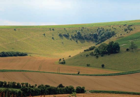


On Cold Kitchen Hill Looking eastward over Woodcombe Bottom

On the hill of the wizard
Andrew Swift sets his sights on the chalk country in the Deverill vallery –he finds a beacon, old quarries, far-reaching views, encompassing silence and a sense of complete isolation
This month’s walk explores the lonely hills above the Deverill valley in south-west Wiltshire. This is chalk country par excellence, with vertiginous amphitheatres scooped out of the rolling downs and glorious views in every direction. Yet, while it is just as spectacular as far better known Wiltshire downlands, hardly anyone goes there. When I visited, on a calm, dry day in high summer, on an eight-mile walk I saw only six people – two walkers with walking poles, two local dog walkers, a farmer on a quad bike and a man working in a barn.
A lack of walkers means that tracks and footpaths not used by those who work on the land tend to disappear, and at several points there was no indication – apart from a dotted line on an OS map –where I should walk. Combined with a lack of waymarks, this posed something of a challenge, and walking these downs without a map would be all but impossible.
Two other caveats – to come up with a circular walk I had to drop down a steep and slippery path and follow low-lying, overgrown and muddy green lanes swarming with insects before heading back uphill. Now that summer’s tipped into autumn, the insects should be a good deal less bothersome, but it’s something to bear in mind.
Those hindrances aside, this walk is likely to linger long in the memory for all the right reasons – superb, brooding countryside with spectacular views, and, despite being less than 45 minutes drive from Bath, a feeling of almost impossible remoteness.
To get there, head south along the A36, and after 19 miles, turn right at a roundabout onto the A350. After 1.8 miles, in the village of Longbridge Deverill, turn right along the B3095, which winds through a string of little villages – Hill Deverill, Brixton Deverill, Monkton Deverill – each sleepier than the last. After three miles, when you come to Kingston Deverill, turn right along a road with a signpost for Maiden Bradley and after 250m you should find space to park on the left (ST846373; BA12 7ES).
From here, walk along the lane in the same direction and turn right at a T junction with a sign warning of a ford. After 150m, turn left up a footpath and go through a six-bar gate. Walk uphill beside a fence, but, after 75m, when the fence curves left, bear right diagonally up a grassy track. When this forks, head left uphill. The track soon becomes indistinguishable, but if you head due north you should, after 400m or so, see a lone hawthorn in the fence ahead (ST849380).
Go through a handgate beside it and turn left along a stony track. Before long, a beacon comes into view ahead. Known as the Jubilee Beacon, it is one of a chain stretching across the country, which are lit to celebrate royal jubilees and other historic occasions. As you carry on past the beacon, you will, on a clear day, see Alfred’s Tower, over six miles away on the horizon. After 850m, when the stony track curves right (ST834385), don’t follow it but continue on across Whitecliff Down for another 800m, before following the fence as it curves right.
After 200m, just before a gateway, turn right to follow a bridleway sign (ST826390). There is a brief opportunity to take in the marvellous panorama eastward over Woodcombe Bottom before turning left to follow a bridleway sign into Bidcombe Wood.
The track through the woods is likely to be muddy, and, after going through a gate and starting to drop steeply downhill, it may be slippery as well. Further down, it turns into a holloway, with old quarries on the left.
Go through a gate at the bottom and turn right to follow a byway sign past a memorial stone. Once again, there is no discernible track here, and, as you go through a handgate, there is no waymark either –only a sign asking you to keep to the footpath as shooting may be in progress. If you stick close to the edge of the wood for the next 1000m, however, you will come to some pines on the left (ST842398).
Bear left, keeping to the right of the pines, and, when you reach the north side of the field, turn right alongside the hedgerow. At the end of the field, go through a gap in the hedge to carry on through an overgrown strip of land which old maps show as a green lane.
Carry on in the same direction to emerge onto a farm track, and, after 750m, you will pass Rye Hill Farm – the home of Wessex

Looking north east from Cold Kitchen Hill
Brewery – on your left. Continue along the green and rocky lane for another 1000m, and turn right when you come to a crosspath (ST 858402).
This is another green lane, which soon starts to climb through woodland, before leading through a seven-bar gate. Carry on in the same direction for another 750m, and, when you come to a farm, turn right past barns to climb a steep and stony track to Brims Down.
When you reach the crest of the hill, where a bridleway crosses the track, turn left along it (ST853391). Looking westward as you continue to climb, there is a superb view across Bushcombe Bottom to the slopes of Whitecliff Down. After 675m, when you come to a barn and a choice of tracks, follow a bridleway waymark to head straight on uphill, with the skyline dominated by a monumental long barrow –70m long and dating back over five thousand years.
After passing it, you come to the trig point on Cold Kitchen Hill. Its name is said to derive from the Celtic Col Cruachen, or Hill of the Wizard, and there is evidence that there was a substantial settlement here from the early Iron Age through to Roman times. In the 1920s, when a Roman temple was excavated here, a large cache of brooches and votive objects was discovered. Today, Cold Kitchen Hill is deserted and, on a calm day, the silence is almost absolute. There are far-reaching views in every direction, but, although the town of Frome can just be glimpsed, seven miles to the north, closer to hand lie only a few scattered buildings and there is not even the sound – or sight – of distant traffic.
Carry on towards the Jubilee Beacon, turn left and, after 750m, turn right through the handgate you came through earlier to retrace your steps down to the starting point. n
Fact file
n Distance: 8 miles
n Approx time: 4–5 hours
n No facilities on route; carrying a supply of water is essential
n Level of challenge: Stiff climbs, rough, stony tracks and muddy stretches; one downhill section which may be slippery
n Map: OS Explorer 143
More on the details of this and many more walks can be found in Andrew Swift’s Country Walks from Bath, published by Akeman Press; akemanpress.com.
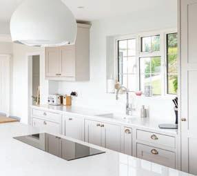
THE
KITCHEN PARTNERS
DESIGN STUDIO
www.thekitchenpartners.co.uk
102 Whiteladies Road, Clifton, Bristol BS8 2QY 01179 466433
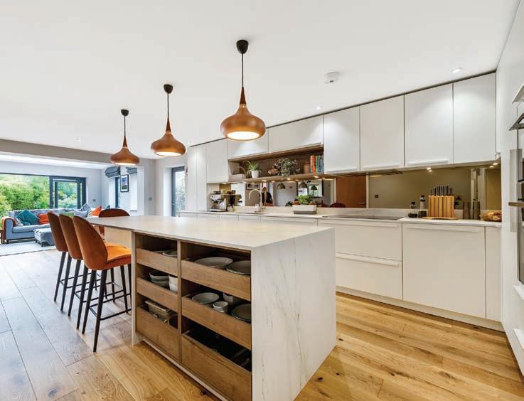


Founders and Lead Designers - Fiona & Clinton