We acknowledge the Biripi and Worimi as the original custodians of the lands and waters on which Wingham was built. We respect their cultural and spiritual relationships with place and honour elders past, present and emerging whose knowledge and wisdom has and will ensure the continuation of cultures and traditional practices.
Report register and quality assurance
Dunn & Hillam Architects operates under a quality management system which has been certified as complying with quality management systems ISO 9001:2015. This report has been reviewed and approved for issue in accordance with the Dunn & Hillam quality assurance policy and procedures.
Job Number 23_302
Issue Number 05
Client MidCoast Council
Issue Date 19 February 2024
The following report register documents the development and issue of the Project Proposal, undertaken by Dunn & Hillam Architects in accordance with its quality management system.
Project Director Lee Hillam
Signature

Date 19 February 2024
REPORT REGISTER
E admin@dunnhillam.com.au
Nominated Architects: Ashley Dunn
ARB No. 7547 and Jonathan
NSW ARB No. 8526
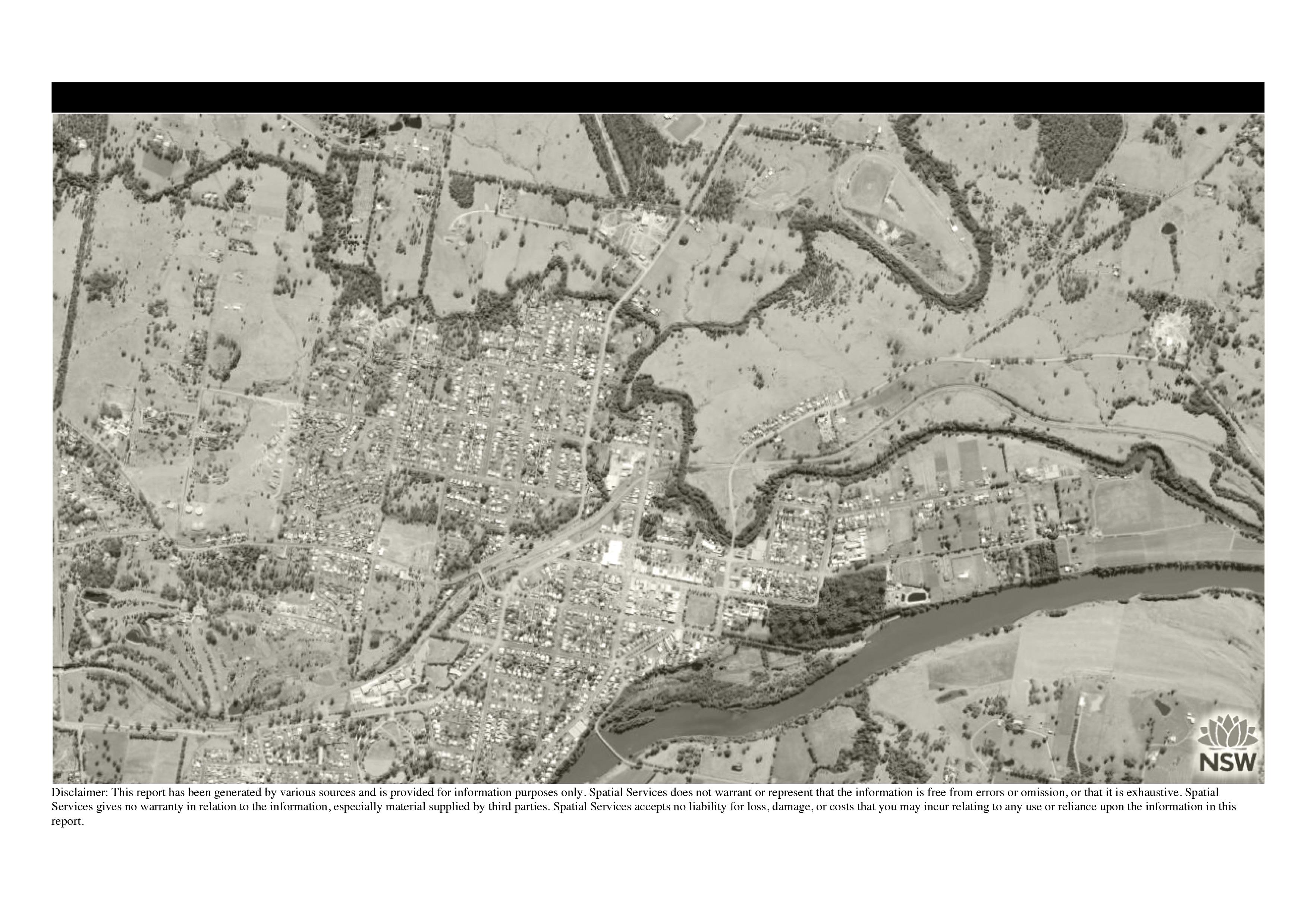
Cover image: Sixmaps aerial (not to
Issue Description 01 Draft Return Brief 02 Draft Return Brief (Revision 01) 03 Feasibility & Masterplan Report (Draft) 04 Feasibility & Masterplan Report (Final) 05 Feasibility & Masterplan Report (Revision 01)
Details
1 Pty Ltd t/a Dunn & Hillam Architects ACN 098 309 196 ABN 17 098 309 196 A 301/414 Gardeners Road, Rosebery, NSW 2018 T +61 2
7715
Contact
Workshop
9316
NSW
Temple
scale)
Executive Summary
This is a final Masterplan that is the generated from feedback, comment, ideas and engagement within the Wingham community.
It is the product of a condensed process of stakeholder engagement, a public exhibition period which resulted in significant community written submissions. It will form the basis of further consultation and design development and will support funding applications.
Design features of the Masterplan
– the original race track is proposed as a walking track and a defining feature for the precinct. This is named, for the purposes of this document, the Racecourse Walk.
– areas outside the Racecourse Walk are deemed casual, public and accessible to all. Uses include picnicking, unserviced camping for events, bush tracks and bushland and creek regeneration
– areas inside the Racecourse Walk are bookable, more formalised and some have uses restricted to clubs and organisations that have made arrangements with the council. Uses include cricket, model airplane events, music festivals, ag field days and RV camping for events.
The masterplan proposes minor changes to the organisation of uses for those clubs and organisations that are already using the site. It proposes ways new uses and organisations may be introduced without impinging on those existing uses.
01 Introduction 4 02 Site 6 03 Return Brief 12 04 Masterplan 18 Nominated Architects: Ashley Dunn NSW ARB No. 7547 and Jonathan Temple NSW ARB No. 8526 3 Feasibility & Masterplan Report Dunn & Hillam Architects Contents
Introduction 01
Dunn & Hillam Architects have been asked by MidCoast Council to work with them to upgrade and review the facilities and services at the old Wingham Racecourse and to provide a guiding Masterplan for all future work.
The Masterplan Report analyses the existing site conditions, planning controls and guidelines and aims to establish clear principles and strategies that will guide all future developments of the site, in ways that brings benefit to the local Wingham community whilst supporting the MidCoast region’s aspirations for arts and culture. A program of works to address urgent maintenance and functional issues will be supported by a longer term vision for the whole site. This analysis allows the client to ensure that works that are urgently required are in line with the future plans.
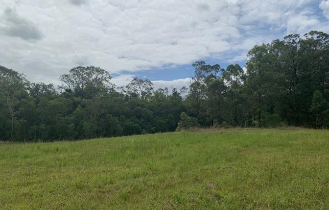
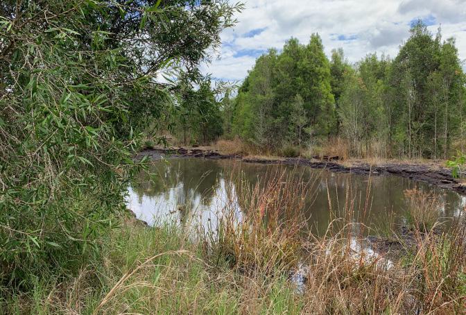
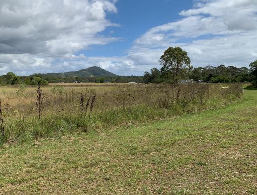
Wingham is located 324km northeast of Sydney via the Pacific Highway and is 11km west of Taree, the major commercial centre of the Barrington Coast. The old Wingham Racecourse is located 2.4km from the Wingham town centre. It is accessed by Racecourse Road and is bordered on three sides by Cedar Party Creek, with south east zones of the site located within a flood prone zone.
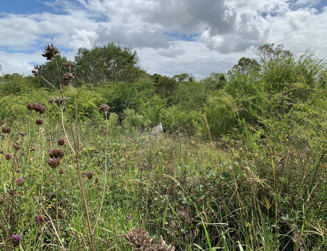
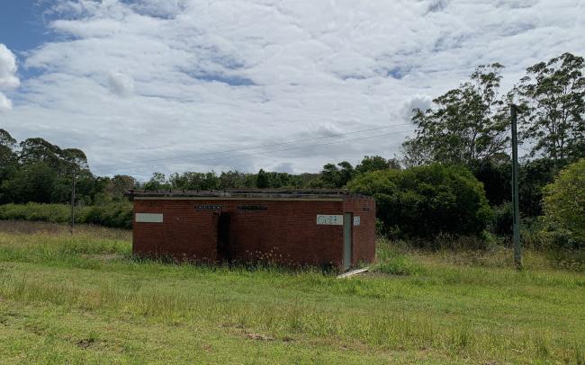
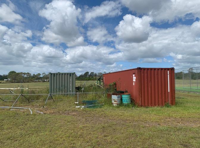
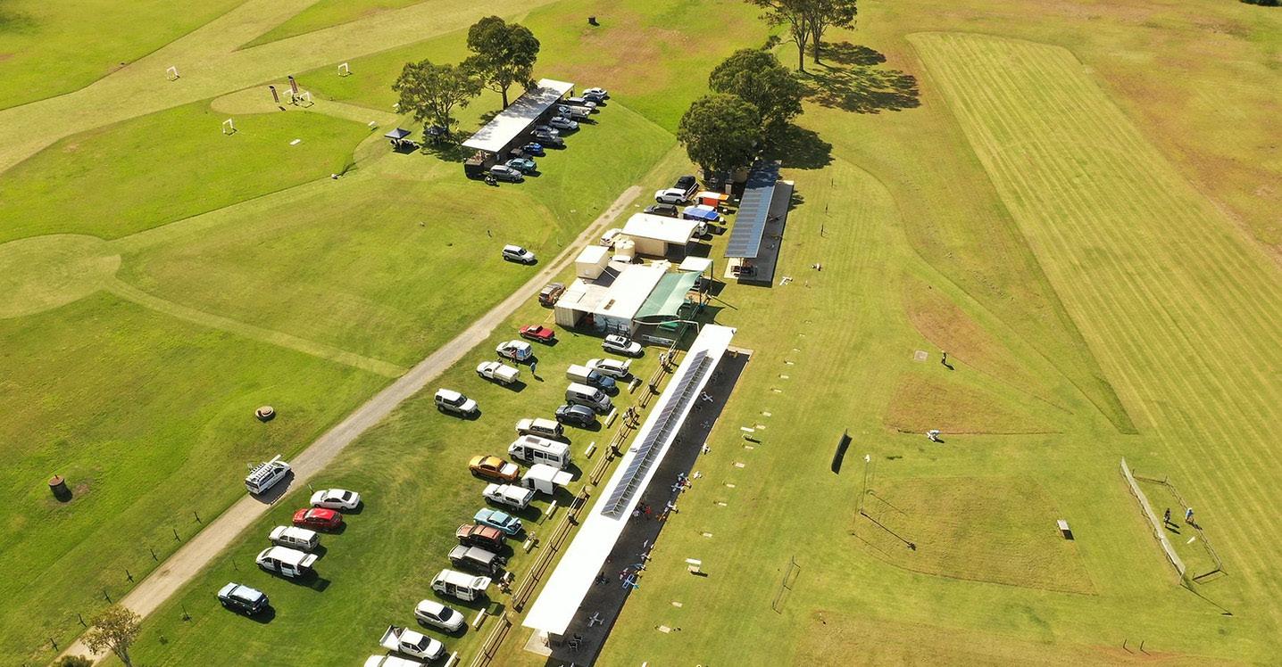
The site has been in disuse as a racing ground since around 25 years ago and is currently being used by local activity groups: Wingham Cricket Club, Manning Model Aero Club, Mid North Coast FPV Club, dog walkers, and sometimes rugby clubs. There are known service utilities to the area including power and water. Existing shade structures and buildings on site are scattered and located according to the key local activity group. Buildings within the flood prone zone will need to be demolished as they are not fit for purpose due to their damaged condition. Additionally, a landscape strategy will be required to clear the site from debris and regenerate the landscape and mitigate future flooding from Cedar Party Creek.
This project presents a great potential for Wingham Racecourse, with its unique and scenic landscape features, to be re-activated as a quality green and open space with sports, recreational and community infrastructure embodying the five project principles: welcoming, flexible, local, sustainable and pragmatic.
Scope of this project
The scope of this project is to:
1. Work collaboratively with the client and key stakeholders to produce a comprehensive and cohesive Masterplan.
2. Review and assess existing reports and background information.
3. Analyse site conditions, constraints and opportunities.
4. Consider the role of the site in relation to Wingham town and surrounds.
5. Consider current and evolving needs of key activity user groups and flexibility to accommodate large scale events and festivals.
6. Establish project principles with key stakeholders
7. Identify and communicate a clear overall strategy for the current and future development of the Wingham Racecourse.
8. Develop a Masterplan for the site including project staging plan that identifies urgent remedial and maintenance works.
MidCoast Cultural Plan 2036
The MidCoast Council produced the MidCoast Cultural Plan 2036 with strategies to enhance its unique environmental, artistic and cultural potential as a vibrant and thriving region.
It proposes four strengths-based approaches:
1. Connecting our landscapes and places
2. Celebrating our First Nations and cultural diversity
3. Supporting our creatives and industry
4. Enhancing our infrastructure and spaces
Better Placed: An integrated design policy for the built environment of NSW GANSW
The Government Architect NSW has produced policies and guides which support good design in the built environment. In undertaking this project we have used these documents as guides and prompts in the process.
Better Placed policy proposes seven objectives which can help produce better places for our towns and cities. They are;
Better Fit: Contextual, Local and of its place
Better Performance: sustainable, adaptable and durable
Better for Community: inclusive, connected and diverse
Better for People: safe, comfortable and liveable
Better Working: functional, efficient and fir for purpose
Better Value: creating and adding value
Better Look and Feel: engaging, inviting and attractive
Draft Connecting with Country, GANSW
The Connecting with Country Draft Framework is an ongoing framework produced by the GA NSW to develop a broader industry understanding and implementation of Connection with Country and co-design processes.
There are three long-term strategic goals outlined in the framework:
1. Reduce the impacts of natural events such as fire, drought, and flooding through sustainable land and water use practices
2. Value and respect Aboriginal cultural knowledge with Aboriginal people co-leading design and development of all NSW infrastructure projects
3. Ensure Country is cared for appropriately and sensitive sites are protected by Aboriginal people having access to their homelands to continue their cultural practices.
“Through our projects, we commit to helping support the health and well-being of Country by valuing, respecting, and being guided by Aboriginal people, who know that if we care for Country – it will care for us.”
Dunn & Hillam Architects is committed to utilising the suggestions and ambitions of this document as a guide in approaching the Wingham Racecourse Masterplan. Seeking to respectfully embed the knowledge of Aboriginal communities into the project.


PLACED BETTER An integrated design policy for the built environment of New South Wales Better Placed Good practice guidance on how to respond to Country in the planning, design and delivery of built environment projects in NSW Issue no. 03— 2023 JUNE 2021 MIDCOAST CULTURAL PLAN 2036 Nominated Architects: Ashley Dunn NSW ARB No. 7547 and Jonathan Temple NSW ARB No. 8526 5 Feasibility & Masterplan Report Dunn & Hillam Architects
Introduction
02
Site
Planning Constraints
Local Context
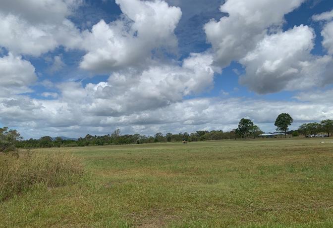
The project site sits on 4 parcels of land registered as 70 Racecourse Road, Wingham NSW 2429, Lot 123, 124,125 DP 74454 and Lot 7002 DP 96090. It is ovoid in shape, orientated north-east with a gradual slope down towards Cedar Party Creek that borders the north-east, south-east and south-west boundaries.
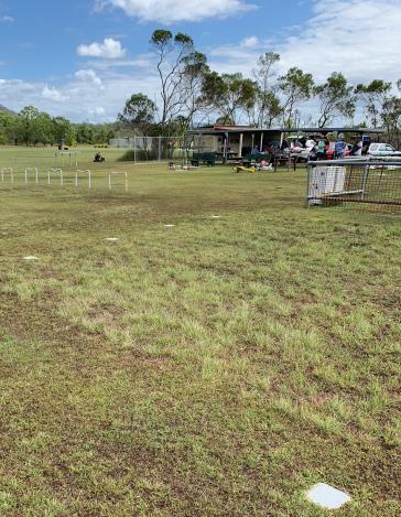
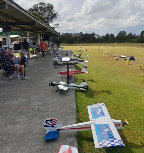
The site is located 2.6km from Wingham station and town centre, approximately 4mins by car and 30mins by foot. While the racecourse that runs along the perimeter of the site has been in disuse for more than 20 years, the central green space is currently being used regularly by three local activity groups: Wingham Cricket Club, Mid North Coast FPV and Manning Model Aero Club.
The few amenity and storage buildings on site that serve existing user groups will require thorough analysis to determine upgrading works for re-purposing or to be demolished due to damage from recent floods.
The site is located close to industrial, farming, and other recreational and sporting sites including the Wingham Clay Target Club that shares the north-eastern boundary. Other recreational uses nearby include go-karting, touch football, rugby league and rifle ranges.
Survey of Existing Site
Currently there has been no survey of the site. Information of the condition of the site, including boundary lines, topography contours, and location of existing buildings have been acquired from IntraMaps, SixMaps and maps in the Greater Taree Local Environmental Plan 2010.
The drawing may not be accurate and will require a survey to be produced before the next stages of the project.
Site Details
Site Address 70 Racecourse Rd, Wingham NSW 2429
Lot & DP Lot 123 + 124 + 125 DP 754454
Lot 7002 DP 96090
The site is owned by Crown Land, Crown Land Manager: MidCoast Council
Easements TBC
Encroachments TBC
Other Site Ownership considerations
The site does not have history that suggest that it might be contaminated (TBC)
Local Government Area MidCoast Council
Site Area Approx. 23.66ha
Site Dimensions
The site measures 805m along the north-west to southwest axis and 370m to the side boundaries at the widest point
Aspect The site has a north-west to southeast axis. The street frontage is located to the north.
Cedar Party Creek borders the site on all sides except in the north-west
Exposure The site is relatively exposed to prevailing winds from the south-east, and is not exposed to noise from main roads
Soil Type To be confirmed by the structural engineer or geo-technical engineer at a later date
Greater Taree Local Environmental Plan 2010
Land Use Zone RE1 Public Recreation
Permissible Height N/A
Permissible FSR N/A
Heritage Controls Potential assessment required for Aboriginal objects/places of heritage significance
Bushfire Prone Land The site has a Bushfire Risk (RFS) Category 1 + Buffer along Cedar Party Creek
Flood Prone Land The site is flood prone
Acid Sulfate Soils Lot 123 DP 754454 is located within an acid sulphate soil zone (class 5)
Environmentally sensitive land TBC
Is the proposed use permissible Permitted with consent: Aquaculture; Bio-solids treatment facilities; Boat building and repair facilities; Boat launching ramps; Boat sheds; Building identification signs; Camping grounds; Car parks; Caravan parks; Cemeteries; Centre-based child care facilities; Charter and tourism boating facilities; Community facilities; Crematoria; Depots; Ecotourist facilities; Educational establishments; Electricity generating works; Emergency services facilities; Entertainment facilities; Environmental facilities; Extractive industries; Function centres; Helipads; Information and education facilities; Jetties; Kiosks; Marinas; Markets; Mooring pens; Passenger transport facilities; Public administration buildings; Recreation areas; Recreation facilities (indoor); Recreation facilities (major); Recreation facilities (outdoor); Research stations; Respite day care centres; Restaurants or cafes; Roads; Sewage treatment plants; Waste or resource management facilities; Water recreation structures; Water recycling facilities; Water supply systems; Wharf or boating facilities
Nominated Architects: Ashley Dunn NSW ARB No. 7547 and Jonathan Temple NSW ARB No. 8526 7 Feasibility & Masterplan Report Dunn & Hillam Architects Site
Strengths
– Unique landscape surrounded by creek on three sides of the site
– Strategically located within a sports and recreational precinct
– Isolated from central town with few residential buildings, located north of site making it easier to manage future potential noise and traffic conditions
– Single main entrance makes it easier to control vehicular site access
Weaknesses/Threats
– Scattered debris including asbestos around southeastern zone of the site requires cleaning up
– A third of the site within flood prone zone
– Residential buildings close to existing main entrance
Opportunities
– Potential to activate site and creek with communal amenities for local dog-walkers, joggers etc.
– Potential to partner with adjacent sports and club facilities providing accommodation options
– Potential to partner with local Indigenous community to discover and protect cultural landforms
– Potential to partner with ecological volunteer groups for flood management and ecological rejuvenation
– Highest part of site out of flood prone zone has potential for caravans/RVs
Lo t 1 25 DP 75 445 4 Lot 124 DP 754454 7002DP96060 Racecourse Road 20 10 18 p ot box gazettedroad gate dest oyed by ood destroyed by tornado shade struc u e conta ner p ot box powerline Wingham Cricket Club Oval conta ner storage ma n en rance 2 6km to Wingham town 5 mins by car 35 m ns walk cr cket nets shade s ructures oi et block keep p tch green h ghest par of s te 1M level change p lo box EW a rs r p n o ma ) compe t on ci c es fence BD Y 2 9M BDY 35M YoungsRoad creek overgrown prone to f ood ng no se + ra f c poten a y a fect ng ne ghbours private and 8 6km to Taree 11 mins by car c ay target club 16 14 12 private land to Go-Karting Rugby & Football clubs 3 mins by car 15mins walk noise from outdoor shoot ng range no se + tra f c po ent a ly af ec ng ne ghbours W ngham Mode Aero Club path of summer sun Western prevai ng winds path of winter sun M d North Coast FPV Club asbestos p le NS ai s r p
no se poten a y a fect ng Youngs Road water permanent y co ec ed NS a rstr p mainta n green ow ow sca tered debr s rom ood rock be ow sur ace Lot123DP754454 Lo t 1 25 DP 75 445 4 Lot 124 DP 754454 7002DP96060 Combonya Road Racecourse Road 20 10 18 pi ot box gazettedroad gate des royed by f ood destroyed by tornado shade structu e conta ner p ot box powerline Wingham Cricket Club Oval conta ner storage ma n en rance 2.6km to Wingham town 5 mins by car 35 m ns wa k cr cket nets shade s ruc ures to let block keep p ch green h ghest par of s te 1M level change p lo box EW a rs r p n orma compe t on c rc es fence BD Y 2 9M BDY 35M YoungsRoad creek overg own p one o lood ng no se + ra ic poten a y a fect ng ne ghbours private land 8 6km to Taree 11 mins by car clay target club 16 14 12 private land to Go-Karting Rugby & Football clubs 3 mins by car 15m ns walk no se from outdoor shoot ng range no se + tra f c poten ia ly af ec ng ne ghbours
50 100 150 200 M W ngham Model Aero Club path of summer sun Western preva ling winds path of winter sun Mid North Coast FPV C ub asbestos p e NS a rs r p CedarPartyCreek no se poten a y a ect ng Youngs Road wa er permanent y co ec ed NS a rstr p mainta n green ow ow sca tered debr s rom f ood rock below sur ace Lot123DP754454
Analysis
CedarPartyCreek
0
Legend opportunities threat / weakness
Nominated Architects: Ashley Dunn NSW ARB No. 7547 and Jonathan Temple NSW ARB No. 8526 Dunn & Hillam Architects 8 Feasibility & Masterplan Report Site
demolish flood prone zone
Topography Analysis
Floodplains
– Topographical features (and lived experience) show that the south east part of the site is susceptabile to flooding.
– The path of the creek also points to a different, less erodable geotechnical condition towards the centre of the site
Bushfires
– bushfire threat will naturally come from downslop vegetated areas, thus the creek area represents a threat around the whole site
How does this influence the masterplan?
– any permanent buildings should be positioned outside the known flood areas
– all buildings should consider the threat of bushfire and be built to be easily defendable AND highly resilient in a bushfire. Any future works should be subject to a Bushfire Attack Level assessment.
– A plan of management can be utilised to ensure that the uses that are within bushfire and flood zones are impermanent (camping) and that these uses are not permitted during times of risk.
Legend bushfire prone zone flood prone zone
Lo t 1 25 DP 75 445 4 Lot 124 DP 754454 7002DP96060 Racecourse Road 10 18 gazettedroad gate ma n en rance fence BD Y 2 9M BDY 35M
private and clay target club 16 14 12 private land
20
Lo t 1 25 DP 75 445 4 Lot 124 DP 754454 7002DP96060 Combonya Road Racecourse Road 20 10 18 pi ot box gazettedroad gate des royed by f ood destroyed by tornado shade structu e conta ner p ot box powerline Wingham Cricket Club Oval conta ner storage ma n en rance 2.6km to Wingham town 5 mins by car 35 m ns wa k cr cket nets shade s ruc ures to let block keep p ch green h ghest par of s te 1M level change p lo box EW a rs r p n orma compe t on c rc es fence BD Y 2 9M BDY 35M
creek overg own p one o lood ng no se + ra ic poten a y a fect ng ne ghbours private land 8 6km to Taree 11 mins by car clay target club 16 14 12 private land to Go-Karting Rugby & Football clubs 3 mins by car 15m ns walk no se from outdoor shoot ng range no se + tra f c poten ia ly af ec ng ne ghbours 0 50 100 150 200 M W ngham Model Aero Club path of summer sun Western preva ling winds path of winter sun Mid North Coast FPV C ub asbestos p e NS a rs r p CedarPartyCreek no se poten a y a ect ng Youngs Road wa er permanent y co ec ed NS a rstr p mainta n green ow ow sca tered debr s rom f ood rock below sur ace Lot123DP754454
YoungsRoad
CedarPartyCreek
Lot123DP754454
YoungsRoad
Nominated Architects: Ashley Dunn NSW ARB No. 7547 and Jonathan Temple NSW ARB No. 8526 9 Feasibility & Masterplan Report Dunn & Hillam Architects Site
Positive Attributes
Nominated Architects: Ashley Dunn NSW ARB No. 7547 and Jonathan Temple NSW ARB No. 8526 Dunn & Hillam Architects 10 Feasibility & Masterplan Report Site
Negative Attributes


Nominated Architects: Ashley Dunn NSW ARB No. 7547 and Jonathan Temple NSW ARB No. 8526 11 Feasibility & Masterplan Report Dunn & Hillam Architects Site
Return Brief 03
Return Brief
Consultants Record
The following table has been formed using information from key stakeholder meetings on the 2nd and 24th February 2023. Further feedback was received through the public Exhibition period, records of which are held with the Council.
Values + Aspirations
Target user groups
– Protect and enhance all existing key users
– Introduce complementary facilities that support: Agricultural Field Days, Music Festivals, community, education, ecological volunteer groups
– Provide facilities that can accommodate events at a state, regional, national level.
Key user groups
– Informal users from the community, including walkers, dog walkers, joggers, and cyclists
– Manning Model Aero Club
3 days per week, 50 members
using the main EW airstrip and shade structures
– Mid North Coast FPV (Drones + fixed wing aircrafts) 3 days per week, 15 members using space near destroyed buildings
– Wingham Cricket Club
4 days a week, 4 day average attendance: 18/20. 89 full members, 131 associate members
currently using amenities block (toilets only, no change rooms), shade structure, container storage and cricket nets nearest to main vehicular entrance to site
Site potential
– CASA flight permissions are higher than most clubs at 1500ft (average 400ft.) means that there is an opportunity to host regional, state and international flying events.
– Unique landscape surrounded by creek on three sides of the site
– Strategically situated amongst other sports and recreational club facilities, with few residences.
– Rehabilitation to Cedar Party Creek will help mitigate future flood risk but also creates potential to make it into an eco-friendly and interactive zone for recreational and educational use for the local community and visitors.
Connecting to Country
– Potential to share cultural knowledge and values of local Indigenous people
Functional Requirements
Multi-functional building
– Facilitate weekly sports + club activities, sports/festival/field days of various scales, educational, community workshops, markets
– Public amenities for all (change rooms, showers, lockers)
– Practical kiosk and kitchen that can be used by all clubs and events
– Ample general and individual storage for key user groups (or individual storage blocks?)
Festival + event days
– Agricultural Field Day, Team Taree, 3 days, attracting up to 5000 visitors Doesn’t have to take the whole site but would likely limit other activities on site while on site.
– Wingham Music Festival, 3 days attracting up to 3000 visitors.
– Local, Regional, State flying + cricket championships / open day
Accommodation
– Allow for a range of accommodation: motorhomes, temporary + permanent camping sites
– Bookable camping only, during events/festival/field days
Clear wayfinding + zoning
– Must clearly prevent damage caused to green zones used by cricket club and flying clubs
– Clear signage and demarcation of zones without causing potential harm to activities (e.g. planes crashing into fences)
Amenities block
– Amenities block near creek destroyed by flood and will need to be demolished
– Potential for shared amenities for all users that also includes for female and accessible toilets
Runways
– Separate existing runways for both Model Aero and FPV Clubs
– Incorporate new runway strip perpendicular to existing runway
– Develop a plan of use for both clubs to share runway strips
Rejuvenating the site
– Asbestos and other debris and rubbish scattered around the site from floods will need to be cleared
Services
– No existing sewer line. Nearest chemical toilet dump point at Showgrounds
– Reduce connected servicing demand through infrastructure. e.g. solar PVs
Access
– Appropriate parking required festival and sporting days.
– Existing roads need upgrading with turning circle for coaches, large trucks and shuttle buses
Plan of management
Opportunities + Partnerships
– Develop a plan of management alongside masterplan to identify key uses and operational considerations to ensure key user group facilities’ condition are kept to desired standards
Future partnerships
– Engage other like-minded organisations on a local, national and international scale
– Existing local organisations including but not limited to, Wingham Walking Group, Manning Valley Cycling Club, and Wingham Advancement Group
– Engage Aboriginal community for cultural knowledge exchange
– Potential to expand partnerships to local ecological groups. e.g. Landcare and Lions Club
– On-site accommodation could cater to neighbouring sports + recreation facilities
– Potential partners: Rotary Club, Local schools, Scout groups, Sporting groups, Equine clubs, Art groups
Financial sustainability
– Identify opportunities for grants and partnerships (e.g. government, private organisations) to deliver projects
– Staged delivery of masterplan works to maintain profitability and site access accordingly
Environmental sustainability
– Ecological and environmental sustainability embedded into the design and operations of the site.
– Ensure resources are efficiently used throughout their life cycle.
– Develop a plan for flood and bushfire management. Implement protective measures for life and property.
– Biodiversity assessment required for regenerative bushland.
– Renewable energy on site
Nominated Architects: Ashley Dunn NSW ARB No. 7547 and Jonathan Temple NSW ARB No. 8526 13 Feasibility & Masterplan Report Dunn & Hillam Architects
Return Brief
Vision + Principles
Vision
The rejuvenation of Wingham Racecourse will transform this community facility into a welcoming and flexible place that can be adapted to meet the needs of individuals and groups of the local Wingham community and beyond.
Project Principles
The following principles have been developed to ensure its success, and have been established based on our understanding of relevant reports and key themes from prior stakeholder meetings. These should guide all new proposals for the Wingham Racecourse Masterplan.
Principle 01
Principle 02
Welcoming
Supporting a range of sporting, recreational, community functions.
A place for all ages and stages of life.
Diverse, inclusive and accessible.
Flexible
A flexible site that can accommodate various groups and events at multiple scales.
Ability to operate with various activities and events occurring concurrently or consecutively without interrupting others.
Well-defined zones with clear way-finding to maintain general safety and protect key user facilities.
Principle 03
Principle 04
Principle 05
Local
Respecting the history, character and charm of Wingham town and it’s natural landscape.
Fitting for Wingham now and for future generations.
Work to reinforce the idea of a precinct that includes existing nearby sites and recreational uses.
Landscape strategy that draws from a unique location hugged by Cedar Party Creek.
Untapped potential to leverage local creative and cultural practitioners and collectives.
Sustainable
Management of natural landscape to rehabilitate local flora and fauna and mitigate future potential flooding from Cedar Party Creek.
Reduce operational and running costs through sustainable design, strategic planning and long term infrastructure investment.
Create opportunities for establishing future partnerships and grants (e.g. sports and recreational clubs, ecological volunteer groups) and generate revenue to fund future works.
Pragmatic
Practical design and strategies that accommodates needs of key user groups and local community.
Considered vehicular and pedestrian strategies.
Various accommodation options with access to amenities for large scale festivals and events.
Integrate high performing, practical, low-tech sustainable systems and strategies.
Nominated Architects: Ashley Dunn NSW ARB No. 7547 and Jonathan Temple NSW ARB No. 8526 Dunn & Hillam Architects 14 Feasibility & Masterplan Report
Return Brief
Programmatic Brief
The following table sets out the spaces and functional requirements for the project using input from meetings and site visits from key stakeholders.
Key Sports + Recreation Clubs / Events
Item Requirements Areas
Wingham Cricket Club Oval Scoreboard Cricket nets
Shaded spectator seating
Storage (dimensions from shipping container sizes)
Parking
Manning Model Aero Club Workshop Prep benches (external)
NS + EW airstrip
Competitive circles
Pilot Box(es)
Shaded spectator seating
Storage Parking (cars + trailers)
MidNorth Coast
FPV Club Workshop Prep benches (external)
NS + EW airstrip
Competitive circles
Pilot Box(es)
Shaded spectator seating
Storage
Parking
Agricultural Field Day External power connection
n/a
3x (3.4x20m)
50-100 pax 54sqm
30 cars
35sqm
5 units, 1200x450mm
200x50m each
30m diameter
15x3m, 5x5m
30 pax
24sqm
20 cars
35sqm
5 units, 1200x450mm
200x50m each
30m diameter
15x3m
20 pax
24sqm
20 cars
Open space for main marquee + various small booths 2000 sqm (1/10th of AgQuip)
Wingham Music Festival External power connection
Undercover arena for 2 stages; main + backstage marquee + Viewing area
Sales area, bar, food stalls, craft stalls
Children’s area
Memory wall (refer to Wingham Music Festival Management Plan 014)
160x120m (marquee size)
Area roughly equivalent ot showground oval
Permanent + Temporary Functions
Item Requirements Areas
Public Access Pick up/drop off for shuttle buses from town centre
Sheltered waiting area
Shuttle bus 1x drop off zone, 1x parking
1x shuttle bus
1x cars
Powered campsite Caravans / RVs only 50-150 sites
Unpowered Campsite Tents (various sizes) 150-200 sites
Amenities New amenities for all, shared by different clubs
Change rooms, lockers, showers, WCs
Area for temporary Porta-loos
Kiosk Kitchen (including cool room + fridges)
Servery/Bar
General storage Parking
Outdoor communal areas
Picnic + BBQ areas (different sizes?)
As required
sqm
4 approx. 1 approx.
Landscape + Environment
Item Requirements Areas
Entry Prominent entry point with small gatehouse building 24 sqm
Signage + wayfinding
Clear signage at entry and on various buildings and boundaries
Fencing to demarcate sports + recreation areas
Sewage No existing sewage system
On site pumping station
Sewage reticulation required
Sewage dump point
Rubbish collection point
Water Rainwater tanks
Internal reticulation of potable water from town supply
Power Renewable energy / solar PVs on roofs
Electricity to be distributed through site from gatehouse building
Soft landscaping Protect and enhance existing significant landscape
Utilise soft landscaping for buffer between uses
Cedar Party Creek landscape regeneration
Hard landscaping Gravel roads as required
Provide sealed roads leading to and parking spaces adjacent to new community building only
Create a hierarchy of paths and roads
DDA accessible pathways from car parking to buildings and where else practical and required
As required
As required
As required
As required
As required
As required
Storage Adjacent seating area 40 sqm 10 sqm 8 sqm 15 pax
Multi-use area
Multi-function building
150 pax, 180 sqm 20
20
cars
Sheltered
Children’s play area Nominated Architects: Ashley Dunn NSW ARB No. 7547 and Jonathan Temple NSW ARB No. 8526 15 Feasibility & Masterplan Report Dunn & Hillam Architects
Return Brief
Benchmark Projects
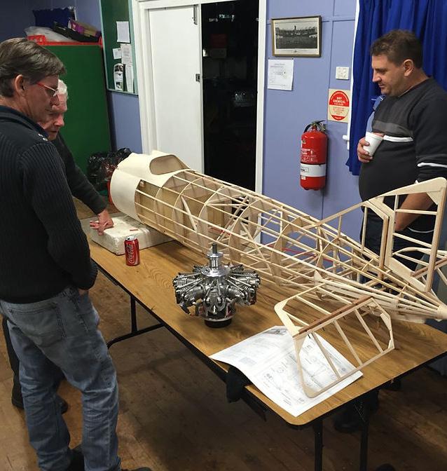
1. Loganholme Aeromodellers Radio Control Society (LARCS), Loganholme, QLD
LARCS has expansive grounds of 40 hectares for 3 separate airstrips and competition circles. It has a height limit similar to the Manning Model Aero Club at Wingham Racecourse and demonstrates the potential capabilities of the site.
Key features:
– Simple shade structures and amenity and storage blocks are centrally located between the airstrips.
– Easily accessible and has ample parking spaces that can accommodate for large competitive events
– 1000ft height ceiling: provides outstanding flight experiences, especially for gliders
Key activities available on site:
– A fully equipped workshop
– Supports flight training and qualification
– Member / community BBQ sessions
– Structured schedule for various flying models
– Controlled aircraft noise level certification of 96db
– State or National competitive events
2. Aeromodellers NSW State Flying Field, Cootamundra, NSW
This aero-modelling society similarly demonstrates potential capabilities of the Wingham Racecourse for the Manning Model Aero Club. It conducts show & tell nights which, given the appropriate facilities, could also be held at the Wingham Racecourse.
Key features:
– Simple shade structures and amenity and storage blocks
– Workshops for members to support aero-modelling activities.
Key activities available on site:
– Various competition events to cater for all levels of skill and build standard
– Location for State championships
– Show & tell nights: Approx 3-4 per year to permit the members to share knowledge and develop the Society to meet their interests

Nominated Architects: Ashley Dunn NSW ARB No. 7547 and Jonathan Temple NSW ARB No. 8526 Dunn & Hillam Architects 16 Feasibility & Masterplan Report
The following projects present a series of benchmark key considerations that are applicable to the Wingham Racecourse Masterplan proposal.
Return Brief
Benchmark Projects
3. Clarence High School Sports Pavilion, Dock4 Architects, TAS

The Sports Pavilion supports various sports activities and has a dual addresses with features that are potentially applicable to the qualities of the new pavilion at Wingham Racecourse.
Key Features:
– Pavilion located between two sports fields
– Supports various sports activities including cricket, football, athletics, physical educational classes - all of which require significantly spatial and security needs.
– Kiosk that opens out to shaded multi-use space with prime views of the field
– Visible, integrated score board
– Change rooms, public toilets, coaching rooms, storage
– Flexible space with movable walls that can be adjustable according to privacy and safety requirements

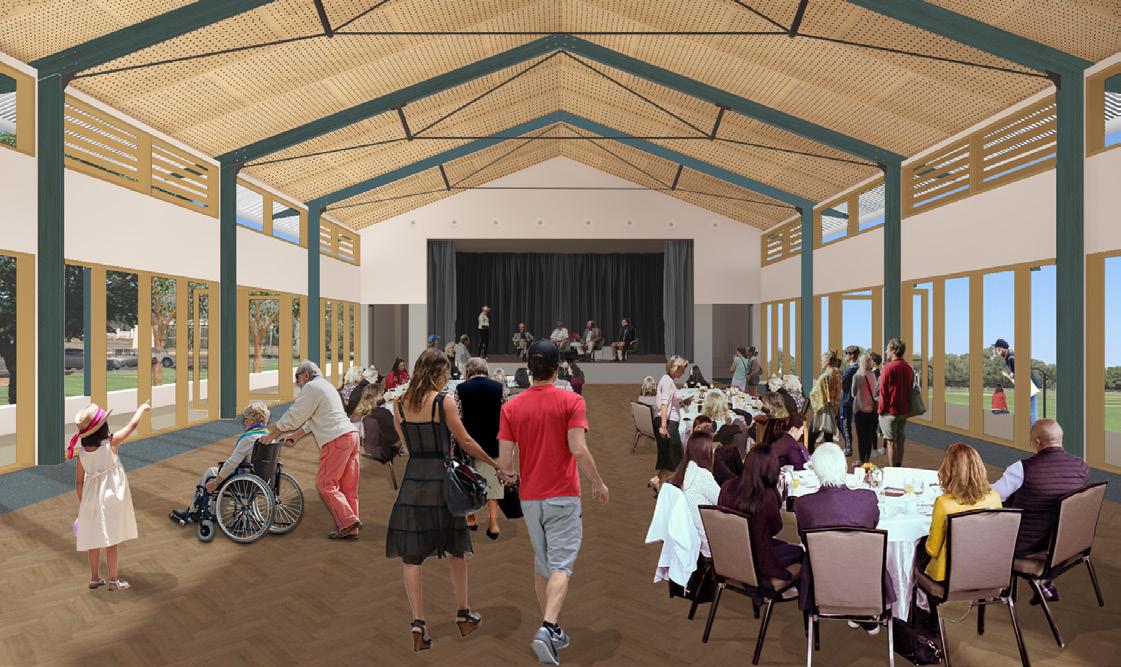
4. Ward Oval Pavilion, Dunn & Hillam Architects, Cobar, NSW (In Progress)
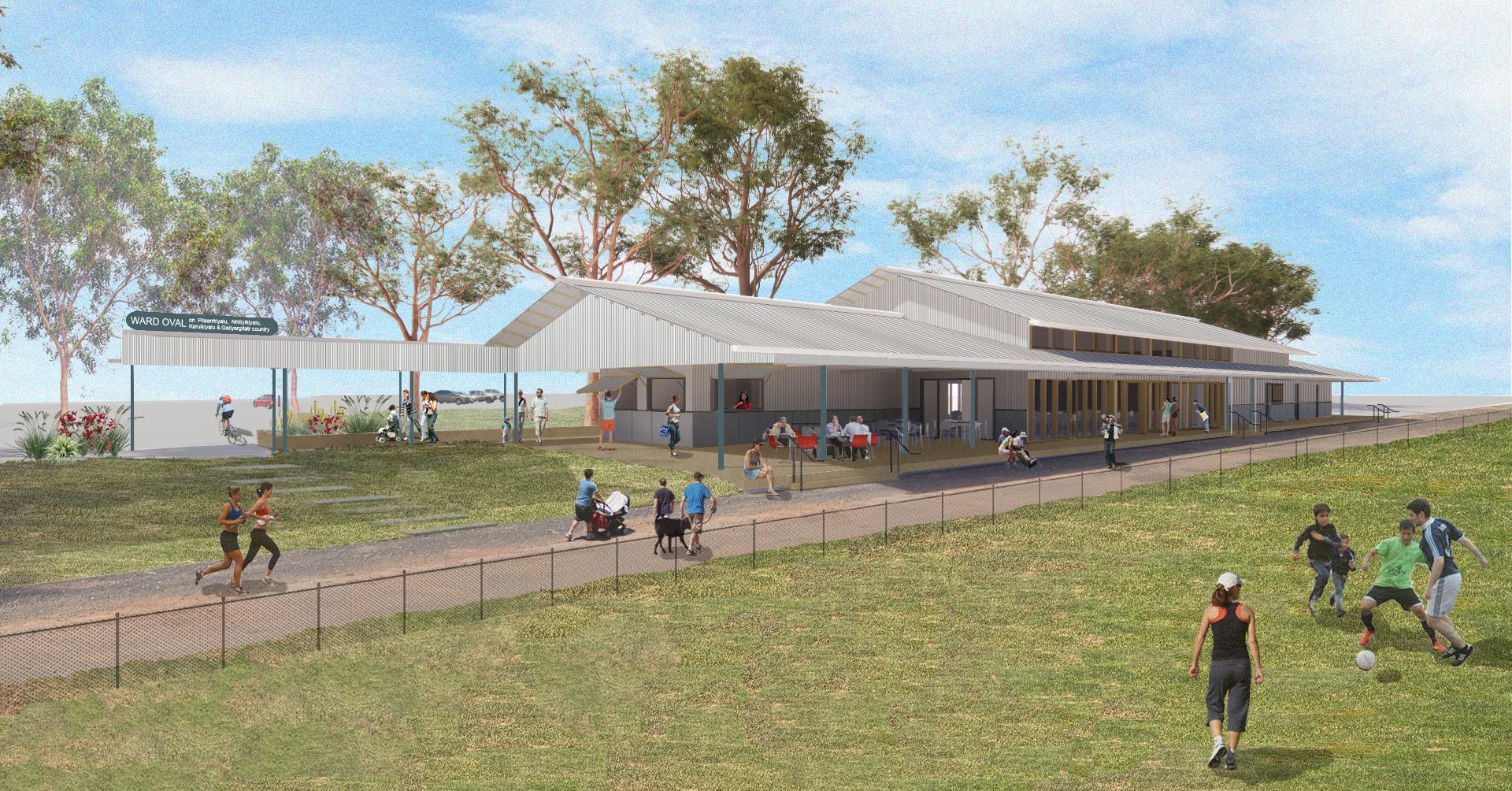
The Ward Oval Pavilion is part of the Ward Oval Masterplan which caters to multiple sports and recreational activities, similar to Wingham Racecourse. It also functions as a multipurpose hall with supporting amenities that give the pavilion flexibility to accommodate to various user groups - a function that will be beneficial to the Wingham Racecourse.
Key Features:
– Masterplan with staged implementation
– Various sports zones: one large and one small oval, cricket ovals, athletics track, soccer field, perimeter running track
– Multipurpose hall with stage, canteen, kitchen, bar, storage, public WCs, home and away change rooms, shaded viewing deck.
CONFIDENTIAL Nominated Architects: Ashley Dunn NSW ARB No. 7547 and Jonathan Temple NSW ARB No. 8526 17 Feasibility & Masterplan Report Dunn & Hillam Architects
Masterplan 04
Masterplan
Key Strategies
Access roads + parking
– New main entrance + primary road access to site to redirect traffic and reduce noise affecting existing residence located across existing main entrance
– Introducing two new main gravel peripheral roads in north-eastern site, creating a vehicular spine
– All activities and buildings accessed off the vehicular spine
– Parking provided adjacent to permanent pavilions + activity zones.
– Additional parking along outer racecourse road and on south-eastern site to cater to festivals/events
– Roads built on south-eastern end of racecourse will accommodate RVs during Music festivals or temporary tents for Agricultural field days.
Distinct Zones
In order to protect the existing key user groups’ activity zones, the site is divided into 3 distinct zones: Cricket zone, Aircraft zone and a Flexible Event zone located in the south eastern flood prone area of the site. This allows for clearly demarcated areas for safety and use during large events like the Wingham Music Festival or Agricultural Field Day. New facilities include:
– Two new permanent structures, strategically located adjacent to the activity zone it serves:
Community Pavilion with grandstand, multi-purpose room, amenities and storage
Model Aircraft Structure with shaded spectator stands, amenities and storage
– New NS airstrip perpendicular to existing EW airstrip keeps the aircraft activity zones compact on site. Will need earthworks to create flat land
– New septic tank for waste management
– New gatehouse to mark and manage entry to site
Landscape strategy
– Preserve and enhance the existing racecourse loop, label as the Racecourse Walk, with appropriate storytelling, signage and guides to direct casual users to stay within this area.
– Clearing all damaged structures, debris + asbestos from flood
– Land regeneration along Cedar Party Creek + south west racecourse
– Berm bordering new NS airstrip acts as natural barrier between Aircraft zone + Flexible Event zone
– Introduce picnic areas on the creek side
A rcraf Zone C cket & Commun ty Zone F exib e Even Zone
Nominated Architects: Ashley Dunn NSW ARB No. 7547 and Jonathan Temple NSW ARB No. 8526 19 Feasibility & Masterplan Report Dunn & Hillam Architects
Masterplan
The ambition of the Wingham racecourse Masterplan is to provide facilities for both everyday and current uses and for specific large events.
The proposal includes three new buildings; a Gatehouse, a Community Pavilion and a Model Aircraft Structure. The Community Pavilion incorporates a multi-function hall that might seat 200 people, storage for a number of clubs or interest groups including the Wingham Cricket Club and toilets and change rooms for all genders. The Model Aircraft structure would be primarily a shade structure with work benches for prep of the aircraft, plus secure storage and a small number of toilets. In the music festival mode these toilets and the shade structure could be used as part of the back of house requirements for the stage set up. All three buildings would provide a connection point for power.
The facilities provided for the events should not dominate the everyday use, so roads should reflect their infrequent use, by being gravel and most parking and RV camping spaces left as flat grassy areas. We are not proposing permanent toilets or showers for the Events days, but rather suggest flat gravel or concrete pads be provided for porta-loo and porta-shower units to be located on site during those events.
CedarPartyCreek
New permanent structures
Demolish existing
New parking (360 total)
Main pavilion: 30
Aircraft pavilion: 30
New trees
Exisiting trees
1 New main entrance to realigned road
2 New exit gate from carpark
3 Gatehouse
4 Community Pavilion
5 Existing cricket oval
6 New carpark with shuttle bus drop off zone
7 Model Aircraft Structure
8 Relocated competition circle
9 Existing EW airstrip reconfigured
10 New NS airstrip
11 New landscape berm
12 Racecourse parking
13 Riverside parking
14
15
16
17
Septic tank Picnic Area
Approximate flight paths 80 x 48m football fields
Racecourse Road c ay arget c ub CedarPartyCreek es dent a bu d ngs 30m 30m 30m YoungsRoad pr vate and pr vate and 0 50 100 200m
Lo t 1 25 DP 75 445 4 Lot 124 DP 754454 7002DP96060
Road Racecourse Road 20 10 18 p lot box gazettedroad gate des royed by f ood des royed by tornado shade s ruc ure container p o box powerline Wingham Cr cket Club Oval container s orage ma n en rance 2 6km to W ngham town 5 mins by car 35 m ns walk cr cke nets shade s ruc ures to e block keep p tch green h ghes part of s te 1M leve change p o box EW a rs rip ( n orma ) compe i on circ es fence BD Y 2 9M BDY 35M YoungsRoad creek overgrown prone to f ood ng no se + tra f c potent a ly affec ng neighbours pr vate land 8 6km 11 m n clay target club 16 14 12 pr vate land to Go-Kart ng, Rugby & Football clubs 3 mins by car 15mins walk no se rom outdoor shoo ing range no se + ra f c poten a ly a fect ng ne ghbours 0 50 100 150 200 M Wingham Model Aero Club path of summer sun Western prevail ng w nds path of winter sun Mid North Coast FPV Club asbestos p e NS airstr p
Proposal - Regular use
Combonya
no se po en ial y affec ng Youngs Road wa er permanen ly co lec ed NS a rs rip ma nta n green low ow sca tered debr s rom f ood rock be ow sur ace Lot123DP754454 Legend
3 2 1 4 7 9 10 11 12 13 14 8 5 17 6 15 16 Nominated Architects: Ashley Dunn NSW ARB No. 7547 and Jonathan Temple NSW ARB No. 8526 Dunn & Hillam Architects 20 Feasibility & Masterplan Report
Proposal - Music Festival
Key Strategies
The dedicated Music Festival Zone (24700sqm) is located where existing trees and new permanent buildings act as a natural border to protect the cricket oval green and airstrips during festivals.
Temporary structures can be assembled to clearly define the zone. The Community Pavilion and Model Aircraft Structure can be utilised as part of the festival.
1. Main arena with two stages, back-of-house + amenities for the performers and staff
2. Various temporary stalls along pedestrianised inner roads (excluding emergency vehicles)
3. Festival ticketed area to restrict access to only ticket holders
4. Utilising Community Pavilion for amenities, multi-purpose hall.
5. Utilising Model Aircraft Structure amenities as part of back of house for the main arena of the music festival. Access restricted by temporary fencing.
6. Additional portable amenities close to parking + camping zones
7. Areas for RVs (74 lots) have been located on land that is level. Sub-soil drainage and soil profile improvement will be needed to create resiliance,
Areas for camping are strategically located close to parking areas and temporary portable amenities. There are two options for camping with different environmental qualities:
8. Racecourse camping (~50 tents)
9. Riverside camping (~75 tents)
New permanent structures
Temporary structures
Festival zones
New parking (360 total)
Main pavilion: 30
Cricket oval: 55
Aircraft pavilion: 30
Racecourse: 60
Riverside: 190
New trees
Exisiting trees
YoungsRoad pr vate and pr vate and 0 50 100 200m c ay arget c ub es dent a bu d ngs Racecourse Road
YoungsRoad pr vate and pr vate and 0 50 100 200m c ay arget c ub es dent a bu d ngs Racecourse Road
CedarPartyCreek
CedarPartyCreek
Music Festival Zone 4 3 5 6 8 7 9 6 1 2
Legend
Nominated Architects: Ashley Dunn NSW ARB No. 7547 and Jonathan Temple NSW ARB No. 8526 21 Feasibility & Masterplan Report Dunn & Hillam Architects Masterplan
Proposal - Agricultural Field Day
Key Strategies
The proposed Ag Field Day Zone (55100sqm), shares a similar layout with temporary stalls assembled in the area bordered by the pavilions and trees. However in this instance, the RV parking spots will be replaced by stalls. More stalls can be assembled in the middle of the racecourse to connect the northeastern + south-western exhibit zones.
1. Utilising Community Pavilion for amenities, multi-purpose hall.
2. Utilising Model Aircraft Structure amenities as part of the administration of the Ag Field Day.
3. Additional portable amenities close to parking.
Legend
CedarPartyCreek
New permanent structures
Temporary structures
Ag Field Day Zone
New parking (360 total)
Main pavilion: 30
Cricket oval: 55
Aircraft pavilion: 30
Racecourse: 60
Riverside: 190
New trees
Exisiting trees
pr vate and pr vate and 0 50 100 200m c ay arget c ub es dent a bu d ngs Racecourse Road
YoungsRoad
CedarPartyCreek
Ag Field Day Zone 3 4 5 3 1 2
pr vate and pr vate and 0 50 100 200m c ay arget c ub es dent a bu d ngs Racecourse Road
YoungsRoad
Nominated Architects: Ashley Dunn NSW ARB No. 7547 and Jonathan Temple NSW ARB No. 8526 Dunn & Hillam Architects 22 Feasibility & Masterplan Report Masterplan
Masterplan
Delivery Staging
The works to complete this masterplan can be staged over a number of years and funded from different sources over time. Below is a proposed outline.
Stage 1
Project Set Up and Design Development
Undertake further community consultation and incorporate feedback from exhibiting the Draft Masterplan (completed Feb 2024).
Engage with the local traditional owners to begin a designing with Country process for the project.
Commission consultant reports that will be necessary for development and for planning approvals, such as;
– detailed survey
– hazardous materials report
– ecological study
– aboriginal cultural heritage study
– bushfire report
– geotechnical survey in areas where buildings are proposed
– water pressure tests
Stage 2
Entry, earthworks, remediation and roads
The first and most urgent works are those that clean up the site and prepare the ground for all future parts of the project.
The tasks include:
– removal of debris from floods and other rubbish
– create a new entry ground for the new second runway and re-align the first runway for the model aircraft clubs
– create the road (gravel) from the new entry to remove vehicle traffic from the racecourse walk
– create level ground for new parking areas
– install landscape drainage and berms to facilitate better drying out of ground after rain
Stage 3
New buildings
The three buildings that are proposed can be built at the same time or separate, however it is likely that the first building should be accompanied by the septic system and upgrades to power.
Stage 4
Landscape regeneration
This part of the work is not dependant on the previous stages. The work includes:
– clearing of weeds and invasive species from the creek edges (tiger country)
– clear and formalise the low lying ground within the racecourse walk boundary
– create a walkway, look outs and picnic areas along the creek edge. Look for opportunities to connect this with the racecourse walk or with publicly accessible paths along the creek towards them
Nominated Architects: Ashley Dunn NSW ARB No. 7547 and Jonathan Temple NSW ARB No. 8526 23 Feasibility & Masterplan Report Dunn & Hillam Architects

Workshop 1 Pty Ltd
t/a Dunn & Hillam Architects
A 301/414 Gardeners Road, Rosebery, NSW 2018
T +61 2 9316 7715
E admin@dunnhillam.com.au
W dunnhillam.com.au


ISO 9001
