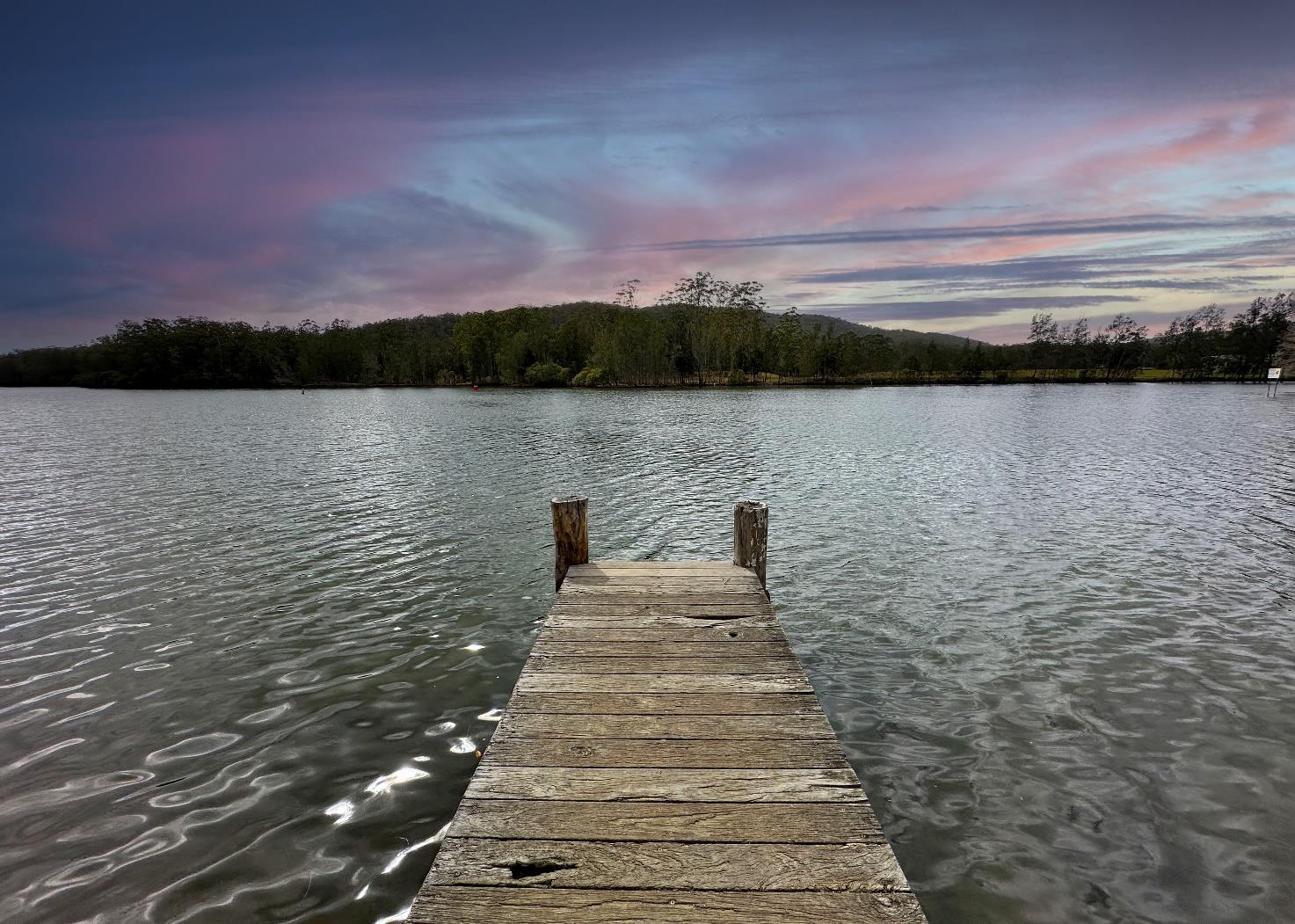
MIDCOAST RECREATIONAL BOATING


Community: a group of people living in the same area or place, or a group of people having certain characteristics, attitudes, and interests in common.
OSRS: an acronym for the MidCoast Open Space and Recreation Strategy 2023 – 2035.
Recreation: A term used to describe any physical activity that is undertaken by people for pleasure, includes: structured sport, unstructured sport, active recreation: such as trail running, and rogaining, fitness activities: such as Parkrun and Bootcamp, aquatics, and play. It is different from leisure as it involves physical activity. For the purposes of this Plan non-motorised water-based activities, such as canoeing, kayaking and paddleboarding are classified as recreations.
Leisure: Defined by its “quality of experience”, such as sightseeing, birdwatching and motorised water-based activities and fishing Denoted by little or no physical activity as part of the actual activity.
Motorised Vessel: Any boating vessel that has a motor for propulsion, such as a boat or jet ski.
Non-motorised Vessel: Any boating vessel that is powered by human activity, such as a canoe, kayak or paddleboard.
Adaptive Management: is an approach to managing open space that involves processes and strategies designed to achieve outcomes in the face of uncertainty.
Carrying Capacity: is a planning concept where all natural systems, such as a natural turf sports field, bushland or nature reserve have an inherent amount of use or impact that they can sustain before negative signs or degradation are observable or measurable. Impacts can include overuse by humans and/or effects of climate change such as extreme rain events or bushfires.
Impact Assessment Model: a planning mechanism that provides to land managers an iterative decision-making model for identifying the state of any natural system and the effects of external impacts on that system. The decision-making component of adaptive management.
Ecosystem: An ecosystem is all the plants and animals that live in a particular area together with the complex relationship that exists between them and their environment.
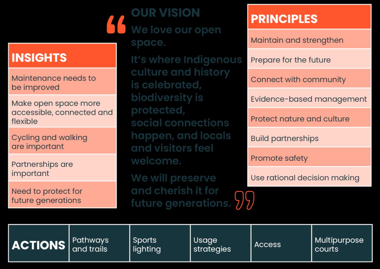
During 2022 and the first half of 2023 we developed the MidCoast Open Space and Recreation Strategy 2023 – 2035. This is the foundational strategy that guides us on how we manage the extensive public open spaces that we have, and how we assist the community in enjoying those spaces. The Strategy also provides guidance on other uses of our public open space, including recreation activities and play.
Through the development of the MidCoast Open Space and Recreation Strategy 2023-2035 we engaged with the community to confirm our analysis of our current open space and we identified five key insights. From these, a vision, guiding principles and actions list have been developed. The vision reflects the value that our community places on our open space. The eight guiding principles have been developed to guide us in our management and delivery of open space in the MidCoast region. The actions reflect our understanding of the short, medium and long term needs and aspirations of our community.
The provision of contemporary boating infrastructure was identified as a key action from the MidCoast Open Space and Recreation Strategy 2023-2035. The MidCoast Recreational Boating Infrastructure Plan 2024 – 2035 is the strategic planning document for the provision of recreational boating infrastructure for the MidCoast region
In 2022 and 2023 MidCoast Council developed the MidCoast Open Space and Recreation Strategy 2023-2035 (OSRS). The Strategy is a twelve-year plan to manage both the public open space in MidCoast along with the activities that take place on that space.
The Strategy includes a comprehensive Action Plan, that detailed many actions that need to be undertaken throughout the public open space portfolio to bring it up to contemporary standards. During the development of the Strategy and its Action Plan it was identified that many of our built facilities located on our public open space, were at an unacceptable standard, or could be expected to reach the end of their life during the lifecycle of the Strategy.
One of the planning recommendations contained in the Strategy’s Action Plan was the development of a Recreational Boating Infrastructure Plan. The purpose of the Plan is the identification of all existing boating infrastructure, what infrastructure needs upgrading, and the identification of where new boating infrastructure will be needed in the future.
The purpose of the Draft MidCoast Recreational Boating Infrastructure Plan 2024 – 2035 is to:
Deliver a comprehensive and prioritised plan for the provision of contemporary boating infrastructure in our waterways and coastal reserves in the MidCoast region.
The MidCoast Recreational Boating Infrastructure Plan 2024 – 2035 aims to:
Provide a plan that will guide Council in planning for and providing infrastructure that meets the community’s needs for boating activities.
The Plan contains the current asset list as well as a future works schedule for our boating infrastructure.
Prior to the amalgamation of the three traditional councils into MidCoast Council in 2017 there were a number of boating infrastructure documents that dealt with our boating infrastructure. These included:
• 2011 Greater Taree City Council (GTCC) Manning River Boating Plan F4-Plan, and
• Great Lakes Council Recreation Boating Strategy
The Plan has referenced these two legacy documents in its development.
Ancillary infrastructure, such as public toilets are not addressed in this Plan.
It is vital that the reader understands that this Plan is a recreational document. It is a recommendation from the OSRS to develop this Plan, therefore its primary focus is on management of our public open spaces and the activity that takes place on them. The overarching outcome of the OSRS is a healthy and active community. Boating activities are mostly nonphysical activities, and where that is the case, this Plan will have no commentary.
Therefore, this Plan does not consider the complex requirements of NSW Maritime in relation to boating infrastructure, nor does it consider safety and other regulations.
The purpose of this plan is to prepare a sustainable and future focused Recreational Boating Infrastructure Plan for public land in the MidCoast area of NSW by consulting with the community to gain a greater understanding of the needs of those who participate in water based recreational activities such as fishing, kayaking, motor boating, water skiing and houseboats.
In developing this strategy, the following actions were undertaken:
1 Review of existing facilities
2 Identification of future need
3 Prioritisation of future infrastructure requirements
4 Consultation with boat users and the community
Our residents are the highest percentage of boat owners in NSW. Our boating infrastructure is needed to support that demand. Boat infrastructure assists boat owners to undertake their recreation activity in a safe and enjoyable manner.
This Plan identifies our current portfolio of boating infrastructure and sets out a plan for the upgrading and provision of new facilities when needed.
Council has two outcomes in the provision for water-based recreation. The first is to provide opportunities to partake in water-based recreation and leisure activities. This is mainly achieved by providing points of entry to waterways for shore based and boat-based recreation and leisure activities, and to consolidate those points of entry to manageable sites. The focus of this outcome is to encourage our community to be active and to enjoy our public open spaces.
The second outcome is to provide and manage shore and water-based boating infrastructure, that enables people to undertake specific recreation activities, thus delivering on the first outcome. The focus of this Plan is the water-based recreation facilities that are on publicly accessible land managed by us. This is achieved through the recommendations in the Plan’s Action Plan.
Whilst providing high quality water-based boating infrastructure for our community, and visitors to our region, is important, the MidCoast Open Space and Recreation Strategy 2023-2035 extensively sets out our philosophy for sustainably managing our valued public open spaces. Our coastal and riverine areas are highly sensitive and are often environmentally protected areas. Therefore, this Plan has been developed with a sustainability focus, ensuing that our water-based boating infrastructure is rationalised, minimalist, fit for purpose and fit for location.
Our focus is sustainability. We will only be providing water-based boating infrastructure where it is needed and where it does not negatively impact our environment.
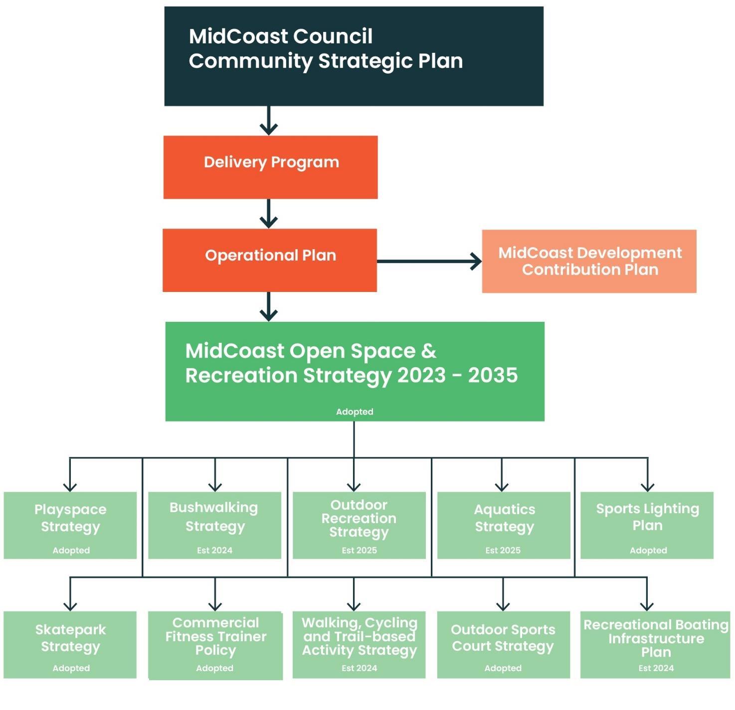
The provision of recreation services to our community involves a number of planning considerations and components. The MidCoast Open Space and Recreation Strategy 2023-2035 provides guidance to the production of this Recreational Boating Infrastructure Plan.
The MidCoast Open Space and Recreation Strategy 2023-2035 presented a public open space planning model. This model sets out the strategies and plans needed to meet the aims of the Strategy and the current and future needs of the community through sport and recreation services.
The MidCoast Recreational Boating Infrastructure Plan 2024 – 2035 is detailed in the model.
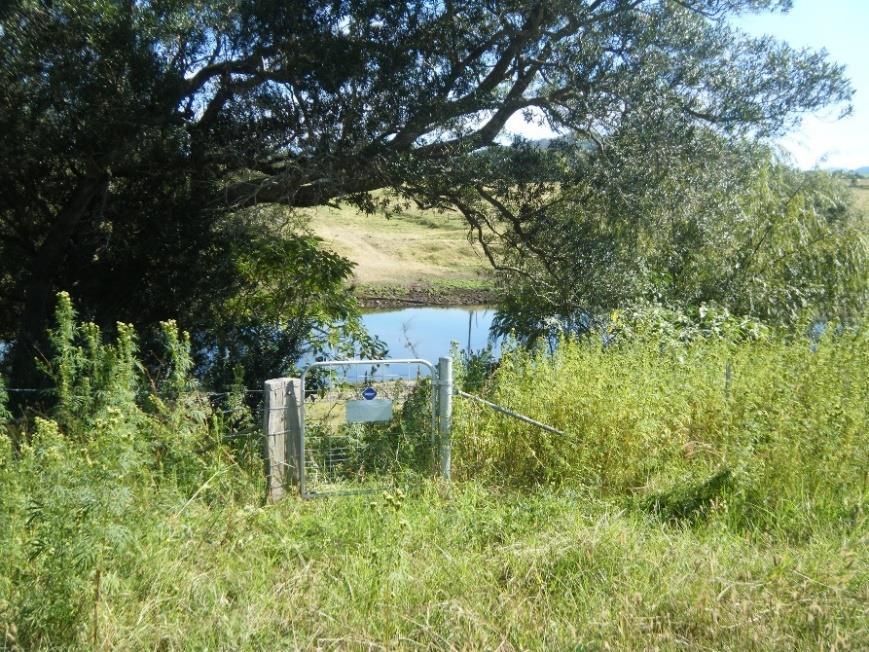
We have more than 180 parks and reserves that are located on our coasts and waterways. Of these many have boating infrastructure in them. These parks and reserves are often our “crown jewels” of our parks, having been set aside for community benefit many decades ago, in some case in the late 1800’s. Because of the value of these parks and reserves for all our community, not just those that undertake boating activities, we need to have a holistic approach to their management.
Overall, there are 826 Council-managed open spaces in the MidCoast region. For a full list of facilities and their type refer to Appendix 3 of the MidCoast Open Space and Recreation Strategy 2023-2035
Our public open space is made up of the following:
Of the park categories and areas detailed above the following crown land reserves are included:
Residents of the MidCoast area enjoy a water-based lifestyle. Many people who live here, and who move here, do so to enjoy access to our world recognised waterways. According to the Transport for NSW Recreational Boating Participation (2018)1 report 27 percent of northern NSW maritime region residents own a recreational vessel, whereas the NSW average is 16 percent.
Many of our parks and reserves detailed on the previous page are either on waterways or the coast. In addition, many of these parks and reserves are crown land, managed by Council on behalf of the NSW Government.
The MidCoast Open Space and Recreation Strategy 2023-2035 highlights the importance of recreational boating and the infrastructure that is required to meet that demand.
Traditionally the provision of boating infrastructure in the MidCoast area has been based on waterway management plans generally done in isolation from other studies.
Historically, upgrades to existing facilities were based on deficiencies identified in condition audits This approach results in like for like, rather than meeting the dynamic and changing needs of the community. Like our other strategies and plans developed in the 2023-2024 period the Recreational Boating Infrastructure Plan takes a portfolio approach to the planning and provision of facilities on our parks and reserves. A portfolio approach is where we provide a selection of different types of facilities, that service different needs within the community. A large regional boat ramp is provided in a major activity centre but is not required in a small coastal village. This portfolio approach ensures that we have the facilities that we need, but also aligns with our minimalist approach to provision
Just like playspaces, skateparks, and sports courts, boating infrastructure is another facility located on our public open spaces. Ultimately, we have an obligation to ensure that our public open spaces are sustainably managed, with critical infrastructure where it is needed the most, with a focus on ensuring that our parks and reserves are not over-embellished.
There are several different land tenures involved in the provision of boating infrastructure in the MidCoast area. Council owns and controls many of the parks and reserves where boating infrastructure can be found. Most of our boat ramps and other facilities are located on Crown Land, which is managed by us on behalf of the state.
However, there are also boating facilities on other land tenures, such as Maritime NSW, the NSW National Parks and Wildlife Service and in some cases on NSW Department of Education land. This Strategy only deals with boating facilities that are on Council managed land.
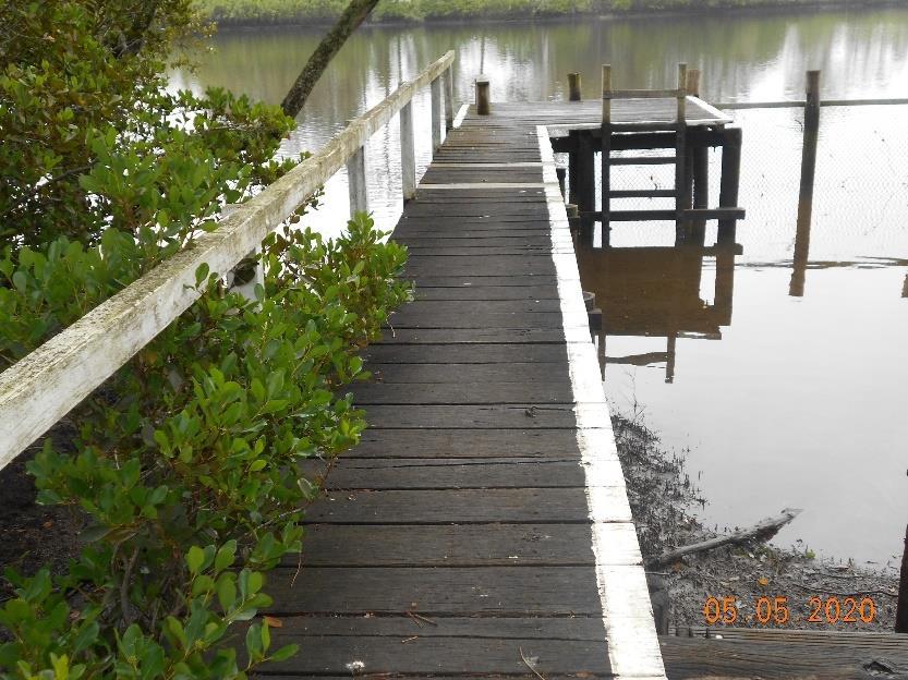
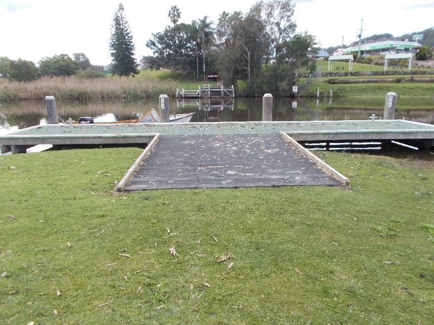
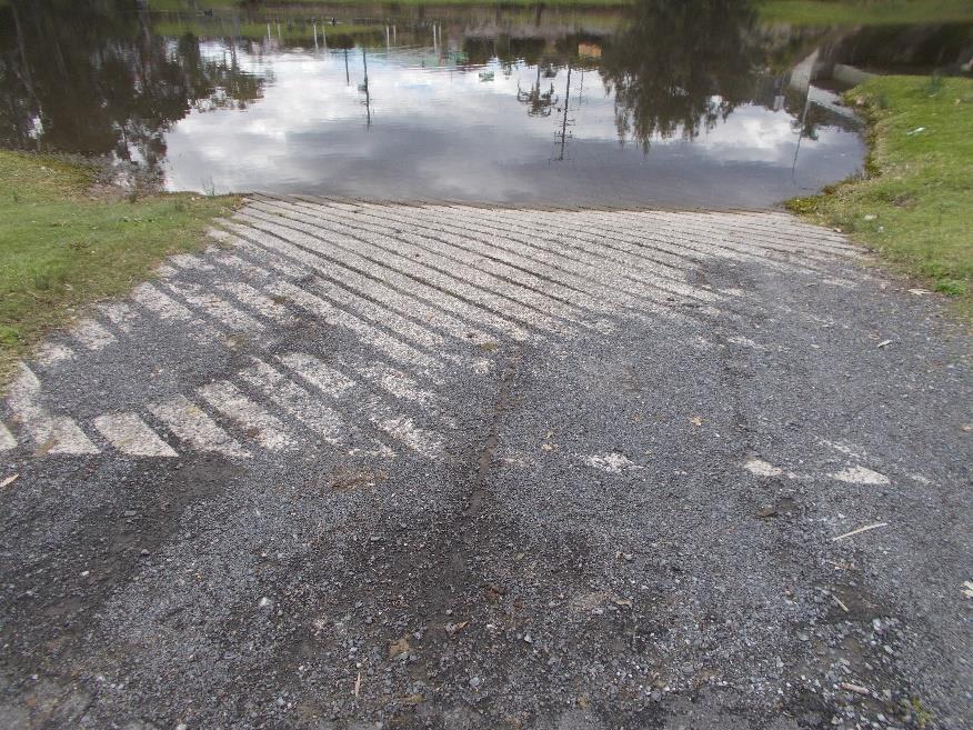
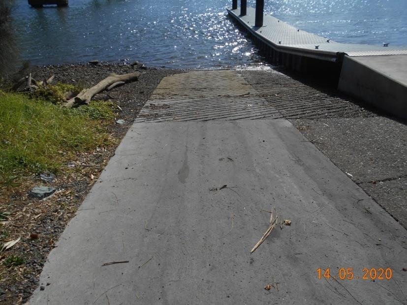
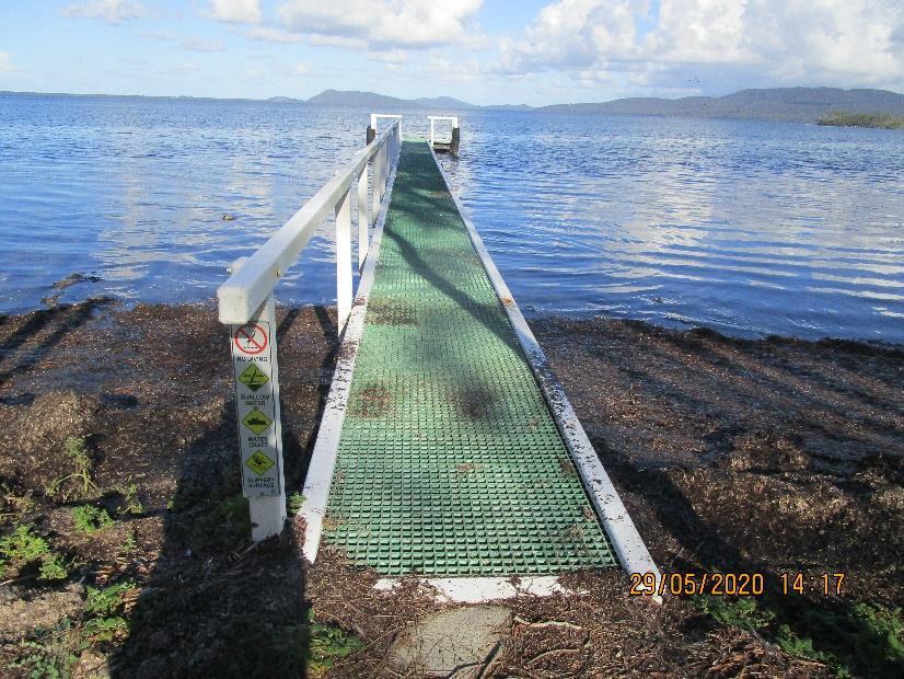
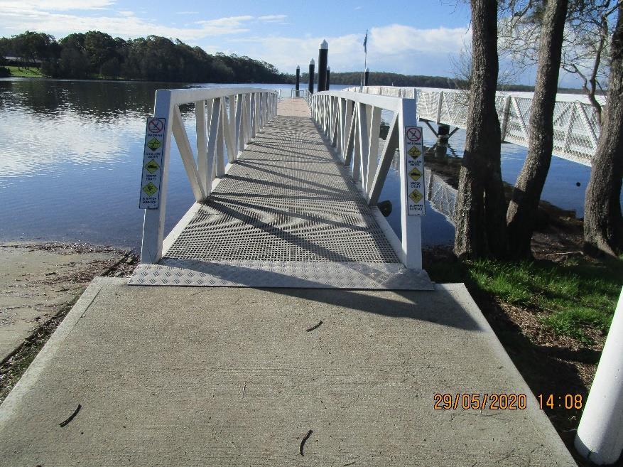
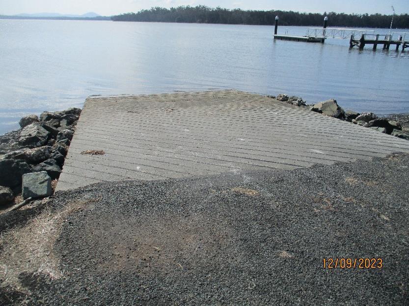
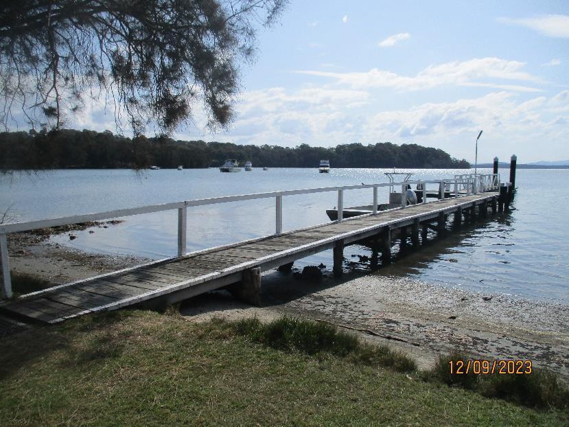
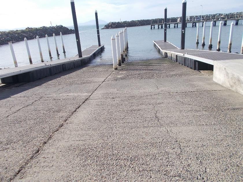
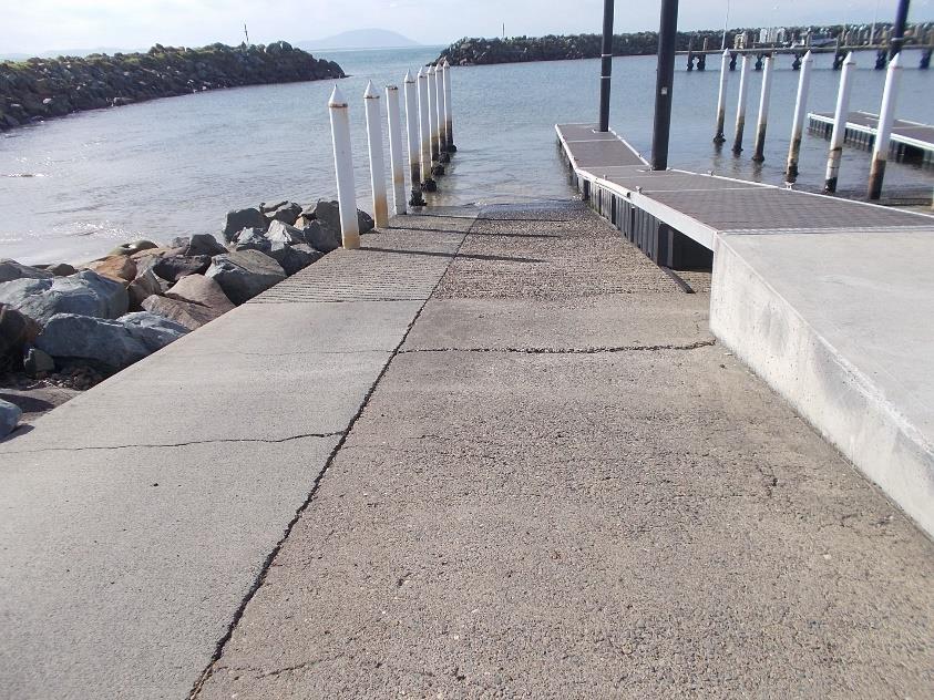
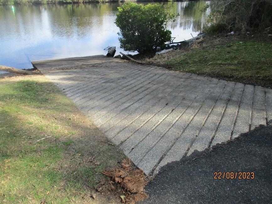
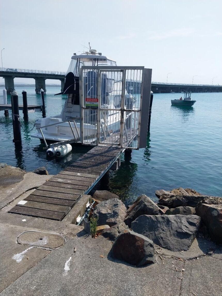
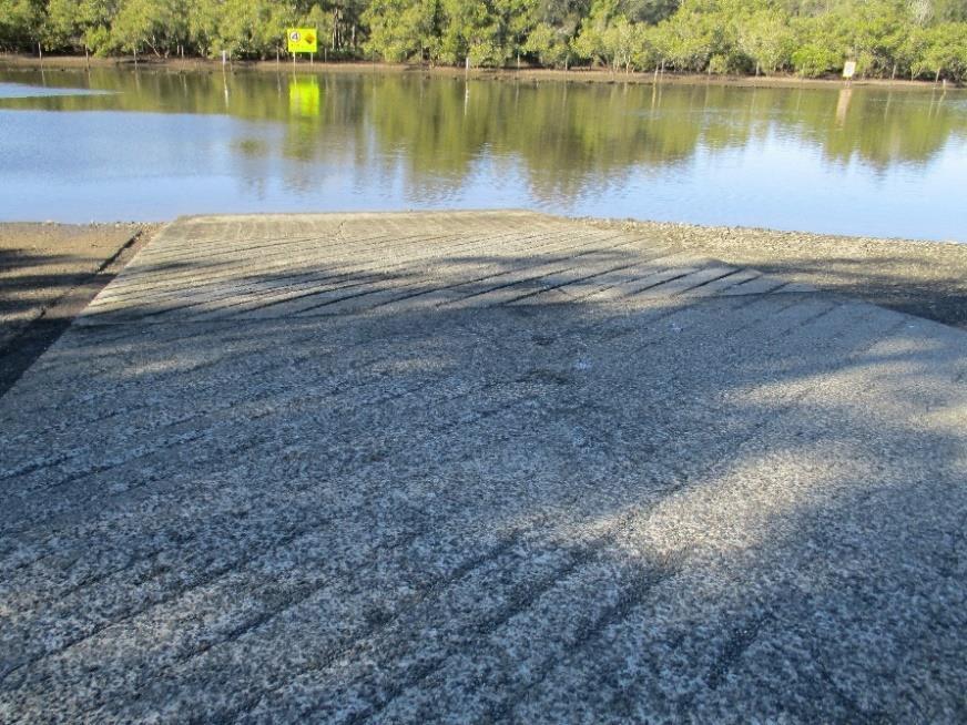
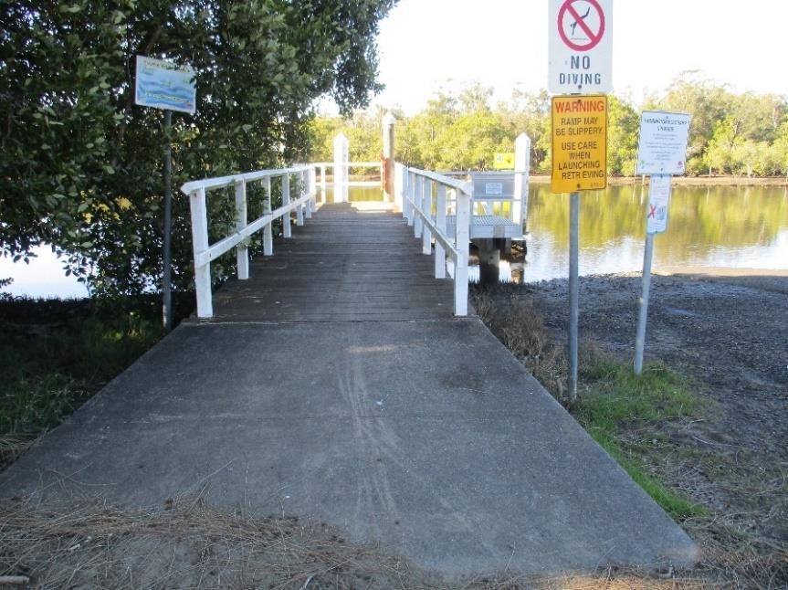
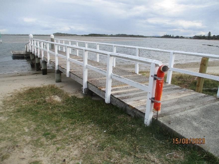
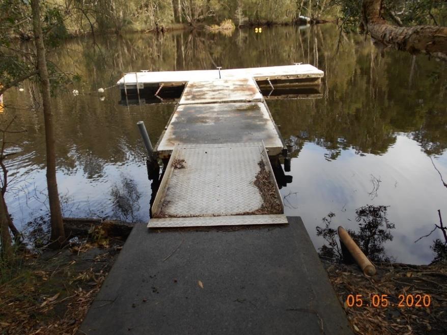
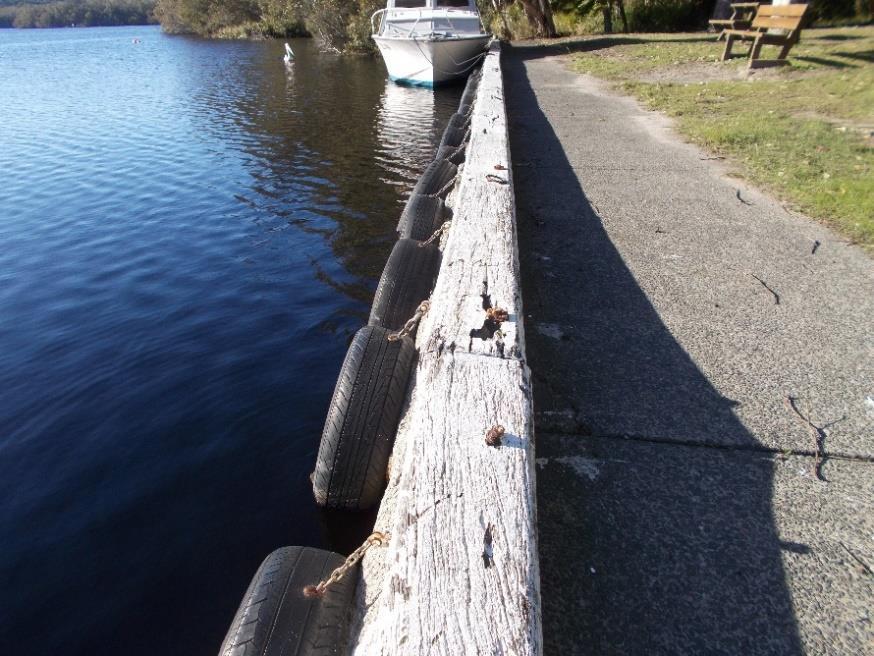
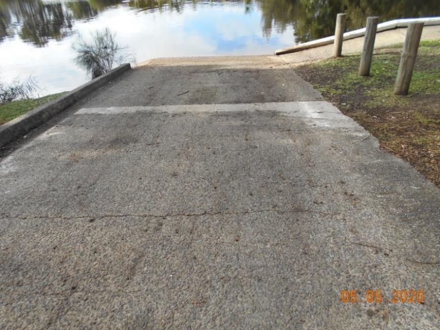
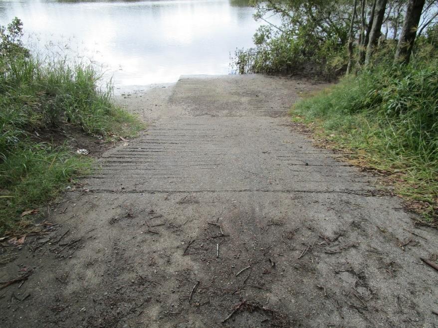
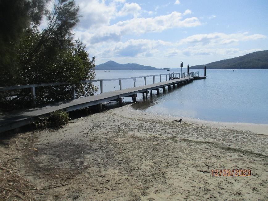
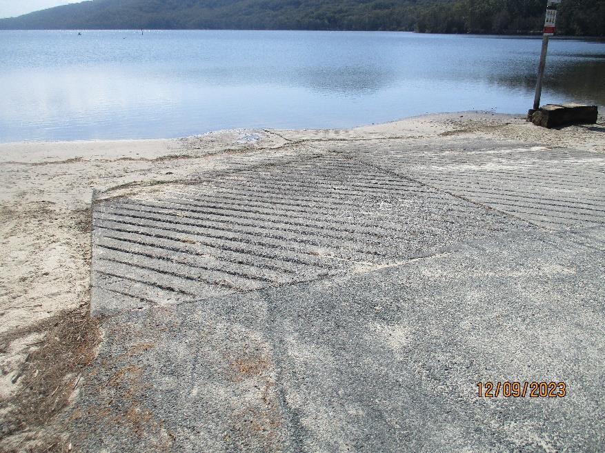
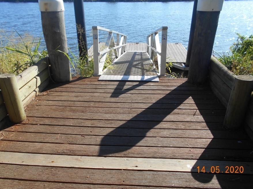
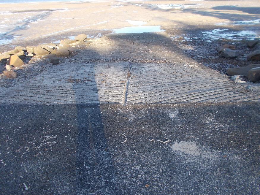
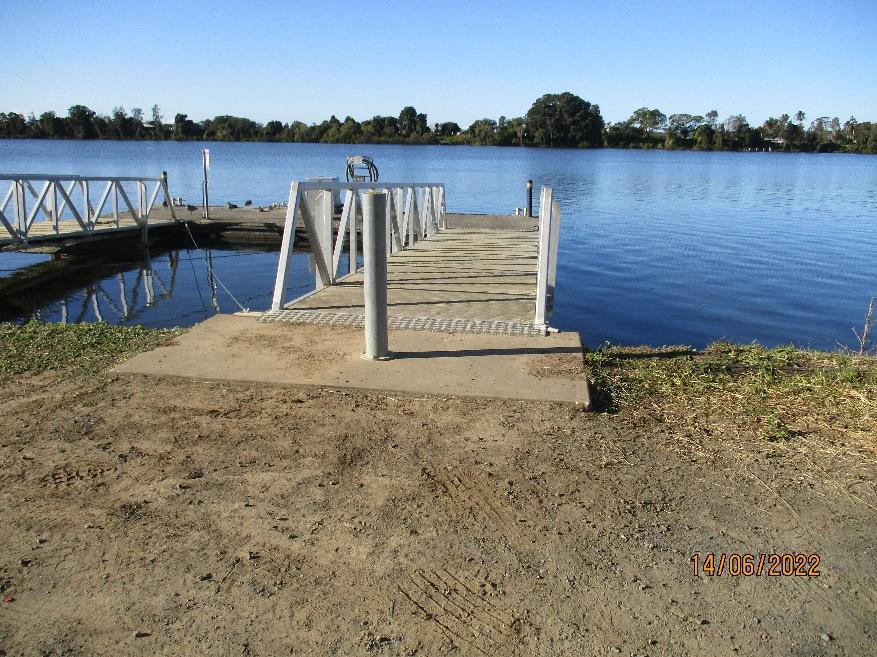
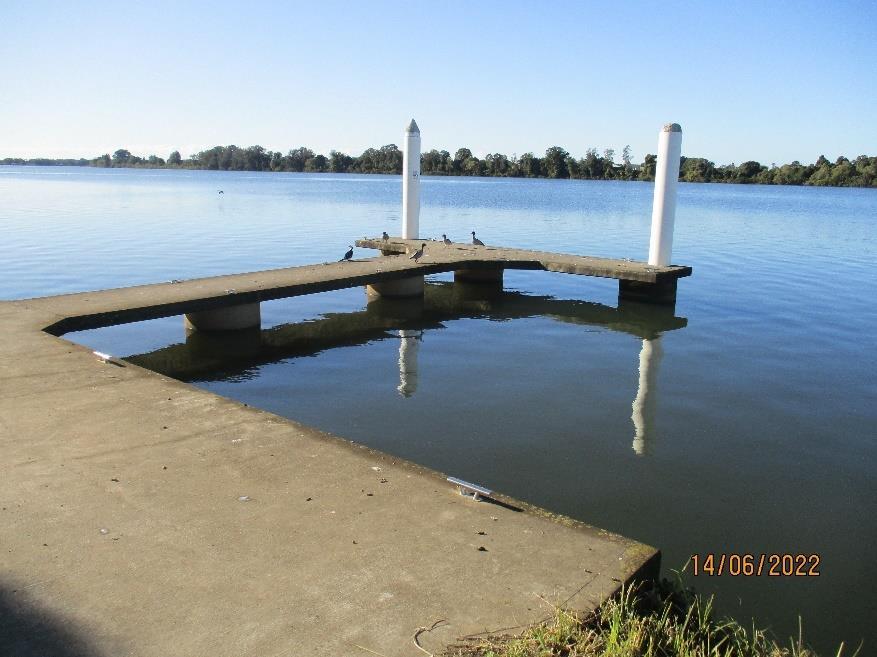
For the purposes of this plan boating infrastructure is defined as including the following:
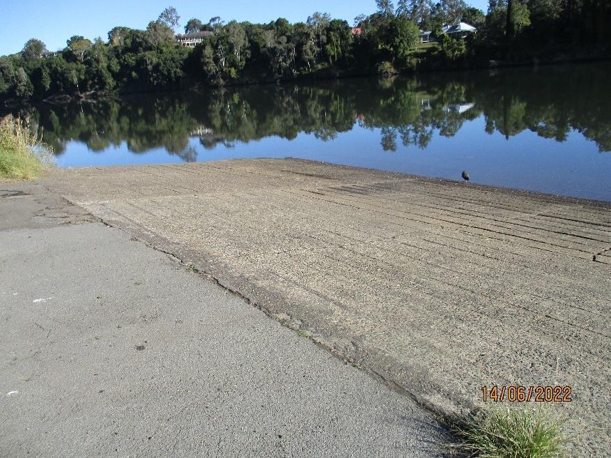
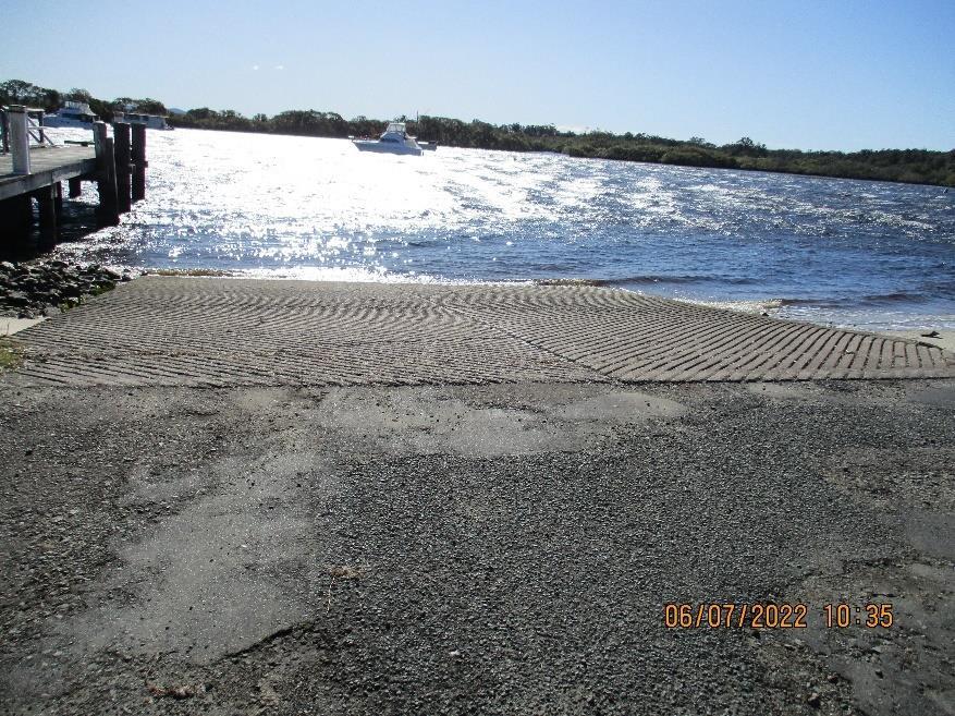
• Boat ramps
• Canoe slides
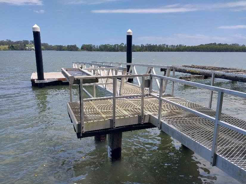
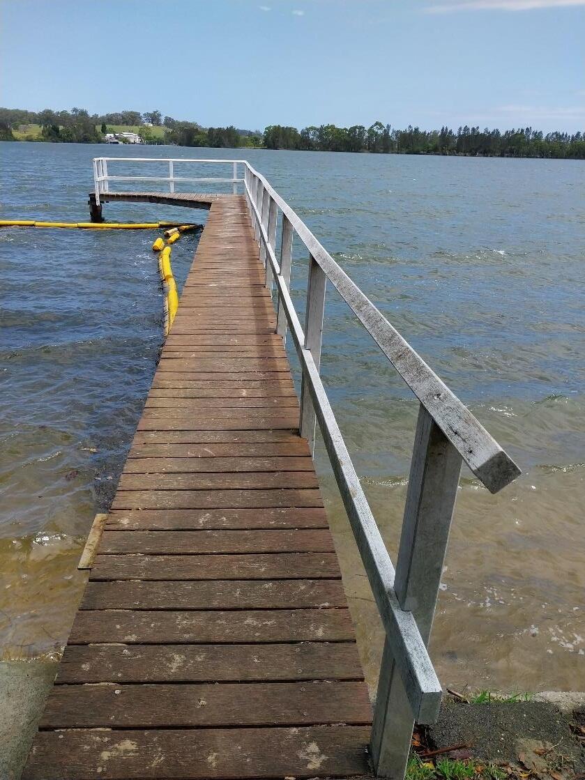
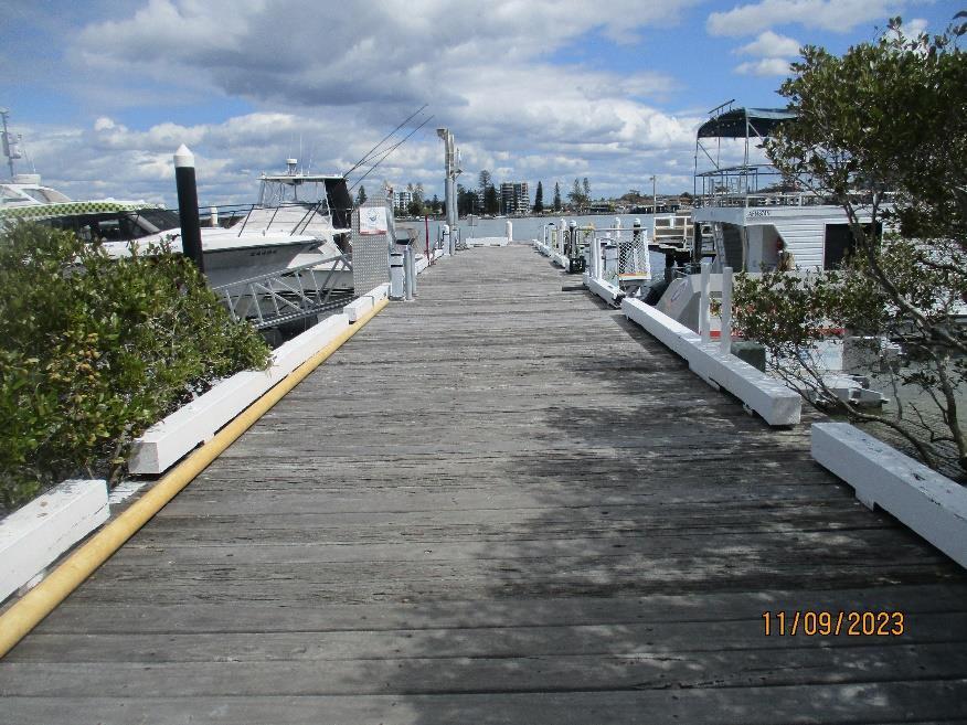
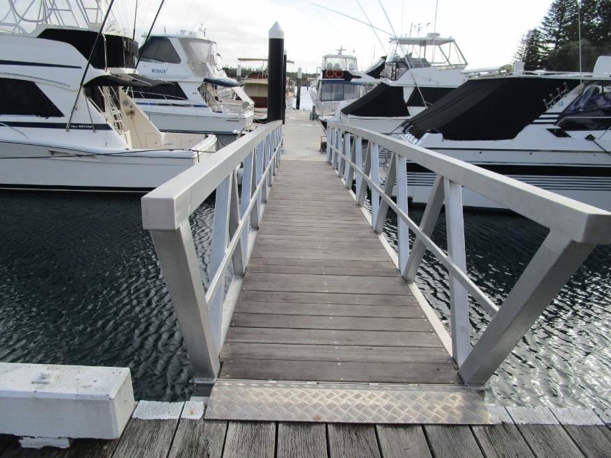
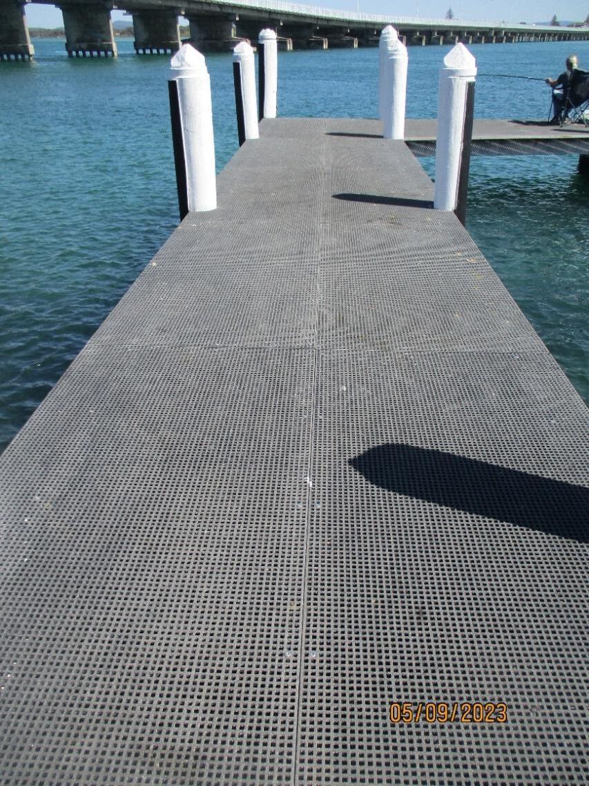
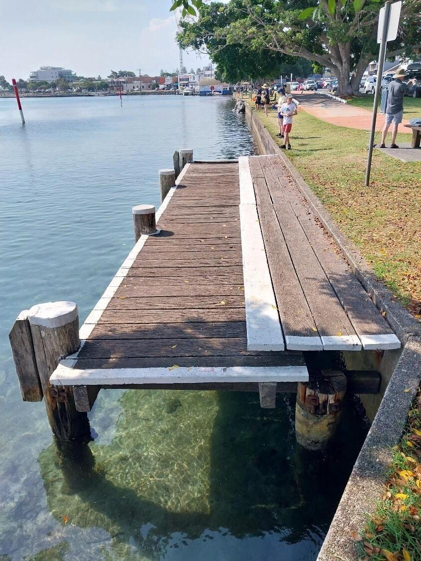
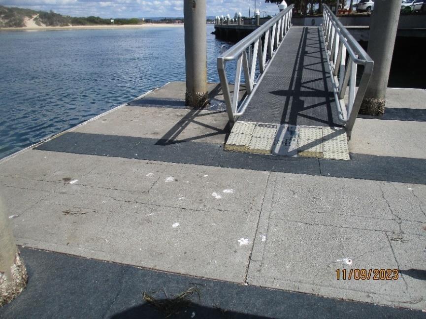
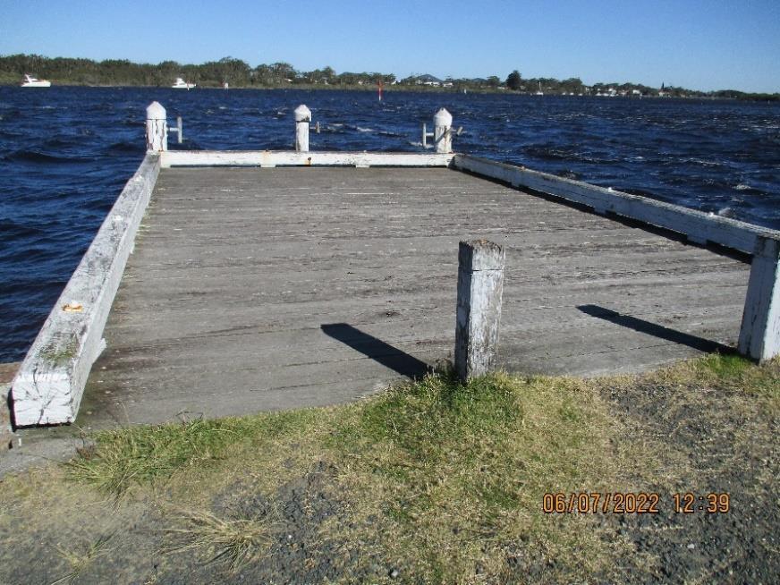
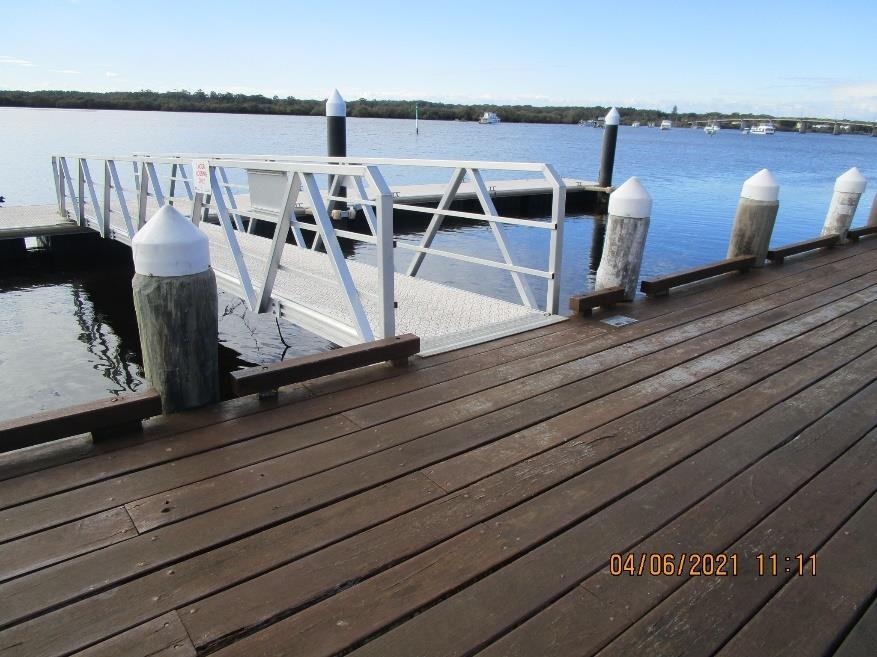
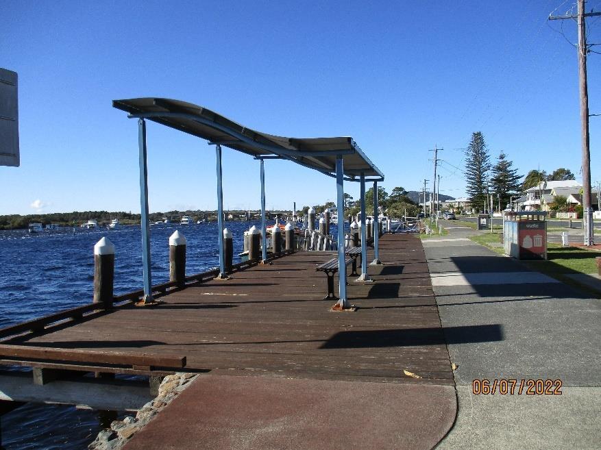
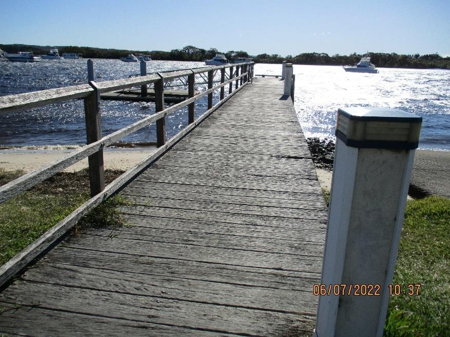
• Jetties
• Pontoons
• Wharves
1 https://maritimemanagement.transport.nsw.gov.au/documents/RMS015Boating%20Participation%20Survey-DRAFT-4.pdf
Boating activities in the MidCoast region are varied. An indication can be the range of registered boats as shown below. It is important to note that this does not identify many of the recreational and sporting boats that utilise the river/ocean such as small yachts, canoes and rowing boats. However, it is a good indication of the variety of boats and their popularity.
• Canoe
• Kayak
• Paddleboards
• Windsurfing
• Kiteboarding
• Dragon boating
• Rowboat
• Sail vessel
• Open runabout
• Cabin runabout
• Motor cruiser
• Jet ski
• Punt
• Barge
• Catamaran
• Houseboat
• Inflatable
It should be noted that the Plan is not activity specific, in that the activity that people are choosing to do on the water does not impact the recommendations contained within the Plan. For example, a boat ramp should cater for all boat launching requirements, for all vessels, whether they be an open runabout, a jet ski or a canoe. Our aim is to deliver boating infrastructure that allows the community to undertake whatever water-based activity they wish to, with a long-term sustainable focus.
The range of boating uses undertaken in the MidCoast region that this plan deals with can be grouped as below. Commercial boating activities and infrastructure, such as boat repair and oyster related activities are not considered.
• Recreational - boating has become the main form of boating in our region. This can range from cruising boats to tinnies, jet ski’s and non-motorised boating.
• Sporting – these uses have always been a feature of the MidCoast region. They can include fishing, rowing, sailing, power boats, skiing, canoeing and dragon boating. These activities are often provided by sporting clubs. Sporting clubs not only use our rivers and coasts to train, but also for hosting significant events. Some events can attract over 1,000 people to the local area in terms of competitors and spectators. Many of these clubs are focussed around the Taree area on the Manning River.
• Tourism – many people visit our region every year and many of them centre their activities around the water, bringing boats to the region for recreational pursuits. While others enjoy the opportunities to access the water for fishing, swimming and viewing our rivers and coast
We have an abundance of flatwater rivers and creeks in our region, both near the coast and in our mountain areas. They are perfect for non-motorised boating activities. A quiet paddleboard in the Breckenridge Channel at Forster, or a sedate canoe along the Gloucester River is an idyllic activity for both our community and visitors.
The MidCoast Open Space and Recreation Strategy 2023 – 2035 has a clear outcome for the community from our parks and reserves, that being “a healthy and active community”. The way we maintain our parks and reserves, and the facilities that we put in them are all designed to deliver on that goal. That being the case our highest priority for boating opportunities is non-motorised boating, such as canoeing, kayaking, paddleboarding, and any other boating activity that requires human physical activity for the activity to take place.
We understand that the majority of our community partake in motorised boating activities, and we fully support this. We have almost a hundred different boat ramps, pontoons, jetties and other facilities spread across the region, demonstrating our commitment to motorised boating.
However, where motorised and non-motorised activities clash, or where facilities are not located in the right location, or where facilities would be better used in different ways, we will adjust or enhance our boating portfolio to meet these needs.
The concept of carrying capacity is covered in detail in the MidCoast Open Space and Recreation Strategy 2023-2035. In short, all living ecosystems have a limit to the amount of impact they can tolerate before negative impacts are observable. Our aim is to provide and manage our infrastructure short of the carrying capacity of the parks, reserves and waterways that they are in.
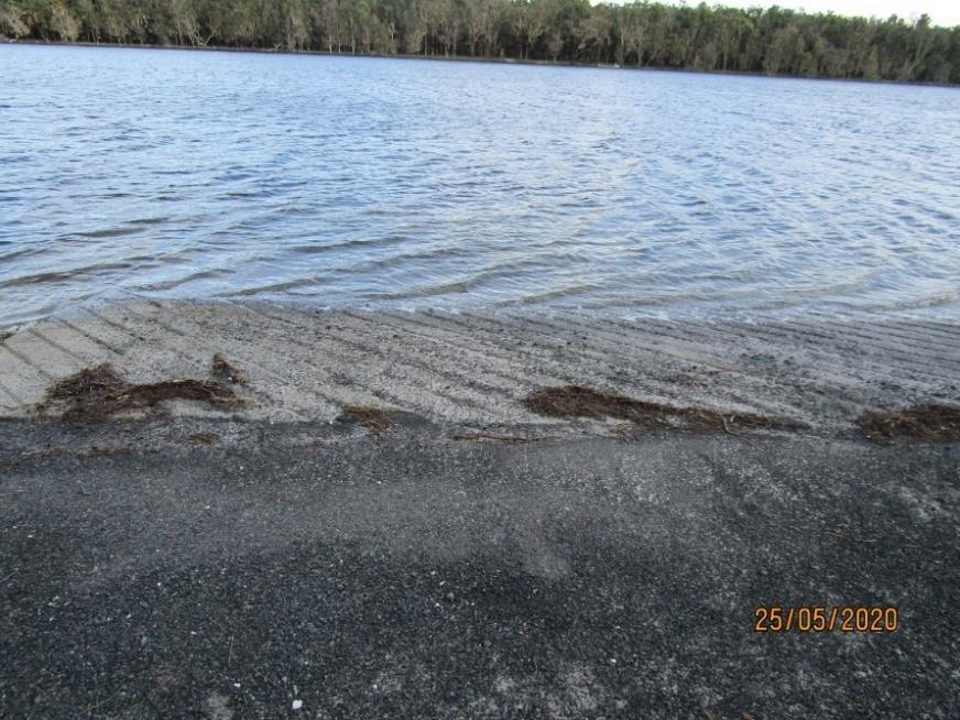
The MidCoast area accommodates significant water-based use from non‐motorised and motorised craft as well as shore-based fishing, sightseeing, walking and picnicking. Most users appear to be seeking an experience associated with the scenic, natural beauty and high environmental quality of our area, in a setting with only minimal infrastructure In short, the more structures, the less appealing.
There is strong evidence to suggest that both the quality of the recreational experience and the environmental values of our waterways, will decline with increased visitation, and more facilities. The point at which irreparable damage is done, caused by increased visitation and more facilities is known as the “environmental threshold”. Our aim is to manage our boating facilities and activities short of that threshold.
Results, from a study undertaken by NSW Maritime2 (2009) to identify popular recreational areas for boating, showed that of the 625 unrestricted boat ramps in NSW, 107 were considered to have high recreational use (delays in launching of 30 minutes or more). 157 were considered to have inadequate parking and 166 in poor or very poor condition requiring upgrading within 1 – 2 years3 . In short, across the state there is high demand for our boating infrastructure, even more so in the MidCoast region. At the same time NSW Maritime found that a lot of our facilities are run-down and in poor repair.
Where the carrying capacity of a site is impacted through additional facilities there are likely to be environmental impacts that mean the resource quality declines unless management inventions are introduced (see the Impact Assessment Model in the OSRS). However, if additional access infrastructure is introduced, additional people are likely to be attracted wishing to use the new
2 NSW Boat Ownership and Storage: Growth Forecasts to 2026, NSW Maritime, Unpublished 2009
3 https://www.hornsby.nsw.gov.au/__data/assets/pdf_file/0018/106623/Sustainable-Water-BasedRecreation-Facilities-Plan.Final.Adopted-18-April-2012.pdf
facilities. This increase in visitation then impacts those that are attracted by the pristine natural conditions. These additional persons may not be as attached to the natural qualities of the environment, and people without an attachment to the waterways may not be as inclined as other people to protect these qualities.
These conflicts between users are often seen in our region. During seasonal visitor periods high levels of motorised water-based vessels are often in conflict with those who desire to enjoy the natural environment. Of particular note in this context are jet-skis, which the area see’s extremely high use during some periods. This user conflict needs to be managed, and access to boating infrastructure is one way to manage this conflict.
The land managers that neighbour our region, to the south, and north, both have Recreational Boating Infrastructure Plans. All three councils understand that people are not restricted in where they go on the water. A person may launch their watercraft in Port Stephens but may spend the day dropping in and out of MidCoast anchorages or even coming ashore in our parks and reserves. Therefore, it is important that our planning aligns, that we place boating facilities where all can use them, and that we do not duplicate assets where our neighbouring councils have provided like facilities.
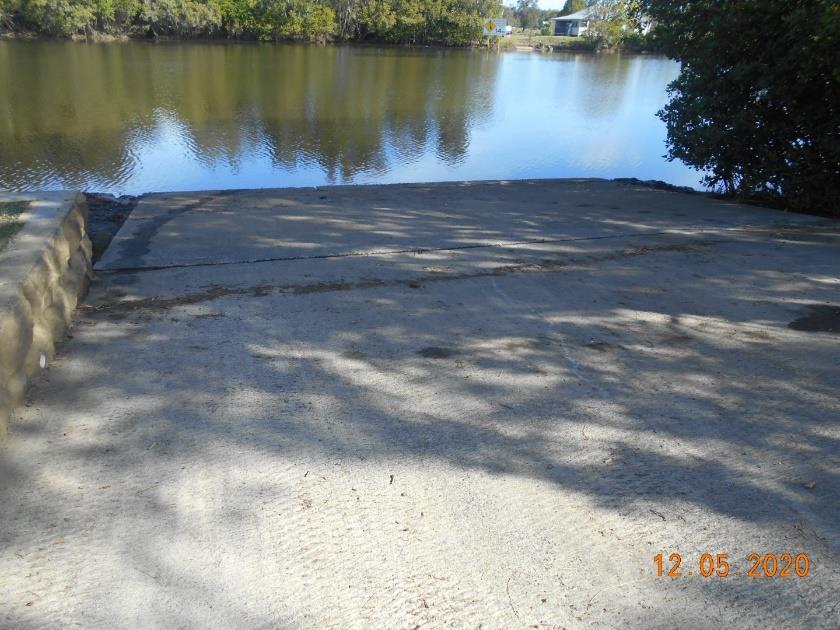
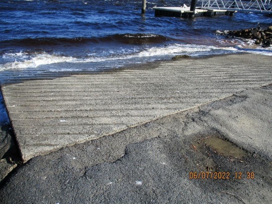
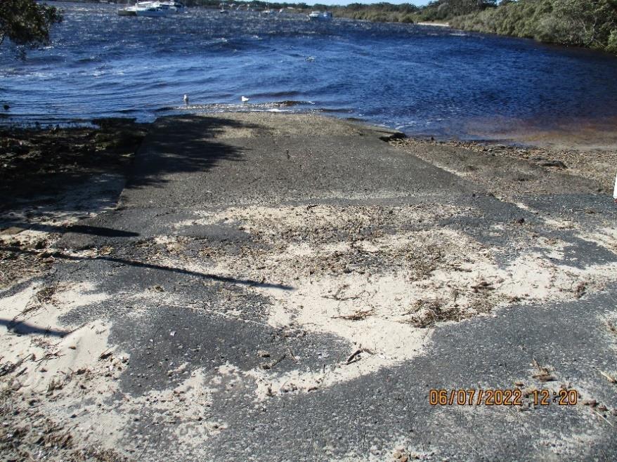
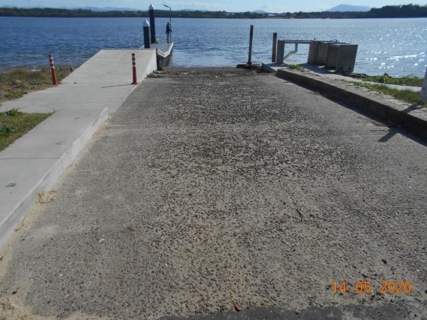
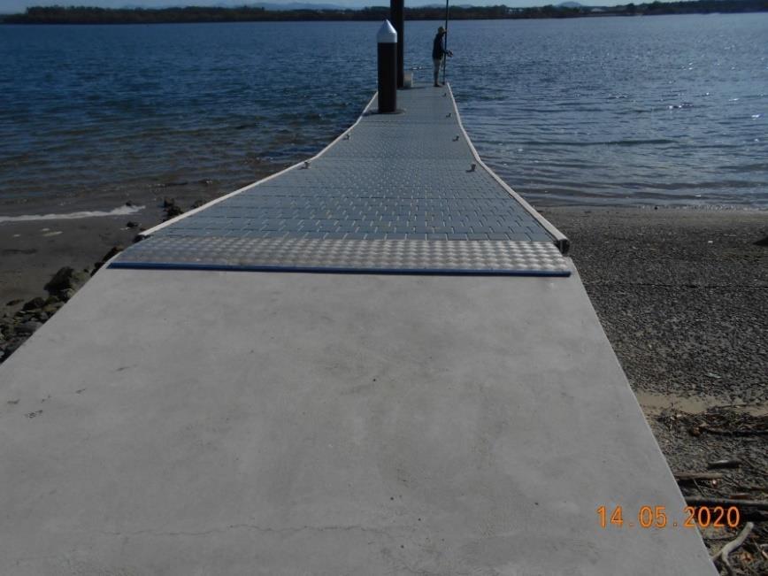
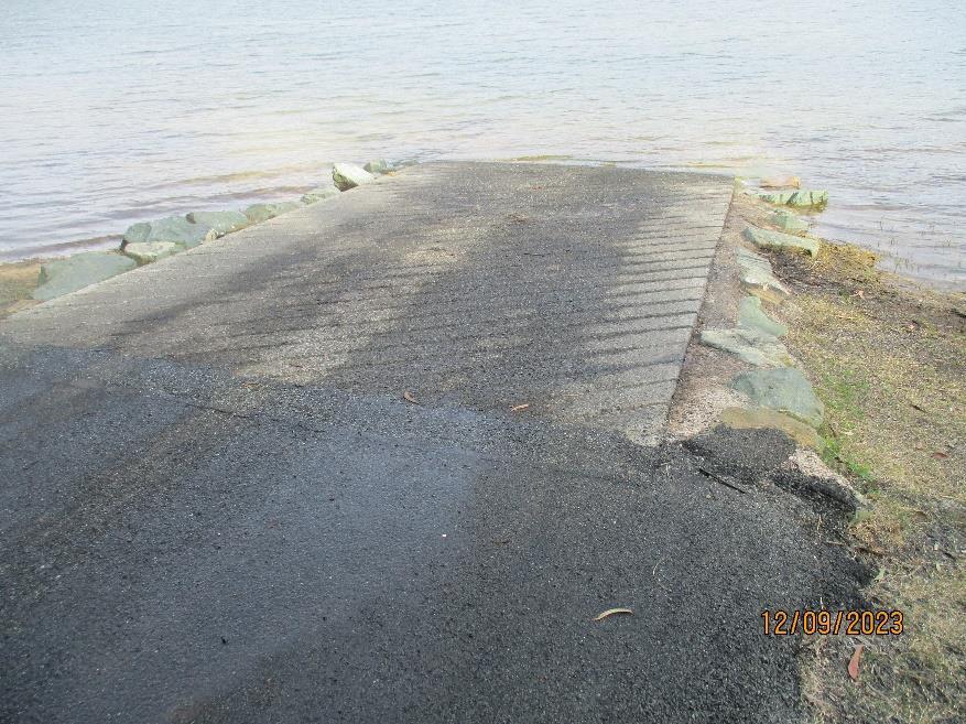
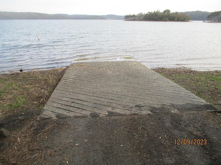
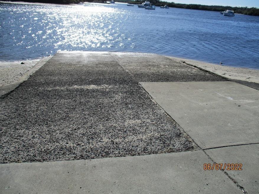
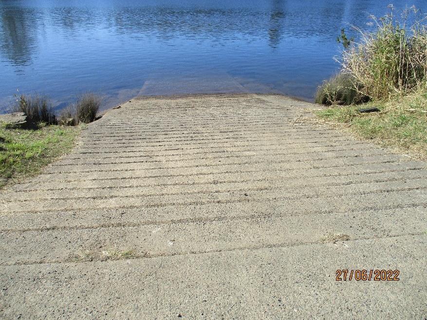
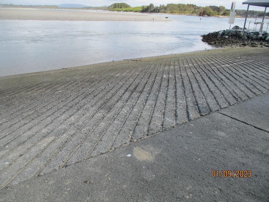
Infrastructure that is made of concrete is considered to have a lifespan of up to 50 years. Therefore, the boat ramps detailed in this plan have been planned for this period. This is subject to usage, and what the natural systems do to those parts of boat ramps that are in direct contact with the water. The surrounds of a boat ramp need to be maintained on a regular basis.
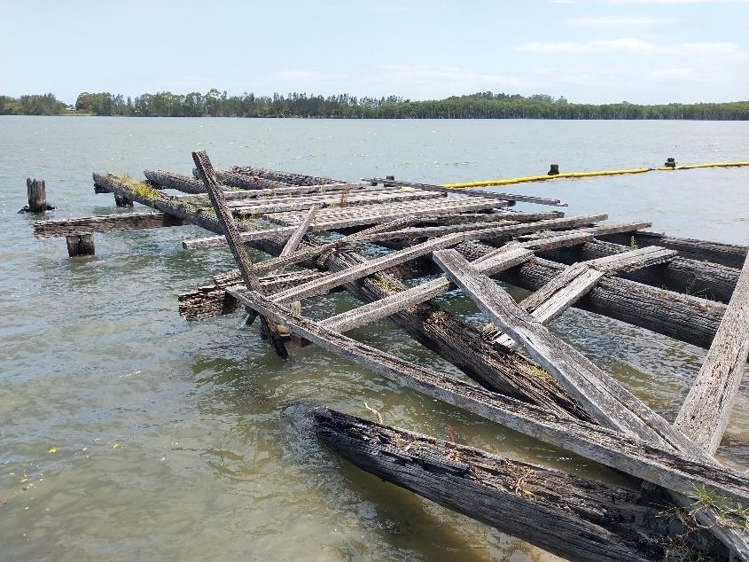
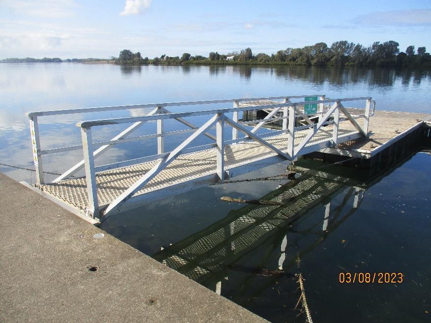
Other boating infrastructure, such as wharves, pontoons and jetties have far shorter lifespans, which are significantly impacted by the natural environment and usage. Many of our facilities need to be replaced or repaired following flood events, with specific funding programs provided by state and federal government for this purpose. Therefore, we expect our boat ramps will last well beyond the time frame of this Plan, however, other boating infrastructure has been planned to remain fit for purpose for shorter periods.
In 2018 the NSW Government released the NSW Maritime Infrastructure Plan4, developed as a joint initiative between Transport for NSW, Roads and Maritime Services and the NSW Department of Industry – Crown Lands and Water.
The Plan sets out a more strategic, coordinated and evidence-based approach to planning, prioritising and delivering NSW Government investments in maritime infrastructure.
By identifying 14 strategically significant locations and defining the key opportunities and outcomes at each location, the Plan focuses on supporting and enhancing safe and sustainable boating for the public and industry in the areas that will deliver the greatest benefits, while continuing to support local projects to meet the needs of boaters across the state.
The 14 strategically significant locations identified in the Plan are:
• On the north coast: the Tweed, Clarence and Richmond Rivers plus Coffs Harbour
• North of Sydney: Port Macquarie, Forster-Tuncurry, Port Stephens, Lake Macquarie and Pittwater;
• South of Sydney: Botany Bay/Port Hacking and Wollongong Harbour; and
• On the south coast: Jervis Bay/the Shoalhaven, Batemans Bay and Eden.
The Plan adopts a new approach to delivering maritime infrastructure through greater coordination, collaboration and reducing red tape, and provides councils and the private sector with greater certainty in how the government will prioritise investment in maritime infrastructure, enabling them to invest in their own infrastructure with confidence.
The Plan responds directly to issues raised by industry and the community over several years of consultation, including through the Regional Boating Plans, Draft Regional Ports Strategy and specific consultation with industry in 2017 and 2018.
The Plan also supports Future Transport 2056 priorities on safety, accessibility and successful places – by enabling safe access to waterways, a growing economy and public amenity. This includes the Maritime Safety Plan 2017‐21 and the important role of infrastructure as part of a Safe Systems approach to boating safety.
The MidCoast region is covered by the NSW Maritime Infrastructure Plan, primarily in the ForsterTuncurry area. We work with the NSW Government in identifying and supporting boating infrastructure in our region. Our rationale in delivering boating facilities is aligned with the State government's planning.
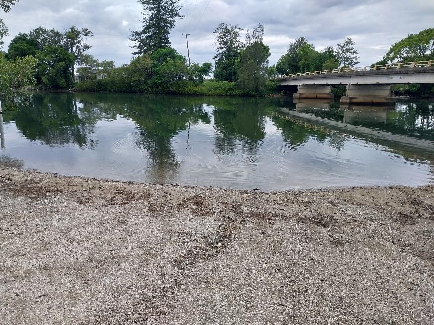
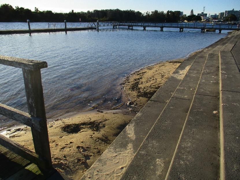
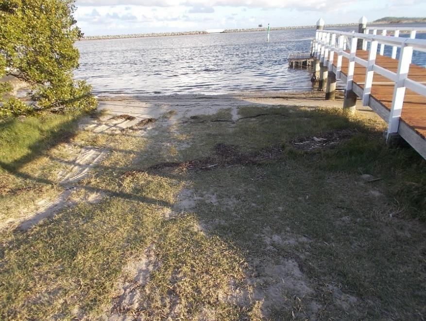
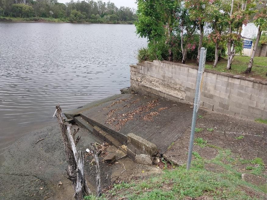
Access to the river, especially along the rock-wall on the north bank in Taree is restricted, creating a situation where the community is not able to access the river for swimming or fishing. Research shows that children that participate in water-based activities, such as swimming have better health outcomes.
At present it is common to see groups of local children swimming off our boat ramps, as this is the easiest way to access the river. This situation creates safety issues and conflict with boat users. The community have approached us to investigate the removal of small parts of the rock-wall along the city side of the river and provide sloping beaches where the community can swim and recreate.
4 https://www.transport.nsw.gov.au/news-and-events/reports-and-publications/nsw-maritime-infrastructureplan
The Action Plan contains an action to investigate and to test the feasibility of the activity. If it is viable this will provide a significant outcome for the community.
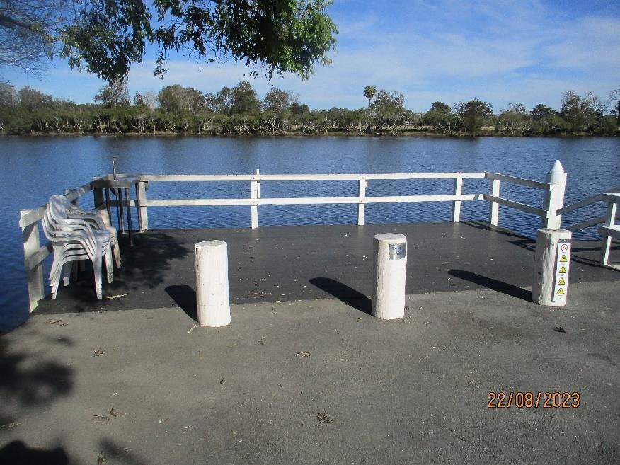
A facility that is often located near to our boating infrastructure are fish cleaning tables. We have 24 of these facilities spread across the region. All of them located near to our boating facilities.
This Plan does not include fish cleaning tables in the asset list or the Action Plan. Fish cleaning tables will be provided where the demand is high enough to justify the expense and maintenance.
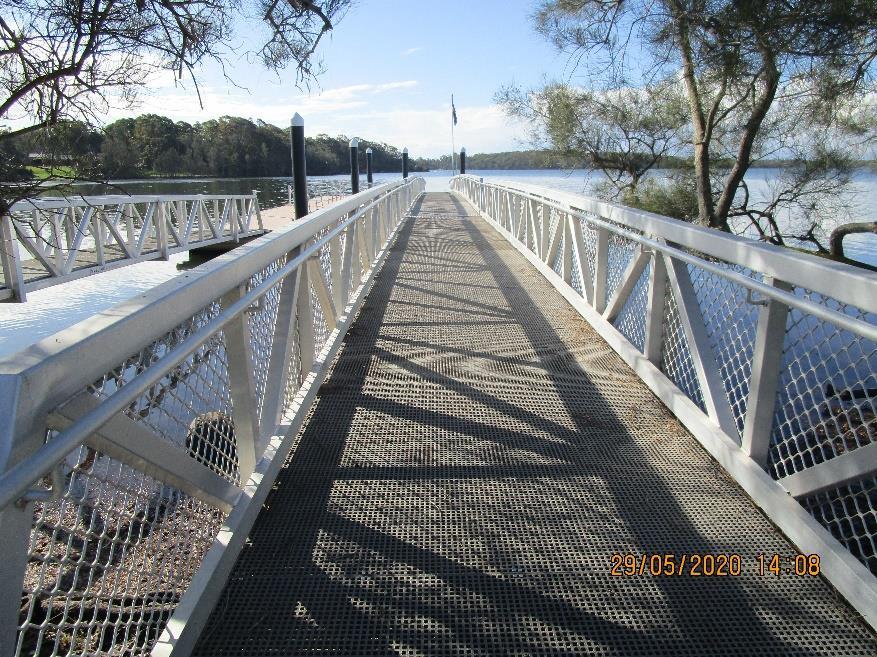
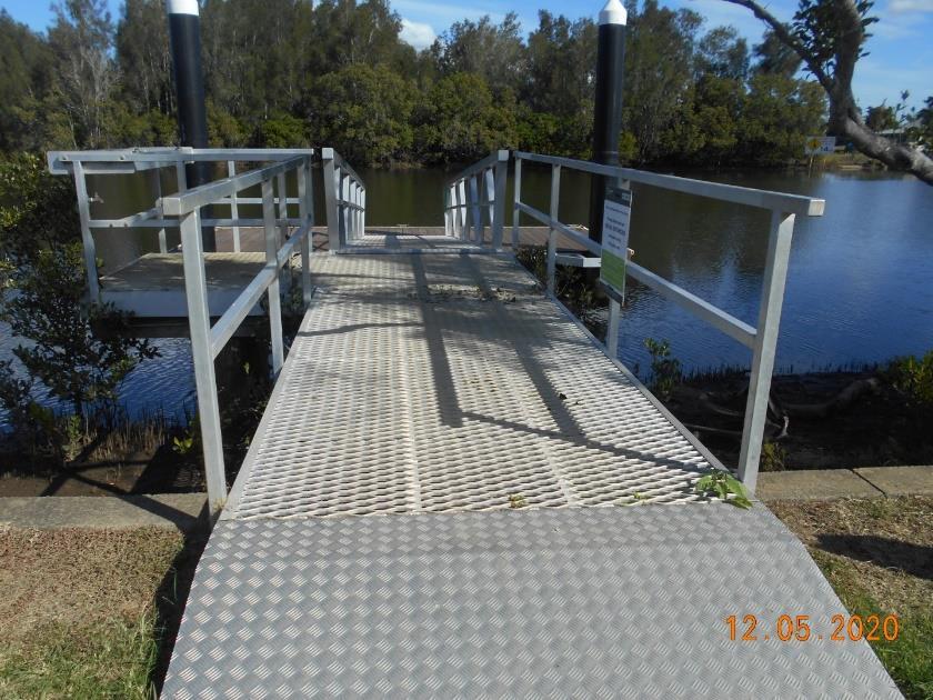
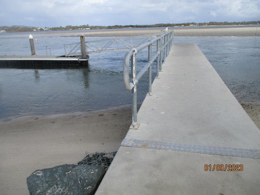
The OSRS speaks extensively about the accessibility of our parks, reserves and the infrastructure that we place in them. There are several actions in the OSRS action plan directed towards providing accessibility facilities to ensure that all members of the community can enjoy our public open spaces.
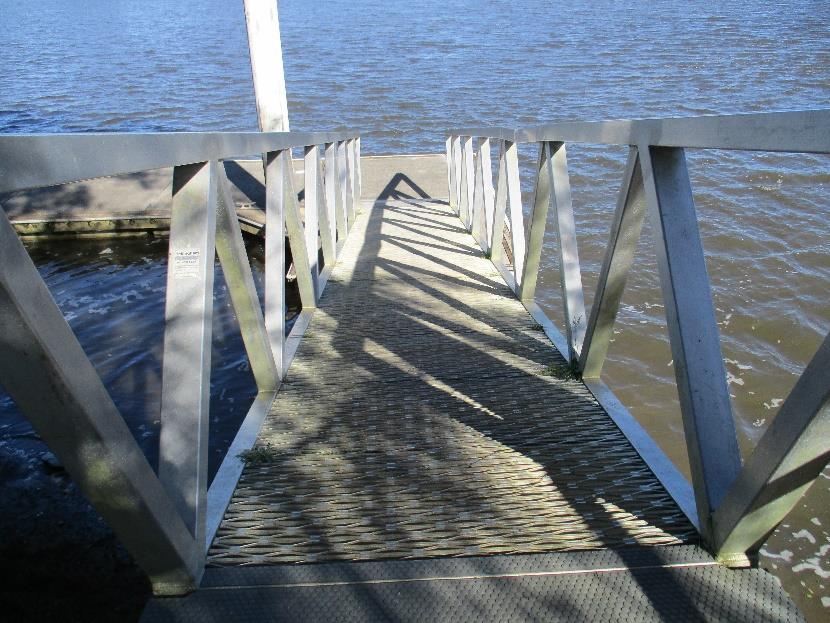
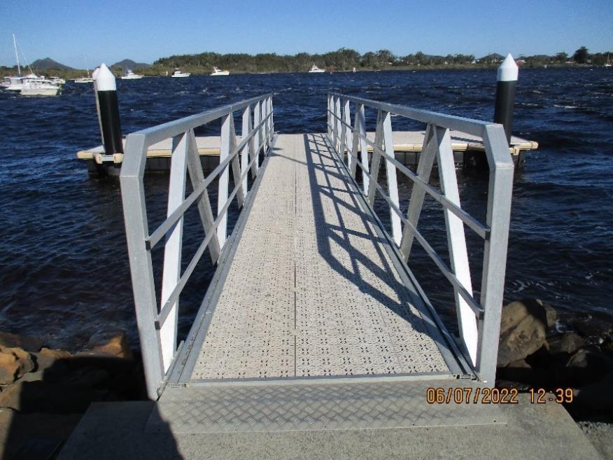
This plan seeks to provide opportunities for all. When we are upgrading boating infrastructure, we will seek to include all-ability facilities. Access to these facilities will be considered, including that people living with disabilities can use our boat ramps and other facilities.
Where opportunities are identified for their provision accessible facilities will be provided.
We
will seek to provide accessible facilities to encourage all members of the community to enjoy our waterways.
Signage is important to directing users where they need to go when they arrive at our facilities but also the regulations that govern their use. We have a policy to keep signage to a minimum whilst also ensuring that the message is clear.
All of our boating facilities will have clear signage that is fit for purpose.
The recreation portfolio contains many different components, most of which require infrastructure to facilitate the activity. Some of these facilities have short life cycles, such as playing surfaces. However, some have long-term life cycles, such as skateparks, and in the case of this plan boating infrastructure. In short, any recreation infrastructure that is constructed with concrete will have a 50-year life.
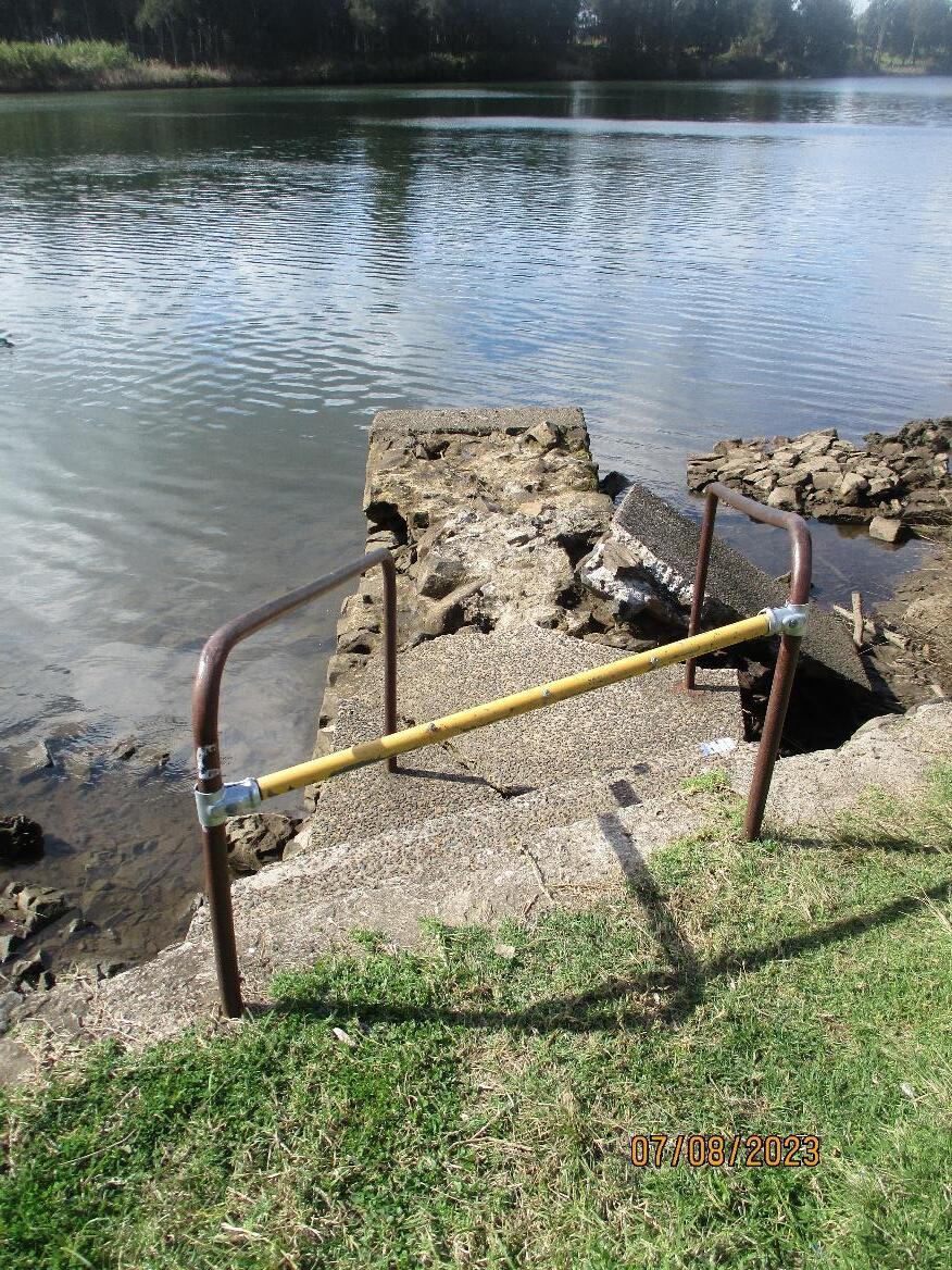
Many of our existing boating facilities were constructed many decades ago and are still in operational use. This longevity of our boating infrastructure has several impacts. Firstly, it means that we don’t have to upgrade these facilities anywhere near as regularly as our other recreation infrastructure. However, it also means that we need to get it right when planning. Some of our existing facilities are no longer fit for purpose. For example, they are in the wrong place, and the urban built space is encroaching on them, creating safety and access issues. In the small number of cases where this is the case these facilities have been identified for adjustment or are recommended for a change in use.
In addition to the development of the MidCoast Recreational Boating Infrastructure Plan the Action Plan contained within the MidCoast Open Space and Recreation Strategy 2023-2035 also includes several boating infrastructure projects. These projects were identified through community engagement or were identified as obvious projects that needed to be undertaken. These projects are included in the Action Plan at Appendix 2.
We used five connected decision drivers to identify the actions and their priority. These are listed in the table below:
Evidence approach
Equitable provision
Each action has been tested through community feedback, analysis of community need, analysis of current activity trends and its impacts on the environment. The priority placed on each action is therefore a result of extensive analysis
Actions were also developed through an equitable lens, in that each location within the LGA was considered for what they have received in the past, how long since that location received a new facility and the feasibility of delivering their individual projects at a certain point in time (e.g., availability of funding).
Asset portfolio condition As has been noted in the OSRS the state of our recreation portfolio is aged, and some of the individual components are no longer fit for purpose. In developing the actions and their priorities the condition of existing infrastructure, and its projected life was a strong determinant in setting its priority.
Financial Sustainability
Environmental considerations
The prioritisation of the actions in the Action plan, and the ability for projects to progress to delivery in the future, has also been influenced by considering the associated financial operating model and/or the long-term asset management requirements in minimising future financial burdens to Council. This financial planning of actions also includes the consideration of access to future potential funding programs, the funds of which the vast majority of the actions will require.
Boating infrastructure, and boats, by their very nature, directly impact our natural environment. In providing these facilities we have an impact on the very thing that we seek to protect. Therefore, considering the impact on our natural environment during the planning phase of a potential new boating facility provides a clear position on whether the facility should progress, and what order it should be in compared to other facilities.
If circumstances change, such as new funding programs, changes within individual communities, or changes in community participation we will revisit the priorities. This might mean a community comes to us and asks for a project to be brought forward, which, when considered, can be done, we will. Not all actions listed will be completed in the life cycle of the Strategy. The review process identified will re-consider each action to ascertain its continuing applicability.
The importance of water-based recreation activities to our community cannot be overstated. The MidCoast Open Space and Recreation Strategy 2023-2035 highlights the value of our river and coastal lifestyles.
Several data sources provide evidence that the MidCoast area has a higher proportion of recreational boating participants than other areas in both NSW and around Australia.
To activate and enhance the community outcome from boating infrastructure we need to provide contemporary boating facilities, in the right places and of the right type, whilst doing so in a sustainable way
Appendix 1 to this Plan lays out a full audit of our current boating infrastructure. This forms the basis for the Action Plan.
The Action Plan in Appendix 2 will give us a 12 year works schedule that will enable us to upgrade the facilities that will need upgrading during that period, as well as providing new facilities where growth in demand is highest.

57. Manning Point
Foreshore Reserve
Manning Point Boat Ramp
58. Manning Point
Foreshore Reserve
Manning Point Pontoon
Reserve

Club)
83. Marine Drive Foreshore Reserve Tea Gardens Wharf Gangway Pontoon (Ability)
84. Marine Drive Foreshore Reserve Tea Gardens Boat Ramp
85.
Reserve
86. Marine Drive
Foreshore Reserve
Tea Gardens Boat RampRegional Boat Ramp
87. Regional Marine Drive
Foreshore Reserve
Tea Gardens Jetty Pontoon Gangway
Upgrade jetty at end of life. Pontoon added to jetty.
Upgrade jetty, baths, including retaining wall at end of life
Excellent condition. No action required
Upgrade boat ramp at end of life. Consider the viability AEOL.
Excellent condition. No action required
Upgrade jetty at end of life
9. Steve Rich Reserve Bundabah Boat Ramp
Upgrade boat ramp at end of life. Consider viability AEOL.
10. Cedar Reserve Bundabah Boat Launch Ramp Upgrade boat ramp
Upgrade the boat ramp, including formalising ramp and add pontoon.
Replace at end of life
13. Cedar Park Coolongolook Boat Ramp
Investigate upgrading the boat ramp

No action required.
Remove at end of life.
16.
No action required.
17. Coomba Aquatic Foreshore Coomba Park Boat Ramp
18. Coomba Park Foreshore Coomba Park Jetty & Pontoon
19. Coopernook Foreshore Reserve Coopernook Boat Ramp
Investigate viability of ramp, including slope and drop-off. Remediate if required.
Upgrade Jetty and pontoon.
Relocate to vicinity of boat ramp to assist with launching boats.
Investigate action to improve slope at the end of the boat ramp.
20. Coopernook Foreshore Reserve Coopernook Gangway and Pontoon No action required.
21. Croki Reserve Croki Boat Ramp No action required
22. Croki Reserve Croki Gangway & Pontoon No action required
23. Croki Reserve (Baths) Croki Jetty Upgrade jetty
24. Croki Reserve Croki Historical Jetty Being removed (2024)

25. Crowdy Head Marina Reserve Crowdy Head Pontoon x 2 Average condition. Upgrade.
26. Crowdy Head Marina Reserve Crowdy Head Boat Ramp
Investigate viability due to sand buildup and the functionality of the car park. AEOL investigate moving ramp to site of decommissioned jetty where there is less siltation.
27. Kendall Reserve Cundletown Boat Ramp No action required
28. Kendall Reserve Cundletown Jetty Gangway Pontoon No action required
29. Riverview Place Reserve Darawank Boat Ramp No action required
Park Darawank Fishing Platform No action required
31. Ehlefeldt Reserve Forster Boat Ramp
Trial a peak use period restriction during December – January each year, when motorised watercraft will not be able to access the ramp. At all other times all watercraft users will have access. This will remove conflict between users during the peak tourist season. Trial to be evaluated after two years.
32. Ehlefeldt Reserve Forster Jetty Gangway Pontoon
33. Forster Boat Harbour Forster Jetty & Gangway
Combined with baths. Upgrade whole facility
No action required.
Undertake masterplan to identify future use.
34. Forster Boat Harbour Forster Boat Ramp
35. Forster Boat Harbour Forster Jetty Pontoon Gangway
Upgrade to regional level facility if viable.
Undertake masterplan to identify future use.
Upgrade. Undertake masterplan to identify future use.
36. Forster Boat Harbour Forster Jetty L Shape
37. John Holland Park inside Boat Harbour Forster Pontoon
38. John Holland Park Forster Outside Jetty #1
Renewal of facility.
Undertake masterplan to identify future use.
No action required.
Undertake masterplan to identify future use.
No action required.
Undertake masterplan to identify future use.
Replaced and upgrade.
39. John Holland Park Forster Outside Jetty #2
Undertake masterplan to identify future use.
40. John Holland Park Forster Outside Jetty #3
41. John Holland Park Forster L shape Jetty
Replaced and upgrade. Undertake masterplan to identify future use.
Replace pillions. Undertake masterplan to identify future use.
43. Pelican Boardwalk Forster Pontoon & Gangway Upgrade new pontoon
44. Elizabeth Reserve Forster Keys Boat Ramp
Investigate boat ramp and pontoon upgrade at Wallis Lake Foreshore Reserve. Will replace boat ramp at Ehlefeldt Reserve if removed.
45. Landers Crossing Gloucester Canoe launch area No action required
46. Relfs Landing Gloucester Canoe launch area No action required
47. Rocky Crossing Reserve Gloucester Canoe launch area No action required
48. Old Bowman Road Gloucester Canoe launch area No action required
49. Gordon Smith Reserve Harrington Boat Ramp
Consider viability in the future to upgrade to a larger facility.
50. Gordon Smith Reserve Harrington Jetty Gangway Pontoon Re-new jetty. Consider formal carpark.
51. Oxley Reserve Harrington Jetty Gangway Pontoon Upgrade
52. Oxley Reserve Harrington Boat Ramp No action required
53. Moira Parade Reserve Hawks Nest Gangway & Pontoon No action required
54. Moira Parade Reserve Hawks Nest Fishing Platform No action required
55. Moira Parade Reserve Hawks Nest Boat Ramp No action required Investigate upgrading of car park.
56. Winda Woppa Hawks Nest Boat Ramp Consider viability.
57. Manning Point Foreshore Manning Point Boat Ramp Upgrade. Extend ramp to remove drop-off.
58. Manning Point Foreshore Reserve Manning Point Pontoon No action required
59. Bullocky Wharf Recreation Reserve Nabiac Boat Ramp
Re-new and consider viability of steepness. Investigate inclusion of ancillary facilities such as a staging area for launching, downstream tie up area, fish cleaning table and possible pontoon.
60. Heron Street Reserve Nerong Gangway Pontoon
61. Waterhen Park Nerong Wharf
62. Waterhen Park Nerong Boat Ramp
63. Mud Bishops Point Old Bar Boat Ramp
Upgrade pontoon as proposed in Nerong Boating Redevelopment Plan. Being undertaken in 2024.
Upgrade wharf as proposed in Nerong Boating Redevelopment Plan
Upgrade boat ramp as proposed in Nerong Boating Redevelopment Plan
Upgrade if visitation and usage increases.
64. Wallis Lake Foreshore Pacific Palms Recreation Club Pacific Palms Jetty Pontoon Gangway Upgraded 2023. No future action
Still operational. Upgrade at end of life.
66.
Deck replacement 2024.
67.
69.
Ave Reserve Pindimar South Pindimar Boat Ramp Consider viability. Renew.
Upgrade the facility. See Action #109
Reserve Tarbuck Boat Ramp No action required
71. Endeavour Reserve Taree Boat Ramp
72. Endeavour Reserve Rowing Club Taree Gangway Pontoon
73. Endeavour Reserve Sewerage Pump Taree Gangway Pontoon
Develop a feasibity study for the expansion of the boat launching area in front of the Taree Rowing Club facility.
Being renewed as part of flood recovery program.
Produce masterplan for whole site.
Being renewed as part of flood recovery program.
Produce masterplan for whole site.
74. Endeavour Reserve Taree Concrete Jetty No action required
Produce masterplan for whole site.
75. Endeavour Reserve Taree Kayak Launch Ramp No action required
Produce masterplan for whole site.
76. Andrews Reserve Taree Boat Ramp No action required
77. Manning Waters Reserve Taree Boat Ramp
Investigate feasibility for upgrade to concrete.
78. Queen Elizabeth Park Manning Quays Taree Gangway Pontoon No action required
79. Queen Elizabeth Park Eddie Bourke Taree Jetty Replaced and relocated (2024)
80. Queen Elizabeth Park (Fotheringham) Taree Kayak Launch Area No action required
81. Westend Avenue Taree Boat Ramp
Investigate viability of current location. Possible decommission to small craft
82. Marine Drive Foreshore Reserve Salamander Tea Gardens Gangway Pontoon No action required
83. Marine Drive Foreshore Reserve Tea Gardens Wharf Gangway Pontoon Ability Pontoon and gangway no action. Wharf decking to be replaced
84. Marine Drive Foreshore Reserve Tea Gardens Boat Ramp No action required
85. Marine Drive Foreshore Reserve Yalinbah Tea Gardens Wharf Pontoon Gangway Wharf decking to be replaced
86. Marine Drive Foreshore Reserve Tea Gardens Boat RampRegional Boat Ramp Upgrade to ramp. New pontoon (2024)
87. Regional Marine Drive Foreshore Reserve Tea Gardens Jetty Pontoon Gangway Replace pontoon (2024)
88. Horrace Dean Memorial Park Tinonee Jetty Replaced in 2024 through flood recovery program.
89. Horrace Dean Memorial Park Tinonee Boat Ramp Consider boat ramp and jetty upgrade at Horrace Dean Memorial Park
90. Point Road Reserve (Concrete) Tuncurry Boat Ramp
91. Point Road Reserve (Gravel) Tuncurry Boat Ramp
Investigate viability for future development.
Investigate the Point Road boat launching area. Formalise parking.
92. Point Road Reserve Tuncurry Jetty Gangway Pontoon No action required
93. Mick Tuck Riverside Reserve Wingham Heritage Wharf
Consider options in protecting heritage value.
94. Mick Tuck Riverside Reserve Wingham Boat Ramp No action required
95. Mick Tuck Riverside Reserve Wingham Gangway Pontoon Replace (2024)
Additional Boating Infrastructure (unlisted) (Below are unofficial boat ramp/s that are used by the community but are not registered as assets)
97. Sandy Point (Lansdowne) Reserve Lansdowne Boat Ramp
Preserve western boat ramp, with minor works to improve for community use. Decommission eastern ramp.
Lansdowne Nature Reserve is managed by NPWS. There is no action for Council.
Undertake a feasibility study to identify a suitable location for a public boat ramp and jetty to service the Carrington and Tahlee communities
New provision. Complete and formalise hand launching ramp, installation of fishing platform
1. Investigate widening the existing boat ramp or adding in a new ramp.
2. Investigate provision of new pontoon next to the boat ramp to assist in launching and retrieving boats.
In collaboration with NPWS investigate the current use of Elizabeth Beach for boat launching. If supported by both organisations consider the provision of new infrastructure.
Construct new canoe slide from western end of park as proposed in Nerong Boating Redevelopment Plan
Conduct a feasibility study to identify a suitable location for a community boat ramp outside of the NAC village
boat launching facility
105. Manning Point Reserve Manning Point Boat Ramp
106. Endeavour Reserve Taree Non motorised boat launch ramp
Investigate new provision and remove existing.
Investigate the provision of a new non-motorised boat launching ramp to the west of the main boat ramp in front of the rowing club.
To be included in the site master plan.
107. North bank reserves Taree River access
Investigate and test feasibility of removing small sections of the rock-wall to create canoe slide, swimming and fishing beaches on the north (city) bank of the river between the bridge and rowing club.
108. John Wright Park Tuncurry Fishing platform
Investigate installation of a new fishing platform or wharf.
109. Various coastal locations Various coastal locations Designated storage area for boats
Investigate developing a process where non-motorised boat owners can store their small boats, out of the water, in an orderly fashion to enhance and protect the value of coastal foreshore parks.
110. Region Region Various
111. John Debert Reserve Frothy Coffee Smiths Lake Pontoon or Jetty
Investigate selecting a boating infrastructure usage database to assist in identifying current usage of individual facilities for an evidence-based decision tool for future facility upgrades.
Investigate the installation of a pontoon or jetty to support the existing boat ramp.
(see Appendix 1)
1. 13103269 Boat Ramp - Allworth Boat Ramp - Allworth Foreshore – Allworth - 7.1m wide
2. 13104497 Jetty - Allworth Boating Facility - Jetty - Allworth Foreshore
Overall size17.4m x 2.1m
Decking 200mm x 50mm
Piles - Qty 10
Girders - Qty 12 250mm x 100mm
Capwales - Qty 8 250mm x 150mm
3. 13104828 Jetty - Allworth Baths Boating Facility - Jetty - Allworth Baths L Shape - Overall size Length 15.7m Width 3.5m & 1.2m
Decking Timber 1.2m 250mm x 50mm, 3.5m 250mm x 5mm
Piles - Qty 19
Girders
Capwales
4. 13104962 Wharf - Lions Park Bulahdelah Boating Facility - Wharf - Lions Park Bulahdelah Licence 347974
Wharf - Overall size Length 14m Width 3m. Gangway L4.9m x W3.8m
Piles - Qty 8
Girders - Qty 6 200mm x 100mm
Capwales - Qty 8 250mm x 100mm
5. 13103329 Boat Ramp - Lions Park Bulahdelah Boat Ramp - Lions Park Bulahdelah Licence 347974
6. 13205328 Boat Ramp - Bohnock Boat Ramp - Bohnock Boat Ramp Reserve – Bohnock -Licence 580564
7. 13205671 Pontoon - Bohnock
8. 13205682 Jetty - Bohnock
9. 13104804 Boat Ramp - Steve Rich Reserve Bundabah
10. 10002276 Boat Launch RampCedar Reserve Bundabah
11. No asset number Boat Ramp – Stones Oyster Cattai Creek
12. 13103350 Jetty - Cedar Park Coolongolook
Boating Facility - Pontoon - Bohnock Boat Ramp Reserve - Licence 580564
Boating Facility - Jetty - Bohnock Boat Ramp Reserve - Licence 580564
Boat Ramp - Steve Rich Reserve - Bundabah 4m wide
13. 10000233 Boat Ramp Cedar Park Coolongolook
14. 10000216 Pontoon & Caged Gangway Coomba Aquatic
Gravel Boat Launch - Cedar Reserve Pleasant View Parade - Bundabah 4m wide
6m wide natural surface boat ramp. Tenure is split between Stones Oyster and Council road reserve.
Boating Facility - Jetty - Cedar Park Coolongolook
Structure 4.7L x 1.8 W
Decking 200mm x 50mm x 1800mm
Capwales Qty 1 200mm x 150mm
Girders Qry 3 200mm x 100mm
Piles 2 x hardwood 250mm
Boat Ramp - Cedar Park Coolongolook
Concrete Gangway 50m & Pontoon -10m x 4m Licence 569458
Coomba Aquatic Gardens installed July - Structure is to the right of old structure with floating pontoon on the end.
15. 13104937 Jetty - Coomba Aquatic South
16. 13104963 Gangway & PontoonCoomba Aquatic
Boating Facility - Jetty - Coomba Aquatic Gardens South
Licence 569458
L Shape - Overall size Length 26m Width 1.5m & 5.4m
Decking 150mm x 150mm
Piles - Qty 26
Girders - Qty 175mm x 160mm
Capwales - Qty 175mm x 175mm
Reconditioned Gangway & Pontoon - located adjacent to the new structure at Coomba
Aquatic Gardens
Pontoon - L 24m W2.2m
Gangway - L 18m x W 980mm
17. 13105144 Boat Ramp - Coomba Park Boat Ramp - Coomba Park -Licence 569458
18. 13104531 Jetty & PontoonCoomba Park Foreshore
Boating Facility - Jetty - Coomba Park Foreshore - Licence 569458
19. 13205488 Boat RampCoopernook Boat Ramp - Coopernook Foreshore Reserve – Coopernook - Licence 491184
20. 13205490 Gangway and Pontoon - Coopernook
Boating Facility - Gangway and Pontoon - Coopernook Foreshore
Replaced all joists and decking, Joists and Fasteners July 2023
Licence 491184
21. 13205468 Boat Ramp - Croki Boat Ramp - Croki Reserve - Croki
22. 13205470 Gangway & PontoonCroki
Boating Facility - Gangway & Pontoon - Croki Reserve
Licence 618663
Decking replaced November 2021 $9535
23. 13205473 Jetty - Croki Baths Boating Facility - Jetty - Croki Reserve 24. 13205474 Historical Jetty - Croki
Facility - Historical Jetty - Croki Reserve 25. 13205496 Pontoon x 2 - Crowdy Head Boating Facility - Pontoon x 2 - Crowdy Head Marina Reserve 26. 10000234 Boat Ramp - Crowdy Head Boating Facility - Boat Ramp - Crowdy Head Marina Reserve
13205169 Boat Ramp - Kendall Reserve Cundletown
Ramp - Kendall Reserve - Cundletown 28. 13205170 Jetty Gangway Pontoon - Kendall Reserve
Facility - Jetty - Kendall Reserve Cundletown
29. 13104839 Boat RampDarawank Boat Ramp - Riverview Place Reserve - Darawank
30. 13104691 Fishing Platform War Memorial Park Darawank
31. 13104966 Jetty Pontoon Gangway - Palms Recky
Boating Facility - Fishing Platform Wharf - War Memorial Park Darawank
Structure 6.8w x 3.7L
Decking 230mm wide 50mm thick
Capwales 225mm x 100
Girders 100mm x 140
Piles 6D/TKoppers 250mm TOE
Boating Facility - Jetty Pontoon and Gangway- Wallis Lake Foreshore - adjacent Club
Elizabeth Beach
Licence 581054
July 2022 - Deck replaced with leftover FRP Envirowalk Sheets from Pelican BW. Substructure braced to bearers and joists 250mm
32. 13104965 Boat Ramp - Pacific Palms (Elizabeth Beach)
33. 13103145 Boat Ramp - Little Street Forster
34. 13104516 Jetty Gangway
Pontoon - Little St Baths
Boat Ramp - Pacific Palms Recky Club Reserve, Pacific Palms Licence 581054
35. 13105138 Jetty & Gangway next Forster Boat Ramp
36. 13104512 Jetty Pontoon
Gangway - Forster Boat Harbour
Boat Ramp - Little Street Ehlefeldt Reserve - Forster
Boating Facility - Jetty x 2, Pontoon, Gangways - Little Street Baths Ehelefeldt
Reserve Forster
Piles D/T Marine Piles 230 to 250 TOE
Capwales 250x100mm
Girders 250x100
Decking 200x50x2500mm
Boating Facility - Jetty & Gangway - Forster Boat Harbour - Next to Boatramp Floating finger pontoon
Installed under Better Boating $225,000 July 2014
Jetty Gangway and Pontoon - Forster Boat Harbour - Next to Fish Cleaning Tables
Jetty L 13.4m x W 2.1m
Decking 200 x 50mm Piles x 8 Capwales Qty 8 200mm x 100
Girders 3 rows x 200 x 100
Gangway 12m x 1.3m Pontoon concrete 7.8m x 2.4m. 2 x piles
37. 13104510 Boat Ramp - Forster Boat Harbour Boat Ramp - Forster Boat Harbour
38. 10000162 Jetty L ShapeForster Boat Harbour
Jetty with permanent houseboats - Forster Boat Harbour Commercial Operations includes Wooden Jetties WJ-01 to WJ-08 and these moorings are labelled as such. Established there is no Fire Hose Reel, schedule inactivated. see email attached.
39. 10000241 Pontoon John Holland Pontoon & Moorings Forster Boat Harbour (inside) John Holland Park. Fire hose reels
Serial
Park inside harbour added to schedule see attached emails.
40. 10000433 Outside Jetty #1John Holland Park
Outside Jetty #1 John Holland Park Forster - northern most jetty adjacent to Boat harbour
This is leased out through MidCoast Council
41. 10000434 Outside Jetty #2 John Holland Park
42. 10000436 Outside Jetty #3 John Holland Park
Outside Jetty #2 John Holland Park Forster - middle structure near Marina
This is leased out through MidCoast Council
Outside Jetty #3 John Holland Park Forster - northern jetty next to public L shaped structure - near Marina
This is leased out through MidCoast Council
43. 13105664 L shape Jetty John Holland Park
44. 13104683 Wharf - Belton Park
Public Jetty L shape - John Holland Park Forster
Licence PO 86 - attached
Length 16.8m x Width 8,4m & 2.4m
Decking - Composite Material
Piles - Qty 12
Girders - 300mm x 100mm
Capwales 300mm x 150mm
Boating Facility - Wharf - Belton Park Forster
Structure 9.7m x 2.3m
Decking 240mm wide 50mm thick
Capwales 130mm x 100mm
Piles 1 treated, 5 untreated hardwood
45. 13104518 Pontoon & Gangway Pelican Boardwalk
Boating Facility - Pontoon & Gangway - attached to Pelican Boardwalk Forster
Licence 316508
Pontoon - Compressed Fibro L 10m x W6.2m Piles Qty 4 Concrete GangwayAluminium -L14m x 1.5m
46. 13103158 Boat Ramp - Forster Keys Boat Ramp - Elizabeth Reserve - Forster Keys
47. 10001492 Canoe launch areaLanders Crossing
48. 10001394 Canoe launch areaRelfs Landing
49. 10001393 Canoe launch areaRocky Crossing
50. 10001491 Canoe launch areaOld Bowman Road
Canoe Launch Area - Landers Crossing Gloucester Landers Crossing is at Landers Bridge( has sign with bridge name). Take Scone Road turn left on to Cobark Rd following signs to Rawdon Vale. Launch area of the side of Bridge
Launch Area - Relfs Landing Gloucester
Canoe Launch Area - Rocky Crossing Reserve - Rocky Crossing Gloucester Constructed 2009 with Better Boating Funding NSW Maritime
Canoe Launch Area - Old Bowman Road Gloucester Take Bowman Farm Rd off Thunderbolts Way. Then the 1st road on the left that’s Old Bowman Farm Road and follow to end. Was the old Gloucester Council Gravel Crusher Plant
and Pontoon - Oxley Reserve Harrington located on foreshore next to bottle shop opposite Elizabeth Street 54. 13205521 Boat Ramp - Oxley Reserve Harrington
55. 13104903 Gangway & PontoonMoira Parade
56. 13104513 Fishing PlatformHawks Nest
Boating Facility - Gangway & Pontoon - Moira Parade Reserve Hawks Nest
Gangway - Aluminium L11.8m x W 1.4m Deck Plastic
Pontoon - Aluminium sub structure - L 12m x W 3.2m
Deck- Plastic Piles x 2
Boating Facility - Fishing Platform Wharf - Moira Parade Reserve Hawks Nest
L 8.4m x 5.3m
Decking - Timber 225mm x 75mm
Piles Qty 5 Girders Qty 5
Capwales 1 x 300 x 100mm 1 x 300 x 200mm
57. 13104878 Boat Ramp - Moira Parade Reserve Boat Ramp - Moira Reserve - Hawks Nest
58. 13103290 Boat Ramp - Winda Woppa Hawks Nest Boat Ramp - Winda Woppa - Hawks Nest
59. 13209166 Boat Ramp - Manning Point
60. 13205672 Pontoon - Manning Point
Boat Ramp - Manning Point Foreshore - Manning Point Licence 581775
Boating Facility - Pontoon - Manning Point Foreshore Reserve Licence 581775
61. 13104875 Boat Ramp - Bullocky Wharf Nabiac Boat Ramp - Bullocky Wharf Recreation Reserve - Nabiac
62. 13104938 Gangway PontoonNerong
63. 13104522 Wharf - Waterhen
Boating Facility - Pontoon and Gangway - Heron Street Reserve Nerong
Jetty -Concrete L6.1m x W1.9m Piles x 2 Steel
Gangway - Aluminum Checker Plate - 2m x 1.5m
Pontoon - Concrete Floating L6m x W1.8m
Boating Facility - Wharf - Waterhen Park Nerong
Park Nerong Concrete - L30m x W 1.5m
64. 13103341 Boat RampWaterhen Park Nerong Boat Ramp - Waterhen Park - Nerong 4.4m wide
65. 10000237 Boat RampMudbishops Point Old Bar Boat Ramp - Mudbishops Point Old Bar
66. 13205331 Jetty Gangway Pontoon - Pampoolah Reserve
67. 13103359 Boat Ramp - Curlew Ave Reserve Pindimar
Boating Facility - Pontoon - Pampoolah Reserve
Boat Ramp - Pindimar South Reserve - Pindimar 4.5m wide
68. 13105139 Boat Ramp - Smiths Lake Boat Ramp - John Debert Reserve Frothy Coffee - Smiths Lake
69. 13104877 Boat RampBrambles Reserve Tarbuck Bay
Boat Ramp - Brambles Reserve - Tarbuck Bay
70. 10016020 Canoe Launch Area –Browns Creek Natural surfacer canoe slide going into Browns Creek in Taree.
71. 13205192 Boat RampEndeavour Reserve Boat Ramp - Endeavour Reserve - Tripple Ramp - Taree
72. 13205193 Gangway PontoonRowing Club
Boating Facility - Gangway and Pontoon - Endeavour Reserve Taree in front of Rowing Club
Endeavour Reserve
73. 13205197 Gangway PontoonSewerage Pump Endeavour Reserve
74. 13205198 Concrete JettyEndeavour Reserve
75. 13205665 Kayak Launch RampEndeavour Reserve
76. 13205233 Boat Ramp - Andrews Reserve Taree
Boating Facility - Pontoon & Gangway x 2 - Endeavour Reserve Taree (Sewerage pumpout Structure)
Boating Facility - Concrete Jetty - end of Endeavour Reserve Taree
Kayak Ramp - Endeavour Reserve - Launching Area - Taree
Boat Ramp - Andrews Reserve Taree
Wide enough for 3 cars Licence 600214
77. 13205206 Gangway PontoonManning Quays Taree
Boating Facility - Gangway and Pontoon - Queen Elizabeth Park Taree (Manning Quays)
78. 13205209 Gangway Pontoon Gangway and pontoon x 2 - Queen Elizabeth Park Taree (Pulteney Street end)
79. 13205209 Jetty - Eddie Bourke
Boating Facility - named Eddie Bourke - concrete jetty, gangway and pontoon x 2Queen Elizabeth Park Taree (Pulteney Street end)
80. 13209168 Kayak Ramp - Queen Elizabeth Park Kayak Launch Ramp - Queen Elizabeth Park - Taree
81. 10000235 Boat Ramp - Manning Waters Reserve Taree (West End Ave)
Boat Ramp - Manning Waters Reserve Taree West
82. 10000291 Salamander Gangway Pontoon - Tillermans
83. 13104905 Ability - Wharf
Gangway Pontoon Opp pub
84. 13104515 Boat Ramp - Marine Drive Foreshore
85. 13104521 Yalinbah - Wharf
Pontoon GangwayFerry
Boating Facility - Wharf Gangway & Pontoon (2nd Public Structure) - Marine Drive
Foreshore Reserve Tea Gardens - opposite Tillermans 77-79 Marine Drive
$260,000 Grant
Gangway 1m x 10m
Pontoon 2m x 30m + 4 piles
Wharf 4m x 6m
Wharf Gang Pontoon Marine Drive Foreshore Tea Gardens - opposite the pub
Wharf 18.2m x 5.6m Deck 200x 50m Piles x 8 Girders x 19 150x300 Capwales x4
300x 150mm
Gangway Alum - L11.8m x 1.4m Deck Plastic
Pontoon - L36m x W3.1m plastic Piles x 4
Boat Ramp - Marine Drive Foreshore Reserve - Tea Gardens
Licence 1986
Wharf Pontoon Gangway (Eastern Ferry - Marine Drive Foreshore Reserve Tea Gardens
Wharf 32.5m x 5.6m Deck 200x 50m Piles x 1 Girders 200 x 125 Capwales 300x
150mm
Gangway Alum - L8m x 1.2m Deck -140 x 25
Pontoon - L9m x W 2.7m Concrete Piles x2
86. 13104786 Boat Ramp - Regional Boat Ramp
87. 13104787 Jetty Pontoon
Gangway - Regional
Boat ramp
Boat Ramp - Regional Boat Ramp - Marine Drive adjacent to bridge - Tea Gardens
Licence 303745
Jetty Pontoon & Gangway - Regional Marine Drive Foreshore Reserve Tea Gardens
Licence 303745
Jetty 26.6m x 2m Deck 200x 50m Piles x 12 Girders x 18 250x100 Capwales x11
250 x 150mm
Gangway Alum - L9m x 1.2m Deck 140 x 25mm
Pontoon - L9.2m x W5
88. 10000239 Jetty - Horrace Dean Memorial Park Jetty - Horrace Dean Memorial Park - Tinonee
89. 13205458 Boat Ramp - Horrace Dean Memorial Park Boat Ramp - Horrace Dean Memorial Park - Tinonee
90. 13102946 Boat Ramp - Concrete Tuncurry
91. 10000236 Boat Ramp - Gravel Tuncurry
92. 13105579 Jetty Gangway Pontoon - Point Road
Boat Ramp - Concrete Point Road Reserve - Tuncurry Licence 580968
Boat Ramp - Gravel Point Road Reserve - Tuncurry Licence 580968
Jetty Gangway and Pontoon - Point Road Reserve Tuncurry Foreshore Licence 580968
93. 13209165 Heritage Wharf - Mick Tuck Reserve Boating Facility - Heritage Wharf - Mick Tuck Riverside Reserve Wingham
94. 13205415 Boat Ramp - Mick Tuck Reserve Boat Ramp - Mick Tuck Riverside Reserve - Wingham
95. 13205417 Gangway PontoonMick Tuck Reserve
Boating Facility - Gangway & Pontoon & concrete jetty - Mick Tuck Riverside Reserve Wingham 10000238 Boat Ramp - Sandy Point Lansdowne
Boat Ramp - Sandy Point - Mill Street, Lansdowne –Ramp on NPWS land. Not managed or maintained by Council