Weston Town Center Master Plan
Weston, Connecticut
Town of Weston June 24, 2019
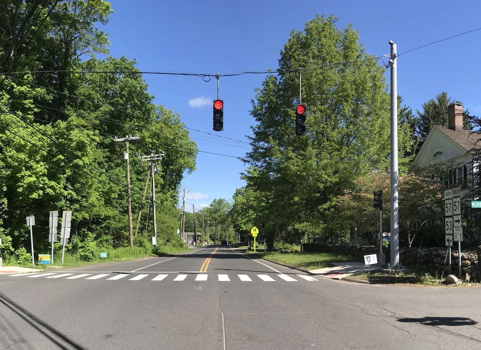

 North Bound Gateway into Weston Center

Table of Contents Introduction 1 Conditions Assessment 2 Site Conditions 2 Transportation 2 Projects on the Horizon 3 Community Engagement Process 6 Town Survey 6 Use Areas 6 Illustrative Concepts 9 Preferred Conceptual Plan 11 Community & Civic Space 11 Green Spaces & Placemaking 11 Expanded Commercial Uses 11 Pedestrian Amenities 11 Car Traffic & Parking 14 Recommendations 14 Zoning Tools 14 Zoning Recommendations 16 Municipal Development 17 Conclusion 27

Milone & MacBroom Inc. (MMI) to is preparing a 2020 Plan of Conservation and Development (POCD) for the Town of Weston, Connecticut. As a part of this process, the project team was charged to give in-depth consideration to and provide recommendations for enhancing Weston Town Center, approximately 72 acres around the intersection of Norfield Road (CT-53) and Weston Road (CT-57).
This area was featured prominently in the 2010 POCD. During that POCD process, it was clear that residents were interested in more commercial development in town, but only in the immediate vicinity of the existing Shopping Center. According to the 2010 POCD, “Support for additional commercial development both in the public and on the Committee, stems from the desire for additional services and places to gather as a community.” Over the course of the current planning process, similar desires were expressed and elaborated upon.
Unlike many traditional New England communities, Weston lacks a town green or town center that would have historically functioned as the hub for civic, commercial, and community activity. Through the Town Survey and the outreach efforts of MMI, it became clear that the vast majority of residents want a location to serve these functions. It is the intent of this report to provide actionable recommendations for achieving a shared vision for this area, which serves all current and future residents.

The Weston Town Center Master Plan is a road map that the Town of Weston can follow to achieve the Community’s collective vision for a Town Center. The Weston Town Center Plan has two components: the Preferred Conceptual Plan and Implementation Recommendations. This Plan is aspirational in nature and depicts the overall vision for the Town Center. It shows the layout of sidewalks, buildings, green spaces, parking areas, and public amenities and reflects what the Town Center strives to be. It is important to keep in mind that the Town Center Plan is conceptual in nature and that actual development may not look exactly like what is depicted on the Plan. Development will occur over time, and therefore, the Plan needs to be flexible so that it can adapt to unknown future economic conditions, consumer preferences, technological capabilities, and demographic characteristics as well as the unique features of each development site. However, it is important that the underlying guiding principles of the Town are adhered to as development occurs over time. The Implementation Recommendations are a road map that outlines the steps that are needed to achieve the vision depicted in the Plan.

Weston Center Plan 1
Introduction
Introduction
Weston Town Center Master Plan Study Area
Conditions Assessment
Conditions Assessment

The area considered in this assessment concerns 17 parcels on approximately 72 acres of land surrounding the intersection of Norfield Road (CT-53) and Weston Road (CT-57). 6.6 acres of this area are zoned for commercial use and are the only lands zoned for commercial use in all of Weston. All other land is zoned for residences and agricultural uses with a minimum lot size of 2 acres. In addition to commercial uses, the Town Center area includes municipal functions (Town offices), community spaces (the public Library, Hurlbutt Elementary School, the Senior Center, playing fields, and churches), as well as residences and offices, which are on lots of less than one acre.
The Town Center sits on the western side of RT 57, near the border with Wilton, and slightly south toward the border with Westport. While not the geographic center, this area has been the historical and cultural heart of Weston since its founding, anchored by the Norfield Congregational Church. It should also be noted that the southern portion of the study area partially overlaps with the Norfield Historic District.
Site Conditions
The topography of Town Center is mostly level. The area contains a small, unnamed watercourse and several wetlands that, combined with their respective upland review areas, make a large portion of the area unsuitable for intensive development. Weston does not have public water or sewer in this area, further limiting how much development the area can sustain. However, most of the Town Center has suitable soil types for septic systems.

Transportation
Vehicular access to the Town Center is provided by the two main thoroughfares. Average daily traffic counts from the Connecticut Department of Transportation (CTDOT) estimate that 12,100 vehicles per day traverse Weston Road/RT 57 near the Shopping Center. Currently there are circulation, access management, and parking issues throughout the area and especially in the Shopping Center.
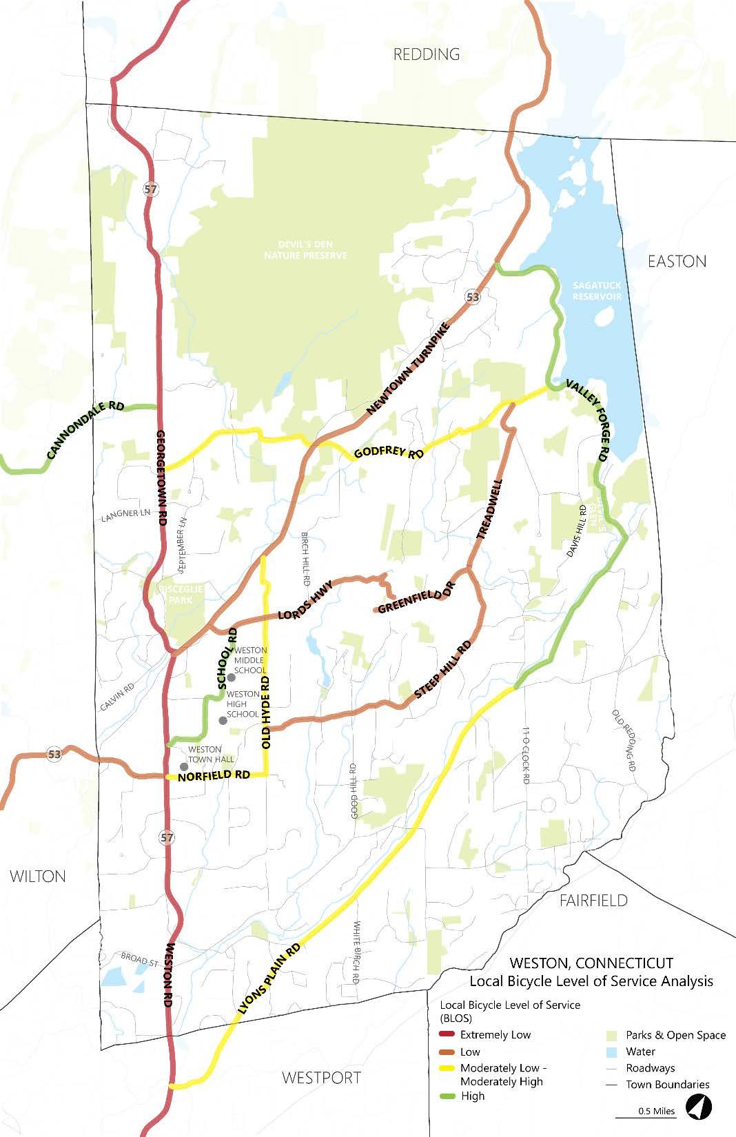
Taking into account the local roadway character, which includes winding countryesque roads, MMI developed a local bicycle level of service analysis. High levels of service can be found on School Road, but extremely low levels of service can be found on Weston Road and on other roads in and around the Town Center.
Site Conditions
Weston Center Plan 2
Conditions Assessment
Walking conditions are also less than ideal with a disconnected sidewalk network and a lack of safe street crossings.
Transportation issues in the Town Center have been well documented. In 2012, the intersection of Weston Road and School Road was studied by the WESTCOG, regional planning agency. In 2016, CTDOT conducted a Town Center Road Safety Audit (RSA) of the existing conditions of walking and biking routes, and identified the issues that discourage or prevent safe walking and biking. These two documents established specific areas of concerns and needs for the Town Center area.

Building upon the recent planning efforts and the RSA, Weston pursued and was recently awarded grant funding to improve transportation issues from the Local Transportation Capital Improvement Program (LOTCIP) and the Connecticut Community Connectivity Grant Program (CCCGP). The projects funded by these grants aim to construct a pedestrian network, as well as provide traffic relief on Weston Road at the entrance to School Road by improving that intersection. This entails creating a 150-foot right-turn lane on the north bound side of Weston Road’s approach to School Road, building a “bump out” on the south bound side to relieve congestion, and replacing the traffic light and improving its timing.
The Town is also in the process of pursuing additional grants and funding opportunities such as the Transportation Alternatives (TA) Set-Aside Grant for pedestrian improvements.
Projects on the Horizon
Several projects may further shape the Town Center in the near future. The Senior Center was recently studied for anticipated future needs, which may entail an expansion and the Library is considering an addition that would include a makerspace. The Beautification Committee is redesigning the landscape in front of the Town Hall to create a Town Green, and Veterans Memorial. EMS facilities are as well being considered for improvements. Phase 1a of the Weston Schools Master Plan was recently completed. The Board of Education is now evaluating alignment options for three schools as part of the next phase. These projects indicate growth and investment in Weston and further highlight the importance of the Town Center area.

Weston Center Plan 3
Vehicle
Pedestrian Circulation
&
Conditions Assessment


Weston Center Plan 4
Pedestrian Mid-block Crossing on RT 57 into the Shopping Center
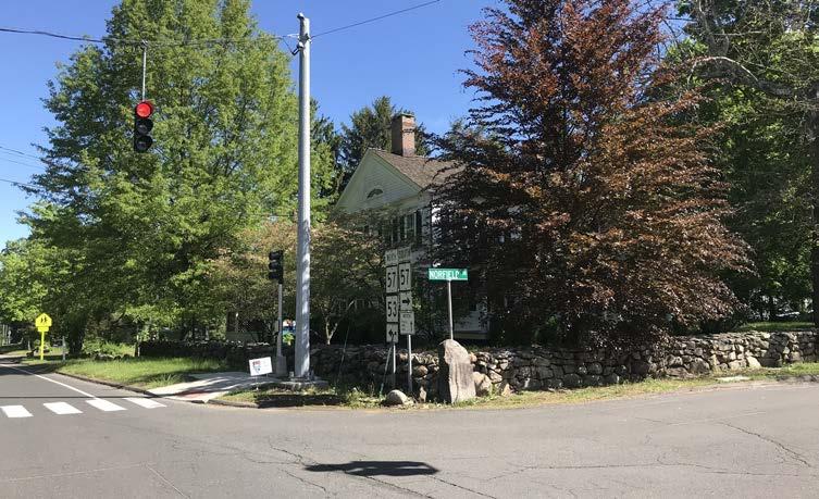
Accessible Drop Ramp without Sidewalk Connection at the Corner of RT 57 and Norfield Road
Conditions Assessment
Horizontal & Vertical Road Alignments and a Lack of Roadway Shoulder Limit Safe Bicycle Activity
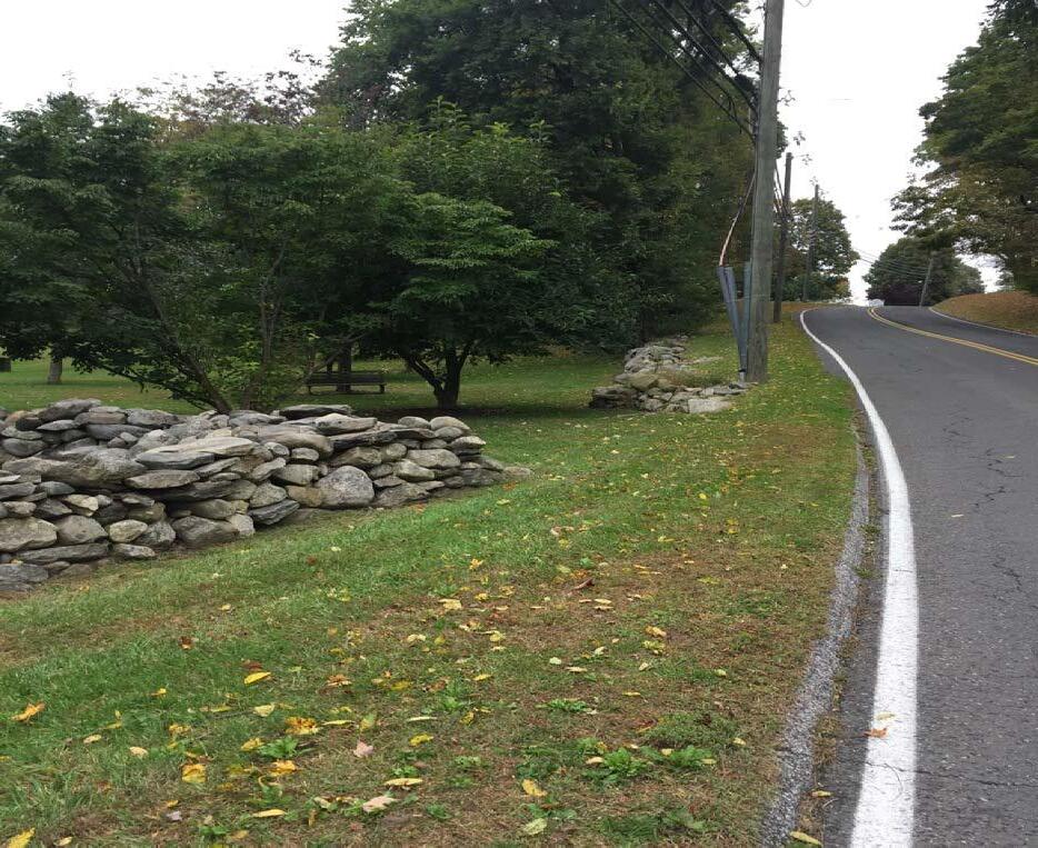
Non-handicap Accessible Access to Destinations in the Town Center


Weston Center Plan 5
Community Engagement Process
Community Engagement Process
To create a vision for the Town Center, the project team engaged in an iterative planning process of public engagement. The team also met with property owners and key stakeholders in the Town Center area.
Town Survey
Initiating this process, the Town of Weston Survey Committee created and launched a town-wide survey, which was open from November to December of 2018. The online survey gauged the opinions of over 2,500 respondents on a wide range of issues relevant for the future of the Town. From the survey, the importance of and opportunities within the Town Center were underscored. Respondents’ highest land use priority was Town Center, especially as it relates to retaining current and attracting new businesses. Approximately 70% of respondents felt that the area needs more amenities and needs to be more attractive and walkable.

Making Weston more bicycle and pedestrian friendly was the second highest land use priority. 71% of respondents felt there were too few sidewalks and over 50% felt there were too few biking trails. Sidewalks and bike lanes were identified as the top infrastructure needs in town. Crossing Weston Road was also a major concern for respondents. The results of the survey guided the project team as they created conceptual plans.
Use Areas
The project team conducted a public Discovery Session workshop in April 2019, attended by over 120 town residents. An online version of the workshop was also available for those who could not make it to the in-person workshop. The focus of this workshop was to determine what residents would like to see in the opportunity areas within the Town Center, as well as expound on traffic and pedestrian issues identified in the Town Survey.
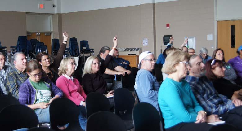
Workshop participants agreed that food service businesses, small medical offices, and a community center are desirable for the Town Center. Participants were split in their opinions of other retail, housing, and professional offices. Personal services like gyms and beauty salons, as well as a town pool were not desired within the Town Center. However, the town pool may warrant some discussion as a part of the broader POCD process. When discussing transportation, participants brought forward many of the themes from the Town Survey. They

Weston Center Plan 6
M.S. Wirtenberg
M.S. Wirtenberg
Community Engagement Process
agreed that improving pedestrian access to the Town Center, especially crossing Weston Road, was important. They also had concerns regarding the traffic flow on School Road and navigating through the Weston Shopping Center. Participants nearly all agreed that the school bus depot should be relocated outside of the Town Center.


The team presented three generalized conceptual use plans for consideration. Common elements that most participants agreed upon across the three plans were; adding more commercial space, in particular having four corners of commercial space around the intersection of Weston and Norfield Roads; creating placemaking gateways to the center; relocating the bus depot and using that land for a community space; preserving historic structures; and creating a sidewalk network.
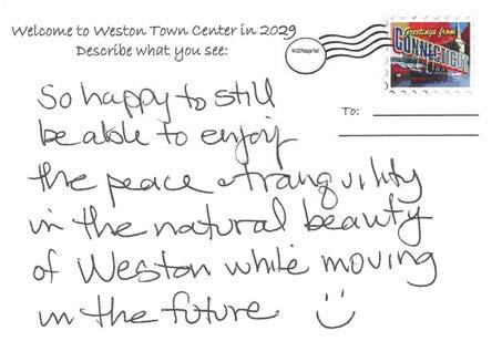
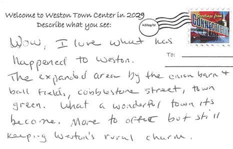
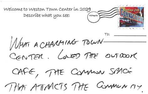
When asked to write how they would like the Town Center to look in 10 years, participants repeated many of the same adjectives; beautiful, vibrant, quaint, charming, antique, heritage, bustling, and rural. It was in that spirit that the project team created the illustrative conceptual plans.
Opportunity Areas

Weston Center Plan 7
M.S. Wirtenberg
Community Engagement Process





Weston Center Plan 8
Community Engagement Process
Illustrative Concepts

In May 2019, the project team presented two example concepts of how the Town Center could develop if different standards and strategies were employed. The intention was to build consensus about what the goal for the Town Center should be, and what kind of look and feel would unify the space. In this workshop, participants indicated their design preferences and discussed different configurations of buildings. They were also given the opportunity to do so online.


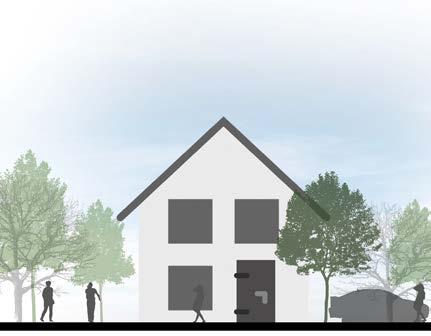
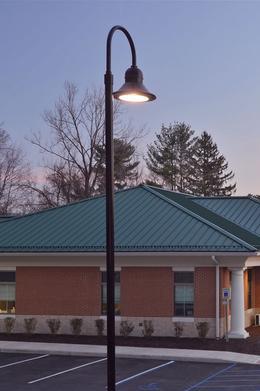
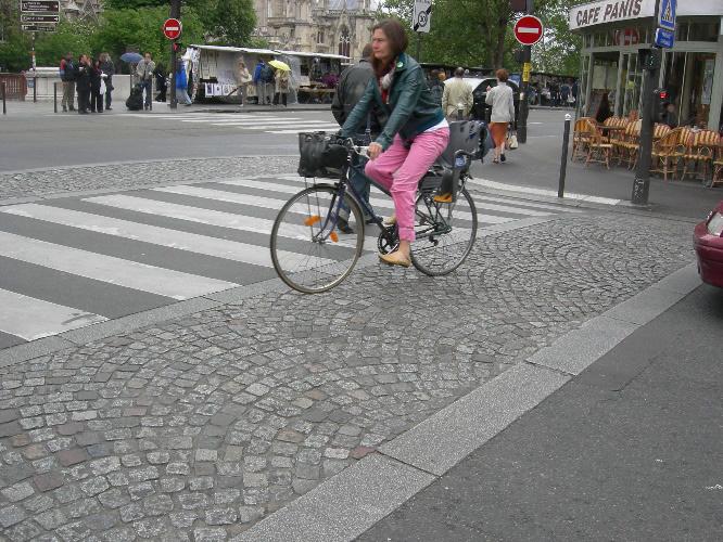
Common elements that the majority of participants agreed on were; parking should be away from the road, behind buildings; new buildings should be restricted to 2.5 stories; new buildings should be in the contemporary farmhouse style; pedestrian plaza spaces outside and between buildings linked together by walkways; and in prominent and visible locations the new streetscape should include high-end finishes that reflect the historic nature of the town.

Weston Center Plan 9
M.S. Wirtenberg
M.S. Wirtenberg
Illustrative Concept Example
Community Engagement Process

Contemporary Farmhouse
Contemporary Farmhouse

2.5 stories
2.5 stories
Contemporary Light Poles
Contemporary light poles
Stone Hardscape
Stone hardscape
Naturalized landscaping
Naturalized Landscaping


Cobblestone Crosswalk
Cobblestone Crosswalk

Seating in front of building along sidewalk (building setback from sidewalk)
Seating in front of building along sidewalk (building setback from sidewalk)
Contemporary bench Contemporary Benches

Contemporary Receptacles
Contemporary receptacles


Weston Center Plan 10
Preferred Concept
Preferred Conceptual Plan
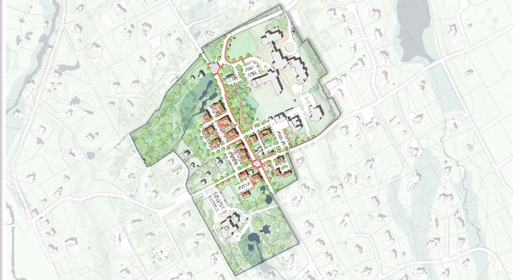
Through the feedback received from stakeholders, the Town Survey, and the workshops, it was clear that the community is calling for a pedestrian-focused center that caters to residents and fills critical gaps in services and resources. The project team developed a preferred concept for the Town Center. This concept takes the elements for which participants found consensus and imagines what the Town Center would like look if these elements were fully implemented. The Preferred Concept Plan revolves around creating a community-centered place that balances the Town’s civic and community uses; with well-designed parks and green spaces balancing the new mixed-use commercials spaces. An improved pedestrian network of sidewalks will be created to connect residents not only within the Town Center but also beyond.
Community & Civic Space
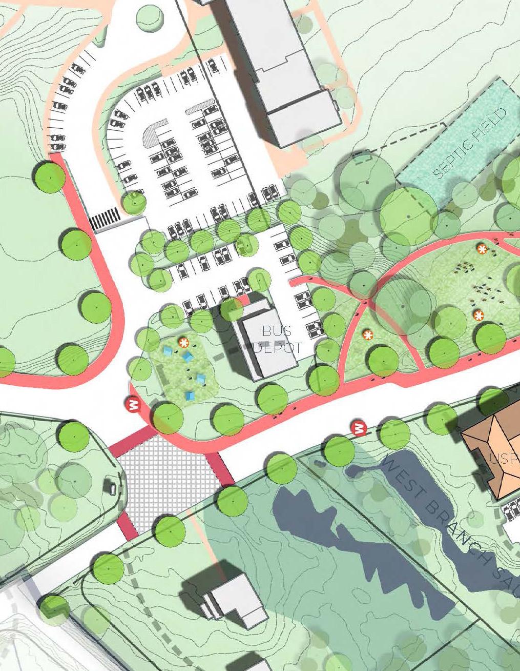
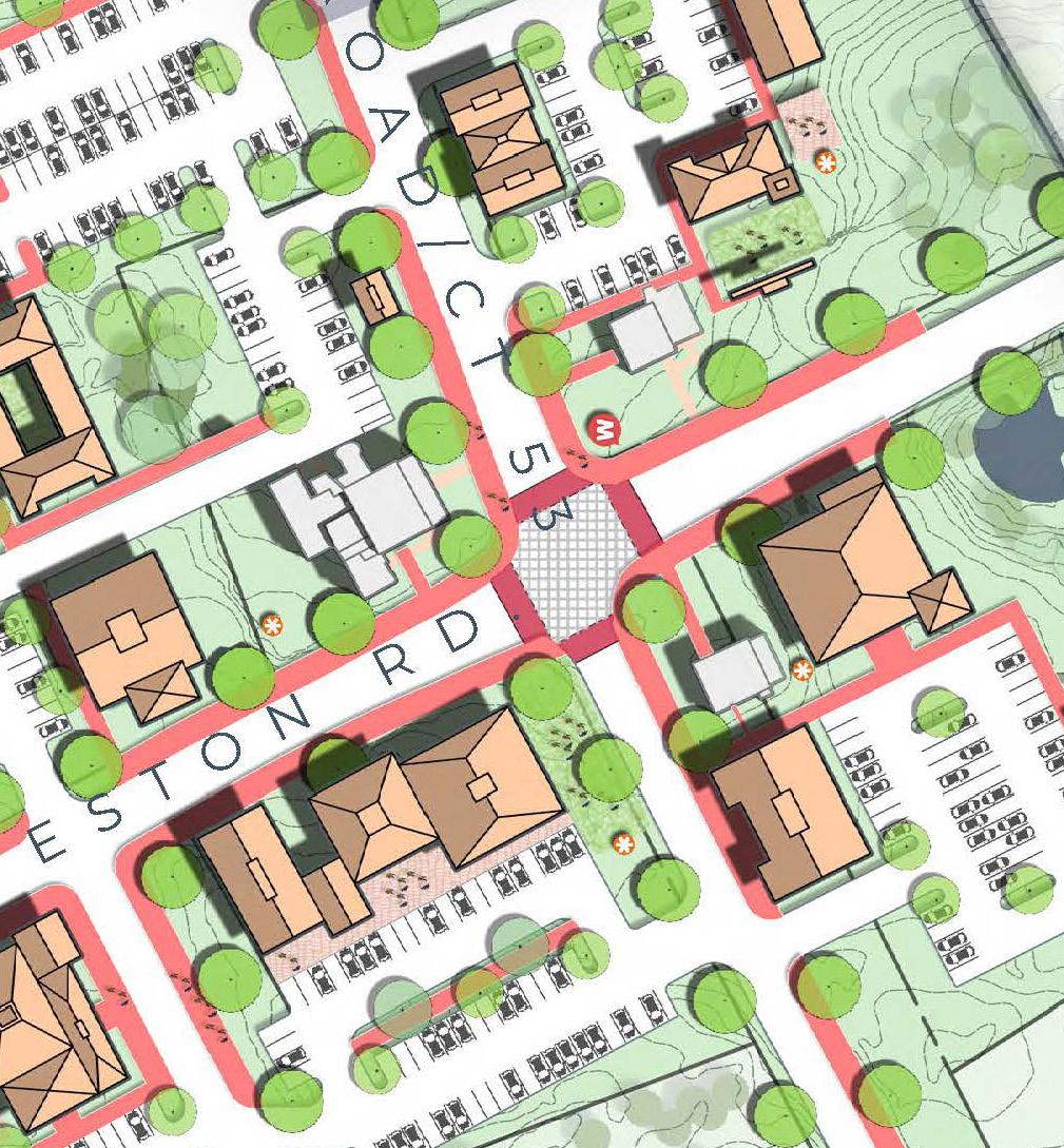
The Preferred Concept includes new and expanded spaces for community and civic functions. The Onion Barn is relocated to Norfield Road to create a gateway statement (#8). The Onion Barn’s current location then becomes the location of a new 2-story municipal or commercial building (#10). Associated parking has been added. The bus depot is converted from its current use to a community/art center with an outdoor event space (#14). Dedicated parking has been added. The function of the bus depot is moved to another location away from the Town Center.
Green Spaces & Placemaking
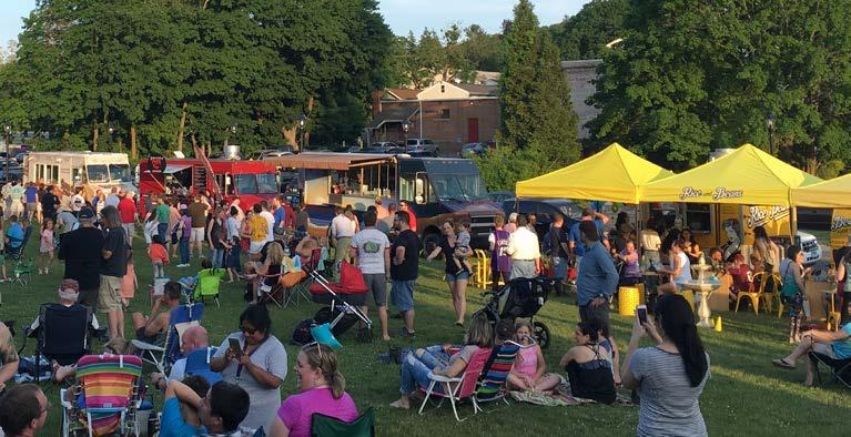
Along the east side of Weston Road, a “central park” has been created that will connect the community/art center to the Town Hall and Shopping Center (#13). A masonry wall and landscaping has been installed to separate the public park from the school. This park not only provides pedestrian connections, but also allows many opportunities to exhibit outdoor sculpture and host community events. At the southern end of the park there is a loop for pick up/drop off for events or that can be used as dedicated food truck parking to further activate the space (#15). In addition to the public greenspace, the Preferred Concept includes opportunities for plazas and outdoor dining associated with new businesses and uses. These areas provide additional opportunities for people to enjoy the rural landscape. Throughout the Town Center there will be landscape features that lend to the sense of place. Perhaps the most visible of these features is the gateway elements on either end of Weston Road (#3). These not only identify Town Center but also invite people to walk in the heart of the community.
Expanded Commercial Uses

New commercial space has been expanded to new properties in the Preferred Concept. The three historic colonial homes around the four corners are converted to commercial space (#4, 7, 9). On the larger lots, small buildings are added as infill and have a commercial use (#4, 7). Dedicated parking is provided on each lot. On the northwest corner, the existing home has been razed, and 11,000 square feet of new commercial building has been constructed (#5). Along with this new construction and the infill on the other three corners, an additional 32,500 square feet of new commercial area has been constructed around the four corners. The Preferred Concept also envisions the Weston Shopping Center reconfigured to integrate better with Weston Road (#1). The Concept includes six 2-story buildings with approximately 26,000 square feet of commercial space. The second stories host offices and residences. Along with the buildings, the parking has been reorganized. Interior sidewalks in the Shopping Center connect the outdoor plazas to the sculpture park across Weston Road. It is estimated that if partially or fully implemented, the Preferred Concept could provide between 30,000 and 60,000 square feet of additional commercial space.
Pedestrian Amenities
In addition to an improved streetscape, the Preferred Concept includes many improvements to the pedestrian experience. At both intersections in the Town Center, decorative crosswalks with intersection streetprint have been installed (#3). By making the intersections visually distinct from the roadway, motorist will more easily recognize them as pedestrian crossings and will be more aware of people moving through the spaces. Weston Road is refreshed with new sidewalks, street trees, and lighting (#2). “Sharrows” have been painted on the roadway to warn motorists to be aware of bicyclists. The existing crossing has been improved and includes plazas at either end. The eastern plaza connects to the open lawn and linear sculpture park along Weston Road (#13). The new central park links schools and the Senior Center with the Town Center core. On the park’s eastern edge there is a 2-foot masonry wall or fence with a vegetative buffer, separating the school from the park.
Weston Center Plan 11
Preferred Concept


Weston Center Plan 12
Preferred Concept

The Intersection of Norfield & Weston Roads Imagined

Weston Center Plan 13
Recommendations
Car Traffic & Parking
Along with the parking constructed for the new commercial, community, and civic buildings, the Preferred Concept doubles the size of the parking lot for Town Hall (#11). Attached to the Town Hall parking area, a dedicated pick-up/ drop-off loop has been added (#15). This area can also serve as food truck parking to support community events in the new park. The Preferred Concept also includes overflow parking at both churches with sidewalks connecting to Town Center (#6). The Concept also illustrates the anticipated School Road intersection improvements from the LOTCIP grant.
Recommendations
To enable positive change to occur the Town Center, Town leadership can employ several strategies and initiatives to spark private and public projects.

Zoning Tools
Zoning refers to laws and ordinances that regulate land use in a given jurisdiction. It can govern the allowable use of land, regulate lots and structures by dimensions, and influence and guide development decisions. Changes to the existing zoning regulations are incumbent upon the Weston Planning and Zoning Commission to vet and adopt. The zoning tools described here are presented as a starting point for these discussions.
Traditional Zoning
Traditional Zoning focuses on the separation of land-use types, permissible property uses, and the control of development intensity through numerical parameters (e.g., Floor Area Ratio, dwellings per acre, height limits, setbacks, parking ratios, etc.). Development quality, scale, and uses allowed in a given area are dependent on a community’s planning objectives which are translated through local land use regulations including zoning, building, and public infrastructure standards. Some uses can be permitted “as of right,” meaning they require no special review, while others can be designated as “conditional” uses that require a public hearing in which special conditions may be created to address a project’s unique impacts.
Design Guidelines
Design guidelines may be used to supplement traditional zoning but are typically advisory. Under design guidelines, new projects have the responsibility to sensitively respond to their context and existing patterns of development while being of their moment. They are not intended to prescribe solutions or limit creativity, but rather to establish a flexible aesthetic framework that respects the town’s past, addresses its present needs, and encourages innovation in the future.

Weston Center Plan 14
Recommendations
Design guidelines can provide a series of recommendations for topics including but not limited to:
• Architecture
• Landscaping
• Materials
• Open Space
• Sense of Place
• Site Development

• Sustainability
With traditional zoning, design guidelines define the goals and principles for a location. As projects are implemented with design guidelines, the identity of space will be reinforced.
Village District
State law allows municipalities to establish village districts. Village district regulations can be integrated into the existing zoning regulations. Village districts enable greater local control over the design and construction, or rehabilitation of buildings than traditional zoning alone. It provides an extra layer of control for local zoning commissions to protect the distinctive character, landscape, and historic structures within the district.
A village district is established though an amendment to zoning regulations. It requires that all applications for new construction and substantial reconstruction in the district that are visible from the road must undergo architectural review. An architect or architectural firm, contracted by the commission and designated as its consultant for the application, must conduct the reviews and submit their recommendations to the commission within 35 days after the commission receives the application. The consultant’s report must be entered into the public hearing record and the commission must consider it in making its decision. Traditional zoning does not usually incorporate such reviews.
If the district is created, the construction of new buildings and demolition of existing buildings require a certificate of appropriateness from the commission, as does the alteration of exterior architectural features of existing buildings. State law specifies the factors the commission must and may consider in making its decision.
If a municipality establishes a village district, the new regulations must provide that:
1. Proposed buildings and modifications to existing buildings be harmonious with their surroundings and their terrain, and to the use, scale, and architecture of nearby buildings to which they are functionally or visually related
2. Spaces and structures visible from the road be designed to enhance the visual amenities in the area around the proposed building or modification
3. The characteristics of residential or commercial property, such as its color and materials, be evaluated for their compatibility with the local architectural motif, and the maintenance of views, historic buildings, monuments, and landscaping
4. Removal of or disruption to historic, traditional, or significant structures or architectural elements be minimized
Under State law, all development in the district must be designed to meet various compatibility objectives. Among other things, the arrangement and orientation of any proposed building or site improvement must be like those in the immediate neighborhood; and exterior signs, lighting, and accessory structures must support a uniform architectural theme and present a harmonious relationship to the neighborhood. However, it does not guarantee that construction and alterations in the district will be historically accurate.
A village district can also include the maintenance of public views; the design, paving materials, and placement of public roads; and other elements the commission considers appropriate to maintain and protect the district’s character. Village district regulations can cover open spaces as well as buildings.
Several municipalities have established village districts, including Chester, East Haddam, Madison, and Ridgefield, just to name a few.
Weston Center Plan 15
Recommendations
Zoning Recommendations
Through the public outreach process, it is clear that many Weston residents are in favor of expanding commercial zoning within the Town Center area and revising the existing commercial zoning regulations. It is understood that the Planning and Zoning Commission will undergo further study and public discussion on zoning implementation. The recommendations below should be viewed as a starting point for those discussions.
Configuration
All the properties abutting Weston Road from the intersection of School Road to the intersection of Norfield Road should be zoned as commercial. The properties on the four corners of the intersection of Weston Road and Norfield Road should also be zoned commercial.
To encourage a lively pedestrian environment, it is recommended that the zoning stipulates the ground floor of buildings will be used for commercial uses, like food service and retail, while the upper floor may be used for office or residential uses. The arrangement will also help create a concentration of employers, customers, and residents in the Town center, further improving housing options and improving the market feasibility of development.
Participants in the workshops supported having outdoor spaces for commercial use between the sidewalk and the building. To achieve this, it is recommended that the Town Center zoning encourage a minimum setback of 10 feet and maximum setback of 20 feet.
Due to Weston’s limited transit options, parking will play an important role in the success of the Town Center. One of the key elements of this Master Plan is to diffuse parking and create an environment that encourages people to walk to and from points of interest and maintains the small-town rural character that Weston desires. While parking will be essential, large parking lots detract from the Town Center’s sense of place. To maintain this balance, shared parking agreements between property owners should be encouraged, especially with properties with large lots and limited hours of operation, like the two nearby churches.
The Planning and Zoning Commission should give consideration for shared parking provision, which is a tool through which adjacent properties share their parking lots and reduce the number of parking spaces that each would provide on their individual properties. Shared parking is not a new concept. In fact, it has been used extensively in neighborhood commercial zones, town centers, and downtowns for decades. Shared parking is particularly effective when adjacent land uses have different peak hours of parking demand such as when municipal uses overlap with evening restaurant uses. The two main approaches to shared parking are contractual agreements between adjacent uses and through the creation of a parking management district.
Another way to help preserve and protect the small-town character is by regulating the placement of parking. By not only diffusing parking but also placing it behind buildings, the appearance of a small-town main street is enhanced. The zoning regulations should stipulate that parking must be placed behind and to the rear of buildings.
Scale
To maintain Weston’s rural charm as it develops, the scale of development must be carefully considered. It is recommended that the following restrictions be included in the zoning for new commercial uses:
• Individual buildings may not exceed 11,000 square feet in area.
• All buildings on a parcel may not exceed 25% coverage of their respective parcel.

• Buildings may not exceed 2.5 stories in height.
Uses
As a starting point, it is recommended that zoning allows for the uses that were positively received in the public outreach sessions, such as food service uses, namely restaurants and dining, coffee shops, bakeries, ice cream shops, as well as pubs and bars. Medical offices and community spaces were also desired for the Town Center. Participants were split on their desire for retail, housing, and professional offices, however it is recommended that these uses are allowed in order to encourage a vibrant and diverse experience. We also recommend that outdoor seating for food service uses be allowed within the new zoning.
Weston Center Plan 16
Recommendations
Implementation
In regard to the zoning tools listed above, it is recommended that Weston’s commercial zoning is amended, and that design guidelines are adopted. Much of the function of a village district is accomplished through the historic district that covers the southern portion of the Town Center. In addition, a village district may be too restrictive, cumbersome, and at this time would be premature, limiting the aesthetic improvements to the Town Center. Once the Town Center is established, a village district may be more appropriate.
Municipal Development
While revising the zoning enables private enterprise to develop privately held properties, much of the Town Center area is under municipal control. This allows for much of the Town Center to move into the future without waiting for the mechanics of private investment.
Relocation of Municipal Services

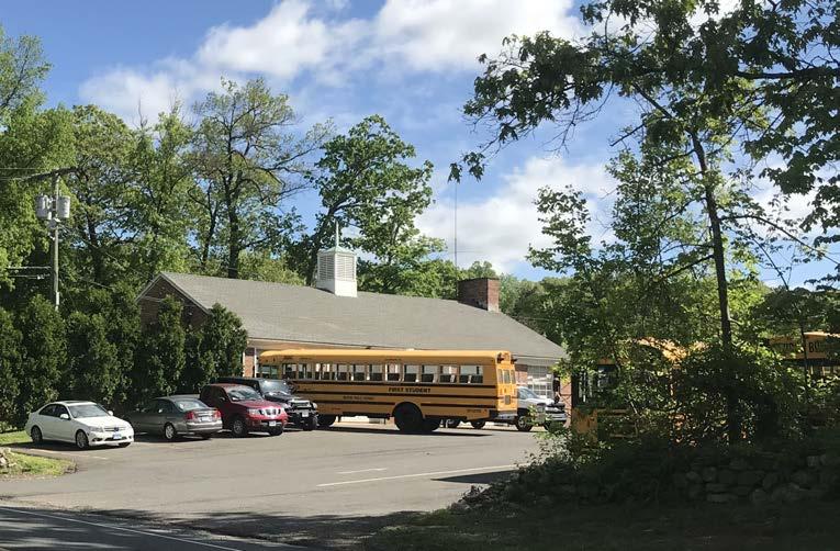
Relocating and reorganizing some municipal services will create opportunities for more engaging uses in this area. There is overwhelming support for moving the bus depot from Town Center. The Town should assess the property to determine the appropriateness and cost associated with the reuse of this structure as a community space. The Town should conduct a facility condition assessment that includes a Phase I ESA and a hazardous building materials assessment in order to understand the cost and applications for reuse.
The Parks and Recreation Department currently occupies one of the four corners at the intersection of Weston and Norfield Roads. There is no advantage to that specific location for the Department, enabling it to be moved. Once the department is moved, the Town could sell the property for reuse. As departments are moved and spaces are reassessed, there is potential for some municipal functions currently in the Town Hall Annex to move into the Town Hall proper. Prior to the development of the east side of Weston Road as a community park with a sculpture walk, the current ballfields will have to be relocated. The Town should conduct a site selection analysis for additional areas in the community for the relocation of these fields.
Improve Pedestrian Environment
One strategy to fast track the implementation of the Town Center Master Plan is to focus on creating the pedestrian infrastructure to better connect pedestrians within the Town Center. To ensure a unified pedestrian environment, the Town will likely have to take the lead and improve these areas in Town Center. The recently received grant funding will jumpstart this process. The LOTCIP grant will address some of the traffic concerns on School Road, and along with the CCCGP will begin the construction of the sidewalk network. Following the Master Plan as a guide, the Town should continue to seek funding to improve pedestrian crossings and sidewalk connectivity. Coupled with the improved pedestrian environment, the Town should seek to implement unified wayfinding signage and gateway improvements to strengthen the sense of place.

Weston Center Plan 17
Lack of Sidewalks Leading to Crosswalk
Recommendations
Phases of Development

The Weston Town Center Master Plan envisions new development through renovation of existing buildings and new construction; however, as with any master plan, change occurs incrementally over an extended period of time due to market factors and the interest and willingness of property owners. Therefore, the plan was broken down into phases. The initial phase is likely to happen over the next 5 to 10 years, and the success of these projects will make the later development phase more viable. The phases of development also help organize and prioritize the Town’s implementation efforts, site acquisition, assembly, and other tasks.
It is important to note that development may not occur sequentially as laid out in the Phasing Plan. Rather, the Phasing Plan is intended to direct the Town’s focus in making the Master Plan come to fruition. As market conditions and other circumstances change, later-phased projects may be easier to implement than earlier-phased projects.

Grant Funded Sidewalk Improvements

Weston Center Plan 18
Implement funded transportation projects
Phase I: Laying the Groundwork
Phase I of the Weston Town Center Master Plan is to complete ongoing and funded projects as well as prepare for future projects.
Maintain Momentum
Implement funded transportation projects (LOTCIP and CCCGP).

These projects will ease congestion on Weston Road and will begin the much-needed sidewalk network in the Town Center. The sidewalks depicted in the Preferred Concept expand upon the work that will be initiated by these two grants.

Weston Center Plan 19
Revise Zoning Regulations

The Planning and Zoning Commission should work to create the Commercial Zoning District Map and revise Zoning Regulations.

Weston could follow the leads of many Connecticut towns and not only revise their zoning but also create design guidelines for the Town Center with assistance from the Historic District. Towns like Guilford, New Canaan, Old Saybrook, and Old Lyme have all worked to create such standards.

Weston Center Plan 20
Proposed New Commercial Zoning District Shops on the Green, Guilford, CT
Complete Memorial Town Green Project

With the Beautification Committee, complete the design and construct the Memorial Town Green Project.
“Weston Town Green has been designed to be an enhanced civic space on Weston Town Hall’s front lawn. An elliptical path leads visitors to a new war memorial and memorial garden, a refurbished gazebo and new park benches. In addition to a hardy lawn replacement, an extensive planting program will feature a red, white and blue perennial garden,
a pollinator meadow and a copse of red bud trees. Sponsored by the Town of Weston’s Beautification Committee and supported with private donations, the Town Green has been designed as a gift to the town by Thiel Architecture + Design.” – Nancy Thiel

Weston Center Plan 21
Reorganize Municipal Property
Work with various Town Departments to efficiently reorganize municipal property.

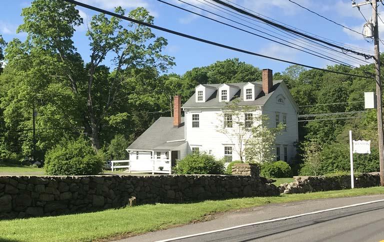
This will entail finding a new location for the Parks and Recreation Department. It may also include future improvements to EMS facilities and the relocation of offices from the Town Hall Annex to the Town Hall proper.


Weston Center Plan 22
Assess Bus Depot Options

Work with the Board of Education to assess the options for the Bus Depot.
While many residents agree the bus depot should be moved, figuring out where it should go and what the property should become will be a larger problem to tackle.
o Conduct a study to identify a new location for bus depot and develop costs associated with relocating the operation.
o Assess existing bus depot building for community reuse.
o Develop a community vision for the property that identifies the preferred community uses to be housed at this location.
o Conduct a facility condition assessment of the current bus depot to understand the fit and constraints, and cost to reuse the facility.
o Develop an operational plan for reuse of the bus depot site.
Weston Center Plan 23
Sculpture Park

Fund and conduct a design process for implementing the sculpture park.

The design for the park should include building a barrier to contain school children and prevent unauthorized guests from entering the play area. Pieces or exhibits for the park should be selected by a local arts and culture commission. Madison, Connecticut is an excellent example of a successful public art program. In addition to designing the new park, a new location for the displaced ball fields must be identified and the new fields need to be designed and constucted.

Weston Center Plan 24
Town Hall Parking Lot
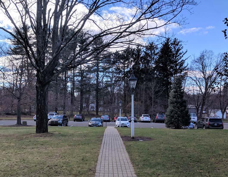
Fund and conduct a design process to reconfigure the Town Hall parking lot and add an access point on Weston Road.


The Preferred Concept configuration adds an additional 45 parking spaces to the municipal campus and provides additional access on Weston Road. There is a loop for pick up/drop off for events or that can be used as dedicated food truck parking for community events and gatherings in the new park. No matter what design is chosen, these features are recommended.
Weston Center Plan 25
Food Truck Friday, Bethel, CT
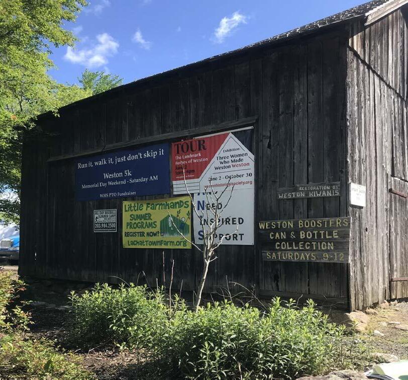
Relocate the Onion Barn
Work with the Historic Commission to find a new location for the Onion Barn.

The Onion Barn could be an excellent component of a gateway element for the Town Center. In a more appropriate location, it could not only set the historical tone for the Town Center but also continue to serve its more contemporary function as a message board for local news and events.
Weston Center Plan 26
Recommendations
Phase II: Digging In Phase II of the Weston Town Center Master Plan takes the project plans created in Phase I to fruition.
At the Parks and Recreation Department Property:
• Relocate the Parks and Recreation Department.
• Develop a Request for Proposals (RFP) for developers for the Parks and Recreation Department property.
• Select a development proposal for the Parks and Recreation Department property.
At the ball field:
• Construct the new park.
• Develop programming and identify lead organization for sculpture walk.

At Town Hall:
• Implement the Town Hall parking lot plan. In the Preferred Concept, circulations issues are alleviated and 45 additional spaces are added.
• Fund and construct the Memorial Walk Town Green project.
Along the street:
• Fund and construct additional streetscape elements such as lighting, planters, wayfinding signage, street furniture, etc. Additional streetscape elements should be prioritized according to the Sidewalk Plan and available funding.
• Work with the Historic District and the Beautification Committee to develop a style guide for public realm amenities. The images from the visual preference session on page 10 is a good starting point for this work.

• Work with the Historic district to relocate the Onion Barn.
Conclusion
Weston has enormous potential to enhance the community’s quality of life through the Town Center. This plan lays out a road map of how the community’s aspirations for this area could be accomplished. By setting the zoning and design framework, improving the pedestrian infrastructure, and highlighting properties for reinvestment, the Town can serve as the catalyst for positive progress. Changes of this nature will take a number of years and require continual collaboration between Town officials, boards, commissions, stakeholders, and residents. Together these parties can contribute to a stronger Center and Weston community.
Weston Center Plan 27
M.S. Wirtenberg


