6 minute read
Challenge Accepted: Hiking at La Salle Lake State Rec Area


Story & photos by Jan Lasar
YOU CAN FIND LAKE LA SALLE STATE RECREATION AREA (LSLSRA) FIVE MILES NORTH OF ITASCA STATE PARK AND ABOUT TWENTY MILES SOUTHWEST OF LAKE BEMIDJI STATE PARK. PART OF THE SRA IS THE SCIENTIFIC AND NATURAL AREA (SNA) BY THE SAME NAME JUST TO THE NORTH, WHICH ALLOWS YOU TO SEE THE FLEDGLING MISSISSIPPI FROM A SCENIC OVERLOOK. BOTH ARE MANAGED BY THE MINNESOTA DEPARTMENT OF NATURAL RESOURCES (MNDNR).

Th e star of the show is La Salle Lake, which is Minnesota’s deepest in-state body of water at over 200 feet. Th e 11-mile hiking trail system is a close second.
Th e 39-site campground has full hookups and there’s a shower house with individual shower rooms and a laundry room. If camping isn’t for you, LSLSRA has two well-equipped guesthouses for rent.
We woke up Saturday morning to rain drumming on the roof. Feeling adventurous, we left for the Challenge Trail when the rain let up. According to our research, this path around boomerang-shaped La Salle Lake promised to be steep, rugged and remote and included two wet, bridge-less water crossings. Challenge Accepted.

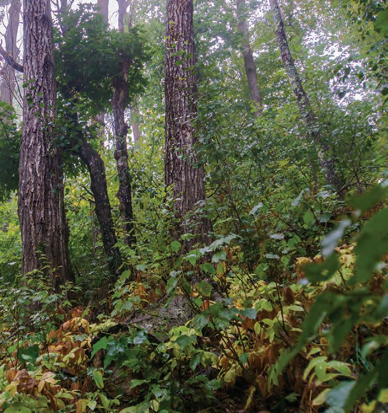
Th e trail starts right by the campground bathroom building and we began working our way around the lake—but not without using the boot scrubbing station to keep invasive plant seeds in check. Th e trail was very narrow and intimate and it


WORLD FAMOUS ITASCA STATE PARK
Paddle the Crow Wing River Water Trail or one of over 400 lakes to enjoy fall colors from a new perspective. Rentals are available and lodging amenities abound to make your trip enjoyable.
218-237-4111

www.parkrapids.com • #VisitParkRapids
really did feel off the beaten path. Th e campground noises soon disappeared and we started getting deeper into the woods. What had been a light sprinkle turned into an actual rain after a while, but we were sheltered from the worst of it by a dense canopy of trees. As we walked along a high ridge, we caught glimpses of the lake. Th e MNDNR website describes the habitat at LSLSRA as having “high and outstanding biodiversity signifi cance.” To us it meant a constantly changing landscape. One minute the trail was lined with maples and other deciduous trees, reminiscent of Maplewood State Park. Th en it changed to a nearly impenetrable palisade of young aspen, followed by stands of huge pines reminiscent of nearby Itasca State Park. Some shady ravines had lush mounds of waist-high ferns, moss-covered rocks and logs full of fungi. In the open areas, the sun had burned vegetation to a crisp. Th is kaleidoscope of minilandscapes kept randomly changing throughout our hike.
At about the three-mile mark, we took a spur trail down to the lake. Slippery rocks made the steep descent a challenge and the trail was beginning to live up to its name. Back on top of the ridge, the trail continued through aspen stands, we lost our tree cover and the rain was picking up. As a reward for all of our hard work so far, we had to walk through an area with dense, thigh-high grasses and other plants that were more than happy to dry themselves off on our feet and legs. Now we were getting wet from above and below, but it didn’t have an impact on our good mood. We were outside, immersed in nature and getting in a good walk.
At the fi rst water crossing, we came to a swampy area and hopped across a few logs and squishy grass tufts to avoid the mud. Th is was our water crossing. Th e water was knee-deep, clear and moving swiftly. On a hot, sunny day this would be an ideal spot to cool off and sit beside the sand-bottomed creek for a while. During a wet year or after a heavy rain, this water crossing could easily become the most challenging part of the hike.
We continued on as before, sometimes climbing up a trail littered with slick


rocks, sometimes squeezing through the woods on a narrow track no wider than a deer trail. Our footsteps thumped on the ground like on a hollow log in some spots and crunched with sticks and acorns in others and there was always the faint sound of wind in the trees and the constant hiss of the rain as it hit the canopy. Like the landscape, the smells varied, too. In the beginning I noticed a sweet odor that was hard to fi gure out. Th en came the tannic musk of decaying oak leaves, the scent of fresh pine and the funk of slimy mushrooms growing in the cracks of rotten logs. Th e sights, sounds and smells were constantly changing as we made our way around La Salle Lake.
Towards the latter half of the trip the sun came out and we dried out as the temperatures climbed. After the second river crossing, which was only a tiny stream we could easily step across, it was a short, straight up hike. Th en, we walked on a wider, grassy trail for a while. Suddenly, we had reached the end of the Challenge Trail. Our Avenza app told us we had hiked
The Black Bear guest house at the northern end of La Salle Lake
If you haven’t been, Lake La Salle State Rec Area is defi nitely worth exploring.
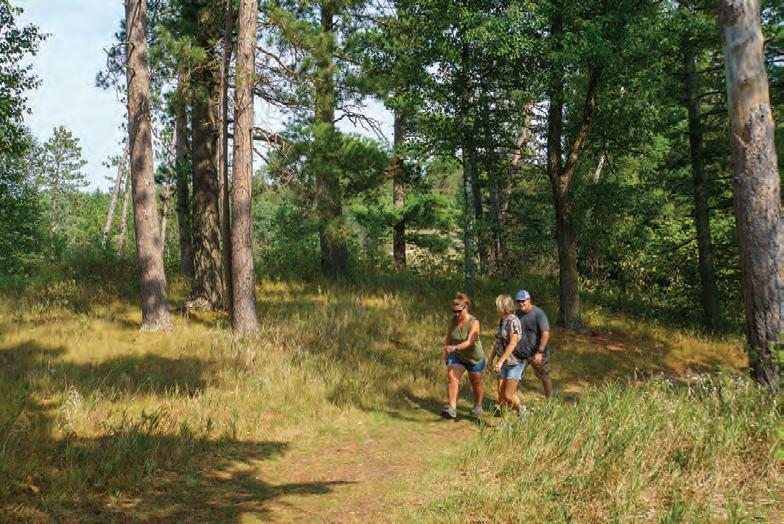
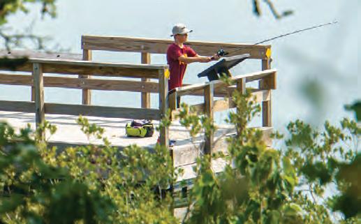
about six and a half miles, but there was a little bit left to go to get back to the campground. We popped out of the woods on some mowed-grass prairie trails, just to duck back into a variety of hard and soft woods with some open, grassy areas thrown in. Th is was the Hunter Waking Trail. Soon we reached the picnic area. We stopped and checked out the nice, big shelter, natural play area and views of the lake. Next was the fi shing pier, then the boat landing and a steep hike up past the camper cabins back to the campground.
We came back after about fi ve hours and had hiked a total of 7.9 miles. While the Challenge Trail itself is six and a half miles long, we needed to hike an extra mile and a half on other trails to make it a loop around the lake.

bike & “paddle” northern minnesota.