Carole Highlands SAFE MOBILITY STUDY
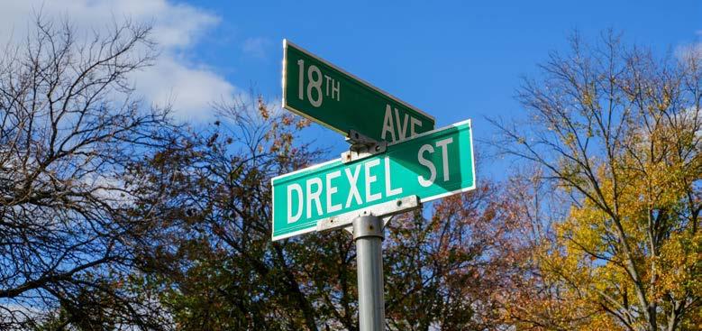
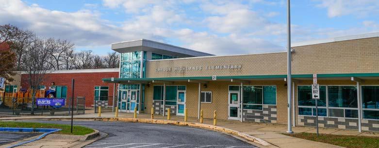
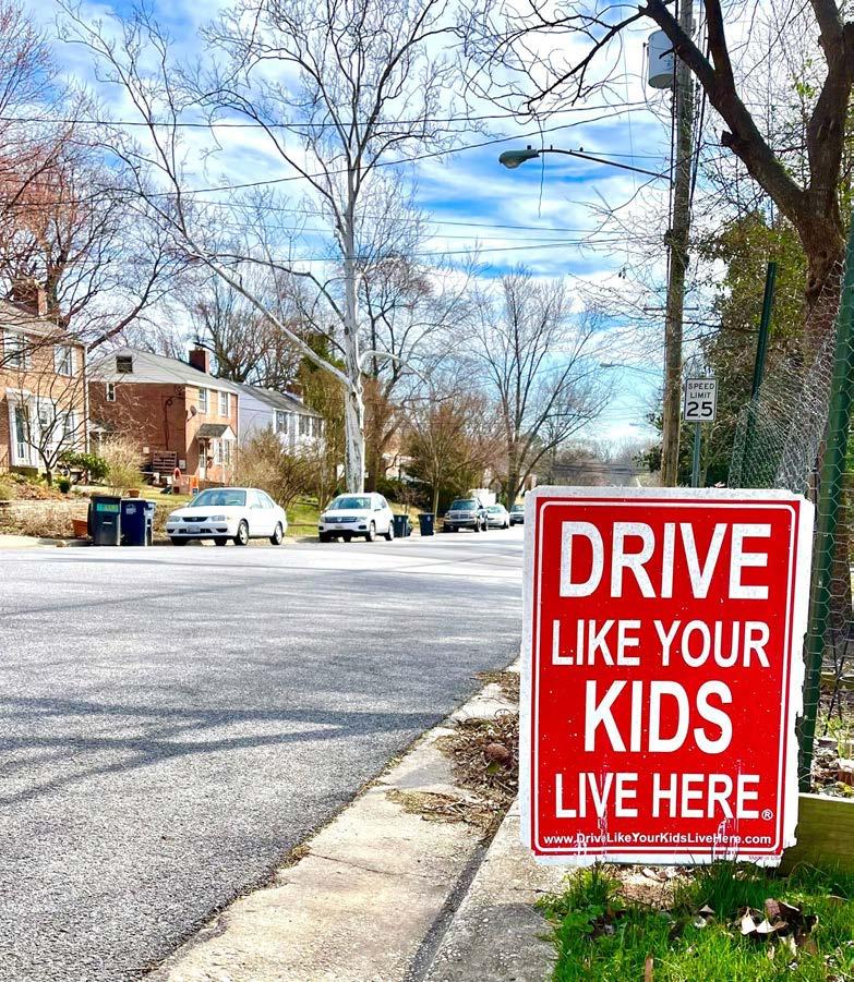
2024 THE MARYLAND-NATIONAL CAPITAL PARK AND PLANNING COMMISSION Prince George’s County Planning Department
Abstract
Date April 2024
Title Carole Highlands Safe Mobility Study
Author The Maryland-National Capital Park and Planning Commission
Subject Safe mobility and enhanced access and connectivity in Carole Highlands.
Source of copies The Maryland-National Capital Park and Planning Commission 1616 McCormick Drive Largo, MD 20774
Series number 230222405
Number of pages 134
The goal of the Carole Highlands Safe Mobility Study is to work in close partnership with local community and partner agencies—such as the Prince George’s County Department of Public Works and Transportation (DPW&T)—to develop design options that maximize safe mobility, support the Prince George’s County Vision Zero program and goals, and enhance access and connectivity to the Purple Line, University Boulevard, and other important community-identified destinations. This report describes existing conditions for mobility and access in Carole Highlands and provides recommendations for improving conditions.
Information contained in this document is for planning purposes and should not be used for final design of any project. All results, recommendations, concept drawings, cost opinions, and commentary contained herein are based on limited data and information and on existing conditions that are subject to change. Further analysis and engineering design are necessary prior to implementing any of the recommendations contained herein.
Page ii • 2024 Carole Highlands Safe Mobility Study Prince George’s County Planning Department

April 2024 By Toole Design Group, LLC, Torti Gallas + Partners, and Mercado Consultants, LLC for The Maryland-National Capital Park and Planning Commission Prince George’s County Planning Department 1616 McCormick Drive Largo, MD 20774 www.pgplanning.org Carole Highlands SAFE MOBILITY STUDY 2024 THE MARYLAND-NATIONAL CAPITAL PARK AND PLANNING COMMISSION Prince George’s County Planning Department
The Maryland-National Capital Park and Planning Commission
Peter A. Shapiro, Chair
Artie Harris, Jr., Vice Chair
Officers
Asuntha Chiang-Smith, Executive Director Gavin Cohen, Secretary-Treasurer
Debra Borden, General Counsel
The Maryland-National Capital Park and Planning Commission (M-NCPPC) is a bicounty agency, created by the General Assembly of Maryland in 1927. The Commission’s geographic authority extends to the great majority of Montgomery and Prince George’s Counties: the Maryland-Washington Regional District (M-NCPPC planning jurisdiction) comprises 1,001 square miles, while the Metropolitan District (parks) comprises 919 square miles, in the two counties.
The Commission has three major functions:
• The preparation, adoption, and, from time to time, amendment or extension of the General Plan for the physical development of the Maryland-Washington Regional District.
• The acquisition, development, operation, and maintenance of a public park system.
• In Prince George’s County only, the operation of the entire county public recreation program.
The Commission operates in each county through a Planning Board appointed by and responsible to the County government. All local plans, recommendations on zoning amendments, administration of subdivision regulations, and general administration of parks are responsibilities of the Planning Boards.
The Prince George’s County Planning Department:
The mission of the Prince George’s County Planning Department is to promote economic vitality, environmental sustainability, design excellence, and quality development that promotes healthy lifestyles in Prince George’s County neighborhoods.
Our vision is to be a model planning department of responsive and respected staff who provide superior planning and technical services and work cooperatively with decision makers, citizens, and other agencies to continuously improve development quality and the environment and act as a catalyst for positive change


Page iv • 2024 Carole Highlands Safe Mobility Study Prince
Department
George’s County
Planning
PRINCE GEORGE’S COUNTY PLANNING BOARD
MONTGOMERY COUNTY PLANNING BOARD
Artie L. Harris, Jr., Chair
Mitra Pedoeem, Vice Chair
Shawn Bartley, Esq.
James Hendrick, Ph.D.
Josh Linden
Peter A. Shapiro, Chair
Dorothy F. Bailey, Vice Chair
Manuel R. Geraldo, Esq.
William Doerner, Ph.D.
A. Shuanise Washington
Prince George’s County
 Angela Alsobrooks, County Executive
County Council
The County Council has three main responsibilities in the planning process: (1) setting policy, (2) plan approval, and (3) plan implementation. Applicable policies are incorporated into area plans, functional plans, and the general plan. The Council, after holding a hearing on the plan adopted by the Planning Board, may approve the plan as adopted, approve the plan with amendments based on the public record, or disapprove the plan and return it to the Planning Board for revision. Implementation is primarily through adoption of the annual Capital Improvement Program, the annual Budget, the water and sewer plan, and adoption of zoning map amendments.
COUNCIL MEMBERS
Jolene Ivey, Chair, 5th District
Sydney J. Harrison, Vice Chair, 9th District
Thomas E. Dernoga, 1st District
Wanika B. Fisher, 2nd District
Eric C. Olson, 3rd District
Ingrid S. Watson, 4th District
Wala Blegay, 6th District
Krystal Oriadha, 7th District
Edward P. Burroughs, III, 8th District
Mel Franklin, At-large
Calvin S. Hawkins, II, At-large
Clerk of the Council: Donna J. Brown
Prince George’s County Planning Department 2024 Carole Highlands Safe Mobility Study • Page v
Local Plans
Page vi • 2024 Carole Highlands Safe Mobility Study Prince George’s County Planning Department Introduction 10 Pubic and Stakeholder Engagement 13 Policy and Planning Context 19 Policies � � � � � � � � � � � � � � � � � � � � � � � � � � � � � � � � � � � � � � � � � � � � � � � � � � � � � � � � � � � � � � � � � � � � � � � � � � � � � � � � � � � � � � � 20 Countywide Plans � � � � � � � � � � � � � � � � � � � � � � � � � � � � � � � � � � � � � � � � � � � � � � � � � � � � � � � � � � � � � � � � � � � � � � � � � � � � � 20
� � � � � � � � � � � � � � � � � � � � � � � � � � � � � � � � � � � � � � � � � � � � � � � � � � � � � � � � � � � � � � � � � � � � � � � � � � � � � � � � � � � � 21
Plans � � � � � � � � � � � � � � � � � � � � � � � � � � � � � � � � � � � � � � � � � � � � � � � � � � � � � � � � � � � � � � � � � � � � � � � � � � � � � 21
Construction
People � � � � � � � � � � � � � � � � � � � � � � � � � � � � � � � � � � � � � � � � � � � � � � � � � � � � � � � � � � � � � � � � � � � � � � � � � � � � � � � � � � � � � � � � �24 Population . . . . . . . . . . . . . . . . . . . . . . . . . . . . . . . . . . . . . . . . . . . . . . . . . . . . . . . . . . . . . . . . . . . . . . . . . . . . . . . . . . . . . . . . 24 Race and Ethnicity . . . . . . . . . . . . . . . . . . . . . . . . . . . . . . . . . . . . . . . . . . . . . . . . . . . . . . . . . . . . . . . . . . . . . . . . . . . . . . . 24 Age . . . . . . . . . . . . . . . . . . . . . . . . . . . . . . . . . . . . . . . . . . . . . . . . . . . . . . . . . . . . . . . . . . . . . . . . . . . . . . . . . . . . . . . . . . . . . . 24 Housing Units and Occupancy 24 Vehicle Ownership 24 Travel Behaviors � � � � � � � � � � � � � � � � � � � � � � � � � � � � � � � � � � � � � � � � � � � � � � � � � � � � � � � � � � � � � � � � � � � � � � � � � � � � � � � �25 Land Use � � � � � � � � � � � � � � � � � � � � � � � � � � � � � � � � � � � � � � � � � � � � � � � � � � � � � � � � � � � � � � � � � � � � � � � � � � � � � � � � � � � � � � 26 Commercial Uses . . . . . . . . . . . . . . . . . . . . . . . . . . . . . . . . . . . . . . . . . . . . . . . . . . . . . . . . . . . . . . . . . . . . . . . . . . . . . . . . . 26 Institutional Uses 26 Residential Uses . . . . . . . . . . . . . . . . . . . . . . . . . . . . . . . . . . . . . . . . . . . . . . . . . . . . . . . . . . . . . . . . . . . . . . . . . . . . . . . . . . 26 Natural Features and the Pepco Right-of-Way � � � � � � � � � � � � � � � � � � � � � � � � � � � � � � � � � � � � � � � � � � � � � � � � � � � 27 Lighting � � � � � � � � � � � � � � � � � � � � � � � � � � � � � � � � � � � � � � � � � � � � � � � � � � � � � � � � � � � � � � � � � � � � � � � � � � � � � � � � � � � � � � � 28 Transportation 31 Street Infrastructure � � � � � � � � � � � � � � � � � � � � � � � � � � � � � � � � � � � � � � � � � � � � � � � � � � � � � � � � � � � � � � � � � � � � � � � � � � � �32 Street Network . . . . . . . . . . . . . . . . . . . . . . . . . . . . . . . . . . . . . . . . . . . . . . . . . . . . . . . . . . . . . . . . . . . . . . . . . . . . . . . . . . . 32 Intersections 32 Pedestrian Infrastructure 33 Sidewalks 33 Crosswalks . . . . . . . . . . . . . . . . . . . . . . . . . . . . . . . . . . . . . . . . . . . . . . . . . . . . . . . . . . . . . . . . . . . . . . . . . . . . . . . . . . . . . . . 34 Curb Ramps . . . . . . . . . . . . . . . . . . . . . . . . . . . . . . . . . . . . . . . . . . . . . . . . . . . . . . . . . . . . . . . . . . . . . . . . . . . . . . . . . . . . . . 35 Bicycle Infrastructure and Shared-Use Paths � � � � � � � � � � � � � � � � � � � � � � � � � � � � � � � � � � � � � � � � � � � � � � � � � � � 36 Public Transportation Infrastructure � � � � � � � � � � � � � � � � � � � � � � � � � � � � � � � � � � � � � � � � � � � � � � � � � � � � � � � � � � � � 36 Table of Contents
Study Area Profile 23
Circulation and Access
Pedestrian Circulation and Access
Bicycle Circulation and Access Needs
Public Transit Circulation and Access
Motor Vehicle Circulation and Access
Prince George’s County Planning Department 2024 Carole Highlands Safe Mobility Study • Page vii
41
� � � � � � � � � � � � � � � � � � � � � � � � � � � � � � � � � � � � � � � � � � � � � � � � � � � � � � � � � � � � � 42
� � � � � � � � � � � � � � � � � � � � � � � � � � � � � � � � � � � � � � � � � � � � � � � � � � � � � � � � � � 47
� � � � � � � � � � � � � � � � � � � � � � � � � � � � � � � � � � � � � � � � � � � � � � � � � � � � � � � � � � � 49
� � � � � � � � � � � � � � � � � � � � � � � � � � � � � � � � � � � � � � � � � � � � � � � � � � � � � � � � � � 49 Safety 53 Crashes � � � � � � � � � � � � � � � � � � � � � � � � � � � � � � � � � � � � � � � � � � � � � � � � � � � � � � � � � � � � � � � � � � � � � � � � � � � � � � � � � � � � � � � 54 Crash Location . . . . . . . . . . . . . . . . . . . . . . . . . . . . . . . . . . . . . . . . . . . . . . . . . . . . . . . . . . . . . . . . . . . . . . . . . . . . . . . . . . . 54 Location of Motor Vehicle KSI Crashes . . . . . . . . . . . . . . . . . . . . . . . . . . . . . . . . . . . . . . . . . . . . . . . . . . . . . . . . . . . . 54 Location of Pedestrian/Bicyclist KSI Crashes 56 Crash Types and Pre-Crash Movements 58 Traffic Safety Concerns � � � � � � � � � � � � � � � � � � � � � � � � � � � � � � � � � � � � � � � � � � � � � � � � � � � � � � � � � � � � � � � � � � � � � � � � 59 Speeding 59 Driver Yielding . . . . . . . . . . . . . . . . . . . . . . . . . . . . . . . . . . . . . . . . . . . . . . . . . . . . . . . . . . . . . . . . . . . . . . . . . . . . . . . . . . . .60 Visibility . . . . . . . . . . . . . . . . . . . . . . . . . . . . . . . . . . . . . . . . . . . . . . . . . . . . . . . . . . . . . . . . . . . . . . . . . . . . . . . . . . . . . . . . . .60 Personal Security Concerns � � � � � � � � � � � � � � � � � � � � � � � � � � � � � � � � � � � � � � � � � � � � � � � � � � � � � � � � � � � � � � � � � � � � � 61 Opportunities, Constraints, and Considerations 63 Opportunities � � � � � � � � � � � � � � � � � � � � � � � � � � � � � � � � � � � � � � � � � � � � � � � � � � � � � � � � � � � � � � � � � � � � � � � � � � � � � � � � � 64 Constraints and Considerations � � � � � � � � � � � � � � � � � � � � � � � � � � � � � � � � � � � � � � � � � � � � � � � � � � � � � � � � � � � � � � � � 65 Recommendations 71 Recommended Access and Connectivity Projects � � � � � � � � � � � � � � � � � � � � � � � � � � � � � � � � � � � � � � � � � � � � � � � � 72 Other Recommended Projects � � � � � � � � � � � � � � � � � � � � � � � � � � � � � � � � � � � � � � � � � � � � � � � � � � � � � � � � � � � � � � � � � � 88 Appendices 103 Appendix A: Project Management Kick-Off Meeting �������������������������������������������� 104 Appendix B: Project Management Team Site Visit����������������������������������������������� 108 Appendix C: Community Walk Audit ������������������������������������������������������������ 112 Appendix D: Carole Highlands Safe Mobility Project Summary Results � � � � � � � � � � � � � � � � � � � � � � � � � � � 118
E: Key Plan Recommendations from Previous Plans� � � � � � � � � � � � � � � � � � � � � � � � � � � � � � � � � � � � 128
F: Public Right-of-Way Dimensions for Key Streets � � � � � � � � � � � � � � � � � � � � � � � � � � � � � � � � � � � � 132 Acknowledgments 133
Appendix
Appendix
Table of Contents
Page viii • 2024 Carole Highlands Safe Mobility Study Prince George’s County Planning Department Figures Figure 1 � Community walk audit on June 25, 2022 14 Figure 2 � Pedestrian access and safety improvement heat map 16 Figure 3 � Bicycle access and safety improvement heat map ��������������������������������������������������������������������������������������������� 17 Figure 4 � Summary results from community survey ��������������������������������������������������������������������������������������������������������������� 24 Figure 5 � Summary results from community survey ��������������������������������������������������������������������������������������������������������������� 25 Figure 6 Carole Highlands Elementary School 26 Figure 7 � A northeast view of the Pepco right-of-way 27 Figure 8 � The Hannon Street goat connector trail 28 Figure 9 � Study area sidewalk affected by vegetative overgrowth 33 Figure 10 � Pedestrians cross uncontrolled crosswalks 34 Figure 11 � An example of a diagonal ramp on Riggs Road 35 Figure 12 � An example of a curb ramp without a detectable warning surface ��������������������������������������������������������� 35 Figure 13 � An example of i nappropriate bike rack design �������������������������������������������������������������������������������������������������������� 36 Figure 14 � Bikeshare station beyond the study area boundary ������������������������������������������������������������������������������������������37 Figure 15 Unkempt conditions at study area bus stop 37 Figure 16 � Carole Highlands students use informal Hannon Street connector trail 42 Figure 17 � Gate from the informal trail to Carole Highlands Elementary School 42 Figure 18 � Informal trail to commercial areas on University Boulevard 43 Figure 19 � Limited pedestrian access to University Boulevard retail shops 43 Figure 20 � Informal trail on the south side of University Plaza Shopping Center 43 Figure 21 � A post office at the shops near Holton Lane in the study area ������������������������������������������������������������������ 45 Figure 22 � M issing sidewalk south of Hannon Street in the study area ������������������������������������������������������������������������ 45 Figure 23 � A bus stop on MD 410 (East West Highway) bereft of a controlled pedestrian crossing ����������� 45 Figure 24 Sligo Creek Trail crossing at MD 410 (East West Highway) 47 Figure 25 � Bridge over Sligo Creek on north side of (MD 410) East West Highway 47 Figure 26 � A b icycle commuter traveling west on Erskine Street 47 Figure 27 � A commuter departs a Metrobus at Riggs Road north of Drexel Street 49 Figure 28 � KSI Crashes by Year 54 Figure 29 � Pedestrians walking along MD 193 (University Boulevard) at 15th Avenue 58 Figure 30 � Variable message sign on Erskine Street at 16th Place ������������������������������������������������������������������������������������ 59 Figure 31 � Pedestrian safety message on MD 193 (University Boulevard) west of Riggs Road ��������������������� 60 Figure 32 � Turner Memorial AME church parking lot, a source of personal security concern �������������������������� 61 Figure 33 The absence of lighting along the Hannon Street informal connector trail 61 Figure 34 � Purple Line construction vs business activity along MD 193 (University Boulevard) 64 Figure 35 � Proposed shared-use path connects 15th Avenue to Holton Lane 65 Figure 36 � Aerial view of Quantum Properties land holdings 65 Figure 37 � Southerly view of Pepco right-of-way 66 Figure 38 � A bicyclist riding on a sidewalk adjacent to Riggs Road 68 Figure 39 � Proposed median reduction along Riggs Road ������������������������������������������������������������������������������������������������������ 68 Figure 40 � An informal pathway connection at 18th Avenue and Hannon Street� ��������������������������������������������������� 69 Figure 41 � Shared-use path concept at Hannon Street to commercial areas ���������������������������������������������������������� 75 Figure 42 Shared-use path concept at Hannon Street to Carole Highlands Elementary School 77 Figure 43 � Shared-use path concept at 15th Avenue to Holton Lane 79 Figure 44 � Missing sidewalks on Erskine Street between 15th Avenue and 16th Place 81 Figure 45 � Shared-use lane and sidewalk concept along E rskine Street: Part 1 82 Figure 46 � Sidewalk concept along Erskine Street: Part 2 83 Figure 47 � Intersection improvement concept at Erskine St/Drexel St/18th Ave: Part 3 84 Figure 48 � Bicycle repair station along Sligo Creek Trail ������������������������������������������������������������������������������������������������������������ 85 Figure 49 � Bicycle repair station signage ������������������������������������������������������������������������������������������������������������������������������� ������������ 85 Figure 50 � Bicycle repair station identification ������������������������������������������������������������������������������������������������������������������������������� 85 Figure 51 Erskine/Drexel Street/18th Avenue intersection bereft of traffic-calming structure 87 Figure 52 � A traffic-calming mini roundabout 87
Maps
Appendices Figures
Prince George’s County Planning Department 2024 Carole Highlands Safe Mobility Study • Page ix
Map 1 � Carole Highlands Context Map 11 Map 2 � Locations of Street Light Poles 29 Map 3 � Existing Pedestrian, Bicycle, and Public Transit Infrastructure 38 Map 4 � Key Existing Pedestrian Routes and Access Needs 46 Map 5 � Key Existing Bicycle Routes and Access Needs �������������������������������������������������������������������������������������������������� 48 Map 6 � Key Existing Public Transportation Transit Access ���������������������������������������������������������������������������������������������� 50 Map 7 � Key Existing Motor Vehicle Routes and Access Needs ������������������������������������������������������������������������������������� 51 Map 8 Crash Density Map 55 Map 9 � Motor Vehicle KSI Crash Density 56 Map 10 � Pedestrian and Bicycle KSI Crash Density 57 Map 11 � Recommended Access and Connectivity Projects 73 Map 12 � Other Recommended Projects 89
Figure A1 � A fence separates an informal trail from the Carole Highlands school grounds �������������������������� 113 Figure A2 � An informal goat trail connects Hannon Street to Carole Highlands Elementary School 114 Figure A3 � Survey Response Rates 118 Figure A4 � Response statistics: p referred survey response methods 118 Figure A5 � Response statistics: p ercentage of respondents that will remain engaged 118 Figure A6 � Response statistics: c urrent travel methods 123 Figure A7 � Response statistics: p referred travel methods 123 Figure A8 � Response statistics: c urrent travel methods in and around Carole Highlands ���������������������������� 124 Figure A9 � Response statistics: p referred travel methods in and around Carole Highlands ������������������������ 125 Figure A10 � Response statistics: p ercentage of respondents that live in Carole Highlands ������������������������� 126 Figure A11 � Response demographics: race/ethnicity 126 Figure A12 � Response demographics: age 127 Figure A13 � Existing and Proposed Bikeways: 2015 Greater Chillum Community Study 131 Tables Table 1 � Study Area Arterial Streets, Speed Limit, Functional Classification, and AADT 32 Table 2 � Other Recommended Projects 90 Additional Images Cover: M-NCPPC Page 15: iStock � com/SolStock Figure 53 � A yield street Northwest Washington, D C 100 Figure 54 � Bicycle and pedestrian signal heads in New York City 100 Figure 55 � Bicycle and pedestrian signal heads Bethesda, Maryland � ������������������������������������������������������������������������� 100 Figure 56 � Flex posts at 13th and Upshur Streets, Northwest Washington, D � C � ���������������������������������������������������� 100 Figure 57 � S hared-use path and roadway street name sign blades in Minneapolis, MN 101 Figure 58 � P rotected pedestrian lane on Grove Street in Silver Spring, MD 101 Figure 59 � Pedestrian crossing island on Franklin Avenue in Silver Spring, MD 101 Figure 60 � Mast arm-mounted street name sign in Herndon, VA 101
Introduction
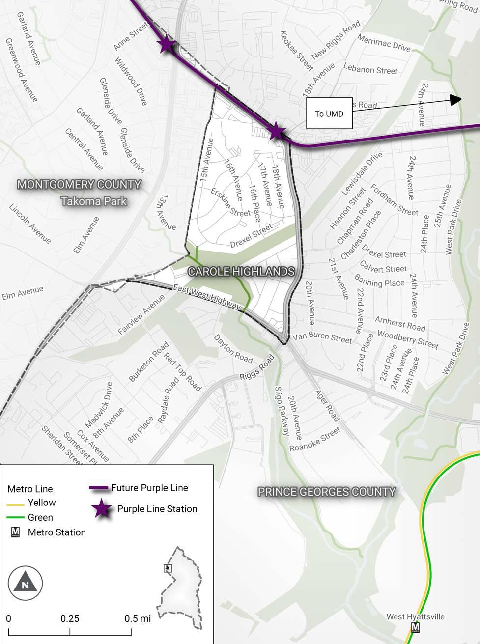
Carole Highlands is a 212-acre community in northwestern Prince George’s County located approximately one mile from the District of Columbia border and between the University of Maryland, College Park (UMD) campus and the City of Takoma Park. The community is bounded by MD 193 (University Boulevard) to the north, MD 410 (East West Highway) to the south, MD 212 (Riggs Road) to the east, and the Montgomery County line to the west (Map 1).
The goal of the Carole Highlands Safe Mobility Study is to work with the community and partner agencies to develop project recommendations that maximize safe mobility, and enhance access and connectivity to the Purple Line, University Boulevard, and other important community-identified destinations. One such partner agency—the Prince George’s County Department of Public Works and Transportation (DPW&T)— manages the County’s Vision Zero program.
This report describes existing conditions for mobility and access in Carole Highlands and provides recommendations for improving safety and access. The report includes:
• A description of the Carole Highlands study area
• A description of the stakeholder engagement activities and resulting feedback that informed this study process
• A description of the policy and planning context for the Carole Highlands study
• A profile of the Carole Highlands community, including people, land use, lighting, and natural features
• Maps and descriptions of existing transportation infrastructure, including street infrastructure, pedestrian infrastructure, bicycle infrastructure, shared-use paths, and public transportation
• Maps and descriptions of existing circulation and access needs for pedestrians, bicyclists, motorists, and public transit
• Maps and descriptions of traffic safety and personal security needs
• A description of opportunities, constraints, and other related considerations
• Project recommendations, including planning-level concept designs and cost estimates for the highest priority access and connectivity projects
The project recommendations target the affected operating agencies, namely, the Department of Public Works and Transportation, the Maryland Department of Transportation’s State Highway Administration (MDOT SHA), and the Maryland-National Capital Park and Planning Commission (M-NCPPC) Department of Parks and Recreation. These operating agencies may accept, reject, or modify the project recommendations in this report. No timeline currently exists regarding decisions to implement the project recommendations. Operating agencies choosing to implement design option recommendations are expected to notify residents and other stakeholders consistent with their procedures.
Page 10 • 2024 Carole Highlands Safe Mobility Study Prince George’s County Planning Department
Map 1 � Carole Highlands Context Map
2024
• Page 11
Prince George’s County Planning Department
Carole Highlands Safe Mobility
Study
Section 1
Pubic and Stakeholder Engagement
This report is informed by several public and stakeholder engagement activities.
• The project management team held a kickoff meeting on February 8, 2022. Notes from this meeting are in Appendix A.
• The project management team conducted a site visit and walk audit on April 8, 2022, at four key locations in the study area. The Site Visit Guide and observations from the tours are in Appendix B.
• The Project management team and Prince George’s County Council Member Deni Taveras met on April 20, 2022, to discuss the project.

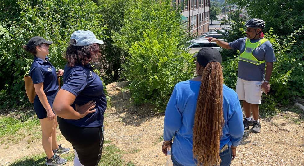
• The project management team joined Carole Highlands residents on June 25, 2022, for walking tours of the study area, followed by a meeting at the Turner Memorial African Methodist Episcopal (AME) Church on 16th Place (Figure 1). Three community members attended the meeting; two joined the walking tours. Minutes from the meeting and observations from the walking tours are in Appendix C.
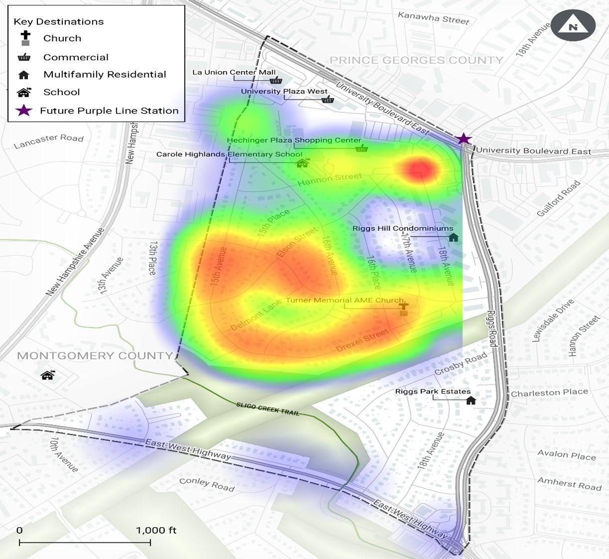
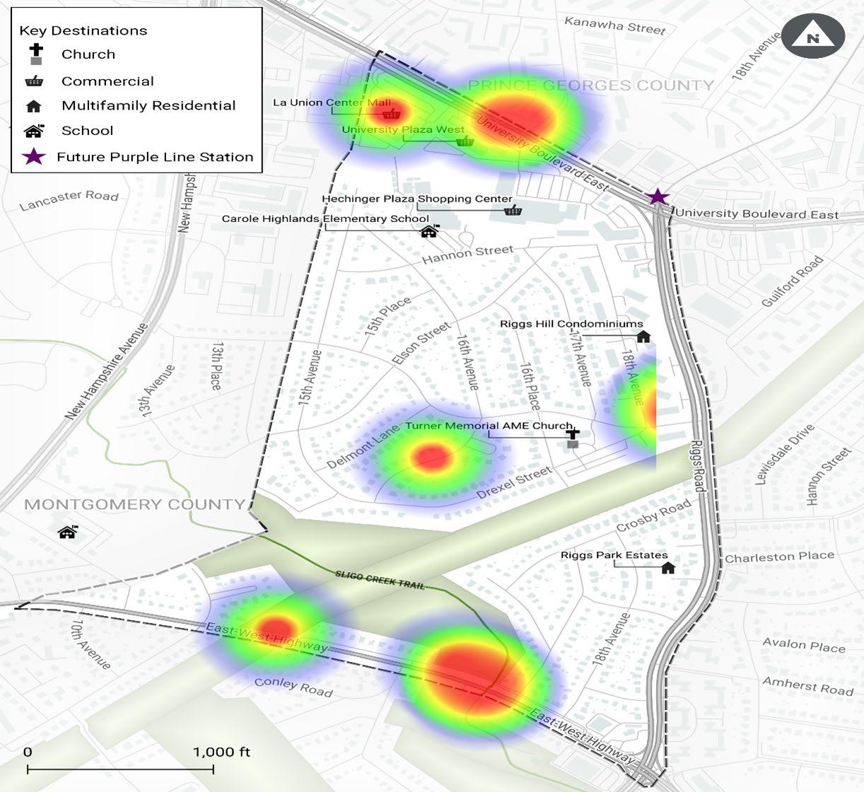
• The project management team received 40 responses from an online community survey conducted from June 6 to July 8, 2022. The survey was delivered in English and Spanish and received two responses in Spanish. See Figures 2 and 3 for heat maps showing areas where respondents indicated a desire for pedestrian and bicycle access and safety improvements. The red color on the maps illustrates locations most often identified by survey respondents. The orange, yellow, green, and blue colors indicate areas identified less frequently in descending order from orange to blue. Full summary results are in Appendix D.
Page 14 2024 Carole Highlands Safe Mobility Study Prince George’s County Planning Department
Figure 1 � Community walk audit participants gather at Turner Memorial AME Church before the walk audit, on June 25, 2022 (PHOTO BY TOOLE DESIGN GROUP )

2024 Carole Highlands Safe Mobility Study Prince George’s County Planning Department Page 15 PUBLIC AND STAKEHOLDER ENGAGEMENT
Page 16 2024 Carole Highlands Safe Mobility Study Prince George’s County Planning Department
Figure 2 � Pedestrian access and safety improvement heat map
2024 Carole Highlands Safe Mobility Study Prince George’s County Planning Department Page 17 PUBLIC AND STAKEHOLDER ENGAGEMENT
Figure 3 � Bicycle access and safety improvement heat map
Section 2 Policy and Planning Context
The context for this study is shaped by State of Maryland and Prince George’s County policies, as well as Countywide plans, local plans, and construction plans. The following policies and plans were reviewed by the project team.
Policies
• Prince George’s County Landscape Manual (2010)
• Prince George’s County Department of Public Works and Transportation Specifications and Standards for Roadways and Bridges (2012)
• Prince George’s County Urban Street Design Standards (2017)
• Maryland Department of Transportation State Highway Administration Context Driven Guide (2020) Prince George’s County Zoning Ordinance (2022)
Countywide Plans
• Prince George’s County Approved Countywide Master Plan of Transportation (2009)
• Formula 2040: Functional Master Plan for Parks, Recreation, and Open Space (2013)
• Plan Prince George’s 2035, Prince George’s County Approved General Plan (2014)
• Approved Resource Conservation Plan: Countywide Functional Master Plan (2017)
• Prince George’s County Department of Parks and Recreation Strategic Trails Plan (2018)
• Prince George’s County Vision Zero Action Plan (2019)
• 2022 Fiscal Year Approved CIP (Capital Improvement Program) Budget
• 2023 Fiscal Year Proposed CIP Budget
• Prince George’s County Capital Roadway and Bridge Projects
Page 20 2024 Carole Highlands Safe Mobility Study Prince George’s County Planning Department
Local Plans
• Langley Park-College Park-Greenbelt Approved Master Plan (1989)
• Takoma/Langley Crossroads Sector Plan, Prince George’s County (2009)
• Purple Line Bicycle Hub Location Study (2010)
• Approved Historic Sites and Districts Plan (2010)
• Purple Line Corridor Access Study (2011)
• Takoma/Langley Crossroads Sector Plan, Montgomery County (2012)
• Greater Chillum Community Study (2015)
• Northern Gateway SPACEs PAMC Project 30% Design and Engineering Report (2021)
• Northern Gateway Wayfinding and Signage Study (2021)
• Langley Park Neighborhood Bicycle Boulevards (2021)
Construction Plans
• Purple Line Center Platform Typical Plans (2022)
Key plan recommendations are listed in Appendix E by location and topic with supporting maps where available.
2024 Carole Highlands Safe Mobility Study Prince George’s County Planning Department Page 21 POLICY AND PLANNING CONTEXT
Section 3
Study Area Profile
People
POPULATION
The Carole Highlands study area has a population of 2,485 community members.1
RACE AND ETHNICITY
Twenty-five percent of the population identify as African American, 12 percent identify as White, 3 percent identify as American Indian, 4 percent identify as Asian, 15 percent are two or more races, and 40 percent identify as another race alone. Almost 6 in 10 (59 percent) identify as Hispanic or Latino.
AGE
Of study area residents, 31 percent are under age 20 years old, 27 percent are between the ages of 20 and 39, 26 percent are between ages 40 and 59, and 15 percent are age 60 or older.
HOUSING UNITS AND OCCUPANCY
Carole Highlands includes 809 housing units, 97 percent of which are occupied. Among occupied units, 67 percent are owner-occupied, and 33 percent are renter-occupied.
VEHICLE OWNERSHIP
Vehicle ownership is more common in owner-occupied homes, with 92 percent of owner-occupied households having at least one vehicle and 65 percent having at least two vehicles. Of renter-occupied households in the study area, 70 percent own a vehicle.
Figure 4 � Summary results from community survey of the most common way respondents travel between destinations inside Carole Highlands and destinations in adjacent areas
1 Data on population, race and ethnicity, age, housing units and occupancy, and vehicle ownership were provided by the Prince George’s Planning Department from the 2019 ACS 5-Year Estimates.
Page 24 2024 Carole Highlands Safe Mobility Study Prince George’s County Planning Department
0% 20% 40% 60% 80% 100% Drive Alone Carpool Public Transportation Bicycle Walk 82.4% 29.4% 5.9% 2.9% 55.9%
Travel Behaviors
Of working-age residents in Carole Highlands, 76 percent commute to work by driving alone and 23 percent commute to work by public transportation. Of residents that use public transportation, 10 percent ride the bus, 10 percent use Metrorail, and 3 percent use commuter rail.2 However, these numbers do not provide a complete picture of the travel behavior of residents in the study area.
According to the Metropolitan Washington Council of Governments (MWCOG), in Prince George’s County, 75 percent of weekday trips are non-work related. These trips—which include trips to stores, trips to school, and trips for recreation—are typically shorter than commute trips, and are more likely to be completed by walking or bicycling.
Data for non-work trips are not available from the United States census or MWCOG for Carole Highlands; however, the Carole Highlands Safe Mobility Project Community Input Survey (hereinafter referred to as the survey) attempted to gain insight into non-work trips in the study area. When asked to select the top two modes of travel within Carole Highlands, more than 80 percent selected walk, half answered drive, and more than a quarter selected bike (Figure 4).
The survey also asked respondents to rank the top two modes of transportation they are likely to use when traveling within the Carole Highlands vicinity. More than two-thirds of respondents answered driving alone, 41.7 percent answered walking, 25 percent answered biking, and 16.7 percent indicated that they use public transportation (Figure 5). 2 Data on commuting to work were provided by the Prince George’s Planning Department from 2019 ACS 5-Year Estimates.
2024 Carole Highlands Safe Mobility Study Prince George’s County Planning Department Page 25 STUDY AREA PROFILE
Figure
common way respondents travel between destinations
Highlands � 0% 10% 20% 30% 40% 50% 60% 70% 80% Drive Alone Carpool Public Transportation Bicycle Walk 56.8% 21.6% 8.1% 10.8% 70.3%
5 � Summary results from community survey of the most
within Carole
Land Use
The Carole Highlands study area contains a range of land uses, including commercial, institutional, and residential.
COMMERCIAL USES
Commercial activity in Carole Highlands is concentrated along University Boulevard, on Riggs Road near the intersection of University Boulevard, and on East West Highway near Riggs Road. Major commercial developments include:
The south side of University Boulevard within the study project boundary is part of the International Corridor, recognized for the businesses and residences serving a community with immigrant roots, primarily from Latin America. There are numerous businesses located along University Boulevard at the northern edge of Carole Highlands. This varied business mix includes ethnic restaurants, grocery, furniture, jewelry, and specialty stores, as well as dental, legal and other professional services providers.
This commercial area is extremely automobile oriented and separated from the sidewalk by parking lots. While these businesses are relatively accessible to pedestrians who live in the Langley Park community on the north side of University Boulevard, access by walking or bicycling for Carole Highlands residents to the University Boulevard corridor is difficult at best due to topography and the lack of proper accessible facilities.
INSTITUTIONAL USES
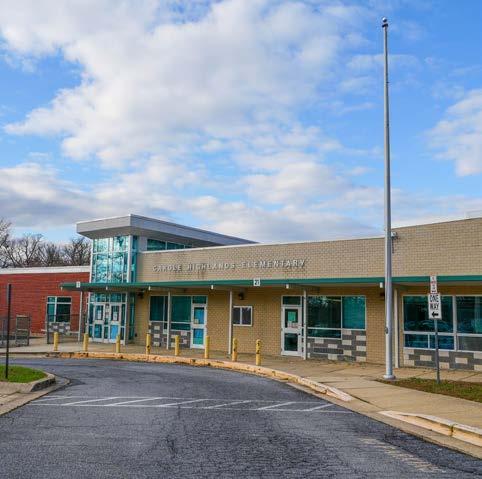
Institutional uses include Carole Highlands Elementary School and Turner Memorial AME Church.
• Carole Highlands Elementary School is on Hannon Street east of 16th Avenue in the north-central portion of the neighborhood. The school serves approximately 500 students. Over 80 percent of students identify as Hispanic or Latino. 14.1 percent identify as Black or African American, 1.7 percent identify as Asian or Asian/Pacific Islander, and 0.6 percent identify as White. Approximately 60 percent of students travel by school bus, 20 percent by personal vehicle, and 20 percent of students walk to school. There are currently seven bus routes that serve the school.
• Turner Memorial AME Church, located on 16th Place between Erskine Street and Drexel Street is a place of worship and located in Carole Highlands.
• Langley Park Multi-Service Center, located at 1401 University Boulevard within La Union Mall, houses several social service providers including the Prince George’s County Health, Social Services, and Family Services departments and the Economic Development Corporation.
RESIDENTIAL USES
Residential uses occupy the bulk of the study area. Multi-family residential dwellings are concentrated in the Riggs Park Estates section of Carole Highlands, in the study area’s northeastern corner. Single-family residential is the dominant land use elsewhere in the vicinity and is divided into three neighborhoods: one neighborhood north of the Pepco right-of-way (Carole Highlands), and two neighborhoods south of the Pepco right-of-way (Riggs Park Estates and Park Lawn).
Page 26 2024 Carole Highlands Safe Mobility Study Prince George’s County Planning Department
Figure 6 � Carole Highlands Elementary School (PHOTO BY TOOLE DESIGN GROUP )
Natural Features and the Pepco Right-of-Way
Carole Highlands is on the fall line between the Coastal and Piedmont areas of the Atlantic seaboard and has hilly topography, which can present a challenge for bicyclists. The result is curved, sloped streets that can be difficult to retrofit with sidewalks and can obstruct visibility and sight lines between street users.
Sligo Creek runs through the southern end of the study area. It is a beautiful natural area with forested sections on both sides. The creek is both an attraction and a barrier. The Sligo Creek Trail provides access along the creek and connections to a vast network of trails in Prince George’s County and the Washington, D.C. metropolitan area, as well as to numerous nearby destinations, including the West Hyattsville Metrorail Station, Takoma Park, and Silver Spring.
However, there are only two connections to the trail within the study area, one via a spur from Sligo Parkway and one via the trail’s intersection with East West Highway.
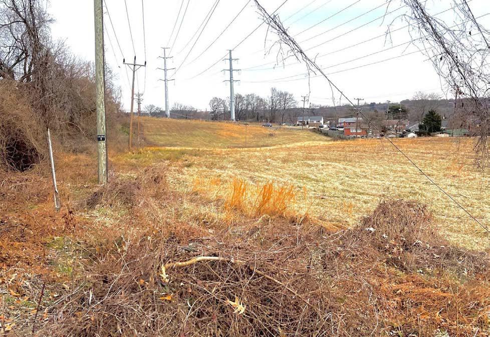
The Pepco right-of-way crosses Sligo Creek at a diagonal angle and is also both an attraction and a barrier within the study area. The meadow bordering the Pepco power lines is home to a variety of bird and animal species; however, except the Sligo Creek Trail, the right-of-way includes no formal trail or street connections across or along it. In the southeastern corner of the study area the Pepco right-of-way effectively isolates the Riggs Park Estates and Park Lawn neighborhoods from the rest of Carole Highlands.
2024 Carole Highlands Safe Mobility Study Prince George’s County Planning Department Page 27
STUDY AREA PROFILE
Figure 7 � A northeast view of the Pepco right-of-way � (PHOTO BY M-NCPPC)
Lighting
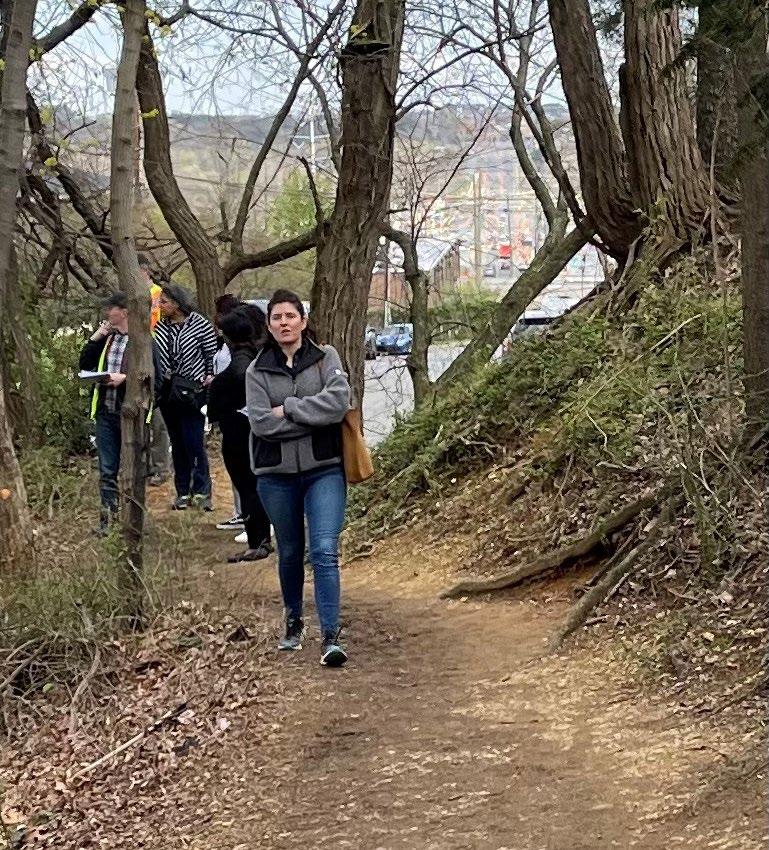
Within the study area, streetlights exist on both sides of streets at regular increments, however there is no lighting on the Sligo Creek Trail or along informal trails within the study area. Most streetlights are high pressure sodium vapor (HPS) lighting, with some mercury vapor (MV) lighting as well. See Map 2 for the location of streetlight poles.
Page 28 2024 Carole Highlands Safe Mobility Study Prince George’s County Planning Department
Figure 8 � The Hannon Street goat connector trail is one of the informal paths in the study area that needs lighting and pavement (PHOTO BY M-NCPPC)

2024 Carole Highlands Safe Mobility Study Prince George’s County Planning Department Page 29
STUDY AREA PROFILE
Map 2 � Locations of Streetlight Poles
Transportation Section 4
Street Infrastructure STREET NETWORK
The study area street network is characterized by an arterial street network on the periphery and a local street network within the interior, with few connections between the two. This is especially true in the portion of the study area north of the Pepco right-of-way, which is connected to the arterial network via Erskine and Drexel Streets. Erskine Street includes speed management features such as speed humps to discourage cut-through traffic and speeding.
Table 1 below provides a list of study area arterials, with the number of through lanes, speed limit, and Annual Average Daily Traffic (AADT)3 volumes for segments in the study area.
The speed limit on all other streets in the study area is 25 miles per hour.
INTERSECTIONS
There are four signalized intersections within the study area:
• University Boulevard and 15th Avenue
• University Boulevard and Riggs Road
• Riggs Road and Drexel Street
• Riggs Road and East West Highway
There are notable all-way stop-sign-controlled intersections at Erskine Street and 15th Avenue and Erskine Street and 16th Avenue. Most other intersections are controlled by two-way stop signs.
Table 1 � Study Area Arterial Streets, Speed Limit, Functional Classification, and AADT
3 Data are from MDOT SHA Statewide AADT Lines. The year of “AADT (Current)” is not provided.
Page 32 2024 Carole Highlands Safe Mobility Study Prince George’s County Planning Department
Street Name Functional Classification Number of Through Lanes Speed Limit AADT 2018F AADT (Current) University Boulevard Principal Arterial 6 35 38,880 33,831 East West Highway Principal Arterial 4 30 23,402 18,851 Riggs Road Minor Arterial 6 35 39,721 33,173
Pedestrian Infrastructure
SIDEWALKS
Sidewalks are present on both sides of all arterial roadways and on all streets in the Riggs Park Estates and Park Lawn neighborhoods, except for a small gap on the north side of Avalon Place near 17th Avenue. From 16th Place eastward, sidewalks are mostly present in the northeastern corner of the neighborhood, although none of the sidewalks directly connect to the commercial areas or sidewalks on University Boulevard and Riggs Road. There are also notable gaps in the following areas:
• The east side of 18th Avenue near Hannon Street and on the north side of Hannon Street near 18th Avenue
• The south side of Erskine Street between 16th Place and 18th Avenue
• The south side of Drexel Street between 16th Place and 18th Avenue
In addition, there is a sidewalk on the east side of 16th Avenue north of Elson Street, and a sidewalk on the north side of Hannon Street between 16th Avenue and 15th Avenue.

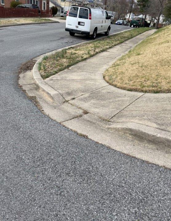
9 Vegetative overgrowth on this sidewalk at Riggs Road near University Boulevard causes a narrow walkway (PHOTO BY TOOLE DESIGN GROUP )
According to the Prince George’s County Planning Department and confirmed via field observation, all sidewalks in the Carole Highlands study are too narrow for pedestrian safety and do not meet the County’s standard width of 5 feet. The narrow sidewalks make it difficult for pedestrians to walk side by side or to pass pedestrians on the sidewalk. Narrow sidewalks are particularly uncomfortable for pedestrians on Riggs Road and University Boulevard where motor vehicle speed is high. On these roads, there is little to no buffer from motor vehicle traffic, there are a substantial number of heavy vehicles, and some segments are overgrown with vegetation.
Additionally, where driveways cross sidewalks, the sidewalk cross-slope often appears to exceed the 2 percent maximum cross-slope established in the United States Access Board’s proposed Public Rightof-Way Accessibility Guidelines (PROWAG).
2024 Carole Highlands Safe Mobility Study Prince George’s County Planning Department Page 33 TRANSPORTATION
Figure
CROSSWALKS
Marked crosswalks exist at three of the four signalized intersections in the study area but are missing at University Boulevard and 15th Avenue, where the intersection was recently repaved.
There are marked crosswalks at two uncontrolled intersections on East West Highway: one at the Sligo Creek Trail crossing and another at Olson Road. Several intersections in the interior of the study area are likely to be used by students accessing Carole Highlands Elementary School, including intersections on 16th Place and 16th Avenue.
Most crosswalk markings are standard markings with two parallel lines in the direction of pedestrian travel. There are also high-visibility “ladder-style” and continental crosswalks at:
• University Boulevard and Riggs Road (across slip lanes on south side of intersection)
• Riggs Road and Drexel Street
• Riggs Road and East West Highway
• East West Highway and Sligo Creek Trail crossing
• East West Highway and Olson Road (across East West Highway)
• Erskine Street and 16th Avenue
• Erskine Street and 16th Place
At some locations, crosswalk markings are not provided on all crosswalk legs. A notable example is the intersection of Riggs Road and Drexel Street, where there is a marked crosswalk across the south leg

Page 34 2024 Carole Highlands Safe Mobility Study Prince George’s County Planning Department
Figure 10 � Pedestrians seen crossing University Boulevard at 15th Avenue without a marked crosswalk (PHOTO BY M-NCPPC)
of the intersection but not across the north leg. The north leg is better aligned with the bus stops and multifamily housing near this intersection, which results in pedestrians often choosing to cross at the north leg where there are no crosswalk markings.
CURB RAMPS
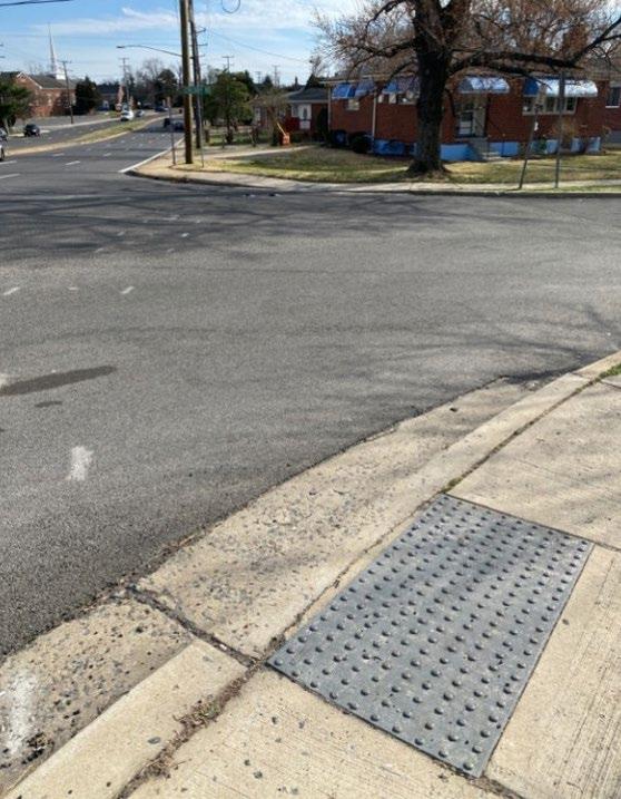
Curb ramps exist at most intersections where sidewalks are present; however, some do not align with the crosswalks they serve (Figure 11). Misaligned curb ramps prevent people that are vision-impaired from comfortably entering the crosswalk. Misaligned curb ramps force people that use wheelchairs and strollers to go into motor vehicle travel lanes to access the crosswalk.
Most curb ramps have detectable warning surfaces except for the following locations:
• Driveway entrances to University Plaza West and Hechinger Plaza Shopping Center on University Boulevard
• 18th Avenue and Erskine Street (both ramps)
• 17th Avenue and Erskine Street (both ramps)
• 16th Place and Elson Street (curb ramp on west side of Elson)
• 17th Avenue and Amherst Road (both ramps) (Figure 12)
• Crosby and Amherst Road (both ramps)
2024 Carole Highlands Safe Mobility Study Prince George’s County Planning Department Page 35
Figure 11 � A curb ramp that improperly feeds a crosswalk near Riggs Road in the study area � (PHOTO BY TOOLE DESIGN GROUP )
TRANSPORTATION
Figure 12 � A curb ramp at 17th Avenue and Amherst Road has no detectable warning surface � (PHOTO BY TOOLE DESIGN GROUP )
Bicycle Infrastructure and Shared-Use Paths
The study area includes a section of the Sligo Creek Trail, a hard-surface shared-use path that runs along Sligo Creek at the southern end of the study area. There are no other bicycle facilities in the study area; however, separate bike lanes/cycle tracks are planned along University Boulevard with the development of the Purple Line.
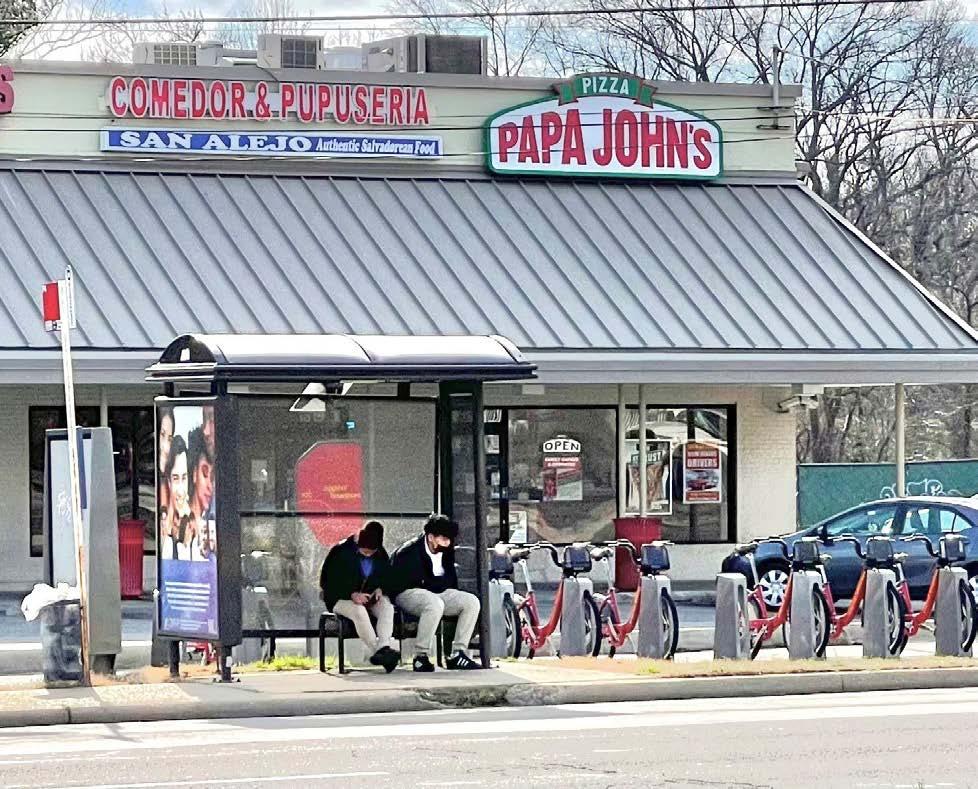
There are two Capital Bikeshare docks near the study area: one in front of the Takoma Recreation Center on New Hampshire Avenue, and another in front of the Papa John’s Pizza store on the south side of East West Highway near Riggs Road.
A wave (also known as a ribbon) bicycle rack along with a bicycle parking sign has been placed near the southeast corner of 15th Avenue and University Boulevard on private property (Figure 13). Bicyclists prefer something other than this type of bicycle rack because, if used as intended, the rack does not provide sufficient support for bicycle frames. Further, its location is on the edge of the parking lot, away from the entrances of the stores, which means it is unlikely to be used by store patrons traveling by bicycle. Short-term bicycle parking should ideally be closer to store entrances rather than the nearest motor vehicle parking space.
Public Transportation Infrastructure

Figure 13 � This inappropriate bike rack design falls short of County specifications (PHOTO BY M-NCPPC)
The study area is served by several Metrobus lines. The C2, C4, F8, and J4 lines serve stops along University Boulevard; the C4 and R1 bus lines serve Riggs Road; and the F4 bus line has stops along East West Highway. Adjacent to the study area, Metrobus K6 runs along New Hampshire Avenue.
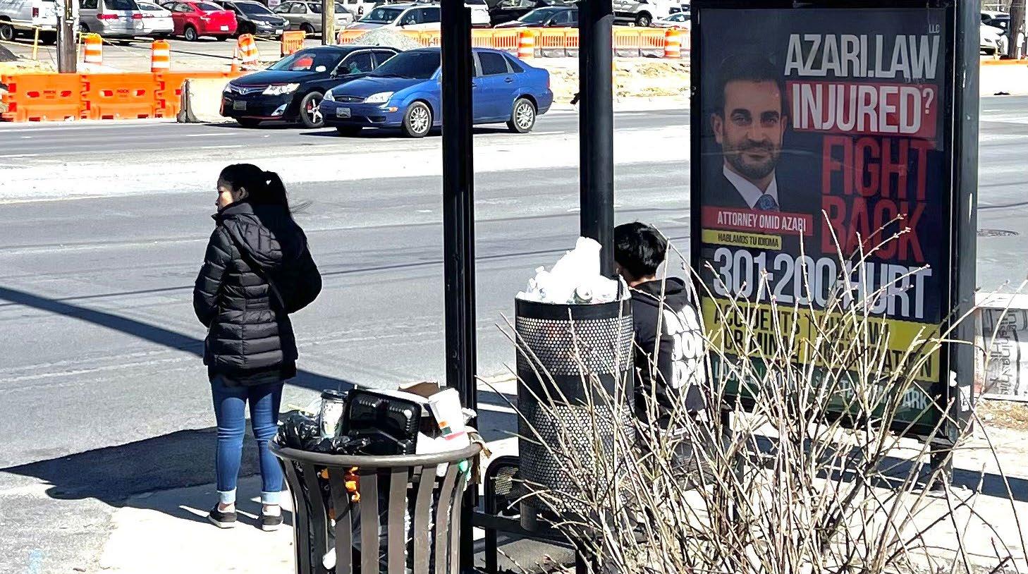
The study area is also served by Route 18 of the County’s TheBus and the University of Maryland’s Shuttle-UM, both of which have stops on University Boulevard. Most bus stops lack shelters and benches. There is only one bus stop with a shelter in the study area; it is located in front of Hechinger Plaza on University Boulevard. There are two additional bus stops with shelters adjacent to the Carole Highlands study area. One is on the north side of University Boulevard; the other is on the south side of East West Highway.
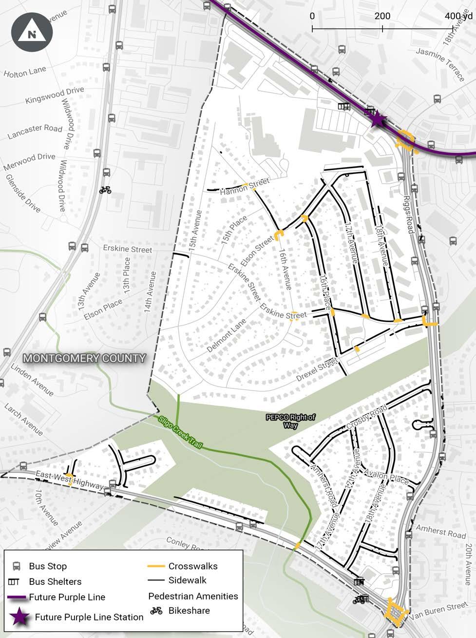
See Map 3 for an illustration of existing pedestrian, bicycle, and public transit infrastructure.
Page 36 2024 Carole Highlands Safe Mobility Study Prince George’s County Planning Department
�
�
2024 Carole Highlands Safe Mobility Study Prince George’s County Planning Department Page 37 TRANSPORTATION
Figure 14
A Capital Bikeshare station adjacent to a bus stop shelter, just beyond the study area boundary � (PHOTO BY M-NCPPC)
Figure 15
The only sheltered bus stop in Carole Highlands has missing glass panels and overflowing trash receptacles � (PHOTO BY M-NCPPC)
Page 38 2024 Carole Highlands Safe Mobility Study Prince George’s County Planning Department
Map 3 � Existing Pedestrian, Bicycle, and Public Transit Infrastructure

Students and caregivers emerge from the Hannon Street informal trail after dismissal from Carole Highlands Elementary School (PHOTO BY M-NCPPC)
2024 Carole Highlands Safe Mobility Study Prince George’s County Planning Department Page 39
TRANSPORTATION
Circulation and Access Section 5
Pedestrian Circulation and Access
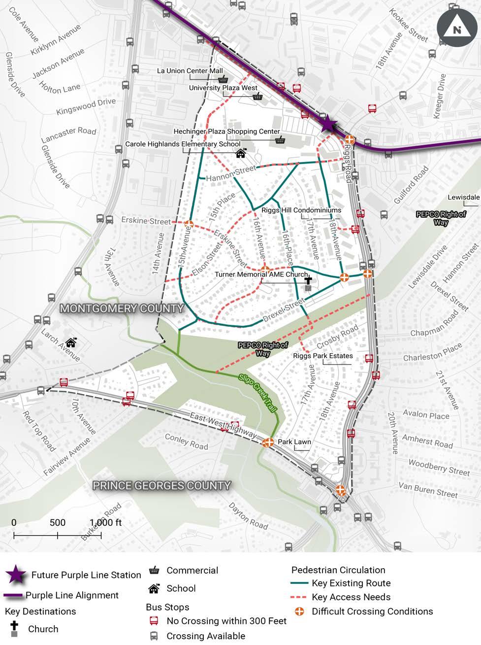
Pedestrian circulation is concentrated on streets with sidewalks and on key access routes to Carole Highlands Elementary, the University Boulevard commercial area, public transit stops, and the Sligo Creek Trail.
PEDESTRIAN ACCESS BETWEEN HANNON STREET/17TH AVENUE INTERSECTION AND CAROLE HIGHLANDS ELEMENTARY SCHOOL
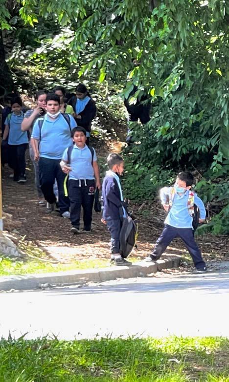
Many Carole Highlands Elementary School students come from the Riggs Hill Condominiums and use the Hannon Street goat path connection between the intersection at Hannon Street and 17th Avenue and the elementary school (Figure 16). Although it is possible to access the school from the Riggs Hill condominiums via sidewalks on Elson Street and 16th Avenue, this route is significantly longer for most Riggs Hill residents, so many prefer to use the informal path connection to access the school.
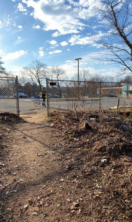
A gate providing access to the school from the trail was temporarily closed, but later reopened following complaints from parents of students attending the school (Figure 17).
Page 42 2024 Carole Highlands Safe Mobility Study Prince George’s County Planning Department
Figure 17 � A gate from an informal trail allows access to Carole Highlands Elementary School � (PHOTO BY TOOLE DESIGN GROUP )
Figure 16 � Students return from school through the informal Hannon Street goat connector trail � (PHOTO BY M-NCPPC)
PEDESTRIAN ACCESS BETWEEN THE 18TH AVENUE/HANNON STREET INTERSECTION AND UNIVERSITY BOULEVARD, RIGGS ROAD
The commercial areas and public transit stops on University Boulevard are key destinations for pedestrians in Carole Highlands. However, there are no convenient, accessible pathways or sidewalks to these destinations.
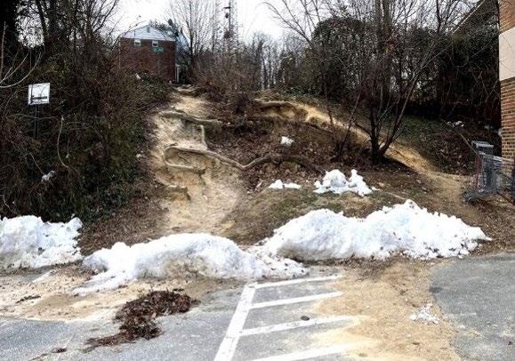
Many residents use the informal paths that connect to these areas from locations near the intersection of 18th Avenue and Hannon Street (Figures 18–20). This informal trail is split between County property and commercial property. However, the Riggs Hill Condominiums recently installed a fence that presents a challenge for pedestrians attempting to reach the path that connects to Hechinger Plaza. The remaining path options are steep and laced with tree roots. One resident observed an older adult pedestrian fall while traversing the path. The pedestrian was unable to stand up without assistance from a neighbor. An accessible path from 18th Avenue and Hannon Street would provide much more convenient access for Carole Highlands residents to the future Riggs Road Purple Line Station.


2024 Carole Highlands Safe Mobility Study Prince George’s County Planning Department Page 43 CIRCULATION AND ACCESS
Figure 19 � A fence limits pedestrian access from 18th Avenue and the Hannon Street goat trail to the University Boulevard retail shops � (PHOTO BY M-NCPPC)
Figure 20 � And informal trail is seen from a parking area on the south side of the University Plaza Shopping Center� (PHOTO BY M-NCPPC)
Figure 18 � An informal trail from the Hannon Street and 18th Avenue intersection allows access to commercial areas on University Boulevard (PHOTO BY M-NCPPC)
PEDESTRIAN ACCESS BETWEEN HOLTON LANE AND UNIVERSITY BOULEVARD VIA 15TH AVENUE
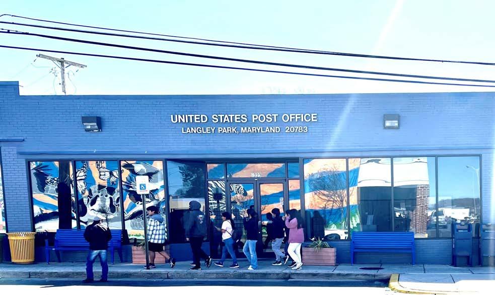
Fencing blocks a potential access point between 15th Avenue and Holton Lane, where a United States Post Office, a grocery store, and other destinations are located. This would be a logical route for Carole Highlands residents to access the Takoma Langley Crossroads Transit Center and adjacent future Takoma-Langley Purple Line Station.
SIDEWALK NEEDS
Community members have requested sidewalks on:
• Erskine Street (Figure 44)
• Drexel Street
• 15th Avenue
• 15th Place
• 16th Avenue south of Elson Street
• 18th Avenue south of Hannon Street on the east side (Figure 22)
• Hannon Street west of 18th Avenue on the north side
• Elson Street south of 16th Avenue
• Delmont Lane
Community members also reported concerns about the narrow, unbuffered sidewalks on Riggs Road, and vegetative overgrowth into the sidewalk along the Pepco right-of-way and on the west side of Riggs Road south of University Boulevard.
PEDESTRIAN CROSSING NEEDS
Community members reported concerns about pedestrian crossing conditions at the following intersections:
• 16th Avenue and Hannon Street
• 16th Avenue and Elson Street
• Erskine Street and 15th Avenue
• Erskine Street and Elson Street
• Erskine Street and 16th Avenue
• Erskine Street and 16th Place
• Erskine Street and 17th Avenue
• Erskine Street, Drexel Street, and 18th Avenue
• East West Highway and Riggs Road
• East West Highway and Chillum Manor Road
• East West Highway and Fairview Avenue
• University Boulevard and Riggs Road
• Drexel Street and Riggs Road
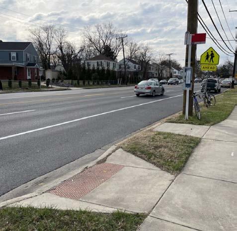
The crossing concerns at the intersections of East West Highway and Chillum Manor Road and East West Highway and Fairview Avenue (Figure 23) relate to the bus stops at these locations and the lack of safe and convenient pedestrian crossings across East West Highway. See Map 4 for an illustration of key existing pedestrian routes and access needs, including bus stops on arterial roadways that are more than 300 feet from a signalized crossing.
Page 44 2024 Carole Highlands Safe Mobility Study Prince George’s County Planning Department
�
and

2024 Carole Highlands Safe Mobility Study Prince George’s County Planning Department Page 45
Figure 22 � The east side of 18th Avenue south of Hannon Street lacks a sidewalk ( PHOTO BY TOOLE DESIGN GROUP)
Figure 23 � A bus stop on East West Highway at Fairview Avenue is not located near a controlled crossing location ( PHOTO BY TOOLE DESIGN GROUP )
AND ACCESS
Figure 21
Some Carole Highlands residents would like a shared-use path between 15th Avenue
Holton Lane to access the Holton Lane shops, post office, and other areas (PHOTO BY M-NCPPC)
CIRCULATION
Page 46 2024 Carole Highlands Safe Mobility Study Prince George’s County Planning Department
Key
Map 4 �
Existing Pedestrian Routes and Access Needs
Bicycle Circulation and Access Needs
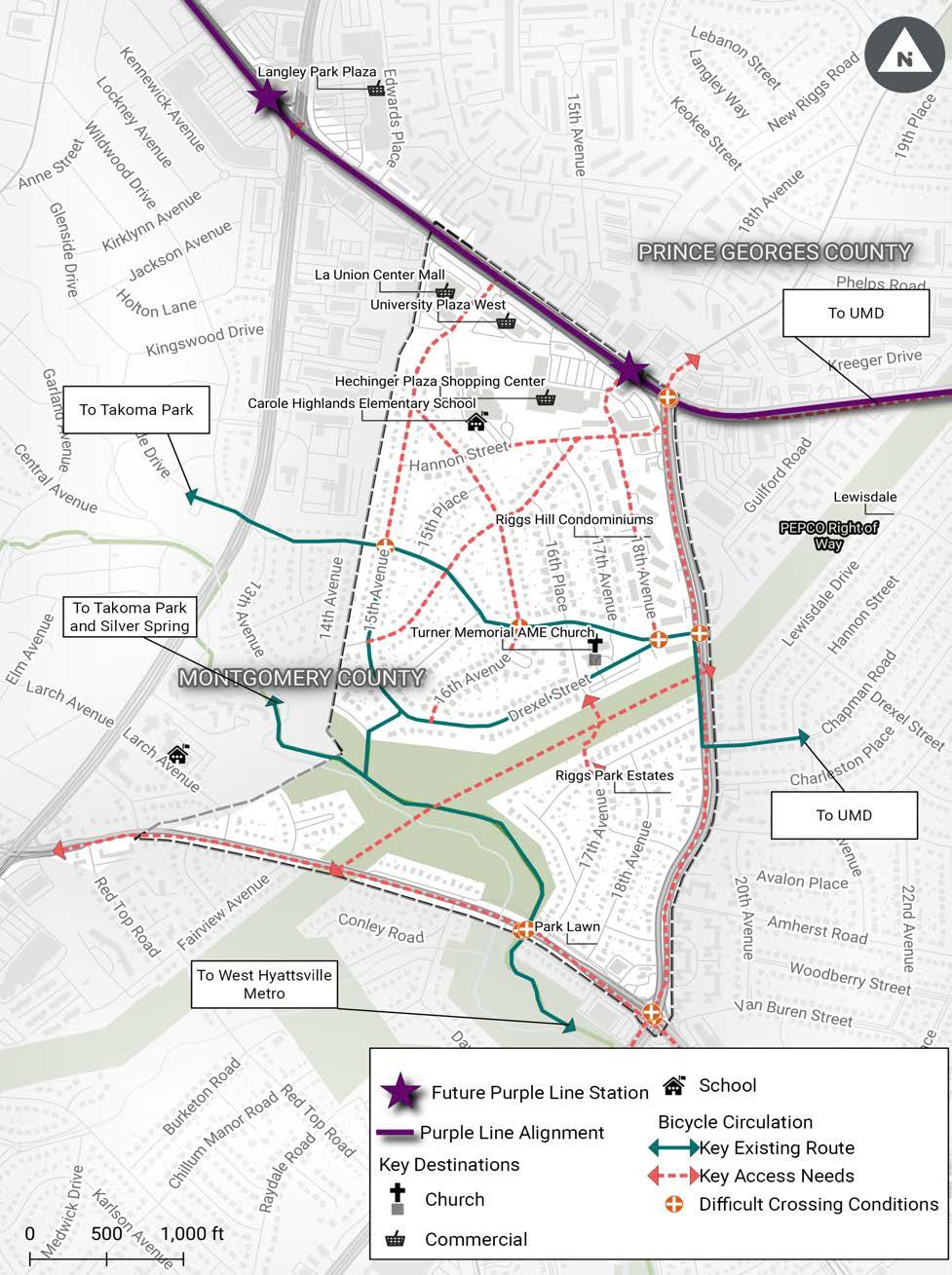
Bicycle circulation is focused on the Sligo Creek Trail and the connecting spur trail from Sligo Creek Parkway. Bicyclists also use Erskine Street to travel through the neighborhood and between Takoma Park and the University of Maryland campus.
Bicyclists avoid the arterial roadways on the edges of the study area because of a lack of dedicated space for them and the speed and volume of motor vehicles. When cyclists choose to travel on these roads, they often ride on the sidewalks because they are intimidated by roadway traffic. Cycling on a sidewalk presents a safety hazard for pedestrians and cyclists; narrow sidewalks often lack a buffer that separates pedestrian and bicycle commuters from motor vehicle traffic. This can create conflicts with pedestrians walking on sidewalks, and with motorists at intersections.
Community members reported concerns about bicyclist crossing conditions where the Sligo Creek Trail crosses MD 410 (East West Highway) (Figure 24). In addition, community members noted that temporary plywood acting as ramp access to a bridge over Sligo Creek north of East West Highway is in poor condition due to rot (Figure 25). The Department of Parks and Recreation staff reported that these ramps have been replaced with interim ramps while awaiting additional work for permanent repair.
Finally, community members requested a bicycle repair station on the Sligo Creek Trail and bicycle access through the neighborhood to the commercial areas on University Boulevard (see Figures 48-50).
See Map 5 for an illustration of key existing bicycle routes and access needs.
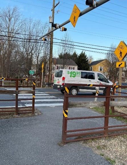
Figure 24 � Sligo Creek Trail crossing at MD 410 (East West Highway) � (PHOTO BY M-NCPPC)
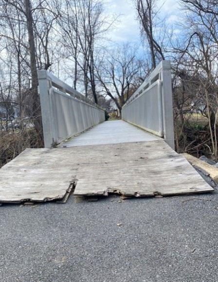
Figure 25 � A bridge crosses Sligo Creek on the north side of MD 410 (East West Highway) � ( PHOTO BY TOOLE DESIGN GROUP )
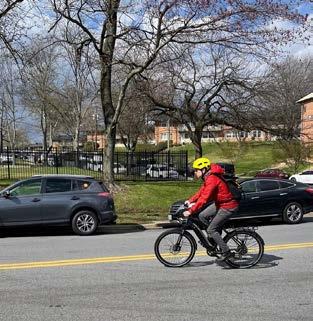
Figure 26 � A bicycle commuter travels westbound in the 1700 block of Erskine Street � (PHOTO BY M-NCPPC)
2024 Carole Highlands Safe Mobility Study Prince George’s County Planning Department Page 47
CIRCULATION AND ACCESS
Page 48 2024 Carole Highlands Safe Mobility Study Prince George’s County Planning Department
Key
Map
5 �
Existing Bicycle Routes and Access Needs
Public Transit Circulation and Access
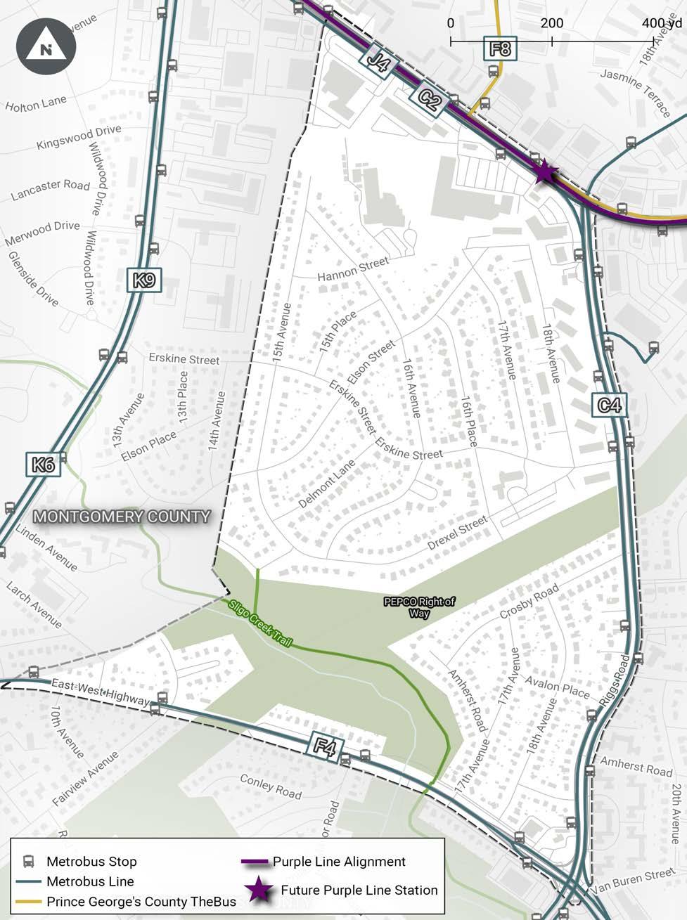
Public transit circulation is limited to arterial roadways at the edge of Carole Highlands, including University Boulevard, Riggs Road, East West Highway, and New Hampshire Avenue.
• University Boulevard is served by the C2, C4, F8, and J4 Metrobus lines, the number 18 line of Prince George’s County TheBus, and Shuttle UM. The future Purple Line will also travel down University Boulevard.
• Riggs Road is served by the C4 and R1 Metrobus lines.
• East West Highway is served by the F4 Metrobus line.
• New Hampshire Avenue is served by the K6 and K9 Metrobus lines.
No public transit buses travel through Carole Highlands’ interior. See Map 6 for an illustration of existing public transit routes.
Motor Vehicle Circulation and Access
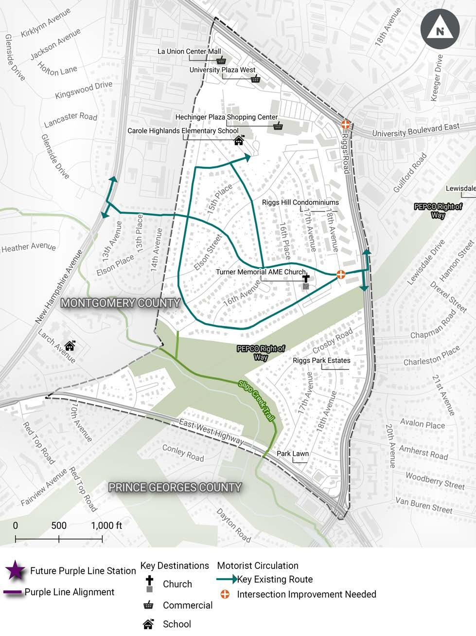
Motor vehicle circulation is concentrated on the arterial roadways surrounding Carole Highlands and on Erskine Street, which is used by some drivers as a shortcut between Riggs Road and New Hampshire Avenue. In addition, there is a motor vehicle circulation pattern associated with arrival and dismissal at Carole Highlands Elementary School that includes 16th Avenue, Hannon Street, and 15th Avenue.
Community members reported a need for an electric vehicle charging station within the Carole Highlands study area and a need for intersection improvements at several locations, including the University Boulevard/Riggs Road intersection and the Erskine Street/Drexel Street/18th Avenue intersection. One community member requested that the speed humps on Erskine Street be removed.
See Map 7 for an illustration of key existing motor vehicle routes and access needs.

2024 Carole Highlands Safe Mobility Study Prince George’s County Planning Department Page 49
CIRCULATION AND ACCESS
Figure 27 � A commuter departs a Metrobus at Riggs Road north of Drexel Street � (PHOTO BY M-NCPPC)
Page 50 2024 Carole Highlands Safe Mobility Study Prince George’s County Planning Department
6 � Key Existing Public Transportation Transit Access
Map
2024 Carole Highlands Safe Mobility Study Prince George’s County Planning Department Page 51
7 � Key Existing Motor
CIRCULATION AND ACCESS
Map
Vehicle Routes and Access Needs
Safety Section 6
Crashes
Over a 6-year period, from 2015 to 2020, there were 679 reported crashes in the study area. Of the reported crashes in the study area, 644 involved only motorists and 35 involved a motorist and a pedestrian or bicyclist.4 Twentythree percent of all crashes resulted in a person being killed or seriously injured (KSI), including 19 percent of crashes involving only motorists and 89 percent of crashes involving a pedestrian or bicyclist and a motorist. In the case of crashes involving a pedestrian or bicyclist and a motorist, the victim was always the pedestrian or bicyclist.5
Overall, KSI crashes trended down from 2015 to 2020 (Figure 28), with the highest number of KSI crashes (39) occurring in 2016. However, pedestrian and bicyclist crashes have not followed this downward trend, with the peak year occurring in 2018.
CRASH LOCATION
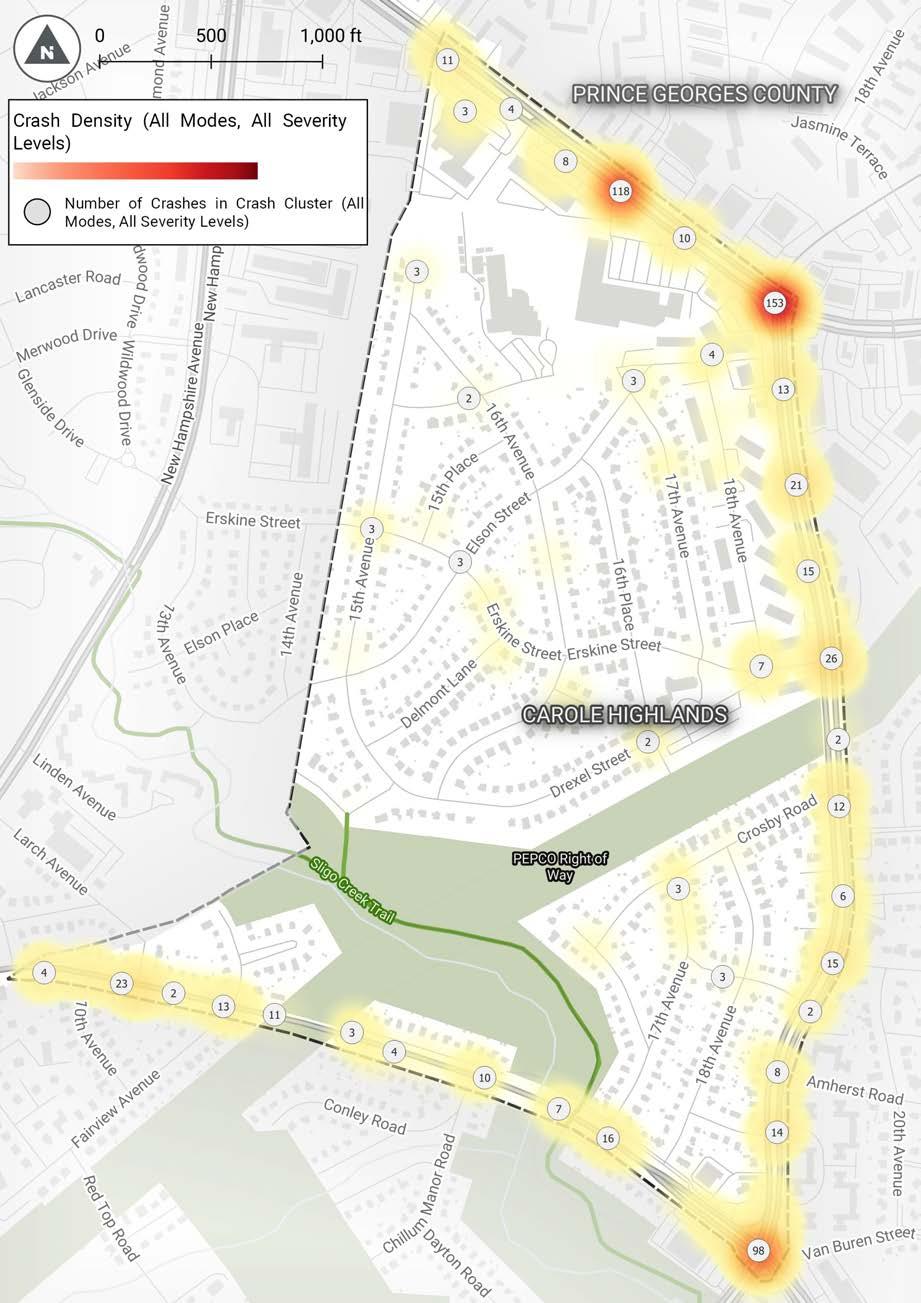
Crashes are concentrated on the arterial roadways surrounding Carole Highlands, particularly at the intersections of MD 193 (University Boulevard) and MD 212 (Riggs Road), University Boulevard and 15th Avenue, and Riggs Road and East West Highway. Comparatively few crashes occurred on neighborhood streets within Carole Highlands. Seven of the neighborhood crashes, one-third of the total, occurred at the Erskine Street, Drexel Street, and 18th Avenue intersection. There were also three crashes at 18th Avenue and Hannon Street, three crashes on 15th Avenue north of 16th Avenue, two crashes at 16th Place and Drexel Street, and three crashes at Erskine Street and 15th Avenue. See Map 8 for additional detail on where crashes are concentrated in the study area.
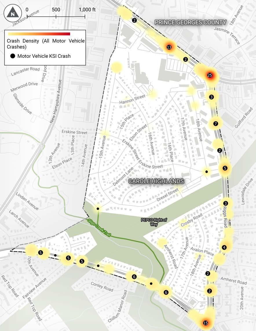
LOCATION OF MOTOR VEHICLE KSI CRASHES
Motor vehicle KSI (killed or seriously injured) crashes follow the pattern for overall crashes, with 25 motor vehicle KSIs at the University Boulevard/Riggs Road intersection, 15 motor vehicle KSIs at the Riggs Road/East West Highway intersection, and 13 KSIs at the University Boulevard/15th Avenue intersection. In addition, there were 29 motor vehicle KSIs on Riggs Road between University Boulevard and East West Highway and 25 motor vehicle KSIs on East West Highway between Riggs Road and the Montgomery County line. Only two motor vehicle KSIs occurred on streets in the interior portion of the Carole Highlands study area (at the intersection of Erskine Street, Drexel Street, and 18th Avenue and along Sligo Parkway East).
See Map 9 for additional detail on where motor vehicle KSI crashes are concentrated in the study area. The heat map indicates the density of crashes in locations throughout the study area. Those points illustrated on the map by a black dot and a number symbolize locations where there have been at least one KSI crash. A black dot without a number indicates there was only one KSI crash.
4 Pedestrians and bicyclists are not distinguished in the crash data.
5 Data are from MDOT SHA.
Page 54 2024 Carole Highlands Safe Mobility Study Prince George’s County Planning Department
0 5% 10% 15% 20% 25% 30% 35% 40% 45%
2020 2019 2018 2017 2016 2015 28% 32% 22% 15% 6% 6% 7% 3% 10% 4% 5% 17%
Motor Vehicle KSI Bike/Pedestrian KSI
Figure 28 � KSI Crashes by Year
�
2024 Carole Highlands Safe Mobility Study Prince George’s County Planning Department Page 55 SAFETY
Map 8
Crash Density Map (All Modes, All Levels of Crash Severity)
LOCATION OF PEDESTRIAN/BICYCLIST KSI CRASHES
Pedestrian and bicyclist KSI crashes were concentrated at the intersection of University Boulevard and 15th Avenue, where almost half of all pedestrian and bicyclist KSI crashes were reported. University Boulevard and Riggs Road, with five KSI crashes, was another pedestrian/bicyclist KSI hot spot. There were seven pedestrian/bicyclist KSIs on Riggs Road with all but one occurring in the
Page 56 2024 Carole Highlands Safe Mobility Study Prince George’s County Planning Department
�
Map 9
Motor Vehicle KSI Crash Density
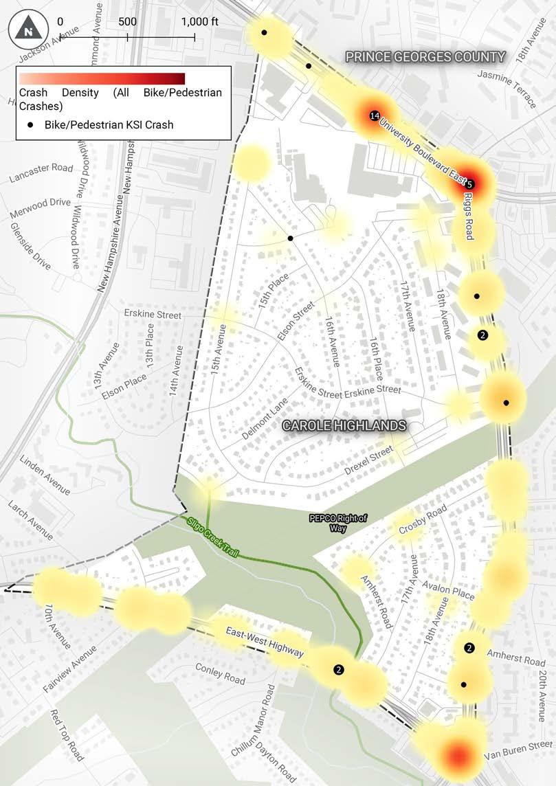
mid-block locations. One crash occurred at the intersection of Riggs Road and Erskine Street. Two pedestrian/bicyclist KSIs occurred near the Sligo Creek Trail crossing of East West Highway. One pedestrian/bicyclist KSI occurred at 16th Avenue and Hannon Street near Carole Highlands Elementary School. See Map 10 for additional detail on where pedestrian and bicyclist KSI crashes are concentrated in the study area.
2024 Carole Highlands Safe Mobility Study Prince George’s County Planning Department Page 57
SAFETY
Map 10 � Pedestrian and Bicycle KSI Crash Density
CRASH TYPES AND PRE-CRASH MOVEMENTS
For motor vehicle crashes, the crash types and pre-crash movements were as follows:
For pedestrian and bicycle crashes, the pedestrian/cyclist locations and pre-crash movements were as follows:

Page 58 2024 Carole Highlands Safe Mobility Study Prince George’s County Planning Department
rear end 39.0% side swipe 16.8% backing up 13.2% left turn 10.9% driverless moving vehicle 10.2% parking/parked vehicle 4.8% head on 3.4% right turn 1.6% mid-block crossing 42.9% crossing at intersection with a crosswalk 28.6% standing on roadway 5.7% walking on the roadway with no sidewalk 5.7% playing in roadway 2.9% walking on the sidewalk 2.9% unknown/not reported 11.3%
Figure 29
�
Pedestrians walk along University Boulevard at 15th Avenue in the study area � (PHOTO BY M-NCPPC)
Traffic Safety Concerns SPEEDING
Community members reported concerns about speeding on several streets in Carole Highlands:
• Erskine Street
• Drexel Street
• 15th Avenue
• 16th Avenue
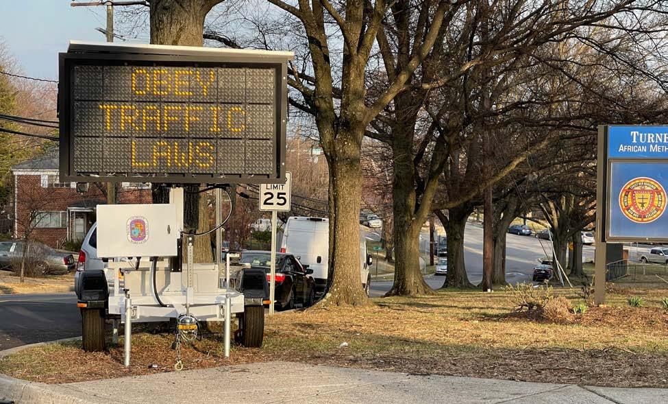
Despite the installation of speed humps, speeding on Erskine Street remains a concern, leading to a recent speed awareness event near the intersection of Erskine Street and Drexel Street (Figure 29). The Carole Highlands Neighborhood Association has requested speed humps on Drexel Street, 15th Avenue (from Drexel Street to Hannon Street) (Figure 30), and 16th Avenue (from Erskine Street to Hannon Street).
The Prince George’s County DPW&T rejected this request in 2018 because the streets did not meet criteria used by their Neighborhood Traffic Management Program compared to other streets in the County where similar requests were made. The Carole Highlands Neighborhood Association continues to pursue speed humps on Drexel Street, 15th Avenue, and 16th Avenue.
2024 Carole Highlands Safe Mobility Study Prince George’s County Planning Department Page 59
SAFETY
Figure 30 � A variable message sign encourages drivers to obey traffic rules near Erskine Street at 16th Place in the study area � (PHOTO BY M-NCPPC)
Figure 31
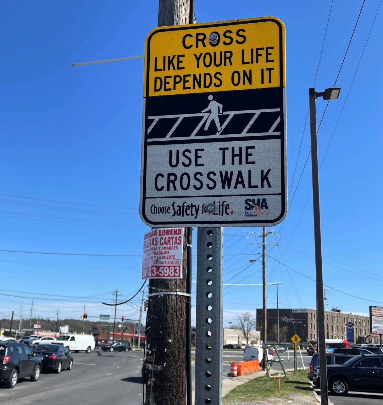
� A pedestrian safety message west of Riggs Road on University Boulevard encourages the use of crosswalks � (PHOTO BY M-NCPPC)
• East West Highway and Riggs Road
• East West Highway and Sligo Creek Trail
Page 60 2024 Carole Highlands Safe Mobility Study Prince George’s County Planning Department

Figure 32 � The parking lot of the Turner Memorial AME Church on Drexel Street is a source of personal security concern for study area participants � (PHOTO BY M-NCPPC)
Personal Security Concerns
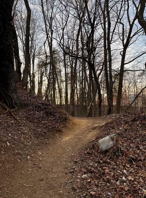
Figure 33 � The absence of lighting reduces the perception of personal safety along the Hannon Street connector goat trail (PHOTO BY M-NCPPC)
Community members reported concerns about personal security on the informal paths between the 17th Avenue/Hannon Street intersection and Carole Highlands Elementary School, and between the 18th Avenue/Hannon Street intersection and Hechinger Plaza and other destinations near the University Boulevard/Riggs Road intersection. There are also concerns about personal security in the Turner Memorial AME Church parking lot on Drexel Street, on the Sligo Creek Trail, and on the connecting spur trail from Sligo Creek Parkway. These concerns relate to specific incidents and the absence of lighting in many locations.
2024 Carole Highlands Safe Mobility Study Prince George’s County Planning Department Page 61
SAFETY
7
Opportunities, Constraints, and Considerations Section
Opportunities
There are many opportunities to improve safe mobility and access in the study area. This section highlights three: the Purple Line, zoning requirements, and the Sligo Creek Trail.
PURPLE LINE
Once constructed, the Purple Line will provide transit access to jobs and activity centers in Bethesda, Silver Spring, College Park, and New Carrollton with easy transfers to Metrorail, Amtrak, and MARC. Two Purple Line stations are planned near the study area: one on University Boulevard west of Riggs Road and one near the intersection of University Boulevard and New Hampshire Avenue adjacent to the Takoma Langley Crossroads Transit Center. If pedestrian and bicycle access to these stops can be provided, it will dramatically improve public transportation access from the study area to other destinations in the Washington metropolitan area. The increased access provided by the Purple Line can trigger new opportunities to formalize path connections to University Plaza, Hechinger Plaza, and add a passage from the northwest section of the neighborhood to Holton Lane.
ZONING REQUIREMENTS
The commercial area along University Boulevard is zoned Local Transit-Oriented-Core (LTO-C). This zoning designation requires that all new developments provide sidewalks that connect to adjacent multifamily housing.6 There may be an opportunity to leverage this requirement to build connections between Hannon Street/18th Avenue and University Plaza and Hechinger Plaza as the shopping centers are redeveloped. Marc Kapastin, general counsel of the Quantum Properties stated, “We recommend that the lower triangular portion of the (Carole Highlands Elementary) school property should be incorporated into a mixed-use development of the Quantum Properties. This redevelopment would well and securely provide formalization of several of the existing impromptu challenging access paths to the school.”7
SLIGO CREEK TRAIL
The Sligo Creek Trail is another asset in Carole Highlands that can offer more options for mobility with the installation of lighting, additional wayfinding signage to surrounding destinations, and the improvement of pedestrian access to the trail. Access can be improved by providing more connections to the trail from the interior of the Carole Highlands neighborhood through the Pepco right-of-way and by improving conditions where the trail crosses arterial roadways, particularly East West Highway and Riggs Road.
6 https://library.municode.com/md
7 Marc “Kap” Kapastin email to Michael Jackson (December 16, 2022).
Page 64 2024 Carole Highlands Safe Mobility Study Prince George’s County Planning Department
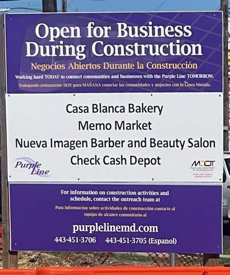
Figure 34 � Purple Line construction along MD 193 (University Boulevard) has caused business disruption along the International Corridor, within and adjacent to Carole Highlands (PHOTO BY M-NCPPC)
OPPORTUNITIES, CONSTRAINTS, AND CONSIDERATIONS
Constraints and Considerations
COORDINATING WITH PROPERTY OWNERS TO BUILD NEW TRAIL CONNECTIONS
Building the new connections identified in this study will require Prince George’s County to coordinate with private property owners. A list of potential new connections and corresponding property owners is provided below.
• Connection from 15th Avenue to Holton Lane—Prince George’s County Board of Education and residential property owners at the end of 15th Avenue (Figure 35)
• Connection from Hannon Street/ 17th Avenue to Carole Highlands Elementary School—Quantum Companies
• Connections from Hannon Street/18th Avenue to University Hechinger Plaza, University Boulevard, and Riggs Road—Riggs Hill Condominiums, Quantum Companies (Figures 36 and 40)
• Connection from 18th Avenue to Riggs Road—Riggs Hill Condominiums
• Connections across and/or along the Pepco right-of-way

Figure 35 � A proposed shared-use path would connect 15th Avenue to Holton Lane through the Board of Education property (PHOTO BY M-NCPPC)


Figure 36 � Quantum Properties land holdings is enclosed by a purple boundary line ( AERIAL PHOTOGRAPH BY QUANTUM PROPERTIES)
2024 Carole Highlands Safe Mobility Study Prince George’s County Planning Department Page 65
UniversityBlvd193 15thAve RiggsRd Hannon St 18th Ave Hannon St GRAPHIC SCALE University Plaza N:\_Spec Projects\MD-Prince Georges\University Plaza\dwg\exhibits\Aerial Exhibit.dwg Layout1 Sep 14, 2018, 1:37pm Hyattsville, MD Aerial Exhibit LA Union Shopping Center Riggs Hill Condos Pep Boys Tick Tock General Notes: Base information is from The Maryland-National Capital Park and Planning Commission Prince George's County Planning Department Information Management Division dated 2014 where available. The contour interval shown is 10'. The aerial photography is from the Prince George's County GIS Department dated 2016.
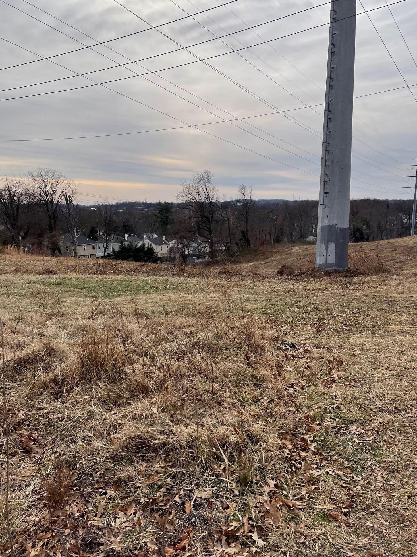
37 � Southerly view of the Pepco right-of-way in the study area (PHOTO BY M-NCPPC)
line rights-of-way. In 2018 Pepco opened the
Page 66 2024 Carole Highlands Safe Mobility Study Prince George’s County Planning Department
Figure

An eastbound view of University Boulevard at 15th Avenue in the study area (PHOTO BY M-NCPPC)
2024 Carole Highlands Safe Mobility Study Prince George’s County Planning Department Page 67
OPPORTUNITIES, CONSTRAINTS, AND CONSIDERATIONS
LIMITED STREET RIGHT-OF-WAY AND POTENTIAL HOMEOWNER OPPOSITION TO SIDEWALK CONSTRUCTION
Expanding existing sidewalks and constructing new ones requires consideration of the limits of the public right-of-way, motor vehicle access needs, and the impact on adjacent homeowners. Although there is often sufficient right-of-way on both sides of neighborhood streets to construct or widen a sidewalk8 to meet the County’s 5-foot minimum width standard, some homeowners may resist sidewalk construction adjacent to their property due to sidewalk maintenance requirements, perceived loss of yard space, loss of mature trees, or for other reasons. In addition, most streets within the study area are already too narrow to construct a sidewalk or separate pedestrian space, considering street curvature and traffic volumes. One exception may be 15th Avenue north of Elson Street, which is straight. See Appendix F for public right-of-way dimensions for key streets in the study area.
LIMITED PUBLIC RIGHT-OF-WAY AND MOTOR VEHICLE CAPACITY NEEDS ON RIGGS ROAD AND UNIVERSITY BOULEVARD
Existing motor vehicle capacity conditions and public right-of-way limitations present a challenge to sidewalk expansion and bicycle facility construction on Riggs Road and University Boulevard. One solution is to reduce driving along these corridors by improving public transit service and pedestrian and bicycle access. Pedestrian and bicycle access improvements are planned on University Boulevard with construction of the Purple Line and will shift travel behaviors away from single-occupancy vehicles. Similar opportunities on Riggs Road may exist, such as narrowing the median, thus reallocating space to sidewalk expansion or the construction of shared-use paths. (Figure 39).
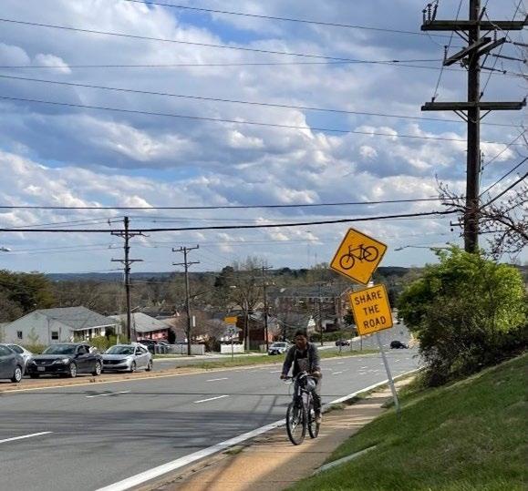
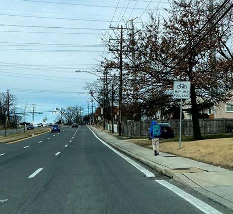
� Median reduction presents an opportunity to convert the Riggs Road sidewalk into a shared-use path
Page 68 2024 Carole Highlands Safe Mobility Study Prince George’s County Planning Department
8 Riggs Road is the exception to this rule. On the west side of Riggs Road, the distance between the edge of the right-of-way and the curb edge and is generally less than five feet. On the east side of Riggs Road, the distance between the edge of the curb and the edge of the right-of-way is generally over 10 feet.
Figure 39
(PHOTO BY M-NCPPC)
Figure 38 � A bicyclist uses a sidewalk to ride along Riggs Road in the study area (PHOTO BY M-NCPPC)
ENVIRONMENTAL PROTECTION CONCERNS IN THE PEPCO RIGHT-OF-WAY
The Carole Highlands Neighborhood Association prioritizes environmental protection of the Pepco right-of-way, which is a sanctuary for birds and other animals. The neighborhood association leads monthly nature hikes in the right-of-way and has worked with Pepco to decrease mowing and protect the right-of-way from invasive species. The neighborhood association prefers natural-surface trails in the Pepco right-of-way over paved shared-use paths.
TOPOGRAPHY, UTILITY POLES, AND MATURE TREES
Topography, utility poles, and mature trees create challenges for sidewalk and path construction in the study area. Retaining walls may be needed along some segments due to slopes. In addition, mature trees may need to be cut down. Utility poles may need to be relocated, or the sidewalk may need to be routed around the pole.
There are steep slopes along the potential pathway connections from Hannon Street and 18th Avenue and at some locations along trail alignments within the Pepco right-of-way. To make these potential pathways more accessible, one solution is to build switchback trails. In addition, a pathway connection through the Pepco right-of-way to East West Highway would require the construction of a bridge over Sligo Creek that is estimated to be 100 feet long, at minimum.
2024 Carole Highlands Safe Mobility Study Prince George’s County Planning Department Page 69
OPPORTUNITIES, CONSTRAINTS, AND CONSIDERATIONS
Figure 40 � The intersection of 18th Avenue and Hannon Street is the site of an informal pathway connection to the commercial International Corridor� (PHOTO BY M-NCPPC)
Section 8 Recommendations
This section includes recommendations to improve safe mobility in Carole Highlands. These recommendations are based on:
• The Carole Highlands Safe Mobility Study goals, which are to maximize safe mobility in Carole Highlands and enhance access and connectivity to the Purple Line, University Boulevard, and other important community-identified destinations
• A review of the policy and planning context, including location-specific recommendations from previous plans
• Public input gathered during stakeholder meetings, the Carole Highlands Community Walk Audit, and the online Carole Highlands Safe Mobility Project Community Input Survey
• Evaluation of existing demographics, travel behaviors, and land uses
• Evaluation of existing transportation infrastructure, circulation, and access
• Crash analysis and evaluation of traffic safety and personal security concerns reported by Carole Highlands residents
• Evaluation of opportunities, constraints, and considerations
The recommendations are divided into two sections: recommended access and connectivity projects and other project recommendations.
Recommended Access and Connectivity Projects
Recommended access and connectivity projects, shown in Map 11, are the highest priority for enhancing access and connectivity to the Purple Line, University Boulevard, and other key destinations within the study area. The following access and connectivity projects are recommended:
1. Hannon Street and 18th Avenue to University Plaza and Hechinger Plaza shared-use path
2. The informal, Hannon Street connector unpaved path between 17th Avenue and Carole Highlands Elementary School converted to a shared-use path
3. 15th Avenue to Holton Lane shareduse path
4. Erskine Street (18th Avenue to 15th Avenue) sidewalk
5. Erskine Street/Drexel Street/18th Avenue intersection improvements
Each recommended access and connectivity project includes the following information:
• Map ID corresponding to the recommended project’s location in Map 11
• Safety and access issues description
• Recommendation description
• Planning-level concept design
• Planning-level cost estimate
• Potential funding sources
• Implementation schedule with short-term, medium-term, and long-term actions
METHODOLOGY USED TO DEVELOP PROBABLE COST OPINIONS
Opinions of probable cost were developed by identifying major pay items and establishing rough quantities to determine a rough order of magnitude cost. Additional pay items have been assigned approximate lump sum prices based on a percentage of the anticipated construction cost. Planning-level cost opinions include a 30% contingency to cover items that are undefined or are typically unknown early in the planning phase of a project. Unit costs are based on 2021 dollars and were assigned based on historical cost data from the MDOT SHA.
Cost opinions do not include easement and right-of-way acquisition; permitting, inspection, or construction management; engineering, surveying, geotechnical investigation, environmental documentation, special site remediation, escalation, or the cost for ongoing maintenance. The overall cost opinions are intended to be general and used only for planning purposes. Toole Design Group, LLC makes no guarantees or warranties regarding the cost estimate herein. Construction costs vary based on the ultimate project scope, actual site conditions and constraints, schedule, and economic conditions at the time of construction.
Page 72 2024 Carole Highlands Safe Mobility Study Prince George’s County Planning Department

2024 Carole Highlands Safe Mobility Study Prince George’s County Planning Department Page 73 Map 11 � Recommended Access and Connectivity Projects RECOMMENDATIONS
Hannon Street/18th Avenue to University/ Hechinger Plaza Shared-Use Path
ISSUES:
• Major pedestrian and bicycle desire line due to multifamily housing and nearby retail establishments and transit
• No pedestrian accommodation
• Existing, informal, unpaved trail (also called a goat trail or a goat path) is steep and laced with tree roots, which presents a tripping hazard (Figure 20)
• Personal security concerns
RECOMMENDATIONS:
• Construct ADA-compliant shared-use path connections from the intersection of Hannon Street and 18th Avenue to Hechinger Plaza and University Plaza.
• Construct a sidewalk on the north side of Hannon Street and the east side of 18th Avenue to provide a continuous sidewalk connection to a shared-use path from the existing sidewalks on the north side of Hannon Street and the east side of 18th Street.
• Construct a curb ramp at Hannon Street and 18th Avenue to provide bicycle access to shared-use path connections.
• Address personal security concerns with lighting and other design elements, as specified in the concept design.
See Figure 41 for the concept.
PLANNING-LEVEL COST ESTIMATE:
• $861,337
POTENTIAL FUNDING SOURCES:
• Rebuilding American Infrastructure with Sustainability and Equity (RAISE) Program
• Reconnecting Communities Program (RCP)
• Transportation Alternatives Program (TAP)
• Solicit feedback on concept design from Riggs Hill Condominiums, Hechinger Plaza, University Plaza, and Carole Highlands community members.
• Identify a funding source or apply for grant funding.
• Develop 30% design
• Develop subsequent levels of design: 60%, 90%, 100%
• Acquire right-of-way or easement
• Obtain environmental permits
• Construct project
Page 74 2024 Carole Highlands Safe Mobility Study Prince George’s County Planning Department
Implementation Schedule Short-Term Medium-Term Long-Term
ID 1
Map

41 � Hannon Street and 18th Avenue to University Plaza and Hechinger Plaza shared-use concept (CONCEPTUAL ILLUSTRATION BY TOOLE DESIGN)
2024 Carole Highlands Safe Mobility Study Prince George’s County Planning Department Page 75
RECOMMENDATIONS
Figure
Hannon Street/17th Ave to the Carole Highlands Elementary School Informal, Unpaved Path
ISSUES:
• No formal pedestrian accommodation for Carole Highlands Elementary School; only a major pedestrian desire line
• The existing desire line supports high foot traffic, but is narrow not easily accessible, and tree roots along the desire line pose hazardous conditions, such as tripping over roots, especially in inclement weather
• No lighting
• Personal security concerns as people experiencing homelessness occupy an area in the northeast corner of the school property and the site of other reported illegal activities
RECOMMENDATIONS:
• Construct an ADA-compliant shared-use path connection.
• Construct sidewalk on south side of Hannon Street to 16th Avenue (not shown in concept).
• Install lighting and other design elements as specified in concept design.
• Consider incorporating the northeast corner of the Carole Highlands Elementary School property— currently occupied by people experiencing homelessness and the site of other illicit activity— into an adjacent mixed-use redevelopment, an idea proposed by Quantum Properties. Quantum Properties is the owner and operator of Hechinger Plaza, University Plaza, and University Plaza West. See Figure 42 for the concept.
PLANNING-LEVEL COST ESTIMATE:
• $176,590
POTENTIAL FUNDING SOURCES:
• RAISE
• RCP
• TAP
• Solicit feedback on concept design from Hechinger Plaza, Carole Highlands Elementary School, Prince George’s County Public Schools, residential property owners at Hannon Street and 17th Avenue, and other Carole Highlands community members.
• Identify funding source or apply for grant funding.
• Develop 30% design
• Develop subsequent levels of design: 60%, 90%, 100%
• Acquire right-of-way or easement
• Obtain environmental permits
• Construct project Map ID 2
Page 76 2024 Carole Highlands Safe Mobility Study Prince George’s County Planning Department
Implementation Schedule Short-Term Medium-Term Long-Term

Figure 42 � Hannon Street and 17th Avenue to Carole Highlands Elementary School shared use path concept � (CONCEPTUAL ILLUSTRATION BY TOOLE DESIGN)
2024 Carole Highlands Safe Mobility Study Prince George’s County Planning Department Page 77
RECOMMENDATIONS
15th Ave to Holton Lane Shared Use Path Map ID 3
ISSUES:
• Major pedestrian and bicycle desire line due to nearby retail establishments and transit
• No pedestrian accommodation
• Personal security concerns
RECOMMENDATIONS:
• Construct ADA-compliant shared-use path connection.
• Address personal security concerns with lighting and other design elements, as specified in concept design. See Figure 43 for the concept.
PLANNING-LEVEL COST ESTIMATE:
• $296,660
POTENTIAL FUNDING SOURCES:
• RAISE
• RCP
• TAP
• Solicit feedback on concept design from Carole Highlands Elementary School, Prince George’s County Public Schools, residential property owners at the end of 15th Avenue, and other Carole Highlands community members.
• Identify funding source or apply for grant funding.
• Complete topographical survey
• Develop 30% design
• Develop subsequent levels of design: 60%, 90%, 100%
• Acquire right-of-way or easement
• Obtain environmental permits
• Construct project
Page 78 2024 Carole Highlands Safe Mobility Study Prince George’s County Planning Department
Implementation Schedule Short-Term Medium-Term Long-Term
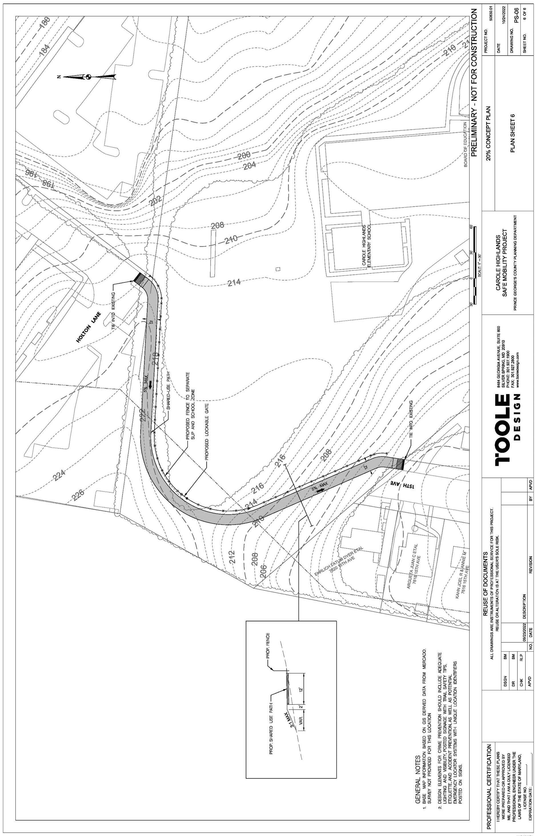
43 � 15th Avenue to Holton Lane shared use path concept � (CONCEPTUAL ILLUSTRATION BY TOOLE DESIGN)
2024 Carole Highlands Safe Mobility Study Prince George’s County Planning Department Page 79
RECOMMENDATIONS
Figure
Erskine Street (15th Ave to 18th Ave) Sidewalk and Shared Lane Markings
ISSUES:
• Significant pedestrian and bicycle desire line due to Erskine Street being Carole Highlands’ only through street connection between Riggs Road and New Hampshire Avenue
• No pedestrian or bicycle accommodation (Figure 44)
• Relatively high motor vehicle volumes and concern about motor vehicle speeds
RECOMMENDATIONS:
• Construct a sidewalk on the south side of Erskine Street. Maintenance of mature trees should be a consideration in sidewalk design.
• Mark high-visibility crosswalks at intersecting streets.
• Mark parking lane edge lines (not shown in concept).
• Install shared lane markings and bicycle wayfinding signage at 15th Avenue and 18th Avenue to facilitate connection to Sligo Trail (not shown in concept).
See Figure 45, Figure 46, and Figure 47 for the concept. Additional recommendations for Erskine Street, not included in the concept, are provided.
PLANNING-LEVEL COST ESTIMATE:
• $411,7349
POTENTIAL FUNDING SOURCES:
• RAISE
• RCP
• TAP
• Solicit feedback on concept design from residential property owners on Erskine and other Carole Highlands community members.
• Identify funding source or apply for grant funding.
• Complete topographical survey
• Develop 30% design
• Develop subsequent levels of design: 60%, 90%, 100%
• Acquire right-of-way or easement
• Obtain environmental permits
• Construct project
9 Cost estimate includes sidewalk on south side of Erskine Street between 16th Place and 18th Avenue. This sidewalk is shown in Figures 45-47 on pages 82-84.
Page 80 2024 Carole Highlands Safe Mobility Study Prince George’s County Planning Department
Implementation Schedule Short-Term Medium-Term Long-Term
Map ID 4
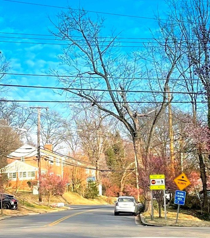
44 � There are no sidewalks on Erskine Street Between 15th Avenue and 16th Place A sidewalk exists on the north side of Erskine Street Between 16th Place and 18th Avenue � (PHOTO BY M-NCPPC)
2024 Carole Highlands Safe Mobility Study Prince George’s County Planning Department Page 81
RECOMMENDATIONS
Figure
Erskine Street (15th Ave to 18th Ave) Sidewalk and Shared Lane Markings
Map ID 4
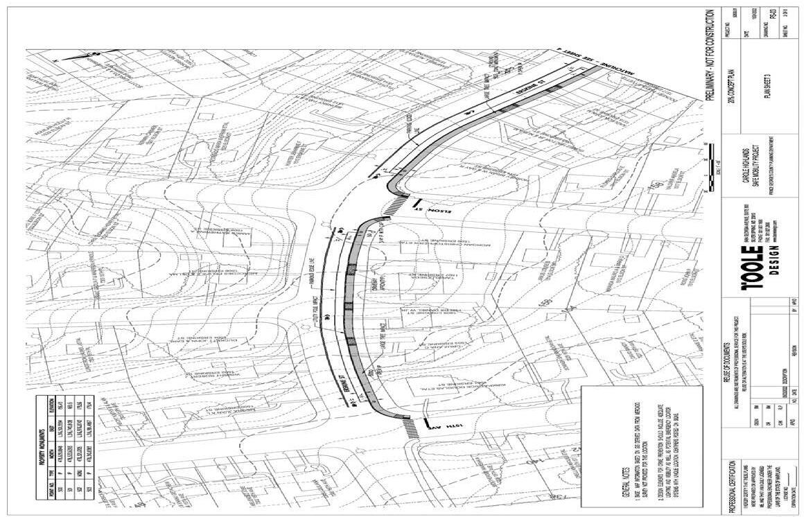
Figure 45 � Part 1: Erskine Street sidewalk and shared lane markings concept 15th Avenue to Delmont Lane (CONCEPTUAL ILLUSTRATION BY TOOLE DESIGN)
Page 82 2024 Carole Highlands Safe Mobility Study Prince George’s County Planning Department
Erskine Street (15th Ave to 18th Ave) Sidewalk and Shared Lane Markings
Map ID 4

Figure 46 � Part 2: Erskine Street sidewalk concept Delmont Lane to 16th Place � (CONCEPTUAL ILLUSTRATION BY TOOLE DESIGN)
2024 Carole Highlands Safe Mobility Study Prince George’s County Planning Department Page 83
RECOMMENDATIONS
Erskine Street (15th Ave to 18th Ave)
Sidewalk and Shared Lane Markings
Map ID 4
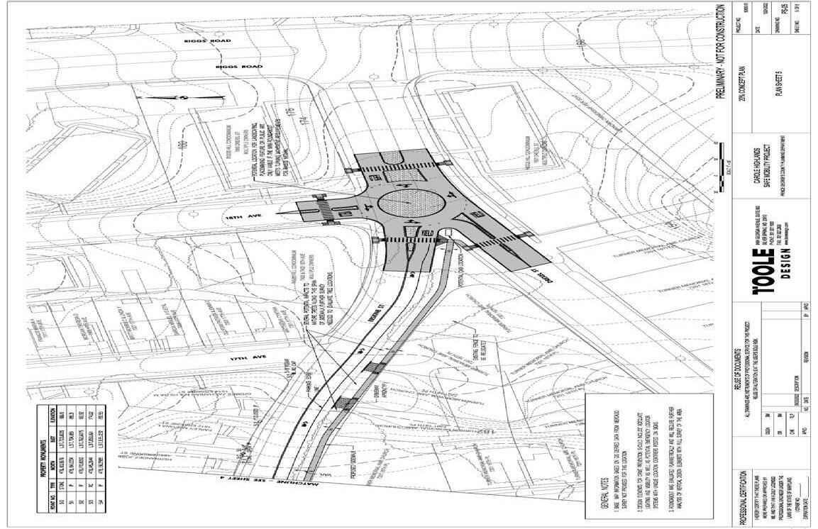
Figure 47 � Part 3: Erskine Street/Drexel Street/18th Avenue intersection improvements concept (and Erskine Street sidewalk concept—16th Place to 18th Avenue � (CONCEPTUAL ILLUSTRATION BY TOOLE DESIGN))
Page 84 2024 Carole Highlands Safe Mobility Study Prince George’s County Planning Department
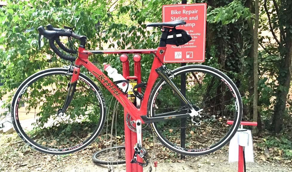
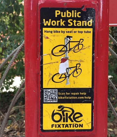
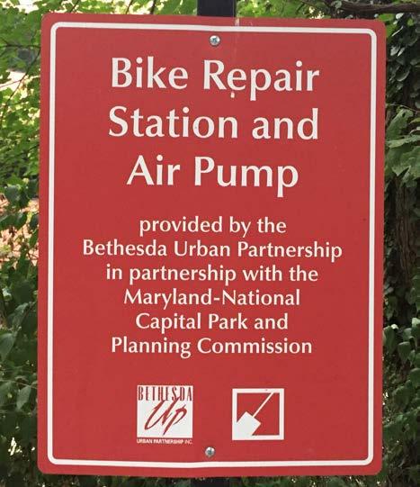
2024 Carole Highlands Safe Mobility Study Prince George’s County Planning Department Page 85
Figure 49 � Bicycle repair station signage � (PHOTO BY M-NCPPC )
Figure 48 � Study area participants would like a bicycle repair station along Sligo Creek Trail (PHOTO BY M-NCPPC )
RECOMMENDATIONS
Figure 50 � Bicycle repair station identification � (PHOTO BY M-NCPPC)
Erskine Street/Drexel Street/18th Avenue
Intersection Improvements
ISSUES:
• Confusing skewed intersection where three streets converge
• No marked crosswalks between the north side of Erskine Street/Drexel Street and sidewalks on the south side of Erskine Street and south side of Drexel Street
• Relatively high motor vehicle speeds and volume
• High motor vehicle crash location, include recent KSI
• Missing detectable warning surfaces for 18th Avenue crossing
RECOMMENDATIONS:
• Construct a mini roundabout to slow vehicle speeds, organize traffic movement, and reduce turn conflicts (Figure 52).
• Install marked high-visibility crosswalks on all legs.
• Install detectable warning surfaces to support 18th Avenue crossing.
PLANNING-LEVEL COST ESTIMATE:
• $537,51510
POTENTIAL FUNDING SOURCES:
• RAISE
• RCP
• Safer Streets and Road for All (SS4A) Grant Program
• TAP
• Maryland Highway Safety Office Grants
• Solicit feedback on concept design from the Carole Highlands Neighborhood Association, Turner Memorial AME Church,, nearby property owners, and other community members.
• Identify funding source or apply for grant funding.
• Complete topographical survey
• Develop 30% design
• Develop subsequent levels of design: 60%, 90%, 100%
• Acquire right-of-way or easement
• Obtain environmental permits
• Construct project
10 Cost estimate for the Erskine Street/Drexel Street/18th Avenue intersection improvements does not include sidewalk on the south side of Erskine Street between 16th Place and 18th Avenue. The cost of this sidewalk segment is included in the cost estimate for the Erskine Street sidewalk.
Page 86 2024 Carole Highlands Safe Mobility Study Prince George’s County Planning Department
Implementation Schedule Short-Term Medium-Term Long-Term
Map ID 4
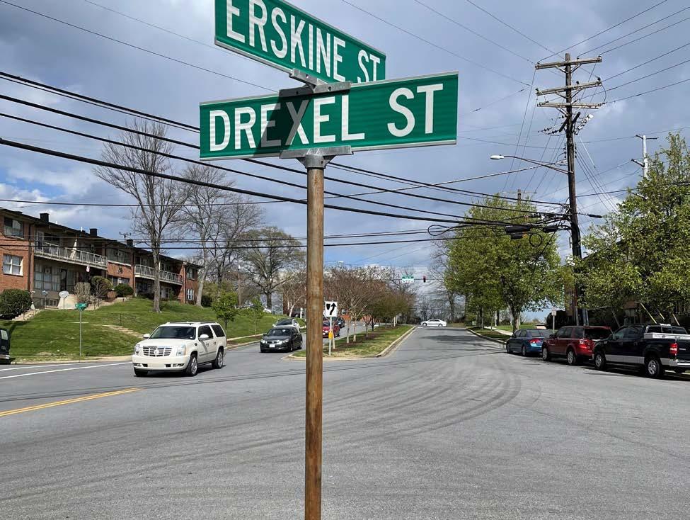
Figure 51 � The Erskine/Drexel Street/18th Avenue intersection lacks a traffic-calming mini-roundabout ( PHOTO BY M-NCPPC)
Figure 52 � By comparison, construction of a mini roundabout at the Erskine/Drexel Street/18th Avenue intersection can slow motor vehicle speeds, organize traffic movement, and reduce turn conflicts � (PHOTO BY TOOLE DESIGN GROUP)
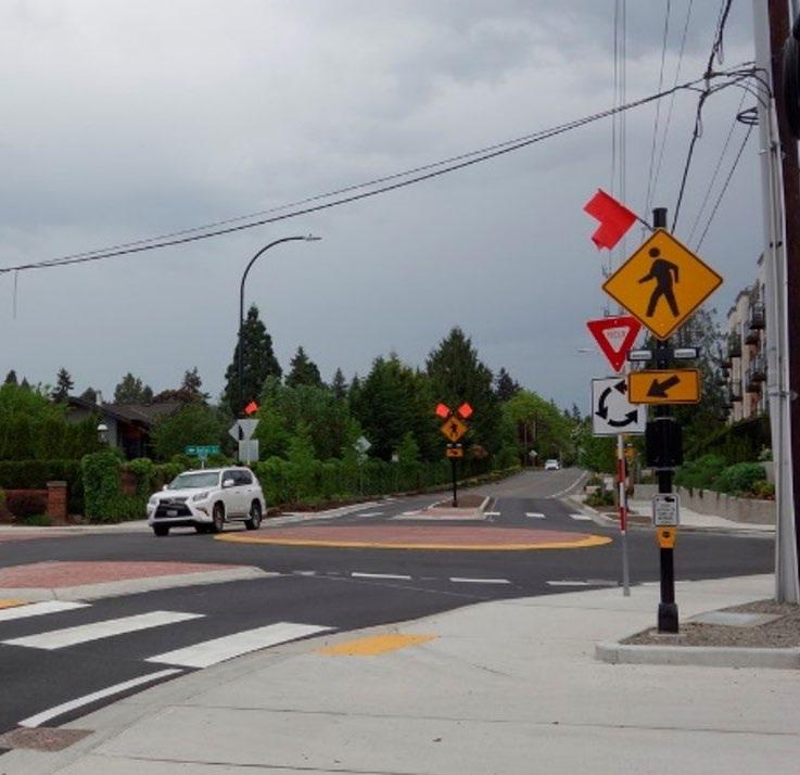
Page 87
RECOMMENDATIONS
Other Recommended Projects
Other recommended projects are shown in Map 12 and listed in Table 2. These projects are also important for improving safe mobility and access in Carole Highlands. Each recommendation includes:
• A Map ID corresponding to the recommendation’s location on the map
• Location description
• Safety and access issues description
• Recommendation description
• Recommendation level
The three potential recommendation levels are described below.
MAINTENANCE LEVEL
Example project types include:
• Mill/overlay with new pavement marking
• ADA upgrades
At this level, there should be no utility relocation except for minor structure adjustments (such as valve and utility access hole lid adjustments). At this level, there should be no need to acquire fee-simple right-of-way, temporary or permanent easements.
MID-LEVEL ROAD IMPROVEMENT
Example project types include:
• Minor curb modifications and pavement elevation modifications related to traffic calming (such as a speed table)
• Locations for rapid rectangular flashing beacon (RRFB)
• Creation of new sidewalk (where some grade change is required)
At this level, there may be a need for minor utility relocations (such as water house, sewer house and gas house connection modifications and electric utility pole guy wire relocation). At this level, there may be a need for temporary or permanent easements, but typically no fee-simple acquisitions.
MAJOR ROADWAY IMPROVEMENT
Example project types include:
• Roundabouts
• Traffic signal improvements
Photo examples of selected treatment options are provided in Figures 52, 57, and 58.
Page 88 2024 Carole Highlands Safe Mobility Study Prince George’s County Planning Department
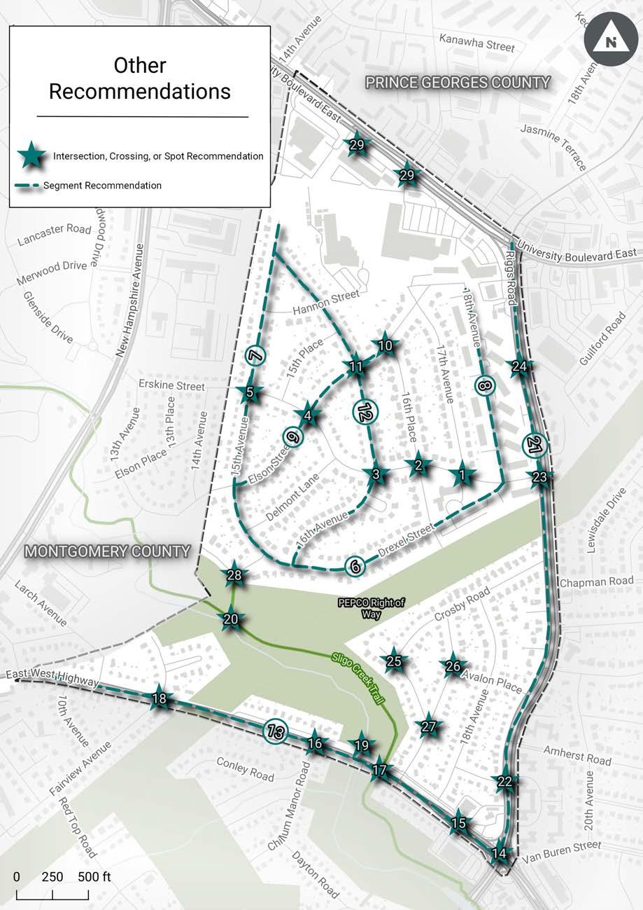
2024 Carole Highlands Safe Mobility Study Prince George’s County Planning Department Page 89
Other Recommended Projects RECOMMENDATIONS
Map 12 �
1
Erskine St and 17th Ave Intersection, Crossing, or Spot
• Missing detectable warning surfaces.
• Relatively high motor vehicle volumes and concern about motor vehicle speeds.
2
3
Erskine St and 16th Pl Intersection, Crossing, or Spot
4
Erskine St and 16th Ave Intersection, Crossing, or Spot
• Key pedestrian route to Carole Highlands Elementary School.
• Missing crosswalks on south and west sides of intersection.
• Relatively high motor vehicle volumes and concern about motor vehicle speeds.
• Install detectable warning surfaces.
• Install curb extensions into 17th Street to short pedestrian crossing distances and discourage motorists from making high-speed turns. (Can be installed with flex posts as an interim measure.)
• Install high-visibility marked crosswalks on the south and west sides of the intersection.
• Install curbed pedestrian refuge islands to narrow motor vehicle travel lanes and support Erskine Street crossings. (Will require restricting parking on Erskine approaches to allow for taper. Can be installed with flex posts as an interim measure.) See Figure 40 on page 72 for example.
• Install curb extensions into 16th Place to shorten pedestrian crossing distances and discourage motorists from making high-speed turns. (Can be installed with flex posts as an interim measure. See Figure 56 on page 101.)
Erskine St and Elson St Intersection, Crossing, or Spot
• Key pedestrian route to Carole Highlands Elementary School.
• Missing crosswalk on south side of intersection.
• Relatively high motor vehicle volumes and concern about motor vehicle speeds.
• Install high-visibility marked crosswalks on the south side of the intersection.
• Install curbed pedestrian refuge islands to narrow motor vehicle travel lanes and support Erskine Street crossings. (Will require restricting parking on Erskine approaches to allow for taper. Can be installed with flex posts as an interim measure.)
• Install curb extensions into 16th Avenue to shorten pedestrian crossing distances and discourage motorists from making high-speed turns. (Can be installed with flex posts as an interim measure.)
Mid
• Relatively high motor vehicle volumes and concern about motor vehicle speeds.
• Install curbed median islands to narrow motor vehicle travel lanes. (Will require restricting parking on Erskine Street approaches to allow for taper. Can be installed with flex posts as an interim measure.)
• Install curb extensions into Elson Street to shorten pedestrian crossing distances and discourage motorists from making high-speed turns. (Can be installed with flex posts as an interim measure.)
Mid
Page 90 2024 Carole Highlands Safe Mobility Study Prince George’s County Planning Department Map ID Location Type Issues Recommendations Recommendation Level
Maintenance
Mid
� Other
Table 2
Recommended Projects
5
Recommended Projects
Erskine St and 15th Ave Intersection, Crossing, or Spot
6
Drexel St (15th Ave to 18th Ave)
Segment
• Key pedestrian route to Carole Highlands Elementary School.
• Relatively high motor vehicle volumes and concern about motor vehicle speeds.
• Recent motor vehicle crashes.
• Key access route for Sligo Trail.
• Key potential student bicycling and walking route to Carole Highlands Elementary School.
• No pedestrian accommodation.
• Concern about motor vehicle speeds.
• Install mini-roundabout.
• If proposed pedestrian facilities on Erskine Street and 15th Avenue are constructed, install high-visibility crosswalks on all legs.
15th Avenue to 16th Place
• Convert to 20-mph yield street with 12-foot-wide travel lane and 8-foot-wide parking lane on one side (see Figure 53). Use excess street space to install sidewalk or protected pedestrian space. (Yield streets are like other local streets except that they feature a single, narrow travel lane that requires vehicles traveling in opposite directions to yield to one another to pass. See Figures 53 and 58 for yield street and protected pedestrian space examples.)
• Conduct further evaluation, using a design vehicle, to address horizontal curvature, refine lane widths, and determine location of potential parking restrictions.
• Coordinate with the Prince George’s County Fire and Emergency Medical Services Department (Fire/EMS) to ensure design meets access needs for fire and EMS vehicles.
• Install high-visibility crosswalks and ADA-compliant ramps where new sidewalks or protected pedestrian spaces intersect streets.
• If yield street is implemented, evaluate motor vehicle speed to determine if additional traffic calming measures (e.g., speed humps) are needed to ensure motor vehicle operating speeds of 20 mph or less.
• If yield street is not implemented, install speed humps to support 20mph design speed.
16th Place to 18th Avenue
• Install speed humps. 15th Avenue to 18th Avenue
• Install shared lane markings and bicycle wayfinding signage at intersections with 15th Avenue and 18th Avenue to facilitate connection to Sligo Creek Trail.
Mid
2024 Carole Highlands Safe Mobility Study Prince George’s County Planning Department Page 91 Map ID Location Type Issues Recommendations Recommendation Level
Mid
Other
RECOMMENDATIONS
Table 2�
(continued)
Table 2� Other Recommended Projects (continued)
7 15th Ave (Drexel St to terminus north of Hannon St)
Segment
• Key access route for Sligo Trail.
• No pedestrian accommodation.
• Concern about motor vehicle speeds.
• Convert to 20 mph yield street (such as a street too narrow for two motor vehicles traveling in opposite directions to pass each other without one vehicle yielding its right-of-way to the other vehicle) with 12-foot-wide travel lane and 8-foot-wide parking lane on one side. Use excess street space to install sidewalk or protected pedestrian space.
• Conduct further evaluation, using a design vehicle, to address horizontal curvature, refine lane widths, and determine location of potential parking restrictions.
• Coordinate with the Prince George’s County Fire and Emergency Medical Services Department (Fire/EMS) to ensure design meets access needs for fire and EMS vehicles.
• Install a high-visibility crosswalk and ADA-compliant ramps to connect the new sidewalk/ protected pedestrian space to the existing sidewalk on the north side of Hannon Street.
• If yield street implemented, evaluate motor vehicle speed to determine if additional traffic calming measures (e.g., speed humps) are needed to ensure motor vehicle operating speeds of 20 mph or less.
• If yield street not implemented, install speed humps to support 20 mph design speed.
Mid
8 18th Ave (Erskine St to Hannon St)
Segment
• Significant pedestrian and bicycle route due to concentration of multifamily housing.
• No bicycle accommodation.
• Install shared lane markings. Maintenance
Page 92 2024 Carole Highlands Safe Mobility Study Prince George’s County Planning Department Map ID Location Type Issues Recommendations Recommendation Level
9
11
Elson St (15th Ave to 1603 Elson St)
Segment
• No pedestrian accommodation.
• Concern about motor vehicle speed.
Drexel Street to 16th Avenue
• Convert to 20 mph yield street with 12-foot-wide travel lane and 8-foot-wide parking lane on one side. Use excess street space to install sidewalk or protected pedestrian lane.
• Conduct further evaluation, using a design vehicle, to address horizontal curvature, refine lane widths, and determine location of potential parking restrictions.
• Coordinate with the Prince George’s County Fire/EMS to ensure design meets access needs for fire and EMS vehicles.
• Install high-visibility crosswalks and ADA compliant ramps where new sidewalks or protected pedestrian spaces intersect streets.
• If yield street implemented, evaluate motor vehicle speed to determine if additional traffic calming measures (e.g., speed humps) are needed to ensure motor vehicle operating speeds of 20 mph or less.
• If yield street not implemented, install speed humps to support 20 mph design speed.
16th Avenue to 1603 Elson Street
• Install sidewalk or protected pedestrian space on the south side of the street.
Mid
Elson St and 16th Pl (curb ramp on west side of Elson St) Intersection, Crossing, or Spot
16th Ave and Elson St Intersection, Crossing, or Spot
• Missing detectable warning surface.
• Key pedestrian route to Carole Highlands Elementary School.
• Install high-visibility crosswalks and ADA-compliant ramps where new sidewalks or protected pedestrian spaces intersect streets. Maintenance
• If yield street not implemented, install speed humps to support 20 mph design speed.
Maintenance
2024 Carole Highlands Safe Mobility Study Prince George’s County Planning Department Page 93 Map ID Location Type Issues Recommendations Recommendation Level
10
RECOMMENDATIONS
Table 2� Other Recommended Projects (continued)
Table 2� Other Recommended Projects (continued)
16th Ave
(Drexel St to 15th Ave)
Segment
• Key pedestrian route to Carole Highlands Elementary School.
• No pedestrian accommodation except for the sidewalk on the east side of the street between Elson Street and Hannon Street.
• Concern about motor vehicle speeds.
Drexel Street to Elson Street
• Convert to 20-mph yield street with 12-foot-wide travel lane and 8-foot-wide parking lane on one side. Use excess street space to install sidewalk or protected pedestrian lane on west side of street.
• Conduct further evaluation, using a design vehicle, to address horizontal curvature, refine lane widths, and determine location of potential parking restrictions.
• Coordinate with the Prince George’s County Fire and Emergency Medical Services Department (Fire/EMS) to ensure design meets access needs for fire and EMS vehicles.
• Install high-visibility crosswalks and ADA compliant ramps where new sidewalks or protected pedestrian spaces intersect streets.
• If yield street implemented, evaluate motor to determine if additional traffic calming measures (e.g., speed humps) are needed to ensure motor vehicle operating speeds of 20 mph or less.
• If yield street not implemented, install speed humps to support 20mph design speed.
Elson Street to 15th Avenue
• Install speed humps.
Mid
Page 94 2024 Carole Highlands Safe Mobility Study Prince George’s County Planning Department Map ID Location Type Issues Recommendations Recommendation Level 12
Table 2� Other Recommended Projects (continued)
13 East West Highway (Riggs Rd to Kentland Ave)
Segment
14 East West Highway and Riggs Rd
Intersection, Crossing, or Spot
• Significant bicycle desire line due to retail establishments, bus stops, and Sligo Creek Trail.
• High motor vehicle speeds and volumes.
• High crash corridor for pedestrian or bicycle crashes, including two recent KSI crashes.
• Explore construction of separated bike lanes or shared use path connecting to existing bike lanes in Montgomery County.
• The bikeway may be a combination of on-road and off-road facilities.
• Sections of off-road sidepath could be constructed by expanding the sidewalk or constructing the sidepath in the existing grass area behind the face of curb.
• Parking removal may be necessary to install the bike lane or shared use path.
• Due to the steepness and length of the hill from Sligo Creek to New Hampshire Avenue, the type of bicycle accommodation selected, and design features included in it, are critical. The design should moderate downhill bicycling speeds and make uphill bicycling more comfortable by providing separation from traffic. In addition, bicycle facilities should be wide enough to enable cyclists on faster moving electric assist bicycles to pass cyclists on slower moving unassisted bicycles.
Major
• Major pedestrian crossing location due to nearby bus stops, retail establishments, and multi-family housing.
• High motor vehicle speeds and volumes.
• Slip lane designs facilitate high speed motor vehicle turns and reduce yielding at slip lane crosswalks.
• High pedestrian and bicycle crash location.
• High motor vehicle crash location, including 15 KSI crashes.
• Conduct traffic study to determine if one or more slip lanes can be removed and/or whether the third eastbound through lane can be removed.
• For slip lanes that cannot be removed, redesign slip lanes to improve motor vehicle yielding at crosswalks, (e.g., by adjusting the angle at which the slip intersects the cross-street to 50-70 degrees, preferably 70 degrees), reducing slip lane width, and/or installing a raised crosswalk.
• If a third eastbound slip lane can be removed, widen pork-chop islands on the south side of the intersection to reduce pedestrian crossing distance across East West Highway.
Major
2024 Carole Highlands Safe Mobility Study Prince George’s County Planning Department Page 95 Map ID Location Type Issues Recommendations Recommendation Level
RECOMMENDATIONS
Table 2� Other Recommended Projects (continued)
15 East West Highway (mid-block crossing 250 feet west of Riggs Rd)
16 East West Highway and Chillum Manor Rd
Intersection, Crossing, or Spot
17 East West Highway and Sligo Creek Trail
Intersection, Crossing, or Spot
• Significant pedestrian crossing location due to existing marked crosswalk and adjacent bus stops and retail.
• Uncontrolled, multi-lane pedestrian crossing.
• High motor vehicle speeds and volumes.
• High pedestrian and bicycle crash location.
• Significant pedestrian desire line due to adjacent bus stops.
• Uncontrolled, unmarked crossing with multiple lanes in each direction.
• High motor vehicle speeds and volumes.
• High motor vehicle crash location, including five KSI crashes near intersection.
Intersection, Crossing, or Spot
• Major pedestrian and bicycle crossing location due to Sligo Creek Trail.
• Uncontrolled crossing with multiple lanes in each direction. Existing flashing yellow beacon not sufficiently effective at encouraging motorist yielding.
• High motor vehicle speeds and volumes.
• Lack of awareness of Sligo Creek Trail and key destinations that can be accessed via the Sligo Creek Trail (e.g., West Hyattsville Metro Station).
• Install pedestrian hybrid beacon.
• Install advance stop lines and coordinated “Stop Here on Red” (R10-6 or R10-6a) signage.*
*The alpha-numeric sign designations refer to the nomenclature of the Maryland Manual of Uniform Traffic Control Devices (MUTCD).
Major
• Install pedestrian hybrid beacon.
• Install advance stop lines and coordinated “Stop Here on Red” (R10-6 or R10-6a) signage.
• Adjust bus stop locations to align with new crosswalk.
• Install bicycle and pedestrian signal heads (Figure 54 and 55) with approval from the operational agencies.
• Install advance stop lines and coordinated “Stop Here on Red” (R10-6 or R10-6a) signage.
• Install green (D-3) street name signs at this location. Signs oriented to motorists should include the words “Sligo Creek Trail” along with, ideally, pictographs of both a pedestrian and a bicyclist. Signs oriented to trail users should indicate the street name, “MD 410 (East West Hwy).” See Figure 56
• The Prince George’s Department of Parks and Recreation will install new wayfinding signage at this location to address the navigational needs for Sligo Creek Trail users, including those using either of the pedestrian bridges over Sligo Creek, which provide local linkage for the neighborhoods along the service roads.
• There is a need for a mast armmounted D-3 street name sign that reads, “Sligo Creek Trail” over MD 410 (East West Hw) at the Sligo Creek Trail intersection, visible to motorists traveling in both directions of MD 410 (Figure 57).
Major
Major
Page 96 2024 Carole Highlands Safe Mobility Study Prince George’s County Planning Department Map ID Location Type Issues Recommendations Recommendation Level
18 East West Highway and Fairview Ave/ Linden Ave
Intersection, Crossing, or Spot
19
20
Pedestrian/ bicycle bridge across Sligo Creek on north side of East West Highway
Intersection of Sligo Trail and trail spur to Sligo Creek Pkwy.
21 Riggs Rd (East West Highway to University Blvd)
Intersection, Crossing, or Spot
• Significant pedestrian desire line due to bus stops.
• Uncontrolled, unmarked crossing with multiple lanes in each direction.
• High motor vehicle speeds and volumes.
• Recent pedestrian or bicycle crashes.
• Although the worn-out temporary plywood ramps at this location were recently removed and replaced, the replacements were not designed correctly.
Intersection, Crossing, or Spot
• Lack of wayfinding signage.
Intersection, Crossing, or Spot
22 Riggs Rd and Amherst Rd
Intersection, Crossing, or Spot
• Significant bicycle desire line due to nearby retail establishments, bus stops, University of Maryland, and Northwest Branch Trail. (Desire line will be enhanced by future Purple Line and planned protected bike lanes on University Boulevard.)
• High motor vehicle speeds and volumes.
• High crash corridor for pedestrian or bicycle crashes, including seven recent KSI crashes.
• Significant pedestrian crossing location due to nearby multi-family housing and bus stops.
• Uncontrolled, unmarked, multi-lane pedestrian crossing.
• High motor vehicle speeds and volumes.
• Recent pedestrian or bicycle crashes, including two KSI crashes.
• Install high-visibility crosswalk supported by rectangular rapid flashing beacon, curb extensions, and pedestrian crossing island.
• Install advance yield markings and coordinated “Yield Here for Pedestrians” (R1-5) signage.
• Replace the replacement ramps with well-designed ramps that are permanent and durable.
• M-NCPPC Department of Parks and Recreation will install new wayfinding signage at this location to address the navigational needs for Sligo Creek Trail users.
• Explore construction of protected bike lanes or shared use path.
• Most critical section is between Chapman Street and University Boulevard.
• The bikeway may be a combination of on-road and off-road facilities.
• Consider creating space for a bikeway by reducing Riggs Road to a 5-lane section or narrowing the median.
• If a bikeway is constructed, install wayfinding signage at key decision points (e.g., Chapman Street, Drexel Street).
• Install pedestrian hybrid beacon.
• Install advance stop lines and coordinated “Stop Here on Red” (R10-6 or R10-6a) signage.
• Shift southbound bus stop north to Amherst Road to encourage bus riders to use pedestrian hybrid beacon supported crossing.
2024 Carole Highlands Safe Mobility Study Prince George’s County Planning Department Page 97 Map ID Location Type Issues Recommendations Recommendation Level
Major
Maintenance
Maintenance
Major
Major
(continued) RECOMMENDATIONS
Table 2� Other Recommended Projects
23 Riggs Rd and Drexel St (west side of Riggs Rd)
Intersection, Crossing, or Spot
24 Riggs Rd and Drexel St (east side of Riggs Rd)
Intersection, Crossing, or Spot
• Significant pedestrian crossing location due to nearby multi-family housing and bus stops.
• Crossing is used by families that live in Lewisdale to access Carole Highlands Elementary School.
• No marked crosswalk on the north side of the signalized intersection.
• High motor vehicle speeds and volumes.
• Recent pedestrian or bicycle crashes, including one KSI crash.
• Significant pedestrian crossing location due to nearby retail establishments, multifamily housing, and bus stop.
• Uncontrolled, unmarked, multi-lane pedestrian crossing.
• High motor vehicle speeds and volumes.
• Recent pedestrian or bicycle crashes, including one KSI crash.
• Install high-visibility marked crosswalk with ADA ramps on the north leg of the intersection.
• Consider locating a crossing guard at this intersection during school arrival and dismissal hours. Mid
• Install pedestrian hybrid beacon.
• Install advance stop lines and coordinated “Stop Here on Red” (R10-6 or R10-61) signage.
• Shift southbound bus stop north to Drexel Street (east side of Riggs Road) to align with the proposed crossing.
25 Crosby Rd and Amherst Rd
Intersection, Crossing, or Spot
• Missing detectable warning surfaces.
• Reconstruct existing ramps with detectable warning surfaces. Maintenance
Page 98 2024 Carole Highlands Safe Mobility Study Prince George’s County Planning Department Map ID Location Type Issues Recommendations Recommendation Level
Major
2� Other
(continued)
Table
Recommended Projects
17th Ave and Avalon Pl Intersection, Crossing, or Spot
27 17th Ave and Amherst Rd Intersection, Crossing, or Spot
28 Intersection of trail spur and Sligo Creek Parkway/ Drexel St Intersection, Crossing, or Spot
29 Driveway entrances to University Plaza West and Hechinger Plaza Shopping Center Intersection, Crossing, or Spot
• Missing sidewalk segment on north side of Avalon Place near intersection.
• Skewed intersection with a long pedestrian crossing across Amherst Road.
• Intersection angle facilitates high-speed turns.
• Missing detectable warning surfaces
• Lack of wayfinding signage.
• Construct a sidewalk to address an existing gap. Mid
• Install triangular curbed pedestrian crossing island to support Amherst Road crossing and encourage slower left turns from northbound 17th Avenue. (Crossing island can be constructed with flex posts as an interim measure.)
• Add stop bar next to existing STOP sign.
• Reconstruct curb ramps with detectable warning surfaces. Mid
• Install wayfinding signage to indicate that spur trail provides access to the Sligo Creek Trail. Maintenance
• Missing detectable warning surfaces.
• Install detectable warning surfaces. Maintenance
2024 Carole Highlands Safe Mobility Study Prince George’s County Planning Department Page 99 Map ID Location Type Issues Recommendations Recommendation Level 26
Other Recommended Projects (continued) RECOMMENDATIONS
Table 2�
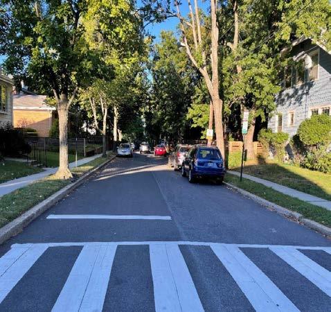
Figure 53 � A yield street accommodates sidewalks on Walnut Street in northwest D � C � (PHOTO BY TOOLE DESIGN GROUP)
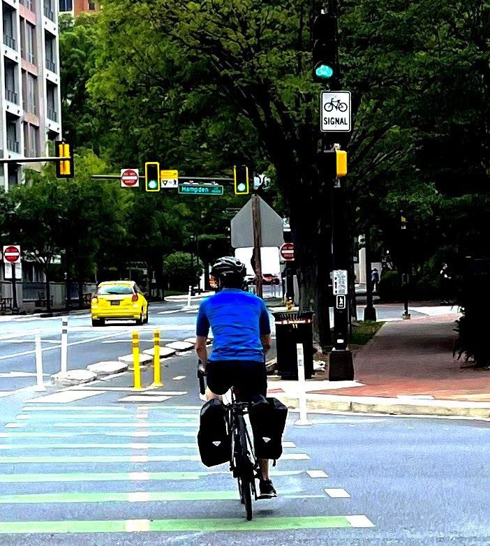
Figure 55 Bicycle and pedestrian signal heads direct cyclists in Bethesda, Maryland (PHOTO BY M-NCPPC )
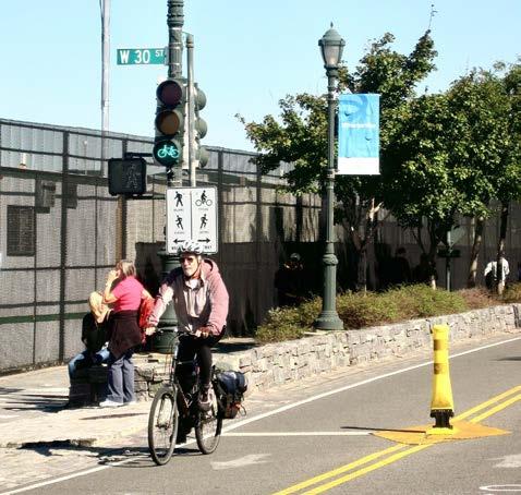
Figure 54 � Bicycle and pedestrian signal heads queue riders and pedestrians at a signalized intersection in New York City � (PHOTO BY M-NCPPC )
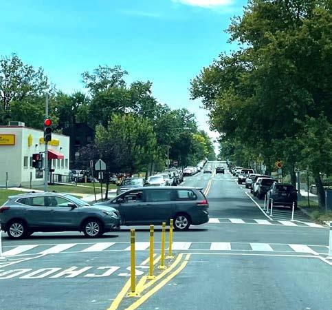
Figure 56 Flex posts shorten pedestrian crossing distances at 13th and Upshur Streets in northwest D C (PHOTO BY M-NCPPC)
Page 100 2024 Carole Highlands Safe Mobility Study Prince George’s County Planning Department
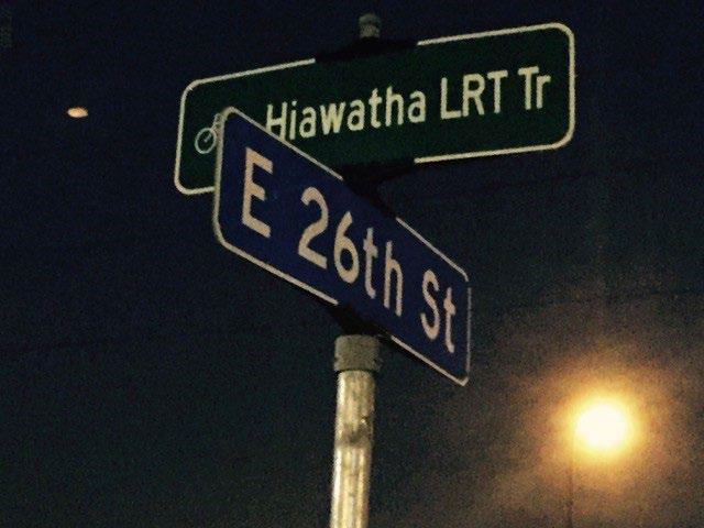
Figure 57 � A shared-use path and roadway street name sign, such as this one in Minnesota, makes uncontrolled crosswalks more visible to motorists � (PHOTO BY M-NCPPC )

Figure 59 A pedestrian crossing island at a Franklin Avenue intersection in Silver Spring, MD (PHOTO BY TOOLE DESIGN GROUP)

Figure 58 � A protected pedestrian lane in Silver Spring directs walkers along a street without sidewalks � (PHOTO BY TOOLE DESIGN GROUP)
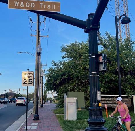
Figure 60 A mast arm-mounted street name sign improves recognition of a shared-use path intersection in Herndon, VA (PHOTO BY M-NCPPC)
2024 Carole Highlands Safe Mobility Study Prince George’s County Planning Department Page 101
RECOMMENDATIONS
Appendices Section 9
Appendix A: Project Management Kick-Off Meeting
PARTICIPANTS
Michael Jackson
Judith Howerton
Jim Elliott
Diane Lambert
Renee White
AGENDA
• Introductions
• Goals and Context
• Scope and Schedule
• Stakeholder Outreach
• Next Steps
• Administrative Issues
GOALS AND CONTEXT
Karina Navas
Daniel Hartmann
Will Capers
Terry Johnson
Ayden Cohen
2�08�2022
Adam Dodgshon
Mussie Tewolde
Erv Beckert
Bob Patten
• The project management team’s consensus was that the initial goal of the study was sufficient, as it was community-centric and broad enough to encompass everything surrounding the project.
• Question for attendees: What else is it important to know about the impetus for this project or neighborhood/project context?
• Karina Navas noted that the area in general has a lot of pedestrian accidents and given the lack of connectivity and infrastructure, there is no incentive to walk around.
• Renee White shared that the Carole Highlands Neighborhood Association meetings focus on the walking path of getting to the future Purple Line and the future impact of the Purple Line on pedestrian routes in the neighborhood. In addition, the president of the neighborhood association observed that many streets within the study area lack sidewalks, so what are ways to make things accessible when the Purple Line finally opens?
• Adam Dodgshon emphasized that this project was deliberately called “safe mobility” rather than “pedestrian access” due to the potential with the Purple Line. He also recommended activation of the street, or placemaking, to bring traffic calming elements to the street. Traffic solutions, along with pedestrian solutions. Erv Beckert noted that University Boulevard is one of the most dangerous roads in the state for pedestrians, as more pedestrians have been killed there than any road in the state of Maryland. Whatever it takes to make the road safer and highlight the presence of other modes of transportation besides the automobile is useful.
• Will Capers noted the importance of a context-sensitive approach and discussing the process with citizens and community members.
Page 104 2024 Carole Highlands Safe Mobility Study Prince George’s County Planning Department
and existing conditions
• Mussie Tewolde expressed curiosity about studies previously done in the study area (specifically University Boulevard, given its notoriety). It could be beneficial to collect the data and then compare that data to other jurisdictions to see where their numbers fall. Are there any planning/design efforts that made a difference in the other counties? Look at the trends in the incidents as well.
• Erv Beckert expressed concern regarding pedestrian temptation to cross streets unsafely due to the lack of pedestrian facilities nearby. Most of the fatalities occur in the middle of the block, justifying the need for better venues for pedestrians. Erv Beckert also asked if this study will trigger future projects.
• Judith Howerton – The county has a hierarchical review process, so it is important to note that the review process could take up to six weeks. With that in mind, we must determine if the current due dates/timeline mean a final, reviewed deliverable or not. Also mentioned the need to plan how early we want to start planning/reaching out to people for the community walk audit so they can ensure it works for their schedule.
• Dan Hartmann - They have an internal process for how they prepare for community meetings. The question is how much do we want to prepare vs the county? They have designers, web staff, etc., that can help develop some of the materials, we would just need to give them the content.
•
2024 Carole Highlands Safe Mobility Study Prince George’s County Planning Department Page 105 APPENDIX OVERVIEW OF SCOPE AND TASKS 0 Project management 1 Kick-off meeting 2 Refine schedule 3 Team site visit/walking audit 4 Plan review
report
5 Preparation for Community Walk Audit and debrief
6 Community Walk Audit and debrief 7 Prepare draft report
Will Capers - design will be more conceptual in nature 8 Review of study and presentation materials 9 Final draft presentation to the community
•
First review of documents must be presented as a Microsoft Word document 10 Refine report 11 Final report
STAKEHOLDER OUTREACH:
Who are the key stakeholder groups?
• Carole Highlands Neighborhood Association
• Lewisdale Condos
• State Highway Administration
• Commercial owners and tenants along University Boulevard
• Governmental, Regulatory and External Affairs (GREA) for Pepco Holdings
• Bob Patten suggested a citizen activist, although he might be a part of the neighborhood association already
ISSUES RAISED
• Scheduling/review time
NEXT STEPS
• Confirm a bi-weekly time for project meetings
• Refine a project schedule
• Reach out to appropriate parties about data/information needs
• Begin plan review and existing conditions analysis
• Schedule site visit with core project management team
Page 106 2024 Carole Highlands Safe Mobility Study Prince George’s County Planning Department
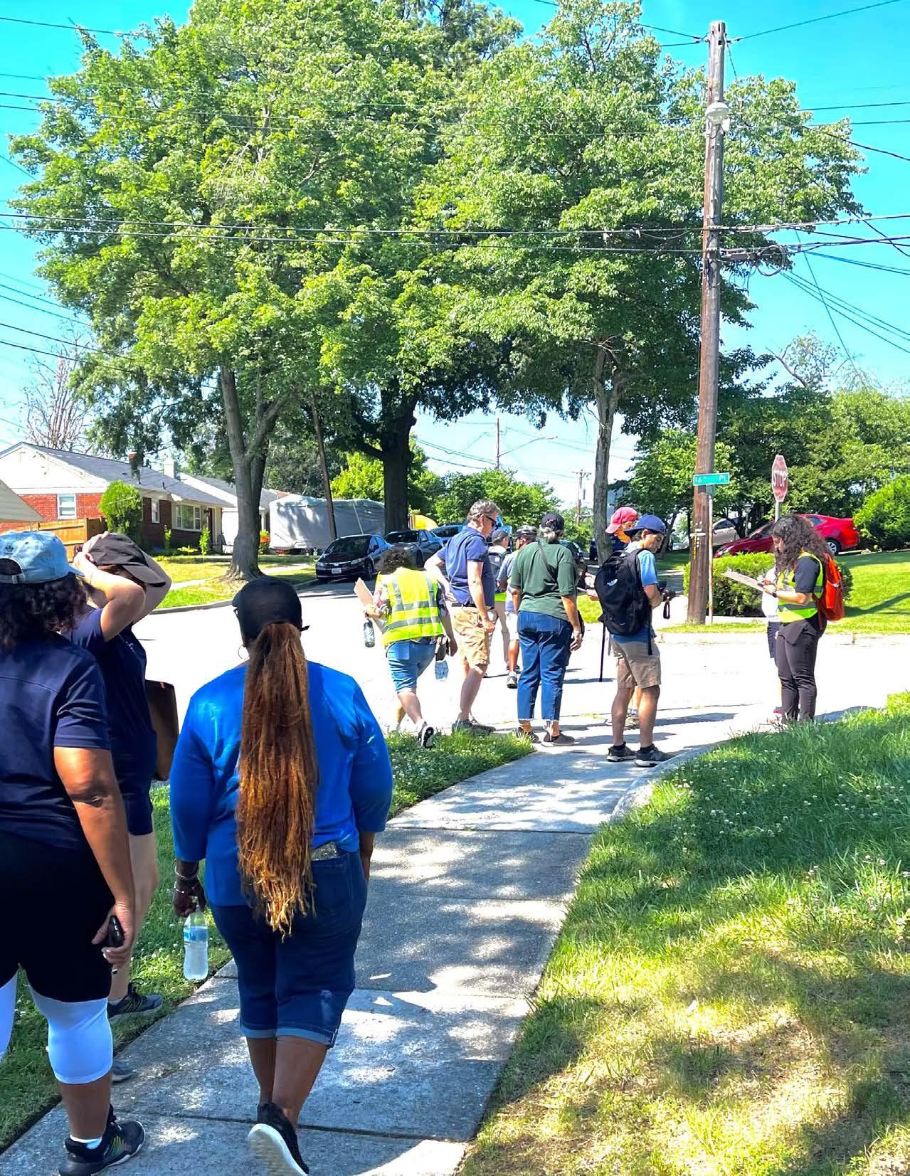 The study team participates in a Community Walk Audit in Carole Highlands (PHOTO BY M-NCPPC)
PARTICIPANTS
Renee White Constituent Services, Office of (former) County Councilmember Deni Taveras
Michael Jackson
Project Manager/Transportation Planner III, Prince George’s County Planning Department
Karina Navas Chief of Staff, Office of (former) County Councilmember Deni Taveras
Crystal Hancock Planner IV, Prince George’s County Planning Department
Patrice Emezie Traffic Engineer, Maryland State Highway Administration
Jim Sebastian Consultant, Toole Design Group
James Elliott Consultant, Toole Design Group
Ayden Cohen Consultant, Toole Design Group
Page 108 2024 Carole Highlands Safe Mobility Study Prince George’s County Planning Department
Appendix B: Project Management Team Site Visit 4�08�2022
Stop 1
Hannon Street and 18th Avenue
OBSERVATIONS
• Participants observed missing sidewalk on the east side of 18th Avenue and north side of Hannon Street.
• Participants observed the informal trail connecting the intersection of 18th Avenue and Hannon Street to the south side of the 1835 University Plaza shopping center at University Boulevard/ Riggs Road.
• Participants discussed the feasibility of formalizing the trail as an ADA and bike-friendly connection.
• Participants discussed personal security concerns related to the informal trail.
• Renee White observed crime scene tape at the site.
• Participants observed another goat trail connecting the intersection of 18th Avenue and Hannon Street to the west side of the 1835 University Plaza shopping center that is now blocked by a fence that was installed due to safety concerns associated with a generator on the adjacent Riggs Hill Condominium property.
• Participants observed and accessed Carole Highlands Elementary School from Hannon Street.
• Participants walked the informal trail at the end of Hannon Street that is frequently used to access the school.
• The trail is 250 feet and 2 inches in length.
• Renee White observed illegal dumping, people experiencing homelessness in the woods surrounding the trail, and potential security concerns at night given the absence of lighting along the trail.
• Renee White noted that in past years, the Carole Highlands Elementary School principal closed the gate adjacent to the school property, but reopened it due to complaints from community members that need access to the school.
• Michael Jackson observed the need for wayfinding signage to help people understand how to get to the school.
• Participants observed the absence of a sidewalk on the south side of Hannon Street at the intersection of 16th Avenue as one approaches the school and leading up the street to school property, where the sidewalk begins, adjacent to the informal trail.
• Participants observed students walking in the roadway on Hannon Street between 16th Avenue and 15th Avenue.
• Participants observed that the street widths of Elson Street (35 feet) and 15th Avenue may trigger speeding and noted the extra space could be used for a sidewalk or separate walking area in the roadway.
1835 University Plaza Shopping Center Access
2024 Carole Highlands Safe Mobility Study Prince George’s County Planning Department Page 109 APPENDIX
Stop 2
18th Avenue/Drexel Street and Erskine Street
OBSERVATIONS
• Speeding is a major concern on Erskine Street, which is used as a short cut between New Hampshire Avenue and Riggs Road.
• Renee White recalled a speed enforcement and awareness event on Erskine Street that resulted in a high number of moving violations and other traffic infractions for non-compliance.
• Michael Jackson proposed adding wayfinding signage to navigate Carole Highlands and surrounding areas.
• Participants discussed the traffic-calming potential of installing a roundabout or other structure at 18th Avenue/ Drexel Street/Erskine Street intersection.
• Participants observed the potential of decreasing street widths and repurposing the space for traffic calming Placemaking elements or a bike station, as wider street widths trigger speeding vehicles.
• Participants observed the absence of a sidewalk on the south side of Erskine Street, next to Turner Memorial AME church, the absence of crosswalk markings, and significant lack of accessibility.
• Riggs Road between Drexel Street and Chapman Road
• Participants observed the potential of constructing a shareduse path along the east side of Riggs Road between Chapman Road and Drexel Street to facilitate east-west bike travel between Chapman Road in Lewisdale and the Drexel Street/ Erskine Street corridor in Carole Highlands by reducing the width of the median and shifting northbound lanes.
OBSERVATIONS
• Participants discussed the potential of building a shared-use path along the Pepco right-of-way between Riggs Road and East West Highway.
• Participants noted the potential use of the Turner Memorial AME Church parking lot, adjacent to the Pepco rightof-way, (which the church closed due to loitering and illegal dumping.
• Participants observed trash in Pepco right-of-way.
18th Avenue/ Drexel Street/ Erskine Street
Page 110 2024 Carole Highlands Safe Mobility Study Prince George’s County Planning Department
Pepco Right-of-Way
Stop 3
East West Highway and East West Highway Service Road
OBSERVATIONS
• Participants discussed making improvements at the intersection of the Sligo Creek Trail and East West Highway to facilitate safe crossing at East West Highway and improve orientation for trail users.
• Participants discussed the need for maintenance at sidepath bridge over Sligo Creek.
• Participants discussed the potential of improving bicycle connectivity on East West Highway between Riggs Road and New Hampshire Avenue.
• Participants discussed installing a marked crosswalk at the intersection of East West Highway and Linden Avenue/Fairview Avenue, where bus stops exist along East West Highway.
Stop 4
Eastern Terminus of Holton Lane
OBSERVATIONS
• Participants discussed the potential of installing a shared use path from the end of Holton Lane to Carole Highlands.
• Renee White observed a bar/lounge across the parking lot from the fence that currently surrounds Carole Highlands on the north side and raised concerns about potential safety issues for the school.
• Participants discussed the need to maintain fencing around the school property, but the potential of providing a shared use path to the end 15th Avenue.
• Renee White discussed soliciting critical feedback from residents that live on 15th Avenue regarding the use of vehicles to navigate Carole Highlands versus safe walking options.
ADDITIONAL INFORMATION SHARED
• Community events are often held at residents’ homes or virtually.
• Potential opposition from residents who perceive new sidewalks as a maintenance burden and a reduction of their yard space.
East West Highway/ East West Highway Service Road
Eastern Terminus of Holton Lane
2024 Carole Highlands Safe Mobility Study Prince George’s County Planning Department Page 111 APPENDIX
Appendix C: Community Walk Audit
PARTICIPANTS
Jason Clayton Community Member
Jeff Cronin Community Member
Barbara Franklin Community Member
Deni L. Taveras
Prince George’s County Council (2014–2022)
Karina Navas
Office of Deni L. Taveras, Prince George’s County Council (2014–2022)
Renee White
Office of Deni L. Taveras, Prince George’s County Council (2014–2022) and community resident
Tony Gonzalez
Office of Deni L. Taveras, Prince George’s County Council (2014–2022)
AGENDA
Crystal Hancock
Prince George’s County Planning Department
Michael Jackson
Prince George’s County Planning Department
Judith Howerton
Prince George’s County Planning Department
Calista Black
Prince George’s County Planning Board
James Elliott
Toole Design Group
Jim Sebastian
Toole Design Group
Ayden Cohen Toole Design Group
Mia Vogel
Toole Design Group
The Carole Highlands Community Walk Audit was divided into three parts: a pre-walk audit meeting, walking tours along two routes, and a walk audit debrief meeting. One walking tour covered the Drexel Street/Erskine Street/18th Avenue intersection, Riggs Road, the Pepco right-of-way, and points in between. The other walking tour covered 16th Place, Elson Street, Hannon Street, 18th Avenue, and points in between.
Observations made during the walking tours occasionally referenced locations in the study area that were not part of the tour. The debrief meeting addressed locations on the walking tours and locations not covered by the tours. The minutes below are organized by location and topic.
Page 112 2024 Carole Highlands Safe Mobility Study Prince George’s County Planning Department
6�25�2022
LOCATION OBSERVATIONS
18th Avenue
• Participants observed several goat trails that lead to Riggs Road from 18th Avenue via breaks in fencing.
• Concern was expressed that owner of the fence—possibly Riggs Hill Condominiums— may make future repairs, blocking trail access.
18th Avenue and Hannon Street
• The goat path behind the building that leads to Hechinger Plaza is a vital, daily connection. A resident reported that she used the goat path to access stores and the C4 and C6 bus lines.
• The previous access point has been fenced off by Riggs Hill Condos, causing people to go around, using a steeper, less accessible path.
• The resident recently encountered a woman who had fallen on the steeper path referenced. The resident was unable to help the person up from the fall and went to a neighbor to help the person recover from the fall.

• The resident has asked her partner to see if they can get something installed on the goat trail (such as rocks to create makeshift stairs, so the path is easier to walk on. The resident finds the current state of the path difficult and dangerous.
• There are security concerns surrounding this and other goat paths near the 18th Avenue and Hannon Street intersection.
• Support from Riggs Hill Condos is necessary to advance these path improvements.
• The neighborhood association contacted Riggs Hill Condominiums attempting to improve the goat trail connections without success.
2024 Carole Highlands Safe Mobility Study Prince George’s County Planning Department Page 113 APPENDIX
Figure A1 � A fence separates an informal trail from the Carole Highlands school grounds (PHOTO BY M-NCPPC)
Trail from Hannon Street/ 17th Avenue to Carole Highlands Elementary School
• Snow and ice make the trail treacherous.
• Aging caregivers often use this trail to take kids to school, posing a risk of them slipping or falling on the path in treacherous conditions.
• Due to the absence of lighting, an assault in a nearby parking lot, and a homicide that occurred in the woods surrounding the trail, there are personal security concerns. In the past, the woods surrounding the trail were the site of an encampment for people experiencing homelessness.
• The principal of Carole Highlands Elementary School faces the challenge of keeping students safe while providing easy access to the school. The principal once closed a gate that offers access to the school via the trail at 17th Street and Hannon Avenue. The principal reopened the trail following complaints from parents and caregivers regarding lack of access.
Connection from 15th Avenue to Holton Lane
• Michael Jackson observed the benefit of a connection from the Holton Lane terminus to 15th Avenue. This connection is supported by many neighbors on 15th Avenue because of a post office and other amenities on Holton Lane, while other neighbors hold concerns regarding those most impacted by a new connection (neighbors that reside at the end of the street).
• There was a connection from 15th Avenue/ Hannon Street westward, but it is closed.
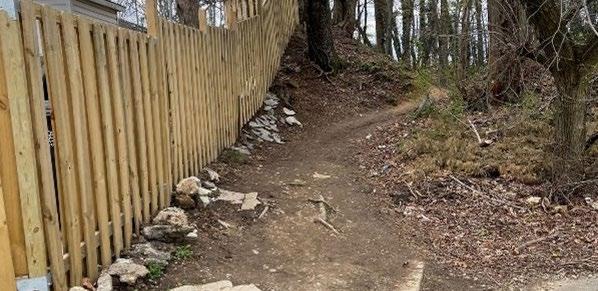
Page 114 2024 Carole Highlands Safe Mobility Study Prince George’s County Planning Department
Figure A2 � An informal goat trail connects Hannon Street to Carole Highlands Elementary School (PHOTO BY M-NCPPC)
15th Avenue
• 15th Avenue is one of the widest streets in the neighborhood; is a major thoroughfare for school traffic.
• Both width and slope of 15th Avenue contribute to motor vehicle speeding.
• There are reports of school bus drivers speeding and failing to come to a stop at intersections.
• There is high pedestrian traffic on 15th Avenue, yet the street lacks a sidewalk.
• Michael Jackson observed the benefit of traffic-calming tools on 15th Avenue.
Elson Street
• There is no sidewalk on the southeast side of Elson Street between 16th Avenue and 17th Avenue and there are no sidewalks on Elson Street south of 16th Avenue.
Elson Street and 16th Avenue
• Participants observed the benefit of a 4-way stop.
Drexel Street
• High motor vehicle speeds are reported on Drexel Street due in part to the street’s slope.
• Drexel Street is used as a short cut to Erskine Street.
• The neighborhood association tried unsuccessfully to get speed humps installed on Drexel Street, but a petition is necessary.
• Drexel Street is narrow, causing drivers who park on the street to close their side view mirrors to prevent sideswiping by passing cars.
• Though there are many families with children and dog walkers, there are no sidewalks on Drexel Street.
• The curve and slope of Drexel Street, the narrow width, and number of parked cars along the street make it difficult for pedestrians and drivers to see one another.
Drexel Street and 16th Place
• There are concerns regarding high motor vehicle speeds and vehicles failing to yield due to the absence of crosswalks across Drexel Street.
Erskine Street
• Erskine Street—a shortcut between Riggs Road and New Hampshire Avenue—urgently needs sidewalks because of the higher motor vehicle speeds and volumes.
• There are missing sidewalks on the south side of Erskine Street between 18th Avenue and 16th Place and on both sides of the street west of 16th Place.
Erskine Street and 16th Place
• Motor vehicle speeds and vehicles that fail to yield create challenges when crossing Erskine Street, so a raised crosswalk may improve safe crossing.
Erskine Street, Drexel Street, and 18th Avenue
• This location—the site of Turner Memorial AME church—is an unusual intersection at which three streets intersect yet there are no marked crosswalks across Erskine Street or Drexel Street.
• This intersection is frequented by people at Carole Highlands Elementary School.
• It was observed that stop signs are routinely ignored.
• Observed the benefit of traffic-calming elements, such as placemaking installations, art, planters, or a roundabout like other tools in adjacent neighborhoods.
Drexel Street and Riggs Road
• There is no marked crosswalk on the north side of Drexel Street as it crosses Riggs Road, yet there are bus stops at the north side crossing, which tempts pedestrians to cross Riggs Road outside of marked crosswalks.
2024 Carole Highlands Safe Mobility Study Prince George’s County Planning Department Page 115 APPENDIX
Riggs Road
• The vegetation along the sidewalk on Riggs Road is overgrown in some areas.
• There is no infrastructure for cyclists along Riggs Road.
• Observed the prioritization of cars given the number of vehicle lanes, the potential benefit of an east-west bicycle connection across Riggs Road, and wider sidewalks.
• There is little to no buffer between the sidewalk and the street.
• The walking tour group observed a mail carrier attempting to cross Riggs Road in the middle of the block, and indication of the lack of safe crossings on Riggs Road.
Pepco right-of-way
• The Pepco right-of-way divides Carole Highlands on the northwest side from Park Lawn/Riggs Park Estates on the southeast side of the right-of-way.
• One participant noted the monthly nature/ bird walks through the Pepco field.
• The neighborhood association prioritizes the environmental protection of the field and has collaborated with Pepco on how to reduce mowing while protecting the field from invasive plant species.
• Preference for natural surface trail connections within the Pepco right-of-way over paved surface trails.
GENERAL COMMENTS
East West Highway and Riggs Road
• The walking tour group observed the need for pedestrian safety improvements.
East West Highway
• The group observed the need for bicycle access improvements along East West Highway.
• There are reported challenges with runoff and flooding of houses on the service road along the north side of East West Highway.
East West Highway and Sligo Trail
• Walking tour participant Jeff Cronin suggested the prioritization of access and safety improvements—such as a HighIntensity Activated crosswalk (HAWK)— at Sligo Creek Trail where it crosses East Highway.
• Participants observed the need for a bicycle repair stand on Sligo Creek Trail.
Councilmember Taveras’s priorities are sidewalk construction and repair, daylighting at intersections, marked crosswalks at large intersections, traffic calming, and speed humps.
A participant suggests a meeting with CASA shortly after election day, which is July 19.
Page 116 2024 Carole Highlands Safe Mobility Study Prince George’s County Planning Department
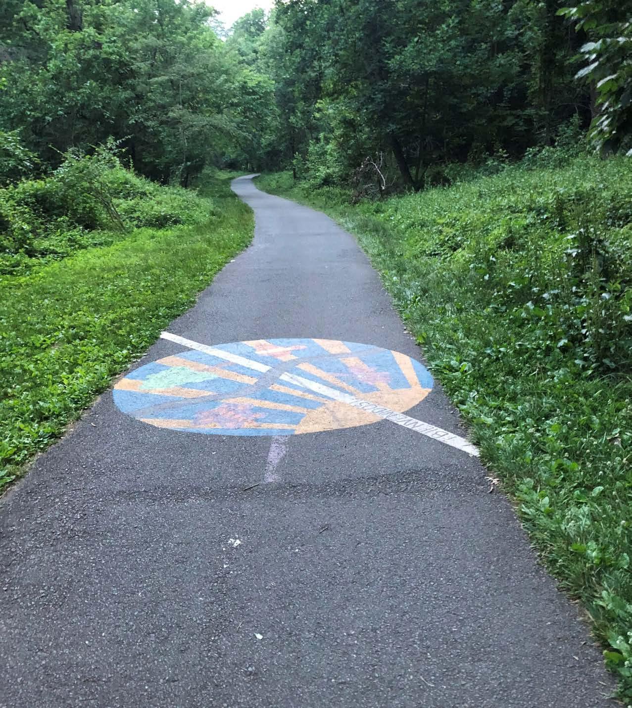
2024 Carole Highlands Safe Mobility Study Prince George’s County Planning Department Page 117 APPENDIX
Sligo Creek Trail at the Takoma Park boundary line in the study area� (PHOTO BY M-NCPPC)
Appendix D: Carole Highlands Safe Mobility Study Summary Results
PEDESTRIAN, BICYCLE, AND MOTOR VEHICLE ACCESS AND SAFETY
IMPROVEMENTS SURVEY
RESPONSE STATISTICS
Respondents were asked where they would like to see pedestrian, bicycle, and motor vehicle access and safety improved in the study area. Figure A3 illustrates the response rate of the survey.
Respondents were asked if they prefer to respond in writing or by indicating locations map.
Most respondents are interested in receiving email updates on the Carole Highlands Safe Mobility Study.
Page 118 2024 Carole Highlands Safe Mobility Study Prince George’s County Planning Department
0510152025303540 Disqualified Partial Complete Number of survey
Responses Count Percent Complete 40 50.6% Partial 39 49.4% Disqualified 0 0 Totals 79
responses
Response Method Count Percent Describe locations in writing 9 22.5% Show locations on a map 31 77.5% Totals 40
22% Write In 78% Use a Map Figure A4 � Preferred survey response method by participants Figure
�
that plan to remain engaged with the Carole Highlands Safe Mobility Study � Yes 74% No 26%
Figure A3 � Response rate of the Pedestrian, Bicycle, and Motor Vehicle Access and Safety Improvements Survey
A5
Percentage of respondents
PEDESTRIAN ACCESS AND SAFETY IMPROVEMENTS SURVEY RESPONSES
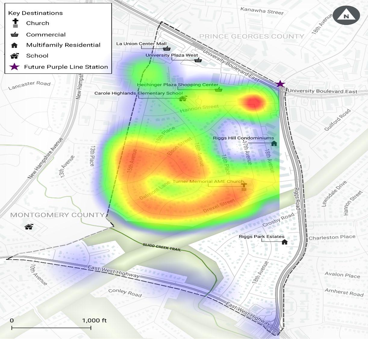
Participants clicked corresponding locations on an interactive map illustrating desired improvements in the study area.
The red color on the map indicates the locations most often identified by survey respondents desiring pedestrian safety improvements.
The orange, yellow, green, and blue colors indicate locations less frequently identified in descending order from orange to blue.
2024 Carole Highlands Safe Mobility Study Prince George’s County Planning Department Page 119 APPENDIX
BICYCLE ACCESS AND SAFETY IMPROVEMENTS SURVEY RESPONSES
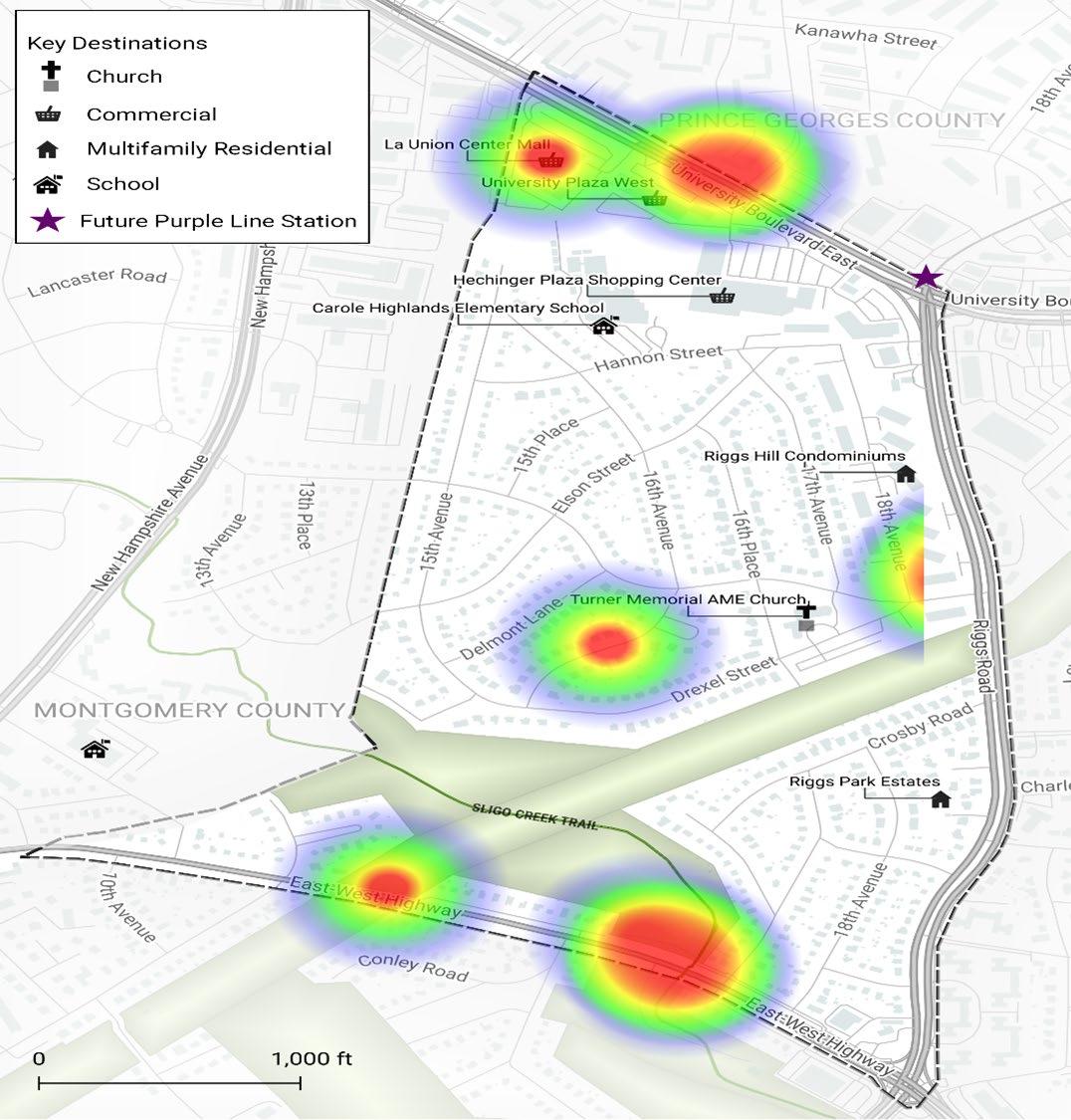
The red color on the map indicates the locations most often identified by survey respondents desiring safety and access improvements for bicyclists.
The orange, yellow, green, and blue colors indicate locations less frequently identified in descending order from orange to blue.
Page 120 2024 Carole Highlands Safe Mobility Study Prince George’s County Planning Department
MOTOR VEHICLE ACCESS AND SAFETY IMPROVEMENTS SURVEY RESPONSES

The red color on the map indicates the locations most often identified by survey respondents desiring motor vehicle access and safety improvements.
The orange, yellow, green, and blue colors indicate locations less frequently identified in descending order from orange to blue.
2024 Carole Highlands Safe Mobility Study Prince George’s County Planning Department Page 121 APPENDIX
ADDITIONAL RESPONSES FROM THE PEDESTRIAN, BICYCLE, AND MOTOR VEHICLE ACCESS AND SAFETY IMPROVEMENTS SURVEY
Response ID Response
12 Might it be possible to create a bike trail beneath the power lines that run between Drexel Street and Crosby Road?
17 The sidewalks on either side of Riggs Road are in poor condition; probably not ADA compatible; crumbling in some places. Thanks for conducting this survey.
19 En el parking lot De la Iglesia Turner, Memora es un lugar que no hay mucha luz y los focos que tienen allí no funcionan. Es una área bien oscura durante la noche. Si hay más luz podemos caminar con más seguridad y se puede ver si hay algún peligro. (Translation: In the parking lot of the Turner Memorial Church, it is a place where there is not much light and the spotlights there do not work. If there is more light, we can walk safely, and you can see if there is any danger).
21 Necesitamos conectivadad con la linea morada. (Translation: We need connection with the Purple Line.)
23 I would like a permanent stop sign ticket camera at 15th Ave and Erskine intersection. This is a VERY dangerous location. I’ve almost been hit numerous times when walking my dog.
26 Add speed bumps to 16th Ave, between Elson and Erskine please. Make a path across from intersection of Hannon St and 18th Ave.
30 We need to slow down the drivers in the neighborhood and somehow get them to stop at the stop signs. Trim trees or plants from blocking stop signs everywhere in the neighborhood.
37 We need sidewalks and protected bike lanes to ensure that pedestrians and bicyclists are safe from motor vehicle traffic. Speeders and folks running stop signs are just going to get worse as traffic increases due to purple line construction/opening. We need to protect our community members and our children from dangerous motor vehicle operators.
39 The more sidewalks in the neighborhood, the better.
49 Sidewalks!
50 I believe all the streets in Carole Highlands should have a sidewalk on at least one side of the street for safety. Drexel Rd is particularly hazardous.
57 Speed bumps on 15th Ave. Flashing 4-way stop signs at Erskine and 15th and Erskine and 16th. Flashing stop sign at Hannon and 15th, people leaving the school after dropping off and picking up just make that left turn without stopping!
58 We desperately need safety bumps (like MoCo has just blocks away) to slow down traffic. I would also welcome sidewalks to protect pedestrians.
59 Our neighborhood receives heavy use from non-neighborhood residents for (1) cut-through (i.e., using Erskine to cut-through from New Hampshire to Riggs, (2) heavy auto and bus traffic for Carole Highlands ES, and (3) regular and special events at the Turner Memorial Church. Improved pedestrian and bike safety is needed.
60 People in cars go at high speeds down Erskine and 15th Ave without fully stopping. This is a route to the elementary school. Buses also go too fast. I want to see speed bumps installed like they do down by Hillwood Park. Considering moving because of safety issues in this area.
62 Speed bumps and sidewalks are needed along Drexel St. and 15th Ave. It is a hill down from Riggs and is often used as an alternative to Erskine St. connecting Riggs and New Hampshire. Maybe pedestrians walking the road and cars going too fast.
65 I like the flashing stop sign!
66 I would like the county to reconsider the routing of school buses to Carole Highlands. Currently, they speed down 16th Avenue, which is a narrow residential street with parking on both sides. Erskine would seem to be a safer and more appropriate bus route.
68 It is well past time for sidewalks in the parts of Carole Highlands that don’t have them. It’s almost impossible to navigate the neighborhood on foot, in particular because Erskine has no sidewalks, so you can’t safely travel across the neighborhood. Sidewalks are essential if people are going to be able to, for instance, walk along Erskine to Riggs to walk up to the Purple Line station.
77 I do not want sidewalks. Trees would have to be cut down and our yards made smaller. I do not want people from Langley Park having easy access to our neighborhood.
79 Get rid of the signs: they don’t work, and they make the neighborhood look trashy. Get rid of the speed bumps: they don’t work and are bad for the environment. On Erskine, get rid of the stop signs. They don’t work and are bad for the environment. Solve the problem of people shortcutting through the neighborhood by making Erskine one-way between 16th Place and 17th Avenue.
Page 122 2024 Carole Highlands Safe Mobility Study Prince George’s County Planning Department
SURVEY RESPONDENT STATISTICAL DATA
Respondents ranked the top two ways they currently travel between destinations within Carole Highlands.
Method Count
Figure A6 � Current travel methods within the study area �
Respondents ranked the top two ways they prefer to travel between destinations within Carole Highlands.
Figure A7 � Preferred travel methods within the study area
2024 Carole Highlands Safe Mobility Study Prince George’s County Planning Department Page 123 APPENDIX
0% 10% 20% 30% 40% 50% 60% 70% 80% 90% Drive Alone Carpool Public Transit Bicycle Walk 27.8% 5.6% 2.8% 58.3% 83.3% Travel
Percent Walk 30 83.3% Bicycle 10 27.8% Public transit 2 5.6% Carpool 1 2.8% Drive alone 21 58.3% Other
0
Preferred Method Count Percent Walk 30 88.2% Bicycle 16 47.1% Public transit 5 14.7% Carpool 1 2.9% Drive alone 8 23.5% Other 1 2.9% 47.1% 14.7% 2.9% 23.5% 2.9% 88.2% 0% 10% 20% 30% 40% 50% 60% 70% 80% 90% 100% Other (write in)
Bicycle
Drive Alone Carpool Pubic Transit
Walk
SURVEY RESPONDENT STATISTICAL DATA
Respondents were asked, if a preferred method of traveling between destinations within Carole Highlands differs from a current method of travel, what should change for a respondent to choose the preferred method of travel?
Response ID Response
17 I’d take the bus to metro more if service were just a bit better. The K9 express bus stops for Carole Highlands on Erskine. Improving frequency on that, the K6, and the 16 would be great.
19 En mi vecindario prefiero caminar y no manejar. (In my neighborhood I prefer to walk and not drive.)
23 I’d like to bike. Probably just the space between walkers and bikers on the paths would need to be widened.
26 Sidewalks
30 Sidewalks and slowing traffic down
37 We need sidewalks
44 need bike lanes
57 I would need a bike path
58 None — I prefer to walk or bike
60 I would like to feel more comfortable walking for everyone.
62 Sidewalks. And something to slow the speed of cars.
65 speed bumps! sidewalks!
79 Prohibit street parking on Erskine and put bike lanes on both sides.
Respondents ranked the top two ways they currently travel between destinations within Carole Highlands and destinations in adjacent areas.
Figure A8 � Current travel methods within the study area and adjacent areas
Page 124 2024 Carole Highlands Safe Mobility Study Prince George’s County Planning Department
Travel Method Count Percent Walk 18 52.9% Bicycle 8 23.5% Public transit 3 8.8% Carpool 4 11.8% Drive alone 25 73.5% Other 0 0 0% 10% 20% 30% 40% 50% 60% 70% 80% Drive Alone Carpool Public Transit Bicycle Walk 52.9% 23.5% 8.8% 11.8% 73.5%
SURVEY RESPONDENT STATISTICAL DATA
Respondents ranked the top two ways they prefer to travel between destinations within Carole Highlands and destinations in adjacent areas.
Figure A9 � Preferred travel methods within the study area and adjacent areas �
Respondents were asked, if a preferred method of traveling between destinations within Carole Highlands and to destinations in adjacent areas differs from a current method of travel, what should change for a respondent to choose the preferred method of travel? Response ID Response
37 Need sidewalks and better access to public transit.
44 Finish Purple Line.
57 Bike lanes.
58 I always feel unsafe as a pedestrian walking along New Hampshire Ave—the cars drive so fast. I also feel unsafe walking in Carole Highlands because of the lack of sidewalks.
60 I don’t feel comfortable crossing New Hampshire to continue on the Silgo Trail and to cross at Erskine/ Garland. The light doesn’t seem long enough for normal walking speed. Feel stuck within Carole Highlands neighborhood.
62 Sidewalks and speed bumps. I do not feel safe walking the street.
65 Purple line! Bike lanes, especially on New Hampshire Ave.
68 Sidewalks inside Carole Highlands in the places that don’t have them, especially on Erskine in the PG County parts.
79 Prohibit parking on Erskine and add bike lanes.
2024 Carole Highlands Safe Mobility Study Prince George’s County Planning Department Page 125 APPENDIX Preferred Method Count Percent Walk 25 73.5% Bicycle 13 38.2% Public transit 9 26.5% Carpool 1 2.9% Drive alone 16 47.1% Other 0 0 0% 10% 20% 30% 40% 50% 60% 70% 80% Drive Alone Carpool Public Transit Bicycle Walk 73.5% 38.2% 26.5% 2.9% 47.1%
SURVEY RESPONDENT DEMOGRAPHIC DATA
Most survey respondents live in Carole Highlands.
9% 91% live in Carole Highlands
The respondent pool reflects a broad demographic.
Figure A10 � Percentage of respondents that identify as a Carole Highlands resident
Figure A11 � Respondents identified by race/ethnicity
Page 126 2024 Carole Highlands Safe Mobility Study Prince George’s County Planning Department Study Area Resident Count Percent Yes 31 91.2% No 3 8.8% Totals 34
Race/Ethnicity Count Percent Asian/Pacific Islander 2 5.7% Black/African American 6 17.1% Hispano(a)/Latino(a) 5 14.3% White/Caucasian 18 51.4% Other (Write In) 2 5.7% Guyanese 1 Why? 1 Prefer not to answer 5 14.3% 0% 10% 20% 30% 40% 50% 60% Prefer not to answer Other/ Write In (Required) White/ Caucasian Hispano(a)/ Latino(a) Black/ African American Asian/ Pacific Islander 5.7% 17.1% 14.3% 51.4% 5.7% 14.3%
SURVEY RESPONDENT DEMOGRAPHIC DATA
Figure A12 � Respondents identified by age
2024 Carole Highlands Safe Mobility Study Prince George’s County Planning Department Page 127 APPENDIX Prefer not to answer 75+ 65-74 55-64 45-54 35-44 25-34 8.6% 28.6% 28.6% 8.6% 8.6% 5.7% 11.4%
Appendix E: Key Plan Recommendations from Previous Plans
RECOMMENDATIONS FOR EXISTING STREETS
Plan or Study
Relevant Recommendations
MD 193 (University Boulevard)
Countywide Master Plan of Transportation (2009)
Purple Line Corridor Access Study (2011)
Takoma/Langley Crossroads Sector Plan (2012)
SPACEs Sidewalk and Safety Improvements Study (2021)
• Provide continuous pedestrian and bicycle accommodation along MD 193 with either a wide sidewalk or side path for pedestrians and recreational cyclists, and wide curb lanes, bike lanes, or shoulders for on-road bicyclists.
• Install separated bike lanes.
• Provide minimum 10-foot sidewalks along University Boulevard at the platform location.
• Enhance street lighting.
• Install a cycle track west of New Hampshire Avenue.
• Install buffered bike lanes.
• Install 5-foot sidewalks with landscape buffers.
• Continue sidewalks across driveways.
• Provide parcel and inter-parcel pedestrian connections.
• At intersections, install high-viability crosswalks on all legs and leading pedestrian intervals (LPIs) and No Right Turn on Red (NRTOR); eliminate free right turns.
• Consolidate driveways.
• Install mid-block crossing with High-Intensity Activated crosswalk (HAWK) beacon between 14th Avenue and 15th Avenue.
• Install pedestrian-scale lighting.
MD 193 (University Boulevard) and MD 212 (Riggs Road)
Purple Line Bicycle Hub Location Study (2010)
Purple Line Corridor Access Study (2011)
SPACEs Sidewalk and Safety Improvements Study (2021)
Vision Zero Action Plan (2019)
MD 212 (Riggs Road)
Countywide Master Plan of Transportation (2009)
Purple Line Bicycle Hub Location Study (2010)
Purple Line Corridor Access Study (2011)
Greater Chillum Community Study (2015)
MD 410 (East West Highway)
Countywide Master Plan of Transportation (2009)
Erskine Street
Purple Line Bicycle Hub Location Study (2010)
Purple Line Corridor Access Study (2011)
• Provide a cycle track and sidewalks.
• Widen and extend the median noses further into the intersection to create pedestrian refuge areas.
• Provide yield lines for right turning vehicles.
• Provide cross-hatching with high intensity paint for crosswalks.
• Use unique color paint for crosswalks to facilitate wayfinding to the Purple Line station.
• Provide wide crosswalks on the west leg of the intersection with Riggs Road to the platform.
• Eliminate the free right turn on southeast corner.
• This segment was identified as part of the High Injury Network, with many pedestrian and bicycle crashes.
• Provide continuous sidewalks and on-road bicycle accommodation along this corridor.
• Proposed shared use roadway.
• Install bike lanes.
• Implement traffic calming.
• Enhance street lighting.
• Improve pedestrian access across Riggs Road for residents in Park Lawn and Riggs Park Estates.
• Continuous facilities for pedestrians and bicyclists are needed along this corridor.
• Proposed shared use roadway.
• Upgrade intersections with new Americans with Disabilities Act (ADA) sidewalk ramps.
• Upgrade driveway entrances with ADA standard aprons.
• Provide cross-hatching with high intensity paint for crosswalks.
• Reconstruct existing narrow sidewalk (less than 4-feet wide) or construct missing sidewalk links with 5-foot sidewalk and vegetated buffer—both sides.
• Install “share the road” signage and shared lane markings.
• Enhance street lighting.
Page 128 2024 Carole Highlands Safe Mobility Study Prince George’s County Planning Department
RECOMMENDATIONS FOR EXISTING STREETS
Plan or Study Relevant Recommendations
Drexel Street
Purple Line Bicycle Hub Location Study (2010)
Purple Line Corridor Access Study (2011)
Elson Street
Purple Line Bicycle Hub Location Study (2010)
Purple Line Corridor Access Study (2011)
• Proposed shared use roadway.
• Upgrade intersections with new ADA sidewalk ramps.
• Upgrade driveway entrances with ADA standard aprons.
• Provide cross-hatching with high intensity paint for crosswalks.
• Reconstruct existing narrow sidewalk (less than 4-foot wide) or construct 5-foot sidewalk and vegetative buffer—both sides.
• Install “share the road” signage and shared lane markings.
• Enhance street lighting.
• Proposed shared use roadway.
• Upgrade intersections with new ADA sidewalk ramps.
• Upgrade driveway entrances with ADA standard aprons.
• Provide cross-hatching with high intensity paint for crosswalks.
• Reconstruct existing narrow sidewalk (less than 4-foot wide) or construct 5-foot sidewalk and vegetative buffer—both sides.
• Install “share the road” signage and shared lane markings.
15th Avenue
Purple Line Bicycle Hub Location Study (2010)
Purple Line Corridor Access Study (2011)
16th Avenue
Purple Line Bicycle Hub Location Study (2010)
Purple Line Corridor Access Study (2011)
• Proposed shared use roadway.
• Upgrade intersections with new ADA sidewalk ramps.
• Upgrade driveway entrances with ADA standard aprons.
• Provide cross-hatching with high intensity paint for crosswalks.
• Reconstruct existing narrow sidewalk (less than 4-foot wide) or construct 5-foot sidewalk and vegetative buffer—both sides.
• Install shared use paths from 15th Avenue north of 16th Avenue to Holton Lane.
• Install “share the road” signage and shared lane markings
• Enhance street lighting.
• Proposed shared use roadway.
• Upgrade intersections with new ADA sidewalk ramps.
• Upgrade driveway entrances with ADA standard aprons.
• Provide cross-hatching with high intensity paint for crosswalks.
• Reconstruct existing narrow sidewalk (less than 4-foot wide) or construct 5-foot sidewalk and vegetative buffer—both sides.
• Install “share the road” signage and shared lane markings. Hannon Street
Purple Line Corridor Access Study (2011)
• Upgrade intersections with new ADA sidewalk ramps.
• Provide cross-hatching with high intensity paint for crosswalks.
• Install “share the road” signage and shared lane markings. 18th Avenue
Purple Line Bicycle Hub Location Study (2010)
Takoma/Langley Crossroads Sector Plan: Prince George’s County (2009)
Purple Line Corridor Access Study (2011)
• Proposed shared use roadway.
• Shared use roadway
• Reconstruct existing narrow sidewalks (less than 4-feet wide) or construct 5-foot sidewalk and vegetative buffer.
• 18th Avenue south of Hannon Street (east side)
• Install “share the road” signage and shared lane markings.
2024 Carole Highlands Safe Mobility Study Prince George’s County Planning Department Page 129 APPENDIX
PROPOSED CONNECTIONS
Plan or Study
Pepco right-of-way
Purple Line Corridor Access Study (2011)
Greater Chillum Community Study (2015)
Relevant Recommendations
• Install new shared use paths to provide connections across the Pepco right-of-way to link Carole Highlands to University Boulevard and Riggs Road.
• Create pedestrian connection across high-tension wire easement between community sections.
• Improve the edges of the high-tension wire easement, particularly in high-visibility areas near major roadways.
Hannon Street (Carole Highlands Elementary School to 17th Avenue)
Purple Line Corridor Access Study (2011)
• Extend as a new roadway or shared use path.
15th Avenue to Holton Lane
Takoma/Langley
Crossroads Sector Plan: Prince George’s County (2009)
Purple Line Bicycle Hub Location Study (2010)
• Indicated as planned trail.
• Proposed hard surface trail.
18th Avenue and Hannon Street to Hechinger Plaza
Purple Line Bicycle Hub Location Study (2010)
Purple Line Corridor Access Study (2011)
18th Avenue to Riggs Road
Purple Line Corridor Access Study (2011)
• Proposed hard surface trail.
• Construct a fenced shared path with steps to University Boulevard or Riggs Road.
• Reconstruct existing narrow sidewalk (less than 4-feet wide) or construct missing sidewalk links with 5-foot sidewalk and vegetative buffer.
• 18th Avenue to Riggs Road (adjacent to multifamily housing).
WAYFINDING AND PLACEMAKING
Plan or Study
Purple Line Corridor Access Study (2011)
Greater Chillum Community Study (2015)
SPACEs Sidewalk and Safety Improvements Study (2021)
Relevant Recommendations
• Install bilingual wayfinding signs along pedestrian and bicycle routes to various destinations such as the Purple Line station, Carole Highlands Elementary School, and the Sligo Creek Trail.
• Create signage for community sections to create a stronger sense of identity for residents.
• Install pedestrian-scale wayfinding signage.
• Install public art at the intersection of University Boulevard and Riggs Road.
Page 130 2024 Carole Highlands Safe Mobility Study Prince George’s County Planning Department
2015 GREATER CHILLUM COMMUNITY STUDY
Map 17. Existing and Proposed Bicycle Lanes and Trails
Figure A13 � Existing and Proposed Bikeways from the 2015 Greater Chillum Community Study 108 Co NNEC tivity a ND t ra NSPortatio N Greater Chillum Community Study
2024 Carole Highlands Safe Mobility Study Prince George’s County Planning Department Page 131 APPENDIX
M M MTA MTA MTA M M M MTA MTA MTA M Nor t hwes t B ran ch Trai l
ligo Cree k Trai l
merican Di s co v er y Trai l
as t Coa st G reenwa y
S
A
E
t
l
P rince G eorge s Connec
or Trai
O n-Road B icyc le Rou tes
N 0’1000’
P roposed B ic y cle Rou tes
Appendix F:
Public Right-of-Way Dimensions for Key Streets
PROPOSED CONNECTIONS
Erskine Street
Drexel Street
Riggs Road
11 Measurements are to the nearest half foot. Measurements were made using PGAtlas’s measuring tool, the property layer, and the latest aerial imagery.
12 Adjacent Pepco right-of-way.
Page 132 2024 Carole Highlands Safe Mobility Study Prince George’s County Planning Department
Block Right-of-way width 11 Curb to curb street width Curb to edge of rightof-way width (north side) Curb to edge of rightof-way width (south side)
16th Pl to 16th Ave 58.5 feet 34.5 feet 8.5 feet 13.5 feet 16th Ave to Delmont Ln 61.0 feet 36.0 feet 10.5 feet 14.0 feet Delmont Ln to Elson St 60.0 feet 35.5 feet 11.0 feet 14.0 feet Elson St to 15th Pl 61.5 feet 35.0 feet 11.0 feet 13.0 feet 5th Pl to 15th Ave 61.5 feet 35.5 feet 10.0 feet 14.0 feet
16th Pl to 16th Ave 53.0 feet 29.5 feet 12.0 feet 13.5 feet 15th Ave to Sligo Pkwy 79.5 feet 55.0 feet 12.5 feet 11.5 feet 15th Avenue Drexel St to Delmont Ln 59.0 feet 35.0 feet 12.5 feet 10.5 feet Delmont Ln to Elson St 63.0 feet 34.0 feet 11.5 feet 14.2 feet Elson St to Erskine St 54.5 feet 33.0 feet 12.0 feet 6.0 feet Erskine St to Hannon St 62.0 feet 34.0 feet 12.5 feet 13.0 feet Hannon St to 16th Ave 63.0 feet 36.0 feet 12.0 feet 14.0 feet Elson Street 15th Ave to Erskine St 54.0 feet 34.5 feet 5.5 feet 12.5 feet Erskine St to 16th Ave 59.0 feet 33.5 feet 12.5 feet 10.5 feet 16th Avenue Drexel St to Elson St 48.0 feet 26.0 feet 6.0 feet 16.0 feet Elson St to Erskine St 53.0 feet 25.0 feet 15.0 feet 12.5 feet
University Blvd to Drexel St 102.0 feet 83.0 feet 4.0 feet 13.5 feet Drexel St to Erskine St 102.0 feet 81.5 feet 5.0 feet 11.5 feet Erskine St to Crosby Rd12 99.0 feet 83.0 feet 4.0 feet 10.0 feet Beechwood Rd to Avalon Pl 114.0 feet 82.0 feet 2.0 feet 31.5 feet
Acknowledgments
Senior Management Team
Lakisha Hull, AICP, LEED AP BD+C Planning Director
Derick Berlage, AICP Deputy Planning Director of Operations
Project Team Core Members
Katina Shoulars Chief, Countywide Planning Division
Will Capers* Supervisor, Transportation Planning Section Countywide Planning Division
Michael Jackson Project Manager, Transportation Planning Section Countywide Planning Division
Crystal Hancock Deputy Project Manager, Transportation Planning Section Countywide Planning Division
Project Team Resource Members
Carly Brockington Senior Public Affairs and Marketing Specialist
Thi-Lai Simpson Publications Specialist
Consultants
James Elliot, AICP Senior Planner, Toole Design Group
Ayden Cohen Toole Design Group
James Sebastian Toole Design Group
Mia Vogel Toole Design Group
Special thanks to:
Judith Howerton, AICP* Senior Planner, Transportation, Countywide Planning Division
Malikia Cherubala* 2022 Summer Intern, Countywide Planning Division
Turner Memorial
African Methodist
Episcopal Church
* Former employee
2024 Carole Highlands Safe Mobility Study Prince George’s County Planning Department Page 133
The Maryland-National Capital Park and Planning Commission Prince George’s County Planning Department 1616 McCormick Drive Largo, MD 20774 www.pgplanning.org


 Angela Alsobrooks, County Executive
County Council


 The study team participates in a Community Walk Audit in Carole Highlands (PHOTO BY M-NCPPC)


