9 minute read
USING SEAL COATS TO REDUCE URBAN HEAT
USING SEAL COATS
TO REDUCE URBAN HEAT by Tanya Roe, Senior Consultant, Sustainability, City of Adelaide
Advertisement
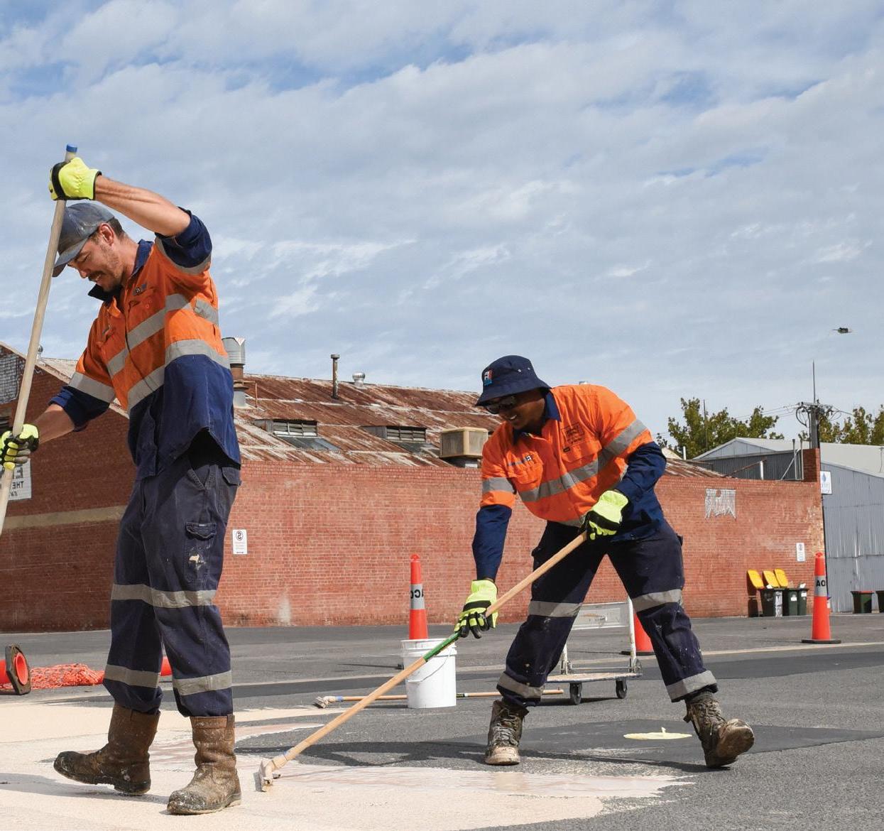
Image credit – Catherine Leo Photography.
For the CBD and eastern Adelaide in South Australia, projections are: ♦ Annual average maximum temperatures to increase by 1.6ºC by 2050 and 2.3ºC by 2070 ♦ Days over 35ºC to increase from 20 days per year to 47 (38-57) days per year by 2090 ♦ Days over 40ºC to increase from 3.7 days per year to 16 (12-22) days per year by 2090
Bureau of Meteorology data indicates that 2019 recorded 38 days over 35ºC and 17 days over 40ºC. The urban heat island effect is prevalent in many Australian cities and has been shown to be exacerbated by climate change. HEAT MAPPING OF LAND SURFACE TEMPERATURES
Due to urban ambient air temperatures being related to land surface temperatures, in 2018 the Resilient East climate change partnership (eight councils in central-eastern Adelaide plus the Government of South Australia), along with the City of Salisbury, commissioned The Collaborative Heat Mapping for the Eastern and Northern Adelaide Project. Graph 1 was taken from this study and depicts the average land surface temperatures of 1,100 locations across the study area, within 18 different land use type categories.
A key finding from the study was that non-shaded asphalt roads are 4ºC hotter than the average land surface day temperature, and they bank the heat and release it at night, becoming the hottest night-time surface.
The study findings are consistent with national and international research and the related map can be viewed along with those of greater Adelaide on the Urban Heat Mapping Viewer portal.
The City of Adelaide (CoA) is using this data to inform its planning and design. Residents and businesses can consult the tool to understand how heat exposed their properties and communities are.

Extreme heat kills more Australians than any other natural disaster and the number of extreme heat days is predicted to increase significantly for many areas of Australia. Climate-KIC Australia in partnership with the City of Adelaide (CoA) and South Australian Department for Environment and Water, are undertaking the Cool Road Adelaide project to test three heat reflective seal coats that may help combat urban heat now and in the future.
The CoA is responding to the predictions for climate change and knowledge of urban heat in a number of ways, such as developing a Climate Risk Profile, a Water Sensitive City Transition Plan, staff and community capacity building, increased greening, investigating more sustainable infrastructure renewals, and trialling cooler materials and infrastructure in the city.
IMPERVIOUS SURFACES
Hard surfaces typically account for the heat island effect in cities. Roofs typically account for 20-25 per cent and pavements 40 per cent of city surfaces, each absorbing 80 per cent of sunlight
Graph 1. Heat mapping study land use analysis results showing the relative temperature difference of various land uses during the day and night with Bowen St West temperatures marked. Original image - Seed Consulting Services, EnDev Geographic and Monash University, 2018.

Post application air column temperature recording directly above the different road surface types using a bluetooth Hobo. Image credit – Edge Environment.

reaching them and converting it into heat. There’s a range of cool materials being used, trialled and developed, which include low heat conductivity (conducts heat less into its interior), low heat capacity (stores less heat in its volume), high solar reflectance (albedo) and a high level of embodied moisture to be evaporated or filtrated into the soil.
Asphalt roads, one of the consistently hot urban surfaces both day and night, cover a large area of our cities and are a local and state government asset. Conventional asphalt pavement can reach 50-65ºC. Alternative cooler options include heat reflective asphalt or concrete, heat reflective seal coats, permeable paving, foam/permeable concrete, resin-based concrete, permeable asphalt, block pavers and vegetated pavement.
As an example, the Tokyo Metropolitan Government has implemented 19km of water retentive pavements as an urban cooling strategy. An urban landscape is highly contested with road, parking, pedestrian access, underground services, aboveground power and signage and awnings, making tree planting challenging.
HEAT REFLECTIVE ROAD PAVEMENT SEAL COATS
In 2019, two local councils (the Cities of Charles Sturt and Salisbury) trialled a US manufactured cool road seal coat product, producing a 6.1ºC reduction in land surface temperature (City of Charles Sturt testing results). Adelaide Airport also trialled two locally manufactured products.
COOL ROAD ADELAIDE
The Cool Road Adelaide Project is trialling all three of the aforementioned cool road seal coats on the same piece of road, and has tested both land surface and air temperature.
The aim of the trial is to understand the advantages and disadvantages (from an urban heat, road preservation and community perception point of view) of the type of product overall, and comparing the three products to each other and a control patch.
Bowen Street West was chosen as an existing asphalt road, receiving a reasonably uniform heat profile, contributing to a night-time heat island (125m x 125m area) and a location site which would cause minimal impact to residents and traders within the CBD. The road is approximately 100m long, 11.5m wide and the road surface is over 20 years old.
The project patched potholed and cracked sections of the road approximately three months before the cool road surfaces were applied, conducted slip resistance (AS 4663:2013 and AS 4586:2013) and skid resistance (DPTI TP345:2-10) testing, and established a community information and consultation process.
The project conducted pre-application road temperature testing via a groundbased measurement platform in mid-December 2019 (after two days over 32ºC with clear skies) at both midday and early morning, to gather day and night-time temperatures.
The three cool road surface products were then applied in late January 2020 in patches approximately 24m long, 11.5m wide and 277m2.
The three products under trial are: ♦ JetBloc TM in Irish Cream by Fulton
Hogan – a blend of epoxy modified and cementitious polymers that can be formulated in many colours including the most heat reflective
Irish Cream option. It’s designed for high traffic and stressed asphalt pavements and can be sprayed on or hand applied JetCool TM by Fulton Hogan – a premium bitumen emulsion with latex and sun reflective fillers which make it a light grey colour. It’s designed for asphalt roads and airport pavements, and can be sprayed on or hand applied CoolSeal by GuardTop® supplied by SuperSealing – a grey colour, waterbased asphalt emulsion. It has been used extensively in Los Angeles, as well as other US cities
POST-APPLICATION TESTING
The post-application temperature measurement occurred in February and March 2020 consisting of: ♦ Ground-based measurement of the entire road surface after two clear sky days over 32ºC. An average surface temperature and relative temperature values for over 100 individual points will be calculated and summary statistics provided ♦ Multiple temperature recordings on the air column directly above the different road surface types using a bluetooth Hobo (a weatherproof data logger with built-in temperature and relative humidity sensors), mounted on 2-3m high masts measuring air temperature to within 0.25-0.50ºC. Loggers mounted at 0.10m, 1m, 1.5m, 2m and 2.5m, and measured every 15 minutes 9am-11pm.
The results will also be used to determine a land surface temperature signal for the CRC for Water Sensitive Cities’ land surface temperature scenario modelling tool, and a series of scenarios modelled to determine an estimate of the day and night-time heat island mitigation benefits at a whole of CBD scale.
A report will be provided in July/August 2020 regarding the land surface and air temperature findings as well as the results of the community consultation. Road
DENSE URBAN MICROCLIMATES
Heat reflectance qualities of materials will need to be considered on a caseby-case basis in different locations. Research is indicating these surfaces may be most useful on roads that are not abutted by high buildings. In highly built-up areas, the road may reflect heat onto surrounding buildings that absorb the heat, increasing the heat load of the building and/or reflecting the heat back into the street. Depending on the scenario and location, seasonal shading, misting, greening (particularly with canopy) and/or permeable pavements may be more effective at cooling a microclimate.
Project findings will be published on the Infrastructure website when released.
References
Mobile Mapping

The Cool Road Adelaide project is a Climate-KIC Australia project delivered in partnership with the City of Adelaide and South Australian Department for Environment and Water. The project is also made possible with in-kind support from Fulton Hogan. More information is available at Your Say Adelaide yoursay.
Post application temperature measurement using thermal imagery. Image credit – Edge Environment.
Coates, L., Haynes. K., O’Brien, J., McAneney, J. & Oliveira, F.D. (2014). Exploring 167 years of vulnerability: An examination of extreme heat events in Australia 1844–2010. Environmental Science & Policy, 42, 33-44. Commonwealth of Australia (2020). Bureau of Meteorology, Climate Data Online webpage http://www.bom.gov.au/climate/data/ C40 Cities Climate Leadership Group (2016). Good Practice Guide, Cool Cities Osmond, P & Sharifi, E. (2017). Guide to Urban Cooling Strategies, Low Carbon Living CRC, Sydney, N.S.W. Resilient East (2015). Climate Projections Report, prepared by URPS and Seed Consultancy Services as part of the Resilient East consultancy led by URPS, for the Eastern Region in association with the Government of South Australia and the Australian Government. Seed Consulting Services, EnDev Geographic and Monash University (2018). Collaborative Heat Mapping for Eastern and Northern Adelaide Report. Prepared for the City of Unley on behalf of the Eastern Region Alliance of Councils and the City of Salisbury. Watkins, R., Palmer, J. & Kolokotroni, M. (2007). Increased Temperature and Intensification of the Urban Heat Island: Implications for Human Comfort and Urban Design. Built Environment, 33(1) Climate Change and Cities, 85-96.
cityofadelaide.com.au/cool-road.

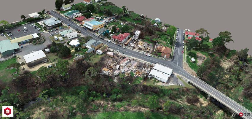
Taylors Mobile Mapping technology is a fast and cost effective way to manage assets such as bridges, buildings, roads, highways, and power stations. Taylors combines the latest in vehicle mounted and UAV technology to capture 360 degree geo-referenced imagery to document site conditions, asset capture and mapping.
Bushfire Recovery With the generous support of Ultimate Positioning Group, Taylors is assisting to document the Impact of the Bushfires throughout Victoria and New South Wales. Utilising the Trimble MX7 Mobile Imaging System, Taylors is collecting geo-referenced images which will help to document the impact of these bushfires. UAVs were also used to help in capturing data around areas where the impact of these bushfires cannot be seen by road.


