12 minute read
North Central


Soo Line North Trail/Lawler Loops/Blind Lake Connector and Loop/Hill City Trail/Rabey Line Trail/UPM Blandin Trail/Emily-Outing Trail /Moose River Trail and Connector/Axtell Technical Riding Area /Miller - Black Bear Trail/ Mississippi Northwoods - Miller Hills - Spider Lake Trails/Fort Ripley Trail and Ripley Connection/Blue Ox Trail/Alvwood-Squaw Lake Trails/Pine Center Trails/Crow Wing Southern Loop Trail/Meeker County OHV Park
Soo Line North Trail
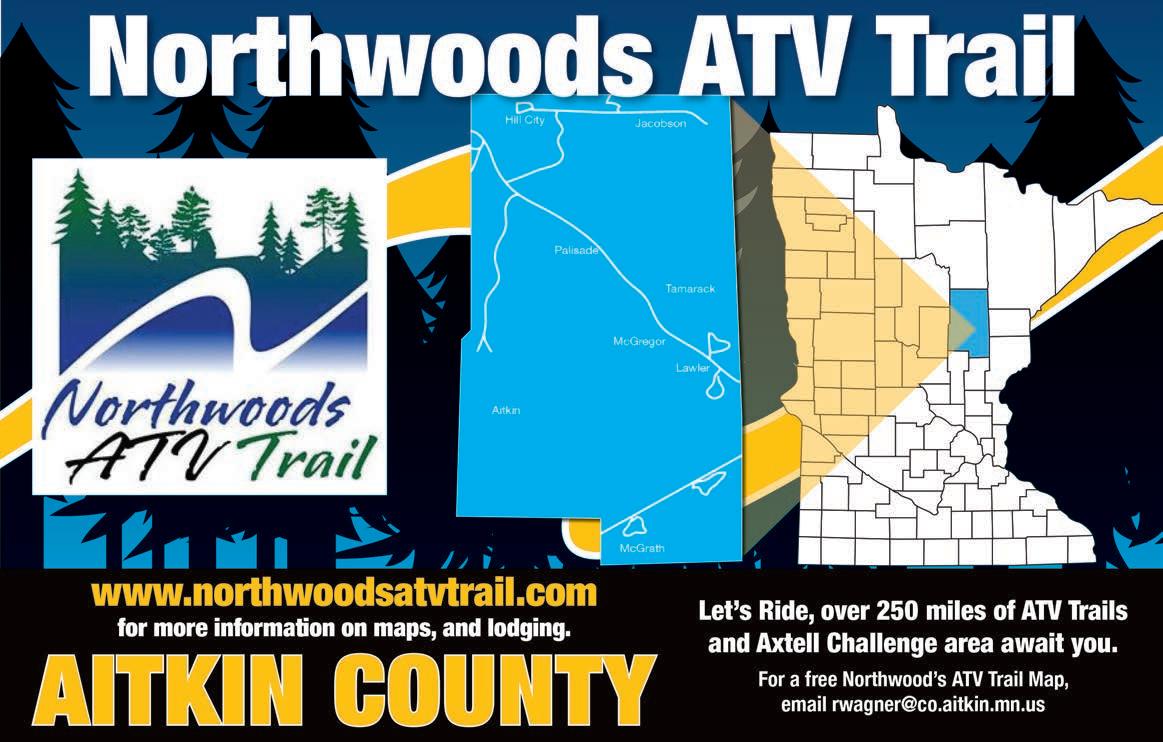
This is the ultimate connector trail, passing through Aitkin, Carlton and Cass counties, with stretches from Moose Lake to Lawler, from Lawler to Shovel Lake and from Shovel Lake to five miles east of Cass Lake (no access to Cass Lake… yet). Many communities along the trail are ATV/OHM-friendly, allowing travel on posted roads within city limits. The trail connects to six more riding areas, for an additional 100-plus miles. The trails follow the former railroad grade, curving through flat portions of the Hill River and Bowstring State Forest. Keep an eye out for wildlife, especially around remote ponds along the way. Motorcycles are not allowed on the segment in Cass County. The Eagle Riders Club, Northwoods ATV Trail and the counties maintain segments of this trail. Distance: 115 miles Difficulty: Easiest Parking/Trailhead Location(s): Parking and trail access is located in Shovel Lake, Swatara, Palisade, McGregor, Lawler, Moose Lake and Remer. Season: Carlton County: year round; Aitkin/Cass counties: April 1 to November 30 Facilities: Lawler, Palisade, Swatara, Remer, Federal Dam and Boy River: food, fuel, restrooms; Moose Lake and McGregor: food, fuel, restrooms, lodging More Information: Aitkin County, Rich Courtemanche, 218-927-7364 or acld@co.aitkin.mn.us; Carlton County, Jim Gassert, 218-485-4486; Cass County, Kirk Titus, 218-947-7501
Lawler Loops
Divert from the Soo Line North Trail onto this series of three woodsy loops. Not only do the loops feature a variety of terrain in a compact package, but each also hosts picnic areas. Boardwalks crisscross over wetlands for an interesting ride. Clubs in the Northwoods ATV Trail group and the county maintain this trail. Distance: 16 miles Difficulty: Easiest Parking/Trailhead Location(s): In Lawler along the Soo Line North Trail Season: May 15 to October 31 Facilities: Lawler: food, fuel, restroom More Information: Rich Courtemanche, 218-927-7364 or acld@co.aitkin.mn.us
Blind Lake Connector and Loop
This is another place to hop off of the Soo Line North, or it can be a destination in itself. Wide trails on the Connector make this a comfortable place for families or learners; the Loop offers narrow trails. The remote lakes, ponds and rivers are a treat. Watch for grouse, fox, deer and turkey. There are restrooms and picnic spots along the trail, and a rustic shelter with a woodstove where the trail ends at Brown Lake. The loop is 15 miles; the connector between the loop and Soo Line is about 20 miles. Aitkin County and Northwoods ATV Trail clubs maintain this trail. Distance: 33 miles Difficulty: Easiest Parking/Trailhead Location(s): On the north and south ends of the loop Season: May 15 to October 31 Facilities: Swatara: food, fuel, restroom More Information: Rich Courtemanche, 218-927-7364 or acld@co.aitkin.mn.us
Hill City Trail
If the Blind Lake Connector is mild, the Hill City Trail offers some of the most satisfying challenges in the Aitkin area. The trails offer steep hill climbs (this was once a ski area) and tight turns through the hardwood forest surrounding the Quadna Mountain Park. Go to the top of the clear-cut hills for a great view, especially in the fall. Access this trail from the Soo Line North or at Quadna Mountain. Aitkin County and Northwoods ATV Trail clubs maintain this trail. Distance: 16 miles Difficulty: More Difficult Parking/Trailhead Location(s): Parking in Hill City and Swatara Season: May 15 to October 31 Facilities: Hill City: food, fuel, restroom, lodging; Swatara: food, fuel, restroom More Information: Rich Courtemanche, 218-927-7364 or acld@co.aitkin.mn.us
Alvwood/Squaw Lake Trails
Just a bit southwest of Northome is access to an incredible 159 miles of ATV and offroad motorcycle trail. Much of it follows roads within three state forests (Blackduck. Bowstring and Big Fork) and within the Chippewa National Forest. Trails skirt several lakes, including Squaw, Sand, Dora and Island lakes, as well as a trailhead at Lake Winnibigoshish. The Alvwood Squaw Lake ATV Club maintains these trails. Distance: 159 miles Difficulty: Easiest Parking/Trailhead Location(s): Parking at many businesses in Alvwood and Squaw Lake Season: Year-round except for forest service road closure March 15 – May 2 Facilities: Alvwood/Squaw Lake: food, fuel, restrooms, lodging More Information: Garrett Ous, 218-340-7775
Blue Ox Trail
The Blue Ox Trail falls into the same class as the Soo Line trails: long, straight and direct — with a few side options. It runs along an abandoned railroad grade through the Big Fork and Koochiching state forests, the Blue Ox ATV Trail is a truly scenic trail, with crossings over the Little Fork and Big Fork rivers, and views of swamps, black spruce and upland aspen stands. There’s a small trail hiccup in Littlefork, but the town allows ATVs on its streets to make the connection. Look for side trails north of Mizpah and for the Alvwood/Squaw Lake area south of Northome. Distance: 74 miles Difficulty: Easiest Parking/Trailhead Location(s): Parking is available in Northome, Funkley and Big Falls (south of International Falls) Season: April 11 to November 30 Facilities: Northome: food, fuel, restrooms, lodging; Big Falls: food, fuel, restroom; Funkley: food, restrooms More Information: Tenstrike to Funkley: 218-308-2367; Funkley to Big Falls: Jack White, 218-897-5764; Big Falls to Littlefork: 218-328-8982; Littlefork to International Falls: 218-300-7841
Rabey Line Trail
This trail is a slice of Minnesota — including woods, high ground, swamp, bogs and views of the young Mississippi. It links the towns of Jacobson and Hill City. The scenic terrain includes jaunts through the Savanna and Hill River state forests. It’s also a good connector trail, with access to forest roads, the UPM Blandin Trail, and near Hill City, the Hill City Connector. Distance: 19 miles Difficulty: Easiest Parking/Trailhead Location(s): East of Hill City and north of Jacobson. Season: May 15 to October 31 Facilities: Hill City: food, fuel, restroom, lodging; Jacobson: food, fuel, restroom More Information: Rich Courtemanche, 218-927-7364 or acld@co.aitkin.mn.us
UPM Blandin Trail
This long, fun trail traverses UPM Blandin property that includes northern hardwoods and tall upland spruce. It’s especially lovely in the autumn. The route includes several small stream crossings, a picnic area and a scenic overlook. To the south, this trail connects to the Rabey Line and it crosses Highway 169 at a point half way between Hill City and Grand Rapids. Into GeoCaching? Trails in this area have several finds. The Rapid Riders ATV Club maintains this trail. Distance: 21 miles Difficulty: Easiest Parking/Trailhead Location(s): Trail access east on Smith Drive, halfway between Grand Rapids and Hill City on Hwy 169. Season: May 15 to November 1 Facilities: Hill City, Grand Rapids: food, fuel, restroom, lodging; Jacobson: food, fuel, restroom More Information: Brian Brackeen, 612-599-0142
Emily-Outing Trail

Take the A Trail to the west or the B Trail on the east: both offer two views of the 56-mile long grant-in-aid-funded Emily-Outing Trail, opened in 2014. The A Trail parallels the shoreline of Roosevelt Lake before it connects and overlaps the Moose River Trail System. The B Trail offers more twisties. It is surrounded by ATVfriendly communities where ATVs are allowed to travel within city limits. Terrain includes flat open trail as well as more challenging rocky and hilly areas. Some sections of the trail share the road with vehicle traffic. The Over the Hills Gang maintains these trails. Distance: 56 miles Difficulty: More Difficult Parking/Trailhead Location(s): Available in Emily and Outing. Trail access from Moose River Trail Season: May 1 to October 31 Facilities: Outing: food, fuel More Information: Perry May, 612-919-5806
Moose River Trail & Connector
The Moose River Trail system and Connector are built on yesteryear’s forest roads. This means the trails are smooth and relatively flat. The Connector links to the Soo Line North Trail, with a small loop close enough to the rail-trail that it creates a fun diversion. The Moose River system links to the Emily-Outing loops. Moose River Trail makes three loops within Land O’ Lakes State Forest: the Plantation Loop, Wren Loop and Cedar Lake Loop. Camping is available at White Oak Lake, off the Wren Lake Loop. Off-highway motorcycles on the Moose River Connector only. The Minnesota DNR, Aitkin County and local clubs maintain these trails. Distance: 36 miles Difficulty: Easiest Parking/Trailhead Location(s): Available in Swatara, Remer for the connector; trail access 7 miles north of Outing on Highway 6 and then east on Ben Draper Forest Road Season: Moose River Trail open year round; Connector open May 15 to October 31 Facilities: Outing, Remer: food, fuel; camping in Land O’ Lakes State Forest More Information: Minnesota DNR Parks and Trails, 218-308-2367; Rich Courtemanche, 218-927-7364 or acld@co.aitkin.mn.us

Mississippi River Northwoods Trail/ Miller Hills
This new trail system is a product of some serious negotiation and compromise — and it’s worth it. The land, formerly owned by Potlatch, features historic forest roads that are now trails that meander through the Aitkin Moraine glacial landscape and mature pine forest. Some of the trails abut the Mississippi, with a rest stop overlooking the river at Northwoods Point. Pay attention to signage to keep the right vehicle on the correct trail — Mille Hills is OHM only. Maintained by Crow Wing County with the Cuyuna Iron Range Riders and the Northern Lites Motorcycle Club. Distance: 11.5 miles (Northwoods); 14 miles (Miller Hills) Difficulty: Easiest Parking/Trailhead Location(s): Three miles east on Highway 21 from the Brainderd airport Season: May 1 to October 31 Facilities: Crosby and Brainerd: Food, fuel, restroom, lodging; Ironton: food, fuel, restroom More Information: Russell Heitola, 218-825-0441
Crow Wing Southern Loop Trail
This loop, primarily on township roads, provides access to the Pine Center and Fort Ripley and Ripley Connection trails. The landscape is primarily agricultural with a quick pass past Upper South Long Lake. Crow Wing County and the Central Lakes ATV Club maintain this trail. Distance: 52 miles Difficulty: Easiest Parking/Trailhead Location(s): Park at the Brainerd Lakes Chamber of Commerce rest stop, located eight miles south of Brainerd on Highway 371 Season: May 1 to November 1 Facilities: Brainerd: Food, fuel, lodging; Trailhead parking: restrooms More Information: Darrel Palmer, 218-828-0353
Fort Ripley Trails/Ripley Connection
This trail runs between Little Falls and Brainerd along parts of the old Burlington Northern railway and Highway 371. The trail skirts Crow Wing State Park and offers three loops at Sebie Lake, which is near Fort Ripley. Off-highway motorcycles are allowed on the Sebie Lake trails. The Ripley Connection runs between Little Falls and Brainerd. Crow Wing County and the Central Minnesota Wheelers maintain these trails. Distance: 31 miles Difficulty: Easiest Parking/Trailhead Locations: Access in Brainerd, Little Falls and Fort Ripley Season: May 1 to October 31 Facilities: Brainerd/Little Falls: food, fuel, restrooms, lodging; Fort Ripley: food, lodging; camping and picnic facilities available in Crow Wing State Park More Information: Darrel Palmer, 218-828-0353
Axtell Technical Riding Area
Boredom is not an option at the Axtell Technical Riding Area. Aitkin County and Northwoods ATV Trail clubs created this play area out of a retired sand pit. The 40 acres of play area ranges from mild to wild, with hill climbs, obstacles, a whoops section and a mud pit. Trails and a hilltop picnic area also included. Enter Axtell via the Soo Line North Trail. Distance: 40 acres Difficulty: Easiest to Most Difficult Parking/Trailhead Location(s): Park in McGregor. Access is 2 miles north off of the Soo Line North Trail Season: May 15 to October 31, 8 a.m. to 8 p.m. Facilities: McGregor: food, fuel, restroom, lodging More Information: Rich Courtemanche, 218-927-7364 or acld@co.aitkin.mn.us
Miller-Black Bear Trail
The 19-mile Miller–Black Bear Trail celebrates its fourth year this summer. The trail tucks into the bends of the Mississippi River, through forests and gently rolling hills covered with wildflowers and wild berries. Picnic tables and grills can be found at scenic high points along the trail overlooking the Mississippi River. Stop and savor the seasons, or stay overnight and make the trip last; primitive camping is available near Section 6 and the Mine Pit Lake. Crow Wing County and the Cuyuna Iron Range Riders maintain this trail. Distance: 19 miles Difficulty: Easiest to More Difficult Parking/Trailhead Location(s): Travel north from Ironton for 3 miles on County Road 30 before turning south onto County Road 31. After 1.3 miles go south on County Road 128 and take the first right; follow 1 mile to parking Season: May 1 to October 31 Facilities: Ironton: food, fuel, restroom More Information: Russell Heitola, 218-825-0441
Pine Center Trails
The 20-mile Pine Center Trail features a variety of terrain, from straightforward routes on level ground to mud runs and rolling hills to thrill experienced riders. The route winds through large hardwood stands of oak and maple. Shelters and picnic areas along the way provide plenty of opportunities to take a break. Connect to the Crow Wing South Loop to ride to Brainerd or reach the Fort Ripley Trail and Ripley Connection. Crow Wing County and the Pine Center Sportsman’s Club maintain these trails. Distance: 20 miles Difficulty: Easiest to More Difficult Parking/Trailhead Location(s): Park at the Pine Center community park located at the intersection of County Road 2 and 8 Season: April 15 to October 31 Facilities: Garrison: food, fuel, restroom, lodging; Pine Center: food More Information: Crow Wing County Land Services, 218-824-1010
Spider Lake Trails
The Foothills State Forest hosts this network of trails that are open to all types of offroad vehicles. The Spider Lake OHV trail system offers a diverse array of trail challenges, making it an ideal spot to hone skills. Parts of the trail follow the popular Snoway 1 snowmobile trail, which is a minimum-maintenance road in the summer months. The trails offer multiple places to camp, including sites on Spider Lake. The trails are open year-round but riding on groomed snowmobile trails is prohibited. Distance: 29 miles Difficulty: Easiest to Most Difficult Parking/Trailhead Location(s): From Pine River go 12 miles west on County Road 2 (24th Street SW) and then south on Spider McKinley Forest Road to parking area Season: Open year-round, except on groomed snowmobile trails and firearms deer season Facilities: Pine River: food, fuel, restrooms, lodging; Leader: food, fuel, restroom More Information: MN DNR Parks and Trails - Bemidji, 218-308-2367
Meeker County OHV Park
With a nearby restroom, picnic shelter and youth training area, the Meeker County OHV Park offers a pleasant variety of experiences. Nestled on 40 acres of maple, elm, ash and oak trees, riders can also take advantage of the scenery via 4 miles of designated ATV trails or the 6 miles of motorcycle trails. There’s even a mud pit, too. Distance: 40 acres Difficulty: Easiest Parking/Trailhead Location(s): Travel west from Darwin on Highway 12 and go south for 6 miles on County Road 9 Season: Year-Round, with temporary closures due to weather Facilities: Restroom, picnic area and shelter More Information: Alvin Bertram, 320-587-9505