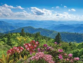
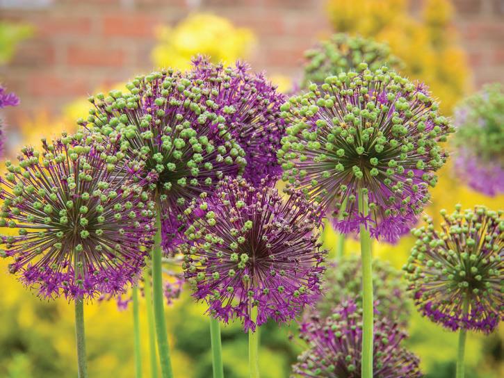
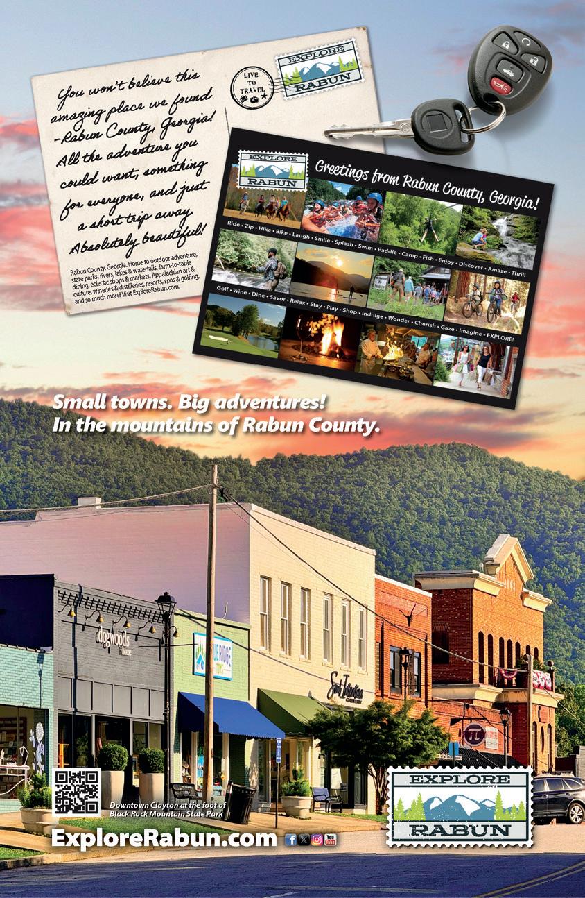
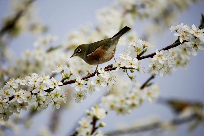
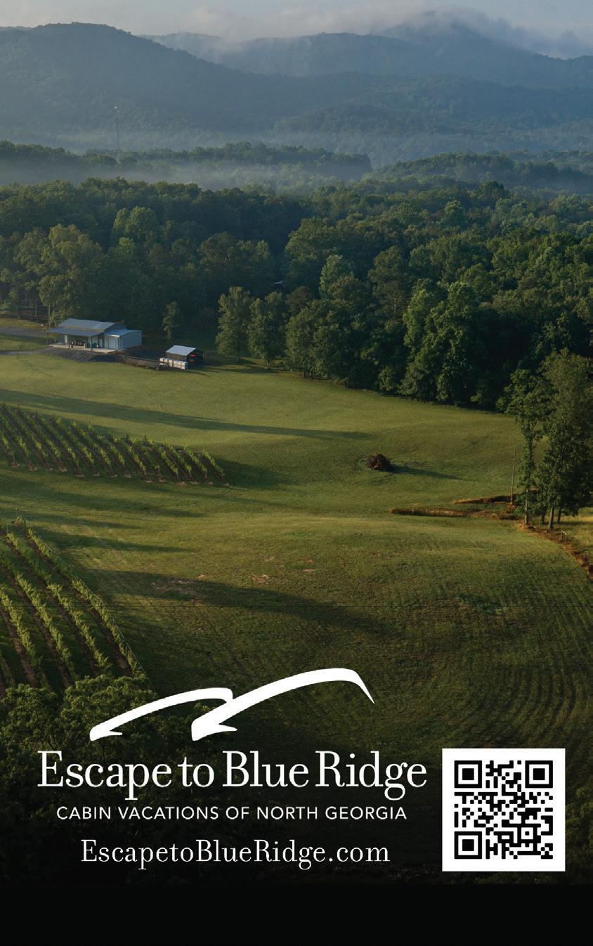
Spring 2025 Vacation Guide in the Mountains (18.1)
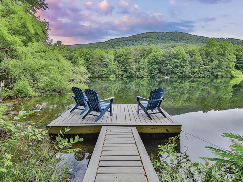
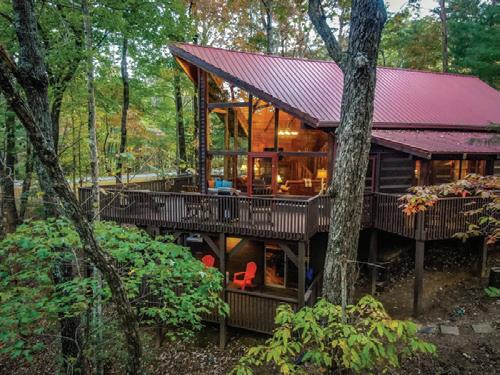
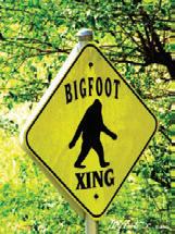
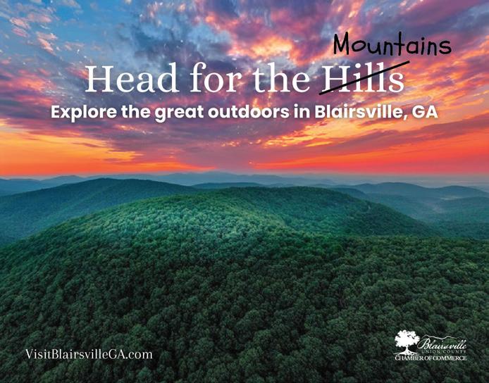
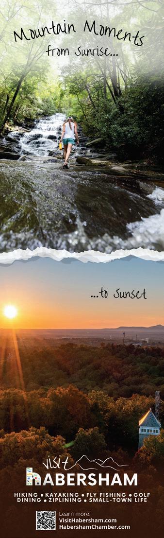
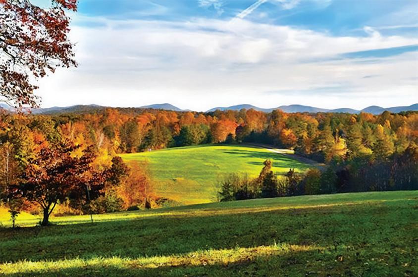
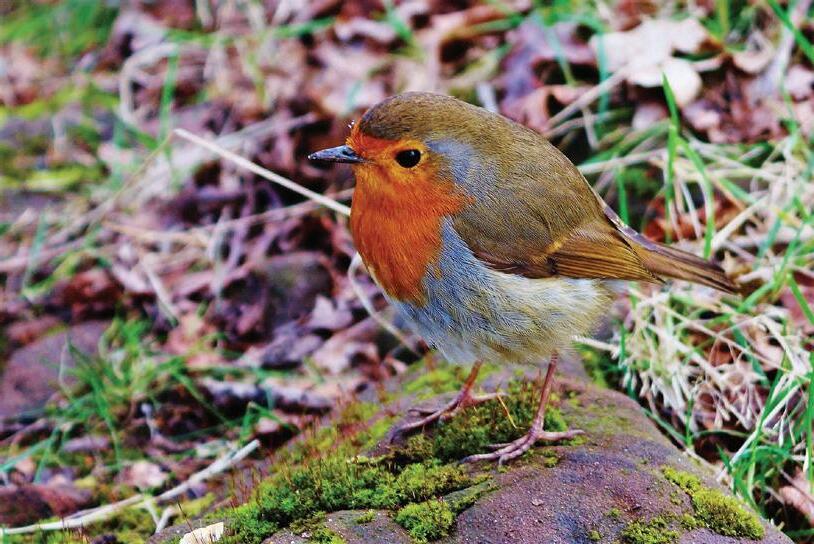
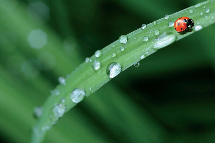
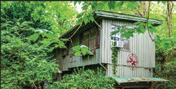
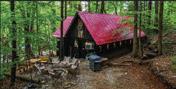
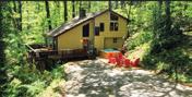
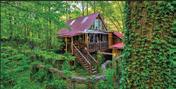
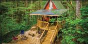
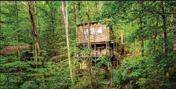
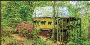
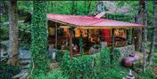
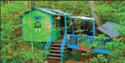
Making memories is what life is all about! North Georgia offers so many things to do regardless of the season! Book your getaway in one of our beautiful cabins, many on streams, rivers, lakes and discover nature at a whole new level. Hike one of our beautiful trails, go horseback riding, take the kids to one of the apple houses and experience picking your own apples or strawberries, visit one of our fabulous wineries, enjoy a delicious meal at one or our local restaurants, check out some of the many stores, antiques and boutiques for a unique shopping experience and don't forget to take the kids to the wellknown "Big Foot Expedition", that all ages enjoy! Take memory photos and share them with us!
Your Local Guide to the North Georgia Mountains. Let the Vacation Guide in the Mountains help you find Events, Festivals, and Recreational Activities. Find the best local places to Eat, Shop, and lodge with handy Maps to make getting around easy.
Just find the # - for the advertiser’s location on the Local City Map or Centerfold Area Map.
Every Issue we will feature a Community Spotlight and point you in the right direction of Hiking Trails, Waterfalls, or Scenic Road Trips in our area.
View our website at www.MountainLakeGuide.com to find everything Online & Links to find more about our Restaurants, Shopping, Lodging, and Area Recreation.
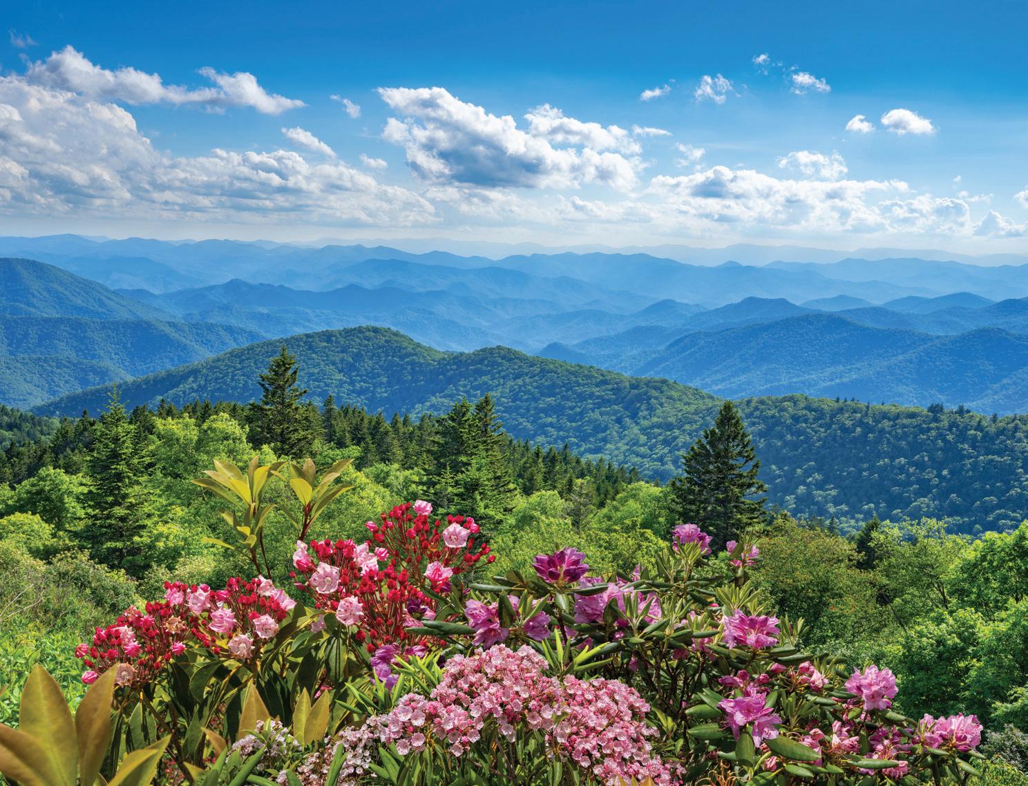
Nestled in the heart of the Appalachian Mountains, Blairsville, Georgia is a hidden gem that offers a perfect blend of scenic beauty, outdoor adventures, and small-town charm. With its picturesque landscapes, historic sites, and a welcoming community, Blairsville has become a sought-after destination for travelers looking to escape the hustle and bustle of everyday life and immerse themselves in the tranquility of nature. Whether you’re a nature enthusiast, a history buff, or simply seeking a peaceful retreat, Blairsville has something to offer for every type of traveler.
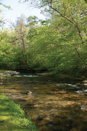
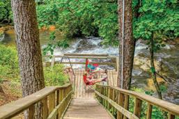
One of Blairsville’s main draws is its stunning natural landscapes. The town is surrounded by the Chattahoochee National Forest, which boasts an array of hiking trails, waterfalls, and breathtaking viewpoints. The Blood Mountain Wilderness Area, part of the Appalachian Trail, offers challenging hikes that reward hikers with panoramic vistas at the summit. For a more leisurely experience, the Vogel State Park provides serene lakeside picnicking, fishing, and boating opportunities, perfect for a relaxed afternoon with family and friends. See the clear blue waters of Trahlyta Lake as you follow walking trails around it and view Trahlyta Waterfalls.
Union County holds an awe-inspiring natural beauty of cascading waterfalls, hiking and biking trails, city parks and nature preserves. Many visitors enjoy the rushing cascades of Helton Creek Falls which has a vertical drop more than 100 feet. The trail accesses lower + upper
falls and visitors are advised to use caution on slippery rocks. The trail to the falls are located off Hwy. 129/19 South.
Other Recreational areas include, Lake Winfield Scott located off Hwy. 180. Take a walk on the trail that is just under a mile around the lake where you see wildflowers and beautiful mountain scenery. The Dockery Lake Recreation Area off Hwy. 60 is below Suches in the Woody Gap area offers a 0.6 mile handicapped accessible trail with views and alternative to more difficult hikes. If your looking for remote hiking with numerous trails the Coopers Creek Scenic Wildlife Management area is located between Hwy. 60 & 180.
Meeks Park located off Hwy. 515 has many recreational opportunities and is the home to many of Blairsville’s Festivals and Events. The Butternut Creek and Nottely River run through the park making for scenic picnic spots. Families enjoy the trail of Butternut Creek Loop that runs 0.7 miles near water and inclines in the park. In addition to walking trails, there is a playground, tennis courts, batting cages, disc golf, skateboard park and plenty of tables, benches and swings for relaxing under the magnificent shady oaks.
If you enjoy golf Union County offers two courses that includes Butternut Creek Golf that is perched upon a hilltop, by the Union County Community Center offering dining and visitor information. Old Union Golf Course is located off Hwy. 129 N. offers a valley layout, with a distinctive links feel that can be thoroughly enjoyed by beginners to professionals.
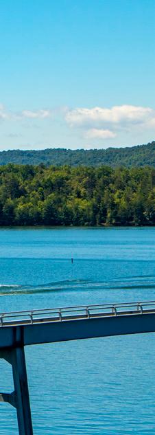
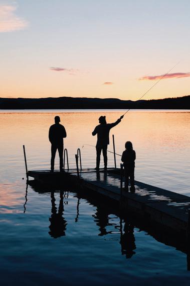
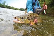
The picturesque Nottely River is a favorite among anglers, offering an abundance of trout and bass. The TVA 184 ft. dam stretches 2,300 ft. across the Nottely River and has a flood storage capacity of 100,000 acrefeet. The reservoir features a beach, camping area and is a popular place for viewing wildlife. Lake Nottely is a great spot for water-based activities and provides fishing supplies, plus seasonal boating & jet ski rentals to help you enjoy this beautiful scenic mountain paradise.
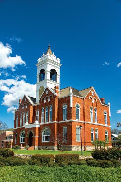
Beyond its natural beauty, Blairsville also has a rich history and culture to explore. The Historic Union County Courthouse, a beautifully preserved 19thcentury building located at the town square, serves as a reminder of the area’s past. Visitors enjoy hearing the nightly bell music from the tower and Friday Night Concerts of local bands and Gospel singings May – October. Just south of the roundabout is The Mountain Life Museum that offers visitors a glimpse into Appalachian life in the 1800s through its collection of historic cabins and artifacts.
Farming and Agriculture have deep roots in Union County and another historical site of The Reece Farm & Heritage Center is homestead to the famous poet Byron Herbert Reece and features restored barns, corn crib, chicken house, smokehouse, spring house and petting farm. Today Agriculture lives on at the Georgia Mountain Research and Education Center and works with communities to help research and classes. Designated tours are periodic but the Eethno-
Botanical Gardens can be visited through the office.
Blairsville’s community spirit shines through its various festivals and events held throughout the year. Fall is famous for the “Sorghum Festival”, a beloved local tradition that celebrates the harvest season with crafts, live music, and of course, the making of traditional sorghum syrup.
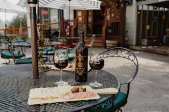
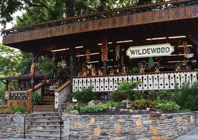
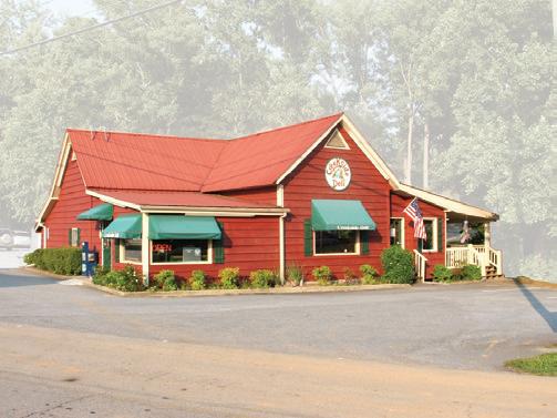
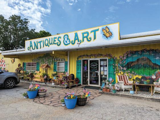
No visit to Blairsville is complete without savoring its local flavors and exploring its charming shops. The town offers a diverse culinary scene that showcases Southern comfort food and farm-to-table delights. Visitors can also stroll through boutiques and craft shops to find unique souvenirs, handmade crafts, and locally produced goods.
Blairsville, Georgia, stands as an idyllic retreat where nature’s beauty meets small-town charm. Whether you are seeking a weekend getaway or family vacation retreat you’ll enjoy the Southern hospitality offered at nearby cabins, B & B’s, hotels and camping located throughout Blairsville.
As you explore you’ll find yourself captivated by the enchanting allure of Blairsville and want to come back for more!
You’re Invited to Explore All that Blairsville has to offer in any Season at visitdowntownblairsville.com or visitblairsvillega.com or Visit us at Union County Welcome Center 129 Union Co Rec Rd, Blairsville, GA 30512
Road Trip To
Scenic Hwy. 197
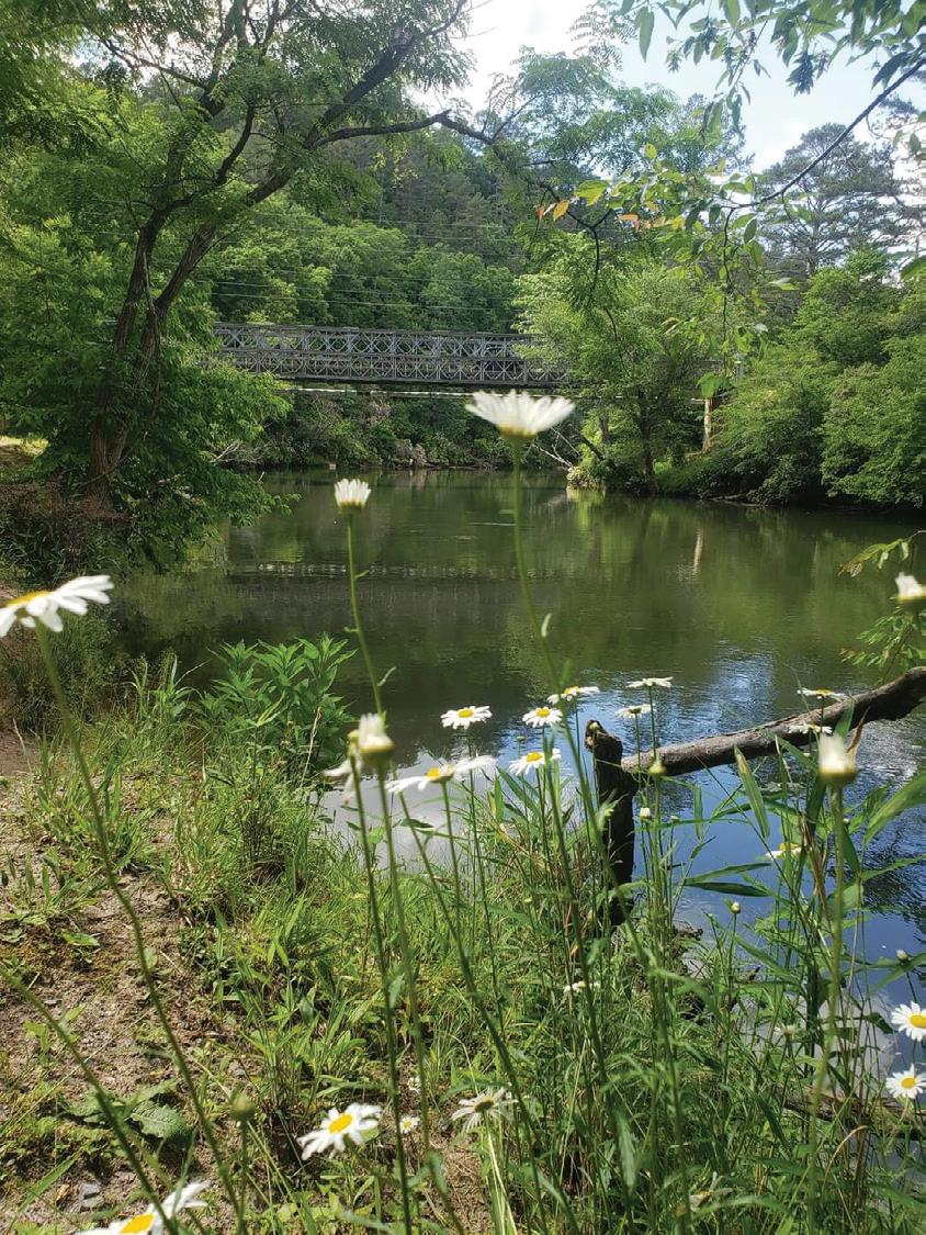
SAM PITTS PARK - beside the beautiful Soque River for walking trails, picnic, and playground. During the summer, movies, concerts and activities are held on weekends!
SOQUE RIVER – This winding drive follows the unique tributary of the Chattahoochee River and is over 28 miles long. Use caution as you travel, as at one point on Scenic 197 there will be a dip in the road (clearly marked by a road sign) where the river can flow over the road, this is humorously known as a “Low Bridge”. Many trout fisherman love this watershed, as the Soque River‘s cold temperatures are the secret to the large Rainbow, Brook, & Brown trout that inhabit it.
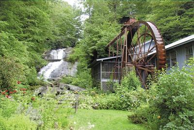
BATESVILLE – has a General Store and some nearby shops of regional handmade arts and crafts. Mark of the Potter is a scenic and historic grist mill was built in the 1930’s and is a must photo stop for the beautiful 25 foot falls from the Soque River that flow beside it. Local artist including: Hickory Flat Pottery and No One Alike have artwork studios.
LAKE BURTON – This 2,775-acre reservoir and is one of the first lakes created to generate hydroelectric energy by Georgia Power. Lake Burton’s name was derived from the former town of Burton, which now lies below the lake’s surface. The town (and the lake) was named after local prominent citizen Jeremiah Burton. Many species of fish, call this home, including bass, crappie, bluegill, sunfish, catfish, walleye, trout, and perch.
MOCCASIN CREEK STATE PARK & LAKE BURTON FISH HATCHERY – Camp at one of Rabun Counties most popular State Parks on the shores of Lake Burton. The park is relatively flat, offering easy navigation for large RVs, bicycles and wheelchairs and offers a fishing pier that sits above a troutfilled creek. Lake Burton Fish Hatchery offers tours and raises trout to stock for cold-water streams of North Georgia.
HEMLOCK FALLS TRAIL – A two-mile trail begins just south to the entrance of Moccasin Creek State Park. The trail is relatively easy and follows a stream where many small waterfalls are created by branches. The trail leads to a wooden bridge that crosses the river where you continue a few feet to see Hemlock Falls.
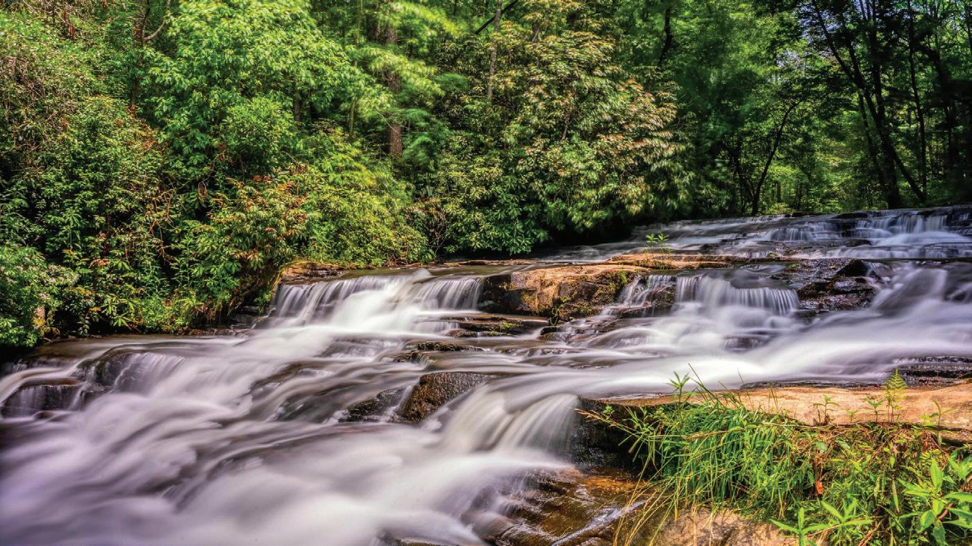
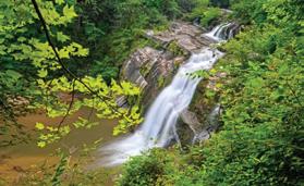
Waterfalls of North GeorGia
crosses the stream. Becky Branch Falls is accessed via the Bartram Trail.
Directions: From Clayton, Georgia go east on Warwoman Road (County Rd. 5) for just less than 3 mile to Poll Creek Road. Park on left side of road by a small branch. Follow the trail on the right side of the branch for about 200 yards to a bridge at the base of the falls.
Blood Mountain Falls & Falls on Waters Creek
This beautiful waterfall is located on Blood Mountain Stream. The stream flows almost 20 feet through a rock cut, creating a churning sluice of water.
Directions: From US 19/129 (Turners Corner), go west on US 19 for approx. 1/2 mile to Waters Creek Recreation Area. Turn right, go approx. 2.8 miles and park in the lot to the right. Across the road is a path to the viewing area.
Cowrock Creek Falls
Cowrock Creek Falls is ab out 30 feet high.
Amicalola Falls
The highest waterfall in Georgia, falling 729 feet in seven cascades. At the base of the falls, there is a parking area, a reflection pool, and 3/10-mile paved trail leading to an observation deck at the top of the falls.
Directions: from Dahlonega, Amicalola State Park’s entrance is on GA Highway 52, east of Ellijay or west of Dahlonega.
Anna Ruby Falls
Curtis Creek falls 153 feet and York Creek drops 50 feet down the slopes of Tray Mountain in twin waterfalls. The very steep 4/10 mile Anna Ruby Falls Trail is paved and has benches along the trail for sitting or resting while enjoying the beauty of the area.
Directions: from Helen, take GA 75 North one mile. Right on GA 356 for 1.5 miles, left on the entrance road to the falls.
Becky Branch Falls
The 20 foot Becky Branch Falls is easily observed from a wooden bridge which
Directions: From the junction of Hwy 19 and 129, travel 1.4 miles on Hwy 19/129 North to FR 443 and turn right. Travel 2.3 miles on FR 443. Park & walk on the old logging road for 0.6 miles.
DeSoto Falls
Three falls along a 3 mile section of the DeSoto Falls Trail are maintained for the hiker’s viewing convenience, and are designated as the lower (cascading 20 feet), the middle (falls about 80 feet) and the upper (about 200 feet) DeSoto Falls.
Directions: From Dahlonega travel north on US 19 for 13.5 miles to Turners Corner. At this intersection, turn left and proceed on US 129 for 4.2 miles. Shortly after the Walasi-yi Center is a left turn for the park.
Dukes Creek Falls
A well-designed trail winds its way into Dukes Creek Gorge, ending at the base of the falls which drop about 150 feet down sheer granite canyon into Dukes Creek.
Directions: Take GA 75 north from Helen for 1.5 miles. Turn left on GA 356 (75 Alternate) for 2.3 miles to the Richard Russell Scenic Highway. Turn right, go 2 miles to Dukes Creek Falls Recreation Area.
Estatoah Falls
Estatoah Falls is a large, open waterfall that may be viewed from the highway.
Directions: It is about 1/2 mile beyond Dillard. Turn right on Highlands/Sky Valley Road (GA 246). Start looking for the falls on the right after 1 mile. There is a pull-out vantage point near the falls about 1 mile up the mountain.
Helton Creek Falls
Two waterfalls, one small, and one large, are located on Helton Creek.
Directions: Go to Helton Creek Road and Forest Service Rd 118, just 1 1/2 miles north of Neel’s Gap off Highway 19/129. The road is on the right as you travel north. It is just south of Vogel State Park. You have only .2 mile trail leading from the parking area on Helton Creek Road, to the base of the larger upper falls.
Hemlock Falls
The scenic two-mile trail leading to Hemlock Falls teases visitors with the sounds of rushing water during the entire hike.
From Clayton: take 76W to HWY 197. Follow HWY 197 to Moccasin Creek State Park/ Lake Burton Fish Hatchery, turning right onto Andersonville Lane, the gravel road across from the hatchery. Continue 0.5 miles until the road dead ends at the trailhead. Follow the trail along Moccasin Creek. You will cross a bridge above one set of falls and will pass another small set of falls on your left before continuing up the trail to the larger Hemlock Falls.
High Shoals Falls
A succession of five waterfalls graces this 170acre scenic area. These falls have an estimated total vertical drop of 300 feet.
Directions: Take GA 75 north from Helen for 11.4 miles. Turn right on Forest Service Road 283 at the High Shoals sign. Go 1.5 miles on this road to the High Shoals Scenic Area.
Horse Trough Falls
A succession of five waterfalls graces this 170acre scenic area. These falls have an estimated total vertical drop of 300 feet.
Helen/Hiawassee Area: Take GA 75 north from Helen for 11.4 miles. Turn right on Forest Service Road 283 at the High Shoals sign. Go 1.5 miles on this road to the High Shoals Scenic Area.
Martin Creek Falls
This two-tier waterfall is 35 feet high with aquatic plants covering the weeping rock wall on the left. This 20-minute walk (.5 mile) follows the Bartram Trail along the west side of the creek.
Clayton/Rabun County Area: From Clayton, go east on Warwoman Road for 3 miles. Turn left onto Forest Service Road 152, and drive past the Game Checking Station. The park drive is .5-mile. Park in a small cleared camping area on the left bend in the road. Walk west from the camping area. Cross
Martin Creek, then travel uphill for about .4 mile to the top of the falls.
Mill Creek Falls
The first waterfall drops about 150 feet into Mill Creek. The second plunges another 150 feet, into a series of rapids through the Mill Creek Gorge. Directions: from Hiawassee, take U.S. 76 east, go right on Hwy. 75 for 3.5 miles, left on Mill Creek Rd (FSR 26) for 2.5 miles.
Minnehaha Falls
The Minnehaha Trail, .4-mile in length, follows Fall Branch until it dead ends at Minnehaha Falls. This waterfall is approximately 100 feet high (falling and shoaling).
Clayton/Rabun County Area: Take U.S. 23/441 north from Tallulah Falls for three miles to the Rabun Beach Recreation Area sign. Turn left onto Old 441. Go 2.5 miles and take a left on Lake Rabun Road. Go 1 mile past Recreation area. Take a left on Low Gap Road. Follow Bear Gap road which forks to the left. Go 1.5 miles to the sign marking the trail on the right side of the road.
Mud Creek Falls
This great waterfall is approximately 100 feet high with an impressive spouting fume down the middle.
Directions: Take Highway 441 north to Dillard. Turn right on GA Hwy 246 and follow signs to Sky Valley. At Sky Valley’s entrance gate, turn left. Turn right on Tahoe Rd and follow the trails.
Raven Cliff Falls
The first fall drops 60 feet, then rushes through a split in the face of a solid rock outcropping and drops 20 feet into a deep pool, and then falls another 20 feet to Dodd Creek. 3 other waterfalls can be found on Dodd Creek.
Directions: from Helen, take GA 75 north for 1.5 miles. Turn left onto GA 356(75 Alternate) and travel 2.3 miles to the Richard B. Russell Scenic Highway. Turn right and travel 2.8 miles to the trailhead and parking area
Sea Creek Falls
In the Cooper Creek Scenic Area, Sea Creek Falls are an easy walk of less than .1 miles. Two steeply cascading falls flow into a large, shallow pool at the base which is popular as a wading pool.
Directions: (Four wheel drive vehicle recommended) From Hwy 515 just past Blue Ridge, take Highway 60 south toward Morganton. At Cooper Creek Store turn left on Cooper Creek Rd. After 3.3 miles the road makes a dramatic turn back on itself and FS 264 is to the left. Travel .3 miles to a campground, park and walk .1 miles further up the creek.
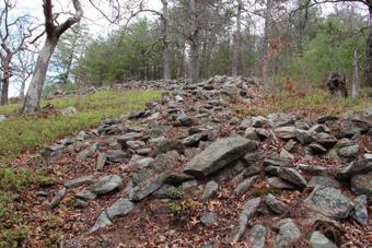
The Fort Mountain Mystery
Just outside Ellijay, traveling on State Road 52 to the Northwest, is a winding two lane road that ascends more than a thousand feet with sharp turns and pull-offs on both sides. Fort Mountain State Park’s entrance then takes you to the park office where you can get information about trails, camping, R.V. sites, and many activities, including hiking, backpacking, biking, picnicking, horse back riding, fishing, swimming, or geocoaching hidden treasures.
Fort Mountain takes its name from a peak that has remnants of a stone formation around part of that peak. These mysterious piles of non-native rock, many of them large, form a long discontinuous zig-zag wall that runs more than 928 feet and varies in height from two to six feet.
The original construction and function of the formation as a fort is less accepted today and its origin remains unknown. Some scholars believe that the formation could be attributed
to pre-Columbian native Americans from around 500 A.D. and that it held a ceremonial or religious purpose. The ancient wall runs east to west and the alignment illuminates one side of the wall at sunrise and the other side at sunset as ancient Native American cultures often worshiped the sun.
The myths of the culture who built it abound. Cherokee Indian culture speaks of a race of “moon-eyed” people who are said to have lived in Appalachia until the Cherokee expelled them.
Another myth revolves around the Welsh prince Madoc, who purportedly sailed to America in 1170. The story asserts that Madoc’s colonists had intermarried with local Native Americans. These “Welsh Indians” were credited with the construction of a number of landmarks throughout the United States.
For more information to Fort Mountain State Park, call 706-695-262
Terri’s Treasure Trove Morganton’s
Cutest Gift Shop
Shop for soaps, local honey, jewelry, vintage items, antiques, home decor, and many gift items. Our creative gift items include socks, candles, Myra bags, locally made jams, sauces, salad dressings, plus so much more!
Google 5-Star Review from Amy R: “This was the cutest little shop in Blue Ridge. The ladies were very sweet and helpful! There is something here for everyone!”
27 Forge Mill Road - just minutes from downtown Blue Ridge Open 7 Days a Week - 706-900-2211 - /TerrisTreasureTroveGA
Tallulah Falls
The Niagara Falls of the Southeast
Rated as one of America’s 20 Best State Parks by Adventure Journal and one of Georgia’s seven wonders, Tallulah Gorge draws admirers as one of the most breathtaking sites.
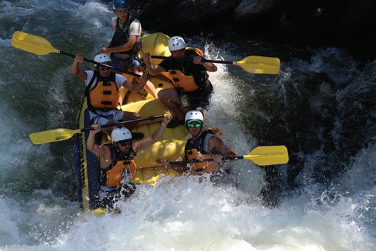
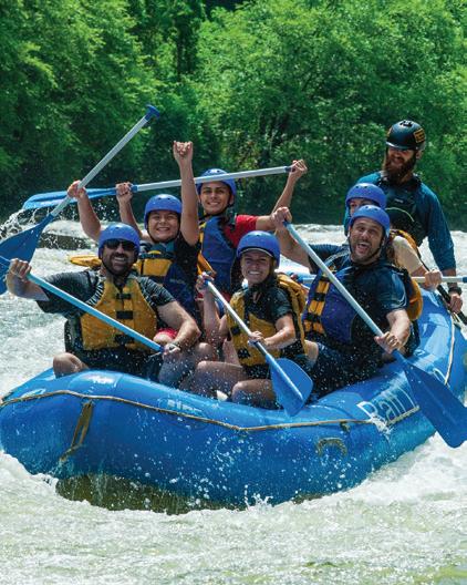
The Niagara Falls of the Southeast is a 1,000-foot gash in Tallulah Dome that drops the Tallulah River over six waterfalls in one mile. Mountain biking and hiking are popular here, as well as some serious multipitch rock climbing. But the real deal here is boating, rafting and kayaking the Tallulah when the upstream Georgia Power Company opens its dam, a few times a year.
Said to be one of the oldest geological features in North America, Tallulah Gorge has been forming for thousands of years. Prehistoric Indians discovered the canyon and hunted both along its rim and in its deep bottom. When the first European settlers arrived in the region during the 1820s, the word of the magnificence of the canyon and falls spread. The Tallulah Hotel opened in 1840 and with the completion of the railroad in 1882, connecting Atlanta to Tallulah Falls, people flooded to see the remarkable natural scenes and it became a major tourist attraction.
At the peak, there were seventeen hotels and boarding houses in and around the town that rented riding horses, offered billiards, tennis, and music for dancing in the major hotels. In 1883, tightrope walker Professor Leon crossed the gorge as part of a publicity stunt for one hotel. Then in July 18, 1970, Karl Wallenda became the second man to walk across the gorge on a tightrope; a feat that may soon be recreated by his great grandson in an upcoming event.
Just as the tourism boom reached its height, however, Georgia Power wanted to dam the Tallulah River to produce electricity and opposition of the natural setting was led by Helen Dortch Longstreet, the widow of Confederate general James Longstreet, in which the park’s trail system is named after. In 1992 Governor Zell Miller joined with officials of Georgia Power Company to announce a remarkable joint partnership to create Tallulah Gorge State Park. Visitors can now enjoy the spectacular 1,739 acres of wilderness with recreational opportunities and guides from Georgia’s State Parks.
Highlights of Tallulah Falls include:
The Jane Hurt Yarn Interpretive Center that highlights the rich history of this Victorian resort town, as well as the rugged terrain and fragile ecosystem of the area. Additionally, an award-winning film takes viewers on a dramatic journey through the gorge.
Tallulah Falls School Founded in 1909 by the Georgia Federation of Women’s Clubs, providing comprehensive college preparatory education.
Arts & Crafts Galleries which feature local fine Southern art, folk art, original paintings and prints, pottery, photography, woodcraft, jewelry and hand blown glass. Shop for unique Native American Crafts, chainsaw art, gems, and many inspirational scenic paintings from the area.
Stay for the weekend in Cabin Lodging, or one of the many camping sites in the area. Enjoy this peaceful getaway from the hustle and bustle of the city, where you can hear the crickets chirp at night. Just bring your lawn chair and listen to Music on Bluegrass Square; located at the outdoor Tallulah Falls Opry House on Main Street. Bonfire, marshmallow roasting, and grilled hot dogs provided!
Recreation abounds with picnic areas, campgrounds, overlooks, 6 Hiking trails, stairs leading down into the gorge and even a suspension bridge that crosses the canyon 80 feet above its bottom. There is shore and boat fishing on all 3 lakes: Tallulah, Tugalo, & Yonah. Spend the afternoon picnicking at Terrora Beach, or play on the tennis courts. There is a public beach for swimming on Tallulah Lake & public playground located at the day use area of Tallulah Gorge State Park.
Tallulah Gorge State Park is open daily from 8 a.m. until dark. There is a $5 parking fee. The entrance is on U.S. 441 in Tallulah Falls, GA. Access to the canyon bottom is by permit only. Permits are free and can be obtained at the interpretive center, but note that ONLY 100 permits are issued per day. The park is extremely popular and the quota of permits is often filled first thing in the morning.
For more information call 706-754-7981 or visit gastateparks.org/TallulahGorge
WELCOME TO THE
Top of Georgia!
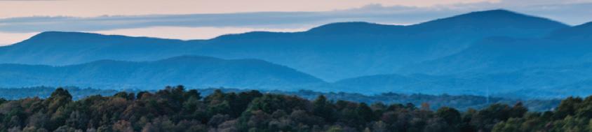
Brasstown Bald
Brasstown Bald is 4,784 feet above sea level and is the highest point in North Georgia. Those who have visited have marveled at the unsurpassed views!
Now you can view Brasstown Bald's Scenic vista in a whole new light - or dark? Coming in September & October, Astronomer, Alex Langoussis will guide you through the night atop Brasstown Bald's 360 degree veiew observation deck, where visitors will engage with wonders of the universe through galactic stories, expertise, and the use of a professional telescope. You could spend the evening being a "Gaurdian of the Galaxy" in learning about the magic of deep space and northern Georgia's incredible nightscape!
Pre- registration is required for Friday night star gazing and there is a cost of $20.00 for
13 & up or $10.00 for ages 6-12. Events are subject to weather conditions, no pets, and people are encouraged to bring a flashlight and extra layer of clothers due to the cooler tempatures at night from higher elevation
During the day there are several trails that lead up to Brasstown Bald, including Wagon Train Trail, Jack’s Knob Trail, where there is an access path to the Appalachian Trail. Arkaquah Trail follows high ridges to the Track Rock Archaeological area and Brasstown Bald Trail climbs 500 ft. in a half mile.
Visitors can travel to Brasstown by car from State Rd. Hwy. 180 that can be accessed either coming from Helen or Hiawassee on 17/75 or by Blairsville on Hwy. 129.
Once to the parking facility there is a steep, paved trail to the Visitor Information Center
at the summit. Although difficult, this is an excellent hike for most people. Frequent stopping places along the path make it achievable for even the most out-of-shape hikers. A shuttle in the visitor parking provides access to the summit in addition to a picnic area for the public.
The Visitors Center provides an unencumbered 360 view of the surrounding mountains and four states of North Carolina, Tennessee, Alabama, and South Carolina. A museum and exhibit entitled “Man and the Mountain" shows rural mountain life, forestry in North Georgia and the diversifed wildlife in the area.
For more info contact: Blairsville Ranger Office: 706-745-6928 or Brasstown Bald Visitors Information Center: 706-896-2556
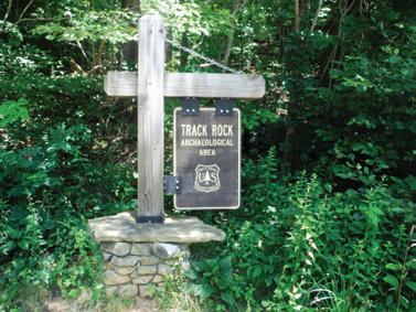
Written in Stone
Track Rock Gap Archaeological Area is the location of a series of soapstone boulders covered with petroglyphs made by Native Americans over 1,000 years ago. There are hundreds of carvings in a wide range of figures. It’s one of the most significant rock art sites in the Southeastern United States.
Track Rock was a place of power within the sacred landscape of the American Indian Nations where the activities of ancient humans were influenced by spirit beings. It sits at the threshold of the spirit world. Rocks carved with footprints and tracks signified a doorway into the domain of dangerous spirit beings. Depictions of footprints and tracks are physical testimony that spirit beings were there at some time in the past, that they could still be lingering somewhere close by in the present, and that they may return unexpectedly at any time in the future.
As early as 3,600 years ago, Native Americans were removing pieces of the soft but durable soapstone to make bowls which were particularly well suited for cooking as they held and radiated heat without breaking. The picture carvings were made by Native Americans during repeated visits over several hundred years beginning around A.D. 1,000. Most likely, the Cherokee, Catabwa and/or Creek tribes made the carvings. In the 1800’s, early American explorers discovered the Track Rock site and it has fascinated people ever since. Recording, studying and preserving of the site began in earnest in 2009.
The carvings at Track Rock were made in one of two ways. Many of the figures were created by repeated blows in the same spot using hammer stones to create the desired
shape. Some of the figures were created by rubbing a hard stone back and forth to carve the design into the rock. Although soapstone is considered a soft rock, it is still rock and rather hard to carve. It took a lot of time and effort to create these figures that have lasted a thousand years. Some of the shapes that can be seen include: 252 cupules, 22 oval shapes, soapstone bowl extraction scars, deer, horse, bird, squirrel, and bear tracks, cross-in-ring motifs and nested ring design, human figures, human footprints (one with 6 toes!), and one giant’s, footprint, maze-like networks, squares, tridents, zigzags, curved and straight lines, and scalloped edges. Unfortunately, signs of vandalism can be seen throughout the area in the form of square shaped depressions with flat topped pedestals in the middle that are left behind when looters chisel out the petroglyphs. There are also several areas when vandals have carved their initials over the top of the ancient marks forever destroying those petroglyphs.
Track Rock Gap is open to public visitation and no fee is charged. When visiting the site, remember that the intensity of natural lighting can influence how much you are able to see. Bright mid-day sun makes it hard to see most of the figures, and the best times to visit are early or late in the day, when the light is at a low angle. Please be respectful of other visitors and the people who made these carvings. Previous visitors removed pieces of the boulders, thus depriving future visitors of the chance to see what they thought was so special.
For more information about Track Rock, including a printable fact sheet with drawings of the petroglyphs, please visit: fs.usda.gov/goto/conf/trackrock
NORTH GEORGIA
Beautiful trails are yours to explore in the great outdoors of the North Georgia Mountains. Just pack a snack and plenty of water, get your gear ready and go for a hike.
Ellijay THREE FORKS
Trail: To the left (North) on the trail is Long Creek Falls (2.3 miles round trip) . To the right is a beautiful section of old growth forest along Stover Creek.
Directions: Take 52 East from Ellijay about 4.8 miles. Turn left on Big Creek Road at the Dollar General. Follow this road about 15.4 miles (the final .4 miles are dirt) to Forest Service 58 and turn Right. This road follows Noontootla Creek to Three Forks. Parking is available where the trails cross the road.
Blue Ridge
FREE KNOB LOOP
Trail: 2.5 miles, easy rating
Directions from Blue Ridge, Georgia: Travel east (toward Blairsville, GA) on GA Hwy 515, approx. 0.8 miles past intersection with GA Hwy 5. Turn Right at Windy Ridge Rd., go 0.2 miles to dead end with Old U.S. 76. Turn left, go 0.2 miles to Aska Road on right. Continue south on Aska Read to Shallowford Bridge. Turn left across river and immediate right on dirt-gravel road leading to Dial, GA. At 0.4 miles come to point where trail enters road from forest. Continue east on road to parking area at 1.2 miles.
Suches
JARRARD GAP TRAIL
Trail: 1.0 mile, easy/moderate rating
Directions: Take US 19 and 129 south from Blairsville Georgia for 9.5 miles. Turn right (west) onto GA 180 and go 7 miles to the main entrance to Lake Winfield Scott Campground. Turn left into the campground. Follow this road over a hill and continue straight ahead into a gravel parking lot at the foot of the hill. From the parking lot, hike along the paved road passing the guard rail at the head of the lake. The trailhead is on the right of the road just past the guard rails.
Blairsville
SOSEBEE COVER TRAIL
Trail: Traveling through a second-growth cove hardwood forest, the 0.25 mile Sosebee Cove Trail is rated easy and receives moderate use. This area is a memorial to Arthur Woody, who served as the first Forest Service Ranger in Georgia.
Directions: from Blairsville Georgia, travel 9.5 miles south along US 19/129 and turn right (west) onto GA 180. Continue along GA 180 for 2 miles to the Sosebee Cove parking lot on the right.
Hiawassee HIGH SHOALS CREEK
Trail: The two waterfalls on High Shoals Creek are the highlight of this 170 acre site. A 1.2 mile trail takes visitors from FS 283 down to the falls.
Directions: Take 75 South from Hiawassee turn right onto Indian Grave Gap Road, graveled Forest Service Road 283 which leads visitors through the Swallow Creek Wildlife Management Area to the High Shoals Creek Falls Scenic Area.
Dahlonega YAHOOLA CREEK
Trail: This is about a 4 mile trail that circles Yahoola Creek Reservoir but also swerves back into the woods a ways. This trail is surprisingly tough with many short, steep climbs in the back hills. While this is a wide doubletrack trail that isn’t always very entertaining, this trail is right on the edge of town and is very easy-to-access. It’s great for a short after work hike or trail run without having to drive all the way up to the Appalachian Trail.
Directions: from Dahlonega go north past the Walmart on the “bypass.” Go straight through the stop light at the entrance to Walmart, and straight through the stoplight at the junction with 52. Shortly after the second light, hang a right into the small gravel parking area overlooking the dam.
Clayton RABUN BALD
Trail : 4 miles round trip Easy to Moderate hike, though last half mile is rather steep and some find this part strenuous.
Directions: from Clayton US 441 North to 1 mile past Dillard, right onto GA 246 toward Highlands for 7 miles, right onto FS7, go 2.1 miles take the right fore (FS7 goes left) go 1.3 miles, take a left fork on dirt road tward Beegum Ga, go 1.6 miles to parking area.
Helen
ANNA RUBY FALLS
Trail: This is an easy hike, but the view is well worth it! The main trail up to Anna Ruby falls is only about a half a mile one-way and it is paved, with some steps. The falls are definitely worth the hike! If you’re more adventurous, there’s a singletrack trail that continues on for about 5 more miles beyond the end of the pavement. There’s a $2 access fee.
Directions: Drive from Helen, Georgia, through Unicoi State Park, and then you’ll soon arrive at the Anna Ruby Falls Visitors Center.
Lakemont
ANGEL FALLS
Trail: This is a heavily wooded trail that leads you to two different waterfalls. One is 1/2 mile in and the other is 1 mile from the starting point. There is a creek that runs along side the trail for a while. I would describe it as a moderate hike with some steep inclines.
Directions: From Highway 441, turn onto Lake Rabun Road and then travel several miles down the winding road around the lake. The entrance to the campground will be on the right hand side. Go into the campground and follow the road around until you see the trailhead sign.
Cornelia LAKE RUSSEL LOOP
Trail: This is a great loop around Lake Russell with some great views of the lake. There’s a nice campground here as well. The 2 dam crossings are very cool.
Directions: From Cornelia, head North/ Northeast on Dick’s Hill Pkwy (Hwy 13) and hang a right on Lake RussellRoad across from the Lake Russell Convenience store. go 2.5 miles, and hang a left at the sign. go left at the fork and park at the trailhead near the old dam. Then just follow the signs and head around the lake.
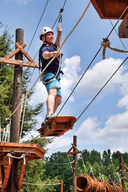
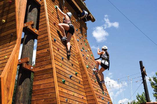
Private
3
Private
Overlooks
1
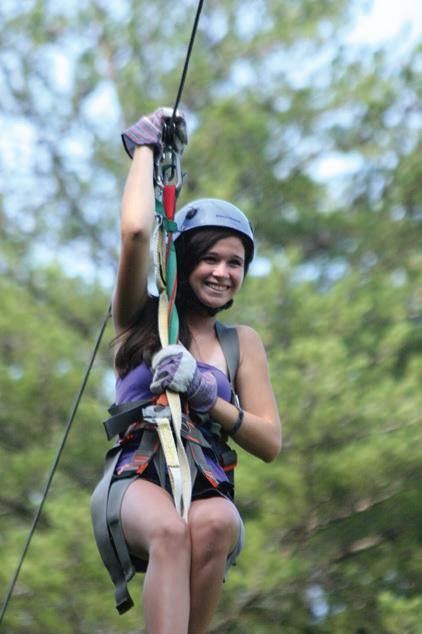
Highly trained guides
State of the art gear
• Automatic braking system for hands-free adventure
• Course built to ACCT standards (Association forChallengeCourse TechnologyStandards)
Chattahoochee River
commercial navigation, flood control, and recreation in three states to over 25 million Americans.
It begins as a spring; “Chattahoochee Gap,” just a little more than a trickle of water where Jack’s Knob Trail dead-ends into the Appalachian Trail at about 3,600 ft. and lies 200 ft. south. Several streams flow from Habersham, Lumpkin, Rabun, Towns, Union and White counties to broaden its shoulders.
Origin of the name “Chattahoochee” is believed to be derived from ‘Chatto,’ a stone, and ‘hoche,’ marked or flowered; there being rocks of that description in the river above Hoithletigua - an old town that historians place near the present town of Franklin, Ga. in Heard County. The river, “Chota,” was named by the Cherokee Indians at the headwaters and when the river flowed
into Creek territory, it became the “Chattahoochee.” and was used by the tribes as a border between their Nations, then between themselves and early settlers.
Excavations suggest that Spanish searched for gold in the valley as early as the sixteenth century. The first American gold rush began in 1828 through streambeds of the Chattahoochee headwaters, and the first dam was built to power a grist and lumber mill in 1876. The present Nora Mill still operates a water-powered mill and grinds cornmeal, grits, wheat, rye, and flours.
The Chattahoochee River and Wildlife Management Area are located within the 750,000-acre Chattahoochee National Forest with lush forests. More than 500 species of birds, mammals, fish, and reptiles live in this protected headwaters portion, as it provides wildlife access to drinking water, sites for nests and dens, and berry-producing shrubs along its banks as a source of food.
Helen is a perfect start, as this river runs through this Alpine Village town of themed German- festivals and businesses. Then the Chattahoochee picks up flow from creeks such as Smith, Low Gap, Henson, Dukes, and Sautee. Two beautiful waterfalls that merge into these creeks are the twin falls of Anna Ruby and Horse Trough Falls, just north of Helen. From Helen, the river flows east through Sautee Nacoochee Valley, which pass agriculturalresidential areas throughout White and Habersham Counties. The river then flows into Buck Shoals State Park, a wildlife preserve not yet opened to the public and Mossy Creek State Park just north of Clermont. The river flows through the newly planned State Park (Don Carter) on the northern tip of Lake Lanier.
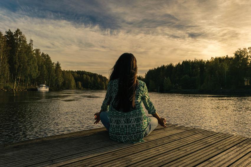
Summer is the perfect time to enjoy recreation such as fishing, tubing, canoeing, boating, hiking and camping on the Chattahoochee River banks, shores, and it’s watershed to make your vacation a “COOL EXPERIENCE”!
36th Annual Trout Tournament
March 29, 2025
Fish the famous Chattahoochee River in Helen, Georgia for your chance to catch tagged fish worth up to $1,000! 6:00am - 2:00pm.
BINGO
Tuesday and Friday Nights
April 4th until August 29th
$1,500 in cash prizes per night! Gates open at 6pm games start at 7pm.
BAVARIANFEST
May 24, 2025
Spring calendar of Events
Please verify Event Dates in case of Rescheduling
Andrews
April 26
Andrews Spring Fling
Downtown Andrews
Blairsville
March 29
Banff Centre Mountain
Film Festival World Tour
Union County Fine Arts Center
April 19
Keen’s Creations presents
Spring Downtown Market
Downtown Square
Cruise-In on the Square
Downtown Square
Farmers Market Cruise In
Union County Farmers Market
May 2 & 3
North Georgia Hot Rod
Reunion & GM Truck Invasion
Meeks Park
Blue Ridge
March 6 – 30
Wizard of Oz
Blue Ridge Community Theater
March 8
2nd Annual Healing Farm
Foundation Texas Hold’em
Poker Tournament
Kiwanis Club of Blue Ridge
March 14 & 15
Fannin County Paddle Battle
III - Blue Ridge Pickleball
Fannin County Recreation Center
March 29
Mercier Hard Cider 5k Run/
Walk
Mercier Orchards
Sugar Creek Races
Sugar Creek Raceway
April 5
Blue Ridge Plant Sale and Artist Market
Fannin County Ag Facility
April 10 – 19
Doubt - A Parable
April 2 – 6 & 9 – 13
The Secret Garden: The Musical Habersham Community Theater
April 19
Old Clarkesville Spring Market
Blue Ridge Community Theater
April 26
2025 Annual Blue Ridge
Trout & Outdoor Adventures
Festival
Downtown Blue Ridge
Ripcord
Blue Ridge Community Theater
Brasstown
March 29 – May 29
Empty Bowls
Folk School Dining Hall
April 26
May Day Parade & Maypole Dance
Festival Barn
Clarkesville
March 15
Mountain Top Jeep Invasion
Habersham County Fairgrounds
Old Clarkesville Market
May 18
Mountain Laurel Festival
Downtown Clarkesville
Clayton
March 15
Downtown Clayton Block
Party & Cruise-In
Downtown Clayton
April 26 & 27
Sassafras Artisan Market
Rabun County Civic Center
May 10
Of These Mountains
Spring Marketplace
Rabun County Civic Center
Cornelia
May 17
Cornelia Music Festival
107 Grant Place
Dahlonega
March 8
The Invaders
The Holly Theatre
April 12
Arts and Ales Festival
52 West Brewing
April 25 – May 11
You’re a Good Man, Charlie Brown
The Holly Theatre
Demorest
March 18
Piedmont Camerata
Chapel
March 25
Piedmont Singers
Chapel
Steel Magnolias
Swanson Center for Performing Arts
Ellijay
March 8
Wyatt Espalin & The Riverstones
Gilmer Arts Playhouse
March 21
Acoustic Blends at The Playhouse
Gilmer Arts Playhouse
March 27
Ellijay Storytellers
Gilmer Arts Playhouse
May 8
2025 Ellijay Songwriters
Festival
Downtown Ellijay
Hayesville
March 7
Play On!
Peacock Performing Arts Center
March 21
Bad Co Experience
Peacock Performing Arts Center
April 12
2025 Georgia Mountain Trail Fest
Reece Orchards
April 18
Acoustic Blends at The Playhouse
Gilmer Arts Playhouse
April 24
Ellijay Storytellers
Gilmer Arts Playhouse
April 10
Piedmont Wind Ensemble Chapel
April 15
Piedmont String Ochestra Chapel
April 17
Piedmont Chamber Ensemble Chapel
April 26
Great Composers Concert Chapel
Dillard
March 21 – 23, 28 - 30, & April 4 - 6
9 to 5 The Musical
Dillard Playhouse
April 25 – 27
2025 Georgia Mountain
Needle Arts Festival
Gilmer County Civic Center
April 26
Woofstock Ellijay
Downtown Ellijay
May 3
2025 Run for the Son 5k
Gilmer Scout Hut
Kanstyx
Peacock Performing Arts Center
March 28
Wyatt Espalin & The Riverstones
Peacock Performing Arts Center
March 29
Frankly Scarlet
Peacock Performing Arts Center
April 5
Carpool
Peacock Performing Arts Center
April 12
Lies and Pies - Scribes on Stage
Peacock Performing Arts Center
April 19
Gnarly Fingers
Peacock Performing Arts Center
April 26
Songwriters Showcase
Peacock Performing Arts Center
Spring calendar of Events
Please verify Event Dates in case of Rescheduling
May 9 – 18
Dracula: A Comedy of Terrors
Peacock Performing Arts Center
Helen
March 8
Wetland Hike
Smithgall Woods
March 29
36th Annual Trout Tournament
Helen Festhalle
April 4, 8, 11, 15, 18, 22, 25, & 29
Bingo
Helen Festhalle
April 26
Art in the Park
Smithgall Woods
May 6 & 9
Bingo
Helen Festhalle
May 10
March 21
Struck by Lightning 2
Marina Station
March 29
Ace Suggs
Marina Station
April 4 & 25
DJ Lory Karaoke
Marina Station
April 5
Bone Daddy’s
Marina Station
April 6 & 27
Struck by Lightning 2
Marina Station
April 11
Ace Suggs
Marina Station
April 12 – May 11
The Rhododendron Festival
Hamilton Gardens
Blooming Ridge Hike
Smithgall Woods
Hiawassee
March 14, 21, & 28
DJ Lory Karaoke
Marina Station
March 15
Bone Daddy’s
Marina Station
March 18
ZZ Top
Anderson Music Hall
True Grit
Marina Station
April 18 & 19
Georgia Mountain Fair
Spring Yard Sale
Georgia Mountain Fairgrounds
April 19
Dustin Martin
Marina Station
April 25 & 26
Memory Lane Classic Car Show
Georgia Mountain Fairgrounds
April 25
Justin Moore
Anderson Music Hall
April 26
Run for the Rhodo’s 5k
Hamilton Gardens
Cody King
Marina Station
May 8 – 10
Top of Georgia Plein Air Fine Arts Festival
Hamilton Gardens
May 8
Acoustic Sunsets at Hamilton Gardens - Summer Series