The information contained is provided by WFG’s Customer Service Department to our customers, and while deemed reliable, is not guaranteed.
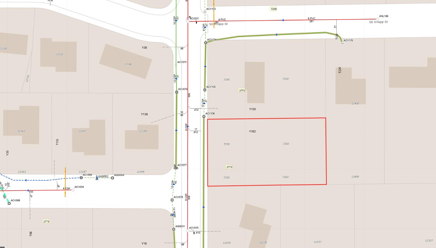
WATER LINE MAP
This map is a copy of public record and is provided solely for informational purposes.
WFG National Title assumes no liability for variations, if any, in dimensions, area or location of the premises or the location of improvements.
SEWER LINE MAP
This map is a copy of public record and is provided solely for informational purposes.
WFG National Title assumes no liability for variations, if any, in dimensions, area or location of the premises or the location of improvements.
ZONING
DETAILS
Detailed Zoning Information
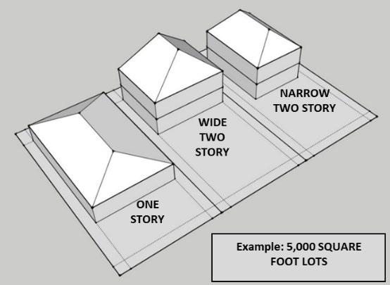
Portland R-10 (Single Dwelling—10,000)
Constrained Sites (z)
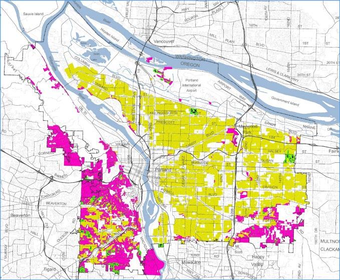
Zoning Map
Community Jurisdiction
Summary of middle housing and other housing type options
Shaping the future of our neighborhoods together Portland’s neighborhoods have always been places of change. So it’s important to work together as a community to make sure that change is for the better and benefits all of us.
In 2020 and 2022, City Council adopted a series of zoning code changes that enable more types of housing to be created in single dwelling neighborhoods. These changes will help increase the diversity of unit sizes and prices to meet the growing demand and changing demographics of the city. The changes also include new limits on building scale, as well as provisions to increase accessibility in our housing stock.
This document provides a summary of the key changes from the Residential Infill Projects and notes some important limitations and considerations. This summary does not reflect all the adopted changes and requirements For more detail, please review the zoning code, and consult with the Bureau of Development Services.
Expanding the kinds of housing choices that are available in our residential neighborhoods is an important step to give more people the opportunity to live close to schools, parks, and jobs at a variety of price points. But it’s only one part of a larger, coordinated effort to address the city’s housing crisis.
MORE HOUSING OPTIONS
In addition to a house, the following other housing types may be eligible on a particular property in the R2.5, R5, R7, R10 and R20 zones. Note: combinations of different types are not allowed (e.g. a triplex with a house, two duplexes instead of a fourplex, or an ADU as part of a cottage cluster).
1 to 6 units in a single building
Accessory Dwelling Unit (ADU) options
House + 1 ADU (attached or detached) Duplex*
Detached unit options
Detached Duplex* (only allowed on site with existing house)
Fee-simple ownership options
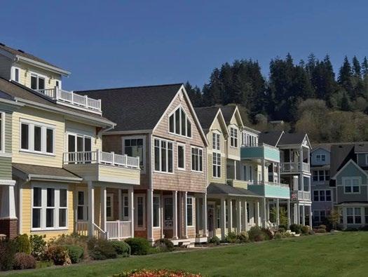
Attached Houses (on regular sized lots)
House + 2 ADUs (only 1 ADU may be attached to the house. Both ADUs may be detached)
Cottage Cluster* (3-16 detached units) Not allowed in R20
Attached Houses (on higher density land division lots)
Affordable four*-, fiveor sixplex
Duplex + 1 ADU (the ADU must be detached from duplex. Duplex may not be a detached duplex)
Middle Housing Land Division (for options with “*”)
House
Triplex* Fourplex*
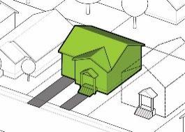
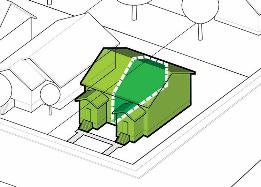
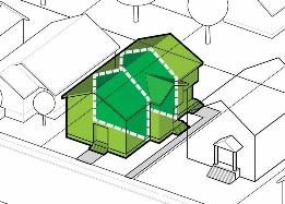
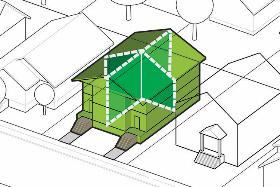
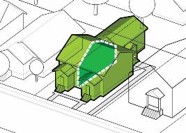
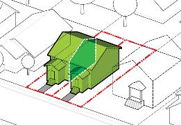
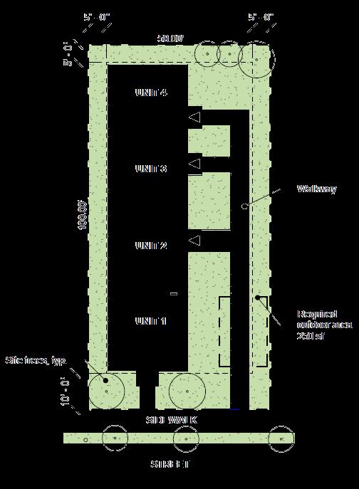
MIDDLE HOUSING LAND DIVISIONS
An alternative to rental or condo units.
Middle Housing Land Divisions provide an opportunity to divide certain middle housing types (duplex, detached duplex, triplex, fourplex, or cottage cluster) so that each unit is on its own lot and available for separate ownership.
More limited approval standards
a. The development is an allowable middle housing type. See options with a “*” on page 2.
b. The development meets applicable development standards based on the original site.
c. The building is built to residential code (townhouse code for attached units).
d. Only one unit is allowed on each lot (no ADUs are allowed).
e. There are no minimum lot size or street frontage requirements for the new middle housing lots (though these standards do apply to the original site).
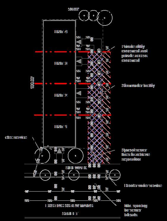
f. Utilities for sewer and water must be separate to each dwelling unit. Stormwater facilities may be shared subject to meeting plumbing code and the stormwater management manual.
g. Easements or tracts will be required for access, utilities, shared amenities, and shared building elements.
Different process from other Land Divisions
a. Must have an existing or proposed middle housing development. Cannot create lots for future development.
b. Building permit should be at an “approvable” stage before starting MHLD review.
c. 63-day maximum land division review process cannot be extended if issues arise.
d. Construction can occur during the review.
e. Final plat approval contingent on completion of certain building elements (e.g. framing and utilities) to ensure final lot lines are correctly sited.
One potential way to divide a fourplex using a Middle Housing Land Division.
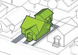
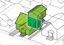
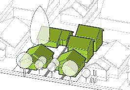
COTTAGE CLUSTERS AND DETACHED DUPLEXES
Cluster sites
A cottage cluster is between 3 and 16 units. Cottage clusters are only allowed in the R10, R7, R5, R2.5 and RM1 zones, and cannot be on sites larger than an acre (or 40,000 sq ft in the RM zone). Like other middle housing options, they are not allowed in the ‘z’ overlay, or on streets that have not been accepted for maintenance. Cluster sites are exempt from regular FAR and building coverage standards, but other limitations apply.
Cottages
Cottages are separated units that are connected by a system of pedestrian paths and organized around a larger a common outdoor area. While there is a minimum number of units required on larger sites, the maximum number (up to 16) is determined by the applicant and what can reasonably fit on the site, considering unit sizes, outdoor area, setbacks, unit separation requirements and any proposed parking.
Common outdoor area
In lieu of larger individual private yards, one or more common outdoor areas are provided. A total of 200 sq ft per unit of common area is required (150 sq ft when cottages are at least 10 feet apart). Each outdoor area must be at least 450 sq ft. Common outdoor area may be located in the side or rear setbacks, but not the front.
Existing homes
Cottage clusters can work for sites with an existing house on a larger yard. Existing homes are allowed to be nonconforming with regard to footprint, height, and size limitations. Note that ADU’s (including pre-existing ones) cannot be part of a cottage cluster. However, detached ADUs may be able to convert to a cottage.
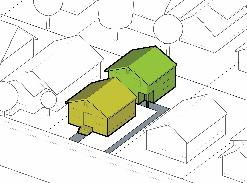
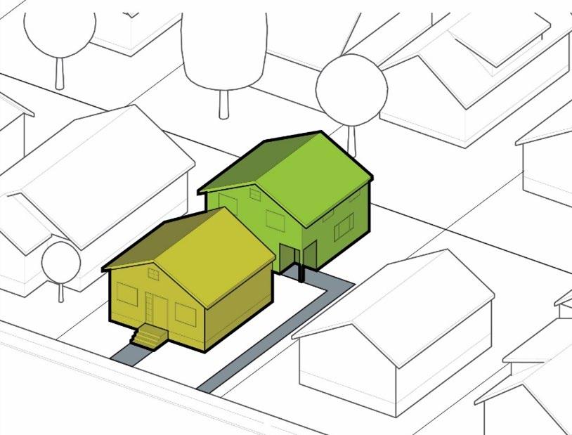
Detached Duplexes
Another option for sites with an existing house is a detached duplex. These are like a detached ADU, except that they can be larger (up to the balance of available floor area). They are also eligible for a middle housing land division so that they can be sold independently from the original house.
Some limitations
Only on sites with an existing house (5+ years old) ADUs are not allowed
New unit height limit is 25 feet
Not allowed in ‘z’ overlay
OTHER REQUIREMENTS
Visitability
For 3 or more units, some portion of the units must be visitable. A visitable unit must have a no step entry, wider doorways, with a bathroom and living area on the ground floor.
Parking
There are no minimum parking requirements for residential uses in the single-dwelling zones. When parking is proposed, there are certain requirements and limitations to where it can be located in relation to the site. For lots that abut an alley, for example, parking access must be from the alley. In other cases, parking is not allowed between a building and the street. On narrow building facades, street facing attached garages may not be permissible.
Building Size (FAR)
The total amount of floor area (the areas of a building measured on all floors excluding a basement) is limited by a ratio of the lot size. This is called a “Floor Area Ratio” or FAR. For example, an FAR of 0.5 for a 5,000 square foot lot results in an allowed floor area of 2,500 square feet (0.5X5,000=2,500). Other types of building size limits also apply such as setback, building coverage and height limits. FAR limits are not applicable to cottage clusters, but other floor area and building size requirements apply.
FAR Bonuses
Additional FAR (+0.1) may be available for projects that add units to a site with an existing house, such as an ADU, or that provide at least one regulated affordable unit.
* FAR limits only apply to lots less than 10,000 sq ft in the R10 and R20 zones
Zero-step visitable entry
SOME HOUSING OPTION LIMITATIONS
Constrained Sites ‘z’ Overlay Zone
Some single dwelling zoned lots have a ‘z’ overlay. This applies in areas with natural resources, natural land hazards such as floodplain, landslide or wildfire risk. Small areas around the Columbia River may also be constrained by airport noise or have an industrial designation.
You can check your zoning on the Portland Zoning Map: https://www.portlandmaps.com/bps/zoning/#/map/
Lots with this overlay are limited to either a house, a house with one ADU, or a duplex. Detached duplexes are not allowed in the ‘z’ overlay. Attached houses are an allowed housing type, but new lots created for attached houses will need to meet standard density lot size standards.
Maintained Streets
Another potential housing option limitation is lots that lack frontage on a street that has been accepted for maintenance by the City or State. Private streets that connect to maintained streets may be eligible for more housing types, but those streets could be subject to private agreements between neighbors using that street.
Lots that lack such street frontage are limited to either a house, a house with one ADU, or a duplex. Unlike the ‘z’ overlay, detached duplexes are allowed in these cases. Street maintenance information is available here: www.portland.gov/transportation/development/maintenance-rip
Minimum Lot Size
While a house, house with one ADU, attached house, or duplex including detached duplex is allowed on most legally platted lots, there are minimum lot sizes that apply to other housing types and lots. A lot of record is one created prior to July 26, 1979 through a recorded deed or other legal instrument of conveyance. A lot remnant is a platted lot that has been reduced in size usually through a property line adjustment. An adjusted lot is a platted lot that has been increased in size typically through a property line adjustment.
House, house w/1 ADU, attached house, duplex or detached duplex on some legally platted or adjusted lots
Attached house w/1 ADU on some legally platted or adjusted lots
House, house w/1 ADU, attached house, attached house w/1 ADU duplex or detached duplex on lot of record or lot remnant
House w/2 ADUs, attached house w/2 ADUs duplex w/1 ADU, triplex, fourplex, Affordable 4-, 5- or 6-plex on any lot or lot of record
Cottage Cluster
Minimum Lot sizes by Housing Type and Zone
Title 33, Planning and Zoning Chapter 33.418 6/30/22
Chapter 33.418 Constrained Sites Overlay Zone
Constrained Sites Overlay Zone
Sections:
33.418.010 Purpose
33.418.020 Map Symbol
33.418.030 Applying the Constrained Sites Overlay Zone
33.418.040 Housing Type Limitations
33.418.010 Purpose
Under some circumstances, more than two dwelling units are allowed on lots in the R20 through R2.5 zones. The Constrained Sites overlay zone reduces development potential to comply with protective measures adopted and acknowledged pursuant to statewide land use planning goals. This overlay zone reduces risk to life or property from certain natural hazards.
33. 418.020 Map Symbol
The Constrained Sites overlay zone is shown on the Official Zoning Maps with the letter “z” map symbol.
33. 418.030 Applying the Constrained Sites Overlay Zone
The Constrained Sites overlay zone is applied to lots in the R20, R10, R7, R5 and R2.5 zones when any portion of the lot has one of the following constraints. When property is rezoned out of an R20, R10, R7, R5, or R2.5 zone, the Constrained Sites overlay zone is automatically removed from the zoning map:
A. Environmental Conservation overlay zone, Environmental Protection overlay zone, or Pleasant Valley Natural Resource overlay;
B. Special flood hazard area;
C. Floodway;
D. 1996 Flood Inundation area;
E. Potential Rapidly Moving Landslide Hazard Zones as shown in the DOGAMI IMS-22 publication;
F. Deep landslide High Susceptibility or Landslide Deposit or Scarp as shown in the DOGAMI IMS-57 publication.
G. Sites in the R10 and R20 zones with a cumulative hazard value of 5 or more as shown on the 1998 City of Portland Wildfire Hazard Zone map;
H. Sites in the R10 and R20 zones with a high or extreme risk rating as shown on the 2001 Multnomah County Community Wildfire Protection Plan map 13B that are not also included in the 1998 City of Portland Wildfire Hazard Zone map;
I. Land within an industrial sanctuary comprehensive plan designation;
J. Land within the Portland International Airport Noise Impact overlay zone with a 68DNL or higher noise contour.
Chapter 33.418 Title 33, Planning and Zoning Constrained Sites Overlay Zone 6/30/22
33.418.040 Housing Type Limitations
The following residential infill and accessory dwelling unit options do not apply in the Constrained Sites overlay zone:
A. 33.110.265.D.2 which allows duplexes consisting of two detached primary dwelling units in the R20 through R2.5 zones;
B. 33.110.265.E which allows triplexes and fourplexes in the R20 through R2.5 zones;
C. 33.110.265.F which allows fourplexes and multi-dwelling structures with up to six dwelling units in the R20 through R2.5 zones;
D. 33.110.265.G which allows cottage clusters in the R10 through R2.5 zones;
E. 33.205.020.B.1.c which allows an accessory dwelling unit on a site with a duplex in the R20 through R.25 zones; and
F. 33.205.020.B.2 which allows two accessory dwelling units on a site with a house, attached house, or manufactured home in the R20 through R2.5 zones
The goals and policies in this chapter convey the City’s intent to:
• Provide a clear definition of each land use designation.
• Provide guidance for how to update the Zoning Map and Zoning Code.
Why is this important?
This chapter describes the land use designations and how they relate to zoning. It is important for the relationship between land use designations and zoning to be clear so that as base zones and the Zoning Code are amended over the life of Comprehensive Plan, the goals and policies of the plan are consistently carried out.
Table of Contents
Goal
Goal 10.A Land use designations and zoning
Policies
Land use designations
Policy 10.1 Land use designations
The Zoning Map and the Zoning Code
Policy 10.2 Relationship of land use designations to base zones
Policy 10.3 Amending the Zoning Map
Policy 10.4 Amending the Zoning Code
List of Figures
10-1. Corresponding and Less-Intense Zones for Each Plan Map Designation
GOALS AND POLICIES
Goal
Goal 10.A: Land use designations and zoning
Effectively and efficiently carry out the goals and policies of the Comprehensive Plan through the land use designations, Zoning Map, and the Zoning Code.
Policies
Land use designations
The Comprehensive Plan Map is one of the Comprehensive Plan’s implementation tools. The map includes land use designations, which are used to carry out the Comprehensive Plan. The land use designation that best implements the goals and policies of the Plan is applied to each area of the city. This section contains general descriptions of the land use designations
Each description includes:
• Type of place or Pattern Area for which the designation is intended.
• General use and intensity expected within the area. In some cases, alternative development options allowed in single-dwelling residential zones (e.g. duplexes and attached houses on corner lots; accessory dwelling units) may allow additional residential units beyond the general density described below.
• Level of public services provided or planned.
• Level of constraint.
Policy 10.1 Land use designations. Apply a land use designation to all land and water within the City’s Urban Services Boundary. Apply the designation that best advances the Comprehensive Plan goals and policies. The land use designations are shown on the adopted Land Use Map and on official Zoning Maps.
Open Space
1. Open Space
This designation is intended for lands that serve a recreational, public open space, or ecological function, or provide visual relief. Lands in this designation are primarily publicly-owned but can be in private ownership. Lands intended for the Open Space designation include parks, public plazas, natural areas, scenic lands, golf courses, cemeteries, open space buffers along freeway margins, railroads or abutting industrial areas, and large water bodies. The corresponding zone is OS.
Single-Dwelling Residential
2. Farm and Forest
This designation is intended for agricultural and forested areas far from centers and corridors, where urban public services are extremely limited or absent, and future investment to establish an urban level of public services is not planned. Areas within this designation generally have multiple significant development constraints that may pose health and safety risks if the land were more densely developed. The designation can be used where larger lot sizes are necessary to enable on-site sanitary or stormwater disposal. It also may be used in locations that may become more urban in the future, but where plans are not yet in place to ensure orderly development. Agriculture, forestry, and very low-density single-dwelling residential will be the primary uses. The maximum density is generally 1 unit per 2 acres. The corresponding zone is RF.
3. Single-Dwelling 20,000
This designation is intended for areas that are generally far from centers and corridors where urban public services are extremely limited or absent, and future investments in urban public services will be limited. Areas within the designation generally have multiple significant development constraints that may pose health and safety risks if the land were more densely developed Very low-density singledwelling residential and agriculture will be the primary uses. The maximum density is generally 2.2 units per acre. The corresponding zone is R20.
4. Single-Dwelling 10,000
This designation is intended for areas far from centers and corridors where urban public services are available or planned but complete local street networks or transit service is limited. This designation is also intended for areas where ecological resources or public health and safety considerations warrant lower densities. Areas within this designation generally have development constraints, but the constraints can be managed through appropriate design during the subdivision process. Singledwelling residential will be the primary use. The maximum density is generally 4.4 units per acre. The corresponding zone is R10.
5. Single-Dwelling — 7,000
This designation is intended for areas that are not adjacent to centers and corridors, where urban public services are available or planned, but complete local street networks or transit service is limited. This designation is also intended for areas where ecological resources or public health and safety considerations warrant lower densities. Areas within this designation may have minor development constraints, but the constraints can be managed through appropriate design during the subdivision process. This designation may also be applied in areas where urban public services are available or planned, but the development pattern is already predominantly built-out at 5 to 6 units per acre. Single-dwelling residential will be the primary use. The maximum density is generally 6.2 units per acre. The corresponding zone is R7.
GOALS AND POLICIES
6. Single-Dwelling 5,000
This designation is Portland’s most common pattern of single-dwelling development, particularly in the city’s inner neighborhoods. It is intended for areas where urban public services, generally including complete local street networks and access to frequent transit, are available or planned. Areas within this designation generally have few or very minor development constraints. Single-dwelling residential will be the primary use. The maximum density is generally 8.7 units per acre. The corresponding zone is R5.
7. Single-Dwelling 2,500
This designation allows a mix of housing types that are single-dwelling in character. This designation is intended for areas near, in, and along centers and corridors, near transit station areas, where urban public services, generally including complete local street networks and access to frequent transit, are available or planned. Areas within this designation generally do not have development constraints. This designation often serves as a transition between mixed use or multi-dwelling designations and lower density single dwelling designations. The maximum density is generally 17.4 units per acre. The corresponding zone is R2.5.
Multi-Dwelling Residential
8. Multi-Dwelling — Neighborhood
This designation allows low-rise multi-dwelling development mixed with singledwelling housing types, at a scale that is compatible with, but somewhat larger than, single-dwelling residential. This designation is intended for areas near, in, and along centers, neighborhood corridors, and transit stations, in locations where transit-supportive densities at a low-rise residential scale is desired. Areas within this designation generally do not have development constraints, and are in locations where urban public services, generally including complete local street networks and access to frequent transit, are available or planned. Maximum density is based on a floor area ratio, not on a units-per-square-foot basis. Minimum density is 17 units per acre. The corresponding zone is RM1
9. Multi-Dwelling — Corridor
This designation allows medium-scale multi-dwelling development. The scale of development is intended to accommodate transit-supportive densities while providing transitions to nearby single-dwelling residential. The designation is intended for areas near, in, and along centers, civic and neighborhood corridors, and transit station areas, where urban public services, generally including complete local street networks and access to frequent transit, are available or planned. Areas within this designation generally do not have development constraints. Maximum density is based on a floor area ratio, not on a units-per-square-foot basis. Minimum density is 30 units per acre. The corresponding zone is RM2.
10. Multi-Dwelling — Urban Center
This designation is intended for the Central City, Gateway Regional Center, Town Centers, and transit station areas where a residential focus is desired and urban
public services including access to high-capacity transit, very frequent bus service, or streetcar service are available or planned. This designation is intended to allow high-density multi-dwelling structures at an urban scale. Maximum density is based on a floor-area-ratio, not on a unit-per-square-foot basis. Minimum density is 43 units an acre. The corresponding zones are RM3 and RM4. This designation is accompanied by the Design overlay zone.
11. Central Residential
This designation allows the highest density and most intensely developed multidwelling structures. Limited commercial uses are also allowed as part of new development. The designation is intended for the Central City and Gateway Regional Center where urban public services are available or planned including access to high-capacity transit, very frequent bus service, or streetcar service. Development will generally be oriented to pedestrians. Maximum density is based on a floor area ratio, not on a units-per-square-foot basis. Minimum density is 87 units per acre. Densities allowed exceed 100 units per acre. The corresponding zone is RX. This designation is accompanied by the Design overlay zone
12. Manufactured Dwelling Park
This designation allows multi-dwelling residential development in manufactured dwelling parks. Allowed housing is manufactured dwellings that are assembled offsite. The designation is intended to reflect the unique features of manufactured dwelling parks in terms of a self-contained development with smaller dwellings on individual spaces with an internal vehicle circulation system, pedestrian pathways, and open area often resulting in lower building coverage than other multi-dwelling designations. The maximum density is generally 29 spaces per acre, one space per 1,500 square feet of site area. The corresponding zone is RMP.
Mixed Use and Commercial
13.
Mixed Use Dispersed
This designation allows mixed use, multi-dwelling, or commercial development that is small in scale, has little impact, and provides services for the nearby residential areas. Development will be similar in scale to nearby residential development to promote compatibility with the surrounding area. This designation is intended for areas where urban public services are available or planned. Areas within this designation are generally small nodes rather than large areas or corridors. The corresponding zones are Commercial Mixed Use 1 (CM1), Commercial Employment (CE), and Commercial Residential (CR).
14.
Mixed Use — Neighborhood
This designation promotes mixed-use development in neighborhood centers and along neighborhood corridors to preserve or cultivate locally serving commercial areas with a storefront character. This designation is intended for areas where urban public services, generally including complete local street networks and access to frequent transit, are available or planned, and development constraints do not exist. Areas within this designation are generally pedestrian-oriented and are
predominantly built at low- to mid-rise scale, often with buildings close to and oriented towards the sidewalk. The corresponding zones are Commercial Mixed Use 1 (CM1), Commercial Mixed Use 2 (CM2), and Commercial Employment (CE).
15. Mixed Use — Civic Corridor
This designation allows for transit-supportive densities of commercial, residential, and employment uses, including a full range of housing, retail, and service businesses with a local or regional market. This designation is intended for areas along major corridors where urban public services are available or planned including access to high-capacity transit, frequent bus service, or streetcar service. The Civic Corridor designation is applied along some of the City’s busiest, widest, and most prominent streets. As the city grows, these corridors also need to become places that can succeed as attractive locations for more intense, mixed-use development. They need to become places that are attractive and safe for pedestrians while continuing to play a major role in the City’s transportation system. Civic Corridors, as redevelopment occurs, are also expected to achieve a high level of environmental performance and design The corresponding zones are Commercial Mixed Use 1 (CM1), Commercial Mixed Use 2 (CM2), Commercial Mixed Use 3 (CM3), and Commercial Employment (CE) Within this designation, the CM3 zone is accompanied by the Design overlay zone.
16.
Mixed Use — Urban Center
This designation is intended for areas that are close to the Central City and within Town Centers where urban public services are available or planned including access to high-capacity transit, very frequent bus service, or streetcar service. The designation allows a broad range of commercial and employment uses, public services, and a wide range of housing options. Areas within this designation are generally mixed-use and very urban in character. Development will be pedestrianoriented with a strong emphasis on design and street level activity, and will range from low- to mid-rise in scale. The range of zones and development scale associated with this designation are intended to allow for more intense development in core areas of centers and corridors and near transit stations, while providing transitions to adjacent residential areas. The corresponding zones are Commercial Mixed Use 1 (CM1), Commercial Mixed Use 2 (CM2), Commercial Mixed Use 3 (CM3), and Commercial Employment (CE). This designation is accompanied by the Design overlay zone
17. Central Commercial
This designation is intended to provide for commercial development within Portland’s Central City and Gateway Regional Center. A broad range of uses is allowed to reflect Portland’s role as a commercial, cultural, and governmental center. Development is intended to be very intense with high building coverage, large buildings, and buildings placed close together along a pedestrian-oriented, safe, and attractive streetscape. The corresponding zone is Central Commercial (CX). This designation is accompanied by the Design overlay zone
Employment
18. Central Employment
The designation allows for a full range of commercial, light-industrial, and residential uses. This designation is intended to provide for mixed-use areas within the Central City and Gateway Regional Center where urban public services are available or planned including access to high-capacity transit or streetcar service. The intensity of development will be higher than in other mixed-use land designations. The corresponding zone is Central Employment (EX). This designation is accompanied by the Design overlay zone
19. Mixed Employment
This designation encourages a wide variety of office, creative services, manufacturing, distribution, traded sector, and other light-industrial employment opportunities, typically in a low-rise, flex-space development pattern. Most employment uses are allowed but limited in impact by the small lot size and adjacency to residential neighborhoods. Retail uses are allowed but are limited in intensity so as to maintain adequate employment development opportunities. Residential uses are not allowed to reserve land for employment uses, to prevent conflicts with the other uses, and to limit the proximity of residents to truck traffic and other impacts. The corresponding zones are General Employment 1 (EG1) and General Employment 2 (EG2).
20. Institutional Campus
This designation is intended for large institutional campuses that are centers of employment and serve a population from a larger area than the neighborhood or neighborhoods in which the campus is located. This designation is intended for areas where urban public services are available or planned. This designation includes medical centers, colleges, schools, and universities. A variety of other uses are allowed that support the mission of the campus, such as residences for students, staff, or faculty. Neighborhood-serving commercial uses and other services are also encouraged. The designation is intended to foster the growth of the institution while enhancing the livability of surrounding residential neighborhoods and the viability of nearby business areas. Corresponding zones are Campus Institution 1 (CI1), Campus Institution 2 (CI2), and Institutional Residential (IR).
Industrial
21. Industrial Sanctuary
This designation is intended to reserve areas that are attractive for manufacturing and distribution operations and encourage the growth of industrial activities in the parts of the city where important freight and distribution infrastructure exists, including navigable rivers, airports, railways, and pipelines. A full range of industrial uses are permitted and encouraged. Nonindustrial uses are significantly restricted to facilitate freight mobility, retain market feasibility for industrial development,
prevent land use conflicts, reduce human exposure to freight traffic and potential air quality, noise, and pedestrian safety impacts, and to preserve land for sustained industrial use. The corresponding zones are General Industrial 1 (IG1), General Industrial 2 (IG2), and Heavy Industrial (IH).
The Zoning Map and Zoning Code
The Zoning Map and the Zoning Code are important tools that carry out the goals and policies of the Comprehensive Plan. This section describes the relationship between the land use designations and the base zones, and how base zones and the zoning maps can be amended. The policies are intended to provide a framework and clarity around zoning map and zoning code amendments. The Zoning Code contains the use and development regulations associated with each base zone
Policies 1.10 through 1.1 9 may also apply to Zoning Map amendments.
Policy 10.2 Relationship of land use designations to base zones. Apply a base zone to all land and water within the City’s urban services boundary. The base zone applied must either be a zone that corresponds to the land use designation or be a zone that does not correspond but is allowed according to Figure 10-1 Corresponding and Less-Intense Zones for Each Plan Map Designation. In some situations, there are long-term or short-term obstacles to achieving the level of development intended by the land use designation (e.g., an infrastructure improvement to serve the higher level of development is planned but not yet funded). In these situations, a less intense zone (listed in Figure 10-1) may be applied. When a land use designation is amended, the zone may also have to be changed to a corresponding zone or a zone that does not correspond but is allowed.
Policy 10.3 Amending the Zoning Map.
10.3.a. Amending a base zone may be done legislatively or quasi-judicially.
10.3.b. When amending a base zone quasi-judicially, the amendment must be to a corresponding zone (see Figure 10-1 Corresponding and Allowed Zones for Each Land Use Designation). When a designation has more than one corresponding zone, the most appropriate zone, based on the purpose of the zone and the zoning and general land uses of surrounding lands, will be applied
10.3.c. When amending a base zone legislatively, the amendment may be to a corresponding zone or to a zone that does not correspond but is allowed (see Figure 10-1 Corresponding and Allowed Zones for each Land Use Designation for zones that are allowed). A legislative Zoning Map amendment may not be to a zone that is not allowed.
10.3.d. An amendment to a base zone consistent with the land use designation must be approved when it is found that current public services are capable of supporting the uses allowed by the zone, or that public services can be made
capable by the time the development is complete. The adequacy of services is based on the proposed use and development. If a specific use and development proposal is not submitted, services must be able to support the range of uses and development allowed by the zone. For the purposes of this requirement, services include water supply, sanitary sewage disposal, stormwater management, transportation, school district capacity (where a school facility plan exists), and police and fire protection.
10.3.e. An amendment to apply or remove an overlay zone or plan district may be done legislatively or quasi-judicially, and must be based on a study or plan document that identifies a specific characteristic, situation, or problem that is not adequately addressed by the base zone or other regulations.
Policy 10.4 Amending the Zoning Code. Amendments to the zoning regulations must be done legislatively and should be clear, concise, and applicable to a broad range of development situations faced by a growing city. Amendments should:
10.4.a. Promote good planning:
1. Effectively and efficiently implement the Comprehensive Plan.
2. Address existing and potential land use problems.
3. Balance the benefits of regulations against the costs of implementation and compliance.
4. Maintain Portland’s competitiveness with other jurisdictions as a location in which to live, invest, and do business.
10.4.b. Ensure good administration of land use regulations:
1. Keep regulations as simple as possible.
2. Use clear and objective standards wherever possible.
3. Maintain consistent procedures and limit their number.
4. Establish specific approval criteria for land use reviews.
5. Establish application requirements that are as reasonable as possible, and ensure they are directly tied to approval criteria.
6. Emphasize administrative procedures for land use reviews while ensuring appropriate community engagement in discretionary decisions
7. Avoid overlapping reviews.
10.4.c. Strive to improve the code document:
1. Use clear language.
2. Maintain a clear and logical organization.
3. Use a format and layout that enables use of the document by lay people as well as professionals.
4. Use tables and drawings to clarify and shorten the document.
5. Identify and act on regulatory improvement suggestions.
GOALS AND POLICIES
Figure 10-1 Corresponding and Allowed Zones for Each Land Use Designation
1 R20, R10, R7 R5 and OS are allowed zones in the Industrial Sanctuary only where the zoning pre-dates the adoption of the 2035 Comprehensive Plan.
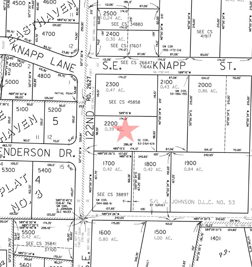
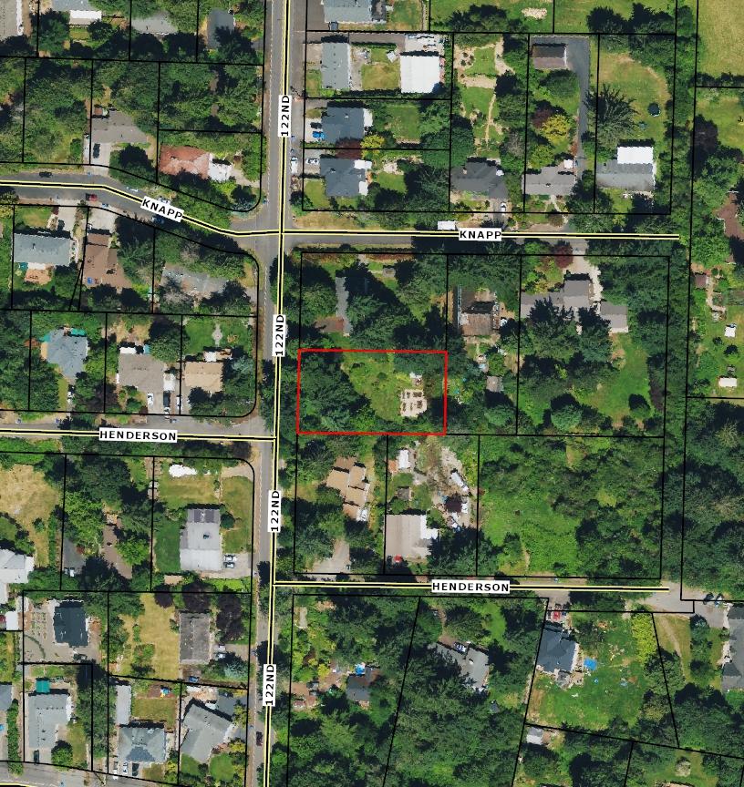
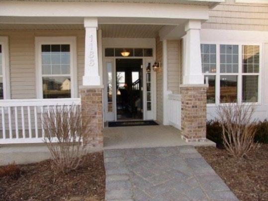
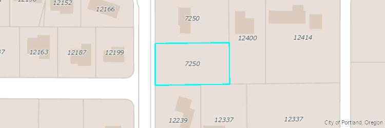
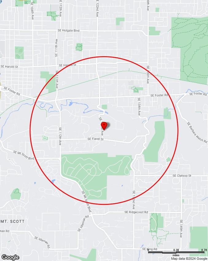
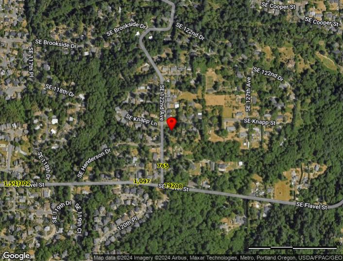
7250 WI/ SE 122ND AVE
PORTLAND, OR 97236
Year Built Neighborhood
Jurisdiction
City Council District
Zoning
Elevation
Owner
Owner Address
VALLEY
Portland / Multnomah
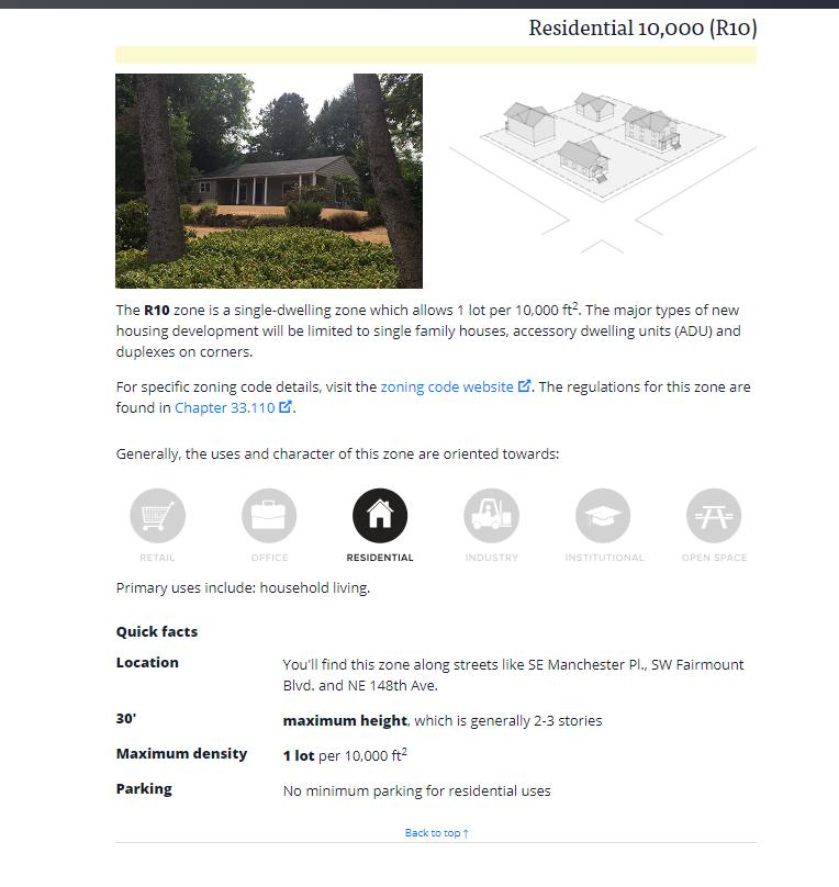
R10 - Residential 10,000
411 ft (approximate)
SOWDER,ROBERT W & SOWDER,BARBARA R
7250 SE 122ND AVE
PORTLAND OR 97236
For more information about data updates or discrepancies, please contact Multnomah County Assessment, Recording & Taxation at (503) 988-2225 or propertytax@multco us
Permits & Zoning
Bureau of Development Services
Phone: 503-823-7300
Zoning Hotline: 503-823-7526
Email: bds@portlandoregon.gov
1900 SW 4th Ave, Suite 5000, Portland, OR 97201 www.portlandoregon.gov/bds/
Leach Botanical Garden
1735 acres
Foster Floodplain Natural Area
54 09 acres
Gilbert Primary Park 4 39 acres
Springwater Corridor
261.64 acres
PlayHaven Park
3.15 acres
Schools
Attendance Area
District Elementary School
Middle School High School
David Douglas SD 40
Gilbert Park Elementary School
Alice Ott Middle School
David Douglas High School
For more information about school attendance areas go to the Schools Map
Nearby Schools
Alice Ott Middle Public 7-8
Gilbert Park Elementary Public K-5
Slavic Christian Academy - SE Portland Private P-8
Gilbert Heights Elementary Public K-5
Kelly Center Head Start Public P
Public Safety
Crime Statistics
To display crime data on the map click the crime category (person, property, or society) within the circle below
Person Crimes
Total: 0
City Average: <1
Assault O�enses (0)
Homicide O�enses (0)
Human Tra�cking O�enses (0)
Kidnapping/Abduction (0)
Sex O�enses (0)
Sex O�enses, Nonforcible (0)
Property Crimes
Total: 1
City Average: <1
Arson (0)
Bribery (0)
Burglary (0)
Counterfeiting/Forgery (0)
Embezzlement (0)
Extortion/Blackmail (0)
Fraud O�enses (0)
Larceny O�enses (1)
Motor Vehicle Theft (0)
Robbery (0)
Stolen Property O�enses (0)
Vandalism (0)
Society Crimes
Total: 0
City Average: <1
Animal Cruelty O�enses (0)
Drug/Narcotic O�enses (0)
Gambling O�enses (0)
Pornography/Obscene Material (0)
Prostitution O�enses (0)
Weapon Law Violations (0)
Data Range: 07/29/2023 - 07/28/2024
Reported crime counts are aggregated across hexagonal 1/8 mile grid sections of the city, and do not represent the number of reported crimes on a speci�c tax lot Points on the map are generalized to the midblock point and may represent the location of multiple reported crimes The locations of certain crimes are not shown on the map due to privacy concerns, but are included in counts and averages
The records depicted give a general picture of crime events in the surrounding area and are not o�cial crime statistics Some information displayed is currently under review and may change subject to record �nalization For greater detail about each record, visit Portland Police Bureau's Open Data Portal and download o�ense data directly from the Crime Statistics Dashboard
Police Jurisdiction
Portland Police Bureau - East Precinct
737 SE 106th Ave, Portland, OR 97216 (503) 823-4800
http://www portlandpolice com
Nearest Fire Station
Station Number 29 13310 SE FOSTER RD
PORTLAND FIRE & RESCUE Fire Management Area
Area Number
FEMA Special Flood Hazard Area (SFHA)
FEMA Reduced Flood Risk Due to Levee
1996 Flood Inundation Area
Elevation Certi�cate(s)
Steep Slope Area (20%)
Mapped Landslide Inventory Area
Title 33 Potential
Landslide Hazard Area
Wild�re Hazard Area
Liquefaction Hazard Zone(s)
Cascadia Subduction Zone M 9.0 Earthquake
Damage Potential
Portland Hills Fault M
6.8 Earthquake
Damage Potential
Location
Site
Owner
Transportation
Portland Bureau of Transportation (PBOT)
1120 SW Fifth Ave, Portland, OR 97204
Portland.gov/Transportation
Parking
Visit our parking map for locations of pay stations, disability parking, downtown SmartPark garages, and more. To learn more about parking enforcement and operations, visit our parking website or contact us at 503-823-2777 or parking@portlandoregon.gov. For permit zone boundaries and info:
Area Parking Permit Zone
Permit Zone
Visitor Limit
Hours
Pavement Responsibility
Find out who is responsible for maintaining pavement on speci�c road segments on PBOT's Pavement Maintenance Responsibility map [Note: pavement maintenance responsibility does not assume ownership in every instance, nor does it assume maintenance responsibility for other assets in the right-of-way such as signs, signals, curbs, or streetlights.]
Safety
Report emergency road hazards or maintenance issue
Report emergency road hazards 24/7 to PBOT's Maintenance Dispatch at 503-823-1700M or email PDXroads@portlandoregon.gov.
Report non-urgent tra�c safety concern
Call 311 (503-823-4000) or email safe@portlandoregon.gov
Learn about Vision Zero, �nd crash data
PBOT and our partners work to eliminate tra�c deaths and serious injuries on Portland streets Visit PBOT's Vision Zero website
Street Sweeping & Cleaning
Due to ongoing budget cuts , PBOT suspended all residential street sweeping June 30, 2023 PBOT crews still sweep 1,000 miles of arterial streets 6-8 times per year as well as protected bike lanes 5 times per year This does not a�ect fall Leaf Day service for those in Leaf Districts:
District
Sweep Date 1
Sweep Date 2
Learn more about Portland's Leaf Day Program
Tra�c Counts
Learn how we gather data, view interactive map at PBOT's tra�c count website
Transportation System Plan (TSP) Classi�cations
Learn how Portland streets are classi�ed within the TSP, including categories related to transit, street design, emergency response, bicycles, pedestrians, and freight. Visit PBOT's TSP Classi�cations map
Weather - Snow & Ice
Learn more about the city's winter weather response or visit our Winter Weather Center map showing priority snow and ice routes, where we deploy salt, road closures, elevation, and more
SmartTrips - Getting Around Portland
Learn more about active transportation options for you, your family, or business, �nd bike and walk maps. Visit PBOT's SmartTrips website
Transit
To plan a trip by bus, MAX train, or Portland Streetcar, use TriMet's trip planner
Survey Utilities
Garbage & Recycling
Residential Customers
Waste Management of Oregon (800) 808-5901
http://wwwwmnorthwest com
Collection Day
Westside Terrain Area?
Commercial Customers
Dropbox Services
Monday No
Unfranchised
Unfranchised
Bureau of Planning & Sustainability
Curbside Hotline: 503-823-7202
Email: wasteinfo@portlandoregon gov
1810 SW 5th Ave, Suite 710, Portland, OR 97201
www portlandoregon gov/bps/
Sewer & Environmental
Bureau of Environmental Services
503-823-7740
1120 SW Fifth Avenue Suite 613 Portland, OR 97204
https://www.portland.gov/bes
This property is inside the City of Portland. Contact the City of Portland for sewer service.
Water
Portland Water Bureau
Phone: 503-823-7770
1120 SW 5th Ave. #405, Portland, OR 97204
www portlandoregon gov/water/
Topography
CUSTOM
MAPS
Water Features
Aerial
Aerial Environmental
Community
Transit
Vacant Land
The information contained is provided by WFG’s Customer Service Department to our customers, and while deemed reliable, is not guaranteed.
PLEASANT
COMMUNITY
Demographics
Traffic Counts INFORMATION
The information contained is provided by WFG’s Customer Service Department to our customers, and while deemed reliable, is not guaranteed.
7250 SE 122nd Ave, Portland, OR 97236 Sitewise Online
Pop-Facts: Demographic Snapshot (Part 2)
Pop-Facts: Demographic Snapshot (Part 2)
7250
122nd Ave, Portland, OR 97236
Pop-Facts: Demographic Snapshot (Part 2)
Pop-Facts: Demographic Snapshot (Part 2)
7250 SE 122nd Ave, Portland, OR 97236
Pop-Facts: Demographic Snapshot (Part 2)
Pop-Facts: Demographic Snapshot (Part 2)
Total retail trade including food and drink (NAICS 44, 45 and 722)
and parts dealers (NAICS 441)
dealers (NAICS 4411)
car dealers (NAICS 44111)
(NAICS 44112)
4412)
vehicle dealers (NAICS 44121)
(NAICS 441222)
(NAICS 444)
(NAICS 44412)
44413)
44419)
and garden equipment and supplies stores (NAICS 4442)
power equipment stores (NAICS 44421)
Nursery, garden center, and farm supply stores (NAICS 44422)
and beverage stores (NAICS 445)
stores (NAICS 4451)
and other grocery (except convenience) stores (NAICS 44511)
stores (NAICS 44512)
food stores (NAICS 4452)
1,533,836
7250 SE 122nd Ave, Portland, OR 97236 Sitewise Online
Retail Market Power Opportunity Gap Report By Retail Store Types
Retail Market Power Opportunity Gap Report By Retail Store Types
(NAICS 44521)
(NAICS 44522)
(NAICS 44523)
(NAICS 44529)
and infants' clothing stores (NAICS 44813)
(NAICS 4482)
luggage, and leather goods stores (NAICS 4483)
stores (NAICS 44831)
goods, hobby, musical instrument, and book stores (NAICS 451)
4511)
45113)
stores (NAICS 45111)
(NAICS 452)
(NAICS 4522)
7250 SE 122nd Ave, Portland, OR 97236 0 - 1 mi
7250 SE 122nd Ave, Portland, OR 97236
Sitewise Online
Retail Market Power Opportunity Gap Report By Retail Store Types
Retail Market Power Opportunity Gap Report By Retail Store Types
store retailers (NAICS 453)
(NAICS 4531)
supplies, stationery, and gift stores (NAICS 4532)
and stationery stores (NAICS 45321)
stores (NAICS 45322)
stores (NAICS 4533)
miscellaneous store retailers (NAICS 4539)
(NAICS 45392)
(NAICS 45391)
(NAICS 45393)
(NAICS 45399)
(NAICS 453991)
(NAICS 453998)
retailers (NAICS 454)
(NAICS 7224)
7225)
7250 SE 122nd Ave, Portland, OR 97236
7250 SE 122nd Ave, Portland, OR 97236 Sitewise Online
Retail Market Power Opportunity Gap Report By Retail Store Types
Retail Market Power Opportunity Gap Report By Retail Store Types
Retail Market Power data is derived from two major sources of information. The demand data is derived from the Consumer Expenditure Survey (CE Survey or CEX), which is fielded by the U.S. Bureau of Labor Statistics (BLS). The supply data is derived from the Census of Retail Trade (CRT), which is made available by the U.S. Census. Additional data sources are incorporated to create both supply and demand estimates. The difference between demand and supply represents the opportunity gap or surplus available for each merchandise line in the specified reporting geography. When this difference is positive (demand is greater than the supply), there is an opportunity gap for that merchandise line; when the difference is negative (supply is greater than demand), there is a surplus.