5 minute read
CuttingEdge - Summer 2019
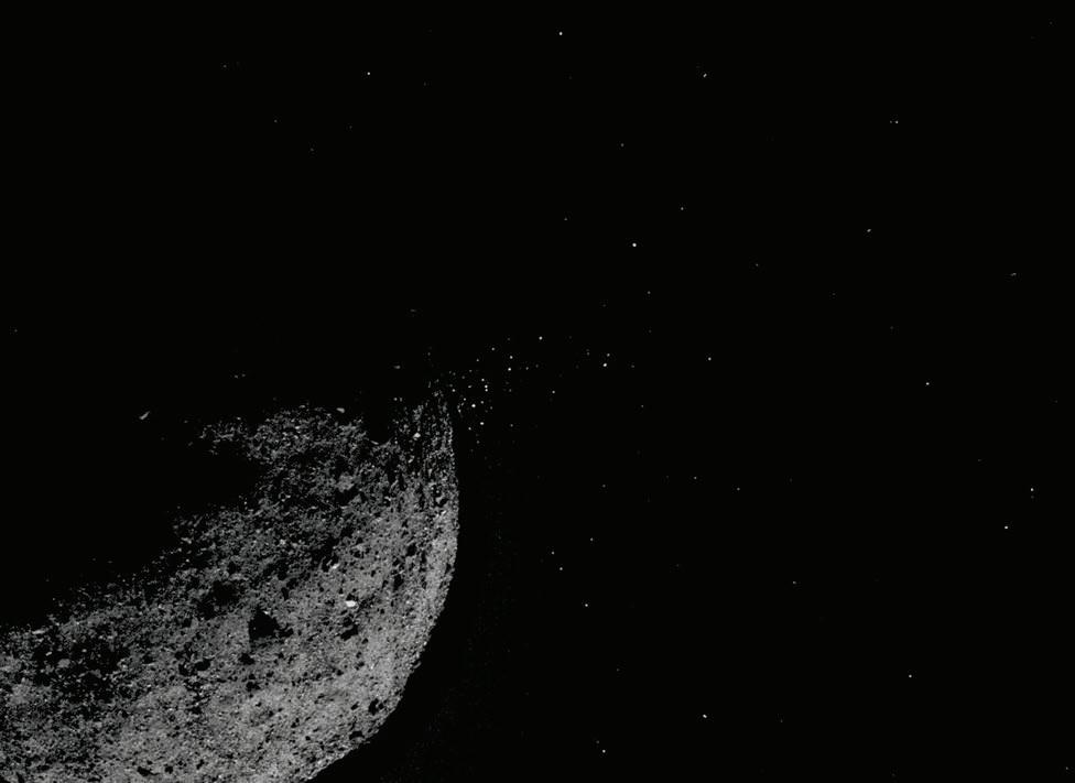
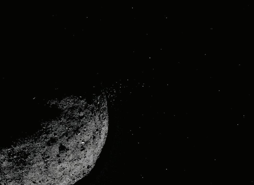
A navigation tool originally developed to help plot OSIRIS-REx’s approach to asteroid Bennu ended up characterizing particles ejected from the object’s surface — an unexpected bonus for scientists interested in learning more about an ancient object that could collide with Earth late in the 22nd century.
The navigation and science teams weren’t expecting to find these specks of surface material, but ended up tracking them with some precision to determine what was happening and whether they posed a threat to the spacecraft. The Origins, Spectral Interpretation, Resource Identification, SecurityRegolith Explorer mission, known as OSIRIS-REx, is rendezvousing with Bennu where it will conduct a two-year detailed survey of the asteroid, collect NASA’s first-ever sample of an asteroid, and bring it back to Earth for analysis.
“For safety reasons, we need to be able to know where any large particles are to ensure they won’t
affect the spacecraft and predict when more particles may enter the environment around Bennu,” said Andrew Liounis, principal investigator for Goddard’s optical navigation team. “For science purposes, the particles can provide information about Bennu’s composition, gravity field, and the forces acting on the surface, along with many other fascinating scientific insights.”

The technology used to do this tracking is an optical navigation (OpNav) technology called the Goddard Image Analysis and Navigation Tool, or GIANT. In contrast to radar or laser-ranging tools that pulse radio and light waves at a target and then analyze the returning signals, GIANT analyzes images to more quickly and accurately measure the spacecraft’s distance from the target as well as the target’s size and other characteristics.
An Independent Check
Goddard technologists developed GIANT to independently check navigation data processed by OSIRIS-REx’s primary navigation team, mainly comprised of KinetX engineers. With images that the mission transmits to Earth, GIANT Principal Investigator Andrew Liounis and his team use their specially developed computer algorithms to analyze the images and then pass along their findings to the primary team. Having a second team helps the OSIRIS-REx mission validate its navigation information, offering additional confidence that nothing has been missed.
“The primary way that we are ‘independent’ is that we are using independent tools to do the processing,” Liounis said. “Many of our algorithms are similar, just with slightly different implementation details. We also have additional algorithms and methods that we have developed in-house through the IRAD (Internal Research and Development) program to provide an even more independent look at the data.”
For example, GIANT can determine direction to an object by locating its center in an image. This is done by predicting what the object should look like and then searching for it in the image using a process known as cross-correlation.
It can also figure out where the camera is pointing by identifying known stars in an image and it can employ another set of techniques that consider the outer edges or limbs of an object to provide information about both the direction to the target, as well as how far away it is. And it can identify and catalog features on the target’s surface and its distance and relationship to other features through a process known as stereophotoclinometry.
The results of these and other calculations enable science and engineering tasks that would not be possible using traditional ranging techniques, Liounis said. As more missions target less well known and more complex bodies, optical navigation will be an essential part of exploration.
“OpNav directly gives you information about the relative state between the spacecraft and the target to higher accuracy than can be inferred from the solutions given from more traditional tracking,” Liounis said.
Radars, laser range finders (LRF), and lidars can also give the relative state, he said, but compared to cameras, they generally cost more and take up more mass, making them unfeasible for some missions.
In addition, radars and LRF only provide distance information to the body’s surface — information in one direction — whereas OpNav can provide both the distance and direction, providing information in all three directions from a single detector.
While lidar can give information in all three directions, it’s generally considered riskier because the technology hasn’t fully matured for spaceflight. Furthermore, cameras typically have a much wider range, Liounis said. They can operate from a distance, while lidar, LRF, and radar need to be close to the body, but not too close. This limitation is particularly true for lidar, Liounis said.
Active range sensors complement OpNav, and many missions rely on both OpNav and particularly LRF if they have the budget and spacecraft size to carry both types of navigation technology. OSIRIS-REx uses both.
Seeking an Autonomous GIANT
The team isn’t finished with GIANT. With this year’s IRAD funding, the team is developing a new version of GIANT that would run autonomously onboard future spacecraft to extract and develop OpNav data from images captured by the spacecraft. As part of a fully autonomous fight system, it would then pass that information to an onboard navigation system to be included in the orbit determination solution.
This would help when the communications lag to Earth is too long for ground controllers to effectively guide spacecraft and when ultra-precise, real-time knowledge of the spacecraft’s relative position and velocity to the target is required for high-impact science observations.
Furthermore, onboard OpNav would reduce the amount of engineering data that needs to be downlinked to Earth, which would reduce the cost of communications for smaller missions and allow for more science data to be downlinked for larger missions. It would also reduce the number of people required to perform ground-based orbit determination and navigation.


