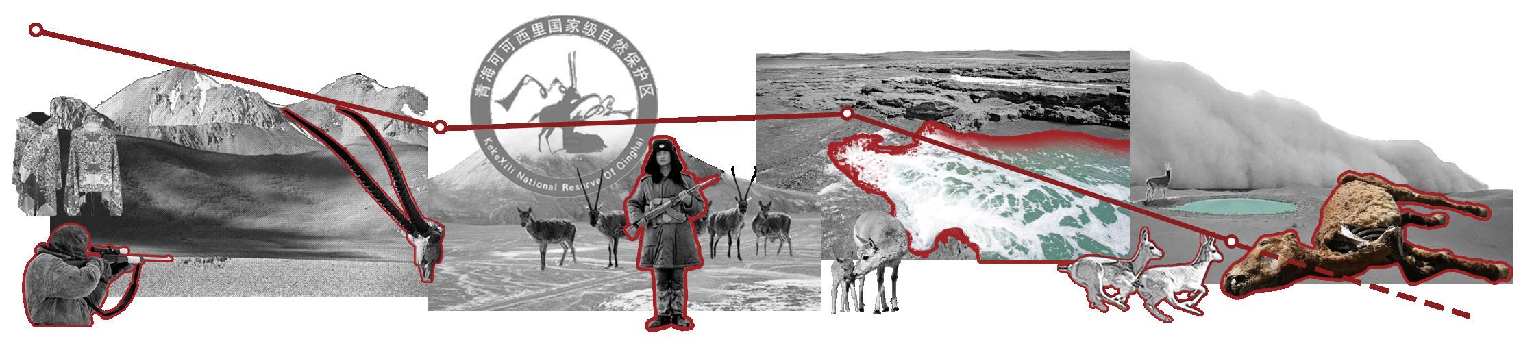
JIAYUAN LI
Landscape Architecture Portfolio 2021-2022
Apply for MLA Landscape Architecture, University College London
MAIL:jiayuanli1997@outlook.com Application number: 23079403
EDUCATION
JIAYUAN LI
Bachelor of Arts in Landscape Architecture at Zhujiang College of South China Agricultural University,SCAU(ZJ)
Address Guangzhou,China
Phone : +86 13192845277 E-mail : jiayuanli1997@outlook.com
Zhujiang College of South China Agricultural University,SCAU(ZJ),China
Bachelor of Arts in Landscape Architecture
GPA:3.53/5
WORK EXPERIENCE
CONTEST
Guangzhou Wenhe Huamei Landscape Design Co., Ltd (http://green-culture.cn/)
Jun.2021 - Oct.2022 | Guangzhou, China
Landscape architecture designer
Project 1 :Wan Fu Ming Ya City Phase III — Commercial Plaza Design
Responsible for analysis of crowd flow, square landscape design, site model construction, effect rendering
Project 2 :Changqiyong village—Rural Landscape Planning and Design
Responsible for overall planning and design, site model construction, effect rendering Project 3 :Maoming People’s Hospital Emergency Building—Hospital Landscape Design
Responsible for data analysis of hospital healing landscape, overall landscape design, site model construction, effect rendering
2020 College Students ' Design Competition of Chinese Landscape Architecture Society

Oct.2020 – Nov. 2020 | Chengdu, China
Project: Resilient Wetland Park Design in Response to Flood Crisis
Team leader
Responsible for site information collection, relevant literature search, conceptual design, modeling, drawing and layout
ACTIVITY
Participate in Voluntary Education Activities in Rural Areas | 2020
The Head of Singing Association of Student Union of School of Design, SCAU(ZJ) | 2018 – 2019 Organizer of the campus singing evening
Sponsor Negotiator of Campus Radio Outreach Department | 2018

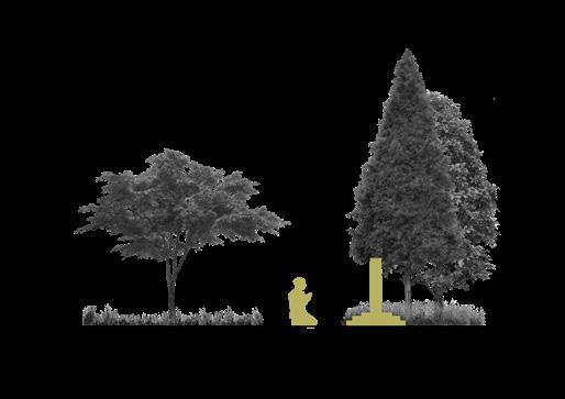
CONTENTS
01
BURIED IN A QUARRY: ECOLOGICAL RESTORATION OF THE QUARRY
The best way to resolve conflicts is fusion
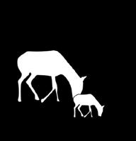
SCARS OF LAKE: THE LOST OF TIBETAN ANTELOPE IN ZHUONAI LAKE
Why fashion things of beauty when beauty is evanescent ?
03
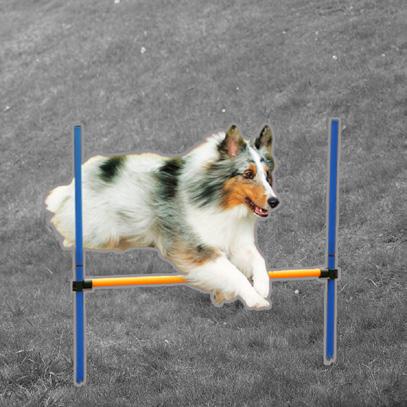
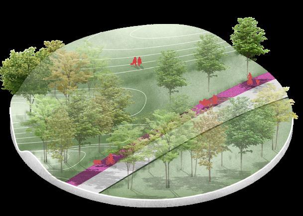
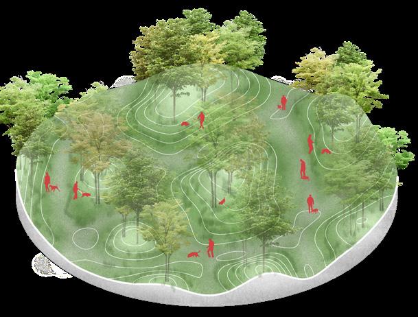
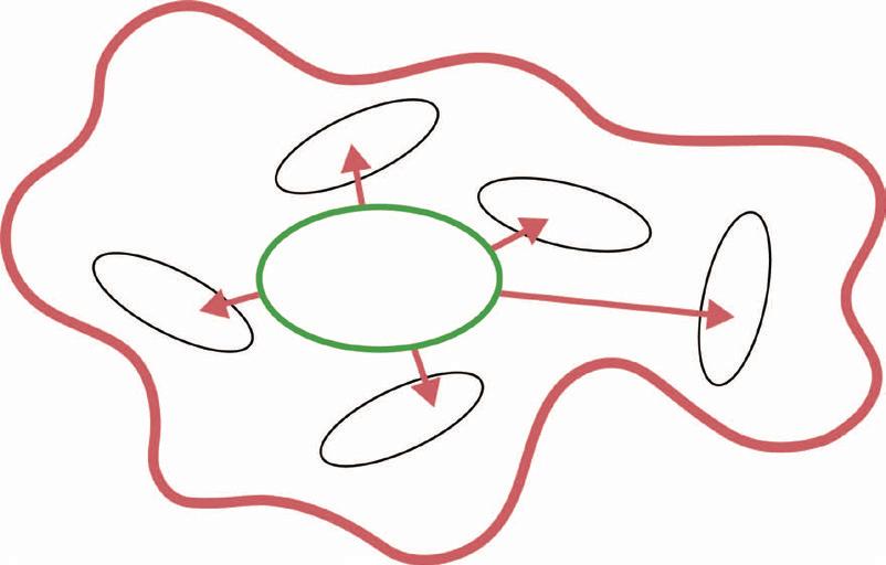
DOG PARADISE: REUSE OF URBAN POST-INDUSTRIAL WASTELAND
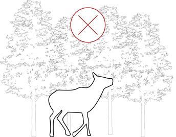
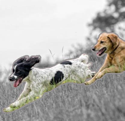
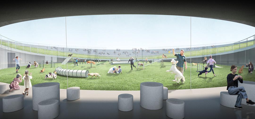
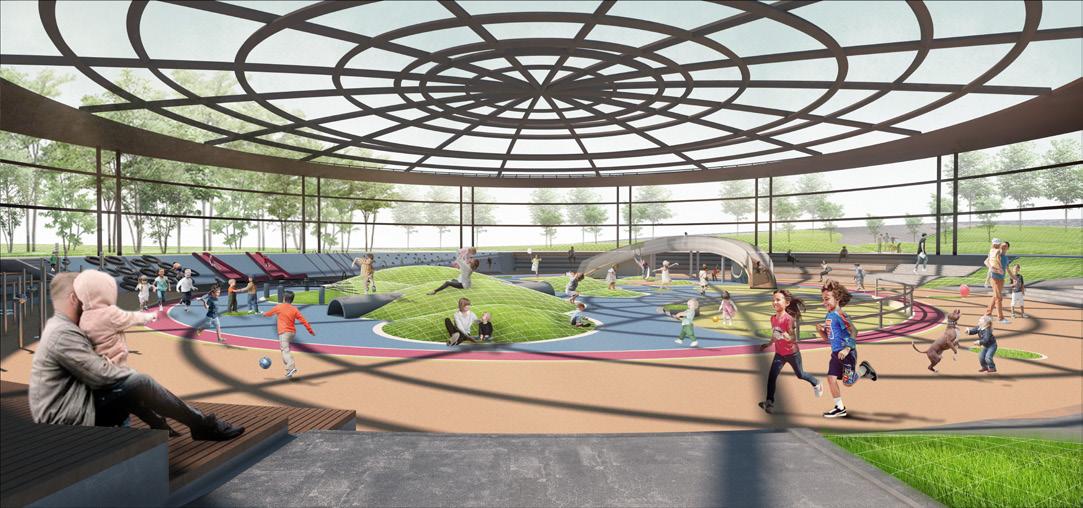
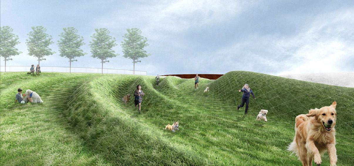
"Most cities should have at least one such park, which should contain a ' dog-only ' section. This seems to be a more reasonable solution than banning dogs in all parks, as bans are often difficult to enforce."

02 04
DIGITAL NOMADS AND FARMER: REINTEGRATION OF URBAN AND RURAL AGRICULTURE
When urbanization develops to a certain stage, it will inevitably lead to counter-urbanization
Location: Conghua,Guangzhou,China
Type:Academic,Individual Work
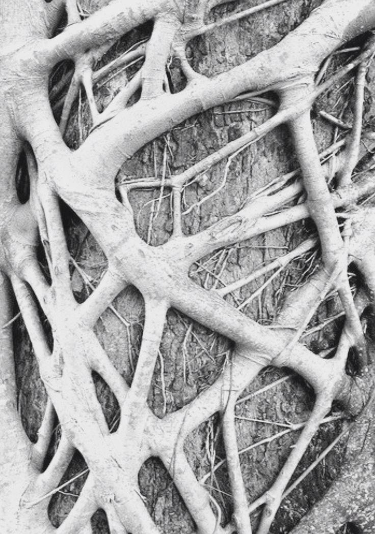
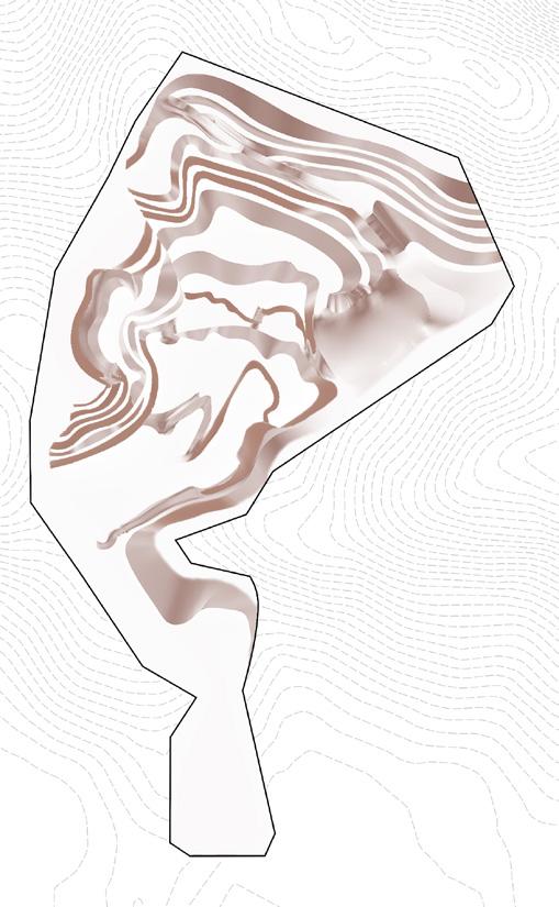
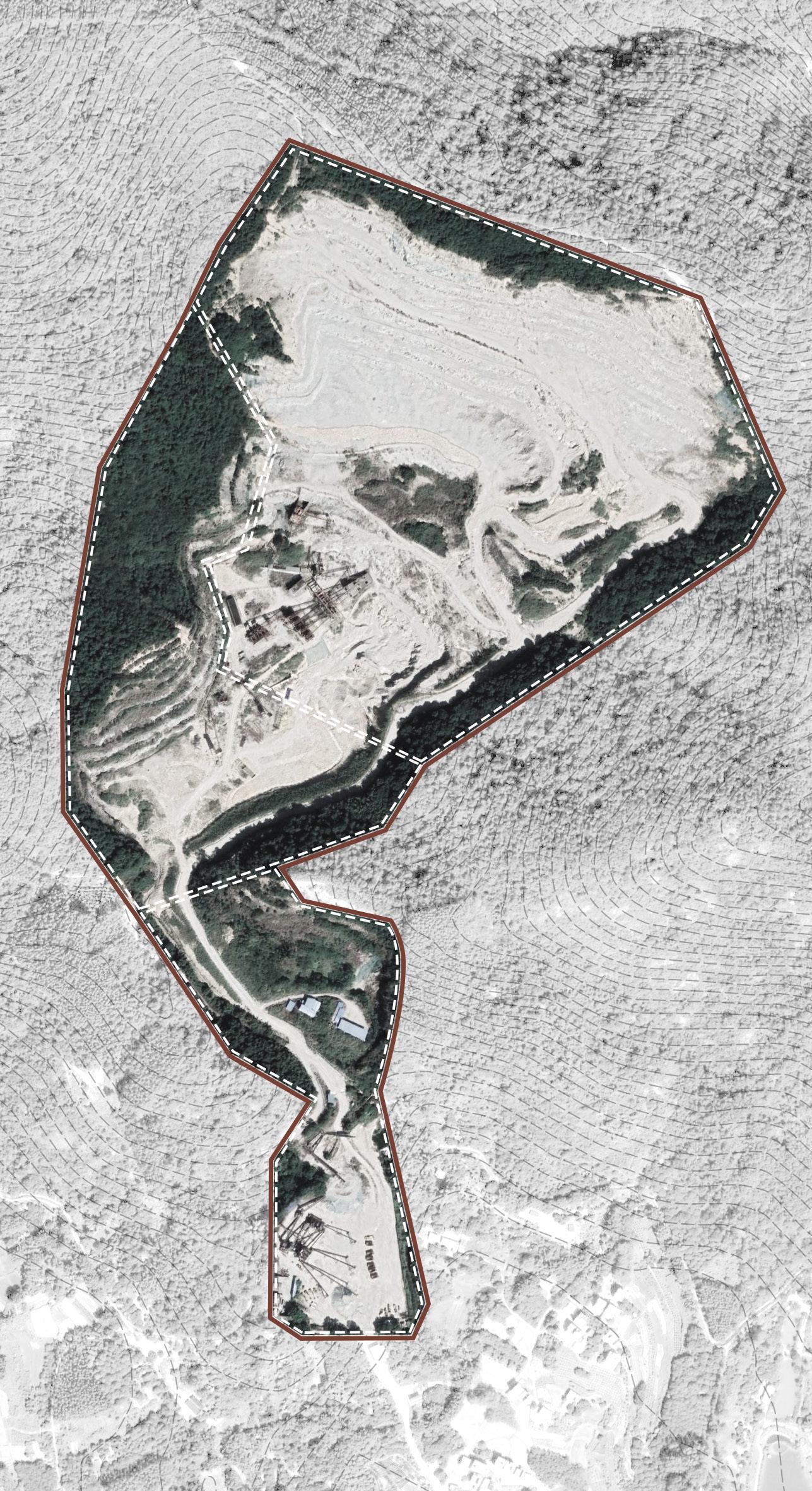
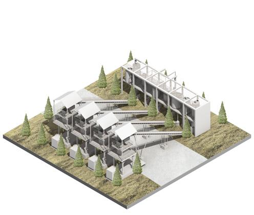
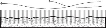
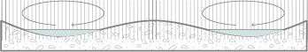
one of the most serious places for population mortality, which leads to serious land contradictions between the abandonment of quarries and the shortage of cemetery demand In view of the potential supply and demand relationship between abandoned quarries and cemeteries, the project adopts the pattern of fusion of quarries and cemeteries, and achieves two purposes : the ecological restoration plan of quarries and the supply and demand of cemeteries, so as to achieve a win-win result
Conghua Industrial legacy equipment Entrance
Destroyed vegetation
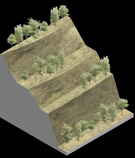
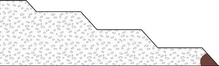
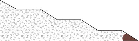
Complex slope
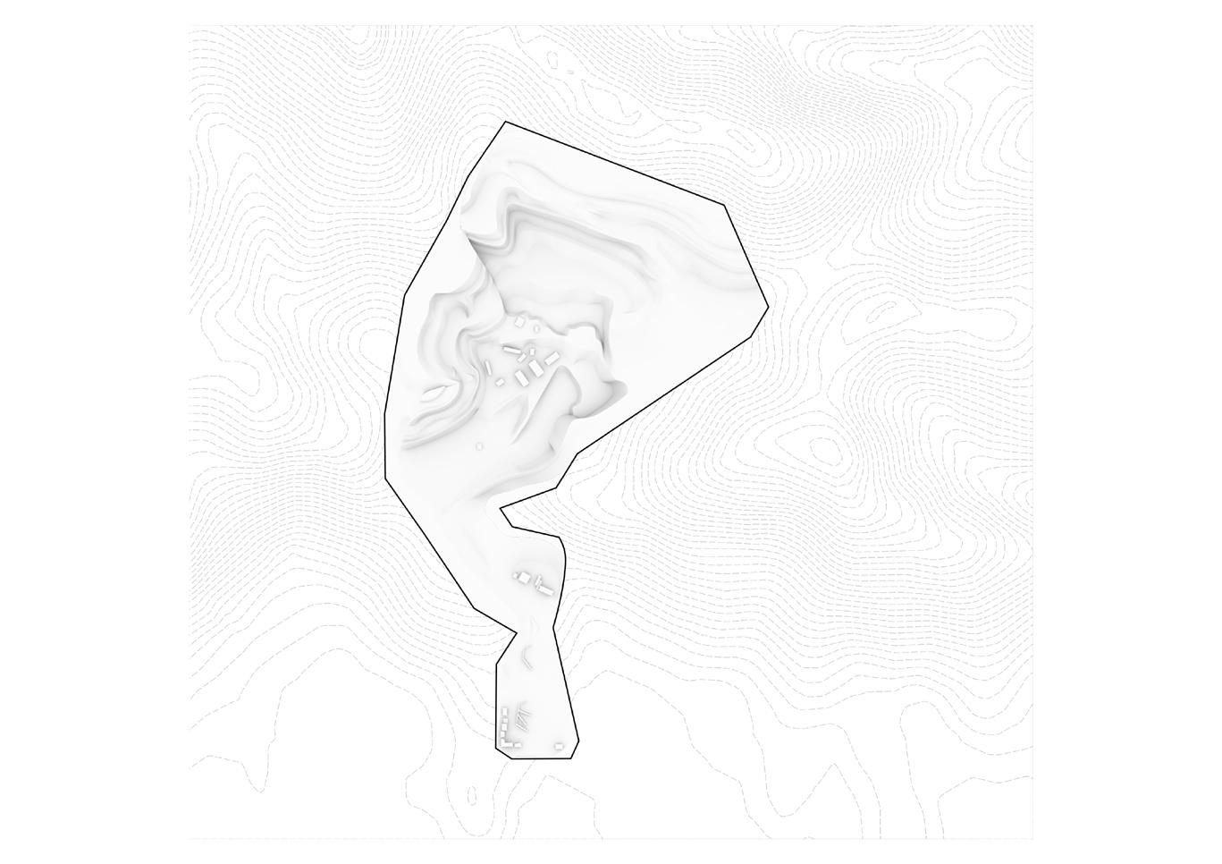
the site left behind complex slope platforms. The earliest developed platform has been covered with vegetation, while most of the high slope platform is still bare.
Platforms generated in the third phase Platforms generated in the second phase Platforms generated in the first phase
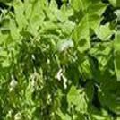
Most of the vegetation in the site was cut down because of industrial development. and some grew poorly because their growing soil was industrially developed to weaken the activity.
Temporary topsoil storage yard
plant
plant
Current road
the site has a specific road classification system that has been
Abandoned building
N
Village
Unproductive land Industrial legacy equipment 0 20 80 40 160M
Left industrial facility
2021 China left a lot of quarries and did not redevelop them. 2000 China has become the third largest mining country after the United States and Russia. 1978 Mineral resources are developing rapidly. 1949 After the founding of new China that began a new era of modern mining development.
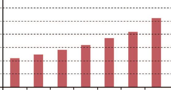
18.70% Aging Population 7.09% Mortality There are more cemeteries are needed Number and growth of deaths in China from 2015 to 2020 Number of deaths (ten thousand) Rate(%) 2015 2016 2017 2018 2019 2020 0 0.005 0.01 0.015 0.02 0.025 0.03 0.035 0.045 0.05 0.055 940 950 960 970 980 990 1000 1010 1020 1030 1040 CURRENT SITE INFORMATION STATUS
QUO
Good
Gree
Bad
plant
coverage 30%
Felled
>45°
15-45° 5°-15°
Abandoned industry Abandoned building Valuable industry Secondary road Tertiary road Main road 90% Not repaired 10% Repaired There are more quarries are left Number of mineral resources developed in Guangzhou from 2010 to 2020 2010 2012 2014 2016 2018 2020 Mining(pcs) 0 10 20 30 40 50 60 Urban Core SITE Quarries Site Legend Cemetery Boundary of Conghua 0 10 5 N 20KM 01 BURIED IN A QUARRY Baby boom leads to increased demand for cemeteries Heavy development has led to an increase in abandoned quarries 1949 After the founding of New China, there were three baby booms. 1980 China implements the family planning policy to limit the population. 2016 China's aging population accounts for 11.97% of the population. 2021 Death toll rises, but land resources are scarce, leaving bodies nowhere to be laid. ? 1949 Abandoned quarries Death Population Available land 1980 2021 2016 Description:The site is located in Conghua District, which is one of the most serious places for abandoned quarries in Guangzhou and
Some abandoned industrial facility was left in the site, including value industry building
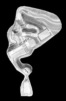
Instructor:Manbo Ye Time:03/2021 Scale:L CHINA Site size — 42 hectares Phase III quarry Phase II quarry Phase I quarry
RESEARCH OF SPATIAL RELATIONS BETWEEN CEMETERY AND QUARRY

STRATEGY FROM QUARRY TO CEMETERY Exisiting
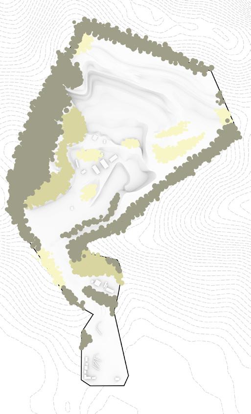
Plain(0-5°)
Plain(0-5°) Medium(15°-30°)
Gentle(5°-15°) Steep(30°-45°)
FORM TRANSFORMATION FROM QUARRY TO CEMETERY
SPATIAL
terrain,
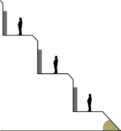
Tree Buried Stepping Green FInal Industrial Green Tomb Wall Buried
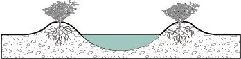
The same and different spatial types between cemetery and quarry can be found from the
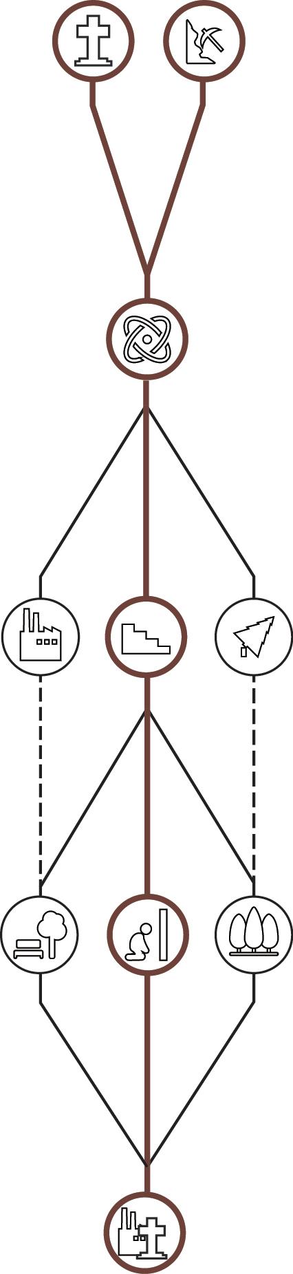
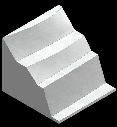
path, vegetation cover and functional requirements. There are similar slopes on the terrain and strong purpose on the path, but there are great differences in vegetation cover and functional requirements. Using the similar spatial form of quarry and cemetery, focus on dealing with the height difference of the site, completing the spatial transformation from quarry to cemetery, and repairing the soil and ecological restoration of the site. CONVERSION
Condition
Extremely Steep(>45°)
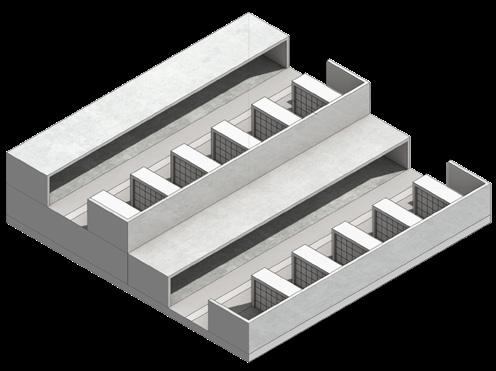
Tomb Stone Buried Step 2 Plants Restoration Tree Tomb Plants Restoration Wall Tomb Stone Tomb Stone Tomb Tomb Stone Buried Step 1 Cut Into Terraces Cut Into Terraces Cut Into Terraces Cut Into Terraces Soil Improvement Vacant land Degraded plant >45° Ecological space Complex slope 5°-45° 0°-5° Sacrifice space Post-industrial cemetery Abandoned industry Public space Scarce land Fusion Imagine Main problem Conversion Result Cemetery Ⅰ Terrain—Similar Slope Quarry Gentle(5°-15°)
Suitable(15°-30°) Suitable(15°-30°) Steep(30°-45°)
Cemetery Ⅱ Path—Strong Purpose Step 1. Service Center Step 2. Fete Step 3. Tranquil Contemplation Quarry Step 1. Mining Step 2. Crushing Ore Step 3. Stacking Cemetery Ⅲ Vegetation coverage—Different Plant Atmospheres Road Vegetation Road Vegetation Flatland Vegetation Flatland Vegetation Slope Vegetation Slope Vegetation Quarry Cemetery Ⅳ Function—Different Functional Requirements Fete Cremate Tranquil Contemplation Mining Area Industrial Area Place Of Abode Quarry Land use conflict
Gentle(5°-15°)
Steep(30°-45°)
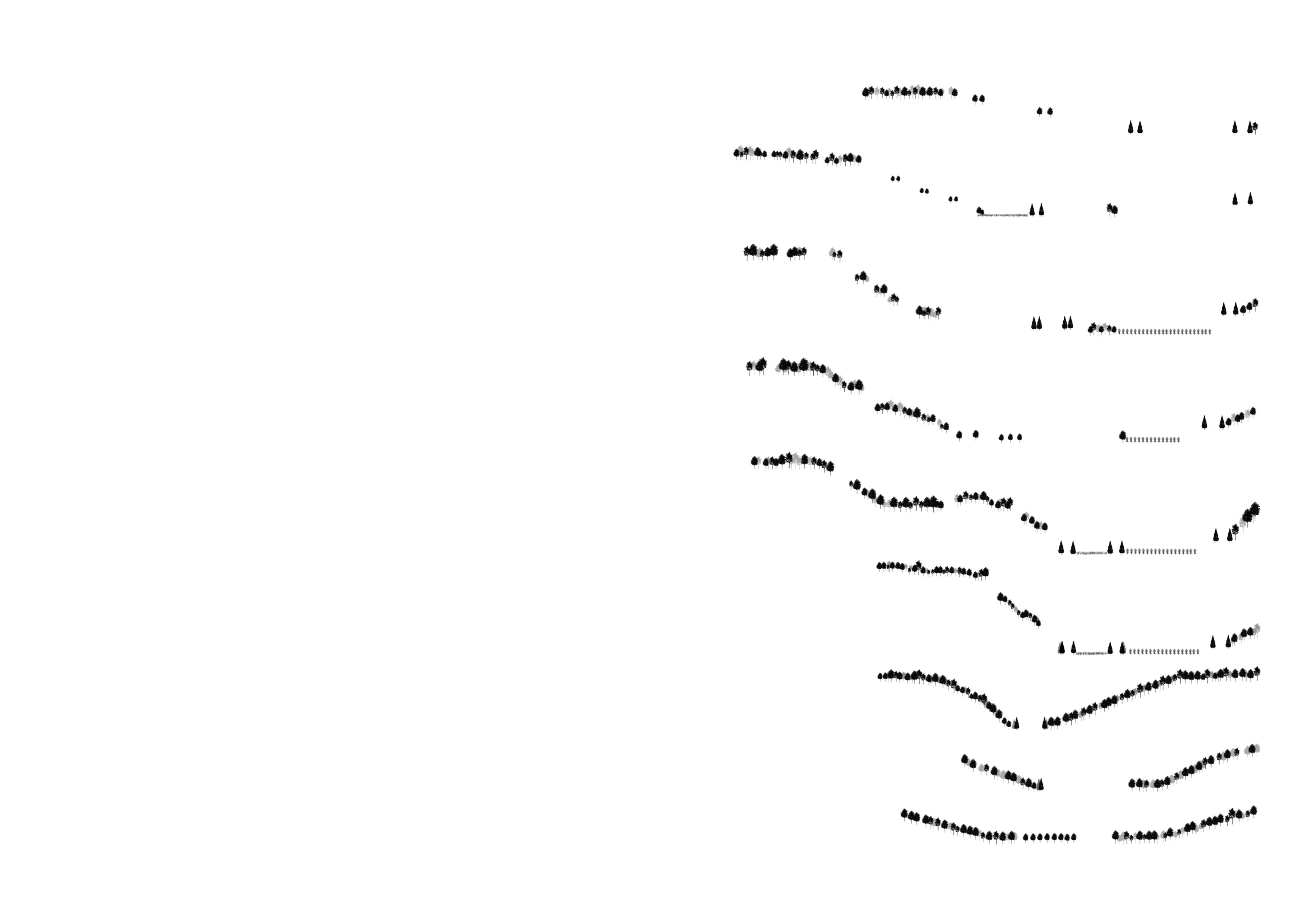
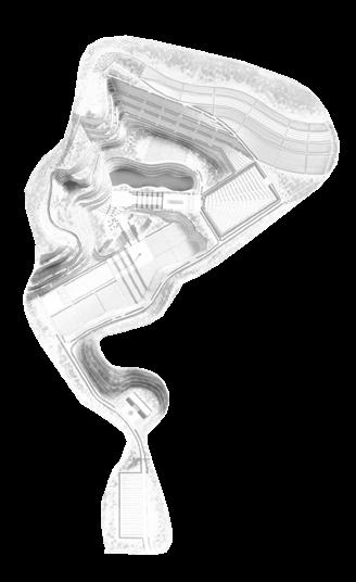
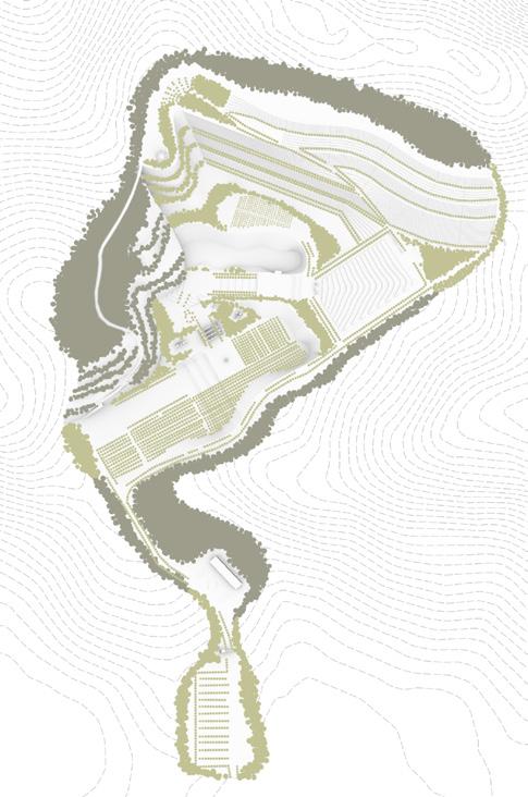
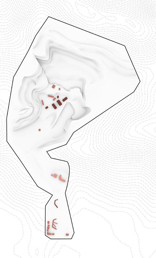
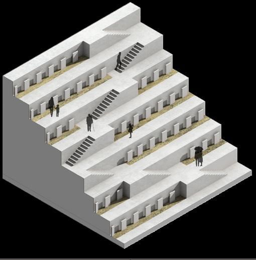
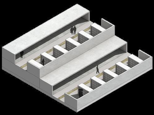
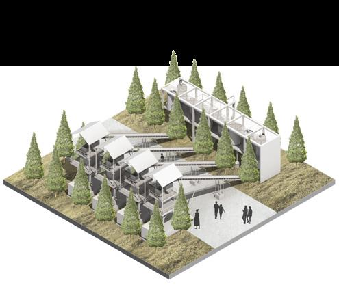
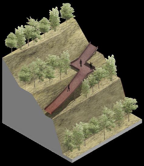
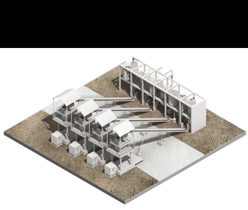
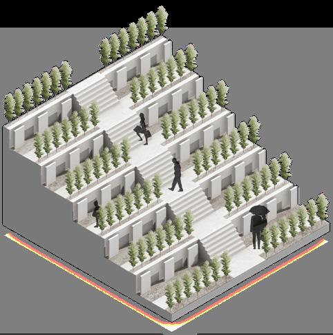
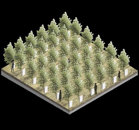
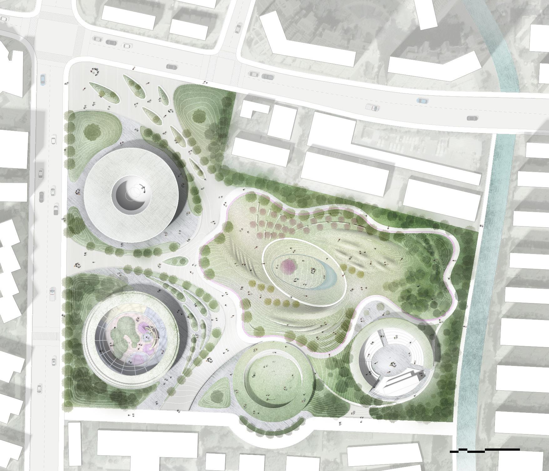
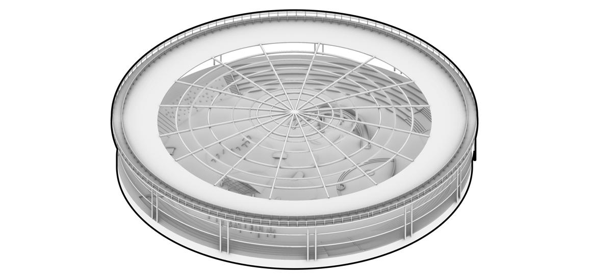
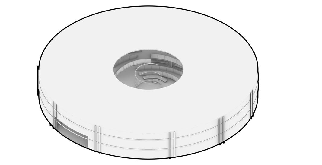
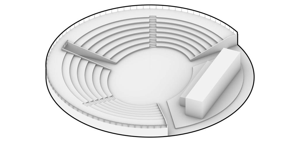
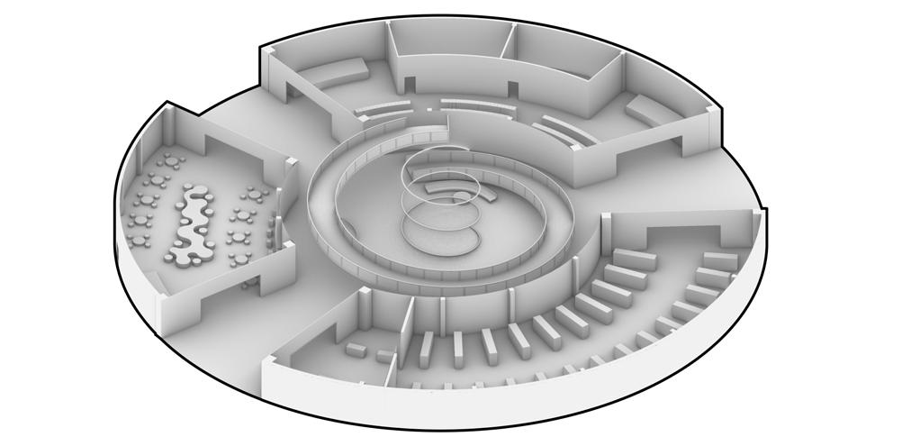
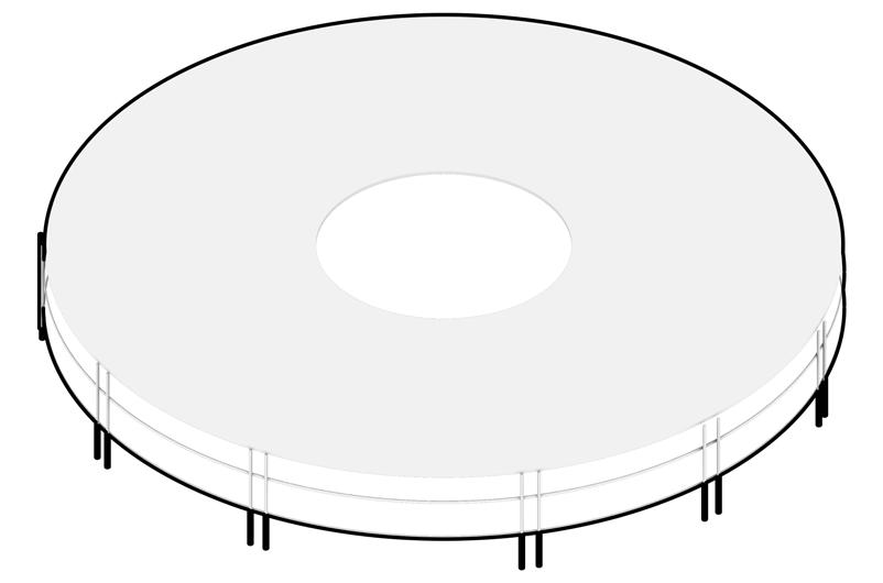
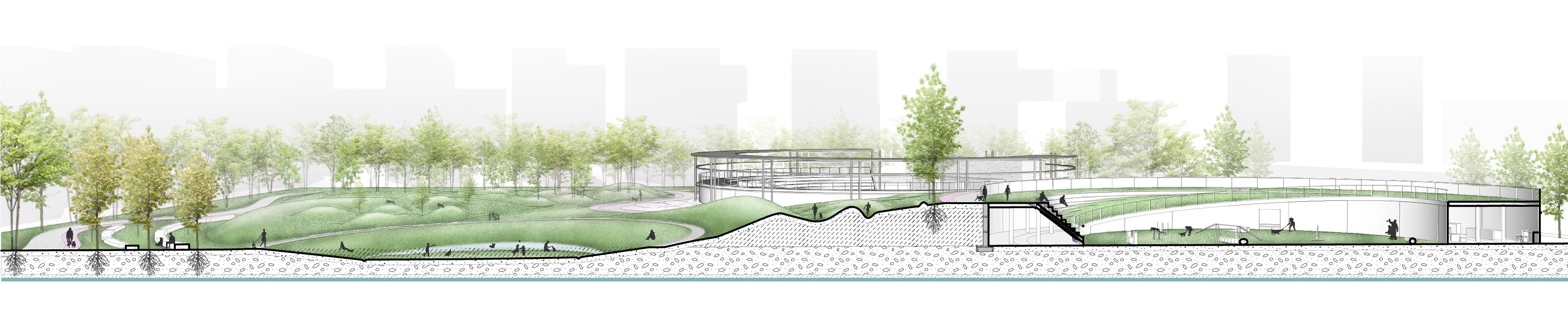
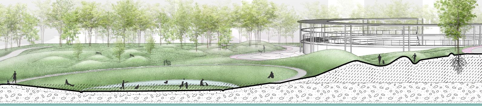
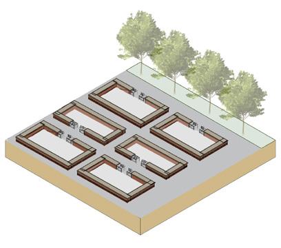
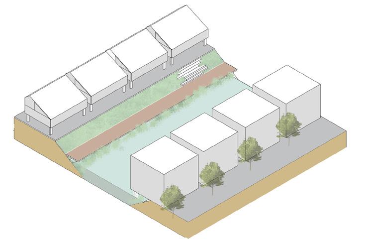
MASTER PLAN SERIAL SECTION Section H-H' Section G-G' Section F-F' Section E-E' Parking lot Section D-D' Section C-C' Section B-B' Section A-A' Section I-I' Plant restoration Original plant New plant Green coverage 52% Circulation Main road Secondary road Tertiary road Zoning Service zone Ecological burial area Public space Tomb-sweeping area Ecological area A B C C' D E F G H D' E' F' G' H' I' A' B' Legend Main road Secondary road Entrance Service centre Tree buried Tree buried Tree buried Industiral Tree buried Tombstone buried Tombstone buried Tomb wall buried Grass buried Lawn Incense tower 1 Legend Entrance 1 Parking Lot 2 Industrial Site 3 Service Area 4 Tree Burial 5 Lawn 6 ndustrial Site 7 Tree-array Seat Space 8 Tomb Wall Burial(slope5°-15°) 9 Grass Burial 10 Tombstone Buried(slope15°-30°) 11 Tombstone Buried(slope30°-45°) 12 Tree-array Seat Space 13 Incense Tower 14 Skywalk 12 2 3 5 4 4 6 7 8 9 10 11 14 13 0 20 80 40 160M N Topography DESIGN OF CEMETERY
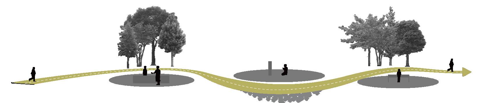
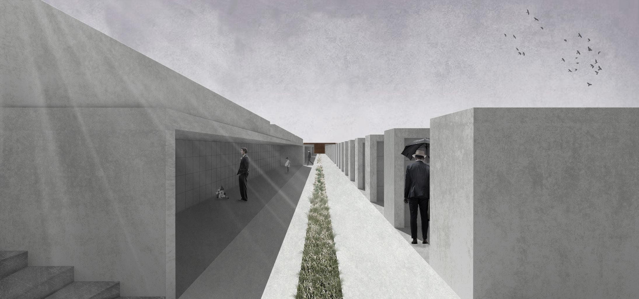
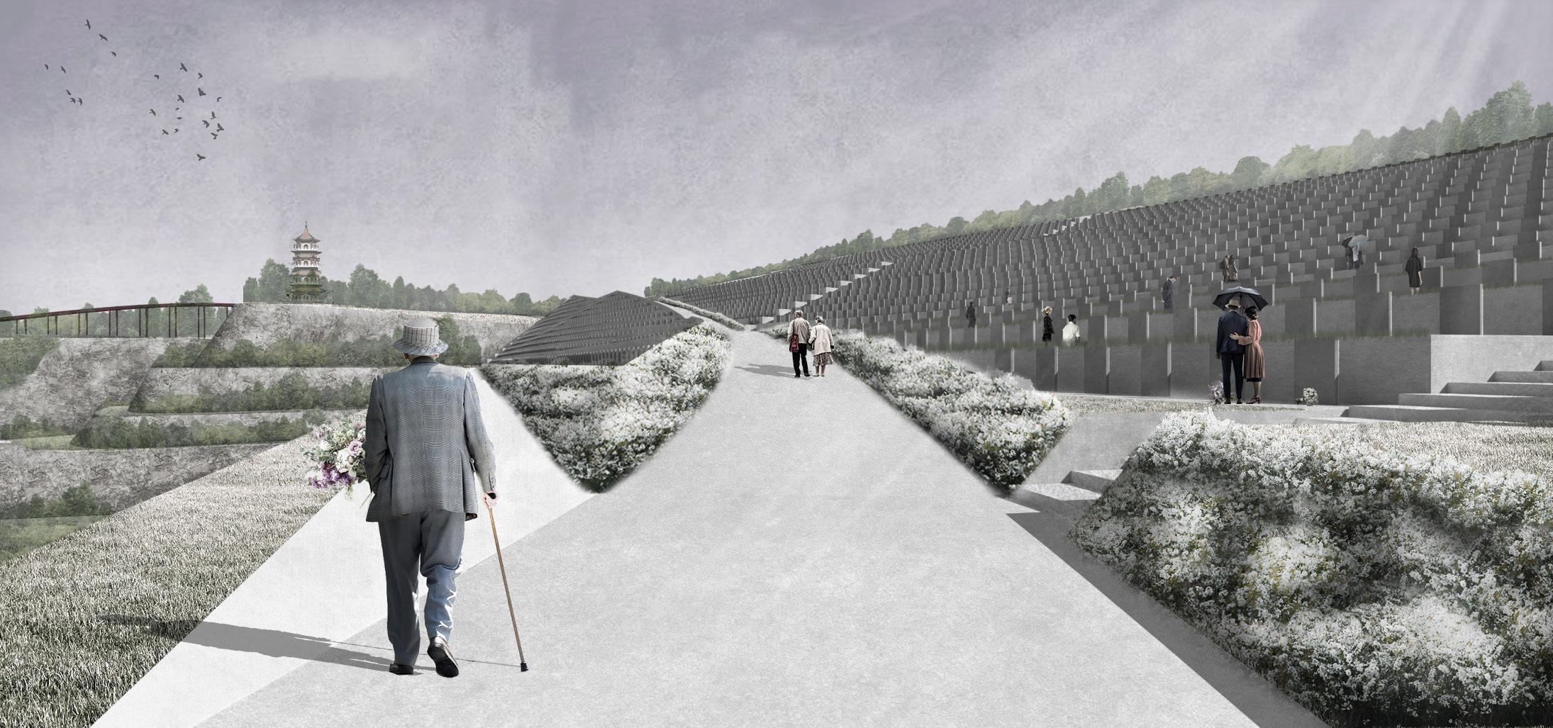
FUNERAL ROUTE
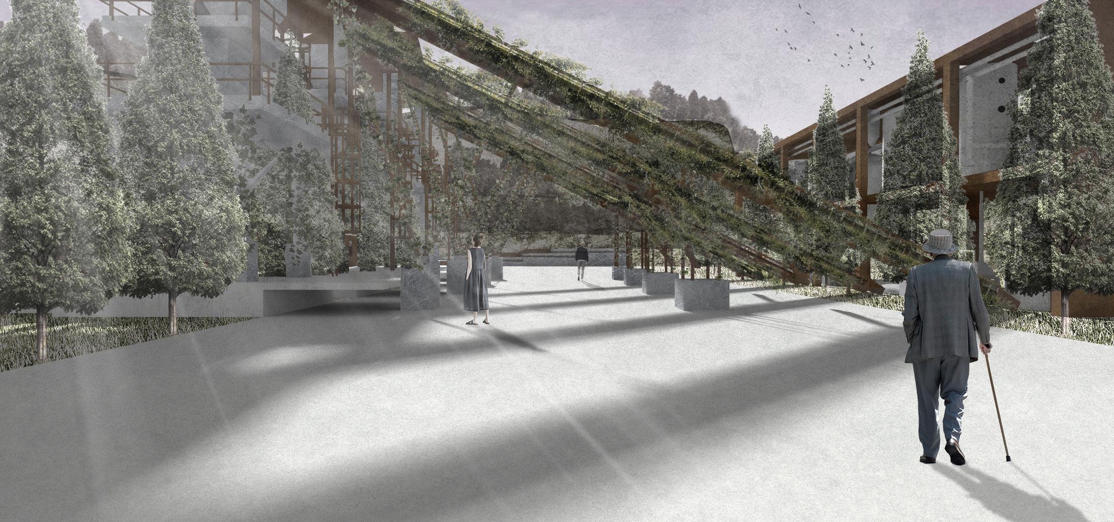
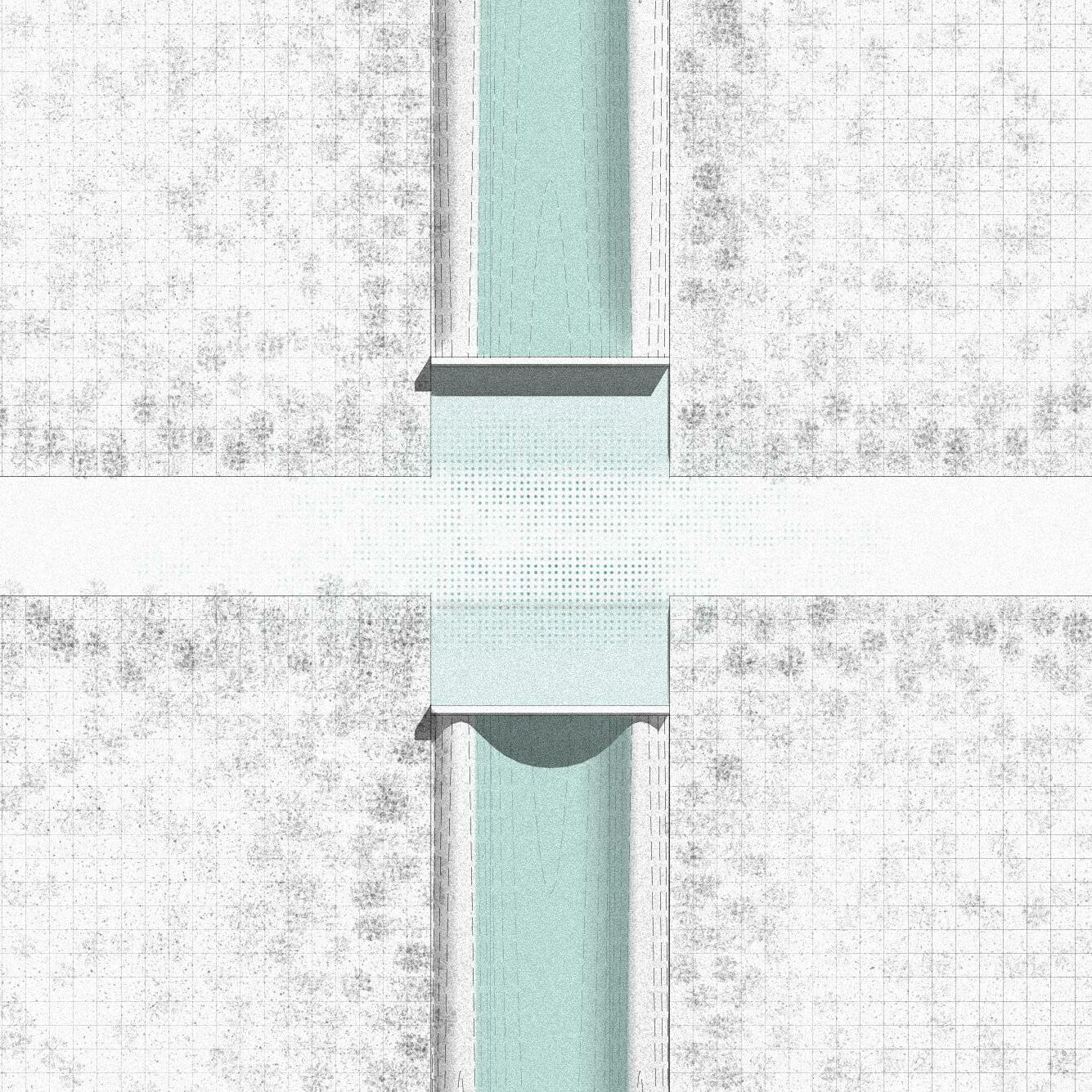
Create a funeral route through different spatial sequences, combine the old industrial atmosphere and the enclosure of different vegetation spaces to enrich the sacrificial process, and use the original spatial atmosphere of the quarry to set off the memorial cemetery landscape.
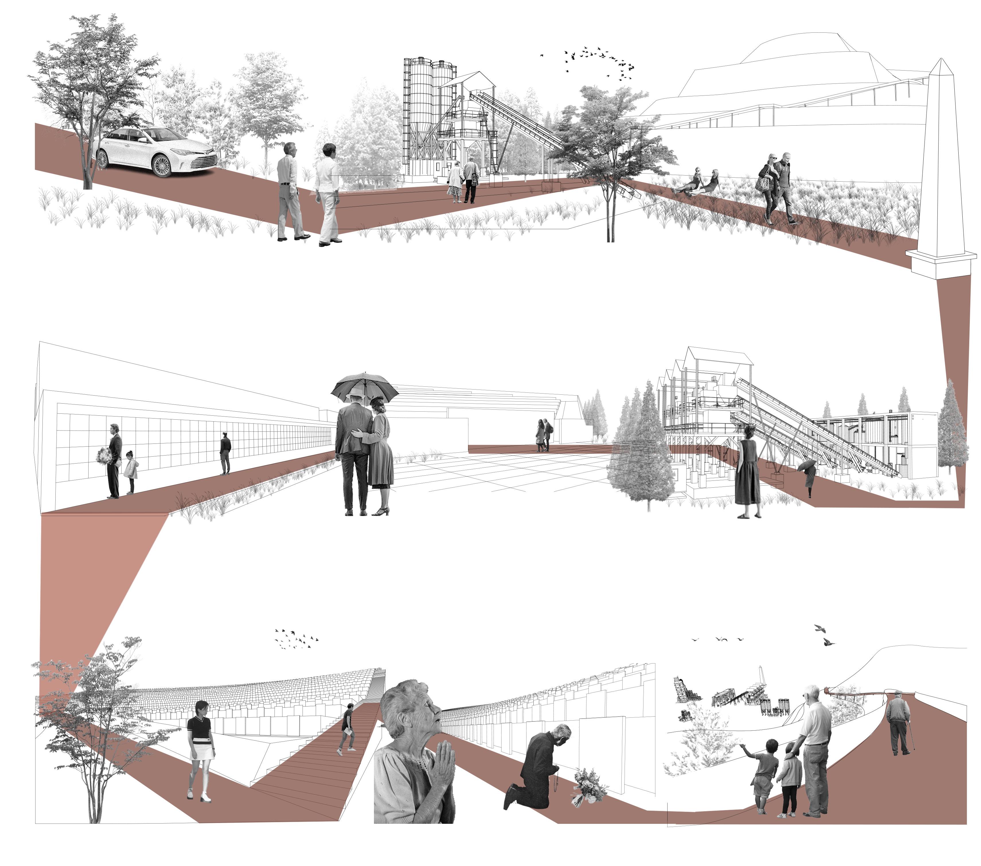
Wow!Good industrial style entrance,It must have been industrial land.
Rest in peace my friend, I will take good care of your daughter.
Honey, How can live without you!
What a wide open lawn Many people are gathering here. I should go in this direction.
PERSPECTIVE OF FUNERAL PROCESSION
D.Industrial Site
Retain the original industrial facilities of the framework, and planting cypresses and vines combined into a transitional space, a unique site memory.
Good place with industrial atmosphere,we can have a rest here.
What a spectacular view! We should get out of here.
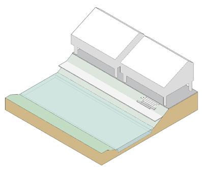
F.Tomb Wall Buried
Each deceased person has his own position. The ashes of the deceased are embedded in the stone wall, and their loved ones can come to mourn every year.
G.Tombstone Buried
Using the complex slopes of the quarry to create a terraced tombstone, people can pick flowers on both sides of the road and dedicate them to their deceased loved ones. Each deceased person has his own unique gravestone.
Entering
B.
) C.
D. Industrial
E. Entrance of
wall buried
wall
I.
A.
the cemetery
Enchance(Narrow space
Lawn(Open space)
site(Transition space)
tomb
F. Tomb
buried G. Tombstone Buried H. Tombstone burial and sacrifice
Skywalk (End)
D E F G
A B C
H
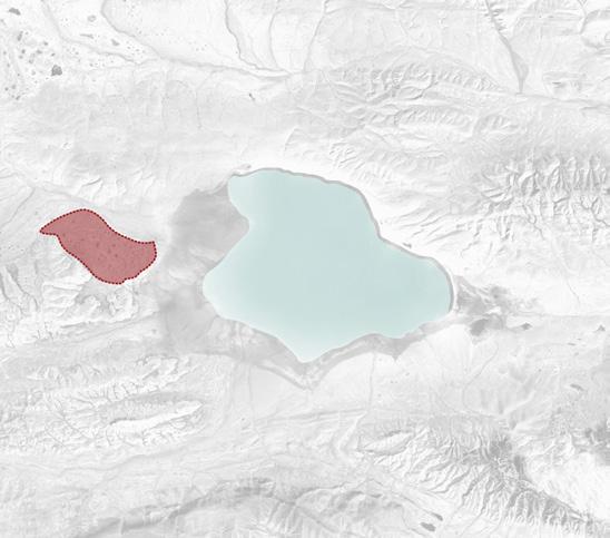
Location: Hob Xil,China
Type: Academic,Team Work
Instructor: Hao Hu
Team members: Jiayuan Li,Yishen Song
Time: 01/2022
Scale: XXL

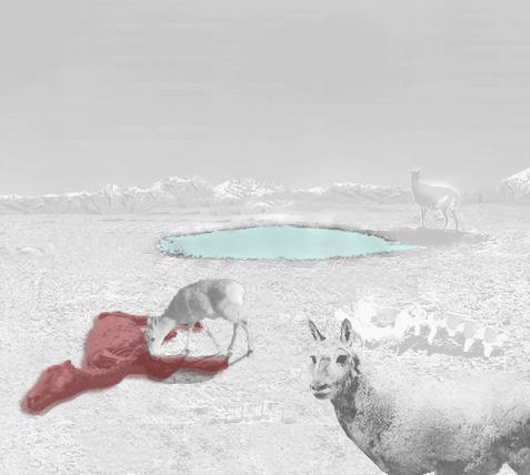
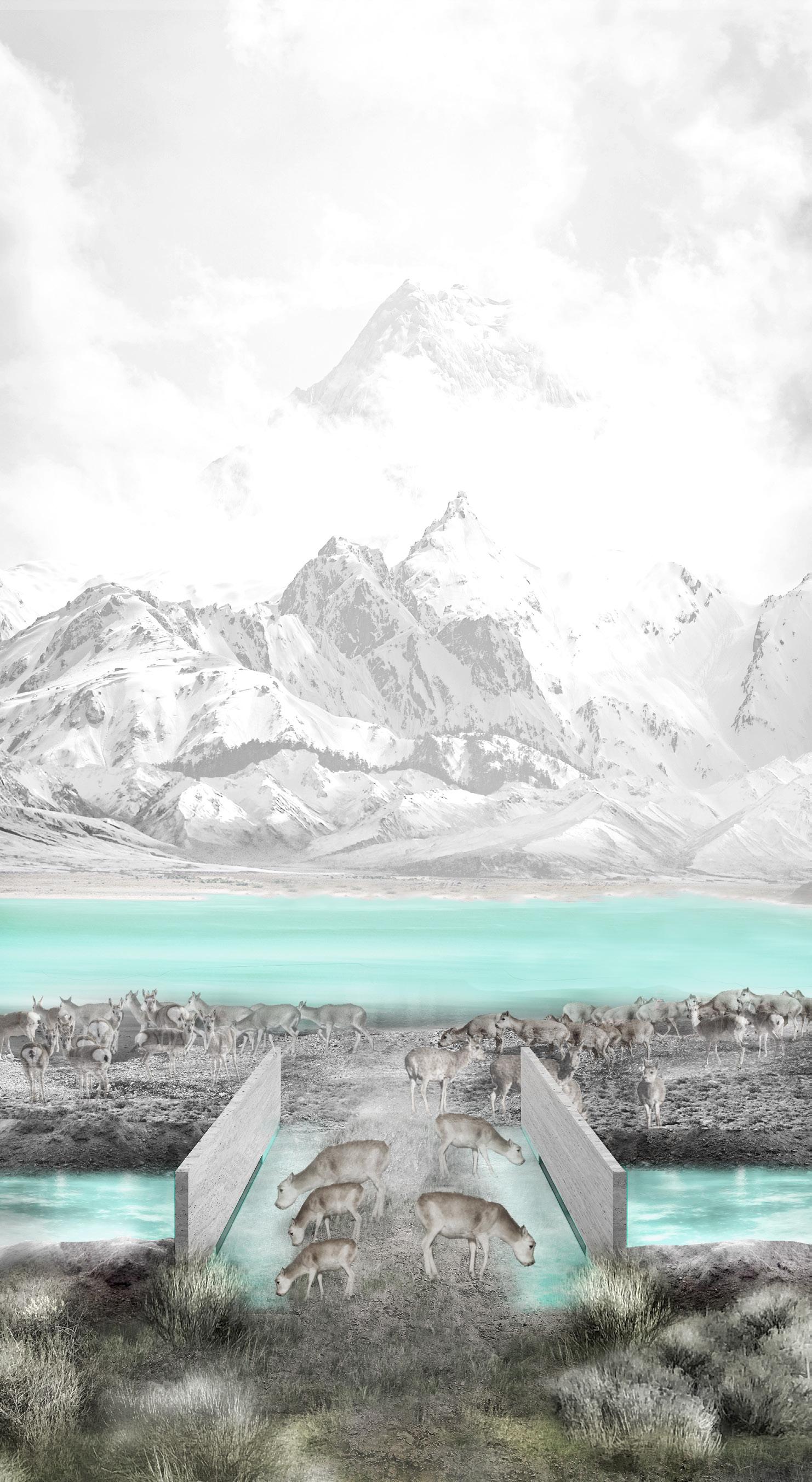
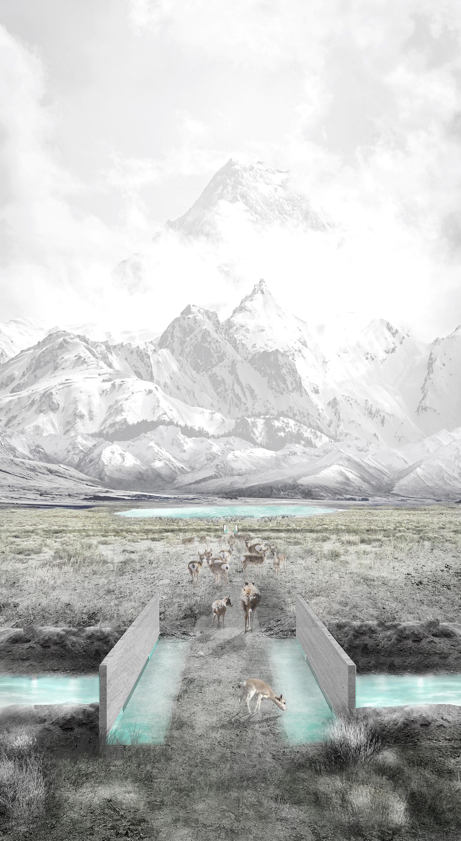
Description: Global warming triggered the irreversibly process of ecological degradation of Zhuonai Lake at an altitude of 4500 metres, which means a key breeding place for Tibetan antelopes is destined to lost .We adopt shortterm ecological compensation tactics to alleviate the dilemma of Tibetan antelopes and delay ecological disaster waiting ahead.

By the end of this tragedy,all ecological tactics would stop working and be left on this ecologically collapsed area as a elegy,it sends a message that not all destruction can be cured and reversed and every human being should be aware of their responsibilities to this planet and take immediate, concerted action, before it is too late.
MIGRATION

OF TIBETAN ANTELOPE
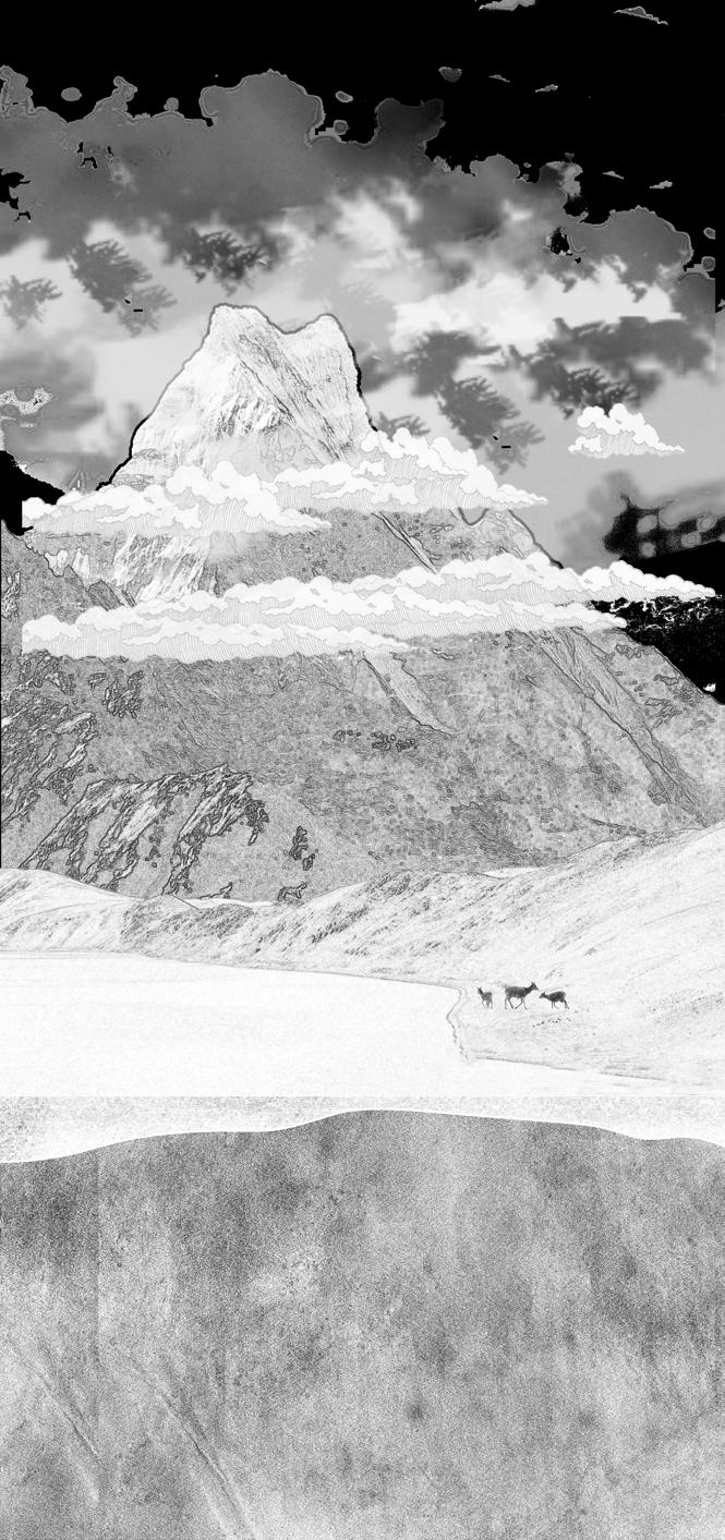
The site is located in the Hoh Xil Nature Reserve at an altitude of 4500M.The Tibetan antelope, a unique species in China, must migrates once a year and travels about 500 km to Zhuona Lake for breeding. However, a series of ecological damage caused by global warming has caused big challenges to the survival of Tibetan antelope.
Breeding place in danger
TIBETAN ANTELOPE IS IN DANGER
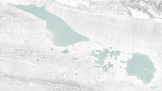
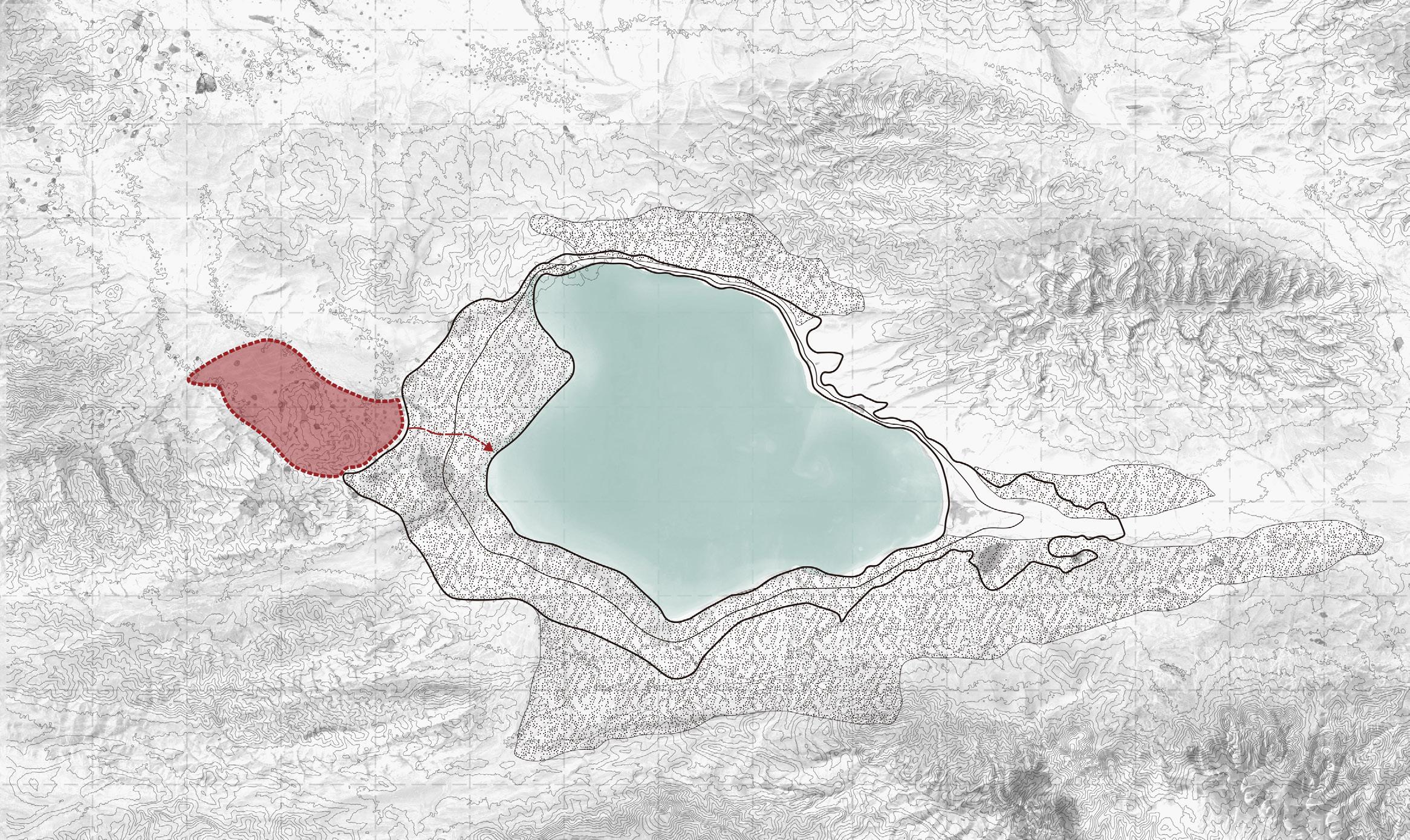
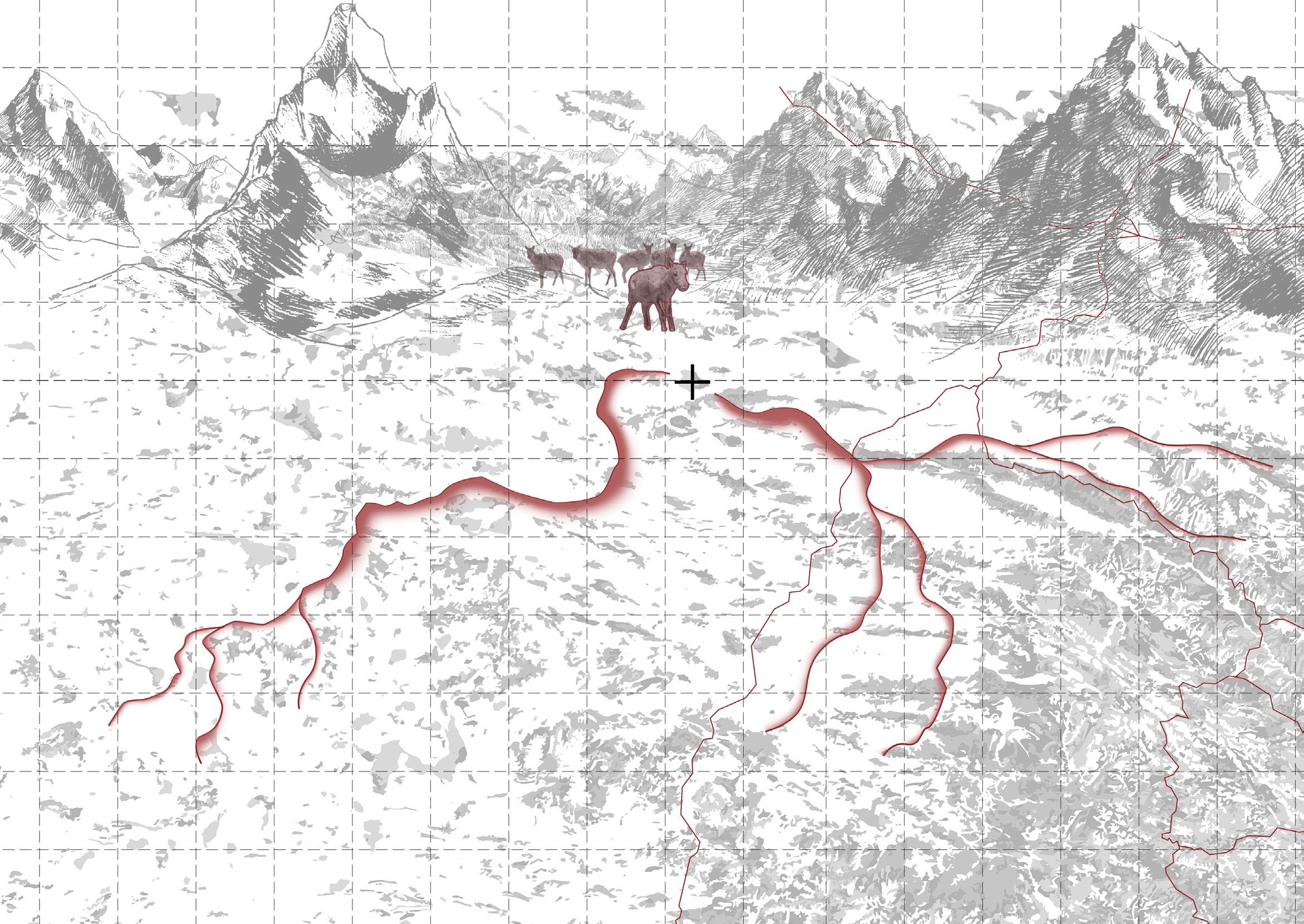
In 2011, a dike burst occurred in the eastern part of Zhuonai Lake, and the water of Zhuonai Lake was constantly losing downward.
BREEDING PLACE UNDER THREATS

2012 2010 2013 2011 2014 2015 2016 2017 2018 2019 2020 2021 2022 2023 2024
G109 500KM 300KM 350KM G215
1470 1460 1450 1440 1430 1420 1410 1400 1390 1380 1370 KM²
Reduction of grassland area SITE BUKATAGE MOUNTAINS
CHINA KEKEXILI N Legend Migration direction National highway
0KM 50KM 100KM 150KM 200KM 250KMv 300KM 350KM 1990s Bloody Shatosh trade The commercial value of the hunter Tibetan antelope to hunt, the number from million in 1950 to less than 100,000 now, the number decreased by 90 % 2000s Hard rescue action China has organized a massive anti-poaching operation and established a nature reserve in the Hoh Xil, where the number of antelope rebounded to 300,000 Future Environmental degradation Due to the continuous reduction of Zhuonai Lake and the further deterioration of the surrounding environment, what should the Tibetan antelope do? Global warming has caused dike burst of Zhuonai Lake, releasing water and threatening the breeding grounds of Tibetan antelopes. 2011 Dike burst of Zhuonai Lake Population 1,200,000 50,000 300,000 10,000 ?
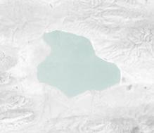
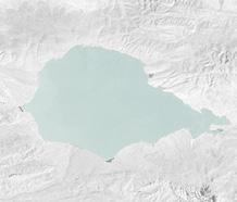
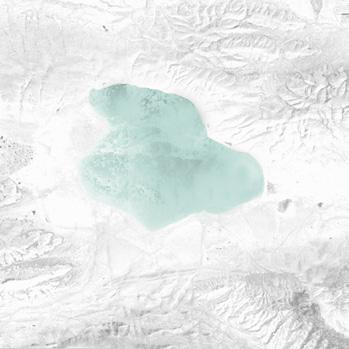
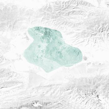
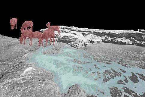
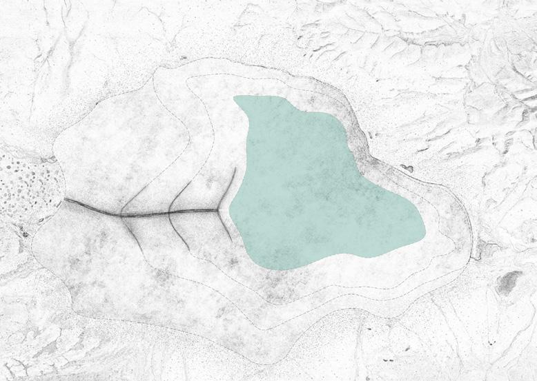
ZhuoNai Lake
02 SCARS
LAKE
THE
OF
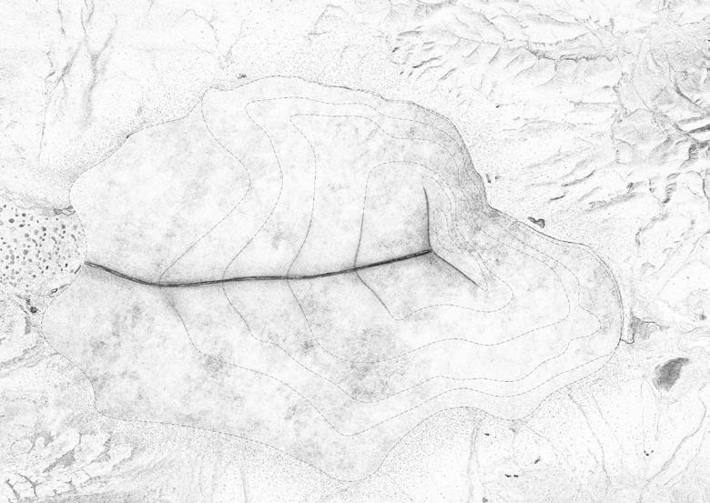
2010 2011 2022 2 3 1 Slope Analysis Hydrology Analysis Landcover Analysis slope>20° water slope<5° bare land 5°<slope<20° ranch Streams down-cutting Global warming turns permafrost into seasonal permafrost, which is extremely unstable to hold any construction to stop the leaking from Zhuonai Lake. 0.98℃ annual mean TEMP in 2020 -0.75℃ annual mean TEMP in 1980 MELTING FROZEN SOIL evaperation increases 2.5~7.5m annually RAISED BANK COLLAPSED unable to restore the lake outlet VANISHING GLACIERS already lost 15% MORE CONCENTRATED RAINFALL increases 7.99mm every decade Global warming fundamentaly and permenantly damaged the fragile balance of water circulation in Zhuonai Lake area. With the collapse of the raised bank, the lake is leaking to gone CHAIN REACTION TO DISASTER 2010 2020 2018 2016 2014 2012 3KM 6KM 9KM 12KM 15KM 18KM A HABITAT DESTINED TO LOST --------------------- AN INEVITABLE DISASTER The fragile butextreme environment here has irreversably damaged. With no way that could restore the habitat. The lake turns into desert is just a matter of time HARSHER PLACE TO BREED ----------------- CONTINUOUS DESERTIFICATION More lake bed left exposed since water withdrawled. These soil would developed into sand within five years and cause sandstorm that severely threaten antelopes. SHRINKING WATERHEAD --------------------- DEVELOPING NEW WATERCOURSE Zhuonai Lake 2000 Zhuonai Lake 2020 Lakes at lower course 2022 Lakes at lower course 2022 leaking The collapse raised bank developed a watercourse to down-stream lakes. Losing billions cubic meters of water, tibet antelopes now have less water to drink. 1. 3. 2. LONGER WAY TO DRINK --------------------- WITHDRAWLING SHORELINE The lake strandline kept withdrawling as water gone. Antelopes have to travel a far longer distance to the lake consumes far more energy and causes more risk. 3.6KM N Legend Desertification zone Lake strandline Breeding area Route to Zhuonai Lake 300 KM² 250 200 150 100 50 0 2012 2010 2013 2011 2014 2015 2016 2017 2018 2019 2020 2021 2022 2023 2024 Reduction of lake area
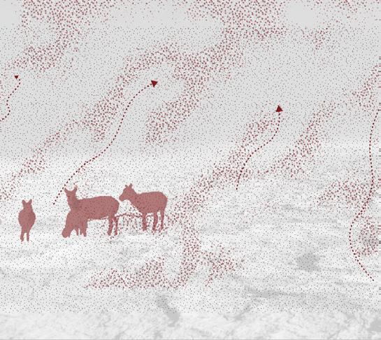
Zhuonai Lake is called the maternity room of Tibet Antelopes. Due to multiple ecological crises however, the reproduction of the Tibet antelopes groups is getting more and more difficult ENVIRONMENTAL DEGRADATION 2012 2013 2014 2015 2016 2017 2018 2019 2020 2021 2022 2023 2024 2025 2026 80 70 60 50 40 30 20 10 0 Day Increased number of dust storms
Habitat environment Fixed breeding place

The breeding site of the Tibetan antelope near Zhuonai Lake will not change, even if the surrounding environment changes.
ECOLOGICAL COMPENSATION TACTICSS


4K~5K Altitudes
Plateau Meadow
The demands of the tibetan antelope

Female Tibetan antelope after breeding and baby Tibetan antelope after birth must be supplemented with some microelement and proteins, and these are in Zhuona Lake.
Behavioral habits
B Li Sr Sn
Zhuonai Lake
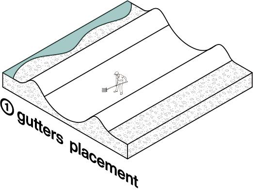
RESTORE WATER
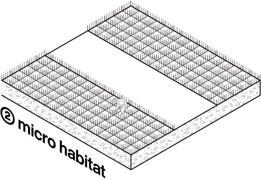
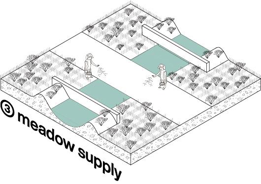
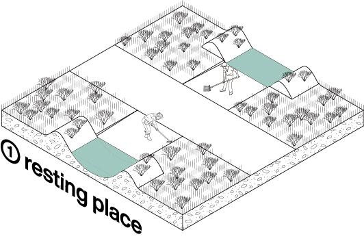
By digging gutters around the lake strandline between the dry and wet season, an artificial lake strandline that could last for 10 years would shorten the distance that antelopes travel to attain water.
CREATE SHELTERBELT REST STOP
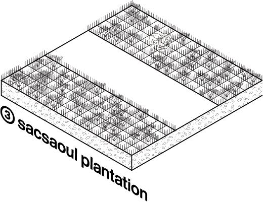
By introducing sacsaouls along side the path leads to the shrinking Zhuonai Lake, the sand storm could be a major threat to antelopes. The shelterbelt could band could stop the exposed lake bed from desertification and band the sandstorm.
The way chasing the shrinking Zhuonai Lake could be too challenging for both baby antelopes and mother antelopes who just got through the delivery. Creating rest stops providing water and meadow could lower their death rates.
Broad Vision Tibetan antelope needs a wide view to perceive nearby security. Tibetan antelope loves lowclosure environments to prevent predators from sudden hunting.
Doesn't like high canopy density

75cm Size 40cm Size
sun
45—60kg Female 5kg Baby Poaceae 60.5% 18.1% 9.2% 6.4% 4.9% 0.9% Fabaceae Asteraceae Tamaricaceae Scrophulariaceae Cyperaceae
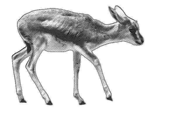
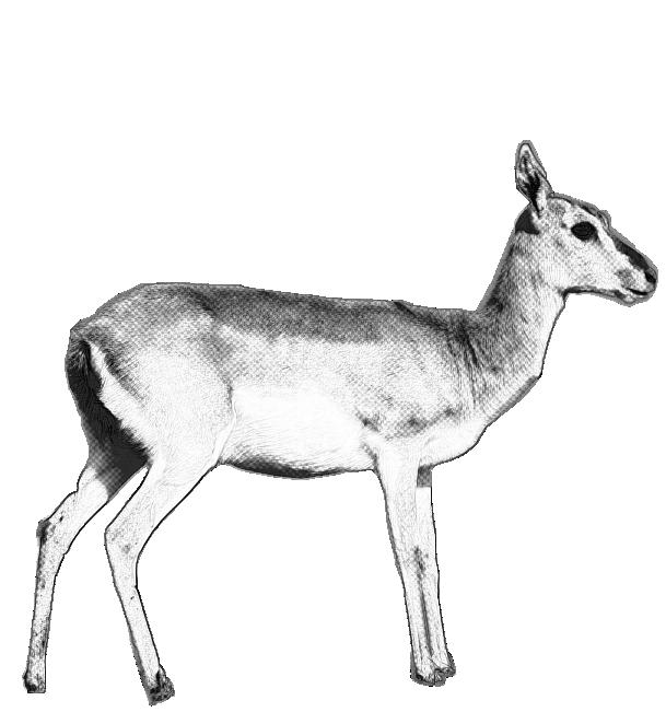
Tibetan antelope (Pantholopshodgsoni) Subcutaneous air bags Make it better at running,the fastest speed can reach 80km/h. Nostril sacculus Help breathe on an air-thin plateau for fast running Cashmere Insulation in the
and protection from wind and cold in the snowstorm.
Feeding habits
Breeding Place Foraging Parturition Going to Zhuonai Lake Drinking water Supplement microelement Leave Zhuonai
Foraging Transition Area Zhuonai Lake The behavior of Tibetan antelope
DESCRIPTION OF TIBETAN ANTELOPE
Lake
Travel water consumption water content 100% 80% 50% 20% 2.5KM 5KM 7.5KM 10KM TRYING TO SAVE TIBETAN ANTELOPE
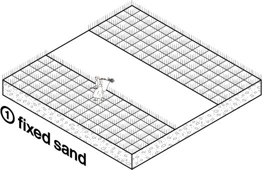
Roots solidify soil Planting sacsaouls Planting sacsaouls Water flow over the gap Wet season lake strandline
Creating pits Stablize temperature
Stress resistance Strong roots
5M 1M Dry
Ridge
Restore rainwater
>
Placing grass squares Shoveling ramps Placing waterpumping walls
sand-proof
2.5m 2.5m 5m Poa annua L. Stipa purpurea Griseb. Littledalea racemosa. shoal road shoal
season lake strandline
Digging gutter Oct. - Apr. )
atmospheric pressure
atmospheric pressure = water keeps flowing in grasses grow out Sprinking grass seeds

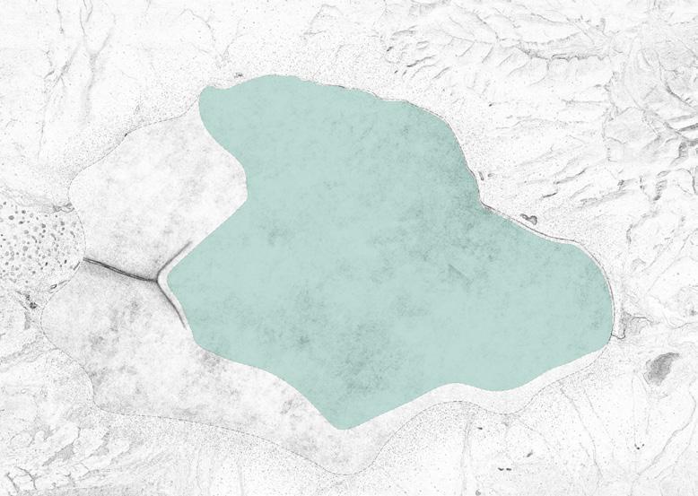
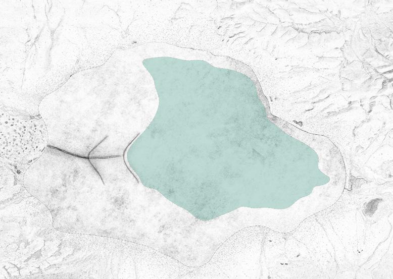
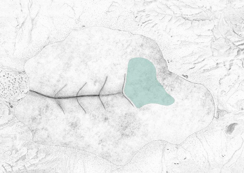
N 0 1 3KM 0.5 2 N 0 4 8M 2 Google Earth Image © 2065 CNES/Airbus Image Landsat/Copernicus Image © 2065 Maxar Technologies 2023 2023 2040 2040 2030 2030 2060 2060 2050 2050 As the shoreline of Zhuona Lake retreats, we will excavate a ditch every ten years to retain the shoreline of Zhuona Lake until it disappears. Zhuonai Lake will dry up in 50 years, which means that the Tibetan antelope will eventually disappear. In the future, the site that people see in google earth will leave only the traces of people to save the Tibetan antelope. Google Earth Google 100% CNES/Airbus Landsat / Copernicus Maxar Technologies Camera: 26 KM. 35°33'19'N 91°50'34''E 4,755M earth.google.com/web/@35.56071155,91.90379361,4760.06772221a,21146.73137783d,35y,-0h,0t,0r WITNESS OF THE VANISHING ZHUONA LAKE The drying process of Zhuonai Lake
Ecological plan (45×45M)
30 YEARS LATER 40 YEARS LATER 50 YEARS LATER
At the early stage of ecological degradation, Zhuonai Lake still contains massive amount of water to hold its area. With ecological interventon of restoring water, creating shelter belt and rest stops, it is not too hard for Tibet Antelopes to get to the lake.
At the medium stage of ecological degradation, ecological tactics formerly implanted to the area still works but less efficient. Zhuonai Lake is severely shrinked and withdrawled far away from the breeding place of Tibet antelopes. The environment here is more cruel to these creatures.
At the late stage of ecological degradation , Zhuonai Lake is ecologically collapse and completely desertification and all ecological interventons are disabled, which means Tibet antelopes who migrate here to breed have nothing but disaster wating here for them.

THE VANISHING ZHUONAI LAKE
SCARS OF ZHUONAI LAKE
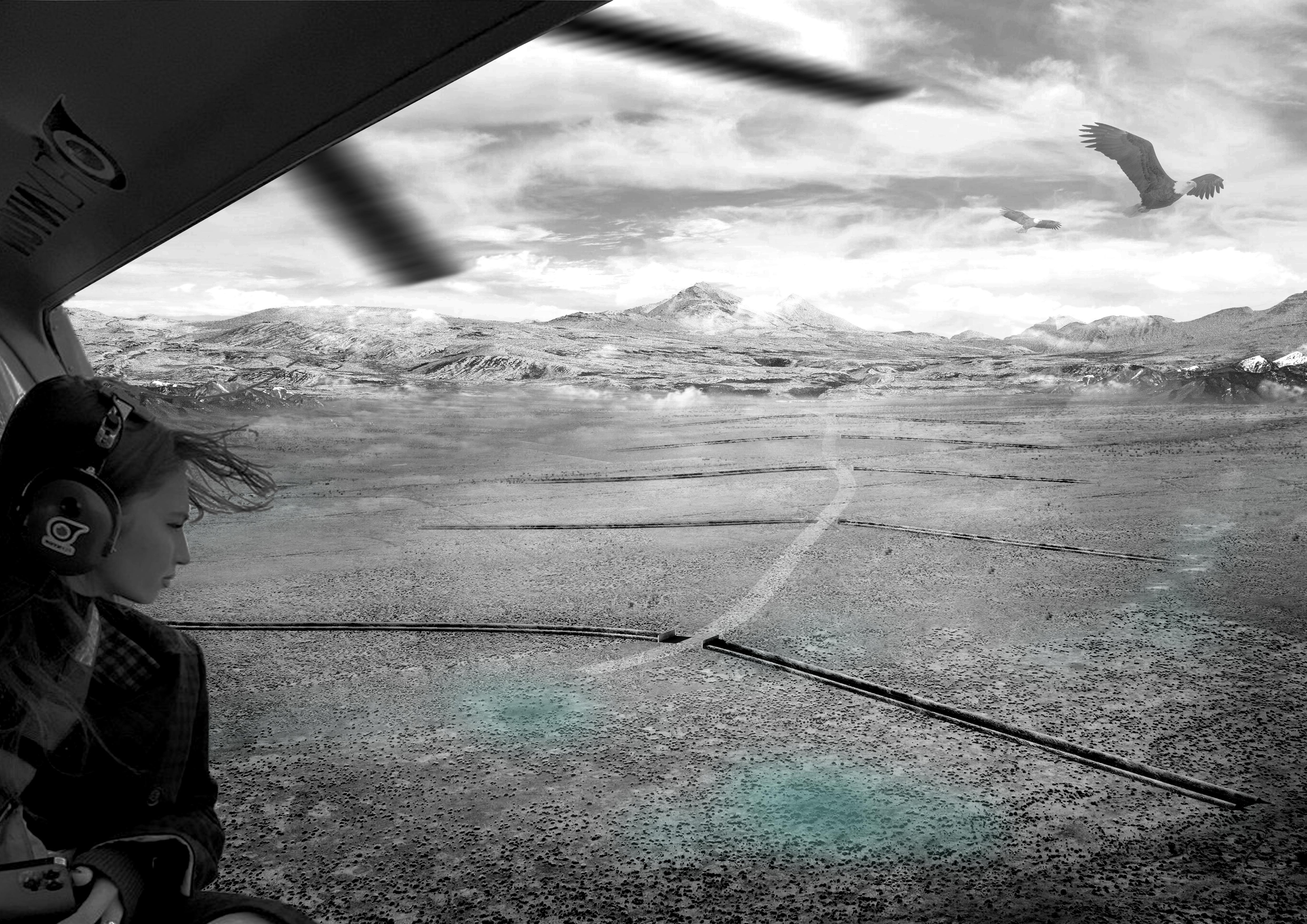
Decades later, when people look at Zhuonai Lake from a helicopter, they will only see a series of gullies across the earth, just like a series of huge scars.They imply the failure of ecological conservation and the extinction of the Tibetan antelope population in Hoh Xil. They also testify to the irreversible damage that global warming and irresponsible lifestyles of humans have brought to this land.
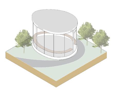
Location: Hongkou,Shanghai
Type: Academic,Individual Work

Instructor: Manbo Ye,Hao Hu
Time: 07/2021

Scale: M


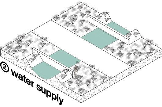
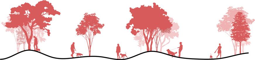
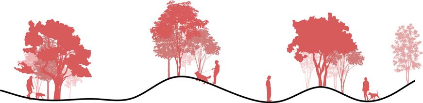
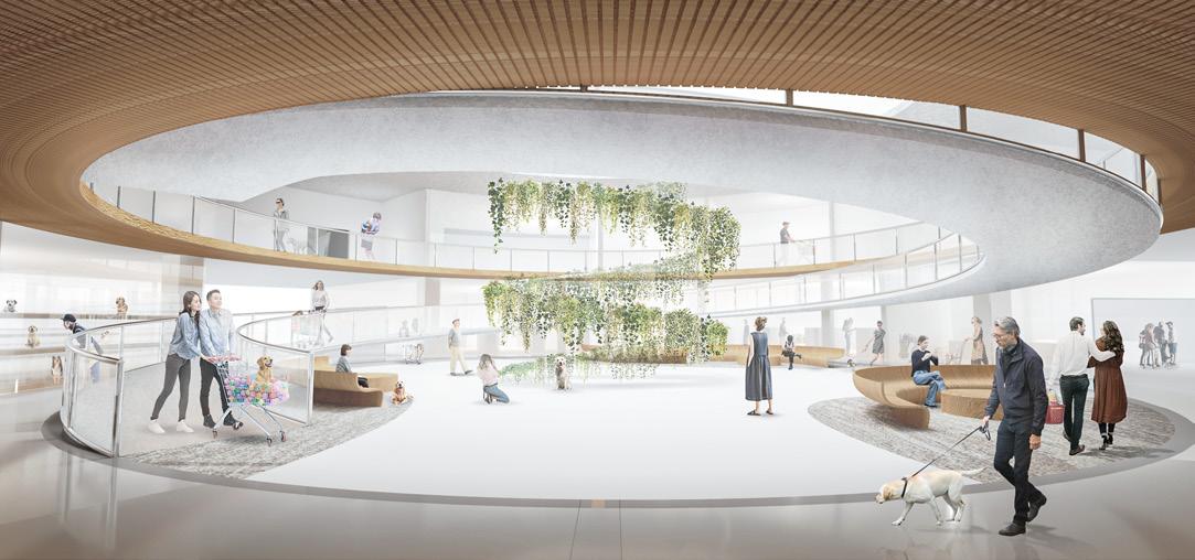
Description: The gashouse was once a symbol of the Shanghai gas era, and it has declined and been abandoned in the development of the times, but it still has the value of historical witness However, in Shanghai, where available land is scarce, the gashouse will be given a new mission to reintegrate into urban space. Based on this social topic, the purpose of this project is to transform the gashouse into an open and interesting dog public park to meet the basic needs of pet dogs of nearby residents. The core of the design is to analyze the most primitive biological habits of the popular dog breeds in Shanghai, solve the soil pollution of the site by ecological means, create diversified activity space for dogs, and retain the abandoned and valuable gas storage tank, and give them new functions.

The site is located in Hongkou District of Shanghai, China. Due to the increase of China 's only children families, Dink families and the aging population, more and more urban residents begin to raise pet dogs as a way to reduce loneliness, make up for mental emptiness and relieve life pressure. Facing the increasing number of pet dogs, Shanghai Hongkou does not have an exclusive activity park for pet dogs. However, land resources are very precious in Shanghai, how to effectively use urban public green space and provide a safe activity green space for people and dogs is an urgent problem to be solved.
1.Industrial Legacy


3.Boundary Disorder


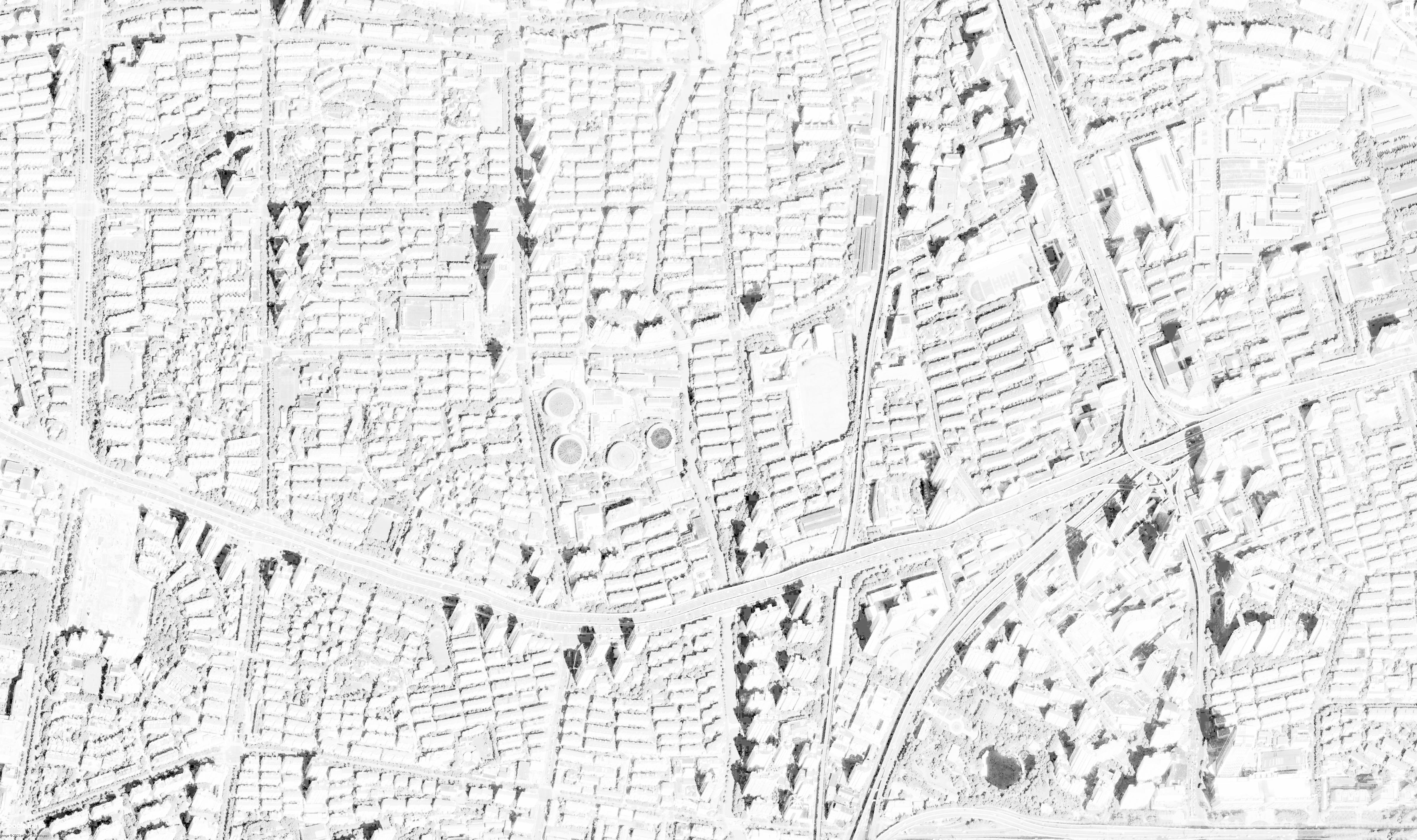
SITE 1KM 2KM 3KM 4KM 5KM 6KM 1KM 2KM 3KM 4KM 5KM 6KM 7KM 8KM Commercial Shopping 150~200 150~200 100~150 100~150 100~150 100~150 100~150 50~100 50~100 50~100 20~50 20~50 School Office Building School School SITE 250M 500M N 25 0 50 100 200M Don't allow dogs to enter Allow dogs to enter Legend N SITE INTERNAL INFORMATION GARAGE Abandoned Building Abandoned Building Abandoned Building River COAL GAS STORAGE TANKS SouthBusStationRoad ShuidianRoad Shajing River Legend Municipal Road Internal Road Green Land Rigid Pavement Site Gcope 2.Pollution A mixture of coal tar left over by the gas industry is distributed inside the site, a viscous black petroleum compound that is extremely difficult to degrade.
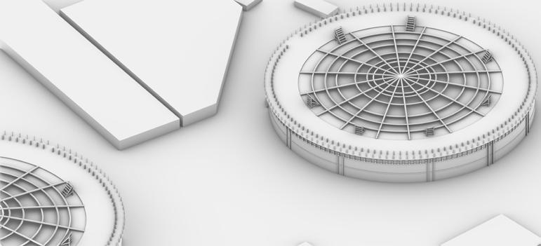
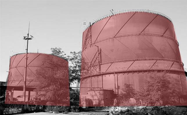
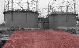
There are four abandoned coal gas storage tanks inside the site, which have extremely important historical value.
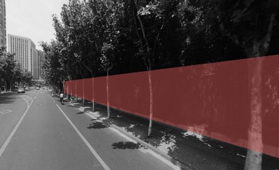
The boundary of the site is mostly separated by the retaining wall, and the connectivity with the surrounding area is poor.
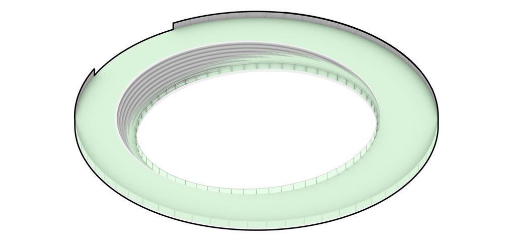
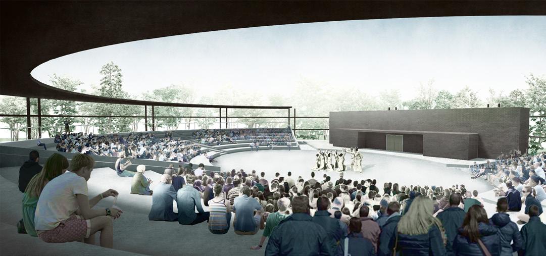
03 DOG PARADISE
SITE
The number of pet dogs is increasing in Shanghai Location China Shanghai The number of pet dogs in Shanghai is growing at about 8 percent a year 300K 2015 2016 2017 2018 2019 2020 2021 400K 500K 600K 700K 800K
THE CONFLICT BETWEEN THE INCREASING NUMBER OF DOGS AND DOG PARKS

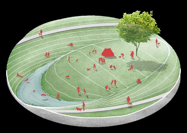
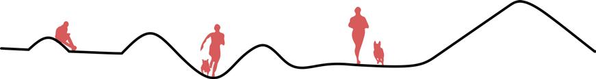


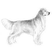
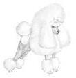
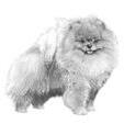
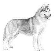

Labrador Retriever 15% Multifunctional Activities
pull sleds
partner,
r
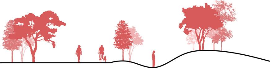
Grass skating Gathering(Swimming) Tracking Barrier-free running Obstacle running
PROCESS OF SPATIAL DERIVATION Often used to assist in hunting, patrol prey on land and water Have a strong body, often used to
and other work Often used for grazing, constant running drives animals out of groups back to groups The role of a pet
small and close to the owne
Bicycling
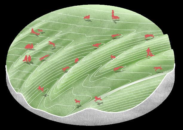
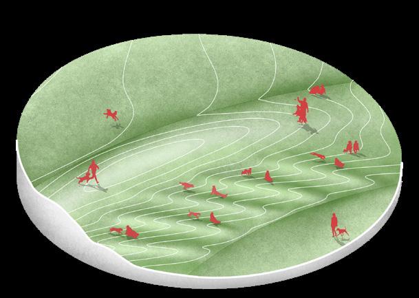
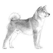
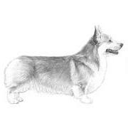
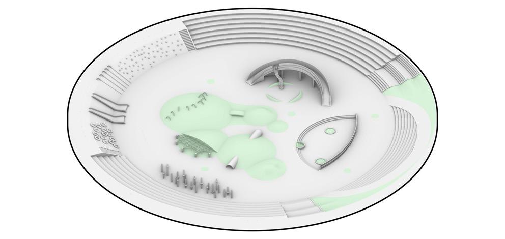
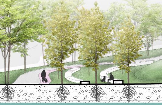
POPULAR DOG Circinate Bicycle Lane Rich Play Experience Tree density and terrain create different feelings Sinking terrain creates enclosed distribution space Terrain changes create downhill runways Different heights and slopes create different experiences Rich trees and terrain create natural conditions Terrain and tree creation barriers Working Group Herding Group Hound Group Toy Group Shiba Lnu 7% Welsh Corg 6% Golden Retriever 13% Miniature Poodle 18% Pomeranian 5% Siberian Husky 17% Alaskan Malamute 2% Border Collie 10% a b c d e f f e d c b a A B C D E F F E D C B A a’ b’ c’ d’ e’ f’ f’ e’ d’ c’ b’ a’ A’ B’ C’ D’ E’ F’ F’ E’ D’ C’ B’ A’ 8% Samoyed Central Lawn
CONCEPT TYPOLOGY SORT OF
01.Demolition & Preservation
Demolition
02.Function & Connection
03.Topographically rich spatial structure

04.Enclose space
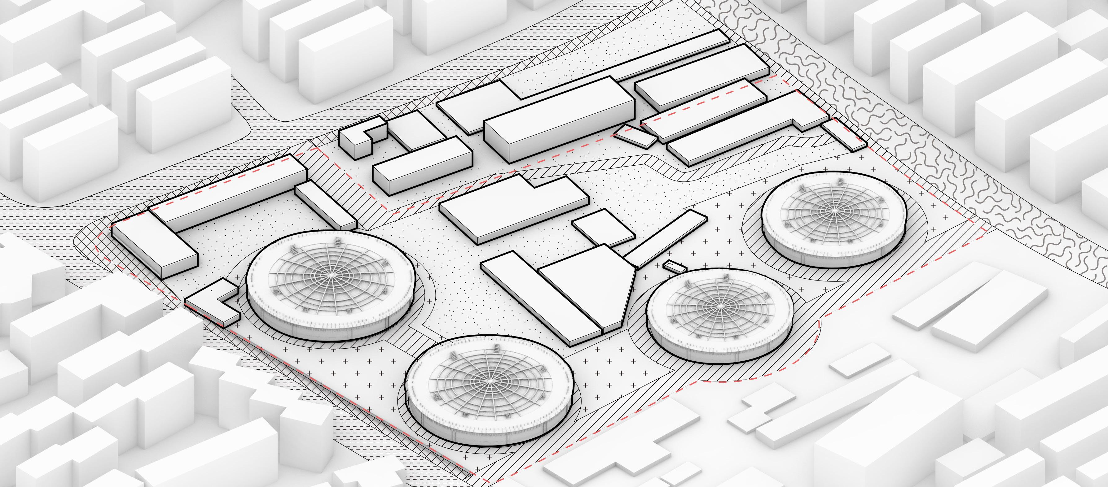
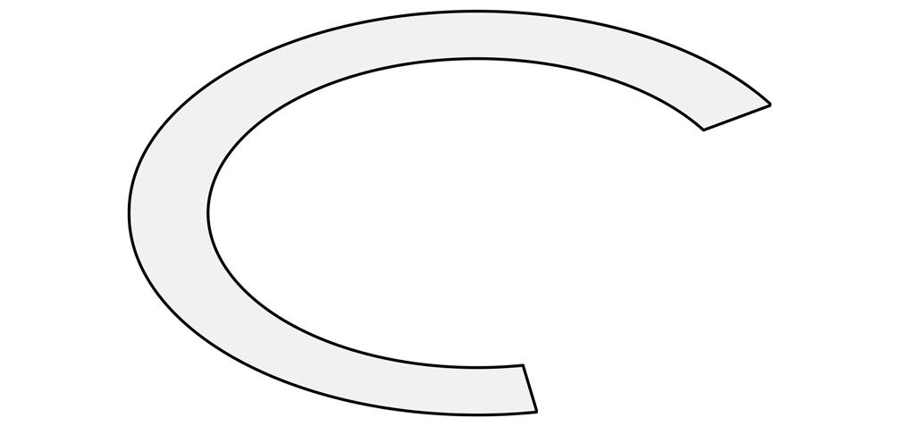
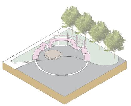
PLAN PLAN
DESIGN ANALYSIS
MASTER
MORPHOLOGICAL
out infrastructure and plant trees to surround different spaces.
Lay
of boundary walls and valueless buildings to open the site interface and accommodate more activity space, and preservation of historically valuable gas storage cabinets. Demolished Preserved
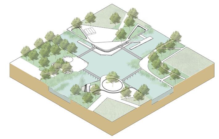
the mixing space which for dogs and humans by lifting and sinking terrain and suture the relationship between gas storage tank and lawn center. Up Up Up Connect Down Entrance
Enrich
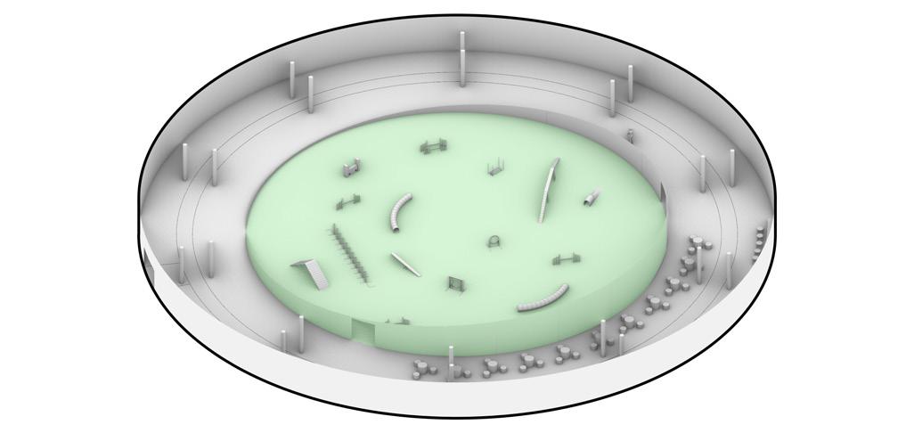
Give four gas storage tanks different functions and place the activity space required by dogs and humans in the site and organize and connect them with tour lines .( appropriate filling and digging of soil and covering a clean layer of soil on the surface to deal with the original soil pollution ) Main road Plaza Entrance Obstacle running Side road Tracking Gathering (Swimming) Bicycling Grass skating Dog commercial building Kids corner Dog training ground Outdoor theatre Barrier-free running N Legend 4 3 6 7 8 9 2 5 1 A B C D Entrance Building Entrance A Dog Commercial Building B Kids Corner C Dog Training Ground D Outdoor Theatre 1 Entrance Plaza 2 Tree-array Seat Space 3 Grass Skating 4 Central Lawn 5 Swimming Area 6 Barrier-free Running 7 Obstacle Running 8 Tracking Area 9 Bikeway ±0m ±0m ±0m +4.5m +4.5m +1.5m -2.5m +3.5m +2m +1m ±0m ±0m 0 5 20 10 40M PLANE GENERATION AND RESULTS
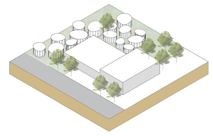
RECONSTRUCTION OF GAS STORAGE CABINET
A. Dog Commercial Building
Area: 3630m²
Description of design:
Retaining the original facade structure of gas storage cabinet, transforming into a modern pet shopping center integrating leisure, entertainment, commerce and catering.
B. Kids Corner
Area:2925m²
Description of design:
Keep the original framework of the gas storage tank, sink enclosure design, strengthen the boundaries of children ' s activities to prevent them from running out of unattended.
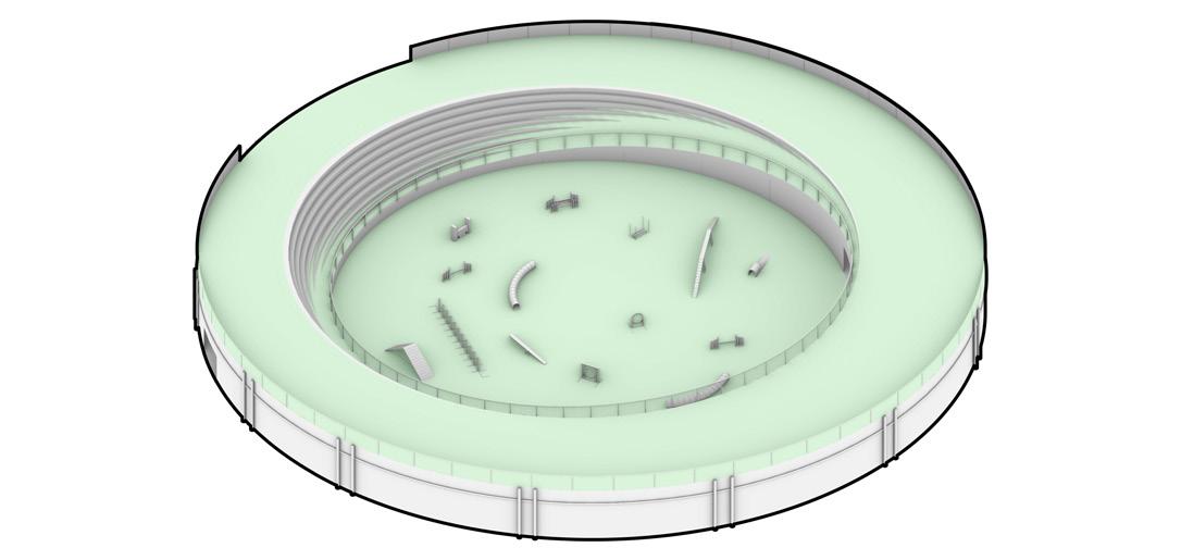
C. Dog Training Ground
Area:3000m²
Description of design:
Retaining the original facade structure of gas storage cabinets, building top floors with lawns to stitch concerns with the site center and connecting a layer of training ground with
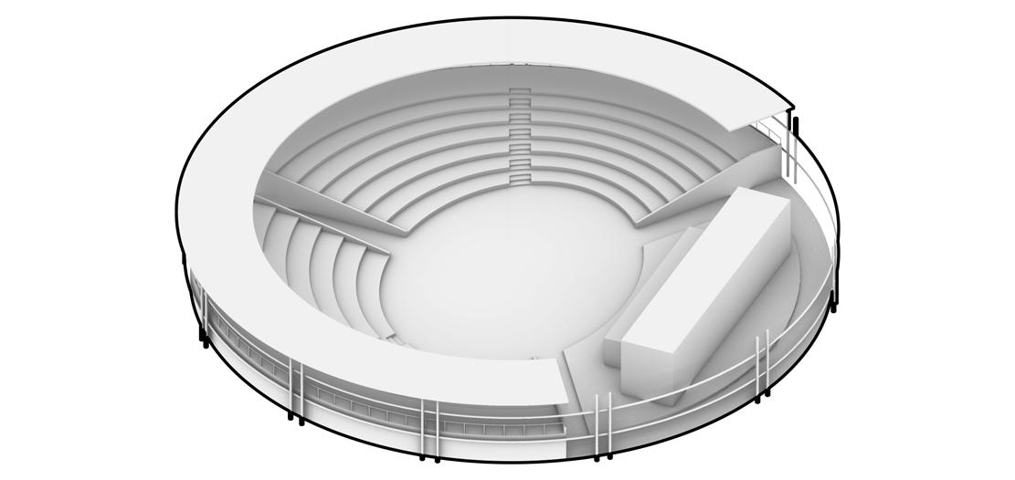
D. Outdoor Theatre
Area:3700m²
Description of design:
Retain a portion of the cover structure and pillars, surround the central stage with steps in a semi-enclosed form.
COVER STRUCTURE COVER STRUCTURE COVER STRUCTURE
SINKING SPACE PILLARS PILLARS PILLARS SYNTHESIS SYNTHESIS SYNTHESIS SYNTHESIS 2nd FLOOR 2nd FLOOR 1st FLOOR 1st FLOOR STEP

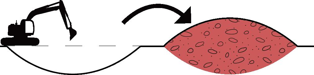


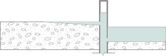
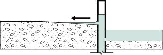
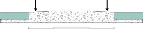
Phytovolatilization Phytodegradation Rhizosphere Degradation Plant Metabolism Phytosatabilization Plant Hydraulics Phytoextraction Section 1-1' Road Road Tree-array Seat Space Gathering Space Barrier-free Running Space Dog Training Ground TREATMENT OF CONTAMINATED SOIL Step 1 Step 2 Step 3 Coal tar mixture remaining from industry exists in soil,soil treatment methods mainly include plant ecological restoration technology and soil excavation.
ECOLOGICAL RESTORATION TECHNOLOGY
Clean Soil Severe Pollution Protect Layer Mild Pollution Severe Pollution Mild Pollution Deep-rooted
In order to control costs and create interesting terrain, reasonably dig heavily contaminated soil into lightly contaminated soil layers and cover clean soil on contaminated soil to form
clean soil profile PERSPECTIVE OF DOG ACTIVITY SPACE The central lawn distributes different spaces to meet dog needs. Create different obstacle spaces through the ups and downs of terrain and plants in the terrain C. Obstacle Running Enclose the central distribution space by sinking the terrain and adding an annular water system to provide dogs with swimming and drinking water D. Gathering A. Tricking In order to meet the wildness of the hunting dog group, through the terrain and a variety of trees to create a natural space atmosphere Create free running spaces of different widths and lengths through elevation of the terrain and create a sense of excitement of downward subduction B. Barrier-free Running Clean Soi Containminated Soil Protect Layer Groundwater Deep-root plant Arbor Celtis reticulata Cercidium floridum Populusspp. Salixspp. Acernegundo Baccharisglutinosa Baccharis viminea Cornus amomum Shrub Bambuseae Brassicanapus L.glutinosa Linum usitatissimum L. Miscanthus Panicum virgatumL. Herb 1 1' A C B D
PLANT
SOIL EXCAVATION
plants were selected to repair soil, and the plant treatment process involved in the transformation of organic and inorganic pollutants was simplified into seven plant ecological restoration mechanisms
a
Location: Nansha,China
Type: Academic,Team Work


Instructor: Jianqi Li
Team members: Jiayuan Li,Junxian Shen
Time: 05/2022

Scale: XXL


Description: Under the background of rapid urbanization, the farmland in Guangzhou has been eroded in a wide range, but the farmland plays an important role in the city, and Nansha District is the last relatively complete agricultural pure land in Guangzhou. We are looking for the more favorable value of Nansha District in Guangzhou to block the expansion of urbanization.
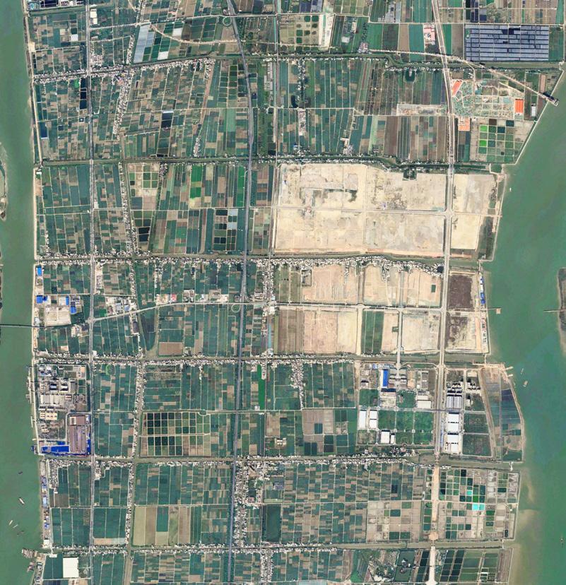

This project attempts to introduce digital nomads who live in cities and only need to work online to integrate into the countryside, so that Nansha District can alleviate the pressure of urban population.
The project analyzes the advantages and disadvantages of farmers and digital nomads, and uses online and offline methods to better integrate farmers and digital nomads.
Legend
Urban built-up area Nansha district High way Legend
04 DIGITAL NOMADS AND FARMER Urban expansion trend Farmland has been heavily occupied Decrease in grain crops and sales Number of digital nomads(million) URBAN EXPANSION LACK OF DIGITAL NOMAD COMMUNITIES IN CHINA The worldwide distribution of digital nomad communities SUITABLE FOR DIGITAL NOMADS IN NANSHA DISTRICT 2010 4618.10km² 2000 1763.89km² 2020 6482.92km² 14000 11000 11500 12000 12500 13000 13500 Grain sales Grain production 2005 2007 2009 2011 2013 2015 2017 2019 2021 N N 317% 159% 23% 19% Decrease proportion of grain crops Increase proportion of urban built-up area Derease proportion of agricultural acreage Decrease proportion of grain sales 12100 12670 7000 (Ha) (kt) 6000 5000 4000 Urban built-up area Agricultural acreage 3000 2000 1000 1996 1998 2000 2002 2004 2006 2008 2010 2012 2014 2016 2018 2020 1580 3272 6482 2878 1220 NanSha District ShenZhen City DongGuan City FoShan City ZhongShan City CHINA SITE North America South America Africa Europe Asia Oceania SITE SITE Guangzhou Center Guangzhou Center 10km 20km 30km 40km 50km 60km 70km 2021 2020 2019 7.3M 10.9M 15.5M City sub-center Urban built-up area Farmland High way An objective assessment of all aspects of Nansha, whether from the traffic or environment and other aspects are very suitable for digital nomads, and the life style of living near the water has its
feelings. We want to go to China to experience local customs, but why there are so few digital nomad communities ? Don t push me I am looking for a place suitable for my living Score Temperature Internet Humidness Social Security Degree Of Education Population Density Internal Traffic Traffic Safety Happiness Work Place Environment Subway Trunk road Water way 4.5/5 4 4 2 2 2 6 116 182 27 112 27 6 5 10 10 32 18 13 16 125 41 6 101 121 62 26℃ 68% 30Mbps Safe Bad Good Good Good Comfy Low 1k ind /km²
humanistic
Legend
FARMERS AND DIGITAL NOMADS ARE MUTUALLY BENEFICIAL
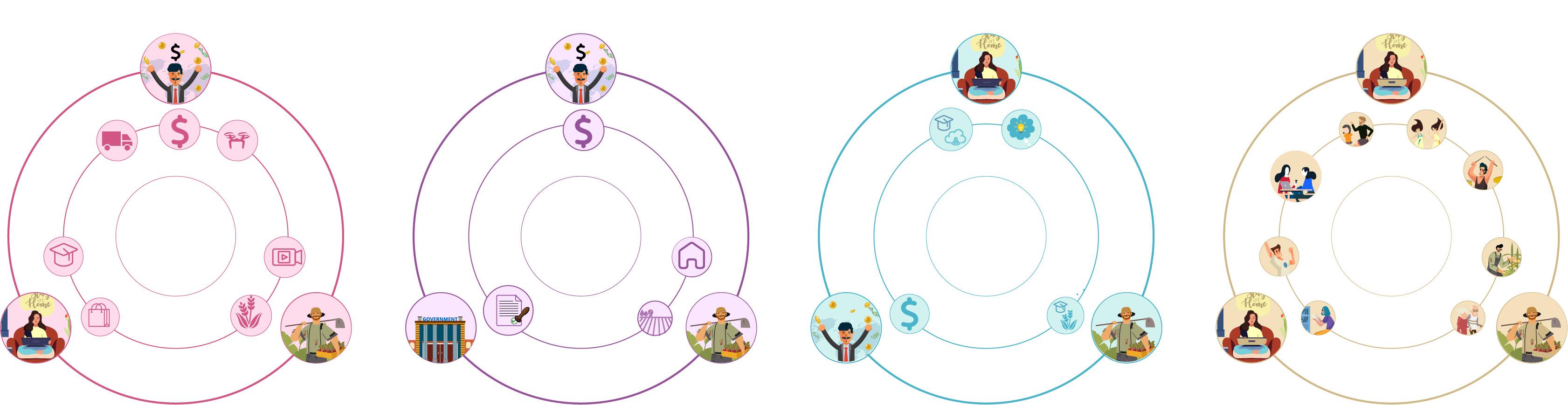
Farmer Living in the village
city Social connections Week Strong Living cost High Building density Low High Public space Less More Economic income Low High Digital education Low High Age structure Old Young Work&Study Social The capitalists build basic logistics facilities Digital nomad

Building density Land Living cost Social connections Less Less Week Strong Low High More More
"WE-BUILD"——ONLINE INTEGRATION Digital education Economic income Sales method Age structure Less Low Low High Low High More High
Digital Nomads
sales platforms Farmer
Social
composition of the four online platforms:sales platform、living platform、work&study platform、social platform.
and farmers form cooperative relations: Using their advantages to cooperate with each other to alleviate the
by the group The government issued supportive policies, The capitalists put up the money Farmers provide houses and land Capitalists build basic education facilities Digital nomad share digital knowledge Farmer provide nature education Digital nomad establish social platforms People can share their news, chat, and make community payments in this platform Technique Money Crop Buy Capitalist Capitalist Capitalist Digital nomad Digital nomad Digital knowledge Recreation Digital nomad Digital nomad Skill Logistics base Farmer Land Money Farmer Cropland Farmer Government House Policy Farmer Online sales Sale Living Resource Disadvantage Disadvantage Resource Low Free time Low High
Living in the
to build
join the platform to operate
relationship
Nomads
difficulties faced


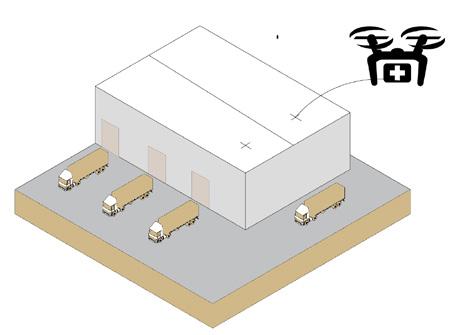
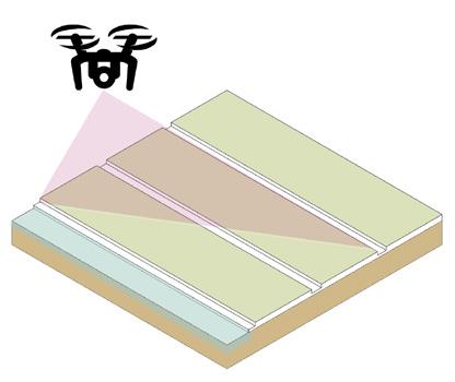
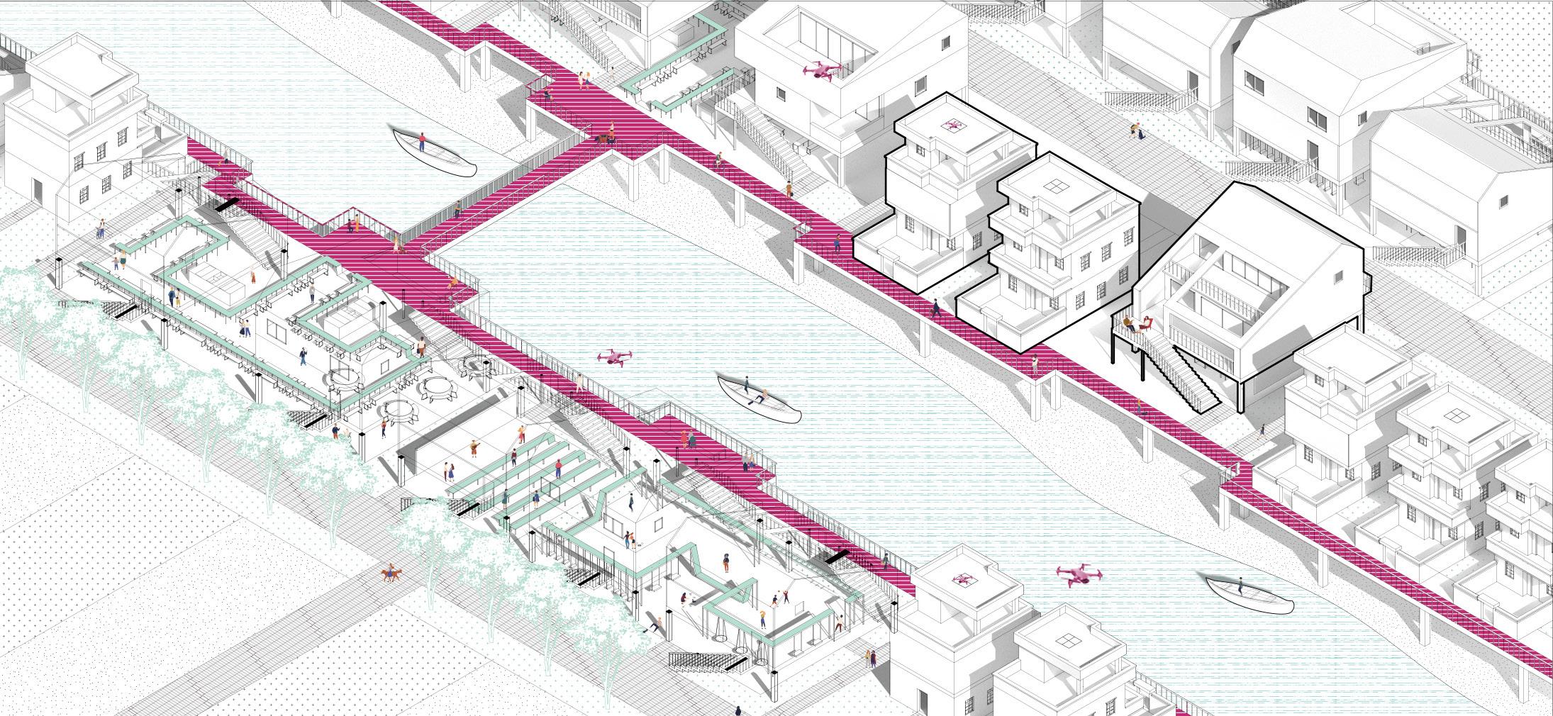
MASTER PLAN Services scope of activation centre UAS systems N 0 100 800M 200 400 2 1 2 3 4 Activation Centre Logistics Warehouse Trunk Road Remodeled Building New Building Wework 3 4 2 2 2 1 Services scope of wework Wework 500m 1000m 1000m Road Scope Activation centre Charging station Logistics warehouse Road Delivery routes Scope Agricultural UAS routes STRATEGY OF OFFLINE AND ONLINE Work& Study Living Welive Webuy Wework Social Offline Online Weplay Sale Share flat Shared housing Shared kitche UAV delivery Meeting room Shared office Workshop Network Sale Activation Center Wework Logistics Wanehouse Community Housing Search Check Room types Online Mall Virtual Tour Delivery Service Meeting Book Office Activity Pay Chat Moment UAV—Agricultural monitoring
Weight: 3kg
Logistics UAV Weight limit: 5kg
Duration: 1h
Charging time: 1.5h
Maximum flight speed: 70hm/h
Farmers can use the platform for live vegetable sales, and consumers make their choice of goods on the vegetable mall. In addition, after consumers make a pre-order, they can watch the process of growing and picking vegetables for planting live. Logistics part for the day of the truck cold chain delivery and drone delivery
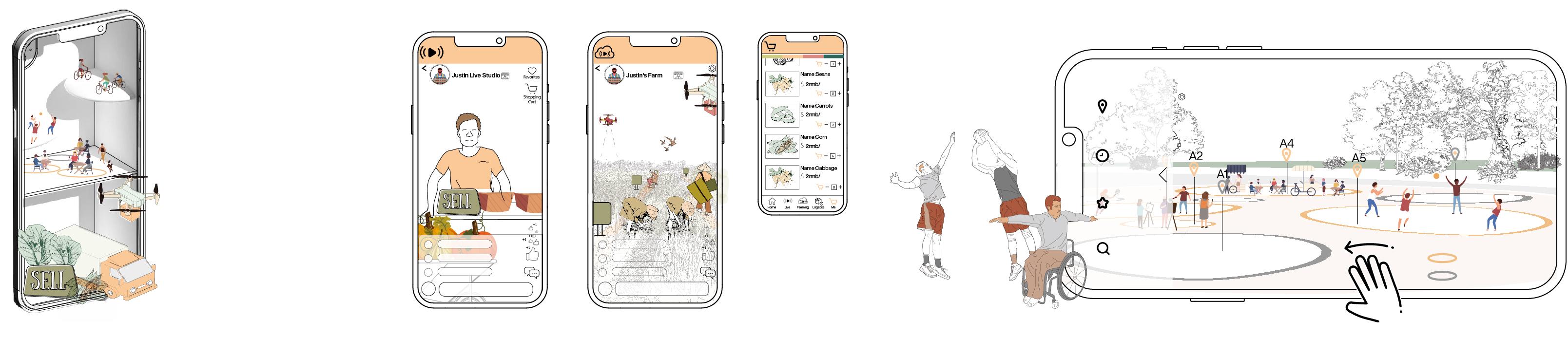
Book the event venue on the platform and make a time reservation for the venue where the event is needed. Network Sale Wharf Dwelling District Education Square Recreation square Logistics Wanehouse Network Sale——Wesale Booking Recreation Square——Weplay Live Room Cloud Farming Booking space Site Time Appointmented Noappointment Activity Discover Vegetable mal Add your comment Add your comment
ONLINE PROCESS ACTIVATION CENTRE
of
to
to
and farmers to have
products
products
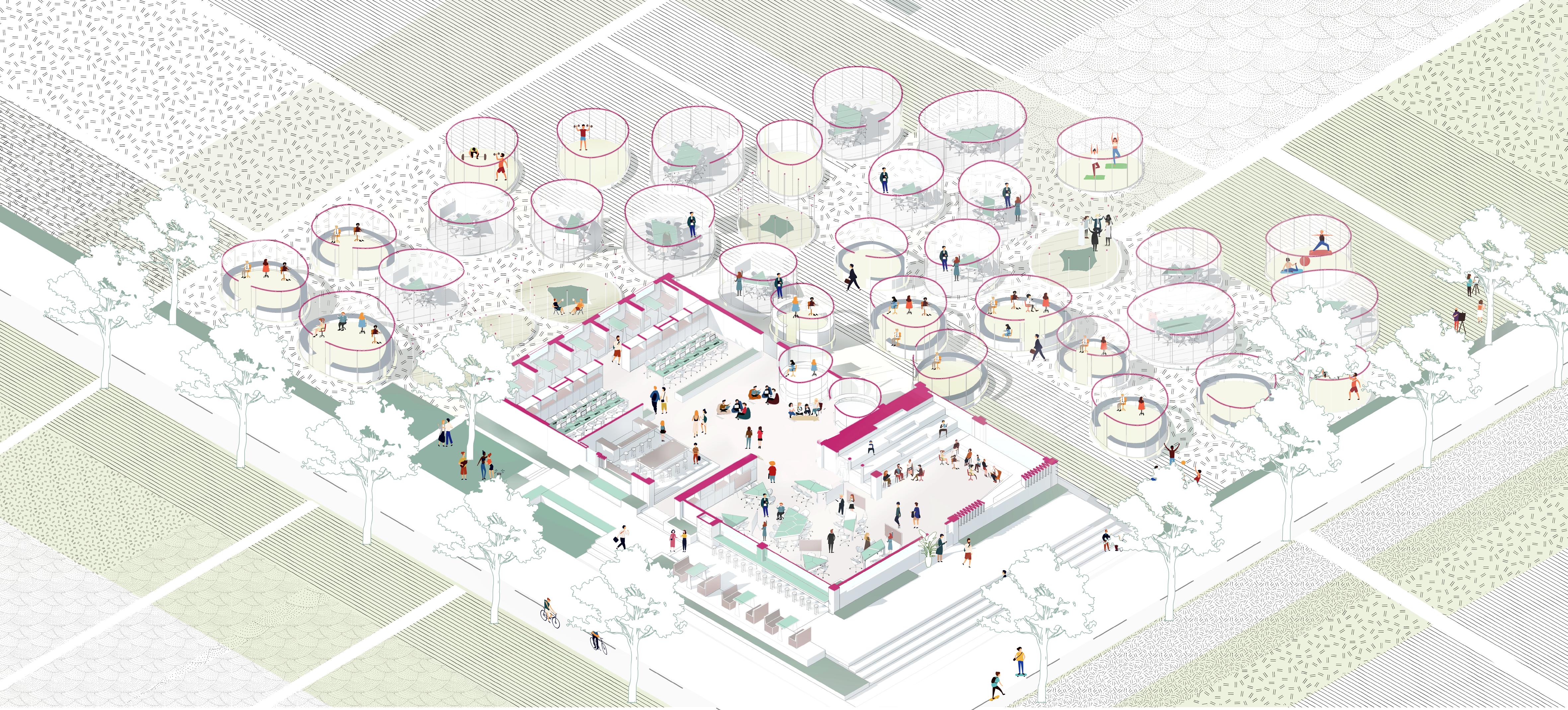
BookingRecreation ExchangeMarket The activity center is built in the center
several large communities, and corridors are established
connect them. In order
allow digital nomads
a stronger interaction, the network sale is set up in the site.farmers can conduct online live sales of agricultural
and send
in real time through the logistics center next to them we have designed a large square, people can directly scan the two-dimensional code of the venue directly to book the venue to hold their desired activities.
We will set up wework work points for digital nomads to meet their online office needs. They can obtain energy through sports. Energy can be used to grow virtual plants to obtain real vegetables, and energy can also be used to offset the energy consumed in wework.
Agricultural UAV
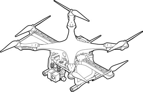
Weight limit: 20kg
Duration: 2h
Charging time: 2.5h
Weight: 21.1kg Maximum flight speed: 7m/s
ONLINE PROCESS

Digital nomads who stay in the community can enjoy the shared office space in the community. By reserving offline office space on the wework platform, you can use desks and hold workshops, etc.
After logging into wework account, the software will record the use time of electronic products and fitness data, resulting in the green energy obtained from exercise to offset the daily consumption of energy, people can obtain plants in the virtual farm, when the plants are collected to a certain point, can be obtained from the real green vegetables
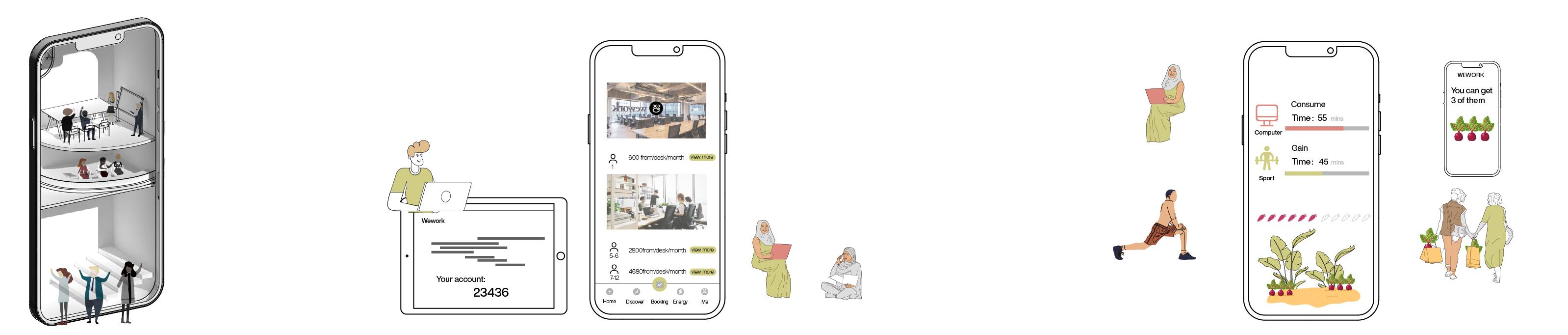
WEWORK
01 01 02 02
Nomads apply for wework app's via email exclusive account. Vegetable Exchange Scan the QR code online or offline to book a workstation Electronic products use time Exercise time Farming energy——Weplay Reserve work place——Wework Wework Wework Hot desk Energy Exchange Private office Number Of Vegetables you can redeem Meeting Room Discussion Room Coffee Shop Private Office Conference Room Fitness Room
Reserveworkplace
Weight: 0.5kg Food Delivery UAV


Weight limit: 3kg


Duration: 0.6h

Charging time: 1h
Maximum flight speed: 65km/h
Shared-kitchen——weplay

Digital nomads can see the basic situation of the house and the surrounding situation online through the “ welive ” app. They can choose the form of long rent or short rent to live with rasidents or other digital nomads.


Or they can check out all kinds of events being held near their communities
Residents
digital nomads
Have good communication with local residents or digital nomads
Online sharing kitchen activities are released. Farmers can provide vegetables that are not sold to the shared kitchen of the community. They cook together, and the extra food can be provided to the elderly living alone for free, or to young people who are busy with work, so as to obtain meager profits.
Shared kitchens not only provide food, but also a space for love and sharing, which can bring farmers and digital nomads into contact by sharing kitchens.
Farmers provide unsold vegetables
Farmer Vagetation
Digital nomads cook together with farmers as a volunteers
We have extra vegetables, so we 'll have a shared kitchen event, and you 're welcome to join us +1 +1 +1 10 lb 12 lb
Cooked food free for lonely old people
The dishes are sold to young people who have no time to cook for a small profit
LIVING SPACE
PROCESS
ONLINE
Room reservation
Weplay
Room reservation——Welive
Shared-kitchen Welive Live with residents Live with digital nomads
New Building Sport Space Movie Space
Shared-kitchen Connect The Community Original Building Remodeled Building
Sports 01 01 03 02 02 04 Movie
Participate in a variety of activities to promote the relationship between local residents and digital noamds Cooking
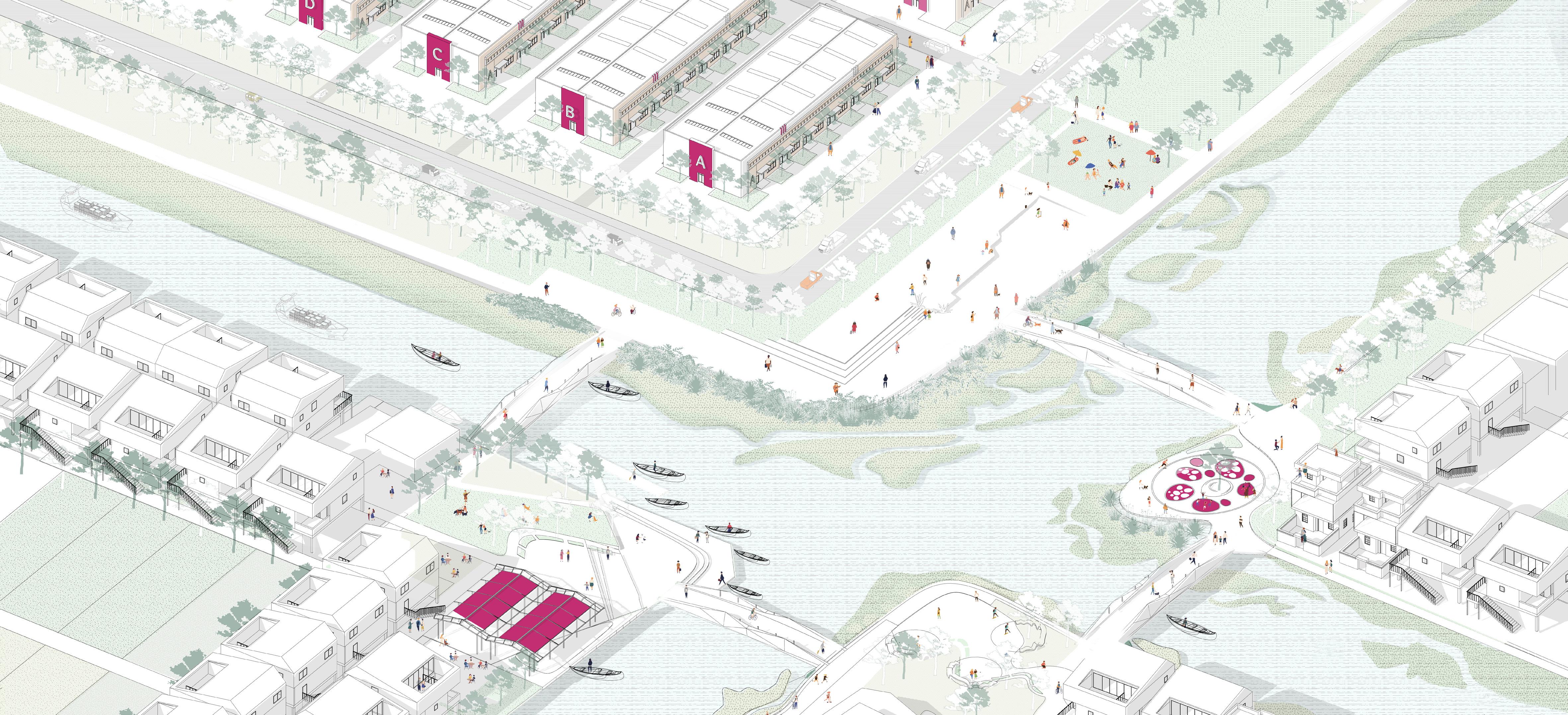
performance
Residents can transform their houses and rent them to digital nomads, so that residents and digital nomads can have more exchanges. The government provides funds to build new houses on idle land. Digital nomads can share rents together and set up a variety of public spaces under new houses, so that residents and digital vagrants can have more interaction and build bridges to connect the interaction between the two communities across the river.And deploying UAV to enrich their lifestyle.
