4 minute read
WHERE WILL ALL THE TREES BE?
Industry summary: where will all the trees be?

It’s with great excitement that Greener Spaces Better Places announces that the Where Will all the Trees Be? report, the third in a series of national urban canopy benchmarking studies published by Greener Spaces Better Places, is now live.
Background
In 2013, the Where are all the Trees? report provided Australia’s first national canopy benchmarking report. In 2017, Where Should all the Trees Go? developed a vulnerability index, overlaying heat mapping and socio-economic data to help inform where urban forestry efforts could provide the most benefit in our towns and cities.
For both research reports, Greener Spaces Better Places conducted a national tour of events to share the findings with the Living Network – including urban greening practitioners and experts, local and state government representatives, and other relevant stakeholders (for example, the development sector).
For this year’s research however, due to the limitations imposed by COVID, the results were shared via a series of webinars and reports.
This year’s approach
Building on the previous years’ research, the focus of the 2020 report, Where Will all the Trees Be? has been to:


> Understand to what extent factors such as urban density, population growth and effort influence local councils’ ability to increase or maintain their urban green cover
> Identify ‘Best on Ground’ councils who, despite a range of challenges, are finding innovative ways to protect and increase their urban green cover
> Capture the broader community’s imagination and understanding of the value of urban green cover by translating ‘targets’ and ‘percentages of cover’ into a more tangible vision for the future, through imagery and an interactive ‘search my postcode’ tool.
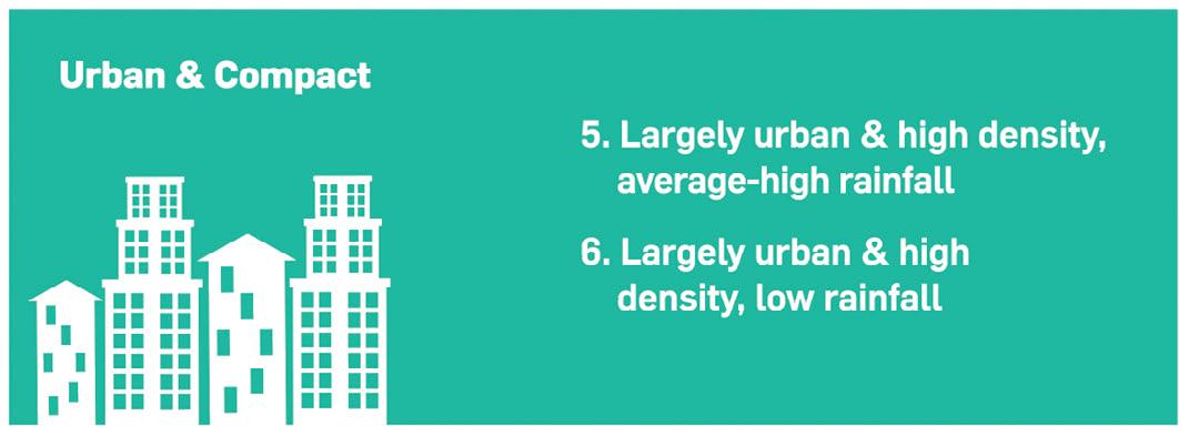
This research differs to previous years’ in that it deep dives into the rates of increase and decline of urban greening across Australia through the lens of six different place types determined by rainfall, urbanisation and population density. These place types help us more usefully compare performance within and across cities to understand what improvement might be possible with concerted effort, and what deterioration might occur with complacency.
> By grouping LGAs accordingly, the data can provide more relevant learnings by eliminating contextual discrepancies (such as demography, climate, density, population and planning and policies) and comparing like-for-like councils, leading to a better understanding of overarching trends and patterns in each category
> Greater understanding of the key barriers and enablers of urban greening
> Identification of which LGAs are “bucking the trend” in their category, and why
> Pinpoints the councils that are making great progress in increasing urban canopy, even as density and population increases in their area – which in turn, serves as a great example to other LGAs in their category looking to follow suit.

Key take-outs from the research
The research revealed that 67% of suburbs and cities across Australia will face significant challenges in growing and maintaining green cover in the future, as our cities grapple with a rising population and grey cover expansion due to urban development. It also confirms the majority (69%) of our urban LGAs have lost green cover (trees and shrubs) since 2013.
More importantly, however, it also revealed that 71/131 urban LGAs have a challenge factor rating of ‘high’ or ‘very high’ when it comes to taking action to reverse this trend.
These findings illustrate that a growing population often means more pressure on green cover in our suburbs and cities – which reinforces that as our cities and suburbs grow, it is vital our green cover keeps pace.
The study identified the following LGAs as ‘Best on Ground’ –places who have maintained or grown their green cover despite mounting challenges including population or grey cover increases: > City of Whittlesea, Victoria (type: suburban, spacious and low rainfall)
> Logan City Council, Queensland (type: suburban, spacious and average-high rainfall)
> City of Greater Dandenong, Victoria (type: urban, spacious and low rainfall)
> Kwinana City Council, Western Australia (type: urban, spacious and average-high rainfall)
> City of Unley, South Australia (type: urban, spacious and low rainfall)
> The City of Parramatta, New South Wales (type: urban, compact and average-high rainfall).
The full 2020 research report can now be accessed on the Greener Spaces Better Places website (in the Guides section).
The interactive ‘search my postcode’ tool can be accessed via the Greener Spaces Better Places homepage (scroll to the red block with the title "Where Will all the Trees Be?") – greenerspacesbetterplaces.com.au
The ‘Where Will all the Trees Be?’ (NY19001) research project is funded by the Hort Innovation research and development levies. The lead researcher on this project is RMIT University, with associated communications activities being funded through the Hort Innovation Nursery Fund, using the Nursery marketing levy.


