PARKS MASTER PLAN
SPRING 2023
CLIENT
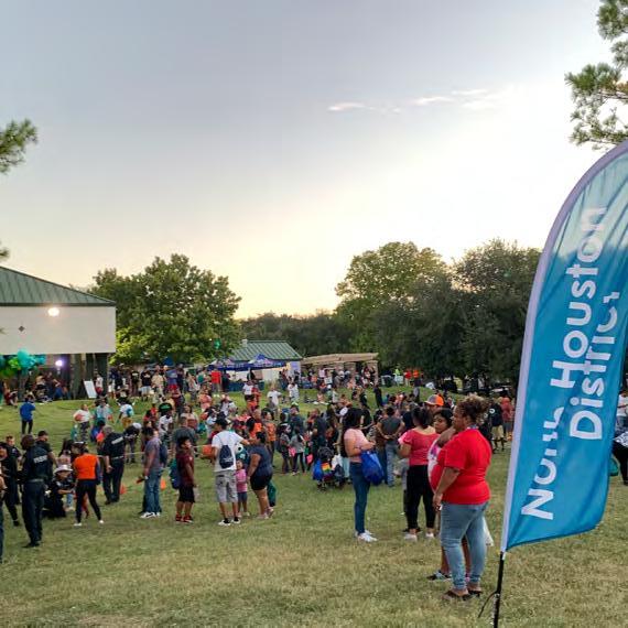
North Houston District
STAKEHOLDER COMMITTEE
North Houston District Board of Directors

City of Houston District B
City of Houston Parks and Recreation Department
Greens Bayou Coalition
Robert Fiederlein Vice President Planning and Infrastructure (281) 874-2132
rfiederlein@northhouston.org
PROJECT TEAM
Asakura Robinson

Keiji Asakura Principal-in-Charge (713) 337-5830
keiji@asakurarobinson.com
Hugo Colón Project Manager hugo@asakurarobinson.com
Isabelle Asakura Deputy Project Manager isabelle@asakurarobinson.com
Harris County Precinct 1
Harris County Precinct 2
Harris County Flood Control District
Houston Parks Board
YMCA
Independent
2023 Parks Master Plan 3 April 2023 CONTENTS EXECUTIVE SUMMARY ........................ 5 EXISTING CONDITIONS....................... 14 District Overview..................................................... 15 Community Profiles................................................. 17 District Quadrants .................................................. 19 Summary of Existing Plans .................................... 30 Greens Bayou .......................................................... 34 Park System Inventory ............................................ 38 Park Accessibility ..................................................... 40 Existing Parks ........................................................... 44 ENGAGEMENT .................................... 47 Engagement Timeline ............................................. 48 Key Findings ............................................................. 50 VISION................................................. 53 Goals & Guiding Principles..................................... 53 District-Wide ........................................................... 54 Bayou Scale ............................................................. 64 Park Scale ................................................................ 74 Thomas R. Wussow Park ................................ 74 Waste Water Treatment Plant ....................... 81 Existing Parks .......................................................... 88 General Recommendations .................................. 90 Park Signage Opportunities ........................... 92 Lighting and Safety Recommendations ....... 96 Landscape and Planting ................................. 98 General Parks Recommendations ................ 99 IMPLEMENTATION.............................. 101 Partnerships.......................................................... 102 Grants and Finance ............................................. 105 APPENDICES.......................................... I

4 2023 Parks Master Plan April 2023
EXECUTIVE SUMMARY
Parks and trails are essential for healthy, thriving communities, and improve the quality of life for residents. Seeking opportunities to expand its park system, the North Houston District worked with community members and key stakeholders to develop a long-term vision and a nearterm plan for priority investments in parks, trails and pedestrian access projects.
PARKS & TRAILS TODAY
The North Houston District parks system serves a growing population of over 50,000 residents. The system features a network of approximately eight (8) parks and eight (8) miles of trails.
WHY NOW?
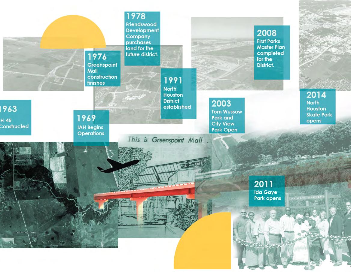
The District and surrounding area have undergone several changes since the last Parks Master Plan in 2008, including:
• The Bayou Greenways 2020 initiative along Greens Bayou; and need to connect the District to the larger system of trails
• The Harris County Flood Control District's (HCFCD) development of numerous detention basins, creating opportunities for expanded park space within such detention ponds
THE PLAN
The 2023 North Houston Parks Master Plan takes stock of existing parkland, partnerships, and community needs to create a cohesive network of parks, open spaces, and trails in the years to come. The
2023 Parks Master Plan aimed to:
• Create an updated inventory of existing parkland and open space
• Develop a clear set of goals with recommendations that connect, activate, enhance, and unify the system
• Unite a network of strategic partnerships to support improvements
This report is the culmination of a ninemonth planning effort. The sections in the following pages include:
Existing Conditions Analysis
Providing an overview of the District's community profile and characteristics, this analysis created an understanding of the District at three scales and revealed an overall deficit in park acreage per 1,000 residents.
Engagement
A combination of public and stakeholder engagement, this process revealed community preferences and leveraged stakeholder expertise to guide master plan recommendations and designs.
Vision and Recommendations
Outlining goals and identifying key approaches recommending connectivity enhancements, activation of new spaces, enhancement of existing spaces, and overall unification of District quadrants.
Implementation
Suggesting a three-pronged approach at the District-wide, Bayou-scale, and park level scales outlining partnership and funding opportunities.
2023 Parks Master Plan 5 April 2023
MASTER PLAN PROCESS
The nine month planning process was developed following four main tasks; Understand, Engage, Envision and Act.

During the Understand phase of the project, data was collected to develop an existing conditions analysis, in which parks and open space gaps and opportunities were identified.
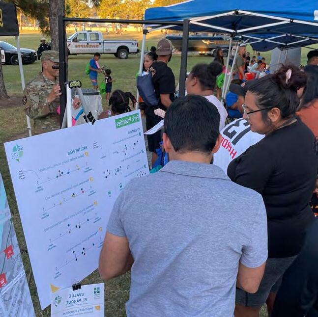
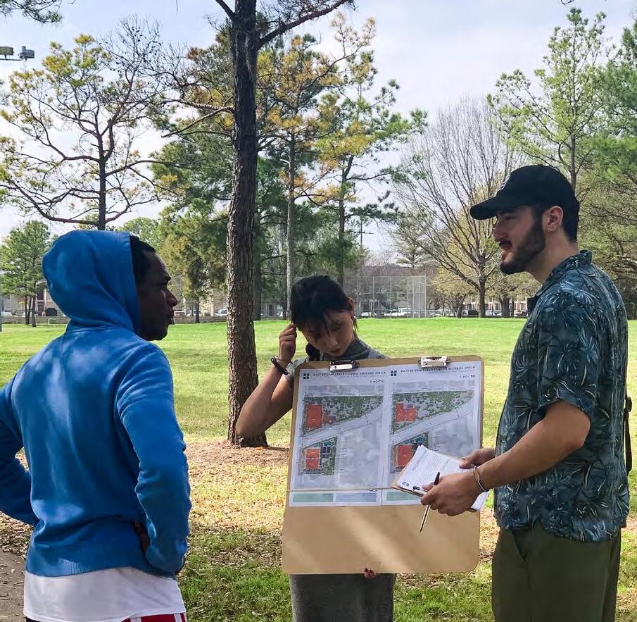
The Engage phase consisted in key stakeholder work sessions to gather feedback from District, neighborhood, and agency leaders. In addition, two public pop up events were performed to gather
feedback related to Wussow Park from community members. This process was performed at different stages of the project.
The Envision phase goal was to develop strategies and recommendations at the District-wide, Bayou scale, and park level. Lastly, the Act phase compiled findings from previous phases of the project to develop the final Plan for presentation to North Houston District's Board of Directors.
Draft Report Pop Up #2 Stakeholder Meeting #3 Final Presentation
ENGAGE ENVISION Pop Up #1 Stakeholder Meetings Data Collection Overall Visioning & Goals Existing Conditions Analysis Concept Plans Recommendations 2023 PARKS MASTER PLAN ACT
UNDERSTAND
6 2023 Parks Master Plan April 2023
ENGAGEMENT SUMMARY
The North Houston District Parks Master Plan engagement sought to capture a combination of public and stakeholder feedback, enabling the consideration of community voices alongside the opinion of key stakeholders. Key stakeholders were brought together by North Houston District, each representing partner agencies such as Harris County Flood Control District, Houston Parks Board, and Harris County Precincts 1 and 2, among others.
General public engagement was focused on gathering feedback from the community in regards to Wussow Park's existing conditions, uses, challenges and needs.
The feedback acquired from both stakeholder sessions and public pop-up events assisted in developing and prioritizing recommendations at different scales in the District. The highlights of the engagement findings are shown below.
POP-UP ENGAGEMENT EVENTS
KEY TAKEAWAYS
3 out of 4 park elements received 3 or fewer star ratings
Over half of respondents use the park for active leisure
Basketball represented users’ top programmatic request
STAKEHOLDER MEETINGS
KEY TAKEAWAYS
16 potential partners and 19 initiatives identified
Easements highlighted as possible priority for connectivity
Wussow Concept 3a selected as preferred concept
FREQUENT TOPICS
FREQUENT TOPICS
PLAY
SPORTS PARTNERSHIPS
CONNECTIVITY CONDITIONS ENHANCEMENT
2023 Parks Master Plan 7 April 2023
EXISTING CONDITIONS ANALYSIS SUMMARY
The Understand Phase of the project consisted in analyzing the state of the park and trail system in North Houston District in conjunction with current and planned projects in the area. Existing and future plans such as the Houston Bike Plan and the North Houston/ Greenspoint Livable Center Study were studied to understand the relationship between those ongoing efforts and to identify opportunities for the 2023
8.1
MILES OF TRAILS
Parks and Trails Master Plan. In addition, the area’s demographic, land use, and ecology were studied using GIS data. Our team also visited all of the parks in the District to better understand the inventory and condition of existing amenities, and identify potential opportunities within the parks system. See below for some key findings from this effort.
5.05 49.3
PARK ACRES/ 1,000 RESIDENTS
MILES OF PLANNED BIKE LANES
8 2023 Parks Master Plan April 2023
Trails Existing Parks Existing Spark Parks 100 People Planned CIPs Existing CIPs Greens Bayou Existing Parks Detention Basins Water Areas
5.5 park acres / 1000 residents is required to meet the national median.
Existing
METRO Boost improvements along METRO 56 Bus Line and the proposed Bus-Rapid Transit (BRT) Corridor
GOALS & GUIDING PRINCIPLES
The parks master planning effort is guided by four goals: Connect, Activate, Enhance, and Unify. The goals were identified by analyzing the existing conditions, conversations with the North Houston District, and
Strengthen the connections between parks, open spaces, and the community.
with other stakeholders. Within each goal, guiding principles are envisioned at three scales: District-wide efforts, Bayou-scale, and park level.
Strengthen the features of existing parks and trails to meet the District’s visions for a unified park system.
Envision solutions to activate publicly owned, under utilized green spaces that currently exist within the District.
Leverage partnerships to identify and address common priorities for the District and standardize District park amenities and branding.
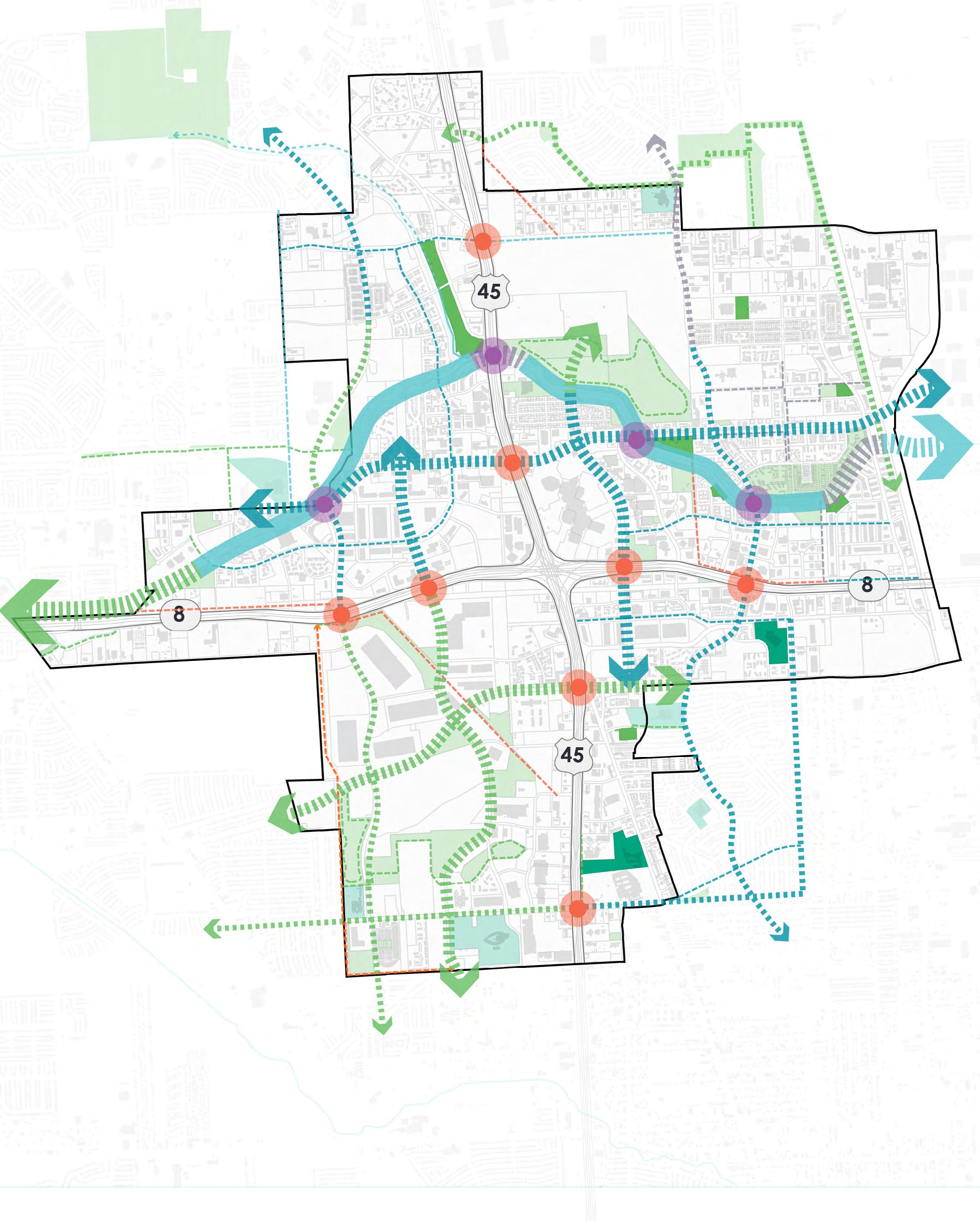
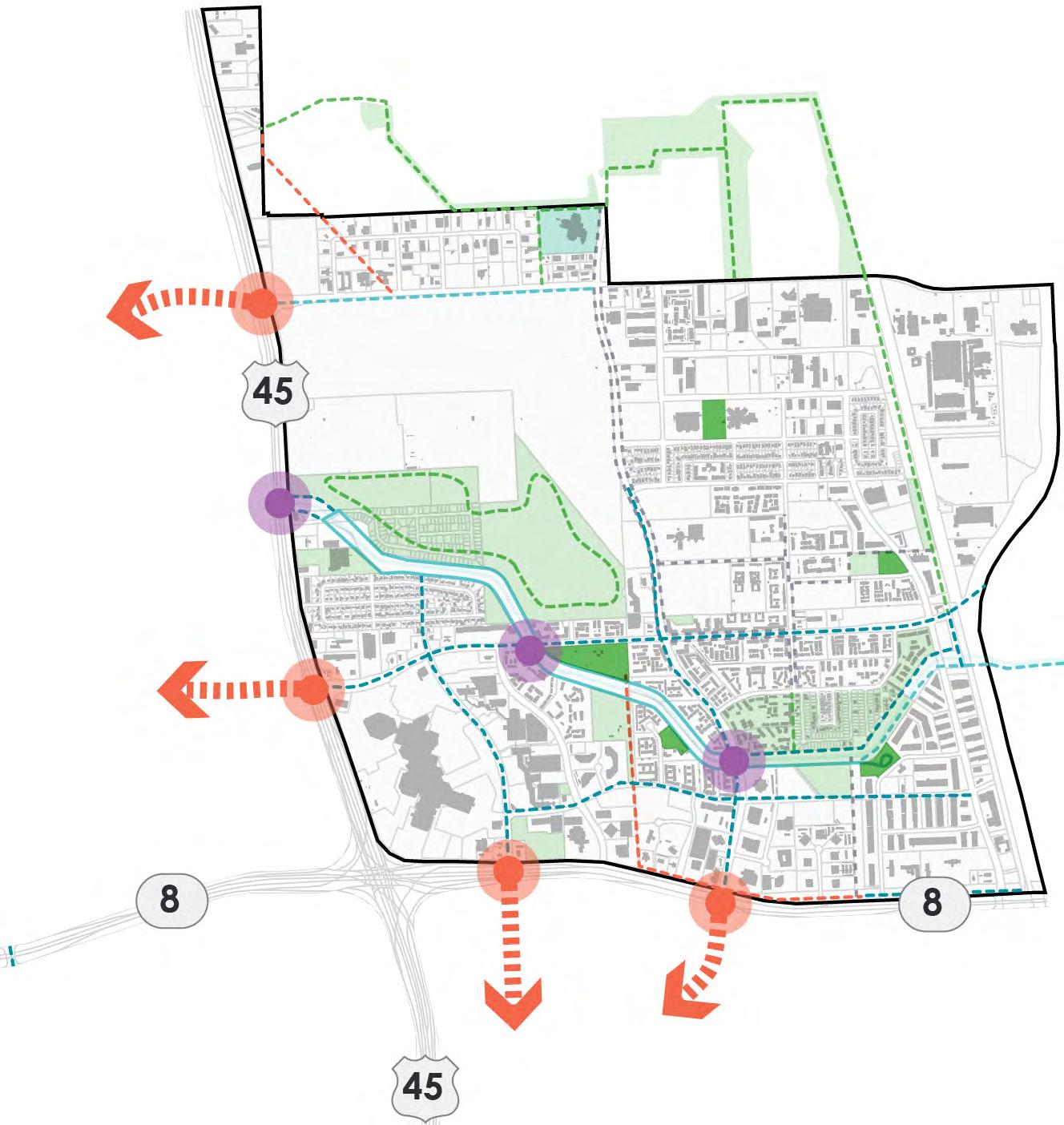
DISTRICT-WIDE RECOMMENDATIONS
District-wide recommendations center around leveraging opportunities to enhance connectivity, activate existing parks, and create new parks and open space by focusing on the goals to Connect and Activate. These recommendations were informed
Complete a network of inner and outer loop trails, paths, and bike lanes, connecting the District's recreational opportunities.
by both existing conditions analyses, as well as identification of and collaboration with partners in and around the District. The diagrams below highlight some of the primary takeaways.
Identify gaps in available park acreage and improve access to parks for residents and visitors.
2023 Parks Master Plan
CONNECT CONNECT ACTIVATE ACTIVATE ENHANCE UNIFY
9 April 2023
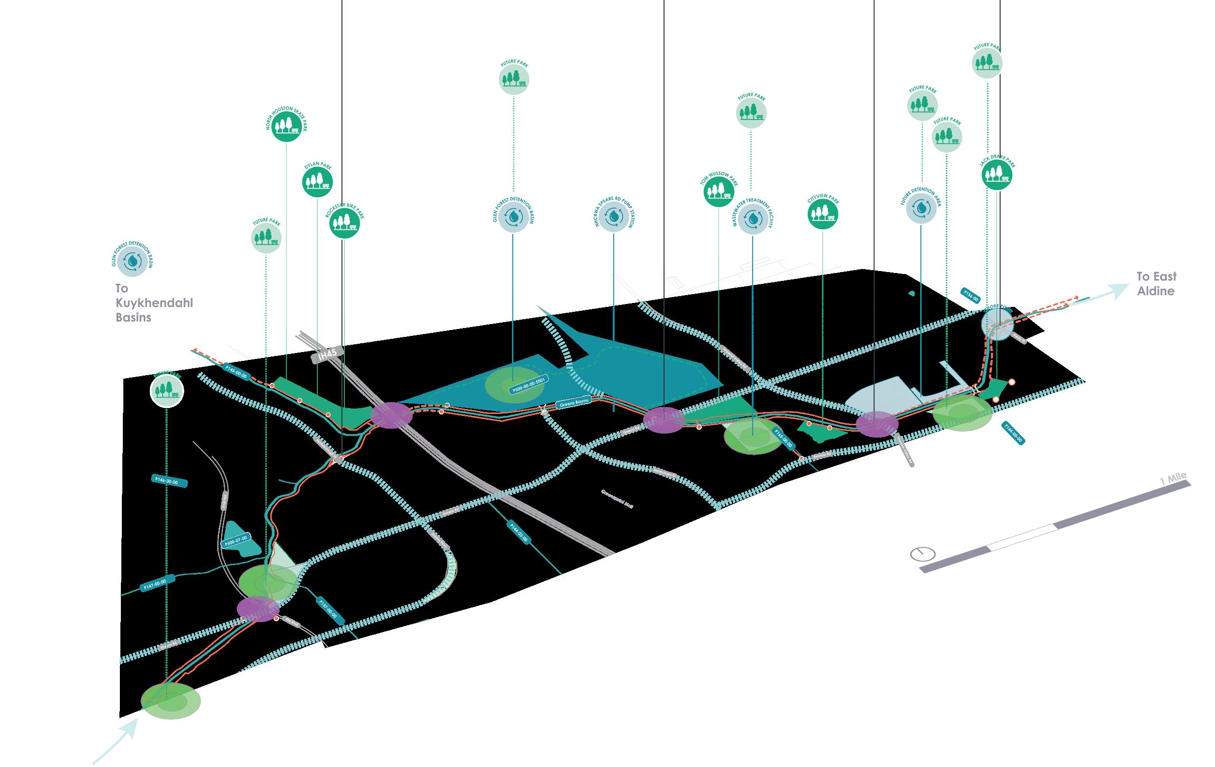
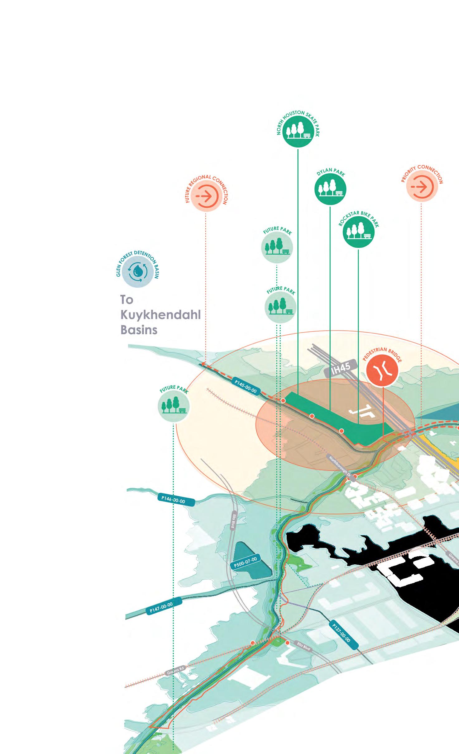
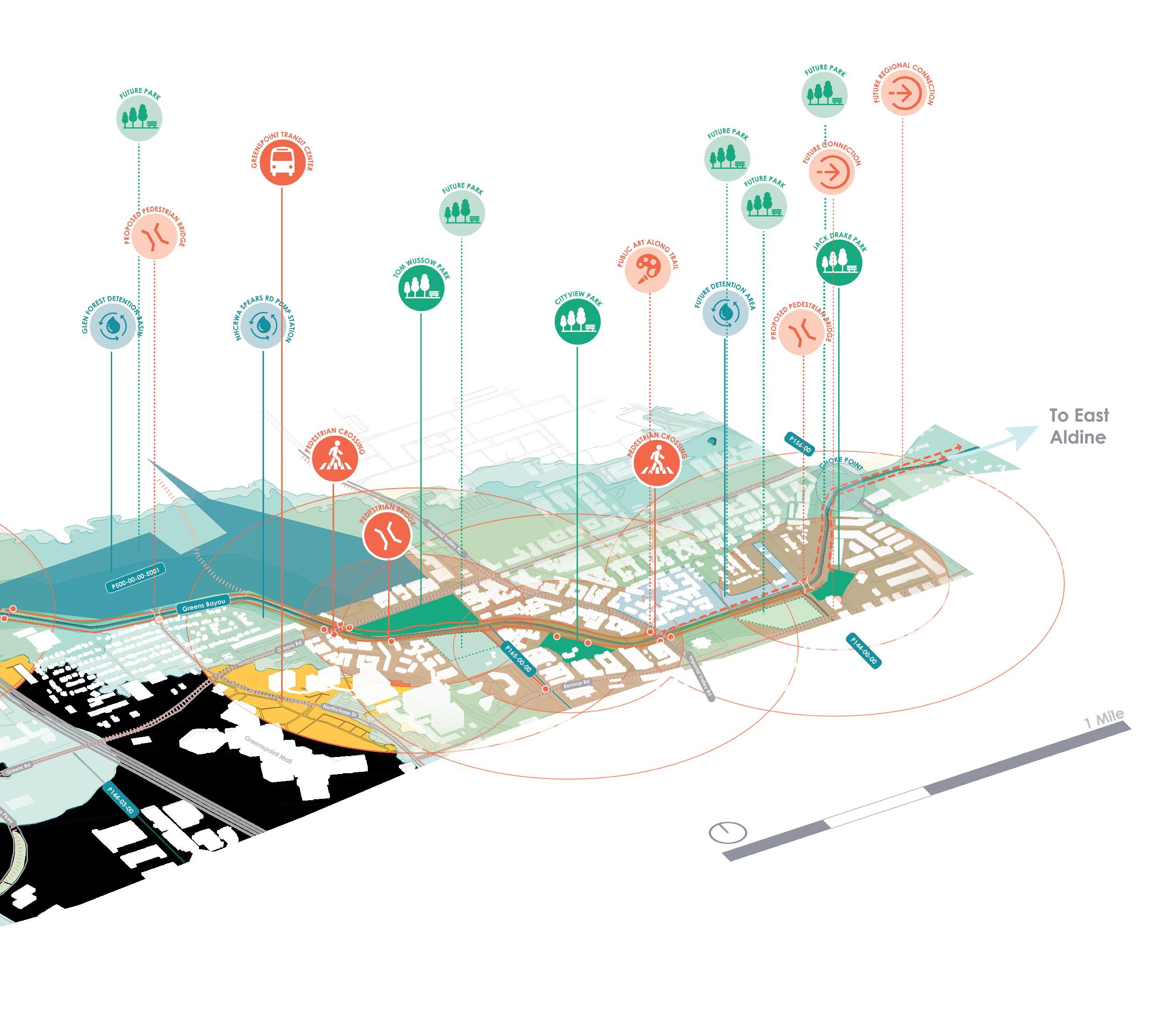
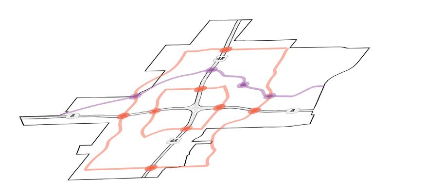
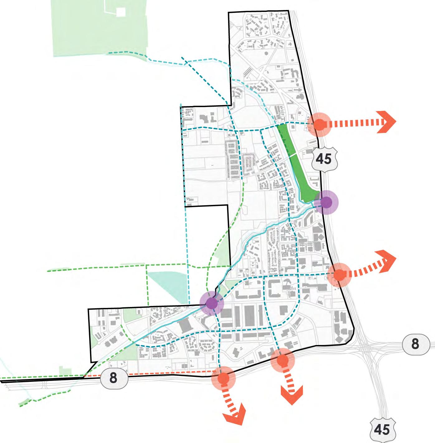
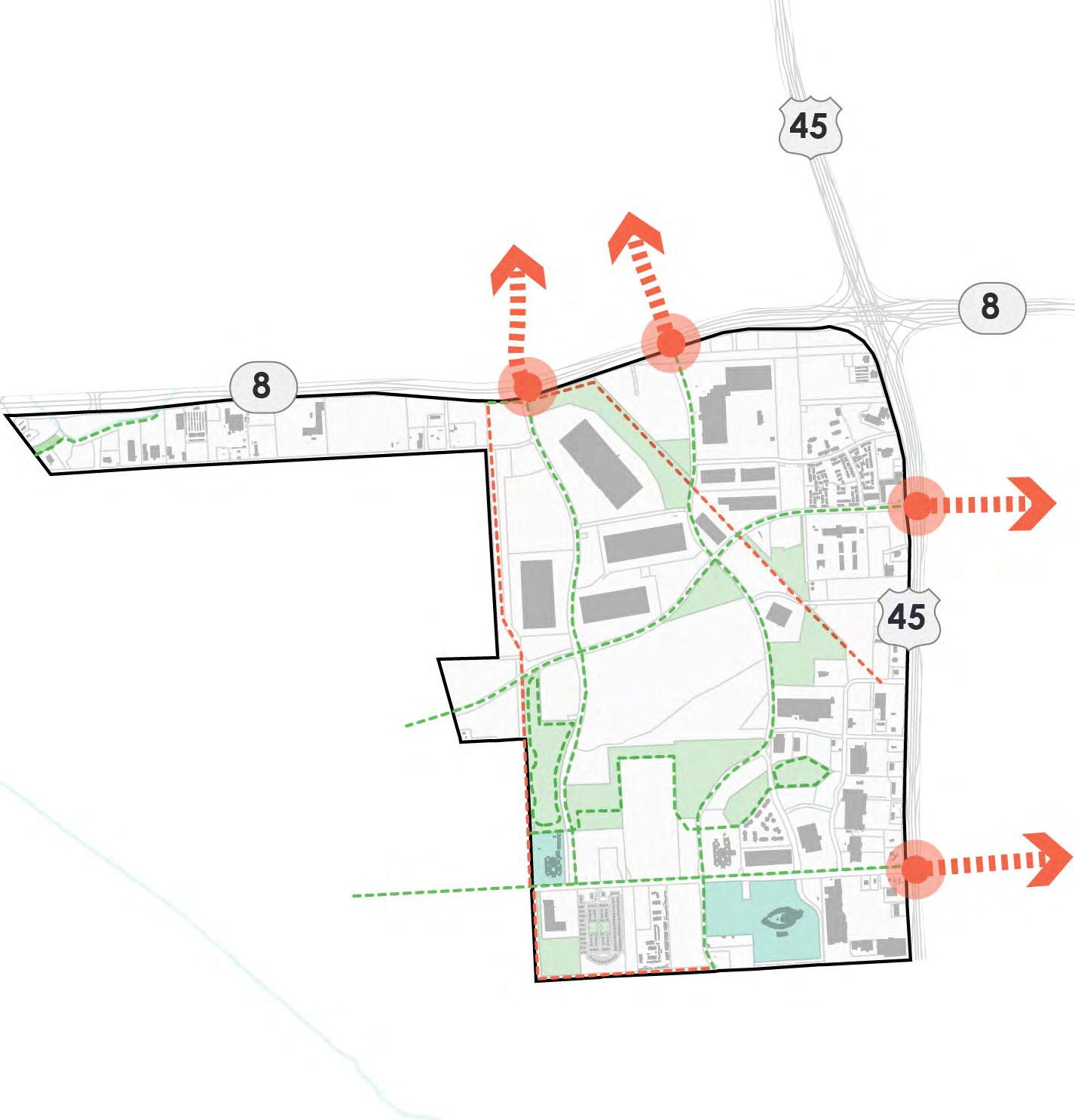
BAYOU SCALE RECOMMENDATIONS
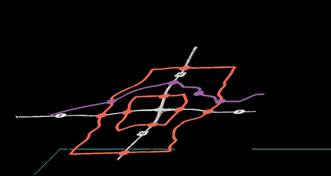
BAYOU GREENWAY OVERVIEW
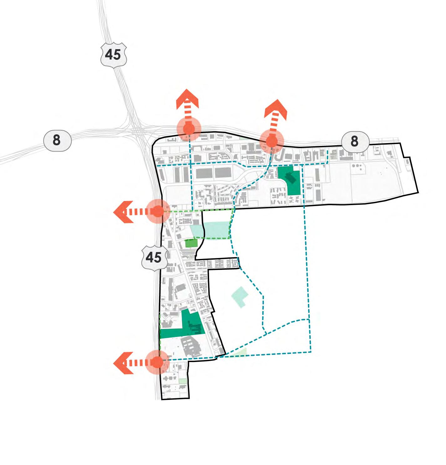
Snaking west to east, the Greens Bayou was seen as the District's spine, a valuable asset from which new and existing parks and open space could tie the recreational experience together. The map below illustrates the master plan's segmented approaches to understanding and developing Bayou recommendations. The overall Bayou recommendations focused on three components guided by the goals to Enhance and Unify:
Bring new life to existing parks and open spaces, leading to an improvement of the District's overall offerings and upgrading the user experience.
Establish a cohesive network of parks and trails, unlocking connections within and between District quadrants emanating from the unifying spine, Greens Bayou.
ENHANCE UNIFY
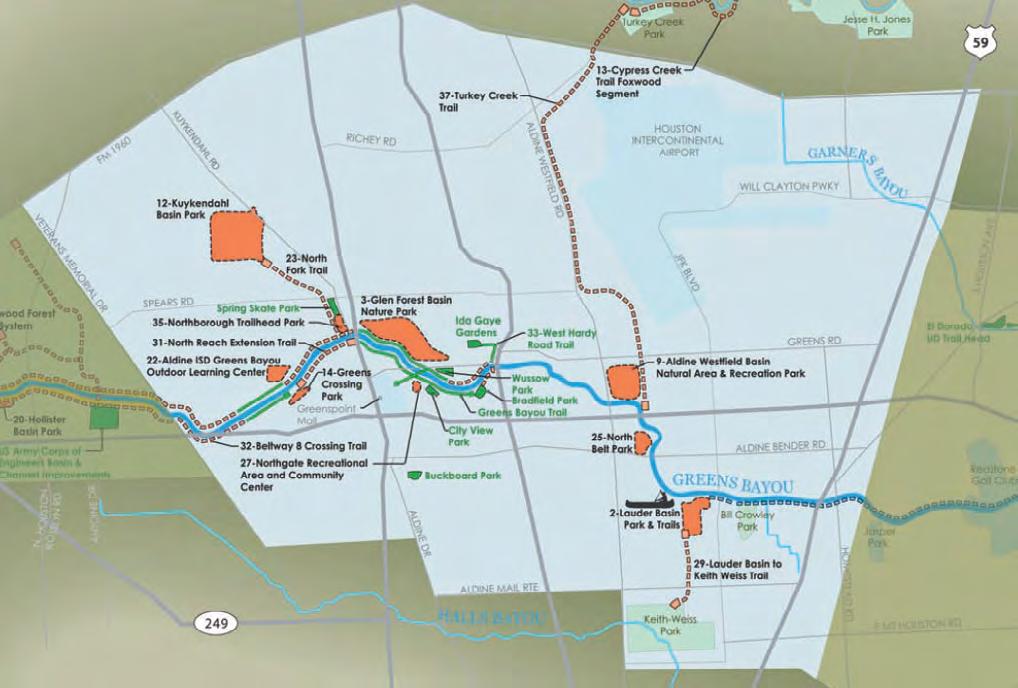
1 3 2 4 5 7 6 8 9 10 11 12 13 15 14 10 2023 Parks Master Plan April 2023
1. Bayou Recreation
2. Bayou Stories
3. Greenway Amenities
Activate
Potential
Green Space
Crossings (Trail Scale)
GREENS BAYOUEAST
GREENS BAYOU - WUSSOW PARK TO CITY VIEW PARK
GREENS BAYOU - EAST/ WEST CONNECTOR
GREENS BAYOUWEST
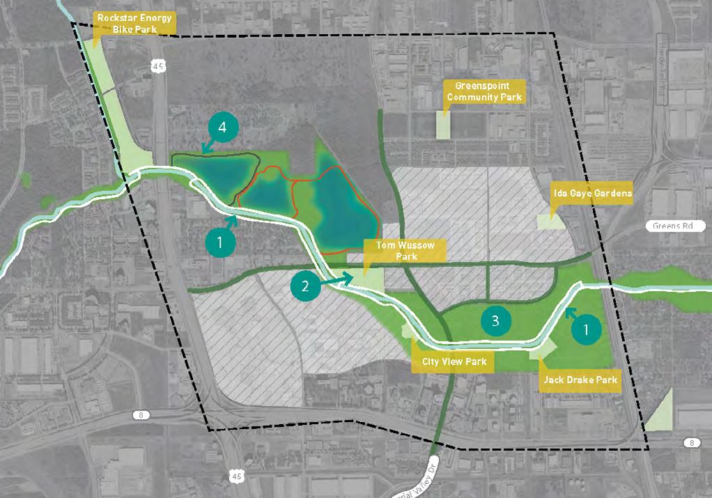
Develop hike and bike trails along both sides of Greens Bayou to maximize connectivity and access Develop an unifying theme of signage, wayfinding and furnishing elements along Bayou Greens Bayou - West Recommendations 1 Develop the District's property near Greens Rd. and Ella Blvd. 2 Create a central nature corridor and tree canopy 3 Develop District markers at western terminus Greens Bayou - East/West Connector Recommendations 4 IH-45 East/West trail connection 5 Glen Forest Detention Basin activation 6 Greenspoint Dr. neighborhood access 7 Future regional connections Greens Bayou - Wussow Park to City View Park Recommendations 8 Active recreation at Wussow Park and Wastewater Treatment Plant Expansion 9 Develop easement trail to Benmar Green Finger 10 Update City View Park to build on Bayou story-telling and supporting the water narrative 11 Build off placemaking and art activation at Imperial Valley Dr. Greens Bayou - East Recommendations 12 Continue to advance the future Central Park concept as a storm water amenity 13 Develop a Jack Drake Natural Recreation Center at the detention facility 14 Utilize the trail easement to connect to Beltway 8 15 Complete trails system and create a regional trail connection to East Aldine 2023 Parks Master Plan 11 April 2023
GENERAL RECOMMENDATIONS
THOMAS R. WUSSOW PARK RECOMMENDATIONS
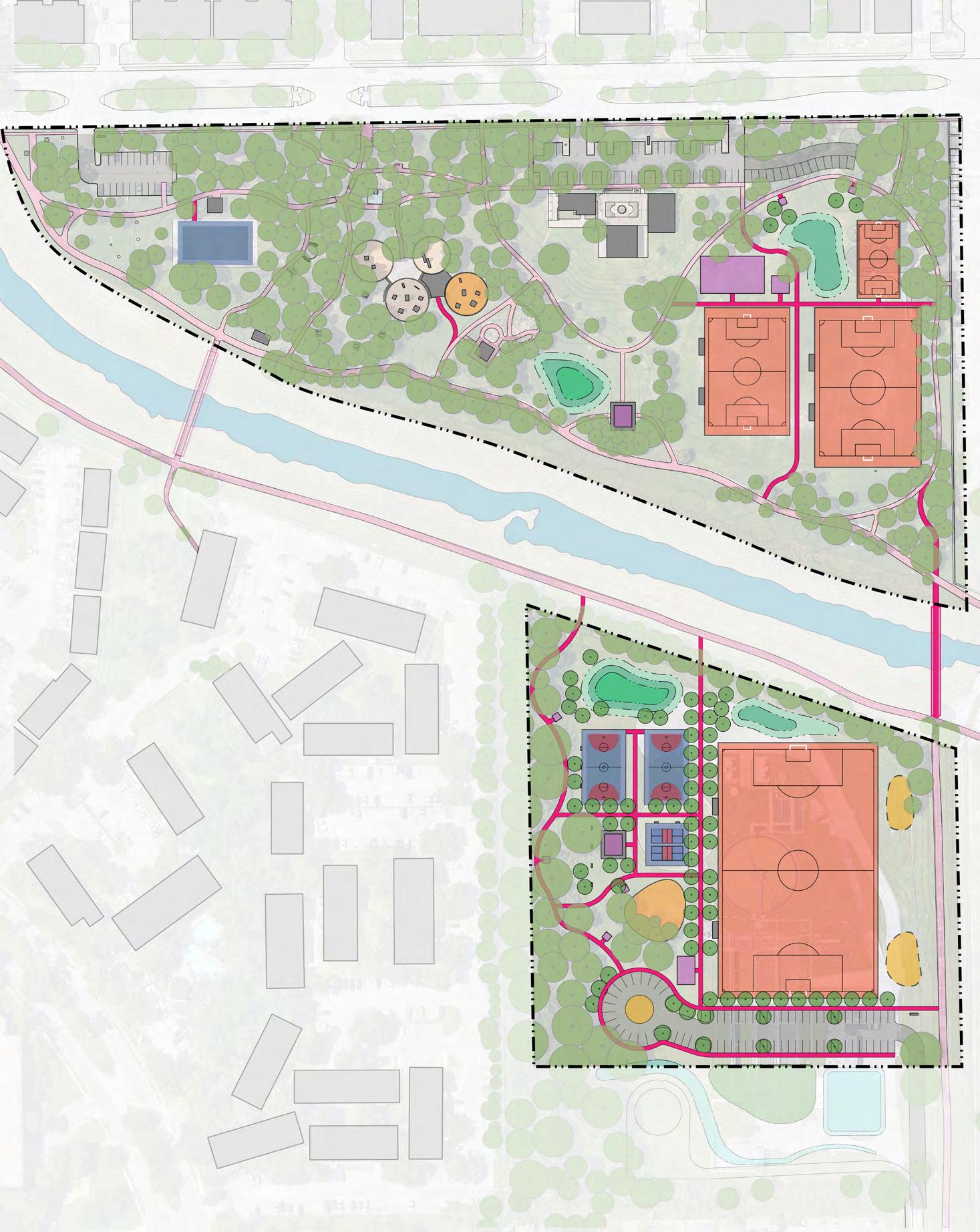
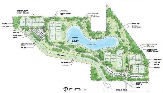
Wussow Park Overview
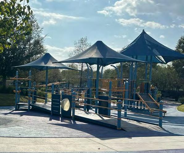
Following the Plan's overall guiding principles and goals, the Wussow Park concept design addresses various park components to improve the user experience and elevate the park into a flagship recreational space within the District. Informed by existing conditions analysis and feedback from both stakeholders and park users, the concept design provides new facilities and possibilities for programming that will allow an expansion and formalization of existing park uses, such as the YMCA and informal soccer, as well as bringing in new users for the outdoor gym and other new activities.
ENHANCE CONNECT ACTIVATE
UNIFY
2
Wussow Park Annex
Located south of Greens Bayou from the original Wussow Park, the Wussow Park Annex replaces the soon-to-be decomissioned waste water treatment plant, converted into a smaller lift station by the City of Houston. This new space was envisioned as a host for new sports programming, featuring multigenerational spaces that are more accessible to residents south of the Bayou, as well as a new pedestrian connection across the Bayou.
7
3
1
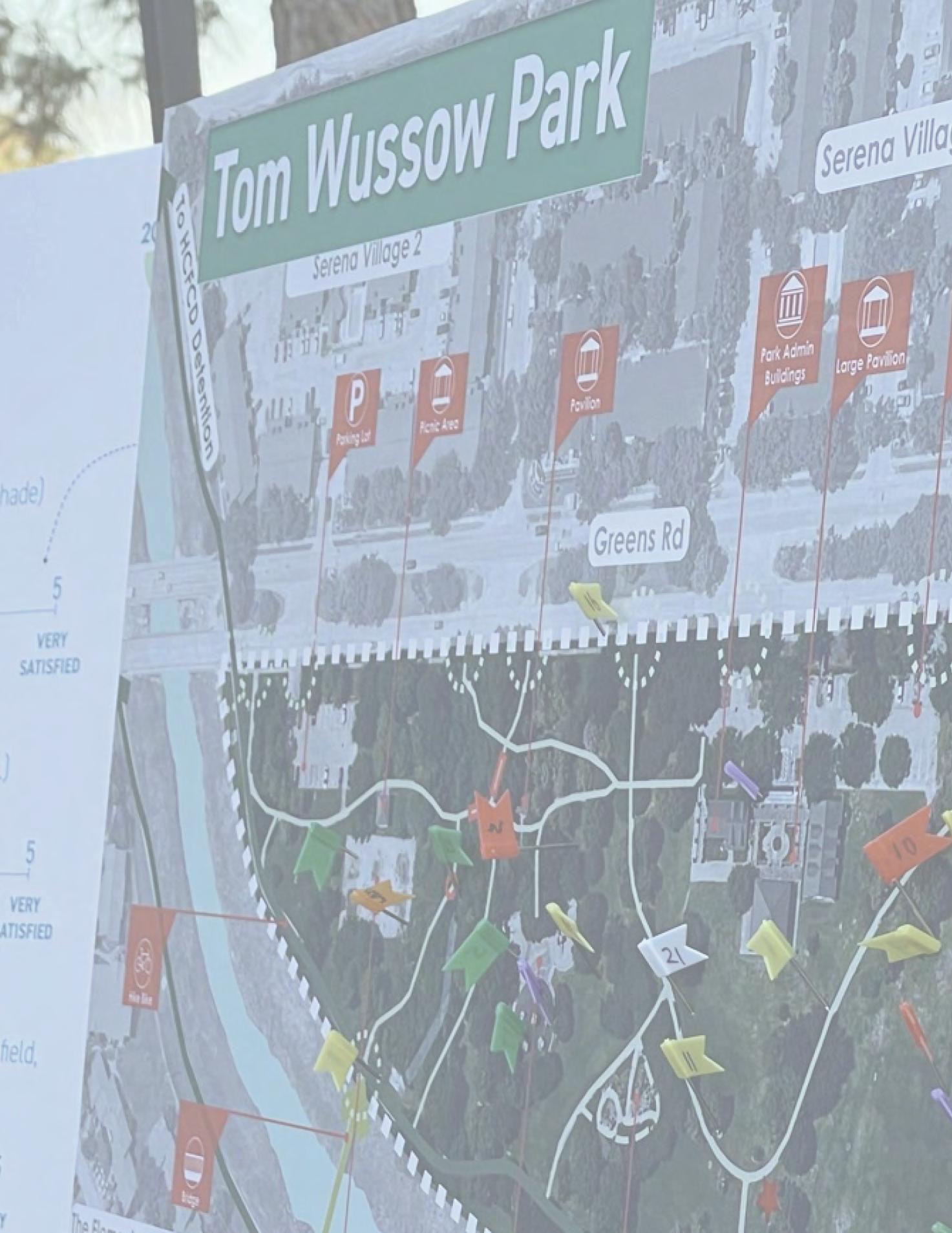
14 11 13 3 3 6 6 4 2 9 8 10 7 12 60’ 120’ 0 Soccer U8-10 Soccer U11-12 Soccer GREENS BAYOU LIMIT OF WORK BAYOU EXISTING TRIALS PROPOSED TRAILS BRIDGE BIKE RACK SAFE CROSSING 1 3 2 13 13 13 14 4 5 7 8 9 10 11 15 11 12 5 6 WUSSOW PARK WUSSOW PARK ANNEX NORTHGATE REGIONAL LIFT STATION 5 5 2 1 Greens Rd THE ROYAL PHOENICIAN
Program TBD PROGRAM WUSSOW PARK 1 Entry Sign 2 Bike Rack 3 Use TBD 4 Playground Expansion 5 Detention 6 Picnic Pavilion 7 Large Picnic Pavilion 8 Parking Expansion 9 Restroom 10 Improved Trails
Soccer Field
Mini Soccer Court
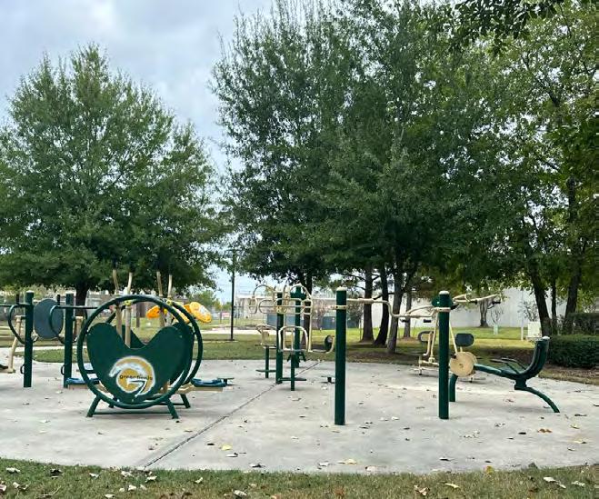
Outdoor Gym
PARK ANNEX
11
12
13
WUSSOW
Monument
Entry Sign
Bike Rack
Basketball Court
Playground
Detention
Picnic Pavilion
4
5
6
Large Picnic Pavilion
Parking
Restroom
Trails
Soccer Field
Pickleball Courts
Pedestrian Bridge
Meadow 12 2023 Parks Master Plan April 2023
8
9
10
11
12
13
14
IMPLEMENTATION AND FUNDING SUMMARY
The implementation of the North Houston District Parks Master Plan is a collaborative effort between different partner organizations. Partnerships will be crucial for the successful execution of strategies and recommendations listed in this Plan.
Chapter 4 explores partnership opportunities identifying assets and abilities, grants, financing options, and the prioritization of fund utilization for the proposed recommendations throughout the four quadrants.
The prioritization of projects between short, middle, and long term were determined based on project demand, feasibility, and frequency of project recommendation in past planning studies and documents.
2023 Parks Master Plan 13 April 2023
EXISTING CONDITIONS
1 14 2023 Parks Master Plan April 2023
DISTRICT OVERVIEW
To understand the parks and recreation system of North Houston District, we analyzed existing and future plans, as well as the context of the area’s demographic, land use, and ecology using GIS data. Our team also visited all of the parks in the district to better understand the inventory and condition of existing amenities, and identified potential opportunities within the parks system.
As the population has grown, with 51,326 residents who call North Houston District their home, so too has the District's inventory of parks and open spaces.
Today, there are a total of eight parks and the Greens Bayou trail network that provide much needed green space for recreation, access to nature, and stormwater detention in a highly developed area. This section includes a review of the Community Profile, Districtwide Ecology, Greens Bayou Greenway, a review of previous plans and studies, a system-wide Parks inventory, and an analysis of Thomas R. Wussow Park. The District has constantly evolved to understand and build on its assets through studies and plans to support their growth.
2023 Parks Master Plan 15 April 2023
MEDIAN
16 2023 Parks Master Plan April 2023 67 % 24 % 3% 3.9% 93 % multi-family homes single-family homes 7 %
Other White Black or African American LatinX/ Hispanic County No High School Diploma High School Diploma or GED Some College, No Degree City District $ 29,615 20.8% 30.6% Graduate or Professional Degree Bachelor's Degree Associate's Degree 1.9% 5.3% 5.5% 36% $ 53,600 $ 63,022 Source: 2020 US Census
DISTRICT WIDE COMMUNITY PROFILE
HOUSEHOLD
INCOME
DEMOGRAPHICS
EDUCATION
RACE AND
HOUSING
COMMUNITY PROFILES
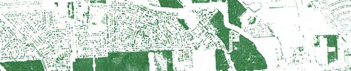
The North Houston District is a 12- square mile management district within the City of Houston and its extraterritorial jurisdiction, located at the intersection of Interstate 45 North and the North Sam Houston Parkway.
Within its boundaries the District is robust in community assets and land use, and comprises a mixed group of residents.
The District also retains a strong presence beyond its boundary, with its proximity to George Bush International Airport and the Port of Houston, and connectivity to the Greater Houston area, all which are key to attracting diverse residents and businesses to the District.
The North Houston District has a majority-minority population, with 67% of the population being represented by the LatinX/Hispanic community, followed by 24% of the population being Black or African American and 3% Non-Hispanic White. In addition to this, there is a small representation of Asian and Pacific Islander, as well as Indigenous people who also live in the District.
Overall, the highest concentration of land uses in the District are commercial (29 %), industrial (17%), and residential, which includes both single-family and multi-family developments (13 %). The District currently has a median household income of $29,615, that is lower than the median household income at the city and county level. There are a total of 15,429 residential units with 14,349 dwelling units (including condominiums) located within multi-family developments and 1,080 single-family homes. With a higher concentration of apartment and condominium units in the area, there is value to having access to safe, quality outdoor space. Existing opportunities to create and provide safe access to open, green spaces across the District are critical, but especially in areas where there is dense multi-family development.
Schools located in North Houston District are primarily served by Aldine Independent School District (ISD), and also by Spring ISD at its northern boundary. Majority of the schools in the District are located south of Greens Bayou, and close to the industries that are supported by the District. The existing network of schools and educational institutions present opportunities to establish partnerships targeting youth development.
The North Houston District is connected by roads, transit, and trails. Key roads that distinguish the District are Interstate Highway 45 (IH-45), running north to south, and the northern rim of Sam Houston Parkway (Beltway 8) which runs east to west through the District. Other major roadways that connect North Houston District include Greens Road, Greenspoint Drive, Imperial Valley Drive, and Aldine Bender Road. There are 11 METRO bus routes, as well as 8.1 miles of existing bike lanes primarily along Greens Bayou that also connect people within the District.
2023 Parks Master Plan 17 April 2023
18 2023 Parks Master Plan April 2023 GREENS CROSSING PINTO BUSINESS PARK AIRLINE CORRIDOR Source: 2020 U.S. Census SW Greenspoint Greens Crossing $ 29,615 $26,920 $31,811 $22,834 $36,894 NW Quadrant Greens Crossing District-Wide NE Quadrant Greenspoint SW Quadrant Pinto Business Park SE Quadrant Airline Corridor Airline Corridor Pinto Business Park 40% 25% 27% 8% DISTRICT QUADRANTS MEDIAN HOUSEHOLD INCOME POPULATION SIZE NE GREENSPOINT
DISTRICT QUADRANTS NW
GREENS CROSSING
The northwest quadrant of the District is Greens Crossing. This quadrant has a total population of 13,211, which accounts for 25% of the District's total population.
This quadrant has a total of 5,214 residential units, consisting of single-family homes and 4,963 units in multi-family developments.
Some key community assets and places in this area include 3 Aldine ISD schools, Houston Fire Department Station 84, and Houston Police Department North Belt Division.
NE GREENSPOINT
The northeast quadrant of the District is referred to as Greenspoint. This is the most populated quadrant in the District, making up 40% of the total population with 21,764 residents.
This quadrant has a total of 7,385 residential units, breaking down to 681 single-family homes and multifamily developments consisting of 6,704 units.
Some key community assets and places in this area are the Aldine-Greenspoint Family YMCA, Greenspoint Mall, 1 Aldine ISD School, and 1 Spring ISD School.
SWPINTO BUSINESS PARK
The southwest quadrant of the District is dominated by Pinto Business Park. This quadrant is the least populated quadrant with a total population of 4,534, which comprises about 8% of the district.
This quadrant has a total of 1,117 total residential units, with 132 single-family homes and 985 units within its multi-family developments.
Pinto Business Park is a key business institution in the North Houston District. The 971-acre business park primarily markets itself towards light manufacturing, warehousing, and supply chain distribution in the area.
SEAIRLINE CORRIDOR
In the southeast quadrant is Airline Corridor. This section of the District has a total population of 11,817 or about 27% of the district.
This quadrant has a total of 1,713 residential units, consisting of 16 single-family homes and multi-family developments consisting 1,697 units.
Some key community assets and places in this area are Aldine Branch Library, Houston Fire Station 74, and 7 Aldine ISD schools.
2023 Parks Master Plan 19 April 2023
DISTRICT-WIDE COMMUNITY PROFILE SE NE NW SW
DEMOGRAPHICS
27%
source: 2020 U.S. Census
source: 2020 U.S. Census
PARKS / OPEN SPACE
4 parks
4.18 miles of existing hike and bike trails along Greens Bayou.
PARKS / OPEN SPACE
6 parks
4.18 miles of existing hike and bike trails along Greens Bayou.
PARKS / OPEN SPACE
0 parks
0 miles
Currently not serviced by any bike trails.
PARKS / OPEN SPACE
3 parks
0 miles
Currently not serviced by any bike trails.
52%
37%
0% 10%
20 2023 Parks Master Plan April 2023
PERCENT OF TOTAL DISTRICT POPULATION AGE SEGMENTS BY QUADRANT of District Park acreage of District Park acreage of District Park acreage of District Park acreage AGE SEGMENTS BY QUADRANT AGE SEGMENTS BY QUADRANT AGE SEGMENTS BY QUADRANT PERCENT OF TOTAL DISTRICT POPULATION PERCENT OF TOTAL DISTRICT POPULATION PERCENT OF TOTAL DISTRICT POPULATION
PARKS + OPEN SPACE
40% 8%
GREENS CROSSING PINTO BUSINESS PARK GREENSPOINT AIRLINE CORRIDOR
0 to 17 38% 34% 27% 2% 18-34 35-64 65+ 0 to 17 37% 32% 27% 2% 18-34 35-64 65+ 0 to 17 41% 26% 27% 1% 18-34 35-64 65+ 0 to 17 34% 29% 31% 5% 18-34 35-64 65+
SE NE NW SW 25%
COMMUNITY ASSETS
33%
Houston Police Department - Greenspoint
Houston Fire Department - #84
Davis High School Plummer Middle School Spence Elementary School
CONNECTIVITY
Green House International Church
40%
Aldine-Greenspoint
Family YMCA
Griggs EC/PK/K School Greenspoint Elementary School
Houston Food Bank
Harvest Time Church
Blanson CTE High School
Thomas Gray Elementary School
Percent of Housing Units in Quadrant
8.5% 18.5%
Percent of Housing Units in Quadrant
source: 2020 U.S. Census
Stehlik Elementary School
Aldine Branch Library
Aldine High School
Stovall Middle School
Bussey Elementary School
Lone Star College-Houston
North Greenspoint
Marcella Elementary School
source: City of Houston
2023 Parks Master Plan 21 April 2023 METRO BUS ROUTE METRO BUS ROUTE METRO BUS ROUTE METRO BUS ROUTE BIKEWAYS BIKEWAYS BIKEWAYS BIKEWAYS
RESIDENTIAL RESIDENTIAL
CIVIC/INSTITUTIONAL CIVIC/INSTITUTIONAL CIVIC/INSTITUTIONAL CIVIC/INSTITUTIONAL CULTURAL/SPIRITUAL CULTURAL/SPIRITUAL CULTURAL/SPIRITUAL CULTURAL/SPIRITUAL 3.57 miles Existing 7.6 miles Proposed 3.91 miles Existing 6.7 miles Proposed 0 miles Existing 0.3 miles Proposed 0 miles Existing 3.5 miles Proposed
RESIDENTIAL
RESIDENTIAL
source: City of Houston
Housing
Percent of
Units in Quadrant Percent of Housing Units in Quadrant
LAND USE
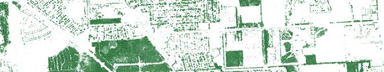
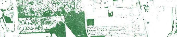
Commercial and industrial parcels make up the majority of the District. The commercial parcels are concentrated along the Beltway 8 and IH-45 corridors. The industrial parcels are located in the southwestern and northeastern borders. Green space including
parks, detention ponds, and open space are located along the Greens Bayou corridor.
A majority of the residential areas are in the northern quadrants of Greenspoint and Greens Crossing with a total of 12,599 residential units.
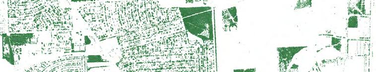
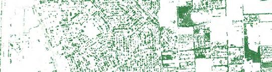
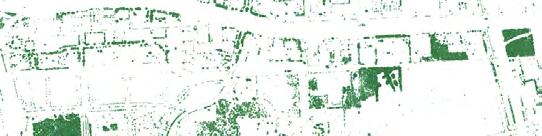
22 2023 Parks Master Plan April 2023 45 45 8 8 Greens Rd Rankin Rd Rankin Rd Aldine Bender Rd Greens Rd Imperial Valley Dr Ella Blvd Greens Crossing Blvd TC Jester Blvd Ella Blvd Imperial Valley Dr Legend Gov/Med/Edu Commercial Industrial Multiple Use Land Use Other Roadways District Boundaries Water Bodies Railroad Building Footprint Waterway Residential Parks/Open Spaces Undevelopable Vacant Developable Detention Basins 0 .25 .50 1.0 miles Sources: Houston-Galveston-Area-Council, City of Houston, Trust for Public Land
MAPPING
DISTRICT
CONNECTIVITY
The North Houston District is serviced by bus routes that connect the District to other areas of Houston. The bus stops are located at key access points to the Bayou's walking and biking trails. Future connectivity growth is anticipated with the addition of a total of
49.3 miles of proposed bike lanes, METRO Boost improvements along METRO 56 bus line, and the proposed Bus-Rapid Transit (BRT) corridor on Greens Road.
2023 Parks Master Plan 23 April 2023 45 45 8 8 Greens Rd Rankin Rd Rankin Rd Aldine Bender Rd Greens Rd Imperial Valley Dr Ella Blvd Greens Crossing Blvd TC Jester Blvd Ella Blvd Imperial Valley Dr Legend Roadways Railroad District Boundaries Waterbodies Waterway Bus Routes Proposed Transit Proposed Bike Path Existing Ped/Bike Paths 0 .25 .50 1.0 miles Sources: Houston Galveston Area Council, METRO, City of Houston
DISTRICT MAPPING
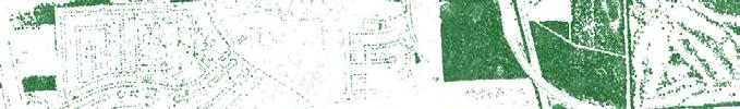
EASEMENTS
Existing and potential easements were mapped throughout the District. Primary utility easements are located along the southwestern border, E/W along Esplanade Blvd, N/S along W Hardy Rd, and one bisecting Greenspoint from Beltway 8 to Rankin Rd.
In addition, there is a continuous easement with Harris County Flood Control District (HCFCD) along both sides of Greens Bayou from end to end of the District.
Sources: Houston Galveston Area Council
24 2023 Parks Master Plan April 2023 45 45 8 8 Easements Potential Easements Legend Waterbodies Parks Detention Roadways Waterway
.25 .50
0
1.0 miles
DISTRICT MAPPING
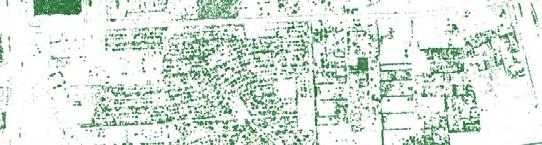
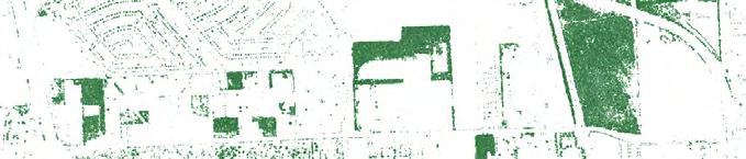
CAPITAL IMPROVEMENT PROJECTS
This map illustrates the existing and planned capital improvement projects (CIPs) in the District. Within the NE quadrant, existing CIPs are located along Greens Road, Imperial Valley Drive, Hardy Street, Greenspoint Drive, and Northchase Drive with planned improvements along Rankin Road, Wayforest Drive, Knobcrest Drive and along the Bayou towards Hardy
St. In the SE quadrant, existing CIPs are located along West Road with planned improvements along Airline Drive, Aldine Bender Rd, Imperial Valley Dr, and Wagon Rd. Additional planned improvements are also anticipated between the Rockstar Energy Bike Park and channel.
2023 Parks Master Plan 25 April 2023 45 45 8 8 Greens Rd Rankin Rd Rankin Rd Aldine Bender Rd Greens Rd Imperial Valley Dr Ella Blvd Greens Crossing Blvd TC Jester Blvd Ella Blvd Imperial Valley Dr Legend Roadways District Boundaries Water Bodies Waterway Sources: Houston-Galveston-Area-Council, Trust for Public Land, City of Houston, American Community Survey 5-year 2017-2021 Planned CIPs Existing CIPs Land Use Parks/Open Spaces Detention Basins 0 .25 .50 1.0 miles
DISTRICT MAPPING
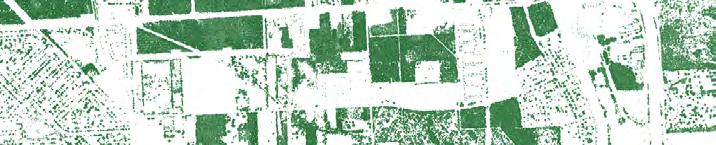
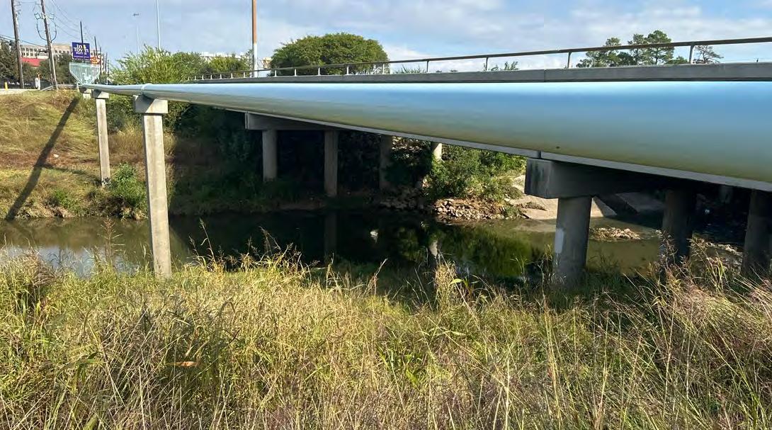
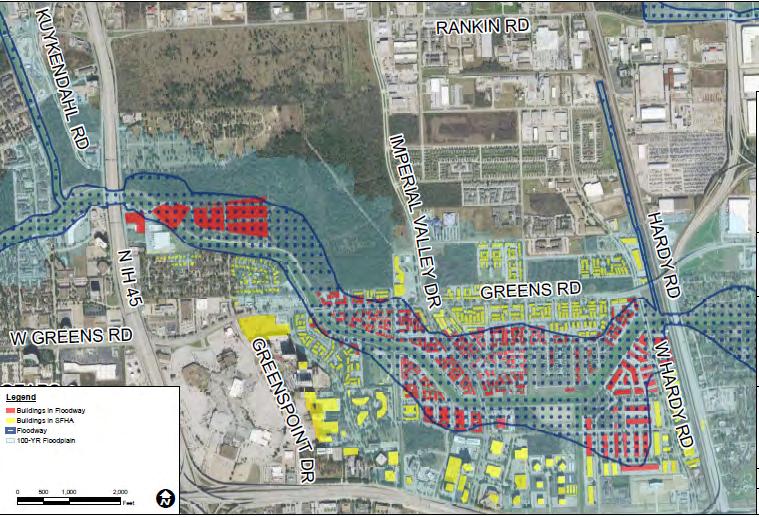
Greens Bayou traverses across the District and is one of the key natural assets that symbolize the area. There are 8.1 miles of trails along the Bayou which connect several multifamily developments to North Houston District’s parks. With the proximity to Greens Bayou, however, approximately 26% of properties in the District are vulnerable to the risks of flooding.
This breaks down to 546 acres of land in the 100-year floodplain and 2,515 acres of land within the 500-year floodplain. Flood plain analysis is illustrated in the map below. Floodplains and floodways are likely to change with the release of MAAPNext data in 2023.
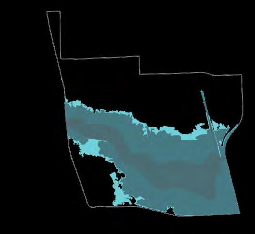
26 2023 Parks Master Plan April 2023 Within the Floodway 0% Within the Floodway 1% In the 100-Year Floodway 6% In the 100-Year Floodway 18% Within the Floodway 15% In the 100-Year Floodway 30% In the 100-Year Floodway Within the 500-Year Floodway Within the Floodway 5% 23% 28% Within the 500-Year Floodway 6% Within the 500Year Floodway 1% Within the 500-Year Floodway 6% 56% 50% 8% 26%
FLOODING
GREENS CROSSING NW GREENSPOINT NE PINTO BUSINESS PARK SW AIRLINE CORRIDOR SE
DISTRICT-WIDE FLOOD MAP
2023 Parks Master Plan 27 April 2023 45 45 8 8 Greens Rd Greens Rd Rankin Rd Rankin Rd Aldine Bender Rd Greens Rd Imperial Valley Dr Ella Blvd Greens Crossing Blvd TC Jester Blvd Ella Blvd Imperial Valley Dr Legend 100 year 500 year Floodway Flooding Roadways District Boundaries Waterbodies Parks Detention Basins Railroad Building Footprint Waterway 0 .25 .50 1.0 miles Sources: Houston-Galveston-Area-Council, Trust for Public Land, City of Houston,
DISTRICT MAPPING
TREE CANOPY
The overall concentration of tree canopies and vegetation density are located in the northern portion of the District in the NW and NE quadrants. While there is correlation of tree canopy density to the location of parks and open space, there are also higher concentrations of tree canopies in residential subdivisions and apartment complexes. It is also
worthwhile to note that though Greens Bayou is a publicly accessible green space for the community, it does not account for tree coverage in the area.
PERCENT OF TREE CANOPY COVERAGE WITHIN EACH QUADRANT


28 2023 Parks Master Plan April 2023
26.3% 22.4% 14% 18%
NW
NE
SW
GREENS CROSSING
GREENSPOINT
PINTO BUSINESS PARK
AIRLINE CORRIDOR SE
DISTRICT-WIDE TREE CANOPY COVERAGE
2023 Parks Master Plan 29 April 2023 45 45 8 0 .25 .50 1.0 miles
Houston Advanced Research Center
Sources:
DISTRICT MAPPING
SUMMARY OF EXISTING PLANS
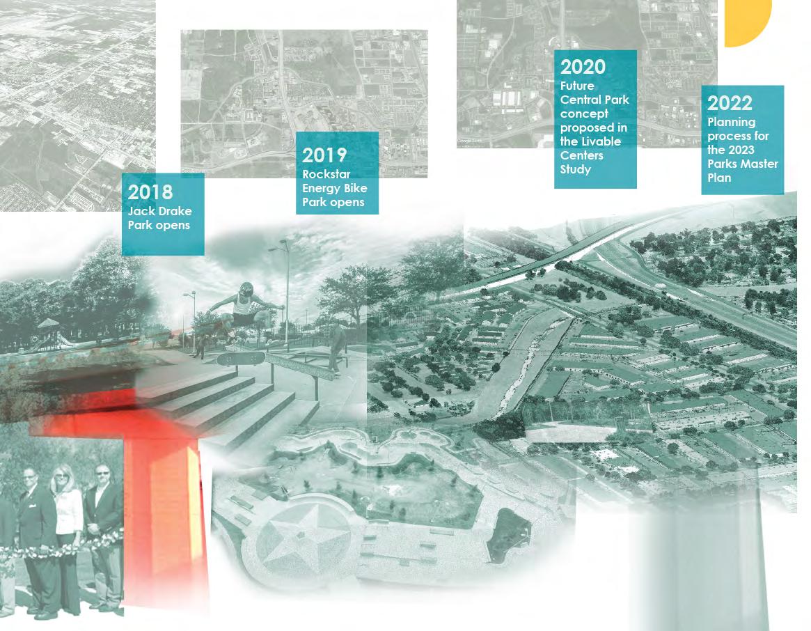
HOUSTON-GALVESTON AREA COUNCIL NORTH HOUSTON / GREENSPOINT LIVABLE CENTERS STUDY, 2020
The study proposed four major visions and recommendations to support them, to strengthen Greenspoint's attraction as a place to live and work based on its current strengths. Some key recommendations presented in the study are completing the Bayou Greenways (Vision Chapter, Pg. 15), establishing a North Houston Bikeways Network (Recommendation 5), and to create a Central Park along Greens Bayou (Recommendation 8). The study also recommended to implement a buy-out/buy-in program to help residents transition to more resilient housing options, which would supplement the Central Park vision.
GREENS BAYOU CORRIDOR COALITION (GBCC) MASTER PLAN, 2012
The GBCC Master Plan is a joint master plan created by the Greens Bayou Corridor Coalition and the National Parks Service, examining the full extent of Greens Bayou from US 290 to the Houston Ship Channel. Some key opportunities within the North Houston District that are identified in this plan include:
• Create a Nature Park with the HCFCD land to the north of Wussow Park. The recommendation also examined opportunities to extend the park to make a connection to the parks located to the west of IH-45.
• Acquire the Northgate Recreation Area and Community Center as part of the AldineGreenspoint YMCA expansion or as an additional recreation and community facility for the District.
• Connect the trails on the north bank of the Greens Bayou to the east towards Hardy Toll Road to establish a larger, regional linear park system.
30 2023 Parks Master Plan April 2023
HARRIS COUNTY FLOOD CONTROL DISTRICT GREENS BAYOU MID-REACH CHANNEL CONVEYANCE IMPROVEMENTS, PRELIMINARY ENGINEERING REPORT, 2022
The preliminary engineering report evaluated whether the recently completed and planned improvements for the Greens Bayou Mid-Reach Channel, an existing channel right-of-way (ROW) could achieve a 10-year System Capacity. The report concluded that phased improvements to add one additional basin just east of Hardy Toll Road in an area identified as part of the Harris County Flood Control District (HCFCD) would improve the existing system capacity. The report includes cost estimates for each phase.
COMMUNITY DESIGN RESOURCE CENTER AT THE UNIVERSITY OF HOUSTON COLLABORATIVE COMMUNITY DESIGN INITIATIVE: ISLANDS, 2012
The publication serves as a guide for change in four partner communities of the Community Design Resource Center at the University of Houston (CDRC), which included Greenspoint. While the publication considered broad community issues and input within Greenspoint, the tools presented related to parks and open space enhancement include:
• Enhance the attractiveness and connectivity of the underpasses of IH-45 and Beltway 8.
• Unite residents and office workers together by encouraging mixed-use development comprised of new housing, green spaces, recreational amenities, and access to transit options.
• Relocate multi-family complexes out of the floodplain and repurpose those area as recreational and open space, and flood detention.
• Enhance the system of parks and trails in Greenspoint to patch and connect existing open spaces.
2023 Parks Master Plan 31 April 2023
NORTH HOUSTON DISTRICT DRAINAGE EVALUATION REPORT, 2016
The purpose of this study was to better understand the regional flooding sources and patterns, and to identify the potential impact of future construction of regional detention basins. Based on high-level 2D storm water analysis, the study recommended to continue pursuing buyout of repetitive/severe repetitive loss properties and to establish localized detention/multiuse parks in those areas. It also identified funding sources for flood risk mitigation.
GREENSPOINT DISTRICT PARKS PLAN, 2008
The District identified and assessed existing parks and open spaces based on meeting National Recreation and Park Association (NRPA) standards and input from the community. The study highlighted recommendations that remain prevalent in the District today including:
• Extending the existing trail on Greens Bayou
• Continuing the District's partnership with the YMCA
• Expansion of Wussow Park with the acquisition of the Northgate Wastewater Treatment Plant
32 2023 Parks Master Plan April 2023
HOUSTON PARKS AND RECREATION DEPARTMENT PARKS MASTER PLAN, 2015
The City of Houston Parks and Recreation Department (HPARD) conducted a two-year assessment and established a Parks Master Plan for each Park Sector based in 2015. The North Houston District is located in the boundaries of Park Sectors 1, 2, and 20. In all the plans, HPARD recognizes the role the District plays in park acquisition, redevelopment of land, and maintenance of parks.
The physical facilities of parks and open space managed by the District were not considered in the plan or the needs assessment. The plan, however, lists priorities such as developing neighborhood connections to parks and trails and establishing partnerships with the school districts and other entities, which are also in line with future needs for 2040 identified for the respective park sectors. In the study, the Stovall Middle School SPARK park was the only existing SPARK facility. There are opportunities to partner with HPARD and SPARK parks to establish more publicly accessible parks and open space to enhance access and connectivity within the District.
2023 Parks Master Plan 33 April 2023
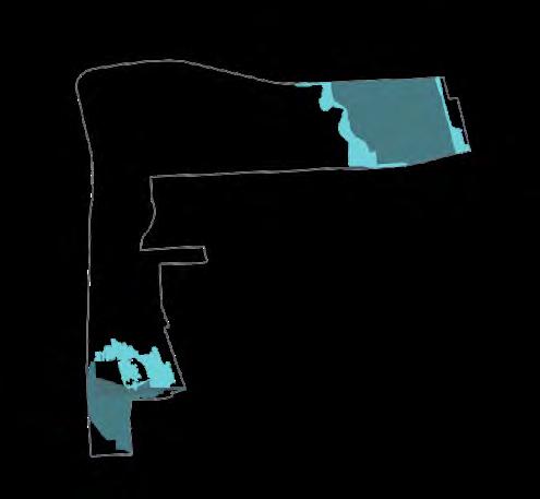
GREENS BAYOU
Greens Bayou runs through the heart of the District and most of the District is located within the Greens Bayou Watershed. The Greens Bayou Greenway is bounded by Rankin Road to the north, Beltway 8 to the south, Beltway 8 to the west and Hardy Road to the east.
Land use along the Bayou is predominately residential multi-family housing with the exception of some commercial parcels near IH-45 and industrial parcels located at the eastern edge of the District.
PARKS
Most of the District's existing parks are located along the Bayou. In total, there are seven existing parks, which include the North Houston Skate Park, Dylan Park, Rockstar Energy Park, City View Park, Jack Drake Park, and Wussow Park.
Potential Parkland
There are several undeveloped or vacant land parcels of interest along the Bayou. These are highlighted as potential parkland opportunities. From left to right, these includes:
• An undeveloped parcel owned by Houston Parks Board before Beltway 8.
• Approximately 8 acres of undeveloped land owned by the District on the south side of Greens Bayou to the west.
• City of Houston Wastewater Treatment Plant (WWTP) located just south of Wussow Park.
• In addition, there are several detention ponds that could serve as dual-use recreational amenities. These are identified on the following page.
W ATERINFRASTRUCTU R E
The parks and open space system is a critical component of flood resiliency in the community. The greenway is home to a network of channels, streams and detention ponds that drain into the Bayou.
34 2023 Parks Master Plan
Waterway
Floodway
Floodplain - 100 years
Floodplain - 500 years
Existing Detention
Proposed Detention
Proposed Bikeway
Existing Access Point Potential Access Point
Existing Pedestrian Bridge
The District currently includes about 6 miles of trails along Greens Bayou. About half of the trails are located in the Greens Crossing neighborhood and the other half in Greenspoint.
Several existing and planned trail improvements have been identified that build upon the District's connectivity.
2023 Parks Master Plan 35 April 2023
W ATERINFRASTRUCTU R E CONNECTIVITY PARKS
Park Future Park
CONNECTIVITY Existing
Existing Trail Proposed Trail
EXISTING AND FUTURE
DETENTION BASINS
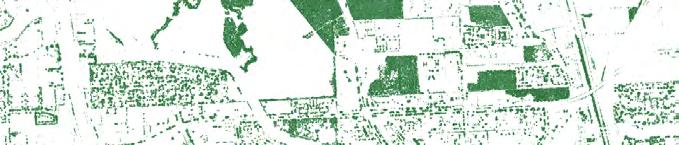
Several recent as well as planned detention areas along Greens Bayou present an opportunity for open space and parkland development through dual-use detention:
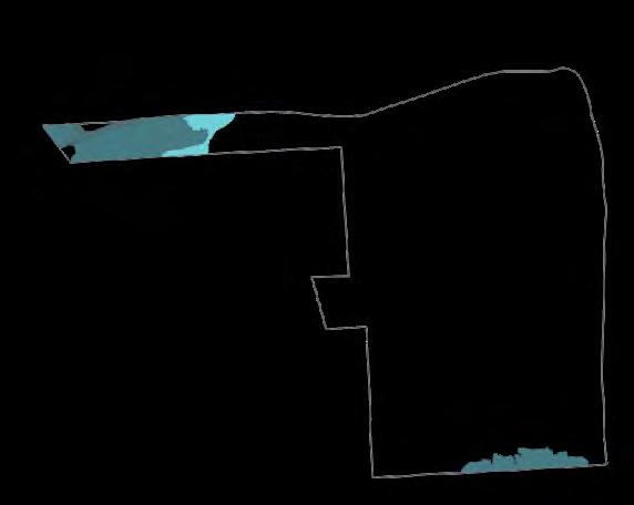
• Glen Forest is one of four detention basins alongside the mid-reach portion of the Bayou that is designed to target a 10-year level of protection. Completed in March 2021, the 160-acre site holds 2643 acre-feet, or 861.2 million gallons, of excess stormwater. (See Appendix B for info on HCFCD Basins)
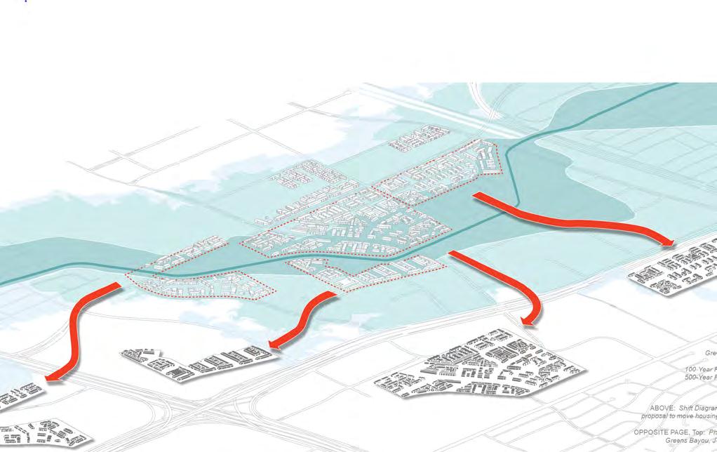
• There are a number of properties located in the lowest lying areas north of Greens Road adjacent to Greens Bayou that are most at risk and represent repetitive loss and severe repetitive losses properties. This area is proposed as a future Central Park in the Livable Centers Study (shown in pink on the image to the right). This includes properties of Arbor Court and Biscayne Apartments.
• An existing 8.5-acre detention pond parcel adjacent to Jack Drake Park.
36 2023 Parks Master Plan April 2023
Legend Keep Retrofit Priority Buyout Area Parks & Open Space Study Area Roads 0 1mile ¼½ Redevelop for Resilience Buildings Detention Basin Greens Bayou HardyTollRd Hardy Toll Rd Greens Rd GreensRd 45 45 8 8 Imperial Valley Dr Imperial Valley Dr Hardy Rd Be a Place That Offers Accessible, Affordable Housing for the Region 147
Figure 4.15 Areas for Property Interventions
Areas for Property Interventions Map showing priority buyout areas (pink) along Greens Bayou (Livable Centers Study)
PARKS Existing Park Future Park W ATERINFRASTRUCTU R E Waterway Floodway Floodplain - 100 years Floodplain - 500 years Existing Detention Proposed Detention
GREENS BAYOU TRAIL
Along Greens Bayou, the District currently offers about 6 miles of trail, with about half of the trail in the northwest quadrant (Greens Crossing) and the other half in the northeast quadrant (Greenspoint).
The western terminus begins just north of Beltway 8 with sections along the northern and southern banks of Greens Bayou until Ella Blvd where the northern section terminates. The southern portion continues east along the Bayou until IH-45 where a pedestrian bridge connects the trail to Rockstar Energy Bike Park, North Houston Skate Park, and Dylan Park.
Directly to the east of IH-45, the trail system begins again and includes trails on the north and south side of the Bayou that begin at Knobcrest Dr. The northern trail's eastern terminus is located at Imperial Valley Drive while the southern trail extends further with the terminus located at Jack Drake Park. This segment includes four crossings: Knobcrest, Greens Rd, a pedestrian bridge near Wussow Park, and at Imperial Valley Dr.
Access Points
There are 12 existing access points primarily centered around Imperial Valley Dr., Greens Rd., with additional access points at City View Park, Benmar Dr., and at IH-45.
The H-GAC Livable Centers study has identified three additional access points at Greenspoint Dr. and two locations at Jack Drake Park. These proposed access points connect to proposed pedestrian bridges that improve connectivity to the future bikeway network and trail extension.
Pedestrian Crossings
There are currently two existing non-vehicular crossing over Greens Bayou located at the western boundary of Wussow Park and just West of IH-45.
Gateways and Trailheads
Over the years, the District has constructed a variety of gateways and placemaking elements along the trail. Gateway markers can include elements such as vertical greens (Ella), or the recent public art installations at Imperial Drive. These elements add a unique character, however, the system as a whole lacks cohesive branding including signage and wayfinding to unify parks and open space throughout the District.
2023 Parks Master Plan 37 April 2023
PARKS Existing Park Future Park CONNECTIVITY Existing Trail Proposed Trail Proposed Bikeway Existing Access Point Potential Access Point Existing Pedestrian Bridge
PARK SYSTEM INVENTORY
The park and recreation system inventory aimed to understand the quantity, quality, location, and types of park and recreation facilities that currently exist in North Houston District.
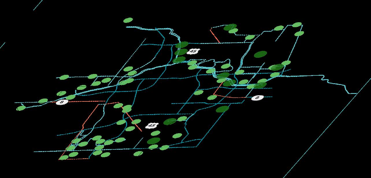
The project team visited each of the park and recreation areas and documented the amenities, accessibility, and overall condition and status of the identified park and recreation areas and its amenities. Overall, 17 parks and open spaces, including vacant land that pose opportunities for the District were inventoried through this process, which is summarized in the matrix following this page.
Typically, smaller open parks and spaces addressed localized needs such as having small playgrounds, well maintained sidewalks, and site furniture.
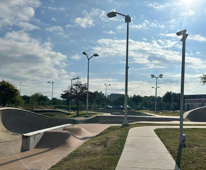
Larger parks and open space draw users from outside of the District for destination activities such as BMX and skateboarding at Rock Star Energy Bike Park and North Houston Skate Park respectively.
Neighborhood parks that are in close proximity to each other differentiate themselves and establish character through paving material, planting material and spatial quality. However, based on the teams' observations, it seems that these parks lack different programs that would serve different age groups. The team did not make an observation for any park or open space in the system that served as a central community park during the inventory process. This is a potential need in the broader area that could meet the demand for more concentration of athletic and other recreational amenities.
EXISTING PARKS
Buckboard Park
City View Park
Dylan Park
Ida Gaye Gardens
Jack Drake Park
North Houston Skate Park
Rockstar Energy Bike Park
OTHER PARK AREAS
Marcella Elementary SPARK Park
Stovall Middle SPARK Park
Thomas R. Wussow Park Greenspoint Community Park
FUTURE PARK AREAS
W Greens Road Parcel
Glen Forest Detention Basin
Central Park Detention Jack Drake Park Detention
38 2023 Parks Master Plan April 2023
HPB Tract 1 2 3 6 4 7 5 8 9 A 10 B 11 C D E F
WWTP
PARKS
2023 Parks Master Plan 39 April 2023 NE GREENSPOINT NW GREENS CROSSING SE AIRLINE CORRIDOR PINTO BUSINESS PARK SW Existing Park Other Parkland Existing Trail Future Park Area Walkshed
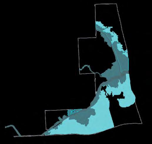
PARK ACCESSIBILITY
PARK WALKSHEDS
There is a great value in ensuring that availability and access to these spaces are in reach across all neighborhoods within the District. The Walkshed Map is a planning tool that identifies what areas are within a 10-minute walk to a park or trail. In the North Houston District, approximately 51% of residential properties have access to a park or trail within a 10-minute walk.
Greens Bayou, as shown on the map, plays a large role in providing connectivity throughout the District
with its trails, especially in the NE and NW quadrants, where Greens Bayou crosses through the District. Many of the parks and open spaces throughout the District are also within walking distance to Greens Bayou, which also helps broaden the radii of access to green space for North Houston District residents.
IH-45 and Beltway 8 are key thoroughfares that define the District, however, they also pose (IH-45 and Beltway 8) a physical hindrance to the connectivity of the parks system and people’s ability to access them.
40 2023 Parks Master Plan April 2023 Legend 0 .25 .50 1.0 miles Sources: Houston-Galveston-Area-Council, Trust for Public Land, City of Houston, Greens Rd Rankin Rd Rankin Rd Aldine Bender Rd Greens Rd Imperial Valley Dr Ella Blvd Greens Crossing Blvd TC Jester Blvd Ella Blvd Imperial Valley Dr 45 Existing Park Existing Trail Detention Basin Walkshed Waterway NE GREENSPOINT NW GREENS CROSSING SE AIRLINE CORRIDOR PINTO BUSINESS PARK SW
DISTRICT EXISTING PARK ACRE & POPULATION ANALYSIS
Another component of accessibility is the amount of available park acreage relative to population to determine whether there is enough parkland. While there is no standard acreage and the number can vary widely based on a variety of factors, this analysis indicates that the district's park acres per 1,000 residents is only 5.05 acres whereas the national median is 10.6 acres.
Within the District, the NW, SW, and SE quadrants have less parks and a low acreage of parks per residents.
NW GREENS CROSSING
PINTO BUSINESS PARK SW
AIRLINE CORRIDOR
2023 Parks Master Plan 41 April 2023
Population Park Acreage Park Acres per 1000 Residents Population per Park NW Greens Crossing 13,211 29.13 11.66 3,896.00 NE Greenspoint 21,764 20.90 2.54 3,176.50 SW Pinto Business Park 4,534 0 0.00 4,534.00 SE Airline Corridor 11,817 5.30 1.96 3,232.67 District Total 51,326 55.33 5.05 3,792.23 National Lower Quintile 5.40 1,227.00 National Median 10.60 1,941.00 National Upper Quintile 17.20 3,125.00 NE GREENSPOINT
SE
PARK SYSTEM INVENTORY MATRIX
Park Name Classification Acres Year Developed Relevant Oranizations 1 Buckboard Park Neighborhood Park 5.3 2008 Greater Greenspoint Redevelopment Authority 2 City View Park Neighborhood Park 2.5 2003 NHD Palm Beach Estates 3 Dylan Park Neighborhood Park 4.43 2014 Greater Greenspoint Redevelopment Authority 4 Ida Gaye Gardens Neighborhood Park 3.0 2011 NHD Langwick Senior Residences, L.P. 5 Jack Drake Park Neighborhood Park 4.0 2018 NHD 6 North Houston Skate Park Community Park 5.4 2013 Greater Greenspoint Redevelopment Authority 7 Rockstar Energy Park Regional Park 19.30 2019 Greater Greenspoint Redevelopment Authority 8 Thomas R. Wussow Park Community Park 11.40 2003 TIRZ, YMCA, NHD 9 Marcella Elementary Spark Park Neighborhood Park 6.1 2018 Aldine Independent School District 10 Stovall Middle Spark Park Neighborhood Park 5.5 2014 Aldine Independent School District 11 Greenspoint Community Park Neighborhood Park 4.2 2016 Aldine Independent School District Buckboard Park City View Park Dylan Park Ida Gaye Park 42 2023 Parks Master Plan April 2023
Picnic Areas Trails Baseball Soccer Basketball Water Feature Park Admin Buildings Restroom Playground Public Art Other X X X X Educational Signs X X Passive Use X X X X X Accessible Park Design X X Garden; Fitness Station X X Viewing Platform X X X X X X X X X X Performance Stage X X X X X X X X X X X X X X X X X X
2023 Parks Master Plan 43 April 2023
Jack Drake Park Marcella Elementary School Rockstar Energy Park
EXISTING PARKS
BUCKBOARD PARK
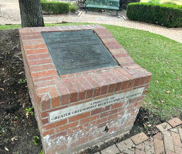
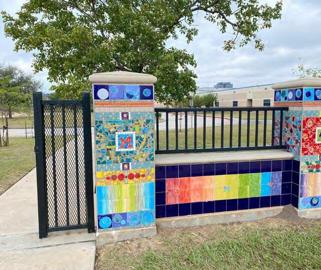
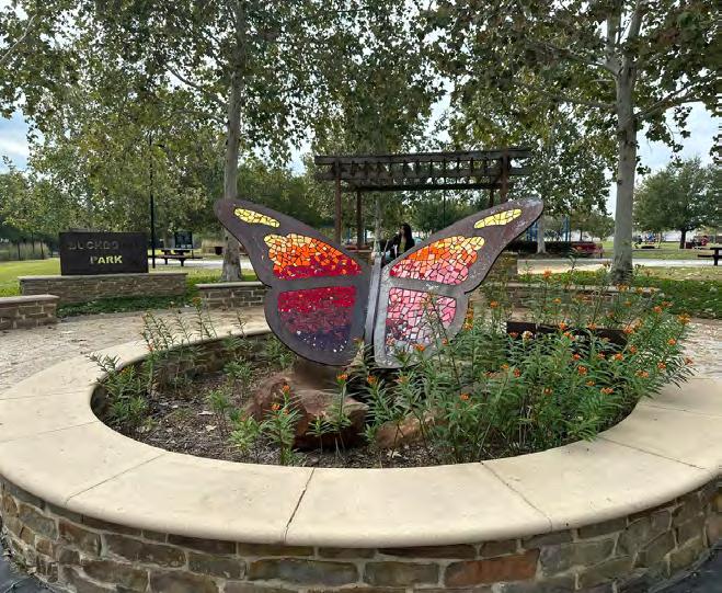
Buckboard Park is considered a neighborhood park located in the southeast quadrant of the District. At 5-acres, the park includes public art, a playground, trails, and picnic areas. Art is a major attractor throughout the park with colorful mosaics, sculptures and painted manholes that make this a beautiful place to enjoy and experience art installations.
Owners: GGRA
Size: 5.30 acres
Address: 70 Buckboard Dr
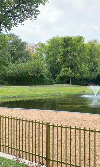
CITY VIEW PARK
Located in the northeast quadrant (Greenspoint) of the District, City View Park is one of the first parks developed by the District alongside Wussow Park in 2003. It is considered a neighborhood park with a pavilion, picnic tables and benches. Although the park has access along the Greens Bayou Trail network and City View Place, its visibility is limited due to its location behind the Palm Beach Estates apartment complex and limited signage.
Owners: NHD
Size: 2.50 acres
Address: 16822 City View Place
DYLAN PARK
Dylan Park was created in memory of Dylan Newman, a child abuse victim who later passed away. The park is located in the northwest quadrant (Greens Crossing) of the District directly adjacent to the North Houston Skate Park which shares the same administrative facilities. It is carefully designed to inspire children of different ages and capabilities, featuring an all inclusive and accessible playground with a colorful rubberized surface that allows children to explore interactive play equipment, textures and surfaces.
Owners: GGRA
Size: 4.43 acres
Address: 12351 Kuykendahl Rd
44 2023 Parks Master Plan April 2023
Butterfly garden
Walking trails
Accessible Playground
IDA GAYE GARDENS
Located in the northeastern quadrant (Greenspoint) of the District, Ida Gaye Gardens is a 3.2-acre park designed to encourage an active, healthy lifestyle for the senior citizens in the area. It includes walking trails, a pond, specialized exercise equipment, an area for structured exercise classes and raised gardens. Connectivity and access to the park happens along Langwick Drive's northern edge. Currently, there is no dedicated parking area for the park, other than on-street parking and there is limited safe crossing for pedestrians approaching the site from the south.
Owners: NHD
Size: 3.2 acres
Address: 16135 W. Hardy Rd
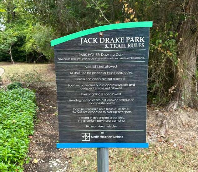
JACK DRAKE PARK
Jack Drake Park is a 4-acre park located within the northeastern (Greenspoint) quadrant of the District. It serves as the trailhead for the Greens Bayou Trail on the eastern side of the district with an additional access point from Hedgecroft Drive where the parking lot is located. Its focus is to provide users the opportunity to access nature through natural restoration strategies and a decomposed granite trail loop. It also provides benches and public art to expand users' experience.
Owners: NHD
Size: 4.0 acres
Address: 641 Bradfield Rd
NORTH HOUSTON SKATE PARK
North Houston Skate Park opened in 2014 and is located at the intersection of Rankin Road and Kuykendahl Road in the northwest quadrant (Greens Crossing). It is the largest skate park in North America, featuring world class, competition-scale professional features. The park shares the same entrance and other amenities with Dylan Park. Although the park is in excellent condition, it could benefit from additional shade, seating areas and other comfort amenities for its users.
Owners: GGRA
Size: 5.40 acres
Address: 12351 Kuykendahl Rd
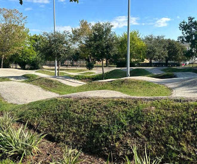
ROCKSTAR ENERGY BIKE PARK
Rockstar Energy Bike Park is the newest addition the North Houston District's park system in the northwestern quadrant (Greens Crossing). It is located along Kuykendahl Road directly adjacent to Dylan Park and the North Houston Skate Park. It features a world-class BMX race track with different sections that provide a diverse riding experience to users. It also houses an event center that can seat approximately 3,500 people.
Owners: GGRA
Size: 19.30 acres
Address: 12351 Kuykendahl Rd
2023 Parks Master Plan 45 April 2023
Specialized exercise equipment
Benches along the trail
Skate equipment
Bike trail
46 2023 Parks Master Plan April 2023
2 ENGAGEMENT
The North Houston District Parks Master Plan engagement sought to capture a combination of public and stakeholder feedback, enabling the consideration of community voices alongside the opinion of key stakeholders. This section includes an overview of the process, including goals, strategies, and principles that informed engagement, as well as key findings and results.
OVERVIEW
As a community where previous public engagement encountered low public participation, efforts for the North Houston District Master Plan had to employ strategies which deviated from traditional, formalized engagement events.
Informed by community perspectives in previous engagement efforts, the engagement plan for the 2023 Parks Master Plan included a combination of stakeholder meetings with public pop-up events. A six (6) month effort between October 2022 and March 2023, engagement for the 2023 Parks Master Plan featured two (2) public engagement pop-ups at Thomas R. Wussow Park and three (3) stakeholder meetings.
STRATEGIES
• Meet people at the park - the public pop up events allowed the planning team to directly engage North Houston District park users.
• Provide bilingual engagement to capture input from Spanish speakers.
• Rely on strong partner organizations to support visioning and implementation.
2023 Parks Master Plan 47 April 2023
ENGAGEMENT TIMELINE
Project engagement ensured the development of a master plan aligned with the vision of the North Houston District and its partners and considerate of community preferences. This timeline summarizes the key engagement events that occurred during the planning process. This process both helped establish a foundation for the project’s goals and contributed to the project’s direction at key moments, including the refinement of recommendations and concept plans.
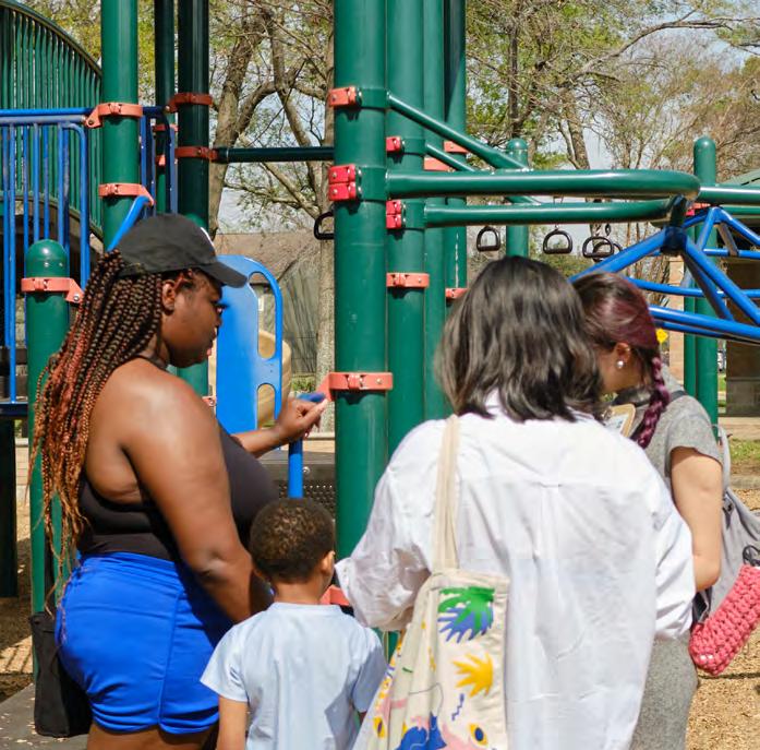
October 4th, 2022
Pop Up #1 Initial Understanding
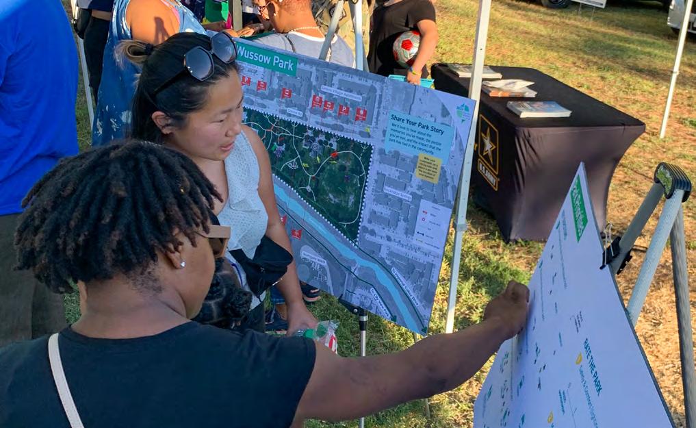
• As part of the National Night Out event at Wussow Park, 25 attendees provided 40 comments related to their park experience and preferences
• A park map activity helped attendees share their own Wussow Park stories
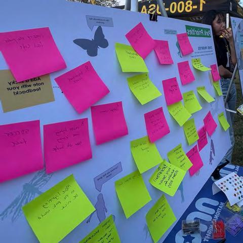
• A park priorities activity encouraged users to reflect on their park experience and explain their usage and perspective of various park amenities and characteristics
October 27th, 2022
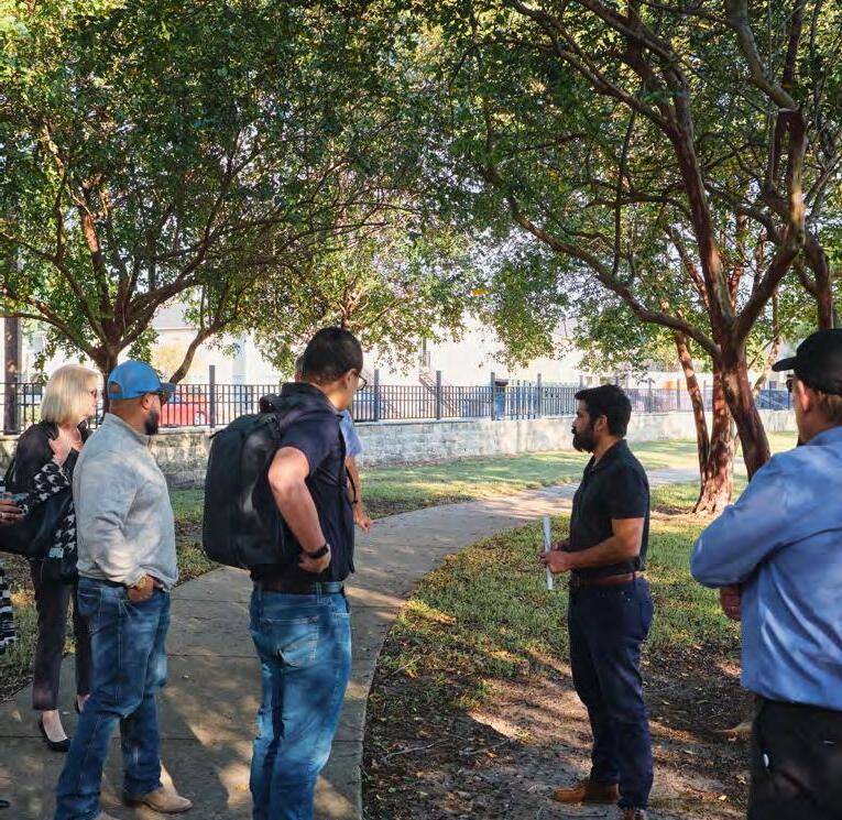
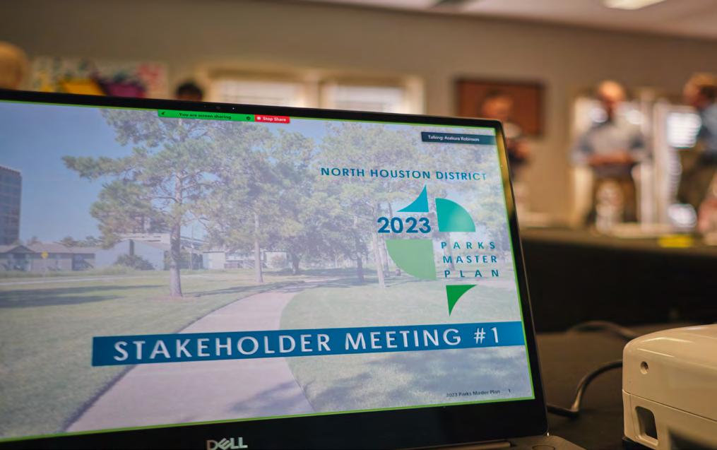
Stakeholder Meeting #1 Partnerships and Vision
• Nine (9) stakeholders representing eight (8) organizations participated in the stakeholder committee's inperson kick-off meeting
• An open-ended discussion allowed stakeholders to establish project goals derived from initial community feedback
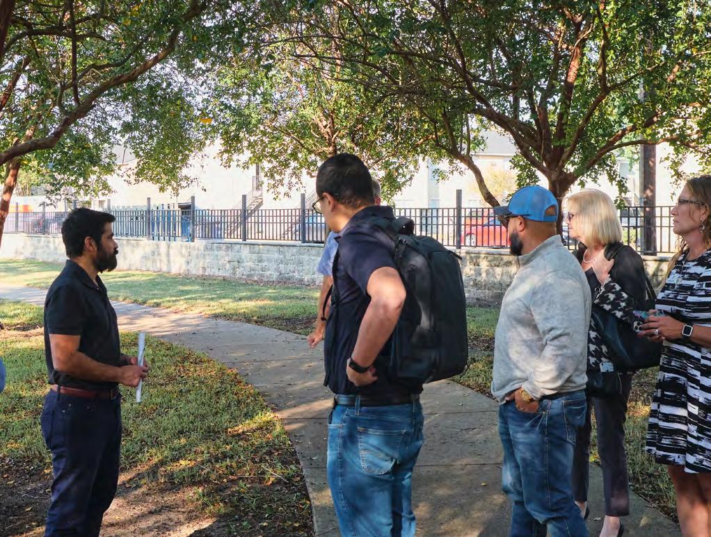
• A tour of Wussow Park served to demonstrate the plan's tangible possibilities to stakeholders
 Stakeholder Meeting #1 INTROS
48 2023 Parks Master Plan April 2023
Pop-Up #1
NATIONAL NIGHT OUT
February 8th, 2023
SURVEYS
February 25th, 2023
March 29th, 2023
Identify Feasibility/Priority
• 12 stakeholders attended a virtual meeting showing the master plan’s progress and presenting initial park concept designs
• A feedback session allowed stakeholders to identify potential opportunities and challenges related to districtwide and bayou-scale master plan recommendations

• Using the online tool Jamboard, users provided eight (8) comments directly on four (4) initial Wussow Park concepts (See page 84)
• On a Saturday, project team members approached approximately 40 Wussow Park users to present stakeholderselected priority concepts
• Users were asked to identify their preferred concepts and provide additional, overall park feedback
• Conversations with users helped the District and design team understand the community’s attitude on the potential plan
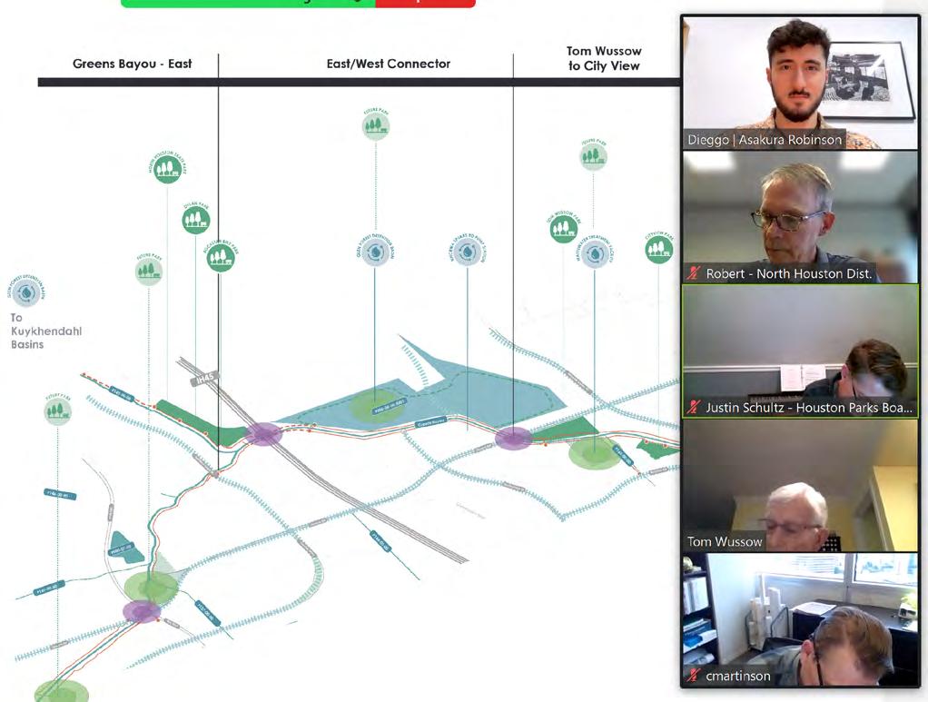
• The final draft of the master plan was presented to 13 attendees at a virtual meeting
• Feedback session outlined the plan's recommendations at the district and Bayou scales, presented the final Wussow concept, and listed known partnerships
• Discussion feedback affirmed stakeholder's support for the project and provided additional perspectives for enhancing small details
Pop Up #2 INTERCEPT
Stakeholder Meeting #3 FINAL PLANS
2023 Parks Master Plan 49 April 2023
Stakeholder Meeting #2 FEASIBILITY
Stakeholder Meeting #2
Pop-Up #2 Community Preferences
Stakeholder Meeting #3 Master Plan
KEY FINDINGS
PUBLIC ENGAGEMENT
3 out of 4 park elements received 3 or lower star ratings
When rating four (4) key park ratings, Safety & Comfort, Maintenance, Amenities, and Programming, attendees gave no higher than three (3) stars to all characteristics except Maintenance. These results outline possible park challenges and concerns.
Over half of respondents use the park for active leisure
Comprised of sports, exercise, and play, active leisure stands as the most popular activity type at Wussow Park, indicating community members’ leisure preferences while highlighting potential opportunities for integrating new programming (see Appendix A).
Majority of users prioritized multigenerational spaces
When presented with two concept design options for the future of Wussow Park, park users most often selected option 1 as their preferred choice, commonly citing the design’s creation of multigenerational spaces (see Appendix A).
Basketball represented users’ top programmatic request
With soccer recognized as Wussow Park’s most popular sport, users noted a need for more basketball facilities, citing a lack of facilities both throughout the surrounding community and in the presented concept designs (see Appendix A).
MOST COMMON FEEDBACK TOPICS
MOST COMMON CONCEPT DESIGN TOPICS
50 2023 Parks Master Plan April 2023
Asakura Robinson Team leading National Night Out engagement. 4 October 2022. Asakura Robinson.
SPORTS LIGHTING WALKING
PLAYGROUND BASKETBALL SOCCER
Topics most frequently represented in park comments and stories (See appendix xx).
STAKEHOLDER ENGAGEMENT
A stakeholder group provided insight toward the master plan's development, leveraging their expertise to highlight possible opportunities and challenges related to the plan’s feasibility. The North Houston District led selection for the 16-person group, representing various local and municipal perspectives (see Appendix A for stakeholder membership details). A series of stakeholder meetings then established a feedback loop to help envision and create project goals and direction throughout the master planning process.
Meeting #1
INTRODUCTION + WUSSOW PARK TOUR
• While discussing strategies for developing master plan recommendations, stakeholders identified 16 potential partnerships and 19 initiatives within or adjacent to the North Houston District
• A tour of Wussow Park provided design direction and points of consideration for future concept plans, including priorities and challenges such as sport fields, trails, and splash pads
Meeting #2
FEASIBILITY + INITIAL CONCEPT PLANS
• Stakeholders highlighted the use of easements as possible priorities for achieving District connectivity, citing their higher feasibility related to safety and cost compared to road-based improvements
• Of 4 concepts presented (see page 84), stakeholders largely preferred concept 3a due to its compatibility with existing programing and overall utility benefit for nearby communities.
Meeting #3
FINAL RECOMMENDATIONS + PLANS
• Stakeholders continuously voiced support for the project throughout the presentation of overall plan recommendations
• Feedback mainly requested consideration of additional details for enhancing and activating spaces to ensure safety and success of enhancements, including circulation and lighting
2023 Parks Master Plan 51 April 2023
Asakura Robinson Team leading Wussow Park tour. 27 October 2022. Asakura Robinson.
Asakura Robinson Team leading Stakeholder Meeting 3. 29 March 2023. Asakura Robinson.
Stakeholders identified new partnerships and initiatives within or adjacent to the North Houston District. 27 October 2022. Asakura Robinson.
52 2023 Parks Master Plan April 2023
3
VISION
The Vision for the North Houston District Parks Master Plan is an effort to take stock of the existing parkland, partnerships, and community to create a cohesive network of parks, trails, and open space.
It is guided by Goals and Guiding Principles, which were shaped by understanding the current conditions of the District, existing plans, and the input provided by members of the public, stakeholders, and the District. The goals to Connect, Activate, Enhance, and Unify aim to strengthen the identity and cohesion of the District's parks, open spaces, and trails. The goals play an important role in the Districts' approach to build, expand, and enhance its plans.
The recommendations presented in this chapter are presented at three different scales - District-wide, Bayou-scale, and at the park level. The intention of this is to attribute the recommendations for the respective scales to one or more goals. It also presents opportunities to approach the Parks Master Plan at different scales.
GOALS & GUIDING PRINCIPLES
The parks master planning effort is guided by four goals: Connect, Activate, Enhance, and Unify. The goals were identified by analyzing the existing conditions, conversations with the North Houston District, and with other stakeholders. Within each goal, guiding principles are envisioned at three scales: District-wide efforts, Bayouscale, and park level.
CONNECT
Strengthen the connections between parks, open spaces, and the community.
Envision solutions to activate publicly owned, under utilized green spaces that currently exist within the District.
Strengthen the features of existing parks and trails to meet the District’s visions for a unified park system.
UNIFY ENHANCE
ACTIVATE 2023 Parks Master Plan 53 April 2023
Leverage partnerships to identify and address common priorities for the District and standardize District park amenities and branding.
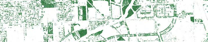
DISTRICT-WIDE
OVERVIEW
The North Houston District presents numerous opportunities to enhance connectivity, activate existing parks, and create new parks and open space throughout the District. The District-wide recommendations section focus on the goals to Connect and Activate.
Connect integrates the existing 8.1 miles of trails, mostly located along Greens Bayou, to existing plans within the District and establish connections throughout the four quadrants. The goal is to complete a network of inner and outer loop of trails, paths, and bike lanes that connect the District's recreational opportunities.
Activate identifies where the gaps in park acreage can be closed and provide wider access to parks for residents and visitors. Publicly owned vacant land and schools were identified for new parks and open spaces. These are opportunities to complement the enhancements for connectivity and to activate more places for recreation and leisure.
The map on page 55 illustrates all of the locations of the existing parks and trails in the District, alongside planned and recommended park, trails, and connections.
The maps on pages 56, 58, 60, and 62 focus on the recommendations shown on page 5 at the Quadrant level. The numbers on the map correspond to the numbers on the table on the page following the respective quadrant maps (pages 57, 59, 61, and 63) and identifies the recommendations needed to meet the Districts' goals.
ACTIVATE 54 2023 Parks Master Plan April 2023
CONNECT
Existing Park Potential Park/Green Space Inner and Outer Loop Potential Crossings Greens Bayou Corridor ACTIVATE GREEN SPACE MAIN PEDESTRIAN AND BIKE CIRCULATION
Potential
Black
Existing Bike Lane Planned Bike Lane Easement NHD Current Pursuits
School
Recommendations Community/Neighborhood
Crossings
Existing Park Potential Park/Green Space Existing SPARK Park Potential SPARK Park Existing Trail Planned Trail Kuykendahl Detention Ella Blvd Fallbrook Dr West Road Greens Crossing Blvd Imperial Valley Dr W Greens Rd Rankin Rd Spears-Gears Rd Ella Blvd Davis High School
Elementary School
Gray Elementary School Green Oak Park Neighborhood Plummer Middle School
Elementary School
Elementary School
Elementary School Remington Ranch
(Street Scale) Potential Crossings (Trail Scale)
Stehlik
Thomas
Spence
Copper
Greenspoint
Elementary School
High School Marcella Elementary School
Elementary School Bussey
School
High School
High School Stovall
School Fallbrook Neighborhood 2023 Parks Master Plan 55 April 2023 miles 0.5 0.25 0 1.0
Davis
Evelyn S Thompson
Elementary
Aldine
Blanson CTE
Middle
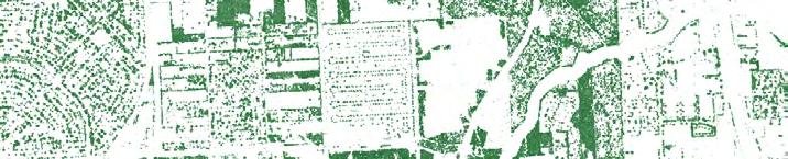
NW QUADRANT RECOMMENDATIONS
NE NE Spence Elementary School Kuykendahl Detention Ella Blvd DrNorthborough Greens Crossing Blvd GreensBayou W Greens Rd Greens Pkwy Davis High School Green Oak Park Plummer Middle School Spears-Gears Rd Rankin Rd SW SW
Gears Rd Existing Bike Lane Planned Bike Lane Easement NHD Current Pursuits Recommendations Community/Neighborhood School Potential Crossings (Street Scale) Potential Crossings (Trail Scale) Existing Park Potential Park/Green Space Existing SPARK Park Potential SPARK Park Existing Trail Planned Trail 56 2023 Parks Master Plan April 2023 NE SE NW SW miles 0.5 0.25 0 1.0
with Aldine Independent School District (AISD) and SPARK Park to build a new SPARK Park at Plummer Middle School and the southeast property at the intersection of Greens Rd. and Spears-Gears Rd.
new trails to connect the Green Oak subdivision to Davis High School, Plummer Middle School, Spencer
#
1 Long-Term Connect Consider
Bike Park
Kuykendahl Detention Basin 2 Long-Term Connect Develop
lane
Proposed bike lane in Houston Bike Plan 3 Long-Term Connect Develop a bike lane
Rankin Rd.
Spears-Green Rd. and IH-45 Proposed bike lane in Houston Bike Plan 4 Long-Term Connect Develop a bike lane
Spears-Green Rd. between Rushcreek Dr. and Gears Rd. 5 Long-Term Connect Complete the bike lane connection on Ella Blvd. and provide safe crossing and access to Greens Bayou 6 Long-Term Connect Develop on-street bike lanes along Northborough Dr., connecting to Greens Pkwy. Proposed bike lane in Houston Bike Plan 7 Short-Term Connect Provide
Current Project pursued by NHD 8 Mid-Term Activate Coordinate
Mid-Term Connect Establish
School, and
10 Mid-Term Activate Coordinate with Harris County and local school districts to activate parcels into new parks and open space 11 Mid-Term Activate Repurpose
Bayou into parks and open space 12 Long-Term Connect Develop on-street bike lanes
Rd.
Blvd and IH-45 Proposed bike lane in Houston Bike Plan 13 Short-Term Connect Provide safe connections to Greens Bayou at Ella Blvd. 14 Long-Term Connect Develop on-street bike lanes along Greens Crossing Blvd. from W. Greens Rd. to Beltway 8 Proposed bike lane in Houston Bike Plan NE Long-Term Connect Complete safe pedestrian and bike connections to the Northeast Quadrant at Rankin Rd. and W. Greens Rd. SW Long-Term Connect Complete safe pedestrian and bike connections to the Southwest Quadrant at Ella Blvd. and Greens Crossing Blvd. 2023 Parks Master Plan 57 April 2023
PRIORITY GOAL RECOMMENDATIONS NOTES
future regional connections between Rockstar Energy
and
a bike
along Ella Blvd. north of Rankin Rd. and to the south of W. Greens Rd.
along
between
along
Bayou trail connection under IH-45 to connect the east and west side of the Bayou
Elementary
Greens Bayou
North Houston District parcels along Greens
along W. Greens
between Ella
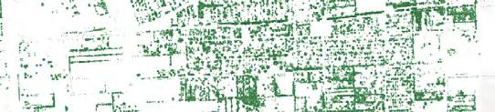
NW NW GreensBayou Greens Rd Benmar Dr Imperial Valley Dr Greenspoint Dr Copper Elementary school Remington Ranch Rankin Rd
16 17 SE SE Greenspoint Community Park 18 Existing Bike Lane Planned Bike Lane Easement NHD Current Pursuits Recommendations Community/Neighborhood School Potential Crossings (Street Scale) Potential Crossings (Trail Scale) Existing Park Potential Park/Green Space Existing SPARK Park Potential SPARK Park Existing Trail Planned Trail 58 2023 Parks Master Plan April 2023 NE SE NW SW miles 0.5 0.25 0 1.0
NE QUADRANT RECOMMENDATIONS
#
1 Long-Term Connect Develop new trails on existing easements to create trail connections from Rankin Rd. 2 Long-Term Connect Create new trails along the northern and eastern boundary of the NE Quadrant to establish connections between schools and residential subdivisions within and adjacent to the NE Quadrant 3 Long-Term Activate Coordinate with Harris County MUD No. 96 to activate new parks and open space 4 Mid-Term Activate Coordinate with Spring Independent School District and SPARK Park to build a new SPARK Park at Cooper Elementary School 5 Mid-Term Connect Provide safe trail connections to Greens Bayou at IH-45, Greens Road, and Imperial Valley Drive. Current project pursued by NHD 6 Short-Term Activate Partner with the Harris County Flood Control District (HCFCD) to activate the Glen Forest Detention Basin with new parks, trails and open space. 7 Short-Term Connect Develop sidewalks along Imperial Valley Drive extending north from Greens Road. Current project pursued by NHD 8 Short-Term Connect Extend trails to the east to W. Hardy Road to improve trail circulation in the quadrant. Current project pursued by NHD 9 Long-Term Activate Coordinate the expansion of Ida Gaye Gardens with parcel owners to the east of the park. 10 Long-Term Connect Develop on-street bike lanes along Greens Rd. Proposed bike lane in Houston bike Plan 11 Long-Term Connect Develop on-street bike lanes along Greenspoint Dr. extending south from Greens Bayou Proposed bike lane in Houston bike Plan 12 Mid-Term Activate Expand and connect Wussow Park to the City of Houston Waste Water Treatment Plant property 13 Mid-Term Activate Develop NHD owned property at 16825 North chase Dr. as new sport amenity park 14 Short-Term Activate Continue to advance the future Central Park concept as a storm water amenity 15 Mid-Term Activate Establish partnerships with Greenspoint Plaza to repurpose land for parks and open space uses 16 Mid-Term Connect Develop new trails on existing easements to create trail and bike network connectivity 17 Mid-Term Connect Develop a Jack Drake Natural Recreation Center at the detention facility west of the park 18 Mid-Term Connect Develop on-street bike lanes along Benmar Dr. extending east from Greenspoint Dr. Proposed by METRO NW Long-Term Connect Complete safe pedestrian and bike connections to the Northwest Quadrant at Rankin Rd. and W. Greens Rd. SE Long-Term Connect Complete safe pedestrian and bike connections to the Southeast Quadrant at Greenspoint Dr. and Imperial Valley Dr. 2023 Parks Master Plan 59 April 2023
Priority Goal Recommendation Notes
NW NW SE SE Detention Pond Greens Crossing Blvd Ella Blvd Fallbrook Neighborhood Thomas Gray Elementary School Blanson CTE High School Stehlik Elementary School SW QUADRANT RECOMMENDATIONS 7 8 9 10 Existing Bike Lane Planned Bike Lane Easement NHD Current Pursuits Recommendations Community/Neighborhood School Potential Crossings (Street Scale) Potential Crossings (Trail Scale) Existing Park Potential Park/Green Space Existing SPARK Park Potential SPARK Park Existing Trail Planned Trail 60 2023 Parks Master Plan April 2023 NE SE NW SW West Rd. FallbrookDr. miles 0.5 0.25 0 1.0
1 Long-Term Connect Complete trail connections to the NW Quadrant
2 Mid-Term Connect
3
Utilize existing easements to create a trail along the western edge and southern portions of the quadrant to connect Pinto Business Park, new parks and open spaces, residential subdivisions, and schools
Connect Extend the bike lane plans for Ella Blvd. to improve connectivity and cycling options for residents, visitors, and workers in the SW Quadrant
4 Mid-Term Activate Coordinate with Harris County MUD No 406 and MUD No 321 to develop new parks and open space
5 Long-Term Connect Develop bike lanes along Greens Crossing Rd. between Beltway 8 and the southern boundary of the SW Quadrant
6 Long-Term Connect Develop bike lanes along Fallbrook Dr. between IH-45 and the western boundary of the SW Quadrant
7 Long-Term Connect Develop existing easements into trails along the eastern boundary of Pinto Business Park
8
9
10
Connect Add pedestrian and bike paths along West Rd. to improve mobility in this quadrant
Activate Coordinate with Aldine Independent School District (AISD) and SPARK Park to build a new SPARK Park at Thomas Gray Elementary School
Activate Coordinate with Aldine Independent School District (AISD) and SPARK Park to build a new SPARK Park at Blanson CTE High School
Complete safe pedestrian and bike connections to the Northwest Quadrant at Ella Blvd. and Greens Crossing Blvd.
# Priority Goal Recommendations Notes
Long-Term
Long-Term
Short-Term
NW Long-Term
Long-Term Connect
2023 Parks Master Plan 61 April 2023
Long-Term
Connect
SE
Complete safe pedestrian and bike connections to the Southeast Quadrant at Fallbrook Dr. and West Rd.
SW SW NE NE Marcella Elementary School Evelyn S Thompson Elementary School Black Elementary School Bussey Elementary School Stovall Middle School Aldine High School Imperial Valley Dr SE QUADRANT RECOMMENDATIONS 1 2 3 4 5 6 7 8 Existing Bike Lane Planned Bike Lane Easement NHD Current Pursuits Recommendations Community/Neighborhood School Potential Crossings (Street Scale) Potential Crossings (Trail Scale) Existing Park Potential Park/Green Space Existing SPARK Park Potential SPARK Park Existing Trail Planned Trail 62 2023 Parks Master Plan April 2023 NE SE NW SW miles 0.5 0.25 0 1.0
1 Long-Term Connect Develop a dedicated on-street bike lane along Greenspoint Rd. from Beltway 8 to Aldine Bender Rd. Proposed bike lane in Houston Bike Plan
2
3
4
Connect Develop an off-street bikeway along existing drainage easement from IH-45 towards the eastern boundary of the quadrant
Connect Develop a dedicated on-street bike lane along Imperial Valley Dr. from Beltway 8 to West Rd.
Connect Work with TxDOT to improve pedestrian and bicycle facilities along Aldine Bender
5 Mid-Term Activate
Coordinate with Aldine Independent School District (AISD) to develop a new park at the property located west of Black Elementary School
6 Short-Term Activate Coordinate with Aldine Independent School District (AISD) and SPARK Park to enhance current SPARK park at Stovall Middle School
7
8
Connect Coordinate with the Harris County Flood Control District and the City of Houston to develop a off-street bikeway along the drainage easement
bike lane in Houston Bike Plan
bike lane in Houston Bike Plan
bike lane in Houston Bike Plan
Connect Develop a dedicated off-street bike lane along West Rd. from IH-45 to Airline Dr. Proposed bike lane in Houston Bike Plan
Long-Term Connect Complete safe pedestrian and bike connections to the Northeast Quadrant at Greenspoint Dr. and Imperial Valley Dr.
Connect Complete safe pedestrian and bike connections to the Southwest Quadrant at Aldine Bender Rd. and West Rd.
# Priority Goal Recommendations Notes
Long-Term
Proposed
Long-Term
Proposed
Long-Term
Long-Term
Proposed
Long-Term
2023 Parks Master Plan 63 April 2023
Long-Term
NE
SW
BAYOU-SCALE OVERVIEW
CREATE A COHESIVE NETWORK
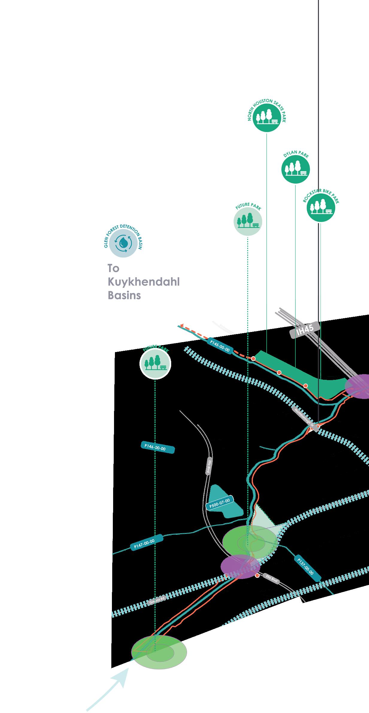
Much of the North Houston District's parks and open spaces are united by Greens Bayou, which traverses the district flowing west to east. Parks and recreation along the Bayou not only provides new recreational options for residents, but also builds resilience and reduces community risk to flooding. To better connect people to the Bayou, the plan focuses on three components, guided by the goals to Connect and Unify.
Connect both sides of the Bayou by developing bike and hike trails along the northern and southern sides of the Bayou to maximize connectivity and access.
Bayou Recreation focuses on leveraging existing parks alongside potential green spaces to create a rich blend of passive and active recreation opportunities.
Bayou Stories integrates art, nature, community history and climate through public spaces to share stories of the community, the Bayou, and the District.
Greenway Amenities unifies the Bayou to parks and opens spaces through branding, comfort elements, and placemaking strategies to establish a cohesive system.
CONNECT
Greens Bayou - West UNIFY 64 2023 Parks Master Plan April 2023
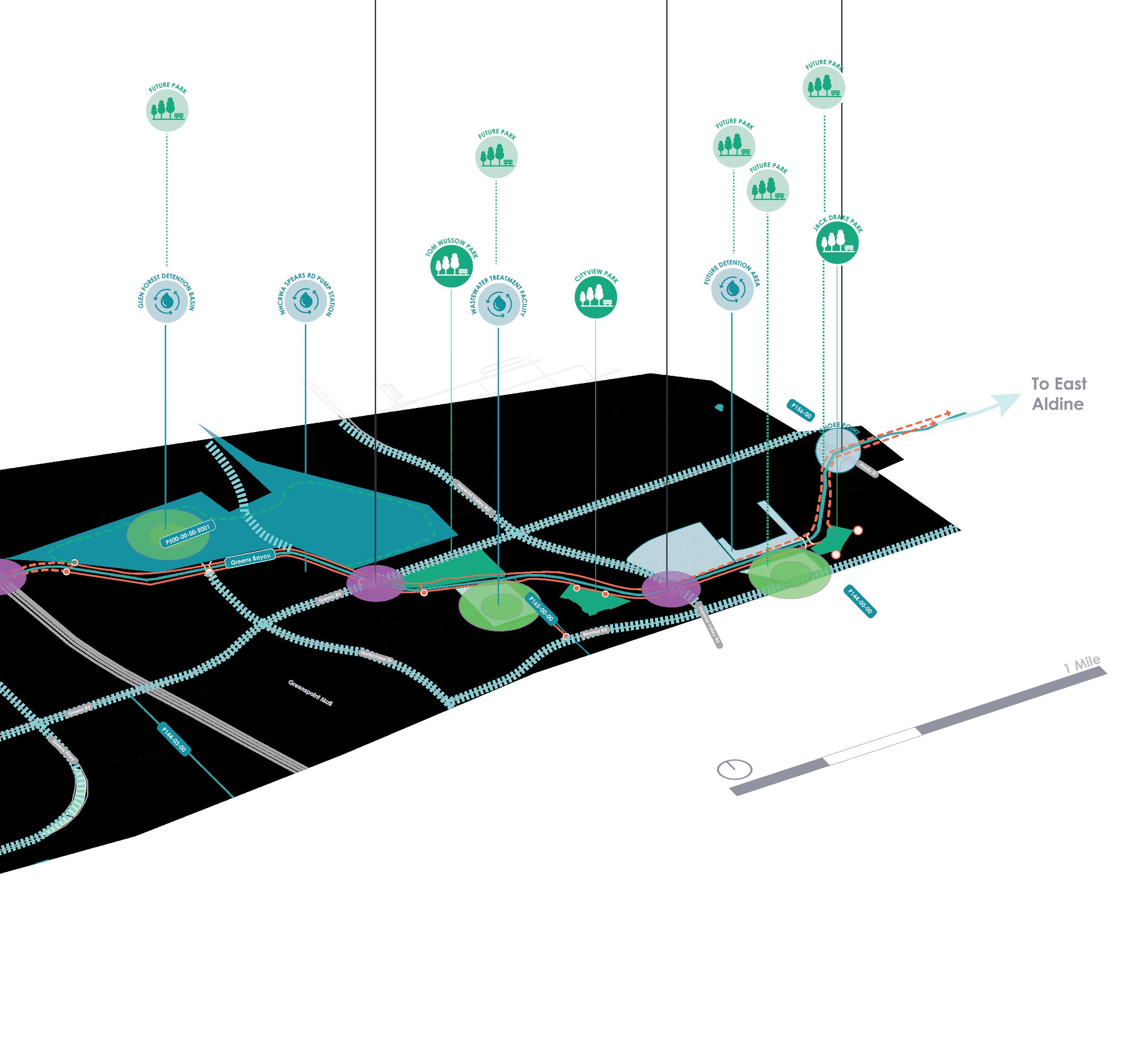
Activate Green Space Potential Crossings (Trail Scale) East/West Connector Greens Bayou - East Wussow to City View 2023 Parks Master Plan 65 April 2023
GREENS BAYOU WEST
The western end of Greens Bayou acts as the gateway into the North Houston District to visitors coming from northwest Houston and Harris County. Future parks and trail users can navigate along Greens Bayou into the North Houston District through a central nature corridor with tree canopies, with stops to enjoy newly activated green spaces.
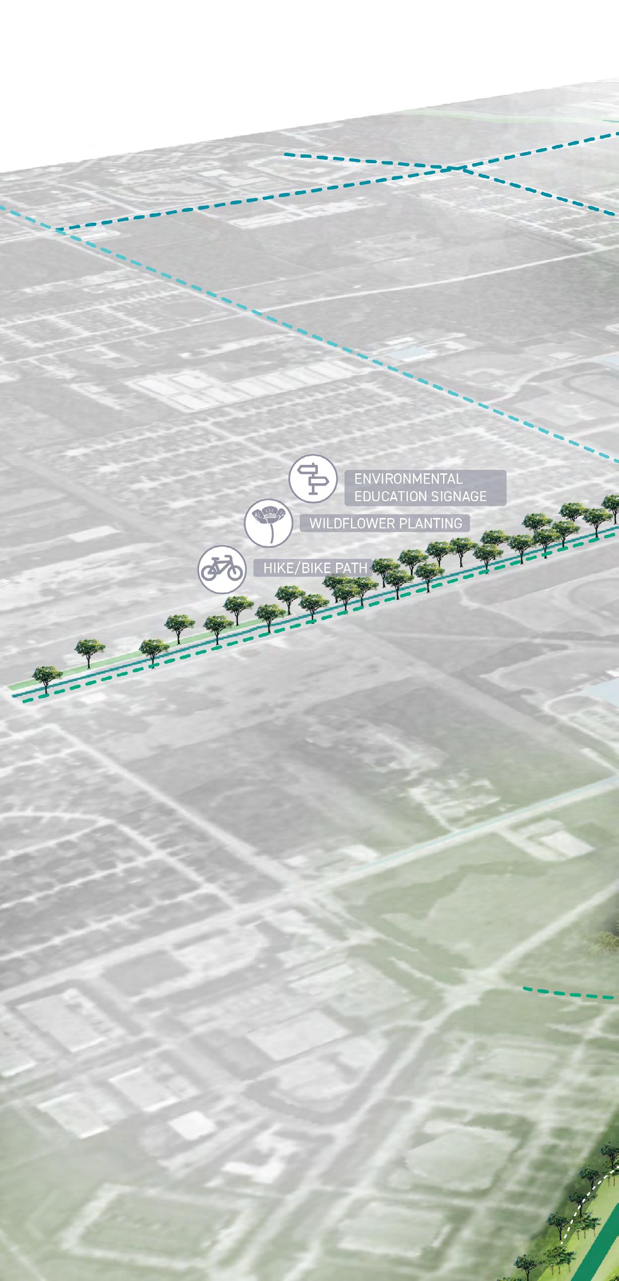
GREENS BAYOU - WEST RECOMMENDATIONS
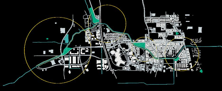
66 2023 Parks Master Plan April 2023
1 Develop the District's property at Greens Rd. and Ella Blvd.
2 Create a central nature corridor and tree canopy
3 Develop District markers at western terminus
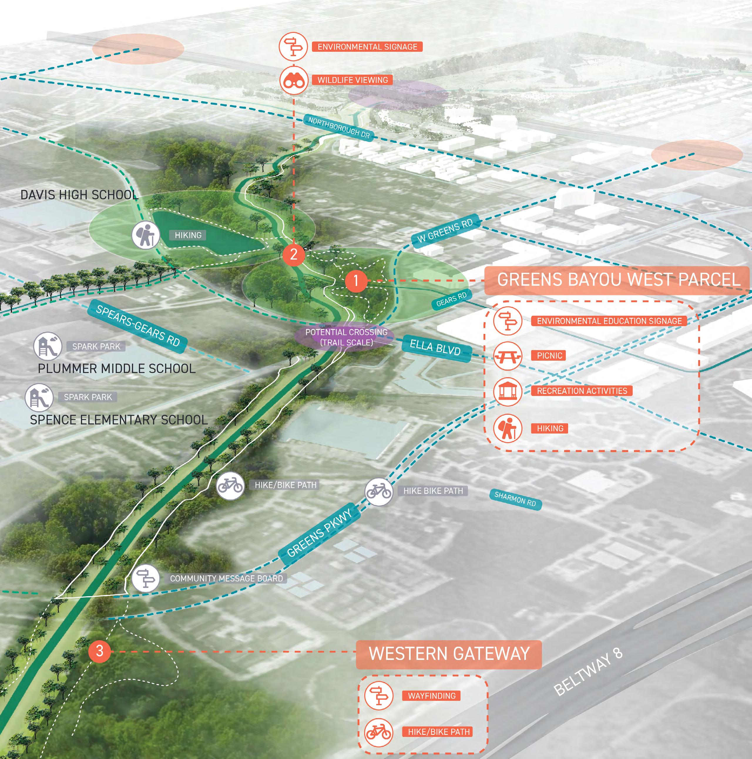
2023 Parks Master Plan 67 April 2023
GREENS BAYOU EAST/WEST CONNECTOR
IH-45 currently demarcates the quadrant boundaries, but also imposes barriers to connect the quadrants. The east/west connector will unite the existing trails on the east and west sides and increase access to existing parks such as Rockstar Bike Park, North Houston Skate Park and Thomas R. Wussow Park. It will open up other opportunities to make regional and neighborhood connections to Greens Bayou and the District's parks located along the Bayou.
GREENS BAYOU - EAST/ WEST CONNECTOR RECOMMENDATIONS
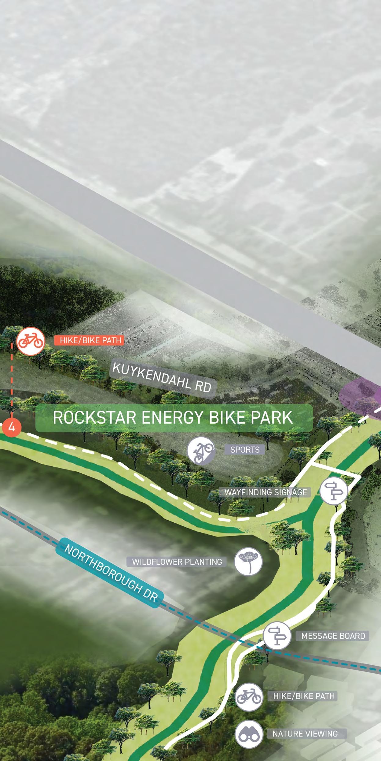
68 2023 Parks Master Plan April 2023
1 IH-45 East/West Trail Connection
2 Glen Forest Detention Basin Activation
3 Greenspoint Dr. Neighborhood Access
4 Future Regional Connections
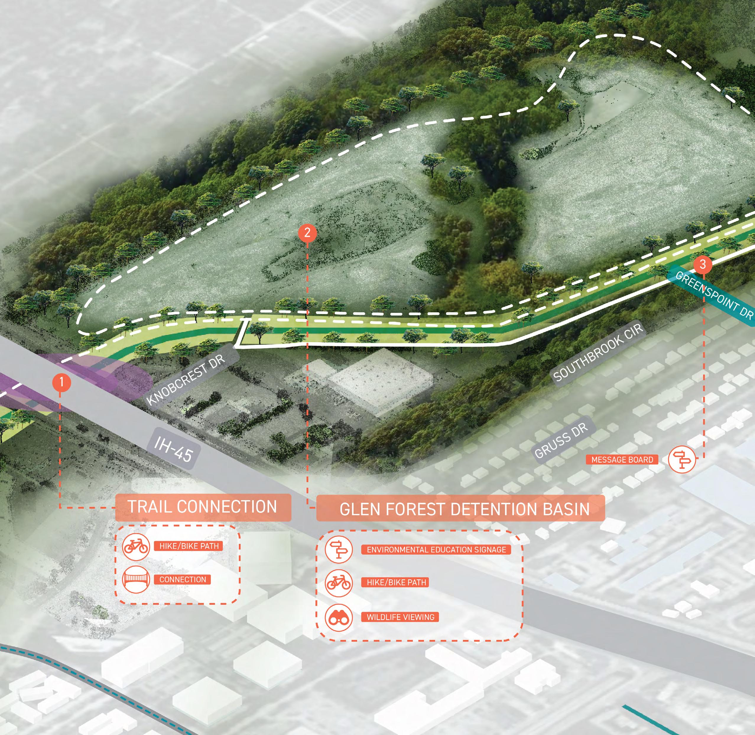
2023 Parks Master Plan 69 April 2023
GREENS BAYOU WUSSOW PARK TO CITY VIEW PARK
Wussow Park and City View Park improvements can build upon and expand the character and story of Greens Bayou and the District. Partnering with the City of Houston and others, the District can explore the development of new green spaces and connections.
Expansion, update, and activation are key methods to address these goals. Repurposing easements into trails and a wastewater treatment plant into a new park, as well as engaging people with art will build a strong identity to the place and to the water.
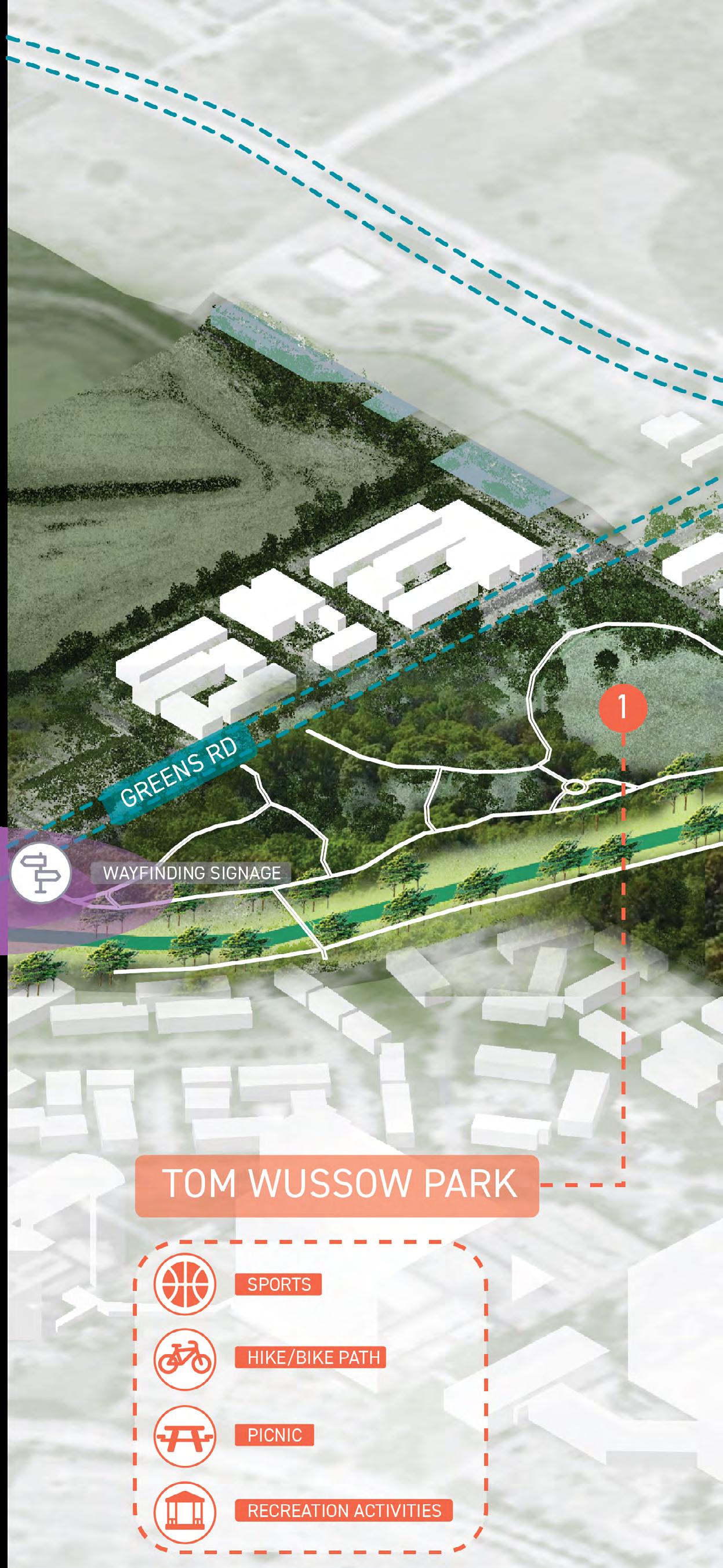
GREENS BAYOU - WUSSOW TO CITY VIEW RECOMMENDATIONS
1 Active recreation at Wussow Park and Wastewater Treatment Plant Expansion
2 Develop easement trail to Benmar Green Finger
3 Update City View Park to build on Bayou story-telling and supporting the water narrative
70 2023 Parks Master Plan April 2023
4 Build off placemaking and art activation at Imperial Valley Dr.
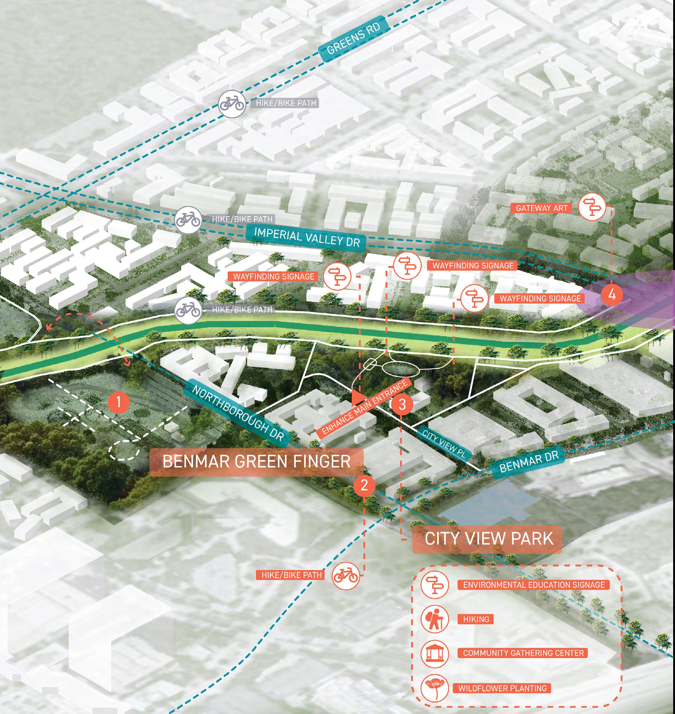
2023 Parks Master Plan 71 April 2023
GREENS BAYOU EAST
The eastern terminus of Greens Bayou within the District houses the future Central Park, Jack Drake Natural Recreation Center, and more trails before it travels towards East Aldine, Cloverleaf, and to Buffalo Bayou.
Continuation of the Harris County Flood Control District's home buyouts along Greens Bayou will pave the way for the development of the future Central Park. In addition to the development of the Jack Drake Natural Recreation Center, the future Central Park will play a role in ensuring resiliency and sustainability in the District. This portion of the Bayou can also create additional trail connections along the Bayou and on existing easements.
GREENS BAYOU - EAST RECOMMENDATIONS
1 Continue to advance the future Central Park concept as a storm water amenity
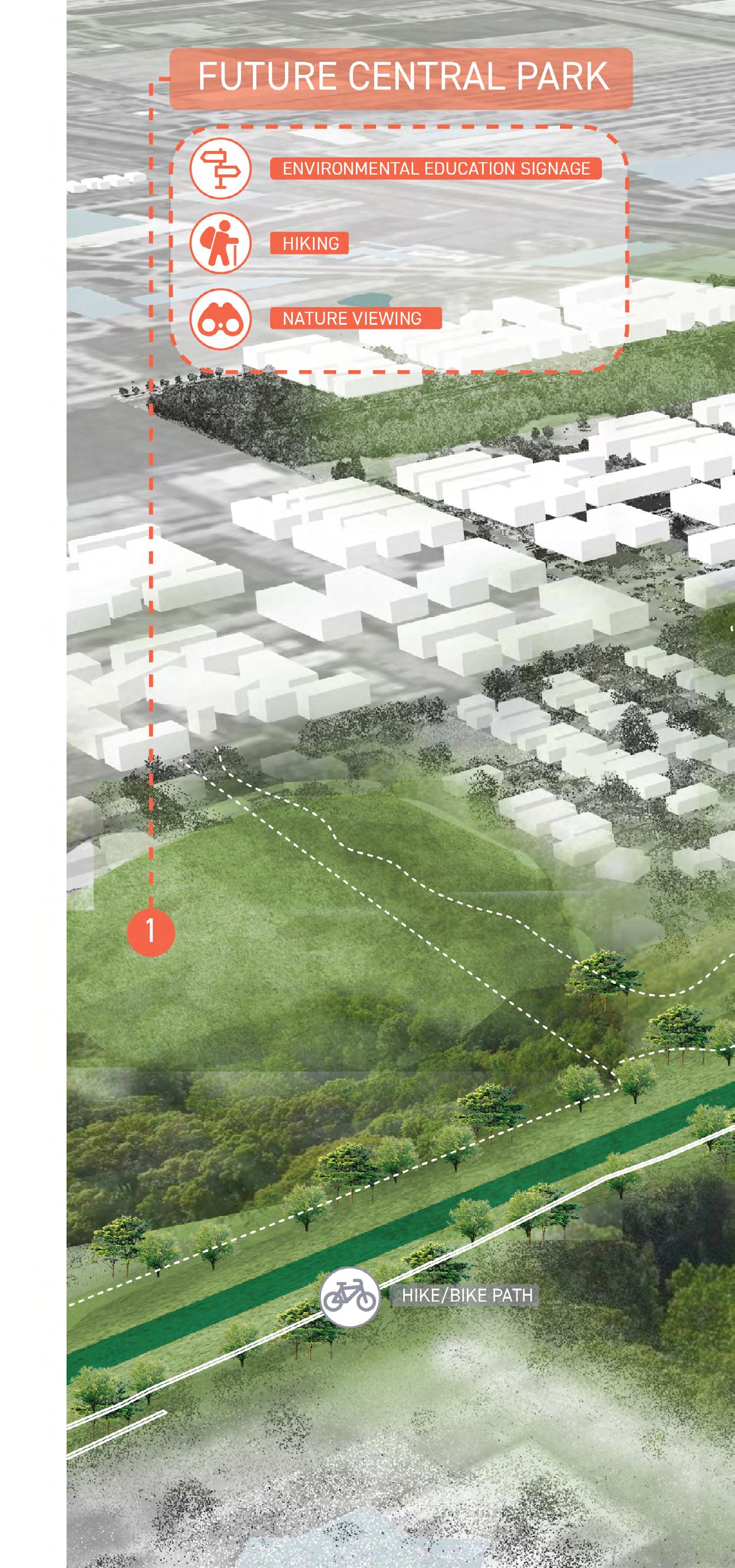
2 Develop a Jack Drake Natural Recreation Center at the detention facility
3 Complete trails system and create a regional trail connection to East Aldine
4 Utilize the trail easement to connect to Beltway 8
72 2023 Parks Master Plan April 2023
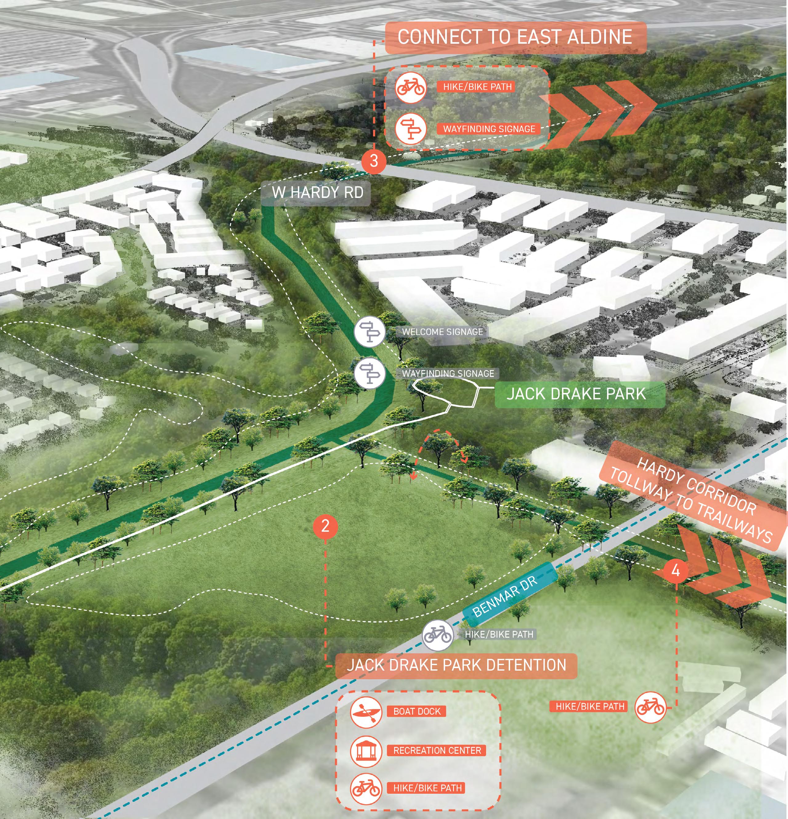
2023 Parks Master Plan 73 April 2023
THOMAS R. WUSSOW PARK
Thomas R. Wussow Park is an 11-acre community park located between Greens Road to the north and Greens Bayou to the south. Completed in 2003, the park is named after one of the District's founders and current Board Members, Thomas R. Wussow. It serves as the District's central community park, offering various recreational amenities.
Wussow Park is a popular destination for families and individuals looking for outdoor recreational activities. The park's location near Greens Bayou makes it an ideal spot for birdwatching and nature walks. The walking trail provides a scenic route for walking, jogging, or biking. The playground area is a hit with kids and offers a safe and fun environment for them to play.
Overall, Wussow Park provides a beautiful and wellmaintained green space for residents to enjoy, serving as a great addition to the community.
South of Wussow Park, across Greens Bayou, an existing Waste Water Treatment Plant (WWTP) site presents a new opportunity for potential new park expansion. The City of Houston Public Works is converting the WWTP's infrastructure into a lift station.
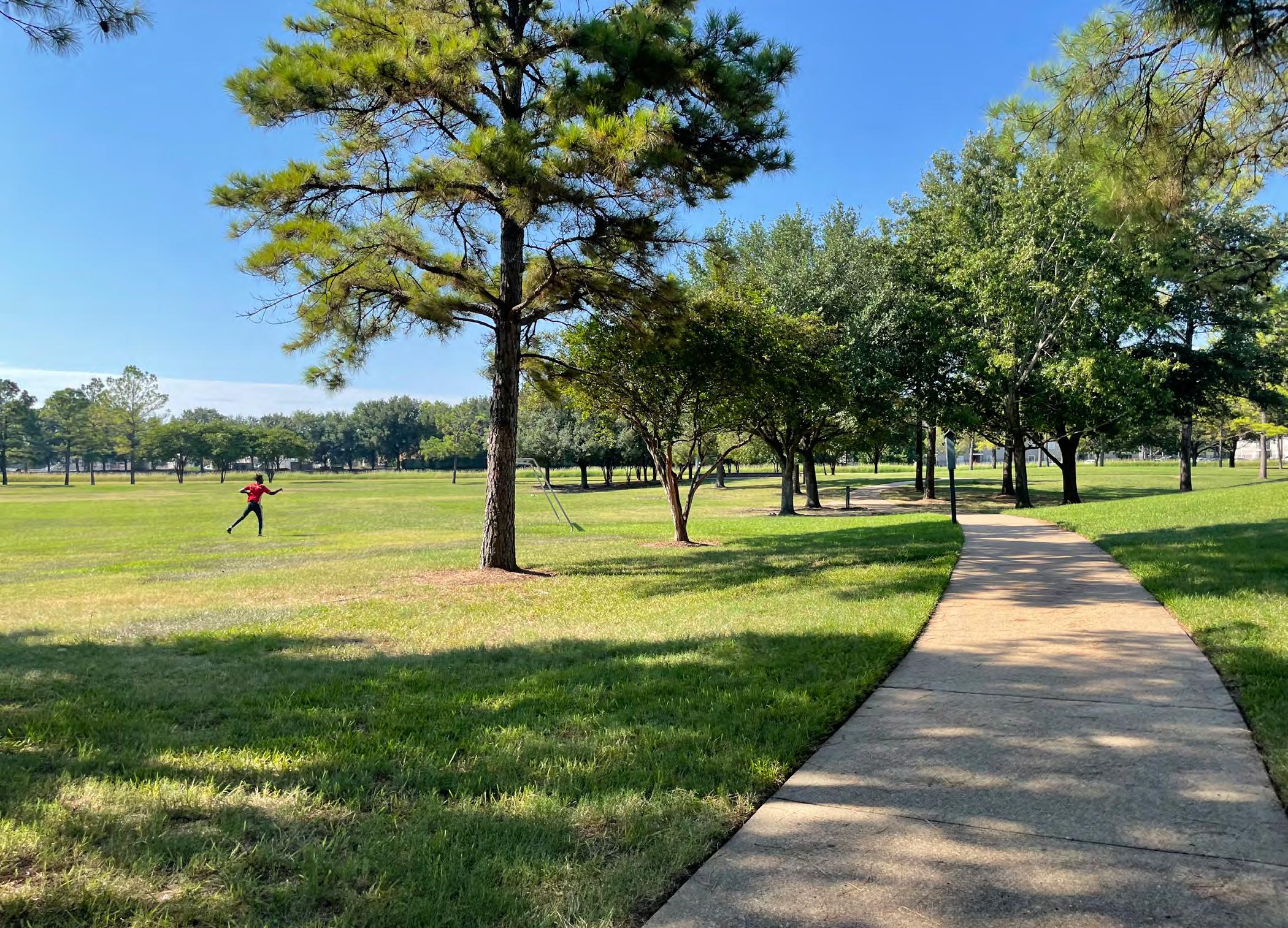 Greens Bayou Trail at Wussow Park
74 2023 Parks Master Plan April 2023
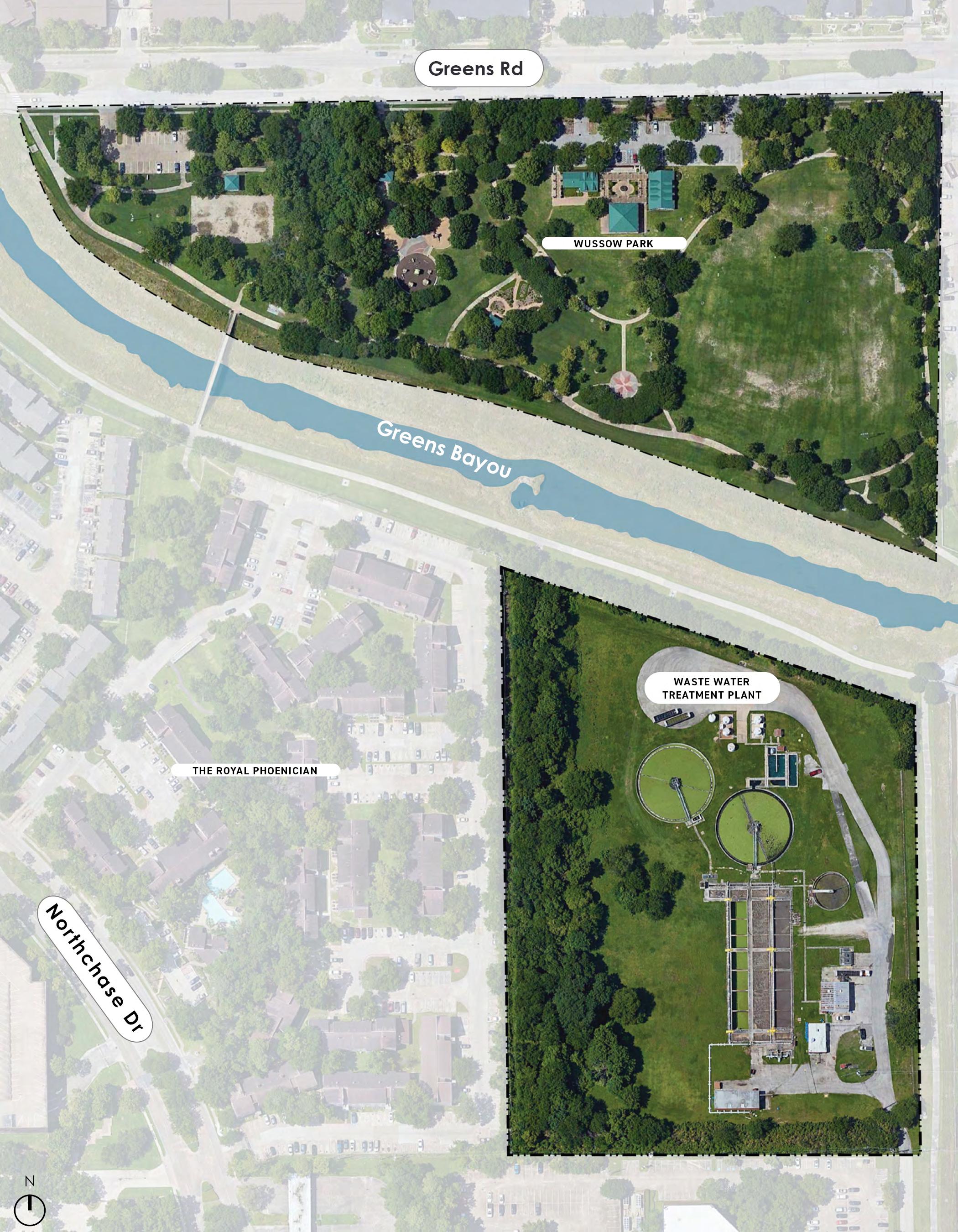
2023 Parks Master Plan 75 April 2023
EXISTING AMENITY DIAGRAM
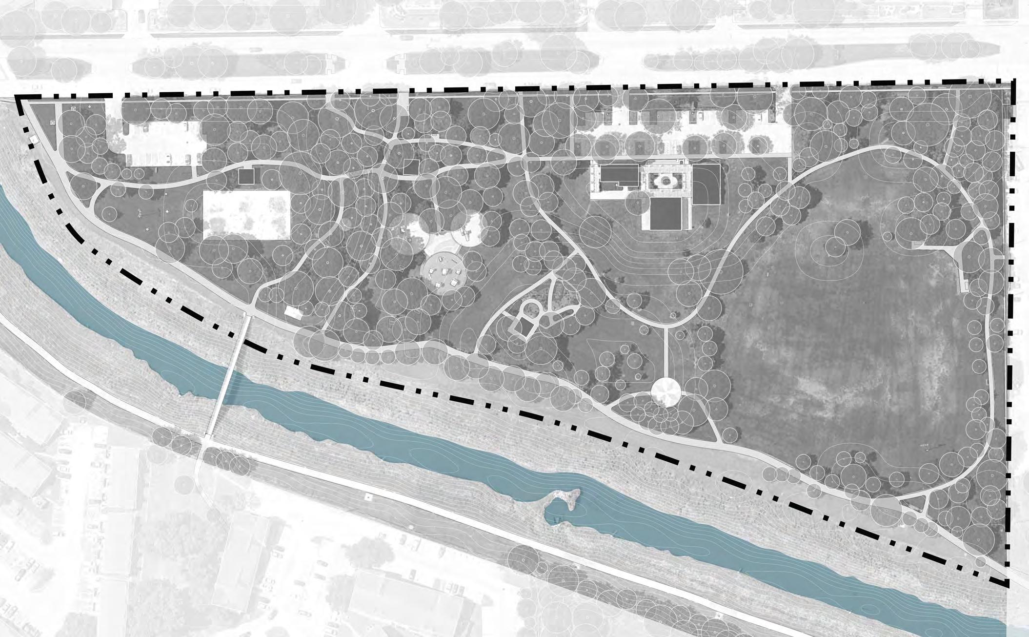
Wussow Park offers several amenities for visitors, including a playground for children, spacious covered pavilions with picnic tables, a multi-purpose athletic field that can be used for various sports such as soccer and baseball, and a walking trail. Additionally, the park has restroom facilities and plenty of parking space for visitors.
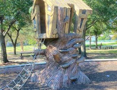
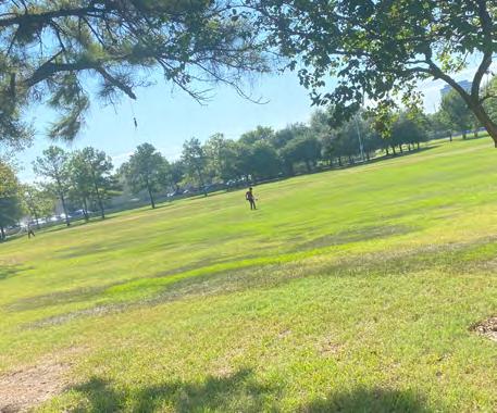
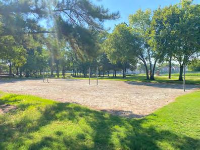
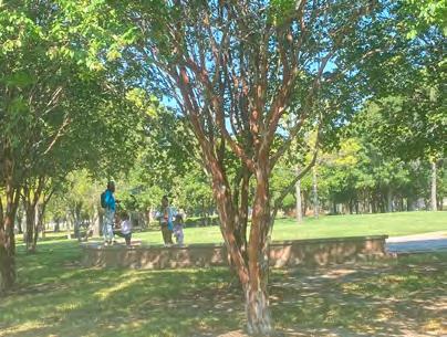
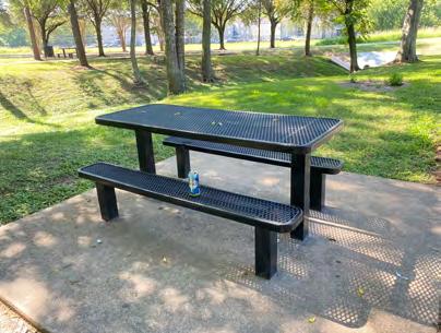
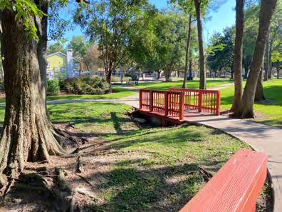
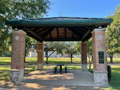
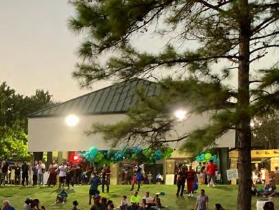
Greens Rd 0 100' N GreensBayou 1 1 2 3 9 8 4 4 6 7 6 6 6 6 6 10 10 10 5 5
76 2023 Parks Master Plan April 2023
2
LEGEND
1
Parking Lot
Restroom
3
Large Pavillion Pedestrian Bridge 6 Picnic Table 7 Plaza
8
Sand Volleyball Court Playground
Study Area Bayou
EXISTING CIRCULATION & PROGRAMMING ANALYSIS
Greens Rd
GreensBayou
Wussow Park is one of the most active parks in North Houston District. Its location within one of the District's densest areas make it an easily accessible park, with its open perimeter along the northern, western, and southern edges, and its comfortable sidewalks and trails.
Although most people walk to the park, vehicular access and both of its parking areas are located along Greens Road to the north. There are currently 63 parking spots, including 2 ADA designated parking stalls. Pedestrians may access the park from both its northern edge along Greens Road and its southern edge along the Greens Bayou Trail. The latter allows visitors to connect to other parks, such as City View Park and Jack Drake Park to the east. A pedestrian bridge over the Bayou allows people, such as residents from the residential areas to the south, to access the park.
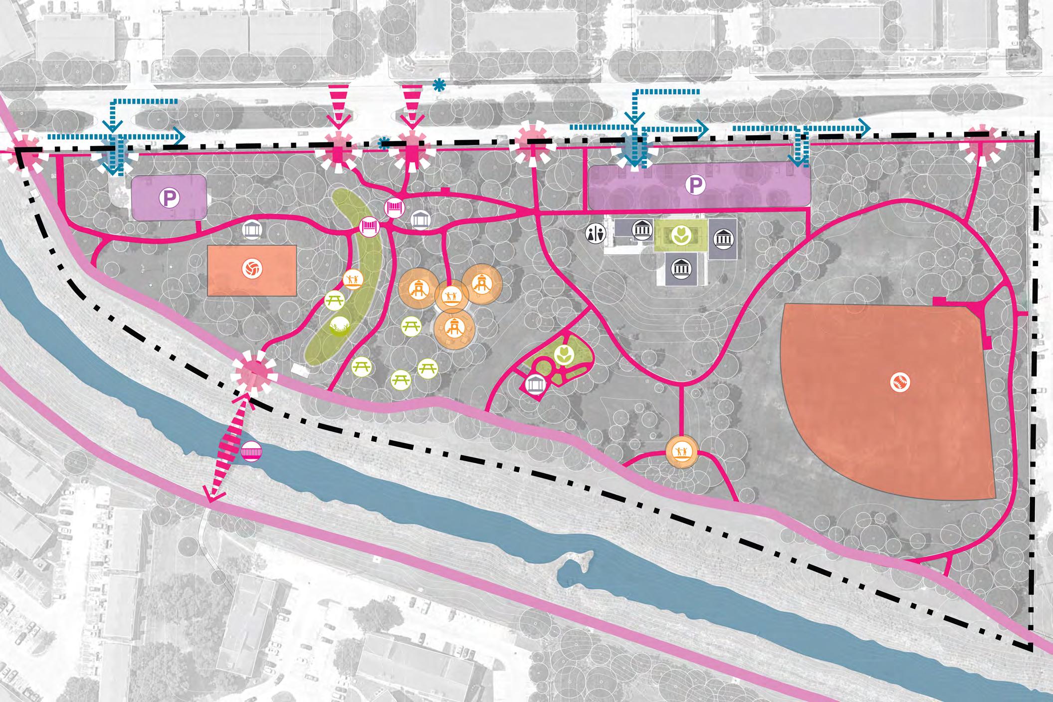
2023 Parks Master Plan 77 April 2023 LEGEND Study Area Bayou Park Internal Paths Greens Bayou Trail Park Pedestrian Entrance Vehicular Entrance Bus Stop Crosswalk Traffic Flow 0 100' N
Park Admin Buildings Garden Playground Volleyball Court Bayou Bridge Parking Lots (63 spots) Restroom Ravine Plaza Multipurpose Field Pedestrian Bridge Pavilion Picnic Table Service Structure Exercise Bridge Experience Recreation 2 1 1 3 1 1 2 2 3 3 3 4 5
EXISTING TOPOGRAPHY & SURFACE RUNOFF ANALYSIS
Most areas in Wussow Park are relatively flat in nature with the exception of the area where the buildings are located which is the highest point in the site and a ravine located to the west of the playground area which is the lowest area on the site. The buildings are located on a berm area which require steps and an accessible ramp to the north edge, adjacent to the eastern parking lot. To the south this berm serves as a natural sloped seating area looking towards Greens Bayou.
At present, Wussow Park is entirely situated in the Greens Bayou floodway, and its location falls under the 100-year flood elevation. Therefore, the primary structures are situated closer to Greens Road and at a higher elevation than other parts of the site. The site's drainage system is designed to discharge water into the Bayou at two locations on the southwest and southeast sides of the property, as illustrated in the diagram above.
After conducting an analysis of the park's elevation and slope, it has been identified that certain areas are experiencing ponding water.
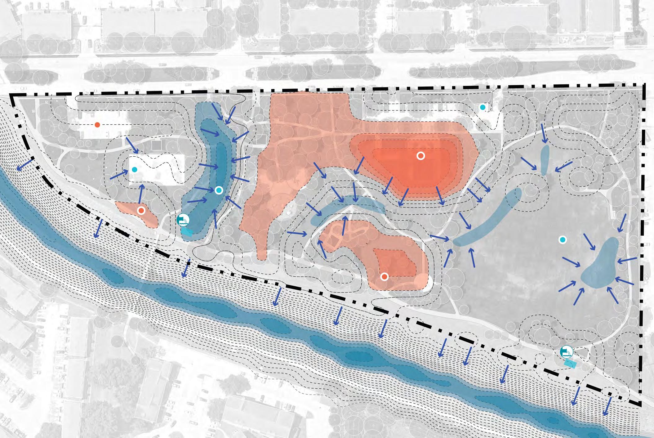
GreensBayou +85.00 +82.00 +79.00 +79.00 +77.00 +79.00 +82.00 +82.00 Greens Rd
RAVINE 78 2023 Parks Master Plan April 2023 LEGEND Study Area Contour Line High Area Low Area High Point Low Point Outfalls Water Flow 0 100' N
EXISTING UTILITIES ANALYSIS
This analysis focuses on underground utilities and easements that could potentially impact location of new amenities and recommendations for Wussow Park improvements. Potable water utility main lines are found running east/west along Greens Road and run north/south parallel to the ravine to the west of the playground.
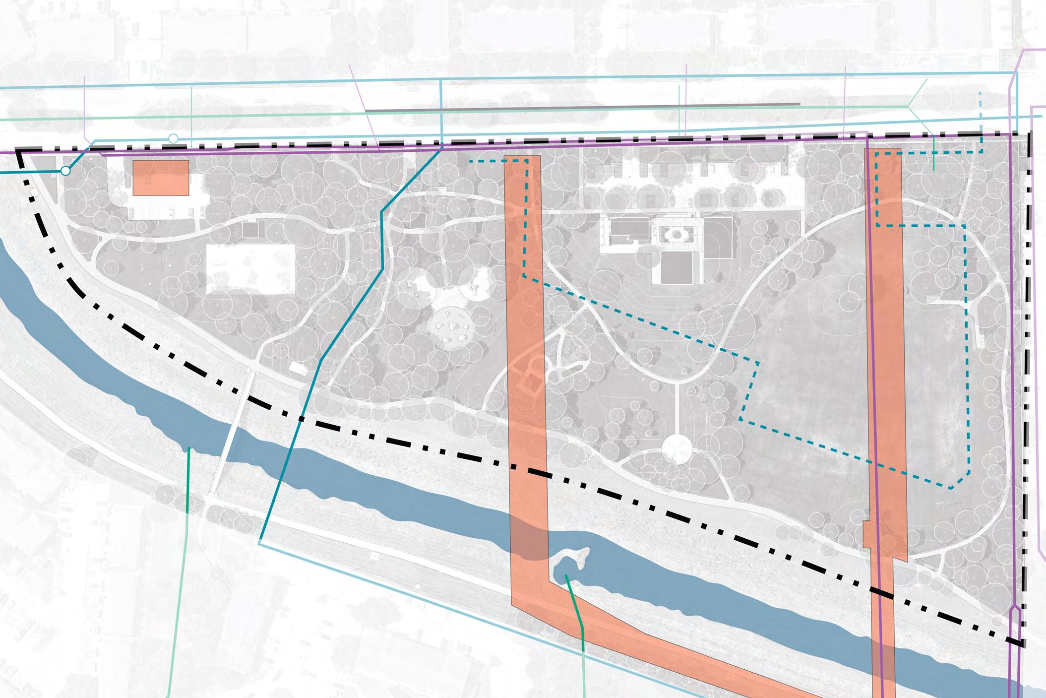
There are two sanitary easements that run north/ south. The easternmost easement runs through the center of the multipurpose field. The second easement is located between the existing buildings and the playground. These two easements are factors to be considered when locating new amenities. Improvements within these easements would be limited to non structural elements such as lawn or planting areas without trees.
Study Area
Bayou
Sanitary Easement
Drinking Water Mains
Abandoned
Water Utilities
Wastewater Utilities
Storm Drainage Utilities
Manhole
0 100' N
Sanitary
Sanitary Easement
Easement Greens Rd LEGEND
GreensBayou 2023 Parks Master Plan 79 April 2023
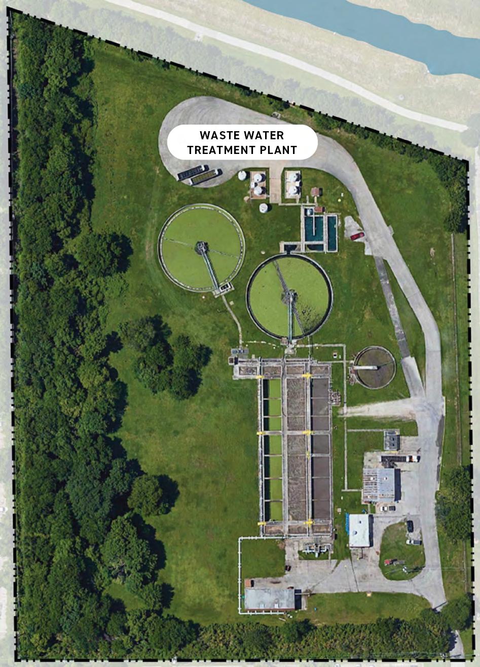
80 2023 Parks Master Plan April 2023
WASTE WATER TREATMENT PLANT
INTRODUCTION AND EXISTING CONDITIONS OPPORTUNITIES
The Wastewater Treatment Plant refers to the approximately 9-acre tract to the south of Wussow Park, along the southern bank of Greens Bayou. This property was a wastewater treatment plant, which is now decommissioned. The City of Houston’s Public Works Department is currently pursuing conversion of this area into the Northgate Regional Lift Station and force main, to divert flow to the Intercontinental Airport Wastewater Treatment Plant. The lift station construction is 90% complete as of February 2023, and is expected to be completed in summer 2023.
The lift station is expected to only take up 1.5-acres of the 9-acres property. With its adjacency to Wussow Park and to Greens Bayou, there are opportunities to expand the boundaries of Wussow Park and create additional connections on Greens Bayou. The following pages will introduce the process for creating, guiding, and finalizing the design and concept for the Wussow Park annex.
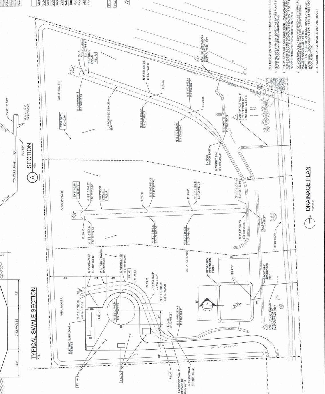
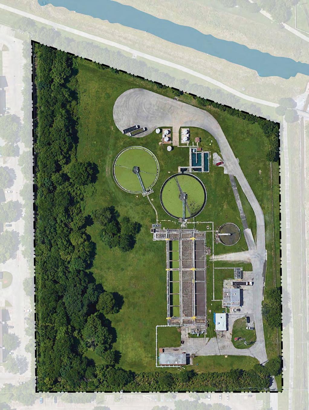
POTENTIAL WUSSOW PARK ANNEX NORTHGATE REGIONAL LIFT STATION BAYOUTRAIL NORTHGATE REGIONAL LIFT STATION AND FORCE MAIN POTENTIAL WUSSOW PARK ANNEX WUSSOW PARK 2023 Parks Master Plan 81 April 2023
RECOMMENDATIONS PROCESS
Formulating recommendations involved the development of a design scheme with the following steps:
1. Observation: Conduct on-site observations to gain an understanding of the context and identify any constraints or opportunities that may impact the design scheme.
2. Stakeholder Engagement: Engage and gather feedback on current park needs from stakeholders.
3. Generation and Refinement of Design Concepts: Using the insights gained from the previous steps, generate initial design concepts then selected up to four design schemes to develop further.
Entry Sign
Event Lawn +Stage
Large Picnic Pavilion
Picnic Pavilion
Outdoor Gym/Airnasium
Restroom
Basketball Courts
Professional Soccer Field Soccer Field
Mini Soccer Court
Pickle Ball Court
Playground
Parking Expansion
Bike Rack
NEW PROGRAMMING TWP TWPA TWP TWPA TWP TWPA
OPTION 1 OPTION 2 OPTION 3
82 2023 Parks Master Plan April 2023
STAKEHOLDER MEETING 2
Tom Wussow Park Tom Wussow Park Annex (TWP) (TWPA)
4. Presentation of Final Scheme: Present the refined design schemes to stakeholders for feedback, with the design team further refining the design schemes to address concerns or issues raised by stakeholders, including incorporating new ideas or modifying existing elements of the design.
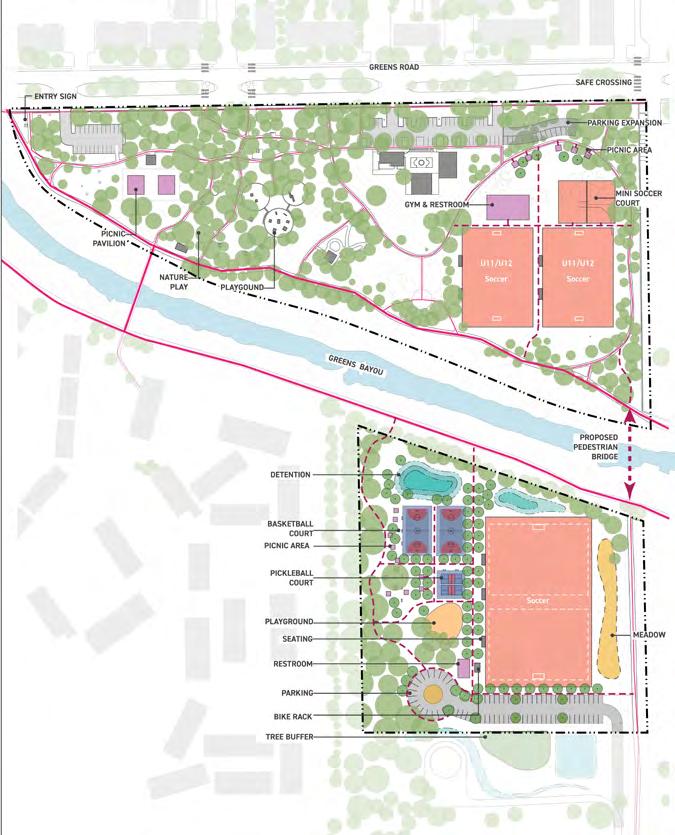
5. Feedback and Approval: Select priority concepts based on stakeholder input, then approach park users to gather feedback on the priority concepts. To understand user opinions on the proposed concepts, request users to identify their preferred concepts and provide overall feedback. Then, analyze the resulting feedback to understand user attitudes towards the proposed plan. This requires identifying key themes or areas of concern raised by the users.
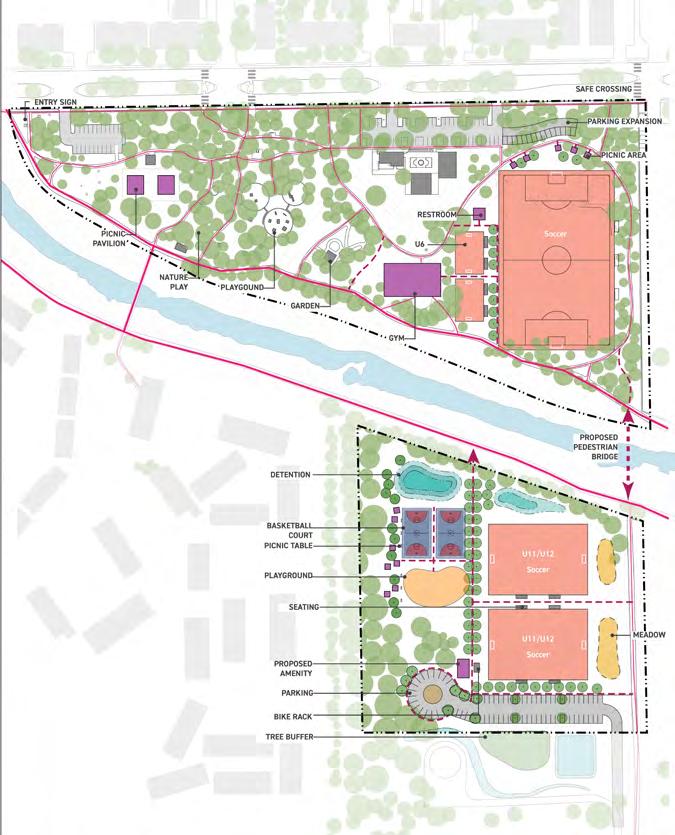
TWP
TWP TWPA TWP TWPA
TWPA
OPTION 4 OPTION 5 OPTION 6
2023 Parks Master Plan 83 April 2023
POP UP 2
RECOMMENDEDED CONCEPT
The proposed design concept aims to enhance the quality of life of nearby residents by providing more opportunities for leisure and recreation in a safe and welcoming environment. The key design elements include:
1. More Sports Facilities: Based on the feedback received from previous events and engagement, the design concept incorporates the addition of more sports facilities such as basketball courts, soccer fields, and pickleball courts. These facilities will provide opportunities for physical activity and meets the residents needs of exercise.
2. Extended Parking Space: Existing parking spaces are extended and new parking lots are built on the new park land to accommodate the growing number of visitors to the park. This will ensure easier access and enhance the overall park experience.
3. Additional Playground: The proposed design incorporates a playground to meet the public desire for a dedicated play area for children. The playground will be equipped with a variety of play equipment that caters to different age groups and abilities.
4. New Bridge: The bridge will provide new and improved access to the newly added park area and across Greens Bayou.
5. New Trail: Carefully considered trails in new park land provides access to facilities and a meandering walking experience under the trees.
6. Picnic Area Pavilions: Located along the trail, serve as great spots for picnics and observing games or children's activities.
7. More Lighting: More lighting will be added to the park and illuminate the sports courts to improve safety and enhance the usability of the park.
WUSSOW PARK
PARK
PROGRAM
1 ENTRY SIGN 2 BIKE RACK 3 USE TBD 4 PLAYGROUND EXPANSION 5 DETENTION 6 PICNIC PAVILION 7 LARGE PICNIC PAVILION 8 PARKING EXPANSION 9 RESTROOM 10 IMPROVED TRAILS 11 SOCCER FIELD 12 MINI SOCCER COURT 13 AIRNASIUM
ANNEX 1 MONUMENT ENTRY SIGN 2 BIKE RACK 3 BASKETBALL COURT 4 PLAYGROUND 5 DETENTION 6 PICNIC PAVILION 7 LARGE PICNIC PAVILION 8 PARKING 9 RESTROOM 10 TRAILS 11 SOCCER FIELD 12 PICKLEBALL COURTS 13 PEDESTRIAN BRIDGE 14 MEADOW 84 2023 Parks Master Plan April 2023
WUSSOW
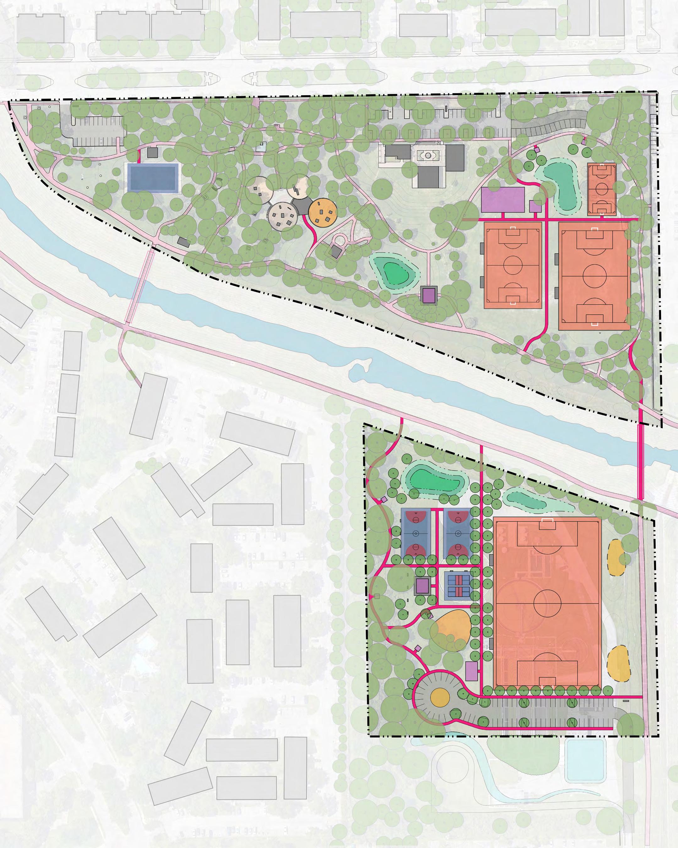
14 14 11 13 3 3 6 6 4 2 9 8 10 7 12 60’ 120’ 0 Soccer U8-10 Soccer Program TBD U11-12 Soccer GREENS BAYOU LIMIT OF WORK BAYOU EXISTING TRIALS PROPOSED TRAILS BRIDGE BIKE RACK SAFE CROSSING 1 1 2 4 5 7 8 9 10 11 13 11 12 5 6 WUSSOW PARK WUSSOW PARK ANNEX NORTHGATE REGIONAL LIFT STATION 5 5 2 1 Greens Rd 3 2023 Parks Master Plan 85 April 2023 THE ROYAL PHOENICIAN
OPINION OF PROBABLE COST
WUSSOW PARK
This opinion of probable construction cost is made on the basis of Asakura Robinson’s experience and qualifications, and represents Asakura Robinson’s best judgment a since Asakura Robinson has no control over the cost of labor, materials, equipment, or services furnished by others, or over the Contractor’s methods of determining pri guarantee that proposals, bids, or actual construction cost will not vary from opinions of probable construction cost as prepared by Asakura Robinson.
Item Quantity Unit Unit Cost Extension Site Improvements Tree Protection and Removal 1 LS 100,000.00 $ 100,000.00 $ Site Development 1 LS 479,966.00 $ 479,966.00 $ Site Improvements Sub-Total 579,966 00 $ Hardscape Entry Sign 1 EA 5,000.00 $ 5,000.00 $ Improve Existing Monument Sign 1 EA 15,000.00 $ 15,000.00 $ Concrete Paving-Mini Soccer Court 6,600 SF 8.00 $ 52,800.00 $ Concrete Paving-Trail 1,200 LF 48.00 $ 57,600.00 $ Concrete Paving-Pad 2,600 SF 8.00 $ 20,800.00 $ Airnasium Structure - Open, No A/C 1 EA 600,000.00 $ 600,000.00 $ Playground Additions/Upgrades 1 EA 100,000.00 $ 100,000.00 $ Court w/o lighting 1 EA 50,000.00 $ 50,000.00 $ U8-10 Soccer Field - Turf 1 EA 10,000.00 $ 10,000.00 $ U11-12 Soccer Field - Turf 1 EA 10,000.00 $ 10,000.00 $ Restroom Structure 1 EA 300,000.00 $ 300,000.00 $ Parking Expansion 6,000 SF 25.00 $ 150,000.00 $ Hardscape Sub-Total 1,371,200 00 $ Grading /Drainage Detention Pond Excavation 1 LS 120,000.00 $ 120,000.00 $ Grading / Drainage Sub-Total 120,000 00 $ Planting Shade Tree 5 EA 1,800.00 $ 9,000.00 $ Irrigation 1 LS 25,000.00 $ 25,000.00 $ Tree Staking - Lodgepole 5 EA 46.00 $ 230.00 $ Hydroseed for Disturbed Areas 12000 SF 0.25 $ 3,000.00 $ Subtotal Planting 37,230 00 $ Site Furnishings Bench 10 EA 2,000.00 $ 20,000.00 $ Bleachers 4 EA 3,000.00 $ 12,000.00 $ Litter Receptacles 12 EA 1,200.00 $ 14,400.00 $ Large Picnic Pavilion 1 EA 150,000.00 $ 150,000.00 $ Picnic Pavilions 2 EA 25,000.00 $ 50,000.00 $ Picnic Table 2 EA 2,000.00 $ 4,000.00 $ Bike Rack 1 EA 1,000.00 $ 1,000.00 $ Play Equipment 1 EA 150,000.00 $ 150,000.00 $ Subtotal Site Furnishings 401,400 00 $ Lighting/Electrical Field Lighting 1 LS 250,000.00 $ 250,000.00 $ Pedestrian Pole Lighting 30 EA 4,000.00 $ 120,000.00 $ Subtotal Lighting 370,000 00 $ Combined Subtotal 2,879,796.00 $ General Conditions 20% 575,959.20 $ Contingency 30% 863,938.80 $ Project Total 4,319,694 00 $ DISCLAIMER ON THE OPINION OF PROBABLE CONSTRUCTION COST :
Tom Wussow Park Tom Wussow Park Annex 86 2023 Parks Master Plan April 2023
Wussow Park Annex
This opinion of probable construction cost is made on the basis of Asakura Robinson’s experience and qualifications, and represents Asakura Robinson’s best judgment a since Asakura Robinson has no control over the cost of labor, materials, equipment, or services furnished by others, or over the Contractor’s methods of determining pri guarantee that proposals, bids, or actual construction cost will not vary from opinions of probable construction cost as prepared by Asakura Robinson.
Note: Opinion of cost does not consider design services fees nor escalation costs.
Item Quantity Unit Unit Cost Extension Site Clearing Tree Protection and Removal 1 EA 100,000.00 $ 100,000.00 $ Site Clearing For Trail 18,000 SF 1.00 $ 18,000.00 $ Site Development 1 LS 776,479.20 $ 776,479.20 $ Site Clearing Sub-Total 894,479 20 $ Hardscape Monument Entry Sign 1 EA 25,000.00 $ 25,000.00 $ Bridge 1 EA 750,000.00 $ 750,000.00 $ Concrete Paving-Trail 3,000 LF 48.00 $ 144,000.00 $ Concrete Paving-Pad 2,600 SF 8.00 $ 20,800.00 $ Play Surface (PIP) 6,000 SF 35.00 $ 210,000.00 $ Pickleball Court 2 EA 50,000.00 $ 100,000.00 $ Basketball Court w/o lighting 2 EA 50,000.00 $ 100,000.00 $ Soccer field 1 EA 150,000.00 $ 150,000.00 $ Restroom Structure 1 EA 300,000.00 $ 300,000.00 $ Parking 30,000 SF 25.00 $ 750,000.00 $ Hardscape Sub-Total 2,549,800 00 $ Grading /Drainage Detention Pond Excavation 1 LS 240,000.00 $ 240,000.00 $ Grading / Drainage Sub-Total 240,000 00 $ Planting Shade Tree 76 EA 850.00 $ 64,600.00 $ Hydroseed for Disturbed Areas 170,000 SF 0.25 $ 42,500.00 $ Wildflower Seeding - Hydroseed 4,000 SF 4.00 $ 16,000.00 $ Irrigation 20,000 SF 2.00 $ 40,000.00 $ Tree Staking - Lodgepole 76 EA 46.00 $ 3,496.00 $ Subtotal Planting 166,596 00 $ Site Furnishings Bench 12 EA 2,000.00 $ 24,000.00 $ Bleachers 2 EA 4,000.00 $ 8,000.00 $ Litter Receptacles 10 EA 1,200.00 $ 12,000.00 $ Large Picnic Pavilions 1 EA 150,000.00 $ 150,000.00 $ Picnic Pavilions 4 EA 25,000.00 $ 100,000.00 $ Picnic Table 16 EA 2,000.00 $ 32,000.00 $ Bike Rack 2 EA 1,000.00 $ 2,000.00 $ Play Equipment 1 EA 150,000.00 $ 150,000.00 $ Subtotal Site Furnishings 478,000.00 $ Lighting/Electrical Field Light Lighting 1 LS 250,000.00 $ 250,000.00 $ Pedestrian Pole Lighting 20 EA 4,000.00 $ 80,000.00 $ Subtotal Lighting 330,000 00 $ 4,658,875.20 $ General Conditions 20% 931,775.04 $ Contingency 30% 1,397,662.56 $ Project Total 6,988,312 80 $ DISCLAIMER ON THE OPINION OF PROBABLE CONSTRUCTION COST :
Tom Wussow Park Tom Wussow Park Annex 2023 Parks Master Plan 87 April 2023
EXISTING PARKS
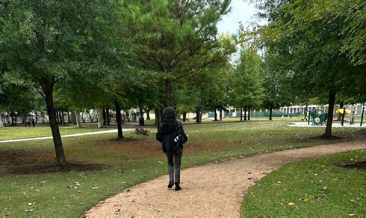
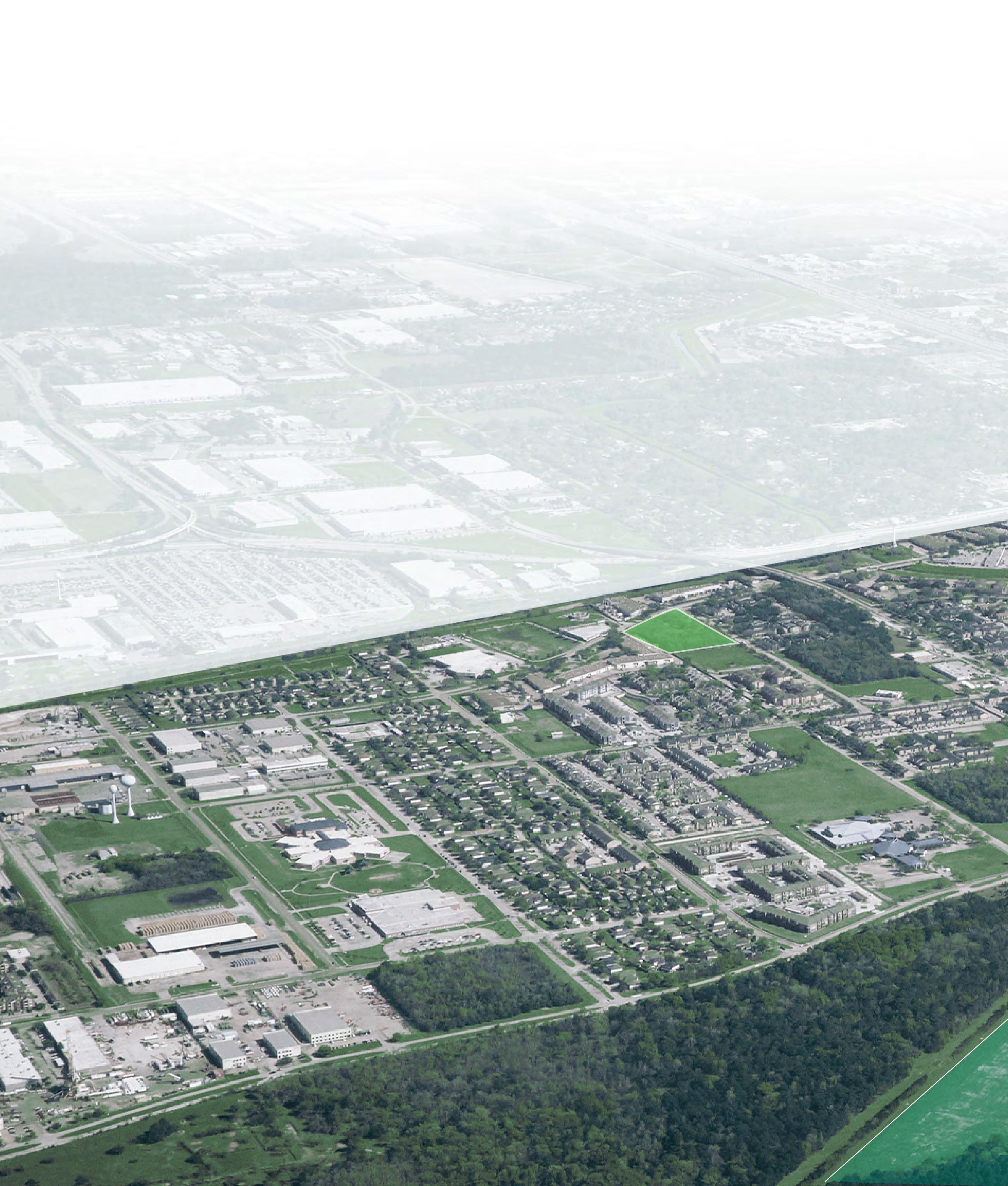
UPDATES & EXPANSIONS
The goal to Enhance aims to strengthen the features of existing parks and trails to meet the District’s visions for a unified park system. The parks shown in this section are representative of some of the parks in the District that would benefit from an update.
Updates entail replacing or adding park amenities such as lighting, benches, signage, playgrounds, and sport fields. It also encompasses opportunities to expand existing park boundaries and create new recreational spaces that encourage people's interaction with the Bayou, outdoors, and other natural assets of the District.
IDA GAYE GARDENS
Updates
• Add safe crossings for pedestrians and cyclists at the south of the site.
• Add accessible parking
• Update landscaping throughout the park.
IDA GAYE GARDENS
88 2023 Parks Master Plan April 2023
ENHANCE
Detention Pond Expansion
• Expand the park boundaries to the adjacent detention pond to create a Natural Recreation Center.
Update
• Update City View Park to build on Bayou story-telling and supporting the water narrative.
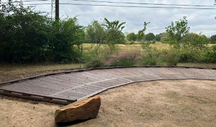
• Update landscaping throughout the park.
Updates/Master Plan
• Expand the park boundaries south of Greens Bayou to create a new park with basketball courts, pickle ball courts, and new recreational amenities.
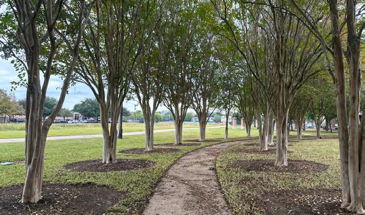
• Build a new pedestrian and bike bridge at the southeastern end of the existing park.
• Add soccer fields on the eastern side of the existing park
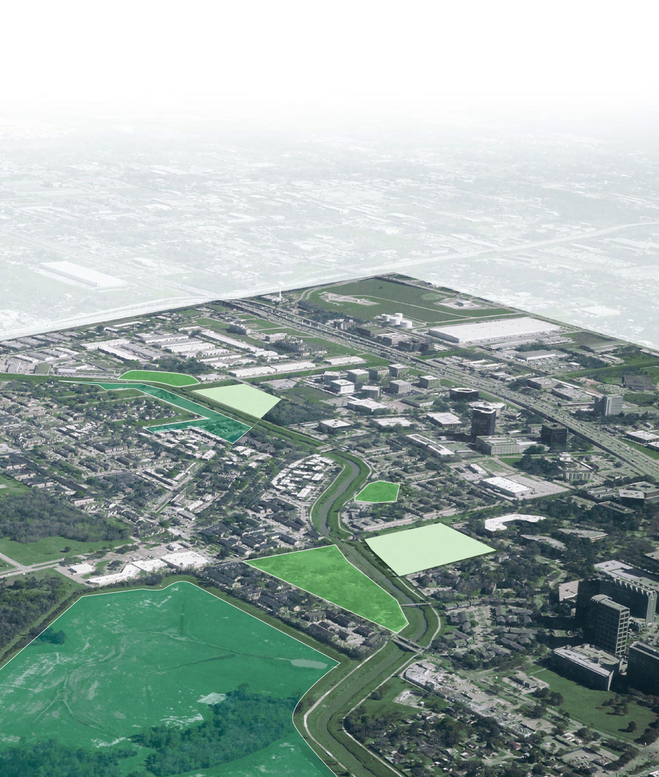
• Add accessible restrooms in the existing park
• Update the picnic area and amenities in the existing park.
• Update landscaping throughout the park.
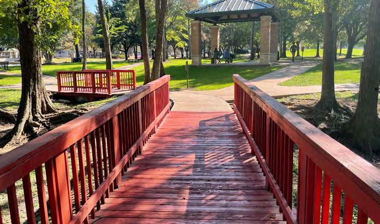
2023 Parks Master Plan 89 April 2023
JACK DRAKE PARK
THOMAS R. WUSSOW PARK
WUSSOW PARK
CITY VIEW PARK
CITY VIEW PARK
JACK DRAKE PARK
GENERAL RECOMMENDATIONS
SIGNAGE AND WAYFINDING
Signage within the North Houston District is imperative to communicate the story of Greens Bayou, the natural diversity of the parks, and amenities available within the park. Current signage varies based on date of installation and the message and intent of the sign.
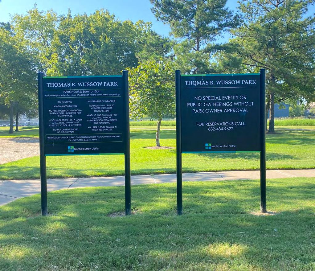
EXISTING SIGNAGE TYPES
This Master Plan addresses existing signage, the purposes of signage in the North Houston District, and envisions how signage can be updated and serve park visitors of today and the future.
Note: Any standard package developed for the parks should comply with existing City of Houston and Harris County standards.
FUNCTIONAL PARK SIGNAGE
Most of the signage within the North Houston District parks serves the function to indicate park-related identification and operations. The existing signage share the District's theme colors, as well as the same style and layout.
OTHER TYPES OF PARK SIGNAGE
There are some exceptions to the District's standard signage such as at the Skate Park, Rockstar Energy Park and Dylan Park. These parks have a distinct brand and style that is separate from the remainder of the District.
Visual and artistic elements are incorporated into the entry signage for Dylan Park and Buckboard Park, and on the park map for Rockstar Energy Park. Educational signage is also featured in Buckboard Park.
 Current park signage at Wussow Park showing park hours and regulations.
90 2023 Parks Master Plan April 2023
Left: Plaque memorializing the establishment of Wussow Park. Right: Educational signage showing butterfly life cycle at Buckboard Park.
SCALES OF PARK SIGNAGE
Signage within the District falls within two categories of scale: pedestrian and vehicular. Pedestrian signage is typically average adult-height and at a font size readable from standing within a few feet of the sign. Vehicular signage is either in monument form or at a larger font to read from the road. There is a lot of opportunity here to expand to users on bikes, and to improve vehicular and pedestrian scale signage at key locations for wayfinding.
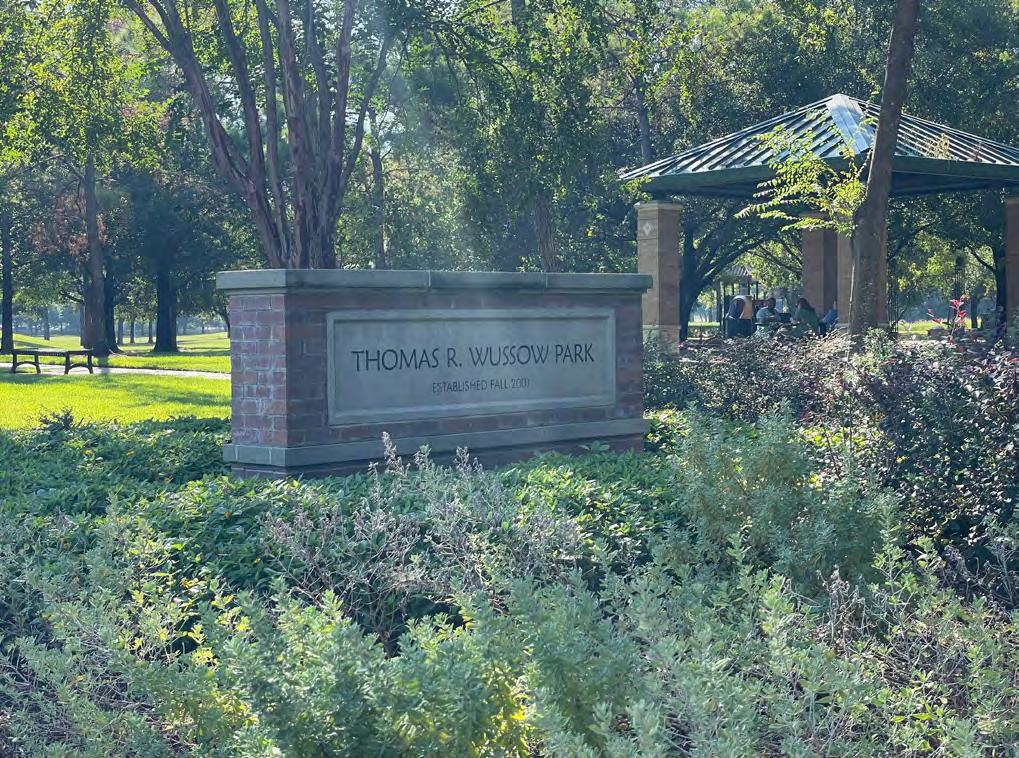
ACCESSIBILITY AND INCLUSIVITY IN PARK SIGNAGE
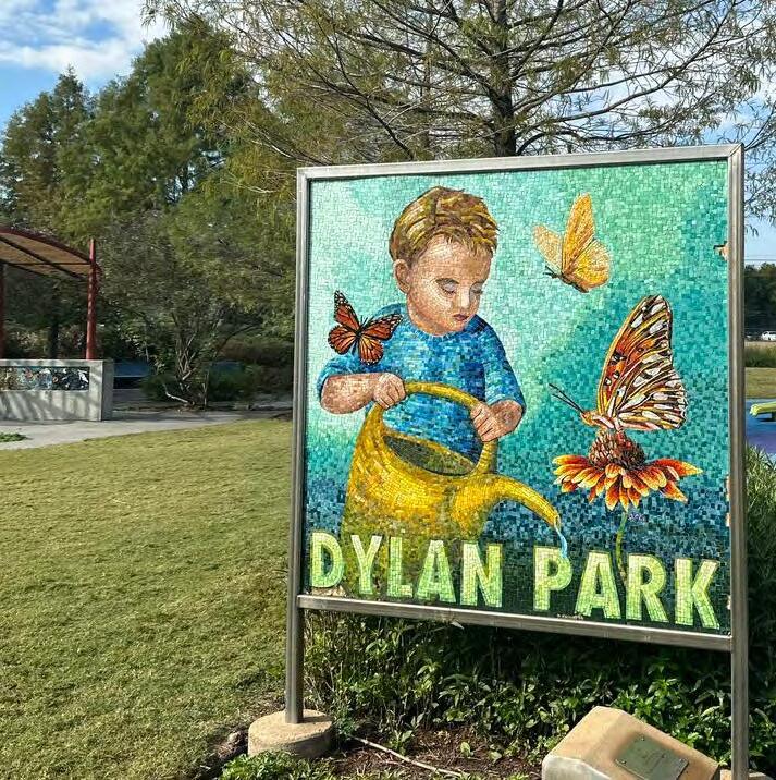
Current signage does not consider park users with various accessibility needs, such as braille or aural forms of communication. Some signs are translated in Spanish and English. There is great opportunity to achieve higher accessibility and language access in signage.
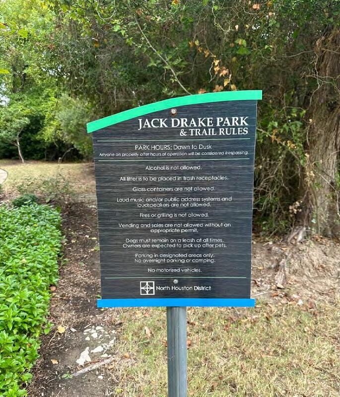
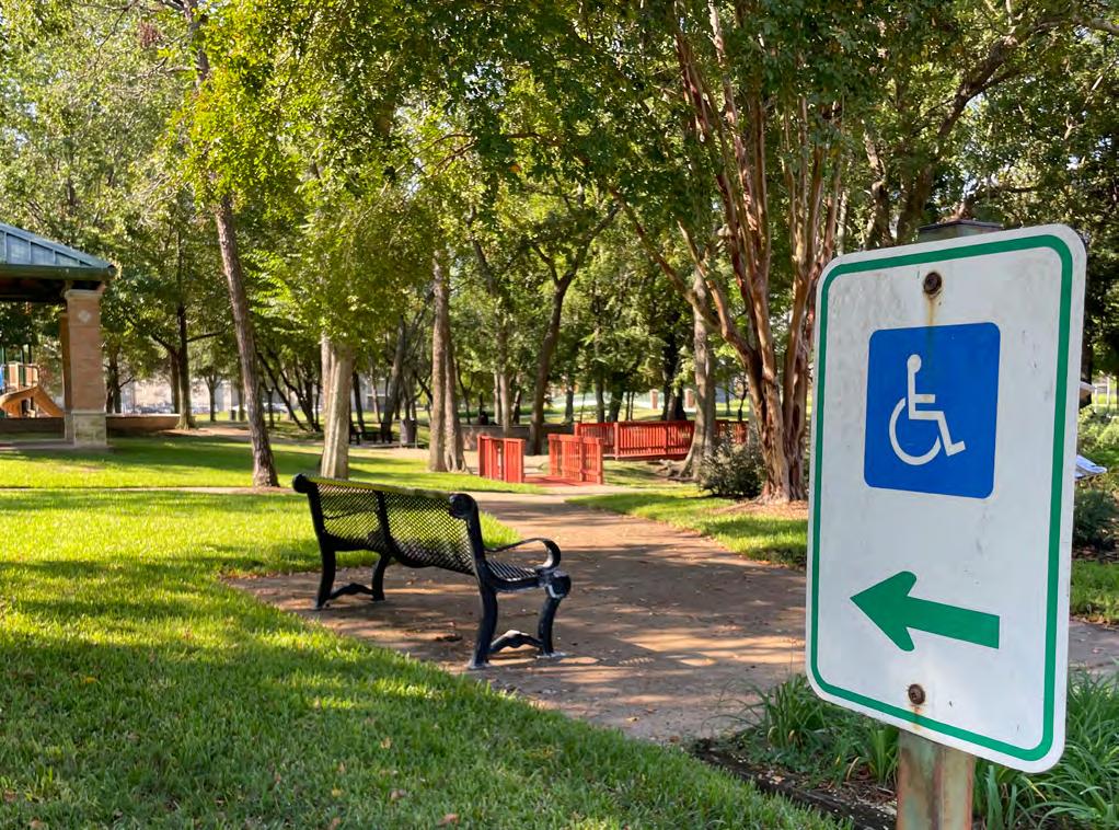 Current entry signage with artistic mosaic inside Dylan Park
Current wayfinding signage for ADA-Compliant route within Wussow Park.
Current park signage at Jack Drake Park showing park hours and regulations.
Dog Waste Station in Wussow Park.
Current entry signage with artistic mosaic inside Dylan Park
Current wayfinding signage for ADA-Compliant route within Wussow Park.
Current park signage at Jack Drake Park showing park hours and regulations.
Dog Waste Station in Wussow Park.
91 April 2023
Monument signage at Wussow Park as seen from Greens Road. 2023 Parks Master Plan
PARK SIGNAGE OPPORTUNITIES
This Master Plan recommends the District determine a standardized package for park signage and wayfinding within the parks system.
Signage standards should consider:
• Identification signage (plants, artwork, historic features, etc.),
• Pedestrian scale signage,
• Vehicular scale signage,
• Monument signage,
• Building signage,
• And Historical signage.
PEDESTRIAN AND BICYCLE SCALE SIGNAGE
Pedestrian and Bicycle scale signage is human-scale signage that is readable from a comfortable standing distance for those on foot or bicycle and can exist at any location within the park; along pathways, at specific elements such as feature trees or plant areas, near trailheads or key pathway intersections.
All of the current parks in the District are part of a greater park system connected to neighborhoods, schools, and businesses. Pedestrian and bicycle scale wayfinding should be considered at park-wide wayfinding and District-wide wayfinding scales.
OPPORTUNITIES
Within the park, this scale of signage can serve multiple purposes.
• For pedestrian scale signage, there is an opportunity to communicate wayfinding to the park user on foot or on bike, such as providing orientation in the park, distance to certain key park features, or pathway system mapping within the park.
• There is also opportunity to communicate proximity of the park user to off-site amenities, or where a park user can catch the nearest bus or find a safe bike route to another part of the city.
Improving pedestrian scale signage and wayfinding is imperative to making the District feel more cohesive and connected, to let visitors know about other park amenities they may be interested in, and to be better connected to the story of the District.
92 2023 Parks Master Plan April 2023
 Wayfinding at Cadence Park in Irvine, CA.
ADA Map in Mont Royal Park in Montreal, Canada
QR-code scavenger hunt at The Underline in Miami, FL.
Signage showing distance to key park features at Pohick Bay Regional Park in Lorton, Virginia
Wayfinding at Cadence Park in Irvine, CA.
ADA Map in Mont Royal Park in Montreal, Canada
QR-code scavenger hunt at The Underline in Miami, FL.
Signage showing distance to key park features at Pohick Bay Regional Park in Lorton, Virginia
93 April 2023
2023 Parks Master Plan
STORY TELLING
Storytelling commonly occurs as written narrative as seen in the park today, but can take many other forms that should be explored for visitors of tomorrow and the future of the District's parks.
Using signage can feature ways for a visitor to interact with a site’s history, natural features, cultural stories, or general wayfinding. The North Houston District has an opportunity to tell the story of the District and to highlight the stories of its waters in the context of Greens Bayou, floods, and the District's resiliency.
Artistic storytelling can take the form of sculptures, trail art installations, or interpretations of the subject matter.
Accessible storytelling is imperative to ensure all visitors of the park can enjoy, learn, and partake in the history and storytelling that they may otherwise not be able to easily access.
Technology-incorporated storytelling takes advantage of the growing trend in using things like augmented reality, QR code based information sharing, and app.-based information sharing using hand-held devices such as smartphones and tablets.
OPPORTUNITIES
Within the District's parks, open spaces, and trails, storytelling can serve multiple purposes.
• Storytelling can be woven into the wayfinding between parks and trails to tell a cohesive story of the District, Greens Bayou, and more.
• Accessibility can take many more obvious and subtle forms, including but not limited to:
• Raised lettering, braille, or aural options for those with visual impairments.
• Signage at various heights for users of all heights and ages.
• Icon-based or graphics-based signage.
• Locating signage in different environments for those who prefer to stop and spend time perhaps within or away from crowded environments.
• Implement artistic features in City View Park that narrates the story of Greens Bayou.
• Add educational signage to provide visitors with information about the District, history, and Greens Bayou.
• Incorporate QR code based information into park signage throughout the District. Some examples of information to add include:
• Virtual, self-guided walking tour of Greens Bayou
• QR-code linked to the North Houston District website
• Webpage with detailed history and information on respective parks.
94 2023 Parks Master Plan April 2023
Nature storytelling art along Green Bayou Trail.
VEHICULAR SCALE SIGNAGE
Vehicular scale signage is signage that is legible from a distance, typically sized and concise enough so one can read and orient themselves quickly and without much distraction. This type of signage typically exists at major roadway entries, roadway intersections, and along roadways.
There are opportunities to provide a sense of celebrated entry, reinforce the sense of identity, and define the edges of the District. Entry monuments exist around the area that should be referred to for example and precedent, potentially incorporating a new special park style.
Parking signage should be visible to motorists to indicate where surface parking is available for specific amenities, as well as general parking locations.
General wayfinding for park amenities should be visible along roadways, especially at key intersections directing motorists to specific destinations. Often, these are simple directional labels and distance markers.
OPPORTUNITIES
• Add or relocate signage to be closer to public rightof-way to increase visibility of the parks.
• Incorporate vehicular scale signage along intersections of public right-of-way and Greens Bayou to indicate walking, biking, and driving distance to respective parks.
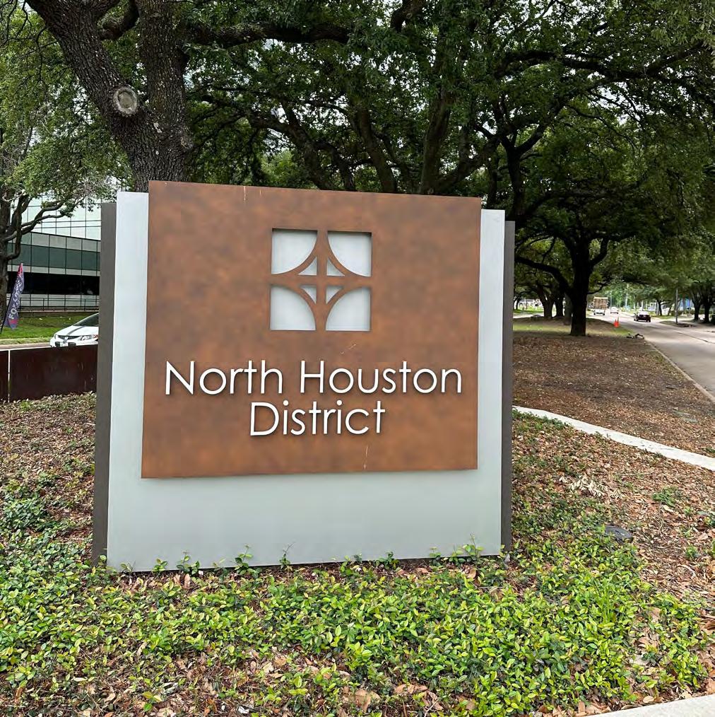
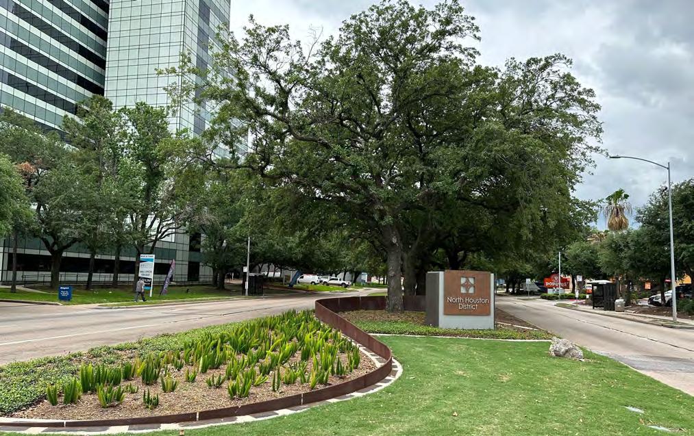
• Utilize existing medians along major thoroughfares to include signage to establish a sense of entry and identity within the District. Forms of median signage include but are not limited to:
• Entry/Gateway monuments built onto a median to indicate entry into the District.
• Flags or banners placed on trees or lighting fixtures
• Landscaping that incorporates native plant species
• Art or sculptures displayed on medians for drivers, pedestrians, and cyclists to view from a distance.
Median Signage and planting at Imperial Valley Drive, North Houston District, Houston, TX.
Median Signage at Imperial Valley Drive, North Houston District, Houston, TX.
2023
95 April 2023
Tongva Park Entrance Signage with seating, visible from Ocean Avenue, located in Santa Monica, CA.
Parks Master Plan
LIGHTING AND SAFETY RECOMMENDATIONS
This Master Plan recommends the District standardizes the upgrades or addition of lighting, safety, and landscape components throughout all of its parks and trails.
Lighting and safety were some of the concerns shared by the public during the engagement for this master plan. There is a need to ensure proper and ample lighting within the parks for all types of park users. Lighting not only adds to the ambiance of a space, but plays a crucial role in ensuring safety.
Lighting types that should be included in the park updating include:
• Pedestrian lighting should be at a comfortable pedestrian height, 12'-14', located along pathways, sidewalks, and pedestrian areas. It should be spaced appropriately so that park users are able to discern facial features of other park users within a comfortable distance of them.
• Vehicular lighting is to be located along the roadways adjacent to and surrounding the park. Vehicular lighting also applies to providing sufficient lighting for parking areas and where pedestrians and vehicles converge such as crosswalks.
• Sports Field/Court lighting should be concentrated at any sports facilities and dog parks. This lighting should be carefully directed as to not disturb adjacent neighbors, and also align with field/court use appropriately as to not be constantly in use when not needed.
• Decorative Lighting serves to add character and bring attention to special park features. Up-lighting feature trees, sculptures or statues, placards, flags, and other types of signage help with those visiting the park in the evening. Decorative lighting can also overlap with pedestrian and vehicular lighting to add a layered approach of creating character and safety after the sun sets.
LIGHTING EFFICIENCY AND DESIGN
Current and new lighting should comply with official park standards as well as meet efficiency guidelines. Lighting should include responsive timing to changing sun set hours, use solar energy, LED efficiency, and self-reporting on any lighting that is malfunctioning. LED lighting has a longer lifespan than older styles and versions, and uses far less energy input for greater output.
There are many modern design options that achieve sustainable and efficient lighting recommendations while maintaining a park's character. Additional design considerations are to be considered, such as ensuring all lighting is entirely downward-directed and dark-sky compliant.
SAFETY
There are many options to include pedestrian safety elements throughout the park. Emergency posts are becoming more common, also known as blue-light call boxes. These boxes are tall, blue-light illuminated posts that are clearly marked for emergency use. They connect to emergency services to render aid more efficiently to those in need.
96 2023 Parks Master Plan April 2023
Pedestrian lighting illuminates trails and paths.
OPPORTUNITIES
• Incorporate pedestrian lighting throughout Wussow Park, particularly between park amenities to ensure safe access within the park.
• Add more pedestrian lighting along streets that are directly adjacent to the District's parks, particularly at crosswalks, so pedestrians and cyclists are able to discern the park after the sun sets.
• Incorporate decorative lighting throughout the District's parks that distinguishes the District's brand.
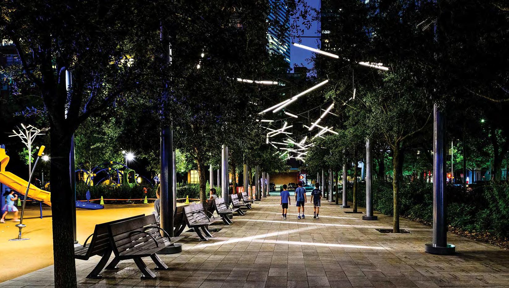
2023 Parks Master Plan 97 April 2023
Many modern lighting styles come in expressions and families of various types of lighting that match
Renderings of pedestrian lighting in Discover Green Park in downtown Houston.
LANDSCAPE AND PLANTING
Identifying specific plants to incorporate throughout the District's landscape can strengthen the identify of the parks, trails, and the overall District.
Refer to Table 1 for the plant schedule below for the list of trees, ground cover, grass, and turf that were recommended in the District's Entry Point Improvement document.
SPECIES PLANTING TYPE
Live Oak (QUERCUS VIRGINIANA)
Mexican Sycamore (PLATANUS MEXICANA)
Bald Cypress (TAXODIUM DISTICHUM)
Cedar Elm (ULMUS CRASSIFOLIA)
Loblolly Pine (PINUS TAEDA)
Crape Myrtle 'Natchez' (LAGERSTROEMIA INDICA)
Asian Jasmine (TRACHELOSPERMUM ASIATICUM)
Sandy Leaf Fig Ivy (FICUS TIKOUA)
Foxtail Fern (ASPARAGUS MEYERI)
Gulf Muhly Grass (MUHLENBERGIA CAPILLARIS)
Common Bermuda (CYNODON DACTYLON)
Trees
Trees
Trees
Trees
Trees
Trees
Ground Cover
Ground Cover
Ground Cover
Grasses
Turf
98 2023 Parks Master Plan April 2023
TABLE 1: PLANT SCHEDULE
GENERAL PARKS RECOMMENDATIONS
The parks in the North Houston District range in park age, uses, and more. The list below presents general opportunities and considerations for all parks and trails within the District.
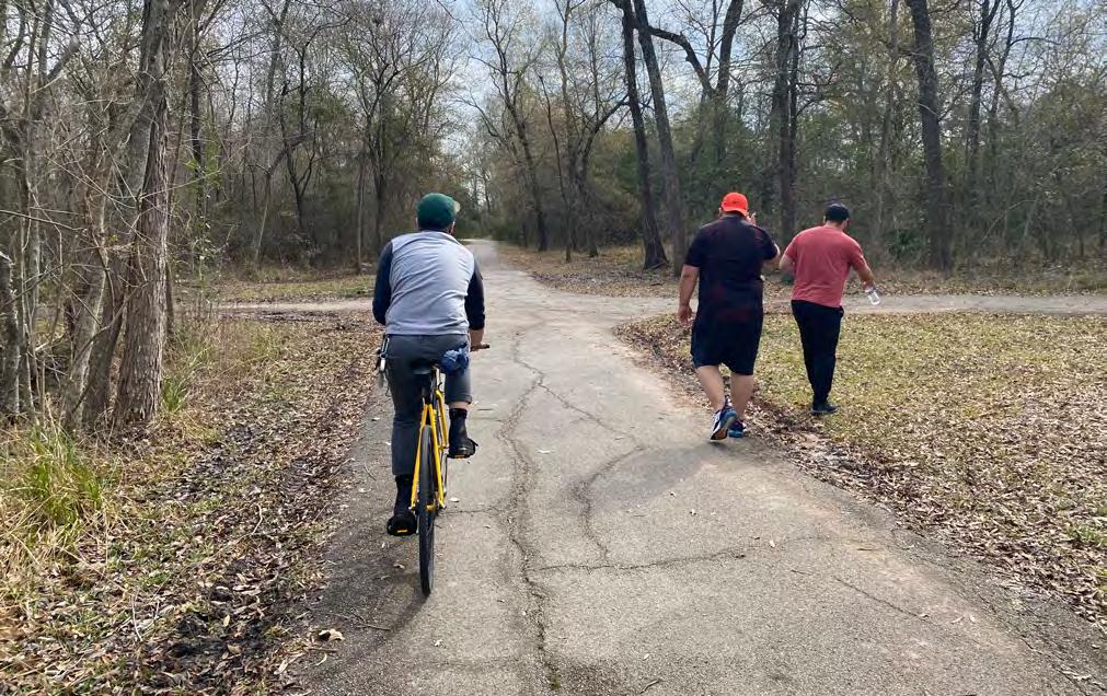
OPPORTUNITIES
• Repair and maintain the trail and facilities in older parks to ensure they are safe and functional for visitors.
• Increase the number of shade trees to provide a more comfortable environment for visitors during hot weather.
• Consider keeping existing art in the parks, as it can enhance the aesthetic value of the park and provide a unique experience for visitors.
• Maintain consistency in art and education to promote a sense of continuity between all parks.
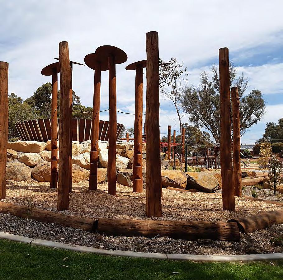
• Install more benches or seating areas throughout the parks to encourage visitors to stay longer and enjoy the surroundings.
• Increase maintenance efforts for community gardens to ensure they are thriving and accessible to all members of the community.
• Diversify the age range of park visitors by adding more sports fields and activities suitable for a range of ages.
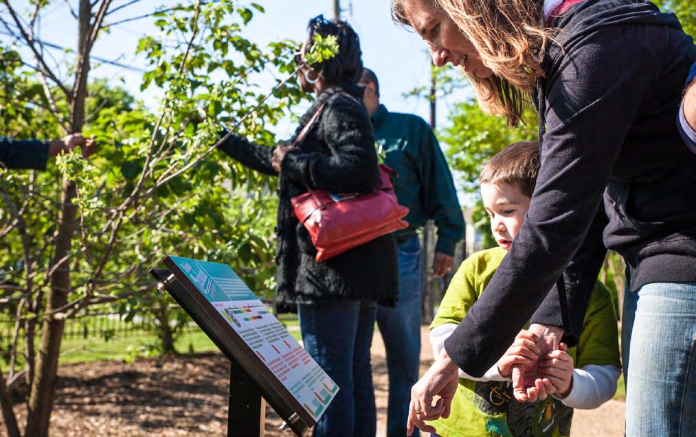 Educational signage at Palm Center in Houston, TX
Nature-based playground at Boddington Nature Playground in western Australia.
Educational signage at Palm Center in Houston, TX
Nature-based playground at Boddington Nature Playground in western Australia.
99 April 2023
Wide trails with spaces for pedestrian and cyclist uses. 2023 Parks Master Plan
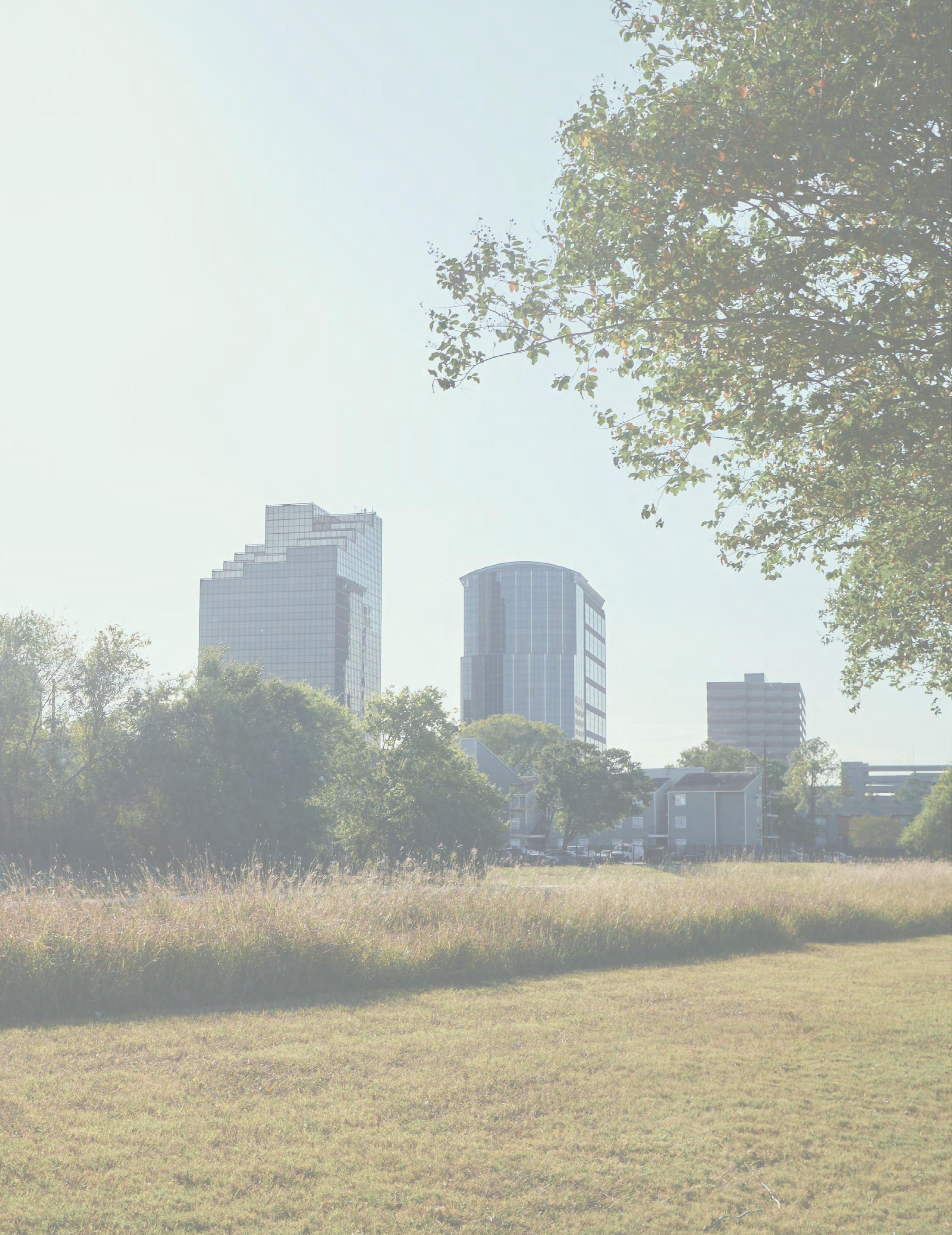
5 IMPLEMENTATION
The implementation of the North Houston District Parks Master Plan is a collaborative effort between the District, City of Houston, Harris County, and many other partner organizations.
This chapter will explore partnership opportunities identifying assets and abilities, grants, financing options, and the prioritization of fund utilization for the proposed recommendations throughout the four quadrants.
The prioritization of projects between short, middle, and long term were determined based on project demand, feasibility, and frequency of project recommendation in past planning studies and documents.
2023 Parks Master Plan 101 April 2023
PARTNERSHIPS
Within the North Houston District and the surrounding Houston metro area there are a diverse array of civic organizations, City governments, businesses, and community organizations that could be instrumental in accomplishing the varying levels of projects envisioned in this report. The list below features some of the most high-value potential partnerships for the District to pursue or further develop in the course of expanding the parks and open space system throughout the area. While some of the organizations below may already be in partnership with the District, it is worthwhile to further emphasize the important role they will play in the planning and implementation of future projects.
ENTITY PURPOSE ASSETS ABILITIES
Greens Bayou Corridor Coalition Advocate for Greens Bayou improvements, create strategic partnerships to develop parks & trails, engage volunteers & communities in Bayou upkeep
North Houston Association Connect and educate North Houston business community, advocate for local economic needs
Partnerships, volunteer programs, local, state, and national advocacy, community engagement
Park maintenance through volunteer programs, facilitate formation of strategic partnerships to support park & trail development, organize community engagement events
Regional business network, advocacy, environment committee
Mobilize local business community to support park & trail development as component of economic development platform, educate business community on environmental topics
Greater Greenspoint Redevelopment Authority/TIRZ no. 11
Oversee administration of TIRZ no.11, provide financial support for infrastructure and amenities, including park and streetscape improvements
City of Houston Parks Enhance the quality of urban life by providing safe, well-maintained parks, and offering affordable programming for our community
Houston Parks Board Create, improve, protect, and advocate for parks in the Houston area
Incremental financing
Incremental tax funding, partnerships with the City, County, Aldine & Spring ISDs, finances redevelopment and attracts new development to underserved areas
City general fund, City special revenue fund, Parks and Open Spaces Ordinance fees
Park maintenance and construction, programming, land acquisition for park purposes
Partnerships, donor funds, volunteer network
Implement projects including Bayou Greenways 2020, community programs, park studies, and park care and maintenance.
102 2023 Parks Master Plan April 2023
ENTITY PURPOSE ASSETS ABILITIES
Harris County Flood Control District
Provide flood damage reduction projects that work with appropriate regard for community and natural values
A dedicated ad valorem property tax; Federal and state grants; Project cost sharing agreements; Funding allocated each year by Harris County Commissioners Court
City of Houston Office of Sustainability
Encourage green development and lifestyles across the city by carrying out green projects, educating on pressing environmental issues, and promoting sustainable projects and services
SPARK
Collaborate with local schools and communities to build parks on public school land that serve school needs during the day, open to public after school day and on weekends/holidays
Aldine-Greenspoint
YMCA
Provide a wide range of community programming, educational support, and recreation activities for local youth
Hines/Pinto Business Park
Real estate investment, development, & management, property manager of Pinto Business Park
City of Houston Planning and Development
Manage land-development regulations, enhance and protect neighborhood character and stability, and provide reliable data, mapping and analysis to decision makers
Implement flood damage reduction projects and flood control facility maintenance
City general fund Support greenhouse gas mitigation initiatives, Serve as a liaison between the City and other entities on matters pertaining to greenhouse gas mitigation, Provide support on utility regulation and its cost saving efficiencies
New park funding, partnerships, community engagement & volunteers
Provides funding for new school parks, engage community and build buyin needed to help envision & financially support new parks, bring in donations & volunteer support
YMCA facilities, volunteer network, community engagement
Engage communities through volunteering, support for park programming, partnership to help build, staff, & operate recreation facilities
Pinto Business Park Collaborate with the District to enhance green elements & trail connectivity within Pinto Business Park
City general fund, City special revenue fund
Historic preservation, Implement land development regulations, Improve transportation planning efforts, Pursue grant funding, Review projects for compliance with development codes
2023 Parks Master Plan 103 April 2023
ENTITY PURPOSE ASSETS ABILITIES
METRO Develop, operate, and maintain a mass transit system to serve the residents within and visitors to its service area
Harris County Precinct 1
Deliver responsive public services to improve the quality of life, advance equality of opportunity, and promote the fair treatment for all
Harris County Precinct 2
Deliver responsive public services to improve the quality of life, advance equality of opportunity, and promote the fair treatment for all
Harris County Engineering
Deliver infrastructure and public services to Harris County
Sales tax, grants, fares Expansion and enhancement of transit infrastructure, design and plan expansions and enhancements including sidewalks and bicycle facilities
Tax revenue, government grants
Bikeway/Street/Sidewalk/ Trail improvements, Park & community center programming, flood mitigation projects
Tax revenue, government grants
Bikeway/Street/Sidewalk/ Trail improvements, Park & community center programming, flood mitigation projects
Engineering Expertise understanding, Harris County resources
Engineering, architecture, project management, real property assessment/ acquisition, and construction
Harris County Health Promote community health and safety, prevent illness and injury
Spring ISD
Provide public education to the Spring area
Aldine ISD
Provide public education to the Aldine area
TxDOT Plan, design, build, operate and maintain Texas highways.
Local developers Build housing to support community desires
Public Health initiatives and connections, Harris County resources
Provide resources, information, and services; connect communities to funding based on demonstrated community needs
Connection to students and parents
Connection to students and parents
Transportation understanding, funding; grants
Advocate for and gather input on Safe Routes to School improvements
Advocate for and gather input on Safe Routes to School improvements
Support community mobility goals
Private capital Implementing housing needs, increasing housing diversity
104 2023 Parks Master Plan April 2023
GRANTS AND FINANCE
To accomplish and sustain the range of recommended parks and open space projects and area improvements presented in this plan, an array of finance mechanisms and funding opportunities must be leveraged to provide a diverse base of support to draw from in the short, mid, and long term. Smaller scale, shorter term projects can benefit from funding strategies better suited to lower project costs and barriers to implementation, while the groundwork for more expansive long-term finance tools can be laid now to provide for larger scale system-wide flagship projects down the road. The following sections detail a selection of relevant grant opportunities and priority-based funding mechanisms to consider for future District developments.
GRANT OPPORTUNITIES
RECREATIONAL TRAIL GRANTS
Offered By: Texas Parks and Wildlife Department
Description: The reimbursable grants can be up to 80% of project cost with a maximum award of $600,000 for motorized (off-highway vehicle) trail grants (call 512-538-4427 for more information regarding potential motorized trail grants). Funds can be spent on both motorized and non-motorized recreational trail projects such as the construction of new recreational trails, to improve existing trails, to develop trailheads or trailside facilities, and to acquire trail corridors. (Source: TPWD)
Eligible Entities: Cities, counties, State and Federal Agencies, Non-profits
Total Program Funding: $3.9 Million (Annually)
TRANSPORTATION ALTERNATIVES SET-ASIDE PROGRAM
Offered By: TxDOT
Description: [This] program provides funding for a variety of generally smaller-scale transportation projects such as pedestrian and bicycle facilities; construction of turnouts, overlooks, and viewing areas; community improvements such as historic preservation and vegetation management; environmental mitigation related to stormwater and habitat connectivity; recreational trails; safe routes to school projects; and vulnerable road user safety assessments. (Source: TxDOT)
Eligible Entities: Cities, Counties, Metropolitan Planning Organizations, Non-profits
Total Program Funding: $250 Million
SAFE STREETS AND ROADS FOR ALL (SS4A) GRANT PROGRAM
Offered By: US DOT
Description: The SS4A program funds regional, local, and Tribal initiatives through grants to prevent roadway deaths and serious injuries. There are two types of SS4A grants: Action Plan Grants and Implementation Grants. which fund a range of planning and capital improvement projects related to road improvements and pedestrian or cycling infrastructure. (Source: US DOT)
Eligible Entities: Metropolitan planning organizations, Counties, Cities, Towns, Transit agencies, Special districts, Federally recognized Tribal governments
Total Program Funding: $800 Million (FY2022)
2023 Parks Master Plan 105 April 2023
RECONNECTING COMMUNITIES PROGRAM
Offered By: US DOT
Description: The first-ever Federal program dedicated to reconnecting communities that were previously cut off from economic opportunities by transportation infrastructure. Funding supports planning grants and capital construction grants, as well as technical assistance, to restore community connectivity through the removal, retrofit, mitigation, or replacement of eligible transportation infrastructure facilities. (Source: US DOT)
Eligible Entities: States, Units of Local Government, Federally recognized Tribal governments, Metropolitan planning organizations, Non-profits
Total Program Funding: $185 Million (FY2022)
REBUILDING AMERICAN INFRASTRUCTURE WITH SUSTAINABILITY AND EQUITY
Offered By: US DOT
Description: RAISE grants (formerly known as BUILD and TIGER) are for investments in surface transportation infrastructure and are awarded on a competitive basis to projects that will have a significant local or regional impact. RAISE funding can support greenways, bike trails, and pedestrian paths, along with roads, bridges, transit, rail, and ports. (Source: City Parks Alliance)
Eligible Entities: Local, State, and Tribal governments, Public Agencies
Total Program Funding: $1.5 Billion
LOCAL PARK GRANT PROGRAM: NON-URBAN INDOOR/OUTDOOR RECREATION
Offered By: Texas Parks and Wildlife Department
Description: The Local Park Grant Program consists of 5 individual programs that assist local units of government with the acquisition and/or development of public recreation areas and facilities throughout the State of Texas. The Program provides 50% matching grants on a reimbursement basis to eligible applicants. Once funded, all grant assisted sites must be dedicated as parkland in perpetuity, properly maintained and open to the public. (Source: TPWD)
Eligible Entities: Cities, Counties, River authorities, Municipal Utility Districts, Special districts
Total Program Funding: $2 Million
COMMUNITY OUTDOOR OUTREACH PROGRAM
Offered By: Texas Parks and Wildlife Department
Description: CO-OP provides grants to tax- exempt organizations ranging from $5,000 to $70,000. This is a reimbursement grant program. Recipients must purchase eligible items and submit proper documentation before being reimbursed. Eligible organizations can apply to use these funds for programming expenses such as personnel, food, travel expenses, participant liability insurance, entrance fees, outdoor recreation equipment and environmental education supplies. (Source: TPWD)
Eligible Entities: Local governments, Universities, School Districts, and Non-profits
Total Program Funding: $14 Million
106 2023 Parks Master Plan April 2023
FLOOD MITIGATION ASSISTANCE GRANT
Offered By: FEMA
Description: This grant may be used for projects that reduce or eliminate the risk of repetitive flood damage to buildings insured by the National Flood Insurance Program including: project scoping, technical assistance, community flood mitigation projects, individual structure/propertylevel flood mitigation projects, and management costs. (Source: FEMA)
Eligible Entities: States, tribes and territories can submit applications on behalf of subapplicants.
Total Program Funding: $200,000,000
BUILDING RESILIENT INFRASTRUCTURE AND COMMUNITIES FUND
Offered By: FEMA
Description: Building Resilient Infrastructure and Communities (BRIC) funds may be used for: capability and capacity building activities, mitigation projects, and management costs. (Source: FEMA)
Eligible Entities: States, tribes and territories can submit applications on behalf of subapplicants.
Total Program Funding: $112,000,000
FIVE STAR AND URBAN WATERS RESTORATION GRANT PROGRAM
Offered By: National Fish and Wildlife Foundation
Description: The Five Star and Urban Waters Restoration Program seeks to develop nationwide community stewardship of local natural resources, preserving these resources for future generations and enhancing habitat for local wildlife. Grants seek to address water quality issues in priority watersheds, such as erosion due to unstable stream banks, pollution from stormwater runoff, and degraded shorelines caused by development. (Source: NFWF)
Eligible Entities: Non-profit 501(c) organizations, state government agencies, local governments, municipal governments, Tribal Governments and Organizations, and educational institutions
Total Program Funding: $2,600,000
MICRO GRANTS PROGRAM
Offered By: Entergy
Description: Through Entergy’s Micro Grants Program, we accept requests for up to $1,000 in all program areas: arts and culture; community improvement/enrichment; economic development, education/literacy, environment and healthy families. (Source: Entergy)
Eligible Entities: Non-profits, Schools, State or local governments, Veterans organizations
Total Program Funding: N/A
2023 Parks Master Plan 107 April 2023
NW QUADRANT
PRIORITY GOAL RECOMMENDATIONS
Short-Term Connect Provide safe connections to Greens Bayou at Ella Blvd.
Short-Term Connect Provide Bayou trail connection under IH-45 to connect the east and west side of the Bayou
Mid-Term Activate Repurpose North Houston District parcels along Greens Bayou into parks and open space
Mid-Term Activate Coordinate with Aldine Independent School District (AISD) and SPARK Park to build a new SPARK Park at Plummer Middle School and the southeast property at the intersection of Greens Road and Spears-Gears Road
Mid-Term Activate Coordinate with Harris County and local school districts to activate parcels into new parks and open space
Mid-Term Connect Establish new trails to connect the Green Oak subdivision to Davis High School, Plummer Middle School, Spencer Elementary School, and Greens Bayou
Long-Term Connect Develop on-street bike lanes along W. Greens Rd. between Ella Blvd. and IH-45
Long-Term Connect Develop on-street bike lanes along Greens Crossing Blvd. from W. Greens Rd. to Beltway 8
Long-Term Connect Complete safe pedestrian and bike connections to the Northeast Quadrant at Rankin Rd. and W. Greens Rd.
Long-Term Connect Complete safe pedestrian and bike connections to the Southwest Quadrant at Ella Blvd. and Greens Crossing Blvd.
Long-Term Connect Consider future regional connections between Rockstar Energy Bike Park and Kuykendahl Detention Basin
Long-Term Connect Develop a bike lane along Ella Boulevard north of Rankin Rd. and to the south of W. Greens Rd.
Long-Term Connect Develop a bike lane along Rankin Rd. between Spears-Green Road and IH-45.
Long-Term Connect Develop a bike lane along Spears-Green Road between Rushcreek Dr. and Gears Rd.
Long-Term Connect Complete the bike lane connection on Ella Blvd. and provide safe crossing and access to Greens Bayou
Long-Term Connect Develop on-street bike lanes along Northborough Dr., connecting to Greens Pkwy.
Long-Term Connect Establish new trails to connect the Green Oak subdivision to Davis High School, Plummer Middle School, Spencer Elementary School, and Greens Bayou
108 2023 Parks Master Plan April 2023
POTENTIAL PARTNERS POTENTIAL FUNDING
METRO, HPB, HPARD, COH, GBCC, TxDOT
METRO, HPB, HPARD, COH, GBCC, TxDOT
COH, HPARD, Harris County, Houston Parks Board
Aldine ISD, SPARK, Houston Parks Board
COH, HHA, Private Developers, HPARD, Houston Parks Board, Harris County
COH, HPARD, HPB, Harris County, AISD
METRO, HPB, HPARD, COH, TxDOT
METRO, HPB, HPARD, COH
METRO, HPB, HPARD, COH
METRO, HPB, HPARD, COH
HPARD, HPB, GBCC, COH, HCFCD
METRO, HPB, HPARD, COH
METRO, HPB, HPARD, COH, TxDOT
METRO, HPB, HPARD, COH
METRO, HPB, HPARD, COH, GBCC
METRO, HPB, HPARD, COH, HCFCD, GBCC
GBCC, Aldine ISD, Private Developers, HPB, METRO, COH
2023 Parks Master Plan 109 April 2023
NE QUADRANT
PRIORITY GOAL RECOMMENDATION
Short-Term Activate Partner with the Harris County Flood Control District (HCFCD) to activate the Glen Forest Detention Basin with new parks, trails and open space
Short-Term Connect Develop sidewalks along Imperial Valley Dr. extending north from Greens Rd.
Short-Term Activate Continue to advance the future Central Park concept as a storm water amenity
Short-Term Connect Extend trails to the east to W. Hardy Rd. to improve trail circulation in the quadrant
Mid-Term Activate Expand and connect Thomas R. Wussow Park to the City of Houston Waste Water Treatment Plant property
Mid-Term Connect Provide safe trail connections to Greens Bayou at IH-45, Greens Rd., and Imperial Valley Dr.
Mid-Term Connect Extend trails to the east of Imperial Valley Drive to improve trail circulation in the quadrant
Mid-Term Activate Establish partnerships with Greenspoint Plaza to repurpose land for parks and open space uses
Mid-Term Connect Develop new trails on existing easements to create trail and bike network connectivity
Mid-Term Activate Develop NHD owned property at 16825 North chase Dr. as new sport amenity park
Mid-Term Connect Develop on-street bike lanes Benmar Dr. extending east from Greenspoint Dr.
Mid-Term Activate Coordinate with Spring Independent School District and SPARK Park to build a new SPARK Park at Cooper Elementary School
Mid-Term Connect Develop a Jack Drake Natural Recreation Center at the detention facility west of the park
Long-Term Activate Coordinate the expansion of Ida Gaye Gardens with parcel owners to the east of the park
Long-Term Connect Develop on-street bike lanes along Greens Rd.
Long-Term Connect Develop on-street bike lanes along Greenspoint Dr. extending south from Greens Bayou
Long-Term Connect Develop new trails on existing easements to create trail connections from Rankin Rd.
Long-Term Connect Create new trails along the northern and eastern boundary of the NE Quadrant to establish connections between schools and residential subdivisions within and adjacent to the NE Quadrant
Long-Term Activate Coordinate with Harris County MUD No. 96 to activate new parks and open space
Long-Term Connect Complete safe pedestrian and bike connections to the Northwest Quadrant at Rankin Rd. and W. Greens Rd.
Long-Term Connect Complete safe pedestrian and bike connections to the Southeast Quadrant at Greenspoint Dr. and Imperial Valley Dr.
110 2023 Parks Master Plan April 2023
POTENTIAL PARTNERS POTENTIAL FUNDING
HCFCD, Houston Parks Board, HPARD, GBCC
METRO, HPB, HPARD, COH
HPARD, HPB, COH, HCFCD, GBCC
COH, HPARD, HPB, Harris County
HPARD, HPB, COH, HCFCD
Houston Parks Board, HPARD, TxDOT, COH
HPARD, HPB, METRO, COH
COH, Greenspoint Plaza, Private Developers, HPARD, Harris County
HCFCD, HPARD, Private Developers, Private landowners, Houston Parks Board, COH, METRO
METRO, HPB, HPARD, COH
Spring ISD, SPARK Parks, Houston Parks Board
HPARD, HPB, COH, HCFCD, GBCC
North Houston District, COH
METRO, HPB, HPARD, COH
METRO, HPB, HPARD, COH
HCFCD, HPARD, Private Developers, Private landowners, Houston Parks Board, COH, METRO
HPARD, Private Developers, Aldine ISD, COH, Houston Parks Board
Harris County MUD No, 96, Harris County
METRO, HPB, HPARD, COH
METRO, HPB, HPARD, COH
2023 Parks Master Plan 111 April 2023
SW QUADRANT
PRIORITY GOAL RECOMMENDATIONS
Short-Term Activate Coordinate with Aldine Independent School District (AISD) and SPARK Park to build a new SPARK Park at Thomas Gray Elementary School
Mid-Term Activate Coordinate with Harris County MUD No 406 and MUD No 321 to develop new parks and open space
Mid-Term Connect Utilize existing easements to create a trail along the western and portions of the southern boundary of the quadrant to connect Pinto Business Park, new parks and open spaces, residential subdivisions, and schools.
Long-Term Connect Develop existing easements into trails along the eastern boundary of Pinto Business Park; Explore opportunities for new parks and open space in adjacent vacant land
Long-Term Connect Complete trail connections to the NW Quadrant
Long-Term Connect Extend the bike lane plans for Ella Blvd. to improve connectivity and cycling options for residents, visitors, and workers in the SW Quadrant
Long-Term Connect Develop bike lanes along Greens Crossing Rd. between Beltway 8 and the southern boundary of the SW Quadrant
Long-Term Connect Develop bike lanes along Fallbrook Dr. between IH-45 and the western boundary of the SW Quadrant
Long-Term Connect Add pedestrian and bike paths along West Road to improve mobility in this quadrant
Long-Term Activate Coordinate with Aldine Independent School District (AISD) and SPARK Park to build a new SPARK Park at Blanton CTE High School
Long-Term Connect Complete safe pedestrian and bike connections to the Northwest Quadrant at Ella Blvd. and Greens Crossing Blvd.
Long-Term Connect Complete safe pedestrian and bike connections to the Southeast Quadrant at Fallbrook Dr. and West Rd.
112 2023 Parks Master Plan April 2023
POTENTIAL PARTNERS POTENTIAL FUNDING
Aldine ISD, SPARK Parks, Houston Parks Board
Harris County MUD No. 406, Harris County, Harris County MUD No. 321 Houston Parks Board
Hines, HPARD, Houston Parks Board, COH, Private Developers
Hines, HPARD, Houston Parks Board, COH, Private Developers
HPARD, HPB, METRO, COH
HPARD, Houston Parks Board, COH
Harris County, HPARD
Harris County, HPARD
HPARD, Houston Parks Board, COH. METRO
Aldine ISD, SPARK Parks, Houston Parks Board
HPARD, HPB, METRO, COH
HPARD, HPB, METRO, COH
2023 Parks Master Plan 113 April 2023
SE QUADRANT
PRIORITY GOAL RECOMMENDATIONS
Short-Term Activate Coordinate with Aldine Independent School District (AISD) and SPARK Park to enhance current SPARK park at Stovall Middle School
Mid-Term Activate Coordinate with Aldine Independent School District (AISD) and SPARK Park to build a new SPARK Park at Evelyn S. Thompson Elementary School
Long-Term Connect Develop a dedicated on-street bike lane along Greenspoint Rd. from Beltway 8 to Aldine Bender Rd.
Long-Term Connect Develop an off-street bike lane along existing drainage easement from IH-45 towards the eastern boundary of the quadrant.
Long-Term Connect Develop a dedicated on-street bike lane along Imperial Valley Dr. from Beltway 8 to West Rd.
Long-Term Connect Work with TxDOT to improve pedestrian and bicycle facilities along Aldine Bender
Long-Term Connect Coordinate with the Harris County Flood Control District and the City of Houston to develop a off-street bike lane along the drainage easement.
Long-Term Connect Develop a dedicated on-street bike lane along West Rd. from IH-45 to Airline Dr.
Long-Term Connect Complete safe pedestrian and bike connections to the Northeast Quadrant at Greenspoint Dr, and Imperial Valley Dr.
Long-Term Connect Complete safe pedestrian and bike connections to the Southwest Quadrant at Aldine Bender Rd and West Rd.
114 2023 Parks Master Plan April 2023
POTENTIAL PARTNERS POTENTIAL FUNDING
Aldine ISD, SPARK, Houston Parks Board
Aldine ISD, SPARK, Houston Parks Board
HPARD, HPB, METRO, COH
HPB, METRO, COH, TxDOT, HCFCD
HPB, METRO, COH, Private Developers
METRO, COH, Private Developers, TxDOT
METRO, COH, HCFCD
HCFCD, METRO, COH, Private Developers, TxDOT
HPARD, HPB, METRO, COH
HPARD, HPB, METRO, COH
2023 Parks Master Plan 115 April 2023
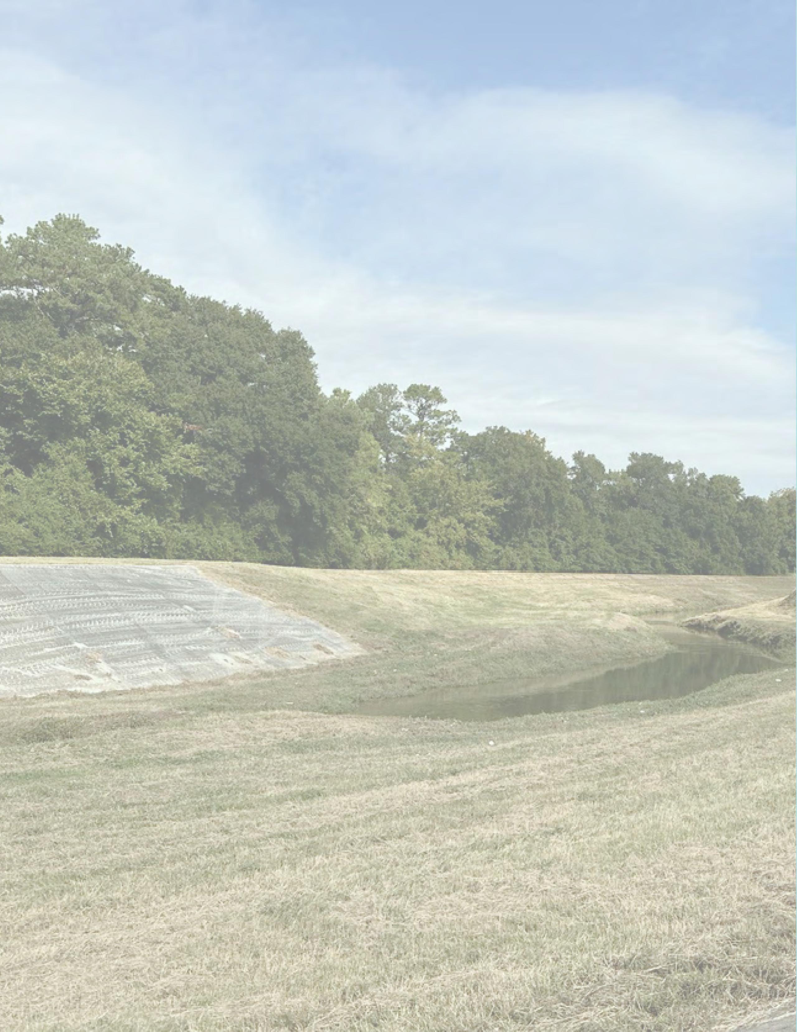
APPENDICES
APPENDIX A ENGAGEMENT SUMMARY
APPENDIX B DETENTION BASINS
APPENDICES i April 2023
POP UP EVENT #1 COMMUNITY ENGAGEMENT SUMMARY
NATIONAL NIGHT OUT AT TOM WUSSOW PARK, TUESDAY OCTOBER 4TH, 5-7 PM
The pop-up event received 40 comments at the 10/4 National Night Out Pop Up Event, with 25 people adding their stories and ideas to the map.
Some key map points were:
• Need for a basketball court around the multi-purpose field (7 responses)
• Lighting improvements throughout the park (6 responses)
• Improving (i.e. striping) the soccer field on the multi-purpose field (4 responses).
Some other notable comments in the mapping activity included:
• Interest in more events/programming

• Access to the restrooms
• Separate play/activities for different age groups (Toddlers, older kids/teens, etc.)
PARKS MASTER PLAN
Event attendees also participated in a board activity identifying how they use Tom Wussow Park and provided their feedback on some park priorities.
Highlights of this activity include:
• Most respondents visit the park either daily (43%) or weekly (38%)
• Most respondents visit the park either in the afternoon (55%) or in the evening (36%)
• An overwhelming majority walk (83%) to the park, and some bike (17%) to the park. There were no park users who drive or use transit to get to Tom Wussow Park.
• The responses reflect diverse uses of Tom Wussow Park, with some more frequent uses being play (27%) and exercise (19%).
• Overall, the general perception of Tom Wussow Park’s safety and comfort, maintenance, amenities, and programming were low. Most people gave the respective categories an average (rating of 3) or below average rating (rating of 1-2).
General observations from interactions:
• The map board was able to draw more people in as it was a visual catalyst to start quick conversations and community engagement.
• People were engaged in other event activities which precluded them from spending too much time on the park priorities board.
• This activity involved more time to evaluate the prompts, so people were less inclined to participate in this activity.
• Many of the people we interacted with did not know the park existed, did not know the name of the park, or had only driven past it.
• People seemed to be positively surprised at how nice and spacious the park is.
ii APPENDICES April 2023 2023
APPENDIX
SUMMARY
A ENGAGEMENT
PARKS, OPEN SPACE, AND TRAILS MAP

The 2023 North Houston Parks Master Plan is an effort to take stock of the existing parkland, partnerhips, and community needs to create a cohesive network of parks, open spaces, and trails. The aim is to develop recommendations that connect, activate, enhance and unify the system across three scales: System-Wide Quadrants, Greens Bayou Greenway, and Tom Wussow Park.


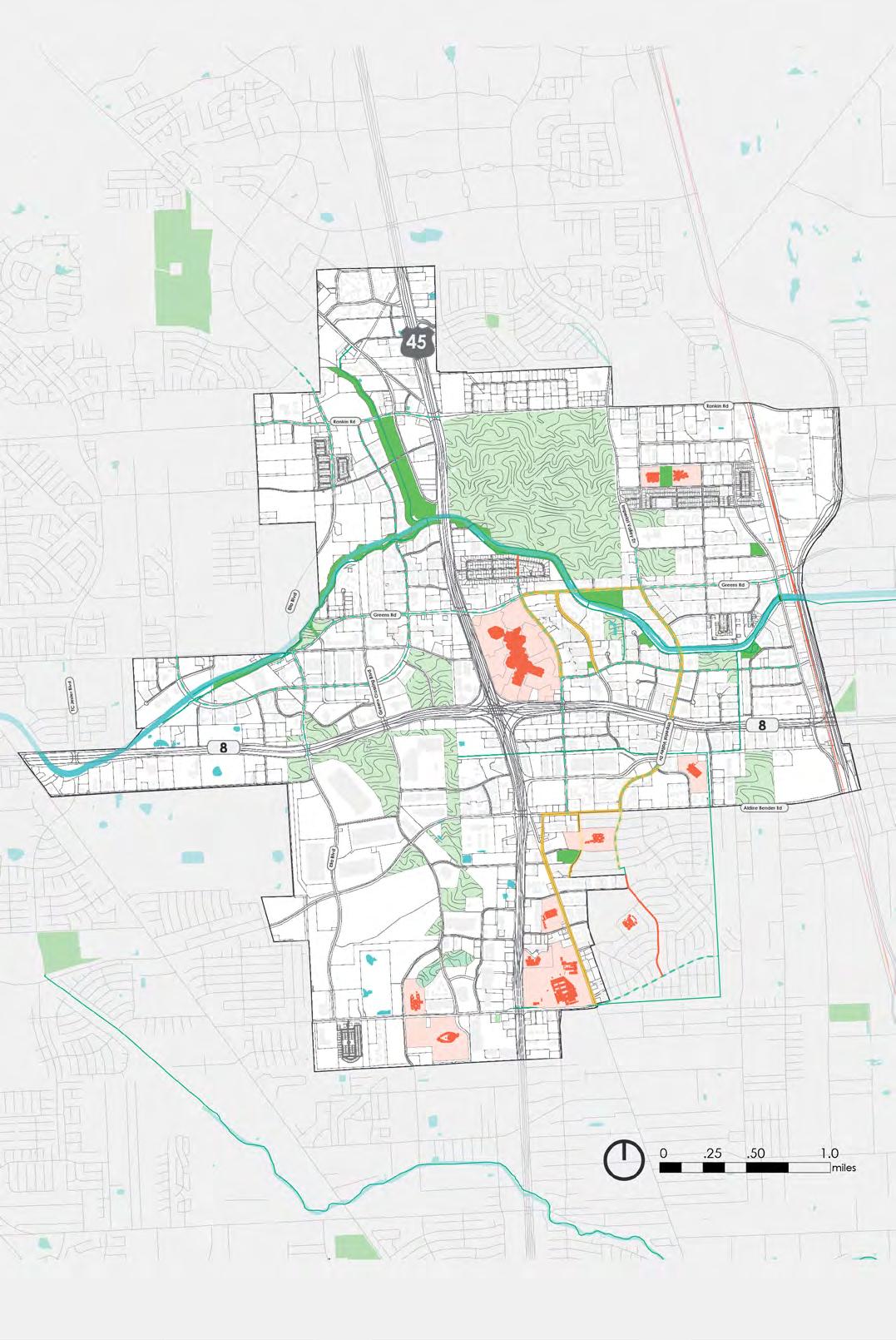
APPENDICES iii April 2023 GREENSPOINT MALL MARCELLA ELEMENTARY TOM WUSSOW PARK GREENSBAYOU BUCKBOARD PARK JACK DRAKE PARK GREENSPOINT COMMUNITY PARK CITY VIEW PARK DYLAN PARK IDA GAYE GARDENS BLACK ELEMENTARY ALDINE NINTH GRADE STOVALL MIDDLE BLANSON CTE HIGH ALDINE HIGH WATER BODIES NORTH HOUSTON PARKS OPEN SPACE TRAILS PROPOSED BIKEWAYS PROPOSED SHARED USE METRO BOOST SIDEWALK IMPROVEMENTS BUSSEY ELEMENTARY STENLIK ELEMENTARY ROCKSTAR ENERGY BIKE PARK NORTH HOUSTON SKATE PARK GREENS CROSSING PINTO BUSINESS PARK AIRLINE CORRIDOR GREENSPOINT
OTHER PRIORITIES What amenities/programming would you like to see? What are other concerns or comments you would like to share? Add a sticky note with your feedback! like to pollenate the gardens like watching for fish by the bayou. like to go to the park after school with my friends. DAILY MORNING WALK ORGANIZED SPORTS WEEKLY LUNCH BIKE EXERCISE MONTHLY AFTERNOON TRANSIT PLAY NATURE RELAX ANNUALLY EVENING CAR GATHERING WITH FRIENDS AND FAMILY OTHER How frequently do you visit Tom Wussow Park? Safety & Comfort (lighting, security, crime, shade) Maintenance (waste, landscaping, restroom, etc.) Amenities (playground, picnic tables, multipurpose field, volleyball, etc.) Programming (sports, pavilion rentals) How do you get to Tom Wussow Park? What time of day do you visit the park? What do you like to do at Tom Wussow Park? NEEDS IMPROVEMENT VERY SATISFIED 2 3 0 5 4 1 NEEDS IMPROVEMENT VERY SATISFIED 2 3 0 5 4 1 NEEDS IMPROVEMENT VERY SATISFIED 2 3 0 5 4 1 NEEDS IMPROVEMENT VERY SATISFIED 2 3 0 5 4 1 How much do you agree? Place a dot where applicable RATE THE PARK KEY QUESTIONS Bridge Pedestrain Bridge To HCFCD Detention ToImperialValleyDrive ToCityViewPark Northgate WWTP The Royal Phoenician The Element Apartments Serena Village 2 Serena Village Apartments Rockridge Springs Greens Rd Imperial Valley Dr GreensBayou Garden Bridge Volleyball NHD 2023 PARK PLAN TOM WUSSOW PARK 50’ 100’ Bridge To HCFCD Detention ToImperialValleyDrive ToCityViewPark Northgate WWTP The Royal Phoenician The Element Apartments Serena Village 2 Serena Village Apartments Rockridge Springs Greens Rd Imperial Valley Dr GreensBayou Multipurpose Playground Parking Lot Parking Lot NHD 2023 PARK PLAN TOM WUSSOW PARK 50’ 100’ Share Your Park Story We’d love to hear about the memories you’ve made, the people you’ve met, and the impact that the park has had in the community. Write your comments on a sticky note and place a pin near your memory POP UP #1 ACTIVITY: ENGAGEMENT BOARDS POP UP #1 ACTIVITY: MAP SYSTEM SUMMARY POP UP #1 ANALYSIS: WORD CLOUD
APPENDIX A ENGAGEMENT SUMMARY
POP UP EVENT #2 COMMUNITY ENGAGEMENT SUMMARY
COMMENTS SUMMARY: 20 forms; 40~people
1. playground is mentioned many times and the option with playground is preferred by most people
2. need more basketball court, expecially on TWP side.
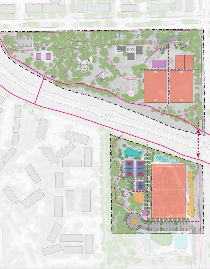
3. many people come to play soccer,
4. refine the trails

5. restroom & gym split is preferred
6. like the new bridge
7. pool wanted
COMMENTS
RELATE PROGRAM PEOPLE
number of people
OPTION 1 daughters come to play at the playground so more play space would be preferred to have additional options playground Dad&daughters in pavillion 3 like the WWTP layout; likes the way sports are mixed in with play, also likes the overall layout of WWTP regarding sports playground; overall layout large church group 7 preferred having large soccer away from main park so it wouldn't take up space from park soccer 1 prefers the accessibility because of WWTP layout being multigeneration of nature of layout, sees more priorites in play areas than sports as they come for the children to play and ride their bikes
WWTP layout family at picnic table 3 overall accessibility of the layout, talking about the way different elements are grouped together in the WWTP, such as playground and football and basketball overall layout boy with dogs 1 family lives by field, in turn they prefer to have the large soccer field together with apartment complex by Tom wussow, children would most benefit from option 1 soccer near appartments
soccer group by soccer field 7 gym/restroom in it is preferred due to convenience, believes would work best for male users rather than female users because of gender related notions about using a gym restroom gym; restroom guy with hoodie running 1 like the layout of gym & playground, likes that its for everybody, more accessible; young kids at the playground, were mainly focused on play opportunities gym; playground kids at playground 2 better option for soccer players, think the option 2 soccer field is too big soccer girls at playground 2 love this option, really need the playground for kids man with grandson by pavilion path 2 like this more, basketball court is great; more activity looks more interesting basketball mom with childrens 3
playground in new park is better playground first vister; mom with child on stroller 1 like this better 1 offers playground playground man walking on trail next to bayou; comes here everyday 1 includes playground and more accessable for kids playground on trail; man 1 playground, like the seating to watch kids; like the nature play in TWP playground woman&man by parking 2
PARKS MASTER PLAN
OPTION 2
believes the large soccer in TW would be buffer for people to play together, multigenerational: more shared space for soccer players who are already familiar with the current layout soccer lady planning birthday party 1 seperation of fields is preferred, he likes it would be better for less interuption; preferred option to prevent conflict between players of one sport and another gym; restroom guy with hoodie running 1 like the WWTP layout, thinks its better organized; likes the soccer-full sized, fits better in TW park than on WWTP; already playing soccer at TW park , so adding/formalizing the existing field would feel most familiar/ right to him
soccer man with baby 1 gym/ restroom split is good, should replicate in option 1 gym; restroom first vister; mom with child on stroller 1 other
wishes for all trails to be wide enough to bike on trail Dad&daughters in pavillion 3 majority people come to play soccer, especially kids; bigger parking would be preferred, likes added space in both options soccer; parking large church group 7 no inter fence between games of different sports is a priority sports guy with hoodie running 1 can't use park in the rain, walks everyday because of disability, wants priority of basics, spcifically trails, don't have a preference between the concepts, but instead wished to see the overall improvement of walking facilities
trail disable man on trail 1 area for bikes and skate boards skate girls at playground 2 the new bridge crossing would help a lot because it will give us a way to cross over easier instead of making a full walk around while having a kid; making the detention pond a more of habitat for turtules/ fish; put basketball court on greens side, set up mini courts too far pickup more crossing over bayou
bridge; basketball; detention pond parents with newborn walking on trail next to greens bayou 2 pool would be cool; really need basketball court pool; man with grandson by pavilion path 2 trampoline in playground, add swimming pool, after thinking the detention pond was a pool trampoline; playground; pool mom with childrens 3 open the bathrooms restroom first vister; mom with child on stroller 1 park hasn't change at all. New restroom would be good or open up the existing ones again restroom 1 indoor gym in the park would be nice to accommodate all water; visiters swimming pool by gym would be nice, needs to be clean, doesn't have to be full size. gym; pool
man walking on trail next to bayou; comes here everyday 1
iv APPENDICES April 2023 2023
NORTH HOUSTON DISTRICT PARKS MASTER PLAN TOM WUSSOW PARK CONCEPT DESIGN OPTION 1 Soccer U11/U12 Soccer U11/U12 Soccer ENTRY SIGN DETENTION PLAYGOUND NATURE PICNIC PAVILION RESTROOM SEATING BIKE RACK PICNIC AREA PARKING TREE BUFFER PICNIC AREA MINI SOCCER COURT PARKING EXPANSION SAFE CROSSING GREENS ROAD GREENS BAYOU PROPOSED PEDESTRIAN BRIDGE PLAYGROUND PICKLEBALL COURT BASKETBALL COURT TOM WUSSOW PARK - NEW AMENITIES LARGE PICNIC PAVILIONS OUTDOOR GYMNASIUM PARKING EXPANSION MINI SOCCER COURT PICNIC PAVILIONS U11/U12 SOCCER FIELD RESTROOM NEW PARK LAND BASKETBALL COURTS PROFESSIONAL SOCCER FIELD PICNIC AREAS RESTROOM PICKLEBALL COURTS PARKING PLAYGROUND TRAIL EXISTING TRIALS PROPOSED TRAILS OPTION 2 NORTH HOUSTON DISTRICT PARKS MASTER PLAN TOM WUSSOW PARK CONCEPT DESIGN U11/U12 Soccer U11/U12 Soccer ENTRY SIGN DETENTION RESTROOM GYM NATURE PLAY PICNIC PAVILION RESTROOM SEATING BIKE RACK PICNIC AREA PARKING TREE BUFFER PICNIC AREA MINI SOCCER COURT PARKING EXPANSION SAFE CROSSING GREENS ROAD GREENS BAYOU MEADOW PEDESTRIAN BRIDGE PICKLEBALL COURT BASKETBALL COURT TOM WUSSOW PARK - NEW AMENITIES LARGE PICNIC PAVILIONS OUTDOOR GYMNASIUM PARKING EXPANSION MINI SOCCER COURT PICNIC PAVILIONS PROFESSIONAL SOCCER FIELD RESTROOM NEW PARK LAND BASKETBALL COURTS RESTROOM PICNIC AREAS PARKING PICKLEBALL COURTS TRAIL U11/U12 SOCCER FIELD EXISTING TRIALS PROPOSED TRAILS
APPENDIX A ENGAGEMENT SUMMARY
STAKEHOLDER MEETING 1 SUMMARY OVERVIEW
Occuring on October 27th, the first stakeholder meeting introduced the committee to the project. Discussions included big-picture goals, thoughts/reflections on the District, and ideas gathered from the first public engagement pop-up, concluding with a tour of Tom Wussow Park.
PRESENTATION AND DISCUSSION
A presentation introduced stakeholders to the project team, project structure, and current progress. Using a top-down, District-to-park structure, conversations focused on recognizing further collaborative opportunities relevant to the 2023 Parks Master Plan, identifying 16 potential partners and 19 initiatives. Main takeaways included:
• Recognition of opportunities to link community mobility, recreation needs, and ongoing/future external initiatives, creating an interconnected parks system
• Greater emphasis on placemaking, branding, and wayfinding throughout the District
• Increased understanding of collaboration across District, with further discussion needed regarding details of partnerships
• Future stakeholder meetings should highlight key players and convey the breadth of partnerships and collaboration across the District
TOM WUSSOW PARK TOUR
Serving as an initial site visit for stakeholders, the park tour proved an effective strategy prompting additional park system discussion and Tom Wussow-specific feedback while promoting an overall relaxed and collaborative atmosphere. Main takeaways included:
• Perceivably stronger connection between stakeholders and park space
• Concern regarding amenities such as splash pads and dog parks due to their maintenance-heavy nature
• Connectivity and accessibility identified as top parks system and Tom Wussow Park priorities
• Stakeholders voicing explicit desire to avoid physical barriers such as fences and walls
• Numerous opportunities identified for enhancing park spaces, including open field, plaza, and volleyball court, as well as connections via roadway crossings and possible second Bayou bridge
NEXT STEPS
In the latter half of January, the next meeting will include preliminary review of concept plans. In preparation, stakeholder follow-ups include:
• Engagement with stakeholders not present in the first meeting
• Individual conversations with stakeholders to identify additional collaborations, including possible coordination for the second public engagement pop-up
APPENDICES v April 2023 2023
PARKS MASTER PLAN
APPENDIX A ENGAGEMENT SUMMARY
STAKEHOLDER MEETING 1 SUMMARY - NOTES
ATTENDANCE LIST
Stakeholders Represented Stakeholders Not Represented
Greens Bayou Coalition
CM District B
HCFCD Houston Parks and Recreation Department
Independent
North Houston District
North Houston District Board
Precinct 2
Villa Serena Communities
YMCA
Aldine ISD
• Spark Parks
Precinct 1
PARTNERS AND INITIATIVES IDENTIFIED FOR COLLABORATION
HCFCD
• Partnerships with TxDOT
Athlete Organizations
• GHORBA
• bikesports.org
• Triathlon-related training organizations
City of Houston
• Bike Plan
County/Precincts
• Safe Streets for All Grant
• VisionZero, Veterans and Rankin corridors
• Precinct adoption of park land
Greens Bayou Coalition
• Bayou and water cleanup efforts
• Connectivity with Kuykendahl
• Maintenance/Ownership partnerships with Precincts
• Inwood Detention Project; guiding example for stakeholder connections/sponsorships
HCTRA
• Tollways to Bikeways
• Additional Possible ROW collaboration
HGAC
• Water protection Grants
HOAs/MUDs
HPB
• Connection between Greens and Halls Bayous
Pinto Business Park
Spring ISD
TxDOT
• i-45 Mid Reach
• NHHIP
UPArt Studio
YMCA
• Ties between programming and amenities
vi APPENDICES April 2023
STAKEHOLDER ACTIVITY:
GOALS WORKSHEET
PLAN GOALS FEEDBACK FORM
Name:
Organization: Use form to note reflections related to plan goals. Use back of form for additional notes or observations. Return this form at the end of the session
Identify opportunities that draw the community to the existing parks system by strengthening the connections between parks and open spaces and open spaces.
CONNECT
Reflections:
ACTIVATE
Reflections:
ENHANCE
Reflections:
UNIFY
Reflections:
STAKEHOLDER ACTIVITY:
TOUR MAP
Envision solutions to activate underutilized green spaces that currently exist within the District.
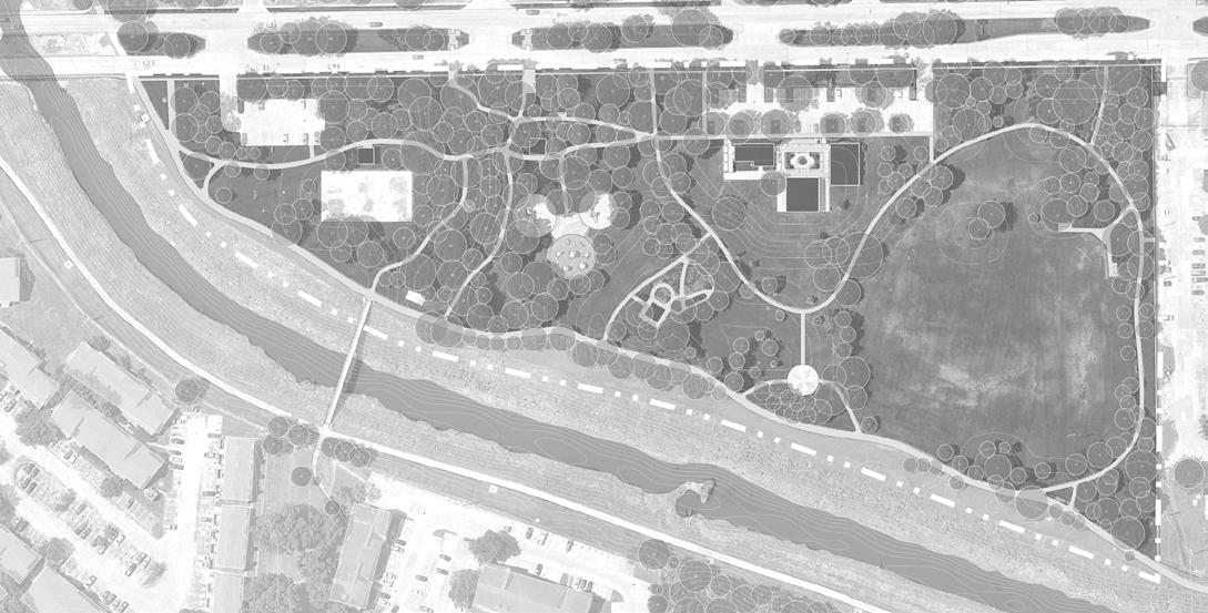
Strengthen the features of existing parks and trails to meet the District’s visions for a unified park system.
Leverage partnerships to identify and address common priorities for the District.
TOM WUSSOW PARK TOUR
APPENDICES vii April 2023 Plaza Garden Pavilion YMCA Multipurpose Field Volley Ball Court Parking Parking Greens Rd. GreensBayou Ravine Bridge Entrance View to WWTP Greens Bayou Trail Connection
NORTH HOUSTON DISTRICT PARKS MASTER PLAN Park Tour Observations Tour Map
NORTH HOUSTON DISTRICT PARKS MASTER PLAN
APPENDIX A ENGAGEMENT SUMMARY
STAKEHOLDER MEETING 2 SUMMARY OVERVIEW
On February 8, 2023, 13 of 16 committee members met for the second Stakeholder Committee meeting of the North Houston District 2023 Parks Master Plan. A presentation on project progress, initial recommendations, and potential Thomas R. Wussow Park concept designs allowed members to evaluate the practicality of District and Bayou scale recommendations and opportunities identified by the project team. Stakeholders communicated their overall support for the project’s current progress, additional recommendations, and detailed feedback regarding the Wussow park concepts.
PRESENTATION AND DISCUSSION:
• Presentation covered current progress, District and Bayou-scale priorities, Wussow Park and Wussow Park Annex concept design options
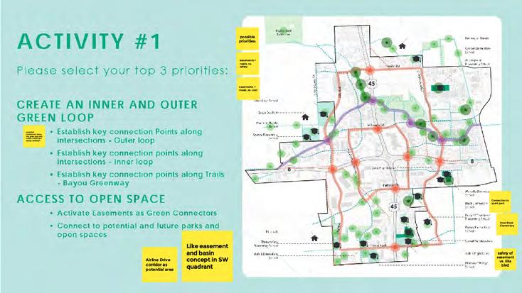
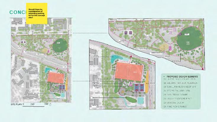
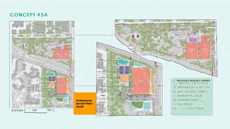
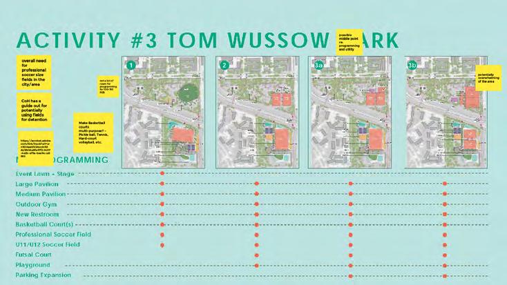
• 3 activities sought feedback from stakeholder via Google Jamboard, an interactive platform allowing stakeholders to add their comments directly into the presentation
• Stakeholders provided 19 comments across each activity
• District and Bayou-scale feedback offered insight into feasible options for realizing connectivity, such as leveraging utility easements as lower-cost options
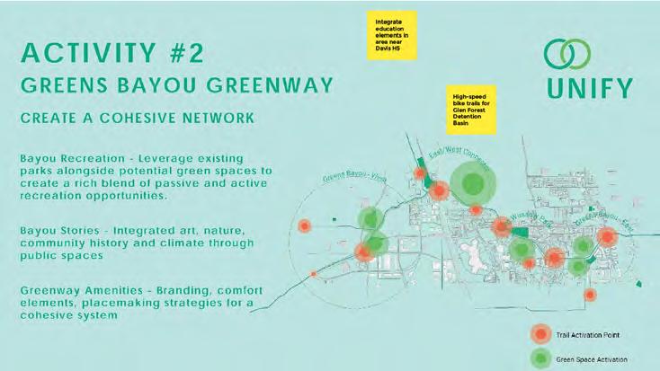
• Stakeholders selected Concept 3a as the priority concept design
PARKS MASTER PLAN
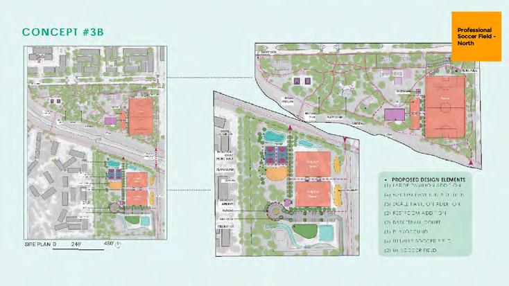
viii APPENDICES April 2023 2023
STAKEHOLDER ACTIVITY: JAMBOARD SUMMARY
APPENDIX A ENGAGEMENT SUMMARY
STAKEHOLDER MEETING 3 SUMMARY OVERVIEW
On March 29, 2023, 13 of 16 committee members met for the final North Houston District 2023 Parks Master Plan Stakeholder Committee. Featuring a presentation on the final District, Bayou, and park-level recommendations, stakeholders primarily voiced their support and enthusiasm for the plan and provided additional observations for consideration.
PRESENTATION AND DISCUSSION:
• Presentation covered District-Scale short to mid-term recommendations, Bayou-Scale recommendations, the Tom Wussow and Tom Wussow Annex final concept plans, and potential partnerships
• 12 comments captured on Miroboard
• Comments primarily voiced by advocates for multi-modal connectivity, focusing on ensuring the mindful development of safe bicycle and pedestrian connectivity
• Additional comments pointed the team to details to consider when enhancing and activating spaces, specifically focusing on:
• Ensuring visibility for safety in the Tom Wussow Park extension
• Making use of the existing Bayou bridge at Knobcrest Dr
PARKS MASTER PLAN
APPENDICES ix April 2023 2023
APPENDIX B DETENTION BASINS
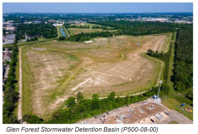
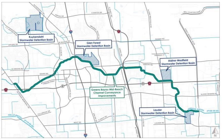
x APPENDICES April 2023
APPENDICES xi April 2023
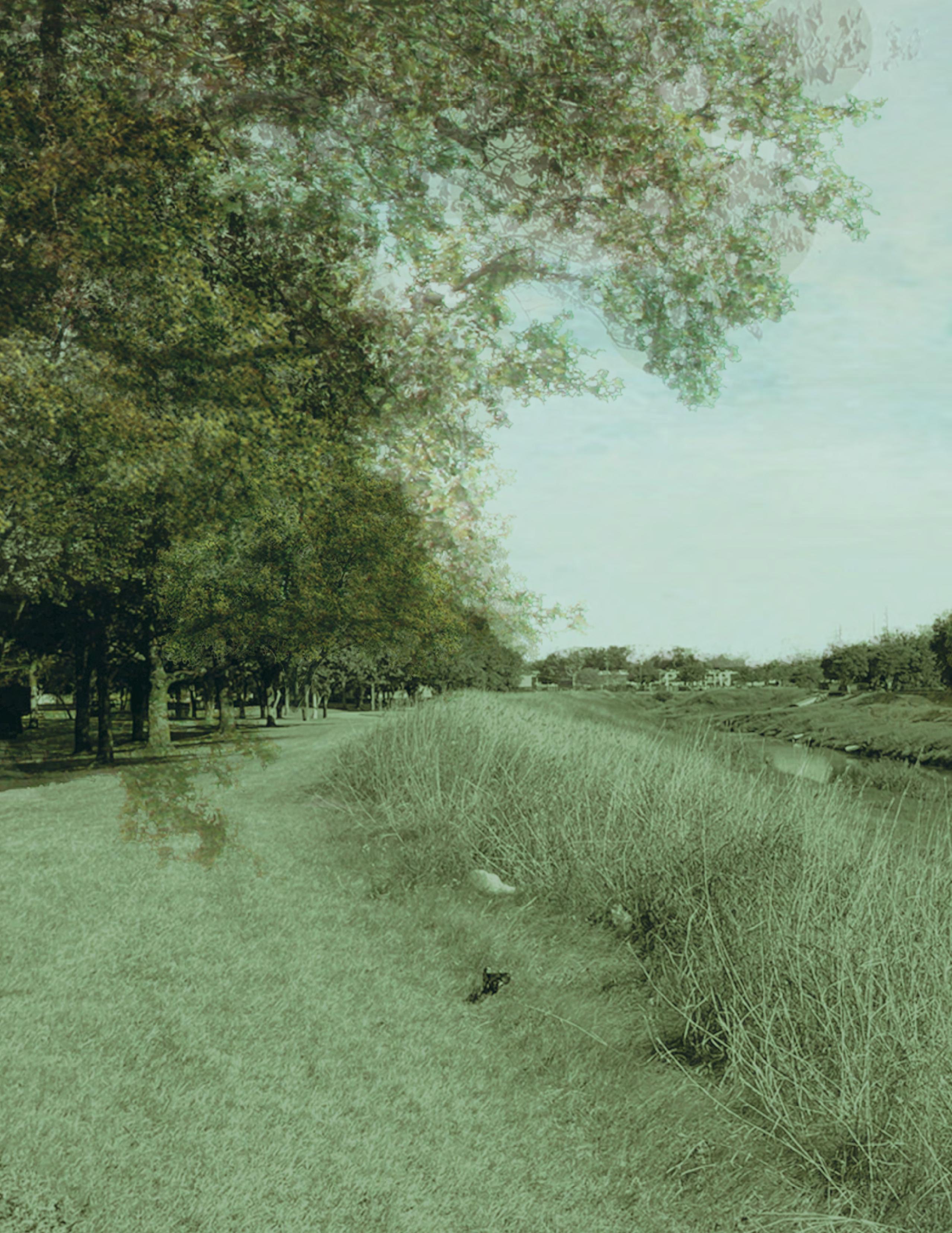

2023 PARKS MASTER PLAN

