NILAY KUMAR DAS
PORTFOLIO
GA Tech (M.Arch), Atlanta, GA
BUET (B. Arch), Dhaka, Bangladesh
Driven by a passion for crafting thoughtful and meaningful design, I translate abstract ideas into tangible spaces that resonate deeply with their communities. This portfolio showcases my journey as astudent and an architect, highlighting projects that demonstrate my commitment to identifying and solving crucial issues through sustainable and optimal solutions. My keen eye for context allows me to understand the needs of each project and its users, resulting in designs that are not only aesthetically pleasing but also address both environmental and social concerns. Through collaborative efforts, I strive to balance the best interests of all stakeholders, ensuring sensitivity and inclusivity are woven into the very fabric of every space I create.
CONTENT
01. Layred Revival
Academic| Advanced Studio I| 2023
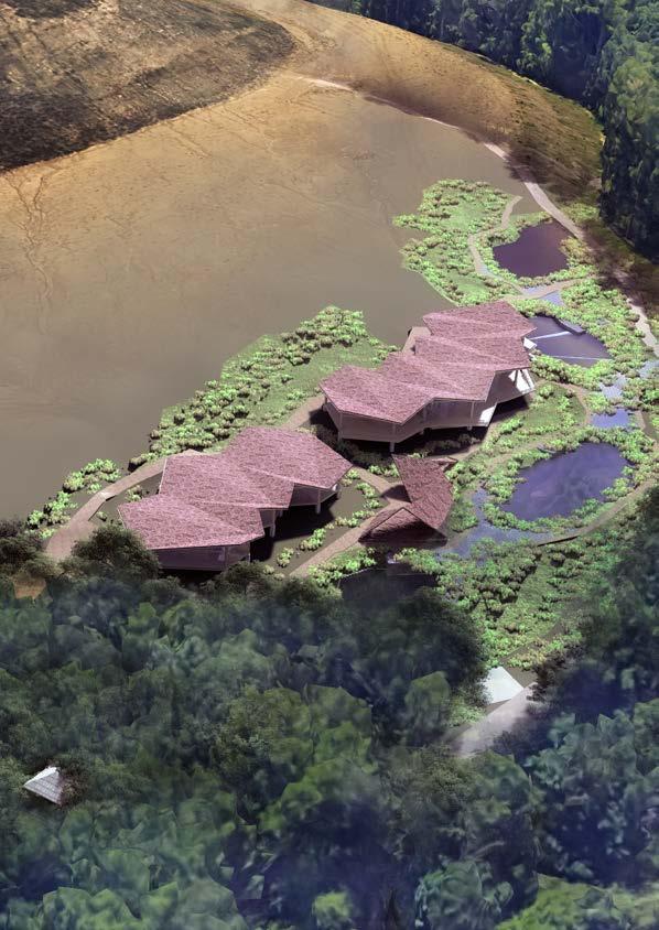
This project revitalizes a polluted river through citizen science and innovative plants. Research facilities develop soil defenders, pollutant filters, and water flow regulators, empowering communities to actively participate. A connected trail fosters education and engagement, while residents submit water samples, driving expert-guided solutions. Together, we reimagine the future, one plant, one sample, one community at a time.
02. A piece of Litmus.
Academic| Studio X (Thesis) | 2019
In this society, where religious tension is still uprising between majority and minority, a change in the infrastructure of the place of worship is a must. It will create empathy in the society and protect a 350 years old Hindu temple from local aggression.
03. A Second Chance
Academic| Studio VII | 2018
Bringing back a traditional snack which was there on the plates for thousand year. A way of creating a second chance for families ling in a rural fabricof Bangladesh.
04. Biomimicry
Academic| Studio VI | 2017
Design of an atelier by mimicking nature.
05. Art Gallery
Academic| Studio IV| 2016
Undestanding the properties and possibilities of a steel structure.
06. Competition Project
Bohemian Rhapsody
07. Office Works
08. Technical Drawings
09. Other Works
Layered Revival
Advanced Studio I| 2023, Duration: 10 weeks
Supervisor: Kimberly Steiner
Location: Atlanta, GA
Atlanta’s beloved South River, ranked a shocking fourth most endangered in the US, battles a silent enemy – widespread pollution from countless, scattered sources across its vast catchment area. Monitoring and regulating these ever-shifting polluters is like solving a vast, ever-changing puzzle. Residents, often unaware of these hidden threats and how to report them, become unwitting bystanders as the river silently chokes. Even when pollution is identified, effectively tracking its origin and impact across the sprawling area proves extremely difficult. Even with knowledge, readily available solutions and resources to tackle pollution at its source are often absent, creating a frustrating stalemate.
But fear not! A beacon of hope emerges: a proposed research facility poised to become a knight in shining armor for the South River. This hub of scientific prowess will act as a pollution detective, wielding cutting-edge technology to identify and track the hidden culprits, empowering residents with knowledge and the ability to report and fight back. More than just a diagnostician, this facility will forge solutions, developing and offering customized tools for communities and individuals to tackle pollution at its source. By collaborating with neighborhoods, it will foster a sense of ownership and responsibility, transforming residents into active guardians of the river’s health.
This is not just a solution, it’s a call to action. Together, we can transform this crisis into a triumph, ensuring a healthy and vibrant South River for generations to come. Let’s join hands, empower ourselves, and become the heroes our river desperately needs.
South

beauty, purpose, and meaning within architectural elements. “Illuminating Layers” captures the essence of this exploration, creating an intriguing interplay between light and form within a compact, thought-provoking design task.


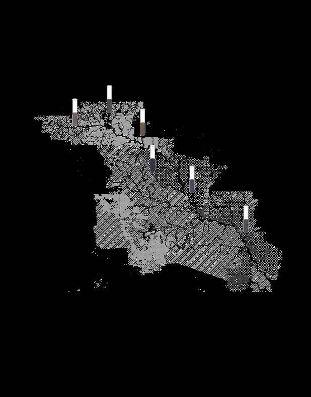
The color improvement in lakes with increasing distance from pollution sources underscores the positive impact of buffer zones. It demonstrates that reducing industrial and population density around these crucial water sources enhances their water quality, benefiting the health of the South River.


Watering Agricultural Land Adding Fertilizer


Impervious surface increases the volume of runoff causing land erosion.
Schematic
The zoning of the South River Atlanta’s surrounding areas plays a crucial role in the river’s health. Ponds and lakes collect water from various sources, including rainwater, industrial runoff, and water treatment plants. These bodies of water, connected by creeks, significantly impact the river’s overall condition, as they serve as the primary sources sustaining its flow and can introduce toxic elements and sediments from diverse land uses.
The zoning of the South River Atlanta’s surrounding areas plays a crucial role in the river’s health. Ponds and lakes collect water from various sources, including rainwater, industrial runoff, and water treatment plants. These bodies of water, connected by creeks, significantly impact the river’s overall condition, as they serve as the primary sources sustaining its flow and can introduce toxic elements and sediments from diverse land uses.
The color improvement in lakes with increasing distance from pollution sources underscores the positive impact of buffer zones. It demonstrates that reducing industrial and population density around these crucial water sources enhances their water quality, benefiting the health of the South River.


Impervious surface increases the volume of runoff causing land

Industrial zone, sewage, and hard surface runoff combine with rainwater, leading to river water pollution.


Industrial zone, sewage, and hard surface runoff combine with rainwater, leading to river water pollution. Hard surface runoff raises water temperature, disrupting the temperature balance and creating unfavorable conditions for algae and plankton in the water.
Construction activities, surface mining, and hard surface runoff introduce sediment into river water, causing a reduction in both its width and depth.
Garbage from freeways and sewage spillage disrupt the ecological balance of the river. Swift construction, establishment of facilities in protected zones, mining, and landfill activities alter the natural landscape, leading to the diversion of waterflow.
The extraction of creek water for irrigation of farmland, golf courses, and various facilities results in creek depletion and reduced water flow during the dry season.


Sectional drawings of different neighborhood and pollutions
Hard runoff temperature, disrupting temperature balance creating conditions and water.
Layer Transitional Layer “Illuminating Layers” is a design concept inspired by the layered growth of leaves in natural systems. It delves into the intricate formations created by leaves on a tree, where upper leaves create spaces for lower leaves to receive sunlight. In this concept, layers are not just physical but also illuminated, symbolizing the act of revealing hidden depth, functionality, and significance within a structure. By employing layers of illumination, the project brings to light the beauty, purpose, and meaning within architectural elements. “Illuminating Layers” captures the essence of this exploration, creating an intriguing interplay between light and form within a compact, thought-provoking design task. The color improvement in lakes with increasing distance from pollution sources underscores the positive impact of buffer zones. It demonstrates that reducing industrial and population density around these crucial water sources enhances their water quality, benefiting the health of the South River. Reserved Nature Waste Management Agricultural Residential Residential Zone Mixed Use Zone Industrial Zone Truck Terminals Impervious Surface Impervious Surface Unregulated Sewage Increasing Construction in Suburbs Mixeduse zone heavy raffic Watering Agricultural Land Adding Fertilizer Golf Course Watering Sewage From Treatment Plant Sewage Water Spill Land Fill Garbage withdrawal Construction In Reserved Zone Surface Mining (I-2) Impervious surface increases the volume of runoff causing land erosion. Industrial zone, sewage, and hard surface runoff combine with rainwater, leading to river water pollution. Hard surface runoff raises water temperature, disrupting the temperature balance and creating unfavorable conditions for algae and plankton in the water. Construction activities, surface mining, and hard surface runoff introduce sediment into river water, causing a reduction in both its width and depth. Garbage from freeways and sewage spillage disrupt the ecological balance of the river. Swift construction, establishment of facilities in protected zones, mining, and landfill activities alter the natural landscape, leading to the diversion of waterflow.of waterflow. The extraction of creek water for irrigation of farmland, golf courses, and various facilities results in creek depletion and reduced water flow during the dry season. South River and it’s surrounding zoning Impervious Hard Surface Residential Zone Golf Course Rapid Development Water Treatment plant Lost Terrain by mining Yet to be mined Industrial Block Creek Creek Creek Creek Water Withdrawal Contaminated Spilling Sewage Water The zoning of the South River Atlanta’s surrounding areas plays a crucial role in the river’s health. Ponds and lakes collect water from various sources, including rainwater, industrial runoff, and water treatment plants. These bodies of water, connected by creeks, significantly impact the river’s overall condition, as they serve as the primary sources sustaining its flow and can introduce toxic elements and sediments from diverse land uses. Reserved Nature Commercial Zone Agricultural Residential Residential Zone Mixed Use (Resi+ Com) Industrial Zone Creek Pond/ Lake South River Jackson Lake Schematic Diagram of South River Water Network South River Layer Transitional Layer “Illuminating Layers” is a design concept inspired by the layered growth of leaves in natural systems. It delves into the intricate formations created by leaves on a tree, where upper leaves create spaces for lower leaves to receive sunlight. In this concept, layers are not just physical but also illuminated, symbolizing the act of revealing hidden depth, functionality, and significance within a structure. By employing layers of illumination, the project brings to light the
The color improvement in lakes with increasing distance from pollution sources underscores the positive impact of buffer zones. It demonstrates that reducing industrial and population density around these crucial water sources enhances their water quality, benefiting the health of the South River. Reserved Nature Waste Management Agricultural Residential Residential Zone Mixed Use Zone Industrial Zone Truck Terminals Impervious Surface Unregulated Sewage Increasing Construction in Suburbs Mixeduse zone heavy raffic Watering Agricultural Land Adding Fertilizer Golf Course Watering Sewage From Treatment Plant Sewage Water Spill Land Fill Garbage withdrawal Construction Reserved Zone Surface Mining (I-2) Aging Industries Impervious surface increases the volume of runoff causing land erosion. Industrial zone, sewage, and hard surface runoff combine with rainwater, leading to river water pollution. Hard surface runoff raises water temperature, disrupting the temperature balance and creating unfavorable conditions for algae and plankton in the water. Construction activities, surface mining, and hard surface runoff introduce sediment into river water, causing a reduction in both its width and depth. Garbage from freeways and sewage spillage disrupt the ecological balance of the river. Swift construction, establishment of facilities in protected zones, mining, and landfill activities alter natural landscape, leading to the diversion of waterflow.of waterflow. The extraction of creek water for irrigation of farmland, golf courses, and various facilities results in creek depletion and reduced water flow during the dry season. South River and it’s surrounding zoning Impervious Hard Surface Residential Zone Golf Course Rapid Development Water Treatment plant Lost Terrain by mining Yet to be mined Industrial Block Creek Creek Creek Creek Water Withdrawal Contaminated Spilling Sewage Water The zoning of the South River Atlanta’s surrounding areas plays a crucial role in the river’s health. Ponds and lakes collect water from various sources, including rainwater, industrial runoff, and water treatment plants. These bodies of water, connected by creeks, significantly impact the river’s overall condition, as they serve as the primary sources sustaining its flow and can introduce toxic elements and sediments from diverse land uses. Reserved Nature Commercial Zone Agricultural Residential Residential Zone Mixed Use (Resi+ Com) Creek Pond/ Lake South River Jackson Lake Schematic Diagram of South River Water Network South River
Industrial Block Impervious Hard Surface Yet to be mined Lost Terrain by mining Golf Course Water Withdrawal Creek Creek Creek Residential Zone Creek Rapid Development Water Treatment Plant Spilling Sewage Water Contaminated Water
Reserved Nature Waste Management Garbage
South River and it’s surrounding zoning Impervious Hard Surface Golf Course Lost Terrain by mining Yet to be mined Industrial Block Creek Creek Creek Water Withdrawal Contaminated Water Spilling Water
Jackson Lake
Schematic Diagram of South River Water Network
Diagram of South River Water Network
Jackson Lake
Residential
Mixed Use Zone Industrial
Reserved Nature Waste Management Agricultural Residential
Zone
Zone Truck Terminals Impervious Impervious Surface Unregulated Sewage Increasing Construction in Suburbs Mixeduse zone heavy raffic
Golf Course Watering Sewage From Treatment Plant Sewage Water Spill Land Fill Freeways Garbage withdrawal Construction In Reserved Zone Surface Mining (I-2) Aging Industries
causing pollution
River and it’s surrounding zoning South River Activities
Issues
Increased Hard Surface
Contamination of Chemical and Waste
Increased Temperature of Water
Sedimentation
Garbage Dumping
Losing Natural Terrain
Extraction of Water
Educating the Community
Creating Awareness
Monitoring Water Condition of Different Sources
Network of Sample Collection
Providing Resources to the community and Stakeholders to have sustainable solutions to prevent pollutions
Introducing Natural Solutions for the community to impliment in there property
Connecting the community with a network of walkable nature trail
Water testing labs
Outdoor research labs
Visitor center
Collection points for water samples
Trails
View decks
Community pavilions
Observation towers
Resting places
Regenerating Lost Nature
Planting native trees and shrubs
Creating wetlands
Restoring riparian areas
Creating wildlife habitats
Using sustainable construction practices
Build a series of ponds that are stepped down in elevation. This will allow the water to flow through the ponds slowly, allowing the sediments to settle out.
Plant aquatic vegetation in the ponds. This will help to filter the water and provide habitat for wildlife.
Use dredged material from the river to create the ponds. This will help to deepen the river channel and improve water quality.
The series of Ponds in our testing facility will provide the scientists to test their experiments of creating natural elements of filtering out the chemical contaminations in the water.
Landscape research area: This area could be used to study the effects of different types of vegetation and land management practices on water quality
Wildlife habitat demonstration area: This area could be used to show visitors how to create and maintain wildlife habitats in their own backyards.
Sustainable construction demonstration area: This area could be used to show visitors how to build homes and other structures that are environmentally friendly
A sign that explains the purpose of the collection point
A container for collecting water samples.
Instructions on how to collect a water sample.
A test tube to carry the water sample to the testing lab.
Activities on the Trails
Guided nature walks
Improved water quality monitoring: Identify and address contaminants in the water supply, fostering public health and safety.
Enhanced environmental protection: Track changes in water quality and identify potential pollution sources, informing environmental management strategies. Informed decision-making: Provide data to guide water treatment strategies, resource allocation, and regulatory actions.
Public awareness and education: Raise awareness of water quality issues and empower communities to advocate for clean water.
Birdwatching tours
Fishing lessons
Kayaking tours
Educational programs for children
Here is a matrix diagram showing the program over time, integrated with the river map and directly relating to the site along the river:
Water testing labs, outdoor research labs, visitor center, collection points for water samples, trails, view decks, community pavilions, observation towers, resting places
Begin construction of educational programs for children
Complete construction of educational programs for children
Complete construction of sustainable construction demonstration area
Complete construction of wildlife habitat demonstration area
Complete construction of landscape research area
Varying Degrees of Action
Conduct environmental assessment: This could involve collecting data on water quality, soil conditions, and wildlife populations.
Develop environmental restoration plan: This could involve identifying specific areas that need to be restored, developing goals for the restoration projects, and creating a timeline for implementation.
Begin construction of environmental restoration projects: This could involve planting trees, creating wetlands, and restoring riparian areas.
Continuing construction of environmental restoration projects: This could involve expanding the scope of the restoration projects or working on more complex projects.
Complete construction of environmental restoration projects: This could involve finishing all of the planned restoration projects and conducting a final assessment to ensure that the goals have been met.
Monitor environmental restoration projects and adjust as needed: This could involve collecting data on water quality, soil conditions, and wildlife populations to ensure that the restoration projects are successful.
Focus Facility Ponds Research Labs Outdoor Labs Collection Points
Year 1 Year 2 Year 3 Year 4 Year 5 Year 6
Sample containers
Gloves
Information board
Dipping tools
Waste disposal
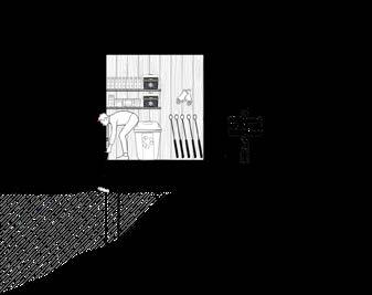
Neighborhood sample stations empower residents to collect water samples for our research facility, fostering community involvement in safeguarding local water quality.



Four-pond cascade filters creek water: sediment settles, sand traps fines, pebbles & charcoal capture chemicals, rocks & geotextile polish. Vegetation zones flank each filter, testing genetically modified plants for natural water purification potential. Cleaned water rejoins the river, showcasing sustainable solutions for diverse river environments.
Research Labs
Public Amenities
Outdoor Research Area
Filtration Ponds

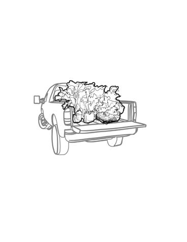
A package of product will be delivered to the customer. Also the logistic support needed to
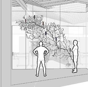
Think research with a view! The lab’s glass walls are getting a makeover, showcasing cool research findings and the real deal about the river’s threats. Get informed, get involved, and let’s all work together to protect our awesome waterway!
CONCEPTUAL FLOW DIAGRAM

Scale: 1/256” = 1’-0”
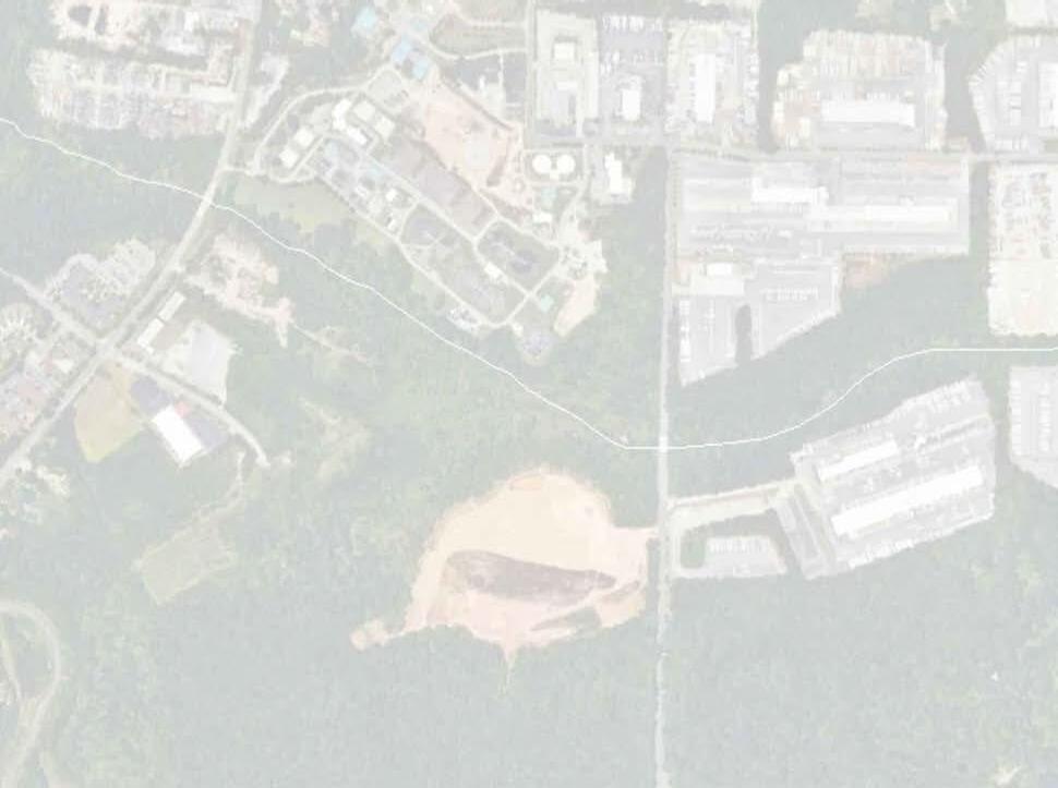
The site edge hugs the existing forest greenery, maximizing north-facing exposure by following the forest’s boundary.
Determining the axis for the water filtration process follows the natural slope through terraced ponds, creating a 30’ buffer on both sides for the construction zone and an outdoor botany research lab, seamlessly integrated with the landscape.
Strategic entry points for pedestrians and construction will define the access, public zones, and private areas, ensuring seamless flow and optimal functionality.
Overlapping zones for buildings, research, public areas, and soakaway spaces create vibrant hubs for shared interests while distinct intersections define dedicated zones for each function, ensuring both connection and differentiation within the site.
SITE IN CONTEXT
STEP 1
STEP 2
STEP 3
STEP 4
1.
2.
3.
4.
5.
6.
This research building is designed to be flexible. It can easily be made bigger or smaller when needed. We’ve included extra space that can be used for fun or work until we need it for more labs. This extra space is important because research buildings often need to grow.
The research labs have extra-tall ceilings to fit special equipment. This equipment helps keep the labs at the right temperature and conditions for experiments. The rest of the building can use fresh air or special systems for heating and cooling.
We have included spaces for the public to visit. Here, we’ll teach the community about the South River and keep them updated on its health.


Mechanical Meeting Office Seminar Space Chemical Washroom Sample Receiving Storage Storage Reception Lab Lobby Equipment Room Expansion Botany and Genetics Lab STORAGE LOCKER ROOM OFFICE ROOM LOBBY SPACE TOILET TOILET EXHIBITION OUTDOOR SEMINAR AND Proposed Master Plan 50’X50’ Grid Scale: 1/64” = 1’-0” MASTER PLAN (With Ground Floor)
Filtration Pond
Outdoor Research Area
Research Block
Exhibition Space and Public Facilities.
Play
outdoor training area.
Scape and
View Deck
Observation tower. Chemical Research Lab Public Space Office Space Service and Storage Training Space Public Access Private Access Molecular Biology Research Lab Expansion Area Storage and Mechanical Support Office and Meeting Space Seminar space 3 4 5 6 6 7 1 2 2 2 2 2 2 2 2 1 A’ B’ B C C’ A 1 1
7.
Modular Approach for ease of expenssion and reduction of space.
SOUTH RIVER FOREST
TRAIL SOAKABLE SURFACE
TRAIL RESEARCH CENTER
SAND LAYER
EXHIBITION SPACE
PUBLIC AMENITY
WATER PURIFICATION POND
TRAIL
SOAKABLE SURFACE
SAND FILTRATION
SAND LAYER
RESEARCH AREA
MECHANICAL ROOM
OUTDOOR RESEARCH AREA
SECTION AA’
Scale: 3/32”-1’-0”
PLAYSCAPE
TRAIL
TRAIL
WATER PURIFICATION POND
OUTDOOR RESEARCH AREA
SOUTH RIVER FOREST
PLAYSCAPE
ROCK AND GEO TEXTILE
NATURAL BANK
SECTION BB’
Scale: 1/16”-1’-0”

TRAIL SOAKABLE SURFACE SOAKABLE SURFACE SOAKABLE SURFACE TRAIL TRAIL OUTDOOR RESEARCH AREA PUBLIC AMENITY RESEARCH CENTER SAND LAYER SAND LAYER WATER PURIFICATION POND TRAINING SPACE EXHIBITION SPACE LOCKER ROOM OFFICE ROOM LAB OFFICE SPACE GATHERING SPACE WASHROOM SPACE FOR EXPANSION
SECTION CC’
Scale: 1/32”-1’-0”
A Piece of Litmus
Studio X Thesis | 2019, Duration: 14 weeks
Thesis Supervisor: Mahamudul Anwar Riyad, Nayna tabassum
Location: Dhaka, Bangladesh
Communal violence in south Asia is a very concerning issue for today and the last century. It creates an enormous threat to minorities periodically. For example, in Bangladesh, ideological minorities, namely, Hindus, Shias, Buddhists, and Shantal or other indigenous people, are victims of communal violence. Although Bengal had a culture of syncretic relationships between various ethnic communities, it has lost its harmony throughout many historical events.
In general, violence is linked to communal identity. Initially, it occurs in places where the polarization of settlement or gathering of minorities happens. So to protect their religious and gathering spaces, minorities have created fortifications and barriers encompassing their polarized territory or sacred areas. However, it is an enormous challenge to uproot communal violence completely because it requires social and physical reformation on a significant scale
In this situation, the scope for integrated social and communal activities can resolve some issues at the community scale. Moreover, the physical reformation of temples can make these social infrastructures more accessible and valuable to others, thus giving minority Hindus a chance to reintegrate with the majority Muslims. Initially, it may look like the attempt is making temples more vulnerable. However, it also gives others a chance to be a part of the premises through various activities and festivals. Therefore, mass people shall consider these social infrastructures as assets for all rather than only for one community. As a feedback to this move, the community’s people will feel the need to make these temples resilient and protect them from communal violence
Otherway it will reflect the harsh reality of communal hatred that we often ignore.
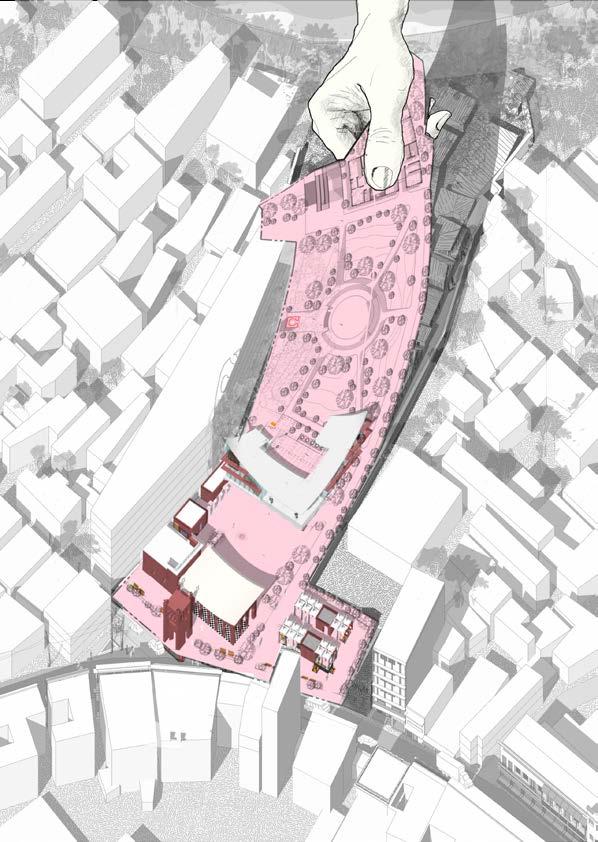
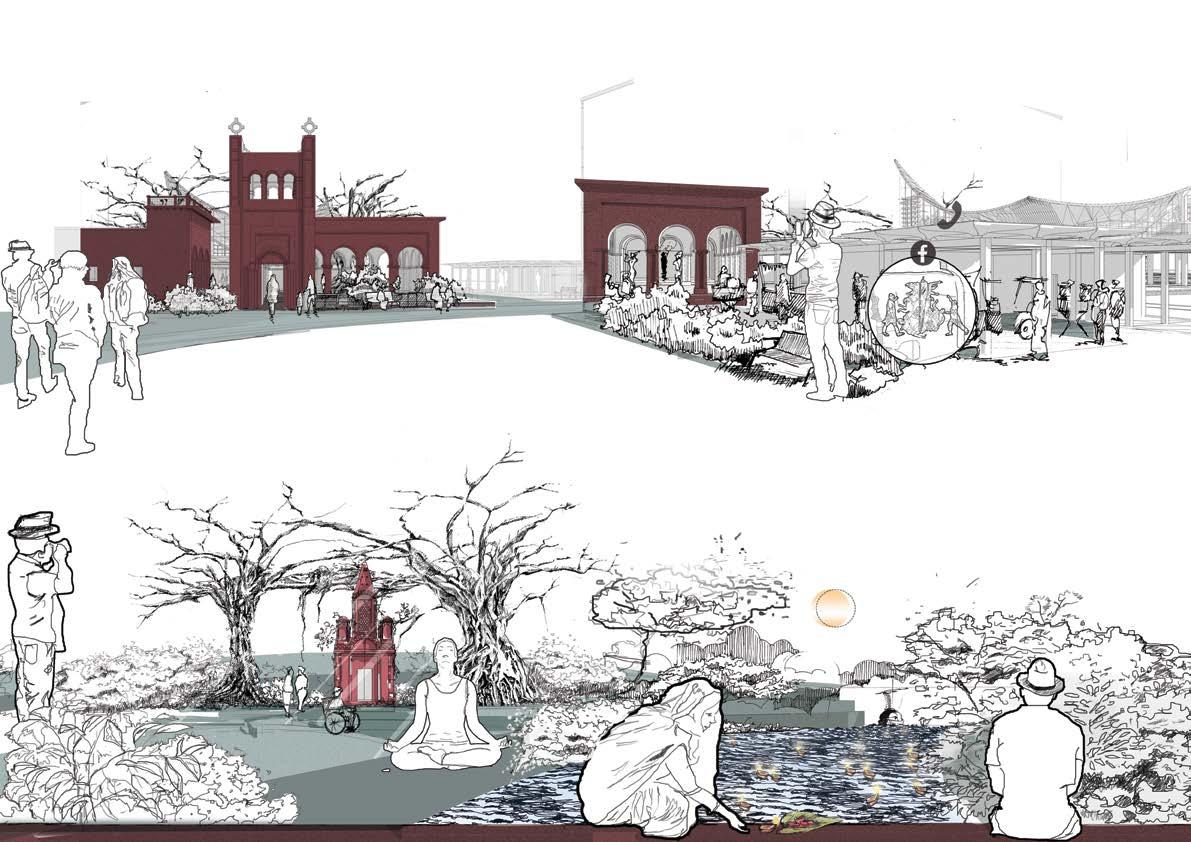
The solution to the Hindu-Muslim conflict is dialogue. Through my design, I showed that space could influence people to interact with each other with compassion, respect, and tolerance making it easier for individuals to connect with others from diversified beliefs. In this project, I re-integrated the Biharilal Joe Temple with the surroundings to create chances for people to strengthen the bonding in the community. Integrating the daily activities of mass people with the temple increases the chance of interaction between people.
Serving as a breathing space also creates a sense of equity in the temple premises. This sense of equity works as a catalyst to grow connection, love, and empathy in the mind of people. A community resilient to communal violence can only be expected when people are committed to establishing a symbiotic relationship and have the scope to show their solidarity in the community.


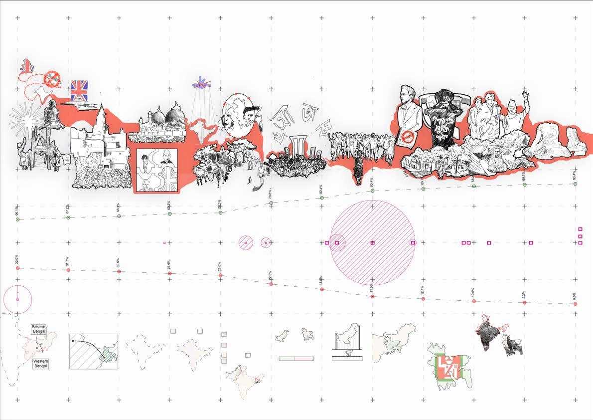
Swadeshi Movement Shifting capital to Delhi Government of India Act 1935 Independence, Partition and Riots.
Complete boycott of British products by the people of India. Muslims and Hindus protested together in “Swadeshi Movement” with a common political agenda.
Satyagraha (civil disobedience)
It was an indicator of compromising Bengali Muslim’s interest thus giving British Govt. a strong base. This first sowed the idea of a separate state for Bengali Muslims and Hindus. People from all stages had denied to work, and pay taxes to British rulers. A sudden call off on the movement cost Gandhi lose his allies. Jinnah and Motilal started two political parties for Muslims and Hindus in India.
A government was formed with members from Britain and India. Although the actual power was held back by British Government members None of the Muslim and Hindu leaders liked government act and refused to participate.
H.S. Suhrawardy urged for an independent Bengal Nehru and Jinnah got two parts of Bengal based on the Hindu and Muslim majority. 3 M muslims migrated from W.B to E.B. 5 M Hindus shifted from E.B to W.B. This mass move made Bengalis Refugee in Bengal
Languages movement. Mass Upsurge
Although Government and authorities from W. Pakistan tried to influence people with religious propaganda against Bengali but people refused to accept Urdu as an official language. A nationwide strike was started after the 21st Feb of 1952’s massacre. An ethnic nationalism started growing among Bengalis.
Mass upsurge started in 1969, The movement soon engulfed the whole of the then East Pakistan. Pakistan Govt. patronized the riots by spreading rumors and exaggerating and inflammatory stories of Muslim casualties in W. Bengal.
Independence Year of Independence The decade of Democracy. Post Election 2001 Ershad introduced Islam as the state religion in the eighth amendment. This was an attempt to get the support of most people of Bangladesh. In 1989-1990 there were several communal attacks. Scholars believe that making Islam the state religion gave the impunity to commit a crime in the name of Islam.
Newly born Bangladesh is surrounded by India, a Hindu majority nation. This raised a concern among the religious political groups. In 1977, secularism was removed from the constitution by a Martial Law directive. The removal of secularism from the constitution ignited the practice of religion-based politics in Bangladesh.
Bangladesh Nationalist Party won a plurality of seats and formed a government with support from the Islamic party Religion-based politics was widely popular. Spreading rumors against Hindus was a recurrent way of startling violence against Hindus. Moreover, it created a sense of apprehension among the minority communities.
The violence mostly occurred in South West Bangladesh which had large Hindu communities. The attacks were systematic with a motive to destroy the economic resources of the Hindu community, terrorize them into fleeing to India, and grabbing their properties.
Dhaka Riots 1930 Rumor
Noakhali Riots 1946 Resentment
East Pakistan Riot 1950
Forcible occupation
East Pakistan Riot 1964 Rumor
Rajshahi Massacres 1962
Ethnic conflict
Bangladesh Genoside 1971 Racism Marichjhapi Massacre 1979 Eviction of Hindus
Bangladesh Riots 1989
Religious Clash
Anti-Hindu Violence 1990
Religious Clash
Bangladesh Violence 1990
Religious Clash
Post Election Riot 2001
Religion Based Politics
Partitioned state in Pakistan
Partitioned state in India India Pakistan Princely State Urdu (44.5%) Bangla (55.5%) British India
Assassination of major Zia and rise of dictatorship in Bangladesh.
the religious
1901 British Rulers divided
Calcutta lost its crown to Delhi as the capital of India. Bengal also lost Assam, Bihar, Orrissa and Manipur
A ripple effect of the Babri mosque demolition in India spread to Bangladesh. Temple, shops, and houses of Hindu minorities were burnt down with several casualties. Right
This act divided India into many pieces, thus creating political and social disintegration among the masses.
Pakistan Govt. Tried to establish Urdu as official language although majority used Bengali.
West Pakistan kept constant suppression upon E. Pakistan.
Newly born Bangladesh is surrounded by India, a Hindu majority nation. This raised a concern among the religious political groups.
Bengal into two parts based on
majority.
to convict anybody without any reason.
1911
1931
First partition of Bengal Bengal was Reunited Rawlatt act The Black Law Government of India Act 1935 Independence, Partition and Riots. Languages used in Pakistan Year of Independence Decade Of Oppression The first Dictator
1921
1941 1951 1961 1971 1981 1991 2001 2011
Of Riot
toll 5k
Riots
Population
Name
Year Reason Death
10k Major
Hindu
Muslim Population
CONTEXT AND


BIHARI LAL JEO TEMPLE
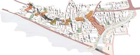
Bihari Lal Jeo Temple is located in a dense urban fabric of old Dhaka and is a sacred space dedicated to the Hindu minorities. The temple is situated in B.K. Das road which is famous point of attraction in Old Dhaka for its rich heritage buildings and heritage walk. Despite being the oldest heritage site of this heritage walk, there has been very little or no government or local authority contribution to protect it from religious violence. As a result, the temple authority created physical barriers that caused a social difference and made the temple restricted and disconnected from the neighborhood.
The Hindu community in this neighborhood also faces social; and physical inaccessibility along with discrimination, deprivation, and oppression from local politicians and goons.


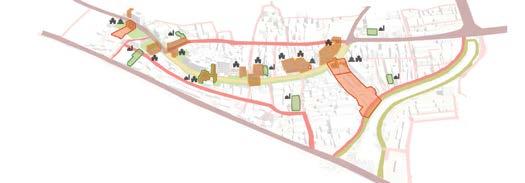
Years of illegal occupancy and political issue of power brought a harsh reality to the heritage buildings and their vibrant neighborhood. Evicting illegal occupants, connecting the heritage sites, and reving the heritage walk of B.K Das road can revitalize the existing condition of this neighborhood. There are 17 heritage buildings; three are temples, and one is a mosque. Surely adaptive reuse of the buildings can draw people’s attention from various stages of society, eventually making the neighborhood more resilient to further violence.

Enlisted heritage buildings at risk.

Hidden inside fortified boundary.

The complex has Polarized Hindu Settlement. 93% of slum dwellers are Hindu and Illegal Settlers.

Threatened by local polititians and goons. Building in the north west block were demolsihed by goons.

Cultural Activities such as Kirtan, Puthipath other folklore activities are still being practiced here.


Areal Isometric drwaing of B.K. Das Road neighbourhood RiverFrontRd RiverFrontRd Historic Buildings Existing Condition and Zonning Place for Improvement Updated Zonnign and Adaptive reuse of Heritage Mosque Temple Secondary Road Primary Road New Roads and Conncections B.K Das Rd. 1 1 1 1 1 1 2 2 2 2 3 3 3 COMMERCIAL ZONE 1 2 3 MIXED USE ZONE RESIDENTIAL ZONE New Service Road Commercial (37%) Community (11%) Residential(24%) Mixed (28%) Area Percentage Commercial Mixed Residential Community Green spaceGreen Zone (0%) Sales Illegal Structure (67%) Legal Structure (33%) Sales Legal Occupancy Illegal Illegal Occupancy (63%) Legal Occupancy (37%) Connecte d Green Revived He ritageWalk Connected ReligiousPracti c e B a c kyardwith water connect ui o n Connected historically essential buildings and religious spaces. Residential Commercial Service Road River Green Buffer Heritage Building Heritage Walk Riverfront Walk 2 2 Occupancy of Heritage Building Legal Illegat Structure Usage Of the plots
NEIGHBORHOOD
Entry
outdoor Temple Court Yard Mandala
Moth Access and Slum Peripheral Access Dholai Khal
Gate Storage and Dorm building
Access Fortification Slum Temple Zoning Building Type Legal and Illegal Structures Connection and Fortification Illegal Legal Residence Workshop Temple Buildings Commercial
An Axonometric drwaing of Biharilal Jeo Temple Complex
Rumor Resentment Ethnic conflict Racism Eviction of Hindus Religious Clash Religion Based Politics Forcible occupation
Communal Attack
Nearly 3000 houses were destroid, burnt or robbed.

198 temples were attacked.
73 business institutions were demolished or burnt.
Sub-Urban Rural
Map of percentage of Bangladeshi Hindus by Subdistrict
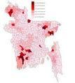
There are various types of settings we can see in Bangladeshi Temples. The variation mostly depends on the size and the context of a temple. Polarized settlement of minorities and fortified boundaries are typical in urban and suburban contexts. Again some tiny temples are isolated from the community. Prominent temples in urban contexts get priority in terms of security. Thus, this makes significant temples isolated from the neighborhood. This variation of these settings in a particular context determines the chance of a coordinated attack happening in a specific temple complex.
1295 people were hurt (Death, Rape, Injury, forced to leave)
Attacking pattern of major violences in last ten years
If we analyze the pattern of coordinated attacks in the last ten years, every episode started from any of the temples. Which eventually spread to the nearby minority’s houses or business institutions, resulting in loss of life, rape injuries, and forced eviction. This unstable situation between the majority and minorities pushes the Hindu community into a fearful future.
The border we created in 1947 between countries is still taking place between communities in the localities, causing isolation, polarized living, and restricted areas to the majorities—such changes in the social contexts of Bangladesh driving unstable conditions in religious harmony. Unfortunately, there are such temples in Dhaka where these patterns are present and have been a vital point of communal violence many times. One of these temples is Biharilal Jio Temple, located in the dense urban fabric of old Dhaka. As an example, I will find ways to make this religious institution more resilient to communal violence and create scopes for spiritual harmony in the neighbourhood.
Urban Large Medium Small
Revenue Protection
Temple Slum Shops
Polarized settlement Disconnected & Hidden
Space
Space
Sense of ownership
Culture Sharing
Access
Temple Complex Slum Shops
Demolished Heritage Building site.
Simplified zonning of existing site


Temple Complex
Public Space Shops
Urban Amenities
Temple Community
Connection with Nature
Heritage Experience
Resilience from Violences
Rathjatra
Loknath Festival
ManashaPuja
MourningNational Day
Janmashtami
Eid-Al-Fitr
Bengali New Year Naam Kirtan
Durga Puja
Shiv Ratri Bashanti Puja Probabledate
LaxmiPuja
Public and religious space
Simplified zonning of new masterplan
IndependenceDay MovementLanguage Day Jagaddhatri Puja SwaraswatiPuja
SpringFirstDayof Victory Day Yoga Library
Existing Activity
Added Activity
Access to the Plaza
Access to the Green

Public
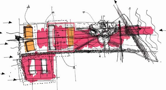
Conceptual Sketches of Masterplan
Religious Space
Place For Gathering Isolation
Existing Zonning New Zonning and Conncetion with site
Connection With Water front
Public Plaza and Community space
Outdoor Temple
Public Space
Conceptual Sketches of Masterplan

Chaos Declassificattion Natural Buffer Sanity Divine


The new design approach is to make the temple complex more connected to the community through various activities and amenities for mass people. In addition, a secular system for the temple will provide a sense of ownership to all community members. Finally, this approach can make the temple resilient to communal violence with the help of all the neighborhood members, regardless of which religion one believes.
Site existing and new zonning Activity Time Log
slavitseF Sat
T ue deW uhT irF 0 18 12 6
AGRAHA Y A N OPUHS HGAM
UN ARTIOHC Exnoitibih Sem inar uPnayaraNja aLxm upija k irtan Access t o G r e e n evitcA azalP Daily activit y Weekly
Sun Mon
HKAHSIOB AHTHSIOJ ASHAR SHRABAN BHADRA ASHWIN KARTIK
GLAF
Events
3K 1.5k
KaliPuja Visitor Bengali Months
In Context Mixed Built Area Mixed Built Area Green with Water Green Area B.K Das Road
Green with Water Dholai Canal
Green Area
Site
Temple
Increased
Space
public enggagement Connceted
Site
Plaza, Green Area, Temple Area
for
Backyards through water fron walkway Connection with Backyard
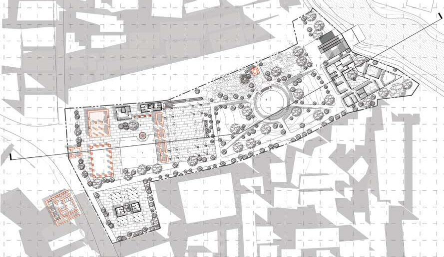

Archive & Office Library & Reader’s Den Restaurant Ground Floor First Floor Entry Gate A Temple Nat Mandir Service kitchen Shops and plaza Service Toilet Exhibits Secular gathering Open temple Masterplan (Ground Plan level at +2100 mm) Section AA’ A’ Garden Pancharatna Moth Amphy Ghat Preist’s residence & Dorm Dholai Canal
Connection between two paths
Hindu belivers
Beliver or non beliver


Market Heritage Walk
Pedestrian River
Temple complex and Plaza
The Temple complex and the adjacent temple property are separated and hidden by the fortified wall and shops. However, this formation is keeping the temple disconnected from the community and losing its chance to be an integrated part of society. By relocating a few functions and utilizing abandoned assets, we can convert the temple into a more engaging urban space for the community.
K K K
K K K
Store House
Store House
Store House
Temple Entry Gate

Restaurant & Admin office
Restauant & Admin office
Restaurant & Admin office
Dorm Shifted to the southern end Office Recovered Property from land encroachers B’ B
Shops & Amenities
Shop & Amenities
Shop & Amenities
Illegally Encroached Property
Illegally Encroached Property
Kitchen & Service
Kitchen & Service Shop Kitchen, Dorm Nat Mandir
Kitchen & Service
Demolition Heritage Building Green
Kitchen, Dorm Shop Office Hard Surface Pedestrian
Demolition Heritage Building Green
Kitchen, Dorm Shop Office Hard Surface Pedestrian
Demolition Hard Surface Pedestrian Green & soakable Surface surface Heritage Building
Mesh Frame
Reflector
Roof Structure
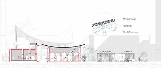
Section BB’
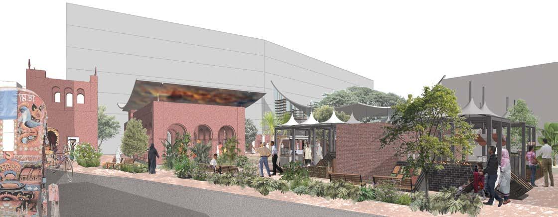 Perspective of Plaza and Temple Comlex
Store House
Store House
Storeage
Store House Store House
Illegal Settelment Damaged Roof
Historic Building Visual Connection
Demolition
Physical Connection
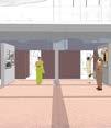
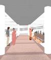
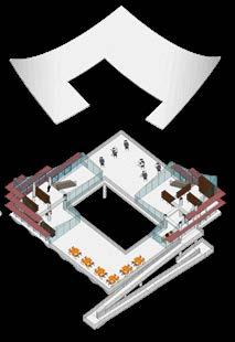
This space is designed to create opportunities for sharing ideas and views among the visitors and people of the community. The addition of this space can break the stereotypical concept of religious spaces used only by the followers of that religion Public space and semi-public spaces are distributed on two levels. Upper floor houses space for a library and terraces, supported by sixteen pilots. The area below the library mass is divided into three layers of functions: temple exhibits, Adaptive exhibition-festival space, and Outdoor temple.

Store House
Store House
Library Axonometric
Store House

Store House
Store House
Store House
Store House
Library
Adaptive
for exhibitions
Temple Exhibits
space
& festivals. Store House
Store
Store House Store
Store House Store House
House
House
Space
Temple
Green Buffer Space for a new library Space
addaptive use
Outdoor
For
Exhibits
for
Relocated
temple
space.
& space for addaptive functions
Demolition Parts Perspective of the library and adaptive functional
Library
module of slab
Structure formation
Structural
Outdoor Temple Slab
Reading Zone Roof
Store House
House Store House Store House Store House
Coffee And Snacks
Store




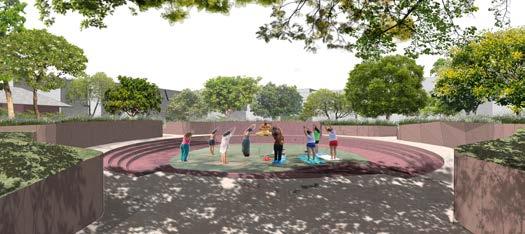
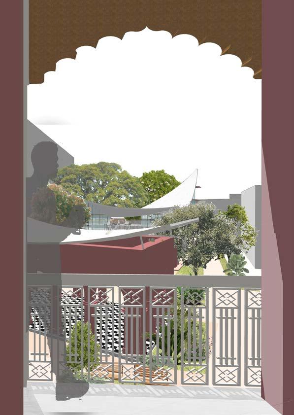
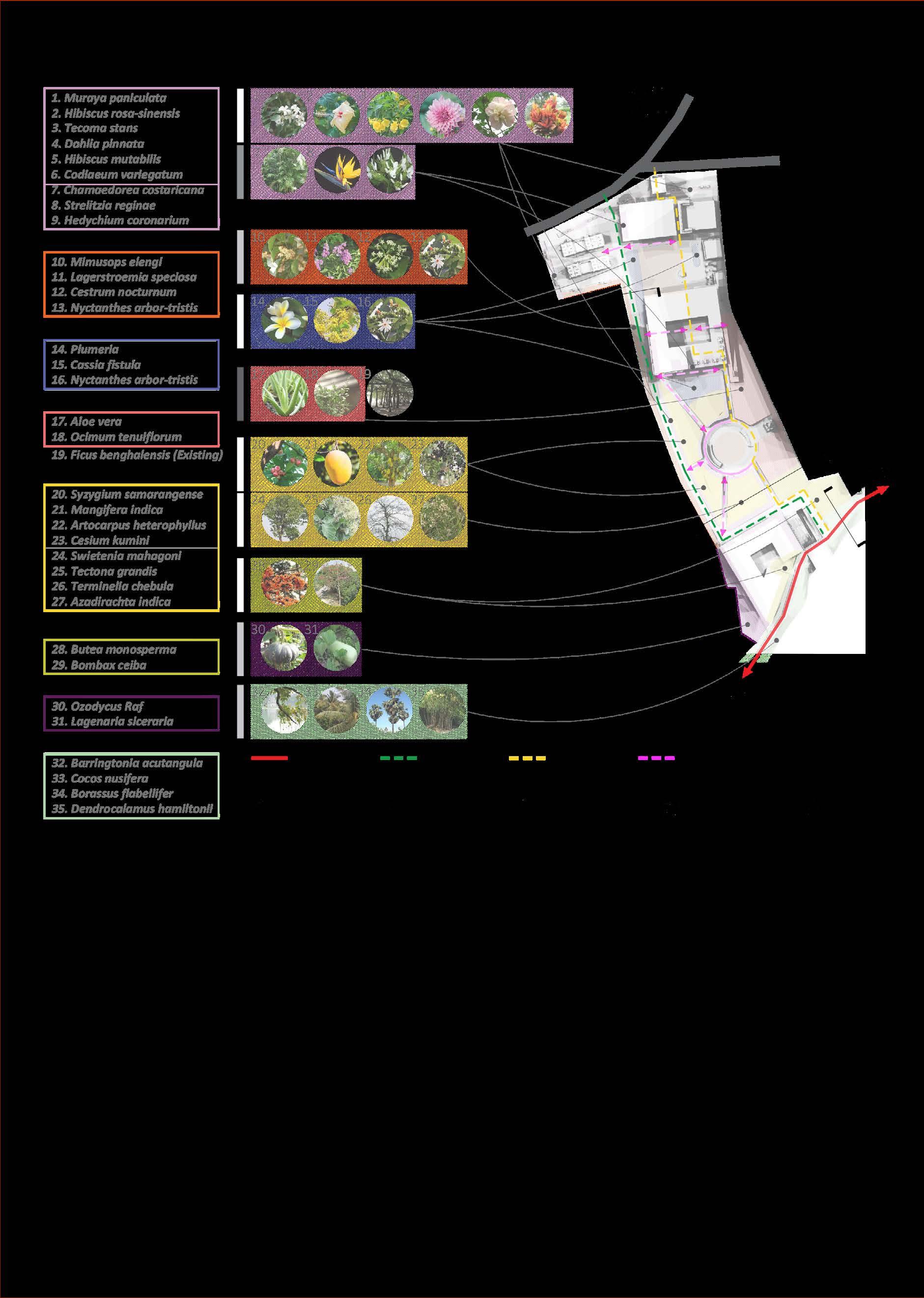
Perspective of adaptable space for festivals and daily activities Beutification & Buffer Smell and Shade Buffer Medicinal Tree Shades and Beautification Fruits and Medicine Edible Vegetation Wet Soil Tree A B C A’ B’ C’
Section AA’
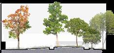
Landscape and circulation Daily Prayer & Ritual Free Food for visitors Sanity Harbal Medicine for community Local Ecology Perspective from Archive and office floor
Section BB’
A Second Chance
Studio VIII | 2018, Duration: 6 Weeks
Studio Supervisor: Dr. S M Najmul Imam, Patrick D’ Rozario, Nefsun Nahar
Location: Noakhali, Bangladesh
Bangladesh is one of the most vulnerable countries to the impacts of climate change. People face extreme climatic events such as erratic rainfall, flooding, drought, sea-level rise, cyclones, river erosion, and salinity intrusion every year. As a result, people lose their homes, farmland, and source of income.
After these events, people migrate to the nearest township or mainly to the capital city Dhaka in search of work and shelter. However, the influx of this climate migrants to city areas makes it challenging to provide a job for a significant portion of the migrants.
Migrated people find it almost impossible to buy a new home in these city areas. Some who have little savings manage to buy a small home in the nearest small towns. However, losing their previous assets and savings weakens their economic stability.
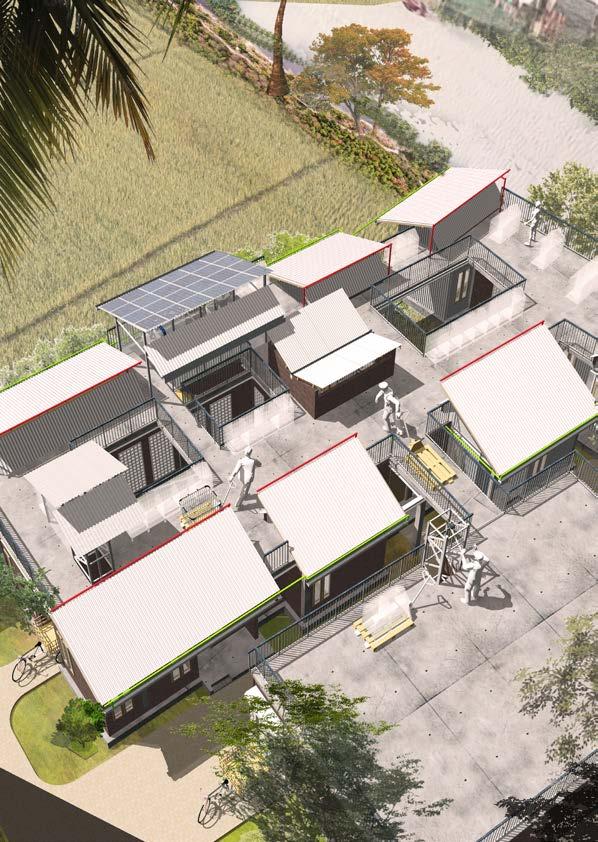
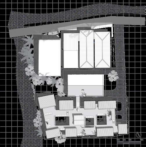
This project seeks to find ways to revitalize their existing assets to support and flourish their skills to support them economically. Minimizing construction costs, creating an efficient way of production, and symbiotic co-existence of the production zone and the residential zone is the key to utilizing every stakeholder’s workability.


Sandesh
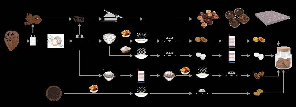
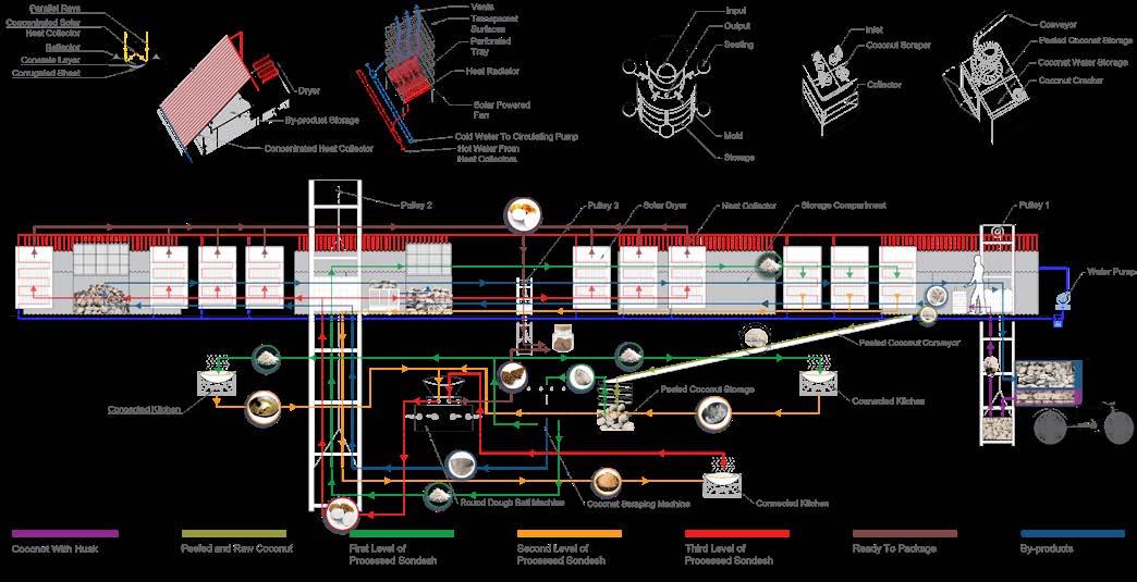
Sandesh is a dessert originating from the Bengal region of the eastern part of the Indian subcontinent. It is a food item that has a thousand years of popularity. Among various Sandeshes, coconut and sesame Sandeshes are popular in southern Bangladesh, where coconut and sesame are highly available. Dehumidification is an important part of preserving this Coconut Sandesh, whereas Sesame Sandesh doesn’t need dehumidification to preserve it for a longer time. That’s why Sesame Sandesh is suitable to make in monsoon. Traditionally sun drying method is widely popular in processing this food item. Molde with floral patterns gives the shape of a Sandesh, with a distinctive pattern on both sides.

Types of Sandesh
Molasses & Coconut Sandesh
Dehumidification after molding is an essential part of enabling longer shelf life. Best produced in dry seasons when the sun is available.
Sugar & Coconut Sandesh
Dehumidification after molding is an essential part of enabling longer shelf life.
Best produced in dry seasons when the sun is available.


Dehumidification is essential to ensure a longer shelf life. Manufacturing period From mid october to May
Molasess & Coconut Flake Sandesh
Dehumidification of raw coconut flakes is an essential part of enabling longer shelf life.
Best produced in dry seasons when the sun is available.

Molasess & Sesame Sandesh
No need for dehumidification makes it easier to make it in monsoon.

No need of Dehumidification. Best produced in monsoon
Sunny
Steps of making different types of Shandesh Molding machine Dryer Product Molding machine Molding machine Products made of coconut waste Molasess Dry Coconut Flakes
Jan Feb Mar Apr May June July Aug Sep Oct Nov Dec
Rainy

Production Line
Sectional Schematic Diagram of Sandesh
Identifying those skills and potentials for adding economic value.
Bangladesh Bank offers small loans on easy terms to convert their existing assets into an efficient infrastructure for producing goods.

Evey migrants bring some skills, culture, and expertise with them.
Putting their skillsets under a framework to give them economic stability. Minimizing
1.
2.


Architectural intervention can create a coexistence between residential space and production line in a symbiotic manner.
Small business and production industries can contribute to the national economy and offer a better living standard for the people.


Unusable

Families and Responsibilities
Member Dayshift Responsibility Nighshift Responsibility

Family 1
Family 2
Family 3
5 Peeling & storing By-products
4 Managing dryers
4 Grinding and chopping raw coconut
Cooking & Molding
Cooking & Molding
Cooking & Molding

Family 4 Packaging
Form Generation
3
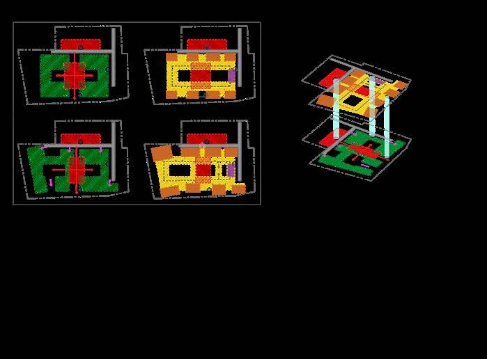
Primary space distribution at GF
Kitchen, Residence Packaging Packaging
Space distribution depending on responsibilities at GF and Roof level
Strategies
New Plinth
Existing Plinth
Storage Drying Zone & Circulation
Storage Drying Zone & Circulation
Vertical Connection
Peeling Zone
Vertical Connection
Peeling Zone
Cooking & Molding
Primary Space Distribution at Roof Vertical Conncetions Kitchen, Residence Packaging Packaging
New Plinth
Existing Plinth
Demolition of existing Plinth
Plinth modification
Demolition of existing Plinth Reuse of Existing Material
Plinth modification Schemactic


F 3 F 3 F 2 F 2 F 1 F 1 F 4 F 4
wall layout as reference for the new
Maintaining Existing
plan
wall layout as reference for the new
Reuse of Existing Material Maintaining Existing
plan
form drawing Drying Zone Private Space Common Space Storage Concrete Surface By-products acts As Insulator Drying Zone Subtraction of roof form Roof formation drawing Family1 Family2 Family3 Family4 Abandonded
Sanitation
Poor
Spaces Lack of Natural Ventilation
Living Condition Project Background
Poor
Construction Cost
Refurbishment 1. Natural Ventilation
1. Adaptive Use of Service Area
Utilizing Existing Material 2. Improved Hygine
Symbiotic Distribution of Space
Efficient Modification 3. Proper Space Allocation 3. Use of natural Energy Improved Living Condition Efficient Production Line
2.
3.
Existing Site


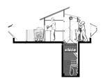
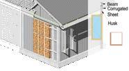
Dehumidification Schematic
Loading
Peeling
Loading Unloading and first level of processing

Peeled coconut to the kitchen storage
Service
Processed

Coconut Husk

By-product Storage
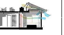
Services are constructed with permanent material to supprot future vertical expansion Ventilation
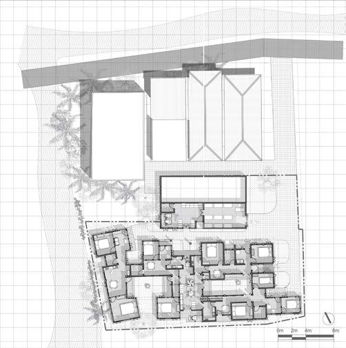
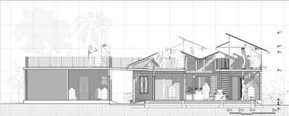
Ground Floor Plan at +1800mm Roof Plan at +3600mm A A A’ 1 5 5 5 5 5 5 5 5 5 12 13 15 16 14 14 2 3 3 4 4 6 8 8 8 8 8 7 4 4 3 3 9 9 10 11 2 2 2 1 1. Living 2. Dinning 3. Kitchen 4. Toilet 5. Bed 6. Coconut Processing zone 7. Coconut Storage 8. Hand Pulley 9. Common Courtyard 10. Packaging Area 11. Storage & Delivery 12. Peeling Area 13. Maintenance & Pump Area 14. Drying Circulation Area 15. By-product Storages 16. Household work area 1 A’
AA’
Section
Sandwich Wall Dehumidification Unit Heat Collector Unit Pump Water Rservoir Peeling Zone Ktichen 3 Ktichen 2 Courtyard Courtyard Ktichen 1 Storage Delivery Zone Processing Zone Slab Outline Husk Storage
Shell Storage Solar Panel Coconut Storage Drying & Circulation Zone
and Production
Drying Chamber Water Circulation Network Roof Level Residential zone
Unit Packaging Zone
Channel
and Vertical zoning
Residential Zone
Biomimicry
Studio VI | 2017, Duration: 5 Weeks
Studio Supervisor: Dr. Zebun Nasreen Ahmed, Kazi Fahriba Mustafa
Location: Dhaka, Bangladesh
Nestled on a tranquil island within a lake, this architectural project explores the intersection of nature and built form. The design takes inspiration from the remarkable beehive, mimicking its efficient structure and embracing its functional beauty.
The beehive’s unique hexagonal form provides exceptional stability while offering the flexibility to adapt to various shapes. This modularity translates into an innovative design where individual modules vary in their outward extrusion. This dynamic form not only evokes the organic flow of the beehive but also serves a functional purpose – meticulously controlling the amount of sunlight entering the interior space.
This project, envisioned as an atelier for an architect, prioritizes uninterrupted views of the surrounding landscape. By manipulating the hexagonal modules, a fluid form emerges, offering the architect a serene and inspiring 360-degree panorama from their workstation.

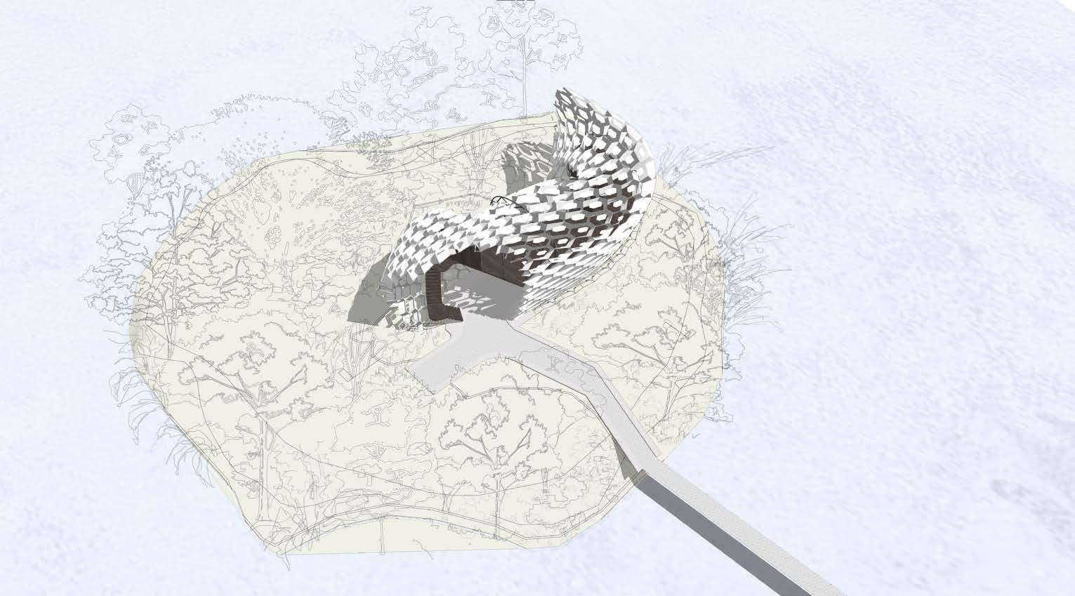
Existing Site Single way curve Singleway curve (aligned with another axis) Doubleway curve Desired form Orientation And Axis Form In the Vacant Space
Honeycomb structures are natural or artificial structures that have the geometry of a honeycomb to minimize the amount of used material to reach minimal weight and material cost.


The main idea came from the change in the sun’s path. Changes in the extrusion of a module’s boundary can vary by location. Considering sunlight and heat gain, examining the shadow pattern of different values determined the values of parameters and constants. This way, we can achieve a screen design that allows us to visually connect to the surroundings while the heat gain is also precalculated and controlled. Inspiration





Sectional View
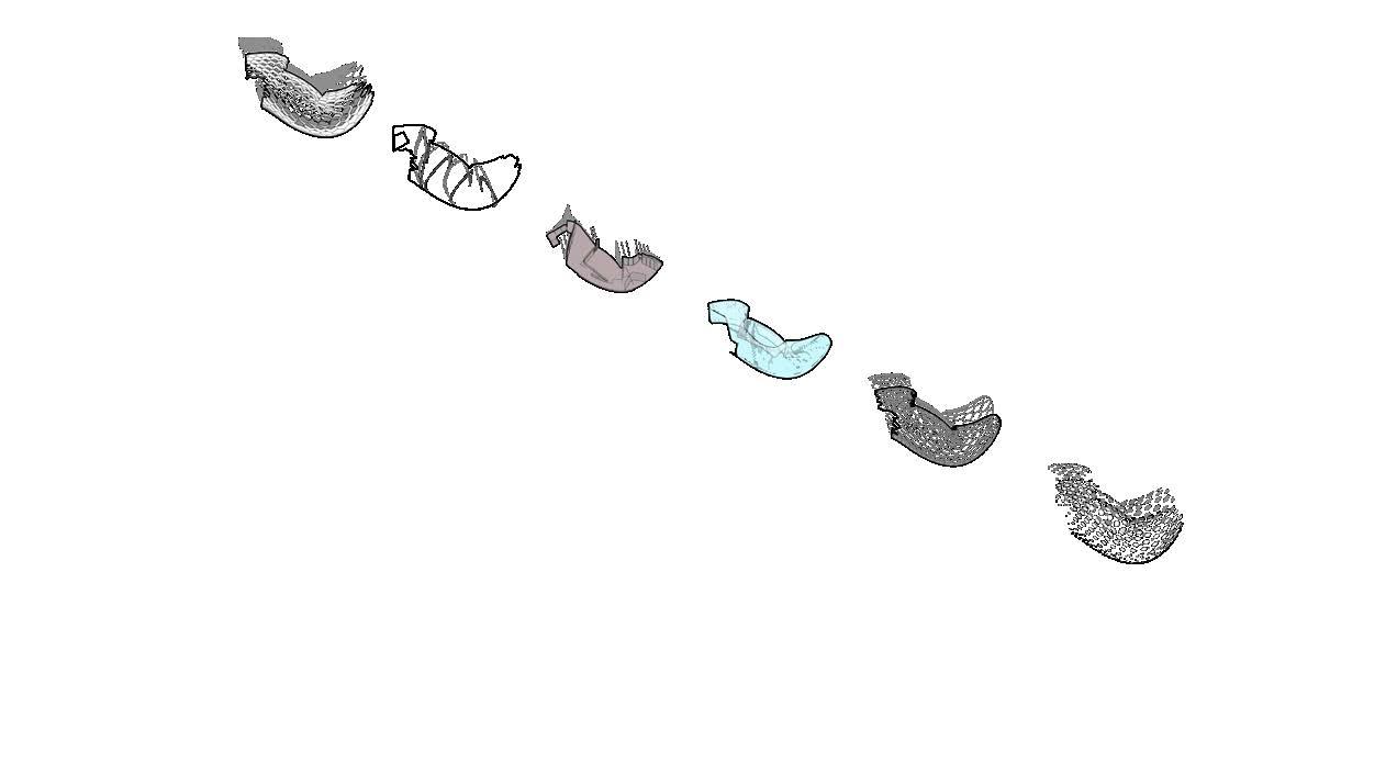
Shadow Pattern at 9 a.m

Shadow Pattern at 12 p.m
Shadow Pattern at 3 p.m

Shadow Pattern at 5 p.m


Screen Glass protection Screen Structure Space Truss Sample 1 Module Quantity: High Extrution Factor: Low Sample 2 Module Quantity: Low Extrution Factor: Low Sample 3 Module Quantity: Low Extrution Factor: High Sample 4 Module Quantity: High Extrution Factor: High
Change of module
Change E S W N
Change
Module
module
Module Module Component
Daytime
Seasonal
Structural
Extrusion vs Aperture of a
Conceptual Sketches
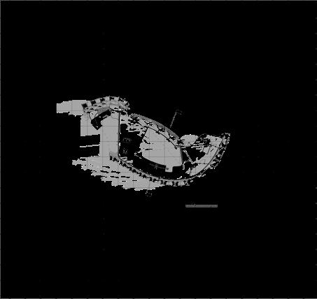
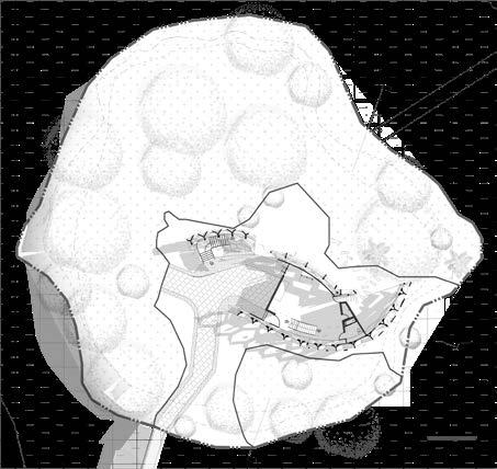
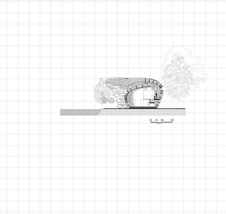

Perspective Section AA’ A’ A’ A A 1 3 2 4 5 6 7 7 1. Studio Space, 2 Store, 3. Washroom, 4. Outdoor Studio, 5. Formal Living, 6. Private Space, 7. Semi Outdoor Space
Art Gallery
Studio IV | 2016, Duration: 4 Weeks
Studio Supervisor: Mahmudul Anwar Riyaad, Mohammad Tahajibul Hossain
Location: Bandarban, Bangladesh
Atop a majestic hill in Bangladesh, this art gallery design emerges from the very essence of the landscape. The project draws inspiration from the dramatic folds of the surrounding hills, seamlessly blending the built form with the existing skyline.
The design transcends the traditional gallery concept by delving into the hidden form of the hill. Unlike the exterior which seamlessly integrates with the existing topography, the interior spaces replicate the experience of being within the hill itself. This unique spatial flow creates a captivating sequence of indoor and outdoor experiences, blurring the traditional boundaries between the two.
The structure is a powerful marriage of strength and form. A steel frame serves as the backbone, providing support and stability. This framework is then clad with prefabricated panels, carefully sculpted to echo the spirit of the site and respond to the specific forces of the context. These transitional spaces not only compliment the natural beauty of the environment but also create a dynamic canvas for the art within, ensuring that both the structure and the exhibits within resonate harmoniously with the surrounding landscape.
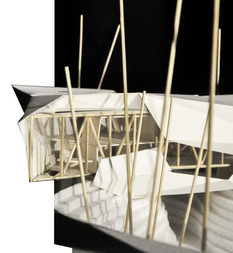


The concept was blending the form of the structure with the terrain. Keeping the property of the skyline as it was before.


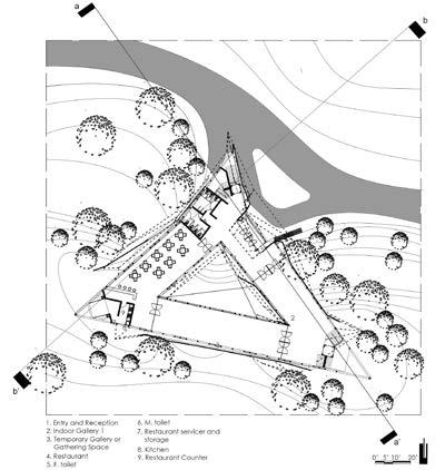
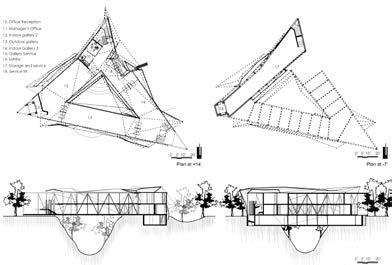



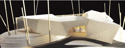
Ground Floor First Floor Structure Shell Basement Basement Ground Floor Shell Axonometric Render Section AA’ Section BB’
Ground Floor Plan
Bohemian Rhapsody
COMPETITION WORK | 2019
Location: Berlin, Germany
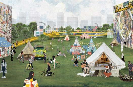
Welcome to Bohemian Rhapsody- an enthusiastic and ecstatic expression of living!
In the center of Berlin’s hustle and bustle, this hostel is just what you need for self-realization and practice your inner bohemian spirit. Forget living inside pigeon coops disguised as hotels, Bohemian Rhapsody rejects those obsolete and segregating ideas by becoming an ever-evolving art-park open for all.
Stay, meet, greet, collaborate, get inspired! Here change is the only constant. How to live here? You choose that! Tell us the idea of your desired temporary living spacewhether shared space for collaboration or personal space for self-contemplation; and we will create that living environment for you. Want to come here and stay inside your vintage Volkswagen minivan? Most welcome putting it in the scaffolding structure, and enjoy the hostel experience! The cost of living? Simple, plastic waste! You can come from any part of the world, just clean the area of plastic garbage, submit them here, and you’re covered! Plastic waste used as currency here will be recycled and used to make building materials for this hostel and other affordable housing projects in different places. That way, you can have impact on creating a cleaner & greener earth!
See the ramp? That is the only fixed structure here acting as a landmark and beacon for this hostel. And it’s not only open for the hostel quests, but for the whole Berlin.
Don’t forget to enjoy the big pool! Swim in a hot summer day, sing and dance by it in rain, sit beside and read a book in a fall after- noon, or ice skate on it in winter!
The art park, for you, will always be evolving. You’ll find new experience every time you visit. Sometimes an art gallery, or a movie theater; sometimes a local gathering and children playing, even as a concert venue!
Interact here with the people of Berlin here. Exchange values, get inspired, and inspire them with your life-culture and idea of bohe- mianism! Who knows, some of them might join you on your next quest as well!
So what are you waiting for??
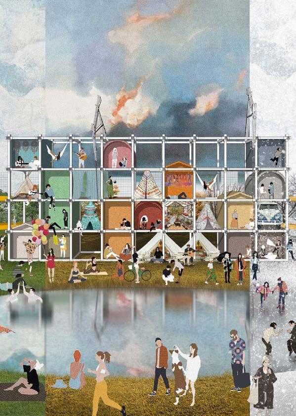
Bohemians arriving from different parts of the world
Bring out the inner bohemian nature of people.
Interaction with people of Berlin share wisdom, ideas, skills, and art.
the service

Arriving at the ramp choosing their desired place for living.
Choosing their desired style and form of living
Plug or 3D printing the temporary structure from the inventory of recycled plastic.
living Isolated or in collaboration with one another.
Facade taking different appearance at different times.
 Bohemian
Empty structutre housing
core when there is no one.
Office Works Technical Drawings
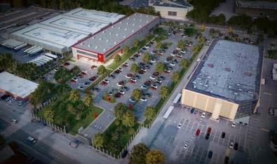
In this project, I designed the layout for the site and created this visualization for my office. This project houses the tesla service center, warehouse, and office space. The challenge was to design according to tesla standards and keep scopes for green patches and soft surfaces.
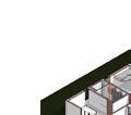
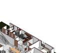
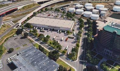
This project was designed to accommodate cross-dock facilities. The existing concrete pad covers 100% of the site. Also, the neighborhood needed a buffer from the truck parking area. To increase the number of soft surfaces, we created a 15’ buffer line around the site and create space for planting native trees.
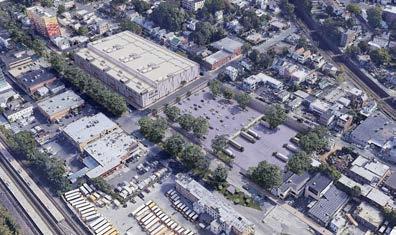
This project had the considerable challenge of accommodating four movie studios within the existing built area. We Kept the existing structural framework as much as possible to minimize the construction cost and utilize the existing assets. We also focused on creating public space and improving the landscape in front of the property. We tried revitalizing the existing soft surfaces through landscape design ideas and incorporated gathering spaces for the neighborhood. also met the counselor to explain our ideas and vision to develop this property and offer breathing space in the neighborhood.
449 W John St, Oyster Bay, NY 11801, USA (Tesla Service Centre)
Long Wharf, New Haven, CT (Cross dock) 1 Grove, NY (Movie Studio+ Parking+ Landscape) Responsibility: Conceptual Design, Modeling, Rendering 1 1 2 2 3 3 4 4 A A B B C C D D 4 A102 4 A102 A102 A102 A101 A101 5 A102 5 A102 3 A101 A101 A101 A101 Level 1 24.0 Level 2 144.0 A B C D Level 3 264.0 FGL 0.0 EGL -15.0 www.autodesk.com/revit Scale Date Drawn By Checked By Project Number Consultant Ar. Gaurab Kundu, Nilay Kumar Das Address Address Address Phone 01758965453 North 1 A103 Presentation Drawings Owner Project Name Checker Nilay Kumar Issue Project Number 1 100 Presentation Drawing Level 3 1 100 2 West Elevation 3 Axonometric Cut Plan At Level 1 4 Axonometric Cut Plan At Level 2 No.DescriptionDate 1 1 2 2 3 3 4 4 A A B B C C D D 15.0 34.0 5.0 38.0 26.0 22.5 4.5 40.5 15.0 71.0 3.0 4.5 6.5 4.5 63.0 15.0 17.5 44.0 95.0 15.0 54.0 86.0 45.0 15.0 89.0 63.0 15.0 61.5 95.0 15.0 144.5 144.5 78.0 171.5 538.0 26.0 4.5 10.5 4.5 8.0 4.5 52.0 43.5 75.5 17.0 104.0 15.0 135.0 165.5 196.0 10.0 75.0 87.0 17.5 10.0 13.0 131.5 7.5 4.5 5.5 80.0 5.0 92.0 85.0 87.0 27.5 152.0 94.5 92.0 199.5 152.0 186.5 538.0 496.5 10.0 27.0 66.0 8.5 4.5 24.0 87.5 24.0 15.0 36.0 54.5 10.0 10.0 10.0 10.0 51.5 10.0 37.0 98.5 39.0 87.5 39.0 100.5 30.0 61.5 135.0 165.5 192.0 492.5 25.0 4.5 33.0 4.5 38.0 30.0 4.5 46.0 4.5 10.5 84.0 8.0 60.5 10.5 114.5 4.5 83.5 4.5 10.0 10.0 10.0 144.5 4.5 40.5 5.5 4.5 13.0 131.5 7.5 10.0 47.5 4.5 3.0 14.0 5.5 10.0 82.0 10.0 179.0 50.5 152.0 62.0 17.0 107.5 15.0 40.5 4.5 50.5 26.0 30.5 15.0 40.5 4.5 116.5 10.0 55.0 56.5 55.5 4.5 126.5 4.5 30.0 15.0 27.5 6.5 30.0 5.0 4.5 30.0 38.5 34.5 49.0 30.0 39.0 38.5 190.5 70.0 21.0 32.0 2.0 30.0 17.5 4.5 40.5 15.0 71.0 3.0 22.0 22.0 151.0 173.0 4.5 101.5 4.5 15.5 72.0 45.0 18.5 15.0 51.5 145.0 66.5 135.5 20.0 101.5 24.5 11.0 52.0 10.5 62.5 31.0 30.0 1.5 90.0 47.0 4.5 40.0 0.5 4.5 116.5 5.5 40.5 126.5 72.0 4.5 4.5 47.5 27.0 5.0 10.0 36.0 54.0 30.0 105.5 55.0 90.0 46.0 www.autodesk.com/revit Scale Date Drawn By Checked By Project Number Consultant Ar. Gaurab Kundu, Nilay Kumar Das Address Address Address Phone 01758965453 North 1 50 H101 wall Layout Owner Project Name Checker Nilay Kumar Das Issue Date Project Number 1 50 1 Wall Layout Level 1 No.DescriptionDate
600


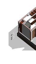


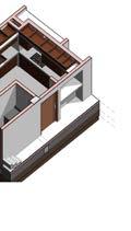


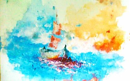
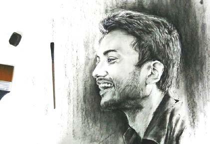
2 2 A A B B 2 M109 127 SF Kitchen 5 WL WL 1 WL WL W5 M109 Level 1 24.0 Level 2 144.0 A B FGL 0.0 EGL -15.0 Level 1 24.0 Level 2 144.0 2 FGL 0.0 EGL -15.0 10 False Ceiling 16 Refrigerato 17 Refrigerato www.autodesk.com/revit Scale Date Drawn By Checked By Project Number Consultant Ar. Gaurab Kundu, Nilay Kumar Das Address Address Address Phone 01758965453 North 1 30 M109 Room Layout Details Owner Project Name Checker Nilay Kumar Das Issue Date Project Number 1 30 1 Room Details Level 1 (kitchen) 1 30 2 Kitchen East Wall 30 3 Kitchen North Wall 4 Kitchen Axonometric Drawing No.DescriptionDate 2 2 A A B B 4.5 17.5 4.5 40.5 15.0 71.0 3.0 4.5 6.5 4.5 6.5 4.5 5.0 5.0 40.5 4.5 65.5 4.5 21.0 4.5 10.0 40.5 70.0 30.0 4.5 4.5 30.0 38.5 4.5 40.5 4.5 51.0 4.5 20.0 4.5 101.5 4.5 10.5 WL WL 1 WL WL W5 WL 26.5 129.0 15.5 11.0 29.0 101.5 20.0 M110 M110 Level 24.0 Level 144.0 A B FGL 0.0 EGL -15.0 10 False Ceiling 4.5 X 6 Lintle 4.5 X Lintle 19 Counter Top 18 Counter Top 1 6.0 10.0 14.0 2.0 4.0 38.0 4.0 42.0 24.0 15.0 16.0 14.0 38.0 46.0 39.0 32.0 48.0 40.0 39.0 6.0 22.5 51.5 40.0 4.5 5.5 19.5 35.0 75.5 5.5 4.5 ø70 11 Kitchen Hood Exhaust Level 1 24.0 Level 2 144.0 2 FGL 0.0 EGL -15.0 6.0 10.0 16.0 4.0 18.0 26.0 4.0 36.0 24.0 15.0 32.0 22.0 26.0 40.0 24.0 15.0 18 Counter Top 10 False Ceiling 2 2 A A B B 36.0 28.0 25.0 10.5 16.0 3.5 10.0 16.0 3.5 28.0 89.0 4.5 20.0 21.5 28.0 52.0 20.0 3.0 16.0 3.0 4.5 51.0 4.5 20.0 29.0 101.5 20.0 40.0 40.0 46.0 1 M110 M110 18 Counter Top 19 Counter Top 2 www.autodesk.com/revit Scale Date Drawn By Checked By Project Number Consultant Ar. Gaurab Kundu, Nilay Kumar Das Address Address Address Phone 01758965453 North 1 30 M110 Room Layout Details Owner Project Name Checker Nilay Kumar Das Issue Date Project Number 1 30 Room Details Level 1 (kitchen Wall Layout Plan) 1 30 1 Kitchen East Wall Layout Drawing 1 30 3 Kitchen North Wall Layout Drawing 1 30 4 Room Details Level (kitchen Counter Top Layout) No.DescriptionDate “Embracing Artistic Expression and Craftsmanship: A Vital Respite from Academic and Professional Endeavors, Fueling My Productivity and Creativity” Acrylic Painting Portrait Sketch
Works
Other
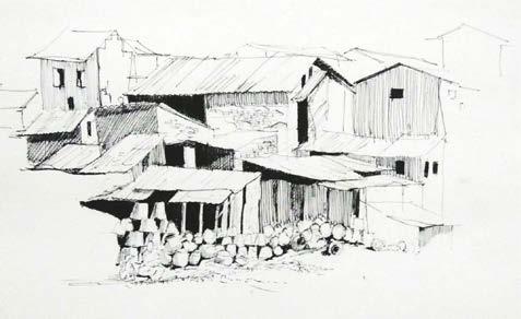
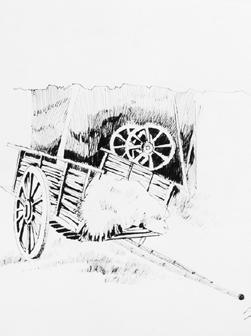

 Sketch
 Portrait with Nail
Clay Sculpture
Sketch
Sketch Portrait with Nail
Clay Sculpture
Architecture, for me, is more than brick and mortar; it’s about weaving stories into spaces, fostering resilience, and empowering people to claim their environment.
Thank You.


 Perspective of Plaza and Temple Comlex


 Bohemian
Empty structutre housing
core when there is no one.


 Sketch
 Portrait with Nail
Clay Sculpture
Sketch
Sketch Portrait with Nail
Clay Sculpture