4 minute read
New LiDAR payload makes aerial surveying more accessible


Tom Goodwin, Ferntech
Many surveyors are using UAVs in their daily operations, making drones an essential part of their toolkit. LiDAR laser scanning used to be expensive as well as difficult with the calibration setup.
Advertisement
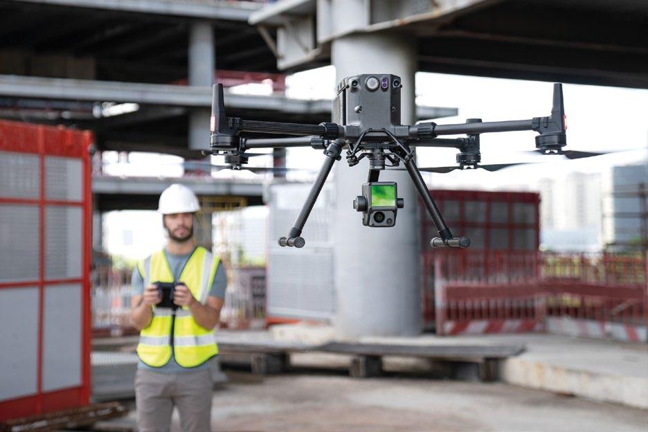
The new DJI Zenmuse L1 sets out to change that.
A clip-on payload that combines the power of LiDAR and high-quality photography at an affordable price, the L1 provides a glimpse into a more accessible future of aerial surveying technology.
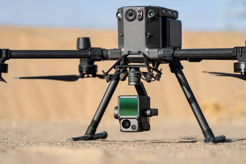
The Zenmuse L1 delivers enhanced 3D data capture capability with a detection range of up to 450 metres, enabling the acquisition of up to two square kilometres of point cloud data in a single flight. It offers point cloud data capture with exceptional centimetre-level accuracy thanks to the high-precision IMU, vision sensor for positioning accuracy, plus GNSS data. It is the first LiDAR payload developed by drone giants DJI, who are recognised for creating accessible technology without compromising on quality.
Tom Goodwin, at Ferntech, says the new model is a welcome addition to DJI’s range of surveying solutions. Ferntech’s team are experienced in providing professional aerial measurement solutions to the geospatial industry, specialising in drone solutions. “There has always been an enthusiasm from local surveyors to use LiDAR in their operations but it has been unaffordable up to this point. The L1 gives more operators the opportunity to generate precise data with the incredible detail that LiDAR systems offer.”
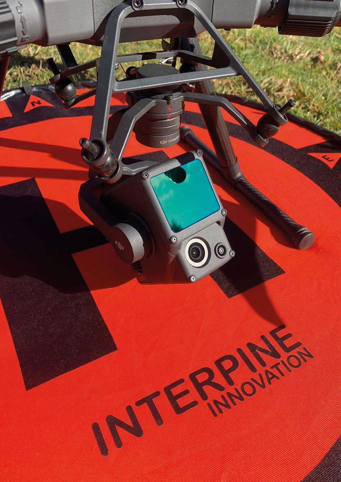
David Herries, of Interpine, a forestry consultant and data management company based in Rotorua, is
excited by the possibilities of the new integrated system. Interpine has been using LiDAR since 2008 from manned aircraft. Interpine now operates a DJI Matrice 300 RTK and the new L1 payload, which will complement its land-based LiDAR units to provide a comprehensive suite of sensors.
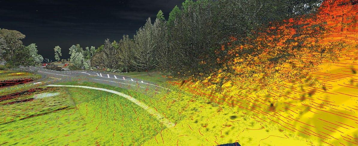
So far, the L1 is living up to expectations. “From the air, this unit provides high-efficiency LiDAR collection covering 100-200ha in a single 30-minute flight with 50 per cent to 20 per cent overlap respectively depending on the requirements based on its 70-degree field of view. Supporting up to three returns and detection ranges up to 450m, the L1 is able to extract terrain under the tree canopy while extracting forest resource measurement when combined with Interpine’s innovative LiDAR processing solutions.”
He acknowledges that the price point has certainly helped. “Finally, LiDAR at any scale is within economic reach.”
Goodwin says another benefit is the full integration with the DJI Matrice 300 RTK and DJI Terra so there is no need to invest in third-party processing software. “The bonus is that it is easy to mount to a Matrice 300 RTK so our customers do not have to upgrade their whole drone system, simply attach it and fly.”
For those who are new to drone technology, Ferntech offers complimentary training on the handover of its DJI Matrice 300 RTK LiDAR solution. “We know that learning new technology can be daunting, but this solution is designed to be simple. All you need is a few hours from someone to show you how to operate the system and you are sorted.” •


Virtual Event | 19 – 21 October 2021

Online Industry Summit for Surveying Professionals
You’re invited to the highly anticipated 12d Tech Forum 2021! This three-day virtual industry summit will connect 2,500+ surveying, geospatial and engineering professionals from across New Zealand and Australia. Watch industry keynotes, learn & upskill with in-depth training sessions, and connect with the industry through virtual networking.
50+ Hours of Incredible Talks
The Tech Forum will host over 50 hours of industry insights and training content, delivered by some of the greatest minds and speakers in the industry. All 150+ sessions will be recorded and available to watch on-demand for 12 months after the event.
Free Access to All Keynote Presentations
Our huge line-up of industry talks include:
Pilbara Desert Collaboration: Land Surveys’ data management strategy collaborating across the Pilbara desert
Piritahi Case Study: 10,000 lot land development project to crush the Auckland housing crisis
GDA2020 at Mackay Regional Council:
Practical insights into successfully implementing GDA2020 through 12d Model
Surveying and Geospatial Topics include…
• BIM & Digital Engineering • Land & Construction Surveying • GDA2020, ADAC, A-SPEC • Point Clouds, Drone Surveying & Photogrammetry • Mobile Mapping & GIS • Digital Twins & Asset Management
Earn CPD Points
Each hour you watch can earn you 1 CDP point. Contact your institution, including Surveying and Spatial New Zealand and SSSI for more information.


