


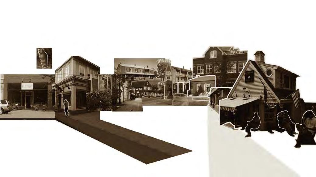
selected work | 2019 - 2024 |


YI CHIEN KUO

selected work | 2019 - 2024 |
Introduction
Poor Living quality bond to the consequences of unaffordability.
Ensuring that urban residents have access to a certain standard of living quality has always been an ideal goal of urban development. The importance of sustaining life in urban areas should not equate to losing the quality of life. In Taiwan’s capital, Taipei, living quality is often hard to attain due to cramped housing, high living costs, and immense pressure on the growing influx of new urban migrants, depriving them of the leisure of city living.
Urban renewal in major cities is a crucial process in moving towards this objective. This project aims to leverage the abundant resources of urban infrastructure to establish a systematic resource allocation that bears more social responsibility. By focusing on urban migrants, also known as the main drivers of urban development, we propose urban development strategies that not only ensure the basic right of living but also prioritize greater affordability and sustainability in a comprehensive manner.
SURVIVE IN URBAN IS HARD FOR SOME PEOPLE
How can urban guarantee the BASIC living right FOR EVERYONE ?
Project Type : Academic
Date : 2021- 2022
Collaborators : none
Studio: Thesis Project
Professor: Shao Kai Yang, yang.shaokai@gmail.com
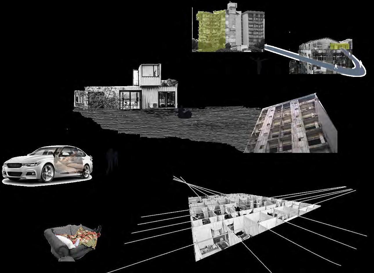
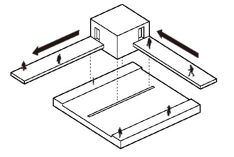
◢ Analyzing pathways that provide a sense of security to the survivors who use the minimum resources to live in the city

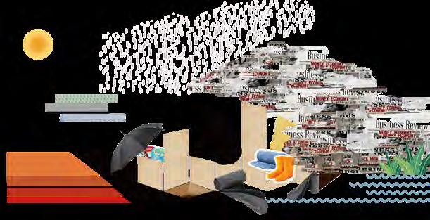
With the continuous development of civilization, the water source is no longer just to maintain physiological needs, but also incorporates the concept of hygiene and cleanliness, so that people can maintain a more permanent physical health and a good image required for social interaction; the function of food is extended to eating and drinking. The space for cooking; the space for socializing has more diverse forms so that more social needs with different purposes can be met. In addition to the size of the space people need, the value of most of them often varies according to the degree of demand, commonality, and privateness. In the various living spaces of the city, many types of buildings based on this can be found.
Comprehend the state of people’s residence as a balance composed of three mental elements and five core physical elements, starting from the characters of Homeless, residence, and life.
Homeless : the existence that provides a sense of belonging and comfort is often constructed by ethical relationships.
Houseless : refers specifically to a physical place that meets the sheltering needs of survival.
Lifeless : in addition to survival behavior, motivation comes from the behavior of personal will.
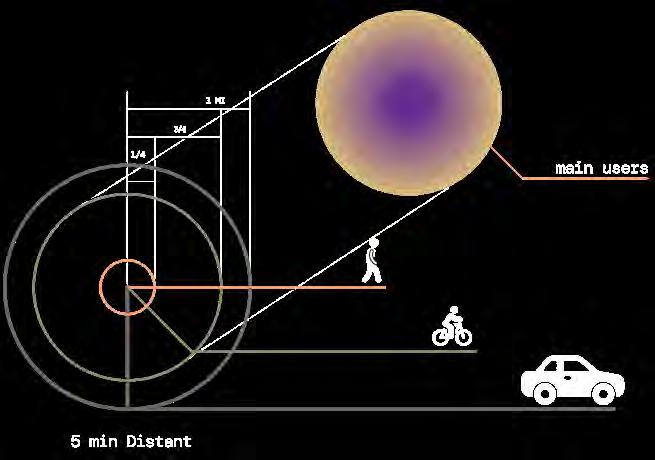
User Survival Requirements
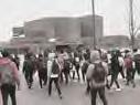
Migrant worker : migrant population suffered from the constraint of resources while they have to pay for every living resources within highly competing situation.
Homeless people : indicatiing the situation of those who with no stable living area and forced to live on the street or shelters.
Students : temporary living in the big city for higher educational purposes, facing the smae budget challenge with working group.
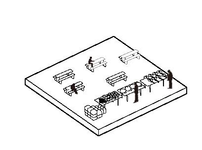
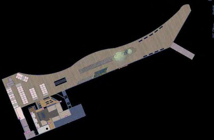
Wholesale Market
Site Resources Analysis
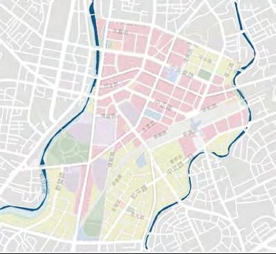
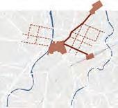
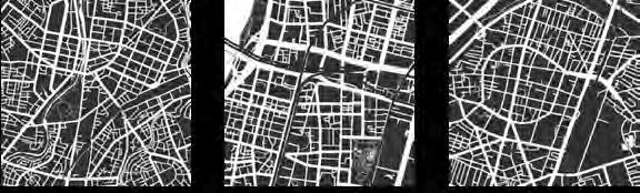
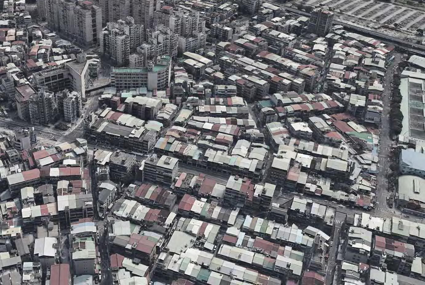
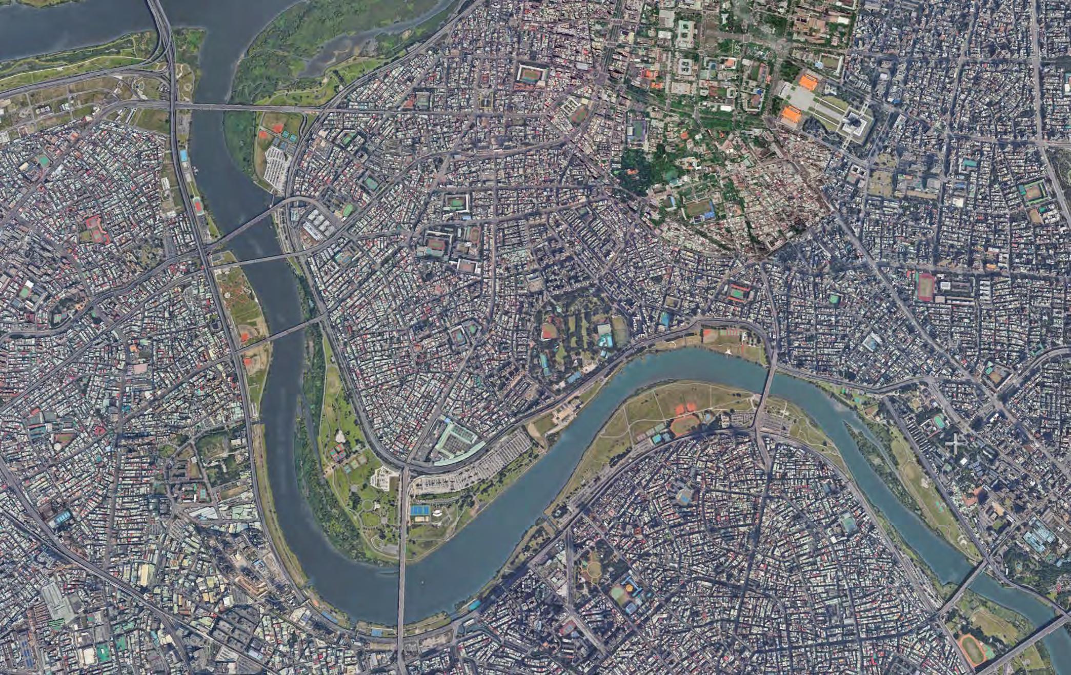
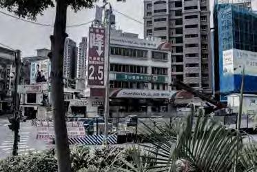
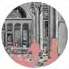
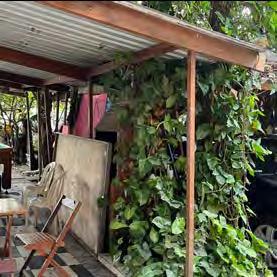
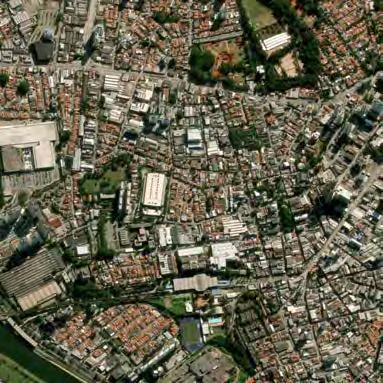
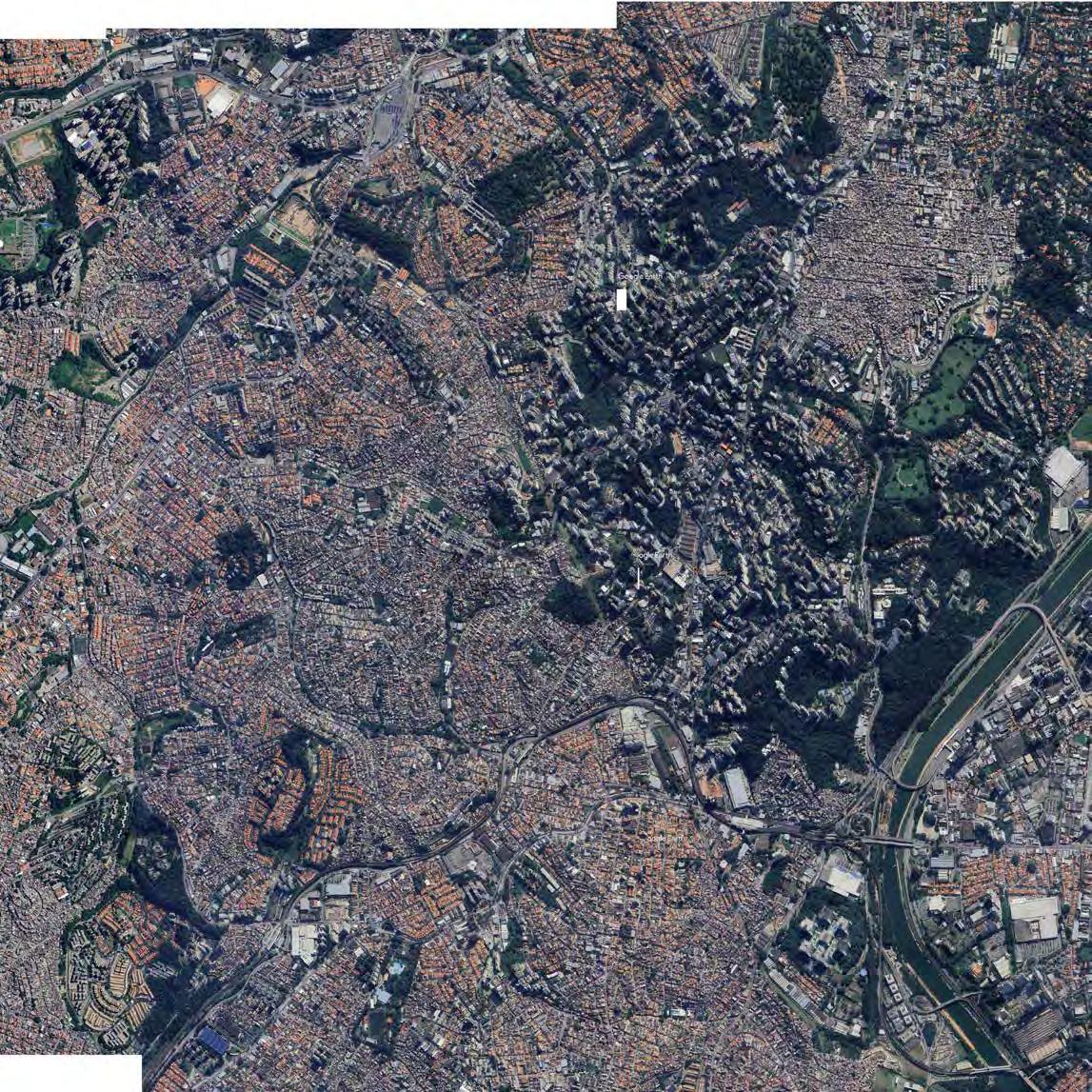
Wanhua District has a high density of old houses. I think the houses that are closer to the house to be changed have the highest availability, which makes the program of simple living possible.
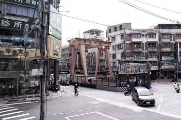
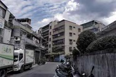
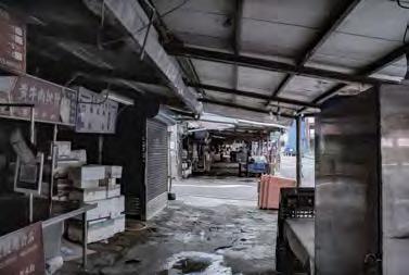
Buildings The Highest Old Houses( >40 year old) Proportion (56.5%) in Taipei City
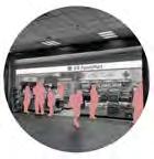
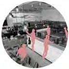
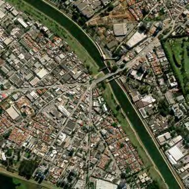
The adjacent market provides public circulation, ample food resources, and dining spaces, with potential for developing shared kitchens and social areas
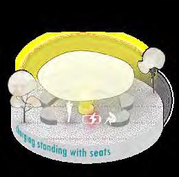
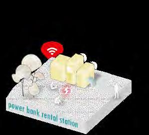
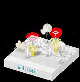
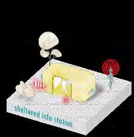
The MRT station includes public restrooms and short-term storage to serve the migrant population. With upgrades, it could be further developed into shared bathhouses and self-storage facilities.

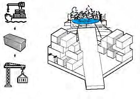
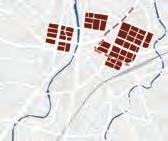
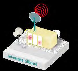
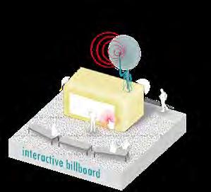
Urban Acupuncture
In order to meet the needs of the North Drifter workers who are constantly entering and leaving the city, the city needs to respond to the changing needs more quickly in order to bring the greatest benefits to the use of the city and space. Through temporary and movable mechanisms, the required living space is constructed according to the needs of the city. Combined with the local infrastructure to provide traffic and the functional core to respond to changes.
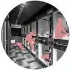
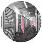
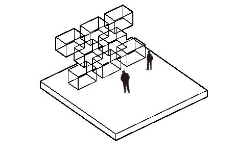
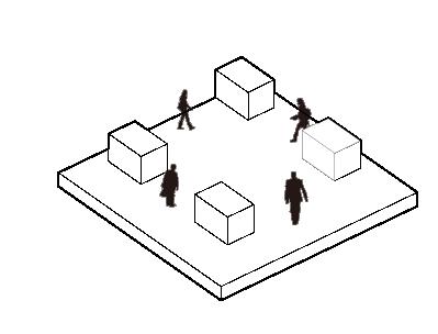
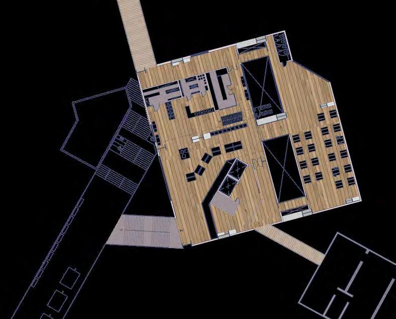
◤ Multi-functional use of residential units to serve different purposes like community space, study room, small gallery, public library...etc.
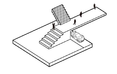
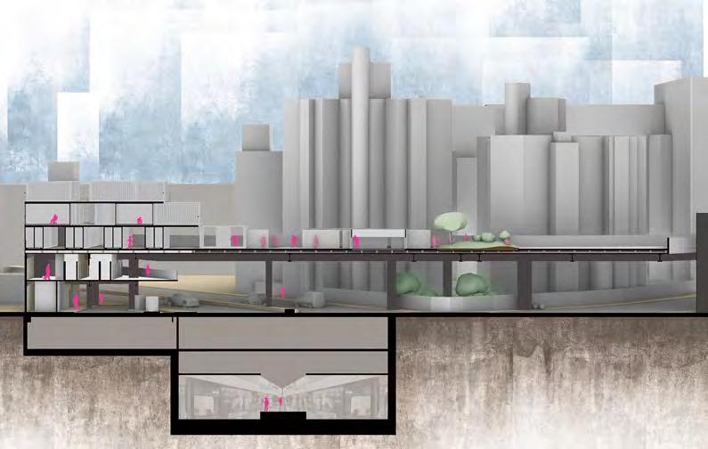
◤ MRT Bathhouse Station
The functions of the bathhouse and self-storage enhance the node significance of the original post station, making it a part of the daily lives of the ethnic groups in Taipei. The original function of the gas station at the entrance of the base is retained and integrated with the MRT station lobby, and a store serving driving needs and users’ supplementary livelihood needs are also included. The upper floor is divided into two systems, self-storage, and a shared bathroom.
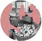
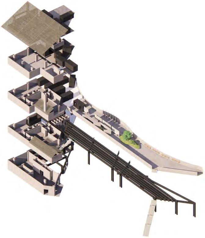
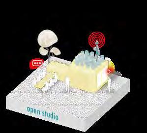
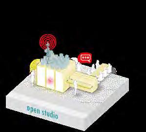
RE-use Restaurant gather the food resources abandoned by the city restaurant, reuse process also be shown to pass the idea and skills of reusing the second-hand food resources.
◢ Food Reuse Center
My proposal utilizes the characteristics of many existing food resources, eating functions, and public circulation, respectively putting them into the shared kitchen, social square, and the program that integrates regional regeneration materials.
Food Regeneration Path make visible the finishing process of renewable resources.
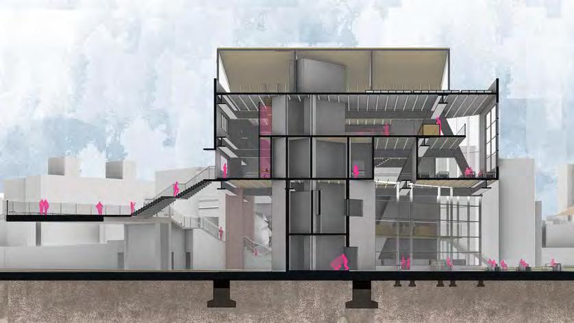
Community Sharing Kitchen people not always have cooking areas at home, this provides them with a better way to reduce the cost of having a kitchen and going out to eat.
Food Bank Self-heating Area With the idea of self-cooking, it is a choice for people to choose the easiest way to heat up their meals.
Sky Walk Route for those who live on the second layer, this is their semi-private route .
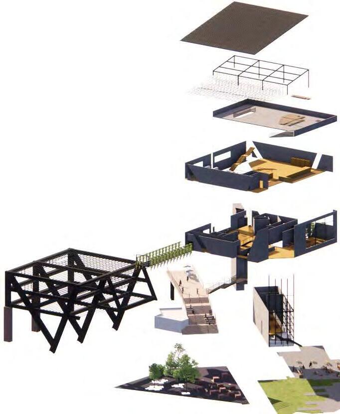
Together Square combine the local cherish activities make people notice sharing food is easy to achieve.
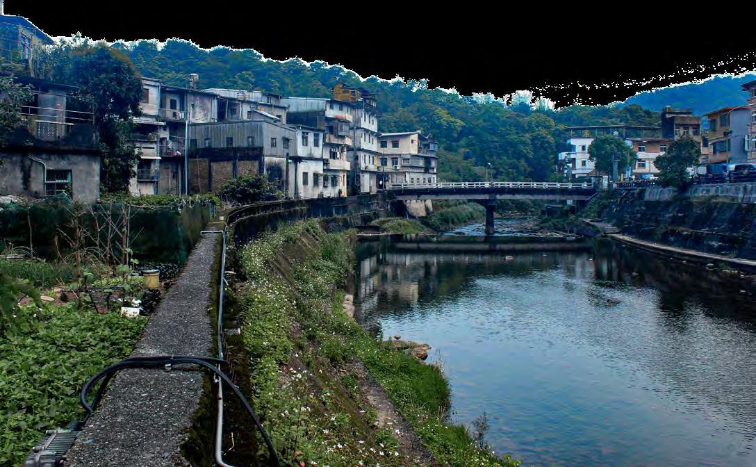
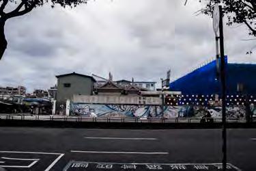
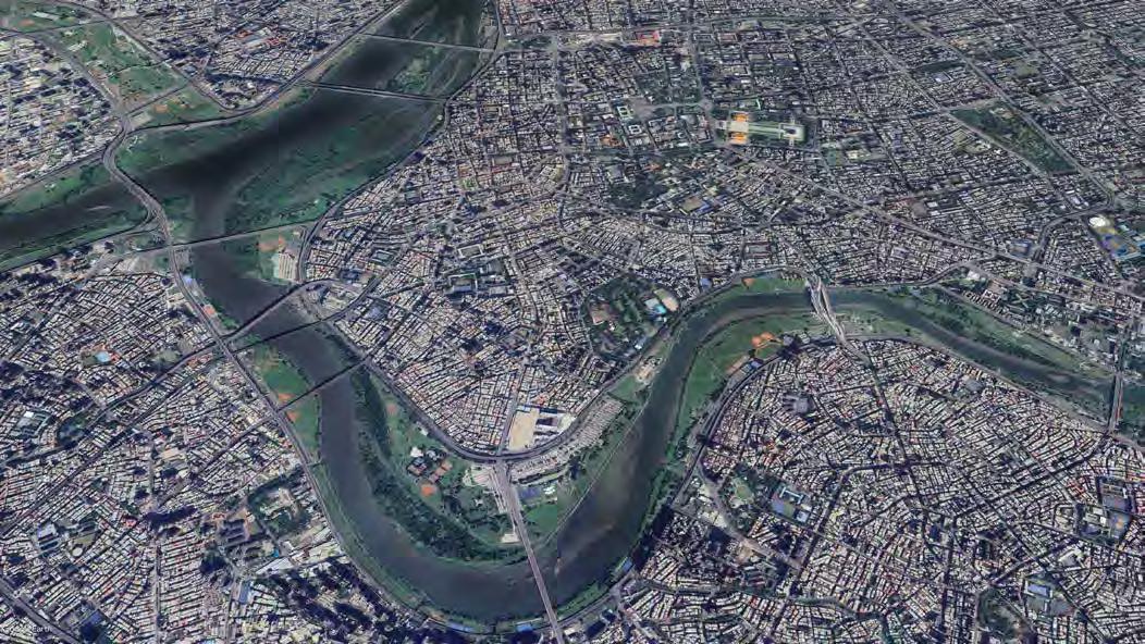
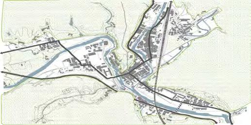
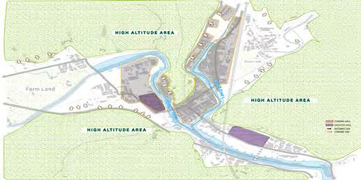
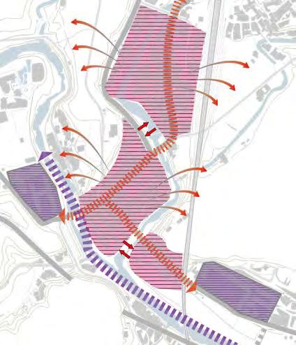
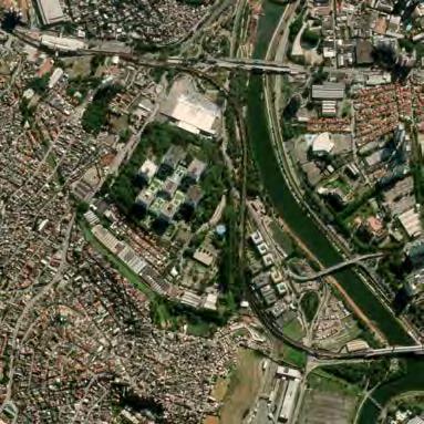
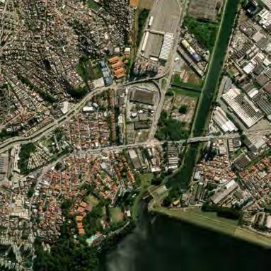
In its heyday, Shuang Xi District flourished thanks to its advantageous river channels and rich mineral veins, evolving into a thriving industrial settlement. Historically, the lives of local residents were deeply entwined with water resources, relying heavily on rainwater for laundry, drinking water, and freight transportation. However, modern infrastructural developments, such as water conservancy pipelines and railway systems, have begun to alter this relationship. As the industry wanes, the district has seen an exodus of young people, leading to a decline in community vitality. Water, once a vital asset, now poses challenges, becoming a barrier that fragments the urban area.
This project aims to align with current urban planning strategies to rethink the integration of natural and urban contexts in Shuangxi District. Through methodical analysis and innovative design, it seeks to rejuvenate the area, offering a fresh urban identity and a cohesive plan that addresses the needs of a community facing industrial decline.
Project Type : Academic
Date : 2020- 2021
Collaborators : none
Studio: Architectural Design Studio VII
Professor:Hsiao Wei Lin, linhw23@cycu.edu.tw, (+886)32656108
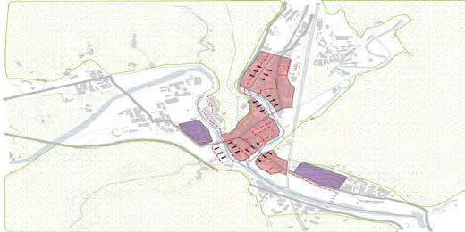
◤ The local culture is deeply rooted in its historical traditions, reflecting a rich heritage that continues to shape the community’s identity.
◥ The SWOT analysis shows strengths in cultural richness and a clean natural environment, with weaknesses like isolation and aging infrastructure. Opportunities include sustainable living, while threats involve floods and emigration.
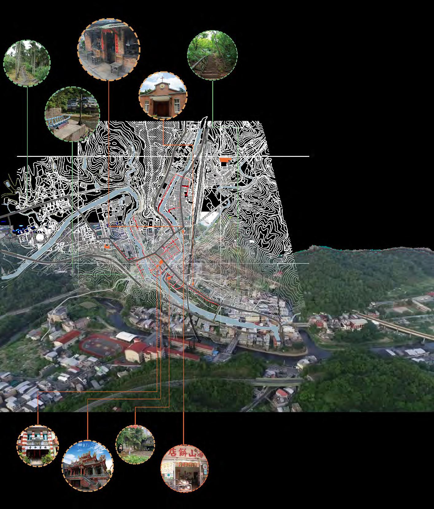
◥ Through a phased strategy that draws on the potential of human-centered design and historical context, this project aims to re-establish a sense of place and local identity. By linking pedestrian pathways, it creates a vital flow within the town, integrating the economic structure of the core area and opening up new possibilities for sustainable development.
Phase 1
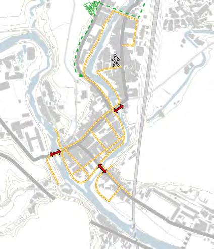
Pedestrian connection
Reconnect river memory Bridge addition and connect
Phase 2
Regional economic integration
Strengthen regional identity
Consolidate resources distribution
Phase 3
Livable district Sustainable Building infrastructure
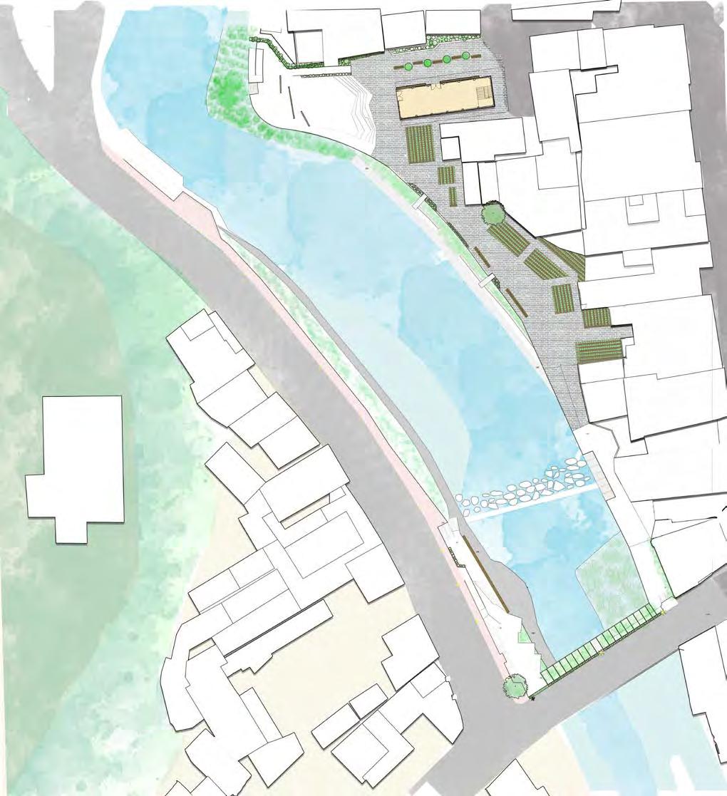
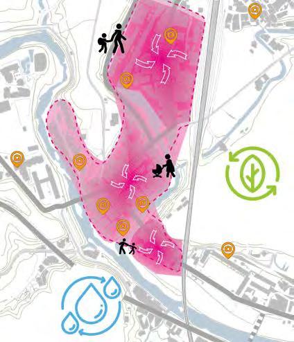
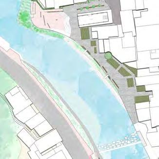
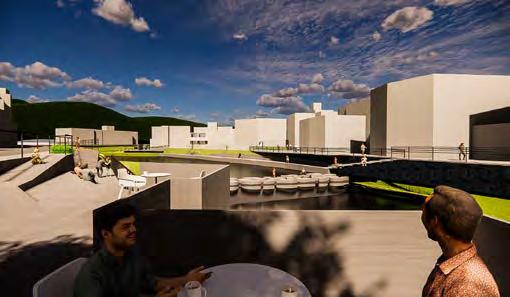
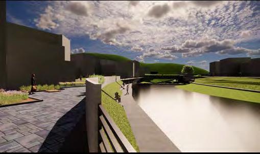
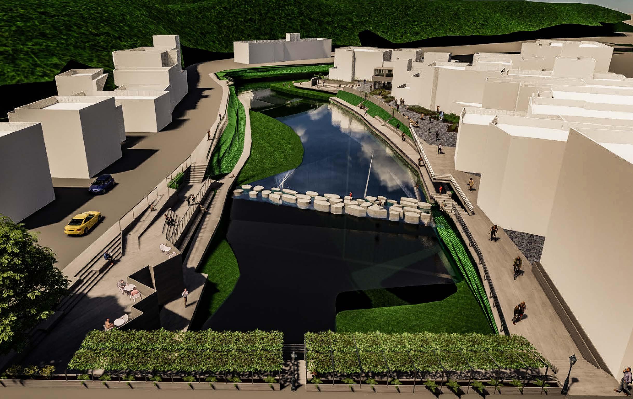
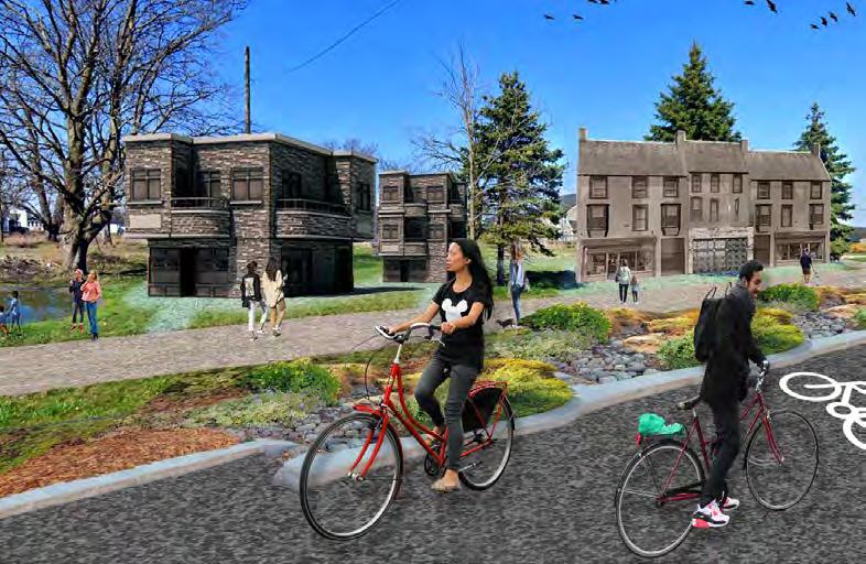
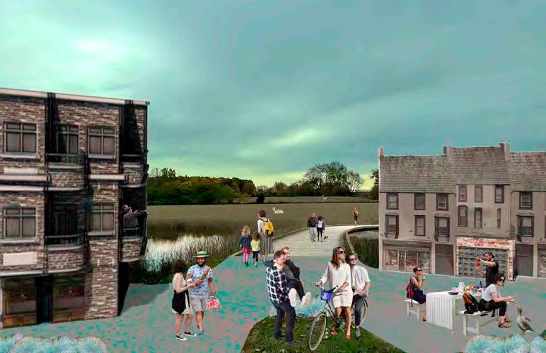
◢ Blending riverside architecture with agriculture, a new spatial experience is created. Utilizing the natural riverside and old breakwater, a public square offers residents activity spaces and closer access to water resources.
◢ By reusing riverside space, a new regional identity for Shuangxi District is formed. Leveraging water source education and agricultural culture, Shuangxi strengthens its unique characteristics as a special zone and clarifies its urban positioning.
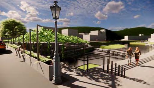
◤ Enhance the bridge’s passage function by integrating a green screen and permeable green barrier, ensuring convenience, accessibility, and mobility for pedestrians across the entire district. Incorporate an accessible slope to provide ease of movement for all users, and utilize a medal structure and the existing old bridge structure for both aesthetic and functional improvements.
◢ Improve the existing breakwater embankment using ecological engineering methods to achieve green water patrolling. Implement 175kg/cm3 concrete and incorporate local river stone to create a resilient and sustainable structure. Develop a stone fish way to support aquatic life and reuse the original irrigation channel to deepen the understanding of the district’s significant agricultural history.
◢ Foster a stronger connection between the river and the local community. Develop a stepping stone walkway that will serve as a versatile, seasonal pedestrian space, offering an interactive pathway for residents and an educational space focused on water source awareness. Enhance the spatial quality of buildings facing the river by integrating new pedestrian passages and dedicated bicycle lanes, ensuring easy and enjoyable access. Additionally, introduce public squares that cater to agricultural education and hiking, providing multi-functional spaces where community members can learn about local agricultural history and enjoy outdoor activities, thereby enriching their engagement with the natural and built environment.
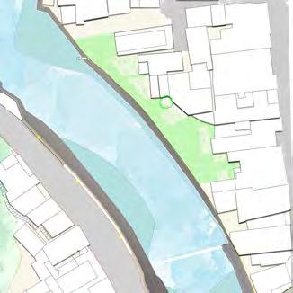
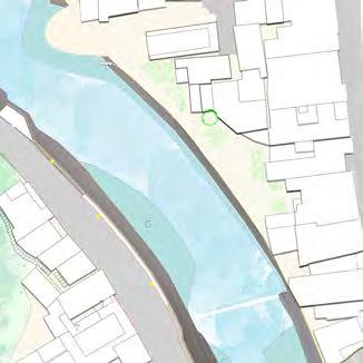
Transit the buildings' riverside texture, make people notice the invisible architectural figures left over from the local culture.
Add new structure to the only bridge linking the old and the new district to improve walkability, decreasing the risk of walking, and increasing the vitality of the community.
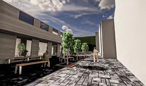
Using the backsides of the buildings near the river to create a new layer for people to walk even for the local stores to run their business in a more suitable and comfortable way.
Reorganize the open space where the locals used to do home farming to create new pedestrian routes and new facade for business needs.
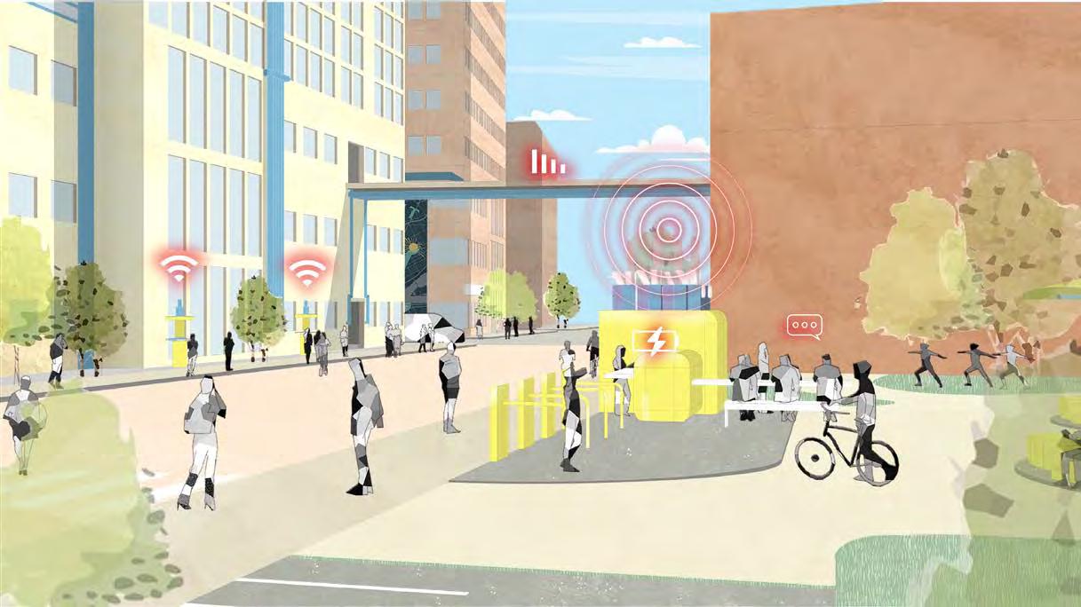
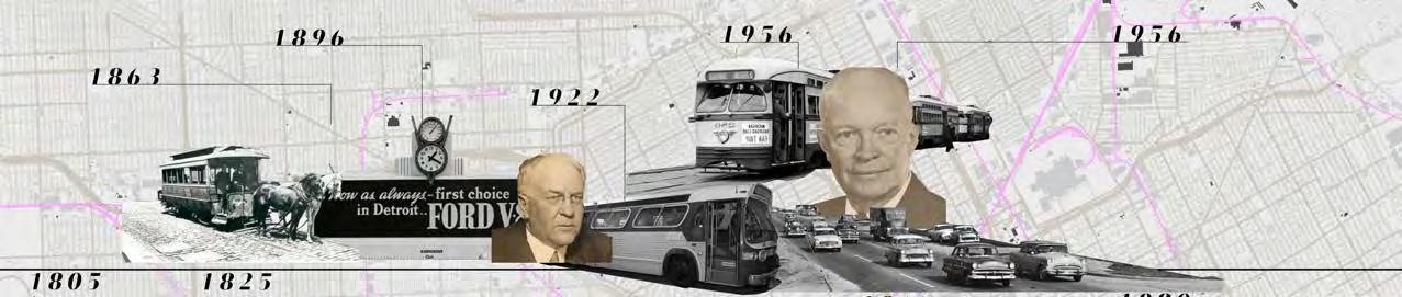
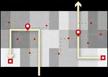
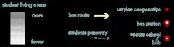
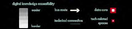
The project addresses Detroit’s daily commuting challenges and the city’s limited access to vehicles and Internet services. By focusing on technology, it aims to systematically transform transit infrastructure, creating a more connected and accessible urban environment. Shifting from a centralized governance model to a decentralized approach, support is distributed across neighborhoods, countering funding shortages and fostering local empowerment. This aligns with the broader vision of improving technology access throughout Detroit.
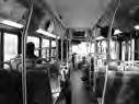
The initiative integrates Wi-Fi-equipped school buses and community hubs re-purposed from abandoned schools. These hubs act as local service cooperatives, offering charging stations, open workspaces, and Wi-Fi access, providing students and communities with essential resources. By connecting transportation, education, and digital infrastructure, the project envisions a resourceful and inclusive city that empowers residents in a rapidly evolving urban landscape.

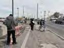
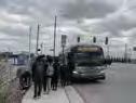
◢ Story of students’ school day in Detroit : 12th-grader Jay Johnson walked toward the bus stop in the Bagley neighborhood, where he boards a Detroit city bus each day for the 11-mile trip to Martin Luther King Jr. Senior High School. At 6:18 a.m., he posted a photo on Instagram, letting his friends know that he was making his way to school. / Pennia Anderson has spent years driving 7 nephews, nieces and grandchildren to charter schools around Detroit.


“It’s 6:30 in the morning, and it’s COLD and the bus passed me,”
“I’M GOING HOME.”


Project Type : Academic
Date : 2024-2025
Collaborators : Jess Chen
Studio : Urban Design Studio II
Professor : Cyrus Peñarroyo, penarc@umich.edu, (+1)734-764-1300


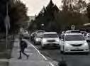

“If something happens to the car, that kid’s not going to school.”
“Who has money for an Uber?”
◢ The ISO view reveals the vision of how the mechanism implemented on the UMCI provide ting public with closer proximity to technology resources.
◢ Two sections show how school bus system go through the whole system provide digital accessibility, the data movement with
beneficial positive impact on the community.

◢ Mechanism combined from three strategies
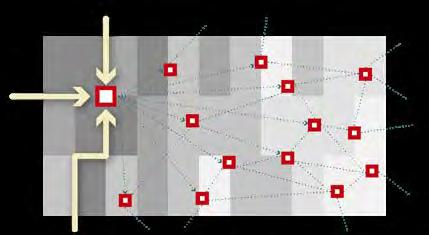
The service cooperative re-purposes abandoned schools as community hubs.
School buses as data mules offer Internet access while traveling across Detroit; to Downtown data commons integrate and redistribute the digital technology resource


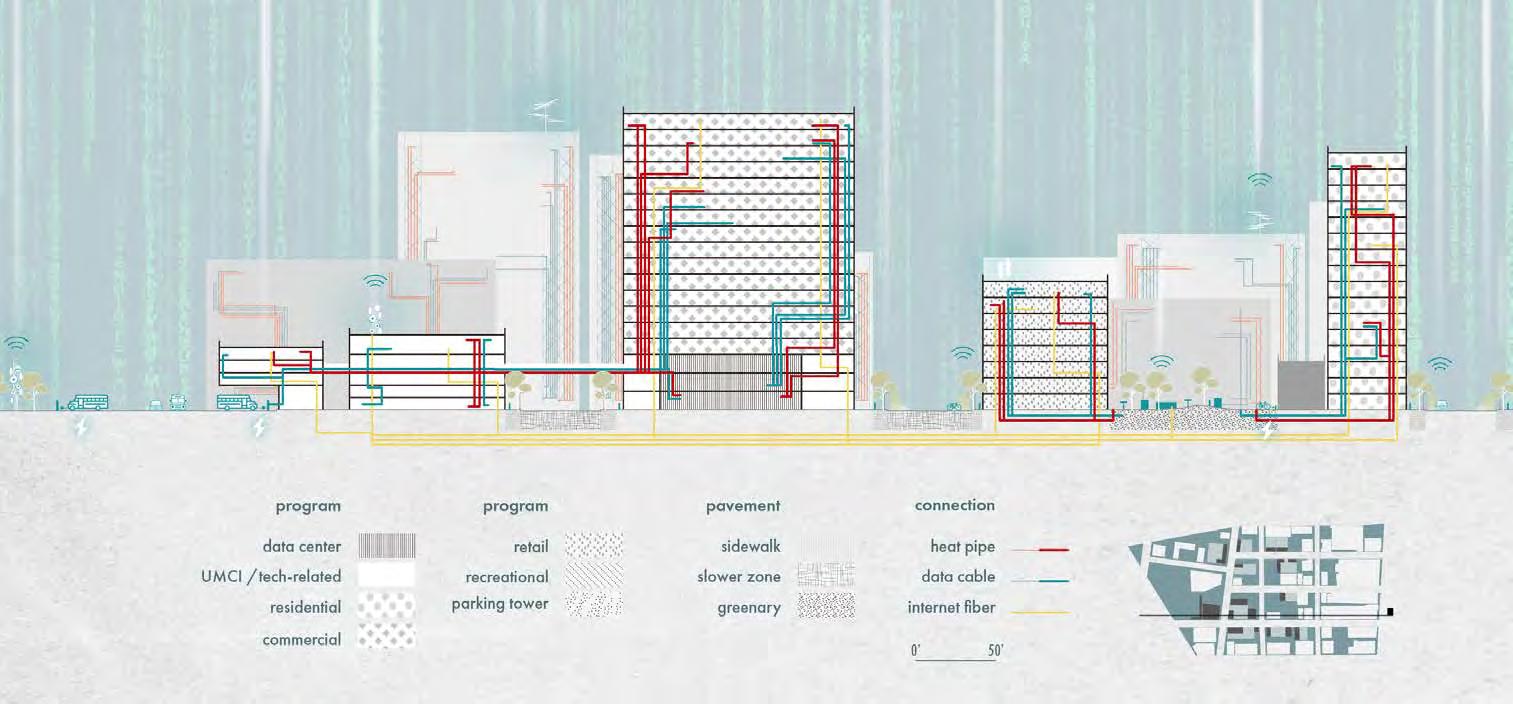


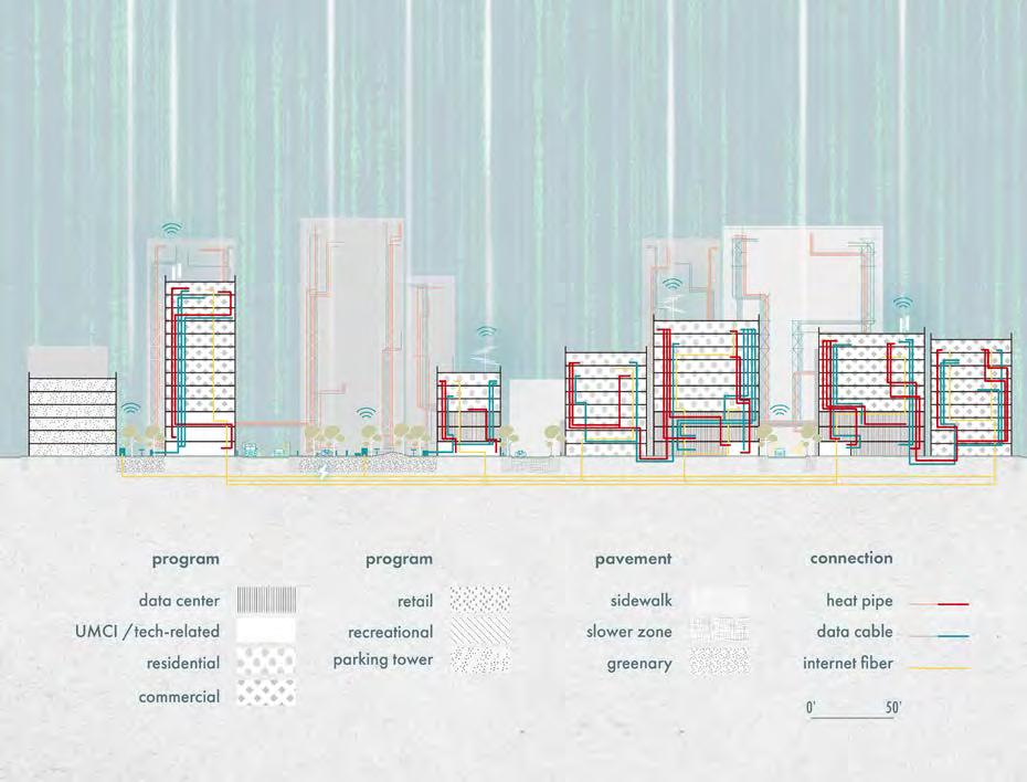
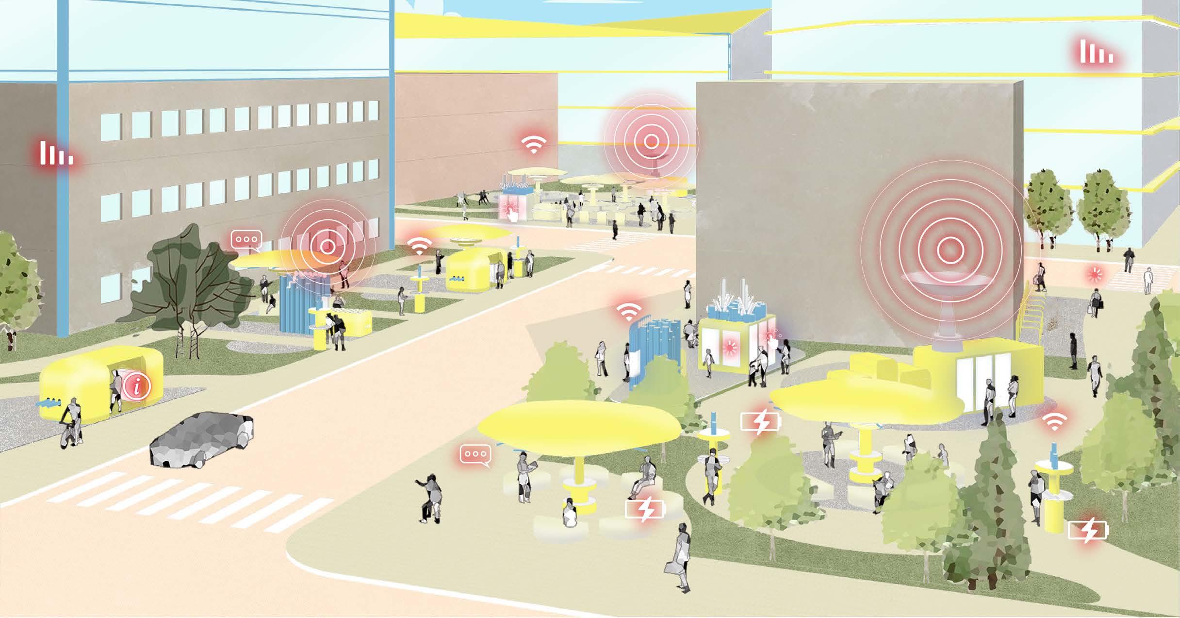
◢ Community data kiosks in downtown Detroit, connecting local residents through shared data, cultural showcases, and tech amenities. These co-owned spaces support data reuse, provide charging stations, and offer shelters, fostering collaboration and accessible high-tech interaction for all.
Redefining Urban Growth via Strategies in Community, Water Mobility
Introduction
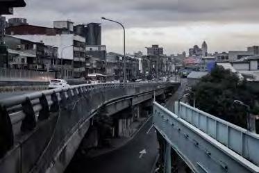
Lyon Township in Oakland County, Michigan, is rapidly expanding, with its population of 23,271 expected to grow as single-family housing development continues. Once a rural area centered around the small town of New Hudson and surrounded by lakes and farmland, Lyon still retains valuable agricultural assets like apple orchards, wineries, and wetlands. The construction of I-96, connecting Lyon to Metro Detroit, catalyzed this development, drawing residents who seek small-town charm with convenient highway access. However, this growth has strained infrastructure, causing traffic congestion as land is sold off for new housing without sufficient infrastructure upgrades.
This project aims to address these issues by redirecting Lyon’s urban development through a justice-centered approach. By comparing alternative growth scenarios, we seek to define a model of urban growth that preserves ecological assets, alleviates infrastructure strain, and supports a sustainable, connected community.


Project Type : Academic
Date : 2024- 2025
Collaborators : Trevor Hibbs
Studio : Urban Design Studio I
Professor : Gabriel Cuéllar, gcuellar@umich.edu
Format :


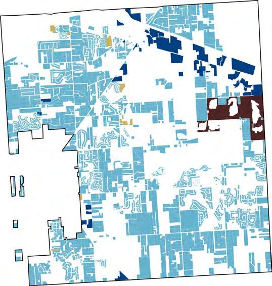
◣ Through research into Lyon’s urbanization, three main issues emerge: future flood risks and inadequate stormwater management; lack of community spaces and local identity with an overreliance on automobiles; and the conflict between land conservation and dense suburban development. To address these, we propose spatial strategies such as communal “hamlets” to reinforce local identity, a conservation zone to protect wetlands, and expanded green corridors to foster connectivity and resilience for sustainable growth.


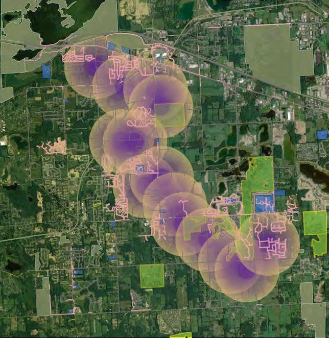


The future development envisions adherence to new zoning protocols, creating a walkable city with interconnected trail systems, a safe living environment, fewer commuting vehicles, and reduced flood risks.
Most importantly, with building codes shaping the town’s character, Lyon Township will attract people who truly wish to settle and thrive as local residents.
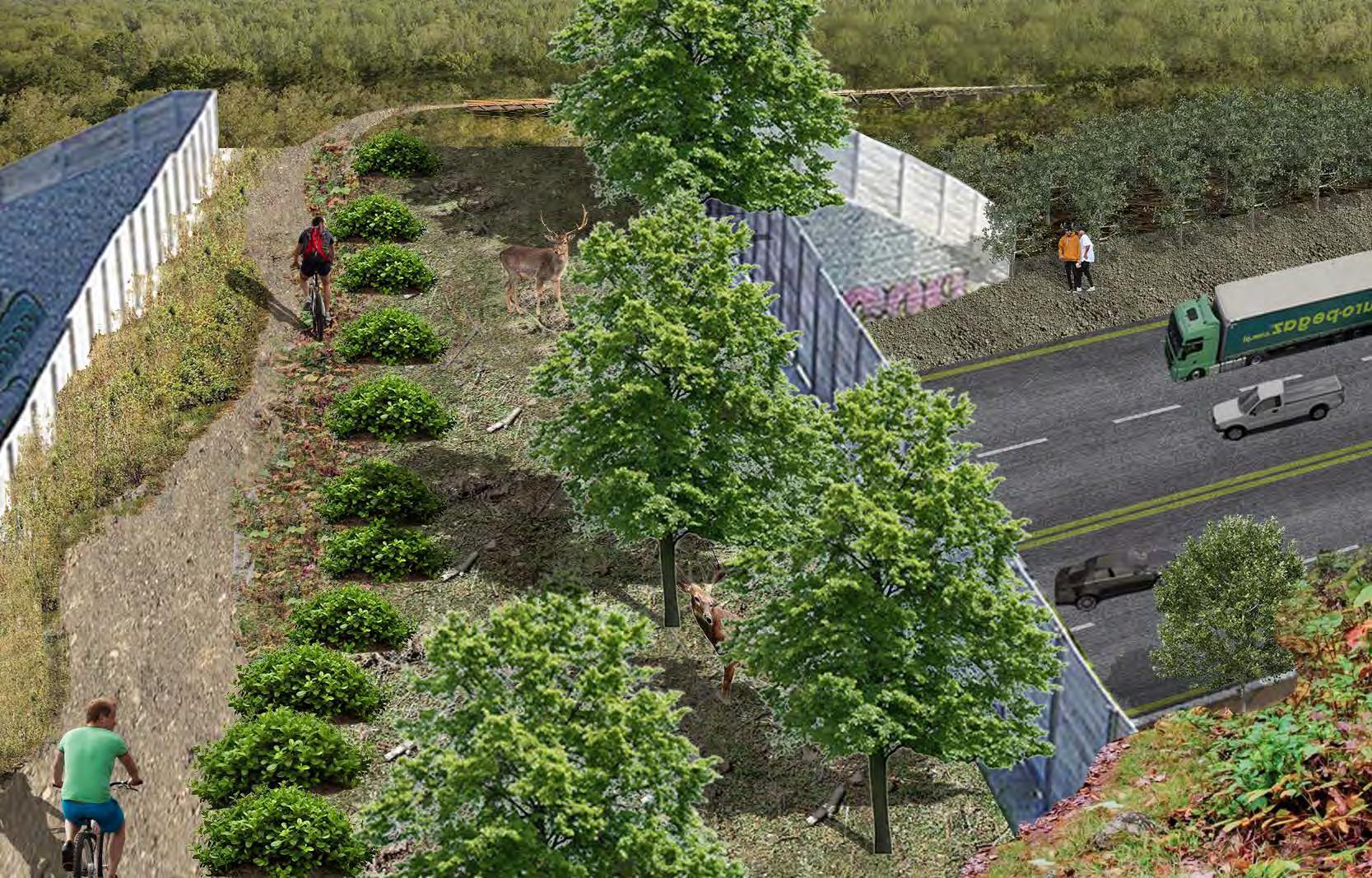
Expanding green infrastructure with accessible biking networks and nature bridges to mitigate the negative impacts of large-scale highway separation.
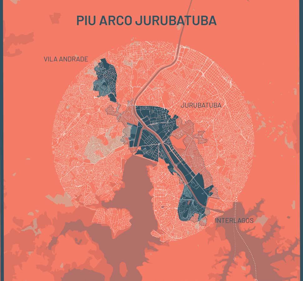
São Paulo Public Cooperation
Introduction
Due to the constrains of being unrecognized by the government, Brazilian people who lives in favelas (illegal settlements) have formed button-up power to secure their right to survive. This public cooperative project aims to represent the official document proposed to help locals understand their situation as well as uniting bigger strength to speak for themselves.
Focus on the upcoming proposal nearby the main station in Jurubatuba, the construction will be about to demolish numerous resident’s homes which is Not on the official document. This project also involved several undocumented meetings with local community, Instagram account of documentary, and booklet with the newest community data.
Project Type : Academic
Date : 2024- 2025
Collaborators : Maria Arquero de Alarco, Tabita Aitonean, Jasmine Paulk, Natalia Boldt, Mariam Reyes-Toidze, Md Ehsan Alam, Chin-Chieh Chen, Stephanie Dutan, Yesha Madhubhai Malaviya, Akshita Mandhyan, Angie Perez, Chun Wang, Aaron Johnson
Studio : Public Design Corporations
Professor : María Arquero de Alarcón, marquero@umich.edu, (+1)617-821-1719
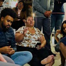
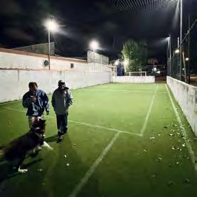
◤ Field photography of communally self-constructed amenities
◥ Representation of missing existing settlements and the government’s proposal for future development.
◢ Turning rational numbers into interactive cards to help community members understand the current situation.
Project Type : Academic
Date : 2023- 2024
Location : Pontiac, MI
Collaborators : Studio: Urban Design Studio II -Technology (Phase two)
Professor : Alina Nazmeeva
Spatial And Technological Counter-Infrastructures
neighborhood REIT+ speculative network: Netless(D. Vasiliev)
Project Type : Academic
Date : 2023- 2024
Location : Central Detroit, MI
Collaborators : none
Studio : Urban Design Studio II -Technology (Phase two)
Professor : Cyrus Peñarroyo, penarc@umich.edu, (734)764-1300
Project Type : Academic
Date : 2020
Location : Zhongli District, Tauyuan City
Collaborators : Wei Yuan Chang, Yung-Ching Chang, Yi-Yu Chung, Shih-Hsin Hung
Professor : Jun Yi Lin, Ya Jun Jiang