12 minute read
TIPS & TECHNIQUES FOR RADI-O
Imagine you are given a map with only the Start and Finish marked. You have to find five unmarked controls and get back within a certain time limit. Your only aid is a portable antenna which will (hopefully) point you in the right direction to each control. But each control only transmits for one minute in every 5-minute period. You have to get a good bearing whilst the control is “ON”, then find it. This is RadiO Orienteering.
Tips and Techniques for RadiO Orienteering
Bruce Paterson, VK3TJN (VIC)
AS I started to write it became increasingly obvious I would have to split this up since there was way too much to cover in one go. Therefore I’ll firstly deal only with something familiar to orienteers - the map.
What is an ARDF Event ?
An Amateur Radio Direction Finding event following championship rules has 5 transmitters (control points) which take turns transmitting, so each transmitter only broadcasts for one-minute in each five-minute cycle. Only the Start triangle and Finish circle are shown on the map and there is a fixed time limit in which to find a certain number of controls (like in a Score event). Time limits of two hours or more are common so often there may be a long way between controls.
Why use a map ?
I’ve been asked “why not just follow the signal from each radio beacon ?”. Well, some competitors do this; they stuff the map in the back pocket and bee-line for the transmitters in turn. Though this technique, with easy terrain, might even get you to the first transmitter faster, your rate doesn’t improve during the event and you most probably end up doing the transmitters in the wrong order. You will do poorly.
The map can be used for navigation around bad terrain (eg. rivers, jungles, ravines), location, remembering bearings, transmitter guesstimation, choosing the control order and getting to the finish quickly.
Location
Knowing where you are on the map, at least approximately, is essential to succeed at Radio Orienteering. Obviously you can’t take advantage of good fast routes to where you think the transmitters might be if you don’t know where you are on the map, but you also cannot draw bearings on the map since you don’t know where they are being taken from. A good coarse navigation ability is essential and normal foot Orienteering events are excellent training for this. Re-location is also important since when very close to a transmitter you sometimes have to sprint to “catch” it whilst it is still transmitting in its one-minute period and it’s very easy to lose contact with the map. When you find a control in foot Orienteering you at least know exactly where you are on the map; not so for Radio Orienteering. Finding the transmitter is no help at all for location.
Bearings
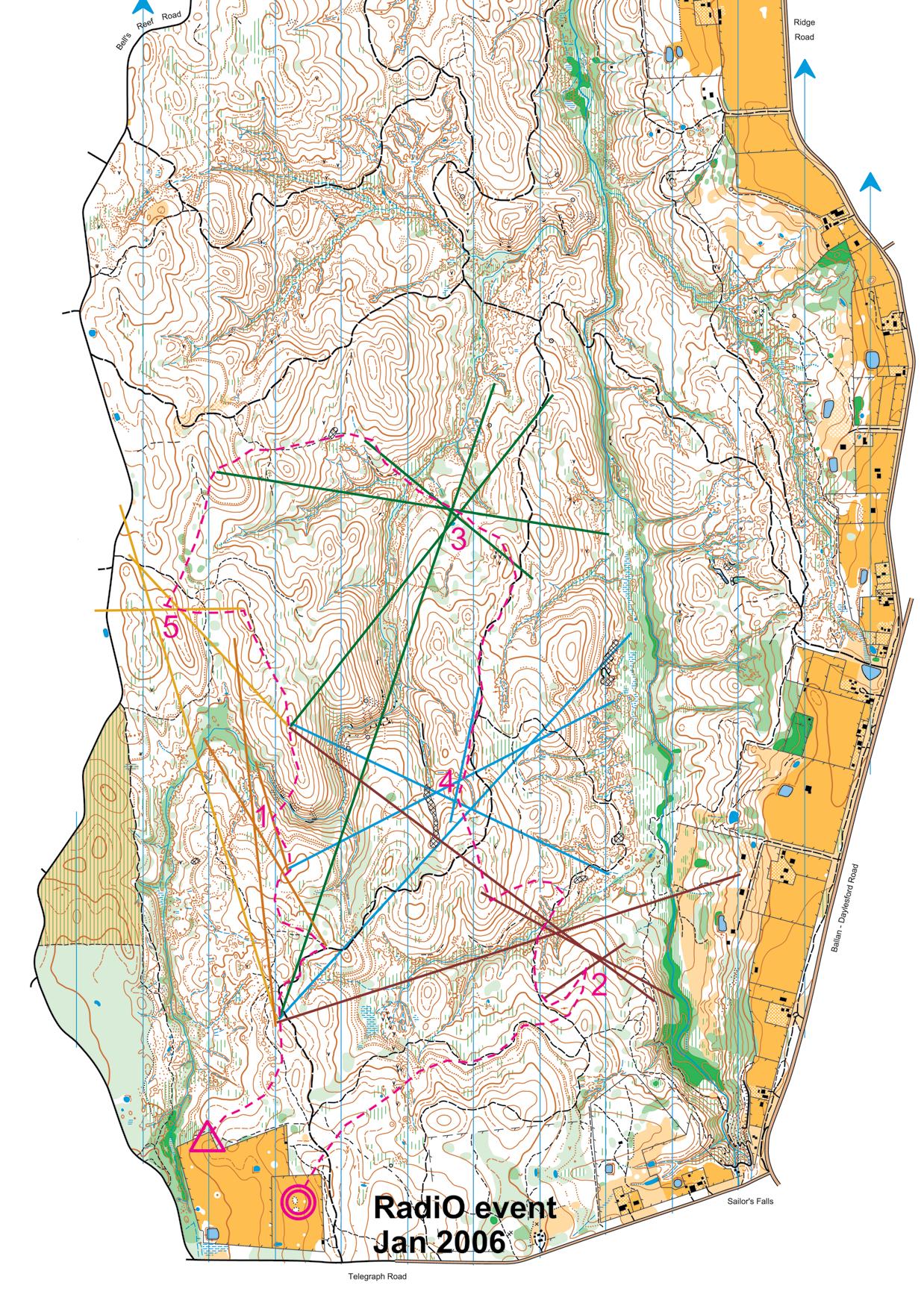
One technique nearly all competitors use is to draw bearings on the map. Bearing lines are drawn from your current position in the direction of a transmitter as determined by peak signal from your radio direction finding gear.
When a number of bearings to one transmitter taken from various points as you travel around the course start to cross near each other (pray they do!), the intersections are your guesstimate of that transmitter’s location. You have to use your compass to relate a bearing from the gear to a bearing on the map.
Originally, I used to sight a plate compass arrow where the antenna pointed, turn the dial to align North, put the plate on the map with the North lines aligned to magnetic North and draw a bearing using the side of the compass from where I figured I was at the time. Luckily there are much faster techniques that are nearly as accurate.
I now affix my compass to the antenna and simply read the degrees where the North arrow points. Note this is not the actual bearing, but the Y-axis reflection (eg. a reading of 350º is a bearing of 10º). I then use an A4 compass rose printed on an overhead transparency showing “reflected” degrees to hand draw a bearing on my map. I merely need to be able to draw a line parallel to the appropriate degrees line on the transparency. Other techniques using a rotatable transparency rose can give even more accurate results (fewer inaccuracies in estimating a parallel line) at the expense of a little more manipulation, but still heaps faster than the original method.
Preparation
Before the event you need to have your map board well prepared. • You need a reasonably hard but light-weight backing behind the map to be able to draw a straight line quickly whilst on the run.
I use 1.5mm clear polycarbonate. • A plastic sheath for the map is a very good idea in case of rain.
Bags are not provided in ARDF due to the huge variation in the way people attach their maps. Time is given at pre-start for you to prepare your map board. I have a thick A4 plastic pocket which will contain the board, the map and the compass rose. • Draw exclusion circles around the start and finish once you get the map. The rules stipulate the distance any transmitter must be from the start and from each other. For championship events the start exclusion is usually 750m and from each other 500m.
Since the finish chute has a homing beacon transmitter you can also draw a 500m radius circle around the finish. Often templates are provided for this at the pre-start, but it’s safest to assume not and have your own. • Have compass rose transparencies pre-printed for both landscape and portrait formats so you can use the appropriate one for the map.
• Chinagraph pencils (from some newsagents) are great for drawing bearings on the plastic sheath. Some competitors have just 1 pencil and write transmitter numbers beside their bearing lines. Others have 5 different colours. I compromise and have 3 coloured pencils bound together. I then use dashed bearing lines for 2 of the 5 transmitters. • I use a velcro patch on the board to hold the triple pencil. Some people tape a pencil to a finger or have piece of string. Others use a special 5-pencil holder on the map board. • Some like to be able to attach their map board to their DF (direction finding) gear, others attach a small rotatable board to their arm. It all comes down to freeing up a hand since the other has to carry the DF gear.
Memory
Bearings aren’t only a means of guesstimating the transmitter locations but they are your memory. In the first 5 minutes each transmitter has been on once and you have (hopefully) 5 bearings. From this you have to determine which transmitter will be your first. Choosing something in the opposite direction to the finish is normally a good strategy. Be flexible and willing to change your order if it seems necessary as you gather more information.
Beware - sometimes bearings can be wrong from your gear (I’ll cover that another time). Another reason bearings can be off is if you weren’t sure where you were when you took them. It’s easy to forget this. It might be worth rubbing some bearings out if you suddenly find yourself somewhere unexpected.
Since each transmitter is off for 4 minutes out of every 5 the better your guesstimate is the more chance you’ll be able to find the control flag when the transmitter is off and not have to wait around precious minutes for it to come back on.
Take particular care with bearings of the transmitter you are going for and the one you plan next, but don’t ignore the others in case some earlier bearings were bad (I have done this to my peril!). You don’t have to draw them all on the map especially if they haven’t changed much. Too many bearings and you can’t see the map anymore!
A Valuable Tool
All the normal foot techniques about navigation, linear features and orientation apply equally in Radio Orienteering. In some cases you have to keep even better track of where you are, rather than going to sleep and waiting for a catching feature, since you might have to take an important bearing on the way.
The map is your tool to do better than the “bee-line” method which can vary so much depending on the terrain. It represents your growing picture of the event, and the better the picture the better your confidence.
In championship events it is paramount you aren’t late back to the Finish, letting down your team. If you find you have to drop transmitters off in order to make it, your map lets you plan.
Without a map it is certainly still a radio direction finding event, but it is not really Orienteering.
Frequently Asked Questions
What’s an ARDF event ?
ARDF stands for Amateur Radio Direction Finding, but the term is often used to refer to a particular style of radio event; the 5 sequenced transmitters conforming to International Rules. Since it’s run like a score event with a fixed time limit, you can take your time and find a couple, or strive competitively for all 5. There are walkers and runners categories offered.
What’s Fox-or-ing ?
A much simpler and easier event to tackle initially. On the map there are control circles, just like Orienteering, but they are bigger (say 100m diameter on the ground), and they need not be centred on the control location. All you know for sure is that the low powered radio transmitter should be able to be heard from within the circle. It combines navigation (to get to the circle in the first place), route choice (in what order do I find the controls?) and radio techniques to find the transmitter control somewhere in the circle. A mini flag with punch is located at the transmitter. It’s basically a scatter-O style of event.
A sniffer? (Do I need to bring my dog?)
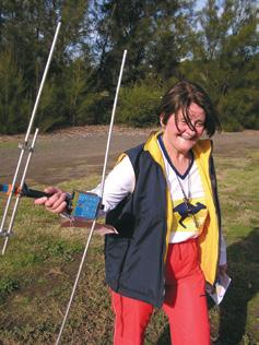
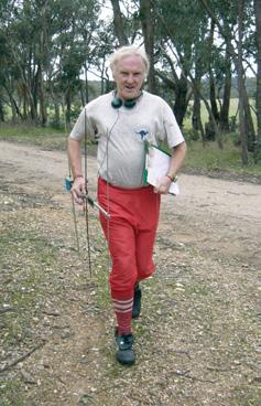
The sniffer is the name of the piece of handheld radio gear you carry on a radio event to work out the direction (bearing) to a transmitter. They are divided into two overall groups: 80metre and 2metre sniffers. The term ‘metre’ refers to the wavelength of the radio band (another way of saying frequency). These two sniffers are for different sets of transmitters and usually only one type is applicable for an event. 2M sniffers look a bit like a TV antenna, and 80m sniffers a small box. Spare sniffers can be borrowed from the ARDF group at events. They will show you how to use one.
Are the radio waves dangerous ?
No. The transmitters use low power levels (under 2 Watts).
How is this Orienteering ? (Don’t you just follow a radio signal ?)
In practice taking a bee-line between transmitters is very cumbersome and slow, and you never know where you are. The Orienteering skills become essential to know exactly where you are, plan how you’re going to get to where you think you want to go and most importantly let you triangulate the transmitter locations
Look I can’t even set a digital watch ! How have I got any hope with all this techy equipment ?
The sniffers really are quite easy to master the operational aspects, and we’re not going to insist you take them apart and reassemble them in the forest.
Why do people carry around cumbersome map boards ? I’ve never needed those before in Orienteering.
They allow you to draw lines (bearings) on your map, or better, on a plastic sheath over the map. Chinagraph pencils are excellent for this.
Why a plate compass ? Isn’t that a backwards step ?
The thumb compass is a great way to quickly follow a direction on a map, but if you need to plot a bearing-off line from where you are heading currently a fair bit of guesstimation is required. A plate compass with its degrees markings can actually be better for RadiO events.
It still sounds all very complicated. Can someone show me ?
Yes! Don’t be afraid to ask any RadiO people at the event. Make sure they know you haven’t tried before and we’ll get someone to go with you all the way to a control. This is the best way to get the hang of it.
Why do this Radio Orienteering ?
Those orienteers who helped out or even competed at the International Asia-Pacific Championships held near Ballarat in 2004 can attest to the enthusiasm and dedication of the overseas competitors. Also, since RadiO is only just beginning in Australia, your chances of competing on the Australian team are far higher than in bush Orienteering. Maybe you’re looking for an extra challenge ?
Someone mentioned radio foxhunting? Is that the same thing ?
Some Europeans do refer to ARDF as foxhunting (the fox is the transmitter, not a furry animal). In Australia we use ‘foxhunting’ to refer to another ‘sport’ involving teams of people in cars and hidden radio transmitters. Many radio orienteers have done or do radio foxhunting as well.
So what now ?
Look for a RadiO event held in conjunction with a regular event. If you want to do both you can (maybe pick the short bush course to give you time and left over energy). Radio Orienteering is only established in Victoria so far, but we’d be very happy to hear from interested people in other States. More details about Radio Orienteering and events can be found on: http://www.ardf.org.au
Redrawn map “Sailors Creek” showing route taken and bearings to transmitters



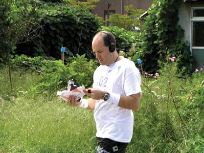
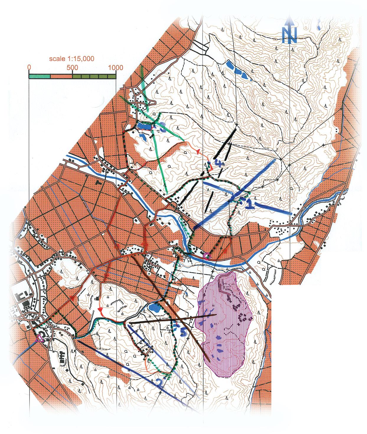
The real thing - Adam Scammell’s map from the Asia-Pacific Region 3 Championships held in Japan. The reddish areas are rice paddies.

