Assembly Adopted February 12, 2013 AO 2013-12 ANCHORAGE ORIGINAL NEIGHBORHOODS hISTORIC pRESERVATION pLAN
The Historic Preservation Plan for Anchorage’s Four Original Neighborhoods was adopted on February 12, 2013 by the Anchorage Assembly in a unanimous vote - Ordinance AO No. 2013-12, Anchorage, Alaska; amending Anchorage Municipal Code section 21.01.080B.1, Table 21.01.1: Comprehensive Plan Elements.
Table of con T en T s
I.
VII.
III. Historic State Historic State Historic Municipal
IV.
iadopted 2/12/2013 AO 2013-12
e xecutive s ummary ...................................................... 1 II. Introducti on .............................................................. 19 Purpose of the HPP 20 Plan Area Boundaries ....................................................................................... 22 Public Participation 23 HPP Methodology and Organization 25 Using the Plan ................................................................................................. 26 List of Acronyms And Abbreviations 29
Hi storic Preservation In a nchorage Today ...................... 31 Federal
Preservation Laws 32 Alaska
Preservation Office 38 Alaska
Preservation Laws .......................................................... 41 Preservation & Alaska Native Peoples 43 Municipality of Anchorage Preservation Programs .......................................... 45 Anchorage
Code .............................................................................. 49 Anchorage Preservation Organizations 52
Past a nd c urrent Planning In a nchorage ........................ 55 Anchorage 2020: Anchorage Bowl Comprehensive Plan...................................56 Anchorage Downtown Comprehensive Plan (2007) 59 Other Plans and Documents 62 V. Hi storic c ontext & s urveys .......................................... 65 Alaska Native Peoples History 66 History of Anchorage 72 Consolidated Historic Resources Inventory ...................................................... 81 VI. Preservation Vi sion, Goals & Policies ............................ 97 1. Quality Of Life / Livability 101 2. Landmarks To Save ..................................................................................... 107 3. Interpreting History & Culture 116 4. Community & Partnerships 127 5. Growth & Change ........................................................................................ 133 6. Economic Development 138 7. Procedures & Regulations 147
n ei ghborhood c haracter, Goals & Policies ................... 161 Ship Creek ...................................................................................................... 163 Government Hill 169 Downtown 181 South Addition .............................................................................................. 192 Fairview 205 VIII. Implementation Plan ................................................. 219 How to Implement the Plan ........................................................................... 220 Implementation Matrix .................................................................................. 222 IX. c ase s tudies ............................................................. 247 X. e ndnotes .................................................................. 265 Endnotes 265 Image Credits ................................................................................................ 269 XI. a ppendices ............................................................... 273 A. Federal Historic Preservation Laws 274 B. Alaska Historic Preservation Act..............................................................275 C. Alaska Historical District Revolving Loan Fund 279 D. Anchorage Historic Preservation Commission 281 E. Anchorage Comprehensive Plan (21.05.030) .......................................... 283 F. Anchorage Historic Preservation Fund 286 G. Anchorage 2020: Relevant Policies 287 H. Anchorage 2020: Relevant Implementation Strategies .......................... 288 I. Anchorage 2020: Relevant Planning Principles 290 J. Downtown Comprehensive Plan: Existing Conditions Analysis 291 K. Downtown Comprehensive Plan: Relevant Policy Objectives ................. 293 L. Partners For Preservation 294 M. Additional Neighborhood Plan Policies 296 N. National Register Historic District Approval Process .............................. 299 O. Acknowledgements 303
Historic Preservation Plan for a nc H orage ’s f our o riginal n eig H bo r H oo ds ii adopted 2/12/2013 AO 2013-012
EXECUTIVE SUMMARY
As Anchorage approaches its centennial in 2015, the city has been presented with a valuable opportunity to celebrate its history. Both the built environment of its oldest neighborhoods and its intangible cultural heritage offer the chance to plan for responsible, sustainable development in the future.
This Historic Preservation Plan for Anchorage’s Four Original Neighborhoods provides a chance to explore new ideas and creative solutions for the preservation of each neighborhood’s unique character.
The recommendations contained within this plan are based on a broad definition of historic preservation that goes beyond just bricks and mortar. Preservation and quality of life issues are inextricably linked, which is why the plan includes strategies related to improving walkability, fostering a healthy local economy, and telling stories about our heritage.
CHAPTER I: EXECUTIVE SUMMARY ADOPTED 2/12/2013 AO 2013-12 1
HPP OBJECTIVE #1 –HISTORIC PRESERVATION
To identify and address the preservation and management of historic resources in Anchorage’s Four Original Neighborhoods.
To provide guidance for future mitigation to impacts to historic resources and landscapes identified during completion of the Historic Preservation Plan (HPP).
Purpose of the Plan
HPP OBJECTIVE #2 –IDENTIFICATION OF KNIK ARM CROSSING PROJECT IMPACTS
To address the impacts to historic and cultural resources from the design, construction, and operation of the Knik Arm Crossing project (KAC). The KAC will introduce physical/built, visual, atmospheric, and audio impacts through right-of-way alignments and significantly increased traffic volumes.
To provide additional information not included in the Government Hill Neighborhood Plan.
The Historic Preservation Plan (HPP) for Anchorage’s Four Original Neighborhoods is a communitybased plan focused on preserving historic character while planning for a sustainable future in Anchorage’s original neighborhoods. The plan area includes the Government Hill, Downtown, South Addition, and Fairview Community Council areas. Because its borders include three of the four neighborhoods, the Ship Creek area is also included in the HPP.
The purpose of the HPP is to address the preservation and management of historic resources, enhance local preservation values, and provide guidance for future impacts to historic resources and landscape features in Anchorage’s Four Original Neighborhoods. The HPP is meant to be used with existing neighborhood and Municipality planning documents, and will be adopted as an element of the Municipality’s Comprehensive Plan. The HPP is specific to the plan area, and provides recommendations that are relevant to the entire plan area as well as to each of the four neighborhoods. Information in the HPP can be used to influence and inform the planning and design of future development projects and of individual buildings—including public infrastructure such as transportation, trails, and parks—to ensure the protection of neighborhood character and values that the citizens of Anchorage have expressed.
The plan is intended to meet two primary objectives: (1) Identification and preservation of historic character and important historic resources of Anchorage’s Four Original Neighborhoods; and (2) identification of Knik Arm Crossing Bridge Project impacts to Anchorage’s Four Original Neighborhoods, as well as the direct and indirect costs of these impacts to the Municipality of Anchorage, private businesses, property owners, and residents (see sidebar).
HISTORIC PRESERVATION PLAN FOR ANCHORAGE’S FOUR ORIGINAL NEIGHBORHOODS ADOPTED 2/12/2013 AO 2013-0122
Preservation in Anchorage Today
Historic preservation is not new to the Municipality of Anchorage. In fact, the Municipality has been actively supporting historic preservation activities, such as the survey and documentation of historic resources, since the late 1970s and early 1980s. Many in the Anchorage community have continued these practices in the Four Original Neighborhoods by restoring private residences and opening significant historic sites to the public, such as the Oscar Anderson House and the Pioneer Schoolhouse.
The HPP promotes these established preservation values, and therefore the plan begins with a review of the current local historic preservation programs and tools in Anchorage. In 1995, the Municipality of Anchorage became a Certified Local Government (CLG), which means that it partnered with the State Historic Preservation Office and the National Park Service to promote grassroots historic preservation. The Anchorage Historic Preservation Commission (AHPC) was formed in January 2007 to support the goals of the CLG. Since that time, the AHPC has partnered with groups such as Alaska Association for Historic Preservation, Anchorage Woman’s Club, and the Cook Inlet Historical Society, among others, on preservation projects in the Four Original Neighborhoods.
The Municipality currently utilizes historic resource surveys and context statements to gather information about its heritage. Surveys are essential because they form the foundation of a city’s preservation program: identifying and discovering significant buildings and landscapes allows residents and planners to fully incorporate these resources and values into planning and development decisions. Prior architectural surveys and studies conducted in the Four Original Neighborhoods have all been conducted using a variety of different methods, which has led to some inconsistencies in the results. These surveys are summarized in the HPP, and are on file at the Municipality of Anchorage Planning Department or the Alaska State Historic Preservation Office.
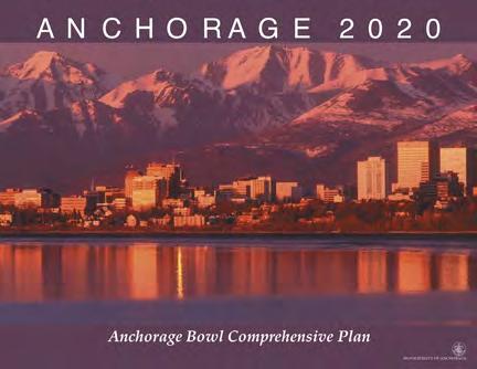
Education about historic preservation incentive programs at the federal, state, and local levels would increase utilization of these programs in Anchorage. Incentives already administered by the National Park Service and the Alaska State Historic Preservation Office include Federal Rehabilitation Tax Credits, Alaska Historical District Revolving Loan Fund, New Markets Tax Credits, low-income housing tax credits, and energy credits. Implementation of strategies in Anchorage 2020: Anchorage Bowl Comprehensive Plan—many of which are powerful preservation tools—would also establish local preservation incentives.
The HPP promotes the established preservation values in the Municipality of Anchorage.

CHAPTER I: EXECUTIVE SUMMARY ADOPTED 2/12/2013 AO 2013-12 3
REFERENCES TO OTHER PLANS
AMC 21.05.03 (Title 21) Comprehensive Plan elements
AMC_4.60.030 (AHPC)
E.4: Formulate a Historic Preservation Plan, and submit to the assembly, mayor, and planning and zoning commission for incorporation into the 2020 Comprehensive Plan.
Anchorage 2020: Anchorage Bowl Comprehensive Plan
Conserve Anchorage’s heritage of historic buildings and sites.
Policy 51: The Municipality shall define Anchorage’s historic buildings and sites and develop a conservation strategy. Functional Plan (Historic Preservation Plan).
HPP and Title 21
The nomination of historic districts and historic architectural standards will be addressed in the future after Title 21 adoption. Nomination of properties and architectural standards will include public involvement, property-owner support, and municipal review and approval.
HPP and Anchorage 2020
Policy #51 of Anchorage 2020 states, “The Municipality shall define Anchorage’s historic buildings and sites and develop a conservation strategy.” The strategy to implement Policy #51 is the development of a Functional Plan specifically noted as a Historic Preservation Plan. Functional Plans study and recommend future needs for specific public facilities and services. Examples of other functional plans: Areawide Trails Plan; Long‐Range Transportation Plan; and the Anchorage Park, Natural Resource, and Recreation Facility Plan. The HPP recommendations for public facilities, including municipal owned historic buildings, trails, and services, are consistent with Anchorage 2020.
HISTORIC PRESERVATION PLAN FOR ANCHORAGE’S FOUR ORIGINAL NEIGHBORHOODS ADOPTED 2/12/2013 AO 2013-0124
Summary of Principal Recommendations
The principal recommendations in the HPP include projects, programs, and strategies that will preserve neighborhood character; maintain and/or increase trails and walking access; incorporate elements of our important history through a variety of interpretive elements; provide guidance to the Anchorage Historic Preservation Commission, Community Councils, the Planning and Zoning Commission and the Assembly in land use and historic preservation decisions; and identify strategies for the mitigation of large infrastructure projects. These include:
à Walking, Biking and Trail Projects;

à Historic Property and Building Preservation;
à Telling Our Stories through Interpretation Projects;
à Identification of Historic Resources for Mitigation of Transportation Impacts;
à Nomination of Properties and Districts to the National Register; and
à Historic Preservation Funding.
Walking and Biking
Anchorage was established in 1915. At that time, the Alaska Engineering Commission (AEC) started construction of the Alaska Railroad and the 13 AEC cottages built on what became Government Hill. The first auction and platting of downtown Anchorage also occurred in 1915. This came after the establishment of the AEC offices in Ship Creek in 1914. Motorized vehicles were nonexistent in Anchorage. People walked or rode their bicycles as trail and road conditions allowed. Anchorage was a town of walkers for many years. This history and culture of walking has carried through to present day. Anchorage is world renowned for its year round trail system. Many recommended implementation items in the HPP support this culture of walkability and trail access.
Walkability, bikeability, and easy access to the Tony Knowles Coastal Trail are among the characteristics valued most highly by residents of the Four Original Neighborhoods.
CHAPTER I: EXECUTIVE SUMMARY ADOPTED 2/12/2013 AO 2013-12 5
Historic Properties and Buildings
Anchorage has significant prehistory and historical resources. Many properties and locations remain today from our forefathers. There are still people alive today that can relate stories of these special places and their early history. This includes Athabascan fishing and camping sites, and National Register buildings located in the Four Original Neighborhoods. Many implementation items in the HPP encourage the preservation of these buildings and locations.
Telling Our Stories
Interpretive planning and project implementation is a cost effective, inclusive way to engage many sectors of our community. Interpretive projects relate important history and culture in a descriptive and succinct way to a variety of audiences including our residents and many visitors. Heritage tourism is one of the fastest growing sectors in the tourism market. The Municipality has a unique opportunity to share its colorful and varied heritage through the many interpretive projects identified in the HPP.
Mitigation of Large Public Infrastructure Projects
We have learned through the Knik Arm Crossing project process that the Municipality lacked important information regarding our historic resources. It is important for the Municipality to be proactive now and through future planning processes to secure the appropriate mitigation elements that will keep our community whole and prosperous. The HPP discusses hundreds of historic and contributing historic properties that could be eligible for nomination to the National Register individually or as a historic district. Many implementation items within the HPP support the nomination of these historic properties and proposed districts.
The 4th Avenue Theatre and quintessential Alaskan building types such as log cabins are already listed in the National Register of Historic Places.
HISTORIC PRESERVATION PLAN FOR ANCHORAGE’S FOUR ORIGINAL NEIGHBORHOODS ADOPTED 2/12/2013 AO 2013-0126
Creation of Historic Districts for Nomination to the National Register
Nomination of historic properties and/or districts encompasses a lengthy nomination process and must be supported by the Alaska State Historic Preservation Office, and the Anchorage Historic Preservation Commission. In the case of historic districts, the Anchorage Planning and Zoning Commission and Anchorage Assembly will also approve the creation of historic districts, should the district wish to include architectural standards. This plan, in and of itself, does not establish such districts.
Historic Preservation Funding

Funding for historic preservation is available through a variety of programs including grants, endowments, and federal tax incentives. The Anchorage Historic Preservation Commission (AHPC) oversees the Municipality’s historic preservation fund. The AHPC uses this funding to match and leverage preservation projects. Many national and local endowment funds look upon funding requests more favorably when the project is identified in an approved Plan. It sends the message that the community has prioritized the project as an important community effort. Staff will continue seeking grants, legislative support, foundation, and other funding for projects identified in the implementation matrix. Many of these public projects will contribute to the Anchorage 2015 Centennial celebration and are already included in discussions with the Anchorage 2015 Centennial planning team initiated by the Anchorage Mayor in September 2012. The HPP may also provide the basis and justification for funding for mitigation requirements derived from the Knik Arm Crossing project design. Within the last three years the AHPC has been successful in receiving over $100,000 for historic preservation projects.
Historic preservation and economic development are not mutually exclusive goals, and the HPP includes recommendations for how preservation can support healthy economic growth, not simply freeze buildings as they stand today.
CHAPTER I: EXECUTIVE SUMMARY ADOPTED 2/12/2013 AO 2013-12 7
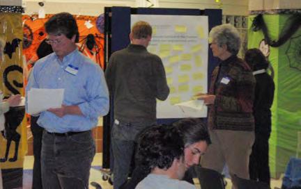
Public workshops informed the policies and implementation strategies of the HPP.
Creating the Vision
The principal recommendations described previously are based on the seven primary goals that apply to all neighborhoods and compose the vision for preservation in Anchorage’s Four Original Neighborhoods (see sidebar). This vision is the heart of the HPP, and was compiled based on extensive input from the community and “best practices” from other cities.
Public participation was critical to the development and coordination of the HPP and will be essential to its implementation. Public comment was solicited through public workshops and focus groups in addition to online surveys and social media, yielding nearly 1,000 public comments. Additionally, a Technical Advisory Committee composed of key local stakeholders guided and reviewed the progress of the HPP. This outreach ensured that the content of the HPP was driven by Anchorage residents and was created specifically for the neighborhoods.
The HPP was also guided by “best” preservation practices developed and tested in other communities. Anchorage can learn from cities with established, neighborhood-focused historic preservation programs how to leverage funding sources to finance preservation projects, build on their heritage to create opportunities in tourism and business, take advantage of preservation incentives to revitalize disadvantaged neighborhoods, adapt iconic old buildings for new uses, and educate the community about its history. Sidebars and notes throughout the HPP highlight how other cities have tackled the same issues facing Anchorage.
HISTORIC PRESERVATION PLAN FOR ANCHORAGE’S FOUR ORIGINAL NEIGHBORHOODS ADOPTED 2/12/2013 AO 2013-0128
HISTORIC PRESERVATION PLAN VISION
1. Quality of Life/Livability: Preserve and improve the characteristics that make the plan area an enjoyable place to live, especially its walkability, open space, historic street grid, and sense of neighborhood identity.
2. Landmarks to Save: Preserve characterdefining features of the plan area, which includes physical landmarks as well as stories, people, landscapes, and events.
3. Interpreting History & Culture: Tell stories and raise public awareness about the plan area’s history, including the cultures and traditions of Alaska Native Peoples.
4. Community & Partnerships: Engage the community to participate in preservation activities and foster partnerships that will support historic preservation.
5. Growth & Change: Manage growth and change to historic neighborhood elements and character through development and implementation of the Municipality-Wide Historic Preservation Plan, the HPP, and Neighborhood and District plans. Adopt relevant policies, regulations, and best practices that will support and reinforce historic character and historic preservation goals, and that will aid in avoiding transportation, infill, redevelopment, or other large infrastructure projects that do not support neighborhood character.
6. Economic Development: Provide incentives for historic preservation while fostering a healthy local economy.
7. Procedures & Regulations: Implement and administer historic preservation policies and review procedures, and resolve conflicts between preservation and existing regulations.
CHAPTER I: EXECUTIVE SUMMARY ADOPTED 2/12/2013 AO 2013-12 9
Applying the Vision to the Entire Plan Area
Each of the seven HPP goals, which are organized from qualitative concepts to regulation-based concepts, is described in its own section in the plan. Each section (summarized below) contains an introduction that explains the intent and purpose of the goal, identifies best practices, and references policies from existing land-use and planning documents that support the goal. Following the goal statement are several policies that support the intent and purpose of the goal. Implementation strategies break down more specifically how the policies may be achieved; these strategies are smaller, more manageable pieces that may be undertaken in support of the goals or the larger vision of the plan. Many of the policies and strategies stem directly from the public comment, and they should sound familiar to those who participated in the public workshops.
Quality of Life
Residents of Anchorage’s Four Original Neighborhoods are keenly interested in preserving and improving the characteristics that make their neighborhoods enjoyable to live in. During preparation of the HPP, nearly a quarter of the public comments addressed “quality of life” issues, which included the historic street grid, scale and density, landscaping, pedestrian safety, a sense of neighborhood identity, and views of the Chugach Mountains and the Cook Inlet. Studies have shown that active community participation is an essential component of maintaining a positive quality of life. To that end, many of the policies and implementation strategies related to quality of life and livability are intended to increase community engagement and collaboration without compromising the independence that Alaskans value.
Landmarks to Save
Historic preservation in Anchorage faces unique challenges because of its harsh climate, relatively young built resources, resources that have been demolished or moved, and materials that have been replaced at a more rapid rate. Nevertheless, preserving local landmarks was identified through public comment as the highest priority in the HPP. The Anchorage community values its history, particularly as exemplified by the Delaney Park Strip, 4th Avenue Theatre, Oscar Anderson House, Alaska Railroad Anchorage Depot and the Freight Shed, Pioneer Schoolhouse, the Wireless Center, Strutz House,
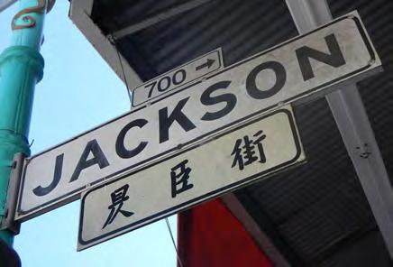
 Bilingual signs in San Francisco’s Chinatown integrate culture and neighborhood identity into everyday life.
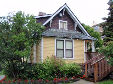
The Oscar Anderson House (1915) has consistently been identified through surveys and public outreach as one of the top “Landmarks to Save.”
Bilingual signs in San Francisco’s Chinatown integrate culture and neighborhood identity into everyday life.
The Oscar Anderson House (1915) has consistently been identified through surveys and public outreach as one of the top “Landmarks to Save.”
HISTORIC PRESERVATION PLAN FOR ANCHORAGE’S FOUR ORIGINAL NEIGHBORHOODS ADOPTED 2/12/2013 AO 2013-01210
Safehaven, Army Housing Association/Pilots’ Row, Alaska Native Peoples’ tikahtnus and cultural sites. It is important to aggressively preserve and protect these “Landmarks to Save” by nominating and listing them on the National Register of Historic Places and a local historic register. All of these identified historic resources should be the first to receive the benefits of the new programs initiated via this HPP.
Interpreting History & Culture
In addition to the preservation of physical features, interpretation of stories, people, and events can add layers and depth to a community’s identity; however, there is a lack of public awareness about the plan area’s history, partly because so many of Anchorage’s residents are transplants or newcomers. Interpretation is therefore an essential element of neighborhood preservation. Community members presented many ideas for how to interpret and commemorate important people, events, and Alaska Native Peoples’ stories during preparation for the HPP. These ideas range from plaques, monuments, and interpretive signage to walking tours, documentaries, websites, and other digital media.
Community & Partnerships
Historic preservation is a community endeavor, and it will take strong partnerships among the public, private, and nonprofit sectors to properly acknowledge and celebrate the heritage of the Four Original Neighborhoods. Fostering partnerships to support historic preservation—especially companies and groups that are not traditionally known for historic preservation but that may have overlapping interests—is especially important to secure funding and other resources. Community awareness and vigilance will be key in accomplishing the goals of the HPP.
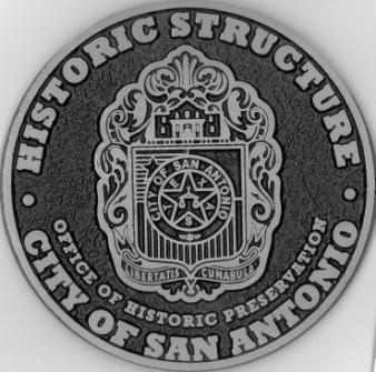
Hundreds of cities nationwide have a Historic Plaque Program to identify and celebrate historic places. An example from San Antonio, Texas, is pictured here.
Re-use of historic buildings such as the Freight Shed can help preserve the unique characteristics of the neighborhoods while still allowing for new growth. Courtesy ARRC.
 Alaska Railroad Freight Shed Media Information
CHAPTER I: EXECUTIVE SUMMARY ADOPTED 2/12/2013 AO 2013-12 11
For additional leasing information, please contact: Jim Kubitz, Vice President of Real Estate and Facilities T: 907.265.2428 E: kubitzj@akrr.com For additional media information, please contact: Tim Thompson, Director of External Affairs T: 907.265.2695 E: thompsont@akrr.com
Growth & Change
An important goal of the HPP is to guide future growth and change in the Four Original Neighborhoods by means of historic preservation policies. Residents would like the character of their neighborhoods to be reinforced through the reuse of historic buildings and thoughtful design of infrastructure (utilities, alleys, street amenities, and streetscape improvements) and infill construction. Of primary concern were large transportation projects such as the Knik Arm Crossing that threaten historic resources or increase traffic, especially along the A-C, L-I, or Gambell-Ingra couplets. Concerns about demolition and/or inappropriate alterations to historic buildings and urban sprawl were also expressed during the public outreach process for the HPP. The “Growth and Change” policies demonstrate how historic preservation can influence a positive outcome for development.
Special Tax Valuation for Historic Properties


Incentives for Historic Properties in Seattle taxes will not reflect substantial improvements made to the historic property.
Eligible properties, as defined by the Seattle City Council, are designated as landmarks subject to controls imposed by a designating ordinance or are contributing buildings located within National Register or local historic districts. The property must have undergone an approved rehabilitation within the two years prior to the date of application and rehabilitation cost must equal or exceed 25% of the assessed value of the improvements, exclusive of land value, prior to rehabilitation. Expenditures are based on Qualified
Rehabilitation Expenditures. “Qualified rehabilitation expenditures” are expenses chargeable to the project, including improvements made to the building within its original perimeter, architectural and engineering fees, permit and development fees, loan interest, state sales tax, and other expenses incurred during the rehabilitation period. Not included are costs associated with acquiring the property or enlarging the building.
Interested property owners must file an application by October 1 with the King County Department of Assessment after the rehabilitation work has been completed. The Assessor will transmit the application to the Landmarks Preservation Board for review. The Board will review and approve the application, confirming the cost of the rehabilitation and that rehabilitation complies with previous Board approval. Once approved, the property owner will sign an agreement with the Board for a 10-year period, during which time the property must be maintained in good condition. The owner must obtain approval from the Board prior to making improvements. If the property is sold, the new owner must sign the same agreement if the special valuation is to remain in effect.
Economic Development
The HPP explores the correlation between historic preservation and economic development. A common misconception is that preservation is too costly and prevents economic development, but in fact preservation policies may include financial and programmatic incentives to encourage smart economic growth. The HPP encourages implementation of programs to educate the community about existing incentives as well as about the creation of new local incentives.
Procedures & Regulations
The HPP recommends local historic preservation review processes and regulations that may be administered to preserve Anchorage’s Four Original Neighborhoods. Design guidelines and historic preservation-related overlay zones may guide new construction in the neighborhoods. Establishment of an official local historical register and of criteria for evaluating the significance of individual resources and historic districts would increase identification of significant historic and cultural resources in the neighborhoods. City of Seattle
HISTORIC PRESERVATION PLAN FOR ANCHORAGE’S FOUR ORIGINAL NEIGHBORHOODS ADOPTED 2/12/2013 AO 2013-01212
The
has created and publicized a comprehensive package of policy and financial incentives for historic preservation projects. IN THIS SERIES: Seattle Historic Districts • Seattle Landmark Designation • Incentives for Historic Properties For more information: www.seattle.gov/neighborhoods/preservation
Joshua Green Building Eastern Hotel Colman School, NW African American Museum The Washington State Legislature passed a law in 1985 allowing “special valuation” for certain historic properties. Prior to that law, owners rehabilitating historic buildings were subject to increased property taxes once the improvements were made. “Special valuation” revises the assessed value of a historic property, subtracting, for up to 10 years, those rehabilitation costs that are approved by the local review board. For the purposes of the Special Valuation of Property Act, the Seattle Landmarks Preservation Board acts as the Local Review Board (RCW 84.26). The primary benefit of the law is that, during the 10-year special valuation period, property
Information www.seattle.gov/neighborhoods/preservation PROGRAMS Preservation funds from the National Park Service, Department of Archaeology and Historic However, the contents and opinions do not Department of the Interior or DAHP. National Park Service. Regulations of the U.S. discrimination in departmental Federally Assisted age, or handicap. Any person who believes program, activity, or facility operated by recipient Opportunity Program, U.S. Department of NW, Washington, DC 20240.
10/13/11 3:43 PM
Linking Preservation to the Neighborhoods
Although the primary purpose of the Historic Preservation Plan for Anchorage’s Four Original Neighborhoods is to create a unified vision for the entire plan area, each neighborhood possesses characteristics that set it apart from the others. The Four Original Neighborhoods share the common goal of retaining and enhancing their own individuality, and it is important to plan for the preservation of each neighborhood’s unique identity. The HPP therefore presents two types of policies: those that bridge boundaries of neighborhoods, and those that focus on the character, issues, and opportunities unique to each one.
The HPP includes a module that addresses each neighborhood separately; each module includes a brief neighborhood history, an area character summary, a list of character-defining features, a summary of concerns and challenges, and a list of neighborhood-specific policies that expand on the vision for the entire plan area. The neighborhoods are organized in chronological order of settlement. The following summarizes each neighborhood’s character and preservation priorities:
Ship Creek
The Ship Creek area (mentioned simply as “Ship Creek” throughout this document) is not technically one of the Four Original Neighborhoods—it does not have its own Community Council—but it is a unique subset of the plan area, and is sometimes discussed independently because of its unique nature. Portions of Ship Creek lie in Downtown, Government Hill, and Fairview, and the area is primarily industrial in character. Ship Creek is rich in Alaska Native Peoples and Alaska Railroad history, and provides opportunities as an intermodal transit center and both an industrial and a recreational area.
Challenges for the Ship Creek area include an update to its master plan to determine the highest and best uses for the existing historic resources as new development is planned and constructed; identifying multimodal transportation connections; finding additional ways to celebrate its history through interpretation; and building stronger public-private partnerships.
NEIGHBORHOOD GOALS
Through the public outreach process, each of the original neighborhoods was able to clearly define its own priorities. The top neighborhood-specific goals that emerged include the following:
Government Hill: maintain a cohesive community and manage the effects of new development
Downtown: preserve the city’s most prominent historic buildings and reinforce a commercial and cultural district that is a year-round destination for locals and tourists
South Addition: preserve walkability and access to open space, reduce demolitions, and maintain the historic character of the Delaney Park Strip
Fairview: preserve its diverse character, restore small-business corridors, overcome past land-use and transportation decisions, and improve walkability and easy access to Downtown
CHAPTER I: EXECUTIVE SUMMARY ADOPTED 2/12/2013 AO 2013-12 13
Government Hill
Government Hill is unique as a geographically isolated area containing remnants of community planning, social history, and architecture from the beginning of Anchorage as a railroad town in 1915 until the present. Government Hill is accessible only by bridge and has views of Downtown, the rail yards, the Port, Cook Inlet, and the Alaska Range. Its residents desire to preserve their cohesive, tight-knit community, as well as the neighborhood’s character-defining features: historic cottages, Quonset huts, the Wireless Center, small streets and alleys, parks and trails, a commercial corridor, and viewsheds.
The biggest challenge for Government Hill will be to complete an implementable neighborhood plan and provide recommendations that can mitigate the impacts of the proposed Knik Arm Crossing project or other major development projects to the greatest extent possible. Revitalizing Government Hill’s “neighborhood center” through the creation of a commercial hub is also a top priority.
Downtown
Downtown Anchorage contains many of the city’s most prominent historic buildings. Residents and business owners appreciate the neighborhood’s mixed-use character and its proximity to the Cook Inlet. Concerns in Downtown include balancing seasonal uses of the area by tourists and visitors in the summer with the desire to have a year-round vital urban core. Other concerns include increasing density in the central business district and ensuring adequate parking.
The challenges for Downtown include fostering an urban district that is a hub for commercial and civic activities; encouraging relevant contextual design; balancing the seasonality of tourism with the neighborhood’s desire to be a vibrant, year-round neighborhood; and leveraging economic development tools to fund preservation activities.
View of Downtown from Ship Creek.
Brown’s Point Cottages (listed in National Register).
HISTORIC PRESERVATION PLAN FOR ANCHORAGE’S FOUR ORIGINAL NEIGHBORHOODS ADOPTED 2/12/2013 AO 2013-01214
South Addition
The South Addition is a walkable, close-knit community with unparalleled access to the outdoors: the Delaney Park Strip, Westchester Lagoon, and Tony Knowles Coastal Trail are all located within the neighborhood’s boundaries. Residents enjoy the South Addition’s central location, mature trees, and mixed-use development. Residents wish to preserve the neighborhood character of the city’s first subdivision; retain the sidewalks and smaller streets that provide good opportunities to walk, ski, and bike; keep neighborhood parks, schools, and small businesses; maintain the connection to Downtown; and preserve the Delaney Park Strip, which is central to the neighborhood’s identity. The South Addition community also expressed a desire to retain existing corner businesses and provide more mixed-use development throughout the neighborhood.
Concerns in the South Addition include placement of infrastructure and utilities, infill construction, and demolition of historic homes. Avoiding potential increases in traffic and the physical division of the historic neighborhood caused by widening roadways—especially along the A-C and L-I couplets— are also high priorities. Residents clearly voiced firm opposition to projects such as the Knik Arm Crossing or other large road expansion projects that would funnel traffic through the neighborhood, thus dividing the residential areas. The biggest challenge for the South Addition will be retaining its existing, cohesive character as development pressures increase and as transportation and infrastructure changes are proposed.
 Strutz House, P Street (potential historic resource).
Delaney Park Strip.
Strutz House, P Street (potential historic resource).
Delaney Park Strip.
CHAPTER I: EXECUTIVE SUMMARY ADOPTED 2/12/2013 AO 2013-12 15
Fairview
Fairview residents value their neighborhood’s diverse mix of buildings and people, housing affordability, and central location. Concerns in Fairview include the way transportation corridors divide the neighborhood (Gambell/Ingra, 15th Avenue); improving connections and walkability; improving socioeconomic conditions; and limiting high-density development that is out of scale with the neighborhood. Changing the type of commercial uses in Fairview is also a high priority: Gambell Street, for example, could be restored as a “Main Street” (like it was in the 1950s) with neighborhoodserving businesses.
The biggest challenge in Fairview will be to overcome past land-use and transportation decisions and to restore the neighborhood’s historic context, walkability, commercial viability, and character.
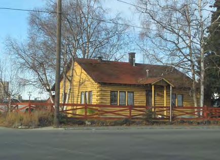
Log Cabin at 7th & Karluk (potential historic resource).
HISTORIC PRESERVATION PLAN FOR ANCHORAGE’S FOUR ORIGINAL NEIGHBORHOODS ADOPTED 2/12/2013 AO 2013-01216
Following Through
In addition to the vision and policies, the HPP includes a detailed implementation plan to ensure that the document does not just sit on a shelf. The implementation strategies described in the plan take many forms, and achieving the vision of the HPP will require a multifaceted approach. A variety of strategies are outlined, from small projects to large undertakings. Where possible, no-cost or low-cost measures have been proposed, but an active pursuit of funding and incentives to property owners will be necessary for effective implementation of the HPP.
The HPP will not be an effective historic preservation tool unless the Municipality of Anchorage partners with property owners, the State Historic Preservation Office, and local nonprofit organizations to advocate for historic preservation; implement the HPP vision, policies, programs, and projects; and further acknowledge, preserve, or nominate to the National Register of Historic Places the properties that have been identified through previous survey work. To date, over 1,200 age-eligible properties have been recorded in the Consolidated Historic Resources Inventory, a database that is intended to serve as the master list of significant historic resources in the Four Original Neighborhoods. As more properties are surveyed and identified as potentially eligible for nomination, it will be essential followup to the HPP to continue to expand the database and to properly recognize historic places.
The implementation plan in Chapter VIII assigns responsible parties and timelines for all strategies in a useful matrix that summarizes the proposed actions. Supporting the myriad preservation activities already in place in Anchorage and using the implementation matrix to guide future actions will achieve the community’s vision for historic preservation in the Four Original Neighborhoods.
Municipality’s Financial Commitment to Implementation of the HPP
The HPP does not commit the Municipality to any project. It serves as a guide for the Municipality and the community to consider community priorities and funding participation. Adoption of the HPP is simply the first step in implementing the strategies presented in the document. Budget, timing, funding source, and other details will be further developed by the Anchorage Historic Preservation Commission (AHPC) and its preservation partners as each item is considered.
 Implementation of the HPP should be coordinated with other current planning efforts such as Anchorage 2020 in order to balance preservation with the growth planned for the city.
CHAPTER I: EXECUTIVE SUMMARY ADOPTED 2/12/2013 AO 2013-12 17
HISTORIC PRESERVATION PLAN FOR ANCHORAGE’S FOUR ORIGINAL NEIGHBORHOODS ADOPTED 2/12/2013 AO 2013-01218
INTRODUCTION
“A historic preservation plan is a statement of the community’s goals for its historic properties and the actions it will take to reach those goals. It is most effective when it is a component of a community’s master plan and is coordinated with other policies for housing, economic development, transportation, etc.” 1
 –Ohio Historic Preservation Office
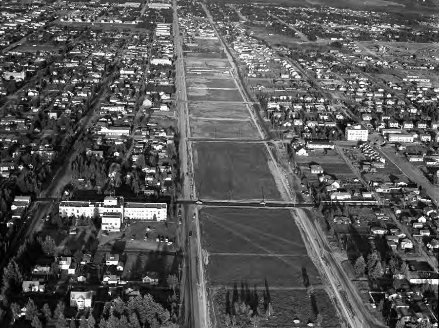
View over the Delaney Park Strip, 1954.
–Ohio Historic Preservation Office
View over the Delaney Park Strip, 1954.
CHAPTER II: INTRODUCTION ADOPTED 2/12/2013 AO 2013-12 19
HPP OBJECTIVE #1 –HISTORIC PRESERVATION
To identify and address the preservation and management of historic resources in Anchorage’s Four Original Neighborhoods.
To provide guidance for future mitigation to impacts to historic resources and landscapes identified during completion of the Historic Preservation Plan (HPP).
Purpose of the HPP
HPP OBJECTIVE #2 –IDENTIFICATION OF KNIK ARM CROSSING PROJECT IMPACTS
To address the impacts to historic and cultural resources from the design, construction, and operation of the Knik Arm Crossing project (KAC). The KAC will introduce physical/built, visual, atmospheric, and audio impacts through right-of-way alignments and significantly increased traffic volumes.
The Historic Preservation Plan (HPP) for Anchorage’s Four Original Neighborhoods is a communitybased plan focused on preserving historic character while planning for a sustainable future in Anchorage’s original neighborhoods. The plan area includes the Downtown, Fairview, Government Hill, and South Addition Community Council Areas.
The purpose of the HPP is to address the preservation and management of historic resources, enhance local preservation values, and provide guidance for future impacts to historic resources and landscape features in Anchorage’s Four Original Neighborhoods. The HPP is meant to be used in conjunction with other planning documents, and will be adopted as an element of the Municipality’s Comprehensive Plan. The HPP is specific to the plan area, which is located in the Anchorage Bowl. Additionally, the information in the HPP can be used to influence and inform the planning and design of future development projects—including public infrastructure such as transportation, trails, and parks—to ensure the protection of neighborhood character and values.
The plan is intended to meet two primary objectives: (1) Identification and preservation of historic character and important historic resources of Anchorage’s Four Original Neighborhoods; and (2) identification of Knik Arm Crossing Bridge Project impacts to Anchorage’s Four Original Neighborhoods, as well as the direct and indirect costs of these impacts to the Municipality of Anchorage, private businesses, property owners, and residents (see sidebar).
Section 106 Mitigation
To provide additional information not included in the Government Hill Neighborhood Plan.
This Historic Preservation Plan is one of several federally funded mitigation measures derived in response to the Knik Arm Crossing project, a bridge and road project sponsored by the Federal Highway Administration (FHWA) that will be constructed in parts of Anchorage’s Four Original Neighborhoods.* The FHWA signed a Record of Decision (ROD) in December 2010 that has allowed the Knik Arm Bridge and Toll Authority (KABATA) to design the project. Indirect effects on historic resources were identified through the Section 106 consultation process, as required by the National
* For more information about the design and review process of the Knik Arm Bridge, visit http://www.knikarmbridge.com/
HISTORIC PRESERVATION PLAN FOR ANCHORAGE’S FOUR ORIGINAL NEIGHBORHOODS ADOPTED 2/12/2013 AO 2013-01220
Historic Preservation Act; the effects and corresponding mitigation measures are outlined in the Knik Arm Crossing Project Programmatic Agreement (PA), signed in December 2008, and in a Memorandum of Understanding (MOU), signed in January 2010. This HPP is one of the mitigation measures identified in the MOU.
The HPP will assist in mitigating the effects of the Knik Arm Crossing Project through the identification of important cultural and historic resources within Anchorage’s Four Original Neighborhoods and the creation of historic preservation management tools that can protect them. The HPP is intended to be used by the community as a tool to influence and inform the design process for the Knik Arm Crossing project, which is still in the early stages of design. However, please note that this HPP is a long-range plan for the Four Original Neighborhoods—not merely a short-term response to the Knik Arm Crossing project—and that the information included herein is intended to shape the planning and design of all future transportation and development projects.
This HPP was not the only preservation-related mitigation measure for the Knik Arm Crossing project, though. In addition to mitigation measures in the Matanuska-Susitna Borough, other mitigation measures completed for the Four Original Neighborhoods include:
Government Hill Neighborhood Plan: The Government Hill Neighborhood Plan (GHNP) will plan for future growth of Government Hill in a manner that reflects the assets and values important to the community and meets the goals of Anchorage 2020: Anchorage Bowl Comprehensive Plan. For more information, visit the GHNP online at www.anchorageghnp.com
Government Hill Oral Histories Project: Interviews were conducted with long-time Government Hill residents to record their stories and document the neighborhood’s history.
South Addition Historic Context Statement and Inventory: A narrative history of the built environment was prepared for the South Addition neighborhood, along with an inventory of significant historic resources.
The HPP is one of several federally funded mitigation measures derived in response to the Knik Arm Crossing project. The Area of Potential Effect (shown above) was defined through the Section 106 Consultation process and appears in the KAC Programmatic Agreement, signed in December 2008.
CHAPTER II: INTRODUCTION ADOPTED 2/12/2013 AO 2013-12 21 NCST AST AST E WHITNEYRD W BLUFF DR EHARVARDAVE TAMARACK ST ELMST CEDARST DOGWOODST NAST E2NDAVE ANDERSONST BOYDST CST DEGANST BIRCHST W MANOR AVE ECOOKAVE DELANEYST EBLUFFDR IVYST W3RDAVE ANDREWS AVE E SHIP CREEK AVE COLWELLST E1STAVE HOLLYW OOD DR CUNNINGHAMST RICHARDSON V STA RD Ship C re ek ASHST ! 4 ! 3 ! 1 ! 6 ERICKSONST ! 2 ! 5 4THAVE GAMBELLST INGRAST PanoramicView HistoricDistrict ANC-02126 GovernmentHill UrbanRenewal HistoricDistrict ANC-02128 GovernmentHill QuonsetHuts HistoricDistrict ANC-02111 GovernmentHill RailroadHousing HistoricDistrict ANC-02108 MapNotes: DataSources:MOA,HDR,SB&A 0250500 Theinformationdisplayedhereisforplanningpurposesonly.Baseinformationshown constitutesdatafromvariousfederal,state,public,andprivatesources.Thesedrawings areforreviewpurposesonlyandarenotintendedforuseinsecuringpermitsorfor constructionpurposes. GeographicInformationSystems(GIS)basedataprese developedandmaintainedbystateandlocalgovernmentagenciesandacquir HDRAlaska,Inc.GISdataisnottheofficialrepresentationoflegaldatasuchas propertyboundaries.Inthepreparationofthisdata,HDRattemptstoofferthemost current,correct,andclearlyexpressedinformationpossible,buttheremaybe inaccuraciesinthedata. 1.Residence 2.Wirelessstation 3.Loxtavehouse 4.Ranchhouse PrintingDate:May12,2008 ProjectionInformation: Name:NAD1983StatePlaneAlaska4FIPS5004Feet Datum:NorthAmerican1983 File:GvtHillHistoricDistrict_ape.mxd HDRAlaska.Inc. QuyanaPark N Co a a T a rd A e T a ELMENDORF AIRFORCE BASE KNIKARM PORTOF ANCHORAGE GOVERNMENT HILL PORTOF ANCHORAGE EXPANSION ANCHORAGESIDE THECROSSING 5THAVE 3RDAVE
Plan Area Boundaries
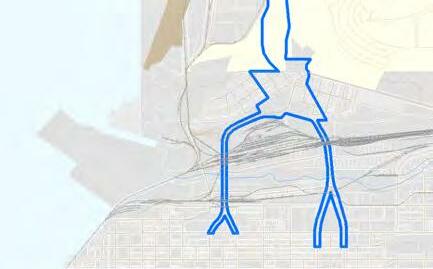
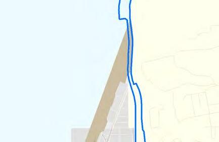
This HPP covers Anchorage’s Four Original Neighborhoods: Government Hill, Downtown, South Addition, and Fairview. The boundaries of the plan area correspond to the boundaries of the four Community Councils. While the Ship Creek area is not technically one of the Four Original Neighborhoods—it lacks its own Community Council—it too is discussed in the HPP. Because Ship Creek overlaps three of the Four Original Neighborhoods and is a unique subset of the plan area, it has its own distinct set of challenges and is often mentioned separately throughout the document.
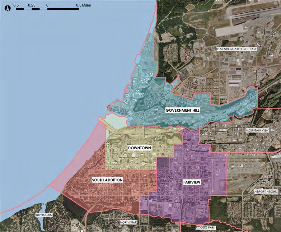 Map of HPP Boundaries, showing the Four Original Neighborhoods.
HISTORIC PRESERVATION PLAN FOR ANCHORAGE’S FOUR ORIGINAL NEIGHBORHOODS ADOPTED 2/12/2013 AO 2013-01222
Public Participation
Public participation has been critical to the development and coordination of the HPP and will be essential to its implementation. Public comment was solicited through the following outreach efforts:
Technical Advisory Committee (TAC) (ongoing): A local committee of key stakeholders was created to guide and review the progress of the HPP. The committee provided feedback at monthly meetings and comprised representatives from the following groups:
à Municipality of Anchorage
à Anchorage Historic Preservation Commission (AHPC)

à State Historic Preservation Office (SHPO)
à National Park Service (NPS)
à Government Hill Community Council
à Downtown Community Council
à South Addition Community Council
à Fairview Community Council
à Alaska Association for Historic Preservation
à Anchorage Woman’s Club
à Anchorage Downtown Partnership, Ltd.
Public Workshop Series #1 (October 24-25, 2011): The purpose of this informational public workshop series was to introduce the project (scope and goals) and to gather information and ideas from the public. These workshops provided the project team with an opportunity to listen to the public’s concerns about issues facing the neighborhoods and identify the community’s goals for the plan. The interactive workshop was hosted twice—in Fairview/South Addition and in Government Hill—and residents of all four neighborhoods were invited to attend.
Focus Groups (October 26-28, 2011): Local groups and community organizations were invited to participate in a series of nine focus groups, organized by specialty or common interest, to discuss preservation-related issues. Focus groups included: Municipality staff, Real Estate, Downtown Businesses & Community, Government Agencies, Design Community, Students & Young Professionals, Boards & Commissions, Tribal & Native Partners, and Historical Societies & Preservation Organizations.
The project website and social media pages allowed the public to stay informed and engaged.
CHAPTER II: INTRODUCTION ADOPTED 2/12/2013 AO 2013-12 23
The HPP public workshop series and open house were attended by residents of all four neighborhoods.
Online Survey (October-December 2011): Members of the public contributed additional feedback through an online survey, accessible through the project’s website (www.anchoragehpp.com).
Public Workshop Series #2 (February 12 and 20-24, 2012): This series of public workshops included an open house on Anchorage’s first Historic Preservation Weekend, and plan area and neighborhood-specific goals were presented to each of the Four Original Neighborhoods: Government Hill, Downtown, South Addition, and Fairview residents participated in prioritizing the draft goals and suggest policies in support of the goals. The public comment received at these workshops directly led to the goals, policies, and implementation strategies in the HPP.
Open House (May 31, 2012): The Public Review Draft of the HPP was presented at an Open House held at the Pioneer Schoolhouse, at which members of the public were invited to comment. Representatives from the Government Hill Neighborhood Plan and local historic preservation groups were also in attendance.
Public Comment Period (May 15-June 30, 2012): Members of the public contributed feedback on the Public Review Draft during the six-week comment period. Comments were received via email, verbally, and through an online survey on the project’s website.
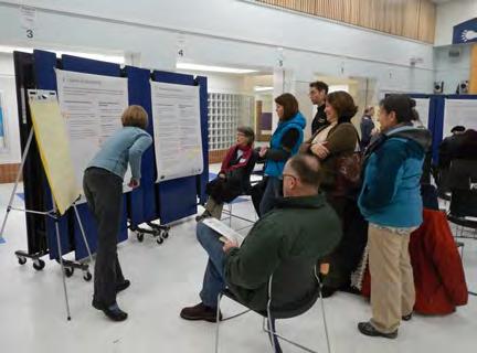

The purpose of public outreach was to listen to the community, elicit comment, and receive feedback.
Nearly 1,000 public comments have been received to date. This feedback has greatly shaped and informed the content of the HPP. A majority of the comments elicited from public outreach have bridged neighborhood boundaries and thus are applicable to the entire plan area (all Four Original Neighborhoods), while others were expressed as neighborhood-specific ideas (see graphic at right). Please note that for each neighborhood, the comments for the entire plan area apply, in addition to neighborhood-specific comments.
HISTORIC PRESERVATION PLAN FOR ANCHORAGE’S FOUR ORIGINAL NEIGHBORHOODS ADOPTED 2/12/2013 AO 2013-01224
HPP Methodology & Organization
ANCHORAGE HISTORIC PRESERVATION PLAN
An analysis of the public comments gathered during the outreach process described above led to the vision for the entire plan (discussed in detail in Chapter VI). Building on the public input used to create the plan vision, the HPP also draws on “best practices” research from other cities to identify preservation-related issues, opportunities, and implementation strategies that can be applied to each neighborhood in the plan area. Using this information, the plan chapters range in detail from extremely broad goals for the preservation of the entire plan area to specific goals for preservation at the block or neighborhood level. The HPP identifies and recommends:
Changes to local and state regulations
Information about significant buildings, landscapes, sites, or districts
Storytelling, educational, and interpretational opportunities for all age groups
Financial incentives for preservation
Other creative ideas and strategies generated during the public involvement process
Illustration of the HPP methodology and visioning process.
CHAPTER II: INTRODUCTION ADOPTED 2/12/2013 AO 2013-12 25
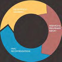
PUBLIC INPUT Hold public meetings and workshops to gather information from the Muni and citizens of Anchorage SYNTHESIS Form public responses into individual issues RESEARCH Look at how other places deal with some of the issues facing Anchorage SURVEY Consolidate existing surveys into database VERIFICATION Report back to the public and collect feedback on the direction of the plan FORMULATION Make recommendations based on research and issues and produce the plan document VISIONING Summarize existing conditions and outline issues, opportunities, and goals START
Using the Plan
The Historic Preservation Plan for Anchorage’s Four Original Neighborhoods is organized as follows:
I. Introduction: This chapter provides an overview of the HPP, including the purpose of the plan, methodology, and a summary of the planning process.
II. Historic Preservation in Anchorage Today: This chapter summarizes existing preservation laws, programs, and groups at national, state, and local levels. This provides readers with an essential understanding of the regulatory framework governing historic preservation in Anchorage.
III. Past and Current Planning in Anchorage: This chapter outlines the relationship of other planning documents that overlap with the HPP, such as Anchorage 2020 and the Downtown Comprehensive Plan. Since the HPP will be adopted as an element of the Municipality’s Comprehensive Plan, it is important for readers to understand the vision and goals of these other documents, too.
IV. Historic Context & Surveys: This chapter outlines the historic context of the plan area, identifies known historic resources, and summarizes previous survey work (methodology and results).
V. Preservation Vision, Goals & Policies: The purpose of this chapter is to identify which new policies can support plan area goals, and to recommend implementation strategies to establish and enforce these policies. This chapter is divided into seven modules, each of which contains goals, policies, and implementation strategies that apply to the entire plan area.
VI. Neighborhood Character, Goals & Policies: This chapter is dedicated to the neighborhoods, and includes history, character-defining features, goals, and policies as well as implementation strategies for each neighborhood. The neighborhood-specific policies discussed in this chapter are in addition to the plan-area policies in the previous chapter.
VII. Implementation Plan: This chapter includes a matrix with specific actions to accomplish each policy. Short-term and long-term actions are identified, and responsible parties have been assigned.
VIII. Case Studies & Further Reading: This chapter includes additional links plus “best practices” research that is not goal-specific.
IX. Endnotes: The endnotes include a list of sources consulted during preparation of the HPP.
X. Appendices: The appendices are intended for reference, and they include important supporting information to elaborate on concepts discussed in the body of the HPP. The appendices also include the full text of various preservation laws and plans referenced in the chapters.
HISTORIC PRESERVATION PLAN FOR ANCHORAGE’S FOUR ORIGINAL NEIGHBORHOODS ADOPTED 2/12/2013 AO 2013-01226
The HPP will support historic preservation, assist in identifying municipal required mitigation elements for large infrastructure projects, develop outreach and educational tools, and identify potential funding and partnerships to assist in future historic preservation projects and programs.
Adoption of the HPP will:
1. Will identify potential historic districts or overlay districts, which would require property owner, community council, Alaska State Historic Preservation Office, Anchorage Historic Preservation Commission, Planning and Zoning Commission, and Assembly support to be established and/or nominated to the National Historic Register.
2. Will provide proposed implementation items and conceptual planning elements to be pursued subsequent to Assembly approval, once advocates are found for each implementation item. Advocates could be the Historic Preservation Commission, Alaska Association for Historic Preservation, Anchorage Downtown Partnership, Inc., Anchorage Woman’s Club, the Municipality, or others.
3. Will addresses historic preservation goals and policies that were taken directly from the Anchorage 2020 Comprehensive Plan. Further action will be required to amend Title 21 with historic preservation standards in the future.
4. Will define the relationship to Title 21—specifically, in ANY conflict between the Plan and Title 21, Title 21 will have precedence until such time as Title 21 is amended to adopt historic and overlay districts and architectural design standards to implement the overlay or historic districts.
5. Will only apply in adjudicatory decisions when municipal code is amended to provide for historic and overlay districts and when architectural design standards associated with those districts are included in municipal code.
6. Will support the efforts of the Historic Preservation Commission as it was re-established in 2007 (AMC 4.60.030).
7. May require the Federal Highway Administration and KABATA to revise the KAC project area of potential effect.
CHAPTER II: INTRODUCTION ADOPTED 2/12/2013 AO 2013-12 27
8. May be the foundation for a new agreement between the Municipality of Anchorage and the Federal Highway Administration and KABATA as defined in the current KAC Programmatic Agreement (12/2008) and KAC Memorandum of Understanding (1/10).
The Municipality is a consulting party with certain rights and standing as defined in the National Historic Preservation Act Section 106; to be initiated and approved prior to the KAC design process. Time is of the essence, should the KAC project $150 million shortfall be funded during the 2013 Alaska legislative session. The purpose of the new agreement would be to amend the Area of Potential Effect of the KAC project to include Downtown, South Addition, and Fairview. This is necessary to address the long term impacts of the increased traffic that will be generated by the KAC project. New information regarding historic properties and proposed historic neighborhoods was found during the HPP planning process. The Municipality would be remiss not to require new consideration of the historic resources.
9. Will guide the Context Sensitive Design process of the KAC project.
Adoption of the HPP will not:
1. Will not amend the regulatory portions of Title 21, and will not be used as the basis for Municipality of Anchorage adjudicatory decisions.
2. Will not establish or nominate historic or overlay districts within the planning areas
3. Will not affect municipal requirements for the exterior or interior remodel of structures.
4. Will not create design guidelines for existing or future private or public development unless and until Title 21 is amended to include such requirements.
5. Will not create additional municipal departments or agencies.
6. Will not create additional design and project reviews nor be used as the basis for additional adjudicatory requirements in the reviews conducted by the Community Development Department or other municipal departments, or by other partner agencies that typically provide project review and comment.
7. Will not create a new employment position within the Municipality.
HISTORIC PRESERVATION PLAN FOR ANCHORAGE’S FOUR ORIGINAL NEIGHBORHOODS ADOPTED 2/12/2013 AO 2013-01228
List Of Acronyms And Abbreviations
AAHP Alaska Association for Historic Preservation
ACHP Advisory Council on Historic Preservation
ADCP Anchorage Downtown Comprehensive Plan (2007)
AEC Alaska Engineering Commission
AEDC Anchorage Economic Development Corporation
AHPC Anchorage Historic Preservation Commission
AHPI Anchorage Historic Properties, Inc.
AHRS Alaska Heritage Resources Survey
AIA American Institute of Architects
AMC Anchorage Municipal Code
Anchorage 2020 Anchorage 2020: Anchorage Bowl Comprehensive Plan
ANCSA Alaska Native Claims Settlement Act (1971)
ANHC Alaska Native Heritage Center
ANILCA Alaska National Interest Lands Conservation Act (1980)
ARRC Alaska Railroad Corporation
ASD Anchorage School District
AWC Anchorage Woman’s Club
AWWU Anchorage Water and Wastewater Utility
BIA Bureau of Indian Affairs
BLM Bureau of Land Management
BOMA Building Owners & Managers Association
CBD Central Business District
CDBG Community Development Block Grants
CIHS Cook Inlet Historical Society
CIRI Cook Inlet Region, Inc.
CLG Certified Local Government
DID Downtown Improvement District
FHWA Federal Highway Administration
GHNP Government Hill Neighborhood Plan
HLB Heritage Land Bank
HPP Historic Preservation Plan for Anchorage’s Four Original Neighborhoods
HUD U.S. Department of Housing and Urban Development
JBER Joint Base Elmendorf-Richardson
KABATA Knik Arm Bridge and Toll Authority
KAC Knik Arm Crossing
LEED Leader in Energy and Environmental Design
LIHTC Low Income Housing Tax Credits
Municipality Municipality of Anchorage
NHPA National Historic Preservation Act of 1966
NMTC New Markets Tax Credits
NPS National Park Service
NRHP National Register of Historic Places
OHA Office of History and Archaeology
Park Strip Delaney Park Strip
PZC Planning and Zoning Commission
Section 106 Section 106 of the National Historic Preservation Act
Section 110 Section 110 of the National Historic Preservation Act
SHPO State Historic Preservation Office
TAC Technical Advisory Committee
TDR Transfer of Development Rights
THPO Tribal Historic Preservation Officer
TIF Tax Increment Financing
Title 21 Anchorage Municipal Code, Title 21 (Land Use Planning)
CHAPTER II: INTRODUCTION ADOPTED 2/12/2013 AO 2013-12 29
HISTORIC PRESERVATION PLAN FOR ANCHORAGE’S FOUR ORIGINAL NEIGHBORHOODS ADOPTED 2/12/2013 AO 2013-01230
HISTORIC PRESERVATION IN ANCHORAGE TODAY
What is historic preservation? What preservation measures are currently employed in Alaska? Do Alaskan cities have preservation regulations? Has Anchorage established historic preservation policies?
The purpose of this chapter is to answer these questions and explore the existing role of historic preservation in the Municipality of Anchorage. Because not everyone reviewing this document is familiar with historic preservation, this chapter explains how historic preservation regulations developed in the United States. The chapter also provides an overview of historic preservation laws and policies at the national, state, and local levels. The goal of this chapter is to explain the current status of historic preservation in Anchorage, to enable the Four Original Neighborhoods to implement the Historic Preservation Plan, and to ensure that the regulations currently in place can be easily understood. This will allow the neighborhood goals to be better coordinated with national, state, and local preservation rules.
CHAPTER III: HISTORIC PRESERVATION IN ANCHORAGE TODAY ADOPTED 2/12/2013 AO 2013-12 31
WHAT ARE THE NATIONAL REGISTER CRITERIA?
Federal Historic Preservation Laws
For a property to be listed or determined eligible for listing, it must meet at least one of the basic National Register Evaluation Criteria, defined by the National Park Service as:
A. Association with events that have made a significant contribution to the broad patterns of our history; or
B. Association with the lives of persons significant in our past; or
C. Embody the distinctive characteristics of a type, period, or method of construction, or that represent the work of a master, or that possess high artistic values, or that represent a significant and distinguishable entity whose components may lack individual distinction; or
D. Has yielded, or may be likely to yield, information important in prehistory or history.6
Early Preservation Laws
Antiquities Act of 1906
In 1906, President Theodore Roosevelt signed the first law to preserve historic resources in the United States, called the Antiquities Act. In response to looting of historic sites, the purpose of the Act was to protect prehistoric and historic ruins, monuments, or objects of antiquity located on federal land. The Act also allowed the president to establish national monuments through proclamation or by approving special acts of Congress.2 In 1916, the National Park Service (NPS) was established within the Department of the Interior to regulate and manage public space, including national monuments. Still used today, the Antiquities Act arguably remains the strongest federal historic preservation law and has most dramatically shaped the preservation of historic resources in the United States.
Historic Sites Act of 1935
The Historic Sites Act of 1935 was another significant piece of preservation legislation, as it was the first law to officially recognize the government’s duty to historic preservation activities. The Act declared that “it is national policy to preserve for public use historic sites, buildings, and objects of national significance for the inspiration and benefit of the people of the United States.”3 The Act also outlined the powers and duties of the Secretary of the Interior, and provided the basis for the National Historic Landmarks (NHL) program. Furthermore, it created the Historic American Building Survey (HABS) program, which today represents the nation’s largest archive of historic architectural documentation. The Historic Sites Act became law on August 21, 1935, and has since been amended eight times. 4
National Historic Preservation Act of 1966, as amended
The National Historic Preservation Act of 1966 (NHPA) recognized the inadequacy of public and private efforts to protect historic resources, “in the face of ever-increasing extensions of urban centers, highways, and residential, commercial, and industrial developments.”5 Managed by the National Park Service (NPS), the NHPA established state historic preservation offices in each state; established a partnership among federal, state, and local Native American tribes; and authorized expansion and maintenance of the National Register of Historic Places by the Secretary of the Interior.
HISTORIC PRESERVATION PLAN FOR ANCHORAGE’S FOUR ORIGINAL NEIGHBORHOODS ADOPTED 2/12/2013 AO 2013-01232
The Act created a federal process to review impacts that federal undertakings may have on historic properties (Section 106), defined the responsibility of federal agencies to federally owned historic properties (Section 110), and directed the Secretary of the Interior to implement preservation, education, and training programs. The Advisory Council on Historic Preservation (ACHP) was formed under the National Historic Preservation Act to serve as the independent federal agency responsible for advising departments within the federal government, Congress, and the president on national historic preservation policy.
The parts of the National Historic Preservation Act that are most relevant to this Historic Preservation Plan are the National Register of Historic Places and Section 106. These sections are described in greater detail below.
National Register of Historic Places
The National Register of Historic Places (National Register) is the United States’ official list of districts, sites, buildings, structures, and objects worthy of preservation. Currently, the National Register includes approximately 80,000 listings of icons of American architecture, engineering, culture, and history. The National Register established guidelines by which to evaluate the historic significance of properties. A property must have historic significance and retain historic integrity to be considered eligible for listing on the National Register.
The National Register guidelines for evaluation of significance were developed to be flexible and to recognize accomplishments of all who have made significant contributions to the nation’s history and heritage. Its criteria were designed to guide federal agencies, state and local governments, and others in evaluating potential entries in the National Register. For a property to be listed or determined eligible for listing, it must meet at least one of the basic National Register Evaluation Criteria (see sidebar).
In addition to meeting the criteria for historic significance, a property must also maintain integrity. “Integrity” is defined in National Register Bulletin #15: How to Apply the National Register Criteria as “the ability of a property to convey its significance.”7 Seven aspects of integrity are location, design, setting, materials, workmanship, feeling, and association.
WHAT HAPPENS TO PROPERTIES LISTED IN THE NATIONAL REGISTER?
The National Register of Historic Places is the official list of the nation’s historic places worthy of preservation. Listing in the National Register provides a formal recognition of a property’s historical, architectural, or archaeological significance. However, according to the National Park Service:
“National Register listing places no obligations on private property owners. There are no restrictions on the use, treatment, transfer, or disposition of private property” (National Park Service, http://www.nps.gov/nr/national_register_ fundamentals.htm).
For more information, visit http://www.nps.gov/ nr/national_register_fundamentals.htm or see Appendix N.
CHAPTER III: HISTORIC PRESERVATION IN ANCHORAGE TODAY ADOPTED 2/12/2013 AO 2013-12 33
The National Register guidance asserts that properties be at least 50 years old to be considered for eligibility. Properties completed less than 50 years before evaluation must be “exceptionally important” (Criteria Consideration G) to be considered eligible for listing. For additional information about evaluating properties for listing in the National Register, visit the NPS website at http://www. nps.gov/nr/.
For a complete listing of National Register-listed sites in the Four Original Neighborhoods, see Chapter V: Historic Context & Surveys.
Section 106
The National Historic Preservation Act created federal policy that required federal agencies to consider the impact of their undertakings on historic properties, in addition to establishing the criteria by which to define historic properties (described above). Section 106 of the National Historic Preservation Act of 1966 applies whenever there is federal funding, federal permitting, or other federal action.
The purpose of Section 106 is to provide the public with an opportunity to alert the federal government to historic properties and influence decisions about projects that may affect them. As part of the Section 106 consultation process, the responsible federal agency must analyze the effects of the proposed project on National Register-listed or -eligible properties, and must involve other groups, known as “consulting parties.” At a minimum, the lead federal agency must actively consult with the State Historic Preservation Office (SHPO), federally recognized tribes/Tribal Historic Preservation Officers (THPOs), and local governments. The agency must also allow the Advisory Council on Historic Preservation (ACHP) an opportunity to comment.8
Public participation is critical to both the Section 106 consultation process and the evaluation of properties for listing on the National Register. The type of public involvement varies, depending on the complexity of the project and the community’s level of interest: members of the public can simply respond to the agency’s request for public comments, or they can formally request to become a consulting party if they have a demonstrated interest in the project.
For additional details about the Section 106 review process, see the Code of Federal Regulations at 36 CFR Part 800, “Protection of Historic Properties,” which is available on the ACHP website at www.achp.gov
HISTORIC PRESERVATION PLAN FOR ANCHORAGE’S FOUR ORIGINAL NEIGHBORHOODS ADOPTED 2/12/2013 AO 2013-01234
Section 106 Process
This flowchart generally describes the four basic steps of the Section 106 historic preservation review process. Each step requires the appropriate level of consultation and public participation. For details, please refer to 36 CFR Part 800.
Is Proposed Action an "Undertaking?"
Potential to Cause Effects? NO YES NO YES
Identify the SHPO/THPO
Identify consulting parties, including tribes
Plan public involvement
Define Area of Potential Effect (APE)
Identify and Evaluate Properties in APE
Historic Properties Affected
No Historic Properties Affected
30-Day Review Consulting Parties
YES
Objection?
Section 106 Process Complete
Step 1: Initiate Consultation 800.3
LEGEND
Decision Point Review Period Finding Section 106 Process Complete
Bold boxes denote major consultation items.
Review existing information regarding APE
Talk to consulting parties
Talk to Federallyrecognized Tribes or NativeHawaiian orgs
National Register listed or eligible properties
Evaluate all other properties in APE
Step 2: Identify and Evaluate Historic Properties 800.4
* NO Section 106 Process Complete * If objection can't be resolved, see 800.4(c)(2) and/or 800.4(d)(1)(ii).
Apply Adverse Effect Criteria
Part 1 of flowchart outlining Section 106 Process. Courtesy U.S. Department of Housing and Urban Development (HUD), 2008.
Adverse Effects Review
No Adverse Effects
Step 3: Assess Effects 800.5
CHAPTER III: HISTORIC PRESERVATION IN ANCHORAGE TODAY ADOPTED 2/12/2013 AO 2013-12 35
30-Day
Define Area of Potential Effect (APE)
Identify and Evaluate Properties in APE
Historic Properties Affected
ADOPTED 2/12/2013
Review existing information regarding APE
Talk to consulting parties
Talk to Federallyrecognized Tribes or NativeHawaiian orgs
National Register listed or eligible properties
Evaluate all other properties in APE
30-Day Review Consulting Parties
No Historic Properties Affected Objection?
YES
* NO Section 106 Process Complete
Apply Adverse Effect Criteria
Changes to Avoid Adverse Effects? NO Adverse Effects 30-Day Review Consulting Parties
YES No Adverse Effects Objection?
* Section 106 Process Complete
Step 2: Identify and Evaluate Historic Properties 800.4
* If objection can't be resolved, see 800.4(c)(2) and/or 800.4(d)(1)(ii).
Step 3: Assess Effects 800.5
* If objection can't be resolved, see 800.5(c)(2) & (3).
Notify Advisory Council on Historic Preservation
Negotiate with Consulting Parties on ways to: Avoid, Minimize, or Mitigate Adverse Effects *
Invite ACHP to Participate 15 Days to Respond
* If negotiationsdeadlock, see 800.7. NO
Step 4: Resolve Adverse Effects 800.6
Draft and Sign Agreement Document File Agreement Document with ACHP
Section 106 Process Complete
Part 2 of flowchart outlining Section 106 Process. Courtesy U.S. Department of Housing and Urban Development (HUD), 2008.
US Department of Housing and Urban Development
HISTORIC PRESERVATION PLAN FOR ANCHORAGE’S FOUR ORIGINAL NEIGHBORHOODS
AO 2013-01236
8/12/2009
Federal Historic Preservation Laws Since 1966
Several laws were passed to further clarify the treatment of historic resources following the National Historic Preservation Act of 1966:
à Department of Transportation Act, Declaration of Purpose and Section 4(f) of 1966
à National Environmental Policy Act of 1969
à Alaska Native Claims Settlement Act of 1971
à Archaeological and Historic Preservation Act of 1974
à American Indian Religious Freedom Act of 1978
à Archaeological Resources Protection Act of 1979
à Abandoned Shipwreck Act of 1987
à Native American Graves Protection and Repatriation Act of 1990
Although these laws are certainly applicable to Alaska—especially the Alaska Native Claims Settlement Act of 1971 and the Abandoned Shipwreck Act of 1987 (according to the Alaska Office of History and Archeology, an estimated three thousand shipwrecks lie off Alaska’s coast)—the National Historic Preservation Act is most pertinent to Anchorage’s Historic Preservation Plan. If you are interested in learning more about the other laws listed above, please see Appendix A: Federal Historic Preservation Laws for a brief summary of each.
CHAPTER III: HISTORIC PRESERVATION IN ANCHORAGE TODAY ADOPTED 2/12/2013 AO 2013-12 37
Alaska State Historic Preservation Office
Alaska was home to several historical societies long before it achieved statehood on January 3, 1959. In the 1920s, the Alaska Historical Society was briefly active, and in the 1950s, historical societies were organized in several Alaskan communities. Statewide historical organizations formed to promote Alaska’s history and prehistory in the 1960s.9
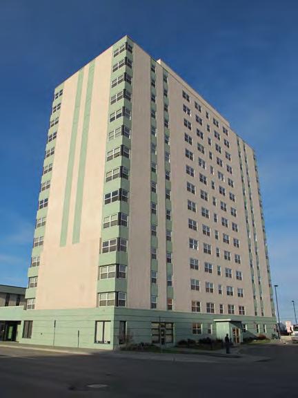
The Alaska State Historic Preservation Office (SHPO) was founded through the National Historic Preservation Act of 1966. The SHPO is part of the Office of History & Archeology, located within the Alaska Department of Natural Resources, Division of Parks and Outdoor Recreation. In 1967, Governor Walter J. Hickel appointed the first Alaska State Historic Preservation Officer.
The National Preservation Act of 1966 outlined the roles and responsibilities of the State Historic Preservation Office. As previously discussed in this chapter, duties of the SHPO include expansion of the National Register of Historic Places, as well as Section 106 review. The SHPO also provides education regarding historic preservation-related issues. For example, the Office of History and Archaeology coordinated with the National Oceanic and Atmospheric Administration to develop Maritime Heritage Awareness Workshops so Alaskans could learn about nautical archeology. The office also sponsors the Alaska Project Archaeology program, which is part of a statewide program that trains educators to teach students in grades four through seven about cultural resources in Alaska. In addition to hosting these education programs for the public, SHPO also provides technical assistance to local governments and reviews federal, state, and local projects.
Federal Rehabilitation Tax Credit Program
The federal rehabilitation tax credit program is coordinated through the SHPO, the National Park Service, and the Internal Revenue Service. Federal rehabilitation tax credit projects are reviewed by SHPO before they are sent to Washington, D.C., for review and certification. The National Park Service explains that “a 20% income tax credit is available for the rehabilitation of historic, incomeproducing buildings that are determined by the Secretary of the Interior, through the National Park Service, to be ‘certified historic structures.’ ”
The owners of McKinley Tower in Downtown received the 20% Federal Rehabilitation Tax Credit for a recent rehabilitation project.
HISTORIC PRESERVATION PLAN FOR ANCHORAGE’S FOUR ORIGINAL NEIGHBORHOODS ADOPTED 2/12/2013 AO 2013-01238
The National Park Service also offers a 10% tax credit for the rehabilitation of nonhistoric buildings constructed before 1936. For more information regarding federal tax incentives, see the National Park Service website at: http://www.nps.gov/tps/tax-incentives.htm.
Alaska Heritage Resource Survey
The duties of the SHPO also include management of the Alaska Heritage Resources Survey program. The Alaska Heritage Resources Survey (AHRS) is an inventory of all archeological, historical, architectural, and paleontological sites recorded in the State of Alaska. Resources listed on the AHRS are evaluated according to National Register criteria for historic significance and criteria; the State of Alaska does not maintain state criteria by which to evaluate resources.
More than 36,000 sites have been recorded in the AHRS to date. Basic data about the property, a physical description, and relevant historical information are compiled for each resource listed in the inventory. The AHRS is intended to prevent unwanted destruction of cultural resources. Although the inventory itself does not directly create protections, it can be used by various government agencies and private companies to responsibly plan for development projects that may affect historic resources. Access to inventory records is restricted to qualified personnel.
Archeological resources, which range from camps of early North American inhabitants to remains from the Cold War, are Alaska’s most common historic resource. Most of Alaska’s buildings and structures were built within the past 50 years and have not been evaluated for their historical or architectural significance. Since they are nearing the 50-year mark, the State Historic Preservation Office emphasizes that planning for the preservation of these resources needs to begin now.
CHAPTER III: HISTORIC PRESERVATION IN ANCHORAGE TODAY ADOPTED 2/12/2013 AO 2013-12 39
ALASKA’S PRESERVATION
GOALS
The Alaska State Historic Preservation Plan established six goals for historic preservation in Alaska, which are supported by the HPP:
Foster respect and understanding of Alaska’s archaeological and historic resources and promote a preservation ethic.
Continue existing partnerships and seek new ones to expand and strengthen the historic preservation community.
Expand efforts to identify, study, designate, interpret, and protect or treat significant archeological and historic resources.
Encourage consideration of archeological and historic resources in the planning and decision-making process of the public and private sectors.
Promote historic preservation as an economic development tool and provide incentives to encourage it.
Encourage appropriate treatment of historic resources.
Alaska State Historic Preservation Plan
The SHPO wrote Alaska’s first State Historic Preservation Plan in 1970. The current Plan (2011-2017), entitled “Saving Our Past,” is the third edition, and was updated in 2011. “Saving Our Past” identifies three priority needs: for a statewide agenda; for greater public awareness and understanding of historic preservation; and for connections between economics and historic preservation.
“Saving Our Past” acknowledges that Alaskans are proud of their state and heritage, and identifies the need for public outreach and a greater understanding of historic preservation. The State Historic Preservation Plan also emphasizes that federal and state historic preservation policies are not sufficient to accomplish the plan’s overall mission to “achieve supportable public policy and sustainable funding for historic preservation in Alaska.” To that end, the plan recommends that local governments “establish historic districts through zoning, enact design review ordinances, and provide property tax incentives. At this time, the Fairbanks North Star Borough is the only local unit of government in Alaska to provide a property tax incentive for rehabilitating properties.”
The Historic Preservation Plan for Anchorage’s Four Original Neighborhoods is a tool that may be used to empower the Municipality to create stronger historic preservation policy at the local level while supporting the goals identified in the State Historic Preservation Plan. Although Anchorage does not currently offer the preservation programs recommended by the state plan—zoning changes, design review, or property tax incentives—a discussion of how to incorporate these items into the Four Original Neighborhoods is included in Chapter VI: Preservation Vision, Goals & Policies.
HISTORIC PRESERVATION PLAN FOR ANCHORAGE’S FOUR ORIGINAL NEIGHBORHOODS ADOPTED 2/12/2013 AO 2013-01240
Alaska State Historic Preservation Laws
The Alaska Legislature passed historic preservation regulations of its own in what is known as the Alaska Historic Preservation Act of 1971. The Act created some important statutes for the state, including a State Historical Resources Commission, and protocol for historic resources threatened by public construction. Chapter 45.98 of the Alaska Statutes discusses the Historical District Revolving Loan Fund that was created for the state. The Act and the Loan Fund statutes are discussed in further detail below; for the full text of each, see Appendices B and C, respectively.
Alaska State Historic Preservation Act (1971)
The purpose of the Alaska State Historic Preservation Act of 1971 is to:
…preserve and protect the historic, prehistoric, and archeological resources of Alaska from loss, desecration, and destruction so that the scientific, historic, and cultural heritage embodied in these resources may pass undiminished to future generations.10
The Act explains how to designate monuments and historic sites, describes how those historic resources would be administered and funded, and gives the state the power to acquire historic, prehistoric, and archeological properties. The legislature finds that historic resources of the state are “properly the subject of concerted and coordinated efforts exercised on behalf of the general welfare of the public”; in other words, historic resources are important to Alaskans, and therefore the state is responsible for protecting these resources. To this end, the Act includes one section, Section 41.35.70, that establishes a protocol for the “preservation of historic, prehistoric, and archeological resources threatened by public construction.”
Similar to Section 106 of the National Historic Preservation Act, the statutes require state agencies to identify historic resources before the commencement of construction projects; determine whether historic resources will be adversely affected by public construction; and record and/or salvage historic resources. Unlike Section 106, though, the Alaska Historic Preservation Act does not encourage the state to avoid public construction projects that may adversely affect historic resources, nor does it require mitigation other than recordation and salvage.
For the full legislation, see Appendix B: Alaska Historic Preservation Act.
CHAPTER III: HISTORIC PRESERVATION IN ANCHORAGE TODAY ADOPTED 2/12/2013 AO 2013-12 41
Alaska State Historical Resources Commission
Section 300 of the Alaska Historic Preservation Act created the Alaska State Historical Resources Commission, discusses the composition and appointment of its members, and defines its responsibilities. These duties include continuing to research and expand on the history of the state; managing capacities for project review; and naming geographical features. A commissioner of the Alaska Historical Resources Commission may review projects; issue written direction to stop a public construction project; consult with local historical district commissions regarding the establishment of historic districts; and evaluate the eligibility of districts for the Historical District Revolving Loan Fund (AS 45.98).
Historical District Revolving Loan Fund
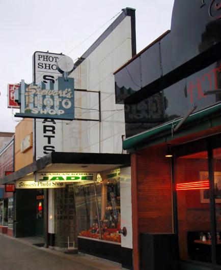
The Historical District Revolving Loan Fund was created under the Alaska Department of Commerce, Community, and Economic Development as an incentive to rehabilitate historic properties located within established historic districts listed on the National Register. Loans for a historic district are capped at $150,000,000, while loans for a historic property within the district are capped at $250,000. For the full legislation, see Appendix C: Alaska Historical District Revolving Loan Fund.
Anchorage’s Fourth Avenue became a Revolving Fund Historic District between D and G streets in 1986. Eight historic properties were located within the district: Old Federal Building, 4th Avenue Theatre, Old City Hall, Anchorage Hotel Annex, the Wendler Building, Felix Brown’s, the Loussac Building, and the Loussac-Sogn Building.
Fourth Avenue between D and G Streets became a Revolving Fund Historic District in 1986.
HISTORIC PRESERVATION PLAN FOR ANCHORAGE’S FOUR ORIGINAL NEIGHBORHOODS ADOPTED 2/12/2013 AO 2013-01242
Preservation & Alaska Native Peoples
In addition to archeological and architectural resources, Alaska is rich in cultural and tribal resources. Federally recognized tribes in the Cook Inlet include Chickaloon Village Traditional Council, Native Village of Eklutna, Kenaitze Indian Tribe, Knik Tribal Council, Ninilchik Traditional Council, Salmatof Tribal Council, Seldovia Village Tribe, and Native Village of Tyonek.11 These groups did not reside permanently in the Four Original Neighborhoods, but migrated seasonally through the area and used Ship Creek, Chester Creek, and Westchester Lagoon as regular fishing locations.
A Tribal Historic Preservation Officer (THPO) has not been designated in the State of Alaska to represent these tribes. However, the established Tribal groups and councils are contacted for consultation on a government-to-government basis for Section 106 projects.
Numerous programs currently exist that encourage the preservation, maintenance, and revitalization of Native culture and traditions. Many local tribes and foundations offer educational programs about the tribe to youth and young adults; support native language as well as thematic, cultural, and diversity studies; host language- and culture-based materials on their websites; and function as contacts for Section 106 Consultation and other related legislation. Major Anchorage-based institutions dedicated to the preservation and interpretation of Native culture, art, and traditions include the Anchorage Museum at Rasmuson Center and the Alaska Native Heritage Center (http:// www.anchoragemuseum.org/ and http://www.alaskanative.net/, respectively).
Several Tribal councils, corporations, and groups were consulted during the development of the HPP. This included two Tribal Consultation focus groups and subsequent ongoing correspondence with Alaska Native Peoples representatives. Through this valuable consultation, the project team and the public were able to learn about the long history of the Alaska Native Peoples in the plan area; the presence of culturally significant resources such as house pits and culturally modified trees; and the need for interpretation of the Alaska Native Peoples’ stories—especially positive and/or modern ones. Recognizing the role of the Alaska Native Peoples community in building Anchorage and exploring current cultural practices are every bit as valuable as prehistoric stories.
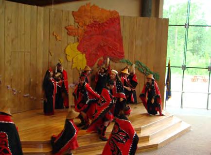 Dance performance at the Alaska Native Heritage Center.
CHAPTER III: HISTORIC PRESERVATION IN ANCHORAGE TODAY ADOPTED 2/12/2013 AO 2013-12 43
Alaska Native Claims Settlement Act (ANCSA)
To prepare for the participation of Alaska Native Peoples in historic preservation activities within the plan area, it is important to understand the organizational structure of the Alaska Native community, which generally includes tribes, corporations, and nonprofit foundations. The Alaska Native Claims Settlement Act (ANCSA) was the federal legislation that established this structure. The provisions of the law are summarized as follows by the University of Alaska’s Justice Center:
Passed in 1971, the Alaska Native Claims Settlement Act (ANCSA) extinguished Native land claims to almost all of Alaska in exchange for about one-ninth of the state’s land plus $962.5 million in compensation. By conveying Native land title to 12 regional and 200 local village corporations chartered under Alaska state law, ANCSA changed the relationship between Natives and the land from one of coownership of shared lands to one of corporate shareholding; i.e., land ownership was based on a corporate model, and governmental entities, including traditional or IRA [Indian Reorganization Act] “tribal” governments, were bypassed.12
The corporation system established by ANCSA differs from the reservation systems used in the Lower 48. Under ANCSA, Alaska Natives became shareholders in the regional and village corporations, which are run like traditional for-profit businesses. Cook Inlet Region, Inc. (CIRI) is the regional Native Corporation for the Cook Inlet, and consequently for Anchorage’s Four Original Neighborhoods. CIRI also has four affiliated nonprofit organizations: The CIRI Foundation provides education funding and services; Cook Inlet Housing Authority provides affordable housing and economic development opportunities; the Cook Inlet Tribal Council provides social, educational, and employment services; and the Southcentral Foundation provides health care and related services. The Alaska Native Heritage Center, Koahnic Broadcast Corporation, and the Alaska Native Justice Center were also founded by CIRI.13 Visit the CIRI website for more information about CIRI and its nonprofit foundations’ involvement in cultural preservation activities in Anchorage and beyond: http://www.ciri.com/content/history/ resources.aspx.
“Regional Corporations Established Pursuant to the Alaska Native Claims Settlement Act, December 18, 1971.”
HISTORIC PRESERVATION PLAN FOR ANCHORAGE’S FOUR ORIGINAL NEIGHBORHOODS ADOPTED 2/12/2013 AO 2013-01244
Municipality of Anchorage Preservation Programs
Historic preservation is far from new to the Municipality of Anchorage. In fact, the Municipality has been actively supporting historic preservation activities since the late 1970s and early 1980s, and has collaborated with local preservation nonprofit organizations such as Alaska Association for Historic Preservation (AAHP), Anchorage Historic Properties, Inc. (AHPI), the Anchorage Woman’s Club, and others. This Historic Preservation Plan for the Four Original Neighborhoods will promote the same preservation values that have underscored the Municipality’s efforts for many years, and thus it is important to understand the local programs and tools currently in place.
Historic Anchorage Preservation Program (1986)
In 1981 Anchorage voters approved a measure to fund “Anchorage Historic Railroad Town,” a preservation-related project that was considered under the Municipality’s “Project 80s” development program. The measure granted $4.5 million to fund the project; that allocation was reduced to $2.7 million through a series of municipal actions. The idea for Railroad Town was first raised in the late 1970s in response to the loss of many of the city’s earliest and most significant buildings. The proposal would relocate historic houses to Third and E streets (current site of the Saturday Market), to spark commercial development and save the buildings from demolition. Historic preservation was only one component of Railroad Town: office and retail space inspired by historic architecture was envisioned as a means to revitalize the eastern sector of Downtown.14
Although Railroad Town was never realized, it sparked the 1986 Historic Anchorage Preservation Program, a follow-up study commissioned by the Anchorage Assembly to plan ways to spend the remaining funding on historic preservation projects. This study was important in the Municipality’s preservation planning history as one of the first documents to clearly describe why historic resources in Anchorage should be valued. The study was developed in partnership with Anchorage Historic Properties, Inc. (AHPI), one of the first major preservation organizations in Anchorage.
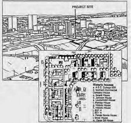 Plans for Anchorage Historic Railroad Town (1985).
Historic Anchorage Preservation Program (March 1986).
Plans for Anchorage Historic Railroad Town (1985).
Historic Anchorage Preservation Program (March 1986).
CHAPTER III: HISTORIC PRESERVATION IN ANCHORAGE TODAY ADOPTED 2/12/2013 AO 2013-12 45
CLGS IN ALASKA
According to the 1986 Preservation Program, citizens in Anchorage were supportive of historic preservation because:
1. Through understanding of our past we gain a sense of community pride, and see our lives as part of an ongoing community.
Anchorage is one of 13 CLGs in Alaska that have been certified since 1987:
North Slope Borough (April 20, 1987)
Matanuska-Susitna Borough (September 8, 1987)
Juneau City/Borough (March 7, 1988)
Dillingham (October 30, 1990)
City of Unalaska (January 24, 1991)
Ketchikan(January 31, 1991)
Fairbanks (March 17, 1992)
Fairbanks-North Star Borough (March 17, 1992)
Seward (May 18, 1992)
Sitka City/Borough (April 14, 1994)
Kenai (February 7, 1995)
Anchorage (March 30, 1995)
Cordova (October 19, 1995)
2. Historical points of interest are tourist attractions, strengthening Anchorage’s appeal for tourists and benefitting the retail and service sectors of the economy
3. Historic preservation will reinforce downtown Anchorage as an interesting and vital pedestrian environment.15
The 1986 Historic Anchorage Preservation Program has served as the foundation for the Municipality’s preservation activities, and many of the policies and implementation strategies presented in subsequent chapters of the HPP will build on and support the concepts in the 1986 program. The study is available on the HPP website at: http://anchoragehpp.com/documents/.
Certified Local Government (CLG)
The Municipality of Anchorage became part of the Certified Local Government, or CLG, program in 1995. Sponsored by the National Park Service (NPS), the CLG program is a partnership among local governments, the SHPO, and NPS. It was established to encourage direct participation of local governments in the identification, evaluation, registration, and preservation of historic properties in their jurisdictions. Certified local governments make every effort to integrate local preservation interests and concerns into local planning and decision-making processes.
Participation in the program connects local governments to technical assistance and provides grant opportunities; in turn, local governments must meet several requirements for certification, including maintaining an active program to designate historic resources. CLGs must also establish a process for local preservation planning, and, at a minimum, draft an outline of a historic preservation plan.
To accomplish these tasks, CLGs must establish a historic preservation commission to review historic resource nominations, pass historic preservation ordinances, and conduct project review.
HISTORIC PRESERVATION PLAN FOR ANCHORAGE’S FOUR ORIGINAL NEIGHBORHOODS ADOPTED 2/12/2013 AO 2013-01246
Anchorage Historic Preservation Commission
The Anchorage Historic Preservation Commission (AHPC) was founded in January 2007 to “encourage and further the interests of historic preservation by identifying, protecting, and interpreting the municipality’s significant historic and cultural resources for the economic and social benefit of the community.” As previously noted, one of the requirements of being a CLG is the creation of a historic preservation review commission. The AHPC was originally established as an 11-member commission, but was reorganized in 2010 as a 9-member commission.
*
The AHPC currently has four primary functions: to identify and inventory historic resources; to formulate a historic preservation plan for the entire Municipality; to provide public education and information about historic resources and historic preservation; and to review all historic preservation projects in the Municipality. The AHPC will also be responsible for creating and populating a local register in the future. The full powers and duties of the HPC were established by AO 2006-175, an ordinance adopted by the State Assembly, and are codified in Section 4.60.030 of the Anchorage Municipal Code. Recent projects undertaken by the AHPC include:
à Draft a Municipality-Wide Historic Preservation Plan (see below for details).
à Review and comment on Section 106 actions by Department of Transportation.
à Partner with the Cook Inlet Historical Society to plan and support Anchorage’s Centennial Celebration through the next three years with projects and events.
à Fundraise for continued operations of Oscar Anderson House Museum (managed by the Municipality’s Historic Preservation Officer).
à Make capital improvements to Pioneer Schoolhouse and Oscar Anderson House Museum.
à Complete the Centennial Legacy Interpretive Project for the Government Hill, Downtown, South Addition, and Fairview neighborhoods. This new effort is supported by the Downtown Partnership, Native Corporations, the Municipality, and the AHPC.
* As of May 2012, there are eight members on the AHPC, and one vacant chair.
CHAPTER III: HISTORIC PRESERVATION IN ANCHORAGE TODAY ADOPTED 2/12/2013 AO 2013-12 47
HISTORIC PRESERVATION PLANS IN ALASKA
The Anchorage Historic Preservation Commission has also adopted several resolutions that focus on preservation of the Pioneer Schoolhouse and operation of the Oscar Anderson House Historical Museum. Additionally, they have supported municipal lease of the Wireless Station in Government Hill to Anchorage Historic Properties, Inc. (Resolution 2011-03) and participation in development of the CityView Historic Preservation Geographic Information System Module (Resolution 2011-06).
Outside of Anchorage, the City/Borough of Fairbanks, the City/Borough of Juneau, and the City of Seward are among those local governments with a historic preservation plan in place. The format and content of these plans vary, and each strives to identify historic resources in the local community, define current preservation regulations, and outline preservation opportunities.
To learn more about these plans, search online at the following links:
City/Borough of Fairbanks http://co.fairbanks.ak.us/communityplanning/ HistoricPreservationCommission/Historic%20 Preservation_2-22-07.pdf
City/Borough of Juneau www.juneau.org/history/Preservation_Plan/ backgd.php
City of Seward www.cityofseward.net/hpc/commission/ seward_historic_preservation_plan.pdf
The full text of AO 2006-175 is included in Appendix D: Anchorage Historic Preservation Commission. Additional information about the HPC’s activities can also be found online at: www.muni.org/Departments/OCPD/Planning/Pages/HistoricPreservationCommission.aspx
Municipality-Wide Historic Preservation Plan
In addition to creating a historic preservation commission, another requirement of being a CLG is the preparation of a historic preservation plan. The Anchorage Historic Preservation Commission is currently in the process of drafting a comprehensive Municipality-Wide Historic Preservation Plan for the Anchorage area. The Plan will establish the structure of the future Anchorage local register; establish local historic preservation criteria; highlight significant historic themes; clarify design review procedures; and identify the Municipality’s long-term preservation goals. The Historic Preservation Plan for Anchorage’s Four Original Neighborhoods will fit within the larger municipality-wide plan. In fact, many of the strategies suggested herein may be expanded to other areas if they are successfully implemented in the Four Original Neighborhoods. Visit the AHPC website for updates about the Municipality-Wide Historic Preservation Plan for Anchorage.
HISTORIC PRESERVATION PLAN FOR ANCHORAGE’S FOUR ORIGINAL NEIGHBORHOODS ADOPTED 2/12/2013 AO 2013-01248
Anchorage Municipal Code
The Municipality of Anchorage is currently in the process of drafting a Municipality-wide historic preservation plan (described previously), and it has other ordinances in place to fund and manage historic preservation projects. The following sections of the Anchorage Municipal Code (AMC) are most relevant to historic preservation, and will be referenced throughout the HPP.
Comprehensive Plan & Zoning Ordinance (Title 21)
Although it contains little specific information about historic preservation, Title 21 is the most relevant section of the Anchorage Municipal Code because it guides the development of the built environment in the city. Title 21 focuses on regulations regarding zoning, subdividing, and development standards; sections relevant to the HPP are described below, and illustrated on the next page.
For the full text of Title 21, see: http://library.municode.com/index.aspx?nomobile=1&clientid=12717. Please note that some sections may not appear because Title 21 is currently being rewritten to implement the comprehensive plan, including the Anchorage 2020: Anchorage Bowl Comprehensive Plan, the Chugiak-Eagle River Comprehensive Plan, and the Turnagain Arm Comprehensive Plan.
Anchorage Comprehensive Plan (AMC 21.05.030)
An important part of regulating development is articulating a cohesive vision for future growth, and thus the Anchorage Comprehensive Plan is incorporated within Title 21. The Anchorage Comprehensive Plan, which is codified as Section 21.05.030 of the Anchorage Municipal Code, includes the following components: general plans that give broad, overall policy direction; functional plans that provide specific direction on topics such as environmental quality, streets and highways, and parks; and areaspecific plans that provide details for a particular geographic area. The Historic Preservation Plan for Anchorage’s Four Original Neighborhoods (HPP) will be adopted as an element of the comprehensive plan. See Appendix E: Anchorage Comprehensive Plan (21.05.030) for the full text, and see the flow chart on the following page.
Historic Sign Designation (AMC 21.47.090)
In 2003, a clause regarding regulations for historic signs (Regulations for Nonconforming Signs, AMC 21.47.090) was added to the Anchorage Municipal Code. The code states that the Urban Design Commission may grant exceptions to sign regulations to protect historic signs.
Anchorage Comprehensive Plan (AMC 21.05.030) flow chart illustrates the relationship of the HPP with the Anchorage Comprehensive Plan, which is contained within Title 21 of the Anchorage Municipal Code (AMC 21.05.030). This section of Title 21, in turn, guides the Municipality’s annual capital improvement projects and federal/state projects.
CHAPTER III: HISTORIC PRESERVATION IN ANCHORAGE TODAY ADOPTED 2/12/2013 AO 2013-12 49
Annual Capital Improvement Projects Informed from • District/Area Plans • Transportation Plans • Community Councils • Elected Officials Federal/State Projects Guided by national policy if it is federally funded • Section 106 • All District/Area Plans • Design • Location • Mitigation
21.05.030 (E) Streets & Highways • Muni Transportation Plan • Official Streets and Highways Plan 21.05.030 (A) (B) (C) • Comprehensive Plans • District/Area Plans (Neighborhood Plans) 21.05.030 (D) Environmental Quality *PROPOSED* 21.05.030 (G) Historic Preservation Cultural & Historic Resources 21.05.030 (F) Parks, Greenbelts & Recreation This
The Historic Preservation Project Fund was recently used by the AHPC to support the replacement of the Pioneer Schoolhouse Roof.
In 2007, the Municipality approved an ordinance to establish standards for variances from the sign standards and to establish criteria for granting historic sign designation. To qualify as historic, a sign must: have been in continuous use at its present location for more than 40 years; not be significantly altered; be structurally safe or made so without compromising its historic integrity; and continue to be beneficial to the public good. Additionally, the sign must be of unique/exemplary design or be associated with a significant historic/cultural event.
Anchorage Historic Preservation Commission (AMC 4.60.030)
The powers and duties of the Anchorage Historic Preservation Commission are set forth in Chapter 4.60.030 of the Anchorage Municipal Code. For the full code, see: Appendix D: Anchorage Historic Preservation Commission.
Anchorage Historic Preservation Project Fund (AMC 6.100)

The Anchorage Municipal Code (AMC Chapter 6.100) established a Historic Preservation Project Fund based on monies generated through public donation or on the loan payments, interest, sales, or lease of historic properties in that city. The purpose of the fund is to identify, initiate, negotiate, and administer historic preservation projects in Anchorage. The Historic Preservation Project Fund is administered by the city’s Historic Preservation Commission; the balance of the fund fluctuates, since it is a revolving fund and spending varies annually according to AHPC disbursements. To date, the Fund has been used by the AHPC to support the following activities:
à Pioneer Schoolhouse Roof ($125,000, matching funds)
à Operations at the Oscar Anderson House ($25,000)
à CityView module: consolidated survey of historic properties in the Four Original Neighborhoods ($15,000)
For the full code, see: Appendix F: Anchorage Historic Preservation Fund.
HISTORIC PRESERVATION PLAN FOR ANCHORAGE’S FOUR ORIGINAL NEIGHBORHOODS ADOPTED 2/12/2013 AO 2013-01250
Economic Development Property (AMC 12.35)
Financial incentives for development are currently offered by the Municipality in the Anchorage Municipal Code (AMC Chapter 12.35). The most recent ordinance, passed in 2009, allows for the following incentives for developers to offset the high cost of construction:
à Economic Development Property: New income-producing properties may receive partial or total exemption from real and personal property taxation for up to five years (AMC 12.35.040).
à Deteriorated Property: Deteriorated commercial properties may receive partial or total exemption from real and personal property taxation for up to 10 years for properties (AMC 12.35.050).
à Municipal Fee Relief: Deteriorated commercial properties may receive a partial waiver or total exemption from municipal fees for development.16
These incentives are intended to encourage redevelopment of underutilized, deteriorated properties and to boost economic development. Although these incentives are neither currently focused on nor tailored to historic preservation, they are mentioned here because they could be useful tools to implement the historic preservation goals of the Four Original Neighborhoods.
For the full code, visit the Anchorage Downtown Partnership’s website: http://www.anchoragedowntown.org/about-downtown/development/development-incentives/.
Heritage Land Bank (AMC 25.40)
The Municipality of Anchorage established a Heritage Land Bank (HLB) for the purpose of managing uncommitted Municipal land and promoting orderly development in accordance with the goals of the comprehensive plan. The HLB is responsible for acquiring, identifying, managing, and transferring municipal lands not assigned to a particular agency or department. Land disposals managed by the HLB include land sales, land exchanges, leases, and easements, all of which could be applicable to historic preservation in the Four Original Neighborhoods. The Heritage Land Bank is overseen by a seven-member HLB Advisory Commission. For the full code (AMC Chapter 25.40), visit http://library. municode.com/index.aspx?clientId=12717
CHAPTER III: HISTORIC PRESERVATION IN ANCHORAGE TODAY ADOPTED 2/12/2013 AO 2013-12 51
Anchorage Preservation Organizations
In addition to the official rules and regulations listed above, the contributions of local nonprofit organizations are an essential component of Anchorage’s existing historic preservation program. Although numerous heritage groups are dedicated to the preservation and management of cultural resources throughout the Anchorage Bowl, the organizations highlighted here contribute most directly today to historic preservation in the Four Original Neighborhoods. These organizations will likely be responsible for executing many of the policies and implementation strategies discussed in later chapters of this document.
Alaska Association for Historic Preservation
The Alaska Association for Historic Preservation (AAHP), founded in 1982, is a statewide nonprofit organization dedicated preserving Alaska’s prehistoric and historic resources. AAHP’s primary tasks are to aid in preservation projects across the state and to serve as a liaison among local, statewide, and national historic preservation groups. Currently, AAHP is headquartered in the historic Oscar Anderson House in Anchorage.
Duties and activities of AAHP include:
à Acts as a local partner of the National Trust for Historic Preservation;
à Partners with and advocates for other local nonprofit preservation organizations, such as Iditarod Historic Trail Alliance, Friends of Nike Site Summit, and others;
à Serves as a consulting party for Section 106 process;
à Manages annual list of Alaska’s Ten Most Endangered Historic Properties, and sponsors a related matching-grant program;
à Publishes quarterly newsletter;
à Holds educational workshops for the public and historic preservation professionals; and
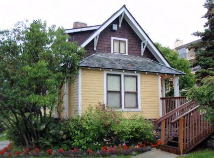
à Sponsors annual preservation awards.
Additional information about the Alaska Association for Historic Preservation is available online at http://www.aahp-online.net/.
The Oscar Anderson House (1915) serves as the headquarters of AAHP and its partner organizations.
HISTORIC PRESERVATION PLAN FOR ANCHORAGE’S FOUR ORIGINAL NEIGHBORHOODS ADOPTED 2/12/2013 AO 2013-01252
Anchorage Woman’s Club
The Anchorage Woman’s Club (AWC) was formed in 1915 with the primary goal of building the city’s first school, what is now called the Pioneer Schoolhouse. The schoolhouse was used for one year as a school and then became a meeting hall for many years. After the 1964 Good Friday Earthquake, the AWC relocated the schoolhouse to its present location at the corner of E. 3rd Avenue and Eagle Street, saving it from demolition. The AWC leases the Pioneer Schoolhouse from the Municipality of Anchorage, and has maintained and managed the building since 1965. The historic Pioneer Schoolhouse serves as the headquarters and administrative offices of the AWC. The schoolhouse is available for meetings and events on a rental basis.
Each spring the AWC performs re-creations of school life in 1915 for Anchorage School District students. The group also performs community service and hosts fund-raisers and events. Additional information about the Pioneer Schoolhouse and the activities of the AWC is available online at http:// www.pioneerschoolhouse.com
Cook Inlet Historical Society
In 1955, the Cook Inlet Historical Society (CIHS) was founded to focus on the history of the Anchorage area and, shortly thereafter, to raise funds for the creation of an Anchorage Museum. The Museum, located at 625 C Street, opened its doors in 1968 and today CIHS provides a forum by which to explore the local history and ethnography of the Anchorage area and the Cook Inlet region. Much of the material the CIHS has researched makes up the permanent Alaska Gallery exhibit in the Museum. Additionally, the CIHS is the designated lead for the Anchorage Centennial (2015), with events planned for 2012 and the following three years.
Additional information about the Cook Inlet Historical Society is available online at www.cookinlethistory.org and http://www.anchoragemuseum.org/about/aboutus_donors.aspx.
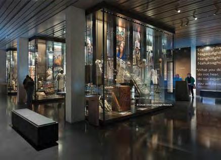 The Pioneer Schoolhouse was Anchorage’s first school, and is now the headquarters of the Anchorage Woman’s Club.
The Cook Inlet Historical Society operates out of the Anchorage Museum.
The Pioneer Schoolhouse was Anchorage’s first school, and is now the headquarters of the Anchorage Woman’s Club.
The Cook Inlet Historical Society operates out of the Anchorage Museum.
CHAPTER III: HISTORIC PRESERVATION IN ANCHORAGE TODAY ADOPTED 2/12/2013 AO 2013-12 53
HISTORIC PRESERVATION PLAN FOR ANCHORAGE’S FOUR ORIGINAL NEIGHBORHOODS ADOPTED 2/12/2013 AO 2013-01254
PAST & CURRENT PLANNING IN ANCHORAGE
The Municipality of Anchorage conducts many programs that govern its current and longterm planning, yet what do these programs say about historic preservation? Do they identify historic resources in the Downtown, Fairview, Government Hill, and South Addition neighborhoods? Aside from the Historic Preservation Project Fund created by the Anchorage Municipal Code, are other resources in place for historic preservation?
This chapter reviews how current and past Municipal plans address historic preservation in the Four Original Neighborhoods of Anchorage.
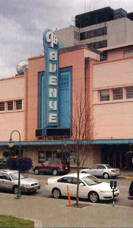
All these plans are or will become part of the Anchorage Comprehensive Plan as outlined in Title 21 of the Anchorage Municipal Code (Section 21.05.30, described above).
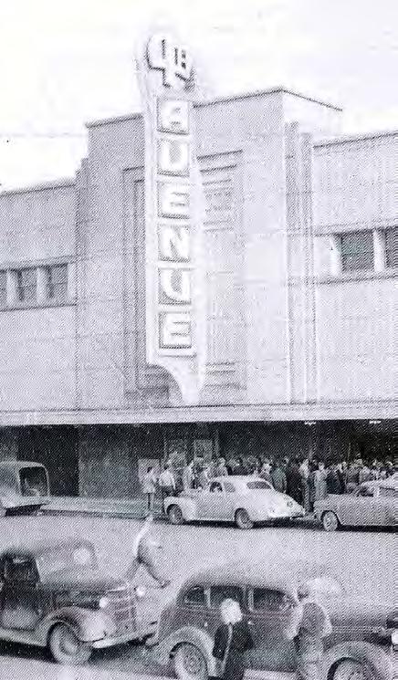 Fourth Avenue Theatre, 1947 & 2008.
CHAPTER IV: PAST & CURRENT PLANNING IN ANCHORAGE ADOPTED 2/12/2013 AO 2013-12 55
The Municipality has been working towards the Urban Transition Scenario set forth in Anchorage 2020 (discussed in detail in Chapter VI of the HPP).
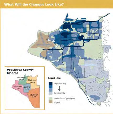
Anchorage 2020: Anchorage Bowl Comprehensive Plan
In 1961 the Municipality of Anchorage drafted its first comprehensive plan to create a vision and development plan for Anchorage. Adopted on February 20, 2001, the Anchorage 2020: Anchorage Bowl Comprehensive Plan (called Anchorage 2020) is the city’s fourth comprehensive plan covering the Anchorage Bowl area. The purpose of the plan is to:
1. Establish a process among elected officials, municipal staff, and interested citizens to create a 20-year plan for land-use policy;
2. Communicate that policy to property owners, developers, elected and appointed officials, and other interested parties; and
3. Guide elected and appointed officials as they deliberate community development issues.
More specifically, the plan directs future growth in the Anchorage Bowl area and provides recommendations regarding the protection of natural areas and open space in relation to development.
Relevant Policies
Anchorage 2020 includes many provisions relevant to historic preservation, but most important is Policy #51, which directs the Municipality to prioritize historic preservation.
Policy #51: “The Municipality shall define Anchorage’s historic buildings and sites and develop a conservation strategy.”
Many other policies related to land use, urban design, zoning, density, housing affordability, open space, arts and culture, and education indirectly overlap with historic preservation goals. This HPP will support all these policies to help realize Anchorage 2020. For a complete list of Anchorage 2020 policies that are relevant to historic preservation in the Four Original Neighborhoods, see Appendix G: Anchorage 2020 Relevant Policies.
HISTORIC PRESERVATION PLAN FOR ANCHORAGE’S FOUR ORIGINAL NEIGHBORHOODS ADOPTED 2/12/2013 AO 2013-01256
Implementation Strategies
Anchorage 2020 identifies strategies that are essential to the implementation of the land-use and design policies described above. Most relevant to the HPP are the strategies identified to implement Policy #51:
à Functional Plan (Historic Preservation Plan): Study of and recommendations for the city’s future preservation needs
à Neighborhood or District Plans: Detailed plans or studies for defined geographic area
à Conservation Easements: Property rights are sold to a third-party conservator to protect the building
à Development Rights-Purchase: Property owner sells development rights to a government agency
à Development Rights-Transfer: Property owners buy development rights from another property owner or sell them to others
Other strategies relevant to the Four Original Neighborhoods include Heritage Land Bank activities and decisions; Infill, Redevelopment, and Reinvestment Incentives to spur economic development; and Overlay Zones to create special zoning districts with regulatory incentives or restrictions. These historic preservation-related implementation strategies are fully defined in Appendix H: Anchorage 2020 Relevant Implementation Strategies.
Anchorage 2020 Planning Principles
Also applicable to the Historic Preservation Plan for Anchorage’s Four Original Neighborhoods are the “Anchorage 2020 Planning Principles,” which are intended to direct future public and private development in order to achieve the plan vision. Anchorage 2020 includes two sets of Planning Principles: Design and Environment, and Public Facilities and Services. These principles articulate a desire to preserve the identity and vitality of neighborhoods in Anchorage as well as a balanced and diverse supply of housing options.
ANCHORAGE 2020 PLANNING PRINCIPLES FOR DESIGN AND ENVIRONMENT
Encourage architectural design that is responsive to the northern climate and seasonal light conditions.
Adopt design standards that are suited to a northern urban environment to help revitalize streetscapes.
Design and landscape roads to maintain and enhance the attractiveness of neighborhoods, open space, and commercial corridors and centers, and to reduce adverse impacts on neighborhoods.
Promote community connectivity with safe, convenient, year-round auto and nonauto travel routes within and between neighborhoods, and to neighborhood commercial centers and public facilities.
Link subdivision design with a sense of place to highlight connections to Anchorage’s coastal setting, watersheds, mountains, wildlife, and subarctic forest and vegetation.
Conserve Anchorage’s heritage of historic buildings and sites.
Protect Anchorage’s scenic views.
CHAPTER IV: PAST & CURRENT PLANNING IN ANCHORAGE ADOPTED 2/12/2013 AO 2013-12 57
ANCHORAGE 2020 PLANNING PRINCIPLES FOR PUBLIC FACILITIES AND SERVICES
• Use public infrastructure to help revitalize or renew aging neighborhoods.
• Improve maintenance, landscaping, and snow removal for streets, bus stops, sidewalks, bike lanes, trails, paved paths; and associated landscaping.
• Promote Downtown as the center for commerce, finance, government, arts, and culture.
The plan also identifies the need for well-planned development that incorporates the unique northern setting of the city and year-round public transportation respective of Anchorage’s natural and built environments.
The sidebars in this section highlight selected planning principles that are most relevant to historic preservation, and will be supported by the HPP. The full list of Planning Principles for Design and Environment and for Public Facilities and Services are located in Appendix I: Anchorage 2020 Relevant Planning Principles of this report.
HISTORIC PRESERVATION PLAN FOR ANCHORAGE’S FOUR ORIGINAL NEIGHBORHOODS ADOPTED 2/12/2013 AO 2013-01258
Anchorage Downtown Comprehensive Plan (2007)
The Municipality developed and approved the Anchorage Downtown Comprehensive Plan (ADCP) in 2007 to guide the future development of the central business district. This effort was one of the implementation strategies suggested in Anchorage 2020. The ADCP focuses on land-use policy and implementation in the Downtown neighborhood. Specifically, the ADCP responds to three policies identified in Anchorage 2020:
#18: Strengthen the role of the CBD [Central Business District] as the regional center for commerce, services, finance, arts and culture, government offices, and medium- to highdensity residential development.
#19: Locate municipal, state, and federal administrative offices in the CBD.
#23: Downtown is a designated major employment center.
The ADCP established the overarching goal of creating a “Downtown for All.” Additional goals of the ADCP include the creation of more housing Downtown, development incentives, improved transportation connectivity, activation of the ground floor of businesses, and creation of a sensible regulatory framework. The goals of the HPP will support this vision for Downtown Anchorage.
Additionally, 14 of Downtown’s most prominent historic resources were identified as assets to the neighborhood in the “Existing Conditions Analysis” completed during the early stages of the ADCP planning process. This is good news for historic preservation. Continued support and community-wide recognition of these 14 historic buildings were reiterated through the HPP public comment process.
See Appendix J: Downtown Comprehensive Plan: Existing Conditions Analysis for a full list.
The Anchorage Downtown Comprehensive Plan (2007) established the goal of creating a “Downtown for All.”
CHAPTER IV: PAST & CURRENT PLANNING IN ANCHORAGE ADOPTED 2/12/2013 AO 2013-12 59
7. Establish Strategies for Downtown Historic Preservation Downtown Anchorage features a rich and diverse collection of significant historic and cultural sites that has increasingly become a major focal point of attraction for both Alaskan residents and out-of-state visitors.
This section recommends the development of an overarching historic preservation strategy specifi cally for Downtown, to be undertaken by the Anchorage Historic Preservation Commission (AHPC), to identify historic resources, issues and opportunities, and create a
framework of historic preservation policies, guidelines and strategies for Downtown. The general policy objectives for this effort would be to:

Promote public awareness of Downtown’s historic resources and their value for the future of Downtown and the overall community;
Promote consideration of historic resources in planning and development decisions by the public and private sectors;
Promote strategic partnerships to further the interests of historic preservation; and
Relevant Policy Objectives
The “Land Use and Economic Development” section of the ADCP recommended many strategies for Downtown historic preservation to be undertaken by the Anchorage Historic Preservation Commission. The HPP will support the ADCP historic preservation issues and strategies, outlined as follows on page 68 of the ADCP:
Historic and Cultural Resources Diagram
Historic and cultural resources were identified in the Anchorage Downtown Comprehensive Plan (2007).
Downtown Anchorage features a rich and diverse collection of significant historic and cultural sites that has increasingly become a major focal point of attraction for both Alaskan residents and outof-state visitors. This section recommends the development of an overarching historic preservation strategy specifically for Downtown…to identify historic resources, issues and opportunities, and create a framework of historic preservation policies, guidelines and strategies for Downtown. The general policy objectives for this effort would be to:
à Promote public awareness of Downtown’s historic resources and their value for the future of Downtown and the overall community;
à Promote consideration of historic resources in planning and development decisions by the public and private sectors;
à Promote strategic partnerships to further the interests of historic preservation; and
à Leverage historic resources as cultural and economic development assets for the future growth and vitality of Downtown.18
See Appendix K: Downtown Comprehensive Plan: Relevant Policy Objectives for a discussion of additional policies that overlap the vision and goals of the HPP.
HISTORIC PRESERVATION PLAN FOR ANCHORAGE’S FOUR ORIGINAL NEIGHBORHOODS ADOPTED 2/12/2013 AO 2013-01260
68 anchorage downtown comprehensive plan LAND USE AND ECONOMIC DEVELOPMENT New Convention Center (underway) h.1 n.1 n.2 n.3 n.3 n.5 n.7 n.6 n.8 n.9 n.11 n.10 n.12 n.4 n.13 h.2 h.3 h.4 h.5 AL EK 9TH C H 5TH 8TH 6TH 4TH 7TH 3RD 2ND BARROW DENALI CHRISTENSEN 2ND D CORDOVA F B EAGLEDENALI 1ST 10TH N Knik Arm Delaney Park Museum of History and Art Memorial Cemetery 5th Avenue Mall Egan Center Performing Arts Center City Hall Town Square State Courthouse Fire Station Hilton Hotel Federal Building Nordstrom's Federal Building Captain Cook Hotel Marriott Hotel Conoco Phillips Atwood Building Quyana Park Weekend Market Sheraton Kimballs n.6 n.7 n.8 n.9 n.5 n.3 n.4 Delaney Park Strip Historic Sites National Register Sites h.1 h.4 h.2 h.3 h.5 n.1 n.2 Alaska Railroad Depot Leopold David House Pioneer School House Old Federal Building The Anchorage Hotel Oscar Anderson House 4th Avenue Theatre Old City Hall Wendler Buildingn.10 Loussac-Sogn Buildingn.11 Kimball Building Anchorage Cemetery Gill Oscar House n.12 n.13 n.14 Alaska Engineering Commission Cottages Historic Anchorage Homes Resolution Park/Captain Cook Monument Holy Family Cathedral Log Cabin Visitor Information Center Legend "Notable"Building Footprint Park/OpenSpaceDowntownStudyArea DowntownCoreArea
Recommended Actions and Programs
To implement these policy objectives, the ADCP recommended the consideration of a historic overlay zone in Downtown to help define key historic areas as well as to serve as a cultural anchor to preserve and celebrate Downtown’s heritage and unique sense of place. It was anticipated that an overlay zone would provide a focus area for incentives, programs, and development guidelines related to historic preservation. In addition to the creation of such a zone, the ADCP identified other potential actions or programs, such as:
à Maintaining an inventory of historic resources;
à Recommending procedures to identify and designate historic resources;
à Providing financial incentives such as grants, tax relief, loans, and/or loan guarantees;
à Furnishing information to historic property owners on methods of maintaining and rehabilitating, and the like;
à Developing guidelines for historic preservation, and identifying appropriate zoning and development provisions applicable to historic properties; and/or
à Expanding public information and interpretive programs and activities.19
Many of these strategies are expanded on in later chapters of this HPP and could be applied across the Four Original Neighborhoods.
CHAPTER IV: PAST & CURRENT PLANNING IN ANCHORAGE ADOPTED 2/12/2013 AO 2013-12 61
Other Plans & Documents

Concepts discussed in the Historic Preservation Plan for Anchorage’s Four Original Neighborhoods— especially those related to quality-of-life issues, design standards and guidelines, transportation and infrastructure, and Municipality-owned buildings—also overlap with policies and regulations established in other municipal planning documents. The policies and implementation strategies in the HPP will need to be coordinated with these other documents to effectively achieve the Municipality’s preservation goals.
Area-Specific Plans

Government Hill Neighborhood Plan (2012)
The Government Hill Neighborhood Plan (GHNP) is currently being prepared by the Municipality of Anchorage. The purpose of the plan is to identify those assets and values important to the community and to celebrate the area’s heritage as the first neighborhood in the city. Like the Historic Preservation Plan for Anchorage’s Four Original Neighborhoods, the GHNP is a mitigation measure for indirect effects identified during the Section 106 consultation process for the Knik Arm Crossing Project. The Municipality of Anchorage has held a series of public workshops and design charrettes to begin preparing the GHNP, which is scheduled for completion in December 2012. For more information about the GHNP, visit: http://www.anchorageghnp.com/GHNP/Home.html.
Fairview Community Plan (2009)

After the adoption of Anchorage 2020 enabled the creation of official Neighborhood Plans, members of the Fairview Community Council prepared a draft community plan for their neighborhood. The Fairview Community Plan documented the history of the area, identified common values and goals, and advocated that the neighborhood be revitalized through a variety of action strategies. A Revised Final Draft was published in 2009; the draft currently awaits formal adoption in the Municipal Assembly. For more information about the draft Fairview Neighborhood Plan, visit: http://www. communitycouncils.org/servlet/content/644.html
 Government Hill Neighborhood Plan (2012).
Public Review Draft
GOVERNMENT HILL NEIGHBORHOOD PLAN
PUBLIC REVIEW DRAFT AUGUST 10, 2012
Fairview Community Plan (2009).
Government Hill Neighborhood Plan (2012).
Public Review Draft
GOVERNMENT HILL NEIGHBORHOOD PLAN
PUBLIC REVIEW DRAFT AUGUST 10, 2012
Fairview Community Plan (2009).
HISTORIC PRESERVATION PLAN FOR ANCHORAGE’S FOUR ORIGINAL NEIGHBORHOODS ADOPTED 2/12/2013 AO 2013-01262
Anchorage Bicycle Plan Bicycles as a Mode of Transportation
Ship Creek Master Plans
The Municipality of Anchorage has been working for many years to plan for Ship Creek’s future, starting with the Ship Creek/Waterfront Land Use Plan (adopted in 1991 as part of the Anchorage Comprehensive Plan). In 1998, the Alaska Railroad and the Municipality of Anchorage initiated a 20-year master planning effort at Ship Creek that would redevelop the area into an intermodal transit hub. The Ship Creek Master Plan examines potential uses such as housing, hotels, retail, restaurants, trails and recreation, arts and crafts, transportation facilities, and a railroad museum. The plan also focuses on public access, transportation, environmental quality, area-based land use, and historical restoration. The Municipality will initiate an update to the 1998 plan in early 2013. The Alaska Railroad has since been working to complete upgrades to its facilities and infrastructure and to prepare design guidelines to shape future development. The renovation of its historic freight shed—Alaska’s first historic building certified under the U.S. Green Building Council’s Leadership Energy and Environmental Design (LEED) program—is a key project for the revitalization of Ship Creek. Completed in 2011, this project is intended to catalyze the vision of Ship Creek as a community commerce center and to create a market atmosphere akin to Vancouver’s Granville Island or Seattle’s Pike Place Market.20
Functional Plans
The Municipality and other agencies have prepared a number of functional plans to address specific concepts and/or property types. The following plans are applicable to the Four Original Neighborhoods and may overlap with the concepts discussed in the HPP:
Environmental Quality
Anchorage Wetlands Management Plan (1995, update currently in progress)*
Parks, Greenbelts, and Recreational Facilities
Anchorage Bicycle Plan (2010)
Anchorage Pedestrian Plan (2007)
Anchorage Bowl Park, Natural Resource, and Recreation Facility Plan (2006)*
Anchorage Area-Wide Trails Plan (1997, update currently in progress)*
Anchorage Metropolitan Area Transportation Solutions Traffic Department - Municipality of Anchorage
An element of the MOA Nonmotorized Transportation Plan
CHAPTER IV: PAST & CURRENT PLANNING IN ANCHORAGE ADOPTED 2/12/2013 AO 2013-12 63
March 2010 AO2010-08
Streets and Highways
2035 Metropolitan Transportation Plan (2011-12, currently undergoing Assembly adoption process)*
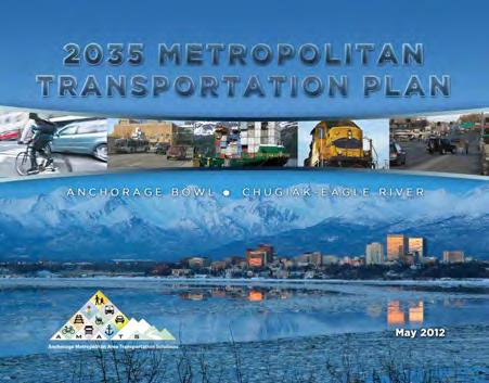
Strategy for Developing Context Sensitive Transportation Projects (2008)
Official Streets and Highways Plan (2005)*
Street and Highway Landscape Plan (1981)*
Facilities Management
Anchorage School District Capital Improvements Master Plan (2011)
Regional Port of Anchorage Master Plan (1999)
Joint Base Elmendorf-Richardson Facilities Master Plan
Economic Development
Live.Work.Play. 2025 Initiative (2011, prepared by Anchorage Economic Development Corporation)
Anchorage Comprehensive Economic Development Strategy (2009-2013)
* Included as an element of the Anchorage Comprehensive Plan (AMC 21.05.030).
Transportation Projects
The planning of two transportation projects is currently under way. Both could affect the historic character of the Four Original Neighborhoods: Knik Arm Crossing (KAC), a bridge across the Knik Arm connecting the Matanuska-Susitna Borough and Anchorage, and Highway to Highway (H2H), which would connect the Seward and Glenn Highways. Although these projects are not addressed directly in this document, the HPP can be used as a tool to influence the design and planning of these and other transportation projects. For those interested in managing the effects of these and other similar projects, please read Chapters VI and VII of the HPP to gain a clear understanding of the effectiveness of public participation.
More information is available online: http://www.knikarmbridge.com/
2035 Metropolitan Transportation Plan (2012).
HISTORIC PRESERVATION PLAN FOR ANCHORAGE’S FOUR ORIGINAL NEIGHBORHOODS ADOPTED 2/12/2013 AO 2013-01264
HISTORIC CONTEXT & SURVEYS
Important themes and patterns of development in a community are established through survey and preparation of a historic context statement. These important tools, described in the sidebar, serve as the building blocks of a historic preservation plan. With a good understanding of its historic and cultural resources, a community is able to make informed planning decisions.
This chapter first includes a historical context statement of the Dena’ina Athabascan people and the Four Original Neighborhoods. The context statement does not provide an exhaustive history, but rather summarizes important themes and patterns in the development of the historic core of Anchorage. The history of the Four Original Neighborhoods—Anchorage’s historic core—reflects all periods of Anchorage’s development. Waterways within the plan area provided sustenance to the early Dena’ina Athabascan people, and the events that defined Anchorage during the first half of the 20th century—construction of the railroad, the birth of aviation, and military build-up—were all concentrated in the plan area. A detailed discussion of the history of each neighborhood is found in Chapter VII: Neighborhood Character, Goals & Policies.
Second, the chapter summarizes surveys of historic resources that were conducted in each of Anchorage’s Four Original Neighborhoods over the past 50 years. In support of the HPP, the findings, meaning the evaluations of the resources documented in these surveys, are being compiled into an inventory. This Consolidated Historic Resources Inventory is currently under construction, but will be accessible to the public through the Municipality’s website when complete. The inventory will identify historic resources located in each of the Four Original Neighborhoods. A “Consolidated Historic Resources Inventory Survey Report” that summarizes the results of the inventory will be prepared as a parallel effort to the HPP.
WHY CONDUCT SURVEYS?
A survey is a means to identify and document historic resources. The information collected through survey is then cataloged into a historic resources inventory—a list or spreadsheet of the resources that were identified and documented. As the National Park Service explains, the purpose of a survey is “to gather the information needed to plan for the wise use of a community’s resources.” Once resources have been documented and evaluated for historic and cultural significance, those findings may inform future planning decisions.
WHAT IS A HISTORIC CONTEXT STATEMENT?
A historic context statement identifies themes and patterns that were important to the development of a community. Context statements do not represent exhaustive histories of a place, nor do they evaluate individual properties; rather, they identify the key factors that shaped the community and make it possible for resources associated with these historically and culturally significant factors to be identified.
CHAPTER V: HISTORIC CONTEXT & SURVEYS ADOPTED 2/12/2013 AO 2013-12 65
Alaska Native Peoples History
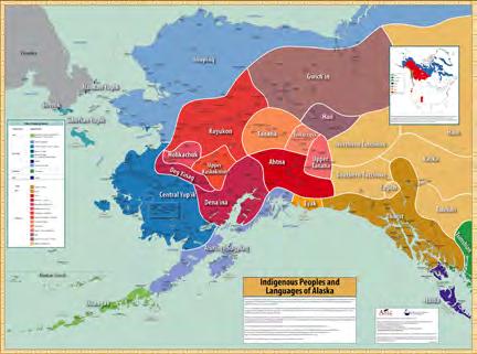
History of the Dena’ina Athabascans of Upper Tikahtnu (The Upper Cook Inlet)
The following passage about the history of the Dena’ina Athabascan people from prehistory to the present was written by the Cultural and Education Department of the Knik Tribal Council, and is quoted in its entirety at the request of the Municipality.
Preface
The Dena’ina Athabascan people are the indigenous people of Tikahtnu (Cook Inlet) area and southcentral Alaska. There are four distinct dialects of Dena’ina; Upper Tikahtnu, Outer Tikahtnu, Lakes region, and Interior (middle Kuskokwim; near the Stony River). The lands and waters of Upper Tikahtnu: Anchorage, Eklutna, Knik, Wasilla, Palmer, Girdwood, and Chickaloon lie within Dena’ina Ełnena (Dena’ina Country). Specifically, it is home to the K’enaht’ana, the indigenous people of Nuti (Knik Arm), who today are members of Eklutna (Idlughet) and Knik (K’enakatnu) Tribes. Following the recession of the glaciers in Tikahtnu, a large valley was created and fed by many rivers. The Matanuska and Knik Rivers today come together at their confluence with Knik Arm; however, it is probable that at one time they joined as one river, discharging into Tikahtnu at the strait between Anchorage and Point MacKenzie. Subsequent earthquakes, land-slides, flooding and erosion have widened the channel between the two points, creating Knik Arm.
Shem Pete:
From Mackenzie across to Dgheyay Leht (Ship Creek) used to be a short distance, like a river, they used to tell me. They cut fish with an ulu knife out there. They used to speak to them and toss the ulu back and forth, they told me. “Impossible,” I told them. But then it happened that it got wider. It might have eroded about a mile. But before, the banks were close together and they used to toss the ulu back and forth. I heard that from those old people.21
Map of Indigenous Peoples and Languages of Alaska (2011)
HISTORIC PRESERVATION PLAN FOR ANCHORAGE’S FOUR ORIGINAL NEIGHBORHOODS ADOPTED 2/12/2013 AO 2013-01266
Early History
Near the end of the last ice-age 10,000 to 7,000 years ago, as the glaciers in the Tikahtnu receded, it opened a corridor to fresh new lands and access to the ocean, allowing human occupation. Approximately 6,000 years ago, salmon began to spawn in Tikahtnu waters; it didn’t take long for people to take advantage of their abundance. Around 2,000 years ago the Dena’ina Athabascans were a thriving culture in Tikahtnu. Protected by the Chugach and Talkeetna Mountains and the great Alaska Range, they fished, hunted, trapped and gathered wild plants in and around numerous glacially fed rivers, streams and lakes. By the time the British and Russians came ashore in Outer Tikahtnu during the late 1700s the Dena’ina were already a dynamic, a socially complex, and wide-spread people, with a matrilineal clan system. Their language “is one of the most complex languages in the world. It’s harder than differential calculus.”22
The Dena’ina Athabascans transitioned from nomadic people following the seasonal cycles of migratory games, to becoming a semi-sedentary people, taking advantage of the abundant resources in the rich Matanuska-Susitna Valley. They established many villages in Upper Tikahtnu area:
winter quarters were near the confluence of a lake with a river or stream for fresh water and fish;
fish camps in the spring and fall were often located on the coast, at the mouth of a river; the Dena’ina took advantage of salmon runs from the ocean; and
hunting camps in the mountains; the men often established observation points for locating large game and sometimes people from other clans and tribes while the women collected berries and small game.
Their villages, composed of small hamlets, were generally clustered around the numerous lakes, rivers and streams that cover the landscape. During pre-contact, the estimated population for the Dena’ina Athabascan in Tikahtnu was about 3,000-5,000, but little was known of the population numbers of the Dena’ina north of the Alaska Range in the interior; the entire Dena’ina population could have been much higher.
In Alaska, there are 21 indigenous cultures that interacted by friendly and not so friendly means. Wars were fought for many reasons, but hunting and fishing rights commonly caused conflict. The relations between the Dena’ina and other indigenous groups (particularly the Sugpiaq/Alutiiq and Yup’ik peoples) were somewhat hostile. Depending on resources, Dena’ina tribes had fairly good relationships with other indigenous groups through trade and intermarriage. All indigenous peoples gained knowledge from other tribes, thereby reshaping their traditional customs through interaction with other cultures. The Dena’ina of southcentral Alaska were in an enviable position, having access to many tribes, their tools and artwork reflect borrowed and incorporated traditions from contact with other cultures.
Traditional Territory
As the Dena’ina adapted to this land, their numerous housepits, cache-pits and remains of campsites have characterized the landscape as Dena’ina territory. They established villages, hunting and fishing camps, gathering sites, and trails. They defended their territory against Yup’ik, Sugpiaq, Russian, and Euro-American encroachment. As a whole, the Dena’ina collective territory equaled in size to the state of Wisconsin.
CHAPTER V: HISTORIC CONTEXT & SURVEYS ADOPTED 2/12/2013 AO 2013-12 67
Dena’ina culture is still active in Anchorage today.
DENA’INA CLAN ORIGINS
The following story describes the Dena’ina clan origins:
Nulchina, The Sky Clan people, they say, stayed in the sky on a frozen cloud; and they drifted over this way to a little warmer place, and the frost melted away from under them, and they landed on top of Mount Susitna, they say.
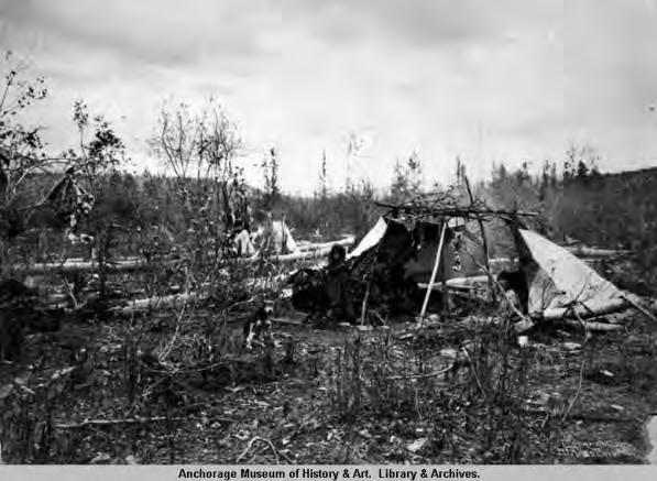
And they went down the inlet, and they came to Iliamna. And they called the people already living there Dudna, [literally “downriver people”]. And whatever people they came to, whatever they saw first, that is what they called the people there.
At another village, they saw a raven, and they called them Ggahyi, the Raven Clan. And in another village, they saw a fish tail, and they called them Kaliyi, the Fishtail Clan.
And they came to another village in a skin boat, and the people hid away, so no one was at home; and they didn’t see anything, so, having come there by water, they named them for themselves, Tulchina, the Waterway Clan.
When they were living in the sky on the frozen clouds, they stayed on an island they called Hagi, “basket.” That island was a basket, they say. When they landed on Mount Susitna, on top of the mountain, a whirlwind struck the basket-island they lived on, and it was blown off the mountain and landed in Cook Inlet, where it turned into an island.
And more names: Nuhzhi, the Overland Clan; and Chixyi, the Ochre Clan, who landed where there was a yellow pigment on the beach, so the people who lived there were named Chixyi, the Ochre Clan.
This is the way they say they named them all.
– Peter Kalifornsky, A Dena’ina Legacy
“Athapascan Indian woman and dwelling.” Photograph by Miles Brothers, 1903.
Left: Athabascan beading by Charlie Pardue. Right: Athabascan Chief Necklace by Selina Alexander. (ANHC)
HISTORIC PRESERVATION PLAN FOR ANCHORAGE’S FOUR ORIGINAL NEIGHBORHOODS ADOPTED 2/12/2013 AO 2013-01268
Within their territory; tribes, clans, and families had separate use areas. Every tributary draining into Tikahtnu was considered Dena’ina territory. The Dena’ina made use of all the waterways from the headwaters to the mouth of every inlet, bay, river, creek, stream, and lake.
The traditional lifestyle of the Dena’ina was to be one with the environment; they were the dominant species, but spiritually, they were part of the environment and equal with the animals who call the Dena’ina Qutsidghe’i’ina “Campfire People.”23
The Dena’ina created and adhered to a form of government with laws, punishment, structured society, spiritual practices, medicines, food, shelter, hunting, fishing, gathering, and harvesting technology.
Dena’ina spirituality believed that every plant and animal within their ecosystem or environment served a purpose, and each had a spirit that if harmed or disrespected would come back for revenge. The Dena’ina maintained their ecosystem so that all resources would co-exist in a way that would ensure balance and continuation of their lifestyle and relationship with the land, water, plants, and animals. Every resource was respected and utilized fully with no waste or overharvesting. The Dena’ina were a populous, thriving people with a rich culture at the time of first contact.
First Contact and the Fur Trade Era 1790s to 1890s
Before contact, the Dena’ina people, as with all peoples in Alaska, were self-sufficient, living in communal hunter-gatherer villages. The maritime cultures in Alaska were especially thriving and expanding with every generation up until first contact with Western culture.
That happened when the British [arrived]: in 1778, Captain James Cook’s Expedition reached the shores of Tikahtnu , which now bears his name: Cook Inlet. Shortly thereafter, Russian trading companies established the first posts on the Kenai Peninsula; Kasilof (Fort St. George) in 1787, and Kenai (Fort St. Nicholas) in 1791.
The Dena’ina trappers, traders and guides were invaluable during the Russian fur trade. Most trade funneled through Dena’ina traders, enabling most Dena’ina communities to remain largely independent from direct Russian control and influence, for a short time at least. The most influential aspect of Western culture has been the introduction of Russian Orthodox Christianity, which is an enduring part of many Dena’ina lifestyles today. The Russian traders also brought many new items to Alaska and Tikahtnu such as: sugar, tea, salt, flour, foods, and alcohol. The traders also brought technology, such as: guns, medicines, metal tools, and writing. Worst of all, these invaders brought diseases; one example of this was a smallpox epidemic that occurred from 1835-1845, in which at least half the Dena’ina population perished. Another consequence of population loss and the influx of Western medicine created a willingness to convert to Christianity, following the establishment in 1845 of the Russian Orthodox Church in Kenai. Over the next several decades, priests traveled to outlying Dena’ina villages. And gradually most Dena’ina became followers of Orthodox Christianity, blending traditional Dena’ina spirituality and Russian Orthodox traditions. In the 1880s, the Russian missionaries completed a census and reported a total of 142 Dena’ina Athabascans in the Matanuska-Susitna Valley,24 after only 100 years of contact with Western culture.
CHAPTER V: HISTORIC CONTEXT & SURVEYS ADOPTED 2/12/2013 AO 2013-12 69
The Russians tried many different business ventures including coal, copper and other mineral exploration, but none was as successful as the fur trade. After hunting sea-otters and fur seals to almost extinction, the Russians, thinking there [were] no other economic benefits in Alaska, sold their trading interests in Alaska to the United States in 1867, before the English usurped the Russian claim in Alaska.
Gold Rush Era 1890s to 1930s
The discovery of gold in Alaska brought a new breed of EuroAmericans and along with these new Americans came new technologies and new diseases. The Dena’ina population was greatly reduced during this time, due to the influx of new diseases. During the gold rush era, the Dena’ina had been involved with Western culture for at least 100 years. They were familiar with trading with foreigners and Western culture and technology. The Dena’ina culture adapted, but still maintained traditional hunting and fishing methods, while using current technology. The Dena’ina at this time continued to trap and trade, but some held jobs, became guides, or entrepreneurs.
In 1915, the Federal government started to build a railroad that cut straight through the Dena’ina territory into the interior of Alaska. Anchorage was selected as the headquarters. Many Dena’ina helped build the railroad, especially during the time between World War I and World War II. In 1918, a large influx of railroad workers brought with them a fatal influenza epidemic. This epidemic hit South-central Alaska especially hard and as a result, almost 50% of the Dena’ina people perished in a short period of time; the second viral epidemic to devastate the Dena’ina.
The Dena’ina that survived watched as their traditional homeland slowly became engulfed and expropriated by an ever-increasing number of newcomers. With the “founding” of Anchorage in 1915, and with the two military installations built during World War II, in addition to public and private development, the dwindling Dena’ina became enveloped in modern Western culture.
Post-World War II Era to Alaska Native Claims Settlement Act (ANCSA) 1940s to 1970s
During and following the war years, the Dena’ina lost most of their traditional hunting and fishing areas and they were denied their subsistence hunting and fishing rights by the State of Alaska. Traditional use areas were turned into homesteads [and] agricultural areas; or were cut by railroads and highways. The Dena’ina Tikahtnu territory became predominantly non-native. The Dena’ina lost important subsistence gathering places but they still practiced their traditional and cultural customs of harvesting and gathering resources. With Alaska becoming a State in 1959, the Dena’ina had to conform and abide by State laws and regulations. Some, not having subsistence fishing rights, became commercial fisherman for their economic and subsistence needs. The Tikahtnu Dena’ina soon felt like foreigners in their own territory. They had lost all of their traditional use areas to the explosive development radiating from the newly established town of Anchorage.
Present-Day Era 1970s to Present
Under the Indian Reorganization Act of 1960 (IRA), two upper Tikahtnu Dena’ina tribes were recognized; Knik Tribal Council (KTC) was formally recognized as a tribe in 1989, and in 1982 the Native Village of Eklutna (NVE) became formally recognized.
HISTORIC PRESERVATION PLAN FOR ANCHORAGE’S FOUR ORIGINAL NEIGHBORHOODS ADOPTED 2/12/2013 AO 2013-01270
With the passing of the Alaska Native Claims Settlement Act (ANCSA) in 1971, the State of Alaska conveyed lands to the Dena’ina, who were forced to form a regional native corporation: Cook Inlet Region, Incorporated (CIRI), and two village corporations; Knikatnu, Inc. and Eklutna, Inc..* The Dena’ina lost approximately 98% of their traditional use areas, but they received close to 22,000 acres based on economic value and not necessarily on traditional use areas. Although the Dena’ina are land owners, they must comply with state and federal hunting and fishing regulations. There is no subsistence hunting or fishing regulations in the traditional territory of the upper Tikahtnu Dena’ina. The tribal governments must now apply for educational and ceremonial harvesting permits to hunt and fish. Since time-immemorial, the Dena’ina have lived in harmony within their traditional territory; now, as a federally recognized tribe, tribal members have no sovereignty to practice a traditional lifestyle.
ANCSA created a corporate structure that was formed to manage tribal- allocated land to be used by all indigenous people in Alaska. The Dena’ina of Upper Tikahtnu have some governmental authority as federally recognized tribes, but no land or population base to assert that authority.†
* This description was prepared by the Knik Tribal Council. To clarify: Under ANCSA, land in the State of Alaska was conveyed by the federal government (not the state) to the newly formed regional and village corporations, in exchange for relinquishing any further claims to that land.
† This description was prepared by the Knik Tribal Council. To clarify: The corporation system established by ANCSA differs from the reservation systems used in the Lower 48 because Alaska Native Peoples become shareholders in the regional and village corporations, rather than direct landowners
As of 2010, there were approximately 90 Dena’ina descendants enrolled in Knik Tribal Council, and a little over 300 enrolled in the Native Village of Eklutna.
Summary
The Dena’ina Athabascan of the lands and waters of Upper Tikahtnu have seen a [millennium] of changes within Dena’ina Ełnena (Dena’ina Country), an area the size of Wisconsin. Having established many villages, the Dena’ina were a thriving highly populated cultural group in Tikahtnu. They are a part of the environment and equal with the animals who call the Dena’ina “Campfire People.” Interaction with Western culture and technology was mostly detrimental; however, they adapted and still maintained traditional hunting and fishing methods while using Western technology. The factors that decimated the Dena’ina were primarily diseases, in addition to the encroachment and colonization of their traditional territory, and loss of traditional hunting and fishing rights. Although having to endure hardships over the past 200+ years, the Dena’ina people still have a strong sense of traditional values and responsibility. The Tribes are tirelessly working to rejuvenate their Dena’ina tribal identity. Working through the federally recognized tribal governments and village/regional corporations, the Dena’ina people are continuously working to assert their tribal sovereignty.
Currently, in 2011, approximately 400 people are enrolled as original descendants of the Knik Tribe, together with members of the Native Village of Eklutna. It is but a small increase from the 1880 Russian census, but a dramatic decrease from pre-contact population, which were estimated to be 3,000-5,000 Dena’ina in Tikahtnu.
CHAPTER V: HISTORIC CONTEXT & SURVEYS ADOPTED 2/12/2013 AO 2013-12 71
History of Anchorage
The following abbreviated history of Anchorage provides the background information required to understand the forces that shaped the development of the built environment in the Four Original Neighborhoods. A more detailed chronology of each neighborhood’s history is found in Chapter VII: Neighborhood Character, Goals & Policies
Exploring Alaska
The Cook Inlet was named for Captain James Cook. A British explorer who is credited with making the first European claim in the Anchorage area, Cook sailed into the inlet in May 1778 on an expedition in search of the fabled Northwest Passage—a nonexistent water route through North America that geographers hoped would connect the Atlantic and Pacific oceans—and claimed the area for England.25 Prior to Cook’s expedition, however, other parts of Alaska were visited by Russian explorers sailing east out of Kamchatka. Mikhail Gvozdev first sighted the Alaskan mainland in 1732, and Vitus Bering, a Danish explorer commissioned by Russia’s Czar Peter the Great, was the first to send boats ashore in 1741.26 Although many early outposts were established along the Kenai Peninsula and Gulf of Alaska, Russian fur traders had little presence in the upper Cook Inlet.27 This early exploration period is celebrated in the Four Original Neighborhoods: the Captain Cook Monument at Resolution Point was installed to commemorate the 200th anniversary of Cook’s expedition to Anchorage.
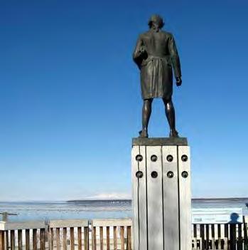
U.S. Territory
In 1867, the United States government purchased the entire Alaska territory from Russia for the bargain price of $7.2 million—just over 2 cents per acre—in a deal brokered by Secretary of State William H. Seward. Many were skeptical of Alaska’s worth to the United States at the time, and called the purchase “Seward’s Folly.” From 1867 until 1884, the territory was known as the Department of Alaska and was controlled under a variety of federal departments.28 The first civil government was formed in Alaska in 1884, at that time known as the District of Alaska.29
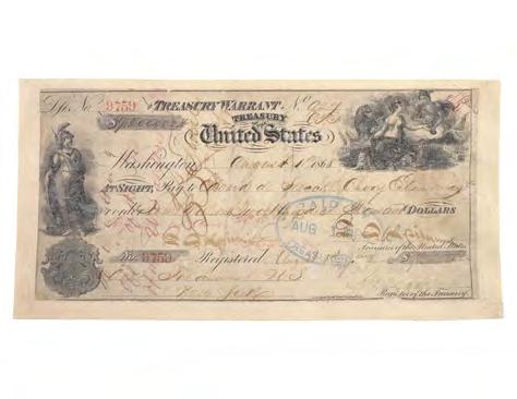
HISTORIC PRESERVATION PLAN FOR ANCHORAGE’S FOUR ORIGINAL NEIGHBORHOODS ADOPTED 2/12/2013 AO 2013-01272
After the discovery of gold near Juneau in 1880 and in Canada’s Yukon Territory in 1896, prospectors flocked to the Klondike, and Alaska’s population began to boom. Discovery of gold in Nome in 1899 and Fairbanks in 1902 further fueled the state’s growth, and finally brought more U.S. attention to Alaska. Most prospectors were not successful in the gold fields, but many of these new arrivals decided to remain in Alaska and established permanent communities.30 In response to increasing pressure for local control over Alaskan affairs, Congress established the Alaska Territory as an organized incorporated territory in 1912. Alaska remained a U.S. Territory from 1912 until it was admitted to the Union as the 49th state in 1959.31
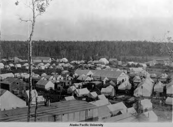
Alaska Railroad & the Founding of Anchorage
Anchorage is a classic railroad boomtown. Its early development followed many of the same patterns that accompanied the railroads across the American West. Anchorage was known by a variety of names prior to the arrival of the railroad, but the U.S. Postal Service formalized the name “Anchorage” in 1915 as a way to consistently direct mail to the government encampment.32
The first railroad in Alaska was a 50-mile span built north out of Seward by the Alaska Central Railway Company in 1903. In March 1914, Congress agreed to fund the construction and operation of a railroad from Seward to Fairbanks. A new federal agency—the Alaska Engineering Commission (AEC)—was created to plan the route and supervise construction.33 Ship Creek, located at the northern edge of present-day downtown Anchorage, became the field headquarters of the AEC in 1914. The delta was a desirable location for a camp because it was conveniently located on the inlet, and rail yards and shops could easily be built on the mud flats. On April 9, 1915, President Woodrow Wilson announced the approval of the AEC’s recommended route through Ship Creek, and ordered construction of the railroad to commence.34
As early as 1914, speculation that Ship Creek might be the base for the new government railroad was enough to attract hundreds of men hopeful for employment. Squatters arrived in droves, and by the time of the president’s announcement, a temporary settlement had already developed on the north side of the creek.
Anchorage Tent City, 1915.
CHAPTER V: HISTORIC CONTEXT & SURVEYS ADOPTED 2/12/2013 AO 2013-12 73
Amended Plat of Anchorage Townsite, with South, East and Third Additions (Approved December 1917).
ADOPTED 2/12/2013
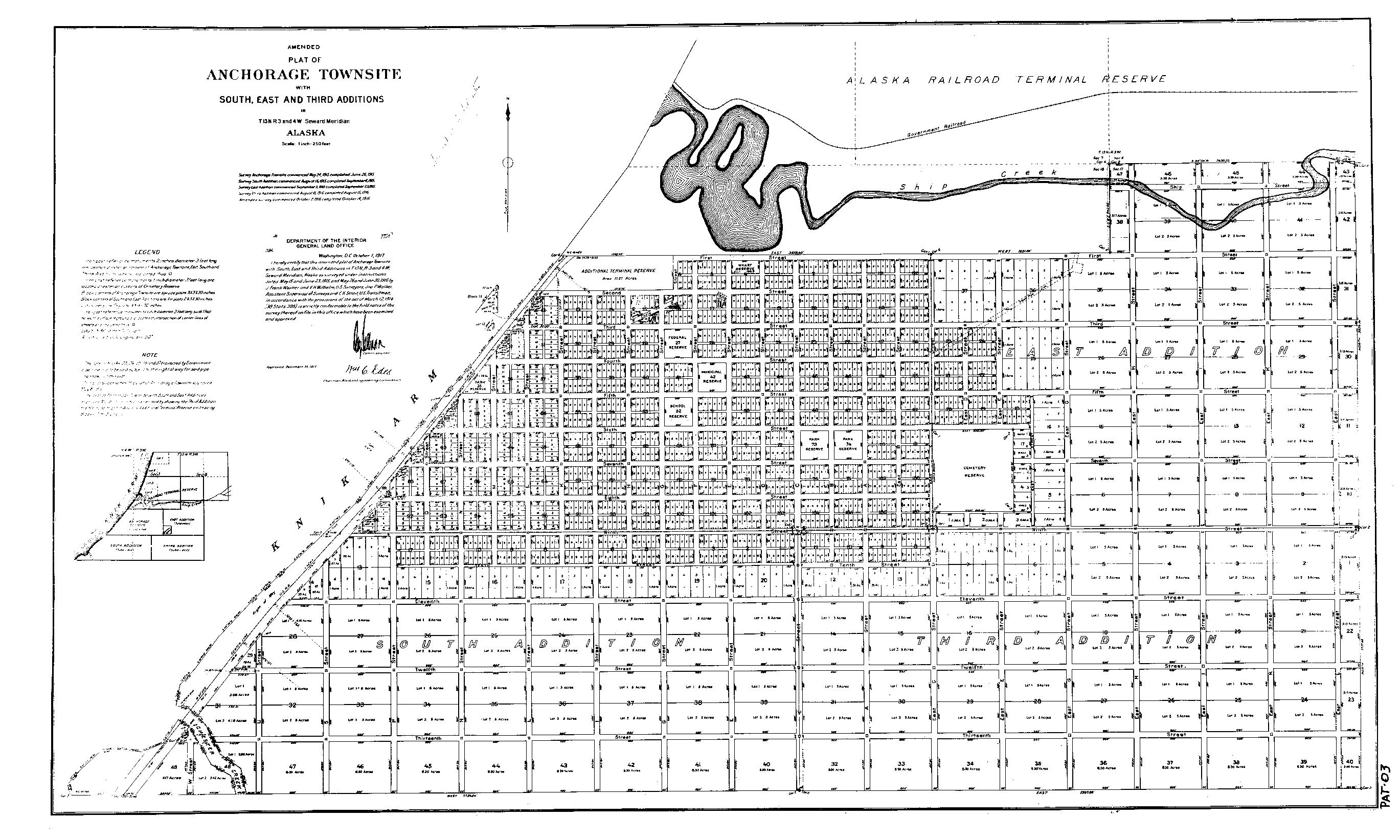
HISTORIC PRESERVATION PLAN FOR ANCHORAGE’S FOUR ORIGINAL NEIGHBORHOODS
AO 2013-01274
“Tent City,” as the squatters’ settlement was often called, primarily comprised canvas tents, although a few entrepreneurs built more solid-wood buildings to house their businesses.35 Many of the squatters were European immigrants who had flocked to the West Coast but could not find work elsewhere. The AEC did eventually hire some of these men as laborers, but in general, Alaska Railroad jobs were not as readily available as the squatters had hoped.36
From 1915 to the end of World War II, the Alaska Engineering Commission (AEC) and the Alaska Railroad constructed housing on Government Hill for railroad managers, engineers, and skilled workers. The AEC built 13 cottages in 1915 on the bluff overlooking Knik Arm at the western end of Government Hill, along what are now West Harvard Avenue and Delaney Street. These were among the first frame houses constructed in Anchorage, and were initially occupied by railroad workers.
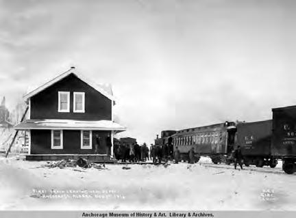
Anchorage Townsite and Incorporation
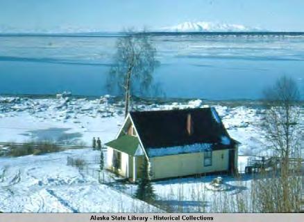
The land for the Anchorage townsite had already been set aside by the General Land Office during a cadastral survey of the region in 1914, but it was not until May 1915 that the townsite was platted.
(During the HPP Public Outreach process, consultation with Tribal representatives revealed that the land for the Anchorage townsite was reserved, platted, and distributed without consulting the Alaska Native Peoples who had inhabited the region for centuries before the arrival of the railroad.) The original townsite plat established a street grid and approximately 1,400 lots on the plateau immediately south of Ship Creek. The engineers numbered the east-west streets and named the north-south streets with letters, to simplify the plan.37
The South Addition was the first expansion of the original townsite, laid out in August 1915 to address a shortage of homestead sites. The East Addition soon followed in late September 1915. The Third Addition was added in the summer of 1916. 38 The expansion of the street grid included larger lots than the original townsite. The AEC created 5- and 8.3-acre parcels in the South Addition and Third Addition because they wanted to encourage agricultural development around Anchorage. Thus, in 1917, a Presidential Executive Order was issued prohibiting the subdivision of tracts containing two or more acres into smaller lots.39
First train leaving Anchorage's new Alaska Engineering Commission Railway depot, 1916.
Oscar Anderson House, home of one of Anchorage's earliest pioneers (pictured here in 1953).
CHAPTER V: HISTORIC CONTEXT & SURVEYS ADOPTED 2/12/2013 AO 2013-12 75
Homes of early Anchorage pioneers are scattered throughout the Four Original Neighborhoods, including the historic Oscar Anderson House and Oscar Gill House, among others. Although Anchorage was quick to establish itself, it was not incorporated as a city until 1920. The original Anchorage city limits extended south to 11th Avenue and east to East G Street (now Gambell Street).40 The farther reaches were largely agricultural in character, scattered with homesteads, dairy farms, and fur farms until the late 1930s.
Aviation
Aviation is one of the more significant themes representing Alaska history. The first airplane flight in Alaska was a demonstration flight in Fairbanks in 1913. It was not until after World War I that significant aviation developments occurred in the state. However, by the late 1920s, airplanes had revolutionized transportation in Alaska.41 The territory’s vast size and rough terrain necessitated the use of airplanes, and remote communities relied—and continue to rely—on bush pilots to fly small planes filled with supplies.42 By 1923, Anchorage citizens had realized the potential of aviation and banded together to create a landing strip out of the firebreak between 9th and 10th avenues (today Delaney Park Strip). The Park Strip served as a landing strip for the biplanes of the bush pilots throughout the 1920s, but by 1929, it could no longer support Anchorage’s aviation needs. Merrill Field was officially dedicated in 1930. For several years after Merrill Field was completed, spring breakup occasionally forced pilots to use the more-solid “old aviation field” at the Park Strip, which by then also functioned as a golf course. The City Council ordered Alaskan Airways to “discontinue the use of the Golf Course as a landing field” in 1931, officially ending the Park Strip’s aviation era.43

World War II
In the late 1930s, the U.S. military began to prepare for the possibility of involvement in another world war. A global study was conducted by the U.S. Navy that investigated and reported on the need for additional naval bases. The report was submitted to Congress by Admiral Arthur J. Hepburn in December 1938 and signed into law in early 1939. The “Hepburn Report” recommended the appropriation of $19 million for the construction of air, submarine, and destroyer bases in Alaska and the Aleutian Islands. This marked the beginning of defense build-up in the Alaska Territory.44
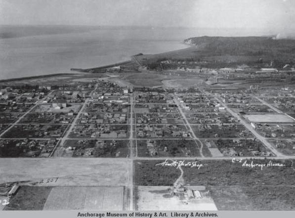 Aerial view of Downtown and the Delaney Park Strip, 1925.
Russell Merrill’s famous “Anchorage No. 1” on the Delaney Park Strip, n.d.
Aerial view of Downtown and the Delaney Park Strip, 1925.
Russell Merrill’s famous “Anchorage No. 1” on the Delaney Park Strip, n.d.
HISTORIC PRESERVATION PLAN FOR ANCHORAGE’S FOUR ORIGINAL NEIGHBORHOODS ADOPTED 2/12/2013 AO 2013-01276
After several failed attempts in the mid-1930s to gain Congressional support for an Alaska air base, President Franklin D. Roosevelt finally ordered the withdrawal of 43,490 acres of land on the outskirts of Anchorage for Elmendorf Field and Fort Richardson in April 1939.45 This location was chosen for the air base due to favorable topography and weather conditions, access to the Alaska Railroad, and proximity to the Cook Inlet.46 Construction of a permanent military airfield and Army base began on the reserved lands in June 1940. This construction included hundreds of barracks, hangars, and tactical runways. Fort Richardson and Elmendorf Field were officially occupied by the Army in August 1940, and operated as the Army’s headquarters for the militarization of Alaska. The Army relocated its operations to the eastern edge of the reserve (present-day Fort Richardson) after World War II. The Air Force assumed control of the original base and renamed it Elmendorf Air Force Base in 1948.47
Wartime military construction turned Anchorage into a boomtown.48 Thousands of civilian workers were employed to construct the new fort. In April 1940, just before construction of Fort Richardson began, Anchorage had a population of only 4,000, and by the summer of 1941 the town had grown to over 9,000. The war created a housing shortage in Anchorage, causing the neighborhoods surrounding Downtown to be built out. Despite the 1917 Executive Order prohibiting further subdivision of tracts sized two acres or larger, Anchorage’s first subdivisions were drawn in the South Addition for A.A. Shonbeck’s land in 1938 and John W. Hansen’s land in 1939 (the Executive Order was eventually revoked).49
The federal agencies and business corporations that moved their headquarters to Anchorage during and after World War II did their part to address the inadequate supply of housing for their employees. Some residential tracts and complexes were constructed by the Army Corps of Engineers and the Civil Aeronautics Administration (CAA) for use by their employees in the Four Original Neighborhoods. The Army Housing Association, a cooperative created by service members and their families, built 32 Minimal Traditional style homes on Block 13 of the Third Addition in the summer of 1940; this portion of 11th Avenue also earned the nickname “Pilots’ Row” because many bush pilots and aviators lived on that block in the 1940s and 1950s. Northwest Airlines built clusters of identical small ranch-style houses for their employees in the South Addition after World War II.
Quonset huts and Loxtave houses in Government Hill, 1947.
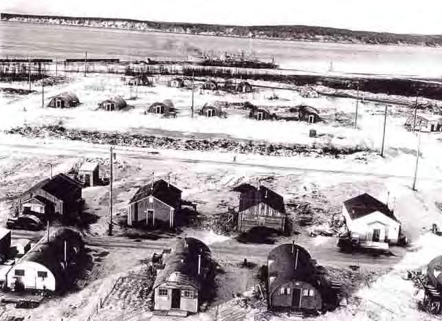 “View of civilian men’s quarters, Elmendorf Air Force Base, Alaska” (circa 1940).
CHAPTER V: HISTORIC CONTEXT & SURVEYS ADOPTED 2/12/2013 AO 2013-12 77
Highways & Airports
As part of the war effort during World War II, the military worked to improve communication and transportation infrastructure, and began constructing roads to connect Fort Richardson to the rest of Alaska. The Alaska (Alcan) Highway (1942), Whittier Tunnel, and the Glenn Highway (1941-1942) were important projects. This military transportation infrastructure was opened to civilians in the postwar era, providing unprecedented air, rail, and road access to Anchorage. This continued with the construction of Anchorage International Airport in 1951, which solidified Anchorage’s position as the “Air Crossroads of the World” and attracted other airlines and thousands of passengers to the city.50 The airport was renamed “Ted Stevens Anchorage International Airport” in 2000, in honor of U.S. Senator Ted Stevens.51 Similarly, construction of the Seward Highway and repaving of the Glenn Highway in the early 1950s provided important vehicular access to Anchorage’s historic core and the entire Anchorage Bowl.52
Alaska Statehood
Alaskans had been considering statehood since the late 19th century. However, early attempts at seeking statehood failed because Alaska lacked the population and financial independence to effectively support itself. By 1945, Alaska’s population had increased dramatically and it had become an integral part of the U.S. defense network, so the demand for statehood became more forceful. The discovery of oil on the Kenai Peninsula in 1957 further fueled the debate, and was the key to changing the national perception of Alaska. Congress passed the Alaska Statehood Bill on June 30, 1958. Alaska officially became the 49th state in the Union when President Dwight Eisenhower signed the bill into law on January 3, 1959.53
The 1964 Earthquake
Among the most significant events in Anchorage’s history is the 1964 Good Friday Earthquake, which occurred at 5:36 p.m. on March 27 of that year. Originally recorded at about 8.6 on the Richter Scale and later upgraded to 9.2, the quake was one of the most powerful seismic events recorded in North America.54
 Postcard of Anchorage International Airport, 1950s.
Bonfire on the Delaney Park Strip to celebrate statehood (June 30, 1958).
Postcard of Anchorage International Airport, 1950s.
Bonfire on the Delaney Park Strip to celebrate statehood (June 30, 1958).
HISTORIC PRESERVATION PLAN FOR ANCHORAGE’S FOUR ORIGINAL NEIGHBORHOODS ADOPTED 2/12/2013 AO 2013-01278
The earthquake had a profound effect on the physical environment in Downtown, Government Hill, the South Addition, Government Hill, and Turnagain because these neighborhoods were especially hard-hit by the disaster.
The 1964 earthquake coincided with the popularity of urban renewal efforts across the country, and Anchorage took the quake as an opportunity to try to redevelop the city, including new public park spaces in areas that faced the most destruction by the quake. Evidence of this postquake redevelopment activity is especially clear in Downtown and Government Hill.
Oil Industry
The largest oil field in North America was discovered in Prudhoe Bay on the Arctic Slope in 1968. A 1969 oil lease sale brought billions of dollars to the state. Alaska’s gross product doubled within two years of the Prudhoe Bay oil field development. Oil companies needed to construct a pipeline to carry North Slope oil to market in order to capitalize on the Prudhoe Bay oil lease sale.55 Construction began on the Trans-Alaska Pipeline System in 1974. The pipeline was completed in 1977 at a cost of more than $8 billion. The oil discovery and pipeline construction fueled an economic windfall when oil and construction companies set up headquarters in Anchorage.56
The tremendous outpourings of the oil fields led to the formation of the Alaska Permanent Fund, which mandated that a portion of the royalties earned by the oil companies be distributed equally among Alaskan residents.57 The fund was voted as a constitutional amendment by Alaska’s citizens in 1976, and the first Permanent Fund legislation was enacted in 1980.58 The discovery of oil at Prudhoe Bay also increased the urgency of settling the outstanding land claims of the Alaska Native Peoples, leading to the passage of the Alaska Native Claims Settlement Act (ANCSA) in 1971. ANCSA established a system of regional and village corporations to hold the land titles and assets transferred to the tribes by the federal government; Alaska Native Peoples became shareholders in these corporations, which are run like traditional for-profit businesses.
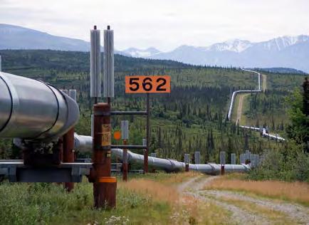 Fourth Avenue, damaged by the 1964 Good Friday Earthquake.
Trans-Alaska Pipeline, 2005 (Courtesy Luca Galuzzi, www.galuzzi.it).
Fourth Avenue, damaged by the 1964 Good Friday Earthquake.
Trans-Alaska Pipeline, 2005 (Courtesy Luca Galuzzi, www.galuzzi.it).
CHAPTER V: HISTORIC CONTEXT & SURVEYS ADOPTED 2/12/2013 AO 2013-12 79
As the oil industry expanded, so did environmental conservation efforts. Many conservation groups were formed during the 1970s and 1980s. The Alaska National Interest Lands Conservation Act (ANILCA) was passed in 1980, which set aside over 100 million acres of public lands.59
Municipality of Anchorage
The Municipality of Anchorage was formed in 1975 by a consolidation of the city and borough. Also included in this unification were Eagle River, Eklutna, Girdwood, Glen Alps, and several other communities. The unified area became officially known as the Municipality of Anchorage. The population of Anchorage had increased to 184,775 by 1980.

The decade of the 1980s was a time of growth, thanks to a flood of North Slope oil revenue into the state treasury. Capital improvement projects and an aggressive beautification program, combined with far-sighted community planning, greatly increased infrastructure and amenities for citizens. This effort was known as “Project 80s,” and included major improvements such as a new library, a civic center, a sports arena, and a performing arts center.60 The Project 80s building program rivaled the military construction of the 1940s.
During the 1980s and 1990s, outdoor recreation activities increased the role of tourism in the modern Anchorage economy, which has continued to the present day. In turn, the recreation and tourism industries have provided employment, attracted new residents to Anchorage, and provided individuals and the Municipality alike with money in their coffers to use in further residential and community development.
Aerial photograph of Anchorage (1978), after the formation of the Municipality.
HISTORIC PRESERVATION PLAN FOR ANCHORAGE’S FOUR ORIGINAL NEIGHBORHOODS ADOPTED 2/12/2013 AO 2013-01280
Consolidated Historic Resources Inventory
The Municipality of Anchorage has been working to identify and protect historic resources in the Four Original Neighborhoods for many years through historic resource surveys. Surveys are important because they are the foundation of a city’s preservation program: identifying and discovering significant buildings and landscapes allows residents and planners to fully incorporate these resources and values into planning and development decisions. Prior architectural surveys and studies conducted in the Four Original Neighborhoods have all been conducted using a variety of different methods, which has led to some inconsistencies in the results. These surveys are summarized below, and are on file at the Municipality of Anchorage Planning Department or at the Alaska State Historic Preservation Office.
As part of the HPP, Page & Turnbull worked with AlliedGIS and the Municipality of Anchorage to compile all these previous neighborhood surveys into a single Microsoft Access database designed to interface with the Municipality’s CityView software. This parallel project is called the Consolidated Historic Resources Inventory. This database is still under construction, but will be available to the public through the CityView Historic Module when this module is complete (currently in process). This database is intended to serve as the master list of significant historic resources in the Four Original Neighborhoods, and should be expanded as more properties are surveyed.
A detailed survey report that outlines the methodology, as well as a list of significant historic properties exported from the database, is available both on the HPP website at http://anchoragehpp. com/documents/, and also on the Municipality’s Planning Department website.
National Register of Historic Places
The National Register of Historic Places (National Register) is the official list of the nation’s historic places worthy of preservation. Since the establishment of the National Register in 1966, more than 80,000 properties across the nation have been listed. In Anchorage, 24 historic resources have been listed in the National Register of Historic Places, 19 of which are located within the plan area. Nomination forms for these buildings can be viewed online through the National Park Service’s website: http://www.nps.gov/nr/research/
Previous neighborhood surveys were consolidated into a single Microsoft Access database that will interface with the Municipality’s CityView software.
CHAPTER V: HISTORIC CONTEXT & SURVEYS ADOPTED 2/12/2013 AO 2013-12 81
HISTORIC PRESERVATION PLAN FOR ANCHORAGE’S FOUR ORIGINAL NEIGHBORHOODS ADOPTED 2/12/2013 AO 2013-01282 R ND TR E AR W RR DRVE D EAST 3RD VENUE IN PEASEAVENUE THPOSTROAD THS RE U ERAVENUE W 9TH VENU T R T A U V UE H EE GL H UN V U AS 13TH VENUE G STREE T ES 8TH VENU W OA EE ES 4TH VENU TL 6 STR ET O LLC S E E B R O TH E G M O NS NA EN E EDRIV HO ODDR E RDROA TH TR W ERND D WA D RICHMOND AVENUE GO TA N E MCGUIR VENUE CKE BACKERAVENU R MPAR IV 6T E R V B A 17 REE U SHIP VENUE 2NDS E BONGA NU W A O O S C RV ES U PORCUP VE T A UTR O S A DRIV HIP V E V UE MA NCHRO S S E B R W O ORNGA EN M RSTO RIVE BL HS RE RA ROA A UE 1 STR E E S E STRD D E AKEAVENUE S RE C V N ARN D UE EE RI N R S U M ES 13TH VENU ARL R AR LDD EAST 18TH AVENUE STO N H R SC ICW RST L N ST Y EAS MNORAVENU SQ DRIV CA RVW STM RST RIVE E AS 22ND VENU M OU DA UE ATW DDRIV EA HAVARD ENUE OL A UE BOYDST EE T MNN O BO M R C R WLDW AN ALEXANDER VENU CASWE LAENU TO WAY 2ST RE MES RV D ONV SAVILLEAVENU MCC E VE R N OF OOP P E HL E EAST 19T COURT ANDE SONST E A OS A EN PORTACCES O S PE V UE G W SH PA N D EYS E G ONBRA WR MP WES 14TH VENU G NNNBO BRA W AMP VY OW TR MS RE A R RA D W S NTELIASDR SAN GL GAWR RO ERTO EN E CIRC MTC VE JE N C R NS REE A O UTER U CHANCE COURT S NO UR O S RI JAMESCOUR O S E O W S E IR FAIRWEATHER DRIVE C B ST EET MCHU ANE AM AD UNNAM OAD UNNA M D STSTREET EAST 12TH AVENUE AS 8TH VENU UNNAM RO U E R E ENCWY WES 13TH VENUN M O RALRO E E NU C U E T E E U A E R A M O A TH RA ROADAV NUE WES 20TH VENU AS 11 UNNA DRO A O AS VENU U AM OA A G ERDR E M D M T G R N M D R D B EAST 9TH AVENUE RO N EAST 5TH AVENUE UNN M ROA A L O YLANE N B R NUE H R M O UNNAMED ROA NAMED AD EAST 16TH AVENUE ELMENDORF AIR FORCE BASE FAIRVIEW SOUTH ADDITION DOWNTOWN GOVERNMENT HILL 0.50 0.5seliM52.0° National Register-Listed Properties in the Plan Area The National Register of Historic Places (National Register) is the official list of the nation’s historic places worthy of preservation. In Anchorage, 24 historic resources have been listed in the National Register of Historic Places, 19 of which are located within the plan area. Previously Listed in “Patterns of the Past” Municipal Parks Wetlands Military (JBER) Previously Listed in National Register (NRHP) PREVIOUSLY EVALUATED PROPERTIES LEGEND Community Council Boundary
Anchorage National Register-Listed Properties (as of December 2012)
Alaska Engineering Commission (AEC) Cottage No. 23 (also known as DeLong Cottage), 618 Christensen Drive (listed 1990)*
Alaska Engineering Commission (AEC) Cottage No. 25, 645 W. 3rd Avenue (listed 1996)*
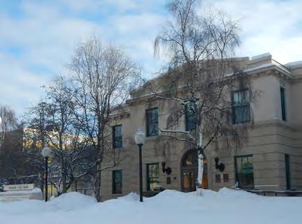
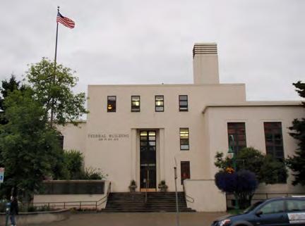
Anchorage Cemetery (also known as Anchorage Memorial Park Cemetery), 535 E. 9th Avenue (listed 1993)*
Anchorage Depot (also known as Alaska Railroad Depot), 411 W. 1st Avenue (listed 1999)*
Anchorage Hotel Annex (also known as Hotel Ronald Lee), 330 E. Street (listed 1999)*
Anchorage Old City Hall, 524 W. 4th Avenue (listed 1980)*
Oscar Anderson House, 911 W. 4th Avenue (listed 1978)*
Beluga Point Site, archeology-address restricted (listed 1978)
Sam Bieri House, 136 W. 7th Avenue (listed 1978)*
Campus Center (also known as Student Center, AMU), University Drive (listed 1979)
Civil Works Residential Dwellings (also known as Brown’s Point Cottages), 786 and 800 Delaney Street (listed 2004)*
Leopold David House, 605 W. 2nd Avenue (listed 1986)*
FAA DC-3 Aircraft N-99, FAA Hangar, International Airport, Anchorage (listed 1977)
Federal Building, U.S. Courthouse, 601 W. 4th Avenue (listed 1978)*
Fourth Avenue Theatre (also known as the Lathrop Building or Lathrop’s Showcase), 630 W. 4th Avenue (listed 1982)*
Oscar Gill House, 1344 W. 10th Avenue (listed 2001)*
KENI Radio Building, 1777 Forest Park Drive (listed 1988)
Kimball’s Store (also known as Kimball Building; Kimball Dry Goods; Gold Pan; Kobuk Coffee Company), 500 and 504 W. 5th Avenue (listed 1986)*
Lathrop Building (also known as The Empress Building), 801 W. 4th Avenue (listed 1987)*
Loussac-Sogn Building, 425 D. Street (listed 1998)*
McKinley Tower Apartments (also known as MacKay Building), 337 E. 4th Avenue (listed 2008)*
Pioneer Schoolhouse, 3rd Avenue and Eagle Street (listed 1980)*
Potter Section House, 115 Seward Highway (listed 1985)
Wendler Building, 410 I Street (listed 1982) and 400 D Street (listed 1988)*
* Located within the Four Original Neighborhoods plan area
The Old Federal Building (top) and Old City Hall (bottom) in Downtown are among the 19 National Register-listed properties in the Four Original Neighborhoods.
CHAPTER V: HISTORIC CONTEXT & SURVEYS ADOPTED 2/12/2013 AO 2013-12 83
HISTORIC PRESERVATION PLAN FOR ANCHORAGE’S FOUR ORIGINAL NEIGHBORHOODS ADOPTED 2/12/2013 AO 2013-01284 C STREE G E N T E B G S AR C VE EAST 3RD VENUE IN IV PEASEAVENUE NO TH TR AD T R T KU ERAVENUE ES 9TH VENU 9 T T U EA NU 2TH RE G G WA MU YA NU AS 13TH VENUE ES 8TH VENU W OA EE ES 4TH VENU TLOOP 2 ET LL ES R E O HN ON E E S RI ED E HO W DDR E O S A W P ARDROAD TH TR WEST NDRIV D WA R OAD RICHMOND AVENUE G TTA MCGUIR VENUE RCKE BACKERAVENU MPAR RIV 6THS E E O E R O 17H TRE SHIP VENUE NDS RE T BO ENU W A R O S A R E EN M ES PO UPI EDRVE Z V T TR F E P KD E IP IN GA NU MA T AUNCHRO EA N R V U R ORN VE E B S S E M RSTON RIV BL VE HS R RALRO ENUE 0 HST E STR G R AKEAVENUE RE AR D NU A RI E S E U ES 13TH VENU RL ERDRV A OLD IVE EAST 18TH AVENUE STOL H S NIC Y OAK R KRSACRC UST LWA EA NORAVNU S ED E RC W STM RST RIV D T AS 22ND VENU C DA UE ATW ODD EA HARVARD VENUE V OYDST EET N H T MN OAS O HLCR T R B IV W D AN VENU CASW LAENUE NTO WAY LA S R T JMESDRV NV SAVILLEAVENUE MCCO A F OP B CHL NE N R T R G M T E EAST 19TH COURT ANDE S NS RE T S NO E E PORTA CE SRO D WE HPP E R E E UE WA S R E E YS E NN NB R M R WES 14TH VENU NNNB RA AMP VY EEWN E O AN MS RE U RA R E 16 NTELI D V SA RN S EN E GL GAWR O RT A L D T LA JE R E ONS REE UTE C URT CHANCE COURT RN K OU R S RI E JA ESCOUR G O T CLE FAIRWEATHER DRIVE OU B ST EET MCH HL NE NA D OA UNNA OAD STSTREET S E EAST 12TH AVENUE AS 8TH VENU UNN N R E H ET CE CW ES 13TH VENUU AM DRO D LROAD VE UE PE E EN E TTL TK RALRO DAVENUE N ES 20TH VENU AS UNNA DRO O D L U E AS VENU NA DRO U O TERD NN OAD D R E EAST 9TH AVENUE NAM D EAST 5TH AVENUE U RN D V CO E LANE NUE N MNNE A R E UNNAMED OA AMED AD EAST 16TH AVENUE ELMENDORF AIR FORCE BASE FAIRVIEW SOUTH ADDITION DOWNTOWN GOVERNMENT HILL 0.5 0 0.5seliM52.0° “Patterns of the Past” Properties in the Plan Area Patterns of the Past identified and provided historical information for 175 properties within plan area. Most were concentrated in Downtown. Previously Listed in “Patterns of the Past” Municipal Parks Wetlands Military (JBER) Previously Listed in National Register (NRHP) PREVIOUSLY EVALUATED PROPERTIES LEGEND Community Council Boundary
Patterns of the Past
One of Anchorage’s most comprehensive historic resource inventories is Patterns of the Past: An Inventory of Anchorage’s Historic Resources, completed in 1979 by Michael Carberry and Donna Lane. A second edition was published in 1986. The report was compiled as a basic source of information about Anchorage’s historic resources, and includes a historic context statement and description of select resources. Patterns of the Past is organized according to major development themes, such as native habitation, mining, railroading, military, and townsite development, each of which is illustrated with examples of property types associated with each theme.61 As was common in cities across the United States in the 1970s, Patterns of the Past was prepared to help inform local decision-makers about historic preservation issues.
Patterns of the Past identified and provided historical information about 175 properties within the four oldest neighborhoods—Government Hill, Downtown, South Addition, and Fairview. Of the 175 properties, 40 appear to have been demolished or moved into municipal storage since the document’s second edition in 1986.
Patterns of the Past is available for review or purchase at the Municipality of Anchorage Planning Department. It can also be reviewed at the Alaska Room of the Z.J. Loussac Public Library.
Patterns of the Past (Carberry & Lane, 1979/1986) was compiled as a basic source of information about Anchorage’s historic resources.
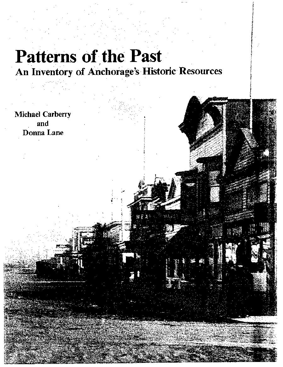
CHAPTER V: HISTORIC CONTEXT & SURVEYS ADOPTED 2/12/2013 AO 2013-12 85
Neighborhood Surveys
THE RELATIONSHIP BETWEEN SURVEYS AND HISTORIC CONTEXT STATEMENTS
Surveys and historic context statements are most useful when they are prepared together. Additional resources may be identified in the field when informed by the research contained in the historic context statement. Likewise, the historic and cultural significance of resources identified through survey may be evaluated using the framework of the context statement. The context statement places the development of these resources into a larger story, while the survey can identify resources that illustrate important themes of the context statement. Each effort—the survey and the context statement— informs the other.
Neighborhood Surveys by the Numbers
Historic resources in each of Anchorage’s original neighborhoods have been studied through architectural surveys completed since the 1980s. In all these surveys, properties that were at least 50 years old received evaluations guided by the National Park Service’s National Register of Historic Places criteria (see Chapter III for a detailed description of criteria). But each survey varies in size, scope, and intensity: some were “reconnaissance-level” surveys—a cursory look at buildings with significance judged on architectural merit alone—while others were “intensive-level” surveys with detailed archival research and thorough documentation. Some surveys covered an entire neighborhood, while others surveyed only a selection of properties. The methodology for conducting a survey is typically developed based on the reason for the survey and the amount of available funding and resources; this accounts for the variation among survey methodologies in the Four Original Neighborhoods. 890 (Recon) / 120 (Intensive) 66 35 NRHP (A & C)
Fairview 2007 2008Entire neighborhoodRecon519 46 191NRHP (C only)
This table summarizes the methodology and results for each of the previous surveys in the Four Original Neighborhoods. Properties listed as “significant” were found eligible for listing in the National Register of Historic Places, either individually or as a contributor to a historic district. The variation among survey methodologies in the Four Original Neighborhoods can be attributed to the reason for the survey and the amount of available funding and resources.
HISTORIC PRESERVATION PLAN FOR ANCHORAGE’S FOUR ORIGINAL NEIGHBORHOODS ADOPTED 2/12/2013 AO 2013-01286
NeighborhoodYearBoundariesSurvey Level # of Surveyed Properties Individually Significant # of District Contributors Criteria Used Ship Creek 1989Selected parcelsIntensive8 8Not specifiedUnknown Government Hill 2006Entire neighborhoodIntensive295 8 88 NRHP (A & C) Downtown 1988 & 2007Selected parcelsIntensive46 46Not specifiedHigh/Medium/Low South Addition 2011 2012 Entire neighborhood (Recon) / Selected Parcels (Intensive) Phased
Ship Creek Architectural Survey (1989)‡
The Ship Creek Architectural Survey was conducted by Anchorage Historic Properties, Inc. (AHPI) in 1989. AHPI identified eight ageeligible buildings that were highly significant, and recommended these buildings for listing in the National Register of Historic Places. The Ship Creek Architectural Survey also recommended that a railroad warehouse district be formed along Warehouse Avenue just east of C Street, including the Freight Depot on First Avenue (period of significance 1916-1950). However, the railroad properties and district recommended by AHPI were never formally listed in the National Register, and many of these buildings are no longer extant today.
The Anchorage Depot (Alaska Railroad Depot) was identified as a significant building in 1989. It is currently owned by the railroad and maintained in accordance with a Building Preservation Plan prepared in 2011.
The Freight Depot was identified as a significant building in 1989. It was recently renovated, and is Alaska's first historic building certified under the U.S. Green Building Council's Leadership Energy and Environmental Design (LEED) program.
Three other buildings identified in the 1989 survey still exist, but may not be feasible to preserve if they are found to be functionally obsolete or are unable to meet the Alaska Railroad's safety and program requirements: AEC Power Plant (Anchorage Railroad Yard), Warehouse 3, and Engine Repair Shop.
Two buildings identified in the 1989 survey are no longer owned by the railroad: AEC Cold Storage Facility (Warehouse Avenue) and B&B Carpenter Shop (Whitney Road)
Three buildings identified in the 1989 survey have since been demolished: W.J. Boudreau Co. (222 Warehouse Avenue), Emmard Cannery (658 Ocean Dock Road), and Anchorage Section House (Whitney Road).
The Ship Creek Architectural Survey (1989) informed the 1991 Ship Creek Waterfront Land Use Study
‡ Additional detail about the methodology used for the Ship Creek Survey and a complete list of the survey results are included under separate cover in the Consolidated Historic Resources Inventory Survey Report.
CHAPTER V: HISTORIC CONTEXT & SURVEYS ADOPTED 2/12/2013 AO 2013-12 87
Government Hill Survey Results (2006)
The Government Hill Survey was conducted in 2006 following a Section 106 consultation for the Knik Arm Crossing Project. The survey initially found 28 properties to be individually eligible for the National Reigster and 174 properties to be contributing resources to a potential Government Hill Historic District. However, the SHPO only concurred with some of the initial survey findings: 88 properties are contributors to one of four small historic districts, while eight properties are individually eligible.
HISTORIC PRESERVATION PLAN FOR ANCHORAGE’S FOUR ORIGINAL NEIGHBORHOODS ADOPTED 2/12/2013 AO 2013-01288
EAST 3RD AVENUE T ERM NAL RO AD EAST WHITNEY ROAD EASTLOOPROAD O C E A N D O C KR O A D EASTBLUFFDRIVE VIKING DRIVE FIGHTER DRIVE ARCT C WARR OR DR VE UNNAMEDROAD HOLLYWOOD DRIVE EAST 1ST AVENUE BULLARD AVENUE BONGAVENUE WEST 3RD AVENUE A N C H O R A G E P O R T R O A D ASTREET PO STR O AD WEST 1ST AVENUE TIDEWATER ROAD FS T R E E T N O R T H P O S T R O A D EAST SH PCREEK AVENUE WEST BLUFFDRIVE 10THSTREET BLAKEAVENUE WEST2ND AVENUE ARNOLDAVENUE ANDREWS AVENUE 11TH STREET WESTERNDRIVE CRA WAVENUE N G R A S T R E E T ES T RE E T E A G L E S T R E E T ARNOLDDRIVE B I RCHSTREET EAST 2ND AVENUE EASTMANORAVENUE 8THSTREET SPAR AVENUE CEDARSTREETEASTHARVARDAVENUE BOYD STREET NORTH C STR EET E A K E RA V E NUE NOR T HAS T RE E T CASWELLAVENUE WEST HARVARD AVENUE RICHARDSONVISTA ROAD NAN BOF FW LOO PRAMP EAST 2ND COURT ANDERSONSTREET B A RRO W S T R E E T G A M B E L L S T R E E TPORTACCESSROAD DOOLITT LE AV ENUE VINEAVENUE DELANEY STREET SH PAVENUE IVYS TREET BRO WN STREET ELM STREET ERICKSONSTREET K A R L U KS T R E E T DOGWO ODSTREET COR D O V AS T R E E T DE N A L I S T R E E T BILBOSTREET BUL LAR DAVE NUE UNNAMED ROAD ELM STR EET AR N OL DA VEN U E EAST BLUFF DRIVE UNNAMED ROAD EAST 1ST AVENUE B L A K E A V E NUE U NN A D R OA D DOOL I TTLE AVENUE UNNAMEDROAD T I DE W A T ER RO AD FIGHTERDRIVE UNNAMEDROAD ARN OLDDRIVE Far West (SHPO Concurs) Far East (SHPO Concurs) Quonsets (SHPO Concurs) Urban Renewal (SHPO Concurs) Previously Listed in “Patterns of the Past” Not Surveyed Found by SRB&A to be a NRHP District Contributor (SHPO did not concur) Not Eligible NRHP District Contributor (SHPO Concurs) Individually NRHP Eligible (SHPO Concurs) Municipal Parks Wetlands Potential Historic District Military (JBER) Previously Listed in National Register (NRHP) GOVERNMENT HILL SURVEY RESULTS PREVIOUSLY EVALUATED PROPERTIES GOVERNMENT HILL SURVEY RESULTS LEGEND Proposed Community Council Boundary Current Community Council Boundary ° 0.05 Miles0.0500.025
Government Hill Survey (2006)§
The Government Hill Survey was conducted in 2006 following a Section 106 consultation for the Knik Arm Crossing Project to document potential historic resources within the project’s Area of Potential Effect. HDR Alaska, Inc., under contract with Knik Arm Bridge and Toll Authority (KABATA), acting on behalf of the Federal Highway Administration (FHWA), contracted with Stephen R. Braund & Associates (SRB&A) to perform the survey work. SRB&A produced a two-volume survey report, which identified and documented potential historic resources in Government Hill. Prior to beginning the survey work, the study area was expanded from the Section 106 Area of Potential Effects to include the apartment buildings on the east side and pre-World War II elements on the west side of Government Hill.
Knik Arm Crossing Project Recommendations for a Historic District(s): Government Hill, Anchorage, Alaska; Volume I: Literature Review and Recommendations (July 25, 2006) includes an explanation of the methodology used; a review of the history of Government Hill; an analysis for a determination of eligibility for a historic district or districts on Government Hill; and recommendations regarding the existence of one or more historic districts. Based on a literature and archival review and windshield surveys of the Government Hill area, SRB&A recommended that the Government Hill area be found eligible for the National Register of Historic Places under Criterion A (Events) as one large historic district with five sub-areas. Of the 295 properties surveyed on Government Hill, 174 properties were considered by SRB&A to be contributing resources to the historic district(s).
§ Additional detail about the methodology used for the Government Hill Survey and a complete list of the survey results are included under separate cover in the Consolidated Historic Resources Inventory Survey Report.
SRB&A then conducted an intensive-level survey and produced forms for all of the contributing and noncontributing resources on Government Hill, which are compiled in Knik Arm Crossing Project Recommendations for a Historic District(s): Government Hill, Anchorage, Alaska; Volume II: Description of Properties (July 25, 2006). This volume presented descriptions of properties located on Government Hill, and included contemporary and historic photographs. Of the 295 properties surveyed on Government Hill, 28 properties were found by SRB&A to be individually eligible to be nominated to the National Register.
The SRB&A report was forwarded on to the Federal Highway Administration (FHWA), which incorporated some of SRB&A’s findings into its own Section 106 report. The FHWA only partially agreed with SRB&A’s findings. In a letter dated July 13, 2006, the State Historic Preservation Office (SHPO) concurred with the FHWA, and found that the large Government Hill Historic District was not eligible due to a lack of integrity, although there were four smaller historic districts in the neighborhood. Of the 295 properties surveyed on Government Hill, SHPO agreed that 88 properties were contributors to one of four historic districts, while eight properties were individually eligible. The National Register nomination process has since been initiated for the individually eligible Wireless Station, based on these survey results.
Please note that this description and map simply summarizes the results of the 2006 Government Hill Survey. The HPP did not reevaluate or otherwise verify the eligibility of properties identified in the Government Hill Survey.
CHAPTER V: HISTORIC CONTEXT & SURVEYS ADOPTED 2/12/2013 AO 2013-12 89
Downtown Survey Results (1988 & 2007)
Anchorage Historic Properties, Inc. (AHPI) surveyed 46 properties in Downtown in 1988; the survey report was updated in2007. The “2nd and F Street Area” was found to retain sufficient integrity for listing in the National Register as a historic district, while the “Local Historic Core” was found to lack the integrity needed for National Register eligibility.
HISTORIC PRESERVATION PLAN FOR ANCHORAGE’S FOUR ORIGINAL NEIGHBORHOODS ADOPTED 2/12/2013 AO 2013-01290
A STREET ES T R E E T S T R E E T L STREET C STREET INGRA STREET K STREET WEST 9TH AVENUE WEST 8TH AVENUE GAMBELL STREET WEST 5TH AVENUE CORDOVA STREET WEST 7TH AVENUE WEST 6TH AVENUE WEST 4TH AVENUE EASTLOOPROAD HYDER STREET EAST 4TH AVENUE EAST 5TH AVENUE EAST 6TH AVENUE EAST 9TH AVENUE WEST 3RD AVENUE EAST 3RD AVENUE WEST 11TH AVENUE O C E A N D O C K R O A D EAST 13TH AVENUE EAST WHITNEYROAD EAST 10TH AVENUE UNNAMEDROAD WEST 10TH AVENUE WEST2ND AVENUE EAST 12TH AVENUE F S TR E ET WESTERNDRIVE J U N E A U S T R E E T H STREET N STREET G STREET EAGLE STREET WEST 1ST AVENUE WEST 12TH AVENUE EAST 11TH AVENUE DENALI STREET EAST SHIPCREEK AVENUE SMALLBOATLAUNCHROAD HOLLYWOOD DRIVE B STREET F A R B A N K S S T R E E T WEST BLUFF DR VE EAST BLUFF DRIVE EAST 1ST AVENUE C O A S T A L P L A C E B I RCHSTREET TERMINALROAD EASTMANORAVENUE CEDARSTREETEASTHARVARDAVENUE BOYDSTREET NORTH C STREET N O R T H A STR E E T ARCTICWARRIORDRIVE WEST HARVARD AVENUE P A C I F I C P L A C E NAN BOF FWLOO PR AMP EAST 2ND COURT I NL E TP L A CE ANDERSONSTREET EAST 7TH AVENUE EAST8THAVENUE ARNOLDAVENUE DEGANSTREET VINEAVENUE D S T R E E T M S T RE E T DELANEY STREET WEST 13TH AVENUE BRO WN STREET ANCHORAGEPORTROAD ELM STREET B A R R O W S T R E E T DOGWOODSTREET EAST 2ND AVENUE MC OU R T BILBOSTREET JUNE A US TR E E T U N N A M E D R O A D D S T R E E T M S T RE E T EAST 8TH AVENUE B S T R E E T MS TR E E T B S T R E E T DE N A L S T RE E T B A RR O W S T RE E T WEST 10TH AVENUE WEST 12TH AVENUE N S T R E E T H S T R E E T J U N E A U S T R E E T U N N A M E D R O A D D E N A L I S T R E E T UNNAMEDROAD G S T R E E T UNNAMEDROAD WEST 13TH AVENUE F S T R E E T WEST 11TH AVENUE E A G L E S T R E E T D S T R E E T EAST 11TH AVENUE F S T R E E T H S T R E E T EAST BLUFF DRIVE UNNAMEDROAD EAST 7TH AVENUE ELM STREET 2nd & F Street Area Local Historic Core Previously Listed in “Patterns of the Past” Not Surveyed Not Eligible Individually NRHP Eligible Municipal Parks Wetlands Potential Historic District Military (JBER) Previously Listed in National Register (NRHP) 1988/2007 DOWNTOWN SURVEY RESULTS PREVIOUSLY EVALUATED PROPERTIES DOWNTOWN SURVEY RESULTS LEGEND Community Council Boundary ° 0.05 Miles0.0500.025
Downtown Anchorage Historic Survey (1988 & 2007)¶
The Downtown area was surveyed by Anchorage Historic Properties, Inc. (AHPI) in 1988, and the Downtown Anchorage Historic Survey report was updated in 2007. According to the original summary statement, all 46 buildings that were included in the study were chosen from within a tightly defined geographic area for the ultimate purpose of determining a concentration of significance that could lead to the identification of a historic area or district. By this methodology, all of the surveyed buildings were considered to have some level of individual historic significance. The use of a high/medium/low rating system of integrity and significance on the individual buildings’ history statements was considered loosely analogous to the primary, secondary, and contributing classifications used by the Department of the Interior for National Register historic districts. The “significance” of each building was based, for the purposes of the study, on its location within the district. A “priority” rating served as a guideline for the level of direct preservation action (for example, pursuing easement purchase or donation, offering financial assistance, making efforts to dissuade adverse impact, and so on) on the part of AHPI as it related to the site.
The “2nd and F Street Area” (roughly bounded by 1st Avenue to the north, E Street to the east, Christensen Road to the west, and the alley between 2nd and 3rd avenues to the south) is the only portion of Downtown Anchorage that was identified as demonstrating the integrity required for eligibility for the National Register of Historic Places. The “Local Historic Core” was identified as lacking sufficient architectural integrity for National Register eligibility.
¶ Additional detail about the methodology used for the Downtown Anchorage Historic Survey and a complete list of the survey results are included under separate cover in the Consolidated Historic Resources Inventory Survey Report.
However, AHPI found that the “Local Historic Core” merited local designation as a special overlay area for planning purposes, in an effort to recommend development designed for compatibility with the historic scale of the area. Particularly sensitive areas within the “Local Historic Core” identified for planning purposes include the 500 North block of 4th Avenue (the buildings directly opposite Old City Hall), the 4th Avenue and G Street intersection, the 4th Avenue and D Street townsite corner (328-340 W. 4th Avenue), and the 3rd Avenue Cottages (three AEC cottages between G and F streets).
Updated property information forms were produced and attached to the 1988 summary statement in 2007. These forms included the 1988 data and descriptions, pairing that information with updated photographs, descriptions, building history, significance, and comments about condition and/or preservation strategy. A total of 24 properties in Downtown were found eligible in 2007.
Please note that this description and map simply summarizes the results of the 1988/2007 Downtown Survey. The HPP did not reevaluate or otherwise verify the eligibility of properties identified in the Downtown Survey.
CHAPTER V: HISTORIC CONTEXT & SURVEYS ADOPTED 2/12/2013 AO 2013-12 91
South Addition Survey Results (2011-12)
The survey was conducted using a phased approach, whereby a reconnaissance survey documented images and vital details for all properties built in 1966 or earlier. Those properties that had already been previously documented, or that did not retain sufficient integrity, or that did not fit within important contexts and themes identified in the Historic Context Statement were eliminated. The remaining properties that appeared potentially eligible for the National Register of Historic Places, either individually or as part of a historic district, were subject to intensive-level survey.
HISTORIC PRESERVATION PLAN FOR ANCHORAGE’S FOUR ORIGINAL NEIGHBORHOODS ADOPTED 2/12/2013 AO 2013-01292 A STREET C STREET E STREET I S T R E E T L STREET WEST 9TH AVENUE CORDOVA STREET WEST 11TH AVENUE H STREET G STREET K STREET WEST 8TH AVENUE WEST 5TH AVENUE N STREET WEST 7TH AVENUE WEST 6TH AVENUE WEST 4TH AVENUE WEST 3RD AVENUE WEST 10TH AVENUE MNI N E S O TAD R E WEST 19TH AVENUE B STREET HILLCRESTDRIVE WEST2ND AVENUE WEST 15TH AVENUE SPENARDROAD S S T R E E T WEST 20TH AVENUE P S T R E E T U STREET WEST 1ST AVENUE WEST 12TH AVENUE A R C T I C B O U L E V A R D I NL E TP L A C E UNNAMEDROAD C O A S T A L P L A C E WEST 16TH AVENUE WEST 13TH AVENUE O S T R E E T STOLTLANE SMALLBOATLAUNCHROAD SCENICWAY O P L A C E WEST 21ST AVENUE F S T R E E T NORTH C STREET MINNESOTASBOFFHILLCRESTRAMP NOR T HAS T RE E T WEST 17TH AVENUE B U N K E R S T R E E T ANTONWAY H I DD EN L ANE P A C F C P L A C E EAST1STAVENUE EAST 4TH AVENUE EAST 5TH AVENUE EAST 6TH AVENUE EAST 9TH AVENUE EAST 3RD AVENUE EAST 11TH AVENUEBEECHLANE EAST 10TH AVENUE EAST 15TH AVENUE D A H L L A N E EAST 16TH AVENUE EAST 13TH AVENUE M S T R E E T PORTACCESSROAD EAST 7TH AVENUE EAST8THAVENUE D S T R E E T WEST 23RD AVENUE R S TR E E T WEST 14TH AVENUE AURORA DRIVE WEST 22ND AVENUE VIRGINIA COURT EAST 15TH TERRACECOFFEY LANE D A VI D PL AC E BOREALIS DRIVE T ON S I N AP L A C E EAST 2ND AVENUE MC OU R T C L A Y C O U R T WEST15TH TERRACE OV E R LOOKP LA C E HI L L CRE S TCI R C L E H S T R E E T WEST 12TH AVENUE K S T R E E T SCENICWAY M S T RE E T WEST 12TH AVENUE MINNESOTADRIVE H S T R E E T WEST 11TH AVENUE WEST 14TH AVENUE WEST 13TH AVENUE O STR EE T D S T R E E T U N N A M E D R O A D WEST 15TH AVENUE MSTR EET O S T R E E T UNNAMED ROAD WEST 12TH AVENUE COFFEYLANE F S T R E E T D S T R E E T NS TRE E T LS T R E E T B S T R E E T K S TR E E T G S T R E E T WEST 22ND AVENUE PS TR E E T UNNAMEDROAD B ST REET N S T R E E T M S T RE E T D S T RE E T WEST 10TH AVENUE WEST 20TH AVENUE WEST 16TH AVENUE M S TR E E T B S T R E E T WEST 16TH AVENUE P S T R E E T F STR EE T F S T R E E T WEST 14TH AVENUE
Previously Listed in “Patterns of the Past” Previously Listed in AHRS Not Eligible (17) NRHP District Contributor: Northwest Airlines Housing (7) NRHP District Contributor: CAA Housing (28) Individually NRHP Eligible (66) Municipal Parks Wetlands Potential Historic District Age Ineligible (according to Muni Assessor’s data) Eliminated (Context/Theme) Eliminated (Integrity) Military (JBER) Previously Listed in National Register (NRHP) SOUTH ADDITION INTENSIVE-LEVEL SURVEY RESULTS: ELIGIBLE PROPERTIES SOUTH ADDITION SURVEY RESULTS LEGEND SOUTH ADDITION RECONAISSANCE SURVEY METHODOLOGY: ELIMINATED PROPERTIES Community Council Boundary ° 0.05 Miles0.0500.025
South Addition Intensive-Level Survey (2011-2012)**
The South Addition Historic Context Statement and Intensive-Level Survey were sponsored by the Municipality of Anchorage to provide a greater understanding of the history of the neighborhood. The Historic Context Statement was written by Page & Turnbull, and served as the foundation for the South Addition Intensive-Level Survey, which was conducted by Braunstein Geological & Environmental Services (BGES). This historic context statement and survey project was funded by the Federal Highway Administration as part of the Knik Arm Crossing Project Programmatic Agreement (dated December 29, 2008) that was executed pursuant to Section 106 of the National Historic Preservation Act of 1966. A Memorandum of Understanding implementing the Programmatic Agreement was prepared on January 14, 2010, to further outline the required scope of this project.
The South Addition Historic Context Statement (final report June 2012) presents the history of the South Addition Survey Area’s built environment from prehistory to the present in order to support and guide identification and evaluation of historic properties throughout the neighborhood, as well as to inform future planning decisions. The document identifies important periods, events, themes, and patterns of development, and also provides a framework for evaluating individual historic properties and potential districts for the National Register of Historic Places. Historic property types associated with these periods and themes are also identified and described in the historic context statement, with significance and integrity considerations are included for each. The context statement does not provide eligibility recommendations for specific properties; this information was included in the South Addition Intensive-Level Survey Report.
** Additional detail about the methodology used for the South Addition Intensive-Level Survey and a complete list of the survey results are included under separate cover in the Consolidated Historic Resources Inventory Survey Report.
The survey was conducted using a phased approach, whereby a reconnaissance survey documented images and vital details for 890 ageeligible (properties (built in 1966 or earlier). Those properties that had already been previously documented, or that did not retain sufficient integrity, or that did not fit within important contexts and themes identified in the Historic Context Statement were eliminated.
The remaining 120 properties that appeared potentially eligible for the National Register of Historic Places, either individually or as part of a historic district, were subject to intensive-level survey. Architectural descriptions, significance statements, and photographs were recorded in an Access database that was used to generate Alaska Historic Resources Survey (AHRS) cards. Of the 120 intensively surveyed properties, 66 were found to be individually significant and 35 were found to be contributors to one of several potential historic districts.
Please note that this description and map simply summarizes the results of the 2012 South Addition Survey. The HPP did not reevaluate or otherwise verify the eligibility of properties identified in the South Addition Survey.
CHAPTER V: HISTORIC CONTEXT & SURVEYS ADOPTED 2/12/2013 AO 2013-12 93
Fairview Survey Results (2007)
The Fairview Historical Building Survey included identifying and documenting all buildings constructed in or before 1962. Eligibility for listing in the National Register of Historic Places was based on Criterion C (Design/Construction) and the level of apparent historic integrity.
HISTORIC PRESERVATION PLAN FOR ANCHORAGE’S FOUR ORIGINAL NEIGHBORHOODS ADOPTED 2/12/2013 AO 2013-01294
A STREET C S T R E E T INGRA STREET GAMBELL STREET EAST 5TH AVENUE EAST 3RD AVENUE EAST 15TH AVENUE EAST 9TH AVENUE CORDOVA STREET VIKING DRIVE EAST 13TH AVENUE EAST 6TH AVENUE HYDER STREET EAST 4TH AVENUE EAST 1ST AVENUE EAST 10TH AVENUE B STREET EAST 8TH AVENUE EAST 12TH AVENUE EAST 14TH AVENUE DENALI STREET J U N E A U S T R E E T SHIP AVENUE EAGLE STREET EAST 16TH AVENUE P O S T R O A D EAST 17TH AVENUE EAST 11TH AVENUE EAST SH PCREEK AVENUE S I T K A S T R E E T J UN EAU DR IVE MERRILL FIELD DRIVE F A I R B A N K S S T R E E T EAST WHITNEYROAD EAST 2ND AVENUE ORCA PLACE SPAR AVENUE KARLUK STREET EAST 20TH AVENUE MEDFRA STREET N O R T H P O S T R O A D EAST15THTERRACE EAST 22ND AVENUE NORTH C STR EET EAST 19TH AVENUE NOR T HAS T R E E T ORCA STREET WEST 1ST AVENUE WEST 9TH AVENUE WEST 8TH AVENUE WEST 7TH AVENUE WEST 6TH AVENUE WEST 5TH AVENUE WEST 4TH AVENUE WEST 3RD AVENUE WEST 16TH AVENUE WEST 15TH AVENUE WEST 10TH AVENUE NORTH SITKA STREET EAST 2ND COURT WEST 22ND AVENUE UNNAMED ROAD WEST 12TH AVENUE EAST 7TH AVENUE C O N C R E T E S T R E E T WEST 14TH AVENUE WEST 11TH AVENUE SE W A R D H G H W BARROW STREET L A T O U C H E S T R E E T WEST 20TH AVENUE CHANCE COURT NELCHINA STREET MCHUGHLANE K A R L UKS T RE E T EAST 15TH TERRACE EAST 14TH AVENUE MEDFRA STREETEAST 12TH AVENUE EAST 10TH AVENUELATOUCHE STREET UNNAMED ROAD B A R RO W S T R E E T FAIRBANKS STREET O R C AS T R E E T EAST 1ST AVENUE EAST 7TH AVENUE L A T O U C H E S T R E E T S I T K A S T R E E T EAST 11TH AVENUE L A T O U C H E S T R E E T EAST 10TH AVENUE U N N A M E D R O A D E A G L E S T R E E T D E N A L I S T R E E T D E N A L I S T R E E T E A G L E S T R E E T H Y DE RS T R E E T EAST 2ND AVENUE UNNAMED ROAD J U NE A U S T RE E T J U N E A U S T R E E T K A R L U K S T R E E T E A G L E S T R E E T EAST 11TH AVENUE O R C A S T R E E T UNNA M E DRO A D Fairview Potential District East Fairview Potential District West Previously Listed in “Patterns of the Past” Not Surveyed Not Eligible (282) NRHP District Contributor (191) Individually NRHP Eligible (46) Municipal Parks Wetlands Potential Historic District Military (JBER) Previously Listed in National Register (NRHP) 2007 FAIRVIEW SURVEY RESULTS PREVIOUSLY EVALUATED PROPERTIES FAIRVIEW SURVEY RESULTS LEGEND Community Council Boundary ° 0.05 Miles0.0500.025
Fairview Historical Building Survey (2007-2008)†† Braunstein Geological & Environmental Services (BGES) was contracted by the Municipality of Anchorage to conduct a historic building survey of the Fairview neighborhood in 2007. Work under this contract included the following tasks: researching the history of Fairview; identifying all buildings that were constructed in or before 1962 (over 45 years of age); photographing and writing an architectural description for these properties; preparing Alaska Historic Resources Survey (AHRS) cards for the surveyed properties; creating a photographic log; and identifying potentially significant individual resources and historic districts. The survey methodology, historic context, significance findings, and property information cards are compiled in Fairview Neighborhood Historical Building Survey (March 2008).
There were 519 age-eligible properties in the Fairview neighborhood that were surveyed and documented. This number included 467 residential and 52 commercial buildings.
Eligibility for listing in the National Register of Historic Places was based on Criterion C (architecture) and the level of apparent historic integrity. Of the 519 surveyed properties, 46 were found to be individually significant and 191 were found to be significant within a historic district.
Please note that this description and map simply summarizes the results of the 2007 Fairview Survey. The HPP did not reevaluate or otherwise verify the eligibility of properties identified in the Fairview Survey.
†† Additional detail about the methodology used for the Fairview Neighborhood Historical Building Survey and a complete list of the survey results are included under separate cover in the Consolidated Historic Resources Inventory Survey Report.
CHAPTER V: HISTORIC CONTEXT & SURVEYS ADOPTED 2/12/2013 AO 2013-12 95
HISTORIC PRESERVATION PLAN FOR ANCHORAGE’S FOUR ORIGINAL NEIGHBORHOODS ADOPTED 2/12/2013 AO 2013-01296
PRESERVATION VISION, GOALS & POLICIES
The purpose of this chapter of the HPP is to identify what new policies can support plan area goals and to recommend implementation strategies to establish and administer these policies. Anchorage residents care deeply about the quality of life and the character of the Municipality and its Four Original Neighborhoods; this sentiment is reflected by the Anchorage Bowl Comprehensive Plan (Anchorage 2020), the Anchorage Downtown Comprehensive Plan (2007), and other previously approved plans. Land-use and design policies most relevant to the HPP are excerpted from these documents and listed with associated goals. The goals, policies, and implementation strategies identified in this chapter were designed to build on these existing documents and to provide guidance and direction for historic preservation.
Previous chapters have discussed inconsistencies in the identification and protection of cultural resources in Anchorage today. Careful review and comparison of existing historic preservation policies with those practiced in other states resulted in some of the recommendations in this chapter; however, the majority of the policies on the following pages stemmed directly from the public. Comments from plan participants made it possible to shape policies and implementations strategies applicable to the entire plan area and specifically for each of the Four Original Neighborhoods.
This chapter (Chapter VI) is the heart of the HPP, and focuses on goals, policies, and implementation strategies applicable to all four neighborhoods—Government Hill, Downtown, South Addition, and Fairview. Building on this, the following chapter (Chapter VII) will summarize the unique characteristics of each neighborhood and includes neighborhood-specific goals, policies, and implementation strategies that may not be applicable to the larger plan area.
INITIAL PUBLIC INPUT
Public meetings and workshops held to gather information from the Municipality and citizens of Anchorage.
ENTIRE PLAN AREA COMMENTS
A majority of the comments elicited from public outreach have bridged neighborhood boundaries, and were applicable to the entire plan area.
NEIGHBORHOOD-SPECIFIC COMMENTS
Residents are passionate about their neighborhoods, and many public comments were expressed as neighborhood-speci c ideas.
PLAN AREA VISION (CHAPTER VI)
Synthezised the character, vision, and goals of the entire plan area based on public feedback.
Neighborhood goals are coordinated with the vision and goals for the entire plan area
NEIGHBORHOOD VISION (CHAPTER VII)
Synthezised the character, vision, and goals of each neighborhood based on public feedback.
Public feedback has greatly shaped and informed the content of the HPP, especially Chapters VI and VII.
CHAPTER VI: PRESERVATION VISION, GOALS & POLICIES ADOPTED 2/12/2013 AO 2013-12 97
SOUTH ADDITION 35% DOWNTOWN 24% FAIRVIEW 18% GOV. HILL 16% SHIP CREEK 5% OTHER 2%
Public Participation & the HPP Vision
There are seven primary goals that apply to all neighborhoods and compose the vision for preservation in Anchorage’s Four Original Neighborhoods (see sidebar). This vision is the heart of the HPP, and was compiled based on extensive input from the community and “best practices” from other cities.
Public participation was critical to the development and coordination of the HPP and will be essential to its implementation. Public comment was solicited, ranging from public workshops and focus groups to online surveys and social media, yielding nearly 1,000 public comments. Most of the comments received through the public outreach process bridge neighborhood boundaries and can be applied to all four neighborhoods within the plan area. Additionally, a Technical Advisory Committee composed of key local stakeholders guided and reviewed the progress of the HPP. This outreach ensured that the content of the HPP was driven by the Four Original Neighborhoods and was created for the neighborhoods. For additional information about the various outreach efforts used to encourage public participation in the plan, please see Chapter II
The HPP was also guided by successful preservation practices developed and tested in other communities. Anchorage can learn from cities with established, neighborhood-focused, historic preservation programs how to leverage funding sources to finance preservation projects, build on their heritage to create opportunities in tourism and business, take advantage of preservation incentives to revitalize decaying neighborhoods, adapt iconic old buildings for new uses, and educate the community about its history. Sidebars and notes throughout the HPP highlight how other cities have tackled the same issues facing Anchorage.
Public input was solicited through a variety of media in order to build the HPP Vision. Pictured here: Alaska Native Peoples Focus Group at the Alaska Native Heritage Center.
HISTORIC PRESERVATION PLAN FOR ANCHORAGE’S FOUR ORIGINAL NEIGHBORHOODS ADOPTED 2/12/2013 AO 2013-01298
HISTORIC PRESERVATION PLAN VISION
1. Quality of Life/Livability: Preserve and improve the characteristics that make the plan area an enjoyable place to live, especially its walkability, open space, historic street grid, and sense of neighborhood identity.
2. Landmarks to Save: Preserve characterdefining features of the plan area, which includes physical landmarks as well as stories, people, landscapes, and events.
3. Interpreting History & Culture: Tell stories and raise public awareness about the plan area’s history, including the cultures and traditions of Alaska Native Peoples.
4. Community & Partnerships: Engage the community to participate in preservation activities and foster partnerships that will support historic preservation.
5. Growth & Change: Manage growth and change to historic neighborhood elements and character through development and implementation of the Municipality-Wide Historic Preservation Plan, the HPP, and Neighborhood and District plans. Adopt relevant policies, regulations, and best practices that will support and reinforce historic character and historic preservation goals, and that will aid in avoiding transportation, infill, redevelopment, or other large infrastructure projects that do not support neighborhood character.
6. Economic Development: Provide incentives for historic preservation while fostering a healthy local economy.
7. Procedures & Regulations: Implement and administer historic preservation policies and review procedures, and resolve conflicts between preservation and existing regulations.
CHAPTER VI: PRESERVATION VISION, GOALS & POLICIES ADOPTED 2/12/2013 AO 2013-12 99
GOAL POLICY
IMPLEMENTATION STRATEGY
“BEST PRACTICES” EXAMPLE
1 | Quality of Life/Livability
Preserve and improve the characteristics that make the plan area an enjoyable place to live, especially its walkability, open space, historic street grid, and sense of neighborhood identity
Plan Area Policies & Implementation Strategies: Quality of Life
1.1 Adopt and implement policies and projects that reinforce and help protect the unique character of each neighborhood.
1.1.1 Adopt branding for each of the Four Original Neighborhoods that celebrates history and diversity. The branding may identify the character of the neighborhood or make a statement about the benefits of living there, using banners, logos, or other materials. For example, this strategy was recently used in Washington, D.C.’s NoMa neighborhood.2
Navigating the Goals, Policies, and Implementation Strategies
Each of the seven HPP goals, which are organized from qualitative concepts to regulation-based concepts, is described in its own module within this chapter. Each module contains an introduction that explains the intent and purpose of the goal, identifies best practices, and references policies from existing land-use and planning documents that support the goal. Following the goal statement are several policies that support the intent and purpose of the goal. Implementation strategies break down more specifically how the policies may be achieved; these strategies are smaller, more manageable pieces that may be undertaken in support of the goals or larger vision of the plan (illustrated at left). Many of the policies stem directly from the public comment made by those who participated in the public workshops.
While each goal expresses a unique idea, the policies and implementation strategies for one goal may be repeated for another. That overlap means that pursuing an implementation strategy for one policy may actually support more than one policy and/or goal. Overlap or redundancy of policies and implementation strategies may allow the goals to be achieved more quickly. Conversely, some policies may contain more strategies and action items than may be feasible to implement. Providing a wide range of options may allow progress to be made in large or small increments. Responsible parties and timelines for all the plan area and neighborhood-specific actions discussed here are found in a matrix that summarizes these goals, policies, and implementation strategies into one condensed document (Chapter VIII: Implementation Plan).
Linking Preservation to the Neighborhoods
Although most of the goals and policies apply to the entire plan area, some of the community input was specific to only one neighborhood, and thus needed to be addressed separately. Turn to Chapter VII for goals, policies, and implementation strategies that are specific to the neighborhoods.
HISTORIC PRESERVATION PLAN FOR ANCHORAGE’S FOUR ORIGINAL NEIGHBORHOODS ADOPTED 2/12/2013 AO 2013-012100
1 | Quality of Life/Livability
Preserve and improve the characteristics that make the plan area an enjoyable place to live, especially its walkability, open space, historic street grid, and sense of neighborhood identity
“Securing quality of life is at the heart of what preservation is all about.… But quality of life is fragile—those things that make up a given community’s quality of life need to be identified, enhanced, and protected. And that’s where historic preservation comes in. Historic buildings are an important element in most community’s quality of life criteria because it is those buildings that provide a sense of belonging, a sense of ownership, a sense of evolution—that sense of community that sustainable economic growth requires.”
– Donovan D. Rypkema, April 27, 199662
Residents of Anchorage’s Four Original Neighborhoods—Government Hill, Downtown, South Addition, and Fairview—are keenly interested in preserving and improving the characteristics that make their neighborhoods enjoyable to live in. Nearly a quarter of the public comments received during preparation of the HPP addressed “quality of life” issues.
Among the characteristics valued most highly by the residents of all four neighborhoods are the historic street grid, scale and density, landscaping, pedestrian safety, and a sense of neighborhood identity. Other qualities that make these neighborhoods desirable places to live and work include walkability and connectivity to other parts of the city; views of the Chugach Mountains and the Cook Inlet; abundance of outdoor recreational opportunities; and access to Anchorage’s extensive trail systems and open space. Delaney Park, known locally as the Park Strip, is a beloved multiuse space, especially for residents of the South Addition. The proximity of the plan area to the Tony Knowles Coastal Trail, Chester Creek, and Westchester Lagoon is also important. Many of the policies discussed in this section focus on preserving these valuable qualities.
There is also certainly room for improving livability in the Four Original Neighborhoods. Residents noted that neglected maintenance of historic homes; the influx of transients, public inebriates, and panhandlers; transportation corridors that bisect the neighborhoods; and large developments that are out of context with existing scale negatively affect the historic character and quality of life in the plan area.
Public art, such as the salmon on A Street, adds to the quality of life in the plan area.
 Walkability, bikeability, and easy access to the Tony Knowles Coastal Trail are among the characteristics valued most highly by residents of the Four Original Neighborhoods.
CHAPTER VI: PRESERVATION VISION, GOALS & POLICIES ADOPTED 2/12/2013 AO 2013-12 101
The Four Original Neighborhoods score high in walkability (shown in green) on WalkScore.com. Their ranking is comparable to neighborhoods in cities like Seattle and San Francisco, although Anchorage as a whole is ranked as “car-dependent.”
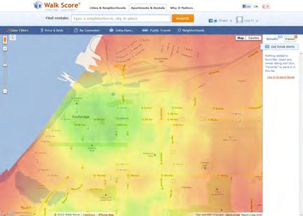
Alaska’s arctic climate and “frontier spirit” further define the quality of life in Anchorage’s Four Original Neighborhoods. Looking to other world-class northern cities such as Stockholm, Helsinki, Copenhagen, and Oslo—all of which rank highly in international quality-of-life surveys, despite their arctic climate—was helpful in understanding these issues. For example, Helsinki, the capital of Finland, was recently voted one of the best places to live, based on its proximity to nature, its innovative infrastructure and design, and the respect it gives to traditional cultural values. The city is also known for embodying a distinctly Finnish way of doing business and living life: a spirit of survival, an appreciation for the seasons, and a sense of humor combine to create an attitude that has sometimes been termed “Finnwacky.” The Four Original Neighborhoods already share many of the building blocks of Helsinki’s award-winning arctic character, so implementing the historic preservation strategies in this HPP to celebrate the unique Alaskan way of life would only strengthen the plan area’s character.
It is also important to note that the livability of a city is defined by more than just the quality of its bricks and mortar. Studies have shown that active community participation is an essential component of maintaining a positive quality of life. To that end, the policies and implementation strategies throughout the HPP are intended to increase community engagement and collaboration without compromising the independence that Alaskans value.
The “Quality of Life” policies presented here set the stage for the other goals of the HPP. Celebrating history and culture (Goal #3), forming partnerships to improve the community (Goal #4), responsibly managing growth (Goal #5), and adopting regulations that will reinforce community values (Goal #7) will all work together to enhance the quality of life in the Four Original Neighborhoods.
Maintaining trails and open space is a high priority.
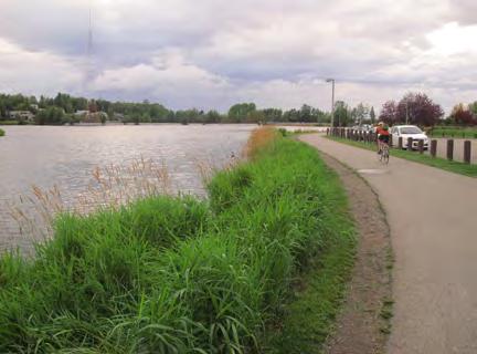
HISTORIC PRESERVATION PLAN FOR ANCHORAGE’S FOUR ORIGINAL NEIGHBORHOODS ADOPTED 2/12/2013 AO 2013-012102
WHAT IS LIVABILITY?
Because the concept of livability is place-based and context sensitive, its definition can differ, depending on region and whether the community is in an urban, suburban, exurban, or rural setting. However, the overall understanding of livability can be conveyed by five of the six principles of the Sustainable Communities Partnership listed below. A livable community:
Provides more transportation choices that are safe, reliable, and economical. In a rural area, this can be as simple as increasing walkability, to enable citizens to park their car once in a downtown area and access their daily needs by foot from that location. Providing transportation to critical social services for rural residents who can’t drive is another valuable livability option.
Promotes equitable, affordable housing options. This refers to an availability of locationand energy-efficient housing choices for people of all ages, incomes, races, and ethnicities—like neighborhoods with mixed-use, mixed-income housing where a retired couple can live in the same community as a recent college graduate.
Enhances economic competitiveness. Through reliable and timely access to employment centers, educational opportunities, services and other basic needs, livable communities are those which have higher economic resilience and more economic opportunities. They provide expanded business access to markets—largely through increased accessibility and mobility choices.
Supports and targets funding toward existing communities. Instead of developing on new land—which can be a waste of funding and resources—livable communities target development toward such strategies as transit oriented, mixed-use development and land recycling—to increase community revitalization, improve the efficiency of public works investments, and safeguard rural landscapes.
Values communities and neighborhoods. The purpose of livability is to enhance the unique characteristics of all communities by investing in healthy, safe and walkable neighborhoods—rural, urban or suburban. The unique nature of each area will determine what livability looks like for that community.
–Quoted from Department of Transportation, http://www.dot.gov/livability/faqs.html.
Live.Work.Play. is an initiative sponsored by the Anchorage Economic Development Corporation to make Anchorage the #1 city in America to live, work, and play.
CHAPTER VI: PRESERVATION VISION, GOALS & POLICIES ADOPTED 2/12/2013 AO 2013-12 103
The NoMa Business Improvement District created a cohesive brand for this Washington, D.C. neighborhood.

Plan Area Policies & Implementation Strategies: Quality of Life
1.1 Adopt and implement policies and projects that reinforce and help protect the unique character of each neighborhood.
1.1.1 Adopt branding for each of the Four Original Neighborhoods that celebrates history and diversity. The branding may identify the character of the neighborhood or make a statement about the benefits of living there, using banners, logos, or other materials. For example, this strategy was recently used in Washington, D.C.’s NoMa neighborhood.63
1.1.2 Coordinate implementation of historic preservation policies to support and extend the Anchorage First Economic Development strategy64 and “Live.Work.Play.” at the neighborhood level.
1.1.3 Utilize the historic function of alleys as a service space.
1.2 Promote and protect access to trails, open space, views, and recreation.
1.2.1 Integrate the history of Anchorage’s parks into the trail system in order to encourage use, and/or provide historical information on the Parks & Recreation website.
1.2.2 Maintain and enhance safety of existing historic trails, and improve connections to Downtown, Coastal Trail, and open space network.
1.2.3 Maintain and enhance the Ceremonial Start for the Iditarod Trail.
Highway signs in portions of British Columbia are bilingual in English and the Squamish language.
HISTORIC PRESERVATION PLAN FOR ANCHORAGE’S FOUR ORIGINAL NEIGHBORHOODS ADOPTED 2/12/2013 AO 2013-012104
1.3 Incorporate elements of Anchorage’s history and culture into everyday activities and places in order to improve quality of life and build a sense of place.
1.3.1 Install street signs in English and Athabascan, especially to represent Athabascan names for villages and geographic features (also applies to Policy 3.2). Highway signs in portions of British Columbia are bilingual in English and the Squamish language.
1.3.2 Name public buildings and streets after Native leaders per Muni code (also applies to Policy 3.2).
1.3.3 Incorporate Native art and/or sculpture into parks, open spaces, and other public areas by creating a network of partners and friends groups that will assist in planning, funding, and support of a public art program (also applies to Policy 3.2).
1.3.4 Integrate historic icons or photographs into streetscape furnishings, such as trash cans and benches (also applies to Policy 3.5). For example, this strategy was used at Jack London Square in Oakland, CA, and in Anacortes, WA.
1.3.5 Commission local artists to paint murals or create other public art depicting history of Four Original Neighborhoods, and consider offering guided tours of the murals. There is already a history timeline near City Hall, and new artwork could tell neighborhoodspecific stories (also applies to Policy 3.5). The Precita Eyes Mural Program in San Francisco is a successful example of this strategy.
 The Port of Anacortes, WA, installed vintage salmon labels on its trash cans to celebrate the town’s salmon canning history.
CHAPTER VI: PRESERVATION VISION, GOALS & POLICIES ADOPTED 2/12/2013 AO 2013-12 105
City officials named the alleys in downtown Sacramento to reflect their distinctive character and help brand the central city. The names, shown in bold italic, begin with the same first letter as the parallel street to the north of the alley.
1.3.6 Name alleys in the Four Original Neighborhoods using historical and cultural references (also applies to Policy 3.5). Officially naming alleys provides an opportunity to honor civic leaders and enhance the pedestrian experience without the problems caused by renaming major boulevards in mature cities. Naming alleys can also assist emergency response teams, who may have trouble finding locations that have addresses on the surrounding streets, but face the unnamed alley. For example, many alleys in San Francisco are named for local writers, such as Dashiell Hammett, Mark Twain, and the Beat writers. Similar programs have recently been enacted in Seattle and Sacramento to create an improved sense of place.
1.3.7 Develop partnerships with the Anchorage School District, nonprofit organizations, and Native groups to execute these projects (see Goal #4).
1.3.8 Seek funding through Alaska Native/Native Hawaiian Institutions Assisting Communities (AN/NHIAC), which is administered through the U.S. Department of Housing and Urban Development (HUD) and is issued to accredited nonprofit Alaska Native and Native Hawaiian institutions of higher education.66
See Policies 3.2 and 3.5 for additional implementation strategies related to incorporating history and culture into everyday life.
HISTORIC PRESERVATION PLAN FOR ANCHORAGE’S FOUR ORIGINAL NEIGHBORHOODS ADOPTED 2/12/2013 AO 2013-012106
2 | Landmarks to Save
Preserve character-defining features of the plan area, which includes physical landmarks as well as stories, people, landscapes, and events
Historic preservation in Anchorage differs from other cities due to several factors, including its more recent establishment and period of development, scarcity of resources and building materials that has caused many buildings to be moved, and the harsh climate that encourages replacement of building materials at a more rapid rate. Anchorage also lacks a local historic register or inventory. Nevertheless, the Anchorage community values its history, particularly as it is exemplified through the built environment of the Four Original Neighborhoods. The community has consistently identified a handful of specific local landmarks in the HPP area that should be preserved—termed “Landmarks to Save”—many of which are located in Downtown and Government Hill (see graphic on next page).
Buildings and spaces consistently mentioned as character-defining features of the plan area include the Park Strip, 4th Avenue Theatre, Oscar Anderson House, Alaska Railroad Anchorage Depot and the Freight Shed, Pioneer Schoolhouse, Strutz House, Safehaven, Army Housing Association/Pilots’ Row, and Star the Reindeer. Additional items include quintessential Alaskan building types (such as log cabins, CAA/FAA houses, and Quonset huts), older homes, and Alaska Native Peoples’ tikahtnus and cultural sites. Natural features such as Westchester Lagoon and the Coastal Trail were also mentioned as valuable places, and although they are not eligible for listing in the National Register, they may deserve to be celebrated in another way.
Many of the buildings identified by the community as high priorities for preservation are owned and operated by the Municipality of Anchorage (Oscar Anderson House, Pioneer Schoolhouse, and Old City Hall, among others). As owners of these valuable resources, the Municipality has an opportunity to take a strong role in preservation of the HPP area. Most importantly, the Municipality should act as the model for preservation “best practices” and should set the standard for appropriate stewardship of historic buildings in the plan area. With the Municipality leading the way and responsibly rehabilitating its historic properties, the HPP area has the potential to support heritage tourism in Anchorage (see Goal #6: Economic Development for more information about heritage tourism).
When planning for the preservation of these landmark buildings, the issue of relocation should be carefully considered. In the national preservation community, it is generally recognized that relocation of a historic resource that is in its original location is acceptable only as a last resort.
CHAPTER VI: PRESERVATION VISION, GOALS & POLICIES ADOPTED 2/12/2013 AO 2013-12 107
However, Anchorage and the Four Original Neighborhoods have a history of relocating buildings for a variety of purposes. Historically, relocation was a practical means of retaining scarce resources such as lumber and brick. Later, relocation of buildings has been implemented as a means to protect threatened historic resources and preserve architectural heritage. In the 1970s and 1980s, many buildings were moved out of the HPP area and into the Municipality’s storage yards to make way for new development, or moved to Wasilla or elsewhere in the Matanuska-Susitna Borough to take advantage of more flexible building codes. But relocation can still have positive benefits, and the Oscar Gill House (1344 W. 10th Avenue) is a success story: the house was moved from the Municipality storage yards back to the South Addition near its original location, and is now listed in the National Register.
In addition to the preservation of physical features, the preservation of stories, people, and events can add layers and depth to a community’s identity. This is especially true of Alaska Native Peoples’ heritage: the built environment as it stands today holds few physical reminders of the traditional use of the plan area, and engaging the Native community will be essential to ensure that the Four Original Neighborhoods properly reflect this aspect of Anchorage’s history. However, the focus of this module is on preservation of character-defining features, so strategies related to storytelling and interpretation are discussed in more detail in Goal #3: Interpreting History & Culture.
The goal of preserving identified local landmarks described in this module is the highest priority in the HPP; all of the other goals ultimately support this one. Therefore, it is vitally important to aggressively preserve and protect these resources by nominating and listing them in both the National Register of Historic Places and a local historic register. A disproportionate number of properties currently listed in the National Register are located Downtown, so one initiative should be to nominate properties in Government Hill, the South Addition, and Fairview that were identified during the neighborhood historic resource surveys as eligible for listing in the National Register. All of these identified historic resources should be first and foremost to receive the benefits of the new programs initiated via this HPP.
HISTORIC PRESERVATION PLAN FOR ANCHORAGE’S FOUR ORIGINAL NEIGHBORHOODS ADOPTED 2/12/2013 AO 2013-012108
Landmarks to Save
The buildings, sites, and stories depicted in this graphic were identified through the HPP Public Outreach Process as the most precious resources in the Four Original Neighborhoods. Places mentioned within Government Hill (orange), Downtown (blue), South Addition (green), and Fairview (pink) are shown here within the shape of each neighborhood’s boundaries.
This list is not intended to be exhaustive— many others not included here are listed in or eligible for the National Register of Historic Places—yet it reflects the resources valued most highly by the public. For a bulleted list of “Landmarks to Save” in each neighborhood, see Chapter VII
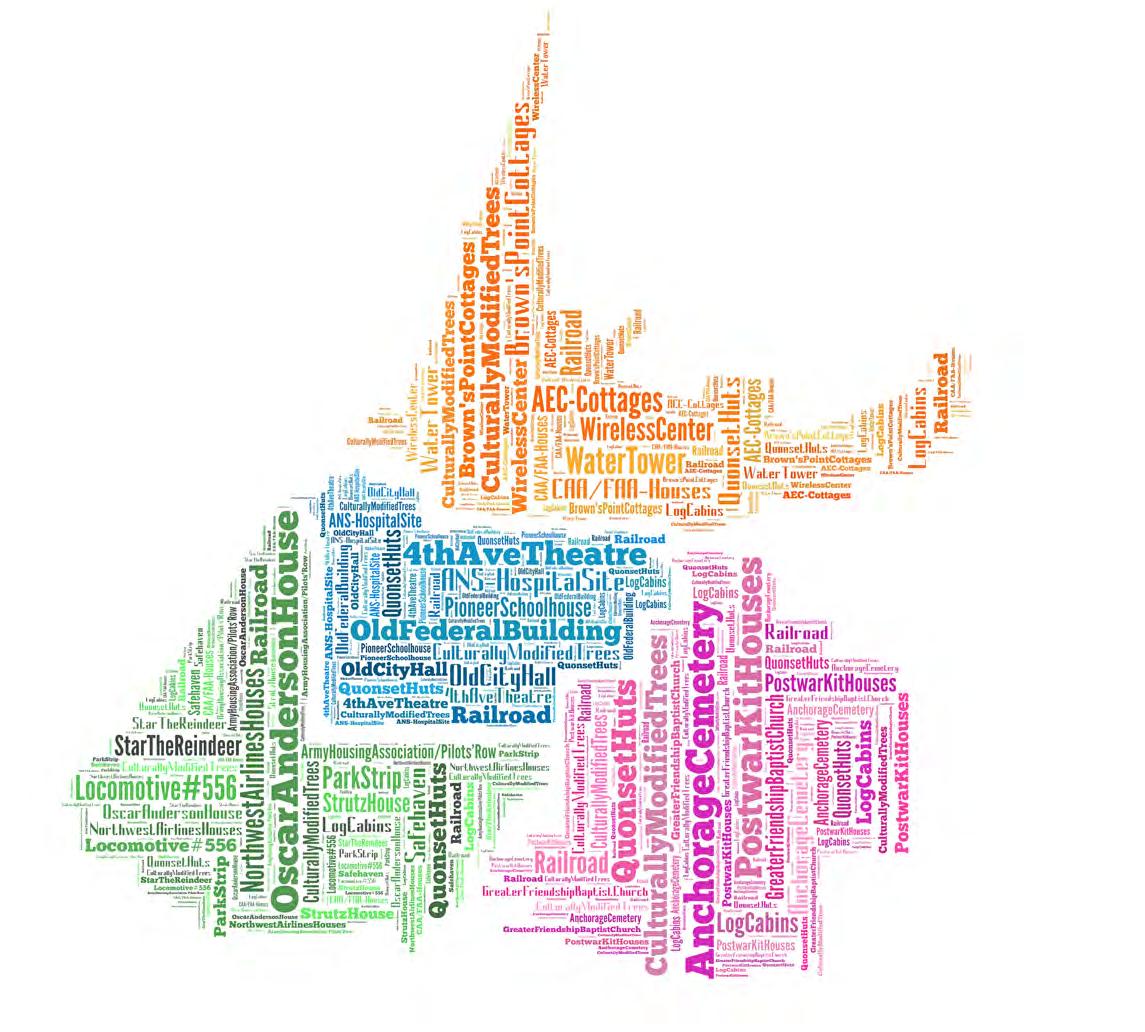
CHAPTER VI: PRESERVATION VISION, GOALS & POLICIES ADOPTED 2/12/2013 AO 2013-12 109
The 4th Avenue Theatre and quintessential Alaskan building types such as log cabins were consistently mentioned as “Landmarks to Save.”
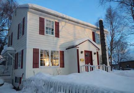
Plan Area Policies & Implementation Strategies: Landmarks to Save
2.1 Retain and preserve the historic and cultural resources identified during the HPP public outreach process and recorded in the Consolidated Historic Resources Inventory.
2.1.1 Create a program to seek official designation of eligible individual resources and districts on local, state, and/or national historic registers. To date, 174 individual resources and 11 historic districts have been found eligible for listing in the National Register and were recorded in the Consolidated Inventory. This nomination program should also include a process to acknowledge and interpret the importance of any identified resources that will not be nominated. Consider working with Alaskan universities to assign tasks toward accomplishing this program.
2.1.2 Prioritize official nomination of National Register-eligible historic resources outside Downtown (in the Government Hill, South Addition, and Fairview neighborhoods).
2.1.3 Encourage adaptive reuse of historic residential, commercial, and industrial resources in the Four Original Neighborhoods to ensure their longevity and vitality.
2.1.4 Seek public and private funding for rehabilitation projects at these buildings.
2.1.5 Continue to identify and preserve additional historic resources in the Four Original Neighborhoods, including nontraditional resource types such as cultural landscapes and trails.
See Chapter 2, “Federal Historic Preservation Laws,” for a discussion of the National Register of Historic Places. See Policy 7.3 for additional discussion about creating and populating a local register.
Prioritize nomination of National Register-eligible properties outside of Downtown, such as these CAA/FAA Duplexes in the South Addition.
HISTORIC PRESERVATION PLAN FOR ANCHORAGE’S FOUR ORIGINAL NEIGHBORHOODS ADOPTED 2/12/2013 AO 2013-012110
2.2 Promote these identified historic resources collectively as Anchorage’s most prominent historic resources.
2.2.1 Focus first on offering preservation incentives and economic development tools (discussed in Goal #6) to the historic buildings identified during the HPP public outreach process and recorded in the Consolidated Historic Resources Inventory.
2.2.2 Create a media campaign to highlight the historic and cultural resources identified during the HPP public outreach process and recorded in the Consolidated Historic Resources Inventory, and promote the benefits of historic preservation.
2.2.3 Develop themed tours of Anchorage that include the resources identified during the HPP public outreach process and the Consolidated Historic Resources Inventory project.
2.2.4 As part of the Municipality’s heritage tourism strategy—including leadership of the 2015 Centennial Celebration—coordinate promotion of these resources with businesses, tourism, and local nonprofit partners. For example, the existing Downtown Anchorage walking tour information could be incorporated into future Anchorage heritage tours.
2.2.5 Prepare a manual aimed at cruise and tour operators that summarizes historic sites and activities.
See Goal #3 for additional implementation strategies related to interpretive programs and education.
See Policy 6.7 for additional implementation strategies related to heritage tourism.
CHAPTER VI: PRESERVATION VISION, GOALS & POLICIES ADOPTED 2/12/2013 AO 2013-12 111
2.3 Avoid relocation of historic buildings and structures to storage facilities or other neighborhoods.
2.3.1 Identify historic buildings—especially those from the Four Original Neighborhoods— currently located in Municipality-owned storage facilities.
2.3.2 Evaluate the feasibility of a program for reintroducing historic buildings from storage back into the Four Original Neighborhoods. This could be an effective strategy for activating vacant lots and parking lots.
2.3.3 If retention of a historic building on site is not feasible, consider relocation to another suitable site within the plan area (e.g., vacant lots and parking lots). Relocation should be the last option considered, and is preferable only to demolition. If relocation is undertaken, the process should be well-documented.
2.4 Engage the Alaska Native Peoples community to identify cultural sites to preserve and interpret.
2.4.1 Work with Alaska Native Peoples community to identify and document Culturally Modified Trees in the plan area.
2.4.2 Work with Alaska Native Peoples community to identify and document house pits, caches, and other archeological sites in the plan area.
2.4.3 Solicit support and assistance from Cultural Resource Specialists in neighboring boroughs and communities to identify archeological and/or culturally significant sites in the plan area.Culturally modified trees in British Columbia.
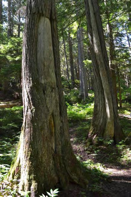
HISTORIC PRESERVATION PLAN FOR ANCHORAGE’S FOUR ORIGINAL NEIGHBORHOODS ADOPTED 2/12/2013 AO 2013-012112
2.4.4 Pursue Tribal Preservation Project Grants from the National Park Service to preserve Native cultural sites (also applies to Policies 3.2 and 4.6).
See Policy 3.2 for additional implementation strategies related to interpretation of Alaska Native Peoples’ history and culture, and Goal #4 for potential funding opportunities.
2.5 Develop preservation manuals for various property types (conditions, maintenance plan, programming, operations, finances, etc.).
2.5.1 Collect and distribute preservation briefs and case studies relevant to specific building types (residential, religious, educational, commercial, etc.) to serve as educational tools and to improve maintenance efforts.
See Policy 2.8 for additional implementation strategies related to preservation manuals for Municipalityowned buildings.
2.6 In addition to preservation of physical features, encourage preservation of stories, people, and events through interpretive programs and education.
See Goal #3 for implementation strategies related to interpretive programs and education.
CHAPTER VI: PRESERVATION VISION, GOALS & POLICIES ADOPTED 2/12/2013 AO 2013-12 113
Identify and track what might become the next generation of historic resources, such as Project 80s buildings.
2.7 Identify and track the next generation of historic resources to preserve, such as “Project 80s” buildings.
2.7.1 Create a database to identify and track local buildings that may achieve significance when they turn 50 years of age. This database should be updated every five years.
2.7.2 Interview “Project 80s” architects, planners, and developers as part of the documentation of the buildings.
2.7.3 Understand the significance of “Project 80s” buildings and other resources from the recent past through the development of a historic context statement.
2.7.4 Draft local registration requirements for significant buildings that have not yet achieved 50 years of age.
See Goal #7 for additional implementation strategies related to conducting and maintaining surveys.
2.8 Encourage public uses for historic buildings owned by the Municipality of Anchorage.
2.8.1 The Municipality should serve as the model for preservation “best practices” and should set the standard for appropriate stewardship by demonstrating these practices while maintaining Muni-owned historic buildings in the plan area.
2.8.2 Comprehensively assess and document historic resources owned by the Municipality.
Encourage public uses for historic buildings owned by the Municipality of Anchorage. (Pictured: Crawford Park Cabins)
2.8.3 Develop a comprehensive capital improvements program for managing Municipalityowned historic buildings. Such a program would prioritize preservation activities and consider various ownership and property management options, including coordination with the Heritage Land Bank and/or building and landscape easements. The capital improvements program should also identify funding opportunities (grants, general fund, and other sources) that may be available to Municipality-owned historic buildings.
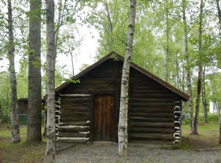
HISTORIC PRESERVATION PLAN FOR ANCHORAGE’S FOUR ORIGINAL NEIGHBORHOODS ADOPTED 2/12/2013 AO 2013-012114
2.8.4 Create an annual fund to support maintenance and management of buildings, based on the capital improvements program, or determine if the Municipality should sell the building to an owner who aspires to maintain it. Examples of reuse or repurposing existing historic buildings, including pro formas, may be developed as part of this process.
2.8.5 Conduct studies to explore appropriate uses for the most historically significant Municipality-owned buildings (e.g., feasibility studies, historic structures reports, historic building preservation plans, capital improvement plans, and operational/ business plans) according to the priorities and strategies established by the comprehensive capital improvements program (see Strategy 2.8.2). Studies for each building should include a budget for operational costs and a funding plan, which should be updated on a biannual basis.
2.8.6 Leverage potential income from Municipality-owned buildings (e.g., film location fees, rental fees, admission, etc.) to finance maintenance projects and development of tools/plans.
2.8.7 Catch up on deferred maintenance of Municipality-owned historic properties to ensure that their condition is stable and sustainable.
2.8.8 Revise tenant leases of Municipality-owned properties to encourage tenant participation in building upkeep and accountability of Public Works’ responsibilities to maintain the buildings.
CHAPTER VI: PRESERVATION VISION, GOALS & POLICIES ADOPTED 2/12/2013 AO 2013-12 115
3 | Interpreting History & Culture
Tell stories and raise public awareness about the plan area’s history, including cultures and traditions of Alaska Native Peoples
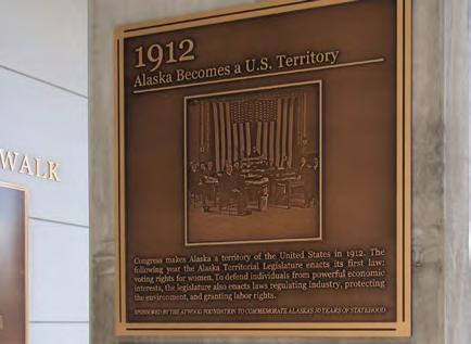
Anchorage residents recognize and appreciate the unique character of the Four Original Neighborhoods, and share a desire to celebrate the neighborhoods’ history and culture. Historic buildings and cohesive neighborhoods are a source of pride for the community, and residents value the contribution of historic resources to the plan area’s identity. However, there is a lack of broad public awareness about the plan area’s history, partly because so many of Anchorage’s residents are transplants or newcomers.
In the plan area, storytelling is of equal importance to the preservation of physical places. Interpretation is therefore essential. During preparation for the Anchorage Original Neighborhoods Historic Preservation Plan, community members presented many ideas for how to interpret and commemorate important people and events. These ideas range from plaques, monuments, and interpretive signage to walking tours, documentaries, websites, and other digital media. Additional interpretation programs and implementation strategies are presented in this chapter. Funding for these interpretive programs is discussed in Goals #4 and #6.
When it comes to deciding on methods for interpreting history and culture in the Four Original Neighborhoods, there are numerous choices that range in size and complication to implement. Thus, it is important to start by creating an Interpretive Program, wherein choice methods for interpretation are established and prioritized. Programming will likely be shaped to an extent by the arctic climate; however, the weather need not impinge on interpretation strategies, and can in fact produce more creative means for sharing stories about the plan area’s history and culture (see sidebar on next page).
Education about Anchorage’s history and preservation policies is also critical. There is a need to improve access to information, teach community members and Municipality administration how to manage historic buildings, and dispel myths about historic preservation.
Most important, Alaska Native Peoples’ stories—especially positive and/or modern ones—should be incorporated into the narrative, and respect should be shown for Alaska Native cultures and traditions. Recognizing the role of the Alaska Native Peoples community in building Anchorage and exploring current cultural practices are every bit as valuable as prehistoric stories.
Existing Alaska History Walk exhibit on 7th Avenue.
“Ngaa Pouwhenua – the Land, the People, the Dreams” exhibition in Waikato, New Zealand, showcases both the heritage and current practices of Māori peoples.
HISTORIC PRESERVATION PLAN FOR ANCHORAGE’S FOUR ORIGINAL NEIGHBORHOODS ADOPTED 2/12/2013 AO 2013-012116
Successful interpretive programs increase recognition of Native heritage and ensure that Native heritage values are acknowledged and interpreted for public understanding. These programs typically seek government and foundation or nonprofit support to implement and maintain them. When incorporating Alaska Native Peoples’ stories into the historic narrative for the Four Original Neighborhoods, it is important to understand that the perception of “heritage” differs for Europeans and indigenous peoples and that over the last century Native land-based and -built heritage has been undermined, which often necessitates creative approaches to cultural preservation. The best examples from other U.S. cities successfully integrate Native culture, heritage, art, and stories seamlessly into interpretive signage and everyday life. Using Native language and motifs in signage and place names may be an effective way to help accomplish this. In considering ways to better represent Alaska Native Peoples in the plan area, inspiration can be drawn from Hawaii, New Mexico, and the Navajo Nation, and from the Maori people in New Zealand, among others.
Plan Area Policies & Implementation Strategies: Interpreting History & Culture
3.1 Develop a comprehensive interpretive plan and/or a series of interpretive plans focusing on the character of each of the Four Original Neighborhoods. Consider interpretative programs and a variety of media that appeal to all ages and demographics.
3.1.1 Form an interpretive planning advisory group (or groups) composed of public-private partnerships to oversee creation of interpretive plan or plans.
3.1.2 Seek funding for an interpretive plan for Municipality-owned buildings and parks, which would identify and prioritize which stories to tell, select media to be used for each story, and establish a consistent graphic identity for all materials. Such a program should consider plaques, freestanding signage, kiosks, walking tours, brochures, mobile applications, social media, websites, video, audio/podcast, artifacts, exhibits, and artwork. This plan could be funded through grants, business improvement district funds, and/or Municipality (see Goals #4 and #6 for potential funding sources for such a program).
ARCTIC INTERPRETATION TIPS
Anchorage’s location presents unique conditions for interpretive planning due to its arctic climate. The following scenarios are suggested to promote history and culture in Anchorage, despite (or because of) the weather:
Construct signage using weather-resistant materials, or construct removable signage so that it does not get damaged or affect snow removal.
Celebrate seasonal activities and opportunities.
Conduct walking tours, even during the winter.
Use winter months for planning and fabrication of tours and interpretive materials.
Shift from outdoor activities, such as tours, to indoor ones, such as lectures, depending on the season.
CHAPTER VI: PRESERVATION VISION, GOALS & POLICIES ADOPTED 2/12/2013 AO 2013-12 117
Publicize Shem Pete’s Alaska , a book about Upper Cook Inlet Dena’ina place names.
3.1.3 Seek funding for an interpretive plan for each of the Four Original Neighborhoods. Each plan would include the same components described above.
3.1.4 Ensure that the Four Original Neighborhoods are represented in the Centennial Legacy Interpretive Project, and complete the installation of interpretive signage, plaques, or monuments in time for the Anchorage Centennial Celebration in 2015.
3.1.5 Work with the Alaska Native Peoples community to identify stories in the plan area to interpret.
3.1.6 Look for interpretive opportunities that take advantage of all four seasons.
3.1.7 Seek funding to assist private property owners in implementing interpretive programs.
3.2 Incorporate Alaska Native Peoples’ stories into existing and future narratives in the Four Original Neighborhoods.
3.2.1 Place an interpretive plaque at the site of the former Alaska Native Service (ANS) Hospital.
3.2.2 Select one example of Culturally Modified Trees, and place interpretive signage at that location (see Policy 2.4).
3.2.3 Create a map of indigenous language place names in the Four Original Neighborhoods. The Bureau of Land Management (BLM) completed a report and map identifying culturally important place names in the Copper River watershed in South-central Alaska.
3.2.4 Publicize Shem Pete’s Alaska, a book about Dena’ina place names.
HISTORIC PRESERVATION PLAN FOR ANCHORAGE’S FOUR ORIGINAL NEIGHBORHOODS ADOPTED 2/12/2013 AO 2013-012118
3.2.5 Install street signs in English and Athabascan, especially to represent Athabascan names for villages and geographic features (also applies to Policies 1.3 and 3.13).
3.2.6 Name public buildings and streets after Native leaders (also applies to Policy 1.3).
3.2.7 Incorporate Native art and/or sculpture into parks, open spaces, and other public areas by creating a network of partners and friends groups that will assist in planning, funding, and support of a public art program (also applies to Policy 1.3).
3.2.8 Add more Alaska Native stories about the sun, moon, and stars to Planet Walk (some are featured at the Sun Station and on the Web, but additional stories could be added to other planet signage).
3.2.9 Include Native Alaskan Peoples’ stories in Oscar Anderson House tour.
3.2.10 Establish an Alaska Native Heritage Center (ANHC) annex or kiosk in Downtown to support heritage tourism (see Policy 6.7).
3.2.11 Host festivals or ceremonies to celebrate the catch of the first salmon, migration of birds, and other traditional events and rituals.
3.2.12 Pursue Tribal Preservation Project Grants from the National Park Service to promote interpretation of Native stories and cultural sites (also applies to Policies 4.6 and 2.4).
3.3 Educate the general public, tourists, and Municipality administration about the history of Anchorage’s Four Original Neighborhoods.
3.3.1 Work with Anchorage School District (ASD) educators and administrators to adapt the local history module for high school students to include information about the Four Original Neighborhoods.
The Auxiliary Heritage Collection and Craft Shop at the Alaska Native Medical Center celebrates Native history and traditional artwork.
CHAPTER VI: PRESERVATION VISION, GOALS & POLICIES ADOPTED 2/12/2013 AO 2013-12 119
The “Alaska App” already includes a self-guided walking tour of Downtown, and could be expanded to include other neighborhoods.
3.3.2 Work with ASD educators and administrators to develop a scavenger hunt or other activity for elementary school students, focused on the Four Original Neighborhoods.
3.3.3 Work with university educators and administrators to incorporate historic preservation curricula into Alaskan universities. The University of Alaska, Anchorage (UAA) Anthropology Department already has graduate-level courses on Cultural Resource Management, which could serve as a model for other courses and degree programs.
3.3.4 Develop a free guided walking tour program. There are various models of tour programs that have been applied successfully in other cities: (1) offered by a local historical society, (2) organized through the city’s public library, (3) sponsored by a business improvement district, (4) offered by for-profit tour companies, or (5) presented by a collective of independent volunteer guides who advertise on a central website. Examples of each type of walking tour program include: (1) Jackson Hole, Wyoming, Historical Society and Museum’s summer walking tour series, (2) San Francisco’s “City Guides” program, (3) New York City’s Grand Central Partnership, (4) Sandeman’s New Europe, and (5) CityFreeTour.com.
3.3.5 Partner with Bicycle Commuters of Anchorage (BCA) or other similar group to offer maps and bike tours of historic resources in the Four Original Neighborhoods (also applies to Policies 3.6 and 3.7). This strategy is used by the San Francisco Bicycle Coalition, which hosts regular historic bicycle tours.
3.3.6 Add information about the history of the Four Original Neighborhoods to the Anchorage Bike map (also applies to Policies 3.6 and 3.7).
3.3.7 Add history of Four Original Neighborhoods to the “Alaska App.” Note that the app already includes a self-guided walking tour of Downtown, created by the Alaska Channel and the Anchorage Downtown Partnership, Ltd.67 (also applies to Policies 3.6 and 3.7).
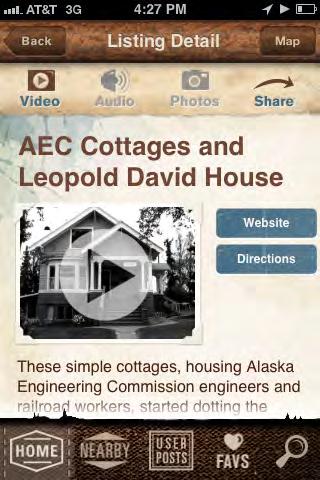
HISTORIC PRESERVATION PLAN FOR ANCHORAGE’S FOUR ORIGINAL NEIGHBORHOODS ADOPTED 2/12/2013 AO 2013-012120
3.3.8 Compile a bibliography of further reading about each neighborhood, to be made available at the Log Cabin Visitor Information Center, Z.J. Loussac Public Library, local schools, and Municipality offices.
3.3.9 Create a multimedia display about the Four Original Neighborhoods in City Hall or Log Cabin Visitor Information Center.
3.3.10 Seek funding for a short, engaging film about the Four Original Neighborhoods.
3.3.11 Publicize Rae Arno’s Anchorage Place Names, a book about the history of street, park, and place names.
See Goal #4 for more information about interested partners that promote community pride and identity.
3.4 Provide practical, hands-on training for residents and organizations about available preservation tools, maintenance tips, conservation issues, and nomination programs.
3.4.1 Sponsor a series of Historic Homes Workshops, teaching about the rehabilitation process, historic preservation review procedures, funding opportunities, or skills such as window repair. For example, a successful window workshop was recently held at the Pioneer Schoolhouse. Examples of this strategy outside of Anchorage include This Old House TV series on PBS, the “Heritage Houses Workshop Series” developed by the Historic Hawai’i Foundation, and the “Historic Home Workshops” hosted by the City of Napa, CA.
3.4.2 Host a Preservation Education lecture series, covering topics such as neighborhood history, historic preservation incentives, and historic preservation procedures and regulations.
3.4.3 Provide basic historic preservation training for Planning & Zoning Commission, Assembly, and Municipality staff. For example, the City of Paso Robles, CA, provided training for its city officials and staff.
“This Old House” has a TV series, magazine, and website dedicated to teaching homeowners about skills such as window repair.
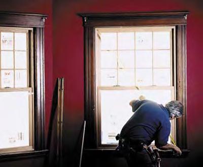
A successful window workshop was recently held at the Pioneer Schoolhouse.
CHAPTER VI: PRESERVATION VISION, GOALS & POLICIES ADOPTED 2/12/2013 AO 2013-12 121
The City of San Antonio, TX, sponsors a 30-minute monthly historic preservation segment called “HPTV.”
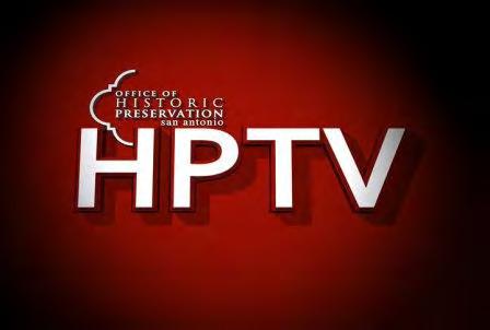
3.4.4 Provide basic historic preservation training for lenders, appraisers, and code officials.
3.4.5 Produce a series of historic preservation pamphlets, such as “Frequently Asked Questions” or “how-to” guides on historic house maintenance. For example, this strategy was used successfully in San Clemente, CA.
3.4.6 Produce a series of short segments focusing on preservation issues, to air on public access television channels (Municipal Channel 10). For example, the City of San Antonio, TX, sponsors a 30-minute monthly historic preservation segment called “HPTV.”
3.4.7 Update Anchorage Historic Preservation Commission (AHPC) website to include more preservation-related links and educational tools.
3.5 Promote community pride and identity through storytelling and interpretation.
3.5.1 Create a Historic Plaque Program. Each plaque would state basic information about the building, such as its historic name, original owner’s name, and/or original construction date. The program could be administered by a local nonprofit organization or the Municipality, with plaques paid for by each property owner. The cost of the plaques would vary, depending on materials and design, but would likely range from $50 to $150 each. For example, hundreds of cities nationwide use this strategy, such as San Antonio, TX (city-funded), and Pacific Grove, CA (sponsored by the Heritage Society).
3.5.2 Publish a quarterly or monthly newspaper column about local history. Many years ago, Robert B. Atwood’s regular column in the Anchorage Daily News focused on history.
3.5.3 Share historic photographs and facts at Community Council meetings, Anchorage School District programs, and other events.
The Precita Eyes Mural Program offers guided tours of murals and other public art—many of which portray significant historical themes—in San Francisco’s Mission District.
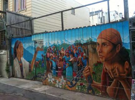
HISTORIC PRESERVATION PLAN FOR ANCHORAGE’S FOUR ORIGINAL NEIGHBORHOODS ADOPTED 2/12/2013 AO 2013-012122
3.5.4 Integrate historic icons or photographs into streetscape furnishings, such as trash cans and benches (also applies to Policy 1.3). For example, this strategy was used at Jack London Square in Oakland, CA, and in Anacortes, WA.
3.5.5 Commission local artists to paint murals or create other public art depicting history of Four Original Neighborhoods, and consider offering guided tours of the murals. There is already a history timeline near City Hall, but new artwork could tell neighborhoodspecific stories (also applies to Policy 1.3). For example, the Precita Eyes Mural Program in San Francisco is a successful example of this strategy.
3.5.6 Host annual Historic House Tour events, rotating among the Four Original Neighborhoods each year. For example, historic Denver hosts an annual house tour in Denver each year, focused on eight to 10 houses in a different historic neighborhood .
3.5.7 Name alleys in the Four Original Neighborhoods. using historical and cultural references (also applies to Policy 1.3). Officially naming alleys provides an opportunity to honor civic leaders and enhance the pedestrian experience without the problems caused by renaming major boulevards in mature cities. Naming alleys can also assist emergency response teams, who may have trouble finding locations that have addresses on the surrounding streets but face the unnamed alley. For example, many alleys in San Francisco are named for local writers, such as Dashiell Hammett, Mark Twain, and the Beat writers. Similar programs have recently been enacted in Seattle and Sacramento to create an improved sense of place.
3.5.8 Design interpretive signage that is weather-resistant, or mounted such that it can be removed in winter. For example, the Donner Summit Historical Society designed customized, removable signs for Donner Summit, near Truckee, CA.
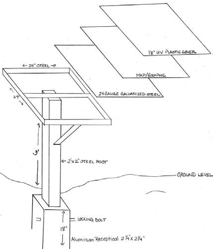
See Policy 3.8 for implementation strategies regarding oral histories.
The Donner Summit Historical Society designed customized signs that could be removed in winter. Donner Summit, near Truckee, CA.
CHAPTER VI: PRESERVATION VISION, GOALS & POLICIES ADOPTED 2/12/2013 AO 2013-12 123
The Freedom Trail in Boston uses special paving, sidewalk markers, and paint to guide visitors on a walking tour of historic sites.
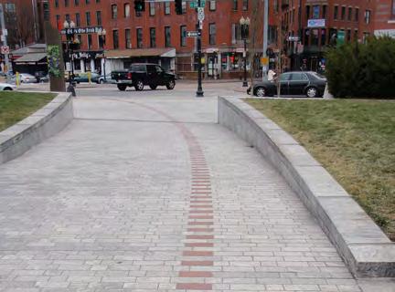
3.6 Take advantage of opportunities for thematic interpretation of stories across neighborhood boundaries.
3.6.1 Develop a mobile application or podcast to host thematic walking and driving tours (e.g., “Aviation History Tour,” “Military History Tour,” “Railroad History Tour,” “1964 Earthquake Tour,” “Alaska Native Peoples Tour,” etc.). This could also be coordinated with the upcoming Anchorage Centennial Legacy Interpretive Project to include a “100 Years, 100 Homes” tour.
3.6.2 Design iconic graphics (e.g., propellers, trains, etc.) to be installed at associated sites to alert people to significant themes.
3.6.3 Incorporate stories about each neighborhood into the existing trail system’s paving or infrastructure to combine history and the outdoors, especially during the summer months. This could be especially effective along the historic Iditarod Trail, which winds through the Four Original Neighborhoods. The Freedom Trail in Boston is a prominent example of this strategy.
3.7 Continue to enhance and promote existing programs that celebrate history and culture (e.g., Oscar Anderson House, Anchorage Museum at Rasmuson Center, Anchorage Memorial Park Cemetery, Alaska Native Heritage Center, etc.).
3.7.1 Create a media campaign to draw attention to the historic and cultural resources identified during the HPP public outreach process and recorded in the Consolidated Historic Resources Inventory, and to promote the benefits of historic preservation.
3.7.2 Continue to host “Historic Preservation Day” in Anchorage (April 11, 2012, was the inaugural celebration).
Using new media such as QR codes can create an interactive storytelling experience, such as on these signs in Rijeka, Croatia.
HISTORIC PRESERVATION PLAN FOR ANCHORAGE’S FOUR ORIGINAL NEIGHBORHOODS ADOPTED 2/12/2013 AO 2013-012124
3.7.3 Celebrate Historic Preservation Month (nationally celebrated in May) in the Four Original Neighborhoods.
3.7.4 Celebrate Alaska Native-American Indian Heritage Month (nationally celebrated in November) in the Four Original Neighborhoods (also applies to Policy 3.2).
3.7.5 Tie in more historic stories to popular events such as Fur Rendezvous, the Iditarod, and the “Slam’n Salm’n Derby” (also applies to Policy 4.2).
3.7.6 Organize an annual historic tour of the cemetery.
3.7.7 Increase Anchorage Historic Preservation Commission presence on social media websites.
3.7.8 Publicize the Anchorage Museum’s Homestead Exhibit online, as most of the featured homesteads were in the Four Original Neighborhoods.
3.8 Collect stories from first-generation Anchorage pioneers and Tribal Elders, and make this task an urgent priority.
3.8.1 Partner with local, state, and national organizations to develop and fund oral history programs. University of Alaska at Fairbanks’ Project Jukebox is an existing oral history program, while StoryCorps and NPR partnered in the past for a project called “StoryCorps Alaska.”
3.8.2 Work with Alaska Native Hospital, Southcentral Foundation, University of Alaska at Fairbanks’ Project Jukebox, and other organizations to gather oral histories from Tribal Elders.
The inaugural celebration of “Historic Preservation Day” was held in Anchorage on April 11, 2012.
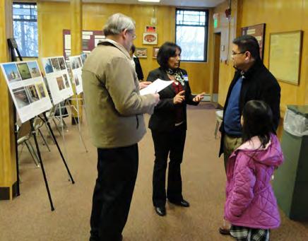
Tie in more historic preservation activities to popular events such as Fur Rendezvous and the Iditarod.
CHAPTER VI: PRESERVATION VISION, GOALS & POLICIES ADOPTED 2/12/2013 AO 2013-12 125
Oral histories gathered by the Brooklyn Historical Society (New York) are available online via podcast.
3.8.3 Encourage the Anchorage Woman’s Club or other interested community organizations to continue to record the oral histories of Anchorage residents.
3.8.4 Incorporate oral history projects and training into the public school system and local universities to get students to record the stories of Anchorage residents. Consider coordinating with the Alaska Humanities Forum curriculum or other educational program to accomplish this task.
3.8.5 Make oral histories easily accessible via podcast. For example, oral histories gathered by the Brooklyn Historical Society (New York) and County Wexford, Ireland, are available online.
HISTORIC PRESERVATION PLAN FOR ANCHORAGE’S FOUR ORIGINAL NEIGHBORHOODS ADOPTED 2/12/2013 AO 2013-012126
4 | Community & Partnerships
Engage the community to participate in preservation activities and foster partnerships that will support historic preservation
Historic preservation is far from a recent undertaking in Anchorage. Whether it takes the form of one homeowner restoring her own home, or a nonprofit organization dedicated to preserving a historic site, many in the Anchorage community are currently engaged in historic preservation activities that have improved or enhanced the Four Original Neighborhoods.
Heritage groups and museums are responsible for innovative and ambitious preservation-related projects. The Alaska Railroad was complimented for its stewardship of the historic industrial district at Ship Creek. Efforts to promote and protect the heritage of Alaska Native Peoples, such as the Alaska Native Heritage Center and Anchorage Museum, were also recognized as important contributions to the community. Other preservation-minded organizations that operate locally include the Alaska Association for Historic Preservation, Cook Inlet Historical Society, and the Anchorage Woman’s Club (discussed in detail in Chapter III). Identifying good partners for preservation in the future— especially companies and groups that are not traditionally known for historic preservation but that have overlapping interests—will be essential to accomplish the goals and policies in other chapters of the HPP (see sidebar on next page).
Fostering partnerships to support historic preservation is especially important in order to secure funding and other resources. Many of the existing programs in Anchorage have used government or corporate grants to fund their efforts, and additional funding opportunities may also be available. The Certified Local Government Program, Tribal Preservation Program, Lowe’s Charitable and Educational Foundation, National Endowment for the Humanities, and American Express are just a few examples of programs and organizations that offer preservation-related grant opportunities. Goal #6 (Economic Development) further discusses funding options.
In addition to building a network of public and private partners, the efforts of the community and its preservation partners should be recognized and rewarded. The Alaska Association for Historic Preservation already hosts Annual Historic Preservation Awards, and projects throughout Alaska have won awards from the National Trust for Historic Preservation. An awards program focused on the Four Original Neighborhoods could also be developed.
The Alaska Railroad was complimented for its stewardship of the historic industrial district at Ship Creek.
CHAPTER VI: PRESERVATION VISION, GOALS & POLICIES ADOPTED 2/12/2013 AO 2013-12 127
Even with partners and funding, preservation in the Four Original Neighborhoods will not succeed if the community is not sufficiently engaged and invested. Raising awareness about the history of the plan area, as well as providing opportunities for the public to participate in preservation activities, will be key in accomplishing the goals of the HPP. In the Four Original Neighborhoods, the Community Councils already provide an opportunity for the public to be involved in neighborhood planning, and this existing structure could be leveraged and refined to serve as both a source of information and a forum for discussion about preservation projects and activities.
IT TAKES A VILLAGE: PARTNERS FOR PRESERVATION
Preservation is a community-wide endeavor. The Four Original Neighborhoods should look to form publicprivate partnerships to support and fund preservation activities in the plan area. Government agencies, nonprofit organizations, corporations, and community groups can all work together to make their resources available to the community. Such partners may include:
Federal agencies
State agencies
Municipal programs and departments
Preservation nonprofit organizations (national, state, local)
Alaska Native Peoples organizations (tribes, corporations, foundations)
Neighborhood/community groups (including Community Councils)
Business organizations/networks
Corporations and local businesses, even those not traditionally known for historic preservation
Educational institutions (school districts, universities)
Museums
See Appendix L: Partners for Preservation for a list of organizations and groups—which is by no means exhaustive or exclusive—mentioned during the HPP Public Outreach process that might be good partners for preservation.
HISTORIC PRESERVATION PLAN FOR ANCHORAGE’S FOUR ORIGINAL NEIGHBORHOODS ADOPTED 2/12/2013 AO 2013-012128
Plan Area Policies & Implementation Strategies: Community & Partnerships
4.1 Identify partners at the federal, state, and local levels to support historic preservation and cultural resource awareness.
4.1.1 Create and maintain a directory of potential preservation partner organizations, including contact information or website.
4.1.2 Follow the lead of Alaska Association for Historic Preservation and establish partnerships between other organizations and the National Trust for Historic Preservation through the “Partners in the Field” program.
4.1.3 Assign HPP implementation tasks to preservation-minded organizations.
4.1.4 Collaborate with Alaska Native Peoples organizations (tribes, corporations, and foundations) on preservation activities in the Four Original Neighborhoods.
4.1.5 Create and manage a list of Alaska Native Peoples groups to collaborate on preservation and interpretive efforts. This list would be maintained by the Municipality and guided by the Anchorage Historic Preservation Commission.
4.2 Reach out to organizations and companies with indirect or nontraditional connections to preservation.
4.2.1 Combine cultural and historic preservation awareness with other Anchorage events and organizations68 (also applies to Policy 3.7).
4.2.2 Form networking opportunities with real estate professionals, developers, architects, and historic preservation groups. For example, “Real Estate & Construction Networking” is a San Francisco Bay Area organization that offers networking opportunities to the local development community.
The Alaska Association for Historic Preservation is a leading preservation partner in Anchorage.
CHAPTER VI: PRESERVATION VISION, GOALS & POLICIES ADOPTED 2/12/2013 AO 2013-12 129
Kiestwood Historical Homeowners Association was formed to preserve a large collection of Ranch Style homes in Dallas, TX. Membership is voluntary at $15 per year, and is overseen by an all-volunteer board.
4.2.3 Create local retail programs to benefit the rehabilitation of a particular historic building type or geographic location (neighborhood). For example, SaveMart, a Sacramento, CA, supermarket chain, sponsored a campaign to raise funds to keep public pools open in that city.
4.3 Encourage collaboration on preservation projects and programs among a variety of local groups.
4.3.1 Form a Historic Homeowners’ Association.
4.3.2 Develop preservation partnerships between federal and state historic preservation agencies and staff, Alaska Native Peoples representatives, and the Municipality to ensure a common message among the agencies, improve communication, and leverage community-wide cultural and historic preservation efforts.
4.3.3 Provide information about appropriate public participation and procedures to ensure that residents are aware of their opportunities to participate in the planning process, and are able to provide their comments in a manner that is helpful to decision-makers.
4.3.4 Create an educational program for community-based organizations that includes materials regarding the benefits of historic preservation.
4.4 Recognize and reward groups and individuals whose activities promote preservation and exemplify proper stewardship of historic resources.
4.4.1 Create an awards program (or expand on the Alaska Association for Historic Preservation’s Annual Historic Preservation Awards) to recognize good stewards of historic resources in the Four Original Neighborhoods. This could be combined with the Historic Plaque Program (Policy 3.5).
HISTORIC PRESERVATION PLAN FOR ANCHORAGE’S FOUR ORIGINAL NEIGHBORHOODS ADOPTED 2/12/2013 AO 2013-012130
4.4.2 Host an annual gala or awards ceremony to celebrate historic preservation and reward those who have been integral to the movement in Anchorage.
4.4.3 Offer discounts for advertising, premier listing for events, and so on, to recognize the role that groups have in supporting historic preservation.
4.5 Utilize networks and contacts from partner organizations to promote and educate.
4.5.1 Update Anchorage Historic Preservation Commission (AHPC) website to include more preservation-related links and educational tools.
4.5.2 Use Anchorage Downtown Partnership, Ltd., Building Owners & Managers Association (BOMA), Community Councils, and other community groups to educate property and business owners about available preservation programs and incentives.
4.5.3 Build a database of historic preservation practitioners.
4.5.4 Ensure that tourist-based organizations have access to information and publicize Anchorage heritage in their programs.
4.6 Identify and implement potential funding sources and grant opportunities for preservation.
4.6.1 Create and maintain a directory of potential preservation-related grants and funding sources, including any application requirements or restrictions.
4.6.2 Pursue preservation grants offered through the Lowe’s Charitable and Educational Foundation, Scenic Byways, Certified Local Government, National Endowment for the Humanities, American Express Historic Preservation Partners program, and other foundations and organizations for preservation projects in Anchorage’s Four Original Neighborhoods.
Grants are given through the “Partners in Preservation” program, sponsored by American Express and the National Trust for Historic Preservation. Each year a different region hosts the program (pictured: Seattle, 2010).
CHAPTER VI: PRESERVATION VISION, GOALS & POLICIES ADOPTED 2/12/2013 AO 2013-12 131
4.6.3 Fundraise through sponsorships, silent auctions, and donations at an annual historic preservation gala (see Policy 4.4.2).
4.6.4 Leverage Anchorage’s Preserve America status to obtain federal funding for historic preservation projects in the plan area (note that Preserve America grants are not being offered in FY2012).
See Goal #6 for additional implementation strategies related to funding and economic development.
4.7 Use each neighborhood’s community center to support preservation activities.
4.7.1 Install interpretive displays in each neighborhood’s existing community center that highlights local history.
4.7.2 When building new community centers, consider incorporating neighborhood characteristics or traditional vernacular forms to celebrate history and ensure contextsensitive design. For example, Quonset huts or log cabins could be used as inspiration for the design of a new community center in one of the Four Original Neighborhoods.
4.8 Refine roles and responsibilities of Community Councils to create a forum for discussion of preservation.
4.8.1 Make information about preservation projects and activities available to the public through Community Councils and other community organizations.
4.8.2 Offer basic historic preservation training for each Community Council member.
4.8.3 Improve and maintain communication between the Community Councils and the Anchorage Historic Preservation Commission (AHPC).
 Historic buildings can be used as community meeting places, such as the A Street Event Hall in Downtown.
HISTORIC PRESERVATION PLAN FOR ANCHORAGE’S FOUR ORIGINAL NEIGHBORHOODS ADOPTED 2/12/2013 AO 2013-012132
5 | Growth & Change
Manage growth and change to historic neighborhood elements and character through development and implementation of the Municipality-Wide Historic Preservation Plan, the HPP, and Neighborhood and District plans. Adopt relevant policies, regulations, and best practices that will support and reinforce historic character and historic preservation goals, and that will aid in avoiding transportation, infill, redevelopment, or other large infrastructure projects that do not support neighborhood character.
One of the primary purposes of the Anchorage Original Neighborhoods Historic Preservation Plan is to provide solutions that will help balance future growth and change in the Four Original Neighborhoods with historic preservation goals. But this document is not the first to conceive of a vision for these neighborhoods: the Anchorage Original Neighborhoods Historic Preservation Plan supports and builds on existing growth and change management plans for the Municipality of Anchorage and its neighborhoods. The Anchorage 2020 Anchorage Bowl Comprehensive Plan identified a preferred growth strategy for Anchorage. This preferred strategy, the Urban Transition Scenario, promotes increased density Downtown; transitional, mixed-use development in the older neighborhoods; and preservation of the suburban and rural character of South Anchorage (see sidebar). Other plans and ordinances that guide growth and change in the Original Neighborhoods include: Title 21 of the Anchorage Municipal Code, and neighborhood-specific plans like the Downtown Comprehensive Plan and draft Government Hill Neighborhood Plan (GHNP) and Fairview Neighborhood Plan.
The policies and implementation strategies in this chapter demonstrate how historic preservation can further strategic goals for development in the Four Original Neighborhoods. Based on preservation best practices, the policies promote development that is respectful of historic and cultural properties and neighborhood character. As the Washington State Historic Preservation Guidebook explains, preservation planning brings predictability to growth and change:
When a change in land use is proposed for a site where cultural resources may be present, a historic preservation plan brings predictability and consistency to the development process. Goals, policies, and action statements regarding cultural resources serve notice to everyone as to the local priorities and public intentions towards these resources. A plan that identifies and evaluates properties or districts as historically significant provides specific direction for appropriate development. For local elected officials, planners, developers, property owners, and other interested citizens, there is immense value in having this predictability built into the development process. As a result, possible delays, surprises, and controversies can be identified early and avoided.70
But policies are not enough. As discussed under “Community and Partnerships,” it is important to identify who leads the growth management policies described in this chapter.
ANCHORAGE 2020 AND THE URBAN TRANSITION SCENARIO
The Urban Transition Scenario was selected as the preferred growth scenario for Anchorage in the Anchorage 2020 Anchorage Bowl Comprehensive Plan. In this scenario:
Downtown, Midtown, and older in-town neighborhoods develop a more intensive urban character. Initiatives to foster more intense mixed-use development and neighborhood renewal in the northern half of the Bowl are introduced. Suburban/rural neighborhood character in South Anchorage is retained.69
The Anchorage Original Neighborhoods Historic Preservation Plan supports this vision through the development of historic preservation policies for neighborhoods and the Municipality.
CHAPTER VI: PRESERVATION VISION, GOALS & POLICIES ADOPTED 2/12/2013 AO 2013-12 133
New development and contemporary architecture can still be integrated into historic neighborhoods.
Local groups are encouraged to be proactive in the management of development and change in their neighborhoods. The ability of the neighborhood to effectively participate, review, and comment on proposed projects is critical to responsible development. Establishing a formal neighborhood-level review process that includes a plan for public participation ensures that residents have the ability to be heard (see sidebar)71. Additional guidance and training programs could help residents and decision-makers to effectively review and comment on growth and change, especially through the Section 106 consultation process. A straightforward, simple review process could also facilitate better communication and cooperation among residents known for their “frontier spirit” or independence. The policies and implementation strategies in this chapter strongly correlate to those proposed in Goal #7: Procedures & Regulations.
“Responsible” development is difficult to define and may vary; therefore, the “responsible” development referenced in this module stems directly from public comments received for the plan area. Residents would like to see the existing character of their neighborhoods reinforced by encouraging reuse of historic buildings, as well as thoughtful design of infrastructure (utilities, alleys, street amenities, and streetscape improvements). Concerns about demolition of and inappropriate alterations to historic buildings, about transportation projects that threaten historic resources, and about urban sprawl were also expressed during the public outreach process for the HPP. Although each neighborhood has a slightly different vision for growth and change, the “Growth and Change” policies in this chapter address the types, sizes, locations, and densities of development applicable across all Four Original Neighborhoods. Neighborhood-specific recommendations—especially relative to commercial development—are discussed in Chapter VII
The Alaska Railroad Freight Shed is LEED-certified and listed in the National Register of Historic Places.
Whether a proposed project involves open space, infrastructure, or buildings, the “Growth and Change” policies presented here demonstrate how historic preservation can influence the outcome. Open space is legally defined as undeveloped land that is protected from development by legislation; however, the term may also be more loosely used to describe parks or “green space” and the landscape of an urban environment, which may include underutilized or vacant lots. Infrastructure is generally defined as a large-scale public system, service, or facility, including power and water systems, public transportation, telecommunications, and roads. Growth strategies address projects large and small, from defining the public review process to establishing limits and redesign of surface parking lots.
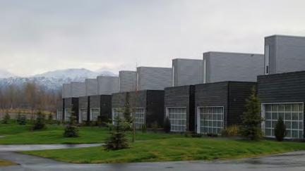
HISTORIC PRESERVATION PLAN FOR ANCHORAGE’S FOUR ORIGINAL NEIGHBORHOODS ADOPTED 2/12/2013 AO 2013-012134
Plan Area Policies & Implementation Strategies: Growth & Change
5.1 Foster the preservation and promotion of the unique characteristics of each of the Four Original Neighborhoods by developing policies and ordinances that support each neighborhood’s goals.
5.1.1 Facilitate projects that will assist in retaining or enhancing historic neighborhood character and uses that will enhance and preserve quality of life, safety, connections to trails and open space, walkability, and bikeability.
5.1.2 Avoid or mitigate projects that threaten the unique characteristics of Municipally Adopted Plans (see Policy 5.5).
5.2 Address “Growth & Change” issues at a neighborhood-specific level by engaging the local community.
5.2.1 Provide information about appropriate public participation and procedures to ensure that residents are aware of their opportunities to participate in the planning process, and are able to provide their comments in a manner that is helpful to decision-makers. (See Policy 4.3) For example, many cities and agencies have prepared tips to help the public maximize their input, such as National Oceanic and Atmospheric Association (NOAA)’s “Tips for Submitting Effective Public Comments.”73
5.2.2 Use the established Community Council review process for infrastructure and development projects. This existing process could evolve to allow historic resources to be properly protected through a checklist of project considerations (need for the proposed project, design, etc.) for the community to study. For example, in 2008, the Municipality of Anchorage prepared a Strategy for Developing Context Sensitive Transportation Projects, which outlines a project development process that promotes cooperation of stakeholders and decision-makers. This approach could easily be expanded to the Four Original Neighborhoods.
PLANNING FOR TRANSPORTATION: CONTEXT SENSITIVE SOLUTIONS
Transportation and infrastructure projects can be threatening to a community’s quality of life and its historic resources, if the project is not planned properly. In recent years, highway designers and administrators have learned that they must be more careful about how transportation affects communities. One solution is “Context Sensitive Solutions,” an approach that advocates for cooperation between stakeholders and decision-makers through all stages of the transportation planning and design process. According to the Federal Highway Administration (FHWA):
“Context Sensitive Solutions is a collaborative, interdisciplinary approach to project development, involving all stakeholders at the earliest phase, to ensure that transportation projects are in harmony with communities and preserve environmental, scenic, aesthetic, and historic resources while maintaining safety and mobility. It involves taking into consideration the land use and environment adjacent to the roadway when planning and designing a project so as to make the improvement blend in with the surrounding community.”
The Municipality of Anchorage built on this FHWA guidance to prepare its own “Strategy for Developing Context Sensitive Transportation Projects,” which was adopted by the Assembly in 2008.
CHAPTER VI: PRESERVATION VISION, GOALS & POLICIES ADOPTED 2/12/2013 AO 2013-12 135
INFLUENCING PROJECT OUTCOMES USING SECTION 106
Federal agencies must actively consult with certain organizations and individuals during review. This interactive consultation is at the heart of the Section 106 review. To influence project outcomes, you may work through the consulting parties, particularly those who represent your interests.
WHO ARE CONSULTING PARTIES?
The following parties are entitled to participate as consulting parties during Section 106 review:
Advisory Council on Historic Preservation;
State Historic Preservation Officers;
Federally recognized Indian tribes/THPOs;
Native Hawaiian organizations;
Local governments; and
Applicants for federal assistance, permits, licenses, and other approvals.
Other individuals and organizations with a demonstrated interest in the project may participate in Section 106 review as consulting parties “due to the nature of their legal or economic relation to the undertaking or affected properties, or their concern with the undertaking’s effects on historic properties.”
Their participation is subject to approval by the responsible federal agency.
–Quoted from Advisory Council for Historic Preservation, www.achp.gov.
5.2.3 Utilize existing processes to encourage large-scale projects to prepare a Neighborhood Outreach/Participation Program to handle “Growth & Change” issues when they arise. It will be important to seek additional input from decision-makers and to define the thresholds for this process when this item is implemented (a size threshold to define “large-scale projects” could be based on acreage, construction cost, or other metric) An example of this strategy is a guidebook prepared by the Georgia Department of Community Affairs.74
5.2.4 Work with SHPO to educate each neighborhood about the federally mandated Section 106 process (see sidebar). The Section 106 process can be a powerful tool for shaping the outcome of federally funded projects, if used properly. (This also applies to Strategy 6.5.3.)
5.3 Make the improvement of Anchorage’s historic core—an urban downtown surrounded by historic residential neighborhoods—the city’s top priority.
5.3.1 Execute the “Urban Transition” vision of Anchorage 2020: Anchorage Bowl Comprehensive Plan. This vision allows Downtown, Midtown, and older in-town neighborhoods to develop a more-intensive urban character, which will also result in the preservation of each neighborhood’s historic character.
5.3.2 Coordinate with the State of Alaska’s and Municipality’s economic development visions.75 For example, active preservation of historic resources in Anchorage’s historic core will assist with the implementation of the vision for Anchorage as a vibrant community in 2025, as outlined by the Live.Work.Play. initiative.
5.3.3 Implement the strategies for downtown revitalization outlined in the Downtown Comprehensive Plan (2007).
5.3.4 Create weekly or monthly events that draw Alaskans to the Four Original Neighborhoods: movies in the park in the summer sponsored by local businesses, restaurant week in the winter, beer festivals, and the like.
HISTORIC PRESERVATION PLAN FOR ANCHORAGE’S FOUR ORIGINAL NEIGHBORHOODS ADOPTED 2/12/2013 AO 2013-012136
5.4 Design and implement infrastructure projects (public utilities, transportation, etc.) that support and enhance neighborhood character.
5.4.1 Identify examples of “successful” infrastructure projects in Anchorage and elsewhere and use these to define characteristics desirable for future projects.
5.4.2 Through the existing “Context Sensitive Solutions” process used by the Municipality, Alaska Department of Transportation (ADOT) and FHWA, design infrastructure projects that maintain the historic street grid of the Four Original Neighborhoods to the greatest extent possible.
5.4.3 Retain historic functions of alleys.
5.5 Mitigate to the greatest extent possible any transportation and infrastructure, redevelopment, and infill projects, whether large or small, that does not enhance and support the existing neighborhood character, or does not follow proposed and adopted preservation plans for that neighborhood. This includes projects such as the Knik Arm Crossing, Seward Highway to Glenn Highway Connection, Ingra/Gambell connector, and A/C couplet.
5.5.1 If impacts to neighborhood character are identified, implement some of the strategies in the HPP to mitigate the negative effects.
See Policy 5.2 for implementation strategies that promote community engagement and responsible development.
See Goal #7 for a discussion of appropriate procedures and regulations that can help mitigate projects.
Retain historic functions of alleys.
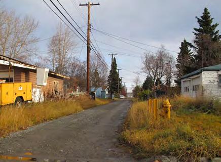
CHAPTER VI: PRESERVATION VISION, GOALS & POLICIES ADOPTED 2/12/2013 AO 2013-12 137
Historic preservation and economic development are not mutually exclusive goals. This chapter discusses how preservation can support healthy economic growth, not simply freeze buildings as they stand today.
6 | Economic Development
Provide incentives for historic preservation while fostering a healthy local economy
Historic preservation and economic development are not mutually exclusive policy goals, and the Anchorage Original Neighborhoods Historic Preservation Plan considers how these goals can work together. There are many opportunities to provide incentives for historic preservation while fostering a healthy economy.
In fact, historic preservation is itself an economic development strategy, because various preservationrelated financial and programmatic incentives are available to encourage smart economic growth. For example, heritage tourism is an economic development tool that is rooted in the interpretation of local history and culture (see Goal #3 for more information about interpretive programs).The National Trust for Historic Preservation defines the term “heritage tourism” as “traveling to experience the places and activities that authentically represent the stories and people of the past and present. It includes historic, cultural, and natural resources.” Partners in Tourism: Culture and Commerce, a nationwide coalition of national and federal agencies that promotes heritage tourism, explains:
Tourism is a powerful economic development tool. Tourism creates jobs, provides new business opportunities and strengthens local economies. When cultural heritage tourism development is done right, it also helps to protect our nation’s natural and cultural treasures and improve the quality of life for residents and visitors alike.
Linking tourism with heritage and culture can do more for local economies than promoting them separately. That’s the core idea in cultural heritage tourism: save your heritage and your culture, share it with visitors, and reap the economic benefits of tourism. […] Perhaps the biggest benefit of cultural heritage tourism is that opportunities increase for diversified economies, ways to prosper economically while holding on to the characteristics that make communities special.76
Yet heritage tourism cannot happen without a commitment to preservation: the Municipality and the Anchorage community must ensure that the desire to develop and modernize in order to accommodate increased tourism does not destroy the very qualities that attract visitors in the first place. Thus, just as it is important to protect the natural environment that draws so many visitors to Alaska, it is essential to protect the heritage of the Four Original Neighborhoods to allow heritage tourism to benefit the city.
HISTORIC PRESERVATION PLAN FOR ANCHORAGE’S FOUR ORIGINAL NEIGHBORHOODS ADOPTED 2/12/2013 AO 2013-012138
In addition to heritage tourism and other such programs, many historic preservation-related financial incentives are currently available to fund rehabilitation projects and encourage economic development. A common misconception is that preservation is too costly and prevents economic development, but all of these financial incentives instead suggest that preservation and economic development are inextricably linked. Successful historic preservation programs in other states have taken advantage of federal and state grants, such as Historic Preservation Restoration Grants, Downtown Revitalization Grants, and Certified Local Government (CLG) Grants. Other federal and state incentives are currently available in Anchorage, but are underutilized, including Federal Rehabilitation Tax Credits, Alaska State Historical District Revolving Loan Fund, New Markets Tax Credits, low-income housing tax credits, and energy credits.
At the local level, Anchorage has the same problem: the implementation strategies in Anchorage 2020—many of which are powerful preservation tools—must be established via local enabling legislation in order to be used. New local incentives may also be created to rehabilitate historic buildings, signage, or storefronts, and the Municipality may choose to partner with local lending institutions to create such programs. The Anchorage HPP encourages getting the word out to the general community about the various financial incentives that are already available, as well as creating a robust package of locally offered incentives.
Indeed, the Anchorage community wishes to preserve existing affordable housing and small businesses within the Four Original Neighborhoods and to encourage new small businesses and affordable housing via smart growth. Community members in the South Addition have expressed a desire to retain existing scattered corner businesses and provide more corner businesses throughout the neighborhood, while Fairview residents want a restored commercial corridor and Government Hill wants a preserved and reinvigorated commercial hub. Again, combining existing federal affordable housing and small business assistance programs with new local policies for the plan area will certainly help to accomplish these goals.
THE ECONOMICS OF PRESERVATION
“The good news is historic preservation is good for the economy. In the last fifteen years dozens of studies have been conducted throughout the United States, by different analysts, using different methodologies. But the results of those studies are remarkably consistent — historic preservation is good for the local economy. From this large and growing body of research, the positive impact of historic preservation on the economy has been documented in six broad areas: 1) jobs, 2) property values, 3) heritage tourism, 4) environmental impact, 5) social impact, and 6) downtown revitalization.”
–PlaceEconomics, in Measuring the Economics of Preservation: Recent Findings (2011). Available online at http://www.placeeconomics.com/wpcontent/uploads/2012/02/ economic-impacts-ofhp_summary.pdf
CHAPTER VI: PRESERVATION VISION, GOALS & POLICIES ADOPTED 2/12/2013 AO 2013-12 139
Incentives for Historic Properties in Seattle controls imposed by a designating ordinance or are contributing buildings located within National Register or local historic districts. The property must have undergone an approved rehabilitation within the two years prior to the date of application and rehabilitation cost must equal or exceed 25% of the assessed value of the improvements, exclusive of land value, prior to rehabilitation. Expenditures are based on Qualified
A wide range of preservation-related economic development policies is presented below, but not all must be adopted. It is the task of the Municipality, in partnership with community members, to determine which initiatives will best accomplish the goals of both historic preservation and economic development in the Four Original Neighborhoods.
Plan Area Policies & Implementation Strategies: Economic Development
6.1 Create and promote a comprehensive package of policy and financial incentives for historic preservation projects.
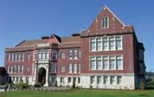


Rehabilitation Expenditures. “Qualified rehabilitation expenditures” are expenses chargeable to the project, including improvements made to the building within its original perimeter, architectural and engineering fees, permit and development fees, loan interest, state sales tax, and other expenses incurred during the rehabilitation period. Not included are costs associated with acquiring the property or enlarging the building.
Interested property owners must file an application by October 1 with the King County Department of Assessment after the rehabilitation work has been completed. The Assessor will transmit the application to the Landmarks Preservation Board for review. The Board will review and approve the application, confirming the cost of the rehabilitation and that rehabilitation complies with previous Board approval. Once approved, the property owner will sign an agreement with the Board for a 10-year period, during which time the property must be maintained in good condition. The owner must obtain approval from the Board prior to making improvements. If the property is sold, the new owner must sign the same agreement if the special valuation is to remain in effect.
Special Tax Valuation for Historic Properties 3:43
The City of Seattle has created and publicized a comprehensive package of policy and financial incentives for historic preservation projects.
6.1.1 Provide the public with a Municipality staff contact and/or assigned AHPC member for expertise and guidance about how to use complex tools and incentives. This person or persons could hold “office hours” at the planning counter to assist the public. For example, preservation planners in San Francisco hold office hours daily at the Planning Information Counter.
6.1.2 Compile information about all available policy and financial incentives at a central, publicly accessible location. Provide links to these incentives on the AHPC website.
6.1.3 Create an “incentives checklist” to make it easy for property owners to take advantage of a combination of available options. For example, the Maine Development Foundation’s Downtown Center (state coordinator for the National Trust’s Main Street Program) offers a Historic Preservation Checklist.77
6.1.4 Partner with the existing Anchorage Economic Development Corporation to promote sound development projects that preserve and grow historic neighborhoods.
See Implementation Strategies for Goal #7 for a discussion of policy and procedural incentives that could be included in the package.
HISTORIC PRESERVATION PLAN FOR ANCHORAGE’S FOUR ORIGINAL NEIGHBORHOODS ADOPTED 2/12/2013 AO 2013-012140
IN THIS SERIES: Seattle Historic Districts • Seattle Landmark Designation • Incentives for Historic Properties For more information: www.seattle.gov/neighborhoods/preservation
Joshua Green Building Eastern Hotel Colman School, NW African American Museum The Washington State Legislature passed a law in 1985 allowing “special valuation” for certain historic properties. Prior to that law, owners rehabilitating historic buildings were subject to increased property taxes once the improvements were made. “Special valuation” revises the assessed value of a historic property, subtracting, for up to 10 years, those rehabilitation costs that are approved by the local review board. For the purposes of the Special Valuation of Property Act, the Seattle Landmarks Preservation Board acts as the Local Review Board (RCW 84.26). The primary benefit of the law is that, during the 10-year special valuation period, property taxes will not reflect substantial improvements made to the historic property. Eligible properties, as defined by the Seattle City Council, are designated as landmarks subject to
Information PROGRAMS Preservation funds from the National Park Service, Department of Archaeology and Historic the contents and opinions do not Department of the Interior or DAHP. Park Service. Regulations of the U.S. discrimination in departmental Federally Assisted age, or handicap. Any person who believes program, activity, or facility operated by recipient Opportunity Program, U.S. Department of Washington, DC 20240.
10/13/11
PM
6.2 Implement historic preservation incentive programs and strategies presented in Anchorage 2020: Anchorage Bowl Comprehensive Plan.
6.2.1 Implement a Conservation Easement Program. In Anchorage 2020, easements are mostly discussed relative to open space, but easily apply to historic properties, too. Façade Easements could be held by the Municipality or AAHP. In addition to Façade Easements, Covenants or Deed Restrictions are another type of legal agreement that can protect historic resources.
6.2.2 Implement a Transfer of Development Rights (TDR) program. Development rights to be transferred could include height and/or floor-area-ratio. In order for this program to be effective, enabling legislation would need to be adopted. The ordinance should designate sending and receiving areas, and should also include a demolition disincentive.
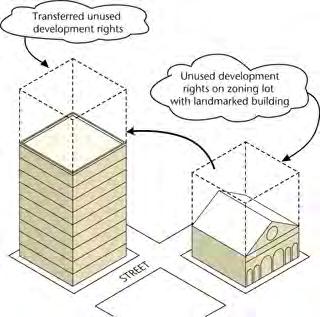
6.2.3 Create a Tax Increment Financing (TIF) program. TIF can be leveraged as a preservation tool when TIF funds go toward rehabilitation projects.
See Policy 7.4 for a discussion of Overlay Zones, another strategy presented in Anchorage 2020.
6.3 Combine new preservation tools and incentives with existing programs (e.g., New Markets Tax Credits, low-income housing tax credits, energy credits, etc.).
6.3.1 Utilize the existing Alaska State Historical District Revolving Loan Fund, especially on 4th Avenue.
6.3.2 Work with the State Office of Historic Preservation and property owners to identify buildings and districts that could take advantage of the 10% and 20% Federal Rehabilitation Tax Credits. Income-producing properties listed in or eligible for NRHP can receive the 20% credit if the project meets the Secretary of the Interior’s Standards for Rehabilitation. Nonresidential properties constructed before 1936 and not listed in or eligible for NRHP can receive the 10% credit.
Transfer of Development Rights (TDR) allows for the transfer of unused development rights to another parcel in order to protect historic or natural resources.
CHAPTER VI: PRESERVATION VISION, GOALS & POLICIES ADOPTED 2/12/2013 AO 2013-12 141
6.3.3 Educate developers about the New Markets Tax Credit (NMTC) program as a way to encourage them to apply. This federally funded program is administered by the U.S. Department of the Treasury.
6.3.4 Educate developers about the Low-Income Housing Tax Credits (LIHTC) program as a way to encourage them to apply. This federally funded program is administered at the state level by the Alaska Housing Finance Corporation (also applies to Policy 6.6).
6.3.5 Encourage public-private partnerships with existing organizations and agencies to manage historic properties in the plan area. The joint administration of Historic Jamestowne, VA, by Preservation Virginia and the National Park Service is a successful example of this strategy.
6.3.6 Work with the Alaska Film Office to purchase Alaska Film Industry Tax Credits to offset rehabilitation costs and attract film and TV projects to historic buildings in the Four Original Neighborhoods.78
6.3.7 Collaborate with the Heritage Land Bank or consider using the existing Anchorage Historic Preservation Fund for the Municipality to buy and lease historic buildings in the Four Original Neighborhoods.
6.3.8 Take advantage of as well as promote the existing “Deteriorated Property Ordinance” (Anchorage Municipal Code §12.35) to rehabilitate historic buildings in the Four Original Neighborhoods. In 2009, this ordinance was amended by the Assembly (AO No. 2009-74) to provide for waiver of certain municipal fees in exchange for fixing the property. The updated ordinance also allows applicants to defer payment of taxes on the deteriorated property for up to five years as an economic development incentive.
HISTORIC PRESERVATION PLAN FOR ANCHORAGE’S FOUR ORIGINAL NEIGHBORHOODS ADOPTED 2/12/2013 AO 2013-012142
6.4 Establish local and statewide economic development tools to promote historic preservation.
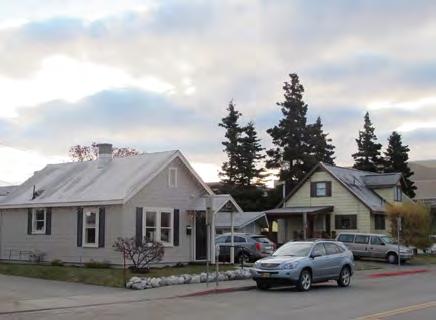
6.4.1 Offer tax abatement or exemption for preservation projects (i.e., freeze the prerehabilitation value of a property) to encourage development. Examples of such programs include: (1) California Mills Act, a 10-year contract, with property valued at prerehabilitation appraisal in exchange for continued preservation of property; (2) Washington State Special Valuation Law, a 10-year special valuation period where property taxes will not reflect substantial improvements made to the historic property; (3) Honolulu Historic Residential Real Property Tax Exemption, where owners pay only the minimum real property tax; and (4) City of San Antonio (TX) Local Tax Exemption, which provides two options: property taxes frozen at prerehabilitation value for 10 years, or no property taxes owed for first five years after rehabilitation, and taxes assessed at 50% of postrehabilitation value for second five years.
6.4.2 Establish a Historic Preservation Restoration Grant Program to fund rehabilitation projects (especially façade improvements). This program could be funded through the existing Anchorage Historic Preservation Fund or other Municipality budget allocation. In some other states, similar programs require a 50% cash match from the grantee. For example, the Arkansas SHPO offers grants of up to $10,000 to fund small projects that restore integrity (e.g., remove nonhistoric siding) and make a property eligible for NRHP, or $10,000 or more for NRHP-listed properties owned by nonprofit organizations.
6.4.3 Offer Storefront Micro Loans (less than $5,000, fixed rate loan) to install signage and improve historic storefronts. The Municipality should consult with local lenders to create such a program (also applies to Policy 6.6). As an example, Salt Lake City has used this strategy successfully.
Tax abatement or exemption for preservation projects could help homeowners maintain their historic properties.
CHAPTER VI: PRESERVATION VISION, GOALS & POLICIES ADOPTED 2/12/2013 AO 2013-12 143
6.4.4 Offer Low-Interest Loans and/or Loan Guarantees to finance qualified rehabilitation projects. The Municipality should consult with local lenders to create such a program (also applies to Policy 6.6).
6.4.5 Build an endowment or trust held by a nonprofit organization (such as AAHP) that could offer loans or other aid to property owners pursuing preservation projects.
6.4.6 Work with the Alaska Film Office to promote historic buildings in the Four Original Neighborhoods for film locations. Revenue generated from filming fees would be directed back into the historic building inventory for preservation/maintenance activities. For example, the Government Services Administration (GSA) uses film revenues as a building management tool.79
6.5 Leverage state and federal funds to support local interests in historic and cultural preservation programs and projects.
6.5.1 Consult the Advisory Council on Historic Preservation (ACHP) to identify federal financial assistance programs available for preservation projects.
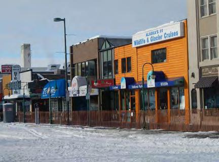
6.5.2 Apply for applicable federal program grants to fund preservation projects in the Four Original Neighborhoods. (Visit www.grants.gov and www.recovery.gov for options.)
6.5.3 Channel federal funds (FHWA, HUD, etc.) through the Section 106 process, with public participation, to ensure appropriate treatment of historic properties in the event of infrastructure improvements.
Storefront Micro Loans could be offered to install signage and improve historic storefronts.
HISTORIC PRESERVATION PLAN FOR ANCHORAGE’S FOUR ORIGINAL NEIGHBORHOODS ADOPTED 2/12/2013 AO 2013-012144
6.6 Preserve and encourage housi ng affordability and small businesses by repurposing historic buildings into mixed-use or higher density housing and commercial neighborhood opportunities.
6.6.1 Provide technical preservation assistance to small business owners, including informational brochures targeted at business owners or “office hours” at preservation organizations or the Municipality to learn about incentives.
6.6.2 Collaborate with the Department of Health and Human Services to add provisions for rehabilitation and preservation to the Municipality’s existing affordable housing programs.
See Implementation Strategies for Policy 6.4.
6.7 Encourage heritage tourism as an economic development strategy.
6.7.1 Develop, maintain, and implement a public outreach program for heritage tourism with community partners, tourism-based organizations, and the Anchorage Historic Preservation Commission.
6.7.2 Provide tourism-based organizations with access to information in order to allow them to publicize Anchorage heritage in their programs.
6.7.3 Develop programs in the plan area that focus on Alaska Native Peoples’ history and culture, as surveys have shown that Anchorage tourists are interested in such programs.
6.7.4 Promote Anchorage’s status as a “Preserve America” community through signage and other materials. (Note that Preserve America Grants are not being offered in FY2012.)
See Goal #3 for additional implementation strategies related to interpretive programs and education.
See Policies 2.2 and 4.5 for additional implementation strategies related to promotion of historic places.
Encourage heritage tourism as an economic development strategy by ensuring tourist-based organizations have access to information about the history of the Four Original Neighborhoods.
CHAPTER VI: PRESERVATION VISION, GOALS & POLICIES ADOPTED 2/12/2013 AO 2013-12 145
The National Trust Community Investment Corporation and the National Park Service use the Preservation Economic Impact Model, created by the Center for Urban Policy and Research at Rutgers University, to forecast the total economic effects of the rehabilitation of commercial historic buildings. The model can be downloaded from the National Trust’s website: http://ntcicfunds. com/services/preservation-economic-impact-model-2-0/.
6.8 Develop metrics that quantify the effects of preservation on the local economy.
6.8.1 Identify the highest and best use for underutilized historic buildings.
6.8.2 Conduct a cost-benefit analysis of Municipality-owned historic buildings, especially vacant ones (also applies to Goal #2).
6.8.3 Provide a detailed analysis of the total economic effects of preservation and/or rehabilitation of historic buildings that will provide developers, property owners, and the Municipality with quantitative information.
6.8.4 Undertake an economic impacts and benefits study focused on quantifying the effects of historic preservation activities in the plan area. For example, leading preservation economist Donovan Rypkema prepared a paper for the ACHP, entitled “Measuring Economic Impacts of Historic Preservation” (2011), which analyzes the benefits of historic preservation.
6.8.5 Establish a benchmarking program to collect relevant statistics and monitor the progress of preservation program. For example, the City of San Antonio, TX, discusses the details of creating a benchmarking program in its San Antonio Strategic Historic Preservation Plan (2009).
6.8.6 Compile case studies of other cities’ successful preservation metrics, to be made available to the public, developers, and other preservation partners. Refine and develop meaningful information connecting successes in other cities to elements available in Anchorage.
HISTORIC PRESERVATION PLAN FOR ANCHORAGE’S FOUR ORIGINAL NEIGHBORHOODS ADOPTED 2/12/2013 AO 2013-012146
7 | Procedures & Regulations
Implement and administer historic preservation policies and review procedures, and resolve conflicts between preservation and existing regulations
Anchorage’s Four Original Neighborhoods must address the practical aspects of implementing and enforcing historic preservation policies. It is essential to identify and resolve conflicts among historic preservation and building codes, zoning codes, municipal ordinances, and state laws.
Some Communities with HPOZs in the City of Los Angeles:
• Adams-Normandie
• Angelino Heights
Who can I call for more information?
Contact your neighborhood’s HPOZ planner for more information.
HPOZLiving
• Banning Park • Carthay Circle
• Gregory Ain Mar Vista Tract
• Hancock Park • Harvard Heights • Highland Park • Lafayette Square • Lincoln Heights • Melrose Hill
Anchorage residents and staff of local, state, and federal agencies are looking for policy tools that will make historic preservation goals easier to achieve. Such tools may include creating design guidelines to standardize improvements and developing historic preservation-related overlay zones. Other procedural tools may consist of securing funding and administrative support from the Municipality, establishing an official local historical register and criteria for evaluating the significance of individual resources and historic districts, and including Alaska Native Peoples more regularly in the planning process.
• Miracle Mile North • Pico-Union • South Carthay • Spaulding Square • University Park • Van Nuys
Department of City Planning 200 N. Spring Street, Room 620 Los Angeles, CA 90012 Phone (213) 978-1200 Fax (213) 978-0017 www.preservation.lacity.org/hpoz
Additional Contacts: Mills Act The Mills Act (also known as Historical Property Contracts) can provide a property tax reduction to help owners of qualified historic buildings offset costs of restoring, repairing, or maintaining their properties.
Department of City Planning, Office of Historic Resources http://www.preservation.lacity.org (213) 978-1200
California State Office of Historic Preservation The State Office of Historic Preservation helps administers the Federal Rehabilitation Tax Credits. http://www.ohp.parks.ca.gov (916) 653-6624
• Vinegar Hill
Developing procedures and regulations will require coordinating the HPP with other planning efforts, which may include revisiting and reactivating previous preservation plans and historic preservationrelated ordinances from the 1980s. Such coordination may also involve developing a cohesive Historic Preservation module in Title 21 of the Anchorage Municipal Code, which is presently being amended.
• West Adams Terrace • Western Heights • Whitley Heights • Windsor Square

A module in Title 21 can be a powerful tool in supporting and regulating historic preservation goals and policies.
The Anchorage Historic Preservation Commission (AHPC) is responsible for administering the Municipality’s current historic preservation program and has been doing commendable work. As the Municipality moves its historic preservation agenda forward, it must clarify the roles of the AHPC and the Community Councils in the implementation of procedures and regulations, including their roles in carrying out this Historic Preservation Plan for Anchorage’s Four Original Neighborhoods. As part of defining these roles, all parties must understand the boundaries of and regulatory differences between historic districts, individual historic resources, and the general neighborhood.
California Historical Building Code (CHBC) The California Historical Building Code allows owners of a qualified historic property to use alternate construction materials or standards than would be required under the California Building Code. http://www.dsa.dqs.ca.gov/SHBSB
Los Angeles’ HPOZs are leading the way in preservation overlay zoning policy. An HPOZ board composed of five members, at least three of whom must be renters or owners of property within the zone, advises the LA City Planning Department on actions within the zone.
A Guide Los Angeles’ Historic Preservation Overlay Zones
CHAPTER VI: PRESERVATION VISION, GOALS & POLICIES ADOPTED 2/12/2013 AO 2013-12 147
Prepared by the Los Angeles Department City Planning Graphics Section Winter 2008
LOS ANGELES CITY PLANNING DEPARTMENT
to
National Park Service preservation briefs and similar publications should be widely available for Municipality staff, AHPC members, and the general public.
Because the historic built environment of the Four Original Neighborhoods is special to Anchorage residents, these areas may require more regulation and coordination of procedures, compared to elsewhere in the Municipality, to ensure that those treasured qualities are maintained. However, the municipal staff and members of the community will need to think carefully about how to balance this need for regulation with the independent “frontier spirit” that many Alaskans possess by deciding which policies should be voluntary and which should be mandatory in each neighborhood.
The seven goals outlined in this HPP are more or less organized from “soft” qualitative concepts to “solid” regulation-based concepts, and so this “Procedures & Regulations” chapter addresses the most authoritative policies. However, it is important to keep in mind that policies relating to previous goals may also require the establishment of processes, procedures, and regulations.
Plan Area Policies & Implementation Strategies: Procedures & Regulations
7.1 Establish a mechanism for implementing this Historic Preservation Plan for Anchorage’s Four Original Neighborhoods.
7.1.1 Form an HPP Implementation Subcommittee led by the Anchorage Historic Preservation Commission. The subcommittee could be supplemented with strategic advisors representing the various parties committed to the implementation strategies.
7.1.2 Report periodically on the progress of the HPP implementation strategies
See Goal #4 for a discussion of potential historic preservation partners.
7.2 Establish procedures for reviewing and permitting actions involving historic properties.
7.2.1 Provide planning staff and building officials with training opportunities about historic preservation practices as the preservation program moves forward in implementation. (See Policy 3.4 for suggestions about training opportunities.)
HISTORIC PRESERVATION PLAN FOR ANCHORAGE’S FOUR ORIGINAL NEIGHBORHOODS ADOPTED 2/12/2013 AO 2013-012148
7.2.2 Add a “historic preservation review” checkbox to planning and building permit applications. This checkbox would prompt users to see if historic resources listed in the Consolidated Historic Resources Inventory Database are present at the subject property and, if so, would allow historic preservation to be included in the review process once applicable authorities are established. Information currently required in building permit applications is outlined in AMC 23.10.104.6.
7.2.3 Amend Anchorage Municipal Code as necessary to allow design review of proposed projects involving historic resources in the Four Original Neighborhoods, using the Secretary of the Interior’s Standards and/or design guidelines. When structuring this design review process, consider the following:
à Who conducts this review (e.g., AHPC, Community Councils, Municipality staff, or other body)?
à What types of resources are subject to review (e.g., National Register-listed, local landmarks, or all properties greater than 50 years of age)?
à What actions trigger this review (e.g., demolition, relocation, or all exterior changes)?
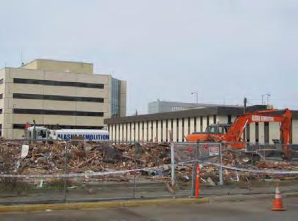
à How is this review administered (e.g., voluntary, mandatory, or in combination with financial incentives)?
7.2.4 Clearly define roles of the Historic Preservation Commission, Community Councils, and other entities in historic properties review process.
7.2.5 Ensure that Alaska Native Peoples have an opportunity for involvement, if desired (see Policy 7.8).
See Policy 2.3 for implementation strategies regarding procedures and regulations for stored or moved buildings.
Adding a historic preservation review checkbox or “demolition delay review” procedures would allow time for consideration of a building’s historic status prior to its demolition.
CHAPTER VI: PRESERVATION VISION, GOALS & POLICIES ADOPTED 2/12/2013 AO 2013-12 149
A tiered local register could allow for the recognition of both traditional historic sites such as log cabins, and beloved local resources, such as Star the Reindeer.

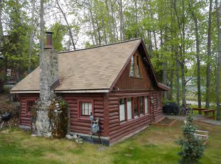
7.3 Create, populate, and maintain an official local register or inventory of historic resources.
7.3.1 Work with the Anchorage Historic Preservation Commission (AHPC) and the State Historic Preservation Office (SHPO) to develop a set of locally approved criteria for nomination of historic places. It will be important for the local criteria to allow for designation of not only buildings, but also landscapes, trails, places, and nontraditional resource types that are significant to the community. The “Municipality-Wide Historic Preservation Plan” currently being developed by the AHPC will provide the draft criteria for consideration.
7.3.2 Consider a tiered local register, which would allow for a hierarchy of both significance and protections. Such a register could include Anchorage Landmarks (listed in the National Register and receiving maximum protection), Anchorage Resources (significant at the local or neighborhood level, and eligible for special consideration in the planning process), and Anchorage Districts (groups of historic resources, with controls on infill construction). AO 2006-175, the ordinance governing the Anchorage Historic Preservation Commission, already discusses a tiered approach to a local register, allowing the AHPC to “review applications for designation of Historic Properties, Historic Resources, or Historic Districts.”
7.3.3 Create a program to populate the local register. Consider working with Alaskan universities to assign tasks toward accomplishing this program (see Policy 2.1).
7.3.4 Officially designate resources identified in past surveys and the Consolidated Inventory in the local register. As part of this task, previous survey findings should be reviewed, using the new local register criteria and being reclassified if needed.
7.3.5 Update Patterns of the Past (Carberry and Lane, 1986) to remove properties that have been demolished, and add properties associated with additional historic themes.
HISTORIC PRESERVATION PLAN FOR ANCHORAGE’S FOUR ORIGINAL NEIGHBORHOODS ADOPTED 2/12/2013 AO 2013-012150
7.3.6 Conduct a Parks Survey to identify historic buildings, landscapes, and trails in municipal parks. For example, trails such as the Tony Knowles Coastal Trail and the ceremonial start of the Iditarod Trail could be evaluated for their significance, and their stories could be interpreted.
7.3.7 Update historic resource surveys every five years to capture properties that are newly age-eligible.
7.4 Consider creation of one or more Historic Preservation Overlay zoning classifications, as discussed in Anchorage 2020: Anchorage Bowl Comprehensive Plan.
7.4.1 Work with the Planning and Zoning Commission, Anchorage Historic Preservation Commission, and Community Councils to create Historic Preservation Zoning classifications, if feasible. When structuring these zones, consider the following options:
à Consider establishing broad Original Neighborhood Overlay Zones, one for each neighborhood or sub-area.
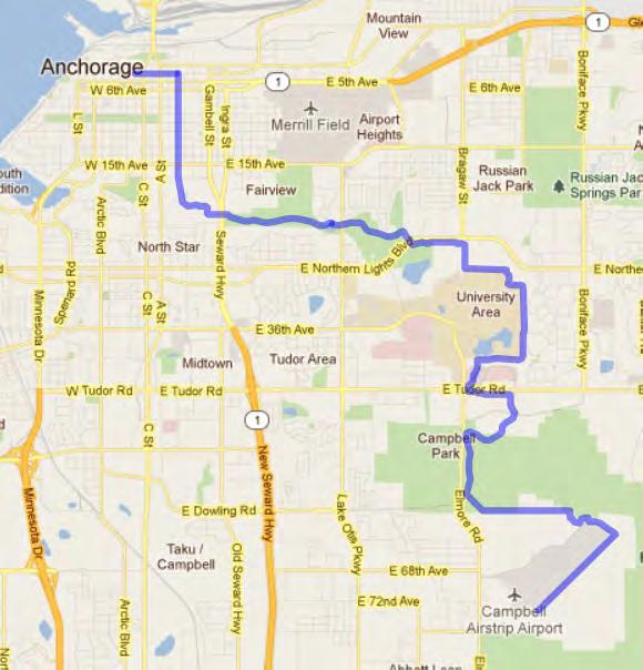
à Consider creating a site-specific historic zoning classification to promote adaptive reuse.
à Consider creating Historic Preservation Overlay Zones (HPOZs) that can be applied to protect historic districts and manage infill construction within the Four Original Neighborhoods.
Trails such as the ceremonial start of the Iditarod Trail could be evaluated for their significance, and their stories could be interpreted.
CHAPTER VI: PRESERVATION VISION, GOALS & POLICIES ADOPTED 2/12/2013 AO 2013-12 151
When considering a Historic Overlay District in Southeast Raleigh, North Carolina, to protect the city’s oldest AfricanAmerican neighborhood, decision-makers took owners’ opinions into account.
7.4.2 Actively consult with property owners prior to the creation of a historic district or zone. Property owners should not feel threatened by Historic Preservation Overlay zones or districts, and there are many ways that the zoning ordinance could be articulated to achieve preservation goals while also protecting owners’ interests. It is important to remember that an overlay zone does not merely place restrictions on properties, but also can offer positive benefits and financial incentives to property owners. Although concern about negative economic effects is often raised when considering potential historic districts or overlay zones, many studies have shown a direct positive correlation between the creation of historic districts and a long-term increase in property values. One of the nation’s leading authorities on this matter is real estate and economic development consultant Donovan Rypkema of PlaceEconomics. While presenting a recent study about property values and historic districts in Philadelphia, “Rypkema showed statistics that homes in Philadelphia’s local historic districts, once those districts took effect, enjoyed an immediate 2 percent increase in values relative to the city average. Afterward, the historic district homes appreciate at an annual rate that is 1 percent higher than the city average.”81 A number of similar studies have been conducted in communities across the country, and data from these reports might be applicable in Anchorage.
7.5 Provide building code and zoning ordinance relief for owners of historic properties, especially small commercial lots.
7.5.1 Evaluate the feasibility of offering a “Historic Preservation Permit” to grant exceptions to land-use regulations/development standards when necessary in order to permit the preservation or restoration of a historic building. Such exceptions may include, but are not limited to, parking, setbacks, height, and lot coverage requirements.
HISTORIC PRESERVATION PLAN FOR ANCHORAGE’S FOUR ORIGINAL NEIGHBORHOODS ADOPTED 2/12/2013 AO 2013-012152
7.5.2 Evaluate the feasibility of offering density bonuses for projects that meet the Secretary of the Interior’s Standards and/or neighborhood-specific design guidelines. This would encourage retention of historic buildings while allowing for the increased density planned for the Four Original Neighborhoods. Density bonuses are already offered in certain zoning districts in exchange for providing affordable housing units, as currently outlined in Title 21. Similar historic preservation density bonus programs have been successfully implemented in Missoula, MT (20% bonus in exchange for adaptive reuse) and Austin, TX, among others.
7.5.3 Utilize the provision for historic buildings included in the already-adopted International Existing Buildings Code (IEBC). This would provide alternatives to building code requirements that conflict with preservation goals in order to facilitate adaptive reuse and upgrade of qualified historic buildings in the Four Original Neighborhoods. The Portland (OR) Fire and Life Safety Guide for Existing Buildings (FLEx Guide) and the California State Historic Building Code (SHBC) are examples of how this strategy has been executed at the local and state level, respectively.
7.5.4 Evaluate the feasibility of offering expedited review and permitting processes for projects that meet the Secretary of the Interior’s Standards and/or neighborhood-specific design guidelines.
See Policy 6.2 for a discussion of Transfer of Development Rights and the Deteriorated Property Ordinance, and other code relief strategies.
The Secretary of the Interior’s Standards are the national benchmark for judging the appropriateness of a rehabilitation project.
CHAPTER VI: PRESERVATION VISION, GOALS & POLICIES ADOPTED 2/12/2013 AO 2013-12 153
7.6 Create neighborhood-specific design guidelines to influence future development and infrastructure projects and ensure the continued preservation of neighborhood character and historic resources.
7.6.1 Create a series of design guidelines that focus on historic character, architectural context, and issues most important in each neighborhood. These guidelines would be developed when a historic district is designated or a historic overlay zone is created, and would require additional input from property owners and decision-makers at such time. When structuring these design guidelines, consider the following:
à Each neighborhood’s guidelines may include items such as scale, massing, rhythm, setbacks, ground area coverage or floor area ratio, architectural character, and materials.
à Create a method for administering the design guidelines. For example, compliance with the guidelines could be voluntary, or could be mandatory for certain types of projects.
à Publish these guidelines as information for the public, developers, property owners, and agencies to use.
7.6.2 Create design guidelines to standardize street amenities (e.g., lights, sidewalks, etc.).
See Goals #1 and #5 for additional discussion of design guidelines.
HISTORIC PRESERVATION PLAN FOR ANCHORAGE’S FOUR ORIGINAL NEIGHBORHOODS ADOPTED 2/12/2013 AO 2013-012154
7.7 Develop and communicate design guidelines/parameters for all agencies—federal and state agencies, Municipality departments, development community, and nonprofit organizations—working within the plan area.
7.7.1 Establish an interagency protocol for working with historic properties in the Four Original Neighborhoods, including clear definition of each agency’s roles and responsibilities.
7.7.2 Use the Municipality Preservation Planner to communicate regularly with other agencies.
See Goals #1 and #5 for additional discussion of design guidelines.
7.8 Work with Alaska Native Peoples to establish regular communication and input into the preservation planning process.
7.8.1 Establish protocols for cultural resource consultation with Alaska Native Peoples groups, including standard archeological discovery procedures and mitigation measures.
7.8.2 Populate a mailing list to notify key Alaska Native Peoples stakeholders about proposed projects.
7.8.3 Ensure that AHPC’s “Native Culture Advisor” chair is filled (as currently recommended per AMC Chapter 04.06.030).
CHAPTER VI: PRESERVATION VISION, GOALS & POLICIES ADOPTED 2/12/2013 AO 2013-12 155
7.9 Update Anchorage Municipal Code as needed to include more historic preservationrelated and neighborhood-specific provisions.
7.9.1 Collect existing historic preservation-related sections scattered throughout the Anchorage Municipal Code and compile them into a cohesive Historic Preservation module within Title 21.
7.9.2 Assess the means to include historic preservation design and siting requirements for inclusion in the Land Use Code and recommend techniques that are appropriate based on the conditions of the community and the recommendations of adopted historic preservation studies. Potential strategies to consider may include a historic preservation module within Title 21 and/or a book of model Historic Preservation Ordinances.
7.9.3 Develop and/or update neighborhood and district plans to include appropriate historic preservation efforts where applicable and, if in the process of development, ensure that such efforts are included.
HISTORIC PRESERVATION PLAN FOR ANCHORAGE’S FOUR ORIGINAL NEIGHBORHOODS ADOPTED 2/12/2013 AO 2013-012156
7.10 Budget for historic preservation activities and maintenance of Municipality-owned buildings in the Four Original Neighborhoods.
7.10.1 Fund and grow the Historic Preservation Program at the Municipality of Anchorage by continually seeking grants, donations, and working with preservation partners for funding. An allocation of the General Fund could be considered in years when financial circumstances permit.
7.10.2 Complete an annual Capital Improvements Plan that includes every Municipality-owned historic building. Identify annual upgrades and maintenance for each building to be funded by the Municipality. (See Policy 2.8.)
7.10.3 Hold at least one annual fund-raising effort to assist the Municipality, Anchorage Historic Preservation Commission, and its many partners to provide operational support of Municipality-owned historic buildings. Use this funding to support grants, endowments, and donations to operate Municipality-owned historic buildings.
7.10.4 Fund the Historic Preservation Program through a coordinated effort to apply for Legislative Grants each budget cycle.
See Goals #4 and #6 for additional funding sources, grant opportunities, and preservation partners.
CHAPTER VI: PRESERVATION VISION, GOALS & POLICIES ADOPTED 2/12/2013 AO 2013-12 157
OVERLAY ZONING
The regulatory tool of overlay zoning creates a special zoning district, placed over an existing base zone or zones, which identifies special provisions in addition to those in the underlying base zone.
The overlay district can share common boundaries with the base zone or cut across base zone boundaries. Regulations or incentives are attached to the overlay district to protect a specific resource or guide development within a special area.
Consider the following options for structuring a historic preservation overlay zone in Anchorage’s Four Original Neighborhoods:
1. Broad Original Neighborhood Overlay Zones: The purpose of these large zones would be to grant properties protections and exemptions that are tailored to each neighborhood’s character and goals. For example, each Original Neighborhood Overlay Zone could enable otherwise-prohibited compatible commercial uses within historic residential zones, or could allow property owners within the zone to qualify for tax credits, low-interest loans, or other incentives.
2. Site-specific historic zoning classification: This zoning classification could be applied to each individual property listed in the Consolidated Historic Resources Inventory Database (or local register, after it is created), and would allow increased flexibility in permitted uses in exchange for official designation. According to AO 2006-175, the ordinance establishing the Anchorage Historic Preservation Commission, it is already within the AHPC’s powers and duties to modify the zoning classification of historic properties as Historic Inventory (HI) or Historic Registries (HR), depending on their status.
Site-specific examples: The S-H Historic Overlay in Eugene, OR, is an excellent example of this strategy: “The S-H Historic overlay designation allows greater flexibility with allowable uses and development standards for the property, with a goal of finding a use that is compatible with the historic character of the property that will help ensure its continued productive use. An example of this is a professional office in a historic house in a residential district where such an office would not normally be permitted. Before a property can receive the S-H Historic zoning designation it must first be designated as a City Landmark or be listed in the National Register of Historic Places.”80
3. Historic District HPOZs: This zoning classification is targeted to protect historic districts and manage infill construction. These protective overlays could provide for review of proposed exterior alterations and additions to historic properties within designated districts, and could make certain financial incentives available within the zones.
HPOZ examples: The best example of this strategy is Los Angeles’ HPOZs, which are leading the way in preservation overlay zoning policy. There are currently 29 such zones, each of which has its own HPOZ Review Board to conduct design review within the district and report to the City Planning Department.
HISTORIC PRESERVATION PLAN FOR ANCHORAGE’S FOUR ORIGINAL NEIGHBORHOODS ADOPTED 2/12/2013 AO 2013-012158
Potential Design Review Process


SAMPLE DESIGN REVIEW PROCESS
Historic Status Permit Submitted Preservation Checklist in Historic District staff
Approvals Process


The details of the historic preservation design review process in the Four Original Neighborhoods will be developed once a historic district is designated or a historic overlay zone is created, and will require additional input from property owners and decision-makers at such time. This chart outlines one possible structure for design review process the procedures and principles recommended in the HPP.
This graphic was prepared in response to comments received from the Planning & Zoning Commission at a worksession on Septembe r 17, 2012. The Commission was concerned about the design review pr ocess for historic districts or landmarks, and requested clarification about the procedures recommended in the HPP. This graphic will be incorporated into the Final HPP as a sidebar in Chapter V I: Preservation Vision, Goals & Policies.
Permit Approved of Individual Historic hearing to staff reviews
CHAPTER VI: PRESERVATION VISION, GOALS & POLICIES ADOPTED 2/12/2013 AO 2013-12 159
Building
Application
Historic
No resources present Muni staff reviews application Permit Approved New construction
Muni
reviews application (with commentary on design standards) Permit Approved Alteration of Historic Resource (Individual or District) AHPC reviews application Muni staff reviews application
Incentives available to property owner Demolition
Resource Public
discuss alternatives to demolition Muni
applications Permit Approved
using
HISTORIC PRESERVATION PLAN FOR ANCHORAGE’S FOUR ORIGINAL NEIGHBORHOODS ADOPTED 2/12/2013 AO 2013-012160
NEIGHBORHOOD CHARACTER, GOALS & POLICIES
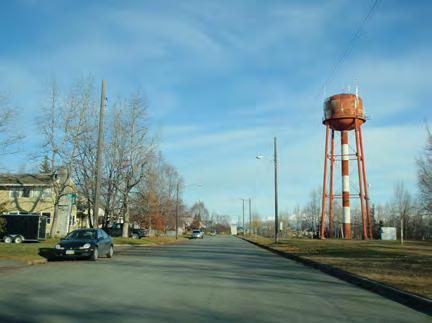
Although the primary purpose of the Historic Preservation Plan for Anchorage’s Four Original Neighborhoods is to create a unified vision for the entire plan area, each neighborhood possesses characteristics that set it apart from the others. Chapter VI: Preservation Vision, Goals & Policies presents policies that bridge neighborhood boundaries, while this chapter focuses on the character, issues, and opportunities unique to each neighborhood.
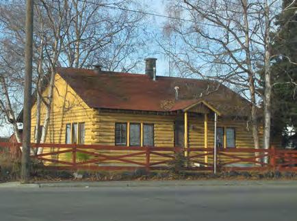
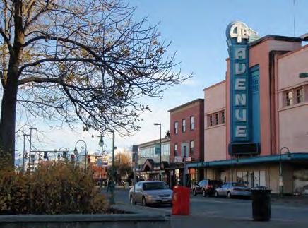
CHAPTER VII: NEIGHBORHOOD CHARACTER, GOALS & POLICIES 161ADOPTED 2/12/2013 AO 2013-12
Public Workshop Series February 21-23, 2012
Through the public outreach process, each of the original neighborhoods was able to clearly define its own priorities. The top neighborhood-specific goals that emerged include the following:
Government Hill: maintain a cohesive community and manage the effects of new development.
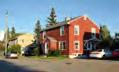
Downtown: preserve the city’s most prominent historic buildings and reinforce a commercial and cultural district that is a year-round destination for locals and tourists.
South Addition: preserve walkability, bikeability, and access to open space; reduce demolitions; maintain the historic character of the Delaney Park Strip (Park Strip); and avoid transportation projects that detract from historic residential character.
Fairview: preserve its diverse character, restore small-business corridors, overcome past landuse and transportation decisions, and improve walkability and easy access to Downtown.

This chapter includes a module that addresses each neighborhood separately; each module includes a brief neighborhood history, an area character summary, a list of character-defining features, a summary of concerns and challenges, and a list of neighborhood-specific policies that expand on the vision for the entire plan area. The neighborhoods are organized in chronological order of settlement. Please note that for each neighborhood, the policies for the entire plan area (Chapter VI) apply, in addition to the neighborhood-specific policies presented here.
 Each neighborhood had a voice during the HPP public outreach process.
HISTORIC PRESERVATION PLAN FOR ANCHORAGE’S FOUR ORIGINAL NEIGHBORHOODS 162 ADOPTED 2/12/2013 AO 2013-012
|
You are invited to contribute to the Historic Preservation Plan for Anchorage’s Four Original Neighborhoods: Downtown Anchorage, Government Hill, Fairview, and the South Addition. We need your input to make this plan extraordinary! At the workshops, you will: Downtown (residents & businesses): Tuesday, February 21 4:30-6:00 pm Anchorage City Hall, Rm 155 632 West 6th Avenue South Addition: Tuesday, February 21 6:30-8:00 pm Denali Montessori School Multipurpose Room 952 Cordova Street Fairview: Thursday, February 23 6:30-8:00 pm Fairview Community Recreation Center 1121 East 10th Avenue Government Hill: Wednesday, February 22 6:30-8:00 pm Government Hill Elementary Multipurpose Room 525 Bluff Drive - Review proposed goals and opportunities developed from your comments in October 2011 - Help shape the vision for the plan, and the future of Anchorage’s Four Original Neighborhoods
Ship Creek
Ship Creek is not technically one of the Four Original Neighborhoods—it lacks its own Community Council—but it does have its own adopted master plan from 1991. Ship Creek overlaps three of the Four Original Neighborhoods (Downtown, Government Hill, and Fairview) and is primarily industrial in character; it therefore has its own distinct set of challenges and is covered here separately. Ship Creek received several comments during the public outreach process, and the HPP acknowledges its importance to the heritage of Anchorage. Ship Creek was the first part of Anchorage to be settled— it was home to Dena’ina fish camps and the headquarters of the Alaska Railroad—and thus it is discussed here first.
History
Ship Creek flows from the Chugach Mountains into Cook Inlet. Prior to the arrival of Americans in Anchorage in 1914-1915, the Dena’ina Athabascan people used Ship Creek as a seasonal fishing camp. The Dena’ina place name for Ship Creek was “Dgheyaytnu,” or “Needlefish Creek.” In 1911, two American families lived on “squatters rights” at the mouth of Ship Creek. Jack and Nellie Brown arrived in 1912; Jack was a Chugach Forest Service employee. Two more families were living in log cabins on the flats of the creek by early 1914. The area was already known as Ship Creek at the time.
But changes were abreast for Ship Creek when the Alaska Railroad Act was passed by Congress and signed into law by President Woodrow Wilson in 1914. The Alaska Engineering Commission (AEC) decided to build its field headquarters where Ship Creek flows into Cook Inlet. Rumors about the impending construction of a railroad brought people into the area, and they set up a tent city along Ship Creek. By the spring of 1915, over a thousand tents were pitched on the north side of the creek. Ships would moor out in the inlet, and smaller boats and barges would bring materials to shore. Thus, the area became known as “Ship Creek Landing.”
During platting of the Anchorage townsite, reserves were set aside for special uses, including a Terminal Reserve in Ship Creek Valley for a rail yard and dock space. After the townsite parcels were auctioned in July 1915, the tent city folded and people moved to the bluffs above Ship Creek.
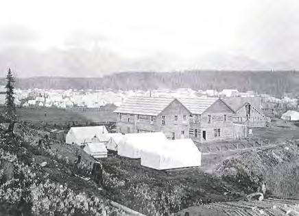 Ship Creek overlaps three of the Four Original Neighborhoods.
By 1915, Ship Creek was filled with over a thousand tents as the Alaska Engineering Commission began construction of the railroad.
Ship Creek overlaps three of the Four Original Neighborhoods.
By 1915, Ship Creek was filled with over a thousand tents as the Alaska Engineering Commission began construction of the railroad.
CHAPTER VII: NEIGHBORHOOD CHARACTER, GOALS & POLICIES 163ADOPTED 2/12/2013 AO 2013-12
S R TH TR AD ER VEN ES 9TH VENU A W OA IA A TL PR ET R E ES 3RD VENU U RIS RIV HO DDR THSTR E NDR D WA R OA G N E PA D IV S T R V D RE N PO UPI VE TR P IN E MA NCHRO RSTO RIV HSRE RA RO UE AKEAVENUE W AR V U HS E RI RL R R LD R A E Y R Y EAS NO AVNU Q VE TMARSTO RI DA ATWO EA HAVARD NUE EE O W AN C LA ME CC HL N NS PO TA C F D E UE E N YS ES 14TH VENU TE A C S JAM SCOUR B B EET LR E U A D RA RODAVNUEUNN O D N M R EAST 10TH AVENUE ED OAD A UNNA DRO O D IV ERDRV E O U AS 4TH VENU EAST 9TH AVENUE M UE AMED AD UNNAMED ELMENDORF AIR FORCE BASE 0.5 0 0.5seliM52.0° FAIRVIEW SHIP CREEK SOUTH ADDITION DOWNTOWN GOVERNMENT HILL
By August 1915, the U.S. Post Office had established the name “Anchorage,” and the name “Ship Creek Landing” was no longer used. By the fall of 1916, buildings in the Terminal Reserve included a depot, commissary, warehouses, shops, offices, and a power plant. Dock Number One was built in 1917, and brought an end to the practice of unloading goods onto barges or lighters to be brought in to shore. Ocean Dock was built circa 1918 and was closed by the Railroad in the mid-1920s.
Ship Creek itself was realigned and the marshy areas and shoreline were filled in 1920. However, the creek still enters the inlet in the same location. The railroad was completed in 1923, and numerous buildings were constructed to house the various functions of the railroad, as well as the city’s other industrial and warehousing needs. In 1927, City Dock (later known as ARR Dock) was built, and adjacent cannery docks were built in 1928.
After World War II, the Alaska Railroad experienced revitalization. Older wood frame buildings were replaced with steel frame buildings, many of which were built from war surplus materials. Some buildings were moved to the site, including the Alaska Railroad Engine Repair Shop, which was moved from Denver in 1948. In 1985, the State of Alaska purchased the Alaska Railroad from the federal government.82 In 1992, Alaska Railroad Corporations employees moved into a new 38,700 sq.ft. headquarters building next to Ship Creek. Most recently, the Alaska Railroad has been working to complete upgrades to its facilities and infrastructure, and to prepare design guidelines to shape future development. The renovation of the historic freight shed, Alaska’s first historic building certified under the U.S. Green Building Council’s Leadership Energy and Environmental Design (LEED) program, is a key project for the revitalization of Ship Creek; completed in 2011, this project is intended to catalyze the vision of Ship Creek as a community commerce center and intermodal transit hub.83
For additional details about the history of Ship Creek and a discussion of significant resources, please read the Ship Creek Architectural Survey Report, prepared by Anchorage Historic Properties, Inc. (AHPI) in 1989.
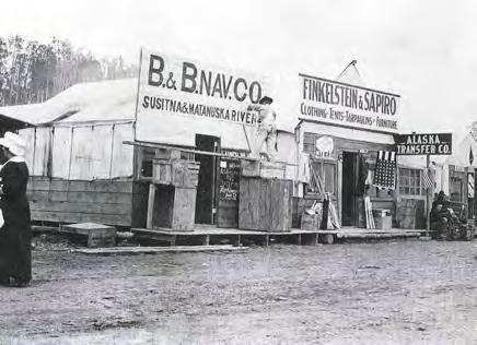 Shops and services were provided to the early residents of Ship Creek’s tent city.
HISTORIC PRESERVATION PLAN FOR ANCHORAGE’S FOUR ORIGINAL NEIGHBORHOODS 164 ADOPTED 2/12/2013 AO 2013-012
Character Summary
Ship Creek lies partially in the Government Hill Community Council area (north of the creek), partially in the Downtown Anchorage Community Council area (south of the creek), and partially in the Fairview Community Council area (a small section between Ingra Street and Post Road). Nevertheless, it is separated topographically from the other areas and maintains its own character, which differentiates it from the other neighborhoods.
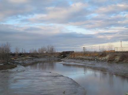
Ship Creek is a narrow, east-west oriented river valley between bluffs. Government Hill is located to the north, the Mountain View neighborhood to the east, Downtown Anchorage to the south, and the Knik Arm of the Cook Inlet to the west. From Government Hill, East Loop Road turns into a north-south bridge over the Ship Creek area, and leads to A and C streets in Downtown. Whitney Road parallels Ship Creek on the north side of the creek, while Ship Creek Avenue parallels on the south. A roughly orthogonal grid of streets exists toward the east end of the Ship Creek area, east of Post Road.
The area is industrial in character, and includes warehouses, machine shops, and other heavy industrial uses, many of which are related to the Alaska Railroad. It also includes a train depot, a hotel, and a few other commercial spaces. Building types are generally utilitarian with flat or gable roofs, but also include Quonset huts. Building structures and materials vary, but include wood frame with shiplap cladding, concrete block, reinforced concrete, and steel frames with metal siding.
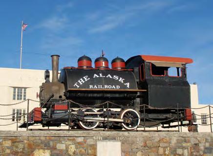 Ship Creek
Historic train at the Alaska Railroad Passenger Depot
Ship Creek
Historic train at the Alaska Railroad Passenger Depot
CHAPTER VII: NEIGHBORHOOD CHARACTER, GOALS & POLICIES 165ADOPTED 2/12/2013 AO 2013-12
Character-Defining Features
Boundaries & Gateways
Located between Downtown (to the south) and Government Hill (to the north)
Four gateways: North C Street/Ocean Dock Road, North Cordova Street, Ingra Street, and Post Road
Streetscape
Industrial area
Ship Creek runs through the center in a meandering fashion
Railroad tracks run generally east-west; rail yard located north of the creek, while a few tracks run south of the creek to warehouses
Lighting & Utilities
Vehicular-scale modern streetlights
Above-ground utility poles
Buildings
Large-scale industrial
“Landmarks to Save”
The following buildings, sites, and stories (listed in alphabetical order) were identified through the HPP Public Outreach Process and previous surveys as the most precious resources in Ship Creek. This list is not intended to be exhaustive, yet it reflects the resources valued most highly by the public.
National Register
Nonindustrial uses, including a hotel, train depot, and commercial functions
One- to three-story buildings
Wood frame, concrete block, reinforced concrete, and/or steel frame construction
1. Anchorage Depot (Alaska Railroad Depot)
Identified during HPP Public Outreach & Previous Surveys
2. Freight Shed
3. AEC Power Plant* (Anchorage Railroad Yard)
Large lots with paved surface parking and storage areas
Few street trees
Multiuse paths, including Ship Creek Trail
Wood lap siding, concrete block, stucco, corrugated metal, and/or brick veneer cladding
Utilitarian style, Quonset huts, Art Moderne style, Contemporary style
4. AEC Cold Storage Facility (Warehouse Avenue, no longer railroad-owned)
5. Warehouse Three*
6. Engine Repair Shop*
Flat and gable roofs
*Building was identified in previous survey, but is functionally obsolete and/or unable to meet ARRC’s operational needs, and therefore may not be feasible to preserve.
HISTORIC PRESERVATION PLAN FOR ANCHORAGE’S FOUR ORIGINAL NEIGHBORHOODS 166 ADOPTED 2/12/2013 AO 2013-012
Challenges and Vision
Ship Creek is a unique subset of the Four Original Neighborhoods—portions of it lie in Downtown, Government Hill, and Fairview—with its own character and history. Ship Creek is rich with Alaska Native Peoples and Alaska Railroad history, and provides opportunities as an intermodal transit center, industrial, and recreational area. The biggest challenge for Ship Creek will be to improve its connection to the rest of Anchorage’s historic core, and to implement a clear vision for its highest and best use.
Ship Creek-Specific Recommendations
The following recommended implementation strategies are specific to Ship Creek. However, please note that due to its complicated and overlapping boundaries with the other neighborhoods, Ship Creek was not discussed as thoroughly in the public outreach process as the neighborhoods, and thus has fewer neighborhood-specific recommendations. Because it did not receive equal attention from key stakeholders, these strategies are offered to supplement the Ship Creek Waterfront Land Use Plan (1991).
Interpret Alaska Native Peoples and Alaska Railroad history at Ship Creek.
à Add to existing signage to tell the stories of Alaska Natives who worked to construct the railroad
à Add interpretive signs to Alaska railroad buildings.
à Install street signs in English and Athabascan, especially to represent Athabascan names for villages and geographic features (also applies to Policies 1.3 and 3.2).
Any interpretive project at Ship Creek would include ARRC involvement to ensure that there are no duplicate efforts, and no impacts to operations or safety.
CHAPTER VII: NEIGHBORHOOD CHARACTER, GOALS & POLICIES 167ADOPTED 2/12/2013 AO 2013-12
town Anchorage and the Ship Creek area, creating better access for residents and visitors. The Ship Creek ITC project is designed to complement existing and projected developments in the Ship Creek area. Project components include:
A new intermodal transportation center with adequate baggage and passenger services; safe and convenient passenger boarding zones; well-defined arrival and departure areas; and platforms, signage and security; along with complementary retail and office space (for example, news stands or transit-related offices).
• The project constructs two new tracks and rehabilitates two existing tracks. This includes one new passenger track and one new main that will allow passenger and freight traffic to bypass the intermodal facility without disrupting passenger operations. The new and rehabilitated passenger tracks will provide more flexibility in operations and provide the infrastructure for future commuter rail service.
• The project addresses the inadequate parking areas and sidewalks leading to the depot.
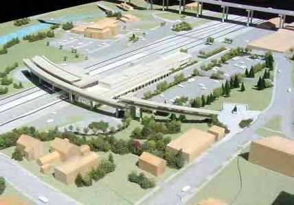
Establish a cohesive strategy for the physical and economic development of Ship Creek that is coordinated with the vision for greater Downtown and Government Hill, including identifying elements important to cultural and historic preservation and interpretation.
Ensure that there are strong physical connections (trails, pathways, sidewalks) between the Government Hill, Ship Creek, and Downtown neighborhoods. Incorporate the story of Ship Creek into interpretive plans that explain how Anchorage
Continue to implement the Ship Creek Master Plan and Intermodal Transit Center projects, but be sure to coordinate with Downtown, Government Hill, and Fairview neighborhood
ECI/Hyer architectural design model view from the south. Architect’s pedestrian bridge rendering.
01/11/2010 1
Resolve any jurisdictional conflicts between the State of Alaska and the Municipality prior to implementing changes at Ship Creek. Consider forming a task force dedicated to solving this issue. The Ship Creek ITC project is designed to complement existing and projected developments in the Ship Creek area. (ECI/Hyer architectural design model view from the south, 2010).
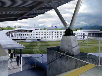
HISTORIC PRESERVATION PLAN FOR ANCHORAGE’S FOUR ORIGINAL NEIGHBORHOODS 168 ADOPTED 2/12/2013 AO 2013-012
Government Hill
Boundaries
Government Hill is located north of Downtown, and was the first of the Four Original Neighborhoods to be settled. The area is roughly L-shaped, and is bordered on the west by the Cook Inlet, on the north and east by Joint Base Elmendorf-Richardson (JBER), and on the south by Ship Creek. Government Hill is accessed by East Loop Road, an elevated roadway that crosses Ship Creek and the Alaska Railroad yards near the center of the neighborhood. Four distinct sub-areas compose Government Hill: the Port of Anchorage at the western edge, the Ship Creek area at the southern edge, and the residential areas of West Government Hill and East Government Hill on top of the bluff.
History
Government Hill is Anchorage’s oldest permanent neighborhood (although the entire Anchorage area has long been seasonally inhabited by the Dena’ina people). From 1915 to the end of World War II, the Alaska Engineering Commission (AEC) and the Alaska Railroad constructed housing on Government Hill for railroad managers, engineers, and skilled workers. The AEC built 13 cottages in 1915 on the bluff overlooking Knik Arm at the western end of Government Hill, along what are now West Harvard Avenue and Delaney Street. The AEC did not lay out a street grid, but positioned the houses to look out over Ship Creek, with easy access to the Terminal Yards and Alaska Railroad offices. The AEC also built a Wireless Center on Manor Avenue to provide better transmission and reception capacity than did an earlier temporary station in the rail yards.
Between 1915 and 1940, the AEC cottages, Wireless Center, and a water tower were the only permanent buildings and structures on Government Hill. During the 1930s, a fox fur farm, the Alaska Labrador Fur Farm, operated on land leased from the Alaska Railroad in the vicinity of what is now Al Miller Memorial Park. Its buildings and pens were of temporary construction. The AEC cottages were sold into private ownership to railroad employees in 1928, but the land remained in the Railroad Reserve until 1935. Once in the hands of individual owners, the original AEC cottages were modified with additions, porch enclosures, larger windows, and garages.
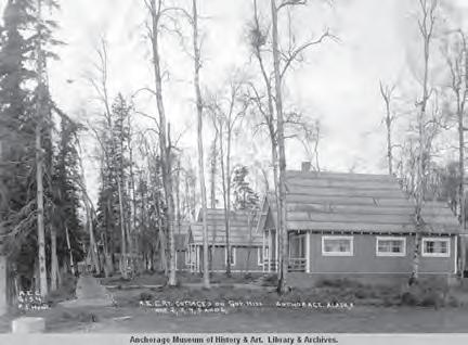 Map highlighting Government Hill.
Alaska Engineering Commission (AEC) Cottages on Government Hill, 1916.
Map highlighting Government Hill.
Alaska Engineering Commission (AEC) Cottages on Government Hill, 1916.
CHAPTER VII: NEIGHBORHOOD CHARACTER, GOALS & POLICIES 169ADOPTED 2/12/2013 AO 2013-12
PEASEAVENUE TR VEN BACKERAVENU SAVILLE NNNB ELMENDORF AIR FORCE BASE 0.5 0 0.5seliM52.0° FAIRVIEW SOUTH ADDITION DOWNTOWN GOVERNMENT HILL
East Government Hill underwent urban renewal from 1958 to 1963, including replatting and leveling the blocks. Plat C-197 shows the proposed subdivision (1959).
In 1941, the Army Corps of Engineers built two identical cottages at Brown’s Point on the edge of the bluff in western Government Hill. These residences housed construction officers for the development of Fort Richardson and Elmendorf Air Field (later Elmendorf Air Force Base and now Joint Base Elmendorf-Richardson). The Brown’s Point Cottages were donated to the Municipality of Anchorage in 1997, and were rehabilitated and listed in the National Register in 2004. During World War II, the Alaska Railroad built 10 identical duplex houses along West Manor Avenue and Delaney Street to house wartime employees. They were sold to private individuals in the mid-1950s, with preference given for longevity of residence and military service. An identical set of duplexes was built in the South Addition to house Civil Aeronautics Administration employees at the end of World War II.
To support the growth of Government Hill after World War II, the Alaska Railroad laid out a block and lot system across the whole neighborhood. The Alaska Railroad set up prefabricated Quonset huts and Loxtave houses (of interlocking wood construction), which were intended to be removed and replaced by a permanent home within five years. In a few cases, the lessees did not construct another building, and the “temporary” buildings remain as the primary residence on the lot. In addition to the single family residences, several duplexes of a standard plan were constructed along the central core streets, such as Manor and Harvard avenues on the western side of the postwar housing area. A postwar construction boom and Railroad Rehabilitation program (1948-1952) resulted in a housing shortage, and the Alaska Railroad built two additional duplexes on Brown Street in 1948. A new steel water tower was also built in the winter of 1947-1948 to replace an older wood water tower, and it still stands today as a neighborhood icon.
In eastern Government Hill, three separate but similar wood frame apartment complexes were built in the early 1950s to accommodate the influx of federal workers engaged on the railroad, military bases, and federal civil works projects. Richardson Vista (now called North Pointe Apartments) and Panoramic View still stand, but the Hollywood Vista Apartments were demolished in 1996. Near the apartment complexes, eastern Government Hill underwent urban renewal from 1958 to 1963, including replatting and leveling the blocks and paving streets and sidewalks. Quonset huts were removed from this part of the neighborhood, and nearly identical ranch houses with attached garages were constructed in their places. Western Government Hill streets were paved in the 1960s, curbs and gutters were added, but no sidewalks were built.
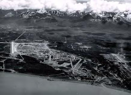 Aerial photograph of Government Hill, showing residential areas, Ship Creek, and Elmendorf Air Force Base (circa 1950).
HISTORIC PRESERVATION PLAN FOR ANCHORAGE’S FOUR ORIGINAL NEIGHBORHOODS 170 ADOPTED 2/12/2013 AO 2013-012
After World War II, shopping and entertainment activities were established in a centrally located business district at the intersection of East Loop Road, East Bluff Drive, and Arctic Warrior Drive. The Hollywood Shopping Center was built in 1951 and was Anchorage’s first “strip mall.” Recreation facilities were also established in the 1950s and 1960s, including a bowling alley, teen dance club, Anchorage Square and Round Dance Club, and Anchorage Curling Club. Government Hill Elementary School was built in 1956, but the school and two residences were destroyed during the great earthquake on March 27, 1964, due to a landslide along the bluff immediately east of Loop Road. The school site was developed into a park in 1985, and Government Hill Elementary School was rebuilt in 1965 on military lands north of the original school. Since the 1960s, the character of the neighborhood has remained largely unchanged.84
The Port of Anchorage is located west of Government Hill, at the bottom of the bluff. Development was originally funded by the issuance of general obligation bonds in the 1950s. Construction began in 1959, and the 700-foot Terminal #1 was completed in 1961 when the port officially opened. In its first year, 38,000 tons of marine cargo moved across its single berth. The Port of Anchorage was the only port in South Central Alaska to survive the 1964 earthquake, and became the main shipping hub for consumer and essential goods entering south-central Alaska. In 1964, Sea-Land began negotiating for port facilities. Terminal #2 was constructed in the late 1960s, along with the Petroleum, Oil, and Lubricants (POL) Terminal. Totem Ocean Trailer Express (TOTE) negotiated for port facilities in 1975, culminating in the completion of Terminal #3, which was finished in 1978. The Port of Anchorage now contains five berths, and provides an estimated 90% of the merchandise cargo to 80% of Alaska’s populated areas.85
TELLING STORIES ABOUT GOVERNMENT HILL
The results of the Government Hill Historic Resource Survey (2006) can be used to raise public awareness about the neighborhood’s history. The following topics and stories are recommended to be told in the Government Hill neighborhood, especially at each of the four potential historic districts. Potential methods of interpretation are discussed throughout the HPP. Note that this list of suggested topics is by no means exhaustive.
1964 Good Friday Earthquake
Alaska Native Peoples History
Alaska Railroad History, including the Alaska Engineering Commission (AEC)
Anchorage’s First Neighborhood
Quonset huts, including invention, design, and use
Role of the military
Urban Renewal
World War II in Alaska
CHAPTER VII: NEIGHBORHOOD CHARACTER, GOALS & POLICIES 171ADOPTED 2/12/2013 AO 2013-12
Character Summary
The Government Hill Community Council Area extends to the Port of Anchorage. The description and character-defining features focus on the Government Hill neighborhood, however. The following character summary is excerpted from the Knik Arm Crossing Project Recommendations for a Historic District(s): Government Hill, Anchorage, Alaska; Volume I: Literature Review and Recommendations (July 25, 2006):
Government Hill is a geographically bounded area within the Municipality of Anchorage, located atop a steep bluff on a point of land above the Ship Creek flats where the railroad, port, and industrial facilities were built during the early part of the twentieth century. Somewhat irregular in shape, Government Hill is generally an east-west rectangular area that extends approximately one mile from east to west and 0.3 miles from north to south. […] Government Hill is surrounded by […] high bluffs to the [east and] south and by the Elmendorf Air Force Base (EAFB) perimeter to the north and east. There are two access routes to Government Hill: a road to the south (East Loop Road) and the base gate (Arctic Warrior Drive). East Loop Road crosses over the railroad yard, the industrial area, and Ship Creek on a viaduct before climbing the opposite bluff into downtown Anchorage. Green space nearly surrounds Government Hill along the steep edges on the south, west, and part of the north side and infiltrates the domesticated space in the form of small parks and remnant, undivided lands within the residential areas. This green space buffers the hill from industrial activity to the south and west, partially muffling the noises of the railroad and port below.
The oldest buildings on Government Hill are located west of Brown Street in the far western portion of Government Hill, an area with narrower streets conforming to the curves of the bluff edge on the north and west sides. The far western portion of Government Hill dates to the earliest period of Anchorage’s Euro-American history (19151923) that centered on the federal government’s efforts to build a railroad to connect the deep water port at Seward to the interior of Alaska.
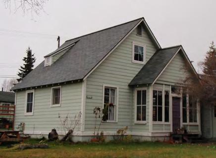
 Green space buffers the hill from nearby industrial activity.
The oldest buildings on Government Hill are located at the western end of the neighborhood.
Green space buffers the hill from nearby industrial activity.
The oldest buildings on Government Hill are located at the western end of the neighborhood.
HISTORIC PRESERVATION PLAN FOR ANCHORAGE’S FOUR ORIGINAL NEIGHBORHOODS 172 ADOPTED 2/12/2013 AO 2013-012
As one travels east of Brown Street, the roads become wider and the houses less uniform until one reaches the Urban Renewal era and multifamily housing in eastern Government Hill. The lots are largest in the far western portion of Government Hill, and the lots in eastcentral Government Hill are larger than the west-central area of Government Hill. […] [M]any of the blocks have platted and heavily utilized alleys where utilities are routed, most outbuildings are located, and cars, recreational vehicles (RVs), and trash cans are stored. Loop Road ascends the southern boundary and cuts through the center of Government Hill, ending in a mostly commercial area before reaching the EAFB base gate. Multifamily units dominate the farthest east portion of Government Hill and include the Richardson Vista (now North Pointe) and Panoramic View apartment complexes. A third apartment complex, Hollywood Vista, was also located in this area of Government Hill but was demolished in 1996.86 [The area once occupied by Hollywood Vista is now being rebuilt.]
For additional details about the history of Government Hill and a discussion of significant resources, please read the Knik Arm Crossing Project Recommendations for a Historic District(s): Government Hill, Anchorage, Alaska; Volume I and Volume II, prepared by Stephen R. Braund & Associates in 2006.

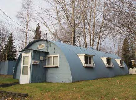 Quonset hut, Cook Street.
Alaska Railroad Duplexes, Manor Street.
Quonset hut, Cook Street.
Alaska Railroad Duplexes, Manor Street.
CHAPTER VII: NEIGHBORHOOD CHARACTER, GOALS & POLICIES 173ADOPTED 2/12/2013 AO 2013-12
Character-Defining Features
Boundaries & Gateways
Anchorage’s oldest neighborhood
Located north of Downtown
Surrounded on all sides by controlled access areas: Joint Base Elmendorf-Richardson (JBER), Alaska Railroad Corporation, and the Port of Anchorage
Streets named for Alaska Railroad workers and leaders
Small lots (50’ x 140’ typical in West Government Hill, 65’ x 125’ typical in East Government Hill)
Buildings typically set on small lots with front lawn and side setbacks
Lighting & Utilities
Vehicular scale modern streetlights
Above-ground utility poles located along residential streets and rear alleys
Buildings
Small-scale residential (single-family and duplexes)
One gateway (E. Loop Road) connects the neighborhood to Downtown, and one gateway connects to JBER
“Welcome to Government Hill” sign at neighborhood entrance
Four sub-areas with cohesive character: West Government Hill, East Government Hill, Ship Creek, and the Port of Anchorage
Streetscape
Residential area on bluff, with port industrial uses in flats
Streets 60’ wide, with 20’ alleys bisecting blocks
Average 25’ to 30’ setbacks from lot line
One- and two-story buildings
No sidewalks in West Government Hill
Sidewalks separated from street by planting zone in East Government Hill
Wood frame construction
Wood siding or replacement siding designed to mimic wood
Garages and off-street parking accessed through rear alleys
Hipped and gable roofs
No fences or low (less than 4’) fences set back from the lot line
Vernacular Folk Cottages, various Revival styles, and ranch houses most prominent
Mature trees in yards
Small parks throughout the neighborhood
Views of inlet and mountains
Large mid-century apartment complexes with standard floor plans
Community Buildings: Government Hill Elementary School, Anchorage Curling Club, and several churches
HISTORIC PRESERVATION PLAN FOR ANCHORAGE’S FOUR ORIGINAL NEIGHBORHOODS 174 ADOPTED 2/12/2013 AO 2013-012
Government Hill Neighborhood Character
Government Hill is located north of Downtown, and was the first of the Four Original Neighborhoods to be settled. The area is roughly L-shaped, and is bordered on the west by the Cook Inlet, on the north and east by Joint Base Elmendorf-Richardson (JBER), and on the south by Ship Creek. Government Hill is accessed by East Loop Road, an elevated roadway that crosses Ship Creek and the Alaska Railroad yards near the center of the neighborhood. Four distinct sub-areas compose Government Hill: the Port of Anchorage at the western edge, the Ship Creek area at the southern edge, and the residential areas of West Government Hill and East Government Hill on top of the bluff. Legend
CHAPTER VII: NEIGHBORHOOD CHARACTER, GOALS & POLICIES 175ADOPTED 2/12/2013 AO 2013-12 F A I R C H I L D A V E N U E T E R MNI A L R O A D EAST WHITNEY ROAD VIKING DRIVE FIGHTER DRIVE EASTLOOPROAD O CEA N DO CK RO A D ARCTICWARRIORDRIVE EAST BLUFF DRIVEHOLLYWOODDRIVE UNNAMEDROAD TIDEWATERROAD NORTH POSTROAD BULLARDAVENUE BONGAVENUEAN C H OR A GE P ORTR OA D CHENNAULT AVENUE 11TH STREET 8TH STREET EAST SHIP CREEKAVENUE SHIP AVENUE WEST BLUFFDRIVE 10TH STREET BLAKEAVENUE 2ND STREET CRAW AVE NUE ARNOLDAVENUEANDREWSAVENUE ARNOLDDRIVE SPAR AVENUE BIRCH STREETEASTMANORAVENUE EASTHARVARDAVENUE TLE AVENUE EAK ERAVENUE CASWELLAVENUE EASTCOOKAVENUE N A NB OFF W LOOP RA MP NORTH C STREET ANDERSONSTREETDELANEY STREET I VYSTR EET BRO WN STR EET ELMSTREET ASH PLACEERICKSONSTREET DOGWOODSTREETBILBOSTREET A R N O LD A VE N U E ELMSTREET UNNAMEDROAD UNNAMED ROAD UNNAMED ROAD UNNAMED ROAD ARNOLD DR I VE UNNAMED ROAD UNNAMED ROAD T IDE W A T ERR OA D UNNAMEDROAD D O O L I T T L E A V E N U E 0.1 0 0.1seliM50.0° PORT OF ANCHORAGE EAST GOVERNMENT HILL SHIP CREEK WEST GOVERNMENT HILL JOINT BASE ELMENDORF-RICHARDSON * * *
Neighborhood Character
Community Council Boundary Principal Boulevard Primary Pedestrian Connection Secondary Pedestrian Connection Multi-Use Trails Bike Routes Wetlands Municipal Parks Gateway Activity Node Churches & Community Centers *
Opportunities for Preservation in Government Hill identified historic resources and other historic places valued highly by the public represent the top opportunities for preservation on Government Hill. The properties shown on this map could be prioritized for preservation projects and policies recommended in the HPP.
OPPORTUNITIES FOR PRESERVATION LEGEND
Previously Listed in National Register (NRHP)
Previously Listed in “Patterns of the Past”
GOVERNMENT HILL SURVEY RESULTS
Individually NRHP Eligible (SHPO Concurs)
NRHP District Contributor (SHPO Concurs)
Found by SRB&A to be a NRHP District Contributor (SHPO did not concur)
Not Eligible
Not Surveyed
Potential Historic District
Mentioned during HPP Public Outreach (not otherwise identified in past surveys)
“Landmarks to Save” (see numbered list in previous section)
Current Community Council Boundary
Proposed Community Council Boundary
Wetlands
Municipal Parks
Military (JBER)
NOTE: This map is organized to show a hierarchy of historic status and each historic property is depicted with the highest level of historical rating currently assigned. For example, a property shown as National Register-listed may have also been discussed in “Patterns of the Past,” or identified in the South Addition Survey. This information can be found in the Consolidated Historic Resource Inventory Database, although it is not shown here.
HISTORIC PRESERVATION PLAN FOR ANCHORAGE’S FOUR ORIGINAL NEIGHBORHOODS 176 ADOPTED 2/12/2013 AO 2013-012 EAST 3RD AVENUE T ERM I NAL RO AD EAST WHITNEY ROAD EASTLOOPROAD O C E A N D O C KR O A D EASTBLUFFDRIVE VIKING DRIVE FIGHTER DRIVE ARCT C WARR OR DR VE UNNAMEDROAD HOLLYWOOD DRIVE EAST 1ST AVENUE BULLARD AVENUE BONGAVENUE WEST 3RD AVENUE A N C H O R A G E P O R T R O A D ASTREET P O STR O AD WEST 1ST AVENUE TIDEWATER ROAD FS T R E E T N O R T H P O S T R O A D EAST SHIPCREEK AVENUE WEST BLUFFDR VE 10THSTREET BLAKEAVENUE WEST2ND AVENUE ARNOLDAVENUE ANDREWS AVENUE 11TH STREET WESTERNDRIVE CRA WAVENUE I N G R A S T R E E T ES T RE E T E A G L E S T R E E T ARNOLDDRIVE B I RCHSTREET EAST 2ND AVENUE EASTMANORAVENUE 8THSTREET SPAR AVENUE CEDARSTREETEASTHARVARDAVENUE BOYD STREET NORTH C STR EET E A K E RA V E NUE NOR T HAS T RE E T CASWELLAVENUE WEST HARVARD AVENUE RICHARDSONVISTA ROAD NAN BOF FW LOO PRAMP EAST 2ND COURT ANDERSONSTREET B A RRO W S T R E E T G A M B E L L S T R E E TPORTACCESSROAD DOOLITT LE AV ENUE VINEAVENUE DELANEY STREET SH PAVENUE IVYS TREET BRO WN STREET ELM STREET ERICKSONSTREET K A R L U KS T R E E T DOGWO ODSTREET CO RD O V AS T R E E T DE N A L S T R E E T BILBOSTREET BUL LAR DAVE NUE UNNAMED ROAD ELM STR EET AR N OL DA VEN U E EAST BLUFF DRIVE UNNAMED ROAD EAST 1ST AVENUE B L A K E A V E NUE U NN A D R OA D DOOL I TTLE AVENUE UNNAMEDROAD T I DE W A T ER RO AD FIGHTERDRIVE UNNAMEDROAD ARN OLDDRIVE Far West (SHPO Concurs) Far East (SHPO Concurs) Quonsets (SHPO Concurs) Urban Renewal (SHPO Concurs) 1 3 2 6 5 4 5
Previously
° 0.05 Miles0.0500.025
11
“Landmarks to Save”
The following buildings, sites, and stories (listed in alphabetical order and marked on the map on the opposite page) were identified through the HPP Public Outreach Process as the most precious resources in Government Hill. This list is not intended to be exhaustive, yet it reflects the resources valued most highly by the public.
National Register
1. Brown’s Point Cottages
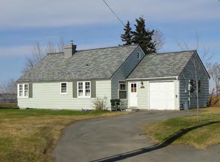
Identified during HPP Public Outreach & Previous Surveys
2. AEC Cottages
3. Alaska Railroad Duplexes Quonset huts Water Tower
6. Wireless Center (National Register nomination completed)
Challenges and Vision
Government Hill is unique as a geographically isolated area containing remnants of community planning, social history, and architecture from the beginning of Anchorage as a railroad town in 1915 until the present.
The residents of Government Hill, which is accessible only by bridge and overlooks Downtown, desire to preserve their cohesive, tight-knit community, as well as the neighborhood’s character-defining features: historic cottages, Quonset huts, the Wireless Center, small streets and alleys, trails, and viewsheds.
The biggest challenge for Government Hill will be to complete an implementable neighborhood plan and recommendations that can mitigate the impacts of the proposed Knik Arm Crossing project or other major development projects to the greatest extent possible. Revitalizing Government Hill’s “neighborhood center” through the creation of a commercial hub is also a top priority. To this end, the HPP contains project recommendations that preserve historic buildings and locations significant to the settlement of the Anchorage area, while helping to maintain the community character of the Government Hill neighborhood.
Brown’s Point Cottages (listed in the National Register).
The Government Hill Water Tower is a neighborhood icon in all seasons.
CHAPTER VII: NEIGHBORHOOD CHARACTER, GOALS & POLICIES 177ADOPTED 2/12/2013 AO 2013-12
4.
5.
Government Hill-Specific Policies & Implementation Strategies
The following policies and implementation strategies are specific to Government Hill, and are applied in addition to the Plan Area Policies described in Chapter VI
#1 Quality of Life/Livability
1.4 GH Maintain and enhance safety of existing historic trails, and improve connections to Downtown, Coastal Trail, and open space network.
1.4.1 GH Provide interpretive material regarding historic trails. Through the “Government Hill Oral Histories” project, long-time residents recalled a time when people walked everywhere in Anchorage. Historic pedestrian usage on Government Hill dates from 1915 when the area was first settled by the Alaska Engineering Commission, and trails continue to be an important part of life on Government Hill today.
#2 Landmarks to Save
2.1 Retain and preserve the historic and cultural resources identified during the HPP public outreach process and recorded in the Consolidated Historic Resources Inventory.
See page 177 for a proposed list of resources developed through the HPP public outreach process.
Biographical information added to street signs in the Presidio of San Francisco integrates history into everyday life.
HISTORIC PRESERVATION PLAN FOR ANCHORAGE’S FOUR ORIGINAL NEIGHBORHOODS GH = GOVERNMENT HILL DT = DOWNTOWN SA = SOUTH ADDITION FV = FAIRVIEW178 ADOPTED 2/12/2013 AO 2013-012
#3 Interpreting History & Culture
3.9 GH Interpret history of Government Hill
3.9.1 GH Add biographical information to street signs in Government Hill, which are named after Alaska Railroad workers. The Presidio of San Francisco has applied this strategy.
3.9.2 GH Incorporate interpretive signs for all the historic mini districts on Government Hill.
3.9.3 GH Publicize results of “Government Hill Oral Histories Project.”
#5 Growth & Change
5.6 GH Introduce limited commercial or mixed-use development that supports neighborhood functions, reduces isolation of Government Hill, and revitalizes Government Hill’s “neighborhood center.”
See the Government Hill Neighborhood Plan (2012) for actions and implementation strategies to renovate and revitalize Government Hill’s “neighborhood center” in a manner that will be consistent with the historical uses and character desired by local residents.
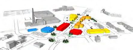
5.7 GH Implement the Government Hill Neighborhood Plan, as parallel effort to HPP, to manage future growth in the Government Hill area.
2 The Government Hill Neighborhood Plan details various development scenarios for a new “neighborhood center.” The GHNP is scheduled for completion in December 2012.
View looking south along Loop Road
The Government Hill Neighborhood Plan (2012) provides details for how to accomplish this policy. Government
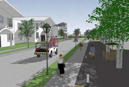
CHAPTER VII: NEIGHBORHOOD CHARACTER, GOALS & POLICIES 179ADOPTED 2/12/2013 AO 2013-12
85 A. CONCEPT B. KEY FEATURES Arctic Warrior and E. Bluff school (with direct road off along E. Bluff (less dependent potential festival lot (also Neighborhood Gateway ALASCOM JBER Gateway Government Hill Elementary School AT & Hollywood E. Bluff E.Loop Erickson New access to neighborhood Secondary access to school New gate location 95
Hill Neighborhood Plan Public Review Draft
#6 Economic Development
6.9 GH Renovate and revitalize Government Hill’s “neighborhood center” by encouraging mixed use development that includes low-impact commercial and residential uses, supported by policies, goals, and implementation strategies developed in the Government Hill Neighborhood Plan.
See the Government Hill Neighborhood Plan (2012) for actions and implementation strategies to renovate and revitalize Government Hill’s “neighborhood center” in a manner that will be consistent with the historical uses and character desired by local residents.
#7 Procedures & Regulations
7.3 Create, populate, and maintain an official local register or inventory of historic resources.
7.3.8 GH As part of the creation of a local register, continue to survey and document historic resources on Government Hill. As recommended in the Consolidated Inventory Survey Report, this would include research and documentation of properties identified by members of the public during the HPP public outreach process.
See Policy 2.1 for recommendations about nominating eligible Government Hill properties to the National Register of Historic Places, as recommended in the Consolidated Inventory Survey Report
7.11 GH Create zoning and land-use policies to encourage appropriate redevelopment and revitalization of small commercial lots in Government Hill’s “neighborhood center.”
7.11.1 GH Implement zoning and land-use policies from Government Hill Neighborhood Plan.
See Policy 5.6 for a discussion of Government Hill-specific design guidelines. See Policy 7.5 for code relief strategies that could be used to facilitate redevelopment of small commercial lots in Government Hill.
HISTORIC PRESERVATION PLAN FOR ANCHORAGE’S FOUR ORIGINAL NEIGHBORHOODS GH = GOVERNMENT HILL DT = DOWNTOWN SA = SOUTH ADDITION FV = FAIRVIEW180 ADOPTED 2/12/2013 AO 2013-012
Boundaries
Downtown Anchorage is the heart of Anchorage, and contains many of the city’s most prominent historic resources. It is surrounded by Ship Creek to the north, the Fairview neighborhood to the east and southeast, the Delaney Park Strip and the South Addition neighborhood to the south, and L Street to the west. Primary thoroughfares include 3rd and 5th avenues (westbound), 4th and 6th avenues (eastbound), L and C streets (southbound), and I and A streets (northbound). These wide one-way streets are designed to funnel fast-moving vehicular traffic through the neighborhood, while some of Downtown’s smaller streets allow two-way traffic. The neighborhood features an orthogonal street grid laid out in 1915, though Christensen Drive, West 1st Avenue, and West 2nd Avenue curve along the slope to Ship Creek at the north edge of the neighborhood. Aside from this north area, Downtown is generally flat.
Anchorage also has a Downtown Improvement District (DID), which covers 119 square blocks, roughly bounded on the north and south by 1st and 9th avenues, and on the east and west by L and Gambell streets. The DID was formed in 1997 and is overseen by the Anchorage Downtown Partnership, Ltd.
History
Development of the built environment in Downtown Anchorage began with the platting of the original Anchorage townsite in May 1915. Located south of the railroad construction port of the Alaska Engineering Commission (AEC), the townsite was set aside during a cadastral survey of the region by the General Land Office in 1914. Commissioner Frederick Mears arrived on April 26, 1915, to prepare the townsite for development. He worked on the assignment with Andrew Christensen, chief of the Alaska field division of the General Land Office, who arrived in Anchorage a month later. Christensen was responsible for the townsite layout and sale of lots. Initially, 240 acres were cleared, and 121 blocks, each 300 feet square, were laid out. Each block contained 12 lots, each measuring 50 feet by 140 feet. The grid plan included a federal reserve, municipal reserve, school reserve, two park reserves, wharf reserves, Indian Possessions reserves, and a cemetery reserve. The lots were sold at auction on July 10, 1915.
The Downtown Improvement District (DID) was formed in 1997 and covers 119 square blocks.
Map highlighting Downtown.
CHAPTER VII: NEIGHBORHOOD CHARACTER, GOALS & POLICIES 181ADOPTED 2/12/2013 AO 2013-12
PEASEAVENUE TR VEN BACKERAVENU SAVILLE NNNB ELMENDORF AIR FORCE BASE 0.5 0 0.5seliM52.0° FAIRVIEW SOUTH ADDITION DOWNTOWN GOVERNMENT HILL
Downtown
Much of the earliest housing in Downtown was of makeshift construction due to a lack of finished lumber. Canvas tents and one-room log cabins were prevalent during the first year. Lumber arrived in the summer of 1916. Frame houses were typically designed in the “Anchorage shotgun” style or the Craftsman style and featured shiplap or clapboard siding. A water line and telephone service were installed in the fall of 1915; electricity was supplied by the AEC’s power plant beginning in 1916; and a sewer system was started in 1917.
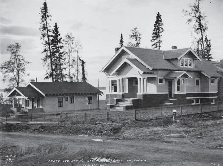
During the townsite auction, lots along 4th Avenue were bought for considerably more money than elsewhere, leading to its establishment as Anchorage’s main commercial corridor. Prior to the auction, interested businessmen had stockpiled construction supplies and were ready to build immediately on 4th Avenue. Within six weeks of the townsite auction, 145 commercial buildings were constructed, 92 of which were on 4th Avenue. Eleven buildings were two stories high, nine of which were located on 4th Avenue. A few businesses, such as Kimball’s Store, were constructed on 5th Avenue.
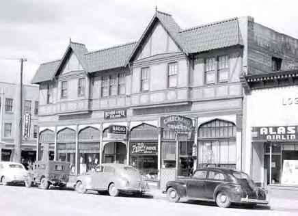
The character of 4th Avenue and Downtown did not change much until the late 1930s, when more modern buildings were erected in response to the city’s prewar population growth spurt. In addition to larger Moderne-style concrete commercial buildings, major new buildings of the era included the City Hall (1936) and the Federal Building (1939). Beginning in 1939, streetlights, traffic lights, and chlorinated water were installed, and 4th Avenue was paved.89
The Good Friday Earthquake in 1964 caused great destruction in Downtown Anchorage. The ground broke along 4th Avenue in an irregular line in front of a row of buildings, an event that came to be known as the 4th Avenue Slide. The slides and quake vibration destroyed or severely damaged about 30 blocks of residences and commercial buildings in Downtown. A six-story apartment building under construction collapsed, and the five-story J.C. Penney department store on 5th Avenue dropped a curtain wall of precast concrete panels into the street.90
The extensive earthquake damage prompted redevelopment of the commercial core, with the construction of the Captain Cook Hotel in 1965 leading the charge. Older buildings were replaced with new, larger buildings and surface parking lots.
Judge Leopold David Residence on 2nd Avenue, 1918.
4th Avenue and E Street, 1949.
HISTORIC PRESERVATION PLAN FOR ANCHORAGE’S FOUR ORIGINAL NEIGHBORHOODS 182 ADOPTED 2/12/2013 AO 2013-012
Redevelopment continued through the 1970s and 1980s as a result of oil prosperity and the Project 80s improvement program. Oil companies led the way in the construction of glass and steel skyscraper office buildings. Project 80s produced the Egan Civic Convention Center, the Alaska Center for the Performing Arts, Evangeline Atwood Theater, an extension to the Anchorage Museum of History and Art, a 1,200-space downtown parking garage, and the Downtown Transit Center.91
The 1990s and 2000s saw additional slow but steady growth in Downtown, including construction of additional large shopping facilities, parking garages, and office towers. However, many office towers and “big box” stores have also moved to Midtown as Anchorage expanded outward. The Dena’ina Civic and Convention Center is one of the largest recent construction projects in Downtown Anchorage: its 200,000 square feet of exhibit and event space attracts thousands of visitors annually.
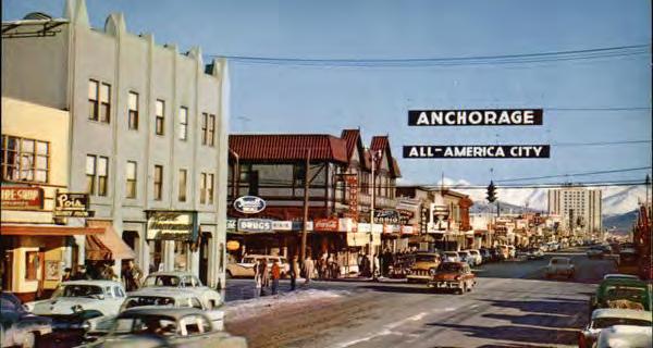
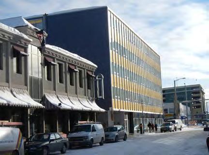
For additional details about the history of Downtown and a discussion of significant resources, please read Patterns of the Past, prepared by Michael Carberry and Donna Lane in 1986.
Character Summary
Downtown is a compact, walkable multiuse district that serves as the heart of the region. Downtown’s diverse building stock includes historic homes—several of Anchorage’s oldest—as well as striking Mid-Century Modern commercial buildings, modern office towers, and industrial warehouses. Commercial and civic buildings dominate 3rd through 9th avenues, interspersed with parking garages and numerous paved surface parking lots. These range from one- or two-story Mid-Century Modern, International, and vernacular buildings to the 22-story Conoco-Philips Building and the 20-story Robert B. Atwood Building (both constructed in 1983). Small residential buildings (many adaptively reused with commercial functions) and a few apartment buildings are scattered throughout. These residences are generally one- or two-stories in height, made of wood or log frame construction, and designed in traditional architectural styles. A concentration of historic residences is located along West 2nd Avenue and F Street. Parks and public open spaces include Buttress Park, Resolution Park, and Town Square.
Historic commercial buildings at E Street and 4th Avenue
“Anchorage All-America City,” circa 1960.
CHAPTER VII: NEIGHBORHOOD CHARACTER, GOALS & POLICIES 183ADOPTED 2/12/2013 AO 2013-12
Character-Defining Features
Boundaries & Gateways
Anchorage’s Central Business District (CBD), civic center, and historic core
Comprises a majority of Anchorage’s Original Townsite Plat (1915)
Five gateways: West 3rd Avenue and C Street, West 3rd Avenue and A Street, West 9th Avenue and I Street, West 9th Avenue and C Street, East 9th Avenue and A Street
Seven sub-areas with cohesive character: the Original Townsite, Central Business District (CBD), Park Strip North, Barrow Street, East Avenues, Pioneer Slope, and Ship Creek
Anchorage Downtown Improvement District (DID) covers 119 square blocks from 9th to 1st avenues and from Gambell to L streets (formed in 1997)
Streetscape
Commercial district (retail, offices, and hotels) surrounded by residential enclaves
Historic streets were 60’ wide with 20’ alleys
Buildings
Street grid and lot size has been altered by full-block buildings in CBD
Wide sidewalks in CBD
Mature trees in residential areas, flower baskets in commercial areas
Many iconic historic buildings (13 listed in National Register)
Diverse mix of buildings: historic homes, mid-century commercial buildings, modern office towers, and industrial warehouses
Interpretive signage and public art (sculptures and murals) about history and culture
Combination of metered street parking, large surface parking lots, and structured parking
Heated sidewalks in portions of CBD
Lighting & Utilities
Vehicular-scale lighting along principal boulevards
Residences: one and two stories, wood or log frame construction, traditional architectural styles
Commercial: historically one and two stories; Mid-Century Modern, International, or vernacular architectural styles; modern commercial buildings up to 22 stories
Industrial: large buildings associated with Alaska Railroad
Community buildings: schools, religious buildings, recreation centers, government buildings
Pedestrian-scale lighting, especially in CBD
Above-ground and underground utilities
HISTORIC PRESERVATION PLAN FOR ANCHORAGE’S FOUR ORIGINAL NEIGHBORHOODS 184 ADOPTED 2/12/2013 AO 2013-012
UNNAMEDROAD
BILBOSTREET EASTBLUFFDRIVE
ELMSTREET
Downtown Neighborhood Character
Downtown is Anchorage’s Central Business District, civic center, and historic core. The neighborhood features an orthogonal street grid laid out in 1915, and is divided into seven sub-areas with cohesive character.
Primary thoroughfares include 3rd and 5th avenues (westbound), 4th and 6th avenues (eastbound), L and C streets (southbound), and I and A streets (northbound). These wide one-way streets are designed to funnel fastmoving vehicular traffic through the neighborhood, while some of Downtown’s smaller streets allow twoway traffic.
CHAPTER VII: NEIGHBORHOOD CHARACTER, GOALS & POLICIES 185ADOPTED 2/12/2013 AO 2013-12 A STREET E STREET I S T R E E T L STREET C STREET INGR A STREE T K STREET WEST 9TH AVENUE WEST 8TH AVENUE WEST 5TH AVENUE GAMBELL STREET CORDOVA STREETWEST 7TH AVENUE WEST 6TH AVENUE WEST 4TH AVENUE EASTLOOPROAD HYDER STREET WEST 11TH AVENUE WEST 3RD AVENUE EAST 4TH AVENUE EAST 5TH AVENUE EAST 6TH AVENUE EAST 9TH AVENUE EAST 3RD AVENUE OC E AND OC K R OAD EAST 13TH AVENUE EAST WHITNEY ROAD EAST 10TH AVENUEWEST 10TH AVENUE WEST2ND AVENUE EAST 12TH AVENUE FS T R E E T WESTERNDRIVE J U N E A U S T R E E T UNNAMEDROAD H ST REE T N S T R E E T G S T R E E T E A G L E S T R E E T WEST 1ST AVENUE WEST 12TH AVENUE EAST 11TH AVENUE D E N A L I S T R E E T EASTSHIP CREEK AVENUE HOLLYWOOD DRIVE F A I R B A N K S S T R E E T WEST BLUFFDRIVE B S T R E E T EAST BLUFF DRIVE EAST 1ST AVENUE C O A S T A L P L A C E BIRCH STREET TERMINALROAD EASTMANORAVENUEEASTHARVARDAVENUE NORTH C STREET ONTRH A ST ERET ARCTICWARRIORDRIVE P A C IF I C P L A C E EASTCOOKAVENUE N A NB OFF W LOOP RA MP EAST 2ND COURT ANDERSONSTREET PORTACCESSROAD EAST 7TH AVENUE EAST 8TH AVENUE I NL ET PL ACE D S T R E E T M STERET DELANEYSTREET WEST 13TH AVENUE BRO WN STR EET ELMSTREET ASH PLACE B A R R O W S T R E E T DOGWO ODS TREET EAST 2ND AVENUE M C OU R T
N S T R E E T YHEDR STERET
M S TR E E T N S TRE E T EDANL ISTERET M S T REE T B S T R E E T B S T R E E T BAORRW STERE T J U N E A U S T R E E T G S T R E E T H S T R E E T EAST 11TH AVENUE F S T R E E T D S T R E E T F S T R E E T WEST 13TH AVENUE UNNAMEDROAD
WEST 11TH AVENUE WEST 12TH AVENUE UNNAMED ROAD U N N A M E D R O A D D E N A L I S T R E E T H S T R E E T WEST 10TH AVENUE
0.1 0 0.1seliM50.0° SHIP CREEK ORIGINAL TOWNSITE BARROW STREET CENTRAL BUSINESS DISTRICT PARK STRIP NORTH PIONEER SLOPE EAST AVENUES * * * * *
Neighborhood Character Legend Community Council Boundary Principal Boulevard Primary Pedestrian Connection Secondary Pedestrian Connection Multi-Use Trails Bike Routes Wetlands Municipal Parks Gateway Activity Node Churches & Community Centers *
Opportunities for Preservation in Downtown identified historic resources and other historic places valued highly by the public represent the top opportunities for preservation in Downtown. The properties shown on this map could be prioritized for preservation projects and policies recommended in the HPP. FOR PRESERVATION LEGEND
NOTE: This map is organized to show a hierarchy of historic status and each historic property is depicted with the highest level of historical rating currently assigned. For example, a property shown as National Register-listed may have also been discussed in “Patterns of the Past,” or identified in the South Addition Survey. This information can be found in the Consolidated Historic Resource Inventory Database, although it is not shown here.
HISTORIC PRESERVATION PLAN FOR ANCHORAGE’S FOUR ORIGINAL NEIGHBORHOODS 186 ADOPTED 2/12/2013 AO 2013-012 A STREET ES T R E E T I S T R E E T L STREET C STREET INGRA STREET K STREET WEST 9TH AVENUE WEST 8TH AVENUE GAMBELL STREET WEST 5TH AVENUE CORDOVA STREET WEST 7TH AVENUE WEST 6TH AVENUE WEST 4TH AVENUE EASTLOOPROAD HYDER STREET EAST 4TH AVENUE EAST 5TH AVENUE EAST 6TH AVENUE EAST 9TH AVENUE WEST 3RD AVENUE EAST 3RD AVENUE WEST 11TH AVENUE O C E A N D O C K R O A D EAST 13TH AVENUE EAST WHITNEYROAD EAST 10TH AVENUE UNNAMEDROAD WEST 10TH AVENUE WEST2ND AVENUE EAST 12TH AVENUE F S TR E ET WESTERNDRIVE J U N E A U S T R E E T H STREET N STREET G STREET EAGLE STREET WEST 1ST AVENUE WEST 12TH AVENUE EAST 11TH AVENUE DENALI STREET EAST SH PCREEK AVENUE SMALLBOATLAUNCHROAD HOLLYWOOD DRIVE B STREET F A I R B A N K S S T R E E T WEST BLUFF DRIVE EAST BLUFF DRIVE EAST 1ST AVENUE C O A S T A L P L A C E B I RCHSTREET TERM NALROAD EASTMANORAVENUE CEDARSTREETEASTHARVARDAVENUE BOYDSTREET NORTH C STREET N O R T H A STR E E T ARCTICWARRIORDRIVE WEST HARVARD AVENUE P A C I F C P L A C E NAN BOF FWLOO PR AMP EAST 2ND COURT NL E TP L A CE ANDERSONSTREET EAST 7TH AVENUE EAST8THAVENUE ARNOLDAVENUE DEGANSTREET VINEAVENUE D S T R E E T M S T RE E T DELANEY STREET WEST 13TH AVENUE BRO WN STREET ANCHORAGEPORTROAD ELM STREET B A R R O W S T R E E T DOGWOODSTREET EAST 2ND AVENUE MC OU R T BILBOSTREET JUNE A US TR E E T U N N A M E D R O A D D S T R E E T M S T RE E T EAST 8TH AVENUE B S T R E E T MS TR E E T B S T R E E T DE N A L I S T RE E T B A RR O W S T RE E T WEST 10TH AVENUE WEST 12TH AVENUE N S T R E E T H S T R E E T J U N E A U S T R E E T U N N A M E D R O A D D E N A L I S T R E E T UNNAMEDROAD G S T R E E T UNNAMEDROAD WEST 13TH AVENUE F S T R E E T WEST 11TH AVENUE E A G L E S T R E E T D S T R E E T EAST 11TH AVENUE F S T R E E T H S T R E E T EAST BLUFF DRIVE UNNAMEDROAD EAST 7TH AVENUE ELM STREET 2nd & F Street Area Local Historic Core 6 5 11 4 3 13 12 14 9 8 16 15 17 18 7 10 2 1
Previously
° 0.05 Miles0.0500.025 Previously Listed in “Patterns of the Past” Mentioned during HPP Public Outreach (not otherwise identified in past surveys) Previously Listed in National Register (NRHP) OPPORTUNITIES
Municipal Parks Wetlands Military (JBER) Community Council Boundary “Landmarks to Save” (see numbered list in previous section)
11 Not Surveyed Not Eligible Individually NRHP Eligible Potential Historic District 1988/2007 DOWNTOWN SURVEY RESULTS
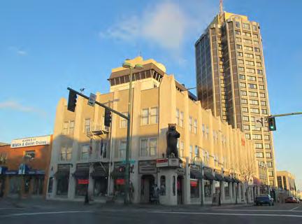
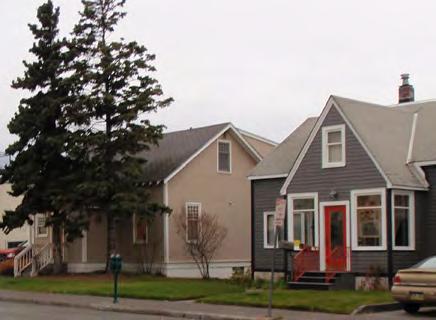
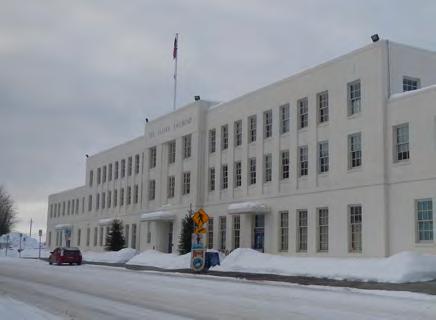
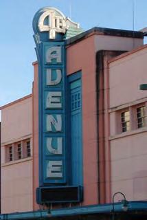 Historic at the Wendler Building (left) & Theatre (right). Railroad Passenger Depot.
CHAPTER VII: NEIGHBORHOOD CHARACTER, GOALS & POLICIES 187ADOPTED 2/12/2013 AO 2013-12 “Landmarks to Save” The following buildings, sites, and stories (listed in alphabetical order and marked on the map on the opposite page) were identified through the HPP Public Outreach Process as the most precious resources in Downtown. This list is not intended to be exhaustive, yet it reflects the resources valued most highly by the public. National Register 1. AEC Cottage #23 2. AEC Cottage #25 3. Anchorage Hotel Annex 4. Anchorage Railroad Depot 5. Fourth Avenue Theatre 6. Kimball Building 7. Leopold David House 8. Loussac-Sogn Building 9. McKinley Tower Apartments 10. Old City Hall 11. Old Federal Building 12. Pioneer School House 13. Wendler Building Identified during HPP Public Outreach / Surveys 14. Alaska Native Service (ANS) Hospital Site 15. All Saints Episcopal Church, West 7th Avenue and E Street 16. Holy Family Cathedral 17. Log Cabin Visitor Information Center 18. Resolution Park/Captain Cook Monument Anchorage Hotel Annex (listed in the National Register).AEC Cottages on 3rd Avenue (listed in the National Register).
signage
Fourth Avenue
Alaska
Challenges and Vision
Downtown Anchorage contains many of the city’s most prominent historic buildings. Residents and business owners appreciate the neighborhood’s mixed-use character as well as its proximity to the Cook Inlet. Concerns in Downtown include balancing seasonal uses of the area by tourists and visitors in the summer with the desire to have a year-round vital urban core. Other concerns include increasing density in the central business district and ensuring adequate parking.
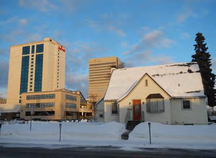
The challenges for Downtown include fostering an urban district that is a hub for commercial and civic activities; encouraging relevant contextual design; balancing the seasonality of tourism with the neighborhood’s desire to be a vibrant year-round neighborhood; and leveraging economic development tools to fund preservation activities.
Downtown-Specific Policies & Implementation Strategies
The following policies and implementation strategies are specific to Downtown, and are applied in addition to the Plan Area Policies described in Chapter VI. Please note that many of these policies overlap with the Downtown Comprehensive Plan (2007), which already applies to this neighborhood.
#1: Quality of Life/Livability
1.5 DT Initiate programs and uses that make Downtown into a day-and-night, year-round urban destination—a “downtown for all.”
1.5.1 DT Ensure that basic amenities that currently exist in portions of Downtown are standardized throughout the neighborhood. This could include standardized street lighting, benches, trash cans, and informational signage. These streetscape improvements provide an opportunity to reinforce the historic character of Downtown, integrate Anchorage’s history and culture into the urban fabric, and create a sense of place. (Also applies to Policy 5.9.)
Historic residences on K Street.
HISTORIC PRESERVATION PLAN FOR ANCHORAGE’S FOUR ORIGINAL NEIGHBORHOODS GH = GOVERNMENT HILL DT = DOWNTOWN SA = SOUTH ADDITION FV = FAIRVIEW188 ADOPTED 2/12/2013 AO 2013-012
#2 Landmarks to Save
2.1 Retain and preserve the historic and cultural resources identified during the HPP public outreach process and recorded in the Consolidated Historic Resources Inventory.
See page 187 for a proposed list of resources developed through the HPP public outreach process.
#3: Interpreting History & Culture
3.10 DT Update existing walking tours to include a broader range of topics/groups, new graphics, information about historic preservation, and “fun facts.”
3.10.1 DT Develop a plan to replace and improve the Project 80s historic walking tour kiosks around Downtown to include Alaska Native Peoples’ history and wayfinding (also applies to Policy 3.2).
#5: Growth & Change
5.8 DT To the greatest extent possible, preserve the city’s historic buildings and reinforce a commercial district that is a destination for locals and tourists by implementing the Downtown Comprehensive Plan (2007).
5.8.1 DT Support strategies from the Downtown Comprehensive Plan (2007) in order to preserve historic buildings and reinforce a commercial district that is a “downtown for all.” See Appendix K for a complete list of relevant historic preservation policies from the Downtown Comprehensive Plan.
See Policy 1.5 for additional implementation strategies related to creating a “downtown for all.”
Implement streetscape improvements consistently throughout the Central Business District (CBD).
Existing Project 80s kiosks could be updated to include a broader range of topics and groups.
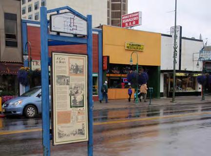
CHAPTER VII: NEIGHBORHOOD CHARACTER, GOALS & POLICIES 189ADOPTED 2/12/2013 AO 2013-12
5.9 DT Foster a visually cohesive, historic central business district.
5.9.1 DT Identify opportunities to repurpose or redevelop historic buildings in Downtown.
5.9.2 DT Create neighborhood-specific design guidelines for infill construction that promotes contextual design and respects the character of historic resources. These guidelines would be developed when a historic district is designated or a historic overlay zone is created, and would require additional input from property owners and decision-makers at such time.
5.9.3 DT Promote new and existing preservation incentives (described in Goal #6) aggressively within the Central Business District (CBD). (Same as Strategy 6.10.3.)
See Policy 1.6 for additional implementation strategies related to improving visual cohesion of Downtown.
#6: Economic Development
6.10 DT Make the economic development of Downtown a top priority, using the strategies outlined in the Downtown Comprehensive Plan (2007), while preserving and promoting historic preservation.
6.10.1 DT Promote existing tax exemptions to encourage large employers to locate and invest in Downtown. New income-producing properties in Downtown may qualify as “Economic Development Properties,” and may qualify for partial or total exemption from real and personal property taxation for up to five years (AMC 12.35.040). Similarly, San Francisco recently adopted a Payroll Tax Reduction in the Mid-Market Street neighborhood, which successfully attracted large tech companies like Twitter to stay in the city (rather than move to Silicon Valley) and spurred many much-needed rehabilitation projects.
HISTORIC PRESERVATION PLAN FOR ANCHORAGE’S FOUR ORIGINAL NEIGHBORHOODS GH = GOVERNMENT HILL DT = DOWNTOWN SA = SOUTH ADDITION FV = FAIRVIEW190 ADOPTED 2/12/2013 AO 2013-012
6.10.2 DT Apply to become a designated Main Street Program, and/or work with the State Historic Preservation Office to apply the Main Street Approach® to revitalize Downtown.
6.10.3 DT Promote new and existing preservation incentives (described in Goal #6) aggressively within the Central Business District (CBD). (Same as Strategy 5.9.3.)
6.10.4 DT Follow recommendations for preservation of identified significant buildings in Downtown Historic Survey (1988/2007).
#7: Procedures & Regulations
7.3 Create, populate, and maintain an official local register or inventory of historic resources.
7.3.9 DT As part of the creation of a local register, continue to survey and document historic resources in Downtown. As recommended in the Consolidated Inventory Survey Report, this would include an expansion of the 1988/2007 Historic Surveys. Survey work should focus on covering more of the neighborhood, especially the residential areas south and east of the main commercial core, as well as on Mid-Century Modern resources throughout Downtown. The “2nd Avenue and F Street Area” should also be further examined for its potential as a National Register historic district.
See Policy 2.1 for recommendations about nominating eligible Downtown properties to the National Register of Historic Places, as recommended in the Consolidated Inventory Survey Report
See Policies 5.3, 5.8, and 7.9 for discussions about implementing policy changes from the Downtown Comprehensive Plan.
See Policies 1.6 and 5.9 for a discussion of Downtown-specific design guidelines.
See Policy 7.4 for a discussion of overlay zones, a strategy that is highly recommended for Downtown.
CHAPTER VII: NEIGHBORHOOD CHARACTER, GOALS & POLICIES 191ADOPTED 2/12/2013 AO 2013-12
South Addition
Boundaries
The South Addition neighborhood (based on Community Council boundaries) is roughly L-shaped, with Cook Inlet forming its western boundary and the southern edge bordered by Westchester Lagoon and Chester Creek Trail. Its eastern boundary runs from the corner of C Street and Chester Creek Trail north along C Street, jogs east on 15th Avenue, and then jogs north on Cordova Avenue to 9th Avenue. The northern boundary runs along 9th Avenue from Cordova Street to L Street, thence turning to continue north on L Street to Cook Inlet. The neighborhood features a generally orthogonal grid of streets with narrow back alleys that run down the length of each block. Curving streets and culde-sacs are found west of P Street, south and west of the Park Strip, and throughout the “Elderberry Triangle” area north of the Park Strip. Primary thoroughfares include L and C streets (southbound); I and A streets (northbound); and 10th, 11th, and 15th streets (east- and westbound). With the exception of the A/C Couplet and the I/L Couplet, most streets in the South Addition allow two-way traffic.
[NOTE: The terms “South Addition” or “South Addition neighborhood” are used throughout this section to mean the South Addition Community Council area; where the historic South Addition plat is specifically discussed, it is clearly identified as such.]
History
The northwest corner of the South Addition Community Council area—sometimes known as the “Elderberry Triangle” or “Bootlegger’s Cove”—was part of the original townsite, which was platted in May 1915. However, the majority of the neighborhood was laid out as the South and Third Additions. The South Addition plat was the first expansion of the original townsite. It was platted in August 1915 and comprised 49 blocks bounded by 9th Avenue, C Street, Chester Creek, and Cook Inlet. Blocks were divided into parcels that grew progressively larger in size the further south they were located. The AEC created 5-acre and 8.3-acre parcels in the South Addition plat because it wanted to encourage agricultural development around Anchorage. The Third Addition was platted in August 1916, and continued the large lot sizes of the South Addition eastward. To protect agricultural development, a Presidential Executive Order was issued in 1917 prohibiting the subdivision of tracts containing two or more acres into smaller lots.92
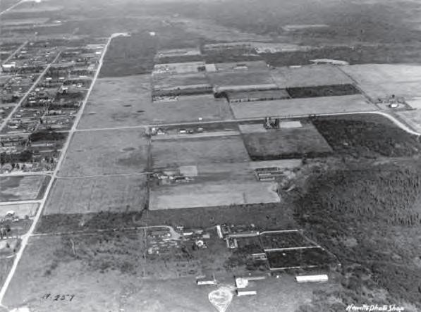 Aerial view of farms in the South Addition, circa 1925. 9th Avenue is on the left edge of the photograph.
Map highlighting the South Addition.
Aerial view of farms in the South Addition, circa 1925. 9th Avenue is on the left edge of the photograph.
Map highlighting the South Addition.
HISTORIC PRESERVATION PLAN FOR ANCHORAGE’S FOUR ORIGINAL NEIGHBORHOODS 192 ADOPTED 2/12/2013 AO 2013-012
AVENUE BACKERAVENU DS VENUE RST ATW SAVILLE ANDE NNNB STS ELMENDORF AIR FORCE BASE 0.5 0 0.5seliM52.0° FAIRVIEW SOUTH ADDITION DOWNTOWN GOVERNMENT HILL
When Anchorage incorporated in 1920, the original city limits extended south to 11th Avenue and east to East G Street (now Gambell Street). However, a majority of the South Addition neighborhood remained unincorporated until after World War II. Isolated from downtown by the Park Strip (then a fire break and later an airstrip, and eventually a golf course), the large parcels of the South Addition and Third Addition plats were used in the early days for homesteads, dairies, and fur farms. Modest dwellings, including wood frame Craftsman-style houses and log cabins, were scattered throughout the neighborhood. The area retained its rural agricultural appearance until the late 1930s.
World War II was a period of major physical growth in the South Addition neighborhood. Military build-up stimulated the economy and brought thousands to Anchorage, but the resulting population boom also caused a severe housing shortage. Despite the 1917 Executive Order prohibiting further subdivision of tracts two acres or larger, Anchorage’s first subdivisions were drawn in the South Addition neighborhood for A.A. Shonbeck’s land in 1938 and John W. Hansen’s land in 1939 (the Executive Order was eventually revoked).93 As these residential subdivisions were created, the large agricultural blocks south of the Delaney Park Strip were no longer appropriate, so new streets were cut east-west through the blocks to mimic the grid size of the original townsite. Development in the South Addition neighborhood was concentrated primarily in the blocks closest to the Park Strip. Newly constructed houses scattered throughout the neighborhood featured near-identical forms and styles, likely reflecting pattern-book plans that were quickly and easily erected.
During the war, several federal agencies and business corporations moved their headquarters to Anchorage. These agencies also did their part to address the inadequate supply of housing by building units for their employees, many of which were located in the South Addition neighborhood. The Civil Aeronautics Administration (CAA) developed a two-block housing project called Safehaven and two groups of two-story Colonial Revival style duplexes. The U.S. Army built a group of 12 military barracks at the west end of the Park Strip circa 1942, which were demolished in the early 1950s. The Army Housing Association, a cooperative created by servicemen and their families, built 32 Minimal Traditional style homes on Block 13 of the Third Addition in the summer of 1940; this portion of 11th Avenue also earned the nickname “Pilots’ Row” because Bob Reeves (Pilot/Owner of Reeves Aviation), Ray Petersen (Pilot/Owner of Wien Air), Oscar Underhill (Pioneer Pilot), and Don Bedford (Pioneer Pilot) lived on 11th and Barrow streets in the 1940s and 1950s.
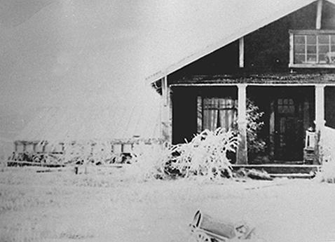
The Army Housing Association, a cooperative created by servicemen and their families, built 32 Minimal Traditional style homes on Block 13 of the Third Addition in the summer of 1940.
 Bungalow at 916 P Street, constructed in 1918 and purchased by the Strutz family in 1924.
CHAPTER VII: NEIGHBORHOOD CHARACTER, GOALS & POLICIES 193ADOPTED 2/12/2013 AO 2013-12
Northwest Airlines housing units at C Street and 10th Avenue… Only Northwest personnel reside in this group of houses—there are about 20 other similar units within 8 blocks” (20 February 1948).
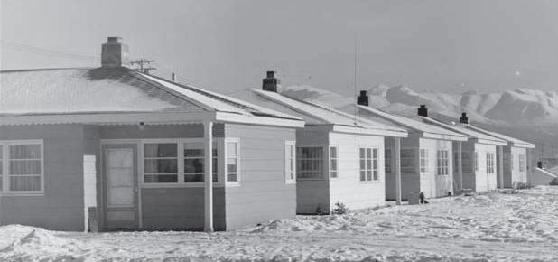
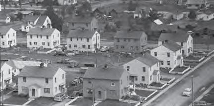
Lastly, Northwest Airlines built clusters of identical small ranch-style houses for their employees in the South Addition neighborhood. These clusters were located around the intersection of West 10th Avenue and C Street, and around West 11th Avenue and L Street; several of these houses still exist in their original historic form on 11th Avenue between A and C streets, as well as near L Street.
To properly plan for postwar growth, the city annexed the South Addition plat on September 18, 1945. After World War II, infill construction continued in the South Addition neighborhood in order to support an influx of returning servicemen. Large tracts were platted for the southwest corner of the South Addition, while replats of single properties or pairs of properties were scattered throughout the neighborhood. Some of the new subdivisions illustrated new postwar urban planning concepts, such as cul-de-sacs and curvilinear or diagonal streets that did not align with the main street grid. They featured single-family houses in modern architectural styles, such as ranch houses and Contemporary and Shed styles. Multifloor apartment buildings were developed during this period in the International style, while civic institutional properties such as schools and churches provided community amenities for the continually growing population.
The Good Friday Earthquake on March 27, 1964, had a profound effect on the physical environment in the South Addition neighborhood, because portions of the neighborhood were especially hardhit. Elderberry Triangle, Bootlegger’s Cove, and the neighborhood’s apartment buildings incurred the most damage. The soft sand and gravel below the bluffs at the west end of the neighborhood gave way during the earthquake, and pressure ridges formed along the fault. Known as the “L Street Slide,” the geologic movement in this area caused some of the most severe damage in Anchorage. Some damaged buildings were salvaged, but many simply had to be demolished. Consequently, much of the housing stock extant today in the L Street Slide area was constructed after the earthquake.
For additional details about the history of the South Addition, please read the South Addition Historic Context Statement, prepared by Page & Turnbull (finalized in June 2012). A discussion of significant resources is included in the South Addition Intensive-Level Survey Report.
During the 1970s and 1980s, the oil industry boom stimulated the housing market and likely contributed to the build-out of the South Addition Community Council area’s remaining vacant lots.13 Today, the South Addition is a largely residential neighborhood, with many parks and community buildings that support its residents.
Detailed view of CAA duplexes at 13th Avenue and I Street from roof of 1200 L Street, 1951.
HISTORIC PRESERVATION PLAN FOR ANCHORAGE’S FOUR ORIGINAL NEIGHBORHOODS 194 ADOPTED 2/12/2013 AO 2013-012
Character Summary
The South Addition neighborhood is largely residential, though a few commercial buildings are located near L Street and the Park Strip. Residences are generally designed in the vernacular folk cottage style, Log Cabin style, various Revival styles, the Minimal Traditional style, and ranch styles. A few Contemporary-style houses are located at the west end of the neighborhood. The South Addition also includes a few tall apartment buildings, churches, and two elementary schools. Parks and public outdoor spaces include Elderberry Park, Nulbay Park, the Delaney Park Strip, Frontierland Park, Earl and Muriel King Park, Kedava Park, and Westchester Lagoon.
TELLING STORIES ABOUT THE SOUTH ADDITION
The results of the South Addition Historic Resource Survey (2012) can be used to raise public awareness about the neighborhood’s history. The following topics and stories are recommended to be told in the South Addition neighborhood. Potential methods of interpretation are discussed throughout the HPP. Note that this list of suggested topics is by no means exhaustive.
1964 Good Friday Earthquake
Alaska Native Peoples History
Army Housing Association at Block 13
Aviation History, including influential pilots
CAA/FAA Duplexes
Cold War History
Delaney Park Strip, including its history as
Homesteads & Pioneers, including early agricultural history of the South Addition
Northwest Airlines Houses
Role of the military
Safehaven
Westchester Lagoon
World War II in Alaska
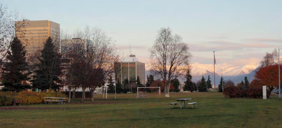 Delaney Park Strip.
CHAPTER VII: NEIGHBORHOOD CHARACTER, GOALS & POLICIES 195ADOPTED 2/12/2013 AO 2013-12
Character-Defining Features
Boundaries & Gateways
Located south of Downtown and the Delaney Park Strip (Park Strip), which plays a key role in the neighborhood
Average 15’ to 25’ setback from sidewalk
Sidewalks separated from street by planting zone is predominant (historic condition)
Lighting & Utilities
Vehicular-scale modern streetlights only along principal boulevards
Composed of three historic plats: Original Townsite Plat, South Addition Plat, Third Addition Plat
Sidewalks without planting zone are found along principal boulevards, near large buildings, and near new infill construction
Above-ground utility poles located at rear alleys and principal boulevards
Buildings
Five gateways: East 15th Avenue and A Street, West 16th Avenue and I Street, West 5th Avenue and L Street, West 9th Avenue and L Street, West 9th Avenue and C Street
No sidewalks in subdivisions near Westchester Lagoon and Chester Creek
Small-scale residential, predominantly single-family
Garages and off-street parking accessed through rear alleys are most common
One- and two-story buildings
Wood frame construction
Five sub-areas with cohesive character: South Addition Plat, Third Addition Plat, Bootlegger’s Cove, Inlet View, and Chester Creek
Streetscape
Residential area
Streets 60’ wide, with 20’ alleys bisecting blocks
Small lots (50’ x 140’ typical)
Buildings typically set on small lots with front lawn and side setbacks
No fences or low (less than 4’) fences at lot line; typically wood picket, chain-link, or other materials that maintain visibility
Mature street trees
Access to Park Strip, Westchester Lagoon, and Coastal Trail
Wood siding, or replacement siding designed to mimic wood
Variety of architectural styles: Log Houses, Vernacular Folk Cottages, various Revival styles, ranch
Multiuse paths for walking, biking, and skiing
Community buildings: schools and religious buildings
HISTORIC PRESERVATION PLAN FOR ANCHORAGE’S FOUR ORIGINAL NEIGHBORHOODS 196 ADOPTED 2/12/2013 AO 2013-012
South Addition Neighborhood Character
The South Addition is a residential neighborhood located south of Downtown and the Delaney Park Strip (Park Strip), which plays a key role in the neighborhood. The neighborhood is divided into five sub-areas with cohesive character. Primary thoroughfares include L and C streets (southbound); I and A streets (northbound); and 10th, 11th, and 15th streets (east- and westbound). With the exception of the A/C Couplet and the I/L Couplet, most streets in the South Addition allow twoway traffic.
CHAPTER VII: NEIGHBORHOOD CHARACTER, GOALS & POLICIES 197ADOPTED 2/12/2013 AO 2013-12 A STREET C STREET E STERET I S T R E E T L STREET WEST 9TH AVENUE CORDOVA STREET WEST 11TH AVENUE H STREET G STREE T K STREET WEST 8TH AVENUE WEST 5TH AVENUE N STREET WEST 7TH AVENUE WEST 6TH AVENUE WEST 4TH AVENUE WEST 3RD AVENUE WEST 10TH AVENUE MINNESOTADRIVE WEST 19TH AVENUE B STREET WEST2ND AVENUE WEST 15TH AVENUE SPENARDROAD S S T R E E T WEST 20TH AVENUE P S T R E E T HILLCRESTDRIVE U STREET WEST 1ST AVENUE WEST 12TH AVENUE A R C T I C B O U L E V A R D SMALLBOATLAUNCHROAD I LNET PL A UNNAMEDROAD C O A S T A L P L A C E WEST 16TH AVENUE WEST 13TH AVENUE O S T R E E T STOLTLANE SCENICWAY OPL AEC WEST 21ST AVENUE F S T R E E T NORTH C STREET ONTRH A ST E R ET WEST 17TH AVENUE B U N K E R S T R E E T EAST WHITNEY ROAD HIDDEN LANE P A C I F I C P L A C E EAST 1STAVENUE EAST 4TH AVENUE EAST 5TH AVENUE EAST 6TH AVENUE EAST 9TH AVENUE M S T R E E T EAST 3RD AVENUE EAST 11TH AVENUE EAST 15TH AVENUE EAST 7TH AVENUE EAST 8TH AVENUE EAST 16TH AVENUE EAST 13TH AVENUE D S T R E E TR S T R EET WEST 14TH AVENUE AURORADRIVE WEST 22ND AVENUE VIRGINIA COURT COFFEY LANE DA V I D P LA CE BOREALIS DRIVE TOSNI PL AEC M C O U R T WEST 15TH TERRACE O V E RL OO K PL A CE PS T R EET M S E E T G S T R E E T WEST 16TH AVENUE N S TRE E T WEST 15TH AVENUE WEST 16TH AVENUE WEST 12TH AVENUE M S T R E E T WEST 13TH AVENUE F S T R E E T WEST 22ND AVENUE WEST 7TH AVENUE N S T R E E T O S T R E E T M STERET H S T R E E T B S T R E E T M IN N ESOTA D R IV E H S T R E E T WEST 11TH AVENUE ANNUM E D ORAD UNNAMEDROAD M S T ET WEST 10TH AVENUE WEST 20TH AVENUE WEST 12TH AVENUE ANNUM E D A D F S T R E E T B S T R E E T P S T R E E T K S T R E E T SCENICWAY D S T R E E T 0.1 0 0.1seliM50.0° INLET VIEW SOUTH ADDITION BOOTLEGGER’S COVE CHESTER CREEK THIRD ADDITION PARK STRIP * * * * *
Neighborhood Character Legend Community Council Boundary Principal Boulevard Primary Pedestrian Connection Secondary Pedestrian Connection Multi-Use Trails Bike Routes Wetlands Municipal Parks Gateway Activity Node Churches & Community Centers *
Opportunities for Preservation in the South Addition
Previously identified historic resources and other historic places valued highly by the public represent the top opportunities for preservation in the South Addition neighborhood. The properties shown on this map could be prioritized for preservation projects and policies recommended in the HPP.
OPPORTUNITIES FOR PRESERVATION LEGEND
HISTORIC PRESERVATION PLAN FOR ANCHORAGE’S FOUR ORIGINAL NEIGHBORHOODS 198 ADOPTED 2/12/2013 AO 2013-012 A STREET C STREET E STREET I S T R E E T L STREET WEST 9TH AVENUE CORDOVA STREET WEST 11TH AVENUE H STREET G STREET K STREET WEST 8TH AVENUE WEST 5TH AVENUE N STREET WEST 7TH AVENUE WEST 6TH AVENUE WEST 4TH AVENUE WEST 3RD AVENUE WEST 10TH AVENUE MNI N E S O TAD R E WEST 19TH AVENUE B STREET HILLCRESTDRIVE WEST2ND AVENUE WEST 15TH AVENUE SPENARDROAD S S T R E E T WEST 20TH AVENUE P S T R E E T U STREET WEST 1ST AVENUE WEST 12TH AVENUE A R C T C B O U L E V A R D I NL E TP L A C E UNNAMEDROAD C O A S T A L P L A C E WEST 16TH AVENUE WEST 13TH AVENUE O S T R E E T STOLTLANE SMALLBOATLAUNCHROAD SCENICWAY O P L A C E WEST 21ST AVENUE F S T R E E T NORTH C STREET MINNESOTASBOFFHILLCRESTRAMP NOR T HAS T RE E T WEST 17TH AVENUE B U N K E R S T R E E T ANTONWAY H I DD EN L ANE P A C F C P L A C E EAST1STAVENUE EAST 4TH AVENUE EAST 5TH AVENUE EAST 6TH AVENUE EAST 9TH AVENUE EAST 3RD AVENUE EAST 11TH AVENUEBEECHLANE EAST 10TH AVENUE EAST 15TH AVENUE D A H L L A N E EAST 16TH AVENUE EAST 13TH AVENUE M S T R E E T PORTACCESSROAD EAST 7TH AVENUE EAST8THAVENUE D S T R E E T WEST 23RD AVENUE R S TR E E T WEST 14TH AVENUE AURORA DRIVE WEST 22ND AVENUE V RG NIA COURT EAST 15TH TERRACECOFFEY LANE D A VI D PL AC E BOREALIS DRIVE T ON S I N AP L A C E EAST 2ND AVENUE MC OU R T C L A Y C O U R T WEST15TH TERRACE OV E R LOOKP LA C E HI L L CRE S TCI R C L E H S T R E E T WEST 12TH AVENUE K S T R E E T SCENICWAY M S T RE E T WEST 12TH AVENUE MINNESOTADRIVE H S T R E E T WEST 11TH AVENUE WEST 14TH AVENUE WEST 13TH AVENUE O STR EE T D S T R E E T U N N A M E D R O A D WEST 15TH AVENUE MSTR EET O S T R E E T UNNAMED ROAD WEST 12TH AVENUE COFFEYLANE F S T R E E T D S T R E E T NS TRE E T LS T R E E T B S T R E E T K S TR E E T G S T R E E T WEST 22ND AVENUE PS TR E E T UNNAMEDROAD B ST REET N S T R E E T M S T RE E T D S T RE E T WEST 10TH AVENUE WEST 20TH AVENUE WEST 16TH AVENUE M S TR E E T B S T R E E T WEST 16TH AVENUE P S T R E E T F STR EE T F S T R E E T WEST 14TH AVENUE 0.05 0 0.050 025 Mile° “Block 13”Safehaven SHPO-Identi ed “West District” SHPO-Identi ed “East District” CAA Housing District #1 CAA Housing District #2 Park Strip District 1 10 9 6 8 8 37 7 5 4 4 2 Previously Listed in “Patterns of the Past” Mentioned during HPP Public Outreach (not otherwise identified in past surveys) Previously Listed in National Register (NRHP) Not Eligible (17) NRHP District Contributor: Northwest Airlines Housing (7) NRHP District Contributor: CAA Housing (28) Individually NRHP Eligible (66) SOUTH ADDITION INTENSIVE-LEVEL SURVEY RESULTS: ELIGIBLE PROPERTIES
Municipal Parks Wetlands Potential Historic District Military (JBER) Community Council Boundary “Landmarks to Save” (see numbered list in previous section) NOTE: This map is organized to show a hierarchy of historic status and each historic property is depicted with the highest level of historical rating currently assigned. For example, a property shown as National Register-listed may have also been discussed in “Patterns of the Past,” or identified in the South Addition Survey. This information can be found in the Consolidated Historic Resource Inventory Database, although it is not shown here. 11
° 0.05 Miles0.0500.025
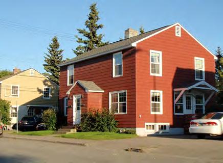
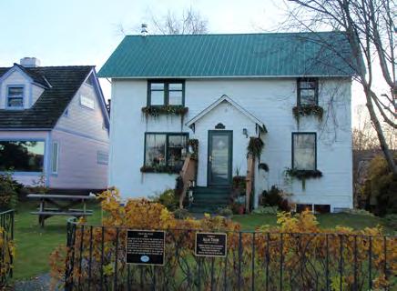
 CAA/FAA
CHAPTER VII: NEIGHBORHOOD CHARACTER, GOALS & POLICIES 199ADOPTED 2/12/2013 AO 2013-12 “Landmarks to Save” The following buildings, sites, and stories (listed in alphabetical order and marked on the map on the following page) were identified through the HPP Public Outreach Process as the most precious resources in the South Addition. This list is not intended to be exhaustive, yet it reflects the resources valued most highly by the public. National Register 1. Oscar Anderson House 2. Oscar Gill House Identified during HPP Public Outreach & Previous Surveys 3. Army Housing Association/Pilots’ Row 4. CAA/FAA Duplexes 5. Park Strip 6. Locomotive #556 7. Northwest Airlines Housing 8. Safehaven 9. Star the Reindeer 10. Strutz House
Duplexes, West 12th Avenue.Oscar Gill House (listed in the National Register). Strutz House, P Street.The layout of the Army Housing Association/Pilots’ Row District was designed to foster community and neighborhood interaction.
Challenges and Vision
The South Addition is a walkable, close-knit community with unparalleled access to the outdoors: the Park Strip, Westchester Lagoon, and Coastal Trail are all located within the neighborhood’s boundaries. Residents enjoy the South Addition’s central location, mature trees, and mixed-use development. Residents of the South Addition aim to preserve the neighborhood character of the city’s first subdivision; retain the sidewalks and smaller streets that provide good opportunities to walk, ski, and bike; keep neighborhood parks, schools, and small businesses; maintain the connection to downtown; and preserve the Park Strip, which is central to the neighborhood’s identity. The South Addition community also expressed a desire to retain existing corner businesses and provide more corner businesses and neighborhood-serving mixed-use development throughout the area.
Concerns in the South Addition include placement of infrastructure and utilities, infill construction, and demolition of historic homes. Avoiding the potential increases in traffic and the physical division of the historic neighborhood caused by widening roadways—especially along the A-C and L-I couplets—are also high priorities for the South Addition. Residents clearly voiced a firm opposition to projects such as the Knik Arm Crossing or other large road expansion projects that would funnel traffic through the neighborhood, thus dividing the residential areas. The biggest challenge for the South Addition will be retaining existing, cohesive character as development pressures increase and as transportation and infrastructure changes are proposed.
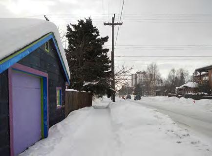 Typical winter streetscape, West 13th Avenue.
Typical streetscape, H Street.
Typical winter streetscape, West 13th Avenue.
Typical streetscape, H Street.
HISTORIC PRESERVATION PLAN FOR ANCHORAGE’S FOUR ORIGINAL NEIGHBORHOODS GH = GOVERNMENT HILL DT = DOWNTOWN SA = SOUTH ADDITION FV = FAIRVIEW200 ADOPTED 2/12/2013 AO 2013-012
South Addition-Specific Policies & Implementation Strategies
The following policies and implementation strategies are specific to the South Addition, and are applied in addition to the Plan Area Policies described in Chapter VI
#1 Quality of Life/Livability
1.6 SA Maintain the unique character of the neighborhood (historic function of alleys, historic streetscape appearance, low-traffic streets, safe sidewalks, parks/open space, and appropriately scaled mixed-use development).
1.6.1 SA Prepare, fund, and approve a neighborhood plan for the South Addition to ensure that these issues are properly addressed. Such a document would include detailed land-use, transportation, and urban design strategies for the neighborhood. Many of the concerns about transportation projects and zoning raised by members of the public are beyond the scope of this HPP, but would certainly be important to include in a neighborhood plan.
#2 Landmarks to Save
2.1 Retain and preserve the historic and cultural resources identified during the HPP public outreach process and recorded in the Consolidated Historic Resources Inventory.
See page 199 for a proposed list of resources developed through the HPP public outreach process.
CHAPTER VII: NEIGHBORHOOD CHARACTER, GOALS & POLICIES 201ADOPTED 2/12/2013 AO 2013-12
New development and contemporary architecture can still be compatible with the historic scale and pattern of the South Addition.
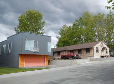
#3 Interpreting History & Culture
3.11 SA Interpret aviation history at the Delaney Park Strip and explain its relationship to the rest of the neighborhood.
3.11.1 SA Create an interpretive plan for the Delaney Park Strip, which may include installation of interpretive signage, plaques, or monuments that celebrate the Park Strip’s rich history as a fire break, golf course, and airport. Installation of signage should be coordinated with the Delaney Park Master Plan (2007), which regulates the placement and design of monuments and signs.
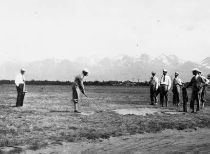
3.12 SA Interpret other historic aspects of the neighborhood (e.g., CAA/FAA houses, early military housing, Safehaven, Army Housing Association/Pilots’ Row, Northwest Airlines housing, Westchester Lagoon, long-standing small businesses, etc.).
3.12.1 SA Use the South Addition Historic Context Statement (2012) to help identify interpretation and storytelling opportunities in the South Addition.
#5 Growth & Change Development and transportation issues are especially important to South Addition residents, so please be sure to read the entirety of Goal #5: “Growth & Change” in Chapter VI in addition to the special South Addition policies below.
5.10 SA Preserve and enhance walkability, bikeability, and access to open space.
5.10.1 SA Develop an open space master plan for the South Addition, and fill any gaps in connectivity. This strategy is essential to preserve walkability of the South Addition, which is an important intangible quality that contributes to the historic and much desired character of the neighborhood. (See Goal #1)
Delaney Park Strip (pictured here circa 1930s) has served as a fire break, golf course, and airport.
HISTORIC PRESERVATION PLAN FOR ANCHORAGE’S FOUR ORIGINAL NEIGHBORHOODS GH = GOVERNMENT HILL DT = DOWNTOWN SA = SOUTH ADDITION FV = FAIRVIEW202 ADOPTED 2/12/2013 AO 2013-012
5.11 SA New construction should reinforce existing scale and character (historic function of alleys, historic streetscape appearance, low-traffic streets, safe sidewalks and pedestrian/bike crossings, parks/open space, and appropriately scaled mixed-use development).
5.11.1 SA Create neighborhood-specific design guidelines that focus on ground area coverage and setbacks. These guidelines would be developed when a historic district is designated or a historic overlay zone is created, and would require additional input from property owners and decision-makers at such time.
5.11.2 SA Discourage demolition of buildings that provide cohesive neighborhood character.
5.12 SA Prevent division of the neighborhood and loss of the historic street grid by limiting new or widened roads and thoroughfares. Identify and educate groups that can represent neighborhood interests in the face of development pressures.
Residents of the South Addition were adamantly opposed to projects such as the Knik Arm Crossing that will subdivide the neighborhood. See Policy 5.2 for the tools that the community can use to respond appropriately to development proposals.
#6 Economic Development
6.11 SA Promote policies that maintain the neighborhood character of small businesses.
6.11.1 SA Conduct a market analysis to identify which small businesses are needed and can be supported in the South Addition.
6.11.2 SA Identify appropriate locations for small businesses (existing buildings or vacant lots), and adjust zoning accordingly (see Goal #7).
6.11.3 SA Actively recruit operators and offer incentives for South Addition-focused businesses.
Small businesses are an essential component of the South Addition’s neighborhood character.
CHAPTER VII: NEIGHBORHOOD CHARACTER, GOALS & POLICIES 203ADOPTED 2/12/2013 AO 2013-12
#7 Procedures & Regulations
7.3 Create, populate, and maintain an official local register or inventory of historic resources.
7.3.10 SA As part of the creation of a local register, continue to survey and document historic resources in the South Addition neighborhood. As recommended in the Consolidated Inventory Survey Report, this would include research and documentation of the Park Strip; the Army Housing Association (also known as Pilots’ Row or Block 13); and properties identified by members of the public during the HPP public outreach process. Surveying potential historic districts identified by SHPO, as well as documentation of all properties near the A/C Couplet, are also high priorities for the South Addition.
See Policy 2.1 for recommendations about nominating eligible South Addition properties to the National Register of Historic Places, as recommended in the Consolidated Inventory Survey Report
7.12 SA Create zoning and land-use policies that maintain the unique character and scale of existing streetscape in the South Addition.
7.12.1 SA Introduce zoning and design guidelines that focus on ground-area coverage and front yard setbacks. These guidelines would be developed when a historic district is designated or a historic overlay zone is created, and would require additional input from property owners and decision-makers at such time.
See Policy 5.11 for a discussion of South Addition-specific design guidelines.
HISTORIC PRESERVATION PLAN FOR ANCHORAGE’S FOUR ORIGINAL NEIGHBORHOODS GH = GOVERNMENT HILL DT = DOWNTOWN SA = SOUTH ADDITION FV = FAIRVIEW204 ADOPTED 2/12/2013 AO 2013-012
Fairview
Boundaries
Fairview is located east and southeast of Downtown Anchorage. It is bordered by Merrill Field and Sitka Street Park to the east, Rogers Park neighborhood to the southeast, North Star neighborhood to the southwest, and the South Addition neighborhood to the west. The Community Council boundaries are irregular, but the extremes align north of East 1st Avenue, Sitka Street (through Merrill Field) to the east, Chester Creek to the south, and C and Cordova streets to the west. Primary thoroughfares include Gambell Street (southbound) and Ingra Street (northbound), which connect to the Glenn Highway to the north and New Seward Highway to the south, as well as East 15th Street (east-westbound). The neighborhood features an orthogonal street grid, though some street intersections on the east side of the neighborhood have been partially blocked in an effort to calm through-traffic. The area is generally flat, though a bluff at East 15th Terrace drops down to East 16th Avenue west of Gambell Street, and another bluff is located at approximately East 16th Avenue east of Ingra Street. Few vacant lots remain in the area.
History
The Fairview neighborhood is located east and southeast of the original Anchorage townsite, which was platted in May 1915. The Anchorage Memorial Park Cemetery, located between 6th Avenue, Cordova Street, 9th Avenue, and Fairbanks Street in what is now Fairview, was reserved at this time by President Woodrow Wilson. The East Addition was platted in September 1915, and included the area north of East 9th Avenue between Cordova and Orca streets in the Fairview neighborhood. The Third Addition was platted in August 1916, and included the area south of East 9th Avenue. Development of the Third and East Additions occurred slowly, and the area remained rural until World War II. Because it lay outside the city limits, Fairview even developed a “red light district” in its early years, with brothels and other businesses that were not allowed in the city.
Aviation was an important part of Fairview development. The Delaney Park Strip, which enters Fairview from the west, was Anchorage’s first airfield, beginning in 1923. As demand increased, however, the city developed Anchorage Municipal Airport, subsequently renamed Merrill Field after Russell Merrill, one of many Alaska aviation pioneers. Merrill died in September 1929 while on a flight.
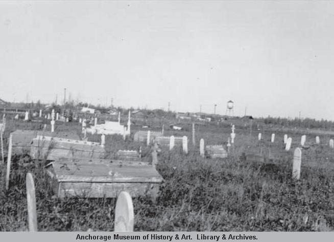 Anchorage Memorial Cemetery, 1937.
Map highlighting Fairview.
Anchorage Memorial Cemetery, 1937.
Map highlighting Fairview.
CHAPTER VII: NEIGHBORHOOD CHARACTER, GOALS & POLICIES 205ADOPTED 2/12/2013 AO 2013-12
PEASEAVENUE TR VEN BACKERAVENU SAVILLE NNNB ELMENDORF AIR FORCE BASE 0.5 0 0.5seliM52.0° FAIRVIEW SOUTH ADDITION DOWNTOWN GOVERNMENT HILL
The first Carrs grocery store opened on Gambell Street in 1950. In 1963, it was the site of an important NAACP protest, making Carrs the first retail store in Anchorage to hire a black employee.
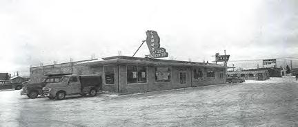
Merrill Field, which creates the eastern boundary for the Fairview neighborhood, began operations in 1930. Since the international airport was constructed in 1951, Merrill Field has continued functioning for private and bush operations.
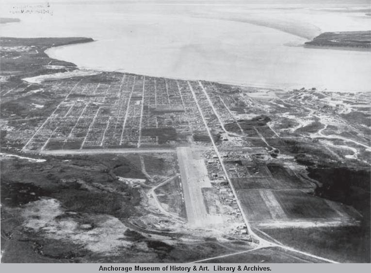
In 1940, in anticipation of World War II, construction began on what would become Elmendorf Air Force Base and Fort Richardson. The influx of workers created a housing shortage, and outlying neighborhoods such as Fairview began to develop, with small cottages and log cabins. The growth of Fairview was encouraged by the construction of the Glenn Highway in October 1942, which connected Anchorage to the Richardson Highway and the Alaska (Alcan) Highway. The Glenn Highway fostered commercial and industrial development along the neighborhood’s north boundary and served to funnel traffic onto Gambell Street. Gambell Street would also become the northern terminus of the Seward Highway (completed in 1951), and thus served as Fairview’s Main Street during the postwar era.
Anchorage’s housing shortage continued after World War II, leading to further development of Fairview. It was a desirable location due to its proximity to Merrill Field, the Glenn Highway, the military bases, Downtown Anchorage, and the north-south traffic route and commercial core of Gambell Street. An Oregon-based company began importing prefabricated houses in 1947, many of which were erected in Fairview. Fairview residents also started local businesses: for example, the first Carrs grocery store was opened in a Quonset hut on Gambell Street in 1950, and the Lucky Wishbone restaurant opened at 5th Avenue and Karluk Street in 1955.
The war and postwar influxes brought people of varied ethnicities to Anchorage. Many AfricanAmericans built residences in Fairview, especially in Eastchester Flats, because it was one of the few areas in the city where African-Americans were allowed to own property. Citizens like John Parks, an African-American contractor, and Joe Jackson, Anchorage’s first African-American real estate agent, were instrumental in constructing houses and apartments in Fairview for African-Americans. Building in Fairview was especially important because in 1951, a house in Rogers Park, just south of Fairview, was burned to the ground just after its construction to prevent an African American from moving into an allwhite neighborhood; this spurred the founding of the Anchorage branch of the National Association for the Advancement of Colored People (NAACP).
Aerial view of Merrill Field and Anchorage, 1940.
HISTORIC PRESERVATION PLAN FOR ANCHORAGE’S FOUR ORIGINAL NEIGHBORHOODS 206 ADOPTED 2/12/2013 AO 2013-012
The African-American community also built churches and started businesses in Fairview, contributing greatly to the neighborhood’s history. The Greater Friendship Baptist Church at East 13th Avenue and Ingra Street was founded in 1951 as the first Southern Baptist church in Alaska, and was later joined by Shiloh Missionary Baptist Church (founded in Downtown in 1952 and moved to Fairview in 1974). Six black-owned nightclubs were active during the 1950s and 1960s, and were known as places for blacks and whites to socialize before integration.95 African-Americans were joined in later years by Alaska Native and Hispanic residents, and Fairview remains known for its diversity today.
By 1950, Fairview remained outside the city’s limits. Anchorage’s population stood at 11,254 within the city limits and 30,600 in the overall area, indicative of the homesteading and settlement that had occurred outside the limits. The city’s first annexation occurred in 1945, encompassing 300 acres south of Downtown. Other neighborhoods followed—Eastchester, University, Mountain View, Russian Jack, Rogers Park, and Spenard—leaving Fairview isolated in the middle. Like those in other neighborhoods, many Fairview residents stoutly resisted annexation by the city, since basic services were already met through the Fairview Public Utility District. Many saw themselves as independent pioneers who neither wanted nor needed bureaucratic oversight or taxation from the city. Discussion extended through the 1950s, but annexation passed in 1958, approved by 60% of the neighborhood’s voters.
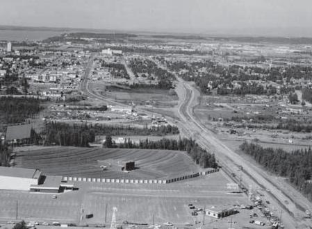
Fairview did not suffer extensive damage from the Good Friday Earthquake on March 27, 1964. However, in 1965, the City Planning Commission called Fairview’s housing “among the poorest in the city” and attempted to implement change by rezoning Gambell and Ingra streets to commercial uses, eliminating single-family residences along those thoroughfares, and encouraging high-density housing. Gambell and Ingra streets were also expanded into four-lane, one-way streets, forming high-volume obstructions to pedestrians and effectively dividing the neighborhood. Fairview was also the site of several urban renewal projects after the earthquake, with federal, state, and Municipal agencies taking advantage of the rebuilding effort to remove “blighted” areas. For example, the Eastchester Urban Renewal project (south of 16th Avenue) was part of the Project Alaska R-16 Urban Renewal Plan, which was adopted by the Anchorage City Council in 1964. This especially affected the African-American residents of Eastchester Flats, who were promised the right of first refusal to return to the area after the project was completed, though most did not return.
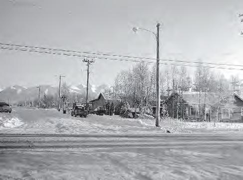 Fairview, 1954. The Fairview Public Utility District provided basic services until Fairview was annexed by the city in 1958.
Aerial view of Gambell-Ingra Couplet, 1966.
Fairview, 1954. The Fairview Public Utility District provided basic services until Fairview was annexed by the city in 1958.
Aerial view of Gambell-Ingra Couplet, 1966.
CHAPTER VII: NEIGHBORHOOD CHARACTER, GOALS & POLICIES 207ADOPTED 2/12/2013 AO 2013-12
TELLING STORIES ABOUT FAIRVIEW
The results of the Fairview Neighborhood Historical Building Survey (2007) can be used to raise public awareness about the neighborhood’s history. The following topics and stories are recommended to be told in Fairview. Potential methods of interpretation are discussed throughout the HPP. Note that this list of suggested topics is by no means exhaustive.
African-American heritage
Anchorage Memorial Cemetery
Aviation and the founding of Merrill Field
Carrs Grocery Store
Ethnic and cultural diversity
Expanding city limits: utilities, annexation, post-war construction boom
Gambell Street & the growth of “car culture”
Homesteads & Pioneers
Red light district
Urban renewal in the 1960s and 1970s
But the 1960s also included important civil rights advancements for the African-American community: in 1963, the NAACP picketed the Carrs supermarket at East 13th Avenue and Gambell Street for not including African-American workers on their staff. The picket resulted in the successful integration of the company when Richard Watts, Jr., was hired as a bagger, making Carrs the first retail store in Anchorage to hire a black employee; Watts is now a senior manager for the company.96
By 1975, Anchorage’s population was approximately 180,000, of whom 5,000 lived in Fairview. Older homes dating from the 1940s and 1950s were torn down and replaced with apartments. Fairview continued to be a depressed neighborhood, however, with issues that included land-use conflicts between older single-family residences and multifamily and commercial buildings, inadequate parkland and recreation facilities, and general deterioration of buildings and social atmosphere. Fairview had a high turnover of residents; the 1970 Census showed that 57% of residents had lived there for a year, while only 25% had lived there more than three years. Almost 75% of residents were renters. These conditions persisted through the 1980s.
During the 1980s, the Fairview Recreation Center and the Fairview Lions Park were constructed. However, the construction of the park had major social consequences for the African-American community: as with Eastchester Flats in the 1960s, the demolition of the Linden Arms and S&S Apartments again resulted in the displacement of African-American residents.97 During the 1990s, voters approved bond measures for a variety of neighborhood improvements, including “traffic calming” measures and beautification of public spaces. Since the 1990s, Fairview residents have continued to seek neighborhood improvement, and the area retains its thriving socioeconomic diversity.98
For additional details about the history of Fairview and a discussion of significant resources, please read the Fairview Neighborhood Historical Building Survey, prepared by BGES in 2007.
HISTORIC PRESERVATION PLAN FOR ANCHORAGE’S FOUR ORIGINAL NEIGHBORHOODS 208 ADOPTED 2/12/2013 AO 2013-012
Character Summary
The wide Gambell-Ingra Corridor bisects Fairview. The area west of Gambell and Ingra streets consists of a mixture of single-family residences interspersed with medium-density condominiums. East Fairview includes single-family residences, four-plexes, and multifamily apartment complexes. Single-family residences consist primarily of World War II-era cottages and log cabins and postwar kit houses. The streets south of the bluffs contain ranch-style single-family residences constructed in the 1960s, fourplexes, and townhouses.
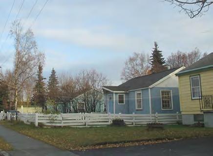
The traditional business center of Fairview is along Gambell Street between East 5th and East 16th avenues. The northern area is dominated by surface parking lots and auto-related businesses. The area west of A Street to C Street and from East 15th Avenue south to Chester Creek contains three- and fourstory office buildings. Sullivan Arena is located near the corner of East 16th Avenue and Gambell Street.
The northeast corner of East Fairview contains an industrial area adjacent to Merrill Field. Fairview also contains a number of institutional properties, including churches, schools, and the City Jail.99
Typical streetscape, East Fairview.
CHAPTER VII: NEIGHBORHOOD CHARACTER, GOALS & POLICIES 209ADOPTED 2/12/2013 AO 2013-12
Character-Defining Features
Boundaries & Gateways
Located east of Downtown, west of Merrill Field
Small residential lots (50’ x 140’ typical)
Buildings
Bounded on south edge by Chester Creek and Woodside Park
Residences typically set on small lots with front lawn and side setbacks
Small- to medium-scale residential: single-family homes and medium-density apartments/condominiums
Composed of two historic Anchorage plats (Third Addition and East Addition)
Average 15’ to 25’ setback from sidewalk
One- and two-story buildings (on average)
Variety of sidewalks (with planting zone, without planting zone, no sidewalks) scattered throughout
Wood frame construction
Principal boulevards divide the neighborhood: Gambell Street, Ingra Street, and 15th Avenue
Garages and off-street parking accessed through rear alleys are most common
Wood siding or replacement siding designed to mimic wood; some stucco
Hipped, gabled, and flat roofs
Six gateways, with “Fairview” sign at East 15th Avenue and Orca Street
Traffic calming devices and landscaping in East Fairview
Variety of architectural styles: Log Houses, Vernacular Cottages, ranch
Six sub-areas with cohesive character: Industrial (north), West Fairview, Gambell/ Ingra Corridor, East Fairview, Merrill Field, and South Fairview
Streetscape
Residential area with commercial uses along Gambell/Ingra Corridor and industrial uses at north end
Streets 60’ wide, with 20’ alleys
Large industrial and commercial lots (150’ to 300’ street frontage typical) surrounded by surface parking
Lighting & Utilities
Vehicular-scale modern streetlights only along principal boulevards
Community buildings: schools, religious buildings, recreation centers
Pedestrian-scale lighting on East 13th Avenue and East 15th Avenue
Above-ground utility poles
HISTORIC PRESERVATION PLAN FOR ANCHORAGE’S FOUR ORIGINAL NEIGHBORHOODS 210 ADOPTED 2/12/2013 AO 2013-012
Fairview Neighborhood Character
Fairview is located east and southeast of Downtown Anchorage. It is bordered by Merrill Field and Sitka Street Park to the east, Rogers Park neighborhood to the southeast, North Star neighborhood to the southwest, and the South Addition neighborhood to the west. Fairview is divided into six sub-areas with distinctive character, and is bisected by the wide Gambell-Ingra Corridor.
CHAPTER VII: NEIGHBORHOOD CHARACTER, GOALS & POLICIES 211ADOPTED 2/12/2013 AO 2013-12 A STREET C STREET INGR A STREE T GAMBELL STREET EAST 5TH AVENUE EAST 3RD AVENUE EAST 15TH AVENUE EAST 9TH AVENUE CORDOVA STREET VIKING DRIVE EAST 13TH AVENUE EAST 6TH AVENUE HYDER STREET EAST 4TH AVENUE EAST 1ST AVENUE EAST 10TH AVENUE B STREET EAST 8TH AVENUE EAST 12TH AVENUE EAST 14TH AVENUE DENALI STREET J U N E A U S T R E E T SHIP AVENUE EAGLE STREET EAST WHITNEYROAD EAST 16TH AVENUE P O S T R O A D EAST 17TH AVENUE EAST 11TH AVENUE EASTSHIP CREEK AVENUE S I T K A S T R E E T JU NE AUDR I VE MERRILL FIELD DRIVEF A I R B A N K S S T R E E T EAST 2ND AVENUE ORCA PLACE SPAR AVENUE K A RL UK S TRE E T N O R T H P O S T R O A D EAST 20TH AVENUE MEDFRA STREET EAST 15TH TERRACE EAST 22ND AVENUE EAST 19TH AVENUE NOTRH A STER ET ORCA STREET NO RTH SITK A STREE T WEST 1ST AVENUE WEST 8TH AVENUE WEST 7TH AVENUE WEST 6TH AVENUE WEST 5TH AVENUE WEST 4TH AVENUE WEST 3RD AVENUE EAST 2ND COURT WEST 16TH AVENUE UNNAMED ROAD WEST 15TH AVENUE WEST 10TH AVENUE WEST 22ND AVENUE EAST 7TH AVENUE WEST 12TH AVENUE C O N C R E T E S T R E E T WEST 14TH AVENUE WEST 11TH AVENUE BARROW STREET L A T O U C H E S T R E E T WEST 20TH AVENUE CHANCE COURT NELCHIN A STREE T MEDFRA STREET EAST 7TH AVENUE EAST 14TH AVENUEEAGLE STREET EAST 11TH AVENUE EAST 10TH AVENUE EAST 15TH TERRACE ORCA STREET BAORRW STERET BARROW STREET OACR ST REET K A R L U K S T R E E T EAST 12TH AVENUE L A T O U C H E S T R E E T EAST 2ND AVENUE KA RLU K STREET UN N A ME DR OA D D E N A L I S T R E E T EDANL I ST ERET EAST 1ST AVENUE J ENUAU STERET KALRKU STERET EAGLE STREET S IT K A S T R E E T U N N A M E D R O A D 0.1 0 0.1seliM50.0° MERRILL FIELD EAST FAIRVIEW GAMBELL/ INGRA CORRIDOR WEST FAIRVIEW SHIP CREEK SOUTH FAIRVIEW * * * *
Neighborhood Character Legend Community Council Boundary Principal Boulevard Primary Pedestrian Connection Secondary Pedestrian Connection Multi-Use Trails Bike Routes Wetlands Municipal Parks Gateway Activity Node Churches & Community Centers *
Opportunities for Preservation in Fairview
Previously identified historic resources and other historic places valued highly by the public represent the top opportunities for preservation in Fairview. The properties shown on this map could be prioritized for preservation projects and policies recommended in the HPP.
OPPORTUNITIES FOR PRESERVATION LEGEND
Previously Listed “Patterns of the Past” during HPP Public Outreach otherwise identified in past surveys)
NOTE: This map is organized to show a hierarchy of historic status and each historic property is depicted with the highest level of historical rating currently assigned. For example, a property shown as National Register-listed may have also been discussed in “Patterns of the Past,” or identified in the South Addition Survey. This information can be found in the Consolidated Historic Resource Inventory Database, although it is not shown here.
HISTORIC PRESERVATION PLAN FOR ANCHORAGE’S FOUR ORIGINAL NEIGHBORHOODS 212 ADOPTED 2/12/2013 AO 2013-012 A STREET C S T R E E T INGRA STREET GAMBELL STREET EAST 5TH AVENUE EAST 3RD AVENUE EAST 15TH AVENUE EAST 9TH AVENUE CORDOVA STREET VIKING DRIVE EAST 13TH AVENUE EAST 6TH AVENUE HYDER STREET EAST 4TH AVENUE EAST 1ST AVENUE EAST 10TH AVENUE B STREET EAST 8TH AVENUE EAST 12TH AVENUE EAST 14TH AVENUE DENALI STREET J U N E A U S T R E E T SHIP AVENUE EAGLE STREET EAST 16TH AVENUE P O S T R O A D EAST 17TH AVENUE EAST 11TH AVENUE EAST SH PCREEK AVENUE S T K A S T R E E T J UN EAU DR IVE MERRILL FIELD DRIVE F A I R B A N K S S T R E E T EAST WHITNEYROAD EAST 2ND AVENUE ORCA PLACE SPAR AVENUE KARLUK STREET EAST 20TH AVENUE MEDFRA STREET N O R T H P O S T R O A D EAST15THTERRACE EAST 22ND AVENUE NORTH C STR EET EAST 19TH AVENUE NOR T HAS T R E E T ORCA STREET WEST 1ST AVENUE WEST 9TH AVENUE WEST 8TH AVENUE WEST 7TH AVENUE WEST 6TH AVENUE WEST 5TH AVENUE WEST 4TH AVENUE WEST 3RD AVENUE WEST 16TH AVENUE WEST 15TH AVENUE WEST 10TH AVENUE NORTH SITKA STREET EAST 2ND COURT WEST 22ND AVENUE UNNAMED ROAD WEST 12TH AVENUE EAST 7TH AVENUE C O N C R E T E S T R E E T WEST 14TH AVENUE WEST 11TH AVENUE SE W A R D H I G H W BARROW STREET L A T O U C H E S T R E E T WEST 20TH AVENUE CHANCE COURT NELCHINA STREET MCHUGHLANE K A R L UKS T RE E T EAST 15TH TERRACE EAST 14TH AVENUE MEDFRA STREETEAST 12TH AVENUE EAST 10TH AVENUELATOUCHE STREET UNNAMED ROAD B A R RO W S T R E E T FAIRBANKS STREET O R C AS T R E E T EAST 1ST AVENUE EAST 7TH AVENUE L A T O U C H E S T R E E T S I T K A S T R E E T EAST 11TH AVENUE L A T O U C H E S T R E E T EAST 10TH AVENUE U N N A M E D R O A D E A G L E S T R E E T D E N A L I S T R E E T D E N A L I S T R E E T E A G L E S T R E E T H Y DE RS T R E E T EAST 2ND AVENUE UNNAMED ROAD J U NE A U S T RE E T J U N E A U S T R E E T K A R L U K S T R E E T E A G L E S T R E E T EAST 11TH AVENUE O R C A S T R E E T UNNA M E DRO A D Fairview Potential District East Fairview Potential District West 1 4 5 8 3 2
° 0.05 Miles0.0500.025
in
Mentioned
(not
Previously Listed in National Register (NRHP)
Municipal Parks Wetlands Military (JBER) Community Council Boundary “Landmarks to Save” (see numbered list in previous section)
11 Not Surveyed Not Eligible (282) NRHP District Contributor (191) Individually NRHP Eligible (46) Potential Historic District 2007 FAIRVIEW SURVEY RESULTS

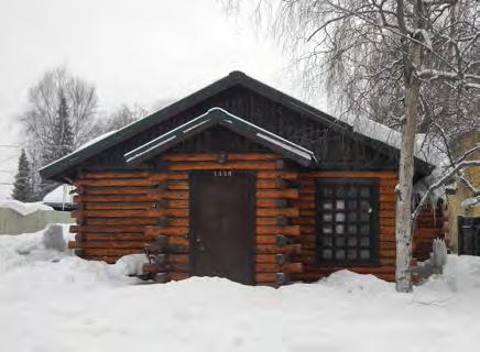 Lucky Wishbone Restaurant, East 5th Avenue.Memorial Park Cemetery (listed in the National
Greater
Lucky Wishbone Restaurant, East 5th Avenue.Memorial Park Cemetery (listed in the National
Greater
CHAPTER VII: NEIGHBORHOOD CHARACTER, GOALS & POLICIES 213ADOPTED 2/12/2013 AO 2013-12 “Landmarks to Save” The following buildings, sites, and stories (listed in alphabetical order and marked on the map on the opposite page) were identified through the HPP Public Outreach Process as the most precious resources in Fairview. This list is not intended to be exhaustive, yet it reflects the resources valued most highly by the public. National Register 1. Anchorage Cemetery Identified during HPP Public Outreach & Previous Surveys 2. Greater Friendship Baptist Church 3. Log Cabins (scattered throughout) 4. Lucky Wishbone 5. Most Worshipful Prince Hall Grand Lodge of Masons 6. Postwar kit houses (scattered throughout) 7. Quonset huts (scattered throughout) 8. Syren House, 1302 Karluk Street
Anchorage
Register).
Friendship Baptist Church, Ingra Street.Log Cabin, Ingra Street.
Neighborhood signage and other improvements on East 15th Avenue have improved walkability and sense of place in Fairview.
Challenges and Vision
Fairview residents value the neighborhood’s diverse mix of buildings and people, housing affordability, and central location. Concerns in Fairview include the way that transportation corridors divide the neighborhood (Gambell/Ingra, 15th Avenue); improving connections and walkability, socioeconomic conditions, and limiting further high-density development.
Changing the type of commercial uses in Fairview is a high priority for the community: Gambell Street was Fairview’s “main street” in the 1950s, and it could be redeveloped into a safer, more pedestrianfriendly corridor with neighborhood-serving businesses. This could be achieved through design strategies that also allow for improved transportation systems.
The biggest challenges in Fairview will be to overcome past land-use and transportation decisions and to restore the neighborhood’s historic context, walkability, commercial viability, and neighborhood character.
Fairview-Specific Policies & Implementation Strategies
The following policies and implementation strategies are specific to Fairview, and are applied in addition to the Plan Area Policies described in Chapter VI
#1 Quality of Life/Livability
1.7 FV Celebrate socioeconomic and ethnic diversity by providing community-focused opportunities relevant to historic preservation, neighborhood cultures, and assets.
1.7.1 FV Finalize and adopt the Fairview Neighborhood Plan (drafted in 2009). Among other things, this plan detailed land-use, transportation, and urban design strategies for the neighborhood. Many of the concerns about transportation projects and zoning raised by members of the public are beyond the scope of this HPP, but would certainly be important to include in the neighborhood plan.
HISTORIC PRESERVATION PLAN FOR ANCHORAGE’S FOUR ORIGINAL NEIGHBORHOODS GH = GOVERNMENT HILL DT = DOWNTOWN SA = SOUTH ADDITION FV = FAIRVIEW214 ADOPTED 2/12/2013 AO 2013-012
#2 Landmarks to Save
2.1 Retain and preserve the historic and cultural resources identified during the HPP public outreach process and recorded in the Consolidated Historic Resources Inventory.
See page 213 for a proposed list of resources developed through the HPP public outreach process.
#3 Interpreting History and Culture
3.13 FV Identify opportunities to highlight Fairview’s African-American heritage and socioeconomic diversity.
3.13.1 FV Place interpretive signage at Greater Friendship Baptist Church (903 E. 13th Avenue), celebrating its status as the first African-American church in Alaska.
3.13.2 FV Work with the African-American community—especially long-time residents—to identify significant people, events, and places worthy of recognition and public information. Residents have already begun collecting oral histories at Fairview reunion events, and this project could continue.
3.13.3 FV Develop a walking tour or exhibition highlighting people, places, and events significant to the Fairview African-American community. For example, a “SoMa Pilipinas Ethnotour” was recently developed to highlight the Filipino heritage of one San Francisco neighborhood.
3.13.4 FV Reach out to other ethnic groups in Fairview to identify opportunities for preservation and interpretation.
A “SoMa Pilipinas Ethnotour” was recently developed to highlight the Filipino heritage of one San Francisco neighborhood. A similar approach could be taken to share the scoial and ethnic history of Fairview.
CHAPTER VII: NEIGHBORHOOD CHARACTER, GOALS & POLICIES 215ADOPTED 2/12/2013 AO 2013-12
The Gambell-Ingra Corridor was once Fairview’s “main street,” but it now bisects the neighborhood.
#5 Growth & Change
5.13 FV Restore small business corridors, overcome past land-use and transportation decisions, and improve walkability and easy access to Downtown.
5.13.1 FV To the greatest extent possible, redevelop Gambell and Ingra streets into a neighborhood commercial corridor with businesses that will unite the east and west sides of the neighborhood.
5.13.2 FV Consider implementing streetscape improvements on Gambell and Ingra streets to create a safer, more pedestrian-friendly neighborhood commercial corridor. The traffic effects of these improvements should be studied by a traffic engineer and communicated to the residents prior to implementation.
5.13.3 FV Identify economic development strategies for Fairview that allow for successful revitalization of a commercial corridor along Gambell and Ingra streets.
5.13.4 FV Continue to implement streetscape improvements that encourage walkability, such as crosswalks and pedestrian-friendly sidewalks.
HISTORIC PRESERVATION PLAN FOR ANCHORAGE’S FOUR ORIGINAL NEIGHBORHOODS GH = GOVERNMENT HILL DT = DOWNTOWN SA = SOUTH ADDITION FV = FAIRVIEW216 ADOPTED 2/12/2013 AO 2013-012
#6 Economic Development
6.12 FV Maintain housing affordability in order to preserve Fairview’s demographic composition, building stock, and character.
See Policy 5.13 for implementation strategies regarding preservation of Fairview’s diverse character. See Policies 6.4 and 6.6 for implementation strategies regarding housing affordability.
#7 Procedures
7.3 Create, populate, and maintain an official local register or inventory of historic resources.
7.3.11 FV As part of the creation of a local register, continue to survey and document historic resources in Fairview. As recommended in the Consolidated Inventory Survey Report, this would include preparation of both a historic context statement and an update of the 2007 Fairview Survey to include more sites associated with significant events or persons, as well as sites of cultural importance to the African-American community or other ethnic groups; and research and documentation of properties identified by members of the public during the HPP public outreach process.
See Policy 2.1 for recommendations about nominating eligible Fairview properties to the National Register of Historic Places, as recommended in the Consolidated Inventory Survey Report
Maintaining the scale, character, and affordability of housing is a priority in Fairview.
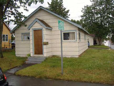
CHAPTER VII: NEIGHBORHOOD CHARACTER, GOALS & POLICIES 217ADOPTED 2/12/2013 AO 2013-12
HISTORIC PRESERVATION PLAN FOR ANCHORAGE’S FOUR ORIGINAL NEIGHBORHOODS GH = GOVERNMENT HILL DT = DOWNTOWN SA = SOUTH ADDITION FV = FAIRVIEW218 ADOPTED 2/12/2013 AO 2013-012
IMPLEMENTATION PLAN
The purpose of this chapter is to articulate an action plan to help the Municipality of Anchorage and its preservation partners accomplish the vision, goals, and policies outlined in the Historic Preservation Plan for Anchorage’s Four Original Neighborhoods. However, reviewing this section should not be taken as a substitute for reading the entire HPP, as the previous chapters include additional details that will help readers fully understand each policy and implementation strategy.

CHAPTER VIII: IMPLEMENTATION PLAN 219ADOPTED 2/12/2013 AO 2013-12
How To Implement The HPP
The implementation strategies described in previous chapters of the plan take many forms, and achieving the vision of the HPP will require a multifaceted approach in order to be successful. The plan identifies a number of planning strategies and actions that will be carried out during the day-to-day work of Municipality staff and decision-makers. Implementing the HPP will also require regulatory improvements, such as procedural updates, ordinance revisions, overlay zones, design guidelines, and other tools that support historic preservation. By using the HPP to guide policy decisions and integrating preservation concepts into existing regulations and business practices, the Municipality will better be able to reduce internal contradictions and support preservation of the Four Original Neighborhoods.
Where possible, no- or low-cost measures have been proposed, yet the amount of dedicated funding to support these preservation activities will directly affect the successful implementation of the HPP. To this end, the Municipality anticipates taking action to execute the HPP: indirect costs such as staff time to write ordinances and manage the program could be incorporated into the Municipality’s work plan; a capital improvement program could be developed to plan for projects; an annual fund could be created to support projects or purchase properties; and fund-raising campaigns could be held regularly. The active pursuit of funding and incentives for property owners will be necessary to balance preservation with the growth planned by Anchorage 2020. Many potential funding opportunities— not just expenses—are therefore identified in the HPP.
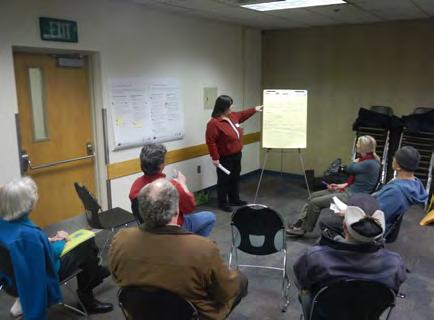 Historic preservation is a community endeavor, and it will take strong partnerships to implement the HPP.
HISTORIC PRESERVATION PLAN FOR ANCHORAGE’S FOUR ORIGINAL NEIGHBORHOODS 220 ADOPTED 2/12/2013 AO 2013-012
HPP Implementation Process
But the Municipality should not be expected to shoulder the burden alone: historic preservation is a community endeavor, and it will take strong partnerships among the public, private, and nonprofit sectors in order to properly celebrate the heritage of the Four Original Neighborhoods. Perhaps most important, many of the implementation strategies of the HPP relate to education and outreach, which are necessary to foster understanding and support for the Municipality’s preservation program. Sharing the history of the Four Original Neighborhoods and improving access to information will go a long way toward increasing public awareness and successfully implementing the HPP.
The Anchorage Historic Preservation Commission (AHPC) is the primary body that advances historic preservation projects to Municipal management, and it is therefore recommended that the AHPC take the lead on implementing the HPP. The first step in implementing the HPP will be to form one or more AHPC subcommittees that will begin by prioritizing tasks, including scoping and budgeting for each strategy. The subcommittee(s) will also be responsible for identifying potential funding sources for each implementation strategy. Please note that cost will be developed on an item-by-item basis, and the HPP does not assign specific costs to each strategy. Furthermore, due to the extensive content and recommendations found in the HPP, a larger body composed of strategic advisors representing the various parties committed to the implementation strategies could be formed to assist the AHPC with implementation.
HPP Adopted Anchorage Historic Preservation Commission (AHPC) Implementation Subcommittee(s) Formed
This received worksession was the implementation incorporated Chapter
Prioritization Worksheet Completed
• Budget, Timing & Funding Source developed
• A few short-term and long-term projects selected by AHPC, with input from neighborhoods, Preservation Partners, and Muni
• Seek Mayor's assistance to form task force(s), if desired


HPP Tasks Implemented


• Tasks added to Muni CIP & workplan

• Tasks assigned to Preservation Partners
• Not all tasks must be accomplished at once
• Seek outside funding and assistance
Adoption of the HPP is simply the first step in implementing the strategies presented in the document. Budget, timing, funding source, and other details will be further developed by the AHPC and its preservation partners as each item is considered.
CHAPTER VIII: IMPLEMENTATION PLAN 221ADOPTED 2/12/2013 AO 2013-12
Implementation Matrix
The following pages contain the Implementation Matrix, which summarizes each implementation strategy discussed in previous chapters of the plan, and is organized by timing. For each strategy, the matrix includes the following:
Related Policy: Each implementation strategy is generally correlated to one policy. However, if a strategy accomplishes or relates to more than one policy, it is noted here.
Timing: The time it takes to implement each strategy varies: timelines are Short-Term (less than 5 years); Intermediate (6-9 years); Long-Term (more than 10 years); and Ongoing. Please note that these time frames are approximate, and are subject to change depending on available funding, resources, and commitment.
Responsible Parties: Indicates one or more parties responsible for implementing the strategy, including collaboration among groups. The parties identified here are not necessarily required to fund and implement the strategy themselves, but rather would be responsible for researching and tracking the strategy to ensure that it is completed. Responsible parties may include individual property owners, neighborhood groups, local government organizations, state and federal agencies, and lawmakers. See Appendix L for a complete list of potential preservation partners who could serve as responsible parties.
Neighborhood: Identifies which neighborhood(s) area is responsible for implementing each strategy. Ship Creek is not included here, though it is not technically one of the Four Original Neighborhoods and did not receive the same attention as the other neighborhoods during the public outreach process.
Requires Approvals: Indicates that further action would be needed by the public, property owners, Planning & Zoning Commission, and Municipal Assembly in order to move this item forward. At such time, the details of the programs will be developed and the feasibility of the items will be evaluated. The effects of the programs on the cost of development would also be thoroughly investigated at this later date.
HISTORIC PRESERVATION PLAN FOR ANCHORAGE’S FOUR ORIGINAL NEIGHBORHOODS 222 GH = GOVERNMENT HILL DT = DOWNTOWN SA = SOUTH ADDITION FV = FAIRVIEWADOPTED 2/12/2013 AO 2013-012
1
1.1.1 Adopt
branding
for
each
of
the
Four
Original
Neighborhoods
that
celebrates
history
and
diversity.
Neighborhood
Groups
(Community
Councils)
1.1.2 Coordinate
implementation
of
historic
preservation
policies
to
support
and
extend
the
Anchorage
First
Economic
Development
strategy
and
Live.Work.Play. at
the
neighborhood
level.
l Business
Organizations
l l l l
1.1.3Utilize
the
historic
function
of
alleys
as
a
service
space. Same
as
5.4.3 l Muni
(Public
Works) l l l l
1.2.1 Integrate
the
history
of
Anchorage’s
parks
into
the
trail
system
in
order
to
encourage
use,
and/or
provide
historical
information
on
the
Parks
&
Recreation
website.
l
Muni
(Parks
&
Rec) l
1.2.2 Maintain
and
enhance
safety
of
existing
historic
trails,
and
improve
connections
to
Downtown,
Coastal
Trail,
and
open
space
network. Muni
(Parks
&
Rec)
1.2.3 Maintain
and
enhance
the
Ceremonial
Start
for
the
Iditarod
Trail. l Muni
(Parks
&
Rec)
1.3.1 Install
street
signs
in
English
and
Athabascan,
especially
to
represent
Athabascan
names
for
villages
and
geographic
features Same
as
3.2.5 l Alaska
Native
Peoples;
Muni
(Public
Works)
1.3.2Name
public
buildings
and
streets
after
Native
leaders
per
Muni
codeSame
as
3.2.6 l Alaska
Native
Peoples;
Muni
(Public
Works)
1.3.3
1.3.4
Incorporate
Native
art
and/or
sculpture
into
parks,
open
spaces,
and
other
public
areas
by
creating
a
network
of
partners
and
friends
groups
that
will
assist
in
planning,
funding,
and
support
of
a
public
art
program
Integrate
historic
icons
or
photographs
into
streetscape
furnishings,
such
as
trash
cans
and
benches
1.3.5
Commission
local
artists
to
paint
murals
or
create
other
public art
depicting
history
of
Four
Original
Neighborhoods,
and
consider
offering
guided
tours
of
the
murals.
1.3.6 Name
alleys
in
the
Four
Original
Neighborhoods
using
historical
and
Same
as
3.2.7 l
Alaska
Native
Peoples;
Muni
(Arts
Advisory
Commission,
Parks
&
Rec) l l l l
Same
as
3.5.4 l Muni
(Public
Works) l l l l
Same
as
3.5.5
Nonprofit
Organizations;
Muni
(Arts
Advisory
Commission)
CHAPTER VIII: IMPLEMENTATION PLAN S = SHORT -TERM ( <5 YRS ) I = INTERMEDIATE ( 6-9 YRS ) L = LONG -TERM ( >10 YRS ) O = ONGOING 223ADOPTED 2/12/2013 AO 2013-12 SILOGHDTSAFV
l
l l l l
l l l
l
l l l l
l l l l
l l l l
l l l l
l
l l l l
cultural
references
Same
as
3.5.7 l Muni
(Public
Works) l l l l 1.3.7 Develop
partnerships
with
the
Anchorage
School
District,
nonprofit
organizations,
and
Native
groups
to
execute
these
projects Goal
#4 l Alaska
Native
Peoples;
Educational
Institutions
(ASD);
Nonprofit
Organizations l l l l 1.3.8 Seek
funding
through
Alaska
Native/Native
Hawaiian
Institutions
Assisting
Communities
(AN/NHIAC) l Alaska
Native
Peoples l l l l 1.4.1
GHProvide
interpretive
material
regarding
historic
trails. l Neighborhood
Groups;
Muni
(Parks
&
Rec) l No.Implementation
StrategyRelated
PolicyTimingPrimary
Responsible
Parties QUALITY
OF
LIFE NeighborhoodRequires
Approvals
1.5.1
DT Ensure
that
basic
amenities
that
currently
exist
in
portions
of
Downtown
are
standardized
throughout
the
neighborhood.
This
could
include
standardized
street
lighting,
benches,
trash
cans,
and
informational
signage.
These
streetscape
improvements
provide
an
opportunity
to
reinforce
the
historic
character
of
Downtown,
integrate
Anchorage’s
history
and
culture
into
the
urban
fabric,
and
create
a
sense
of
place. 5.9 l Muni
(Public
Works);
Business
Organizations l
1.6.1
SAFund,
prepare,
and
approve
a
neighborhood
plan
for
the
South
Addition. l
1.7.1
FVFinalize
and
adopt
the
Fairview
Neighborhood
Plan
(drafted
in
2009). l
2
2.1.1 Create
a
program
to
seek
official
designation
of
eligible
individual
resources
and
districts
on
local,
state,
and/or
national
historic
registers.
2.1.2
2.1.3
Prioritize
official
nomination
of
National
Register-‐eligible
historic
resources
outside
Downtown
(in
the
Government
Hill,
South
Addition,
and
Fairview
neighborhoods).
Encourage
adaptive
reuse
of
historic
residential,
commercial,
and
industrial
resources
in
the
Four
Original
Neighborhoods
to
ensure
their
longevity
and
vitality.
2.1.4
2.1.5
Seek
public
and
private
funding
for
rehabilitation
projects
at
these
buildings.
Continue
to
identify
and
preserve
additional
historic
resources in
the
Four
Original
Neighborhoods,
including
nontraditional
resource
types
such
as
cultural
landscapes
and
trails
2.2.1
Focus
first
on
offering
preservation
incentives
and
economic
development
tools
to
the
historic
buildings
identified
during
the
HPP
public
outreach
process
and
recorded
in
the
Consolidated
Historic
Resources
Inventory.
Goal
#6 l
Neighborhood
Groups
(Community
Councils);
Muni
(Planning) l
Neighborhood
Groups
(Community
Councils);
Muni
(Planning)
SHPO;
Muni
(AHPC);
Nonprofit
Organizations;
Educational
Institutions
SHPO;
Muni
(AHPC);
Nonprofit
Organizations;
Educational
Institutions
Muni
(AHPC);
Nonprofit
Organizations;
Educational
Institutions
Muni
(AHPC);
Nonprofit
Organizations;
Business
Organizations
SHPO;
Muni
(AHPC);
Nonprofit
Organizations;
Educational
Institutions
SHPO;
Muni
(AHPC);
Business
Organizations
2.2.2
Create
a
media
campaign
to
highlight
the
historic
and
cultural
resources
identified
during
the
HPP
public
outreach
process
and
recorded
in
the
Consolidated
Historic
Resources
Inventory,
and
promote
the
benefits
of
historic
preservation.
Same
as
3.7.1 l Muni
(AHPC);
Media
Outlets
LANDMARKS
TO
SAVE
HISTORIC PRESERVATION PLAN FOR ANCHORAGE’S FOUR ORIGINAL NEIGHBORHOODS 224 GH = GOVERNMENT HILL DT = DOWNTOWN SA = SOUTH ADDITION FV = FAIRVIEWADOPTED 2/12/2013 AO 2013-012 SILOGHDTSAFV No.Implementation
StrategyRelated
PolicyTimingPrimary
Responsible
PartiesNeighborhoodRequires
Approvals
l
l
l l l l
l
l l l
l
l l l l
l
l l l l
l
l l l l
l l l l
l l l l
2.2.3 Develop
themed
tours
of
Anchorage
that
include
the
resources
identified
during
the
HPP
public
outreach
process
and
the
Consolidated
Historic
Resources
Inventory
project. Groups;
Nonprofit
Organizations;
Business
Organizations
2.2.4 As
part
of
the
Municipality’s
heritage
tourism
strategy—including
leadership
of
the
2015
Centennial
Celebration—coordinate
promotion
of
these
resources
with
businesses,
tourism,
and
local
nonprofit
partners.
6.7 l Business
Organizations;
Corporations;
Media
Outlets l l
2.2.5
2.3.1
Prepare
a
manual
aimed
at
cruise
and
tour
operators
that
summarizes
historic
sites
and
activities.
Identify
historic
buildings—especially
those
from
the
Four
Original
Neighborhoods—currently
located
in
Municipality-‐owned
storage
facilities.
2.3.2
2.3.3
Evaluate
the
feasibility
of
a
program
for
reintroducing
historic
buildings
from
storage
back
into
the
Four
Original
Neighborhoods.
If
retention
of
a
historic
building
on
site
is
not
feasible,
consider
relocation
to
another
suitable
site
within
the
plan
area
(e.g.,
vacant
lots
and
parking
lots).
2.4.1 Work
with
Alaska
Native
Peoples
community
to
identify
and
document
Culturally
Modified
Trees
in
the
plan
area.
2.4.2 Work
with
Alaska
Native
Peoples
community
to
identify
and
document
house
pits,
caches,
and
other
archeological
sites
in
the
plan
area.
2.4.3
6.7 l Muni
(AHPC);
Corporations;
Nonprofit
Organizations
l Muni
(AHPC)
Muni
(AHPC)
Muni
(AHPC)
Alaska
Native
Peoples;
SHPO
Alaska
Native
Peoples;
SHPO
Solicit
support
and
assistance
from
Cultural
Resource
Specialists
in
neighboring
boroughs
and
communities
to
identify
archeological
and/or
culturally
significant
sites
in
the
plan
area. (Planning)
2.4.4 Pursue
Tribal
Preservation
Project
Grants
from
the
National
Park
Service
to
preserve
Native
cultural
sites as
3.2.12 Native
Peoples;
SHPO;
NPS
2.5.1 Collect
and
distribute
preservation
briefs
and
case
studies
relevant
to
specific
building
types
(residential,
religious,
educational,
commercial,
etc.)
to
serve
as
educational
tools
and
to
improve
maintenance
efforts. Muni
(AHPC);
Nonprofit
Organizations
2.7.1
Create
a
database
to
identify
and
track
local
buildings
that
may
achieve
significance
when
they
turn
50
years
of
age.
This
database
should
be
updated
every
five
years.
l
SHPO;
Nonprofit
Organizations;
Muni
(Planning) l
CHAPTER VIII: IMPLEMENTATION PLAN S = SHORT -TERM ( <5 YRS ) I = INTERMEDIATE ( 6-9 YRS ) L = LONG -TERM ( >10 YRS ) O = ONGOING 225ADOPTED 2/12/2013 AO 2013-12 SILOGHDTSAFV No.Implementation
StrategyRelated
PolicyTimingPrimary
Responsible
PartiesNeighborhoodRequires
Approvals
l Neighborhood
l l l l
l l
l l l l
l l l l
l
l l l l
l
l l l l
l
l l l l
l
l l l l
l Muni
l l l l
Same
l Alaska
l l l l
l SHPO;
l l l l
l l l
2.7.4 Draft
local
registration
requirements
for
significant
buildings
that
have
not
yet
achieved
50
years
of
age.
2.8.1 The
Municipality
should
serve
as
the
model
for
preservation
“best
practices”
and
should
set
the
standard
for
appropriate
stewardship
by
demonstrating
these
practices
while
maintaining
Muni-‐owned
historic
buildings
in
the
plan
area.
SHPO;
Muni
(AHPC)
l Muni
(Real
Estate/HLB)
2.8.2 Comprehensively
assess
and
document
historic
resources
owned
by the
Municipality. Muni
(Real
Estate/HLB)
2.8.3 Develop
a
comprehensive
capital
improvements
program
for
managing
Municipality-‐owned
historic
buildings.
7.1 l Muni
(Real
Estate/HLB)
2.8.4
Create
an
annual
fund
to
support
maintenance
and
management
of
buildings,
based
on
the
capital
improvements
program,
or
determine
if
the
Municipality
should
sell
the
building
to
an
owner
who
aspires
to
maintain
it.
Examples
of
reuse
or
repurposing
existing
historic buildings,
including
pro
formas,
may
be
developed
as
part
of
this
process. l
Muni
(Real
Estate/HLB)
2.8.5
Conduct
studies
to
explore
appropriate
uses
for
the
most
historically
significant
Municipality-‐owned
buildings
according
to
the
priorities
and
strategies
established
by
the
comprehensive
capital
improvements
program.
2.8.3 l
Muni
(Real
Estate/HLB)
2.8.6
2.8.7
Leverage
potential
income
from
Municipality-‐owned
buildings
(e.g.,
film
location
fees,
rental
fees,
admission,
etc.)
to
finance
maintenance
projects
and
development
of
tools/plans.
Catch
up
on
deferred
maintenance
of
Municipality-‐owned
historic
properties
to
ensure
that
their
condition
is
stable
and
sustainable.
2.8.8
Revise
tenant
leases
of
Municipality-‐owned
properties
to
encourage
tenant
participation
in
building
upkeep
and
accountability
of
Public
Works’
responsibilities
to
maintain
the
buildings.
Muni
(Real
Estate/HLB)
Muni
(Real
Estate/HLB)
Muni
(Real
Estate/HLB)
HISTORIC PRESERVATION PLAN FOR ANCHORAGE’S FOUR ORIGINAL NEIGHBORHOODS 226 GH = GOVERNMENT HILL DT = DOWNTOWN SA = SOUTH ADDITION FV = FAIRVIEWADOPTED 2/12/2013 AO 2013-012 SILOGHDTSAFV No.Implementation
StrategyRelated
PolicyTimingPrimary
Responsible
PartiesNeighborhoodRequires
Approvals 2.7.2 Interview
“Project
80s”
architects,
planners,
and
developers
as
part
of
the
documentation
of
the
buildings l Nonprofit
Organizations l l l l 2.7.3 Understand
the
significance
of
“Project
80s”
buildings
and
other
resources
from
the
recent
past
through
the
development
of
a
historic
context
statement. l SHPO;
Nonprofit
Organizations l l l l
l
l l l l
l l l l
l
l l l l
l l l l
l l l l
l l l l
l
l l l l
l
l l l l
l
l l l l
3
3.1.1
INTERPRETING
HISTORY
&
CULTURE
Form
an
interpretive
planning
advisory
group
(or
groups)
composed
of
public-‐private
partnerships
to
oversee
creation
of
interpretive
plan
(or
plans). l
Neighborhood
Groups
(Community
Councils);
Muni
(Planning);
Nonprofit
Organizations;
Educational
Institutions l l l l
3.1.2 Seek
funding
for
an
interpretive
plan
for
Municipality-‐owned
buildings
and
parks,
which
would
identify
and
prioritize
which
stories
to
tell,
select
media
to
be
used
for
each
story,
and
establish
a
consistent
graphic
identity
for
all
materials.
Muni
(Planning);
Muni
(Real
Estate)
3.1.3
Seek
funding
for
an
interpretive
plan
for
each
of
the
Four
Original
Neighborhoods.
Each
plan
would
include
the
same
components
described
above. Neighborhood
Groups
(Community
Councils)
3.1.4
Ensure
that
the
Four
Original
Neighborhoods
are
represented
in
the
Centennial
Legacy
Interpretive
Project,
and
complete
installation
of
interpretive
signage,
plaques
or
monuments
in
time
for
the
Anchorage
Centennial
Celebration
in
2015.
l Neighborhood
Groups
(Community
Councils)
3.1.5 Work
with
the
Alaska
Native
Peoples
community
to
identify
stories
in
the
plan
area
to
interpret.
Alaska
Native
Peoples
3.1.6 Look
for
interpretive
opportunities
that
take
advantage
of
all
four
seasons. l
Neighborhood
Groups
(Community
Councils);
Muni
(Planning);
Nonprofit
Organizations;
Educational
Institutions l l l l
3.1.7 Seek
funding
to
assist
private
property
owners
in
implementing
interpretive
programs. Nonprofit
Organizations
3.2.1 Place
an
interpretive
plaque
at
the
site
of
CHAPTER VIII: IMPLEMENTATION PLAN S = SHORT -TERM ( <5 YRS ) I = INTERMEDIATE ( 6-9 YRS ) L = LONG -TERM ( >10 YRS ) O = ONGOING 227ADOPTED 2/12/2013 AO 2013-12 SILOGHDTSAFV No.Implementation
StrategyRelated
PolicyTimingPrimary
Responsible
PartiesNeighborhoodRequires
Approvals
Goal
#4
&
Goal
#6 l
l l l l
l
l l l l
l l l l
l
l l l l
l
l l l l
the
former
Alaska
Native
Service
(ANS)
Hospital.
l Alaska
Native
Peoples 3.2.2 Select
one
example
of
Culturally
Modified
Trees,
and
place
interpretive
signage
at
that
location. 2.4 l Alaska
Native
Peoples l l l l 3.2.3 Create
a
map
of
indigenous
language
place
names
in
Four
Original
Neighborhoods.
l Alaska
Native
Peoples l l l l 3.2.4Publicize
Shem
Pete's
Alaska, a
book
about
Dena’ina
place
names.
l Media
Outlets;
Nonprofit
Organizations l l l l 3.2.5
Install
street
signs
in
English
and
Athabascan,
especially
to
represent
Athabascan
names
for
villages
and
geographic
features. Same
as
1.3.1 l Alaska
Native
Peoples;
Muni
(Public
Works) l l l l 3.2.6Name
public
buildings
and
streets
after
Native
leaders. Same
as
1.3.2 l Alaska
Native
Peoples;
Muni
(Public
Works) l l l l
Alaska
Native
Peoples;
Muni
(Arts
Advisory
Commission,
Parks
&
Rec)
3.2.8 Add
more
Alaska
Native
stories
about
the
sun,
moon,
and
stars
to
Planet
Walk. l Alaska
Native
Peoples;
Muni
(Public
Works) l
3.2.9 Include
Alaska
Native
Peoples’
stories
in
Oscar
Anderson
House
tour. l Alaska
Native
Peoples;
Nonprofit
Organizations l l l l
3.2.10 Establish
an
Alaska
Native
Heritage
Center
(ANHC)
annex
or
kiosk
in
Downtown
to
support
heritage
tourism. 6.7 l Alaska
Native
Peoples;
Business
Organizations l l l
3.2.11 Host
festivals
or
ceremonies
to
celebrate
the
catch
of
the
first
salmon,
migration
of
birds,
and
other
traditional
events
and
rituals. l Alaska
Native
Peoples;
Nonprofit
Organizations;
Neighborhood
Groups l l l l
3.2.12 Pursue
Tribal
Preservation
Project
Grants
from
the
National
Park
Service
to
pursue
interpretation
of
Native
stories
and
cultural
sites. Same
as
2.4.4 l Alaska
Native
Peoples;
SHPO;
NPS l l l l
3.3.1
3.3.2
Work
with
Anchorage
School
District
(ASD)
educators
and
administrators
to
adapt
the
local
history
module
for
high
school
students
to
include
information
about
the
Four
Original
Neighborhoods. Educational
Institutions
(ASD)
Work
with
ASD
educators
and
administrators
to
develop
a
scavenger
hunt
or
other
activity
for
elementary
school
students
focused
on
the
Four
Original
Neighborhoods.
3.3.3
Educational
Institutions
(ASD)
Work
with
university
educators
and
administrators
to
incorporate
historic
preservation
curriculum
into
Alaskan
universities.
Educational
Institutions
(Universities)
3.3.4Develop
a
free
guided
walking
tour
program.
Nonprofit
Organizations
3.3.5 Partner
with
Bicycle
Commuters
of
Anchorage
(BCA)
or
other
similar
group
to
offer
maps
information
about
the
history
of
the
Four
Original
Neighborhoods
to
the
Anchorage
Bike
map
(also
applies
to
Policies
3.6
and
3.7). Groups;
Media
Compile
a
bibliography
of
further
reading
about
each
neighborhood,
to
be
made
available
at
the
Log
Cabin
Visitor
Information
Center,
Z.J.
Loussac
Public
Library,
local
schools,
and
Municipality
offices.
3.3.9 Create
a
multimedia
display
about
the
Four
Original
Neighborhoods
in
City
Hall
or
Log
Cabin
Visitor
Information
Center.
HISTORIC PRESERVATION PLAN FOR ANCHORAGE’S FOUR ORIGINAL NEIGHBORHOODS 228 GH = GOVERNMENT HILL DT = DOWNTOWN SA = SOUTH ADDITION FV = FAIRVIEWADOPTED 2/12/2013 AO 2013-012 SILOGHDTSAFV No.Implementation
StrategyRelated
PolicyTimingPrimary
Responsible
PartiesNeighborhoodRequires
Approvals 3.2.7 Incorporate
Native
art
and/or
sculpture
into
parks,
open
spaces,
and
other
public
areas
by
creating
a
network
of
partners
and
friends
groups
that
will
assist
in
planning,
fund,
and
support
of
a
public
art
program. Same
as
1.3.3 l
l l l l
l l l
l
l
l l l l
l
l l l l
l
l l l l
l
l l l l
and
bike
tours
of
historic
resources
in
the Four
Original
Neighborhoods. 3.6
&
3.7 l Neighborhood
Groups
(Bicycle
Commuters
of
Anchorage) l l l l 3.3.6 Add
3.6
&
3.7 l Muni
(Parks
&
Rec) l l l l 3.3.7Add
history
of
Four
Original
Neighborhoods
to
the
“Alaska
App.”
3.6
&
3.7 l Neighborhood
Outlets l l l l 3.3.8
l Educational
Institutions l l l l
l Muni
(AHPC);
Business
Organizations l l l l
3.4.1
Sponsor
a
series
of
Historic
Homes
Workshops,
teaching
about
the
rehabilitation
process,
historic
preservation
review
procedures,
funding
opportunities,
or
skills
such
as
window
repair.
For
example,
a
successful
window
workshop
was
recently
held
at
the
Pioneer
Schoolhouse.
3.4.2
3.4.3
3.4.4
3.4.5
3.4.6
Host
a
Preservation
Education
lecture
series,
covering
topics
such
as
neighborhood
history,
historic
preservation
incentives,
and
historic
preservation
procedures
and
regulations.
Provide
basic
historic
preservation
training
for
Planning
&
Zoning
Commission,
Assembly,
and
Municipality
staff.
Provide
basic
historic
preservation
training
for
lenders,
appraisers,
and
code
officials.
Produce
a
series
of
historic
preservation
pamphlets,
such
as
“Frequently
Asked
Questions,”
or
“how-‐to”
guides
on
historic
house
maintenance.
l
Muni
(AHPC);
Neighborhood
Groups
l l l l
Neighborhood
Groups
Nonprofit
Organizations
Nonprofit
Organizations l l l l
Produce
a
series
of
short
segments
focusing
on
preservation
issues
to
air
on
public
access
television
channels
(Municipal
Channel
10).
l Muni
(AHPC) l l l l
3.4.7 Update
Anchorage
Historic
Preservation
Commission
(AHPC)
website
to
include
more
preservation-‐related
links
and
educational
tools. Same
as
4.5.1 l
3.5.1
Muni
(AHPC)
Create
a
Historic
Plaque
Program.
Each
plaque
would
state
basic information
about
the
building,
such
as
its
historic
name,
original
owner’s
name,
and/or
original
construction
date. l Organizations;
Muni
(Planning)
3.5.2 Publish
a
quarterly
or
monthly
newspaper
column
about
local
history.
Many
years
ago,
Robert
B.
Atwood’s
regular
column
in
the
Anchorage
Daily
News
focused
on
history.
CHAPTER VIII: IMPLEMENTATION PLAN S = SHORT -TERM ( <5 YRS ) I = INTERMEDIATE ( 6-9 YRS ) L = LONG -TERM ( >10 YRS ) O = ONGOING 229ADOPTED 2/12/2013 AO 2013-12 SILOGHDTSAFV No.Implementation
StrategyRelated
PolicyTimingPrimary
Responsible
PartiesNeighborhoodRequires
Approvals 3.3.10 Seek
funding
for
a
short,
engaging
film
about
the
Four
Original
Neighborhoods. l Muni
(AHPC);
Nonprofit
Organizations;
Neighborhood
Groups
(Community
Councils) l l l l 3.3.11 Publicize
Rae
Arno’s
Anchorage
Place
Names,
a
book
about
the
history
of
street,
park,
and
place
names.
l
l l l l
l
l l l l
l Muni l l l l
l Muni l l l l
l
l l l l
Nonprofit
l l l l
l Media
Outlets l l l l 3.5.3 Share
historic
photographs
and
facts
at
Community
Council
meetings,
ASD
programs,
and
other
events. l Neighborhood
Groups
(Community
Councils) l l l l 3.5.4 Integrate
historic
icons
or
photographs
into
streetscape
furnishings,
such
as
trash
cans
and
benches. Same
as
1.3.4 l Muni
(Public
Works) l l l l
Host
annual
Historic
House
Tour
events,
rotating
among
the
Four
Original
Neighborhoods
each
year.
Neighborhood
Groups
(Community
Councils);
Nonprofit
Organizations
3.5.7 Name
alleys
in
the
Four
Original
Neighborhoods
using
historical
and
cultural
references
3.5.8 Design
interpretive
signage
that
is
weather-‐resistant,
or
mounted
such
that
it
can
be
removed
in
winter.
3.6.1 Develop
a
mobile
application
or
podcast
to
host
thematic
walking
and
driving
tours.
3.6.2 Design
iconic
graphics
(e.g.,
propellers,
trains,
etc.)
to
be
installed
at
associated
sites
to
alert
people
to
significant
themes.
3.6.3
Incorporate
stories
about
each
neighborhood
into
the
existing
trail
system’s
paving
or
infrastructure
to
combine
history
and
the
outdoors,
especially
during
the
summer
months.
This
could
be
especially
effective
along
the
historic
Iditarod
Trail.
3.7.1
Muni
(Public
Works)
Muni
(Public
Works)
Nonprofit
Organizations;
Muni
(AHPC)
Nonprofit
Organizations;
Muni
(AHPC)
Muni
(Public
Works)
Create
a
media
campaign
to
draw
attention
to
the
historic
and
cultural
resources
identified
during
the
HPP
public
outreach
process
and recorded
in
the
Consolidated
Historic
Resources
Inventory,
and
to
promote
the
benefits
of
historic
preservation. Same
as
2.2.2 l Muni
(AHPC);
Media
Outlets
3.7.2Continue
to
host “Historic
Preservation
Day”
in
Anchorage
3.7.6Organize
an
annual
historic
tour
of
the
cemetery.
3.7.7 Increase
Anchorage
Historic
Preservation
Commission
presence
on social
media
websites. (AHPC) Publicize
the
Anchorage
Museum’s
Homestead
Exhibit
online,
as
most
of
the
featured
homesteads
were
in
the
Four
Original
Neighborhoods. Outlets;
Museums
(Anchorage
Museum)
HISTORIC PRESERVATION PLAN FOR ANCHORAGE’S FOUR ORIGINAL NEIGHBORHOODS 230 GH = GOVERNMENT HILL DT = DOWNTOWN SA = SOUTH ADDITION FV = FAIRVIEWADOPTED 2/12/2013 AO 2013-012 SILOGHDTSAFV No.Implementation
StrategyRelated
PolicyTimingPrimary
Responsible
PartiesNeighborhoodRequires
Approvals 3.5.5 Commission
local
artists
to
paint
murals
or
create
other
public art
depicting
history
of
Four
Original
Neighborhoods,
and
consider
offering
guided
tours
of
the
murals.
Same
as
1.3.5 l Nonprofit
Organizations;
Muni
(Arts
Advisory
Commission) l l l l 3.5.6
l
l l l l
Same
as
1.3.6 l
l l l l
l
l l l l
l
l l l l
l
l l l l
l
l l l l
l l l l
l Muni
(AHPC) l l l l 3.7.3 Celebrate
Historic
Preservation
Month
(nationally
celebrated
in
May)
in
the
Four
Original
Neighborhoods. l Media
Outlets l l l l 3.7.4 Celebrate
Alaska
Native-‐American
Indian
Heritage
Month
(nationally
celebrated
in
November)
in
the
Four
Original
Neighborhoods. 3.2 l Alaska
Native
Peoples;
Media
Outlets l l l l 3.7.5 Tie
in
more
historic
stories
to
popular
events
such
as
Fur
Rendezvous,
the
Iditarod,
and
the
“Slam’n
Salm’n
Derby” 4.2 l Muni
(AHPC);
Media
Outlets l l l l
l Nonprofit
Organizations l l l l
l Muni
l l l l 3.7.8
l Media
l l l l
3.8.1 Partner
with
local,
state,
and
national
organizations
to
develop
and
fund
oral
history
programs.
Nonprofit
Organizations;
Educational
Institutions
(UAF
Project
Jukebox);
SHPO;
NPS
3.8.2 Work
with
Alaska
Native
Hospital,
Southcentral
Foundation,
University
of
Alaska
at
Fairbanks,
and
other
organizations
to
gather
oral
histories
from
Tribal
Elders.
3.8.3
3.8.4
Encourage
the
Anchorage
Woman's
Club
or
other
interested
community
organizations
to
continue
to
record
the
oral
histories
of
Anchorage
residents.
Incorporate
oral
history
projects
and
training
into
the
public
school
system
and
local
universities
to
get
students
to
record
the
stories
of
Anchorage
residents.
3.8.5Make
oral
histories
easily
accessible
via
podcast.
3.9.1
GH Add
biographical
information
to
street
signs
in
Government
Hill,
which
are
named
after
Alaska
Railroad
workers
3.9.2
GH
l
Alaska
Native
Hospital;
Southcentral
Foundation;
UA
Fairbanks;
Muni
(AHPC) l l l
l Nonprofit
Organizations;
Neighborhood
Groups l l l l
l Anchorage
Humanities
Forum
l Muni
(AHPC) l l l l
l Muni
(AHPC);
Government
Hill
Community
Council l
Incorporate
interpretive
signs
for
all
the
historic
mini-‐districts
on
Government
Hill l
3.9.3
GHPublicize
results
of
"Government
Hill
Oral
Histories
Project" l
3.10.1
DT
Develop
a
plan
to
replace
and
improve
the
Project
80s
historic
walking
tour
kiosks
around
Downtown
to
include
Alaska
Native
Peoples’
history
and
wayfinding
3.2 l
3.11.1
SA
Create
an
interpretive
plan
for
the
Delaney
Park
Strip,
which
may
include
installation
of
interpretive
signage,
plaques,
or
monuments
that
celebrate
the
Park
Strip’s
rich
history
as
a
fire
break,
golf
course,
and
airport. l
3.12.1
SA Use
the
South
Addition
Historic
Context
Statement (2012)
to
help
identify
interpretation
and
storytelling
opportunities
in
the
Muni
(AHPC);
Government
Hill
Community
Council l
Muni
(AHPC);
Government
Hill
Community
Council l
Muni
(AHPC);
Alaska
Native
Peoples;
Muni
(Public
Works);
Anchorage
Downtown
Partnership
Inc. l
Neighborhood
Groups;
Nonprofit
Organizations;
Muni
(Parks
&
Rec) l
Neighborhood
Groups
(Community
Councils);
Nonprofit
Organizations;
Muni
Neighborhood
Groups
(Community
Councils);
Nonprofit
Organizations;
Muni
(AHPC);
SHPO
Neighborhood
Groups
(Community
Councils);
Nonprofit
Organizations;
Muni
(AHPC);
SHPO
CHAPTER VIII: IMPLEMENTATION PLAN S = SHORT -TERM ( <5 YRS ) I = INTERMEDIATE ( 6-9 YRS ) L = LONG -TERM ( >10 YRS ) O = ONGOING 231ADOPTED 2/12/2013 AO 2013-12 SILOGHDTSAFV No.Implementation
StrategyRelated
PolicyTimingPrimary
Responsible
PartiesNeighborhoodRequires
Approvals
l
l l l l
l
l l l l
South
Addition. l
(AHPC);
SHPO l 3.13.1
FV Place
interpretive
signage
at
Greater
Friendship
Baptist
Church
(903
E.
13th
Avenue),
celebrating
its
status
as
the
first
African-‐American
church
in
Alaska l
l 3.13.2
FV Work
with
the
African-‐American
community—especially
long-‐time
residents—to
identify
significant
people,
events,
&
places.
l
l
Neighborhood
Groups
(Community
Councils);
Nonprofit
Organizations;
Muni
(AHPC);
SHPO
4
4.1.1 Create
and
maintain
a
directory
of
potential
preservation
partner
organizations,
including
contact
information
or
website. Muni
(AHPC)
4.1.2 Follow
the
lead
of
Alaska
Association
for
Historic
Preservation and
establish
partnerships
between
other
organizations
and
the
National
Trust
for
Historic
Preservation
through
the
“Partners
in
the
Field”
program. Nonprofit
Organizations
4.1.3Assign
HPP
implementation
tasks
to
preservation-‐minded
organizations. Muni
(Planning)
4.1.4 Collaborate
with
Alaska
Native
Peoples
organizations
(tribes,
corporations,
and
foundations)
on
preservation
activities
in
the
Four
Original
Neighborhoods.
4.1.5 Create
and
manage
a
list
of
Alaska
Native
Peoples
groups
to
collaborate
on
preservation
and
interpretive
efforts.
This
list
would
be
maintained
by
the
Municipality,
and
guided
by
the
Anchorage
Historic
Preservation
Commission.
l Alaska
Native
Peoples;
Muni
(Planning)
4.2.1 Combine
cultural
and
historic
preservation
awareness
with
other Anchorage
events
and
organizations. 3.7 Business
Organizations;
Media
Outlets;
4.2.2 Form
networking
opportunities
with
real
estate
professionals,
developers,
architects,
and
historic
preservation
groups.
4.2.3 Create
local
retail
programs
to
benefit
the
rehabilitation
of
a
particular
historic
building
type
or
geographic
location
(neighborhood).
4.3.1Form
a
Historic
Homeowners’
Association. Groups Develop
preservation
partnerships
between
federal
and
state
historic
preservation
agencies
and
staff,
Alaska
Native
Peoples
representatives,
and
the
Municipality
to
ensure
a
common
message
among
the
agencies,
improve
communication,
and
leverage
community-‐wide
cultural
and
historic
preservation
efforts. SHPO;
Alaska
Native
Peoples;
Muni
(AHPC)
HISTORIC PRESERVATION PLAN FOR ANCHORAGE’S FOUR ORIGINAL NEIGHBORHOODS 232 GH = GOVERNMENT HILL DT = DOWNTOWN SA = SOUTH ADDITION FV = FAIRVIEWADOPTED 2/12/2013 AO 2013-012 SILOGHDTSAFV No.Implementation
StrategyRelated
PolicyTimingPrimary
Responsible
PartiesNeighborhoodRequires
Approvals 3.13.3
FV Develop
a
walking
tour
or
exhibition
highlighting
people,
places,
and
events
significant
to
the
Fairview
African-‐American
community.
l Neighborhood
Groups
(Community
Councils);
Nonprofit
Organizations;
Muni
(AHPC);
SHPO l 3.13.4
FV Reach
out
to
other
ethnic
groups
in
Fairview
to
identify
opportunities
for
preservation
and
interpretation.
l
l
l
l l l l
l
l l l l
l
l l l l
l l l l
l Alaska
Native
Peoples;
Muni
(Planning);
Muni
(AHPC) l l l l
l
Muni
(AHPC) l l l l
l Muni
(AHPC) l l l l
l Corporations l l l l
l Neighborhood
l l l l 4.3.2
l NPS;
l l l l COMMUNITY
&
PARTNERSHIPS
4.3.3
Provide
information
about
appropriate
public
participation
and
procedures
to
ensure
that
residents
are
aware
of
their
opportunities
to
participate
in
the
planning
process,
and
are
able
to
provide
their
comments
in
a
manner
that
is
helpful
to
decision-‐makers. as
5.2.1 l
4.3.4 Create
an
educational
program
for
community-‐based
organizations
that
includes
materials
regarding
the
benefits
of
historic
preservation.
4.4.1
Create
an
awards
program
(or
expand
on
the
Alaska
Association
for
Historic
Preservation’s
Annual
Historic
Preservation
Awards)
to
recognize
good
stewards
of
historic
resources
in
the
Four
Original
Neighborhoods.
3.5 l
l
Neighborhood
Groups l l
Muni
(AHPC);
Nonprofit
Organizations;
Educational
Institutions
Muni
(AHPC);
Nonprofit
Organizations l l l l
4.4.2
Host
an
annual
gala
or
awards
ceremony
to
celebrate
historic
preservation
and
reward
those
who
have
been
integral
to
the
movement
in
Anchorage. l Muni
(AHPC);
Nonprofit
Organizations l
4.4.3 Offer
discounts
for
advertising,
premier
listing
for
events,
and
so
on,
to
recognize
the
role
that
groups
have
in
supporting
historic
preservation.
4.5.1 Update
Anchorage
Historic
Preservation
Commission
(AHPC)
website
to
include
more
preservation-‐related
links
and
educational
tools. Same
as
3.4.7 l
l Business
Organizations
Muni
(AHPC)
4.5.2 Use
Anchorage
Downtown
Partnership,
Ltd.,
Building
Owners
&
Managers
Association
(BOMA),
Community
Councils,
and
other
community
groups
to
educate
property
and
business
owners
about
available
preservation
programs
and
incentives.
l Organizations
4.5.3Build
a
database
of
historic
preservation
practitioners. Muni
(Planning)
4.5.4 Ensure
that
tourist-‐based
organizations
have
access
to
information
and
publicize
Anchorage
heritage
in
their
programs.
4.6.1 Create
and
maintain
a
directory
of
potential
preservation-‐related
grants
and
funding
sources,
including
any
application
requirements
or
restrictions. Pursue
preservation
grants
for
preservation
projects
in
Anchorage’s
Four
Original
Neighborhoods. (AHPC);
Neighborhood
Groups
4.6.3 Fundraise
through
sponsorships,
silent
auctions,
and
donations
at
an
annual
historic
preservation
gala. Organizations
CHAPTER VIII: IMPLEMENTATION PLAN S = SHORT -TERM ( <5 YRS ) I = INTERMEDIATE ( 6-9 YRS ) L = LONG -TERM ( >10 YRS ) O = ONGOING 233ADOPTED 2/12/2013 AO 2013-12 SILOGHDTSAFV No.Implementation
StrategyRelated
PolicyTimingPrimary
Responsible
PartiesNeighborhoodRequires
Approvals
Same
l l
l l l l
l l l
l l l l
l l l l
Business
l l l l
l
l l l l
l Muni
(AHPC) l l l l
l Muni
(AHPC) l l l l 4.6.2
l Muni
l l l l
4.4.2 l Nonprofit
l l l l
4.6.4
Leverage
Anchorage’s
Preserve
America
status
to
obtain
federal
funding
for
historic
preservation
projects
in
the
plan
area
(note
that
Preserve
America
grants
are
not
being
offered
in
FY2012).
4.7.1 Install
interpretive
displays
in
each
neighborhood’s
existing
community
center
that
highlights
local
history. Neighborhood
Groups;
Educational
4.7.2 When
building
new
community
centers,
consider
incorporating
neighborhood
characteristics
or
traditional
vernacular
forms
to celebrate
history
and
ensure
context-‐sensitive
design.
Muni
(Real
Estate);
Design
Professionals
4.8.1 Make
information
about
preservation
projects
and
activities
available
to
the
public
through
Community
Councils
and
other
community
organizations Neighborhood
Groups
(Community
Councils)
4.8.2 Offer
basic
historic
preservation
training
for
each
Community
Council
member. Neighborhood
Groups
(Community
Councils)
4.8.3 Improve
and
maintain
communication
between
the
Community
Councils
and
the
Anchorage
Historic
Preservation
Commission
(AHPC).
5
5.1.1
GROWTH
&
CHANGE
l Neighborhood
Groups
(Community
Councils);
Muni
(AHPC)
Facilitate
projects
that
will
assist
in
retaining
or
enhancing
historic
neighborhood
character
and
uses
that
will
enhance
and
preserve
quality
of
life,
safety,
connections
to
trails
and
open
space,
walkability,
and
bikeability. Muni
(Planning)
5.1.2 Avoid
or
mitigate
projects
that
threaten
the
unique
characteristics
of
Municipally
Adopted
Plans. 5.6 l (Planning)
Provide
information
about
appropriate
public
participation
and
procedures
to
ensure
that
residents
are
aware
of
their
opportunities
to
participate
in
the
planning
process,
and
are
able
to
provide
their
comments
in
a
manner
that
is
helpful
to
decision-‐makers.
Same
as
4.3.3 l Neighborhood
Groups 5.2.2
5.2.1
Use
the
established
Community
Council
review
process
for
infrastructure
and
development
projects.
This
existing
process
could
evolve
to allow
historic
resources
to
be
properly
protected
through
a
checklist of
project
considerations
(need
for
the
proposed
project,
design,
etc.)
for
the
community
to
study.
Muni
(Planning);
Neighborhood
Groups l l l l
HISTORIC PRESERVATION PLAN FOR ANCHORAGE’S FOUR ORIGINAL NEIGHBORHOODS 234 GH = GOVERNMENT HILL DT = DOWNTOWN SA = SOUTH ADDITION FV = FAIRVIEWADOPTED 2/12/2013 AO 2013-012 SILOGHDTSAFV No.Implementation
StrategyRelated
PolicyTimingPrimary
Responsible
PartiesNeighborhoodRequires
Approvals
l Muni
(Planning) l l l l
l
Institutions l l l l
l
l l l l
l
l l l l
l
l l l l
l l l l
l
l l l l
Muni
l l l l
l l l l
l
Utilize
existing
processes
to
encourage
large-‐scale
projects
to
prepare
a
Neighborhood
Outreach/Participation
Program
to
handle
“Growth
&
Change”
issues
when
they
arise.
It
will
be
important
to
seek
additional
input
from
decision-‐makers
and
to
define
the
thresholds
for
this
process
when
this
item
is
implemented
(a
size
threshold
to
define
“large-‐scale
projects”
could
be
based
on
acreage,
construction
cost,
or
other
metric).
5.2.4 Work
with
SHPO
to
educate
each
neighborhood
about
the
federally mandated
Section
106
process.
l
Muni
(Planning);
Muni
(PZC);
Anchorage
Assembly;
Neighborhood
Groups;
Public
&
Property
Owners l l l
6.5.3 l Muni
(Planning);
Neighborhood
Groups;
SHPO
5.3.1 Execute
the
“Urban
Transition”
vision
of
Anchorage
2020:
Anchorage
Bowl
Comprehensive
Plan Muni
(Planning)
5.3.2
Coordinate
with
the
State
of
Alaska’s
and
Municipality’s
economic
development
visions.
For
example,
active
preservation
of
historic
resources
in
Anchorage’s
historic
core
will
assist
with
the
implementation
of
the
vision
for
Anchorage
as
a
vibrant
community
in
2025,
as
outlined
by
the
Live.Work.Play. initiative. Muni
(Planning)
5.3.3 Implement
the
strategies
for
downtown
revitalization
outlined
in
the
Downtown
Comprehensive
Plan
(2007). Muni
(Planning)
Create
weekly
or
monthly
events
that
draw
Alaskans
to
the
Four
Original
5.3.4
Neighborhoods:
movies
in
the
park
in
the
summer
sponsored
by
local
businesses,
restaurant
week
in
the
winter,
beer
festivals,
and
the
like.
5.4.1
5.4.2
l Neighborhood
Groups
(Community
Councils) l l l l
Identify
examples
of
“successful”
infrastructure
projects
in
Anchorage
and
elsewhere
and
use
these
to
define
characteristics
desirable for
future
projects. l Muni
(Public
Works);
Muni
(AHPC) l
Through
the
existing
“Context
Sensitive
Solutions”
process
used
by
the
Municipality,
Alaska
Department
of
Transportation
(ADOT)
and
FHWA,
design
infrastructure
projects
that
maintain
the
historic
street
grid
of
the
Four
Original
Neighborhoods
to
the
greatest
extent
possible. (Public
Works)
5.4.3Retain
historic
functions
of
alleys. as
1.1.3 (Public
Works)
5.5.1 If
impacts
to
neighborhood
character
are
identified,
implement
some
of
the
strategies
in
the
HPP
to
mitigate
the
negative
effects.
S = SHORT -TERM ( <5 YRS = INTERMEDIATE ( 6-9 YRS = LONG -TERM ( >10 YRS ) O = ONGOING 5.2.3
Muni
(Planning);
State
Agencies;
Federal
Agencies
CHAPTER VIII: IMPLEMENTATION PLAN
) I
) L
235ADOPTED 2/12/2013 AO 2013-12 SILOGHDTSAFV No.Implementation
StrategyRelated
PolicyTimingPrimary
Responsible
PartiesNeighborhoodRequires
Approvals
l l
l l l l
l
l l l l
l
l l l l
l
l l l l
l l l
l Muni
l l l l
Same
l Muni
l l l l
l
l l l l
5.9.1
Support
strategies
from
the
Downtown
Plan
(2007)
in
order
to
preserve
historic
commercial
district
that
complete
of
relevant
historic
preservation
policies
from
the
Downtown
Comprehensive
Plan.
Identify
opportunities
to
repurpose
or
redevelop
historic
buildings
in
Downtown.
Muni
(Planning);
Business
Organizations
(Downtown
Partnership)
Muni
(Planning);
Business
Organizations
(Downtown
Partnership)
Create
neighborhood-‐specific
design
guidelines
for
infill
construction
that
promotes
contextual
design
and
respects
the
character
of
historic
resources.
These
guidelines
would
be
developed
when
a
historic
district
is
designated
or
a
historic
overlay
zone
is
created,
and
would
require
additional
input
from
property
owners
and
decision-‐makers
at
such
time. Business
Organizations
(Downtown
Partnership)
5.9.3
DT Promote
new
and
existing
preservation
incentives
(described
in
Goal
#6)
aggressively
within
the
Central
Business
District
(CBD).
Same
as
6.10.3 l Organizations;
SHPO
5.10.1
SA Develop
an
open
space
master
plan
for
the
South
Addition,
and
fill
any
gaps
in
connectivity.
This
strategy
is
essential
to
preserve
walkability
of
the
South
Addition,
which
is
an
important
intangible
quality
that
contributes
to
the
historic
and
much
desired
character
of
the
neighborhood. l
5.11.1
SA
Create
neighborhood-‐specific
design
guidelines
that
focus
on
ground
area
coverage
and
setbacks.
These
guidelines
would
be
developed
when
a
historic
district
is
designated
or
a
historic
overlay
zone
is
created,
and
would
require
additional
input
from
property
owners
and
decision-‐makers
at
such
time.
5.11.2
SA Discourage
demolition
of
buildings
that
provide
cohesive
neighborhood
character.
5.13.1
FV
To
the
greatest
extent
possible,
redevelop
Gambell
and
Ingra
streets
into
a
neighborhood
commercial
corridor
with
businesses
that
will
unite
the
east
and
west
sides
of
the
neighborhood.
l
Muni
(Planning);
Muni
(Parks
&
Rec);
Neighborhood
Groups l
l
Muni
(Planning);
Neighborhood
Groups l l
l
Muni
(Planning);
Muni
(AHPC);
Neighborhood
Groups l
Muni
(Planning);
Muni
(Public
Works) l l
HISTORIC PRESERVATION PLAN FOR ANCHORAGE’S FOUR ORIGINAL NEIGHBORHOODS 236 GH = GOVERNMENT HILL DT = DOWNTOWN SA = SOUTH ADDITION FV = FAIRVIEWADOPTED 2/12/2013 AO 2013-012 SILOGHDTSAFV No.Implementation
StrategyRelated
PolicyTimingPrimary
Responsible
PartiesNeighborhoodRequires
Approvals 5.8.1
DT
Comprehensive
buildings
and
reinforce
a
is
a
“downtown
for
all.”
See
Appendix
K
for
a
list
l
l
DT
l
l 5.9.2
DT
l
l l
Business
l
5.13.2
FV
Consider
implementing
streetscape
improvements
on
Gambell
and
Ingra
streets
to
create
a
safer,
more
pedestrian-‐friendly
neighborhood
commercial
corridor.
The
traffic
effects
of
these
improvements
should
be
studied
by
a
traffic
engineer
and
communicated
to
the
residents
prior
to
implementation.
5.13.3
FV
5.13.4
FV
6
Identify
economic
development
strategies
for
Fairview
that
allow
for
successful
revitalization
of
a
commercial
corridor
along
Gambell
and
Ingra
streets.
Continue
to
implement
streetscape
improvements
that
encourage
walkability,
such
as
crosswalks
and
pedestrian-‐friendly
sidewalks.
ECONOMIC
DEVELOPMENT
6.1.1
Provide
the
public
with
a
Municipality
staff
contact
and/or
assigned
AHPC
member
for
expertise
and
guidance
about
how
to
use
complex
tools
and
incentives.
This
person(s)
could
hold
“office
hours”
at
the
planning
counter
to
assist
the
public.
l
Muni
(Planning);
Muni
(Public
Works) l l
6.1.2
6.1.3
6.1.4
l
Neighborhood
Groups
(Community
Councils);
Business
Organizations l
l Muni
(Public
Works)
Muni
(Planning)
Compile
information
about
all
available
policy
and
financial
incentives
at
a
central,
publicly
accessible
location.
Provide
links
to
these
incentives
on
the
AHPC
website. 3.4.7
&
4.5.1 l
Create
an
“incentives
checklist”
to
make
it
easy
for
property
owners
to
take
advantage
of
a
combination
of
available
options.
l
Muni
(AHPC)
Muni
(Planning);
Nonprofit
Organizations l l l
Partner
with
the
existing
Anchorage
Economic
Development
Corporation
to
promote
sound
development
projects
that
preserve
and
grow
historic
neighborhoods. l Muni;
Neighborhood
Groups
6.2.1Implement
Conservation
Easement
Program. l Muni
(Real
Estate/HLB);
Nonprofit
Organizations
6.2.2
Implement
Transfer
of
Development
Rights
(TDR)
program.
Development
rights
to
be
transferred
could
include
height
and/or
floor-‐area-‐ratio.
In
order
for
this
program
to
be
effective,
enabling
legislation
would
need
to
be
adopted.
The
ordinance
should
designate
sending
and
receiving
areas,
and
should
also
include
a
demolition
disincentive.
l
Muni
(Planning);
Anchorage
Assembly;
Muni
(PZC);
Public
&
Property
Owners
6.2.3
Create
Tax
Increment
Financing
(TIF)
district.
TIF
can
be
leveraged
as
a
preservation
tool
when
TIF
funds
go
toward
rehabilitation
projects.
Muni
(Finance);
Anchorage
Assembly;
Muni
(PZC);
Public
&
Property
Owners
6.3.1
Utilize
existing
Alaska
State
Historical
District
Revolving
Loan
Fund,
especially
on
4th Avenue.
SHPO;
Muni
(AHPC)
CHAPTER VIII: IMPLEMENTATION PLAN S = SHORT -TERM ( <5 YRS ) I = INTERMEDIATE ( 6-9 YRS ) L = LONG -TERM ( >10 YRS ) O = ONGOING 237ADOPTED 2/12/2013 AO 2013-12 SILOGHDTSAFV No.Implementation
StrategyRelated
PolicyTimingPrimary
Responsible
PartiesNeighborhoodRequires
Approvals
l
l
l l l l
l l l l
l
l l l l
l l l l
l l l l l
l
l l l l l
l
l l l l
6.3.3
Educate
developers
about
the
New
Markets
Tax
Credit
(NMTC)
program
as
a
way
to
encourage
them
to
apply.
This
federally
funded
program
is
administered
by
the
U.S.
Department
of
the
Treasury.
6.3.4
l (Planning)
Educate
developers
about
the
Low-‐Income
Housing
Tax
Credits
(LIHTC)
program
as
a
way
to
encourage
them
to
apply.
This
federally
funded
program
is
administered
at
the
state
level
by
the
Alaska
Housing
Finance
Corporation. Muni
(Planning)
6.3.5 Encourage
public-‐private
partnerships
with
existing
organizations
and
agencies
to
manage
historic
properties
in
the
plan
area.
6.3.6
Work
with
the
Alaska
Film
Office
to
purchase
Alaska
Film
Industry
Tax
Credits
to
offset
rehabilitation
costs
and
attract
film
and
TV
projects
to
historic
buildings
in
the
Four
Original
Neighborhoods.
Muni
(Planning);
Nonprofit
Organizations
Muni
(AHPC);
Alaska
Film
Office l
6.3.7 Collaborate
with
the
Heritage
Land
Bank
or
consider
using
the
existing
Anchorage
Historic
Preservation
Fund
for
the
Municipality
to
buy
and
lease
historic
buildings
in
the
Four
Original
Neighborhoods. Muni
(Real
Estate/HLB);
Muni
(AHPC)
6.3.8
Take
advantage
of
as
well
as
promote
the
existing
“Deteriorated Property
Ordinance”
(Anchorage
Municipal
Code
§12.35)
to
rehabilitate
historic
buildings
in
the
Four
Original
Neighborhoods.
Organizations;
Neighborhood
Groups
6.4.1 Offer
tax
abatement
or
exemption
for
preservation
projects
to
encourage
development.
6.4.2
Establish
a
Historic
Preservation
Restoration
Grant
Program
to
fund
rehabilitation
projects
(especially
façade
improvements).
This
program
could
be
funded
through
the
existing
Anchorage
Historic
Preservation
Fund
or
other
Municipality
budget
allocation.
In
some
other
states,
similar
programs
require
a
50%
cash
match
from
the
grantee.
Muni
(Finance)
Muni
(AHPC);
Nonprofit
Organizations
HISTORIC PRESERVATION PLAN FOR ANCHORAGE’S FOUR ORIGINAL NEIGHBORHOODS 238 GH = GOVERNMENT HILL DT = DOWNTOWN SA = SOUTH ADDITION FV = FAIRVIEWADOPTED 2/12/2013 AO 2013-012 SILOGHDTSAFV No.Implementation
StrategyRelated
PolicyTimingPrimary
Responsible
PartiesNeighborhoodRequires
Approvals 6.3.2 Work
with
the
State
Office
of
Historic
Preservation
and
property
owners
to
identify
buildings
and
districts
that
could
take
advantage
of
the
10%
and
20%
Federal
Rehabilitation
Tax
Credits.
Income-‐producing
properties
listed
in
or
eligible
for
NRHP
can
receive
the
20%
credit
if
the
project
meets
the
Secretary
of
the
Interior’s
Standards
for
Rehabilitation.
Nonresidential
properties
constructed
before
1936
and
not
listed
in
or
eligible
for
NRHP
can
receive
the
10%
credit. l SHPO l l l l
Muni
l l l l
6.6 l
l l l l
l
l l l l
l
l l l
l
l l l l
l Business
l l l l
l
l l l l
l
l l l l l
6.4.5 Build
an
endowment
or
trust
held
by
a
nonprofit
organization
(such
as
AAHP)
that
could
offer
loans
or
other
aid
to
property
owners
pursuing
preservation
projects. Nonprofit
Organizations
6.4.6 Work
with
the
Alaska
Film
Office
to
promote
historic
buildings
in
the
Four
Original
Neighborhoods
for
film
locations.
6.5.1 Consult
the
Advisory
Council
on
Historic
Preservation
(ACHP)
to
identify
federal
financial
assistance
programs
available
for
preservation
projects. Nonprofit
Organizations;
Muni
(AHPC);
SHPO
6.5.2 Apply
for
applicable
federal
program
grants
to
fund
preservation
projects
in
the
Four
Original
Neighborhoods.
(Visit
www.grants.gov
and
www.recovery.gov
for
options.)
6.5.3
Channel
federal
funds
(FHWA,
HUD,
etc.)
through
the
Section
106
process
with
public
participation
to
ensure
appropriate
treatment
of
historic
properties
in
the
event
of
infrastructure
improvements.
6.6.1
Provide
technical
preservation
assistance
to
small
business
owners,
including
informational
brochures
targeted
at
business
owners
or
“office
hours”
at
preservation
organizations
or
the
Municipality
to
learn
about
incentives.
6.6.2
6.7.1
Collaborate
with
the
Department
of
Health
and
Human
Services
to add
provisions
for
rehabilitation
and
preservation
to
the
Municipality’s
existing
affordable
housing
programs.
Develop,
maintain,
and
implement
a
public
outreach
program
for
heritage
tourism
with
community
partners,
tourism-‐based
organizations,
and
the
Anchorage
Historic
Preservation
Commission.
l Muni
(Planning);
SHPO l l l l
l Muni
(Planning);
SHPO
l Muni
(AHPC) l l l l
6.7.2
6.7.3
l Muni
(Health
&
Human
Services) l l l l
l Muni
(AHPC);
Nonprofit
Organizations;
Corporations
Provide
tourism-‐based
organizations
with
access
to
information
in
order
to
allow
them
to
publicize
Anchorage
heritage
in
their
programs. Nonprofit
Organizations
Develop
programs
in
the
plan
area
that
focus
on
Alaska
Native
Peoples’
history
and
culture,
as
surveys
have
shown
that
Anchorage
tourists
are
interested
in
such
programs.
l
Alaska
Native
Peoples;
Nonprofit
Organizations
CHAPTER VIII: IMPLEMENTATION PLAN S = SHORT -TERM ( <5 YRS ) I = INTERMEDIATE ( 6-9 YRS ) L = LONG -TERM ( >10 YRS ) O = ONGOING 239ADOPTED 2/12/2013 AO 2013-12 SILOGHDTSAFV No.Implementation
StrategyRelated
PolicyTimingPrimary
Responsible
PartiesNeighborhoodRequires
Approvals 6.4.3 Offer
Storefront
Micro
Loans
(less
than
$5,000,
fixed
rate
loan)
to
install
signage
and
improve
historic
storefronts.
6.6 l Local
Lenders l l l l 6.4.4 Offer
Low-‐Interest
Loans
and/or
Loan
Guarantees
to
finance
qualified
rehabilitation
projects.
l Muni
(AHPC);
Nonprofit
Organizations;
Local
Lenders l l l l
l
l l l l
l Alaska
Film
Office l l l l
l
l l l l
l l l l
l l l l
l
l l l l
l l l l
6.8.2 Conduct
a
cost-‐benefit
analysis
of
Municipality-‐owned
historic
buildings,
especially
vacant
ones. Goal
#2 Muni
(AHPC)
6.8.3
Provide
a
detailed
analysis
of
the
total
economic
effects
of
preservation
and/or
rehabilitation
of
historic
buildings
that
will
provide
developers,
property
owners,
and
the
Municipality
with
quantitative
information. Business
Organizations;
Nonprofit
Organizations
6.8.4 Undertake
an
economic
impacts
and
benefits
study
focused
on
quantifying
the
effects
of
historic
preservation
activities
in
the
plan
area.
l Muni
(AHPC);
Nonprofit
Organizations
6.8.5 Establish
a
benchmarking
program
to
collect
relevant
statistics and
monitor
the
progress
of
preservation
program.
Muni
(AHPC);
Muni
(Finance)
6.8.6
6.10.1
DT
Compile
case
studies
of
other
cities’
successful
preservation
metrics,
to
be
made
available
to
the
public,
developers,
and
other
preservation
partners.
Refine
and
develop
meaningful
information
connecting
successes
in
other
cities
to
elements
available
in
Anchorage.
Muni
(Real
Estate);
Muni
(AHPC);
Nonprofit
Organizations
Promote
existing
tax
exemptions
to
encourage
large
employers
to
locate
and
invest
in
Downtown.
Business
Organizations
6.10.2
DT Apply
to
become
a
designated
Main
Street
Program,
and/or
work
with
the
State
Historic
Preservation
Office
to
apply
the
Main
Street
Approach®
to
revitalize
Downtown.
Muni
(Planning);
Business
Organizations;
SHPO l
6.10.3
DT Promote
new
and
existing
preservation
incentives
(described
in
Goal
#6)
aggressively
within
the
Central
Business
District
(CBD). Same
as
5.9.3 l (Planning);
Business
Organizations;
SHPO DT Follow
recommendations
for
preservation
of
identified
significant
buildings
in
Downtown
Historic
Survey
(1988/2007).
Muni
(Planning);
Business
Organizations
6.11.1
SA Conduct
a
market
analysis
to
identify
which
small
businesses
are
needed
and
can
be
supported
in
the
South
Addition. Neighborhood
Groups
6.11.2
SA Identify
appropriate
locations
for
small
businesses
(existing
buildings
or
vacant
lots),
and
adjust
zoning
accordingly. #7 l
6.11.3
SA Actively
recruit
operators
and
offer
incentives
for
South
Addition-‐focused
businesses.
Neighborhood
Groups;
Business
Organizations
Neighborhood
Groups;
Business
Organizations
HISTORIC PRESERVATION PLAN FOR ANCHORAGE’S FOUR ORIGINAL NEIGHBORHOODS 240 GH = GOVERNMENT HILL DT = DOWNTOWN SA = SOUTH ADDITION FV = FAIRVIEWADOPTED 2/12/2013 AO 2013-012 SILOGHDTSAFV No.Implementation
StrategyRelated
PolicyTimingPrimary
Responsible
PartiesNeighborhoodRequires
Approvals 6.7.4 Promote
Anchorage’s
status
as
a
“Preserve
America”
community
through
signage
and
other
materials.
(Note
that
Preserve
America
Grants
are
not
being
offered
in
FY2012.) l Muni
(Planning);
Nonprofit
Organizations l l l l 6.8.1Identify
the
highest
and
best
use
for
underutilized
historic
buildings. l Muni
(AHPC);
Nonprofit
Organizations l l l l
l
l l l l
l
l l l l
l l l l
l
l l l l
l
l l l l
l
l
l
Muni
l 6.10.4
l
l
l
l
Goal
l
l
l
PROCEDURES
&
REGULATIONS
7.1.2 Report
periodically
on
the
progress
of
the
HPP
implementation
strategies. Muni
(Planning);
Muni
(AHPC)
7.2.1 Provide
planning
staff
and
building
officials
with
training
opportunities
about
historic
preservation
practices
as
the
preservation
program
moves
forward
in
implementation. 3.4 l Muni
(Planning);
Muni
(Development
Services);
Muni
(AHPC);
Muni
(PZC);
Anchorage
Assembly;
Public
&
Property
Owners
7.2.2 Add
a
“historic
preservation
review”
checkbox
to
planning
and
building
permit
applications.
This
checkbox
would
prompt
users
to
see
if historic
resources
listed
in
the
Consolidated
Historic
Resources
Inventory
Database
are
present
at
the
subject
property
and,
if
so,
would
allow
historic
preservation
to
be
included
in
the
review
process
once applicable
authorities
are
established.
Information
currently
required
in
building
permit
applications
is
outlined
in
AMC
23.10.104.6.
7.2.3
7.2.4
7.3.1
Muni
(Planning);
Muni
(Development
Services);
Muni
(AHPC);
Muni
(PZC);
Anchorage
Assembly;
Public
&
Property
Owners
Amend
Anchorage
Municipal
Code
as
necessary
to
allow
design
review
of
proposed
projects
involving
historic
resources
in
the
Four
Original
Neighborhoods,
using
Secretary
of
the
Interior’s
Standards and/or
design
guidelines.
(Planning)
Clearly
define
roles
of
the
Historic
Preservation
Commission,
Community
Councils,
and
other
entities
in
historic
properties
review
process.
Muni
(AHPC);
Neighborhood
Groups
(Community
Councils) l Ensure
Alaska
Native
Peoples
have
an
opportunity
for
involvement,
if
desired. Native
Peoples;
Muni
(Planning) l
Work
with
the
Anchorage
Historic
Preservation
Commission
(AHPC) and
the
State
Historic
Preservation
Office
(SHPO)
to
develop
a
set
of
locally
approved
criteria
for
nomination
of
historic
places,
including
buildings
and
landscapes.
The
“Municipality-‐Wide
Historic
Preservation
Plan”
currently
being
developed
by
the
AHPC
will
provide
the
draft
criteria
for
consideration.
l
Muni
(AHPC);
SHPO l l l l
CHAPTER VIII: IMPLEMENTATION PLAN S = SHORT -TERM ( <5 YRS ) I = INTERMEDIATE ( 6-9 YRS ) L = LONG -TERM ( >10 YRS ) O = ONGOING 241ADOPTED 2/12/2013 AO 2013-12 SILOGHDTSAFV No.Implementation
StrategyRelated
PolicyTimingPrimary
Responsible
PartiesNeighborhoodRequires
Approvals 7 7.1.1 Form
an
HPP
Implementation
Subcommittee
led
by
the
Anchorage
Historic
Preservation
Commission. l Muni
(Planning) l l l l
l
l l l l
l l l l
l
l l l l l
l Muni
l l l l l
l
l l l l 7.2.5
7.8 l Alaska
l l l
7.3.2 Consider
a
tiered
local
register,
which
would
allow
for
a
hierarchy
of
both
significance
and
protections.
(AHPC);
SHPO
7.3.3 Create
a
program
to
populate
the
local
register.
Consider
working
with
Alaskan
universities
to
assign
tasks
toward
accomplishing
this
program. 2.1 l
7.3.4
Officially
designate
resources
identified
in
past
surveys
in
the
local
register.
As
part
of
this
task,
previous
survey
findings
should
be
reviewed,
using
the
new
local
register
criteria
and
being
reclassified
if
needed.
7.3.5
7.3.6
l
Muni
(AHPC);
University
of
Alaska l l l l
Muni
(AHPC);
SHPO
Update
Patterns
of
the
Past
to
remove
properties
that
have
been
demolished,
and
add
properties
associated
with
additional
historic
themes. Muni
(AHPC)
Conduct
a
Parks
Survey
to
identify
historic
buildings,
landscapes,
and
trails
in
municipal
parks. l
Muni
(AHPC);
Muni
(Parks
&
Rec)
7.3.7 Update
historic
resource
surveys
every
five
years
to
capture
properties
that
are
newly
age-‐eligible. l l
7.3.8
GH
7.3.9
DT
7.3.10
SA
As
part
of
the
creation
of
a
local
register,
continue
to
survey
and
document
historic
resources
in
Government
Hill.
As
part
of
the
creation
of
a
local
register,
continue
to
survey
and
document
historic
resources
in
Downtown.
As
part
of
the
creation
of
a
local
register,
continue
to
survey
and
document
historic
resources
in
the
South
Addition.
7.3.11
FV As
part
of
the
creation
of
a
local
register,
continue
to
survey
and
document
historic
resources
in
Fairview.
7.4.1 Work
with
the
Planning
and
Zoning
Commission,
Anchorage
Historic
Preservation
Commission,
and
Community
Councils
to
create
Historic
Preservation
Zoning
classifications,
if
feasible.
When
structuring
these
zones,
consider
the
following
options:
1)
Consider
establishing
broad
Original
Neighborhood
Overlay
Zones,
one
for
each
neighborhood
or
sub-‐area.
2)
Consider
creating
a
site-‐specific
historic
zoning
classification
to
promote
adaptive
reuse.
3)
Consider
creating
Historic
Preservation
Overlay
Zones
(HPOZs)
that
can
be
applied
to
protect
historic
districts
and
manage
infill
construction
within
the
Four
Original
Neighborhoods. l
Muni
(AHPC);
Muni
(PZC);
Anchorage
Assembly;
Neighborhood
Groups
(Community
Councils);
Public
&
Property
Owners l l l l l
HISTORIC PRESERVATION PLAN FOR ANCHORAGE’S FOUR ORIGINAL NEIGHBORHOODS 242 GH = GOVERNMENT HILL DT = DOWNTOWN SA = SOUTH ADDITION FV = FAIRVIEWADOPTED 2/12/2013 AO 2013-012 SILOGHDTSAFV No.Implementation
StrategyRelated
PolicyTimingPrimary
Responsible
PartiesNeighborhoodRequires
Approvals
l Muni
l l l l
l l l l
l
l l l l
l l l l
l AHPC l l
l l
l l
l l
l l
7.5.1 Evaluate
the
feasibility
of
offering
a
“Historic
Preservation
Permit”
to
grant
exceptions
to
land-‐use
regulations/development
standards
when
necessary
in
order
to
permit
the
preservation
or
restoration
of a
historic
building.
Such
exceptions
may
include,
but
are
not
limited
to,
parking,
setbacks,
height,
and
lot
coverage
requirements.
7.5.2
7.5.3
Evaluate
the
feasibility
of
offering
density
bonuses
for
projects
that
meet
the
Secretary
of
the
Interior’s
Standards and/or
neighborhood-‐specific
design
guidelines.
Utilize
the
provision
for
historic
buildings
included
in
the
already-‐adopted
International
Existing
Buildings
Code
(IEBC).
7.5.4
Evaluate
the
feasibility
of
offering
expedited
review
and
permitting
processes
for
projects
that
meet
the
Secretary
of
the
Interior’s
Standards and/or
neighborhood-‐specific
design
guidelines.
Create
a
series
of
design
guidelines
that
focus
on
historic
character,
architectural
context,
and
issues
most
important
in
each
neighborhood.
l
Muni
(Planning);
Muni
(AHPC);
Muni
(PZC);
Anchorage
Assembly;
Public
&
Property
Owners
7.6.1
These
guidelines
would
be
developed
when
a
historic
district
is
designated
or
a
historic
overlay
zone
is
created,
and
would
require
additional
input
from
property
owners
and
decision-‐makers
at
such
time.
When
structuring
these
design
guidelines,
consider
the
following:
1)
Each
neighborhood’s
guidelines
may
include
items
such
as
scale,
massing,
rhythm,
setbacks,
ground
area
coverage
or
floor
area
ratio,
architectural
character,
and
materials.
2)
Create
a
method
for
administering
the
design
guidelines.
For
example,
compliance
with
the
guidelines
could
be
voluntary,
or
could
be
mandatory
for
certain
types
of
projects.
3)
Publish
these
guidelines
as
information
for
the
public,
developers,
property
owners,
and
agencies
to
use.
7.6.2 Create
design
guidelines
to
standardize
street
amenities
(e.g.,
lights,
sidewalks,
etc.).
l Muni
(Planning);
Muni
(AHPC)
l Muni
(Planning);
Muni
(AHPC)
l Muni
(Planning);
Muni
(AHPC) l l l l l
Muni
(Planning);
Muni
(AHPC);
Neighborhood
Groups
(Community
Councils);
Business
Organizations;
Nonprofit
Organizations
Muni
(Planning);
Muni
(AHPC);
Neighborhood
Groups
(Community
Councils);
Business
Organizations;
Nonprofit
Organizations
CHAPTER VIII: IMPLEMENTATION PLAN S = SHORT -TERM ( <5 YRS ) I = INTERMEDIATE ( 6-9 YRS ) L = LONG -TERM ( >10 YRS ) O = ONGOING 243ADOPTED 2/12/2013 AO 2013-12 SILOGHDTSAFV No.Implementation
StrategyRelated
PolicyTimingPrimary
Responsible
PartiesNeighborhoodRequires
Approvals 7.4.2 Actively
consult
with
property
owners
prior
to
the
creation
of
a
historic
district
or
zone. l Muni
(AHPC);
Muni
(Planning);
Neighborhood
Groups
(Community
Councils) l l l l
l l l l l
l l l l l
l l l l
l
l l l l l
l
l l l l l
7.7.1
Establish
an
interagency
protocol
for
working
with
historic
properties
in
the
Four
Original
Neighborhoods,
including
clear
definition
of
each
agency’s
roles
and
responsibilities.
Muni
(Planning);
Muni
(AHPC);
SHPO;
Federal
Agencies
7.7.2 Use
the
Municipality
Preservation
Planner
to
communicate
regularly
with
other
agencies.
Muni
(Planning);
Muni
(AHPC);
SHPO;
Federal
Agencies
7.8.1 Establish
protocols
for
cultural
resource
consultation
with
Alaska
Native
Peoples
groups,
including
standard
archeological
discovery
procedures
and
mitigation
measures.
7.8.2 Populate
a
mailing
list
to
notify
key
Alaska
Native
Peoples
stakeholders
about
proposed
projects.
7.8.3
7.9.1
Ensure
that
AHPC’s
“Native
Culture
Advisor”
chair
is
filled
(as
currently
recommended
per
AMC
Chapter
04.06.030).
Collect
existing
historic
preservation-‐related
sections
scattered
throughout
the
Anchorage
Municipal
Code
and
compile
them
into
a
cohesive
Historic
Preservation
module
within
Title
21.
l
Alaska
Native
Peoples;
Muni
(Planning);
Muni
(AHPC) l l l l
l Alaska
Native
Peoples;
Muni
(Planning);
Muni
(AHPC) l
l Alaska
Native
Peoples;
Muni
(Planning);
Muni
(AHPC)
l Muni
(Planning);
Muni
(AHPC);
Anchorage
Assembly l l l l
7.9.2
Assess
the
means
to
include
historic
preservation
design
and
siting
requirements
for
inclusion
in
the
Land
Use
Code
and
recommend
techniques
that
are
appropriate
based
on
the
conditions
of
the
community
and
the
recommendations
of
adopted
historic
preservation
studies.
Potential
strategies
to
consider
may
include
a
historic
preservation
module
within
Title
21
and/or
a
book
of
model
Historic
Preservation
Ordinances.
7.9.3
Develop
and/or
update
neighborhood
and
district
plans
to
include
appropriate
historic
preservation
efforts
where
applicable
and,
if
in
the
process
of
development,
ensure
that
such
efforts
are
included.
7.10.1
Fund
and
grow
the
Historic
Preservation
Program
at
the
Municipality
of
Anchorage
by
continually
seeking
grants,
donations,
and
working
with
preservation
partners
for
funding.
An
allocation
of
the
General Fund
could
be
considered
in
years
when
financial
circumstances
permit.
l Muni
(Planning);
Muni
(AHPC);
Anchorage
Assembly l l l l
Muni
(Planning);
Muni
(AHPC);
Neighborhood
Groups
(Community
Councils);
Nonprofit
Organizations
Muni
(Real
Estate);
Muni
(Planning);
Anchorage
Assembly
7.10.2
Complete
an
annual
Capital
Improvements
Plan
that
includes
every
Municipality-‐owned
historic
building.
Identify
annual
upgrades
and
maintenance
for
each
building
to
be
funded
by
the
Municipality.
Muni
(Real
Estate);
Muni
(Planning);
Muni
(Development
Services);
Anchorage
Assembly
HISTORIC PRESERVATION PLAN FOR ANCHORAGE’S FOUR ORIGINAL NEIGHBORHOODS 244 GH = GOVERNMENT HILL DT = DOWNTOWN SA = SOUTH ADDITION FV = FAIRVIEWADOPTED 2/12/2013 AO 2013-012 SILOGHDTSAFV No.Implementation
StrategyRelated
PolicyTimingPrimary
Responsible
PartiesNeighborhoodRequires
Approvals
l
l l l l
l
l l l l
l l l
l l l l
l
l l l l l
l
l l l l l
2.8 l
l l l l
7.10.3 Hold
at
least
one
annual
fund-‐raising
effort
to
assist
the
Municipality,
Anchorage
Historic
Preservation
Commission,
and
its
many
partners
to
provide
operational
support
of
Municipality-‐owned
historic
buildings.
Use
this
funding
to
support
grants,
endowments,
and
donations
to
operate
Municipality-‐owned
historic
buildings.
7.10.4 Fund
the
Historic
Preservation
Program
through
a
coordinated
effort
to
apply
for
Legislative
Grants
each
budget
cycle.
7.11.1
GH Implement
zoning
and
land
use
policies
from
Government
Hill
Neighborhood
Plan.
7.12.1
SA Introduce
zoning
and
design
guidelines
that
focus
on
ground-‐area
coverage
and
front
yard
setbacks.
S = SHORT -TERM ( <5 YRS = ( 6-9 YRS = LONG -TERM ( >10 YRS =
Muni
(AHPC);
Nonprofit
Organizations;
Business
Organizations;
Neighborhood
Groups
Muni
(Real
Estate);
Muni
(Planning);
Anchorage
Assembly
Muni
(Planning);
Muni
(AHPC);
Anchorage
Assembly;
Neighborhood
Groups
Muni
(Planning);
Muni
(AHPC);
Anchorage
Assembly;
Neighborhood
Groups
CHAPTER VIII: IMPLEMENTATION PLAN
) I
INTERMEDIATE
) L
) O
ONGOING 245ADOPTED 2/12/2013 AO 2013-12 SILOGHDTSAFV No.Implementation
StrategyRelated
PolicyTimingPrimary
Responsible
PartiesNeighborhoodRequires
Approvals
l
l l l l
l
l l l l
l
l
l
l l
HISTORIC PRESERVATION PLAN FOR ANCHORAGE’S FOUR ORIGINAL NEIGHBORHOODS 246 GH = GOVERNMENT HILL DT = DOWNTOWN SA = SOUTH ADDITION FV = FAIRVIEWADOPTED 2/12/2013 AO 2013-012
CASE STUDIES
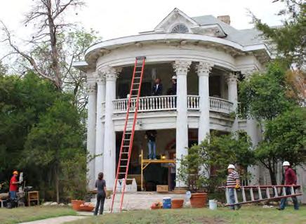
“Best practices” research, sometimes known as “benchmarking,” is a common component of many planning projects. Learning from other places and comparing the performance of various programs is invaluable because it allows us to build upon our peers’ successes, rather than reinvent the wheel. The four U.S. cities profiled in this chapter of the HPP are not intended to approximate Anchorage in every way, but certain parallels can be drawn between Anchorage and certain aspects of each of these cities. Some were selected because they are similar to Anchorage in size, organization, or climate, while others were selected because they exhibit political similarities or contain like resource types. Still others are national leaders in preservation, and are simply inspiring. The ideas and programs presented in the case study section were carefully chosen to collectively represent the brightest ideas and best neighborhood-focused preservation programs from across the country that are most relevant to Anchorage.
Information about how other cities have tackled the issues facing Anchorage is also included throughout this document, so please pay special attention to the sidebars and notes in the HPP.
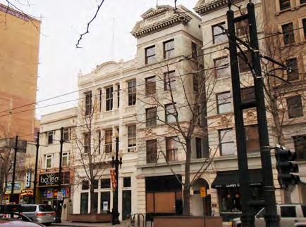
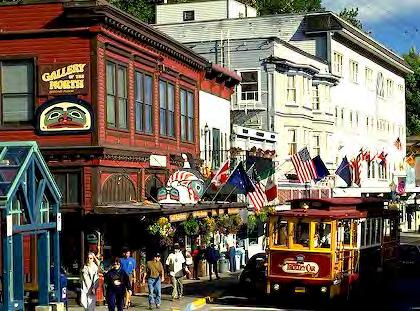
CHAPTER IX: CASE STUDIES ADOPTED 2/12/2013 AO 2013-12 247
Case Study #1: Juneau, Alaska
Juneau’s Historic Sites & Structures Inventory is available to the public online.
Juneau’s built environment dates back to its humble beginnings as a mining town in the 1880s, and it has continued to flourish as the capital of Alaska. Heritage tourism is a huge component of the city’s local economy, and therefore historic preservation has been a key goal of the city for many years. The City/Borough of Juneau became a Certified Local Government in 1988, and the creation of local historic districts and local landmarks has allowed Juneau to protect its historic resources.
Juneau was selected as a case study because it is one of the few other cities in Alaska with an active historic preservation program, even though its resources are generally older than Anchorage’s resources. Juneau has had success in its Downtown Historic District with design guidelines that clarify expectations, streamline the design review process, and improve economic viability—all things Anchorage is concerned about, too—and thus it a good lesson for Anchorage.
Online Inventory
Juneau’s Historic Sites & Structures Inventory was developed as a joint effort between the City/ Borough of Juneau and the Juneau-Douglas City Museum, using a variety of grant funding. The project was intended to be a “one-stop shop” for researchers and the public, collecting information and materials that were previously scattered throughout various City/Borough departments. The inventory is available online, and is searchable by a variety of fields (architectural style, address, architect, etc.). Historic photographs have been provided where possible, and it is easy to learn about the properties that have been documented. The inventory can be accessed at: http://www.juneau. org/cddftp/HSD/.
HISTORIC PRESERVATION PLAN FOR ANCHORAGE’S FOUR ORIGINAL NEIGHBORHOODS ADOPTED 2/12/2013 AO 2013-012248
Downtown Historic District
The Juneau Downtown Historic District is the city’s historic core, and is listed in the National Register of Historic Places and as a local historic district. The district has been protected in some capacity since the 1980s, but a new set of design guidelines was prepared in 2009 to clarify expectations, streamline the design review process, and improve economic viability. Earlier sets of design standards focused exclusively on the late Victorian style, though in 2009 guidelines were expanded to cover four styles: late Victorian, early Twentieth Century Commercial, Art Moderne, and Art Deco.
Compliance with the design standards is mandatory for all properties within the historic district. Even alterations that may seem minor, such as storefront improvements, have the potential to greatly affect a building’s integrity, and therefore must be reviewed.
Further Reading About the Juneau Downtown Historic District:
Juneau Municipal Code, ZA 04.080.80, “Downtown Historic District Design Standards and Guidelines,” http://www.juneau.org/law/regulations/documents/ZA04_080_Chapter_80_DOWNTOWN_ HISTORIC_DISTRICT_DESIGN_STANDARDS_AND_GUIDELINES.pdf
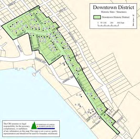
Winter and Company, “Downtown Historic District Design Standards and Guidelines: Juneau, Alaska” (2009), http://www.juneau.org/plancom/documents/Final_DHDDSG_Adoption_Review_8112009_ low.pdf
Mary Catherine Martin, “New guidelines set for Juneau historic district,” Juneau Empire (October 13, 2009), http://juneauempire.com/stories/101309/loc_504192846.shtml
The Juneau Downtown Historic District is listed in the National Register of Historic Places and as a local historic district.
CHAPTER IX: CASE STUDIES ADOPTED 2/12/2013 AO 2013-12 249
Like Anchorage, Salt Lake City uses a neighborhood-based Community Council system.
Case Study #2: Salt Lake City
Salt Lake City has been working to build a high-quality historic preservation program, with a focus on building new preservation tools and establishing a consistent vision and philosophy. Salt Lake City has been involved in preservation since the 1970s—despite being a relatively young city—but recently completed a comprehensive preservation plan (April 2010) with extensive community participation during the planning process. Like Anchorage, Salt Lake City uses a neighborhood-based Community Council system.
Salt Lake City was selected because like Anchorage, it is a relatively young city in the American West. Salt Lake City is smaller than Anchorage—only 189,899 people compared to Anchorage’s 295,570—but like Anchorage, it is organized using a neighborhood-based Community Council system: each council provides community input and information to City departments on a variety of topics and issues.
Financial Incentives
Salt Lake City takes advantage of a number of historic preservation incentives, including a variety of low-interest loans and tax exemptions. These resources are helpfully collected on the website of the Utah Heritage Foundation (a statewide preservation advocacy nonprofit organization): http://www. utahheritagefoundation.com/preservation-resources/financial-resources
Utah Statewide Incentives
State Tax Credit: The Utah State Historic Preservation Office offers a 20% state tax credit program for rehabilitation of qualified residential properties. http://history.utah.gov/historic_buildings/ financial_assistance/state_tax_credit.html
Revolving Loan Fund: The Utah Heritage Foundation offers low-interest loans to restore and rehabilitate significant historical properties throughout the state. http://www. utahheritagefoundation.com/preservation-resources/low-interest-loans
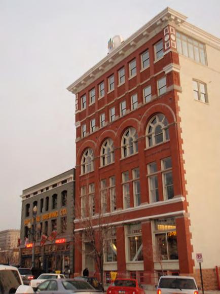
HISTORIC PRESERVATION PLAN FOR ANCHORAGE’S FOUR ORIGINAL NEIGHBORHOODS ADOPTED 2/12/2013 AO 2013-012250
Salt Lake City Housing & Neighborhood Development
Home Repair Program: To preserve and rehabilitate existing homes, loans are available for home repair, up to $20,000, with interest rate between 0% and current bank rates. Minimum payment loans and deferred payment are offered. http://www.slcclassic.com/ced/hand/pages/housing.htm
First-Time Home Buyers Program: To improve affordability of existing housing stock, first-time home buyers may qualify for interest rates as low as 3% fixed for 30 years.
Salt Lake City Revolving Loan Fund
Small Business Building Renovation Loan: Loans up to $50,000 over 10 years are available for a business to improve and renovate a current building. Interest rate is fixed; collateral minimum 25% of loan amount; cash requirement 10% cash or equivalent injection. http://www.slcclassic. com/ED/rlf.htm
Storefront Micro-Loans: Commercial property owners can receive up to $5,000 over 3 years for signage and storefront enhancements. Interest rate is fixed; no collateral or cash requirement.
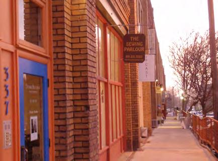
Salt Lake City Redevelopment Agency Programs
Building Renovation Loans: Building owners and developers can receive funding for up to 50% of building renovation costs, including restoring the façade of the building to its original appearance. http://www.slcrda.com/programs/programs.htm
High-Performance Building Renovation Loans: Property owners or developers can receive financing for 50% of building renovation costs at 0% interest for buildings that achieve a LEED certification level or an Energy Star rating.
Salt Lake City offers a Storefront Micro-Loan program for signage and storefront enhancements to historic buildings.
CHAPTER IX: CASE STUDIES ADOPTED 2/12/2013 AO 2013-12 251
HLC: Demolition or Economic Hardship
Tax Increment Reimbursement Program: The Redevelopment Agency will reimburse property owners or developers for open-air and public space improvements, renovating a historic building to a vanilla shell status, and constructing underground or structured parking as part of a housing development.
Design Review Process
Prior to obtaining a building permit, a Certificate of Appropriateness is required for all exterior work (except painting and minor repair) in locally designated historic districts or individual properties listed on the Salt Lake City Register of Cultural Resources. The city’s historic preservation ordinance includes clear standards for considering approval of Certificate of Appropriateness applications.
To streamline the process for applicants and staff, three levels of review are conducted. Administrative Review is staff-level review of smaller projects, such as window replacement, garages, and small additions (typically reviewed within one to two weeks, or approved at the counter). The Architectural Subcommittee is a small group of Historic Landmark Commission members that provides technical assistance to property owners or assists staff with complicated administrative approvals (the committee meets as needed). The full Historic Landmark Commission reviews demolitions, infill construction, and major alterations (meeting once each month). Although demolition of significant buildings is generally prohibited, the review process includes an Economic Hardship provision as an exception to this rule: a Determination of Economic Hardship takes into account current level of economic return on the property, marketability for sale or lease, infeasibility of alternative uses, and availability of financial incentives.
Although demolition of significant buildings is generally prohibited, the Salt Lake City design review process includes an Economic Hardship provision as an exception to this rule. Interested applicants fill out this form for consideration by the Historic Landmarks Commission.
Further Reading About Salt Lake City’s Design Review Process:
Salt Lake City Historic Landmark Commission, “Getting Approval.” Available online at http:// www.slcclassic.com/CED/HLC/default.asp
Salt Lake City Municipal Code, “§ 21A.34.020: Historic Preservation Overlay District.” Available online at http://www.sterlingcodifiers.com/codebook/index.php?book_id=672

HISTORIC PRESERVATION PLAN FOR ANCHORAGE’S FOUR ORIGINAL NEIGHBORHOODS ADOPTED 2/12/2013 AO 2013-012252
Address of Subject Property: Project Name: Name of Applicant: Phone: Address of Applicant: E-mail Address of Applicant Cell/Fax: Applicant’s Interest in Subject Property: Name of Property Owner: Phone: E-mail Address of Property Owner: Cell/Fax: County Tax (“Sidwell #”): Zoning: Legal Description (if different than tax parcel number): Existing Property Use: Proposed Property Use
Please Check Type of Application and submit associate fee Type Application Fee Additional Fee Demolition (non-contributing) $27.69 Plus cost of first class postage Demolition (contributing structure) $442.96 Plus cost of first class postage Economic Hardship (Conditional Use Process) $221.48 Plus cost of first class postage Economic Hardship (Demolition Process) $221.48 Plus cost of first class postage Notice: Additional information may be required by the project planner to ensure adequate information is provided for staff analysis. All information submitted as part of the application may be copied and made public including professional architectural or engineering drawings which will be made available to decision makers, public and any interested party. File the complete application at: SLC Planning Division 451 S State, Room 215 PO Box 145471 Salt Lake City, UT 84114-5480 Telephone: (801) 535-7700 S gnature o Property Owne Or authorized agent SALT LAKE CITY PLANNING 8 2008 OFFICE USE ONLY Petition No.: Date Received: Reviewed By: Use for demolition of a contributing or non-contributing structure and economic hardship Please use application for minoralterationsfordemolitionofaccessorystructure.
Zoning Tools
As recommended by the city’s 2010 Historic Preservation Plan, Salt Lake City has been working on revisions to its zoning code to include a wider range of preservation zoning tools. New tools such as “character conservation districts” would provide communities with flexibility in how to protect their neighborhoods’ character. These conservation districts are voluntary—more than 50% of residents have to “opt-in”—and design review can be as strict or as lenient as the community wants. This grassroots approach is perfect for areas that may not want or do not qualify for local designation, yet have character worthy of protection.
Combined with the existing overlay zoning classifications for historic preservation, the city will soon offer four types of zoning tools that create a hierarchy of protections and corresponding restrictions. This range of tools, listed in increasing level of local regulation, consists of base zoning, neighborhoodbased zoning, conservation district, and local historic district.
Further Reading About Salt Lake City’s Zoning Tools:
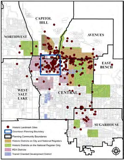
Clarion & Associates/City of Salt Lake City, Salt Lake City Historic Preservation Plan: Revised Draft (April 2010), 52-53. Available online at http://www.slcclassic.com/ced/planning/documents/ MasterPlans/HistoricPreservation/HP-MP_4.10draft.pdf
Frank Gray, CED Director, “City Council Transmittal: Salt Lake City Preservation Program” (June 29, 2011). Available online at ftp://ftrftp.slcgov.com/attachments/9-20-11-A4.pdf
Derek P. Jensen, “New conservation districts might find a home in Yalecrest,” Salt Lake Tribune (December 5, 2011). Available online at http://www.sltrib.com/sltrib/home2/53037095-183/saysconservation-districts-yalecrest.html.csp
In addition to traditional historic districts, Salt Lake City has been working on providing new preservation zoning tools such as “character conservation districts.”
CHAPTER IX: CASE STUDIES ADOPTED 2/12/2013 AO 2013-12 253
Miracle Mile North HPOZ
Case Study #3: Los Angeles
Preservation Plan
In a city as vast as Los Angeles, it is not surprising that neighborhood-based planning is an essential component of the city’s historic preservation activities. Although Los Angeles enacted a Cultural Heritage Ordinance in 1962, until recently it did not have all the elements of a comprehensive municipal historic preservation program. In the last decade, the city has been known for its ambitious and innovative historic preservation planning efforts, including SurveyLA, a comprehensive survey project to identify significant historic resources throughout Los Angeles’ 880,000 parcels. The city’s Office of Historic Resources was formed in 2004, and now has a staff of six planners to serve dozens of Los Angeles neighborhoods, each large enough to be small cities in their own right.
Los Angeles was selected as a case study because it shares Anchorage’s mid-century modern resources, automobile-oriented development patterns, and strong neighborhood focus. Los Angeles’ population is clearly at different scale than Anchorage’s, but it was not profiled here because of its size. Residents of the Four Original Neighborhoods are passionate about their neighborhoods, and want the HPP and future preservation efforts to be tailored to their specific area. Los Angeles is a leader in neighborhoodbased preservation zoning policy, and their HPOZ system is summarized here because it allows the same type of flexibility at the neighborhood level desired in Anchorage. The Los Angeles Conservancy was highlighted here because it is a nationally recognized preservation nonprofit organization that could inspire preservation groups in Anchorage.
Overlay Zones
Each HPOZ Review Board creates its own “Preservation Plan,” which includes a set of design guidelines to be used for review of applications.
Historic preservation in Los Angeles occurs at the neighborhood level, and the city’s Historic Preservation Overlay Zones (HPOZs) structure is one of the nation’s leading examples of preservation zoning policy. There are currently 29 HPOZs, each of which has its own HPOZ Review Board to conduct design review within the district and report to the City Planning Department. In addition, 11 proposed HPOZs are under consideration by the Los Angeles City Council.
According to the Office of Historic Resources’ website: “Each HPOZ Board consists of five members, at least three of whom must be renters or owners of property within an HPOZ. All members should have knowledge of and interest in the culture, structures, sites, history and architecture of the HPOZ
 City of Los Angeles
HISTORIC PRESERVATION PLAN FOR ANCHORAGE’S FOUR ORIGINAL NEIGHBORHOODS ADOPTED 2/12/2013 AO 2013-012254
Adopted December 9, 2010
area, and if possible, experience in historic preservation. […] The Board is an advisory body to the City Planning Department. The Director of Planning has the authority to issue determinations, building permit sign-offs, and Certificates of Appropriateness.”
At the time an HPOZ is adopted by the City Council, the Department of City Planning will work with the HPOZ Review Board to create a “Preservation Plan,” which includes a list of contributing properties and a set of design guidelines to be used for review of Certificate of Appropriateness applications.
When HPOZ neighborhoods do not yet have an adopted Preservation Plan, the Secretary of the Interior’s Standards for Rehabilitation are used as the benchmark for review of projects.
By using a neighborhood-based model for design review within HPOZs, the Cultural Heritage Commission—analogous to Anchorage’s Historic Resources Commission—is only involved in reviewing alterations to individual local landmarks.
Further Reading About Los Angeles’ HPOZs:
Los Angeles Department of City Planning, Office of Historic Resources, “Historic Preservation Overlay Zones,” http://preservation.lacity.org/hpoz
Los Angeles Ordinance Number 175891, amending § 12.20.3 of the Los Angeles Municipal Code (2004), http://preservation.lacity.org/hpoz/ordinance
Adaptive Reuse Ordinance
One of the most powerful incentives in Los Angeles’ toolbox is the Adaptive Reuse Ordinance, adopted in 1999 to facilitate conversion of commercial buildings into new uses, such as apartments, condominiums, live/work lofts, retail, and hotels. The ordinance was originally focused on decaying Downtown Los Angeles, but was expanded to other neighborhoods in 2003 after it was successfully implemented in Downtown.
Map showing Adaptive Reuse Incentive Areas in the City of Los Angeles.
Adaptive Reuse Incentive Areas
In the City of Los Angeles
CHAPTER IX: CASE STUDIES ADOPTED 2/12/2013 AO 2013-12 255
Eastern Crenshaw Beverly Glendale Alhambra Monterey Park Maywood Huntington Park Hawthorne Hermosa Redondo Rolling Rolling Hills Rancho Palos Verdes Long Beach Lakewood Paramount Lynwood Cudahy Downey Calabasas Malibu Cañada Flintridge Crescenta Del Willowbrook Rancho Dominguez City East Angeles Fox Hills Ladera Marina Signal Hill Village Simi Valley Beach City Hollywood teFw
Not to scaleN epared City Los Angeles Planning Department Graphic Services Section May, 2004 Broadway Ave60 Griffith Sheldon Osborne Hubbard Eldridge Downtown Adaptive Reuse Ordinance LAMC Section 12.22 26, amended Ordinance No. 174,315, effective December 20, 2001 Holly Adaptive Reuse Incentive Areas Specific Plan Ordinance No. 175,038, effective February 2003 Hollywood Community Redevelopment Project Area Adaptive Reuse Incentive Areas Specific Plan Ordinance No. 175,038, effective February 2003 ilsh Union 15thSt MainLosAngeles leSt 8th Chavez 6th College WashingtonBl Alvarado 30thS SantaMonicaFwy shing lloA ScarffSt iversity hS 10 110 Central City Community Plan Area Figueroa Corridor Economic Development Strategy Area Adaptive Reuse Incentive Areas Specific Plan Ordinance No. 175,038, effective February 2003 Thisadaptivereuseincentiveareaincludesallrealpropertywithfrontageon bothsides CentralAvenuesouth theNumber Freeway northofVernonAvenue. 110 10 adenaA TempleSt Fig Main Ch n tow Lincoln Heights 10 ayHillSt inS ntral hing nBl Central Avenue oldenState wy antaAna PasadenaFwy SantaMonicaFwy 101 Temple ilsh arad erly Beverly 11th Ramp Olympic Adaptive Reuse Incentive Areas Specific Plan Ordinance No. 175,038, effective February 9, 2003 ThisadaptivereuseincentiveareaincludestheshadedportionoftheWilshireCenter/Koreatown CommunityRedevelopmentProjectArea. Wilshire Center/Koreatown Community Redevelopment Project Area lly 101
The Adaptive Reuse Ordinance helps to streamline the approval process, resulting in substantial time- and cost-savings for developers. The program relaxes parking, density, and other typical zoning requirements, and also provides flexibility in the permitting process. The result has been the creation of several thousand new housing units, revitalization of distressed neighborhoods, and retention of significant buildings, thus illustrating the important link between historic preservation and economic development.
Further Reading About Los Angeles’ Adaptive Reuse Ordinance:
Los Angeles Department of City Planning, Office of Historic Resources, “Adaptive Reuse Ordinance,” http://preservation.lacity.org/reuse-ordinance
City of Los Angeles, “Adaptive Reuse Program” (2nd ed., February 2006), http://www.scag. ca.gov/Housing/pdfs/summit/housing/Adaptive-Reuse-Book-LA.pdf
Nonprofit Partners
The Los Angeles Conservancy is the local preservation advocacy nonprofit organization, and is a great partner for the Office of Historic Resources. The Conservancy hosts tours and events; honors local achievements through its annual preservation awards; sponsors youth and other educational programs; and serves as a contact for other community groups. The Conservancy also actively advocates for threatened historic buildings, especially Los Angeles’ famous theaters and Mid-Century Modern resources. Furthermore, the Conservancy website provides a wealth of information, including helpful links and resources about how to research one’s own property, how to contact tradesfolk and contractors who specialize in traditional building, or which incentives are available to finance one’s preservation project.
Further Reading About the L.A. Conservancy:
Los Angeles Conservancy: http://www.laconservancy.org/index.php
 The LA Conservancy hosts popular preservation events such as “Last Remaining Seats,” a series of classic films in historic theatres.
The LA Conservancy website provides a wealth of information and resources.
The LA Conservancy hosts popular preservation events such as “Last Remaining Seats,” a series of classic films in historic theatres.
The LA Conservancy website provides a wealth of information and resources.
HISTORIC PRESERVATION PLAN FOR ANCHORAGE’S FOUR ORIGINAL NEIGHBORHOODS ADOPTED 2/12/2013 AO 2013-012256
Case Study #4: San Antonio, Texas
San Antonio—home of the Alamo—has built a comprehensive, robust preservation program with a focus on community outreach and education. The City of San Antonio’s Office of Historic Preservation includes one dedicated historic preservation officer, as well as 10 planners who support various aspects of the program. In 2009, San Antonio prepared a Strategic Historic Preservation Plan, using an extensive public planning process to help guide the long-term vision for the program.
San Antonio was selected as a case study because of the comprehensive nature of its preservation program, as well as the political and economic similarities shared by Texas and Alaska. Although San Antonio is a much larger, denser city than Anchorage, it was not profiled here because of its size. Instead, San Antonio’s success in implementing their recent historic preservation plan through regular reporting and extensive public education campaigns parallels the implementation plan for the HPP.
Implementation & Benchmarking
San Antonio’s Office of Historic Preservation has been working to implement its Strategic Historic Preservation Plan since its adoption in August 2009. To this end, the city has prepared an annual report each year that summarizes the accomplishments in each of the six recommendation categories: Planning, Zoning, Economic Development, Historic Resources, Incentives, and Education and Advocacy. In the first year alone, nearly 20 achievements undertaken by public-private partnerships were highlighted in the annual report. A detailed matrix is also updated annually to track each implementation strategy.
Further Reading About the San Antonio Strategic Historic Preservation Plan:
City of San Antonio Office of Historic Preservation, “Strategic Plan,” http://www.sanantonio.gov/ historic/StrategicPlan.aspx
Education & Outreach
The City of San Antonio has been dedicated to raising awareness about historic preservation. The city’s user-friendly website includes links to all these events and programs, making it easy for the public to learn about preservation:
Hundreds of cities nationwide have a Historic Plaque Program to identify and celebrate historic places. An example from San Antonio, Texas, is pictured here.
CHAPTER IX: CASE STUDIES ADOPTED 2/12/2013 AO 2013-12 257
A recent public awareness and fundraising campaign called “Power of Preservation” was designed to secure support from the private sector and communicate the role of preservation in improving the quality of life in San Antonio.
A Historic Plaque Program visually identifies significant buildings in the city, which currently has 27 local historic districts and more than 2,000 individual local landmarks.
Since 2010, the Office of Historic Preservation has sponsored Historic Preservation Television (HPTV), a monthly 30-minute segment on the city’s public access channel. Past topics include African-American Structures in San Antonio, San Antonio’s Historic Districts, Historic Farms and Ranches, Design Guidelines, and more.
A recent public awareness and fundraising campaign called “Power of Preservation” included events, flyers, and press releases; the Office of Historic Preservation also celebrates and promotes National Preservation Month every May.
Other educational tools include a series of walking tours; a Historic Conservation Series on Texas Public Radio; a “River Walk Tour” smartphone app; and guides to conducting historic house research.
Brochures about historic preservation regulations and processes are available online, and Office of Historic Preservation staff are available to provide technical assistance to property owners and developers.
Further Reading About San Antonio’s Education & Outreach Efforts:
City of San Antonio Office of Historic Preservation, “Preservation Tools,” http://www.sanantonio. gov/historic/tools.aspx
City of San Antonio Office of Historic Preservation, “Incentives,” http://www.sanantonio.gov/ historic/incentives.aspx
City of San Antonio Office of Historic Preservation, “Events and Announcements,” http://www. sanantonio.gov/historic/events.aspx
HISTORIC PRESERVATION PLAN FOR ANCHORAGE’S FOUR ORIGINAL NEIGHBORHOODS ADOPTED 2/12/2013 AO 2013-012258
Other Cities
Little Rock, Arkansas
Little Rock was selected as an additional case study because of its size, although it is a bit smaller than Anchorage—only 195,314 people compared to Anchorage’s 295,570. The following highlights of Little Rock’s preservation program are especially relevant to Anchorage:
The Little Rock Historic Preservation Plan was completed in 2009, and is quite comprehensive. Like Anchorage, recognition of diverse cultural history was a key goal: for example, Central High School is a National Historic Landmark for the role it played in desegregation of education in the U.S. http://www.littlerock.org/!userfiles/editor/docs/planning/hdc/pres_plan_part_1_rev.pdf.
Capital Zoning District Commission: This commission was formed in the 1970s to protect the special character of the neighborhoods surrounding the State Capitol and Governor’s Mansion. It acts as a special planning and historic preservation commission for this area, and conducts review of work in the district independently of the citywide Historic District Commission. This could be a model for regulating preservation in the Four Original Neighborhoods. http://czdc.arkansas.gov/ Pages/default.aspx
Financial incentives are a key component of preservation in Little Rock. Tax credits, façade easements, rehabilitation grants and loans, housing affordability programs, and overlay zoning all help to balance preservation and economic development in Little Rock. All these concepts could apply in Anchorage, too. http://www.littlerock.org/citydepartments/planninganddevelopment/ boardsandcommissions/historicdistrictcomm/default.aspx.
The Arkansas Historic Preservation Program conducted a two-year study about the effects of historic preservation on the Arkansas economy, and the results are directly applicable to Anchorage. Issues such as heritage tourism, job creation, tax credits, grant programs, and historic property valuation are all addressed, and were proved to be beneficial to the state. http://www. arkansaspreservation.com/economic-benefits/.
The Capitol Zoning District Commission reviews historic preservation work in a special district surrounding the State Capitol and Governor’s Mansion.

CHAPTER IX: CASE STUDIES ADOPTED 2/12/2013 AO 2013-12 259
Average investment by the state of Arkansas in preservation grants is $4.1 million annually. State preservation grants:
• Support 85 Arkansas jobs yearly.
• Add $2.3 million to the yearly income of Arkansas families.
• Return $100,000 in state and local taxes each year.
Main Street Arkansas assists local downtown programs in their preservation-based revitalization efforts.

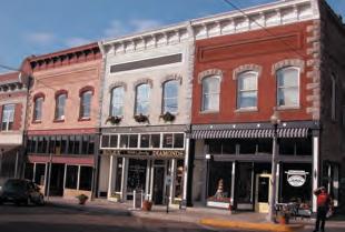
Main Street Arkansas’s efforts:
• Result in $7 million spent per year rehabilitating historic downtown buildings and 187 downtown retail/service jobs.
• Support 246 Arkansas jobs each year.
• Add $3.8 million to the yearly income of Arkansas families.
• Return $1 million in state and local taxes each year.
Arkansas Historic Preservation Program

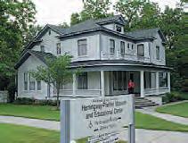

An agency of the Department of Arkansas Heritage 1500 Tower Building 323 Center Street Little Rock, AR 72201 501-324-9880 Arkansas Historic Preservation Program
A Profitable Past: The Economic Impact of Historic Preservation in Arkansas Historic Preservation
A brochure entitled “A Profitable Past: The Economic Impact of Historic Preservation in Arkansas” highlights the results of a two-year statewide study about the positive economic effects of historic preservation activities.
Historic Preservation Preservation adds million to economy and supports year!
HISTORIC PRESERVATION PLAN FOR ANCHORAGE’S FOUR ORIGINAL NEIGHBORHOODS ADOPTED 2/12/2013 AO 2013-012260
Historic
$970
Arkansas’s
23,321 jobs each
ARKANSAS HISTORIC PRESERVATION PROGRAM
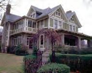
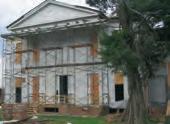
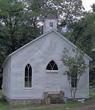
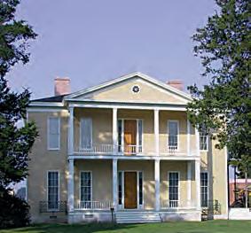
TThe results of a two-year study by the Center for Urban Policy Research at the Edward J. Bloustein School of Planning and Public Policy at Rutgers, the State University of New Jersey find that historic preservation has a tremendous impact on Arkansas’s economy.
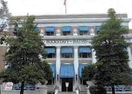
The study looked into the economic impact of the federal Historic Rehabilitation Tax Credit, the anticipated effect of a proposed state tax credit, heritage tourism, rehabilitation of historic properties, state historic preservation grants and the Main Street Arkansas program. All of the figures cited are in 2006 dollars.
The federal Historic Rehabilitation Tax Credit creates a strong incentive to invest in historic properties.
The Federal HRTC investment:
• Leveraged $54.3 million of historic rehabilitation in Arkansas from 2000 to 2006.
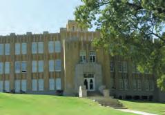
• Supported 767 Arkansas jobs from 2000 to 2006.
• Added $22.4 million to the income of Arkansas families from 2000 to 2006.
• Generated $1.1 million in state and local tax revenue from 2000 to 2006.
The proposal for a 25-percent Arkansas state historic rehabilitation tax credit would attract strong investment in Arkansas’s economy.
• One Arkansas job would be supported for every $12,000-$12,500 of state investment in the proposed tax credit.
• Each $1 of state investment in the proposed tax credit would return $2.19-$2.22 in income to Arkansas families.
• Each $1 of state investment in the proposed tax credit would return 17.7-18.5 cents in state and local taxes, partially offsetting the program’s short-term cost to state revenue.
Heritage tourists are those tourists who visit a site of historical or cultural value.
Heritage tourists:
• Comprise about 16 percent of all Arkansas tourists.
• Spend about 30 percent more than the average tourist.
• Are more likely to come from out of state, adding new dollars to Arkansas’s economy.
Heritage tourism:
• Generates $890.6 million in Arkansas each year.
• Supports 21,552 Arkansas jobs yearly.
• Adds $318.8 million to the yearly income of Arkansas families.
• Generates $73.8 million in state and local tax revenue each year.
Arkansans spend $74.5 million each year rehabilitating historic properties — those properties that are listed on, or eligible for listing on, the National Register of Historic Places or the Arkansas Register of Historic Places.
Historic rehabilitation:
• Supports 1,523 Arkansas jobs yearly.
• Adds $40.9 million to the yearly income of Arkansas families.
• Generates $3.3 million in state and local tax revenue each year.
• Accounts for about 6 percent of all building rehabilitation in Arkansas.
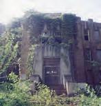
The state of Arkansas offers several grant programs for historic rehabilitation.
• These include grants from the Arkansas Natural and Cultural Resources Council and the Arkansas Historic Preservation Program’s Historic Preservation Restoration Grants, County Courthouse Restoration Grants, and Main Street
Model Business Grants, many of which are funded through the Real Estate Transfer Tax.
Historic Preservation
CHAPTER IX: CASE STUDIES ADOPTED 2/12/2013 AO 2013-12 261
Cincinnati’s local nonprofit organizations host events to celebrate modernism and the recent past.
Cincinnati, Ohio
Cincinnati was selected as an additional case study because of its size. As estimated by the U.S. Census Bureau in July 2011, Anchorage is the 65th biggest city by population, Cincinnati is 64th—nearly the same size. The following highlights of Cincinnati’s preservation program are especially relevant to Anchorage:
Like Anchorage, Cincinnati is organized using a Community Council system.

At-Risk Historic Buildings List: This unusual program identifies privately-owned structures that are deteriorating or abandoned with the hope of raising public awareness and inspiring advocacy. http://www.cincinnati-oh.gov/community-development/property-maintenance/at-risk-historicbuildings/.
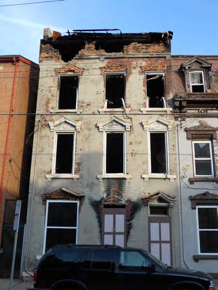
Cincinnati has 22 Local Historic Districts and Protection Areas, each with their own set of Conservation Guidelines. The city also has 28 National Register Districts (some overlap with local districts). http://www.cincinnati-oh.gov/planning/historic-conservation/local-conservationguidelines/.
“Urban Conservator” position: the city’s program is headed by the urban conservator, a person whose qualifications must include experience in private development (architect, planner, preservation consultant, builder or developer—not just an academic). Two regular planners are also assigned to the preservation team. http://www.cincinnati-oh.gov/planning/historicconservation/urban-conservator/.
Cincinnati Modernism: although it is not known for its modern resources, Cincinnati’s local nonprofit organizations have recognized resources from the recent past and are trying to raise public awareness about this important period of design. http://www.cf3.org/ & http:// cincinnatipreservation.org/advocacy/modernism/.
Cincinnati’s “At-Risk Historic Buildings” program identifies deteriorating or abandoned structures with the hope of
HISTORIC PRESERVATION PLAN FOR ANCHORAGE’S FOUR ORIGINAL NEIGHBORHOODS ADOPTED 2/12/2013 AO 2013-012262
Additional cities that could be used as case studies and are referenced throughout the HPP include:
Seattle: http://www.seattle.gov/neighborhoods/preservation/
Boulder, Colorado: http://www.bouldercolorado.gov/index.php?option=com_content&task=vie w&id=1428&Itemid=490
Portland, Oregon: http://www.portlandonline.com/bps/index.cfm?c=39750
Santa Fe: http://www.santafenm.gov/index.aspx?NID=237
CHAPTER IX: CASE STUDIES ADOPTED 2/12/2013 AO 2013-12 263
HISTORIC PRESERVATION PLAN FOR ANCHORAGE’S FOUR ORIGINAL NEIGHBORHOODS ADOPTED 2/12/2013 AO 2013-012264
ENDNOTES
Endnotes
1. Ohio Historical Society, “Why Plan for Historic Preservation,” Ohio Historic Preservation Office Preservation Toolbox. Available HTTP: http://ww2. ohiohistory.org/resource/histpres/toolbox/ppl/ppl01.html (accessed November 14, 2011).
2. Bureau of Land Management. “The Antiquities Act: A Century of Historic Preservation—Join the Adventure: Honor the Past, Shape the Future.” No date. Available HTTP: http://www.blm.gov/ heritage/adventures/menu/media/history.pdf (accessed November 14, 2011).
3. National Park Service, Historic Sites Act of 1935, as amended. Available HTTP: http://www.cr.nps.gov/ local-law/FHPL_HistSites.pdf.
4. Ibid.
5. National Park Service. National Historic Preservation Act of 1966, as amended through 1992. Available HTTP: http://www.cr.nps.gov/locallaw/nhpa1966.htm (accessed November 14, 2011).
6. National Park Service, Bulletin 15: “How to Apply the National Register Criteria for Evaluation” (1990).
7. National Park Service, Bulletin 15: “How to Apply the National Register Criteria for Evaluation” (1990).
8. Advisory Council on Historic Preservation. Citizen Guide to Section 106. Available HTTP: http:// www.achp.gov/docs/CitizenGuide.pdf (accessed November 14, 2011).
9. Alaska Office of History & Archeology. “Saving Our Past: Alaska’s State Historic Preservation Plan 2011-2017.” Available HTTP: http://www.dnr. alaska.gov/parks/oha/shpo/akpreservepln.pdf.
10. Alaska Statute Title 41, Chapter 35, Section 10: Declaration of Policy.
11. Cook Inlet Alaska ICWA Contact List, February 3, 2012. Accessed HTTP: http://hss.state.ak.us/ocs//ICWA/pdf/CITC-tribeslist.pdf.
12. UAA Justice Center, “ANCSA & Alaska Native Lands.” Accessed HTTP: http://justice.uaa.alaska. edu/rlinks/natives/ak_natives_ancsa.html.
13. Cook Inlet Region, Inc., “CIRI Company Overview.” Accessed HTTP: http://www.ciri.com/content/ company/slideshow.aspx.
14. Janet McCabe, “Historic Railroad Town facing key assembly decision,” Anchorage Daily News (September 5, 1985). Daniel Patrick O’Tierney, “Let marketplace determine if Railroad Town will work,” Anchorage Daily News (May 30, 1985).
15. Municipality of Anchorage, Historic Anchorage Preservation Program (April 3, 1986), page 5.
16. Anchorage Downtown Partnership, LTD. Accessed HTTP: http://www.anchoragedowntown.org/ about-downtown/development/developmentincentives/.
17. The Anchorage Citizens Coalition (ACC) is a nonprofit membership organization that “participates in comprehensive plan implementation and promotes local and regional land use and transportation planning.” Although the ACC is not officially involved in the Title 21 rewrite, the organization has compiled helpful summaries of the process to date, available online at www.accalaska.org.
18. Municipality of Anchorage, Anchorage Downtown Comprehensive Plan (2007), 68.
19. Ibid., 69.
20. Alaska Railroad Corporation, “Building Leases.” Accessed HTTP: http://alaskarailroad.com/ Corporate/RealEstateServices/BuildingLeases/ tabid/406/Default.aspx.
21. James Kari and James A. Fall, with principal contributor Shem Pete, Shem Pete’s Alaska: The Territory of the Upper Cook Inlet Dena’ina, 2nd ed. (Fairbanks: University of Alaska Press, 2003).
22. Alan Boraas, As Languages Die, We Lose Diversity of Thought.
CHAPTER X: ENDNOTES ADOPTED 2/12/2013 AO 2013-12 265
23. Peter Kalifornsky, A Dena’ina Legacy: The Collected Writings of Peter Kalifornsky.
24. Louise Potter, Early Days in Wasilla.
25. Murray Lundberg, “Captain James Cook in Alaska,” at ExploreNorth, http://explorenorth. com/library/yafeatures/bl-Cook1.htm (accessed September 20, 2011).
26. Anchorage Museum of History and Art, “Europe Discovers Alaska,” Exhibition Materials; Alaska History & Cultural Studies, “Russia’s Colony: More Russian Exploration in Alaska,” http://www. akhistorycourse.org/articles/article.php?artID=130 (accessed September 19, 2011).
27. Elizabeth Tower, Anchorage: From Its Humble Origins as a Railroad Construction Camp (Fairbanks, AK: Epicenter Press, 1999), 15.
28. United States Department of the Interior, National Park Service, The Alaska Journey: United States Department of the Interior in Alaska (Anchorage: National Park Service), 6-8; Dermot Cole, Historic Photos of Alaska (Nashville, TN: Turner Publishing, 2008), 1.
29. National Park Service, The Alaska Journey, 9-15; Cole, 59.
30. Cole, 59.
31. National Park Service, The Alaska Journey, 9-15; Cole, 59.
ADOPTED
32. Michael Carberry and Donna Lane, Patterns of the Past: An Inventory of Anchorage’s Historic Resources, 2nd ed. (Anchorage: Municipality of Anchorage, 1986), 8.
33. John Strohmeyer, Historic Anchorage: An Illustrated History (San Antonio, TX: Historical Publishing Network, 2001), 9; National Park Service, The Alaska Journey, 28-29.
34. Tower, 26-27; Carberry and Lane, 2.
35. Tower, 26-27; Carberry and Lane, 2-3.
36. Strohmeyer, 9-10; Carberry and Lane, 3.
37. “Map of Anchorage Townsite” (1916), National Archives and Records Administration, Pacific Alaska Region.
38. Ibid. 39. Carberry and Lane, 132.
40. “A City is Born—And Reborn,” manuscript in Vertical Files, Anchorage Museum of History and Art (n.d.).
41. “Alaska’s Heritage: 4.2 Air Transportation,” http://www.akhistorycourse.org/articles/article. php?artID=177 (accessed September 22, 2011).
42. U.S. Department of the Interior, National Park Service, Elmendorf Air Force Base, Volume I: Historic Context of World War II Buildings and Structures (Washington D.C.: National Park Service, 1999), 34.
43. Carberry and Lane, 195.
44. Fern Chandonnet; “Chapter IX. The Garrisoning of Alaska, 1939-41,” HyperWar, at http://www.ibiblio. org/hyperwar/USA/USA-WH-Guard/USA-WHGuard-9.html (accessed September 25, 2011).
45. Elmendorf Air Force Base, Volume I, 21-24. 46. Tower, 82.
47. U.S. Air Force, “Elmendorf Air Force Base History Fact Sheet” (2006), at http://www.jber.af.mil/ library/factsheets/factsheet.asp?id=5280 (accessed September 25, 2011); Elmendorf Air Force Base, Volume I, 3.
48. Claus M. Naske and L.J. Rowinski, Anchorage: A Pictorial History (Norfolk, VA: The Donning Company, 1981) 126.
49. Municipality of Anchorage Plat Maps. 50. Tower, 105.
51. State of Alaska, “Ted Stevens Anchorage International Airport History,” at http://dot.alaska. gov/anc/about/history.shtml.
52. Tower, 107.
HISTORIC PRESERVATION PLAN FOR ANCHORAGE’S FOUR ORIGINAL NEIGHBORHOODS
2/12/2013 AO 2013-012266
53. National Park Service, The Alaska Journey, 90-91.
54. Committee on the Alaska Earthquake of the Division of Earth Sciences National Research Council, The Great Alaska Earthquake of 1964: Engineering (Washington D.C.: National Academy of Sciences, 1973), ix.
55. Tower, 155.
56. Anchorage Chamber of Commerce, “Timeline,” at http://www.anchoragechamber.org/cms/Default. asp?Page=103.
57. Mother Earth Travel, “History of Anchorage,” at http://motherearthtravel.com/united_states/ anchorage/history.htm.
58. State of Alaska Permanent Fund Dividend Division, “Historical Information.” Available HTTP: http://pfd.alaska.gov/historical/index.aspx.
59. Alaska Department of Natural Resources, “What Is ANILCA?” at http://dnr.alaska.gov/commis/opmp/ anilca/more.htm.
60. Vanessa Orr, “From Project 80s to the Present: Resurgence of Construction in Anchorage Recalls Earlier Time,” Alaska Business Monthly (September 2007).
61. Carberry and Lane, i-iv.
62. National Park Service, “40th Anniversary of the National Historic Preservation Act.” Available HTTP: http://www.nps.gov/history/40th/quality. htm.
63. Washington City Paper Blog. Available HTTP: http://www.washingtoncitypaper.com/blogs/ housingcomplex/2011/05/10/noma-settles-on-newidentity-connectedness/.
64. Anchorage First Economic Development Strategy. Available HTTP: http://www.goanchoragefirst. com/category/about-anchorage-first/.
65. Alaska Coastal Management Program. Available HTTP: http://www.alaskacoastalmanagement. org/.
66. For additional information about Alaska Native/Native Hawaiian Institutions Assisting Communities see: http://www. cdfa.net/cdfa/cdfaweb.nsf/ordredirect. html?open&id=alaskaedguide09.html.
67. Alaska Channel, “Anchorage Tour: The Pioneer’s Trail.” Accessed HTTP: http://alaska.org/ anchorage-tour.htm.
68. “2012 Anchorage Events You Don’t Want to Miss.” Available HTTP: http://www.anchorage.net/2012Anchorage-events.
69. Municipality of Anchorage, Anchorage 2020: Anchorage Bowl Comprehensive Plan (2001), 45.
70. Washington State Department of Community, Trade and Economic Development. Historic Preservation: A Tool for Managing Growth. Growth Management Services: June 2005. Available HTTP: http://www. dahp.wa.gov/sites/default/files/Historic%20 Preservation%20Guidebook%20Final.pdf.
71. Federal Highway Administration (FHWA), “What is CSS?” Available HTTP: http://www.fhwa.dot.gov/ context/what.cfm.
72. Cascadia Green Building Council. Available HTTP: http://cascadiagbc.org/branches/alaska-branches/ alaska-1.
73. NOAA Fisheries Service, Alaska Regional Office. “Tips for Submitting Effective Public Comments.” Available HTTP: http://www.fakr.noaa.gov/prules/ effectivecomments.pdf.
74. Georgia Department of Community Affairs. “Planning for Community Involvement: Guidebook for Citizens and Local Planners.” Available HTTP: http://www.dca.state.ga.us/development/ planningqualitygrowth/programs/downloads/ guidebooks/PlanningCommunityInvolvement.pdf.
75. “Access to the Future,” Alaska Department of Community and Economic Development (2003). Available HTTP: http://www.commerce.state. ak.us/dca/pub/AccessDec03.pdf.
CHAPTER X: ENDNOTES ADOPTED 2/12/2013 AO 2013-12 267
76. Partners in Tourism: Culture and Commerce, “Getting Started: How to Succeed in Cultural Heritage Tourism,” Cultural Heritage Tourism. Available HTTP: http://www. culturalheritagetourism.org/howtogetstarted.htm.
77. Maine Development Foundation, “Maine Downtown Center Historic Preservation Checklist.” Available HTTP: http://www.mdf.org/documents/ MaineDowntownCenterHistoricPreservation Checklist.pdf
78. Alaska Film Office. Available HTTP: http://www. film.alaska.gov/.
79. U.S. General Services Administration, “Filming On Location.” Available HTTP: http://www.gsa. gov/portal/content/101542; U.S. General Services Administration, “Building Manager Tools.” Available HTTP: http://www.gsa.gov/portal/ content/104831.
80. City of Eugene, Oregon, “Incentives for Historic Preservation.” Available HTTP: http://www. eugene-or.gov/portal/server.pt?open=512&objID =318&PageID=452&cached=true&mode=2&user ID=2.
81. Don Nelson, “There’s value in preserving towns’ historic homes,” Athens Banner Herald (Athens, Georgia, May 8, 2011), at http://www.onlineathens. com/stories/050811/bus_825928005.shtml (accessed September 1, 2011).
82. Municipality of Anchorage, Department of Economic Development and Planning, Ship Creek/ Waterfront Land Use Study (May 1991), 4-7.
83. Alaska Railroad Corporation, “Building Leases,” accessed HTTP: http://alaskarailroad.com/ Corporate/RealEstateServices/BuildingLeases/ tabid/406/Default.aspx.
84. Stephen R. Braund & Associates, Knik Arm Crossing Project Recommendations for a Historic District(s): Government Hill, Anchorage, Alaska; Volume I: Literature Review and Recommendations (July 25, 2006): 8-28; Alison K. Hoagland, Buildings of Alaska (New York: Oxford University Press, 1993), 102-104.
85. Municipality of Anchorage, Department of Economic Development and Planning, Ship Creek/ Waterfront Land Use Study (May 1991), 7.
86. Braund & Associates, 1.
87. “Trails of Anchorage Map.” Available HTTP: http:// www.trailsofanchorage.com/TrailwatchMap.pdf.
88. Municipality of Anchorage, Parks and Recreation Department, “Trail Watch Ambassadors.” Available HTTP: http://www.muni.org/Departments/parks/ trail/Pages/TrailWatchAmbassadors.aspx.
89. Carberry and Lane, 1-55, 67-100.
90. Tower, 132-133. 91. Ibid, 178. 92. Carberry and Lane, 132. 93. Municipality of Anchorage Plat Maps.
94. Page & Turnbull, South Addition Historic Context Statement (Administrative Draft, September 30, 2011), 24-93.
95. Interview with Cal Williams and other Fairview residents (May 29, 2012).
96. Christine Kim, “Carr’s first black worker recalls his rise through the ranks,” KTUU (February 19, 2010), accessed at http://articles.ktuu.com/2010-02-19/ carrs_24126516.
97. Interview with Cal Williams and other Fairview residents (May 29, 2012).
98. BGES, Fairview Historic Building Survey (March 2008), 9-17.
99. Fairview Community Council, Fairview Community Plan: Revised Final Draft (November 12, 2009), 14-15.
HISTORIC PRESERVATION PLAN FOR ANCHORAGE’S FOUR ORIGINAL NEIGHBORHOODS ADOPTED 2/12/2013 AO 2013-012268
Image Credits
2.15 Steve McCutcheon, McCutcheon Collection; Anchorage Museum, #B1990.014.5.AncAir.5.6.34
3.31 Top right: Municipality of Anchorage Bottom right: Richard Knecht, 1993. http://www. pbs.org/harriman/explog/lectures/crowell.html
Bottom left: Alaska Native Heritage Center
3.43 Charlene’s Express Travel. http://www. charlenestravel.com/html/day-tours/dt1---citytour-w-native-heritage-center.php
3.35 US Department of Housing and Urban Development (8/12/2009). At http:// portal.hud.gov/hudportal/documents/ huddoc?id=DOC_12988.pdf
3.44 Alaska Subsistence: A National Park Management History. At http://www.cr.nps.gov/ history/online_books/norris1/chap4.htm
3.45 Anchorage Daily News (May 30, 1985)
3.50 Municipality of Anchorage
4.55 Sonya Senkowsky and Amanda Coyne, Alaska Then and Now: Anchorage, Juneau & Fairbanks (San Diego: Thunder Bay Press, 2008), 24-25.
4.56 Anchorage 2020: Anchorage Bowl Comprehensive Plan (2001)
4.56 Anchorage 2020: Anchorage Bowl Comprehensive Plan (2001)
4.59 Anchorage Downtown Comprehensive Plan (2007)
5.66 Krauss, Michael, Gary Holton, Jim Kerr, and Colin T. West. 2011. Indigenous Peoples and Languages of Alaska. Fairbanks and Anchorage: Alaska Native Language Center and UAA Institute of Social and Economic Research. Accessed at http://www.uaf.edu/anla/map
5.68 Anchorage Museum of History & Art/Cook Inlet Historical Society. Crary-Henderson Collection, #AMRC-b62-1-579, at http://vilda.alaska.edu
5.68 http://www.alaskanative.net/en/main_nav/ education/culture_alaska/athabascan/
5.72 Braunstein Geological & Environmental Services.
5.72 U.S. National Archives & Records Administration (NARA), at http://www.ourdocuments.gov/doc. php?doc=41, accessed 21 September 2011)
5.73 Alaska Pacific University Collection #UAAHMC-0778-14-1-2, at http://vilda.alaska.edu
5.74 Municipality of Anchorage Planning Department
5.75 Alaska State Library, #ASL-P414-4433, at http:// vilda.alaska.edu
5.75 Anchorage Museum of History & Art, Alaska Engineering Commission Collection #AMRCaec-g181, at http://vilda.alaska.edu/cdm/ singleitem/collection/cdmg2/id/1461/rec/47.
5.76 Alaska Digital Archive, #AMRC-b65-2-6
5.76 Anchorage Museum of History & Art #B65.2.163, reproduced in Strohmeyer, page 2)
5.77 Anchorage Museum of History & Art/Cook Inlet Historical Society. Dorothy Zappa Photograph Collection, #AMRC-b75-104-27, at http://vilda. alaska.edu
5.77 Anchorage Museum of History & Art, #B59.X.1.60.
5.78 Anchorage Museum of History & Art. Ingalls Collection, #AMRC-b88-3-125, at http://vilda. alaska.edu
5.78 Anchorage Museum of History & Art. Ward Wells Collection, #AMRC-wws-2023-41, at http://vilda.alaska.edu
CHAPTER X: ENDNOTES ADOPTED 2/12/2013 AO 2013-12 269
5.79 US Geological Survey Photographic Library. Alaska Earthquake 1964, No. 144 ake00144. At http://libraryphoto.cr.usgs.gov/cgi-bin/search. cgi?search_mode=exact&selection=Alaska+Eart hquake+1964|Alaska+Earthquake|1964
5.79 Luca Galuzzi, 2005. www.galuzzi.it. Accessed at http://en.wikipedia.org/wiki/File:Trans-Alaska_ Pipeline_System_Luca_Galuzzi_2005.jpg
5.80 NASA. Line 108 Roll 2659, Frame 6441. Available at Alaska Resources Library & Information Services.
6.101 “America’s top 50 Bike-Friendly Cities,” Bicycling Magazine, http://www.bicycling.com/ride-maps/ featured-rides/46-anchorage-ak
6.102 http://www.walkscore.com/AK/Anchorage
6.104 “NoMa Settles on New Identity: Connectedness.” Washington City Paper (May 10, 2011). At http://www.washingtoncitypaper. com/blogs/housingcomplex/2011/05/10/nomasettles-on-new-identity-connectedness/
6.104 http://en.wikipedia.org/wiki/File:Bilingual_road_ sign_in_squamish_language_1.jpg
6.105 National Association for Interpretation (NAI), Pacific Northwest Region 10. http://nairegions.org/10/
6.106 ”Sacramento council approves naming alleys in central city,” Sacramento Bee (11 October 2011). http://www.sacbee.com/2011/10/12/3975583/ alleys-opiu-poiu-poiu-poi.html.
6.116 Interpretation Network New Zealand. “Sheltering the stories - Whakamarumaru te korero paki.” (August 25, 2011) http:// interpretationnetwork.wordpress.com/tag/ cultural-interpretation/
6.118 James Kari and James A. Fall, with principal contributor Shem Pete, Shem Pete’s Alaska: The Territory of the Upper Cook Inlet Dena’ina, 2nd ed. (Fairbanks: University of Alaska Press, 2003).
6.121 http://www.thisoldhouse.com
6.121 Municipality of Anchorage
6.122 City of San Antonio Office of Historic Preservation. “HPTV: Historic Preservation Television on Channel 21.” http://www. sanantonio.gov/historic/HPTV.aspx
6.123 http://www.donnersummithistoricalsociety.org/ PDF%27s/20milemusemsigns/signplansm.pdf
6.125 Municipality of Anchorage
6.126 http://itunes.apple.com/podcast/brooklynhistorical-society/id283168068?mt=2
6.130 http://www.kiestwoodhha.org/
6.131 http://main2seattle.wordpress.com/2010/04/
6.134 Alaska Railroad. “Project Facts: LEED Renovation of Historic Freight Shed.”
6.140 http://www.seattle.gov/neighborhoods/ preservation/incentives.htm
6.141 http://www.nyc.gov/html/dcp/html/zone/ glossary.shtml
6.145 http://www.cruiselinesbest.com/ bestalaskancruises.php
6.146 National Trust Community Investment Corporation. Available at: http://ntcicfunds. com/services/preservation-economic-impactmodel-2-0/.
6.148 National Park Service, “Preservation Brief 13,” http://www.nps.gov/hps/tps/briefs/brief13.htm.
6.149 http://anchoragejoop.blogspot.com/2012/05/ new-covenant-house-east-downtown.html
6.147 http://www.preservation.lacity.org/hpoz/la
6.151 GoogleMaps
6.152 http://www.raleighpublicrecord.org/ news/2011/12/27/raleigh-historic-overlay-inlimbo/
HISTORIC PRESERVATION PLAN FOR ANCHORAGE’S FOUR ORIGINAL NEIGHBORHOODS ADOPTED 2/12/2013 AO 2013-012270
7.163 Dermot Cole, Historic Photos of Alaska (Nashville, TN: Turner Publishing, 2008), 89.
7.164 Dermot Cole, Historic Photos of Alaska (Nashville, TN: Turner Publishing, 2008), 89.
7.169 Photo by P.S. Hunt. Anchorage Museum of History & Art. Alaska Engineering Commission Collection #AMRC-aec-g154. http://vilda.alaska. edu/cdm/singleitem/collection/cdmg2/id/1435/ rec/11
7.170 Alaska Department of Natural resources, Recorder’s Office, Anchorage, Alaska. http://dnr. alaska.gov/ssd/recoff/sag/DocDisplay.cfm?Selec tedDoc=19598000170&District=301
7.178 http://crunch22.blogspot.com/2008/06/presidiostreet-sign-history-lesson.html
7.179 Winter & Co./Municipality of Anchorage, Government Hill Neighborhood Plan, Public Review Draft (August 2012).
7.181 Anchorage Downtown Partnership, Ltd. “Downtown Improvement District.” http://www. anchoragedowntown.org/pdf/map_DID.pdf.
7.182 Anchorage Museum of History & Art. Alaska Engineering Commission Collection #AMRCaec-h114. http://vilda.alaska.edu/cdm/ singleitem/collection/cdmg2/id/4998/rec/1.
7.182 Sonya Senkowsky and Amanda Coyne, Alaska Then and Now: Anchorage, Juneau & Fairbanks (San Diego: Thunder Bay Press, 2008), 36.
7.183 Postcard, circa 1960. Published by C.P. Johnson. http://www.cardcow.com/377313/all-americancity-fourth-avenue-anchorage-alaska/
7.193 Alaska Digital Archive, AMRC-b65-2-7
7.194 “Strutz, Louis and Aline,” Anchorage 19101935, at http://www.alaskahistory.org/detail. aspx?ID=155.
7.194 Courtesy Mike and Melanie San Angelo
7.195 Alaska Department of Health & Social Services, Alaska State Library. Alaska Digital Archives, #ASL-P143-0559
7.195 Steve McCutcheon, McCutcheon Collection; Anchorage Museum, #B1990.014.5.AncAir.3.13
7.202 Delaney Park Master Plan (2007)
7.203 “Bread, front and center,” Anchorage Press, http://www.anchoragepress.com/ food_and_drink/food_review/bread-frontand-center/article_f663ceb9-d0ba-577c-b7a8179f5bfd4ab5.html.
7.205 Anchorage Museum of History & Art. Charles Weller Collection, #AMRC-b74-40-34. http:// vilda.alaska.edu/cdm/singleitem/collection/ cdmg2/id/177/rec/2.
7.206 John Strohmeyer, Historic Anchorage: An Illustrated History (Anchorage: Anchorage Museum Association, 2001), 18.
7.206 Anchorage Museum of History & Art. General Photograph File, #AMRC-b79-1-158. http://vilda. alaska.edu/cdm/singleitem/collection/cdmg2/ id/202/rec/10.
7.207 Fairview Neighborhood Plan (Revised Draft, 2009), 8.
7.207 Photo by Ward Wells. Anchorage Museum of History & Art. Ward Wells Collection, #AMRCwws-4434-40. http://vilda.alaska.edu/cdm/ singleitem/collection/cdmg2/id/5397/rec/1.
7.215 San Francisco Architectural Heritage Foundation & National Trust for Historic Preservation. For additional information, visit the Bayanihan House at http://www.bayanihancc.org/ programs.html.
9.248 City/Borough of Juneau, Alaska. http://www. juneau.org/cddftp/hsd/.
9.249 City/Borough of Juneau, Alaska. http://www. juneau.org/cddftp/HSD/downtown_historic_ district.php.
CHAPTER X: ENDNOTES ADOPTED 2/12/2013 AO 2013-12 271
9.252 Salt Lake City, “HLC Demolition or Economic Hardship Application,” http://www.slcclassic. com/ced/planning/documents/applications/HLC/ HLCDemolitionEconomicHardship.pdf.
9.253 Salt Lake City Planning Division GIS, 2009. Reproduced in Salt Lake City Historic Preservation Plan: Revised Draft (April 2010). Available online at http://www.slcclassic. com/ced/planning/documents/MasterPlans/ HistoricPreservation/HP-MP_4.10draft.pdf.
9.254 City of Los Angeles Office of Historic Resources, “Los Angeles’ HPOZs.” http://www.preservation. lacity.org/hpoz/la.
9.255 City of Los Angeles Adaptive Reuse Program, 2nd ed. (February 2006). http://www.scag.ca.gov/ Housing/pdfs/summit/housing/Adaptive-ReuseBook-LA.pdf.
9.256 Courtesy LA Conservancy. http://www.flickr. com/photos/laconservancy/7883682838/sizes/o/ in/photostream/.
9.256 LA Conservancy, “Resources,” http://www. laconservancy.org/preservation/.
9.257 City of San Antonio. http://www.sanantonio. gov/historic/HistoricPlaque.aspx.
9.258 City of San Antonio. http://www. powerofpreservation.org/.
HISTORIC PRESERVATION PLAN FOR ANCHORAGE’S FOUR ORIGINAL NEIGHBORHOODS ADOPTED 2/12/2013 AO 2013-012272
APPENDICES
This chapter includes important background information and additional detail to support the concepts discussed throughout the HPP. Each appendix is listed as follows:
A. Federal Historic Preservation Laws
B. Alaska Historic Preservation Act
C. Alaska Historical District Revolving Loan Fund
D. Anchorage Historic Preservation Commission
E. Anchorage Comprehensive Plan (21.05.030)
F. Anchorage Historic Preservation Fund
G. Anchorage 2020: Relevant Policies
H. Anchorage 2020: Relevant Implementation Strategies
I. Anchorage 2020: Relevant Planning Principles
J. Downtown Comprehensive Plan: Existing Conditions Analysis
K. Downtown Comprehensive Plan: Relevant Policy Objectives
L. Partners For Preservation
M. Additional Neighborhood Plan Policies
N. National Register Historic District Approval Process
O. Acknowledgements
CHAPTER XI: APPENDICES ADOPTED 2/12/2013 AO 2013-12 273
APPENDIX A. Federal Historic Preservation Laws
The following summary of federal historic preservation laws is from “Saving Our Past: Alaska’s Historic Preservation Plan 2011-2017.” The full text regarding each law may be found in the library and online.
Antiquities Act of 1906
Establishes federal management authority over cultural and scientific resources [on federal lands]
National Historic Preservation Act of 1966, as amended
Creates state historic preservation offices in each state
National Environmental Policy Act of 1969
Sets policy for producing balanced evaluation among varied resources, including historic and cultural properties
Expands the National Register of Historic Places
Establishes a federal-state-local-Indian tribes partnership
Establishes a review procedure for federally funded and licensed agencies (Section 106 review)
Provides an interdisciplinary approach to decisions for resource use and preservation that is presented to the public in environmental impact statements and assessments
Alaska Native Claims Settlement Act of 1971
Defines requirements for preservation programs in federal agencies
Grants the president of the United States the authority to protect areas of public land by designating national monuments
Guides public resource management through its concepts of conservation and protection
Includes an enforcement provision with penalties for criminal actions that injure or destroy historic or prehistoric ruins or monuments or objects of antiquity
Establishes permitting provisions under which qualified individuals or groups can conduct research in the public interest on public lands
Requires federal agencies with jurisdiction over federal lands to maintain a program for carrying out the Act
Directs the Secretary of the Interior to implement a preservation and education and training program
Department of Transportation, Declaration of Purpose and Section 4(f) of 1966
Establishes federal policy that special effort should be made to preserve the natural beauty of the countryside and public park and recreation lands, wildlife and waterfowl refuges, and historic sites
Transportation programs and projects shall seek prudent and feasible alternatives to impact land of a historic site of national, state, or local significance
Provides for transfer of federal land to Alaska Native region and village corporations
Section 14(h)1 of the Act provides for transfer of historic places and cemetery sites to regional Native corporations
Archaeological and Historic Preservation Act of 1974
Authorizes the Secretary of the Interior to survey dam-related construction areas for archaeological sites
Provides for protection or salvage of archaeological sites threatened by dam construction
Provides funding for such work
HISTORIC PRESERVATION PLAN FOR ANCHORAGE’S FOUR ORIGINAL NEIGHBORHOODS ADOPTED 2/12/2013 AO 2013-012274
American Indian Religious Freedom Act of 1978
Requires agencies to evaluate their actions to protect religious freedom
Recognizes Indians’ needs to access sacred sites
Archaeological Resources Protection Act of 1979
Strengthens protection of archaeological resources more than 100 years old
Authorizes federal agencies to issue permits for excavation
Establishes criminal and civil penalties for unauthorized actions such as vandalism, digging, sale, and purchase of artifacts
Allows site locations to be kept confidential to protect sites
Requires federal land managers to establish programs to increase public awareness of the significance of archaeological resources on public lands
Abandoned Shipwreck Act of 1987
Transfers title of abandoned shipwrecks on submerged state lands to state ownership
Defines shipwrecks to include the vessel or wreck, its cargo, and other contents
Eliminates application of the Law of Salvage or the Law of Finds to shipwrecks
Native American Graves Protection and Repatriation Act of 1990
Provides a means to establish ownership of Native American grave materials and objects of cultural patrimony
Requires consultation with tribes regarding disturbance of Native American graves
Establishes a committee to arbitrate disputes regarding ownership of graves
Provides for repatriation of certain specific categories of Native American grave materials and objects of cultural patrimony
APPENDIX B. Alaska Historic Preservation Act
Article 01. Chapter 41.35 ALASKA HISTORIC PRESERVATION ACT
Sec. 41.35.010. Declaration of policy.
It is the policy of the state to preserve and protect the historic, prehistoric, and archeological resources of Alaska from loss, desecration, and destruction so that the scientific, historic, and cultural heritage embodied in these resources may pass undiminished to future generations.
To this end, the legislature finds and declares that the historic, prehistoric, and archeological resources of the state are properly the subject of concerted and coordinated efforts exercised on behalf of the general welfare of the public in order that these resources may be located, preserved, studied, exhibited, and evaluated.
Sec. 41.35.020.
Title to historic, prehistoric, and archeological resources; local display.
(a) The state reserves to itself title to all historic, prehistoric, and archeological resources
CHAPTER XI: APPENDICES ADOPTED 2/12/2013 AO 2013-12 275
situated on land owned or controlled by the state, including tideland and submerged land, and reserves to itself the exclusive right of field archeology on state-owned or controlled land. However, nothing in AS 41.35.010 - 41.35.240 diminishes the cultural rights and responsibilities of persons of aboriginal descent or infringes upon their right of possession and use of those resources that may be considered of historic, prehistoric, or archeological value.
(b) Although title to historic, prehistoric, and archeological resources is in the state, local cultural groups may obtain from the state, or retain, for study or display, artifacts and other items of these resources from their respective cultures or areas if the commission created in AS 41.35.300 finds that (1) the group has a durable building with weatherproof and fireproof construction and humidity control and other factors necessary to serve as a museum which will assure safe preservation of the items, (2) the item sought to be obtained is not one for which there is an undue risk of damage during transportation, and (3) the item sought to be obtained or retained is not one requiring special treatment or care beyond the ability or means of the group requesting it. A group retaining such an item or obtaining one from the state shall house it in the museum building and shall
make every reasonable effort to assure its safe preservation. If the commission finds that a local cultural group is not properly taking care of an item the group shall return it to the department.
Sec. 41.35.030. Designation of monuments and historic sites.
Upon the recommendation of the commission, the governor may declare by public order any particular historic, prehistoric, or archeological structure, deposit, site, or other object of scientific or historic interest that is situated on land owned or controlled by the state to be a state monument or historic site, and the governor may designate as a part of the monument or site as much land as is considered necessary for the proper access, care, and management of the object or site to be protected. When an object or site is situated on land held in private ownership, it may be declared a state monument or historic site in the same manner, with the written consent of the owner.
Sec. 41.35.040. Administration and financial support of monuments and historic sites.
State-owned monuments, sites, and other historic, prehistoric, or archeological properties owned or purchased by the state
are under the control of the department, and their maintenance shall be covered in the appropriations made to the department.
Privately owned state monuments or historic sites are eligible to receive state support for their maintenance, restoration, and rehabilitation if they are kept accessible to the general public and application for support is made in conformity with regulations adopted by the commissioner.
Sec. 41.35.045. Fees for guided tours through historical sites. [Repealed, Sec. 3 ch 89 SLA 1987].
Repealed or Renumbered
Sec. 41.35.050. Regulations.
The commissioner shall adopt regulations to carry out the purposes of AS 41.35.01041.35.240.
Sec. 41.35.060. Power to acquire historic, prehistoric, or archeological properties.
(a) The department, with the recommendation of the commission, may acquire real and personal properties that have statewide historic, prehistoric, or archeological significance by gift, purchase, devise, or bequest. The department
HISTORIC PRESERVATION PLAN FOR ANCHORAGE’S FOUR ORIGINAL NEIGHBORHOODS ADOPTED 2/12/2013 AO 2013-012276
shall preserve and administer property so acquired. The department may acquire property adjacent to the property having historic, prehistoric, or archeological significance when it is determined to be necessary for the proper use and administration of the significant property. (b) If an historic, prehistoric, or archeological property which has been found by the department, upon the recommendation of the commission, to be important for state ownership is in danger of being sold or used so that its historic, prehistoric, or archeological value will be destroyed or seriously impaired, or is otherwise in danger of destruction or serious impairment, the department may establish the use of the property in a manner necessary to preserve its historic, prehistoric, or archeological character or value. If the owner of the property does not wish to follow the restrictions of the department, the department may acquire the property by eminent domain under AS 09.55.240 - 09.55.460
Sec. 41.35.070. Preservation of historic, prehistoric, and archeological resources threatened by public construction.
(a) The department shall locate, identify, and preserve in suitable records information regarding historic, prehistoric, and archeological
sites, locations, and remains. The information shall be submitted to the heads of the executive departments of the state.
(b) Before public construction or public improvement of any nature is undertaken by the state, or by a governmental agency of the state or by a private person under contract with or licensed by the state or governmental agency of the state, the department may survey the affected area to determine if the area contains historic, prehistoric, or archeological values.
(c) If the department determines that historic, prehistoric, or archeological sites, locations, or remains will be adversely affected by the public construction or improvement, the proposed public construction or improvement may not be commenced until the department has performed the necessary investigation, recording, and salvage of the site, location, or remains. All investigation, recording, and salvage work shall be performed as expeditiously as possible so that no state construction project will be unduly impaired, impeded, or delayed.
(d) If in the course of performing public construction or improvements, historic, prehistoric, or archeological sites, locations, remains, or objects are discovered, the
department shall be notified and its concurrence shall be requested in continuing the construction or improvement. Upon receipt of this notice, the department shall survey the area to determine whether the area contains historic, prehistoric, or archeological data which should be preserved in the public interest. The survey shall be conducted as expeditiously as possible. If, as a result of the survey, it is determined that (1) this data exists in the area, (2) the data has exceptional historic, prehistoric, or archeological significance, and should be collected and preserved in the public interest, and (3) it is feasible to collect and preserve the data, the department shall perform the necessary work to collect and preserve the data. This work shall be performed as expeditiously as possible.
(e) If the concurrence of the department required under (b) and (c) of this section is not obtained after 90 days from the filing of a request for its concurrence to proceed with the project, the agency or person performing the construction or improvement may apply to the governor for permission to proceed without that concurrence, and the governor may take the action the governor considers best in overruling or sustaining the department.
CHAPTER XI: APPENDICES ADOPTED 2/12/2013 AO 2013-12 277
(f) The costs of investigation, recording, and salvage of the site shall be reimbursed by the agency sponsoring the construction project.
(g) Notwithstanding (a) - (f) of this section, all actions to stop any project shall first be approved in writing by the commissioner.
Sec. 41.35.080. Permits.
The commissioner may issue a permit for the investigation, excavation, gathering, or removal from the natural state, of any historic, prehistoric, or archeological resources of the state. A permit may be issued only to persons or organizations qualified to make the investigations, excavations, gatherings, or removals and only if the results of these authorized activities will be made available to the general public through institutions and museums interested in disseminating knowledge on the subjects involved. If the historic, prehistoric, or archeological resource involved is one which is, or is located on a site which is, sacred, holy, or of religious significance to a cultural group, the consent of that cultural group must be obtained before a permit may be issued under this section.
Sec. 41.35.090. Notice required of private persons.
Before any construction, alteration, or improvement of any nature is undertaken on a privately owned, officially designated state monument or historic site by any person, the person shall give the department three months notice of intention to construct on, alter, or improve it. Before the expiration of the threemonth notification period, the department shall either begin eminent domain proceedings under AS 41.35.060 (b) or undertake or permit the recording and salvaging of any historic, prehistoric, or archeological information considered necessary.
Sec. 41.35.100. Excavation and removal of historic, prehistoric, or archeological remains on private land.
Before any historic, prehistoric, or archeological remains are excavated or removed from private land by the department, the written approval of the owner shall first be secured. When the value of the private land is diminished by the excavation or removal, the owner of the land shall be compensated for the loss at a monetary sum mutually agreed on by the department and the owner or at a monetary sum set by the court.
Sec. 41.35.110. - 41.35.190. Historic sites advisory committee. [Repealed, E.O. No. 83, Sec. 20 (1993)].
Repealed or Renumbered Sec. 41.35.200. Unlawful acts.
(a) A person may not appropriate, excavate, remove, injure, or destroy, without a permit from the commissioner, any historic, prehistoric, or archeological resources of the state.
(b) A person may not possess, sell, buy, or transport within the state, or offer to sell, buy, or transport within the state, historic, prehistoric, or archeological resources taken or acquired in violation of this section or 16 U.S.C. 433.
(c) [Repealed, Sec. 3 ch 83 SLA 2001].
(d) An historic, prehistoric, or archeological resource that is taken in violation of this section shall be seized by any person designated in AS 41.35.220 wherever found and at any time. Objects seized may be disposed of as the commissioner determines by deposit in the proper public depository.
HISTORIC PRESERVATION PLAN FOR ANCHORAGE’S FOUR ORIGINAL NEIGHBORHOODS ADOPTED 2/12/2013 AO 2013-012278
Sec. 41.35.210. Criminal penalties.
A person who is convicted of violating a provision of AS 41.35.010 - 41.35.240 is guilty of a class A misdemeanor.
Sec. 41.35.215. Civil penalties.
In addition to other penalties and remedies provided by law, a person who violates a provision of AS 41.35.010 - 41.35.240 is subject to a maximum civil penalty of $100,000 for each violation.
Sec. 41.35.220. Enforcement authority.
The following persons are peace officers of the state and shall enforce AS 41.35.010 - 41.35.240:
(1) an employee of the department authorized by the commissioner;
(2) a peace officer in the state; (3) any other person authorized by the commissioner.
Sec. 41.35.230. Definitions.
In AS 41.35.010 - 41.35.240, unless the context otherwise requires,
(1) “commission” means the Alaska Historical Commission established in AS 41.35.300 ;
(2) “historic, prehistoric, and archeological resources” includes deposits, structures, ruins, sites, buildings, graves, artifacts, fossils, or other objects of antiquity which provide information pertaining to the historical or prehistorical culture of people in the state as well as to the natural history of the state.
Sec. 41.35.240. Short title.
AS 41.35.010 - 41.35.240 may be cited as the Alaska Historic Preservation Act.
APPENDIX C. Alaska Historical District Revolving Loan Fund
Sec. 45.98.010. Creation of historical district revolving loan fund.
(a) There is created in the Department of Commerce, Community, and Economic Development a historical district revolving loan fund. All principal and interest payments, and money chargeable to principal or interest that is collected through liquidation by foreclosure or other process on loans made under this chapter, shall be paid into the historical district revolving loan fund.
(b) Money in the fund may be used by the legislature to make appropriations for costs of administering this chapter.
(c) On June 30 of each fiscal year the unexpended and unobligated cash balance of the fund that is attributable to loans owned by the fund lapses into the general fund.
Sec. 45.98.015. Special account established.
(a) There is established as a special account within the historical district revolving loan fund
CHAPTER XI: APPENDICES ADOPTED 2/12/2013 AO 2013-12 279
the foreclosure expense account. This account is established as a reserve from fund equity.
(b) The commissioner of commerce, community, and economic development may expend money credited to the foreclosure expense account when necessary to protect the state’s security interest in collateral on loans made under this chapter, or to defray expenses incurred during foreclosure proceedings after a default by an obligor.
Sec. 45.98.020. Historical district loans.
Upon endorsement and plan approval by a local historical district commission established under AS 29.55.010 or former AS 29.48.108 and the recommendation of a majority of the members of the Alaska Historical Commission, the Department of Commerce, Community, and Economic Development may make loans to a person, firm, business, or municipality subject to applicable laws for the restoration, improvement, rehabilitation, or maintenance of a structure that is
(1) within the boundaries of a historical district established under AS 29.55.020 or former AS 29.48.110 and identified as important in state or national history as provided for in AS 29.55.020 (b) or former AS 29.48.110 (b); or
(2) a building or structure within a historical district, that is suitable for superficial modification so that it can conform to the period or motif of the surrounding buildings or structures that are the reason for the area’s designation as a historical district.
Sec. 45.98.030. Powers and duties of the department.
For purposes of administering this chapter, the Department of Commerce, Community, and Economic Development may
(1) prescribe the form and procedure for submitting loan applications under this chapter;
(2) designate agents and delegate powers to them as is necessary;
(3) in consultation with the Alaska Historical Commission, adopt regulations necessary to carry out its functions, including regulations for the process of plan approval by the commission and regulations to establish reasonable fees for services provided and charges for collecting the fees;
(4) establish amortization plans for the repayment of loans not to exceed 30 years;
(5) collect the fees and collection charges established under this section.
Sec. 45.98.040. Limitations on loans.
Loans made under this chapter are subject to the following limitations:
(1) state participation in all loans in the aggregate, for any one historical district qualifying under this chapter may not exceed $1,500,000;
(2) state participation in a loan for the restoration, improvement, rehabilitation, or maintenance of any one building or structure qualifying under this chapter may not exceed $250,000;
(3) the loans shall be secured by acceptable collateral and may not exceed 85 percent of the appraised value of the collateral offered as security;
(4) the rate of interest may not exceed seven and one-half percent a year on the unpaid balance of the state’s share of the loan;
(5) a participating financial institution shall administer and service the loan for a reasonable fee not exceeding one-quarter of one percent;
HISTORIC PRESERVATION PLAN FOR ANCHORAGE’S FOUR ORIGINAL NEIGHBORHOODS ADOPTED 2/12/2013 AO 2013-012280
(6) the state has a lien on the property accepted as collateral to the extent of its portion of the loan; when the lien or notice of the lien is properly recorded it is superior to all other liens except those for taxes and special assessments; a lien of the participating financial institution, to the extent of its portion of the loan after it is properly recorded, is superior to all other liens except liens for taxes, special assessments, and the lien of the state.
Sec. 45.98.050. Sale or transfer of mortgages and notes.
(a) The commissioner of commerce, community, and economic development or a designee of the commissioner may sell or transfer at par value or at a premium or discount to any bank or other private purchaser for cash or other consideration the mortgages and notes held by the Department of Commerce, Community, and Economic Development as security for loans made under this chapter.
(b) [Repealed, Sec. 33 ch 141 SLA 1988].
Sec. 45.98.055. Disposal of property acquired by default or foreclosure.
The Department of Commerce, Community, and Economic Development shall dispose of property
acquired through default or foreclosure of a loan made under this chapter. Disposal shall be made in a manner that serves the best interests of the state, and may include the amortization of payments over a period of years.
Sec. 45.98.060. Penalty provision.
After a project for which a loan is granted is commenced, if the Department of Commerce, Community, and Economic Development or a local historical district commission, in consultation with the Alaska Historical Commission, determines that the project is inconsistent with the guidelines or stipulations for construction, or otherwise fails to conform to the requirements of the loan, the interest rate on the state’s share of the loan shall be increased to the highest rate of interest allowed at that time as provided in AS 45.45.010 . In addition, a penalty in the amount of two percent of the balance of the loan shall be assessed by the Department of Commerce, Community, and Economic Development.
Sec. 45.98.070. Short title.
This chapter may be cited as the Historical District Loan Act.
APPENDIX D. Anchorage Historic Preservation Commission
The Anchorage Historic Preservation Commission was founded in January 2007 to “encourage and further the interests of historic preservation by identifying, protecting, and interpreting the municipality’s significant historic and cultural resources for the economic and social benefit of the community.” Powers and duties of the Commission are annotated below, excerpted from Anchorage Municipal Code Chapter 04.60.030:
AMC Chapter 04.60.030
1. Prepare regulations and submit to the Assembly for approval establishing standards, definitions, procedures for identification of, designation of, and review of actions pertaining to historic resources.
2. Prepare and maintain a comprehensive inventory of historic resources. The local Historic Inventory shall be compatible with the Alaska Heritage Resource Survey and shall be submitted annually to the State of Alaska Office of History and Archeology.
CHAPTER XI: APPENDICES ADOPTED 2/12/2013 AO 2013-12 281
3. Prepare and submit to the assembly, mayor, and planning & zoning commission for approval by ordinance, a procedure for designating, without changing or modifying the underlying zoning classification:
a) Resources on the Historic Inventory with “HI”; and
b) Properties listed in local, state and federal Historic Registries with “HR.”
4. Formulate an Historic Preservation Plan, and submit to the assembly, mayor, and planning & zoning commission for incorporation into the 2020 Comprehensive Plan.
5. Review applications for designation of Historic Properties, Historic Resources or Historic Districts, including nominations to the State and National Registers of Historic Places, and under applicable federal and state laws, nominate such properties, resources or districts for the local Historic Register.
6. Under the Alaska Historic Preservation Act and the National Historic Preservation Act of 1966 [emphasis original], 16 USC 470 et seq.:
a) Serve as the historic preservation review commission for the municipality for the purpose of maintaining the municipality as the certified local government;
b) Serve as the local historical district commission for the municipality under AS 29.55 and AS 45.98, and maintain the local Historic Register;
c) Under federal and state law, recommend eligible properties to the state historic preservation officer to nomination to the National Register of Historic Places.
7. Recommend to the Mayor and the Assembly resources and potential incentives to assist historic property owners in the preservation, restoration, rehabilitation and repair of historic property.
8. Advise the assembly and planning & zoning commission concerning historic preservation planning and its implementation, and recommend appropriate amendments to the Comprehensive Plan, Title 21, and other local development regulations to promote the purposes of this chapter.
9. Recommend to the Assembly and the Planning & Zoning Commission maintenance programs for municipalityowned Historic Properties, Historic Resources or properties within Historic Districts.
10. Make recommendations to the mayor and assembly concerning:
a) Acquisition of property or interests in property;
b) Availability and use of public or private funds to promote the preservation of properties and districts within the municipality;
c) Enactment of legislation, regulations and codes to encourage the use and adaptive reuse of historic properties.
11. Provide information, in the form of pamphlets, newsletters, workshops or similar activities, to historic property owners on methods of maintaining and rehabilitating historic resources.
HISTORIC PRESERVATION PLAN FOR ANCHORAGE’S FOUR ORIGINAL NEIGHBORHOODS ADOPTED 2/12/2013 AO 2013-012282
12. Officially recognize excellence in the rehabilitation of historic buildings, structures, sites and districts, and new construction in historic areas.
13. Develop and participate in public information, educational and interpretive programs and activities to increase public awareness of the value of historic preservation.
14. Establish liaison, support, communication and cooperation with federal, state and municipal governmental entities and departments, as well as boards and commissions, to further historic preservation objectives, including public education.
APPENDIX E. Anchorage Comprehensive Plan (21.05.030)
4. Section 36 Land Use Study (recommending Alternative 2), March 1991. (AO 92-125).
Chapter 21.05 – Comprehensive Plan
21.05.030 – Elements
The comprehensive plan consists of the following elements, which are incorporated in this chapter by reference. While they may be valid planning tools, plans or other elements that are not listed below or incorporated into the comprehensive plan elsewhere in this Code are not official elements of the comprehensive plan. If elements of the comprehensive plan conflict, the element most recently adopted shall govern.
A. Anchorage Bowl.
1. Anchorage 2020, Anchorage Bowl Comprehensive Plan, February 20, 2001 (AO No. 82-85, AO No. 2000-119(S)).
2. Anchorage Downtown Comprehensive Plan, dated December 11, 2007. (AO No. 2007-113, § 2, 12-11-07).
3. Spenard Commercial District Development Strategy, June 1986 (AR No. 86-121; AO 87-145).
5. The Ship Creek/Waterfront Land Use Plan (dated May, 1991), including the Transportation Element (dated June 3, 1991). (AO 91-88, as amended by attachment of Assembly Information Memorandum (AIM) 178-91)
6. Potter Valley Land Use Analysis (Ao 99144).2
7. U-Med/Universities and Medical District Framework Master Plan dated October 21, 2003, and plan map amendments approved June 23, 2009. (AR No. 83-195; AO No. 2003-129, § 2, 10-21-03).3
8. Tudor Road Public Lands and Institutions Plan, April 1986 (AR 86162).4
9. Utility Corridor Plan, February 27, 1990 (AO No. 90-13(S)).
10. 3500 Tudor Road Master Plan. (AO No. 2007-118, § 3, 11-13-07)
B. Turnagain Arm.
1. Turnagain Arm Comprehensive Plan, as amended and adopted December 1, 2009 (AO No. 79-208; AO No. 85-16; AO No. 87-22; AO No. 2006-15, § 1, 2-28-06; AO No. 2009-126, § 2, 12-109).
ADOPTED 2/12/2013
CHAPTER XI: APPENDICES
AO 2013-12 283
2. Girdwood Area Plan, February 1995 (AO No. 94-238(S); AO No. 98-176, § 1, 11-24-98).
3. Glacier-Winner Creek Access Corridor Study Final Routing Report, December 1996 (AO 97-11).
4. Girdwood-Iditarod Trail Route Study, May 1997 (AR 97-84).5
5. Girdwood Commercial Areas and Transportation Master Plan, February 20, 2001 (AO 2000-124(S) (as amended).
C. Chugiak, Eagle River, Eklutna.
1. Chugiak-Eagle River Comprehensive Plan, January 1993; amended by Alternative 1 of HLB Parcel 1-085 Land Use Study, March 1996; amended by Chugiak—Eagle River Comprehensive Plan Update, April 2006; amended by Chugiak-Eagle River Site Specific Land Use Plan, January 2009 (AO No. 79-136, AO No. 92-133; AO No. 96-86, AO No. 2006-93(S-1); AO No. 2006-93(S-1), § 2, 12-12-06; AO No. 2009-104, § 3, 9-1509).
2. Chugiak-Eagle River Long-Range Transportation Plan, 2002 Update, January, 2003 (AO No. 96-104, § 2,
8-13-96, AO No. 2003-128; AO No. 2003-128, § 2, 9-23-03)
3. Eagle River Greenbelt Plan, April 1985 (AR No. 85-88).6
4. Eagle River Central Business District Revitalization Plan, (AO 2003-74).
D. Environmental Quality.
1. Anchorage Coastal Management Plan, July 2007 (AR No. 79-153; AO No. 81-3; AO 2007-107, effective August, 2007).
2. Anchorage Wetlands Management Plan, April 1995 (AO No. 82-33(S); AO No. 84-16(SA); AO No. 84-130(S); AO No. 84-163; AO No. 95-129, § 2, 3-1296; AO No. 2006-94, § 2, 7-25-06).
3. 208 Areawide Water Quality Management Plan, August 1979 (AR No. 79-151, executive summary contained in AIM 147-79; AO 82-33(S)).7
4. Hillside Wastewater Management Plan,8 February 1982 (AO No. 82-52; AO No. 85-167; AO No. 85-168; AO No. 93203; AO No. 97-64, § 1, 6-3-97; AO 9878; AO No. 98-90, § 1, 8-18-98; AO No. 99-51, § 1, 3-23-99; AO No 2001-141(S), § 1, 10-23-01; AO No. 2004-150, § 1, 1116-04; AO No. 2006-59, § 1, 5-2-06; AO No. 2006-101, § 1, 9-26-06).
5. 1992 Air Quality Attainment Plan for Anchorage, Alaska, December 19929 (AR No. 82-170; AR 92-279).
6. Eagle River PM-10 Control Plan, September 1991 (AR No. 90-30; AR No. 91-197).10
7. Little Campbell Creek Watershed Management Plan.
E. Streets and Highways.
1. Official Streets and Highways Plan, Fall 2005 (AO 79-70; AO No. 83-200; AO No. 84-255; AO No. 86-132; AO No. 9697(S), § 1, 8-13-96; AO No. 97-85, § 1, 6-3-97; AO No. 2000-122, § 1, 8-15-00; AO No. 2005-115).
2. Street and Highway Landscape Plan, November 1981 (AO No. 81-180).11
3. Anchorage Long-Range Transportation Plan 2025. (AO No. 85-165; AR No. 9825; AO No. 2001-75, § 2, 4-24-01; AO 2005-115).
F. Parks, Greenbelts and Recreational Facilities.
1. Anchorage Bowl Park, Natural Resource, and Recreation Facility Plan dated (effective date of this ordinance). (AO No. 2005-122, § 2, 4-18-06)
HISTORIC PRESERVATION PLAN FOR ANCHORAGE’S FOUR ORIGINAL NEIGHBORHOODS ADOPTED 2/12/2013 AO 2013-012284
2. Areawide Trails Plan, January 1996 (GAAB Resolution No. RE 73-100);12 AO No. 78-203; AO No. 85-16; AO No. 96140, § 2, 4-8-97)).
3. Areawide Library Facilities Plan, April 1984 (GAAB Resolution No. R17-7113 AR No. 82-170).
4. Updated Far North Bicentennial Park Plan (GAAB Resolution No. RE 74-128; AR No. 85-87; AO No. 2002-165, 12-1002).14
5. Campbell Creek Park System Acquisition and Development Plan (GAAB Resolution No. R86-72).15
6. Chester Creek Greenbelt (AR No. 1175).16
7. Rabbit Creek Greenbelt Plan, October 1986 (AM No. 882-79; AM No. 882-79A; AR No. 87-16).17
(AO No. 18-75; AO No. 82-49; AO No. 85-165; AO No. 2000-119(S), § 4, 2-20-01; AO No. 2001-124(S), § 2, 2-20-01; AO No. 2002-68, § 1, 4-23-02; AO No. 2002-119, § 1, 9-10-02; AO No. 2003-74, § 1, 5-20-03; AO No. 2003-129, § 2, 1021-03; AO No. 2005-115, § 3, 10-25-05; AO No. 2006-93(S-1), § 2, 12-12-06; AO No. 2007-107, § 2, 8-28-07; AO No. 2008-74, § 2, 6-24-08; AO No. 2009-69, § 2, 6-23-09; AO No. 2009-104, § 3, 9-15-09; AO No. 2009-126, § 2, 12-1-09)
Editor’s note—
AO No. 2001-119(S), at section 9, provides that “elements of the comprehensive plan listed in section 21.05.030 that were originally adopted by resolution are hereby ratified and confirmed, and for the purpose of the rules stated in section 21.05.030 for interpretation of conflicting plan elements, shall be deemed to have been adopted on the date that they were adopted by resolution” and further provides the following information corresponding to the above footnotes:
1This plan was originally adopted by the 1976 Comprehensive Plan ordinance, but is superseded by implication by the 1983 plan. This ordinance (AO 2000119(S)) repeals the plan adopted in 1976 and elevates the 1983 plan to an element of the comprehensive plan.
2Previously enacted as an amendment to the Comprehensive Plan and herein codified.
3Not previously listed as an express element of the Comprehensive Plan.
4Not previously listed as an express element of the Comprehensive Plan, but was originally conceived as a subelement of the Far North Bicentennial Park Plan, which is a part of the Comprehensive Plan.
5Previously included in published versions of Title 21 as an editor’s note and herein elevated to a plan element.
6Not previously listed as an express element of the Comprehensive Plan.
7Refer to AMCR Chapter 21.67 for certain permitting requirements.
8Accompanying Transition Area Standards Technical Report is superseded and otherwise codified by AMC
21.45.200 per AO 85-20.
9Not previously an element of the Comprehensive Plan, but supersedes by implication the 1982 plan.
10Not previously an element of the Comprehensive Plan.
11This plan was adopted by the 1976 Comprehensive Plan ordinance, but is superseded by implication by the Anchorage Park, Greenbelt and Recreation Facility Plan. Historical research did not disclose the original enacting resolution or ordinance. AO No. 2001-119(S) officially acknowledges and approves the supersedence.
12Borough Bikeways Plan was adopted by the 1976 Comprehensive Plan ordinance and not otherwise expressly revoked, repealed or superseded. However, it is superseded by implication by the Areawide Trails Plan. AO No. 2001-119(S) officially acknowledges and approves the supersedence.
13The 1976 Comprehensive Plan adopted the Comprehensive Library Services and Facilities Plan (GAAB R17-71), which has been superseded by implication by the Areawide Plan. AO No 2001-119(S) officially acknowledges and approves the supersedence.
14This plan was adopted by the 1976 Comprehensive Plan ordinance and should remain listed as its removal may affect the federal and state patents under which the Municipality holds title to the property.
15Not previously adopted as part of the Comprehensive Plan and not otherwise revoked, repealed or superseded.
16Adopted by the 1976 Comprehensive Plan ordinance and not otherwise revoked, repealed or superseded.
17Not previously an element of the Comprehensive Plan.
CHAPTER XI: APPENDICES ADOPTED 2/12/2013 AO 2013-12 285
APPENDIX F. Anchorage Historic Preservation Fund
Anchorage Municipal Code, Chapter 6.100 –Historic Preservation Project Fund
6.100.010 – Establishment; purpose.
There is a historic preservation project fund. Monies in the historic preservation project fund are dedicated to financing historic preservation projects in accordance with this chapter.
6.100.020 – Financing of historic preservation projects.
A Grants from the project fund may be made with assembly approval. Monies granted from the historic preservation fund shall be used to finance historic preservation projects, and to pay the cost of identifying, initiating, negotiating, and administering historic preservation projects. The design of each historic preservation project fund shall be subject to review and approval by the historic preservation board.
B Historic preservation projects that may quality for funding under this section may include, but need not be limited to, the following elements:
1) Acquiring historic structures.
2) Acquiring easements or development rights to preserve historic structures.
3) With respect to historic structures in which the municipality has a property interest:
a) Acquiring land for the relocation of such structures.
b) Relocating such structures.
c) Renovating such structures.
d) Landscaping the sites of such structures.
4) Constructing and acquiring public improvements that identify, interpret or inform the public concerning historic structures, provide public access to historic structures, or otherwise are related to the public use and enjoyment of historic structures.
5) Costs of planning, designing, administering and acquiring the project elements described in subsections B.1 through 4 of this section.
6) Programs and events to educate the community concerning historic preservation and historic structures
in the municipality and to promote the historic preservation in the municipality.
C The methods of financing historic preservation projects may include but are not limited to:
1) Purchasing or leasing interests in real or personal property;
2) Restoring, repairing or improving real property; and
3) Loans or interest subsidies on loans.
D The municipality may contract with any qualified entity for administration of historic preservation projects authorized under this section.
6.100.030 – Revenues.
The following revenues received by the municipality shall be accounted for separately from all other revenues and appropriated annually to the historic preservation project fund, provided that revenue from other sources also may be appropriated to the historic preservation project fund:
A. Revenue from the sale, lease or other disposition of an interest in real property whose acquisition was financed in whole or in part with monies from the historic preservation project fund.
HISTORIC PRESERVATION PLAN FOR ANCHORAGE’S FOUR ORIGINAL NEIGHBORHOODS ADOPTED 2/12/2013 AO 2013-012286
B. Payments of the principal of, and interest on, loans from the historic preservation project fund.
C. Investment earnings on monies in the historic preservation project fund.
D. Donations to the historic preservation project fund from members of the public.
Revenues that are so appropriated are subject to the dedication in section 6.100.010.
6.100.040 – Annual report.
A. The operation of the historic preservation project fund shall be reviewed and reported on annually, and appropriate findings and recommendations shall be made.
B. The annual report shall include but not be limited to:
1. A financial audit of all fund bank accounts, including all income, expenditures and investments.
2. An inventory of interests in historic structures acquired with monies from the fund during the preceding year, including a summary of each acquisition involving the fund.
3. Pertinent discussion of fund operations.
4. Reports from historic preservation fund grantees concerning grant-financed projects and activities.
C. The annual report, including any recommendations, shall be completed and submitted to the assembly not later than the last regularly scheduled assembly meeting in May of each year.
APPENDIX G. Anchorage 2020: Relevant Policies
The Historic Preservation Plan (HPP) for Anchorage’s Four Original Neighborhoods will support the preservation-related goals and policies identified in Anchorage 2020: Anchorage Bowl Comprehensive Plan (2000). The following land use and design policies excerpted from Anchorage 2020 are most relevant to the HPP:
Policy #4 – Zoning Map
The Zoning Map shall ultimately be amended to be consistent with the adopted Neighborhood or District Plan Maps
Policy #21 – New Commercial Development
b) In order to use existing commercial land more efficiently, redevelopment, conversion, and reuse of underused commercial areas shall be encouraged.
d) Architectural and site design standards shall improve the function, appearance, and land use efficiency of new commercial development.
CHAPTER XI: APPENDICES ADOPTED 2/12/2013 AO 2013-12 287
Policy #25 – Neighborhood Commercial Centers
(c) Site and architectural design of these centers, as well as operational aspects, should be compatible with surrounding neighborhoods and designed with a goal of reducing vehicle trips and distance for neighborhood residents and to minimize traffic impacts on nearby residential areas.
Policy #46 – Residential Neighborhoods
The unique appeal of individual residential neighborhoods shall be protected and enhanced in accordance with applicable goals, policies, and strategies
Policy #51 – Conservation Strategy
The Municipality shall define Anchorage’s historic buildings and sites and develop a conservation strategy. (Strategies for Implementation: Conservation Easements; Development Rights-Purchase; Development Rights-Transfer)
Policy #52 – Residential Streetscape Design
Site and design residential development to enhance the residential streetscape and diminish the prominence of garages and paved parking
Policy #60 – Affordable Housing
Design attractive affordable housing that is suited to its environs
Policy #79 – Site Selection Criteria
Site selection criteria for government facilities frequented by the public shall consider: (a) Compatibility with nearby uses; (e) Ability to enhance neighborhoods
Policy #84 – Public Land Acquisition Strategy
Develop an acquisition strategy to secure sufficient and suitable public lands for parks, sports fields, greenbelts, open space, trails, and other public facilities based upon available level of service standards. (Strategies for Implementation: Heritage Land Bank)
Policy #87 – Education Support the life-long learning needs of community residents through a variety of formal and informal educational opportunities.
Policy #88 – Arts & Culture
Provide opportunities for integrating arts and culture in developments throughout the community.
Policy #90 – Municipal Capital Improvements
The Anchorage 2020: Anchorage Bowl Comprehensive Plan and adopted level of service standards shall be used to guide municipal capital improvements
APPENDIX H. Anchorage 2020: Relevant Implementation Strategies
The following excerpt is from Chapter 5: Plan Implementation of the Anchorage 2020: Anchorage Bowl Comprehensive Plan. The implementation strategies noted with an asterisk are associated with Policy #51 (Conservation Strategy), while the other strategies are associated with indirect preservation-related policies.
*Conservation Easements: One method to encourage preservation of open space is for a property owner to sell property rights to a thirdparty conservator rather than a government agency. The objective is to allow the property owner to donate or receive some compensation for the property without the property being lost to private ownership. Implementation of this strategy will require the solicitation of local or national organizations that routinely acquire these types of property rights. This strategy may require municipal agency coordination between such organizations and potential sellers of property rights.
HISTORIC PRESERVATION PLAN FOR ANCHORAGE’S FOUR ORIGINAL NEIGHBORHOODS ADOPTED 2/12/2013 AO 2013-012288
*Development Rights-Purchase: One way to promote preservation of open space or other important assets is for a property owner to sell development rights to a government agency. The objective is to allow the property owner to retain the benefit of private ownership without the benefits of developing it, or the burden of a high tax valuation. The community benefits from retaining the asset without the costs of purchasing the property outright. The property would retain a reduced property tax value, but would be left on the tax rolls. Implementation of this strategy will require the establishment of a funding source, or land bank, and procedures.
*Development Rights-Transfer: One way to promote the preservation of open space or other important assets is for a property owner to buy or sell development rights to or from another property owner. These permissions, or rights, are salable commodities to others for use on their property. Typical rights would be building height, gross leaseable area, parking requirements, or number of dwelling units. Implementation of this strategy will require the creation of a system where property owners may sell their development rights to another property owner to use. A development right sold removes that right from the selling property and grants the receiving property the development right.
*Functional Plan (or Historic Preservation Plan): These are plans that study and recommend future needs for specific public facilities and services. Functional plans include the following examples: Areawide Trails Plan; Log-Range Transportation Plan; Transit Development Plan; Utility Corridor Plan; Anchorage Park, Greenbelt and Recreation Facility Plan; Underground Utilities Implementation Plan; Areawide Library Plan.
Heritage Land Bank: Through adoption of Anchorage 2020 and key implementation measures, such as adopted levels of service standards and district plans, the Heritage Land Bank will have specific guidance for making land management decisions.
Infill, Redevelopment, and Reinvestment Incentives: The intent of this strategy is to create economic incentives for development in areas where land values are high and public services are installed or available, but where existing structures are beyond their economic life or the property is vacant. Incentives could include tax increment financing, development rights transfer, reduced development fees, reduced parking requirements, and allowing
mixed-use and mixed-density development. Implementation may result in the creation of a Development Authority or Redevelopment Agency.
*Neighborhood or District Plans: This strategy calls for the preparation of more detailed studies or plans for defined neighborhoods or districts. It is the next level of comprehensive planning. Implementation of the strategy will require a long-term effort in local area planning with appropriate resources, such as a planner, to aid the neighborhood commitment to the effort. Each plan will include land use and residential intensity maps, which will guide subsequent action on re-zonings, plats, and capital improvement programming and design.
Overlay Zone: Under this strategy, new land use regulations would be enacted to create unique zoning districts for specific land use regulatory incentives or restrictions. These overlay regulations apply in addition to underlying zoning district regulations… Implementation will mean amendments to the zoning ordinance and application of overlay zones on the zoning maps. The overlay zones will be identified in subsequent district or neighborhood plans.
CHAPTER XI: APPENDICES ADOPTED 2/12/2013 AO 2013-12 289
APPENDIX I. Anchorage 2020: Relevant Planning Principles
The following “Principles for Design and Environment” excerpt is from the Anchorage 2020 Anchorage Bowl Comprehensive Plan, Chapter 4: Land Use Concept Plan:
Design versatile public spaces and facilities for maximum year-round use to serve a variety of activities.
Improve the architectural quality of commercial development through design standards that make sites appear less industrial and more attractive and functional for the user.
Encourage architectural design that is responsive to our northern climate and seasonal light conditions.
Adopt design standards that are suited to a northern urban environment to help revitalize streetscapes.
Adopt design standards that minimize negative impacts from adjacent incompatible land uses.
Design and landscape roads to maintain and enhance the attractiveness of neighborhoods, open space, and commercial corridors and centers, and to
reduce adverse impacts on neighborhoods.
Design and maintain roads, bus stops, sidewalks, bike lanes, and trails for yearround use.
Promote community connectivity with safe, convenient, year-round auto and non-auto travel routes within and between neighborhoods, and to neighborhood commercial centers and public facilities.
Encourage an adequate supply of quality, affordable housing that meets the diverse needs of Anchorage residents and that integrates with other housing to balance neighborhoods.
Establish flexible building and subdivision design standards that emphasize compatibility with Anchorage’s natural setting.
Link subdivision design with a sense of place to highlight connections to Anchorage’s coastal setting, watersheds, mountains, wildlife, and subarctic forest and vegetation.
Link neighborhoods, schools, natural areas, parks and greenbelts with open spaces and greenways, wherever possible.
Conserve Anchorage’s heritage of historic buildings and sites.
Promote retention of natural groundcover, or the inclusion of new cover, to reduce and filter surface runoff.
Protect Anchorage’s scenic views.
Protect the urban forest and other native vegetation in stream corridors, parks, and greenways; and restore their natural condition, wherever possible.
Expand community greenbelt links within areas where these are deficient.
Initiate and coordinate planning for land and water resources at the watershed scale.
Preserve important wetlands for their ecological, hydrological, habitat, aesthetic, and recreational values.
HISTORIC PRESERVATION PLAN FOR ANCHORAGE’S FOUR ORIGINAL NEIGHBORHOODS ADOPTED 2/12/2013 AO 2013-012290
APPENDIX J. Downtown Comprehensive Plan: Existing Conditions Analysis
The following is excerpted from the Existing Conditions Analysis, originally published as “Appendix A” of the Anchorage Downtown Comprehensive Plan, Chapter 3: Land Use and Development Analysis:
Seventeen sites have been identified to hold historic significance in the Downtown Study Area. Thirteen of them are noted on Diagram 4.6: Historic Sites Diagram. They are described as follows:
H1. Holy Family Cathedral. The original structure was transported from the town of Knik by horse and sleigh in the early 1920s. The population of Anchorage grew to warrant construction of a larger building in the early 1930s. Because of WWII, the present building was not completed until 1952. A plaque by the entrance commemorates the 1981 visit by Pope John Paul II who held Mass for 50,000 people on the Park Strip.
H2. 4th Avenue Theatre. First opened in 1947 with the Anchorage premier of “The Jolson Story.” Originally built by Austin E. “Cap” Lathrop, Alaskan entrepreneur, this Art Deco-style landmark survived the 1964 Good Friday Earthquake and was completely refurnished in 1992, returning it to its former glory. Inside are shops and the theatre’s original floor-to-ceiling bronze murals that show Alaska’s commercial progress, plus twinkling lights form the Big Dipper in the auditorium ceiling.
H3. Old Federal Building. Alaska Public Lands Information Center is the complete information source for Alaska’s federal and state public lands. The building, completed in 1939, once housed the post office, federal agencies and the Federal District Courtroom and is now part of the National Register of Historic Places. When the Statehood Act was passed by the US Senate the summer of 1958, a huge 49-star flag covered the entire front of the building.
H4. ACVB Log Cabin Visitor Information Center. This year-round center is open daily and operated by ACVB staff and volunteers. It features brochures, maps and information about the community and its
many attractions. In front of the rustic, sodroofed cabin is a milepost demonstrating Anchorage’s location as “Air Crossroads of the World”. Outside the door is a 5,144-lb./2,333 kg jade boulder (jade is mined around the Arctic Circle in Alaska and is Alaska’s state gem) donated by Ivan and Oro Stewart.
Across F Street on Woolworth’s is a four-panel mural, 5 feet high, 56 feet wide, panorama of Alaska scenes from Portage Glacier through the Anchorage area to Mount McKinley. The mural was commissioned in 1990 to celebrate the 75th anniversary of Anchorage’s start as a tent city. Beneath the mural is the first verse of the Alaska Flag song, the state’s official song. Southeast of the cabin is an abstract sculpture dedicated to William Seward, who, as secretary of state, negotiated Alaska’s purchase from Russia. Behind the cabin is the steel and granite “Spirit Bridge” which contains the eternal flame and waterfall erected in honor of civic leader Robert Hartig.
H5. Old City Hall. Opened in 1936, this two-story building served as the town’s first seat of government. Private businesses now occupy the building.
CHAPTER XI: APPENDICES ADOPTED 2/12/2013 AO 2013-12 291
H6. The Anchorage Hotel. Established in 1916, the hotel was home to Alaska painter Sydney Laurence. An addition was constructed in 1936 which survived the 1964 earthquake. Building was completely renovated in 1989.
H7. Kimball Building. Most representative of Anchorage’s early commercial buildings in the town site, this building was one of the few multiple-story buildings in Anchorage when it was completed in 1915.
H8. Oscar Anderson House/Elderberry Park. Anchorage’s first wood frame house, built in 1915. Oscar Anderson was the 18th person to set foot in Anchorage’s tent city and continued to live in Anchorage until his death in 1969. The house was completely restored over a four-year period between 1978 and 1982 and is currently the only house museum in Anchorage.
H9. Resolution Park/Captain Cook Monument. Commemorates the 200th anniversary of Captain James Cook’s exploration of the area on his third and final voyage.
H10. William A. Egan Civic & Convention Center. Completed in 1983, Egan Center
has a 2,776-person capacity, large enough to host up to 85% of the world’s meetings. Lobby art includes “Eskimo Spirit Carvings” in the east seating area, “Volcano Women” sculptures in the west conversation pit and the colorful “Beaded Sky Curtain” hanging over the west escalators. The Center was named for Alaska’s first elected governor.
H11. Alaska Center for the Performing Arts. One of only 22 performing arts centers in the country, the Center includes three theaters. Alaska artists designed the lobby carpeting and seat upholstery in two of the theaters. Besides the functional art, 23 Native masks decorate public spaces throughout the Center.
H12. Historic Anchorage Homes.
610 W. 2nd Ave. Originally constructed for Alaska Engineering Commission (AEC) chairman William C. Edes in 1917, it was referred to as “Cottage 22” during the development of the railroad.
605 W. 2nd Ave. Built and designed by Leopold David, the first elected mayor of Anchorage. Today the house is tricolored in the original color scheme.
542 W. 2nd Ave. Originally owned by Andrew Christensen, the auctioneer for
the General Land Offices, who auctioned off parcels of land that became the original townsite of Anchorage.
618 Christensen Dr. Known as “Cottage 23,” this home was first occupied in 1917 by Walter DeLong, AEC general storekeeper.
H13. Anchorage Cemetery. The original town site’s graveyard, this cemetery is the burial place of several notable Alaskans, including artist Sydney Laurence (his grave is marked with an artist’s palette). Some graves bear Russian Orthodox crosses; the traditional Eskimo upright whalebones mark others.
H14. Delaney Park. Originally a firebreak for the town site, it served as the area’s first airfield, and later, the first golf course. Locally known as the “Park Strip,” Delaney Park runs east/west from A to P Streets, north and south between 9th and 10 Avenues. The Park is named for James Delaney, Anchorage’s mayor from 1929 to 1931. Today it contains ball fields, basketball and volleyball courts, a skating rink, tennis courts, one of Alaska’s last steam engines, and a Veteran’s Memorial with a giant American flag on top of a spruce pole.
HISTORIC PRESERVATION PLAN FOR ANCHORAGE’S FOUR ORIGINAL NEIGHBORHOODS ADOPTED 2/12/2013 AO 2013-012292
APPENDIX K. Downtown Comprehensive Plan: Relevant Policy Objectives
The Historic Preservation Plan (HPP) for Anchorage’s Four Original Neighborhoods will support the preservation-related goals and policies identified in the Anchorage Downtown Comprehensive Plan (2007). The following policy objectives excerpted from Anchorage 2020 are most relevant to the HPP:
Page 44: Establish incentives to make rehabilitation and/or redevelopment of older properties, underused parcels and surface parking lots cost effective
Page 45: Examine the feasibility of an arts and cultural center celebrating Anchorage’s diversity through educational, recreational and entertainment programming in arts, languages, cuisine and other unique cultural traditions
Page 51: Support Ship Creek’s development strategy to preserve the historic character, promote an arts corridor along 1st Avenue and integrate new development
Page 68: Promote public awareness of Downtown’s historic resources and their value for the future of Downtown and the overall community
Page 122: Promote Anchorage’s history and rich cultural diversity [through an image and branding program]
Page 122: Promote distinct district characters with marketing, events and branding
Page 68: Promote consideration of historic resources in planning and development decisions by the public and private sectors
Page 125: Create district signage codes unique to their character to bolster their identities
Page 45: Preserve the 4th Avenue Theatre by making it a viable operation as a Downtown destination venue
Page 68: Promote strategic partnerships to further the interests of historic preservation
Page 69: Leverage historic resources as cultural and economic development assets for the future growth and vitality of Downtown
Page 69: Consider a historic overlay zone in Downtown
Page 107: Signage should incorporate Alaska Native art and history to enhance Downtown Anchorage’s unique identity
Page 125: Determine significant sites and events that are in need of interpretive signs to showcase their importance in Anchorage’s history.
CHAPTER XI: APPENDICES ADOPTED 2/12/2013 AO 2013-12 293
APPENDIX L. Partners for Preservation
The following is a list of organizations and groups—which is by no means exhaustive or exclusive—mentioned during the HPP Public Outreach process that are currently or might become good partners for preservation. Don’t forget to think outside the box when looking for preservation partners!
Federal Agencies
Advisory Council on Historic Preservation (ACHP)
Bureau of Land Management (BLM)
State Agencies
Alaska Department of Transportation & Public Facilities (ADOT&PF)
Alaska Film Office
Alaska Railroad Corporation (ARRC)
Boards and Commissions
Anchorage Assembly
Alaska State Historic Preservation Office (SHPO)
Anchorage Historic Preservation Commission (AHPC)
Heritage Land Bank Advisory Commission (HLBAC)
Alaska State Historical Commission
Certified Local Government (CLG) program
Municipality of Anchorage Departments & Programs
Municipal Departments
Anchorage Community Development Authority (ACDA)
Planning & Zoning Commission (PZC)
Urban Design Commission
Alaska Native Peoples Organizations
Alaska Federation of Natives
Alaska Native Heritage Center
Alaska Native Hospital
Bureau of Indian Affairs (BIA)
Federal Highway Administration (FHWA)
Joint Base Elmendorf-Richardson (JBER)
National Park Service (NPS)
National Scenic Byways Program
Preserve America (Note: grant funding not available in FY2012)
U.S. Department of Housing and Urban Development (HUD)
Community Development (including Development Services and Planning)
Health & Human Services
Parks and Recreation
Public Works (including Project Management and Engineering)
Real Estate (including Heritage Land Bank)
Port of Anchorage
Transportation
Water and Wastewater Utility (AWWU)
Chickaloon Village Traditional Council / Chickaloon-Moose Creek Native Association
Chulista Foundation
Cook Inlet Housing Authority
Cook Inlet Region, Inc. (CIRI)
Cook Inlet Tribal Council
Knik Tribal Council / Knikatnu, Inc
Native Village of Eklutna / Eklutna, Inc.
Native Village of Tyonek / Tyonek Native Corporation / Tebughna Foundation
Rasumson Foundation
Southcentral Foundation
Tribal Preservation Program, by National Park Service
HISTORIC PRESERVATION PLAN FOR ANCHORAGE’S FOUR ORIGINAL NEIGHBORHOODS ADOPTED 2/12/2013 AO 2013-012294
Preservation Nonprofit Organizations
African American Historical Society of Alaska
Alaska Airmen’s Organization
Alaska Association for Historic Preservation (AAHP)
Alaska Historical Society
Alaska Moving Image Preservation Association
Anchorage Historic Properties, Inc. (AHPI)
Cook Inlet Historical Society
Friends of Nike Site Summit Ghost Tours of Anchorage
Iditarod National Historic Trail Alliance
NAACP, Anchorage Chapter
National Endowment for the Humanities
National Trust for Historic Preservation (NTHP)
Neighborhood/Community Groups
Anchorage Land Trust
Anchorage Park Foundation Anchorage Woman’s Club Arctic Entries
Audubon Society
Bicycle Commuters of Anchorage Churches & Religious Organizations Downtown Community Council
Fairview Community Council
Government Hill Community Council
Great Land Trust
Institute of the North NeighborWorks
South Addition Community Council
Business Organizations/Networks
Alaska Board of Realtors
Alaska Business Development Center
Alaska Housing Finance Corporation (AHFC)
Anchorage Chamber of Commerce
Anchorage Convention & Visitors Bureau (ACBV)
Anchorage Downtown Partnership, Ltd.
Anchorage Downtown Rotary Club
Anchorage Economic Development Corporation (AEDC)
Building Owners & Managers Association
Grand Masonic Lodge of Alaska
Petroleum Club
Design Professionals
Alaska Design Forum
American Institute of Architects (AIA), Alaska Chapter
American Planning Association (APA), Alaska Chapter
American Society of Landscape Architects (ASLA), Alaska Chapter
Cascadia Green Building Council
Corporations & Local Businesses
National Companies Offering Preservation Grants
American Express Historic Preservation Partners Program
Lowe’s Charitable and Educational Foundation
Local Tour Companies
Anchorage City Tour
Holland America Tours
Premier Alaska Tours
Princess Tours
Royal Celebrity Tours
CHAPTER XI: APPENDICES ADOPTED 2/12/2013 AO 2013-12 295
Educational Institutions
Alaska Pacific University
Anchorage Humanities Forum
Anchorage School District
University of Alaska, Anchorage
University of Alaska, Fairbanks
Museums
Alaska Aviation Museum
Alaska State Trooper Museum
Alaska Veterans Memorial Museum
Anchorage Museum
National Archive, Pacific Region
Wells Fargo History Museum
Media Outlets
Alaska App Alaska Channel
Anchorage Daily News
KNBA Radio Station
KSKA Radio Station
APPENDIX M. Additional Neighborhood Plan Policies
The following policies and implementation strategies were removed from the HPP during the adoption process because they are not directly relevant to historic preservation or they need additional work before they are ready to be adopted. However, these items were generated during the HPP Public Outreach Process and would be appropriate to include in a neighborhood plan because they are important to the community.
Entire Plan Area Policies (Chapter VI)
Consider enacting a “Demolition Delay Review” procedure in the Four Original Neighborhoods, at least as an interim measure while a comprehensive design review structure is being created. The purpose of this process is to allow time for consideration of alternatives to demolition, such as restoration, relocation, ownership transfer, or architectural salvage. Demolition Delay is an administrative process that creates a predictable waiting period during which approval of a demolition permit is delayed; public notices and/or a public hearing would be required in order to allow the community
an opportunity to consider other solutions or document the property prior to demolition. Further action would be needed by the public and decision-makers prior to implementing this item. Other cities that have enacted this strategy include Portland, OR (Zoning Code 33.445.810), Boston (Zoning Code Article 85, Chapter 665), Chicago, Fort Worth, and Boulder, CO, among others.
Implement the strategies outlined in the Anchorage Pedestrian Plan (2007) and Anchorage Bicycle Plan (2010) to improve pedestrian and bicycle connectivity throughout the Four Original Neighborhoods.
Identify missing links in the trail and open space systems running through the Four Original Neighborhoods, and plan to bridge these gaps in the future. This should build on the Anchorage Bowl Park, Natural Resource, and Recreational Facility Plan (2006) and Areawide Trails Plan (1997, currently being updated).
HISTORIC PRESERVATION PLAN FOR ANCHORAGE’S FOUR ORIGINAL NEIGHBORHOODS ADOPTED 2/12/2013 AO 2013-012296
Develop land-use and architecture projects and programs that reinforce and promote connectivity to the park system. Support the Anchorage 2020 vision of “a northern community built in harmony with our natural resources and majestic setting.” This could be accomplished by drafting design guidelines for each neighborhood.
Designate and utilize a historic building in each neighborhood as a community meeting place to supplement existing community centers. Neighborhood organizations may use the building (landmark) as a symbol of the organization, to fundraise, and so forth.
Combine uses of neighborhood community centers. “Co-work spaces,” a special type of shared, mixed-use work space, have been successful in places like Nedspace in Portland, OR, and Working Village in Santa Monica, CA. A similar concept could be applied to community centers in the Four Original Neighborhoods.
Implement the strategies outlined in the Anchorage Pedestrian Plan (2007) and Anchorage Bicycle Plan (2010) to improve pedestrian and bicycle connectivity throughout the Four Original Neighborhoods.
Limit the amount of surface parking and utilize underground parking and/or parking garages to avoid impacts to the historic character of the streetscape, where possible.
Analyze parking demands to determine the need/location/size of parking garages in the neighborhoods.
Create design guidelines that address parking structures and encourage integration of the garages as unobtrusively as possible into the neighborhoods.
Analyze seismic issues to identify potential locations and structural requirements for safe underground parking lots.
For large, high-density new construction projects in the Four Original Neighborhoods, recommend that parking requirements be met through structured or underground parking, rather than surface parking.
Redesign existing surface parking lots to reintroduce native vegetation.
Neighborhood-Specific Policies (Chapter VII) Government Hill
Light the C Street Trail from 3rd Avenue to Government Hill.87
Expand “Trail Watch Ambassadors” program to cover Government Hill trails.88
Implement strategies from the Government Hill Neighborhood Plan regarding trails and connectivity.
Determine through Community Councilled neighborhood meetings and/or market analysis what types of businesses would be most desirable in the community.
Identify economic development strategies for Government Hill that allow for successful “neighborhood center” commercial development.
Create neighborhood-specific design guidelines to maintain a visually cohesive “neighborhood center.”
Establish a commercial hub that fosters neighborhood interaction and a sense of community.
Coordinate HPP with Neighborhood Plan to ensure that there is an established process by which the neighborhood can review and comment on proposed projects.
CHAPTER XI: APPENDICES ADOPTED 2/12/2013 AO 2013-12 297
APPENDIX N. National Register Historic District Approval Process
The National Register of Historic Places is the official list of the nation’s historic places worthy of preservation. Listing in the National Register provides a formal recognition of a property’s historical, architectural, or archaeological significance. National Register listing places no obligations on private property owners. In fact, prior to listing an individual property or establishing a historic district in Anchorage, there would be an extensive public outreach process to notify and include property owners and decision-makers. Details about the National Register nomination process, especially as it pertains to historic districts, is included here for reference.
The following explanation about identifying, notifying & counting property owners in National Register Historic Districts is excerpted from a publication by the Washington State Historic Preservation Office. It can be found in full online: http://www.dahp.wa.gov/sites/ default/files/NPS_Guidelines_for_Districts.pdf
Identifying, Notifying & Counting Property Owners in Historic Districts
National Register of Historic Places regulations [36 CFR Part 60] require that as part of the nomination process, the States must identify the owners of the nominated property, notify the owner(s) in writing of the State’s intent to nominate the property, and provide the owner(s) an opportunity to concur in or object to the nomination. If the private property owner or a majority of the private property owners (in instances of multiple ownership of a single property or of districts) formally objects (by notarized letter) to the listing, the property cannot be listed in the National Register [36 CFR 60.6(g)].
National Register regulations define “owner or owners” as “those individuals, partnerships, corporations, or public agencies holding fee simple title to property. Owner or owners does not include individuals, partnerships, corporations, or public agencies holding
easements or less than fee interests (including leaseholds) of any nature,” [see 36 CFR 60.3(k)]. To identify property owners, the nominating authority is required to consult the list of owners “from either official land recordation or tax records,” [36 CFR 60.69c)]. The state must determine how many owners there are, and of that number, how many are private (as opposed to public) owners. Public owners (local, state, or national government entities) can voice an objection, but it does not count in determining if a majority of owners object and thus prevent listing; only private property owner objection can prevent listing.
The following guidance is found in National Register regulations or contained in previously issued National Register policy letters.
Who gets to vote?
Each person listed in the land recordation or tax records as an owner gets one vote, regardless of how many properties or what part of one property that party owns, and regardless of whether the property contributes to the significance of the district [36 CFR 60.6(g)].
Thus what is important is not how many properties are within the nominated boundary, but how many property owners.
CHAPTER XI: APPENDICES ADOPTED 2/12/2013 AO 2013-12 299
How to count owners:
A husband and wife are both listed as owners - each gets a vote and their vote is counted separately. If only one spouse is listed in the records as owner, that person gets one vote.
Several people own one property and each is recorded as an owner - each gets one vote.
A person owns several properties within the nominated boundary - that person gets one vote, regardless of how many properties he or she owns.
provisions of National Register regulations. Each owner of a condominium unit listed in the official land recordation or tax records gets one vote. In addition, the condominium association may be considered one owner for notification purposes if the common areas of the condominium property are owned in fee simple title by that entity.
A co-operative (co-op) is included within the nominated boundary. Those individuals participating in a co-operative are part of a corporation and do not hold fee simple title - the co-operative gets one vote.
What constitutes a majority?
If a majority of private property owners formally objects, the property cannot be listed. If there are two private property owners and only one objects, the property can be listed; both must object to constitute a majority to block listing. If there are three owners, two of the three must object. If there are fifty owners, twenty six must object, etc.
Additional Questions:
A partnership is listed as an owner - the partnership is considered one owner and it gets one vote (regardless of how many partners there are).
A corporation is listed as an owner - the corporation gets one vote.
A trust is listed as an owner - the trust is considered one owner and it gets one vote.
A condominium is included within the nominated boundary. The owners of individual units in a condominium hold fee simple title to their property, and therefore are considered owners under the notification
A district which includes both public and private property owners. Example, a district includes 100 owners (four public property owners and 96 private property owners). For purposes of owner concurrence or objection, only the 96 private property owners’ votes must be tabulated. If 49 of the private property owners (51% of 96) object, the property cannot be listed.
Question 1. Can anyone who becomes an owner prior to the final action on the nomination cast a vote concurring in or objecting to the nomination?
Answer 1: Yes. While the regulations require the State to send written notification to the owners of record at least 30 but not more than 75 days before the State Review Board meeting, the regulations also provide that:
“If an owner whose name did not appear on the list certifies in a written notarized statement that the party is the sole or partial owner of a nominated private property such owner shall be counted by the SHPO in determining whether a majority of owners has objected” [36 CFR 60.6(g)].
HISTORIC PRESERVATION PLAN FOR ANCHORAGE’S FOUR ORIGINAL NEIGHBORHOODS ADOPTED 2/12/2013 AO 2013-012300
Notarized letter of objection from private property owners will be considered by the Keeper of the National Register if received by the Keeper prior to the date of listing of the property.
Question 2. What is the “record date” for determining ownership and, therefore, eligibility to express consent or objection to the nomination?
Answer 2: National Register regulations require that the State obtain the property owner list “within 90 days prior to the notification of intent to nominate” [36 CFR 60.6©]. As outlined in our response to Question 1, however, any owner not appearing on such lists may still concur in or object to listing by providing the required documentation establishing ownership.
Question 3. Can a notarized statement of consent or objection become “stale” and cease to be effective because it was made too far in advance of the State’s final action?
Answer 3: No. Statements of consent or objection do not automatically become “stale” or invalid unless new documentation becomes available that contradicts the previous information (i.e., an owner provides a new letter
of consent or notarized objection, or a different owner is identified and verified). In cases where there has been a significant passage of time from the original notification and the submittal of the nomination of the property to the National Register, the SHPO is required to renotify property owners, including the reverification of the list of the list of owners required under 36 CFR 60.6c. In addition, if subsequent to nomination (i.e., after it is formally nominated and returned to the State by the National Register) a State makes a major revision to a nomination or renominates a property rejected by the Keeper, the SHPO shall notify the affected property owners and chief elected local official of the revisions or renomination in the same manner as the original notification for the nomination [36 CFR 60.6(w)].
Question 4. What if the owner’s letter of objection is not notarized, as required by 36 CFR 60.6(g)?
Answer 4: If the State receives an owner objection letter that is not notarized, the objection does not count. The State may want to alert the owner that the letter is deficient and the objection will not be counted.
CHAPTER XI: APPENDICES ADOPTED 2/12/2013 AO 2013-12 301
National Register Nomination Process
National Register Nomination Process Flow Chart
The following flow chart outlines the process for nominating a property or district to the National Register. This process includes the property owner, Anchorage Historic Preservation Commission, Alaska State Historic Preservation Office, and Keeper of the National Register.
Prepare Nomination Form
•Individual Properties
•Historic Districts
•Multiple Property Submissions (MPS)
SHPO Receives Application
•Nominations are first submitted to the State Historic Preservation Officer (SHPO)
•SHPO must provide a reasonable opportunity for public comment, including all local tribal entities
Owner Consent
•Property cannot be listed in the National Register above the objection of the owner
•51% of owners in a historic district must agree
•Owner objections and other public comments must be received in writing within 30 days
AHPC Reviews Application
•Anchorage Historic Preservation Commission (AHPC) provides written opinion of eligibility within 60 days
State Reviews Application
•The Alaska Historical Commission provides written opinion of eligibility within 90 days
Keeper Reviews Application
•Keeper of the National Register provides final determination of eligibility within 60 days
•If owner has objected, Keeper can formally determine the property to be eligible, but cannot complete the listing
Nomination Complete!
•Importance of property is acknowledged
•Some protection from adverse impacts of public works projects
•Property may be eligible to receive incentives, such as the 20% Federal Rehabilitation Tax Credit
This graphic was prepared in response to comments received from the Planning & Zoning Commission at a worksession on Septembe r 17, 2012. The Commission requested clarification about the process by which properties are nominated to the National Register of Historic Places. This graphic will be incorporated into the Final HPP as a sideba r in Chapter VI: Preservation Vision, Goals & Policies.
HISTORIC PRESERVATION PLAN FOR ANCHORAGE’S FOUR ORIGINAL NEIGHBORHOODS ADOPTED 2/12/2013 AO 2013-012302
a cknowledgements
Mayor d an s ullivan
a nchorage a ssembly
Ernie Hall, Chair
Debbie Ossiander
Patrick Flynn Bill Starr
Harriet Drummond
Dick Traini
Elvi Gray-Jackson
Paul Honeman
Adam Trombley Chris Birch
Jennifer Johnston
Cheryl Frasca
anchorage planning and Zoning commission
Connie Yoshimura, Chair
Terry Parks, Vice Chair
Stacey Dean
Jim Fergusson
Ray Hickel
Peter Mulcahy
Bruce Phelps
Dana Pruhs
Tyler Robinson
anchorage Historic preservation commission

Michelle Ritter, Chair
Elizabeth Grover, Vice Chair
Bobbie Bianchi
Debbie Corbett, MA
John Crittenden, AIA
Darrell Lewis
Richard Porter, Knik Tribal Council
Kim Varner Wetzel
a laska s tate Historic p reservation Office
Judith E. Bittner, State Historic Preservation Officer
Jo Antonson, Deputy State Historic Preservation Officer
Joan Dale, Archeologist/Forensic Consultant
Shina DuVall, Archeologist

Doug Gasek, Architectural Historian
Mckenzie Herring, Natural Resource Technician
Summer Rickman, Review & Compliance Historian
Knik a rm Bridge and Toll a uthority
Judy Dougherty, Deputy Executive Director
Edrie Vinson, KABATA Liaison
Technical advisory committee
John Crittenden (AHPC)
Grant Crosby (NPS)
Bob French (Government Hill Community Council) Doug Gasek (SHPO)
Bonnie Harris (South Addition Community Council) Darrel Hess (Fairview Neighborhood Resident) Allen Kemplen (Fairview Community Council) Doug Johnson (South Addition Community Council) Elizabeth Park (Anchorage Woman’s Club) Summer Rickman (SHPO)
Michelle Ritter (AHPC)
Melanie San Angelo (Block 13 / South Addition ) Chris Schutte (Downtown Partnership, Ltd.) Claris Syren (Fairview Community Council)
a nchorage Woman’s c lub
Helen Gonion, President Betty Skladal, Past President
Julie Wold
Municipality of a nchorage, c ommunity p lanning
Jerry T. Weaver, Jr., Director
Carol Wong, Manager, Long-Range Planning Section Kristine Bunnell, Senior Planner, Project Manager
Joni Wilm, Associate Planner
Sue Perry, Principal Office Associate
c onsultant Team
The HPP Consultant Team was led by Page & Turnbull, an architecture and planning firm founded in San Francisco in 1973. Page & Turnbull is one of the first architecture firms in California dedicated to the practice of historic preservation, and is among the longest-practicing such firms in the country. All Page & Turnbull staff meet the Secretary of the Interior’s Historic Preservation Professional Qualifications Standards.
Page & Turnbull San Francisco, California
Ruth Todd, FAIA, AICP, LEED AP
Rebecca Fogel
Meg de Courcy
Christina Dikas
BGES, Inc.
Anchorage, Alaska
Bob Braunstein
Brian Braunstein
Allied GIS Anchorage, Alaska
Gail Morrison
Shane Feirer
Chapter xI: append IC es adopted 2/12/2013 AO 2013-12 303
HISTORIC PRESERVATION PLAN FOR ANCHORAGE’S FOUR ORIGINAL NEIGHBORHOODS ADOPTED 2/12/2013 AO 2013-012304
The preparation of this document was partially funded by the United States Department of Transportation, Federal Highway Administration.
This publication was released by the Municipality of Anchorage, Community Development Department, Planning Division, for the purpose of public information. It was produced in Anchorage, Alaska, by the Municipality of Anchorage, Reprographics Section, at a cost of $92.40 per copy.