Urban Design and Planning

With roots extending back to a two-person partnership formed in 1898, Page is one of the most prolific and enduring architecture and engineering design practices. Page architects, engineers, interior designers, planners, strategic analysts and technical specialists provide services throughout the United States and abroad. Our diverse, international portfolio includes projects in the healthcare, academic, government and science and technology sectors, as well as civic, corporate and urban housing projects.
interdisciplinary design practices. From offices in Albany, Albuquerque, Atlanta, Austin, Boston, Houston, Dallas, Denver, Dubai, Los Angeles, Mexico City, Orlando, Phoenix, Raleigh, San Francisco and Washington DC over 1300 Page architects, planners, engineers, interior designers, strategic analysts and technical specialists provide services throughout the United States and in over 50 countries. Page’s diverse, global portfolio includes academic, aviation, civic, corporate, government, hospitality, housing, healthcare, industrial, and science and technology sectors.
The Page portfolio consists largely of complex projects that benefit from our integrated disciplines and that make a significant impact on the communities they serve. We are guided by the three core values of creativity, collaboration, and commitment, and through the force of these ideals, we live up to our promise of design that makes lives better.
While Page is distinguished by our portfolio of successes, we also are distinguished by our full spectrum of design services. This allows us to provide an integrated “total design” single team approach. Our clients benefit from the highest levels of interdisciplinary coordination, quality control and quick response demanded on today’s highly complex and technically sophisticated projects. We are guided by the three core values of creativity, collaboration and commitment. Through the force of these ideals, we live up to our promise of design that makes lives better.
Visit our website at pagethink.com
Visit our website at pagethink.com
Creating places
where people can grow and prosper.
We are passionate about creating projects that are inclusive, inviting, sustainable, and resilient. Bringing the skills of planners, urban designers, architects, and landscape architects together in interdisciplinary teams, we are dedicated to supporting the ongoing evolution of our urban areas, encouraging appropriate development and redevelopment that is suited to the conditions and character of place.
Our clients benefit from our integrated thinking, rapid responsiveness, and innovative ideas demanded by today’s complex and technically sophisticated projects. Our work includes large-scale land planning; developing revitalization strategies for large city downtowns to small town districts; transforming underutilized corridors; re-imagining corporate and research campuses; and infill strategies for transitoriented developments. Our considerable experience in community engagement includes workshop facilitation, community visioning, consensus building, surveys, and associated print and web materials.
Every project is based on the unique needs of the client and the physical and social context of its location. The manifestation of our planning and urban design work are spaces that build upon unique qualities and spirit of place – we start with a vision and design for the future.
Page Southerland Page, Inc. 3
At Page, we promise design that makes lives better.
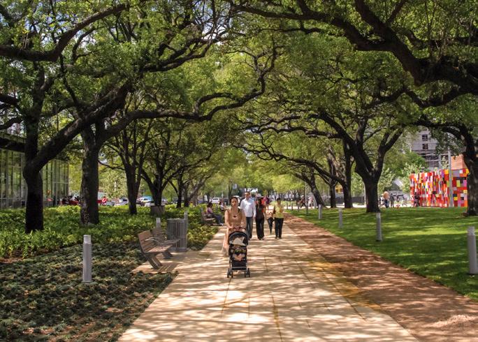
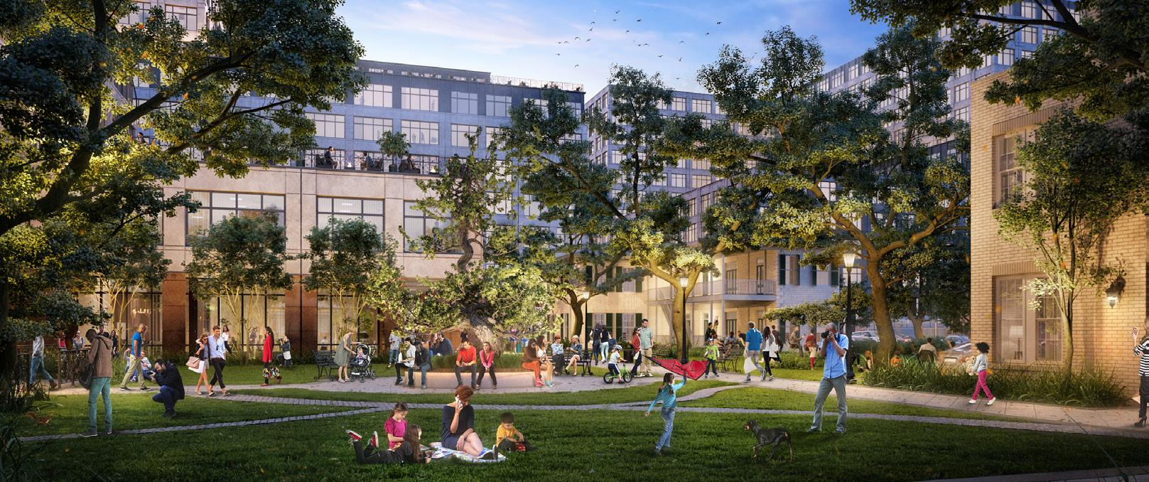
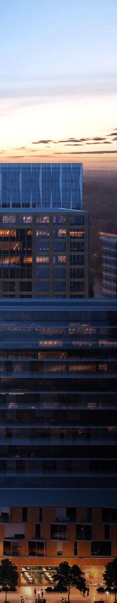
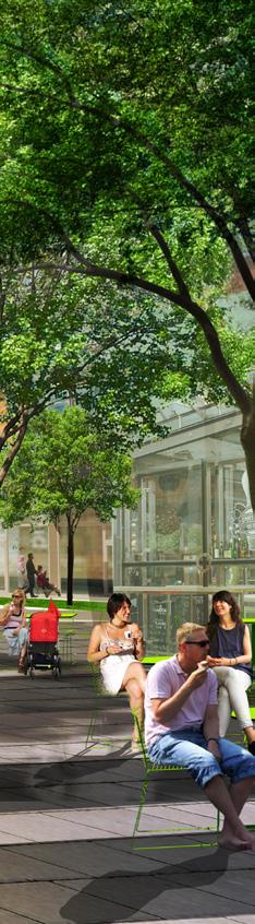
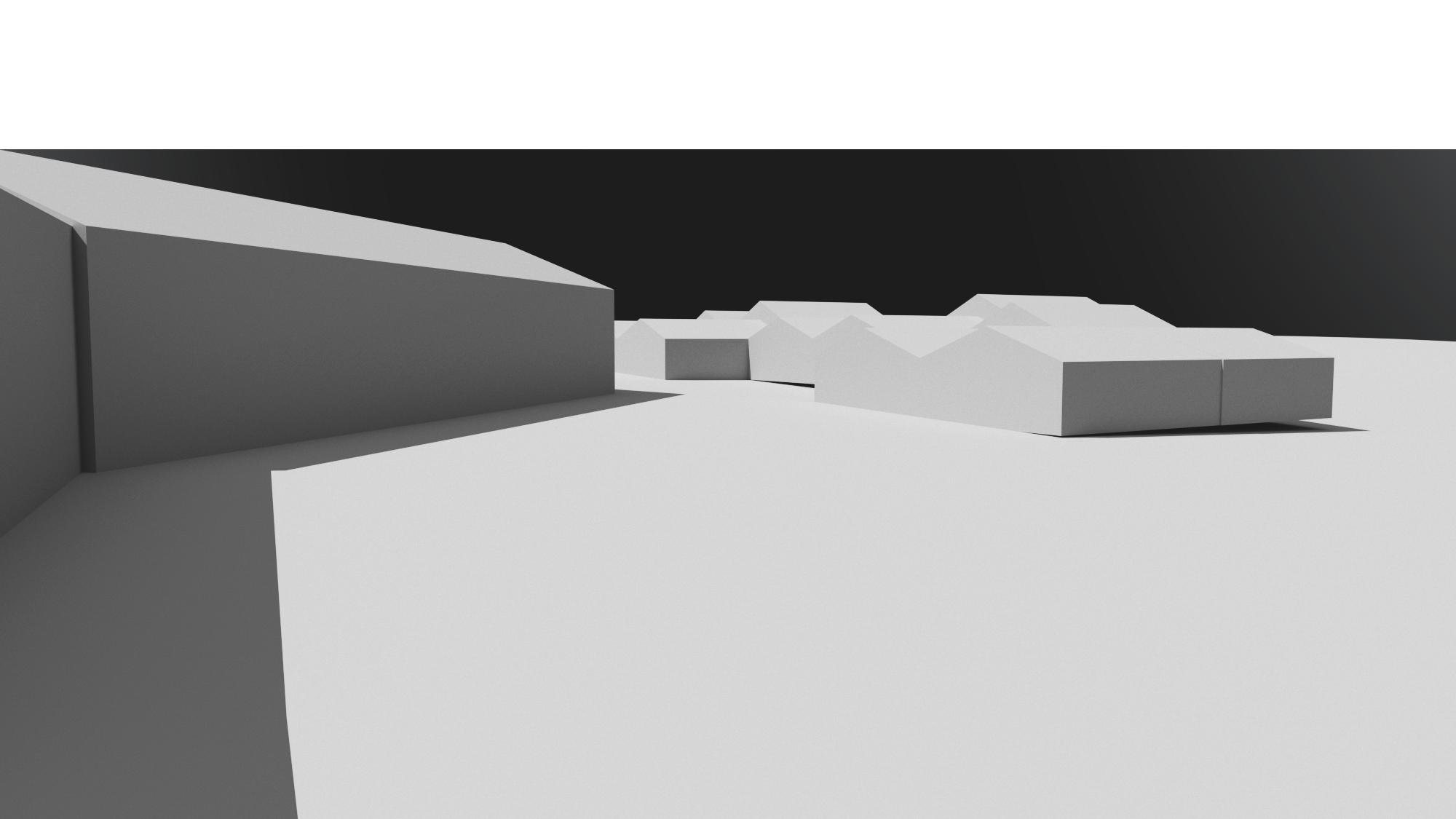
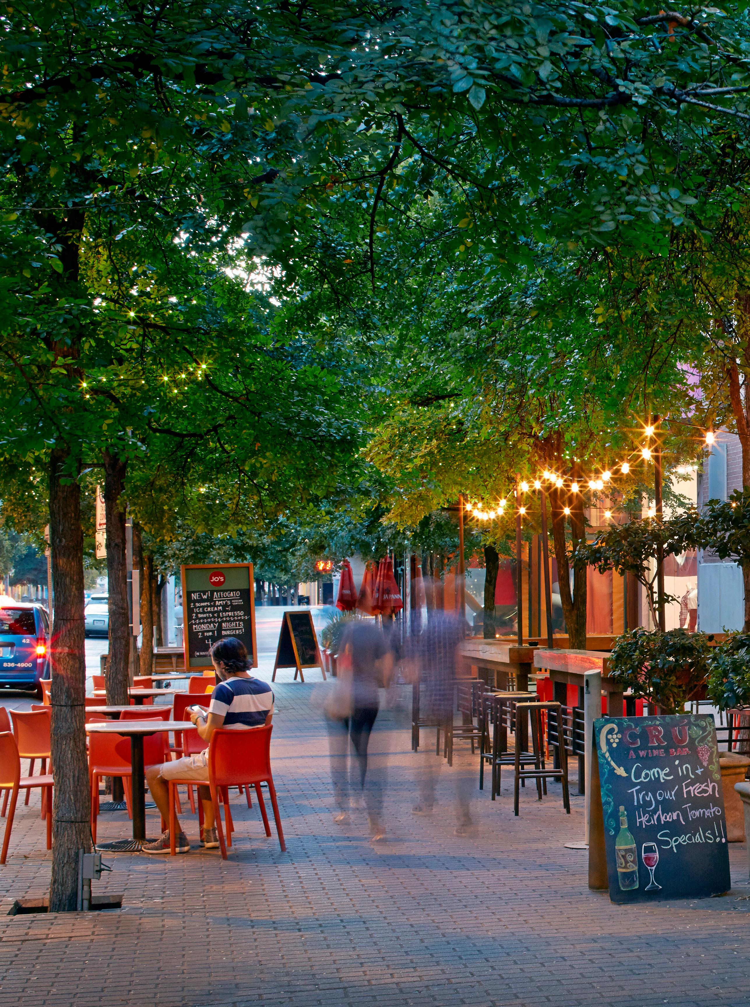 2nd Street District / Austin, Texas
Urban Districts and Neighborhoods
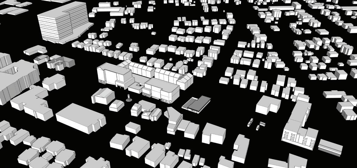
As cities become more populated, we need to find better ways to inhabit them. Creating healthy cities is a key challenge in the 21st century. Linking together the social, cultural and physical urban fabric, cities require a vibrant and dense mixed-use core with compact walkable blocks, easy access to mobility, an inclusive public realm, and a lively pedestrian environment. To be sustainable, cities must provide a high quality of life that catalyzes public and private investment.
Page Southerland Page, Inc. 5
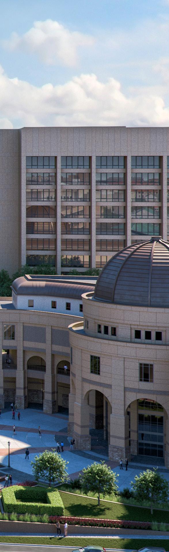
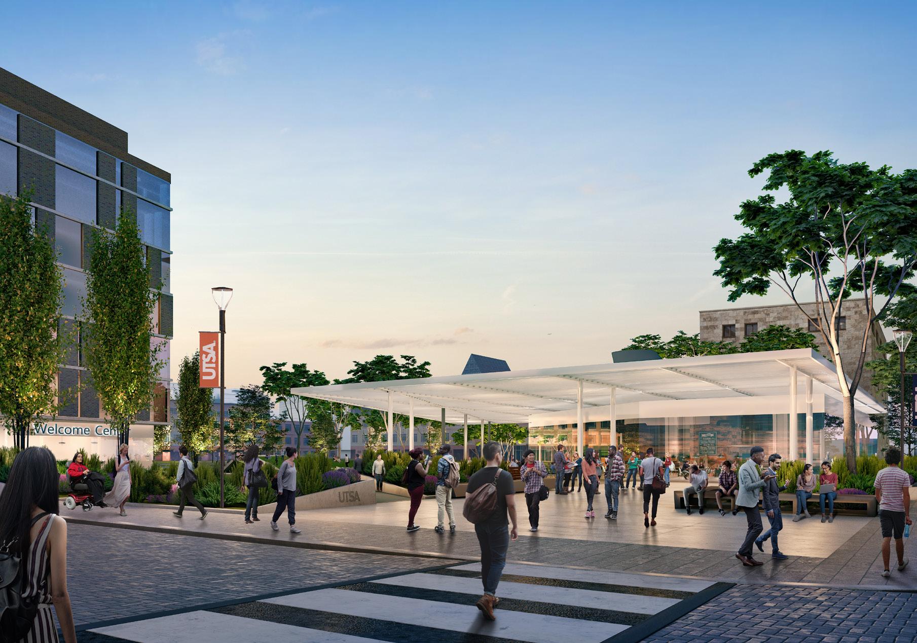
UTSA Downtown Campus Master Plan / San Antonio, Texas
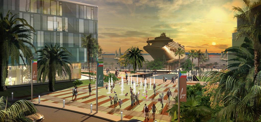
The Cities of Cogo and Corisco Master Plans / Equatorial Guinea Discovery Green / Houston, Texas
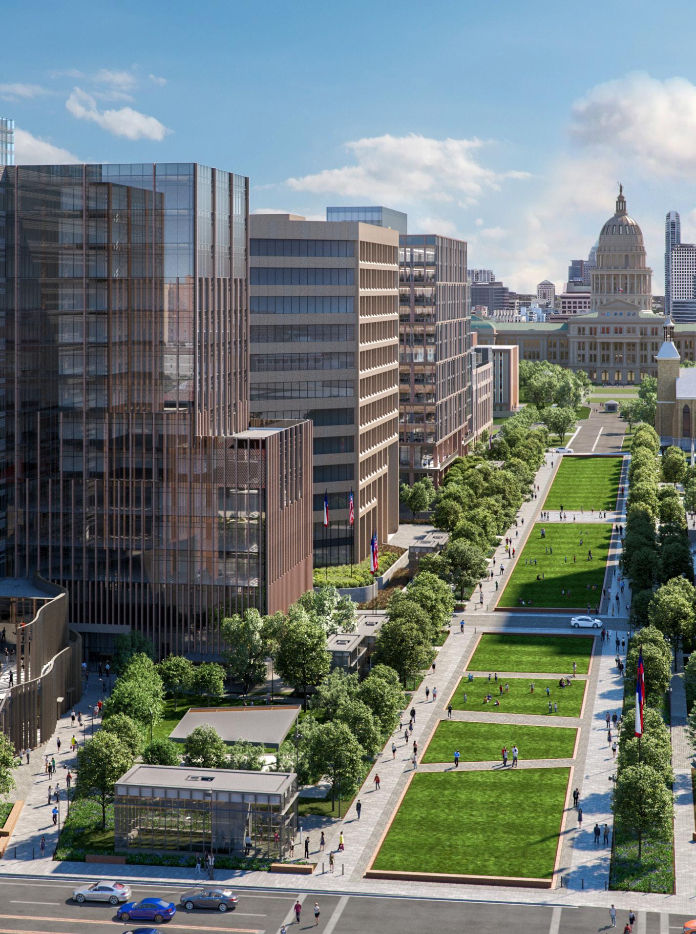
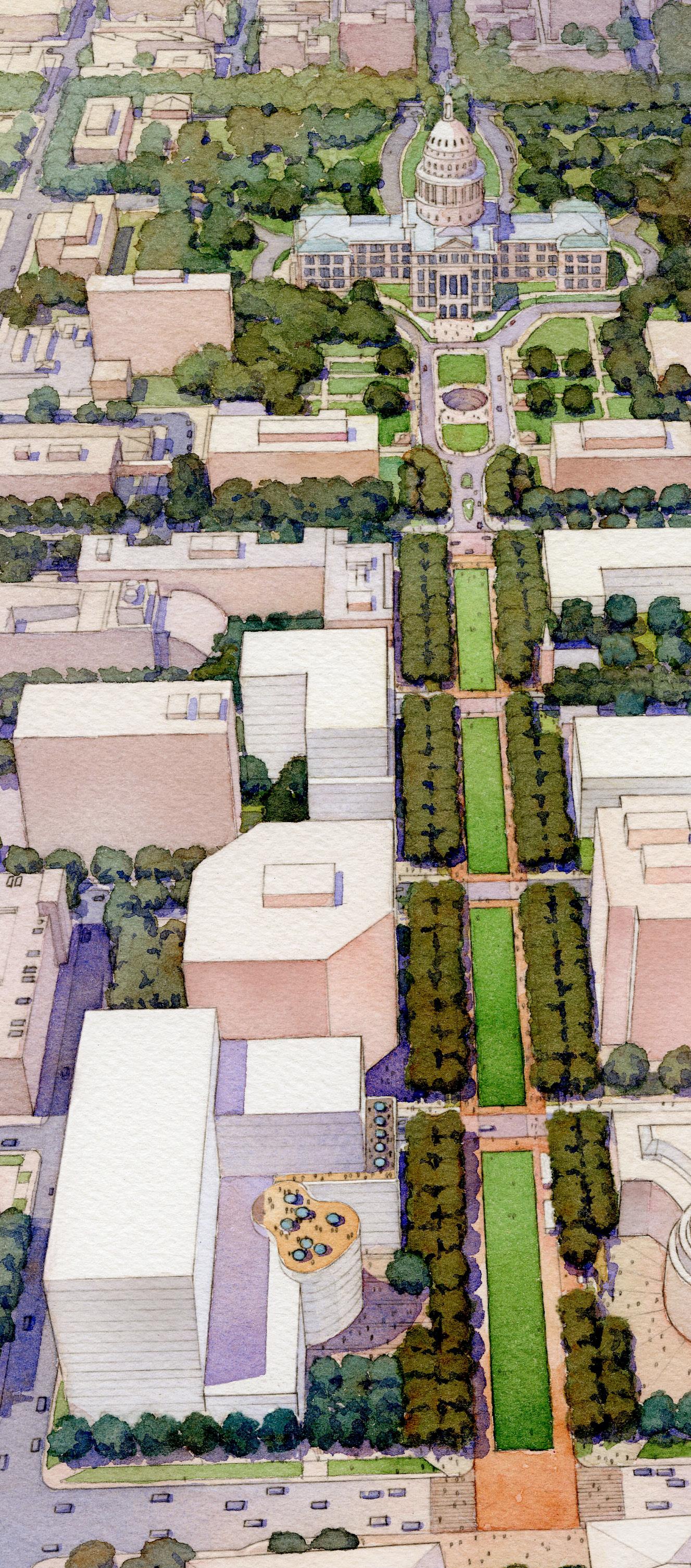
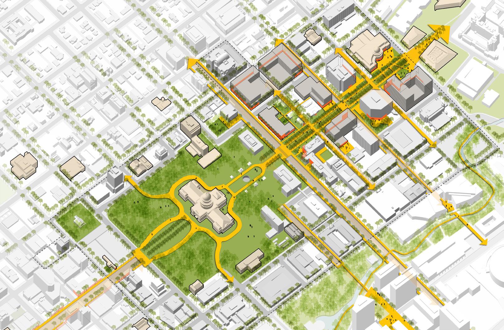
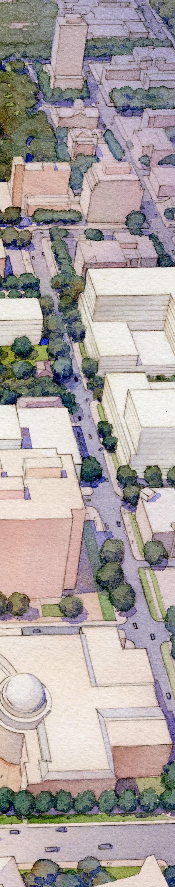
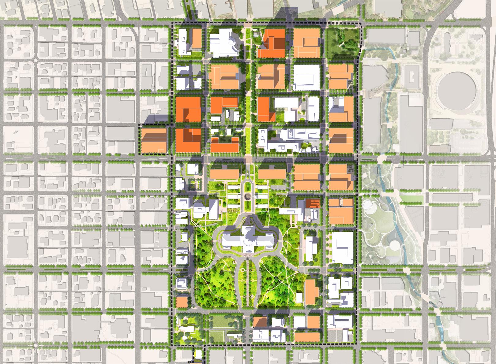
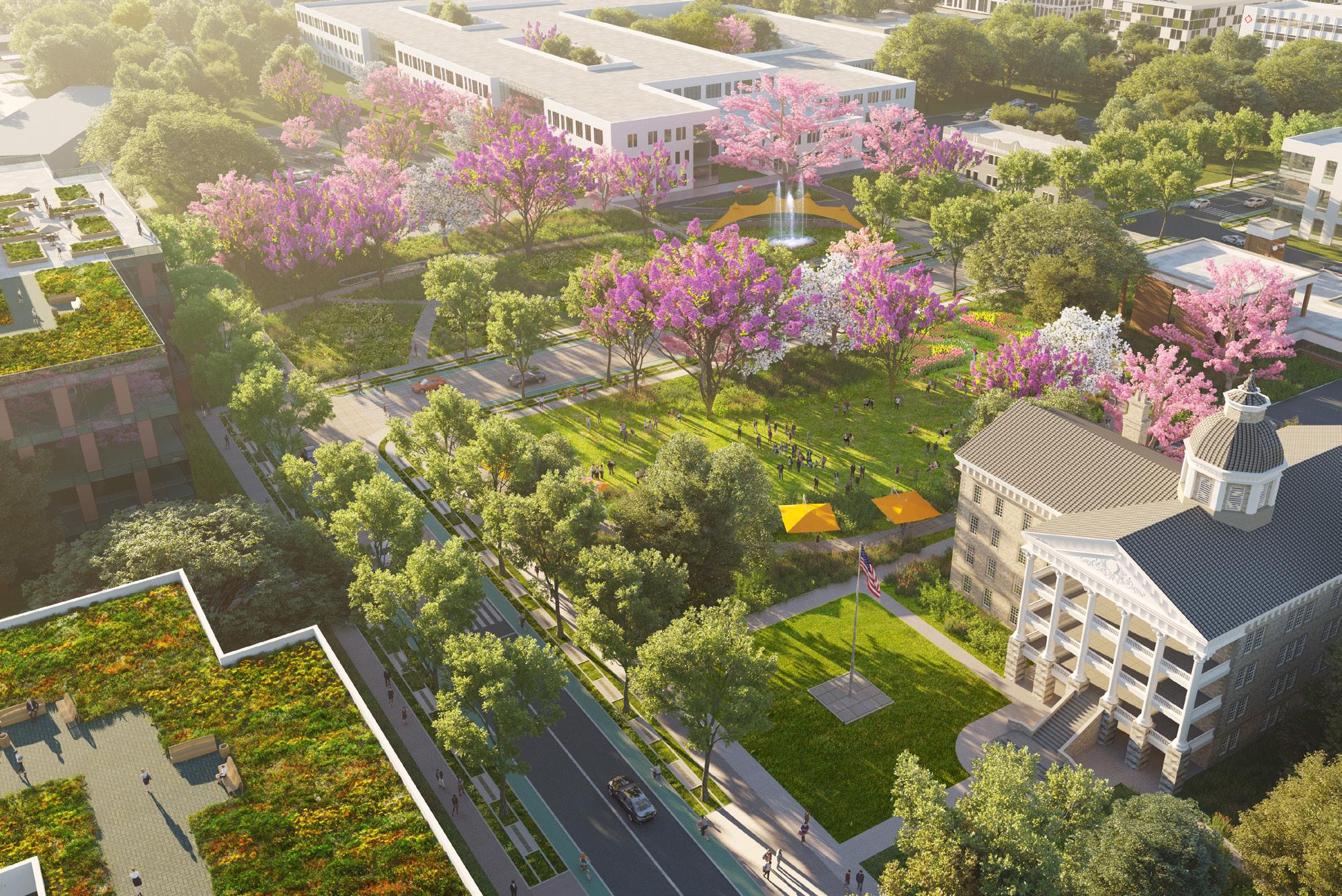
Texas Capitol Complex Master Plan Austin, Texas
This master plan covers the 40-block area around the Texas Capitol Complex in downtown Austin and outlines a strategic vision and long-term goals for the most prominent site in the state’s real estate portfolio. Three guiding design concepts emerged: a vision for a new Cultural Gateway and Texas Mall approaching the Capitol grounds from the north; an attitude toward east/west streets that proposes well defined urban connectors with both strong pedestrian and vehicular roles; and the establishment of a Historic Precinct around a cluster of notable structures and significant landscape features that would serve as a garden district within an otherwise compact urban environment. As master architect for Phase 1 buildings, Page designed two new high-rise office buildings which help define the Mall and create a strong urban character. Page continues to be involved as the master planner for the complex, having completed three of the legislatively required 2-year updates.
6
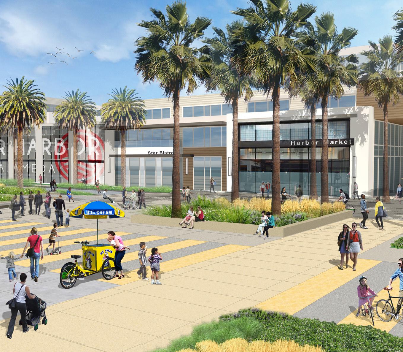
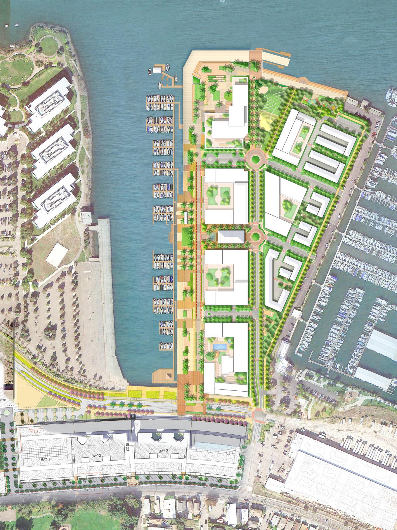
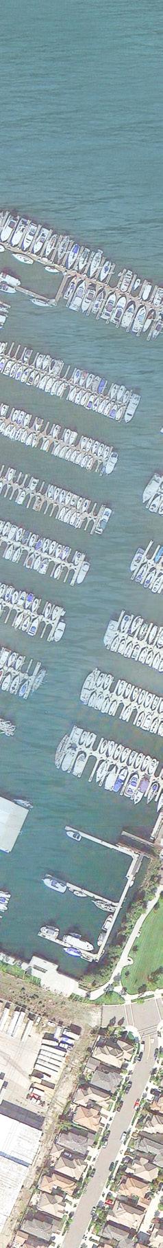
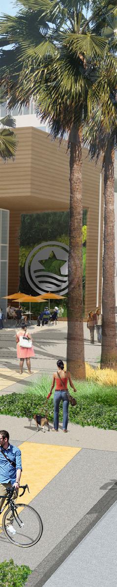
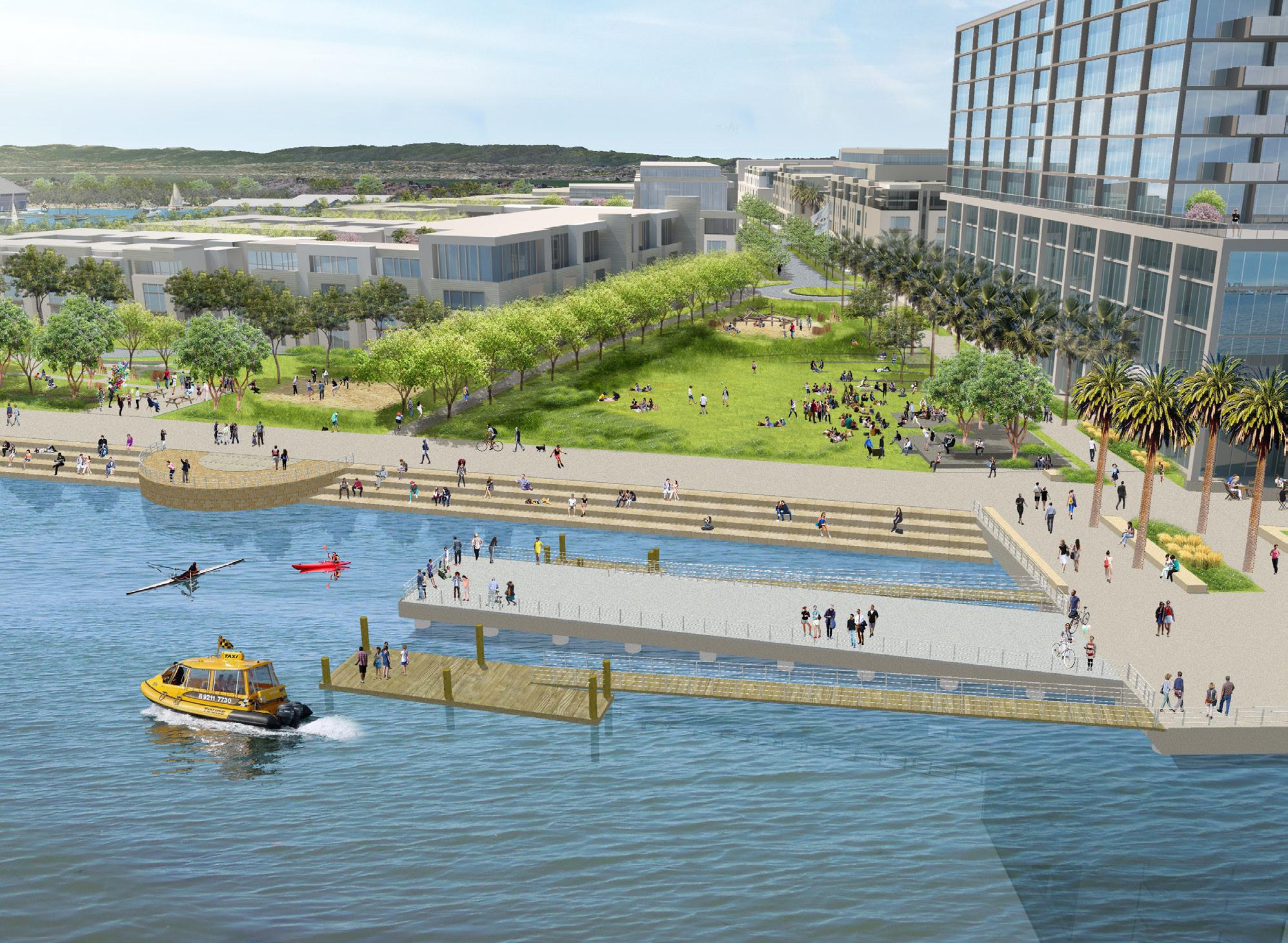
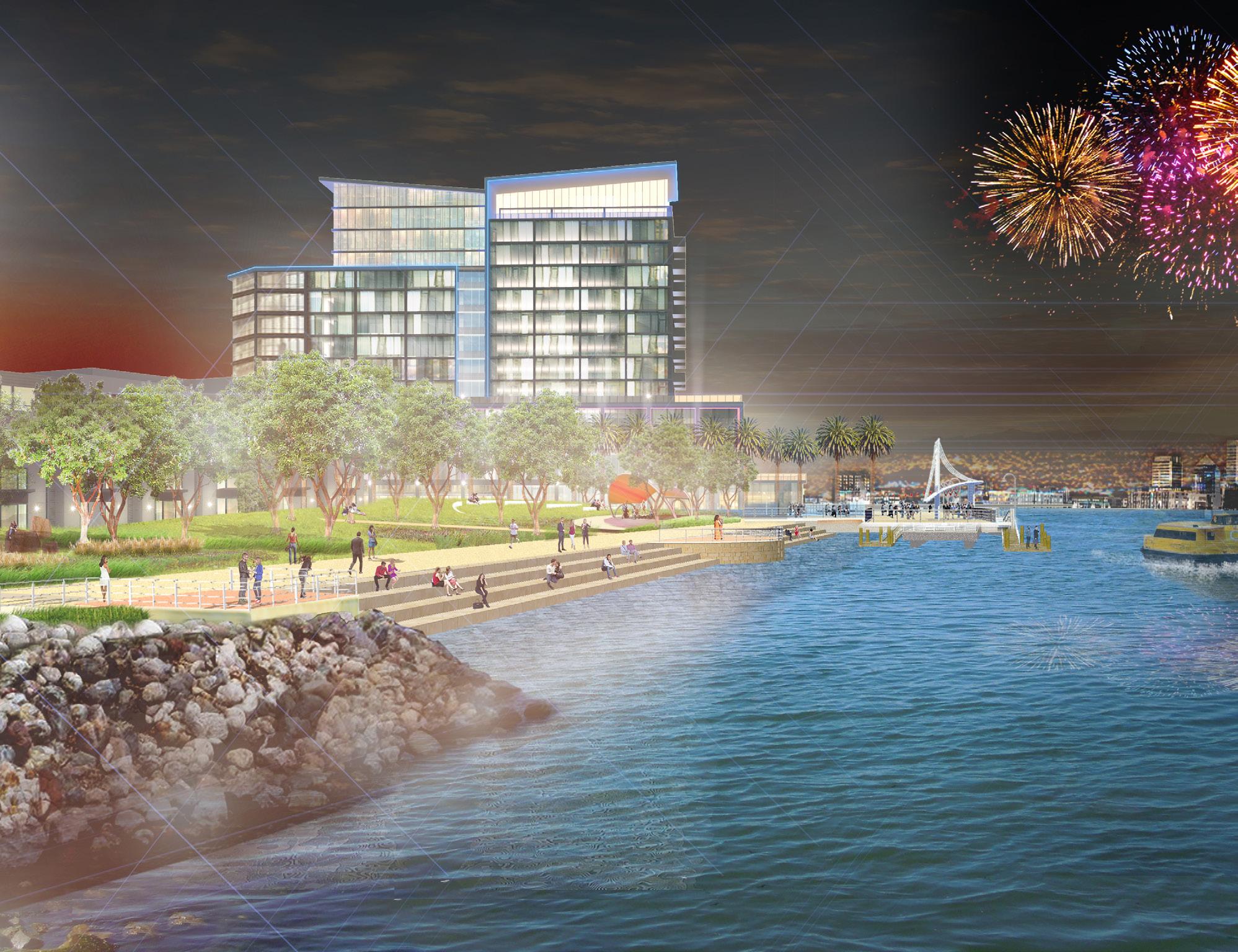
Alameda Encinal Master Plan Alameda, California
This mixed-use, 23-acre community transforms an industrial site, formerly used for shipping and storage, into a vibrant waterfront showcase for the City of Alameda. The plan features over 14 acres of public property, including a waterfront park and six acres of waterfront promenade, opening up 2,700 lineal feet of previously inaccessible industrial property for public use. A worldclass waterfront park is the centerpiece of the property, with a promenade that stretches up to over 150’ in width. The promenade includes seating and gathering areas for lounging, playgrounds, retail and cafes, a cycle track, and ample walking space to wander along the waterfront. The northwest corner of the site features a large plaza area for congregating and enjoying the views of the adjacent estuary, downtown Oakland, the Oakland hills, and San Francisco’s skyline.
8
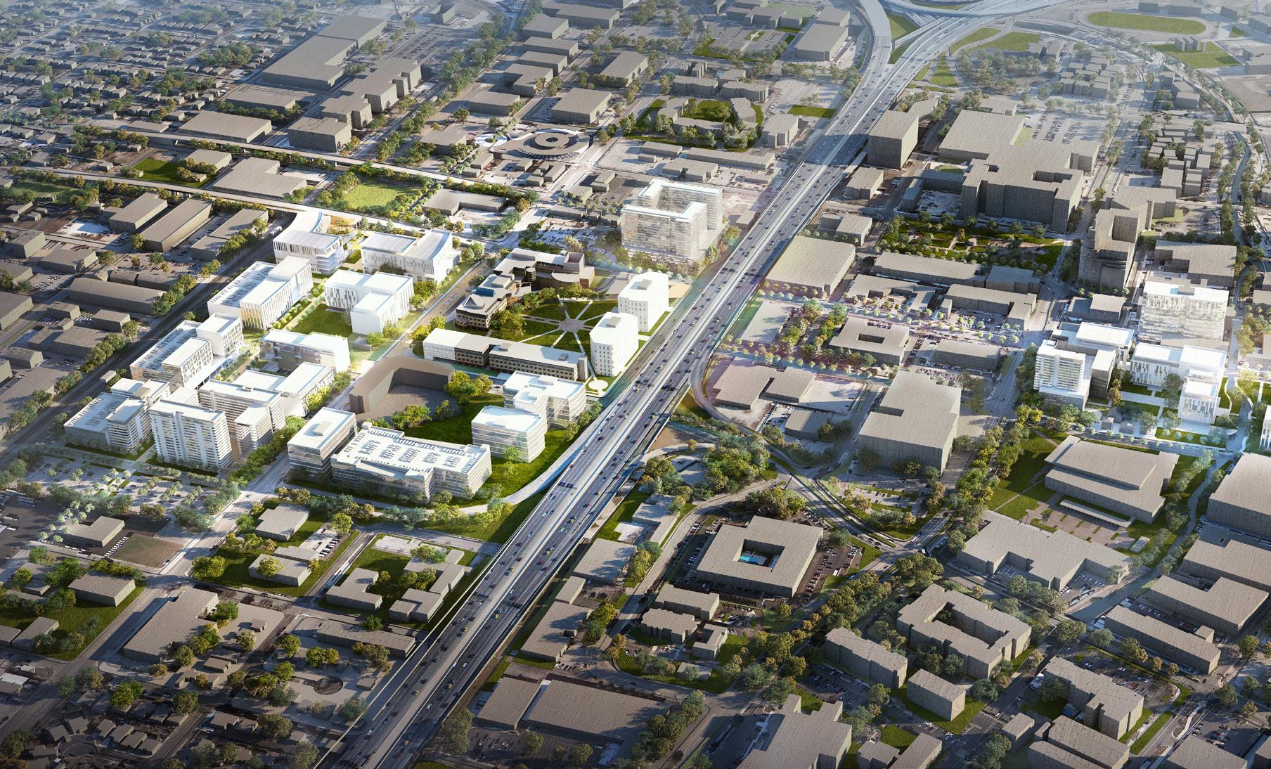
Western Downtown Facilities Master Plan Houston, Texas
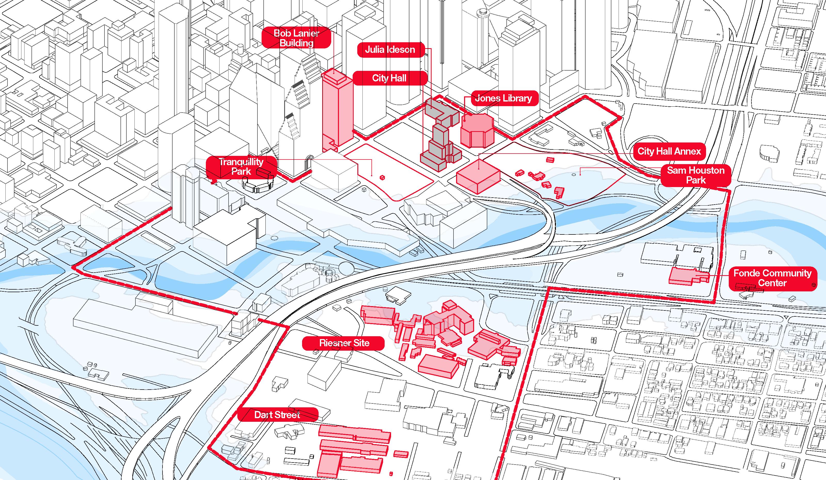
As the symbolic and operational core of Houston’s city government, the western downtown area comprises a substantial concentration of civic buildings that are significant for the City’s continued economic and administrative vitality. This master plan serves as a development framework and guide towards the highest and best use of these City-owned assets. The plan has three major components: Land Use Plan; City Facilities Plan; and Financial Plan. The plan assesses the current and future uses of approximately 40 buildings and makes recommendations based on an in-depth analysis of size, age, building systems conditions, current employment base, floodplain level, and other facility-use factors. While efficiency, consolidation, and re-purposing are at the forefront, the vision for this plan propels downtown Houston to become the hub for local, regional, and national civic activities.
10 Urban Design and Planning
University Hills Dallas, Texas
Page is serving as the master planner and architect for a new development in southern Dallas, adjacent to the University of North Texas Dallas (UNTD). This collaboration between the City of Dallas and its developer partner seeks to utilize a TIF district to create investment in this under-served area of the city. The new development will include significant residential offerings with single-family, townhouses, and multi-family buildings.
These residential neighborhoods are threaded with open space amenities and encircle a new town center bringing retail, office, and a central green space. Ongoing coordination with UNTD will leverage the growth of the institution and provide services where the campus and neighborhood can come together in a unified location that serves both the academic mission and community needs.

Page Southerland Page, Inc. 11
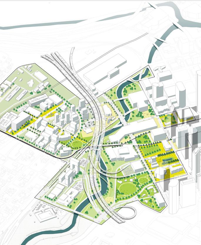
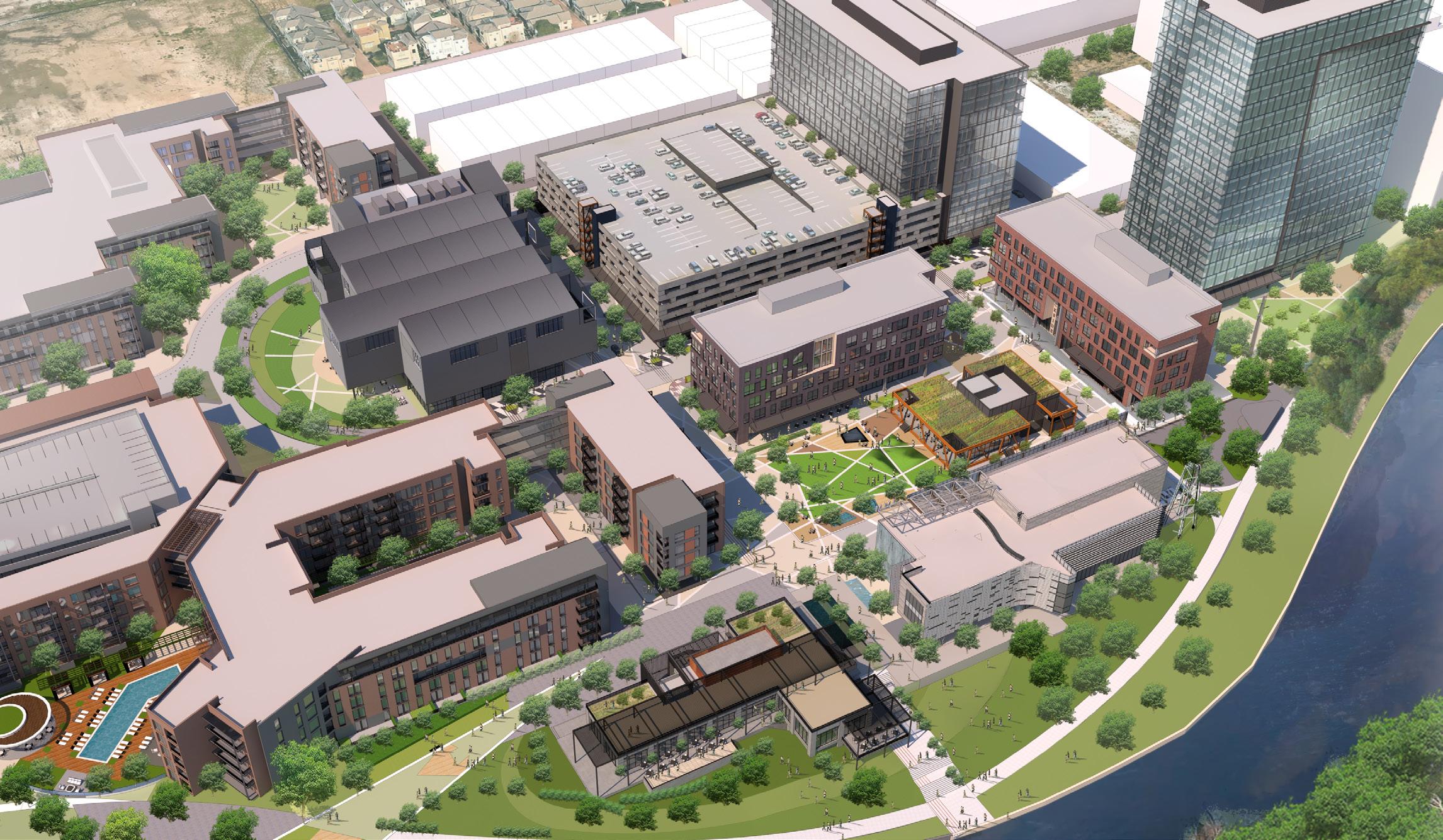
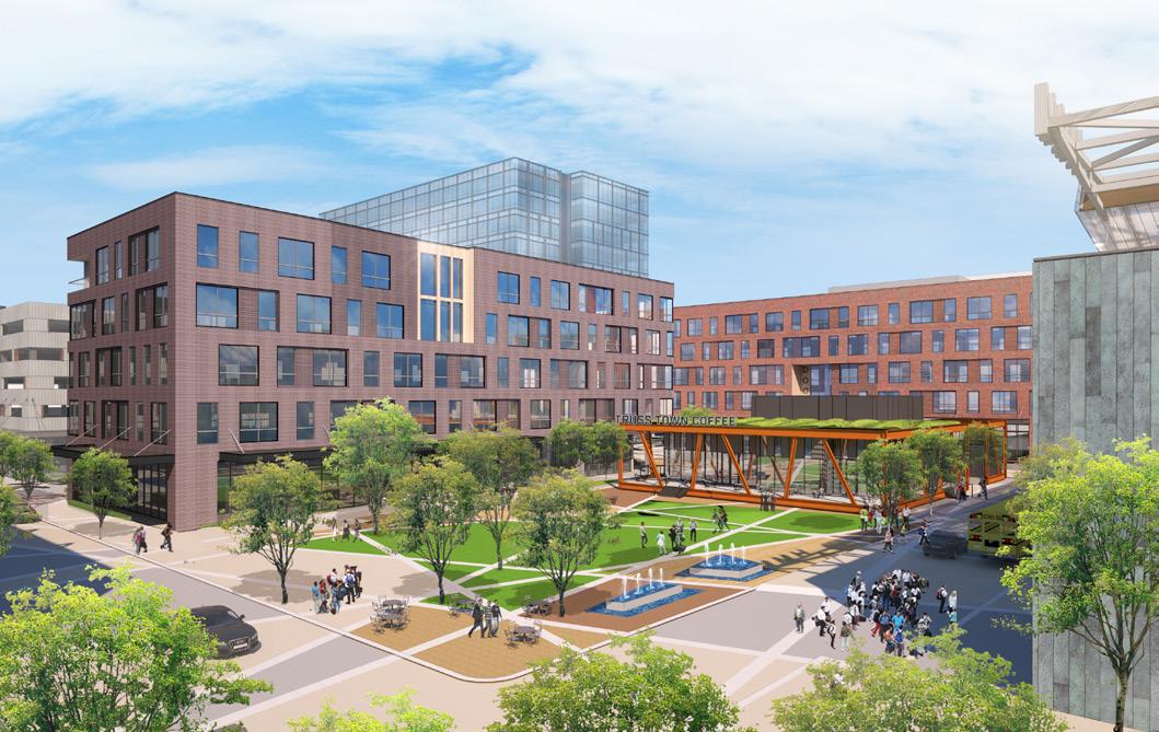
Midway East River Houston, Texas
This development plan transforms Houston’s historic industrial waterfront along the Buffalo Bayou into a new multi-phased, mixeduse economic center welcoming a wide variety of workers, residents, and visitors. The redevelopment of a former shipping and industrial complex opens up more than one mile of waterfront, previously inaccessible for many decades, and includes improvements to infrastructure, streets, sidewalks, pedestrian access, and open space. Careful attention was placed on the pedestrian realm where appropriately scaled outdoor spaces flow through the site connecting the urban environment of East River with a linear park being developed along Buffalo Bayou. In addition to developing the master plan, Page designed the first six office towers and retail buildings slated for completion in Phase 1.
12 Urban Design and Planning
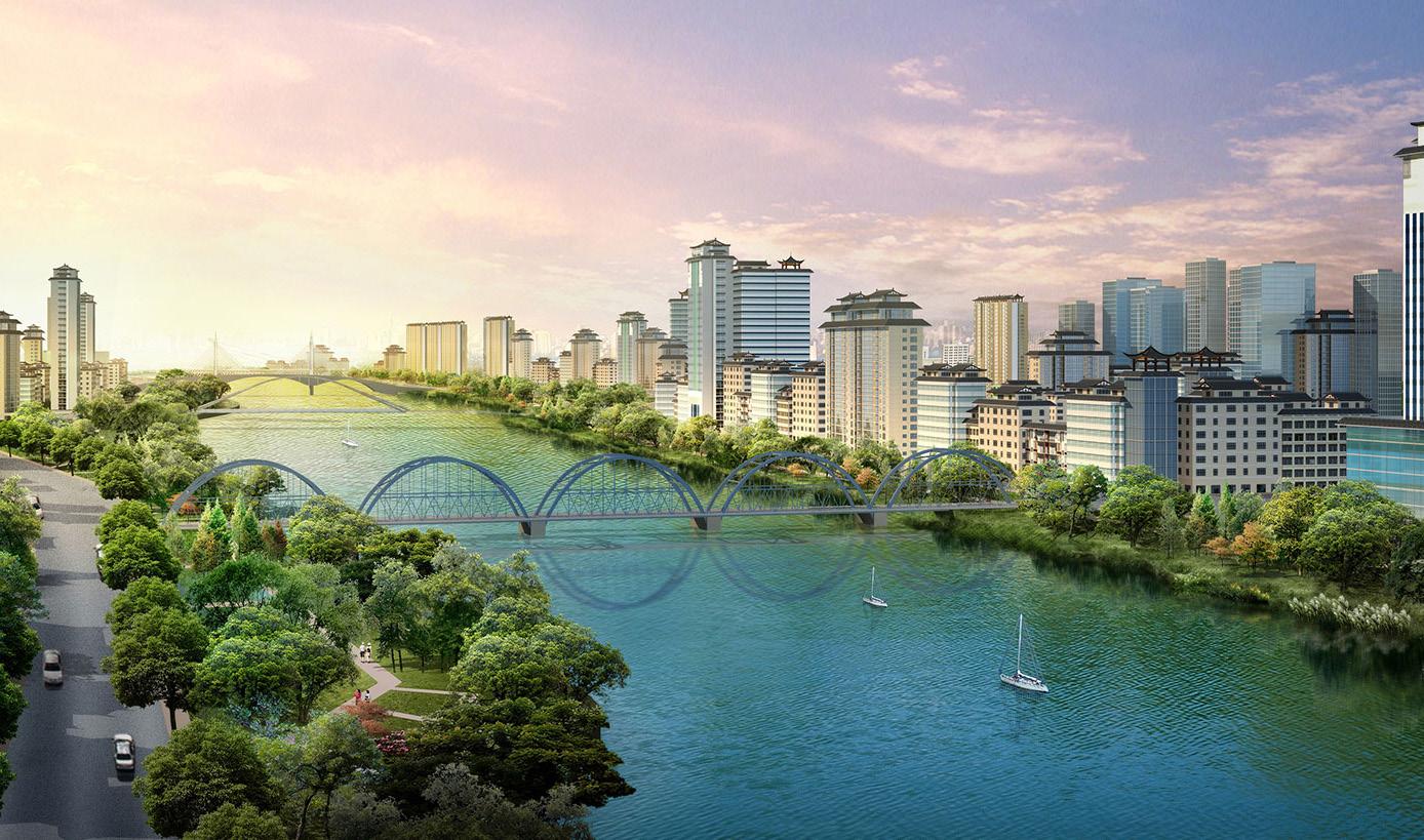
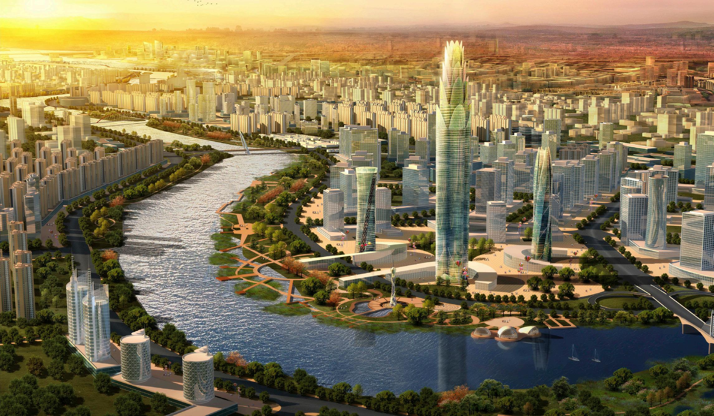
Lanzhou City
Urban
Plan Lanzhou China
The ancient city of Lanzhou, located in the western interior of China and at the edge of the Gobi Desert and headwaters of the Yellow River, is rapidly positioning itself to become the economic and touristic catalyst for the region. In order to accomplish this, the restoration and reclamation of the Yellow River corridor is paramount to the City’s redevelopment. As a sustainable economic catalyst, the plan creates new touristic, entertainment, and development zones including a new central business district on reclaimed brownfield sites, large entertainment and recreation venues sited near proposed parks and urban gardens, and new shoreline pedestrian paths and bikeways.
To help mitigate very poor air quality, a variety of interventions are proposed including electric mass transit and an urban forest ‘island’ with gardens and wetlands. This “greening” of Lanzhou will have an enormous impact on the area’s carbon footprint.
Page Southerland Page, Inc. 13
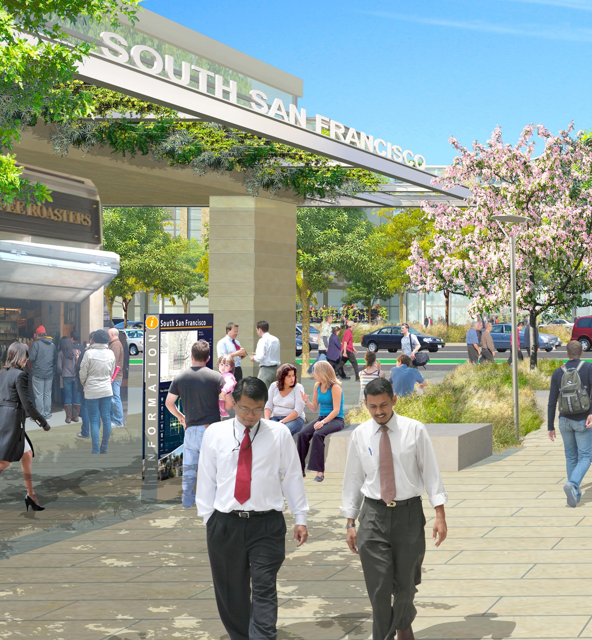
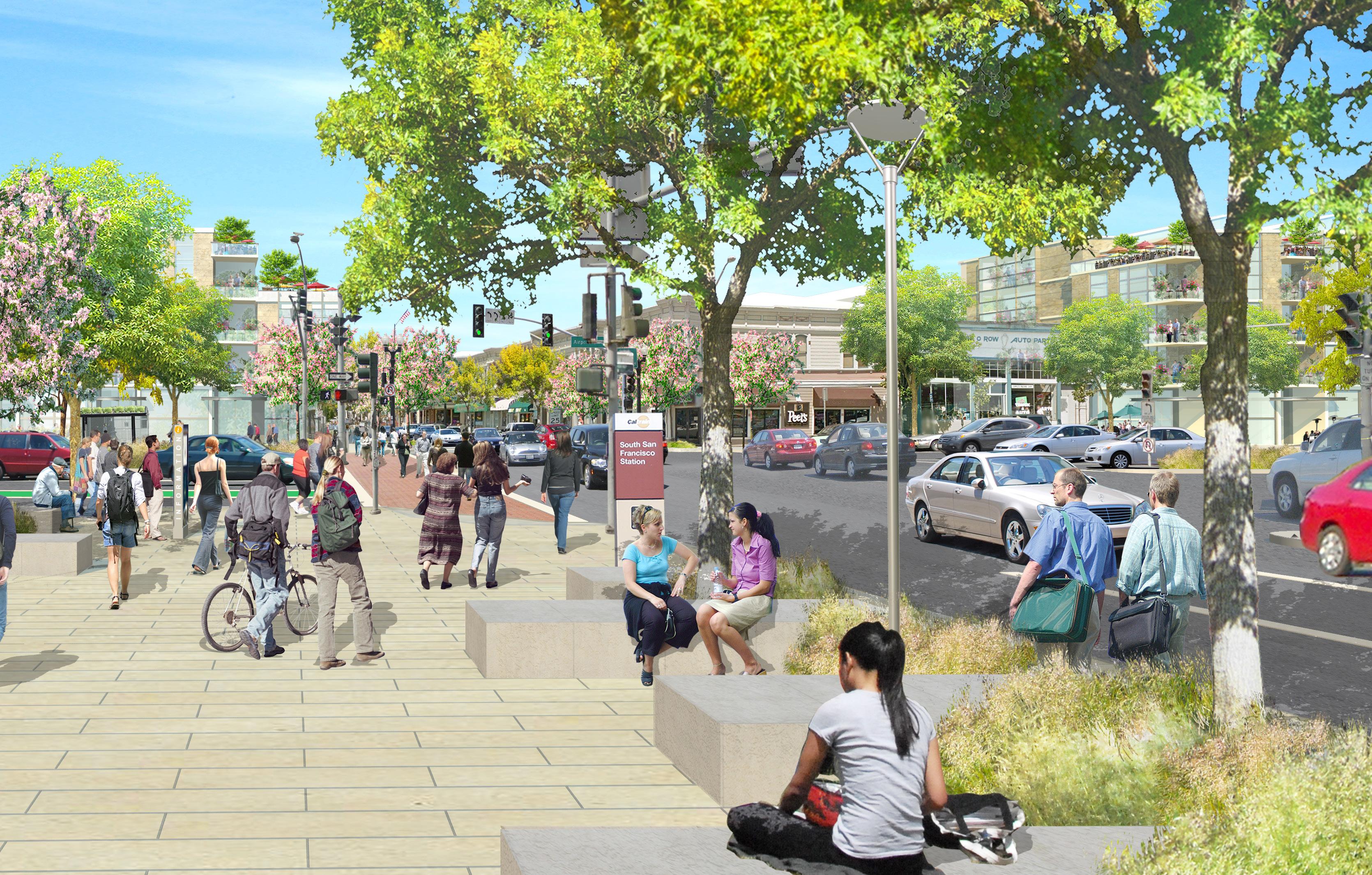
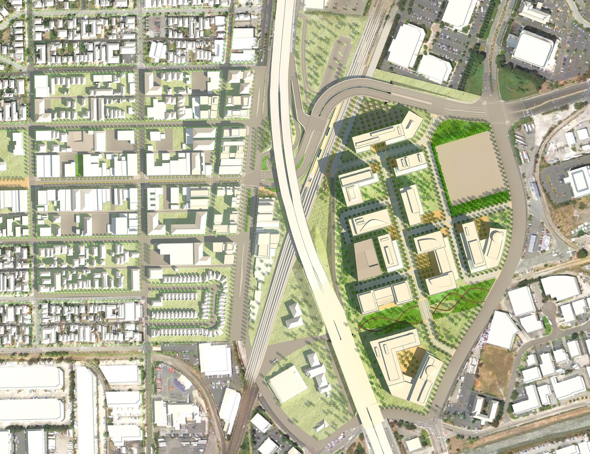
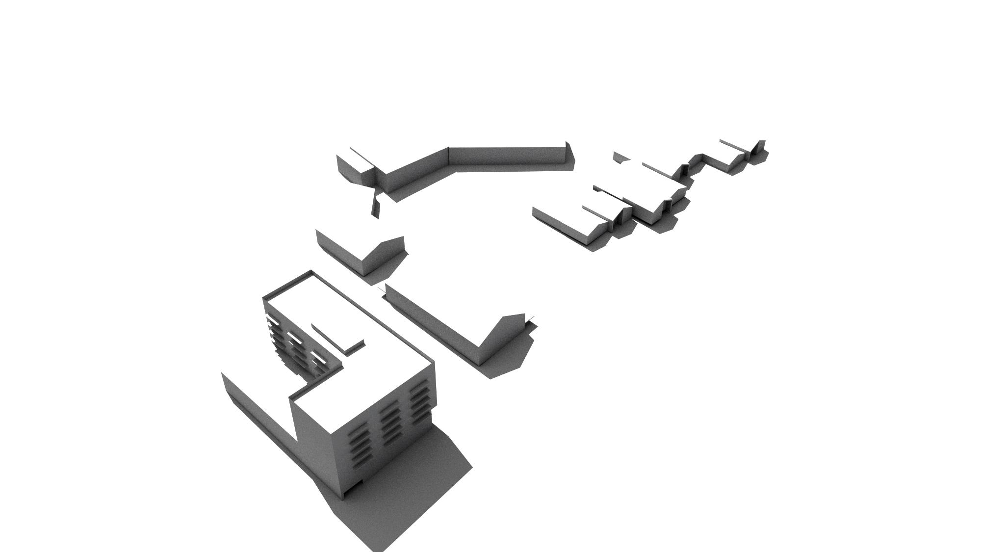
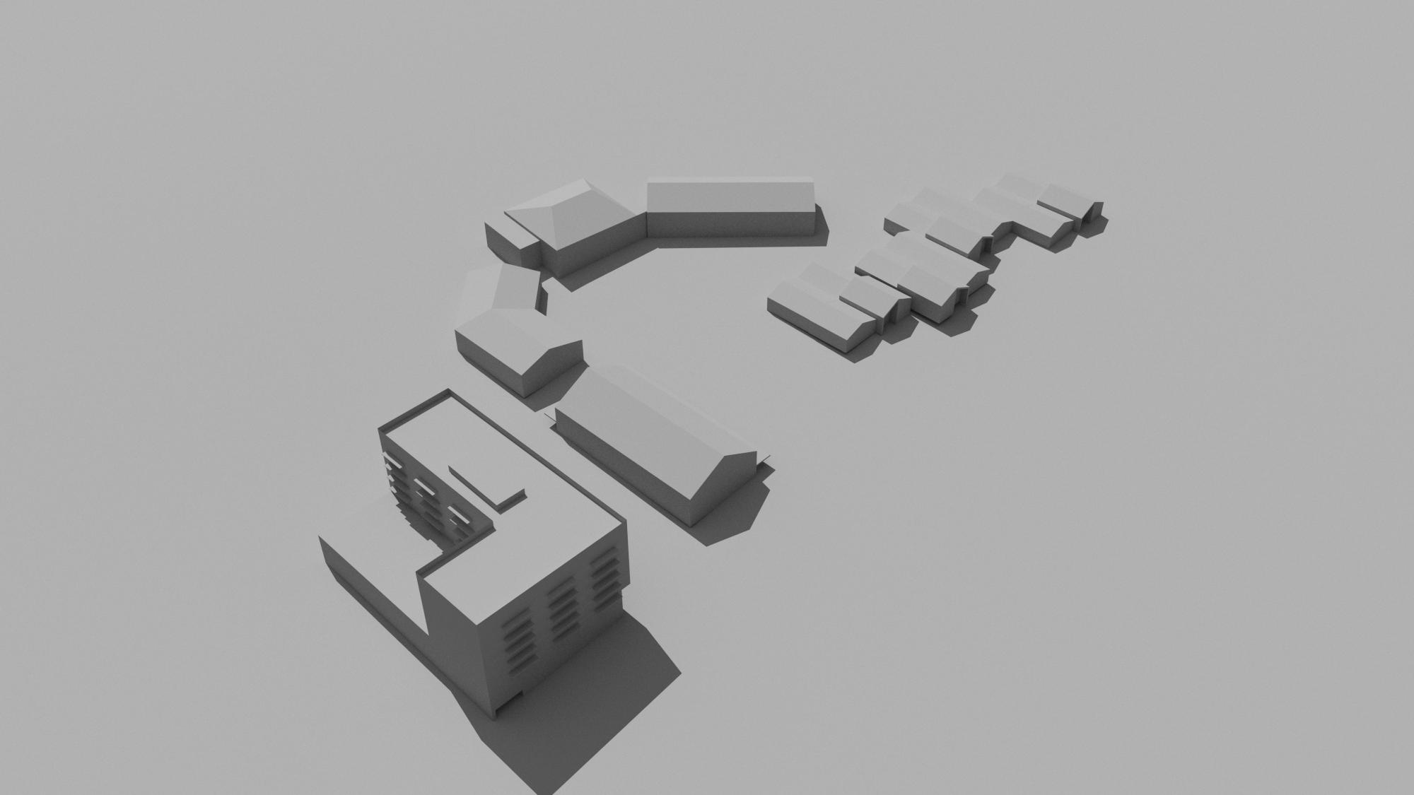
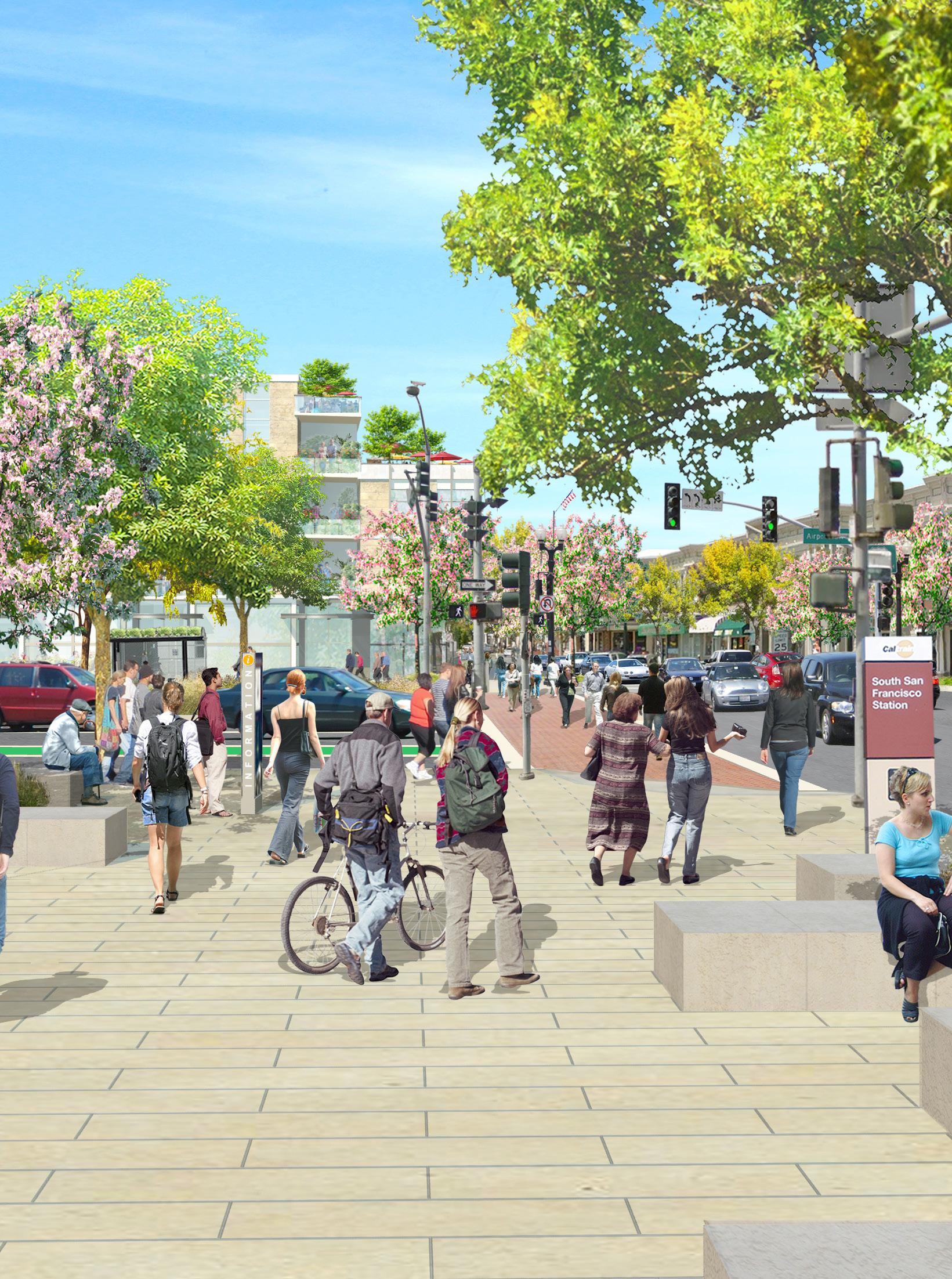 Downtown Station Area Specific Plan & EIR / South San Francisco, California
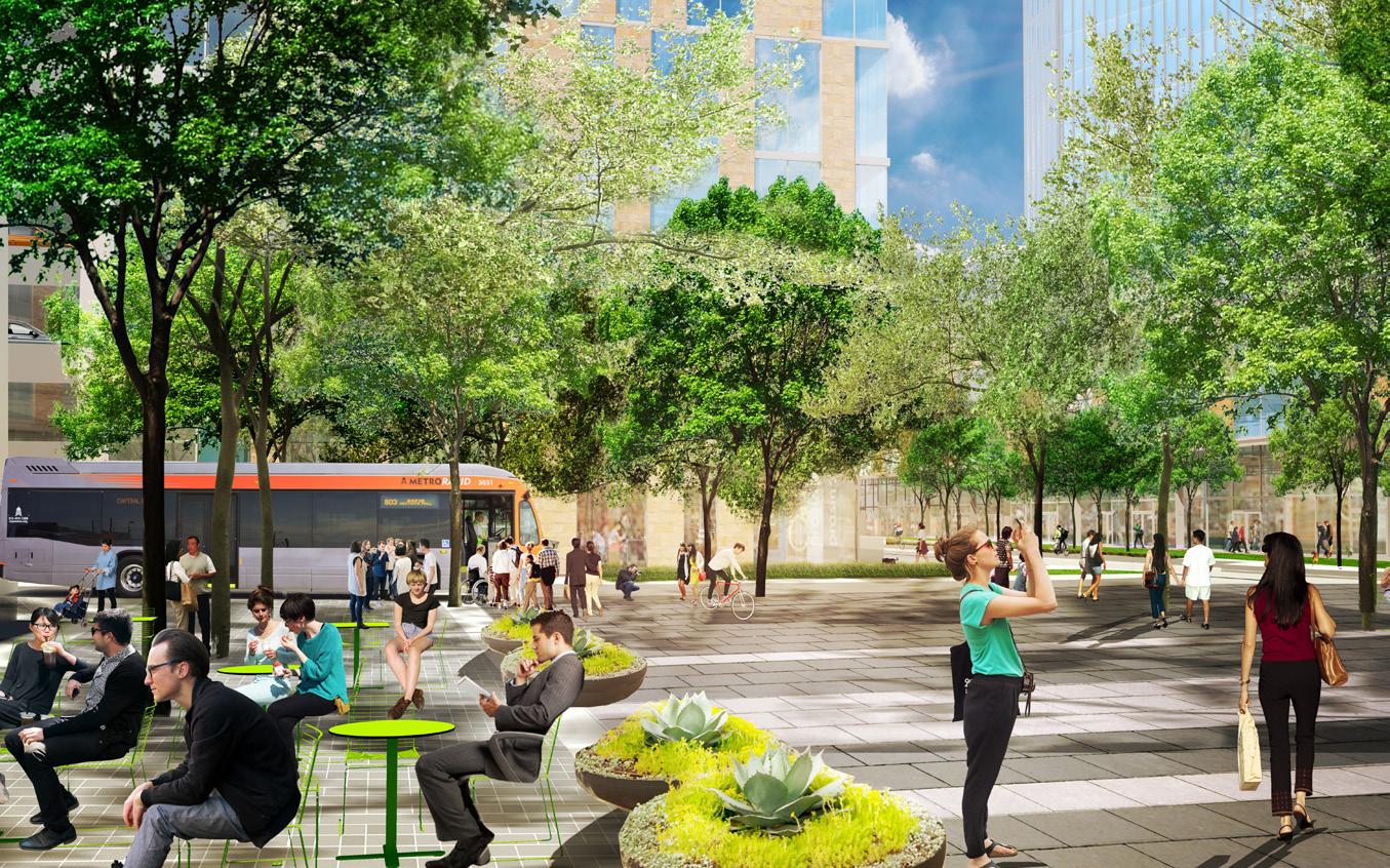
Multi-Modal Transporation Environments
Transportation systems are among the most ubiquitous features of the built environment. Without an underlying urban framework accessible to all modes of travel, it is difficult to establish a land use mix that supports a strong and vibrant environment. Transit-oriented development represents the best of planning for our communities –creating accessible and enjoyable environments where people have convenient access to the goods and services they need and to their places of employment and living.
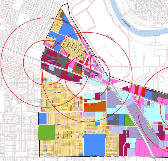
65th Street Station Area Study / Sacramento, California
Page Southerland Page, Inc. 15
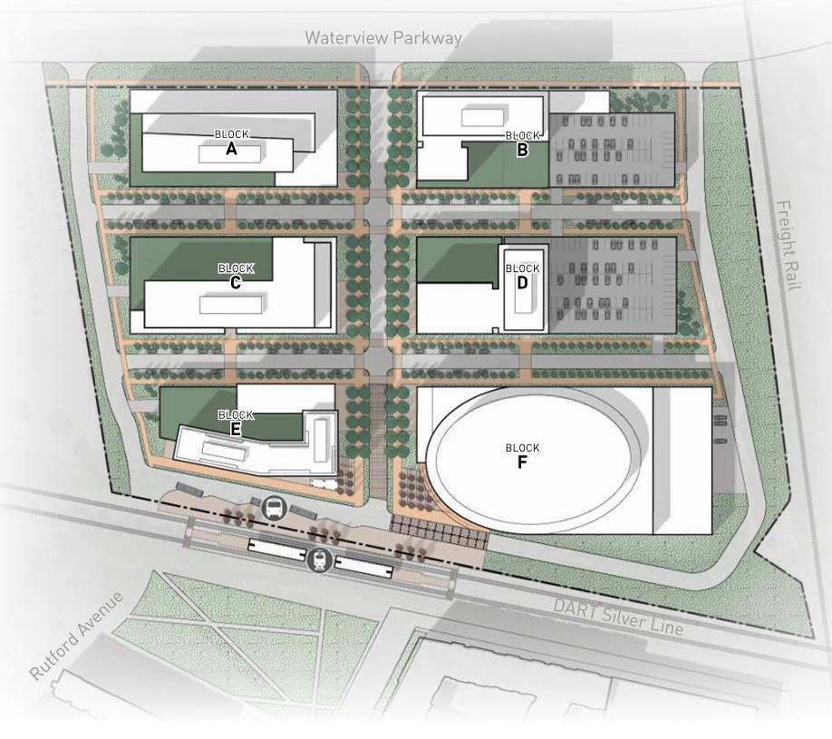
UTD Transit Station Area Plan / Dallas, Texas
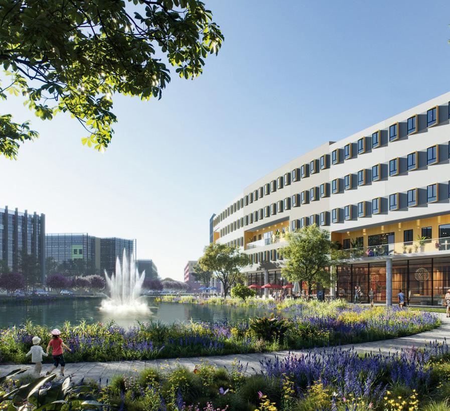
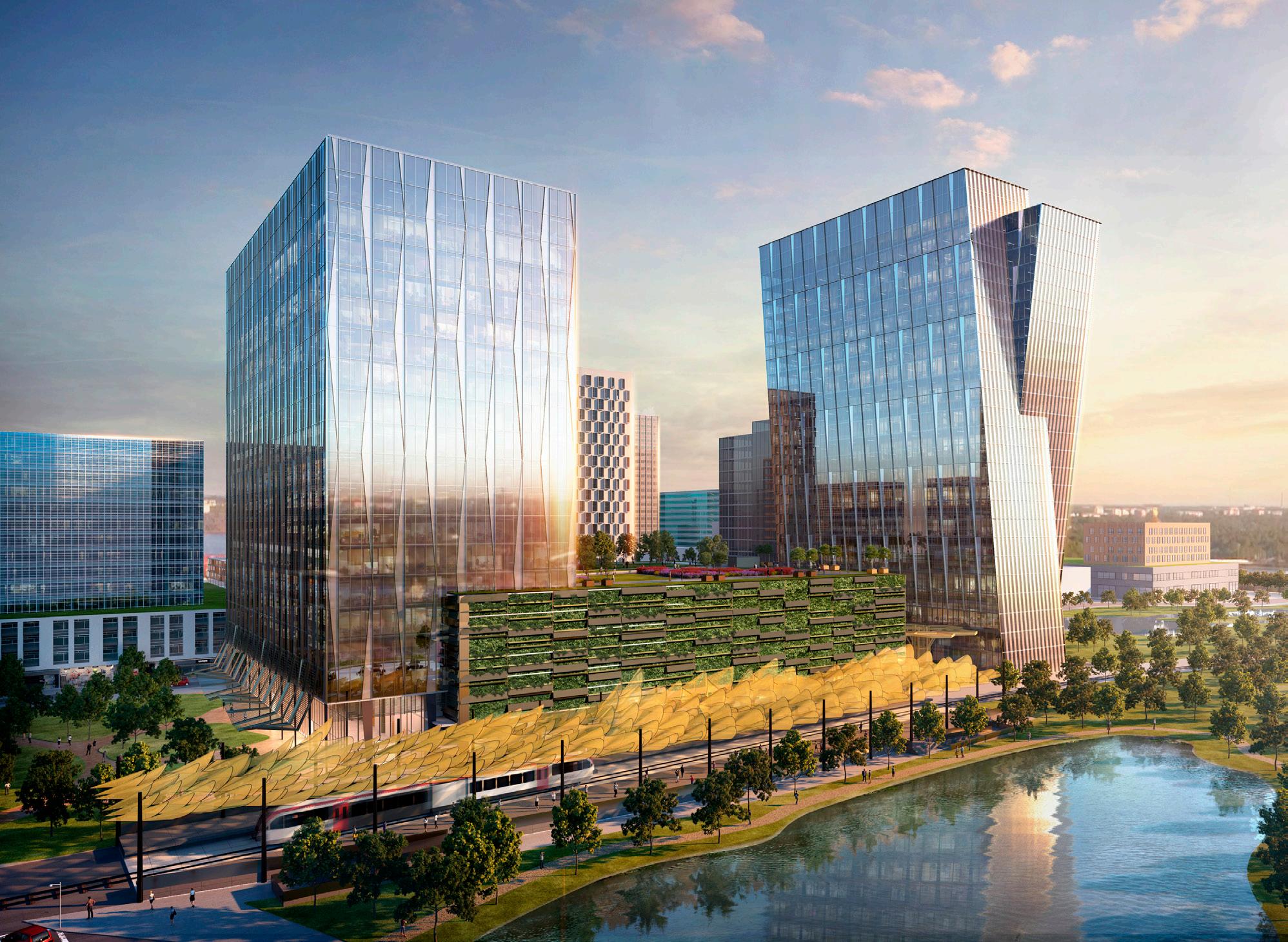
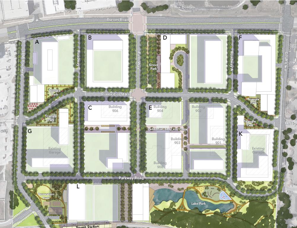
Uptown ATX Master Plan
Austin, Texas
This master plan transforms an existing 64-acre corporate campus into a vibrant mixed-use district with residential, retail, and high-tech office space. An existing public transit line runs along one edge of the property and the plan proposes relocating an existing station to the edge of this property to better serve the campus and surrounding district. The primary street within the plan functions as the main retail spine and links a new transit station with the adjacent district. The plan is organized into a grid to maintain maximum flexibility, allowing the replacement of existing structures with new development to fill in around them. Page is following this master plan with design work for multiple high-rise office buildings as well as the new transit station.
16

Downtown Station Area Specific Plan & EIR South San Francisco, California
This specific plan guides the City of South San Francisco in creating a vibrant, transit-supportive, diverse downtown and Caltrain station area. A number of physical challenges, in particular the barriers posed by freeways, ramps, and overpasses, divide the downtown from the City’s major employment base and make it difficult to access the Caltrain station. The plan’s vision creates a unique place that provides connectivity to the downtown and Caltrain station areas, encourages long-term development that is transit-supportive, and provides accessibility for all community members. The plan also addresses current market trends, affordable housing, and implementation. Design standards were prepared to enable the city to guide future development in the public and private realms within the study area.
18

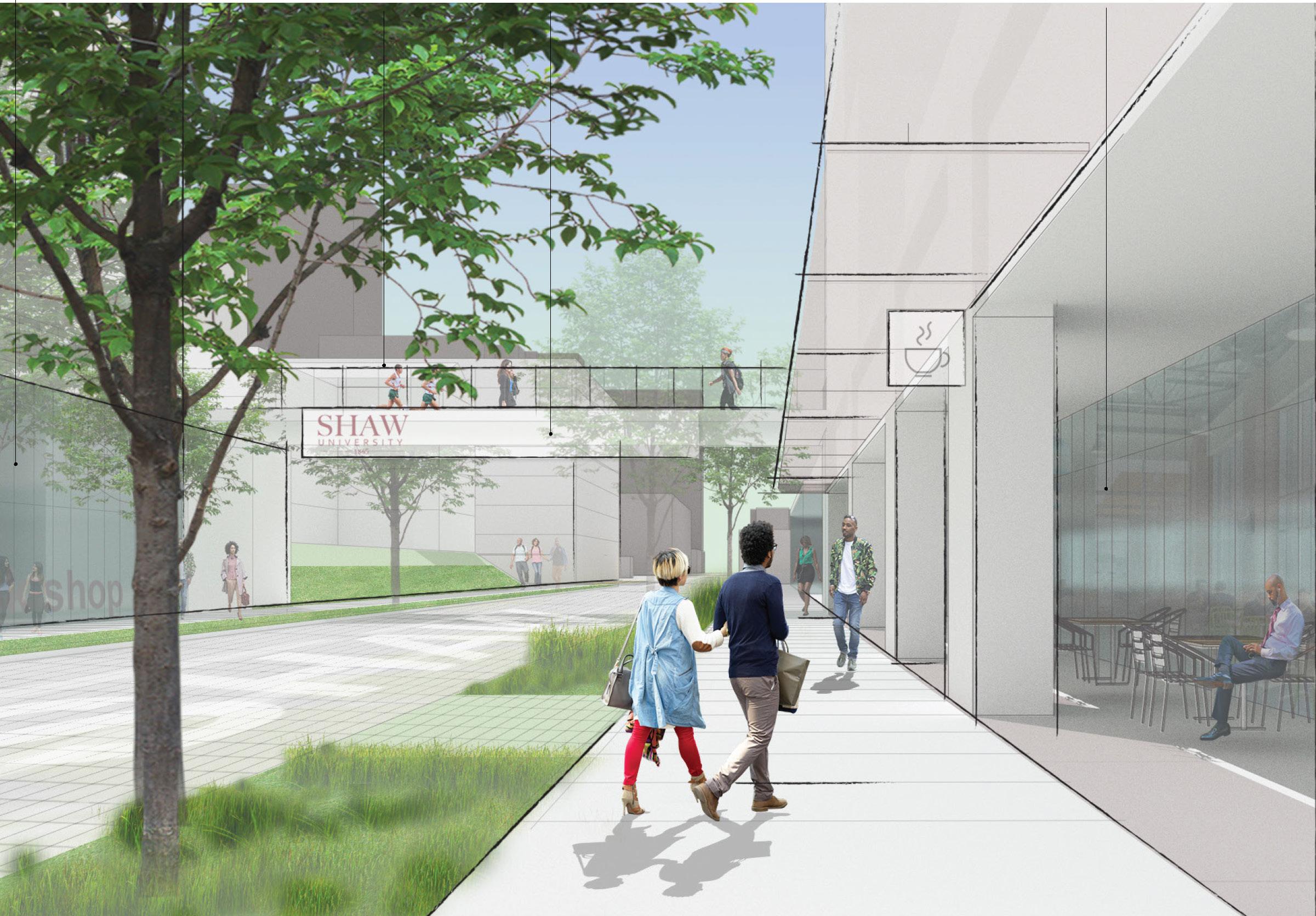
 Shaw University Real Estate Rezoning / Raleigh, North Carolina
Housing and Non-Profit
Housing is one of the most critical issues facing cities today. Both major metropolitan regions and secondary markets struggle to house workforce, lower income, and vulnerable populations due to increasing economic pressures. Cities, non-profits, and even academic institutions seek to be part of the solution in leveraging land resources to create more affordable opportunities for housing while also generating services and institutional benefits to enhance the overall community impact.
Page Southerland Page, Inc. 21
Alief Neighborhood Center / Houston, Texas
SAFE Alliance Vision Plan / Austin, Texas
AEDC Urban Renewal District Planning Austin, Texas


East 11th Street in Austin marks the heart of a historically-black neighborhood and a centerpiece of the designated urban renewal district in the city. Working in collaboration with the Austin Economic Development Corporation (AEDC) and the Urban Renewal Board (URB), Page led a planning process to identify the physical and financial feasibility of redevelopment on the final two URB-controlled blocks in the district.
Working with leadership, the community, and city officials, the project team reviewed previous engagement and studies that were conducted to identify program needs and priorities. Page conducted site analysis and zoning requirements to develop multiple scenarios that would determine best use of the site, all while incorporating community goals and cultural amenities. These scenarios assume new construction and and incorporation of a cultural anchor, affordable housing, and creative workspace for the community.
22 Urban Design and Planning
Block 18 Block 16 60’ 77’ 60’ 50’ 11th Street Current Program Cultural Institutions Places of Worship Office Commercial Multifamily / Single Family Retail Food / Beverage Green Space Block18 Block16
Retail Parking Structure City Owned Parcel East 11th Street Multifamily Commercial Cultural Center
Shaw University Real Estate Rezoning
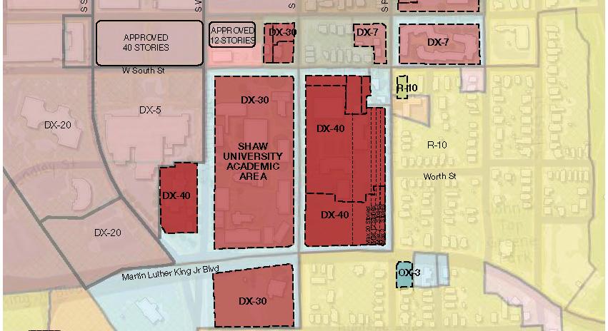
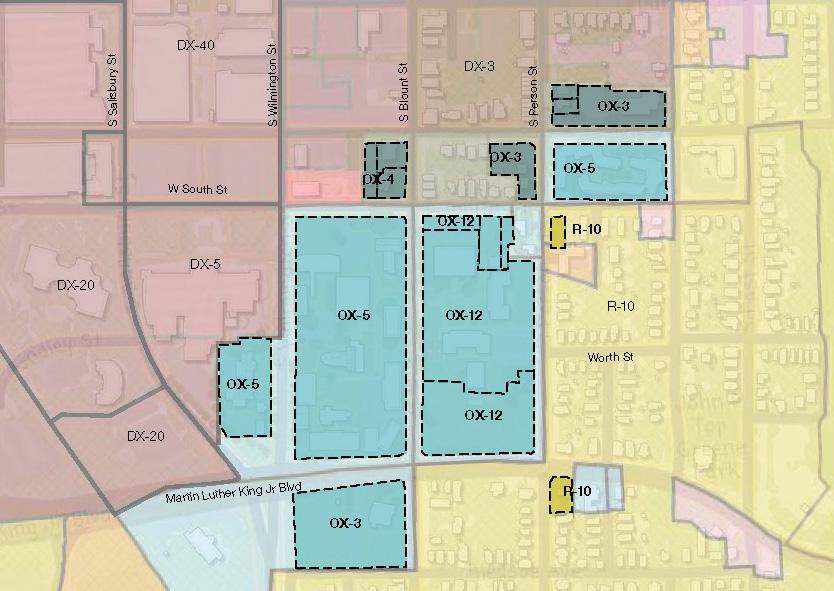
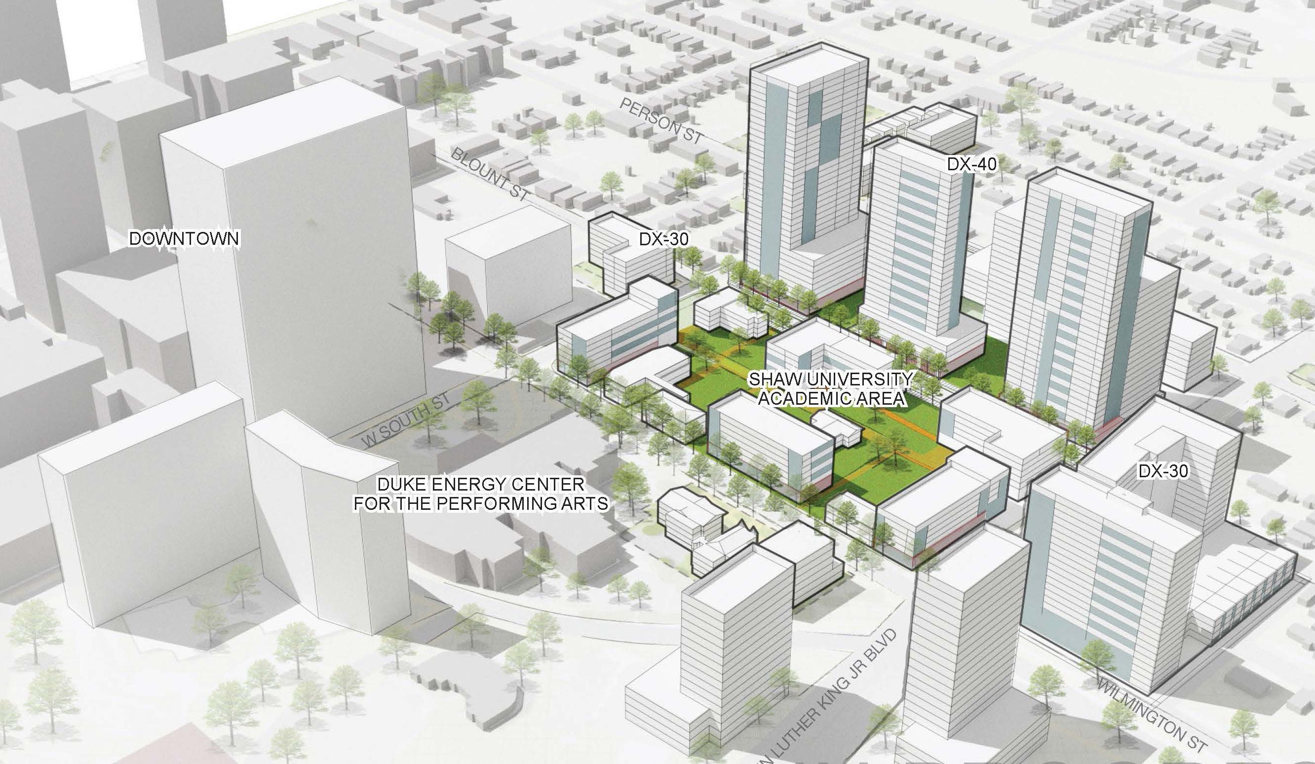
Raleigh, North Carolina
Shaw University is an HBCU located at the edge of downtown in Raleigh, adjacent to areas of substantial investment and redevelopment. Consequently, the institutions real estate holdings represent one of its largest financial assets. The university selected Hayat Brown and Page to conduct a physical and financial analysis of the land use in advance of a proposed rezoning process.
The consolidation of academic programs frees up approximately half of the campus for redevelopment. The repositioning will enable Shaw to develop a new mixed-use district on the campus to accommodate housing, retail, and research adjacent to the core. The plan monetizes edge-campus development sites, while maintaining property ownership, to achieve long-term funding streams and enable a series of capital improvement projects to revitalize the core campus and replace aging infrastructure while providing tangible assets for the university and community.
Page Southerland Page, Inc. 23
AISD Housing Study and Asset Repositioning Austin, Texas
Despite the population growth of city and region, the Austin Independent School District (AISD) has lost enrollment in recent years and was forced to close multiple campuses. At the same time, district staff struggle to afford the rapidly increasing cost of living near their place of work. Working with Hayat Brown and Page, the district sought to reposition the resultant land resources to support housing options for staff and the community.
Beginning with two distinct sites, the asset repositioning study analyzed a variety of housing configurations, densities, and compatible uses on the sites to determine a configuration that is both financial feasible and meets important community objectives. Various scenarios tested keeping existing school buildings and removing them, as well as redevelopment under current zoning and rezoning scenarios. Preferred site scenarios were selected not for pure market potential but for a balance of feasibility and community benefit.
24 Urban Design and Planning Single Family - 2,000 SF Townhome (2,500 sf each) 78,400 sf = 78 Units 95,600 sf = 96 units Building Height: 55’ Parking Garage Surface Parking Surface Parking Parking Garage Building Height: 44’ Park Space: 113,000 sf (or) 2.59 acres GSF# of Units Parking
Site (sq ft) 871200
Floor
FAR
FAR Scenario 04 Single Family Home
174,000174 214
154,350 63 126
(GSF)472378.5 21,560 32 64
1.844283768
2.59 (acres) SF-5 Anita Coy Building Park Space Zoning Multi Family MF-4 Townhome SF-6
Single Family: attached Townhomes Single Family: attached Townhomes Single Family: attached Townhomes Single Family: attached Townhomes Multi Family Building Current park Building Height: 45’ N Building Height: 25’ GSF # of Units Parking 2,000 44 88 90,000 82 102 Rosedale Elementary Building Park Space Zoning Townhome 1.45 (acres) SF-6 Scenario 03 Multifamily MF-4
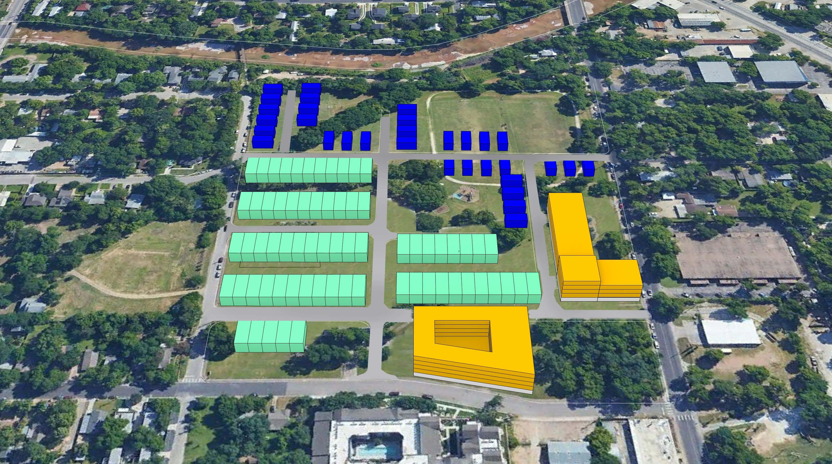
Community First! Village Phase 3-4 Planning Austin, Texas
Community First! Village (CFV) is a 51-acre community that provides affordable, permanent housing and a supportive community for individuals coming out of chronic homelessness. A development of Austin-area nonprofit Mobile Loaves & Fishes (MLF), this transformative residential program exists to love and serve neighbors who have been living on the streets, while also empowering the surrounding community into a lifestyle of service with the homeless.
The purpose of the site planning and programming effort was to support MLF leadership in envisioning the potential and best use of their Phase 3 & 4 sites, developing a framework and strategy to maximize the positive impact of each site while retaining the agility, flexibility and collaboration at the heart of CFV Phase 1 and the MLF organization. In collaboration with MLF leadership, Page analyzed Phase 1 & 2 sites, developed guiding principles, established site concepts and planning guidelines, and generated conceptual site plans for Phase 3 & 4. Feedback was gathered from all participants during a series of visioning sessions, focus groups, and an on-site design charette and tour.
Page Southerland Page, Inc. 25 acres 1.844283768
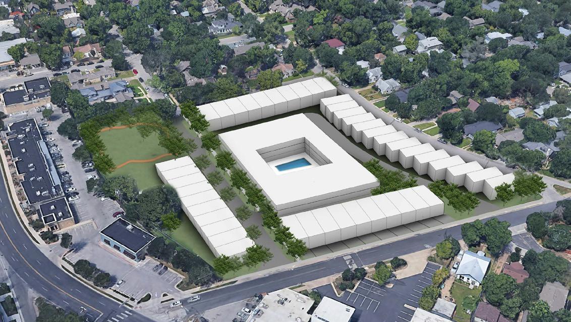
The SAFE Alliance is a non-profit organization dedicated to ending violence through prevention, advocacy, and comprehensive services for individuals, families, and communities that have been affected by abuse. SAFE engaged Page to help envision the future redevelopment


Page collaborated with the client to adjust to the rapidly increasing value of land in Austin, understanding the need to expand services to meet the demands of the growing population and maximize the potential of existing assets to best serve the community, including a focus affordable housing opportunities.


The proposed redevelopment of both campuses includes leveraging the Rathgeber Village (RV) campus is sited within a larger unified development on the eastern edge of the Mueller neighborhood. The site is primarily used for teen and children’s shelter with some administrative functions. Redevelopment of RV will trail behind Grove, but early implementation will focus on expansion of administrative and support functions as well as the creation of affordable housing.

26 Urban Design and Planning
Shelter Shelter Expansion Supportive Housing
z
Resource Center Expansion / Warehouse
Shelter SHP
Clinic / Drop-in Center
Shelter Expansion
8 The SAFE Alliance - Grove and Rathgeber Village Campuses
Affordable Housing School
Facilities
Teen Cottages
59 The SAFE Alliance - Grove and Rathgeber Village Campuses Grove Site Section The massing of the future site growth is organized with a gradient that directly relates to the security gradient of campus. The south end of the site houses the tallest and least secure functions, while the north end of the site has the shortest and most secure programs. This allows for a stepping down in scale, intimacy, and visibility as security increases.
Shelter The affordable housing takes advantage of Austin’s Affordability Unlocked program. This program allows some density bonus when building affordable housing and meeting specific criteria. Primarily, the program allows for up to 50% additional height beyond base zoning, removes compatibility requirements, and relaxes parking requirements. This will allow SAFE to maximize the number of affordable units that can be accommodated on site at Grove.
Administration
Resource Center Clinic / Drop-in Center
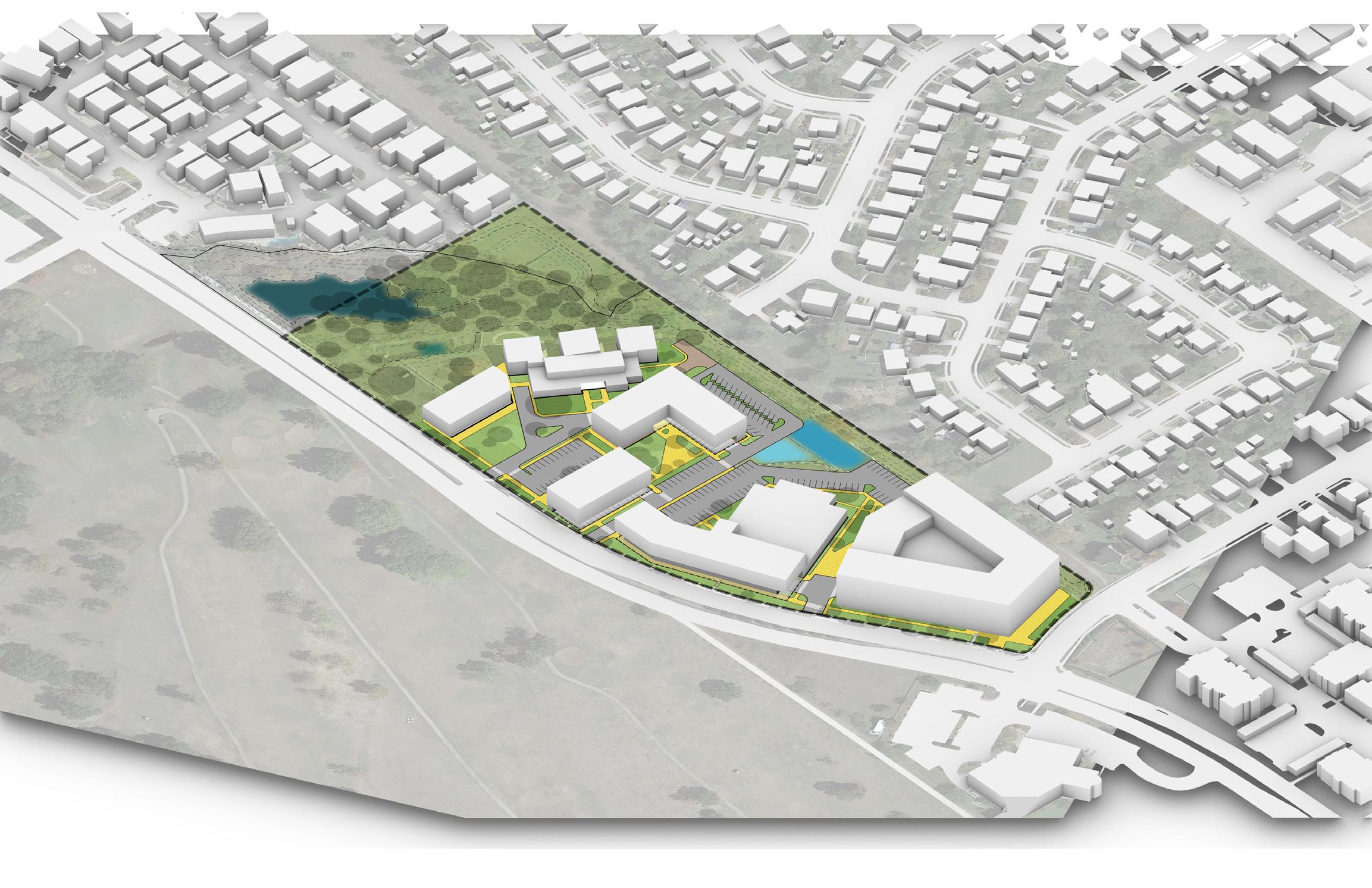
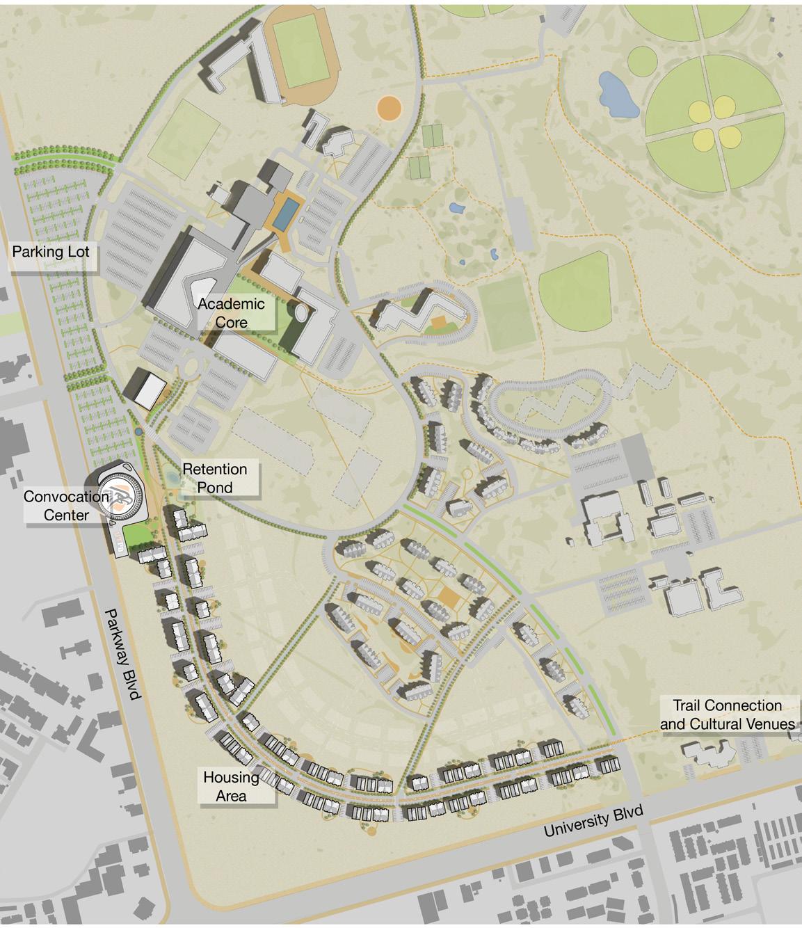
UTPB Housing and Mixed-Use District Study Odessa, Texas
The University of Texas Permian Basin (UTPB) Housing and Mixeduse District Study reflect the university’s growth as an institution of academic excellence not only within the Odessa-Midland metro area, but the whole of West Texas. The study was conducted in collaboration with JLL in order to determine the feasibility and market potential of the development of an under-utilized corner of the campus. The combination of a conceptual plan, program, and market study provided the university with guidance for what can reasonably be achieve on this prominent site and a strategy for implementation.
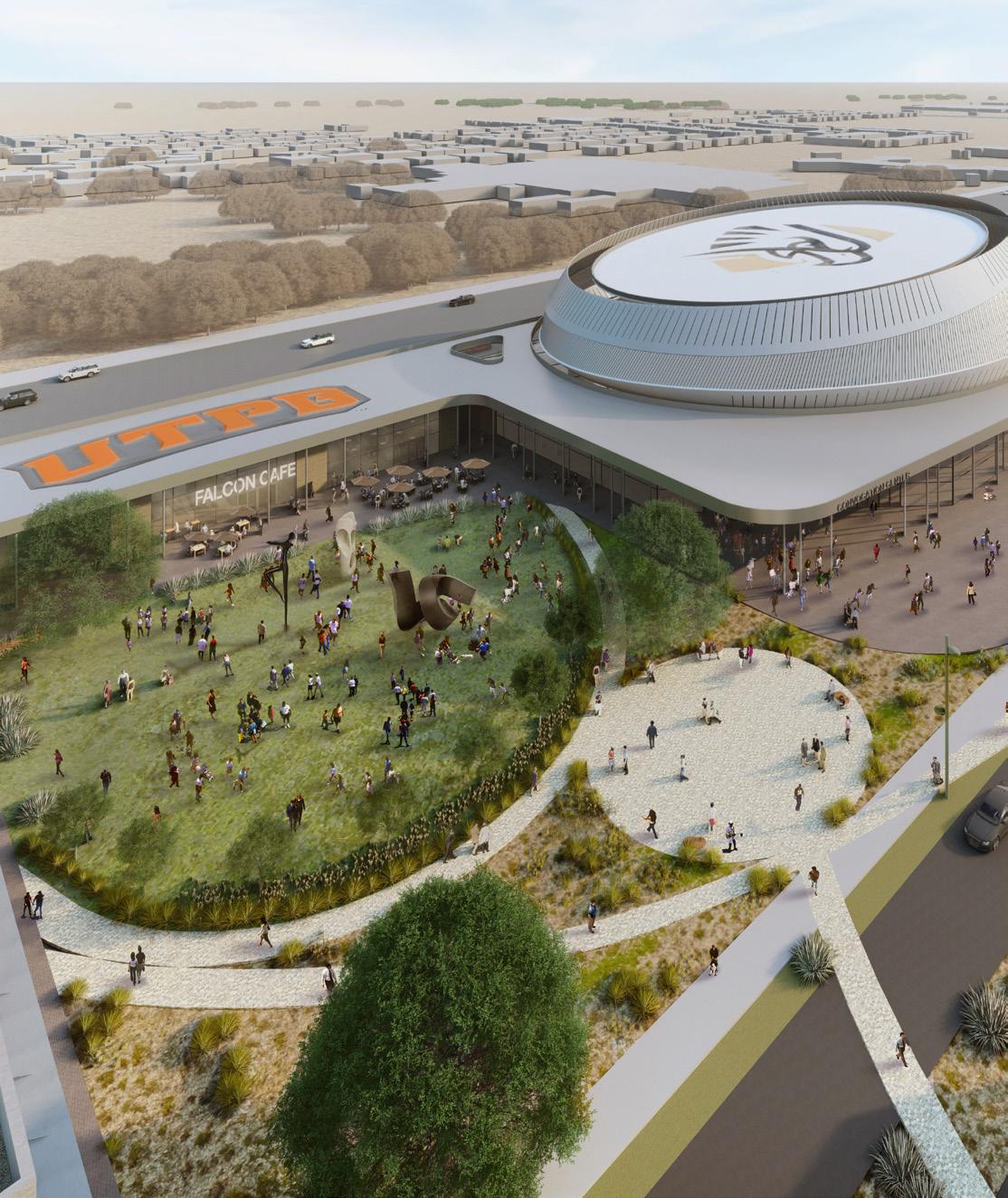
The concept plan activates the southwest corner of campus, linking the academic core and trails via a proposed boulevard. The land use builds upon the existing campus planing structure by reinforcing the connection of landscape and cultural feature. The new development seeks to provide a diverse set of housing typologies for the expanding needs associated with the increasing population of both UTPB and the City of Odessa. Target populations include UTPB faculty and staff, as well as teachers and first responders from the region. Proposed housing typologies include multi-family buildings as well as townhouses. The heart of the proposed development is a new Convocation Center that will become a town/gown anchor of vibrant and lively activity for the students and public align, thereby creating a strong sense of place that welcomes the entire community.
Page Southerland Page, Inc. 27
 CSUMB Divarty Street / Monterey, California
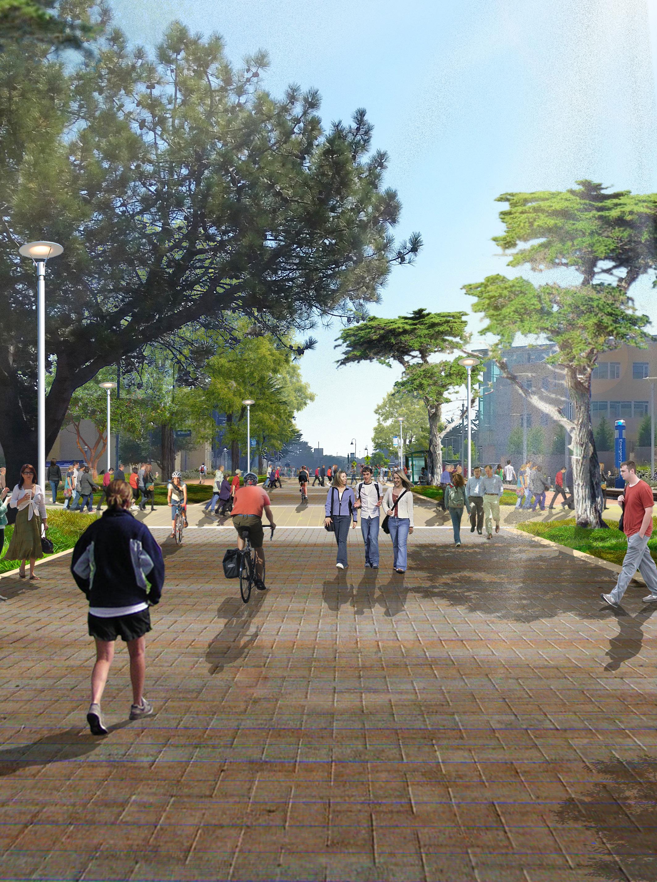
Corridors and Streetscapes
Corridors and streets constitute the largest component of public open space in a city, and the quality of our urban environments greatly depends on the level of attention and investment in their character, land-use and design. As a public amenity, it is important to find creative solutions to balance the often-conflicting demands placed on limited right-of-way. Opportunities exist to create corridors that are safe, universally accessible, pedestrian-friendly, and active, socially vibrant spaces.
Page Southerland Page, Inc. 29
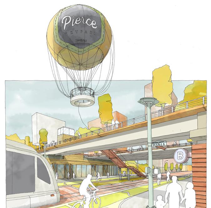
Pierce Skypark / Houston, Texas
City of San Antonio Northeast Corridor Redevelopment Standards / San Antonio, Texas
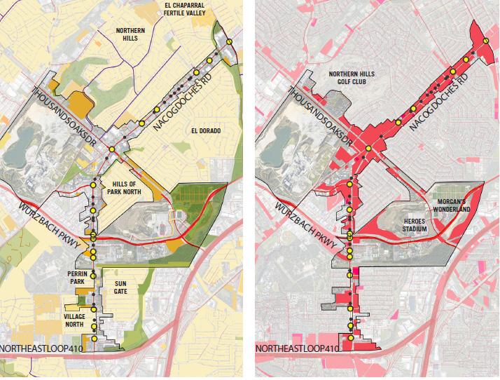
City of San Antonio Bandera Road Corridor Plan San Antonio, Texas
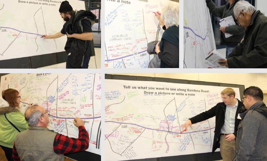
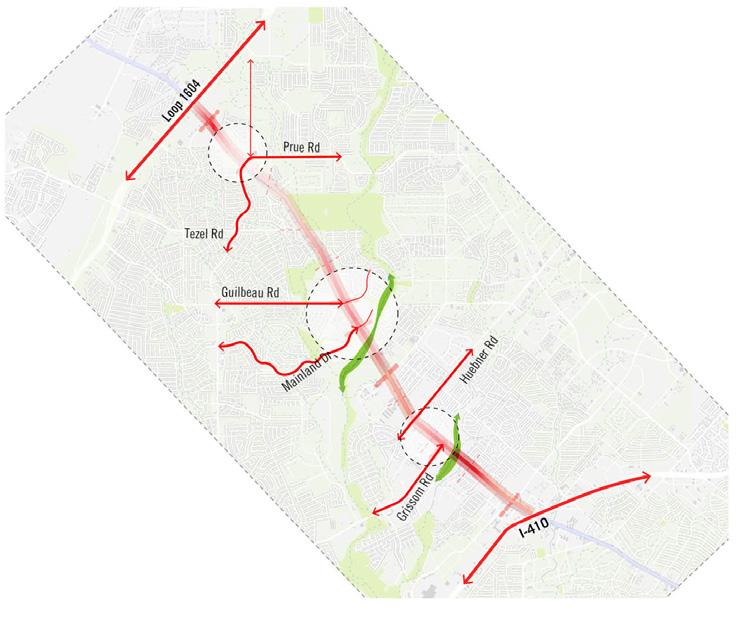
Primarily located in San Antonio, Texas, with an approximate 6.5 linear mile area bisecting the City of Leon Valley, Texas, the Bandera Road Corridor links northwest San Antonio (just inside Loop 410) and Leon Valley with Downtown San Antonio via Bandera and Culebra, connecting many crosstown routes with a direct path to the city center. The proposed Corridor Plan length is approximately 6.5 linear miles, and includes an area within one-half mile around Bandera Road, from Loop 410 to Loop 1604. The Page and Work5hop led team guided an effort for the City of San Antonio in collaboration with a parallel effort conducted by TxDOT. This analysis looked not only at the corridor itself, but the economic impacts, multi-modal opportunities, housing supply, and related land uses surrounding and connecting through the right-of-way. Extensive engagement is being conducted to include a wide range of interested stakeholders.
30 Urban Design and Planning
City of Cedar
Park
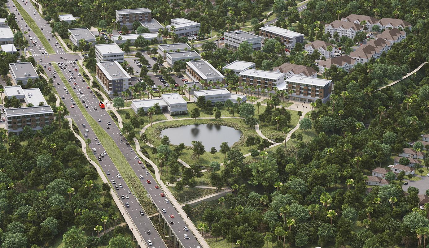
Bell Boulevard Corridor Master Plan Cedar Park, Texas
With this master plan, the City of Cedar Park sought to redevelop and revitalize a one-mile stretch of the Bell Boulevard corridor to create a gathering place and a sense of identity for the City. The primary goals were to create an economically vibrant corridor to energize the region, generate a return on investment for the City and maintain existing traffic levels while increasing pedestrian access. The study area encompassed approximately 240 acres of public and private land.
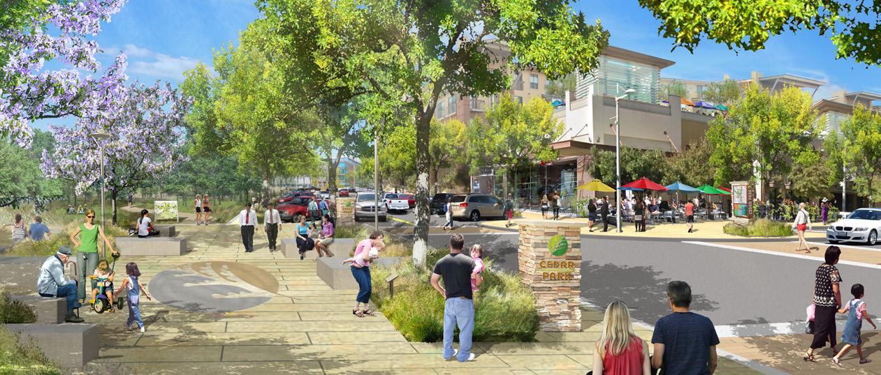
Page, as a consultant on the Design Workshop-led team, was an integral part of the planning process, analyzing existing buildings and proposing typologies for various block structures. Page also assisted in benchmarking with comparative redevelopment projects. Following the master plan, Page was engaged by, the City’s selected master developer to help refine the vision for the 50-acre catalyst site and provide text fit studies for office, retail and multifamily buildings on the site.
Page Southerland Page, Inc. 31
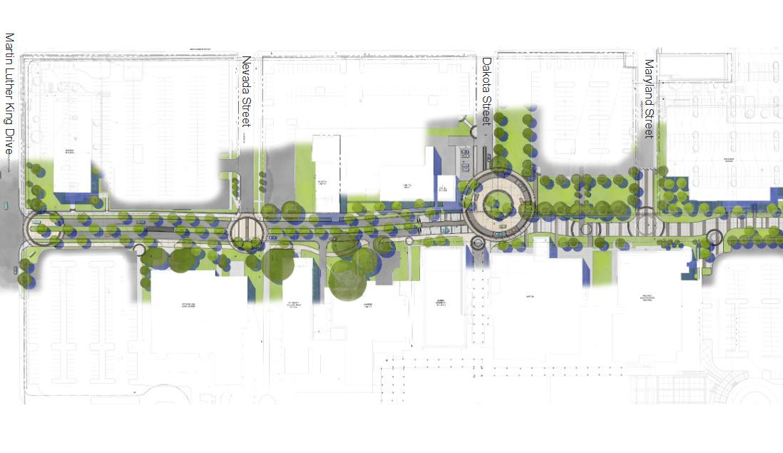
St. Philip’s Way San Antonio, Texas
Site Analysis | Road Network

The campus has easy vehicular access to the relevant areas of the city.
As part of a multi-building and site planning project for St. Philip’s College, Page urban designers engaged in detailed planning and design of a new campus entry and pedestrian street. The project includes the conversion of four blocks of a campus-owned street. Two-blocks are proposed to transition to a boulevard with street trees and improves pedestrian facilities for the campus entry. The remaining two blocks will be closed to through traffic to create a connective pedestrian environment. The project included a proposal to bury existing overhead utility lines and coordination with ongoing belowgrade utility relocations. Lamp posts were selected for consistency between the vehicular and pedestrian-only portions of the street.
• Neighboring streets connect to several highways. They provide a fast route to and from downtown.
• A series of secondary streets connect the campus to the surrounding neighborhood. These connections integrate the campus with the community. Main Streets Secondary Streets
32
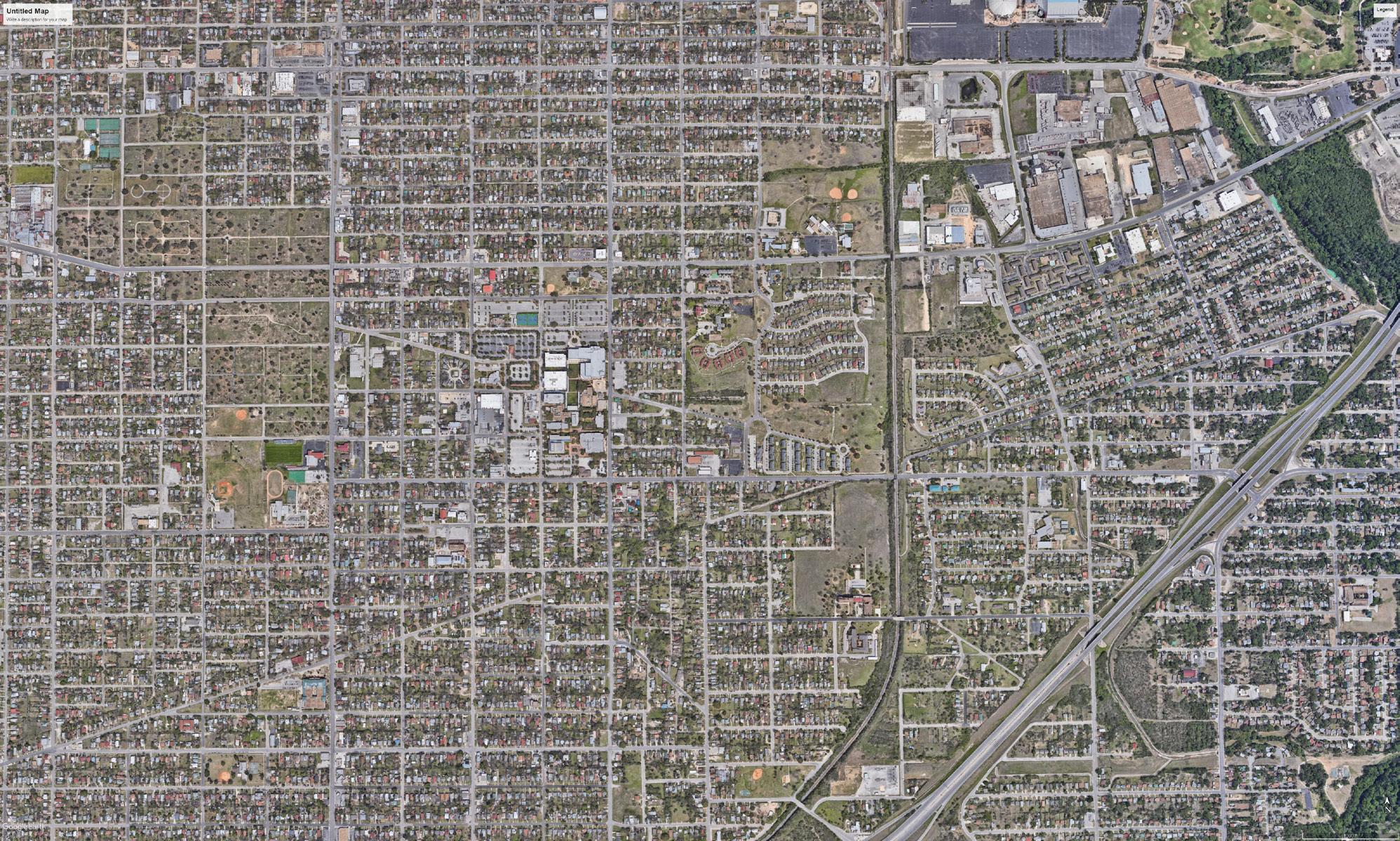
E.Commerce St To Downtown S New Braunfels Ave To HWY 35 To HWY 35 To HWY 10 To HWY 10 To HWY 10 MLK Drive Historic Cemeteries AT&T Center S Walters
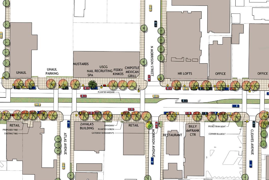
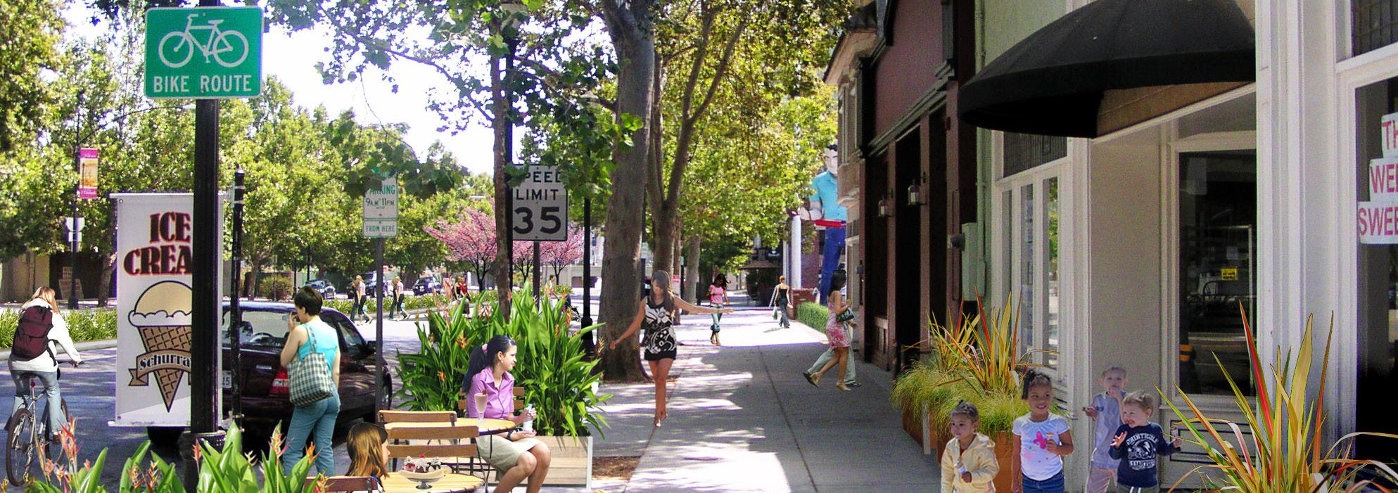
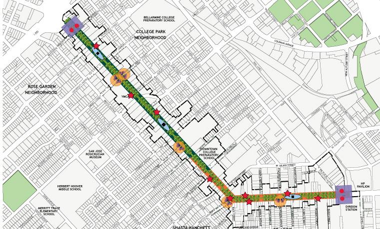
The Alameda was once a thriving commercial/retail boulevard but in recent years had suffered from the common problems of evolving urban thoroughfares: lack of pedestrian amenities; intrusive traffic; inadequate and potentially unsafe crosswalks; and poor connectivity with other destinations. This community-based, integrated urban design/transportation plan presents a vision and strategy for reinvigorating this commercial center, encouraging multimodal transportation, creating a more livable and cohesive community, and fostering economic and residential development. Through an extensive community engagement program, the plan reinforces and emphasizes the historic legacy of the area and establishes The Alameda as a grand boulevard and active ‘main street’ with amenities and services for residents, commuters, and visitors.
Page Southerland Page, Inc. 33
The Alameda: “The Beautiful Way” San Jose, California
 Schwab Austin Campus / Austin, Texas
Innovation Communities and Corporate Campuses
The office and research landscape is evolving to meet today’s changing market needs. Emerging is a new model that melds work-life balance issues, cross-collaborative research, and a dynamic workforce. By applying urban design principles, innovation districts and corporate environments enrich the work experience by creating opportunities for social interaction, recreation, and connections with the natural environment. Urban and campus form can help foster innovation.
Page Southerland Page, Inc. 35
Burlingame Waterfront Development / Burlingame, California
Four Points Center / Austin, Texas
Riverside Presidio Master Plan / Austin, Texas
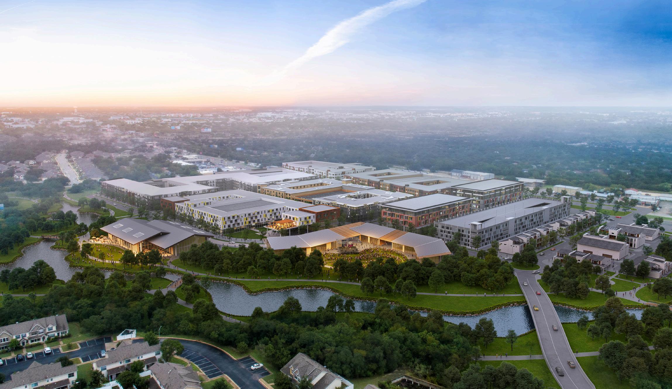
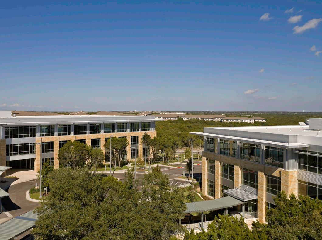
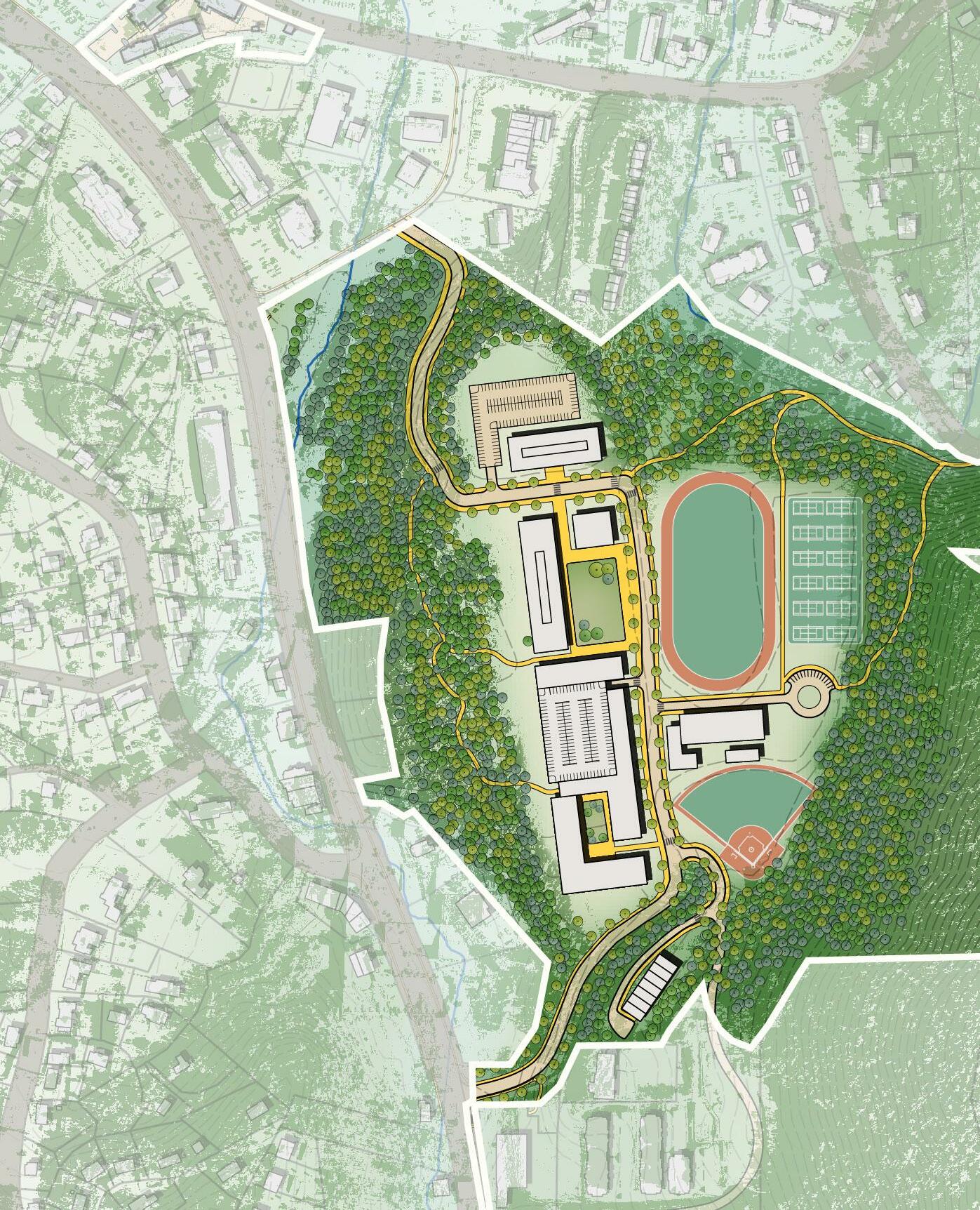
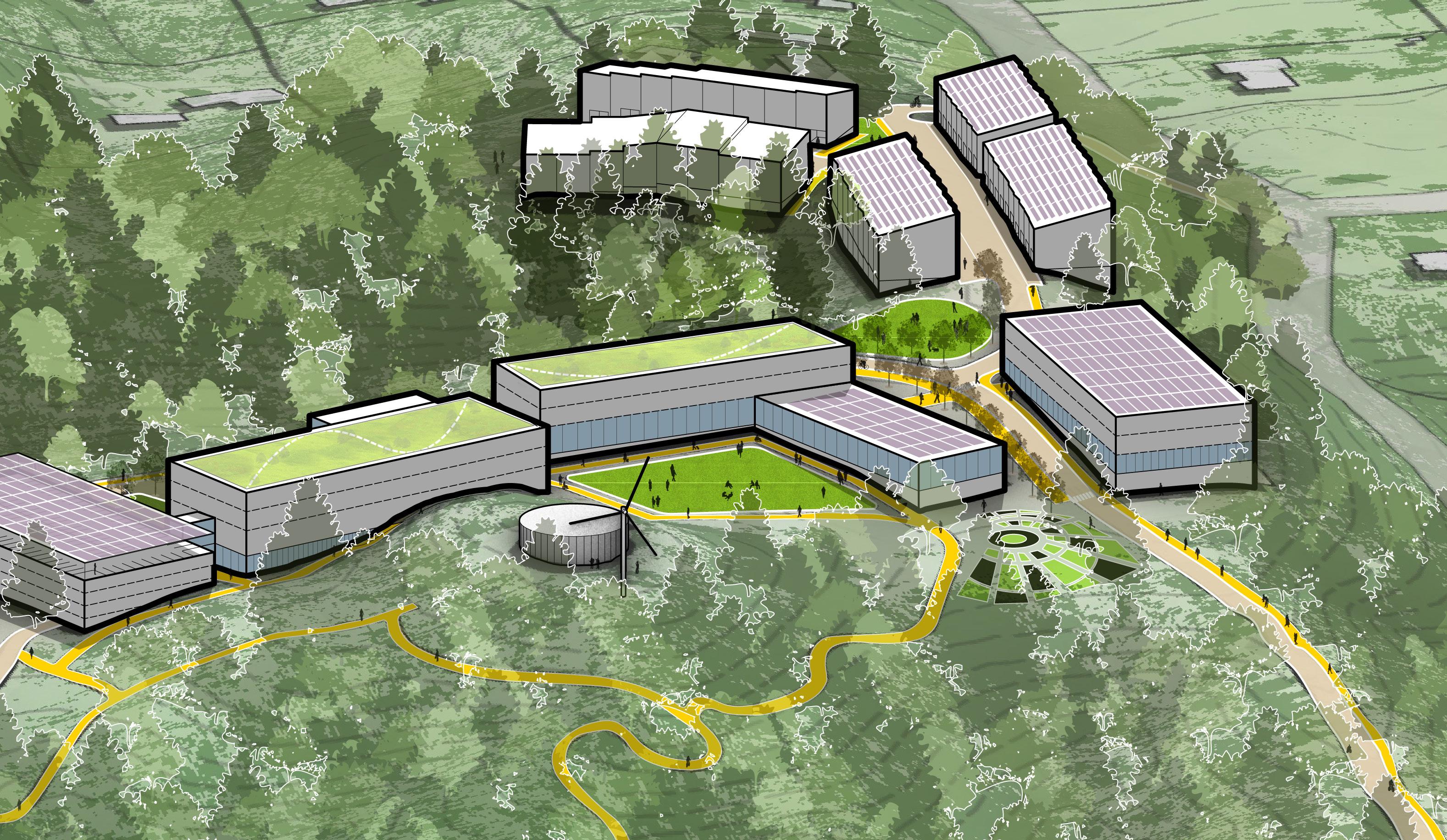
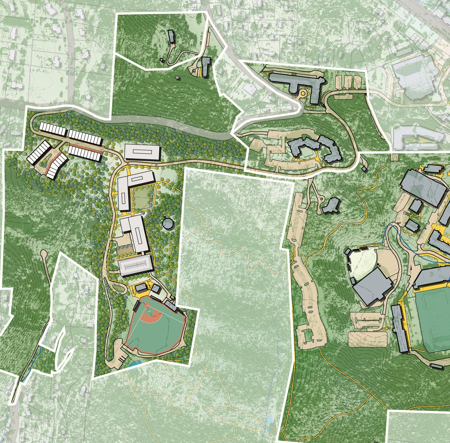
ASH Brain Health Campus Master Plan Austin, Texas
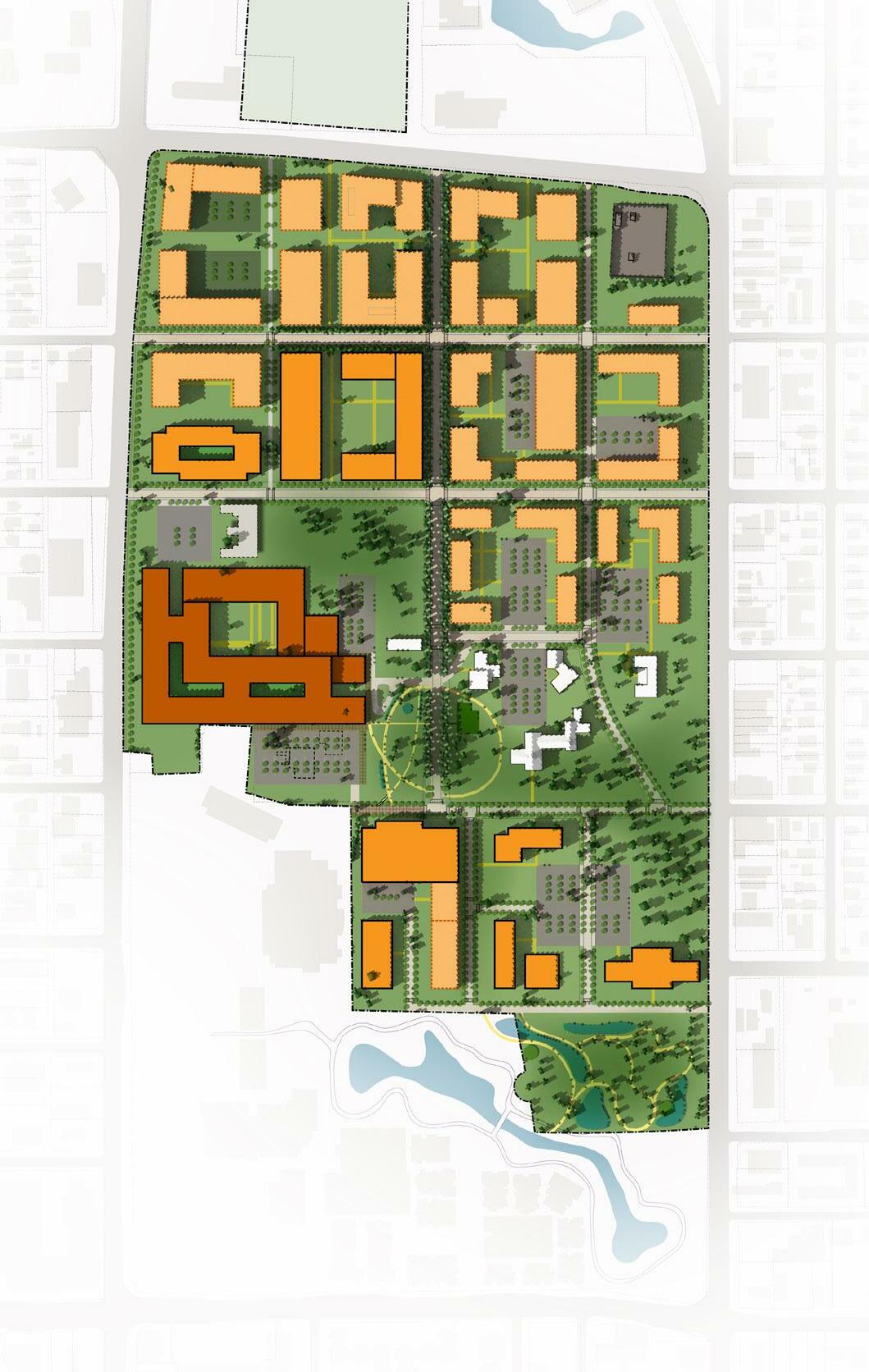
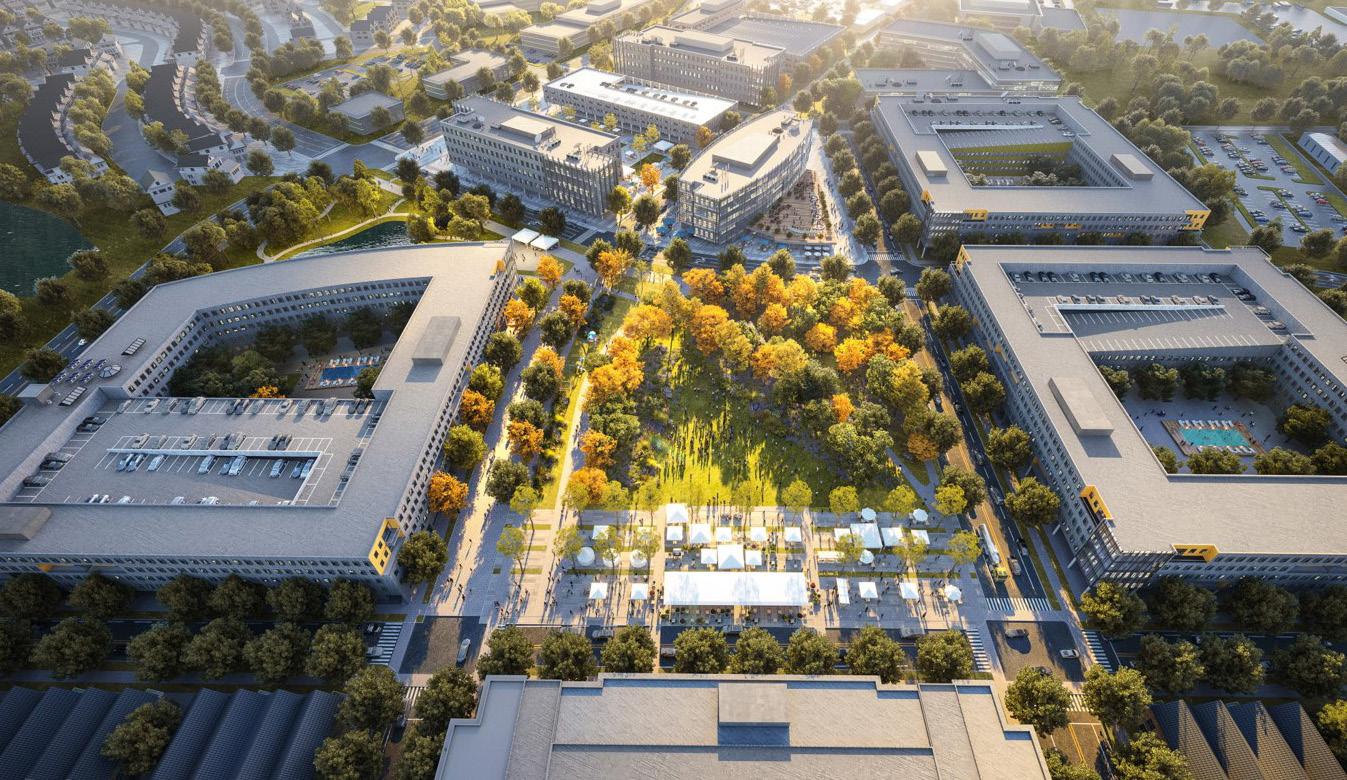
This 95-acre campus is located in the center of Austin and includes the Austin State Hospital as well as multiple healthcare partner companies. The plan develops a long-term vision to create the continuum of care necessary for the future of brain health in Austin and surrounding communities, and establishes a framework to guide future infill development and motivate additional partners to co-locate on the campus. Urban design principles include: a north-south spine which provides organizational structure to the campus; land use districts that create desired adjacencies and help organize functional areas of the campus; a connection to the city grid to create urban walkable streets; and preserving open space such as an existing pecan grove while also defining new open spaces that include a campus square and community park expansion at the south end of campus.
36
Appalachian State University Innovation District Plan
Boone, North Carolina
Page worked closely with Appalachian State University and their market and economic advisor to prepare master plans for sites, on and off campus, that position the university to generate mission-sustaining revenue through the creation of vibrant, mixed-use districts. These district plans identify how best to utilize the identified land holdings to capture financial and strategic value through development.
The plans identify site capacity, land use, massing, open space, and circulation strategies for an array of uses including academic, research, lab facilities, multifamily housing, retail, athletics, community outreach, and event spaces. Academic, commercial, and research partnership developments are co-located to foster trans-disciplinary collaboration. Housing focuses on generating affordable solutions for the challenging real estate market of Appalachia. The planning effort included extensive university stakeholder engagement to achieve consensus on land use and development strategies.
38
Community Engagement
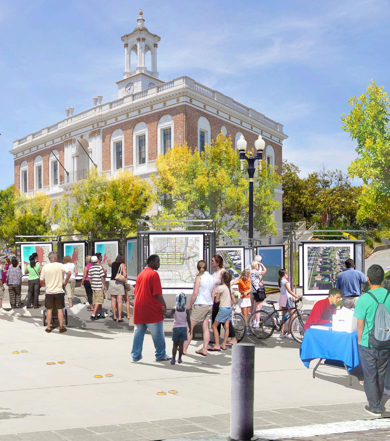
Improve Our Communities | Connect
We are dedicated to the advancing cities, spaces, and places that make up our communities. Our people are committed to investing in causes that matter.
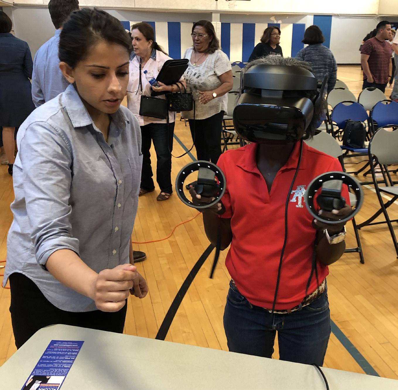
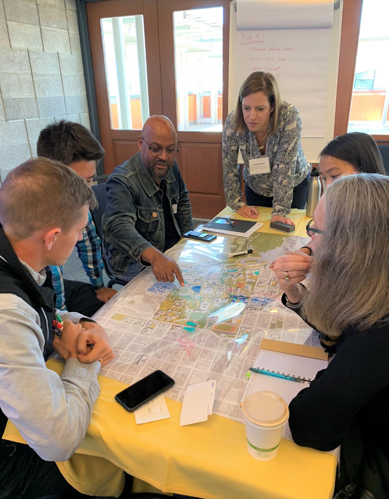
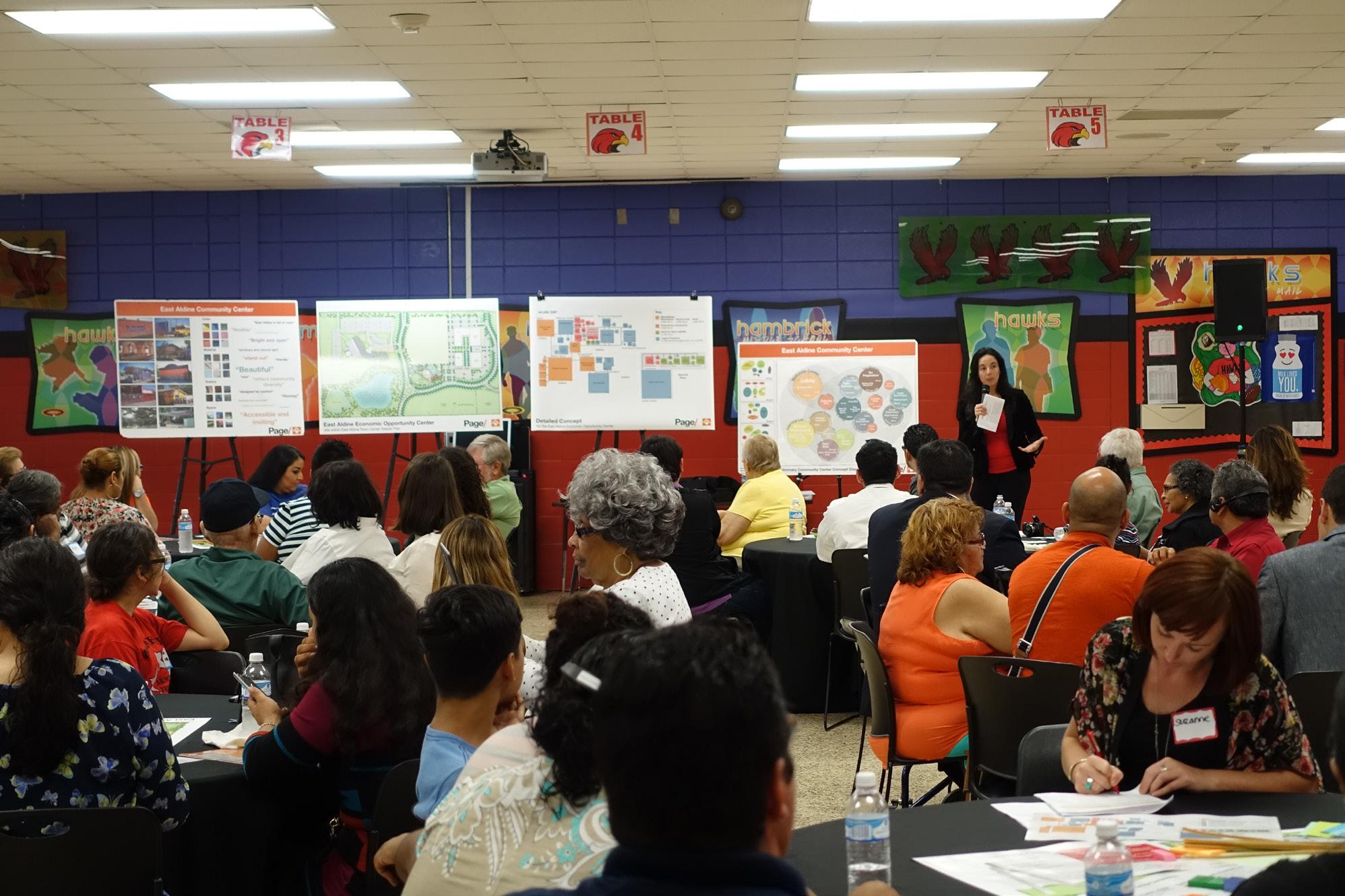
Stakeholder engagement is a critical part of our planning process, and we work to establish an open and honest dialogue from the outset of any project. Our process involves continuous participation with project leadership and the broader community. Our teach uses techniques to actively engage participants and solicit feedback.
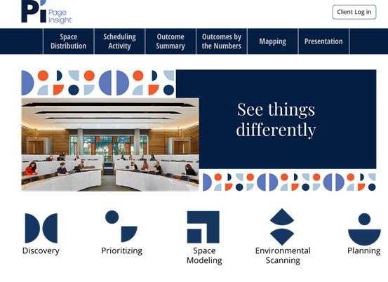
Equitable engagement in a planning process means meeting people where they are. Critical voices respond to different methods of engagement, and we work to utilize tools to engage through multiple mediums. Through our Page/Insight online platform, we have the ability to deploy a customized Discovery Survey that allows interactive feedback remotely from participants who may not be able to engage directly. Whatever the means, it is important that we afford broad opportunities to engage to ensure long-term support for a planning process.
40

Albany Albuquerque Atlanta Austin Boston Dallas Denver Dubai Houston Los Angeles Mexico City Orlando Phoenix Raleigh San Francisco Washington DC
pagethink.com
