
APPENDIX
March 2023

PARK & OPEN SPACE INVENTORY Park Map Park Size Chart Inventory ACCESSIBILITY REPORT Park Accessibility Data Inputs Accessibility Analysis Findings Interventions MARKET ANALYSIS Market Analysis Multiple Regression Analysis Results COMMUNITY MEETING MATERIALS First Community Meeting Second Community Meeting Third Community Meeting 1 3 5 7 85 87 91 93 99 101 103 105 109 11 113 121 140 TABLE OF CONTENTS APPENDIX A B C D
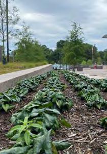
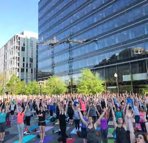
Yoga
hosted by CityCenter DC
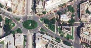
DowntownDC
Meade Memorial
Parks Master Plan

SURVEYS Stakeholder Survey Summary Community Survey Summaries Community Survey Results CASE STUDIES New York City Paris Seattle Houston Philadelphia BEST PRACTICES Tactical Urbanism Amenities Comfortable Spaces Activation & Programming Adaptive Reuse Relevant & Current 151 153 155 165 177 179 183 185 187 189 191 193 195 197 199 201 204 E F G
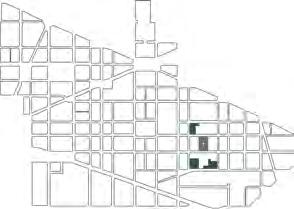
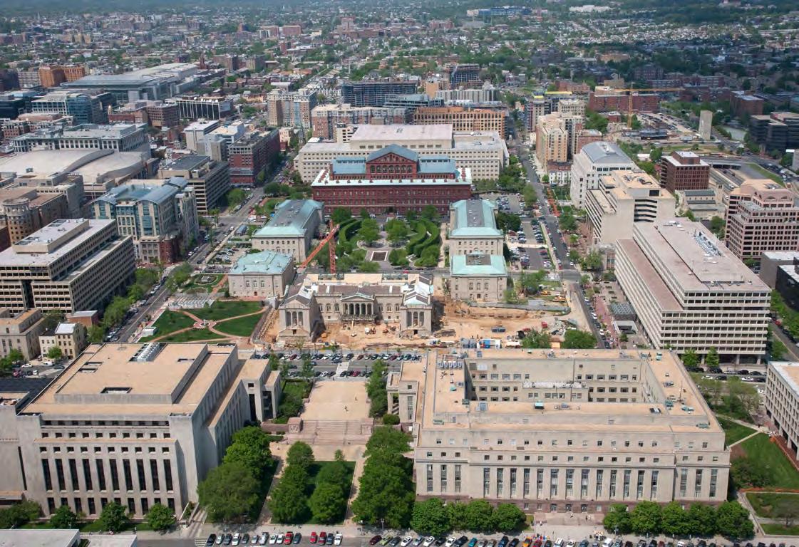
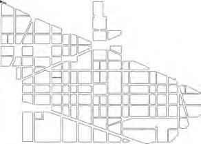
A OPEN SPACE INVENTORY
1

2
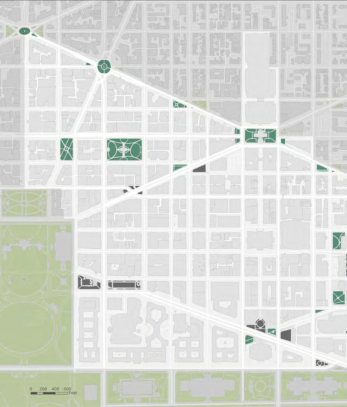
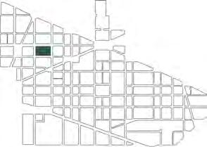
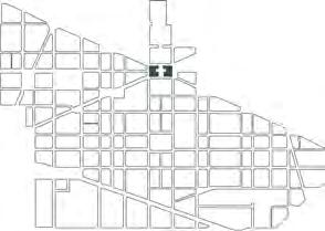
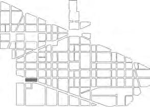
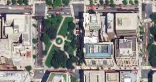
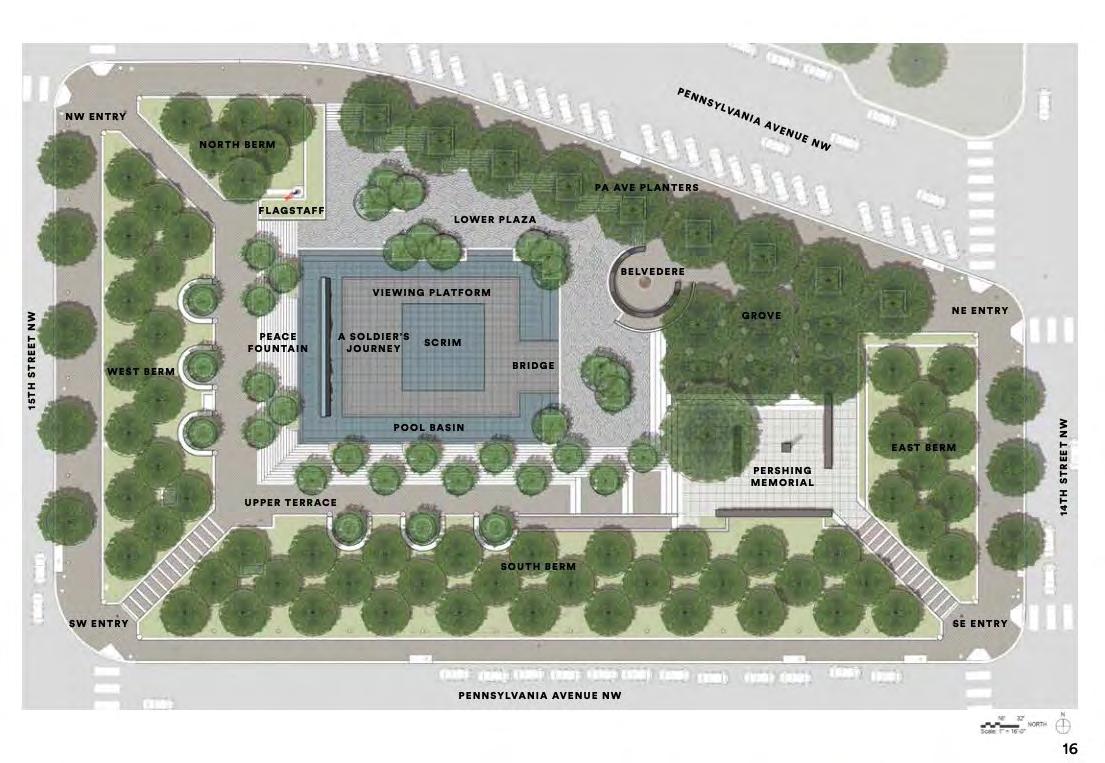
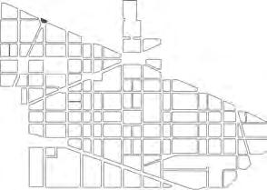
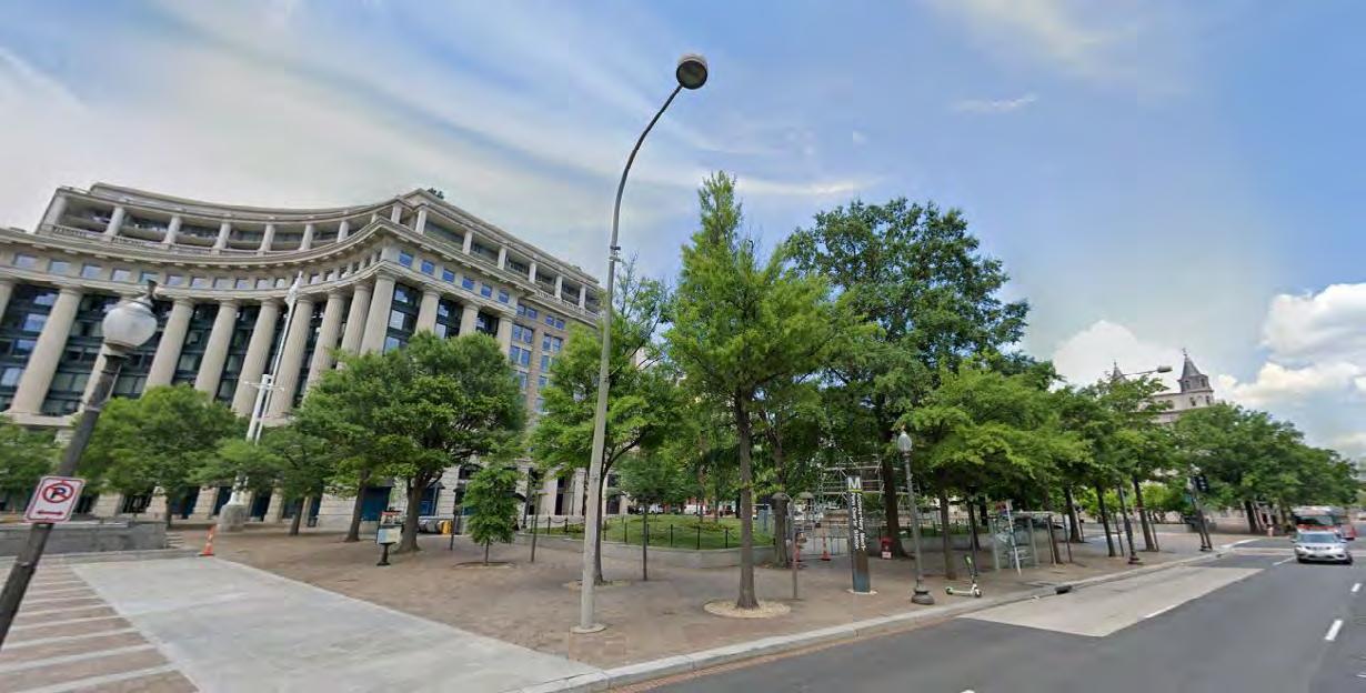
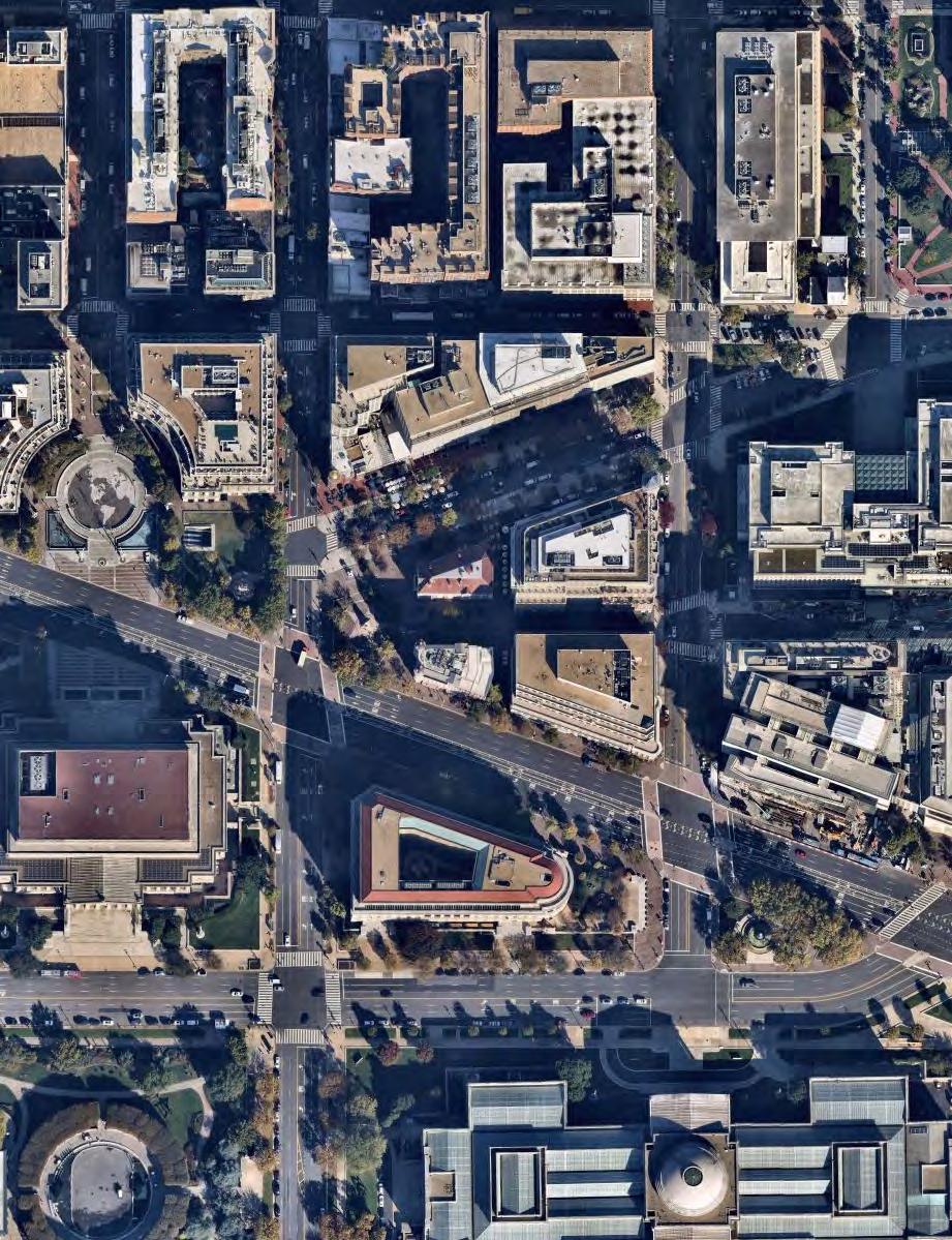
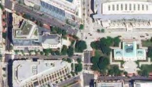
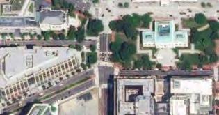
NEWYORKAVE VERMONT AVE 13TH ST 14TH ST 15TH ST 15TH ST 16TH ST 12TH ST I ST K ST L ST M ST DOWNTOWN FEDERAL TRIANGLE F ST E ST D ST G ST 11TH ST 10TH ST 9TH ST 7TH ST 6TH ST 5TH ST 8TH ST H ST H ST I ST K ST PENNSYLVANIA AVE INDIANA AVE MASSACHUSETTS MOUNT TRIANGLE MOUNT VERNON SQUARE CHINATOWN PENN QUARTER THE WHITE HOUSE THE ELLIPSE THE NATIONAL MALL The BID boundary was officially expanded in 2022. However, the analysis and recommendations in this plan only include the 2021 boundary. PARK MAP 2 3 5 6 7 8 10 11 12 18 15 16 32 21 22 20 25 27 30 31 17 19 13 3 DowntownDC Parks Master Plan
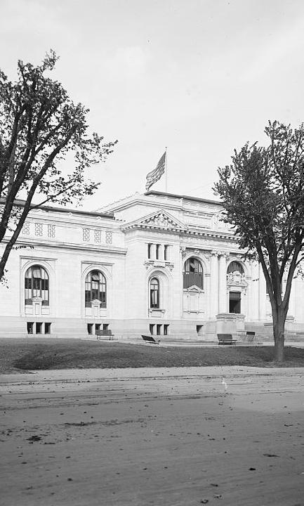
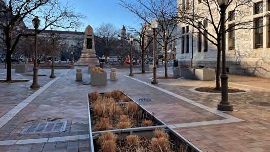
Judiciary Square
Franklin Park
Mount Vernon Square
John Marshall Park
Freedom Plaza
McPherson Square
U.S. Navy Memorial (Market Square)
WWI Memorial (Pershing Park)
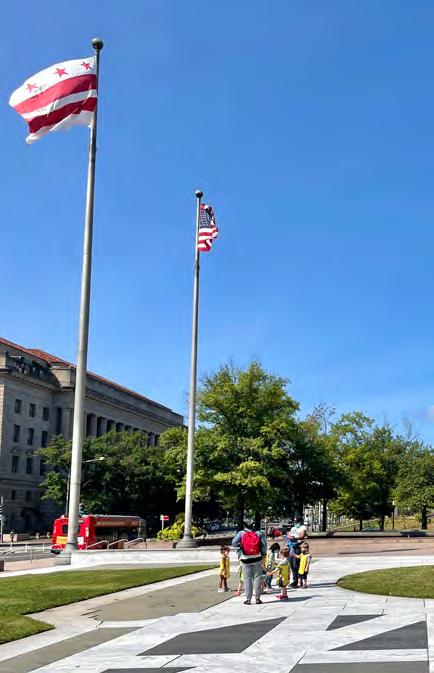
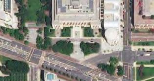
Meade Memorial
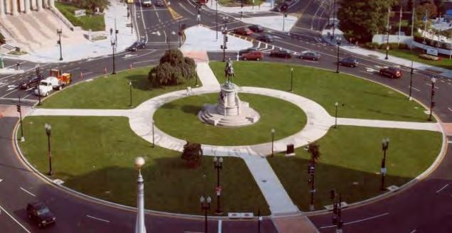
Thomas Circle & Reservation 65

Burke Park & Reservation 69A
The Park at CityCenter
Scott Circle & Reservation 64A
Japanese American Memorial
Mellon Fountain
Chinatown Park
F.D.R. Memorial Stone
Reservation 173
Indiana Plaza
Reservation 71
Reservation 70
Reservation 175
Reservation 75
Sombrotto Park
Reservation 187
Reservation 196
Reservation 172
Reservation 77B
Reservation 78
Reservation 172B
Reservation 172A
Reservation 73
F ST E ST 4TH ST 3RD ST 2ND ST 1ST ST ST LOUISIANAAVE MASSACHUSETTSAVE NEW JERSEY AVE MOUNT VERNON TRIANGLE U.S. CAPITOL 1 4 9 14 23 26 28 29 24 1 2 3 4 5 6 7 8 9 10 11 12 13 14 15 16 17 18 19 20 21 22 23 24 25 26 27 28 29 30 31 32
4
PARK SIZE CHART
FRANKLIN PARK FREEDOM PLAZA WWI MEMORIAL
MOUNT VERNON SQUARE MCPHERSON SQUARE CHINATOWN PARK BURKE PARK MEADE MEMORIAL THE PARK AT CITYCENTER RESERVATION 173 RES. 71 RES. 73 RES. 175 RES. 70 2 3 1 5 8 6 21 22 20 16 32 4 9 11 12 18 5 DowntownDC Parks Master Plan
JOHN MARSHALL PARK JUDICIARY SQUARE (ONLY PLAZA & GREEN SPACES)
RES. 172 RES. 172B RES. 172A SCOTT CIRCLE RESERVATION 172 (A & B) THOMAS CIRCLE JAPANESE AMERICAN MEMORIAL SOMBROTTO PARK FRANKLIN PARK RESERVATION 77B RESERVATION 78 INDIANA PLAZA RESERVATION 196 F.D.R. MEMORIAL STONE MELLON FOUNTAIN U.S. NAVY MEMORIAL RESERVATION 187 RESERVATION 75 RES. 73 RES. 64A RES. 65 LARGEST PARK SPACE SMALLEST PARK SPACE 15 27 30 31 13 10 26 29 24 28 14 17 19 25 7 23 6
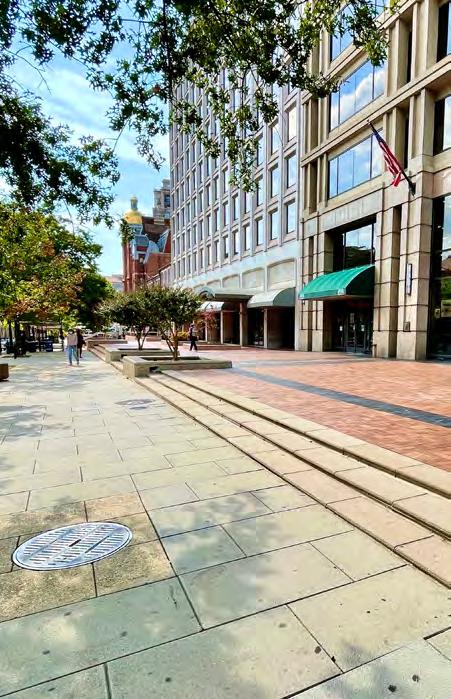
JUDICIARY SQUARE 01
NPS AND D.C. OWNED
PARK HISTORY
VARIOUS
AT A GLANCE
Judiciary Square is the largest park space in the BID.
The space is typically underutilized as it creates a feeling of separation from the nearby Capital One Arena and 7th Street businesses.
The park and surrounding buildings hold important cultural significance and create a sense of grandness for parkgoers.
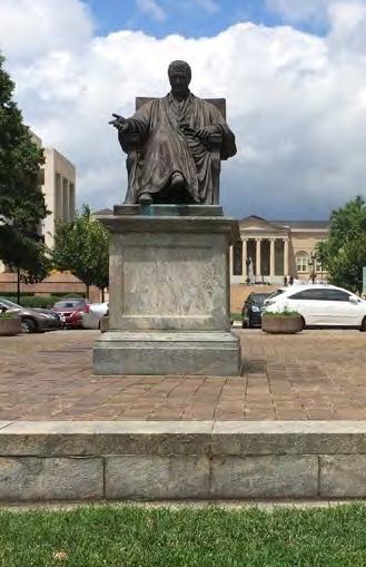
Judiciary Square is one of the original 17 reservations set aside for public use in the 1791 L’Enfant Plan. Encompassing approximately 18 acres, it is made up of three city blocks between D and G streets and 4th and 5th streets. In 1802–03, a city jail designed by English architect George Hadfield was built in the center of the reservation, which otherwise remained an open common for many years. The construction of City Hall at the south end of the square, also designed by Hadfield, began in 1820. It was the first government building constructed in Washington after the U.S. Capitol and the White House. When a new jail, designed by Robert Mills, was built on the reservation in 1842, the old jail was converted into a hospital. A few years later, the city built a school on the grounds. During the Civil War, the U.S. Army commandeered the buildings and grounds. When the old hospital was destroyed by fire, a new military hospital was constructed on the site.
Judiciary Square was improved in the late 19th century to create a more parklike setting for City Hall. The jail, schoolhouse, and military hospital were razed, and the grounds were redesigned with paths, lawn panels, trees, and flowering shrubs. In 1868, a marble statue of Abraham Lincoln, designed by Irish sculptor Lot Flannery (1836–1922), was erected in front of City Hall. Originally displayed on an 18-foot-high marble column, the statue now stands on a rectangular pedestal. Judiciary Square was selected as the site of the Pension Building in 1881. Designed by architect and engineer Montgomery C. Meigs, it was located at the north end of the reservation on axis with the north portico of City Hall. Today it is home to the National Building Museum. Early 19th-century development of the square was influenced by the City Beautiful Movement.
7 DowntownDC Parks Master Plan
5.2 AC
36,005 VISITORS
OCTOBER 2021
THE LAWN COULD ENCOMPASS THE MUSEUM EXPERIENCE AND ANNOUNCE THAT THIS IS A DESIGN DISTRICT.
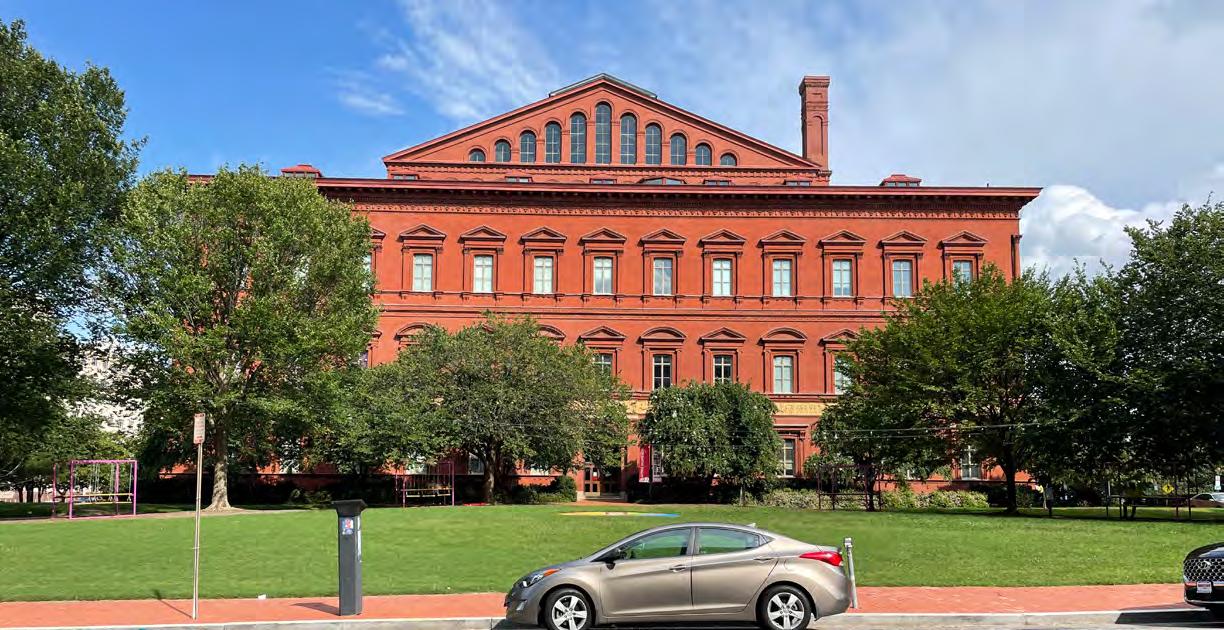
‒ FROM STAKEHOLDER INTERVIEWS
 The National Building Museum helps program the West Lawn
8
New construction included the Court of Appeals (1908–10) at 450 E Street, now the U.S. Court of Military Appeals, and the Juvenile Court (1938-–39) at 410 E Street, now Superior Court Building C. These buildings are sited immediately northwest and northeast of City Hall, which, over the years, was renovated and largely rebuilt, and today houses the D.C. Court of Appeals. The buildings now designated as D.C. Superior Court Building A
(515 5th Street) and D.C. Superior Court Building B (409 E Street), both built in the late 1930s, are arranged to form an open plaza in the middle of the reservation, now the site of the National Law Enforcement Officers Memorial (1991). Judiciary Square’s distinctive collection of government buildings are surrounded by small, landscaped parks that feature trees, open lawns, winding sidewalks, and benches.
 *Source: Robinson & Associates, “The Plan of the City of Washington,” Draft National Historic Landmark Nomination, 2001; D.C. Preservation League, “Judiciary Square Historic District,” Revised Draft National Register of Historic Places Registration Form, 2018; and HABS No. DC-690, Judiciary Square (Reservation No. 7).
9 DowntownDC Parks Master Plan
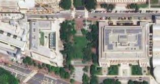
Judiciary Square takes up three city blocks, containing a Metro station, museum, and federal and local government buildings and their associated parking lots.
ACCESS & CONTEXT
The Judiciary Square Metro station is at the heart of the square, and three bus stops are located within a block. The Capital One Arena sits to the west, and other museums and theaters occupy surrounding blocks. A mix of federal and local government offices, private office buildings, a few residential buildings, and commercial retail make up the directly adjacent land use.
SITE OBSERVATIONS
» The programming provided by the museum activates the space and connects it to a cultural destination.
» Benches have been removed.
» Proximity to Metro stop increases pedestrian activity.
» Flexible space for creative curation and programming.
FEATURES & QUALITY
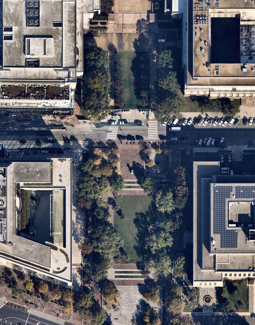
Judiciary Square occupies a large footprint and combines green lawn area with hardscaped plazas. The plaza directly surrounding the Metro station entrance is formal in rhythm with patterns of radiating trees and pathways, but lacks seating.


The lawn area next to the National Building Museum is programmed by the institution, though the permanent benches have been removed.
 Benches have been removed.
Creative programming curated by the museum.
Paths and lawn area connect portions of Judiciary Square but get truncated by surface parking allocations.
Benches have been removed.
Creative programming curated by the museum.
Paths and lawn area connect portions of Judiciary Square but get truncated by surface parking allocations.
10
Darlington Memorial Fountain
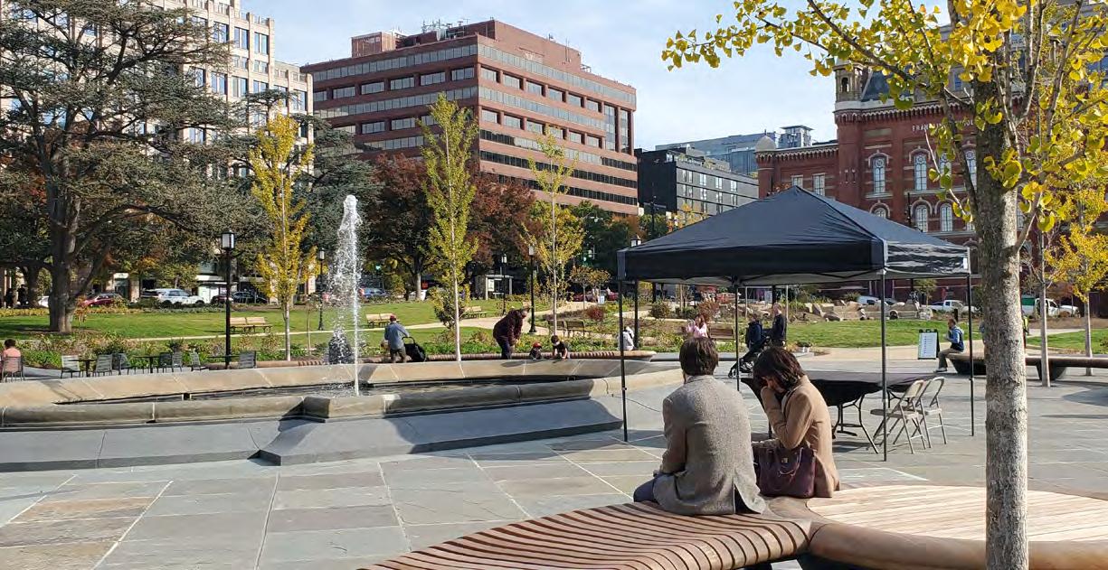
FRANKLIN PARK 02
NPS OWNED BID MAINTAINED
ROLE IN HISTORY
AT A GLANCE
Franklin Park was reopened in September 2021 after a $21 million renovation.
Through a formal cooperative management agreement (CMA) with NPS and the District, the BID operates, programs, and manages the park.
Thanks to the renovation and full schedule of activities and events, the park has quickly become a favorite destination for BID residents, workers, and visitors.
The refurbished park better meets needs of parkgoers with events, playspace, and design elements that highlight history while modernizing the space for a more engaging environment.
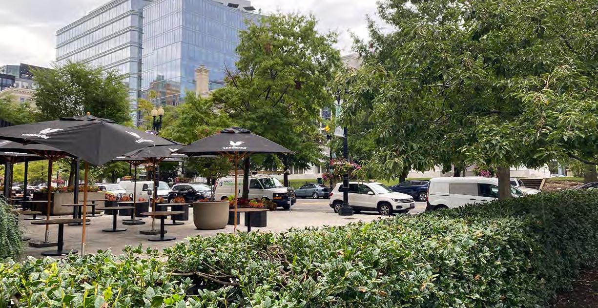
Franklin Park occupies an entire city block in the heart of the city’s downtown business district. Originally known as Fountain Square, the land was designated parkland in 1831 to protect the springs in the site, which were used to supply water to the White House and other federal buildings. The next improvements were made to the square in the late 1860s, when it was transformed into a lush Victorian garden featuring shade trees, ornamental plants, curving paths, a circular fountain basin, lampposts, and public restrooms. In 1914, a memorial statue of Commodore John Barry, father of the U.S. Navy, was erected on the park’s west side. It was designed by sculptor John J. Boyle (1851–1917) and architect Edward P. Casey (1864–1940).
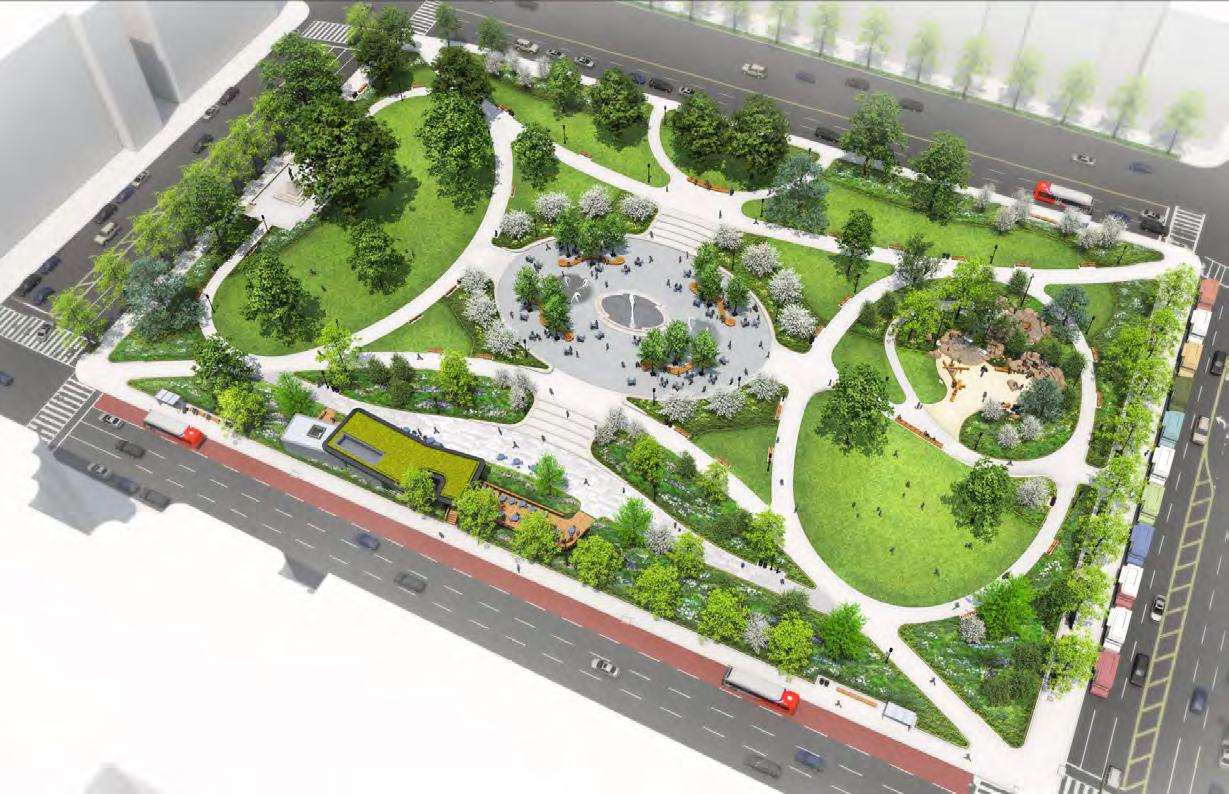
In 1936, the U.S. National Park Service (NPS) rehabilitated the park with funding from the Public Works Administration. The project eliminated the more ornamental features of the Victorian design, created a new circulation system, and installed a new fountain surrounded by a paved flagstone plaza in the center of the block. In 2012, the NPS partnered with the DowntownDC Business Improvement District (BID) and the D.C. Office of Planning (OP) to plan for a major rehabilitation of Franklin Park. The urban design and landscape architecture firm OLIN prepared the design, which featured a re-envisioned fountain, playground area, café, and new streetscape furnishings. Franklin Park had its official reopening in September 2021.
11 DowntownDC Parks Master Plan
*Source: National Park Service, Cultural Landscapes Inventory, “Franklin Park, National Mall & Memorial Parks – L’Enfant Plan Reservations,” 2017; and Robinson & Associates, “The Plan of the City of Washington,” Draft National Historic Landmark Nomination, 2001.
4.8 AC
7,619 VISITORS OCTOBER
FRANKLIN PARK IS ENERGIZING THE ENTIRE NEIGHBORHOOD.
‒ FROM STAKEHOLDER INTERVIEWS
 People enjoy a weekday lunch hour in the newly renovated Franklin Park.
12
2021
ACCESS & CONTEXT
Hotels and office buildings surround Franklin Park. Several ground floor restaurants are taking advantage of views of the newly renovated park with sidewalk dining.
There are bus stops or transfer stations on all four sides of the park, and McPherson Square Metro station is located at the southwest corner. The lack of fencing and multiple entry points at the corners and at mid-block make the park visually and physically accessible to the surrounding area.
FEATURES & QUALITY
Franklin Park has been highly activated since its reopening. Weekend concerts and weekday events are hosted regularly. A restaurant space was added on the south side of the park, offering new opportunities for dining and events.
Public bathrooms and a children’s garden are new features added during redevelopment, along with updated plantings, paths, a performance space. Street trees line sidewalks, shading benches facing the park.
13 DowntownDC Parks Master Plan
Design plan for Franklin Park created by STUDIOS Architecture and Land Collective in 2019.
SITE OBSERVATIONS
» Bus stops could be better integrated into the park.

» Maintenance concerns must be addressed.
» The redesign and regular programming have greatly increased activity and positive perception of the park and surrounding area.

» Nearby businesses have seen an increase
in pedestrian traffic and sales thanks to the park, according to stakeholder interviews.
» Placer data that tracks cell phone use to understand pedestrian patterns has shown an uptick in park usage from years prior.
 Restaurant rendering: When complete, the restaurant will provide an opportunity to dine in the park.
Adjacent buildings have “park front” views as an added amenity.
Restaurant rendering: When complete, the restaurant will provide an opportunity to dine in the park.
Adjacent buildings have “park front” views as an added amenity.
14
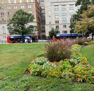
The renovated park has a rich plant palette that adds seasonal interest and a garden respite in the heart of the urban context.
MOUNT VERNON SQUARE 03
D.C. OWNED EVENTS DC MAINTAINED
PARK HISTORY
AT A GLANCE
The square is 2.6 acres and surrounds the Carnegie Library. The green space is a popular destination of the residential neighborhood to the north of Massachusetts Avenue.
The park’s space is highly visible to vehicles and pedestrians. Stakeholders drew attention to the difficulty of accessing it due to the highly trafficked convergence of roadways that surround the square. Pedestrians and cyclists do not feel comfortable crossing.
Mount Vernon Square encompasses a 2.6-acre site at the crossing point of Massachusetts Avenue and New York Avenue and is located on the north-south axis of 8th Street, one of the major streets of the L’Enfant Plan. One of the first public buildings on the site was a market built in 1846, which serviced what was once a densely populated neighborhood known as the Northern Liberties. After the market stalls were razed in 1872, the Board of Public Works laid roadways across the site in line with the four intersecting avenues and streets. The resulting triangular parcels were improved with sidewalks, post-and-chain fencing, and planted with grass.
A redesign in 1882 eliminated the through streets and created a large rectangular park with gravel pedestrian paths, ornamental trees, flowering shrubs, drinking fountains, and gas lanterns. The site was selected as the location of the Carnegie Library (originally known as the Central Public Library) in 1899. The classical Beaux Arts–style library was designed by the firm Ackerman & Ross and completed in 1903. Lacking sufficient funds, the planned improvements to the grounds did not occur until 1913, when the park was entirely redesigned. The Carnegie Library was rehabilitated in 2017–19. Today, the landscape features broad lawn panels planted with large specimen trees, curved pedestrian paths, foundation plantings, and benches. These elements create a park-like setting for the Carnegie Library.
15 DowntownDC Parks Master Plan
*Source: Robinson & Associates, HABS No. DC-682, Mount Vernon Square (Reservation 8); and EHT Traceries, Inc. National Register of Historic Places Registration Form, “Central Public Library (Additional Documentation),” 2019.
10,390 VISITORS
OCTOBER 2021
THIS BECAME A CRUCIAL SPACE TO NEARBY RESIDENTS DURING THE PANDEMIC.

‒ FROM STAKEHOLDER INTERVIEWS

16
Mount Vernon Square is a popular public space destination in D.C., especially for the residential population to the north of Massachusetts Avenue.
2.6 AC
ACCESS & CONTEXT
There is heavy car traffic surrounding the square. The Mt. Vernon Sq 7th St-Convention Center Metro station entrance is a block to the north. There is an uncovered bus stop on K Street to the south, and another to the north.
Surrounding land use is mostly commercial and office, with close proximity to the CityCenterDC mixed use development-
FEATURES & QUALITY
The square is characterized by flexible open green space with paths surrounding the library building. The lawn is dotted with large, mature shade trees. A few benches face into the space. The square has a mostly symmetrical, formal design.
17 DowntownDC Parks Master Plan
SITE OBSERVATIONS
» The heavy traffic pattern surrounding the park makes it difficult for pedestrians to access it.
» It is a popular destination and is activated by indoor public space and retail.
» Connection to the pedestrian-only portion of 8th Street.
» The square is at a highly visible convergence point of roadways.

» Surrounding view parks add to the space.
 The overall design of Mount Vernon Square has remained consistent.
Both green space and hardscape make up the public space.
The overall design of Mount Vernon Square has remained consistent.
Both green space and hardscape make up the public space.
18
The space is surrounded by heavy traffic patterns and wide roadways pedestrians must cross to reach the square.
JOHN MARSHALL PARK 04
AT A GLANCE
John Marshall Park is
1.9 acres in size and is characterized by wide, flexible green space with a section of hardscape plaza and pathways.
The park has many benches in the plaza space near Pennsylvania Avenue, with a few more lining the central lawn area. The surrounding land use is primarily courthouse buildings.
PARK HISTORY
Chief Justice John Marshall (1755–1835) lived for a time at a boardinghouse on what was at the time called 4th ½ Street. His residence there led to the street being renamed John Marshall Place. In 1983, the Pennsylvania Avenue Development Corporation, which had been charged with revitalizing the segment of Pennsylvania Avenue between the White House and the U.S. Capitol, closed John Marshall Place to create a park. It had been partially serving as a parking lot at that point. Today, the park is bounded by C Street on the north, Pennsylvania Avenue on the south, the E. Barrett Prettyman Federal Courthouse on the east, and the Canadian Embassy on the west.
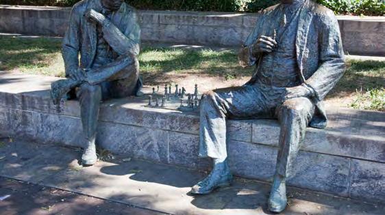
The landscape architecture firm Carol R. Johnson and Associates designed the park. Carol R. Johnson (1929–2020) was a pioneering landscape architect who founded her firm in 1959, when there were few female practitioners working in urban design and planning. John Marshall Park was dedicated on May 10, 1983. It is a pedestrian-oriented park that preserves the historic vista between Pennsylvania Avenue and Old City Hall. It features paved and lawnpaneled terraces that accommodate the site’s change in grade. They are edged with low granite walls and beds planted with trees and shrubs. Animating the terraces are two kinds of features: those relating to the life of Marshall (such as inscriptions and plaques describing his life) and more whimsical decoration, such as Lloyd Lillie’s lifesize sculpture The Chess Players and David Phillips’s Lily Pond Fountains near C Street. The western fountain marks the location of a spring that, in 1808, supplied the city’s first piped water. The John Marshall Statue at the north end of the park is a copy of William Wettmore Story’s 1883 statue located in the Supreme Court. It was installed in 1985.
NPS
BID
OWNED
MAINTAINED
19 DowntownDC Parks Master Plan
*Source: Robinson & Associates, National Register of Historic Places Registration Form, “Pennsylvania Avenue National Historic Site,” 2007; and The Cultural Landscape Foundation, “Pioneer Information: Carol R. Johnson,” available at https://www.tclf.org/pioneer/carol-r-johnson..
3,203 VISITORS

A PROMISING SPACE FOR MEANINGFUL REDESIGN.

‒ FROM STAKEHOLDER INTERVIEWS
 John Marshall Park is adjacent to Pennsylvania Avenue and has a large area of flexible lawn space. Seatwalls, topography, trees, and surrounding buildings lend a sense of enclosure to the park.
20
OCTOBER 2021 1.9 AC
21 DowntownDC Parks Master Plan
The park extends across two blocks and is characterized by open lawn ares, plaza spaces, and seatwalls.
ACCESS & CONTEXT
There is one bus stop near the park along Pennsylvania Avenue. The park is adjacent to streets on two sides, but otherwise fronts building facades. The park is surrounded by local and federal government uses. The Canadian Embassy is directly adjacent, and the park maintains prominent views of Old City Hall.
DESIGN ELEMENTS
John Marshall Park is part of the Pennsylvania Ave National Historic Site and the proposed Judiciary Square Historic District. Significant historical elements of this park that should be preserved or protected as design and function are considered:

» Views and vistas
FEATURES & QUALITY
The park has flexible, largely uninterrupted lawn space. Seatwalls and benches occupy the edge, and statuary and public art sculptures are present.
The park is divided into three terraces that descend to meet Pennsylvania Avenue. The top terrace holds a sculpture of John Marshall and two decorative fountains, a design element that reinforces the site’s history as an early public water supply site for the District.
SITE OBSERVATIONS
» Large, undefined open space.
» Secluded feeling.
» Sense of enclosure created by trees, steps down into the park, and surrounding building facades.
Statuary adds a focal point to the extensive park. Public art along the seatwalls that surround the perimeter.22
Three terraced sections make up the park and provide seatwalls.
FREEDOM PLAZA 05
AT A GLANCE
Freedom Plaza takes up two reservation spaces and divides Pennsylvania Avenue, providing two prominent viewsheds down the roadway. The plaza is an important First Amendment space and serves as a gathering area for community members and visitors for protests and events.
Thanks to the large, flat hardscape, the plaza has become a popular destination for the skateboarding community.
PARK HISTORY
In 1972, the U.S. Congress established the Pennsylvania Avenue Development Corporation (PADC), a cooperative venture between the federal government and private interests. This venture was charged with revitalizing the segment of Pennsylvania Avenue between the White House and the U.S. Capitol, popularly known as “America’s Main Street.” The PADC’s public improvements were implemented between 1978 and 1993 and included the creation of five new public spaces, including Freedom Plaza. The plaza was assembled by combining two parks (Reservations 32 and 33) and rerouting the portion of Pennsylvania Avenue that diagonally bisected them. The design was a collaboration between the landscape architect George E. Patton (1920–1991) and architect Robert Venturi (1925–2018), a leading practitioner of Postmodern design.
It consists of a raised, open plaza with a depiction of the L’Enfant plan on its surface. The plan’s streets and avenues are rendered in white marble on a black granite field, and grass panels are used to represent the Mall and other open spaces. The plaza is framed with planting beds, urns, and a large fountain at its west end. The design incorporates a statue of the Revolutionary War hero Count Casimir Pulaski that was placed at the east end of Reservation 33 in 1910. The park was dedicated as Western Plaza on November 1, 1980. The following year, the PADC implemented a revised planting plan by landscape architecture firm Oehme, van Sweden & Associates. On April 22, 1988, Western Plaza was renamed Freedom Plaza, after the civil rights achievements of Dr. Martin Luther King Jr.
BID
NPS OWNED
MAINTAINED
23 DowntownDC Parks Master Plan
*Source: Robinson & Associates, National Register of Historic Places Registration Form, “Pennsylvania Avenue National Historic Site,” 2007; and National Park Service, Cultural Landscapes Inventory, “Pennsylvania Avenue National Historic Site, National Mall & Memorial Parks,” 2017.
25,323 VISITORS
[FREEDOM PLAZA IS] SUCH AN IMPORTANT EVENT SPACE FOR DOWNTOWNDC, BUT NEEDS TO BECOME A DESTINATION.

‒ FROM STAKEHOLDER INTERVIEWS
24
OCTOBER 2021 1.8 AC
25 DowntownDC Parks Master Plan
The design, reimagined as part of the Pennsylvania Avenue Development Corporation’s plan to enhance the boulevard, highlights the legacy of history and reinforces the L’Enfant Plan.
ACCESS & CONTEXT

To the north of Freedom Plaza are commercial and office buildings, while federal and local government buildings occupy the area directly south (Federal Triangle). Pennsylvania Avenue runs next to the park space, providing ample right of way and large sidewalks.

SITE OBSERVATIONS
» Lack of shade.
» Design imposed across the surface reinforces context and breaks up the large expanse.
» Popular destination for skateboarding.
» Multiple school and daycare groups use the space and surrounding sidewalk for outdoor play.
FEATURES & QUALITY
The plaza is large and flat, with view corridors down Pennsylvania Avenue. Although there are no trees within the plaza’s boundaries, there are sections of grass and large planters.
Seatwalls provide seating around the perimeter, and stairs elevate the space from the surrounding streetscape. A fountain sits at the western edge, and statuary and public art sculptures adorn the perimeter.
Freedom Plaza is a central First Amendment space. The design incorporates quotes, the L’Enfant Plan, and layouts of key civic spaces in D.C.26
Schools and day cares use spaces like Freedom Plaza throughout the BID for play space.
MCPHERSON SQUARE 06
NPS OWNED
PARK HISTORY
AT A GLANCE
McPherson Square is a popular lunchtime destination for surrounding office workers. The park is served by bus stops and the adjacent McPherson Square Metro station.
During the pandemic, and in part due to the renovations occurring at Franklin Park, McPherson Square has become host to a large encampment for people experiencing homelessness.
This open space appears on Pierre Charles L’Enfant’s 1791 Plan for the City of Washington. Along with Farragut Square to the west, Lafayette Park to the southwest, and Connecticut and Vermont avenues, McPherson Square forms a patte d’oie, or “goose foot,” an arrangement typical of Baroque city planning. This configuration of broad avenues and open spaces was intended to create reciprocal views and focus attention on sites of outstanding importance. For most of the 19th century, the square remained undeveloped. In 1867, the land was transferred to the jurisdiction of the U.S. Army Corps of Engineers and Office of Public Buildings and Grounds. Under this agency, park improvements included the installation of a post-and-chain fence, paved walks, turf lawns, gas lamps, and a drinking fountain.
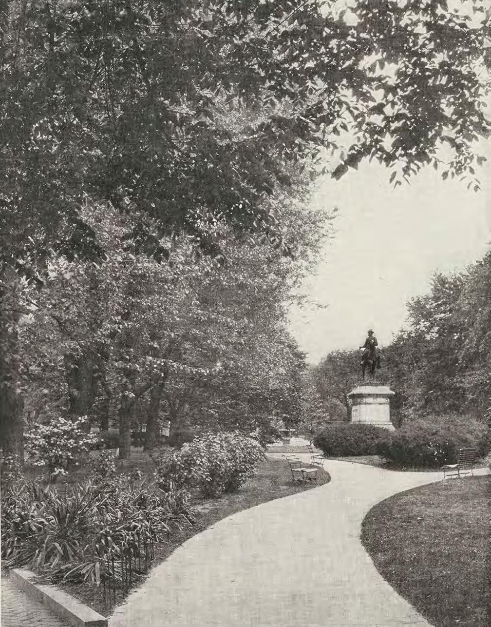
In 1876, the section of Vermont Avenue that once cut through the park was closed, filled, and sodded, and an equestrian statue of the U.S. Army Gen. James Birdseye McPherson by sculptor Louis T. Rebisso (1837–1899) was erected in the center of the park, which was subsequently dedicated as McPherson Square. A pair of parallel walks was installed along the former road alignment, and a single walk was placed along the opposite diagonal. Later changes made in about 1891 altered this system of circulation, replacing the axial walks with curved asphalt walks. A plan by landscape architect Irving W. Payne, implemented in 1930–31, restored the earlier diagonal scheme, with some design refinements. As it exists today, McPherson Square retains many of the design elements implemented in the early 1930s.
BID MAINTAINED
27 DowntownDC Parks Master Plan
*Source: Robinson & Associates, National Park Service, Cultural Landscapes Inventory, “McPherson Square, National Mall & Memorial Parks – L’Enfant Plan Reservations,” 2017; and HABS No. DC-680, McPherson Square (Reservation No. 11.
48,373 VISITORS OCTOBER 2021


IT A HARMONIOUS SPACE FOR ALL USERS.
INTERVIEWS
MAKE
‒ FROM STAKEHOLDER
1.7 AC 28
McPherson Square is formal in design, with a pattern of paths directing visitors to the statue of General James McPherson.
29 DowntownDC Parks Master Plan
Historic photo that highlights the formal pattern of walking paths and statuary.
ACCESS & CONTEXT
The park is adjacent to a McPherson Square Metro station entrance on the southwest corner. Covered bus stations are situated on two park sides. A wide sidewalk surrounds the perimeter, with mature street trees. The park is bisected by two diagonal walkways that connect each corner, providing a well-traveled shortcut through the park.

The buildings surrounding the park are mostly office with ground floor retail or restaurants. One of the buildings at the southwest corner contains residential use.
SITE OBSERVATIONS
» Encampments occupy much of the park.
» Formal, historic design layout and elements.
FEATURES & QUALITY
Benches provide seating at regular intervals. Large, mature trees provide shade in a formal pattern and are supplemented by an ornamental planting palette. A statue serves as the park’s focal point and makes McPherson Square eligible for National Register status.

The park has water fountains and trash receptacles, as well as a temporary bathroom. Fencing surrounds the perimeter of the park and the statue at its center. The chain-and-bollard style at the edge matches other parks throughout the city, but the interior fencing is more formal.
» Large bird population attracted by the lunch crowd.
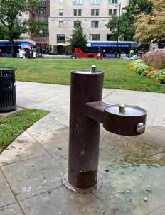 Water fountains, benches, and plantings are present.
Public transportation and sidewalk connections.
Water fountains, benches, and plantings are present.
Public transportation and sidewalk connections.
30
Statuary adds to history of the park and is emphasized by design.
U.S. NAVY MEMORIAL 07
NPS OWNED
PARK HISTORY
BID MAINTAINED
AT A GLANCE
This is a 1.6-acre hardscape plaza with adjacent green space. The plaza had more than 245,800 visits in 2021.
The plaza sits along Pennsylvania Avenue with a prominent viewlines and seatwalls around the perimeter. A Metro stop is located directly adjacent to the open space.
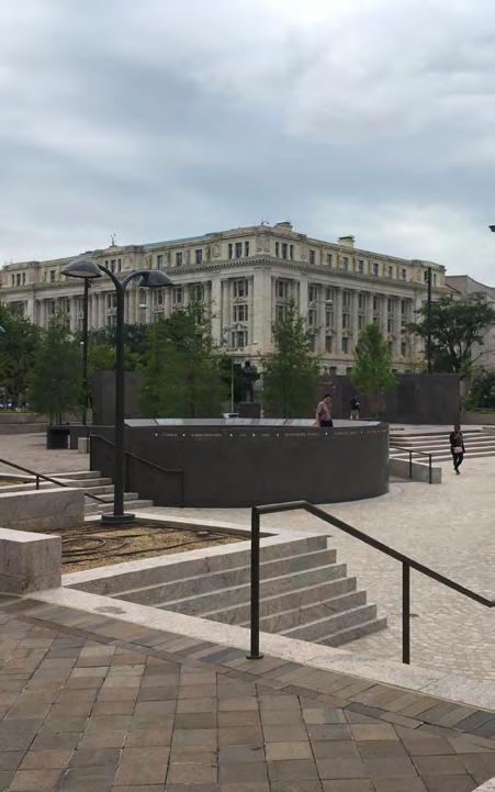
The U.S. Navy Memorial, also known as Market Square, occupies Reservation 36, one of the open spaces designated for public use in the L’Enfant’ Plan. Authorized by Congress in 1980, the U.S. Navy Memorial honors the men and women who have served, are serving, and will serve in the Navy. The memorial, by Conklin Rossant Architects, comprises a circular plaza paved with granite in a design that depicts a map of the world. The plaza is framed by two terraced waterfall fountains on the north and two pools with vertical jet fountains on the south. Granite walls along the southern edge of the plaza support relief sculptures depicting Navy history and life, from the opening of Japan and the Great White Fleet to women in the Navy and Navy medicine. A bronze statue, The Lone Sailor, stands in the northwest corner of the map, and two 65-foottall steel masts that function as flagpoles stand along Pennsylvania Avenue. The memorial was dedicated on October 13, 1987.
North of the memorial, between the twin buildings that comprise Market Square (a residential mixed-use complex built in 1990), is a rectangle of grass and stone edged with stone benches. The open design of the memorial and the paired buildings overlooking it preserve and accentuate the historic vista along 8th Street between the National Archives and the Smithsonian American Art Museum and National Portrait Gallery. At the corner of Pennsylvania Avenue and 7th Street, adjacent to the Navy Memorial and atop the ArchivesNavy Memorial Metro Station, is the Major General Winfield Scott Hancock statue (1896) by sculptor Henry Jackson Ellicott (1847–1901).
31 DowntownDC Parks Master Plan
*Source: Robinson & Associates, National Register of Historic Places Registration Form, “Pennsylvania Avenue National Historic Site,” 2007.
1.6 AC

54,081 VISITORS
ONE OF THE MOST VISITED PUBLIC SPACES IN DOWNTOWNDC.

‒ ACCORDING TO PLACER DATA
 The Navy Memorial plaza is prominently located along Pennsylvania Avenue and is served by a Metro station.
OCTOBER 2021 32
ACCESS & CONTEXT
The Navy Memorial plaza sits atop a Metro station and is connected by wide sidewalks that stretch along Pennsylvania Avenue and up 8th Street. The brick patterned streetscape differentiates the plaza entrance from the rest of the sidewalk. Two sheltered and one unsheltered bus stop are located just south of the memorial.
The surrounding land consists of federal government buildings and mixed-use development, including residential and commercial. Museums sit diagonal to the plaza along 8th Street.
FEATURES & QUALITY
With its round, elevated form and hardscaped surface, the plaza differs from most public space in DowntownDC. Seatwalls surround the perimeter, with ground level lighting. The surface is characterized by the globe pattern stretching across it, known as the “Granite Sea.” Fountains flank both sides.
There are sculpture elements surrounding the perimeter and large masts with signal flags that demarcate the entrance.

33 DowntownDC Parks Master Plan
The “Granite Sea” map stretches across the surface of the plaza. Image source: NavyMemorial.org.
SITE OBSERVATIONS
» Prominent views along Pennsylvania Avenue.


» Well connected to the streetscape both along Pennsylvania Avenue and up 8th Street.
» Feels very central to DowntownDC thanks to proximity of transportation options and cultural connections.

 Surrounding buildings provide a sense of enclosure to the otherwise open plaza space.
Connection from the Portrait Gallery (at top) to Pennsylvania Avenue.
Surrounding buildings provide a sense of enclosure to the otherwise open plaza space.
Connection from the Portrait Gallery (at top) to Pennsylvania Avenue.
34
The space includes water features and encircling sculptural elements.
WWI MEMORIAL 08
NPS OWNED
AT A GLANCE
The plaza was recently renovated to create the memorial, leaving few previous historic elements.
Circulation along Pennsylvania Avenue and the preservation of iconic views along the corridor are key historic links to the park’s remaining history.
Key connection point between Freedom Plaza and the White House.
Street trees and layered steps down to memorial create a sense of enclosure for visitors.
PARK HISTORY
NPS MAINTAINED
As part of the evolution of the McMillan Plan in the 20th century and the development of Federal Triangle in the 1930s, the NPS acquired jurisdiction over this reservation in 1938 and planted it with grass and trees. Nearly 20 years later, in 1957, the National Capital Planning Commission approved the park as the site for a memorial to General John J. Pershing, commander of the American Expeditionary Force during World War I. Architect Wallace K. Harrison was selected as the memorial designer.
Although the park was dedicated as Pershing Square in 1960, Harrison’s plans were put on hold for over a decade, during which time there was intense local and national discussion over how to improve the appearance and utility of Pennsylvania Avenue and the buildings lining it. The PADC selected the landscape architecture firm M. Paul Friedberg and Partners to redesign the site, incorporating a revised memorial concept prepared by Harrison. The park and the Pershing Memorial were dedicated on May 14, 1981.
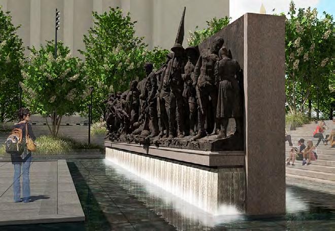
Rendering of the redesigned memorial space35 DowntownDC Parks Master Plan
Shortly after Pershing Park opened, the PADC implemented a revised planting plan by landscape architecture firm Oehme, van Sweden & Associates. In 2015, the National Defense Authorization Act designated Pershing Park as the site for a new National World War I Memorial that would be created by enhancing the Pershing Memorial through sculptural and other commemorative elements, including landscaping. After a national


10,155 VISITORS
OCTOBER 2021
competition, the winning design, The Weight of Sacrifice, by a team consisting of architect Joseph Weishaar, sculptor Sabin Howard, landscape architect Phoebe Lickwar, and GWWO Architects, was selected in early 2016. The redesigned park and National World War I Memorial officially opened in April 2021.
*Source: Robinson & Associates, “Pershing Park, D.C. Historic Preservation Office Determination of Eligibility Form,” 2016. The water feature and secluded inset of the park provides a reprieve from surrounding noise36
1.4 AC
DESIGN ELEMENTS
The WWI Memorial (formerly known as Pershing Park) is a contributing element of the L’Enfant Plan. The park is within the boundary of the Pennsylvania Avenue National Historic Site and was determined to be National Register eligible. Significant historical elements of this park that should be preserved or protected as design and function are considered:
» Circulation (Pennsylvania Avenue sidewalk)
» Land use
» Memorials and statuary
» Small-scale features
» Spatial organization
» Vegetation
ACCESS & CONTEXT
The WWI Memorial is surrounded by streets and sidewalk on all sides, with small street trees lining the edges and dotted throughout the park. Four bus stops cluster around the eastern edge. Street parking lines the northern and southern edges of the park.
Land use to the south is characterized by large federal government offices within Federal Triangle. Hotels and office buildings sit to the north, the White House to the west, and Freedom Plaza directly to the east.
37 DowntownDC
The plan for the redesigned memorial space that reopened to the public in early 2021 (GWWO Architects).
Parks Master Plan
FEATURES & QUALITY
The memorial site is elevated around the perimeter but offers a lower interior that provides a visual and auditory buffer from surrounding streets. The memorial features a fountain and interactive reflecting pool with relief sculptures and signage. Plantings and seatwalls add to the sense of relief from the busy streets. The hardscape plaza provides a modern and formal design.

SITE OBSERVATIONS
» The water feature that is part of the memorial design filters out surrounding noise and helps the space feel like a retreat.
» Landscaping, seatwalls, and paving materials differentiate the space and help expand the park experience to the sidewalk.
 Seatwalls line the edge, separating the sidewalk level from the plaza below.
Plantings and water infuse the space with softer, natural elements while maintaining a formal design that matches other D.C. spaces.
Seatwalls line the edge, separating the sidewalk level from the plaza below.
Plantings and water infuse the space with softer, natural elements while maintaining a formal design that matches other D.C. spaces.
38
The memorial offers a variety of vantage points, taking advantage of the inset park design
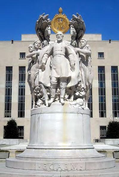
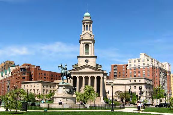
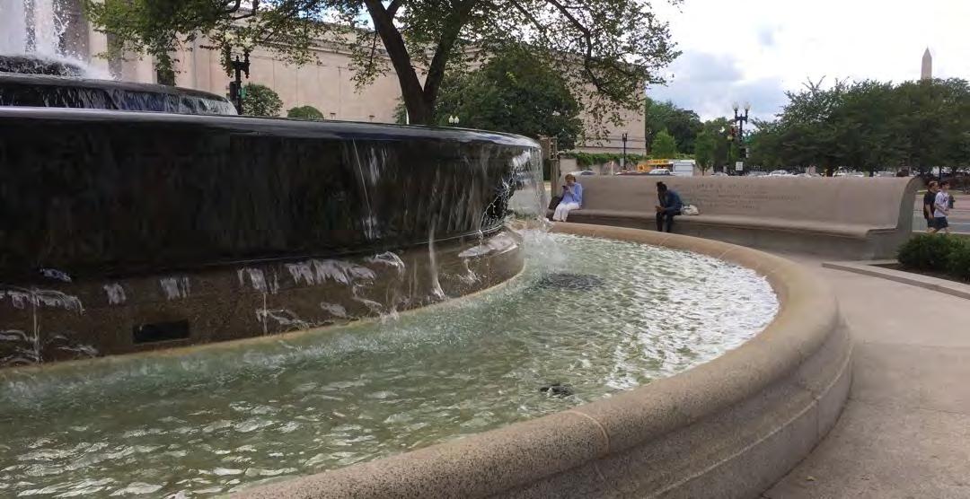
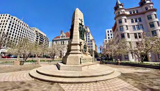
MEADE MEMORIAL 09
NPS OWNED
PARK HISTORY
BID MAINTAINED
AT A GLANCE
The memorial faces Pennsylvania Avenue with expansive views down to the Capitol, which creates a monumentalfeeling space.
Large sidewalk space extends plaza area.
Meade Memorial is a triangular parcel of land at the northwest corner of Pennsylvania Avenue and 3rd Street developed by the PADC. The centerpiece of the park is the George G. Meade Memorial, by sculptor Charles A. Grafly (1862–1929). Originally dedicated in 1927 on a site at the east end of the National Mall, the memorial was placed in storage in 1967 as a result of the construction of the Reflecting Pool at the foot of the U.S. Capitol. As part of the PADC’s development of Meade Memorial, the memorial was relocated to Pennsylvania Avenue in 1984. The granite benches along the sidewalk were part of the original installation and incorporated into the new plaza design.
As with several other public spaces within the purview of the PADC, the landscape architecture firm Oehme, van Sweden & Associates provided the planting scheme. The memorial depicts Meade, a Union hero at Gettysburg, amid a circular group of figures representing War, Chivalry, Courage, Energy, Progress, Loyalty, and Fame. The figures stand on a circular pedestal and stepped base designed by the architectural firm of Simon and Simon. The bronze wreath that originally surmounted the Meade figure was lost either during the removal of the statue from its original location or during its two decades of storage, and, in 1984, the group was re-erected without it. A replacement wreath was created in 1988 by sculptor Walker Hancock (1901–1998), who had assisted Grafly in 1927.
 *Source: Robinson & Associates, National Register of Historic Places Registration Form, “Pennsylvania Avenue National Historic Site,” 2007.
39 DowntownDC Parks Master Plan
DESIGN ELEMENTS
Meade Memorial is within the Pennsylvania Avenue NHS boundary and the proposed Judiciary Square HD. Meade Memorial is a contributing element to the Civil War Monument National Register nomination. Significant historical elements of this park that should be preserved or protected as design and function are considered:


» Circulation
» Memorials and statuary
» Small-scale features
» Views and vistas
ACCESS & CONTEXT
Meade Memorial is connected by wide sidewalks and nearby bus stops.
0.8
40
Meade Memorial is highly visible along Pennsylvania Avenue with a prominent viewshed to the Capitol building.
AC
THOMAS CIRCLE 10
AT A GLANCE
Little tree cover and the proximity of traffic make this space feel exposed.
The lack of seating and shade make the park a through space rather than a place to linger.
Reservation 65, among others outside of the BID boundary, are small triangle space serving the purpose of pedestrian islands in the intersections around the traffic circle.
PARK HISTORY
Thomas Circle has served as a park since its first improvements in 1871–72. The early park design featured asphalt walks, bluestone curbs, fencing, a fountain, rustic stone furniture, ornate gas lamps, and seasonal plants and flowers. In 1879, an equestrian statue by sculptor John Quincy Adams Ward (1830-1910) honoring Civil War hero Maj. Gen. George H. Thomas was erected in the center of the circle, requiring the removal of the fountain and stone seating. Four elm trees were planted around the base of the statue. In the first decades of the 20th century, philosophies of park use and function prompted change in park designs throughout the city. An aerial view taken in the mid-1930s shows a sparsely planted circle with simple lamp standards in place of the earlier ornamental ones.
In 1940, Massachusetts Avenue, which had become a major crosstown artery, was tunneled under the circle, and through-lanes were carved through the park. While the elm trees survived the construction, the changes all but eliminated pedestrian access to the park. In 2006, the D.C. Department of Transportation, in cooperation with the NPS, completed a two-year restoration of Thomas Circle. The project eliminated the through lanes, restored the park to its earlier form, and installed new walks and landscaping.
NPS OWNED BID MAINTAINED
41 DowntownDC Parks Master Plan
*Source: Robinson & Associates, HABS No. DC-687, Thomas Circle (Reservation No. 66).
3,626 VISITORS
ADDRESS TRAFFIC PATTERNS TO MAKE THE PARK MORE ACCESSIBLE FOR BIKES AND PEOPLE.
‒ FROM STAKEHOLDER INTERVIEWS
 Thomas Circle is accessible to pedestrians and cyclists via several crosswalks, although traffic volume makes for difficult crossing.
42
OCTOBER 2021 0.7 AC
DESIGN ELEMENTS
Thomas Circle is a contributing element of the L’Enfant Plan. The statue of General Thomas contributes to the Civil War Monuments National Register nomination. Significant historical elements of this park that should be preserved or protected as design and function are considered:

» Circulation
» Land use
» Memorials and statuary
» Small-scale features
» Spatial organization
ACCESS & CONTEXT
Roadways pass around and under the space. To reach the space, pedestrians cross three lanes of the traffic circle, aided by crosswalks that use brick pavers to differentiate from traffic travel lanes. There are bus stops a block to the north of the park, outside of the study area. Massachusetts Avenue is a major thoroughfare, carrying high average daily trips, as does the intersecting 14th Street.
Some office and commercial stock sits to the southwest of the park, but residential multifamily buildings characterize a large portion of the surrounding area.
43 DowntownDC Parks Master Plan
Traffic patterns previously bisected the space, but Thomas Circle has since reclaimed the park for pedestrian use.
FEATURES & QUALITY
Park paths encircle the main statuary in the center of the park and provide through paths in two directions. The park contains three small trees but is otherwise composed of lawn area. The main statue at the center is surrounded by a wrought-iron fence that is consistent with some other parks throughout DowntownDC. There are no benches or seating.
 In contrast to Thomas Circle, Logan Circle has mature shade trees and benches
Thomas Circle has flexible open lawn space but lacks shade, seating, or other defining park elements.
In contrast to Thomas Circle, Logan Circle has mature shade trees and benches
Thomas Circle has flexible open lawn space but lacks shade, seating, or other defining park elements.
44
Thomas Circle features a prominent statue of General George Henry Thomas, which contributes to the Civil War Monuments NR nomination.
BURKE PARK 11
AT A GLANCE
The statue in the middle of the park is prominent and breaks up the available lawn space.
The bow-tie pair to Burke Park, reservation 69A, is a small open space that functions as a crossing refuge within the busy roadway. Schools nearby require safe crossing, which can be difficult through the busy intersection.
PARK HISTORY
Burke Park is a trapezoidal-shaped park on the south side of Massachusetts Avenue between 11th Street and 12th Street. As initially developed in 1875, the park featured a turf lawn, pedestrian paths, a drinking fountain, lampposts, and a post-and-chain perimeter fence. Later, deciduous and evergreen trees were added to the landscape to further enhance the space. In 1904, quarterround curbs replaced the fencing. The portrait statue of Irish statesman and orator Edmund Burke at the east end of the park was erected in 1922. It is a copy of the original in Bristol, England, by Welsh sculptor James Harvard Thomas (1854–1921). American architect and memorial designer Horace W. Peaslee (1884–1959) designed the pedestal. Today, the park’s simple design features lawn panels and deciduous trees, mainly planted along the perimeter sidewalks. A circular bed in the west end of the park is surrounded by a walk with radiating paths.
DESIGN ELEMENTS
Burke Park is located within the Shaw Historic District. The Edmund Burke statue contributes to the American Revolution Statuary National Register nomination. Significant historical elements of this park that should be preserved or protected are:
» Circulation
» Land use
» Memorial
» Small-scale features
» Spatial organization
» Vegetation
» Views and vistas
*Source: Robinson & Associates, HABS No. DC-675, Samuel A. Gompers Memorial Park and Reservation No. 68 (Edmund Burke Park).45 DowntownDC Parks Master Plan
NPS OWNED BID MAINTAINED
ACCESS & CONTEXT
An uncovered bus stop is located north of the park which requires street crossings to access. Roadways surround all three sides of the triangle park, with 11th Street carrying a significant amount of daily traffic.


To the north of Burke Park there is more significant residential density than in the BID study area, while to the south office, the building stock consists of offices and local government buildings. Thompson Elementary School sits to the southwest of the park.

50 VISITORS
OCTOBER 2021
FEATURES & QUALITY
Benches have been removed from the park. Like Chinatown Park, Burke Park is a “bow-tie pair” triangle park with a small view park directly adjacent (Reservation 69A).
Statuary and paths define the park. Some plantings and open grass area make up the rest of the space.
 Reservation 69A is a pedestrian refuge owned by NPS next to Burke Park, which is the smallest official park space in the BID area.
Statue of Edmund Burke located at the east end of the park (image from D.C. Memorialist) .
Reservation 69A is a pedestrian refuge owned by NPS next to Burke Park, which is the smallest official park space in the BID area.
Statue of Edmund Burke located at the east end of the park (image from D.C. Memorialist) .
0.4
46
AC
THE PARK AT CITYCENTER 12
D.C. OWNED
PARK HISTORY
CITYCENTERDC MAINTAINED
AT A GLANCE
The park was extensively renovated in 2014 as part of the CenterCityDC mixed-use development. Ownership was transferred from NPS to the District of Columbia in 2008.
CityCenterDC now provides programming, maintenance, and security to the space
The hardscape plaza has movable furniture that can be arranged or removed for flexible event space.
The Park at CityCenter is located on Reservation 174, one of a number of small, triangular or trapezoidal parks that appear in the L’Enfant Plan. Formerly owned by the NPS, the reservation was transferred to the District of Columbia in 2008. The site became a public park as part of the planning for CityCenterDC, a large-scale, mixed-use development bound by 11th Street on the west, New York Avenue on the north, 9th Street on the east, and H Street on the south. The Park at CityCenter was designed by the Seattle-based landscape architecture firm Gustafson Guthrie Nichol and opened in 2014.
DESIGN ELEMENTS
Reservation 174 is a contributing element of the L’Enfant Plan. Significant historical elements of this park that should be preserved or protected as design and function are considered:
» Land use
» Spatial organization
THE PARK PROVIDES A LEVEL OF SERENITY, EVEN NEXT TO A ROAD LIKE NEW YORK AVENUE.
‒ FROM STAKEHOLDER INTERVIEWS
47 DowntownDC Parks Master Plan
3,825 VISITORS
ACCESS & CONTEXT
As the park is associated with CityCenterDC, it is directly adjacent to mixed-use development, including ground-floor retail, dining, residential units, hotel, and office uses.
New York Avenue, a divided roadway with planted median strip, sits to the north of the park and is heavily trafficked. Pedestrian pathways and a private, closed-off street go to the south.

 *Source: Robinson & Associates, “The Plan of the City of Washington,” Draft National Historic Landmark Nomination, 2001; and NCPC Staff Recommendation, “Reservation 174: Northwest Park (Old Convention Center Site),” 2008.
The Park at CityCenter is no longer under NPS ownership and has been incorporated into the mixeduse development that covers several blocks with retail, office, residential, and hotel uses.
*Source: Robinson & Associates, “The Plan of the City of Washington,” Draft National Historic Landmark Nomination, 2001; and NCPC Staff Recommendation, “Reservation 174: Northwest Park (Old Convention Center Site),” 2008.
The Park at CityCenter is no longer under NPS ownership and has been incorporated into the mixeduse development that covers several blocks with retail, office, residential, and hotel uses.
48
OCTOBER 2021 0.4 AC

49 DowntownDC Parks Master Plan
Site plan for the mixed-use district and park, designed by the Seattle-based landscape architecture firm Gustafson Guthrie Nichol and opened in 2014.
FEATURES & QUALITY
Though part of a bow-tie pair of parks, the Park at CityCenter differs in layout, elements, and programming from its counterpart. A water feature and seating occupy the center of the space.

Small trees permeate the park space along with ornamental plantings. Umbrellas provide additional shade. Movable tables and chairs fill the space next to the water feature.
SITE OBSERVATIONS
» Clean and well maintained
» Respite from city noise
» Occupied by pedestrian activity
 The fountain reduces the impact of traffic noise within the space.
50
CityCenter provides frequent programming and events that keep the space activated throughout the year. Upkeep and security provided by CityCenter.
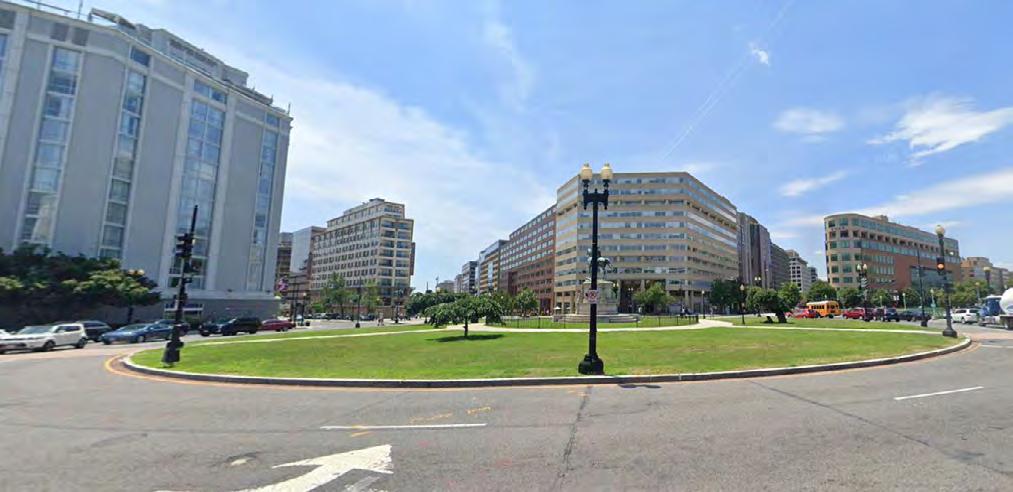
SCOTT CIRCLE 13
AT A GLANCE
Inaccessible to pedestrians and serves only as a visual park or amenity to the neighborhood.
The landscaping, statue, and overall design makes the circle appear substantial.
Unless the circle is opened to pedestrians and crosswalks are put in place, the space will remain inaccessible.
PARK HISTORY
Scott Circle is located at the intersection of Rhode Island Avenue, Massachusetts Avenue, and 16th Street and was first developed in the 1870s. An equestrian statue of Brevet Lt. Gen. Winfield Scott by American sculptor Henry Kirke Brown (1814–1886) was installed in the center of the circle in 1874. It rests on a pedestal carved from single block of granite excavated at the foot of G Street. For many years, the grounds were enhanced with a circular walkway, lampposts, ornamental evergreens, and flowerbeds. In 1910–11, Scott Circle and the triangular reservations to the east (Reservation 64A) and west (Reservation 62), which together form a bow-tie shape, were redesigned to unify the appearance of the three sites. In 1941, a tunnel was constructed to carry 16th Street underneath the park. Today, Scott Circle functions as a traffic circle, and while there are no pedestrian paths, the landscape is planted with grass, ornamental trees, and shrubs.
NPS OWNED BID MAINTAINED 51 DowntownDC Parks Master Plan
363 VISITORS
ACCESS & CONTEXT
Scott Circle, given its function as a roundabout, is surrounded by car travel lanes. There are no paths within the park or crosswalks to reach the space. There are bus stops within a block to the south and east of the circle.
Several hotels cluster near the intersection, as well as multifamily residential buildings and some office stock.
FEATURES & QUALITY
Despite its nearly half-acre size, Scott Circle is a “visual amenity,” given that there is no way to access the space from the surrounding sidewalks. The central statue of Winifred Scott is surrounded by small trees, shrubbery, and grassy area.

SITE OBSERVATIONS
» Inaccessible to pedestrians or cyclists, so the park functions only as visual amenity.
» Lacks visual interest.
» Significant room for planting or other visual activation.
*Source: Robinson & Associates, HABS No. DC-684, Scott Circle (Reservation No. 63). Scott Circle provides a visual amenity within a busy roundabout52
OCTOBER 2021 0.4 AC
JAPANESE MEMORIAL 14
AT A GLANCE
Directly adjacent to more green space outside of the BID boundary and close to the U.S. Capitol building.
Creates some separation from surrounding urban environment with memorial elements and plantings.
PARK HISTORY
Reservation 728, bound by Louisiana Avenue, New Jersey Avenue, and D Street, is the site of the Japanese American Memorial to Patriotism During World War II, dedicated in 2000. The memorial features a shallow reflecting pool containing granite boulders and a bronze sculpture set on a tall pedestal depicting two Japanese cranes ensnared in barbed wire. Granite walls inscribed with the names of Japanese Americans who died while fighting World War II and the names of 10 internment camps define the memorial space, which features a variety of plant materials, including a Japanese maple, Japanese cherry trees, low groundcover, and shrubs. The memorial design was a collaboration between Davis Buckley Architects and Japanese American sculptor Nina Akamu (b. 1955).
CONTRIBUTING ELEMENTS
Reservation 728 is a contributing element of the L’Enfant Plan. Significant historical elements of this park that should be preserved or protected as design and function are considered:
» Land use
» Spatial organization
» Vegetation
» Views and vistas
*Source: Smithsonian American Art Museum, Art Inventories Catalog, “National Japanese American Memorial.”NPS OWNED BID MAINTAINED 53 DowntownDC Parks Master Plan
ACCESS & CONTEXT
Reservation 728 is directly adjacent to two bus stops. It is walkable to Constitution Avenue and Union Station.

Surrounding land use includes office, federal government buildings, and some nearby commercial.

3,565 VISITORS
FEATURES & QUALITY
Reservation 728 is a hardscape plaza featuring the Japanese American Memorial to Patriotism During World War II as its main element. The memorial includes a stillwater feature, sculptural elements, inscriptions, and low walls that give the space a sense of enclosure. Cherry blossom trees surround the space, as well as street trees along the perimeter.
 The memorial offers secluded space despite the small footprint of the park.
54
OCTOBER 2021 0.3 AC
MELLON FOUNTAIN 15
AT A GLANCE
The large central fountain gives meaning to the small space.
Grand views down Pennsylvania Avenue make small space feel monumental.
Nearby uses include museums, government buildings, and offices.
PARK HISTORY
NGA AND BID MAINTAINED
Reservation 546, also known as Mellon Fountain, is a small, triangular parcel of land north of the National Gallery of Art West Building at the intersection of 6th Street, Pennsylvania Avenue, and Constitution Avenue. The centerpiece of the park is the Andrew W. Mellon Memorial Fountain, which was installed in 1952 to commemorate the Pittsburgh industrialist who donated to the United States National Gallery of Art his priceless art collection and a large endowment. As designed by Otto R. Eggers of the architecture firm Eggers and Higgins, the fountain consists of three tiers of circular bronze basins rising from a ground-level granite bowl approximately 18 yards in diameter. At the center of the uppermost basin, a single spout shoots a fountain of water 20 feet into the air, and the water spills over the tiered basins. The signs of the zodiac sculpted on the largest of the bronze basins were designed by sculptor Sidney Waugh (1904–1963).
A granite walkway and bench, also designed by Waugh, surrounds the fountain. Between 1979 and 1993, the PADC led a comprehensive effort to revitalize “America’s Main Street” after years of neglect. As part of the renewal project, the PADC created new landscapes and reorganized and renovated existing ones. In the case of Mellon Park, the PADC rebuilt the sidewalks and constructed a granite ramp with bronze handrails.
*Source: Robinson & Associates, National Register of Historic Places Registration Form, “Pennsylvania Avenue National Historic Site,” 2007. NGA OWNED55 DowntownDC Parks Master Plan
DESIGN ELEMENTS
Mellon Park is a contributing element of the L’Enfant Plan. Significant historical elements of this park that should be preserved or protected as design and function are considered:


» Circulation
» Memorial fountain
» Land use
» Small-scale features
» Spatial organization
» Vegetation
» Views and vistas
Mellon Fountain is a focal point within the largely hardscaped park56
697 VISITORS OCTOBER 2021 0.3 AC
CHINATOWN PARK 16
AT A GLANCE
Chinatown Park includes an open lawn area with activation potential, but maintenance is needed.
Proximity to 7th Street and Chinatown make the space culturally connected to the neighborhood and creates significant foot traffic. New amenities and landscaping are needed to build on this park’s identity.
PARK HISTORY
Chinatown Park is located on Massachusetts Avenue between 5th Street and 6th Street, at the northeast corner of the District’s Chinatown neighborhood. Also known as Reservation 72, it is one of a number of small triangular or trapezoidal parks that appear on the L’Enfant Plan a result of it’s radiating avenues — in this case, Massachusetts Avenue — superimposed over a traditional street grid. The park features an open lawn panel with trees around its edge, two types of fencing, quarter-round curbs, and perimeter sidewalks. Two paved paths cross through the park: a north-south path along 6th Street and an east-west path along I Street.
*Source: Robinson & Associates, Urban Land Institute, Washington, Technical Assistance Panel Report, “Realizing a New Vision for Chinatown Park,” 2017.CRIME IS AT AN ALL-TIME LOW IN CHINATOWN, BUT THE PERCEPTION IT ISN’T SAFE STICKS.
NPS OWNED BID MAINTAINED 57 DowntownDC Parks Master Plan
‒ FROM STAKEHOLDER INTERVIEWS
DESIGN ELEMENTS
Significant historical design elements of this park that should be preserved include:
» Circulation
» Land use
» Small-scale features
» Spatial organization
» Vegetation
» Views and vistas
908 VISITORS
OCTOBER 2021
ACCESS & CONTEXT
There is an uncovered bus stop on the north edge of the park. The park is surrounded on all three sides by traffic lanes with sidewalks and is accessible by crosswalks. Both commercial and residential land-uses are adjacent to the park.
FEATURES & QUALITY
The fencing and curbing that surrounds the park is consistent with other parks throughout the system. Benches have been removed and the park currently lacks seating or definition. Trees provide shade along the park edges and along the sidewalk on the south side of the park.
 Chinatown Park lacks furnishings & upkeep.
58
0.3 AC
F.D.R. MEMORIAL STONE 17
NPS OWNED
PARK HISTORY
BID MAINTAINED
AT A GLANCE
Reservation 35 is located at Pennsylvania Avenue and 7th Street near a Metro station and covered bus stops along Pennsylvania Avenue.
The nearby roadways have large street trees and canopy cover and wide sidewalks which offer prominent view lines.
Reservation 35, also known as the F.D.R. Memorial Stone, is located at the intersection of Pennsylvania Avenue and 7th Street. The reservation is the location of the Franklin Delano Roosevelt Memorial Stone, dedicated in 1965 and designed by New York architect Eric Gugler (1889–1974). The memorial’s simple design, which consists of a white marble block inscribed with the words “In Memory of Franklin Delano Roosevelt 1882–1945,” conforms with Roosevelt’s own wishes for a memorial to his life. In a 1941 conversation with Supreme Court Justice Felix Frankfurter, the president stated that if a monument should be dedicated to his memory, he preferred an unadorned stone with a simple “In memory of” inscription located on the public reservation near the National Archives, a building he greatly admired. A much larger memorial to the president was later built along the Tidal Basin and dedicated in 1997.
59 DowntownDC Parks Master Plan
ACCESS & CONTEXT
The space is adjacent to Pennsylvania Avenue and has a large streetscape. The Archives-Navy Memorial Metro station is within Reservation 35. Sheltered bus stops are located along the adjacent streetscape. Surrounding the open space are residential, retail, office space, museums, and federal buildings.

FEATURES & QUALITY
Reservation 35 is a combination of hardscape and grass, though the grassy portion is sectioned off by fencing and a low wall. The fencing is consistent in style with other spaces in DowntownDC. There are trees surrounding the perimeter and a few within the space.
*Source: Robinson & Associates, National Register of Historic Places Registration Form, “Pennsylvania Avenue National Historic Site,” 2007.
0.3
60
Reservation 35 is functionally part of the Navy Memorial Plaza, occupying the streetscape just to the south.
AC
RESERVATION 173 18
SITE OBSERVATIONS
Accessibility appears limited due to curbs, sidewalk maintenance needs, and steps.
In the small space, the area can be overwhelmed by encampments.
Mature shade trees along the perimeter.
PARK HISTORY
Reservation 173 is the bow-tie pair to the Park at CityCenter. The landscape features grass panels defined by concrete curbs. Street trees line the perimeter of the park, and canopy tree plantings are located along the paths that cross its northern and western edges.
CONTRIBUTING ELEMENTS
Reservation 173 is a contributing element of the L’Enfant Plan. Significant historical elements of this park that should be preserved or protected as design and function are considered:
» Circulation
» Land use
» Small-scale features
» Spatial organization
» Vegetation
» Views and vistas
NPS OWNED BID MAINTAINED 61 DowntownDC Parks Master Plan
822 VISITORS
ACCESS & CONTEXT
The park is surrounded by roadways with sidewalks. Street trees line the exterior of the park along the sidewalks, with a few also in the green space. There is metered parking on three sides of the park, and a bike lanes on the south and western edges. There is one sheltered and one unsheltered bus stop to the north.

Commercial and office uses are adjacent to the park, and it sits diagonally across the street from the CityCenterDC mixed-use development.
FEATURES & QUALITY
The triangle park’s form — a bow-tie pair raised above sidewalk level and curbed — is consistent with other similar parks from the L’Enfant Plan across the District. Only the north edge has a bollard-and-chain fence. The grassy area slopes down toward the south side of the park.

The adjacent streetscape has benches and medium-sized street trees. A few benches and trash cans line the two paths that cut orthogonally through the park.
 Reservation 173 is a bow-tie pair with the Park at CityCenter. The triangle park is characterized by standard elements of D.C. parks, including raised curbs, open lawn area, benches, and surrounding paths.
OCTOBER
0.3
62
2021
AC
INDIANA PLAZA 19
AT A GLANCE
This plaza has high cultural significance and grand viewlines. Surrounding roads and sidewalks are wide and can hold many pedestrians. The nearby Navy Memorial and Metro station bring some pedestrian traffic to the space.
PARK HISTORY
Indiana Plaza is a small public park created by the intersection of two diagonal avenues with 7th Street. The plaza was developed by the PADC in 1987 to better define the public space between two of its historic preservation projects: the 1858 Central National Bank Building on Pennsylvania Avenue and the 1889 National Bank of Washington on Indiana Avenue. Designed by the architecture firm Tippets-Abbett-McCarthy-Stratton (TAMS), the project required closing a segment of C Street, narrowing Indiana Avenue, relocating two historic memorials, pavement design, and landscaping.
The Grand Army of the Republic Memorial, which terminates the vista down C Street, commemorates Dr. Benjamin F. Stephenson, a surgeon with the 14th Illinois Infantry Regiment during the Civil War and the founder of the Grand Army of the Republic. The memorial’s granite shaft was designed by the architectural firm Rankin, Kellogg and Crane and sculptor John Massey Rhind (1860–1936) crafted the bronze sculptures. The Grand Army of the Republic Memorial was erected originally in 1909 and moved to its current location in 1987 as part of the redesign of Indiana Plaza. The second major sculptural element on the site is the Temperance Fountain. It was donated to the city in 1882 by wealthy California dentist and speculator Henry Cogswell as a fountain to provide water for visitors as an alternative to alcohol.
NPS OWNED BID MAINTAINED
63 DowntownDC Parks Master Plan


*Source: Robinson & Associates, National Register of Historic Places Registration Form, “Pennsylvania Avenue National Historic Site,” 2007.
2,221 VISITORS OCTOBER 2021 0.2 AC 64
The plaza is well connected by Metro and bus, and sits adjacent to key civic spaces; the Navy Memorial, and Pennsylvania Avenue
65 DowntownDC Parks Master Plan
Aerial photo of Indiana Plaza and surrounding public spaces
ACCESS & CONTEXT
Indiana Avenue is an important link to Pennsylvania Avenue, the Navy Memorial open space, Metro access, and the generous public space provided by Indiana Plaza itself. While relatively underused today, the physical infrastructure is well suited to support a greater amount of public life. Though small, the street provides a diagonal connection from Judiciary Square to the Archives-Navy Memorial Metro station (directly adjacent to Indiana Plaza) and Pennsylvania Avenue. There is a covered bus stop within the plaza.
Along Indiana Avenue there is some office use with ground floor retail and a multifamily residential building.
FEATURES & QUALITY
The plaza is patterned and hardscape, occupying the end of a block across from the Navy Memorial. It features the Grand Army of the Republic memorial at its center, cherry blossom trees, planted areas with low seatwalls and ornamentation, and stairs.

 Cherry blossoms encircle the monument at the center of the plaza
The plaza experience is continued along the wide sidewalks of Indiana Avenue.
Cherry blossoms encircle the monument at the center of the plaza
The plaza experience is continued along the wide sidewalks of Indiana Avenue.
66
Landscaping and lighting features add texture to the linear plaza space.
NPS OWNED BID MAINTAINED
PARK HISTORY
Reservation 71 is one of a number of small triangular or trapezoidal parks that appear in the L’Enfant’s Plan and is one of four small reservations that border Mount Vernon Square.


CONTRIBUTING ELEMENTS
Reservation 71 is a contributing element of the L’Enfant Plan. Significant historical elements of this park that should be preserved or protected as design and function are considered:
» Land use
» Small-scale features
» Spatial organization
» Vegetation
» Views and vistas
ACCESS & CONTEXT
Close connection to Mount Vernon Square open space. Well connected by sidewalks and predominately surrounded by office uses. There are residential units to the north.
FEATURES & QUALITY
RESERVATION 71 20 DowntownDC Parks Master Plan
The open space is smaller than its counterpart and similarly occupies the end of a block. Fencing and plantings partition space and the fence style is consistent with other park spaces in the city. A grassy lawn, benches, and walkways comprise most of the space.
0.15 AC Reservation 71 67
RESERVATION 70 21
PARK HISTORY
Reservation 70 is one of a number of small triangular or trapezoidal parks that appear in the L’Enfant Plan as a result of its layered Baroque structure of radiating avenues — in this case, Massachusetts Avenue — superimposed over an orthogonal street grid. It is one of four small reservations that border Mount Vernon Square.

ACCESS & CONTEXT
There is a close connection to Mount Vernon Square’s open space. Restaurant space is adjacent and cafe areas can be seen from the park space. Institutional and commercial uses are nearby, and there is some residential density to the north.
FEATURES & QUALITY
It is a small space occupying the end of a block. Fencing and plantings partition space, but the fence style is consistent with other park spaces in DowntownDC. Grassy lawn area, benches, and trees are all found within the space.

0.14 AC
NPS OWNED BID MAINTAINED
68
Reservation 70 is one of four small, fenced in parks surrounding Mount Vernon Square
RESERVATION 175 22
AT A GLANCE
Reservation 175, along with Reservations 70 and 71, flank Mount Vernon Square and contribute to the overall experience of the Square.
These surrounding parks are view parks; small in size and bounded by fencing.
There is little programming, but the park spaces feature lawn area, shade trees, and benches.
Retail and restaurants in the adjacent block areas contribute to the activity in and around the parks.
PARK HISTORY
Reservation 175 is another one of four small reservations that border Mount Vernon Square.
CONTRIBUTING ELEMENTS
Reservation 175 is a contributing element of the L’Enfant Plan. Significant historical elements of this park that should be preserved or protected as design and function are considered:
» Circulation
» Land use
» Small-scale features
» Spatial organization
» Vegetation
» Views and vistas
NPS OWNED BID MAINTAINED 69 DowntownDC Parks Master Plan
ACCESS & CONTEXT
The space has a direct connection to Mount Vernon Square. Several restaurant spaces are adjacent, and cafe areas can be seen from the park space. Commercial and mixed uses such as CityCenterDC are the directly adjacent land uses.

FEATURES & QUALITY
The park space is small, but the connection to Mount Vernon Square and the three other View Parks function as a small park system. However, fencing and high shrubbery make the park feel enclosed. Adjacency to nearby cafe space could help extend the feeling of the park into the streetscape. The proximity to residential neighborhoods north of Massachusetts Avenue make this an important community park space in tandem with Mount Vernon Square.
The small park abuts a restaurant patio, using hedges to define space and soften the edges.70
0.12 AC
RESERVATION 75 23
D.C. OWNED
PARK HISTORY
BID MAINTAINED
AT A GLANCE
Reservation 75 is located at Massachusetts Avenue and 4th Street.
There are no benches or seating in the reservation.
Grass lawn needs maintenance.
There are no walkways through the space, and sidewalks frame the space.
Reservation 75, located at the intersection of Massachusetts Avenue, 4th Street, and H Street, was transferred from the National Park Service to the District Department of Transportation in 1967.
DESIGN ELEMENTS
Reservation 75 is a contributing element of the L’Enfant Plan. Significant historical elements of this park that should be preserved or protected as design and function are considered:
» Land use
» Spatial organization
» Views and vistas
SITE OBSERVATIONS
» Given the small nature of the space, there is little buffer from the surrounding roadways.
» The grass needs maintenance.
» The park is limited in its footprint, with no additional sidewalks surrounding the outside.
71 DowntownDC Parks Master Plan
ACCESS & CONTEXT
The park is surrounded by streets, including Massachusetts Avenue, which has a wide right of way and an underground section. The nearest bus stations are two blocks away to the east and the west. It is three blocks north of the Judiciary Square Metro station.


The land use around the park is residential multifamily and federal office buildings.

FEATURES & QUALITY
The park is a smaller version of the bow-tie pairs present throughout the city. The park has four small street trees around the perimeter. The grassy area is defined by paths along either side.
72
The triangle park lacks maintenance and park features to support visitor experience.
0.1 AC
SOMBROTTO PARK 24
AT A GLANCE
The park is small but provides shade and has a wellmaintained lawn area.
The park is completely surrounded by traffic lanes with parking around perimeter.
PARK HISTORY
Reservation 727, also known as Sombrotto Park, was acquired by the NPS by transfer from the District of Columbia. It is bound by First Street, C Street, and Louisiana Avenue. This small park has a simple design consisting of a grass lawn panel planted with shade trees and perimeter sidewalks. The park is dedicated to Vincent R. Sombrotto, former president of the National Association of Letter Carriers. The organization’s headquarters are directly adjacent to the park.
DESIGN ELEMENTS
Sombrotto Park is a contributing element of the L’Enfant Plan. Significant historical elements of this park that should be preserved or protected as design and function are considered:
» Land use
» Spatial organization
» Vegetation
» Views and vistas
*Source: Robinson & Associates, National Register of Historic Places Registration Form, “Pennsylvania Avenue National Historic Site,” 2007]
73 DowntownDC Parks Master Plan
NPS OWNED BID MAINTAINED
ACCESS & CONTEXT
Sombrotto Park is at the edge of the study area and bounded by roads on all sides. It is across the street from additional park space. The nearest bus stops are two blocks away. Office and government buildings are most of the proximal building stock.
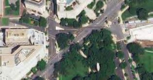
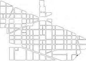
227 VISITORS
FEATURES & QUALITY
Sombrotto Park has a few large trees that provide significant shade to the small space. Paths cut through and street lights line the perimeter. The space is flat and has well-maintained lawn space. There is parking on all sides.
 The small park space is surrounded by car parking on all sides.
OCTOBER 2021 0.1
74
AC
RESERVATION 187 25
AT A GLANCE
The space is small and operates as a “view park.”
Plantings provide nice ornamentation to enhance the streetscape.
PARK HISTORY
Reservation 187 is another small triangular park with landscaping that features grass panels defined by concrete curbs and perimeter sidewalks. Plantings include a cluster of crabapple trees, as well as liriope, hostas, azaleas, and other plantings.
DESIGN ELEMENTS
Reservation 187 is a contributing element of the L’Enfant Plan. Significant historical elements of this park that should be preserved or protected as design and function are considered:
» Land use
» Small-scale features
» Spatial organization
» Vegetation
» Views and vistas
75 DowntownDC Parks Master Plan
NPS OWNED BID MAINTAINED
ACCESS & CONTEXT
Directly adjacent to Judiciary Square and part of the diagonal connection to the Navy Memorial and Pennsylvania Avenue.

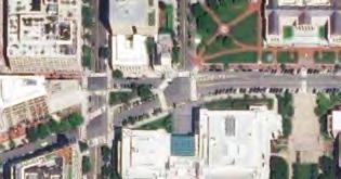
FEATURES & QUALITY
The space functions as streetscape enhancement, featuring a planted area separated by a curb. The lack of fencing helps maximize the small footprint, but the planted area does not offer much usable space.


0.1
AC
Reservation 187
76
The streetscape adjacent to Reservation 187.
RESERVATION 77 B 26
AT A GLANCE
Planting space is not being used to full capacity. The low seatwall provides areas for rest but has very little shade cover.
The surrounding sidewalk adds significantly to the footprint of the space.
The streetscape design around the space lacks cohesion.
PARK HISTORY
Reservation 77B is an open, landscaped parcel of land defined by the intersection of Massachusetts Avenue, New Jersey Avenue, and G Street. The reservation is the location of the Victims of Communism Memorial, dedicated in 2007. The memorial features a bronze replica by Thomas Marsh (b. 1951) of the sculpture Goddess of Democracy, which was erected in Beijing during the 1989 Tiananmen Square protests and fabricated of foam and paper-mache. The site offers a prominent, unimpeded view of the U.S. Capitol.
CONTRIBUTING ELEMENTS
Reservation 77 B is a contributing element of the L’Enfant Plan. Significant historical elements of this park that should be preserved or protected as design and function are considered:
» Land use
» Small-scale features
» Spatial organization
» Views and vistas
» Vegetation
NPS OWNED BID MAINTAINED 77 DowntownDC Parks Master Plan
ACCESS & CONTEXT
The open space is fully surrounded by car traffic. Sidewalks surround the central plaza element, and crosswalks connect to the adjacent blocks.
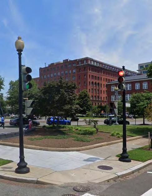
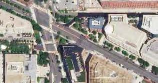
Surrounding land use is characterized by office to the south and a public institution use to the west. Commercial uses sit north, out of the study area.

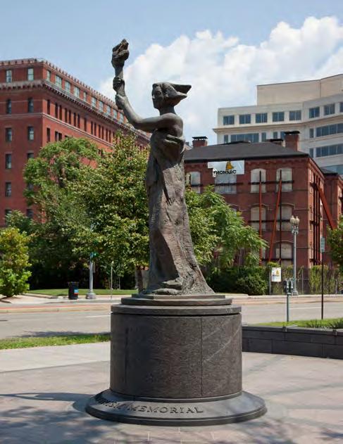
1,287 VISITORS
FEATURES & QUALITY
The plaza space is oriented around its central sculpture and features patterned pavers and a low seatwall around the edge. The is predominately hardscape, but a curbed planted area occupies a portion. There are a few trees, both along the sidewalk and within the planted area. The space is relatively flat and small.
Memorial statue at the center of the park. Landscaping, sidewalks, seatwall, and raised curbs define the small view park.78
OCTOBER 2021 0.08 AC
RESERVATION 78 27
AT A GLANCE
Though the space is small, it is thoughtfully designed for the linear block edge it occupies.
The plantings and memorial help accentuate and define the space. Proximity to Union Station and commercial buildings means there is considerable foot traffic.
PARK HISTORY
Reservation 78 is maintained as a flat grassy area defined by brick walkways on the north and south sides and a sidewalk on its western edge. The site is the location of the Holodomor Memorial to Victims of the Ukrainian Famine-Genocide of 1932–33, designed by D.C. architect Larysa Kurylas (b. 1957). The memorial is a 30-footlong bronze panel featuring stalks of wheat that transition from high to low relief representing the passage from bounty to famine. The bronze panel is set back from Massachusetts Avenue behind a paved plaza defined by a granite retaining wall and benches. The site is planted with trees and plants set within beds defined by concrete curbs.
CONTRIBUTING ELEMENTS
Reservation 78 is a contributing element of the L’Enfant Plan. Significant historical elements of this park that should be preserved or protected as design and function are considered:
» Land use
» Small-scale features
» Spatial organization
» Views and vistas
*Source: Deborah K. Dietsch, “Local Architect Designs Washington Memorial to Victims of Genocidal Famine in Ukraine,” Washington Post, July 24, 2014.]NPS OWNED BID MAINTAINED 79 DowntownDC Parks Master Plan
ACCESS & CONTEXT
This plaza sits at the northeastern edge of the BID boundary. Union Station is a block away. Office use and commercial buildings surround the plaza space, as well as adjacent green space across the street outside of the BID boundary.

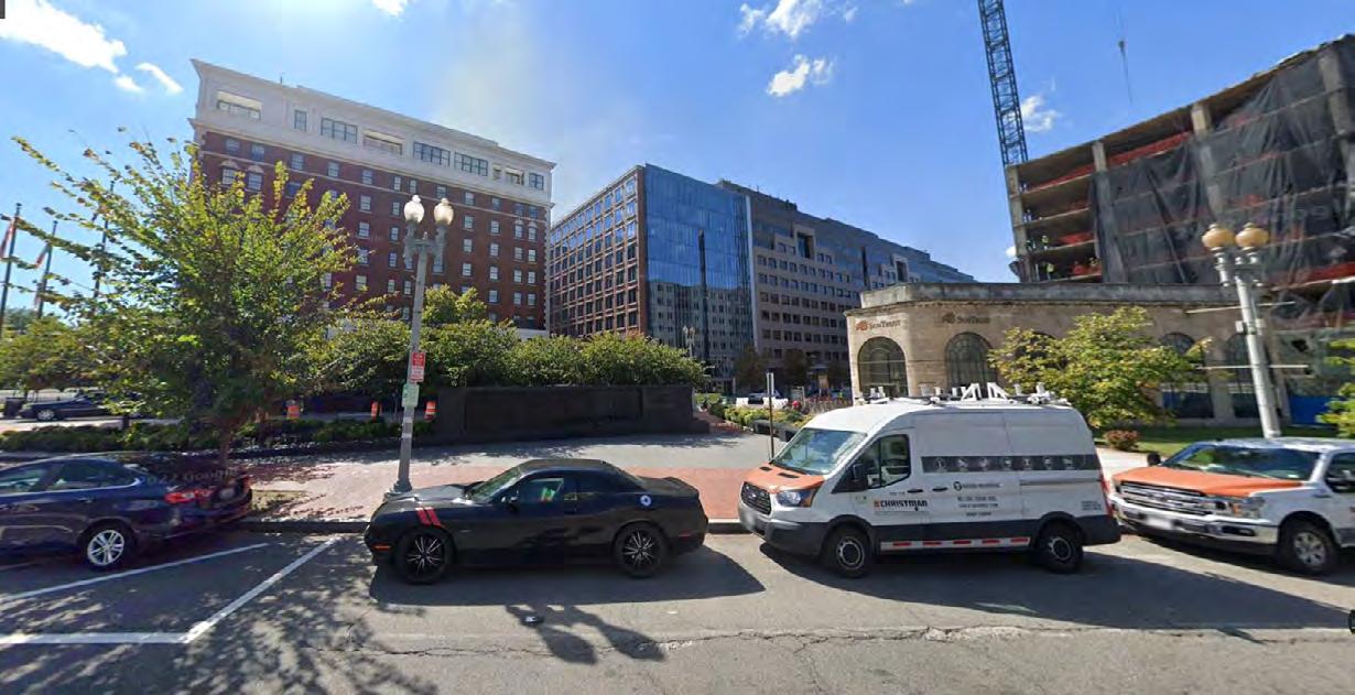
3,672 VISITORS
FEATURES & QUALITY
The plaza occupies a narrow end of a block. It is composed mostly of hardscape, including a combination of brick pavers and concrete to differentiate space. A linear planting strip bisects the space with shrubbery and small trees. The Holodomor memorial lines the planned area with bas relief and an inscription.

OCTOBER 2021 0.07 AC
80
The Holodomor Memorial
RESERVATION 172 28
AT A GLANCE
The sidewalk around the park is wide and features street trees with planting beds, expanding the perceived footprint of the park.
What greenery the small space has is partitioned behind fencing that visually and functionally shrinks the space.
PARK HISTORY
Reservation 172 is one of several small triangular or trapezoidal parks that appear in the L’Enfant Plan. Today, the reservation forms a small park at the front entrance to the New York Avenue Presbyterian Church at 1313 H Street. The interior of the park is paved with brick and features concrete and wood slat benches. Around the perimeter are specimen trees with understory plantings, which create a buffer between the interior of the park and the adjacent roadway.
DESIGN ELEMENTS
Significant historical elements of this park that should be preserved or protected as design and function are considered:
» Circulation
» Land use
» Small-scale features
» Spatial organization
» Vegetation
» Views and vistas
NPS OWNED BID MAINTAINED 81 DowntownDC Parks Master Plan
ACCESS & CONTEXT
The park sits at the end of a block and is separated from the sidewalk by a low curb and intermittent fencing. At the intersection of New York Avenue and H Street, the park is subject to heavy surrounding traffic.


A church is the only building directly adjacent to the park, but office and commercial are nearby.
454 VISITORS
FEATURES & QUALITY
The park is mostly hardscape, but does have some planted areas at the edge. The small space is shaded by the adjacent church and small trees that occupy the park. The space currently has no benches or seating. Fences partition the space at three points, separating the hardscape from only portions of the planted area. The fencing is consistent with other park spaces in DowntownDC.
*Source: Robinson & Associates, “Pershing Park, D.C. Historic Preservation Office Determination of Eligibility Form,” 2016.
 One of 3 small triangle spaces that cluster around the intersection of New York Ave & H St
82
OCTOBER 2021 0.09 AC
RESERVATION 172 A 29
0.03
69 VISITORS OCTOBER 2021
PARK HISTORY
Reservation 172A is a residual space used as a median along New York Avenue. It is entirely paved except for several tree beds.
ACCESS & CONTEXT
The park occupies a median, meaning the small space is surrounded by traffic on all sides. At the intersection of New York Avenue and H Street, there is significant daily traffic that passes by.
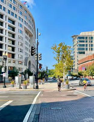


FEATURES & QUALITY
As one of three park spaces at this intersection, the experience is somewhat expanded by the adjacent open space. The space is entirely hardscaped with a two small street trees and several large planters with seasonal plantings around the perimeter. There are two streetlights in the space.
SITE OBSERVATIONS
» The space is among the smallest in DowntownDC.
» Lacks definition or much feeling of separation from surrounding traffic.
» Lacks shade or seating, which could bolster the small space.
AC
NPS OWNED BID MAINTAINED
83 DowntownDC Parks Master Plan
Street crossing aided by Reservation 172A.
RESERVATION 172 B 30
PARK HISTORY
Reservation 172B is a residual space defined as a paved and planted median and used to connect pedestrian movement along New York Avenue and the H Street Corridor.
ACCESS & CONTEXT
At the intersection of New York Avenue and H Street, there is somewhat significant daily traffic that passes by. There is a bikeshare docking station directly adjacent and bike parking within the plaza.
FEATURES & QUALITY
0.02 AC 255 VISITORS OCTOBER
2021
The plaza space is differentiated by brick, surrounded by sidewalks, and has a defined planted area not partitioned by fencing. A few street trees are in or near the open space.

SITE OBSERVATIONS
» Of the three clustered spaces around this intersection, this one provides the most coherent space.

» Paving patterns help differentiate streetscape and plaza, while the lack of partitioned space maximizes the small footprint.

NPS OWNED BID MAINTAINED
84
Reservation 172B hosts a bikeshare docking station.
B ACCESSIBILITY ANALYSIS
85

86
PARK ACCESSIBILITY
DEFINING ACCESSIBILITY
For the purpose of this study, accessibility refers to the ease with which a person can travel from a point of origin (such as their home) to a destination — in this case, the parks and open spaces within DowntownDC. It considers factors that may make mobility more difficult (such as steep terrain) and how appealing one route may be to a pedestrian over another (if a route has interesting storefronts to look at, or shaded pathways, for example).
WHY MEASURE ACCESSIBILITY?
Accessibility is important to understand to ensure that all people have easy and clear access to usable park and open spaces. Visualizing areas that lack access can identify places of high need for intervention or new open space assets.
Seeing movement patterns can also allow for scenario testing. With an accessibility analysis model set up, it is possible to see how the addition of a new park space could alter movement flows throughout the study area. Modeling streetscape interventions can also predict where changes could be the most effective to promote pedestrian activity, relieve traffic flow from busy areas, and better connect the park system.
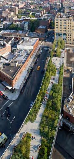 The New York City High Line Source: Architonic
87 DowntownDC Parks Master Plan
WHAT THIS ANALYSIS TELLS US
For DowntownDC, this analysis can help identify the most logical routes between destinations and parks. With a visualization of pedestrian movements, patterns can appear that support streetscape interventions to either catalyze an under performing street, redirect pedestrian activity from an overly trafficked street, or improve conditions in an area lacking sufficient access to parks. The results of the analysis can frame a street hierarchy to categorize current use, capacity, and opportunity for several frameworks of intervention.
A small or underused street could be the right place to create more park-like experiences within the streetscape. A low traffic area without many garage entrances could be appropriate for an open or shared street that prioritizes pedestrians. With the development of green corridors, the experience of the parks system can be greatly increased despite the fixed nature of parks in DowntownDC. An accessibility analysis can help identify where those green corridors could increase park usability and access, and where they would have the most success.
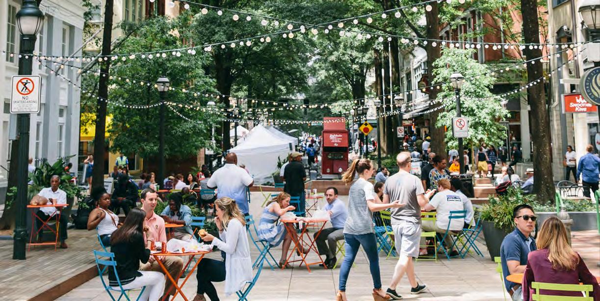
88
Poplar & Broad crosswalk project, the Atlanta City Studio
AT A GLANCE
With geospatial data and an understanding of existing use patterns, an Accessibility Analysis is an essential tool that can predict use patterns and demand as environments change.
Data inputs include:
Population density and associated factors (Census data)
Building type and concentration
• Land use
• Number and location of building entrances
• Number and type of intersections
• Transit ridership data
• Topography
• Straightness of route
• Destinations (type and density)
• Types of trips
• Mobile location data
Walkability and equitable access to open space is critical for health and well-being, especially for populations residing in dense cities and urban settings. There are many factors in the urban environment that influence pedestrian comfort, activity, and access to parks. The pedestrian environment refers to street connectivity, building density, land use diversity, location of services, and the transportation system.
ACCESSIBILITY ANALYSIS
How people move through an area is motivated not only by their destination and purpose, but by a variety of physical and emotional factors embedded in the environment. The width of a street, variety of surrounding ground-floor facades, and straightness and flatness of a particular route all contribute to the choices pedestrians make to get from point A to point B. With data inputs that describe the physical environment added to mapping and modeling software, an accessibility analysis can predict those choices and provide insight into pedestrian preferences. These preferences are a useful guide to support design intuition and select streetscapes that could best support an investment to boost activity.
89 DowntownDC Parks Master Plan
ROUTE SELECTION


There is agreement among published accessibility studies that pedestrians tend to choose the straightest and shortest path to reach a particular destination. Thus, route geometry is an important part of the calculation for route choice analysis. Land use also affects route choices, as people will deviate to connect various destinations or choose a path based on proximity to multiple options.

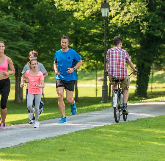

90
DATA INPUTS
PARK SERVICE AREA
There are 32 parks and plazas that comprise the open space network in DowntownDC. The diagram here shows the existing parks and plazas in the study area with a 500-meter buffer applied to show reasonable walkability coverage. While this diagram shows excellent coverage in terms of equitable park dispersal, it does not capture the size, quality, or usability of the parks.
MOBILE LOCATION DATA

Mobile location data provides the estimated visitor counts based on cell phone data. A person must spend a minimum of 8 minutes in a location for it to register as a visit. Mobile location data is an important tool for urban planners to assess the viability of spaces in a network and emerging route preferences.
Placer Data (placer.ai) uses aggregate cell phone location information to visualize movement patterns and map where people linger. The analysis here uses data from October across 3 years (2019, 2020, and 2021) to show trends and the effects of the COVID-19 pandemic.
 500 M
RADIUS
500 M
RADIUS
91 DowntownDC Parks Master Plan
Mobile phones provide valuable data tracking use of public space.
ESTIMATED VISITOR COUNTS TO THE PARKS
October 2020* was at the peak of the COVID-19 pandemic. The Placer data in the table below illustrates how park visits dramatically dropped during the pandemic and the numbers remain below prepandemic levels.
PARK / PLAZA OCT 2019 OCT 2020* OCT 2021 Scott Circle 227 0 363 Thomas Circle 4,228 2,011 3,626 Burke Park 884 2,354 50 McPherson Square 73,459 17,688 Franklin Park 8025 2431 7,619 Mount Vernon Square 21,186 10,595 Chinatown Park 796 440 908 West Lawn of Building Museum (Judiciary Square) 3,012 2,266 788 John Marshall Park 5,513 1,859 3,203 Sombrotto Park (Reservation 727) 98 99 227 The Park at CityCenter 12,615 2,608 3,825 Triangle Park (Reservation 172) 699 42 454 Reservation 172B 500 47 255 Reservation 172A 810 183 69 Freedom Plaza 52,290 25,370 U.S. Navy Memorial Plaza 111,520 11,521 Indiana Plaza 13,505 2,120 2,221 National Law Enforcement Officers Memorial (Judiciary Square) 28,069 3,639 Reservation 546 (Mellon Fountain) 4,164 308 1,076 National Japanese American Memorial (Reservation 728) 8,840 2,001 3,565 Reservation 77B 1,824 720 1,287 Holodomor Memorial (Reservation 78) 5,612 2,208 3,672 Reservation 173 1,850 133 822
92
ACCESSIBILITY ANALYSIS
BETWEENNESS ACCESSIBILITY ANALYSIS
The Betweenness Index reflects realistic pedestrian flows in the network. A higher betweenness centrality value means that more pedestrians use the street because it is the shortest path within a walking radius of 1 mile.
GEOSPATIAL DATA AND TOOLS
Geospatial data is needed to evaluate accessibility analysis; roads, building footprints, address points, Metro stations in D.C., and Metro bus stop data are provided by Open Data DC (opendata.dc.gov). Office and retail rentable building area (RBA) data is provided by Costar (costar.com).
Urban Network Analysis (UNA) toolbox in 3D Rhino developed by MIT City Form Lab has been used to calculate the betweenness accessibility.
TRAVEL OPPORTUNITIES FOR PEDESTRIANS TO ACCESS PARKS
There are multiple travel scenarios that can affect how pedestrians walk to nearby parks in cities. Typically, people will travel on foot up to 10 minutes to reach a park from (1) home, (2) office, (3) retail/dining, (4) mixed-use buildings, (5) a subway station, or (6) a bus stop. Accessibility analyses evaluate travel possibilities that can then reveal trends of pedestrian movements and route choices to access parks across a city.
BETWEENNESS NETWORK 1 1 2 2 1.5 4.5 9
93 DowntownDC Parks Master Plan
ACCESSIBILITY FROM ALL BUILDINGS TO PARKS, 2021
The darker red means a higher accessibility value for streets and nodes. McPherson Square shows the highest accessibility condition for people walking from buildings of all land use types to nearby parks within a 1 mile distance.
Accessibility Index Parks High Low
McPherson Square
US Navy Memorial Plaza
Judiciary sq
94
Freedom Plaza
ACCESSIBILITY FROM OFFICE BUILDINGS TO PARKS, 2021
ACCESSIBILITY FROM RETAIL BUILDINGS TO PARKS, 2021
Accessibility Index High Low Parks Accessibility Index High Low Parks
McPherson Square
US Navy Memorial Plaza
95 DowntownDC Parks Master Plan
US
Navy
Memorial
Plaza Freedom Plaza Freedom Plaza Judiciary sq
ACCESSIBILITY FROM NON-RESIDENTIAL BUILDINGS TO PARKS, 2021
McPherson Square
ACCESSIBILITY FROM MIXED-USE BUILDINGS TO PARKS, 2021
McPherson Square
Accessibility Index High Low Parks Accessibility Index Parks High Low
96
RESIDENTS ACCESSIBILITY TO PARKS, 2021
Thomas Circle Park
McPherson Square
ACCESSIBILITY FROM RESIDENTIAL BUILDINGS TO PARKS, 2021
Thomas Circle Park
McPherson
Square
Mount Vernon Square
Accessibility Index Parks High Low Accessibility Index Parks High Low
97 DowntownDC Parks Master Plan
ACCESSIBILITY FROM BUS STOPS TO PARKS, 2021
ACCESSIBILITY FROM METRO STATIONS TO PARKS, 2021
Accessibility Index High Low Parks Accessibility Index High Low Parks
Franklin Park
US Navy Memorial Plaza
Freedom Plaza
Mount Vernon Square
98
Freedom Plaza
FINDINGS
CORRELATION ANALYSIS
Correlation is the degree of the linear relationship between two different variables — in this case, between the mobile location data (October 2019–2021) and one of the accessibility analysis variables.
CONCLUSION
The building footprint size, non-residential building type, office RBA, retail RBA, and metro ridership input variables show a positive strong correlation with the mobile location data for October 2019, 2020, and 2021. This indicates that as the one variable increases, the mobile location data tends to also increase. However, the residential building variable shows a very weak association with increases in park visitor counts. Bus stops show a strong correlation in 2020.
0 No association
0 to ±0.25 Negligible association
±0.25 to ±0.05 Weak association
±0.05 to ±0.75 Moderate association
±0.75 to ±1 Very strong association
±1 Perfect association
INTERPRETATION OF THE DEGREE
Correlation coefficient values can range from +1 to -1, where +1 indicates a perfect positive relationship, -1 indicates a perfect negative relationship, and a 0 indicates that no relationship exists.
RANGE STRENGTH OF ASSOCIATION
VARIABLES (ACCESSIBILITY INDEX) MOBILE DATA (OCT 2019) MOBILE DATA (OCT 2020*) MOBILE DATA (OCT 2021) Building footprint (sq ft) 0.85 0.89 0.89 Mixed use building (sq ft) 0.59 0.60 0.67 Residential building (sq ft) 0.15 0.23 0.25 Non-residential building (sq ft) 0.77 0.83 0.82 Office rentable building area (RBA) (sq ft) 0.95 0.98 0.96 Retail RBA (sq ft) 0.94 0.92 0.92 Census (total population by Census block) 0.48 0.48 0.55 Metro ridership 0.87 0.87 0.83 Bus stops 0.56 0.80 0.51 99 DowntownDC Parks Master Plan
TAKEAWAYS
» Overall, the DowntownDC BID area provides abundant access to parks or plazas within a halfmile walking radius. However, even though the site is fully covered thanks to the distribution of parks and plazas, the actual usable service area is significantly impacted by the size and quality of spaces.
» According to the correlation analysis, Metro riders are a significant influence on the increase in park visits. This implies that people prefer to use the Metro to get to parks. However, bus services did contribute significantly to park visits during the peak of the pandemic.
» Mixed-use development has a positive effect on the increase in park visitors. This could mean that more mixed-use land-use development would increase potential park visitors in the future.
» Retail buildings show statistically significant relationship with the park visitors. This means retail customers are likely to visit parks in the BID area, and active retail activities tend to increase park visitors.
» Surprisingly, residential buildings do not show a strong relationship with park visits. This implies that the current routes from multifamily buildings to the parks do not provide a pleasant experience or quality parks are not located within a walkable distance. The DowntownDC BID area historically has been predominately an office market. Therefore, residential buildings may not be a significant enough factor in the study area.
» Larger building footprints positively influence visitor counts, implying that a large building along a block could be more beneficial for promoting walkability than several smallfootprint buildings in a block.
» The office RBA (0.92) is the strongest factor associated with an increase in park visitors during the peak of the pandemic. The retail RBA correlation coefficient slightly decreased in 2020. This assumes that most retail facilities (except essential businesses) temporarily closed during D.C.’s lockdown.
100
INTERVENTIONS
Pedestrian priority streets
Main urban green corridor
Sub-urban green
Parks and plazas
Sidewalk cafes
BENEFITS OF A GREEN CORRIDOR SYSTEM
Well-developed green corridor systems are essential to improve walking and natural infrastructure in cities. Green corridors include linear parks, traditional parks, open spaces, and streetscapes — including adjoining buildings, sidewalks, street furniture, trees, and parklets. The green urban network provides both ecological services, such as diverse wildlife habitats and stormwater mitigation, as well as providing
services to citizens including active transportation routes, more green space, and diverse urban activities. Green corridors smoothly link parks, plazas, and mixed land use in cities which can bring increased social interaction, a pedestrian -friendly environment, improved biodiversity, and a reduction of air pollution and the urban heatisland effect.
 GREEN NETWORK SYSTEM
101 DowntownDC Parks Master Plan
GREEN CORRIDOR PROPOSAL FOR DOWNTOWNDC BID

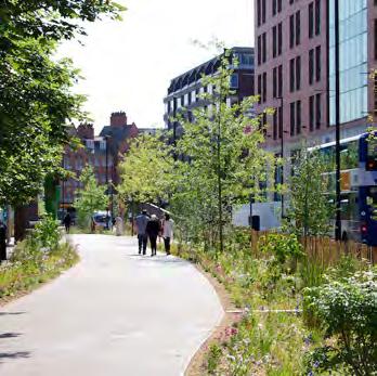
The DowntownDC BID has relatively good park coverage. People can access a nearby park within a 10-minute walk throughout the area. However, the size of parks in the BID is limited. Only 8 of 36 parks are larger than 1 acre. Most parks are smaller than a half-acre, and some are smaller than 0.1 acres, which drastically limits their ability to meet need.
For the DowntownDC public realm, the street hierarchy should be defined based on the accessibility analysis, which highlights pedestrian flow intensity. If the actively used streets are transformed as green corridors, the park experience is enhanced while traveling in the BID. Also, there is an opportunity for parklets and street cafes to proliferate with the development of green corridors. This can encourage local business activity and provide better food and services for pedestrian park visitors.
 GREEN CORRIDOR
102
SIDEWALK CAFE IN NATURE
C MARKET ANALYSIS
103
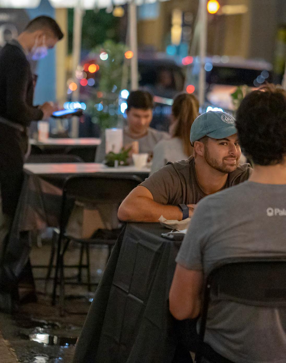
104
MARKET ANALYSIS
HR&A analyzed demographic and real estate market trends in the DowntownDC area to build an understanding of how the current population uses downtown parks and open space. The analysis highlights opportunities where existing or proposed development can support parks programming and activation. DowntownDC’s primary land use is office space, and open space users are primarily workforce. Therefore, a focus was placed on how retail and residential uses can be used in conjunction with parks to attract residents and visitors outside of standard work hours. Attracting these users is especially important for the post-pandemic recovery of the downtown office real estate market.
DEMOGRAPHIC TRENDS
DowntownDC contains highly educated, wellpaid office workers and residents. The following statistics reflect the time this analysis was completed, early 2022:
» There are 10,470 residents living in the BID.
» The 2021 total daytime population is 96,857; 97% consists of employees coming to work. 2,694 remain in the BID during the workday.
» Nearly 75% of households in the BID have annual incomes above $75,000, while 61% have incomes greater than $100,000.
» Only 5% of DowntownDC households have children. However, in 2019 there were 14 childcare providers located within the BID (My Childcare DC). This suggests families working in DowntownDC may depend on childcare services in the area.
» The residential population in the BID has a higher level of educational attainment compared with D.C. as a whole.
DOWNTOWNDC BID WASHINGTON, DC
Bachelor’s Degree: 33% Bachelor’s Degree: 26%
Graduate/Professional Degree: 45% Graduate/Professional Degree: 34%
COMMUTER POPULATION TRENDS
Most people working within DowntownDC commute into the area from elsewhere in the Washington metropolitan area. Of the 164,840 people employed within the BID in 2018, 99% lived outside the area.
DATA CONTEXT
This chapter reflects demographic and market trends at the time of the regression analysis, completed in early 2022. Since completing this analysis, trends have began to return to pre-pandemic numbers. For example, in 2022, the average daytime population rose to 138,647.
COUNTY OF
PERCENT OF
POPULATION District of Columbia 33% Prince George’s County, MD 14% Montgomery County, MD 13% Fairfax County, VA 12% Arlington County, VA 7% Other 21%
ORIGIN
COMMUTER
105 DowntownDC Parks Master Plan
One-third of these commuters come into the BID from other parts of the District. The remaining two-third arrive from Virginia and Maryland. Of the residential population living in DowntownDC, 45% of residents have an average commute time of less than 20 minutes, and 50% walk to work. This suggests that many BID residents are likely choosing to live in the area so that they can be close to work.
Many commuters travel into the BID via Metro. Rail ridership has seen significant impacts from COVID-19. In February 2020, there were 85,290 average daily entries on Metrorail within DowntownDC. These rates dropped at the start of the pandemic and stand at just over 20,000 average daily entries as of October 2021, representing less than a quarter of previous rail entries. With return to work plans still uncertain, it is likely this depressed rail ridership will continue, which will negatively impact patronage at DowntownDC retailers and restaurants. In contrast to rail ridership, bus ridership in the BID area has not seen as drastic of a drop, going from 28,000 average daily entries in 2019 to 12,500 average daily entries as of October 2021 on routes that go through the BID.
RESIDENTIAL MARKET
At the time of this analysis, there were 15 apartments and 20 condominium buildings, with a collective total of 6,004 units, located in DowntownDC, 52% of which were built before 2000. Of these market-rate units, 60% are occupied by renters and 40% are occupied by owners. In addition to these buildings, the BID is home to 992 non-market units, which
include affordable housing, senior living, student dormitories, and shelters.
» During the pandemic, vacancy rates jumped up to 11.1% for DowntownDC multifamily buildings, rising from 4.9% in 2019. Vacancy rates have since fallen closer to pre-Covid levels, currently at 3.7% in the third quarter of 2021, suggesting that renters who left the urban core during the height of the pandemic have since chosen to return downtown.
» Most of the multifamily housing borders other residential neighborhoods in the area, including Logan Circle and Mount Vernon Triangle. These neighborhoods fall on the adjacent side of Massachusetts Avenue and offer access to amenities like supermarkets, gyms, and retail. There are two additional clusters of residential in DowntownDC, including a cluster of apartments in Penn Quarter, near the Archives-Navy Memorial Metro station. Penn Quarter provides proximity to Metro, restaurants, and retail, and unlike other parts of DowntownDC, Penn Quarter has a neighborhood feel not dominated by large office buildings. The other outlying cluster falls near the Metro Center Metro station. Like Penn Quarter, this location provides proximity to transit, restaurants, and retail. For instance, the Apartments at CityCenter are luxury apartments and condos that sit above the mixed-use block of CityCenterDC retail and are located less than a five-minute walk from Metro Center.
106
OFFICE MARKET
As part of the central business district, DowntownDC primarily contains office space (see map on opposite page). Like office districts across the country, DowntownDC continues to face steep challenges rebounding from the pandemic. In September 2021, more than a year into the pandemic, less than a quarter of total office workers (24.7%) were working from their downtown offices. While this is slightly higher than rates over the summer, DowntownDC has attracted fewer workers back when compared with other parts of the region: 28.6% of DC workers overall were back in their offices in September 2021, 35.1% in Northern Virginia, and 32.7% in suburban Maryland.
Given the slow return of office workers, and the uncertainty that continues to influence employer decisions around return to office plans, office vacancy rates have continued to climb. In the first quarter of 2021, DowntownDC direct vacancy rates hit 16%. This tracks with trends in the overall D.C. office market. This is to be expected, given that DowntownDC is the core of the city’s overall office market. Both the DowntownDC submarket and the District overall were experiencing a slight growth in vacancy prior to the pandemic.
In Virginia, before and after the pandemic Tysons Corner and the Rosslyn-to-Ballston corridor have had consistently lower vacancy rates, indicating
the strength of these office markets. Though Tysons and Rosslyn/Ballston are significantly smaller office markets than DowntownDC, the success of these areas is driven in part due to their lower price point and their proximity to local amenities. Both markets tend to have lower base rents on average and contain a more diverse mix of uses than DowntownDC, with larger percentages of residential and retail building stock. In July 2021, DowntownDC’s Class A office base rents averaged $56.70 per SF, while in Rosslyn/Ballston and Tysons Corner average base rents were $42.54 and $39.04, respectively.
National Landing, an emerging office market, followed a different trend, with high vacancy rates in Crystal City and Pentagon City following the U.S. Department of Defense’s Base Realignments and Closure process that concluded in early 2012. Today, the area is undergoing a transformation into a tech and innovation hub, driven by the upcoming arrival of Amazon’s HQ2.
Due to this major investment, National Landing’s office market saw declining vacancy rates before the pandemic, slightly outperforming both DowntownDC and D.C. overall from 2019 until early in the pandemic in 2020. National Landing also has a more diverse mix of building uses and a larger residential base (nearly 22,000 residents) compared with DowntownDC.
107 DowntownDC Parks Master Plan
EXISTING OFFICE PROPERTIES
NEW OFFICE SPACE OUTSIDE TRADITIONAL MARKETS
While office vacancies remain high throughout the D.C. region, new products are opening in nontraditional markets. These recent and planned deliveries are working to attract tenants through numerous amenities and mixed-use building features. In a post-COVID environment, central business districts like DowntownDC will need to adjust to remain relevant and vibrant, with a broader mix of building uses. Investments in parks and amenities is one way to reattract office tenants, particularly due to the higher demand for outdoor space that has arisen since
the pandemic’s start; people feel safer and more comfortable gathering for events and meetings outdoors, a practice likely to persist into the future. Other nontraditional office markets in D.C. are using these forms of amenities on- and off-site to attract tenants. For example, The Yards at Capital Riverfront is a Brookfield Property in Southeast DC that provides amenities for the modern worker. Both interior amenities such as rooftop workspaces and flexible outdoor spaces attract new tenants to the area.
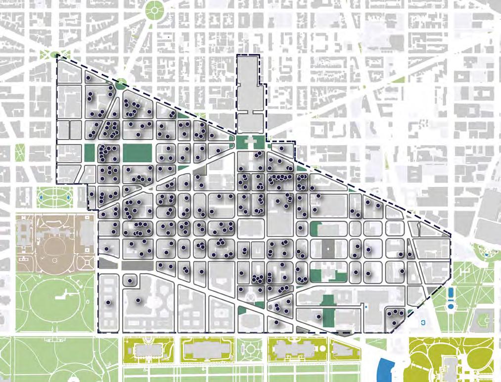
108
MULTIPLE REGRESSION ANALYSIS RESULTS
INTERPRETING MULTIPLE REGRESSION ANALYSIS
Regression analysis measures the relationship between a single dependent variable, and several independent variables. This regression analysis measures the relationship between independent variables such as metro ridership and the dependent variable, park visit counts. The coefficients measure the weight or mathematical relationship between each independent variable and the dependent variable. The P-value indicates whether these relationships are statistically significant. The lower the p-value, the greater the statistical significance of the relationship. A p-value of 0.05 or lower is generally considered statistically significant, indicating a true relationship between the dependent and independent variables. For example, total population appears to have no relationship with park visits, while Metro ridership and office building density have a statistically significant impact on park visits.
2019 RESULTS
INDEPENDENT VARIABLES COEFFICIENTS P-VALUE Building density 0.03 0.00 Mixed-use building density 2,919.20 0.14 Residential building density -152.91 0.00 Non-residential building density -52.18 0.60 Office building density -0.02 0.01 Retail building density 0.30 0.00 Census (total population) 7.59 0.11 Metro ridership 1.97 0.03 Bus stops -94.07 0.76
109 DowntownDC Parks Master Plan
2020 RESULTS
2021 RESULTS
INDEPENDENT VARIABLES COEFFICIENTS P-VALUE Building density 0.01 0.00 Mixed-use building density 78.38 0.86 Residential building density -12.65 0.22 Non-residential building density -25.77 0.26 Office building density 0.00 0.15 Retail building density -0.02 0.66 Census (total population) 0.69 0.61 Metro ridership 3.68 0.17 Bus stops 23.76 0.74
INDEPENDENT VARIABLES COEFFICIENTS P-VALUE Building density 0.02 0.00 Mixed-use building density 1,778.47 0.08 Residential building density -80.58 0.00 Non-residential building density -50.67 0.25 Office building density -0.01 0.02 Retail building density 0.08 0.05 Census (total population) 3.34 0.16 Metro ridership 4.75 0.01 Bus stops -78.87 0.60
110
DCOMMUNITY MEETING MATERIALS
111

112
FIRST COMMUNITY MEETING 11.17.21

1. SITE EXPLORATION
5. FINAL PLAN DATA ASSESSMENT
2. STAKEHOLDER INTERVIEWS
3. COMMUNITY NEEDS
4. PLAN DEVELOPMENT
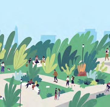
PRESENTATION 01 1 DOWNTOWN DC PARKS MASTER PLAN COMMUNITY MEETING 11.17.21 11.17.2021 COMMUNITY MEETING 2 DOWNTOWN DC PARKS MASTER PLAN COMMUNITY MEETING 11.17.21
to
PROJECT GOALS 3 DOWNTOWN DC PARKS MASTER PLAN COMMUNITY MEETING 11.17.21
The purpose of this study is
create a vision for new and enhanced parks and open spaces that meet the needs of the DowntownDC community.
START SEP 2021 OCT NOV JAN 2022 SPRING 2022 OPEN HOUSE IN FRANKLIN PARK VIRTUAL COMMUNITY MEETING PROJECT KICKOFF + AREA TOUR PROJECT FINALE CELEBRATION
PROJECT SCHEDULE
113 DowntownDC Parks Master Plan
HISTORY’S IMPRINT
The L’Enfant plan (1791) exemplifies Baroque city planning, creating a system of gridded streets & radiating avenues which emphasize civic space. In 1901, the McMillan Plan & City Beautiful movement enhanced the formal granduer of DC’s historic core.

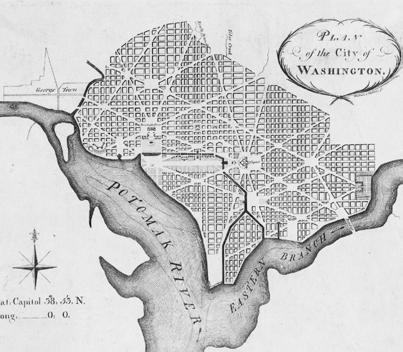

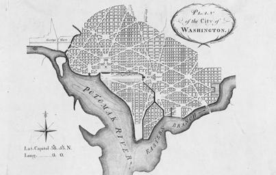
L’ENFANT PLAN
The organization of avenues creates focal points and view sheds that logically place prominent public spaces and cultural institutions in epicenters.
4 DOWNTOWN DC PARKS MASTER PLAN COMMUNITY MEETING 11.17.21
MCMILLAN PLAN - 1901 L’ENFANT-ELLICOTT PLAN - 1792 5 DOWNTOWN DC PARKS MASTER PLAN COMMUNITY MEETING 11.17.21
6 DOWNTOWN DC PARKS MASTER PLAN COMMUNITY MEETING 11.17.21
DC
DOWNTOWNDC BID UNITED STATES CAPITOL THE WHITE HOUSE WASHINGTON MONUMENT LINCOLN MEMORIAL JEFFERSON MEMORIAL THE ELLIPSE NATIONAL MALL TIDAL BASIN POTOMAC RIVER
DOWNTOWN
BID
114
Legacy of the L’Enfant plan can be seen in the parks and open space in DowntownDC.
These park spaces are within National Historic Sites (NHS) in DowntownDC.


7 DOWNTOWN DC PARKS MASTER PLAN COMMUNITY MEETING 11.17.21 DOWNTOWN DC BID CONTRIBUTING ELEMENTS TO THE PLAN OF THE CITY OF WASHINGTON NEWYORKAVE VERMONT AVE E ST D ST ST 14TH ST 15TH ST 16TH ST 11TH ST 10TH ST 9TH ST 7TH ST 6TH ST 5TH ST 3RD ST 2ND ST 8TH ST ST K ST K ST M ST PENNSYLVANIAAVE INDIANAAVE MASSACHUSETTSAVE NEW JERSEY AVE THE WHITE HOUSE MONUMENT THE ELLIPSE UNITED STATES CAPITOL SMITHSONIAN NATIONAL MUSEUM OF NATURAL HISTORY NATIONAL ARCHIVES MUSEUM SMITHSONIAN NATIONAL MUSEUM OF AMERICAN HISTORY NATIONAL MUSEUM OF AFRICAN AMERICAN HISTORY AND CULTURE LAFAYETTE SQUARE THOMAS CIRCLE PARK THE PARK AT CITYCENTER DC COBB PARK THE NATIONAL MALL SOMBROTTO MEMORIAL PARK MILIAN PARK NATIONAL GALLERY OF ART BURKE PARK CHINATOWN PARK MT VERNON TRIANGLE MT VERNON SQUARE DOWNTOWN CHINATOWN PENN QUARTER FEDERAL TRIANGLE FRANKLIN PARK MCPHERSON SQUARE JOHN MARSHALL PARK JUDICIARY SQUARE JUDICIARY PARK FREEDOM PLAZA US NAVY MEMORIAL MOUNT VERNON SQUARE METRO CENTER CHINATOWN 15TH ST Contributing elements to The Plan of The City of Washington WWI MEMORIAL 8 DOWNTOWN DC PARKS MASTER PLAN COMMUNITY MEETING 11.17.21 DOWNTOWN DC BID HISTORIC DISTRICTS (HD) NEWYORKAVE VERMONT AVE ST E ST D ST ST 14TH ST 15TH ST 16TH ST 11TH ST 10TH ST 9TH ST 7TH ST 6TH ST 5TH ST 3RD ST 2ND ST 8TH ST H ST H ST ST K ST K ST PENNSYLVANIAAVE INDIANAAVE MASSACHUSETTSAVE NEW JERSEY AVE THE WHITE HOUSE WASHINGTON MONUMENT THE ELLIPSE UNITED STATES CAPITOL SMITHSONIAN NATIONAL MUSEUM OF NATURAL HISTORY NATIONAL ARCHIVES MUSEUM SMITHSONIAN NATIONAL MUSEUM OF AMERICAN HISTORY NATIONAL MUSEUM OF AFRICAN AMERICAN HISTORY AND CULTURE LAFAYETTE SQUARE THOMAS CIRCLE PARK SAMUEL GOMPERS THE PARK AT CITYCENTER DC COBB PARK SOMBROTTO MEMORIAL PARK NATIONAL GALLERY OF ART BURKE PARK CHINATOWN PARK MT VERNON TRIANGLE MT VERNON SQUARE DOWNTOWN FRANKLIN PARK MCPHERSON SQUARE JOHN MARSHALL PARK JUDICIARY SQUARE JUDICIARY PARK FREEDOM PLAZA US NAVY MEMORIAL MOUNT VERNON SQUARE METRO CENTER 15TH ST WWI MEMORIAL CHINATOWN PENN QUARTER FEDERAL TRIANGLE FEDERAL TRIANGLE HD SHAW HD PENNSYLVANIA AVE. NHS LAFAYETTE SQUARE HD SIXTEEN ST. HD FINANCIAL HD DOWNTOWN HD These park spaces are within Historic Districts (HD) in DowntownDC. 9 DOWNTOWN DC PARKS MASTER PLAN COMMUNITY MEETING 11.17.21 DOWNTOWN DC BID NATIONAL HISTORIC SITES (NHS) NEWYORKAVE VERMONT AVE ST E ST D ST ST 14TH ST 15TH ST 16TH ST 11TH ST 10TH ST 9TH ST 7TH ST 6TH ST 5TH ST 3RD ST 2ND ST 8TH ST H ST H ST ST PENNSYLVANIAAVE INDIANAAVE MASSACHUSETTSAVE NEW JERSEY AVE THE WHITE HOUSE WASHINGTON MONUMENT THE ELLIPSE UNITED STATES CAPITOL SMITHSONIAN NATIONAL MUSEUM OF NATURAL HISTORY NATIONAL ARCHIVES MUSEUM SMITHSONIAN NATIONAL MUSEUM OF AMERICAN HISTORY NATIONAL MUSEUM OF AFRICAN AMERICAN HISTORY AND CULTURE LAFAYETTE SQUARE THOMAS CIRCLE PARK SAMUEL GOMPERS MEMORIAL PARK THE PARK AT CITYCENTER DC COBB PARK SOMBROTTO MEMORIAL PARK NATIONAL GALLERY OF ART BURKE PARK CHINATOWN PARK MT VERNON TRIANGLE MT VERNON SQUARE DOWNTOWN CHINATOWN PENN QUARTER FEDERAL TRIANGLE FRANKLIN PARK MCPHERSON SQUARE JOHN MARSHALL PARK JUDICIARY SQUARE JUDICIARY PARK FREEDOM PLAZA US NAVY MEMORIAL MOUNT VERNON SQUARE METRO CENTER 15TH ST FORD’S THEATER
WWI MEMORIAL 115 DowntownDC Parks Master Plan
DOWNTOWN DC BID
These parks have components that are listed on the National Register (NR) in DowntownDC.
HISTORIC ELEMENTS
The elements shown here have been identified as contributing features to the historic and cultural importance of the parks and open spaces in DowntownDC.
DOWNTOWN DC BID
As the L’Enfant plan informs existing park footprints, how can sidewalks and streets contribute to the experience of open space to best meet the needs of all types of visitors?
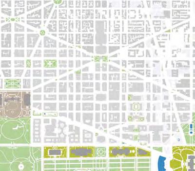

10 DOWNTOWN DC PARKS MASTER PLAN COMMUNITY MEETING 11.17.21
NATIONAL REGISTER LISTINGS (NR) NEWYORKAVE VERMONT AVE E ST D ST ST 14TH ST 15TH ST 16TH ST 11TH ST 10TH ST 9TH ST 7TH ST 6TH ST 5TH ST 3RD ST 2ND ST 8TH ST ST K ST K ST M ST PENNSYLVANIAAVE INDIANAAVE MASSACHUSETTSAVE NEW JERSEY AVE THE WHITE HOUSE MONUMENT THE ELLIPSE UNITED STATES CAPITOL SMITHSONIAN NATIONAL MUSEUM OF NATURAL HISTORY NATIONAL ARCHIVES MUSEUM SMITHSONIAN NATIONAL MUSEUM OF AMERICAN HISTORY NATIONAL MUSEUM OF AFRICAN AMERICAN HISTORY AND CULTURE LAFAYETTE SQUARE THOMAS CIRCLE PARK THE PARK AT CITYCENTER DC COBB PARK THE NATIONAL MALL SOMBROTTO MEMORIAL PARK MILIAN PARK NATIONAL GALLERY OF ART BURKE PARK CHINATOWN PARK MT VERNON TRIANGLE MT VERNON SQUARE DOWNTOWN CHINATOWN PENN QUARTER FEDERAL TRIANGLE FRANKLIN PARK MCPHERSON SQUARE JOHN MARSHALL PARK JUDICIARY SQUARE JUDICIARY PARK FREEDOM PLAZA US NAVY MEMORIAL MOUNT VERNON SQUARE METRO CENTER CHINATOWN 15TH ST
WWI MEMORIAL 11 DOWNTOWN DC PARKS MASTER PLAN COMMUNITY MEETING 11.17.21
CIRCULATION CONSTRUCTED WATER FEATURES LAND USE MONUMENTS SMALL-SCALE FEATURES (BENCHES, CURBS, PAVING) HISTORIC BUILDINGS SPATIAL ORGANIZATION VEGETATION VIEWS + VISTAS 12 DOWNTOWN DC PARKS MASTER PLAN COMMUNITY MEETING 11.17.21 NEWYORKAVE VERMONT AVE ST E ST D ST ST 14TH ST 15TH ST 16TH ST 11TH ST 10TH ST 9TH ST 7TH ST 6TH ST 5TH ST 3RD ST 2ND ST 8TH ST H ST H ST ST PENNSYLVANIAAVE INDIANAAVE MASSACHUSETTSAVE NEW JERSEY AVE THE WHITE HOUSE WASHINGTON MONUMENT THE ELLIPSE UNITED STATES CAPITOL SMITHSONIAN NATIONAL MUSEUM OF NATURAL HISTORY NATIONAL ARCHIVES MUSEUM SMITHSONIAN NATIONAL MUSEUM OF AMERICAN HISTORY NATIONAL MUSEUM OF AFRICAN AMERICAN HISTORY AND CULTURE LAFAYETTE SQUARE THOMAS CIRCLE PARK SAMUEL GOMPERS MEMORIAL PARK THE PARK AT CITYCENTER DC COBB PARK SOMBROTTO MEMORIAL PARK NATIONAL GALLERY OF ART BURKE PARK CHINATOWN PARK MT VERNON TRIANGLE MT VERNON SQUARE DOWNTOWN CHINATOWN PENN QUARTER FEDERAL TRIANGLE FRANKLIN PARK MCPHERSON SQUARE JOHN MARSHALL PARK JUDICIARY SQUARE JUDICIARY PARK FREEDOM PLAZA WWI MEMORIAL US NAVY MEMORIAL MOUNT VERNON SQUARE METRO CENTER
15TH ST
116
DOWNTOWN DC PEOPLE
Residents, Office Workers, and Tourists are the three primary user types in DowntownDC. As a complete system, these parks and open spaces should strive to meet the needs of all people. What are those needs?


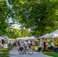

PARKS + PUBLIC SPACES HAVE MULTIPLE FUNCTIONS...


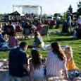


BELOVED PARKS + PUBLIC SPACES ARE OFTEN...


WHAT ELSE IS NEEDED?

13 DOWNTOWN DC PARKS MASTER PLAN COMMUNITY MEETING 11.17.21
WHAT ELSE? EVENT SPACE WHAT ELSE? RESTROOMS FURNITURE DESTINATIONS DINING + RETAIL PLAYGROUNDS USER TYPE NEEDS HISTORY DOG PARKS WHAT ELSE? WORKSTATIONS TOURISTS RESIDENTS WORKERS ? ? ?
14 DOWNTOWN DC PARKS MASTER PLAN COMMUNITY MEETING 11.17.21
?
ELSE IS NEEDED? WALKING + RUNNING SOCIAL GATHERING CLASSES RELAXATION PUBLIC ART NATURE ACTIVATION EVENTS + SHOWS MARKETS 15 DOWNTOWN DC PARKS MASTER PLAN COMMUNITY MEETING 11.17.21 ?
WHAT
CLOSE TO AMENITIES WELL CONNECTED NEAR TRANSIT WELL MAINTAINED EDUCATIONAL WALKABLE + BIKABLE SAFE DOG FRIENDLY SHADED 117 DowntownDC Parks Master Plan


16 DOWNTOWN DC PARKS MASTER PLAN COMMUNITY MEETING 11.17.21 SOME PARK TRENDS INCLUDE... ? WHAT ELSE IS NEEDED? FURNISHINGS WATER FEATURES SMALL-SCALE GAMES PLAYSCAPES WORKSTATIONS UNIQUE LANDSCAPES FLEX SPACE SIGNAGE & BRAND DECORATIVE LIGHTING 17 DOWNTOWN DC PARKS MASTER PLAN COMMUNITY MEETING 11.17.21 PARKS IN DOWNTOWN DC NEWYORKAVE VERMONT AVE 13TH 11TH ST 9TH ST 6TH ST PENNSYLVANIAAVE INDIANAAVE MASSACHUSETTSAVE NEW JERSEY AVE 1 2 3 4 5 6 7 8 9 10 11 12 13 14 15 16 17 18 19 20 21 22 23 24 25 28 29 27 26 ACCESSIBLE GREEN SPACE (WITHIN THE BID) HARDSCAPED OPEN SPACE (WITHIN THE BID) RESTRICTED PUBLIC OPEN SPACE LIMITED PUBLIC OPEN SPACE ACCESSIBLE OPEN SPACE SCOTT CIRCLE PARK 2. THOMAS CIRCLE PARK 3. BURKE PARK 4. MCPHERSON SQUARE 5. FRANKLIN PARK MT. VERNON SQUARE 7. CHINATOWN PARK 8. RESERVATION 75 9. RESERVATION 196 10. JUDICIARY SQUARE 12. JOHN MARSHALL PARK 13. VINCENT SOMBROTTO MEMORIAL PARK 14. US NAVY MEMORIAL PARK 15. FRANKLIN D. ROOSEVELT MEMORIAL 16. THE PARK AT CITY CENTER DC (PRIVATELY MAINTAINED) 17. RESERVATIONS 172, 172A, 172B 18. WORLD WAR MEMORIAL 19. FREEDOM PLAZA 20. US NAVY MEMORIAL PLAZA 22. NATIONAL LAW ENFORCEMENT OFFICERS MEMORIAL 23. ANDREW W. MELLON MEMORIAL FOUNTAIN 24. MEADE PLAZA 25. NATIONAL JAPANESE AMERICAN MEMORIAL 27. RESERVATION 73 28. RESERVATION 77B 29. RESERVATION 78 LEGEND 18 DOWNTOWN DC PARKS MASTER PLAN COMMUNITY MEETING 11.17.21 4.79 AC FRANKLIN PARK 27 ACRES of open space assets, 4.5% of DowntownDC 9 spaces over 1 acre 24 spaces under a 1/2 acre 10 spaces under 0.1 acres NAVY MEMORIAL GREEN 0.47 AC TRIANGLE PARK at New York Ave & H St NW 0.08 AC PARKS IN DOWNTOWN DC 118
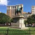


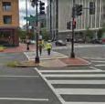
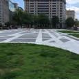

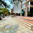


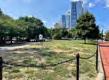


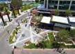


19 DOWNTOWN DC PARKS MASTER PLAN COMMUNITY MEETING 11.17.21 YOUR THOUGHTS ON PARKS + OPEN SPACE STATUARY SOCIAL GATHERING DESIGN ELEMENTS PROGRAMMING STREETSCAPE DESIGN DESIGN OPPORTUNITY GATHERING AREAS SMALL SPACES PUBLIC SPACE SIDEWALK ACTIVATION 20 DOWNTOWN DC PARKS MASTER PLAN COMMUNITY MEETING 11.17.21 FAVORITE PARKS? MCPHERSON SQUARE FREEDOM PLAZA CHINATOWN PARK FRANKLIN PARK JOHN MARSHALL PARK BUILDING MUSEUM THE PARK AT CITYCENTER WWI MEMORIAL BURKE PARK 21 DOWNTOWN DC PARKS MASTER PLAN COMMUNITY MEETING 11.17.21 FAVORITE ELEMENTS? PUBLIC ART PLAZA ENCLOSED POCKET PARK COMMUNITY GARDEN FURNITURE IN PARKS CORNER PLAZA URBAN SKATE PARK SPLASH PAD PLAZA PLAYGROUND NATURE POCKET PARK 119 DowntownDC Parks Master Plan


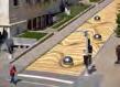

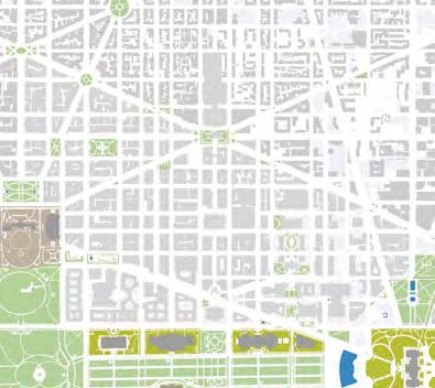
22 DOWNTOWN DC PARKS MASTER PLAN COMMUNITY MEETING 11.17.21 FAVORITE SIDEWALKS? PEDESTRIAN ONLY STREET SIDEWALK PLAZA SIDEWALK CAFE SIDEWALK FURNITURE SIDEWALK LANDSCAPING ART STREETS 23 DOWNTOWN DC PARKS MASTER PLAN COMMUNITY MEETING 11.17.21 WHERE DO WE NEED MORE PUBLIC SPACE? WASHINGTON MONUMENT THE NATIONAL MALL NEWYORKAVE VERMONT AVE 13TH ST 15TH ST 15TH ST 4TH ST 3RD ST ST PENNSYLVANIAAVE INDIANAAVE MASSACHUSETTSAVE THE WHITE HOUSE WASHINGTON UNITED STATES CAPITOL LAFAYETTE SQUARE MT VERNON TRIANGLE DOWNTOWN CHINATOWN PENN QUARTER NEW JERSEY AVE NATURAL HISTORY NATIONAL ARCHIVES MUSEUM MUSEUM OF AMERICAN HISTORY NATIONAL MUSEUM OF AFRICAN AMERICAN HISTORY AND CULTURE THOMAS CIRCLE PARK THE PARK AT CITYCENTER DC SOMBROTTO MEMORIAL NATIONAL GALLERY OF ART BURKE PARK MT VERNON SQUARE FEDERAL TRIANGLE FRANKLIN SQUARE JOHN MARSHALL JUDICIARY SQUARE JUDICIARY PARK FREEDOM PLAZA METRO CENTER GALLERY PLACECHINATOWN 24 DOWNTOWN DC PARKS MASTER PLAN COMMUNITY MEETING 11.17.21 QUESTIONS + COMMENTS NEWYORKAVE VERMONT AVE F ST 12TH ST 9TH ST 7TH ST 6TH ST PENNSYLVANIAAVE INDIANAAVE MASSACHUSETTSAVE THE WHITE HOUSE WASHINGTON MONUMENT UNITED STATES CAPITOL LAFAYETTE SQUARE THE NATIONAL MALL MT VERNON TRIANGLE DOWNTOWN CHINATOWN PENN QUARTER NEW JERSEY AVE SMITHSONIAN NATIONAL ARCHIVES MUSEUM MUSEUM OF AMERICAN HISTORY NATIONAL MUSEUM OF AFRICAN AMERICAN HISTORY AND CULTURE THOMAS CIRCLE PARK SAMUEL GOMPERS THE PARK AT CITYCENTER DC COBB PARK SOMBROTTO MEMORIAL PARK NATIONAL GALLERY OF ART BURKE PARK MT VERNON SQUARE FEDERAL TRIANGLE FRANKLIN PARK MCPHERSON SQUARE JOHN MARSHALL PARK JUDICIARY SQUARE JUDICIARY PARK PLAZA WWI US NAVY CARNEGIE METRO CENTER CHINATOWN 25 DOWNTOWN DC PARKS MASTER PLAN COMMUNITY MEETING 11.17.21 MORE INFORMATION downtowndcparksmasterplan.com 120
SECOND COMMUNITY MEETING 02.17.22 PRESENTATION

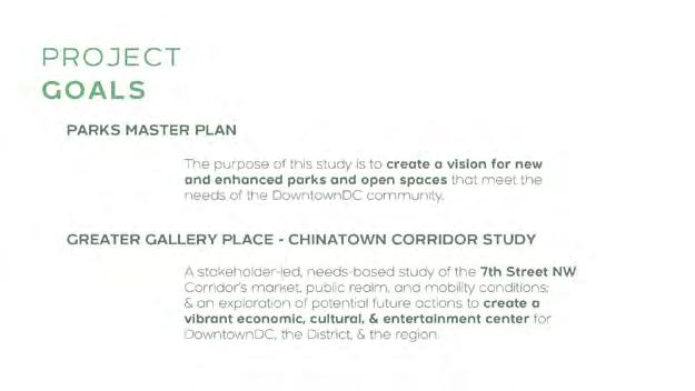

02 121 DowntownDC Parks Master Plan


122

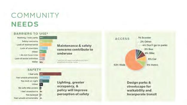
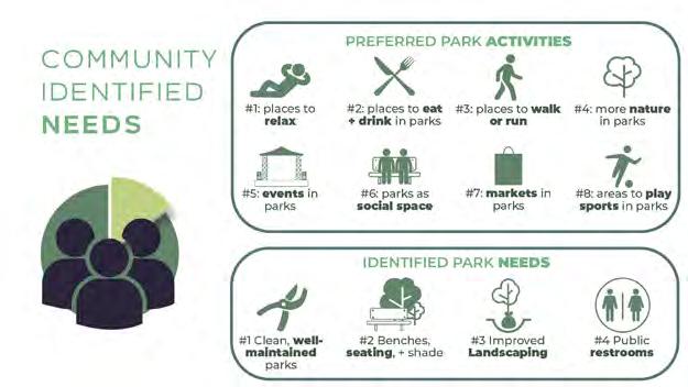
123 DowntownDC Parks Master Plan
GREATER GALLERY PLACE - CHINATOWN CORRIDO R STU D Y: STUDY AREA
Greater Gallery Place/Chinatown includes many significant culture and entertainment destinations and diverse attractions that together become the heart of Downtown and the heart of the region.
GREATER GALLERY PLACE - CHINATOWN CORRIDO R STU D Y:
AREA
GREATER GALLERY PLACE/CHINATOWN CORRIDOR STUDY:


STUDY
Study area: 20% of BID development in 15% of its area Including: 15% of BID Office 30% of BID residences 10% of BID hotel rooms 30% of BID retail Washington D.C. 81.3% Ann Arunde County MD 0.6% Montgomery County, MD 5.4% Calvert County, MD 0.3% Prince George’s County, MD 2.9% Loudoun County, VA 0.6% Howard County, MD 0.6% Falls Church City, VA 0.3% Fairfax County, VA 1.9% Visitors outside Washington Metropolitan Area 1.9% Arlington County, VA 3.2% Alexandria City, VA 1.0% What zip code do you live in? As of February 8, 2022, approximately 320 participants took the survey Among the DC participants: 54% from Downtown DC 7% from Northeast DC 19% from Southeast DC 20% from Northwest DC
INTERCEPT SURVEY RESPONSES 124
QUESTION: What typically brings you to Gallery Place-Chinatown?
(SELECT UP TO 3)
QUESTION: When do you typically visit Gallery Place-Chinatown?

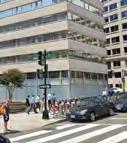


QUESTION: How do you typically travel to Gallery Place - Chinatown?

(SELECT UP TO 3)

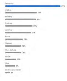
125 DowntownDC Parks Master Plan


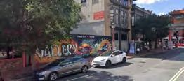


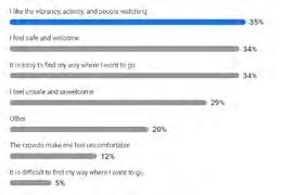

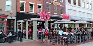


QUESTION: How do you feel when you walk along 7th Street in Gallery Place - Chinatown? (SELECT UP TO 3) Lots of stores and restaurants are gone. Gallery Place Chinatown used to be active Feel empty not enough things open to attract crowds. feel welcome, but unsafe. Homeless and loitering issues Lots of traffic and cars make it less enjoyable than it could be. Mixed feelings. Between H and F is usually too noisy with lots of unfriendly people loitering around, especially near the McDonald’s and the Chinatown arch. Between F and Penn is usually friendlier. Between H and K is okay in some areas but not others. Overall, there are too many closed shops and there needs to be more friendly people/activity on the streets. Needs more public activations, streeteries, new businesses, less car traffic, more street closures for events like the Christmas Market.
How do you feel when you walk along other streets in Gallery Place-Chinatown? (SELECT UP TO 3) Lots of stores and restaurants are gone. Gallery Place Chinatown used to be active Feel empty not enough things open to attract crowds. feel welcome, but unsafe. Homeless and loitering issues Lots of traffic and cars make it less enjoyable than it could be. Mixed feelings. Between H and F is usually too noisy with lots of unfriendly people loitering around, especially near the McDonald’s and the Chinatown arch. Between F and Penn is usually friendlier. Between H and K is okay in some areas but not others. Overall, there are too many closed shops and there needs to be more friendly people/activity on the streets. Needs more public activations, streeteries, new businesses, less car traffic, more street closures for events like the Christmas Market.
What activities would you like to do more of in Gallery Place - Chinatown? (SELECT UP TO 3) 126
QUESTION:
QUESTION:
QUESTION: What would make getting around Gallery Place Chinatown more enjoyable?
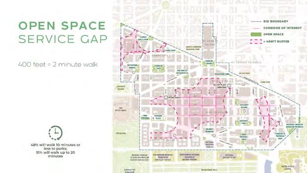


(SELECT UP TO 3)
127 DowntownDC Parks Master Plan
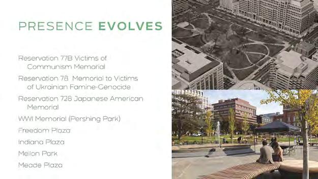
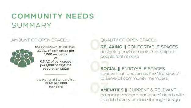

128

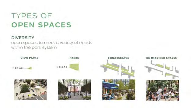
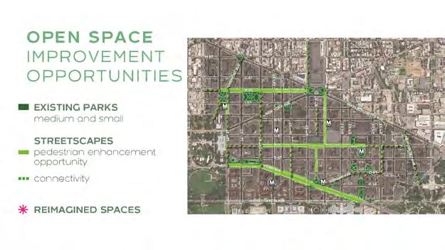
129 DowntownDC Parks Master Plan


130

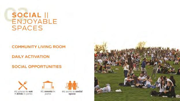
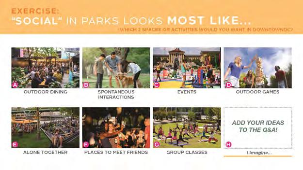
131 DowntownDC Parks Master Plan

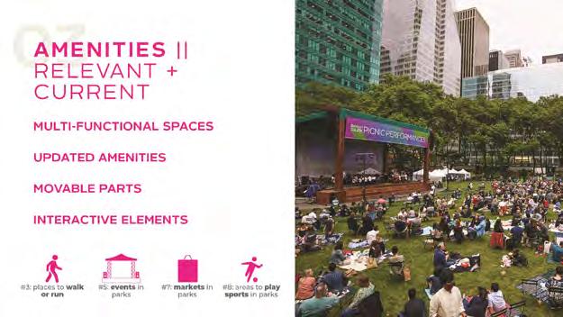
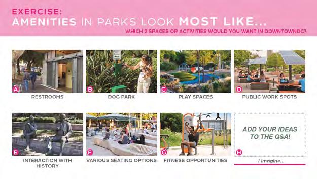
132


133 DowntownDC Parks Master Plan
THE NEXT EVOLUTION OF GALLERY
PLACE MUST INCLUDE:
• Continued layering of cultural activity to drive visitors, support significant retail vibrancy and define downtown as a regional destination for everyone.
Diversified Land uses (including increased residential) balancing daytime office workers with residential populations.
• New amenities to support residents and visitors alike [i.e. neighborhood serving retail/ grocery store, outdoor dining, neighborhood interaction, playgrounds, etc.]
• New ‘Quieter’ spaces that offer an alternative to the 7th street atmosphere.
Expanded pedestrian space to increase comfort, capacity and variety at high-activity areas.
Expanded open space programming offered by local institutions, cultural organizations and attractions.

• Enhanced transit + multi-modal mobility choices to improve ease of access, and decrease single occupancy vehicles, congestion, and emissions.

134
GREATER GALLERY PLACE - CHINATOWN CORRIDO R STU D Y:
GROUND FLOOR ACTIVITY
Restaurant spaces make up a significant portion of ground floor frontage, but the narrow sidewalks support minimal outdoor dining opportunities.
Cultural amenities are located throughout the study area, but clustered along F and 7th Streets.

7th Street has the greatest diversity of ground floor uses.


GREATER GALLERY PLACE - CHINATOWN CORRIDO R STU D Y:
PEDESTRIAN PATHS


16% of study area is designated for pedestrians [outdoor]
This is a positive overall. But the pedestrian space is not located where it is needed most, i.e., adjacent to major pedestrian-oriented destinations along 7th Street.


GREATER GALLERY PLACE - CHINATOWN CORRIDO R STU D Y:

GREEN SPACE
4% of study area is visible planted green space [but not all of that is accessible]
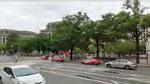
While significant greenspaces surround the study area, there is little accessible greenspace within. This is particularly true especially in the area of greatest pedestrian activity.
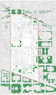
Area of greatest pedestrian activity 7th and G 7th and 9th and F 7th and H
9th and 7th and Pennsylvania 7th and G
of greatest pedestrian activity Chinatown Park Indiana Plaza American Art Museum along G Street
Area of greatest pedestrian activity Area
135 DowntownDC Parks Master Plan

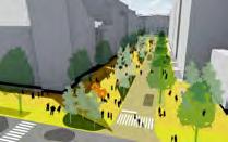
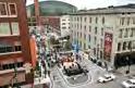

OPPORTUNITIE S TO IMPROVE PUBLIC REALM EXPERIENCE AN D ACTIVI T Y: Stakeholder identified opportunity areas to improve public realm experience WHAT IF 8TH STREET BECAME A NEIGHBORHOOD AMENITY? E s n xp ien e PRECEDENT INSPIRATION Possibility 1- Establish curbless 8th Street path with central plaza/park Possibility 2- Establish curbless 8th Street shared space (Woonerf) with asymmetrical plaza/park View over H and 8th Street looking south View over H and 8th Street looking south IF 8 TH STREET WERE RE - IMAGINED - WHICH ACTIVITIES WOULD YOU MOST ENJOY IN THIS NEW PUBLIC SPACE? (SELECT UP TO 3) A. Eat and drink outside B. Interact with & appreciate art C. People watch D. Play on a playground E. Visit a dog park F. Attend a performance/concert/event G. Learn about history & culture H. Relax in the shade I. Converse with friends J. Pick up & drop off for passengers & deliveries 136
HOW CAN 7TH ST BETTER MEET PEDESTRIAN AND TRANSIT NEEDS?
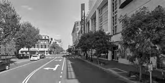

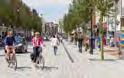
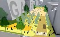


WHAT F+G STREETS AROUND THE GALLERY / ARENA COULD HOST MORE EVENTS AND GATHERINGS? E ie IF F AND G STREETS WERE RE - IMAGINED - WHICH ACTIVITIES WOULD YOU MOST ENJOY IN THIS NEW PUBLIC SPACE? PRECEDENT INSPIRATION View over F and 9th Street looking east Possibility 1 - Remove extra lanes - Create linear plaza/park, narrow F Street View over F and 9th Street looking east Possibility 2 - Remove extra lanes - Create open plaza/park, establish curbless F Street shared space (Woonerf) (SELECT UP TO 3) A. Eat and drink outside B. Interact with & appreciate art C. People watch D. Play on a playground E. Visit a dog park F. Attend a performance/concert/event G. Learn about history & culture H. Relax in the shade I. Converse with friends J. Pick up & drop off for passengers & deliveries
E ie 137 DowntownDC Parks Master Plan
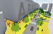


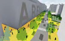
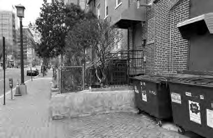

PRECEDENT INSPIRATION Possibility 1 - Expand sidewalks, narrow street, prioritize bus + symmetrical P.U.D.O. Possibility 2 - Expand sidewalks, street, prioritize bus asymmetrical P.U.D.O. (SELECT UP TO 3) A. Eat and drink outside B. Interact with & appreciate art C. People watch D. Play on a playground E. Visit a dog park F. Attend a performance/concert/event G. Learn about history & culture H. Relax in the shade I. Converse with friends J. Pick up & drop off for passengers & deliveries View 7th and G Street looking south View 7th and G Street looking south IF 7 TH STREET WERE RE - IMAGINED - WHICH ACTIVITIES WOULD YOU MOST ENJOY IN THIS NEW PUBLIC SPACE? HOW CAN 6TH STREET BETTER CONNECT + REFLECT CHINATOWN? E ie View at NE corner of 6th and H Street, looking north IF THE SPACE NEAR 6TH AND H STREETS WERE RE - IMAGINEDWHICH ACTIVITIES WOULD YOU MOST ENJOY IN THIS NEW PUBLIC SPACE? (SELECT UP TO 3) A. Eat and drink outside B. Interact with & appreciate art C. People watch D. Play on a playground E. Visit a dog park F. Attend a performance/concert/event G. Learn about history & culture H. Relax in the shade I. Converse with friends J. Pick up & drop off for passengers & deliveries 138

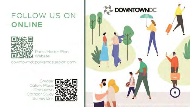
139 DowntownDC Parks Master Plan


06.16.22 PRESENTATION 03 1 DOWNTOWN DC PARKS MASTER PLAN COMMUNITY MEETING 06.16.2022 06.16.2022 COMMUNITY MEETING
RECAP OF PLANNING PROCESS AND COMMUNITY ENGAGEMENT EFFORTS community input informing design decisions MASTER PLAN OVERVIEW findings and recommendations TOP THREE PRIORITY RECOMMENDATIONS park specific design interventions QUESTIONS AND ANSWERS DOWNTOWN DC PARKS MASTER PLAN COMMUNITY MEETING 06.16.2022 2 Create a vision for new and enhanced parks and open spaces that meet the needs of the DowntownDC community. PROJECT GOAL DOWNTOWN DC PARKS MASTER PLAN COMMUNITY MEETING 06.16.2022 PLANNING PROCESS Extensive public outreach to ensure the plan stayed rooted in the community’s needs and vision Envision a park system that has diverse offerings and activities System wide recommendations and park specific design plans working in tandem Identify new opportunities to expand and improve community experience. 140
THIRD COMMUNITY MEETING
AGENDA
COMMUNITY DRIVEN PROCESS


START SEP 2021 OCT NOV JAN 2022 JUN OPEN HOUSE & VIRTUAL COMMUNITY MEETINGS STEERING COMMITTEE STAKEHOLDER INTERVIEWS COMMUNITY MEETING PLAN COMPLETE STAKEHOLDER INTERVIEWS COMMUNITY NEEDS APPROACH OPEN SPACE OBSERVATIONS RECOMMENDATIONS DATA COLLECTION PROJECT SCHEDULE STEERING COMMITTEE COMBINED COMMUNITY MEETING STEERING COMMITTEE PROJECT KICKOFF + AREA TOUR DATA COLLECTION STEERING COMMITTEE MAY FINAL MASTER PLAN DELIVERY ASSESSMENT + STRATEGY DOWNTOWN DC PARKS MASTER PLAN COMMUNITY MEETING 06.16.2022 17 PARKS REVIEWED 15TH ST 15TH ST 10TH 1 2 3 4 5 6 7 8 9 10 11 12 13 15 16 17 18 19 20 14 21 22 23 24 25 28 29 27 26 ACCESSIBLE GREEN SPACE (WITHIN THE BID) HARDSCAPED OPEN SPACE (WITHIN THE BID) RESTRICTED PUBLIC OPEN SPACE LIMITED PUBLIC OPEN SPACE ACCESSIBLE OPEN SPACE 2. THOMAS CIRCLE PARK 3. BURKE PARK 4. MCPHERSON SQUARE 5. FRANKLIN PARK 7. CHINATOWN PARK 8. RESERVATION 75 9. RESERVATION 196 10. JUDICIARY SQUARE 11. JUDICIARY PARK 13. VINCENT SOMBROTTO MEMORIAL PARK 14. US NAVY MEMORIAL PARK 15. FRANKLIN D. ROOSEVELT MEMORIAL (PRIVATELY MAINTAINED) 17. RESERVATIONS 172, 172A, 172B 18. WORLD WAR MEMORIAL 19. FREEDOM PLAZA 20. US NAVY MEMORIAL PLAZA 22. NATIONAL LAW ENFORCEMENT OFFICERS MEMORIAL 23. ANDREW W. MELLON MEMORIAL FOUNTAIN 24. MEADE PLAZA 25. NATIONAL JAPANESE AMERICAN MEMORIAL 27. RESERVATION 73 28. RESERVATION 77B 29. RESERVATION 78 LEGEND DOWNTOWN DC PARKS MASTER PLAN COMMUNITY MEETING 06.16.2022
DOWNTOWN DC PARKS MASTER PLAN COMMUNITY MEETING 06.16.2022 5 Steering Committee Meetings 4 Virtual Public Meetings 3 In-Person Outdoor Open House Events 3 Community Surveys 37 Stakeholder Interviews 20 Hours of Listening PARKS MASTER PLAN 141 DowntownDC Parks Master Plan
WHAT WE HEARD
PREFERRED PARK ACTIVITIES
#1: places to relax
#5: events in parks
#3: places to walk or run
#7: markets in parks
IDENTIFIED PARK NEEDS
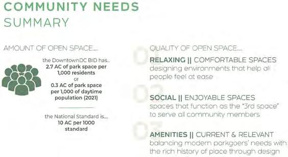


#8: areas to play sports in parks


want more
social, & amenitized park spaces
Needs Phase November COMMUNITY IDENTIFIED NEEDS Survey 1 DOWNTOWN DC PARKS MASTER PLAN COMMUNITY MEETING 06.16.2022 DOWNTOWN DC PARKS MASTER PLAN COMMUNITY MEETING 06.16.2022 142
People
relaxing,
Community
957
FEEDBACK TAKEAWAYS
Survey 2
RELAXING
PARKS: lush landscape, shade, & solitude over seating types


STREETSCAPE: pedestrian prioritization & activation

SOCIAL
PARKS & STREETSCAPES: organized activities & events over individualized opportunities


AMENITIES
PARKS: restrooms & flexible living over play or dogs
STREETSCAPES: shade, beautification, & activation over mobility facilities


COMMUNITY PRIORITY
Survey 2
PRIORITY SPACES
Approach Phase March DowntownDC Parks Master Plan
MCPHERSON SQ
MT VERNON SQ
FREEDOM PLAZA
CHINATOWN PARK
JUDICIARY SQ
JOHN MARSHALL PARK RES. 173
BURKE PARK
LUSH LANDSCAPE SOLITUDE PEDESTRIAN PRIORITIZATION SPILL OUT DINING & COMMERCIAL What does relaxing park space look like? (Top 2 selections) 474 418 What does a relaxing streetscape look like? (Top 2 selections) 726 428 OUTDOOR DINING EVENTS MARKETS / FESTIVALS DINING OPPORTUNITIES What does social park space look like? (Top 2 selections) 518 470 What does a social streetscape look like? (Top 2 selections) 687 411 SHADE STRUCTURES PUBLIC ART RESTROOMS VARIOUS SEATING OPTIONS What does amenitized park space look like? (Top 2 selections) 676 472 What does an amenitized street look like? (Top 2 selections) 417 401 *Significant desire for a dog park was also expressed
Survey 2 PARKS STREETSCAPE Approach Phase March DOWNTOWN DC PARKS MASTER PLAN COMMUNITY MEETING 06.16.2022 474 418 518 470 676 472 726 428 687 411 417 401
AMENITY PREFERENCES
Approach Phase M a rch DOWNTOWN DC PARKS MASTER PLAN COMMUNITY MEETING 06.16.2022
C ommunity survey data & stakeholder interviews helped identify the top 5 parks selected for redesign DOWNTOWN DC PARKS MASTER PLAN COMMUNITY MEETING 06.16.2022 143
MASTER PLAN OVERVIEW AND RECOMMENDATIONS
FINDINGS
CREATING QUALITY

For the community, the most important features to enhance the quality of public space in DowntownDC range from improved daily operations that care for park spaces to increased diversity of amenities, including vending, seating, and restrooms, infrastructure for events and programming, and elements that enhance the comfort and enjoyment of park spaces.


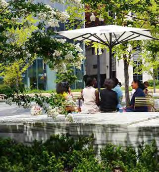

DOWNTOWN DC PARKS MASTER PLAN COMMUNITY MEETING 06.16.2022 Recommendations Phase May DESIGN ELEMENTS
DOWNTOWN DC PARKS MASTER PLAN COMMUNITY MEETING 06.16.2022
144
SYSTEM-WIDE APPROACH
ADDRESS THE QUANTITY + QUALITY
B ased on community input, site observations, & knowledge of best practices, DowntownDC needs to improve the quality of existing public spaces & find creative ways to expand the footprint & reach of parks & open space assets
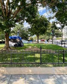
SYSTEM-WIDE APPROACH
QUANTITY STRATEGY
grow the parks - inner / outer park
“parkify” key streets to create a connected system keep open space open

QUALITY STRATEGY
baseline of open space furnishings
maintenance level diverse offerings (open space components)

DOWNTOWN DC PARKS MASTER PLAN COMMUNITY MEETING 06.16.2022
DOWNTOWN DC PARKS MASTER PLAN COMMUNITY MEETING 06.16.2022 145 DowntownDC Parks Master Plan
PARK SPECIFIC VS. SYSTEM-WIDE
RE-IMAGINING KEY PARKS
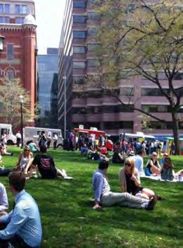
C ommunity feedback & site observations identified 5 existing parks that should be p rioritized for intervention
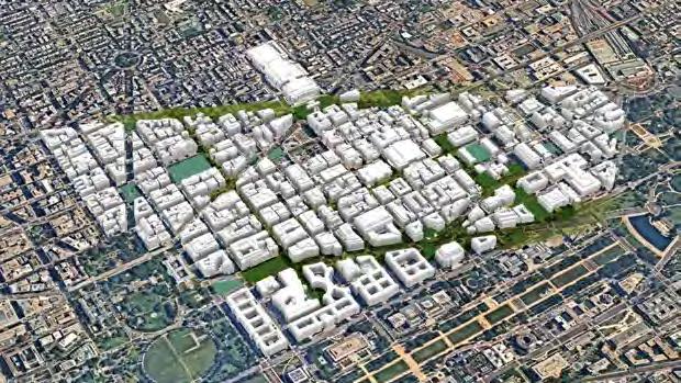
TARGETED APPROACH
The 5 parks identified are well - distributed throughout DowntownDC. Any design intervention must be paired with improved accessibility & a maintenance plan to ensure the longevity & integration of the parks into the heart of the communit y.
TOP THREE PRIORITY RECOMMENDATIONS

DOWNTOWN DC PARKS MASTER PLAN COMMUNITY MEETING 06.16.2022
Freedom Plaza Mt Vernon Square Chinatown Park
McPherson Square
John Marshall Park
146
TOP THREE COMMUNITY
DowntownDC Parks Master Plan
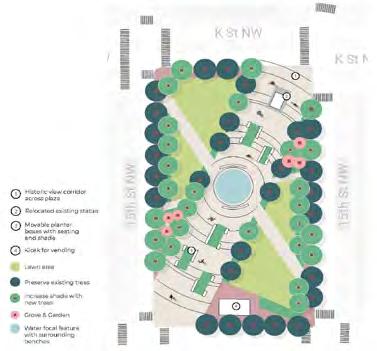


MCPHERSON SQUARE
DRAFT RECOMMENDATIONS
Formal Partnership for Markets and to Sell Food & Beverages
• Community Focused & Modern Park Events


• Utility Connections and Lighting for Events
• Enhance “Outer Park” Area
• Flexible Lawn Space and Plaza Areas
• Workstations for Mobile “Outdoor Office”
• Movable Plant Beds with Attached Seating Concepts

• Modern Focal Water Feature
• Bike & Pedestrian Connections
1 Community 2 3
Pick 1 147
23 12TH ST 9TH ST 6TH ST 2ND ST THE WHITE HOUSE WASHINGTON UNITED STATES CAPITOL LAFAYETTE SQUARE PENN QUARTERMUSEUM OF NATIONAL ARCHIVES MUSEUM SMITHSONIAN NATIONAL MUSEUM OF NATIONAL MUSEUM OF AFRICAN AMERICAN HISTORY AND CULTURE THOMAS MEMORIAL PARK THE PARK AT SOMBROTT PARK MILIAN PARK NATIONAL GALLERY OF ART BURKE PARK DOWNTOWN CHINATOWN PARK MT VERNON SQUARE FEDERAL TRIANGLE MCPHERSON SQUARE JOHN JUDICIARY SQUARE JUDICIARY PARK FREEDOM PLAZA METRO CENTER
M CPH ERS O N S Q UA RE FREEDO M PLA Z A MOUNT VERNON SQUARE DOWNTOWN DC PARKS MASTER PLAN COMMUNITY MEETING 06.16.2022 1 2 3 QUANTITY QUALITY AMENITY SOCIAL RELAX
PICKS
• Public Restrooms M C PHERSON SQUARE M C PHERSON SQUARE 4
POLLING QUESTION # 1
Which of the recommended elements for McPherson Square do you like the best? (select all that apply)


a. Food and Beverages in the Park
b. Community Focused Park Events


c. Mobile “Outdoor Office” Spaces
d. Water Feature in the Center of the Park
e. Movable Plant Beds
f. Improved Bike & Pedestrian Connections
g. New Comfortable & Flexible Seating
h. New Public Restrooms
Community Pick
MOUNT VERNON SQUARE
DRAFT RECOMMENDATIONS
• Formal Partnership to Sell Food and Beverage
• Green Garden Landscape
• Environmental Art Sculpture Installations
• Outdoor Exhibition Space Through Partnership
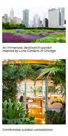

• Bike & Pedestrian Connections
• Mid-block Pedestrian Crossings
• Shade and Café Seating
• Public Restrooms
2 SQUARE MOUNT VERNON SQUARE 1 2 148
18
DOWNTOWN DC PARKS MASTER PLAN COMMUNITY MEETING 06.16.2022
QUANTITY QUALITY AMENITY SOCIAL RELAX
• Comfortable & Flexible Seating M OUNT VERNON
POLLING QUESTION # 2
Which of the recommended elements for Mount Vernon Square do you like the best? (select all that apply)
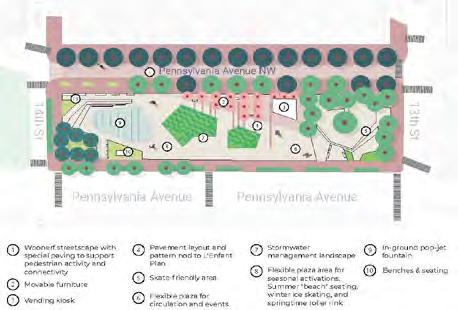

a. Food and Beverages in the Park
b. Lush Landscape
c. Environmental Art Sculpture Installations
d. Outdoor Art Exhibition
e. Improved Bike & Pedestrian Connections
f. New Mid-block Pedestrian Crossings

g. Shade with Café Seating
h. New Public Restrooms
3 Community Pick
FREEDOM PLAZA
DRAFT RECOMMENDATIONS
• Design In Collaboration with National Capital Planning Commission (NCPC) Future Plans
• Formal Partnership for Markets and to Sell Food & Beverages
• Movable Shade Structures and Flexible, Movable Seating

• Events Infrastructure
• Lush plantings
• Skateboarding Opportunities

• Enhance “Outer Park” Area for Enlarged Park Feel

• Public Restrooms
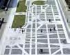
18
DOWNTOWN DC PARKS MASTER PLAN COMMUNITY MEETING 06.16.2022
QUANTITY QUALITY AMENITY SOCIAL RELAX
FREEDOM PLAZA FREEDOM PLAZA Ice skating, DC Waterfront Park, San Diego Pop up roller rink, Philadelphia 1 2 3 4 5 6 7 8 9 10 10 149 DowntownDC Parks Master Plan
Which of the recommended elements for Freedom Plaza do you like the best? (select all that apply)


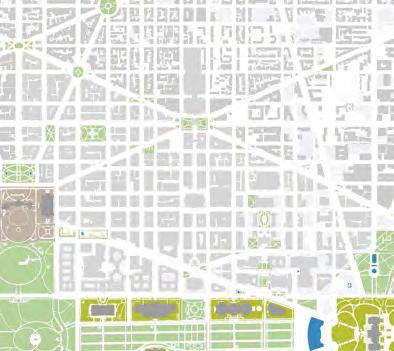

b.

18 POLLING QUESTION # 3 DOWNTOWN DC PARKS MASTER PLAN | COMMUNITY MEETING 06.16.2022
Beverages
the Park
a. Food and
in
Movable Shade Structures with Flexible Seating
Infrastructure for Events
Lush Landscape
Enhanced Skateboarding Area
Enhanced “Outer Park” Area for Enlarged Park Feel
New Public Restrooms MORE INFORMATION downtowndcparksmasterplan.com DOWNTOWN DC PARKS MASTER PLAN COMMUNITY MEETING 06.16.2022 2 4
c.
d.
e.
f.
g.
COMMENTS 15TH 15TH ST 16TH ST 11TH ST 10TH ST 5TH ST 1ST 8TH ST THE THE ELLIPSE SQUARE THE NATIONAL MALL MT VERNON TRIANGLE PENN QUARTER SMITHSONIAN NATIOAL MUSEUM OF NATIONAL ARCHIVES MUSEUM SMITHSONIAN NATIONAL MUSEUM OF NATIONAL MUSEUM OF AFRICAN AMERICAN SAMUEL GOMPERS MEMORIAL PARK COBB PARK MEMORIAL PARK MILIAN PARK NATIONAL GALLERY OF ART BURKE PARK DOWNTOWN CHINATOWN PARK MT VERNON SQUARE FEDERAL TRIANGLE PARK MCPHERSON SQUARE PARK JUDICIARY SQUARE JUDICIARY FREEDOM PLAZA WWI MEMORIAL MEMORIAL CARNEGIE LIBRARY METRO CENTER CHINATOWN GALLERY PLACECHINATOWN DOWNTOWN DC PARKS MASTER PLAN | COMMUNITY MEETING 06.16.2022 Please submit your comments and/or questions using the Q&A button. 18 THANK YOU!! DOWNTOWN DC PARKS MASTER PLAN COMMUNITY MEETING 06.16.2022 Thank you to all our stakeholders for your time and essential input to this process and plan. The Final Master Plan Report will be released in July. 150
QUESTIONS +
E SURVEYS
151
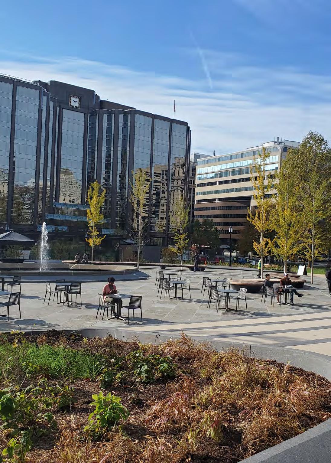
152
STAKEHOLDER SURVEY SUMMARY
13
STAKEHOLDER SURVEY PARTICIPANTS
STAKEHOLDER GROUPS
ENGAGEMENT OUTCOMES
The project team engaged stakeholders to discuss potential solutions for redesigning parks and spaces within the BID. Stakeholders discussed ways to better integrate parks into the community by addressing needs for increased access, play spaces, and social events. Interviews addressed the need for bold and visionary thinking to activate and leverage existing open spaces fully. Interviews also included the evaluation of existing and future partnerships that can potentially develop more-engaging offerings. Stakeholder-highlighted challenges to open park spaces during interviews included lack of maintenance (e.g., loose bricks in sidewalks, burned-out lights) and encampments.
There are overlapping needs for areas around parks related to transportation, dining, and tourism. A consistent theme highlighted by several stakeholders is the need to consider the relationship of park edges to the rest of the public realm. For example, sidewalks can include better incorporation of bus stops, retail, and restaurants with park spaces. This would help reinforce their connection to the community.
Feedback expressed that parks and open spaces within the BID do not provide a relaxing environment, and community members expressed a strong need for places of respite. Many felt existing spaces should be upgraded to be more flexible to meet various uses for community members. There is also consensus that the volume and frequency of programming should increase to activate the spaces and make them appealing to more park visitors.
PROCESS
The stakeholder survey used rank analysis to understand both the level of support participants had for each concept presented and how important the issue was for them. The average of support felt is presented in the radar diagram on the opposite page. The closer the blue line gets
to the center, the stronger the overall agreement was with the statement; the farther away, the stronger the disagreement. The questions that elicited the strongest agreement are shown in green. The level of importance for each topic is ranked on the opposite page.
Safety Universities Culture Groups Managers Agencies 8% 8% 15% 23% 23% 23% Public Safety Universities Museums & Culture Community Groups Commercial Property Managers Agencies Maintenance Safety Vending & Retail Recreation Relaxing Spaces Nature Public Art Catering to Tourists Playgrounds 33% 27% 19% 8% 8% 8% 8% 8% 8% 8% 8% 15% 23% 23% 23%
153 DowntownDC Parks Master Plan
LEVEL
OF
RANKING
Q23. Parks should be quiet & relaxing
Q28. Easy to learn about events Q27. BID brand needs to be stronger
Q4.
Q5. ADA accessibility
Q19. Public spaces need more art
Q15. Homeless services should be provided in parks
Q14. Parks should be more welcoming to tourists
Q10. More parks are needed near bus stops
Public Safety Universities Museums & Culture Community Groups Commercial Property Managers Agencies Maintenance Safety Vending & Retail Recreation Relaxing Spaces Nature Public Art Catering to Tourists Playgrounds 33% 27% 19% 8% 8% 8% 8% 8% 8% 8% 8% 15% 23% 23% 23% Strongly Agree Agree Strongly Disagree Disagree Q1. Maintenance is needed
The parks feel safe at night
Q9. More parks are needed near Metro stations
Q2 Q3 Q6 Q7 Q8 Q11 Q12 Q13 Q16 Q17 Q18 Q20 Q21 Q22 Q24 Q25 Q26
IMPORTANCE
of
The stakeholder survey offers a way to quantify the opinions and priorities shared qualitatively during the interview process. The graph at left shows the issue statements that ranked the highest among participants but does not indicate if they agreed or disagreed with the statement. Reference the diagram below to see the average strength of agreement or disagreement for statements. 154
Percentage
respondents
SURVEY ONE SUMMARY 01
633
PARTICIPANTS
SURVEY APPROACH
Prefer
On October 16, 2021, the survey officially launched at Franklin Park’s Rock the Park event. The survey was promoted through social media, newsletters, postcards, the Downtown Holiday Market, the DowntownDC BID website, and the project website. Survey Monkey was used to collect responses.
Prefer not to answer
DOWNTOWNDC POPULATION VS. SURVEY DATA
Tourists Other Area Residents Residents Workers
The BID’s population is 66% white, 17% Asian, 11% Black, 10% Hispanic, 3% 2 or more races, and 3% other; 49% female and 51% male; and at 35%, 25–34 year olds make up the largest age group.
RACE
CONNECTION TO BID 1% 2% 3% 2% 6% 8% 10% 53% 15% 1% 5% 40% 54% 2% 7% 22% 37% 31% Other Am. Indian Pacific Islander
or more races
GENDER
/ ETHNICITY
Two
not
Hispanic
Asian
Black
to answer
/ Latino Asian /
American
/ African American White Non-binary
Male Female
Sources: DowntownDC BID, LandDesign survey data 155 DowntownDC Parks Master Plan
51% 77% 31%
do not have children at home
DOWNTOWN DC POPULATION VS. SURVEY DATA
The average household size for Downtown is 1.5 people.
are dog owners SURVEY METHODOLOGY
The survey featured 22 questions that gathered demographic data, established participants’ connection to the study area,and conducted a needs assessment. The questions were designed to understand the current barriers to park usage, the most pressing needs for the park system to address, and programming preferences. There were 17 multiple-choice questions, two open-ended questions, three photobased selections, and one map-based question. The survey sample size refers to the number of completed responses, which can accurately reflect the target population for this survey. As the population of DowntownDC is just over 10,000, a sample size of 633 yields a confidence level of 95% with a margin of error of 3.8%. Thus, the survey results can confidently reflect the opinions of the entire population in a statistically valid way.
BID INCOME
71% of households make $75,000 or more, with an average annual income of $183,760 per household. The median income is $111,832 (2020).
AGE EMPLOYMENT Under 18 18 - 24 25 - 34 35 - 44 45 - 54 55 - 64 65+ Prefer not to answer 1% 9% 31% 23% 16% 12% 6% 2% I feel safe Feel unsafe physically Too dark at night Other No safe bike access I feel unwelcome Too isolated Feel unsafe emotionally 3% 7% 4% 14% 8% 21% 29% 14% Students 2% 5% 6% 8% 12% 15% 51% Local Government Not Employed Restaurant, Retail, or small business Other Federal Government Private Sector Under 18 18 - 24 25 - 34 35 - 44 45 - 54 55 - 64 65+ Prefer not to answer 1% 9% 31% 23% 16% 12% 6% 2% I feel safe Feel unsafe physically Too dark at night Other No safe bike access I feel unwelcome Too isolated Feel unsafe emotionally 3% 7% 4% 14% 8% 21% 29% 14% Students 2% 5% 6% 8% 12% 15% 51% Local Government Not Employed Restaurant, Retail, or small business Other Federal Government Private Sector
work in the private sector
156
WHEN DO YOU VISIT PARKS?*
USAGE
Weekday
Weekday
Weekday
I do not visit parks
I do not visit parks
WHAT DO YOU DO IN PARKS?*
Gaining an understanding of the times people use parks can yield meaningful results and provide insights into staffing, programming needs, and event scheduling.
PREFERRED USES
People most want to use parks as spaces to relax. Given the scale, design, and physical context of the park system within DowntownDC, the spaces need to be more conducive to relaxation. With such a strong need, park spaces need to be reimagined to reduce noise and create moments of retreat within the urban fabric.
IF YOU SELDOM USE THE PARKS, WHY?*
Nothing, I visit parks
Nothing, I visit parks
Safety concerns
Safety concerns
Lack of maintenance
Lack of maintenance
BARRIERS TO USE
Identifying the issues that keep people away from the park system is instrumental in developing programming, design, and policy driven strategies to make the parks welcoming and usable to all. While most people responded that they are undeterred in visiting parks, safety and maintenance concerns were listed as significant contributors to underuse.
*Percentage of responses where multiple selections could be made.
Weekend Afternoons Weekend Mornings Weekday Evenings Weekday Afternoons Weekend Evenings Weekday Mornings I do not visit parks Nothing, I visit parks Safety concerns Lack of maintenance Lack of amenities Other I do not have time Lack of social activities Noise Relax Eat or drink Walk or run Be in nature Events Meet friends Markets Play sports Other Other 70% 50% 37% 28% 25% 18% 15% 12% 12% 10% 42% 40% 38% 20% 28% 19% 16% 10% 10% 53% 47% 46% 41% 26% 2% Weekend Afternoons Weekend Mornings
Evenings
Weekday
Afternoons
Evenings
Weekend
Mornings
Other
of social activities Noise Relax Eat or drink Walk or run Be in nature Events Meet friends Markets Play sports Other Other 70% 50% 37% 28% 25% 18% 15% 12% 12% 10% 42% 40% 38% 20% 28% 19% 16% 10% 10% 53% 47% 46% 41% 26% 2% Weekend Afternoons Weekend Mornings
Evenings
Afternoons
Evenings
Lack of amenities
I do not have time Lack
Weekday
Weekday
Weekend
Mornings
Lack of amenities Other I do not have time
social activities Noise Relax Eat or drink Walk or run Be in nature Events Meet friends Markets Play sports Other Other 70% 50% 37% 28% 25% 18% 15% 12% 12% 10% 42% 40% 38% 20% 28% 19% 16% 10% 10% 53% 47% 46% 41% 26% 2%
Lack of
157 DowntownDC Parks Master Plan
Sources: DowntownDC BID, LandDesign survey data
SAFETY
Feel unsafe physically
Feel unsafe physically
SAFETY
Too isolated
Too isolated
Understanding how comfortable people feel in parks can help untangle barriers to use. While most people responded that they feel safe, a large proportion did share concerns about physical safety and that the parks are too dark at night. The design of individual spaces can address these concerns by considering the layout, context, occupancy, lighting, and staffing.
Feel unsafe emotionally
Feel
Too isolated
WHAT WOULD YOU LIKE THE BID PARKS TO HAVE?*
ADDRESSING NEEDS
Establishing desires for the parks within DowntownDC can help guide design and programming decisions. Based on survey results, clean, well-maintained parks are the highest priority for park users.
HOW DO YOU GET TO THE PARK?
ACCESS
How people get to parks can shape streetscape design and park amenities. Considering so many people walk to parks, walkability needs to be a priority for streetscape design. Developing public space that incorporates public and active transportation can help the space feel more comfortable and increase occupancy and activity.
CONCERNS?
*Percent of responses where multiple selections could be made.
I feel safe
Too dark at night
Other No safe bike access
I feel unwelcome
Benches, seating, & shade Landscaping Public restrooms Free events Vending Public art / Monuments Free WiFi / Public services Other Playground Scooter 43% 65% 45% 41% 38% 29% 26% 13% 12% 9% 7% 1% 2% 4% 4% 8% 8% 8% 63% 19% 21% 7% 3% 3% 2% 2% Other Don’t go to parks Bus Bike Car Metro Walk
Clean, well-maintained parks
I feel safe
Too dark at night
Other No safe bike access
I feel unwelcome
Benches, seating, & shade Landscaping Public restrooms Free events Vending Public art / Monuments Free WiFi / Public services Other Playground Scooter 43% 65% 45% 41% 38% 29% 26% 13% 12% 9% 7% 1% 2% 4% 4% 8% 8% 8% 63% 19% 21% 7% 3% 3% 2% 2% Other Don’t go to parks Bus Bike Car Metro Walk
unsafe emotionally Clean, well-maintained parks
I feel safe
Feel unsafe physically Too dark at night Other No safe bike access I feel unwelcome
Benches, seating, & shade Landscaping Public restrooms Free events Vending Public art / Monuments Free WiFi / Public services Other Playground Scooter 43% 65% 45% 41% 38% 29% 26% 13% 12% 9% 7% 1% 2% 4% 4% 8% 8% 8% 63% 19% 21% 7% 3% 3% 2% 2% Other Don’t go to parks Bus Bike Car Metro Walk
Feel unsafe emotionally Clean, well-maintained parks
48%
will walk 0–10 minutes to parks visit parks weekly will walk up to 20 minutes visit monthly 158
39% 51% 28%
PREFERRED EXPERIENCE
BID PARKS
In survey data, stakeholder interviews, and the Franklin Park Open House event, engagement participants cited the renovated Franklin Park as their favorite space in DowntownDC, indicating the strong support behind the partnership, redesign, and programming done there.
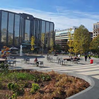
TYPOLOGY PREFERENCES
Respondents were asked to choose their favorite experience from a selection of park types that showed different design and programming patterns. Participants opted for a secluded, enclosed park experience that emphasizes nature. The top selection was for nature pocket park (26%), followed by an enclosed pocket park retreat (23%). Both options offers similar experiences of seclusion from noise and stimuli. This tracks with response data that indicates a strong desire for more relaxing park experiences.
FAVORITE STREETSCAPE
STREETSCAPE DESIGN
The survey showed six distinct styles of streetscape activations that could reclaim all or partial roadway for pedestrian use. In all, 41% of respondents selected pedestrian-only street experience for DowntownDC. The second most popular option, at 18%, was for sidewalk cafes integrated into the streetscape.

Nature Pocket Park
Pedestrian-Only Street
Franklin Park
FAVORITE BID PARK
Sources: DowntownDC BID, LandDesign survey data 159 DowntownDC Parks Master Plan
ADDING TO THE NETWORK
On the map below, survey respondents indicated where more open space assets were needed. The largest cluster of dots covers Penn Quarter, extending up to the Smithsonian American Art Museum/National Portrait Gallery and Metro Center station.

SURVEY TAKEAWAYS
The sentiments of those surveyed indicated a strong desire to improve maintenance, increase the comfort and intimacy of park spaces, and increase the level of activation throughout the park system.
USER PRIORITY AREAS
The survey asked users to indicate on the map where more open space is needed.160
161 DowntownDC Parks Master Plan
957
ETHNICITY
CONNECTION TO THE BID
Hispanic
RELAXING
Pedestrian
Two or more races
Two or more races
Prefer not to answer
/ Latino Asian / Asian American Black / African American White
Hispanic / Latino Asian / Asian American Black / African American White
Tourists Other Area
Residents Residents Workers
Residents Residents
The second community survey had 957 responses and was distributed through a variety of channels across the BID in February 2022. There were 17 questions in the survey, as compared to 22 in the first survey. This survey collected similar demographic data and established participants’ connections to DowntownDC, as in the first survey, but also focused more on physical interventions in green spaces and community preferences toward the feeling parks evoke in visitors. It asked questions about which aspects of parks and streetscapes make visitors feel relaxed. The survey also highlighted the community’s desire for spaces with amenities and that encourage social interaction.
RELAXING
The same sets of questions were asked about preferences for both streetscapes and parks. When asked about relaxing park experiences, participants valued a sense of solitude as well as lush surroundings and lots of shade. Compared with the same question in streetscape settings, participants overwhelmingly valued pedestrian prioritization. They also valued dining and commercial settings that can spill out onto the street and wider sidewalks.
Pedestrian prioritization Spill-out dining & commercial Wider sidewalks Buffered vehicular movement & noise Moveable furniture Differentiating materials Overhead canopies None of the above 1% 10% 2% 12% 25% 35% 45% 76% 1% 1% 4% 2% 4% 5% 11% 72% 2% 7% 22% 37% 31% Other Pacific Islander
Survey 2 Results
Am. Indian
Tourists Other Area
Workers
Hispanic
Residents Residents
prioritization Spill-out dining & commercial Wider sidewalks Buffered vehicular movement & noise Moveable furniture Differentiating materials Overhead canopies None of the above 1% 10% 2% 12% 25% 35% 45% 76% 1% 1% 4% 2% 4% 5% 11% 72% 2% 7% 22% 37% 31% Other Pacific
Survey 2 Results
Islander Am. Indian
Tourists Other Area
Workers
prioritization Spill-out dining & commercial Wider sidewalks Buffered vehicular movement & noise Moveable furniture Differentiating materials Overhead canopies None of the above 1% 10% 2% 12% 25% 35% 45% 76% 1% 1% 4% 2% 4% 5% 11% 72% 2% 7% 22% 37% 31% Other Pacific Islander Am.
Prefer not to answer Survey 2 Results
Pedestrian
Indian
Two or more races
Prefer not to answer
/ Latino Asian / Asian American Black / African American White
Sources: DowntownDC BID, LandDesign survey data
PARTICIPANTS
EXPERIENCE
RACE /
SURVEY APPROACH
SURVEY TWO SUMMARY 02
live in DowntownDC
25% 46% 29% are between ages 25 and 34 are between ages 35 and 44
SOCIAL
The next set of questions highlights participants opinions regarding social settings in parks and streetscapes. For 54% of participants, the image of outdoor dining best represented a social park experience. For 49%, a social park experience is also represented by the opportunity to meet with friends. Similarly, a social streetscape experience is best represented by images of markets, festivals, and dining opportunities.
AMENITIES
The final questions for this survey focused on the amenities that participants consider most in parks and streetscapes. For parks, the image that best represented an amenitized experience was restrooms, various seating options, and play spaces. The amenities that participants valued most were dining areas, shade structures, inviting seating, and bike facilities.
SURVEY TAKEAWAYS
The second round of surveying focused on what participants value most when considering parks’ and streetscapes’ abilities to feel relaxing, be a social setting, and contain amenities. The most valued aspects of streetscape were frequently connected to dining on the street, and markets or other vending opportunities. For parks, the values were more focused on creating a sense of peace, but also fulfilling community needs such as dining opportunities, places to socialize or host events, and expanding facilities such as restrooms or spaces for play.
This survey also asked participants to identify parks and corridors that they consider to be highest priority for improvements. The top five parks identified were: McPherson Square, Mount Vernon Square, Freedom Plaza, Chinatown Park, and Judiciary Square. The top five corridors identified were Pennsylvania Avenue, K Street NW, F Street NW, 7th Street NW, and Vermont Avenue NW.
TOP PARK
PRIORITIES
AMENITIZED STREETSCAPES
AND CORRIDOR
Dining areas Shade structures Inviting seating Bike facilities Public art Mobility options Play elements None of the above Pennsylvania Avenue K Street NW McPherson Square Mount Vernon Square 1% 18% 10% 29% 36% 37% 42% 44% 1 2
Dining areas Shade structures Inviting seating Bike facilities Public art Mobility options Play elements None of the above Pennsylvania Avenue K Street NW F Street NW 7th Street NW Vermont Avenue McPherson Square Mount Vernon Square Freedom Plaza Chinatown Park Judiciary Square 1% 18% 10% 29% 36% 37% 42% 44%
162
Survey 2 Results
1 2 3 4 5
SURVEY THREE SUMMARY 03
TOP OVERALL ACTIVITY PRIORITIES
1 2 3 4 5
TOP 5 AMENITY PRIORITIES
SURVEY APPROACH
The third and final community survey was opened to responses in March 2022. It had 73 participants, a significant drop from the previous two surveys. Similar questions were asked as in previous surveys, which collected demographic data and established community preferences. The third survey was focused on identifying goals and desires for specific parks of interest identified in previous surveys and community meetings: McPherson Square, Mount Vernon Square, Freedom Plaza, Chinatown Park, and John Marshall Park.
MCPHERSON SQUARE
The top three activities that participants would most like to participate in at McPherson Square are to attend markets or festivals, eat and drink outside, and experience live music or performances. The top three amenities that participants desired were lush plantings, water features, and restrooms.
FREEDOM PLAZA
The activities selected most frequently by those surveyed who would most like to participate in at Freedom Plaza were attending markets or festivals, experience live music or performances, and eating or drinking outside. These choices are similar to those noted at McPherson Square. The amenities most desired by participants for this park were lush plantings, public art, and restrooms.
Sources: DowntownDC BID, LandDesign survey data
PARTICIPANTS 73
AMENITY PRIORITIES
TOP 5
Survey 3 Results McPherson Square Freedom Plaza Mount Vernon Square Lush plantings Water features Restrooms Public art Open/flexible seating 29% 31% 35% 36% 44% Lush plantings Public art Restrooms Food/beverage vending Open/flexible seating 31% 35% 38% 38% 38% Lush plantings Public art 44% 46% Survey 3 Results McPherson Square Freedom Plaza Mount Vernon Square Lush plantings Water features Restrooms Public art Open/flexible seating 29% 31% 35% 36% 44% Lush plantings Public art Restrooms Food/beverage vending Open/flexible seating 35% 38% 38% 38% Lush plantings Public art 44% 46% Attend markets and festivals Experience live music or performances Eat and drink outside Relax and people watch Enjoy nature
163 DowntownDC Parks Master Plan
23% 19% 21% are between ages 25 and 34 are between ages 35 and 44
live in downtown D.C.
MOUNT VERNON SQUARE
The top three choices selected as activities that participants would like to do in Mount Vernon Square were eating and drinking outside, experiencing live music or performances, and relaxing. The park amenities selected most frequently by participants included lush plantings, public art, and open/flexible space.
CHINATOWN PARK
Similar to the other selections for parks, participants would like to attend markets or festivals, eat and drink outside, and relax at Chinatown Park. Participants would like to see the top three amenities at the park, including lush plantings, open spaces, and public art.
JOHN MARSHALL PARK
The top activities that survey participants would most like to do in John Marshall Park are attend markets and festivals, experience live music and performances, and eat or drink outside. The amenities most often selected by participants in this survey were lush plantings, public art, and restrooms.
SURVEY TAKEAWAYS
For all five parks, respondents’ top three desired activities included experiencing live music and performances. Most parks also had markets and festivals as a commonly selected use. Based on the survey results, parks in DowntownDC can improve their programming by increasing markets, festivals, and performances.
TOP 5 AMENITY PRIORITIES
TOP 5 AMENITY PRIORITIES
TOP 5 AMENITY PRIORITIES
Lush plantings Public art Restrooms Food/beverage vending Open/flexible seating 31% 35% 38% 38% 38% Lush plantings Public art Open/flexible space Restrooms Water feature 27% 32% 44% 32% 46% 49% Lush plantings Open/flexible space Public art Restrooms Water feature 29% 39% 40% 40% Lush plantings Public art Restrooms Food/beverage vending Open/flexible seating 31% 35% 38% 38% 38% Lush plantings Public art Open/flexible space Restrooms Water feature 27% 32% 44% 32% 46% 49% Lush plantings Open/flexible space Public art Restrooms Water feature 29% 39% 40% 40% Survey 3 Results Lush plantings Public art Restrooms Water feature Open/flexible seating 31% 33% 34% 42% 43% 164
SURVEY ONE RESULTS 01
FEEDBACK TAKEAWAYS
Survey 2
RELAXING
PARKS: lush landscape, shade, & solitude over seating types
STREETSCAPE: pedestrian prioritization & activation
Approach Phase March
SOCIAL PARKS & STREETSCAPES: organized activities & events over individualized opportunities
AMENITIES
PARKS: restrooms & flexible living over play or dogs
STREETSCAPES: shade, beautification, & activation over mobility facilities
COMMUNITY PRIORITY
Survey 2
PRIORITY SPACES community survey data & stakeholder interviews helped identify the top 5 parks selected for redesign
Approach Phase March
MCPHERSON SQ
MT VERNON SQ
FREEDOM PLAZA
CHINATOWN PARK
JUDICIARY SQ
JOHN MARSHALL PARK RES. 173 BURKE PARK
OF THESE IDENTIFIED PARK LOCATIONS, WHICH ONE IS THE HIGHEST PRIORITY FOR IMPROVEMENTS FOR YOU?
MCPHERSON

SQUARE BURKE PARK RESERVATION 173
VERNON SQUARE CHINATOWN PARK FREEDOM PLAZA JUDICIARY SQUARE AREA JOHN MARSHALL PARK
MOUNT
SELECT YOUR NUMBER ONE CHOICE: EXERCISE: A B D H F E C G A B C D E F H G PENNAVE F ST G ST E ST H ST NEWYORKAVE I ST K ST L ST M ST MASSACHUSETTSAVE 15 TH ST 14 TH ST 13 TH ST 12 TH ST 11 TH ST 10 ST 9 ST 8 TH ST 7 ST 6 TH ST 5 ST 4 TH ST 3 RD ST 2 ND ST D ST C ST CONSTITUTION AVE NEW JERSEY AVE INDIANAAVE VERMONT AVE Freedom Plaza McPherson Sq Mt Vernon Sq Chinatown Park John Marshall Park Res. 173 Judiciary Sq Burke Park 165 DowntownDC Parks Master Plan
EXERCISE: OF THESE IDENTIFIED STREETSCAPES, WHICH ONE IS THE HIGHEST

VERMONT AVE 15TH STREET K STREET 13TH STREET 10TH STREET F STREET SELECT YOUR NUMBER ONE CHOICE:
IMPROVEMENTS
8TH ST 7TH STREET INDIANA AVE PENN AVE A B C D E F H G I C D F G J E EXISTING PARKS STREETSCAPES pedestrian enhancement connectivity J PENNAVE F ST G ST E ST H ST NEWYORKAVE I ST K ST L ST M ST MASSACHUSETTSAVE 16 TH ST 15 TH ST 14 TH ST 13 TH ST 12 TH ST 11 TH ST 10 ST ST 8 TH ST 7 ST 6 TH ST 5 ST 4 TH ST 3 RD ST 2 ND ST D ST C ST NEW JERSEY AVE INDIANAAVE G I B H Penn Ave K Street F Street 7th Street Vermont Ave 15th Street 13th Street 8th Street Indiana Ave 10th Street CONSTITUTION AVE A DESIGN ELEMENTS Survey 3 (Top 4 Community Selections) JOHN MARSHALL PARK MCPHERSON SQUARE CHINATOWN PARK RESERVATION 73 MT. VERNON SQUARE 71 70 175 FREEDOM PLAZA ACTIVITIES AMENITIES Markets / festivals Eat / drink Live music Lush planting Water feature Restrooms Eat / drink Live music Relax Lush planting Public art Flexible space Markets / festivals Live music Eat / drink Public art Lush planting Restrooms Markets / festivals Eat / drink Live music Lush planting Flexible space Public art Markets / festivals Live music Eat / drink Lush planting Public art Restrooms Scan to participate! Relax Public art Enjoy nature Restrooms People watch Vending People Watch Restrooms Relax Flexible space Recommendations Phase May 166
PRIORITY FOR
FOR YOU?
SURVEY TWO RESULTS 02
DowntownDC Parks Master Plan: Interventions Survey 2 / 18 0 32% 3 5 57% 52 25 29% 236 49 84% 465 64 84% 605 Q2 What is your connection to DowntownDC? Ans we ed 933 Sk ipped 24 Tota Res pondents 933 0% 10% 20% 30% 40% 50% 60% 70% 80% 90% 00% am a our ist fr om ou o Other p ease speci y) l e do nto n I w or k dow ntow n I am a D str ct ar e ANSWER CHO CES RESPONSES am a tou s t rom out o own O her (p eas e s pec i y ) v e down own work down own am a D s t c t area res dent DowntownDC Parks Master Plan: Interventions Survey 5 / 18 0 00% 0 3 77% 36 45 92% 439 28 97% 277 8 89% 85 3 97% 38 1 99% 19 6 49% 62 Q5 What is your age? Ans wered 956 Sk pped: 1 TOTAL 956 0% 10% 20% 30% 40% 50% 60% 70% 80% 90% 100% U de 18 18-24 25-34 35-44 45-54 55-64 65+ Pr e er not to answ er ANSWER CHO CES RESPONSES Under 18 18-24 25-34 35-44 45-54 55-64 65+ P e er not o ans we DowntownDC Parks Master Plan: Interventions Survey 7 / 18 72 34% 688 2 31% 22 4 42% 42 4 31% 41 0 00% 0 0 32% 3 4 52% 43 11 36% 108 0 42% 4 Q7 What is your race / ethnicity? Ans wered: 951 Sk pped: 6 TOTAL 951 0% 10% 20% 30% 40% 50% 60% 70% 80% 90% 00% Wh te or Caucasian B ack o Afr can Hispa c o Lat o As an or As an Amer can Amer ican nd an or Native Haw ai an or Tw o o mor e r aces Pr e er not to answ er Other p ease speci y) ANSWER CHO CES RESPONSES Whi e o Cauc as an Blac k o Afr c an Amer c an His pan c or Lat no As an o As an Americ an Ame c an nd an or A as k a Na iv e Nat v e Hawa ian or o her Pac c Is ander Two or more rac es Pre er not to ans wer O her (p eas e s pec fy ) DowntownDC Parks Master Plan: Interventions Survey 8 / 18 52 10% 496 39 08% 372 8 30% 79 0 53% 5 Q8 What is your gender identity? Ans wered 952 Sk pped: 5 TOTAL 952 0% 10% 20% 30% 40% 50% 60% 70% 80% 90% 100% Femal e Mal e Pr e er not to answ er Other pl ease spec y) ANSWER CHO CES RESPONSES Fema e Ma e P e er not o ans we O her (p eas e s pec i y ) 167 DowntownDC Parks Master Plan
Q10 Which of the following pictures best represents a relaxing park experience
DowntownDC Parks Master Plan: Interventions Survey 10 / 18 49 63% 474 43 77% 418 35 92% 343 34 76% 332 28 27% 270 8 90% 85 8 80% 84 0 52% 5
to you?
up to 2) Ans wered: 955 Sk pped: 2 Tota Res pondents 955 0% 10% 20% 30% 40% 50% 60% 70% 80% 90% 00% Sol tude Lush Landscape Shade Natur al zed Landscape Comfo ab e Seating Water Featu es nt mate Seat ng A eas None of the above ANSWER CHO CES RESPONSES So i ude Lus h Lands c ape Shade Natu a iz ed Lands c ape Com or ab e Sea ng Water Fea ures nt mate Sea ng Areas None of he abov e DowntownDC Parks Master Plan: Interventions Survey 11 / 18 76 10% 726 44 86% 428 34 49% 329 24 95% 238 12 37% 118 9 54% 91 6 18% 59 0 52% 5
Which of the following pictures best represents a relaxing streetscape experience to you? (Pick up to 2) Ans wered 954 Sk pped: 3 To a Res pondents 954 0% 10% 20% 30% 40% 50% 60% 70% 80% 90% 100% Pedestr ian P o t zat on Sp l -out D n ng & W der S dew a ks Buffer ed Vehicu ar Moveabl e Fur n tur e D ffer entiat ng Mater a s Over head Canopies None of the above ANSWER CHO CES RESPONSES Pedes an Pr or iz at on Spi -out D n ng & Commerc a W de S dewa k s Buf ered Veh c u ar Mov emen & No s e Mov eable Furn ure Di ferent a ing Mate a s Ov e head Canop es None of he abov e DowntownDC Parks Master Plan: Interventions Survey 12 / 18 54 13% 518 49 11% 470 43 05% 412 26 96% 258 21 63% 207 9 30% 89 7 63% 73 0 52% 5 Q12 Which of the following pictures best represents a social park experience to you? (Pick up to 2) Ans wered: 957 Sk pped: 0 Tota Res pondents 957 0% 10% 20% 30% 40% 50% 60% 70% 80% 90% 00% Ou door D n ng Pl aces to Meet Fr ends E t A one Together Spontaneous nte actions G oup C asses Ou door Games None of the above ANSWER CHO CES RESPONSES Ou door D n ng Plac es o Mee Fr ends Ev en s Alone Together Spon aneous In erac t ons Group C as s es Ou doo Games None of he abov e DowntownDC Parks Master Plan: Interventions Survey 13 / 18 71 79% 687 42 95% 411 32 18% 308 27 69% 265 21 42% 205 8 05% 77 6 27% 60 1 15% 11 Q13 Which of the following pictures best represents a social streetscape experience to you? (Pick up to 2) Ans wered 957 Sk pped: 0 To a Res pondents 957 0% 10% 20% 30% 40% 50% 60% 70% 80% 90% 100% Mar ke s / Fest val s Dining Oppor tun t es Gr oup Seat ng Ar eas F exibl e Seat ng Scu p ur a E ements Outdoo Ga es n er act ve Exhibi s None of the above ANSWER CHO CES RESPONSES Mark ets Fes iv a s D n ng Oppo tun ies Group Sea ng Areas F ex b e Seat ng Sc u ptu a E emen s Ou door Games nterac t v e Ex hib s None of he abov e 168
(Pick
Q11
Q14 Which of the following pictures best represents an amenitized park experience to you? (Pick up to 2)
Q15 Which of the following pictures best represents an amenitized streetscape experience to you? (Pick up
Q16 Using the map above, indicate which of these identified park locations is the highest priority for improvements for you See the map for reference
Q17 Using the map above for reference, tell us which street segment you d like to see a streetscape intervention that could add a park-like experience to the public realm
DowntownDC Parks Master Plan: Interventions Survey 14 / 18 70 86% 676 49 48% 472 25 47% 243 22 33% 213 18 34% 175 12 05% 115 10 06% 96 0 84% 8
Ans wered: 954 Sk pped: 3 Tota Res pondents 954 0% 10% 20% 30% 40% 50% 60% 70% 80% 90% 00% Restr ooms Var ious seat ng options P ay spaces Publ c w or k stations Dog par k nter act on w th h s or y F tness oppo un ties None of the above ANSWER CHO CES RESPONSES Res t ooms Various s eat ng opt ons Play s pac es Pub c work s ta ions Dog park nte ac on w h h s ory F tnes s oppor un t es None of he abov e DowntownDC Parks Master Plan: Interventions Survey 15 / 18 43 71% 417 42 03% 401 36 69% 350 35 85% 342 28 83% 275 17 82% 170 10 48% 100 0 84% 8
to
Ans wered 954 Sk pped: 3 To a Res pondents 954 0% 10% 20% 30% 40% 50% 60% 70% 80% 90% 100% Dining a eas Shade str uc ur es I t g t g Bike ac l t es Pub ic a t Mob i y opt ons P ay e ements None of the above ANSWER CHO CES RESPONSES D n ng areas Shade s truc tu es nv t ng s ea ng B k e ac es Pub ic ar Mob i y opt ons Play e emen s None of he abov e DowntownDC Parks Master Plan: Interventions Survey 16 / 18 34 75% 327 19 45% 183 14 98% 141 8 40% 79 6 27% 59 5 10% 48 4 78% 45 3 51% 33 2 76% 26
2)
Ans we ed 941 Sk ipped 16 TOTAL 941 0% 10% 20% 30% 40% 50% 60% 70% 80% 90% 00% A McPher son Squar e D Mt Ver non Squar e F F eedom Pl aza E Ch natow n Par k G Jud c ar y Squar e H John Ma shal Par k C Reser va on 173 (at he B Bu ke Par k Other p ease speci y ANSWER CHO CES RESPONSES A Mc Phers on Square D Mt Vernon Square F Freedom P az a E Ch na own Park G J ud c a y Square H J ohn Mars ha Pa k C Res e v at on 173 (a he n ers ec on o New Yo k Av e & S ree ) B Burk e Park O her (p eas e s pec fy ) DowntownDC Parks Master Plan: Interventions
17 / 18
Survey
Ans wered: 943 Sk ipped 14 0% 10% 20% 30% 40% 50% 60% 70% 80% 90% 100% J Pennsy vania C K S eet F F Str eet H 7th Str eet A Ver mont Avenue B 15th Str eet D 13th Str eet G 8 h S eet Other pl ease spec y) I nd ana Avenue E 10 h S eet 169 DowntownDC Parks Master Plan
DowntownDC Parks Master Plan: Interventions Survey 18 / 18 28 00% 264 23 12% 218 14 32% 135 9 97% 94 6 26% 59 5 30% 50 5 30% 50 4 14% 39 1 70% 16 1 38% 13 0 53% 5 TOTAL 943 ANSWER CHO CES RESPONSES J Penns y v an a Av enue C K Street F F Street H 7th St ee A Ve mont Av enue B 15th S ee D 13th S ee G 8 h Street O her (p eas e s pec fy ) Ind ana Av enue E 10th S ree 170
SURVEY THREE RESULTS 03
Re- magin ng Parks and Open Space n DowntownDC 2 / 32 23 29% 17 27 40% 20 43 84% 32 2 74% 2 2 74% 2 Q2 What is your connection to DowntownDC? Ans we ed 73 Sk ipped 0 TOTAL 73 0% 10% 20% 30% 40% 50% 60% 70% 80% 90% 00% l ve dow ntow n I w or k dow ntow n I am a D st ct ar e am a our ist fr om ou o Other p ease speci y) ANSWER CHO CES RESPONSES v e down own wo k down own am a D s t ic t area res dent am a tou s t rom out o own O her (p eas e s pec y ) Re- magin ng Parks and Open Space n DowntownDC 5 / 32 1 37% 1 5 48% 4 19 18% 14 20 55% 15 13 70% 10 13 70% 10 17 81% 13 8 22% 6 Q5 What is your age? Ans we ed 73 Sk ipped 0 TOTAL 73 0% 10% 20% 30% 40% 50% 60% 70% 80% 90% 100% U de 18 18-24 25-34 35-44 45-54 55-64 65+ Pr e er not to answ er ANSWER CHO CES RESPONSES Under 18 18-24 25-34 35-44 45-54 55-64 65+ P e er not o ans we Re- magin ng Parks and Open Space n DowntownDC 7 / 32 72 60% 53 10 96% 8 1 37% 1 0 00% 0 0 00% 0 0 00% 0 5 48% 4 9 59% 7 0 00% 0 Q7 What is your race / ethnicity? Ans we ed 73 Sk ipped 0 TOTAL 73 0% 10% 20% 30% 40% 50% 60% 70% 80% 90% 00% Wh te or Caucasian B ack o Afr can Hispa c o Lat o As an or As an Amer can Amer ican nd an or Native Haw ai an or Tw o o mor e r aces Pr e er not to answ er Other p ease speci y) ANSWER CHO CES RESPONSES Whi e o Cauc as an Blac k o Afr c an Amer c an His pan c or Lat no As an o As an Americ an Ame c an nd an or A as k a Na iv e Nat v e Hawa ian or o her Pac c Is ander Two or more rac es Pre er not to ans wer O her (p eas e s pec fy ) Re- magin ng Parks and Open Space n DowntownDC 8 / 32 42 47% 31 50 68% 37 5 48% 4 1 37% 1 Q8 What is your gender identity? Ans we ed 73 Sk ipped 0 TOTAL 73 0% 10% 20% 30% 40% 50% 60% 70% 80% 90% 100% Femal e Mal e Pr e er not to answ er Other pl ease spec y) ANSWER CHO CES RESPONSES Fema e Ma e P e er not o ans we O her (p eas e s pec i y ) 171 DowntownDC Parks Master Plan
Re- magin ng Parks and Open Space n DowntownDC 10 / 32 Q10 Pick the top 3 activities you would most like to be able to participate in at McPherson Square? Ans we ed 72 Sk ipped 1 0% 10% 20% 30% 40% 50% 60% 70% 80% 90% 00% Attend mar kets / festiva s Eat / dr nk o s de Exper ence ve mus c o Re ax Outdoo fitness / Peop e w atch Read a book Vis t w th r iends / Picn c Pl ay outdoor games Lear n about histor y Other p ease speci y Wal k a dog Re- magin ng Parks and Open Space n DowntownDC 11 / 32 52 78% 38 47 22% 34 37 50% 27 33 33% 24 30 56% 22 23 61% 17 19 44% 14 15 28% 11 13 89% 10 11 11% 8 8 33% 6 6 94% 5 4 17% 3 Tota Res pondents 72 ANSWER CHO CES RESPONSES At end mark ets / es v a s Eat / d nk outs de Ex per enc e v e mus c or per ormanc es Re ax Ou doo nes s / we lnes s c las s es Peop e wa c h Read a book V s i wi h r ends / fami y P c n c P ay outdoo games Learn abou h s ory O her (p eas e s pec fy ) Wa k a dog Re- magin ng Parks and Open Space n DowntownDC 12 / 32 Q11 Pick the top 3 amenities you would most like to have in McPherson Square? Ans we ed 72 Sk ipped 1 0% 10% 20% 30% 40% 50% 60% 70% 80% 90% 00% Lush p ant ngs Water feat r e Restr ooms P b c ar Open / flex bl e space Food / bever age Qu et n mate spaces Movab e fur n tu e Outdoor w or kstations Outdoor fitness Other p ease speci y Designated dog ar ea Re- magin ng Parks and Open Space n DowntownDC 13 / 32 44 44% 32 36 11% 26 34 72% 25 30 56% 22 29 17% 21 27 78% 20 23 61% 17 18 06% 13 16 67% 12 13 89% 10 9 72% 7 8 33% 6 Tota Res pondents 72 ANSWER CHO CES RESPONSES Lus h p ant ngs Water feature Res t ooms Pub c art Open f ex b e s pac e Food / bev e age v end ng Qu e n mate s pac es Mov able fu n tu e Ou doo work s at ons Ou doo nes s equ pmen O her (p eas e s pec fy ) Des gna ed dog a ea 172
Re- magin ng Parks and Open Space n DowntownDC 14 / 32 Q12 Pick the top 3 activities you would most like to participate in at Freedom Plaza? Ans we ed 73 Sk ipped 0 0% 10% 20% 30% 40% 50% 60% 70% 80% 90% 00% Attend mar kets / festiva s E per ence e m s c o Eat / dr nk ou s de Peop e w atch Lear n about histor y Outdoo fitness / En oy na ur e Re ax Vis t w th r iends / Pl ay outdoor games Skateboar d Picn c Other p ease speci y Re- magin ng Parks and Open Space n DowntownDC 15 / 32 61 64% 45 49 32% 36 41 10% 30 26 03% 19 17 81% 13 16 44% 12 16 44% 12 15 07% 11 12 33% 9 9 59% 7 8 22% 6 4 11% 3 4 11% 3 Tota Res pondents 73 ANSWER CHO CES RESPONSES Attend mark ets / es v a s Ex per enc e v e mus c or per ormanc es Eat / d nk outs de Peop e wa c h Learn abou h s ory Ou doo nes s / we nes s c las s es En oy nature Re ax V s i wi h r ends / fami y P ay outdoo games Sk a eboard P c n c O her (p eas e s pec fy ) Re- magin ng Parks and Open Space n DowntownDC 16 / 32 Q13 Pick the top 3 amenities you would most like to have in Freedom Plaza? Ans we ed 71 Sk ipped 2 0% 10% 20% 30% 40% 50% 60% 70% 80% 90% 00% Lush p ant ngs P b c ar Restr ooms Food / bever age Open / flex bl e space Water featur e Movab e fur n tu e P ay space Qu et in mate spaces Outdoor w or kstations Outdoor fitness Other p ease speci y Re- magin ng Parks and Open Space n DowntownDC 17 / 32 38 03% 27 38 03% 27 38 03% 27 35 21% 25 30 99% 22 30 99% 22 18 31% 13 16 90% 12 14 08% 10 11 27% 8 7 04% 5 5 63% 4 Tota Res pondents 71 ANSWER CHO CES RESPONSES Lus h p ant ngs Pub c art Res t ooms Food / bev e age v end ng Open f ex b e s pac e Water feature Mov able fu n ture P ay s pac e Qu e n ma e s pac es Ou doo work s at ons Ou doo nes s equ pmen O her (p eas e s pec fy ) 173 DowntownDC Parks Master Plan
Re- magin ng Parks and Open Space n DowntownDC 18 / 32 Q14 Pick the top 3 activities you would most like to participate in at Mt Vernon Square? Ans we ed 71 Sk ipped 2 0% 10% 20% 30% 40% 50% 60% 70% 80% 90% 00% Eat / dr nk ou s de E per ence e m s c o Re ax En oy na ur e Picn c Outdoo fitness / Vis t th ie ds / Lear n about histor y Pl ay outdoor games Read a book Wal k a dog Other p ease speci y Skateboar d Re- magin ng Parks and Open Space n DowntownDC 19 / 32 45 07% 32 43 66% 31 40 85% 29 32 39% 23 25 35% 18 19 72% 14 18 31% 13 18 31% 13 12 68% 9 11 27% 8 7 04% 5 5 63% 4 2 82% 2 Tota Res pondents 71 ANSWER CHO CES RESPONSES Eat / d nk outs de Ex per enc e v e mus c or per ormanc es Re ax En oy nature Pic n c Ou doo nes s / we lnes s c las s es V s i wi h r ends / fami y Learn abou h s ory P ay outdoo games Read a book Wa k a dog O her (p eas e s pec fy ) Sk a eboard Re- magin ng Parks and Open Space n DowntownDC 20 / 32 Q15 Pick the top 3 amenities you would most like to have in Mt Vernon Square? Ans we ed 71 Sk ipped 2 0% 10% 20% 30% 40% 50% 60% 70% 80% 90% 00% Lush p ant ngs P b c ar Open / flex bl e space Restr ooms Water featur e Movab e fur n tu e Food / bever age Outdoor w or kstations Qu et in mate spaces P ay space Designated dog ar ea Other p ease speci y Re- magin ng Parks and Open Space n DowntownDC 21 / 32 46 48% 33 43 66% 31 32 39% 23 32 39% 23 26 76% 19 25 35% 18 22 54% 16 19 72% 14 16 90% 12 7 04% 5 4 23% 3 2 82% 2 Tota Res pondents 71 ANSWER CHO CES RESPONSES Lus h p ant ngs Pub c art Open f ex b e s pac e Res t ooms Water feature Mov ab e fu n ture Food / bev e age v end ng Ou doo work s at ons Qu e n mate s pac es P ay s pac e Des gna ed dog a ea O her (p eas e s pec fy ) 174
Re- magin ng Parks and Open Space n DowntownDC 22 / 32 Q16 Pick the top 3 activities you would most like to participate in at Chinatown Park? Ans we ed 70 Sk ipped 3 0% 10% 20% 30% 40% 50% 60% 70% 80% 90% 00% Attend mar kets / festiva s Eat / dr nk o s de Re ax Peop e w atch Exper ence ve mus c o Vis t w th r ends / Lea about histo y Outdoo fitness / Pl ay outdoor games Picn c Wal k a dog Read a book Other p ease speci y Re- magin ng Parks and Open Space n DowntownDC 23 / 32 51 43% 36 41 43% 29 30 00% 21 28 57% 20 27 14% 19 20 00% 14 17 14% 12 15 71% 11 15 71% 11 15 71% 11 14 29% 10 7 14% 5 4 29% 3 Tota Res pondents 70 ANSWER CHO CES RESPONSES At end mark ets / es v als Eat / d nk outs de Re ax Peop e watc h Ex perienc e v e mus c or per ormanc es Vis i wi h r ends / fami y Learn abou h s ory Ou doo nes s / we nes s c as s es P ay outdoo games P c n c Wa k a dog Read a book O her (p eas e s pec fy ) Re- magin ng Parks and Open Space n DowntownDC 24 / 32 Q17 Pick the top 3 amenities you would most like to have in Chinatown Park? Ans we ed 70 Sk ipped 3 0% 10% 20% 30% 40% 50% 60% 70% 80% 90% 00% Lush p ant ngs Open / flex bl e space Pub c ar Restr ooms Water featur e Movab e fur n tu e Food / bever age Designated dog ar ea Outdoor fitness P ay space Outdoor w or kstations Other p ease speci y Re- magin ng Parks and Open Space n DowntownDC 25 / 32 48 57% 34 40 00% 28 40 00% 28 38 57% 27 28 57% 20 27 14% 19 17 14% 12 10 00% 7 8 57% 6 8 57% 6 5 71% 4 2 86% 2 Tota Res pondents 70 ANSWER CHO CES RESPONSES Lus h p ant ngs Open f ex b e s pac e Pub c art Res t ooms Water feature Mov ab e fu n ture Food / bev e age v end ng Des gna ed dog a ea Ou doo nes s equ pment P ay s pac e Ou doo work s at ons O her (p eas e s pec fy ) 175 DowntownDC Parks Master Plan
Re- magin ng Parks and Open Space n DowntownDC 26 / 32 Q18 Pick the top 3 activities you would most like to participate in at John Marshall Park? Ans we ed 67 Sk ipped 6 0% 10% 20% 30% 40% 50% 60% 70% 80% 90% 00% Attend mar kets / festiva s E per ence e m s c o Eat / dr nk ou s de Re ax Peop e w atch En oy na ur e Vis t th ie ds / Pl ay outdoor games Picn c Wal k a dog Read a book Other p ease speci y Skateboar d Re- magin ng Parks and Open Space n DowntownDC 27 / 32 40 30% 27 38 81% 26 37 31% 25 37 31% 25 26 87% 18 26 87% 18 20 90% 14 13 43% 9 13 43% 9 10 45% 7 7 46% 5 5 97% 4 2 99% 2 Tota Res pondents 67 ANSWER CHO CES RESPONSES At end mark ets / es v a s Ex per enc e v e mus c or per ormanc es Eat / d nk outs de Re ax Peop e wa c h En oy nature V s i wi h r ends / fami y P ay ou doo games P c n c Walk a dog Read a book O her (p eas e s pec fy ) Sk a eboard Re- magin ng Parks and Open Space n DowntownDC 28 / 32 Q19 Pick the top 3 amenities you would most like to have in John Marshall Park? Ans we ed 67 Sk ipped 6 0% 10% 20% 30% 40% 50% 60% 70% 80% 90% 00% Lush p ant ngs P b c ar Restr ooms Water feat r e Open / flex bl e space Movab e fur n tu e Food / bever age Qu et n mate spaces P ay space Designated dog ar ea Outdoor w or kstations Other p ease speci y Re- magin ng Parks and Open Space n DowntownDC 29 / 32 43 28% 29 41 79% 28 34 33% 23 32 84% 22 31 34% 21 26 87% 18 23 88% 16 19 40% 13 13 43% 9 7 46% 5 4 48% 3 4 48% 3 Tota Res pondents 67 ANSWER CHO CES RESPONSES Lus h p ant ngs Pub c art Res t ooms Water feature Open f ex b e s pac e Mov ab e fu n ture Food / bev e age v end ng Qu e n mate s pac es P ay s pac e Des gna ed dog a ea Ou doo work s at ons O her (p eas e s pec fy ) 176
F CASE STUDIES
177

178
NEW YORK CITY Investing in equitable design 01
INVEST IN EXISTING PARKS
LESSONS LEARNED
• Revitalize the existing parks network with design to improve usability and safety.
• Prioritize financing exciting parks, not new projects.
• Reconsider signage and park rules.
• Enforce park rules.
• Use design to welcome users and enforcement to deter unwanted behavior.
Former Mayor Bill de Blasio appointed Mitchell Silver to serve as Former Parks Commissioner in New York City (NYC) — a nontraditional move considering Silver’s background as an urban planner. Under his guidance, the city rejuvenated its park system with a focus on equity, design, and a reclamation of the public realm for pedestrians.
NYC began investing about 580 million in the existing park system rather than adding new spaces. 215 parks had seen little to no investment over two decades and weren’t serving their neighborhoods. By investing in these spaces, the city ensured that the existing park system served its purpose within its communities.
The Community Parks Initiative gave neighborhoods renewed access to their local parks by bringing neglected community parks back to life with fresh design and improved maintenance. However, deploying design interventions and renewed functionality to spaces was only one component. Reconsidering how existing parks served the surrounding community by examining entrances, edge conditions, rules, and signage, fencing, and materiality was instrumental in returning space to the public for meaningful use.
EVERYONE DESERVES PARKS THAT ARE SAFE AND CLEAN.
179 DowntownDC Parks Master Plan
‒ MITCHELL SILVER
SIGNAGE
For decades, NYC’s parks employed signage that excluded adults without children from entering them. While this was intended to promote safety, a paradoxical effect occurred in which the signage created the perception of threat and made the parks exclusionary spaces. This reduced the overall number of park-goers, making the city’s parks feel less safe and less welcoming.
Reframing rules to promote positive uses rather than discouraging negative ones can improve overall functionality by both preserving regulations and creating a more welcoming impression.
PARKS WITHOUT BORDERS
The sidewalk next to a park should be considered the “outer park” and designed with a high level of care and sensitivity. The outer park can function for public use 24/7, even when the inner park is closed. For example, fences can block sightlines, reduce overall real and perceived safety, and interfere with the relationship between the inner and outer park. Designers should avoid fencing in park spaces or carefully consider how they look and their purpose. When necessary, use them as low partitions and make them visually permeable with the choice of materials. Additionally, like the parks, the sidewalks should be well designed.

180
PARK RULES
NYC parks have daily hours of operation and close at night, which means that people cannot sleep in the parks. Encampments are not allowed, and under new leadership, these rules have been more consistently enforced. The city’s new approach is to use design to make the parks as welcoming as possible to all users, and to use policy to keep unwanted behaviors out of public space. When design is used as the primary mechanism to discourage undesirable uses, it makes parks feel unwelcoming to all uses. Discouraging park use decreases numbers and creates a cyclical effect that makes spaces feel more isolated, neglected, and, ultimately, less safe. Policy and enforcement coupled with welcoming design produces the best results for all.
THE FULL PUBLIC REALM
The public realm is, in essence, the space between buildings. Park Commissioner Silver reframed the conversation about public space to consider how the streetscape could support public life and expand the physical and psychological footprint of existing park offerings. Though maintained by different entities, the entire sidewalk and roadway present publicly owned space and can be coordinated interdepartmentally to perform at a higher level for the public.
MULTIDIMENSIONAL SPACE
Parks can no longer be passive, aesthetic spaces but must build experiences for the park user. Parks and public spaces must be designed and programmed with engaging activities, retail and dining opportunities, and events that foster experiences for all users. Quality public spaces in urban settings make them more livable and usable.
PARTNERSHIPS
It is essential to consider streets and sidewalks as part of the public realm to create a unified experience by creating interagency partnerships. Look for spaces that are already publicly owned and consider how to reimagine them to make them function as public space.
“Friends of” groups that volunteer to help maintain redeveloped Community Parks Initiative parks have made a substantial difference in the upkeep and longevity of new spaces.
181 DowntownDC Parks Master Plan


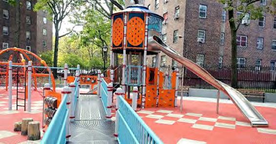

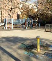
 MLK Playground before MLK Playground after NYC parks have operating hours and guiding rules that allow parks to close at night, discouraging sleeping.
Abraham Lincoln Playground
Standard signage for the NYC park system.
Low walls create permeable barriers to parks, allowing visual access and a more welcoming environment.
MLK Playground before MLK Playground after NYC parks have operating hours and guiding rules that allow parks to close at night, discouraging sleeping.
Abraham Lincoln Playground
Standard signage for the NYC park system.
Low walls create permeable barriers to parks, allowing visual access and a more welcoming environment.
182
Fencing around refurbished NYC parks allow for views into the space while defining edges.
PARIS
A modern approach to a historical setting
THE RE-GREENING OF THE CITY
LESSONS LEARNED
Jardins des Tuileries, a public garden situated in the center of Paris, has long been a favorite spot for Parisians and tourists to stroll. However, the high foot traffic eroded the park’s green space, with greenery accounting for only 40% of the garden’s 56 acres. A recent renovation restored the garden to its 17th century splendor while utilizing a more sustainable approach. The overhaul added over 90 elm trees along the garden’s alleys to increase the shade canopy and restored the Bosquet des Oiseaux (Birds Grove), where new species of trees and shrubs will attract birds and add biodiversity.
RETURNING PUBLIC SPACE TO LOCALS
Originally conceived in 1667, the famed Champs-Élysées, a 1.2mile-long central street known for its high-end shops, is being transformed into a pedestrian-friendly public space. Connecting the Arc de Triomphe with the Place de la Concorde, the ChampsÉlysées is the most famous avenue in Paris. Currently an emblem of tourism, consumerism, and pollution, the redesign looks to return the street to neighborhood residents. Half of the boulevard’s eight vehicular lanes will be closed to cars and turned into spaces for pedestrians. Pockets of greenery with food kiosks and meeting spaces aim to attract locals back to the area and improve air quality to make it a more sustainable and desirable public space.
THE 15-MINUTE CITY
This concept represents a shift in urban planning processes which focuses on creating walkable cities. A 15-minute city refers to an ideal urban area where residents can access everything, they may need within 15 minutes of travel. Paris is one of the first cities to heavily focus on this concept in its urban planning practices. Though this is an all-encompassing policy shift, a large focus of the initiative to improve lives of locals through walkability is to increase the prevalence of parks.
02
183 DowntownDC Parks Master Plan
• Respect cultural heritage and history while adapting as a modern and diverse city
ADDRESSING CLIMATE CHANGE
In a city where air pollution levels are historically high, Paris has recently taken steps to make the city greener and adapt to changing temperatures. With the goal of making 50% of the city’s surfaces vegetated and permeable, Paris is redesigning four historic landmarks to increase tree canopy cover. This includes areas directly in front of the Hotel de Ville, the City Hall, and behind the Opera Garnier, Paris’ 19th century opera house. A departure from the typical paved plazas or highly manicured gardens, these “urban forests” show that it is possible to integrate ecological goals with historic architecture.

URBAN ECOLOGY
Previously a car-dominated environment, the contemporary overhaul of the Place de la République is now the largest public plaza in Paris. With the removal of a traffic circle and adjustments to the surrounding road layout, the area dedicated to pedestrians has been expanded by over 50%. The plaza includes a new cafe pavilion, water features, and more than 150 trees. Veering from the typical manicured French style, the plant palette of ornamental grasses and seedling trees is reminiscent of an early stage in successional forest growth, challenging people to rethink what urban landscape should look like.
184
Paris has creatively added more greenery within its urban footprint.
SEATTLE Partnerships can shape dynamic spaces
PARTNERSHIPS
LESSONS LEARNED
• Managed encampments with phased housingfirst approach.
• Provide services while encampments last to make them livable. Encampments in parks limit usability for others and provide unjust living conditions.
• Conduct direct outreach with encampment residents.
• Use parks to connect people with housing.
In Downtown Seattle, two core green spaces, Westlake Park and Occidental Park, are owned by the city but managed by the Downtown Seattle Association (DSA). Starting as a year-long pilot project in 2015, DSA saw improvements from activating the two parks, and the various partnerships have continued because of the parks’ success. Public space improvements are funded and leveraged by the following three entities: DSA, the Metropolitan Improvement District, and the city, which forms the Urban Parks Activation Partnership (UPAP). Other alliances, such as the Alliance for Pioneer Square and the Seattle Parks Foundation, are also partners, providing additional programming, maintenance, and enhancement to the spaces.
The parks now have programming every day of the week, infusing them with more significant foot traffic that lends to the overall success of each space. Seasonal activities and immersive public art installation programs provide a large draw and make people want to linger in space throughout the year. Park staff and full-time security keep the spaces clean and improve the perception of safety.
03
IT’S RARE TO SEE AN EMPTY SEAT IN THE PARK NOW.
185 DowntownDC Parks Master Plan
‒ SEATTLE PARKS FOUNDATION
STRENGTHENING POLICY
Seattle officials say that encampments in parks represent a double-barreled failure as they limit the overall functionality of public park space for many users, while also providing inadequate living conditions for those that use the space to sleep.
Citywide policies to confront housing problems are the primary mechanism for reducing the use of parks and public spaces as encampments.. Until more permanent housing can be accommodated, the city is providing temporary shelter, bathrooms, and security on-site to improve health and safety.
With greater investment in shelters during the pandemic, individual outreach has been occurring early to move people into housing.. Avoiding displacement policies not only builds greater trust, it also creates a solution rather than a rearrangement that would push encampments to new public spaces.
The City of Seattle is using park space to allocate resources and connect people with more permanent solutions to housing.

186
Source: Seattle.gov
HOUSTON Policy and partnerships can reduce encampments and provide dignity
LESSONS LEARNED
• Use a housingfirst approach. Combine local, state, and federal resources. Coordinate effort across Houston to facilitate interdepartmental response.
• Ban encampments.
SYSTEMWIDE APPROACH
In Houston, tracking efforts across governmental agencies, nonprofits, and private enterprises created more direct and efficient services for those living in encampments, ultimately eliminating gaps in service. Comprehensive data on services, providers, and the impact of outreach has been instrumental in getting more people into housing and reducing the number of people sleeping in public outdoor spaces.
Houston first focused on housing veterans experiencing homelessness with coordinated efforts involving the city, HUD, local businesses, the Houston Police Department, and nearly 100 organizations and coalitions. This model of coordination among all stakeholders involved in addressing housing and services for people experiencing homeless has persisted thanks to the Homeless Management Information System. This digital database shares information and provides a platform for communication to expand efforts of all organizations involved. While this is not unique to Houston, the city was quick to integrate the system into its practice and use it as a core element in its engagement efforts.
04
187 DowntownDC Parks Master Plan
HOUSING FIRST
In 2011, Houston removed all prerequisites and barriers previously in place to housing, allowing anyone in need to qualify. More units were produced through construction, renovation, and an incentive program created for landlords.
Simply put, the solution to homelessness is a home, so Houston put its efforts toward creating much more permanent, supportive housing. With better results, Houston continued to receive more funds from HUD to continue implementing housing and associated programs.
ENCAMPMENT BAN
Part of Houston’s approach has been to ban encampments in public spaces. But a ban can only be coupled with a solution for permanent housing, otherwise the rule would only shift encampments to new areas whenever enforced. The ban is only enforced when there are available alternatives, including shelter space.

188
Evelyn’s Park in Houston draws a crowd for a summer pop-up event.
05
PHILADELPHIA
Maintaining cultural assets and inclusivity
REVAMPING LANDMARK SPACES
LESSONS
LEARNED
• Honor identity, culture, and history. Enhance pedestrian comfort and mobility.
• Integrate democratic design and inclusive programming.
Known as the first “planned city” in North America, the public spaces in Philadelphia are laden with historical importance, much like DowntownDC. Today, many iconic landmark spaces are modernizing with the goal of improving civic life and the pedestrian environment in downtown Philadelphia.
PRIORITIZING THE PEDESTRIAN
Benjamin Franklin Parkway is currently undergoing a revitalization effort. At just 1 mile long, the grand boulevard serves as the central artery of the city’s cultural core, cutting across Center City to link City Hall with the Museum of Art. With inclusivity in mind, the redesign will make the parkway safer and more attractive to pedestrians and cyclists through a variety of public space improvements.
189 DowntownDC Parks Master Plan
ACCESSIBILITY FOR ALL
Previously a 1960s-era sunken hardscape, Dilworth Park has been reinvented as a vibrant and vital civic space. Located at the base of City Hall, this public space was recently redesigned to address accessibility issues and provide a more usable and democratic public space that lives up to the historic character of Philadelphia City Hall. The new design brings the entire plaza to street level and includes an interactive fountain, lawn space, and cafe with outdoor seating
USING ART TO UNEARTH HISTORY
Located above a major transit hub, Dilworth Park uses art to reveal the site’s below-ground activities. Pulse is an interactive and immersive public art experience that celebrates the site’s history as Philadelphia’s transportation hub and home of the first steam-powered waterworks. This transit-activated art piece traces the paths of the subway lines that converge beneath Dilworth Park through illuminated ribbons of atomized fog, offering a personal interaction with the city’s transportation infrastructure.
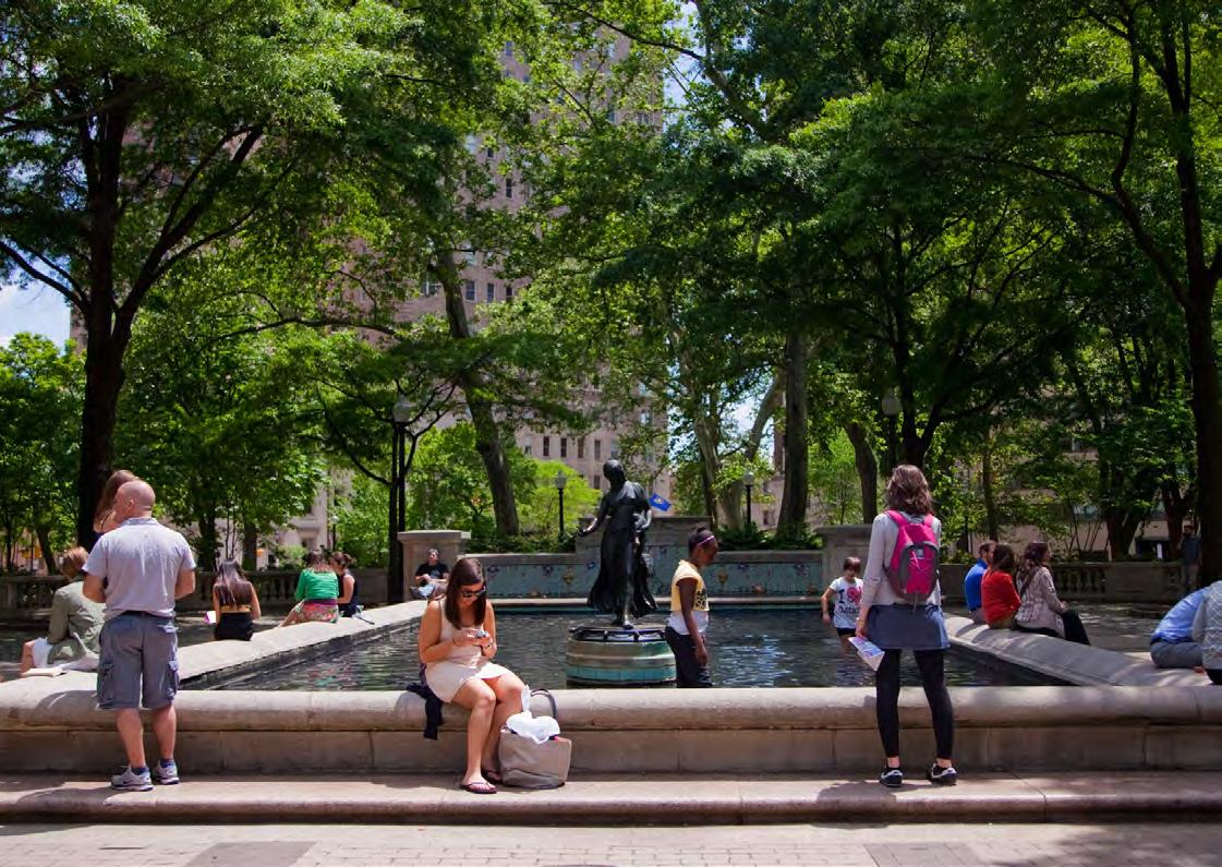
190
Philadelphia’s Rittenhouse Square features engaging park elements in the context of surrounding dining and retai that help pull people into the space.
G BEST PRACTICES
191

192
TACTICAL URBANISM 01
LESSONS LEARNED
• Tactical urbanism enables the testing of new and innovate ideas quickly.
• Implementation can be flexible based on performance or needs change. Short-term change can lead to future financial investment.
AN ITERATIVE APPROACH
Cities around the world are using tactical urbanism — or short-term, low-cost, and scalable design interventions — to advance long- term goals related to pedestrian safety, public space, and more. These space-activation projects take an iterative approach to planning and design, allowing cities to experiment with and gather input on potential permanent design implementations.
Whether temporary to semipermanent, tactical urbanism projects frequently use a combination of programming and physical improvements. Successful projects are typically very collaborative, site specific, and respond directly to the needs and/or challenges at the focus area.
TRANSFORMING PAVEMENT TO PUBLIC SPACE
Tactical urbanism frequently manifests in the creation of new temporary public spaces by reallocating underused street space for pedestrian-oriented uses. In cities with a short supply of public space and a need for more publicly accessible gathering space, tactical urbanism can be an innovative solution to redistribute existing land area.
193 DowntownDC Parks Master Plan
STUDIO OUTDOORS
With the goal of bringing professionals back downtown and reigniting local businesses during the COVID pandemic, this modern, outdoor co- working space created a destination in downtown D.C. Part workspace, part art installation, Studio Outdoors was designed in collaboration with District artist No Kings Collective. With a tropical design scheme, this vibrant outdoor workspace included a green turf, a pergola draped with plants, and umbrellas. Although it was a temporary installation, this project shows how tactical urbanism can quickly transform an underutilized space to meet the needs of the moment.

DOWNTOWNDC’S STREATERY
Operating as a communal outdoor dining room for six different restaurants and food trucks, DowntownDC’s streatery converted a stretch of underutilized sidewalk on 8th Street between H and I streets NW into an expansive outdoor patio. The streatery aimed to draw more dining interest downtown during the COVID pandemic.
 Cuba Libre streatery located at 8th and H Street. Photo courtesy of Cube Libre.
194
Coworking space offers seating and WiFi. Photo courtesy Washington Post/Sarah Voisin.
LOCAL CONTEXT
Amenities in public space allow them to function as a community living room, or “third space.” In the District, these examples of emerging office markets illustrate how amenities in public space and mixed-use developments can make them engaging places that people choose to occupy beyond the workday. In typical office districts, spaces struggle to keep space occupied after the workday.
THE YARDS — CAPITOL RIVERFRONT
In Southeast D.C., Brookfield Properties is moving forward with a mixed-use office space that will consist of 272,000 SF of office and 22,766 SF of retail. The site sits catty-corner to the Nationals’ baseball stadium and is a short walk to Yards Park and Washington Canal Park. Both public parks provide green space and waterfront access that serve the office space. Within the building, amenities will include an interior elevated courtyard and rooftop gathering spaces on floors four through seven, with additional outdoor space on the penthouse level. As the market adjusts to a working environment after the pandemic, there is a strong preference for workspaces with access to outdoor gathering spaces. This location provides a diverse range of outdoor amenities both on- and off-site, as well as restaurants and activities in the surrounding area.


THE LIZ — 14TH STREET NW CORRIDOR
North of Logan Circle along the 14th Street NW corridor is the Liz, a mixed-use luxury apartment, office, and retail development. The building is home to two cultural centers and has nearly full occupancy for its apartments, office, and retail spaces. The Liz strategically maximized outdoor space, with outdoor seating areas along the street and two roof levels, one for the offices and one for residents. The use of space at street level also makes the space more welcoming and increases its use beyond the standard workday.
Amenities case studies are from the HR&A Partners Market Analysis Report prepareed for this study. HR&A’s full report can be found in Appendix C. The Yards at Capitol Riverfront195 DowntownDC Parks Master Plan
The Liz on the 14th Street NW corridor
02 AMENITIES
SIGNAL HOUSE — UNION MARKET
Located in Union Market, Signal House is a 10-story mixed-use office building that was delivered in April 2021. Carr Properties is attracting tenants through a focus on wellness and amenities. While the building had difficulties leasing during the pandemic, Signal House represents a trend toward amenities as a draw for tenants. Union Market was historically a collection of wholesale markets on 45 acres between Florida Avenue and New York Avenue NE. Today, Union Market has grown into a popular destination for dining and shopping, bringing together both old and new retailers and restaurants as the district grows. Residents and workers alike express appreciation for the authenticity and liveliness of the Union Market neighborhood.

20 MASS — DOWNTOWNDC
There are also examples of innovative mixed-use development with an office component planned within DowntownDC. 20 Mass is a mixed-use redevelopment slated to be delivered in 2023. The building will offer 180,000 SF of office space, 13,000 SF of ground-level retail, a 14,500 SF penthouse, and 271 hotel rooms. The multipurpose space is intended to attract a variety of uses beyond the standard workday.
Signal House in Union Market. Photo courtesy of CoStar.196
COMFORTABLE SPACES 03
DESIGN FOR COMFORT
Urban open spaces are welcoming and relaxing when they address human comforts. Providing shade, heat abatement, protection from the elements, human-scale design, noise buffers, and a sense of enclosure make spaces comfortable. Great parks provide welcoming atmospheres to all ages, ethnicities, economic groups, and abilities. To achieve comfortable design, consider.
• Sense of enclosure. Exterior vertical elements and canopies help create a comfortable feeling. Use building edges, trees, shrubs, steps, and other design elements to create outdoor rooms and walls with tree canopies, umbrellas, or shelters for the ceiling.
• Human-scaled elements. Provide a transition from taller buildings and expansive streets through enclosure and pedestrianscaled elements such as decorative lighting, landscaping, and furnishings.
• Microclimate. Parks and plazas should provide protection from the environmental conditions that are nuisances and use the environment to offer comfort. Vegetation and structures should be situated so that they allow warmth from the sun and shelter from the wind in the cold months and shade from the sun with cooling breezes in the hot months.
• Urban oasis. Design, site layout, planting palettes, and structures should also help provide respite from the noise, pollution, and chaos often present in the urban environment.
• Welcoming edges. Through design, parks should convey approachability. While offering a sense of enclosure is important to creating comfort, some applications of park enclosures can give off a negative impression. Fencing should be limited and decorative. Using plant material to help enclose spaces can achieve the same function as fencing while softening edges and providing aesthetic, psychological, and environmental benefit.
A key to enforcing rules of how public space should be operated and used to preserve the comfort of a diverse group of parkgoers is to create parks that close. To support this in an equitable way, there should be an interwoven connection between the park and the streetscape to allow spillover.
• Park Closures. If a park is to be closed for rehabilitation or during nighttime hours, gates and fencing can be designed to inform users of park hours in a positive rather than a negative tone. Gates should be decorative if used, and open hours posted. Temporary fencing for a park under rehabilitation can be engaging. A fence could, for example, be decorated with local artwork to create more visual interest.
• Safety. Looking at Franklin Park in DowntownDC as an example, design grade changes and plantings encourage the movement of children away from roads. Design elements could provide comfortable, nearby places for adults to watch over children playing. Parks and plazas are embracing the philosophy that play should be encouraged throughout public open space and not regulated behind a fence.
197 DowntownDC Parks Master Plan
• Inner and Outer Park. Embrace NYC’s example, where the park is extended outside of fence lines to provide a 24-hour park amenity to those experiencing the city’s green infrastructure during hours the park is closed.
The outer park is the exterior (sidewalk, streetscape, perimeter) that remains open. The outer zone should be thought of as an extension of the inner park and enhanced to offer comfort amenities like shade, seating, and plantings for after-hours use. This will provide the additional benefit to transit users at all times of the day as well as to visually increase the park footprint.
DESIGN FOR SAFETY
• Universal accessibility. All components of parks should provide access and comfort for people of all ages and abilities to enjoy.
• Basic needs. Include amenities that support basic needs such as bathrooms, water fountains, and vending.
• Open views. While enclosure is important for comfort, it should not create barriers to “eyes on the park.” The biggest deterrent to unsociable behavior is keeping it out in the open. Using the principles of Crime Prevention Through Environmental Design (CEPTED) can balance enclosure with openness.
• Safety audits. Accessibility into and within the park needs to be analyzed regularly, as intrusions from tree roots and delayed maintenance responses can reduce accessibility.
ENTRANCES AS GATEWAYS
Entrances should be clearly highlighted in the landscape treatment and should align with pedestrian flow and viewsheds.
• These features oftentimes become the go-to places for memento photography, meeting places, point of reference, etc., and are associated with the “brand” of the place, reinforcing its character and function. Entrance treatments should help elevate and celebrate the existence of a public open space or park and provide recognizable landmarks.
• Park access should support pedestrian connectivity and corridors defined by sidewalks, bus and metro stops, bike facilities, and so on, by providing access directly into parks.
DESIGN WITHOUT ENFORCEABLE POLICY WILL NOT PRODUCE QUALITY.
198
ACTIVATION & PROGRAMMING 04
USE ADJACENCY TO ACTIVATE
Streets, outdoor cafes, building facades, entrances, and transit hubs should be used to help activate and bring people into parks. Land uses around parks have the potential to provide activation adjacency. Land uses that enhance the outdoor realm should be encouraged along park edges, while land uses that are primarily interior focused and have blank walls, covered windows, and no entrances should be discouraged.
• Street activation. Encourage and promote street and park activation such as outdoor retail stands, outdoor cafes, walk-up windows, art installations, and residential balconies overlooking the park.
• Extend spaces into the right-of-way. Blur the line between these spaces and the public park space as much as possible by extending each of these spaces into the street right of way.

‒ WILLIAM WHYTE 199 DowntownDC Parks Master Plan
IF THERE’S A LESSON IN STREETWATCHING, IT IS THAT PEOPLE DO LIKE BASICS — AND AS ENVIRONMENTS GO, A STREET THAT IS OPEN TO THE SKY AND FILLED WITH PEOPLE AND LIFE IS A SPLENDID PLACE TO BE.
CONTEXTUAL RELEVANT BY HONORING HISTORY
The majority of the parks and open spaces in DowntownDC contain historic aspects or elements that must be respected and given special consideration when addressing a particuular park’s materials and furnishings. The National Capital Planning Commission (NCPC) has studied the question of how new design layouts and elements may be achieved within a historic context and provides guidance on how to evaluate the purpose and function of these elements and determine their role in the future of the parks.
Most of the parks and open spaces in the study area are intended as places to contemplate our national history, as the majority of NPS holdings do. Exploration of U.S. history is the key attraction of tourists to D.C. This foundational function of the open space should be explored and enhanced.
ENHANCE DAILY USE THROUGH PROGRAMMING
One of the most important functions of a park or open space is for it to be accessible and enhance someon’s daily life. Parks and public spaces should provide comfort and wonder for those moving through them, both individually and as a system.
• Joyful space. This can be done with elements that people can interact with, such as art. If there is an empty storefront or long blank wall along a pedestrian zone, add interactive displays and use public decorative lawn spaces to engage people as they walk by.
• Interactions of varied scale. Create opportunities for interaction, from small interactions like looking for the D.C. icon scattered throughout the downtown public realm, to large interactions, like the photo fountain in Chicago’s Millennial Park.
• Entertainment nodes. Allow buskers and music to occupy space and create informal nodes of entertainment that add texture to the life of a park or streetscape.
COMMUNITY LIVING ROOM
As a tool to be attractive to residential uses, open spaces should be an extension of people’s lives. Open spaces should provide various outdoor rooms that accomodate activities such as family play, outdoor dining, pets, and exercise opportunities.
WHAT ATTRACTS PEOPLE MOST, IT WOULD APPEAR, IS OTHER PEOPLE.
‒ WILLIAM WHYTE
200
ADAPTIVE REUSE 05
D.C. scores high on the Trust for Public Lands’ walkability and park access scoring, coming in at No. 1. There are many “public open spaces.” Couple that with the lack of available land for new parks, and it is the existing public realm that must be used to have the impact to enhance the attractiveness and quality of experience for those living, working, and visiting DowntownDC. It is important to recognize that out of the dozens of parks in the BID, only about 10 of them can truly be considered “parks,” given the small size and minimal programming that characterize most of the other spaces. These smaller spaces function to provide mainly aesthetic appeal and support the views, street layout, and focal points as intended in the original city plan.
EXISTING OPEN SPACES
Through a systemwide understanding of the public realm, collectively parks and open spaces can meet the diverse needs of the community.
ADDRESS THE MISSING DIVERSITY
With a focus and attention on meeting the needs of residential users in adding amenities, other users’ needs will also be met. For example, outdoor spaces that provide shade, WiFi, and collaboration can be used as a break from working from the home office as well as for people commuting into the study area.
BUILT-IN FLEXIBILITY
Create multidimensional spaces that have many purposes and can serve most needs. In the study area, by design, most urban parks and open spaces are limited in size but have increased demands on their use and programming. In addition to their physical size, they serve a broad cross-section of the city’s population with varying expectations of the spaces. The size and location of an open space greatly impacts the type of features and programming it can successfully accommodate. However, each space should strive to be flexible to serve multiple functions.
Existing spaces are unidimensional and underutilized, resulting in safety concerns. Here are descriptions of some functions that most readily overlap.
201 DowntownDC Parks Master Plan
GREEN SPACE
No matter how small or inaccessible a space might be, there is value to having landscaped space in an urban environment. Views to green space provide both physical and mental benefits. Plants can help buffer against visual clutter, dampen urban noise, improve stormwater management, and provide habitat and food for pollinators and urban wildlife.
OPEN LAWN
One of the most useful and least expensive improvements is creating and maintaining accessible lawn areas. As proven throughout the pandemic, open lawns provide extreme flexibility: room for spreading a blanket for a picnic, tossing a ball, individual and group exercise, informal play, and impromptu social circles.
MULTIGENERATIONAL PLAY EVERYWHERE
Park elements and spaces that encourage use by all ages not only maximize park utilization but also facilitate stronger familial and community bonds. Play spaces that allow children and adults of all abilities to interact together by utilizing features like group swings encourage cooperative use.. Incorporating playful elements in multiple places instead of a concentrated traditional playground encourages broader park use by the entire family.
EMBRACE MULTICULTURAL
Embrace the area’s international population: residents, workers, and visitors. Considering how that can influence design and programming to foster engagement with the space and with others is key. Exploring the diverse ways and cultural differences in the use of public open space allows greater use of the space by all.
PROVIDE EVENT INFRASTRUCTURE
Some parks are large enough to accommodate small events, while others could also hold large events. Many events require some amount of infrastructure, and frequent requirements include a stage, large gathering areas with unobstructed views, power sources, and lighting. While making these elements built-in for easy “plug-and-play” use can facilitate regular events and reduce rental costs, if they are not carefully designed within the larger context of the park, these details can sometimes limit the space’s usefulness to only certain types of events, creating large empty spaces that negatively impact the overall perception and appeal of a park. Designing for flexibility of event size can not only avoid this, but it can make even an everyday use feel comfortable and desirable in the space.
202
QUALITY AND DURABILITY
The physical materials in a public open space not only set the tone for the visual aesthetic, but they are also the foundation of the space’s longevity and functional usefulness to the community it serves. Thus, material selection should be based not only on aesthetics and installation cost, but also on durability, availability, maintenance requirements, and future costs. Establishing performance criteria early on helps guide the process to ensure the final selections meet the aesthetic goals and perform successfully over the long term. While each space will have a unique set of design requirements, prequalification of the basic materials and furnishings streamlines the design and implementation process, while simplifying maintenance to a set of readily available products and replacement parts.
AESTHETIC QUALIFICATIONS
Establishing cohesion and sense of place often dictates a defined material palette that is readily recognizable to the geography. Designing across generations and centuries of public spaces can create challenges in continuity of materials due to a range of practical factors such as actual material availability, manufacturing techniques, and cost. Public opinion and trends in style also change over time, and this should be recognized, so it is in good practice to avoid aesthetics that are overly trendy. Establish a standard approach to design with and around historic elements and how to respect them, whether that means matching exactly or adopting a blended approach with clear but balanced distinctions.
COST CONSIDERATIONS
It is important to establish a budget up front so that cost considerations can be incorporated early in the overall design approach and not result in a substitution of materials as the design and implementation process continues further toward completion. In addition to material, shipping, and installation costs, a product’s lifecycle cost should be evaluated relative to the maintenance budget for a more complete picture of the product’s value.
DURABILITY & MAINTENANCE
Materials and products in a public setting endure heavy use on a daily basis as well as the longterm impacts of decades between renovations. Understanding a material’s performance over time and selection for durability is important to a park’s long-term usability. Collaboration with maintenance professionals for a park is equally important to gauge what level and type of maintenance is typical and can easily be folded into current practices, and what may be a unique situation that would require additional effort such as extra time, funding, special training, or monitoring.
ESTABLISH PERFORMANCE CRITERIA AND STANDARDS TO ENSURE LONGEVITY OF MATERIALS AND FURNISHINGS.
203 DowntownDC Parks Master Plan
RELEVANT & CURRENT 06
POP-UP PARKS
These features oftentimes become the goto places for memento photography as they typically feature very trendy installations and programming. Often, these pop-up parks are a result of partnerships.
These areas not only help elevate and celebrate the existence of a public open space or park. Popup parks also provide recognizable landmarks and reinforce a sense of place.

MOVEABLE STREET FURNITURE
Light but durable park furniture can be found in many parks and appears to be a new trend in street furniture. Previous park furniture can be generally characterized as clunky, worn, hostile, and typically limited in use to one purpose.
The flexibility of moveable street furniture follows the desires of parkgoers for more flexible spaces following the pandemic. This type of furniture also complements the trend of open spaces to be multipurpose, as they can be adjusted for different types of programming or different event sizes.
204
Farmers market in Dupont Circle. Photo courtesy of WAMU.