Connecting Communities Across Georgia with 325 Miles of Trails

Sandy Springs Springway
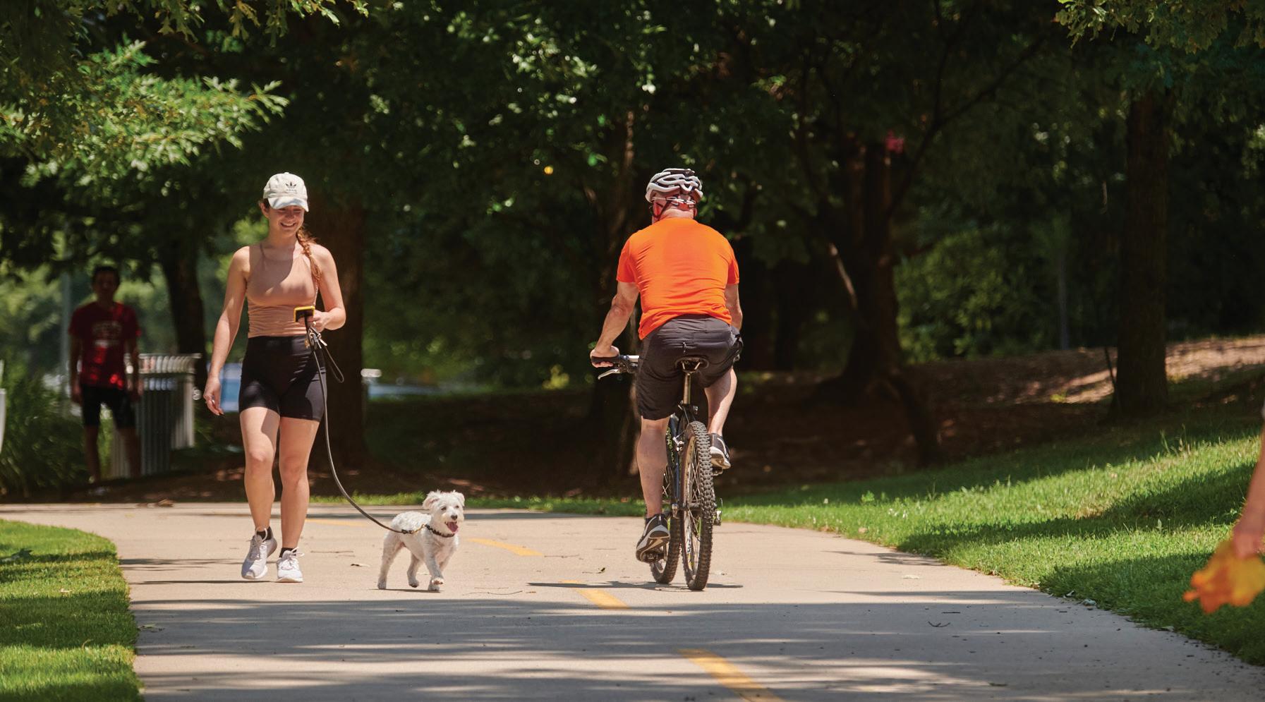
PATH Foundation
A Non-Profit Organization Dedicated to Planning and Building Greenway Trails
August 2024, Issue #113


Connecting Communities Across Georgia with 325 Miles of Trails
Sandy Springs Springway
PATH Foundation
A Non-Profit Organization Dedicated to Planning and Building Greenway Trails
August 2024, Issue #113
In 2019, Sandy Springs officials contacted PATH about developing trails in their city. A combination of forward-thinking leaders, Sandy Springs Conservancy, PATH400 being developed to their city limit and PATH’s experience retrofitting trails through developed communities made the time right to build trails in Sandy Springs.
PATH spent several months in the field, attending public meetings, and collaborating with city officials to develop the Springway master plan for trails. The city formally adopted the Springway master plan in October of 2019. As part of the plan, we suggested segments of the Springway plan as candidates for early development. In
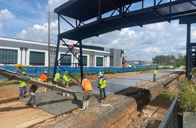
2021, the city was awarded a GOSP grant and initiated their model trail segment linking Morgan Falls Park along the Chattahoochee River to Roswell Road.
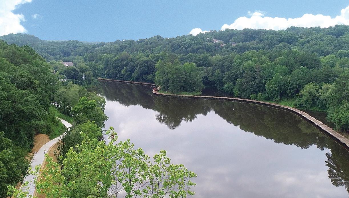
Rock was encountered during construction of the boardwalk connection along Orkin Lake. The project was delayed while engineers evaluated the situation and prescribed construction recommendations on how to best handle the rock.
This trail segment travels along Lake Orkin on a raised boardwalk! The 3,000-footlong boardwalk was built from
the top down, similar to the method used on the structure linking North Druid Hills Road to Mason Mill Park in Dekalb County. Future phases of the Springway include a signalized crossing of Roswell Road and a loop connection back to the Chattahoochee River and Morgan Falls Overlook Park. The city of Sandy Springs allocated local funding along with the GOSP $3M grant for the trail between Morgan Falls and Roswell Road. Your donations to PATH paid for project management. The trail is scheduled to be completed and open to the public by year end. l

The Silver Comet and Chief Ladiga Trails are built on the right-of-way of the Seaboard Airline Railroad (SAL), that used to connect Atlanta to Birmingham. CSX bought SAL in 1980 including the out-of-service line that was destined to become the Chief Ladiga Trail.
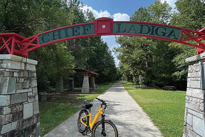
Georgia/Alabama state line and beginning of the Chief Ladiga Trail
seven-mile extension in April of this year with a schedule to complete work in the Spring of 2025.
Various governmental agencies developed the Chief Ladiga Trail from the Georgia state line to Weaver, Alabama, seven miles northeast of Anniston between 1996 and 2006. PATH built the 63-mile-long Silver Comet Trail between 1998-2008. There was a celebration at the state line in 2008 to commemorate two successful efforts to create what was then the longest paved trail in the country.
In 2008, then Anniston Mayor Robinson understood the importance of bringing the Chief Ladiga trail into downtown Anniston. Unfortunately, his negotiations with CSX didn’t end successfully. In 2012, Mayor Stewart rekindled the negotiations and Anniston now controls the right-of-way. The city’s contractor, B&B Construction, started constructing the
Trail travelers have longed for more places to stay and eat when they reached the end of the combined 98-milelong trail. Soon they’ll have the option to rest at the Finial Hotel or grab a cold beer at the Coldwater Brewpub near the end of the extension.
The extension is being built by the city at a cost of $8.2 million. Toby Bennington, Director of Planning and Economic Development for the City of Anniston thinks the extension will be a boon for downtown merchants. “Alabamians will travel to downtown Anniston to access the trail and Georgians will end their journey in downtown. I think merchants in the vicinity of the Amtrak station will benefit greatly.”
PATH, and now the city of Anniston, are appealing to Amtrak to change their policy in regard to loading and unloading bikes on trains at the Amtrak station in Anniston. We are trying to create a scenario where you could shuttle one-way on the train. l
Atlanta Trails Master Plan (Trails ATL) Public outreach is being conducted for the City of Atlanta and PATH’s effort to create a new trail vision for Atlanta. It is scheduled to be completed by Spring 2025. See TrailsATL.com for more information.
Northwest Beltline (Phases 1-4) Design and acquisition teams are working on all phases of the Northwest Beltline towards completion of all design by year end.
Cricket Frog Trail - Alcovy River Trestle This improved connection of the old railroad trestle bridge will fill in the last gap of the Cricket Frog allowing
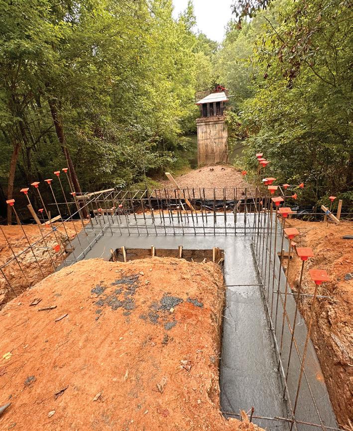

users a longer stretch of trail. Completion is scheduled for this fall.
Northwest Beltline (Phase 5)
The Atlanta Beltline’s Northwest trail corridor is broken down into five phases. The first phase to be released for construction is Segment 5. PATH is providing Program Management of the design, permitting and construction of the project. Construction began in July and will take approximately a year to complete. This segment will connect the existing Westside Beltline corridor at Huff Road and end at English Street in Blandtown.
PATH400 – Loridans Drive to City of Sandy Springs The City of Atlanta, PATH and Livable Buckhead have partnered to complete this segment from Loridans Drive to the Sandy Springs city limits. Construction is anticipated to begin in the fall of 2024. Once complete, this section will link to the Sandy Springs PATH400 segment that will eventually connect to the GA 400/I-285 interchange trail GDOT has installed.
PATH400 - Wieuca Road to Loridans Drive This impressive section of PATH400 will provide trail users with a skyline view of Mountain Way Common and

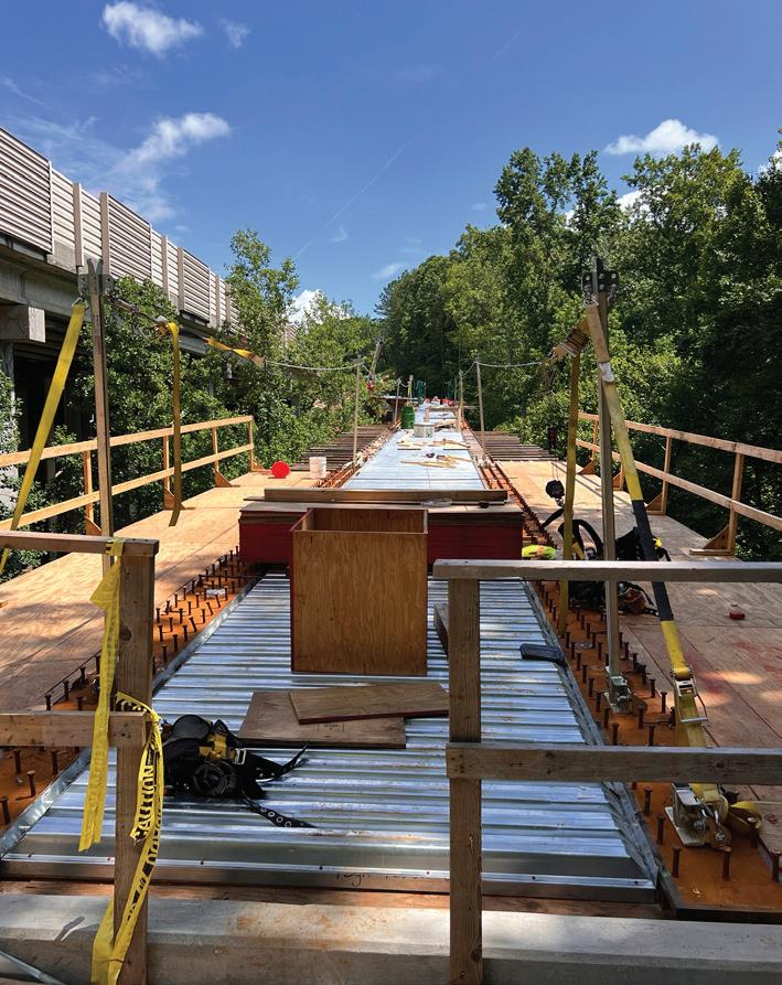
GA400. Included is an 80-foothigh pedestrian bridge with a spur trail connection, which requires a complex system of walls to allow the trail to run parallel to and continue underneath 400’s bridge at Mountain Way Common. Trail users will be able to enjoy this amazing section of PATH400 when it opens to the public in the summer of 2025.
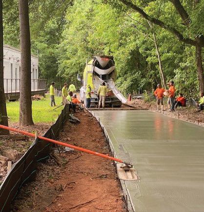
Sandy Springs - Phase 2A This trail connects Roswell Road to Morgan Falls Park by circling Orkin Lake. It is Sandy Springs’ model project and will be a main attraction for trail users. Anticipated completion is the end of 2024.
Silver Comet Connector - Silver Comet to Plant Atkinson Road The final pieces of this segment are wrapping up. PATH will host

a Ribbon Cutting ceremony this fall. Everyone is welcome.
Silver Comet ConnectorPlant Atkinson Road to the Chattahoochee River Construction has resumed on this segment and the contractor anticipates completion by January of 2025.
Silver Comet ConnectorMacArthur Trail This segment is a spur off of PATH’s existing Whetstone Trail and connects to Chattahoochee Avenue. It is the first of five segments to connect the Silver Comet to downtown. Construction will begin this fall.

Silver Comet ConnectorWoodall Rail Trail This trail segment connects The Works at Chattahoochee Avenue to the Northwest Beltline at Elaine Avenue. It is the fifth link of the Silver Comet Connector and will be the first completed segment by January of 2025.
Westside Paper Spur Trail This trail connects the Westside Paper development from West Marietta Street to the Westside Beltline Connector at Joseph E. Lowery Boulevard and will be complete by the spring of 2025.
Interchange PATH and the City of Sandy Springs collaborated with GDOT to build a trail through the new I-285/400 interchange. This trail is illuminated and extends PATH400 outside perimeter and into the cities of Dunwoody and Sandy Springs. l
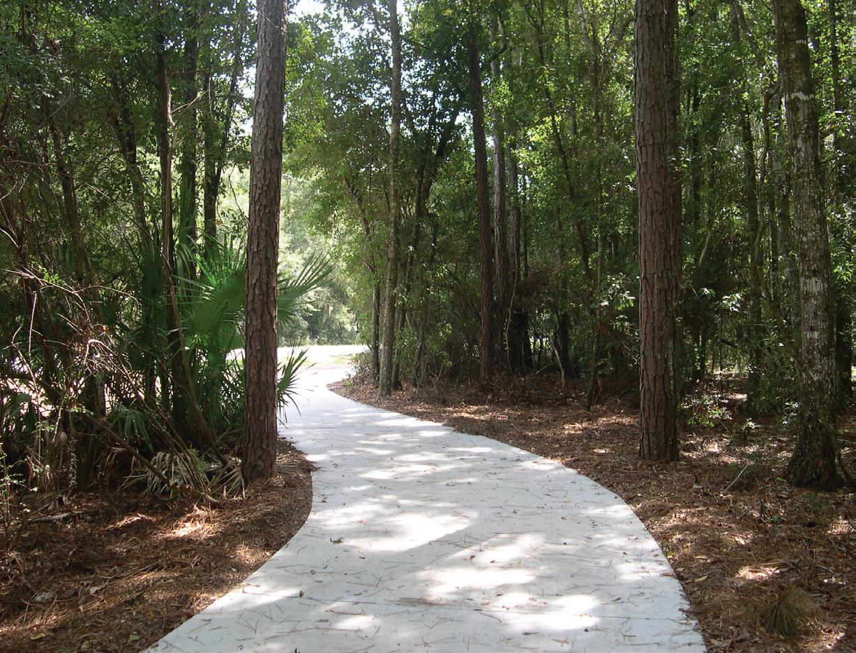

People are surprised to learn that PATH developed trails on St. Simons Island. In 2012, we were asked to partner with the St. Simons Land Trust to extend and upgrade the existing trails. We utilized a grant from the James M. Cox Foundation to extend the existing trail along Lawrence Road to Hampton Point and a spur from Lawrence Road to Sea Island alongside the causeway. Glynn County and the Land Trust have since upgraded crossings, signage, and other safety features on the trails.
The standard width of the trails is eight feet, a bit narrower than most PATH trails. Still, they seem to work for people on vacation in a leisure environment.
Most trails on the island aren’t suited for fast riding.
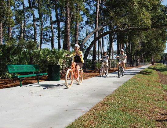
The Island Trail System links most hotels and motels to restaurants, bars, and shopping. Where there’s not a trail, most of the streets are a good alternative. Motorists seem to anticipate tourists on beach cruisers wobbling along, taking in the scenery. There are several busy round-abouts on the island that can be treacherous. Rental bikes are plentiful on the island. We suggest renting a bike; that way you can ride on the enormous beach at low tide and not worry about the saltwater fouling your own bike. l


Nothing makes an old, retired man happier than seeing accounts of people enjoying PATH trails in the way I envisioned them being used thirty three years ago. I can almost share the anticipation of knowing the Pumpkinvine Creek trestle is around the next bend. I know the feeling one gets when they approach the serpentine boardwalk across Alexander Lake on the Arabia Mountain PATH (AMP), and the rush a cyclist gets when they ride through the pasture on the Carrollton Greenbelt.
I had my 80th birthday this summer, my riding days are in the rearview mirror, but my memories of my years of riding are still with me. I re-live my riding every time someone posts pictures of
their ride or tells me about a grand experience they had on a trail. What’s not to love about whisking through the forest on a trail and socializing with your riding companions on a beautiful day?
People used to tell me, “You need to ride in Europe; they are light years ahead of the states providing for cycling.” I’ve biked through Italy on three occasions and Holland once. I’ll take the Silver Comet or the AMP any day over the bike congestion of Amsterdam or the winding roads through Tuscany. We got it right!!
My colleagues and I envisioned fellow Georgians using the trails we built just like they are using them. It’s gratifying to see the videos and posts on social media of families and friends enjoying the fruits of our labor.
It’s nice to hear about people from other parts of the country planning their vacations around a visit to our trails.
When we finish the connection between the Silver Comet and the Atlanta Beltline, all of metro Atlanta will have a world class trail system that puts Europe to shame. I wish I was still riding. It would be great to join all the joyful people and experience the wind in my (almost gone) hair and anticipate riding through the Brushy Mountain tunnel again. Guess I’ll have to rely on other people’s stories for a contact high.
By the way, Europe, eat your heart out. l
PATH Foundation
1601 West Peachtree Street
Atlanta, GA 30309
Charlie Shufeldt, Chairman
Alexander C. Taylor, Vice Chairman
C. Austin Stephens, Secretary
Harry L. Anderson, Treasurer
Jennifer Dorian
B. Harvey Hill, Jr.
Jaime Hockin
Ciannat Howett
James C. Kennedy
Sarah K. Kennedy
Scott Kitchens
E. Cody Laird, Jr.
Stephen Lanier
Tree McGlown
Lyle Ross
John W. Somerhalder II
Stephanie Stephens
Richard Tyler
Lauren Wilson
W. Douglas Ellis, Jr., Emeritus
William C. Fowler, Emeritus
Carol Muldawer, Emeritus
Greta deMayo, Executive Director
Ed McBrayer, Executive Advisor
Follow us on Facebook and Instagram and visit our website at pathfoundation.org.