3 minute read
Pines to Palms Highway


San Juan Capistrano to Coachella Valley Via Highway74 “Pines to Palms Highway
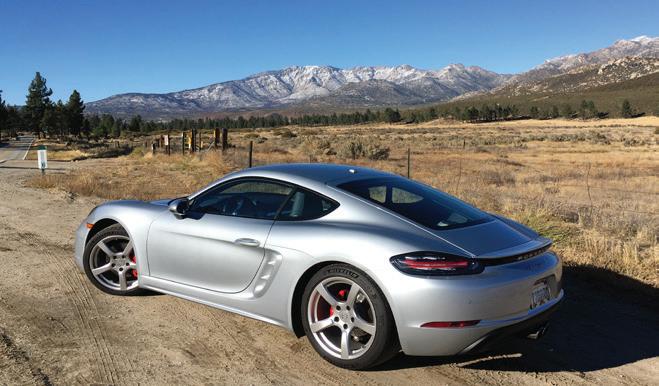
We are newcomers to the Porsche community having joined PCA-OCR in March 2020 after purchasing our first Porsche 2017 Cayman S in January. We have been disappointed, of course, by the cancellation of many PCA events due to Covid and have been looking for fun drives to take in our Porsche. We decided to extend our usual run to Lake Elsinore on Ortega Highway (Hwy 74) to drive the entire length of Hwy 74 from San Juan Capistrano to Palm Desert. The trip is about 115 miles with a travel time of about 3 hours, not including stops for restaurants and photos.
Advertisement
This trip turned out to be just what we were looking for. It was so enjoyable we ended up making the trip twice. First was a two-day trip last October with an overnight in Palm Springs, followed by a one-day trip in November after a rainstorm cleared the skies and left snow on the mountains for spectacular views.
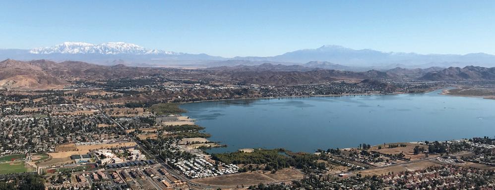
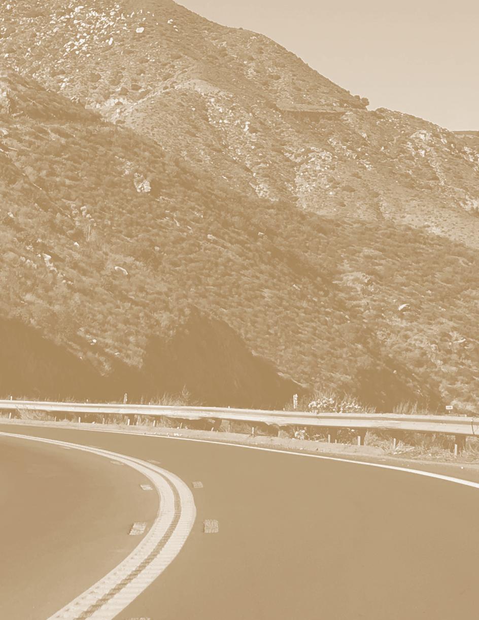
The Ortega Highway portion of Hwy 74 is a two-lane road well known for sharp curves. The best curves begin after crossing a narrow bridge (12.5 miles from I-5) and entering a steep canyon. Further on, after the passing the top of the hill, there is a good view of Lake Elsinore with Mt. San Gorgonio and Mt. San Jacinto in the distance. No left turns are allowed at the turnouts near the top of the hill, but a little farther down the hill a left turn is allowed into the parking lot of the Lookout Roadhouse. Just watch out for the uneven transition from the roadway to the dirt parking lot. After the viewpoint, there is a steep downgrade with a couple of sharp hairpin turns before entering the City of Lake Elsinore.
The “fly in the ointment” portion of the trip is getting from Lake Elsinore to Hemet. We first tried what we thought was a shortcut that runs south of Hwy 74 on Railroad Canyon Rd/Newport Rd through the town of Menifee. It turns out that this route has innumerable traffic lights that seemed to be synchronized for red lights. On our second trip we followed Hwy 74 throughout and made better time, even with some traffic.
Leaving Hemet, Hwy 74 runs alongside the South Fork of the San Jacinto River. Crossing a small bridge at the signpost for 3000 ft. elevation, the highway then begins climbing more steeply into the mountains. There is a large paved turnout on the left at 3.8 miles past the 3000 ft. signpost. This spot has a good view of the San Jacinto River in the foreground, with distant views of Saddleback Mountain to the west and Mt. Baldy to the northwest. Looking north is a nice view of Mt. San Jacinto. As the elevation increases, the terrain turns to pine forest and the road then reaches the junction of Hwy 74 with Hwy 243 in Mountain Center. Hwy
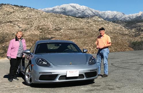
Pines to Palms Highway Story and Photos by Jim and Barbara Reese ”
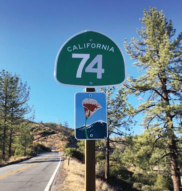
243 heads north to Idyllwild while Hwy 74 heads east towards Palm Desert. This portion of Hwy 74 is known as the “Pines to Palms Highway.”
After leaving the junction with Hwy 243, the road climbs over Keen Camp Summit, elevation 4,917 ft. The road then descends past Lake Hemet into Garner Valley with pine trees and ranchland terrain. We stopped for lunch at the Paradise Valley Café at the junction of Hwy 74 and Hwy 371. Their menu has a motorsports theme including a “Porsche” sandwich. The sandwiches were outstanding.
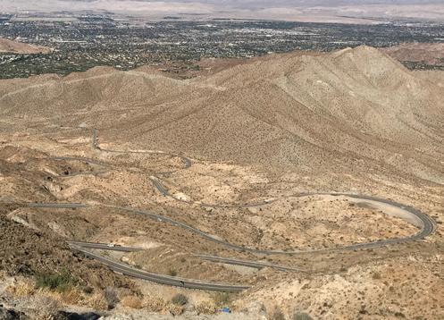
Hwy 74 continues as a gently winding road with nice views of distant mountains. Pine trees are gradually replaced by chaparral and rocky outcroppings. The Coachella Valley viewpoint is located 16 miles from the Hwy 371/Hwy 74 junction. This viewpoint overlooks the serpentine passage of Hwy 74 down the hill to the Coachella Valley.
The trip was an excellent Porsche drive with lots of sharp curves and great views. It was so enjoyable that we returned home on Hwy 74 rather than taking an alternate route. We are looking forward to making the trip again!