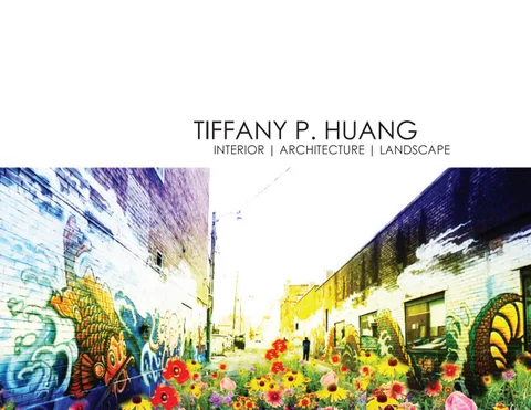
TIFFANY P. HUANG
INTERIOR | ARCHITECTURE | LANDSCAPE
Table of Contents Residence in Neihu, Taipei City | Ho+Hou Gozo Clothing Store | Straight Square Modular Systems I Gutter to Golf | Pontchartrain Sponge Park Thesis | Preserving Toronto’s neighbourhoods through laneways Western Waterfront | Beach Restoration Riverdale Park | Patches and Corridors Toronto Pearson Airport | Wetland Skate Park Visual Communication | HKG
1 Living room 2 Dining room 3 Kitchen 4 Recreation room
A
5 2nd daughter’s bedroom
D
6 Master bedroom
E
7 Master bathroom 8 Closet room 9 Storage room 1
10 1st daughter’s bedroom
2
B
5
7
6
11 Guest bathroom 8
3 4
Residence in Neihu, Taipei City | Ho+Hou This was a design renovation project, approximately 35 ping (116 sq m), for a family apartment housing a middle-aged couple and their two daughters. The biggest design challenge for this project was that the original ceiling height and beams were very low for this unit. Our dropped ceilings had to be strategically designed in certain areas to achieve maximum height. The second biggest challenge was that the client insisted on using all her old furniture, so a lot of the times our design was based on the furniture. Upon entering the house, we see the (1)living room and the (2)dining room directly adjacent to it. To the right is a partition that conceals a (4)recreation room with a piano and a work desk. The client wanted a very white interior with a light wooden floor but most of her furniture was very dark in color. Hence, we tried to blend the furniture into the space by creating a display wall that had some of the same medium and dark tones.
11 C
10
9
We continued the white interior scheme and ash wood flooring into the bedrooms. We used the same design elements in every bedroom to really tie the whole interior space together. This was achieved through cut-out wall designs and grey features.
ELEVATION A
ELEVATION C
ELEVATION B
ELEVATION D
ELEVATION E
The layout for the (6)master bedroom is less than ideal as the client did not want to demolish existing walls and wanted to keep using a larger than regular king sized bed in a spatially limited room. Pocket sliding doors are used to separate the main room from the (8)closet room and (9)storage room to keep the space fairly flexible. There is no load-bearing wall between the storage room and (10)1st daughter’s bedroom. The client wanted her daughter’s bedroom to eventually become an extension of her master bedroom after her daughter moved out in a few years time. Hence, we designed a wall of cabinets that could easily be knocked down in lieu of a wall.
GOZO Clothing Store | Straight Square The Asian fashion retailer, GOZO, wanted to rebrand their image with a new flagship store in Shanghai. Our design task was to help the company create a new store concept, which would better attract the target market. GOZO is targeted towards girls in their teens to twenties that have a quirky sense of style. The clothes are more casual/comfortable in style and tend to have muted colors. In Design Proposal 1, we opted for a simple grayscale color palette in order to let the clothes stand out. We used hardwood floors to give the space a warm earthy feel. We created a hanging steel frame with a curtain backdrop in order to create this juxtaposed feeling of bold and soft at the same time. We then used various shapes and textures for the furniture in order to mimic the varying shapes and patterns often found in GOZO’s clothing. A steel beam, which is also a light rod, cuts through the space arbitrarily to create a sense of whimsicality and some asymmetry. Display cases use light frames with glass in order to further accentuate flightiness.
In Design Proposal 2, we used the loom machine commonly found in textile factories as the source of inspiration for our concept. From the outside looking in, the store almost appears like a giant, whimsical loom. We used an off-white color for the entire interior and cultured marble for an accent wall. The purpose was to create a very futuristic character to the space, because the GOZO brand image emphasizes the idea of dressing beyond the ordinary and the contemporary time. All the clothes and products are hung on steel cables and rods to portray a very light feeling and airiness, and again, futureness.
Fall 2011
Modular Systems I When we construct things, we tend to have preconceived associations for how certain materials work and how they are applied. This project intends to help us break from those associations by recognizing materials and applications as unique properties and structures. Drawing upon the case study of Serpentine Pavilion 2002, designed by Toyo Ito and Cecil Balmond of Arup, we analyze a project through a system of taxonomy: material composition, process of fabrication, structure and form. This system of indexing or decontextualizing shows the emergence of a project through a series of processes rather than as a ready-made product. Serpentine Pavilion’s seemingly random roof frame was generated from an algorithm that superimposed scaled rotations of a square. Each structural beam was assigned a gauge and restrained by the minimal strength necessary. The wall pattern was then defined by extensions of the roof. Inspired by Ito’s algorithm as a tool to create structure and form, I devised a formula that would inform the design of a freestanding wall structure. Both projects use a system approach to dictate the process of fabrication, materials, and structural form. Having a fascination for origami and polyhedrons, I wanted to construct a modular unit based on those two things. Through much trial and error, I discovered a polyhedron that I could deconstruct and then reconstruct into a totally form. As a polyhedron, it remains a closed system, but when reconstructed, the polyhedron becomes an open system with infinite potential. Image credit: Ito, T. El Croquis #123: Toyo Ito 2001-2005 - Beyond Modernism. Madrid: El Croquis. 2004
height 168cm spread 154cm
New Orleans Context Map
[GUTTER TO GOLF] Winter 2011
Pontchartrain Park
Sponge
The City of New Orleans is dependent on artificial levees for the movement of water and sits partially below sea level. An elaborate underground storm sewer system sits below that city and intensively pumps storm water into major canals that carry the water to either Mississippi River to the south or Lake Pontratrain to the north. Northern parts of the city, like Gentilly District, were built on cypress swamps. The levee that forms the eastern boundary of this district was constructed in the 1920s, and the extension of the northern lakefront was constructed shortly after. These man-made boundaries created a bowl shaped topography that led to cumulative problems of soil and hydrology. This area was also one of the most affected during Hurricane Katrina. Pontchartrain Park Neighbourhood that sits within Gentilly District has a large municipal park worth exploring for stormwater solutions. This patch of open land can alleviate 100 year storm runoff and improve drainage when the underground system is at overcapacity. Top right diagram reproduced from Gutter to Golf, John H Daniels Faculty: Justin Cheung, Marc Hardiejowski, Juan Robles, Scott Rosin
Tree’s weekly water intake
Existing soil condition = 5 gallon
100’
50‘
Pecan Carya illinoensis
Live Oak Quercus virginiana
Baldcypress Taxodium distichum
Sweet Gum Liquidambar styraciflua
River Birch Betula nigra
No topsoil
Subsoil 5’ >55% organic matter 50-75% clay
100’
low water permeability
Plant more thirsty trees! The design strategy involved does not change the overall scheme of Joe Bartholomew Golf Course because the golf course was already top notch and the park itself is historically/culturally significant. It is important not to alter anything that will affect the nature and sequence of the game. To retain runoff from a 100-year storm, we need to plant an estimated 500 additional trees. Ten regional trees were selected for their 1) tolerance to flood and drought and 2) water needs. Estimated water needs were calculated from the equation*: 5 gal. + (5 gal. x caliper inches) The trees will be planted near existing ones in the rough and out-of-bounds areas. The impact of trees added onsite can only be observed after several decades when the trees become established. Image credit: http://media.nola.com/sports_impact/photo/joebart-101210jpgf48b5f81033c4534.jpg Information on trees and golf: *lake.osu.edu/topics/horticulture/files/Watering%20Trees%20FS1.pdf http://www.plantnative.org/rpl-arla.htm http://www.lsuagcenter.com/NR/rdonlyres/C6007A92-A5F2-4B6A9598-1487CABFB9CD/18167/pub2926NativeTreeGuide.pdf http://www.fs.fed.us/r8/foresthealth/pubs/storm_damage/hurrican e.html http://www.weekendgardener.net/tree-information/wetsoil090809.htm plants.usda.gov; www.na.fs.fed.us http://www.bae.ncsu.edu/extension/extpublications/water/protecting/ag-765-stormwater-golf-course.pdf
50‘
Sweetbay Magnolia Magnolia virginiana
Red Maple Acer rubrum
Black Gum Nyssa Sylvatica
Eastern Red Cedar Juniperus virginiana
Green Ash Fraxinus pennsylvanica
PHASE I: Implementation
$
PHASE II: Growth
Pontchartrain Park Neighbourhood Association appeals to the city’s Department of Park and Parkways and the Federal Emergency Management Agency for funding and assistance of this project.
Once trees start reaching maturity, they will start building its own topsoil from the leaves and debris that fall to the ground and decompose.
Pontchartrain Park Neighbourhood Association will work closely with schools and depend on volunteer work for the labor intensive planting of trees.
Once trees start reaching maturity, the roots will reach deep into the soil, improve soil condition with chemical processes and help reduce compaction.
It takes roughly 500 mature trees to absorb the runoff of a 100-year storm. It will take decades to observe any substantial impact because it takes decades for trees to mature. So we must start planting now!
Once trees are established, a new ecosystem will be introduced. There may be new wildlife, climate changes and a reduced carbon footprint.
Proposal
50+ years
X
lagoon with raised water table
topsoil build-up and riparian buffer
cart path
fairway
500’
G T G
T
T
T G
X
Detail plan rescaled to fit on paper Sections 1/64” : 1’ Perspective viewpoint
University of Toronto site of interest
[THESIS] Fall 2012
Preserving Toronto’s neighbourhoods through laneways Old neighbourhoods in Toronto are truly gems of the city. The neighbourhoods are loved for their historical architecture and their cultural vibes. But many of these areas are undergoing rapid gentrification and old buildings are quickly being demolished. The culture and identity of neighbourhoods will be lost in hindsight if we don’t have a long term plan for development. There are more than 2,400 laneways in Toronto, many of which are nested among old neighbourhoods. There is ample space in these laneways for options of densification, without the need to compromise old buildings. This thesis seeks to explore how laneways can be used as a tool to
provide options for development, slow gentrification and preserve the cultural integrity of neighbourhoods.
Diagram reproduced from Site Unseen: Laneway Architecture and Urbanism in Toronto
Toronto laneways first appeared in the late 19th c. alongside development to provide back-door servicing to houses. By the 1950s, laneways were relieved of their servicing duties with minimal alteration.
115 m. lot width 1.3% lot coverage 230 m. lot width 0.9% lot coverage
85 m. lot width 1.8% lot coverage
85 m. lot width 2.1% lot coverage
24 m. lot width 7.3% lot coverage
18 m. lot width 16% lot coverage
12 m. lot width 23% lot coverage
Why do some lanes feel safer to walk through? There are a number of laneways in Harbord Village that see much more pedestrian activity than any other laneways in Toronto. The reason being that these laneways have historical ties and were built in ways that allowed them to function more like a regular street than a back alley. I have done four case studies and made the following observations: RESIDENCY + INFRASTRUCTURE + SERVICE
Coach houses and workers’ cottages left from historical development have been converted into modern homes. These areas have infrastructure already set in place, which makes it easy for new laneway houses to be built. Single family homes facing regular streets have been converted to UofT student housing. These houses have open (unfenced) entrances from the laneway.
COMMERCE
Some businesses operate from the main street entrance and also from a laneway entrance
SHORT BACK LOT
The lots in these areas tend to be much shorter, hence the backside of many houses lie very close to the laneway
BALCONY
There are many balconies that sit above the first or second storey of houses, overlooking the laneway
PLAYGROUND/ PARKETTE
Small public playgrounds or parkettes are attached to some of these laneways
All of these conditions create eyes on the street which make these laneways feel more secure and comfortable to walk through. The site of interest is just southeast of Harbord Village and south of UofT. Laneways here have started to exhibit some of the above conditions but is nowhere close to being pedestrian-friendly laneways and still feel relatively unsafe.
1930
1940
1950
1960
1970
1980
Elizabeth Streets. This district, bounded by Spadina, College, McCaul and Queen streets, was a low-density residential area, containing two- and three-storey wooden houses built in the late nineteenth century. For a number of decades, the Jewish community predominated this area, and Chinese households accounted for only 20 percent of the population. In the late 1950s the Jewish community began to relocate to newer residential areas towards Bathurst and a large number of houses became available for sale and rent.
A neighbourhood that can easily phase out car dependence
Number of persons
Population age distribution
2006 census
1990
The universal immigration policy of 1967 encouraged migration by Chinese immigrants from Hong Kong, Taiwan and Southeast Asian countries, allowing business to expand in this area. Small Chinese associations, rooming houses, cafÊs, stores, restaurants and other small retail shops were set up on Huron, Beverley, D’Arcy and other side-streets of Dundas Street West. Larger restaurants, service and retail establishments, and Chinese associations spread out on Spadina Avenue from its intersection with Dundas Street West.
With the construction of City Hall in the 1950s and the expropriation of properties, Chinese shops and homes were forced to relocate and migrated westward to the Spadina location.
2000
2010
As the Chinese community began to age and shrink, revenues of businesses in the neighbourhood also decreased. In response to a dwindling economy, the city set up the Toronto Chinatown Business Improvement Area (BIA) in 2007. The neighbourhood is starting to gentrify.
2011 census
1200
1000
800
600
Located between University of Toronto and Chinatown, this neighbourhood has an eclectic mix of Chinese, economic families and university students. This demography is becoming largely stratified. As more young adults are renting dwellings, the neighbourhood is more and more like a college town, and families are fleeing. This puts up many houses for sale that private developers are keen to take down and rebuild on.
400
200
0-4
5-9
10 - 14
15 - 19
20 - 24
25 - 29
30 - 34
35 - 39
40 - 44
45 - 49
50 - 54
55 - 59
60 - 64
65 - 69
70 - 74
75 - 79
Source: Statistics Canada, 2011 National Household Survey; Statistics Canada, 2011 Census of Population; Statistics Canada, 2006 Census Tract Profile.
couple with children
owned
couple without children
rented
one person 2,220 ho use ho lds
its un
1,965 h ous eh o
1,965 h ous ing
2,220 ho usin gu nit s
Housing by tenure
s ld
employed labour force 15 years and over
other (includes non-family persons living together)
car, truck, van public transit walk, bike
Income status
all persons in private households
Chinese other
4,590 pe rson s
not visible minority 4,270 p ers on s
4,230 pe rson s
% in low income
2,000 p ers on s
Visible minority
2,250 pe rson s
other
4,585 p ers on s
Statistics show that the majority of people that live here take public transportation, bike or walk to work. These numbers do not include the number of students that also bike and walk to school and senior citizens that walk to places. Vacant parking lots/ garages are further proof that laneways serve much less than 20% of residents with cars.
85+
Mode of transport to work
Private household
In order to slow down this trend, it is necessary to attract more family type households back into this neighbourhood without displacing the current ones. What gentrification tends to do is replace certain types of people, and essentially, replace entire communities. Our goal is to introduce different types of people to diversify an already established community.
80 - 84
Age cohort (in years)
Prototypes and options for diversity
W
W
G G
W
W
A
R
R
W /G
R
R
It is important to create as many urban options as possible because that is how we attract different types of people and generate diversity. UofT is already starting to encroach into these boundaries. If we do not create new zoning bylaws and a long term goal for development, it will be no time until this neighbourhood is filled with high-rises.
R G
G
W
The activity of each laneway depends on a variety of factors - the function of surrounding buildings, the size and shape of the lane, etc. Hence, certain types of design and development are more suitable for some laneways than others. The laneways are categorized based on ideas from a series of case studies.
W
F
G
G)
Many organizations have been converting unwanted alleys into communal gardens to be enjoyed by residents. The Garden Lane is suitable for laneways that dead end inside residential blocks.
A
A
R) Vauban was built as a “sustainable model district” where the primary mode of transportation is by foot or bicycle. The streets are free from parking spaces and vehicles are allowed down these streets at a walking pace only to pick up and deliver. Residents that choose to own a car must buy a car park on the periphery of the development. Developments like Vauban are worth exploring at a smaller scale for residential laneways that are wide and open access.
F
F) Melbourne has laneways in the central business district that is not part of bylaw
G) Garden Lane
residential commercial
R) Residential Lane
residential
F) Food Lane
parks and open space
A) Artist Lane
50
100 m
W) Woonerf Lane
home to a vibrant culture of art, food and entertainment. They became gentrified since the 1990s and their heritage value officially recognized. There are some laneways in this neighbourhood that are hidden with historical remnants of a vibrant pub/ cafe culture. These one of a kind small stores can be revived in the lanes behind the existing cultural food hub.
A)
The Umbrella Sky Project is an annual art installation in the town of Agueda, Portugal and part of a festival promoting local arts and culture of the region. Large laneways that have less flexibility to change, such as the high-traffic commercial lanes behind Chinatown stores, can adopt this art strategy.
W) In the Netherlands, woonerfs are commonly found as shared
streets between cars, bikes and pedestrians. Defining characteristics are curved streets to slow vehicles, no curbs and intermittent parking. Woonerfs are suitable for laneways that serve as connection points.
Lane in Middlesbrough, Teesside
Vauban in Freiburg, Germany
Melbourne’s laneways
Umbrella Sky Project, Agueda
Dutch woonerfs
Image credit: North News & Pictures Ltd; Alex Ely / CABE; Ilana Mcmorran; David Ventura; ctenium.wordpress.com
R1
G
R2
G
R2
R1 A
F
F
Schematic plans and sections
A
R1
Prototypes for each type of laneway were created. The residential laneway involves two prototypes. The first type (R1) consists of a meandering lane with a large commercial/industrial parking lot inside the block. Luxury condo developers buy up the parking lot and adjacent residential parking to create 2-3 storey boutique homes. A new private laneway is created for public access that is car-free with the exception of dispatch service vehicles. There is underground parking that must be entered from one of the connecting woonerfs. The second type (R2) is a straight lane that offers flexibility with individual private developments. Laneway homes are not built with car storage along this car-free lane. The garden lane (G) is designed depending on the needs of the adjoining residents. Car parking is pushed to the edge of the lane while garages are converted into storage sheds (to store communal garden tools, barbeque grill, etc).
PLANS 1:1500 SECTIONS 1:500
R2
G
A
F
The artist lane (A) is meant to encourage more urban activity. The parklet offers tables with Chinese chess boards and a place for the high percentage of Chinese senior residents to mingle. Alternatively, the tables offer an outdoor place to eat and hang out in general. The laneways are strung with artwork and lights for pedestrians to walk through and admire during vehicle off-peak hours. Situated right behind Baldwin Village, an enclave full of restaurants, the food lane (F) offers further options for dining, especially for after hours. Old speakeasies hidden in these laneways have been revived and converted into trendy cafes and pubs. Food trucks operate until late at night, catering to those night owls. Image credit: Lanehouse on Bartlett by Curated Properties; Mendoza Lane House by Lanefab; Hampden Lane House by Robert Gurney; 40R Laneway House by Superkul Inc; Laneway House by Kohn Shnier Architects; Gradient House by Superkul Inc
Beach erosion
Fall 2010
Western Waterfront: beach restoration The Western Waterfront today consists of a chain of under-developed public parks and beaches that line the water’s edge between the Humber River and Ontario Place. These public spaces are cut off from the surrounding City by a major transportation corridor comprised of The Queensway, CN Rail Corridor, Gardiner Expressway, and Lake Shore Boulevard. The Western Waterfront is perceived as a hot spot for the surrounding local community rather than a city destination spot. Destination spots tend to have a clear purpose and identity. Just north of the Western Waterfront, there is High Park that offers extensive greenscape and seasonal blooms. To the right, the Central Waterfront is a cultural/commercial hub of activity. Western Waterfront needs to be redefined as a beach community in order to become a destination public open space. Three City beaches, collectively known as Sunnyside Beach, mark the Western Waterfront shoreline. In 1914, the Toronto Harbour Commission (THC) moves the shoreline further south by lakefilling and the federal government constructs offshore breakwaters to prevent beach erosion. The biggest problem with breakwaters, however, is that they only provide a short term fix. Waves can displace the breakwaters over time and the need for constant replacement makes it an expensive process and a waste of taxpayers’ money. Breakwaters are also hideous and ruin the view. A more effective solution to prevent beach erosion is to mimic natural beaches and their processes. Source: http://www1.toronto.ca/city_of_toronto/waterfront_secretariat/fil es/pdf/wwmp-final-report-21aug09.pdf
Man-made beach
Healthy beach profile
vs Succession
+
74 acres
Tilling
+ Seeding
+
27 acres
Mulching
+ Mulching
+ Planting
+ Raking
Mowing
+ Weeding
+
+ Infilling 54,000 cu. m. sand
+
Weeding
Monitoring
Marram grass and sand dune ecology
2,100 plugs marram grass
Monitoring
As sand accumulates on a beach area, forces work together to move deposited sediments inland, where they form dunes. Waves continue to push sand up onto the shore, and winds carry dry sand away from the water. Eventually, piles of this sand become contained and fortified by various grasses, shrubs and other coastal vegetation. These piles of sand are known as coastal sand dunes. Sand dunes are very important to coastal ecosystems; they may need a beach's sand in order to form, but a beach needs a dune's reservoir of sand to replenish itself after a storm. Coastal areas are protected from erosion because sand dunes absorb the effects of storms and surges. Sand dunes also provide a foundation for ecosystems made up of a wide variety of coastal life. Marram grass (Ammophila arenaria) is commonly found/planted in coastal sand dune ecologies. This grass reproduces mainly by a network of creeping underground stems (rhizomes), which spread vertically and horizontally and locks the sand in place. The strategy for Western Waterfront’s beach restoration will depend on marram grass plantings all along the shoreline.
F F
E E
D D
C C
B B
A A
Creating a task force C B
Key Sections
A lot of effort and time is needed to establish a new coastal dune ecosystem. Planting marram grass for such a large area requires manual labor and can only be achieved through a task force. Community groups, schools, varying types of non-profit/governmental organizations need to get on board with this project to save the beach. When new sand and sediment accumulate after the initial planting, the task force must go back to the site every few years to see which areas need intensification and plant more grass. It is important to see that with most restoration projects, it is an ongoing process. We won’t see immediate results and we can’t reap the benefits until much later on.
A
D E
5 years
F
35 years
50 years C B
Key Sections
A
5 years
D E
F
35 years
50 years
Don River Watershed
a
Riverdale Park the missing patch
Fall 2010
Riverdale Park: patches and corridors According to Richard T. T. Forman, patches and corridors are essential to landscape ecology. Patches represent species habitats and corridors are the conduits that allow species to travel to and from habitats. The patch and corridor needs of species can vary greatly. Specialist species need certain patch and corridor requirements (specified size, shape, scale, vegetation) in order to thrive, while generalist species can thrive in a range of conditions. In Toronto, there is continuous loss of species diversity due to diminished patches and corridors. A number of regional species of the Don River Watershed are reportedly endangered. Riverdale Park sits near the mouth of the watershed in downtown Toronto. There is a noticeable lack of forest cover south of this area and north of the Toronto Islands. Riverdale Park is a perfect opportunity to become a habitat patch for this green connectivity. Due to the fact that parks in the city are overly manicured, generalist species - like pigeons, raccoons and squirrels - have taken over the population of specialist species and have turned into problems of pest. Our goal is to reintroduce specialist species to offset that ratio and create species diversity. Don River Watershed map: www.trca.on.ca
Concept existing plant communities observed patch patch opportunity corridor opportunity existing aquatic communities wetland opportunity water flow major infrastructure main circulation recreation opportunity
Habitat succession 2010-2090
Program carved pathways for walking, jogging, biking, rollerblading, skateboarding, wheelchairs active sports: baseball, softball, soccer, football, rugby, frisbee passive recreation: dog-walk, stroll, bird-watch, game-watch, picnic, rest, socialize, draw, photograph 5-10m+ tall
1-5m tall
>1m tall
aquatic plants: water lily, juncus effusus, sedges, cattail, mare`s tail, cordgrass, arrowhead, spike rush, pickerelweeds, duckweed, jaumea hardwoods: sassafras, oak, maple, quaking aspen, cottonwood, willow, alder, birch, cherry, poplar, dogwood, butternut shrubs: willow, dogwood, honeysuckle, raspberry, blackberry, rose, sarsaparilla, chokeberry, juniper, elderberry, viburnum ground cover and wildflowers: blue vervain, tickseed sunflower, bonete, bulbet fern, big blue stem, little blue stem, canadian wild rye, switch grass
section a - dry season
section a - wet season
In order to diversify species, there must be diversified habitat. The existing Riverdale Park has some observed ecosystems, but much of the park is open lawn with lots of invasive trees. There is a rich woodland that sits outside the park boundaries on the west side and is the only habitat patch of significance in this area. The strategy is to expand that ecosystem throughout the whole park with ecological succession. Riparian zones and wetlands will be incorporated into the floodplains adjacent the Don River, creating transition and passage for aquatic/semi-aquatic species. It will take at least 80 years for ecological succession to establish its climax community. By then, the endangered species of this region will hopefully have reappeared and reestablished their numbers.
Winter 2010 | Collaboration with Han Liu
Toronto Pearson Airport: Wetland skate park Toronto Pearson Airport has undergone dramatic changes since its opening in 1938. By mid 20th century, Toronto had become the largest city in Canada, and the city’s airport naturally expanded to accommodate the rapidly growing population. In 1969 the federal government set up regulation for noise control by disallowing residential building around the immediate vicinity of the airport. Much of the development surrounding the airport became commerce and industry, while the remainder of open space became contaminated brownfields. There seems to be a common trend among big international airports where the surrounding area is spotted with soley commercial/industrial buildings (usually related to aircraft). For the everyday passenger, the only entertainment one can find while waiting for their flight is inside the airport. The junction of Etobicoke Creek and Highway 401 (at the southeast corner of the airport runways) has opportunity to become a destination park. Due to the noisy condition of the site, this area is the ideal playground for action sports such as skateboarding. Source: Missisauga Master Plan, GTA Master Plan, Google Map 2010
Contamination
Hydrology
Wetland proposal
Water quality control The main problem on this site is Highway 401 which divides the Etobicoke Creek corridor into a north and south, and hinders a continuous flow of circulation. The area is highly contaminated with pollutants due to runoff from the airport facilities and the highway, fertilizers from nearby farmland, and chemicals left over from the Air France plane crash in 2005. There are three main strategies for this site that aim to tackle 1) contaminated soil and water 2) separated space. First, we will convert the existing detention pond into an extended, combined subsurface and open water wetland system to treat stormwater runoff that comes from the airport before it reaches Etobicoke Creek. Secondly, we use phytoremediation in the contaminated cultural meadows and forested areas to treat the already contaminated soil. The third strategy involves creating better circulation for pedestrian use, especially in the north-south direction, by connecting broken paths into a continuous one.
in rk Pa g Lo t
Conv
air Dr
Parking Lot
ay
w igh
1
40
oke bic
Eto
H
ek
Cre
Eto
bic
ay
ok
eC
ree
k
1
40
w gh
Hi
Meadow
Wetland
Forest
Skate Park
Subsurface Wetland 0M
User experience The steep slope from Convair Drive declining toward Etobicoke Creek has been recontoured into a smooth, gradual one for the purpose of skating. Varying sized ramps, bowls and pipes are offered so skaters have options. The pedestrian walkway is an elevated bridge that snakes through/around the wetlands and underpass, and terminates south of the highway. Woodlands and cultural meadows have been maintained from existing conditions. This park project will managed by the Greater Toronto Airports Authority (GTAA) and become part of their expansion program.
N 100M
Looking west
Skateboard half-pipe
Subsurface wetland
Looking southwest
Skateboard fun box
1
2
3
4
5
6
[Visual Communication] Spring 2010
HKG
Metrics of contemporary landscape representation of Hong Kong International Airport (1) Planometric representation - surfaces and structures. Original drawing scale 1:15,000 (2) Laser beam cutting & assembly - surfaces and structures. Scale 1:15,000 (cutting process, power 8, speed 10) (3) Axo/isonometric representations - oblique aerial perspective. Altitude 1,500m. Distance 3,910m. Lens length 50mm (4) Composite aerial imaging (5) CNC machine cutting topographic model (6) Tectonic topography. Lens length 30mm
7
8
(7) Contour and profiling - proposed infield berm. Altitude 1,500m. Distance 3,910m. Lens length 50mm. Drawing scales shown here are not to scale (8) Composite/panoramic imaging