5 minute read
40 Years of the Canoe Route


Recession-era makework project created a “lasting legacy”
What was I to do? It was 1983, I had a wife and four young sons under six. My job at a major forestry company had disappeared due to changing forest practices and policies.
Advertisement
BY STEVE DROSDOVECH
For the first time in my 20 years of forestry work, I had to take employment insurance.
That was not to be for long. I was asked to engineer a project that was put together by the Powell River Chamber of Commerce and the Forest Service to help provide jobs for unemployed forestry workers. It was to be an exciting project, linking eight of Powell River’s pristine lakes to form a route for people to portage via canoe; the Powell Forest Canoe Route.
As I met with the Resource Officer I became more and more excited by this idea.
Now I was imagining hikers and canoeists and visitors to Powell River, discovering these pristine areas that I knew so well. I was up to the challenge.
My first job was to walk the routes and to make notes of the trails to be considered or to be changed, even to be completely re-routed. Then the trail maps had to be made.
My walls at home were soon decorated with drawings, notes and maps as each route was planned and evaluated. My kitchen table covered with lay-out and engineering notes. Our children were understandably curious and delighted by this display of tempting papers. The array was a huge challenge for 40 sticky fingers to resist.
I had made many maps before in my forestry work and with the help of the Forest Service it was not long before the route took shape.

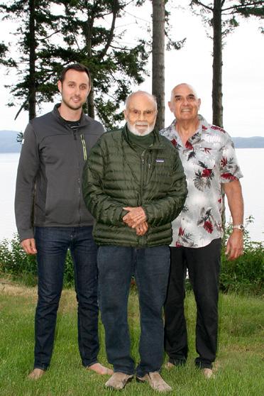
Steve on EI in 1983, with his four sons, planning the canoe route. He’s with Bob and Sandra Audet and their two children.
The challenge was to engineer routes that would not break the backs or spirits of the canoeists carrying packs, supplies and of course canoes, sometimes for several kilometers. I wanted as much as possible to prevent presenting them with very steep curves or climbs.
Several of the lakes already had trails between them, but not to the standard that was needed for this project.
It was not too long before I met the crew who were to build the portages between the lakes. This was to be back-breaking work. The supervisor, Barry Agar was to oversee them while I had the luxury of consulting on the engineering aspects, just watching and encouraging. There was no way to smooth out everything the landscape threw at us. The trail between Windsor and Goat Lake was dubbed “cardiac hill.”
I am not sure how many of them realized their work would be appreciated by people from across Canada and many other countries. In fact, the Powell Forest Canoe Route placed Powell River on the map of the world as a world renowned place for outdoor recreation, along with the Sunshine Coast Trail.
As I look back now, I appreciate having had the privilege of helping create this lasting legacy.

THE OG: Retired forester, Steve Drosdovech, with the original map for the Powell Forest Canoe Route – a project he undertook in 1983 on behalf of the Chamber of Commerce and the Forest Service.
Building up our swish paddle journey
BY PIETA WOOLLEY
In mid-May, 14 people, some who were part of a work training program, moved more than 20,000 lbs of picnic tables, fire rings and lumber on to the Powell Forest Canoe Route. All of it was trucked into the bush and hauled in by boat and by hand.
“It’s all going to remote locations,” said Hugh Prichard, who is coordinating the $300,000 upgrades as part of his work as project manager with the Powell River Education Services Society, which is a partner with Recreation Sites and Trails BC in the operation of the route. “Every board and screw had to be barged, canoed, or hiked in.”
After 40 years, the amenity is getting some much-needed upgrades. They include replacing the last 25 of the routes original Canoe Rests; building six new composting toilets at remote campsites; adding new tent sites and platforms for a better night’s sleep; two new docks and ramps; replacing bridges and boardwalks; new kiosks and signs; installing animal-safe food caches; and much more. The money for the improvements at the Recreation Sites came from the Ministry of Tourism Arts Culture and Sport.

GIVE IT A REST: The canoe route has 10.5 kilometres of portages – and now, there’s a new canoe rest every 100 metres. That’s 110 canoe rests built – if anyone’s counting. Thus, a new canoe rest.

A 40-year-old canoe rest.
Likely thousands use parts of the route each year; when it was established, those kinds of numbers were never anticipated, said Hugh, who has been coordinating the maintenance on the with the route in various capacities since 2007. What’s changed since then, he said, is the management has to be much more mindful now of environmental and social impacts of building through this land. The route runs through land owned privately, as well as TFL 39, and it’s on the Traditional Territory of both Tla’amin and Sechelt Nations.
“All new improvements are above ground,” explained Hugh. “There are no big excavations, everything is leave-no-trace, minimal impact. In the old days we would have dug a huge pit toilet. Now, the toilets don’t go in the ground at all.”
In the next 18 months or so, the route will be renamed as part of its revitalization. Hugh is also collaborating with Sunshine Coast Tourism and others to design and install interpretive signage along the route that will include new kiosk maps and other wayfinding markers.
The sheer number of people and groups involved in working on the route is staggering. In the beginning, it was a crew of laid-off foresters, with the Chamber of Commerce and the Forest Service at the helm. Then timber companies (most recently Western Forest Products) maintained it and generally took responsibility for it. For the past 15 years, the province, WFP, Tla’amin Nation, VIU, PRESS and volunteers have all contributed to this unlikely but remarkable achievement.
“The objective we are after is to preserve a world-class freshwater paddling journey,” said Hugh.