4 minute read
Taumanu Reserve–Onehunga Foreshore Restoration


Auckland, New Zealand
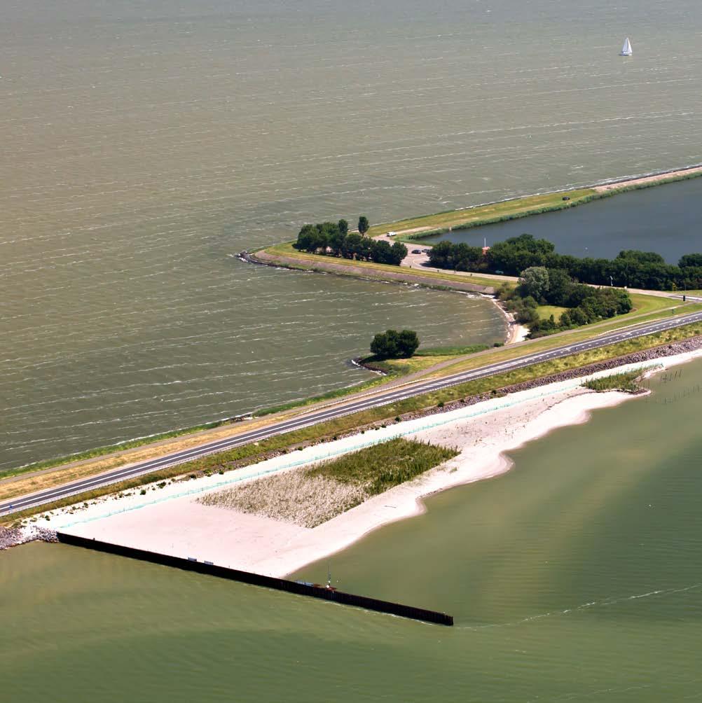
Taumanu (Taāumanu) Reserve is a recreational park created in 2015 on land reclaimed from the Manukau Harbour in Auckland’s southwest. The project was executed by the Auckland Council and the New Zealand Transport Agency and planned by the environmental and engineering consultancies, Tonkin & Taylor Limited and Aecom; landscape designs were executed by Isthmus. The head contractor, the New Zealand construction firm Fulton Hogan Ltd., provided the project management and construction services required to transform project designs into a reality. The creation of Taumanu Reserve was initiated and driven by a passionate and well-organized community wanting to restore the foreshore that was once accessible to them; the foreshore was cut off from the community when the state highway was built across the Onehunga Bay in the mid-1970s.
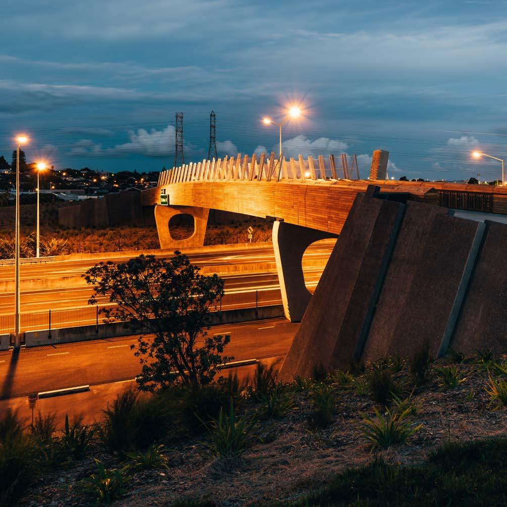
Taumanu Reserve is composed of 6.8 hectares of new coastal reserve; nine beaches formed from either sand or gravel; 1.5 kilometers of shared use path; a gateway pedestrian footbridge over a motorway integrating reserves; a festival lawn for public events; a boat ramp; and a car park with toilet and shower facilities. The project won the World Architecture News Transport Award-2016 (for Taumanu Bridge) and the New Zealand Institute of Landscape Architects Nzila Award of Excellence—te karanga o te tui (Māori design excellence)—2017.
Article cover: A formed hill creates land-to-land access to the newly formed recreational park. (Photo by Tonkin & Taylor)
Producing Efficiencies
The challenge was to deliver the beach’s and reserve’s technical functions in a dynamic coast environment while successfully incorporating the cultural, social, and cultural requirements of multiple stakeholders within a fixed budget that included design, approvals, and construction.
The commitment to using a nature-based framework for design required the understanding, coordination, and layering of many technical and subject matter experts’ input—including those outside engineering, such as landscape architects and flora and fauna experts—as well as input from contractors for construction efficiencies. The layering of expert input ultimately resulted in increased resilience and decreased costs throughout the project cycle and efficient construction programming.

Using Natural Processes
The layering approach started with nature and involved three steps: (1) using the natural environment to determine the starting point for each design element; (2) applying technical engineering to design a functional piece of infrastructure; and (3) overlaying the functional infrastructure with multiple layers of enhancements that would improve the aesthetic, ecological, cultural, and social outcomes that the infrastructure would achieve.
An example of the layered development approach used in this project is the creation of lava flow headlands in lieu of rock groynes, or “groins.” These reflect the adjacent environment and have a natural appearance; their ecological function is also enhanced. The headlands enabled the creation of nine beaches formed from either sand or gravel. The beaches are based on the processes that were observed and modelled from around the wider Manukau Harbour’s coastline.

Broadening Benefits
Numerous environmental benefits were realized; for example, there were significant water quality improvements made to Onehunga Bay that reduced Escherichia coli (E. coli) and brought the water up to safe swimming standards. A return to more natural coastal processes in the bay and restoration of the environment was delivered, as was increased biodiversity of the Manukau Harbour through the selection of plants and provision of habitats that promote biodiversity. Increased resilience and decreased costs were also realized by working strategically with the site’s existing natural features. The primary social benefit is a strong sense of community ownership towards the reserve, an attitude that was built through a collaborative working process and Māori-inspired design choices.

Promoting Collaboration
A complex landscape of treaty negotiations was traversed between the region’s Māori and the Crown; as an indirect consequence, negotiations were also conducted between the Auckland Council and the Crown. A Mana Whenua Kaitiaki (the persons and/ or agents who perform the tasks of guardianship over a particular resource or area) Group (MWKG) was formed as a forum for engagement on matters of significance for Mana Whenua (Māori with authority over the land). The MWKG formation produced a large number of positive outcomes, including stormwater quality improvements, Mana Whenua input into plant design and selection, and the inclusion of two Pou Whenua (artworks) incorporated into the project plan.