4 minute read
Medmerry Managed Realignment Scheme


Selsey, West Sussex, England, United Kingdom
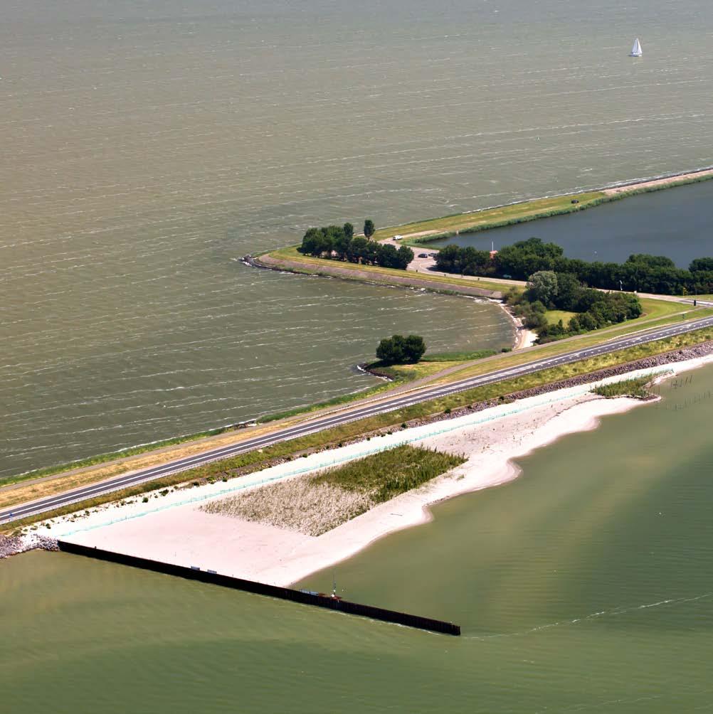
The Medmerry Managed Realignment Scheme (plan) in West Sussex was constructed by Team Van Oord and the Environment Agency of England (EA). The project came about through a combination of a need to improve flood risk management to West Sussex communities, and a requirement of the EA’s Regional Habitat Creation Program to create intertidal habitat. The scheme is comprised of the largest realignment, or restoration, of open coast in the United Kingdom. New flood banks were built from approximately 500,000 cubic yards of clay obtained from on-site borrow pits. The augmented borrow pits then contributed to the intertidal habitat area, which is revealed at low tide. The project, which was completed in 2013, provides a one-in-one-hundred-year standard of defense— representing an increase from a one-in-one-year standard prior to implementation—to 348 properties. The project has won several awards, including the Environmental Excellence Award for Dredging for Coastal Reinforcement in 2016; the World Dredging Association Conference’s Coastal Resilience Environmental Award in 2016; The Prime Minister’s Better Public Building Award, and the Civil Engineering Project of the Year, both received as part of the 2014 British Construction Industry Awards.
Article cover: Medmerry coastline with partial inundation. (Photo by the Environment Agency of England)
Producing Efficiencies
The managed realignment was implemented by constructing clay embankments on a retired alignment, tying into high ground where possible, and defending all residential and commercial properties in the hinterland. The seaward ends of the embankment are protected and tied in with rock. The scheme links to adjacent private defenses built around the same time by Bunn Leisure’s holiday park.
Using Natural Processes
As an alternative to traditional forms of flood risk management, this scheme used natural processes to reduce local flooding by creating new salt marsh on the seaward side. This marshland was designed to absorb wave energy and reduce the amount of water that could overtop existing defenses. In addition to flood protection, the salt marsh provides a rich habitat for wildlife, promotes infiltration, stores water, and reduces the runoff rate into the estuary.

Broadening Benefits
The project has increased recreation and tourism opportunities and led to the creation of new green infrastructure, such as 10 kilometers of new and replacement footpaths, bike paths, and horse trails. The scheme has also created new habitat and led to biodiversity gain, creating 183 hectares of intertidal habitat and 80 hectares of transitional grassland. Mitigation was also provided for 50 hectares of a freshwater Site of Special Scientific Interest (SSSI)—a United Kingdom conservation designation indicating an area is protected—within and around the realignment area.
The EA has leased the land to the Royal Society for the Protection of Birds (RSPB) to manage as a nature reserve, mostly on ninety-nine-year lease. RSPB has leased much of it to tenants (some of whom are former owners) for conservation grazing and arable use, both landward and seaward of the new sea wall, creating a mosaic of land use and habitat.


Promoting Collaboration
The EA worked with local residents and interest groups to establish the Medmerry Stakeholder Advisory Group, which consisted of over 20 individuals and/or groups. The project team members were Mackley, the EA, the RSPB, Arcadis and Jacobs. As mentioned previously, the construction effort was led by Team Van Oord. Most of the land required for the project was acquired through voluntary purchase by the EA of three complete farms, excluding farmhouses, at a cost of around 10 million British Pounds. Some of the land purchase was subject to overage. The RSPB owned part of the land used for the project and contributed it. Following completion, the land acquired by the EA has been leased to the RSPB—primarily on a ninety-nine-year lease—to manage as a nature reserve.