2 minute read
Coastal Storm Modeling System
U.S. Army Engineer Research and Development Center
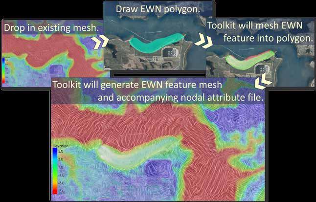
Integrating physics-based models to create realistic coastal storm risk assessments. Accurate coastal flood risk quantifications saves millions of dollars in construction costs for new structures, but creating those accurate assessments requires robust, sophisticated numerical models integrated into complex statistical frameworks. The U.S. Army Engineer Research and Development Center (ERDC) Coastal Storm Modeling System (CSTORM) provides a state-of-the art standardized approach to high-fidelity coastal storm modeling. The CSTORM modeling system combines physics-based numerical models with an efficient workflow and the ability to analyze risk to coastal communities from storms both now and under future sea level rises. With the toolkit, users can interactively design and add natural and nature-based features (NNBF) to the CSTORM models and quickly manipulate multiple aspects of their design. The workflow is based on ten years of successful CSTORM case studies, and the toolkit’s recommended model parameter settings for EWN features are taken from extensive literature review sources. With the higher accuracy results from the CSTORM modeling workflow and the powerful and efficient new capabilities of the EWN Toolkit, engineers and researchers can innovate and confidently assess coastal and riverine resilience design work.


