PRIYANKA KAR
ARCHITECTURE AND URBAN DESIGN PORTFOLIO


[SENSOR]IAL LANDSCAPES
INSTRUCTOR: Francesco Garofalo
option STUDIO FALL 2023 harvard gsd
INSTRUCTOR: DANA MCKINNEY peter g. rowe rahul mehrotra
CORE STUDIO FALL 2022 harvard gsd green stitches grey needles
03
INTENSIFYING THE URBAN SPIRIT OF PARIKRAMA MARG
INSTRUCTOR: sanjeev singh tapas mitra undergraduate thesis 2019 spa bhopal
04
INSTRUCTOR: ANA MARIA DURAN CALISTO option studio spring 2023 harvard gsd reimagining shushufindi
05
DISCRETE MUTATIONS
06
MAPPING EXERCISES
INSTRUCTOR: SUSHANT VERMA AMAN JAIN academic project 2021 smartlab 4.0
instructors: ANA M. D. CALISTO FRANCESCO G. STEPHEN GRAY academic projects harvard gsd
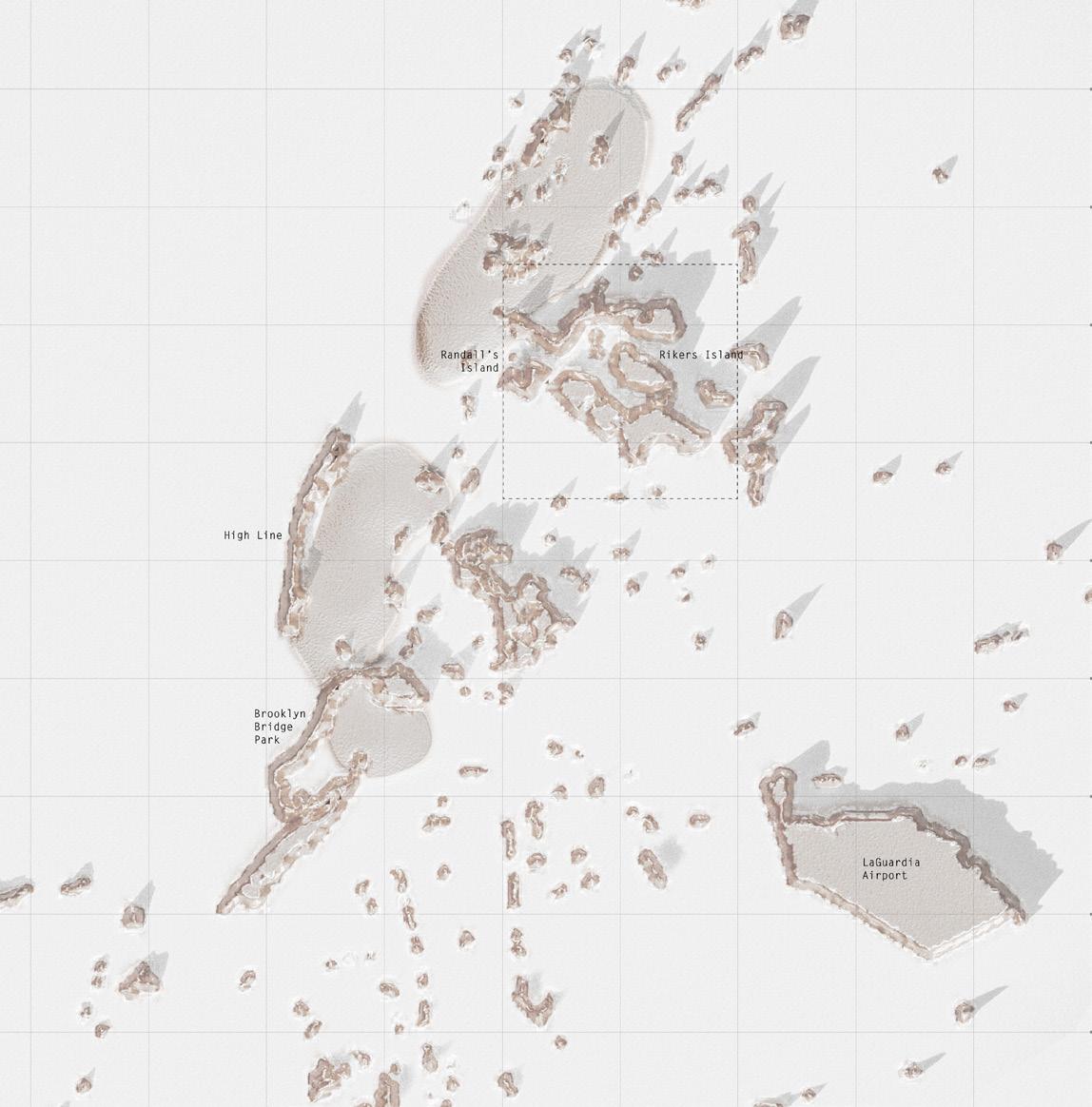
The idea of surveillance generates an invisible infrastructure which surrounds us. It generates an alternate streetscape that remains hidden from our naked eyes but actually determines the alternate urban reality that we live in. Different forms of surveillance along with degrees of accessibility helps us achieve at the critical juncture of ‘control’. Upon research on New York city, it is found that areas of public access are highly controlled.
Paradoxically, areas of zero public access, such as Rikers Island, are at the most extreme end of control. What is extremely controlled is actually invisible to the public eye.
Surveillance, an inseparable part of urban life that poses a considerable threat to personal liberty and the seamless functioning of our daily lives, has evolved into an indispensable tool in the modern era. It serves as a means to monitor activities, movements, facial expressions, speech, and, in certain instances, even wastewater.
At a time when surveillance is often linked with privacy issue and pervasive technology, our objective is to establish a better form of surveillance framework—a form that allows us to monitor our environment, to better our future amidst the challenges of climate crisis.
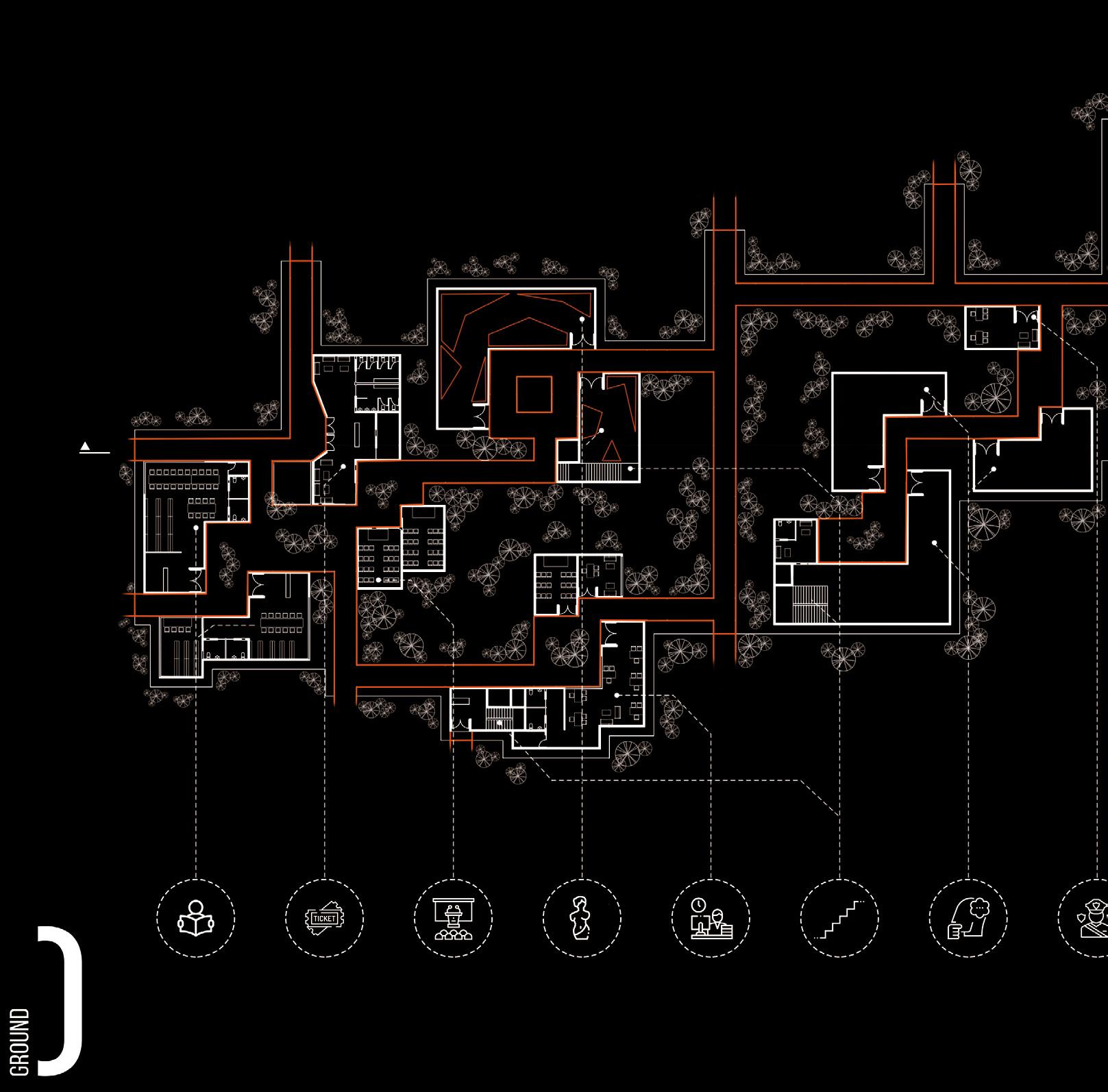
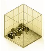
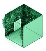
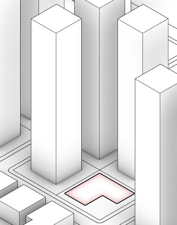
landscape PRoPOSAL FOR post-carceral landscape of riker’s island
HARVARD GSD
distinction project team work with Gracie meek
RIKER’s ISLAND
NEW YORK USA
fall 2023
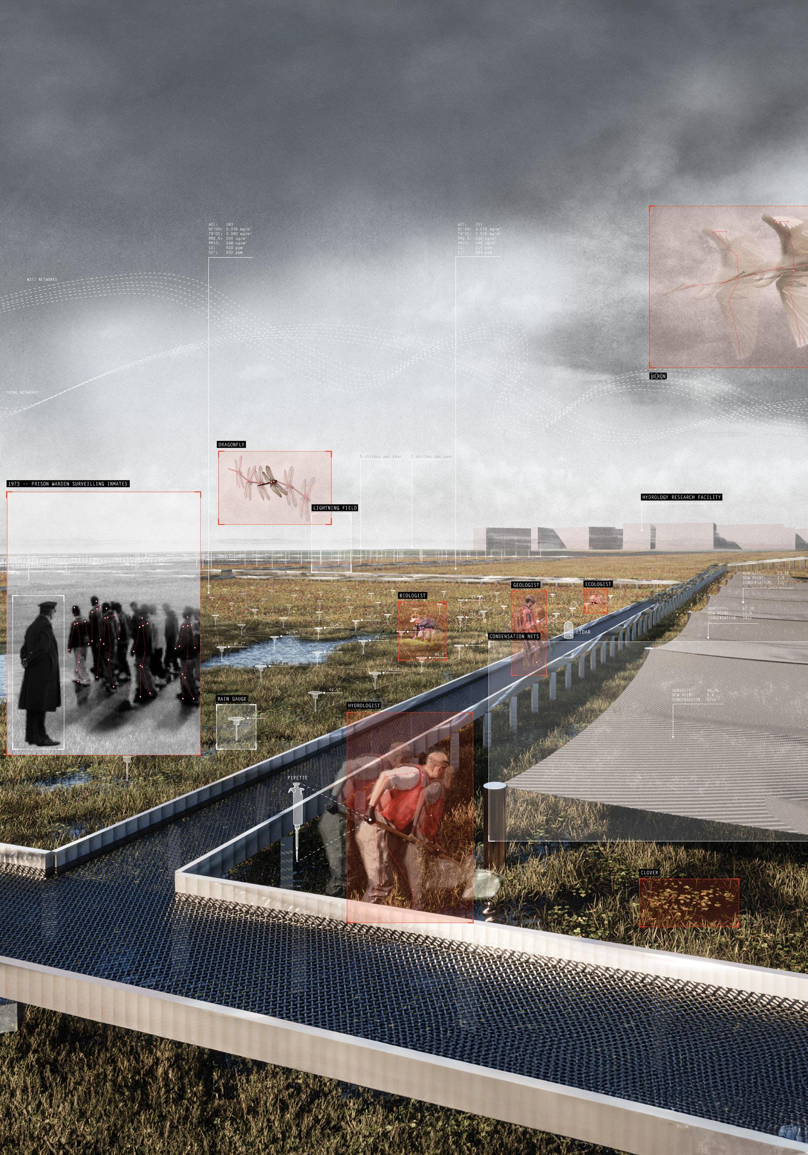
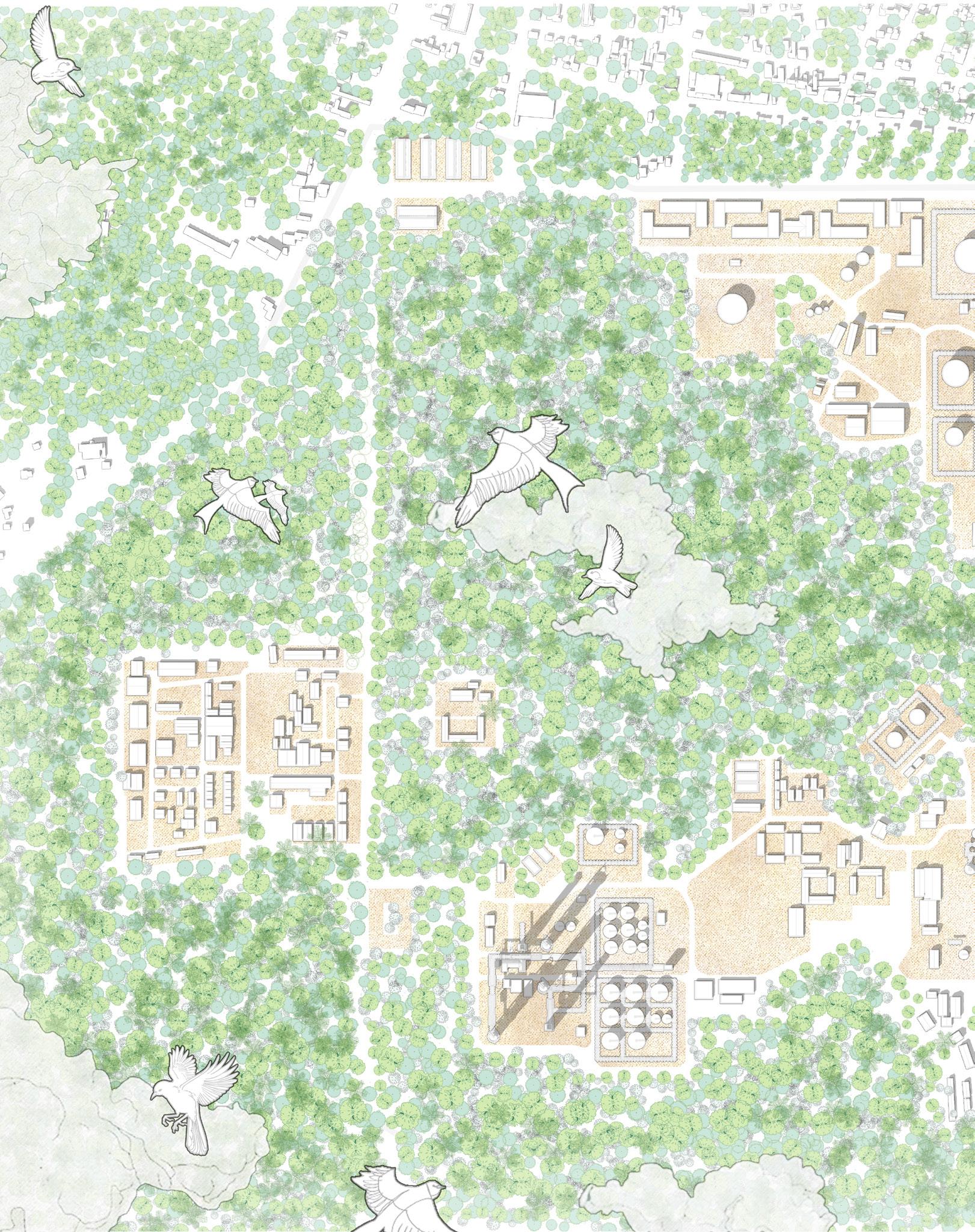
A rendered view of Riker’s Island set in the era of 2100, where the subject of surveillance has shifted beyond incarcerated people to various zones of a critical zone, monitoring the impact of human activity on a post carceral landscape and the activity of human and non human agents.
+1 Twitter
+3 Public Cameras
+2 Private Cameras
+1 Shazam
+1 Phone Calls
+1 Patrolling
+1 Stop and Frisk
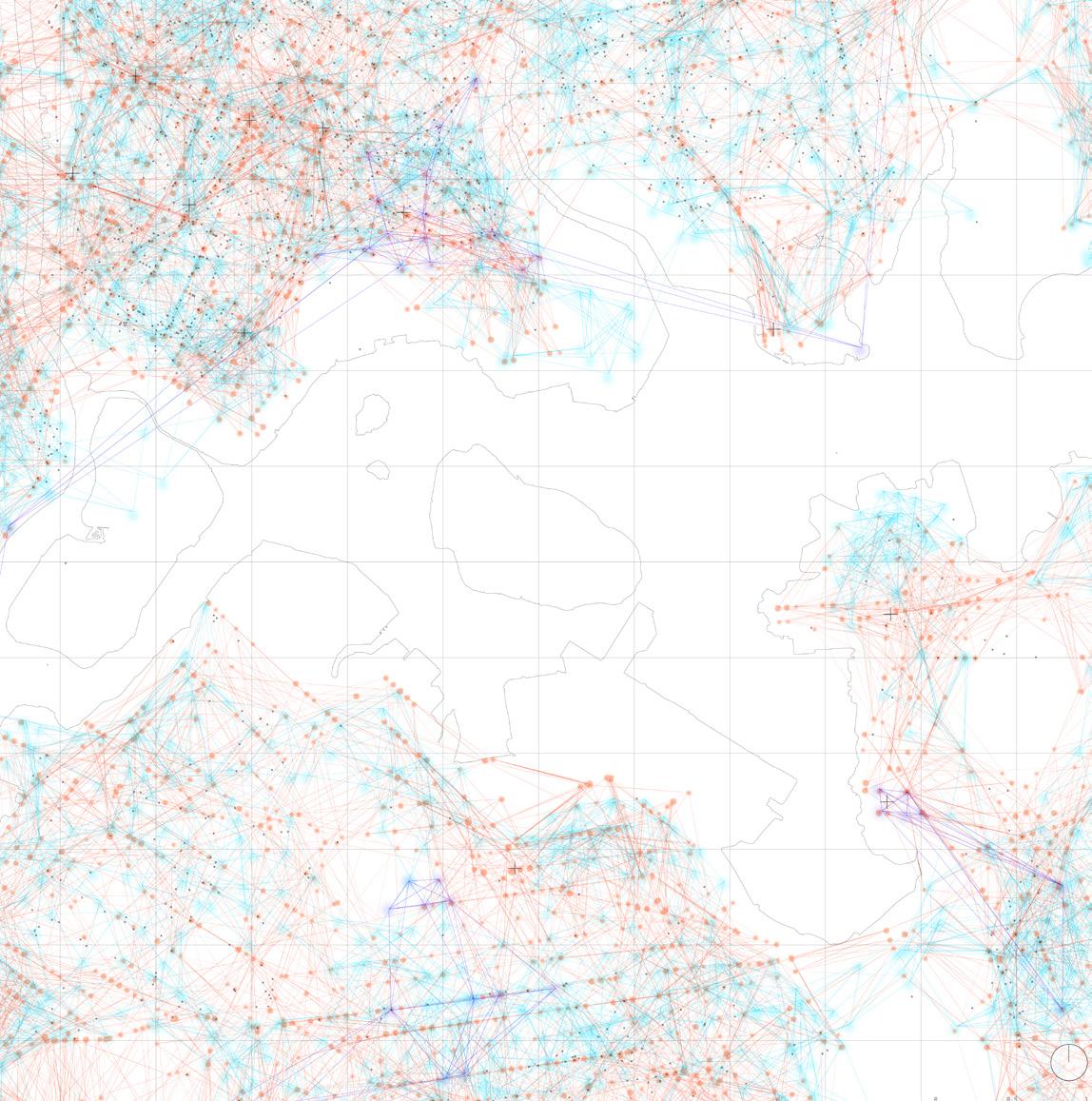
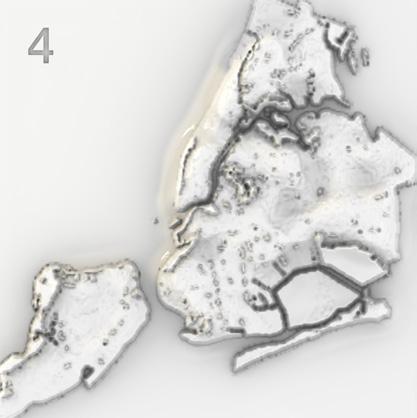
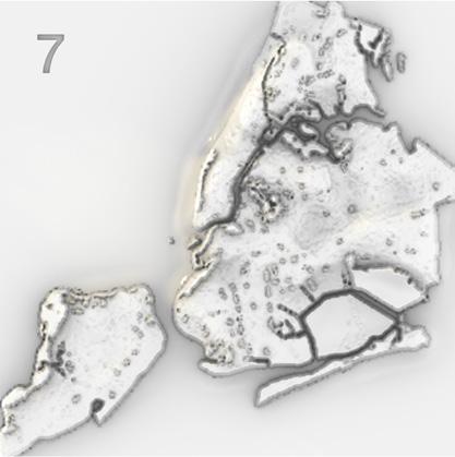
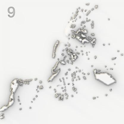
Archipelagos of Control generated by algorithm using surveillance data points of NYC’s public spaces; Mapped using three Controlled access, and Typology of Public Space. It highlights Riker’s Island as highly controlled while being invisible in acc Surveillance:
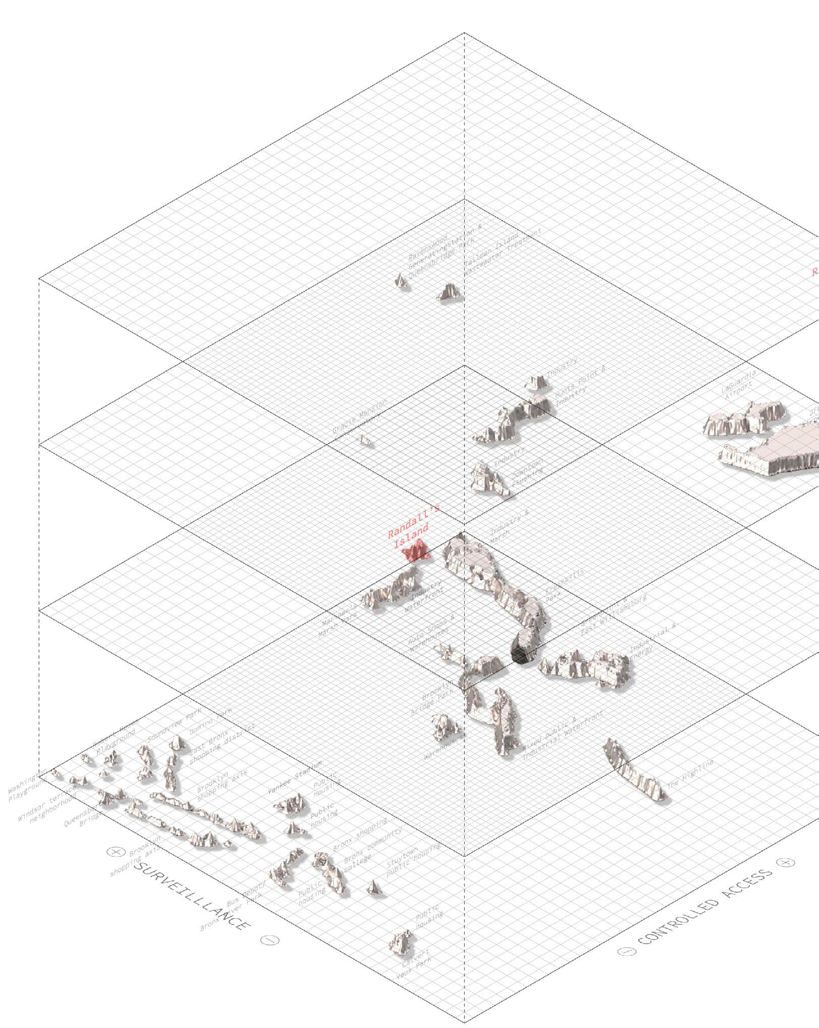
+4 Controlled Access
+2 Unhindered Access

criteria: Level of Surveillance, accessible public surveillance map.
Top: Achipelago of Control in NYC; from generated algorithm weighing all surveillance sources. Bottom: Invisible public surveillance infrastructure in Upper East River
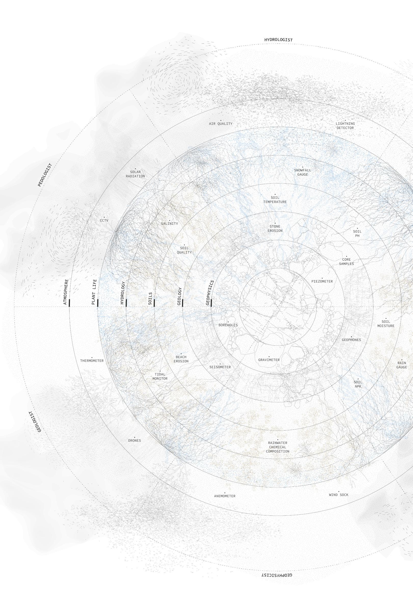
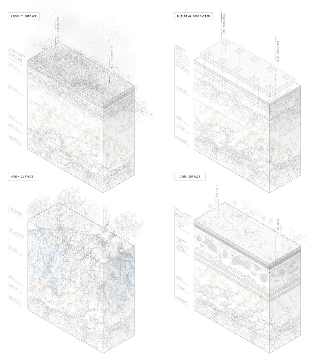
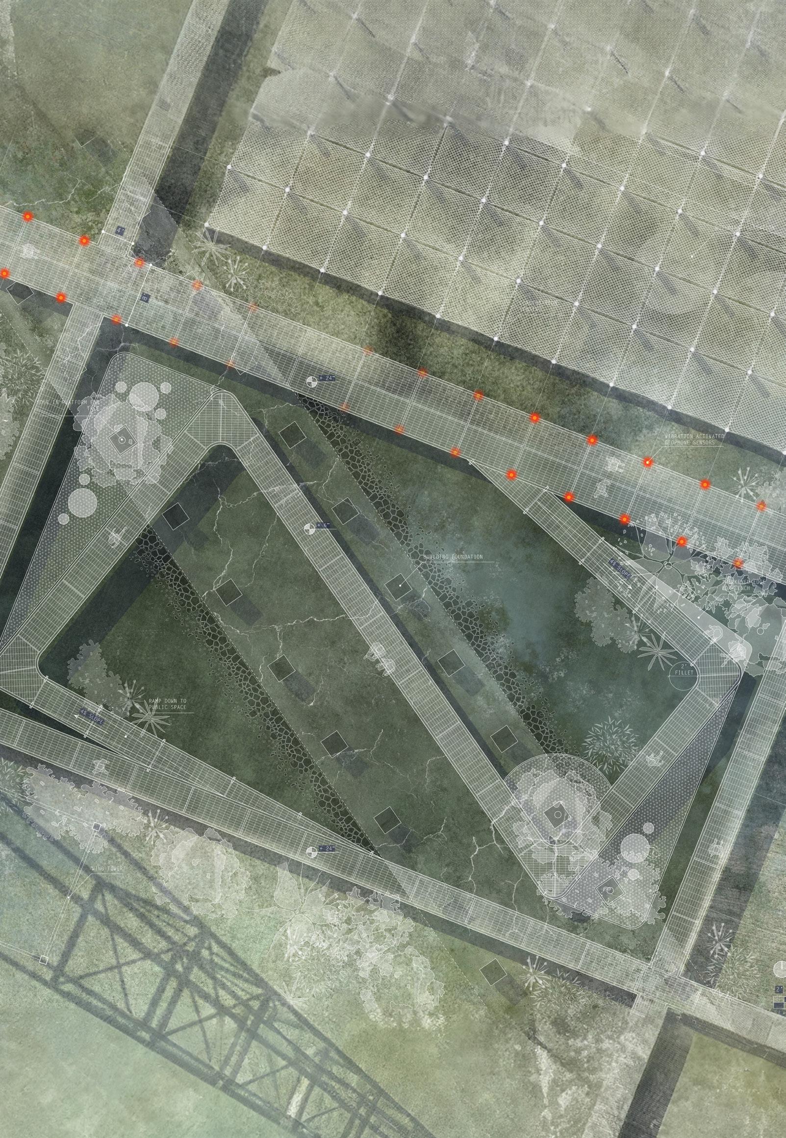
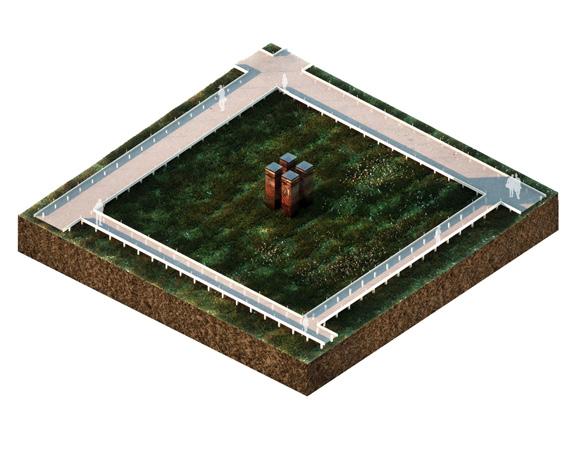
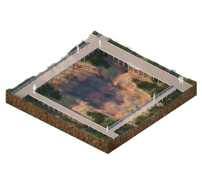
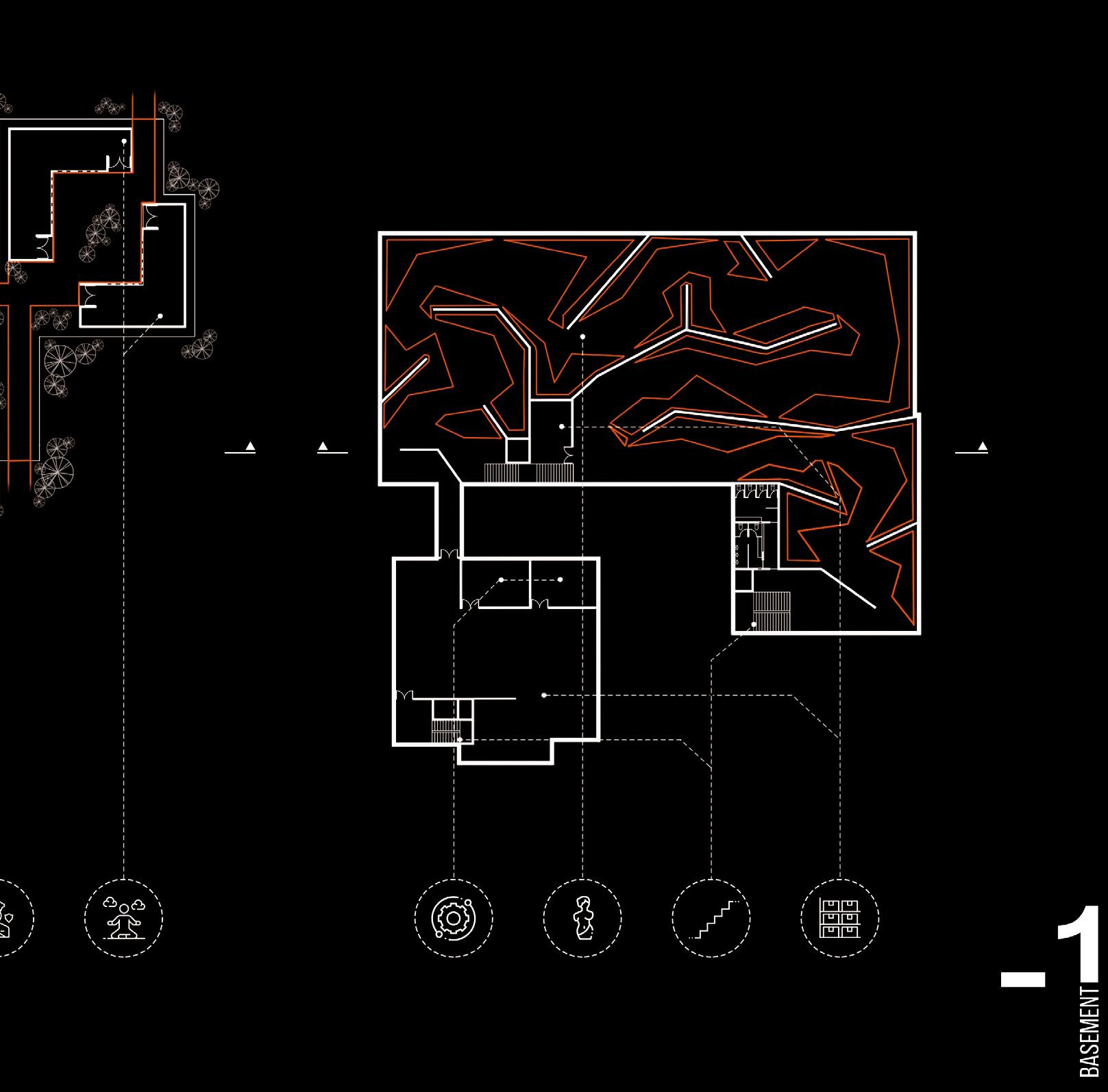
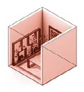
Top : Soil sections showing the sectional palimpsest of Riker’s. From top left (clockwise direction)- asphalt surface, building, dump area & marshy surface.
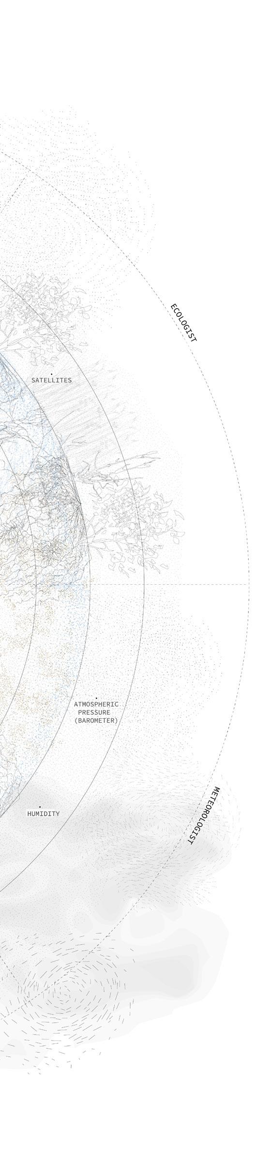
Right : Diagram depicting the Critical Zone and specialised areas of study.
A Critical Zone Observatory (CZO), part of a network of environmental laboratories and research centers operating at the watershed scale, becomes the core program. Extending from the lowest part of the atmosphere to the uppermost bedrock layer, CZOs typically record landscape changes in natural environments. However, there is a limited understanding of urban lifestyle impacts on the critical zone supporting life on Earth. The establishment of a CZO on the post-carceral landscape of Rikers aims to compare the impact of human activities with that of a natural ecosystem.
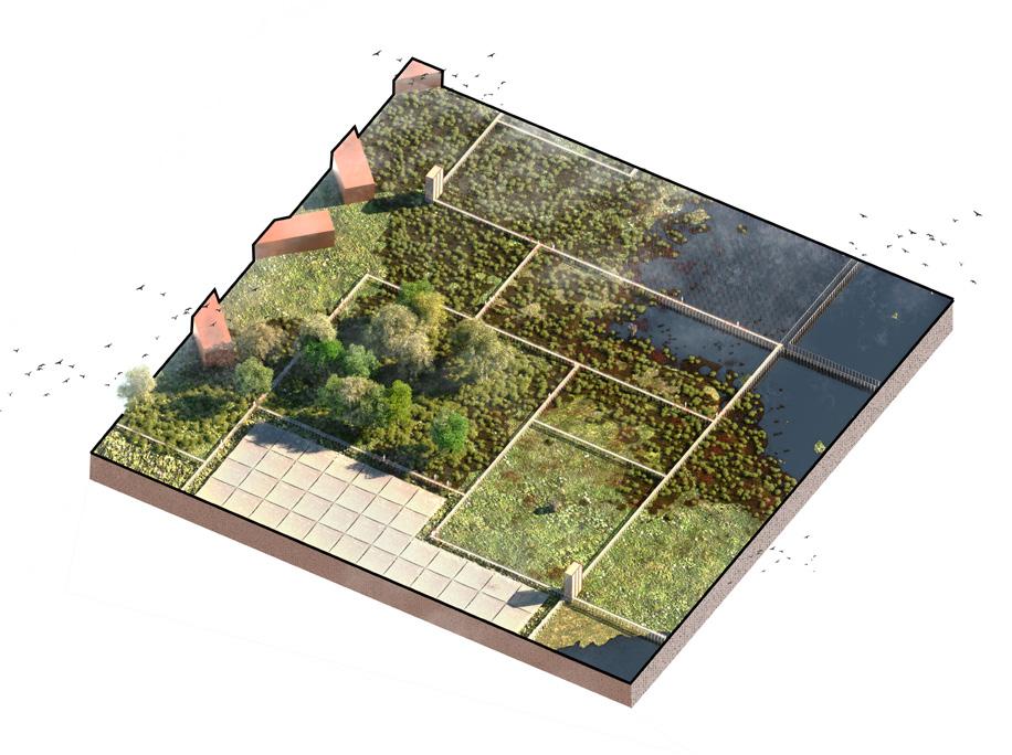
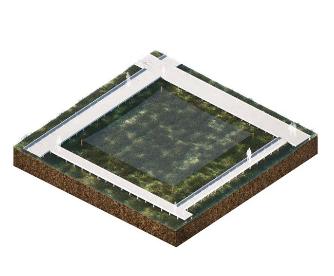
Despite the ongoing high surveillance levels reminiscent of its time as an incarcerated landscape, the subject shifts beyond humans to Earth’s layers, transforming surveillance apparatus and introducing a new catalog of monitoring devices.These devices facilitate an understanding of the existing palimpsest of the island, identifying four main surface conditions: asphalt, building foundations, marsh, and landfill. With the projected flooding of Rikers Island due to rising sea levels, a phasing plan was developed for the demolition and disuse of vulnerable infrastructure, preserving four viable building complexes on higher ground.
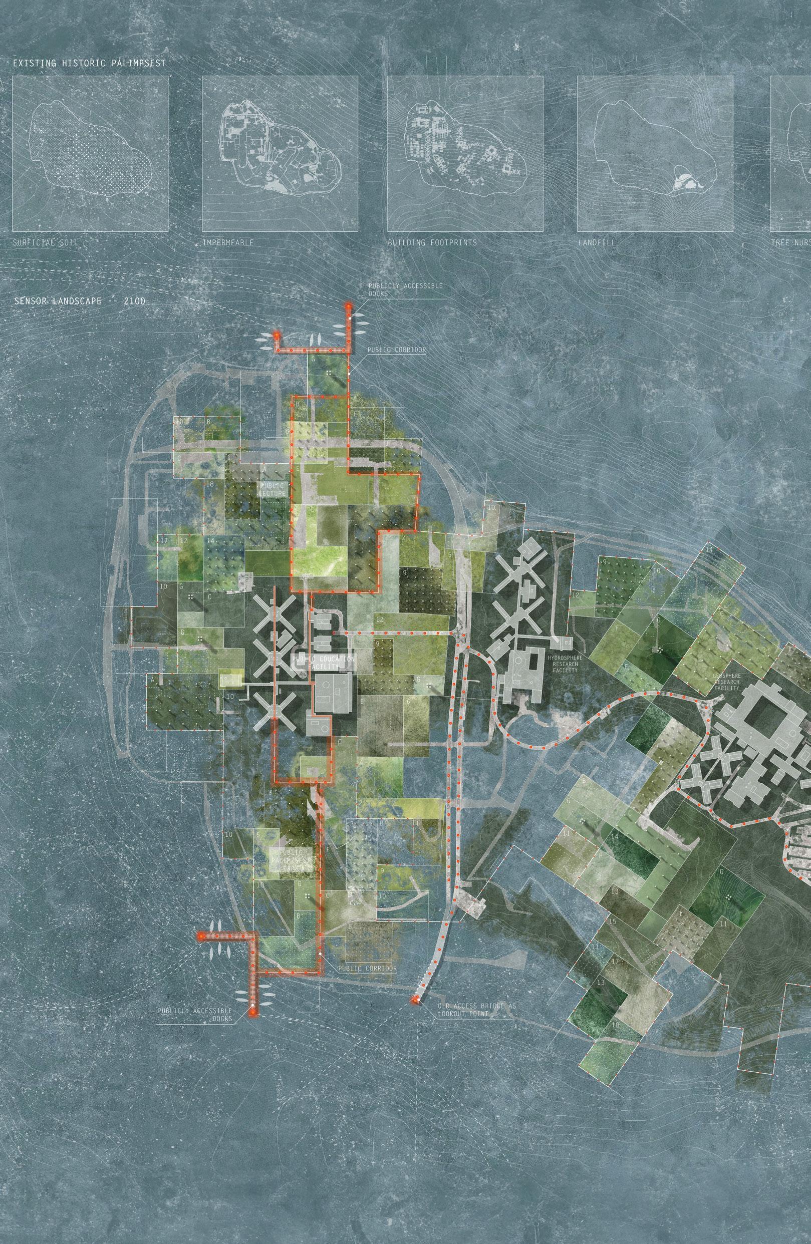
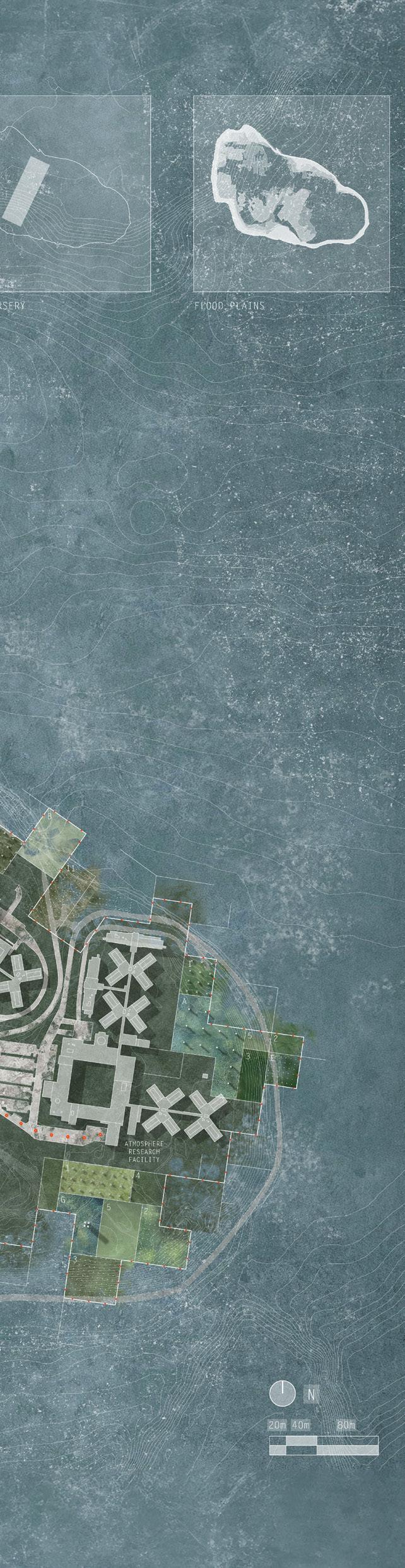
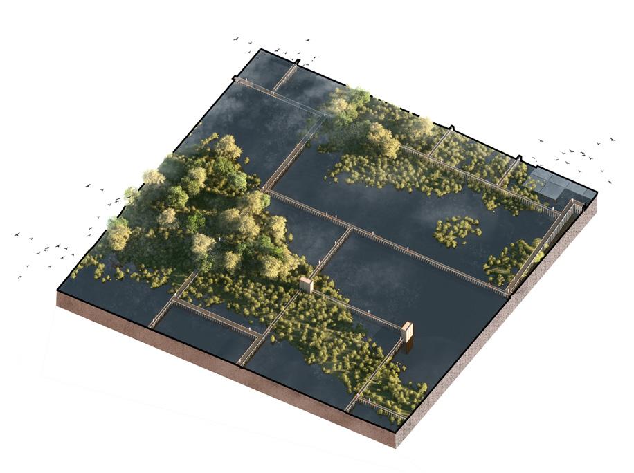
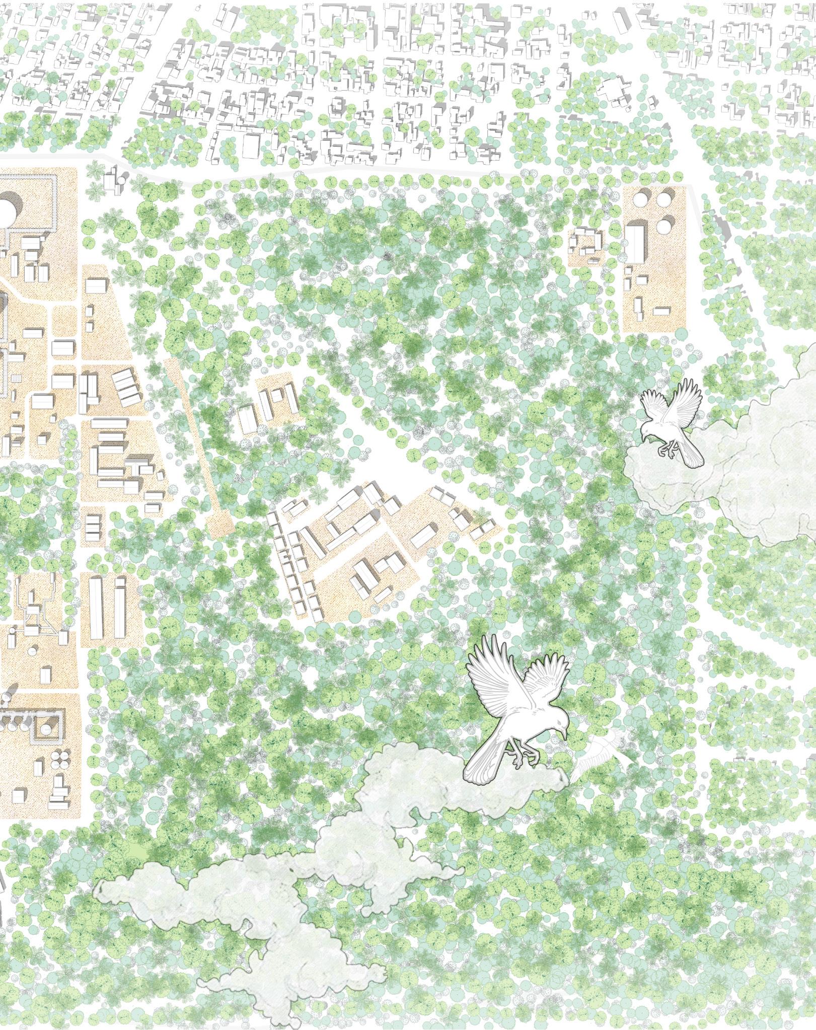
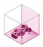
Top : Axonometrics depicting the different surveillance parcels in the experiential landscape of Riker’s 2100; Bottom : Site plan of the reimagined Riker’s Island set in 2100 New York City; the top row depicting the palimpsest of landscapes that have existed on the island. The buildings remaining are part of the original prison infrastructure that has been reused for the purposes of the CZO.
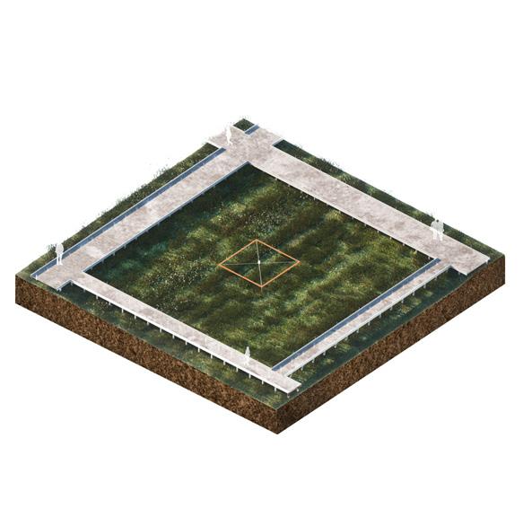
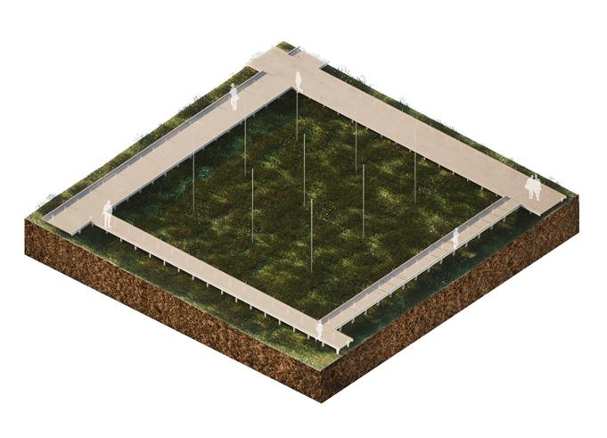
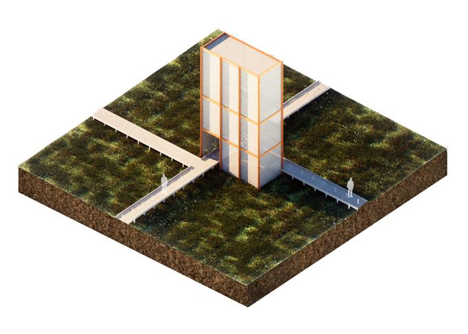
A zoomed in plan on the northern part of the Riker’s island along the north south tendril punctuated by public spaces. Seismic lights placed along the pathway light up as motion is sensed, illuminating it even at nights
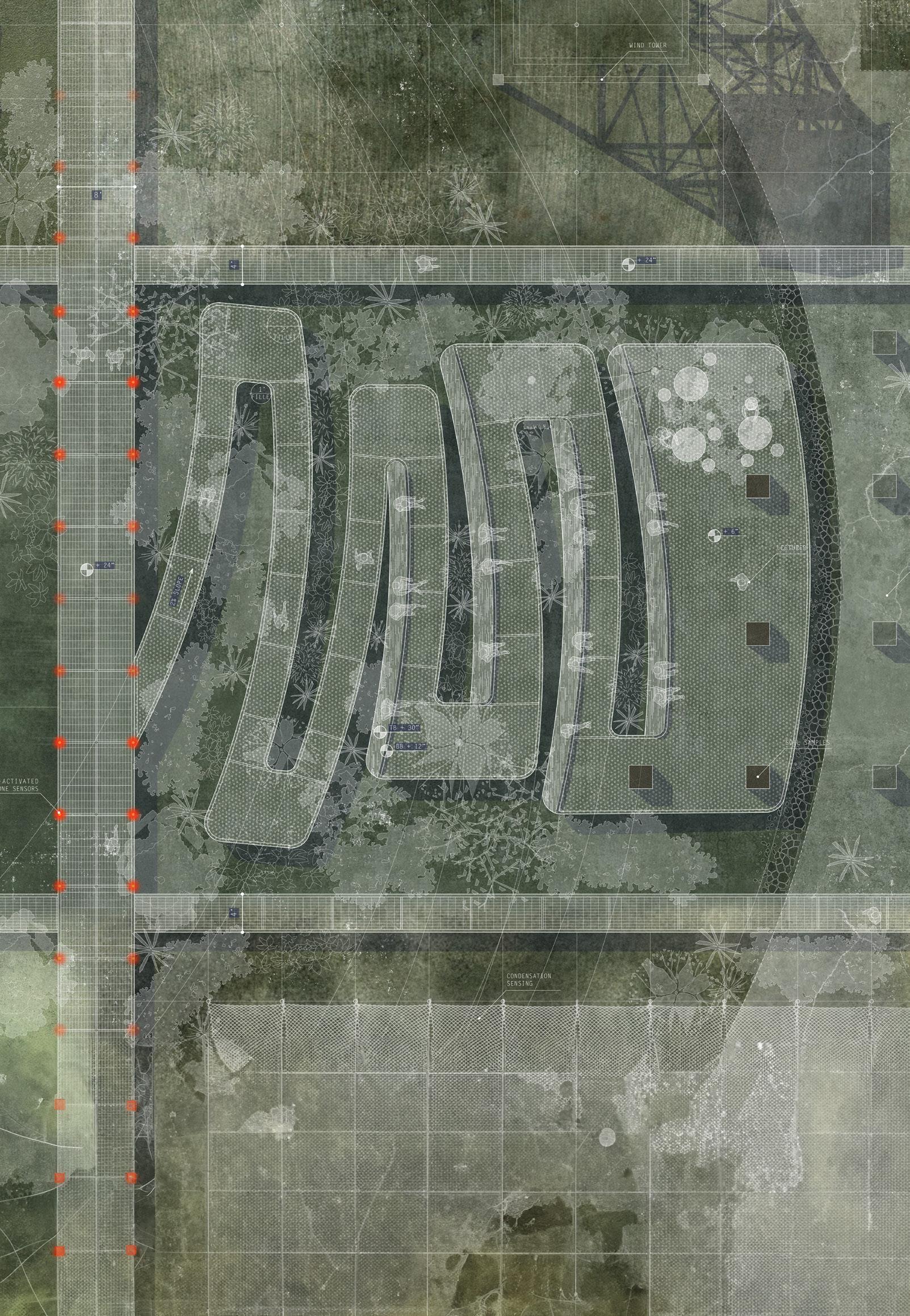
Amongst these public spaces, a few educational open air spaces are created wherein a dialogue can be carried out amidst the various sensorial parcels of the island.
The site plan, based on the 2100 projections, features mesh walkways dividing the island into surveillance parcels. These parcels’ profiles reflect historic layers, creating a landscape that honors its varied history. The design incorporates strategically placed experiential fields, allowing visitors to not only access quantitative data from sensors on surveillance parcels but also experience ecosystem transformations. Access to the island is restricted to a tendril along the north and south corridor, accessible via docks, public spaces, and experiential fields. The central building complex serves as a public education facility, facilitating interaction between visitors and the island’s educational resources. The landscape is dedicated to various CZO layers, with quantitative devices corresponding to nearby research facilities. The eastern side, accessible through a major artery linking docks to the landscape, is reserved for researchers, housing monitoring devices and research facilities related to the various layers of a critical zone. Ultimately, the island becomes a keeper, preserving landscape layers and histories, capturing the impact of human and non-human life, becoming anything but marginal for the city of New York.
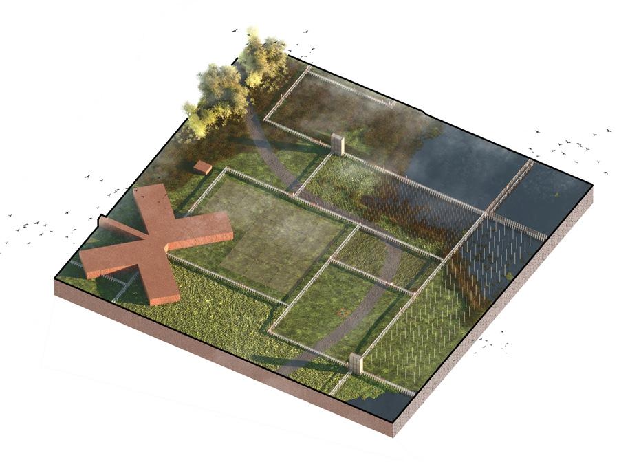
Experiential landscapes visually showcasing the changing conditions on the island, a qualitative represenatation of the quantitative data being collected. Clockwise from top left: soil sample field, lightning field, wind tower, erosion field, condensation nets, camera field(capturing movement of various non human and human agents through the landscape).
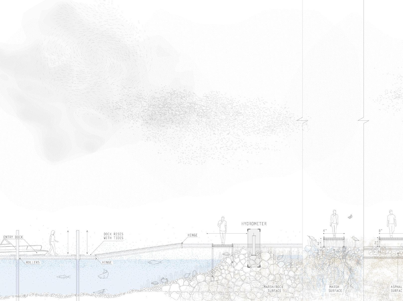
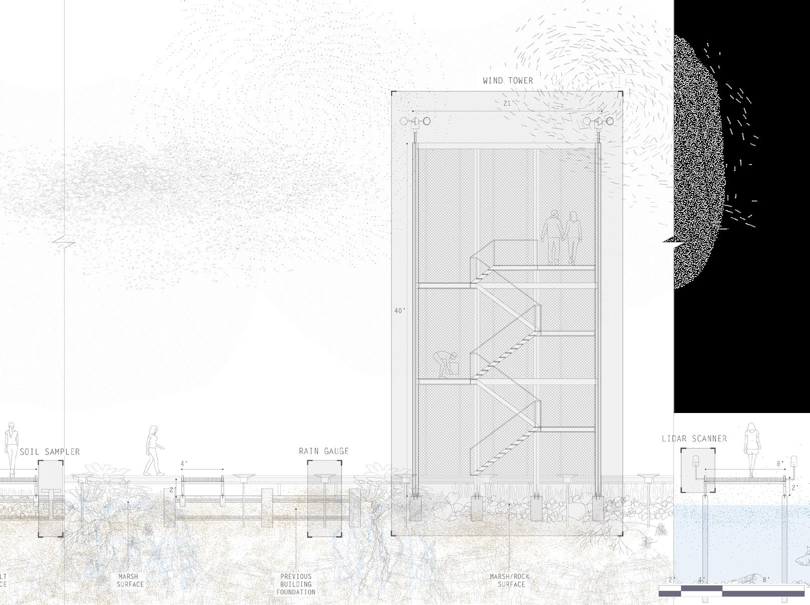
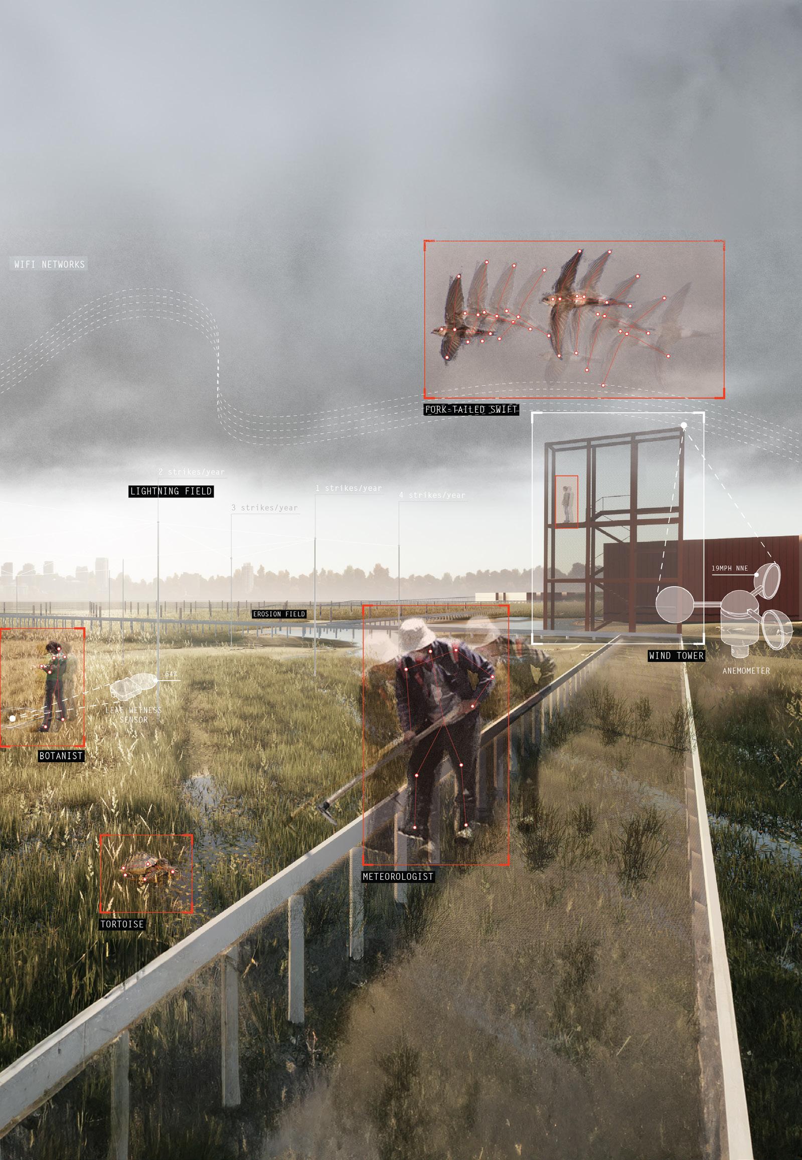
The pathways leave a minimal imprint, allowing all forms of life to exist without obstruction. Researchers collect information from time to time to keep the databas up to date.
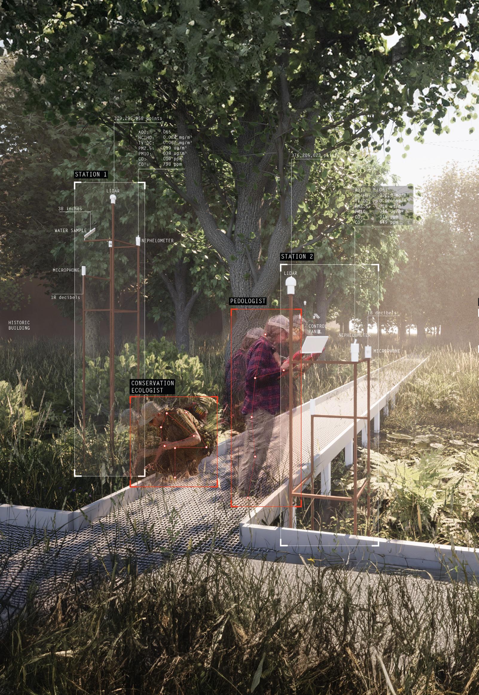
Areas untouched by visiters have minimal monitoring stations set up. Inclusion of some battery operated gadgets are done to reduce the impact of wireless networks on the landscape.
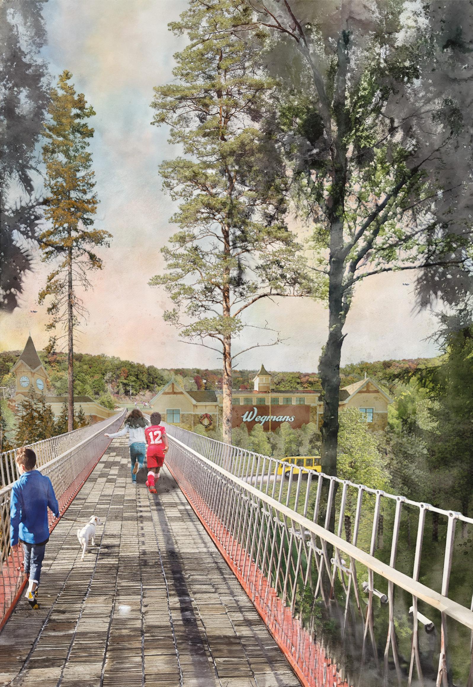
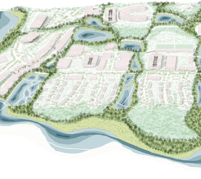
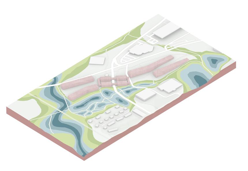
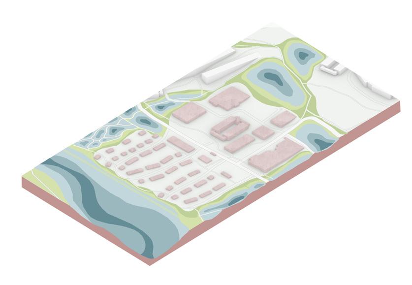
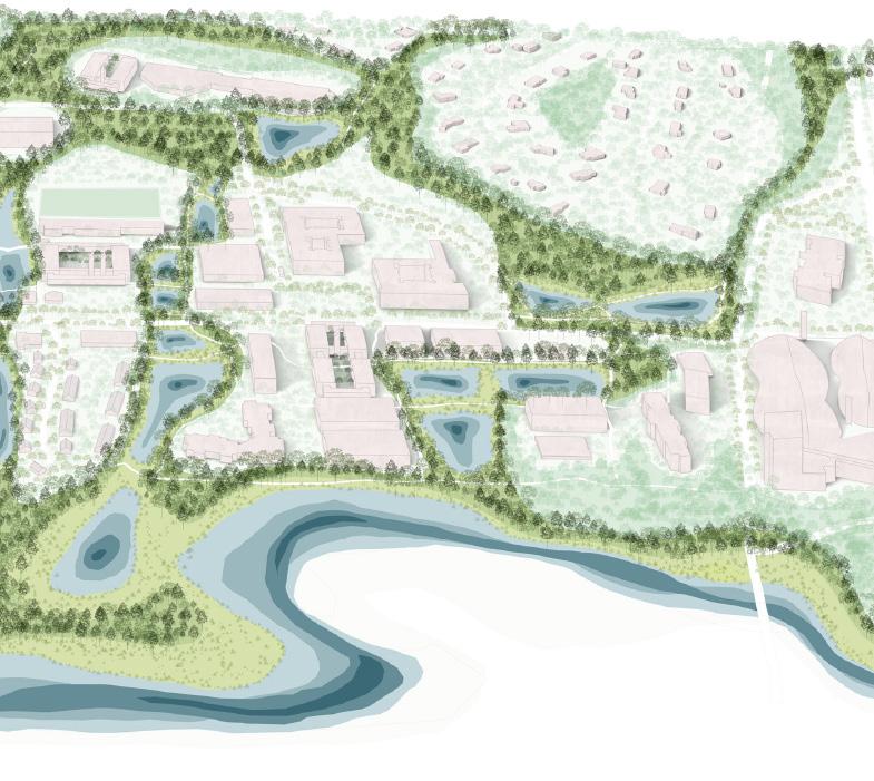
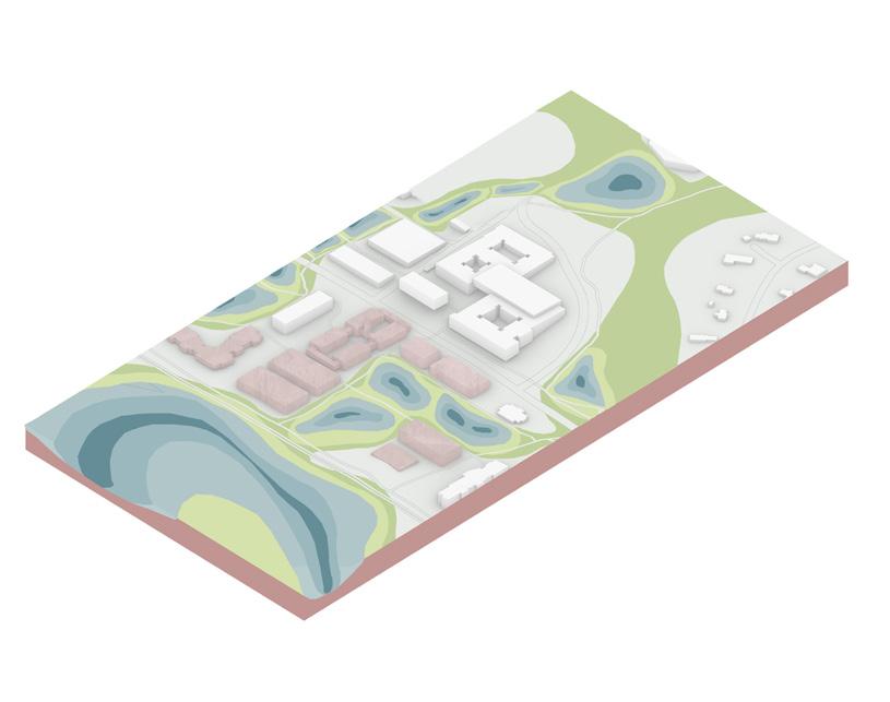
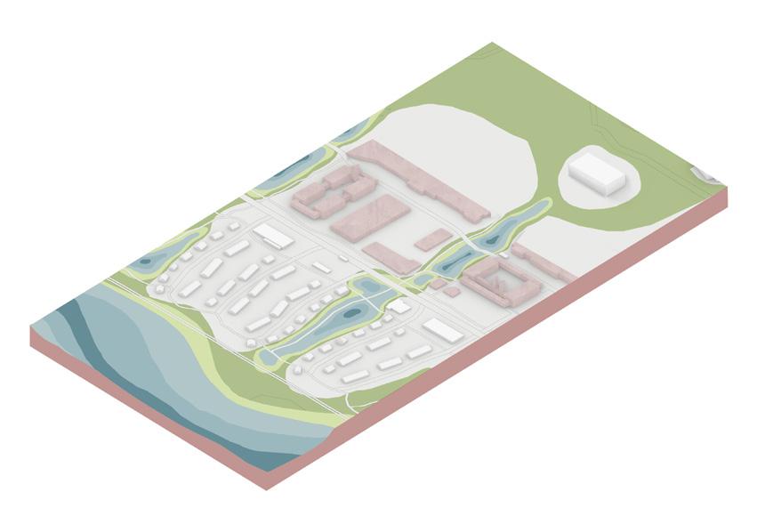
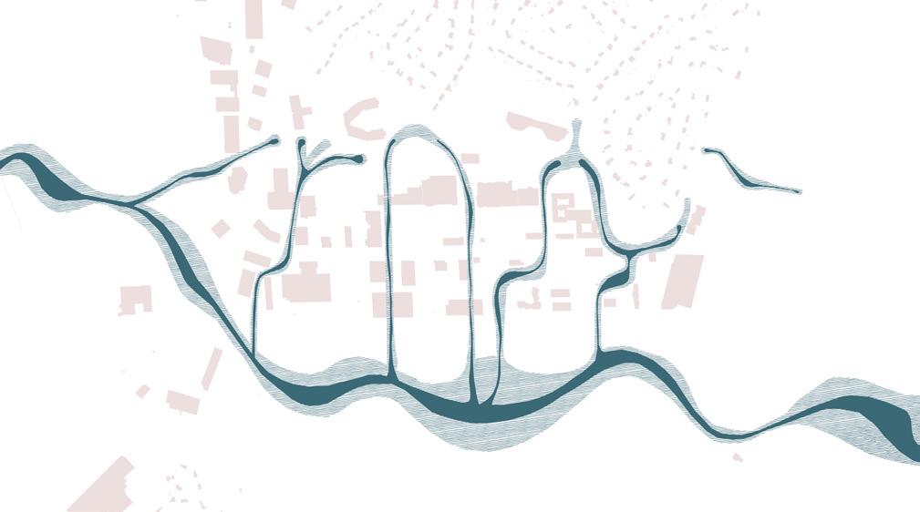
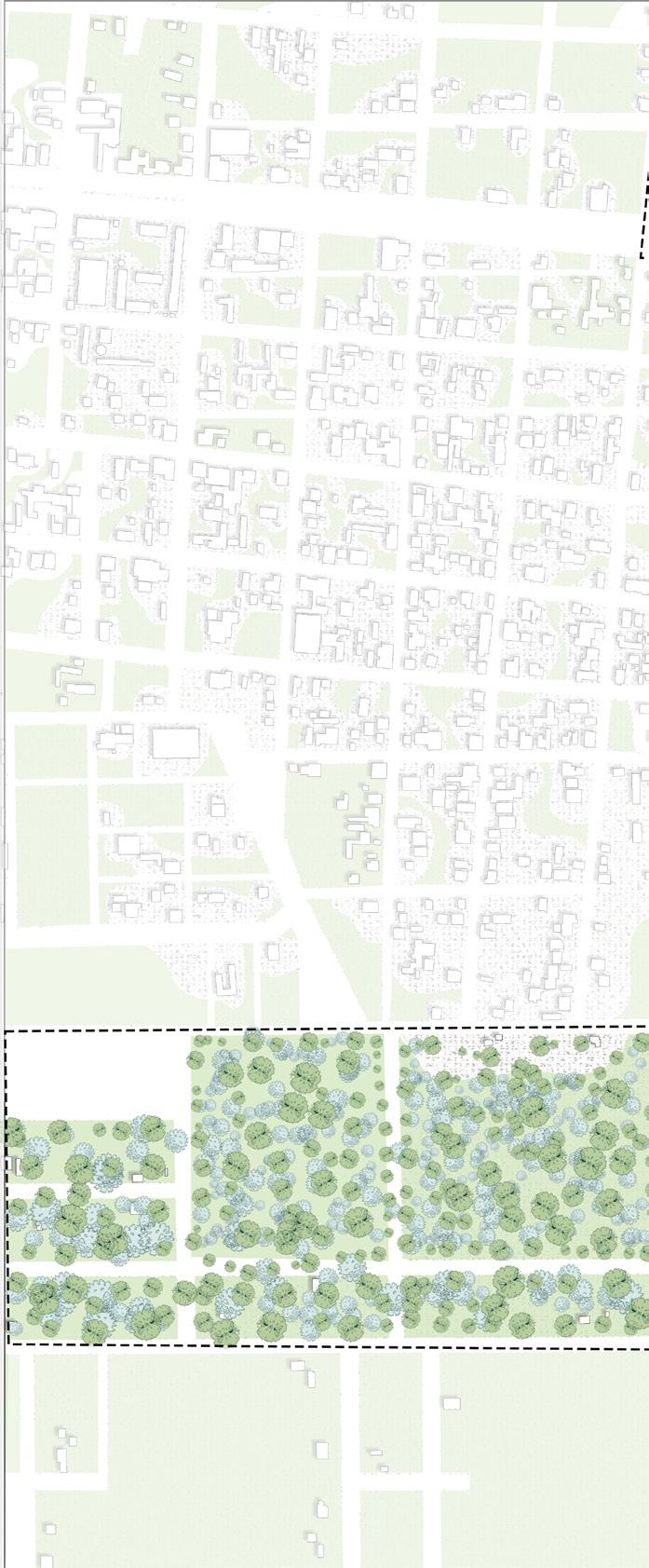
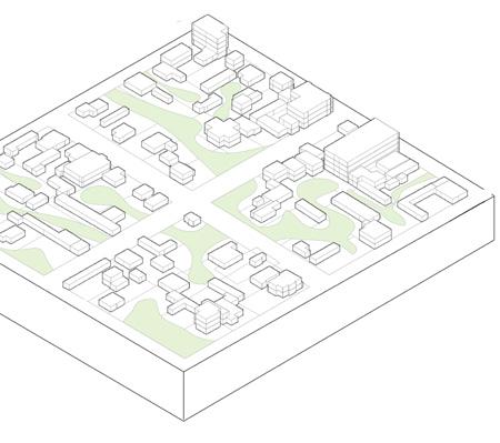
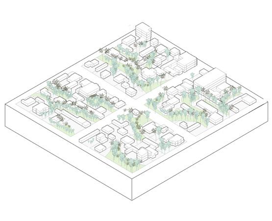
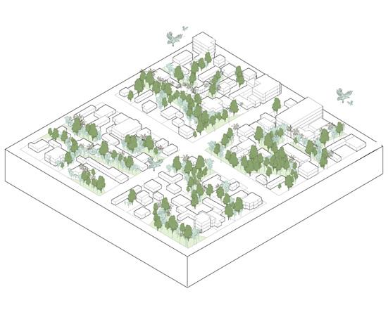
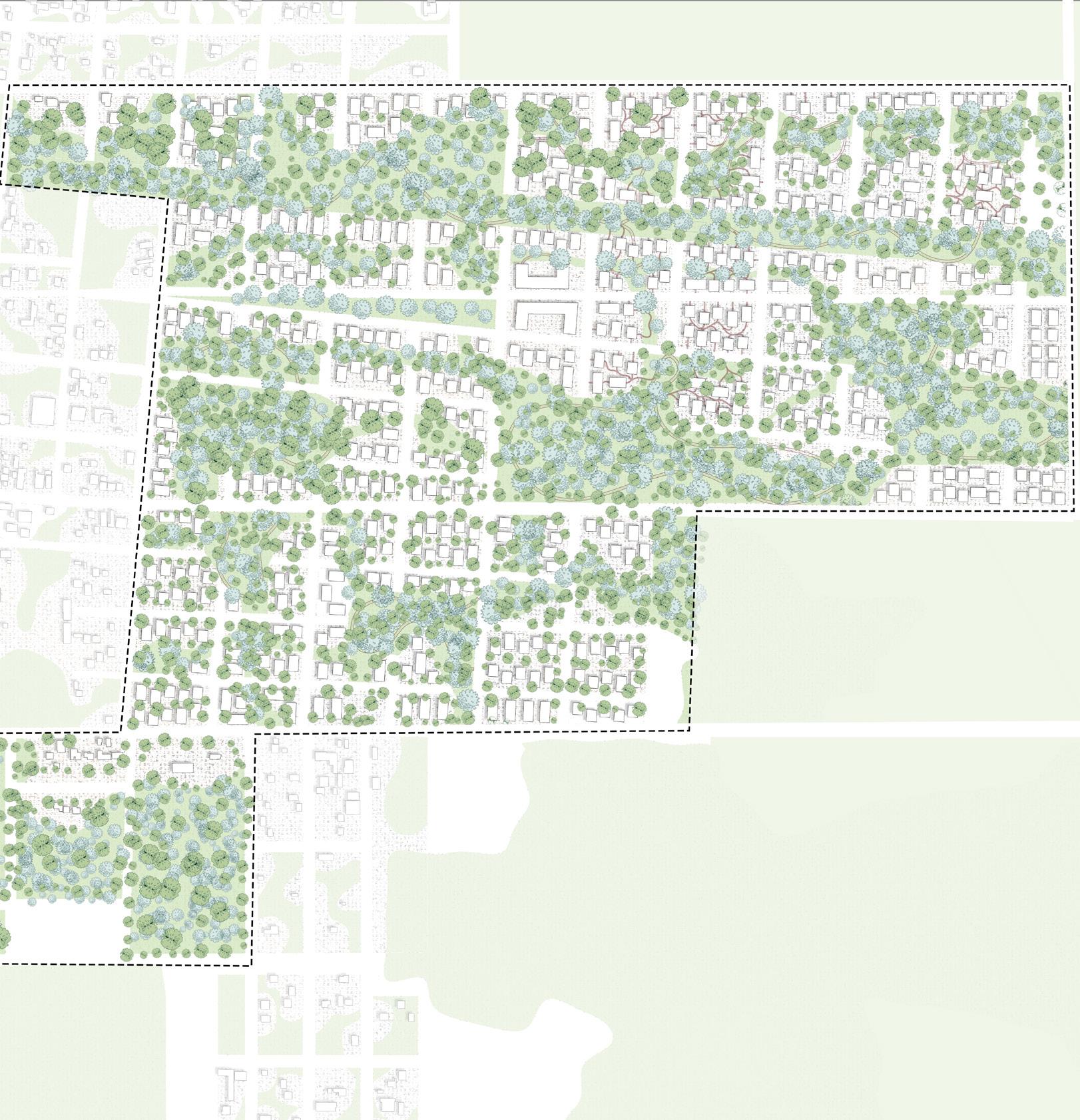
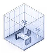
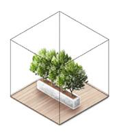
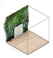
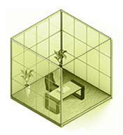
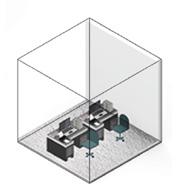
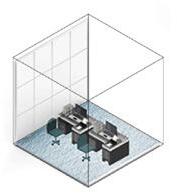
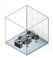
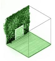
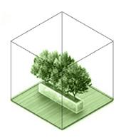
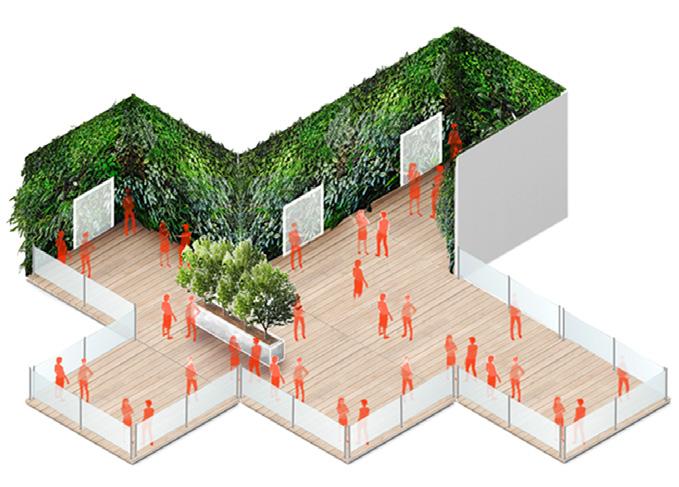
Green Stitches, Grey Needles is an urban design proposal that introduces social, experiential, and environmental value into suburban commercial centers.
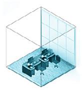
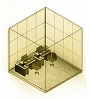
Today’s strip malls, where the suburbs shop, are single-use resource acquisition zones with little to offer beyond the products acquired in their stores—a precarious business model in a world of rapidly-expanding online retail. This project adds new value to suburban consumptionscapes through a two-pronged strategy. First are the green stitches: wildly landscaped environmental corridors are cut east-west through the site, connecting two larger ecological zones. These stitches are sized to accommodate wildlife movement and located to channel water—converting the hard infrastructure of storm sewers into the biophilic, soft infrastructure of flood-resilient creeks. This first strategy is possible because of the second: grey needles, an acupunctural approach to parking where huge surface lots are consolidated into garages of much smaller footprint.
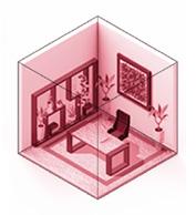
To activate and finance this construction, the surrounding retail becomes higherdensity and the garages themselves are injected with themed social infrastructure currently lacking in the suburbs: youth activities, nature programming, sports facilities, performance space, and community services.
URBAN DESIGN
PRoPOSAL FOR THE SUBURBIAN condition in westwood
HARVARD GSD distinction project team work with benjamin parker westwood massachusetts USA fall 2022
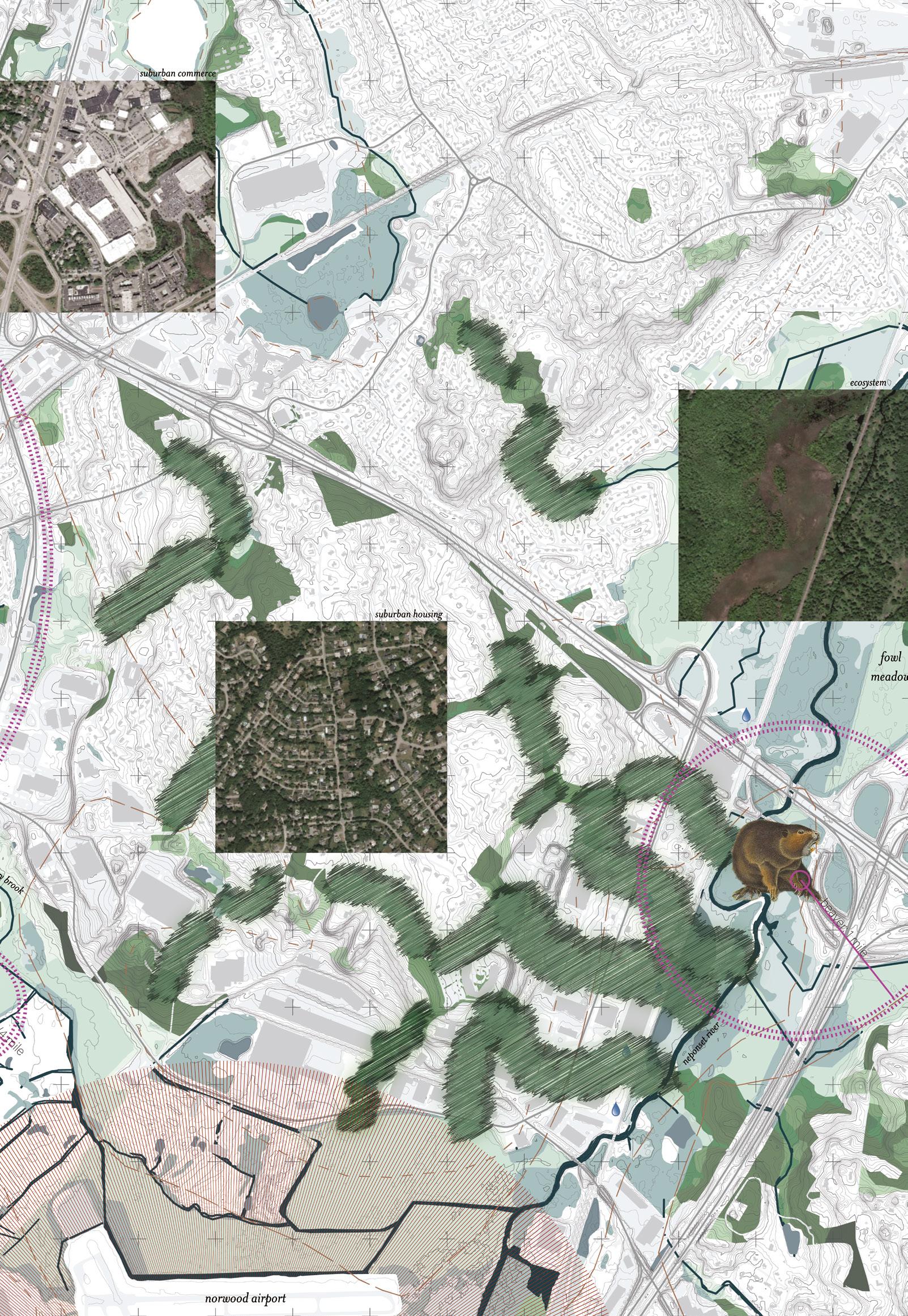
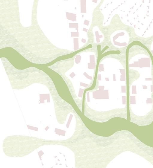
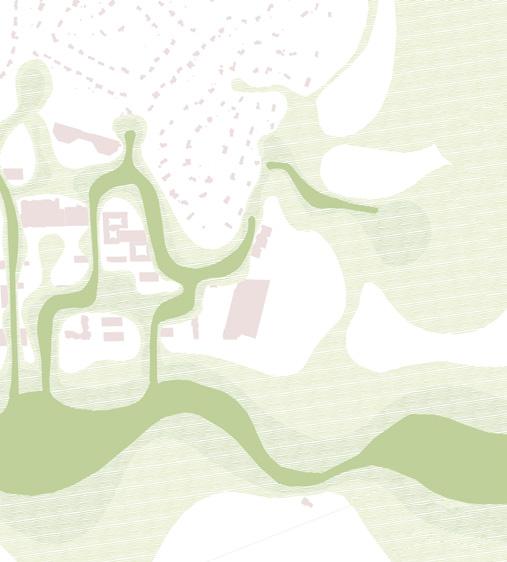
An ecological context plan showcasing the site’s potential in connecting the beautiful natural landscapes of Lowell woods and fowl meadow by creating natural corridors for movement of various animals.
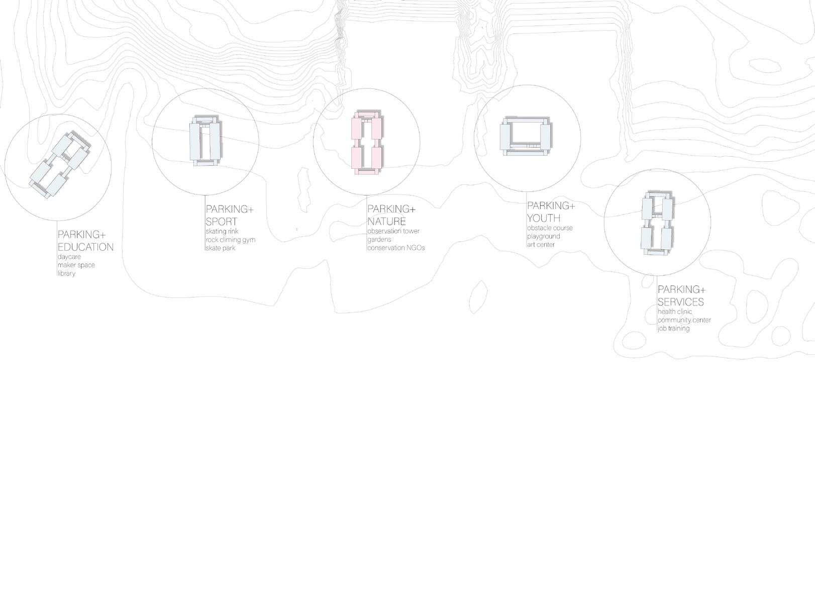
Parking+ education daycare maker space library Parking+ sport skating rink rock climbing gym skate park
Parking+ nature observation tower gardens conservation NGOs
Parking+ youth obstacle course playground art center
Parking+ services health clinic community center job training

Parking+ entertainment 4 venues condominiums train to Boston/ NYC
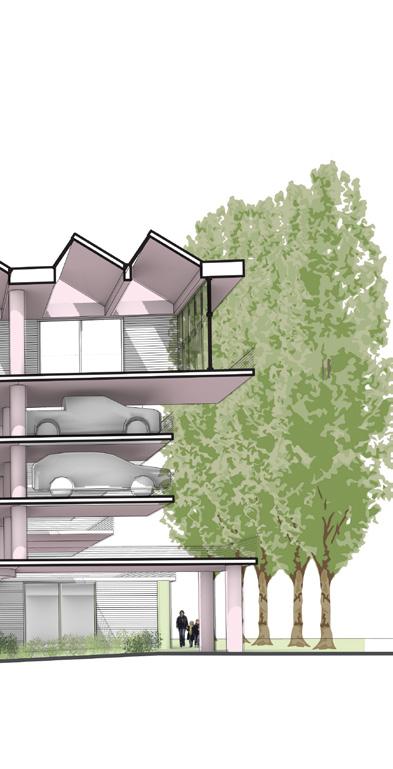
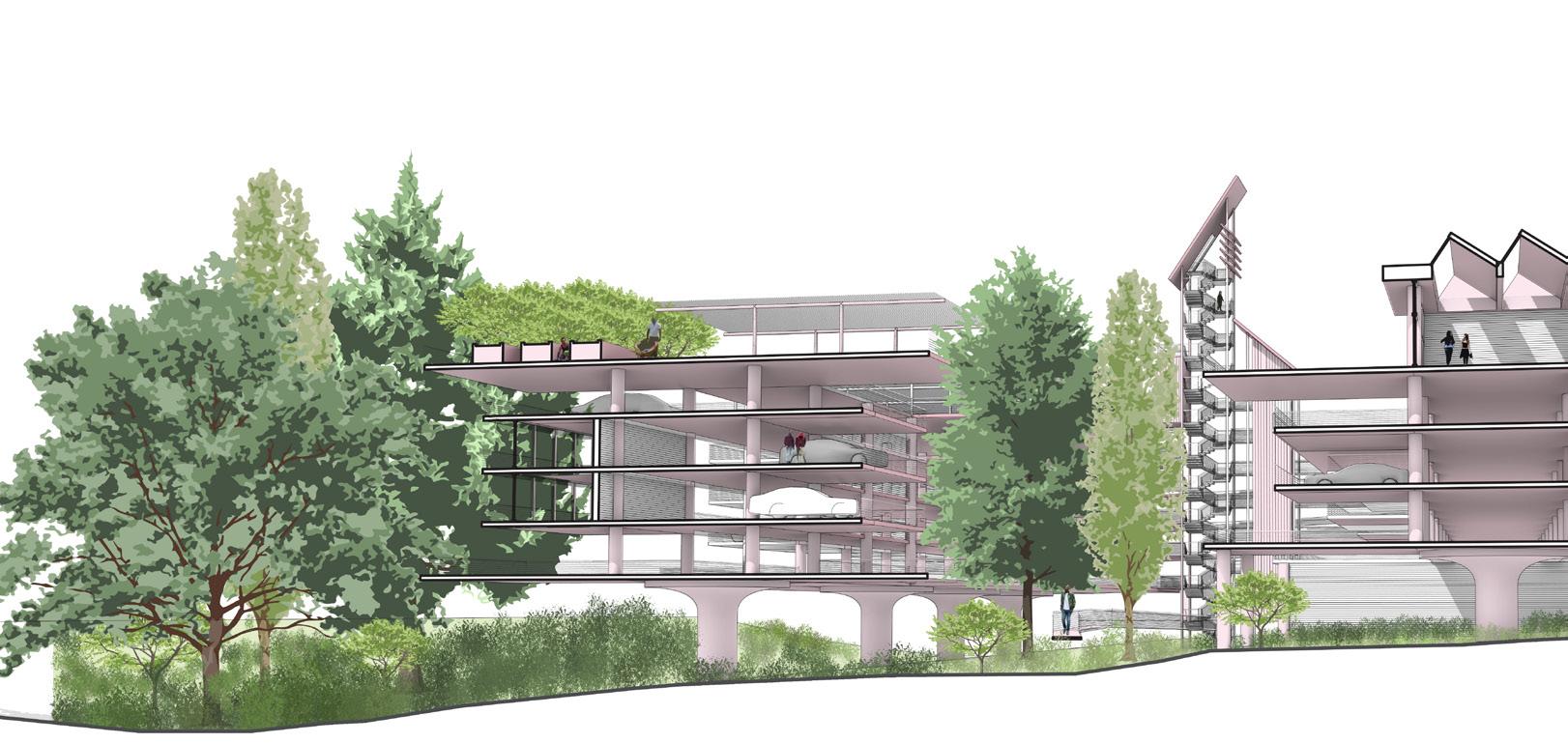
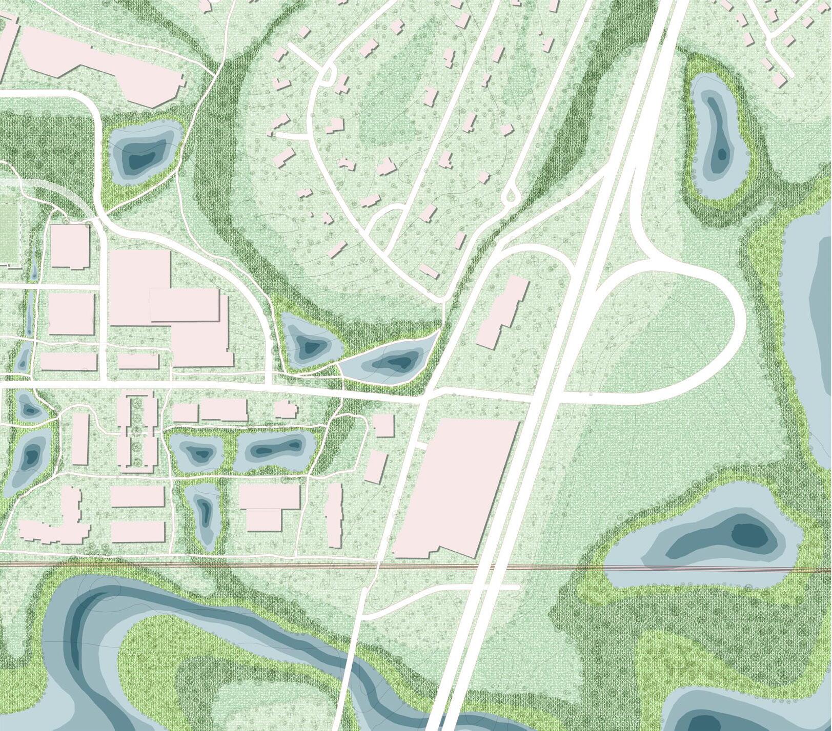
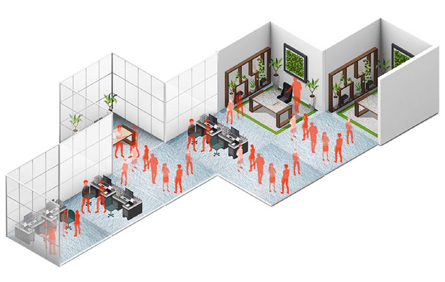
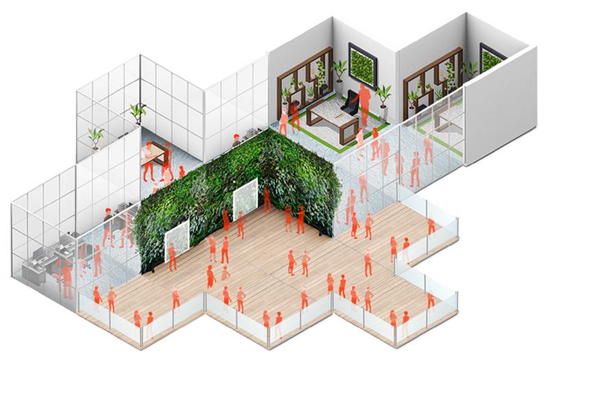
Top : Parking garages allowing various programs depending on the local spaces around it, catering to the needs of the people ;
Bottom : Perspective section of a parking garage showcasing interaction with natural corridors on one side (left) and spaces to host activities depending upon the module of development (right) such as a playground, community center, cafes etc.
While doing so, the biggest problem we had to solve was the huge expanse of impermeable surface that vastly covered the landscape- parking. The demands of a car centric suburbia called for huge parking spaces, which is a pragmattic requirement from the human front but the suburbian edge that was surrounded by critical environmental areas required a ecologically sound intervention that create spaces for the nature to exist. Inability to do so has lead to the flooding and erosion issues, that have caused negatively impacted the infrastructure and complexes that are present there.
To do so, the grey needles were introduced. Parking garages. Concentrating the impermeable surfaces to one core helped open up avenues for the environment to exist within the site rather than on the edge of it. It also provides space on the ground plane for other uses to exist ranging from a community centre to cafes to rock climbing gym, depending upon its location throughout the site. They adapt to the needs of the immediate neighborhood while also reacting to the needs of the suburbian edge that it is located in.
This allows for the creation of vital social spaces that foster community interaction and a sense of belongingness in an otherwise dull living condition that surround the commercial centres of suburbia. Thus, a new mdoel is created that is unique to the needs of the town that does not only feel like you are living in the wild and amongst the beauty that nature has to provide in Westwood but in a commercially colorful neighborhood that is only pertinent to cities. You get a mix of both while allowing the major force that is nature to exist.
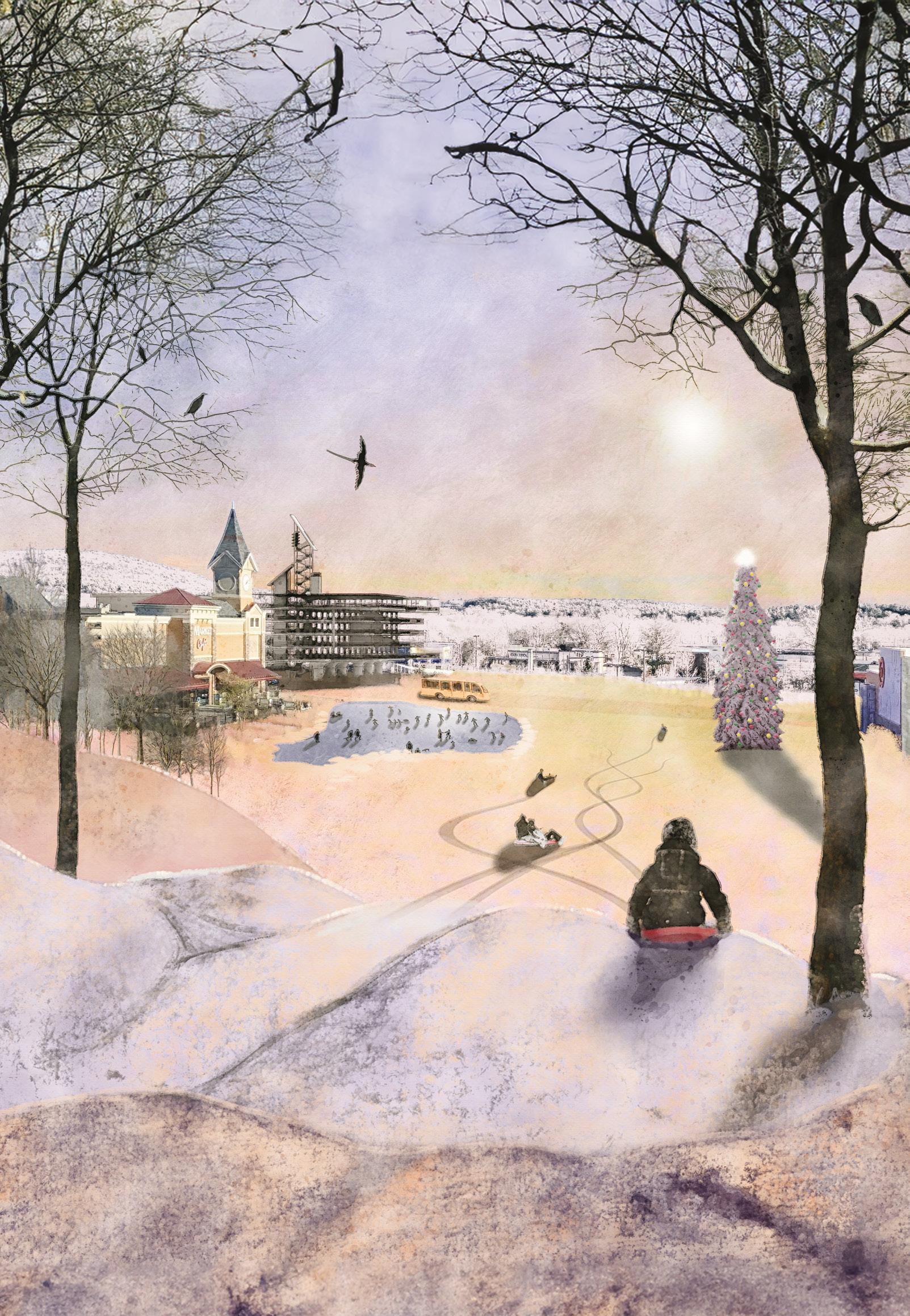
As the winter sun sets, a breathtaking scene of beauty unfolds. The parking garages allow barren parking lots to transform into community areas, where people can gather and connect with one another.
The green corridors uplift the experiential value of even the most mundane suburban activities, transforming them into moments of natural wonder. Nature and humanity can coexist in perfect harmony.
Top: Axonometric view of the site showing the pulsating green and blue corridors Bottom: The modules of development (dependent upon the location on site) 1.Multifamily Configuration; 2.Housing and Sport Configuration;
Bottom: The modules of development (dependent upon the location on site) for (From left to right) 3.Medical Configuration; 4.Commercial Configuration
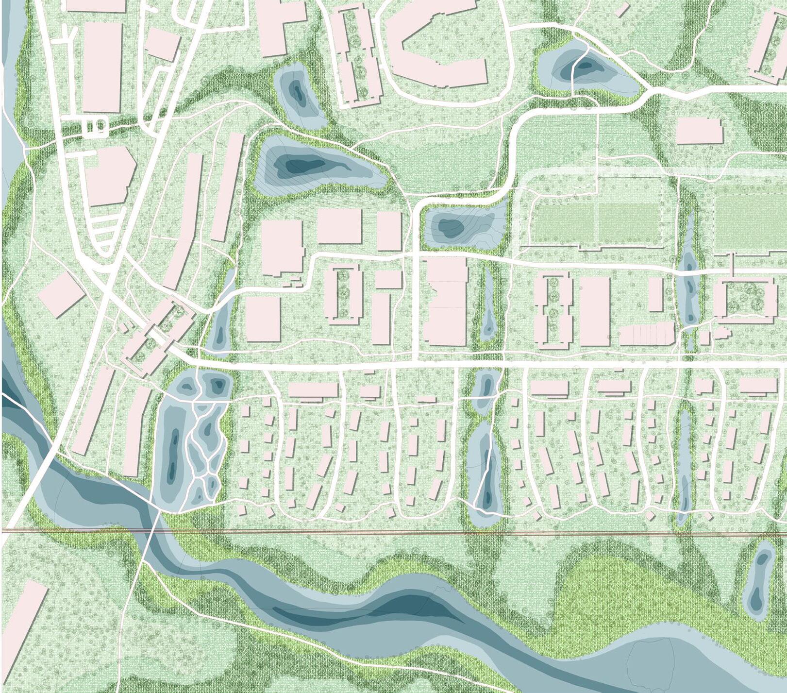
Water movement corridors modulating the topography with seasonal water bodies filling up along sloped terrain
Green corridors along the water movement impermeable surfaces to allow absorption
Assisted living Multifamily housing Courtyard Mariott University Park Station Office building
movement channels created by removal of absorption
Thus, ecological corridors are formed to allow smooth passage of water preventing erosion and flooding in Westwood suburbs
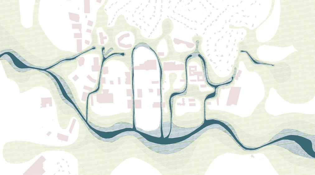
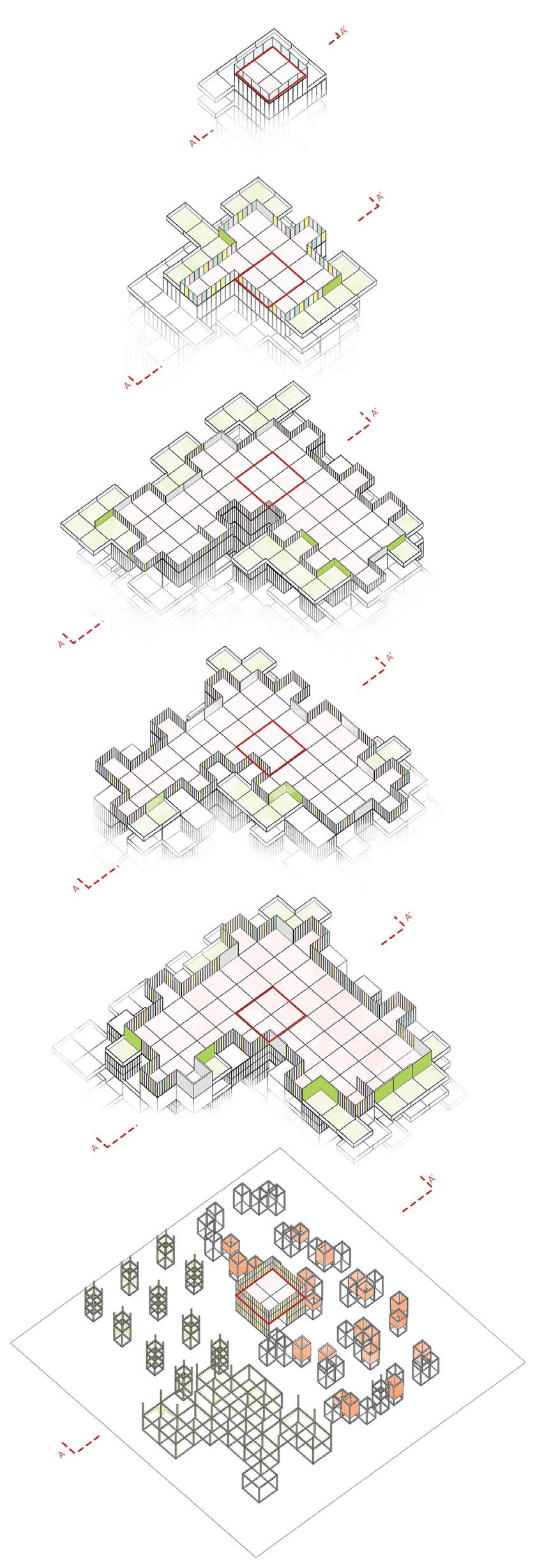
Every Indian city has its own distinctive memoryscape, culturescape and heritagescape. These scapes, albeit not entirely unique, capture the essence of every memory, cultural and spiritual fingerprint.While culturescapes interweave a variety of domains, memoryscape remain vital to the traditional and cultural facet of a place. Due to its dependence upon each and every observer’s experience, residual recollection and connect with a place, memoryscape remains an ever dynamic paradigm, strongly influenced by the activities of the concernaed and the aura of the place. However, due to various technological advancements and centered human comfort with economical motives, these have reduced such beautiful spiritual and cultural landscapes to a mere setting of making money.
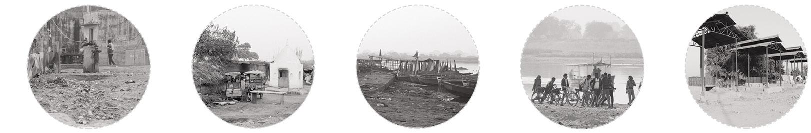
This gap is studied by taking up the case of Vrindavan, which is an intense centre of spiritual activities in the Braj pilgrimage mandala. The spiritual engagement aimed at by Braj pilgrimage is being affected with the insensitive development that the area is witnessing right now, ultimately rendering the pilgrims with mental, physical and spiritual disengagement with the scapes of the town, over and above the fading of place-based collective memories.
This disconnect is analyzed by studying the underlying reasons, succeeded by the methods of reclaiming the said landscapes, rewriting the tale of the city, reuniting their imagined and real scapes.
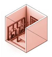
CULTURAL CENTRE ON BRAJ PILGRIMAGE AND LORD KRISHNA’S IDEOLOGIES
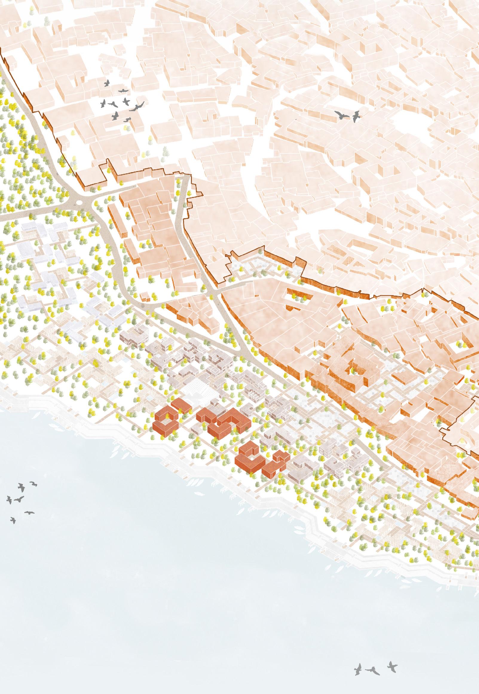
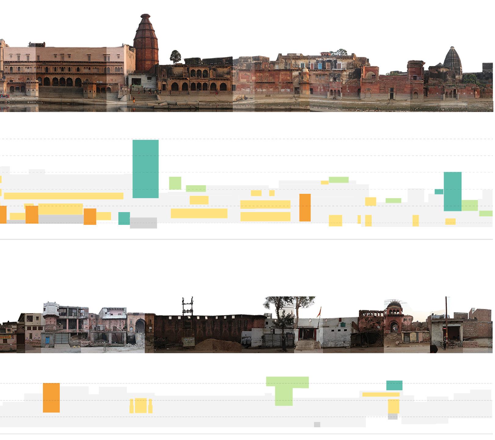
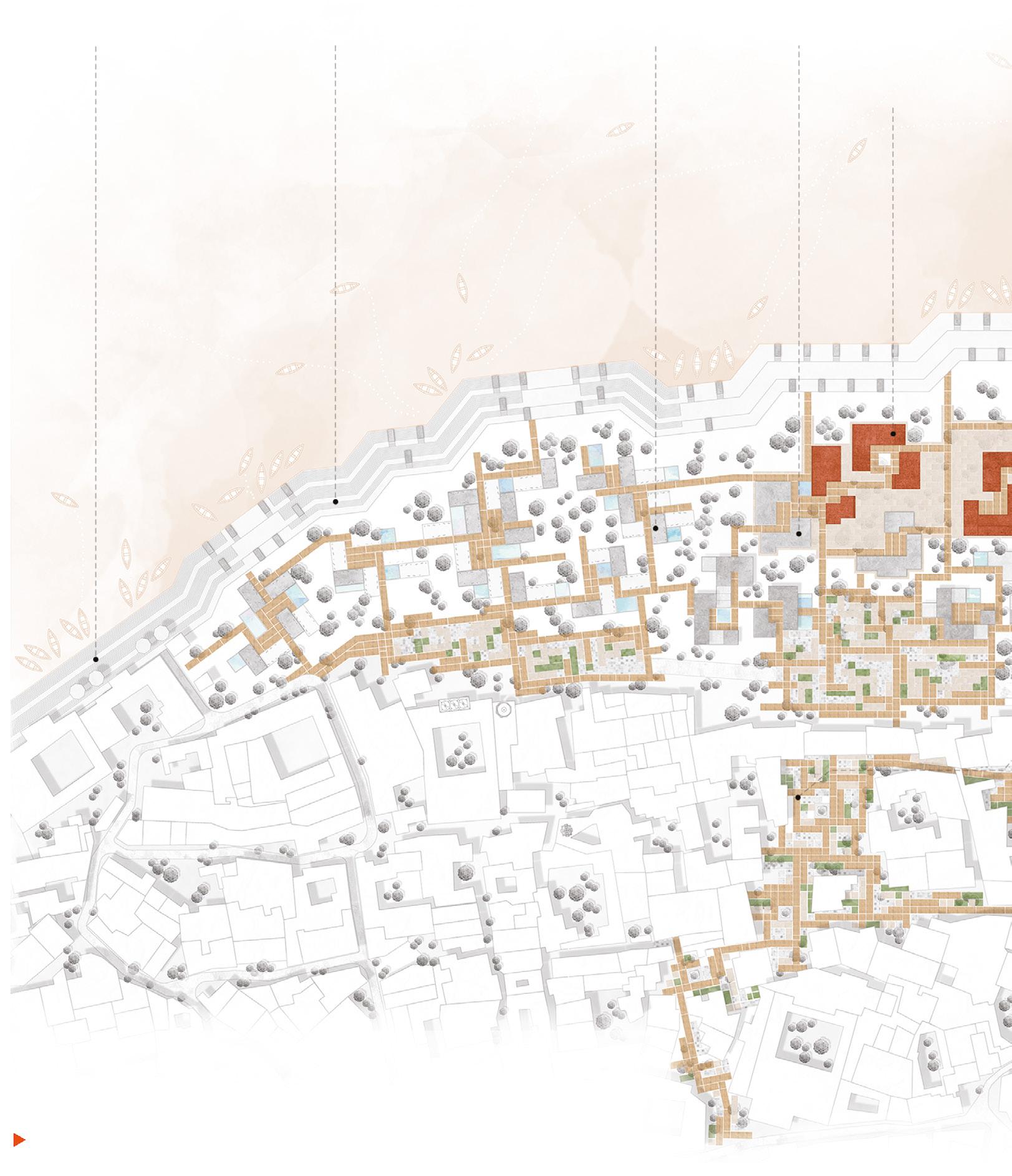
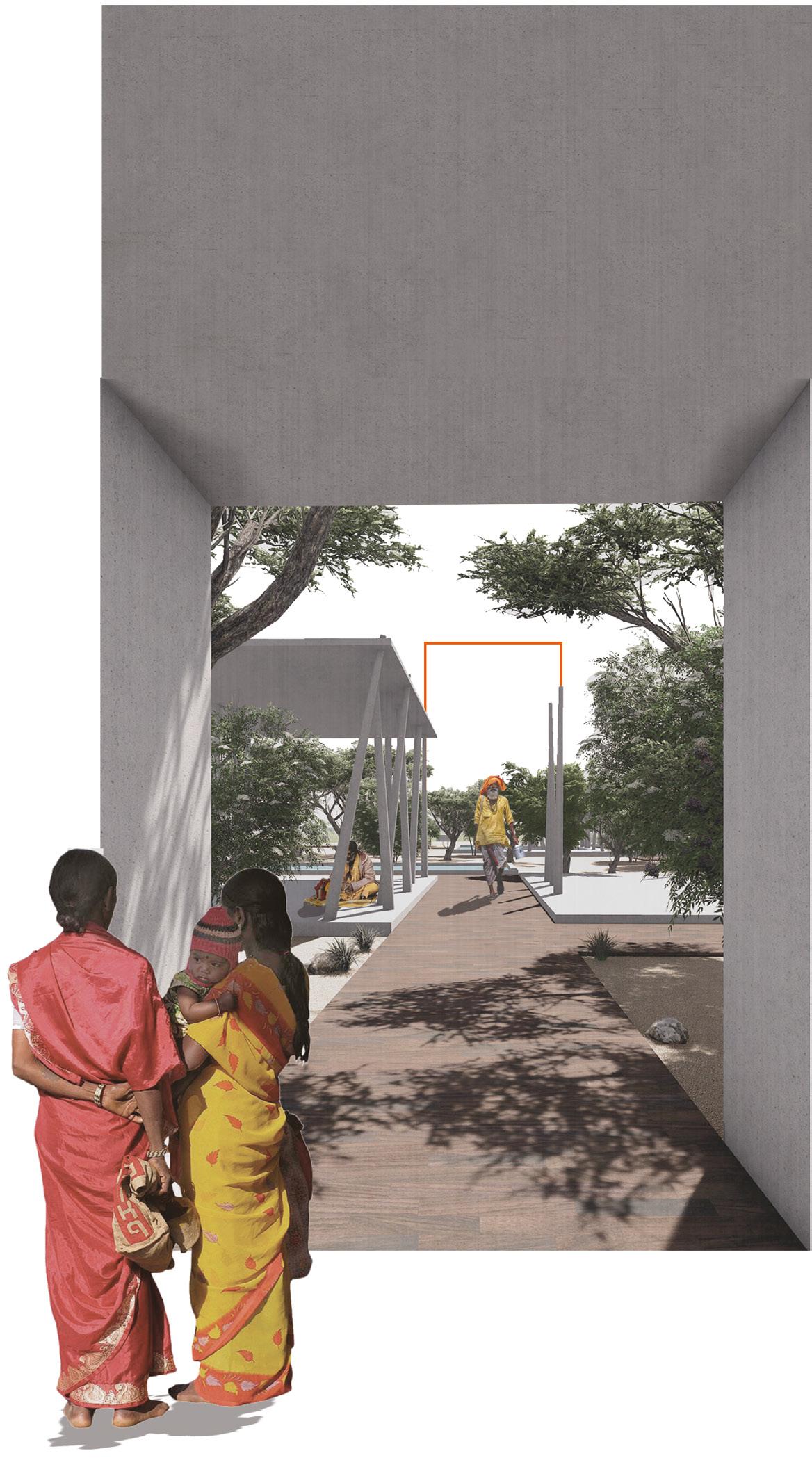
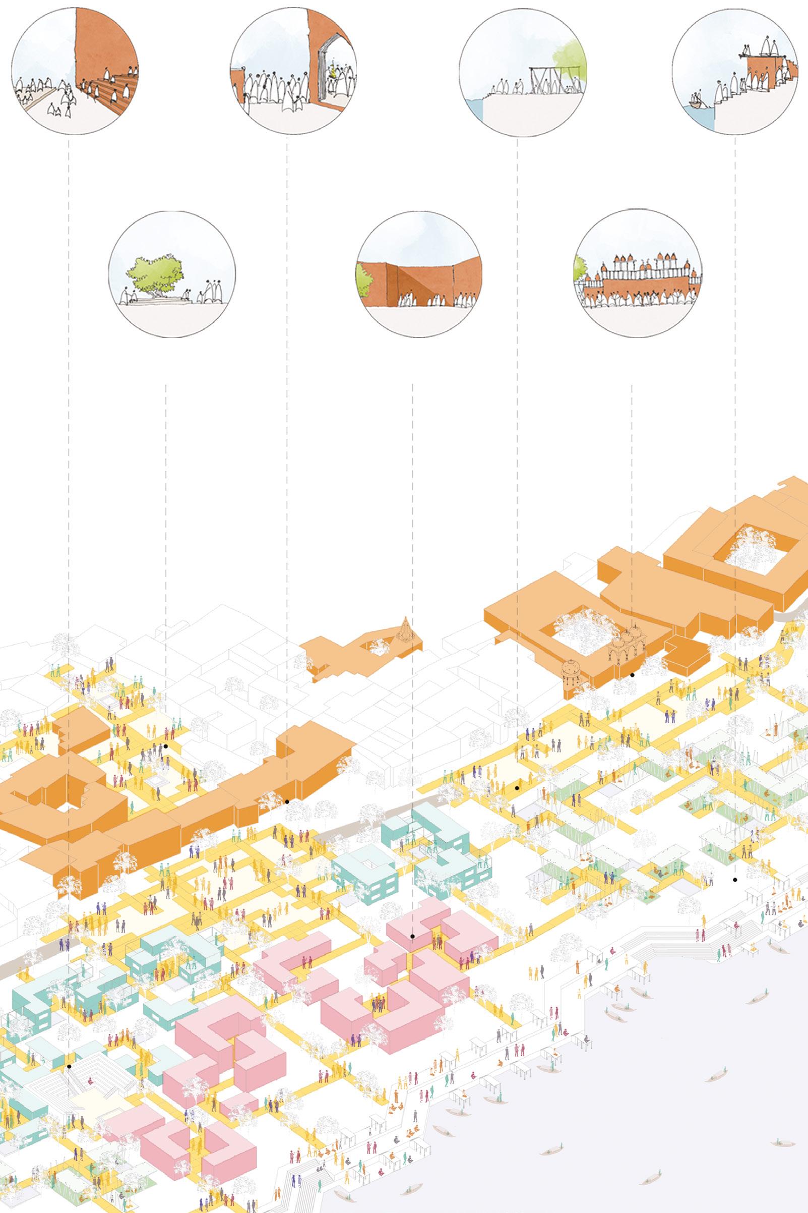
Aerial view of the site post design intervention. An activated urbanscape along the Parikrama Marg which allows the natural as well as the human coexist without taking over the vernacular values of the pilgrimage town.
Top : Crucial issues leading to mental, spiritual and cultural disconnect ;
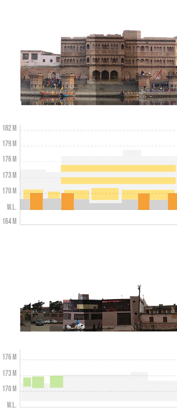
Bottom : Analytically mapping the repeating architectural elements along the abutting ghats and streets of the site of intervention
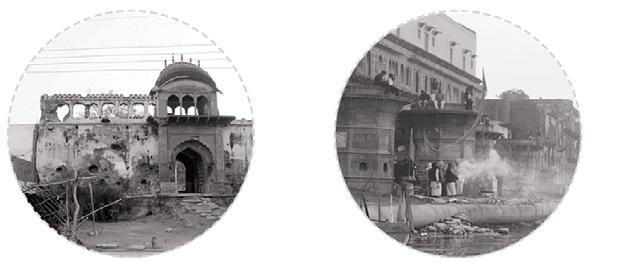
Dilapidated vital socio-heritage structures causing imbalanced sociospatial relationship Hindrance to reverential activities & abrupt transition between streets- leading to disengagement
Increasing urbanization, uncontrolled growth, increasing pilgrims and unparalleled infrastructure generates a gap between the users and the landscape. The loss of water bodies and reduction in the size of groves, in and around Vrindavan, along with the disappearing place markers has led to the dwindling of the cultural memories.
The idea is to recapture the memories of Vrindavan, building upon the memoryscape, while intensifying the reverential activities of the Holy town in order to recover the lost essence of the pilgrimage. This is done by translating the emotions of the various user groups involved into the architectural design of the urban area and the cultural centre collectively. It is very vital if we are to experience architectural meaning and sense that the effect of the building should find a counterpart in the world of the viewer’s experience. Hence, the urban design proposal should be designed keeping in mind the collective memoryscape where all the elements that can invoke these memories in the visitors are integrated into one to form a minimalistic yet powerful intervention that brings back what is lost.
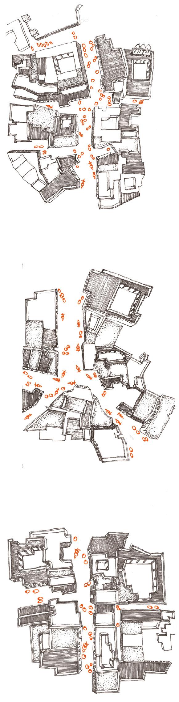
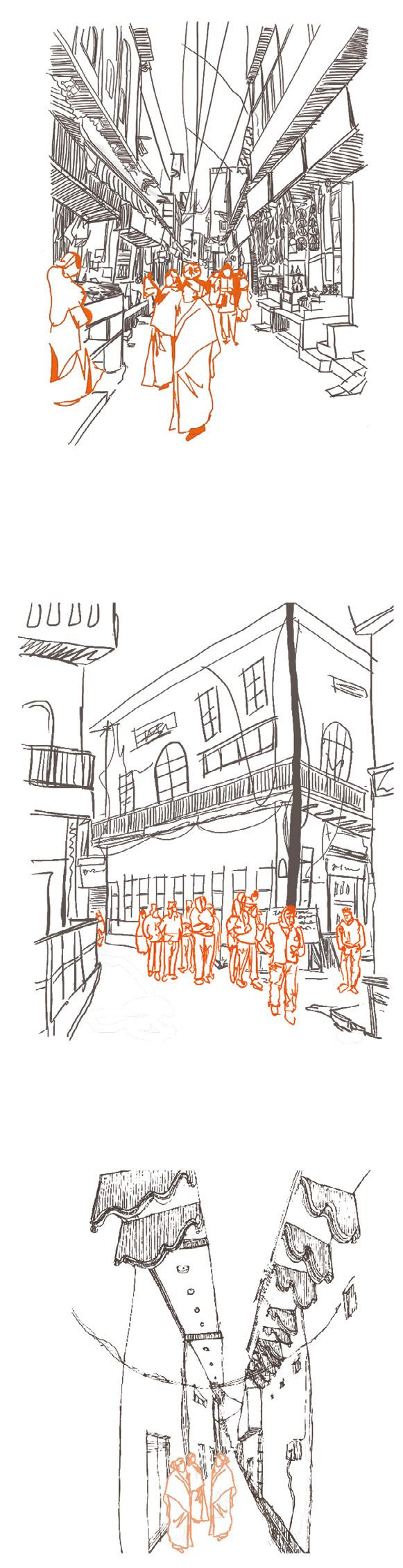
After careful analysis of movement patterns and memory mapping , the site of intervention is pinned down. This is corroborated by the findings of space syntax that shows that if intervened in this specific site, the intervention can be weived into the fabric of the cultural landscape.
The landuse of the surrounding area and data regarding the users present nearby the site is collected which shows a majority of migrant workers, who are left out to these periphery areas to create their own homes, thereby leading to illegal settlements and encroachments of open land. The services are also mapped out to further develop them through the proposal inorder to create a sustainable solution to the issues found. spire arches
Lagging infrastructural development leading to deteoriation of open spaces
No place for the migrants- leading to encroachments and unplanned development
Undefined river edge- diminishing reverential activities related to river Yamuna
Lack of transit routes leading to unintended intersection of reverential & everyday activities
Taboo surrounding crematorium located nearby the Parikrama Marg
While MEMORIES are abstract and so is SPIRITUALITY, the image created in the user’s mind is subjective to their past experiences and varies from one to another. However, the idea is to invoke the emotions aimed to be preached by Lord Krishna’s ideologies and deliver the user groups with the ultimate desire, LIBERATION. Doing so, they can they be one with the supreme being and can be of service to him.
The experiences aimed to be generated will be done so by using the muscle memory which will drive the kinesthetic interfacing with architecture. These memories evoked in the people will translate space into motion experience, bringing out the dynamic character of space. And to generate those, one has to keep perception psychology in mind as well.
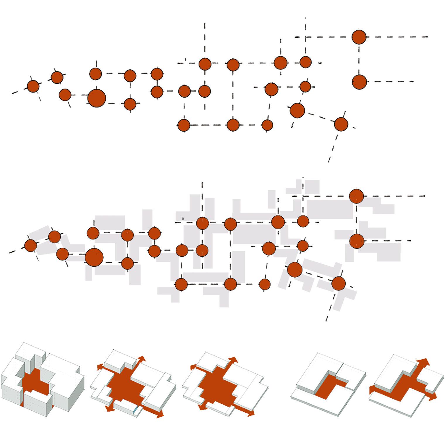
Top : Movement lines generating nodes ; Intermediate : Nodes, generating spaces inspired from urban fabric ; Bottom : Transformation of internal courtyards in buildings to external nodes at intersections of pathways Conceptual sketches
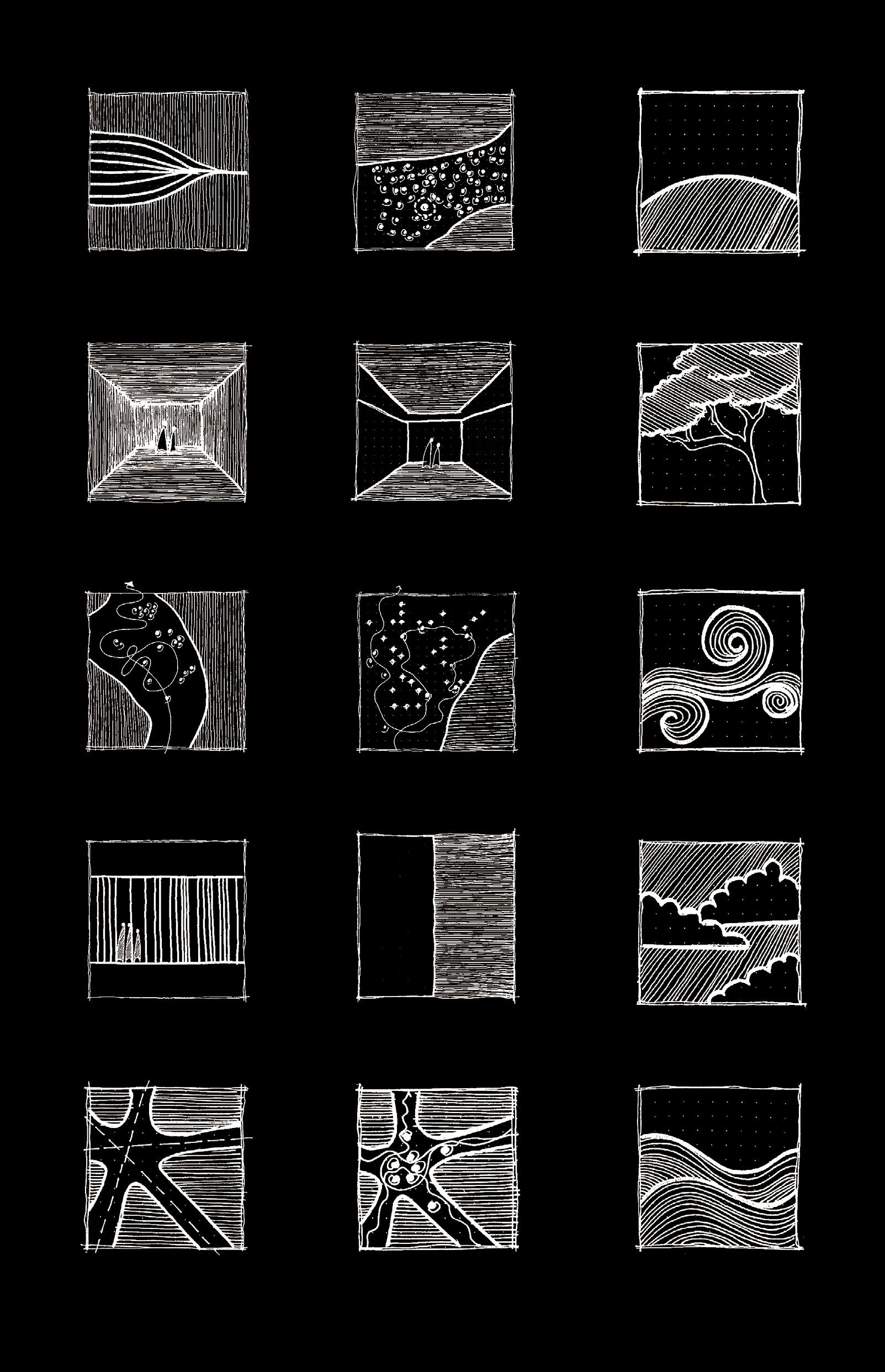
Sense of quiet
Connection to reverential soil (land
Visual weight, darkness
Visual weight, lightness
Integration of green element
User interaction
Alteration in rhythm
Integration of wind element
Altering density of elements
Stone and feather
Integration of sky element
Intersection of axes
Movement generation
Inclusion of water element
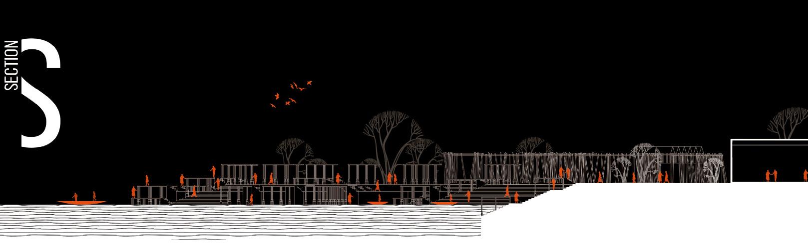
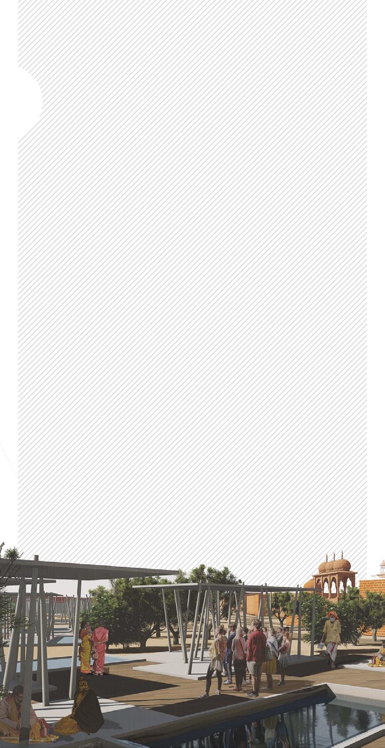
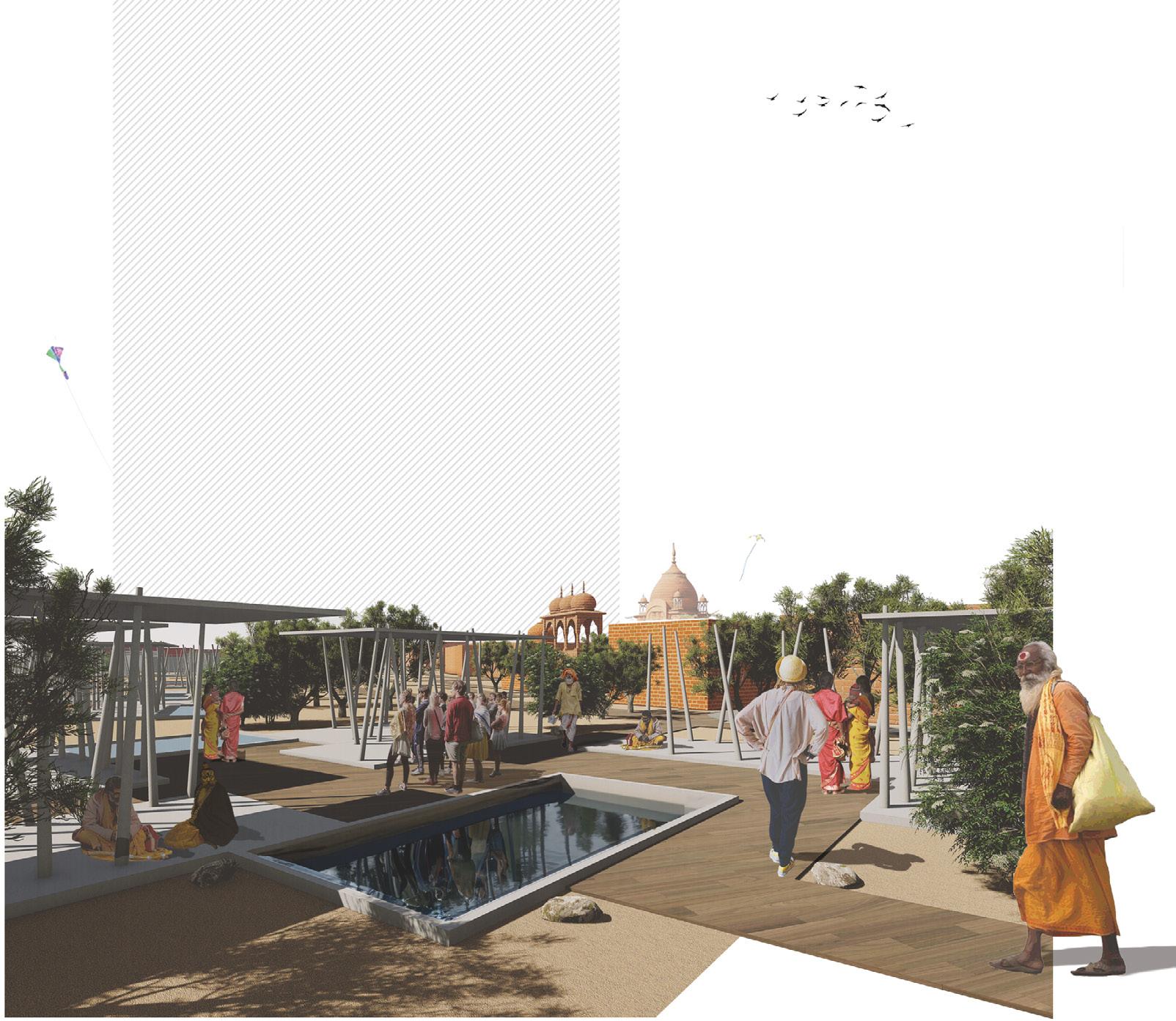
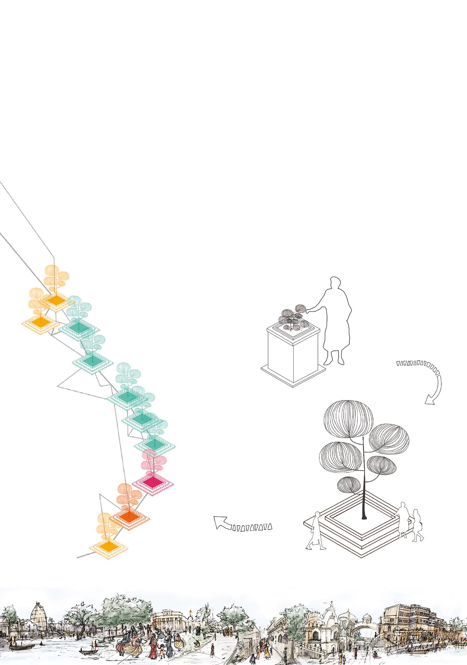
The entrance points to the market complex and its exit points opens up to a vista of activities towards the ghat areas. The sprawling views showing the integration of the old and new through a vernacular landscape reimagined.

Memory mapping of various user groups
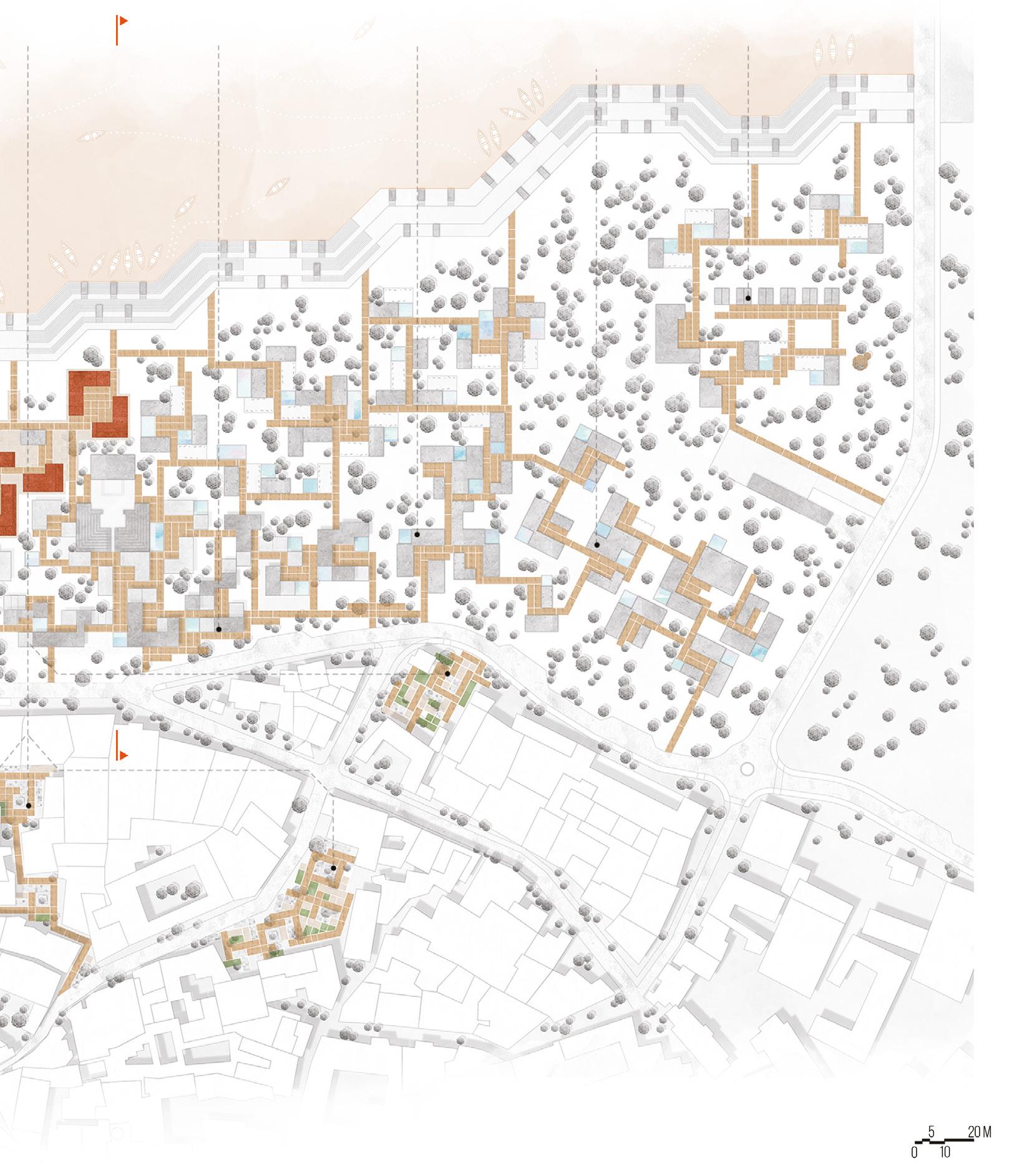
Transformation of a repetitive element to a vital urban memory marker, a proposed urban integration intervention :
Top right : Tulsi in the courtyard of houses ; Bottom right : Vana-Tulsi in the stepped platform becoming a backdrop of interactions at the nodes ;
Bottom left : Collective memoryscape integrated with Vana tulsi intervention; Center: Rejuvenated collective memoryscape of Vrindavan
Memory mapping of various groups was undertaken. This generated the vital nodes of their mental imagery. After overlaying the maps of various people of same user group, a concluding user group mental map was inferred. Overlaying all the maps finally gave a concluding map for all users. This helped justifying the reason of taking up the site at the specific location. Since, it reoccurs in everyone’s memory and in the collective memoryscape, intervening at the given site will help intensify the urban spirit of Parikrama Marg, which is the aim of the design proposal.
Intervening at sensitive locations along the determined memory map will integrate the design proposal into the urban fabric. This becomes a challenge as the new manifestations will have an impact in the memoryscape of the reverential Braj town. Hence, the interventions, while being contemporary interpretations, must not disrupt the existing relations of man and the builtscape and be in harmony with the existing heritage or it may turn into a failure, while further degrading the religious path. Thus, a Vana tulsi plant, which is native to the Braj region, on an elevated stepped platform is proposed at every node determined through this mental mapping. This will be a repeating and binding element of the design area as well as the urban area.
Cultural hub with performing arts
Memory markers for urban integration
Interaction with heritagescape
User adaptible spaces for various activities
Activated waterfronts due to ghats
Museum; a catalyst for heritage conservation
Heritage; a backdrop for all activities
Top : Activated streets with activities and tourists sweeping into the traditional bazaar ; Intermediate : Activated streets due to increased movement of people along the Parikrama marg
Projected pluralities in site context as an effect of design interventions with activated movement of residents due to increased interaction with pilgrims
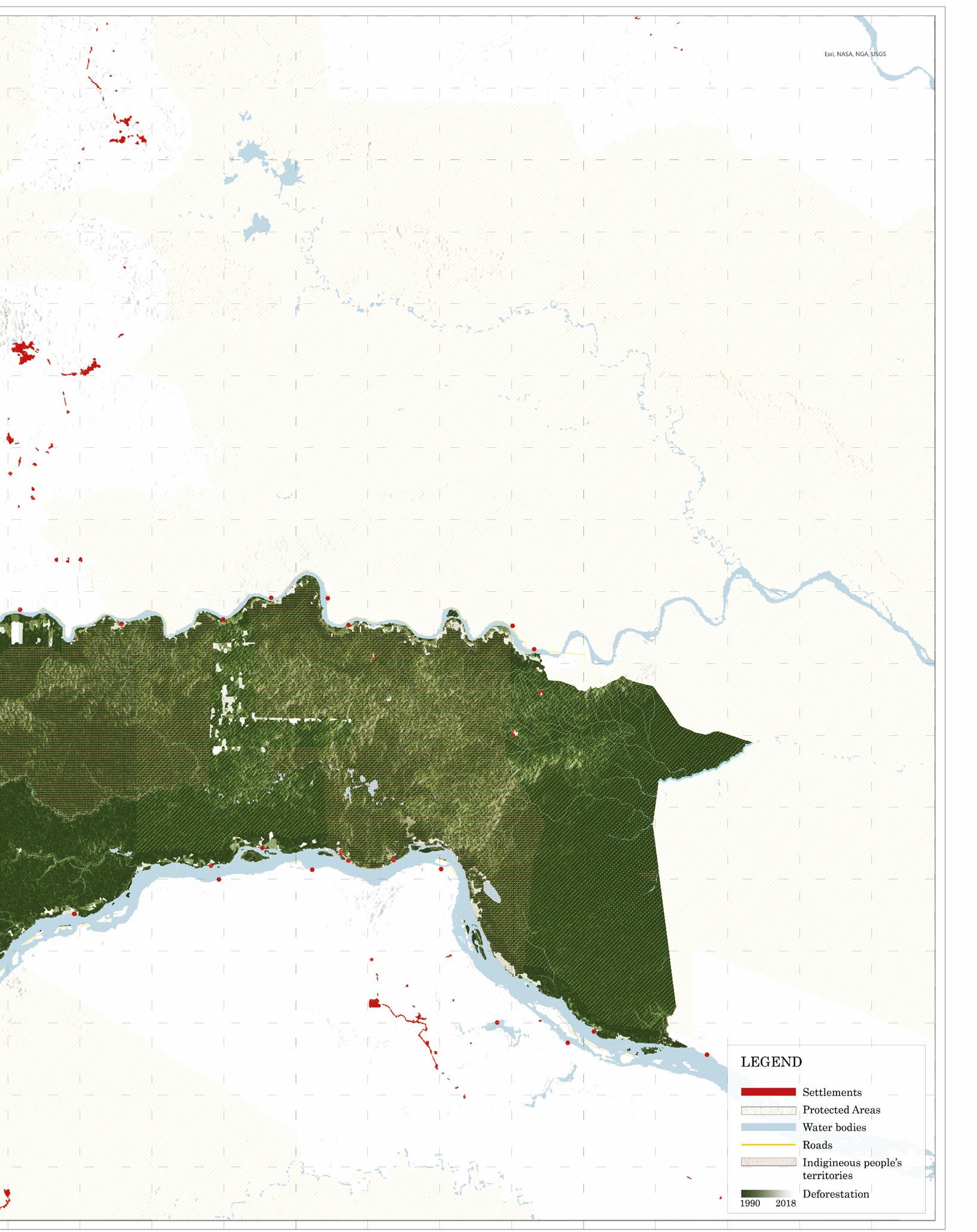
Shushufindi is recognized among the numerous towns in Ecuador that underwent rapid urbanization propelled by the oil extraction industry. While this industry fostered urban development and created employment opportunities, it also resulted in the degradation of natural ecosystems and contamination of indigenous lands. With the global shift away from oil dependency, concerns arise about the future of these towns built on the foundation of the oil economy. Despite its adverse social and environmental impacts, oil facilitated connectivity to the global economy. However, as the industry diminishes, questions arise regarding the fate of these oil-reliant communities.
The algorithm assesses the optimal locations for city expansion based on the proximity to various infrastructures. Its insights are derived from community input. Emphasizing the significance of oil infrastructure, the algorithm stipulates that new settlements should be situated farthest away from such facilities. Development should prioritize existing road networks to minimize forest encroachment. Additionally, it should prioritize social infrastructure and established skill development centers. Cultural sanctuaries must be respected and located nearby, as they hold profound importance for the indigenous community. Ultimately, development should steer clear of any previously contaminated sites that have not undergone bioremediation.
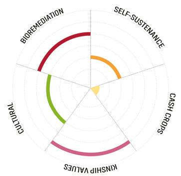
The algorithm’s application produces a map delineating areas for immediate degrowth and bioremediation (pink), areas requiring bioremediation without rehabilitation (white), and areas suitable for expansion. However, the reliance on the oil industry for employment complicates the transition away from contaminated zones. To address this, the chakra system was analyzed, deriving insights for designing an incentivebased urban growth model that provides economic opportunities without perpetuating reliance on oil.
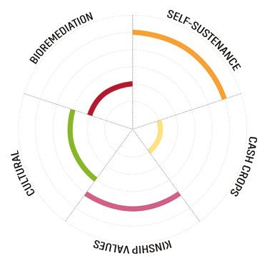
This led to the development of five chakra systems tailored to different land uses, incorporating indigenous plants known for bioremediation, sustenance, cultural significance, and self-sufficiency. Each system is applied according to the specific needs of residential, oil infrastructure, commercial, agricultural, and social/cultural zones, fostering economic viability while restoring soil health. Utilizing these two algorithms, a framework for new urban growth was formulated. In existing areas, new biodiverse corridors were identified, where planting mechanisms could be implemented. These spaces are situated within regions requiring bioremediation but not rehabilitation.
PRoPOSAL FOR postOIL TOWN growth OF SHUSHUFINDI
ECUADOR
HARVARD GSD top 3 project adaptive reuse

Rendered view of the site plan of the oil district put to adaptive reuse strategies. The area which falls under the zone requiring immediate bioremediation and rehabilitation (identified in pink in the map after).
Left: Algorithm for urban growth and degrowth shows the various weightage given to different infrastructures. A positive sign means movement towards the infrastructure while a negative sign means development away from the infrastructure. Right: Map of Urban growth and degrowth. Areas are classified as urban spaces requiring immediate bioremediation and rehabilitation (pink), bioremediation without rehabilitation (white) and area of city expansion(green).
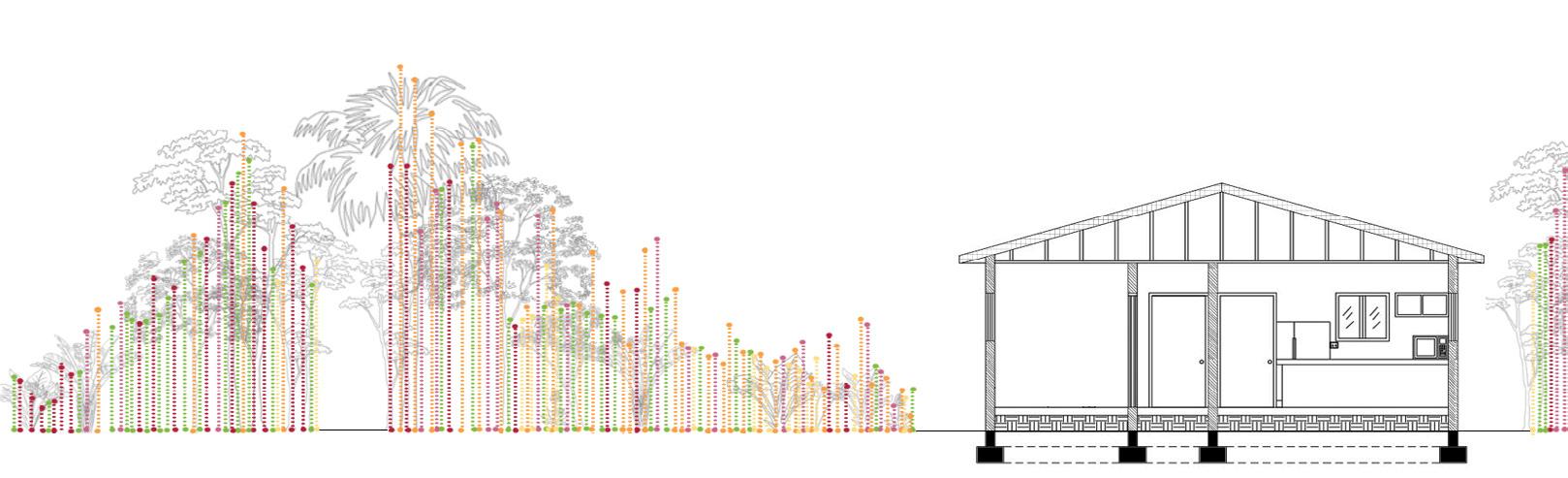
Right:Weightage of Plants in different land use; Below: Plan and Section of planting generated by algorithm with different colors denoting different plant groups in a residential sector.
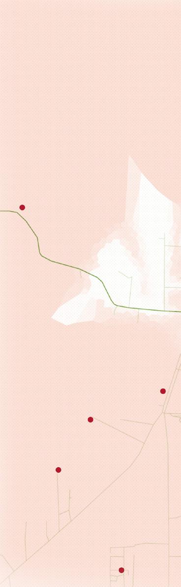

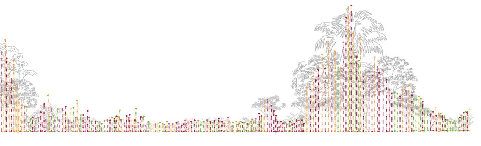
Top right: Green corridors in spaces requiring bioremediation but not rehabilitation(white areas in the map above) showcasing transition over the years in already existing urban spaces. Bottom right: Site plan of new development in the area where city could grow towards(green areas from map above).

Consequently, the implementation of chakra systems not only infused greenery into the urban fabric but also established corridors connecting the city with the surrounding forest, countering the adverse impacts of the oil industry. In newly developed areas of the town, the chakra systems guided development. Skill development centers were established to bolster community traditional knowledge systems, aiding those who had migrated due to the oil industry while fostering harmonious cohabitation between indigenous and working communities and offering an alternative source of income. In areas requiring degrowth, residents were relocated to the new part of the town.
The project’s primary focus lies in the adaptive reuse of the oil refinery district situated in Shushufindi’s main city, falling within the region requiring immediate bioremediation and rehabilitation. While the removal of oil infrastructure was mandated, the Seikopai and other indigenous communities advocated against wasteful resource disposal. Thus, an adaptive reuse strategy was implemented to integrate various community needs into the existing infrastructure postbioremediation. The entire area was reconceptualized as a cultural, transport, industrial, and educational hub, seamlessly integrating major infrastructural projects desired by the local government. The oil refinery was repurposed into a biofuel industry, utilizing cityproduced biowaste to generate electricity and other beneficial bioproducts, aligning with the desires of the city dwellers. Plans for education and administrative sectors were included, overseen by the municipality. This comprehensive approach forms a robust adaptive reuse design proposal that repurposes every existing infrastructure element in the city.
Thus, a new future for Shushufindi is envisioned, wherein infrastructure recycling and reuse align with the traditional value systems of the community. This fusion of traditional and modern systems facilitates development within a rejuvenated landscape, fostering community well-being and prosperity.
Deciding with the community for intervention locations
Using Chakra system algorithm for planting in corridors Injected green in existing urban fabric in the white zone
Forest Skill Development Center
Site plan of the oil district of Shushufindi, indicating adaptive reuse strategies.
Biofuel Industry Cultural Museum Restaurant Complex Fire Station Industrial Estate Bus Terminal
The urban lifestyle in London remains severely affected in the city that can lead to a mental health crisis sooner or later. Non-inclusion of green spaces and less availability of open spaces in an office environment, which acts as a break during working hours, remains one of the bigger contributing factors. Moreover, the use of more mechanical devices and personalized vehicles instead of public transport leads to a larger looming problem from the last decade. An average person’s carbon footprint remains 12.7 tons which is 3 times higher than in other countries. The pollution crisis remains an imminent issue, due to which a higher percentage of people suffer from respiratory illnesses every year in the city and thus, die due to complicacies emerging from the same. It has been observed that most of the respiratory illnesses are caused due to the concentration of nitrogen oxides in the atmosphere which are difficult to remove and remain toxic. The levels in London are higher than those anywhere in Europe.
To intervene in a city with such complex issues, with the limitations that skyscrapers present, one must delve into taking innovative approaches in the architectural field. The solution, hence, does not remain a conventional architectural intervention but rather in creating a system that would address all the issues simultaneously, thus deconstructing the web of problems and acting upon each, one by one.
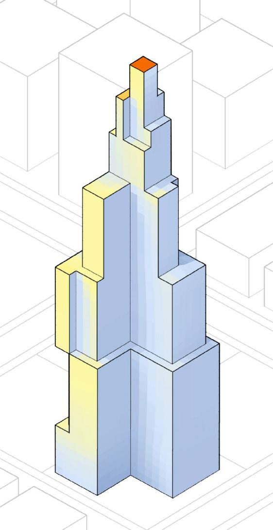
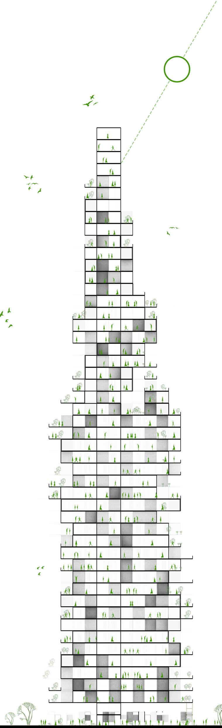
COMPUTATIONAL DESIGN project using discrete design methods and ruleset design rat[lab] india TOP 3 PROJECT TEAM WORK WITH PATRISH KUMAR
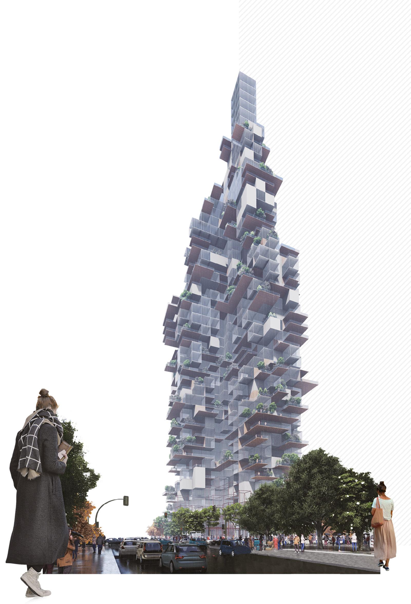
A rendered view of the skyscraper accompanies showcasing the discrete design ruleset used to generate an architectural solution to tackle the various issues grapping the metropolitan borough of London.


FUNCTIONAL
SENSE

Parts

TERRACE_TERRACE
Interior-Recreational Interior-Offices

ruledBasedAssembly ruledBasedAssembly
INTERIOR_INTERIOR
TERRACE_INTERIOR
ruledBasedAssembly
TERRACE_TERRACE

Ruled Based Assembly Rendered View
INTERIOR_INTERIOR

Ruled Based Assembly Rendered View
TERRACE_INTERIOR

Ruled Based Assembly Rendered View
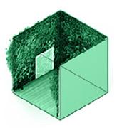
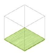
A set of modules, each measuring 4m X 4m, are determined that would form the elements of the discrete system envisioned. they are characterised by the degree of enclosure, functions and materials. The modules have a targeted functional quality and also integrate certain design strategies in themselves. After the modules, the rules that form relationship between modules are given which comprise of thousands of rulesets formed by the permutation and combination of all modules. Thus, these rules form the foundation of the design and alongwith the modules, define the spatial organisation of spaces.


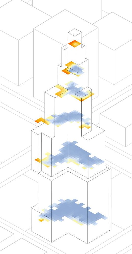
Left to Right: Envelope development; Massing that is used to then run environmental analysis and visibility analysis.
Left: Radiation Analysis of Envelope, helping determine which module to place to combat excessive radiation; Right: Incident Sunlight hours analysis of building envelope to position solar panels for energy production .
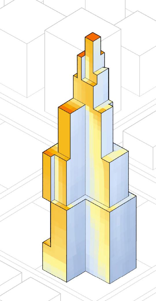

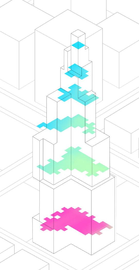
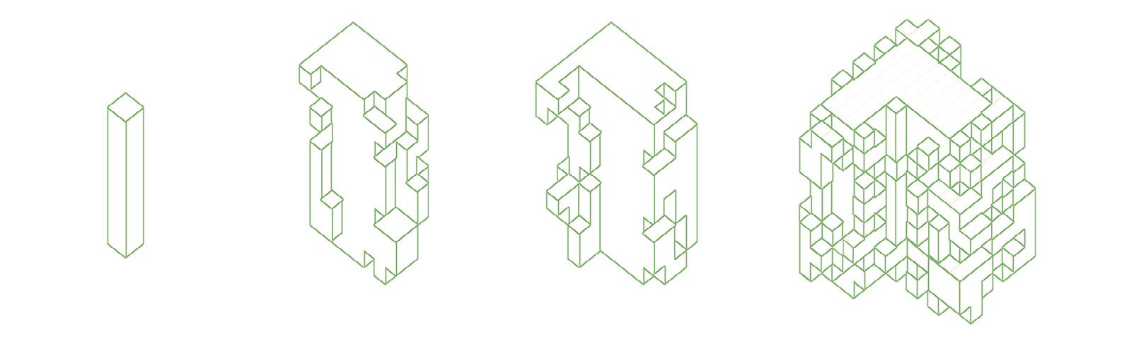
A set of modules are determined that would form the elements of the system envisioned. The modules have a targeted functional quality and also integrate certain design solutions in themselves. These modules are then assigned to specific zones and specific horizontal rings inorder to achieve a functional system that would also cater to the required functional aspects of the skyscraper.
The aggregation grows both vertically and horizontally while pertaining to the rulesets provided. It ensures that the outcome of the aggregation is devoid of geometric clashes and intersections. The plugin and software used are Wasp 3D in Grasshopper.
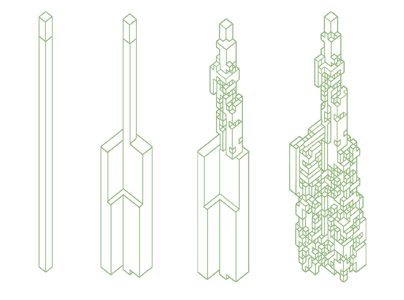
Top: Discrete aggregation development- horizontally from the core to the envisioned outer envelope. Bottom: Discrete aggregation development- vertically from the core to the envisioned outer envelope of various zones creating a staggered effect.
Skyscraper details showcaing the typical plans from zone 1(bottom) to zone 6(top); Far left: Section of Smarthub
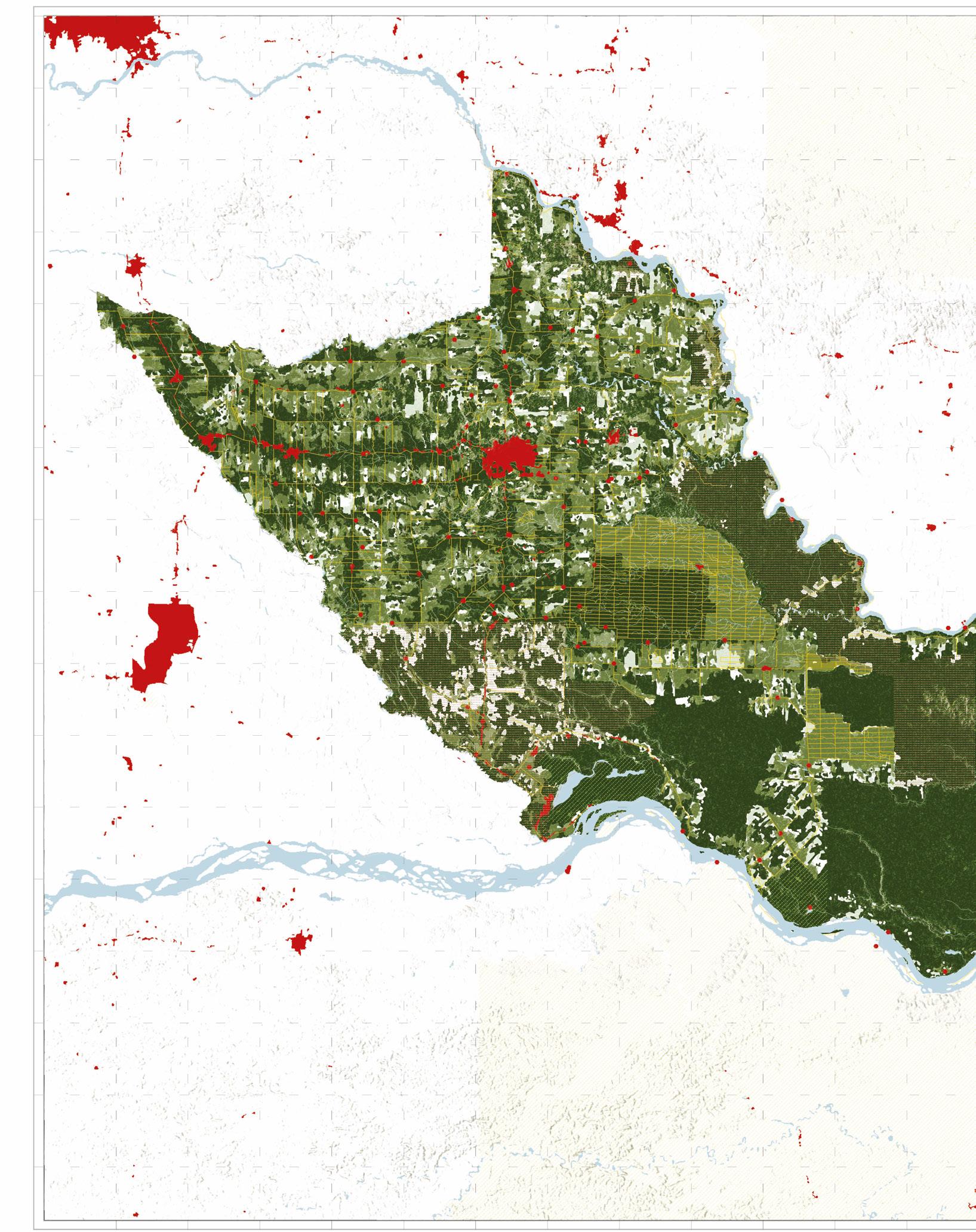

AThe extractive oil industries, cash cropping, and uncontrolled urban development have caused extensive deforestation in the Amazon forest areas of Shushufindi canton. This has severely disrupted the ecological balance and encroached upon indigenous lands and practices. There is a pressing need for more sensitive landscape management and urban development strategies.
Cartographic maps showing deforestation from 1990 to 2018 and subsequent urban growth in Shushufindi
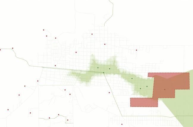
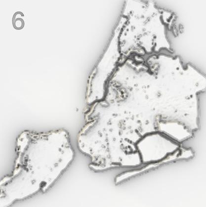
Different forms of surveillance along with degrees of accessibility create islands of control around the city. This map displays a topography that represents NYC from the perspective of control. Higher elevation equals more heightened control. The visualization finds that areas of public access are highly surveilled and controlled. Paradoxically, areas of zero public access, such as Rikers Island, are at the most extreme end of control. What is extremely controlled is actually invisible to the public eye.
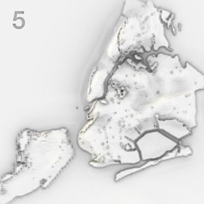
BDone in collaboration with Gracie Meek, this map of New York City reveals islands of control created by surveillance beyond perspective on the city, obscuring traditional road maps and geomorphology to highlight zones of intense control. Different create these control zones, with higher elevations on the map indicating heightened control, control being defined in terms publicness of space. Eight iterations with varying surveillance values were tested before finalizing the composite map.
The team placed geolocated surveillance data derived from NYC Open Data into a grasshopper script that translated values into height. The team gave each surveillance category a height value, and when combined, created an archipelago of control. 8 iterations with different values for types of surveillance were tested before landing on the composite map.
Bottom: Archipelago of Control: Surveillance Technology in New York City; Right: Iterative archipelagos created by different
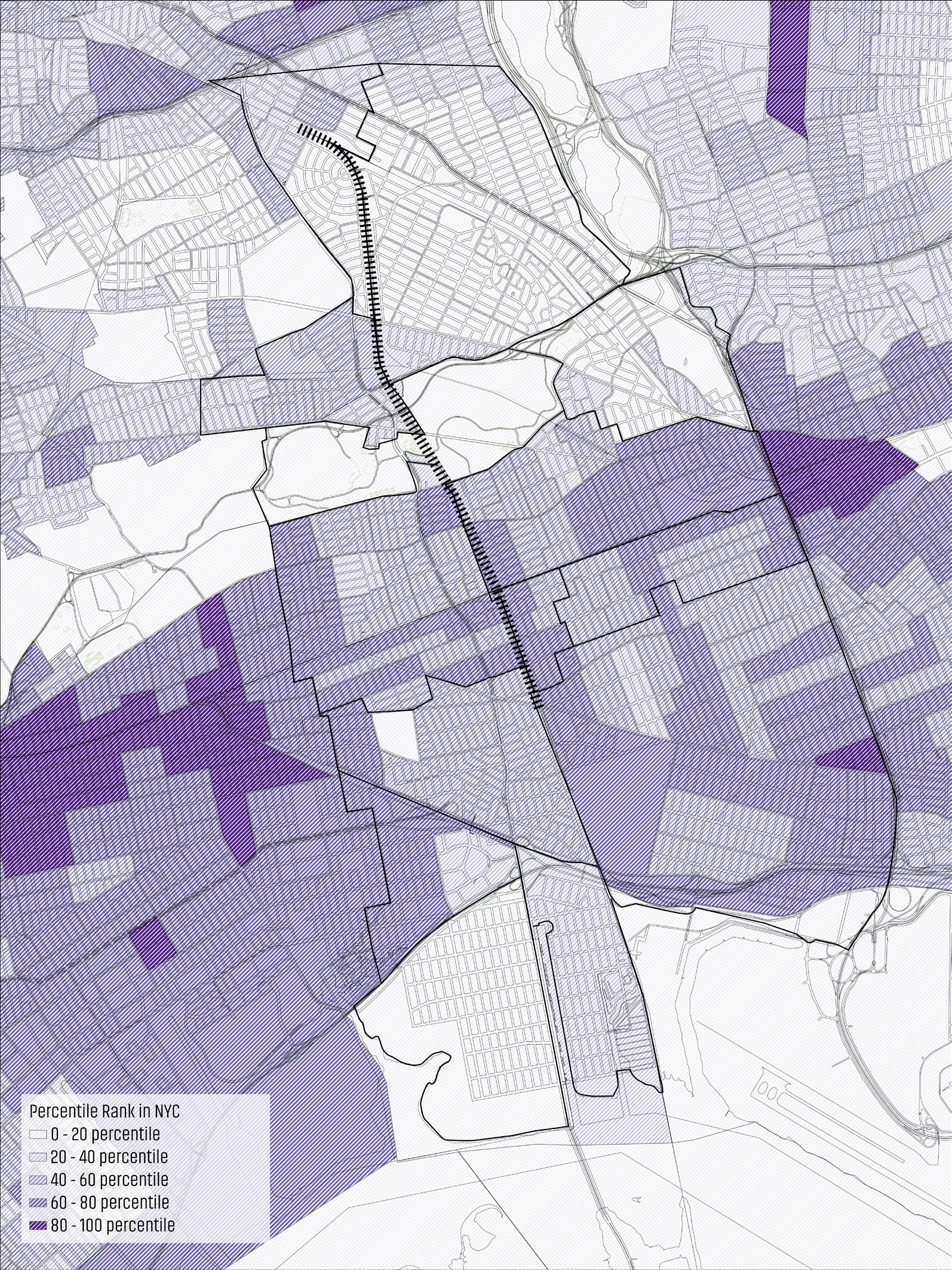
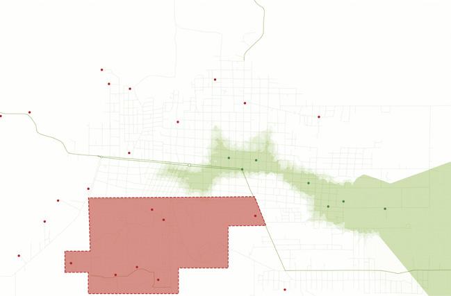
CThe following 2 maps were done for the Trust for Public Land as the role of Equity Auditor to identify where to implement anti-displacement strtageies which need to be put in place to mitigate gentrification due to the Queensway project. Areas within the proximity of Queensway that are workforce disadvantaged, and are more vulnerable to displacement and gentrification due to the creation of the Queensway. These areas need to be a direct area of focus for anti displacement strategies.
Economically Disadvantaged Areas near the QueensWay project.
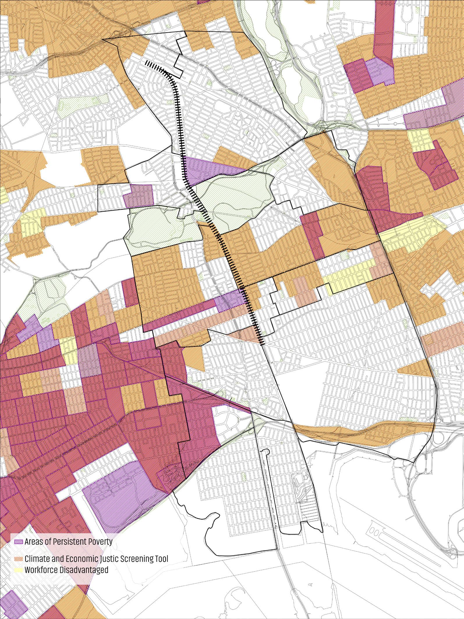
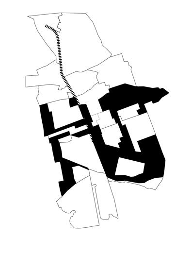
According to the New York Climate Justice Group, disadvantaged communities have historically been marginalized by land use policies. Southern neighborhoods, in particular, continue to face significant disadvantages, reflecting a pattern of historical underinvestment. This map, combined with the previous one, helps identify priority areas for implementing anti-displacement strategies to mitigate gentrification resulting from the Queensway project.
Disadvantaged communities near the QueensWay project.