THE FLEET STREET QUARTER


AN AREA BASED STRATEGY FOR
THE FLEET STREET QUARTER
BRIEF HISTORY
ISSUES
CONTEXT
FUTURE
A VISION FOR THE FLEET STREET QUARTER
CELEBRATE FLEET STREET QUARTER’S DIVERSE CHARACTER AREAS
TO SURROUNDING
ACTIVATION
REALM IMPROVEMENTS
PROJECTS
BRIEFS
MATRIX
CONTENTS FOREWORD 4 INTRODUCTION 5 EXECUTIVE SUMMARY 7
8 A
10 ASSETS,
AND OPPORTUNITIES 12 POLICY
AND
CHANGES 16 DEVELOPMENT CONTEXT 18
20
22 CONNECT
NEIGHBOURHOODS 24 ENCOURAGE
25 PUBLIC
28 POTENTIAL
30 PROJECT
32 PROJECT
54 PHASING 56
Fleet Street Quarter is an iconic location. As stewards for change, we want to harness growth and opportunities to breathe new life into the area. We want to create a vibrant, resilient, inclusive, green and sustainable district through modern placemaking.
While sometimes forgotten, this area has a rich history, presenting an opportunity for reinvigoration through the modern renewal of its past. The public realm can and should do more to support the growth and evolution of this area. It’s not just about what happens within buildings, but what happens in the spaces in between them.
This Area Based Strategy presents a compelling vision for the future of Fleet Street Quarter’s streets, spaces and public life. We hope that it inspires our partners and stakeholders to share ideas and become involved.
Martha Grekos
Chair of the Fleet Street Quarter Public Realm & Environment Steering Group
FOREWORD
4 AN AREA BASED STRATEGY FOR THE FLEET STREET QUARTER
ABOUT THIS DOCUMENT
This Area Strategy sets out an implementable vision for the improvement of the public realm of the Fleet Street Quarter over the short, medium, and longer terms. The vision recognises that the district includes strong and complementary character areas that should be celebrated through both placespecific public realm improvements and through the encouragement of cultural and commercial activation.
This strategy has been developed by Publica working closely with the Fleet Street Quarter Public Realm & Environment Steering Group and representatives from the City of London. The strategy and principlebased vision are based on the key findings from Publica’s initial studies of the area – its history, spatial and environmental characteristics, transport connectivity, and policy context.
The purpose of this document is to set out a spatial and temporal framework for future public realm changes to ensure that the area can fulfil its upcoming potential, establishing some key projects for the Fleet Street Quarter Partnership to deliver, or help to deliver over the coming years. In addition to providing strategic guidance to support better placemaking, this document can be used to facilitate dialogue, debate, and decision making by stakeholders in the area including the City of London Corporation (CoL), Transport for London (TfL), developers, landowners, businesses, and residents.
Fourteen projects have been identified as having potential for public realm improvement. These have been illustrated to give an impression of the scope and impact of the proposals. The spatial briefs for the fourteen projects provide strategic guidance rather than detailed design solutions; they are intended to stimulate new ideas and provoke discussion and decision-making.
ABOUT THE FLEET STREET QUARTER PARTNERSHIP
The Fleet Street Quarter has been established to take a leading role in accelerating a vision that will shape this historic location into a thriving quarter.
An ambitious development pipeline offers the Partnership an opportunity to harness this growth, creating a new narrative for this iconic location –an area that will foster innovation, champion culture and curate a green and sustainable business district.
A number of founding funding partners have joined together to form the partnership and are now leading an ambitious work programme.
The Fleet Street Quarter will be the area’s advocate, promoter, and custodian. We will be working closely with our partners at the City of London Corporation, TfL, the GLA and our vibrant, innovative business community to deliver a powerful enhancement agenda.
We are working towards becoming a Business Improvement District (BID) in the coming years.
ABOUT PUBLICA
Publica is a London-based urban design and public realm practice working in the UK and across the world to make our cities more successful, functional, and beautiful. We survey neighbourhoods, undertake rigorous research, provide strategies for innovative and inclusive policy and planning and design public spaces which celebrate civic dignity and enrich everyday life.
INTRODUCTION
AN AREA BASED STRATEGY FOR THE FLEET STREET QUARTER 5
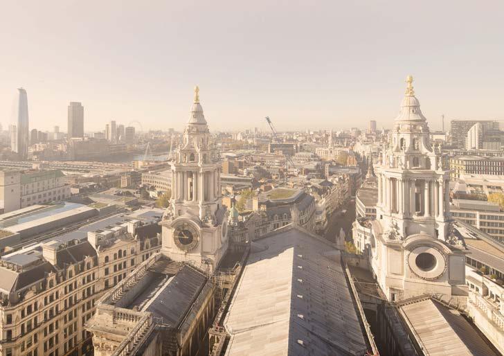 Aerial view of Fleet Street from St Paul’s Cathedral
6 AN AREA BASED STRATEGY FOR THE FLEET STREET QUARTER
Fleet Street Quarter lies between and connects the City of Westminster and the City of London. The significance of this central and ‘in-between’ location is intertwined with both the history of the area and its future.
The Inns of Court were located in the vicinity of Fleet Street in the fourteenth century, establishing the area as the epicentre of the nation’s legal community to this day. The flourishing publishing and print industries flowed from the demands generated by the legal community which in turn gave rise to Fleet Street’s most famous industry – print journalism. The newspapers and their related industries defined the area until the industry began relocating in the late 1980s. This distinct history has created the exceptionally rich and varied character of the area’s street patterns and architecture. Much of Fleet Street Quarter falls within the Fleet Street and Chancery Lane Conservation Areas. The historic character of these parts of the Quarter form a sharp contrast to the other areas which are dominated by large scale commercial buildings.
The relocation of the area’s predominant industry inevitably had a consequential impact on the industries and activities that were part of journalism’s own eco-system. Pubs, restaurants, shops, and small businesses have been reducing in number since the 1990s and the current impact of Covid-19 has exacerbated this pattern of decline. Conversely, the voids left by this relocation have also presented opportunities in terms of new development. Some major new-build and refurbishment projects have been completed in recent years and there is a significant pipeline of development due for completion in the next five years. There is now the opportunity to consider and coordinate the contributions of new development in terms of public realm improvements and ground floor uses and activities.
Taken together with the wider changes taking place in our cities in response to the climate emergency and the need to address issues of social and economic inequality, there is at this moment, the urgent need and appetite to set out an ambitious vision for the future of Fleet Street Quarter’s public realm.
This strategy seeks to address the current challenges facing the Fleet Street Quarter while developing a vision that builds on the area’s assets and strengths. There is also the question of future identity – what does the Fleet Street Quarter want to be?
The challenges are evident. The area has lacked a clear identity in the years following the departure of the media and the consequential decline of activity has been further compounded by the pandemic. Spatially, the large traffic arteries create severances through the area and contribute to poor air quality; there is a deficiency of open space and greenery, and wayfinding and orientation are difficult.
The area’s strengths are its history and its location. Although the newspapers have dispersed, the area’s location and connectivity have always been attractive to businesses, evidenced by the current number of headquarter buildings in the area and the interest in the development pipeline. However, the workspace market is likely to be more competitive following the pandemic and differentiators, such as the quality of the public realm, are increasingly important to consider.
Fleet Street Quarter borders other London neighbourhoods. This presents the opportunity to bring some of this activity into the area. For example, by encouraging the small businesses from Farringdon to locate in the area, by capturing the tourists walking from the Southbank to St. Paul’s, by bringing students into the area from the Strand. To do this the public realm must be improved but in parallel, there needs to be a mix of activity taking place across the area that appeals to an audience beyond the daytime workers of the large corporations.
The vision is therefore based around three interconnected strategies – improving the public realm, encouraging activation, and connecting to surrounding neighbourhoods. This vision aims to re-invigorate the area into becoming a memorable, sustainable and vibrant part of London that is welcoming, inclusive, supportive of a variety of uses, while providing a high-quality public realm for the area’s remarkable history and future.
EXECUTIVE SUMMARY
AN AREA BASED STRATEGY FOR THE FLEET STREET QUARTER 7
STREET QUARTER
Fleet Street Quarter is the area north and south of Fleet Street and Ludgate Hill, approximately half a mile in width measured along its spine. The western extent of Fleet Street Quarter borders the legal precincts of the Inner and Middle Temples and adjoins the Royal Courts of Justice in the City of Westminster. To the east, the Fleet Street/Ludgate Hill corridor frames the approach to St Paul’s Cathedral. To the south, the Quarter is bordered by Tudor Street and Queen Victoria Street. Fleet Street Quarter is well connected to public transport, with rail connections at City Thameslink and Blackfriars and London Underground stations at Chancery Lane and Blackfriars, the Farringdon interchange is nearby with access to the Elizabeth Line and the Blackfriars Pier is also nearby. Fleet Street, Farringdon Street and Holborn are main bus routes with a total of fourteen lines running through and at the edges of the quarter. For cyclists, Fleet Street Quarter benefits from its proximity to the Cycle Superhighway 3 that runs east-west along Victoria Embankment and from Cycleway 6 that runs north-south from Blackfriars to Farringdon.
The Fleet Street Quarter’s location is one of its greatest assets with the potential to connect to and capitalise on activity taking place in adjacent areas, particularly the planned cultural hub at Strand Aldwych and the new Museum of London in West Smithfield.
The opening of the new Museum of London at Smithfield Market in 2024 will attract more visitors to Culture Mile. Pre-pandemic, six million people a year crossed Millennium Bridge from Tate Modern and the wider Southbank area to the St. Paul’s area. Some of this pedestrian traffic is likely to continue further north to the Museum of London passing through Fleet Street Quarter.
At Strand Aldwych, two-way traffic is being returned to Aldwych and part of the Strand will be pedestrianised to provide new public spaces for culture, bringing an increasing number of people to the area.
The Quarter can also capitalise on its proximity to the River Thames and the crossings to the Southbank. The future Bazalgette Embankment – a new public space for recreation and leisure – will also be completed by 2025.
LOCATION PLAN
Fleet Street Quarter boundary Borough boundary
WESTMINSTER
20 MINUTE Somerset T rafalgar Square London School and Political Queen St Mary King’s EMBANKMENT PIER EMBANKMENT HOLBOR N R USSELL SQUARE CHARRING CROS S
THE FLEET
8 AN AREA BASED STRATEGY FOR THE FLEET STREET QUARTER
10 MINUTES 15 MINUTES MINUTES Somerset House 180 Stran d St Clement Dane s St Paul’s Cathedral Royal Courts of Justice of Economic s Political Science Daily Telegrap h B uilding Daily Expres s B uilding Dr Johnson’s House Old Bailey Bank King’s College Maughan Library St Bride’s I nner and Middle T emple s Royal Festival Hall Hayward Galler y N ational Theatre The Globe Theatre Tate Modern B arbica n Museum of Londo n West Smithfield Queen Elizabeth Hall Mary le Stran d King’s College London BL A CKFRIAR S CITY THAMESLINK TEMPLE CHANCE RY LA NE ST PA UL’S BL ACKFRIARS PIER BANKSID E FA RRINGDO N MANSION HOUSE BARBICAN CITY OF LONDON CAMDEN ISLINGTON SOUTHW ARK LA MBETH 0m 250m 500m N AN AREA BASED STRATEGY FOR THE FLEET STREET QUARTER 9
THE RIVER FLEET
Fleet Street takes its name from one of London’s ‘lost’ subterranean rivers – the River Fleet – a once vital transport corridor into north London that now runs under Farringdon Street as a sewer. The gentle incline and curve of the street reflects the Fleet valley’s pre-urban topography. The topography and natural landscape created by the River Fleet and the Thames are distinguishing features in the area.
BETWEEN TWO CITIES
Historically, Fleet Street lay outside the walls of the Roman city boundary and was an important route between the Roman city and the centre of Lundenwic, in today’s Covent Garden. This ancient processional thoroughfare links the double nucleus of London, the two cities – Westminster and the City of London and connects the Palace of Westminster to St Paul’s Cathedral. It remains an important route today, included in processions to celebrate royal jubilees, state funerals, and the Lord Mayor’s show.
THE INNS OF COURT AND THE LEGAL PROFESSION
The area developed in the medieval period and by the thirteenth century it had been brought within the boundaries of the City, marked at the western end
A painting by Samuel Scott (c.1750) depicting the mouth of the River Fleet as it joins the Thames.

of Fleet Street by the Temple Bar. The establishment of the Inns of Court in the fourteenth century lay the foundations for the area’s role as the country’s centre of the legal profession. Today, the area has a high concentration of legal services with more than two hundred international law firms employing over seventeen thousand solicitors.
FLEET STREET AND THE PRESS
From Tudor times, Fleet Street was home to booksellers, writers, and printers. The printing industry flourished in the area for the next two hundred years and thus it has renowned associations with significant literary figures such as Dr. Johnson and Oliver Goldsmith. The eighteenth century introduced the publishing of daily newspapers with Britain’s first daily newspaper, The Daily Courant, beginning in 1702, next to the King’s Arms tavern at Fleet Bridge.
Up until the late twentieth century, the pubs of Fleet Street were a part of the news culture, and several that are still operating today were known as ‘journalists’ pubs’, such as the Ye Olde Cheshire Cheese, El Vino, and Punch Tavern. While the news industry moved away by 2005, pubs and taverns in and around Fleet Street remain popular.
A BRIEF HISTORY
10 AN AREA BASED STRATEGY FOR THE FLEET STREET QUARTER

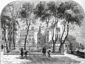
 The Agas Map of London (1561 1633) showing the urbanisation of the area along the major routes to the west of the city.
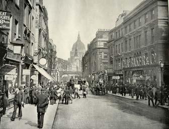
Fleet Street in the late nineteenth century.
An engraving by Henry Fletcher (1729) of Middle Temple, one of the Inns of Court located close to the Quarter.
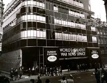
The Daily Express building on Fleet Street.
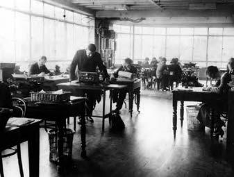
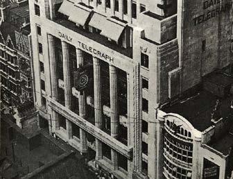
The Daily Telegraph building on Fleet Street.c 1934
Daily Express Building, Fleet Street
AN AREA BASED STRATEGY FOR THE FLEET STREET QUARTER 11
ISSUES AND OPPORTUNITIES
THE HISTORIC FABRIC
The geography and history of the area has formed an urban grain that is distinguished by the marked contrast between the broad main streets and the historic network of lanes and alleys. Across the area there are a variety of architectural styles, including seventeenth century timbering, Georgian domestic frontages, and monumental twentieth century newspaper buildings. There are numerous listed buildings in this area, including several churches and public houses. Much of Fleet Street, between Chancery and Ludgate Circus, lies in the Fleet Street Conservation Area and Fleet Street boasts one of the longest ensembles of pre-war buildings in London. This architectural character is an asset to the Quarter and efforts to enhance this character should be integral to any public realm improvements.
CONTEMPORARY CHARACTER
Much of Fleet Street Quarter is comprised of streetscapes of modern blocks. Many of the buildings completed since the 1990s are of high architectural and material quality and are good examples of their type. However, collectively, the homogeneity and scale of these blocks are in stark contrast to the historic parts of Fleet Street Quarter, with little sense of local identity. There is an opportunity in the public realm between these buildings to bring in some of the character and irregularity of the more intimate parts of the area, through the manipulation of space, views, activity, and landscape elements.
OPEN SPACES AND GREENERY
The Fleet Street area stands out from its surrounding areas in that it has relatively few green spaces and street trees and the environment around Fleet Street Quarter area is predominantly one of hard surfaces. While there is an intimate and evocative historic network of streets, lanes, and enclaves, there is a remarkable deficiency of greenery and green spaces and few places to sit and dwell, and there is no key ‘anchor’ public space. The three largest open
spaces are private – New Street Square, Fleet Place and Salisbury Square. New Street Square (2008) and Fleet Place (1993) are examples of high-quality public realm of their eras but the design of each could be enhanced to bring more activity to the spaces. To achieve the City Corporation’s goal of net-zero carbon emissions from its own operations by 2027 and across the Square Mile by 2040, the opportunity must be taken to increase greenery in the area as extensively as possible, with the addition of trees along key pedestrian routes, as well as in the small number of public and private/public spaces.
THE PEDESTRIAN EXPERIENCE
The most used pedestrian routes through the Fleet Street area are on the main arteries –Fleet Street and Ludgate Hill if going east-west and, Farringdon Street, Chancery Lane, Fetter Lane, and St. Bride Street if going north-south. Except for the improved areas of public realm on Chancery Lane, St. Bride Street and Shoe Lane, most of these routes offer a low quality pedestrian experience, with poor air quality, a lack of crossing points, and an inconsistency in the material treatment of pavements. The networks of pedestrian routes north and south of Fleet Street that are quieter with less traffic, offer a far more pleasant walking experience, but these are not well used as they are difficult to navigate and the area lacks sufficient signage. The external spaces that do exist are also underused due to a lack of amenity, active frontage, and poor visual permeability. There is the opportunity to encourage the use of alternative routes by implementing a wayfinding strategy, or by strengthening the existing Legible London signage.
THE CYCLING EXPERIENCE
Fleet Street Quarter benefits from its proximity to the Cycle Superhighway 3 that runs east-west along Victoria Embankment and from Cycleway 6 that runs north-south from Blackfriars to Farringdon. As part of the City of London’s temporary changes during the pandemic in 2020, cycle routes have been implemented along Fleet Street and Fetter
ASSETS,
12 AN AREA BASED STRATEGY FOR THE FLEET STREET QUARTER
Fleet Street forms part of an important civic route through London and has a unique identity enhanced by the considerable number of historic buildings along its length.


Large-scale commercial developments occupy much of the northern and eastern areas of the Quarter, including the recently completed New Ludgate development on Old Bailey.
Predominately built on sites cleared by bomb damage during WWII there is a poor relationship between many of these newer developments and the area’s historic fabric.
Although lacking larger open spaces, there are a number of pleasant, smaller green spaces in the Quarter including the St. Dunstan in the West Burial Ground.

Newer open spaces, such as New Street Square, provide opportunity for respite and dwelling but can be hard to find from the main pedestrian routes in the area.
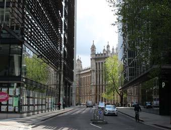
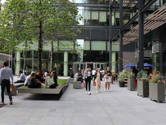
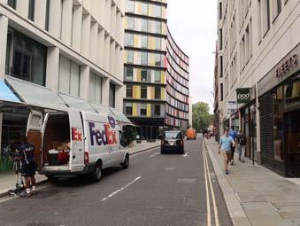 Several historic lanes contribute to the areas character, with Chancery Lane being the longest and most elegant of these.
AN AREA BASED STRATEGY FOR THE FLEET STREET QUARTER 13
ISSUES AND OPPORTUNITIES
Lane. This network of cycle routes, which will be made permanent in the future, will encourage workers and visitors to cycle to the area. There is the opportunity to further encourage cycling by providing improved infrastructure for cyclists such as more onstreet cycle parking and cycle repair shops and cafes.
VEHICULAR TRAFFIC
The main traffic arteries in Fleet Street Quarter are key arteries within the wider London traffic network and are heavily used. Fleet Street/Ludgate Hill and Holborn each have five bus routes and Farringdon Street has four routes. Improvements to these main arteries and to Ludgate Circus are major projects but ones that will have the most impact on the area. Any improvements to the public realm must maintain service and loading access for vehicles as many smaller premises do not have off-street loading facilities.
FLEET STREET QUARTER AT NIGHT
An evening walk around Fleet Street Quarter demonstrated how key public realm features and monuments in the area are poorly lit. There is the opportunity to improve the lighting in the area to enjoy these features, use them to aid wayfinding, and to extend uses after dark.
EMPLOYMENT
The area represents one of the densest employment clusters in all of London with the wider area having a daytime workplace population of around one hundred and ninety thousand people. Breaking down the local working population according to the industries they work in along broad economic classifications highlights how economically specialised the Fleet Street Quarter is with Professional, Scientific and Technical Services; Finance and Insurance; Business Administration; and Information and Communications dominating the local employment profile. There are comparatively few retail or hospitality jobs in the area. This economic specialisation contrasts with the more mixed employment profile of the wider Central Activities Zone (CAZ) which has larger shares of Public Administration, Health, and Education jobs
by comparison. The Creative Industries; Retail; and Accommodation are also noticeably more important sectors in the CAZ’s economic structure. Over three hundred commercial spaces in the area provide a total of nearly fifteen million square feet of work and retail space. However, the proportion of retail space is small at two percent, when compared to a more mixed-use area such as King’s Cross where retail accounts for fifteen percent of commercial space.
ACTIVITY AND CULTURE
Within the boundaries of Fleet Street Quarter there are few permanent cultural destinations, with the exception of Dr. Johnson’s House, the small museum in Gough Square and St. Bride’s Church. Pre-pandemic, Dr. Johnson’s House attracted approximately twenty thousand visitors a year to visit the house and to attend its programme of cultural events. Both are clearly destinations for visitors and interest in these should be capitalised upon in the future public realm strategy for the area. More generally, there is no clear concentration of social or cultural activity, with poor relationships between ground-floor uses and the public realm, resulting in little active visual engagement. Widened footways, additional spill-out areas and enhanced evening and night-time cultural activity would add much-needed vibrancy and activity to the Quarter.
LIVING
The Fleet Street Quarter area has a very low population density with an estimated two thousand two hundred and fifty five people living in the wider area making it among the least densely populated places in Greater London. While the Fleet Street Quarter area is not identified as an area of residential growth, and the predominantly commercial character is embedded in planning policies, new residential schemes will be accepted on side streets off the main routes through the area. In the longer term, re-introducing a greater proportion of residential use will contribute to a more mixed area that will diversify and increase ground floor uses and activity in the public realm.
ASSETS,
14 AN AREA BASED STRATEGY FOR THE FLEET STREET QUARTER
A substantial quantity of commercial activity, befitting from the Quarter’s central location, brings a considerable day-time population to the area.
However, the recent Covid-19 pandemic has dramatically reduced footfall in the area impacting many of the businesses operating there.
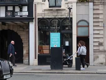

In the evening the Quarter quickly becomes quiet as people leave central London or move onto the more vibrant surrounding areas.


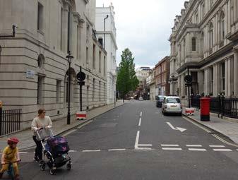
Although small, the residential population brings a welcome element of diversity to the activity of the area.
 With a number of bus routes running along its length, Fleet Street also experiences high vehicular numbers with narrow pavements further increasing the sense of traffic dominance.
New Bridge Street and Farringdon Street are part of London’s strategic road network supporting large volumes of traffic on a daily basis.
AN AREA BASED STRATEGY FOR THE FLEET STREET QUARTER 15
POLICY CONTEXT AND FUTURE CHANGES
POLICY CONTEXT
The Fleet Street Quarter area sits within one of the seven Key Areas of Change identified in the Draft Local Plan Review 2036 with significant growth anticipated in the area. The vision for the area reaffirms the prioritisation of office and commercial uses. There are however policies to deliver greater diversity and variety in the types of spaces on offer in the area to accommodate a wider range of sectors. The retail function of the area will be strengthened, and the emerging policy framework is supportive of later opening hours and the development of evening and night time activities in the area.
The future of the Fleet Street Quarter will also be driven by the City Public Realm SPD and the City’s Transport Strategy to ensure that local area enhancements deliver safer, healthier and high quality places that contribute to the City of London’s vision for sustainable public realm. In particular, the above plans set the framework for developing places that successfully balance the needs of all users of the public realm and account for changing patterns of use over time. There is strong policy support for delivering public realm enhancements where the careful consideration of the design, management and programming of spaces creates flexible and multipurpose spaces that are sensitive to local heritage and character and the needs of pedestrians, cyclists and vehicles.
The Draft Local Plan Review 2036 also sets culture and creativity high on the policy agenda and encourages the growth of these sectors. A new draft policy will require developers to submit cultural strategies alongside their planning applications and outline how they will invest in and improve the local cultural offer through their development. There are also provisions in the Draft Local Plan to accommodate outdoor cultural events in open spaces during the evening and night-time. The UK’s creative industries and London’s creative economy have become a remarkable example of innovation and resilience. The rise of these sectors has been accompanied by a renewed sense of value for the role of culture in our cities, an increase in foreign
direct investment into the UK, and a greater appreciation for the complexity and diversity that characterises thriving places. Creative production and culture in the city are key catalysts to unlock positive and sustainable growth, international competitiveness, and post-pandemic recovery. There is therefore an opportunity to create a more mixed-use area, accepting that the public realm and buildings must adapt to post-Covid-19 economic and social trends.
FUTURE CHANGES
A considerable development pipeline will bring much change to the Fleet Street Quarter in the next five years. A number of major new developments have recently secured planning approval, meaning the area will come under increasing pressure to perform as a high-quality environment for multiple-user groups and increased number of pedestrians. As the urban fabric evolves, it will be key to ensure that the relationship between developments and the surrounding public realm is considered at an early stage, and that the interface between the public realm and street level frontages and uses are coordinated and prioritised from the outset.
16 AN AREA BASED STRATEGY FOR THE FLEET STREET QUARTER
DEVELOPMENT CONTEXT MAP
UNDER CONSTRUCTION
86 Fetter Lane, Fetter Yard
66 Shoe Lane, Athene Place
1 Stonecutter Street, Stonecutter Court
Creed Court
7 Newgate Street
Chancery House
C7 West Smithfield/Museum of London
C8 61 65 Holborn Viaduct
150 Holborn
C10 St. Barths
C11 Blackfriars Super Sewer
C12 Arundel Great Court
PLANNING PERMISSION GRANTED
G1 Fleet Street Estate
G2 26 28 Tudor Street, Northcliffe House
G3 65 Fleet Street
G4 Fleet House, 8 12 New Bridge Street
G5 30 34 New Bridge Street
G6 6 St Andrew Street
G7 Morley House, Holborn Viaduct
G8 1 High Timber Street, Millenium Bridge House
G9 West Smithfield/Museum of London
PLANNING PERMISSION UNDER CONSIDERATION
P1 120 Fleet Street, River Court
P2 5 Chancery Lane
POTENTIAL FUTURE DEVELOPMENTS
F1 100 Fetter Lane
F2 10 Salisbury Square, St Bride’s House
F3 133 Fleet Street, Peterborough Court
F4 8 10 New Fetter Lane, 1 Plough Place
F5 Thavies Inn House
F6 100 New Bridge Street
F7 Hale Court, Chancery Lane Fleet Street Quarter boundary
FLEE T STREET STRAND LUDGATE HILL FA RRINGD ON STREET HOLBORN GRAYS INN ROAD QUEEN VICTORIA STREET CHARTERHOUSE STREET T UD OR ST REE T FE T TE R L AN E NEW HIGH HOLBORN GI LT SPUR STREET HA TTON GARDEN ALDWYCH ST . BRIDE STREETCAREY STREET T EMPLE AV EN UE LO NDON BL A CKFRIAR S BL A CKFRIAR S UNDERGROUND BL A CKFRIAR S PIER CITY THAMESLINK TEMPLE CHANCE RY LA NE ST PA UL’S FA RRINGDO N BARBICAN C1 C2 P1 P2 F1 F2 C3 C4 C5 F3 F4 F5 F6 F7 C6 C7 C8 C9 G1 G2 G3 G4 G5 G6 G7 G8 G9 C10 C11 C12
C1
C2
C3
C4
C5
C6
C9
AN AREA BASED STRATEGY FOR THE FLEET STREET QUARTER 17
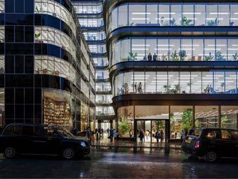

DEVELOPMENT CONTEXT
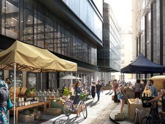
G1 – Fleet Street Estate (Image credit: Eric Parry Architects)
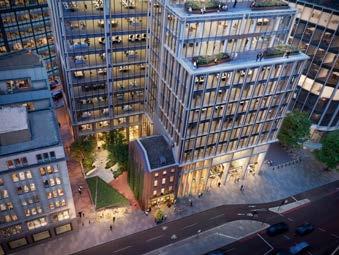
P1 – 120 Fleet Street (Image credit: BIG - Bjarke Ingels Group)
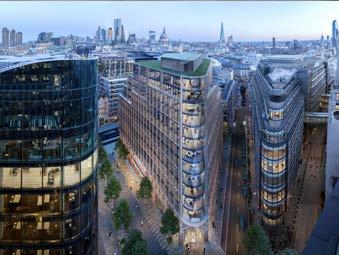
C3 – 1 Stonecutter Street (Image credit: TP Bennett)
A
SELECTION OF
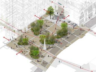
PIPELINE DEVELOPMENTS IN THE FLEET STREET QUARTER
18 AN AREA BASED STRATEGY FOR THE FLEET STREET QUARTER

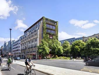
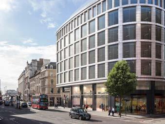
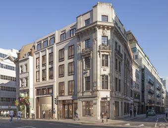
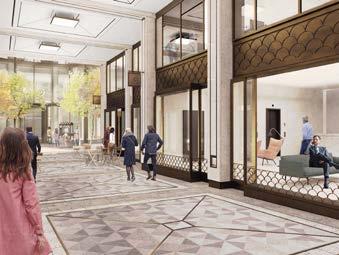
 G3 – 65 Fleet Street (Image credit: Buckley Gray Yeoman)
G5 – 30-34 New Bridge Street (Image credit: Perkins & Will)
G4 – Fleet House, 8-12 New Bridge Street (Image credit: Perkins & Will)
G2 – 26-28 Tudor Street; (Image credit: John Robertson Architects)
C7 – Museum of London (Image credit: Museum of London)
AN AREA BASED STRATEGY FOR THE FLEET STREET QUARTER 19
VISION FOR THE FLEET STREET QUARTER
Fleet Street Quarter has a rich history and a strategic location that presents an opportunity to harness growth and reinvigorate the area into a vibrant, adaptable, and sustainable district. The Fleet Street Quarter area will be re-invigorated through playing to the distinctive strengths and qualities of four identified character areas to elevate the quarter as a whole and allow it to continue to develop in a unique way. The Vision will be delivered across both public realm improvements and the encouragement of activation.
Public realm improvements will create an inviting, varied and attractive network of neighbourhood streets and open spaces that will soften the character of the area and provide spaces to dwell and attractive pedestrian routes. Activation through creative and cultural activities, interventions and uses will bring life back into the area and attract visitors from beyond the area. Four strategies are identified:
A
20 AN AREA BASED STRATEGY FOR THE FLEET STREET QUARTER
1 CELEBRATE FLEET STREET QUARTER’S DIVERSE CHARACTER AREAS
Reinvigorate Fleet Street Quarter by celebrating the histories, and by strengthening the distinctiveness, of the diverse character areas within the Quarter.
2 CONNECT TO SURROUNDING AREAS
Connect to, and be influenced by, surrounding areas by creating inviting gateways into Fleet Street Quarter and by encouraging visitors.
3 ENCOURAGE ACTIVATION
Encourage a spectrum of activities to bring a diversity of life to the Fleet Street Quarter across all times of the day and throughout all seasons.
4 DELIVER PUBLIC REALM IMPROVEMENTS Deliver sustainable public realm improvements to create a welcoming and green network of neighbourhood streets and open spaces.
AN AREA BASED STRATEGY FOR THE FLEET STREET QUARTER 21
STREET QUARTER’S DIVERSE
1 CELEBRATE FLEET
CHARACTER AREAS CHARACTER AREAS MAP Chancery Lane Fleet Street Lanes South Farringdon Blackfriars & Whitefriars Major Projects In responding to and reinforcing distinctive patterns of development, historic fabric and natural landscape, four character areas have been identified within the Fleet Street Quarter area. FLEE T STREET STRAND LUDGATE HILL FA RRINGD ON STREET HOLBORN GRAYS INN ROAD QUEEN VICTORIA STREET CHARTERHOUSE STREET T UD OR ST REE T FE T TE R L AN E NEW HIGH HOLBORN GI LT SPUR STREET HA TTON GARDEN ALDWYCH ST BRIDE STREETCAREY STREET T EMPLE AV EN UE LO NDON BL A CKFRIAR S BL A CKFRIAR S UNDERGROUND BL A CKFRIAR S PIER CITY THAMESLINK TEMPLE CHANCE RY LA NE ST PA UL’S FA RRINGDO N BARBICAN 22 AN AREA BASED STRATEGY FOR THE FLEET STREET QUARTER
Chancery Lane
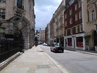
The area north of Fleet Street bordered by Chancery Lane to the west and New Fetter Lane to the east. The area is characterised by the elegant grandeur of Chancery Lane and the exceptional range of building ages and styles. The network of side streets is well-preserved, offering alternative pedestrian routes to the main arteries in the area.
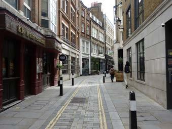
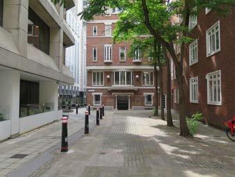
Fleet Street Lanes
The group of historic lanes, alleys and courtyards to the north of Fleet Street distinguished by their historic fabric, irregularity and charm. Dr. Johnson’s House is located here at Gough Square, and enhancements to the public realm will increase the appeal of these historic lanes.
South Farringdon
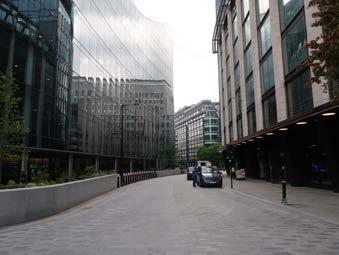
The area north of Fleet Street and Ludgate Hill bisected by Farringdon Street, and bordered by Holborn to the north. The area is characterised by the predominance of modern development and the clustering of large-scale commercial buildings.
Blackfriars & Whitefriars
The area south of Fleet Street and Ludgate Hill, distinguished by its topography – the gentle slope down to the River. The area includes St. Bride’s Church to the west of New Bridge Street and Carter Lane to the east.
AN AREA BASED STRATEGY FOR THE FLEET STREET QUARTER 23
Fleet Street Quarter can capitalise on its location by drawing in some of the activity of surrounding areas.


CHANCERY LANE


Close to the West End, the Chancery Lane area could bring in some of the life of Covent Garden and Kingsway, in particular the student activity surrounding King’s College London and the London School of Economics.


FLEET STREET LANES
The proximity of the Lanes to Strand Aldwych will encourage an increasing number of visitors into Fleet Street Quarter.
SOUTH FARRINGDON
The impact of the Elizabeth Line coming to Farringdon Station will increase the popularity of the Farringdon area and broaden its influence. The South Farringdon area of Fleet Street Quarter can capitalise on this proximity and use cultural activity and commercial activation to attract visitors and tenants.
BLACKFRIARS & WHITEFRIARS
This part of Fleet Street Quarter can capitalise on its proximity to St. Paul’s Cathedral, Millennium Bridge, and the River Thames to draw in some of the millions of pedestrians in the vicinity to become an enhanced destination for retail and tourism.
EXISTING SURROUNDING NEIGHBOURHOODS
CONNECTING TO SURROUNDING NEIGHBOURHOODS

FLEE T STRE ET STRAND LUDGATE HILL FA RRINGDON STREE T HOLBORN QUEEN VICTORIA STREET CHARTERHOUSESTREET TUDOR STREET F ETTE R LA NE NEW HIGH HOLBORN GI LT SPUR STREET TTON GARDE ST. BRIDE STREETCAREY STREET TEMPLE AV ENU E O LD BAILEY LO NDON BL A CKFRIAR S BL A CKFRIAR S UNDERGROUND BL A CKFRIAR S PIER CITY THAMESLINK TEMPLE CHANCE RY LA NE ST PA UL’S FA RRINGDO N BARBICAN 2 CONNECT TO SURROUNDING NEIGHBOURHOODS FLEE T STRE ET STRAND LU FA RRINGDON STREE T HOLBORN GRAYS INN ROAD QUEEN VICTORIA STREET CHARTERHOUSESTREET TUDOR STREET NEW HIGH HOLBORN TTON GARDE ST. BRIDE STREETCAREY STREET TEMPLE AV ENU E O LD BAILEY LO NDON BL A CKFRIAR S BL A CKFRIAR S UNDERGROUND BL A CKFRIAR S PIER CITY THAMESLINK TEMPLE CHANCE LA NE ’S FA RRINGDO N
24 AN AREA BASED STRATEGY FOR THE FLEET STREET QUARTER
The creative industries have illustrated the diverse social and economic activity they can bring to London’s public realm and existing building stock. Maximising the use of Fleet Street Quarter as a stage for culture and creativity and a place with a variety of mixed uses, will increase the appeal of the area beyond the working day, attract more diverse communities and encourage relationships between creative practitioners and cultural institutions. The experience, growth and diversification of the area’s streets and spaces should be extended from the daytime to enable a vibrant evening and night-time economy. Four types of activation are identified:
GROUND FLOOR ACTIVITY
Employ a strategic approach to animating buildings and ground floor uses, encouraging creative input from retailers and businesses.
AFFORDABLE WORKSPACE NETWORK
Encourage the provision of a variety of commercial office space including affordable and smaller units to allow small and growing businesses the opportunity to take up space within the Quarter and promote creative ways to occupy vacant spaces.
CULTURAL ANCHOR AND ACTIVATION
Enhance the day-to-day experience through meanwhile uses, interventions and through areawide coordinated cultural programming in open spaces and/or the streetscape. Reignite creativity in the area through building on existing institutions, animating vacant spaces, and introducing a cultural anchor to attract a diverse community.
MIXED-USE CITY
Encourage developers and the City of London to promote and encourage mixed-use development in the area and allow the adaptation of space to support new uses and different types and sizes of occupiers.
3 ENCOURAGE ACTIVATION
AN AREA BASED STRATEGY FOR THE FLEET STREET QUARTER 25
Café and restaurant uses spill out into the public realm on Meard Street in Soho bringing life to the city.


A concentration of complementary retail uses – focused on bespoke tailoring – provides Savile Row with a unique identity and makes the street a destination within London. (Image credit: Publica/Edward Bishop)

The Koppel Project and The Trampery both offer a range of workspaces in central London locations supporting artists, entrepreneurs, start-ups and scale-ups. Alongside these, both enterprises provide gallery and events spaces and deliver a cultural programme to promote their social agenda. (Image credits: The Koppel Project; The Trampery)

GROUND FLOOR ACTIVITY PRECEDENTS
AFFORDABLE WORKSPACE NETWORK PRECEDENTS
3 ENCOURAGE ACTIVATION 26 AN AREA BASED STRATEGY FOR THE FLEET STREET QUARTER
An example of a permanent cultural anchor, the Institute of Contemporary Arts attracts a diversity of visitors and demonstrates the impact and reach even a small-scale cultural institution can have.
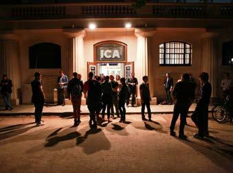
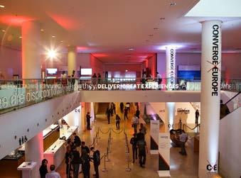
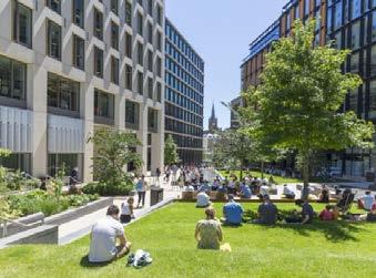
(Image credit: The Institute of Contemporary Arts)
The Parramatta Lanes Festival in Parramatta, Australia, is an example of the potential impact of a temporary event. The Festival transforms this Central Business District into a cultural hub for the city, bringing food, art, music, and performance to the area.

(Image credit: Parramatta Lanes)
The recent, successful development of King’s Cross demonstrates the importance of delivering a mix of activities to create a vibrant and attractive area of the city. Here, educational, cultural, food and drink, retail and residential uses were delivered alongside commercial space and revenue-generating conference spaces.
(Image credit: John Sturrock)
King’s Place on York Way is an innovative mixed-use commercial development that integrates office space on its upper floors with a multi-purpose cultural venue on its lower floors. The cultural venue is home to three London orchestras and includes a four hundred seat concert hall, as well as multiple revenue-generating conference spaces.
(Image credit: Matt Chung Photo)
CULTURAL ANCHOR AND ACTIVATION PRECEDENTS MIXED-USE CITY PRECEDENTS AN AREA BASED STRATEGY FOR THE FLEET STREET QUARTER 27
4 DELIVER PUBLIC REALM IMPROVEMENTS
Improving the public realm of Fleet Street Quarter will enhance the area’s existing heritage assets, and ensure that streets and open spaces are welcoming, well-connected, vibrant and encourage the celebration of public life. Three project types are identified:
MAJOR PROJECTS
These will improve the function of the street environment for all users on major streets and enhance the gateway experience into Fleet Street Quarter through widened footways, improved crossings, new pedestrian spaces and shared surface treatments.
NEIGHBOURHOOD STREETS
These projects will create accessible neighbourhood streets to ensure the area serves diverse audiences, provides comfortable amenities and dwelling spaces, and encourages public recreation. The streets should be designed to consider animation of the spaces after dark and the use of lighting to aid area-wide orientation, legibility, and wayfinding.
OPEN SPACES
Enhancements to the network of open spaces in Fleet Street Quarter will help to promote social and environmental wellbeing through increased biodiversity and greenery.
MAJOR PROJECTS PRECEDENTS
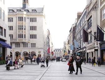
Major public realm improvements on Bond Street transformed the street affirming it as one of London’s premier shopping streets and increasing pedestrian footfall by twenty percent.
(Year of completion: 2018, Designer: Publica/Norman Rourke Pryme/Westminster City Council).
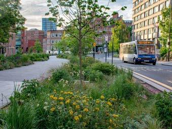
The Grey to Green scheme in Sheffield rebalances spaces in the city reallocating highway space for greenery and pedestrian movement.
(Year of completion: 2014 2022, Designer: Nigel Dunnett) (Image credit: Nigel Dunnett)
28 AN AREA BASED STRATEGY FOR THE FLEET STREET QUARTER
NEIGHBOURHOOD STREETS PRECEDENTS
Short term improvements commissioned by Grosvenor on North Audley Street demonstrate how existing assets can be supported.
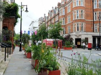
(Year of completion: 2021, Designer: Publica/Norman Rourke Pryme/Westminster City Council).
Pavilion Road in Brighton is an example of a shared space that prioritises the pedestrian and slows down vehicular traffic.
(Year of completion: 2007, Designer: Gehl Architects)
OPEN SPACES PRECEDENTS
Considered planting at Floral Court elevates this small space and delivers a valuable opportunity for respite in the city.
(Year of completion: 2018, Designer: KPF Architects/ Publica)
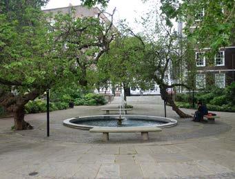
Fountain Court in Middle Temple, and the small open spaces that surround it, demonstrate how a network of smaller spaces can make up for a deficiency of larger open spaces in the city.


AN AREA BASED STRATEGY FOR THE FLEET STREET QUARTER 29


FLEE STRAND TE HILL FA RRINGD ON STREET HOLBORN GRAYS INN ROAD QUEEN VICTORIA STREET CHARTERHOUSE STREET T UD OR ST REE T T TE R L AN E NEW HIGH HOLBORN GI LT SPUR STREET HA TTON GARDEN ALDWYCH ST BRIDE STREETCAREY STREET T EMPLE AV EN UE LO NDON BL A CKFRIAR S BL A CKFRIAR S UNDERGROUND BL A CKFRIAR S PIER CITY THAMESLINK TEMPLE CHANCE RY LA NE ST PA UL’S FA RRINGDO N BARBICAN POTENTIAL PROJECTS BY AREA KEY Fleet Street Quarter boundary Chancery Lane Fleet Street Lanes South Farringdon Blackfriars & Whitefriars Major Projects A1 Chancery Lane A2 Fetter Lane B1 Fleet Street Lanes C1 New Street Square C2 Thavie’s Inn C3 Shoe Lane and Stonecutter Street C4 Holborn Circus C5 Fleet Place C6 Old Bailey D1 Tudor Street D2 St Bride’s Churchyard D3 Carter Lane E1 Fleet Street and Ludgate Hill E2 New Bridge Street and Farringdon Street E3 High Holborn B1 C1 E1 E2 E3 C2 D1 D2 D3 C4 C3 C5 C6A1 A2 30 AN AREA BASED STRATEGY FOR THE FLEET STREET QUARTER
FLEE T STREET STRAND LUDGATE HILL FA RRINGD ON STREET HOLBORN GRAYS INN ROAD QUEEN VICTORIA STREET CHARTERHOUSE STREET T UD OR ST REE T FE T TE R L AN E NEW HIGH HOLBORN GI LT SPUR STREET HA TTON GARDEN ALDWYCH ST BRIDE STREETCAREY STREET T EMPLE AV EN UE LO NDON BL A CKFRIAR S BL A CKFRIAR S UNDERGROUND BL A CKFRIAR S PIER CITY THAMESLINK TEMPLE CHANCE RY LA NE ST PA UL’S FA RRINGDO N BARBICAN POTENTIAL PROJECTS BY TYPE KEY Fleet Street Quarter boundary Major Projects Neighbourhood Streets Open space network Key streets for activation Programmable open spaces AN AREA BASED STRATEGY FOR THE FLEET STREET QUARTER 31
A1 CHANCERY LANE
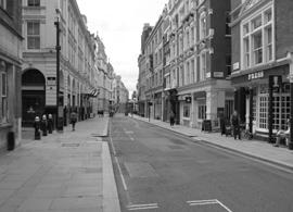
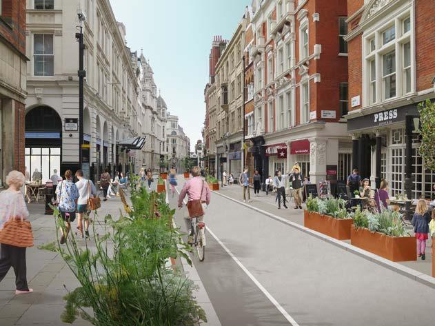
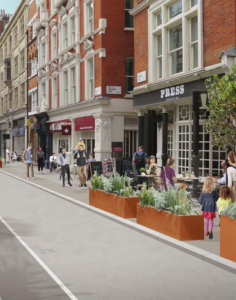
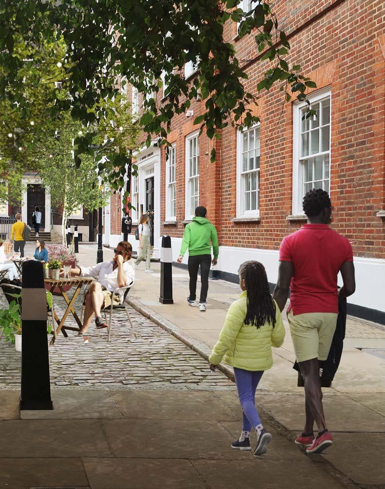
Chancery Lane is a characterful historic lane and key north-south artery for pedestrians connecting the various Inns of Court. Building on the recent improvements to the public realm and the success of the current temporary traffic restrictions, further enhancements in the short-term could include increasing the amount of spill-out space and adding greenery. In the long term, widened footways could be made permanent, and street trees, seating, and improved lighting could be added. More active ground-floor uses with spaces for outdoor seating should be encouraged to create better activity and attract users.
PROJECT BRIEFS
FLEET STREET STRAND LUDGATE HILL FA RRINGDON STREE T HOLBORN GRAYS INN ROAD QUEEN VICTORIA STREET CHARTERHOUSESTREET TUDOR STREET F ETTE R LA NE NEW HIGH HOLBORN GI LT SPUR STREET HA TTON GARDE N ST. BRIDE STREETCAREY STREET TEMPLE AV ENU O LD BAILEY LO NDON BL A CKFRIAR S BL A CKFRIAR S UNDERGROUND BL A CKFRIAR S PIER CITY THAMESLINK TEMPLE CHANCE RY LA NE ST PA UL’S FA RRINGDO N BARBICAN RELATIVE IMPACT: RELATIVE COMPLEXITY: PHASING: NEAR TERM, 2022 2024 KEY STAKEHOLDERS: COL 32 AN AREA BASED STRATEGY FOR THE FLEET STREET QUARTER
BRIEFS
A2 FETTER LANE AND BREAM’S BUILDINGS
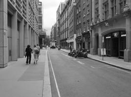
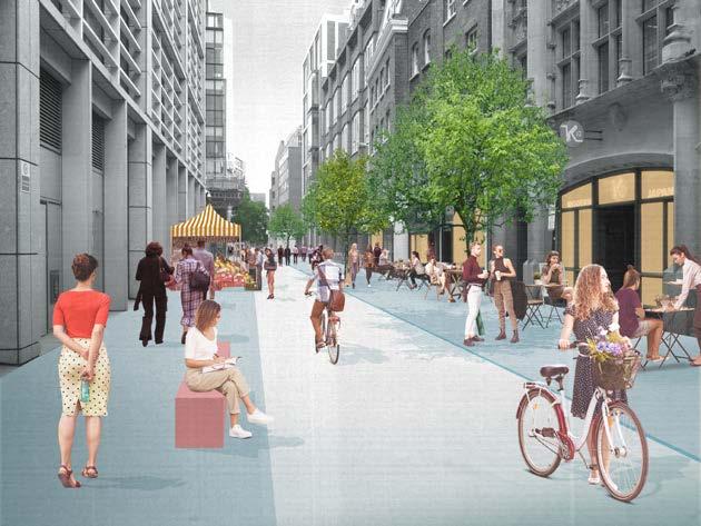
Fetter Lane is a no through traffic route that provides a key opportunity to strengthen pedestrian connections to Holborn, Farringdon, and Clerkenwell. In the short term, traffic restrictions could be introduced and meanwhile uses such as outdoor dining, markets, and temporary greening, would enhance the experience of the street in an impactful way. In the long term, an improved pedestrian environment could be created through permanent streetscape changes including improvements to footways, lighting and with the addition of street trees. Timed street closures could be considered to accommodate a programme of events such as street markets, and to promote spill-out activity.
PROJECT
FLEET STREET STRAND LUDGATE HILL FA RRINGDON STREE T HOLBORN GRAYS INN ROAD QUEEN VICTORIA STREET CHARTERHOUSESTREET TUDOR STREET F ETTE R LA NE NEW HIGH HOLBORN GI LT SPUR STREET HA TTON GARDE N ST. BRIDE STREETCAREY STREET TEMPLE AV ENU E O LD BAILEY LO NDON BL A CKFRIAR S BL A CKFRIAR S UNDERGROUND BL A CKFRIAR S PIER CITY THAMESLINK TEMPLE CHANCE RY LA NE ST PA UL’S FA RRINGDO N BARBICAN RELATIVE IMPACT: RELATIVE COMPLEXITY: PHASING: NEAR TERM, 2022 2024 KEY STAKEHOLDERS: COL AN AREA BASED STRATEGY FOR THE FLEET STREET QUARTER 33

CHANCERY LANE 34 AN AREA BASED STRATEGY FOR THE FLEET STREET QUARTER
AN AREA BASED STRATEGY FOR THE FLEET STREET QUARTER 35
B1 FLEET STREET LANES
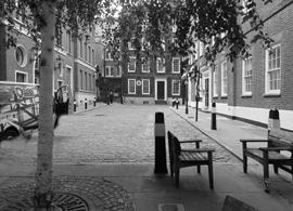
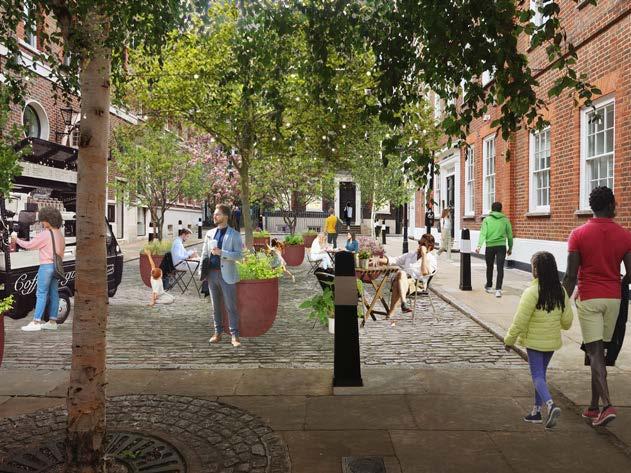
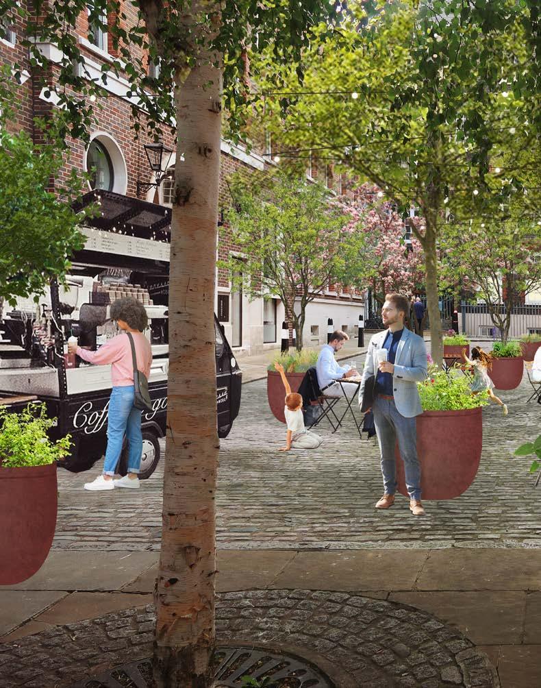
The Lanes are one of the most distinct parts of Fleet Street Quarter. This network of historic small-scale spaces should be celebrated and strengthened to increase connectivity, while providing quieter alternatives to main routes. Inviting dwelling spaces can be created through improved lighting, wayfinding, and additional seating and greenery. Widened footways would encourage spill-out activity through restaurant, bar and café uses, animating the public realm during the day and into the evening.
PROJECT BRIEFS
FLEET STREET LUDGATE HILL FA RRINGDON STREE T HOLBORN GRAYS INN ROAD QUEEN VICTORIA STREET CHARTERHOUSESTREET TUDOR STREET F ETTE R LA NE NEW GI LT SPUR STREET HA TTON GARDE N ST. BRIDE STREETSTREET TEMPLE AV ENU E O LD BAILEY LO NDON BL A CKFRIAR S BL A CKFRIAR S UNDERGROUND BL A CKFRIAR S PIER CITY THAMESLINK CHANCE RY LA NE ST PA UL’S FA RRINGDO N BARBICAN RELATIVE IMPACT: RELATIVE COMPLEXITY: PHASING: MEDIUM TERM, 2024 2026 KEY STAKEHOLDERS: COL 36 AN AREA BASED STRATEGY FOR THE FLEET STREET QUARTER
NEW STREET SQUARE
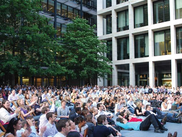
A privately owned public space, New Street Square is a welcome open space and nodal point within Fleet Street Quarter on the route between Fleet Street and Holborn. The space is generous with many points of arrival from surrounding streets. Currently difficult to find, the square could be enhanced to feel welcoming to a broad range of users not just those in the surrounding offices. This could be achieved through the addition of greenery, more seating and improved lighting, as well as through an active programme of cultural events.

PROJECT BRIEFS C1
FLEET STREET LUDGATE HILL FA RRINGDON STREE T HOLBORN GRAYS INN ROAD QUEEN VICTORIA STREET CHARTERHOUSESTREET TUDOR STREET F ETTE R LA NE NEW GI LT SPUR STREET HA TTON GARDE N ST. BRIDE STREETCAREY STREET TEMPLE AV ENU E O LD BAILEY LO NDON BL A CKFRIAR S BL A CKFRIAR S UNDERGROUND BL A CKFRIAR S PIER CITY THAMESLINK TEMPLE CHANCE RY LA NE FA RRINGDO N BARBICAN RELATIVE IMPACT: RELATIVE COMPLEXITY: PHASING: MEDIUM TERM, 2024 2026 KEY STAKEHOLDERS: COL, LAND OWNER AN AREA BASED STRATEGY FOR THE FLEET STREET QUARTER 37
LANES NORTH OF FLEET STREET 38 AN AREA BASED STRATEGY FOR THE FLEET STREET QUARTER
AN AREA BASED STRATEGY FOR THE FLEET STREET QUARTER 39
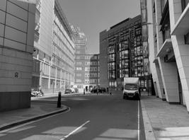
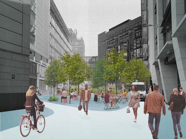
Thavies Inn is a large space in between buildings currently used as on-street parking. Underutilised, there is potential to transform this space into an inviting, permeable public space to provide an improved north-south pedestrian link and green oasis space near Holborn Circus. Substantial public realm improvements could be delivered by increasing greenery and employing high-quality materials. Temporary uses such as a mobile café could improve the recreational offer and public life of the area. The project is currently in development, at pre-application stage with the City of London.
PROJECT BRIEFS C2 THAVIES INN FLEET STREET LUDGATE HILL FA RRINGDON STREE T HOLBORN GRAYS INN ROAD QUEEN VICTORIA STREET CHARTERHOUSESTREET TUDOR STREET F ETTE R LA NE NEW GI LT SPUR STREET HA TTON GARDE N ST. BRIDE STREETSTREET TEMPLE AV ENU O LD BAILEY LO NDON BL A CKFRIAR S BL A CKFRIAR S UNDERGROUND BL A CKFRIAR S PIER CITY THAMESLINK CHANCE RY LA NE ST PA UL’S FA RRINGDO N BARBICAN
RELATIVE IMPACT: RELATIVE COMPLEXITY: PHASING: MEDIUM TERM, 2024 2026 KEY STAKEHOLDERS: COL, LAND OWNERS 40 AN AREA BASED STRATEGY FOR THE FLEET STREET QUARTER
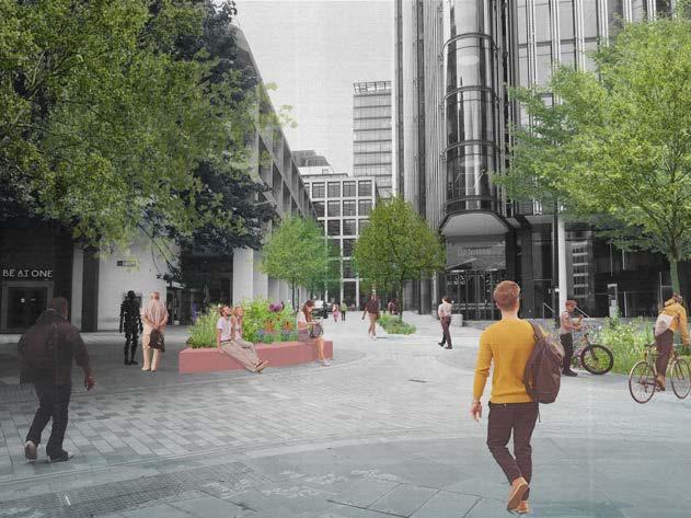
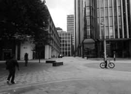
PROJECT BRIEFS C3 SHOE LANE AND STONECUTTER STREET FLEET STREET LUDGATE HILL FA RRINGDON STREE T HOLBORN GRAYS INN ROAD QUEEN VICTORIA STREET CHARTERHOUSESTREET TUDOR STREET F ETTE R LA NE NEW GI LT SPUR STREET HA TTON GARDE N ST. BRIDE STREETCAREY STREET TEMPLE AV ENU O LD BAILEY LO NDON BL A CKFRIAR S BL A CKFRIAR S UNDERGROUND BL A CKFRIAR S PIER CITY THAMESLINK TEMPLE CHANCE RY LA NE ST PA UL’S FA RRINGDO N BARBICAN Building on the recently completed public realm improvements, some enhancements to the streetscape could include improved signage, increased amenity, and additional planting to strengthen this east-west route while additional trees would be a long-term aspiration. RELATIVE IMPACT: RELATIVE COMPLEXITY: PHASING: MEDIUM TERM, 2024 2026 KEY STAKEHOLDERS: COL AN AREA BASED STRATEGY FOR THE FLEET STREET QUARTER 41
The public open space next to St. Andrew Holborn is a key gateway into Fleet Street Quarter. The space was improved by the City of London several years ago with the addition of trees and seating. An improved sense of arrival could be created to mark this northern gateway by adding soft planting and additional seating. The space could also be used for art installations and events to strengthen the cultural life of the area.
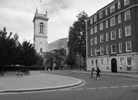

PROJECT BRIEFS C4 HOLBORN CIRCUS GATEWAY FLEET STREET LUDGATE HILL FA RRINGDON STREE T HOLBORN GRAYS INN ROAD QUEEN VICTORIA STREET CHARTERHOUSESTREET TUDOR STREET F ETTE R LA NE NEW GI LT SPUR STREET HA TTON GARDE N ST. BRIDE STREETSTREET TEMPLE AV ENU O LD BAILEY LO NDON BL A CKFRIAR S BL A CKFRIAR S UNDERGROUND BL A CKFRIAR S PIER CITY THAMESLINK CHANCE RY LA NE ST PA UL’S FA RRINGDO N BARBICAN
RELATIVE IMPACT: RELATIVE COMPLEXITY: PHASING: MEDIUM TERM, 2024 2026 KEY STAKEHOLDERS: COL 42 AN AREA BASED STRATEGY FOR THE FLEET STREET QUARTER
FLEET PLACE
This open space sits at the centre of the Fleet Place development west of Old Bailey. Hard to find, this space and the routes to it, provides an alternative pedestrian route north-south to the more trafficked arteries of Farringdon Street and Old Bailey, but it is underused. Improved signage, increased ground level activity, spill out spaces and enhancements to the landscape character of the open space would make Fleet Place more inviting.
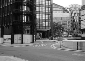
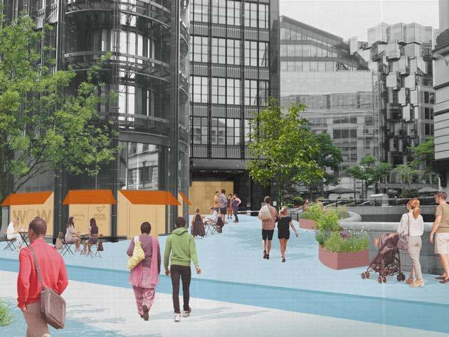
PROJECT BRIEFS C5
FLEET STREET LUDGATE HILL FA RRINGDON STREE T HOLBORN GRAYS INN ROAD QUEEN VICTORIA STREET CHARTERHOUSESTREET TUDOR STREET F ETTE R LA NE NEW GI LT SPUR STREET HA TTON GARDE N ST. BRIDE STREETCAREY STREET TEMPLE AV ENU O LD BAILEY LO NDON BL A CKFRIAR S BL A CKFRIAR S UNDERGROUND BL A CKFRIAR S PIER CITY THAMESLINK TEMPLE CHANCE RY LA NE ST PA UL’S FA RRINGDO N BARBICAN
RELATIVE IMPACT: RELATIVE COMPLEXITY: PHASING: LONG TERM, 2026– 2030 KEY STAKEHOLDERS: COL, LAND OWNER AN AREA BASED STRATEGY FOR THE FLEET STREET QUARTER 43
OLD BAILEY
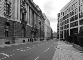
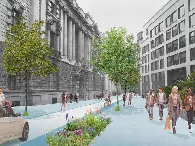
Old Bailey is a busy traffic artery connecting Holborn to Ludgate Hill. It is also the most direct route for pedestrians if walking from Farringdon to the River. Enhancements to the public realm would improve this as a walking route through footway widening and the addition of street trees, while improving the setting for the Old Bailey and other buildings of heritage value on the street. The small open spaces along Old Bailey could be integrated into an overall improvement scheme to make this a key walking route in the area.
PROJECT BRIEFS C6
FLEET STREET LUDGATE HILL FA RRINGDON STREE T HOLBORN GRAYS INN ROAD QUEEN VICTORIA STREET CHARTERHOUSESTREET TUDOR STREET F ETTE R LA NE NEW GI LT SPUR STREET HA TTON GARDE N ST. BRIDE STREETSTREET TEMPLE AV ENU O LD BAILEY LO NDON BL A CKFRIAR S BL A CKFRIAR S UNDERGROUND BL A CKFRIAR S PIER CITY THAMESLINK CHANCE RY LA NE ST PA UL’S FA RRINGDO N BARBICAN
RELATIVE IMPACT: RELATIVE COMPLEXITY: PHASING: LONG TERM, 2026– 2030 KEY STAKEHOLDERS: COL 44 AN AREA BASED STRATEGY FOR THE FLEET STREET QUARTER
TUDOR STREET
Tudor Street connects Blackfriars to Temple Gardens and connects the Quarter to the River Thames. The use of the street is set to change with the upcoming developments at Salisbury Square. Wide and relatively quiet, the character of the street could be transformed from being a back street to an active street. The addition of ground floor activity, widened footways, spill out spaces, and greenery would make this an inviting east west route though the Quarter.


PROJECT BRIEFS D1
FLEET STREET LUDGATE HILL FA RRINGDON STREE T HOLBORN GRAYS INN ROAD QUEEN VICTORIA STREET CHARTERHOUSESTREET TUDOR STREET F ETTE R LA NE NEW GI LT SPUR STREET HA TTON GARDE N ST. BRIDE STREET TEMPLE AV ENU E O LD BAILEY LO NDON BL A CKFRIAR S BL A CKFRIAR S UNDERGROUND BL A CKFRIAR S PIER CITY THAMESLINK CHANCE RY LA NE ST PA UL’S FA RRINGDO N BARBICAN RELATIVE IMPACT: RELATIVE COMPLEXITY: PHASING: LONG TERM, 2026 2030 KEY STAKEHOLDERS: COL AN AREA BASED STRATEGY FOR THE FLEET STREET QUARTER 45
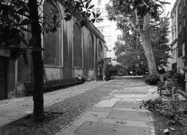
The site of St Bride’s church has been occupied since the Roman period with the churchyard providing a shift in enclosure and noise levels, creating a sheltered space that contrasts with the bustle of Fleet Street. The space could be improved to provide an enhanced pedestrian link and an intimate space for dwelling, away from the bustle of Fleet Street, through improvements including additional planting and improved lighting.

PROJECT BRIEFS D2 ST BRIDE’S CHURCHYARD FLEET STREET LUDGATE HILL FA RRINGDON STREE T HOLBORN QUEEN VICTORIA STREET CHARTERHOUSESTREET TUDOR STREET F ETTE R LA NE NEW GI LT SPUR STREET HA TTON GARDE N ST. BRIDE STREET TEMPLE AV ENU E O LD BAILEY LO NDON BL A CKFRIAR S BL A CKFRIAR S UNDERGROUND BL A CKFRIAR S PIER CITY THAMESLINK RY ST PA UL’S FA RRINGDO N BARBICAN
RELATIVE IMPACT: RELATIVE COMPLEXITY: PHASING: LONG TERM, 2026 2030 KEY STAKEHOLDERS: COL, LAND OWNER 46 AN AREA BASED STRATEGY FOR THE FLEET STREET QUARTER
D3 CARTER LANE AND BLACKFRIARS LANE
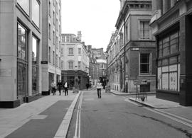
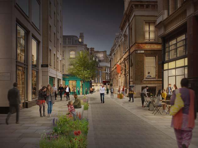
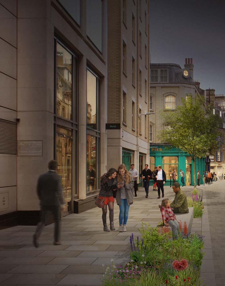
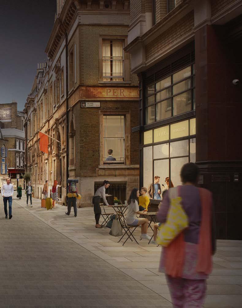
Carter Lane is a historic City of London street with houses dating to the seventeenth century. It is a great asset with some sections working as valuable and unique pedestrian routes. Blackfriars Lane and the eastern end of Carter Lane could be designed as a high-quality unified place through widened footways, new paving, improved crossing widths and greenery. These improvements would attract the pedestrian traffic crossing Millennium Bridge to St Paul’s. Special lighting, active frontages and shared spill-out spaces should be considered to create spaces that feel safe and well-managed after dark. Traffic closures for temporary programming of events and cultural activation during the daytime and night-time could be introduced.
CHARTERHOUSESTREET
PROJECT BRIEFS
FLEET STREET LUDGATE HILL FA RRINGDON STREE T HOLBORN GRAYS INN ROAD QUEEN VICTORIA STREET
TUDOR STREET F ETTE R LA NE NEW GI LT SPUR STREET HA TTON GARDE N ST. BRIDE STREET TEMPLE AV ENU E O LD BAILEY LO NDON BL A CKFRIAR S BL A CKFRIAR S UNDERGROUND BL A CKFRIAR S PIER CITY THAMESLINK CHANCE RY LA NE ST PA UL’S FA RRINGDO N BARBICAN RELATIVE IMPACT: RELATIVE COMPLEXITY: PHASING: NEAR TERM, 2022 2024 KEY STAKEHOLDERS: COL AN AREA BASED STRATEGY FOR THE FLEET STREET QUARTER 47
CARTER LANE 48 AN AREA BASED STRATEGY FOR THE FLEET STREET QUARTER
AN AREA BASED STRATEGY FOR THE FLEET STREET QUARTER 49
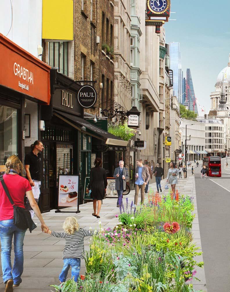
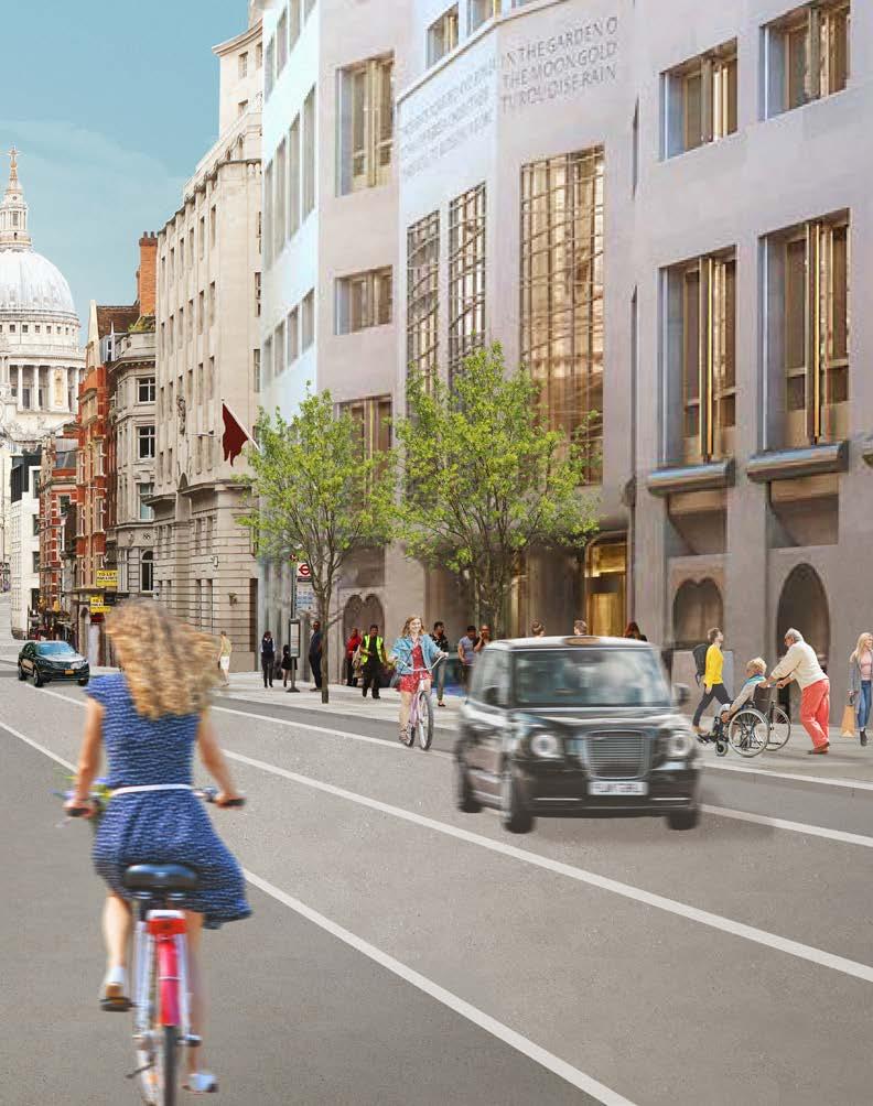
E1 FLEET STREET / LUDGATE HILL

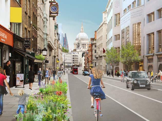
As the primary east-west corridor between the City of London and the City of Westminster, there is much needed scope for public realm and transport improvements. The aim would be to enhance the identity of the Fleet Street/Ludgate Hill corridor as the principal ceremonial route from the City to Westminster. This could be achieved by expanding on existing temporary measures, which include footway widening and provision of cycle lanes, and consider reduced street clutter, additional amenity, and distinctive features, while preserving and enhancing views to key heritage assets including St Paul’s Cathedral and St Bride’s Church. Increased active frontage, outdoor seating and improved lighting will help animate the public realm.
PROJECT BRIEFS
STRAND FA RRINGDON STREE T HOLBORN GRAYS INN ROAD QUEEN VICTORIA STREET CHARTERHOUSESTREET TUDOR STREET F ETTE R LA NE NEW HIGH HOLBORN GI LT SPUR STREET HA TTON GARDE N ST. BRIDE STREETCAREY STREET TEMPLE AV ENU E O LD BAILEY LO NDON BL A CKFRIAR S BL A CKFRIAR S UNDERGROUND BL A CKFRIAR S PIER CITY THAMESLINK TEMPLE CHANCE RY LA NE ST PA UL’S FA RRINGDO N BARBICAN RELATIVE IMPACT: RELATIVE COMPLEXITY: PHASING: MEDIUM TERM, 2024 2026 KEY STAKEHOLDERS: COL, TFL 50 AN AREA BASED STRATEGY FOR THE FLEET STREET QUARTER
Farringdon Street/New Bridge Street and Ludgate Circus are a key part of the Transport for London Road Network. The aim would be to transform Ludgate Circus into a place to explore and experience, rather than to simply pass through. This could be achieved through improved lighting, landmark trees, and distinctive planting, strengthening the daytime and night-time experience of the street for workers, visitors, and residents. The arrival and pedestrian experience at Blackfriars Station and Ludgate Circus could be improved through widened footways, improved crossings, and enhanced townscape views. The addition of blue infrastructure such as surface water management and water features could be considered to celebrate the historic course of the River Fleet and bring the activity of nearby cultural institutions to the public realm.


PROJECT BRIEFS E2 FARRINGDON STREET / NEW BRIDGE STREET AND LUDGATE CIRCUS FLEET STREET LUDGATE HILL HOLBORN GRAYS INN ROAD QUEEN VICTORIA STREET CHARTERHOUSESTREET TUDOR STREET F ETTE R LA NE NEW GI LT SPUR STREET HA TTON GARDE N ST. BRIDE STREETCAREY STREET TEMPLE AV ENU E O LD BAILEY LO NDON BL A CKFRIAR S BL A CKFRIAR S UNDERGROUND BL A CKFRIAR S PIER CITY THAMESLINK TEMPLE CHANCE RY LA NE ST PA UL’S FA RRINGDO N BARBICAN
RELATIVE IMPACT: RELATIVE COMPLEXITY: PHASING: LONG TERM, 2026 2030 KEY STAKEHOLDERS: COL, TFL AN AREA BASED STRATEGY FOR THE FLEET STREET QUARTER 51
FLEET STREET AND LUDGATE HILL 52 AN AREA BASED STRATEGY FOR THE FLEET STREET QUARTER
AN AREA BASED STRATEGY FOR THE FLEET STREET QUARTER 53
E3 HIGH HOLBORN
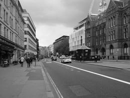
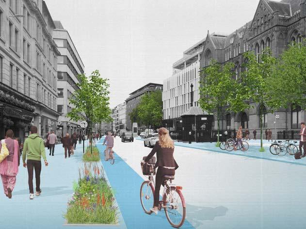
High Holborn constitutes the northern boundary of Fleet Street Quarter. It is part of the A40 and a major strategic east west traffic route through central London. High Holborn has a wide carriageway and wide footways. Being heavily trafficked, the street has relatively poor air quality and further suffers from a lack street trees. Given the generous width of the footways, there is the opportunity to improve the environment for pedestrians through the addition of greenery and seating. Together with planned improvements to the cycle network by 2030, the street has the potential for transformation over the long term.
PROJECT BRIEFS
STRAND FA RRINGDON STREE T HOLBORN GRAYS INN ROAD QUEEN VICTORIA STREET CHARTERHOUSESTREET TUDOR STREET F ETTE R LA NE NEW HIGH HOLBORN GI LT SPUR STREET HA TTON GARDE N ST. BRIDE STREETCAREY STREET TEMPLE AV ENU E O LD BAILEY LO NDON BL A CKFRIAR S BL A CKFRIAR S UNDERGROUND BL A CKFRIAR S PIER CITY THAMESLINK TEMPLE CHANCE RY LA NE ST PA UL’S FA RRINGDO N BARBICAN RELATIVE IMPACT: RELATIVE COMPLEXITY: PHASING: LONG TERM, 2026 2030 KEY STAKEHOLDERS: COL, ADJACENT BIDS 54 AN AREA BASED STRATEGY FOR THE FLEET STREET QUARTER
AN AREA BASED STRATEGY FOR THE FLEET STREET QUARTER 55
CHANCERY LANE
Lane
Lane
FLEET STREET LANES
SOUTH FARRINGDON
Street
Street
Thavies
Lane
BLACKFRIARS & WHITEFRAIRS
MAJOR PROJECTS
Place
Bailey
Street
Bride’s Churchyard
Lane
Street and
Bridge Street
Space Network
Holborn
PROJECT MATRIX PROJECT FAMILY REF PROJECT PROJECT TYPE RELATIVE IMPACT
A1 Chancery
Neighbourhood Streets A2 Fetter
and Bream’s Buildings Neighbourhood Streets
B1 Fleet
Lanes Open Space Network
C1 New
Square Open Space Network C2
Inn Open Space Network C3 Shoe
and Stonecutter Street Open Space Network C4 Holborn Circus Open Space Network C5 Fleet
Open Space Network C6 Old
Neighbourhood Streets
D1 Tudor
Neighbourhood Streets D2 St
Open
D3 Carter
Neighbourhood Streets
E1 Fleet
Ludgate Hill Major Projects E2 New
and Farringdon Street Major Projects E3 High
Major Projects 56 AN AREA BASED STRATEGY FOR THE FLEET STREET QUARTER
TIMESCALE
Near Term 2022 2024
KEY STAKEHOLDERS REQUIRES TRAFFIC MODELLING
CoL
Near Term 2022 2024 CoL
Medium Term 2024 2026
CoL
Medium Term 2024 2026 CoL, Land Owner
Medium Term 2024 2026 CoL, Land Owners
Medium Term 2024 2026
CoL
Medium Term 2024 2026 CoL
Long Term 2026 2030 CoL, Land Owner
Long Term 2026 2030
CoL
Long Term 2026 2030 CoL
Long Term 2026 2030 CoL, Land Owner
Near Term 2022 2024
Medium Term 2024 2026
Long Term 2026 2030
CoL
CoL, TfL
CoL,TfL
Long Term 2026 2030 CoL, Adjacent BIDs
RELATIVE COMPLEXITY
AN AREA BASED STRATEGY FOR THE FLEET STREET QUARTER 57
This Vision is the start of a long-term process of change for the Fleet Street Quarter area. It is recognised that it will not be possible to deliver all projects at once. Phasing will depend on a range of factors including the availability of funding, development pipeline, stakeholder consultation, planning, and opportunities presented by the private sector. Projects have therefore been grouped into three implementation phases – near-term (2022 2024), medium-term (2024 2026) and long-term (2026 2030+).
PHASE 1: 2022 2024

CHARTERHOUSESTREET

PHASING
FLEET STREET STRAND FA RRINGD ON STREET HOLBORN GRAYS INN ROAD Q N VICTOR A STREET
UDOR FE T TE R L AN NEW HIGH HOLBORN GI LT SPUR STRE T HA TTON GARDEN ALDWYCH ST BRIDE STREETCAREY STREET EMPLE AV EN UE LO NDON BL A CKFRIAR S BL A CKFRIAR S UNDERGROUND BL A CKFRIAR S PIER CITY THAMESLINK TEMPLE CHANCE RY LA NE ST PA UL’S FA RRINGDO N BARBICAN
STRAND FA RRINGD ON STREET HOLBORN GRAYS INN ROAD QUE ICTOR A STREET CHARTERHOUSESTREET FE T TE L AN E NEW HIGH HOLBOR GI LT SPUR STRE T HA TTON GARDEN ALDW CH ST BRIDE STREETCAREY STREET EMPLE AV EN UE LO NDON BL A CKFRIAR S BL A CKFRIAR S UNDERGROUND BL A CKFRIAR S PIER CITY THAMESLINK TEMPLE CHANCE RY LA NE ST PA UL’S FA RRINGDO N BARBICAN STRAND FA RRINGD ON STREET HOLBORN GRAYS INN ROAD QUE ICTOR A STREET CHARTERHOUSESTREET FE T TE L AN E NEW HIGH HOLBOR GI LT SPUR STRE T HA TTON GARDEN ALDW CH ST BRIDE STREETCAREY STREET EMPLE AV EN UE LO NDON BL A CKFRIAR S BL A CKFRIAR S UNDERGROUND BL A CKFRIAR S PIER CITY THAMESLINK TEMPLE CHANCE RY LA NE ST PA UL’S FA RRINGDO N BARBICAN PHASE 2: 2024 2026 PHASE 3: 2026 2030 KEY Fleet Street Quarter boundary Priority projects Completed projects City of London temporary measures Active frontage delivered as part of new development Public realm delivered as part of new development Future development – pipeline Future development – completed 58 AN AREA BASED STRATEGY FOR THE FLEET STREET QUARTER
PUBLIC REALM IMPROVEMENTS
NEAR TERM
2022 2024
• Deliver short-term public realm improvements on Chancery Lane and Fetter Lane to provide spillout space for existing businesses and increase greenery on these prominent Neighbourhood Streets.
• Enhance the lanes north of Fleet Street by delivering increased greenery and seating that celebrates these characterful spaces.
• Deliver public realm improvements on Carter Lane as a key Neighbourhood Street with the potential to connect the Quarter with the City and the cultural activity of the Southbank.
ACTIVATION
GF
Curate ground floor uses along neighbourhood streets and in and around open spaces to activate the public realm and provide unique identities to these spaces.
MU
MEDIUM
TERM
2024 2026
• Help the CoL to deliver public realm improvements on Fleet Street as the Quarter’s first major project.
• Enhance additional open spaces to complete the open space network north of Fleet Street including New Street Square, Thavies Inn and the Holborn Circus Gateway.
Work with developers and the CoL to encourage mixeduse development and update policy to support a diversity of activity in the area.
WS
Create a network of diverse workspaces using empty retail units and underused office space.
CA
Deliver a programme of temporary cultural attractions to bring increased footfall and attract a diversity of users to the area.
LONG TERM
2026 2030
• Work in partnership with CoL and TfL to deliver public realm improvements to New Bridge Street/Ludgate Circus and Farringdon Street.
• Complete public realm improvements on Old Bailey and Tudor Street and enhance their neighbouring open spaces to extend the impact of the public realm improvements in the south and the east of the Quarter.
WS
Deliver a permanent workspace hub as a centre of creativity in the area and continue to grow and expand a diverse network of workspace in the area.
CA
Bring a small permanent cultural attraction to the area.
KEY
WS Affordable workspaces
CA Cultural activation
GF Curate ground floor uses
MU Mixed-use
NT Night-time
AN AREA BASED STRATEGY FOR THE FLEET STREET QUARTER 59
Hamilton House
1 Temple Avenue
London, EC4Y 0HA
+44 (0)207 490 3986 www.publica.co.uk
Issued 21 October 2021
This publication and © Publica 2021. All rights reserved. Publica retains all intellectual property (IP) rights and copyright associated with this work, as set out in Publica’s terms and conditions. Further publication or use will require copyright usage approval. Basemap drawings contain OS Data © Crown copyright and database rights 2021 Ordnance Survey. All photographs and drawings by Publica unless otherwise noted. Third-party images have been credited and further publication or use will require copyright usage approval. Included incidental iconography in artist’s impressions is purely illustrative, for the purposes of cultural review, and not indicative of any planned usage, installation or creative activities within the scheme as realised in due course. Please contact Publica for further information.
®
60 AN AREA BASED STRATEGY FOR THE FLEET STREET QUARTER


 Aerial view of Fleet Street from St Paul’s Cathedral


 The Agas Map of London (1561 1633) showing the urbanisation of the area along the major routes to the west of the city.
Fleet Street in the late nineteenth century.
An engraving by Henry Fletcher (1729) of Middle Temple, one of the Inns of Court located close to the Quarter.
The Daily Express building on Fleet Street.
The Daily Telegraph building on Fleet Street.c 1934
Daily Express Building, Fleet Street


 Several historic lanes contribute to the areas character, with Chancery Lane being the longest and most elegant of these.


 With a number of bus routes running along its length, Fleet Street also experiences high vehicular numbers with narrow pavements further increasing the sense of traffic dominance.
New Bridge Street and Farringdon Street are part of London’s strategic road network supporting large volumes of traffic on a daily basis.


 G3 – 65 Fleet Street (Image credit: Buckley Gray Yeoman)
G5 – 30-34 New Bridge Street (Image credit: Perkins & Will)
G4 – Fleet House, 8-12 New Bridge Street (Image credit: Perkins & Will)
G2 – 26-28 Tudor Street; (Image credit: John Robertson Architects)
C7 – Museum of London (Image credit: Museum of London)


