PORTFOLIO OF QUAN NGUYEN
Master of Landscape Architecture, 2023
University of New South Wales

Master of Landscape Architecture, 2023
University of New South Wales
I would like to show my respects and acknowledge the First Nations People of Australia and celebrate their continuing cultural practice and connection to Country.
I would like to acknowledge the Traditional Custodians of the land on which we live and work, and pay our respect to Elders of the past, present and emerging.

I am proud that I am studying at UNSW, “located on the unceded territory of the Bedegal, who are the Traditional Owners of the land where Kensington campus of UNSW is situated.”
(UNSW, 2023)
Always was, always will be.
Welcometo the collection of my works, where landscape are infused with creativity, harmony and value. I am Quan, an individual with enthusiasm for landscape architecture and ambition to design transformational outdoor environments that have an influence for decades to come.
Coming from rural background, I learned about the delicate balance between human activity and the environment while growing up amongst incredible panoramas, which sparked a strong respect for the beauty of our natural surroundings. This connection drives me ahead and inspires my continual dedication to creating sustainable and aesthetically pleasing solutions that go further than the norm. My chosen career is landscape architecture since it allows me to shape the future one project at a time while combining creativity and environmental sustainability.
I get inspiration from traveling to other places and immersing myself in various cultures outside of my work endeavors. These experiences have altered my viewpoint and strengthened my dedication to creative approaches that connect people with nature. I am eager to combine my experience, knowledge, and creativity as I begin my master’s degree at UNSW in order to design profound landscapes that make a lasting impact.
July, 2023
Phone: +61435825381
Email: quanarc.ng@gmail.com or q.m.nguyen@student.unsw.edu.au
Linkedin: QUAN NGUYEN
University of Architecture HCM city , Vietnam | 2015 - 2020
Bachelor of Landscape Architecture
Awards & Achievements:
Top 3 highest Graduation Project
3rd prize for Excellent Urban and Rural Planning graduation project
University of Architecture HCM city scholarship for excellent students
University of New South Wales (UNSW) , Australia | 2022- NOW
Master of Landscape Architecture
AutoCAD
Revit
Sketchup
Lumion
Photoshop
Indesign
Illustrator
Premiere Pro
After Effects
Rhinoceros
Grasshopper
Microsoft Suite
Korn Architects | Jan, 2021 - Feb,2022
Graduate Landscape Architect
Using Revit to do landscape design for all phases, from Schematic Design to Construction Design including modeling and documenting drawings
Using Lumion to visualize concept ideas. Work in close cooperation with other disciplines for Landscape Projects. Responsible for hardscape and softscape specification.
Ground iNK Landscape Architects | March, 2022 - Now
Student Landscape Architect
Assisting senior colleague to prepare Concept Design and SSDA package.
Documenting DA, CC and Tender drawings for residential, mix-use, public domain, and educational projects by using Autocad, Photoshop and Indesign.
Using Revit to document Tender drawings for industrial project and coordinating with other disciplines through Bim360, Aconex and Procore.
AMPHIBIOUS PLAZA
FLOODING MITIGATION
WEAVING
URBAN AGRICULTURE
CAPSTONE PROJECT
• PUBLIC REALM DESIGN PROJECT
• COMPUTATIONAL STUDY
• WSUD PROJECT
• CASE STUDY RESEARCH
• FLOOD ADAPTIVE LANDSCAPE
• INSTRUCTOR: MIKE HARRIS
• INSTRUCTOR: DANIEL YU
• INSTRUCTOR: ELISA PALAZZO
• INSTRUCTOR: MELISSA CATE
CHRIST
• INSTRUCTOR: SARA PADGETT KJAERSGAARD
• WINTER, 2022
• WINTER, 2022
• SPRING, 2022
• WINTER, 2022
• WINTER, 2023
LOCATION: TWEED HEADS, NSW, AUSTRALIA | LANDSCAPE ARCHITECTURE POSTGRADUATE PROJECT

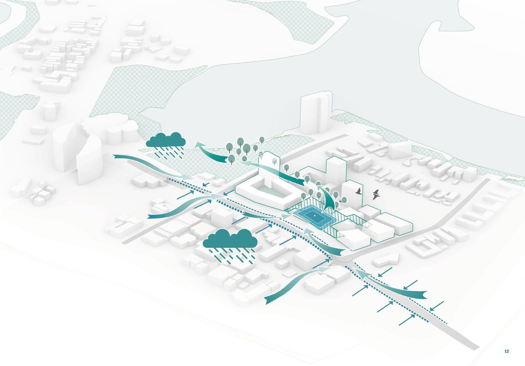
CREDIT TO MY GROUPMATES: NAOMI CHAN, YANG HE & JIAOYANG ZHANG
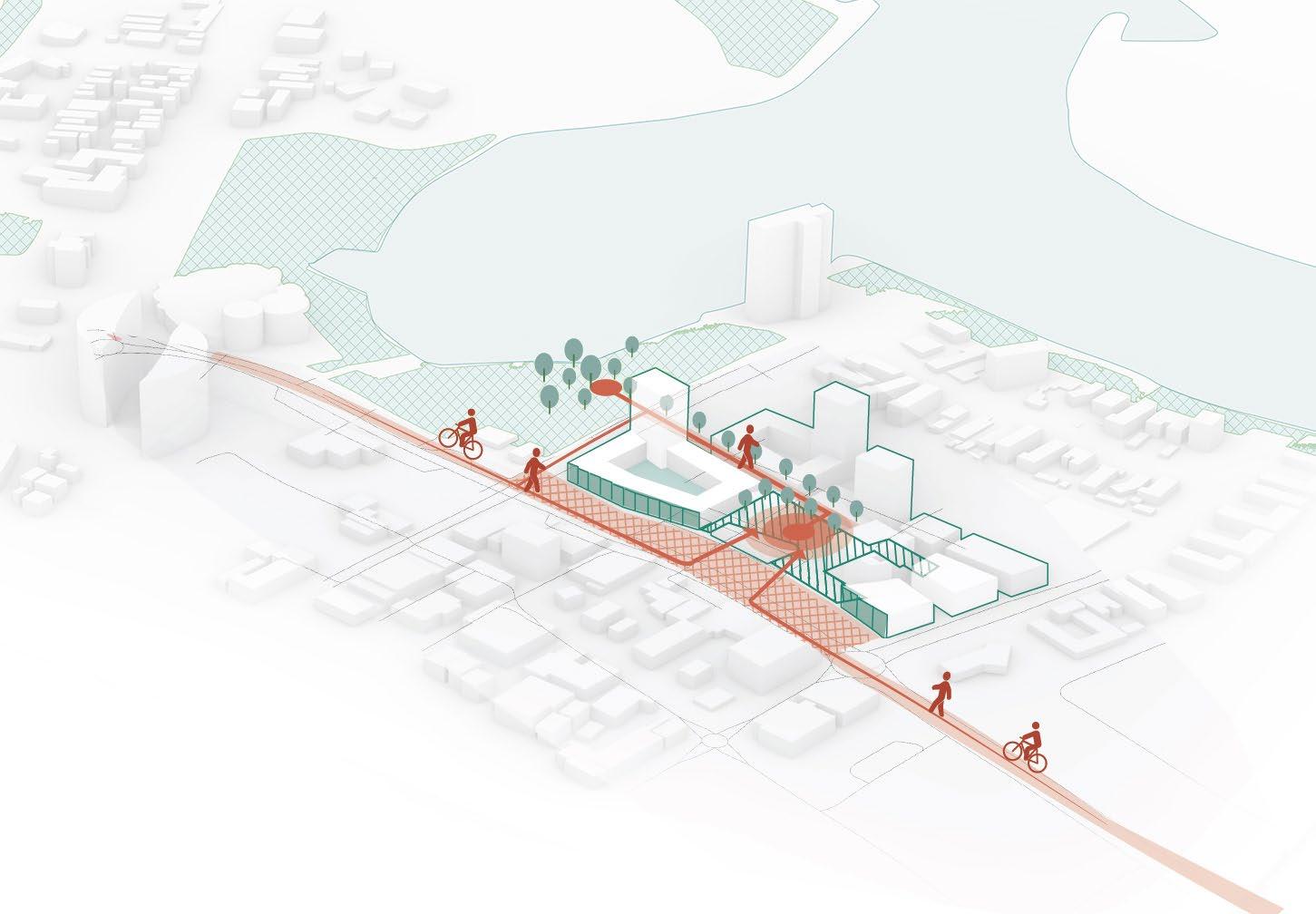
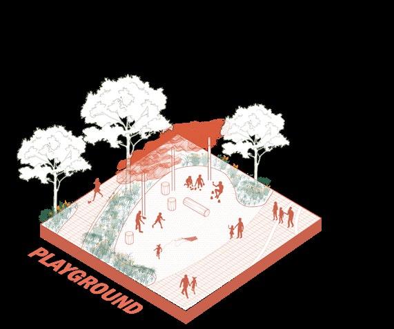
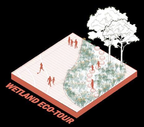
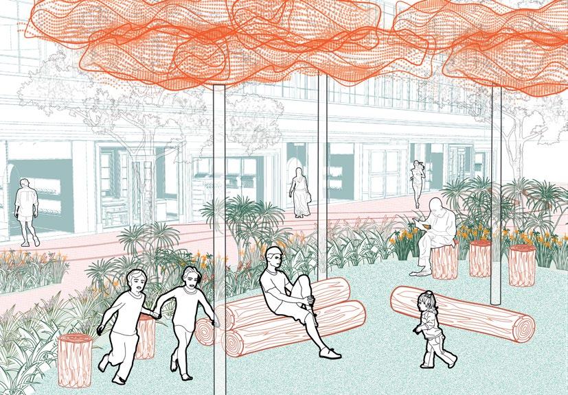
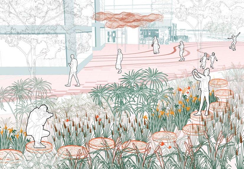
Creating constructed wetlands for stormwater treatment, at the same time being a public space as well as a historical reminder for the original wetland. The Wetland also functions as stepping stones for migratory birds.
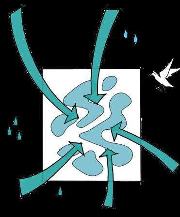
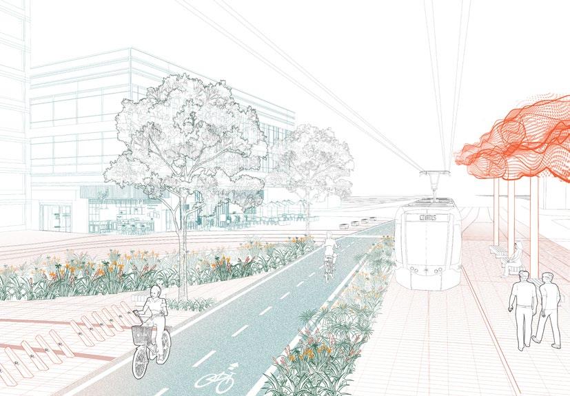
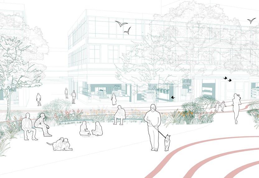
Creating a bioswale for stormwater treatment along Wharf Street, as well as a historical reminder for the original Tweed RIver that flows along Wharf Street.
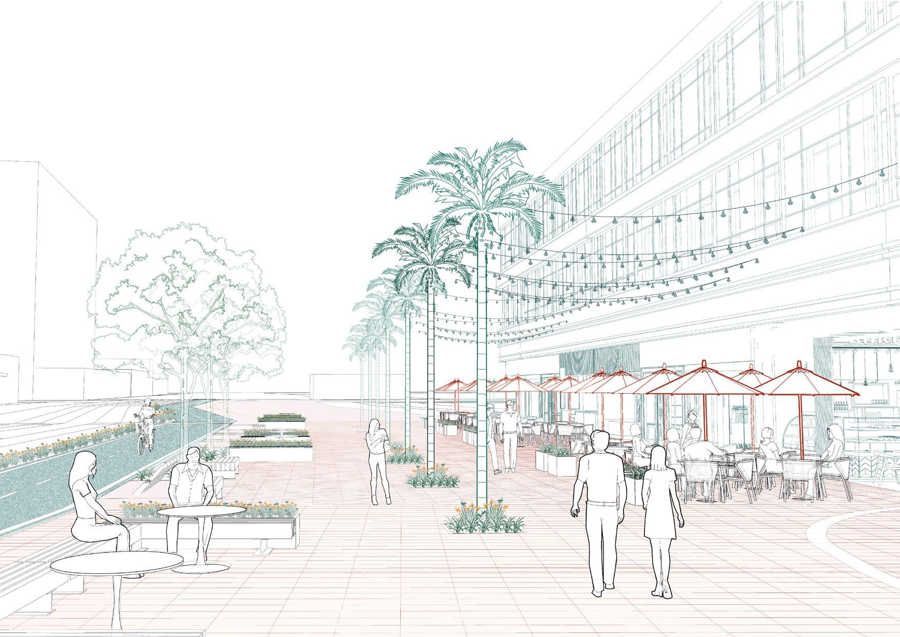
Bringing in existing trees of Tweed Heads to our site such as Araucaria heterophylla and Wodyetia bifurcata A.K.Irvine , creating a visual connection.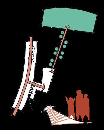
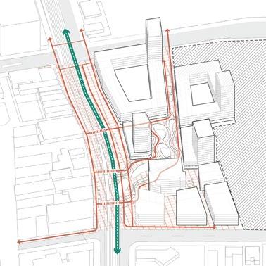
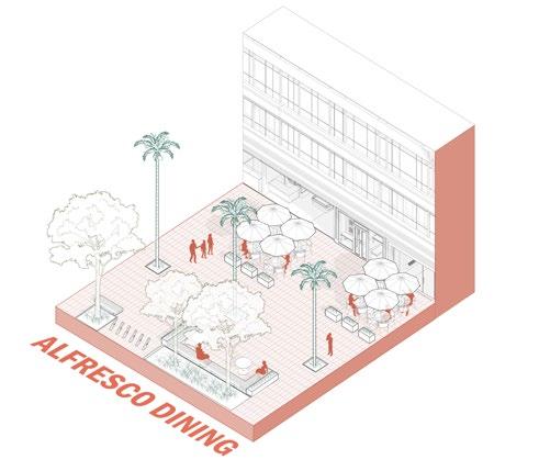
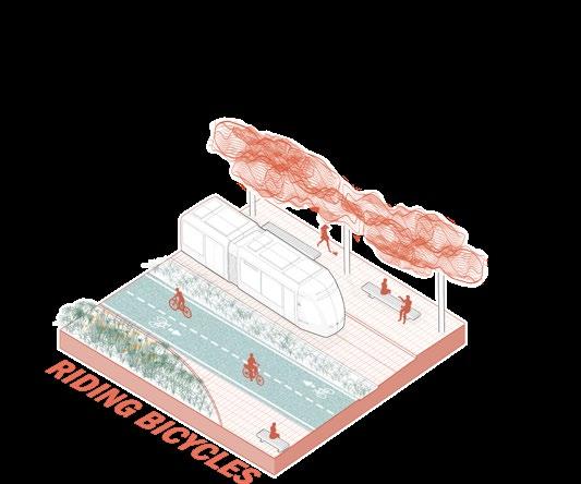
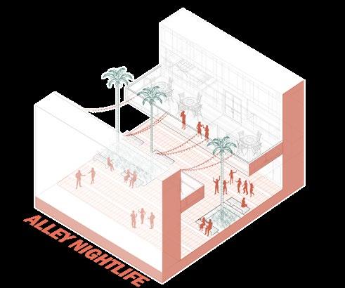
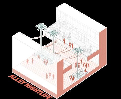
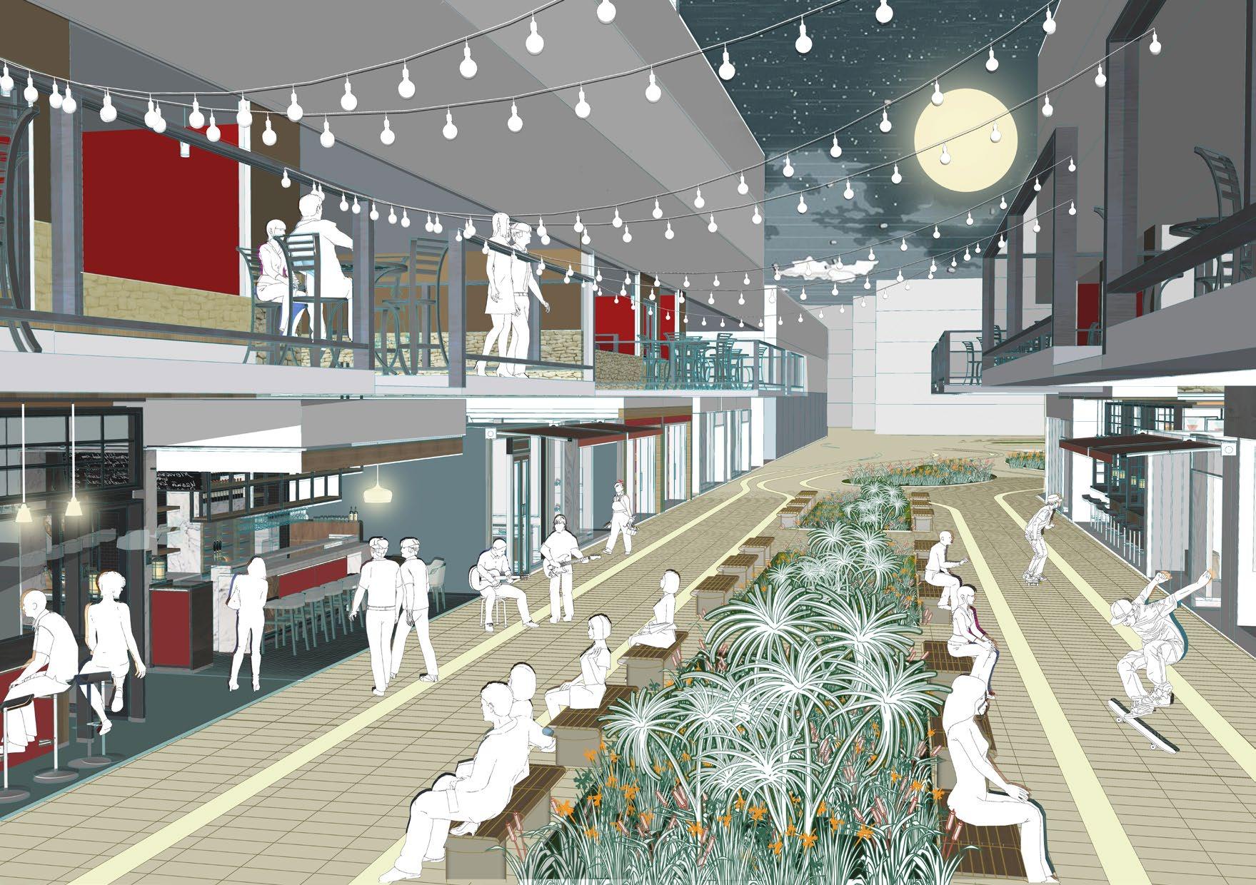
Make this part of Wharf Street a plaza, allowing mainly pedestrian, cyclists and lightrail to go through, and so people can enjoy a wider public space.
Include fine grain shops as retail shopfronts to diversify user experience.
REIMAGINGING USERS WALKING EXPERIENCE (FINE-GRAIN SHOPS) BEFORE AFTER


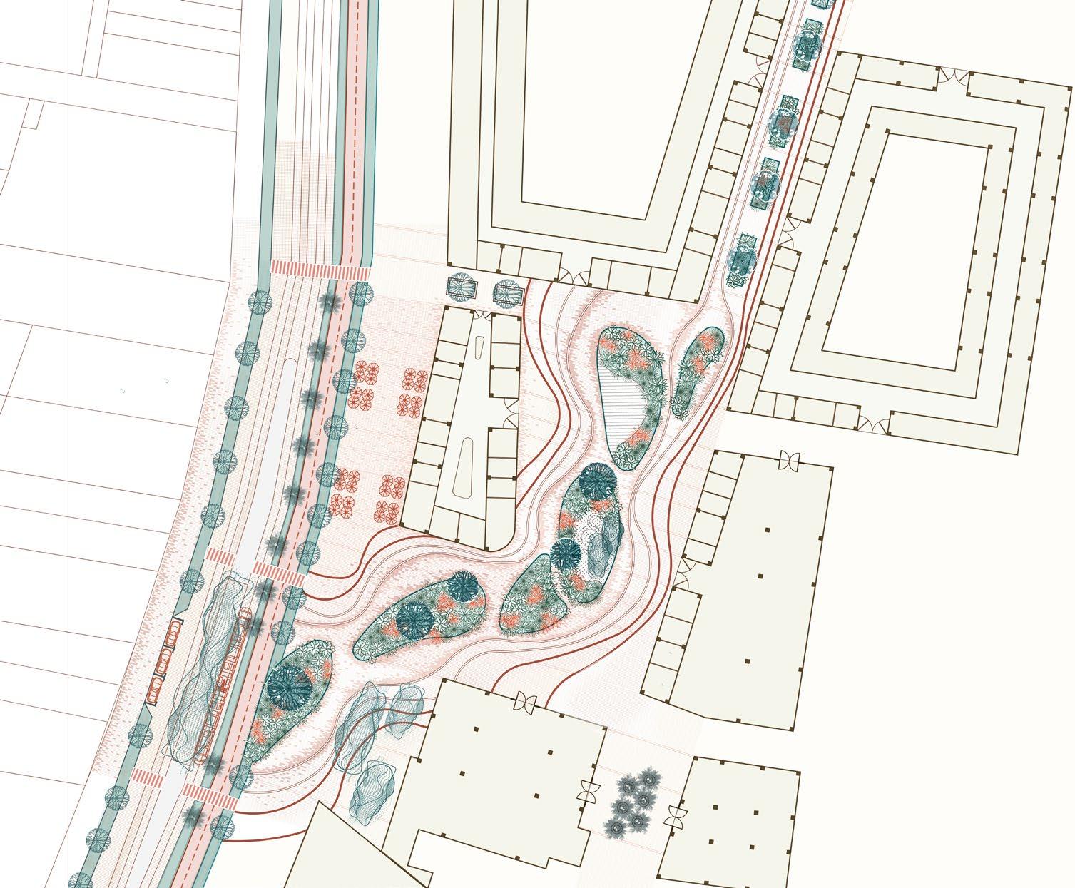
These two diagrams show the plant distribution in one of the wetlands. Some of the shrubs have the function of purifying water quality, such as Typha orientalis and Carex appressa.

SECTION AA’
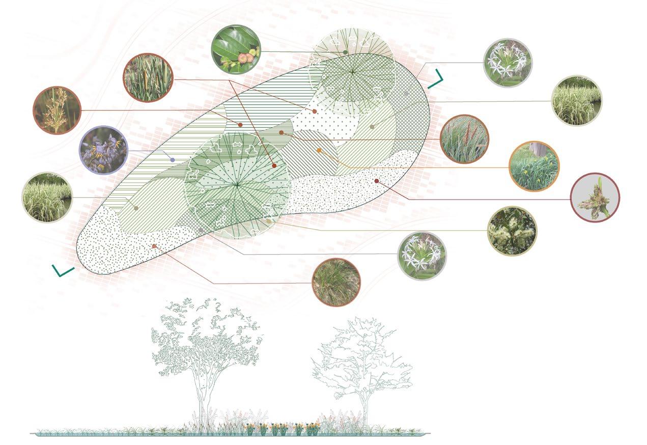 Glochidion ferdinandi var. Ferdinandi
Crinum pedunculatum
Crinum pedunculatum
Arundo donax L.
Iris pseudacorus L.
Isolepis inundata
Melaleuca quinquenervia
Carex maculata
Carex appressa
Typha orientalis
Juncus usitatus Dianella caerulea
LOCATION: BYRRILL CREEK, NSW, AUSTRALIA | LANDSCAPE ARCHITECTURE POSTGRADUATE RESEARCH\


CREDIT TO MY GROUPMATES: NAOMI CHAN & HAYLIE SHUM


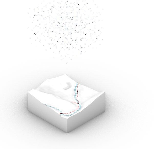
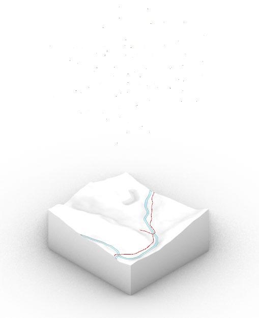
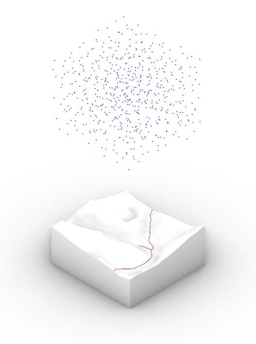
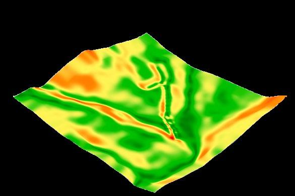
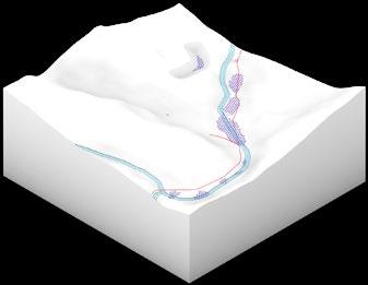
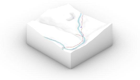
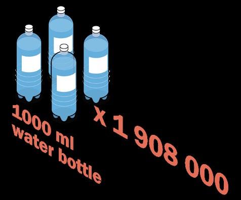
The model simulates the highest and lowest amount of rainfall on monthly basis, it helps us to design, visualise and compare how much rainfall has been captured in the proposed pond during the two scenarios.

Rainfall - Lowest mean daily (Dry Season)
Rainfall - Highest mean monthly
(Rainy Season)
Flooded Area - Lowest mean daily (Dry Season)
Flooded Area - Highest mean monthly (Rainy Season)
 Byrrill Creek Road
Byrrill Creek Road
Byrrill Creek Road

The analysis of site topography, slope gradient, drainage pattern and rainfall stimulation has allowed us to visualize and determine the later design development process. It has allowed us to quantify the volume of water and design the potential location and volume of retention ponds. The design solutions have been evaluated, modified, and optimized in the development design stage.
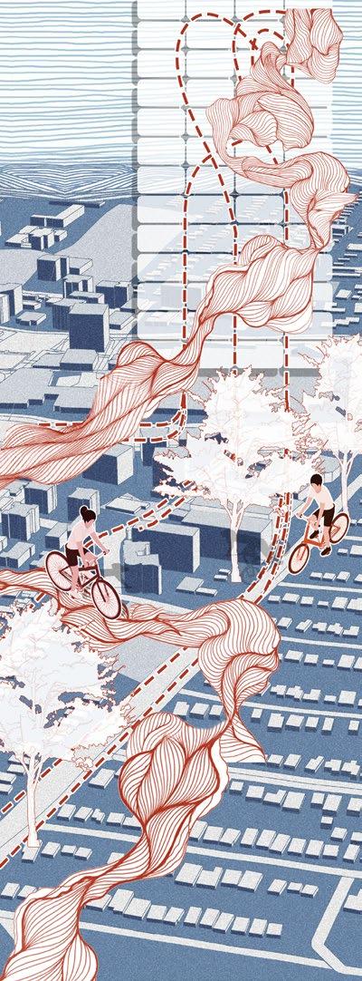

WEAVE THE NATURE BACK INTO URBAN CLOTH !
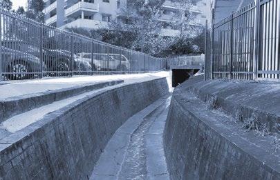
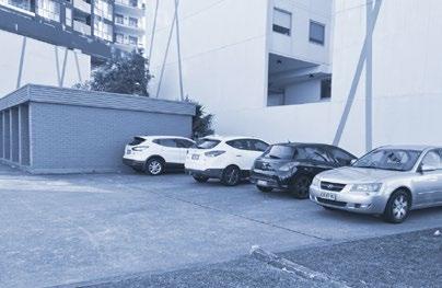
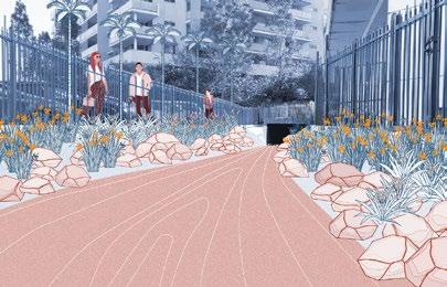
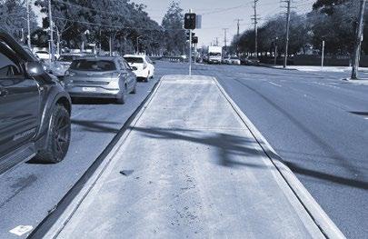
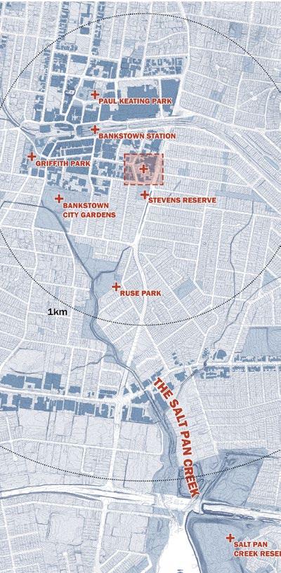
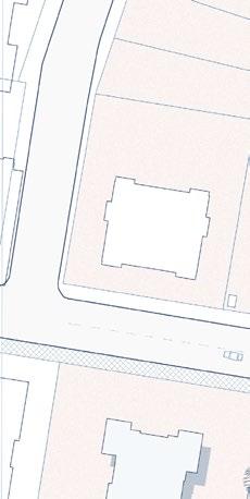
The project area is located within the Salt Pan Creek catchment which has high potential flood risk as a result of intense rainfall. Meanwhile, rapid urbanization, which led to the significant lost of green area also raise the chance of flooding. The project is aim to change impermeable urban surface into flood adaptive area by bringing back the nature into the neighborhood.
How do we “WEAVE”?
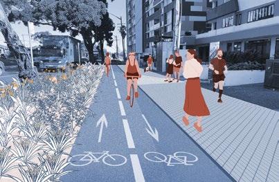
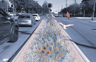
Weaving the nature into urban areas from the smallest scale upwards. Integrating natural elements, native cultural factors with a little intervention to the existing scenario. The project brings some water sensitive urban design technique into the design in order to solve different issues in each areas.

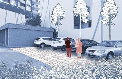
MATERIAL COIR MATTING | Provides ability to prevent land erosion. | Promote the growth of vegetation | Protect the soil from losing
Permeable Pedestrian Pavers
Permeable Traffic Pavers
Green Parking
Green Area

Pavement Pavers
Daylighting Creek

Pedestrian Entrance
Pedestrian Routes

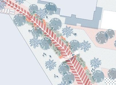
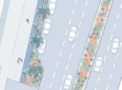

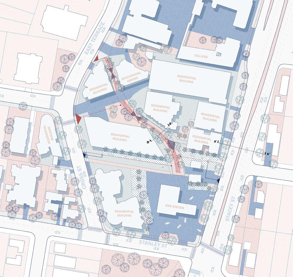
Vehicular Entrance
Vehicular Routes
Viewpoints
Pedestrian Pitstops
LOCATION: NSW, AUSTRALIA | LANDSCAPE ARCHITECTURE POSTGRADUATE RESEARCH




CREDIT TO MY GROUPMATES: NAOMI CHAN & LINZHI LI
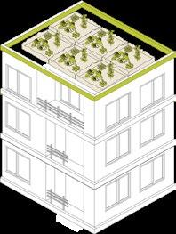
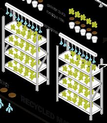
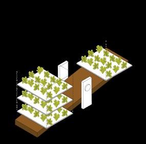
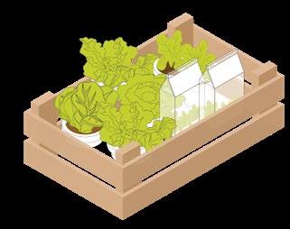
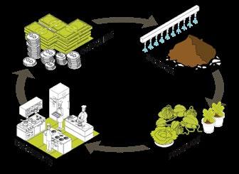
Question: What are the differences between 3 Urban Agriculture cases in contributing food to urban areas?
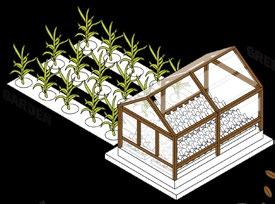
POCKET CITY FARM (CAMPERDOWN) URBAN GREEN SYDNEY (BARANGAROO)
SOUTH EVELEIGH NATIVE ROOFTOP FARM
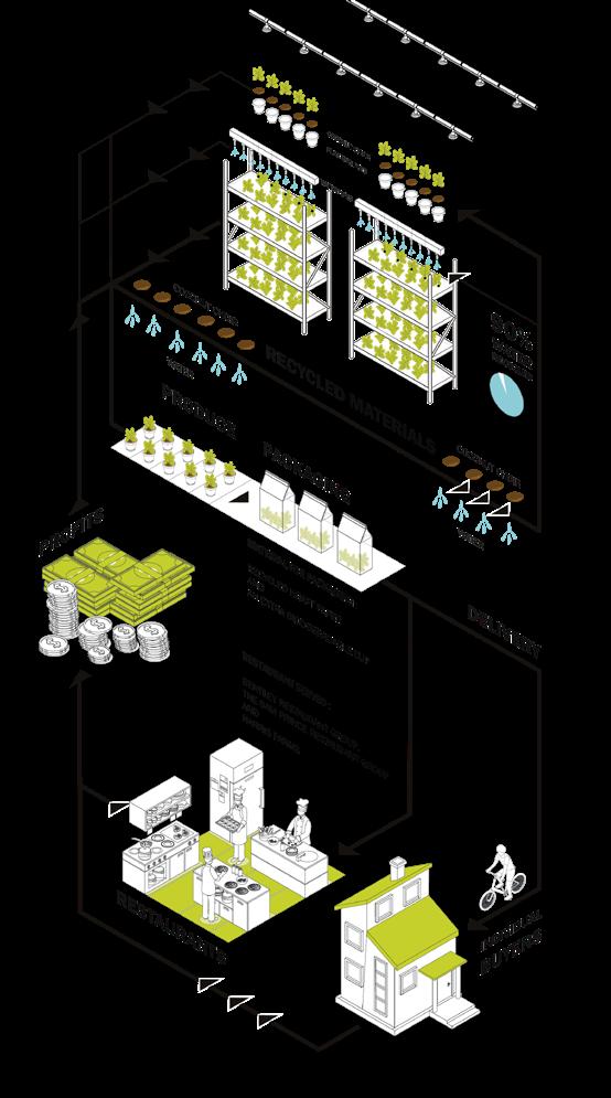
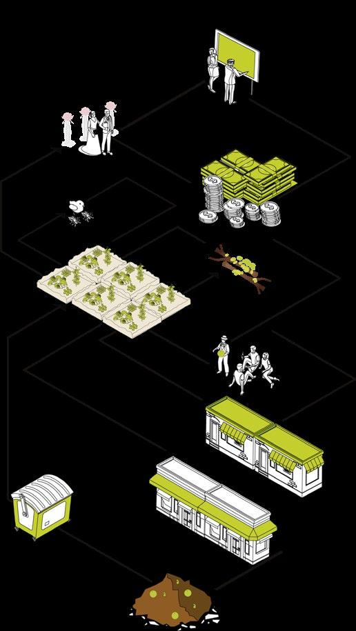
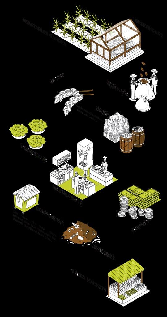 POCKET CITY FARM (CAMPERDOWN) URBAN GREEN SYDNEY (BARANGAROO) SOUTH EVELEIGH NATIVE ROOFTOP FARM

LOCATION: ROCKDALE, NSW, AUSTRALIA | LANDSCAPE ARCHITECTURE
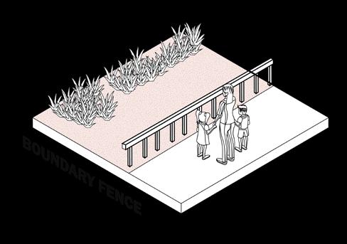
POSTGRADUATE RESEARCH

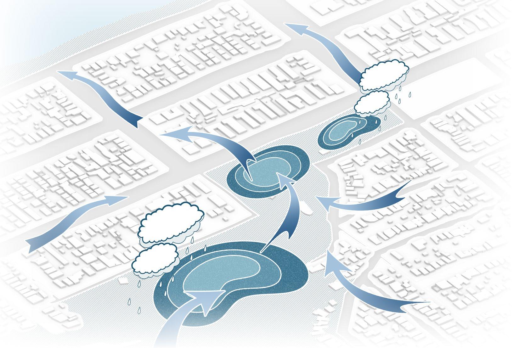
FLOODING SCENARIOS EXISTING GEOLOGY
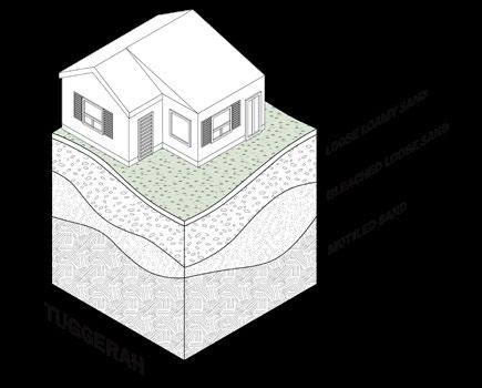
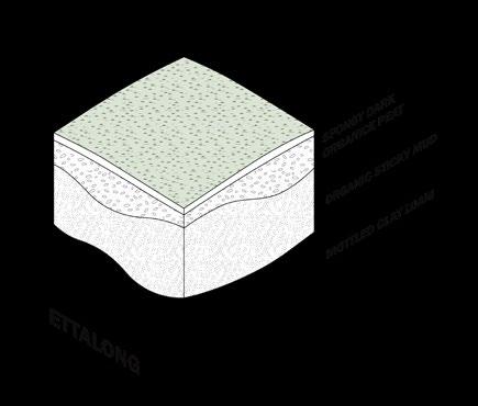
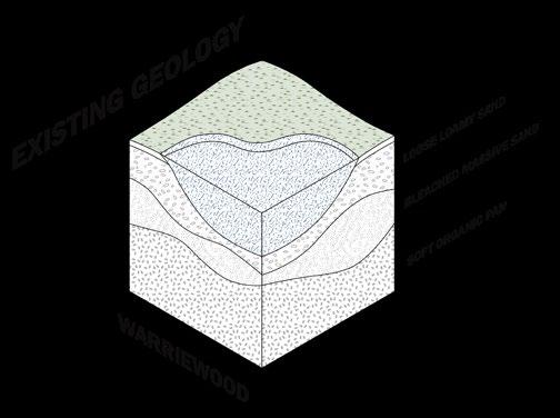
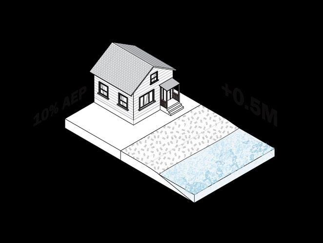
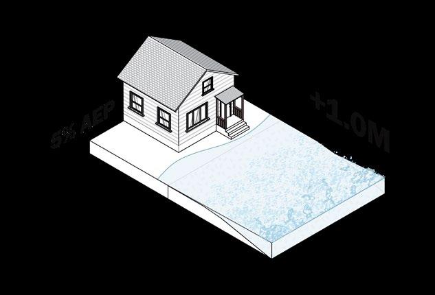
WALKABILITY EXPERIENCE
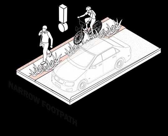
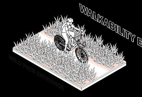
GOOD DESIGN SHOWS LANDSCAPE CAN ADAPT TO BOTH LONG AND SHORT TERM FLOOD SCENARIOS.
Create constructed wetlands for stormwater treatment, which also functions as stepping stones for native ecosystems.
Excessed water will be purified and released into the Botany Bay.
Transform the site into a stormwater capture hub, creating a public infrastructure that promote flood adaption.
GOOD DESIGN FACILITATES THE ABILITY OF VEGETATION TO ADAPT WITH FLOODING SITUATIONS
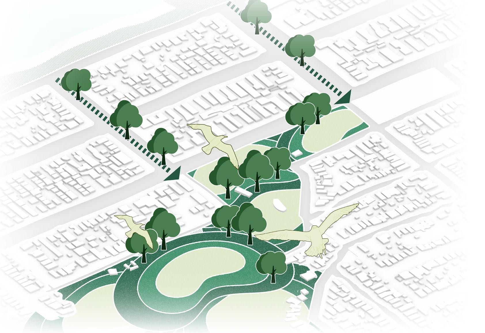
Incorporate ‘Wet Landscape’ infrastructure into residential areas to help mitigating flood issue.
Create natural habitat for various species such as Golden Whistler, Green Bell Frog,...
Create constructed wetlands with ecosystem that can manage stormwater. The vegetation also functions as a reminder of historical nature.
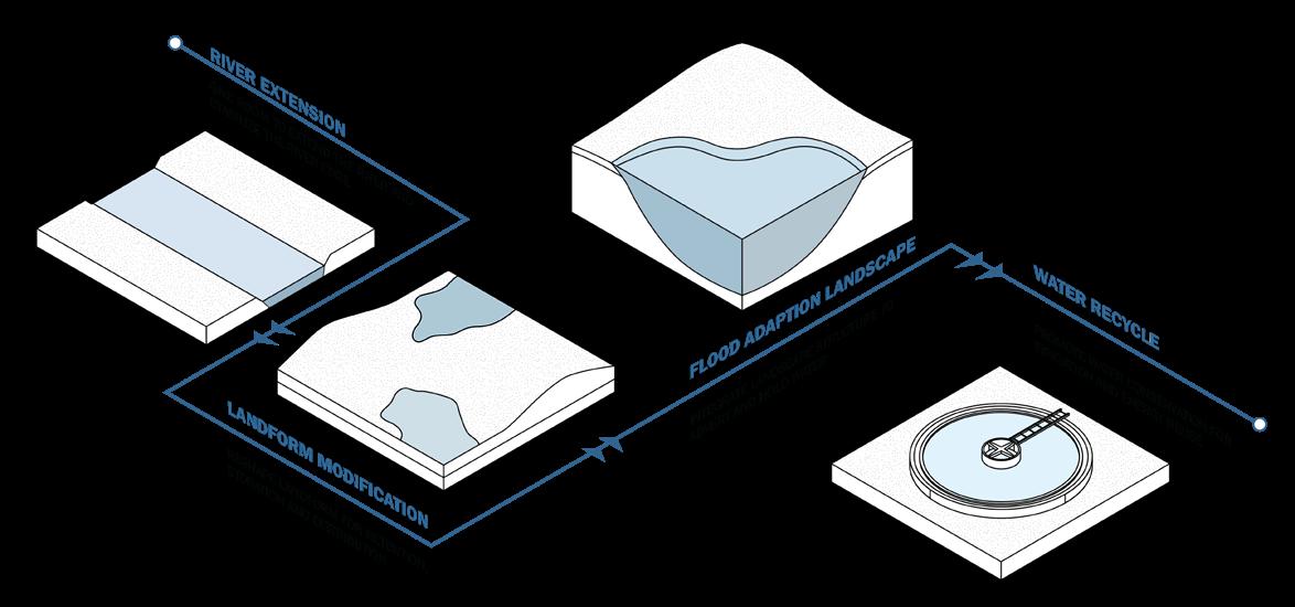
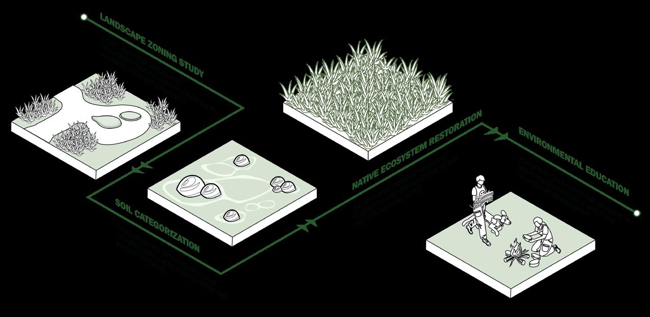
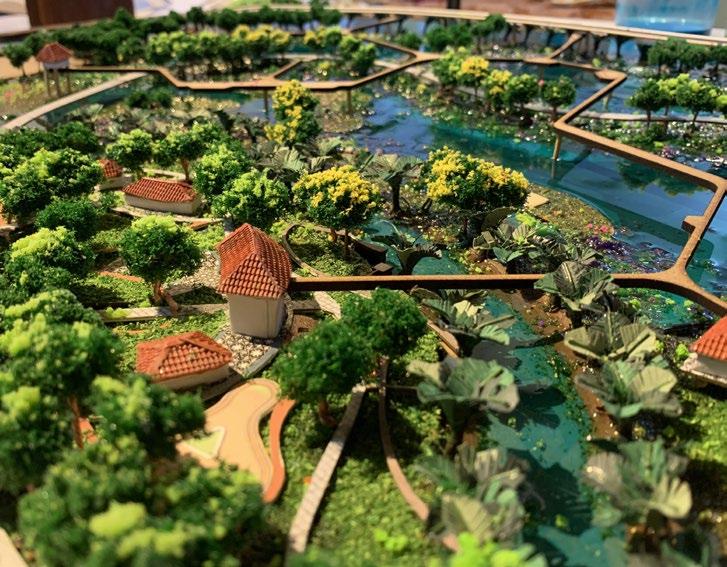
PERSONAL SELECTED SKETCHES, WORK IN-PROGRESS & MODEL MAKING
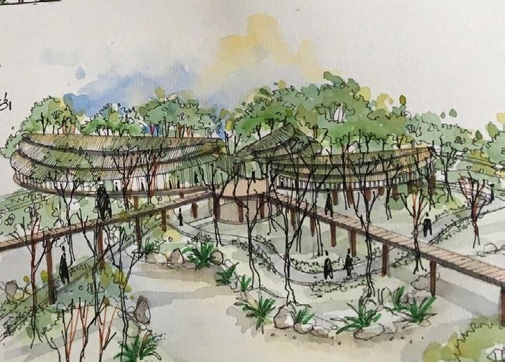
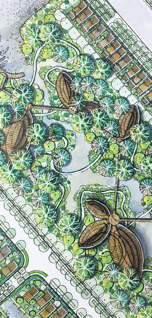
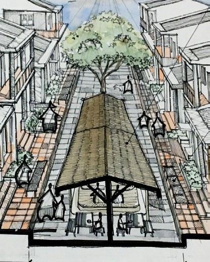
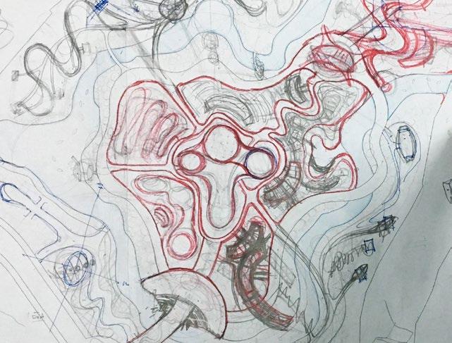
 Pen sketch
Concept sketch for Studio project
Perspective sketch for Studio project
Section sketch for Studio project
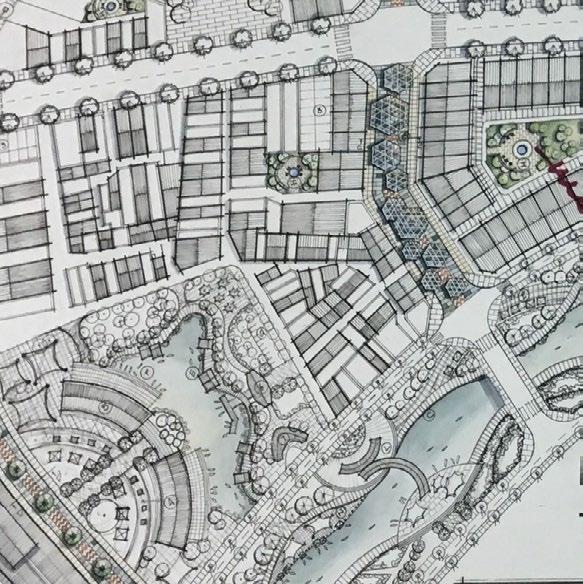
Landscape plan sketch for Studio project

 Concept sketch for Studio project
Landscape plan sketch for Studio project
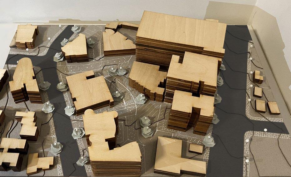
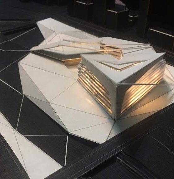
Landscape model for Studio project
Landscape model for Studio project
Landscape model for Studio project