URBAN ECOPUNCTURE
They are the sustainable urban transformation strategies developed on particular nodes or ‘points’, in order to stimulate a larger network or ‘lines’causing the reactivation of a complete urban system or ‘surface’.
These small-scale urban interventions can transform the larger metropolitan context through ecological, social and economic strategies able to reactivate ecosystems.
What is Urban Ecopuncture?
I
STUDY AREA SCALE
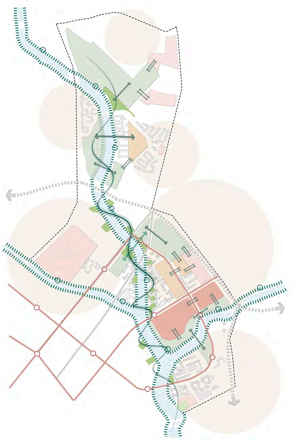
It is fragmented into monofunctional enclaves. At this scale, the activation of an eco-network using a set of minimal interventions is proposed.
Community Nodes

The community centers and schools can serve as nodes to activate the green network.

Park Connectors
Existing and disconnected network of park connectors.

Public Open Space
Existing public open spaces inside the perimeter area.
Infrastructure Barrier Expressway and river block global and local movement, despite several access gates.
Current Infrastructure
Existing mobility infrastructure regarding roads and trains.
Urban Superzoned
Fragmented, superzoned and single-use planning results in longer travels,wasting energy.
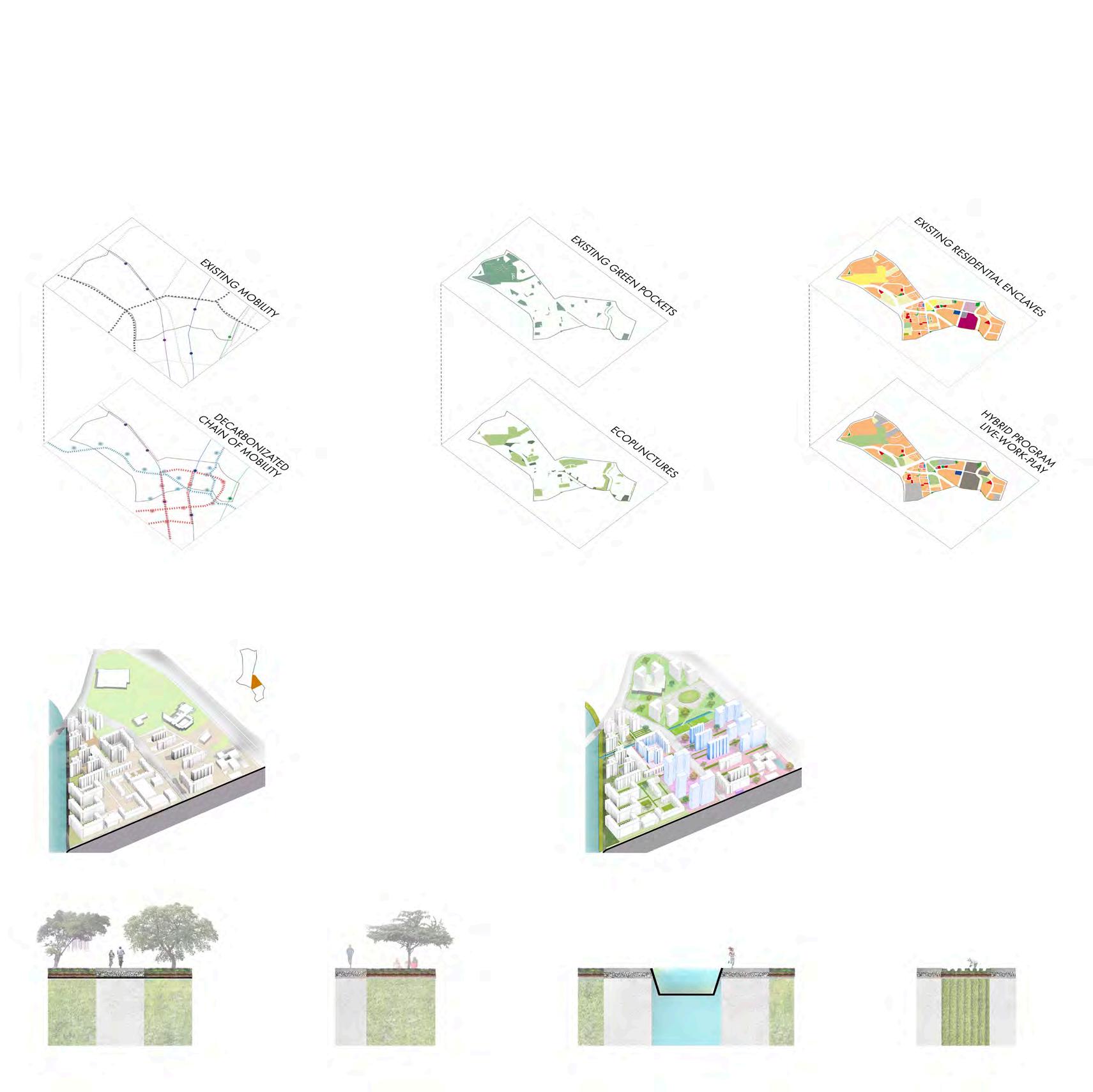
POINT TOOLBOX NODE ACTIVATORS Water Transit Oriented Development Water Plant SOHO Community Farming Walking + Cycling Playground ECO NETWORK POTENTIAL MAP + ISSUES MAP ANALYSIS
urban ecopuncture//
CONCEPT PLAN
ECO NETWORK
The proposal aims to provide a feasible connection between the existing green spaces while introducing community functions and amenities to activate them. Treating the active green spaces as ‘nodes’ connected by a ‘linear network’ results in the creation of an ‘eco-network’ in place. The toolbox concept is proposed in order to integrate functions in said green spaces (nodes), such as: Community farming, Water Transit Oriented Development, SOHO, playground environments and art exhibit center. This eco-network allows people to access public amenities in and around the existing green spaces, making them community cores.
Ecopuncture Point Neightbourhood Eco Network 500m //econetwork
INTERVENTION AREA SCALE
It is a predominatly residential site lacking vitality. At this scale, the proposal focuses on redesigning the open spaces in the existing residential blocks and guidelines to add a varied program to the site.
STRATEGIES RESIDENTIAL LIFESTYLE IMPROVEMENT
Water Transit Bus Rapid Transit
Ecopuncture Point Active green HUB
EXISTING RESIDENTIAL BLOCK TYPO
Residential Enclave
It suffers from a lack of mixed-use program, uninteresting and lifeless.
Aging Issue
Currently the area is not equipped enough to face the aging issue by 2050

Eco HUB
Incubator Space
Coworking Space
PROPOSED RESIDENTIAL BLOCK TYPO
Ecopuncture
Activating green spaces as ‘nodes’ on a ‘linear’ grid of park connectors, water canals and urban farming, housing block’s ground floors and streets are enlivened to bring about aging in place.
INTEGRATION GREEN GRID WITHIN RESIDENTIAL AREAS
Urban Farming Canal Front Greenscape Pedestrian+Cycling Pedestrian Path
urban ecopuncture//
Coworking Space
Densified housing
GUIDE PLAN
200m Bus Rapid Transit Line
Live-Work-Play HUB
Residential Enclave
//to reimagine public housing
Ecopuncture Point Eco HUB
SITE AREA SCALE
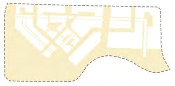
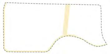
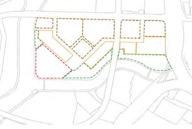
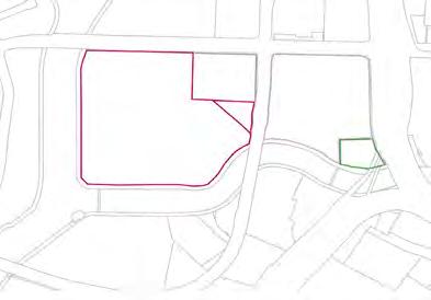
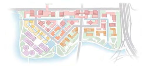
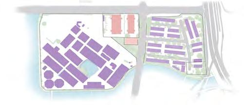
As a private industrial site in a residential zone, the site lacks relevance or vitality required for 2050. With approximately half the perimeter being waterfront, the site has the potential to be designed as an attractive active publicly accessible space.
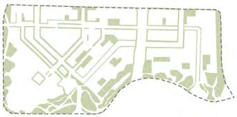
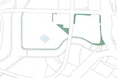
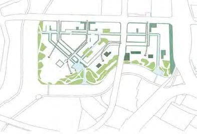
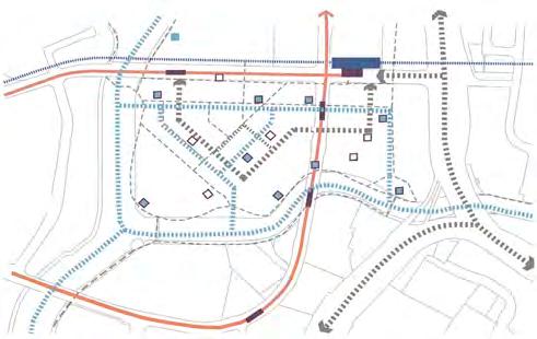
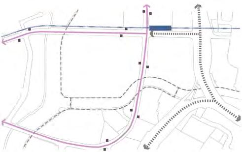
STRATEGIES SITE INTERVENTION
Existing greenage
Existing monofunctional program
Existing mobility
Proposed integrated ecological network

Proposed hybrid spatial organization
SPATIAL SHIFT PRIVATE INDUSTRY TO HYBRID INTERGENERATIONAL LIVING
Proposed decarbonated mobility chain
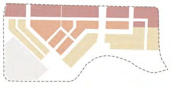
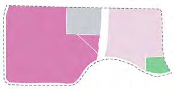
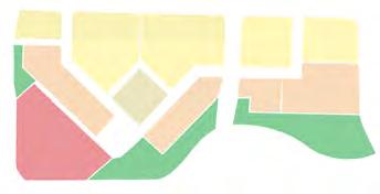
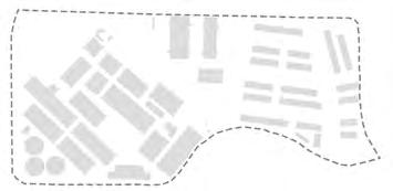
Proposed site 8% open space 61% open space 9% green space 30% green space Existing site
POND SITE POROSITY GREENSCAPE FARMING ACTIVE GREEN PRIVATE INDUSTRY LIGHT INDUSTRY OFFICE PRIVATE GREEN OFFICE/COMMERCE HOUSING ART HUB WATERFRONT PARK TRAIN TRAIN STATION CAR BUS BUS STOP CYCLE WATER TRANSIT WATER TRANSIT HUB BUS RAPID TRANSIT BUS RAPID TRANSIT STOP SILO PARKING
urban ecopuncture//
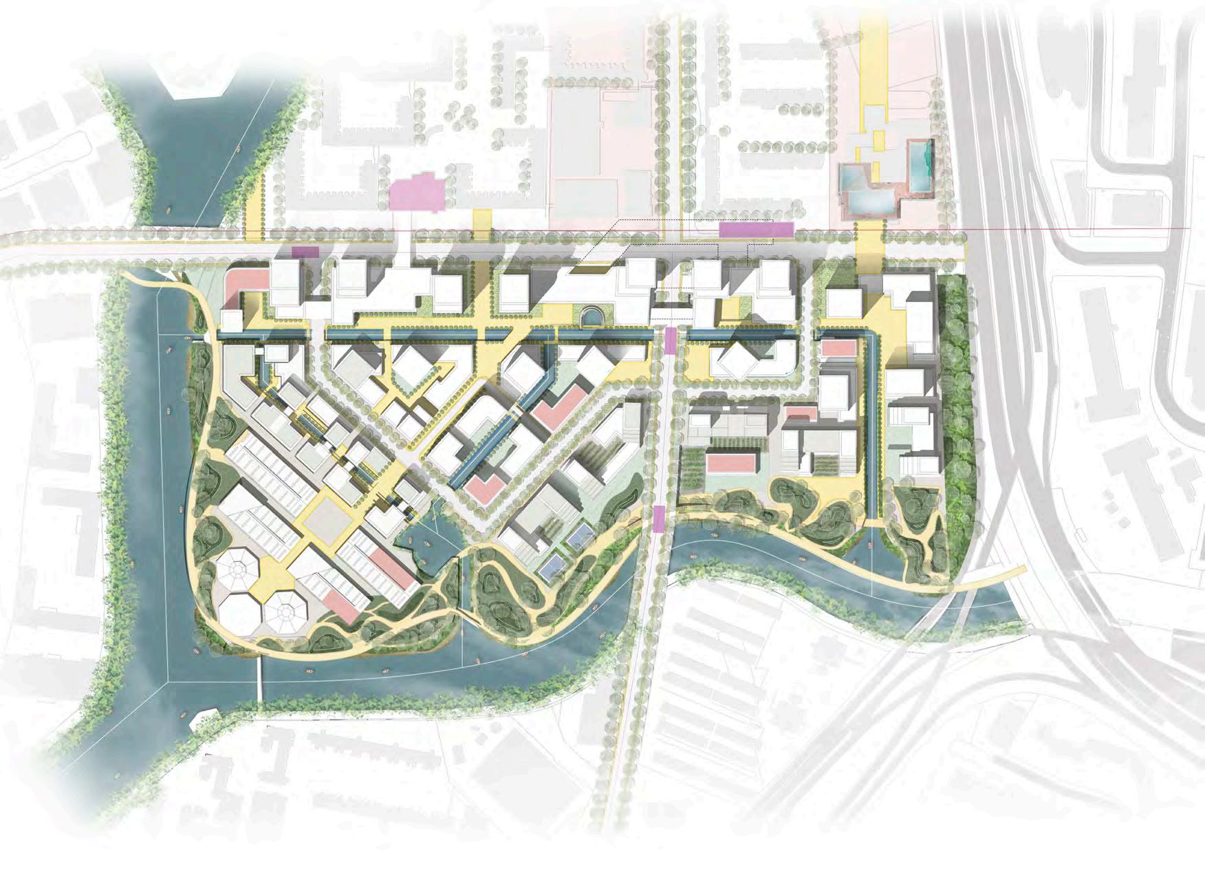
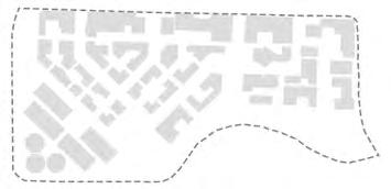
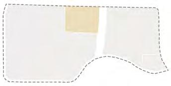
3 primary functions 6 primary functions 2.8 plot ratio 4.5 plot ratio 43% built area 48% built area MASTER PLAN Multimodal Stations Public Space Facilities 50m to reimagine live-work-play //
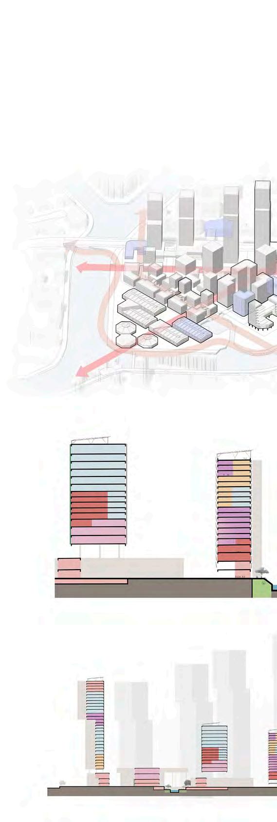
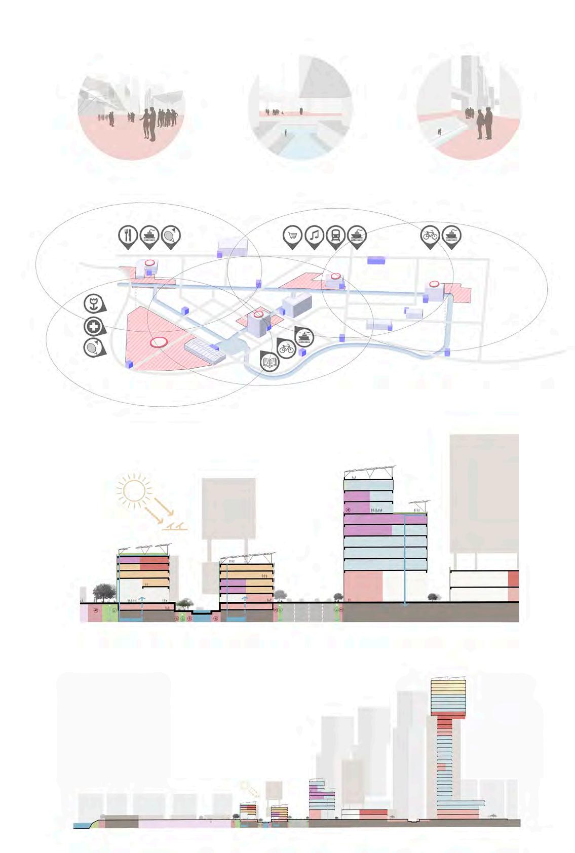
Section BB’ Along the Dynamic
Section AA’ Live-Work-Play environment
Lines Main spines + Sustainable
typo A typo B typo C
Points Open spaces + Facilities at 5 min walk
3 active canal front
1 2 3
2 food court square
1
art complex plaza
urban ecopuncture//
West North South
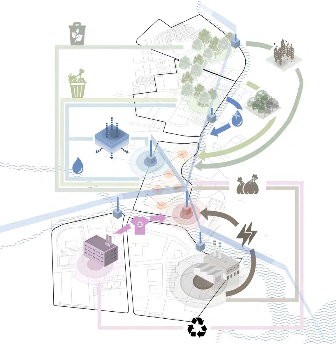
INNOVATION & INDUSTRY
ECOLOGY & FOOD SUSTAINABILITY
SUSTAINABLE WATER TRANSIT NETWORK
PRODUCTIVE SPACES
WASTEWATER MANAGEMENT
ENERGY MANAGEMENT
RETHINKING THE URBAN ECOSYSTEM INTERACTION WITH SURROUNDING SITES
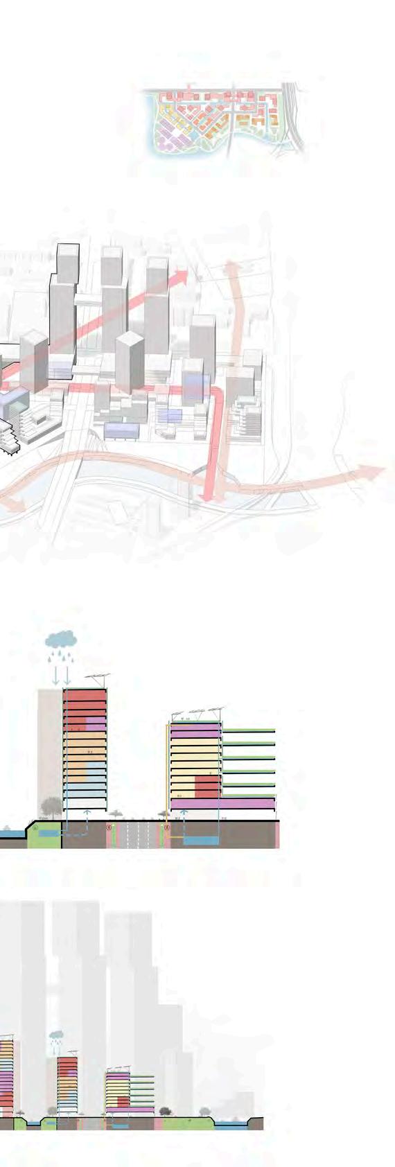
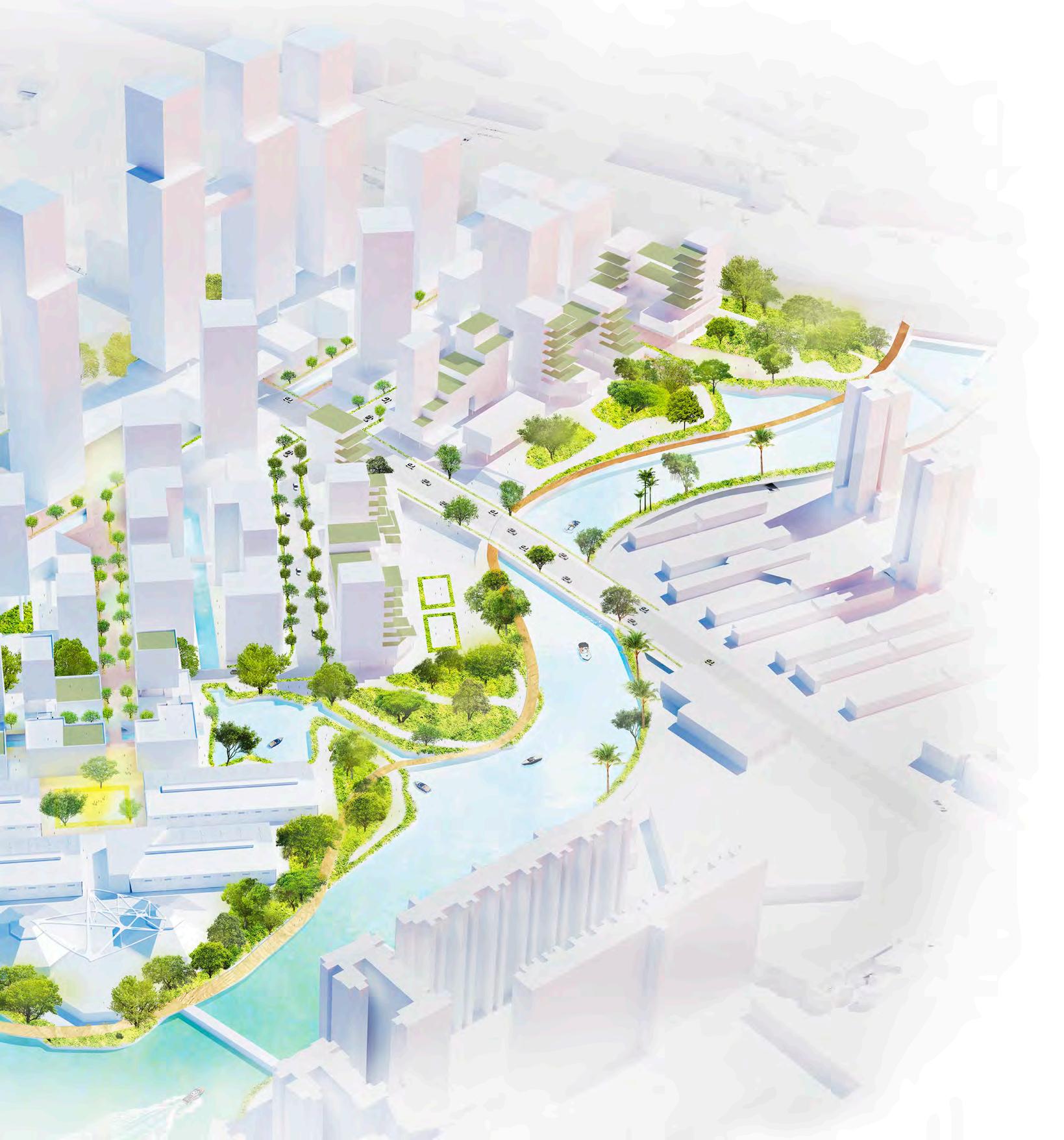
The site has a priviledged location regarding the logistic, mobility and metabolistic chain. In addition to the several land connections (road, bridges or pathways), this proposal also includes the water linkage possibility, resulting in a versatile key strategic point to send and receive passengers, food, energy, products or waste disposal. As a consequence the site is expected to thrive in economic, social and sustainable activity.
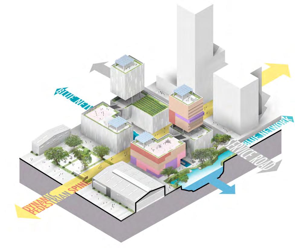
 Dynamic Pedestrian Spine
A-A´ B-B´
typo D typo E
//to reimagine live-work-play
Sustainable water transit network
East Apartments Commercial Community Event Space Office Facility Soho 30m
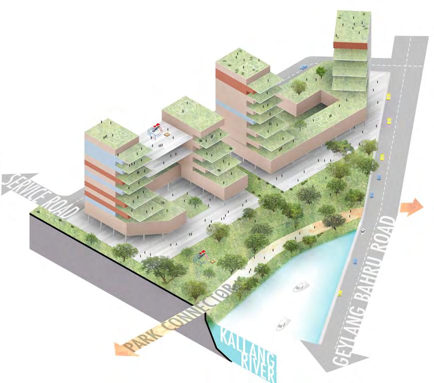
LOW-RISE BIOPHILIC COMMUNITY
Typology B (population estimate 1603)
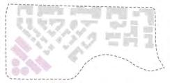
Functions
Co-living spaces + Community facilities
Plot Ratio 4.5
Intergenerational Co-living
While young parents work, their kids are looked after by the elderly,enhancing the community bonding and the community subsidy system,a modern coliving lifestyle.
Key spatial qualities
Integrated greenscape
CREATIVE HUB
Typology A
Functions
Studios + Workshops + Restaurants
Plot Ratio 0.7
Path-Place
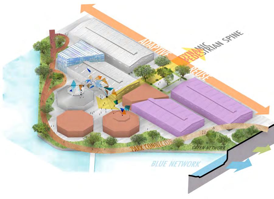
The art complex is the destination of the pedestrian spine across the site, bringing activities to the canal front.
Active Waterfront Edge
A naturalized canal front takes visitors through a vibrant sequence of spaces along the redesigned park connector.
Key spatial qualities
Low-rise design
urban ecopuncture//
OPEN BLOCK COWORKING COMMUNITY
Typology C (population estimate 1672)
Functions
Soho + Health care + Event spaces
Plot Ratio 8.1
Fine Grain
Highly porous,mixed use on ground floor including canal front pedestrian pathways.
Key spatial qualities
Open block design
INTEGRATED WATERFRONT EDGE
Typology D (population estimate 2244)
Functions Commerces + Event spaces +
Community spaces + Serviced apartments
Plot Ratio 2.7
Mixed Use Greenscape
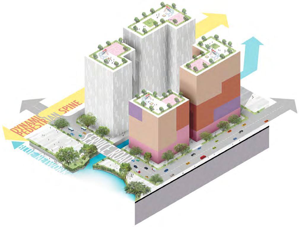
Community areas host kids playgrounds, basketball/futsal fields and resting zones, making a vibrant waterfront greenscape.
Key spatial qualities
Porosity
Commercial Residential Facility Community space Office 30m //edgeconditions + typologies
VERTICAL DENSE INNOVATIVE BUSINESS SPINE
Typology E (population estimate 650)
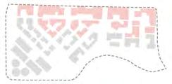
Functions Office + Commerce + R&D + Corporate facilities+Serviced apartments
Plot Ratio 6
Dense Mixed Use
Vertically dense typology,maximizes the profitability of the site, its active ground floor includes new productive dynamics.
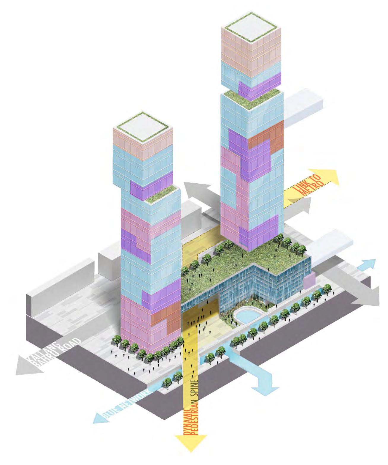
Key spatial qualities
View-oriented staggering
Active Street Space
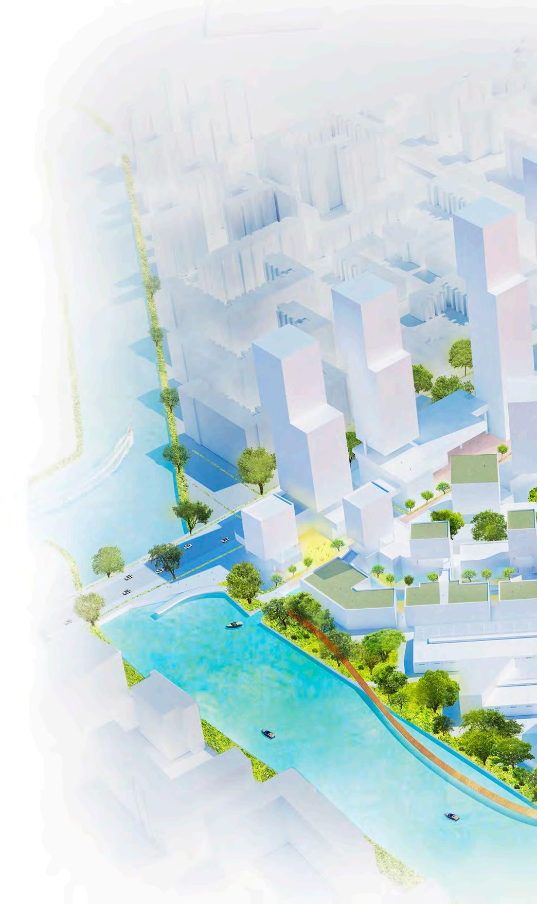
The main commercial spine goes from the exterior road and along the canal,on site. Basement level canal front street sees docking, leisure and commercial activities. Plots also contain privately owned public spaces that link right across the site until the water front through the dynamic pedestrian spine
Community space Commercial Residential Facility Office 30m urban ecopuncture//
How is the proposal relevant today, and more importantly, for 2050?
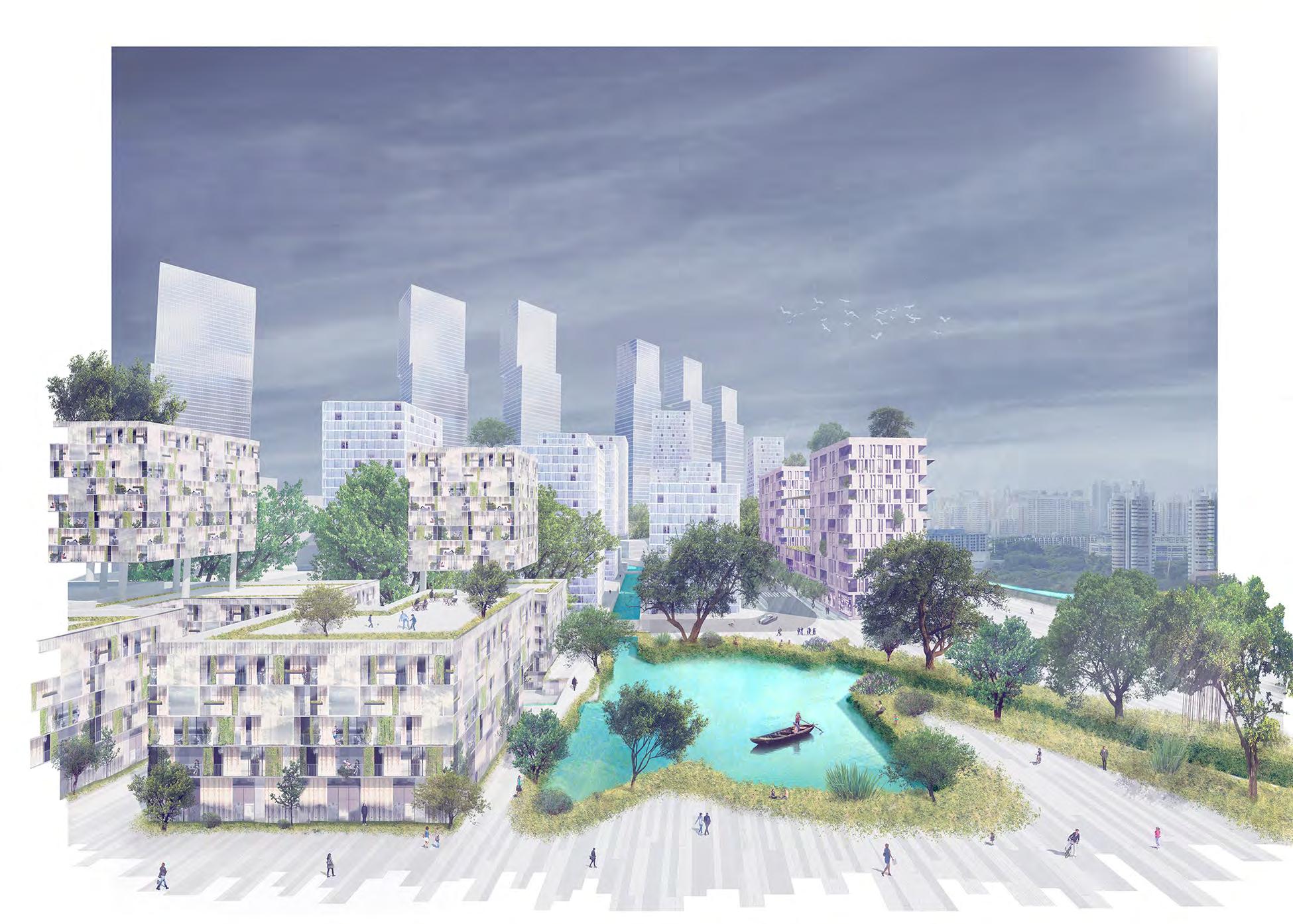
Cities of the future, due to their size, are increasingly polycentric, and there is a need for self-sustenance within these centres. This includes the demand for an economically viable and comfortable lifestyle for all ages, especially the elderly. This proposal makes possible a symbiotic communal living, thus creating self-sustaining ‘urban villages’
The holistic integration of an ecological network into the site generates a new ‘module’of neighbourhood that can be incorporated into urban waterfront environments in the future. With degrees of hybridity in the vertical programme,the use of open spaces and the types of green spaces, the site offers a conducive Live-Work-Play context for users of all ages.
//conclusion
LIVING FILTER

Hybrid’carbon sink’urban model for the Barcelona Metropolitan Area in 2050.
Reducing carbon dioxide emissions is a multi-faceted problem, and requires a multi-faceted solution. This proposal aims to maximise biological CO2 absorption in Barcelona Metropolitan Area by 2050 through a network of microalgae production hubs, the pilot of which is the designed site (a nexus for production, jobs, research, education and living) thus, weaving together natural, productive and social ecosystems to create the perfect ‘climate era’ resilience model for Barcelona.
 Click to watch the video of the project
2
What is microalgae?
It is the “diverse group of microscopic organisms that inhabit in marine and freshwater habitats,able to perform photosynthesis”.
How can we use it?
Industrial-scale microalgae production in photobioreactors requires sunlight, CO2 and water to produce biomass
The value-added products of biomass generation have several useful applications for the chemical industry. Additionally, this microalgae ecosystem can also be used to treat wastewater
Average global radiation ≥ 4kwh/m2/day
Water source (fresh or Mediterranean’s) ≥ 520 m3
Wastewater treatment through Microalgae ecosystem
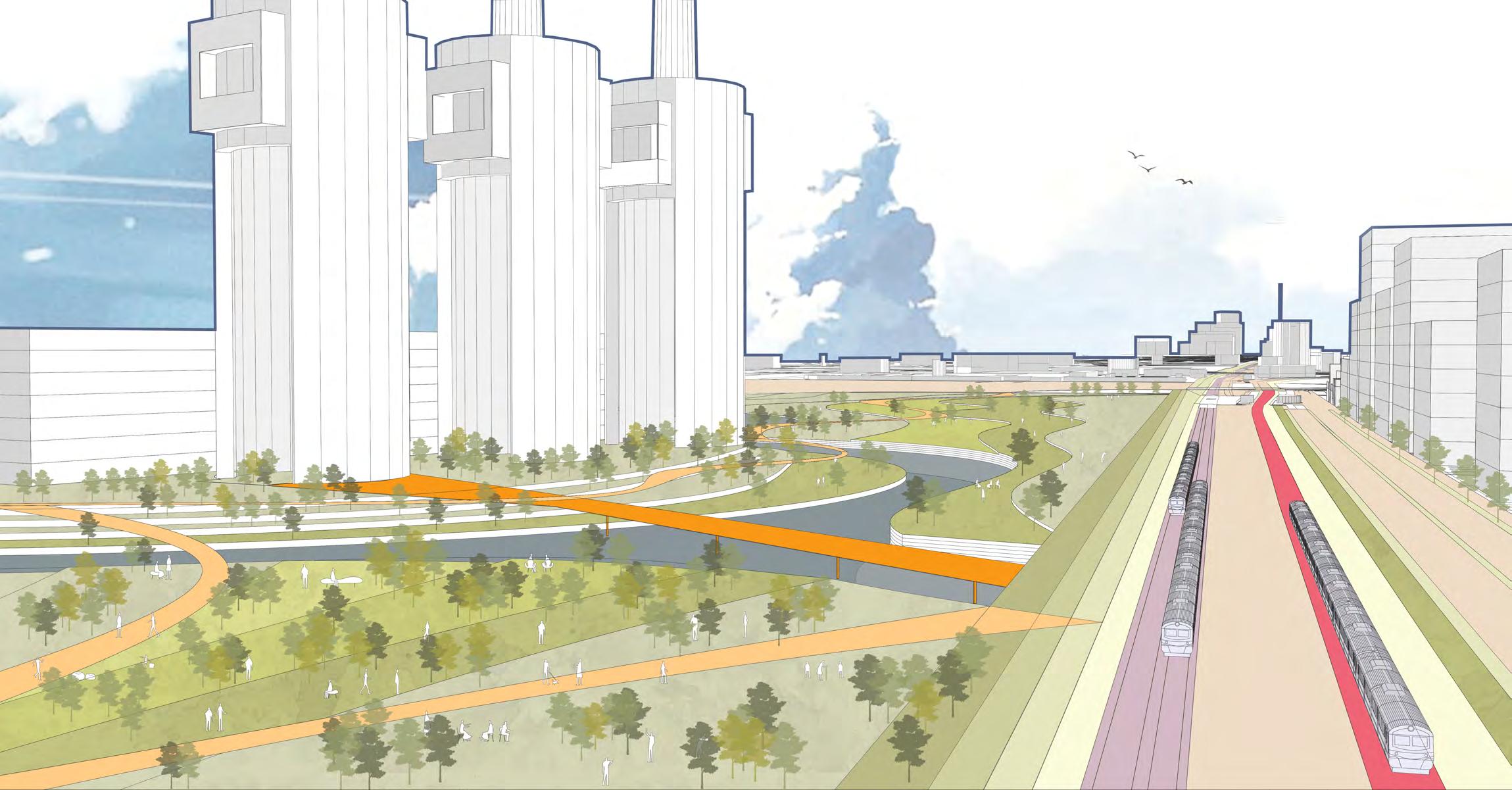
Photobiorreactors (microalgae production + biomass extraction ≈ 7000m2)
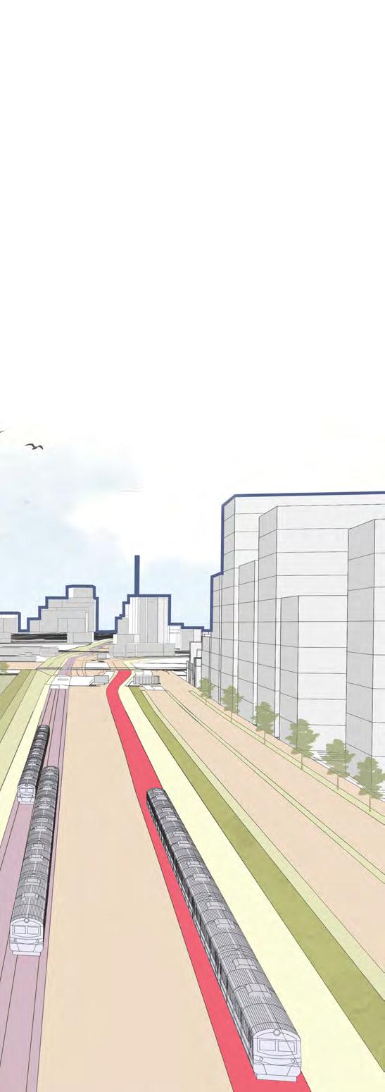
Valueadded byproducts
-Nutraceuticals
-Cosmetics
-Nutraceuticals
-Animals feed
-Bulk chemicals for fertilizer
Organic Waste
CO2
1 ton/yr
INCREASING MARKET VALUE
Power Plant
47% of Spain’s chemical production comes from Catalonia, where the Barcelona Metropolitan Region hosts production,work,contextual knowledge and infrastructure. This clustering creates an agglomeration economy, providing better access to goods and skilled workers which companies need. Within this established chemical production system, our proposal integrates a network of microalgae hubs-sites with production, education, research and development, and offices.
Barcelona Metropolitan Region
Local chemical production system
Barcelona Metropolitan Area
Proposed network of microalgae hub-sites
Factors for selection
Sites for economically viable microalgae production
According to a study, the elements for site selection are:
1.Located close to stationary sources of CO2 emissions, for eg. thermoelectric power plants.
2.Daily solar radiation (annual average) greater than
4 kWh/m2 /day or 5200 MJ/m2 /year.
3.More than 6 h of daily sunshine, by annual average.
4.Approximate range of 10 km from the coast.
5.Outside reserves, protected areas and wetlands.
6.Close to ports or railways. 7.Accessible from roads.
8.Slope of less than 5%.
Vision for pilot site Carbon sink “Live-Work-Innovate”lifestyle in 2050
LIVE/WORK CREATE/WORK STUDY RESEARCH INVESTIGATE SHOPPING COMMERCE PUBLIC TRANSPORT BIKE PLAY INTERACT PRODUCE WALKABLE Site Factory Retail Education Govt assn R&D
livingfilter//
CONSERVATION
PROXIMITY TO MOB L TY INFRASTRUCTURE <5% SLOPE REQUIRED STATIONARY SOURCE OF CARBON DIOXIDE SOLAR RADIATION > 4 KW/SQ.M/DAY BARCELONA AVG 4.12 REDUCED DEPENDENCESEAWATER ON FRESHWATERSOURCES
ZONE OUT OF CONSERVAT ON ZONE WITHIN 10 KM OFF THE COAST
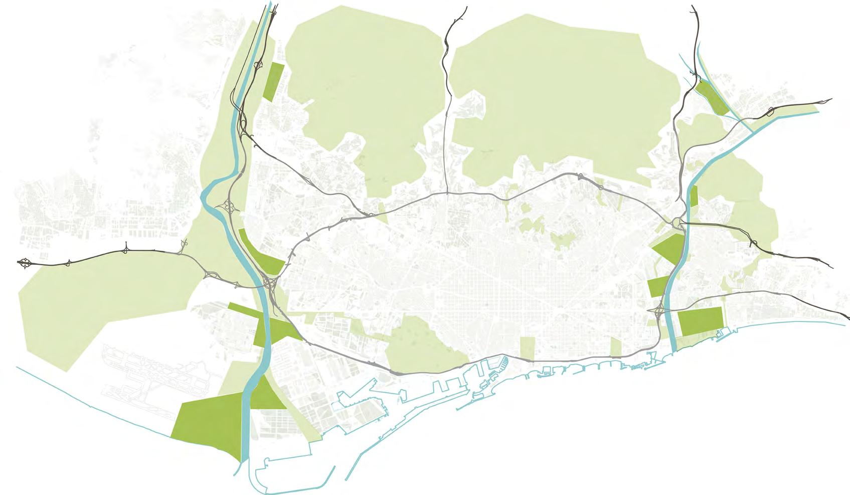
Existing potential microalgae hubs
Stationary CO2 sources near rivers
Greenery links ‘live-work-innovate’ sites
Existing mobility ties the sites to chemical industry
Barcelona City Scale
Urban network of CO2 sequestration
Urban green Atmospheric CO2 absorption
Existing built fabric
Atmospheric CO2 absorption
microalgae panels
The site sequesters 108,754 CO2tonnes anually
Microalgae HUB
Industrial CO2 feed
microalgae panels closed production
2 km
11kg/m²/yr
absorption 0.1-0.49kg/m²/yr
40kg/m²/yr
CO2 absorption
CO2
CO2 absorption
//viabilitystudy
METROPOLITAN HUB “LIVE-WORK-INNOVATE”
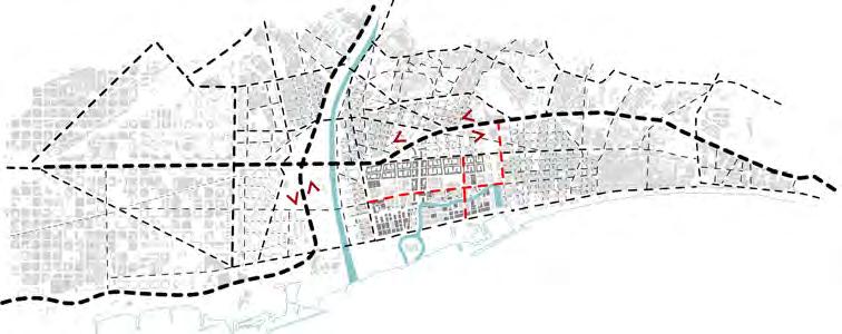
Located in the municipalities of Sant Adria de Besos and Badalona, the site is a vision for the area where urban day-to-day functions, ecology and microalgae production co-exist in harmony. A large estuarine wetland with a soft shoreline shares the space with the Three Chimneys, a landmark readapted into the area’s cultural magnet. Production functions are integrated across the site, with complementary programs; this increases efficiency and economic opportunities.
Mobility network
Wetland system absorbs 0.12 kg CO2 /m²/yr
Urban Parks absorbs 0.4 kg CO2 /m²/yr
River park + other urban green absorbs 0.016 kg CO2 /m²/yr
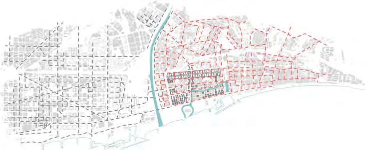
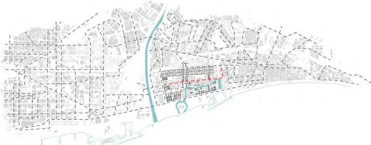
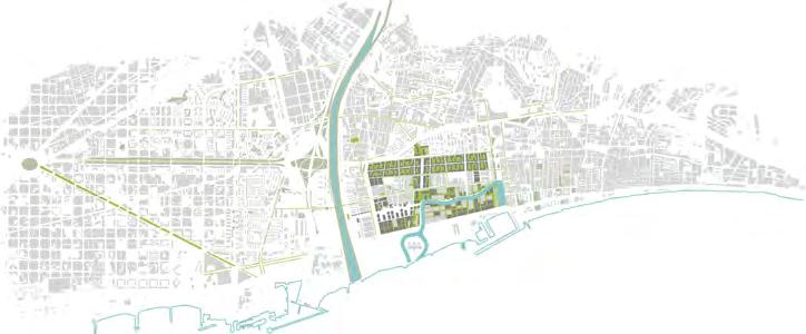
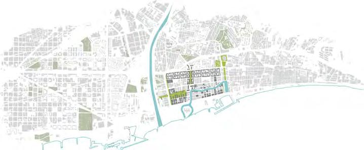
Train, metro, tram network
Bus transit network
Bicycling network
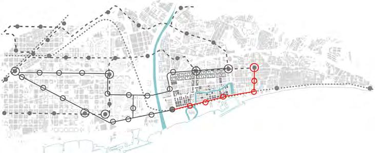
EXISTING PROPOSED EXISTING TRAIN EXISTING METRO EXISTING TRAM PROPOSED TRAM EXISTING BUS PROPOSED BUS EXISTING CYCLE PROPOSED CYCLE livingfilter//
MOBILITY
Being adjacent to Barcelona city, the study area is at the fringe of the various networksof transport. The means of transport include regional rail, metro transit, tram transit, bus transit, and cycling network. While a minority are in close proximity to the regional rail stations, the majority of the residents rely on proximity to bus stops. The proposal improves the mobility networks, mainly increasing the tram network and the bus system in the car-lite design site.
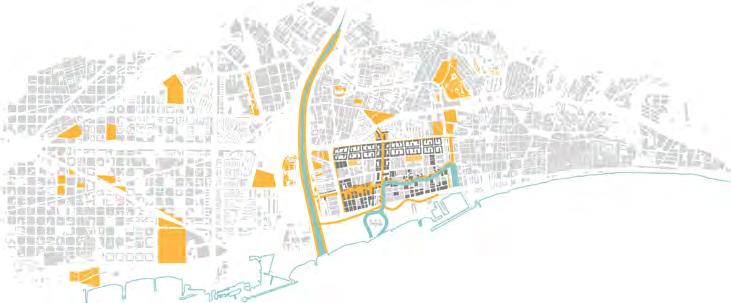
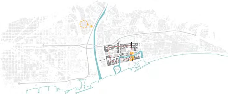
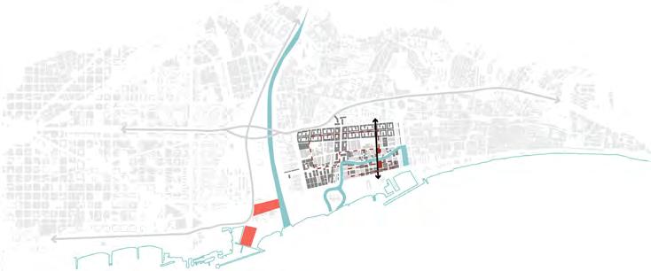
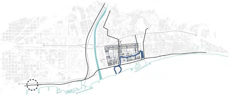
METABOLISM
Local routes for water distribution, goods distribution, waste collection and energy system on-site are integrated into the municipal systems. An Elevated-Goods-Mover System (EGMS) is proposed for the collection of biomass and the distribution of commercial goods.
PUBLIC SPACE NETWORK
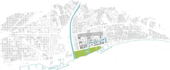
The network of public space offers recreational amenities and facilities, thus lending a local,metropolitan significance to the proposal in addition to its regional vision.
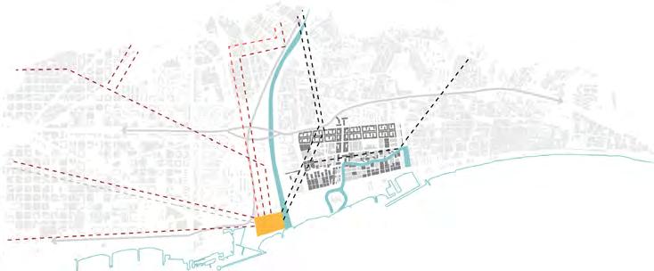
Municipal energy distribution system
Ground Mover System
system
system PRODUCTIVE USE WATER SUPPLY MUNICPAL WATER TREATMENT PLANT LOGISTIC STREET MUNICPAL WASTE ECOPARKS ON-SITE WASTE COLLECTION ROUTE ON-SITE WASTE COLLECTION POINTS LOGISTIC STREET ON-SITE EGMS COLLECTION ROUTE ON-SITE EGMS COLLECTION POINTS 66KV 110KV 220KV REROUTED INFRAESTRUCTURE COMBINED CYCLE POWER PLANT //urbanarmature
Elevated
Waste management
Water distribution
Public space network
DESIGN SITE INTERVENTION

The design of the the urban commercial Badalona marina
The local green C40 Cities measures as carbon sinks (C40 The proposal envisions the Three Chimneys.
MEDITERRANEANSEA M RESIDENTIAL CONTEXT BA D A L ONA MA RINA BESOS RIVER LOCAL GREEN CORRIDOR PRODUCTIVE ESPLANADE UC L TURALTRAIL C O M MER C IAL SP I N E TO BADALONA BARCELONA CITY SANT ROC MRT EXISTING INDUSTRY SANT ROC MRT livingfilter//
1 Adaptive reuse of existing warehouses for microalgae production.
2 Urban green linkage from River Park to Badalona Marina.
3 Seawater canal passage to Badalona Marina for production use.
4 Designing multiple axes and scales of public space.
CONCEPT PLAN DESIGN
PROCESS
INTERVENTION
the main axes across the site lends each edge a different character: commercial spine acts as a gateway into the site; the vibrant production esplanade includes canalfront public spaces and recreational amenities all the way from the existing marina until the Three Chimneys.
corridor includes campus spaces that spill over to the neighbouring residential context, thus providing a connection from the marina to the River Park through the site. measures carbon-positive developments by a quantifiable unit: climate-positive credits. A way to earn these credits is to create or preserve on-site parks and green spaces (C40 Cities, 2016). The hierarchy of public green spaces in this proposal is thus developed according to the potential of atmospheric carbon dioxide sequestration. envisions a metropolitan-scale “landmark” green urban space for the residents of Sant Adria de Besos, with a major green spine that connects the Badalona marina to Chimneys. The proposal also improves the permeability of the site, with significant spaces like the wetland being 100% permeable, to decrease surface-water runoff.
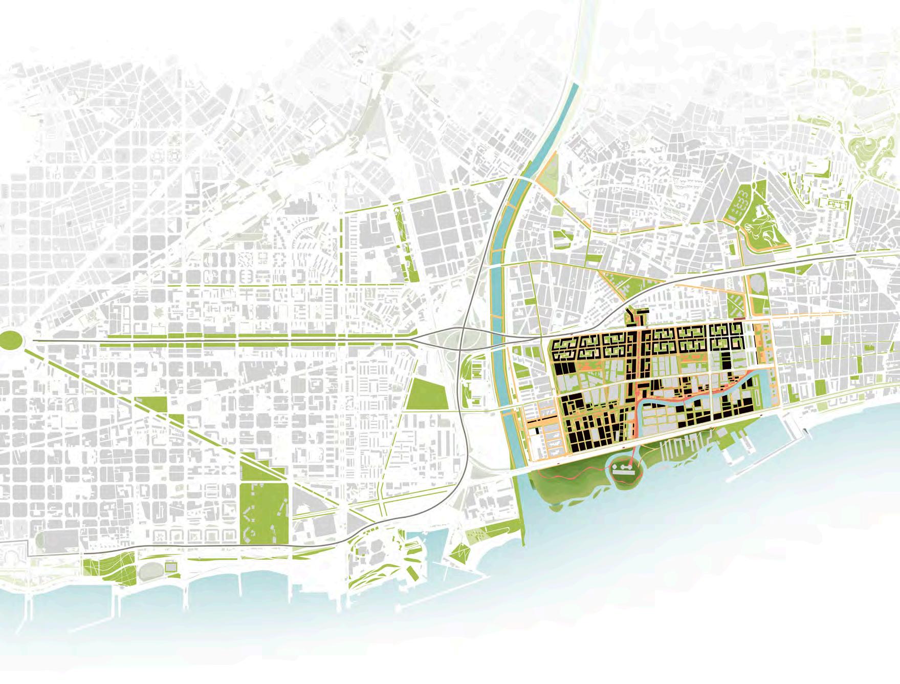
//designintervention MASTER PLAN
500m
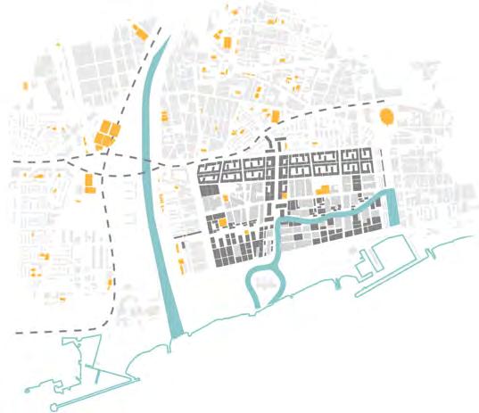
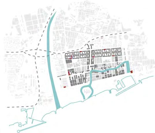
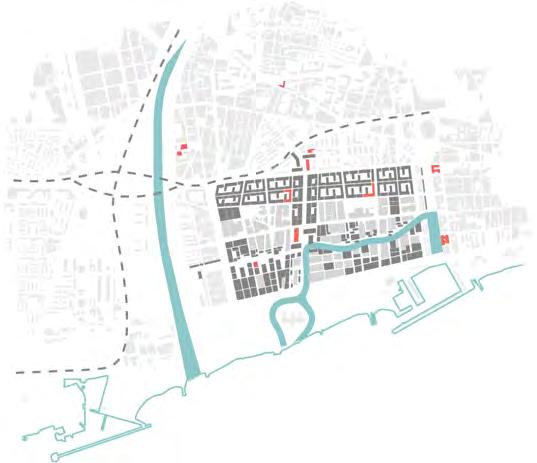
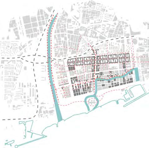
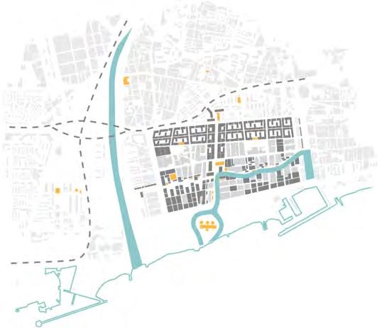

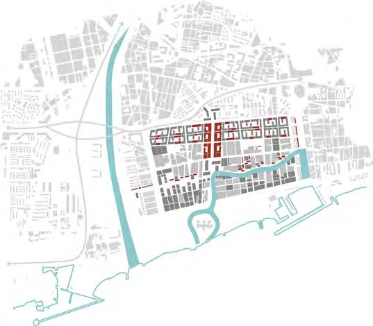
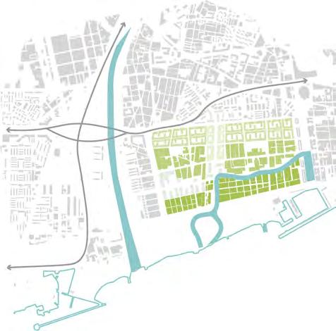
facilities Social welfare facilities
facilities Educational facilities Healthcare facilities Retail location GFA Percentaje of production use Zoning PRODUCTION EDUCATIONAL OFFICE/R&D RESIDENTIAL livingfilter// Pedestrian system
Sports
Cultural
ZONING STRATEGY

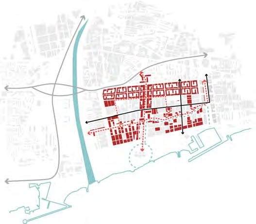
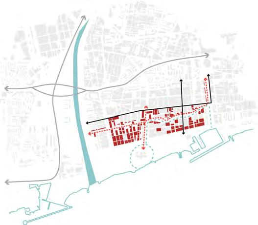
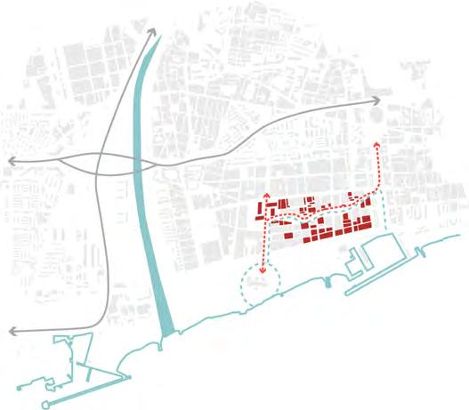
The zoning plan indicates a strategy integrating production uses across the site, with educational uses and o ffice uses along major axes of the site. In linking these crucial functions together in a considered, resilient, and non-exploitative way, vitality and local value can be brought along the corridor that extends from the River Park to the Badalona Marina.
FACILITIES DISTRIBUTION
The proposal significantly increases residents’ accessibility to basic facilities, thus improving their standard of living. 33.8% of the total land parcel area is dedicated to facilities alone, which are consciously distributed in the design site. Notably, they are also distributed along the urban commercial spine leading up to the Three Chimneys and affronting the district park spaces near the residential quarter of the site.
PROPOSAL ANALYSIS

LAND DIVISION
CONCLUSION
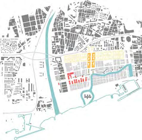
The proposed wetland (counted as protected ecological area) increases the total area of systems significantly, barring which, the proportion of total systems to total zones is 56.5% to 43.5%.

2030
2040
2 2050 Phase 3
Phase 1
Phase
100% 75% 25% 20% PRODUCTION EDUCATIONAL OFFICE/R&D RESIDENTIAL BUILT FORM DATA Plot ratio 2.8 Net plot ratio 5.9 Total GFA (m2) 1,776,206 Existing housing units 1500 Modified housing units 2115 Proposed housing units 4037 Total housing units 7652 Housing density 37 h.u/ha Population 19895 Population density 97.5 /ha
TOTAL AREA (ha) 204 ha SYSTEMS (m2) Street system area 260,117 12.8% Public spaces area 391,380 27.9% Protected ecology area 582,923 41.7% Monofunctional facilities 146,887 7.2% Other systems area 16,898 0.8% Total Systems 1,398,205 68.5% ZONES Solely Residential area 45,434 2.23% Solely Commercial area 0 0% Solely Office area 0 0% Solely Production area 272,594 13.4% Mixed-use area 310,781 15.2% Total Zones 628,809 30.8% v Total Zones and Systems 204 ha 100% //urbanapparatus
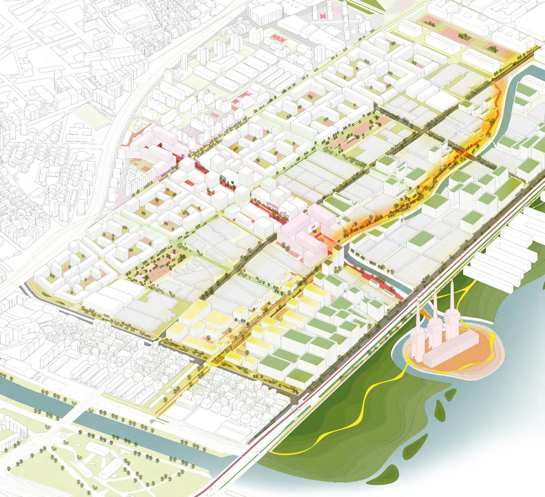
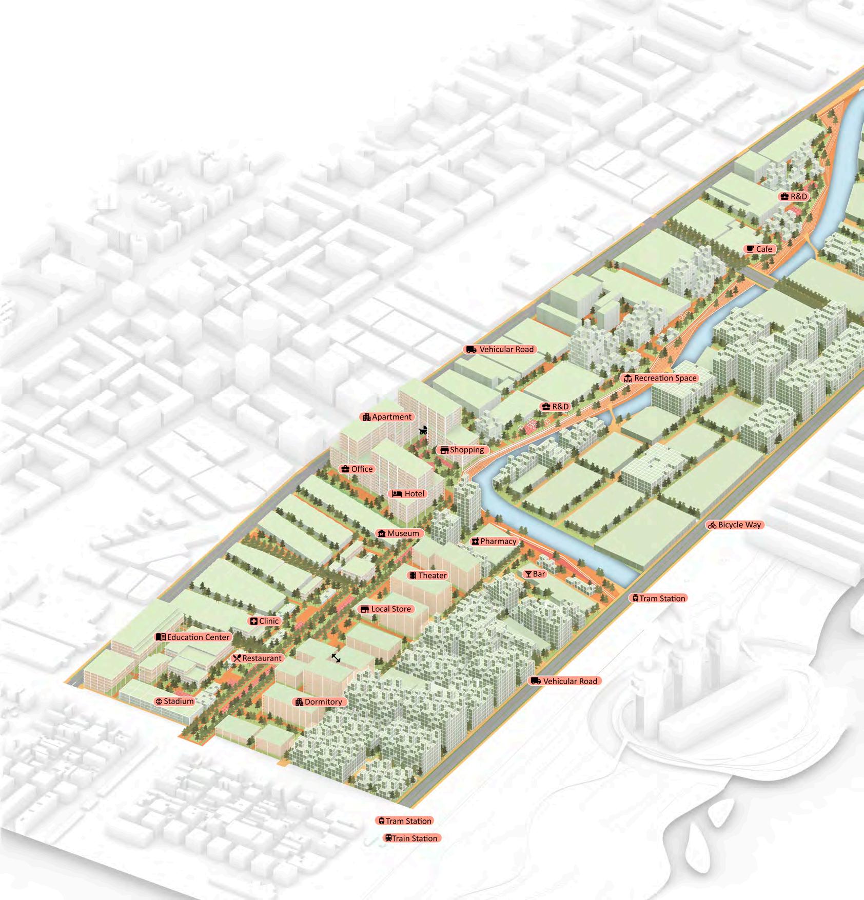
AXONOMETRIC MASTERPLAN livingfilter//
MICROALGAE HUB “LIVE-WORK-INNOVATE”
The proposal, as a hybrid car-lite production hub in Sant Adria de Besos acts as a regional ‘carbon sink’ and a metropolitan growth catalyst accommodating residences, offices and facilities in a high-density compact urban model.

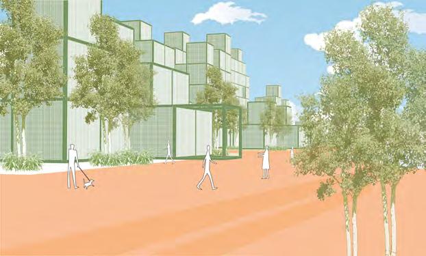
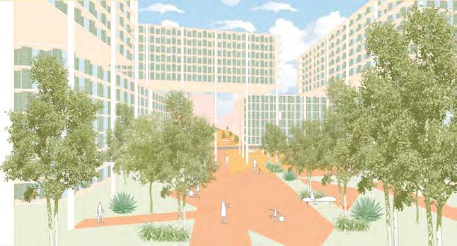
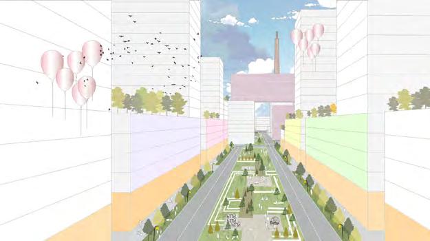
The real innovation of the design is rooted in its attitude toward the site’s positives: the landmark Three Chimneys and the existing fabric, while integrating environmentally and economically sustainable production uses within a layer of vibrant public spaces and green. To tackle the primary issue of the municipality of Sant Adria de Besos, an urban “listlessness” due to being adjacent to Barcelona city, one of the strategies, the development of a water canal - was for productive purposes as well as for public recreational canalfront spaces, thus serving as an urban magnet complimenting the landmark attention of the Three Chimneys.
MASTERPLAN 200m
//placemaking
COMMERCIAL SPINE TYPOLOGY
The typology fronts the urban commercial spine, framing a major gate into the site. It is a vertical mix of office, hotel, residential uses with retail in the ground floor. With the canal as the source, water is distributed for productive and domestic use within the site. An elevated goods mover system ensures the distribution of commercial goods and collection of biomass. Solar energy is tapped into for productive uses, and can supplement the grid for energy purposes.element, the canal, lends vitality to many recreational spaces and for efficient productive uses.
5908.35 10%
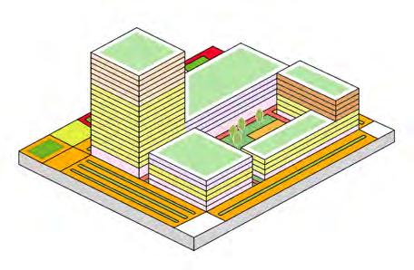
PERMISSIBLE BUILDING BIOSWALE FACADE TREATMENT: MICROALGAE PANELS VEGETATION USE: MICROALGAE URBANCOMMERCIALSPINE PRIMARY PUBLIC SECONDARY PUBLIC SPACE SEMI-PUBLIC SPACE COMMERCIAL USE (HT. 6M) HT. 60M) HT. 18M) 36 36 Public space Private space Hotel Retail Facilities Residential Production Office/R&D livingfilter//
GROUND PLOTLINE EXTENT OF VEHICULAR
Unit
Total
Residential
Commercial
Hotel
Facilities
Total housing
Housing
Population
Population
Built up space (m2) 5142 74.9 Open spaces 1745 25.1 Spaces for vehicles 0 0 Parking space 0 0 TOTAL 6887 100%
area (ha) 0.6889 Plot ratio 5.7
GFA (m2) 39,389 GFA per use (m2)
5120.57 13% Office 11816.7 30% Production 8665.58 22%
7877 20%
0 0%
units 39
density 56.6 h.u./ha
102
density 148/ha
VEGETATION
RESIDENTIAL LIVE-WORK-INNOVATE TYPOLOGY
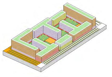
The typology is in the residential quarter of the site. It includes hybrid residential and production use spaces, to fulfill our vision of “day-to-day living with industry in 2050”.
FACADE TREATMENT: MICROALGAE PANELS
USE: MICROALGAE PRODUCTION
Unit area (ha) 2.1689
Plot ratio 3.9
Total GFA (m2) 85245.8
GFA per use (m2)
Residential 38360.6 45%
Commercial 8524.58 10%
Office 8524.58 10%
Production 21311.45 25%
Facilities 2131 0%
Total housing units 426
Housing density 196.4 h.u./ha
Population 1108
Population density 510/ha
Built up space (m2) 11268 51.9
Open spaces 10421 48.1
Spaces for vehicles 0 0
Parking space 11268 -
TOTAL 35088 100%
SECONDARY PUBLIC SPACE
PLOTLINE
HT. 30M) H 21M) 10M 10M HT M 57M 30M
PERMISSIBLE BUILDING ENVELOPE EXTENT OF VEHICULAR STREET GROUNDFLOOR
SPACE
PRIVATE
//guidelines + typologies
Public space Private space Hotel Retail Facilities Residential Production Office/R&D
PRODUCTION ESPLANADE & LOCAL GREEN CORRIDOR
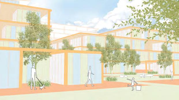
The production esplanade and green corridor project is a major axis through the site, connecting the River Park and the Badalona marina, and affronts a majority of the proposed canal. It will function as an important public space for the entire municipality, with the production uses providing many jobs. Moreover, It will serve as a thriving urban spine for Sant Adria de Besos.A nexus for production work as well as public recreation, campus spaces, research and development spaces and retail.
To tackle the urban “listlessness” of the municipality of Sant Adria de Besos, the proposal’s central element, the canal, lends vitality to many recreational spaces and for efficient productive uses.
100m livingfilter//
BUILT FORM DATA Plot ratio 2.8 Net plot ratio 5.9 Total GFA (m2) 1,776,206 LAND DIVISION TOTAL AREA (ha) 63.3 SYSTEMS (m2) Street system area 29,638 8.9% Public spaces area 167,554 50.2% Facilities area 61,325 18.4% Canal system area 37,058 11.1% Other spaces area 38,038.6 11.4% Total Systems 333,672 52.7% ZONES Solely Residential area 0 0% Solely Commercial area 6507 0% Solely Office area 0 0% Solely Industrial area 114,341 13.36% Mixed-use area 178,480 15.23% Total Zones 299,328 47.3% Total Zones and Systems 63.3 ha 100%
HOTEL FACILITIES
RESIDENTIAL EDUCATION
OFFICE/R&D COMMERCIAL PRODUCTION
INTEGRATION STRATEGY
EXISTING BUILDINGS
PREDOMINANT PRODUCTION
PREDOMINANT RESIDENTIAL
PREDOMINANT EDUCATION
REMOVED OBSOLETE BUILDINGS
EXISTING BUILDINGS PROPOSED BUILDINGS
ADAPTIVELY REUSE BUILDINGS INFILL NEW BUILDINGS +ACTIVITIES
FOOTPRINT

CANAL GREEN SPACE PUBLIC SPACE VEHICULAR
PROPOSED BLOCK //specialproject
Facilities
ANALYSIS
Vehicular network Public space network Green network
SPATIAL
CONTACT mail: raggioarch@gmail.com phone: +34 601043419


 Dynamic Pedestrian Spine
A-A´ B-B´


 Click to watch the video of the project


