6 minute read
Wendland and Elbe Valley


16 BACKGROUND OF THE TERRITORIAL PORTRAIT The Focus Region is located in the south-east of the Hamburg Metropolitan Region and along the Elbe, Germany‘s third-largest river and an important asset for the region. In addition to the connection to Hamburg, the connections to Berlin and Magdeburg represent an important potential. The Elbe always represented a fracture between the two different territories. On the one hand, this was due to the barrier effect of a dynamic large riverbed and the resulting lack of crossing lines, and, on the other, to the connection of the districts north and south of the river to different regional cultural areas (Mecklenburg- Schwerin and Hannover, respectively). In addition, the Elbe in this area was the border between East and West Germany from 1945 to 1990. This has strengthened different regional characters of the territories, which have remained spatially and socially quite diverse up to today.
ECONOMIC AND SOCIAL CHARACTERISTICS Lüchow-Dannenberg. For this district a population decline of up to 20% (2009–2031) is predicted.8 Recently, however, one can speak of a stabilisation of population figures: in 2015 a net increase of +1,400 in the district has been noted, with a net increase of 1,798 of movements into the district that exceeded the natural decrease.9 The district of Lüchow-Dannenberg is characterised by very low economic strengths and high risks, if compared to the rest of Germany. 10 The unemployment rate in 2015 has been 8%.11 The number of commuters coming into in the district was 26.0% of all employees in 2016, and the number of outgoing commuters was 35.5% of residents. The economy of the district has so far not been significantly influenced by tourism, with about 260,000 overnight stays in 2015.13 A potential for tourism is especially recognised in the Elbe floodplains.14 The rural character, the cultural heritage (also supra-regional events such as the Kulturelle Landpartie), and the built heritage constitute a potential focus for regional development.
Advertisement
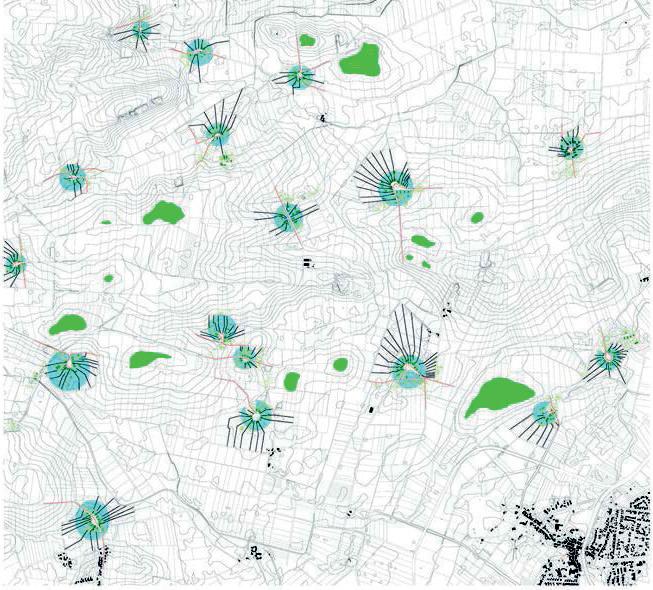
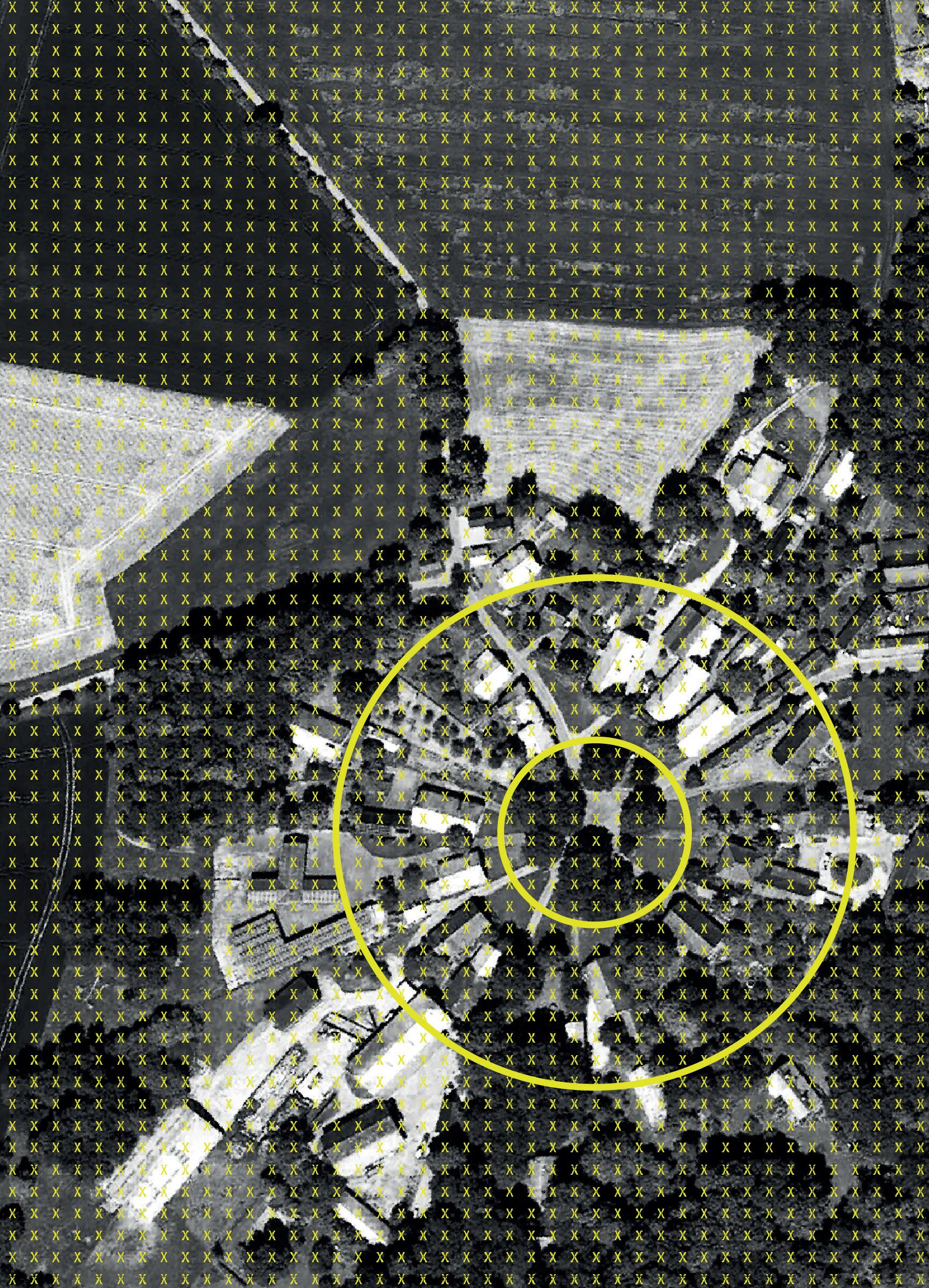
SETTLEMENT AND BUILDINGS STRUCTURE Wendland The Wendland is characterised by the settlement and fields forms of round hamlets (Rundlinge), that in the thirteenth century were systematically settled. The typical hall houses are arranged in a round form around the green common area at the centre of the hamlet. Today, more than a hundred Rundlinge still exist in the region. The transformations that have been triggered by alternative thinking in regard to the concentration and industrialisation in agriculture have set new regional impulses since the 1970s in the fields of culture, regional production, and crafts. The centres in Wendland (Lüchow and Dannenberg) concentrate today supply functions, trade, and industry, with appropriate monofunctional building structures and extensions of housing development areas. They also take over the function of regional main gateway for incoming commuters.
Elbe Valley The set of settlement structures and the cultivation of the landscape were associated with the Elbe floods, with the fertile alluvial soils and the transport options along the river and in the Geest areas. Terp villages (Wurtendörfer) created on artificial dwelling mounds and row
// WENDLAND AND ELBE VALLEY
Jörg Schröder, Maddalena Ferretti
villages (Reihendörfer) are documented since the thirteenth century. The towns Hitzacker, Dömitz, and Gartow were characterised by fortifications. The protected historical cores have been transformed by settlement extensions.
LANDSCAPE AND NATURAL SPACE The Elbe is Germany’s third-largest river and one of the last semi-natural rivers in central Europe. Other important space-defining factors in the region were and are transport and energy generation. The Geest areas differ in landscape between Griese Gegend (sandy, nutrient-poor soils, high forests and moors) and Wendland (Lüchower lowland with Geest terraces with
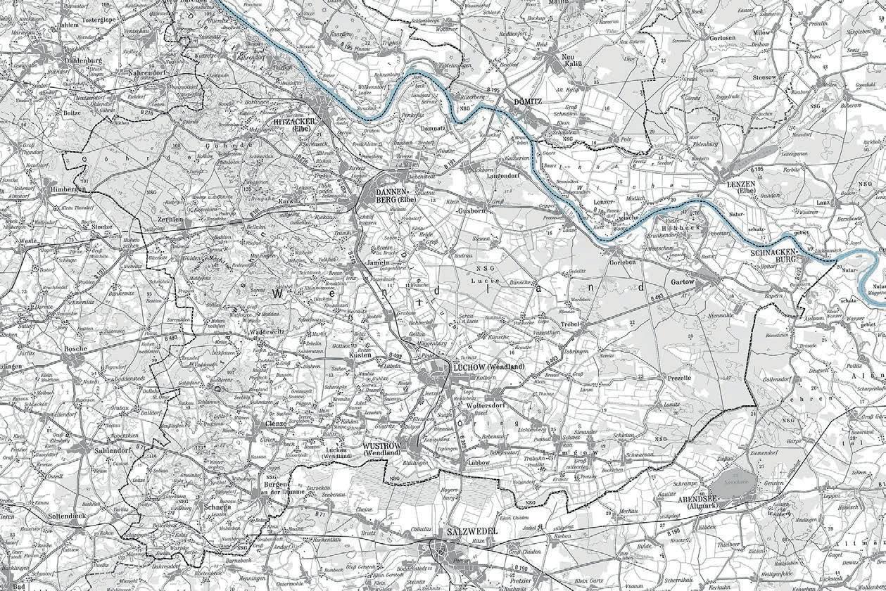
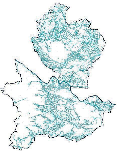
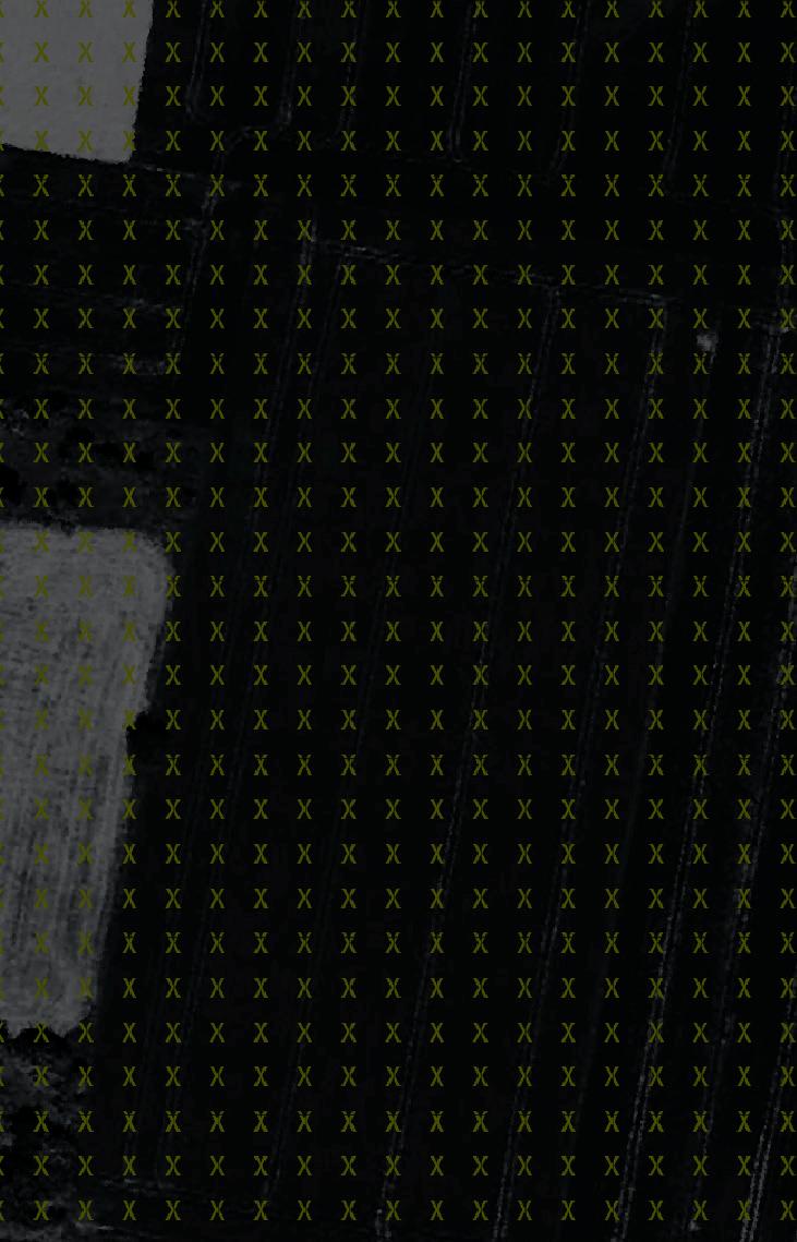
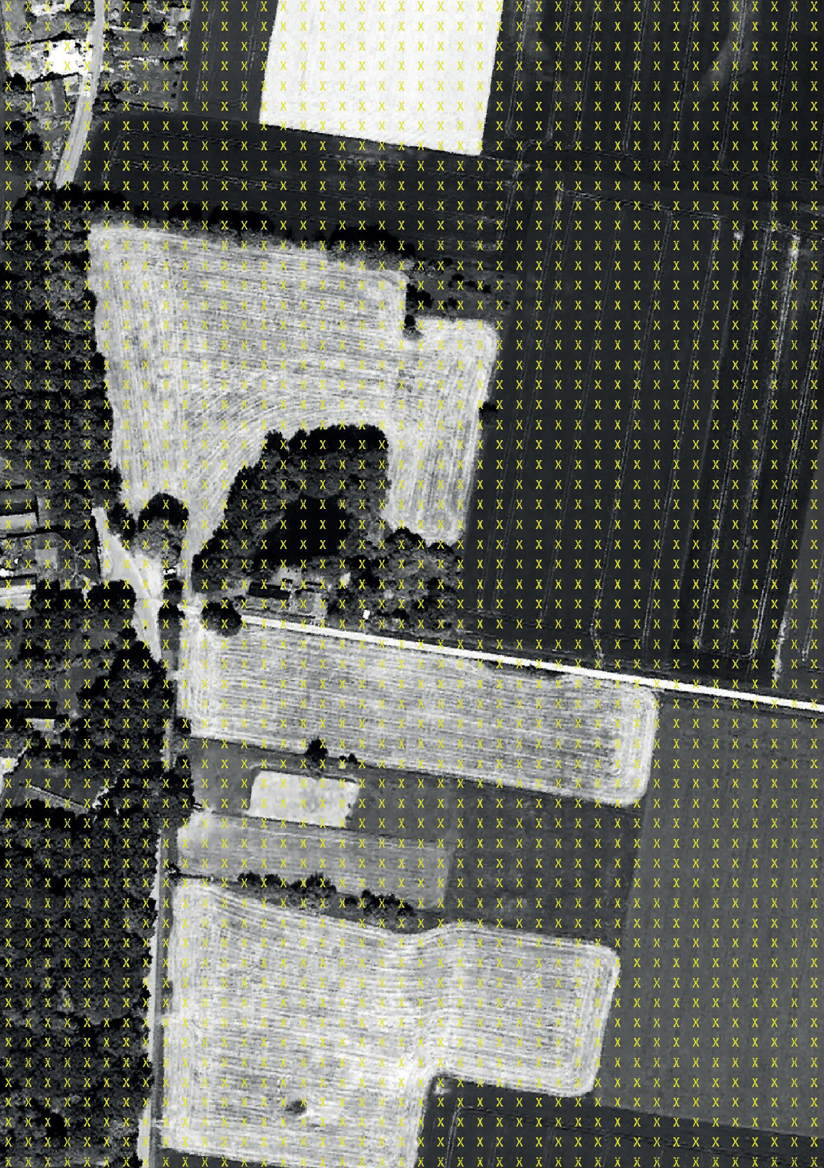
Overview map of Wendland and Elbe valley Rundlinge settlement and landscape structure, near Satemin. Map by Lorena Hyso and Charlotte Regier, in: Schröder/Ferretti (2018)
Scenarios and Patterns for Regiobranding. pp. 159. INTRODUCTION
17
18 more fertile soils). The agricultural and forestry structures in the north and south of the Elbe are characterised by different soils and water conditions, but also, historically, by different land reforms: collectivisation versus land consolidation (Flurbereinigung).
INFRASTRUCTURE The entire Focus Region is disadvantaged in terms of broadband Internet connectivity; sometimes there is no connection at all. Renewable energy is seen as a potential development priority. Energy storage and energy efficiency in existingbuildings have a research, development, and implementation deficit. In general, the regional diversity in terms of resources (water, forestry, agricultural production and biomass, wind power, solar energy) is a relevant potential. The Elbe and the ElbeMüritz-Channel can provide cross-regional, and in particular touristic, connections. Too few are the Elbe crossing possibilities (bridges, ferries etc.). Public transport has also deficiencies. A connection to the European rapid transit network is provided in Ludwigslust (with rapid trains to Hamburg and Berlin). A motorway connection for the Ludwigslust-Parchim area is the A24 (to Hamburg and Berlin) and the A14 (to the Baltic Sea or Magdeburg).
SPATIAL PLANNING DEFINITIONS Griese Gegend (with Flusslandschaft ElbeMecklenburg-Vorpommern). The district Ludwigslust-Parchim is defined as a rural region. In the part included in the Focus Region, Ludwigslust is a mid-sized centre, Dömitz and Lübtheen are small centres, Eldena and Neu-Kaliß rural centres.
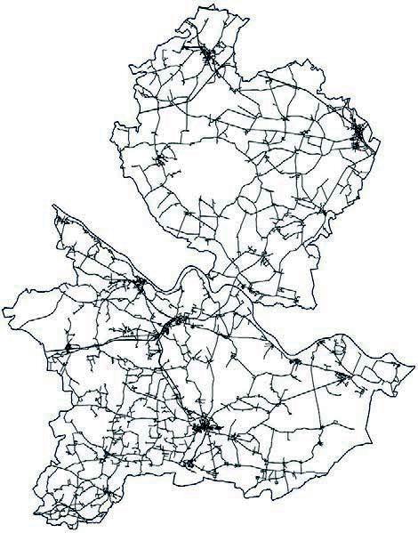
Networks of streets
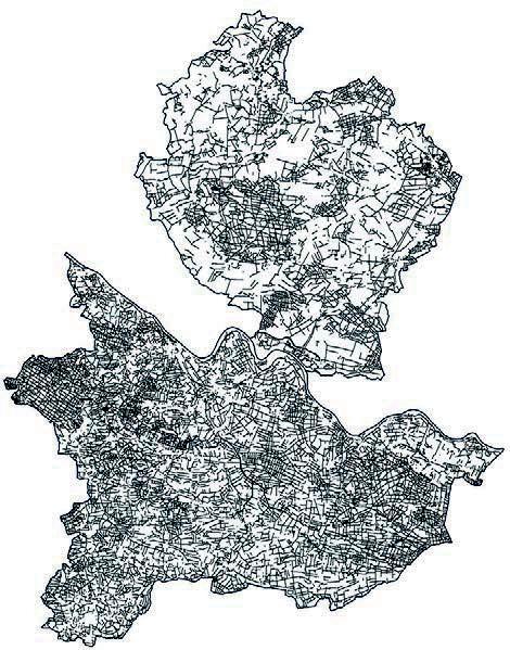
Networks of pathways
Wendland (with Niedersächsische Elbtalaue). The district of Lüchow-Dannenberg is defined as a rural region. In the part included in the Focus Region, Lüchow is a mid-sized centre, Clenze, Dannenberg (Elbe), Gartow, Hitzacker (Elbe) and Wustrow (Wendland) are small centres.
SPATIAL PLANNING FRAMEWORK The planning framework for the Focus Region is multilayered and of formal as well as of informal character. Griese Gegend (with Flusslandschaft Elbe-Mecklenburg-Vorpommern). State spatial development plan of Mecklenburg-Vorpommern (2005); regional plan Westmecklenburg (2011); the structural plans and specified plans of the municipalities; area development plans and statutes in the field of urban and villages renewal, ISEK, and ILEK; regional development plan A14 (only for parts of the Focus Region); plan for the biosphere reserve Flusslandschaft Elbe Mecklenburg-Vorpommern (only for parts of the Focus Region); integrated rural development strategy for the district Ludwigslust Parchim (2015).
Maps:
© Regionales Bauen und Siedlungsplanung LUH,
data based on © Geobasisdaten ATKIS BasisDLM, LAIV-MV, LGLN,
2015 Networks of channels and rivers INTRODUCTION
19
The FRINGES Urban Design Studio adopts a qualitative and quantitative approach in research and design, with the elaboration of many data analysis, surveys and interviews. The studio is structured in three phases, mainly focused on the literature and international case studies analysis, the exploration of the site and the projects elaboration. The structured methodological approach leads to a scientific research oriented and responsible design and development process.
Das Studienprojekt FRINGES verbindet qualitative und quantitative Forschung und Entwurf, es bereitet Daten, Feldforschung und Interviews analytisch auf. In drei Phasen werden zunächst Konzepte aus theoretischer Literatur und internationalen Referenzprojekten gewonnen, dann wird der Kontext erschlossen und schließlich Projekte entworfen und entwickelt. Dieser strukturierte methodische Ansatz ist Vorraussetzung für einen forschungsorientierten und verantwortlichen kreativen Entwicklungsprozess.
METHODOLOGY
22
Discussion with Nicole Servatius at PostLab Lüchow // Alissa Diesch


