ISSN 2348-313X (Print)
International Journal of Life Sciences Research ISSN 2348-3148 (online)
Vol. 8, Issue 2, pp: (62-73), Month: April - June 2020, Available at: www.researchpublish.com

ISSN 2348-313X (Print)
International Journal of Life Sciences Research ISSN 2348-3148 (online)
Vol. 8, Issue 2, pp: (62-73), Month: April - June 2020, Available at: www.researchpublish.com
Abstract: The topic of the study was: Water Quality Assessment in the Gippsland Region, case study Snowy River and compare it with Tambo River. This analytical study was conducted on two rivers of different characteristics due to the difference in geographical location between them. Four different sample areas were identified at upstream and four other locations at downstream of the estuary, to assess water quality. Data were collected to determine the quality of river water through the use of three main methods, as follows: The chemical readings of the YSI360 to extract water temperature, dissolved oxygen, electrical conductivity and ph. In addition to the HI98703 device to measure the turbidity of water. Finally biological analysis of samples. It has been observed that the study in both sites have different natural properties that are closely related to the water condition that affected the water quality in both places. The results of the water quality indicators measurements show constant numbers, especially the temperature and turbidity level, which indicates that the River contains an indication of its quality. The results of this study also indicate that Site 1 contains fair water with greater diversity in terms of relative biological richness. Site 2 contains results showing good water quality ratings. However, the measurement values were significantly higher than at site 1, with biomarkers relatively low compared to site 1. Human activities such as agriculture and grazing of cattle have reduced the layer of plants, especially the area near the site 2. This excessive exploitation of land in the region contributes to a lack of vegetation and increased waste in the area, which makes recovery difficult if these activities continue at site 2. It is worth noting that Site1 has a vegetation range, which has contributed to the diversity of water components unlike Site 2, which is characterized by sand components due to a large loss of vegetation.
Natural characteristics vary between Snowy and Tambo rivers due to their geographical locations. The significant difference between snowy River and Tambo River is that the Tambo values are generally higher than the Snowy River, except for the DO and Turbidity level. Snowy and Tambo have faced deterioration due to human activities such as agriculture and mining that have added burden to both rivers.
Keywords: Water Quality- Water Monitoring- Water Assessment – Water Chemistry- Aquatic Micro Organisms.
This study aims to determine the level of water quality in the most important rivers of the Gippsland region, using modern technology to identify the natural features of the Snow and Tambo rivers.
Site 1:
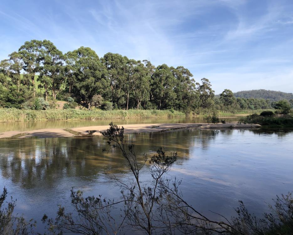
The first site of sampling is located at the upstream of Snowy River. The coordinate of this site were 37°67’70’’S, 148°37’91’’ E. According to the range finder, the channel width is 141.3m and stream width is 100m. 90% of sand and 10% of clay formed the river bed. The stream habitat was estimated by visualisation to be approximately 90% riffle/run and 10% pool with a slow current velocity in the reach. The depth of Site 1 had been measured in the riffle/run area of
ISSN 2348-313X (Print)
International Journal of Life Sciences Research ISSN 2348-3148 (online) Vol. 8, Issue 2, pp: (62-73), Month: April - June 2020, Available at: www.researchpublish.com
31cm. During the sampling, 10%-35% of Filamentous algae observed in the riffle/run area. Moreover, 1-10% of moss, macrophytes had been found. On the edge area of the reach, less Filamentous algae than the riffle area. Also a small proportion of leaf packs, logs had been found.
The land is mostly cleared and used as grazing further away from the riparian zone of site 1. The upstream of Snowy River has native forest on both left and right bank with steep slopes. Due to visual approximation, 20m of riparian zone on the left bank with occasional clumps of vegetation and 10m of riparian zone on the right bank with semi-continuous vegetation. On the left bank, 20%-50% are shrubs, bushes and ground covers. Less than 20% of trees were observed. Furthermore on the right bank, we have found 20-50% trees, 50%-80% shrubs and more than 80% ground covers. On both sides of riparian zone of site 1, ground covers take the greatest proportion than shrubs and trees.
Site 2:
The second site of sampling is located at the downstream of Snowy River. The coordinate of this site were 37°69’93’’S, 148°39’62’’E. According to the range finder, the channel width is 84.5m and stream width is 45.6m. 70% of sand and 30% of clay fo rmed the river bed. The team visually observed the stream habitat, it is approximately 90% riffle/run and 10% pool with a slow current velocity in the reach. The depth of site 2 had been measured in the riffle/run area of 17cm. From the sampling, 10%-35% of loose silt on the substrate observed in the riffle/run area. Furthermore, 1%-10% of Filamentous algae and Macrophytes had been found. On the edge area of the reach, more Macrophyte observed than riffle area. Also many trailing bank vegetation exists in edge area.
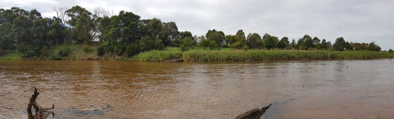
The land is used as grazing and cleared near the riparian zone of site 2. The downstream of Snowy River has native forest on the left bank and native heath/grassland on the right bank. The left bank here is broader than the left bank of site 1. From the visual approximation, 25m of riparian zone on the left back with continuous vegetation and 10m of riparian zone on the right bank with occasional clumps of vegetation. On the left bank, more than 80% of vegetations are ground covers, 50%-80% of shrubs and less than 20% of trees. Furthermore, on the right bank, less than 20% of trees and ground covers, but 20%-50% of shrubs observed. On both sides of riparian zone of site 2, shrubs take the greatest proportion than trees and ground covers.
ISSN 2348-313X (Print)
International Journal of Life Sciences Research ISSN 2348-3148 (online)
Vol. 8, Issue 2, pp: (62-73), Month: April - June 2020, Available at: www.researchpublish.com
Comparison between Site 1 and Site 2
There are many similarities between site 1 and Site 2 since they are from the same river. Such as the current velocity from two sites are slow. The riverbed is both formed by sand and clay. The depth of the two sites are shallow, which results in a high number of invertebrates in both sites. Both sites contain Filamentous algae and Macrophytes and little willow roots in run area. Geographically, the riparian zone of site 1 and Site 2 is different. For Site 1, both banks are native forest with steep slopes. For site 2, there is a riparian zone formed up by native forest on the left bank with a board valley and a native grassland on the right bank. Furthermore, the composition of riparian zone of site 1 and site 2 is different. There are mainly ground covers in the riparian zone of site 2 while shrubs exist the most in the riparian zone of site 2.
Parameters of site 1 and site 2
Parameters Site 1 Site 2
Length of surveyed reach (m) 150 150 Stream habitat in surveyed (%) Riffle 90 Riffle 90 Run 10 Run 10
Mean Stream Width (m) 100 45.6
Mean Channel Width (m) 141.3 84.5
Depth of water (cm) 31 17
Methodology: In this study, two sites of snowy river were visited to determine water chemistry and biological data of water. The distance between each location sampling position was 50m. The consistent and reliable methods were used to examine the health of river in serval ways including the comparison of result with previous year studies. Both sites of snowy river were visited in one day by cohort M. At each site cohort M was divided in four teams i.e. Genoa, Bemm, Cann and thurra and four sampling sites were designated to each team for the measurements of water parameters and invertebrates sampling. In addition, the work was further divided among individuals for water parameter by YSI, turbidity by Hanna HI and kick and sweep sampling. The following physical qualities were observed at both sites.
• longitude and latitude of the sites
• stream and channel width by using range finder
• stream habitat in the form of percentage of riffle/run and pool
• Equilibrate instruments before use
• In-situ water quality measurements using YSI 556 MPS
• On field turbidity by using HANNA HI 93703
ISSN 2348-313X (Print)
International Journal of Life Sciences Research ISSN 2348-3148 (online)
Vol. 8, Issue 2, pp: (62-73), Month: April - June 2020, Available at: www.researchpublish.com
• Take invertebrates samples by using kick and sweep sampling
• On field sorting of samples and storage in appropriate container
• Velocity of water
• Site observations in terms of water odours, water oils, Plume, sediment odours and bare ground
• Erosion at local catchment
• Source of local pollution at the site of sampling
• Use of land on the both sides (banks) of the river
• Categorization of land according to AUSRIVAS
The water chemistry was measured by using YSI 556 multi probe system (MPS). The probe was placed in water few meters away from the riverbank and kept in water for 15-20 minutes for stabilization to take place. After that the following measurements were collected from the YSI screen and these readings were saved to ensure there will be no loss of data and for safety reasons these readings were noted down on paper by each team.
- Temperature (°C)
- pH - Ambient conductivity (µs/cm)
- Conductivity at 25°C (µs/cm)
- Dissolved oxygen (mg/l)
- Alkalinity (mg/l)
Meanwhile, one of the team members took water sample for the turbidity analysis. Because turbidity is not possible with YSI 556, so for that purpose HANNA HI 93703 turbidity meter was used. The plastic bottle and a pole were used to take the water sample for turbidity analysis, the small amount of water sample was poured into a clean and dry cuvette and then this cuvette was placed in turbidity meter. To increase the level of accuracy, three readings for turbidity were taken and noted down on paper.
When the water chemistry was being calculated, the rest of the team members were engaged in taking invertebrates samples by using kick and sweep sampling. Sweep samples were collected gently by sweeping net in water while in kick sampling underwater surrounding substrate were disturbed by kick to extract the hidden organism and sediments and then samples were taken by using net (figure). The net was washed to remove the stick organism from net. After sampling, the sampled data was placed in shallow container, two group members started to sort and collect the different invertebrates’ samples by using 10ml aliquots and plastic spoons in separate labelled jar containing ethanol. Then samples were identified at Bullock island lab.
Alkalinity analysis: It is the acid neutralising capability of water. Alkalinity of water is determined by titration of standard HCL with carbonic acid and Bicarbonate (phenolphthalein) as an indicator. The one sample for alkalinity test was taken from each site and kept in plastic bottles in an esky to avoid any contamination.
Next day, at Bullock island water sample were analyzed for invertebrate and water chemistry. From a team, one person was identifying the water chemistry i.e. alkalinity, nitrogen and phosphorus content. The rest of the team members sorted different invertebrates based on their taxonomic family by using microscope. These invertebrates were placed in different petri dishes and then by picking one sample from each petri dish, these invertebrates were identified by using ―The WaterBug Book‖: A guide to freshwater macroinvertebrates of temperate Australia. This book provided step wise process to identify freshwater macroinvertebrates. After samples being examined, the invertebrate’s family signal score and EPT index were determined. The signal score stands for grade number level while EPT represents sum of Ephemeroptera, Plecoptera and Trichoptera.
ISSN 2348-313X (Print)
International Journal of Life Sciences Research ISSN 2348-3148 (online) Vol. 8, Issue 2, pp: (62-73), Month: April - June 2020, Available at: www.researchpublish.com
During the sampling of two sites at Snowy River, we used two different methods to collect invertebrates. These two techniques are kick sampling and sweep sampling. We performed kick sampling in the riffle area of the river, where the flow is rapid and turbulent. One of our team member hold the net and move to the center of the river. Place the net into the flow and make it face upstream. Slowly walk backwards in upstream direction and kick the substratum to extricate the invertebrates. Once the invertebrates were dislodged, they would be carried into the net by current. Kick sampling takes 5-10 minutes and covering 10m of stream bed.
The sweep sampling was performed at the edge of the stream where the velocity of current was reduced so that we can get different invertebrates from the kick sampling. One of our team members swept the net along the edge of the stream and moving upstream. For sweep sampling, we only focus on the invertebrates around the surface of the river. It covers 10m for the net to travel to obtain a reliable indication of biota.
Table 1: Water quality measurement of Snowy River from four different locations
Parameters
Location1 Location2 Location3 Location4 Site 1 (upstream) Site 2 (Downstream) Site 1 Site 2 Site 1 Site 2 Site 1 Site 2
Temperature C 16.63 20.16 15.93 20.24 16.06 20.21 15.64 19.85 SC s cm 25 C 113 128 123 127 106 123 130 134
DO (mg/L) 8.85 8.54 9.51 9.31 8.63 8.64 8.98 8.65 pH 6.98 7.1 6.96 7.48 6.94 6.96 7.1 7.48 Turbidity 2.79 3.38 0 0 1.34 3.38 0 0 Alkalinity 56 53 40 41 44 40 40 30
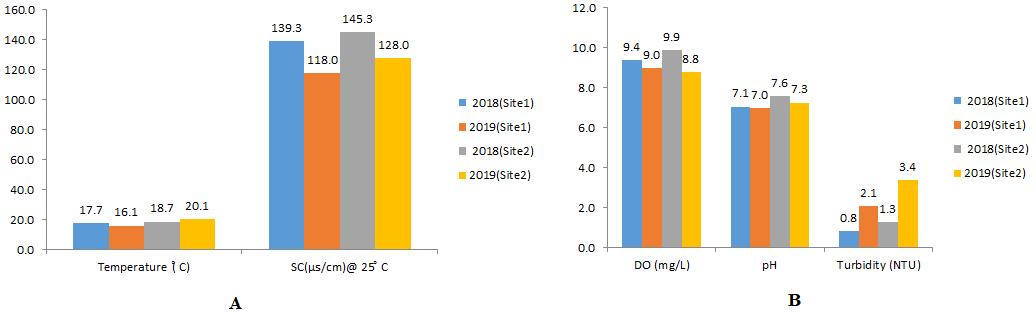
Raw water quality parameters were provided to identify similarities and differences. In 2019, in terms of upstream river (site 1): the temperature for each team was stable within each location among various groups; there was a similarity in temperature values significantly, approximately 16° C. However, in downstream river (site2), the temperature of all members of the Master's students were clearly obvious; more than 3 ° C which the values around 20° C (Table 1). This difference is possibly due to the period time of sampling from the day the measurement was made, as well as the surrounding site's environment. The data has been collected on site 1 early in the morning (approximately 9:30 am), and water temperature measurements and other measurements were taken at site 2 about 2:15 pm. This would allow the water to be heated more by the sun at site 2. What's more, site 1 has more vegetation than the site 2. Site 1 had sharp gradients and a combination of long and dense trees around the river's bank that surround the creek, while Site 2 does not contain almost any surrounding plants to allow abundant of plants, and site 2 is located in a planned flat area where sunlight can easily reach water, which significantly contributes to warming.
ISSN 2348-313X (Print)
International Journal of Life Sciences Research ISSN 2348-3148 (online)
Vol. 8, Issue 2, pp: (62-73), Month: April - June 2020, Available at: www.researchpublish.com
It seems that the water temperatures collected year 2018 was lower than the values of 2019. An approximate increase of 1.3% in water temperature since last at site 1 as well as an approximate 3% increase in location 2. However, this pattern has change considerably in one of the locations last year, which was the temperature higher in site 1 more than site2 (see bar chart1). It is possibly due to the location which the sun is vertical in site1 that time, and the sample area at site 2 for that team contains more vegetation which can prohibit the heat. Thus, the average of temperatures is higher at site 2 than site 1 which may illustrate the distinction in other water indicators.
In general; in year 2019, DO values have almost stable reading among all teams with slightly increase at site1 more than site 2. Dissolved oxygen (DO) has raised site in both sites in 4 locations. Despite the scientific fact that dissolved oxygen decreases with increasing temperature; which means warmer surface water requires less DO to reach 100% saturation than does deeper and cooler water (Daniel et al., 2002). As shown from the data that has been collected from this field study it is possible that a variety of factors are affecting the water condition in and around the two sites, which lead to convert DO levels such as respiration, decomposition, photosynthesis, and other chemical and biological processes (Daniel et al., 2002). Moreover, site 1 has higher values of DO more than site 2, this is probably due to the fact that site 1 has more vegetation than site2 which allow plant to do photosynthesis that is connected to the flourishing of aquatic organisms. Although there is no predicted relationship between temperature and DO in the 2019 results alone, the values compared to the previous study of year 2018, DO has similar pattern of the relationship between temperature and DO (see bar chart1). This clarifies that the temperature effects DO level can takes very long period of time and 2 years is not enough to notes significant impact.
In year 2019 , from the values that have been given SC at site 2 is higher in values than site1 between all locations (see table1). The higher number of SC clarifies that the water has contains too many substances. These conductive ions come from different sources such as organic matters, salt and Do. Based on the obtained data site 2 has more capability to pass electrical current due to the fact that can be largely attributed to the runoff of agricultural land and nearby livestock fields, as well as the active agriculture activities. In addition, the runoff will significantly contribute to loading a variety of nutrients and ions, which will lead to the increase the SC (Hucks et al., 2009). Similar pattern, have been shown in the year 2018 which the SC was high again at site2 (see bar chart.1). This is maybe due to the human activities surrounding site2 which has putted external burden through the flow of the river.
The pH obtained by the 4 groups show that there is no significant difference between site 1 and 2. pH measurement determines whether the water is acidic, alkaline or neutral. In location1 observed an increase of the average 7.4 from sites 1 to 2. In location2 has found that the average between both sites were 7.22. Location3 observed an average of pH 6.95 from Site 1 to Site 2. Lastly, location4 observed the highest value of average Ph which was 7.29 between the first and second sites (see table.1). Similarly, the values of Ph in year 2018 was near from the values of year 2019 (see bar chart.1). As a result, all values illustrate natural indicator which is the samples have good quality of water, the values are nearly similar because they have same concentration of hydrogen ions and hydroxide ions and hence, the water is still neutral even if its pH changes a bit (Tibby et al., 2003). However, does not mean this level of pH will be stabilized all the time, because pH level can be fluctuated by daily photosynthesis and respiration inside the water which carbon dioxide is one the main causes of increasing the acidity (Young et al., 2004). Consequently, the level pH from the samples does not affecting the life of aquatic organisms.
Alkalinity was determined in field lab by utilising a set of calibrations to identify the water's ability to neutralize the acid. Both locations one and three have higher values of Alkalinity in site 1 more than site2. This is mean the characteristic of the sampled water has constant ions that incorporate acid protons into their molecules which they are not available as a free acid that can lower the pH. On the other hand, location4 has the higher level of alkalinity in site2 than site1. It is possible to refer it to the previous justification. Location2 has similar values of alkalinity level (tabe.1). All this give an clarification that low alkalinity causes erratic pH, high alkalinity causes stubbornly high pH values which is difficult to lower. Furthermore, a high pH level can cause in high calcium levels which makes the water cloudy. As a result, based on
ISSN 2348-313X (Print)
International Journal of Life Sciences Research ISSN 2348-3148 (online) Vol. 8, Issue 2, pp: (62-73), Month: April - June 2020, Available at: www.researchpublish.com
the data this year the increase of alkalinity that have been observed shows practical indicator of aquatic life in the river, as high alkalinity in the water will allow for more condensate for acid remains from eternal materials that mixed with the flow of upstream and downstream areas (Winton et al., 2000). What's more, higher levels of alkalinity prohibit radical changes in pH that may be perilous for some marine species or organisms that are not normally exposed to acidity changes (Winton et al., 2000).
The outcome of monitoring the Snowy River in year 2018 and 2019: Generally, the results from years 2018 and 2019 are nearly to be similar which has been clarified over the results' discussion. Thus, monitoring snowy river quality sign is critical. In essence, it serves main purpose due to the fact that the results are utilized to determine any changes or trends that appear in water over a period of time. These can be as shortterm developments, which regular monitoring of water quality is an essential part to identifying any issues or hardships that may arise in the future at the Snowy river.
Snowy and Tambo Rivers 2019 (similarity/contrast):
Table 2: Comparison of water quality measure between Snowy and Tambo River, 2019
Parameters
Snowy River Tambo River Snowy River Tambo River Site 1 (upstream) Ramrod (upstream) Site 2 (Downstream) Mossiface (Downstream)
Temperature C 16.1 14.4 20.1 15.8 SC s cm 25 C 118.0 169.7 128.0 156.0 DO (mg/L) 9.0 9.5 8.8 9.6 pH 7.0 7.5 7.3 7.4 Turbidity (NTU) 2.1 5.4 3.4 7.8 Alkalinity (CaCO3), ppm 45.0 53.9 41.0 50.1 Hardness (CaCO3),ppm 38.3 39.8 35.8 36.4
The table below summaries the mean values of measurements of Snowy and Tambo Rivers for the year 2019, with specific focus on site1 and site 2 for both rivers. Overall, in both rivers have nearly convergent numbers that related to each perimeter, but this does not mean that the there is no marked differences. In terms of temperature in both sites, Snowy River has higher values than Tambo River; at site 1 the average temp of Snowy River was 16.1C, whereas the mean value of temp at Tambo was 14.4C. Similarly, the mean temp of Snowy at site2 was 20.1C, but the temp of Tambo has considerable decrease compared with Snowy, which reached only 15.8C (table.2). It is noticeable that Snowy has hotter water than Tambo; this is possibly because of geographical location. Tambo River is located in the Victorian Alps, which is an extensive mountain range at southern part of the Australian Alps at VIC, which make Tambo with more elevation than Snowy. As the water temp changes with height, natural processes can be significantly altered, which may affect flora and fauna that live in and around aquatic ecosystem (Kingston et al., 2009). Moreover, Snowy River possibly has been influenced by humans' activities more than Tambo River.
On the other hand, SC shows different values of temp among Snowy and Tambo Rivers. Concerning to SC values Tambo River has higher numbers than Snowy River in both 2 sites. At Ramrod SC has reached 196.7 µs/cm, unlike upstream at Snowy which was only 118 µs/cm. In the same way, Mossiface the average of SC was 156.0 µs/cm, while downstream at Snowy River has extended to only 128.0 µs/cm (table.2). It is perceptible that SC values are higher at Tambo River than Snowy River. This is probably due to dissolved inorganic matters have bigger quantities at Tambo. These an inorganic chemical conducts have stronger electrical current which give an indication that whenever the conductivity increases the salinity increases (Honma et al., 2001). Tambo may face some changes that lead to high conductivity such as a discharge or other sources that contributes to decrees the health of water body in terms of its biota.
In terms of pH both 2 rivers have relatively similar readings. The mean ph of Snowy River at site1 and site2 were 7 and 8.8 respectively. Tambo River has reached 7.5 at site 1 and 7.4 at site 2 (table.2). Both rivers illustrated the water has good conditions because the pH of pure water is 7 and all values had readings around this number. It is obvious to notice
ISSN 2348-313X (Print)
International Journal of Life Sciences Research ISSN 2348-3148 (online)
Vol. 8, Issue 2, pp: (62-73), Month: April - June 2020, Available at: www.researchpublish.com
that both Rivers contain from basic water due to the fact that all values have greater number than 7. This is giving a significant indicator that the water of Tambo and Snowy rivers is safe because the normal range of pH in surface water system between 6.5 and 8.8.
pH values are connected to DO values, when the pH within good condition in water the DO will be good as well. Both Snowy and Tambo Rivers have nearly similar values which are 9 mg/L and 9.5 mg/L respectively at site1(table.2). Tambo River has almost same value at sit2 which was 9.6 mg/L, while Snowy River was 8.8 mg/L. it is detectable that the values of DO at Tambo have higher numbers than Snowy River. However, this is does not change the fact that two rivers have safe values of DO. When the values of DO lower than 5 mg/L in the rivers can be dangerous for aquatic organisms which can considerably increase the stress on them, and if this DO is remain low will lead them to die (Kirisits et al., 2001) . As well as the high DO in water which can cause gas bubble disease when DO reach and ramming above 115-120% which lead the fish and micro invertebrates to kill (Kirisits et al., 2001).
In terms of turbidity, Tambo River has higher values than the Snowy River. At site 1 the turbidity has reached 2.1 NTU at Snowy River, whereas the value has extended to 5.4 NTU at Tambo River. Likewise, the value of turbidity at site2 was 7.8 NTU at Tambo River, while the value was lower at Snowy River which was 3.4 NTU (table.2). Overall, these values met the requirements of EPA and the ANZECC and ARMANZ guidelines. However, some of the values in particular the Tambo River in its both tow sites not valuable for drinking purposes. This is because WHO states that the turbidity level should not exceeds 5 NTU without treatment (World Health Organization, 2004). There are potential reasons of a slight increase of turbidity at Tambo water; open water possibly cause thrive of external phytoplankton. Moreover, probably some human's activities that disturbs the land such as agriculture that can lead to increase sediments levels level that enter the water body through storm water and rain, All this can considerably contribute to make the water cloudy.
In general alkalinity indicators in both Rivers did not give an unexpected difference, which all the values were linked with the safe values of pH. At Snowy River the value of it was 45.0 ppm, the hardiness was 38 at site 1. However, Tambo River has higher values at site 1; which both values of alkalinity and hardness were 53.9 ppm and 39.8ppm respectively. Similarly, Tambo River is still having bigger numbers of alkalinity and hardness at site 2 than the Snowy River. The values of Tambo were 50.1ppm for alkalinity and 36.4ppm for hardness, whereas the numbers of both alkalinity and hardness were 41.0ppm and 35.8ppm respectively at Snowy River. It is discernible that Tambo River has more Calcium carbonate or other elements like MgCo3 which leads to carbonate ions to the buffering system at the River (Winton et al., 2000). Also, hardness is connected to alkalinity; when alkalinity increases the hardness of water increases and this the reason that Tambo River is possibly has higher dissolved minerals, mostly calcium and magnesium than the Snowy River.
Table 3: Comparison of chemical parameters between Snowy and Tambo River, 2019.
Parameter
Ammonium NH4(ppm) 0.1 0.1 0.1 0.1
Nitrate NO3 -(ppm) 0.6 4.2 0.8 3.0
Phosphate PO4 3(ppm) 0.5 0.8 0.6 0.7
In terms of Ammonia in both Snowy and Tambo Rivers have constant values for all sites, which were 0.1 ppm (table.3). This is can provide significant indication that the health of water is good and with a safe sign to organisms because NH4will be toxic to aquatic organisms if it has reach below 1ppm.
Similarly, NO3- has safe numbers in both Rivers. At Snowy the values of NO3- at site 1 and site2 were 0.6ppm and 0.8ppm respectively, while the values of NO3- were dramatically raised at Tambo River in both tow sites 4.2ppm and 3.0ppm continuously (table.3). Still these values of Tambo are safe but if reached 10ppm or more, will be hazardous on aquatic lives. Although, NO3 has no direct influence on aquatic animals, it contributes to thrive of introduced plants and algae that can affect the aquatic organisms in water body (Rier et al., 2006).
ISSN 2348-313X (Print)
International Journal of Life Sciences Research ISSN 2348-3148 (online) Vol. 8, Issue 2, pp: (62-73), Month: April - June 2020, Available at: www.researchpublish.com
In terms of Phosphate levels at Snowy and Tambo have relatively disturbing numbers. The values of phosphate at Snowy River at site1 and site are 0.5ppm and 0.6ppm continuously. The phosphate values at Tambo are 0.7 at site1 and 0.8 at site2 (table.3). The reason of these values a bit bothersome is the total normal phosphate in water should not be more than 0.5mg/l, because if the number is higher could lead to enter new algae into the flow of water that cause significant reduction of O2, which this process is known as eutrophication (Jarvie et al., 2002).
Table 4: Comparison of water quality parameters with ANZECC and ARMANZ guideline 2000: Guideline Site 2 Site 1 Parameters 85-110 103 89 DO - % saturation 6-50 FTU 1.69 1.03 Turbidity- FTU 5.5-9.00 7.25 6.99 pH 125-2200 128 118 SC- µS/cm o C 15-30 20.11 15.31 Temperature o C
These water quality guidelines were developed in 2000 as part of the National Water Quality Management Strategy of Australia (NWQMS) and link to New Zealand's National Sustainable Water Management (Warne, 2002). This guideline act as a considerable shift in the way surface water quality is managed in Australia (Warne, 2002).
ANZECC and ARMCANZ Water Quality System Steering Report: National strategies for water quality management should be as follows: pH should be within the range of 5.5 - 9 in order to use the river system as enjoyment water. From the table the values of site 1 and site2 were 6.99 and 7.25 respectively. These readings give an indication that the value of the pH is in a safe range according to this guideline system. The level of temperature also has witnessed a good condition15.31C and 20.11C in both sites when compared to the guideline 15C-30C. The turbidity level is one of the best readings and is consistent with the guidelines because the turbidity level values were much lower; 1.03 and 1.69 at both sites than the basic standard 6-50 FTU. SC values were also indicated at very safe levels 118 µS/cm o C and 128 µS/cm o C respectively in both sites, compared with the guidance numbers 125-2200 µS/cm o C. Finally, the dissolved oxygen level shows that it is within the range of the slandered of the guidelines, which ranged between values 89% and 103% at site 1 and site2 compare to standard of guideline 85-110%.
Table 5: EPA Guideline: Guideline Site 2 Site 1 Parameters 70-110 103 89 DO - % saturation 18-26 FTU 1.69 1.03 Turbidity- FTU 6.9-8.3 7.25 6.99 pH
Similarly, this guideline clarifies the basic standard of water condition to consider the water within good quality or not. Overall all the values were in the range of the guidelines slandered. As an example, the mean values of DO of both site 1 and 2 were in the safe range of the guideline 89-103% respectively. In addition, the level of turbidity has witnessed lower number than the number of the EPA guideline standard 1.03 for site1 and 1.69 at site2, as well as pH values 6.99 and 7.25 were in a safe range that is referred to EPA guideline standard. As a result, this year the values of the snowy river have witnessed positive indicator that the river has good health due to the chemical characteristics involve pH, Do, Temp, SC and turbidity have safe values and they are not contain any hazardous indications.
Table
M), 2019
Site 1 Site 2 Kick Sweep Kick Sweep
Mean Signal score 6.3 5.9 5.6 5.4
Signal Rating Good Fair Fair Fair
Number of families 16 14 14 11
Total number of families 23 19
Key family score 7 5 EPT 6 3
ISSN 2348-313X (Print)
International Journal of Life Sciences Research ISSN 2348-3148 (online)
Vol. 8, Issue 2, pp: (62-73), Month: April - June 2020, Available at: www.researchpublish.com
This type of measurement is pivotal due to the fact that the presence of various types of micro-invertebrates that live in different parts of water body, which some of them are live under sediments and some of them are abundant near to surface water and others. These large micro-invertebrates are tolerated various conditions and different pollution levels. Thus, their existence or absence utilizes to identify the level of clean or polluted water. Through homogenous work among teams to identify the bio indicator by relying on lab activates. The total family numbers of kick and sweep samples clarify that the species richness at site1 (23) is higher than site2 (19).
In terms of kick sample it has been found that the total of families number is higher at site 1 than site2, the values was 16 and 14 respectively. Although the differences of total numbers of families not big, it give clarification that site1 has more micro-invertebrates that to thrive under the accumulation of the rivers than site2. Moreover, there have been found that the total family numbers of micro-invertebrates by using sweep sample strategy higher at site1 (14) than site2 (11).
Signal score is one of the most important indicators that used in different sampling techniques (kick / sweep). This feature shows the quality of water based on micro-invertebrates. In other words, it indicates how well water is in different area of the sample, and each family is signalled to certain value from 1 to 10. The mean signal score of kick sample at site 1 was 6.3 which is referring as a good rating. But the mean signal score of kick sample at was lower than with 5.6 and the condition of water is consider as a fair. Still site 1 has higher values again with sweep sample. The mean signal score of site 1 was 5.9 (fair), while site 2 has 5.4 (fair).
Large micro-invertebrates communities are often used as indicators of overall aquatic ecosystem health because many species are sensitive to pollution and sudden changes in their environment. The EPT indicator is the proportion of the micro-invertebrates population belonging to these species. The EPT index is based on the assumption that high-quality flows usually have the richest species. The total EPT score at site 1 is 6, whereas, the total EPT of site 2 is 3.
Table 7: Biological indices of Tambo River, 2019
Ramrod Mossiface Kick Sweep Kick Sweep
Mean Signal score 5.6 5.4 5.7 5.2
Signal Rating Fair Fair Fair Fair
Number of families 32 23 25 32
Total number of families 55 57 Key family score 14 15 EPT 6 7
Some large micro-invertebrates are mobile, but many are stable in the water body for a long time. Large, stable microinvertebrates collected from a particular location on the river are likely to live for months or even years. In order to live large stable micro-invertebrates, conditions must be appropriate throughout this period, meaning that they have adapted a certain level of heat, dissolved oxygen ratios and other elements that contribute to their reproduction. Sometimes microorganisms may not be indicative of quality or poor water.
The mean signal score for both site 1 and site2 is fair and was expected to be higher than fair at Snowy River. There are different types of large micro-invertebrates that tolerate different flow conditions and pollution levels. Their presence or absence is used to refer to clean or contaminated water in general. There are some micro-invertebrates that exist only in free-pollution water, which was found in some large micro-invertebrate in samples at the snowy river. However, it did not indicate that the mean signal score contains high quality water because of different types of large invertebrates tolerate different flow conditions and pollution levels.
Thus, the absence of these organisms in a water body does not necessarily indicate that water quality is poor. There are several factors that are heavily influenced by large micro-invertebrates that will change the average outcome of the meant signal score and EPT index including: Seasons: Invertebrates' life is linked to the availability of food. In other words, large micro-invertebrates that feed on algae or an organic matters and they are more abundant in summer when algae
ISSN 2348-313X (Print)
International Journal of Life Sciences Research ISSN 2348-3148 (online)
Vol. 8, Issue 2, pp: (62-73), Month: April - June 2020, Available at: www.researchpublish.com
production is at its highest level, giving a clear indication that some large invertebrates are more active in summer than in other seasons. In addition, the competition between aquatic life for dissolved oxygen may be a direct cause of the abundance or lack of large micro-invertebrates because the larger organisms in the water, the greater the amount of dissolved oxygen is consumed.
Activities such as agriculture also play an important role when nutrients and fertilizers are added to the near-river soil, which can accelerate the growth of aquatic plants in the river, which may affect the presence of large micro-invertebrates. Furthermore, industrial contaminants and surfactants from mining and drilling activities can reduce pH making water more acidic, and the reduction of pH can weaken shells and outer structures and kill large invertebrates over time.
Therefore, preliminary results on water quality are obtained by sampling once a year is not sufficient. It should be borne in mind that the continuous study of sampling by using different strategies (kick and sweep) in more than once a year in the same site help to obtain a complete picture of water health. Weather conditions also play a major role in the results extracted. For example: heavy precipitation contributes to accelerating the flow of the river leading to the inundation of large micro-invertebrates, or the interruption of precipitation may slow down the flow to a large extent, contributing to the lack of population of these organisms.
Based on the field study to the entrance of the lake, it is possible to observe that in both sites the study has different natural characteristics which are closely related to water quality that affected the bio indicators. The results of the measurements of water quality indicators show stable numbers, especially temperature and turbidity level, which carries more than positive results of the river health. The results of this study also indicate that Site 1 has fair water with a greater diversity in terms of relative biological richness. Site 2 contains results showing good water quality rates. However, the measurement values were remarkably higher than Site 1, with relatively low biomarkers compared to Site 1 relatively. Human activities such as agriculture and livestock grazing have mitigated the vegetation layer, especially the area near the site2. This over-exploitation of land in the region contributes to the lack of vegetation cover and the increase of waste in the area, making recovery difficult if these activities continue at site2. It is worth noting that the sites 1 have a gradient in the range of vegetation, which contributed to the diversity of water components unlike site 2, which is characterized by the components of sand because of the loss of vegetation significantly.
Natural characteristics are vary among Snowy and Tambo Rivers due to the geographical location. The significant difference between Snowy and Tambo Rivers is the values of Tambo are higher than Snowy River in general, except the level of DO and turbidity. Both Snowy and Tambo have faced degradation due human activities such agriculture and mining that added a burden to both rivers structures
In the future, it is desirable to change the sampling time between the two sites to try to find out that when the samples are taken at site 2 in the morning, it will have an effect on the results, or that site 1 will carry low readings even if the sampling time is changed to the afternoon due to its natural characteristics. Also, repeated studies on the same place more than once a year may contribute effectively to identify water quality accurately at Snowy and Tambo, thus contributing to the reduction that there are external factors directly or indirectly affected the results such as precipitation or climatic conditions.
[1] Daniel, M.H., Montebelo, A.A., Bernardes, M.C., Ometto, J.P., De Camargo, P.B., Krusche, A.V., Ballester, M.V., Victoria, R.L. and Martinelli, L.A., 2002. Effects of urban sewage on dissolved oxygen, dissolved inorganic and organic carbon, and electrical conductivity of small streams along a gradient of urbanization in the Piracicaba river basin. Water, Air, and Soil Pollution, 136(1-4), pp.189-206.
[2] Honma, I., Nomura, S. and Nakajima, H., 2001. Protonic conducting organic/inorganic nanocomposites for polymer electrolyte membrane. Journal of membrane science, 185(1), pp.83-94.
[3] Jarvie, H.P., Neal, C., Warwick, A., White, J., Neal, M., Wickham, H.D., Hill, L.K. and Andrews, M.C., 2002. Phosphorus uptake into algal biofilms in a lowland chalk river. Science of the Total Environment, 282, pp.353-373.
[4] Kirisits, M.J., Snoeyink, V.L., Inan, H., Chee-Sanford, J.C., Raskin, L. and Brown, J.C., 2001. Water quality factors affecting bromate reduction in biologically active carbon filters. Water Research, 35(4), pp.891-900.
ISSN 2348-313X (Print) International Journal of Life Sciences Research ISSN 2348-3148 (online) Vol. 8, Issue 2, pp: (62-73), Month: April - June 2020, Available at: www.researchpublish.com
[5] Kingston, D.G., Hannah, D.M., Lawler, D.M. and McGregor, G.R., 2009. Climate–river flow relationships across montane and lowland environments in northern Europe. Hydrological Processes: An International Journal, 23(7), pp.985-996.
[6] Tibby, J., Reid, M.A., Fluin, J., Hart, B.T. and Kershaw, A.P., 2003. Assessing long-term pH change in an Australian river catchment using monitoring and palaeolimnological data. Environmental science & technology, 37(15), pp.3250-3255.
[7] Warne, M.S.J., 2002. Derivation of the Australian and New Zealand water quality guidelines for toxicants. Australasian Journal of Ecotoxicology, 7(2), pp.123-136.
[8] Winton, B.R., Leslie Jr, D.M. and Rupert, J.R., 2000. Breeding Ecology and Management of Snowy Plovers in North-Central Oklahoma (Ecología Reproductiva y Manejo de Charadrius alexandrinus en la Oklahoma NorCentral). Journal of Field Ornithology, pp.573-584.
[9] World Health Organization, 2004. Guidelines for drinking-water quality (Vol. 1). World Health Organization.
[10] Rier, S.T. and Stevenson, R.J., 2006. Response of periphytic algae to gradients in nitrogen and phosphorus in streamside mesocosms. Hydrobiologia, 561(1), pp.131-147.
[11] Young, W.J., Chessman, B.C., Erskine, W.D., Raadik, T.A., Wimbush, D.J., Tilleard, J., Jakeman, A.J., Varley, I. and Verhoeven, T.J., 2004. Improving Expert Panel Assessments through the use of a Composite River Condition Index the case of the rivers affected by the Snowy Mountains hydro‐electric scheme, Australia. River Research and Applications, 20(6), pp.733-750.