Draft Inner West Blue-Green Strategy


20 23 SEPT Exhibited
Project Client: Inner West Council


Project Name: Inner West Blue-Green Grid Strategy
Report: Project Plan Milestone 2 Submission
Project Number: 1030SYD
Revision: Status: Date: by: Checked:
A DRAFT 02.06.23 GL/AV BN
B DRAFT 19.07.23 GL/AV BN
C DRAFT 01.08.23 GL/AV BN
D DRAFT 21.08.23 GL/AV BN
E DRAFT 13.09.23 GL/AV BN
Studio: Sydney
Report Contact: Benjamin Norris
AUSTRALIA
Sydney
Phone: +61 [0]2 9188 7500
Email: sydney@mcgregorcoxall.com
Address: Suite 101, Lvl 1 39 East Esplanade,
UNITED KINGDOM
Bristol
Phone: +44 [0]7496 282281
Email: bristol@mcgregorcoxall.com
Address: 77 Stokes Croft, Bristol BS1 3RD, United Kingdom.
www.mcgregorcoxall.com
Disclaimer
Melbourne
Phone: +61 [0]3 9088 6500
Email: melbourne@mcgregorcoxall.com
Address: Level 4, 125 Flinders Lane, Melbourne VIC 3000, Australia.
This Study is for the confidential use only of the party to whom it is addressed (the client) for the specific purposes to which it refers. We disclaim any responsibility to any third party acting upon or using the whole or part of its contents or reference thereto that may be published in any document, statement or circular or in any communication with third parties without prior written approval of the form and content in which it will appear. This Study and its attached appendices are based on estimates, assumptions and information sourced and referenced by McGregor Coxall and its sub consultants. We present these estimates and assumptions as a basis for the reader’s interpretation and analysis. With respect to forecasts we do not present them as results that will actually be achieved. We rely upon the interpretation of the reader to judge for themselves the likelihood of whether these projections can be achieved or not. If financial models have been included, they have been prepared from the best information available at the time of writing, no responsibility can be undertaken for errors or inaccuracies that may have occurred both with the programming or the financial projections and their assumptions. In preparing this Study we have relied upon information concerning the subject property and/or study area provided by the client and we have not independently verified this information except where noted in this Study.
1. INTRODUCTION .................................................................... 01 1.1 Executive Summary...................................................02 2. CONTEXT ................................................................................. 03 2.1 What is the Blue-Green Grid........................... 04 2.2 Why the Inner West Needs a Blue-Green Grid..................................................................... 05 2.3 Key Drivers Behind the Project 06 2.4 Local Geographic Context ................................ 07 3. POLICY AND PLANNING FRAMEWORK ................ 10 3.1 Background Documents 11 3.2 State and Local Level Policy Framework ........................................................................ 12 4. COMMUNITY AND STAKEHOLDER ENGAGEMENT ........................................................................... 17 4.1 Community and Stakeholder Insights 18 5. TOWARDS A VISION ........................................................ 25 5.1 Vision for the Inner West Blue-Green Grid 26 5.2 Incorporation of Designing with Country Principles .................................................................... 28 6. OVERVIEW OF THE GRID ............................................... 30 6.1 Classifying the Network ......................................... 31 6.2 Evidence Base for the Grid ................................33 7. THE GRID .................................................................................. 35 7.1 The Inner West Blue-Green Grid ................ 36 7.2 Opportunities Per Grid ............................................ 37 7.3 Precinct Plans 38 8. DELIVERING THE GRID .................................................... 85 8.1 Implementation Plan Overview.................. 86 9. APPENDIX ................................................................................ 90 9.1 Appendix A - Sieve Mapping ............................ 91 9.2 Appendix B - Mapping Layers ...................... 103 Content
Aboriginal and Torres Strait Islander Statement Acknowledgment of Country
Council acknowledges the Gadigal and Wangal peoples of the Eora Nation, who are the traditional custodians of the lands in which the Inner West Local Government Area is situated. We celebrate the survival of Aboriginal and Torres Strait Islander cultures, heritage, beliefs and their relationship with the land and water. We acknowledge the continuing importance of this relationship to Aboriginal and Torres Strait Islander peoples living today, despite the devastating impacts of European invasion. We express our sorrow for past injustices and support the rights of Aboriginal and Torres Strait Islanders to self-determination.
Inner West Council acknowledges the Gadigal and Wangal peoples, who are the Traditional Custodians of the lands in which the Inner West Local Government Area is situated.
We celebrate the survival of Aboriginal and Torres Strait Islander cultures, heritage, beliefs and their relationship with the land and water. We acknowledge the continuing importance of this relationship to Aboriginal and Torres Strait Islander peoples living today, despite the devastating impacts of European invasion. We express our sorrow for past injustices and support the rights of Aboriginal and Torres Strait Islander peoples to self-determination.
Inner West Council understands our responsibilities and role in working with Aboriginal and Torres Strait Islander communities to promote cultural heritage and history, address areas of disadvantage, and protect and preserve the environment as well as sites of significance to Aboriginal and Torres Strait Islander peoples. In doing so we acknowledge that Aboriginal and Torres Strait Islander cultures continue to strengthen and enrich our community.
Today, diverse groups of Aboriginal and Torres Strait Islander peoples live and work across the Inner West. We admire the resilience displayed in their significant achievements and in making immense contributions to both Council and the broader community.
Inner West Council is committed to embedding the values and perspectives of the Aboriginal and Torres Strait Islander communities to ensure we learn from the mistakes of our past and forge a positive future of long-lasting value built on mutual respect, equality, and opportunity.
Inner West Council Wards
Balmain Ward - Baludarri - Leather Jacket
Leichhardt Ward - Gulgadya - Grass Tree
Ashfield Ward - Djarrawunang - Magpie
Stanmore Ward - Damun - Port Jackson Fig
Marrickville Ward - Midjuburi - Lilly Pilly
Djarrawunang
Damun
Midjuburi
Gulgadya
Baludarri
1. Introduction
1.1 Executive Summary
Project Purpose
The Inner West is facing significant population growth and infrastructure investment over the next 20 years. The density of the existing built environment, high land prices and limited available funding will restrict Council’s ability to provide new open space to serve the needs of our community. Innovative solutions are needed to provide the additional facilities and areas required to keep the community active and healthy. The Blue-Green Grid is one such solution.
The Strategy can deliver the first essential steps towards development in a shared journey of learning and understanding for the Inner west community and its relationship to Gadigal and Wangal Country.
The development of this Strategy is a key project as identified in Council’s Local Strategic Planning Statement and is the first step towards creating a network of interconnected, multi-purpose links across the Inner West and into neighbouring Council areas. The draft Strategy provides an aspirational vision for creating a network of interconnected open spaces aimed at:
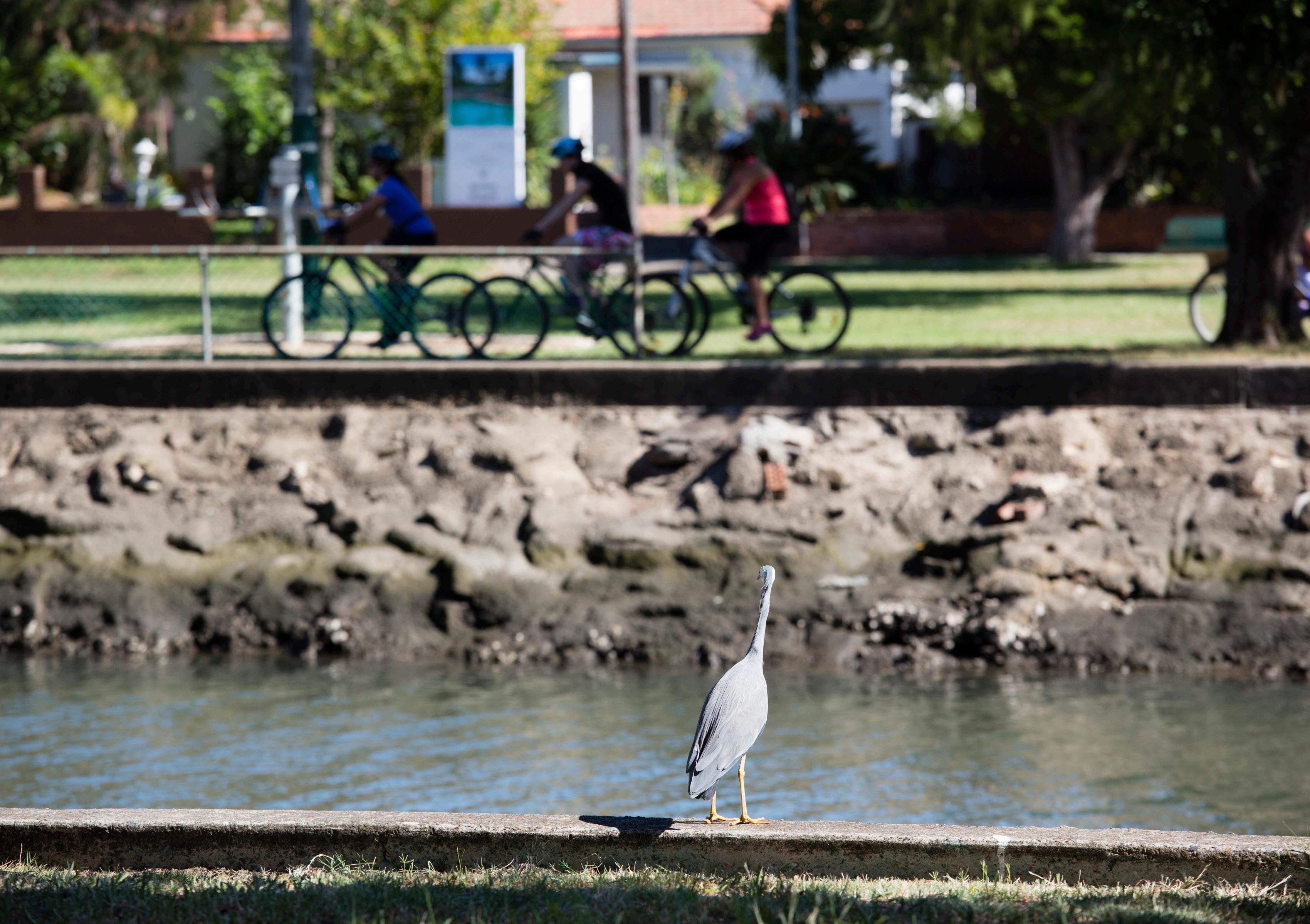
– Improving access to recreational open space, routes for walking, cycling and play for people of all ages and abilities.
– Expanding the urban tree canopy and vegetation and integrating water into the landscape to reduce urban heat, improve air quality and provide natural habitat for native fauna.
– Providing adequate shade to protect the community from over exposure to UV radiation.
– Protecting and enhancing ecological communities and increasing their resilience.
– Improving hydrology by incorporating water sensitive urban design (WSUD), treating stormwater, reducing flood risk, and managing water quality.
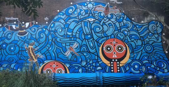
– Promoting art, cultural (including Aboriginal culture and heritage), and scenic features.
The Blue-Green Grid as mapped in the draft Strategy comprises of 84 key routes connecting schools, open spaces, railway stations and key points of interest across the Inner West. It feeds off existing regionally significant priority open spaces and corridors including the GreenWay, Bay Run, Iron Cove Creek, Cooks River Foreshore and Parklands and Callan Park. It will also look to maximise opportunities to connect the community to a major new open space for the area located in Rozelle – the Rozelle Parklands.
Development of the draft Strategy has been informed by an extensive round of community engagement undertaken over March and April 2023 in addition to a review of a range of mapped data sets as well as existing plans, policies and strategies applying to the Inner West Council area and surrounds. All information gathered has been utilised to identify the grid links and opportunities as presented in this draft Strategy.
The Blue Green Grid Strategy is long term aspirational strategy that helps Council to coordinate future grant funding opportunities and local capital works programs. Once fully implemented, the Blue-Green Grid will create a network of new routes to travel across the Inner West and into neighbouring council areas. The Blue-Green Grid will improve access to a diverse mix of open spaces and directly contribute to the creation of the Greater Sydney Green Grid – a project of regional significance as identified in the Greater Sydney Region Plan and the Eastern City District Plan.
Connection with Country Network
Blue-Green Infrastructure has the potential to heal Country. By underpinning blue and green infrastructure with cultural narratives and places of significance, the Blue-Green Grid can embody both cultural and environmental values and encourage shared ownership and custodianship.
DRAFT 02
2. Context
2.1 What is the Blue-Green Grid
2.1.1 What is the value of the Blue-Green Grid for the Inner West?
“The Sydney Green Grid promotes the creation of a network of high quality open spaces that supports recreation, biodiversity and waterway health. The green grid will create a network that connects strategic, district and local centres, public transport hubs, and residential areas.”
Sydney Green Grid - Government Architect of NSW
The Blue-Green Grid is a place-based strategy that connects linkages within the wider public realm, through enhancing creek corridors, transport routes, suburban streets, footpaths and cycleways. It will make a vital contribution to the development of a liveable city.
Recognise and celebrate Aboriginal and Torres Strait Islander culture and histories.
Mitigate urban heat and sequester carbon through water retention and increased tree canopy cover.
Better integrate active transport networks to improve accessibility and reduce reliance on private transport.
Protect, enhance and increase wildlife corridors and areas of habitat for native flora and fauna.
Facilitate health and wellbeing by providing infrastructure for active recreation and community connection.
Improve connectivity, walkability and accessibility to key places of interest across the Inner West.
Provide a plan for the timely delivery and implementation of an integrated network of blue and green infrastructure within Council’s delivery and operational plans.
Provide opportunities for promotion of areas of heritage significance as well as public art and cultural activation in public spaces.
DRAFT 04
2.2 Why the Inner West Needs a Blue-Green Grid
Across the LGA there is currently an average of 16.4 sqm of open space per person. This is forecasted to decline to 14.3 sqm per person by 2036 (even with the delivery of the new open space at the Rozelle Parklands and Bays West areas). Limited land availability and high land values make it difficult to maintain the existing provision rate, however Council remains aspirational and plans for the delivery of increased open space and recreational facilities in areas where there are identified proximity and provision gaps. By the very nature of being an inner-city area, the density of the existing built environment, high land prices and limited available funding, Council is restricted in its ability to provide new open space across the LGA to meet this growth. Council will need to adopt innovative solutions to provide the additional facilities and areas required to keep the community active and healthy.
In response to the planning priorities and actions in the Greater Sydney Region Plan and the ECDP, Council has committed to developing a Blue-Green Grid Strategy for the Inner West. The Inner West Local Strategic Planning Statement (LSPS) included a a specific action to prepare a Blue-Green Grid Strategy.
Community Participation in Recreation
Similar to national participation trends, the most popular recreation activities in the Inner West are unstructured and informal, including walking (for fun, transport and with dogs), play, fitness, cycling and swimming.
Local participation trends that align with national and international trends include:
– Increased demand for unstructured and informal participation in a more flexible setting,
– Declining access for children to unsupervised play, particularly in natural environments,
– Lower levels of participation in recreation activities for people with disability,
Growth Projections
Development of a Green-Grid is a priority under the Greater Sydney Region Plan and the Eastern City District Plan (ECDP). The ECDP identifies regionally significant priority corridors located with the Inner West.
Although the Inner West has a spectacular natural environment with many green and water enriched spaces, it is missing an overarching scheme that approaches them in a connected way. Protecting the environment , connecting infrastructure with neighbourhood councils, and ensuring economic and social uses are sustainable will enhance ecological and public health benefits, rendering a holistic mesh that is far greater than the sum of its parts.
The ECDP also identifies additional opportunities for connections that form part of the long-term vision to create a network of walking and cycling links for transport as well as leisure and recreational trips between Iron Cove Bridge and the Cooks River.
– Less access to formal sporting opportunities and concerns about safety restricting women’s and girl’s participation.
From the Recreation Needs Study October 2021 update.
Population and Density
The Inner West Council area (the Inner West) is a 3,519ha urban community with an estimated resident population of 192,022 residents (2016).
The area is expected to undergo significant population growth and change over the next 10 to 20 years. This growth presents challenges and opportunities for Council to provide for the community’s recreation needs.
DRAFT Inner West Blue-Green Grid Strategy 2023 05
The Blue-Green Grid is one way this can be achieved.
2016
The Inner West 2036 192,022 People 226,837 People + 32,601 Residents From the Local Infrastructure Contributions Plan 2023 growth statements. + 14,362 Workers + 16,856 Dwellings 51 people/ha 64.5 people/ha
The Inner West
2.3 Key Drivers Behind the Project
Key drivers for the Inner West Blue-Green Grid can be understood from a strategic planning perspective and at a finer grain, community focused level, as outlined below.
– Strategic alignment with the Greater Sydney Region Plan to ensure efficient delivery and an integrated planning approach.
– Government priorities across active transport, open space, environment and economic outcomes.
– Funding opportunities and capital works projects.
STRATEGIC PLANNING
– Covid-19 has highlighted the importance of open space.
– Community have told us they wish to see an expansion of the active transport network through the LGA.
– Supporting local businesses with the necessary infrastructure to create places that are vibrant, thriving and attractive.
– Community growth and involvement.
COMMUNITY
DRAFT 06
NEEDS AND THE ECONOMY
Sydney Green Grid - Central District (2017) Green Grid Map.
2.4 Local Geographic Context

to Cove GreenWay
Cove Creek
River
Town Centre Sydney Harbour
Creek
Creek Future Rozelle Parklands
Street, Newtown
Town Centre Dulwich Hill Town Centre
Golf Course Tempe Reserve Sydney Airport Sydney City LGA
Bankstown LGA Burwood LGA
LGA
Bay LGA
Canal Callan Park
River
Cooks
Iron
Cooks
Ashfield
Whites
Johnstons
King
Marrickville
Marrickville
Canterbury
Bayside
Canada
Hawthorne
Parramatta
Geographic Context
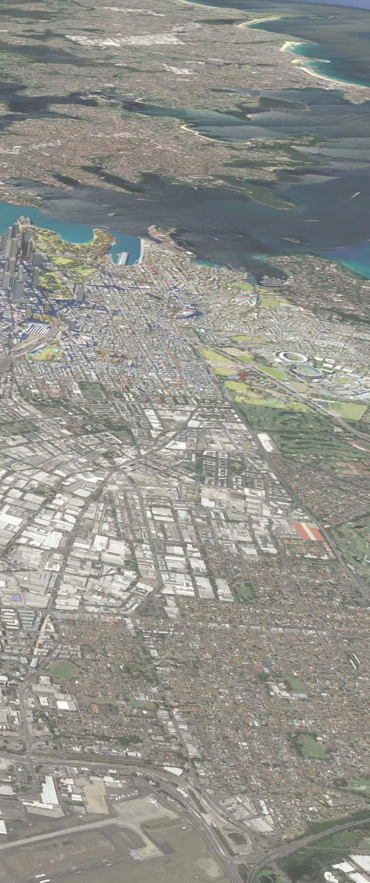
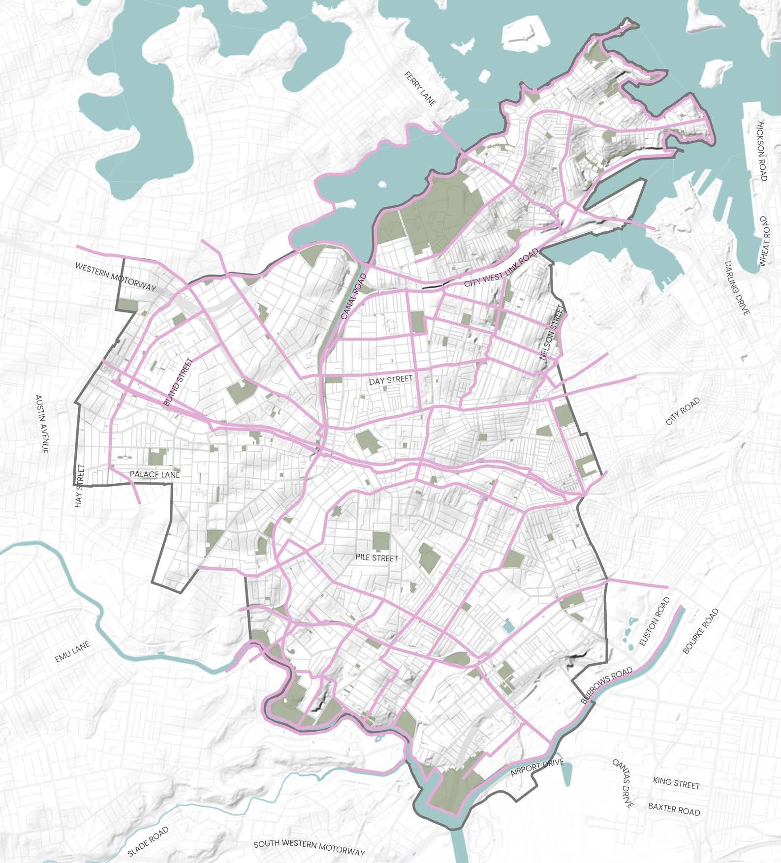
The Inner West Council Area encompasses a total land area of 36 km² located in the inner-western Sydney suburbs, about 4 to 10 km from the western edge of the Harbour CBD, and sits within the Greater Sydney Commission’s Eastern City District. The area is located close to the international trade and transport gateways, Sydney Airport and Port Botany, and is predominantly residential, with substantial industrial and commercial areas.
The significant change and projected population growth for the Inner West together with it’s strategic position will generate an increased demand for jobs, services, housing and recreation opportunities.
This presents opportunities and challenges for creating a variety of open space and recreation facilities within substantially denser areas close to Sydney centre, benefiting a larger quantity of people.
Green Infrastructure
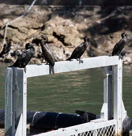
Inner West’s green layer of urban tree canopy, a range of parks, recreational open spaces, and ecological areas offers the opportunity to create a rich mesh of diverse uses.
A significant percentage of greenery comes from parks which contribute to the Blue-Green Grid as an existing system. Areas with high biodiversity value should be included in the grid, as it will serve as protection to the existing ecologies and enhance future ecosystems. Data on existing vegetated areas and tree canopy cover suggest the area lacks diverse vegetation, particularly on the eastern side of the Inner West LGA, highlighting East Marrickville, Sydenham and St Peters as areas with particular lack of greenery.
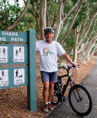
Transport, Walking and Cycling
The Inner West has a prominent transport infrastructure network, well served by main roads, heavy and light rail, buses and ferries, with committed and future projects expend the metro network, including Metro West and Metro South West. It is served by the Princes Highway, Liverpool Road (Hume Highway), City West Link, Parramatta Road, the Bankstown, Illawarra and Inner West railway lines, and the Sydney Light Rail.
The Blue-Green Grid has potential to follow highly travelled routes, using trees to reduce noise, improve aesthetics and create a corridor of wildlife and biodiversity.
Whilst the Inner West boasts an excellent rail network, much of the Inner West remains outside the walkable radius of stations. The Blue-Green Grid can be placed to support longer walking distances, and should be located to create access to stations.
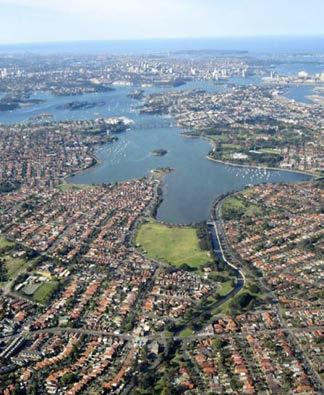
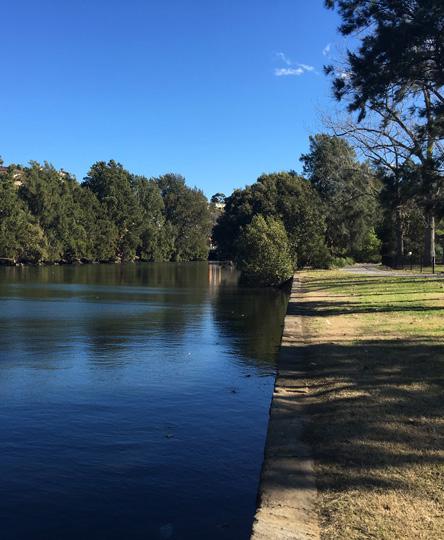
Blue Infrastructure
Hydrological corridors are sensitive environments that contribute to biodiversity and local ecology, as well as high amenity routes to walk along. Six main water corridors are identified in the area, representing key hydrological network, Cooks River, Iron Cove, Paramatta River, Hawthorne Canal, Whites and Johnstons Creek. They will assist in mitigating impacts of flooding, protect and enhance existing waterways and riparian areas, by incorporating them as places of high amenity.
Neighbouring Councils
The Inner West Blue-Green Grid will benefit from aligning strategies and plans with its neighbouring Councils. The LGA is bounded by the City of Canada Bay in the north, the City of Sydney in the east, to Bayside Council in the southeast, the City of Canterbury Bankstown in the south-west, and Burwood Council in the west.
DRAFT 08
Inner West’s Blue-Green Grid represents a cross section of regionally significant priority corridors.
2.4.1 Notable Green Spaces Across The Inner West
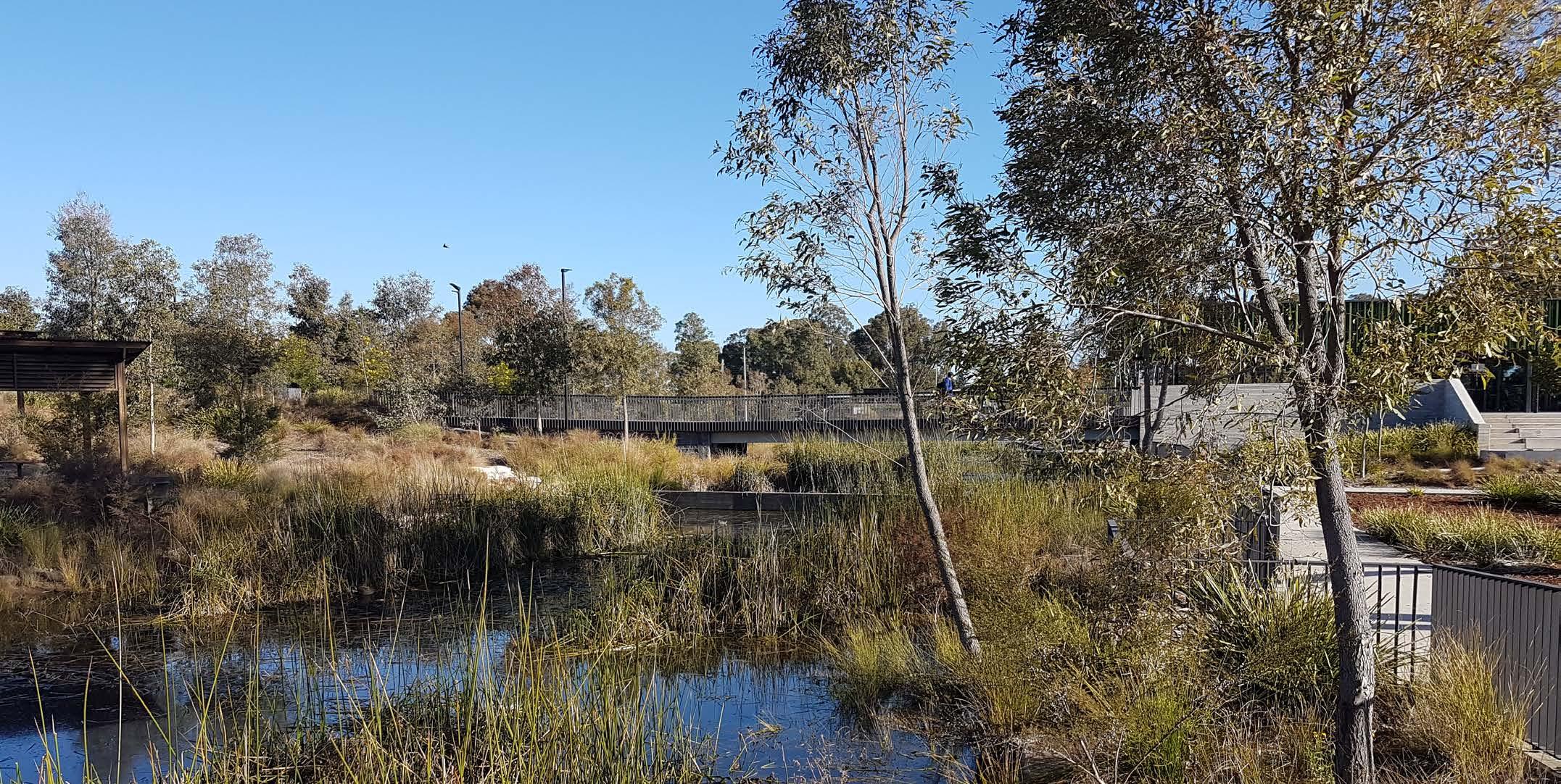
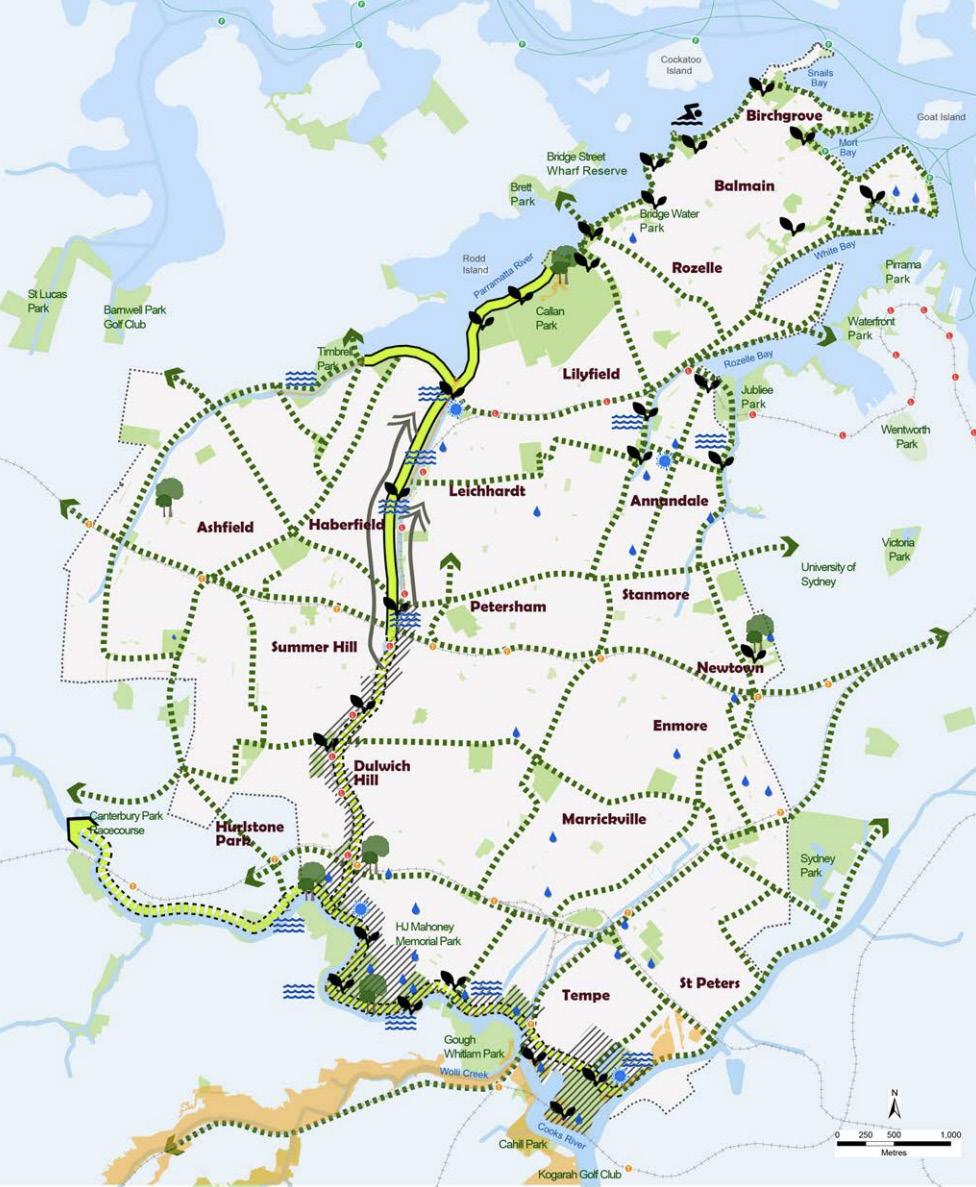
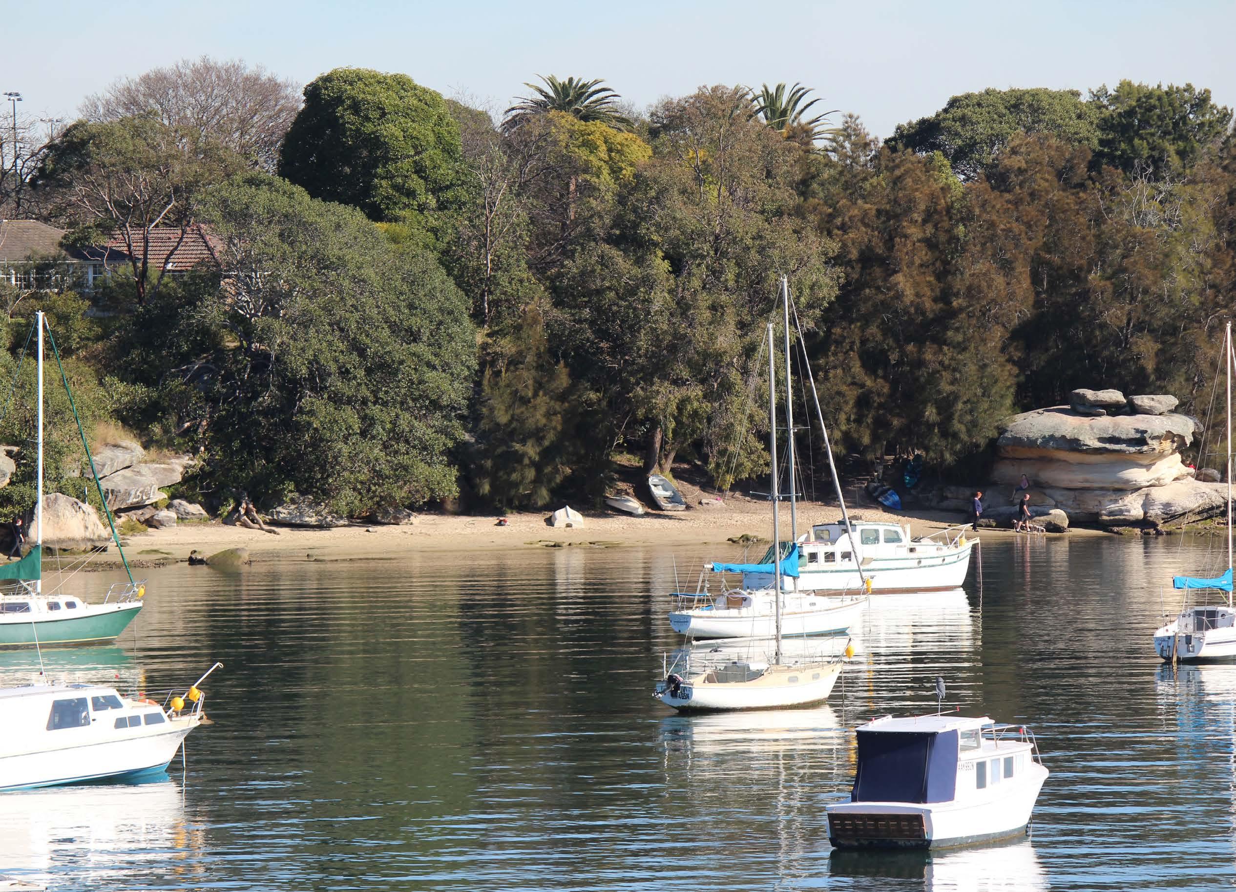
The Cooks to Cove Greenway
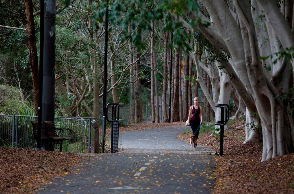
The Cooks to Cove GreenWay (the GreenWay) is an environmental and active travel corridor linking two well established shared paths – the Bay Run around Iron Cove at its northern end, and the Cooks River at its southern end.
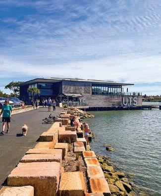
It mostly follows the route of the Inner West Light Rail and Hawthorne Canal via Dulwich Hill, Summer Hill, Lewisham, Haberfield and Lilyfield. It features bike paths and foreshore walks, cultural and historical sites, cafes, bushcare sites and a range of parks, playgrounds and sporting facilities.
The GreenWay was first conceptualised more than fifteen years ago by enthusiastic local community advocates who saw the potential for an environmental, cultural and sustainable transport corridor, including active (non-motorised) transport and public transport (light rail) along the route of the former Dulwich Hill Goods Line.
The GreenWay has regional significance as a recreational and active transport route, an ecological corridor and a place of cultural significance within the Inner West.
The Bay Run
The Bay Run is a 7km pedestrian and cycling circuit around Iron Cove passing through the suburbs of Rozelle, Lilyfield and Haberfield within the Inner West and Five Dock, Rodd Point, Russell Lea and Drummoyne with the Canada Bay Council area. The Bay Run is an iconic foreshore destination, popular with walkers, joggers and cyclists who enjoy the picturesque water views while exercising.
The Cooks River
The Cooks River and Parklands are located in the suburbs of Marrickville, Dulwich Hill and Tempe within the Inner West, with parts of the parkland and river running through neighbouring council area of Bayside, City of Canterbury Bankstown and Strathfield. Many parts of the river and its foreshores offer beautiful riverside walkways and cycle paths, wonderful parks and facilities and an abundance of native flora and fauna.
The Cooks River Open Space Corridor has been identified to become a regionally significant parkland corridor, improving water quality and providing high quality open space with links to nearby centres including Strathfield, Sydney Olympic Park, Campsie, Canterbury, Dulwich Hill, Marrickville and Wolli Creek.
Iron Cove Creek
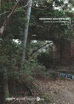
Iron Cove Creek (also known as Dobroyd Canal) is an open stormwater channel running between the Bay Run at Iron Cove and Liverpool Road Ashfield, via Ashfield Aquatic Centre. Council is preparing a Master Plan for the Iron Cove Creek. The Master Plan will explore options for how Council could help people walk and cycle with ease to these valued places.
Callan Park
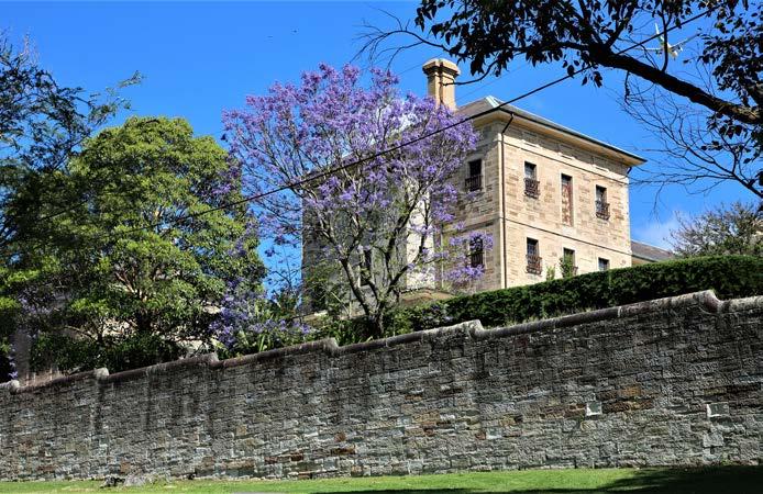
Callan Park is a state heritage listed open space located on the foreshore of the Parramatta River within the suburbs of Lilyfield and Rozelle. At just over 60 hectares, the parkland is a significant regional open space with a rich and complex history. It is cherished for its rich architectural heritage and its history as a hospital for the treatment of mental health disorders, which began in the 1870s and continued until the hospital closed in the early 2000s.
While being a significant recreational open space for the area, the park is also still used for a variety of education, community and health related uses. Callan Point located within Callan Park is considered to be the most important Aboriginal archaeological site remaining on the southern shores of Sydney Harbour. Callan Point also contains rare examples of preeuropean vegetation and culturally important rock carvings.
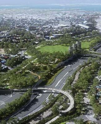
Rozelle Parklands
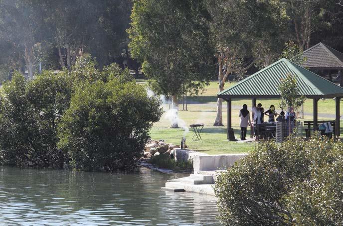
The creation of Rozelle Parklands is a result of works being undertaken by State Government as part of the larger WestConnex project, specifically the Rozelle Interchange. The Parklands will provide multiple sports fields and recreation facilities located among 10 hectares of green space. The Parklands are scheduled to open at the end of 2023.
DRAFT Inner West Blue-Green Grid Strategy 2023 09
Photo source reference: Iron Cove Bay, Sydney Green Grid, Department of Planning and the Office of the Government Architect, 2017
Photo source reference: An artist’s impression of the new Rozelle Parklands, NSW Government.
Iron Cove Creek
The Cooks to Cove GreenWay The Bay Run
The Cooks River
Callan Park Rozelle Parklands
3. Policy and Planning Framework
3.1.1 State, Regional, District and Local Policy, Plans and Strategies
A detailed background document review was undertaken to provide a consolidated source of state, regional, and local strategic planning policy information relevant to the Inner West Blue-Green Grid.

DRAFT Inner West Blue-Green Grid Strategy 2023 11
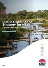
Our Greater Sydney 2056 Eastern City District Plan 2018 Greater Sydney Outdoors Study 2019 The Greater Sydney Region Plan A Metropolis of Three Cities 2018 Public Open Space Strategy for NSW 2022 Connecting with Country 2020 Inner West Local Strategic Planning Statement 2020 Sydney Green Grid Central District 2017
3.1 Background Documents
Engagement Outcomes Report for the LSPS 2019 IWC Recreational Needs Study 2021 Community Asset Needs Study 2021 Our Inner West 2036 Community Strategic Plan 2022 IWC Recreation Strategy and Action Plan (20212030) DRAFT IWC Cycling Strategy and Action Plan IWC Integrated Transport Strategy 2020 Traffic and transport Needs Strategy (TTNS) 2021 Cooks River Corridor Plan 2022 GreenWay Masterplan and associated documents 2018 Pedestrian Access and Mobility Plan 2021 Healthy Ageing Strategy 2022 Floodplain Risk Management Plan
3.2 State and Local Level Policy Framework
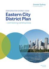
3.2.1 Our greater Sydney 2056 - Eastern City District Plan (2018)
OUR GREATER SYDNEY 2056 Eastern City District Plan
The Eastern City District Plan contains the planning priorities and actions for implementing the Greater Sydney Region Plan, A Metropolis of Three Cities, at a district level and is a bridge between regional and local planning.
The Plan aims to achieve the Vision for Greater Sydney in the Eastern City through:
– Sustaining communities through vibrant public places, walking and cycling, and cultural, artistic and tourism assets.
– Aligning growth with infrastructure, including transport, social and green infrastructure, and delivering sustainable, smart and adaptable solutions.
– Being innovative in providing recreation facilities and open space areas, and increasing urban tree canopy.
– Building effective responses to climate change and natural and urban hazards.
Main priorities related to Blue Green-Grid are:
– Planning Priority E10: Delivering integrated land use and transport planning and a 30-minute city.
– Planning Priority E14: Protecting and improving the health and enjoyment of Sydney Harbour and the District’s waterways.
– Planning Priority E15: Protecting and enhancing bushland and biodiversity.
– Planning Priority E17: Increasing urban tree canopy cover and delivering Green Grid connections.
– Planning Priority E18: Delivering high quality open space.
Our Greater Sydney 2056 Eastern City District Plan
2018
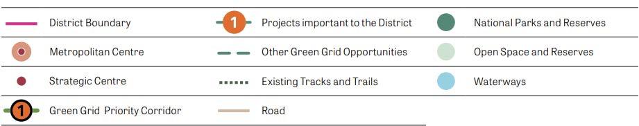
Relevant Priority Green Grid Corridors as identified in the Eastern City District Plan
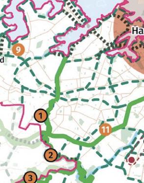
1 The Iron Cove Greenway and the Hawthorne Canal
“The vision for Greater Sydney as a metropolis of three cities – the Western Parkland City, the Central River City and the Eastern Harbour City and a 30 minute city – will see the Eastern City District become more innovative and globally competitive, carving out a greater portion of knowledge intensive jobs from the Asia Pacific Region. The vision will improve the District’s lifestyle and environmental assets.”
2 The Cooks River Open Space Corridor
Creating a sequence of connected open spaces that follow the Hawthorne Canal and the Light Rail Corridor from Leichhardt North to Dulwich Hill light rail stations which provide enhanced open space to growing communities along the light rail.
Will become a regionally significant parkland corridor, improving water quality and providing high quality open space with links to nearby centres including Strathfield, Sydney Olympic Park, Campsie, Canterbury, Dulwich Hill, Marrickville and Wolli Creek. This is a priority Green Grid project for both the Eastern City and South districts.
Relevant Projects important to the District
11 Bankstown to Sydenham Open Space Corridor
This project will transform surplus rail easement land and wide local streets that run parallel to the rail line into an active walking, cycling and open space corridor connecting the Cooks River, Wolli Creek Regional Park, The Greenway and Salt Pan Creek open space corridor, as well as the wider open space network.
DRAFT 12
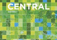
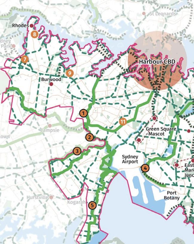
3.2.2 Sydney Green Grid - Central District (2017)
SYDNEY GREEN GRID Central District
An objective of the Sydney Green Grid is to protect and provide open space and areas of biodiversity, particularly as housing density increases. The GANSW proposed a network of high-quality green space that connects town centres, public transport hubs and major residential areas. Known as the Sydney Green Grid, it is an integral part of delivering the public benefit embedded in the Central District. Identified interventions can facilitate opportunities to increase access to open space, promote healthy and active living and create high quality public realm.
Strategic opportunities identified in the Inner West Council area are:
– Improved access to Sydney Harbour, Parramatta River foreshore and the coast line.
– Undertake local open space studies to increase access to open space at a local level and ensure equity of access to open space across the district.
– Create new open space to support the Inner West for example new regional parks within the Rozelle Rail Yards corridor and active sports facilities at White Bay Power Station and above White Bay car park.
Project opportunities identified include:
– Link the suburbs of Marrickville and Leichhardt with Sydney Harbour via the proposed Iron Cove Greenway which links the Cooks River and Iron Cove Bay.
– Link the heads of the open space at Blackwattle Bay, Rozelle Bay and White Bay into the existing open space network.
– Increase public foreshore access within the Bays Precinct and access from Sydney CBD to the Bays Precinct via the Glebe Island Bridge.
Sydney Green Grid Central District
2017
Sydney Green Grid identified Project Opportunities
The
“The various and unique landscapes of Sydney are recognised as an asset that can reinforce character identity and environmental resilience. Delivered alongside infrastructure and urban renewal an enhanced network of open space and green infrastructure can serve to shape and support new and existing communities. The Harbour, the coastline and the Cooks River provide a coherent spatial strategy that defines the landscape quality of the subregion.”
DRAFT Inner West Blue-Green Grid Strategy 2023 13
The Greenway
Hawthorne Canal (Identified in
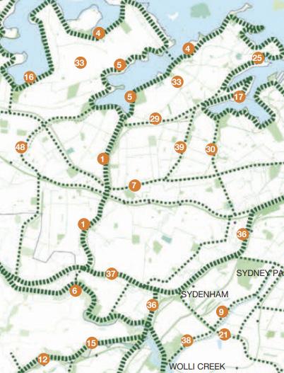
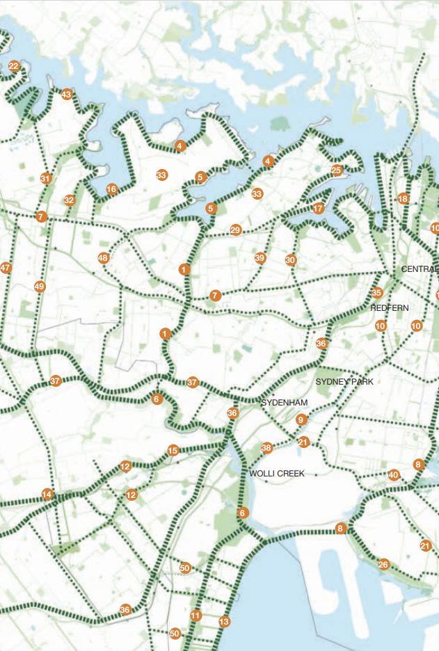
Hydrological 4 Sydney Harbour Foreshore and Parramatta River Walk Recreational 5 The Bay Run and Iron Cove Creek Recreational 6 The Cooks River Open Space Corridor (Identified in ECDP) Hydrological 7 Parramatta Road Urban Renewal Corridor Transport 9 Alexandra Canal Hydrological 17 White Bay and Blackwattle Bay Foreshore and Open Space Transport 25 Tom Uren Trail, Balmain Recreational 29 Lilyfield Road Active Transport Corridor Transport 30 Johnstons Creek and Harold Park Hydrological 33 Sydney Harbour Bays Green Links: Balmain and Rozelle Recreational 36 Illawarra Rail Line: Wolli Creek to Redfern Transport 37 Bankstown to Sydenham Open Space Corridor (Identified in ECDP) Transport 38 Airport to Bourke Street Active Transport Green Link Transport 39 Whites Creek and Whites Creek Lane, Leichhardt Hydrological 48 Cooks River Secondary Green Links: Ashfield to Canterbury Recreational
1
and the
ECDP)
document
connects key hubs as
of
to
Blue-Green Grid in the Inner West. 48 6 9 30 17 4 5
identifies a network of quality green space that
well as provides a list
projects with opportunity
become part of the
3.2.3 Community Strategic Plan
OUR INNER WEST 2036 Community Strategic Plan (2022)
The Community Strategic Plan (CSP) identifies the community’s vision for the future, long-term goals, and strategies to get there and outlines how Council will measure progress towards that vision.
The Blue-Green Grid Strategy aligns closely with:
Strategic Direction 1: An ecologically sustainable Inner West. This strategy will help Council achieve outcomes:
– 1.2 An increasing and resilient network of green corridors provide habitat for plants and animals.
– 1.3 Waterways are healthy and the community is watersensitive, treating water as a precious resource.
– 1.4 Air quality is good and air pollution is managed effectively; 1.5 Inner West is zero emissions, climate adapted and resilient to the changing climate.
Strategic Direction 2: Liveable, connected places and transport.
This strategy will help Council achieve outcomes:
– 2.1 Development is designed for sustainability, net zero and improves health and wellbeing of the community.
– 2.3 Public spaces are welcoming, accessible, clean and safe.
– 2.6 People walk, cycle and move around the Inner West with ease.
Strategic Direction 4: Healthy, resilient and caring communities.
This strategy will help Council achieve outcomes:
– 4.3 People have opportunities to participate, and develop their health and wellbeing.
– 4.4 People have access to the services and facilities they need at all stages of life and all abilities.
Blue-Green Grid Strategy
Climate + Renewables Strategy
Community Strategic Plan
Highest level plan that a council will prepare - the purpose of this plan is to identify the community’s main priorities and aspirations for the future and to plan strategies for achieving these goals.
Inner West Council’s Plans, Strategies and Studies for example:
GreenWay Masterplan Community Asset Needs Study
Pedestrian Access and Mobility Plan
Integrated Transport Strategy
Recreation Needs Study
2023 Draft Cycling Strategy
Delivery Program
Sets out principal activities that Council will deliver to the community during the Council term.
Operational Plan
Sets out the details of the Delivery Program - the individual projects, activities and budget.
Local Environmental Plan (LEP)
Development Contributions Plan
Development Control Plan (DCP)
DRAFT 14
Local Strategic Planning Statement
The Eastern City District Plan
The Greater Sydney Region Plan
3.2.4 Our Place Inner West - Local Strategic Planning Statement (2020) OUR PLACE INNER WEST Local Strategic Planning Statement
The LSPS for the Inner West provides a local response to the planning priorities and objectives outlined in The Greater Sydney Region Plan and the Eastern City District Plan
The statement sets out the vision for the area in 2036 and the actions that will be taken to achieve this vision. It provides the land-use planning framework for the Inner West, providing a link between the Greater Sydney Commission’s Eastern City District Plan and the priorities of Our Inner West 2036 – A Community Strategic Plan for the Inner West Community.
The LSPS Vision Statement:
“Inner West 2036: A place of creative, connected, sustainable and productive neighbourhoods - as vibrant, innovative and diverse as our community.”
In response to State plans outlining a basis Green Grid, the Inner West Council committed to further developing the Blue-Green Grid.
Planning Priority 3 of the LSPS sets out a vision of a diverse and increasing urban forest that connects habitats of flora and fauna. This includes the action 3.3 to “Develop a Blue/Green Grid Strategy to protect and increase habitat and the urban forest, embed water sensitive urban design principles and prioritise the routes based on function and connectivity.”
Council has outlined indicative plans based on the opportunities identified in the Greater Sydney Region Plan, Eastern City District Plan and Sydney Green Grid strategy developed by the Government Architect of NSW to be further developed.
Inner West Local Strategic Planning Statement (LSPS)
Relevant Planning Priorities, Objectives and Actions
Relevant Planning Priority Objectives
Planning Priority 1: Adapt to climate change Inner West is resilient to the impacts of climate change, urban and natural hazards.
Planning Priority 3: A diverse and increasing urban forest that connects habitats of flora and fauna
Planning Priority 4: Inner West is a water sensitive city with clean waterways
Protect, maintain and increase urban forests, native vegetation and habitat.
Development on all private and public land incorporates best practice Water Sensitive Urban Design (WSUD).
Reduced reliance on Sydney’s drinking water supply
Water quality is enhanced and natural waterways are clean and healthy.
Planning Priority 7: Provide for a rich diversity of functional, safe and enjoyable urban spaces connected with and enhanced by their surroundings
Planning Priority 8: Provide improved and accessible sustainable transport infrastructure
Planning Priority 10: Recognise and sustain Aboriginal and Torres Strait Islander cultures and histories
Provide urban spaces that support community needs and creative places.
Safe, user-friendly active transport infrastructure forms an integral part of Inner West and supports all types of trips.
Indigenous cultures and histories are recognised and steps are taken to ensure cultural continuity.
Aboriginal heritage of significance is conserved in Inner West.
Planning Priority 11: Provide accessible facilities and spaces that support active, healthy communities
The community has access to a wide range of accessible high quality open spaces, community facilities, recreational and cultural spaces.
A Blue/Green Grid promotes active and healthy lifestyles.
DRAFT Inner West Blue-Green Grid Strategy 2023 15
2020
4. Community and Stakeholder Engagement
4.1 Community and Stakeholder Insights


4.1.1 How Community and Stakeholder Ideas Were Considered
Consultation Approach and Methodology
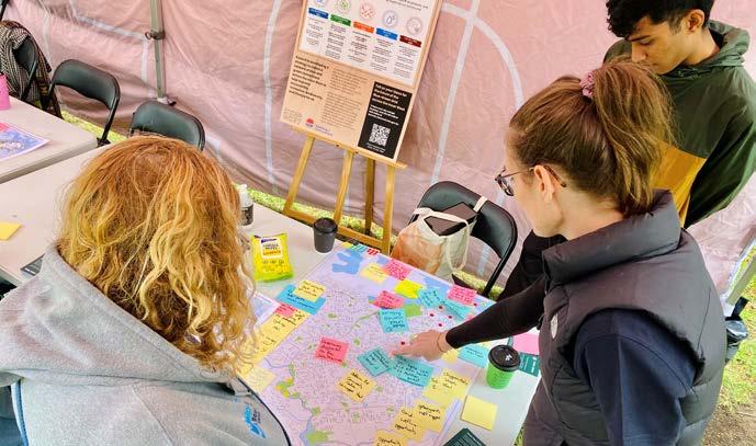
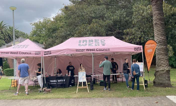
The purpose of this first round of engagement was to gather information from internal and external stakeholders including the community to gather place specific suggestions, and opportunities as well as better understand local needs and priorities for blue and green grid connections across Inner West. In line with the high level of support that was expressed by the community during the LSPS consultation, this project specific Blue-Green Grid consultation was warmly welcomed by the community.
The first phase of consultation took place between 16 March and 8 May 2022. The community responses presented a clear set of values and priorities while also giving a range of place specific suggestions for the project to consider.
The consultation approach looked to capture community and stakeholder insights from across the entire Inner West, asking participants to categorise their ideas within 8 Emerging Opportunities:
– Provide more areas of natural habitat for native fauna.
– Adapt to climate change - focusing on reducing urban heat and improving air quality.
– Protect and enhance ecological communities.
– Increase access to recreational open space and waterways.
– Provide more routes for walking, cycling, and play along green leafy streets and pathways.
– Expand the urban tree canopy and areas of vegetation.
– Incorporate more Water Sensitive Urban Design features into landscape to better treat stormwater, reduce flood risk and manage water quality.
– Promote art, cultural and scenic features.

Overall, the engagement captured:
The three most common themes captured across the engagement were:
Effective Active Transport Networks

Participants acknowledged the great work of delivering the network to date, but wished to see pathways and active transport routes better equipped to handle capacity and diverse uses. It was highlighted that speed was the number one barrier to encouraging new users to the network, and an effective network should identify the type of users along each journey, and aim to cater to all of their needs through suitable separation or safety measures.
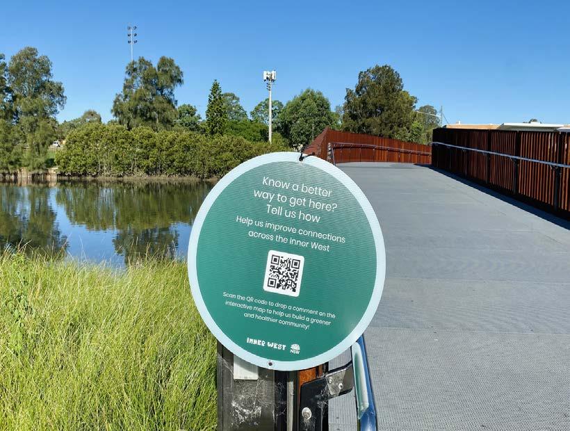
The outcomes of the online mapping tool
The use of mapping activities throughout the consultation, aimed to ensure insights were place based and specific to help respond to key microclimate and network challenges across the Inner West.
What are their values, needs, aspirations
In line with the high level of support that was expressed by the community during the LSPS consultation, this project specific Blue-Green Grid Strategy consultation was warmly welcomed by all community members. At the highest level, the community praised the approach to increase the health of blue and green assets and broadly recognised that this network would provide a suitable opportunity for planning an efficient and effective active transport network.
Access to Water
Participants from all suburbs wished to see a longterm plan for enabling residents across the LGA to interact with the Blue-Green Grid. In the short to medium term there is a common vision to naturalise the creeks and rivers in the LGA and activate the banks. In the long term, our community wish for opportunities to swim across the entire LGA.
Rewilding for Open Space
Participants didn’t wish to simply see biodiversity increasing across the LGA, but wanted the Strategy to take a considered approach on where and how these assets are delivered and maintained, so that they remain for generations to come, despite our growing community. Our community commonly identified the opportunity for more dense and planned planting in open spaces, that would not only increased biodiversity in our existing green spaces, but enable community to connect with nature.
DRAFT 18
409 participated in discussion across the engagement 1,800+ ideas captured 94 contributers placing 355 pins online interactive map 41 representatives from collaborative partners including neighbouring councils, stage agencies and schools 150+ visitors to 5 pop ups 98 workshop and focus group participants 25 submissions received 1154 YSIW visitors 400+ flyers distributed 230 QR Code scans on posters
4.1.2 Engagement Methods
This first engagement stage included a variety of engagement activities aimed at capturing input from a diverse representation of our community and interested stakeholders. Engagement activities included:
Engagement Activity Theme or Location
Participation
2,750 site views
1,154 visitors
Online Mapping Tool and Submissions Your Say Inner West
94 participants making
- 355 contributions
- 22 written submissions
Drop-In Sessions
- Haberfield
- Marrickville
- Ashfield
- Balmain
- Camperdown
- Access Advisory Committee
- Aboriginal and Torres Strait Islander Advisory Committee
158 Contributors
372 Ideas and Insights for responding to BlueGreen Grid opportunities
Local Democracy Groups Workshops
- Greenway Advisory Committee
- Environmental Advisory Committee
- Open invite for all Local Democracy Group membersattended by approximately 15 participants
- # 1 Environmental Matters
58 Participants
210 Contributions and Indepth discussion on responding to opportunities
Community Focus Groups
- #2 Active Transport and Recreation
- #3 Arts, Culture and Community
Internal Council Staff Workshop Face to Face
Collaborator and Partner Organisation Workshop Online workshop with neighbouring council, state departments, schools and infrastructure stakeholders
16 Participants
218 Identified places, spaces and routes for investigation
24 Participants from service areas across the organisation
75 Partnership projects and initiatives identified
41 Participants
180+ Contributions and identified partnership opportunities
DRAFT Inner West Blue-Green Grid Strategy 2023 19
4.1.3 What was heard from the community
Provide more areas of natural habitat for native fauna
Protect and enhance ecological communities
Promote art, cultural and scenic features
Engagement participants consistently reiterated the importance of a considered planting of endemic species, not simply native species, in order to boost the ecology and health of natural habitats for native fauna. Common areas for action included:
– Rewilding railways with native flora.
– Identifying suitable plots within highly urbanised areas to create dense planting.
– Upskilling community members to enable them to include native planting on private land.
Engagement participants recognised weed control and bushcare knowledge as the key to succeeding in this priority. In addition to this, the need for limiting the human impact on vital ecological assets was widely recognised. Common areas for action included:
– Identifying and protecting areas of particular ecology and biodiversity and limiting human interaction.
– Community education and upskill programs on weed removal.
– Upskill and education in council’s maintenance team on weed identification.
– Programming to increased Bushcare programs and their reach.
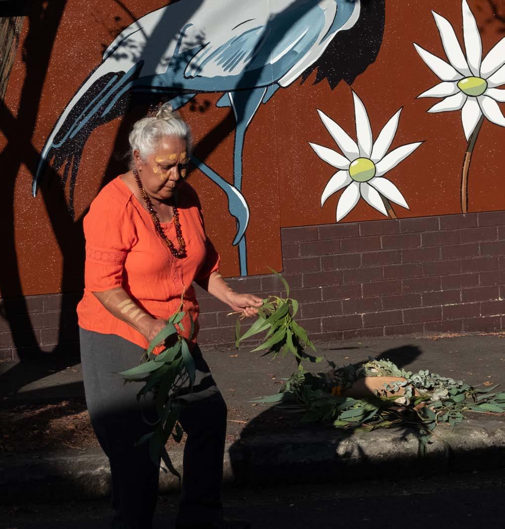
Engagement participants recognised that the Blue-Green Grid was well placed to incorporate three key cultural themes.
1. First Nations Culture and Caring for Country.
2. Artists and the creative sector have traditionally been based in the Inner West industrial areas.
3. The Inner West’s rich history, particularly highlighting the playful and interesting “tales” of residents and businesses from the past.
Participants wished to see the Strategy designate a specific arts and cultural identity of the Blue-Green Grid, in order to guide future planning, rather than attempt to encompass all elements of arts and culture. Common areas for action included:
– Engaging users into First Nations knowledge and learning.
– Creating a focus on live performances along and within the Blue-Green Grid.
– Embracing and emphasising the cultural practice of connecting to water and nature, and opportunities to do this through both play and tranquillity.
Adapt to climate change - focusing on reducing urban heat and improving air quality
Engagement participants recognised the direct link between this action and increasing tree canopy in the LGA. Common areas for action included:
– Rewilding rail way lines.
– Focusing increased tree canopy efforts along active transport links.
– Identifying opportunities for increased tree canopy in partnerships with local schools.
Increase Access to recreational open space and waterways
Engagement participants consistently prioritised the opportunity for places to swim, right across the LGA. Those neighbouring the harbour wished to see greater access points, those within walking distance of Cooks River wished to see river health be a key focus to enable interactions within the water, and those without direct access wanted to see active transport links prioritised towards bodies of water. Common areas for action included:
– Designating harbour swimming opportunities and providing appropriate infrastructure.
– Increasing the health of the Cooks River to encourage interaction with the waterway.
– Targeted delivery of green and open spaces in areas of high density.
– Rewilding open spaces.
– Appropriate provision of dog parks within open spaces.
DRAFT 20
Provide more routes for walking, cycling, and play along green leafy streets and pathways
Incorporate more Water Sensitive Urban Design features into the landscape to better treat storm water, reduce flood risk and manage water quality
Separated cycleways, roadways and footpaths was the number one priority captured across the entire engagement. Participants recognised that the speed of cars was the number one barrier to more people adopting active transport, while pedestrians recognised that the fastest user on any active transport route was the greatest barrier for new users and pedestrians.
In addition, 2 of the top 3 most supported community comments highlighted the desire to see private developments extend and contribute to the green grid and active transport network. Comments relating to the Flour Mill developments approach to connecting the green grid and delivering high quality open spaces were widely supported by community. Common areas for action included:
– Suitable separation of pedestrians and cyclists on shared paths.
– Designated bike paths along streets greater than 40km/h.
– Identifying key commuter routes for separated cycleways – as this removed the danger of cars from cyclists, and the danger of fast travelling bikes from pedestrian footpaths.
– Crossing of Parramatta Rd was identified as a major barrier to creating a comprehensive network.
– Crossing WestConnex entry and exit points in St Peters was identified as a major barrier to a comprehensive network.
– Crossing WestConnex entry and exit points at the Rozelle Interchange was identified as a major barrier to a comprehensive network.
– Widening of all current and future shared paths across the network.
– Ashfield North, Marrickville, and Darling Street Balmain were three commonly identified key areas for new connections.
– Continuing to leverage creek lines as green, active transport corridors.
Engagement participants consistently expressed a desire to re-naturalise the creek lines and rivers across the entire LGA, and placed greater emphasis on using open and green spaces to address flooding risks.
In conjunction with this, participants wanted to see permeable surfaces favoured in urban areas to reduce flood risks and increase the health of waterways. Common areas for action included:
– Naturalise waterways and canals across the LGA prioritising those areas that intersect with open spaces and provide opportunities for the community to connect with the water.
– Improving the health of the Cooks River by reducing dumping and increasing monitoring to identify run that is posing particular threat to the ecology of the river.
– Regenerating the Hawthorn Canal.
– Eliminating the use of pesticides in open spaces adjacent to waterways.
– Increased recognition for restoring riparian zones and mangroves.
– Address key flood zones along the Cooks River, and Marrickville Golf Course.
Expand the urban tree canopy and areas of vegetation
Engagement participants commonly highlighted priority areas for increased tree canopy efforts.
As a first step it was felt that the project should look to identify all possible sites that across the LGA that could accommodate significant tree planting, rather than individual plantings that were at risk in urban areas. Common areas for action included:
– Partnerships with schools.
– Identifying opportunities for verge gardens - creating a green trellis that spread from large open areas and green spaces, into the streets.
– Identifying streets suitable for partial closure to create an urban garden.
– Targeting the western and northern side of all active transport routes.
– Targeting railway lines as green corridors.
DRAFT Inner West Blue-Green Grid Strategy 2023 21
4.1.4 Local Democracy Groups Identified
Priorities
Across the engagement, five advisory committee workshops identified priorities well suited to achieving the desired outcomes of the strategy. The below highlights a number of priorities that participants felt were particularly well aligned to the Blue-Green Grid Strategy.
Environmental Advisory Committee
– Acknowledgement and reinstating of traditional creek lines.
– Open space and ecological green projects given appropriate resourcing to ensure upkeep is carried out in a way to preserve biodiversity and ecology.
– Naturalisation of creek beds to restore water ecology and booster surrounding ecosystems.
– Designation of ecological reserves not publicly accessible.
– Planting of endemic species.
– “Re-wilding” train lines with natural habitat.
– Extending the green trellis beyond open spaces and reserves.
– Increased tree canopy in all town centres.
Aboriginal and Torres Strait Islander Advisory Committee
– Open space projects that are delivered should be designed to enable Indigenous organisations to carry out cultural awareness and education programs.
– Prioritise the delivery of the Inner West Walking Trails.
– Acknowledge traditional creek lines.
– Acknowledge relevant aboriginal significance and culture in all open spaces.
– Planting of endemic species.
GreenWay Advisory Committee
– Acknowledgement and reinstating or traditional creek lines.
– Increased partnership with Bushcare.
– Improved maintenance practices from Council staff to ensure appropriate weed identification and bushcare practices.
– Prioritise the extension of the GreenWay.
– Delivery Old Canterbury Rd link within GreenWay project.
– Overcome major barriers to connecting the network, such as Parramatta Rd and City West Link.
Collaborative Workshop
(Invite Extended to All Council Local Democracy Groups Members)
– Identify commuter cycle routes and delivery suitable bike paths to remove them from vehicles but also separate fast commuter cyclists from pedestrians.
– Increased designated cycleways and separated paths desired across the LGA.
– Prioritise cycle ways along creek lines and green corridors.
– Increased access to blue spaces along Cook’s River.
– Desire to see green trellis extend outward from open spaces and into urban areas.
– Extend GreenWay.
Access Advisory Committee
– Accessible wayfinding.
– Accessible pathways mean removing incline and decline.
– Accessible pathways require well maintained flat surfaces.
– Creating a network for all required public education.
– Speed of the fastest person on the active transport network is the biggest barrier to adoption and inclusive networks.
– Heat impacts disabled users of the network far greater than others and there is a need for regular respite stops on a journey.
– Charging stations for mobility scooters and e-vehicles on network.
– Safe storage facilities at end of journey for mobility devices that can be worth $20,000+.
– Accessible trails/paths along riverbanks and through bushland to enable everyone to connect with nature – National Parks are leading the way on accessible paths through nature.
DRAFT 22
4.1.5 Focus Group Identified Priorities
Across the engagement, three online focus groups workshops were held, Recreation and Active Transport, Environmental Matters, Arts Culture and Community. Several priorities to achieving the desired outcomes of the Blue-Green Grid Strategy were identified. The below highlights a number of priorities that participants felt were particularly well aligned to the strategy:
Recreation and Active Transport Focus Group
– Widening of paths along key commuter routes.
– Greater separation of cars and cyclists on commuter cycling routes.
– More separated pedestrian and cyclist pathways in popular parts of the active transport network.
– Identify and deliver suitable crossings over Parramatta Rd, WestConnex entry and exit at St Peters, and Rozelle Parklands.
– Suitable connections between Anzac Bridge and Darling St Balmain.
– Increased tree canopy on the active transport network in Marrickville.
– Decreased speed limit to 30km/h on shared roads and local streets.
Arts, Culture and Community
– Investigation of a cultural trail through Balmain, Rozelle and White Bay.
– Identify and implement a cultural identity for the Blue-Green Grid Strategy, that will guide all cultural activities and installations in open spaces.
– Identify and celebrate the tails, identities and characters of the inner west’s past, through artistic installations in open spaces.
– Recognise the importance of maintaining arts and makers spaces in the inner west, particularly in traditional industrial areas such as Tempe and Marrickville which have been home to artistic collectives for decades.
Environmental Focus Group
– Naturalising and more biodiverse planting in open spaces.
– Naturalisation of creek beds to restore water ecology and booster surrounding ecosystems.
– Extension of the Greenway project.
– Planting of endemic species.
– “Re-wilding” train lines with natural habitat.
– Extending the green trellis beyond open spaces and reserves.
– Upskilling Council maintenance teams on weed control and protection of native species.
– Increased funding for Bushcare.
– Greater value given to existing mature trees, to limit removals across the LGA.
– Commitment to the White Bay Wildlife Corridor.
DRAFT Inner West Blue-Green Grid Strategy 2023 23
4.1.6 Community and Stakeholder Mapping
As well as highlighting priority actions for responding to the emerging themes, engagement participants were asked to provide their local knowledge in nominating spaces, places, routes and areas which they believed should be investigated as a priority for responding to each of the 8 emerging opportunities.
Based on these outcomes from the engagement, a list of the priority links and places were mapped. The findings discussed in relation to the 8 Emerging Opportunities were fitted into the 5 categories of grid (Aboriginal and Torres Strait Islander, Arts, Culture and Heritage; Recreational; Ecological; Hydrological and Connected).
The map illustrates the most common places, spaces, links and opportunities that were discussed and explored by community during the consultation.
Frederick Street
Callan Park
Elkington Park
“Love Elkington Park. Love The Dawny. Love sitting on the point above the cliffs. What a marvellous example of Green and Blue. Plus, cycling here from Marrickville, is a true Blue-Green link, riding along the Greenway, the Bay Run and Balmain foreshore.”
“Callan park is one of my favourite places to ride. I like that they are going to do the place up, but should keep in mind that more people will flock there and there should be things taken into consideration such as car, cycling and pedestrian safety that also doesn’t impose on people’s freedom to navigate and move where they want.”
Legend
Inner West LGA Boundary
Parks and Open Spaces
“Frederick street is a main walking thoroughfare for both transport (bus stops) and access to Ashfield pool. However it’s very hot to walk and there is limited separation from the heavy vehicles on the road making it unpleasant and unsafe.”
Yeo Park
“A lovely big park with beautiful trees, please add some native understory and ground covers in places so there’s habitat for birds etc as well as people.”
Waterways, rivers and creeks
Engagement Desired Links
Engagement Places
Cooks River
“Wardell Rd Bridge doesn’t allow walkers and cyclists to pass each other, narrow and dangerous.”
Tempe Reserve
“Tempe Reserve is already important as habitat for native bird species, especially in those areas planted with thick native shrubs. It’s a pity about the plastic grass. More could be done. For example, dense native shrubs bordering the banks of the Alexandria Canal.”
Lilyfield Road
“Lilyfield Rd will be the perfect connection between the Rozelle railyards park/bays precinct and the bay run, and so should have a really high quality cycle path to connect the two”
Parramatta
Road
“Parramatta Rd has no tree cover. With the Rozelle interchange opening soon and the completion of Westconnex there should be some opportunity to re-allocate some space on Parramatta Rd for trees (especially around bus stops so you can wait in the shade), better footpaths, bike lanes etc.”
Sydenham
Drainage Pit
“Could this be developed into an urban wetland with some public access/viewpoints?”
Hurlstone Park
Croydon Park
Camperdown
Balmain East
Summer Hill
Dulwich Hill Marrickville
Petersham
Birchgrove
Annandale
Sydenham
Leichhardt Lewisham
Stanmore
Newtown
St Peters
Croydon
Balmain
Enmore
Mascot
Rozelle
Tempe
5. Towards a Vision
5.1 Vision for the Inner West Blue-Green Grid
The Blue-Green Grid will create a network of blue and green connections across the Inner West to help improve accessibility, recreation, biodiversity, and lifestyle for all.
The Blue Green-Grid Strategy provides an aspirational masterplan that aims to maximise the quality of life for our residents and the environment by:
An engaging cultural experience
– Promoting art and culture events.
– Recognising and sustaining Aboriginal and Torres Strait Islander’s cultures and histories.
Creating a range of recreation opportunities
– Providing diverse, vibrant and connected urban spaces that enhance the surroundings.
– Delivering a high quality of open space with a variety of uses for all abilities and ages.
Connecting ecological corridors
– Increasing urban forest that connects habitats for flora and fauna.
– Adapting to climate change.
– Protecting and enhancing areas of high value biodiversity.
Enhancing waterways and connection to water
– Enhancing water quality.
– Reducing flood risk through water sensitive cities approaches and blue and green infrastructure.
– Adapting to climate change.
– Create water sensitive city with clean waterways.
Enhancing connectivity and accessibility
– Improving function and access of public transport.
– Providing accessible facilities and spaces that support active, healthy communities.

DRAFT Inner West Blue-Green Grid Strategy 2023 27
Inner West Blue-Green Grid 282 Parks 398 Community Assets 17 Rail Stations 6 Waterways 3 Ferry Wharfs Sydney Harbour 278 Council-owned parks totalling 256 hectares 4 State-owned parks 28 Sporting Grounds 12 Outdoor Gyms 126 Play Spaces 18 Community Gardens 8 Libraries 94 Social assets 296 Cultural assets 2 indoor recreation centres 5 aquatic centres 267 Cycle Paths 61 Schools To Connect 183,772 Residents Consists of 84 Links 178+ Animal species 350+ Native flora https://profile.id.com.au/inner-west/population https://www.innerwest.nsw.gov.au/live/environmentand-sustainability/at-home/gardens-and-wildlife/ nature-for-backyards-guide/biodiversity-in-the-innerwest
The
5.2 Incorporation of Designing with Country Principles
As outlined by the Connecting With Country, Government Architects NSW
The Inner West Blue-Green Grid incorporates a holistic understanding of the natural environment where people, animals, resources and plants are equally considered. At the core of the Blue-Green Grid is to value and respect Aboriginal cultural knowledge and ensure Country is cared for appropriately while sensitive sites are protected.
The strategy is an opportunity to incorporate, celebrate and recognise the Aboriginal and Torres Strait Islanders knowledge, reconciliation, culture and heritage within the Inner West. The Blue-Green Grid will acknowledge and cherish local history by educating and showcasing thought promotion of art, cultural features, performance and placemaking.
The Inner West Blue-Green Grid is aligned with and pursues the Designing with Country principles outlined as follows.
General Aspirations
– Ensure that Aboriginal and Torres Strait Islander culture and heritage is visible in the design and planning of Inner West.
– Support, educate and provide a better understanding of the Aboriginal and Torres Strait Islander culture in our built environment.
– Provide links to connect with Aboriginal and Torres Strait Islander cultural values and history of the site.
– Promote art, storytelling, performances and placemaking that acknowledge and celebrate Aboriginal and Torres Strait Islander culture.
– Gain cultural awareness by exploring Inner West connection to Country.
Principles for Action
– Develop guides to improve education and promotion of culture, reconciliation, knowledge and heritage by creating a signage policy on the Aboriginal and Torres Strait Island, Arts, Culture and Heritage Grid routes.
– Honour Aboriginal culture by incorporating Aboriginal and Torres Strait Islander shared knowledge and culture on promoting Indigenous led activities, such as public artworks and cultural activations.
– Create connections to histories of cultural landscapes into project design principles, materiality, and storytelling of places.
– Create culturally safe places, that nurture immediate and long term opportunities to support Aboriginal cultural practice.
– Ensure that the Inner West has a cultural programme that includes creative tours and attractions that showcase Aboriginal histories and culture.
– Explore routes that educates and showcase local Indigenous knowledge and shares histories.
DRAFT 28
6. Overview of the Grid
Classifying the Network
The Inner West Blue-Green Grid promotes the creation of a network of high quality open spaces that support recreation, biodiversity, connectivity and waterway health, and recognise and embrace Aboriginal culture.
The connections are classified into five categories based on their most appropriate primary function: the Aboriginal and Torres Strait Islander, Arts, Culture and Heritage Grid, the Recreational Grid, the Ecological Grid, the Hydrological Grid, the Connected Grid.
A colour coding has been applied to the assessment of the analysis to assist with visual understanding of the grids.
THE ECOLOGICAL GRID
THE HYDROLOGICAL GRID
THE RECREATIONAL GRID
THE BLUEGREEN GRID
THE CONNECTED GRID
THE ABORIGINAL AND TORRES STRAIT ISLANDER, ARTS, CULTURE AND HERITAGE GRID

DRAFT Inner West Blue-Green Grid Strategy 2023 31
6.1
The Aboriginal and Torres Strait Islander, Arts, Culture and Heritage Grid as an opportunity to incorporate Aboriginal and Torres Strait Islanders knowledge within the Inner West, promoting art, cultural, and scenic features as well as acknowledging and cherishing a deeply embedded local history to share with generations to come.
THE ABORIGINAL AND TORRES STRAIT ISLANDER, ARTS, CULTURE AND HERITAGE GRID OBJECTIVES
– Celebrate and promote the Aboriginal and Torres Strait Islander reconciliation, culture and heritage in the Inner West, through activities including public art, performance and placemaking.
– Showcase and educate our distinctive creatives and town centres.
– Explore the Inner West’s Connection to Country.
MAPPING CONSIDERATIONS
– Connecting key places of Aboriginal heritage.
– Connecting to key Indigenous organisations.
– Acknowledging water as key indigenous places.
– Recognising the Kangaroo Ground Patyegarang area.
– Connecting to public art.
– Connecting to galleries and studios.
– Connecting historically significant places.
The Recreational Grid is about providing locals of all ages and abilities with routes to walk, run, cycle, interact and play along green streets within our local area. Approximately 42% of adults go for recreational walks, 15% run and 9.8% cycle (Recreation Needs Study 2018).
The recreational grid provides access to local parks and high amenity routes.
THE RECREATIONAL GRID OBJECTIVES
– Increase access to open space.
– Encourage active and healthy living.
– Provide a diverse range of open spaces to cater to a wide range of activities.
– Increase amenity to encourage outdoor recreation.
MAPPING CONSIDERATIONS
– Searching for easy-to-use straight forward routes to be followed by users going for daily activity.
– Searching for routes that would form a loop to create simple routes for people to use as a standard walk/run.
– Searching for routes along key open spaces to form an easy to access network.
– Connecting high areas of density to provide accessible routes and open space.
THE ECOLOGICAL GRID OBJECTIVES
The Ecological Grid contributes to a resilient community. The Blue-Green Grid will enhance biodiversity to ensure ecological resilience, creating green habitat corridors and protecting endangered communities.
– Protect and enhance natural environment for future generations.
– Adapt to climate extremes and reduce urban heat.
– Mitigate climate change through carbon storage.
– Provide habitats for different native species.
– Create environments where people, flora and fauna thrive together.
MAPPING CONSIDERATIONS
– Areas of high biodiversity value.
– Implementing a higher concentration of the grid within wildlife corridors to improve presence of tree canopy and shrubs.
– Considering parks and open spaces as places of biodiversity value and connecting them.
– Long extended routes from “living streets” as areas with high potential for vegetation and canopy.
– Concentrating streets in areas of high heat.
Waterways are a fundamental network of the Blue-Green Grid. The Hydrological Grid will protect and enhance riparian areas and natural character, and improve drainage, mitigate flooding, and improve ecological integrity and visual amenity.
THE HYDROLOGICAL GRID OBJECTIVES
– Improve water quality in Sydney Harbour.
– Enhance health of six major waterways.
– Increase riparian vegetation and ecologies.
– Opportunities to connect with water.
Reduce pluvial flooding in urban areas.
MAPPING CONSIDERATIONS
– Find areas of flooding which will inherently provide good areas for flora (ie, plants need water and help mitigate flooding).
– Where the implementation of the Blue-Green Grid will assist in reducing flooding around built up areas.
– Key waterways which can be places of high amenity for locals.
THE CONNECTED GRID
The Connected Grid improves infrastructure, particularly active and public transport, and connectivity between points of interests within the Inner West.
OBJECTIVES
– Increase local connectivity.
– Increase regional connectivity.
– Contribute to a 30-minute connected Sydney.
– Make public and active transport accessible, safe and attractive.
– Connect the community to nature.
– Connect the community to local infrastructure.
– Ensure key places have inclusive accessibility.
MAPPING CONSIDERATIONS
– Finding points of interest to connect schools and town centres to public transport,
– Finding existing cycle routes or where a cycle route could be placed to run parallel to main streets.
– Key routes that connect highest volume of pedestrians between mass and public transport (eg, light rail and train stations, and bus stops).
DRAFT 32
–
6.2 Evidence Base for the Grid
6.2.1 Analysis Overview
Geographic Information System (GIS) data has been utilised as evidence base in the mapping process of the Inner West Blue-Green Grid, where a series of maps were analysed for each Grid and later overlayed to provide a visual image of opportunities and constraints.
Refer to the Appendix for data sets sources and methodologies which was used for mapping analysis. The data was categorised into each of the five grids, as they related and impacted each theme, as shown on the right.
6.2.2 Sieve Mapping
‘Sieve mapping’ is a constraints and opportunities mapping process that builds up a number of geographical layers, in order to produce a visual representation of areas that indicate potential for the implementation of the Blue-Green Grid.
To develop and refine the Inner West Blue-Green Grid, a series of mapping layers pertaining to their appropriate category were selected and overlaid to develop lines of inquiry and test the existing BlueGreen Grid plan from the LSPS.
Zones highlighted in strong colours on the sieve map represents areas of most overlapped layers, indicating potential areas for implementing the grid. In contrast, zones with lighter colours or in blanc can be translated as vulnerable areas, which the grid would benefit.
The next step was to trace precise lines of connection along existing streets, to create an integrated network representing the ATSIACH, Recreational, Ecological, Hydrological, and Connected Grids.
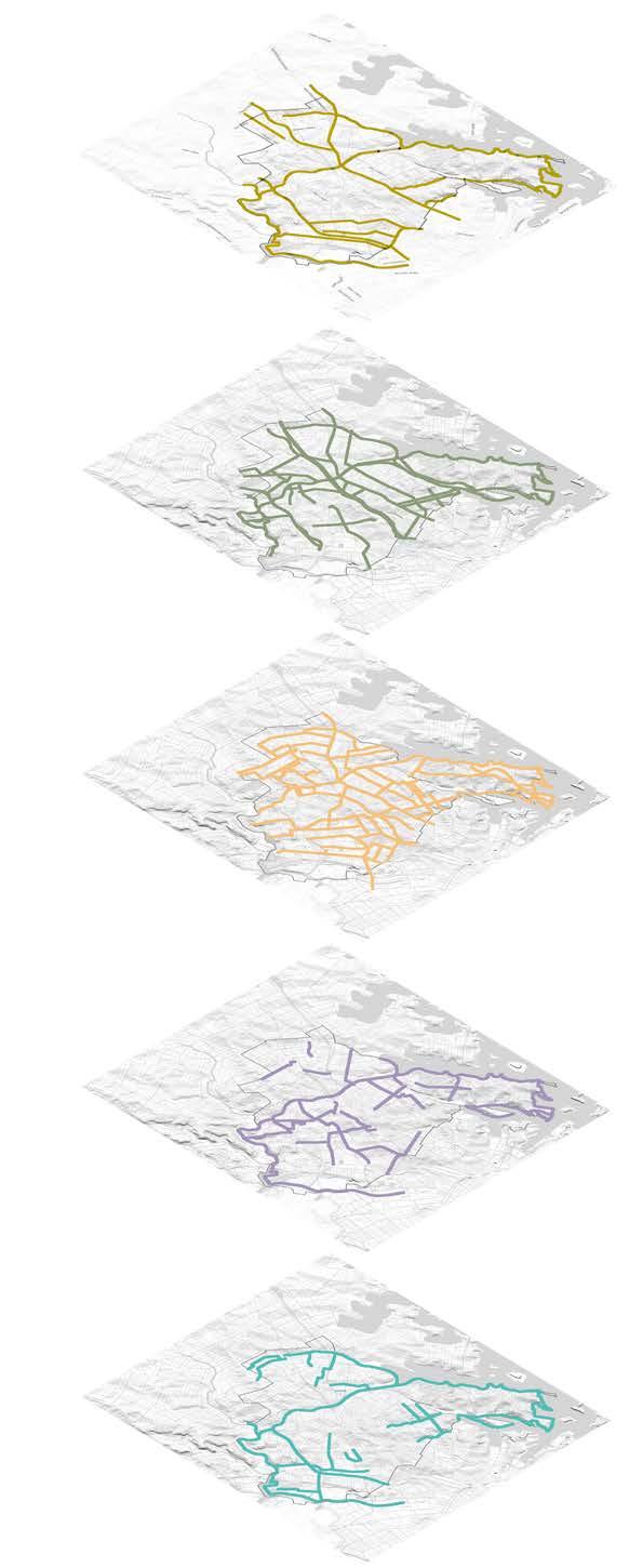
This strategy was used to test the existing plan, were the links were overlapped with the LSPS Green Grid Map and indicate recommendations to better respond to the grid.
Aboriginal and Torres Strait Islander, Arts, Culture, and Heritage
Maps related to heritage, identified local Indigenous places, waterways and swamps, public art, arts venues, and cultural and historical places linked to Aboriginal history.
Ecological
Biodiversity corridors, vegetation coverage, living streets, urban heat, and tree canopy.
Connected
Parks, activity anchors, points of interest, pedestrian movement, public transport walkability, public art and heritage.
Recreational
Areas of higher density, local centres, parks and catchment areas, active streets, and provision of open space per person data.
Hydrological
Waterways and flooding extend, sea level, permeable surfaces, and urban heat.
DRAFT Inner West Blue-Green Grid Strategy 2023 33
7. The Grid
7.1 The Inner West Blue-Green Grid
The Inner West Blue-Green Grid forms a web of 84 links across the Inner West and neighbouring Council areas. It addresses the aspirations, needs and priorities of community and stakeholders while also seeking to implement state and local planning priorities related to the creation of a blue and green grid network.
The network responds to aspirations from local community by creating a green trellis along the LGA, better equiping pathways and active transport routes for a better connectivity, and improving access and interaction with green spaces and waterways.
The Blue-Green Grid will create places where people connect to each other, nature, neighbourhood, and the city. Once fully implemented, the Inner West Blue-Green Grid will create a network of links and spaces that allows people to move through freely and safely with good quality footpaths, canopy cover, and greenage. It will provide culture, public art and temporary activations, enhance Aboriginal heritage, and contribute towards the community’s sense of places and stewardship.
Inner West LGA Boundary
Parks and Open Spaces
Waterways, rivers and creeks
The Inner West Blue-Green Grid
Closed Link Loop
Legend
7.2 Opportunities Per Grid
A matrix has been created to include a name and description for each link utilising placed based information. Each link was categorised utilising the five grid functions and highlevel opportunities were identified based on function and community input provided through the engagement process. The below opportunities were identified by stakeholders and will be refined and adjusted through the implementation process and future project work.
THE ABORIGINAL AND TORRES STRAIT ISLANDER, ARTS, CULTURE AND HERITAGE GRID
1. Recognise and celebrate Aboriginal and Torres Strait Islander culture and histories and protect items and places of high value.
2. Provide public art and cultural activation in public spaces and parks.
3. Recognise and promote the areas of heritage significance.
THE ECOLOGICAL GRID THE RECREATIONAL GRID
THE HYDROLOGICAL GRID
1. Provide green and open spaces in areas of high-density development.
2. Provide additional tree plantings to increase canopy cover and shade.
3. Increase and improve access to a diverse range of open spaces.
4. Provide a diverse range of inclusive spaces to encourage outdoor recreation for all.
5. Develop a network of play streets.
1. Protect, enhance and increase wildlife corridors and areas of habitat for native flora and fauna.
2. Rewild underutilised corridors.
3. Provide additional tree plantings.
4. Encourage verge and private garden planting.
5. Streets for landscaping and community gardens.
THE CONNECTED GRID
1. Improve water quality of local waterways.
2. Naturalise and uncover existing waterways, creeks and canals.
3. Provide additional swimming and recreational opportunities.
4. Integration of WSUD.
1. Provide safe, accessible footpaths and crossings.
2. Provide cycleways.
3. Better connect access across major road and transport corridors.
4. Where possible provide suitable separation of pedestrians, cyclists and vehicles.
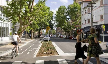
5. Reduce speed limits in high pedestrian areas and along cycleways.
Walama/Ballast Point Park has incorporated design that acknowledges historic remains from when the area was one of Sydney’s major oil distribution sites.
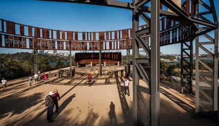
Verge Gardens in Western Australia have identified endemic plants and have created native gardens with dense canopy cover and tree hollows instead of grass to create local habitat for wildlife.
The Drying Green at Green Square, Sydney, has incorporated WSUD in the form of local wetland. WSUD can also be implemented through rain gardens, sediment ponds, swales and rainwater tanks.
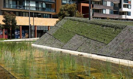
Bourke Street Cycleway is a 3.4 km active transport corridor across a traffic-congested area of inner city Sydney consisting of dense planting, and separate cycleways.
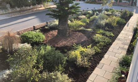
DRAFT Inner West Blue-Green Grid Strategy 2023 37
Image credit: McGregor Coxall Image credit: City of Sydney Image credit: APACE WA Image credit: McGregor Coxall Image credit: Simon Wood
Frances Newton Reserve is a pocket park in Darlinghurst designed as a passive recreational accessible pocket park, behaving like a playground for children, designed to spark imagination and play.
7.3 Precinct Plans
The Inner West LGA has been divided into 10 sections in order to better understand and read the grid alongside the purpose of each individual link.
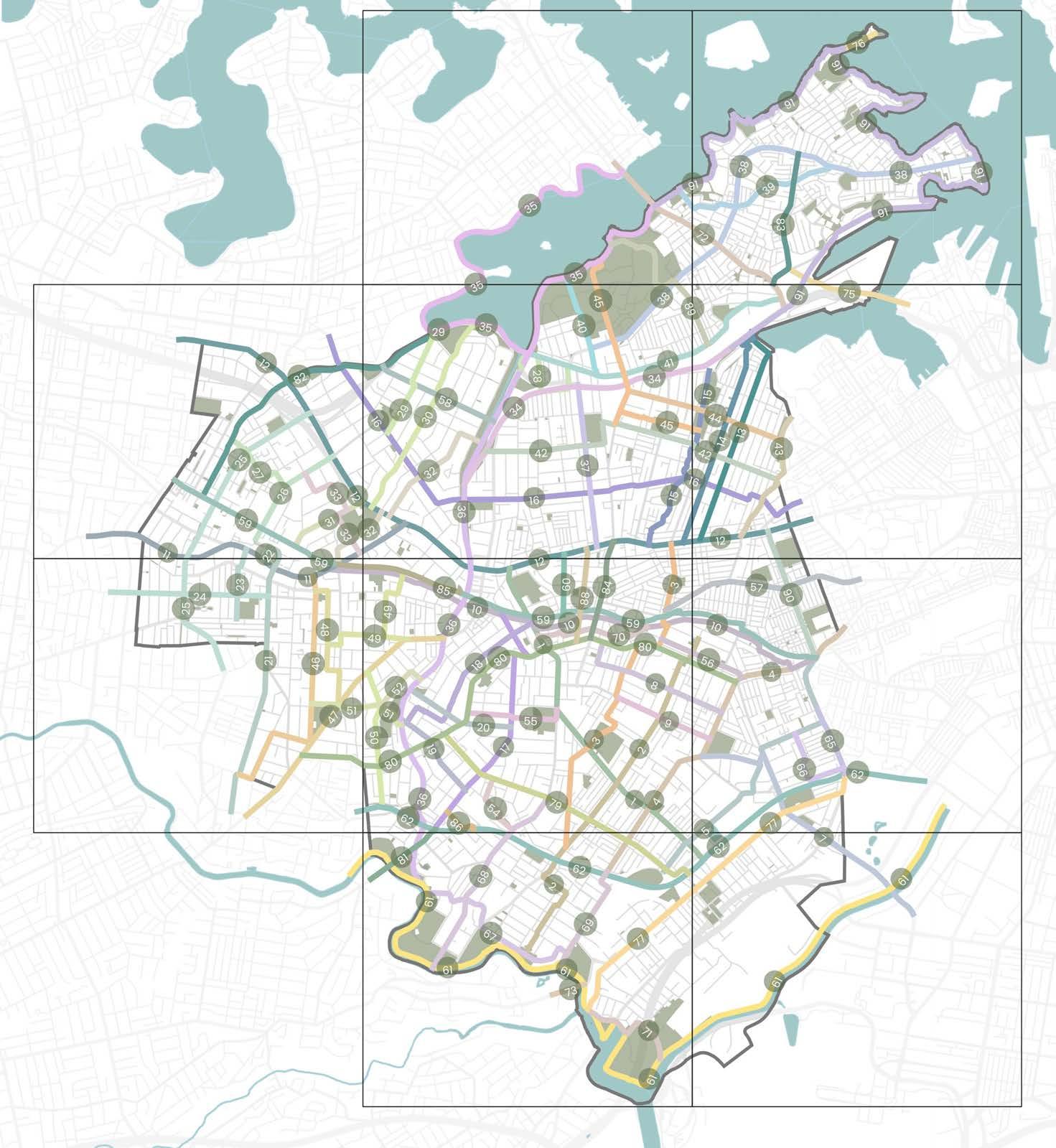
DRAFT 38
3 7 1 4 8 2 5 9 10 6
7.3.1 Precinct 1
Blue-Green Grid Links
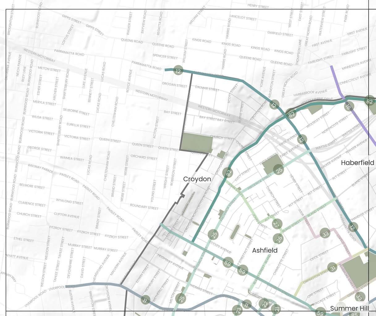
Iron
Cycling
Haberfield,
Urban
2019,
GreenWay
2018,
Parramatta
2016, TfNSW DPE/Inner West Council
GreenWay
2013,
GreenWay
2011,
GreenWay
2010,
DRAFT Inner West Blue-Green Grid Strategy 2023 39
Places
Southern Link of Newtown to Croydon train line 11 Liverpool Road 12 Parramatta Road
Marion Street between Ramsay Street to Johnstons Creek
Holden Street connecting Ashfield Station to Canterbury Park
Hercules Street
Knox Street to Pratten Park via Park Lane 25 Peace Park to Parramatta Road via Milton Street and Frederick Street 26 Ashfield Station to Parramatta Road along Bland Street 27 John Street to Bland Street 31 Orpington Street 32 Hawthorne Light Rail Stop to Bruce Street Reserve 33 Bland Street to Liverpool Road 59 Northern Link of Newtown to Croydon train line 82 Iron Cove Creek Corridor 29 Ashfield Park 30 Reg Cody Reserve 31 Hammond Park 32 Wadim (Bill) Jegorow Reserve
10
16
21
22
23
Cove Creek Master Plan
Inner West Council
2023,
Strategy and Action Plan
Inner West Council
2023,
Ashfield and Leichhardt local network improvements
TfNSW
2023,
Canopy Strategy
Bay Council
Canada
Master Plan
Inner West Council
Corridor
Road
Urban Transformation Strategy (PRCUTS)
Biodiversity Strategy
Inner West Council
and Bushcare Plan
Revegetation
Inner West Council
Flora and Fauna Literature Review
Inner West Council
Projects and Responsibility 31 29 32 30 Precinct Boundary Inner West LGA Boundary Parks and Open Spaces Waterways, rivers and creeks The Inner West Blue-Green Grid Suburb Boundary 0 Train Station Light Rail Station Ferry Terminal Local Places 500m 0m 1km
Relevant
10 Southern Link of Newtown to Croydon train line
Newtown, Stanmore, Petersham, Lewisham, Summer Hill, Ashfield, Croydon
11 Liverpool Road Croydon, Ashfield
A key rail corridor that crosses through a biodiversity corridor at the GreenWay. Link is compromised of multiple links along train lines for connectivity, however is not fully connected for pedestrians. It provides direct routes to train stations and would be well travelled by daily transport users.
The link provides direct routes between train stations and opportunities for better connection to the GreenWay. There is also opportunity to identify a clear user journey along the line and create more crossing for both pedestrians and cyclists. Better cycleway connections, widened footpaths and tree planting for shade are other identified improvements along this route.
Liverpool Road is a key arterial road that traverses Ashfield Town Centre and connects Paramatta Road with Croydon. The link also includes an Aboriginal place of significance.
The route has opportunities to provide more street planting for shade, notably around the Frederick Street intersection. Improvements to cycling connections in and out of the area have also been identified. Ashfield Town Centre is a high pedestrian areas, and could benefit from traffic calming measures for pedestrian safety. Additionally, there are opportunities to recognise and celebrate Aboriginal and Torres Strait Islander culture and histories and protect items and places of high value.
12 Parramatta Road
Parramatta Road is a key state road which traverses the Inner West east to west connecting the CBD to Western Sydney. The 6 lane road is mostly commercial in nature, and has limited street trees. There are multiple points of interest along the link, including half a dozen entertainment venues and pubs, Ashfield Park, the GreenWay, Fort Street High School and primary links into surrounding suburbs.
Parramatta Road has opportunities to deliver significant improvement in tree canopy coverage and street tree planting for cooling. The link could deliver widened footpaths, improved crossings for pedestrians and cyclists alike, along with dedicated cycleways and improved public transportation offering. The link is subject to both local and state strategies that provide opportunity for public domain and access uplift, including the Paramatta Road Corridor Urban Transformation Strategy, Tech Central, and the WestConnex Camperdown Dive Site which holds potential to deliver temporary and long term value to the Blue-Green Grid.
A key east-west connection through the LGA running almost parallel to Parramatta Road offering an alternative east-west connection, crossing with the GreenWay and Whites Creek. It connects multiple town centres including Haberfield, Leichhardt and industrial centres at Annandale/Camperdown. Parks include Algie Park, Lambert Park, Mayes Street Reserve and Evan Jones Playground and schools including Leichhardt Public School St Brendans Catholic Primary School.
21
Holden Street connecting Ashfield Station to Canterbury Park
Ashfield
A major north-south connection that links Ashfield Train Station to Canterbury Park via Ashfield Town Centre. The link connects several open spaces and recreation facilities including some in neighbouring Canterbury-Bankstown LGA.
22 Hercules Street Ashfield
This is a short link connecting north and south Ashfield Town Centre. The link connects with links 21 and 11.
Ashfield The link connects the Ashfield Town Centre to Pratten Park.
1
Much of the link has established greenery, with verges providing opportunity for additional tree plantings to increase canopy cover and shade. The link is also an existing cycle route; therefore, opportunities exist to provide a formal cycleway. The link could benefit from additional crossings in high pedestrian activity areas. 1
Increased tree canopy, verge gardens, greening of laneways and landscaping are some of the key opportunities to enhance shade and amenity for the pedestrians along the route. The link could also benefit from improved pedestrian and cycle infrastructure allowing for suitable separation of pedestrians, cyclists and vehicles. 1
1
Opportunities along the link should consider the provision of additional vegetation and tree plantings to increase canopy cover and shade. Park Lane has been identified as alternate cycle connection offering a wide, quieter and leafy street for east-west cycling connections. 1
1
DRAFT 40 Number Link Suburbs Link Description Possible Opportunities & Improvements ATSIACH EcologyConnectivityHydrology Recreation
1 1
1 1
Haberfield, Croydon, Ashfield, Leichhardt, Annandale, Camperdown, Newtown, Stanmore, Petersham, Lewisham, Summer Hill.
1
1
16
Marion Street between Ramsay Street to Johnstons Creek
Annandale, Leichhardt, Haberfield
The link runs parallel to Paramatta Road but is a local road so it has the potential to become a quiet, safe and comfortable active transport route alternative. Additional cycleways and connections from the GreenWay to Norton Street have been identified. The link has opportunities for more street tree planting for urban cooling and opportunities for public art and cultural activation in the town centres and venues such as Leichhardt Town Hall. 1 1
1
23 Knox Street to Pratten Park via Park Lane
A north-south connection that will aim to connect Peace Park in the Canterbury Bankstown area up to Parramatta Road. There are multiple parks and open spaces along this link including Cecile Herman Park, Thomas Street Reserve, Banks Street Reserve the Ashfield Aquatic Centre, JG McCartney Playground and Hammond Park and playground.
Participants identified Frederick Street as a key bike and pedestrian route to access Ashfield Train Station, the Ashfield Aquatic Centre and a number of other open spaces within this area of the Inner West. Milton Street was also identified as key connector, although in need of improvements to prioritise pedestrian travel and amenity. Potential improvements along this link should consider:
- improvements to footpaths and crossings to ensure they safe and accessible access to key destination. Additional wayfinding would also benefit this link. - providing improved cycle infrastructure and where possible allowing this infrastructure to be separated from pedestrians and vehicles. Community input highlighted the need for increased safety measures for cyclists under the Frederick Street railway bridge - additional vegetation and tree plantings to increase biodiversity, canopy cover and shade along the link
- provision for incorporation of WSUD elements along the link
The link runs between Ashfield Train Station to Parramatta Road. It connects with St Vincent's College, Bethlehem
Bland Street was commonly highlighted by the community as a street in needs of improved active transport connectivity due to its use by cyclists and pedestrians. Link opportunities should investigate provision of improved footpaths and crossings to ensure safety and accessibility (with particular attention required to the intersection of Elizabeth Street and Bland Street).
This link should be considered as part of future works on John Street associated with the Iron Cove Creek Master Plan project. Opportunities along John Street associated with the Master Plan may include provision of improved pedestrian and cycle infrastructure along the Iron Cove Creek. This link would provide improved connectivity from the Iron Cove Creek into North Ashfield.
Ashfield Park is a well utilised green space. The community wish to see better connections to the park from surrounding areas. This link connects with links 59 and 26 providing more direct connections between Ashfield Train Station and Ashfield Park. Opportunities for this link should consider providing safe, accessible footpaths and crossings along Orpington Steet.
Ashfield Park could also accommodate the delivery of more significant dense planting to increase tree canopy cover and shade for park users.
The link aims to better connect Ashfield to the GreenWay. It connects Richard Murden Reserve to Ashfield Park through to Bruce Street Reserve which acts as a thoroughfare between Elizabeth Street and Bruce Street. It runs through a flood zone.
Pedestrian access through the Bruce Street Reserve could be supported by improving footpaths. While there are street trees present along the link, it could benefit from more continuous canopy cover and shade beside Ashfield Park and on O'Connor Street. Verges throughout the link can accommodate increased planting.
Opportunities along the link should consider improving footpaths, crossings and continuous cycle infrastructure along the entirety of the link. There is some opportunity along this link to increase verge and private garden plantings to increase areas of natural habitat for native flora and fauna. Opportunities should also be considered for integration of WSUD to assist with flooding in the area.
DRAFT Inner West Blue-Green Grid Strategy 2023 41 Number Link Suburbs Link Description Possible Opportunities & Improvements ATSIACH EcologyConnectivityHydrology Recreation 25
Peace Park to Parramatta Road via Milton Street and Frederick Street
Ashfield, Ashbury
1 1
26 Ashfield Station to Parramatta Road along Bland Street Ashfield
College, Da La Salle Ashfield and St John's Pre-School.
1 1 1
27 John Street to Bland Street Ashfield
The link would look to connect the Iron Cove Creek to Bland Street via John Street, Alt Street and Charlotte Street.
1 1
31 Orpington Street Ashfield
Link connects Parramatta Road to Elizabeth Street via Ashfield Park.
1 1 1
32 Hawthorne Light Rail Stop to Bruce Street Reserve Ashfield
1 1 1
33 Bland Street to Liverpool Road Ashfield Link runs via Julia, Loftus and Pembroke Street, via Ashfield Park.
1 1 1
This link follows the T2 rail line between Croydon and Newtown. The northern side of the rail line does not currently allow for full pedestrian access east - west. This link is aspirational to show the need for increased access to the rail line by daily transport users.
Currently there is no continuous pedestrian or cycle link along the rail corridor. Through the community engagement undertaken for this project, this has been identified as a project opportunity that should be investigated to improve pedestrian and cycle connections eastwest across the Inner West. Opportunities along the link should consider improving footpaths, crossings and cycle infrastructure. Rewilding of areas adjacent to the rail corridor in addition to consideration of areas that could accommodate increased tree canopy, verge and private garden plantings should be investigated.
The Iron Cove Creek corridor is a 3.5km long corridor between Liverpool Road and Iron Cove following the alignment of Iron Cove Creek (also known as Dobroyd Canal).
Iron Cove Creek green link is identified in the NSW Government's Sydney Green Grid. This link aligns with current project work being undertaken by Council as part of the Iron Cove Creek Master Plan. The Master Plan will explore use of the canal and the adjoining land to provide an off-street walking and cycling path as well as increased landscaping/habitat and more open space between Liverpool Road and Iron Cove.
DRAFT 42 Number Link Suburbs Link Description Possible Opportunities & Improvements ATSIACH EcologyConnectivityHydrology Recreation
59 Northern Link of Newtown to Croydon train line
Newtown, Stanmore, Petersham, Lewisham, Summer Hill, Ashfield, Croydon
1 1
82 Iron Cove Creek Corridor Haberfield, Ashfield, Croydon
1 1 1 1 1
7.3.2 Precinct 2
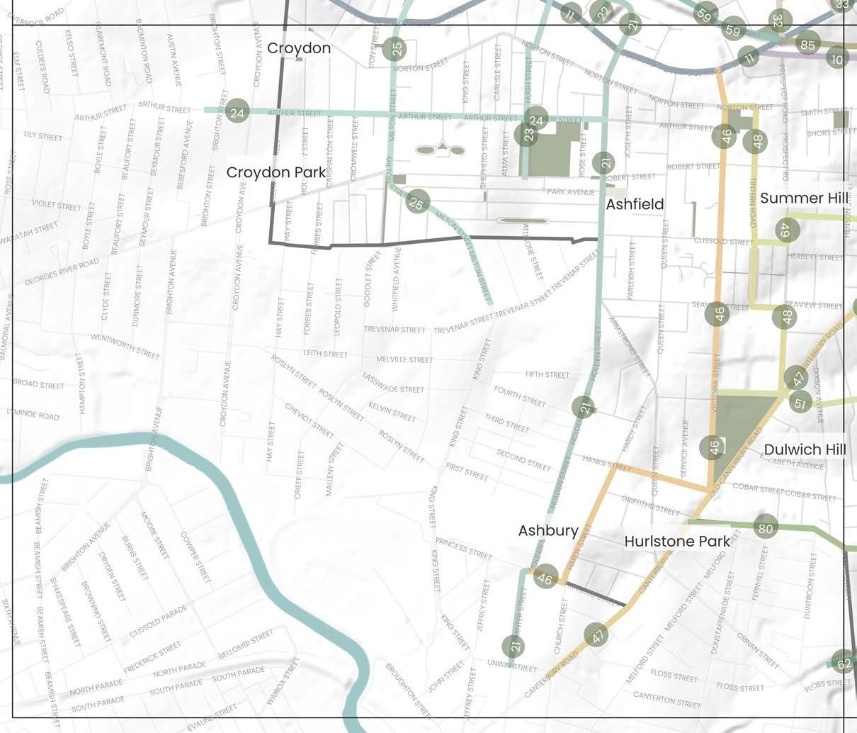
DRAFT Inner West Blue-Green Grid Strategy 2023 43
33 Yeo Park 34 Peace Park 35 Allman Park 36 Cecile Herman Park 37 John Paton Reserve and Henson Street Pre-School 38 Trinity Grammar School 39 St. Patrick’s Catholic Primary School Places Blue-Green Grid Links 10 Southern Link of Newtown to Croydon train line 11 Liverpool Road 21 Holden Street connecting Ashfield Station to Canterbury Park 22 Hercules Street 23 Knox Street to Pratten Park via Park Lane 24 Holden Street to Brighton Street via Arthur Street 25 Peace Park to Parramatta Road via Milton Street and Frederick Street 32 Hawthorne Light Rail Stop to Bruce Street Reserve 46 Victoria Street between Liverpool Road and Hanks Street 47 Canterbury Road and Old Canterbury Road 48 Yeo Park to Liverpool Road via Prospect Road 49 Victoria Square Reserve to Summer Hill Village 51 Yeo Park to Arlington Light Rail Stop 59 Northern Link of Newtown to Croydon train line 62 Southern Trainline 80 New Canterbury Road and Stanmore Road 85 Grosvenor Crescent 33 38 39 35 37 34 36 Cycling Strategy and Action Plan 2023, Inner West Council Iron Cove Creek Master Plan 2022, Inner West Council
Master Plan 2018, Inner West Council GreenWay Biodiversity Strategy 2013, Inner West Council Marrickville Draft Strategy for A Water Sensitive Community 2012, Inner West Council GreenWay Revegetation and Bushcare Plan 2011, Inner West Council Marrickville Biodiversity Strategy 2011, Inner West Council
Flora and Fauna Literature Review 2010, Inner West Council
GreenWay
GreenWay
and Responsibility Precinct Boundary Inner West LGA Boundary Parks and Open Spaces Waterways, rivers and creeks The Inner West Blue-Green Grid Suburb Boundary 0 Train Station Light Rail Station Ferry Terminal Local Places 500m 0m 1km
Relevant Projects
22 Hercules Street Ashfield
A key rail corridor that crosses through a biodiversity corridor at the GreenWay. Link is compromised of multiple links along train lines for connectivity, however is not fully connected for pedestrians. It provides direct routes to train stations and would be well travelled by daily transport users.
The link provides direct routes between train stations and opportunities for better connection to the GreenWay. There is also opportunity to identify a clear user journey along the line and create more crossing for both pedestrians and cyclists. Better cycleway connections, widened footpaths and tree planting for shade are other identified improvements along this route.
Liverpool Road is a key arterial road that traverses Ashfield Town Centre and connects Paramatta Road with Croydon. The link also includes an Aboriginal place of significance.
A major north-south connection that links Ashfield Train Station to Canterbury Park via Ashfield Town Centre. The link connects several open spaces and recreation facilities including some in neighbouring Canterbury-Bankstown LGA.
This is a short link connecting north and south Ashfield Town Centre. The link connects with links 21 and 11.
The route has opportunities to provide more street planting for shade, notably around the Frederick Street intersection. Improvements to cycling connections in and out of the area have also been identified. Ashfield Town Centre is a high pedestrian areas, and could benefit from traffic calming measures for pedestrian safety. Additionally, there are opportunities to recognise and celebrate Aboriginal and Torres Strait Islander culture and histories and protect items and places of high value.
Much of the link has established greenery, with verges providing opportunity for additional tree plantings to increase canopy cover and shade. The link is also an existing cycle route; therefore, opportunities exist to provide a formal cycleway. The link could benefit from additional crossings in high pedestrian activity areas.
Increased tree canopy, verge gardens, greening of laneways and landscaping are some of the key opportunities to enhance shade and amenity for the pedestrians along the route. The link could also benefit from improved pedestrian and cycle infrastructure allowing for suitable separation of pedestrians, cyclists and vehicles.
23
The link connects the Ashfield Town Centre to Pratten Park.
Opportunities along the link should consider the provision of additional vegetation and tree plantings to increase canopy cover and shade. Park Lane has been identified as alternate cycle connection offering a wide, quieter and leafy street for east-west cycling connections.
24 Holden Street to Brighton Street via Arthur Street
Ashfield, Croydon, Croydon Park
An east-west connection between Holden Street and Brighton Street via Arthur Street that directly connects Rose Street Playground, Pratten Park, and Brunswick Parade Reserve.
Possible improvements to this link should consider improved cycling infrastructure footpaths and crossings. Opportunities also exist for additional plantings to increase areas of natural habitat for native flora and fauna.
25
Peace Park to Parramatta Road via Milton Street and Frederick Street
Ashfield, Ashbury
A north-south connection that will aim to connect Peace Park in the Canterbury Bankstown area up to Parramatta Road. There are multiple parks and open spaces along this link including Cecile Herman Park, Thomas Street Reserve, Banks Street Reserve the Ashfield Aquatic Centre, JG McCartney Playground and Hammond Park and playground.
Participants identified Frederick Street as a key bike and pedestrian route to access Ashfield Train Station, the Ashfield Aquatic Centre and a number of other open spaces within this area of the Inner West. Milton Street was also identified as key connector, although in need of improvements to prioritise pedestrian travel and amenity. Potential improvements along this link should consider:
- improvements to footpaths and crossings to ensure they safe and accessible access to key destination. Additional wayfinding would also benefit this link.
- providing improved cycle infrastructure and where possible allowing this infrastructure to be separated from pedestrians and vehicles. Community input highlighted the need for increased safety measures for cyclists under the Frederick Street railway bridge - additional vegetation and tree plantings to increase biodiversity, canopy cover and shade along the link
- provision for incorporation of WSUD elements along the link
The link aims to better connect Ashfield to the GreenWay. It connects Richard Murden Reserve to Ashfield Park through to Bruce Street Reserve which acts as a thoroughfare between Elizabeth Street and Bruce Street. It runs through a flood zone.
Pedestrian access through the Bruce Street Reserve could be supported by improving footpaths. While there are street trees present along the link, it could benefit from more continuous canopy cover and shade beside Ashfield Park and on O'Connor Street. Verges throughout the link can accommodate increased planting.
DRAFT 44 Number Link Suburbs Link Description Possible Opportunities & Improvements ATSIACH EcologyConnectivityHydrology Recreation
10 Southern Link of Newtown to Croydon train line
Newtown, Stanmore, Petersham, Lewisham, Summer Hill, Ashfield, Croydon
1 1
11 Liverpool Road Croydon, Ashfield
1
1
21
Holden Street connecting Ashfield Station to Canterbury Park
Ashfield
1 1
1 1
Knox Street to Pratten Park via Park Lane Ashfield
1 1
1 1 1 1
1 1
32 Hawthorne Light Rail Stop to Bruce Street Reserve Ashfield
1 1 1
46
Victoria Street contains existing well established street trees. The link connects multiple parks and schools including Gough Reserve, Yeo Park, Yeo Park Infants School, Trinity Grammar School, Sydney Private Hospital, and Allman Park.
The existing canopy cover provided by established street trees could be expanded or enhanced with additional greening around verges to improve amenity. Opportunities should consider the provision of safe footpaths and crossings, improving connections for pedestrians along this link.
47 Canterbury Road and Old Canterbury Road
Summer Hill, Hurlstone Park, Ashfield
A north-south link connecting Yeo Park to the Summer Hill Flour Mills development at Edward Street.
There are opportunities to provide improved pedestrian and cycle infrastructure along this link. An improvement identified by the community is the intersection of Old Canterbury Road and Edward Street which connects to the GreenWay cycleway along Weston Street. Yeo Park could also accommodate delivery of more trees to increase canopy cover and amenity for park users.
48
Prospect Road is an existing cycling link and services as an alternative route to link 46 along Victoria Street. The link connects Yeo Park, Trinity Grammar School, Victoria Square Reserve, and Allman Park.
The link crosses through Victoria Square Reserve which offers opportunity to increase habitat for local flora and fauna as well as providing a shaded, vegetated green link. There is the opportunity for north-south pedestrian access through the Reserve though no footpath currently exists. Narrow verges along Prospect Road limit potential for additional greening within the street. Additional plantings in private front gardens could assist with providing additional vegetation and habitat for local flora and fauna. Maintenance of footpaths, especially around areas of high pedestrian activity should be considered.
Link runs along Junction Road connecting Victoria Square Reserve to Summer Hill Village. Link also connects with link 47 on Old Canterbury Road connecting in with high density residential development within the Summer Hill Flour Mills site, Lewisham Train Station and Lewisham West Light Rail Stop.
Link connecting Yeo Park and Arlington Light Rail Stop along Arlington Street and Constitution Road. The link includes connections to Johnson Park and Arlington Recreation Reserve.
Improvements could mostly consider the provision and improvement of safe, accessible footpaths and crossings to key destinations within this link. Segments of the link including parts of the Summer Hill Village have limited canopy cover and would benefit from additional tree plantings to increase shade and general amenity for pedestrians and other users of this link and key destination.
The link services as a direct connection to a number of recreational open spaces and transport infrastructure. Link opportunities should consider providing safe, accessible footpaths and crossings and where possible providing additional tree plantings and landscaping to enhance the amenity provided to pedestrians along the route.
This link follows the T2 rail line between Croydon and Newtown. The northern side of the rail line does not currently allow for full pedestrian access east - west. This link is aspirational to show the need for increased access to the rail line by daily transport users.
Currently there is no continuous pedestrian or cycle link along the rail corridor. Through the community engagement undertaken for this project, this has been identified as a project opportunity that should be investigated to improve pedestrian and cycle connections eastwest across the Inner West. Opportunities along the link should consider improving footpaths, crossings and cycle infrastructure. Rewilding of areas adjacent to the rail corridor in addition to consideration of areas that could accommodate increased tree canopy, verge and private garden plantings should be investigated.
Currently there is no continuous pedestrian or cycle link along the rail corridor. Opportunities along the link should consider improving footpaths, crossings and cycle infrastructure. There is some opportunity along this link to increase tree canopy, verge and private garden plantings and to rewild the area along the rail corridor to increase areas of natural habitat for native flora and fauna.
DRAFT Inner West Blue-Green Grid Strategy 2023 45 Number Link Suburbs Link Description Possible Opportunities & Improvements ATSIACH EcologyConnectivityHydrology Recreation
Victoria Street between Liverpool Road and Hanks Street
Ashfield, Ashbury
1 1 1
1 1
Yeo Park to Liverpool Road via Prospect Road Summer Hill, Ashfield
1 1
49 Victoria Square Reserve to Summer Hill Village Summer Hill, Ashfield
1 1
51 Yeo Park to Arlington Light Rail Stop Ashfield, Summer Hill Dulwich Hill
1 1
59 Northern Link of Newtown to Croydon train line
Newtown, Stanmore, Petersham, Lewisham, Summer Hill, Ashfield, Croydon
1 1
62 Southern Trainline
St Peters, Sydenham, Marrickville, Dulwich Hill
Link follows the train corridor which runs from St Peters to Dulwich Hill train stations.
1 1 1 1
80
New Canterbury Road and Stanmore Road
Hurlstone Park, Dulwich Hill, Lewisham, Petersham, Stanmore, Newtown
85 Grosvenor Crescent Summer Hill
Link runs along major roads including New Canterbury Road, Stanmore Road through to Enmore Road. The route connects with a number of town centres including Dulwich Hill and Petersham.
This link will operate as a main active transport connection from the east-west across in the Inner West. Opportunities along this link should look to provide improved cycleways and pedestrian infrastructure, including reduced speed limits and traffic calming where there is high pedestrian activity. Where possible provision should be made for suitable separation of pedestrians, cyclists and vehicle infrastructure. Additional tree plantings to improve shade and amenity along the link is a noted opportunity, particularly within the town centres included within this grid link.
Link follows a portion of the train line between Liverpool Road and Cadigal Reserve.
Opportunities along the link should consider improving footpaths, crossings and cycle infrastructure. There is some opportunity along this link to increase verge and private garden plantings and to rewild the area along the rail corridor to increase areas of natural habitat for native flora and fauna.
DRAFT 46 Number Link Suburbs Link Description Possible Opportunities & Improvements ATSIACH EcologyConnectivityHydrology Recreation
1 1
1
7.3.3 Precinct 3
35 The Bay Run Path from Robson Park to Constellation Playground
38 Balmain Road at Glover Street to Balmain East Ferry wharf via Darling Street
39 Beattie Street to Bridgewater Park via Wise, Terry and Margaret Street
40 Orange Grove Public School to Leichhardt Oval
45 Callan Park to Whites Creek Valley
72 Victoria Road
89 Callan Park
91 Balmain Peninsula harbour walk
Callan Park Tidal Pools project
Ongoing, Inner West Council
Rozelle Town Centre Master Plan (under development)
Ongoing, Inner West Council/TfNSW
Cycling Strategy and Action Plan
2023, Inner West Council
Parramatta to Sydney Harbour
Foreshore Link (under development)
2023, TfNSW
Callan Park Landscape Structure Plan
2021, Inner West Council/ Greater Sydney Parklands/NSW Health
Bays West Place Strategy
2021, NSW DPE
Leichhardt Native Revegetation & Biodiversity Management Plan
2017, Inner West Council
Foreshore Access Strategy
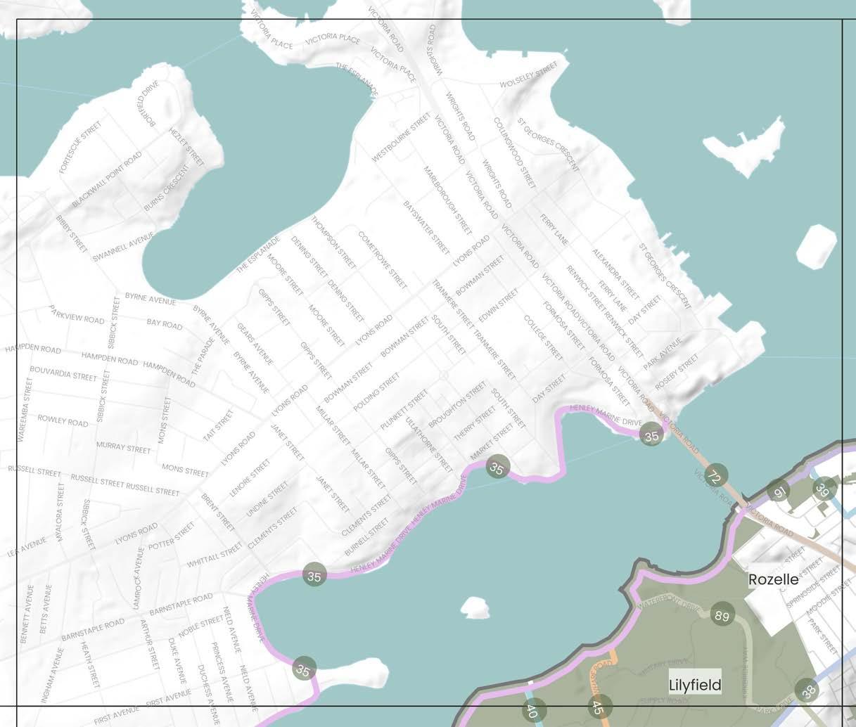
2020, Canada Bay Council
1 Callan Park
2 King George Park
3 Bridgewater Park
Callan Park Endangered Ecological Centre Restoration Projects
2022, Bushcare NSW
Waterfront Revitalisation in Callan Park
2021, Greater Sydney Parklands
DPE/Inner West Council
DRAFT Inner West Blue-Green Grid Strategy 2023 47
Places Relevant Projects
Responsibility 35 35 38 1 2 3 Precinct Boundary Inner West LGA Boundary Parks and Open Spaces Waterways, rivers and creeks The Inner West Blue-Green Grid Suburb Boundary 0 Train Station Light Rail Station Ferry Terminal Local Places 500m 0m 1km
Blue-Green Grid Links
and
Drummoyne
Russell Lea
Rodd Point
Chiswick
38
The Bay Run Path from Robson Park to Constellation Playground
Lilyfield, Rozelle, Haberfield
One of the key links within the Blue-Green Grid which follows the foreshore of the Iron Cove Bay partly within the Inner West and partly within the Canada Bay Council areas. The link has existing pedestrian and cycling facilities and connects with many existing recreational spaces.
Community input into this project has suggested that the link could be improved through the provision of separated paths for pedestrians and cyclists. Other improvements for this link include the provision of additional tree plantings on parts of the link that are currently very exposed to assist in providing additional shade along this key recreational route.
Balmain Road at Glover Street to Balmain East Ferry wharf via Darling Street
Rozelle, Balmain, Balmain East
The link is a key route along the spine of the Balmain Peninsula connecting with Callan Park, the Rozelle and Balmain Town Centres and through to the Balmain East ferry wharf and harbour foreshore area. The link connects with the historical Tom Uren Trail and link 91 know as the Balmain Peninsula harbour walk.
Darling Street was commonly identified by the community as a missing active transport link within the northern part of the Inner West. This link would benefit from improved footpaths and crossing and cycle infrastructure within the town centres. The link would also benefit from increased tree canopy cover along the eastern side of Darling Street and Balmain Road to increase shade cover and improve amenity along these popular high streets for pedestrians and cyclists. Additional opportunities for improvements to Darling Street at the intersection with Victoria Road will be made possible through opportunities identified as part of the Rozelle Town Centre Master Plan (as identified as part of link 72).
39
Beattie Street to Bridgewater Park via Wise, Terry and Margaret Street
Rozelle, Balmain
40 Orange Grove Public School to Leichhardt Oval Lilyfield
This link connects foreshore open spaces at Balmain Cove including Bridgewater Park and Elliot Park to the town centres of Rozelle and Balmain via Beattie Street.
Connects Orange Grove Public School to a major recreational facility and the harbour foreshore. This link runs along Glover Street, Emmerick Street and Perry Lane to Lilyfield Road.
From Whites Creek Valley the link runs along Ilka Street, via War Memorial Park and along Alfred Street before heading north along Balmain Road into Callan Park. This link also connects with link 42 which connects with Pioneers Park.
This link could benefit from increased landscaping and street tree plantings in areas with wider road reserves. Opportunities should also consider improvements to pedestrian and cyclist infrastructure along this link.
Part of this route along Glover Street is an existing cycleway but there is no formal cycle path provided. Improved cycle infrastructure along Glover Street as well as other streets identified within this link would improve connectivity and access.
The community have identified a desire for improved connections between Whites Creek Valley and Callan Park. Along this link an opportunity exists to pedestrianise and green the laneway between Ainsworth Street and Mackenzie Street which would provide more direct and desirable connection to Balmain Road. Balmain Road is in need of improvements to the existing network of footpaths and crossings as well as increased canopy cover to support safer pedestrian access and improve amenity.
The opening of the WestConnex Iron Cove Tunnel presents a significant opportunity for Council to work with TfNSW on active transport and public domain improvements along Victoria Road. The project will also offer opportunities for improvements along Darling Street Rozelle that will help improve connectivity of the Rozelle Town Centre (currently divided by Victoria Road). Possible link opportunities could include:
- improvements to footpaths and crossings to ensure they safe and accessible
- providing cycle paths and where possible allowing these to be separated from pedestrians and vehicles
- additional vegetation and tree plantings to increase biodiversity, canopy cover and shade along the link
- provision for incorporation of WSUD elements
- provision of spaces for public art and cultural activation
- recognition and celebration of Aboriginal and Torres Strait Islander culture and histories
Any improvements to this link should also consider appropriate connections into the future Rozelle Parklands.
DRAFT 48 Number Link Suburbs Link Description Possible Opportunities & Improvements ATSIACH EcologyConnectivityHydrology Recreation 35
1 1 1 1 1
1 1 1
1 1
1
45 Callan Park to Whites Creek Valley Lilyfield
1 1
72 Victoria Road Rozelle
Link from the Bays Precinct to the Bay Run.
1 1 1
The link runs along the harbour side of the Balmain Peninsula starting from Bridgewater Park through to the intersection of Robert Street and Victoria Road. The link connects multiple parks along the Sydney Harbour Foreshore, providing an excellent route for recreation.
The community recognise Callan Park as an important recreational and cultural/arts precinct for the local and wider Sydney community. Future works to the parkland should ensure the space offers a diverse range of inclusive spaces for the community to undertake a range of recreational and cultural activities. Community feedback to this strategy has expressed a desire to increase and improve access to Callan Park through improved active transport infrastructure including provision of more safe, accessible footpaths and crossings on streets leading into the parkland as well as improve cycle infrastructure.
Other opportunities for this parkland and surrounds based on identified grid functions include:
- Recognise and celebrate Aboriginal and Torres Strait Islander culture and histories
- Provide public art and cultural activation in public spaces and parks
- Recognise and promote the areas of heritage significance
- Protect, enhance and increase areas of habitat for native flora and fauna
- Provide additional swimming and recreational opportunities
Improving connectivity, public access and an increased range of recreational facilities along the harbour foreshore were identified by many contributors to this project as in need of further investigation. Of note was the desire by many to see additional swim sites provided along the harbour foreshore in locations such as Mort Bay. Improved pedestrian access was suggested for areas including Paringa Reserve, Simmons Point Reserve and Yurulbin Park.
TfNSW is currently undertaking a major project known as the Parramatta to Sydney Foreshore Link. The link program will look to deliver a 91km continuous link between Parramatta Park to the Opera House/Botanical Garden for cyclists and pedestrians.
Council will need to work closely with TfNSW to on this project work. The link is in close vicinity of the White Bay Eco Corridor which aims to increase and connect greenspaces for wildlife. The link should consider suggestions made for the eco corridor for implementation of this link where relevant.
DRAFT Inner West Blue-Green Grid Strategy 2023 49 Number Link Suburbs Link Description Possible Opportunities & Improvements ATSIACH EcologyConnectivityHydrology Recreation
89 Callan Park Lilyfield
This link travels through Callan Park to Lilyfield Road via Cecily Street.
1 1 1 1
91 Balmain Peninsula harbour walk Rozelle, Birchgrove, Balmain, Rozelle
1 1 1 1 1
7.3.4 Precinct 4
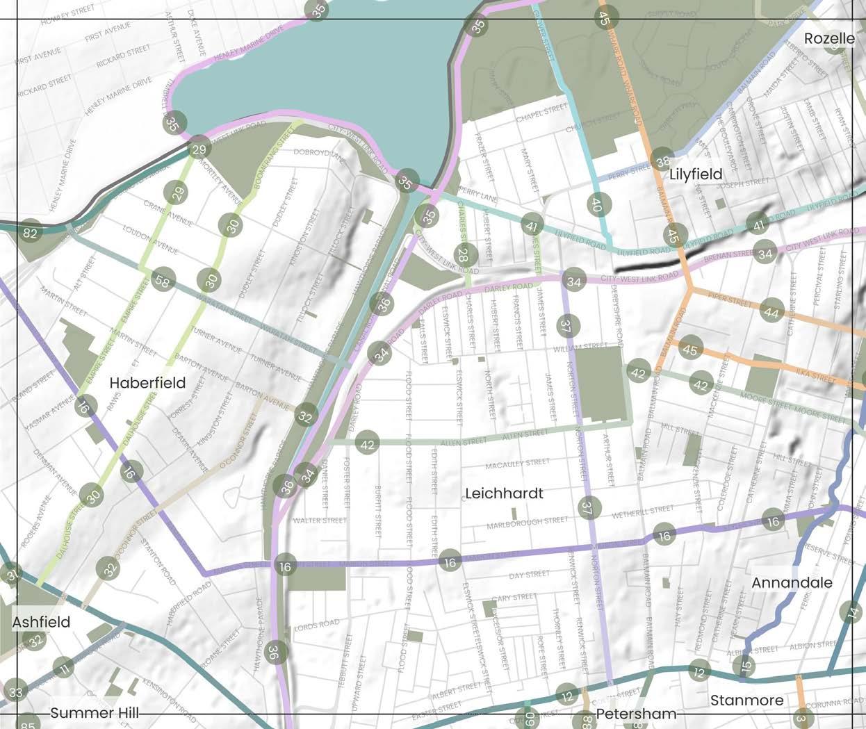
DRAFT 50
Places Blue-Green Grid Links 3 Petersham Road to Percival Road 11 Liverpool Road 12 Parramatta Road 14 Annandale Street 15 Whites Creek via Cohen Park, Whites Creek Valley and Whites Creek Lane 16 Marion Street between Ramsay Street to Johnstons Creek 28 Leichhardt North Light Rail Stop to Blackmore Oval 29 Robson Park to Algie Park 30 Ashfield Park to Robson Park via Boomerang Street 32 Hawthorne Light Rail Stop to Bruce Street Reserve 34 Hawthorne Canal to The Crescent along City West Link 35 The Bay Run Path from Robson Park to Constellation Playground 36 The Cooks to Cove GreenWay 37 Norton Street 38 Balmain Road at Glover Street to Balmain East Ferry wharf via Darling Street 40 Glover Street to Derbyshire Road 41 Lilyfield Road 42 Hawthorne Light Rail Stop to Badu Reserve 44 Piper Street to Johnstons Creek 45 Callan Park to Whites Creek Valley 19 Leichhardt Park Aquatic Centre 20 Leichhardt Oval 21 Orange Grove Public School 22 Pioneers Memorial Park 23 War Memorial Park 24 Lambert Park 25 The GreenWay and associated parks 26 Ashfield Park 27 Algie Park 28 Robson Park 19 20 21 23 22 25 28 25 27 26 24 13 58 Waratah Street 60 Palace Street 82 Iron Cove Creek Corridor 84 Crystal Street 88 Railway Street and Regent Street 89 Callan Park Precinct Boundary Inner West LGA Boundary Parks and Open Spaces Waterways, rivers and creeks The Inner West Blue-Green Grid Suburb Boundary 0 Train Station Light Rail Station Ferry Terminal Local Places 500m 0m 1km
27 26
13
7.34 Precinct 4 Continued 28 25
24
Inner
Boundary
West LGA
Iron Cove Creek Master Plan
2023, Inner West Council
GreenWay Missing Links project
Ongoing, Inner West Council
Marrickville Town Centre Master Plan
(under development) Ongoing, Inner West Council
Cycling Strategy and Action Plan
2023, Inner West Council
Haberfield, Ashfield and Leichhardt local network improvement plans
2023, TfNSW
Parramatta to Sydney Harbour Foreshore Link
2023, TfNSW
Bays West Place Strategy
2021, NSW DPE
Leichhardt Aquatic Centre Masterplan
2020, Inner West Council
WestConnex Urban Design and Landscape Plan
2020, Transport for NSW
Foreshore Access Strategy
2020, Canada Bay Council
Urban Canopy Strategy
2019, Canada Bay Council
GreenWay Master Plan
2018, Inner West Council
Leichhardt Native Revegetation & Biodiversity Management Plan
2017, Inner West Council
Annandale North Neighbourhood Movement Plan
2016, Inner West Council
GreenWay Biodiversity Strategy
2013, Inner West Council
Marrickville Draft Strategy for a Water Sensitive Community
2012, Inner West Council
GreenWay Revegetation and Bushcare Plan
2011, Inner West Council
Marrickville Biodiversity Strategy
2011, Inner West Council
GreenWay Flora and Fauna Literature Review
2010, Inner West Council
Marrickville Urban Forest Strategy
DRAFT Inner West Blue-Green Grid Strategy 2023 51
Relevant Projects and Responsibility 19 20 21 23 22 25
and Open Spaces
rivers and creeks The Inner West Blue-Green Grid Suburb Boundary 0 Train Station Light Rail Station Ferry Terminal Local Places 11 500m 0m 1km
2010, Inner West Council
Precinct
Boundary Parks
Waterways,
15
Marrickville,
Key existing cycle route that connects Marrickville Town Centre to Parramatta Road via Marrickville High School, Henson Park, Newington College, Stanmore Train Station and Town Centre, and Weekly Park. The link is mostly residential in character.
Liverpool Road is a key arterial road that traverses Ashfield Town Centre and connects Paramatta Road with Croydon. The link also includes an Aboriginal place of significance.
Parts of this route have decent canopy coverage, whilst some provide wide road reserves that would suite additional greening and more space for pedestrians. The link could benefit from additional crossings and widened footpaths.
The route has opportunities to provide more street planting for shade, notably around the Frederick Street intersection. Improvements to cycling connections in and out of the area have also been identified. Ashfield Town Centre is a high pedestrian areas, and could benefit from traffic calming measures for pedestrian safety. Additionally, there are opportunities to recognise and celebrate Aboriginal and Torres Strait Islander culture and histories and protect items and places of high value.
Haberfield,
Parramatta Road is a key state road which traverses the Inner West east to west connecting the CBD to Western Sydney. The 6 lane road is mostly commercial in nature, and has limited street trees. There are multiple points of interest along the link, including half a dozen entertainment venues and pubs, Ashfield Park, the GreenWay, Fort Street High School and primary links into surrounding suburbs.
Parramatta Road has opportunities to deliver significant improvement in tree canopy coverage and street tree planting for cooling. The link could deliver widened footpaths, improved crossings for pedestrians and cyclists alike, along with dedicated cycleways and improved public transportation offering. The link is subject to both local and state strategies that provide opportunity for public domain and access uplift, including the Paramatta Road Corridor Urban Transformation Strategy, Tech Central, and the WestConnex Camperdown Dive Site which holds potential to deliver temporary and long term value to the Blue-Green Grid.
Whites Creek via Cohen Park, Whites Creek Valley and Whites Creek Lane
Annandale
A residential street, lined with large mature trees on the road leaving the footpaths unobstructed. The link connects Parramatta Road with the City West Link and Rozelle Bay.
A hydrological corridor running from Parramatta Road to City West Link that has a parallel walkway connecting Cohen Park to Whites Creek Valley Park. The creek has inherent ecological value and is identified as being an important corridor to the local Aboriginal heritage. The link is a great place for recreational walks and passes though tree lined streets through many reserves and playgrounds, and includes valuable community facilities like Annandale Skate Park, Whites Creek Community Garden and Wetlands, and Cohen Park tennis courts.
Like Johnston Street (Link 13), existing strong tree canopy cover coupled with a wide road creates the opportunity to create a dense ecological corridor in conjunction with private and verge garden planting. The residential nature of the street may be a safer location for a cycleway than other streets and provide a pedestrian friendly alternative to surrounding streets with higher vehicle speeds and usage.
Ample opportunity to enhance and diversify urban ecology and for naturalisation along the creek beds and riparian zones, with the potential of creating a nature reserve. Additional tree planting along the link, supported by verge and private garden planting, would support urban ecology and provide urban cooling. Opportunity for additional cycleways, traffic calming and footpath improvements.
16
Marion Street between Ramsay Street to Johnstons Creek
Annandale, Leichhardt, Haberfield
A key east-west connection through the LGA running almost parallel to Parramatta Road offering an alternative east-west connection, crossing with the GreenWay and Whites Creek. It connects multiple town centres including Haberfield, Leichhardt and industrial centres at Annandale/Camperdown. Parks include Algie Park, Lambert Park, Mayes Street Reserve and Evan Jones Playground and schools including Leichhardt Public School and St Brendans Catholic Primary School.
The link runs parallel to Paramatta Road but is a local road so it has the potential to become a quiet, safe and comfortable active transport route alternative. Additional cycleways and connections from the GreenWay to Norton Street have been identified. The link has opportunities for more street tree planting for urban cooling and opportunities for public art and cultural activation in the town centres and venues such as Leichhardt Town Hall.
DRAFT 52 Number Link Suburbs Link Description Possible Opportunities & Improvements ATSIACH EcologyConnectivity Hydrology Recreation
3 Petersham Road to Percival Road
Petersham, Stanmore
1 1
11 Liverpool Road Croydon, Ashfield
1 1
12 Parramatta Road
Croydon, Ashfield, Leichhardt, Annandale, Camperdown, Newtown, Stanmore, Petersham, Lewisham, Summer Hill.
1 1
14 Annandale Street Annandale
1 1
1 1 1 1 1
1 1 1
29
Connects the light rail stop at Leichardt North to the Blackmore Oval via James Street, Darley Road, Charles Street and Canal Road.
Connection from The Bay Run past Dobroyd Point Public School to Algie Park and playground along Chelmsford Avenue and Empire Street to Ramsay Street.
Provides a connection from the Bay Run to Ashfield Park via the Haberfield Town Centre and Library.
The link offers opportunity to formalise a green link from the light rail station to Blackmore Oval and then connecting onto the GreenWay in Richard Murden Reserve. Darley Road could benefit from additional vegetation and tree plantings to increase shade cover along the link for pedestrians and cyclists. Additional wayfinding signage would also be beneficial help navigate this link and the connections it offers to existing greenspaces and transport infrastructure.
There is some opportunity along this link to increase verge and private garden plantings. This link as a play street could also be considered given the close proximity to the local public school and Algie Park.
30
The link aims to better connect Ashfield to the GreenWay. It connects Richard Murden Reserve to Ashfield Park through to Bruce Street Reserve which acts as a thoroughfare between Elizabeth Street and Bruce Street. It runs through a flood zone.
Opportunities along the link should consider improving footpaths, crossings and cycle infrastructure along the entirety of the link for ease of use, especially around Haberfield Town Centre. Due to existing wide verges, there is potential to increase plantings to expand areas of natural habitat for native flora and provide additional shade through canopy cover. The connections between Boomerang Street and the Bay Run could be upgraded for accessibility to a key active transport route.
Pedestrian access through the Bruce Street Reserve could be supported by improving footpaths. While there are street trees present along the link, it could benefit from more continuous canopy cover and shade beside Ashfield Park and on O'Connor Street. Verges throughout the link can accommodate increased planting.
A route that links up from Hawthorne Canal at The GreenWay along the northern Light Rail route and City West Link to The Crescent via Jubilee Park in Annandale. The link covers a key ecological corridor along multiple Light Rail Stops and also runs through a major flooding area and the Rozelle Interchange (part of WestConnex works).
One of the key links within the Blue-Green Grid which follows the foreshore of the Iron Cove Bay partly within the Inner West and partly within the Canada Bay Council areas. The link has existing pedestrian and cycling facilities and connects with many existing recreational spaces.
Footpaths and crossings along Darley Road and at major intersections on City West Link can be upgraded to ensure pedestrian safety. There is opportunity for increased tree planting in areas with wide street verges. The link could support a safe east-west active transport connection through the provision of continuous cycleway infrastructure.
Community input into this project has suggested that the link could be improved through the provision of separated paths for pedestrians and cyclists. Other improvements for this link include the provision of additional tree plantings on parts of the link that are currently very exposed to assist in providing additional shade along this key recreational route.
DRAFT Inner West Blue-Green Grid Strategy 2023 53 Number Link Suburbs Link Description Possible Opportunities & Improvements ATSIACH EcologyConnectivity Hydrology Recreation
28
Leichhardt North Light Rail Stop to Blackmore Oval Leichhardt
1 1 1 1
Robson Park to Algie Park Haberfield
1
Ashfield Park to Robson Park via Boomerang Street Haberfield
1
32 Hawthorne Light Rail Stop to Bruce Street Reserve Ashfield
1 1 1
34
Hawthorne Canal to The Crescent along City West Link
Leichhardt, Lilyfield, Annandale, Haberfield
1 1
35
The Bay Run Path from Robson Park to Constellation Playground
Lilyfield, Rozelle, Haberfield
1 1 1 1 1
40 Orange Grove Public School to Leichhardt Oval Lilyfield
The GreenWay is an environmental and active transport corridor linking the Cooks River at Earlwood with the Parramatta River at Iron
As a major environmental and recreational link for the Inner West, the link continues to offer the community a diverse and inclusive recreation space with opportunities for
- public art and cultural activation in public spaces and parks
- protecting, enhancing and increasing wildlife corridors and areas of habitat for native flora and fauna
- Providing safe, accessible footpaths and cyclewaysRecognising and celebrating
- Aboriginal and Torres Strait Islander culture and histories in significant locations as they are identified along the link
Major improvements and opportunities for this existing ecological active transport corridor are outlined within the GreenWay Masterplan. The GreenWay Masterplan includes proposals for $57 million of works to be implemented over the long term. Around $45 million of high priority works are anticipated to be completed in 2025. Works in progress include:
- high voltage feeder relocation to the Waratah Mills Light Rail Station (required to enable construction of the paths and an ecological restoration of parts of the corridor
- Bay Run path and lighting upgrade
- in-corridor works involving the construction of a shared path, lighting and landscaping
Community feedback identified the need for improved crossings over Parramatta Road at Taverners Hill. In April 2023 design plans were exhibited detailing options for addressing key missing links and connections which could delivered to provide safer, more accessible connections along the entirety of the GreenWay link. A section of the link is included within the Parramatta Road Corridor Strategy Phase Planning Proposal. Future uplift may provide opportunities for improved public domain and recreation improvements.
The Leichhardt Town Centre is located along this link. The link connects it to Parramatta Road alongside Leichhardt Town Hall, Pioneers Memorial Park, to the light rail station in the north.
Increasing canopy cover where possible is significant to provide shade and amenity for the high volume of pedestrians around the town centre. Provision of accessible footpaths and crossings should be maintained for pedestrian safety. Parramatta Road Corridor (Stage – 1 Implementation) offers opportunities to deliver additional recreation space and through site links that the Blue-Green Grid may be able to connect to in the future. Norton Street is recognised by many as being home to stong Italian culture, community and heritage. This link should look to contribute to the recognition of this area through provision of new public art, signage and areas for cultural events.
The link is a key route along the spine of the Balmain Peninsula connecting with Callan Park, the Rozelle and Balmain Town Centres and through to the Balmain East ferry wharf and harbour foreshore area. The link connects with the historical Tom Uren Trail and link 91 know as the Balmain Peninsula harbour walk.
1 1
Part of this route along Glover Street is an existing cycleway but there is no formal cycle path provided. Improved cycle infrastructure along Glover Street as well as other streets identified within this link would improve connectivity and access. 1
DRAFT 54 Number Link Suburbs Link Description Possible Opportunities & Improvements ATSIACH EcologyConnectivity Hydrology Recreation
36 The Cooks to Cove GreenWay
Leichhardt, Haberfield, Lewisham, Summer Hill, Dulwich Hill
Cove.
1 1 1 1 1
37 Norton Street Leichhardt
1 1
1
38
Balmain Road at Glover Street to Balmain East Ferry wharf via Darling Street
Rozelle, Balmain, Balmain East
Darling Street was commonly identified by the community as a missing active transport link within the northern part of the Inner West. This link would benefit from improved footpaths and crossing and cycle infrastructure within the town centres. The link would also benefit from increased tree canopy cover along the eastern side of Darling Street and Balmain Road to increase shade cover and improve amenity along these popular high streets for pedestrians and cyclists. Additional opportunities for improvements to Darling Street at the intersection with Victoria Road will be made possible through opportunities identified as part of the Rozelle Town Centre Master Plan (as identified as part of link 72). 1
Connects Orange Grove Public School to a major recreational facility and the harbour foreshore. This link runs along Glover Street, Emmerick Street and Perry Lane to Lilyfield Road.
Leichhardt,
This link runs from Victoria Road to Canal Road. The link runs adjacent to the area which has been identified to become Rozelle Parklands and the existing Easton Park. Part of the link is an existing on road cycle link. Areas of Aboriginal heritage significance are located along this link.
An east-west connection across the Inner West that could link the Bay Run with the new Rozelle Parklands development site. Future improvements and opportunities along this link should consider:
- increasing areas of vegetation that could provide habitat for native flora and fauna within the private and public domain along the link
- provision of additional improved cycle infrastructure, where possible separated from vehicular traffic
- providing safe and accessible footpaths and crossings along the entirety of the link
- integration of WSUD elements into existing open spaces and the streets
- protection of areas containing items and places of Aboriginal and Torres Strait Islander significance
Improved east-west active transport connections via Sydney Secondary College have been raised an opportunity that should be considered further. Future improvements and opportunities along this link should look to consider:
Route is a key east-west link running along Allen Street, Moore Street and Booth Street through to Badu Reserve. The link passes through Pioneers Memorial Park, Sydney Secondary College and a small commercial area located along Booth Street.
- increasing areas of vegetation that could provide habitat for native flora and fauna within the private and public domain along the link
- provision of cycle infrastructure, where possible separated vehicular traffic
- providing safe and accessible footpaths and crossings along the entirety of the link
- integration of WSUD elements into existing open spaces and the streets
This link offers potential to formalise a connection between multiple green spaces located along Piper Street. Opportunities should look to consider:
The link provides east-west connectivity along Piper Street from Balmain Road to Piper Street Reserve and Johnsons Creek via Annandale North Public School and Hinsby Park.
- increasing areas of vegetation that could provide habitat for native flora and fauna within the private and public domain along the link
- providing safe and accessible footpaths and crossings along the entirety of the link
- reduced vehicle speed limits along the road way
- integration of WSUD elements into existing open spaces and the streets
- opportunities for the integration of a play street along the link (given the close connection of the school with existing recreational spaces)
The community have identified a desire for improved connections between Whites Creek Valley and Callan Park. Along this link an opportunity exists to pedestrianise and green the laneway between Ainsworth Street and Mackenzie Street which would provide more direct and desirable connection to Balmain Road. Balmain Road is in need of improvements to the existing network of footpaths and crossings as well as increased canopy cover to support safer pedestrian access and improve amenity.
Opportunities exist to provide safe, accessible footpaths and crossings along this link. This street is also identified in the 2023 Cycle Strategy allowing opportunities for new cycle infrastructure to be provided along this link in the future. Existing vegetation and tree canopy is minimal. Therefore some opportunities may also exist to provide additional tree plantings and encourage verge and private garden planting to improve amenity along the link.
Improvements along this link should consider the provision of safe, accessible footpaths and crossings. The amenity of the link could also be improved through the provision of additional vegetation and tree plantings to increase canopy cover and shade along the link.
DRAFT Inner West Blue-Green Grid Strategy 2023 55 Number Link Suburbs Link Description Possible Opportunities & Improvements ATSIACH EcologyConnectivity Hydrology Recreation
41 Lilyfield Road Lilyfield, Rozelle
1 1 1
42 Hawthorne Light Rail Stop to Badu Reserve
Annandale
1 1 1 1 1
44 Piper Street to Johnstons Creek Annandale, Lilyfield
1 1 1
45 Callan Park to Whites Creek Valley Lilyfield
From Whites Creek Valley the link runs along Ilka Street, via War Memorial Park and along Alfred Street before heading north along Balmain Road into Callan Park. This link also connects with link 42 which connects with Pioneers Park.
1 1
58 Waratah Street Haberfield
Connects the Iron Cove Creek to Richard Murden Reserve via Dobroyd Point Public School.
1 1
60 Palace Street Petersham Short link connecting Parramatta Road to Petersham Train Station via Fort Street High School.
1 1
The Iron Cove Creek corridor is a 3.5km long corridor between Liverpool Road and Iron Cove following the alignment of Iron Cove Creek (also known as Dobroyd Canal).
Iron Cove Creek green link is identified in the NSW Government's Sydney Green Grid. This link aligns with current project work being undertaken by Council as part of the Iron Cove Creek Master Plan. The Master Plan will explore use of the canal and the adjoining land to provide an off-street walking and cycling path as well as increased landscaping/habitat and more open space between Liverpool Road and Iron Cove.
This link has been identified by the community as a key missing active transport connection necessary to better connect the northern and southern parts of the Inner West. Possible improvements to this link should consider improved cycling infrastructure and where possible additional tree plantings and improvements to footpaths and crossings to make the link a safer active transport connection for all users.
Opportunities exist to provide safe, accessible footpaths and crossings along this link. Some opportunities may also exist to provide additional tree plantings and encourage verge and private garden planting to improve amenity along this link.
The community recognise Callan Park as an important recreational and cultural/arts precinct for the local and wider Sydney community. Future works to the parkland should ensure the space offers a diverse range of inclusive spaces for the community to undertake a range of recreational and cultural activities. Community feedback to this strategy has expressed a desire to increase and improve access to Callan Park through improved active transport infrastructure including provision of more safe, accessible footpaths and crossings on streets leading into the parkland as well as improve cycle infrastructure.
Other opportunities for this parkland and surrounds based on identified grid functions include:
- Recognise and celebrate Aboriginal and Torres Strait Islander culture and histories
- Provide public art and cultural activation in public spaces and parks
- Recognise and promote the areas of heritage significance
- Protect, enhance and increase areas of habitat for native flora and fauna
- Provide additional swimming and recreational opportunities
DRAFT 56 Number Link Suburbs Link Description Possible Opportunities & Improvements ATSIACH EcologyConnectivity Hydrology Recreation
82 Iron Cove Creek Corridor Haberfield, Ashfield, Croydon
1 1 1 1 1
84 Crystal Street Petersham Link from New Canterbury Road to Parramatta Road via Petersham TAFE.
1
88 Railway Street and Regent Street Petersham Connection between Parramatta Road and New Canterbury Road via Petersham Train Station.
1
89 Callan Park Lilyfield This link travels through Callan Park to Lilyfield Road via Cecily Street.
1 1 1
7.3.5 Precinct 5
Blue-Green Grid Links
1 Petersham Park to Sydenham Station via Marrickville and Henson Park
2 Marrickville Peace Park to Montague Gardens
3 Petersham Road to Percival Road
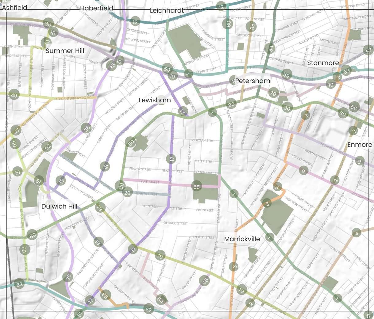
4 Victoria Road to Newtown Train Station
8 Newington Road from Albert Street to Enmore Road
9
10
56
57
17
85
DRAFT Inner West Blue-Green Grid Strategy 2023 57
Addison Road from Enmore Park to Bright Street
Southern Link of Newtown to Croydon train line
12 Parramatta Road
Street
Johnson Park to Petersham Public School
Arlington Light Rail Stop along Beach Road to Wardell Road
Hoskins Park to Wardell Road along Pigott Street and Herbert Street
The Cooks to Cove GreenWay
Canterbury Road and Old Canterbury Road
Victoria Square Reserve to Summer Hill Village
Constitution Road to The Parade via Union Street
Yeo Park to Arlington Light Rail
Windsor Road to Waratah Mills Light Rail Stop
Ness Park via Harney Street
Yule Street and Porter Avenue
Palace Street
Southern Trainline
Road
Lewisham Train Station to Dulwich Hill Train Station via Wardell Road and Hunter
18
19
20
36
47
49
50
51
52
54
55
60
62
68 Livingstone
Crammond Park
Road
70 Petersham Town Centre to
79 Marrickville
Street
80 New Canterbury to Stanmore Road 84 Crystal
Grosvenor Crescent
Kays Avenue West
Railway Street
Regent Street from Parramatta Road
New Canterbury Road 43 51 40 39 50 41 42 45 44 46 52 47 49 48
86
88
and
to
Cavendish Street
Salisbury
Road
Croydon
Precinct Boundary Inner West LGA Boundary Parks and Open Spaces Waterways, rivers and creeks The Inner West Blue-Green Grid Suburb Boundary 0 Train Station Light Rail Station Ferry Terminal Local Places 500m 0m 1km
59 Northern Link of Newtown to
train line
7.3.5 Precinct 5 Continued
Relevant Projects and Responsibility
Dulwich Hill Village Master Plan (under development)
Ongoing, Inner West Council
Marrickville Town Centre Master Plan (under development)
Ongoing, Inner West Council
GreenWay Missing Links project
Ongoing, Inner West Council
Cycling Strategy and Action Plan
2023, Inner West Council
Dulwich Hill Parklands Master Plan
2020, Inner West Council
GreenWay Master Plan
2018, Inner West Council
Leichhardt Native Revegetation & Biodiversity Management Plan
2017, Inner West Council
Parramatta Road Corridor Urban Transformation Strategy (PRCUTS)
2016, TfNSW DPE/Inner West Council
Western Channel Subcatchment Management Plan
2014, Inner West Council
Eastern Channel North Subcatchment Management Plan
2013, Inner West Council
GreenWay Biodiversity Strategy
2013, Inner West Council
GreenWay Revegetation and Bushcare Plan
2011, Inner West Council
Marrickville Biodiversity Strategy
2011, Inner West Council
GreenWay Flora and Fauna Literature Review
2010, Inner West Council
Riverside Crescent Subcatchment Management Plan
2010, Inner West Council
Tennyson Street Subcatchment Management Plan
2009, Inner West Council
DRAFT 58 43 51 40 39 50 41 42 45 44 46 52 47 49 48 Precinct Boundary Inner West LGA Boundary Parks and Open Spaces Waterways, rivers and creeks The Inner West Blue-Green Grid Suburb Boundary 0 Train Station Light Rail Station Ferry Terminal Local Places 500m 0m 1km Places 39 Marrickville Park 40 Henson Park 41 Morton Park 42 Lewisham Public School 43 Pertersham Park 44 Johnston Park 45 Arlington Recreation Reserve 46 Jack Shanahan Park 47 Wicks Park 48 Marrickville Public School 49 Marrickville High School 50 Wilkings Public School 51 Newington College 52 St. Maroun’s College
Link connects major recreational open spaces traveling from Petersham Park at West Street and down Livingstone Road to Marrickville Park then along Sydenham Road passing Wilkins School, Henson Park and Wicks Park before arriving at Sydenham Station. The link travels busy streets, mostly residential with pockets of commercial and industrial at the Sydenham end.
The link could see improvements in pedestrian and cycling infrastructure to make the north-south connection safer but to also offer better connections to major east-west cycling routes and the rail line. West Street is well serviced with existing tree canopy. This should be retained and enhanced so as encourage and increase areas of habitat for native flora and fauna. Areas of industrial character along Sydenham Road see a reduction in canopy cover and could benefit from increased tree planting to mitigate urban heat and support urban ecology.
A key existing cycle way that runs from the Cooks River up to Montague Gardens via Marrickville Town Centre and number of schools including Ferncourt Public School and Newington College. The link along Illawarra Road is busy. The streets are predominantly residential in character, with some commercial and with a good amount of tree canopy.
The route has an existing strong tree canopy presence with room to expand, and the community wish to see increased planting for shade and amenity. Opportunity exists to raise pedestrian crossing through the high pedestrian activity area. The community identified Illawarra Road as good north-south connection. However, due to topography and heavy vehicle presence it would need improvements to be a safe option for active transport such as traffic calming, signage and line markings.
Key existing cycle route that connects Marrickville Town Centre to Parramatta Road via Marrickville High School, Henson Park, Newington College, Stanmore Train Station and Town Centre, and Weekly Park. The link is mostly residential in character.
A busy thoroughfare, the route connects parts of Marrickville through to Newtown predominantly following Victoria Road and Enmore Road. Key destinations along the link include the Factory Theatre, Enmore Park and Enmore Theatre. The link changes from residential to industrial then commercial along the route, with varying canopy cover.
Parts of this route have decent canopy coverage, whilst some provide wide road reserves that would suite additional greening and more space for pedestrians. The link could benefit from additional crossings and widened footpaths.
Additional canopy cover and street planting would be a key opportunity for this link which lacks shade along parts of Victoria Road. The link is an important connector from Marrickville to Newtown and on to the city with the opportunity to improve cycleways, footpaths and crossings and measures to create a safer environment for active transport.
The community have suggested improving the crossing at King, Wilson and Eliza Street in Newtown. The link hosts some of the Inner West's most iconic cultural institutions providing an opportunity for public space activation and cultural installations.
DRAFT Inner West Blue-Green Grid Strategy 2023 59 Number Link Suburbs Link Description Possible Opportunities & Improvements ATSIACH EcologyConnectivityHydrology Recreation
1
Petersham Park to Sydenham Station via Marrickville and Henson Park
Marrickville, Petersham, Sydenham
1 1 1
2 Marrickville Peace Park to Montague Gardens
Marrickville, Enmore, Stanmore
1 1 1
3 Petersham Road to Percival Road
Marrickville, Petersham, Stanmore
1 1
4 Victoria Road to Newtown Train Station
Marrickville, Enmore, Newtown
1 1 1 1
Newtown, Stanmore, Petersham, Lewisham, Summer Hill, Ashfield, Croydon
Haberfield,
A residential link, with significant tree planting and shade. It contains an existing cycle way linking Enmore Road to the backstreets of Petersham but with no separated cycle path. It passes Newington College, Newington Road Playground and leaves you close to Marr Playground in Petersham.
The footpaths are narrow, as is the street, creating obstacles for pedestrians. The cycleway is valued, however the steep slope, poor road condition and school drop off's at Newington College create a hazard for cyclists. This link would benefit from reduced speed limits, separated cycleways, footpath improvements and other safety measures at drop off points to protect cyclists.
This route has a mix of commercial, industrial and residential character. It connects Enmore Park through to Addison Road Community Centre, an important community and cultural institution for the Inner West.
The route experiences some flooding and has limited canopy cover at points so could benefit from increased tree planting, landscaping and Water Sensitive Urban Design features. Opportunities exist to improve Addison Road for cyclists and pedestrians, namely at the intersection with Enmore Road, by improving sidewalks and intersections. A key feature of the link is the Addison Road Community Centre, which provides ample opportunity to provide public art and cultural activation in public spaces.
A key rail corridor that crosses through a biodiversity corridor at the GreenWay. Link is compromised of multiple links along train lines for connectivity, however is not fully connected for pedestrians. It provides direct routes to train stations and would be well travelled by daily transport users.
The link provides direct routes between train stations and opportunities for better connection to the GreenWay. There is also opportunity to identify a clear user journey along the line and create more crossing for both pedestrians and cyclists. Better cycleway connections, widened footpaths and tree planting for shade are other identified improvements along this route.
Parramatta Road is a key state road which traverses the Inner West east to west connecting the CBD to Western Sydney. The 6 lane road is mostly commercial in nature, and has limited street trees. There are multiple points of interest along the link, including half a dozen entertainment venues and pubs, Ashfield Park, the GreenWay, Fort Street High School and primary links into surrounding suburbs.
Parramatta Road has opportunities to deliver significant improvement in tree canopy coverage and street tree planting for cooling. The link could deliver widened footpaths, improved crossings for pedestrians and cyclists alike, along with dedicated cycleways and improved public transportation offering. The link is subject to both local and state strategies that provide opportunity for public domain and access uplift, including the Paramatta Road Corridor Urban Transformation Strategy, Tech Central, and the WestConnex Camperdown Dive Site which holds potential to deliver temporary and long term value to the Blue-Green Grid.
The link continues from link 81, Wardell Road from Cooks River to Dulwich Hill Station. It connects the train stations to each other passing Petersham Public School and St Maroun's School and College. Wardell Road is a busy road, predominantly residential and contains many significant street trees.
Opportunity to deliver a strong active transport connection between the two transportation hubs down Wardell Road by way of dedicated cycleway, improved footpaths and crossings. The link could benefit from improvements to street tree planting and verge gardening for urban cooling and enhancing urban ecology.
DRAFT 60 Number Link Suburbs Link Description Possible Opportunities & Improvements ATSIACH EcologyConnectivityHydrology Recreation
8 Newington Road from Albert Street to Enmore Road
Marrickville, Enmore, Petersham
1
9 Addison Road from Enmore Park to Bright Street Marrickville
1 1 1 1
10 Southern Link of Newtown to Croydon train line
1 1
12 Parramatta Road
Croydon, Ashfield, Leichhardt, Annandale, Camperdown, Newtown, Stanmore, Petersham, Lewisham, Summer Hill.
1 1
17
Lewisham Train Station to Dulwich Hill Train Station via Wardell Road and Hunter Street
Lewisham
1 1
This link connects Petersham TAFE, Petersham Public School, Christian Brothers High School and Lewisham Public School to key recreational precincts along the GreenWay including Johnson Park, Arlington Oval and Arlington Light Rail Stop. The link is mostly residential, and The Boulevarde has significant mature and established trees.
Connects the grid to Arlington Light Rail Stop along The GreenWay. Mostly residential in character, with a major crossing at New Canterbury Road at the Dulwich Hill shops. Established native planting along Beach Road.
A corner of Johnson Park is set aside for rewilding and natural habitat which is highly valued and should be preserved and maintained. Opportunities exist to create a stronger active transport link including separated cycleways, improved footpaths, and traffic calming measures to increase pedestrian safety.
Connects Wardell Road to the GreenWay along Pigott Street and Herbert Street.
Opportunities to provide street tree planting for urban cooling at traffic lights with New Canterbury Road as well as traffic calming measures to create a safe environment for pedestrians and for the use of active transport along this link.
The identified route has an established tree canopy cover with opportunity to expand to increase areas of natural habitat for native flora and fauna. Opportunities also exist to integrate WSUD along the end of Pigott St in order to prevent stormwater run off. An additional opportunity exist to investigate more pedestrian crossings on Pigott Street.
As a major environmental and recreational link for the Inner West, the link continues to offer the community a diverse and inclusive recreation space with opportunities for - public art and cultural activation in public spaces and parks
- protecting, enhancing and increasing wildlife corridors and areas of habitat for native flora and fauna
- Providing safe, accessible footpaths and cycleways
- Recognising and celebrating
- Aboriginal and Torres Strait Islander culture and histories in significant locations as they are identified along the link
The GreenWay is an environmental and active transport corridor linking the Cooks River at Earlwood with the Parramatta River at Iron Cove.
Major improvements and opportunities for this existing ecological active transport corridor are outlined within the GreenWay Masterplan. The GreenWay Masterplan includes proposals for $57 million of works to be implemented over the long term. Around $45 million of high priority works are anticipated to be completed in 2025. Works in progress include:
- high voltage feeder relocation to the Waratah Mills Light Rail Station (required to enable construction of the paths and an ecological restoration of parts of the corridor
- Bay Run path and lighting upgrade
- in-corridor works involving the construction of a shared path, lighting and landscaping
Community feedback identified the need for improved crossings over Parramatta Road at Taverners Hill. In April 2023 design plans were exhibited detailing options for addressing key missing links and connections which could delivered to provide safer, more accessible connections along the entirety of the GreenWay link. A section of the link is included within the Parramatta Road Corridor Strategy Phase Planning Proposal. Future uplift may provide opportunities for improved public domain and recreation improvements.
A north-south link connecting Yeo Park to the Summer Hill Flour Mills development at Edward Street.
There are opportunities to provide improved pedestrian and cycle infrastructure along this link. An improvement identified by the community is the intersection of Old Canterbury Road and Edward Street which connects to the GreenWay cycleway along Weston Street. Yeo Park could also accommodate delivery of more trees to increase canopy cover and amenity for park users.
DRAFT Inner West Blue-Green Grid Strategy 2023 61 Number Link Suburbs Link Description Possible Opportunities & Improvements ATSIACH EcologyConnectivityHydrology Recreation
18 Johnson Park to Petersham Public School
Dulwich Hill, Lewisham, Petersham
1 1
19 Arlington Light Rail Stop along Beach Road to Wardell Road Dulwich Hill
1 1
20
Hoskins Park to Wardell Road along Pigott Street and Herbert Street
Dulwich Hill
1 1
36
The Cooks to Cove GreenWay
Leichhardt, Haberfield, Lewisham, Summer Hill, Dulwich Hill
1 1 1 1 1
47 Canterbury Road and Old Canterbury Road Summer Hill, Hurlstone Park, Ashfield
1 1
49 Victoria Square Reserve to Summer Hill Village Summer Hill, Ashfield
Link runs along Junction Road connecting Victoria Square Reserve to Summer Hill Village. Link also connects with link 47 on Old Canterbury Road connecting in with high density residential development within the Summer Hill Flour Mills site, Lewisham Train Station and Lewisham West Light Rail Stop.
Improvements could mostly consider the provision and improvement of safe, accessible footpaths and crossings to key destinations within this link. Segments of the link including parts of the Summer Hill Village have limited canopy cover and would benefit from additional tree plantings to increase shade and general amenity for pedestrians and other users of this link and key destination.
50
Link that connects St Paul of the Cross Catholic Primary School to JF Laxton Reserve and Arlington Oval. The link is on the outskirts of a biodiversity area.
Sections of the link with wide road reserves present the opportunity for increased greening through verge and private garden plantings. Underutilised green space running along The Parade could be enhanced with additional planting of diverse vegetation to act as a natural habitat for native flora and fauna. Improvements should look to provide safer pedestrian and cycle infrastructure especially surrounding the intersection at New Canterbury Road.
51
Link connecting Yeo Park and Arlington Light Rail Stop along Arlington Street and Constitution Road. The link includes connections to Johnson Park and Arlington Recreation Reserve.
The link services as a direct connection to a number of recreational open spaces and transport infrastructure. Link opportunities should consider providing safe, accessible footpaths and crossings and where possible providing additional tree plantings and landscaping to enhance the amenity provided to pedestrians along the route.
52 Windsor Road to Waratah Mills Light Rail Stop Dulwich Hill
Short link providing connectivity to the Waratah Mills Light Rail stop from Windsor Road along Weston Street.
Improvements could involve increasing greening along the verges and increased tree canopy cover along Windsor Road.
The link connects Marrickville Road and Livingstone Road via Pine Street and Hollands Avenue. Harney Street has fantastic established greenery and Ness Park includes a fenced playground suitable for toddlers. Ness Park can be accessed from Hollands Avenue and Pine Street. St Marouns School can also be accessed just off Pine Street.
Improvements along this link should consider the provision of safe, accessible footpaths and crossings between key streets included along the link. Hollands Avenue would benefit from increased vegetation and tree plantings to improve overall amenity along this connection. Both Hollands Avenue and Pine Street are identified in the 2023 Cycle Strategy allowing opportunities for new cycle infrastructure to be provided along this link in the future.
A short link connecting New Canterbury Road to Marrickville Park along Yule Street and Porter Avenue.
Improvements along this link should consider the provision of safe, accessible footpaths and crossings. The amenity of the link could also be further enhanced through the provision of additional tree plantings as well as verge and private garden plantings.
Link runs along Cavendish Street between Holt Street and Enmore Road. It incorporates
Improvements along this link should consider the provision of safe, accessible footpaths and crossings. This street is also identified in the 2023 Cycle Strategy allowing opportunities for new cycle infrastructure to be provided along this link in the future. The amenity of the link could also be further enhanced through the provision of additional vegetation and tree plantings.
Improvements along this link should consider the provision of safe, accessible footpaths and crossings. This street is also identified in the 2023 Cycle Strategy allowing opportunities for new cycle infrastructure to be provided along this link in the future. The amenity of the link could also be further enhanced through the provision of additional vegetation and tree plantings.
DRAFT 62 Number Link Suburbs Link Description Possible Opportunities & Improvements ATSIACH EcologyConnectivityHydrology Recreation
1 1
Constitution Road to The Parade via Union Street Dulwich Hill
1 1
Yeo Park to Arlington Light Rail Stop Ashfield, Summer Hill Dulwich Hill
1 1
1 1
54 Ness Park via Harney Street Marrickville
1 1 1
55 Yule Street and Porter Avenue Marrickville
1 1
56 Cavendish Street Stanmore, Enmore
an existing cycle path connecting with Stanmore Public School and Newington College. The link joins with link 3 which connects to Stanmore Train Station.
1
57 Salisbury Road Stanmore, Camperdown
East-west link connecting Stanmore Train Station and Town Centre to Royal Prince Alfred Hospital in Camperdown. Much of Salisbury Road has good tree canopy coverage.
1 1 1
Newtown,
This link follows the T2 rail line between Croydon and Newtown. The northern side of the rail line does not currently allow for full pedestrian access east - west. This link is aspirational to show the need for increased access to the rail line by daily transport users.
Currently there is no continuous pedestrian or cycle link along the rail corridor. Through the community engagement undertaken for this project, this has been identified as a project opportunity that should be investigated to improve pedestrian and cycle connections east-west across the Inner West. Opportunities along the link should consider improving footpaths, crossings and cycle infrastructure. Rewilding of areas adjacent to the rail corridor in addition to consideration of areas that could accommodate increased tree canopy, verge and private garden plantings should be investigated.
Short
Improvements along this link should consider the provision of safe, accessible footpaths and crossings. The amenity of the link could also be improved through the provision of additional vegetation and tree plantings to increase canopy cover and shade along the link.
Currently there is no continuous pedestrian or cycle link along the rail corridor. Opportunities along the link should consider improving footpaths, crossings and cycle infrastructure. There is some opportunity along this link to increase tree canopy, verge and private garden plantings and to rewild the area along the rail corridor to increase areas of natural habitat for native flora and fauna.
Livingstone Road is a key connector to access many areas of the Inner West. This part of the road connects the Marrickville Town Centre to the Cooks River via a number of local primary and high schools. Parts of the link include a separated cycleway, however this is not consistently provided along the entirety of the link. Possible improvements should look to improve pedestrian and cycle infrastructure and where possible allow for suitable separation of pedestrians, cyclists and vehicles. The link could also benefit from increased vegetation and tree plantings not only improve amenity of the link for pedestrians, but to also enhance and increase wildlife corridors and areas of habitat for native flora and fauna.
Petersham has seen an increase in high density development in recent years. This link seeks to improve access to existing open space within the area for residents to enjoy in neighbouring suburbs. Link opportunities should consider provision of accessible footpaths and crossings and additional tree plantings to improve amenity along this link.
The community has identified a desire for formalised cycle infrastructure to be provided along this link and where possible providing suitable separation of pedestrians, cyclists and vehicles. As the link travels through two major town centres, consideration should also be given to reducing the speed limit to increase safety for pedestrians and cyclists. The link would benefit from increased tree canopy and vegetation to assist with reducing the impacts of urban heat but also improving amenity along the link.
DRAFT Inner West Blue-Green Grid Strategy 2023 63 Number Link Suburbs Link Description Possible Opportunities & Improvements ATSIACH EcologyConnectivityHydrology Recreation
59 Northern Link of Newtown to Croydon train line
Stanmore, Petersham, Lewisham, Summer Hill, Ashfield, Croydon
1 1
60 Palace Street Petersham
link connecting Parramatta Road to Petersham Train Station via Fort Street High School.
1 1
62 Southern Trainline
St Peters, Sydenham, Marrickville, Dulwich Hill
Link follows the train corridor which runs from St Peters to Dulwich Hill train stations.
1 1 1 1
68 Livingstone Road Marrickville
Link connects the Cooks River to Marrickville Road at the Marrickville Library.
1 1 1 1
70 Petersham Town Centre to Crammond Park
Petersham, Stanmore Link connects open space within Stanmore to Petersham Town Centre.
1
79 Marrickville Road Marrickville, Dulwich Hill, Sydenham Link runs along Marrickville Road connecting Dulwich Hill and Marrickville Town Centres to Sydenham Train Station.
1
80
New Canterbury Road and Stanmore Road
Hurlstone Park, Dulwich Hill, Lewisham, Petersham, Stanmore, Newtown
Link runs along major roads including New Canterbury Road, Stanmore Road through to Enmore Road. The route connects with a number of town centres including Dulwich Hill and Petersham.
This link will operate as a main active transport connection from the east-west across in the Inner West. Opportunities along this link should look to provide improved cycleways and pedestrian infrastructure, including reduced speed limits and traffic calming where there is high pedestrian activity. Where possible provision should be made for suitable separation of pedestrians, cyclists and vehicle infrastructure. Additional tree plantings to improve shade and amenity along the link is a noted opportunity, particularly within the town centres included within this grid link.
84
85
Link follows a portion of the train line between Liverpool Road and Cadigal Reserve. Link connects with link 59 which follows land north of the rail line.
Small
This link has been identified by the community as a key missing active transport connection necessary to better connect the northern and southern parts of the Inner West. Possible improvements to this link should consider improved cycling infrastructure and where possible additional tree plantings and improvements to footpaths and crossings to make the link a safer active transport connection for all users.
Opportunities along the link should consider improving footpaths, crossings and cycle infrastructure. There is some opportunity along this link to increase verge and private garden plantings and to rewild the area along the rail corridor to increase areas of natural habitat for native flora and fauna.
86
There is some opportunity along this link to increase verge and private garden plantings and to rewild the area along the rail corridor to increase areas of natural habitat for native flora and fauna.
Opportunities exist to provide safe, accessible footpaths and crossings along this link. Some opportunities may also exist to provide additional tree plantings and encourage verge and private garden planting to improve amenity along this link.
DRAFT 64 Number Link Suburbs Link Description Possible Opportunities & Improvements ATSIACH EcologyConnectivityHydrology Recreation
1 1
Crystal Street Petersham Link from New Canterbury Road to Parramatta Road via Petersham TAFE.
1
Grosvenor Crescent Summer Hill
1
Kays Avenue West Dulwich Hill
link connecting Kays Avenue West to Albemarle Street over the rail line.
1
88 Railway Street and Regent Street Petersham Connection between Parramatta Road and New Canterbury Road via Petersham Train Station.
1
7.3.6 Precinct 6
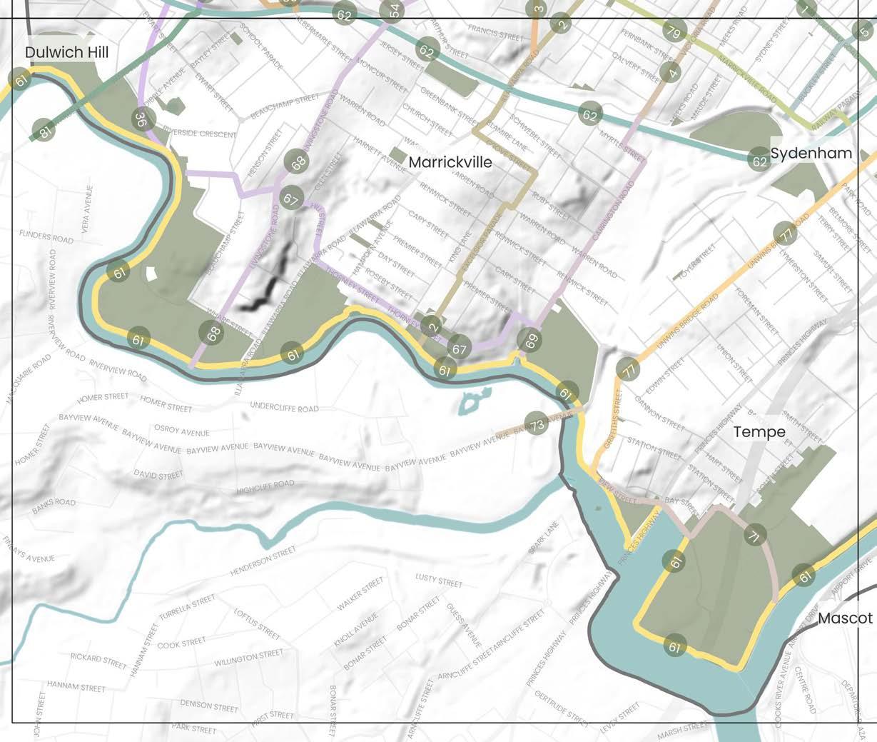
3
4
5
2
DRAFT Inner West Blue-Green Grid Strategy 2023 65
1km
500m 0m
Places Blue-Green Grid Links
Petersham Park to Sydenham Station via Marrickville and Henson Park
1
Ave at Cooks River
Illawarra Road to Montague Gardens
From Richard
Foreshore along
Petersham Road to Percival Road
to Newtown Train Station
Victoria Road
Club
Newtown Station
Cooks to Cove GreenWay
Cooks River to Alexandra Canal 62 Southern Trainline 67 Thornley Street to Alfred Street via Hill Street 68 Livingstone Road 69 Carrington Road 71 Holbeach Ave 73 Bayview Avenue 77 Unwins Bridge Road 79 Marrickville Road 81 Wardell Road 64 Tillman Park 65 Fraser Park 66 Mackey Park 67 Tempe Park and Reserve 68 Steel Park 69 Marrickville Golf Club 70 Mc Neilly Park 71 Marrickville West Primary 72 Ferncourt Public School 64 65 66 67 68 69 70 71 72 Precinct Boundary Inner West LGA Boundary Parks and Open Spaces Waterways, rivers and creeks
Inner West Blue-Green Grid Suburb Boundary 0 Train Station Light Rail Station Ferry Terminal Local Places
Fraser Park Football
to
36 The
61 The
The
7.3.6 Precinct 6 Continued
Relevant Projects and Responsibility
Cycling Strategy and Action Plan
2022, Inner West Council
Cooks River Corridor Plan
2022, City of Canterbury Bankstown
Campsie Town Centre Master Plan
2022, City of Canterbury Bankstown
Dibble Avenue Waterhole
2021 Inner West Council
Bayside Priority Green Grid Corridors Spatial Framework
2021, Bayside Council
Eastern Channel Subcatchment Management Plan
2020 Inner West Council
GreenWay Master Plan
2018, Inner West Council
Sydney Gateway Study
2018, TfNSW
Western Channel Subcatchment Management
2014, Inner West Council
GreenWay Biodiversity Strategy
2013, Inner West Council
Marrickville Draft Strategy for a Water Sensitive Community
2012-2021
2012 Inner West Council
GreenWay Revegetation and Bushcare Plan
2011, Inner West Council
Marrickville Biodiversity Strategy 2011-2021
2011, Inner West Council
GreenWay Flora and Fauna Literature Review
2010, Inner West Council
Marrickville Urban Forest Strategy
2010, Inner West Council
Riverside Crescent Subcatchment Management Plan
2010, Inner West Council
Tennyson Street Subcatchment Management Plan
2009, Inner West Council
Illawarra Road Subcatchment Management Plan
2006, Inner West Council
DRAFT 66
500m 0m 1km 64 65 66 67 68 69 70 71 72 Precinct Boundary Inner West LGA Boundary Parks and Open Spaces
rivers and creeks
Inner West Blue-Green Grid
Boundary 0 Train Station Light Rail Station Ferry Terminal Local Places 3
Waterways,
The
Suburb
Marrickville,
Link connects major recreational open spaces traveling from Petersham Park at West Street and down Livingstone Road to Marrickville Park then along Sydenham Road passing Wilkins School, Henson Park and Wicks Park before arriving at Sydenham Station. The link travels busy streets, mostly residential with pockets of commercial and industrial at the Sydenham end.
The link could see improvements in pedestrian and cycling infrastructure to make the north-south connection safer but to also offer better connections to major east-west cycling routes and the rail line. West Street is well serviced with existing tree canopy. This should be retained and enhanced so as encourage and increase areas of habitat for native flora and fauna. Areas of industrial character along Sydenham Road see a reduction in canopy cover and could benefit from increased tree planting to mitigate urban heat and support urban ecology.
Marrickville,
A key existing cycle way that runs from the Cooks River up to Montague Gardens via Marrickville Town Centre and number of schools including Ferncourt Public School and Newington College. The link along Illawarra Road is busy. The streets are predominantly residential in character, with some commercial and with a good amount of tree canopy.
Key existing cycle route that connects Marrickville Town Centre to Parramatta Road via Marrickville High School, Henson Park, Newington College, Stanmore Train Station and Town Centre, and Weekly Park. The link is mostly residential in character.
A busy thoroughfare, the route connects parts of Marrickville through to Newtown predominantly following Victoria Road and Enmore Road. Key destinations along the link include the Factory Theatre, Enmore Park and Enmore Theatre. The link changes from residential to industrial then commercial along the route, with varying canopy cover.
Link runs through the Marrickville industrial area via the Sydenham Pit and Drainage Pumping Station. A pedestrian cut through from Shirlow Street to Sydney Steel Road offers connectivity between Sydenham Train Station to Marrickville Metro through to King Street via Alice Street and up to Newtown Station. The link is predominantly industrial and commercial in character travelling along a mix of busy roads and pedestrian links.
The route has an existing strong tree canopy presence with room to expand, and the community wish to see increased planting for shade and amenity. Opportunity exists to raise pedestrian crossing through the high pedestrian activity area. The community identified Illawarra Road as good north-south connection. However, due to topography and heavy vehicle presence it would need improvements to be a safe option for active transport such as traffic calming, signage and line markings.
Parts of this route have decent canopy coverage, whilst some provide wide road reserves that would suite additional greening and more space for pedestrians. The link could benefit from additional crossings and widened footpaths.
Additional canopy cover and street planting would be a key opportunity for this link which lacks shade along parts of Victoria Road. The link is an important connector from Marrickville to Newtown and on to the city with the opportunity to improve cycleways, footpaths and crossings and measures to create a safer environment for active transport. The community have suggested improving the crossing at King, Wilson and Eliza Street in Newtown. The link hosts some of the Inner West's most iconic cultural institutions providing an opportunity for public space activation and cultural installations.
Multiple opportunities for this link have been identified, including the potential for Sydenham Pit and Drainage Pumping Station to be investigated for naturalisation to support urban ecology and local amenity. The link includes parts of Marrickville's industrial precinct that holds cultural significance providing opportunity for public art and cultural activation. At Fraser Park, the link also runs through a Kangaroo Ground connecting to a potential Aboriginal archaeological site providing opportunity to recognise and celebrate Aboriginal and Torres Strait Islander culture and histories. Street planting for shade and improved sidewalks and cycleways are areas of improvement, especially in the industrial areas.
DRAFT Inner West Blue-Green Grid Strategy 2023 67 Number Link Suburbs Link Description Possible Opportunities & Improvements ATSIACH EcologyConnectivity Hydrology Recreation
1
Petersham Park to Sydenham Station via Marrickville and Henson Park
Petersham, Sydenham
1 1 1
2 Marrickville Peace Park to Montague Gardens
Enmore, Stanmore
1 1 1
3 Petersham Road to Percival Road
Marrickville, Petersham, Stanmore
1 1
4 Victoria Road to Newtown Train Station
Marrickville, Enmore, Newtown
1 1 1 1
5 Fraser Park Football Club to Newtown Station
Marrickville, Enmore, Newtown, Sydenham
1 1 1
The GreenWay is an environmental and active transport corridor linking the Cooks River at Earlwood with the Parramatta River at Iron Cove.
As a major environmental and recreational link for the Inner West, the link continues to offer the community a diverse and inclusive recreation space with opportunities for
- public art and cultural activation in public spaces and parks
- protecting, enhancing and increasing wildlife corridors and areas of habitat for native flora and fauna
- Providing safe, accessible footpaths and cyclewaysRecognising and celebrating
- Aboriginal and Torres Strait Islander culture and histories in significant locations as they are identified along the link
Major improvements and opportunities for this existing ecological active transport corridor are outlined within the GreenWay Masterplan. The GreenWay Masterplan includes proposals for $57 million of works to be implemented over the long term. Around $45 million of high priority works are anticipated to be completed in 2025. Works in progress include:
- high voltage feeder relocation to the Waratah Mills Light Rail Station (required to enable construction of the paths and an ecological restoration of parts of the corridor
- Bay Run path and lighting upgrade
- in-corridor works involving the construction of a shared path, lighting and landscaping
Community feedback identified the need for improved crossings over Parramatta Road at Taverners Hill. In April 2023 design plans were exhibited detailing options for addressing key missing links and connections which could delivered to provide safer, more accessible connections along the entirety of the GreenWay link. A section of the link is included within the Parramatta Road Corridor Strategy Phase Planning Proposal. Future uplift may provide opportunities for improved public domain and recreation improvements.
The Cooks River is a key green and blue asset for the Inner West and neighbouring council areas. Along the link are multiple parks and reserves, a children’s playground and the Marrickville Golf Club. The link offers a diverse range of passive and active recreational opportunities.
While there are many recreational activities that can be undertaken along the Cooks River Foreshore, the community has expressed a desire for the Cooks River itself to be improved with the aim of providing increased access to the riverbank for recreational activities. Therefore, improvements should be focused on naturalising the waterway and improving water quality. This area of the Inner West is also recognised as an area with high biodiversity values and therefore, future improvements must also look to increase and enhance natural vegetation along the riverbank to enhance and increase areas of habitat for native flora and fauna. The river also has significant Indigenous heritage which should be recognised and promoted in any future works.
Currently there is no continuous pedestrian or cycle link along the rail corridor. Opportunities along the link should consider improving footpaths, crossings and cycle infrastructure. There is some opportunity along this link to increase tree canopy, verge and private garden plantings and to rewild the area along the rail corridor to increase areas of natural habitat for native flora and fauna.
The link provides an alternate connection between Mackey Park and Princes Street Park on the Cooks River via the small shopping area located on Illawarra Road. Possible link improvements should consider improved footpath and crossings, increased tree plantings and vegetation in addition to incorporation of WSUD elements to assist with improved water management in the area.
Livingstone Road is a key connector to access many areas of the Inner West. This part of the road connects the Marrickville Town Centre to the Cooks River via a number of local primary and high schools. Parts of the link include a separated cycleway, however this is not consistently provided along the entirety of the link. Possible improvements should look to improve pedestrian and cycle infrastructure and where possible allow for suitable separation of pedestrians, cyclists and vehicles. The link could also benefit from increased vegetation and tree plantings not only improve amenity of the link for pedestrians, but to also enhance and increase wildlife corridors and areas of habitat for native flora and
DRAFT 68 Number Link Suburbs Link Description Possible Opportunities & Improvements ATSIACH EcologyConnectivity Hydrology Recreation
36 The Cooks to Cove GreenWay
Leichhardt, Haberfield, Lewisham, Summer Hill, Dulwich Hill
1 1 1 1 1
61 The Cooks River to Alexandra Canal Marrickville, Dulwich Hill, Tempe, St Peters
1 1 1 1 1
62 Southern Trainline
St Peters, Sydenham, Marrickville, Dulwich Hill
Link follows the train corridor which runs from St Peters to Dulwich Hill train stations.
1 1 1 1
67 Thornley Street to Alfred Street via Hill Street Marrickville
The link runs just north of the Cooks River acting as a secondary connector to many of the green spaces accommodated on the foreshore of the Cooks River.
1 1 1
68 Livingstone Road Marrickville
Link connects the Cooks River to Marrickville Road at the Marrickville Library.
1 1 1 1
fauna.
Link connects Mackey Park located along the Cooks River to Myrtle Street through a significant industrial precinct. The link connects with link 4 which runs along Victoria Road.
This is a popular link identified by the community to travel north-south connecting Marrickville to the Cooks River foreshore and open space areas. Possible opportunities include improvements to existing cycle infrastructure to improve safety for pedestrians, cyclists and vehicles along Carrington Road and also along connecting streets including Myrtle Street up to Victoria Road.
Link connecting Kendrick Park to Tempe Reserve over the Princes
This link connects two major open spaces located on the foreshore of the Cooks River separated by the Princes Highway. Both open spaces offer a diver range of facilities for recreational activities. A possible opportunity to improve connectivity and access to both spaces could be a pedestrian and cyclist overpass over the Princes Highway connecting Holbeach Avenue to View Street. The amenity of both parks and the link could also be improved through the provision of additional vegetation and tree plantings to increase canopy cover and shade and to also enhance and increase areas of habitat for native flora and fauna. Kendrick Park is a listed heritage item. Link opportunities should consider opportunities to recognise and celebrate Aboriginal and Torres Strait Islander culture and histories significant to this area.
The current crossing requires pedestrians to cross the bridge twice in order to re-join existing footpaths along the Cooks River. Opportunities to improve this connection for pedestrians and cyclists should be investigated as it would improve access to the Cooks River, Tempe Train Station and Gough Whitlam Park.
Improvements along this link should consider the provision of safe, accessible footpaths and crossings in addition to improved cycling infrastructure between these two key destinations. The amenity of the link could also be improved through the provision of additional vegetation and tree plantings to increase canopy cover and shade along the link.
The community has identified a desire for formalised cycle infrastructure to be provided along this link and where possible providing suitable separation of pedestrians, cyclists and vehicles. As the link travels through two major town centres, consideration should also be given to reducing the speed limit to increase safety for pedestrians and cyclists. The link would benefit from increased tree canopy and vegetation to assist with reducing the impacts of urban heat but also improving amenity along the link.
Opportunities along the link should consider improving footpaths, crossings and cycle infrastructure. Particular consideration should be given to investigating improvements on the Wardell Road Bridge in line with the suggestions made in the 2022 Cooks River Corridor Plan. There is also some opportunity along this link to increase areas of natural habitat for native flora and fauna through increased provision of tree canopy, verge and private garden plantings along the link.
DRAFT Inner West Blue-Green Grid Strategy 2023 69 Number Link Suburbs Link Description Possible Opportunities & Improvements ATSIACH EcologyConnectivity Hydrology Recreation
69 Carrington Road Marrickville
1 1 1 1 1
71 Holbeach Avenue Tempe
Highway.
1 1 1 1
73 Bayview Avenue Marrickville, Earlwood
Small link over the Cooks River connecting Gough Whitlam Park in Earlwood to Mackey Park in Marrickville.
1 1
77 Unwins Bridge Road Tempe
Link runs along Unwins Bridge Road connecting King Street to the Cooks River via Tillman Park.
1 1
79 Marrickville Road Marrickville, Dulwich Hill, Sydenham
Link runs along Marrickville Road connecting Dulwich Hill and Marrickville Town Centres to Sydenham Train Station.
1
81 Wardell Road Marrickville, Dulwich Hill Link from the Cooks River at the Wardell Road Bridge to Dulwich Hill Station via Wardell Road.
1
7.3.7 Precinct 7
Blue-Green Grid Links
38
Relevant Projects and Responsibility
Balmain Road at Glover Street to Balmain East Ferry wharf via Darling Street
39 Beattie Street to Bridgewater Park via Wise, Terry and Margaret Street
72 Victoria Road
75 The Bays Precinct to Blackwattle Bay via Glebe Island Bridge
76 Louisa Road
83 Montague Street and Mullens Street
91 Balmain Peninsula harbour walk
Places
4 Elkington Park & Dawn Fraser Baths
5 Birchgrove Oval
6 Yurulbin Park
7 Mort Bay Park
8 Ballast Point Park
9 Gladstone Park & Balmain Hospital
10 Sydney Secondary CollegeBalmain
11 Vanardi Green
Rozelle Town Centre Master Plan (under development)
Ongoing, Inner West Council/TfNSW
Cycling Strategy and Action Plan
2023, Inner West Council
Parramatta to Sydney Harbour Foreshore Link (under development)
2023, TfNSW
White Bay Eco-corridor
2022, Inner West Council
Tom Uren Walking Trail
2016, Inner West Council
Bays West Place Strategy
2021, NSW DPE
Rozelle Interchange Urban Design and Landscape Plan
2021, TfNSW
Leichhardt Native Revegetation & Biodiversity Management Plan
2017, Inner West Council
Balmain East Foreshore Plan of Management
2013, Inner West Council
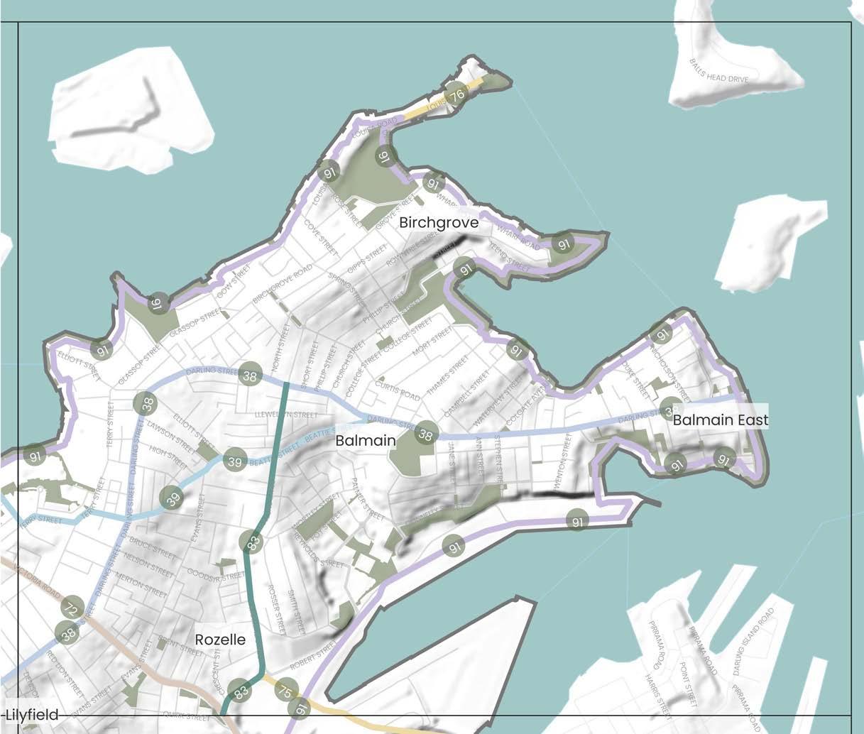
DRAFT 70
4 5 6 8 7 9 11 10 7 Precinct Boundary
West
Boundary Parks and Open
Grid
0 Train Station Light Rail Station Ferry Terminal Local Places 500m 0m 1km
Inner
LGA
Spaces Waterways, rivers and creeks The Inner West Blue-Green
Suburb Boundary
The link is a key route along the spine of the Balmain Peninsula connecting with Callan Park, the Rozelle and Balmain Town Centres and through to the Balmain East ferry wharf and harbour foreshore area. The link connects with the historical Tom Uren Trail and link 91 know as the Balmain Peninsula harbour walk.
Darling Street was commonly identified by the community as a missing active transport link within the northern part of the Inner West. This link would benefit from improved footpaths and crossing and cycle infrastructure within the town centres. The link would also benefit from increased tree canopy cover along the eastern side of Darling Street and Balmain Road to increase shade cover and improve amenity along these popular high streets for pedestrians and cyclists.
Additional opportunities for improvements to Darling Street at the intersection with Victoria Road will be made possible through opportunities identified as part of the Rozelle Town Centre Master Plan (as identified as part of link 72).
This link connects foreshore open spaces at Balmain Cove including Bridgewater Park and Elliot Park to the town centres of Rozelle and Balmain via Beattie Street.
This link could benefit from increased landscaping and street tree plantings in areas with wider road reserves. Opportunities should also consider improvements to pedestrian and cyclist infrastructure along this link.
The opening of the WestConnex Iron Cove Tunnel presents a significant opportunity for Council to work with TfNSW on active transport and public domain improvements along Victoria Road. The project will also offer opportunities for improvements along Darling Street Rozelle that will help improve connectivity of the Rozelle Town Centre (currently divided by Victoria Road). Possible link opportunities could include:
- improvements to footpaths and crossings to ensure they safe and accessible
- providing cycle paths and where possible allowing these to be separated from pedestrians and vehicles
- additional vegetation and tree plantings to increase biodiversity, canopy cover and shade along the link
- provision for incorporation of WSUD elements
- provision of spaces for public art and cultural activation
- recognition and celebration of Aboriginal and Torres Strait Islander culture and histories
Any improvements to this link should also consider appropriate connections into the future Rozelle Parklands.
This future link will provide key connectivity to the Pyrmont peninsula and surrounds including multiple open spaces and the Sydney
Redevelopment of Blackwattle Bay and the Bays Precinct (currently being led by the NSW Government) offers an opportunity for the reopening of Glebe Island Bridge. This link would provide a direct connection between Rozelle and Pyrmont. Opportunities for this link must include provision for appropriate pedestrian and cycle facilities.
The link is in close vicinity of the White Bay Eco Corridor which aims to increase and connect greenspaces for wildlife. The link should consider suggestions made for the eco corridor for implementation of this link where relevant.
Louisa Road is very narrow and existing footpaths are in poor condition. Improvements along this link should consider the provision of accessible footpaths and crossings along Louisa Road in addition to improved public access to the foreshore. The community have also expressed a desire for this area to be investigated as a possible location of a future swim site along the harbour foreshore.
DRAFT Inner West Blue-Green Grid Strategy 2023 71 Number Link Suburbs Link Description Possible Opportunities & Improvements ATSIACH EcologyConnectivityHydrology Recreation
38
Balmain Road at Glover Street to Balmain East Ferry wharf via Darling Street
Rozelle, Balmain, Balmain East
1 1 1
39
Beattie Street to Bridgewater Park via Wise, Terry and Margaret Street
Rozelle, Balmain
1 1
72 Victoria Road Rozelle
Link from the Bays Precinct to the Bay Run.
1 1 1
75 The Bays Precinct to Blackwattle Bay via Glebe Island Bridge Rozelle
Fish Markets.
1 1 1
76 Louisa Road Birchgrove Link to from Birchgrove Park to Yurulbin Park and Birchgrove Ferry Wharf.
1 1 1 1
This north-south link connecting from the Balmain Town Centre to new Bays West precinct area.
The link offers opportunities to improve active transport connections to the Balmain Town Centre on Darling Street. Possible improvements to this link should consider improved cycling infrastructure and where possible additional tree plantings and improvements to footpaths and crossings. Consideration of a reduced speed limit along this link would also serve to make the link a safer active transport connection for all users. The link is in close vicinity of the White Bay Eco Corridor which aims to increase and connect greenspaces for wildlife. The link should consider suggestions made for the eco corridor for implementation of this link where relevant.
The link runs along the harbour side of the Balmain Peninsula starting from Bridgewater Park through to the intersection of Robert Street and Victoria Road. The link connects multiple parks along the Sydney Harbour Foreshore, providing an excellent route for recreation.
Improving connectivity, public access and an increased range of recreational facilities along the harbour foreshore were identified by many contributors to this project as in need of further investigation. Of note was the desire by many to see additional swim sites provided along the harbour foreshore in locations such as Mort Bay. Improved pedestrian access was suggested for areas including Paringa Reserve, Simmons Point Reserve and Yurulbin Park.
TfNSW is currently undertaking a major project known as the Parramatta to Sydney Foreshore Link. The link program will look to deliver a 91km continuous link between Parramatta Park to the Opera House/Botanical Garden for cyclists and pedestrians. Council will need to work closely with TfNSW to on this project work.
The link is in close vicinity of the White Bay Eco Corridor which aims to increase and connect greenspaces for wildlife. The link should consider suggestions made for the eco corridor for implementation of this link where relevant.
DRAFT 72 Number Link Suburbs Link Description Possible Opportunities & Improvements ATSIACH EcologyConnectivityHydrology Recreation
83 Montague Street and Mullens Street Balmain, Rozelle
1
91 Balmain Peninsula harbour walk Rozelle, Birchgrove, Balmain, Rozelle
1 1 1 1 1
7.3.8 Precinct 8
Blue-Green Grid Links
Relevant Projects and Responsibility
Cycling Strategy and Action Plan, 2023, Inner West Council
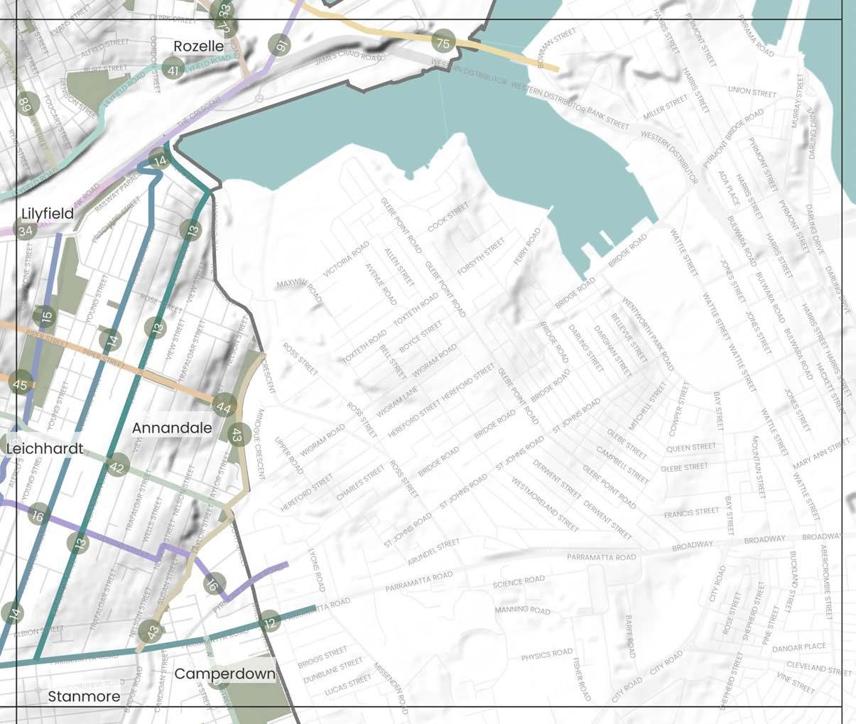
Parramatta to Sydney Harbour Foreshore Link
2023, TfNSW
Bridge Road Cycleway
2022, City of Sydney/TfNSW
Bays West Place Strategy, 2021
NSW DPE
White Bay Eco-corridor
2022, Inner West Council
Johnston’s Creek Naturalisation
2021, Inner West Council/ City of Sydney Council/Sydney Water
Rozelle Parklands
2021, Transport for NSW
Leichhardt Native Revegetation & Biodiversity Management Plan
2017, Inner West Council
Parramatta Road Urban Amenity Improvement Plan (PRUAIP)
2016, TfNSW/Inner West Council
Parramatta Road Corridor Urban Transformation Strategy (PRCUTS)
2016, TfNSW DPE/Inner West Council
Annandale North Neighbourhood Movement Plan
2016, Inner West Council
Marrickville Draft Strategy for a Water Sensitive Community
2012, Inner West Council
Marrickville Biodiversity Strategy
2011, Inner West Council
Marrickville Urban Forest Strategy
2010, Inner West Council
DRAFT Inner West Blue-Green Grid Strategy 2023 73
Places 12 Parramatta Road
Johnston Street including part of the Crescent 14 Annandale Street
Whites Creek via Cohen Park, Whites Creek Valley and Whites Creek Lane
Marion Street between Ramsay Street to Johnstons Creek
Hawthorne Canal to The Crescent along City West Link
Lilyfield Road
Hawthorne Light Rail Stop to Badu Reserve
Johnstons Creek 44 Piper Street to Johnstons Creek 45 Callan Park to Whites Creek Valley 72 Victoria Road 75 The Bays Precinct to Blackwattle Bay via Glebe Island Bridge 89 Callan Park 90 Australia Street 91 Balmain Peninsula harbour walk 12 Easton Park 13 Glebe Foreshore Parks 14 Cohen Park 15 Hinsby Park
Whites Creek Valley Park
13
15
16
34
41
42
43
16
12 13 14 16 18 15 17
Camperdown Park
School Precinct Boundary Inner West LGA Boundary Parks and Open Spaces Waterways, rivers and creeks The Inner West Blue-Green Grid Suburb Boundary 0 Train Station Light Rail Station Ferry Terminal Local Places 500m 0m 1km
Forest Lodge Camperdown
17
18 Annandale North Public
Glebe Pyrmont
15
Haberfield,
Parramatta Road is a key state road which traverses the Inner West east to west connecting the CBD to Western Sydney. The 6 lane road is mostly commercial in nature, and has limited street trees. There are multiple points of interest along the link, including half a dozen entertainment venues and pubs, Ashfield Park, the GreenWay, Fort Street High School and primary links into surrounding suburbs.
Johnston Street is a wide tree-lined street with an existing cycle route along it. It runs from Parramatta Road up Johnston Street via Annandale Town Centre to the Rozelle Interchange and Jubilee Park. The street is mostly residential and features The Empire Hotel, Annandale Community Centre, Annandale Public School, Annandale North Public School, and Annandale TAFE Campus along its route.
Parramatta Road has opportunities to deliver significant improvement in tree canopy coverage and street tree planting for cooling. The link could deliver widened footpaths, improved crossings for pedestrians and cyclists alike, along with dedicated cycleways and improved public transportation offering. The link is subject to both local and state strategies that provide opportunity for public domain and access uplift, including the Paramatta Road Corridor Urban Transformation Strategy, Tech Central, and the WestConnex Camperdown Dive Site which holds potential to deliver temporary and long term value to the Blue-Green Grid.
The existing strong tree canopy cover coupled with wide road reserve creates an opportunity to create a dense ecological corridor by delivering more street trees and encouraging verge and private garden planting. The street has both space and opportunity for a dedicated cycleway and more regular pedestrian crossings which could be focused around the schools, educational institutions and community facilities.
Like Johnston Street (Link 13), existing strong tree canopy cover coupled with a wide road creates the opportunity to create a dense ecological corridor in conjunction with private and verge garden planting. The residential nature of the street may be a safer location for a cycleway than other streets and provide a pedestrian friendly alternative to surrounding streets with higher vehicle speeds and usage.
1 1 1 1 1
16
1 1 1
34
1 1
DRAFT 74 Number Link Suburbs Link Description Possible Opportunities & Improvements ATSIACH EcologyConnectivityHydrology Recreation
12 Parramatta Road
Croydon, Ashfield, Leichhardt, Annandale, Camperdown, Newtown, Stanmore, Petersham, Lewisham, Summer Hill.
1 1
13 Johnston Street including part of the Crescent Annandale
1 1 1
14 Annandale Street Annandale
A residential street, lined with large mature trees on the road leaving the footpaths unobstructed. The link connects Parramatta Road with the City West Link and Rozelle Bay. 1 1
Whites Creek via Cohen Park, Whites Creek Valley and Whites Creek Lane
Annandale
A hydrological corridor running from Parramatta Road to City West Link that has a parallel walkway connecting Cohen Park to Whites Creek Valley Park. The creek has inherent ecological value and is identified as being an important corridor to the local Aboriginal heritage. The link is a great place for recreational walks and passes though tree lined streets through many reserves and playgrounds, and includes valuable community facilities like Annandale Skate Park, Whites Creek Community Garden and Wetlands, and Cohen Park tennis courts.
Ample opportunity to enhance and diversify urban ecology and for naturalisation along the creek beds and riparian zones, with the potential of creating a nature reserve. Additional tree planting along the link, supported by verge and private garden planting, would support urban ecology and provide urban cooling. Opportunity for additional cycleways, traffic calming and footpath improvements.
Marion Street between Ramsay Street to Johnstons Creek
Annandale, Leichhardt, Haberfield
A key east-west connection through the LGA running almost parallel to Parramatta Road offering an alternative east-west connection, crossing with the GreenWay and Whites Creek. It connects multiple town centres including Haberfield, Leichhardt and industrial centres at Annandale/Camperdown. Parks include Algie Park, Lambert Park, Mayes Street Reserve and Evan Jones Playground and schools including Leichhardt Public School and St Brendans Catholic Primary School.
The link runs parallel to Paramatta Road but is a local road so it has the potential to become a quiet, safe and comfortable active transport route alternative. Additional cycleways and connections from the GreenWay to Norton Street have been identified. The link has opportunities for more street tree planting for urban cooling and opportunities for public art and cultural activation in the town centres and venues such as Leichhardt Town Hall.
Hawthorne Canal to The Crescent along City West Link
Leichhardt, Lilyfield, Annandale, Haberfield
A route that links up from Hawthorne Canal at The GreenWay along the northern Light Rail route and City West Link to The Crescent via Jubilee Park in Annandale. The link covers a key ecological corridor along multiple Light Rail Stops and also runs through a major flooding area and the Rozelle Interchange (part of WestConnex works).
Footpaths and crossings along Darley Road and at major intersections on City West Link can be upgraded to ensure pedestrian safety. There is opportunity for increased tree planting in areas with wide street verges. The link could support a safe east-west active transport connection through the provision of continuous cycleway infrastructure.
This link runs from Victoria Road to Canal Road. The link runs adjacent to the area which has been identified to become Rozelle Parklands and the existing Easton Park. Part of the link is an existing on road cycle link. Areas of Aboriginal heritage significance are located along this link.
An east-west connection across the Inner West that could link the Bay Run with the new Rozelle Parklands development site. Future improvements and opportunities along this link should consider:
- increasing areas of vegetation that could provide habitat for native flora and fauna within the private and public domain along the link
- provision of additional improved cycle infrastructure, where possible separated from vehicular traffic
- providing safe and accessible footpaths and crossings along the entirety of the link
- integration of WSUD elements into existing open spaces and the streets
- protection of areas containing items and places of Aboriginal and Torres Strait Islander significance
Route is a key east-west link running along Allen Street, Moore Street and Booth Street through to Badu Reserve. The link passes through Pioneers Memorial Park, Sydney Secondary College and a small commercial area located along Booth Street.
Improved east-west active transport connections via Sydney Secondary College have been raised as an opportunity that should be considered further. Future improvements and opportunities along this link should look to consider:
- increasing areas of vegetation that could provide habitat for native flora and fauna within the private and public domain along the link
- provision of cycle infrastructure, where possible separated vehicular traffic
- providing safe and accessible footpaths and crossings along the entirety of the link
- integration of WSUD elements into existing open spaces and the streets
A key blue link for the Inner West Blue-Green Grid. This link follows the creek line of Johnstons Creek from where it enters the Inner West area running from the Crescent in Annandale and then south to Bridge Road in Stanmore. Recent works completed by Sydney Water naturalised a portion of the creek between Rozelle Bay and The Crescent.
The works completed by Sydney Water along this creek have been well received by the community. Future improvements and opportunities along this link should look to consider naturalisation of other areas along the creek line to further improve water quality and recreational opportunities along the creek line.
A current project that will see improvements to this link includes the Parramatta Road Urban Amenity Improvement Program (PRUAIP) – Johnstons Creek. This project involves the completion of a new pathway and cycle way along Johnsons Creek in addition to improvements on Wigram, Booth Street and Badu Park.
The PRUAIP in addition to any future projects should seek to contribute to environmental improvements along the creek line including improved biodiversity outcomes, reduction in urban heat, increased tree canopy cover as well as improved air and water quality.
This link offers potential to formalise a connection between multiple green spaces located along Piper Street. Opportunities should look to consider:
The link provides east-west connectivity along Piper Street from Balmain Road to Piper Street Reserve and Johnsons Creek via Annandale North Public School and Hinsby Park.
- increasing areas of vegetation that could provide habitat for native flora and fauna within the private and public domain along the link
- providing safe and accessible footpaths and crossings along the entirety of the link
- reduced vehicle speed limits along the road way
- integration of WSUD elements into existing open spaces and the streets
- opportunities for the integration of a play street along the link (given the close connection of the school with existing recreational spaces)
The community have identified a desire for improved connections between Whites Creek Valley and Callan Park. Along this link an opportunity exists to pedestrianise and green the laneway between Ainsworth Street and Mackenzie Street which would provide more direct and desirable connection to Balmain Road. Balmain Road is in need of improvements to the existing network of footpaths and crossings as well as increased canopy cover to support safer pedestrian access and improve amenity.
DRAFT Inner West Blue-Green Grid Strategy 2023 75 Number Link Suburbs Link Description Possible Opportunities & Improvements ATSIACH EcologyConnectivityHydrology Recreation
41 Lilyfield Road Lilyfield, Rozelle
1 1 1
42 Hawthorne Light Rail Stop to Badu Reserve Leichhardt, Annandale
1 1 1 1 1
43 Johnstons Creek Annandale, Stanmore
1 1 1 1 1
44 Piper Street to Johnstons Creek Annandale, Lilyfield
1 1 1
45 Callan Park to Whites Creek Valley Lilyfield
From Whites Creek Valley the link runs along Ilka Street, via War Memorial Park and along Alfred Street before heading north along Balmain Road into Callan Park. This link also connects with link 42 which connects with Pioneers Park.
1 1
This future link will provide key connectivity to the Pyrmont peninsula and surrounds including multiple open spaces and the Sydney Fish Markets.
The opening of the WestConnex Iron Cove Tunnel presents a significant opportunity for Council to work with TfNSW on active transport and public domain improvements along Victoria Road. The project will also offer opportunities for improvements along Darling Street Rozelle that will help improve connectivity of the Rozelle Town Centre (currently divided by Victoria Road). Possible link opportunities could include:
- improvements to footpaths and crossings to ensure they safe and accessible
- providing cycle paths and where possible allowing these to be separated from pedestrians and vehicles
- additional vegetation and tree plantings to increase biodiversity, canopy cover and shade along the link
- provision for incorporation of WSUD elements
- provision of spaces for public art and cultural activation
- recognition and celebration of Aboriginal and Torres Strait Islander culture and histories
Any improvements to this link should also consider appropriate connections into the future Rozelle Parklands.
Redevelopment of Blackwattle Bay and the Bays Precinct (currently being led by the NSW Government) offers an opportunity for the reopening of Glebe Island Bridge. This link would provide a direct connection between Rozelle and Pyrmont. Opportunities for this link must include provision for appropriate pedestrian and cycle facilities. The link is in close vicinity of the White Bay Eco Corridor which aims to increase and connect greenspaces for wildlife. The link should consider suggestions made for the eco corridor for implementation of this link where relevant.
The community recognise Callan Park as an important recreational and cultural/arts precinct for the local and wider Sydney community. Future works to the parkland should ensure the space offers a diverse range of inclusive spaces for the community to undertake a range of recreational and cultural activities. Community feedback to this strategy has expressed a desire to increase and improve access to Callan Park through improved active transport infrastructure including provision of more safe, accessible footpaths and crossings on streets leading into the parkland as well as improve cycle infrastructure.
Other opportunities for this parkland and surrounds based on identified grid functions include:
- Recognise and celebrate Aboriginal and Torres Strait Islander culture and histories
- Provide public art and cultural activation in public spaces and parks
- Recognise and promote the areas of heritage significance
- Protect, enhance and increase areas of habitat for native flora and fauna
- Provide additional swimming and recreational opportunities
DRAFT 76 Number Link Suburbs Link Description Possible Opportunities & Improvements ATSIACH EcologyConnectivityHydrology Recreation
72 Victoria Road Rozelle
Link from the Bays Precinct to the Bay Run.
1 1 1
75 The Bays Precinct to Blackwattle Bay via Glebe Island Bridge Rozelle
1 1 1
89 Callan Park Lilyfield
This link travels through Callan Park to Lilyfield Road via Cecily Street.
1 1 1 1
Link that connects Parramatta Road to Camperdown Park and Camperdown Memorial Rest Park to King Street, Newtown. O'Dea Reserve is located just west of Australia Street and can be easily accessed via this link.
Existing open spaces accessed from this link including Camperdown Park and the Commons are open spaces that are well loved and used by the community. Any improvements to this area should increase and improve access to these open spaces ensuring upgrades make them safe, inclusive and more accessible. Community feedback for these open spaces and the broader Newtown/Camperdown area has request that connectivity improvements in the form of safe, accessible footpaths and crossings are provided for pedestrians in addition to improved cycle infrastructure for the community to move around this area.
This link is within an area of Aboriginal and Torres Strait Islander significance. Future capital works projects should look to recognise and celebrate Aboriginal and Torres Strait Islander culture and histories through design elements.
The link runs along the harbour side of the Balmain Peninsula starting from Bridgewater Park through to the intersection of Robert Street and Victoria Road. The link connects multiple parks along the Sydney Harbour Foreshore, providing an excellent route for recreation.
Improving connectivity, public access and an increased range of recreational facilities along the harbour foreshore were identified by many contributors to this project as in need of further investigation. Of note was the desire by many to see additional swim sites provided along the harbour foreshore in locations such as Mort Bay. Improved pedestrian access was suggested for areas including Paringa Reserve, Simmons Point Reserve and Yurulbin Park.
TfNSW is currently undertaking a major project known as the Parramatta to Sydney Foreshore Link. The link program will look to deliver a 91km continuous link between Parramatta Park to the Opera House/Botanical Garden for cyclists and pedestrians.
Council will need to work closely with TfNSW to on this project work. The link is in close vicinity of the White Bay Eco Corridor which aims to increase and connect greenspaces for wildlife. The link should consider suggestions made for the eco corridor for implementation of this link where relevant.
DRAFT Inner West Blue-Green Grid Strategy 2023 77 Number Link Suburbs Link Description Possible Opportunities & Improvements ATSIACH EcologyConnectivityHydrology Recreation
90 Australia Street Camperdown, Newtown
1 1 1 1
91 Balmain Peninsula harbour walk Rozelle, Birchgrove, Balmain, Rozelle
1 1 1 1 1
7.3.9 Precinct 9
2
Relevant Projects and Responsibility
Streets
2023,
4
5 Fraser Park Football Club to Newtown Station
7
8 Newington Road from Albert Street to Enmore Road
9 Addison Road from Enmore Park to Bright Street
10 Southern Link of Newtown to Croydon train line
Cycling
Sydney
2021,
WestConnex Urban Design and Landscape Plan
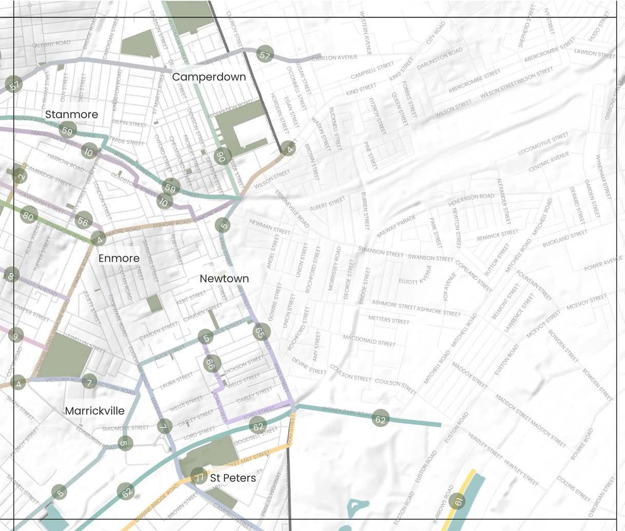
2020, TfNSW
Sydney Park Junction
2021,
Eastern
2013
Marrickville
2012
Eastern
Marrickville
DRAFT 78
Places
53 Camperdown Cemetery 54 Camperdown Park 55 O’Dea Reserve 56 Enmore Park
Blue-Green Grid Links
Montague Gardens
Marrickville Peace Park to
Victoria Road to Newtown Train Station
Enmore Park to Sydney Park
Street
Salisbury Road
Northside North Train Line
The Cooks River to Alexandra Canal
Southern Trainline 65 King Street South 66 Pearl Street to St Peters Train Station
Unwins Bridge Road 80 New Canterbury Road and Stanmore Road 90 Australia Street
56 Cavendish
57
59
61
62
77
Alive: Newtown
Enmore Master Plan
and
Inner West Council
Strategy
Plan
Inner
Council
and Action
2023
West
Upgrade
St Peters Station
Council
2021, TfNSW/Inner West
Park Junction
TfNSW/City of Sydney/Inner West Council
TfNSW/City of Sydney/Inner West Council
Channel North Subcatchment Management Plan
, Inner West Council
Strategy
Water Sensitive Community
Draft
for A
, Inner West Council
Channel
Subcatchment Management Plan
, Inner West Council
East
2011
Strategy
, Inner West Council
Urban Forest
2010
53 54 55 60 61 56 57 59 58 Precinct Boundary Inner West LGA Boundary Parks and Open Spaces Waterways, rivers and creeks The Inner West Blue-Green Grid Suburb Boundary 0 Train Station Light Rail Station Ferry Terminal Local Places 57 Camdenville Park 58 Simpson Park 59 Camdenville Public School 60 TAFE NSW - Design Centre Enmore 61 Stanmore Public School 500m 0m 1km Macdonaldtown Alexandria
A key existing cycle way that runs from the Cooks River up to Montague Gardens via Marrickville Town Centre and number of schools including Ferncourt Public School and Newington College. The link along Illawarra Road is busy. The streets are predominantly residential in character, with some commercial and with a good amount of tree canopy.
The route has an existing strong tree canopy presence with room to expand, and the community wish to see increased planting for shade and amenity. Opportunity exists to raise pedestrian crossing through the high pedestrian activity area. The community identified Illawarra Road as good north-south connection. However, due to topography and heavy vehicle presence it would need improvements to be a safe option for active transport such as traffic calming, signage and line markings.
A busy thoroughfare, the route connects parts of Marrickville through to Newtown predominantly following Victoria Road and Enmore Road. Key destinations along the link include the Factory Theatre, Enmore Park and Enmore Theatre. The link changes from residential to industrial then commercial along the route, with varying canopy cover.
Link runs through the Marrickville industrial area via the Sydenham Pit and Drainage Pumping Station. A pedestrian cut through from Shirlow Street to Sydney Steel Road offers connectivity between Sydenham Train Station to Marrickville Metro through to King Street via Alice Street and up to Newtown Station. The link is predominantly industrial and commercial in character travelling along a mix of busy roads and pedestrian links.
The link connects a series of green spaces including Enmore Park, Camdenville Oval, Simpson Park and Sydney Park. Route runs through some industrial areas in St Peters as well as a recognised Kangaroo Ground. It runs partially through a flood zone and crosses the Cooks River. The link also passes the St Peters Interchange of West Connex, a busy and wide street.
A residential link, with significant tree planting and shade. It contains an existing cycle way linking Enmore Road to the backstreets of Petersham but with no separated cycle path. It passes Newington College, Newington Road Playground and leaves you close to Marr Playground in Petersham.
Additional canopy cover and street planting would be a key opportunity for this link which lacks shade along parts of Victoria Road. The link is an important connector from Marrickville to Newtown and on to the city with the opportunity to improve cycleways, footpaths and crossings and measures to create a safer environment for active transport. The community have suggested improving the crossing at King, Wilson and Eliza Street in Newtown. The link hosts some of the Inner West's most iconic cultural institutions providing an opportunity for public space activation and cultural installations.
Multiple opportunities for this link have been identified, including the potential for Sydenham Pit and Drainage Pumping Station to be investigated for naturalisation to support urban ecology and local amenity. The link includes parts of Marrickville's industrial precinct that holds cultural significance providing opportunity for public art and cultural activation. At Fraser Park, the link also runs through a Kangaroo Ground connecting to a potential Aboriginal archaeological site providing opportunity to recognise and celebrate Aboriginal and Torres Strait Islander culture and histories. Street planting for shade and improved sidewalks and cycleways are areas of
This link contains parks that are highly valued by the community as a place to gather, walk dogs and enjoy nature. Due to it linking several significant green spaces, it also holds opportunity for an ecological corridor. Community members suggested improvements to crossings at WestConnex and improved cycleways connecting Enmore and Campbell Street connecting better to Bourke Street in Alexandria. WestConnex has public path upgrades at the St Peters Interchange that could positively
The footpaths are narrow, as is the street, creating obstacles for pedestrians. The cycleway is valued, however the steep slope, poor road condition and school drop off's at Newington College create a hazard for cyclists. This link would benefit from reduced speed limits, separated cycleways, footpath improvements and other safety measures at drop off points to protect cyclists.
This route has a mix of commercial, industrial and residential character. It connects Enmore Park through to Addison Road Community Centre, an important community and cultural institution for the Inner West.
The route experiences some flooding and has limited canopy cover at points so could benefit from increased tree planting, landscaping and Water Sensitive Urban Design features. Opportunities exist to improve Addison Road for cyclists and pedestrians, namely at the intersection with Enmore Road, by improving sidewalks and intersections. A key feature of the link is the Addison Road Community Centre, which provides ample opportunity to provide public art and cultural activation in public spaces.
DRAFT Inner West Blue-Green Grid Strategy 2023 79 Number Link Suburbs Link Description Possible Opportunities & Improvements ATSIACH EcologyConnectivityHydrology Recreation
2 Marrickville Peace Park to Montague Gardens
Marrickville, Enmore, Stanmore
1 1 1
4 Victoria Road to Newtown Train Station
Marrickville, Enmore, Newtown
1 1 1 1
5 Fraser Park Football Club to Newtown Station
Marrickville, Enmore, Newtown, Sydenham
1 1 1
7 Enmore Park to Sydney Park
Enmore, St Peters, Marrickville, Newtown
1 1 1 1 1
8 Newington Road from Albert Street to Enmore Road
Marrickville, Enmore, Petersham
1
9 Addison Road from Enmore Park to Bright Street Marrickville
1 1 1 1
A key rail corridor that crosses through a biodiversity corridor at the GreenWay. Link is compromised of multiple links along train lines for connectivity, however is not fully connected for pedestrians. It provides direct routes to train stations and would be well travelled by daily transport users.
The link provides direct routes between train stations and opportunities for better connection to the GreenWay. There is also opportunity to identify a clear user journey along the line and create more crossing for both pedestrians and cyclists. Better cycleway connections, widened footpaths and tree planting for shade are other identified improvements along this route.
Link runs along Cavendish Street between Holt Street and Enmore Road. It incorporates an existing cycle path connecting with Stanmore Public School and Newington College. The link joins with link 3 which connects to Stanmore Train Station.
Improvements along this link should consider the provision of safe, accessible footpaths and crossings. This street is also identified in the 2023 Cycle Strategy allowing opportunities for new cycle infrastructure to be provided along this link in the future. The amenity of the link could also be further enhanced through the provision of additional vegetation and tree plantings.
East-west link connecting Stanmore Train Station and Town Centre to Royal Prince Alfred Hospital in Camperdown. Much of Salisbury Road has good tree canopy coverage.
Improvements along this link should consider the provision of safe, accessible footpaths and crossings. This street is also identified in the 2023 Cycle Strategy allowing opportunities for new cycle infrastructure to be provided along this link in the future. The amenity of the link could also be further enhanced through the provision of additional vegetation and tree plantings.
This link follows the T2 rail line between Croydon and Newtown. The northern side of the rail line does not currently allow for full pedestrian access east - west. This link is aspirational to show the need for increased access to the rail line by daily transport users.
Currently there is no continuous pedestrian or cycle link along the rail corridor. Through the community engagement undertaken for this project, this has been identified as a project opportunity that should be investigated to improve pedestrian and cycle connections east-west across the Inner West. Opportunities along the link should consider improving footpaths, crossings and cycle infrastructure. Rewilding of areas adjacent to the rail corridor in addition to consideration of areas that could accommodate increased tree canopy, verge and private garden plantings should be investigated.
The Cooks River is a key green and blue asset for the Inner West and neighbouring council areas. Along the link are multiple parks and reserves, a children’s playground and the Marrickville Golf Club. The link offers a diverse range of passive and active recreational opportunities.
While there are many recreational activities that can be undertaken along the Cooks River Foreshore, the community has expressed a desire for the Cooks River itself to be improved with the aim of providing increased access to the riverbank for recreational activities. Therefore, improvements should be focused on naturalising the waterway and improving water quality. This area of the Inner West is also recognised as an area with high biodiversity values and therefore, future improvements must also look to increase and enhance natural vegetation along the riverbank to enhance and increase areas of habitat for native flora and fauna. The river also has significant Indigenous heritage
DRAFT 80 Number Link Suburbs Link Description Possible Opportunities & Improvements ATSIACH EcologyConnectivityHydrology Recreation
10 Southern Link of Newtown to Croydon train line
Newtown, Stanmore, Petersham, Lewisham, Summer Hill, Ashfield, Croydon
1 1
56 Cavendish Street Stanmore, Enmore
1
57 Salisbury Road Stanmore, Camperdown
1 1 1
59 Northern Link of Newtown to Croydon train line
Newtown, Stanmore, Petersham, Lewisham, Summer Hill, Ashfield, Croydon
1 1
61 The Cooks River to Alexandra Canal Marrickville, Dulwich Hill, Tempe, St Peters
1 1 1 1 1
62 Southern Trainline
St Peters, Sydenham, Marrickville, Dulwich Hill
Link follows the train corridor which runs from St Peters to Dulwich Hill train stations.
Currently there is no continuous pedestrian or cycle link along the rail corridor. Opportunities along the link should consider improving footpaths, crossings and cycle infrastructure. There is some opportunity along this link to increase tree canopy, verge and private garden plantings and to rewild the area along the rail corridor to increase areas of natural habitat for native flora and fauna.
65 King Street South Newtown
This link runs along Newtown's King Street, connecting Sydney Park and St Peters Station, to Camden and St Johns Street at Newtown High School of the Performing Arts.
Being a major high street within the Inner West, King Street is a high vehicular and pedestrian traffic area. Investigation of opportunities should consider improved footpaths and crossings and a reduced speed limit along the full length of King Street to improve safety for pedestrians and cyclists. A pedestrian and cyclist overpass over the Princes Highway from St Peters Station to Sydney Park should also be investigated. This would need to undertaken in collaboration with City of Sydney Council. There are many arts and cultural venues located just off King Street. Opportunities to provide additional public art and cultural activation spaces along the link should also be considered.
66 Pearl Street to St Peters Train Station Newtown, St Peters
This links provides a connection between Alice Street Newtown to St Peters Railway Station as an alternative to King Street.
There is some opportunity along this link to increase verge and private garden plantings and to rewild the area along the rail corridor to increase areas of natural habitat for native flora and fauna.
Link runs along Unwins Bridge Road connecting King Street to the Cooks River via Tillman Park.
77 Unwins Bridge Road Tempe
80
New Canterbury Road and Stanmore Road
90 Australia Street
Hurlstone Park, Dulwich Hill, Lewisham, Petersham, Stanmore, Newtown
Camperdown, Newtown
Link runs along major roads including New Canterbury Road, Stanmore Road through to Enmore Road. The route connects with a number of town centres including Dulwich Hill and Petersham.
a coecs aaaa oad o Capedo a ad
Camperdown Memorial Rest Park to King Street, Newtown. O'Dea Reserve is located just west of Australia Street and can be easily accessed via this link.
Improvements along this link should consider the provision of safe, accessible footpaths and crossings in addition to improved cycling infrastructure between these two key destinations. The amenity of the link could also be improved through the provision of additional vegetation and tree plantings to increase canopy cover and shade along the
This link will operate as a main active transport connection from the east-west across in the Inner West. Opportunities along this link should look to provide improved cycleways and pedestrian infrastructure, including reduced speed limits and traffic calming where there is high pedestrian activity. Where possible provision should be made for suitable separation of pedestrians, cyclists and vehicle infrastructure. Additional tree plantings to
Existing open spaces accessed from this link including Camperdown Park and the Commons are open spaces that are well loved and used by the community. Any improvements to this area should increase and improve access to these open spaces ensuring upgrades make them safe, inclusive and more accessible. Community feedback for these open spaces and the broader Newtown/Camperdown area has
DRAFT Inner West Blue-Green Grid Strategy 2023 81 Number Link Suburbs Link Description Possible Opportunities & Improvements ATSIACH EcologyConnectivityHydrology Recreation
1 1 1 1
1 1 1
1
1 1
1 1
1 1 1 1
7.3.10 Precinct 10
Blue-Green Grid Links
1 Petersham Park to Sydenham Station via Marrickville and Henson Park
5 Fraser Park Football Club to Newtown Station
7 Enmore Park to Sydney Park
61 The Cooks River to Alexandra Canal
62 Southern Trainline
77 Unwins Bridge Road from King Street to The Cooks River
Places
62 Sydenham Green
63 St. Peters Public School
Relevant Projects and Responsibility
Marrickville Town Centre Master Plan (under development)
Ongoing, Inner West Council
Alexandra Canal project
Ongoing, DPE/Sydney Water/Bayside
Inner West/City of Sydney councils
Ballast Point Draft Replanting Plan
Ongoing, Inner West Council
Cycling Strategy and Action Plan
2023, Inner West Council
Bayside Priority Green Grid Corridors Spatial Framework
2021, Bayside Council
WestConnex Urban Design and Landscape Plan
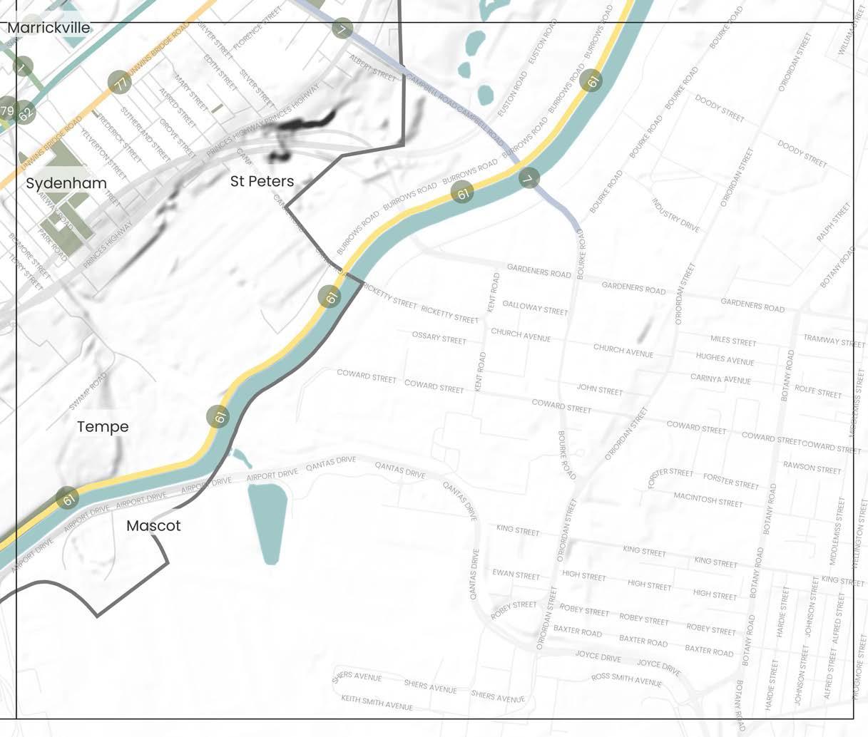
2020, TfNSW
GreenWay Master Plan
2018 Inner West Council
Sydney Gateway Study
2018, Transport for NSW
GreenWay Biodiversity Strategy
2013, Inner West Council
Eastern Channel East Subcatchment Management Plan
2011 Inner West Council
GreenWay Revegetation and Bushcare Plan
2011 Inner West Council
Marrickville Biodiversity Strategy
2011 Inner West Council
GreenWay Flora and Fauna Literature Review
2010 Inner West Council
Marrickville Urban Forest Strategy
2010 Inner West Council
DRAFT 82
62 63
Precinct Boundary Inner West LGA Boundary Parks and Open Spaces Waterways, rivers and creeks The Inner West Blue-Green Grid Suburb Boundary 0 Train Station Light Rail Station Ferry Terminal Local Places 500m 0m 1km
Alexandria
Rosebery
Botany
Link connects major recreational open spaces traveling from Petersham Park at West Street and down Livingstone Road to Marrickville Park then along Sydenham Road passing Wilkins School, Henson Park and Wicks Park before arriving at Sydenham Station. The link travels busy streets, mostly residential with pockets of commercial and industrial at the Sydenham end.
Link runs through the Marrickville industrial area via the Sydenham Pit and Drainage Pumping Station. A pedestrian cut through from Shirlow Street to Sydney Steel Road offers connectivity between Sydenham Train Station to Marrickville Metro through to King Street via Alice Street and up to Newtown Station. The link is predominantly industrial and commercial in character travelling along a mix of busy roads and pedestrian links.
The link connects a series of green spaces including Enmore Park, Camdenville Oval, Simpson Park and Sydney Park. Route runs through some industrial areas in St Peters as well as a recognised Kangaroo Ground. It runs partially through a flood zone and crosses the Cooks River. The link also passes the St Peters Interchange of West Connex, a busy and wide street.
The link could see improvements in pedestrian and cycling infrastructure to make the north-south connection safer but to also offer better connections to major east-west cycling routes and the rail line. West Street is well serviced with existing tree canopy. This should be retained and enhanced so as encourage and increase areas of habitat for native flora and fauna. Areas of industrial character along Sydenham Road see a reduction in canopy cover and could benefit from increased tree planting to mitigate urban heat and support urban ecology.
Multiple opportunities for this link have been identified, including the potential for Sydenham Pit and Drainage Pumping Station to be investigated for naturalisation to support urban ecology and local amenity. The link includes parts of Marrickville's industrial precinct that holds cultural significance providing opportunity for public art and cultural activation. At Fraser Park, the link also runs through a Kangaroo Ground connecting to a potential Aboriginal archaeological site providing opportunity to recognise and celebrate Aboriginal and Torres Strait Islander culture and histories. Street planting for shade and improved sidewalks and cycleways are areas of improvement, especially in the industrial areas.
This link contains parks that are highly valued by the community as a place to gather, walk dogs and enjoy nature. Due to it linking several significant green spaces, it also holds opportunity for an ecological corridor. Community members suggested improvements to crossings at WestConnex and improved cycleways connecting Enmore and Campbell Street connecting better to Bourke Street in Alexandria. WestConnex has public path upgrades at the St Peters Interchange that could positively contribute to this link and deliver additional shared and cycle paths, significant tree planting, and permeability of the site for crossing.
The Cooks River is a key green and blue asset for the Inner West and neighbouring council areas. Along the link are multiple parks and reserves, a children’s playground and the Marrickville Golf Club. The link offers a diverse range of passive and active recreational opportunities.
While there are many recreational activities that can be undertaken along the Cooks River Foreshore, the community has expressed a desire for the Cooks River itself to be improved with the aim of providing increased access to the riverbank for recreational activities. Therefore, improvements should be focused on naturalising the waterway and improving water quality. This area of the Inner West is also recognised as an area with high biodiversity values and therefore, future improvements must also look to increase and enhance natural vegetation along the riverbank to enhance and increase areas of habitat for native flora and fauna. The river also has significant Indigenous heritage which should be recognised and promoted in any future works.
Currently there is no continuous pedestrian or cycle link along the rail corridor. Opportunities along the link should consider improving footpaths, crossings and cycle infrastructure. There is some opportunity along this link to increase tree canopy, verge and private garden plantings and to rewild the area along the rail corridor to increase areas of natural habitat for native flora and fauna.
Improvements along this link should consider the provision of safe, accessible footpaths and crossings in addition to improved cycling infrastructure between these two key destinations. The amenity of the link could also be improved through the provision of additional vegetation and tree plantings to increase canopy cover and shade along the link.
DRAFT Inner West Blue-Green Grid Strategy 2023 83 Number Link Suburbs Link Description Possible Opportunities & Improvements ATSIACH EcologyConnectivityHydrology Recreation
1
Petersham Park to Sydenham Station via Marrickville and Henson Park
Marrickville, Petersham, Sydenham
1 1 1
5 Fraser Park Football Club to Newtown Station
Marrickville, Enmore, Newtown, Sydenham
1 1 1
7 Enmore Park to Sydney Park
Enmore, St Peters, Marrickville, Newtown
1 1 1 1 1
61 The Cooks River to Alexandra Canal Marrickville, Dulwich Hill, Tempe, St Peters
1 1 1 1 1
62 Southern Trainline St Peters, Sydenham, Marrickville, Dulwich Hill
Link follows the train corridor which runs from St Peters to Dulwich Hill train stations.
1 1 1 1
77 Unwins Bridge Road Tempe
Link runs along Unwins Bridge Road connecting King Street to the Cooks River via Tillman Park.
1 1
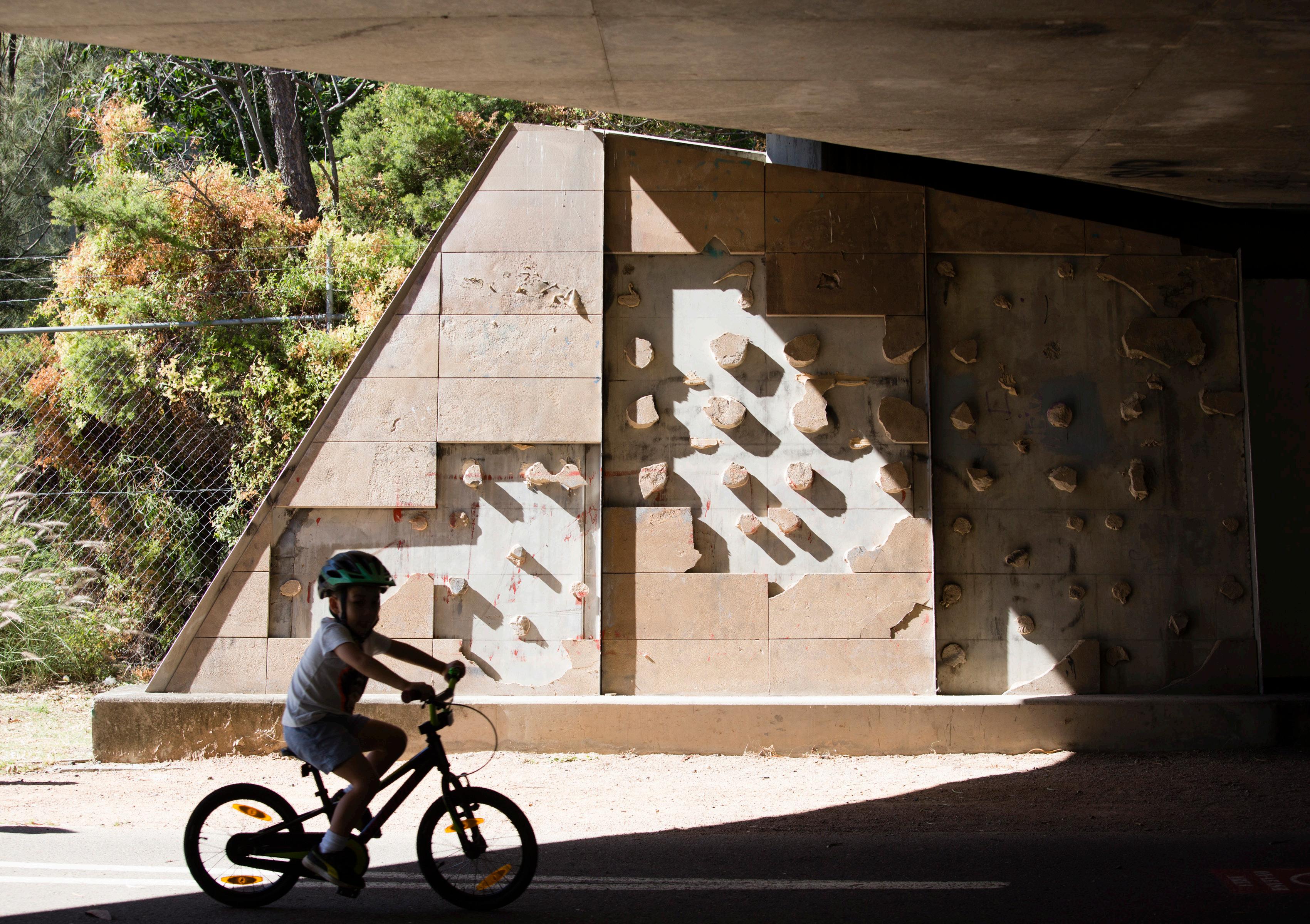
8. Delivering the Grid
8.1 Implementation Plan Overview
8.1.1 How the Blue-Green Grid can be embedded across plans, policies and strategies
Inner West Council has an Integrated Planning and Reporting Framework that begins with the community’s aspirations set out in the Community Strategic Plan
Our Inner West 2036 adopted by Council in June 2022. The community’s strategic directions relevant to the Blue-Green Grid include:
Strategic Direction 1: An ecologically sustainable Inner West
Strategic Direction 2: Liveable, connected neighbourhoods and transport
Strategic Direction 4: Healthy, resilient and caring communities
Planning is undertaken by Council to support the achievement of these strategic directions which require time, money, assets and people for effective implementation. Council’s Resourcing Strategy consists of three inter-related elements that it will take responsibility for:
– Long-Term Financial Planning.
– Asset Management Planning.
– Workforce Planning.
These elements help form and deliver Council’s Delivery Program and Operational Plans, as well as any other strategic plans developed to support the Community Strategic Plan.
Following community consultation, evidence-based planning and input from relevant Council teams, this Strategy now defines where the Grid will be located and identifies priority projects. Implementation of the Strategy will be an ongoing and iterative process for decades to come.
The successful implementation of the Blue-Green Grid Strategy will rely on Inner West Council’s:
– Political and executive support.
– Organisational capacity and provision of resourcing and budget.
– Stakeholder co-operation and support (community and business; major land-owner/ managers; State Government and neighbouring local governments).
– Access to grants, financial contributions and funds.
– Up to date data and best practice processes.
– Delivery mechanisms and funding within the planning system.
The Strategy will also be used to inform advocacy programs for other public agencies to assist in funding identified works, especially with a regional or district purpose.
This Strategy will be embedded within Council’s strategic planning framework to inform current and future planning, operational and delivery programs crucial to implementation of the Blue-Green Grid including:
– The Local Environmental Plan and Development Control Plan to guide development on public and private land.
– Local Infrastructure Contribution Plans and Planning Agreements.
– Housing, transport, retail, employment, biodiversity, climate change, recreation, stormwater, catchment, urban canopy, flood, waterways, engagement, design excellence and active transport policies and strategies to embed the Grid into all layers of Council’s land use planning, management and delivery.
– Site specific plans, masterplans and precinct plans to revitalise the public domain and deliver priority projects.
– Plans of management for implementation in our public reserves.
– Design, operational, management and maintenance guidelines for Council staff and developer use for different forms of green infrastructure including water sensitive urban design systems, landscaping, irrigation, green roofs and walls, and footpath and street tree planting in the public domain.
– Green Infrastructure asset valuation to help quantify the benefits of green infrastructure and public spaces to ensure benefits are integrated into capital project business cases and decisionmaking.
– Programs to engage with and educate the community as well as collaborate with and include Aboriginal knowledge and culture in Blue-Green Grid projects.
DRAFT 86
8.1.2 Four Pillars for Implementation 8.1.3 Priority Actions and Initiatives
Implementation of the Blue-Green Grid will be based on four pillars that have been identified based on existing State and local government legal requirements and policies, research, best practice, precedents and consultation with the community and Council officers.
The four pillars for implementation are:
Advocacy and Collaboration
Advocacy and Collaboration
1. Adopt the Blue-Green Grid as a Council priority and build Council’s culture around integrating the Strategy as a key purpose.
2. Encourage multidisciplinary interdepartmental cooperation within Council to plan, implement and maintain the grid as a common purpose.
– Create a cross Council working group for the first three years of implementation to build knowledge and capacity in the organisation.
Funding Valuation and Incentives
3. Work closely with business, industry, developers, utility providers, investors, government departments, peak bodies, advocacy groups, Indigenous stakeholders and the community to deliver shared benefits for the Grid.
Community Education and Participation
– Continue to consult the Inner West Community during implementation of the Blue-Green Grid Strategy.
Governance Delivery and Operations
Relevant recommended priority actions and initiatives have been categorised under each pillar to give clarity and structure to the way forward and are listed in section 8.1.3 on the right.
– Include the Grid in the Community Engagement Strategy – Community Participation for Land Use Planning Matters.
– Integrate, implement and manage the Blue- Green Grid with adjoining asset managers (such as neighbouring councils, Sydney Water, Greater Sydney Parklands, Roads and Maritime Services, State Rail Authority, Transport NSW, Departments of Education and Health, Department of Planning and Environment, Cooks River Alliance, Sydney Harbour Coastal Councils Group, Parramatta River Catchment Group, Indigenous groups and large private and public landowners).
– Actively engage with utility / infrastructure providers to protect, retain and enhance the Grid values when undertaking works.
– Investigate opportunities to relocate powerlines underground and bundle cables at a local or precinct scale, especially in areas undergoing redevelopment to provide space for urban canopy.
– Advocate for the protection and enhancement of tree canopy in NSW Government projects and along active transport routes.
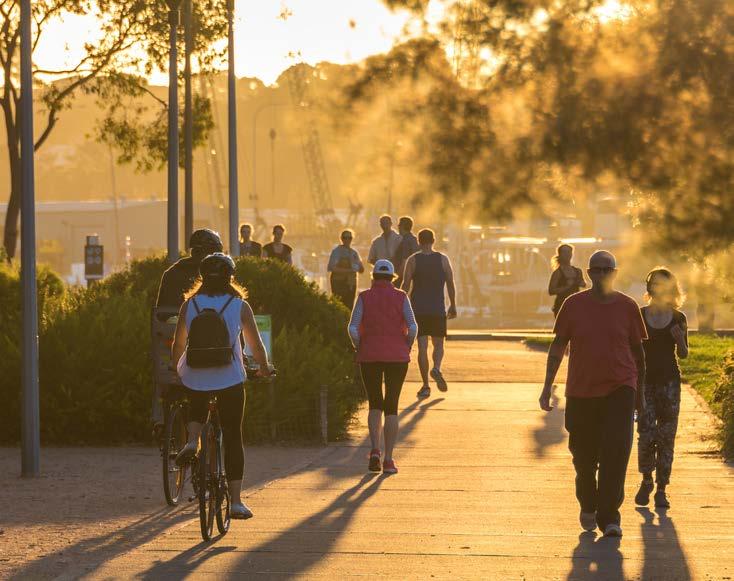
4. Represent community needs and interests to Commonwealth and State Governments and the private sector to improve canopy, linkages, accessibility and water quality.
The Measures of Success for Implementation
– Council wide recognition of the Blue-Green Grid Strategy
– Formation of Blue-Green Grid working groups
– Integration of Blue-Green Grid opportunities across council projects, including public domain and street scape upgrades
DRAFT Inner West Blue-Green Grid Strategy 2023 87
Funding, Valuation and Incentives
1. Investigate valuing blue and green infrastructure as an asset class within Council’s asset management system in accordance with the NSW Government’s ongoing Valuing Green Infrastructure and Public Spaces Project to help build the business case for funding and to drive responsive design outcomes.
– Consider adopting a tree value assessment tool to deter removal and enhance community education.
2. Resource priority projects through ongoing revenue streams and sufficient budget.
– Seek funding from State and Federal Government through connection to government strategies, environmental and place-based schemes and capital allocation.
– Investigate funding opportunities from Council environmental levies and capital works programs, levies raised under a Special Infrastructure Contributions Program, Voluntary Planning Agreements, local infrastructure contributions (S.7.11 Contributions and S.7.12 Levies), private and business dedications, grants, conservation agreements, community title schemes in new developments, Regional Infrastructure Contribution Framework, Metropolitan Greenspace Program, Local infrastructure Renewal Scheme, TCorp, Land Acquisition Strategy, conditions of consent and tree bonds.
– Leverage budget and programs linked to WSUD programs with the Blue-Green Grid to give it more weight when determining priorities.
– Ensure developer funding for long-term tree and WSUD maintenance in the public realm that are associated with Voluntary Planning Agreements.
3. Investigate incentives to retain and plant green infrastructure and implement water sensitive urban design along the Blue-Green Grid on public and privately owned land including retrofitting.
– Encourage developers to incentivise the establishment of canopy trees in privately owned landscape areas for medium and high density development along the Grid (e.g. bonds returned for owners after 2 years growth).
– Investigate an offset fund for green infrastructure.
Community Education and Participation
1. Activate community understanding and participation through Council’s community environmental education and engagement programs.
– Continue or develop programs such as tree dedications, tree giveaways, adopt a tree and recognition for significant contributors to the BlueGreen Grid to encourage stewardship.
– Continue to implement programs and funding to support community-based initiatives such as Rivercare, National Tree Day and Bushcare.
The Measures of Success for Implementation
– Project benefits are better understood through application of more rigorous capital cost and life cycle valuation methods of Blue-Green Grid Infrastructure in business cases.
– Blue and green infrastructure is included as an asset class within Council’s asset management system.
– Council is successful in obtaining sufficient funding to implement projects.
– Council allocates sufficient budget and resources to effectively implement the Strategy, value the benefits and maintain and manage blue and green infrastructure e.g healthy street trees, rain gardens, gross pollutant traps.
– Tree canopy improves on private properties in targeted areas along the Green Grid.
– Identify an LGA mascot or emblem for the BlueGreen Grid such for signage and recognition.
2. Collaborate with indigenous stakeholders to identify, protect, enhance and present green and blue Infrastructure.
3. Continue to respond to community needs and aspirations in line with Council’s Service Charter and make improvements to systems when needed.
The Measures of Success for Implementation
– Increased community awareness of the need for and benefits of the Blue-Green Grid.
– Increased participation in education programs, tree giveaway, community planting days, citizen science and award programs.
– Increased stewardship of public places by community groups based on number of groups and participants.
– Increased requests for street trees from the community.
DRAFT 88
– Increased rate of retention of trees, planting of new trees, green roofs and walls on private property along the Blue-Green Grid.
– Improvement to Customer Relationship Management (CRM) statistics for the Blue-Green Grid matters.
– Increased engagement and collaboration with indigenous stakeholders in the implementation, creation and management of the blue and green and ATSIACH grids.
– Increased community satisfaction in place-
Governance Delivery and Operations
1. Ensure the Integrated Planning and Reporting Framework recognises and facilitates the Blue-Green Grid.
– Integrate the vision, goals, targets, objectives and priority projects for the Blue-Green Grid into iterations of the Community Strategic Plan, Delivery Program and Operational Plan.
– Integrate the vision, goals, targets and objectives for the Blue-Green Grid into relevant strategies, plans, operational, technical, policy and planning documents for consistency in implementation, co-benefits and to inform planning, capital works, resourcing, priorities and projects. This includes reserve plans of management, precinct, street tree and park masterplans, relevant projects, programs and guidelines, heritage conservation areas, neighbourhood character statements, neighbourhood and precinct plans, design excellence guidelines and catchment management plans.
– Include a Blue-Green and The Aboriginal and Torres Strait Islander, Arts, Culture and Heritage layer in Council’s Geographic Information System along with placed based targets and the value overlays for e.g bike/ walking routes, heritage, biodiversity and riparian to assist in Grid decision
making, prioritisation and implementation.
– Amend the LEP and DCP to identify, enhance, create and protect the Blue-Green Grid in targeted areas.
– Review and adopt existing sub-catchment plans and prepare plans for areas without to assess capital costs of redoing stormwater infrastructure, meet water quality targets and help make Parramatta and Cooks Rivers swimmable.
2. Undertake planning, operational and delivery changes to ensure the strategy is successfully implemented on public land.
– Integrate Councils public tree inventory with its asset management, GIS, significant tree register and customer information systems to help manage tree assets.
– Implement systems and training to ensure the public tree planting program, WSUD and raingardens along the Grid are successful.
• Adopt best practice locally appropriate standards, guidelines and checklists to scope work for footpaths, bike lanes, parking, road and lane widths that not only satisfy Australian Standards and AusRoads but also accommodate trees and WSUD in the public realm.
• Develop standard planting specifications and maintenance regimes for raingardens.
• Map Council team responsibility for implementation, maintenance and management.
3. Regularly monitor and evaluate success in quantitative and qualitative terms and identify lessons learnt to improve compliance, processes, outcomes and inform Council’s governance framework and Sydney wide comparative data analyses.
The Measures of Success for Implementation
The Blue-Green Grid is included in Council’s Integrated Planning and Reporting Framework and Geographic Information System.
– Statutory controls in Council’s LEP and DCP identify, enhance, create and protect the Blue-Green Grid and The Aboriginal and Torres Strait Islander, Arts, Culture and Heritage Grid.
– Blue-Green Grid monitoring, auditing, evaluation and reporting processes indicate improvements by tracking key actions and performance indicators such as:
• Number of priority projects implemented along the Grid including ARSIACH culture projects.
• Ease of use and cost effectiveness of data collection and evaluation tools.
• Adoption of sub-catchment plans, integrated transport strategy and other strategic plans to inform the Grid.
• Integration of Council’s public tree inventory with its asset management, GIS, significant tree register and customer information systems to help manage tree assets.
• Implementation of systems and training to ensure the public tree planting program, WSUD, and raingardens along the Grid are successful e.g. standards, guidelines and checklists.
• Place-based canopy, biodiversity, access, water quality/ quantity and active transport targets are met along the Grid.
• Reduced Council liability and insurance claims from blue-green assets due to proper management and maintenance.
• Fauna sightings and public use of sections of the Grid.
• Number of swimmable locations in Parramatta River and Cooks River.
DRAFT Inner West Blue-Green Grid Strategy 2023 89
9. Appendix
9.1 Appendix A - Sieve Mapping
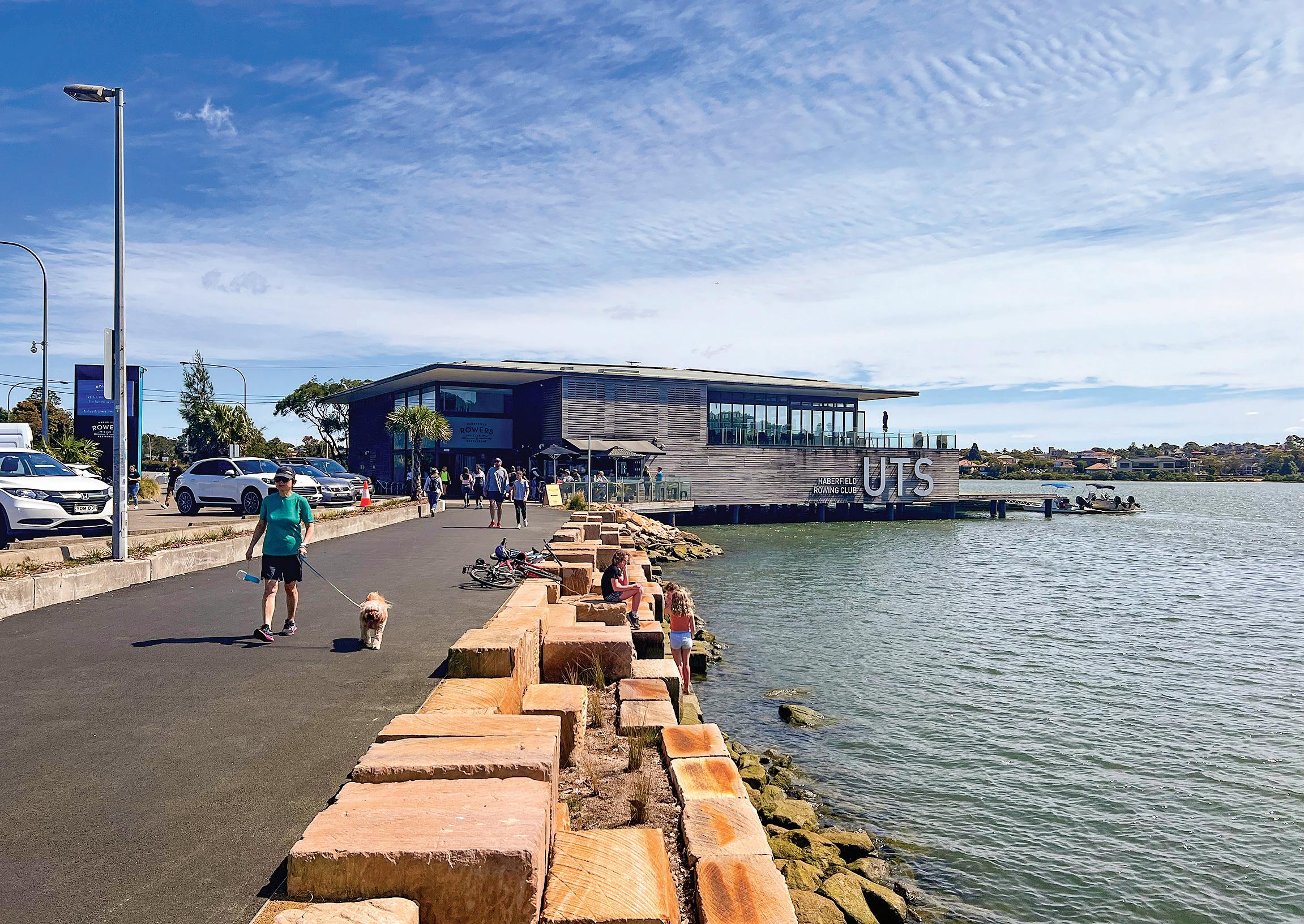
Mapping Methodology
The LSPS for The Inner West provides a local response to the planning priorities and objectives outlined in The Greater Sydney Region Plan and the Eastern City District Plan, and established the baseline to start the analysis to be further detailed and developed.
Together with a review of a collection of documents prepared by Council, spatial data was collected to create a technical evidence base to assist in the determination of each link that forms the Blue-Green Grid.
Validating and Testing
The LSPS Green Grid was tested over multiple seive maps and with engagement input to see where links were missing or where links could be amended that would better suit the Blue-Green Grid.
Localising Links and Defining the Network
With the previous technical analysis it was possible to localise opportunities and identify new links. This evidence is themed against the LSPS goals to provide a direct link between community, Council and the design.
It is extremely important to guarantee that the community is involved and driving the vision. A map was created based on community and stakeholder aspirations, vision, needs and priorities, and additional routes and places were included in the grid.
LSPS Green
Background Review
Validating & Testing
(See appendix)
The Inner West Blue-Green Grid
Stakeholder and Community Engagement
DRAFT 92
Grid
LSPS Green
(evidence
CONCEPT LAYERED SIEVE MAPS
base of the 5 Grid functions) STRATEGY
Mapping Engagement Input
Localising Links
Grid
THE ABORIGINAL AND TORRES STRAIT ISLANDER, ARTS, CULTURE AND HERITAGE GRID MAPPING LAYERS
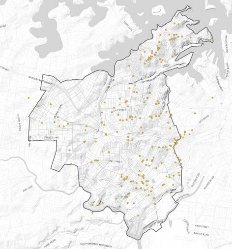
Tom Uren Trail
The Tom Uren Trail is named after the politician, Tom Uren who worked to preserve the heritage of Inner Sydney. The trail can be connected to the grid.
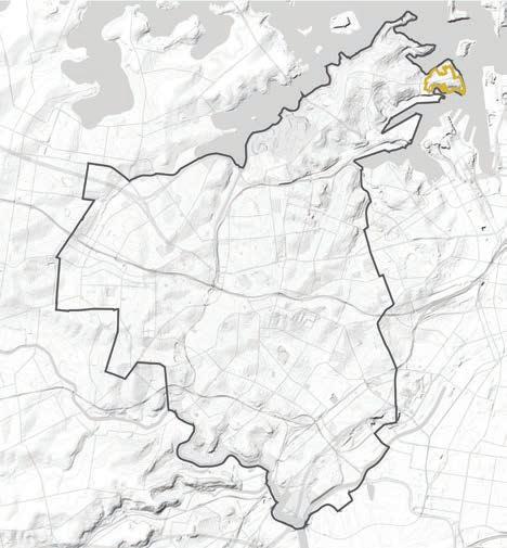
Public art can be explored through implementation of links through the Blue-Green Grid.
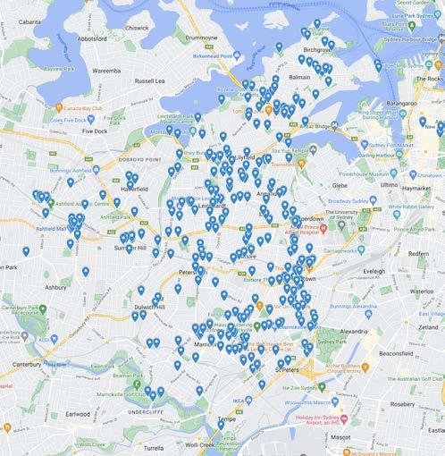
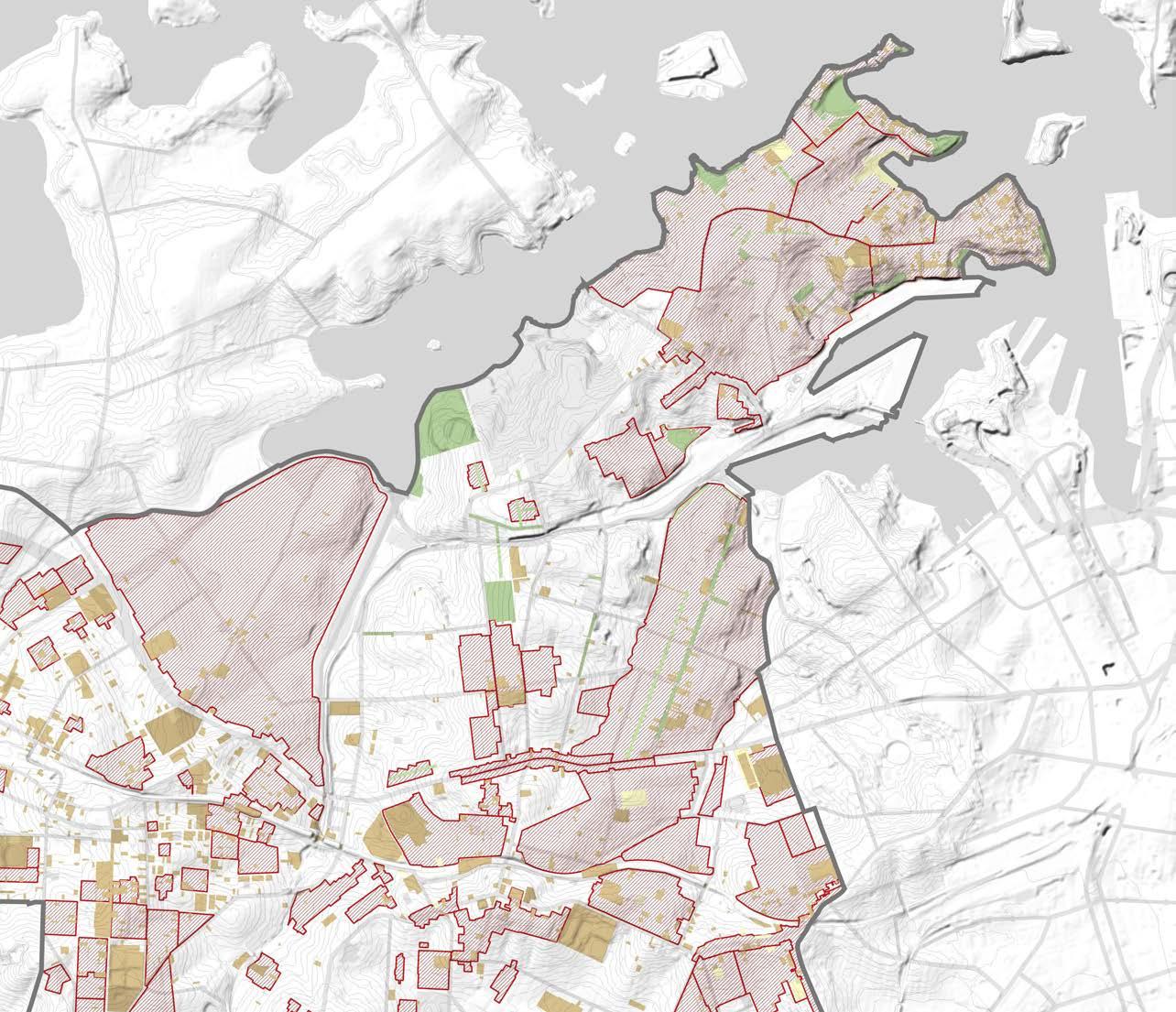
DRAFT Inner West Blue-Green Grid Strategy 2023 93
Inner West LGA Boundary Tom Uren Trail Legend
Art Venues Legend Inner West LGA Boundary Identified Public Art Public Art
Legend Inner West LGA Boundary Conservation AreaGeneral Item - General Item - Archaeological Item- Landscape Public Art Location
Localising and Defining the Network
THE ABORIGINAL AND TORRES STRAIT ISLANDER, ARTS, CULTURE AND HERITAGE GRID
OPPORTUNITIES TO BETTER RESPOND TO THE GRID
Key findings of the ARSIACH Grid Sketch are 4 main routes, improving connectivity between links, indigenous heritage areas and waterways, with focus on Sydenham area.
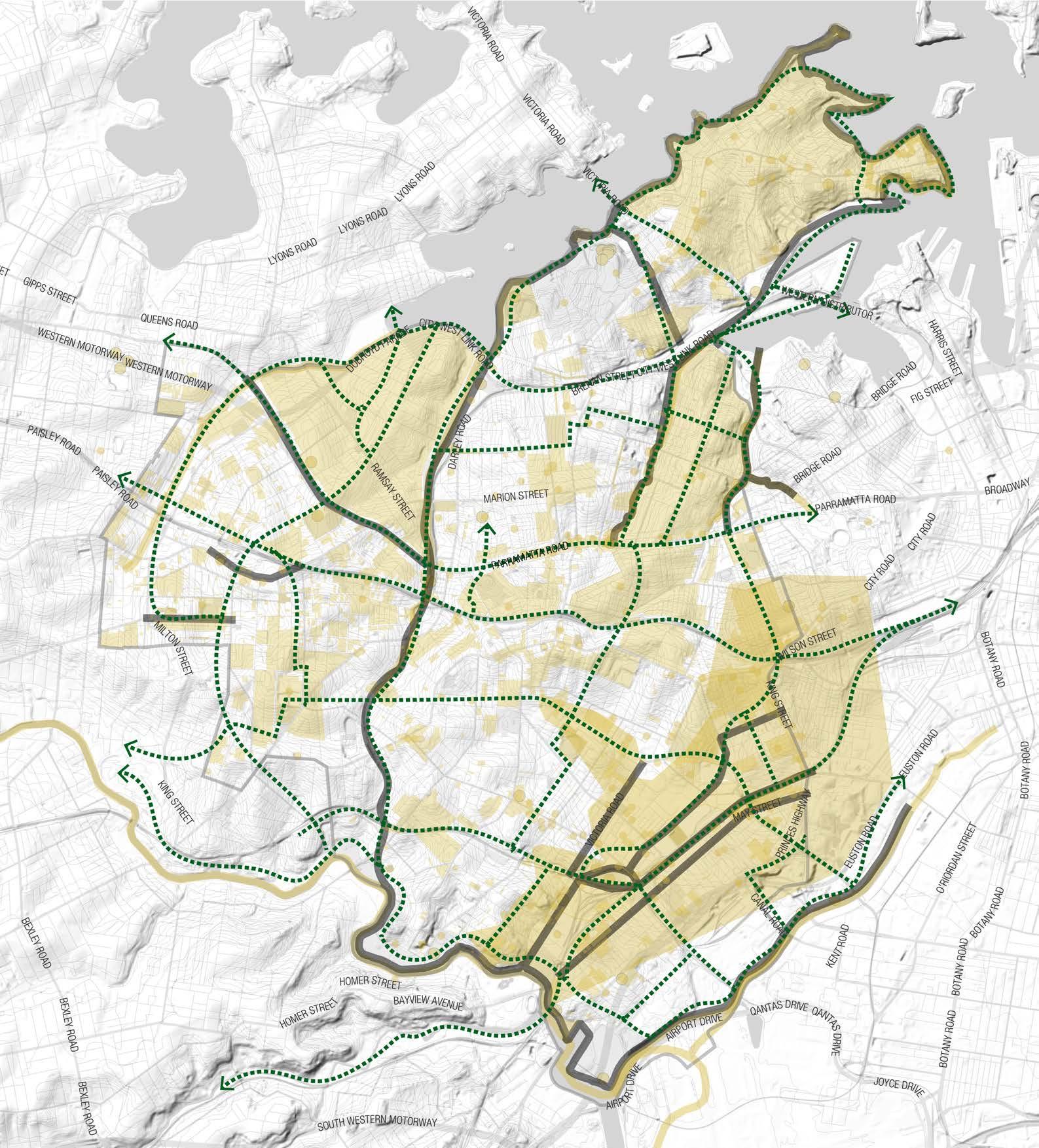
Legend
Inner West LGA Boundary
3+ Overlapping Layers
1 Layer
Initial Grid Sketch
LSPS Blue Green Grid
Opportunity new links for the Grid
Hurlstone Park
Croydon Park
Camperdown
Balmain East
Summer Hill
Dulwich Hill
Marrickville
Petersham
Birchgrove
Annandale
Sydenham
Leichhardt Lewisham
Stanmore
Newtown
St Peters
Croydon
Balmain
Enmore
Mascot
Rozelle
Tempe
Open Space Network
THE RECREATIONAL GRID MAPPING LAYERS
Activity Centres
The Recreational Grid will link parks and open s paces and provide loops and routes for people to follow, enhancing access to a diversity of recreational open spaces.
Projected Population Density
Key town centres are known as places of recreational shopping and eating and so will be connected through the Recreational Grid.
Population Density
High density areas identify priority areas for implementation of the Recreational Grid, representing larger proportion of people to be positively impacted.
Lack of Open Space Open Space Provision Estimates 2036
High density areas identify priority areas for implementation of the Recreational Grid, representing larger proportion of people to be positively impacted.
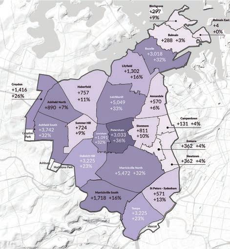
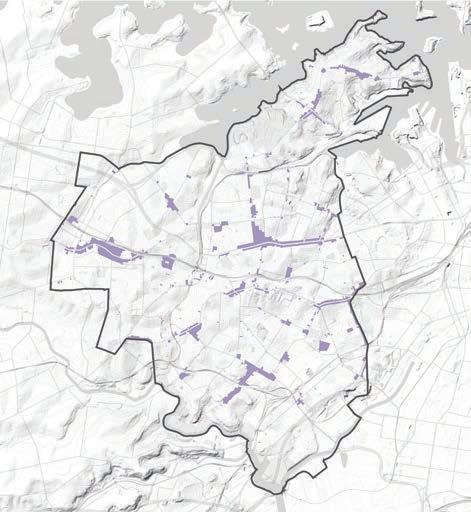
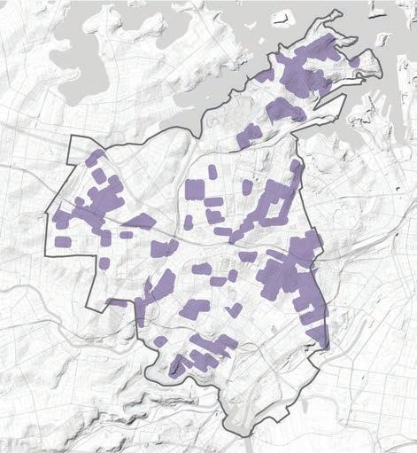
The map indicates main areas that lack parks and green open spaces, representing opportunities of improvement with the Recreational Grid.
The map indicates main areas that lack parks and green open spaces, representing opportunities of improvement with the Recreational Grid.
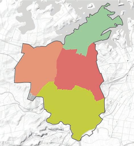
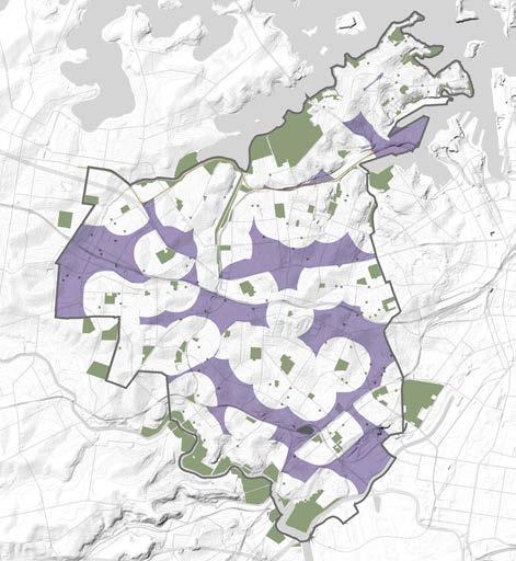
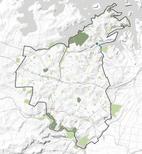
DRAFT Inner West Blue-Green Grid Strategy 2023 95
Inner West LGA Boundary
Parks (5ha+)
Regional
District Park (2ha to 5ha)
Level Local Parks (0.5ha to 2 ha)
Level 2 Local Parks (0.1ha to 0.5ha)
Pocket Parks (less than 0.1ha)
Inner West LGA Boundary Catchment - North Catchment 2 - West Catchment 3 - East Catchment 5 - South Inner West LGA Boundary Parks and Open Spaces Areas not within 400m walking distance Inner West LGA Boundary Town Centres Inner West LGA Boundary Highest density areas Legend Legend Legend Legend Legend 6.4 m2 16.9 m2 8.7 m2 32.5 m2
Confirmed Rozelle Parklands
Inner West LGA Boundary 35-40% 30-35% 25-30% 20-25% 15-20% 10-15% 5-10% 0-5% Legend
Localising and Defining the Network
THE RECREATIONAL GRID
OPPORTUNITIES TO BETTER RESPOND TO THE GRID
The LSPS already responds well to the most overlapped layers on the recreational criterion, providing connections along east/west and central zone of the LGA.
The Sketch Recreation Grid provides refined connection between links, providing 7 new main routes that will improve connectivity between areas of poor accessibility to open space, high density, and lack of recreational parks.
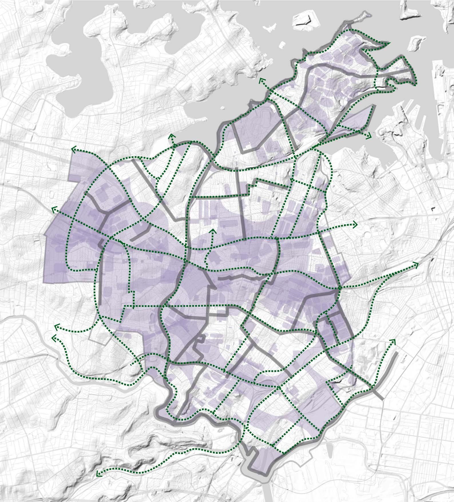
Lilyfield, Balmain in the northeast will potentially benefit from the new recreational grid.
Legend
Inner West LGA Boundary
3+ Overlapping Layers
1 Layer
Initial Grid Sketch
LSPS -Green Grid
Opportunity new links for the Grid
Hurlstone Park
Croydon Park
Camperdown
Balmain East
Summer Hill
Dulwich Hill
Marrickville
Petersham
Birchgrove
Annandale
Sydenham
Leichhardt Lewisham
Stanmore Newtown
St Peters
Croydon
Balmain
Enmore Mascot
Rozelle
Tempe
Biodiversity
THE ECOLOGICAL GRID MAPPING LAYERS
Vegetation Concentration
Tree Canopy Concentration
Parks and Open Spaces are areas of high biodiversity value and should be protected, enhanced and connected by the Ecological Grid.
The Ecological Grid will incorporate areas with existing vegetation coverage as well as seek areas which would benefit from additional diverse vegetation.
The Ecological Grid will incorporate areas with existing canopy coverage as existing links as well as seek areas which would benefit from additional tree canopy, and see the relationship between urban heat and trees.
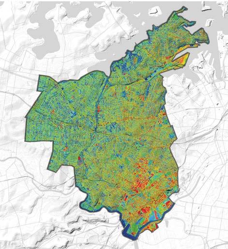
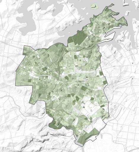

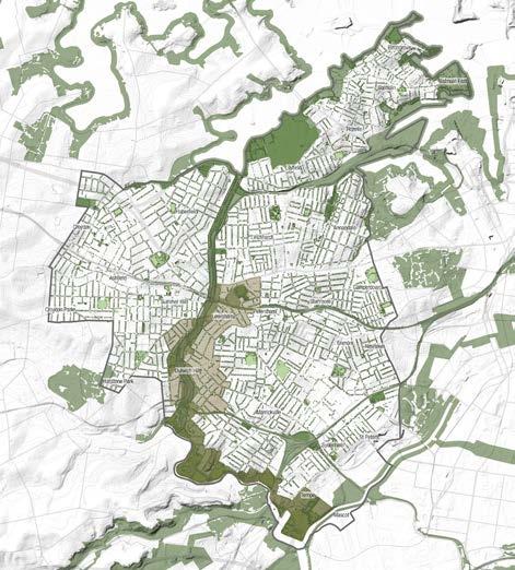
Applying the Grid in areas facing extreme urban heat often correlating with lack of vegetation.
Applying the Grid in areas facing extreme urban heat often correlating with lack of vegetation.
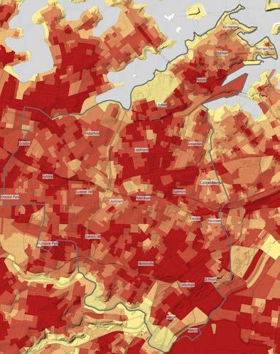
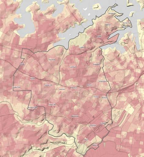

DRAFT Inner West Blue-Green Grid Strategy 2023 97
Inner West LGA Boundary Parks Biodiversity Corridor Wildlife Corridor & Bandicot Protection Area Greenway Registered Council Street Tree Inner West LGA Boundary 50%-100% vegetation coverage 30%-50% vegetation coverage 20%-30% vegetation coverage Inner West LGA Boundary 50%-100% vegetation coverage 30%-50% vegetation coverage 20%-30% vegetation coverage Legend Legend Legend Urban Heat Island Inner West LGA Boundary 0 - 5.08 UHI* 5.08 - 6.78 UHI* 6.78 - 7.73 UHI* 7.73 - 8.54 UHI* 8.54 - 12.71 UHI* Legend Urban Heat Legend Inner West LGA Boundary 20°C 41°C
Localising and Defining the Network
THE ECOLOGICAL GRID
OPPORTUNITIES TO BETTER RESPOND TO THE GRID
Maintaining and enhancing areas of high biodiversity is encouraged by the LSPS.The Sketch Ecological Grid indicates 9 new routes that give an opportunity to better respond to areas that lack vegetation and tree canopy at a finer grain level. They incorporate the living streets and better connect to the Greenway to local parks, mainly around Dulwich Hill, Lewisham and Hurlstone Park, and the Hawthorne Canal with new west/east corridors, to benefit Haberfield and Leichhardt suburbs.
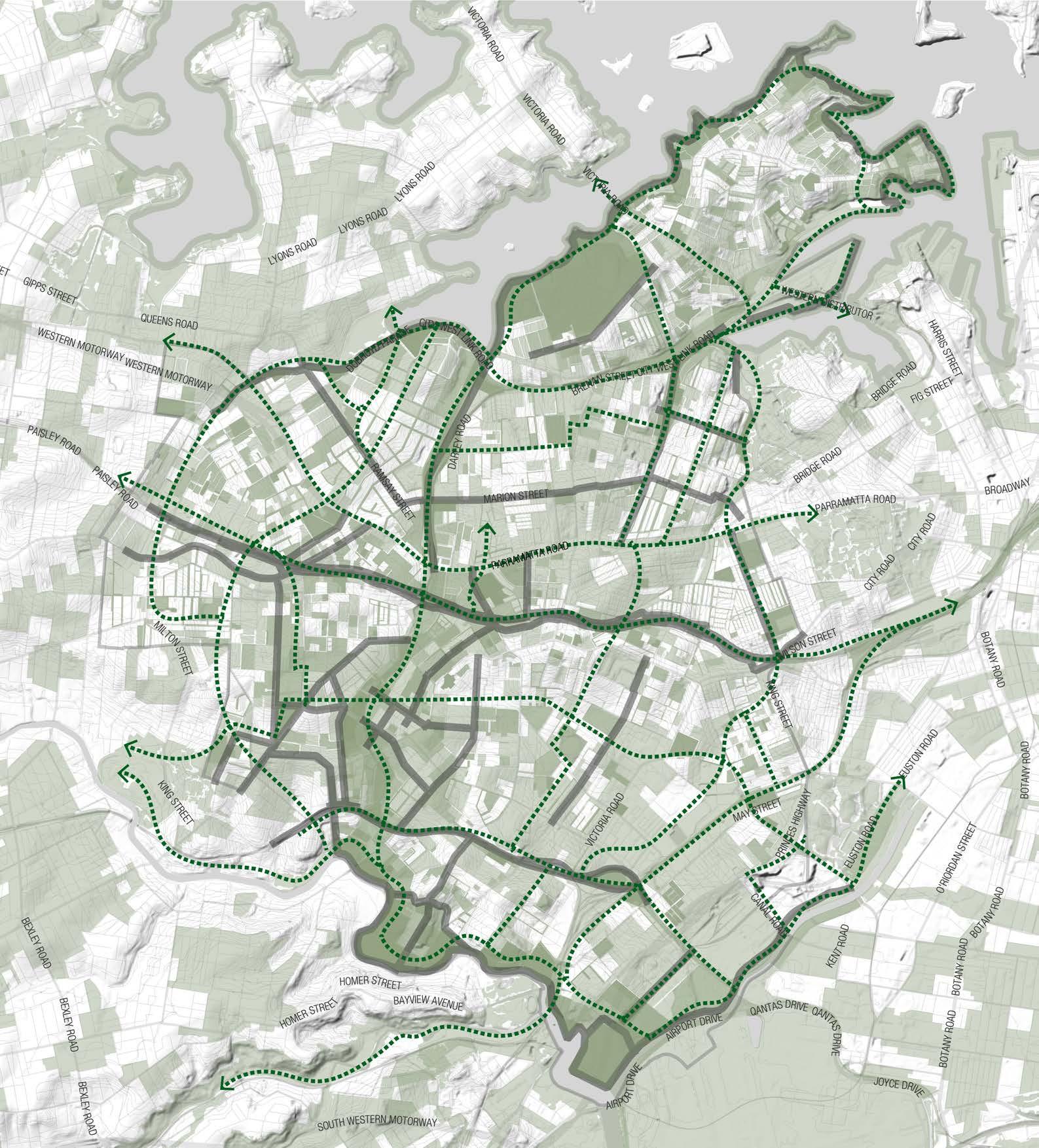
Legend
Inner West LGA Boundary
3+ Overlapping Layers
1 Layer
Initial Grid Sketch
LSPS Blue-Green Grid
Opportunity new links for the Grid
 Hurlstone Park
Croydon Park
Camperdown
Balmain East
Summer Hill
Dulwich Hill
Marrickville
Petersham
Birchgrove
Annandale
Sydenham
Leichhardt Lewisham
Stanmore
Newtown
St Peters
Croydon
Balmain
Enmore
Mascot
Rozelle
Tempe
Hurlstone Park
Croydon Park
Camperdown
Balmain East
Summer Hill
Dulwich Hill
Marrickville
Petersham
Birchgrove
Annandale
Sydenham
Leichhardt Lewisham
Stanmore
Newtown
St Peters
Croydon
Balmain
Enmore
Mascot
Rozelle
Tempe
THE HYDROLOGICAL GRID MAPPING LAYERS
Hydrological Network and Flooding
The implementation of the Hydrological Grid will assist in mitigating impacts of flooding, protect and enhance existing waterways and riparian areas, by incorporating them as places of high amenity.
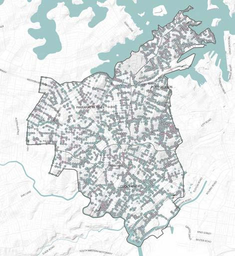
Urban Heat
Hydrology can be used in to combat heat through evaporative cooling.
Understanding where less permeable surfaces are which correlates with flooding.
Waterways and Catchment
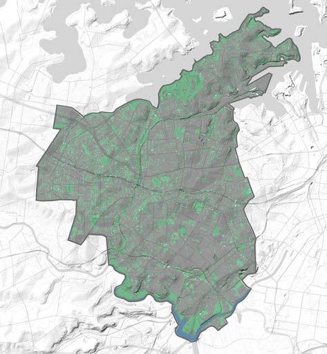
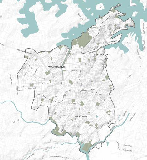
Hydrology can be used in to combat heat through evaporative cooling.
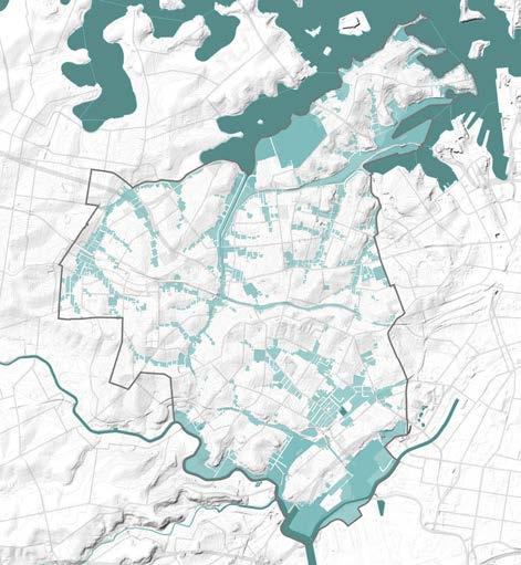
Pipes and Drainage
DRAFT Inner West Blue-Green Grid Strategy 2023 99
Inner West LGA Boundary Previous Area Impervious Area Open Water
Surfaces Urban Heat Island
Permeable
Inner West LGA Boundary Waterways Flooding extent Inner West LGA Boundary Catchment Boundary Inner West LGA Boundary Drainage Pits Stormwater Pipes Legend Legend Legend Legend Legend Inner West LGA Boundary 20°C 41°C Inner West LGA Boundary 0 - 5.08 UHI* 5.08 - 6.78 UHI* 6.78 - 7.73 UHI* 7.73 - 8.54 UHI* 8.54 - 12.71 UHI* Legend
Localising and Defining the Network
THE HYDROLOGICAL GRID
OPPORTUNITIES TO BETTER RESPOND TO THE GRID
The LSPS Green Grid already responds well to the hydrological systems in the Inner West. The Sketch Hydrological Grid indicates new 7 links to better reduce flooding risks and less permeable surfaces.
Legend
Inner West LGA Boundary
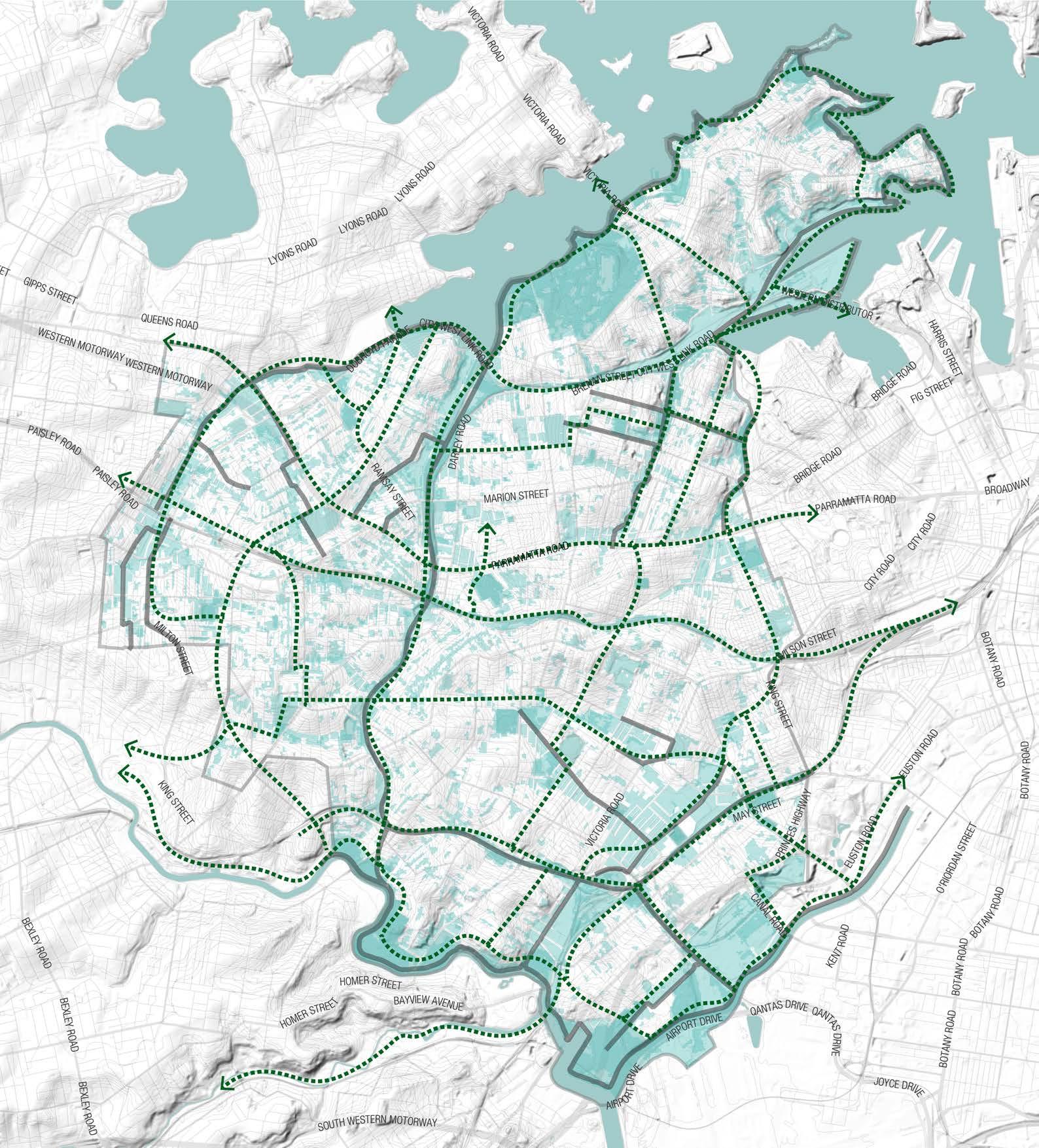
3+ Overlapping Layers
1 Layer
Initial Grid Sketch
LSPS Blue-Green Grid
Opportunity new links for the Grid
Hurlstone Park
Croydon Park
Camperdown
Balmain East
Summer Hill
Dulwich Hill
Marrickville
Petersham
Birchgrove
Annandale
Sydenham
Leichhardt Lewisham
Stanmore
Newtown
St Peters
Croydon
Balmain
Enmore
Mascot
Rozelle
Tempe
Open Space Network
THE CONNECTED GRID MAPPING LAYERS
Activity Centres
Points of Interest
Heritage Walks
Parks will be easily accessible by high amenity routes.
Activity anchors such as schools and town centres to be connected to other POIs.
The Connected Grid will improve connectivity to and between POIs, such as hospitals, education facilities, picnic areas, lookouts etc.
Existing routes and trails can be incorporated into the grid and connected to the grid.
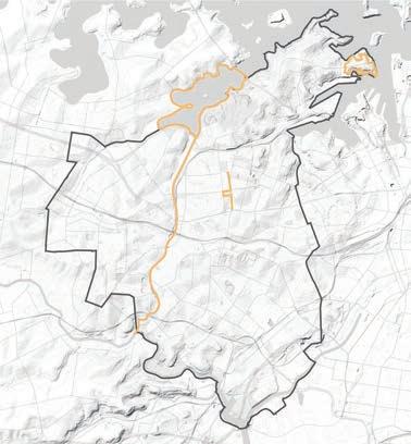
Cycling Routes Movement Network
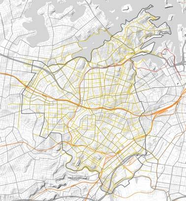
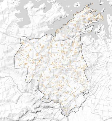
Public Transport Walkability
The Connected Grid will improve the connectivity of areas of high volume of pedestrians such as train stations, lightrail stations and bus stops.
Cycle routes will form part of the Blue Green Grid as active transport corridors.
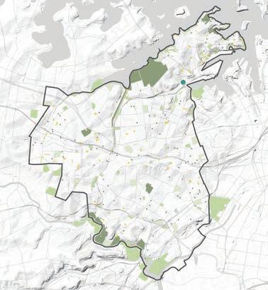
The Connected grid will improve the most commonly travelled paths that where identified in different hours and days of the week to understand high use routes.
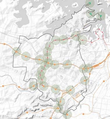
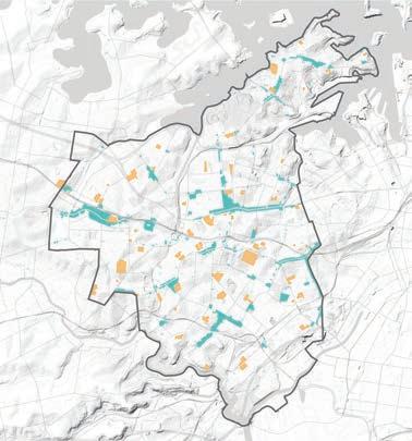
Pedestrian, Access, Mobility Plan (PAMP)
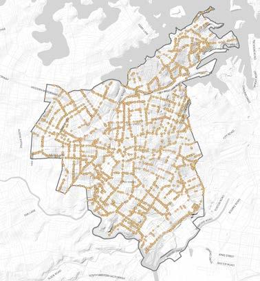
Elabotrate on what a PAMP issue is and how we can use this data can be incorporated into the grid and connected to the grid.
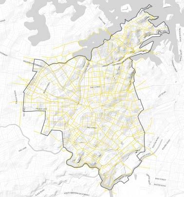
DRAFT Inner West Blue-Green Grid Strategy 2023 101
Train Line Train Station Light Rail Light Rail Station Ferry Station 400m Walkable Radius from Station Inner West LGA Boundary Regional Parks (5ha+) District Park (2ha to 5ha) Level Local Parks (0.5ha to 2 ha) Level 2 Local Parks (0.1ha to 0.5ha) Pocket Parks (less than 0.1ha) Confirmed Rozelle Parklands Inner West LGA Boundary Schools Town Centres Inner West LGA Boundary POI Legend Legend Legend Legend Legend Legend Inner West LGA Boundary Motorway Arterial Road Primary Road Local Road Train Line Train Station Light Rail Light Rail Station Ferry Station Cycle Routes Inner West LGA Boundary Cycle Routes
Legend Inner West LGA Boundary Local walking tracks
Issues
PAMP
Legend Inner West LGA Boundary PAMP Issue Point
Localising and Defining the Network
THE CONNECTED GRID
OPPORTUNITIES TO BETTER RESPOND TO THE GRID
The Sketch Connected Grid improves east/west connections, and creates 18 new links to enhance the existing LSPS Green Grid.
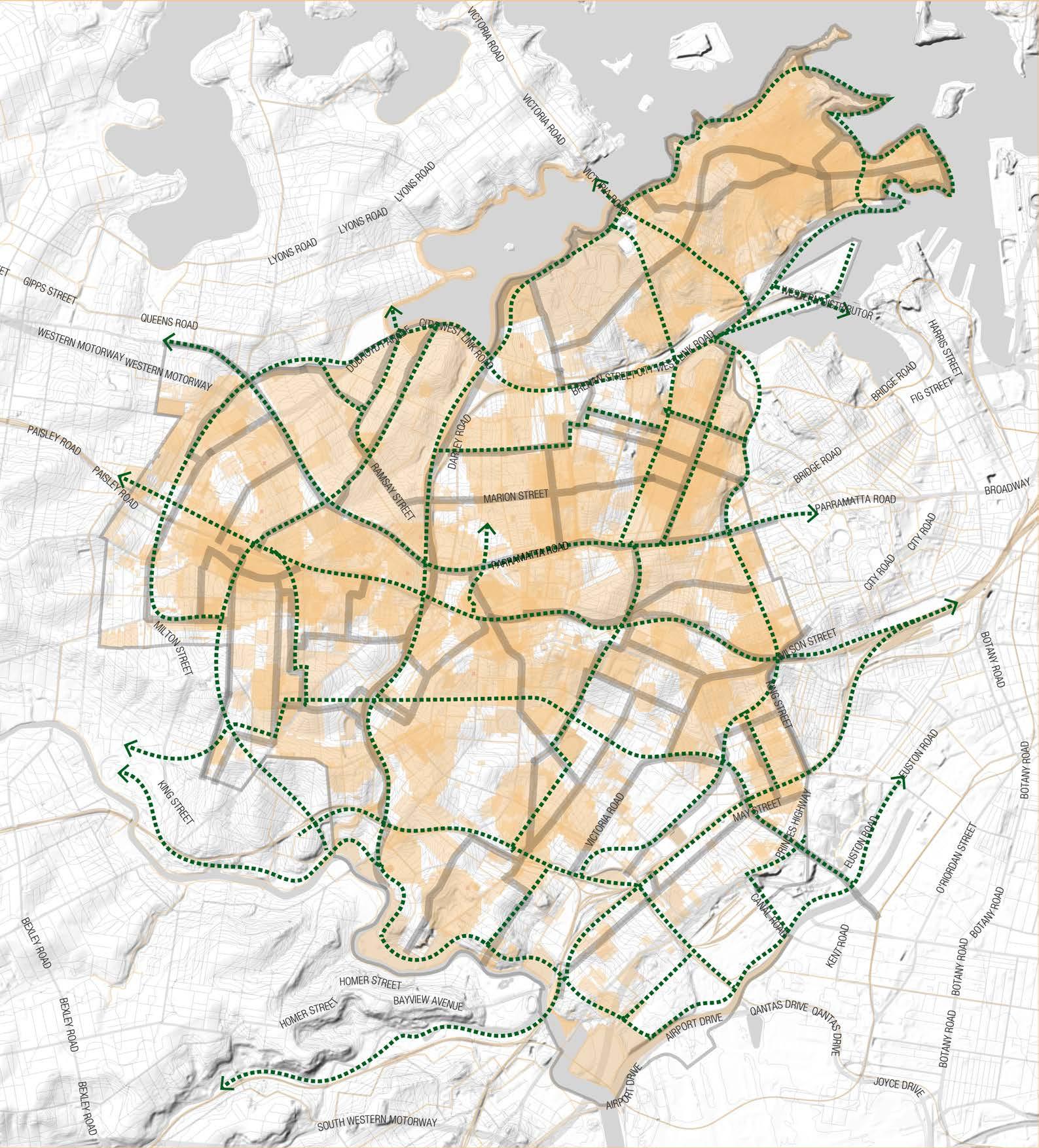
Suburbs to benefit with the new routes, to improve connectivity within and its surroundings are Marrickville, in the southeast part of the LGA, Balmain in the northeast and Leichhardt.
Legend
Inner West LGA Boundary
3+ Overlapping Layers
1 Layer
Initial Grid Sketch
LSPS Blue-Green Grid
Opportunity new links for the Grid
Hurlstone Park
Croydon Park
Camperdown
Balmain East
Summer Hill
Dulwich Hill
Marrickville
Petersham
Birchgrove
Annandale Sydenham
Leichhardt Lewisham
Stanmore Newtown
St Peters
Croydon
Balmain
Enmore Mascot
Rozelle Tempe
9.2 Appendix B - Mapping Layers
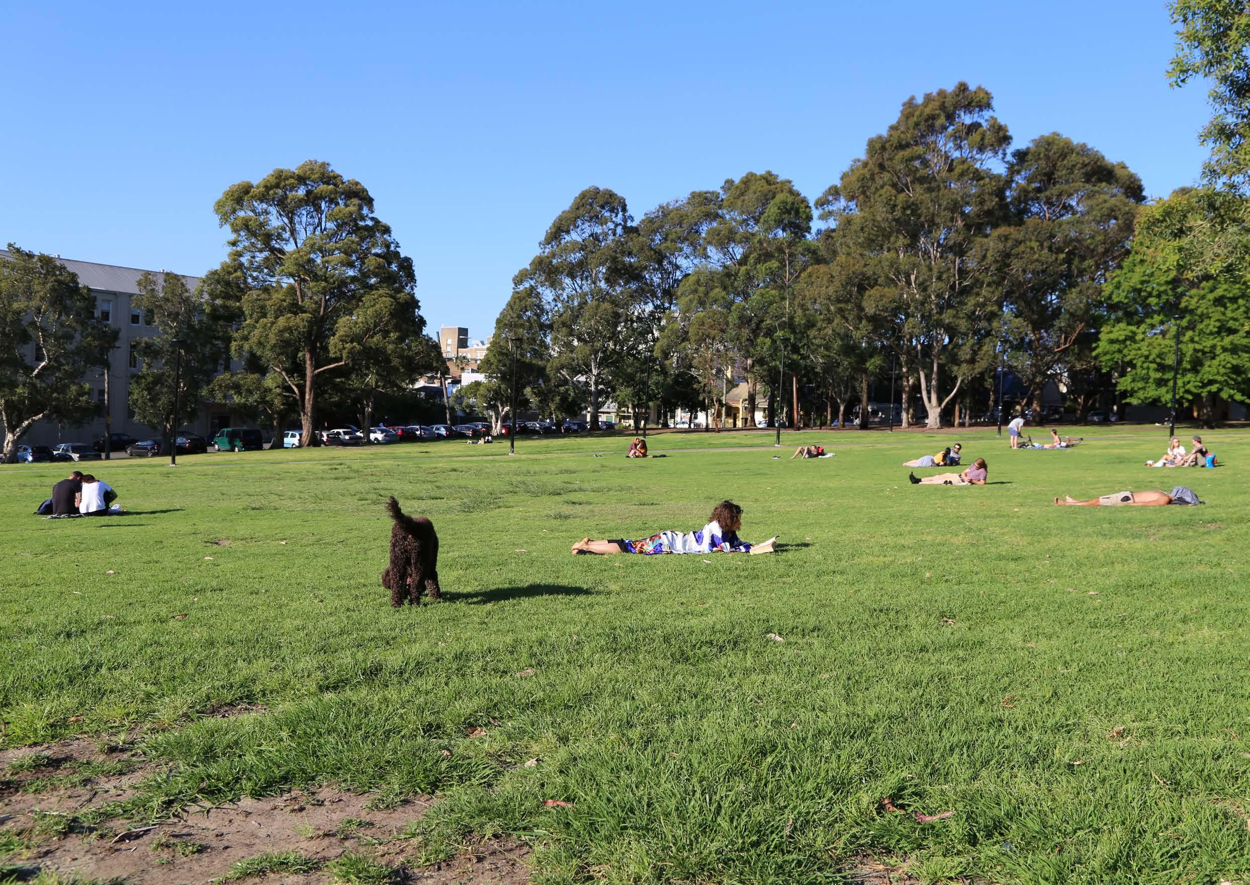
Mapping Layers
LOCAL CONTEXT
The Inner West borders with the Sydney Harbour and is located within close proximity to key destinations.
The local area has a prominent transport infrastructure network, with plans to extend the Sydney metro network.
The local area has numerous State significant projects running through the Inner West, providing an opportunity to apply the Blue-Green Grid to new projects.
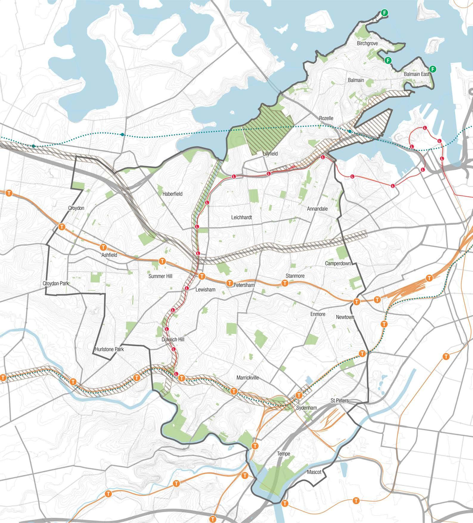
Legend
Inner West LGA Boundary
Parks
Water bodies
State significant projects
Train Line
Train Station
Light Rail
Light Rail Station
Under construction Metro line
Under construction Metro Station
University
Hospital
Shopping & Eating
Sports & Entertainment
Airport
PrincesHighway Princess
Mapping Layers
Tom Uren Trail
The Tom Uren Trail is an important route that connects significant places in the Inner West. It should be connected to the Blue-Green Grid as its historical and heritage significance.
Map source: https://www.innerwest.nsw.gov.au/explore/ libraries/community-history/our-history/self-guidedheritage-walks/tom-uren-trail
Legend
Inner West LGA Boundary
Tom Uren Trail
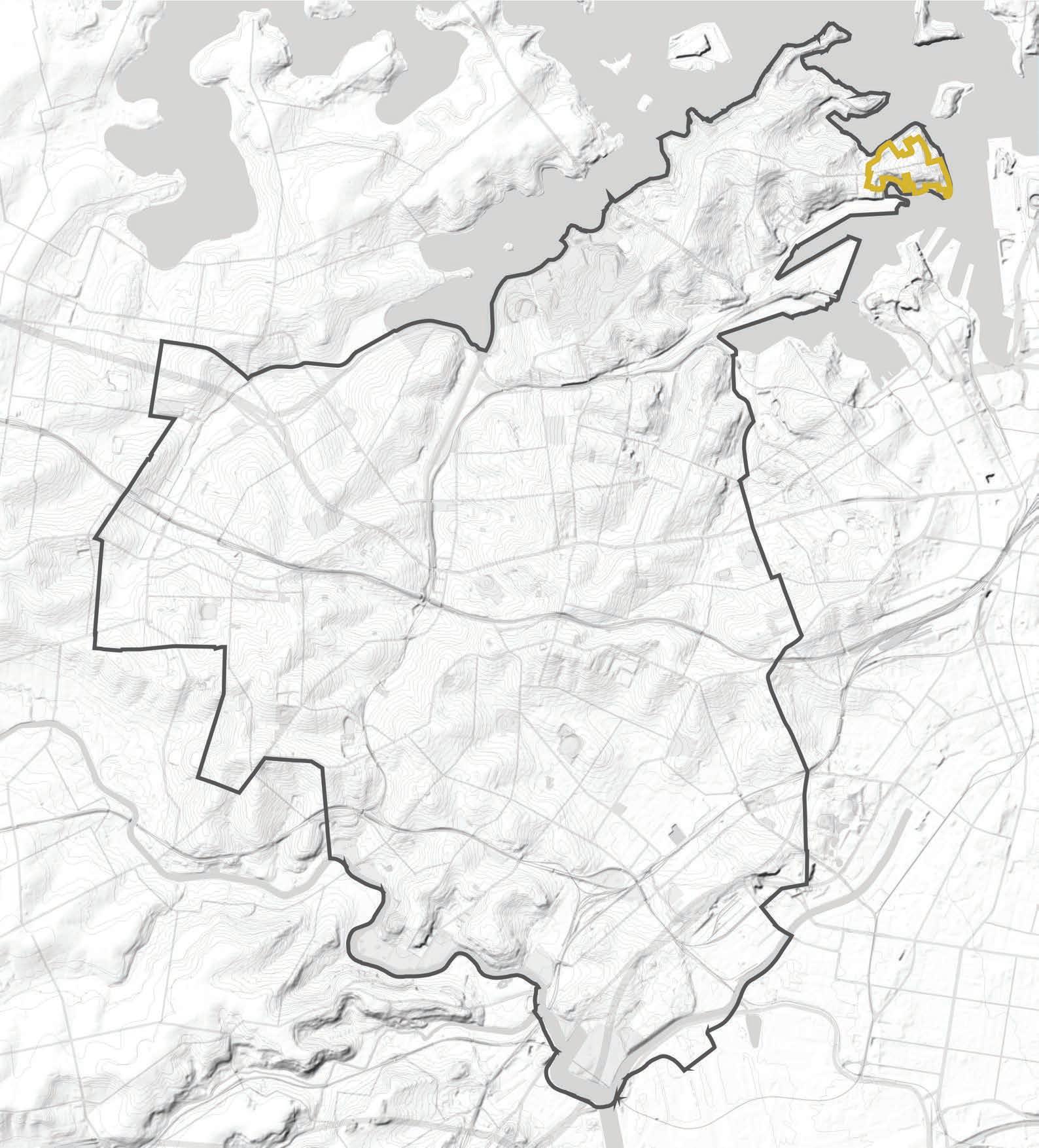
Inner West Blue-Green Grid Strategy 2023 105
Mapping Layers
Heritage
Key heritage areas can both contribute to the BlueGreen Grid and be protected by it.
The design can include strategies to celebrate heritage items through displaying and educating.
Map Source: Shapefile Provided by Inner West Council.
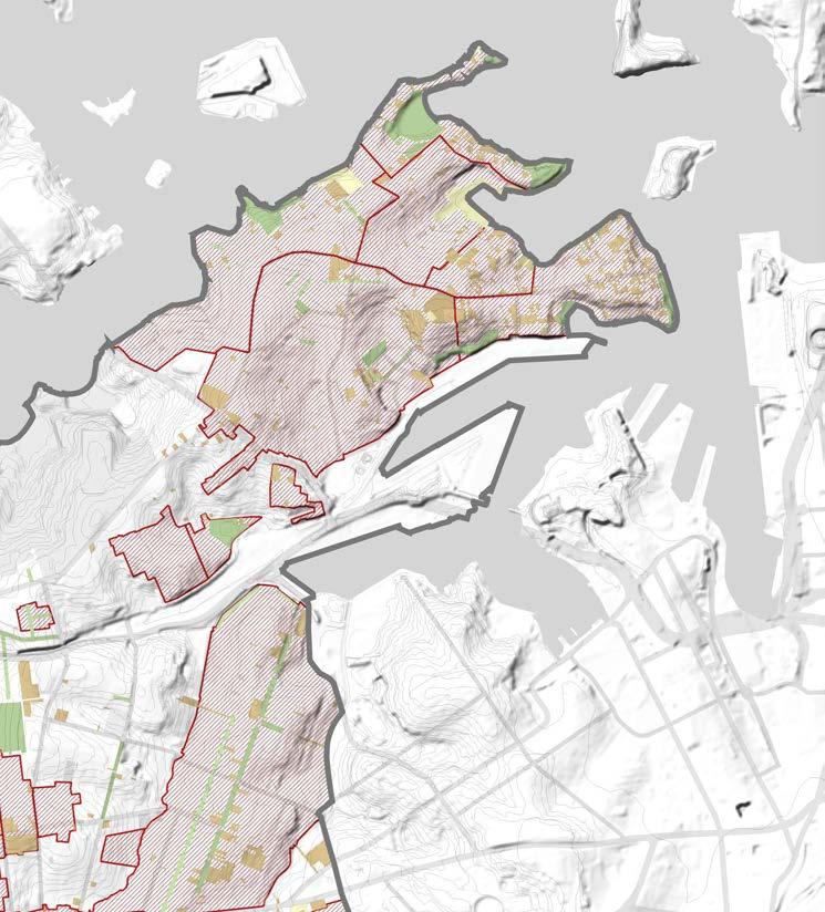
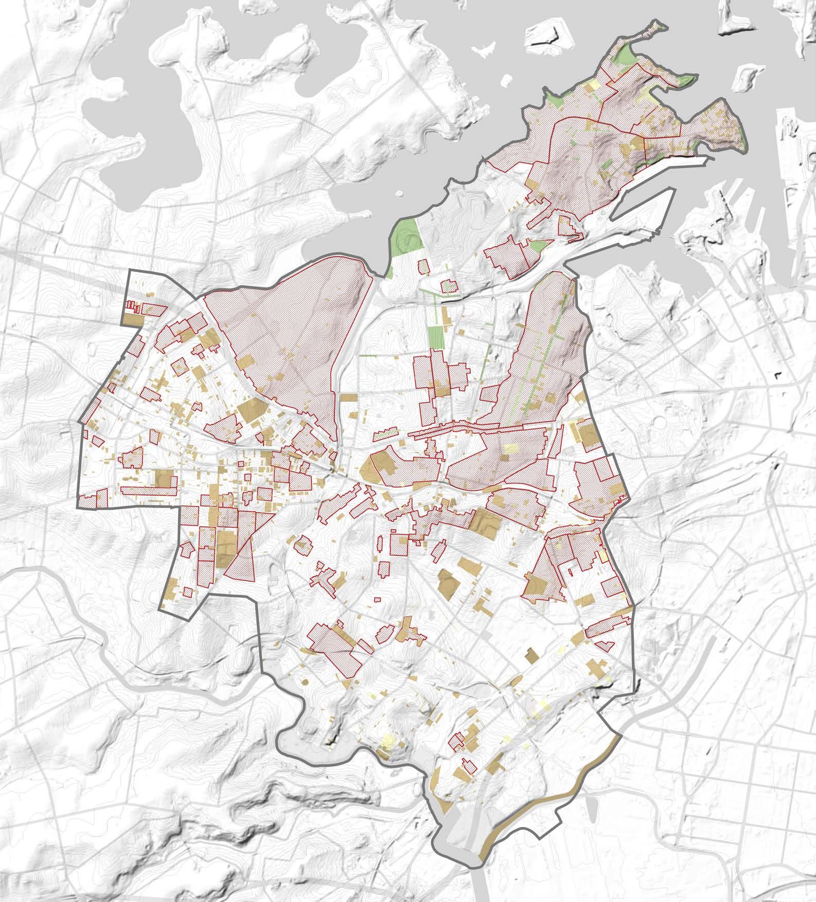
Legend
Inner West LGA Boundary
Conservation Area - General
Item - General
Item - Archaeological
Item- Landscape
Mapping Layers
Public Art
The ARSIACH Grid will be enhanced by exposing pubic art along the Blue-Green Grid to enhance art and culture.
Map Source: Inner West Council.
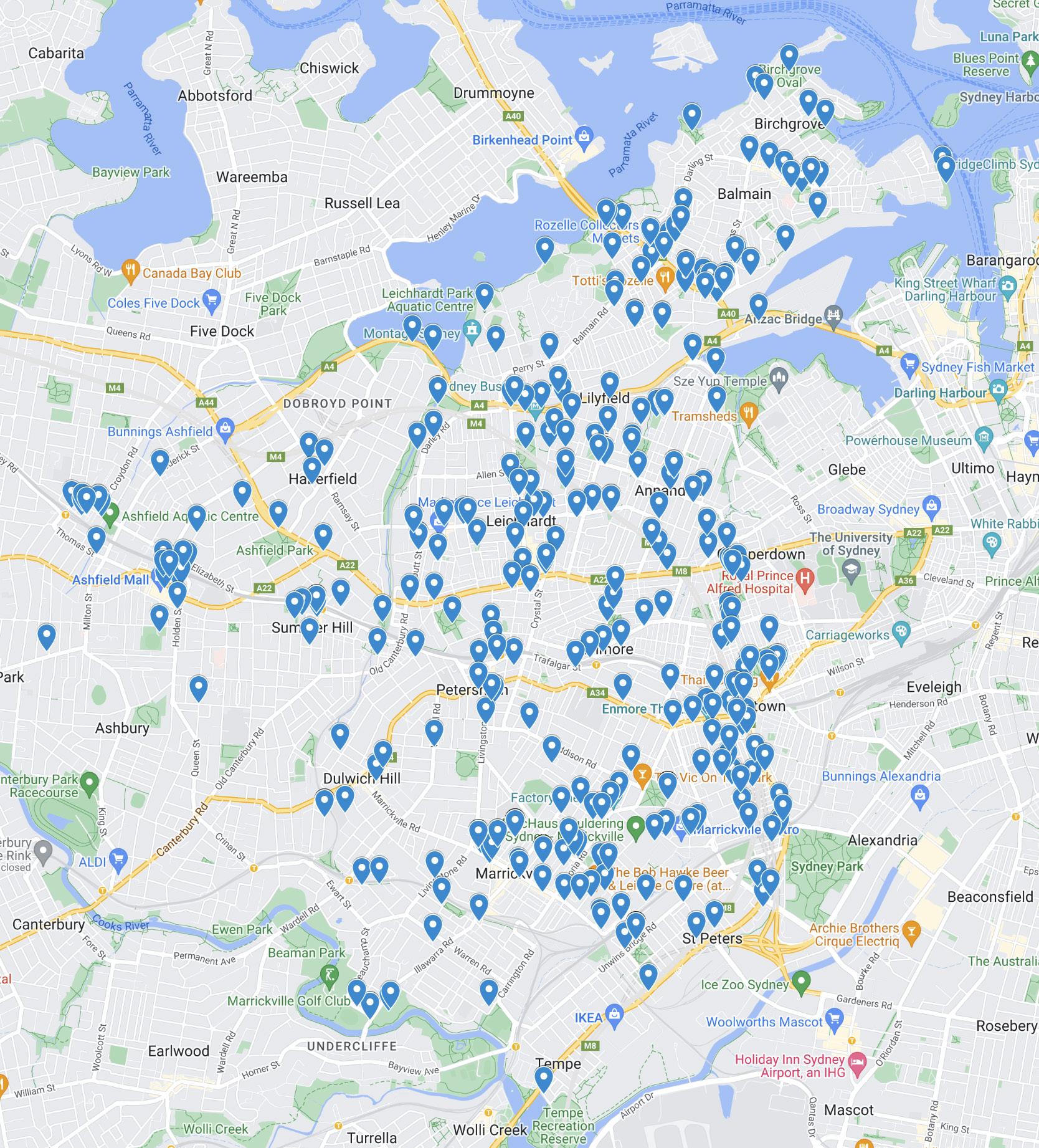
Legend
Identified Public Art
Inner West Blue-Green Grid Strategy 2023 107
Mapping Layers
Open Spaces Network
The Blue-Green Grid will link parks and open spaces to provide loops and routes for people to follow, enhancing access to a diversity of recreational open spaces.
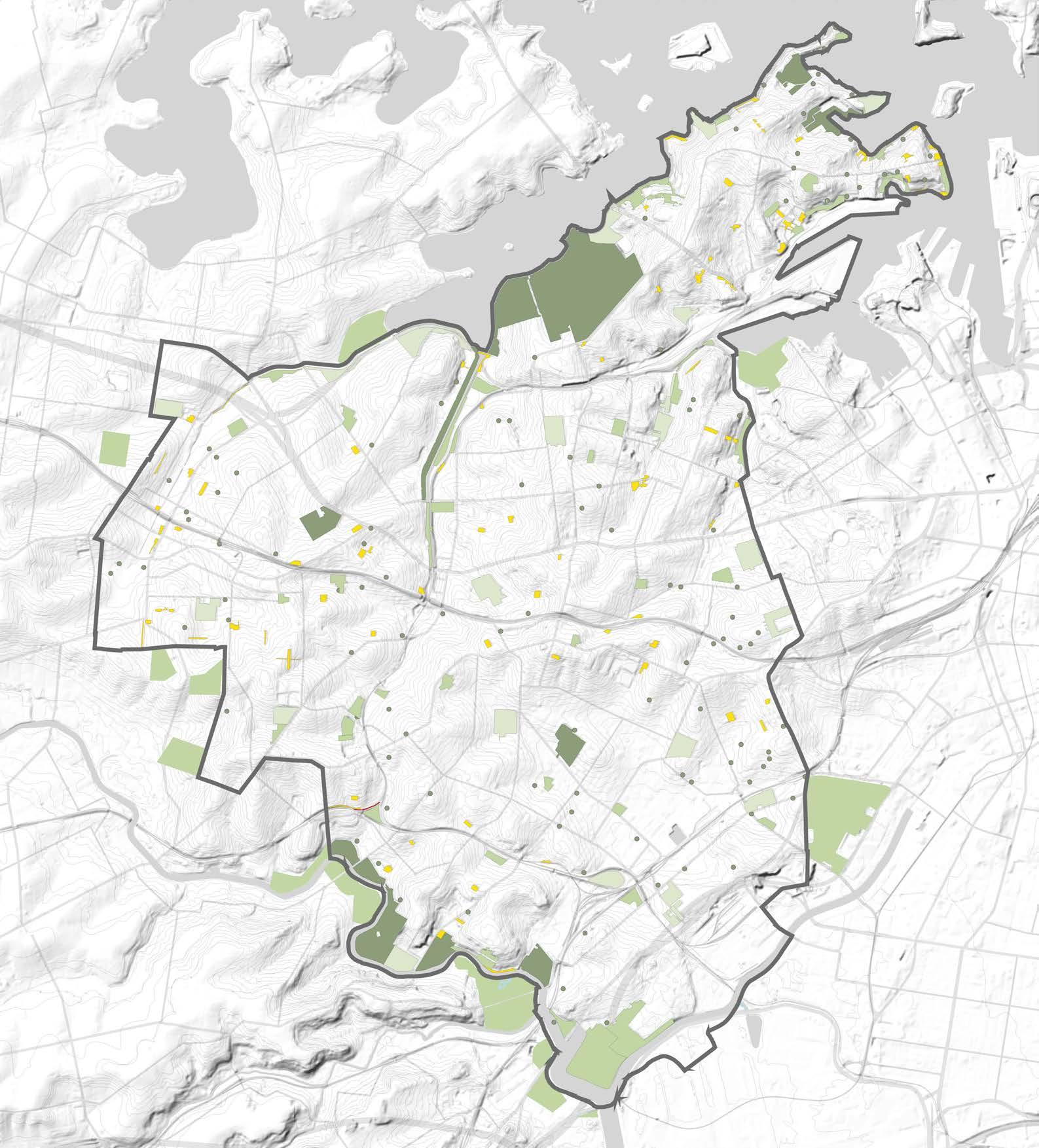
Legend
Inner West LGA Boundary
Regional Parks (5ha+)
District Park (2ha to 5ha)
Level 1 Local Parks (0.5ha to 2 ha)
Level 2 Local Parks (0.1ha to 0.5ha)
Pocket Parks (less than 0.1ha)
Map source: 2021 Recreational Needs Study, Inner West Council.
Mapping Layers
Activity Centres
Key town centres and schools are natural anchors for neighbourhoods. They represent areas of high movement and recreation activities, and should comprise part of the Blue-Green Grid as places that require good accessibility and public amenity.
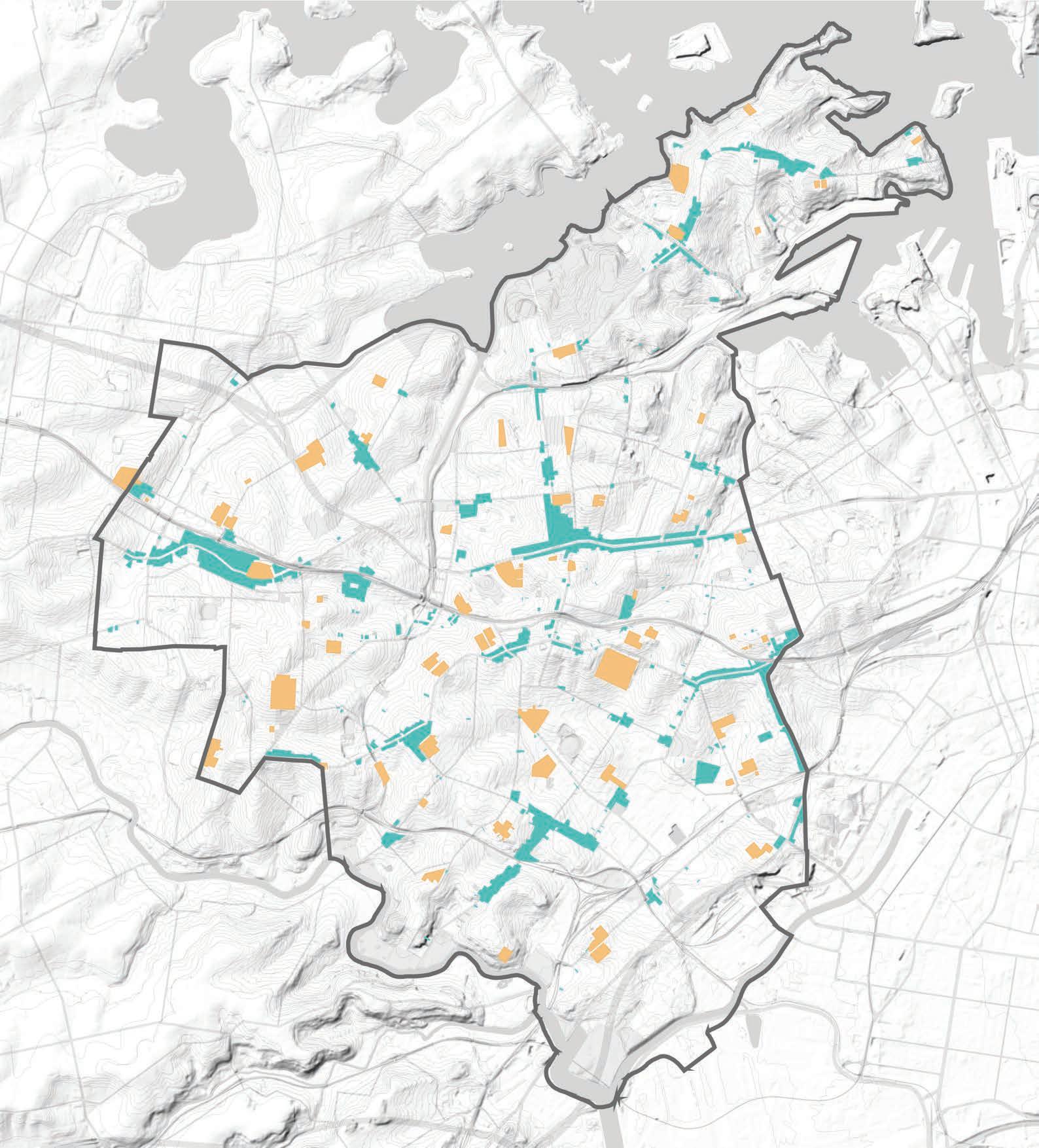
Map source: Inner West Council.
Town Centres
Inner West Blue-Green Grid Strategy 2023 109
Inner West LGA Boundary Schools
Legend
Mapping Layers
Population Density
High density areas would be prioritised, reflecting areas to have the largest amount of people to benefit from the Blue-Green Grid.
Map source: https://atlas.id.com.au/inner-west/maps/ population-density
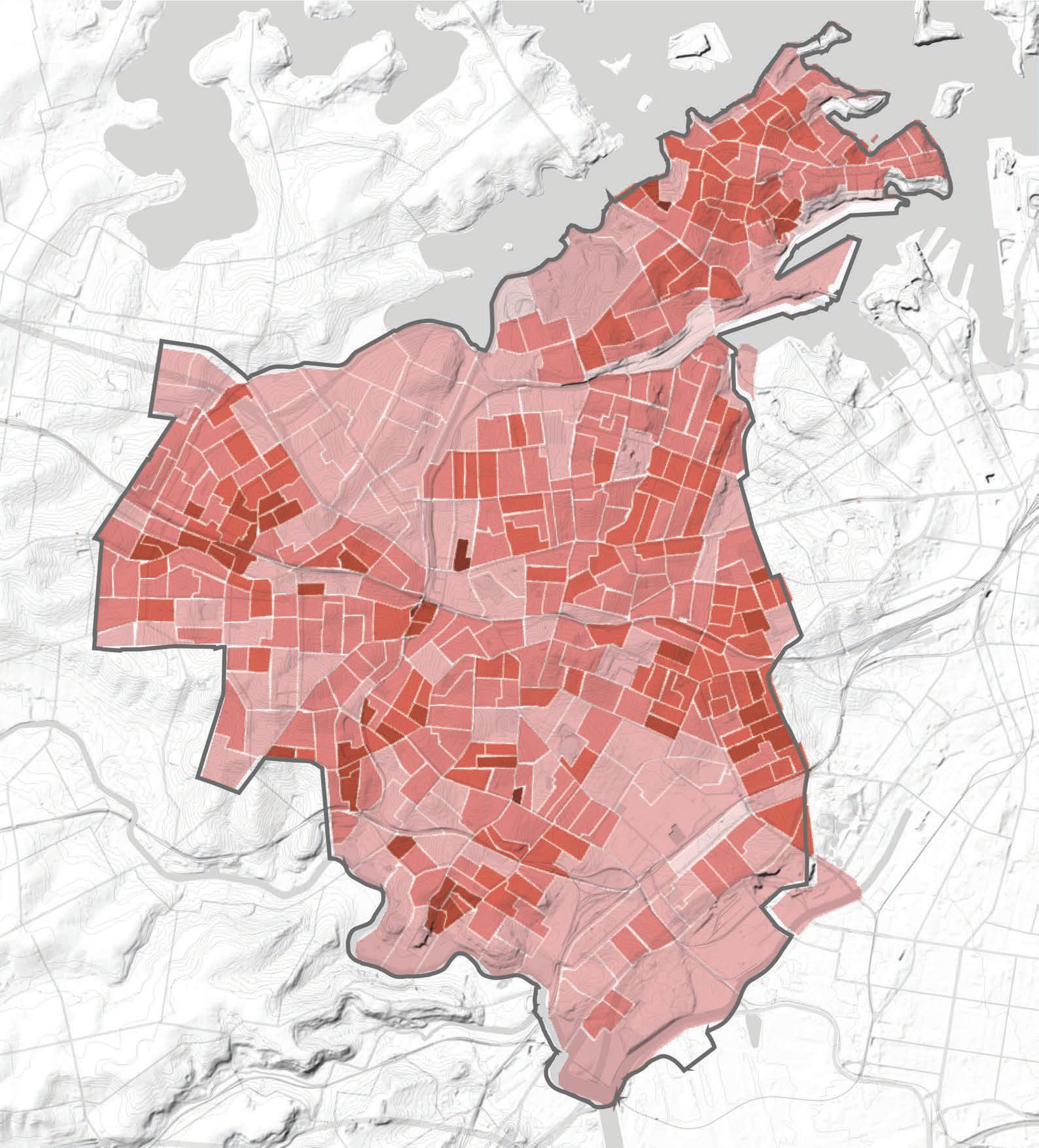
Legend
Inner West LGA Boundary
0 people
5.43 to 4766.66 people
4766.67 to 7569.96 people
7569.97 to 11457.72 people
11457.73 to 21863.34 people
21863.35 to 41765.70 people
Mapping Layers
Projected Population
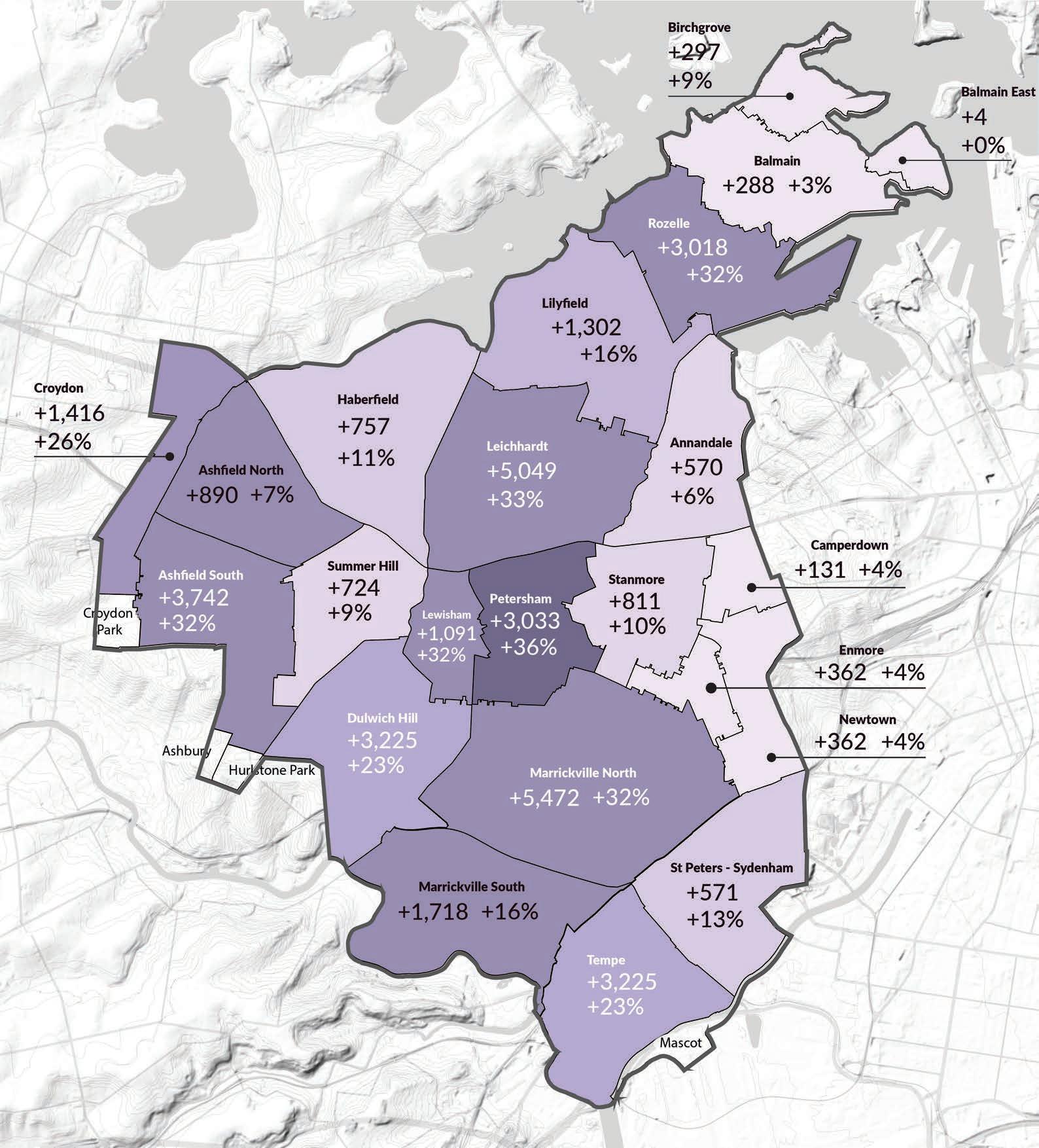
High density areas would be prioritised, reflecting areas to have the largest amount of people to benefit from the Blue-Green Grid.
Map source: Inner West Council
Inner West Blue-Green Grid Strategy 2023 111
Legend
Inner West LGA Boundary 35-40% 30-35% 25-30% 20-25% 15-20% 10-15% 5-10% 0-5%
Mapping Layers Provision of Open Space
The map indicates provision of green open space per person. The map shows a decline in open space per person, indicating a loss of open space and a rise in population. The East and West catchments are of particular concern, with a particularly low amount of open space available per person. The Blue-Green Grid can contribute to recreational needs within areas that lack open space and better connect people to the open space that does exist to them.
Map source: 2021 Recreational Needs Study, Inner West Council.
Legend
Inner West LGA Boundary
Catchment 1 - North
Catchment 2 - West
Catchment 3 - East
Catchment 4 - South
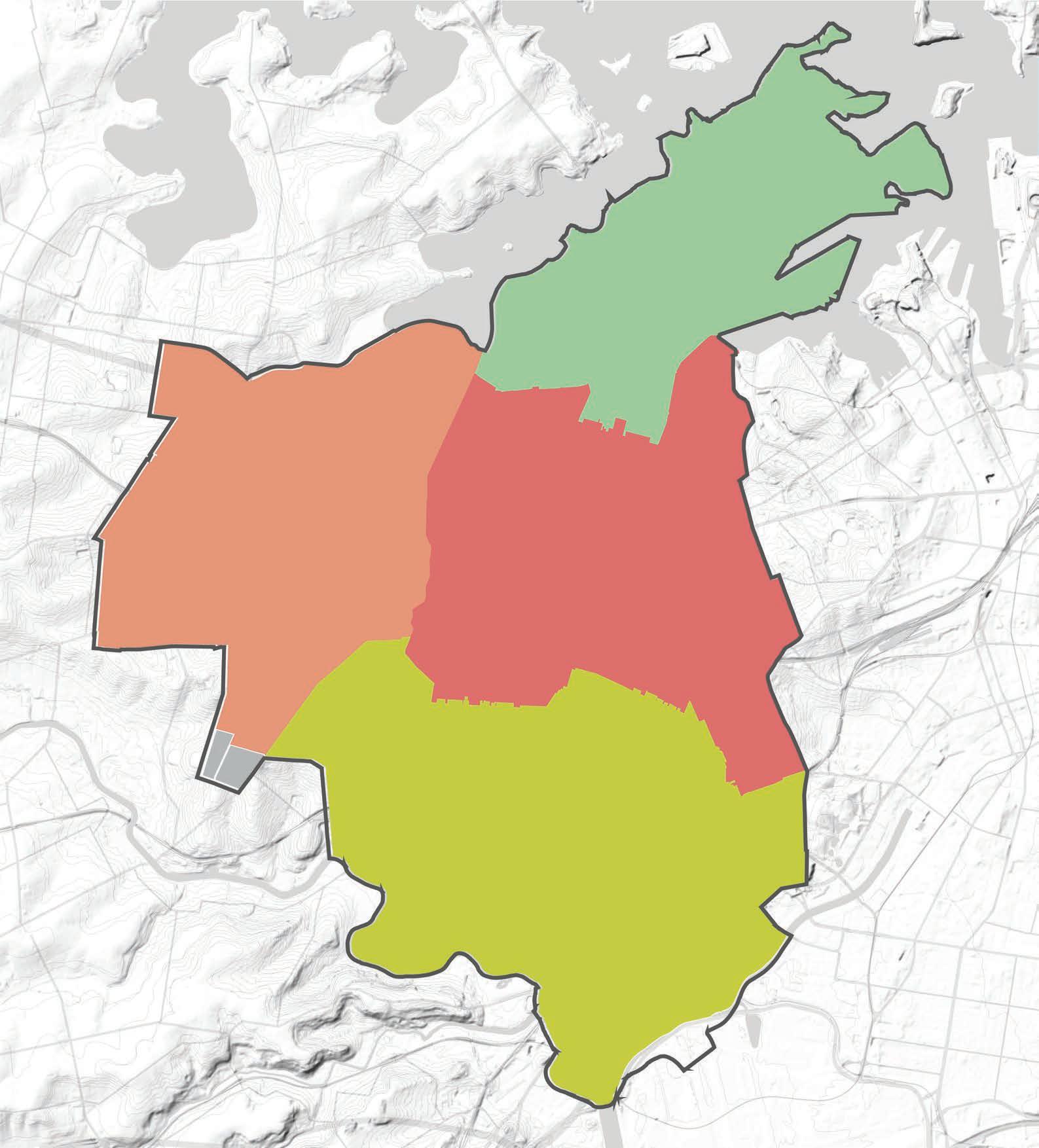
6.4 m2 16.9 m2 8.7 m2 32.5 m2
Mapping Layers
Accessibility to Open Space
Perimeters of major parks were offset to find ~400m of walkable distance from the perimeter from the parks without major barriers such as main roads and train lines which prevent ease of pedestrian accessibility.
This in turn begins to show which areas benefit from a strong existing presence of greenery and which areas heavily lack green open spaces.
Map source: 2021 Recreational Needs Study, Inner West Council.
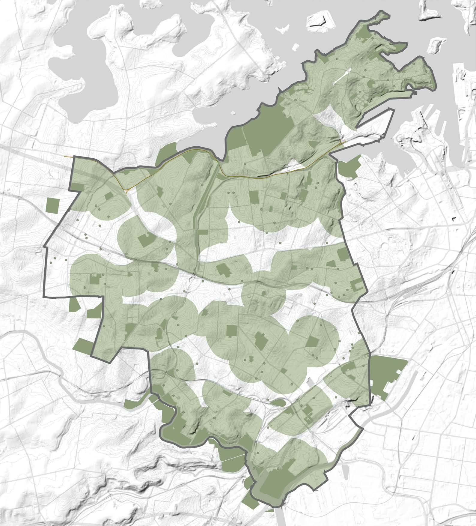
Legend
Inner West LGA Boundary
Major Parks
400m walkability zone of Major Parks
Inner West Blue-Green Grid Strategy 2023 113
Mapping Layers
Areas Lacking Open Space
This map was extracted from Recreation Needs Study and identify areas that have below benchmark access to open space.
The catchment areas exclude areas that are across access barriers such as major roads and above ground train lines.
The map indicates areas that would benefit from the addition of the Blue-Green Grid.
Map source: 2021 Recreational Needs Study, Inner West Council.
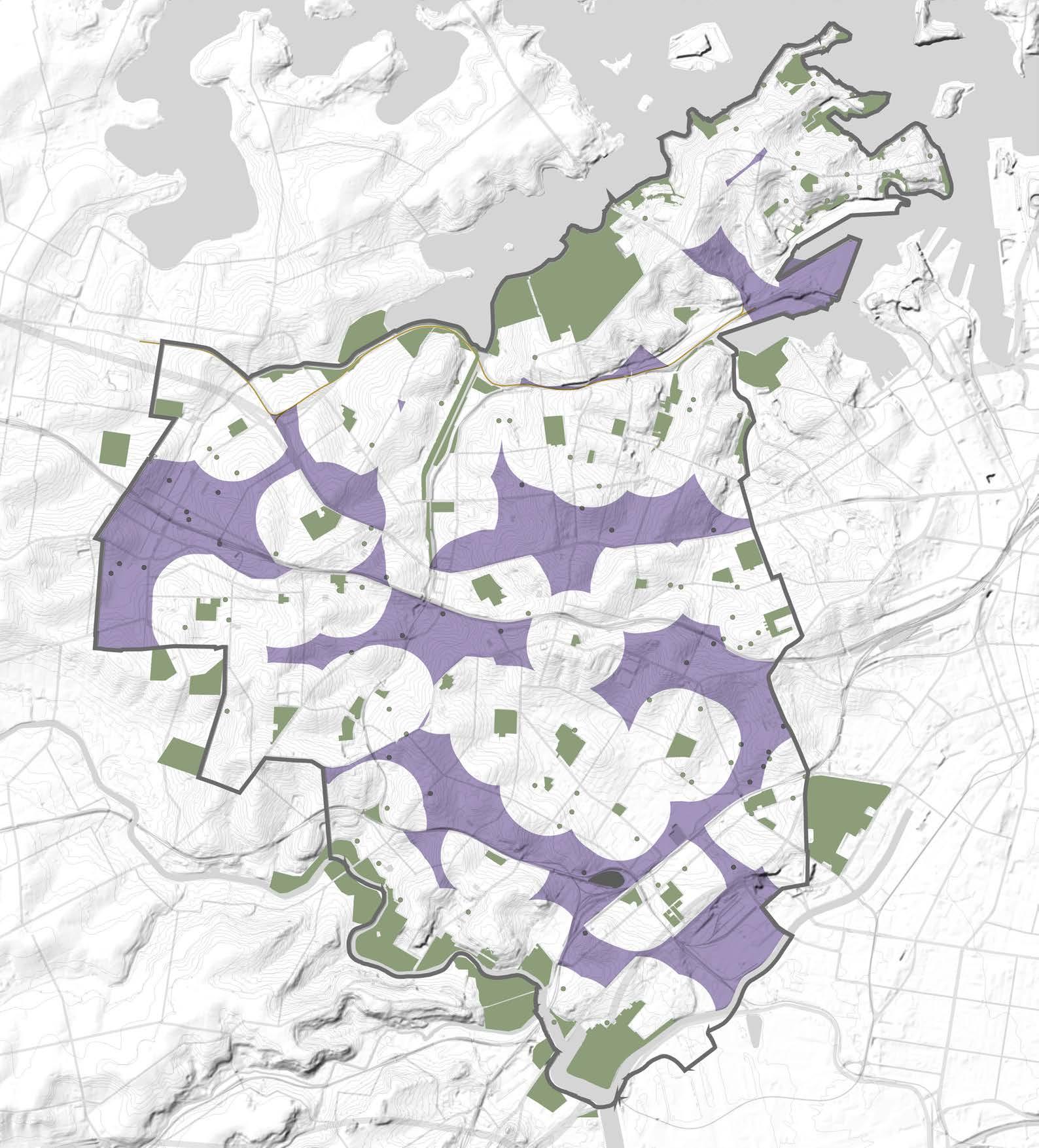
Inner West LGA Boundary
Parks and Open Spaces
Areas not within 400m easy walking distance.
Legend
Mapping Layers Biodiversity
A significant percentage of greenery comes from parks which contributes to the Blue-Green Grid as an existing system. Areas with high biodiversity value should be included in the grid, as it will serve as protection to the existing ecologies and enhance future ecosystems. Two major corridors improves North / South connection, and three key zones are identified with high value biodiversity. Biodiversity East/West connection can be improved by Blue-Green Grid.
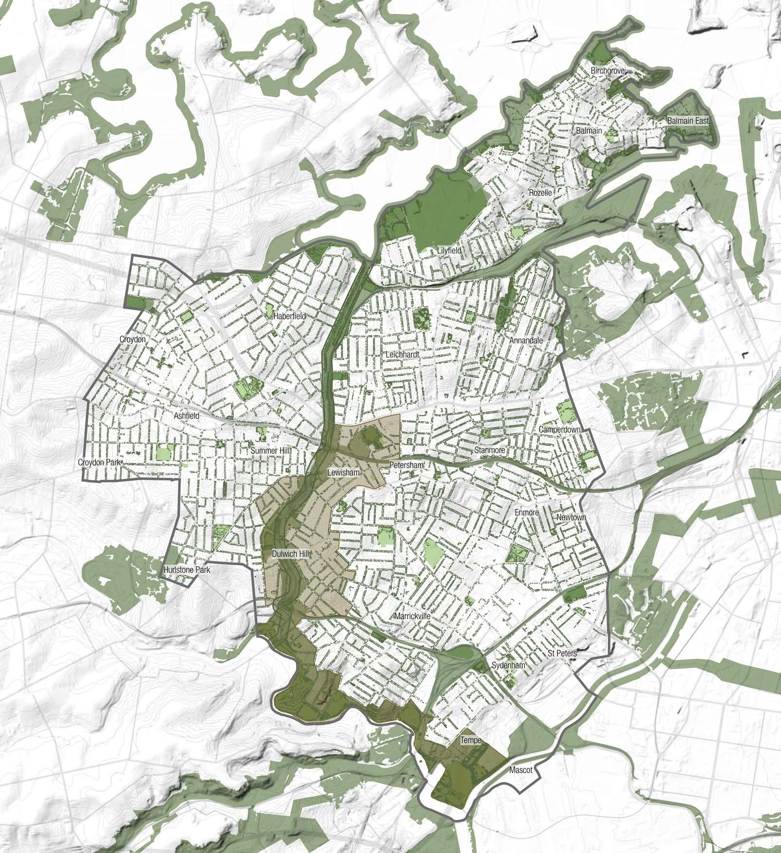
The Indigenous people are the traditional carers of land and themselves utilised the local environment as infrastructure for food and shelter. Their history and knowledge should be referenced and utilised.
Map source: SSROC Biodiversity Corridors 2016 (Provided by Inner West Council), Shapefiles provided by Inner West Council.
Inner West LGA Boundary
Parks
Biodiversity Corridor
Wildlife Corridor & Bandicot Protection Area
Greenway
Registered Council Street Tree
Inner West Blue-Green Grid Strategy 2023 115
Legend
Mapping Layers
Vegetated Areas
Vegetation on this map includes all cataloged vegetation types; grass,shrubs and trees.
The mapping shows where theres a higher concentration of greenery, which is inevitably where the parks are.
Key to the Blue-Green Grid is considering plants of various sizes to provide habitat to small ground and lower dwelling animals such as the Long-nosed Bandicot and Superb Fairy Wren as well as contribute to a strong green character.
Shown in this map, is the lack of diverse vegetation particularly on the eastern side of the Inner West LGA, highlighting East Marrickville, Sydenham and St Peters as areas with particularly lack of greenery.
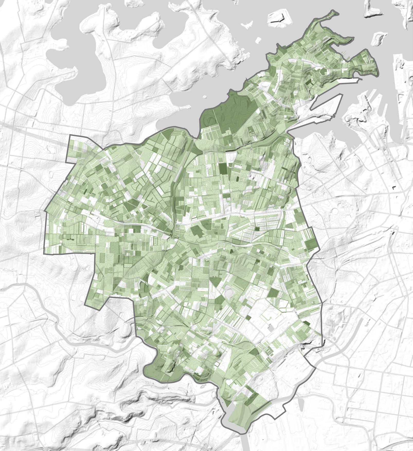
Identified areas correlate with previous map and areas that lack walkability to green open spaces.
Map source: Shapefile provided by Inner West Council, OEH 2019.
Legend
Inner West LGA Boundary
50%-100% vegetation coverage
30%-50% vegetation coverage
20%-30% vegetation coverage
Mapping Layers
Tree Canopy Cover
Understanding tree canopy in the Inner West shows where existing trees contribute to the Blue-Green Grid, and where the Blue-Green Grid can contribute to areas that lack canopy.
Tree canopy is crucial to providing shady areas and combating urban heat, as well as playing a key role in sequestering carbon.
Tree canopy also provides habitat to tree dwelling animals, which some require consecutive trees in order to move around safely.
Similarly to the preceding vegetation map, shown is a lack of tree canopy on the south eastern side of the Inner West LGA, with East Marrickville, Sydenham and St Peters particularly lacking in tree canopy coverage.
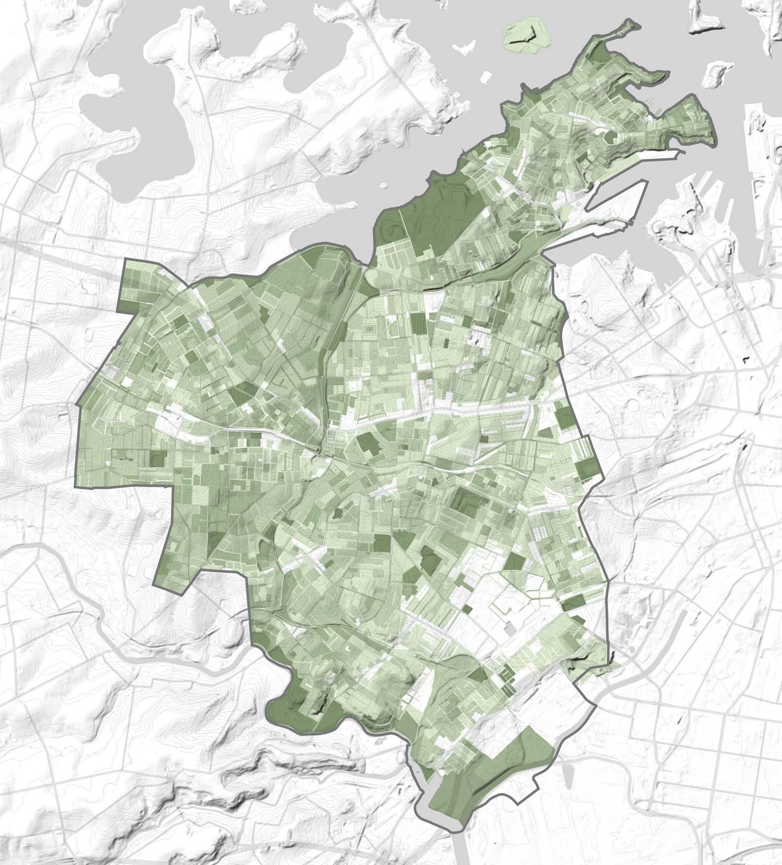
Legend
Inner West LGA Boundary
50%-100% vegetation coverage
30%-50% vegetation coverage
20%-30% vegetation coverage
Inner West Blue-Green Grid Strategy 2023 117
Map source: Shapefile provided by Inner West Council, OEH 2019..
Mapping Layers
Urban Heat Island
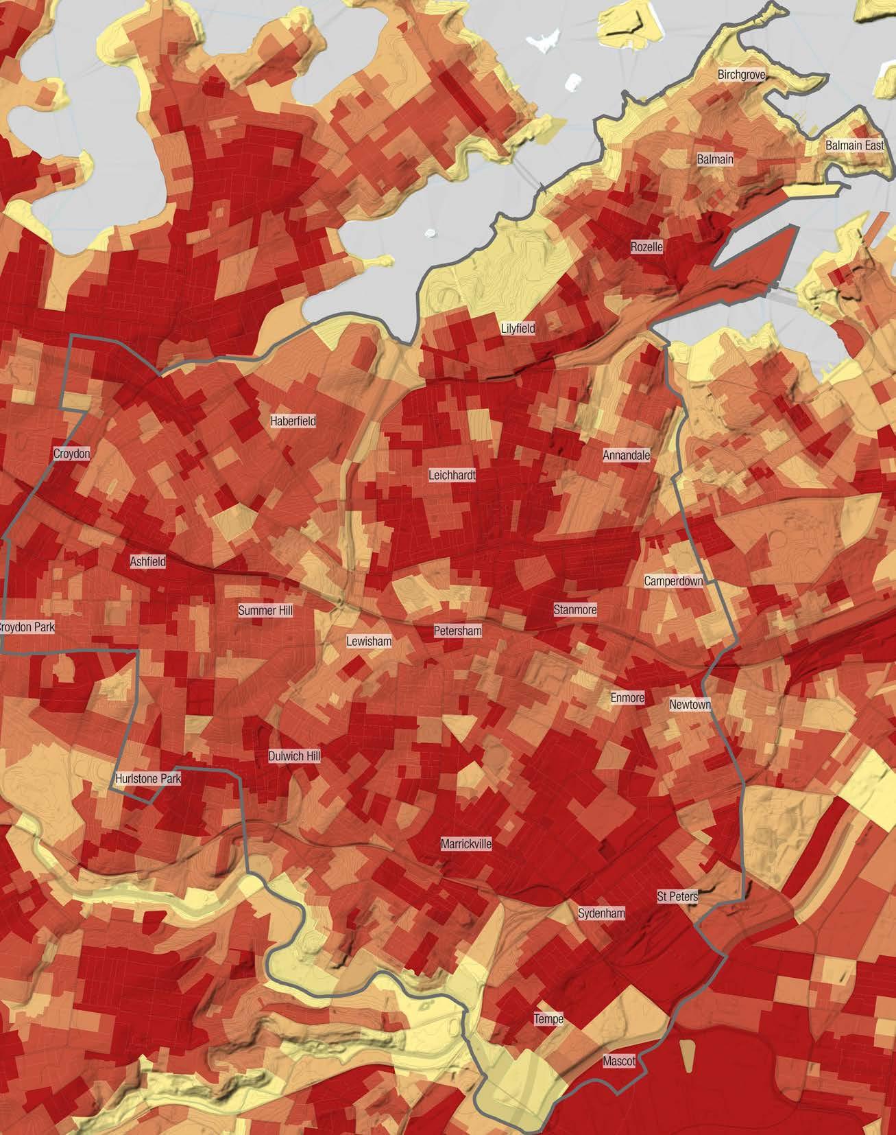
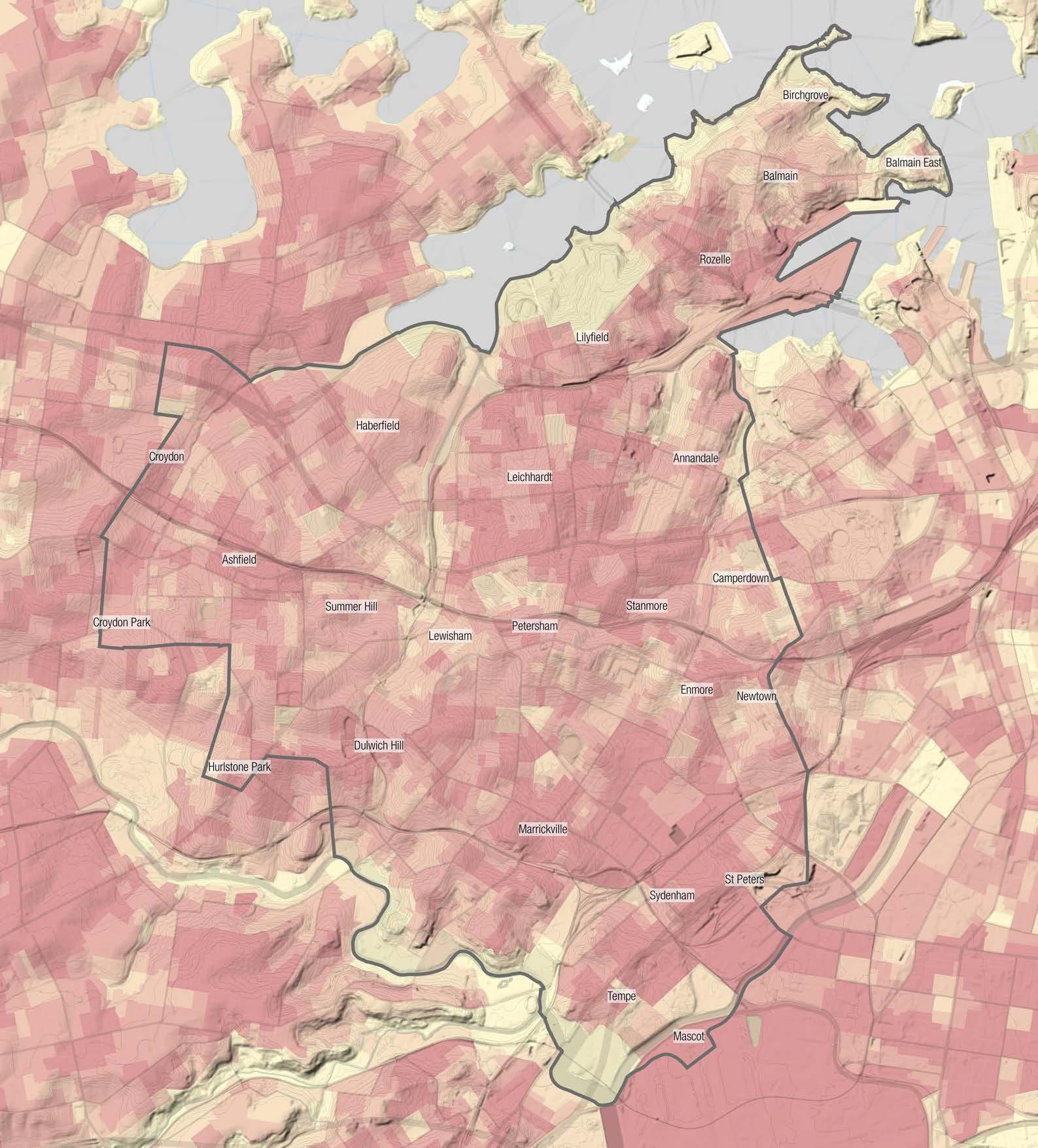
The presence of medium-high density dwellings, industrial and commercial areas and a relative lack of large areas of bushland makes the Inner West susceptible to the Urban Heat Island effect.
The map highly correlates with preceding vegetation and tree canopy maps, where the lack of greenery on the eastern side of the LGA has likely contributed to a higher heat vulnerability, where areas with a higher concentration of greenery and water bodies have a lower heat vulnerability.
Areas with a high Urban Heat Island Effect (UHI) would greatly benefit from the implementation of a BlueGreen Grid, as shown, existing greenery such as found in the GreenWay, around the cooks river and the northern point with a high concentration of parks.
Legend Inner West LGA Boundary 0 - 5.08 UHI* 5.08 - 6.78 UHI* 6.78 - 7.73 UHI* 7.73 - 8.54 UHI* 8.54 - 12.71 UHI*
Map source: NSW Government Dataset, 2016.
Mapping Layers
Heat Map
Similarly to the UHI map, the map highly correlates with preceding vegetation and tree canopy maps, where the lack of greenery on the eastern side of the LGA has likely contributed to a higher heat vulnerability, where areas with a higher concentration of greenery and water bodies have a lower heat vulnerability. Areas of high urban heat would benefit from the implementation of greenery associated with the BlueGreen Grid.
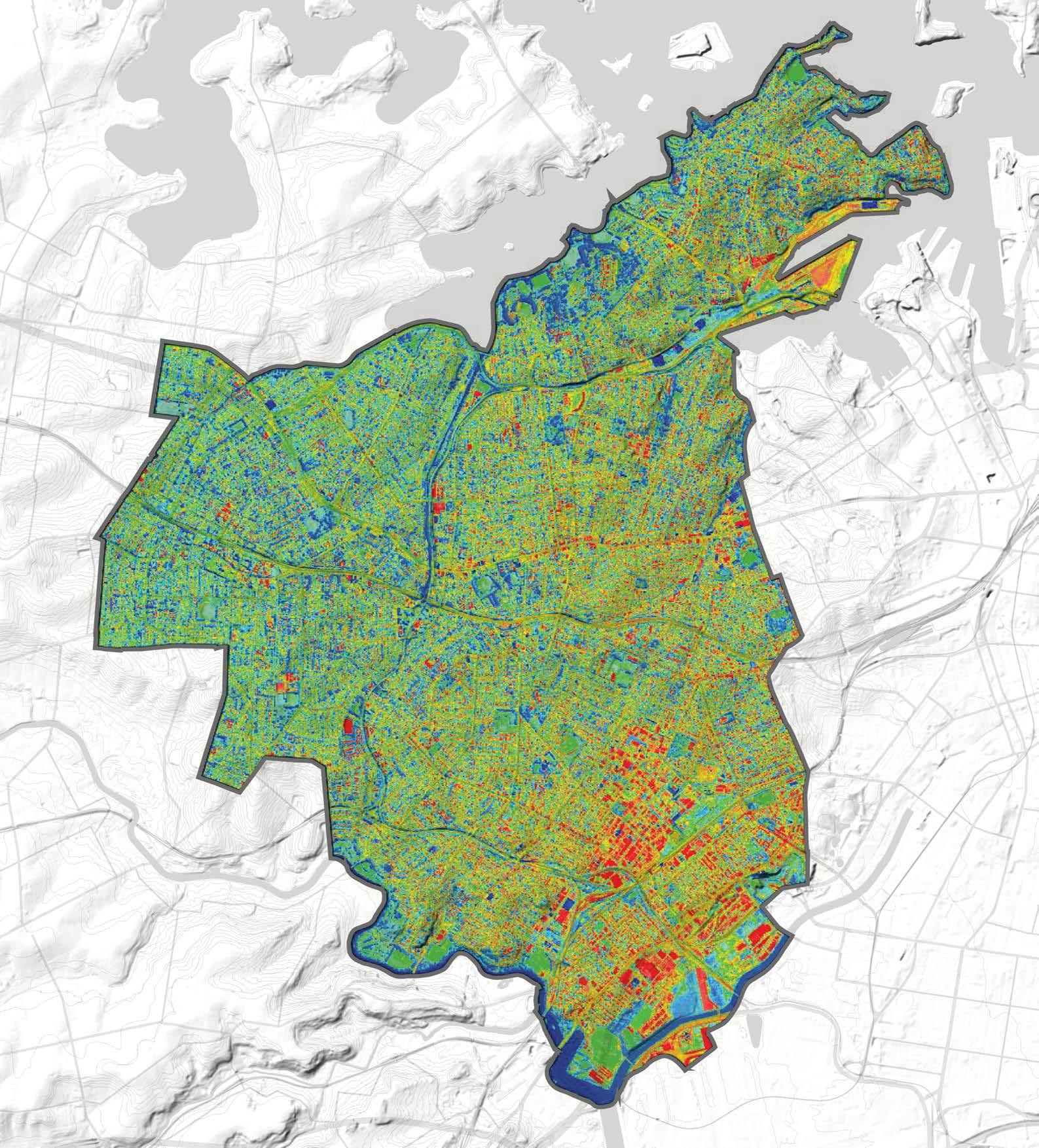
Map source: Inner West Council
Legend
Inner West Blue-Green Grid Strategy 2023 119
Hurlstone Park
Croydon Park
Camperdown
Balmain East
Summer Hill
Dulwich Hill
Marrickville
Petersham
Birchgrove
Annandale
Sydenham
Leichhardt Lewisham
Stanmore Newtown
St Peters
Croydon
Balmain
Enmore
Mascot
Rozelle
Tempe
LGA Boundary 20°C 30°C 41°C
Inner West
Mapping Layers
White Bay Eco-Corridor
White Bay Eco-corridor can contribute as ecological links.
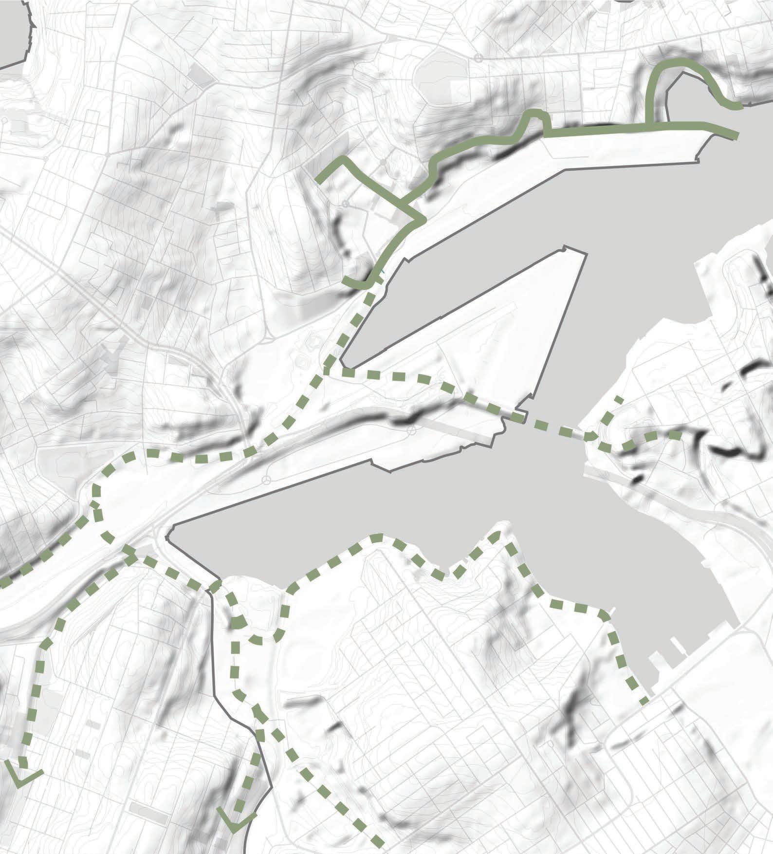
Map source: https://glebesociety.org.au/updateproposed-eco-corridor-as-part-of-the-future-forbays-west/
Legend
Inner West LGA Boundary
White Bay eco-corridor
Bays West eco-corridors
Mapping Layers
Hydrological Network
The Blue-Green Grid inevitably will create a hydrological network. The implementation of the BlueGreen Grid will provide an opportunity to rejuvenate the struggling waterways, bringing together ecology with hydrology to aid in the nitrogen cycle.
Utilising the water network and where water naturally collects, will indicate areas that will benefit from the application of a the Blue-Green Grid to reduce flooding, naturally provide water to plants and enhance the interaction between plants and water which will contribute to lowering urban heat.
Six main water corridors are identified in the area, representing key hydrological network.
Flooding areas can be mitigated and indicate opportunities for implementation of Blue-Green corridors.
Notably, flooding occurs at the site which was previously a swamp (see Indigenous Historical Hydrological Systems Map).
Map source: Shapefiles provided by Inner West Council.
Inner West LGA Boundary Water bodies Creeks
Flooding Extent
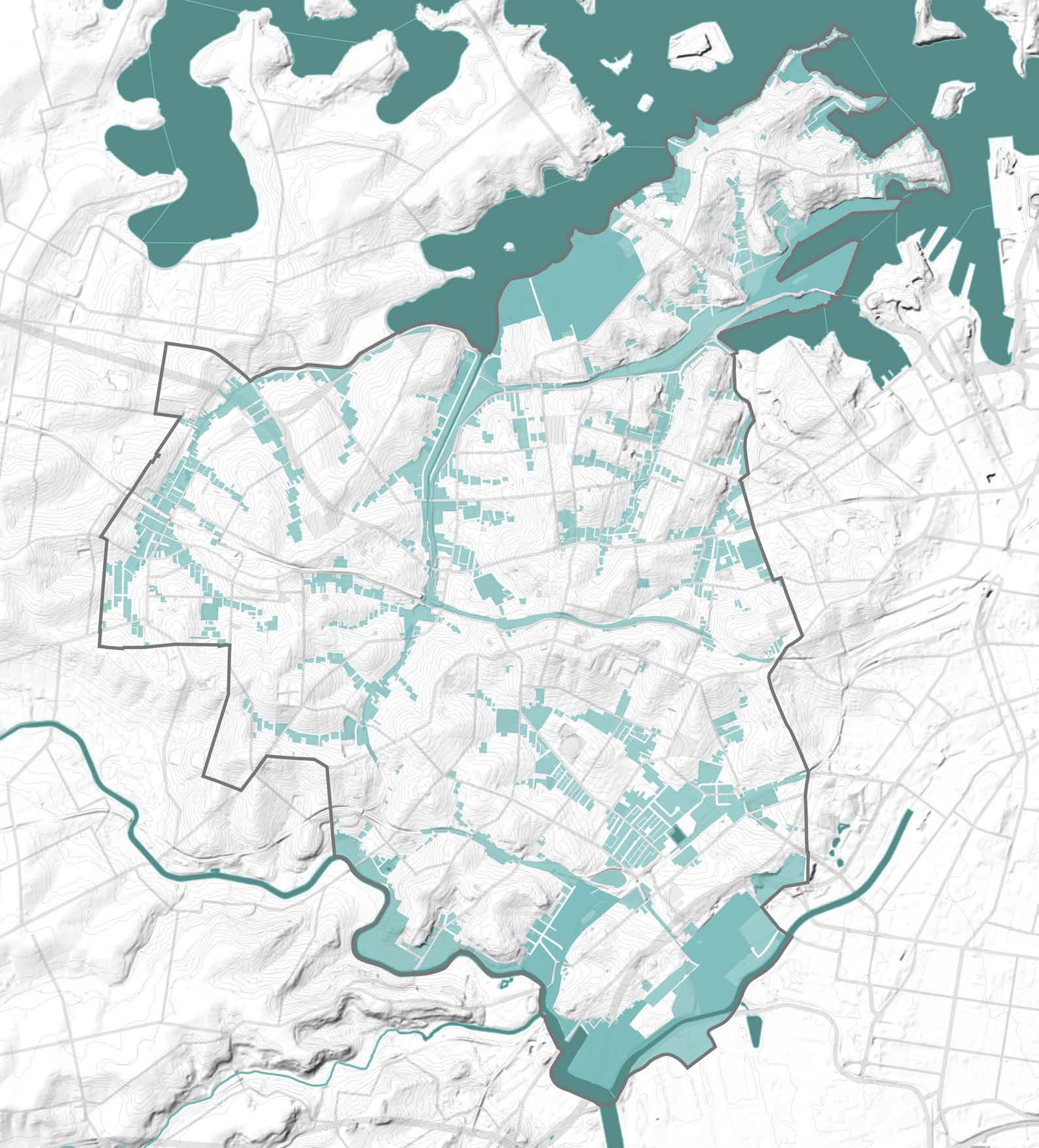
Inner West Blue-Green Grid Strategy 2023 121
Legend
Mapping Layers
Permeable Surfaces
Understanding where less permeable surfaces are which correlates with flooding.
Map source: Inner West Council.
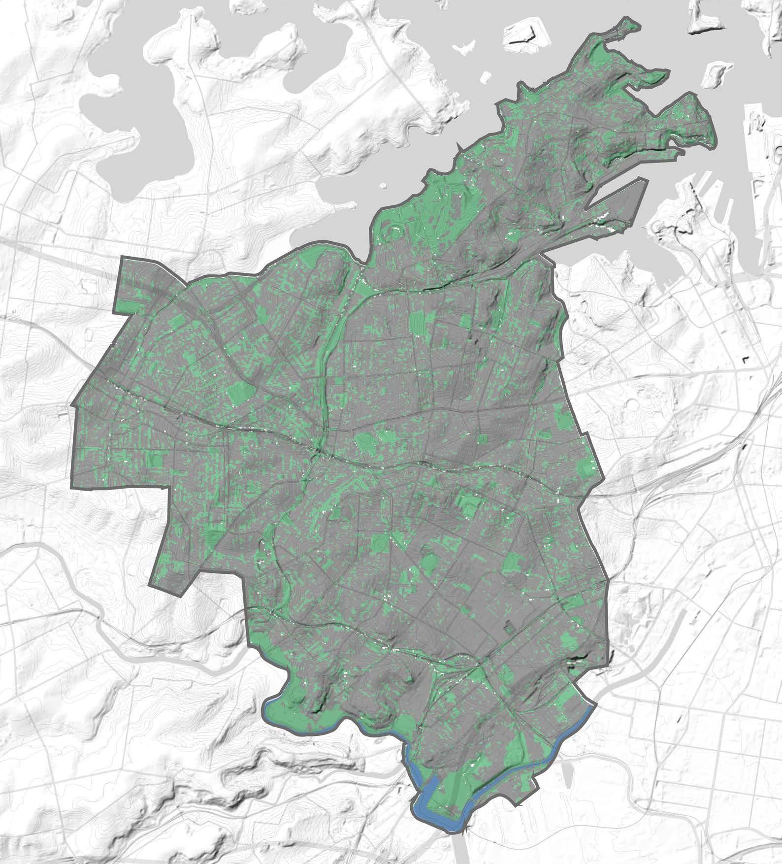
Legend
Inner West LGA Boundary
Previous Area
Impervious Area
Open Water
Hurlstone Park
Croydon Park
Camperdown
Balmain East
Summer Hill
Dulwich Hill
Marrickville
Petersham
Birchgrove
Annandale
Sydenham
Leichhardt Lewisham
Stanmore
Newtown
St Peters
Croydon
Balmain
Enmore
Mascot
Rozelle
Tempe
Mapping Layers Points of Interest (POI)
The Blue-Green Grid is about providing high amenity, green routes along commonly traveled paths and routes. The POI map outlines the specific places to connect. POI’s include:
Ambulance Stations, Art Galleries, Athletic Tracks, Boat Ramps, Cemeteries, Child Care Centres, Clubs, Community Facilities, Comunity Homes, Convent/ Monasteries, Court Houses, Education Facilities, Embassies, Fire Stations, General Hospitals, Historic Sites, Libraries, Local Government Chambers, Lookouts, Monuments, Museums, Nursing Homes, Parks, Picnic Areas, Places of Worship, Police Stations, Post Offices, Preschools, Pumping Stations, Retirement Villages, Rubbish Depots, SES facilities, Schools (High schools, primary schools, special schools, public and private)
Shopping Centres, Slipways, Sports Centres, Sports courts and fields, Swimming Pools, TAFE colleges, Transport interchanges, Universitieis, Urban Places, and, Wharfs.
Map source: https://datasets.seed.nsw.gov.au/dataset/ nsw-points-of-interest-poi
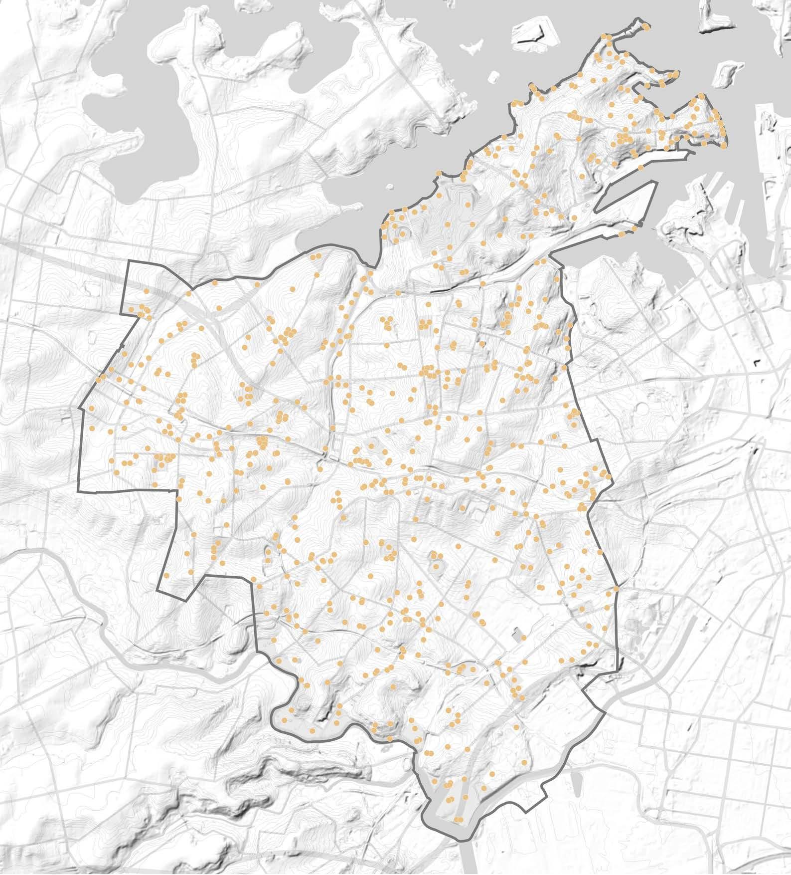
Legend
Inner West LGA Boundary POI
Inner West Blue-Green Grid Strategy 2023 123
Hurlstone Park
Croydon Park
Camperdown
Balmain East
Summer Hill
Dulwich Hill
Marrickville
Petersham
Birchgrove
Annandale
Sydenham
Leichhardt Lewisham
Stanmore Newtown
St Peters
Croydon
Balmain
Enmore
Mascot
Rozelle Tempe
Mapping Layers
Water Catchment
Understanding where less permeable surfaces are which correlates with flooding.
Map source: https://datasets.seed.nsw.gov.au/ dataset/42582022-ed91-45df-b542-8af77f564020/ metaexport/html
Legend
Inner West LGA Boundary Catchment Boundary
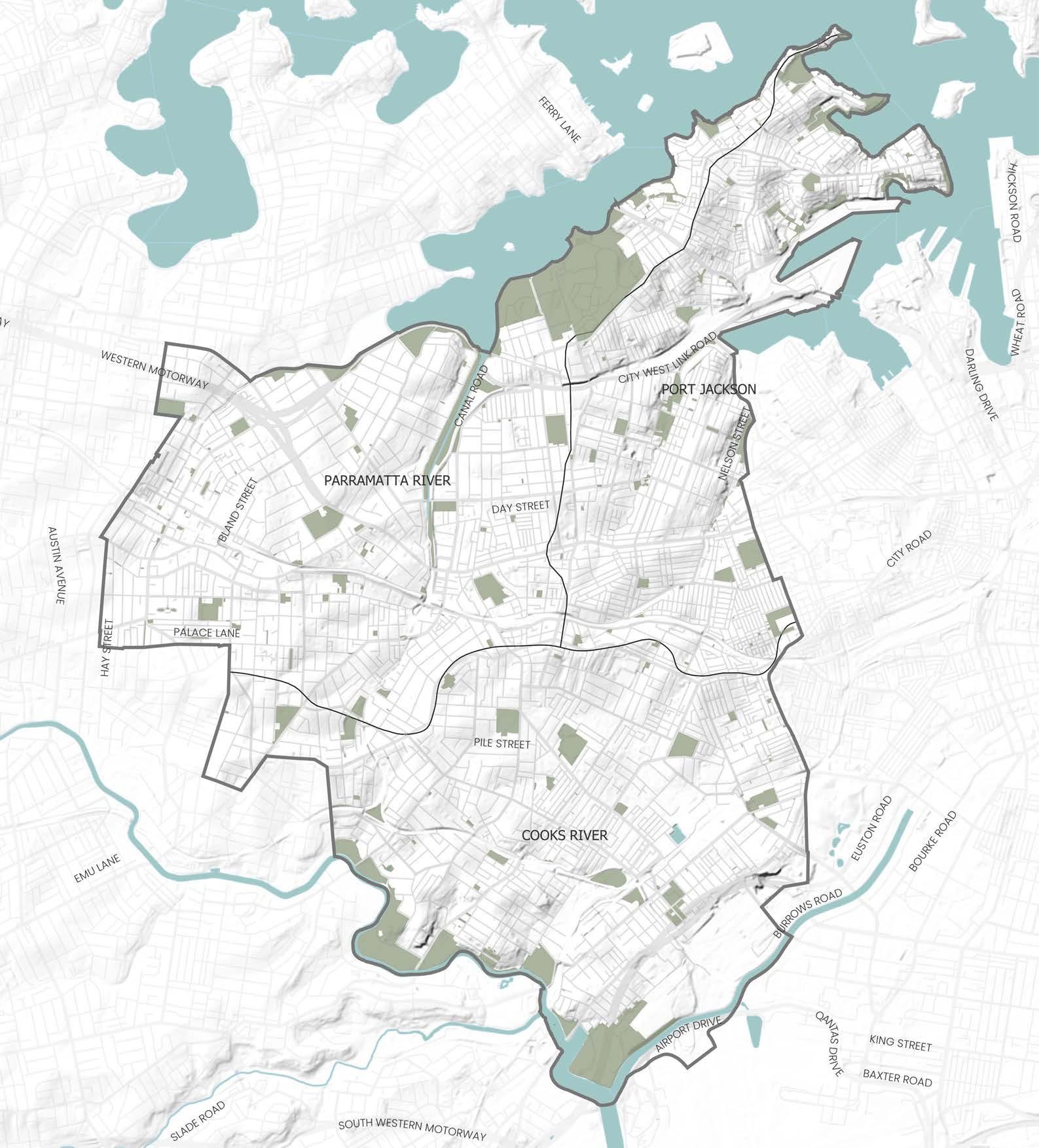 Hurlstone Park
Croydon Park
Camperdown
Balmain East
Summer Hill
Dulwich Hill
Marrickville
Petersham
Birchgrove
Annandale
Sydenham
Leichhardt Lewisham
Stanmore Newtown
St Peters
Croydon
Balmain Enmore
Mascot
Rozelle Tempe
Hurlstone Park
Croydon Park
Camperdown
Balmain East
Summer Hill
Dulwich Hill
Marrickville
Petersham
Birchgrove
Annandale
Sydenham
Leichhardt Lewisham
Stanmore Newtown
St Peters
Croydon
Balmain Enmore
Mascot
Rozelle Tempe
Mapping Layers Pipes and Drainage
The Blue-Green Grid will provide WSUD in areas which require drainage to naturally control what enters our waterways.
Map source: Inner West Council.
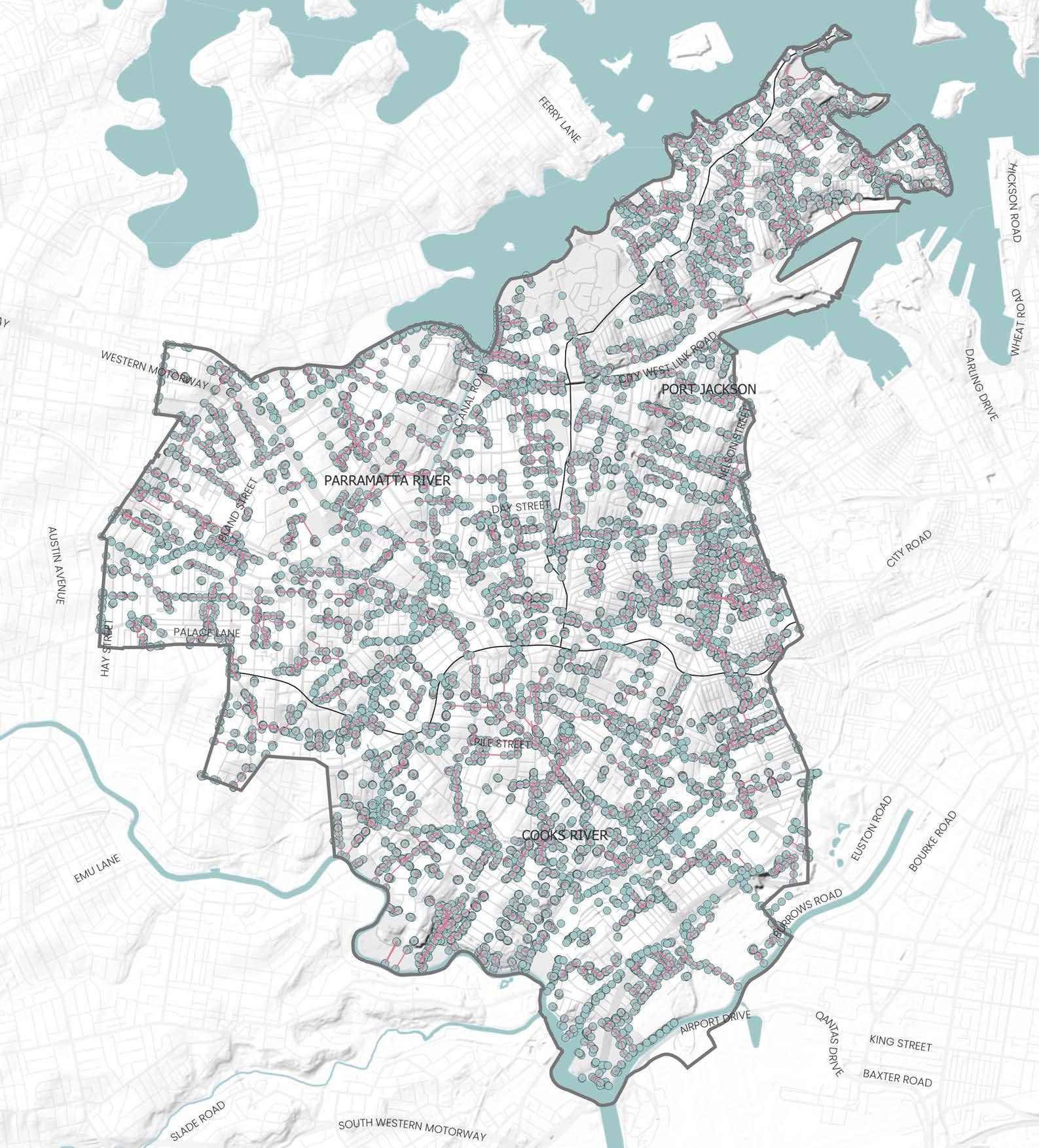
Legend
Inner West LGA Boundary
Drainage Pits
Stormwater Pipes
Inner West Blue-Green Grid Strategy 2023 125
Hurlstone Park
Croydon Park
Camperdown
Balmain East
Summer Hill
Dulwich Hill
Marrickville
Petersham
Birchgrove
Annandale
Sydenham
Leichhardt Lewisham
Stanmore Newtown
St Peters
Croydon
Balmain
Enmore
Mascot
Rozelle
Tempe
Mapping Layers
Points of Interest (POI) - Heat Map
The Points of Interest (POI) heatmap represents an aggregate of location of a feature, service or activity that people may want to see, know about or visit across the LGA. The POI dataset is acquired from and maintained by State Government of NSW and Spatial Services (DCS).
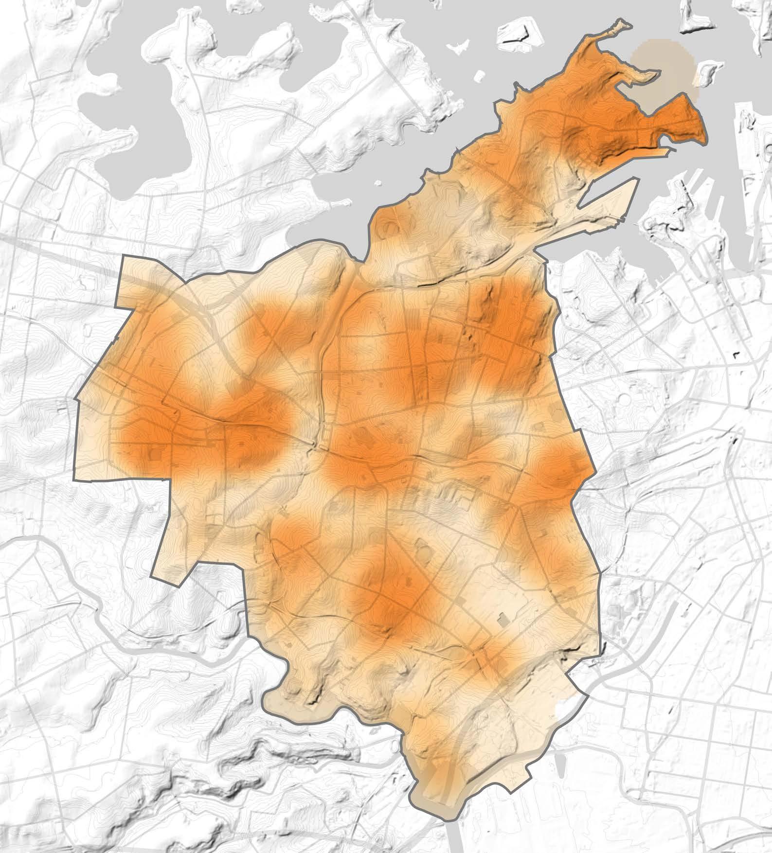
POI dataset includes features related to Community, Education, Recreation, Transportation, Utility, or Hydrography, Physiography and Place, and defined as a place with a prescribed name. The spatial analysis technique uses this dataset with density calculation to estimate density-clusters across a study area. It calculates the density of interest points by spreading the influence of each point throughout the study area using a kernel function. The resulting output of this analysis method helps in analysing potential pedestrian mobility and behaviour with the LGA.
The POI Heat Map expands on the previous POI map. This in turn helps identify a broader Blue-Green Grid, which runs broadly near POIs in circumstances a link may not be suitable along that specific route.
Map source: https://datasets.seed.nsw.gov.au/dataset/ nsw-points-of-interest-poi
Map produced by McGregor Coxall with GIS.
Legend
Inner West LGA Boundary
More Points of Interest
Less Points of Interest
Mapping Layers
Movement Network
The Inner West Network is key to movement within, to and from the area, with plans to improve the network with the addition of the Metro.
The existing cycle routes provide hints as to where the Blue-Green Grid could go and indicate gaps to be improved.
Proximity to public transport from the Blue-Green Grid provides accessibility to green spaces, whilst also encourages use of public transport through providing direct accessible paths and active transport over private car use, as the Blue-Green Grid will produce more attractive routes that are lush and cool which people want to use.
The Blue-Green Grid has potential to follow the train lines and main roads, using trees to reduce noise, improve aesthetics and creating a corridor of wildlife and biodiversity.
Map
Inner West LGA Boundary
Motorway
Arterial Road
Primary Road
Local Road
Train Line
Train Station
Light Rail
Light Rail Station
Ferry Station
Cycle Routes
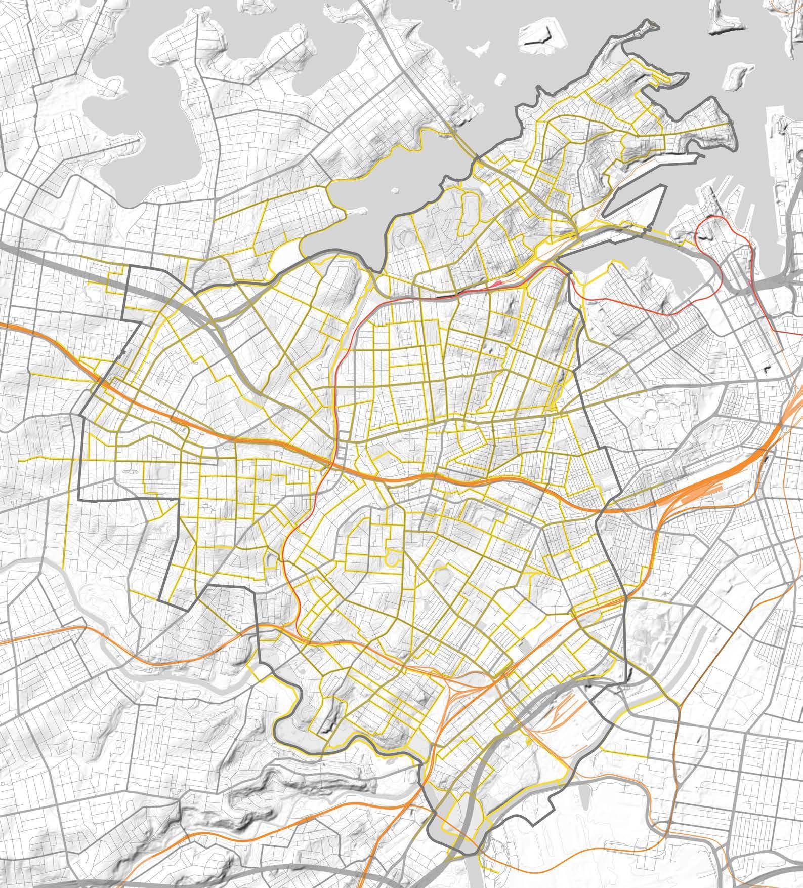
Inner West Blue-Green Grid Strategy 2023 127
source: Shapefiles provided by Inner West Council, NSW DPIE, Six Maps.
PrincessHighway PrincessHighway
OldCanterburyRoad Hume Highway
Legend
Mapping Layers
Transport Walkability
Whilst the Inner West boasts an excellent rail network, much of the Inner West remains outside the walkable radius of stations.
The Blue-Green Grid can be placed to support longer walking distances, and should be located to create access to stations.
Blue-Green Grid opportunities identified in 7 areas that lack suitable walking connectivity to stations.
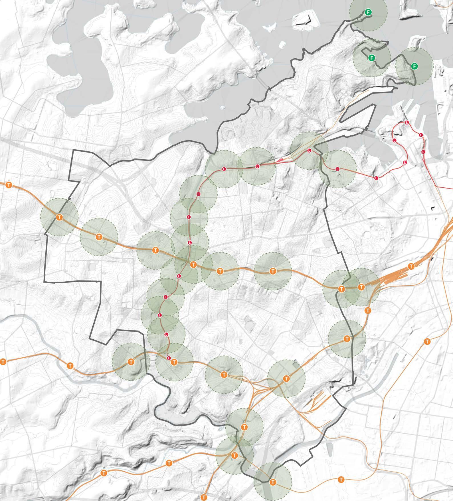
Map Source: Shapefiles provided by Inner West Council, NSW DPIE, Six Maps.
Legend
Inner West LGA Boundary
Train Line
Train Station
Light Rail
Light Rail Station
Ferry Station
400m Walkable Radius
Hurlstone Park
Croydon Park
Camperdown
Balmain East
Summer Hill
Dulwich Hill Marrickville
Petersham
Birchgrove
Annandale
Sydenham
Leichhardt Lewisham
Stanmore Newtown
St Peters
Croydon
Balmain
Enmore Mascot Tempe
Rozelle 1 2 3 4 5 6 7
Mapping Layers
Pedestrian Hotspots
The pedestrian heat map represents an aggregate of pedestrian activity across the LGA. The pedestrian location points is a collection of raw data set of mobile location data acquired from Echo Analytics. The spatial analysis technique uses this data set with density calculation to estimate density-clusters across a study area. It calculates the density of events (such as occurrences, observations, or incidents) by spreading the influence of each event throughout the study area using a kernel function. The resulting output of this analysis method helps in analysing pedestrian mobility and behaviour with the LGA.
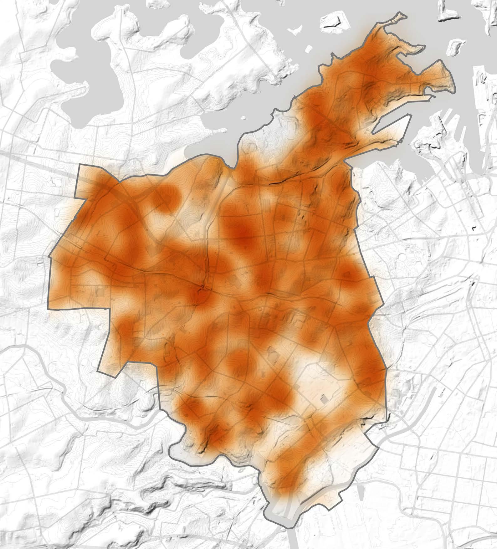
The Blue-Green Grid will go through commonly used routes. This map uses GPS data which mapped locations of people at different times of the day. A heat map was then created using an algorithm that identifies multiple data sets in high location concentration.
Map Source: Echo Analytics.
Map produced by McGregor Coxall with GIS.
Legend
Inner West LGA
Boundary
More footfall
Less footfall
Inner West Blue-Green Grid Strategy 2023 129
Mapping Layers
Public Art
There is Opportunity for public art to comprise some of the Blue-Green Grid to promote art and culture.
Map source: https://www.innerwest.nsw.gov.au/explore/ parks-sport-and-recreation/walking-and-cycling/ walking-and-cycling-routes
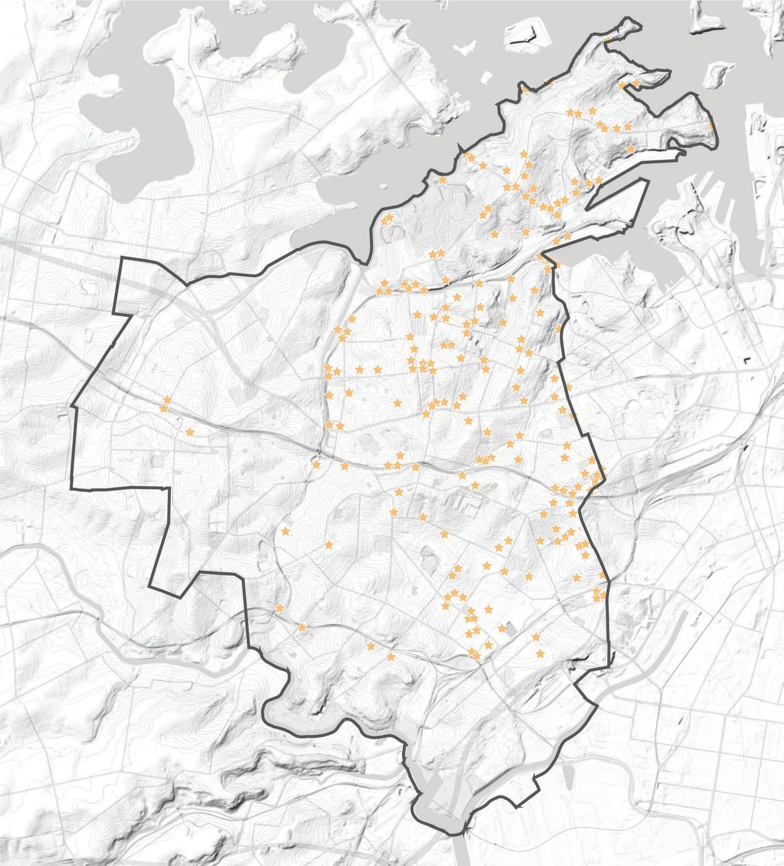
Legend
Inner West LGA Boundary
Identified Public Art
Mapping Layers
Heritage Walks
Trails can contribute to the Blue-Green Grid as existing routes.
Map source: https://www.innerwest.nsw.gov.au/explore/ parks-sport-and-recreation/walking-and-cycling/ walking-and-cycling-routes.
Legend
Inner West LGA Boundary
Local walking tracks
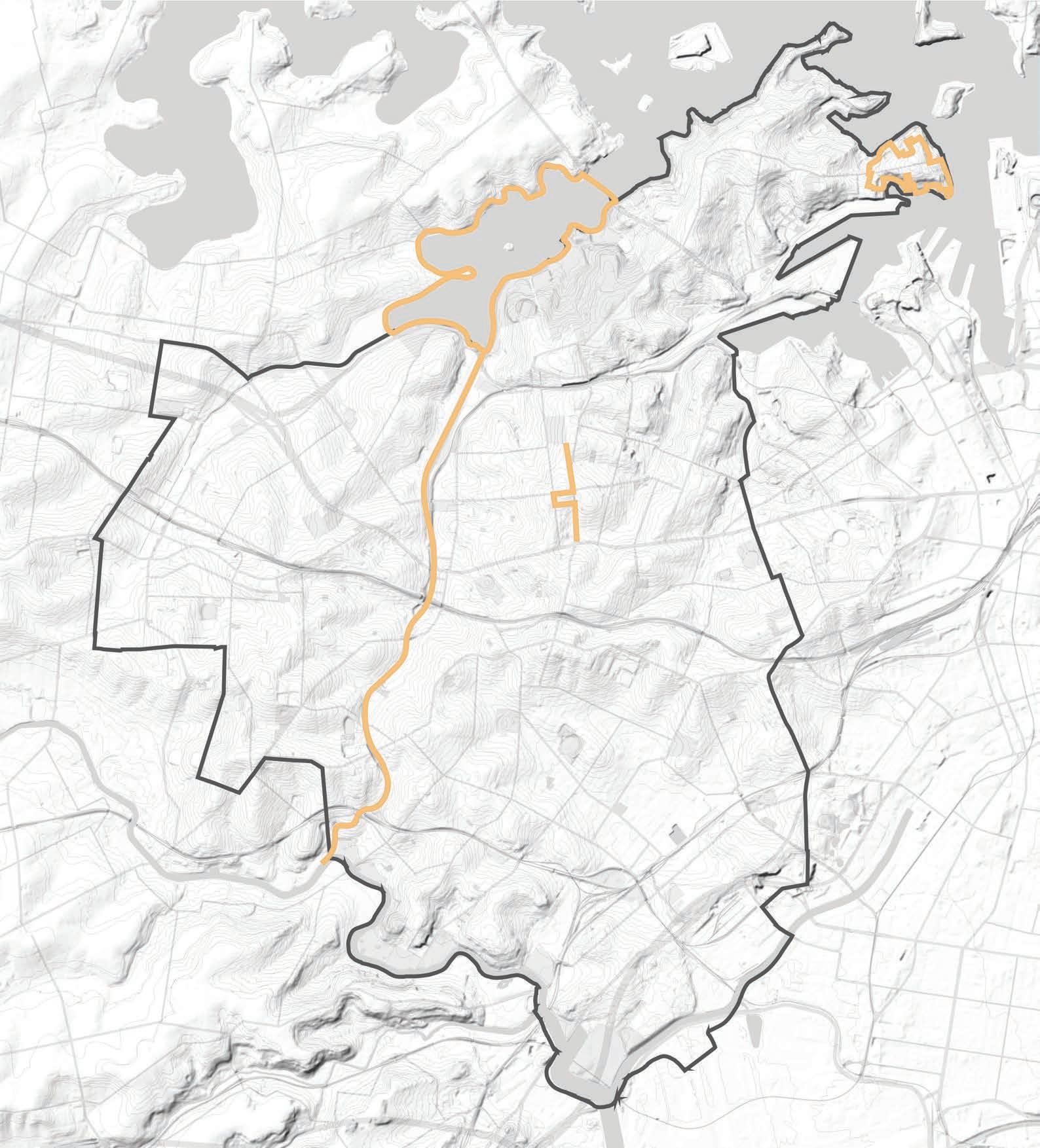
Inner West Blue-Green Grid Strategy 2023 131
Mapping Layers
Footpath Widths
Footpaths around the Inner West vary in width, shown in the adjacent map.
The width of the footpath impacts how they can be used, the safety of users, streetscape and implementation of blue and green infrastructure. Wider footpaths offer more opportunity due to adequate space allowing the addition of greenery and WSUD.
This map was used on the implementation stage to indicate actions in priority areas.
Map source: Inner West Council
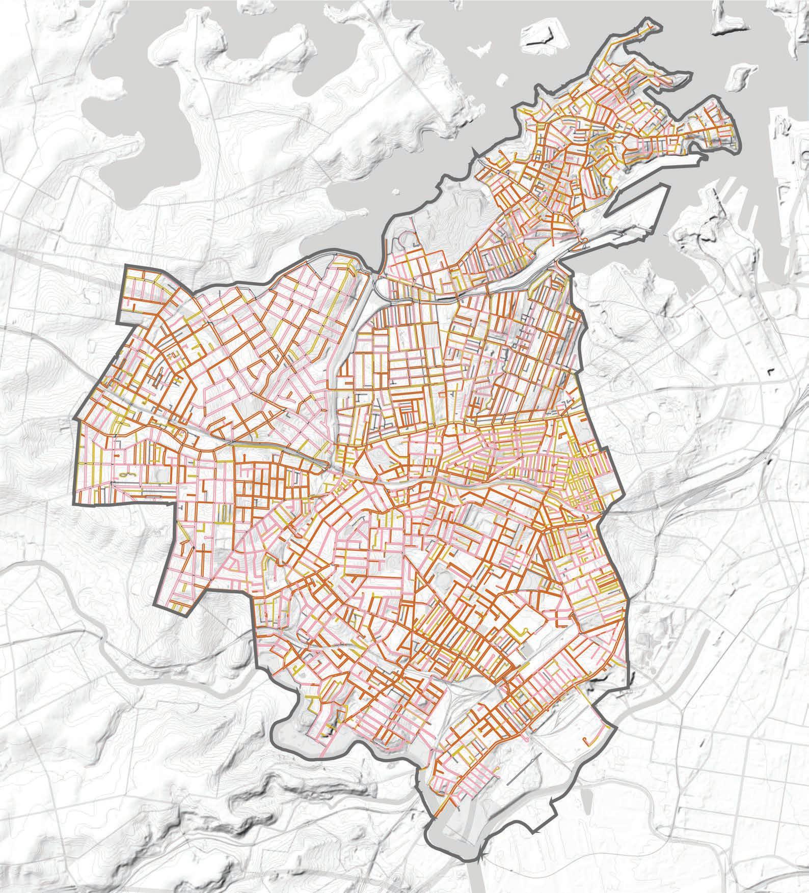
Legend
Inner West LGA Boundary
0-1.5m Footpath
1.5-2m Footpath
2-11m Footpath
Hurlstone Park
Croydon Park
Camperdown
Balmain East
Summer Hill
Dulwich Hill
Marrickville
Petersham
Birchgrove
Annandale
Sydenham
Leichhardt Lewisham
Stanmore Newtown
St Peters
Croydon
Balmain
Enmore
Mascot
Rozelle
Tempe
Mapping Layers
Crown Land
Mapping council and crown land shows areas which the strategy can easily be implemented.
Map source: Shapefile provided by Inner West Council.
Legend
Inner West LGA Boundary
Crown land
Freehold
Local Government Authority
NSW Government Authority
Inner West Blue-Green Grid Strategy 2023 133
