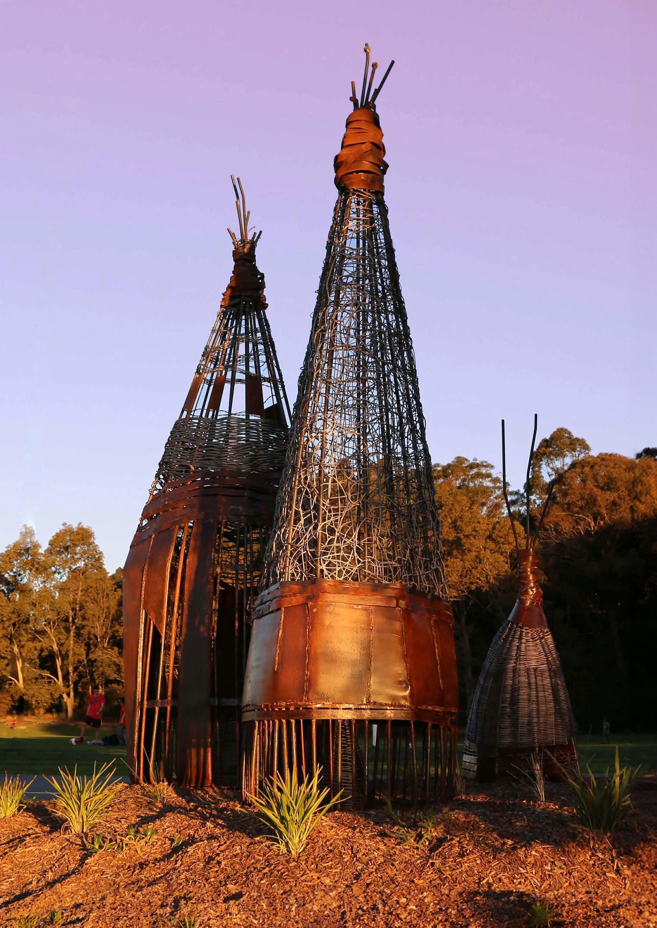
Left: Fish Traps by Edwards Clarke, Bay Run Above: Council Ward Artwork by Mumbulla Creative
Aboriginal and Torres Strait Islander Recognition Statement
Council acknowledges the Gadigal and Wangal clans of the Eora Nation, who are the traditional custodians of the lands in which the Inner West is situated. We celebrate the survival of Aboriginal and Torres Strait Islander cultures, heritage, beliefs and their relationship with the land and water. We acknowledge the continuing importance of this relationship to Aboriginal and Torres Strait Islander peoples living today, despite the devastating impacts of European invasion.
We pay our respects to their Elders –past and present.
We express our sorrow for past injustices and support the rights of Aboriginal and Torres Strait Islanders to self-determination. Council understands our responsibilities and role in working with the Aboriginal community to promote cultural heritage and history, address areas of disadvantage, and protect and preserve the environment as well as sites of significance to Aboriginal peoples. In doing so, we acknowledge that Aboriginal cultures continue to strengthen and enrich our community.
Today, diverse groups of Aboriginal and Torres Strait Islander peoples
live and work across Inner West. We admire the resilience displayed in their significant achievements and in making immense contributions to both Council and the broader community. Council is committed to embedding the values and perspectives of the Aboriginal and Torres Strait Islander communities to ensure we learn from the mistakes of our past and forge a positive future of long-lasting value built on mutual respect, equality and opportunity.
We acknowledge their evolving, living cultures and dynamic relationships with Country. We recognise that Country has been cared for by First Nations peoples for millennia. We also pay our respects to the cultural knowledgeholders who have guided us in the development of this project.
52 Natural Area sites
24 hectares of land managed for ecological outcomes
15 threatened fauna species
5 Reconstructed wetlands
128 in-person nursery events
119 bushcare events
2 native plant community nurseries
13,355 plants propagated
21.3 tonnes of weeds removed from Natural Areas
3 citizen science groups
10 Urban Ecology staff
7 Aboriginal and Torres Strait Islander partnerships
100 new verge gardens and 3 Adopt-a-spots
1,708 Bushcare volunteer hours
200+ endemic plant species grown
3 reconstructed saltmarsh systems
Silver Princess (Yoyetta celis)
Our Approach to Improving Biodiversity
The establishment of the Inner West Draft Biodiversity Strategy 2036 provides the Inner West Community with an achievable plan to improve indigenous biodiversity within our local government area, capitalising and building partnerships with the community and identifying new opportunities for the delivery of programs which enhance our stewardship and care for the environment.
This plan has been written by a Technical Advisory Group comprised of staff from teams across Council which are involved in the development and delivery of programs to manage and enhance biodiversity.
Importantly this plan has also been developed in consultation with the community and the community volunteers which support Council’s ongoing efforts to improve and care for the environment.
Urban development, while providing for population needs, is leading to the dramatic loss of urban biodiversity in NSW. Land clearing, habitat fragmentation, invasive species, and changes to microclimate, lighting, and hydrology are some of the major development pressures leading to a decline in urban wildlife diversity and abundance. The Inner West area also faces a series of complex planning challenges, including future predicted changes in population growth that will increase pressure on our existing biodiversity and bluegreen infrastructure.
This plan recognises the very real challenges which are associated with urban growth and the significant impacts that such growth has on land use and in the Inner West.
The Biodiversity Strategy, once adopted, will provide a key tool for Council in ensuring that the values of biodiversity are carefully considered in future decision making and that habitat protection is at the forefront of Council’s planning and strategic planning framework.
This plan has been developed strategically in two parts – firstly a Biodiversity Strategy which establishes the importance of the Inner West’s biodiversity and provides the context for Council's strategic approach to protecting and enhancing biodiversity. Secondly, Part 2 of the Strategy, the Draft Actions framework, sets out
ambitious and measurable actions to achieve our strategic priorities. Upon formal Council adoption, the strategy will be reviewed internally on a yearly basis, with key actions and implementation plans assessed to determine targets.
Council’s Biodiversity Strategy 2036 assesses the current state of the local environment and strengthens our resolve to create an ecologically sustainable Inner West as a top priority of the community. Valuing traditional knowledge, and learning from the past, to ensure the Inner West continues to be a great place to live, work, and play for many generations to come is central to this strategy.
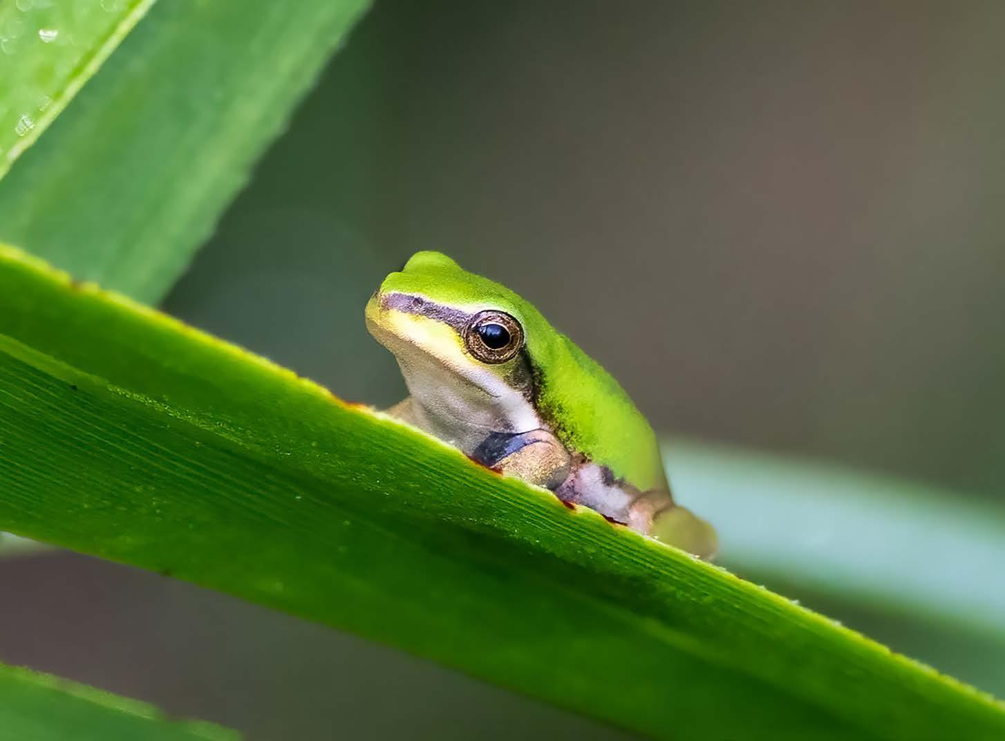
Eastern Dwarf Tree Frog (Litoria fallax)
1 Introduction
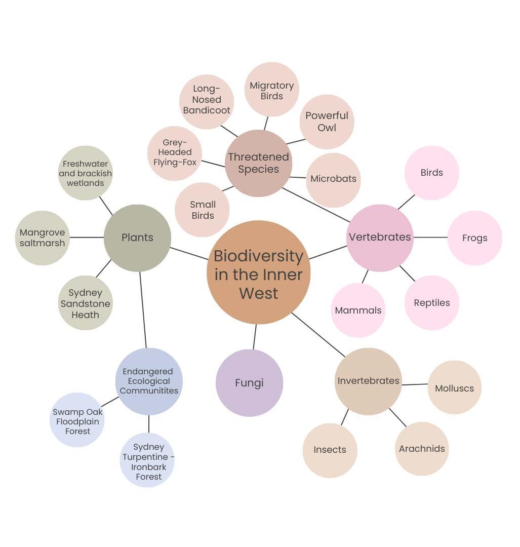
Biodiversity is short for biological diversity. It describes the variety of living organisms and is commonly measured at the genetic, species, and ecosystem levels. The variety of life forms in the Inner West includes all our plants, animals and micro-organisms, the genetic information they contain, and the different ecosystems they form with the non-living components of our landscape.
Urban areas, like the Inner West, are highly developed landscapes that are best known for their dense populations and human land uses. Although they can look like ‘concrete jungles’, cities are increasingly described as ‘urban ecosystems’ (Figure 2) that have an essential role in the conservation of biodiversity.
Figure
2. Definition of Key Terms
Urban ecosystem
An ecological community where the living components of an urban area (plants, animals, organisms) interact with each other and the non-living components of their environment (soil, water, weather).
Country
A term indigenous people use to describe the lands with which they have traditional attachment or relationship. Country is not simply land. It has been called a “nourishing terrain” that gives and receives life. Country is central to indigenous identity, spirituality, community, and culture.
Cues to Care
Landscape cues in urban areas that indicate human presence and intention in an ecological space. For example, sandstone rocks surrounding a Natural Area.
Blue-green infrastructure
The network of blue and green spaces in a city. This includes parks, cemeteries, gardens, community gardens, urban forests, street trees, green roofs, wetlands, streams, rivers, lakes, and ponds.
Natural Areas
Land or natural feature that is managed for the core outcomes of biodiversity conservation, critical habitat restoration and regeneration of ecosystem function. Provides community use of land in a manner that will minimise and mitigate any disturbance caused by human intrusion.
Aboriginal Ecological Knowledge (A.E.K.)
The evolving knowledge acquired by indigenous and local peoples over hundreds or thousands of years through direct contact with the environment. This knowledge includes the relationships between plants, animals, natural phenomena, landscapes and weather patterns.
1.2. Biodiversity in Urban Areas
The conservation of biodiversity in urban areas is essential for sustaining ecosystem health and safeguarding the future of Australia’s unique native species.
Cities are often found in ‘biodiversity hotspots’ and more than 30% of Australia’s nationally threatened species live in our urban or regional centres. The Inner West is part of a biodiversity hotspot called the Forests of Eastern Australia. There are 15 threatened fauna species or populations that call the Inner West home (see pages 44-45 in Section 5).
In urban areas, biodiversity depends on the quantity and quality of habitat provided by blue-green infrastructure (Figure 2).
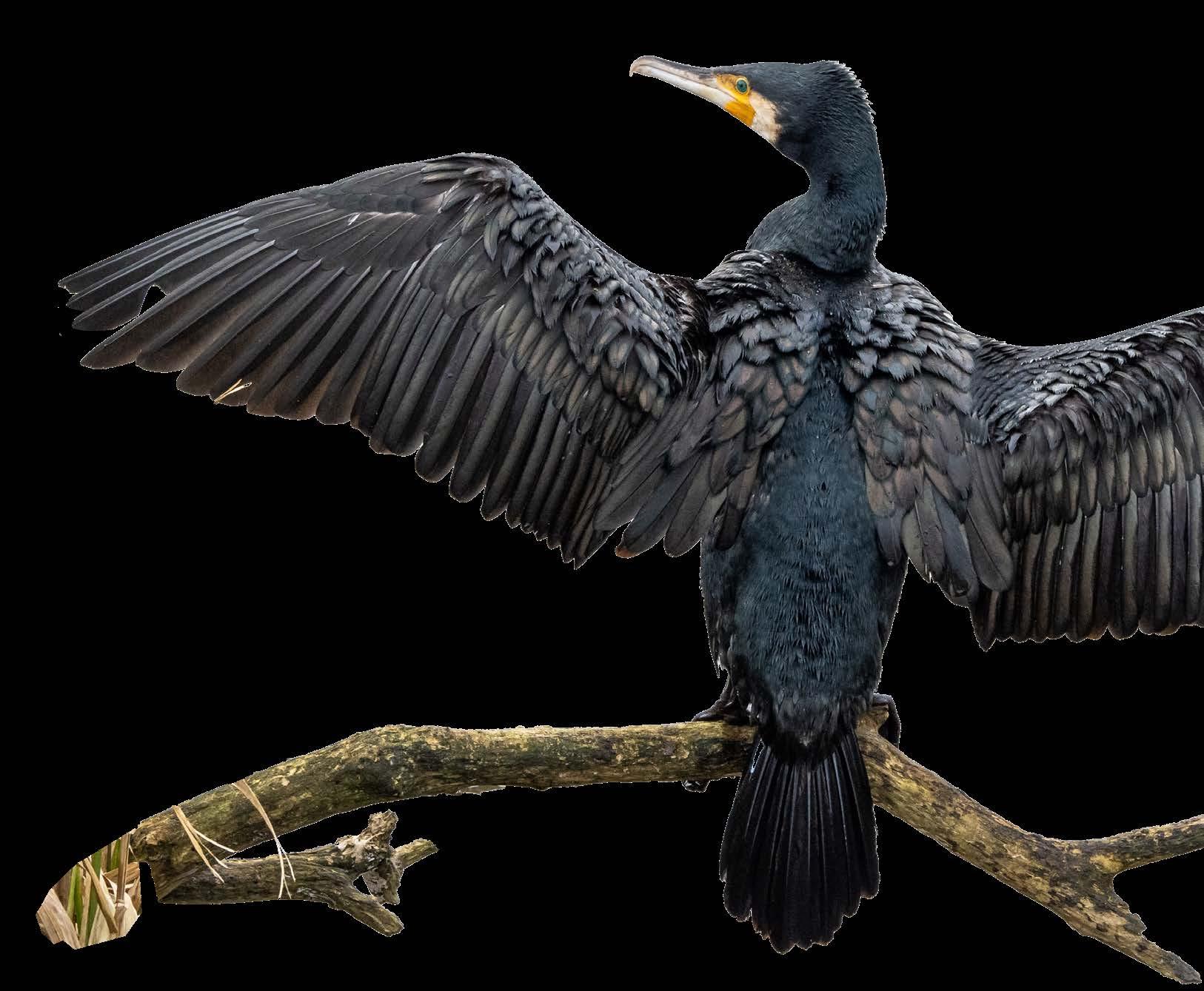
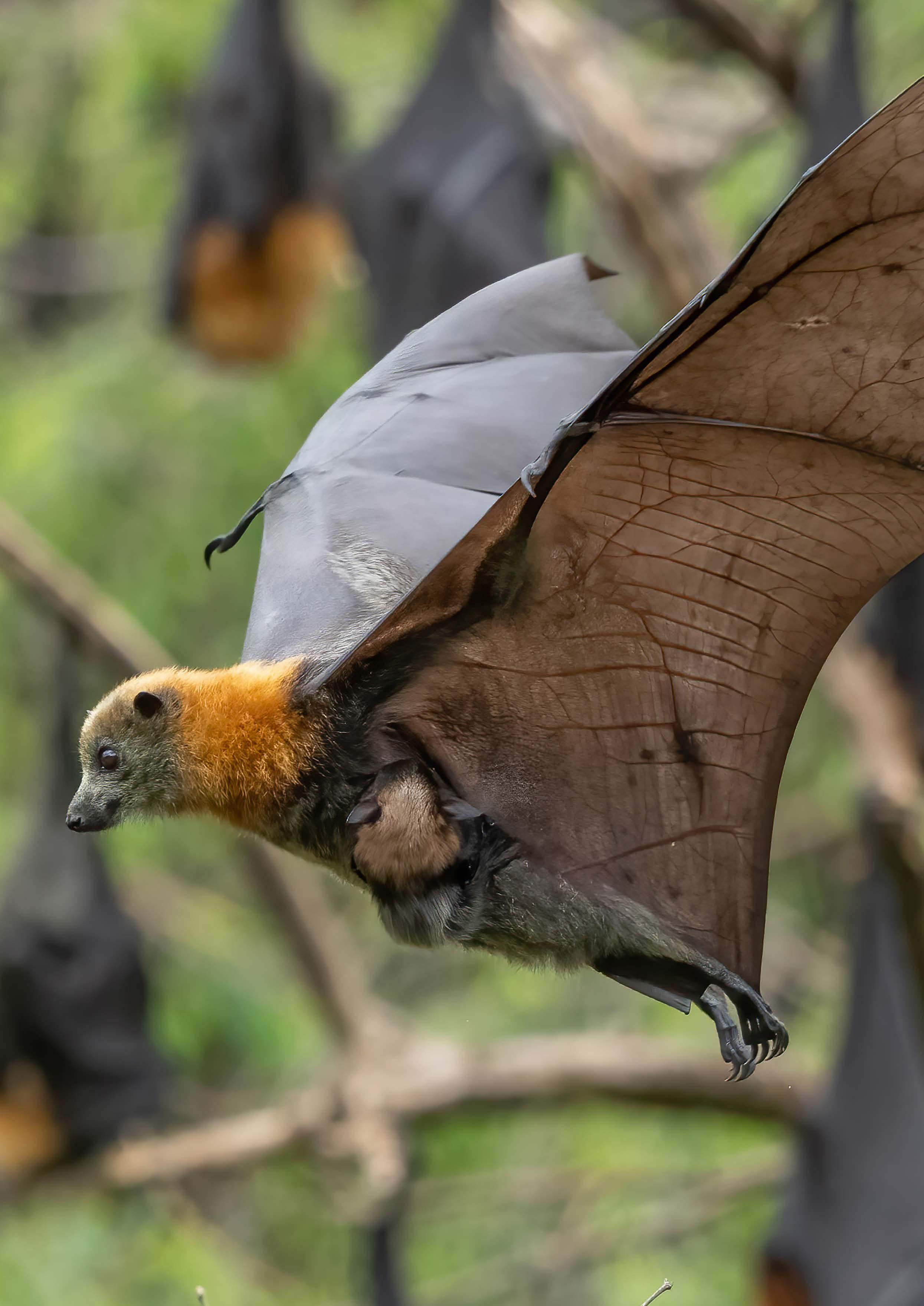
The Inner West’s waterway corridors, for example, provide roosting and foraging habitat for threatened species like the Powerful Owl and Grey-headed Flying Fox. Even smallscale, urban greening initiatives that add native shrubs and groundcovers can have substantial biodiversity benefits.
Urban development is leading to the dramatic loss of urban biodiversity in NSW. Land clearing, habitat fragmentation, invasive species, and changes to microclimate, lighting, and hydrology are some of the major development pressures leading to a decline in urban wildlife diversity and abundance.
To protect biodiversity, urban authorities need to conserve existing habitat and develop measures to reduce the ecological impact of new development.
1.3 Biodiversity and the Community Strategic Plan
Protecting and enhancing biodiversity in the Inner West will support the implementation of Council’s Community Strategic Plan (CSP), Our Inner West 2036. The Biodiversity Strategy is most closely aligned with Strategic Direction 1. An Ecologically Sustainable Inner West.
Outcomes
and actions from Inner West Council's Community Strategic Plan Strategic direction 1 - An ecologically sustainable Inner West
Strategies in the CSP that promote the conservation of biodiversity include:
• Providing the community with knowledge and tools for sustainability
• Increasing the Inner West’s urban tree canopy
• Improving the Inner West’s mid-storey and understorey vegetation
• Protecting, connecting, and enhancing Natural Areas and biodiversity corridors
• Implementing water-sensitive policies and projects to improve waterway health
The Biodiversity Strategy will support the CSP by providing a holistic framework for protecting biodiversity and enhancing ecosystem health across the Inner West.
While the Inner West is home to a range of native species and Natural Areas, our green cover is in decline and biodiversity is vulnerable to a range of threatening processes. The Inner West also faces a series of complex planning challenges that will increase pressure on our existing biodiversity and bluegreen infrastructure.
1.4 Actions
Action is needed to enhance the health of our local environment so Council can continue delivering high-quality services that are valued by the community.
Council is committed to working with the community to develop innovative and collaborative responses that acknowledge and protect the contribution biodiversity makes to the health, liveability, and sustainability of the Inner West. The actions proposed in this strategy can help unite the community in the stewardship of our local environment
and develop deeper connections to the Country of the Gadigal and Wangal that sustains us (Figure 2).
The vision for the Biodiversity Strategy 2036 is to protect, repair, and Care for Country to secure a future where people and nature thrive together.
To develop this vision, the strategy has proposed 7 goals and 12 priorities under the themes of Increase Biodiversity, Unite Community, and Lead by Example (Figure 3). Each theme has a set of supporting
actions that provide direction for improving the planning and management of biodiversity in the Inner West (See page 50 in Section 6).
The actions most relevant to the strategy’s context (e.g. planning challenges) are also highlighted in boxes throughout the text.
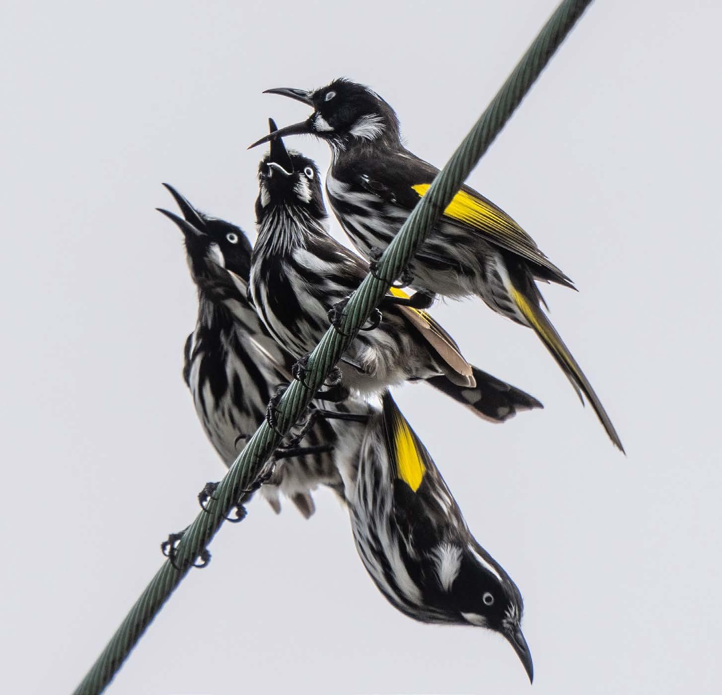
New Holland Honeyeater (Phylidonyris novaehollandiae)
' Protect, repair, and Care for Country to secure a future where people and nature thrive together. '
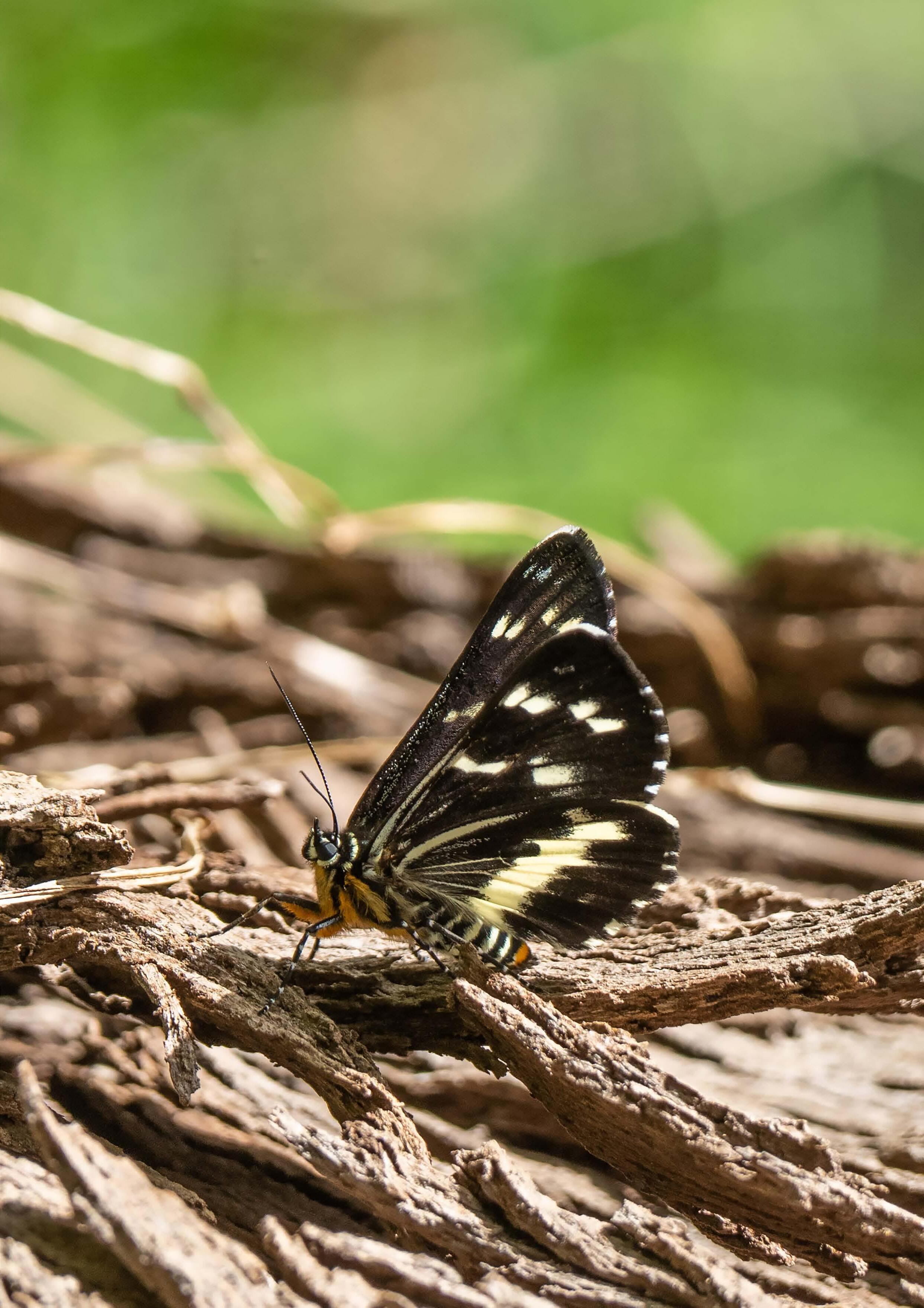
Forest Day-moth
(Cruria synopla)
Theme 1: Increase Biodiversity
Goals
1 2 3
Increase terrestrial biodiversity throughout the Inner West Council area
Priorities
1. Enhance the protection of biodiversity by improving the quantity and quality of habitat for local fauna and flora
Increase marine, freshwater, and riparian biodiversity throughout the Inner West
Establish baselines and bridge knowledge gaps
2. Improve quality of waters flowing through Inner West
3. Expand, enhance, and protect natural riparian habitat
4. Enhance the monitoring of local species, ecosystem health, and evaluation of biodiversity management actions
5. Develop better understanding of current state of environment and knowledge gaps
Theme 2: Unite Community
Goals
1 2
Increase opportunities for people to connect with, and care for, biodiversity in the Inner West
Priorities
1. Citizen science and community stewardship
2. Education, transparency, and promotion of biodiversity achievements
Strengthen the representation and integration of Aboriginal ecological knowledge in the protection of biodiversity
3. Care for Country
Theme 3: Lead by Example
Goals
Council is a leader in supporting urban biodiversity
Priorities
1. Embed ecological principles as a core responsibility of Council
2. Redefine good decision making with an orientation around strategic risk management
Strengthen partnerships to improve biodiversity outcomes
3. Establish cooperative processes for biodiversity within Council
4. Establish connections with external agencies and pool resources
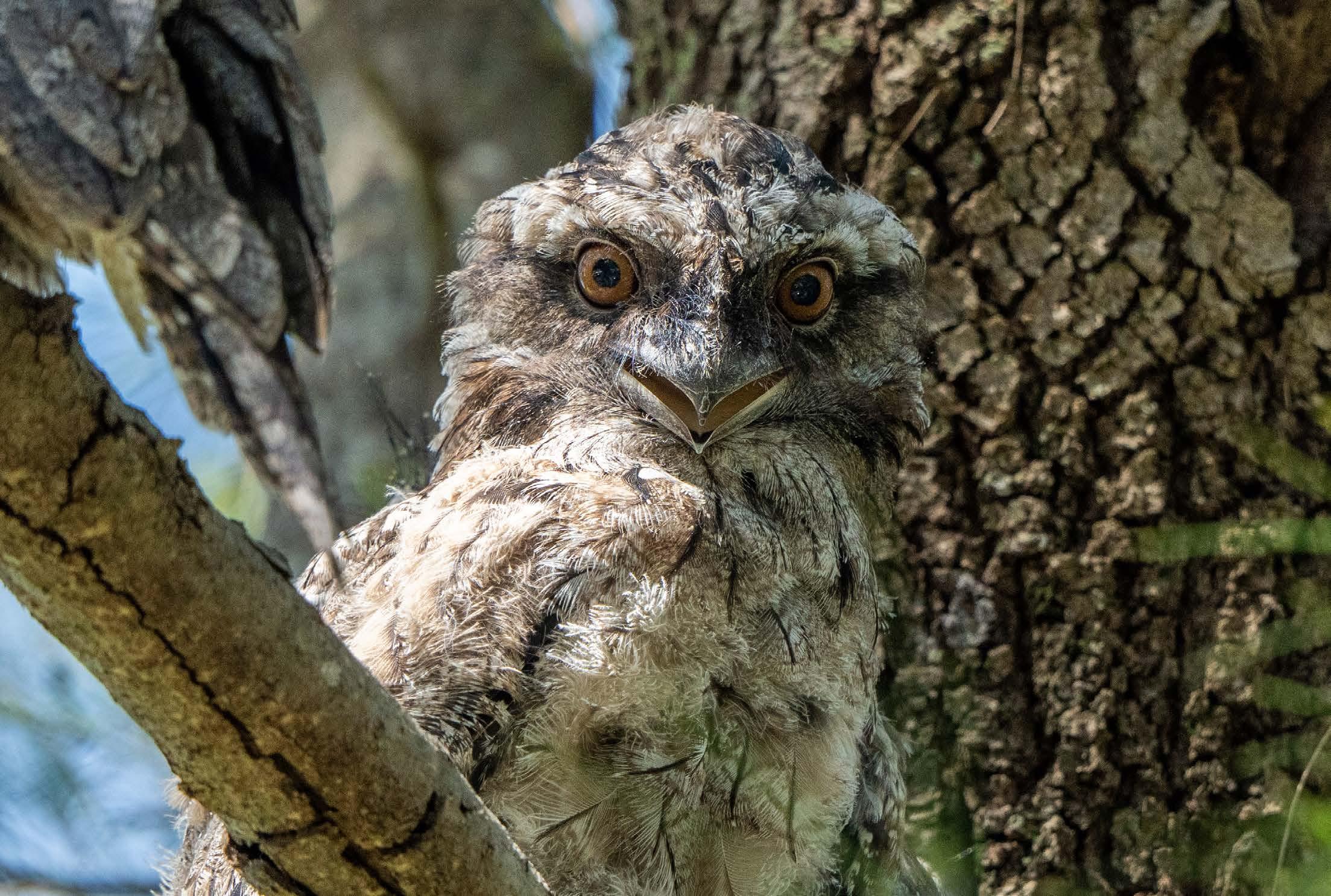
Tawny Frogmouth (Podargus strigoides)
2 The Value of Biodiversity
Biodiversity has intrinsic value and a right to exist on its own terms. However, biodiversity is also vital to human wellbeing and the continuing prosperity of our societies. Biodiversity supports the stability of ecosystems and enhances their ability to adapt to environmental change. It is a cornerstone of ecosystem health and provides a range of services that are critical to the development of healthy, liveable, and sustainable cities. This section describes how enhancing biodiversity can deliver value to Inner West Council and the local community it serves.
2.1 Biodiversity and Ecosystem Services
Ecosystem services are defined as the benefits obtained from the healthy functioning of ecosystems (Figure 4). This simple definition, however, understates their true value. Human survival depends on provisioning and supporting services like photosynthesis, pollination, and the supply of fresh water. Regulating services manage environmental quality and ensure we have healthy, comfortable places to live.
Biodiversity plays a crucial role in delivering the urban ecosystem services that sustain the health and liveability of the Inner West. Our soils, plants, and micro-organisms moderate the microclimate, remove air pollution, absorb harmful wastes, and improve water quality. Our waterways and green spaces directly support community wellbeing by providing space for recreation, improving cognitive function, beautifying the landscape and contributing to social connectedness.
Importantly, Natural Areas can deliver greater physical and mental health benefits than conventional green open space. Natural Areas provide better access to environments that increase people’s ability to restore their mental health, expand their physical activity, and create a sense of belonging. Vegetation complexity, and greater species diversity,
fosters higher levels of relaxation and self-reflection.
The contribution ecosystem services make to health, liveability, and sustainability means the economic value of urban biodiversity is substantial. The concept can also aid responsible urban planning by allowing the full costs and benefits of government programs and planned development to be anticipated.
The Australian Capital Territory (ACT) government calculated the financial costs and benefits of increasing its tree canopy cover from 21% to 30%. The financial value of 7 ecosystem services was estimated, with each hectare of urban tree canopy in the ACT providing the community with $7,671 in benefits. This meant every dollar spent on increasing the ACT’s tree canopy would generate $1.15-$1.25 in benefits.
The value of ecosystem services means that biodiversity, in the very real sense, is a community asset that generates returns on investment. The conservation of biodiversity is a fiscally responsible investment in the health, liveability, and sustainability of the Inner West.
Provisioning
All of the products produced and harvested from an ecosystem. For example, fish, mushrooms, lumber, medical resources,
Regulating
Supporting
The ecological products and processes necessary for the production of all other ecosystem services. This can include nutrient cycling, photosythesis, soil formation and habitat provision.
Ecosystem services
Cultural
Benefits gained from the regulation of ecosystem processes, such as shade, air and water purification, pollination, flood mitigation and decomposition
Figure 4. Definition and Description of (Urban) Ecosystem Services
The impact of the natural world in the social landscape. This includes recreation, education, spiritual growth, heritage value and inspiration to folklore, literature, music etc.
Fosters constructive relationships between Indigenous people and state institutions
Improved early childhood development
Improved physical and mental health
Enhacement of cultural identify and community pride
Builds self-esteem and sense of autonomy
Community Development and Caring for Country
5.
Aboriginal Community Development and Caring for Country
Supports education, training and skills development
Supports customary practices and gender identifiers for men and women
Provides space for cutlural transmission and mentoring of young people
Figure
2.2 Biodiversity and Reconciliation
The Inner West Reconciliation Action Plan acknowledges the link between reconciliation and community development for Aboriginal and Torres Strait Islander peoples. It includes the call to promote inclusive decision-making and nurture connection to Country through placemaking and cultural practices. The conservation of biodiversity in the Inner West can contribute to the reconciliation process by supporting Caring for Country, and the practical delivery of community outcomes through enhanced biodiversity actions which support this concept.
Caring for Country is an approach to land and sea management that is based on the ancestral laws and customs of Aboriginal and Torres Strait Islander peoples. Caring for Country is intricately linked to indigenous cultural life, identity, autonomy, and health. It creates a range of benefits that support community development for Aboriginal and Torres Strait Islander peoples (Figure 5).
Conserving biodiversity is linked to Caring for Country as it typically involves protecting sacred areas and cultural heritage, enhancing species diversity and animal welfare, and restoring the health of waterways and terrestrial ecosystems.
Importantly, Caring for Country requires that Aboriginal and Torres Strait Islander peoples can access, use and relate to Country. This can be supported by developing more opportunities for immersive cultural practices such as walking Country, cool burning, gathering resources, and teaching and performing ceremony.
By better integrating Caring for Country, with the protection of biodiversity, Council will have additional avenues to implement its vision for reconciliation. Nurturing connections to Country can support community development for Aboriginal and Torres Strait Islander peoples and unite the broader Inner West community in the stewardship of our local environment.
Theme 1: Increase biodiversity Actions
Investigate opportunities to expand on existing wetlands, remediate degraded wetlands and build new wetlands across the LGA (1.2.2.3)
Theme 2: Unite community Actions
Investigate opportunity for equal partnerships including partnering the Native Community Nursery with Indigenous providers and educators (2.2.1.1)
Partner with Aboriginal and Torres Strait Islander peoples to integrate appropriate methods of Caring for Country principles in Urban Ecology programs and projects, such as reintroduction of fire protocols into the landscape (2.2.1.2)
Co-design programs in collaboration with Aboriginal and Torres Strait Islander peoples to support engagement and participation in decision making (2.2.1.3)
Theme 3: Lead by example Actions
Facilitate truth telling and embed Caring for Country principles (3.1.2.2)
Understanding of Biodiversity and the Value of Biodiversity
of IW residents can correctly define biodiversity
of IW residents agreed that biodiversity is essential to the production of clean air and water
of IW residents agreed that biodiversity is important for their personal recreation, relaxation, and spiritual renewal
Concern with Biodiversity Loss and Environmental Problems
of IW residents were concerned about extinction of native species in NSW
Environmental Regulation
of IW residents agreed that environmental regulation should aim to improve, rather than merely maintain, the health of the environment.
of IW residents believed environmental regulation of property development and construction is too relaxed.
of IW residents believed environmental regulation is not restricting the growth of the NSW economy.
of IW residents were concerned that environmental problems will negatively affect their health and quality of life
of IW residents were concerned that environmental problems will negatively affect the NSW economy
Figure 6.
Environmental Attitudes of the Inner West Community
Information sourced from NSW Office of Environment & Heritage
“Who Cares About the Environment?” Cross-tabulated survey data 2015
2.3 Community Values and Priorities
The vision of the Community Strategic Plan describes an Inner West that has a vibrant, caring and progressive community where people live in harmony with nature. This vision of harmony reflects the distinctive environmental values of the Inner West community (Figure 6).
Inner West residents have a good understanding of biodiversity and place a high value on the ecosystem services nature provides. They are concerned about the decline of native species in NSW and the negative impact environmental problems will have on their quality of life. They support stronger regulations to improve environmental health, and agree we have a responsibility to protect biodiversity for future generations.
Inner West residents highly value Council services that protect the natural environment and support environmental education. The community’s top two priorities for Council to focus on in the next 10 years were (1) adequate planning and management of development, and (2) environmental protection, climate change, and the provision of green open space.
Council continues to implement the community’s vision for the Inner West and will develop actions that increase opportunities for people to connect with, and care for, our local biodiversity.
Theme 1: Increase biodiversity Actions
Investigate and prioritise opportunities for water sensitive urban design (WSUD) to be incorporated into Council managed land and collaborate with private landholders to increase WSUD uptake (1.2.1.1)
Theme 2: Unite community Actions
Increase opportunities and participation in environmental citizen science (2.1.1.1)
Activate Council’s Sustainability Hub with Urban Ecology staff for consultation with public and hold events on site (2.1.2.1)
Investigate the development of a Biodiversity Sensitive Urban Design (BSUD) workshop to help residents create native habitat in their backyards (2.1.2.5)
Theme 3: Lead by example Actions
Investigate and pursue relevant grant opportunities which increase natural capital (3.2.2.2)
3 Urban Ecology at Inner West Council
Urban ecology is the field of research, planning and management practice that is focused on the protection of biodiversity and ecosystem services in urban areas.
Council’s Parks Planning and Ecology team is responsible for protecting, enhancing, and managing biodiversity including Natural Areas, habitat, foreshores, water and soils. This team delivers both planning and operational restoration and maintenance programs. This team also develops and implements Council’s ecology policies and prepares park master plans that include key biodiversity improvements and opportunities.
3.1. Blue-Green Corridors
Council’s Blue-Green Grid Strategy is a long term, aspirational plan for creating a network of multipurpose corridors across the Inner West. The strategy’s vision is to create blue and green links that will improve accessibility, recreation, biodiversity, waterway health, and recognition of Aboriginal culture.
The Blue-Green Grid Strategy includes ecological objectives for providing native habitat, increasing waterway health and vegetation, and creating opportunities for people to connect with the local environment. The Blue-Green Grid Strategy also establishes 20 priority links for development in the first 10-15 years of implementation.
3.1 Blue-Green Corridors
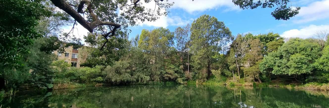
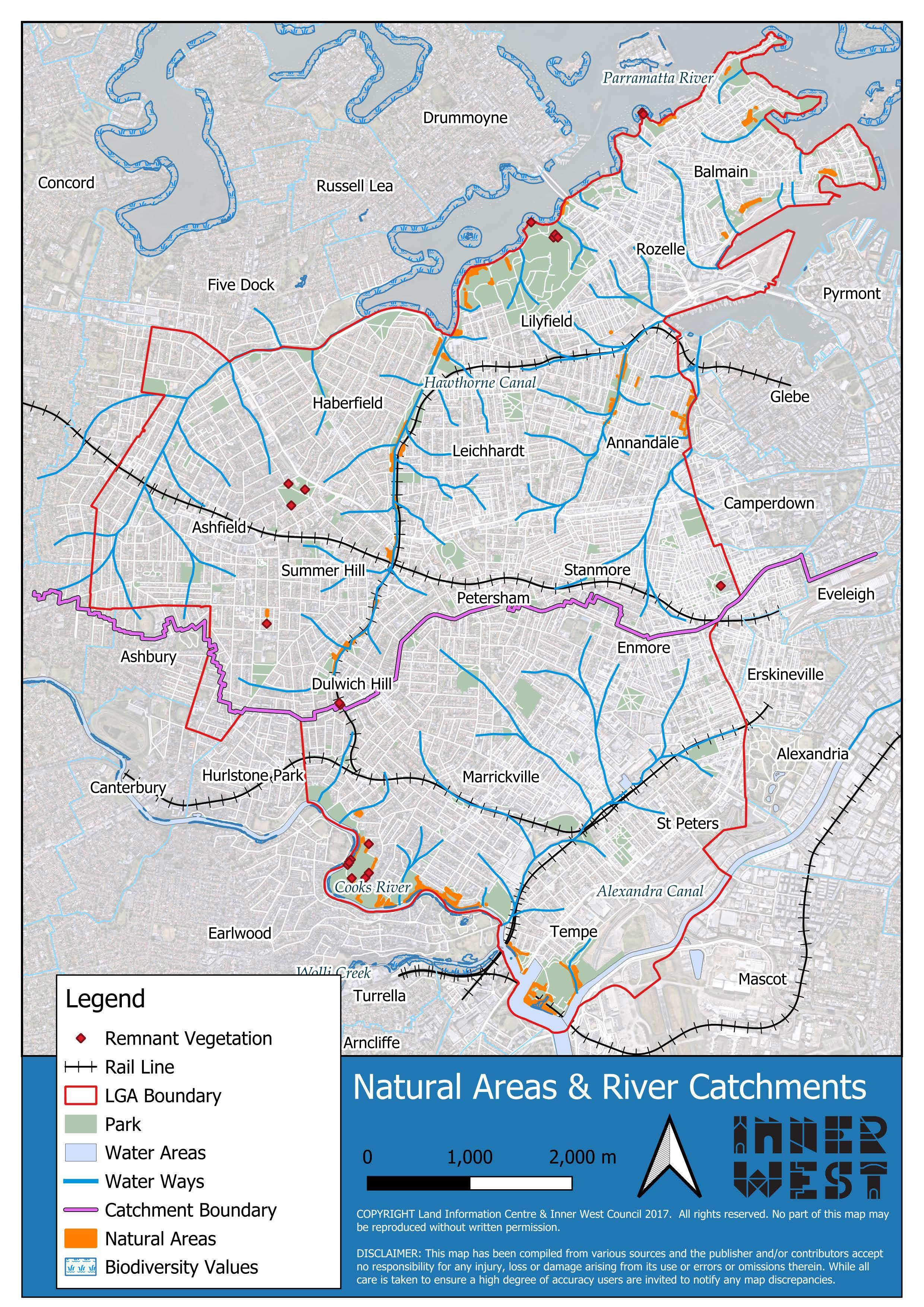
Dibble Waterhole is the only remaining open brick pit within the Inner West. Prior to colonisation, it was a small natural spring and holds cultural significance for local Aboriginal people as a special women’s site and place of healing. Water has accumulated in the brick pit over time, creating a wildlife refuge. In 2021, bank stabilisation and restoration works were undertaken to recreate the endangered Swamp Oak Floodplain Forest that historically lined the Cooks River. Dibble Waterhole is now a haven for terrestrial and freshwater wetland species.
3.2 Natural Areas program
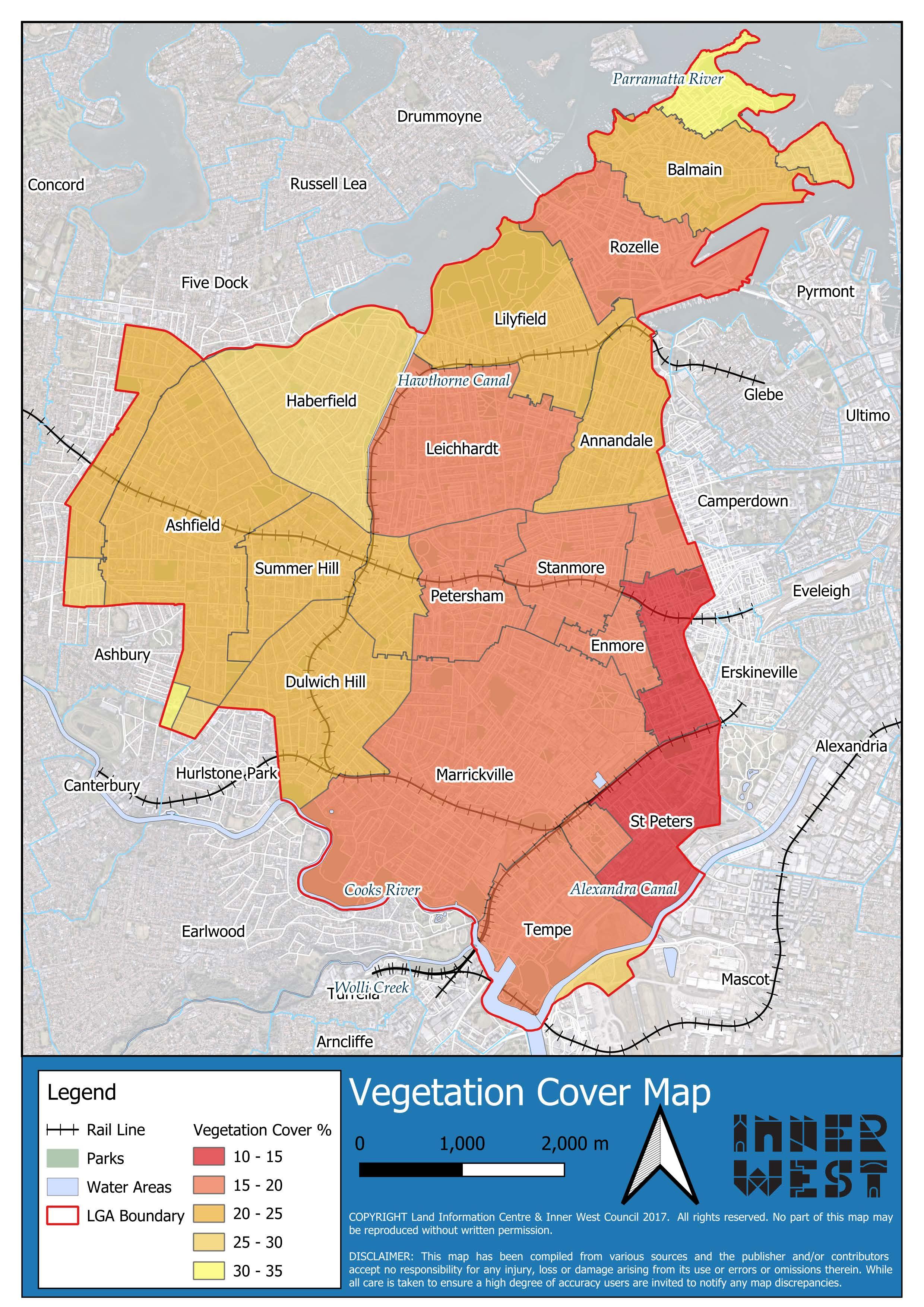
Council manages 24 hectares of Natural Areas, with 52 sites spread across the five wards in the Inner West.
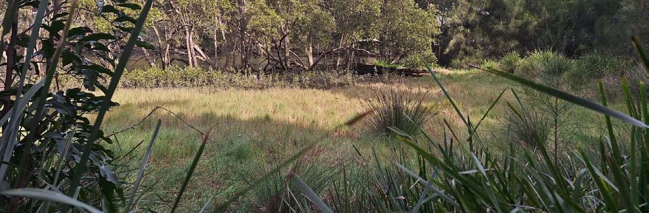
Natural Areas are pockets of bushland, wetland, watercourses, riparian corridors, or escarpments that are managed in perpetuity. Each year the Natural Areas program aims to progress landscape resilience and measures to safeguard our biodiversity improvements and investment.
Natural Areas in the Inner West provide spaces for species recovery and natural regeneration to occur. The core objective of Natural Areas is to provide native habitat, maintain ecosystem function, and protect conservation values for Inner West residents now and into the future.
Natural Areas are revegetated using endemic plants propagated at the IWC native nurseries. The aim is to protect or re-create the local vegetation communities that covered different land features in the Inner West prior to 1750. At Dibble Waterhole, for example, ongoing restoration and maintenance work is undertaken to restore the endangered Swamp Oak Floodplain Forest that once lined the Cooks River.
Profile of Dibble Avenue Waterhole
Government context
Examples of strategies, initiatives and policies
United Nations Convention on Biological Diversity
International
National
State
Inner West Council
Representation of
United Nations Sustainable Development Goals
Environment Protection and Biodiversity Conservation Act 1999
Australia’s Strategy for Nature
Environmental Planning and Assessment Act 1979
Biodiversity Conservation Act 2016 State Environmental Planning Policy (Biodiversity and Conservation) 2021
Figure 7.
3.3 Waterways and Catchment Management
To improve waterway health and functionality in the Inner West, Natural Area lands in riparian zones are managed according to best practice principles to retain water in the landscape and encourage natural biofiltration.
Council supports residents in installing rainwater harvesting systems in their homes through the Rainwater Tank Rebate program. There are five major wetlands in the LGA managed by Council: Tempe Wetland, Blackmore Oval Wetland, Dibble Waterhole, Whites Creek Valley Park Wetland. and Peter Bulger Wetland in Camdenville Park. Additionally, there are 3 reconstructed saltmarsh systems at Tempe Lands Reserve, Hawthorne Canal, and Steel Park.
As a member of the Cooks River Alliance and Parramatta River Catchment Group, Council works collaboratively with other councils, the state government, and external stakeholder agencies to pool resources and improve ecological outcomes for the two rivers. This includes work in advocacy, planning, education, monitoring and on-
ground works.
Council works to improve catchment health through the inclusion of Water Sensitive Urban Design (WSUD) principles on Council lands, including the construction of rainwater gardens, wetlands and swales. Council is active in searching for naturalisation opportunities, to convert old channelised creeks back to natural creek lines.
The only remaining natural creek line, a small unnamed creek behind Hercules Street in Dulwich Hill, is planned as an offset site to be managed by Council. Many freshwater tributaries, such as this, once lined the natural banks before channelisation of the Cooks River began in the late 19th century.
Some unique environmental features in the Inner West can also be found along our waterways. Wave Rock, for example, is a sandstone escarpment meeting the water’s edge at Marrickville Parklands and Golf Course. It is surrounded by a Natural Area that is collaboratively managed with Bushcare volunteers. Downstream lies Fatima Island, the only island remaining in the Cooks River, viewable from Kendrick Park.
The Inner West's dark sky zone
Dark skies initiatives have been implemented around the world to reduce light pollution. Dark skies are known to improve sleep patterns of nearby people, reduce energy usage, and preserves wildlife’s natural habitats and behavioural patterns. Here, in the Inner West, our local dark sky zone is situated around Tempe Lands Reserve.
3.4 Living Streets Program
The Living Streets Program was initiated by community members that want to improve ecological outcomes in their local streets and neighbourhoods. The program supports appropriate, communityled care of Council-owned land so it can work harder to contribute to the ecological health and liveability of the Inner West.
The Living Streets Program consists of the Verge Garden and Adopt-aSpot programs.
The Verge Garden program allows for individual residents to plant and maintain a garden on the Councilowned verge next to their property. The Adopt-a-Spot program is for
groups to care for a nominated area of Council-owned land that is not a verge or community garden. Adopta-Spot activities might include gardening, habitat creation, wildlife watching and citizen science projects.
3.5 Community Native Plant Nurseries
Council has two Community Native Nurseries, located in Marrickville and Annandale. The primary purpose of the nurseries is to provide local indigenous plants for Council projects such as the GreenWay, Natural Area and Bushcare sites. The nurseries are also open to the public and plants are available for sale. The nursery staff, supported by community volunteers, collect and
The Steel Park saltmarsh, reconstructed in 2010, represents a significant effort to restore lost wetland ecosystems in the Inner West. This saltmarsh consists mainly of low-growing forbs and occasional shrubs, with Sarcocornia quinqueflora and Sporobolus virginicus being the dominant species. Positioned in the high tide zone, the saltmarsh is capable of withstanding periodic inundation and elevated salinity levels. The saltmarsh provides essential habitat for fish, crustaceans, and migratory shorebirds. It also enhances water quality by filtering nutrients and sediments, reduces erosion, and protects the foreshore from flooding and storm events.
process seed from locally native plant species, under Scientific license, for propagation in the nurseries. In this way, seed conservation is targeted at species most at risk in the wild and helps protect vulnerable or threatened species from extinction.
The nurseries supply plants for Natural Area restoration in the Inner West and neighbouring local government areas. They also provide free plants for the Living Streets Program, and to local schools for Schools Tree Day. The nurseries currently have over 200 species on their plant list. These species are indigenous to the Inner West, and their seeds are generally sourced from remnant vegetation of the Sydney Basin to maintain genetic diversity and ensure they are adapted to local conditions.
In 2023, the nurseries sold or supplied 7,939 plants. These plants help green our streets, restore our waterways, and provide habitat for native wildlife in parks and Natural Areas.
Theme 1: Increase biodiversity Actions
Identify current Dark Sky Zones, investigate potential establishment of new zones, and implement wildlife friendly lighting standards around Natural Areas (1.1.1.4)
Theme 2: Unite community Actions
Provide volunteering opportunities through Adopt-a-Spot and Verge Garden, Native Community Nurseries and Bushcare programs (2.1.1.3)
Conduct Natural Area tours (2.1.2.3)
Establish a new Native Community Nursery in the Southern LGA and increase nursery capacity (2.1.1.5)
Profile of The Steel Park Saltmarsh
3.6 Bushcare
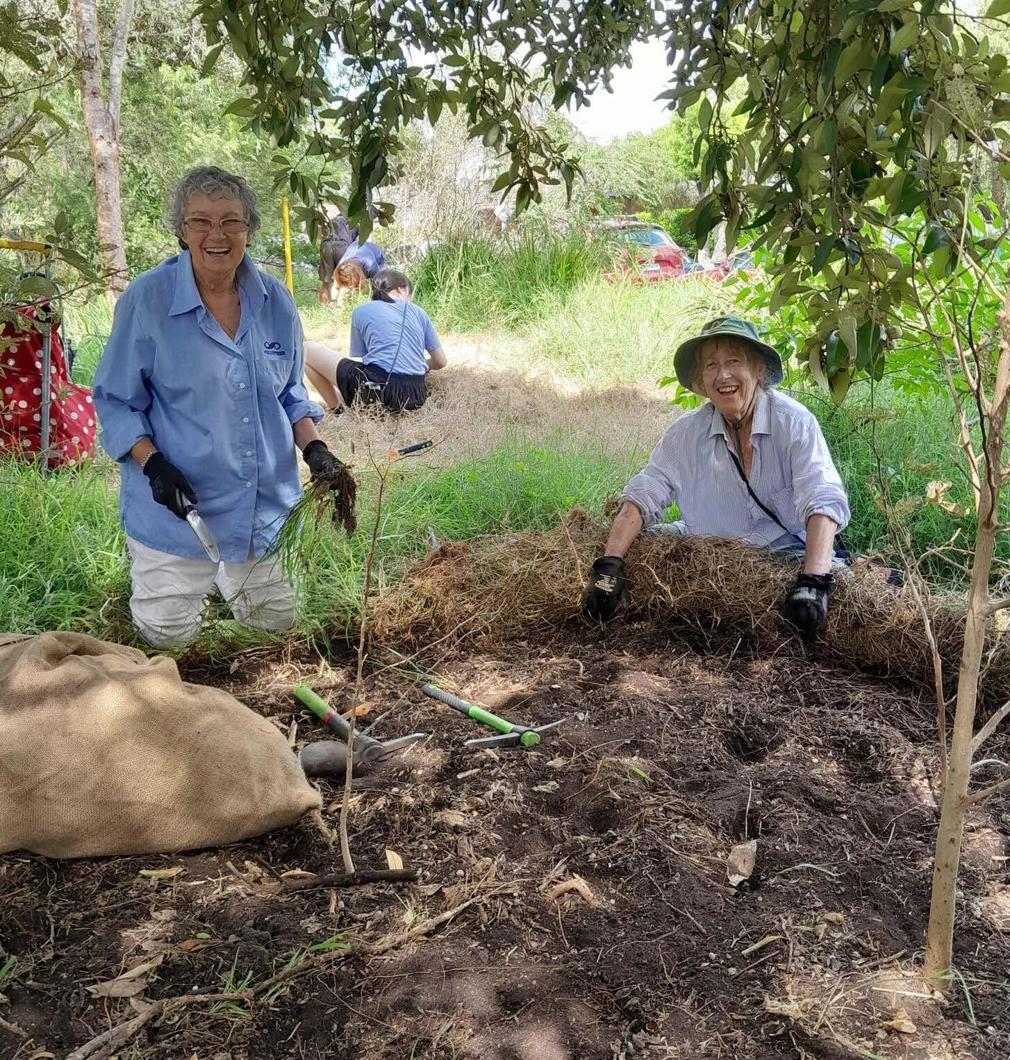
Council manages local biodiversity in partnership with community volunteers who provide regular Bushcare of Natural Areas across the Inner West.
Community Bushcare groups restore, maintain, and monitor areas of native habitat. At some sites, such as Camperdown Cemetery, volunteers protect rare examples of remnant indigenous bushland in the Inner West. There are currently 8 Community Bushcare groups in the Inner West working at 14 sites. Bushcare volunteers make an invaluable contribution to the Inner West community and the health of the local environment. In 2023-24, 119 bushcare events were held, with 700 volunteer attendances. This provided 1,708 hours of bushland restoration and maintenance work on sensitive ecological projects.
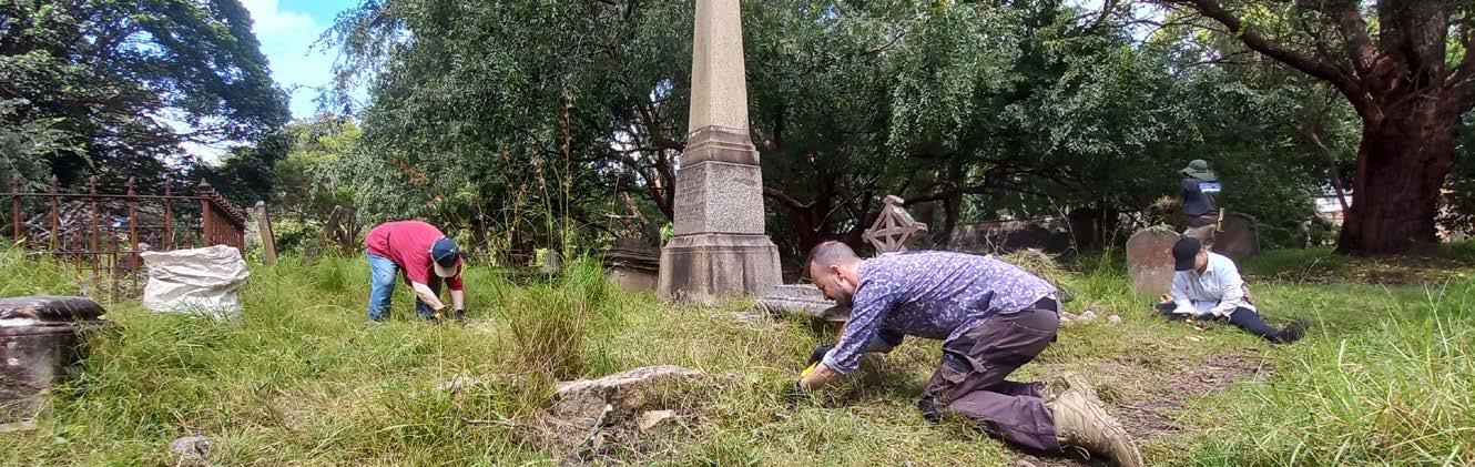
Profile of Camperdown Cemetery Community Bushcare Group
Camperdown Cemetery is home to one of the last remaining remnant patches of the critically endangered Sydney TurpentineIronbark Forest (STIF) ecological community. A unique and diverse assemblage of the STIF understory species remain intact and undisturbed by urban sprawl. It has been managed by the Friends of Camperdown Cemetery Bushcare group since the early 2000s.
Passionate Bushcare volunteers working to restore native bushland
3.7 Citizen Science
Citizen Science groups regularly meet to monitor species diversity and population trends in the Inner West. There are two birdwatching groups—Tempe Birdos and GreenWay Birdos—that conduct monthly surveys and provide publicly accessible data and resources about local bird species. The Inner West Microbat Monitors is another group that periodically meets to survey microbat populations. Inner West residents also participate in annual citizen science surveys such as Frog ID and the Aussie Bird Count.
These citizen science projects and events help to provide key biodiversity data for Council’s
ecology service. They also provide community education and engagement opportunities for children and adults alike.
3.8 Grants and Education
The Inner West Environment Grants program supports community projects that contribute to ecological sustainability in the Inner West. The grants provide up to $10,000 for projects that address biodiversity, healthy waterways, water sensitive urban design and other environmental issues. Recently funded grant projects have supported the rescue and rehabilitation of injured fauna, the construction of native gardens and habitat, and the creation of outdoor play and learning spaces to support education about urban ecology.
in 2016. The group meets fortnightly, along the GreenWay, to conduct surveys of birds in the local area and Bushcare sites. Their survey data is made publicly accessible in the Atlas of Living Australia and is used to help protect biodiversity in the Inner West. In 2021 the group developed an community resource, “A Photo Guide to the Birds of the GreenWay”. The group has completed over 180 surveys at 10 different sites in the LGA and regularly record over 30 species each survey.
Inner West Council provides educational resources for residents to improve ecological outcomes on their property. The ‘Water Sensitive Design on Your Property’ workshop introduces the principles of Water Sensitive Urban Design (WSUD) and instructs participants in how to build a water sensitive feature on their property. The Nature for Backyards guide provides advice for planning and maintaining native gardens that provide habitat for local wildlife.
3.9 Microforests
Given the urbanised nature of the Inner West local government area, and the limited space to create natural spaces, Council resolved to trial “Microforests”. These are small, densely planted pockets of native vegetation and are reported to add canopy cover, help reduce urban heat, and increase opportunities for habitat and biodiversity on small sites which had previously been underutilised.
There are currently 5 trial sites in the Inner West: two in Whites Creek Valley Parklands and one each in Tempe Reserve, Leichhardt Park, and Richard Murden Reserve. The Microforests are planted and managed by Council’s Urban Public Tree Management team.
• The Inner West ranks 16/29 for green cover in LGAs that are urban, compact, with highaverage rainfall.
• Hard surfaces (e.g. roads, roofs, and pavement) in the Inner West = 65.7%.
• Hard surface coverage has increased 2.3% since 2016.
• Green space in the Inner West = 34.3%.
• Most of the green space consists of tree canopy (19.3%) and grass cover (12.1%). Shrub cover is very low at 2.9%.
• Green space coverage has declined 2.4% since 2016.
• The Inner West has a very high challenge rating for maintaining and growing future green cover.
*Information sourced from RMIT Centre for Urban Research. Where will all the trees be?an assessment of urban forest cover and management for Australian cities
Figure 12. Green Cover in the Inner West *
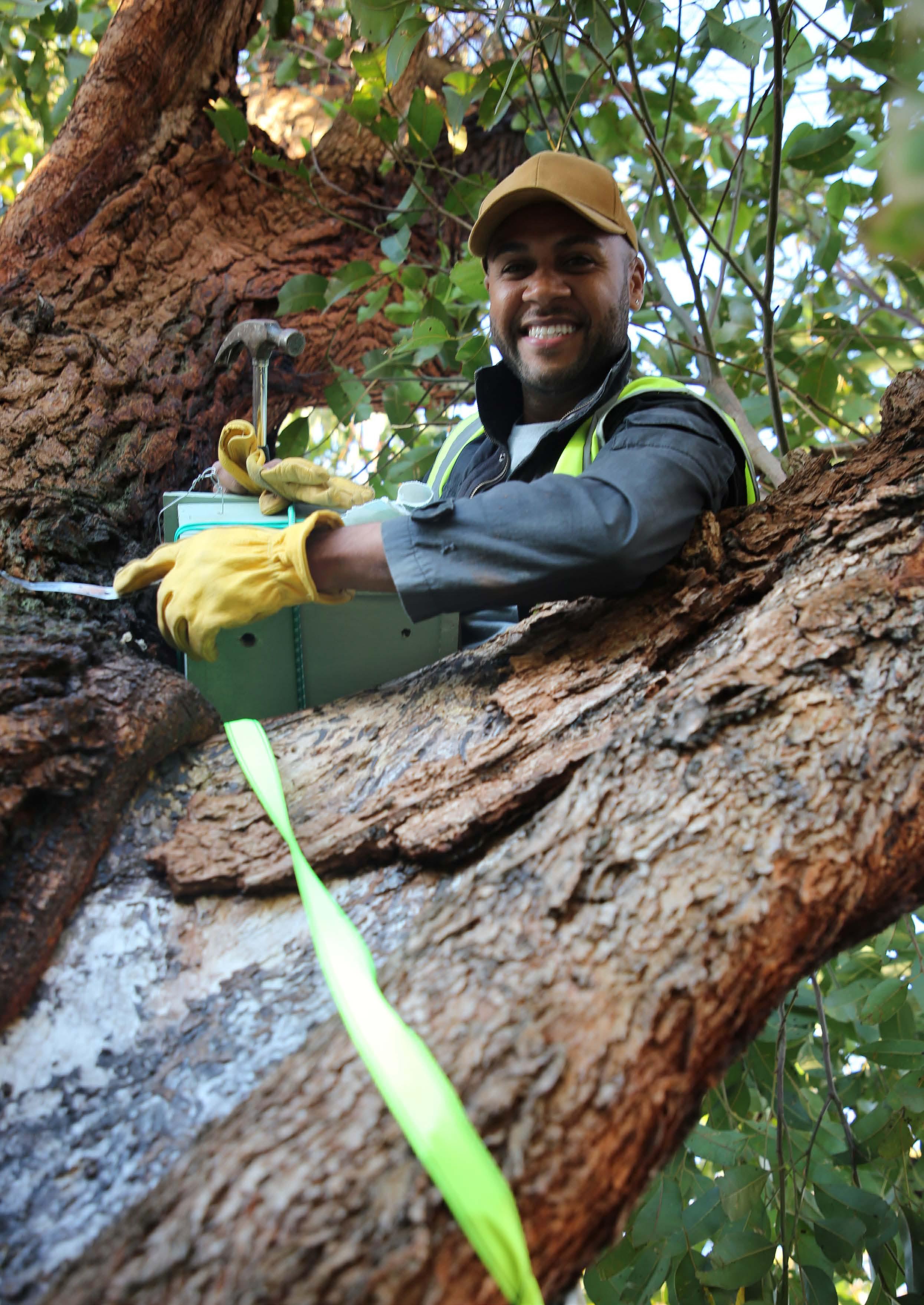
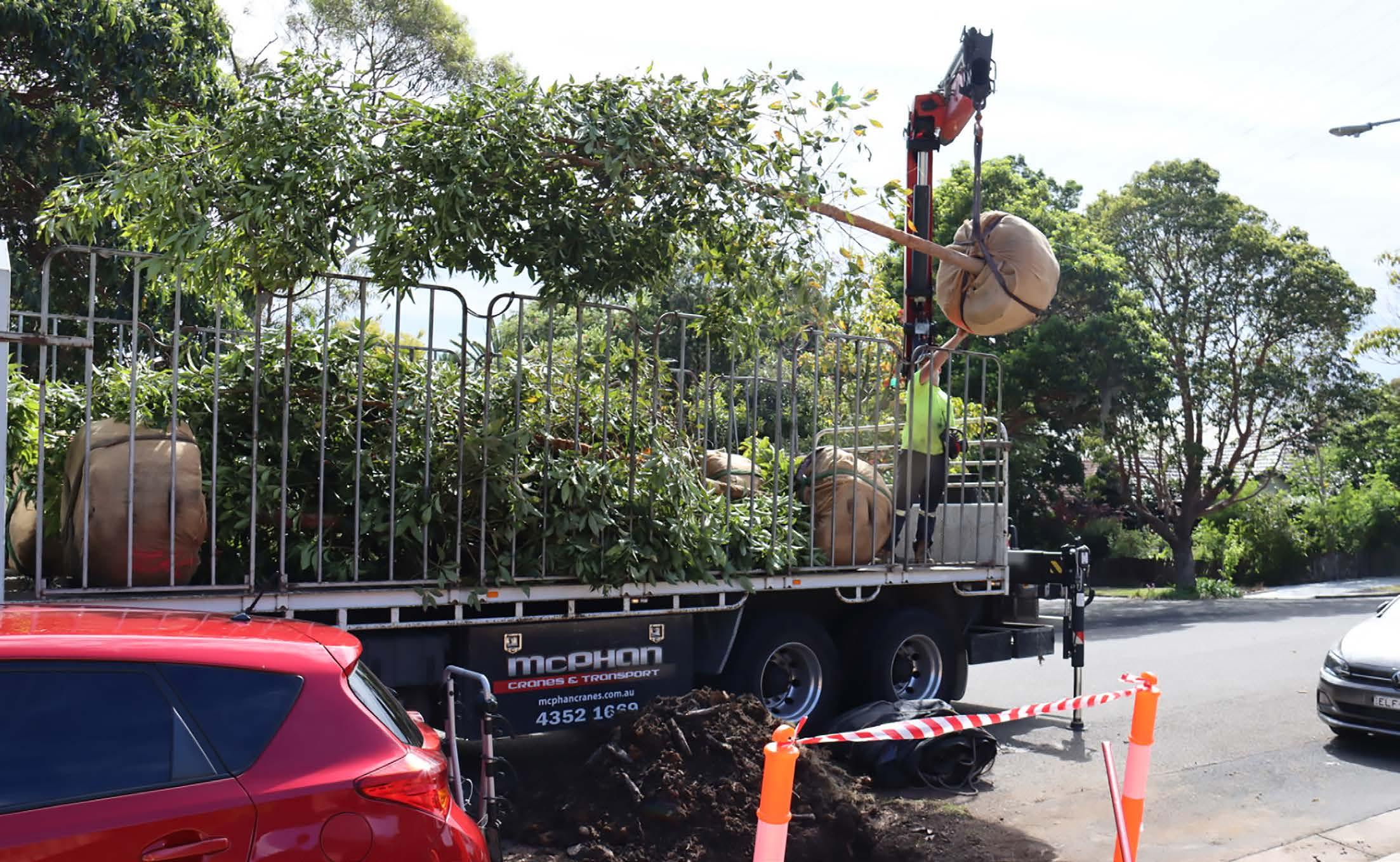
Inner West Council workers delivering trees
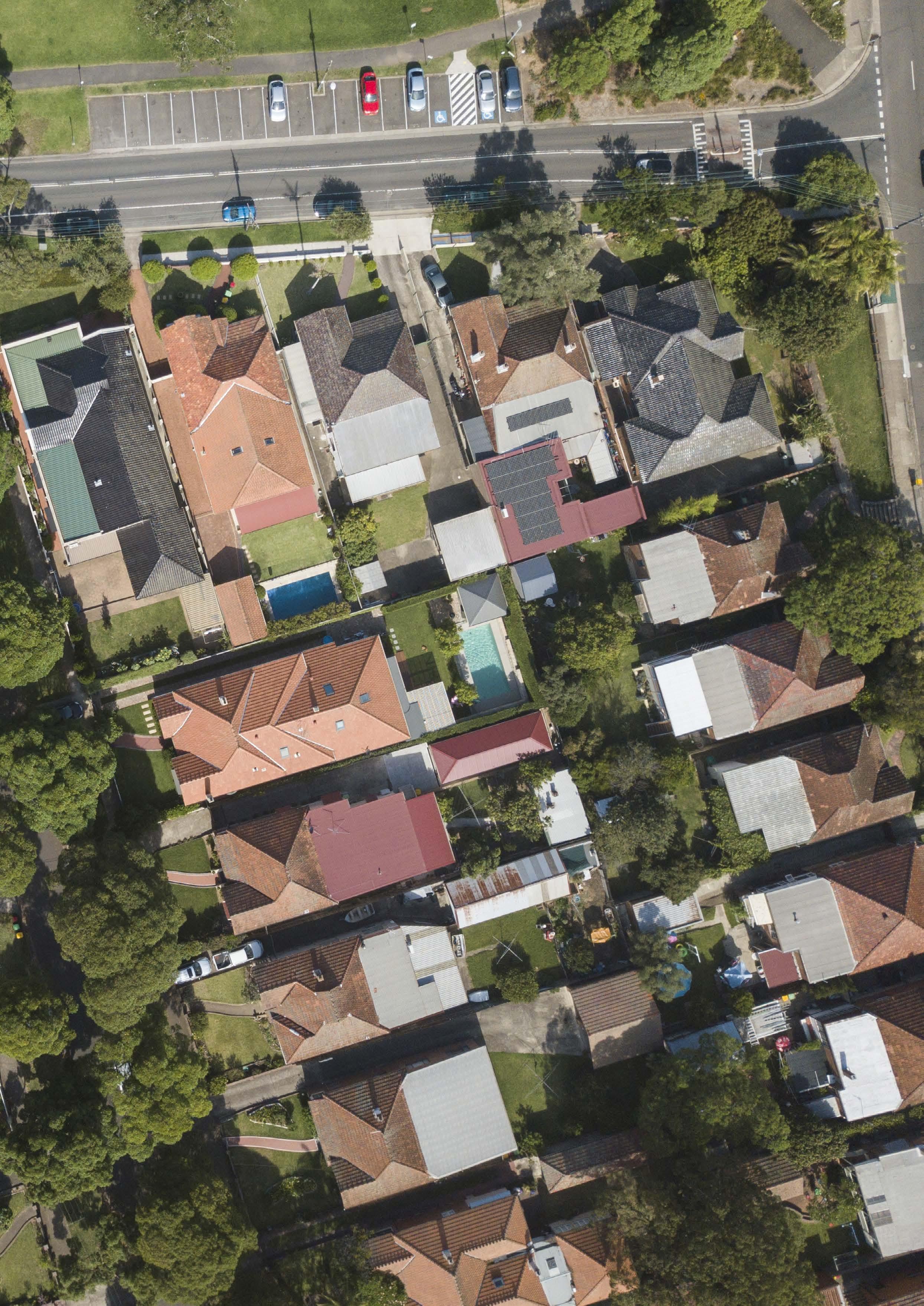
Aerial Shot of Haberfield demonstrating the contribution of backyard Biodiversity.
4 Biodiversity Planning Challenges and Opportunities
4.1 Population Growth and Service Demands
The Inner West LGA will have significant population growth in the next 10-15 years. By 2036, the resident population is projected to grow by around 20%.
Maintaining ecosystem health and liveability, while servicing the needs of a growing population, is a critical planning challenge for Inner West Council.
Population growth directly threatens biodiversity as urban development reduces the quantity and quality of existing habitat, and the land available for new habitat. New infrastructure typically leads to vegetation removal, habitat fragmentation, and increased pollution of Natural Areas and waterways.
Population growth also increases demand for the active and passive recreation opportunities provided by blue-green infrastructure. If demand outstrips supply, this can lead to over or misuse of the local environment, increasing the risk that Natural Areas and native species are directly harmed or degraded.
Tree and shrub cover is declining in the Inner West (Figure 12), and there is a clear shortfall in the provision of green open space. In 2019, the Inner West LGA had the second lowest amount of per capita green space in Greater Sydney. To keep up with population growth, and maintain the current standard, Council will need to add substanstially to the exisiting
stock of green space by 2036. Further decreases in the quantity and quality of blue-green infrastructure will negatively affect biodiversity and the health and wellbeing of Inner West residents. To address this challenge, Council needs to work with our community to protect green cover on private land and maximise the contribution public land makes to enhancing biodiversity.
4.2 Urban Consolidation and Densification
Dwelling targets set by the NSW Government to accommodate population growth require an increase in medium and high density development in the Inner West.
Protecting biodiversity, while increasing density, is a critical planning challenge that will affect the community’s access to nature and the ecosystem services it provides.
Higher density, in-fill development typically reduces the quantity and quality of habitat provided on private land. The loss of green cover can negatively affect liveability by reducing the supply of ecosystem services. It can also increase demand on waterways and Natural Areas as new residents seek a missing connection to nature.
To address the challenge of urban densification, Council will need to reduce the decline of green cover on private land. A combination of ‘land sparing’ and ‘land sharing’ techniques can be used to promote
development that is green and dense. New works on public land will also need to provide habitat for local species and create more opportunity for the community to connect with nature.
Theme 1: Increase biodiversity Actions
Recognise the Gadigal Bat Roost as a key threatened species habitat site and ensure ongoing protection and monitoring (1.1.1.5)
Identify key threatening processes to local biodiversity, mitigation strategies and natural recovery processes (1.3.1.3)
Maintain and monitor Microforest trial sites, assess for biodiversity (1.3.1.4)
Theme 2: Unite community Actions
Install ‘cues to care’ in appropriate Natural Areas to better inform and engage the community in the protection of valuable habitat zones, such as the Gadigal Bat Roost (2.1.2.4)
Theme 3: Lead by example Actions
Review existing policies, strategies, and Plans of Management (PoM) to ensure biodiversity outcomes are prioritised and identify on ground actions that have not yet been realised (3.1.1.2)
Investigate suitable planning controls, policies, projects, targets, or incentives to:
a. Reduce decline of habitat on private land
b. Protect and increase mid/low-storey vegetation cover
c. Establish a “Greenweb” program to identify existing vegetation links.
d. Improve management of transition zones between Natural Areas and parks/streetscape
e. Advise on the financial value of blue-green infrastructure (3.2.1.1)
Land Sharing and Land Sparing Strategies to Achieve Green and Dense Urban Areas
Land Sparing: balancing the ratio of built area to blue-green space in urban areas
• Preserve remnant patches
• Maintain riparian corridors
• Create managed parks
• Build home gardens and backyards
• Create stormwater green infrastructure
Land Sharing: integrating greenblue space into the built area.
• Greening vacant lands
• Install green roofs and facades
• Increase perimeter vegetation
• Increase vegetation along streets and right of way.
4.3 Climate Change
Climate change will transform environmental conditions in the Inner West and increase the frequency and intensity of extreme weather events. Without adequate planning, the predicted impacts will harm local biodiversity, erode ecosystem services, and reduce Council’s ability to provide and maintain green open space. This would reduce liveability and increase the vulnerability of community health and wellbeing. Increasing the resilience of biodiversity is a critical planning challenge for the Inner West that will affect our ability to mitigate and adapt to climate change.
Climate change is a major driver of biodiversity loss in cities and may seriously disrupt the Inner West’s blue-green infrastructure. The Inner West has 73 parks in foreshore, creek, and river corridors that may be damaged by rising sea levels and extreme flood events. Climate change is predicted to negatively affect the health of 96% of Sydney’s tree species, threatening the sustainability of the Inner West’s Natural Areas.
Although climate change is a major threat to biodiversity, biodiversity can also be planned and managed to enhance the Inner West’s resilience to climate change. Protecting and enhancing biodiversity presents opportunities for Council to expand its inventory of climate actions and develop biodiversity as a mitigation and adaptation solution.
Theme 1: Increase biodiversity Actions
Review local impacts of climate change on biodiversity and natural assets to identify knowledge gaps and mitigation methods (1.3.2.2)
Theme 3: Lead by example Actions
Establish best practice
4.4 Land Management for Biodiversity
Population growth and densification strengthen the need to enhance the quantity and quality of habitat on Council-owned land. Multi-purpose management of recreational land is an established trend in open space planning. However, steps must be taken to ensure managing land for biodiversity, and ongoing community uses, is complimentary.
Designing multi-functional green spaces, where increasing habitat is compatibly managed with other land uses, is an important role of Council.
The design and management of urban green space greatly affects its capacity to support biodiversity and provide ecosystem services. Because blue-green infrastructure provides a wide range of functions, it is often subject to competing objectives and management practices that can limit biodiversity outcomes.
Quality native habitat can appear messy and unmanaged compared to manicured landscapes in public
parks or private gardens. This can lead people to think they are uncared for, creating demands to ‘clean up’ Natural Areas in ways that negatively affect their biodiversity values. Conventional landscape maintenance can also harm biodiversity if it is not effectively managed. Turfgrass maintenance, pesticide application, and removing leaf litter and woody debris are common horticultural practices that can harm local fauna and reduce the ability of green spaces to support biodiversity. Council can enhance the multi-purpose management of green open space with design, maintenance and community education actions. Providing more “cues to care” in sensitive areas, for example, can reduce maintenance conflicts and show the community that native habitat in the Inner West is valuable and actively cared for.
Theme 1: Increase biodiversity Actions
Utilise Council’s Community Native Nurseries to provide locally native plants to a mid-storey and ground cover planting program to improve habitat quality on suitable Council-owned land (1.1.1.3)
Plan for the loss and adaptation of identified Natural Areas to sea level rise scenarios (1.2.2.4)
Theme 2: Unite community Actions
Work in partnership with citizen science, environmental and Bushcare groups on the collection and integration of data with proposed Council managed databases (2.1.1.2)
Theme 3: Lead by example Actions
Develop and deliver Biodiversity Training for Council staff (3.1.2.3)
Include Natural Areas and Waterways in open space and recreation needs analyses (3.1.2.4)
Keep an eye out for Cues to Care
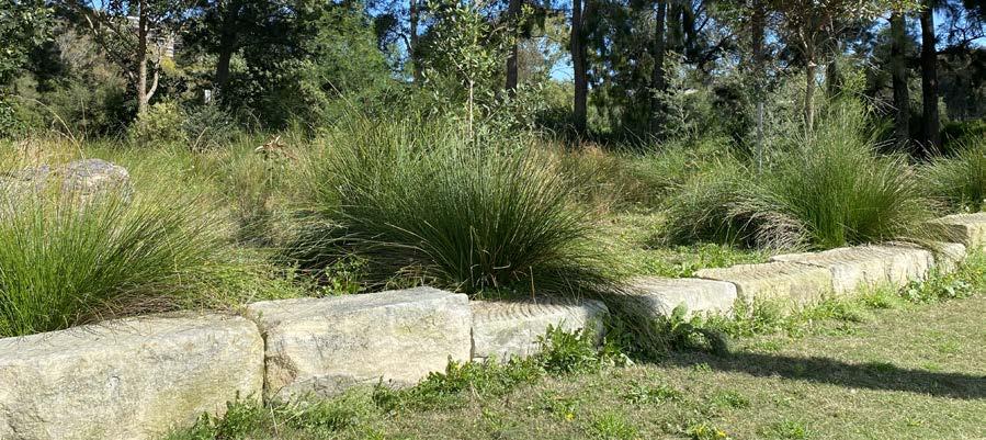
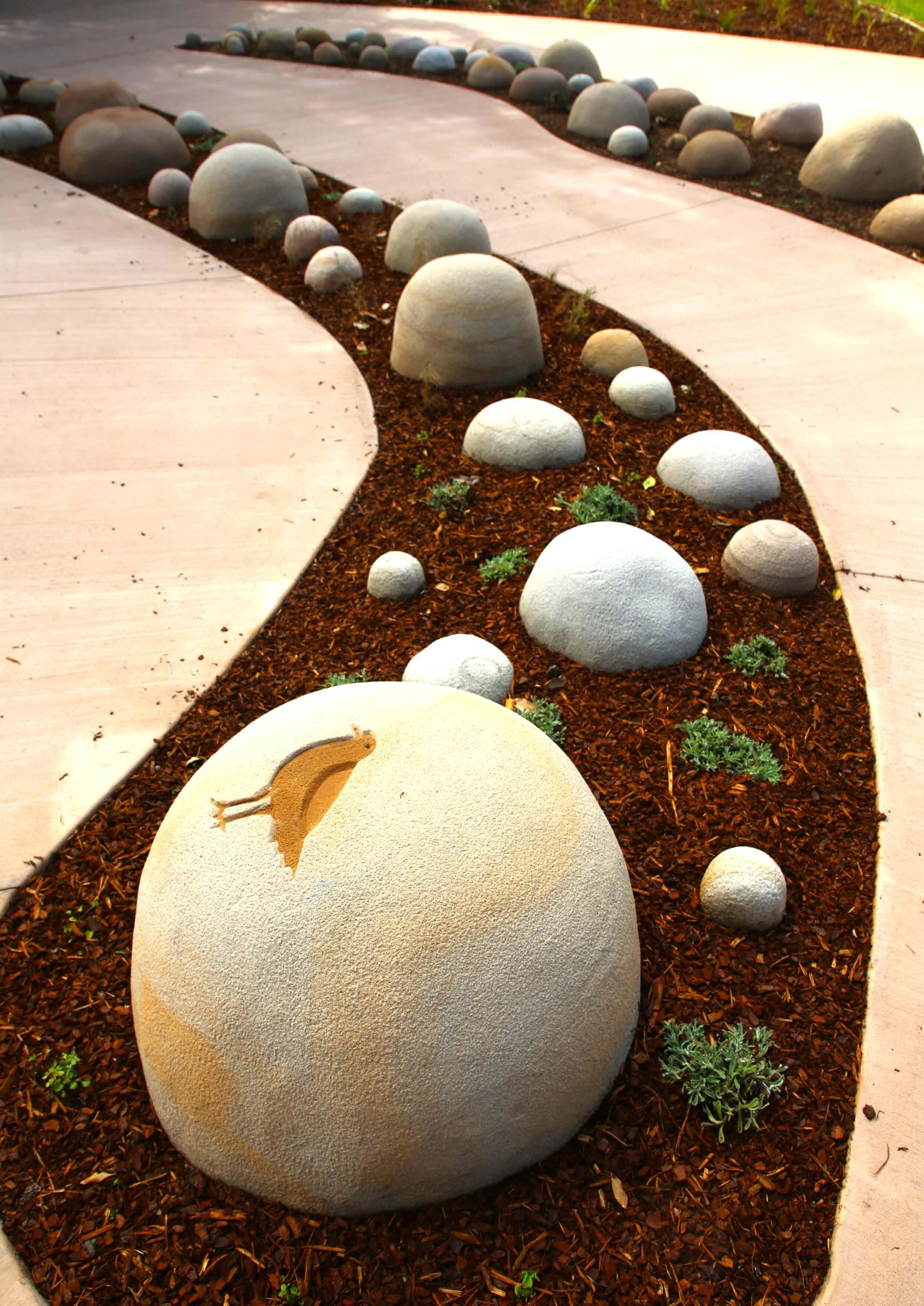
How do you know when you're moving out of landscaped public areas into Natural Areas? Keep an eye out for:
Signage Fencing and edging
Mown borders and buffer planting
Seating and viewing areas
Can you see where to take care?
Aboriginal Culture in the Fabric of our Society
The Inner West is located on the unceded lands of the Gadigal and Wangal clans of the Eora nation. Gadi (gal) territory centres around Sydney Harbour, the Eastern Suburbs, South to the River’s mouth and west up to Petersham area. Wan (gal) territory includes the Balmain Peninsula and extends west between Burramattagal (Parramatta River) and the Cooks River.
Prior to colonisation, fishing was a central part of Gadigal and Wangal life on the rivers, with the Wangal practicing aquaculture and agriculture upstream of the Inner West. Our creeks and saltmarsh were a rich source of shellfish and waterbirds. The Floodplain and Turpentine-Ironbark Forests in the Inner West contained extensive hunting grounds and supplied raw materials for medicine, storage, shelter and canoe building.
The Gadigal and Wangal managed Country in a systematic and regenerative manner. This was informed by a thorough understanding of local species and their interaction with water flows, seasons and weather patterns represented in the D’harawal Calendar. Fire is an important ceremonial and land management tool employed to manipulate plants and create new ecosystems for cultivation purposes. Cultural burns use cool, low-intensity fire to modify and regenerate the landscape and maintain ecological health.
The colonisation and urbanisation of Inner Sydney has had devastating impacts on the Eora nation and
Country. The Gadigal and Wangal suffered unjustly, were forced to leave their Country by violent dispossession of land, introduced diseases, industrial and urban development, and the segregation imposed by Aboriginal ‘protection’ programs. These events caused long-term harm to Gadigal and Wangal language, culture, and kinship systems, which supported the health of the environment and Aboriginal people.
Despite the destructive impacts of first contact, Aboriginal people continued to live in the Inner West and were part of the region’s earliest industries – fishing and lime-kiln – on the Cooks River and Gamay (Botany Bay). They were later joined by Aboriginal migrants from rural NSW, who moved to Sydney as Aboriginal Protection Board reserves were closing in the mid20th century. New and returning Aboriginal residents faced racial discrimination, and their struggle for social justice continues today.
Although the Inner West landscape has been radically transformed, Aboriginal people maintain a vital connection to the local environment. In urban areas, Country lies dormant under concrete and roads and can be revitalised with the correct approach. Our parks and river corridors contain Aboriginal heritage sites, provide places for connection to Country, and support ancestral identity and belonging. They also host memorials to Aboriginal
Survival, and the Wayfinding art project that celebrates Gadigal and Wangal culture.
These connections support Aboriginal custodianship for the cultural and natural heritage of the Inner West. The Aboriginal and Torres Strait Islander community Care for Country in multiple ways, including partnerships with Council.
Indigenous Australians have strong relationships to urban ecosystems arising from spiritual beliefs and kinship with plants and animals. There is a deep connection to Country, and a responsibility to Care for Country. Protecting and enhancing urban ecosystems enables this connection to continue. By learning, valuing and understanding the natural world we can acknowledge and appreciate Aboriginal culture in the fabric of our society.
D'harawal Calendar
Burran
Hot and dry
January - March
Male kangaroos aggressive
Meat forbidden
Weetjellan blooming
Marrai'gang
Wet becoming cool April-June
Quolls seeking mates
Lillypilly ripens
Burrugin
Cold and frosty| June-July
Echidna seeking mates
Burringoa flowering
Shellfish forbidden
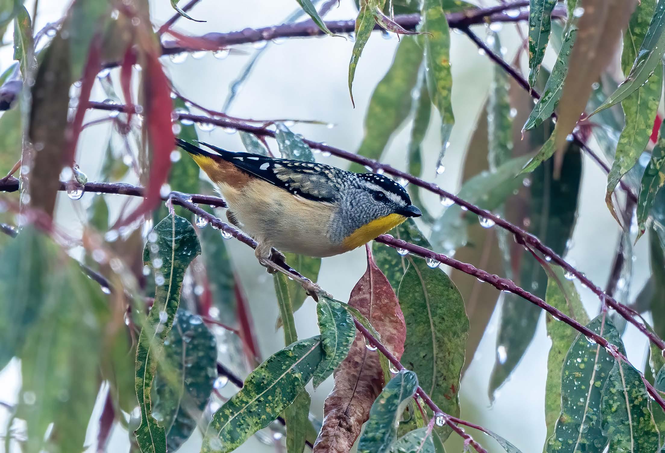
Spotted Pardalote (Pardalotus punctatus)
Wiritjiribin
Cold and windy
July-August
Lyrebird building mounds
Marrai'uo flowering
Boo'kerrikin flowering
Gentle spring rains
Ngoonungi
Cool becoming warm September-October
Flying foxes appear Ceremonial time
Miwa Gawaian in flower
Parra'dowee
Warm and wet
November-December
Summer heat starts Stable weather
Caring for Country: Aboriginal and Torres Strait Islander Partnerships with Inner West Council Urban Ecology Team
1. Caring for Country project with Gunawirra at Richard Murden Reserve, Lilyfield
The Yarning Mothers program is supported by IWC for co-management of an established Natural Area. Aboriginal people access and Care for Country, which involves bushcare and cultural activities such as selective harvesting, replanting, and regenerating endemic plants on Country. The program empowers co-design on best practise methodologies incorporated into an annual action plan.
2. Natural heritage tours of Gadigal and Wangal Country
The Aboriginal and Torres Strait Islander community and Elders co-lead Natural Areas tours with Council. This includes the First Nations and Natural Heritage Tour of the Gumbramorra Swamp for the Inner West
Heritage Festival 2024. These tours are organised in partnership with the Inner West Council’s Library and History Services, and the Creative Communities Team, for Edge Festival, Footprints Festival and Heritage Festival.
3. Ecological Management of Aboriginal Cultural Heritage sites
Council collaborates on the management of cultural heritage sites, including middens, freshwater flows, and natural feature sites. This includes the propagation of endemic plants, plant lore, restoration of indigenous plants to pre-1750 vegetaion communities to repair Country, celebrate continuity of culture, and unlock cultural stories that may be shared with the wider community.
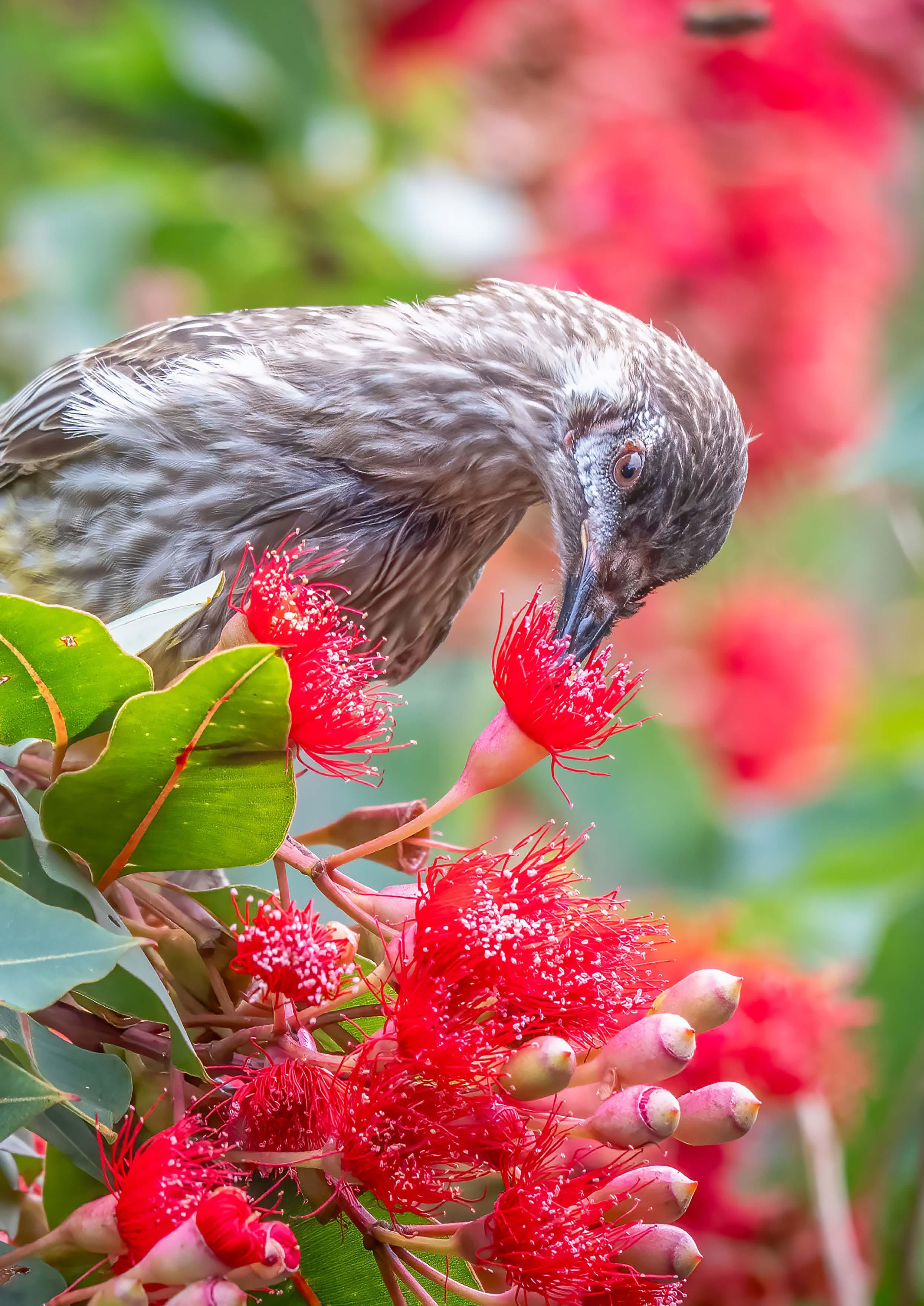
Red Wattlebird (Anthochaera carunculata)
5 The Urban Ecosystem of the Inner West
Historical and Regional Context
The Inner West is located in the southern and eastern reaches of the Cooks River and Parramatta River catchments. These river catchments form the northern and southern boundaries of the Inner West LGA. Both rivers are estuarine systems in the Inner West. They receive water from a modified network of tributaries that include Whites Creek, Hawthorne Canal and Iron Cove Creek.
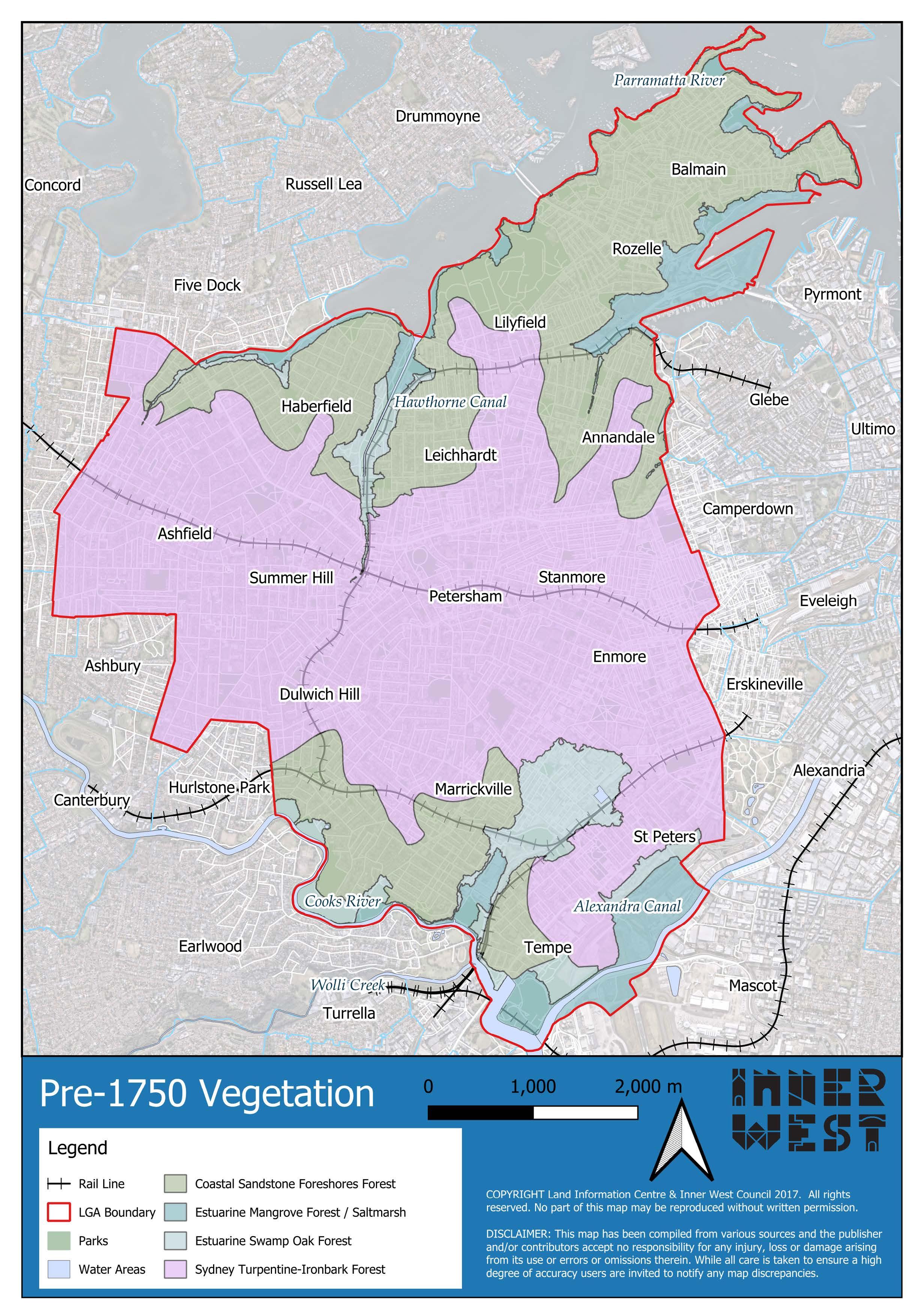
Prior to European colonisation, the Gadigal and Wangal managed multiple vegetation communities that were spread across the Inner West (Map 1).
Tidal mudflats, saltmarshes, and mangrove forests fringed the foreshores of the Southern LGA boundary and created an extensive estuary connecting the Cooks River to Botany Bay. The Floodplain Forest of Swamp Oaks and salt-tolerant sedges preferred the wetlands and low-lying areas along the major waterways. They were found through Tempe, Marrickville, and the Hawthorne Canal from Summer Hill to Iron Cove.
Coastal Sandstone Forest was the dominant vegetation community in the northern suburbs, extending from Haberfield along the higher elevations through to the Balmain Peninsula, where sandstone escarpments fell to Estuarine Reedlands. It was also found on the sandstone valley moving north and west from the Cooks River into Marrickville and Dulwich Hill. Here,
shrubby heath grew on the dry, shallow soils of ridges and exposed rock platforms.
Sydney Turpentine-Ironbark Forest is now an Endangered Ecological Community, but it once covered the Inner West from Croydon to St Peters. These well-drained forests often had a grassy understorey. The area between Newtown and St Peters was a Kangaroo Ground managed by the Gadigal and Wangal for hunting.
The Turpentine-Ironbark Forest included the iconic Gumbramorra Swamp. This system of freshwater and brackish wetlands spread across Sydenham and Marrickville up to Addison Road. The Gumbramorra Swamp was likely a popular campsite for the Gadigal and Wangal because of the freshwater and abundance of resources.
5.1 Flora
The Inner West has a variety of plants and vegetation types on public and privately owned land across the LGA (Figure 8).
There have been 477 flora species recorded in the Inner West since 2014. Just under half of these species are native to NSW (229). The remaining 248 species are from other Australian states or international regions.
Our urban forest is one of the Inner West’s largest vegetation assets. Council manages 75,000 trees in public parks and streets. Total canopy cover for the LGA was between 17-19% in 2020-21. However, it is unevenly distributed across
the Inner West’s suburbs and land tenures (Map 2). Although Council is increasing public tree canopy, tree removal on private land is driving an overall decline in urban forest cover. 72% of the Inner West’s suburbs lost tree canopy between 2020-21. To support biodiversity, each vegetation layer is required. Increasing the volume of native groundcover, shrub, and understorey vegetation is one of the most effective ways to increase the diversity and abundance of urban fauna. This type of vegetation is currently low and declining in the Inner West. Between 2016-2020, shrub cover in the Inner West declined by 0.7% to only 2.9% of the LGA. Groundcovers and shrubs are the least common, and most degraded, type of vegetation in the Leichhardt and Balmain wards’ green spaces. The restoration of the Inner West's vegetation communities provides the most valuable biodiversity asset in the LGA. The vegetation communities in the Inner West are called:
Degraded remnants and revegetation sites of these vegetation communities can be found in the Inner West’s Natural and Priority Biodiversity Areas.
Figure 8.
These areas support the conservation of Endangered Ecological Communities (EECs) and preserve an important part of the Inner West’s natural and cultural heritage conservation. These areas are of high biodiversity significance, and they also supply Council’s community nurseries with provenance seed stock for propagation of indigenous species. This is critical to the success of ecological restoration and ongoing community engagement on biodiversity.
To enhance biodiversity in the Inner West, Council will develop measures that aim to improve the coverage and condition of our native flora. This includes actions for new planting and monitoring, as well as investigating planning options for vegetation on public and private land.
5.2 Fauna
Theme 1: Increase biodiversity Actions
Install carved tree hollows/nest boxes in suitable parks and Natural Areas (1.1.1.2)
Audit currently installed nest boxes, map all locations and assess whether in use by native animals (1.3.2.3)
Theme 2: Unite community Actions
Develop concept plans for a bird watching hide at the Dibble Avenue Waterhole (2.1.1.4)
Theme 3: Lead by example Actions
Include Natural Areas and Waterways in open space and recreation needs analyses (3.1.2.4)
The Inner West is home to a range of wildlife that includes amphibians, reptiles, birds, mammals, and aquatic and invertebrate species of which much less is known.
There has been 217 fauna species recorded in the Inner West since 2014. Compared to the five neighbouring council areas, the Inner West has the third lowest fauna diversity. It has substantially fewer species than the smaller and more densely populated City of Sydney.
The vast majority (198) of fauna species in the Inner West are native to Australia. The most successful are usually mobile and urban-adapted species that are not easily deterred by human presence. Birds are our most abundant fauna group, with 140 species recorded in the BioNet Atlas and previous surveys for Council. Most of our fauna species could be considered uncommon or rare in the Inner West, and some are threatened or protected migratory species (Figure 18). Threatened fauna include 14 bird and bat species, plus an endangered population
of Long-nosed Bandicoot. Most of the threatened species in the Inner West have small populations and are extremely vulnerable to urban development and other environmental threats.
Consultation with the community consistently raised the need to address the impact of domestic animals. Pet cats kill many millions of native animals each year at a rate that is 25-52 times higher than feral cats in natural environments. The presence of pet dogs in Natural Areas is associated with lower bird diversity and abundance.
Improving the quantity and quality of native flora in the Inner West will benefit many of our native fauna species. However, Council can develop additional measures that would help increase fauna diversity, and enhance the resilience of threatened, uncommon or rare species in the Inner West. This includes artificially improving important habitat features (e.g. tree hollows), developing a monitoring program for priority species, and investigating options to reduce the impact of major environmental threats to vulnerable species.
Theme 1: Increase biodiversity Actions
Complete mapping and condition reporting on threatened species and Endangered Ecological Communities (EEC) (1.3.2.1)
Develop monitoring programs for target/indicator species to measure ecosystem health, habitat value and species richness/diversity (1.3.1.1)
Theme 2: Unite community Actions
Develop an education program on the threatened and unique species of the Inner West and habitat creation (2.1.2.2)
Theme 3: Lead by example Actions
Investigate solutions to risks posed by domestic animals to local wildlife (for example potential curfews for domestic pets close to Priority Biodiversity Areas, Catch, Neuter and Release programs etc.) (3.1.1.1)
Facilitate local research opportunities through external agencies, such as universities, CSIRO etc., to improve knowledge and foster innovation in the urban ecology sector (3.2.2.4)
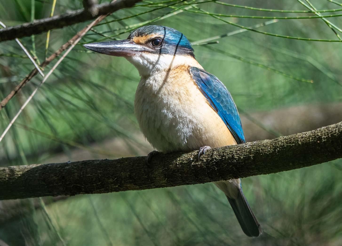
Sacred Kingfisher (Todiramphus sanctus)
Figure 18.
in the Inner West (2007 - 2024)
Threatened Species (Recorded in Field Surveys: Confirmed, Probable, or Predicted)
* Not recorded in field survey or BioNet after 2010. Stated years are the year of last recording
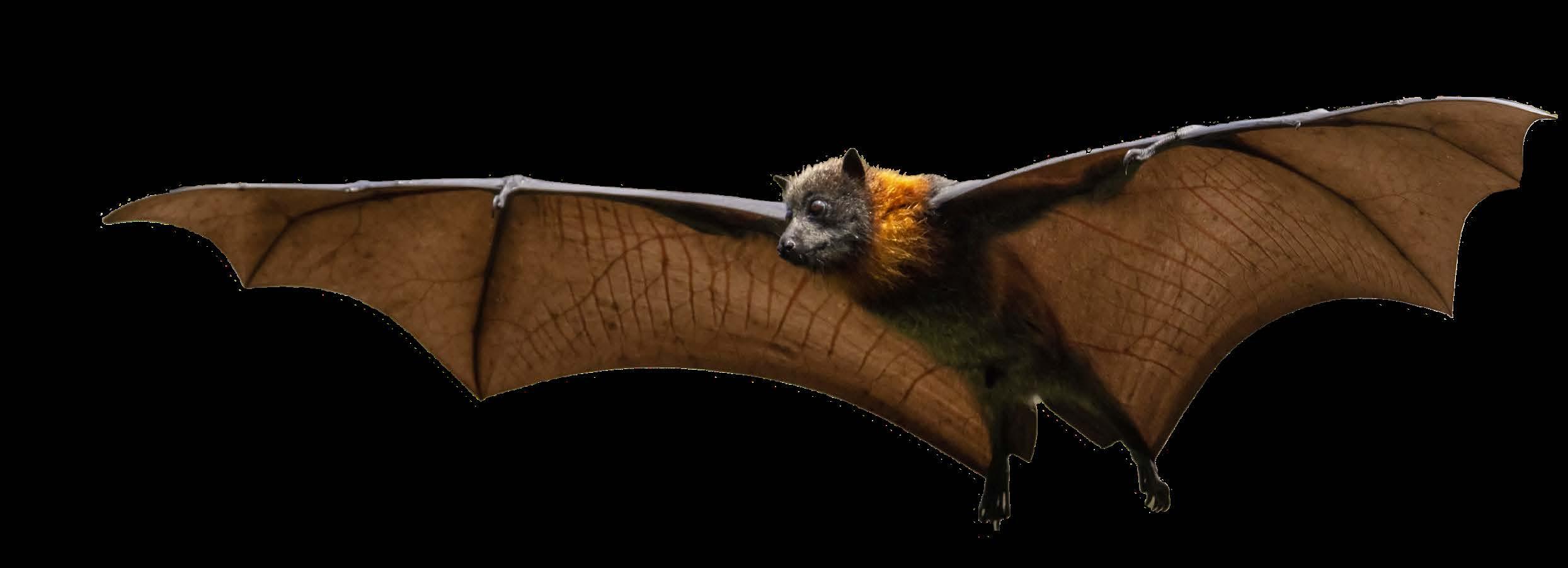
Grey-headed Flying-Fox (Pteropus poliocephalus)
5.3 Waterways
The Inner West sits across two catchment areas, the Parramatta River Catchment and the Cooks River Catchment (Map 3). Across these two catchments a wide variety of riparian and water habitat types are present, including creek lines, rivers, coastal areas and wetlands. Local animals, plants and fungi depend on these for survival in the urban environment.
Much of the Inner West’s creeks have been re-routed, piped or channelised throughout the 1900s and reclassified as “stormwater drains”. This was done with the goal of quickly moving water away from the land to reduce flooding and flush out pollutants.
Unfortunately, this has removed many of the natural processes that alleviate these issues. Natural catchment features, such as wetlands and riparian vegetation, normally act as a sponge by retaining the water in the landscape for longer periods of time. This prevents flooding, filters pollutants , and slowly releases water to ensure flows continue through dry periods. One example of this is the Gumbramorra Swamp, a wetland expanding across much of today’s Marrickville and Sydenham. Before colonisation this brackish and freshwater swamp’s expanse would vary depending on the season and rainfall patterns, doubling in size during wet periods. In the present day, the water has been redirected into concrete drains and
a concrete overflow pit. The area now experiences frequent flooding and erosion, with no natural ‘sponge’ to soak up the water.
Five wetlands are currently managed by Council: Dibble Waterhole, Blackmore Park Wetland, Tempe Wetland, Whites Creek Valley Park Wetland and Peter Bulger Wetland in Camdenville Oval. These areas have been restored to have higher biodiversity values. The only remaining sandbar island in the Cooks River, Fatima Island, provides critical nesting habitat for sea birds. One natural creek line remains, tucked behind Hercules Street in Dulwich Hill.
Increasing riparian habitat, reducing pollutants and restoring the natural water regime is a key element to improving local biodiversity, as well as reducing erosion, flooding and improving water quality. This can be through bank naturalisation, rainwater harvesting, incorporation of Water Sensitive Urban Design (WSUD) in developments, reducing hard surfaces and improving/ increasing wetlands and rainwater gardens.
Theme 1: Increase biodiversity Actions
Support residents looking to install rainwater harvesting systems through the Rainwater Tank Rebate Program (1.2.1.2)
Review Council managed rainwater gardens and swales to assess current conditions and effectiveness (1.2.1.3)
Investigate opportunities to naturalise channelised waterways and reduce stormwater runoff (1.2.2.1)
Develop a River Report Card system for monitoring and reporting water quality throughout the LGA (1.3.1.2)
Theme 3: Lead by example Actions
Collaborate with external agencies (such as Sydney Water, Transport for NSW, Local Land Services, and other local Councils) and participate in regional partnerships (such as SSROC, Parramatta River Catchment Group and the Cooks River Alliance) (3.2.2.1)
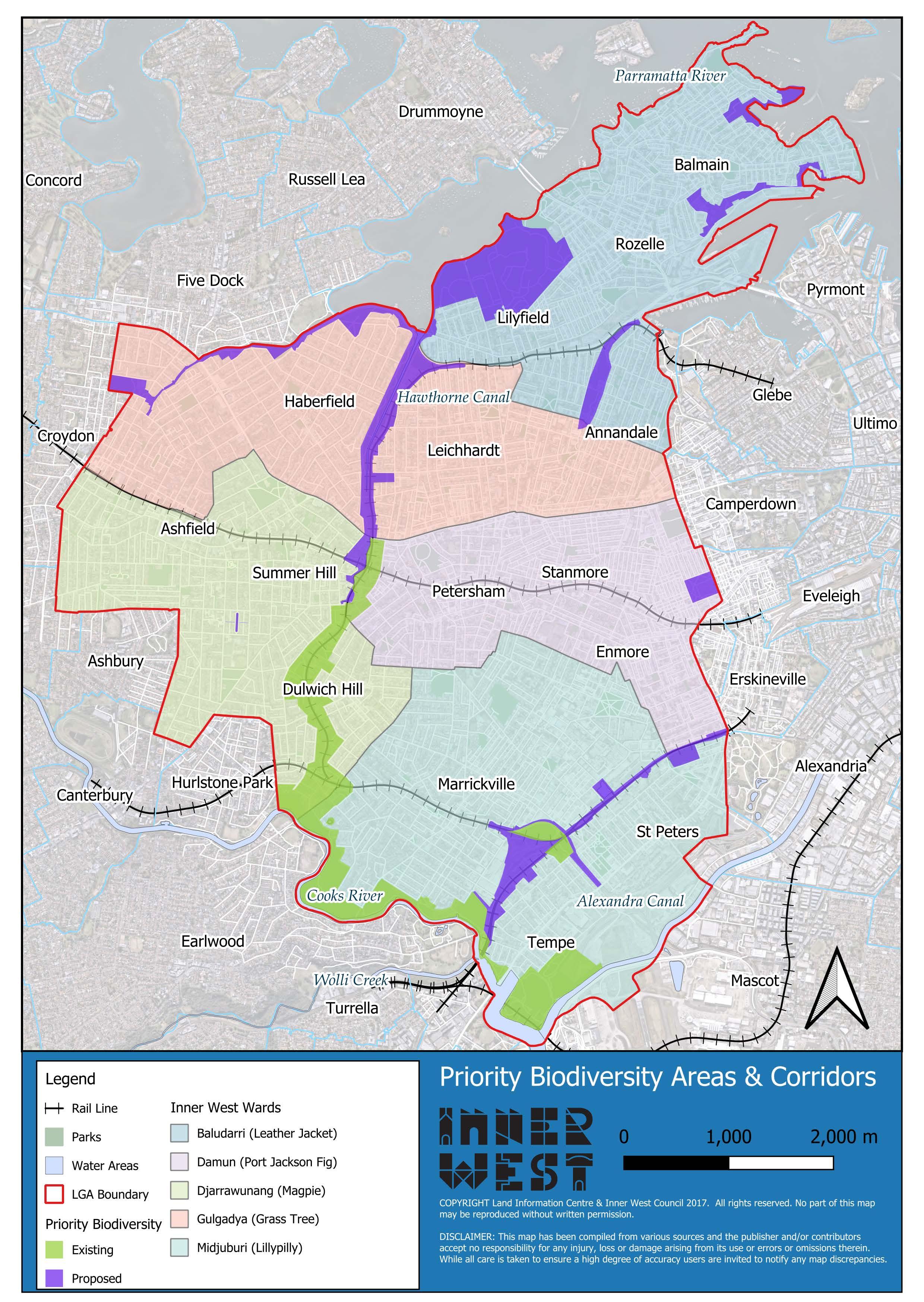
5.4 Priority Biodiversity Areas
The Inner West has key Priority Biodiversity Areas (PBAs) that contribute to habitat connectivity, conservation of species and deliver improved ecosystem services through nature regenerative land managment. Five of the PBA's form a corridor that links the Iron Cove to Alexandra Canal, following the Greenway and The River Corridor at the southern end of the Inner West (Map 4). The PBAs are defined in the Inner West Local Environmental Plan and include public and private land. Significant restoration and maintenance work has been completed in the PBAs as part of Inner West Council’s Natural Areas Program. Community volunteers are central to the rehabilitation of PBA sites. Community-led work on the GreenWay began in 1977, and there are currently 11 community bushcare sites across the PBAs.
The PBAs help build habitat connectivity and support the protection and regeneration of the Inner West's vegetation communities. They also provide critical habitat features that are often missing from the wider LGA. This includes nectar producing trees, coarse woody debris, sandstone rocks and crevices, publicly inaccessible areas of dense woody weeds and native shrubs, and artificial structures (e.g. culverts and bridges) that provide roosting habitat.
The PBAs provide invaluable refuges for native fauna in the Inner West. Mobile and urban adapted species of birds, bats, and lizards are likely the most common fauna. However, the PBAs also provide critical habitat for a range of threatened and rare fauna species in the Inner West.
The biodiversity values present in the PBAs suggests the concept could be expanded to other parts of the Inner West. The PBAs are concentrated in the South of the LGA, and there are other locations with Natural Areas that have been identified as potential local and regional biodiversity corridors (e.g. Balmain Peninsula).
Creating new PBAs would support Outcome 1.2.3 in the Community Strategic Plan and Action 3.1. in the Inner West Local Strategic Planning Statement. Council will also develop further initiatives to strengthen the monitoring and condition of habitat values in the PBAs.
Theme 1: Increase biodiversity Actions
Explore potential for additional Priority Biodiversity Areas land designation to other valuable ecological sites in the broader LGA (1.1.1.1)
Appreciate and protect existing natural riparian zones such as the unnamed Hercules St creek line and Mort Bay ephemeral creek (1.2.2.2)
Theme
3: Lead by example Actions
Recognise Callan Park and Marrickville Golf Course as significant biodiversity refuges and collaborate with land managers to protect remnant habitats (3.2.2.3)
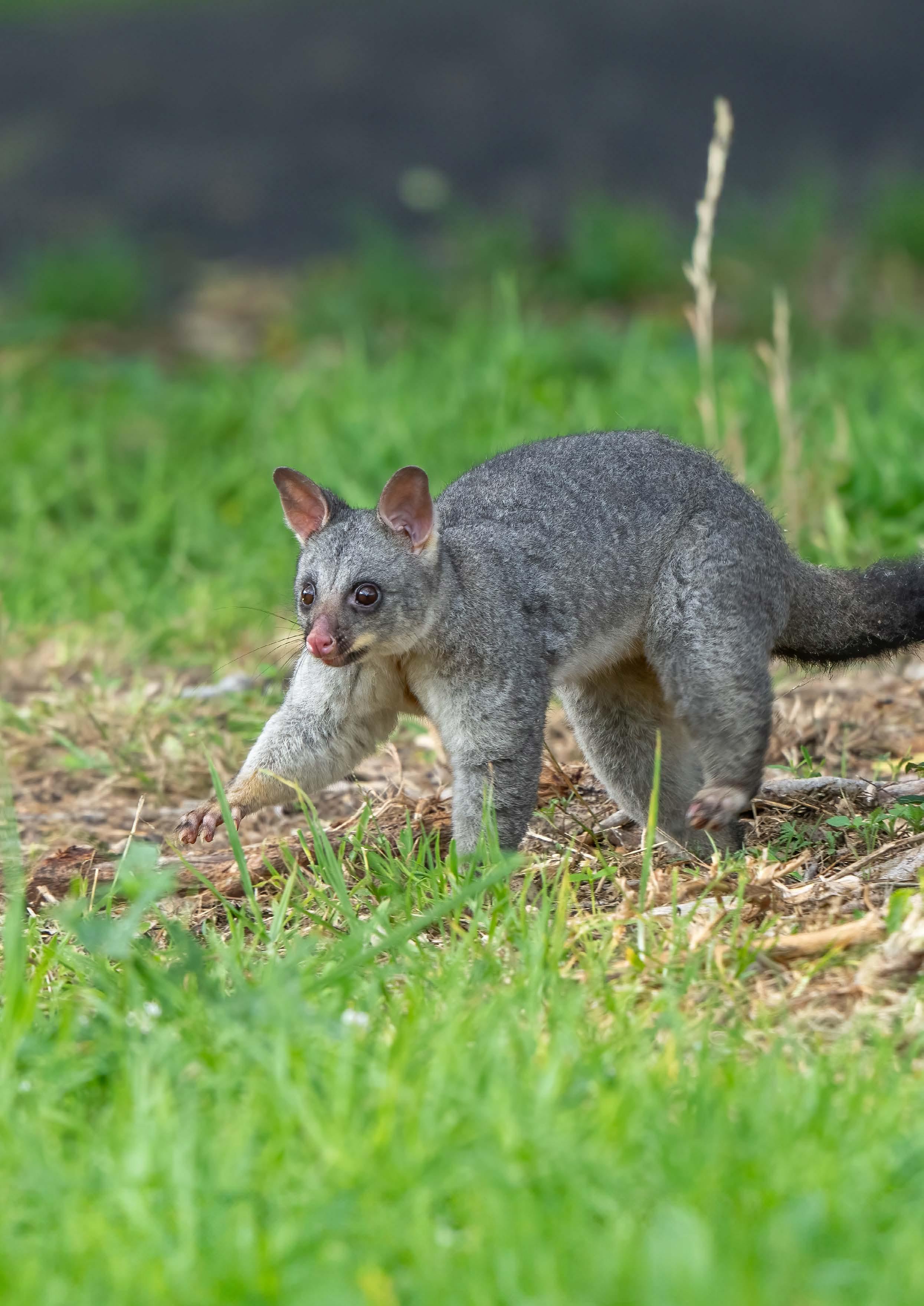
Common Brushtail Possum (Trichosurus vulpecula)
Potential Priority Biodiversity Areas (PBAs)
Area
Callan Park
Leichhardt Park
Mort Bay to Ballast Point
Whites Bay Eco-Corridor
Whites Creek Valley Parklands
Inner West Council Ward
Baludarri
Camperdown Memorial Rest Park and Cemetery Damun
Greenway Northern Links
Iron Cove Creek
Victoria Square
Gumbramorra Swamp links
Djarrawunang / Gulgadya
Djarrawunang
Midjuburi
6 Action Plans
6.1 Theme 1 – Increase Biodiversity
The first theme for this strategy is simply “Increase Biodiversity”. Inner West Council is looking not just to maintain current levels, but to enhance and become an urban haven for biodiversity. The theme also includes strengthening our knowledge of local flora and fauna to improve strategies and outcomes. This is directly linked to Inner West’s Community Strategic Plan (CSP), strategic direction 1: An ecologically sustainable Inner West. This is closely aligned with CSP outcomes 1.1, 1.2, 1.3, 1.4 and 1.5.
Theme 1 — Increase biodiversity
Increase terrestrial biodiversity throughout the Council area (1.1)
Enhance the protection of biodiversity by improving connectivity and quality of habitat for local fauna and flora (1.1.1)
Explore potential for additional Priority Biodiversity Areas land designation to other valuable ecological sites in the broader LGA (1.1.1.1)
Install carved tree hollows/nest boxes in suitable parks and Natural Areas (1.1.1.2)
Utilise Council’s Community Native Nurseries to provide locally native plants to a mid-storey and ground cover planting program to improve habitat quality on suitable Council-owned land (1.1.1.3)
Identify current Dark Sky Zones, investigate potential establishment of new zones, and implement wildlife friendly lighting standards around Natural Areas (1.1.1.4)
Recognise the Gadigal Bat Roost as a key threatened species habitat site and ensure ongoing protection and monitoring (1.1.1.5)
Medium term Coordinator Urban Ecology
Short term Team Leader Ecology Projects Public Trees Manager
Medium term Coordinator Urban Ecology Supervisor Community Nurseries
Medium term Parks Planning & Ecology Manager Coordinator Urban Ecology
Medium term Coordinator Urban Ecology
Increase marine, freshwater, and riparian biodiversity throughout the Council area (1.2)
Improve quality of waters flowing through Inner West (1.2.1)
Investigate and prioritise opportunities for water sensitive urban design (WSUD) to be incorporated into Council managed land and collaborate with private landholders to increase WSUD uptake (1.2.1.1)
Support residents looking to install rainwater harvesting systems through the Rainwater Tank Rebate Program (1.2.1.2)
Medium term Coordinator Urban Ecology Senior Environment OfficerCatchments
Review Council managed rainwater gardens and swales to assess current conditions and effectiveness (1.2.1.3)
Medium term Coordinator Stormwater & Emergency Planning
Project Engineer
Capital Projects
Establish baselines and bridge knowledge gaps (1.3)
Expand, enhance, and protect natural riparian habitat (1.2.2)
Investigate opportunities to naturalise channelised waterways and reduce stormwater runoff (1.2.2.1)
Enhance the monitoring of local species, ecosystem health, and evaluation of biodiversity management actions (1.3.1)
Appreciate and protect existing natural riparian zones such as the unnamed Hercules St creek line and Mort Bay ephemeral creek (1.2.2.2)
Investigate opportunities to expand on existing wetlands, remediate degraded wetlands and build new wetlands across the LGA (1.2.2.3)
Plan for the loss and adaptation of identified Natural Areas to sea level rise scenarios (1.2.2.4)
Develop monitoring programs for target/indicator species within our Natural Areas to measure ecosystem health, habitat values and species richness/diversity (1.3.1.1)
Develop a River Report Card system for monitoring and reporting water quality throughout the LGA (1.3.1.2)
Long term Coordinator Urban Ecology Senior Environment OfficerCatchments
Medium term Coordinator Urban Ecology
Long term Parks Planning & Ecology Manager Senior Manager Operations
Long term Parks Planning & Ecology Manager
Short term Coordinator Urban Ecology Team Leader Ecology Projects Public Trees Manager
Short term Coordinator Urban Ecology Senior Environment OfficerCatchments
Develop better understanding of current state of environment and knowledge gaps (1.3.2)
Identify key threatening processes to local biodiversity, mitigation strategies and natural recovery processes (1.3.1.3)
Maintain and monitor Microforest trial sites, assess for biodiversity (1.3.1.4)
Complete mapping and condition reporting on threatened species and Endangered Ecological Communities (EEC) (1.3.2.1)
Review local impacts of climate change on biodiversity and natural assets to identify knowledge gaps and mitigation methods (1.3.2.2)
Audit currently installed nest boxes, map all locations and assess whether in use by native animals (1.3.2.3)
Medium term Coordinator Urban Ecology
Medium term Public Trees Manager Coordinator Urban Ecology
Medium term Coordinator Urban Ecology
Medium term Urban Sustainability Manager
Short term Team Leader Ecology Projects
6.2 Theme 2 - Unite Community
Community is a key focus for this strategy, and as such our second theme is to “Unite Community” under one goal of improving biodiversity. Inner West aims to actively include community as partners in this strategy and see the Inner West Council’s residents, visitors, workers and stakeholders working hand in hand to create a more resilient, healthy and thriving Inner West, for now and future generations. This is connected to CSP strategic direction 1: An ecologically sustainable Inner West and strategic direction 4: Healthy, resilient, and caring communities. This directly supports outcomes 1.1, 1.3, 4.1, 4.2, 4.3 and 4.4 of the CSP.
Theme 2 — Unite community
Goals Priorities Actions
Increase opportunities for people to connect with, and care for, biodiversity in the Inner West (2.1)
Citizen science & community stewardship (2.1.1)
Increase opportunities and participation in environmental citizen science (2.1.1.1)
Work in partnership with citizen science, environmental and Bushcare groups on the collection and integration of data with proposed Council managed databases (2.1.1.2)
Provide volunteering opportunities through Adopt-a-Spot and Verge Garden, Native Community Nurseries and Bushcare programs (2.1.1.3)
Develop concept plans for a bird watching hide at the Dibble Avenue Waterhole (2.1.1.4)
Establish a new Native Community Nursery in the Southern LGA and increase nursery capacity (2.1.1.5)
Ongoing Team Leader Ecology Projects
Ongoing Coordinator Urban Ecology
Medium term Coordinator Urban Ecology Team Leader Ecology Projects
Long term Parks Planning & Ecology Manager
Medium term Senior Manager Environment and Sustainability
Education, transparency and promotion of biodiversity achievements (2.1.2)
Activate Council’s Sustainability Hub with Urban Ecology staff for consultation with public and hold events on site (2.1.2.1)
Develop an education program on the threatened and unique species of the Inner West and habitat creation (2.1.2.2)
Conduct Natural Area tours (2.1.2.3)
Install ‘cues to care’ in appropriate Natural Areas to better inform and engage the community in the protection of valuable habitat zones, such as the Gadigal Bat Roost (2.1.2.4)
Investigate the development of a Biodiversity Sensitive Urban Design (BSUD) workshop to help residents create native habitat in their backyards (2.1.2.5)
Short term Coordinator Urban Ecology Coordinator Resource Recovery Planning
Medium term Coordinator Urban Ecology
Ongoing Coordinator Urban Ecology
Medium term Team Leader Ecology Projects
Short term Coordinator Urban Ecology
Strengthen the representation and integration of Aboriginal ecological knowledge in the protection of biodiversity (2.2)
Care for Country (2.2.1)
Investigate opportunity for equal partnerships including partnering the Native Community Nursery with Indigenous providers and educators (2.2.1.1)
Partner with Aboriginal and Torres Strait Islander peoples to integrate appropriate methods of Caring for Country principles in Urban Ecology programs and projects, such as reintroduction of fire protocols into the landscape (2.2.1.2)
Co-design programs in collaboration with Aboriginal and Torres Strait Islander peoples to support engagement and participation in decision making (2.2.1.3)
Medium term Parks Planning & Ecology Manager Coordinator Urban Ecology
Medium term Cultural Advisor Coordinator Urban Ecology Team Leader Ecology Projects
Medium term Coordinator Urban Ecology Cultural Advisor
6.3 Theme 3 – Lead by Example
Inner West Council has committed to becoming an example of how urban local governments can make a difference to biodiversity on a large scale. This is realised through the strategy’s third theme, “Lead by Example”. Through strengthening partnerships, both internally and externally, and embedding ecological principles into Council’s decision making we look to inspire our local community through our leadership. This is aligned with CSP strategic direction 1: An ecologically sustainable Inner West and strategic direction 5: Progressive, responsive and effective civic leadership including outcomes 1.1, 5.2, 5.3 and 5.4.
Theme 3 — Lead by example
Goals Priorities Actions
Inner West Council is a leader in supporting urban biodiversity (3.1)
Embed ecological principles as a core responsibility of Council (3.1.1)
Investigate solutions to risks posed by domestic animals to local wildlife (for example potential curfews for domestic pets close to Priority Biodiversity Areas, Catch, Neuter and Release programs etc.) (3.1.1.1)
Short term Coordinator Urban Ecology; Team Leader Companion Animal / Monitoring Services
Redefine good decision making with an orientation around strategic risk management (3.1.2)
Review existing policies, strategies, and Plans of Management (PoM) to ensure biodiversity outcomes are prioritised and identify on ground actions that have not yet been realised (3.1.1.2)
Develop a Natural Areas Policy for nature regenerating lands (3.1.1.3)
Establish best practice principles for decision making to address impact and dependency on nature (3.1.2.1)
Facilitate truth telling and embed Caring for Country principles (3.1.2.2)
Develop and deliver Biodiversity Training for Council staff (3.1.2.3)
Include Natural Areas and Waterways in open space and recreation needs analyses (3.1.2.4)
Medium term Parks Planning & Ecology Manager Senior Planning and Policy Officer
Medium term Coordinator Urban Ecology
Medium term Senior Manager Environment and Sustainability
Ongoing Coordinator Urban Ecology Cultural Advisor
Short term Coordinator Urban Ecology
Medium term Parks Planning & Ecology Manager
Strengthen partnerships to improve biodiversity outcomes (3.2)
Establish cooperative processes for biodiversity within Council (3.2.1)
Establish connections with external agencies and pool resources (3.2.2)
Investigate suitable planning controls, policies, projects, targets, or incentives to:
a. Reduce decline of habitat on private land
b. Protect and increase mid/low-storey vegetation cover
c. Establish a “Greenweb” program to identify existing vegetation links.
d. Improve management of transition zones between Natural Areas and parks/streetscape
e. Advise on the financial value of blue-green infrastructure (3.2.1.1)
Establish cross Council collaboration for effective delivery of Council biodiversity projects (3.2.1.2)
Collaborate with external agencies (such as Sydney Water, Transport for NSW, Local Land Services, and other local Councils) and participate in regional partnerships (such as SSROC, Parramatta River Catchment Group and the Cooks River Alliance) (3.2.2.1)
Investigate and pursue relevant grant opportunities which increase natural capital (3.2.2.2)
Medium term Parks Planning & Ecology Manager
Senior Manager Operations
Team Leader
Planning Policy
Strategic Planning
Senior Planning and Policy Officer
Chief Financial Officer
Short term Parks Planning & Ecology Manager
Ongoing Parks Planning & Ecology Manager
Ongoing Parks Planning & Ecology Manager
External Grants Officer
Recognise Callan Park and Marrickville Golf Course as significant biodiversity refuges and collaborate with land managers to protect remnant habitats (3.2.2.3)
Facilitate local research opportunities through external agencies, such as universities, CSIRO etc., to improve knowledge and foster innovation in the urban ecology sector (3.2.2.4)
Short term Parks Planning & Ecology Manager Coordinator Urban Ecology
Ongoing Coordinator Urban Ecology
7 References
The following texts were key references in the preparation of this strategy.
Adapt NSW. (2014). Metropolitan Sydney Climate Change Snapshot. Sydney: NSW Office of Environment and Heritage. Aronson, M. F., Lepczyk, C. A., Goddard, M. A., et al. (2017). Biodiversity in the City: Key Challenges for Urban Green Space Management. Frontiers in Ecology and the Environment, 15(4), 189-196.
Barros, E. (2021). Urban Forest Update: Councillor Briefing, 23rd February 2021. Inner West Council.
Davies, P., Corkery, L., and Nipperess, D. (2017). Urban Ecology: Theory, Policy and Practice in New South Wales, Australia National Green Infrastructure Network.
Elmqvist, T., Setala, H., Handel, S. N., van der Ploeg, S., et al. (2015). Benefits of restoring ecosystem services in urban areas. Current Opinion in Environmental Sustainability, 14(June), 101-108.
Greener Spaces, Better Places. (2020). Inner West Council. Retrieved from https://www.greenerspacesbetterplaces.com.au/wwattb/inner-west-council/
Inner West Council. (2017). Creating our Inner West 2036: Community Strategic Plan issues Paper. Petersham: Inner West Council.
Inner West Council. (2021). Recreation Needs Study, A Healthier Inner West (October 2021 Update). Petersham, NSW: Inner West Council.
Inner West Council. (2021). The Greenway In-Corridor Works Flora and Fauna Assessment Petersham, NSW: Inner West Council.
Inner West Council. (2021). Inner West Council Community Research. Retrieved from https://www.innerwest.nsw.gov.au/ArticleDocuments/1909/Report%20-%20Inner%20West%20community%20 research%202021.pdf.aspx
Irish, P. (2016). Aboriginal History Along the Cooks River. Cooks River Alliance.
Leichhardt Council. (2017). Leichardt Fauna Survey 2016: Final Report Prepared for Leichhardt Council. Sydney: Ecological Consultants Australia.
Mata, L., and Hahs, A. K. (2023). Large positive ecological changes of small urban greening actions. Ecological Solutions and Evidence, 4(3), e12259.
Office of Environment and Heritage. (2017). Cross-tabulated Survey Data for Who Cares about the Environment? A Survey of the Environmental Knowledge, Attitudes, and Behaviours of People in New South Wales in 2015. Sydney: NSW Office of Environment and Heritage.
Threatened Species Recovery Hub. (2020). Research Findings Factsheet: The Impact of Pet Cats on Australian Wildlife Threlfall, C. G., Mata, L., Mackie, J. A., and Hahs, A. K., et al. (2017). Increasing Biodiversity in Urban Green Spaces through Simple Vegetation Interventions. Journal of Applied Ecology, 54, 1874-1883.
Weir, J. K., Stacey, C., and Youngetob, K. (2011). The Benefits Associated with Caring for Country. Department of Sustainability, Environment, Water, Population and Communities. Canberra: Australian Institute of Aboriginal and Torres Strait Islander Studies.
Young, Nadia and Parramatta River Catchment Group. (2023). First Nations Peoples of the Parramatta River and Surrounding Region. Parramatta River Catchment Group.
A special thank you to David Noble for allowing the use of his pictures of local birds, insects, frogs and mammals throughout this strategy document.