

Council acknowledge the Gadigal and Wangal peoples of the Eora Nation, who are the traditional custodians of the lands in which the Inner West Local Government Area is situated.
We celebrate the survival of Aboriginal and Torres Strait Islander cultures, heritage, beliefs and their relationship with the land and water. We acknowledge the continuing importance of this relationship to Aboriginal and Torres Strait Islander peoples living today, despite the devastating impacts of European invasion. We express our sorrow for past injustices and support the rights of Aboriginal and Torres Strait Islanders to self-determination.
1. Introduction
As part of Inner West Council’s Local Area Traffic Management (LATM) Strategy Review Program, Council has prepared the Newtown South (M7) LATM Study.
The objective of the study is to reduce traffic volumes and speeds in local roads to increase liveability and improve safety and access for pedestrians. The LATM was originally completed in 2007.
In developing LATM recommendations, consideration is to be given to incorporate the following principles of Local Area Traffic Management:
• Reduction of vehicular speeds
• Minimisation of traffic levels and intruding traffic in a local street
• Minimisation of crash risk
• Improvement to local amenity by:
– Reducing car use
– Increasing use of public transport
– Increasing walking and cycling
– Improving the streetscape.
2. Exisiting conditions
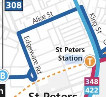
The Newtown South LATM Area (M7) is bounded by Edgeware Road, King Street (Princes Highway), Alice Street, and Lord Street. A map of the study area is shown in Figure 2.1 below.

Surrounding Land Use
Open space is provided immediately outside of the south-eastern boundary of the study area, at Sydney Park, outside of the southern boundary at Camdenville Oval, and outside of the northern boundary at Matt Hogan Reserve in Alice Street. Small open space areas are also provided within the study area at Collyer Playground on the corner of Pearl Street and Wells Street, Peace Reserve at King Street/Alice Street, and Alice Street Playground on the corner of Alice Street/Hawken Street.
The King Street Newtown shopping strip is located on the eastern boundary of the study area, and the Marrickville Metro Shopping Centre lies to the west just outside the study area.
St Peters Train Station is located on the southern boundary of the study area with pedestrian access via Lord Street.
Educational facilities within the study area provided at Camdenville Public School which has pedestrian access via Wells Street and Laura Street. Vehicular access to staff parking is located on Laura Street. The school has 365 students, and the catchment area encompasses the entire study area and extends north and west to Enmore Road.
Traffic signals are provided at the following locations.
• Edgeware Road/Alice Street/Llewellyn Street
• Edgeware Road midblock between Wells Street and Victoria Road
• Bedwin Road/Edgeware Road/Edinburgh Road
• Lord Street/King Street/Concord Street
• Darley Street/King Street/Bray Street
• King Street/Union Street
• Alice Street/ King Street/Angel Street
Truck Load Limits are provided at the following locations.
• Lord Street – 3 tonne load limit
• Alice Street – 3 tonne load limit from 10:00pm-6:00am
• Edgeware Road – 3 tonne load limit from 10:00pm6:00am
Banned turning movements are provided as follows.
• ‘No Right Turn’ into Angel Street from Princes Highway travelling northbound
• ‘No Right Turn’ into Union Street from Princes Highway travelling northbound / ‘No Left Turn’ into Union Street from Princes Highway travelling southbound
• ‘No Left Turn’ into Darley Street from Princes Highway travelling northbound
• ‘No Right Turn 6AM-10PM, 3PM-7PM Mon-Fri’ into Bray Street from Princes Highway travelling northbound
• ‘No Right Turn’ into Concord Street from Princes Highway travelling northbound / ‘No Left Turn’ into Concord Street from Princes Highway travelling southbound
• ‘No Left Turn’ into Lord Street from Princes Highway travelling southbound
• ‘No Right Turn’ into Llewellyn Street from Princes Highway travelling southbound
• ‘Right Turn Only’ into Bedwin Road from Edgeware Road travelling northbound
Pedestrian (zebra) crossings are currently provided at the following locations:
• Alice Street west of Hawken Alice Street
• Lord Street west of Maria Lane
• Wells Street along frontage of Camdenville Public School
• Laura Street along frontage of Camdenville Public School
Road closures are provided at the following locations:
• Wells Street between Commodore Street and John Street
• Pearl Lane south of Dickson Street
• Alice Lane east of Pearl Street
A detailed inventory is provided in Figure 2.2.


The Newtown South LATM (2007)
The Newtown South LATM was initially completed in 2007 and approved by Council in 2008.
After consultation the following projects were recommended, which have since all been completed with the exception of the installation of 10 metres ‘No Stopping’ restrictions at the John Street/Lord Street intersection.
• Install a speed hump approximately mid-block in the section of John Street between Lord Street and Darley Street to reduce speeding in this section of John Street (Completed)
• Construct two (2) kerb blisters in Edgeware Road at its junction with Lord Street to improve the visibility of motorists exiting Lord Street and to highlight the “One Way” restrictions in Lord Street (Completed)
• Construct a kerb blister in Edgeware Road at the southeastern corner of Edgeware Road and Darley Street to direct the southbound through traffic in Edgeware Road towards Bedwin Road (Completed)
• Narrow the existing marked foot crossing in Laura Street, at its junction with Hawken Street, with kerb blisters to improve the safety of the pedestrian crossing (Completed)
• Install a pedestrian refuge island in Walenore Avenue at its junction with Alice Street to improve pedestrian safety (Completed)
• Install a pedestrian refuge island in Dickson Street at its junction with King Street to improve pedestrian safety (Completed)
• Install two (2) speed humps in Alice Lane to the rear of Property Nos. 17 and 55 Holmwood Street, Newtown to reduce the speed of vehicles using the laneway (Completed)
• Install “No Stopping” restrictions at the statutory 10m distance from the corners of Lord Street and John Street, to discourage illegal parking at this location (Not Completed)
• Raise the existing marked foot crossing in Lord Street outside of St Peters Station to improve safety of the pedestrian crossing. (Completed)
• Relocate the existing speed hump in Lord Street, between the existing marked foot crossing and King Street (however set back more than 10 metres from the intersection), which will act as an entry threshold (Completed)
• Install an additional speed hump in Lord Street just west of its intersection with John Street to improve safety at the intersection of Lord Street and John Street (Completed).
Edgeware Rd
Edgeware Rd
MurraySt
Smidmore St
Edinburgh Rd
Hawken St
LauraSt
WellsSt
DarleySt
Commodore St
AliceSt
AliceLn Pearl St
HolmwoodSt
HolmwoodLn
DicksonSt
DicksonLn
WellsSt
KingLn
KingSt
DarleyLn
DarleySt
CarolineLn
Inner West Cycling Strategy 2023
The Inner West Cycling Strategy was publicly exhibited in November 2022 with finalisation and adoption by Council in June 2023. The Cycling Strategy outlines six priorities with actions to provide a safer cycling network and support more people cycling.
The Cycling Strategy applies the NSW Government’s Movement and Place framework. Movement and Place is a cross-government framework for planning, designing, and managing the street network to maximise benefits for the people and places they serve. The bike network map specifies local streets designated for prioritised cycling access and main streets designated for place-based cycling access. The NSW Design and Roads and Streets Guide and the Network Planning in Precincts Guide aim to shift the emphasis in network planning from a hierarchy of roads towards a network that is place-based and prioritises walking, cycling, public transport use. This approach will form the basis of planning the Inner West bike network.
Pedestrian Access Mobility Plan PAMP (2021)
Bitzios Consulting was commissioned by Inner West Council to undertake and develop the Inner West PAMP to provide an updated and consolidated PAMP that covers the entire LGA. The PAMP provides Council with a long-term strategy for the development and improvement of pedestrian routes and facilities with a focus on encouraging and increasing localised pedestrian activity. The PAMP includes a detailed works program that identified issues associated with access, connectivity, crossing deficiency, infrastructure condition, missing footpath, narrow footpath, obstruction, and safety issues. The identified proposals in the PAMP of relevance to the LATM include.
• (CD1742) Missing crossing point in King Street (southern leg) at Alice Street/King Street/Angel Street traffic signals
• (CD1709) Driveway used as kerb ramp at pedestrian refuge at Alice Street east of Clara Street
• (SA189) Opportunity to raise pedestrian crossing near School at Laura Street west of Hawken Street
• (SA181) Opportunity to raise pedestrian crossing near School at Wells Street.


Road Hierarchy
The funding classification of road hierarchy is as follows:
• State Roads – fully funded by TfNSW
• Regional Roads – shared funding between Council and TfNSW
• Local Roads – fully funded by Council.
The functional classification is as follows:
• State Road/Arterial Roads – predominantly carry through traffic from one region to another and are controlled by TfNSW.
• Regional/sub arterial roads – provide connection from arterial roads to areas of development and carry traffic directly from one part of the region to another.
• Collector roads – provide connection between the sub-arterial roads to the local road system in a developed area.
• Local Roads – subdivisional roads within a particular developed area. These are used solely as local access roads.
The study area includes the State Road of King Street and two Regional Roads of Alice Street and Edgeware Road as detailed in Figure 2.4 All other roads are local roads.
MurraySt
CamdenSt
AliceSt
Edgeware Rd
Smidmore St
Hawken St
LauraSt
Commodore St
Pearl St
AliceSt
AliceLn
HolmwoodSt
HolmwoodLn
DicksonSt
DicksonLn
WellsSt
KingLn
KingSt
WellsSt
DarleySt John St
LordSt
DarleyLn
DarleySt
GoodsellSt LordSt
Crash Data
A review of the most recent five years of recorded crash data has been undertaken as detailed in Figure 2.5 below. This corresponds with the period October 2017 – September 2022. A total of 40 crashes occurred in the study area.
Most of the crashes occurred on King Street (a state road) with 12 crashes. Edgeware Road (a regional road) with 16 crashes and Alice Street (a regional road) with 7 crashes.
The administration and management of state roads is carried out and financed by Transport for NSW, and regional and local roads are administered, managed, and financed by local councils. It should be noted that only crashes that result in a casualty or a vehicle being towed away are included. All other minor crashes are not recorded.
In total, 4 crashes involved pedestrians. This includes 1 at the Alice Street/Edgeware Road signalised intersection, 2 midblock in Alice Street between Alice Lane and Hawken Street and 1 at the King Street/Lord Street intersection. A further 9 involved cyclists including 3 midblock along Alice Street and only one on a local road (Pearl Street). 2 crashes occurred along King Street, 3 along Alice Street and 3 along Edgeware Road including 1 south of Darley Street.
The only intersection between two local roads which has more than one crash is the Darley Street/John Street which had a total of 2 crashes, including a run-off road crash and a cross traffic crash. The only other crashes internal to the study area at local roads include a crash in Lord Street between John Street and Edgeware Road (RUM CODE 71) which resulted in a run-off road crash heading westbound, and a crash in Pearl Street between Alice Street and Commodore Street (RUM CODE 63) which saw the collision between a vehicle door and pedal cycle between southbound cyclists.

Bus Services
Several bus routes service the study area on the boundary roads as detailed in Figure 2.6.
Route 308 Marrickville Metro to Central Eddy Avenue via Redfern travels within the study area via Edgeware Road- Alice Street – King Street.
Route 422 Kogarah to Central Pitt Street travels within the study are via King Street.
Train Services
St Peters Train Station is located at the south-eastern boundary of the study area. It is served by Sydney Trains T3 Bankstown line services. It will be converted to a metro as part of the Southwest Metro project which will be operational in 2025.
Traffic Data
Traffic data was collected in November 2022 in the form and speed and volume counts as detailed in Table 2.1 including an assessment of acceptable speed and volume. Please note that the 85%ile speed is the speed at which 85% of the vehicles are traveling at or below. All roads have a posted speed limit of 50 km/h. As a general rule local roads have a desirable traffic volume of less than 2,000 vehicles/day, whilst regional roads have a desirable traffic volume of less than 20,000 vehicles/day. Road

Alice
Alice Lane b/w Walenore Ave & King St 230 Y 16 Y Y
Pearl Ln b/w Holmwood Ln & Dickson St 194 Y 17 Y Y
Alice St (Regional Road) b/w Pearl St & Walenore Ave 9,416 Y 46 Y Y (not assessed at 40 km/h due to regional road status
Hawken St b/w Alice St & Laura St 574 Y 24 Y Y
Walenore Ave b/w Alice St & Alice Ln 255 Y 18 Y Y
Holmwood St b/w Pearl Ln & King St 443 Y 30 Y Y
Pearl St b/w Alice Ln & Wells St 569 Y 34 Y Y
Dickson St b/w Pearl Ln & King St 665 Y 27 Y Y
Wells St b/w Edgeware Rd & Commodore St 360 Y 31 Y Y
Wells St b/w Pearl Ln & King St 555 Y 25 Y Y
Darley St b/w John St & King St 794 Y 25 Y Y
Lord Street b/w Edgeware Rd & John St 1,115 Y 25 Y Y
Lord St b/w John St &King St 1,245 Y 33 Y Y
Table 2.1 Speed and Volume Review
Regarding traffic volumes all road sections have acceptable traffic volumes. Regarding speed, all road sections have acceptable speed profiles regarding the existing posted speed limit and potential 40 km/h speed limit in the area and road classification.
Continuous Footpath Treatment
Under the road rules, a footpath is a road related area. When entering, or crossing, a road related area from a road, drivers must give way to any pedestrians or other road users on the road related area. Therefore, where pedestrian priority is desirable, but a regulatory pedestrian crossing is not warranted, a continuous footpath treatment that is not differentiated in colour and texture from the adjacent footpath may be a suitable solution.
Typically, no more than 45 vehicles per hour moving through the intersection to be treated. There should be few, if any, heavy vehicles frequenting the intersection. Measured vehicle flows apply for three periods of one hour in any day. This measure should capture the busiest traffic flows that occur at that location. Table 2.2 provides an assessment of suitability of this treatment at locations within the study area.
When entering, or crossing, a road related area from a road, drivers must give way to any pedestrians or other road users on the road related area.
3. Identified Community issues
Council undertook an initial survey through Council’s Your Say website in May 2022 with invitation letters mailed out to stakeholders and residents within the study area to determine existing issues and ideas. A total of 191 responses were received through the online survey and a further 20 through the mapping tool.
The main outcomes of the first stage of consultation are that the problems identified by the greatest number of respondents are high traffic volumes, followed by pedestrian safety and the third most raised issue was heavy vehicles using local roads.
Regarding specific streets, Edgeware Road, Alice Street and King Street have the highest level of concern for too much traffic, pedestrian safety, heavy vehicle uses and excessive speed.
Lord Street also has a level of concern for rat running and exceeding the speed limit. The results of the consultation are included in the Engagement Outcome Report as provided in Appendix A.
4. LATM recommendations
An overall plan of the proposed treatments is detailed below in Figure 4.1 Further details of each recommendation are detailed in this section including concept plans.

EXISTING TRAFFIC SIGNALS TO BE UPGRADED TO INCLUDE LEFT TURN RED HOLDING ARROW - SUBJECT TO TFNSW APPROVAL
UPGRADE EXISTING RAISED PEDESTRIAN CROSSING
UPGRADE EXISTING
SIGNPOSTING FROM 'NO PARKING 8:30AM-6:00 PM
TFNSW TO INVESTIGATE
SIGNALISED PEDESTRIAN CROSSING AT SOUTHERN LEG OF INTERSECTION
INSTALL 'NO STOPPING' RESTRICTIONS AT

INSTALL SPEED HUMP & SHARED ZONE WITH MARKED PARKING SPACES

MON-FRI' TO 'NO PARKING 8:30AM-6:00 PM MON-SAT' EDGEWARE RD EDINBURGHRD
EXISTING PEDESTRIAN CROSSING TO BE CONVERTED TO RAISED PEDESTRIAN CROSSING - ADOPTED AT NOV 2023 COUNCIL MEETING
EXISTING PEDESTRIAN CROSSING TO BE RELOCATED - ADOPTED AT DEC 2023 COUNCIL MEETING
INSTALL FLUSH THRESHOLD TREATMENT WITH RED PAVEMENT PAINT & PIANO KEYS AT BENDS.
PROVIDE FOOTPATH CONNECTION BETWEEN EXISTING KERB RAMPS
INSTALL 'NO STOPPING' RESTRICTIONS AT INTERSECTION
INSTALL RAISED PEDESTRIAN & BICYCLE CROSSING WITH KERB BLISTERS & SPLITTER ISLAND
NOTE:
ADDITIONAL BICYCLE LOGO LINEMARKING TO BE INSTALLED ALONG THE FOLLOWING ROADS:
- ALICE ST
GATE TO BE MODIFIED TO ALLOW FOR BICYCLE ACCESS
INSTALL 'NO STOPPING' RESTRICTIONS AT INTERSECTIONS
INSTALL 'NO STOPPING' RESTRICTIONS AT INTERSECTION

Figure 4.1 Overall Plan of Proposed Treatments


Alice Street at Hawken Street
To improve pedestrian amenity and provide a flush continuous pedestrian facility it is proposed to reconstruct the existing raised pedestrian (zebra) crossing incorporating kerb extensions in Alice Street west of Hawken Street, as detailed in Figure 4.2
There is expected to be no net parking loss for this proposal.
The estimated cost is $100,000.


Alice Street at Pearl Street
To improve pedestrian safety and amenity and reduce speeds it is proposed to upgrade the existing pedestrian refuge in Alice Street west of Pearl Street into a raised pedestrian (zebra) crossing, as detailed in Figure 4.3.
The issue of lack of pedestrian (zebra) crossings in Alice Street was raised during the community engagement. This proposal will address the issue of lack of pedestrian (zebra) crossings in Alice Street as raised during the community engagement and also address the crash history in Alice Street by providing pedestrian priority whilst also reducing speeds.
There is expected to be no net parking loss for this proposal.
Council’s Pedestrian Crossing Warrant Policy requires the following be met:
• In each of two separate one-hour periods in a typical day, the pedestrian flow per hour crossing the road is or is expected to be equal to or greater than 20, and vehicle volumes be equal to or greater than 200 where children and elderly or mobility impaired pedestrians count as two pedestrians.
A review of data collected at the intersection on Tuesday 8th November 2022 during peak hours of 8:15am-9:15 am and 5:00pm-6:00pm;
• AM Peak - 26 pedestrians, 660 vehicles
• PM Peak - 22 pedestrians, 748 vehicles
According to Council’s Pedestrian Crossing Warrant the warrant has been met.
The estimated cost is $100,000.


Alice Street at Walenore Avenue
To improve pedestrian safety and amenity it is proposed to upgrade the existing pedestrian refuge in Alice Street west of Walenore Avenue into a raised pedestrian (zebra) crossing, as detailed in Figure 4.4
The issue of lack of pedestrian (zebra) crossings in Alice Street was raised during the community engagement.
There is expected to be a net loss of approximately two (2) parking spaces for this proposal.
Council’s Pedestrian Crossing Warrant Policy requires the following be met:
• In each of two separate one-hour periods in a typical day, the pedestrian flow per hour crossing the road is or is expected to be equal to or greater than 20, and vehicle volumes be equal to or greater than 200 where
A review of data collected at the intersection on Tuesday 8th November 2022 during peak hours of 8:15am-9:15 am and 5:00pm-6:00pm;
• AM Peak - 33 pedestrians, 630 vehicles
• PM Peak - 31 pedestrians, 731 vehicles
According to Council’s Pedestrian Crossing Warrant the warrant has been met.
The estimated cost is $100,000.
Dickson Street at King Street
It is recommended that a continuous footpath treatment with kerb extensions be installed at this location as detailed in Figure 4.5. Typically, no more than 45 vehicles per hour moving through the intersection to be treated.
Traffic data collected in November 2022 indicates weekday traffic movements of 45 in the AM peak, 45 lunchtime peak and 46 in the PM peak meeting the requirements at most times for a continuous footpath treatment. The driveway layback must be no wider than 7 metres hence additional kerb extensions are require constrain the intersection so that drivers do not have the full width to manoeuvre.
There is expected to be no net parking loss for this proposal.
The estimated cost is $35,000.


Wells Street at King Street
It is recommended that a continuous footpath treatment be installed at this location as detailed in Figure 4.6 Typically, no more than 45 vehicles per hour moving through the intersection to be treated.
Traffic data collected in November 2022 indicates weekday traffic movements of 37 in the AM peak, 35 lunchtime peak and 48 in the PM peak meeting the requirements at most times for a continuous footpath treatment. The driveway layback must be no wider than 7 metres hence additional kerb extensions are require constrain the intersection so that drivers do not have the full width to manoeuvre.
There is expected to be no net parking loss for this proposal.
The estimated cost is $35,000.


Darley Lane at King Street
It is recommended that a continuous footpath treatment be installed at this location as detailed in Figure 4.7. Typically, no more than 45 vehicles per hour moving through the intersection to be treated.
No data is available for this site, however given the subject is a laneway, it is anticipated that the traffic volumes would be low.
There is expected to be no net parking loss for this proposal.
The estimated cost is $35,000.
Wells Street between Edgeware Road and Commodore Street
An existing at-grade pedestrian (zebra) crossing is provided along the frontage of Camdenville Public School. In order to reduce speeds and provide a safer crossing point it is recommended that the crossing be relocated approximately 6.5 metres east to facilitate the construction of two new kerb ramps, separating the existing shared driveway that is being used by both vehicles and pedestrians to improve safety. The proposal is detailed in Figure 4.8 This issue has already been identified and the plan approved at the November 2023 Local Traffic Committee and subsequently endorsed by Council at the December 2023 Council meeting.
The project is listed on Council’s Traffic Facilities Capital Works budget for 2023/2024 and is estimated to be around $24,000.
Laura Street between Edgeware Road and Hawken Street
An existing at-grade pedestrian (zebra) crossing is provided along the frontage of Camdenville Public School. In order to reduce speeds and provide a safer crossing point it is recommended that a raised pedestrian crossing be provided at this location, as detailed in Figure 4.9 This issue has already been identified and the plan approved at the October 2023 Local Traffic Committee and subsequently endorsed by Council at the November 2023 Council meeting.
The project is listed on Council’s Traffic Facilities Capital Works budget for 2023/2024 and is estimated to be around $115,000.


Edgeware Road/Llewellyn Street/Alice Street
The traffic signals under their current arrangement do not provide a red left holding arrow. It is proposed to request TfNSW upgrade the traffic signals to provide a safer crossing point for pedestrians crossing the Llewellyn Street leg of the intersection by introducing this signal phase sequence, as detailed in Figure 4.10 In addition, a Pedestrian Warning (left arrow) sign and supplementary ‘Disabled’ sign is also proposed facing northbound traffic in Edgeware Road on approach to the traffic signals as the existing road conditions make it difficult to sight children or wheelchair users who are wishing to cross Llewellin Street from the southern to northern side.


Edgeware Road between Darley Street and Lord Street
In order to provide a safer crossing facility for both pedestrians and cyclists it is recommended that a raised pedestrian/cyclist crossing be installed in Edgeware Road south of Bedwin Road with kerb extensions and median splitter island, as detailed in Figure 4.11. Under current conditions it is unclear whether southbound vehicles in Edgeware Road are wishing to travel on the Bedwin Road Bridge or continue along Edgeware Road. Some 90% of traffic heads south to use the bridge as opposed to Edgeware Road however due to the road geometry, drivers do not indicate leading to uncertainty as to which direction they are heading. This leads to unsafe pedestrian movements hence the need for a prioritised crossing point. Existing ‘Give Way’ and ‘Left Only’ restrictions will remain in place.
There is expected to be a net loss of approximately three (3) parking spaces for this proposal.
The estimated cost is $100,000.


Alice Lane & King Lane (between Pearl Lane and Holmwood Street)
In order to reduce vehicle-vehicle and vehicle-pedestrian conflict it is recommended that it be converted to one way eastbound in Alice Lane and King Lane (between Alice Lane and Holmwood Street) given its narrow road width. Furthermore, the section between Walenore Avenue and Holmwood Street does not have a useable footpath hence it is recommended that it be converted to a 10 km/h Shared Zone. A speed cushion is also recommended to be installed at Alice Lane at its intersection with Walenore Ave to slow drivers down when entering the 10 km/h Shared Zone. The proposal is detailed in Figure 4.12
The estimated cost is $30,000.
John Street/Darley Street
In order to reduce speeds and provide safer conditions it is recommended that a raised platform be installed at the John Street/Darley Road intersection.
It is also proposed to install ‘No Stopping’ restrictions at the intersection to prevent illegal parking too close to the intersection which limits sight lines making it difficult and unsafe to manoeuvre through the intersection. The proposal is detailed in Figure 4.13.
The estimated cost is $40,000.


John Street/Lord Street
In order to reduce speeds and provide safer conditions it is recommended that a raised platform be installed at the John Street/Lord Street intersection.
It is also proposed to install statutory ‘No Stopping’ restrictions at the intersection to prevent illegal parking too close to the intersection which limits sight lines making it difficult and unsafe to manoeuvre through the intersection. An exception to this has been made at the northern side of Lord Street, Newtown, east of John Street – a reduced ‘No Stopping’ zone of 7m was recommended at the November 2023 Local Traffic Committee and subsequently endorsed for implementation at the December 2023 Council meeting. The proposal is detailed in Figure 4.14
The estimated cost is $40,000.


Lord Street between King Street and Laneway
In order to provide improved pedestrian amenity between King Street and the pedestrian access to St Peters Railway Station, it is proposed to widen the Lord Street southern footpath between King Street and the access to the railway station, a length of some 50 metres. This will provide a narrowing to the entry point to Lord Street, which may reduce vehicle speeds and alert motorists they are entering a local road area. It may also reduce through traffic in Lord Street. It is also proposed to install a ‘3 Tonne Load Limit on side Road’ (Left) sign at Princes Highway, immediately south of its intersection with Lord Street on the western side. The 3T load limit restriction is already existing on Lord Street, however there is currently inadequate signage informing drivers of this restriction. This proposal will result in the loss of some part-time parking (two spaces signposted No Parking 6:00am-12:00 noon Mon-Fri), and is detailed in Figure 4.15
The estimated cost is $50,000.


Wells Street at Commodore Street, Wells Street at John Street
Wells Street is a narrow two-way road, and there is a road closure with pedestrian and cyclist only access between Commodore Street and John Street. At its intersections with Commodore Street and John Streets, there are sharp 90-degree bends with low sight distance due to parked vehicles. It is recommended that these bends be painted red with piano key landmarking at the approach and departure points to alert drivers of the bend.
Furthermore, it was found through consultation that the existing footpath connection linking Commodore Street and John Street has poor accessibility for mobility impaired pedestrians, therefore, it is recommended that the footpath connection be rebuilt with smooth connection between the two existing kerb ramps. The proposal is detailed in Figure 4.16
There is expected to be no net parking loss for this proposal.
The estimated cost is $30,000.


Edgeware Road between Llewellyn Street and Victoria Road
During the consultation process it was advised that traffic flow is impacted by parked vehicles on weekends. It is proposed to amend the existing timed parking restrictions from ‘No Parking 8:30am-6:00pm Mon-Fri’ to ‘No Parking 8:30am-6:00pm Mon-Sat’ as detailed in Figure 4.17.
The estimated cost is $500. NOT
Pearl Street/Wells Street
It is proposed to install ‘No Stopping’ restrictions at the intersection to prevent illegal parking too close to the intersection which limits sight lines making it difficult and unsafe to manoeuvre through the intersection.
The estimated cost is $500.
Laura Street/Commodore Street
It is proposed to install ‘No Stopping’ restrictions at the intersection to prevent illegal parking too close to the intersection which limits sight lines making it difficult and unsafe to manoeuvre through the intersection. ‘No Stopping’ restrictions may be reduced from the statutory 10m requirement subject to TfNSW approval.
The estimated cost is $500.
Wells Street at Edgeware Road
Wells Street is a narrow two-way road. At its intersection with Edgeware Road, it is recommended that the statutory 10 metres of ‘No Stopping’ restrictions be installed on both the southern and northern side of the road to allow manoeuvring to occur, which is of particular importance given the road allows for two-way traffic.
The estimated cost is $500.
King Street at Alice Street
It is proposed to request TfNSW to investigate the implementation of a signalised pedestrian crossing at the southern leg of the intersection of King Street and Alice Street.
Cost N/A


Implement Reduced Speed Limits
Speed zones are set to enable drivers travelling at a speed limit to safely respond to potential risks in the road environment. Lower speeds deliver significant road safety benefits, reducing both the number and severity of crashes. Travelling at speeds that are set to accommodate the mix of vehicles and people movements on the road network allows drivers and riders to stop to avoid crashes, and if they do crash, to reduce the impact to prevent death and serious injuries, especially in areas of high pedestrian activity.
The chances of survival for a pedestrian being hit by a car is 10 percent at 50 km/h which increases significantly to 60 percent at a speed of 40 km/h.
The potential benefits and impacts in reducing the speed limit from 50 m/h to 40 m/h include a 12% reduction in crashes and 17% reduction in injuries.
In line with the draft report for Council’s Inner West@40 Study on proposed speed limit reductions (yet to be endorsed by Council), it is recommended that all local roads in the Newtown South LATM study area have their speed limit reduced from 50km/h to 40km/h. Furthermore, it is recommended that Edgeware Road (a Regional Road) has its speed limit reduced from 60 km/h to 50 km/h, and Alice Street (a Regional Road) be retained at 50 km/h. The proposal is detailed in Figure 4.18 The area is within the Area 6 Enmore and Marrickville West and considered ‘Priority A’ in the draft Inner West@40 Study. This will require TfNSW approval as they are responsible for setting speed limits. The speed reduction will result in safer conditions for motorists, pedestrians and cyclists noting that there have been a number of crashes particularly along the Regional Road of Edgeware Road (which is proposed to have a reduced speed limit from 60 km/h to 50 km/h).
The estimated cost is $10,000.
5. Summary of proposals
$115,000 High
9 Alice Lane & King Lane Convert full length from Pearl Street to Holmwood Street to one way eastbound and convert section between Walenore Avenue and Holmwood Street to a 10 km/h Shared Zone.
10 John Street/Darley Street A raised platform be installed at the John Street/Darley Street intersection.
11 John Street/Lord Street A raised platform be installed at the John Street/Lord Street intersection.
12 Lord Street between King Street and Laneway Widen the Lord Street southern footpath between King Street and the access to the railway station, a length of some 50 metres.
$30,000 High
13 Pearl Street/Wells Street Install statutory 10 metres of ‘No Stopping’ at the intersection.
14 Wells Street at Edgeware Road Install statutory 10 metres of ‘No Stopping’ on both the southern and northern side.
15 Laura Street/Commodore Street Install ‘No Stopping’ at the intersection –reduced ‘No Stopping’ restriction may be implemented subject to TfNSW approval
16 Edgeware Road between Llewellyn Street and Victoria Road
17 Edgeware Road between Darley Street and Lord Street
18 Wells Street at Commodore Street, Wells Street at John Street
Amend the existing timed parking restrictions from ‘No Parking 8:30am-6:00pm Mon-Fri’ to ‘No Parking 8:30am-6:00pm Mon-Sat’
Install raised pedestrian/cyclist crossing in Edgeware Road south of Bedwin Road with kerb extensions and median splitter island.
Bends to be painted red with piano key landmarking at the approach and departure points, and footpath connection to be rebuilt with smooth connection between the two existing kerb ramps.
19 Edgeware Road/Llewellyn Street/Alice Street
20 Local Roads and Regional Roads in Study Area
Install Pedestrian Warning (left arrow) sign and supplementary ‘Disabled’ sign, request TfNSW upgrade the traffic signals to provide a safer crossing point for pedestrians crossing the Llewellyn Street leg of the intersection.
Request TfNSW implement 40 km/h speed limit on Local Roads and 50 km/h speed limit on subject Regional Roads.
21 Pearl Lane at Disckson Street Modify existing gate to allow for bicycle access
Total $848,500
$40,000 Medium
$40,000 Medium
$50,000 Low
It is estimated that the total cost of all proposals will be approximately $848,500 inclusive of GST and $933,350 including 10% contingency.
$500 High
$500 High
$500 High
$500 Low
$100,000 Medium
$30,000 High
$500 High
$10,000 High
$2,000 Low


For further information about cycling in the Inner West, visit innerwest.nsw.gov.au