
CARRILLORODRIGO LANDSCAPE DESIGNER 479rdrg1crrll@gmail.comPORTFOLIO7991258

HELLO,

2

My personal explorations are film photography and processing, carpentry, and cooking. All of them bring me levels of inspiration through the processes of trial and countless errors, giving me the ability to leave my own mark on them.
I got introduced to landscape playfulalternativesfordesign,introduceddifferentGrowingskateboarding,throughcoincidentally.upandtravelingforparksandspotsmetourbancausingmetosearchreasoning,solutionsandtostreetscapes.Amodeoffunctiontends to follow me everywhere.
RENATURALIZING THE
6+ years experience as a draftsman 18 GARVAN WOODLAND GARDENS ENTRANCE navigation and parking 10 STUDENT
3
CONTENTS LOWER STATES MANUFACTURING ASLA
RIO GRANDE DELTA floodway manipulation 4 PIAZZA DELLA CHIESA NUOVA REDESIGN study abroad summer 16 FAYETTEVILLE FOOD CITY community gardening opportunities 14 CENTRAL
volunteering and organizing 19
RIO GRANDE DELTA
2022, McALLEN, TX
CREDITS: Rodrigo Carrillo, Cathleen Gomez, Tyler Hash
RENATURALIZING4
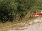
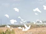
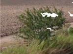
This project initially started as an interest in using birdwatching as a catalyst for bringing attention to protected lands and major flyways along the borderlands in South Texas. During an analysis on the societies and environments along the Lower Rio Grande Valley, my group acknowledged that Hidalgo County on the U.S. side contains the initial distributaries from the Rio Grande that would have started the “delta” of this pre-engineered region, and that historically non-infrastructured neighborhoods known as “colonias” are consistently located in flood-prone areas with little walkability. We made the plan to convert existing levee-bordered floodways into meandering ecosystems that also act as pedestrian greenways to connect the communities along the tributary.

MASTER PLAN
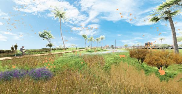
THE LOWER
5 EXISTING FLOODWAYS RIVER MORPHOLOGY INTRODUCE EXCAVATION AND WATERMOUNDINGERODES LANDFORMS AND ESTABLISHES MEANDERING PATH WATER IS RETAINED DURING FLOOD TO ENCOURAGE BIOREMEDIATION

6 HIDALGO(TEXAS , US . )TAMAULIPAS(MEXICO) HACKNEY LAKE INLET RIOGRANDE/RIO BRAVO RIO GRANDE/RIOBRAVO RIOGRANDE/RIOBRAVO ARROYO COLORADO FLOODWAY REYNOSA FLYWAYSCLIMATE BOUNDARIESCITYLANDSPROTECTEDCOLONIASDELTATYPICALTRIBUTARIESWATERSHEDS McALLEN ECOLOGICAL CONTEXT URBAN SCALE MAP


SURROUNDINGURBAN
Easy access from low speed roads makes it possible for nearly all groups to take advantage of these naturalized interventions. FLOODPLAIN PARKS Ephemeral parkland can exist during low water times, allowing paths and terraced design to give visitors a new perspective on the change of water levels. LEVEE Establishing a continuous trail network that runs parrallel to the inlets will give a new level of nonvehicular access for communiitesunderservedtoexplore their cities in a new way.
SURROUNDINGURBAN


ROADSIDE


Residential and LEVEE privatizedSometimes INLETOVERFLOW Parrallel to major INLET Allowed to meander and regain natural shape that creates more surface area for natvie plants to emerge in the surrounding edges. BUFFER Densely planted edge next to the inlet provides filtration of urban toxins that may make it to the watershed, and protection from birds along the flyway.
Structures that attract and encourage visitors to engage with the incoming animal life can support the imagery of the border-city to be a birding capital.


OBSERVATION

LEVEE


High ground with small road SOIL Rich from forsometimesflooding,usedagriculture FLOODPLAIN Water finds low points and collects INLET BANK Engineered to be consistantgeometrically INLET Overflow from Rio Grande, meanderedfollowspath


Residential and commercial zones LEVEE privatizedSometimes INLETOVERFLOW Parrallel to major inlets INLET Allowed to meander and regain natural shape that creates more surface area for natvie plants to emerge in the surrounding edges. BUFFER Densely planted edge next to the inlet provides filtration of urban toxins that may make it to the watershed, and protection from birds along the flyway. OBSERVATION Structures that attract and encourage visitors to engage with the incoming animal life can support the imagery of the border-city to be a birding capital. ROADSIDE Easy access from low speed roads makes it possible for nearly all groups to take advantage of these naturalized interventions. FLOODPLAIN PARKS Ephemeral parkland can exist during low water times, allowing paths and terraced design to give visitors a new perspective on the change of water levels. LEVEE Establishing a continuous trail network that runs parrallel to the inlets will give a new level of nonvehicular access for communiitesunderservedtoexplore their cities in a new way. 150'200' 50' 400' +/- 400' - 800'200'150'50' 400'+/- 400' - 800' CL CLCL EXISTING PROPOSEDLEVEEPROGRAMING
LEVEE High ground with small road SOIL Rich from forsometimesflooding,usedagriculture FLOODPLAIN Water finds low points and collects INLET BANK Engineered to be geometrically INLET Overflow from Rio Grande, meanderedfollowspath


8
FLOODWAY ALTERATIONS

The central canals within the floodways are precisely engineered to move water away from populated areas as quickly as possible while the surrounding levees typically have private-access gravel road. Elevation differences are used to the advantage of the visitor to create interesting experiences when passing by the new terrain.

EXISTING PROPOSEDCANALMOUNDS AND RETENTION AREAS PATHWAYS BRIDGING OVER CANAL-MOUNDS AXON SECTION credits: model - Cathleen Lee, Tyler Hash; rendering - Rodrigo Carrillo

With the intention of bridging communities along the entire delta, areas of significant interest are identified by the intersections of highway corridors and two tributaries in neighborhoodthewillIdeally,onthevisitorswelllateralstrategyThisMcAllen.horizontalwillprovidemovementasaskeypointsfortoandfromprotectedlandstheborder.eachphasebecateredtosurroundingneeds.

PHASING STRATEGY
EXISTING EXTENDEDLEVEEFLYOVER PATHS PATHWAYS EXPLORING THE FLOOD ZONE RIO GRANDE/RIOBRAVO RIOGRANDE/RIOB RAVO
Different degrees of exploration suit the needs of a variety of visitors, from pedestrian travelers, to recreational hikers of various skill level, and to those utilizing newly developed urban areas nearby.


PRIMARY
TRAIL DETAILS

PROMENADESTRAILS
9 VIGNETTES credits: models - Tyler Hash; rendering - Rodrigo Carrillo SECONDARY TRAILS


MASTER PLAN credits: design structure - Rodrigo Carrillo; rendering - Joiner Dotson
2021, HOT SPRINGS, AR
CREDITS: Rodrigo Carrillo, Winifred VanLandingham, Lillyan Priest, Joiner
AsDotsonanongoing
GARVAN10
WOODLAND GARDENS ENTRANCE
project in collaboration with the Garvan Board of Directors, the University of Arkansas has given students (ARCH, LARC, ID) to design a new Education Center that uses “nature as a classroom”. For this purpose, we needed to form a new entry that would speak to the unique ecosystem that is this area of the Ouachita Mountains and create a simpler wayfinding system to greet the site.
The result is a one-acre “pine/bluestem nucleus” that selectively promotes native species from the existing parking lot, and showcases them in the center of a large round-about. Ability to circle around and find a desired exhibit entrance increases the efficiency of keeping people on site and offers the potential to introduce new programing that would influence further development in the garden.

Pine
After
SECONDARY/PRIMARY
Research of the Region | Garvan Woodland Gardens Thinning Forest Thinning New Growth
Research
GROWTHNEWAFTERTHINNINGAFTERFORESTOVERGROWN
SERVICE PEDESTRIAN COLLECTOR PEDESTRIAN TERTIARY
CIRCULATION CIRCULATION PARKING CAPACITY PARKING CAPACITY


Overgrown
EXISTING SITE PROPOSED SITE
Entrance to the Garvan Botanical Gardens is made difficult by the overgrowth of the forested parking lot, screening entrances to the several entry exhibits. Parking is often congested during events and overflow parking is commonly used.
11 Garvan Woodlands’ Site Inventory & Analysis Garvan Woodland Gardens Page 14The Pine Bluestem Nucleus Entrance Primary PackedPavedTertiarySecondaryVehicularVehicularVehicularPedestrian(ADA)GravelPedestrian (ADA) Gravel or Dirt Pedestrian Existing Circulation Garvan Woodlands’ Site Inventory & Analysis Garvan Woodland Gardens Page 15The Pine Bluestem Nucleus Entrance 50 1735 26 62 43 29 92 BPkg P g Total Parking: 354 Existing Parking Count En y Drive O e flow Pa king Main Parking Wel ome Center Bride Hall Chipmunk Ca e G oom Hall Carillon Anthon Chapel Klipsch Ampitheater xisting Pinarking WBuildingsL MinoMajoxistingCC ou The Pine Bluestem Nucelus | Garvan Woodland Gardens Page 38The Pine Bluestem Nucleus 55Prev180 1048 30 62 Overall 222 386 129 354 Proposed Existing On Site 43 29 59 50 Master Site Plan Diagrams Parking The Pine Bluestem Nucelus Garvan Woodland Gardens Page 41The Pine Bluestem Nucleus Potential Removed Trees The Pine Bluestem Nucelus | Garvan Woodland Gardens Page 37The Pine Bluestem Nucleus Master Site Plan Diagrams Circulation
Overgrown Forest of the Woodland Gardens Pine Bluestem Nucleus Thinning Forest Thinning
The
After
CANOPY STUDY
CANOPY STUDY
Pine
Region | Garvan

Overgrown
While mainting a healthy tree density in mind, the native short-leaf pine trees are given priority in a massive thinning of the forest. Sapplings become established in the clearing and gives way to a native ecostystem in the center of the entrance.


After
A large radius allows for minimal intrusion with the established vegetaion on site and the multi-lane access offers the best method for matching grade and offering several direct access points to entrances.
PINE THINNING
MODULAR
PIONEER WALL
VIGNETTE VanLandingham Rodrigo Carrillo
12 Research of the Region Garvan Woodland Gardens Page 31The Pine Bluestem Nucleus Targeted Educational Research Stewardship of the Forest The Pine Bluestem Nucelus Garvan Woodland Gardens Page 50The Pine Bluestem Nucleus Educational Perspective
POSSIBLE PROGRAMS
The open nucleus of the entry design gives several opportunities to educate visitors using the open understory and tall canopy of the pine ecosystem, as well as utilizing the logged lumber.


credits: Winifred
and
& lichens (moss) Ferns (shadedunstablePioneer
Byrophyte


[1ST COLUMN, 2ND COLUMN] DISPLAY, PIONEER WALL, credits: Winifred VanLandingham and Rodrigo
PROGRAM CONCEPT credits: Winifred VanLandingham and Rodrigo Carrillo ofThethe
Multiple visits to the site allowed us to embrace the unique nature of the Ouachita Mountains and take a thorough survey of existing vegetation to lead to our selection of native species. Working closely with the staff, we approached the design process with a narrow set of guidelines.


SHORT LEAF PINE PINUS ECHINATA ECOLOGICAL BENEFITS CULTURAL SIGNIFICANCE Short leaf pine satisfies habitat requirements for many breeding songbirds and an important cover and food resources many songbird and mammal species. wind sways the pines, and below not breath wild air; still the mosses that glow the flooring and over the lines the roots here and there. George Meredith. Grey-Headed White-breastedChickadeenuthatch Short leaf pine pine tree species native to the eastern United States. It’s numbers have been declining the last years. An effort underway reestablish short leaf pine growth, as plays role ecosystem diversity and the lumber industry. Scale: Northside Highlands Southside HighlandsLowlands Zone Zone 2 Zone 3 Sherless Clebit 12-30% Gravely, Loamy Sherless Clebit 12-30% Gravely, Loamy Sherless Clebit 3-8% Sandy, Well-Drained Bald Cypress Taxodium distichum Farkleberry Vaccinium arboreum Sweet Gum Liquidambar styraciflua Black Tupelo Nyssa sylvatica Redpurple Beebalm Monarda russeliana Eastern Redbud Cercis canadensis Hickory Carya sp. Northern Red Oak Quercus rubra FernResurrection Pleopeltis Polypodioides Flowering Dogwood Cornus Florida White Oak Quercus Alba Southern Red Oak Quercus falcata English Yew Taxus baccata Soft Rush Juncus usus Elmleaf goldenrod Solifago ulmifolia Prairie Dropseed Sporobolus heterolepis Pale Purple Coneflower Echinacea pallida Thoroughwort Eupatorium serotinum Short-leaf Pine Pinus echinata Paw Paw Asimina triloba White Azalea Rhododendron viscosum American Hornbeam Carpinus caroliniana Our Approach Garvan Woodland Gardens HOW DOES GARVAN ALIGN THE IDENTITY OF THE GARDEN WITH ITS MISSION LEARNINGRESEARCHOUACHITA DESIGN SERENITY CULTURE COMMUNITYAESTHETIC Project Goals Our Approach Garvan Woodland Gardens HOW DO WE EDUCATE THROUGH EXPERIENCE WITHIN THE GARDEN? Project Goals CultureOuachitaResearchLearning Page 7 Our Approach Garvan Woodland Gardens HOW DO WE LINK THE ARCHITECTURE AND LANDSCAPE TO CREATE AN EXPERIENCE UNIQUE TO THE GARDENS? Project Goals AestheticSerenityCultureDesignResearch Page 8The Pine Bluestem Nucleus Our Approach Garvan Woodland Gardens HOW DO WE BROADERTOMEANINGFULCREATEPARTNERSHIPSCONNECTTOAAUDIENCE? Project Goals OuachitaCultureCommunityResearchLearning Page 9The Pine Bluestem Nucleus Our Approach Garvan Woodland Gardens HOW DO WE DESIGN A MORE ACCESSIBLE AND LEGIBLE APPROACH TO THE GARDEN? Project Goals SerenityAestheticCultureDesign [BELOW] OUACHITA SECTION credits: Lillyan Priest, Winifred VanLandingham, Rodrigo Carrillo COLUMN] HABITAT EXPLORATION, CANOPY NET, DECAYING HAMMOCK HOTEL Rodrigo Carrillo ECOLOGY STUDY credits: Lillyan Priest, Winifred VanLandingham, Joiner Dotson, Rodrigo Carrillo OUR APPROACH Pioneer wall is made out the trunks of cut down trees PioneerSedumsPlant: plant that colonizes unstable and poor environments (shaded understory) Provides DirectionStell Bar Support Screening for Wild Animals 4’ 10’


These built exhibits can be located within the nucleus or inspire to branch out into any of Garvan Gardens’ many trail systems.

13


PROGRAM DIAGRAMS PREEMPTIVE STUDIES


In collaboration with local non-profit, Tri Cycle Farms, we acknowledged the issue of food deserts, or any area more than 1 mile (walking distance) from a fresh food market, and their goal of educating the public on urban food production. The idea came to link the city together through reciprocating community action between other food distribution collaborators with a larger reach for participation and food recovery locations with smaller local levels of influence. By utilizing existing conditions found in Fayetteville, different programs can be implemented to accommodate the various housing types and income levels, providing education, collaboration, and food for the city.
FAYETTEVILLE14
URBAN REACH OF FOOD SECURITY
FOOD CITY
2020, FAYETTEVILLE, AR
CONTRIBUTORS AND HALF MILE FOODRADIUSRECOVERY DISPERSAL AND QUARTER MILE RADIUS
TRI CYCLE FARMS AND MILE INCRAMENT RADIUS
15 I-49166271B NeighborhoodGarland NeighborhoodMission NeighborhoodMLKSouthCorridorSchool RESIDENTFAYETTEVILLEFORSURVEY AWARENESSFOODFORNON-PROFITDRIVENCOMMUNITY HELP USE ANY AVAILABILITY IN YOUR SCHEDULE TO VOLUNTEER FOR ANOTHERSTARTNON-PROFITCREATE YOUR OWN OPERATION WITH EVERY OPPORTUNITY ANDDONATESHAREFUND OTHER OPERATIONS AS REGULARLY AS POSSIBLE TO KEEP THE FUEL BECOMERECIEVEGOINGAPARTOFTHECYCLE OF THERECOLLABORATORS!SHOULDNEVER BE A REASON FOR SOMEONE TO NOT BE ABLE TO RECIEVE A MEAL! N N NY N N HAVE YOU PREVIOUSLY BEEN AF FECTED BY THE ACTIVITIES OF CLASSTRI-CYCLE?HAVEYOUATTENDEDORPARTICIPATED IN VOLUNTEER ON SITE? ARE YOU INTERESTED IN BENEFITTING YOUR COMMUNITY WITH YOUR ABILITIES? DO YOU HAVE ACCESS TO RESOURCES SUCH AS LAND KNOW-HOW?AND ALL YOU NEED IS TIME! DO YOUR HAVE ACCESS TO EXTRA SPENDING ABILITY THAT COULD HELP? ARE YOU COMFORTABLE WITH PARTICIPATING IN A PROGRAM?COMMUNITY ARE YOU INTIMIDATED BY THE FRIENDLY ENVIRONMENT AND WARM COMPASSION?
FAYETTEVILLE URBAN MAPS


Turning sights to the organization themselves, a survey was created to help influence participation with the gardens initiatives, and a site plan with unique signage was designed to draw in attention.
Neighborhoods along the greenway have various housing types, industries, and natural resources which can influence the capabilities of food production.KEYNOTE GARDENS


Noticing that lower income housing is mostly in the center of the city, it became logical to use the Razorback Greenway Trail as the epicenter for programming and design within the adjacent neighborhoods to motivate the forms.
WITHIN PARKINGBEDSMODULARYARDSOPENVERTICALRESIDENTIALGREENHOUSESTEMPORARYINTERSECTIONSROUNDABOUTPOLLINATORFOODESTABLISHMENTSWITHINTERACTIONSWATERSTREAMRESTOREDHOUSINGMULTI-FAMILYYARDSRESIDENTIALSURFACEWITHTOLERANTCROPSCREEKSANDOFFORESTSATINEMPTYPARCELSFARMINGONSPACEINDUSTRIALGARDENSFORFLUCTUATINGLOTS55.36% OF FAYETTEVILLE IS WITHIN FOOD DESERT (OUTSIDE OF CIRCLES) WITH ALL MAJOR ROADS APPROACHING GREENWAY LIGHTER = LOWER MEDIAN HOUSEHOLD INCOME HIGHLIGHTED NEIGHBORHOODS WITH PARTICULAR INTERESTS [TOP TO BOTTOM] TRI CYCLE SURVEY, SITE DESIGN, SCULPTURAL SIGNAGE, VIGNETTE
TRI CYCLE ENGAGEMENTPROGRAM AXONS

DELLA CHIESA NUOVA REDESIGN

2021, ROME, ITALY
extendedsidewalk withcobblestoneintegratedplanters pedestrianreinforcedlane 1.37m canopydeepareaADAramp/staircombo .5 m andsplashdeeppadbenches relocatedbus-stop relocatedbus-stop permanent tents outdoor-marketfor cobblestonesurfacepedestrianreinforcedlaneroadreducedwidth P.S.C. with additional seating ENCLOSED PIAZZARESTARAUNTS OUTDOORSEATING PUBLIC TRANSIT PEDESTRIAN AXIS ENTRANCETO FAMILYSPACEORIENTED PUBLIC MARKET MERCHANDISEGENERALQUIET SPACE

PIAZZA16
During a summer studying abroad in Rome, an emphasis was made on the concept of “palimpsest” to explain how the original city had been constantly updated to grow with society yet still show remnants of its past. With this in mind, extensive research was done on “The Papal Way” and the significance that royal families had on city planning and leadership. Then, by selecting a piazza to study on how it is being used in today’s modern society, I designed an updated open space that could better serve the several factors of users. From taxis to skaters to the famous church, a deeper investigation showed that some recreational features could greatly reinforce the things that make this city center wonderful.
Map Restaurant Owner on Corner, Spanish Speaking, 40+, June 20 “Only drunks spend much time there” “Skateboarders come every single night” “Had more use when people parked on it 20 years Skateboarders,ago” English Speaking, 13+, June “Skate22 here at least twice a week” “Equivilant to Coloseo Skatepark with shade, because it’s always going to be hot, and it has different obstacles” “Only been kicked out once by a priest who asked to not skate on steps” Taxi Drivers, Mostly Italian Speaking, 30+, June “Spend223-4 minutes between drives in the lot, day & night, non-stop” “There’s not enough room for everyone, especially when non-workers park” “Zero interaction with pedestrians” Priest from Chiesa Nuova, English Speaking, 30+, Jun 20 “Don’t know much, rarely ever use the “Tospace”my knowledge, people used to park on the piazza” Framed SequencePerspectivesofLandmarksPiazzaSforzaCisarini2FontaniadellaTerrina3MnmtalPietroMetastasio1 2 3 Active Function Informal Seating Return-Users
Noticing that lower income housing is mostly in the center of the city, it became logical to use the Razorback Greenway Trail as the epicenter for programming and design within the adjacent neighborhoods to motivate the forms.
17 PapalWay PapalWayTiberRiver Piazza dell'Orologio St.Mary in Vallicella Piazza Moretta ParkOratoryUnder-ConstructionofSt.PhilipNeriPiazza Sforza Cesarini Piazza della Chiesa NuovaPiazza della Chiesa Nuova


FAYETTEVILLE URBAN MAPS
Context
Tracking Notes THE PALMIPSEST OF ROME SHIFTS AROUND THESE LANDMARKS BUT MAINTAINS SOME URBANISM PALACES OF WEALTHY FAMILIES IN MODERN ROME OVERLAYED ON 1893 NOLLI MAP PIAZZA DELLA CHIESA NUOVA IN RELATION TO PAPAL STUDYINGWAYPUBLIC USE OF THE PIAZZA GEOMETRIC STUDY AND INTERVIEWS OF THE PIAZZA 1 1 22 3 4 4 5 5 66


Originally used as landmarks along the path that the pope would use on his way from the Vatican, open spaces in front of palaces drew attention and importance to the families, influencing how the city would adapt to open areas.
PAPAL WAY PALIMPSEST
2016, LOWELL, AR
MANUFACTURINGSTATES
CENTRAL18
My time as a draftsman has taught me countless lessons about precision, teamwork and efficiency in completing projects. Using strategies that I’ve adapted from this company has impacted the process in which I handle any design work.
Although far from the world of landscape design, the metal building components coming together to create forms of structures imposes similar issues of decision making and layering of engineering variables. The steps to deliver an accurate cutlists to be produced in the factory is creating floor plans, framing plans, elevations, and details describing every subject to be constructed.
2022, FAYETTEVILLE, AR


E CULTURAL ARTS UNDER CONSTRUC series - SPR 2


STUDENT ASLA

OF TH
ONES
Becoming elected as the student president was one of the most rewarding challenges of my school career. The task of sharing the design world with my peers was more than just monthly meetings, but praising events that advocate for our field. My executive committee and I were able to host several local tours of impressive landscape design lead by staff that created them, provided workshops at every monthly meeting to share knowledge, and hosted productive gatherings, big and small. Our largest feat was raising enough funds to provide transportation and lodging for 20 of our members to attend the 2021 National ASLA Conference in Nashville.
DS
0 0 P M eter n tt te TODAY 25 PERSON M

19


