8 minute read
Custer State Park: Know Before You Go


By Brian Massa
Nestled in the southeastern section of the Black Hills and covering 71,000 acres, Custer State Park is South Dakota’s first and largest state park. Former governor and senator Peter Norbeck is credited with creating the park along with designing and constructing the Needles Highway and Iron Mountain Road, two of three scenic drives in the park.
Advertisement
Named after Lt. Colonel George Armstrong Custer, the park is known as the best place in North America to view wildlife. The main attraction are the tatanka, a Lakota word meaning big beast, which we know as buffalo or bison. A herd of approximately 1,400 buffalo roam freely throughout the park. Don’t be surprised to find one in your campground if you’re staying on the eastern side of the park!

This is not the only wildlife you’ll see—during our stay, we encountered elk, coyotes, pronghorn, deer, prairie dogs, and another park favorite, the begging burros. You could also spot bighorn sheep, mountain goats, and mountain lions.

Before you begin exploring, stop at the visitor center at the eastern entrance and watch the 20-minute movie titled “Spirit of the Tatanka” for a park overview.
ENTRANCE FEE

A Temporary Entrance License of $20 per vehicle is required and good for up to seven consecutive days. An annual park license is $36. If you are staying at one of the park campgrounds or lodges, you will be required to have an entrance license in addition to the campground/resort fee. Licenses can be purchased online, at the entrance gate, or at self-serve kiosks! The park is open year-round, but not all services are available during the winter months.

HOW TO GET THERE
Custer State Park is located approximately 45 miles south of Rapid City, South Dakota, where you will find the closest airport. There are east and west entrances along U.S. Route 16A, which will be your main entrances if traveling with your RV. From the north, if traveling by car, you can enter from SD Highway 87, known as the Needles Highway. From Mount Rushmore, you can take U.S. Route 16A, known as Iron Mountain Road. Do not take this route if traveling in an oversized vehicle or RV. Both highways have three narrow tunnels with limited height and width restrictions, the narrowest of which comes in at just 8 feet wide and 9 feet, 9 inches tall!
WHERE TO CAMP

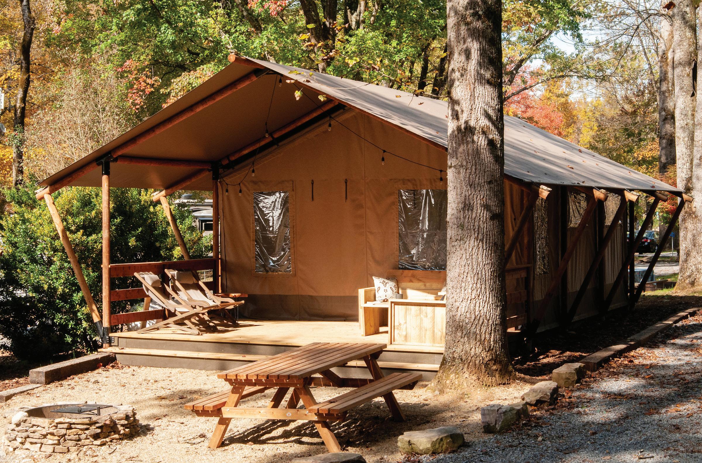
The park has eight campgrounds—all of them can accommodate RVs of all sizes as well as tents, and four offer camping cabins. The campgrounds are spread throughout the park, so keep this in mind if you want to focus your stay in one specific area. We stayed at Stockade Lake South Campground because of its proximity to the town of Custer, which has restaurants, a grocery store, and gas stations. We also drove through Grace Coolidge campground and admired several of their creekside campsites.

There are many campground options located outside of Custer State Park and to the north, near Mount Rushmore. There are also four lodges in the park. Presidents Coolidge and Eisenhower each stayed at State Game Lodge, landing this property on the National Register of Historic Places.
SCENIC DRIVES

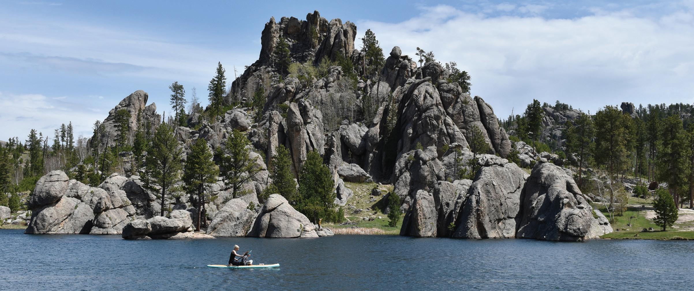
Needles Highway (SD Highway 87 North) 14 miles
This road offers sweeping views of granite cathedral spires, and you should allot about an hour to complete the drive. The route features the landmark Needle’s Eye Tunnel, a popular destination for everyone visiting this park. The tunnel is the narrowest of three along this route, and measures 8 feet wide and 9 feet, 9 inches high! For this reason, it’s very important to not bring your RV on this route.

Iron Mountain Road 17 miles
This road connects Custer State Park to Mount Rushmore National Memorial. The road is designed for enjoying the scenery, so give yourself at least an hour to complete it. There are three tunnels along this winding route as well, the narrowest of which is 10 feet, 9 inches wide and 11 feet high. The highlight of this drive is the Doane Robinson tunnel, which provides a view of Mount Rushmore in the distance as you pass through. The famous pigtail bridges, designed to drop in altitude quickly, are also along this route. Wildlife Loop Road 18 miles Due to the wildlife along this loop, give yourself 1.5 hours to complete it. During this drive, you will encounter the park’s main attraction—more than 1,400 free-roaming buffalo. You will also encounter prairie dogs and burros, who will be looking for a free meal as you drive by.
HIKES

We tried to hit as many of the hikes as possible, but we weren’t able to complete two of the more popular hikes—Sunday Gulch and Black Elk Peak. Sunday Gulch was closed, and we had hit our limit before tackling Black Elk Peak, a strenuous 6.5-mile out-and-back trail.
Badger Clark Trail

Named after South Dakota’s first poet laureate, this is an easy 0.8 -mile loop trail with a climb as you make your way through a dense pine forest. The trail is located behind Badger Clark’s former house. Badger built and lived in the house until his death in 1957. It was purchased by the state of South Dakota and preserved, and park visitors can tour it during the summer.
Cairn Trail
This 0.3-mile loop trail located behind the Peter Norbeck Outdoor Education Center is rated as moderate difficulty due to the healthy 164-foot climb to the top before heading down. Views of the Black Hills on one side and Grace Coolidge Lodge and Highway 16A on the other make the climb worth it!
Legion Lake Trail
This easy 0.7-mile loop trail around Legion Lake provides views of the lake and Legion Lake Lodge. This is a great hike for families with children. Stop at the lodge for lunch on the outdoor deck, or grab a snack in the store.
Sylvan Lake Shore Trail
Sunday Gulch Trail, Black Elk Peak, and Little Devils Tower
Lovers Leap Trail
To get your heart pumping, try this moderate 4-mile loop trail with a rather steep climb of 626 feet. Views of past forest fires are evident during the ascent. White birch trees line Galena Creek, which you will cross over on several plank bridges. Get the climb over quickly by going clockwise, and keep an eye out for poison ivy.
Stockade Lake Trail
This moderate 1.5-mile loop trail has you climb 419 feet to the top before making your way down. Views of Stockade Lake, the granite Needles to the north, and spring wildflowers made this one of my favorite hikes in the park. Little Devils Tower This strenuous 3-mile hike features a steep rock scramble to the top, but the views are stunning! If you can handle it, this should be on your list. We started this hike at Sylvan Lake, where trail #4 will take you to Little Devils Tower. If you wish, you can continue on this trail to the Cathedral Spires trail. We hiked approximately 0.6 miles of that one before turning back.

From the cathedral spires and ponderosa pine forests to the rolling hills and pristine lakes, Custer State Park is an outdoor paradise with something for everyone. Park management has done an excellent job keeping the park current while focusing on enhancing the experience! ■
FUN FACTS
■ The annual Buffalo Roundup is held each September. Range conditions determine herd size, and excess buffalo are sold at auction to manage the herd.
■ The granite spires within the park were considered as a possible site for the presidential monument before Mount Rushmore was chosen.
■ Until the late 1920s, visitors could ride burros to the top of Black Elk Peak. The burros were released into the park when the rides were discontinued.
■ Black Elk Peak, which sits at 7,424 feet, is the highest peak between the Rocky Mountains and the European Alps.
Follow Brian and Dawn Massa’s travels at savvy-traveler.com and on Instagram @savvytraveler2