8 minute read
10 Scenic Hikes in Sedona


By Nicoll Davis
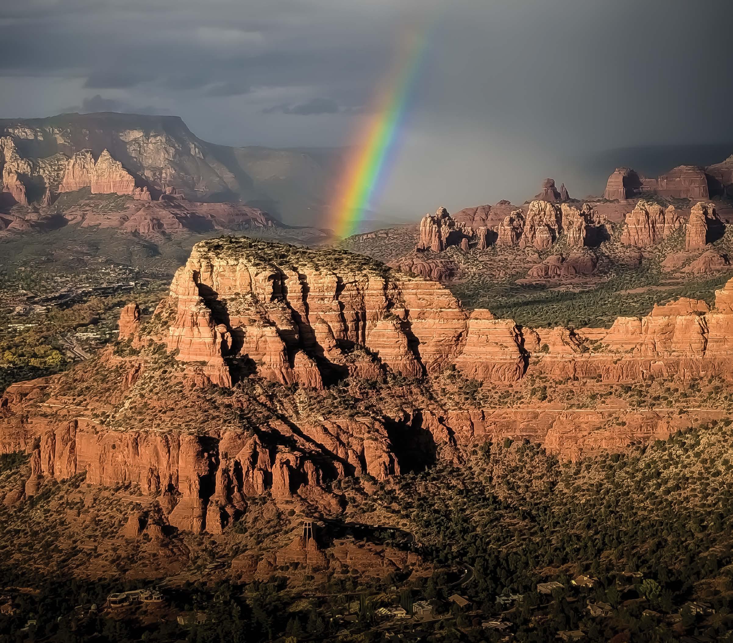
The red rocks of Sedona are unlike any other geological formation in the world. With their vibrant red color and unique shape, it’s easy to see why they’re so popular with tourists. But on top of just being pretty, Sedona is home to miles and miles of hiking trails. Winding through the towering red rocks, these trails offer hikers the chance to explore caves, natural arches, and magical pools. Sedona is a hiker’s paradise!
Advertisement
KNOW BEFORE YOU GO
Before you set out to explore the stunning Sedona landscape, be sure to purchase a Red Rock Pass. The United States Forest Service has created the Red Rock Pass program to help maintain and enhance Sedona’s red rock landscape. If you park on National Forest land in the red rock area, you’re required to display a valid pass on your windshield or to have purchased an online pass
BEST TIME TO VISIT
The best time of year to hike in Sedona depends on what you are hoping to see and do. If you want to avoid crowds, the shoulder seasons of spring and fall are ideal. The weather is also more pleasant at this time of year, with moderate temperatures and fewer chances of rain. If you’re hoping to see wildflowers in bloom, late spring is the best time to visit. Here are ten of my favorite Sedona-area hikes. Unless otherwise noted, trail lengths and elevation gains for the hikes in this article are as listed on AllTrails.
1 - Soldier Pass Trail
Trail Length: 4.5 miles round trip, Elevation Gain: 839 feet
Soldier Pass Trail is one of the most popular hikes in Sedona. It’s one of my absolute favorites because it has so many scenic stops along the way, like the Devil’s Kitchen Sinkhole, Seven Sacred Pools, and the Soldier Pass Cave. There is a small parking lot, but as of 2022, the lot is closed whenever the free shuttle service is running, so be sure to check the shuttle schedule in advance.
Here are some scenic stops along the trail:
Devil’s Kitchen Sinkhole
Just 0.25 miles down the Soldier Pass Trail is a massive sinkhole that collapsed in 1995. Sinkholes are most commonly created when rainwater dissolves limestone caves beneath the surface and the caves collapse suddenly.
Seven Sacred Pools

Continuing down the Soldier Pass Trail, you’ll emerge from the trees to see the Seven Sacred Pools on your left. If it’s your first time on this hike, keep your eyes peeled—we walked right by them the first time!
Soldier Pass Cave

Soldier Pass Cave
1.3 miles from the start of the main trailhead, a spur trail takes hikers on a moderate climb up steep terrain. Once at the cave entrance, adventurers can choose to crawl or climb their way inside to explore the wonders of this hidden world.
2 - Bell Rock Loop

Bell Rock Loop
Trail Length: 1.8-mile loop Elevation Gain: 203 feet
Bell Rock is an iconic formation that is easily recognizable for its bell-like shape. Just a short drive from Sedona down Highway 179, you can find the Bell Rock Trailhead and hike the 1.8-mile loop around Bell Rock. You’ll also be able to see Courthouse Butte on this trail. This hike rewards you with stunning panoramic views of the entire Sedona area.
3 - Robbers Roost Trail

Robbers Roost Trail
Trail Length: 3 miles round trip (1 mile if using the 4×4 trail), Elevation Gain: 462 feet
This large, open cave, also known as the Hide Out Cave or Shaman’s Cave, is located atop a cliff, offering stunning views of the surrounding landscape. According to local legend, Robbers Roost was a hideout for bandits and bootleggers. And when you see this cave in person, it’s easy to imagine outlaws using it as a hiding place. But what makes Robbers Roost unique is its natural rock window. This opening in the cliff face allows sunlight to pour into the cave, creating a truly magical atmosphere.
4 - Loy Canyon Trail

Loy Canyon Ruins
Trail Length: 9.8 miles round trip, Elevation Gain: 2,326 feet
Loy Canyon is an excellent hiking trail for history buffs and anyone interested in ancient cultures. The canyon is home to well-preserved Native American ruins, providing insight into how local tribes once lived. These ruins are ancient and sacred, so please respect them and preserve these sites by leaving no trace. Do not touch or move the ruins.
5 - DEVIL’S BRIDGE TRAIL
Elevation Gain: 521 feet Trail Length: 3.9 miles round trip
The Devil’s Bridge Trail is one of the most popular trails in Sedona, and for good reason. Devil’s Bridge is the largest natural sandstone arch in the Sedona area and is an impressive 54 feet tall and 45 feet wide. The natural rock bridge is one of the most photographed locations in Sedona, thanks to its iconic status. And for first-time Sedona visitors, hiking Devil’s Bridge is like a rite of passage.
This hike can be quite crowded, especially at peak times. If you’re looking to avoid the crowds, I recommend hiking Devil’s Bridge via Chuck Wagon Trail. It’s a more scenic and secluded route to reach the bridge.
6 - Subway Cave

Subway Cave
Trail Length: 5.3 miles round trip, Elevation Gain: 1,000 feet
Many secret Sedona trails are becoming a lot less secret, but the hike to the cliff dwellings on Boynton Canyon leading to the secret Subway Cave is still my favorite trail in Sedona. To find the cave, hike down Boynton Canyon Trail for 2.01 miles and veer off the beaten path at the alligator bark tree. This hidden trail will take you to the Subway Cave, an old ruin and keyhole-shaped cave. To get into the cave, you’ll have to do some scrambling up the middle of the keyhole. The trail length and elevation gain listed here are based on taking the trail to Subway Cave, so they differ from what’s listed on AllTrails for the Boynton Canyon Trail.
7 - Cathedral Rock

Cathedral Rock
Trail Length: 1.2 miles round trip Elevation Gain: 741 feet
The Cathedral Rock trailhead is located just a few minutes from the city center, and the trail itself is relatively short and easy to navigate, with rewarding views, making this a very popular hike. Like Soldier Pass Trail, the parking lot is now closed during shuttle service hours.
Beginning with an easy walk through a driedup creek bed, the trail takes a short ascent up to a plateau. This plateau offers stunning views of the surrounding area, including the Chapel of the Holy Cross and the Coconino National Forest. The plateau is a great place to catch your breath and take pictures before continuing on to the summit. The final stretch of the trail is a bit more challenging, with some steep sections and loose rock, but the views from the top are more than worth it.
8 - Bear Mountain Trail
Trail Length: 4.9 miles round trip Elevation Gain: 2,024 feet
Sedona is famous for its red rocks, and Bear Mountain is no exception. The trail winds its way up an exploded hillside, offering hikers stunning views of Sedona. This hike has some challenging sections, and there are several opportunities to rest and take in the scenery along the way. The summit of Bear Mountain offers 360-degree views of Sedona and the surrounding area.
9 - Doe Mountain

Doe Mountain
Trail length: 1.5 miles round trip (2.75 miles if you walk the whole trail on top of the mountain) Elevation Gain: 511 feet
The Doe Mountain hike is one of my favorite hiking trails for sunsets in Sedona. With a gradual incline, you’ll pass through some trees and meander alongside a cactus or two as you venture to the top of the mountain. At the top, you’ll be rewarded with great views of Sedona.
10 - Birthing Cave

Birthing Cave
Trail Length: 2 miles round trip, Elevation Gain: 291 feet
The birthing cave is a Sedona landmark famous for its unique teardrop shape and sacred powers. I honestly expected the cave to be a little bigger, but since most photographers take pictures of the birthing cave with wide lens cameras, the size is deceiving. Regardless, it was an interesting experience. The cave can get pretty crowded, so I suggest doing this hike in the morning.
With so many trails to explore, we hope you’ll get the chance to visit this stunning destination and take in the incredible scenery for yourself! ■

