

SO WIE ICH WILL


SO WIE ICH WILL
THE WAY I WANT
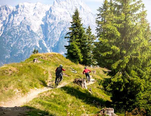

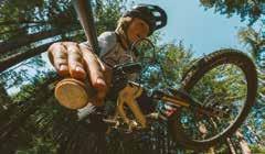
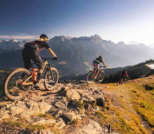
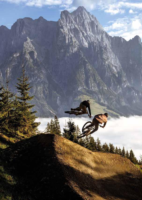
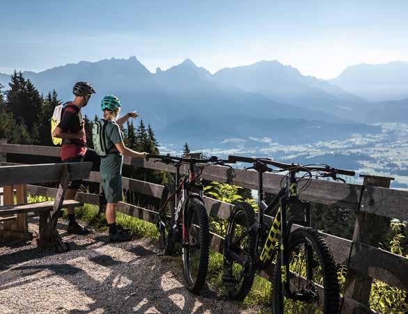
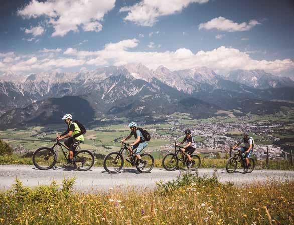
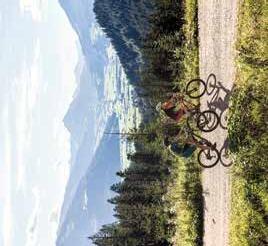
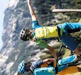
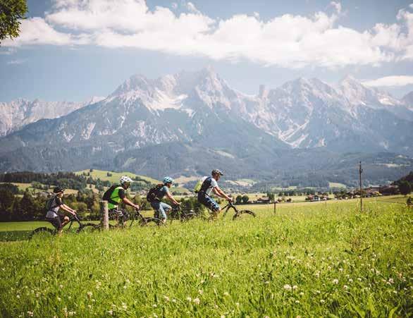
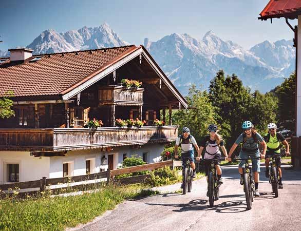
Das sanfte Geräusch der rollenden Reifen. Die spektakuläre Aussicht. Heute spielen die Waden besonders gut mit – und plötzlich ist es da: das Glücksgefühl am Bike.
Saalfelden Leogang ist wie geschaffen für Urlaub auf zwei Rädern. Unzählige Mountainbike-Strecken in allen Schwierigkeitsstufen und zahlreiche Talradwege erwarten dich hier – und eröffnen dir eine unglaubliche Tourenvielfalt zwischen Berg und Tal. Wähle jeden Tag aufs Neue zwischen anspruchsvollen Gipfeltouren, abwechslungsreichen Single- und Flowtrails oder familienfreundlichen Radausflügen. Ambitionierte Mountainbiker, Downhiller und Freerider loten ihre Grenzen im EPIC Bikepark Leogang aus. Du zählst dich eher zu den Genussradlern? Dann such dir eine der vielen gemütlichen Touren durchs Tal aus. Oder hol dir mit einem E-Bike einfach etwas Extra-Schub.
Ganz gleich, ob du die Landschaft genießen, dich auspowern oder etwas völlig Neues ausprobieren willst: In Saalfelden Leogang findest du nicht nur die passende Umgebung dafür, sondern auch sämtliche Services rund ums Bike – von Fahrtechniktrainings und Guided Tours über Bikeshops mit Verleih bis zu spezialisierten Bikehotels.
Simply marvellous: Feeling strong, the wind at your back, enjoy the soft hum of the spinning wheels and the spectacular views. This is cycling at its very best.
Saalfelden Leogang is ideal for holidays on two wheels: numerous mountain bike routes of all difficulty levels and various valley cycle paths await discovery. Here there's truly an unbelievable variety of tours from the highest peaks to the peaceful valley below. Every day, you can choose between challenging summit tours, varied single and flow trails or family-friendly bike excursions. Meanwhile, ambitious mountain bikers, downhillers and freeriders can test their skills to the limit at the EPIC Bikepark Leogang. Or are you perhaps more of a leisure-minded cyclist?
Choose one of the many leisurely tours through the valley or simply opt for a little extra thrust with an e-bike. Regardless of whether you want to enjoy the scenery, power up or try something completely new: Saalfelden Leogang is the place to be! Featuring all biking services from riding technique trainings and guided tours to bike shops with rentals and specialised bike hotels.
ÖSTERREICHS GRÖSSTE BIKE-REGION
Über 90 km Single-Trails, Downhill-Tracks und Flow-Lines, mit den dazugehörigen 9 Bergbahnen, sind im gemeinsamen Biketicket inkludiert.
AUSTRIA ' S LARGEST BIKE-REGION


Experience more than 90 kilometres of singletrails, downhill tracks and flow lines as well as nine lifts with only one single Bike Ticket.




Mit dem „Salzburger MTB-Leitsystem“ werden in Saalfelden Leogang MTB-Routen und Single Trails einheitlich gekennzeichnet. Über eine entsprechende Farbcodierung sind die zwei grundsätzlichen MTB-Arten „Tour“ (Rot) und „Trail“ (Gelb) sofort erkennbar.
A uniform MTB signage system will guide you through Saalfelden Leogang. With corresponding colour coding, the two basic MTB-types "Tour" (red) and "Trail" (yellow) can be immediately identified as such.
14,8
Piktogramm farbkodiert nach konditioneller Schwierigkeit (siehe S. 10)
Pictogram colour code according to difficulty level (see p. 10)
LEICHT
Eher kurz, nicht steil Gute Fahrbahndecke Keine besonderen Gefahrenbereiche Familienfreundlich
MITTELSCHWER
Mittellange Strecken, teilweise steiler Fahrbahnbeschaffenheit erfordert
MTB Ausrüstung, z. T. unübersichtliche, kurvenreiche Abschnitte erfordern sportliches Radfahrkönnen
SCHWER
Lange Strecken
Steil bzw. mit steilen Abschnitten
MTB Ausrüstung obligatorisch Situationsangepasstes & vorausschauendes Fahren
EASY
Relatively short, not steep
Good road surface
No particular dangers
Family friendly
INTERMEDIATE
Medium distance, steeper in some places
Road surface demands MTB equipment
Blind corners, winding passages demand sporty biking skills
DIFFICULT
Long distance, Steep or steeper passages
MTB equipment obligatory
Adapt speed etc. to situation & anticipate dangerous situations
FAHRRAD
MOUNTAINBIKE
MOUNTAINBIKE
sehr leicht | very easy leicht | easy
mittelschwierig | moderate schwierig | difficult
Unser Tipp:
Langsam beginnen und dann Step by Step steigern!
Our tip: Start slowly and improve step by step!
Weck deinen Körper und Geist auf. Schau dir die Line erstmal mit geringer Geschwindigkeit an. | Wake up your body and mind. Inspect the line at low speed.
Mach ein paar Wiederholungsfahrten um mehr Flow zu bekommen und dich an die Sprünge etc. zu gewöhnen. | Lap the line a few times to get the flow of the features.
Steigere deine Geschwindigkeit und trau dich an größere Sprünge ran. | Work your way up to faster speeds and larger features.
Richtiges Equipment auf unseren Lines & Trails
Damit ihr auf unseren Lines im Bikepark Leogang und auf den Singletrails in der Region sicher unterwegs seid, empfehlen wir euch folgendes
Equipment:
Die Lines im Epic Bikepark Leogang werden durch das Shaper Team gebaut und täglich gewartet. Sie sind alle Downhill orientiert und beinhalten Sprünge, Anlieger, Drops etc.
The lines in the Epic Bikepark Leogang are built by the Shaper Crew and maintained daily. They are all Downhill oriented and include jumps, berms, drops, etc.

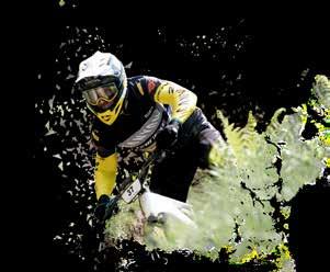
1. Integralhelm (Pflicht!) | Full Face Helmet (obligatory!)
2. Brille | Goggle
3. Protektorenjacke (Rücken-, Schulter, Brust, Ellbogenschoner) | Safety jacket (Back-, Shoulder-, Chest-, Ellbow protection)
4. Handschuhe | Gloves
5. Knieschoner | Knee protectors
6. Bikeschuhe | Bike shoes
Optional: Nackenschutz | Neckbrace
Recommended equipment on our lines & trails In order to be safe on our lines in the Bikepark Leogang and on the single trails in the region, we recommend the following sports equipment:
Die Single Trails befinden sich außerhalb des Bikeparks in der Region Saalfelden Leogang. Sie werden natürlich angelegt mit Wurzeln, natürlichem Waldboden und Northshores, die Feuchtflächen queren, und können auch kurze Uphill Passagen enthalten.
The single trails are located outside the bikepark in the Saalfelden Leogang region. They are naturally laid out with roots, natural forest ground and northshores that cross wetlands, and may also include short uphill passages.
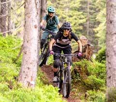
1. Enduro Helm | Enduro Helmet
2. Brille | Goggle or Glasses
3. Protektorenrucksack (für ein Erste Hilfe Paket, Flickzeug, extra Schlauch, zusätzliche Bekleidung, etc.) | Protector backpack (bring a first aid kit, repair kit & tools, extra clothing, etc.)
4. Handschuhe | Gloves
5. Knieschoner | Knee protectors
6. Bikeschuhe | Bike shoes

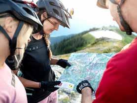
Gesund aufs Rad Mountainbiken ist Ausdauersport.
Fahre nur gesund und überschätze dich nicht!
Sorgfältig planen Bereite dich gründlich vor (Karten, Bücher, Internet, Wetter) und passe deine Tour den aktuellen Gegebenheiten an!
#1
Nur freigegebene Wege befahren Benütze nur freigegebene Straßen oder Wege und respektiere lokale Sperrungen!
#2
Healthy Biking
Mountain biking is a sport that demands stamina. Ride only in good health, and don't overestimate your capabilities!
Check dein Bike
Kontrolliere vor jeder Fahrt Bremsen, Luftdruck, Räder, Federung und Schaltung. Lass dein Bike einmal im Jahr im Fachbetrieb überprüfen!
#3
Plan carefully
Prepare thoroughly (check maps, guidebooks, the Internet, weather reports) and adjust your plans according to current conditions!
#4
Ride only on authorized routes
Use only authorized roads and paths and respect local closures!
Inspect your bike
Before each ride, check the brakes, tire pressure, wheels, suspension and gearshift. Have your bike checked at least once a year by a specialist!
Vollständige Ausrüstung
In jeden Rucksack gehören: Wärmende Kleidung, Regenschutz, Reparaturset, Erste-Hilfe Paket, Mobiltelefon, Licht, Handschuhe, Brille sowie Essen & Trinken!
Immer mit Helm Bergauf und bergab, immer mit Helm!
Zusätzliche Protektoren können vor Verletzungen schützen!
#5
Fußgänger haben Vorrang
Nimm Rücksicht, indem du dich frühzeitig ankündigst und das Tempo reduzierst!
#6
Bring all necessary equipment/supplies
Your backpack should include: warm clothing, rain gear, repair kit, first-aid kit, mobile phone, flashlight, gloves, protective glasses and sufficient food and water!
Tempo kontrollieren
Passe deine Geschwindigkeit der Situation an und fahre bremsbereit!
#7
Always wear your helmet
Whether you're on your way up or down, always wear a helmet! Additional protective gear can help you avoid injuries!
Pedestrians have the right-of-way Leave yourself plenty of time to signal your presence and reduce your speed!
Watch your speed
Adjust your speed to current conditions and always be ready to brake! #8
Hinterlasse keine Spuren
Durch kontrolliertes Bremsen verhinderst du Bodenerosion und Wegeschäden. Nimm deinen Abfall mit und vermeide Lärm!
Rücksicht auf Tiere
Fahre bei Tageslicht (2 h nach Sonnenaufgang & 1 h vor Sonnenuntergang) um Störungen der Tiere zu vermeiden! Nähere dich im Schrittempo und schließe Weidezäune nach der Durchfahrt!
#9
#10
Leave no trace behind
By riding carefully, you'll help avoid soil erosion and damage to the path. Take your waste with you and avoid unnecessary noise!
Watch out for animals
Ride during daylight (2 h after sunrise / 1 h before sunset) to avoid disturbing animals! Approach them at walking speed and close all gates after passing through them!
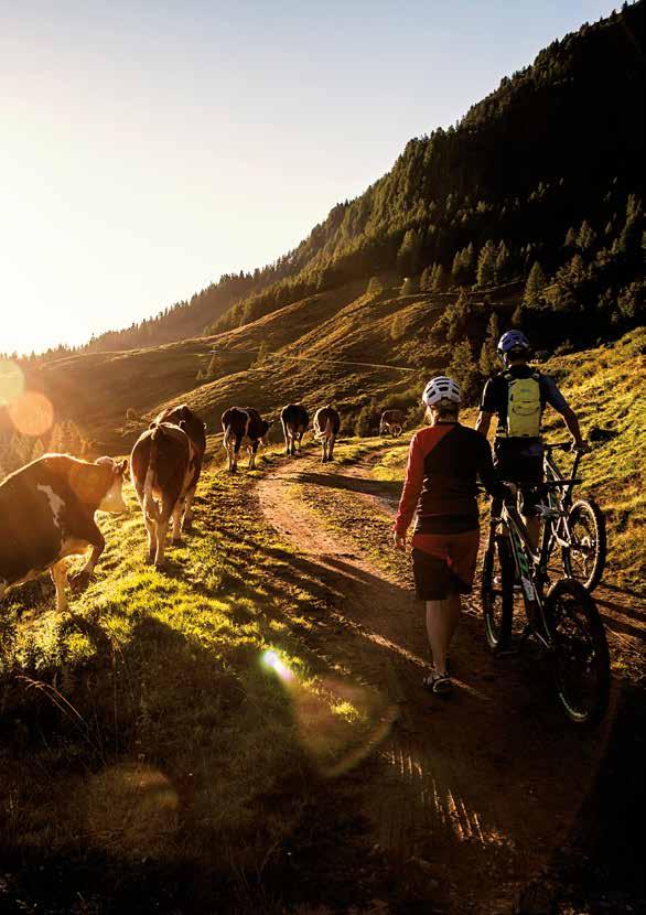

Die Naturlandschaft Salzburgs bietet Platz für Wildtiere, Pflanzen und Menschen. Voraussetzung ist jedoch, dass du dich als Naturnutzer oder Naturnutzerin an gewisse Regeln hältst:
The natural landscape of Salzburg provides space for wild animals, plants and people. Thus it is essential that you stick to certain rules:
Halte dich während der Morgen- und Abenddämmerung sowie in der Nacht nicht im Wald auf, damit das Wild in Ruhe Nahrung finden kann. Meide Ruhezonen, sie sind wichtige Rückzugsgebebiete des Wildes. #1
Do not stay in the forest at dawn or dusk and at night, so that the game can find food in peace. Avoid resting areas, they are important retreat areas of animals in the forest.
Bleib auf markierten Wegen, damit sich die Wildtiere an dich gewöhnen können. So empfinden sie dich normalerweise nicht als Bedrohung.
Stay on the official trails so that the wildlife can get used to you. In this way they don't see you as a threat. #2
Beachte Schilder und Markierungen: Sie bieten wichtige Informationen zum richtigen Verhalten in der Natur.
Note signs and markings: they provide important information about the correct behavior in nature. #3
Führe Hunde immer an der Leine; sie verängstigen und gefährden sonst Wildtiere.
Always keep dogs on a leash; otherwise they scare and endanger wildlife. #4
Nimm deinen Abfall wieder mit nach Hause, er verunreinigt die Natur und kann für Tiere gefährlich werden.
Take your waste back home, it pollutes nature and can be dangerous for animals. #5
Genieße die Ruhe im Wald und Lärme nicht unnötig herum. Du musst aber auch nicht flüstern. Du kannst dich ganz normal unterhalten, so können die Tiere dein Verhalten besser einschätzen.
Enjoy the peace in the forest and do not make unnecessary noise. You do not have to whisper either. You can talk normally, so that animals can better assess your behavior. #6
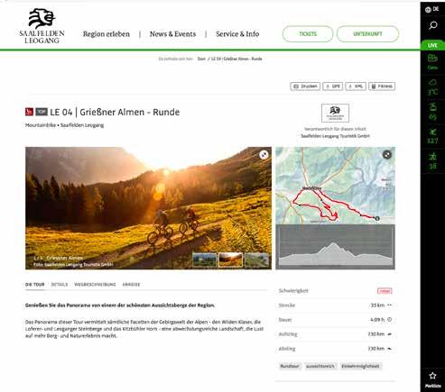
Suche deine Wunschtouren mit Zeitangabe, Höhenprofil sowie Tipps und Attraktionen des jeweiligen Weges in unserer digitalen Tourenkarte auf:
Search for the tours you want with specific duration, altitude profile as well as tips and attractions of the respective tour in our digital tour & trail map at:
bike.saalfelden-leogang.com






In den Tourenbeschreibungen findest du folgende Angaben:
1 Kilometer = Streckenlänge
2 Höhenmeter = Summe aller Anstiege
3 konditioneller & fahrtechnischer Anspruch
Diese Kriterien ermöglichen es allen BikerInnen, sich für die richtige Tour zu entscheiden.
Salzburg
The tour descriptions contain the following details:
1 Kilometres = Length of route
2 Altitude metres = The total of all ascents
3 Fitness and ability level of tour
These criteria enable all bikers to select a tour that meets their wants and needs.

Badhaus Leogang
LE01
Asitzbahn
Talstation 833


Forsthofalm



Berg Hütten Pirzbichl


Stöcklalm
Asitzbahn Mittelstation
Steinbergbahn (nur Winterbetrieb)
Krallerhof
Rain
Zusätzlich zum Bikefolder gibt es in den TVBs & Hotels die Bike Tourenkarte und eine eigene Line & Trail Map mit der man Österreichs größte Bike-Region und den Epic Bikepark Leogang entdecken kann. Diese dienen zur genauen Übersicht des Bike-Wegnetzes in Saalfelden Leogang.
Sappmais
In addition to the bike folder, a pull out bike touring map and a separate line & trail map with which you can discover Austria' s largest bike-region and the Epic Bikepark Leogang, is available in the tourism board offices and in hotels to provide an exact overview of the bike tour offers in Saalfelden Leogang.
Start Start
Fahrtrichtung
Driving direction

SO WIE ICH WILL
THE WAY I WANT
Zusätzlich zum Bikefolder gibt es in den TVBs & Hotels die Bike Tourenkarte und eine eigene Line & Trail Map mit der man Österreichs größte Bike-Region und den Epic Bikepark Leogang entdecken kann. Diese dienen zur genauen Übersicht des Bike-Wegnetzes in Saalfelden Leogang.


In addition to the bike folder, a pull out bike touring map and a separate line & trail map with which you can discover Austria's largest bike-region and the Epic Bikepark Leogang, is available in the tourism board offices and in hotels to provide an exact overview of the bike tour offers in Saalfelden Leogang.
Ideal short tour to warm up or test your mountain bike. Directly at the starting point is also a bike rental. At the beginning you bike comfortably along the cycle path to Hütten and into the Schwarzleotal. After a little over 2 km you turn left and ride along some bends up to the wonderfully situated hotel Forsthofalm. Immediately after the hotel you can get an idea of the downhill lines of the Bikepark Leogang, which is crossed here. After the underpass, turn left and follow the forest road to the starting point at the valley station of the Asitzbahn.
Start & Finish Leogang Asitzbahn valley station
Difficulty easy
Ideale Kurztour zum Einradln bzw. Testen
Deines Mountainbikes. Direkt beim Startpunkt befindet sich auch ein Bikeverleih.
Zu Beginn geht es gemütlich den Radweg entlang nach Hütten und hinein ins Schwarzleotal. Nach etwas mehr als 2 km zweigt man links ab und erreicht entlang einiger Kehren das wunderbar gelegene Holzhotel Forsthofalm. Gleich nach dem Hotel kann man sich ein Bild der Downhill-Lines des Bikepark Leogang machen, die man in diesem Bereich quert. Nach der Unterführung biegt man links ab und folgt der Forststraße zum Startpunkt bei der Asitzbahn Talstation.
Leogang Asitzbahn Talstation
Start & Ziel
Schwierigkeit leicht
Leogang –30,9 km –1090 hm
SCHWARZLEOSCHWARZBACH
LE 02


Anderl- hof
Badhaus Leogang
Badhaus Leogang
LEOGANG LEOGANG
Hütten
LE 02
Asitzbahn Talstation
S
Anderl- hof KrallerAlm
Rain
Steinbergbahn
Berg
Forsthof- alm
Asitzbahn Stöcklalm
Berg der Sinne
Matz- alm
Tödlingalm
Blechwand 1530m
G r i e ß n e r A l m e n
Kuhfeldhörndl 1942m
Knappenstube alm
AlteSchmiede
AsitzBräu
Unterberghaus/ Knappenstube
Schaubergwerk
Sonnkogel 1727m
S ip ble re nemlag
Scheltaualmen Adamalm
Lindlalm
Großer Asitz 1914m
Schönleiten- hütte
Wildenkar- hütte
Leogang –30,9 km –1090 hm

Anderlhof
Leogang –30,9 km –1090 hm Hier
LE 02 SCHWARZLEOSCHWARZBACH
This local circuit around Leogang takes you to the valleys of the Schwarzbach and Schwarzleobach. This is one of the few mountain bike circuits which is equally beautiful in both directions and has a consistent profile throughout. Whichever side you start from, there is a lengthy ascent to the head of the valley to start with. This is followed by an uphill and downhill stretch with panoramic views throughout. If your energy is dwindling, there are various points along the way where you can change your route and take a different forest road into the valley.
This local circuit around Leogang takes you to the valleys of the Schwarzbach and Schwarzleobach. This is one of the few mountain bike circuits which is equally beautiful in both directions and has a consistent profile throughout. Whichever side you start from, there is a lengthy ascent to the head of the valley to start with. This is followed by an uphill and downhill stretch with panoramic views throughout. If your energy is dwindling, there are various points along the way where you can change your route and take a different trail into the valley.
Die Hausrunde von Leogang mit den zwei Tälern des Schwarzbaches und des Schwarzleobaches. Eine der wenigen Mountainbike Runden, die in beide Richtungen wirklich schön zu fahren ist und ein ähnliches Profil aufweist. Von beiden
Leogang Asitzbahn valley station
Leogang Asitzbahn valley station
Start & Finish
Start & Finish
Difficulty intermediate
Difficulty intermediate
Seiten steht zunächst ein langer Anstieg bis zum jeweiligen Talschluss am Programm. Danach ist es ein Auf und Ab, wobei sich stets ein anderes Panorama bietet. Sollten die Kräfte schwinden, gibt es auf dieser Runde auch einige Möglichkeiten abzubrechen und auf einem anderen Weg ins Tal zu fahren.
Die Hausrunde von Leogang mit den zwei Tälern des Schwarzbaches und des Schwarzleobaches. Eine der wenigen Mountainbike Runden, die in beide Richtungen wirklich schön zu fahren ist und ein ähnliches Profil aufweist. Von beiden Seiten steht zunächst ein langer Anstieg bis zum jeweiligen Talschluss am Programm. Danach ist es ein Auf und Ab, wobei sich stets ein anderes Panorama bietet. Sollten die Kräfte schwinden, gibt es auf dieser Runde auch einige Möglichkeiten abzubrechen und auf einem anderen Weg ins Tal zu fahren.
Leogang Asitzbahn Talstation
Start & Ziel
Leogang Asitzbahn Talstation Schwierigkeit mittelschwierig
Start & Ziel
Schwierigkeit mittelschwierig
Anderlhof
Badhaus
Bahnhof
AlteSchmiede
Unterberghaus/ Knappenstube
Blechwand 1530m
Sonnkogel 1727m
Kuhfeldhörndl 1942m
Spielberghorn 2044m
Spielbergtörl 1671m Bamkogel 1709m
Kohlmaiskopf 1794m
Maisereck 1675m
AsitzBräu
Panorama Alm


Leogang –18,9 km –650 hm
Schwarzleotal is a " cool " tip for mountain bikers on hot summer days in particular.
Always keeping to Schwarzleobach, this tour proceeds 500 metres altitude uphill to the head of the valley. There is a short section, where you have to get off and push the bike. You reach Lindlalm via a short section of woodland and meadows. This cosy Alpine hut, which gives a fantastic panorama and is a pure Alpine idyll, will ensure you quickly forget the ascent.
Das Schwarzleotal ist besonders an heißen Sommertagen ein „cooler“ Tipp für MountainbikerInnen. Immer am Schwarzleobach entlang geht es 500 Höhenmeter bergauf bis zum Talschluss. Hier wartet noch eine kurze Schiebestrecke. Über einen kurzen Wald und Wiesenweg erreicht man die Lindlalm. Diese gemütliche Almhütte, mit herr -
lichem Panorama und Almidylle pur, lässt den Anstieg schnell vergessen.
TIP: Combine this tour with a hike to Spielberghorn. Walking time from Lindlalm: approx. 1,5 hours. Please note: surefootedness required.
TIPP: Diese Tour kann man ideal mit einer Wanderung zum Spielberghorn verbinden. Gehzeit von der Lindlalm: ca. 1,5 Stunden. Achtung: Trittsicherheit erforderlich!
Warmingberg 1292m
Rothörndl 2406m
Hochbrett 2470m
Jungfrau 1910m
Rauenkopf 1806m
Tour Rast Forsthofalm
Hochfilzen
Hochdurchkopf 1722m
Blechwand 1530m
Sonnkogel 1727m
Kuhfeldhörndl 1942m
Grießenpass 976m
Kleberkopf 1757m


Leogang –35 km –835 hm
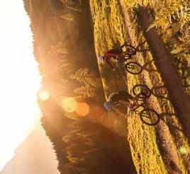
Enjoy amazing panoramic views!
Enjoy amazing panoramic views!
Man genießt das Panorama eines der schönsten Aussichtsberge.
On the cycle path, it is for the most part an easy uphill journey to Hochfilzen. There is a short section on the main road to cover before you head onto the forest road. The ascent to the Grießner Almen is a very pleasant climb. After a short descent there is a brief uphill section again. Then follows a longer descent to Feistenau. Enjoy great panoramic views of the surrounding mountains ranges –Wilder Kaiser, Leoganger Steinberge and the Kitzbüheler Horn. Having arrived in Hochfilzen, we then head back to Leogang.
On the cycle path, it is for the most part an easy uphill journey to Hochfilzen. There is a short section on the main road to cover before you head onto the forest road. The ascent to the Grießner Almen is a very pleasant climb. After a short descent there is a brief uphill section again. Then follows a longer descent to Feistenau. Enjoy great panoramic views of the surrounding mountain ranges –Wilder Kaiser, Leoganger Steinberge and the Kitzbüheler Horn. Having arrived in Hochfilzen, we then head back to Leogang. LE 04
Am Radweg geht es zunächst leicht bergauf nach Hochfilzen. Ein kleines Stück muss auf der Hauptstraße zurückgelegt werden, bevor es ins Gelände geht. Der Anstieg zu den Grießner Almen weist eine sehr angenehme Steigung auf. Nach einer kurzen
Abfahrt geht es nochmals kurz bergauf. Es folgt eine längere Abfahrt bis Feistenau. Das Panorama dieser Tour vermittelt sämtliche Facetten der Gebirgswelt der Alpen –den Wilden Kaiser, die Leoganger Steinberge und das Kitzbüheler Horn. Zurück in Hochfilzen, begeben wir uns auf den Rückweg nach Leogang.
Man genießt das Panorama eines der schönsten Aussichtsberge. Am Radweg geht es zunächst leicht bergauf nach Hochfilzen. Ein kleines Stück muss auf der Hauptstraße zurückgelegt werden, bevor es ins Gelände geht. Der Anstieg zu den Grießner Almen weist eine sehr angenehme Steigung auf. Nach einer kurzen Abfahrt geht es nochmals kurz bergauf. Es folgt eine längere Abfahrt bis Feistenau. Das Panorama dieser Tour vermittelt sämtliche Facetten der Gebirgswelt der Alpen –den Wilden Kaiser, die Leoganger Steinberge und das Kitzbüheler Horn. Zurück in Hochfilzen, begeben wir uns auf den Rückweg nach Leogang.
Leogang Asitzbahn valley station Difficulty intermediate
Start & Finish
Leogang Asitzbahn Talstation
Start & Ziel
Schwierigkeit mittelschwierig
Heueck 1757m
Römersattel 1202m
Dürrkarhorn 2287m
Schafspitze 2455m
Geierkogel 1753m
eesneseiW
Fleckberg 1241m
Leogang –27,8 km –360 hm 1285 hm Hier
Badhaus Leogang
Priesteregg
Otting Hirnreit Berg Hütten
LEOGANG
KrallerAlm
Anderl- hof
Grießen
Seealm
LE 05 SOFT-TRAIL-TOUR
Blechwand 1530m
Tödlingalm
Hochfilzen
Themenpark
Natur & Stein
Irracheck 1334m
Steinbergbahn Asitzbahn
Forsthof- alm
HuggenbergStöcklalm
S Asitzbahn Bergstation
Stöcklalm
Schaubergwerk
LE 05
Unterberghaus/ Knappenstube
Unterberghaus/ Knappenstube
AlteSchmiede
AsitzBräu
AsitzBräu
Panorama Forsthof-
Schönleiten- hütte
Sonnkogel 1727m
Lindlalm
S c h w a r z l e o rg ba ne
Grießenpass 976m
Örgenbaueralm
Örgenbaueralm
Gaststätte, Alm Restaurant, Hut Start Start N 1000m 2000m
Fahrtichtung
Haiderbergkogel 1875m
Driving direction
Single trail single trail S
Geierkogel 1853m
Großer Asitz 1914m
Wildenkar- hütte
Kohlmaiskopf 1794m
Spielberghorn 2044m
Panorama Alm
Rauchkuchl
Weberalm
Weberalm
Schabergkogel 1888m
Ederalm Asteralm
Saalbach Hochfilzen
Kleberkopf 1757m
Pfaffenschwendt
Feistenau
Kapelln
Trixlegg Berglehen Lahntal
Eiserne Hand
Bach gr a b e n S ip ble nemlagre Gr ie ß n e r A l m e n
Bamkogel 1709m
Wirtsalm
Tour Rast Spielberghaus
Burgeralm
Maisereck 1675m
Maisalm
Streuböden Alm
Sausteige 1912m

1285 hm
Leogang –27,8 km –360 hm
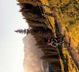
The tour starts with a trip on the cable car up to the Asitz mountain station (lift pass required!)
After completing the Asitztrail (intermediate difficulty) the route follows uphill and downhill sections to the Thurneralm. From here, it continues along a magnificent woodland and meadow trail (Egger-Trail) to the Spielberg plateau. Then, cycle past the Spielberghaus and Burgeralm and along a forest road down to the Gasthaus „Eiserne Hand“ in Fieberbrunn. Another short climb takes you to Hochfilzen. The return journey follows a comfortable cycle path back to Leogang.
Zuerst geht es mit Hilfe der Kabinenbahn bergauf zur Asitz Bergstation (Liftkarte erforderlich!).
Nach dem Asitztrail (Schwierigkeitsgrad: rot) führt der Weg abwechselnd bergab und bergauf bis zur Thurneralm. Von dort aus geht es weiter auf einem herrlichen Waldund Wiesen Trail (Egger-Trail) bis zum Spielbergplateau. Vorbei am Spielberghaus und der Burgeralm, fährt man auf dem Forstweg bergab bis zum Gasthaus „Eiserne Hand“ in Fieberbrunn. Ein kurzer Anstieg bringt dich nach Hochfilzen. Zurück geht es dann gemütlich auf dem Radweg bis nach Leogang.
TIP: Knee and elbow protectors recommended!
TIPP: Knieund Ellbogenprotektoren werden empfohlen!
Kuchelhorn 2500m
Lärchkopf 1515m
Bärenkopf 1308m
Rosenbühel 1372m
Brandlhorn 2095m
T
Rothörndl 2406m
Hochbrett 2470m
Jungfrau 1910m
Passauer Hütte
Leogang –31,8 km –640 hm 1570 hm
Passauer Hütte
Hochzint 2246m
Birnhorn 2634m
Badhaus Leogang
Ecking
Gh Saliter Hof
KrallerAlm
Berggasthof Huggenberg
Bockareit Stubn
Berggasthof Biberg
Weikersbacher Kopf 1541m
Sinnlehen Alm
Anderlhof
Steinbergbahn
Irracheck 1334m
Örgenbaueralm
Haiderbergkogel 1875m
Funeck 1806m
Stablberg Hinterjetzbach
Sausteige 1912m
Asitzbahn
Rauenkopf 1806m
Hochdurchkopf 1722m
Forsthofalm
Stöcklalm
LE 06
AsitzBräu AlteSchmiede
Scheideggriedel 1738m
Großer Asitz 1914m
Geierkogel 1853m
Hecherhütte
Wildenkarhütte
Rauchkuchl


Schönleiten- hütte Skyrest
1570 hm
Leogang –31,8 km –640 hm
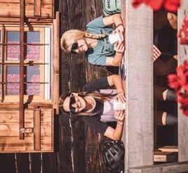
The tour starts with a trip on the cable car (Leogang) up to the Asitz mountain station (lift pass required!). After the Asitztrail (or alternatively the forest road) to the Schönleitenhütte, the route follows uphill and downhill sections past the Jahnhütte and Örgenbauernalm and on to the Berggasthof Biberg. Here you can enjoy magnificent panoramic views from one of the region's most beautiful vantage points and savour some culinary treats before tackling the descent down to Leogang. The last few kilometres back to the starting point follow comfortable terrain. LE 06
Zuerst geht es gemütlich mit Hilfe der Asitzbahn oder Steinbergbahn bergauf zur Bergstation (Liftkarte erforderlich!). Nach dem Asitztrail (oder alternativ über die Forststraße) zur Schönleitenhütte geht es abwechselnd bergauf und bergab, vorbei an Jahnhütte und Örgenbauernalm bis zum Berggasthof Biberg. Hier kann man das herrliche Panorama auf einem der schönsten Aussichtsberge der Region genießen und sich kulinarisch verwöhnen lassen, ehe man die Abfahrt Richtung
Leogang in Angriff nimmt. Die letzten Kilometer zurück zum Ausgangspunkt können dann ganz gemütlich absolviert werden.
Leogang Asitzbahn mountain station
Berggasthof Biberg
Leogang Asitzbahn Bergstation
Start
Ziel Leogang Asitzbahn Talstation
Schwierigkeit mittelschwierig
31,8 km 0 Schönleitenhütte Örgenbaueralm
km
Leogang –12,1 km –1140 hm
Stadtlbauer siedlung
LEOGANG
Freizeit- zentrum S LE 07
Hirnreit
Sinnlehen Alm
LE07
Themenpark Natur & Stein
Irracheck 1334m
Hütten
Leog a n g e r Ahc e
KrallerAlm Örgenbaueralm
Anderlhof
Anderlhof
Rain
Steinbergbahn
rawhcS z ab c h t a l
Asitzbahn
Forsthofalm
Stöcklalm
Berg der Sinne Weikersbacher
Matzalm
Durchenalm
AsitzBräu
AlteSchmiede
Großer
Schönleiten-


Leogang –12,1 km –1140 hm

On the legendary race course up to Leogang´s local mountain. From the center of Leogang, the tour leads into the very natural and quiet Schwarzbachtal. Passing the Matzalm you reach the end of the valley, where the road turns and you go up through the woods to the mountain station of Asitzbahn. Take the road past alpine pastures, partly a bit steeper, up to the storage pond and from there the last short climb to the summit. Course record: 46:33 minutes!
Auf der legendären Wettkampfstrecke auf den Leoganger Hausberg.
Vom Zentrum in Leogang führt die Strecke hinein in das naturbelassene und ruhige Schwarzbachtal. Vorbei an der Matzalm gelangt man zum Talschluss, wo die Strecke wendet und man durch die Wälder hinauf zur Bergstation der Asitzbahn gelangt. Entlang von Almwiesen geht's zum Teil etwas steiler hinauf zum Speicherteich und von dort den letzten kurzen Anstieg zum Gipfel. Der Streckenrekord: 46:33 Minuten!
Leogang –7,6 km –220 hm
LE 09 Priesteregg
GUNZI-TRAIL


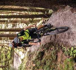
Start at the recreation centre in Leogang and cycle along the river to the junction railway station. From here you go uphill to Badhaus. Take the steep turn-off to the right onto a forest road and then continue slightly uphill. After a short descent, a further steep turn-off comes to the left. Follow the trail here, pass a small moor and drop into the Gunzi Trail. Through the Ullachtal you go back to the village of Leogang.
Los geht's beim Freizeitzentrum in Leogang und man radelt am Radweg entlang der Leoganger Ache bis zur Abzweigung Bahnhof. Von hier aus geht es bergauf bis zum Badhaus. Man nimmt die steile Abzweigung rechts auf einen Forstweg und fährt danach weiter leicht bergauf. Nach einer kurzen bergab Passage kommt auf der linken Seite eine weitere steile Abzweigung. Dem Wegverlauf hier einfach folgen, rechts vorbei an einem kleinen Moor und hinein in den Gunzi-Trail. Durchs Ullachtal gehts danach zurück ins Dorf Leogang.
Bahnhof
LEOGANG

Leogang –16,3 km –820 hm Start & Ziel

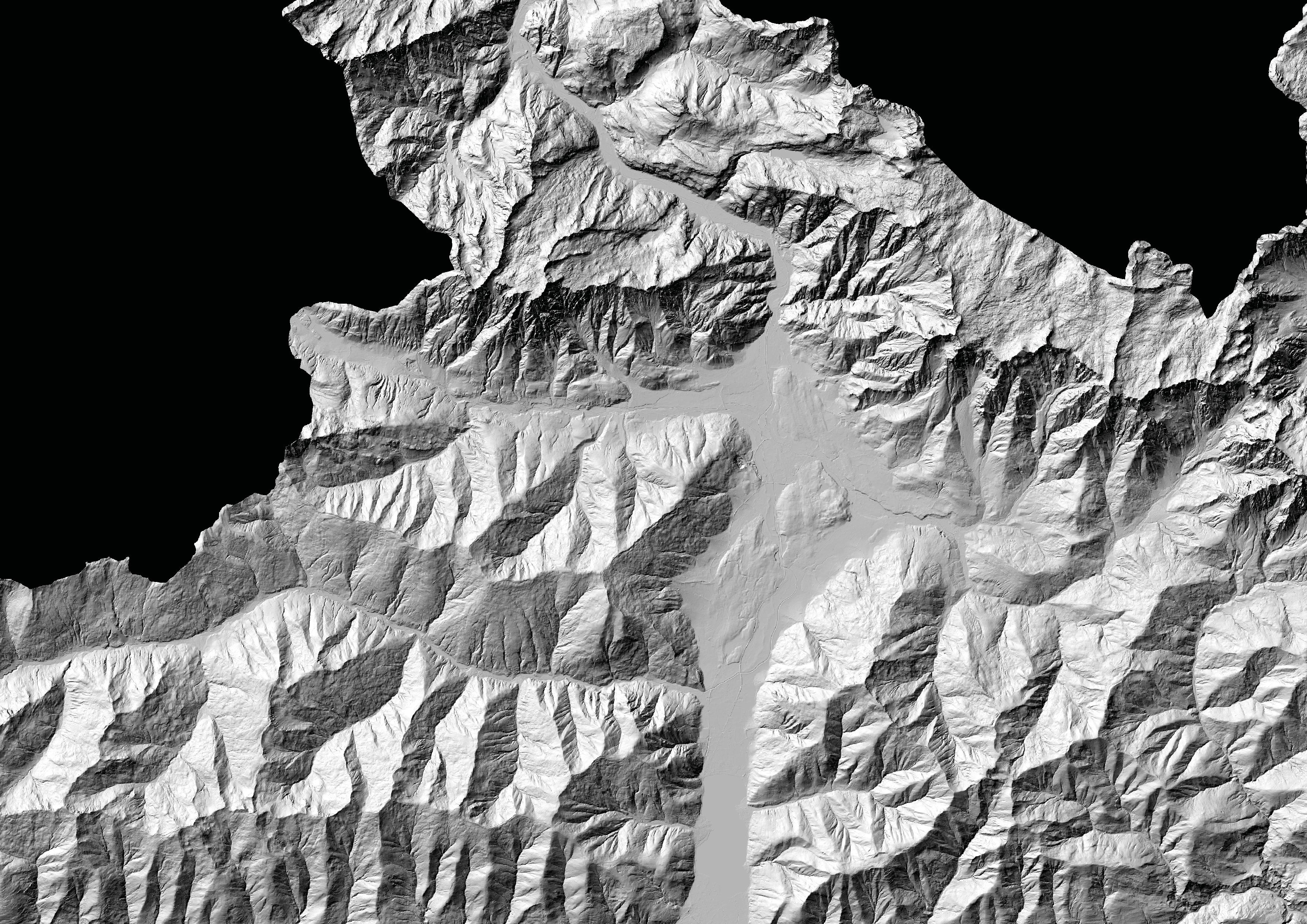
From the centre in Leogang, the tour leads into the natural Schwarzbachtal. Follow the forest road up to just below the mountain station. That's where the trail starts! In the first part ride on the varied trail with northshores and rooty passages down until you come back on a forest road. Follow this road for about 400 meters to reach the 2nd part of the trail. Passing the Matzalm you continue out of the valley over the Embachalm. At the end you return to the forest road, which leads back to the centre of Leogang. TIP: If you would like to start off a bit more comfortably, you can take the Asitzor Steinbergbahn cable car!
Vom Freizeitzentrum Leogang führt die Strecke hinein ins naturbelassene Schwarzbachtal und geht hinauf bis knapp unter die Bergstation. Im ersten Teil geht's auf dem schönen, abwechslungsreichen Trail mit Northshores und wurzeligen Passagen runter bis man wieder auf eine Forststraße kommt. Dieser folgt man ca. 400 Meter entlang, um zum 2. Teil des Trails zu gelangen. Vorbei an der Matzalm geht es weiter talauswärts über die Embachalm. Am Ende gelangt man wieder auf die Forstraße, die zurück ins Zentrum von Leogang führt. TIPP: Wer den Start etwas gemütlicher angehen möchte, kann mit der Asitzoder Steinbergbahn auffahren!
Leogang –38,5 km –595 hm
St. Ulrich
BUCHENSTEINWAND-RUNDE
Berg Hütten
Geierkogel 1753m
Grieslegg 1348m
Schwendt Flecken
Fleckberg 1241m
T I R O L T r u p p e n ü b u n g s p l a t z
Tour Rast Wiesenseehof Wiesenseehof
Hochfilzen
Hochfilzen
Pfaffenschwendt
Buchau
Kapelln
Feistenau
Seealm
Reith S A L Z B U R G
Grießenpass 976m
Grießen
Trixlegg
Berglehen


St. Jakob
St. Jakob
Mühlau
Moosbach
Grünbichl
Fieberbrunn
S4 Alm
Single trail single trail
Leogang –38,5 km –595 hm
Leogang –38,5 km –595 hm
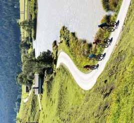
From the Asitzbahn valley station the route initially leads along a gentle incline towards Hochfilzen. This is where the tour around the Buchensteinwand begins. It is a very beautiful and varied tour with lots of short climbs and descents. The panorama on this ideal beginner tour includes various peaks such as the Wilder Kaiser, the Loferer and Leoganger Steinberge and the Kitzbüheler Horn. Once back in Hochfilzen, the route leads back towards Leogang.
From the Asitzbahn valley station the route initially leads along a gentle incline towards Hochfilzen. This is where the tour around the Buchensteinwand begins. It is a very beautiful and varied tour with lots of short climbs and descents. The panorama on this ideal beginner tour includes various peaks such as the Wilder Kaiser, the Loferer and Leoganger Steinberge and the Kitzbüheler Horn. Once back in Hochfilzen, the route leads back towards Leogang.
TIP: Don't forget to stop-off at the Griessner Seealm on your way back to enjoy home-made regional specialties.
TIP: Don‘t forget to stop-off at the Griessener Seealm on your way back to enjoy home-made regional specialties.
Start & Finish
Start & Finish Leogang Asitzbahn valley station
Leogang Asitzbahn valley station Difficulty easy LE 11 BUCHENSTEINWAND-RUNDE
Difficulty easy
Von der Talstation der Asitzbahn aus geht es zunächst leicht bergauf nach Hochfilzen. Hier be -
ginnt die eigentliche Runde um die Buchensteinwand, welche sich durch ihre kurzen Anstiege und Abfahrten als eine sehr variantenreiche Strecke
darstellt. Wilder Kaiser, Lofererund Leoganger Steinberge und das Kitzbüheler Horn gehören zum Panorama dieser perfekten Einsteiger-Tour. Wieder in Hochfilzen angekommen, geht es zurück
Von der Talstation der Asitzbahn aus geht es zunächst leicht bergauf nach Hochfilzen. Hier beginnt die eigentliche Runde um die Buchensteinwand, welche sich durch ihre kurzen Anstiege und Abfahrten als eine sehr variantenreiche Strecke darstellt. Wilder Kaiser, Lofererund Leoganger Steinberge und das Kitzbüheler Horn gehören zum Panorama dieser perfekten Einsteiger-Tour. Wieder in Hochfilzen angekommen, geht es zurück Richtung Leogang.
Richtung Leogang.
TIPP: Am Rückweg sollte man nicht auf die Einkehr in der Griessner Seealm vergessen, wo man mit selbstgemachten Spezialitäten der Region verwöhnt wird.
TIPP: Am Rückweg sollte man nicht auf die Einkehr in der Griessener Seealm vergessen, wo man mit selbstgemachten Spezialitäten der Region verwöhnt wird.
Leogang Asitzbahn Talstation
Leogang Asitzbahn Talstation
Start & Ziel
Start & Ziel
Schwierigkeit leicht
Zip here
Heueck 1757m
Kuchelhorn
Schafspitze 2455m
AsitzBräu
Großer
Wildenkar-
Ederalm
Rauchkuchl


40,7 km –1690 hm
Leogang –
Leogang –40,7 km –1690 hm
AlteSchmiede
Schönleitenhütte
From the valley station of the Asitz cable car you cycle along the cycle path towards Hochfilzen.
From the valley station of the Asitz cable car you cycle along the cycle path towards Hochfilzen.
From there you bike on to the Gasthof "Eiserne Hand" and via the Burgeralm to the Spielberghaus. The descent to Saalbach can then be made via the forest road. For enduro lovers there is the chance to take the "Höllen Trail". Then it gets a bit easier with the Kohlmaisbahn cable car taking you up the mountain and onto the Wildenkarhütte hut. The way back to Leogang goes along the Asitztrail. The way down from the Asitz to the valley can be made via Matzalm Trail or on the forest road.
From there you bike on to the Gasthof „Eiserne Hand“ and via the Burgeralm to the Spielberghaus. The descent to Saalbach can then be made via the forest road. For enduro lovers there is the chance to take the „Höllen Trail“. Then it gets a bit easier with the Kohlmaisbahn cable car taking you up the mountain and onto the Wildenkarhütte hut. The way back to Leogang goes along the Asitztrail. The way down from the Asitz to the valley can be made via the Steinberg Line by FOX or on the forest road.
Von der Talstation der Asitzbahn geht es entlang des Radweges in Richtung Hochfilzen. Von dort weiter zum Gasthof „Eiserne Hand“ und über die Burgeralm zum Spielberghaus. Es folgt die Abfahrt über den Forstweg nach Saalbach. Für Enduro-Liebhaber gibt es auch die Möglichkeit über den „Höllen Trail“ nach unten zu gelangen.
TIP: Use ellbow & knee protection!
Leogang Asitzbahn valley station
Start & Finish
Start & Finish Leogang Asitzbahn valley station
Difficulty difficult
Spielberghaus
Burgeralm
Eiserne Hand
30 km
Dann geht es gemütlich mit Hilfe der Kohlmaisbahn zur Bergstation und weiter zur Wildenkarhütte. Der Rückweg nach Leogang erfolgt über den Asitztrail. Vom Asitz runter ins Tal geht's über den Matzalm Trail oder die Forststraße.
Von der Talstation der Asitzbahn geht es entlang des Radweges in Richtung Hochfilzen. Von dort weiter zum Gasthof „Eiserne Hand“ und über die Burgeralm zum Spielberghaus. Es folgt die Abfahrt über den Forstweg nach Saalbach. Für Enduro-Liebhaber gibt es auch die Möglichkeit über den „Höllen Trail“ nach unten zu gelangen. Dann geht es gemütlich mit Hilfe der Kohlmaisbahn zur Bergstation und weiter zur Wildenkarhütte. Der Rückweg nach Leogang erfolgt über den Asitztrail. Vom Asitz runter ins Tal geht‘s über die Steinberg Line by FOX oder die Forststraße.
TIPP: Für die Trails werden Ellbogenund Knieprotektoren empfohlen!
TIPP: Für die Trails werden Ellbogenund Knieprotektoren empfohlen!
Talstation
Leogang Asitzbahn
Leogang Asitzbahn Talstation
Start & Ziel
Start & Ziel
Schwierigkeit schwierig
Schwierigkeit schwierig
Seealm
40,7 km 0
10 km 20 km


From the valley station of the Asitzbahn, follow the LE 01 | Forsthofalm-Runde approx. 230 HM
Von der Talstation der Asitzbahn folgt man der LE 01|Forsthofalm-Runde und tritt ca. 230 HM
uphill to the Forsthofalm. The natural, hand-built single trail starts above the Forsthofalm and meanders through a beautiful forest down in the Schwarzleotal. At a length of 1800 meters you can expect several Northshores, technical switchbacks and flowing passages. And all this with a great view of the Leogang Steinberge. Once at the bottom, it either goes back to the valley station or you take the climb again and ride the Knappenor Forsthof trail (Difficulty: difficult).
bergauf bis zur Forsthofalm. Der naturbelassene, handgebaute Single Trail startet oberhalb der Forsthofalm und schlängelt sich durch einen Mischwald hinunter in das Schwarzleotal. Auf 1800 Metern erwarten dich mehrere Northshores, technische Spitzkehren und flowige Passagen mit einem tollen Ausblick auf die Leoganger Steinberge. Unten angekommen geht's wieder zurück zur Talstation oder man nimmt nochmal den Anstieg und freut sich danach auf die Abfahrt am Knappenoder Forsthoftrail (Schwierigkeitsgrad: schwierig).


Leogang –5,9 km –215 hm

From the valley station of the Asitzbahn, follow the LE 01 | Forsthofalm-Runde approx. 230 HM
uphill to the Hotel Forsthofalm. Here you will find a fairytale landscape! The trail leads past high rocks and crosses several streams through a beautiful forest. Pure biking pleasure on 2000 meters natural, hand-built trail with many Northshore elements. Once at the bottom, it either goes back to the valley station or you take the climb again and ride the Knappenor Schwarzleotrail.
Man folgt von der Talstation Asitzbahn der LE 01| Forsthofalm-Runde und tritt ca. 230 Höhenmeter rauf bis zum Holzhotel Forsthofalm, wo sich der Einstieg des Trails befindet. Hier erwartet dich eine märchenhafte Landschaft! Der Trail führt vorbei an hohen Felsen und quert mehrere Bäche durch Nadel –und Laubwälder. Purer Fahrspaß auf 2000 Metern naturbelassenem, handgebautem Trail mit vielen Northshore Elementen. Unten angekommen geht's entweder wieder zurück zur Talstation oder man nimmt nochmal den Anstieg und freut sich danach auf die Abfahrt am Knappenoder Schwarzleotrail. Doppelter Trailspaß ist hier garantiert!
LE15


From the valley station of the Asitzbahn, follow the LE 01|Forsthofalm-Runde and pedal approx. 230
HM uphill to the Forsthofalm. Just above, on the right side, is the entrance portal of the trail. It shares the entrance and exit with the well-known Schwarzleo trail, but otherwise it winds its way down the forest independently. Look forward to a fun ride down into the Schwarzleo valley with flowing turns, unique northshore elements and natural root passages.
From the valley station of the Asitzbahn, follow the LE 01|Forsthofalm-Runde and pedal approx. 230 HM uphill to the Forsthofalm. Just above, on the right side, is the entrance portal of the trail. It shares the entrance and exit with the well-known Schwarzleo trail, but otherwise it winds its way down the forest independently. Look forward to a fun ride down into the Schwarzleo valley with flowing turns, unique northshore elements and natural root passages.
Von der Talstation der Asitzbahn folgt man der LE 01|Forsthofalm-Runde und tritt ca. 230 HM bergauf bis zur Forsthofalm. Gleich oberhalb befindet sich auf der rechten Seite das Einfahrtsportal des Trails. Er teilt sich zwar Einund Ausgang mit dem wohlbekannten Schwarzleo-Trail, aber sonst schlängelt er sich eigenständig den Hang hinunter. Freu dich auf eine spaßige Fahrt runter ins Schwarzleotal mit flowigen Turns, einzigartigen Northshore Elementen und natürlichen Wurzelpassagen.
Von der Talstation der Asitzbahn folgt man der LE 01|Forsthofalm-Runde und tritt ca. 230 HM bergauf bis zur Forsthofalm. Gleich oberhalb befindet sich auf der rechten Seite das Einfahrtsportal des Trails. Er teilt sich zwar Einund Ausgang mit dem wohlbekannten SchwarzleoTrail, aber sonst schlängelt er sich eigenständig den Hang hinunter. Freu dich auf eine spaßige Fahrt runter ins Schwarzleotal mit flowigen Turns, einzigartigen Northshore Elementen und natürlichen Wurzelpassagen.
Leogang –17,8 km –972 hm
ALTESCHMIEDE-TRAIL-TOUR
LE 17
Badhaus Leogang
Badhaus Leogang
LEOGANG LEOGANG
Hütten
LE 17
Asitzbahn Talstation
S
Berg
Tödlingalm
Anderl- hof KrallerAlm
Blechwand 1530m
Anderl- hof
ab c h t a l S c h w a r z l e o rg neba S ip ble re nemlag G r i e ß n e r A l m e n
Forsthof- alm
Rain
Steinbergbahn
Asitzbahn Stöcklalm
Berg der Sinne
Knappenstube alm
Matz- alm AlteSchmiede
AsitzBräu
Unterberghaus/ Knappenstube
Schaubergwerk
Sonnkogel 1727m
Kuhfeldhörndl 1942m
Scheltaualmen Adamalm
Lindlalm
Asitz 1914m
Großer
Schönleiten- hütte
Wildenkar- hütte
Gaststätte, Alm Restaurant, Hut
Single trail single trail
1000m 2000m


Leogang –17,8 km –972 hm
Leogang –17,8 km –972 hm
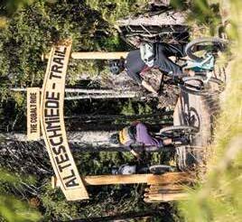
ALTESCHMIEDE TRAIL-TOUR
LE 17 ALTESCHMIEDE-TRAIL-TOUR
The start of the new AlteSchmiede Trail is located above the mountain station on the Asitz –this can be reached comfortably with the cable car or more athletically via the forest path. On the Asitz Trail in the direction of Saalbach Hinterglemm, it branches off to the right after approx. 50m. From there, you follow a hand-built single trail that offers wonderful views of the imposing massif of the Leoganger Steinberge mountains from time to time, across natural forest and alpine meadows. Look forward to variety and maximum riding fun for young and old with trail experience.
Der Einstieg des neuen AlteSchmiede Trails befindet sich oberhalb der Bergstation am Asitz –diese ist ganz gemütlich mit der Bergbahn oder sportlich über den Forstweg erreichbar. Auf dem Asitz Trail in Richtung Saalbach Hinterglemm, zweigt er nach ca. 50m rechts ab. Von dort aus folgt man einem handgebauten Singletrail, der einem immer mal wieder herrliche Ausblicke auf das imposante Massiv der Leoganger Steinberge bietet, über naturbelassene Waldund Almwiesenstücke.
Einzigartige Erinnerungsshots sind also garantiert. Freut euch auf Abwechslung und maximalen Fahrspaß für Jung und Alt mit Trailerfahrung.
Leogang Asitzbahn valley station Difficulty intermediate
AsitzBräu AlteSchmiede
Start & Finish
Leogang Asitzbahn Talstation
Start & Ziel
Schwierigkeit mittelschwierig
15 km
10 km
5 km
17,8 km 0
Lahnerhorn
Vorderkaserkopf

Lofer
Lofer
Österreichs größte Bike-Region
Österreichs größte Bikeregion
Warminger Hof
Wildzacken 2093m
Hochdurchkopf 1722m
Hochfilzen
Seealm
Berg Hütten
Kralleralm
Steinbergbahn
Asitzbahn
Stöcklalm
Grießen
Fieberbrunn
Buchau Feistenau
Reith
Trixlegg
Scheideggriedel 1738m
Asitzbräu Alte Schmiede
Schönleiten- hütte
Forsthofalm Asteralm
Kohlmaiskopf 1794m
Eiserne Hand Burgeralm Wirtsalm
Spielberghaus
Panorama Alm
Asteralm
Großer Asitz 1914m
Wildenkar- hütte
Saalbach Hinterglemm
Wieseralm
Pfefferalm
Österreichs größte Bike-Region
Österreichs größte Bikeregion
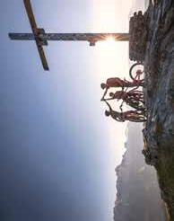
"THE CHALLENGE –Bike your limit" is the name of the challenge in Austria's largest bike-region that only the best can master. Who will manage to ride the entire area around Saalbach Hinterglemm Leogang Fieberbrunn in one day? Thanks to modern lifts, it can be done in one day!
„THE CHALLENGEBike your limit“ is the name of the new mountain tour challenge in Austria‘s largest bike region that only the fittest can achieve. Who will manage t o ride the entire area around Saalbach Hinterglemm Leogang Fieberbrunn in one day? You must conquer seven mountains in „THE CHALLENGE“ with the help of seven lifts.
TIP: The following route description is just a recommendation. " THE CHALLENGE " can of course be started and finished at any of the lifts.*
TIP: The following route description is just a recommendation. “The Challenge” can of course be started and finished at any of the lifts.
Please note: Bikepark suitable protective equipment is recommended.
Please note: Bikepark suitable protective equipment is recommended.
Start & Ziel Leogang Asitzbahn Talstation
Schwierigkeit schwierig
Leogang Asitzbahn valley station
Start & Finish
Difficulty difficult
Leogang
Asitzbahn / Steinbergbahn
*
Star t & Finish L eogang Asitzbahn valley station
* " THE CHALLENGE " normally also includes the Schweinestberg Trail in Fieberbrunn, which was newly built in 2022. However, this can only be reached this year after an uphill section with around 400 m ascent, as the Streuböden cable car is being rebuilt. A successful participation in the Challenge is therefore possible this year –due to the new construction of the Streuböden cable car –even without the Schweinestberg-Trail.
Fieberbrunnn
Saalbach
Hinterglemm
Kohlmaisbahn
Reiterkogelbahn
THE CHALLENGE
THE CHALLENGE
„THE CHALLENGE –Bike your limit“ heißt die Herausforderung in Österreichs größter Bike-Region, die nur die Besten schaffen können. Wer schafft es, das ganze Gebiet rund um Saalbach Hinterglemm Leogang Fieberbrunn an einem Tag abzufahren? Dank moderner Bergbahnen ist das an einem Tag zu schaffen!
„Bike your limit“ heißt die neue Herausforderung in Österreichs größter Bike-Region, die nur die Besten schaffen können. Wer schafft es, das ganze Gebiet rund um Saalbach Hinterglemm Leogang Fieberbrunn an einem Tag abzufahren? Sieben Berge müssen bei „THE CHALLENGE“ unter Zuhilfenahme von sieben Bergbahnen bezwungen werden.
Hinweis: Die nachfolgende Streckenführung ist eine Empfehlung. „ THE CHALLENGE “ kann bei jeder Seilbahn gestartet und beendet werden.*
Hinweis: Die nachfolgende Streckenführung ist eine Empfehlung. „The Challenge“ kann bei jeder Seilbahn gestartet und beendet werden.
Achtung: Bikepark geeignete Schutzausrüstung wird empfohlen!
Achtung: Bikepark geeignete Schutzausrüstung wird empfohlen!
* „ THE CHALLENGE “ inkludiert normalerweise den Schweinestberg Trail in Fieberbrunn, der 2022 neu gebaut wurde. Dieser kann heuer aber nur nach einem Uphillstück mit etwa 400 hm erreicht werden, da die Streubödenbahn neu errichtet wird. Eine erfolgreiche Teilnahme an der Challenge ist daher in diesem Jahr–aufgrund des Neubaus der Streubödenbahn –auch ohne den Schweinestberg-Trail möglich.
Start & Ziel Le gang Asitzbahn Talstation
Schwierigkeit schwierig
S ch attberg Sprinter
Saalbach
S ch attberg
X-Press
Streuböden Hier
Asitzbahn / Steinbergbahn
KOGEL Bahn
12er


SO WIE ICH WILL
THE WAY I WANT
* beschilderte Touren
Zusätzlich zum Bikefolder gibt es in den TVBs & Hotels die Bike Tourenkarte und eine eigene Line & Trail Map mit der man Österreichs größte Bike-Region und den Epic Bikepark Leogang entdecken kann. Diese dienen zur genauen Übersicht des Bike-Wegnetzes in Saalfelden Leogang.


In addition to the bike folder, a pull out bike touring map and a separate line & trail map with which you can discover Austria's largest bike-region and the Epic Bikepark Leogang, is available in the tourism board offices and in hotels to provide an exact overview of the bike tour offers in Saalfelden Leogang.
Breithorn
Gründbichl
Steinalm
Bachwinkl
Einsiedelei
Lenzing
Bürgerberg
Dorfheim
SAALFELDEN

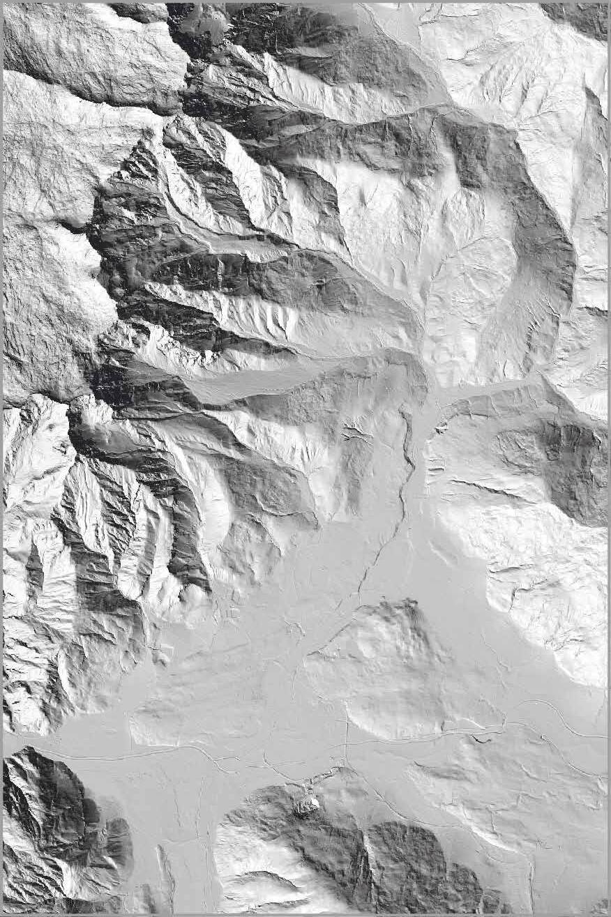
–6,4 km –525 hm
Saalfelden
Steinalm
Saalfelden centre
Start & Finish
Difficulty intermediate
SA 01 STEINALM-TOUR
From the town hall square in Saalfelden, head towards Obsmarkt and from there continue towards Bachwinkl. In Bachwinkl you then branch off the bike path and continue up the road to the car park Wiechenthaler Hütte. Here you keep right and follow the forest road with several hairpin bends up to the picturesque Steinalm. After a leisurely break with a snack and a wonderful view of the surrounding valleys, return to Saalfelden on the same route. 1200
Vom Rathausplatz in Saalfelden geht es zuerst in Richtung Obsmarkt und von dort aus weiter in Richtung Bachwinkl. Im Ortsteil Bachwinkl zweigt man dann vom Radweg ab und fährt die Straße weiter hoch bis zum Parkplatz Wiechenthaler Hütte. Hier hält man sich rechts und folgt der Forststraße mit mehreren Serpentinen bis rauf zur malerisch gelegenen Steinalm. Nach einer gemütlichen Rast mit Jause und herrlichem Blick auf die umliegenden Täler geht's auf der gleichen Strecke wieder zurück nach Saalfelden.
Saalfelden Zentrum
Start & Ziel
Schwierigkeit mittelschwierig
6,4 km 0
4 km
Hier abreißen Zip here
Saalfelden –20,2 km –620 hm

Gasthof
Saalfelden –20,2 km –620 hm
This route starts from the centre of Saalfelden and follows the Lichtenbergstrasse road up to the main ascent below the hermitage –Steinalm car park in Saalfelden. The highest point of the tour lies at the foot of the Breithorn and invites visitors to sit on the small bench and take a rest. From here, the route follows forest roads downhill to the Berggasthof Kronreith –the perfect place for a well-deserved break with its magnificent panoramic views. The last stretch follows a cycle path via Maria Alm back to Saalfelden. SA
Vom Stadtzentrum Saalfelden fährt man auf der Lichtenbergstraße bergauf bis zum Hauptanstieg
unterhalb der Einsiedelei –Steinalm Parkplatz in Saalfelden. Der höchste Punkt der Tour liegt am Fuße des Breithorn und lädt auf einer kleinen Bank zum Verweilen ein. Weiter geht es dann bergab auf Forstwegen zum Berggasthof Kronreith, der mit herrlichem Panorama zur verdienten Pause lädt. Über Maria Alm und den Golfplatz Urslautal fährt man anschließend das letzte Stück auf dem Radweg zurück zum Ausgangspunkt in Saalfelden.
Saalfelden centre
Start & Finish
Difficulty intermediate
Gasthof Kronreith
Saalfelden Zentrum
Start & Ziel
Schwierigkeit mittelschwierig
20,2 km 0
10 km
Saalfelden –18,9 km –330 hm
Bürgerberg 1235m
KRONREITH-RAMSEIDEN-RUNDE

SAALFELDEN
Zentrum
Ramseiden
Gasthof
Schinking
Gasteig
Ritzenhof
Theurerhof
Theurerhof
Obsmarkt Thor Oedt
Dorfheim
Golfplatz
Rain
Pfaffing
Schmieding
Kühbühel 875m
Dorf
Maria Alm
Maria Alm
Gasthof
Almdorf
Hof Niedernhaus
Saalfelden –18,9 km –330 hm
This route proceeds from the centre of Saalfelden towards Ramseiden. It leads past the Theurerhof and then follows a gentle incline along a gravel road and past the fantastically situated golf course to Maria Alm. The town centre of Maria Alm with the second highest church tower in the province of Salzburg invites guests to stop a while. From here, the route leads up to the Berggasthof Kronreith where you can enjoy regional delights after the short climb. The return journey takes you via Maria Alm and along on the other side of the golf course back to Saalfelden.
Vom Zentrum Saalfelden führt die Route in östlicher Richtung nach Ramseiden. Am Theurerhof vorbei, geht es auf einer Schotterstrasse leicht bergauf und entlang des herrlich gelegenen Golfplatzes nach Maria Alm. Das Zentrum Maria Alms mit dem zweithöchsten Kirchturm des Salzburger Landes lädt zum Verweilen ein. Weiter geht es nun bergauf zum Berggasthof Kronreith, wo man sich nach dem kurzen aber erwähnenswerten Anstieg mit regionalen Köstlichkeiten verwöhnen lassen kann. Der Rückweg erfolgt über Maria Alm und führt uns auf der anderen Seite des Golfplatzes zurück nach Saalfelden.
Saalfelden centre
Start & Finish
Difficulty easy
Gasthof Kronreith
Saalfelden Zentrum
Start & Ziel
Schwierigkeit leicht
km 0
Einsiedelei
Saalfelden –25,2 km –855 hm
Gh Saliter Hof
Obsmarkt
Dorfheim
SAALFELDEN
Ramseiden
Zentrum Saalfelden S
SA04
Uttenhofen
L regnagoe A c h
BIBERG-TOUR
Stadtlbauer siedlung
Themenpark Natur & Stein Bürgerberg
Berggasthof Huggenberg
Bahnhof Saalfelden S
Theurerhof
Thor Oedt
Ritzenhof
Bockareit Stubn
Kehlbach
Pfaffing
Schmieding Rain Almdorf
Kühbühel 875m
Breitenberg- ham
Hof Niedernhaus
Pfaffenhofen
Haid
Weikersbach
Ruhgassing
Sinnlehen Alm
Sinnlehen Alm
Berggasthof Biberg
Berggasthof Biberg
Weikersbacher Kopf 1541m
Irracheck 1334m
Örgenbaueralm
Harham
Weberalm
Haiderbergkogel
Saalfelden –25,2 km –855 hm
The cycle path follows an easy road from the centre of Saalfelden to Harham. Here the ascent to the Örgenbauernalm begins, covering 500 altitude metres and 15 bends. After a short flat section, the route continues on up until it reaches a short descent and the end of the climb just above the Berggasthof Biberg –the highest point of the tour. Here you can enjoy magnificent panoramic views from one of the region's most beautiful view points and savour some culinary treats before tackling the descent down to Saalfelden.
SA 04 BIBERG-TOUR
Am Radweg geht es gemütlich vom Stadtzentrum Saalfelden bis nach Harham. Hier beginnt der 500 Höhenmeter Anstieg mit 15-Kehren zur Örgenbauernalm. Nach einem kurzen Flachstück geht es weiter bergauf, bis man nach kurzer Abfahrt und dem Abschlussanstieg knapp oberhalb des Berggasthofs Biberg den höchsten Punkt der Tour erreicht. Hier kann man das herrliche Panorama auf einem der schönsten Aussichtsberge der Region genießen und sich kulinarisch verwöhnen lassen, ehe man die Abfahrt in Richtung Saalfelden in Angriff nimmt. The tour to one of the nicest views of the region.
Berggasthof Biberg
Die Tour auf einen der schönsten Aussichtsberge der Region.
Start & Finish
Saalfelden centre Difficulty intermediate
Saalfelden Zentrum
Start & Ziel
Schwierigkeit mittelschwierig
km Örgenbaueralm
km 0
Stadtlbauer
Uttenhofen Otting Hirnreit
Sinnlehen
Breithorn
Bachwinkl
Einsiedelei
Haiderbergkogel
Weikersbacher Kopf 1541m
Weberalm Durchenalm
Weberalm Durchenalm
Gstallner Alm
Jahnhütte
Stablberg
Mitterhofen
Gh
Gh
Dorfheim
Bahnhof
Pfaffenhofen
Gerling
Mayerhofen
Schmiedhofalm
Pfefferbauer
Jaga Alm
Sonnberg

Theurerhof
Ebenbergalm
Ebenbergalm
Thumersbach Erlberg Obsmarkt Thor
Gasthof Hinterreit
Hofer Plattl 1456m
Schmiedhofalm Sinnlehen Theurerhof
Gasthof Hinterreit
Arbesreit Alm
Hinterjetzbach Alm
Maishofen Alm Maishofen
Schwalbenwand
Schönwieskopf
Maria Alm
Gh Christernreith
Ebner
Wastl Alm
Wastl
Grießbachhütte
Dirndl Alm
Statzer-Haus
Tödlingalm
Tödlingalm
Saalfelden –28,2 km –1510 hm
This route starts in the centre of Saalfelden and follows the cycle path to Zell am See and on along the banks of the Zellersee lake to Thumersbach. Here, the long ascent to the peak of the Hundstein begins. 1,360 m of altitude must be completed as part of this climb. Once at the peak, you can recharge your batteries at the Statzerhaus and enjoy the unrivalled views before following the descent down to Maria Alm. From here, the route follows a cycle path back to Saalfelden.
This route starts in the centre of Saalfelden and follows the cycle path to Zell am See and on along the banks of the Zellersee lake to Thumersbach. Here, the long ascent to the peak of the Hundstein begins. 1,360 m of altitude must be completed as part of this climb. Once at the peak, you can recharge your batteries at the Statzerhaus and enjoy the unrivalled views before following the descent down to Maria Alm. From here, the route follows a cycle path back to Saalfelden.
TIP: The Hundstein can also be accessed from Maria Alm –the key facts are virtually identical!
TIP: The Hundstein can also be accessed from Maria Alm –the key facts are virtually identical!
Start & Finish Saalfelden centre
Start & Finish Saalfelden centre
Difficulty difficult
Difficulty difficult
SA 05 HUNDSTEIN-TOUR
Vom Stadtzentrum Saalfelden fährt man am Radweg zunächst in Richtung Zell am See und weiter am Ufer des Zellersee nach Thumersbach. Hier beginnt der lange Anstieg zum Gipfel des Hundstein. 1.360 Höhenmeter müssen hier in einem Anstieg bewältigt werden. Am Gipfel angekommen kann man am Statzerhaus die Energiedepots wieder auffüllen und die unvergleichliche Aussicht
Vom Stadtzentrum Saalfelden fährt man am Radweg zunächst in Richtung Zell am See und weiter am Ufer des Zellersee nach Thumersbach. Hier beginnt der lange Anstieg zum Gipfel des Hundstein. 1.360 Höhenmeter müssen hier in einem Anstieg bewältigt werden. Am Gipfel angekommen kann man am Statzerhaus die Energiedepots wieder auffüllen und die unvergleichliche Aussicht genießen, bevor es an die Abfahrt zurück nach Thumersbach geht. Am Radweg fährt man dann zurück nach Saalfelden.
genießen, bevor es an die Abfahrt zurück nach Thumersbach geht. Am Radweg fährt man dann zurück nach Saalfelden.
TIPP: Der Hundstein kann übrigens auch von Maria Alm aus in Angriff genommen werden –die Eckdaten der Tour sind fast identisch!
TIPP: Der Hundstein kann übrigens auch von Maria Alm aus in Angriff genommen werden –die Eckdaten der Tour sind fast identisch!
Saalfelden Zentrum
Start & Ziel
Start & Ziel
Saalfelden Zentrum Schwierigkeit schwierig
Schwierigkeit schwierig
Saalfelden –14,7 km –255 hm
Bürgerberg 1235m

Obsmarkt
HINTERREIT-RUNDE
Dorfheim
SAALFELDEN
SA 06 SA 06
Gasthof Kronreith
Maria Alm Maria Alm
Schinking
Bahnhof
Zentrum Saalfelden S
Ramseiden
Theurerhof
Golfplatz
Dorf
Gasteig
Rain
Oedt
Pfaffing
Schmieding
Almdorf
Ritzenhof
Kühbühel 875m
Niedernhaus
Thor
Gasthof Hinterreit
Gasthof Hinterreit
Hof
Single
Winklhof
Winklhof
–14,7 km –255 hm
Saalfelden

On this easy beginner's tour you start in the center of Saalfelden and cycle first to Ramseiden. There you turn off in the direction of Oedt / golf course. In Oedt you turn right again and bike along the golf course to Rain. After a short descent you cross the B164 and continue to Almdorf. Arriving at the small village square, follow the signs "MA 06 | Hinterreit-Runde" to Berggasthof Hinterreit. Take a break there. Then the tour continues via Schlossberg, Maria Alm and the golf course Urslautal back to Saalfelden.
Bei dieser gemütlichen Einsteigertour startet man im Zentrum von Saalfelden und fährt zuerst nach Ramseiden. Dort zweigt man Richtung Oedt / Golfplatz ab. In Oedt geht's nochmal rechts weg und man fährt entlang des Golfplatz nach Rain. Nach einer kurzen Abfahrt kreuzt man die B164 und radelt weiter nach Almdorf. Am kleinen Dorfplatz angekommen, folgt man ab hier der Beschilderung „MA 06 | Hinterreit-Runde“ zum Berggasthof Hinterreit. Hier lohnt sich eine kleine Rast. Danach geht es über den Schloßberg, Maria Alm und den Golfplatz Urslautal wieder zurück nach Saalfelden.
Saalfelden centre
Start & Finish
Difficulty easy
Saalfelden Zentrum
Start & Ziel
Schwierigkeit leicht
Gasthaus Hinterreit 10 km
5 km
14,7 km 0
Steinalm
Lettlkaser
Bürgerberg 1235m
Bachwinkl
Wiesing
Gründbichl
hcalaaS
Saliterköpfl 1499m
VOGELSANG-RUNDE
Ramseiden
Theurerhof
Oedt
B164
Birnbachloch
SAALFELDEN
Saalfelden –21,8 km –632 hm Single trail single trail
Pfaffing
Hubertus
Hubertus
Einsiedelei
Obsmarkt
Zentrum Saalfelden S
B311
Gh Saliter Hof Gh Schörhof
Lenzing
Wiesersberg
Euring
SA09
Uttenhofen
L e o regnag Ahc e
Ecking Stadtlbauer siedlung
Otting
Dorfheim
Bahnhof Saalfelden
Thor
Ritzenhof
eesneztiR
Kühbühel 875m
Niedernhaus
Breitenberg- ham
Hirnreit
Berggasthof Huggenberg
Berggasthof Huggenberg
Themenpark Natur & Stein
Berggasthof Biberg Bockareit Stubn
Berggasthof Bockareit Stubn
Kehlbach
B311
Haid
Sinnlehen Alm
Sinnlehen Alm
Durchenalm
21,8km
Saalfelden –21,8 km –632 hm
Saalfelden –21,8 km –632 hm
–21,8 km –632 hm
Saalfelden

VOGELSANG-RUNDE
VOGELSANG-RUNDE
You start in the center of Saalfelden and ride along the cycle path in the direction of Leogang. To warm up, you go from Uttenhofen to Lenzing. There you turn left at the church and continue in the direction of Ecking and Otting. Turn left again and follow the street towards the main road. After crossing the road, the uphill section starts along the forest road. At the top you can either make a detour to the Berggasthof Biberg or go down to Huggenberg. After a short refreshment, follow the road and then from the parking lot Biberg back to the city center.
You start in the center of Saalfelden and ride along the cycle path in the direction of Leogang. To warm up, you go from Uttenhofen to Lenzing. There you turn left at the church and continue in the direction of Ecking and Otting. Turn left again and follow the street towards the main road. After crossing the road, the uphill section starts along the forest road. At the top you can either make a detour to the Berggasthof Biberg or go down to Huggenberg. After a short refreshment, follow the road and then from the parking lot Biberg back to the city center.
You start in the center of Saalfelden and ride along the cycle path in the direction of Leogang. To warm up, you go from Uttenhofen to Lenzing. There you turn left at the church and continue in the direction of Ecking and Otting. Turn left again and follow the street towards the main road. After crossing the road, the uphill section starts along the forest road. At the top you can either make a detour to the Berggasthof Biberg or go down to Huggenberg. After a short refreshment, follow the road and then from the parking lot Biberg back to the city center.
Start & Finish Saalfelden Center
Start & Finish Saalfelden Center
Difficulty intermediate
SA 09
SA 09
Im Zentrum von Saalfelden startet man los und fährt entlang des Radweges in Richtung Leogang.
Im Zentrum von Saalfelden startet man los und fährt entlang des Radweges in Richtung Leogang. Dann geht’s von Uttenhofen nach Lenzing. Dort zweigt man an der Kirche links ab und fährt weiter in Richtung Ecking und Otting. Dort zweigt man nochmal links in Richtung Bundesstraße ab. Nach dem Überqueren der Straße geht’s am Bauhof vorbei und danach beginnt die Bergaufpassage entlang der Forststraße. Oben angekommen kann man entweder noch einen Abstecher zum Berggasthof Biberg machen oder zum Huggenberg runter fahren. Nach einer kurzen Erfrischung geht es über die Straße bergab und danach vom Parkplatz Biberg retour ins Zentrum.
Im Zentrum von Saalfelden startet man los und fährt entlang des Radweges in Richtung Leogang. Dann geht’s von Uttenhofen nach Lenzing. Dort zweigt man an der Kirche links ab und fährt weiter in Richtung Ecking und Otting. Dort zweigt man nochmal links in Richtung Bundesstraße ab. Nach dem Überqueren der Straße geht’s am Bauhof vorbei und danach beginnt die Bergaufpassage entlang der Forststraße. Oben angekommen kann man entweder noch einen Abstecher zum Berggasthof Biberg machen oder zum Huggenberg runter fahren. Nach einer kurzen Erfrischung geht es über die Straße bergab und danach vom Parkplatz Biberg retour ins Zentrum.
Dann geht's von Uttenhofen nach Lenzing. Dort zweigt man an der Kirche links ab und fährt weiter in Richtung Ecking und Otting. Dort zweigt man nochmal links in Richtung Bundesstraße ab. Nach dem Überqueren der Straße geht's am Bauhof vorbei und danach beginnt die Bergaufpassage entlang der Forststraße. Oben angekommen kann man entweder noch einen Abstecher zum Berggasthof Biberg machen oder zum Huggenberg runter fahren. Nach einer kurzen Erfrischung geht es über die Straße bergab und danach vom Parkplatz Biberg retour ins Zentrum.
Huggenbergalm
Huggenbergalm
Difficulty intermediate
Start & Ziel Saalfelden Zentrum
Start & Finish Saalfelden Center Difficulty intermediate SA 09 VOGELSANG-RUNDE
Start & Ziel Saalfelden Zentrum
Start & Ziel Saalfelden Zentrum Schwierigkeit mittelschwierig
Schwierigkeit mittelschwierig
Schwierigkeit mittelschwierig
Saliter Hof
Saliter Hof
10 km
km
15 km 5 km
0 15 km 5 km
0


Ohne
THE WAY I WANT SO WIE ICH WILL
Zusätzlich zum Bikefolder gibt es in den TVBs & Hotels die Bike Tourenkarte und eine eigene Line & Trail Map mit der man Österreichs größte Bike-Region und den Epic Bikepark Leogang entdecken kann. Diese dienen zur genauen Übersicht des Bike-Wegnetzes in Saalfelden Leogang.


In addition to the bike folder, a pull out bike touring map and a separate line & trail map with which you can discover Austria's largest bike-region and the Epic Bikepark Leogang, is available in the tourism board offices and in hotels to provide an exact overview of the bike tour offers in Saalfelden Leogang.
Pfaffenhofen Bahnhof


Leogang –59,9 km –435 hm
Leogang –59,9 km –435 hm
km
LE 19 PANORAMA-RUNDE
LE 19 PANORAMA-RUNDE MAISHOFEN
From the Asitzbahn valley station the route initially leads along a cycle path and follows a gentle descent towards Saalfelden. Then the tour leads on to Haid and Bsuch. From here, there is a short climb to Gerling, then on to Maishofen, past Kammer Castle and on to the north banks of the Zellersee lake. If you are still full of energy, the route can be combined with the varied circuit around the lake Zell with magnificent panoramic views. Then you cycle back via Neunbrunnen to Harham, turning off at the Hotel Gansl and take the cycle path back to Saalfelden and finally to Leogang.
From the Asitzbahn valley station the route initially leads along a cycle path and follows a gentle descent towards Saalfelden. Then the tour leads on to Haid and Bsuch. From here, there is a short climb to Gerling, then on to Maishofen, past Kammer Castle and on to the north banks of the Zellersee lake. And if this is still not enough, the route can be combined with the varied circuit around the lake Zell with magnificent panoramic views. Then you cycle back via Neunbrunnen to Harham, turning off at the Club La Costa and the cycle path back to Saalfelden and finally to Leogang.
Von der Talstation der Asitzbahn fährt man zunächst entlang des Radweges leicht bergab in Richtung Saalfelden. Die Tour führt weiter nach Haid und Bsuch. Ein kurzer Anstieg nach Gerling, und weiter nach Maishofen vorbei am Schloss
Von der Talstation der Asitzbahn fährt man zunächst entlang des Radweges leicht bergab in Richtung Saalfelden. Die Tour führt weiter nach Haid und Bsuch. Ein kurzer Anstieg nach Gerling, und weiter nach Maishofen vorbei am Schloss
Kammer bis hin zum Nordufer des Zeller See. Wem das noch zu wenig ist, kann die abwechslungsreiche Runde um den Zeller See mit herrlichem Panorama anhängen. Zurück geht es dann über Neunbrunnen nach Harham, wo beim Hotel Gansl die Abzweigung genommen wird und man am Radweg zurück nach Saalfelden und weiter nach Leogang gelangt.
Kammer bis hin zum Nordufer des Zeller See. Wem das noch zu wenig ist, kann die abwechslungsreiche Runde um den Zeller See mit herrlichem Panorama anhängen. Zurück geht es dann über Neunbrunnen nach Harham, wo beim Club La Costa die Abzweigung genommen wird und man am Radweg zurück nach Saalfelden und weiter nach Leogang gelangt.
Leogang Asitzbahn valley station
Start & Finish
Leogang Asitzbahn valley station
Start & Finish
Difficulty easy
Difficulty easy
Leogang Asitzbahn Talstation
Start & Ziel
Start & Ziel
Leogang Asitzbahn Talstation Schwierigkeit leicht
Schwierigkeit leicht
Saliterhof
Leogang –41,6 km –460 hm
Leogang –41,6 km –460 hm
P i l l e r see
St. Ulrich
Geierkogel 1753m
Warmingberg 1292m
Seealm
Grießenpass 976m
Schartental Altwieben
Strass Schwendt
Unterberg 1187m
Grieslegg 1348m
Fleckberg 1241m
Reith Neuwieben
Lehrbergköpfl 1301m
Flecken
St. Jakob
Pfaffenschwendt
Tour Rast Wiesenseehof Kapelln
Feistenau
Grießen Berglehen
Leogang –41,6 km –460 hm
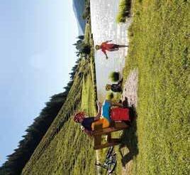
From the valley station at the Asitzbahn cable car, the route initially leads along a cycle path along a gentle incline towards Hochfilzen. From here, it runs on via the Wiesensee lake to the Pillersee lake. There are several hydrotherapy points en route, inviting visitors to dip their feet into the cold and clear water. On the journey back to Leogang, sections of the Buchensteinwand circuit can be incorporated or you can enjoy a comfortable cycle across the Griessener Moor with a stop-off at the Seealm.
Von der Talstation der Asitzbahn aus fährt man entlang des Radweges zunächst großteils leicht bergauf in Richtung Hochfilzen. Von dort weiter über den Wiesensee zum Pillersee. Mehrere Kneippanlagen laden unterwegs dazu ein, die Füße ins kalte und klare Nass zu stecken. Am Rückweg nach Leogang können auf Wunsch Teilpassagen der Buchensteinwand-Runde eingebaut werden oder man radelt gemütlich über das Griessner Moor mit einem Zwischenstopp auf der Seealm am Radweg zurück.
Leogang Asitzbahn valley station
Start & Finish
Leogang Asitzbahn Talstation
Start & Ziel
Difficulty easy
Schwierigkeit leicht
km Strasserhof Seealm Wiesenseehof Seealm Wiesenseehof
Strasserhof
Hier abreißen Zip here



So leicht kann’s gehen: Voller Biergenuss mit nur 4,5 % Alkohol. Unser Stiegl-Hell – erfrischend süffig und wunderbar harmonisch.
SO WIE ICH WILL
THE WAY I WANT
Zusätzlich zum Bikefolder gibt es in den TVBs & Hotels die Bike Tourenkarte und eine eigene Line & Trail Map mit der man Österreichs größte Bike-Region und den Epic Bikepark Leogang entdecken kann. Diese dienen zur genauen Übersicht des Bike-Wegnetzes in Saalfelden Leogang.


In addition to the bike folder, a pull out bike touring map and a separate line & trail map with which you can discover Austria's largest bike-region and the Epic Bikepark Leogang, is available in the tourism board offices and in hotels to provide an exact overview of the bike tour offers in Saalfelden Leogang.
Leogang –66,0 km –590 hm
LE 16 STEINBERG-RUNDE
Waidring
Gh Brandlhof
Gh Schörhof
Bachwinkl
Lenzing St. Martin bei Lofer
Weißbach
Weißbach
Lofer
Lofer
Hochfilzen St. Ulrich
Hochfilzen St. Ulrich
Strass Schwendt
Schartental S a a l a c h t a l L e o g a n g e r S t e i n b e r eg
Flecken
Wiesenseehof Buchensteinwand 1462m
Warminger Hof
Euring
LEOGANG
Asitzbahn Talstation
LE 16 egnagoe A
Grießen
Seealm
SAALFELDEN
SAALFELDEN
Steinbergbahn
Bachgr ab e n S p i e l b e r g la m ne G r i e ß n e r A l m e n S
Asitzbahn
S c h w a r z l e o rg ba e n
Leogang –66,0 km –590 hm
Die Steinberg-Runde eignet sich auch perfekt als Rennrad-Runde. Eine Rast bei der Seealm bietet den perfekten Abschluss zu dieser Tour, um sich mit regionalen Schmankerl und einem erfrischendem Getränk zu belohnen!
The Steinberg Circuit is also a perfect road bike tour. A stop at the Seealm is the perfect way to end this tour and to reward yourself with regional delicacies and a refreshing drink!
It initially follows a cycle path with a descent to Lenzing. From here, the tour continues on towards Weißbach and Lofer. The route then follows a climb up towards Waidring and on to St. Ulrich at the Pillersee lake –the ideal place to stop off and admire the fantastic landscape. Then it's on through the Wiesensee valley to Hochfilzen. Once in Hochfilzen, the return journey to Leogang begins. The return journey is mostly downhill for a relaxed end to the circuit. The Steinberg Circuit can be completed in either direction.
Leogang Asitzbahn valley station
Start & Finish
66 km
Hochfilzen
St. Ulrich a. P.
40 km
Difficulty easy LE 16
Am asphaltierten Radweg geht es zunächst leicht bergab nach Lenzing. Von dort aus weiter Richtung Weißbach und Lofer. Ab hier fährt man leicht bergauf in Richtung Waidring und weiter nach St. Ulrich am Pillersee, wo man sich unbedingt kurz Zeit nehmen sollte um die herrliche Landschaft zu genießen. Weiter fährt man durch das Wiesensee Tal zurück nach Hochfilzen. Wieder in Hochfilzen angekommen, beginnt der Rückweg nach Leogang. Dort geht's dann fast nur noch bergab und lässt die Runde entspannt ausklingen. Die Steinberg Runde ist in beide Richtungen befahrbar.
Lofer
20 km
Leogang Asitzbahn Talstation
Start & Ziel
Schwierigkeit leicht
Saalfelden
0
Sinnlehen
Steinbergbahn


Leogang –65,0 km –2985 hm
Leogang –65,0 km –2985 hm

The ultimate e-bike XXL Tour. Take the Asitzbahn cable car up to the top station –that's where the riding fun begins. Via Asitztrail you bike towards Saalbach. The next stops and trails are as follows: Wurzeltrail to Kohlmais –Trail to Panoramaalm continuing to Spielberghaus & Reiterkogel, take the Wetterkreuztrail and continue to Rosswaldhütte –Reichkendlkopf –Hochalmtrail to Lengau. Then follow the cycle path to Kohlmaisbahn. Take the trail to Wildenkarhütte from the top station and bike via the Asitztrail back to the Asitz. Just below the top station, the Matzalm-Trail takes you back downhill to the village of Leogang and finally over the bike path back to the valley station of the Asitzbahn cable car.
The ultimate e-bike XXL Tour. Take the Asitzbahn cable car up to the top station –that’s where the riding fun begins. Via Asitztrail you bike towards Saalbach. The next stops and trails are as follows: Wurzeltrail to Kohlmais –Trail to Panoramaalm continuing to Spielberghaus & Reiterkogel, take the Wetterkreuztrail and continue to Rosswaldhütte –Reichkendlkopf –Hochalmtrail to Lengau. Then follow the cycle path to Kohlmaisbahn. Take the trail to Wildenkarhütte from the top station and bike via the Asitztrail back to the Asitz. Just below the top station, the Matzalm-Trail takes you back downhill to the village of Leogang and finally over the bike path back to the valley station of the Asitzbahn cable car.
Start & Finish Leogang Asitzbahn valley station Difficulty difficult
Start & Finish Leogang Asitzbahn valley station Difficulty difficult
LE 18 E-TRAIL XXL
Die ultimative E-Bike XXL Tour. Los geht's mit der Auffahrt auf den Asitz per Kabinenbahn –dann kann der Fahrspaß beginnen. Via Asitztrail radelt man Richtung Saalbach. Die nächsten Stops und Trails sind folgende: Wurzeltrail zum KohlmaisTrail bis zur Panoramaalm und weiter zum Spielberghaus & Reiterkogel, von dort runter am Wetterkreuztrail
Die ultimative E-Bike XXL Tour. Los geht’s mit der Auffahrt auf den Asitz per Kabinenbahn –dann kann der Fahrspaß beginnen. Via Asitztrail radelt man Richtung Saalbach. Die nächsten Stops und Trails sind folgende: Wurzeltrail zum KohlmaisTrail bis zur Panoramaalm und weiter zum Spielberghaus & Reiterkogel, von dort runter am Wetterkreuztrail
–weiter zur Rosswaldhütte –Reichkendlkopf –Hochalmtrail bis Lengau. Danach geht's talauswärts bis zur Kohlmaisbahn. Oben angekommen fährt man bis zur Wildenkarhütte und über den Asitztrail zurück zur Bergstation Asitz. Unter der Bergstation geht's auf dem Matzalm-Trail zurück ins Dorf Leogang und schlussendlich über den Radweg wieder zurück zur Talstation.
–weiter zur Rosswaldhütte –Reichkendlkopf –Hochalmtrail bis Lengau. Danach geht’s talauswärts bis zur Kohlmaisbahn. Oben angekommen fährt man bis zur Wildenkarhütte und über den Asitztrail zurück zur Bergstation Asitz. Unter der Bergstation geht’s auf dem Matzalm-Trail zurück ins Dorf Leogang und schlussendlich über den Radweg wieder zurück zur Talstation.
Start & Ziel Leogang Asitzbahn Talstation Schwierigkeit schwierig
Start & Ziel Leogang Asitzbahn Talstation
Schwierigkeit schwierig
Saalbach 40 km
Obsmarkt
Gh Schörhof
Wiesing
Saalfelden Leogang
Dorfheim
Natur & Stein S
Wiesersberg
Euring
Gründbichl
Badhaus Leogang
Lenzing
Gh Saliter Hof
Uttenhofen
Bahnhof Saalfelden
Thor
Ritzenhof
Ritzenhof
Bachwinkl B311
Kühbühel 875m
Leogang –33,1 km –330 hm Single
Ecking
Otting
Bahnhof Leogang Steinberge
Priesteregg
LEOGANG LEOGANG
Freizeitanlage Sonnrain
Stadtlbauer siedlung
Hirnreit
Breitenberg- ham
Haid
Bockareit Stubn Berggasthof Huggenberg Anderl- hof
Kehlbach
Berggasthof Anderl- hof
Themenpark
Berggasthof Biberg
Berggasthof Biberg
Weikersbacher
Kopf 1541m
Weikersbach
Sinnlehen Alm
Sinnlehen Alm
KrallerAlm
KrallerAlm
LE 22
Rain
Steinbergbahn
Matz-


Irracheck 1334m Funeck
Leogang –33,1 km –330 hm
HOFL ÄDEN AUF DER TOUR
(Bitte Öffnungszeiten beachten!)
DIRECT SALES OUTLETS
(Please check opening hours):
Leogang: Dorfladen Leogang, Gerstbodner Troadladl Saalfelden Stechaubauer, HpH anno 1905, Alpakastall, Gasthof Hubertus, Stillinghof, Klampfererhof, Siegfried Herzog Destillate, Sinnlehenalm (Abstecher am Rückweg | stop by on your way back ).
On this tour you will get to know lovely regional products. The starting point is at the Asitz valley station in Leogang. Along the bike path you ride comfortably to Euring in Saalfelden. After a short climb to Bachwinkl, it goes downhill to the center of Saalfelden and from there to the picturesque Ritzensee. After a short break, you cycle over Breitenbergham and Uttenhofen on the bike path back to Leogang.
Auf dieser Tour lernst du die Direktvermarkter der Region kennen und kannst dir das ein oder andere Schmankerl für zuhause mitnehmen. Der Startpunkt ist bei der Asitz Talstation in Leogang. Entlang des Radweges fährt man gemütlich bergab bis nach Euring in Saalfelden. Nach einer kurzen Steigung bis nach Bachwinkl geht es wieder bergab in das Zentrum von Saalfelden und von dort an den malerisch gelegenen Ritzensee. Nach einer Verschnaufpause fährt man dann über Breitenbergham und Uttenhofen am Radweg zurück nach Leogang.
Leogang Asitzbahn valley station
Start & Finish
Leogang Asitzbahn Talstation
Start & Ziel
Difficulty easy
Schwierigkeit leicht
Gasteig
Euring
Gründbichl
Steinalm
Steinalm
Bachwinkl
Lenzing
Ecking
Otting
Saalfelden –35,8 km –1020 hm
Bürgerberg 1235m
Einsiedelei
Obsmarkt
SAALFELDEN
Zentrum Saalfelden S
Theurerhof
Golfplatz
Ramseiden Schmieding
Ritzenhof
Oedt
B164
Dorf
Rain Almdorf
Pfaffing
Kühbühel 875m
eesneztiR
Dorfheim
SA 07 Hier
SAALFELDEN-TOUR
SA 07
A
L regnagoe
Bahnhof
Saalfelden
Thor
Breitenberg- ham
Gasthof Hinterreit
Hof Niedernhaus
Ruhgassing
Gerling


Gasthaus Priesteregg
Gasthaus Priesteregg
Berggasthof Huggenberg
Berggasthof Huggenberg
Themenpark Natur & Stein
Bockareit Stubn
Bockareit Stubn
Berggasthof Biberg
Kehlbach
Haid
Weikersbach
Pfaffenhofen
Harham
Örgenbaueralm
Lahntal
Weikersbacher Kopf 1541m Sausteige
Weberalm
Saalfelden –35,8 km –1020 hm

Starting point is the center of Saalfelden. From there the tour goes past the lake Ritzensee through the Kollingwald to Bsuch, Schützing and Harham. In Harham you reach the first longer climb to the Örgenbauernalm, where you can take a first break. After another short climb to the Berggasthof Biberg you ride downhill, past the Huggenberg back to the valley. Cycle back to Bsuch and then continue towards Maria Alm. At the end you can get back to the center of Saalfelden via the bike path at the golf course.
Startpunkt ist das Zentrum Saalfelden. Von dort aus geht es vorbei am Ritzensee durch den Kollingwald nach Bsuch, Schützing und Harham. In Harham erfolgt der erste längere Anstieg auf die Örgenbauernalm, wo man eine erste Rast einlegen kann. Nach einem weiteren kurzen Anstieg zum Berggasthof Biberg fährt man bergab, vorbei am Huggenberg wieder zurück ins Tal. Zurück nach Bsuch und dann weiter Richtung Maria Alm. Am Schluss gelangt man über den Radweg beim Golfplatz wieder retour ins Zentrum Saalfelden.
Huggenbergalm
Saalfelden centre Difficulty intermediate
Start & Finish
Saalfelden Zentrum
Start & Ziel
Schwierigkeit mittelschwierig
30 km
Berggasthof Biberg 10 km
20 km
35,8 km 0
Sommerstein 2308m
Breithorn 2504m
Saalfelden –28,6 km –1075 hm
Persailhorn 2347m
S t e i n e r n e s M e e r
Steinalm
Einsiedelei
Bürgerberg 1235m
Ramseiden
Gasthof Kronreith
Schinking
Die Jufenalm
B164
Postalm
Zentrum Maria Alm Sonn
Gasteig
Theurerhof
Golfplatz
SAALFELDEN
Obsmarkt
B164
Dorf
Rain Almdorf
Pfaffing
Maria Alm Maria Alm
Schmieding
Ritzenhof
Postalm Hütte Schörhof
Gh Schörhof
Wiesing
Dorfheim
Tom’s Hütte
Gasthof Hinterreit
eesneztiR Natrunbahn
Natr u n
Unternberg
Schattb e r g
Hofer Plattl 1456m


Wiesersberg
Euring
Lenzing Gründbichl
Gh Saliter Hof
Zentrum Saalfelden S SA 08 SA 08
Bahnhof Saalfelden
Thor Oedt Bachwinkl Pfaffenhofen
Kehlbach
Kühbühel 875m
Hof Niedernhaus
Breitenberg- ham
Single trail single trail
Ruhgassing
1000m 2000m
Saalfelden –28,6 km –1075 hm
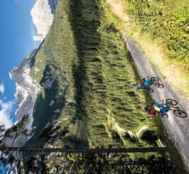
From the center of Saalfelden you cycle uphill in the so-called Bürgerau.There you follow the forest road to the Bürgerberg where you get really close to the Steinernes Meer plateau. After reaching the highest point, it goes downhill towards Gasthof Kronreith and from there back towards Maria Alm. There you cycle along the Krallerwinkl and branch off towards Jufenalm. After a rest on the alpine pasture, you ride back over the bike path on Natrun. The descent from Natrun can either be taken on the road or via the Single Trail Flow-One. Arrived in the valley, the tour goes comfortably along the golf course back to Saalfelden.
Vom Zentrum Saalfelden aus geht es bergauf in die Bürgerau. Dort folgt man der Forstraße entlang auf den Bürgerberg und kommt dabei dem Steinernen Meer richtig nahe. Nachdem man am höchsten Punkt angelangt ist, geht es bergab Richtung Gasthof Kronreith und von dort aus zurück in Richtung Maria Alm. Dort radelt man dann den Krallerwinkl entlang und zweigt Richtung Jufenalm ab. Nach einer Rast auf der Alm geht es über den Radweg am Natrun zurück. Die Abfahrt vom Natrun kann man entweder über die Straße oder über den Single Trail Flow-One wählen. Im Tal angekommen geht es dann gemütlich über den Golfplatz zurück nach Saalfelden.
Saalfelden centre
Start & Finish
Die Jufenalm
Difficulty intermediate
Gasthof Kronreith
Saalfelden Zentrum
Start & Ziel
Schwierigkeit mittelschwierig
km
km
km 0
100PRCNT®
2024 COLLECTION GOGGLES

MMXXIV
RACE SUPPORT SINCE—82


RACE SUPPORT SINCE—82


SO WIE ICH WILL
THE WAY I WANT

Leoganger Bergbahnen, Hütten 39, 5771 Leogang T +43 6583 8219, info@bikepark-leogang.com www.bikepark-leogang.com
Bike nehmen, hinauf auf den Asitz mit der Kabinenbahn und direkt in die epischen Lines & Trails des Bikepark Leogangs einsteigen.
Der Epic Bikepark Leogang gehört mit seinem kompletten Bikesport Angebot für Rookies und Pros zu den renommiertesten Bikeparks in Europa. Zu den legendären Highlights zählen der Riders Playground – ein 30.000 m² großes Übungsareal, der Hot Shots fired by GoPro – eine Pro-Jump Line mit viel Airtime, sowie die UCI Weltmeisterschafts- und Weltcup Strecke Speedster.
Grab your bike, board the cable car up the Asitz and head straight onto the epic lines & trails of the Bikepark Leogang.
The Epic Bikepark Leogang has become one of the most renowned bike parks in Europe thanks to what it has to offer for everyone, from rookie to pro. Its legendary highlights include the Riders Playground – a 30,000 m² practice area, the Hot Shots fired by GoPro – a pro-jump line giving loads of airtime, and the UCI World Championship and World Cup line "Speedster".
Mehr Infos im kostenlosen Bikepark Folder. More info in the free Bikepark brochure.

Vali's Hölle – für alle Downhill-Pros: Auf dieser Line verlor Vali Höll, Lokalmatadorin und Medaillenhoffnung bei der UCI Downhill Weltmeisterschaft 2020 im Epic Bikepark Leogang ihre Chance auf Gold. Zu ihren Ehren wurde die Line Vali's Hölle getauft.
STEINBERG LINE BY FOX – Flüssige Line für alle Könnerstufen: Mit einem Durchschnittsgefälle von ca. 9 % und einer Länge von 6,1 km zählt sie zu den flüssigsten Lines im Bikepark Leogang. Mit ihren angenehm befahrbaren Anliegern und Kurven ist sie für Biker aller Könnerstufen geeignet. Ein Highlight ist die Aussichtsplattform mit einzigartigem Blick auf die namensgebende Bergkette „Leoganger Steinberge“.
HOT SHOTS – fired by GoPro:
Pro-Jump Line mit viel Airtime: Die 3,3 km lange Jumpline mit ihrer abwechslungsreichen Beschaffenheit ist ein Fahrspaß für Könner die Airtime lieben. Perfekt für deine GoPro Kamera Action.
Vali's Hölle (hell) – for all downhill-pros: Our local hero and medal candidate, Vali Höll, missed her chance for gold on this line during the 2020 UCI Downhill World Championships. We honour her by naming it Vali's Hölle (transl. in english Vali's hell).
STEINBERG LINE BY FOX – Flow Line for all skill levels: With an average descent of 9 % and a length of 6.1 km this is one of the flowiest lines in the Bikepark Leogang. With it's smoothly banked turns it is a pleasure to ride for everyone. It is named after the "Leoganger Steinberge", which can be thoroughly enjoyed on the trail's viewing platform. A highlight you shouldn't miss!
HOT SHOTS – fired by GoPro:
Pro-Jump Line for those who love airtime: This jump line is, based on its diverse nature and with a length of 3.3 km, fun to ride for pros who love airtime. Perfect for your GoPro camera action.
Bevor du die Bergwelt mit deinem Bike eroberst, solltest du im Riders Playground fleißig üben. Nimm dir Zeit, geh nicht über deine persönlichen Grenzen und vergiss dabei niemals den Spaß!
Starte hier und arbeite dich bis ganz nach unten.
Start here and work your way to the bottom.
Before you conquer the mountains with your bike, practice at the Riders Playground. Take your time, don't push it too far and don't forget to have fun!
Unser Tipp: Langsam beginnen und dann Step by Step steigern! Our tip: Start slowly and improve step by step!
Weck deinen Körper und Geist auf. Schau dir die Line erstmal mit geringer Geschwindigkeit an. | Wake up your body and mind. Inspect the line at low speed.
Mach ein paar Wiederholungsfahrten um mehr Flow zu bekommen und dich an die Sprünge etc. zu gewöhnen. | Lap the line a few times to get the flow of the features.
Steigere deine Geschwindigkeit und trau dich an größere Sprünge ran. | Work your way up to faster speeds and larger features.
Noch mehr Lines & Trails gibts in Österreichs größter Bike-Region – zu finden auf der Rückseite der line & trail map! Discover even more lines & trails in Austria's largest bike-region –check out the back of your line & trail map!


LE13
Seilbahn
Cable car
Seilbahnstation
Cable car station
Sehr leicht
Very easy
Leicht
Easy
Mittelschwierig
Moderate
Schwierig
Difficult
MTB-Steckennetzwerk
Route network
Radweg
Bicycle trail
Vorgegebene Richtung
Predetermined direction
Restaurant
Restaurant
Bike Wash
Bike wash
Radwerkstatt
Bike service
Bike Verleih
Bike rental
Parkplatz
Parking lot
The Challenge
Bike your Limit
LE15
Forsthof Trail
Knappen Trail
AlteSchmiede
Asitz-Trail
Speedster – Die UCI Weltmeisterschafts- und Weltcup Strecke: Eine anspruchsvolle Kombination aus steilen Abschnitten in Falllinie, engen Kehren, Wurzel- und Highspeed-Passagen auf 2,3 km.
ANTONIUS TRAIL – Technisches Können gefragt: Dieser naturbelassene schmale Single Trail ist technisch sehr anspruchsvoll, schlängelt sich durch Waldpassagen und mündet in die Steinberg Line by FOX.
Flying Gangster – Für Fortgeschrittene und Pros: Strecke mittleren Schwierigkeitsgrades mit zahlreichen Wallrides, Anlieger, Doubles, Tables und Jumps.
Flow Link – Lässige Freeride Line:
Der Flow Link lässt die freie Wahl – Airtime oder doch am Boden bleiben.
Bongo Bongo – Gute Linienwahl und Technik erforderlich: Der Trail verläuft fast ausschließlich im Wald mit North Shore Elementen, Anliegern und Drops.
Hangman I – Technisch und anspruchsvoll: Der technisch anspruchsvolle und schmale Hangman I schlängelt sich mit kleinen Wurzelpassagen und Northshore Elementen durch den Wald und unter der Asitzbahn den Hang hinab.
Hangman II – Fahrspaß für Jedermann:
Der Hangman II ist die perfekte Anfänger-Strecke: Hier dominieren breite Forstwege und flache, einfache Absprünge.
Lumberjack Line:
Drops von 0,5 bis 3 m, Tables, Step-downs, Wallrides und Logs erlauben dir deine eigenen Combos!
Speedster – The World Championship and World Cup course: The most challenging course – a combination of steep root sections, tight turns and fast segments on 2.3 km.
ANTONIUS TRAIL – Technical skills required: A difficult, technical and nature based single trail which winds it way through forest areas before it merges into the Steinberg line by FOX.
Flying Gangster (Freeride) – For advanced and pros: Line with medium difficulty for rookies and pros: numerous wallrides, banked turns and jumps.
Flow Link – Cool freeride line:
The Flow Link gives you the freedom of choice –airtime or stay on the ground.
Bongo Bongo – Line selection and solid technique required: This trail runs almost exclusively through the forest an includes north shore elements, berm & drops.
Hangman I – Technical and challenging: The narrow, technical, and difficult Hangman I takes you over root sections and northshore elements through forest area's underneath the Asitzbahn cable car.
Hangman II – Fun for all:
The Hangman II is a perfect line for beginners because the gravel path is wide and flat and with easy jumps.
Lumberjack Line:
Drops from 0.5 to 3 m, tables, step-downs, wallrides and logs allow you to create your own combos!
Keep Bikepark Leogang clean!
Kein Müll am Berg! | No littering on the mountain !


Enduro Racing? Bikeparks shredden? Oder einfach über alle Berge?
Das neue Ransom ist da - ein perfektes, ultraleichtes All-Mountain für maximale Downhill-Performance, einer progressiven Geometrie und mit herausragender Federungsperformance.
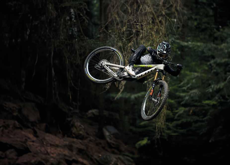

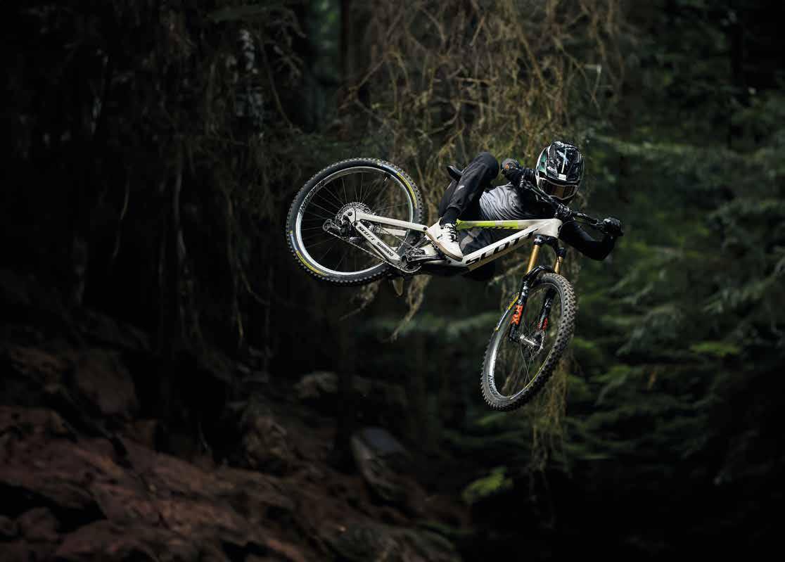

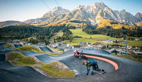
Learn sooner. From rookie to pro.
Wenn ihr gerne mit eurem Bike spielt, euch neue Moves und Lines zutraut und über euch hinauswachsen wollt, dann ist der Riders Playground im Epic Bikepark Leogang genau das Richtige für euch!
„Step by Step“ ist das Motto auf 30.000 m2
• Mini Shred Line • Voltage Line
• Rookie Line • Contessa Line
• Greenhorn Line • Mini Speedster
• Maxxis Line • Maxi Jump Line
• Bike School Area • Drop Area
• GoPro Bagjump
• Asphaltierter Velosolutions Pumptrack mit einer Jump & Dirt Line.
Learn sooner. From rookie to pro.
If you like to play with your bike, or get to learn new moves and lines, the Riders Playground in the Epic Bikepark Leogang is just the right thing for you! "Step by Step" is the motto on the 30,000 m2 area.
• Mini Shred Line • Voltage Line
• Rookie Line • Contessa Line
• Greenhorn Line • Mini Speedster
• Maxxis Line • Maxi Jump Line
• Bike School Area • Drop Area
• GoPro Bagjump
• Velosolutions Pump track made out of asphalt with it's Jump & Dirt Line.
LINES
LR01
LR02
LR03
LR04
LR05 LR06
LR07
Greenhorn Line
Maxxis Line
Lumberjack Line
Maxi Jump Line
Voltage Line
Contessa Line
Rookie Line
Mini Speedster
Mini Shred Line
Drop Area
GoPro Bagjump
World Champs
Pumptrack - Jump & Dirt Line
Bike School Area
Zauberteppich Magic Carpet
Riederfeldlift
L1 Asitzbahn

Mit dem ONLINE BIKEBONUS hast du die Chance dein Tages- oder Mehrtagesticket frühzeitig zu einem günstigeren Preis zu sichern. An den Seilbahnkassen gelten fixe Preise. Das Bike-Ticket inkludiert die uneingeschränkte Benützung der in Betrieb befindlichen Seilbahnen in Saalbach Hinterglemm und Leogang inklusive Bike-Transport.
Hol dir dein Bike-Ticket online: bikepark-leogang.com
Save money with our ONLINE BIKEBONUS and get your day or multi-day ticket early at a discount. Fixed rates apply at our lift ticket offices. The bike ticket provides unlimited use of all operating lifts in Saalbach Hinterglemm and Leogang including bike transport.
Get your bike ticket online: bikepark-leogang.com
NEU AB SOMMER 2024
Lade dein Ticket direkt auf dein Handy!
NEW FROM SUMMER 2024
Get your ticket on your smartphone!
09.05. – 03.11.2024
09.00 bis 16.30 h
Informationen zu den Betriebszeiten der einzelnen Anlagen, sowie den aktuellen Trailstatus findet ihr online. Die in der Preisliste dargestellten Preise sind fixe Kassa-Preise. Im Online Shop erhältst du den Online Bikebonus.

May 9th – November 3rd, 2024
9.00 a.m. to 4.30 p.m.
Information on the operating times of the individual lifts and the current trail status can be found online. The prices shown in the price list are fixed prices. The online bikebonus is available in our online shop only.

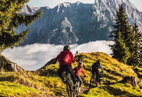
• 2 Übernachtungen in der gewünschten Kategorie in Saalfelden oder Leogang
• 2 Tage Liftpass für den Bikepark Leogang
• 1 Mountainbike Erlebnistag mit Fahrtechniktraining (2 Std. Fahrtechniktraining & Nachmittagstour)
• Saalfelden Leogang Card

• 2 overnight stays in the selected category in Saalfelden or Leogang
• 2 days lift ticket for the Bikepark Leogang
• 1 mountainbike adventure day with technical training (2 hrs. technical training & afternoon tour)
• Saalfelden Leogang Card




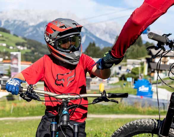

SO WIE ICH WILL
THE WAY I WANT

Über 20 Jahre Unterrichtserfahrung im BikeSport! Ausbildungsstätte für Bikepark Coaches! Entwickler und Initiatoren der ersten Bikepark Ausbildung in Österreich!
Unsere Priorität ist es, euch eine schöne und unvergessliche Bike-Zeit zu bescheren und unser fundiertes Fachwissen über Fahrtechnik in allen Facetten mit euch zu teilen.
Alle Programmpunkte werden auf die Individualität des Einzelnen, die aktuellen Gegebenheiten, sowie auf die Witterungsverhältnisse abgestimmt.
Wir freuen uns auf dich!
Euer Team der Bikeschule Elements.
Mehr Informationen:
Over 20 years of teaching experience in biking! Training centre for bike park coaches! Developers and initiators of the first bike park education in Austria!
Our priority is to give you a nice and unforgettable bike time and to share our in-depth knowledge of all facets of riding techniques with you.
All program items are tailored to the individuality of the participants, the current circumstances and the weather conditions.
See you soon in Leogang!
More information:
FAHRTECHNIK TRAININGS Level
½ Tageskurse für Erwachsene DI/DO/SO
Basic */**
Flow **/***
Gravity ***/****
Tageskurse für Erwachsene DI/DO/SO
Bikepark Schnuppertag */**
Bikepark Erlebnistag **/***
½ Tageskurse von 5 bis 7 Jahren MO/MI/FR
Mini Shred */**
Young Gun ***
Tageskurse für Kinder & Jugendliche MO/MI/FR
Greenhorn Day *
Rookie Day **
Step up Day ***/****
Specials täglich nach Vereinbarung
Familien Training
Eltern/Kind Training
Friends Training
Privat Unterricht täglich nach Vereinbarung
Early Bird 8.45 – 9.45 h
Individuell 10.00 – 12.00 h oder 13.00 – 15.00 h
Mehrtägige Veranstaltungen
www.bikeschule-leogang.at/de/camps
Programm gültig in der Bike-Saison 2024. Gruppenkurse ab 4 Teilnehmer. Änderungen aus Sicherheitsgründen (Witterung) vorbehalten. Info und Beratung unter: T + 43 664 2439087 office@elements-outdoorsports.at www.elements-outdoorsports.at www.bikeschule-leogang.at
Level: * Anfänger ** Leichte Vorkenntnisse *** Fortgeschritten **** Erfahrung
RIDING SKILLS WORKSHOPS Level
½ day workshops for adults TUE/THU/SUN
Basic */**
Flow **/***
Gravity ***/****
full day courses for adults TUE/THU/SUN
Bikepark Taster Day */**
Bikepark Adventure Day **/***
½ day courses for kids 5 to 7 years MON/WED/FRI
Mini Shred */**
Young Gun ***
full day courses for Kids & Youth MON/WED/FRI
Greenhorn Day *
Rookie Day **
Step up Day ***/****
Specials daily on request
Family Workshop
Father and Son Training
Friends Training
Private lessons daily on request
Early Bird 8.45 a.m. – 9.45 a.m.
Individual 10.00 a.m. – 12.00 p.m. or 1.00 p.m. – 3.00 p.m.
Camps and multiday events
www.bikeschule-leogang.at/en/camps
Program valid for the 2024 bike season. Group lessons minimum 4 participants. We reserve the right of alterations!
Information and advice: T + 43 664 2439087 office@elements-outdoorsports.at www.elements-outdoorsports.at www.bikeschule-leogang.at
Level: * Beginner ** Intermediate *** Advanced **** Expert
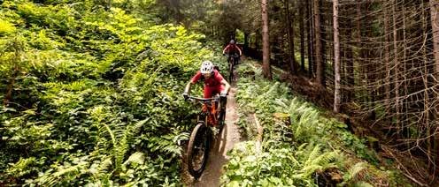
Sport Mitterer, Hütten 39, 5771 Leogang
T +43 6583 8642, info@sportmitterer.at www.sportmitterer.at
Der Bikepark Shop Leogang direkt an der Talstation ist der Treffpunkt für alle Biker. Hier kann man sich SCOTT Bikes ausleihen, Ersatzteile, aber auch Ausrüstung und coole Bekleidung kaufen.
Auch für die Reparaturen an deinem Bike stehen unsere erfahrenen „Bikeärzte“ gerne zur Verfügung. Die Jungs werden dein Bike pflegen, als ob es ihr eigenes wäre. Schau einfach mal vorbei.
The Bikepark Shop, located right next to the valley station of the lifts, is a popular meeting point for bikers. Here, you can rent the latest SCOTT bikes, purchase spare parts, as well as equipment and cool clothing.
Our experienced "bike doctors" are also available to assist you with any repairs you might need on your bike. Our guys will look after your bike as if it were their own. Have a stop by.
* STS = Safety Set, beinhaltet Vollvisierhelm, Protektorjacke, Knie-, Schien- & Ellbogenschoner
* STS = Saftey Set, includes full face helmet, protector jacket, knee-, shin bone & elbow protectors

INTERSPORT MARIA ALM, Am Kirchplatz 3 + Dorfstraße 2
T +43 6584 2119, www.intersport-mariaalm.at
Immer das passende Bike zu jeder Gelegenheit –wir bieten Top-Bikes in allen Kategorien an zwei Standorten in Maria Alm. Profitieren Sie von unserer großen Auswahl!
Dazu finden Sie alles, was Sie für eine perfekte Radtour brauchen: Rucksäcke, Brillen, Bekleidung und Accessoires für alle Fälle.
ÖFFNUNGSZEITEN:
täglich: 09.00 bis 12.00 h / 14.00 bis 18.00 h
Always the right bike for every occasion – we offer top bikes in all categories at two locations in Maria Alm. Benefit from from our large selection!
In addition, you will find everything you need for a perfect bike tour: Backpacks, glasses, clothing and accessories for all occasions.
OPENING HOURS:
daily: 9 a.m. to noon / 2 p.m. to 6 p.m.

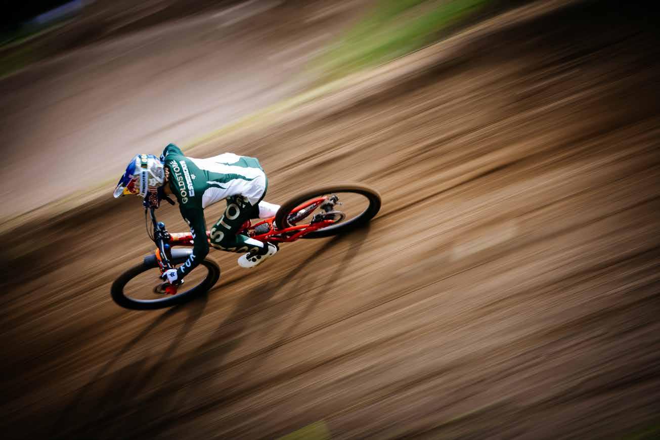


SO WIE ICH WILL
THE WAY I WANT
Versperrbarer Bike-Raum Bike locker room
Überwach.kamera & Bewegungsmelder Security camera & motion detector
BikeWaschplatz Bike wash
Service-Ecke Werk- & Flickzeug wird zur Verf. gestellt Service corner Tools and repair kits are provided
Wäscheservice Laundry service
Bikeinfo/ -ecke Bike info corner
Geprüfte Bike Guides Certified bike guides
HOTEL
BACHER gegen Gebühr for a fee
NATURHOTEL
FORSTHOFGUT gegen Gebühr for a fee
HOTEL
KRALLERHOF gegen Gebühr for a fee
HOTEL
DER LÖWE
LEBE FREI ****
MAMA THRESL
Kooperation Cooperation Bikeschule Elements
Kooperation Cooperation Bikeschule Elements
Hoteleigene Guides
Gratis Reinigungsprodukte | Free cleaning products Gratis Kettenöl Free chain oil Gratis free Kooperation Cooperation Bikeschule Elements
Gratis Reinigungsprodukte | Free cleaning products Self-Service
PURADIES****S gegen Gebühr for a fee
DIE RIEDERALM****S gegen Gebühr for a fee
RITZENHOF ****S
HOTEL & SPA AM SEE gegen Gebühr for a fee
BIOHOTEL
RUPERTUS****S gegen Gebühr for a fee gegen Gebühr for a fee
SALZBURGER HOF LEOGANG****S
STOCKINGGUT
BY AVENIDAGratis Reinigungsprodukte | Free cleaning products Gratis für Biker free for Bikers
Self-Service
Kooperation Cooperation Bikeschule Elements
Hoteleigene Bikeguides
Hoteleigene Bikeguides


Hotel Bacher Asitzstubn Leogang, Hütten 33, 5771 Leogang
T +43 6583 8556, info@hotelbacher.at
DEINE BASE IM HERZEN DES „THE EPIC BIKEPARK LEOGANG“ – FÜR BIKER, NATURFREUNDE UND FAMILIEN!
Dein Tag beginnt mit einem ausgiebigen Frühstück, bevor du im Bikepark voll durchstartest mit Pumptrack und Riders Playground. Nach einem actionreichen Tag chillt dein Bike sicher in unserem verschließbaren, videoüberwachten Bikekeller. Entspanne im Wellnessbereich mit Saunen und dem beheizten Infinity Panoramapool auf dem Hoteldach mit Sonnenterrasse und Blick auf die Leoganger Steinberge und den Bikepark. Genieße regionale Köstlichkeiten, sichere dir vergünstigte Bikepark-Tickets und entdecke unseren hoteleigenen Bikeverleih sowie Services wie Bike-Werkstatt und Wäscheservice.
#hotelbacherasitzstubn #bachersbikeverleih
YOUR BASE IN THE HEART OF " THE EPIC BIKEPARK LEOGANG " – FOR BIKERS, NATURE LOVERS AND FAMILIES!
Your day starts with a hearty breakfast before you hit the ground running in the bike park, with its pump track and riders' playground. After an action-packed day, safely store your bike in our lockable, video-monitored bike cellar. Relax in the spa area with saunas and the heated infinity panorama pool on the hotel roof, with sun terrace and views of the Leoganger Steinberge mountains and the bike park. Enjoy regional delicacies, secure discounted bike park tickets and discover our hotel's own bike hire, as well as other services such as a bike workshop and laundry service.
#hotelbacherasitzstubn #bachersbikehire

Naturhotel Forsthofgut, Hütten 2, 5771 Leogang T +43 6583 8561, info@forsthofgut.at www.forsthofgut.at
Life is better in the mountains – Das Naturhotel Forsthofgut ist ein wahres Paradies für den Urlaub auf zwei Rädern.
Das Naturhotel Forsthofgut begrüßt seine Gäste mit Europas erstem waldSPA, einem Badesee mit Blick auf die majestätischen Leoganger Steinberge und für kulinarische Genüsse im Einklang mit der Region sorgt die „ForsthofgutKÜCHE“. Direkt ab Hotel warten zahlreiche Bikerouten – von der Runde für Einsteiger bis zum herausfordernden Trail im Bikepark Leogang. Diese lassen sich am besten mit den Bikes aus dem hoteleigenen Bikeverleih erobern: Hier stehen die neuesten Modelle von Scott für Touren bereit. Die Ausrüstung der Gäste findet im „Basislager“ Platz. Und für die Bikes gibt es einen abschließbaren Bike-Keller und einen Bike-Waschplatz. Für Ruhe und Erholung nach einem Tag in der Natur sorgt der 5.700 m2 waldSPA mit separatem Adults Only Bereich, mehreren Pools und einer großzügigen Saunalandschaft. Das Forsthofgut ist ein Ort, der bleibende Erinnerungen schenkt und Momente schafft, in denen Freiheitsgefühl und Abenteuerlust begeistern.
Life is better in the mountains – The Naturhotel Forsthofgut is a true paradise for a holiday on two wheels.
The Naturhotel Forsthofgut welcomes its guests with Europe's first waldSPA, a bathing lake with a view of the majestic Leoganger Steinberge and the "ForsthofgutCUISINE" provides culinary delights in harmony with the region. Numerous biking routes await you directly from the hotel –from a path for beginners to the challenging trail in the Leogang Bike Park. These are best conquered with the bikes from the hotel's own bike rental: The latest models from Scott are available for tours. The guests' equipment can be stored in the "base camp". And for the bikes there is a lockable bike cellar and a bike washing area. The 5,700 m2 waldSPA with a separate adultsonly area, several pools and a spacious sauna area ensures a peaceful and relaxing atmosphere after a day in nature. The Forsthofgut is a place that creates lasting memories and moments that inspire a sense of freedom and adventure.
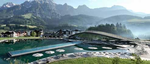
Hotel Krallerhof Leogang, Rain 6, 5771 Leogang
T +43 6583 8246, urlaub@krallerhof.com
www.krallerhof.com
Ob genussvolles Biken, anspruchsvolle Rad- & Mountainbiketour oder Downhill in der größten Bike-Region Österreichs – im Krallerhof haben Sie nicht nur eine echte Pole-Position direkt an der Steinbergbahn, Sie genießen auch Erholung und Wellness im Salzburger Land.
Im hauseigenen TwoWheelsClub stehen Ihnen E-Bikes, Helme und Radkarten zur Verfügung. Unsere zertifizierten Bike-Guides begleiten Sie auf den zahlreichen Lines des angrenzenden Bikeparks oder gestalten nach Ihren Wünschen ansprechende, individuelle Biketouren. Tauchen Sie zur Entspannung und Regeneration danach in unser einzigartiges Spa ATMOSPHERE by Krallerhof – Adults Only – und unser Refugium ein. „Maximal regional“ lautet das Motto der Kulinarik im Haus. Die KrallerAlm direkt neben dem Krallerhof ist mit Ihrer großzügigen Sonnenterrasse beliebter Treffpunkt für Biker und Genießer mit hervorragender Küche & Steinofenpizza.
Whether you want to cycle through picturesque landscapes or prefer the thrill of downhill mountain bike runs, Austria's largest bike-region has something in store for everyone. At the Krallerhof you not only have a real pole position right next to the Steinbergbahn, you also enjoy relaxation and wellness in the Salzburg region.
In addition, we offer our guests in-house E-Bike rental services and skill-building classes. The certified bike instructors of our TwoWheelsClub accompany you on tours in the bike park or the beautiful surrounding countryside.
For relaxation and regeneration, dive into our unique spa ATMOSPHERE by Krallerhof – Adults Only – and our Refugium. "Maximum regional" is the motto of the hotel's cuisine. Also the traditional restaurant KrallerAlm directly next to the Krallerhof is highly popular amongst cyclists and guests with its spacious sunny terrace offering sweeping views of the surrounding mountains, excellent cuisine and unforgettable fresh stone oven pizza.


Hotel Der Löwe lebe frei, Dorf 119, 5771 Leogang
T +43 6583 7428, lebefrei@loewe.at www.loewe.at
Willkommen im Hotel Der Löwe – Deinem BikeParadies mitten im Dorfzentrum von Leogang!
Erlebe unvergessliche Biketouren direkt ab Hotel oder actionreiche Abenteuer im nahegelegenen THE EPIC Bikepark. Unser nachhaltig mit Erdwärme beheizter Außenpool und Sportmassagen sorgen für Entspannung danach. Genieße die alpine Gourmetküche, entspanne im exklusiven Adults only SPA LEONARIUM oder im FAMILY SPA mit Hallenbad und Saunen. Unsere Naturholzzimmer und Suiten bieten höchsten Komfort. Nach einem actionreichen Tag wartet die Wein- und Cocktailbar LIONS LOUNGE auf Dich. Für Biker bietet das Bike-Hotel kostenfreien Sportwäsche-Service, eine professionelle BikeWerkstatt, eine videoüberwachte Bikegarage mit 30 E-Ladestationen, sowie einen Bikewaschplatz und Trockenraum mit eigenem Spint. Zusätzlich stehen E-Mountainbikes zur Verfügung.
Fühle dich wie zu Hause im Hotel Der Löwe lebe frei. Die Familie Madreiter lebt Gastfreundschaft schon seit Jahrzehnten. Familiär, herzlich und ehrlich. Buche jetzt mit −15 % Ermäßigung auf Bikeparktickets!
Welcome to Hotel Der Löwe – your bike paradise in the center of Leogang!
Experience unforgettable bike tours directly from the hotel or action-packed adventures in the nearby THE EPIC Bikepark. Our sustainably heated outdoor pool and sports massages ensure relaxation afterwards. Enjoy the alpine gourmet cuisine, relax in the exclusive Adults only SPA LEONARIUM or in the FAMILY SPA with indoor pool and saunas. Our natural wood rooms and suites offer the highest level of comfort. After an action-packed day, the LIONS LOUNGE wine and cocktail bar awaits you.
For bikers, the bike hotel offers a free sports laundry service, a professional bike workshop, a video-monitored bike garage with 30 e-charging stations, as well as a bike washing area and drying room with its own locker. E-mountain bikes are also available.
Feel at home at Hotel Der Löwe live free. The Madreiter family has been practicing hospitality for decades. Familiar, warm and honest.
Book now with −15 % discount on bike park tickets!
mama thresl, Sonnberg 252, 5771 Leogang
T +43 6583 20800, info@mama-thresl.com
www.mama-thresl.com
Das mama thresl ist ein Lifestyle-Domizil für aktive Gäste, die Natur genauso lieben wie eine gesellige Zeit mit Freunden: Herzlich, frech und nie tierisch ernst.
ANGEBOTE FÜR BIKER: Bike-Waschanlage und Werkstatt, belüftete Bike-Locker. E-Mountainbikes von Mondraker (entgeltlich). Das Haus liegt in perfekter Lage am Bikepark; Bikeschule Elements Outdoorsports sowie Bike-Verleih bei Sport Mitterer sind in unmittelbarer Nähe.
BESONDERES: Bikern läuft im mama thresl das Wasser im Mund zusammen, wenn feine Steaks und leckere Burger vom Grill, gesunde SalatSchüsserln und ofenfrische Flammkuchen auf die Teller kommen.
Immer samstags: BBQ Abend nach nordamerikanischem Vorbild ALL U CAN EAT!
Donnerstags, freitags und samstags von 21.00 bis 0.30 h: LIVE DJ Clubbing an der island Bar! Ein Tipp sind auch die Yoga-Kurse, die immer wieder indoor oder outdoor auf dem Rooftop bzw. auf den Yoga-Plattformen mit Panorama-Bergblick mitten im Wald im Priesteregg statt finden.
The mama thresl is a lifestyle domicile for active guests who love mountains and nature just as much as a convivial time with friends: warm, cheeky and never overly serious.
OFFERS FOR BIKERS: Bike wash and workshop, ventilated bike lockers, E-Mountainbikes from Mondraker (against payment). The establishment is ideally situated at the bike park near the Elements Outdoorsports bike school as well as the Sport Mitterer bike rental.
EXTRA SPECIAL: The moment fine steaks and tasty burgers from the grill, healthy salad bowls and oven-fresh tarte flambée are dished up, Pavlovian responses quickly follow at mama thresl. Every Saturday: American-style "ALL YOU CAN EAT" BBQ evening!
Thursdays, Fridays and Saturdays from 9.00 p.m. to 12.30 a.m.: LIVE DJ Clubbing at the island Bar! Don't miss: yoga classes, which take place either indoors or outdoors on the rooftop as well as on the yoga platforms with panoramic mountain views in the middle of the forest in Priesteregg.
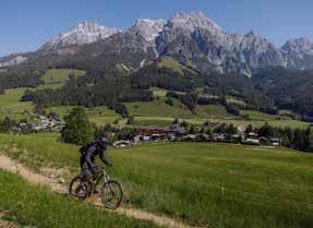
Puradies, Rain 9, 5771 Leogang
T +43 6583 8275, info@puradies.com www.puradies.com

Im Bikehotel Puradies sind alle Radler bestens aufgehoben, viele Routen beginnen direkt vor der Haustüre des Hotels. Zusätzlich erhalten Sie von uns −15 % auf Ihre Bikekarte!
Falls Sie Ihr Bike daheimlassen möchten, können Sie direkt im Puradies E-Mountainbikes ausleihen. Zusätzlich steht den Gästen natürlich ein videoüberwachter Bikekeller und ein Waschplatz zur Verfügung!
Das 4-Sterne-Superior-Resort ist genau die Mischung, nach der sich so viele sehnen. Totale Ruhe mit nichts als Natur ringsum. Und trotzdem Lifestyle und Design, eine inspirierende Bar, Yoga, der himmlische Heaven Spa und natürlich Kinderbetreuung. Ein Chaletdorf mit 14 exklusiven Privat-Chalets und ein Design Hotel mit Suiten, Lofts, Restaurants, Wellness und vielem mehr. Zwischen Steinberg- und Asitzbahn auf einem 300.000 m2 großen Plateau, das allein dem Puradies gehört.
At the nature resort Puradies, all cyclists are in good hands many routes start right on the hotel's doorstep. You will also receive 15 % off your bike card!
If you want to leave your bike at home, you can rent e-mountain bikes directly at the hotel. Guests also have a video-monitored bike basement and a washing area available!
The 4-star superior resort is exactly the mix that so many people long for. Total tranquillity with nothing but nature all around. And yet Lifestyle and design, an inspiring bar, yoga, the new Heaven Spa and, of course, childcare. A chalet village with 14 exclusive private chalets and a design hotel with suites, lofts, restaurants, wellness and much more. Between the Steinberg and Asitzbahn on a 300,000 m2 plateau that belongs solely to Puradies.
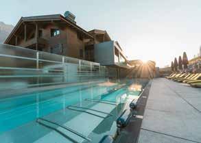

Beste Voraussetzungen für Bikespaß von A bis Z:
Von Trails über Downhill bis zu genussvollen Erlebnistouren. Als Bikepark-Mitgliedsbetrieb bieten wir großartige Annehmlichkeiten für Biker: Gesicherter Bikeraum (direkter Ausgang zum Bikepark), großes Spiele- & Actionangebot, ideal auch für junge Bike-Familien. Wellnessvergnügen auf über 2000 m² mit In- und Outdoor Sportbecken (20 m lang), 60 m Erlebnis-Wasserrutsche, FamilienWellness,… Sowie (exklusiv für Erwachsene) unser einzigartiger Thermalpool (20 m Länge), 6 Saunen & Schwitzattraktionen, Relax-Cube,…!
Familiärer herzlicher Service, hervorragende Kulinarik (mehrfach ausgezeichnet) und tolles Wohnambiente für den perfekten Urlaub.
Erleben Sie eine Gourmetküche auf höchstem Niveau in unserem Genießerrestaurant „dahoam“ by Andreas Herbst, u. a. ausgezeichnet mit 4 Gault Millau Hauben.
NEU: Spaß & Action für Klein & Groß gibt es in unserer neuen Trampolinhalle!
LOCATED RIGHT AT THE LEOGANG BIKE PARK, YOUR VACATION ENJOYMENT IS ASSURED
The best conditions for biking fun from A to Z: From trails, to downhill runs, to delightful exploration tours. As a member of the Bike Club Federation, we offer all kinds of great services for biking enthusiasts, including: a secure bike room (with direct access to the Bikepark), many games and other activities ideally suited to young biking families, fitness and wellness facilities spread over 2,000 square meters (21,500 square feet), with inand outdoor pools (20 meters in length), a thrilling 60-meter water slide and family spas…as well as (exclusively for adults) our unique 20 meter thermal pool, six saunas/steam rooms, Relax-Cube…!
Friendly and excellent service, outstanding culinary delights (awarded several) and a simply superbambience make for the perfect holiday.
Experience gourmet cuisine at the highest level in our fine dining restaurant "dahoam" by Andreas Herbst, awarded with 4 Gault Millau toques.
NEW: Fun & action for young and old in our new trampoline hall!
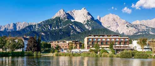
Ritzenhof – Hotel & Spa am See, Ritzenseestraße 33, 5760 Saalfelden
T +43 6582 73806, info@ritzenhof.at www.ritzenhof.at
Leger-alpiner Lifestyle, lecker-kreative Küche, familiäre Atmosphäre und genussvolle Entspannung im traumhaften SPA am See. Nach einem Tag voller Uphill-, Downhill- oder Cross Country-Abenteuer an der frischen Bergluft lockt der SPA mit IndoorPool, verschiedenen Saunen, Dampfbad, Infrarotkabine, privater Liegewiese und direktem Zugang zum Ritzensee. Dort ist es auch, wo Sie unsere Spa-Therapeuten mit eigens auf Ihre Bedürfnisse abgestimmten Behandlungen verwöhnen. Als leidenschaftlicher Biker ist der Chef des Hauses, Hannes Riedlsperger, selbst immer wieder auf den Trails der Region unterwegs. Gerne verrät er seine Lieblingsstrecken und gibt wertvolle Tipps! Für den kulinarischen Genuss folgt das Küchenteam den Werten der eigens entwickelten Alpine Cuisine: So verarbeiten wir unsere Produkte zum Zeitpunkt der größten Kraft und Reife und vertrauen zahlreichen langjährigen, regionalen Lieferanten.
The charm of Alpine lifestyle: delicious creative cuisine, family atmosphere and enjoyable relaxation in the dreamlike lakeside SPA. After a day full of uphill, downhill or cross country adventures in the fresh mountain air, the SPA with indoor pool, various saunas, steam bath, infrared cabin, private sunbathing area and direct access to the Ritzensee lake is the place to be! Here, our spa therapists will pamper you with treatments specially tailored to your needs. Hannes Riedlsperger, the head of the house, is a passionate biker and is himself always on the go on the region's trails. As a true insider, he loves to share information and to reveal his favourite routes! For culinary enjoyment, the kitchen team cooks according to the principles of Alpine Cuisine: we process our products at the time of greatest strength and maturity and trust in numerous long-standing, regional suppliers.
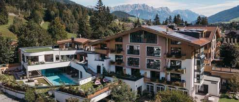
Bio, Aktiv & Echte Urlaubserlebnisse verspricht der Sommer im Biohotel RUPERTUS.
Genau 50 liebevoll eingerichtete Zimmer und Suiten, 100 % beste Bio Qualität und eine Gastgeberfamilie die sich mit ihrem Team persönlich um die Wünsche der Gäste kümmert. Im erweiterten Wellnessbereich und Hotelgarten mit Indoor- und Outdoorpool findet sich die Basis für einen rundum ehrlichen Urlaub. Regelmäßige Yogaklassen sorgen für den Ausgleich zum Bergsport. In Sachen Mountainbike wird viel geboten – ist das Haus doch seit 2001 Mitglied bei den Mountainbike Holidays und seit 2023 bei den Roadbike Holidays. Gut geführt geht's in Richtung Abenteuer. Die hoteleigenen Guides Emil und Patrick stehen mit einem breiten Tourenangebot bereit. Kinder freuen sich auf 4 Kids Bike Camps im Sommer 2024! Nur 200 m sind es bis zum EPIC Bikepark Leogang.
Biohotel Rupertus, Hütten 40, 5771 Leogang
T +43 6583 8466, info@rupertus.at
www.rupertus.at
IN THE BEST OF HANDS: GUIDED MOUNTAIN BIKE HOLIDAYS FROM OUR HOTEL DOORSTEP
Summer promises organic delights, plenty of activity & genuine holiday experiences at the Biohotel RUPERTUS!
Exactly 50 lovingly furnished rooms and suites, 100 % organic quality and a host family that personally takes care of the guests' wishes with their team. The extended wellness area and hotel garden with indoor and outdoor pool provide the basis for an all-round honest vacation. Regular yoga classes provide a balance to mountain sports. When it comes to mountain biking, the hotel has been a member of Mountainbike Holidays since 2001 and Roadbike Holidays since 2023. Wellguided adventures in one of the most beautiful cycling regions in Austria. The hotel's own guides Emil and Patrick are on hand with a wide range of tours. The hotel's own bike store is stocked with the latest models from SCOR and BMC and is ready for you to ride. Children can look forward to 4 Kids Bike Camps in summer 2024! The EPIC Bikepark Leogang is just 200 m away.

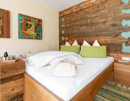
Salzburger Hof Leogang, Sonnberg 170, 5771 Leogang
T +43 6583 7310, office@salzburgerhof.eu www.salzburgerhof.eu
Der Salzburger Hof Leogang besticht mit seiner unschlagbaren Lage direkt an der Talstation der Asitz-Bergbahn und am Bikepark Leogang.
Zahlreiche Serviceleistungen speziell für Biker erwarten Sie im Salzburger Hof Leogang: Hochsicherheits-Bikeraum, voll ausgestattete Bikewerkstatt, Bikewaschplatz, gratis Wäscheservice für Biker, Verleih von MTB und E-MTB. Mehrmals wöchentlich werden geführte Biketouren durch die Region angeboten.
Nach einem aktiven Tag auf den Biketrails der Region finden Sie in unseren beiden Wellnessbereichen Panorama-Spa mit Infinity Sky-Pool und Familien-Spa mit Gartenpool oder bei einer speziellen Biker-Massage optimale Entspannung. Genießen Sie mit unserer Verwöhnpension jeden Tag das leckere Frühstücksbuffet, ein Nachmittags-Jausenbuffet und ein 4-Gänge Wahlmenü am Abend. Ihr perfekter Bike-Urlaub wartet schon auf Sie!
The Salzburger Hof Leogang impresses due to its unique location right next to Bikepark Leogang and the valley station of the Asitz gondola.
We offer numerous services especially for bikers: high-security bike garage, fully equipped workshop, bike washing area, free laundry for bikers, rental of MTB and E-MTB. Moreover, we offer several times per week guided bike tours through the region Saalfelden Leogang.
After an active day on the bike trails you can relax in our two spa areas panorama-spa with infinity sky-pool and family-spa with gardenpool or enjoy a soothing biker's massage.
Enjoy the delicious breakfast buffet, an afternoon snack buffet and a 4-course dinner menu due to our Superior Half Board. The perfect bike vacation is waiting for you.
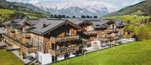
Stockinggut by AvenidA, Rain 5, 5771 Leogang
T + 43 6583 20 600, welcome@stockinggut.at
www.stockinggut.at
Egal ob Anfänger oder Profi, Draufgänger oder Genuss-Radfahrer – als Bike-Liebhaber bist du im Stockinggut genau richtig.
Nach nur wenigen Pedaltritten befindest Du Dich im Epic Bike Park Leogang, in dem zahlreiche Lines und Trails auf dich warten. Adrenalin kommt hier bestimmt nicht zu kurz. Damit Du die Region rund um das Stockinggut noch besser erkunden kannst, gibt es bei uns einen hauseigenen E-Mountainbike-Verleih. Ebenso befinden sich eine BikeWaschanlage vor dem Hotel und ein Bike-Locker in der Garage. Den Sport & Rent Mitterer kannst du zu Fuß erreichen – dort findest Du alles, was das Biker-Herz begehrt.
In unserem Restaurant warten am Ende des Tages eine köstliche Mahlzeit und der ein oder andere Drink an der Bar auf Dich und in unserem Wellnessbereich kannst Du Dir und Deinen Muskeln eine wohlverdiente Auszeit gönnen. Die traumhafte Aussicht auf die Leoganger-Steinberge gibt es noch on top.
Whether you're a beginner or a pro, a daredevil or a leisure cyclist – as a bike lover, our Stockinggut is the perfect place for you.
After just a few pedal strokes, you'll find yourself in the Epic Bike Park Leogang, where numerous lines and trails await you. Adrenalin is certainly not in short supply here. So that you can explore the region around the Stockinggut even better, we have our own e-mountain bike rental. There is also a bike wash in front of the hotel and a bike locker in the garage. You can reach the Sport & Rent Mitterer on foot – there you will find everything a biker's heart desires.
At the end of the day, a delicious meal and a drink or two await you in our restaurant and you can treat yourself and your muscles to a well-earned break in our wellness area. The fantastic view of the mountain range in Leogang is the cherry on top.
Eine der klimaschonensten Arten in den Urlaub zu fahren. Noch dazu ohne Stau. Von den Knotenpunkten Salzburg, Innsbruck, Wörgl, München, Wien oder Klagenfurt lässt sich Saalfelden Leogang bequem mit der Bahn erreichen. Sowohl in Saalfelden, als auch in Leogang (Leogang und Leogang Steinberge) findest du Bahnhöfe, an denen die durchreisenden Züge regelmäßig halten. Dein Rad kannst du mit den Nah- und Fernverkehrszügen mitnehmen oder per Gepäckservice sogar unkompliziert nach Saalfelden Leogang liefern lassen.
Die Saalfelden Leogang Card ist deine kostenlose Fahrkarte für den öffentlichen Verkehr im Pinzgau. In dieser Gästekarte sind Bus und Bahn (inklusive Linie 690 nach Hochfilzen) im gesamten Pinzgau inkludiert. Übrigens auch für An- und Abreise gültig.

One of the most climate-friendly ways to go on vacation. Even more so without traffic jams. From the hubs in Salzburg, Innsbruck, Wörgl, Munich, Vienna or Klagenfurt, Saalfelden Leogang may be accessed easily by train. In Saalfelden, as well as in Leogang (Leogang and the Leogang Steinberge) you will find train stations, where the passing trains stop on a regular basis. You can take your bike with you on local and long-distance trains or even have it easily delivered to Saalfelden Leogang using the DB and ÖBB luggage service.
The Saalfelden Leogang Card is your free ticket for public transport in Pinzgau. This guest card includes bus and train (including line 690 to Hochfilzen) in the entire Pinzgau region. Also valid for arrival and departure.
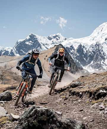
PROTECTIVE SPORTS PACKS


Der neue EXPLORER PRO 30 wurde speziell für lange Bike-Touren konzipiert –mit ihm fährt sämtliches Gepäck bequem und sicher am Körper mit. Zugleich ist er mit dem besten Belüftungssystem ausgestattet, das wir je entwickelt haben.
• AIR FLOW CONTACT SYSTEM mit verbesserter Ergonomie und optimiertem Belüftungssystem
• TRINKBLASENFACH für Trinkblasen mit 1,5 bis 3 l Fassungsvermögen
• Neutrale Lastverteilung dank BODY HUGGING
• Separate WASH POUCH inklusive
• AIRO FLEX Hüftgurt für eine top belüftete und zugleich stabile Lastverteilung auf die Hüften
BIKE EVENTS IN SAALFELDEN LEOGANG
09.05. – 11.05.
07.06. – 09.06.
29.06. – 30.06.
17.08. – 18.08.
13.09. – 15.09.
14.09.
14.09. – 15.09.
05.10.
Opening Weekend im Bikepark Leogang
UCI Mountain Bike World Series
-15 % auf Lifttickets
Photo Days
Photo Days
BIKE Festival Saalfelden Leogang
-15 % auf Lifttickets
VPACE Kids Cup
Photo Days
Auner Austrian Gravity Series
Alle detaillierten Infos und Links zu den Veranstaltungen gibt's hier: www.bikepark-leogang.com
All detailed information and links to the events can be found here: www.bikepark-leogang.com
VOM TRAIL AUF DIE STRASSE –MAXXIS EROBERT DIE STADT

ERFAHRE HIER ALLES ÜBER DIE METRO REIFENFAMILIE
MAXXIS , der Marktführer bei MTBReifen, ist bekannt für höchste Qualität und beste Performance. Diese MAXXIS Qualität gibt’s jetzt endlich auch für alle (E-) City- und (E-) Lastenräder. Die METRO REIFENFAMILIE – bester Pannenschutz, ideal für den Ganzjahreseinsatz und ressourcenschonend.
KARKASSEN AUS RECYCELTEN FISCHERNETZEN

FRÜHLING SPRING 2024
10. – 12.05.
18. – 20.05.
19. – 23.05.
25. – 26.05.
15. – 23.06.
Youth Bike Park Days
Style & Gravity Days für Erwachsene
Rookie Youth Camp
Ladies Camp „Girls shred too“
Downhill Days für Erwachsene
Youth Bike Park Days
Bike Park Coach Ausbildung
SOMMER & HERBST CAMPS FÜR KINDER UND JUGENDLICHE 2024 SUMMER & AUTUMN CAMPS FOR CHILDREN AND TEENS 2024
ROOKIE CAMP JE 5 TAGE EACH 5 DAYS
30.06. – 04.07., 14. – 18.07., 28.07. – 01.08., 25. – 29.08.
Rookie Bike Park Youth Camp
YOUTH BIKE PARKS JE 3 TAGE EACH 3 DAYS
24. – 26.06., 08. – 10.07., 22. – 24.07., 05. – 07.08., 12. – 14.08., 19. – 21.08.
Youth Bike Park Days (ab 8 – 18 Jahre | from 8 – 18 years)
YOUNG GUN MINI CAMP JE 3 TAGE EACH 3 DAYS
22. – 24.07., 29. – 31.07., 05. – 07.08., 12. – 14.08., 19. – 21.08.
Young Gun Mini Camp 5+ (ab 5 – 7 Jahre | from 5 – 7 years)
YOUTH BIKE PARKS JE 3 TAGE EACH 3 DAYS
02. – 04.09., 07. – 09.10., 14. – 16.10., 28. – 30.10.
HERBST AUTUMN 2024
07. – 08.09., 12. – 13.10.
14. – 22.09.
Youth Bike Park Days (ab 8 Jahre | from 8 years)
Ladies Camp „Girls shred too“
Downhill Days für Erwachsene
Youth Bike Park Days (ab 8 Jahre | from 8 years)
Bike Park Coach Ausbildung

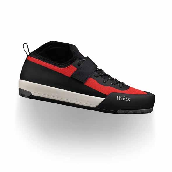
Für den Inhalt verantwortlich:
Saalfelden Leogang Touristik GmbH
Mittergasse 21a, 5760 Saalfelden
T +43 6582 70660 info@saalfelden-leogang.at www.saalfelden-leogang.com
Bilder:
Fotoarchiv der Saalfelden Leogang Touristik GmbH
Klemens König, SalzburgerLand Tourismus, Robert Kittel, Archiv der Saalfelden Leogang Touristik GmbH
Die Bildrechte bei den Partnerbetrieben liegen bei den jeweiligen Inserenten.
Kartografie & Kartengrundlage: max2 GmbH
Design:
Agentur Rahofer, Salzburg
Grafik:
Werbeagentur Wedl, Mils
Druckerei:
Hutter Druck GesmbH & Co KG, St. Johann in Tirol
Stand April 2024
Änderungen, Fehler und Preisänderungen vorbehalten.
Saalfelden Leogang ist Träger des österreichischen Umweltzeichen für Destinationen. Mehr Informationen:

Responsible for the content:
Saalfelden Leogang Touristik GmbH
Mittergasse 21a, 5760 Saalfelden T +43 6582 70660 info@saalfelden-leogang.at www.saalfelden-leogang.com
Photo credits:
Photo archive from the Saalfelden Leogang Touristik GmbH
Klemens König, SalzburgerLand Tourismus, Robert Kittel, archive from the Saalfelden Leogang Touristik GmbH
The image rights of the partners belong to the respective owner.
Cartography: max2 GmbH
Design:
Agentur Rahofer, Salzburg
Graphic:
Werbeagentur Wedl, Mils
Printing:
Hutter Druck GesmbH & Co KG, St. Johann in Tirol
Edition April 2024
Subject to changes, errors, and price changes.
Saalfelden Leogang has been awarded the Austrian Ecolabel for Destinations. More information:


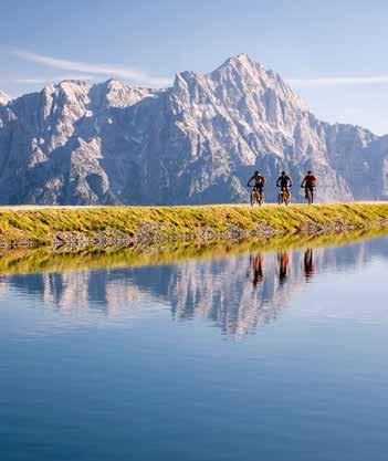
T
F
