2 minute read
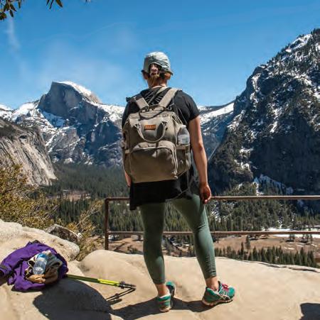
3 ОTunnel View to Inspiration Point


This 2.3-mile trail has gorgeous views of Yosemite Valley, El Capitan and Bridalveil Fall, but parking is often a challenge and the climb to the top is steep.
You’ll start at the famed Tunnel View lot on Wawona Road, where millions of photographs have been taken. It will be very crowded. Breathe deep, be patient and try to find a parking spot before heading up the trail to Inspiration Point.
Advertisement
The trail climbs about 1,000 feet over the course of 1.2 miles. The views, even more than the trail grade, are likely to slow your progress. There are gaps in the trees and overlooks throughout the trail that serve as great spots for rest and reflection.
Inspiration Point itself creeps up after you’ve walked about 30 minutes. It offers similar wonderful views as can be found next to the tunnel a mile south—but without the noise and stress of passing vehicles and buses.
Most people turn around here but, if you have more time, the Pohono Trail continues uphill for several more miles, regularly hitting famous points and overlooks.
4
Yosemite Falls
This is a spectacular but difficult 6.6-mile climb to the top of North America’s tallest waterfall, rising more than 2,500 feet from the Yosemite Valley floor.
The trail begins at Camp Four, near shuttle stop #7. The switchbacks start early—you’ll climb 1,000 feet to Columbia Rock in the space of just 1 mile, with sweeping views of the valley as your reward. This is often the most crowded part of the trail (many families attempt it with their children), so be patient as you navigate around fellow hikers.

The next ¾ mile isn’t too hard. The trail flattens a lot and even curves downhill for a bit, until Upper Yosemite Fall dominates your line of sight. This is the highlight of the trip for many. Take your time and try to find a spot for photos and lunch. If you turn around here, then you will finish your hike in about four hours—or faster, if your pace is less leisurely.
For those continuing on, the next 1½ miles consist of brutal switchbacks and another 1,500 feet of elevation gain. Early in the climb, you’ll probably feel the cool mist from the falls. The reward for reaching the top is panoramic views of the valley—and a sense of wonder about how modestlooking Yosemite Creek can feed such a massive waterfall.

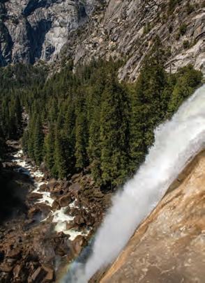
Must Do! WATERFALLS
They’re flowing, in some cases past blobs of snow, and as the days warm up, they will really get to roaring. Yosemite Upper and Lower, Vernal, Nevada, Sentinal, Bridalveil, Horsetail . . . even some that haven’t run much in years will be on full display. This year promises to be spectacular—and dangerous. A variety of lookout points and hikes put visitors in close proximity to the falls. Stay vigilant, and don’t lose your life for a selfie.