TABLE OF CONTENTS
Ingelwood-Ramsay Urban Landscape Identity
Instructors: Professor Enrica Dall’Ara & Gordon Skilling
LAND 614 Landscape Architecture Studio II, Fall 2022
School of Architecture, Planning + Landscape
University of Calgary
Landscape of Movement
Instructors: Professor Twab Helmi
LAND 604 Landscape Architecture Studio I, Winter 2022
School of Architecture, Planning + Landscape
University of Calgary
A Research-oriented Project Studio

Instructors: Professor Bev Sandalack / Jack Vanston
LAND 702 -Landscape Architecture Studio 3 Advanced-Winter 2023
School of Architecture, Planning + Landscape
University of Calgary
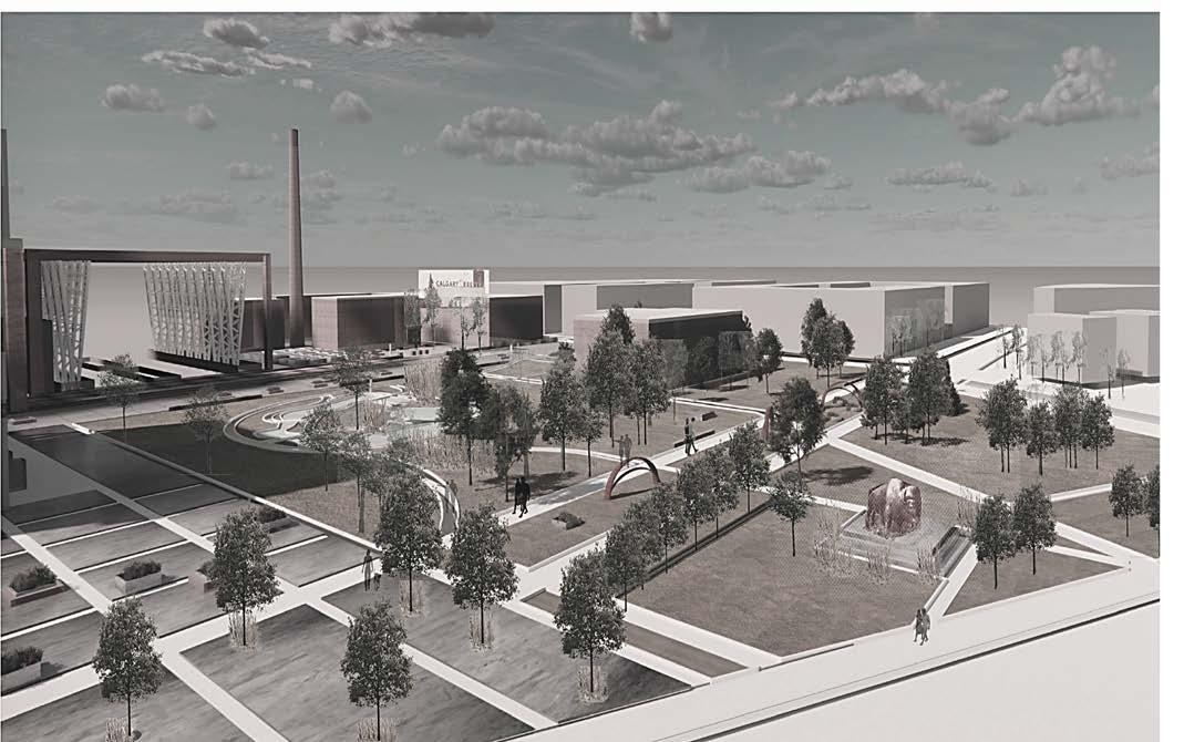
BREWERY DISTRICT GARDENS
CULTURAL HERITAGE HUBS REVITALIZATION
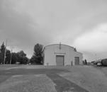
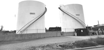
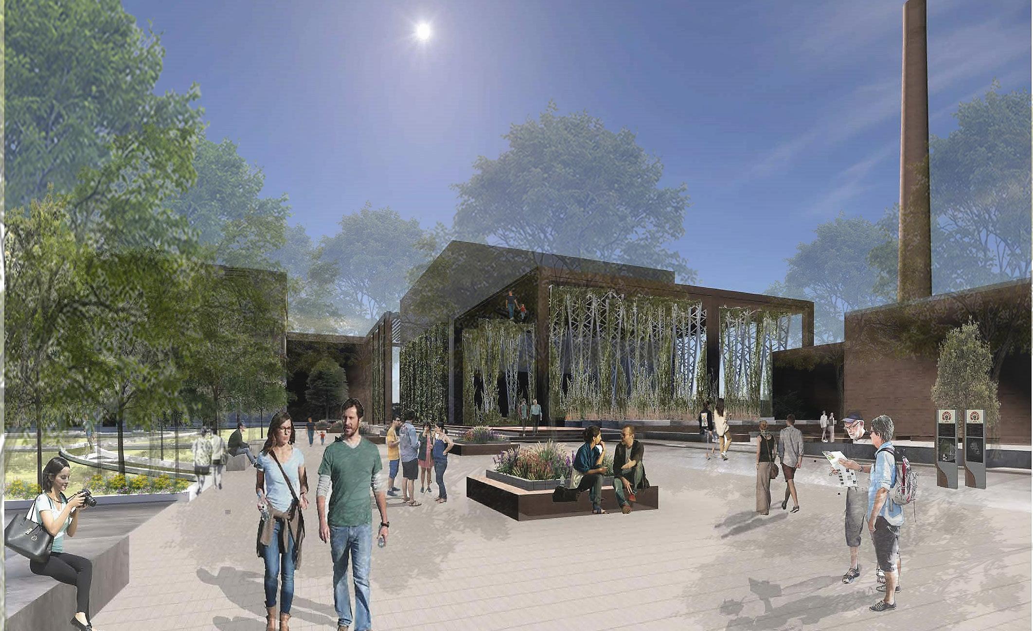
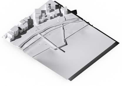
The work focuses on the redevelopment of Inglewood Brewery District. The vision is to give the public and the community the opportunity to reconnect with an old Calgary landmark, bringing it back to life, while also encouraging the further development of a walkable community. The idea is to integrate, develop and interlink the existing patterns that are formed by its previous industrial use, and to find a new interpretation with a new syntax.The landscape oriented transformation plan is set the framework to create an urban destination that is dynamic and engaging for generations to come through, to create a strong sense of identity. The Brewery Garden with its iconic and historical bronze statues, as a symbol of the Calgary Brewery Company,1930’s, mediates a system of new and refurbished connections between old picturesque garden, and new proposed site features.
Ingelwood-Ramsay Urban Landscape Identity
Instructors: Professor Enrica Dall’Ara & Gordon Skilling
LAND 614 Landscape Architecture Studio II, Fall 2022 School of Architecture, Planning + Landscape University of Calgary


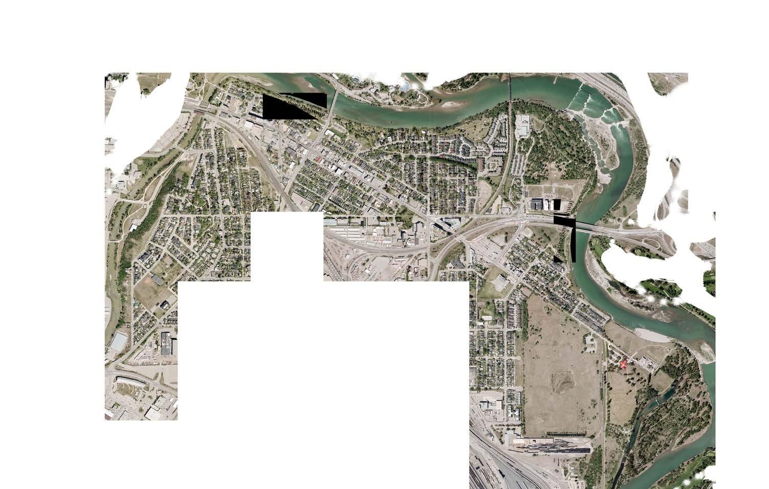


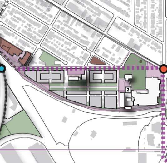
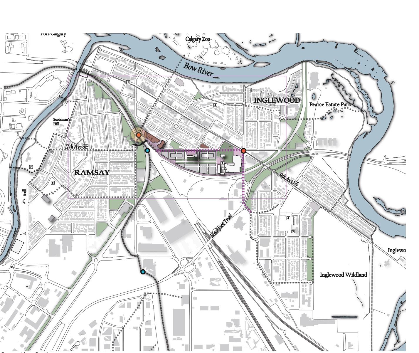
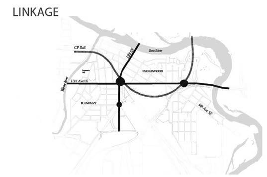
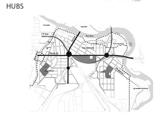
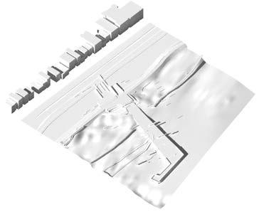
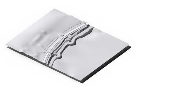
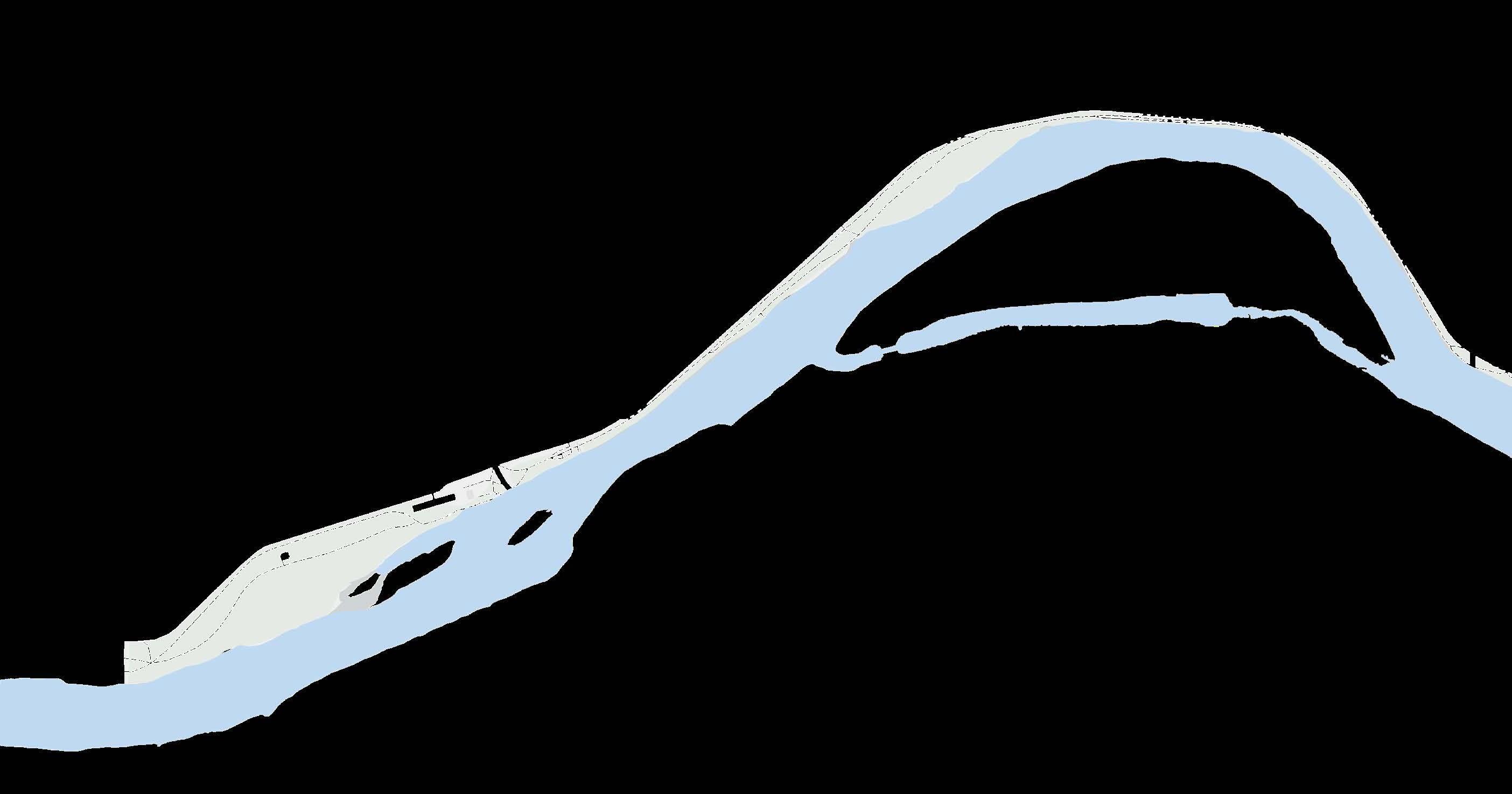
Strategies Interventions Intervention 1: Cultural Hub Intervention 3: Post Industrial Reclamation Intervention 4: Native Planting In Open Areas Intervention 2: Pathway Network Existing Condition SCALE 1:5000 0 50 100 150 200m 20 A A B B B B C D D D BowRiver 9thAveSE RAMSAY INGLEWOOD Calgary Zoo Fort Calgary Inglewood Wildland Pearce Estate Park Inglewood Bird Sanctuary 17th Ave SE BlackfootTrail Scotsman’s Hill 2 3 4 9thAveCommercial Inglewood Community Garden and Community Center NellieBreenPark Ramsay Community Garden Scotsman Hill Lookout Cold Garden Ol’ Beautiful Existing Future Proposed Type of Reclaimed Limbo Interventions Community Hub Green Network Green Line Station Cultural Hub Native Planting in Open Areas Cultural Hub Accesible Park Areas Green Rooves Post Industrial Reclamation Plaza Improved Pedestrian-Bike Crossing Pathway System Reclaimed Limbos Green Line Route Pathway Kitchen Garden Sharing Library A C D Pathway Network Post Industrial Reclamation Native Planting in Open Area 1 2 3 4 Bow River 12StSE Bow River Elbow River 9thAveSE RAMSAY INGLEWOOD 17th Ave SE 12StSE Proposed Cultural Hub Inglewood Bird Sanctuary Linkage Hubs Limbos/Frindge Bow River Elbow River 9thAveSE RAMSAY INGLEWOOD 17th Ave SE CP Rail 12StSE Hubs Limbos/Frindge Bow River Elbow River INGLEWOOD 17th Ave SE CP Rail 12StSE Calgary Zoo Fort Calgary Proposed Cultural Hub Elbow River Linkage Hubs Limbos/Frindge Bow River Elbow River 9thAveSE RAMSAY INGLEWOOD 17th Ave SE CP Rail 12StSE Hubs Limbos/Frindge Bow River Elbow River 9thAveSE RAMSAY INGLEWOOD 17th Ave SE CP Rail 12StSE Calgary Zoo Fort Calgary Pearce Estate Park Inglewood Bird Sanctuary Proposed Cultural Hub Limbos/Frindge Bow River Elbow River 9thAveSE RAMSAY INGLEWOOD 17th Ave SE CP Rail 12StSE Calgary Zoo Fort Calgary Pearce Estate Park Proposed Cultural Hub Inglewood Bird Sanctuary Address Fragmentation/Pedestrian/Bike loop Preserve and Reveal Diversity of Local Character Reclaim Limbos with LID Strategies SYNTHESIS
MASTER
& MASTER PLANNING
PLAN
A Community Green Infrastructure Plan, as a strategic approach, was examined to preserve industrial heritage while implementing green infrastructure that encompasses a wide variety of natural and restored spaces and landscape features.
DISTRICT LANDSCAPE REDEVELOPMENT
DESIGN APPROACH
A system of “hubs” and “links” are proposed to develop and interlink the existing patterns that were formed by previous industrial patterns.
PROGRAMMING APPROACH
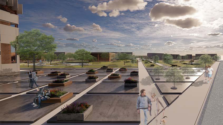
The aim is to expose local cultural networks through interventions along corridors that provide opportunities for creative and recreational programming. The Brewery District was set out in five stages. Beginning with Railway Garden as a welcoming node and the new outdoor market as the next stepping stone across the 17Avenue promenade, pedestrians are led to the next destination on Revitelized Brewery Garden, the project’s cornerstone.
1 4 5 3
REVITALIZING CULTURAL HERITAGE HUBS


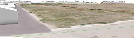
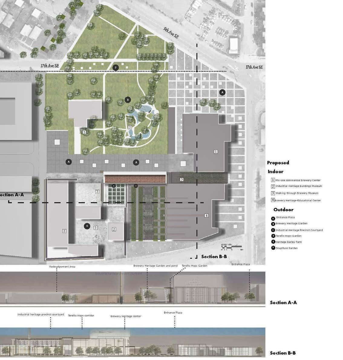
SITE PLAN

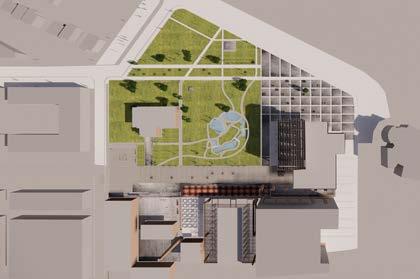
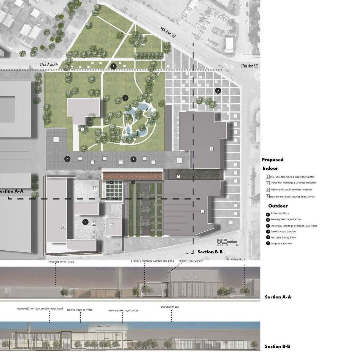
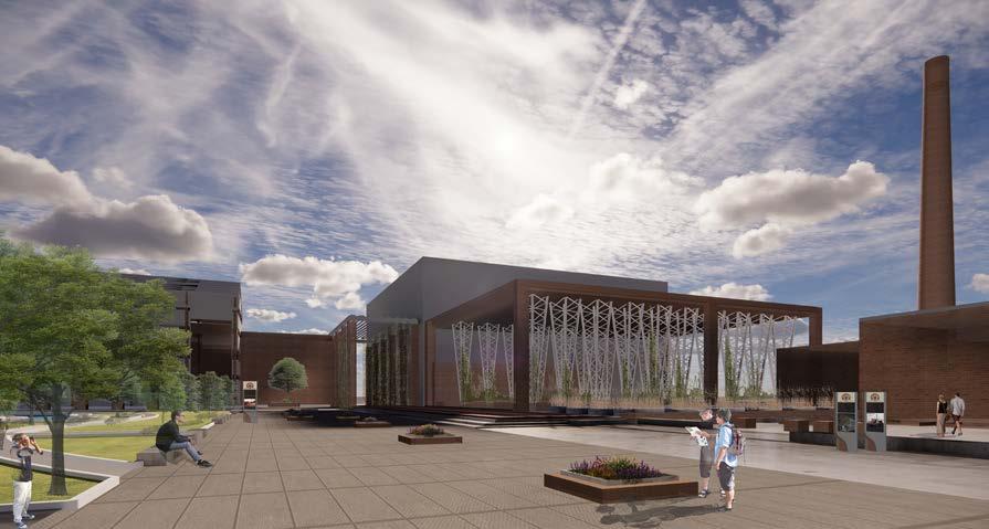
Brewery Garden in Garden Industrial Heritage Precinct Courtyard Terellis Hops Garden Heritage Barley Farm/ Educational Farm Heritage Courtyard Enterance Mix-use Commercial Brewery Center Brewery Enterance Plaza Brewery Picturosque Graden Industrial heritage/BreweryBuildings Sculpture Garden Mix-use Commercial Brewery Center Garden Enterance Plaza Outdoor Room 17th Avenue Promenade 9th Avenue Promenade Brewery Picturosque Graden Brewery Picturosque Pond Buffalo Heritage Sculpture A City Industrial Heritage Hub • VIEW A-Increasing Walkability Oppourtunites in a Lively District. • Two Point Perpective, Bird view-(Shadow Setting, Before Sunset 5;30PM) • VIEW A • VIEW B A Brewery Garden in Garden Mix-use Commercial Brewery Center Sculpture Garden Mix-use Commercial Brewery Center Garden Enterance Plaza Outdoor Room 17th Avenue Promenade 9th Avenue Promenade Brewery Picturosque Graden Brewery Picturosque Pond Buffalo Heritage Sculpture A City Industrial Heritage Hub • VIEW A-Increasing Walkability Oppourtunites in a • Two Point Perpective, Bird view-(Shadow Setting, Before • View B-Preserving The Historic Garden and Buildings • Two Point Perpective, Human Scale-(Shadow Setting, After • VIEW A • VIEW B B A Brewery Garden in Garden Key Map Industrial Heritage Precinct Courtyard Terellis Hops Garden Heritage Barley Farm/ Educational Farm Heritage Courtyard Enterance Mix-use Commercial Brewery Center Brewery Enterance Plaza Brewery Picturosque Graden Industrial heritage/BreweryBuildings Walking-through Brewery museum Brewery Heritage-Educational Center Sculpture Garden Mix-use Commercial Brewery Center Garden Enterance Plaza Outdoor Room 17th Avenue Promenade 9th Avenue Promenade Brewery Picturosque Graden Brewery Picturosque Pond Buffalo Heritage Sculpture A City Industrial Heritage Hub • VIEW A-Increasing Walkability Oppourtunites in a Lively District. • Two Point Perpective, Bird view-(Shadow Setting, Before Sunset 5;30PM) • View B-Preserving The Historic Garden and Buildings Footprints. • Two Point Perpective, Human Scale-(Shadow Setting After Sunrise, 8AM) LAND 614 Landscape Architecture Studio II, Fall 2022-Assignment#3 Instructors: Enrica Dall’Ara & Gordon Skilling Students: Sahar Rezaee Inglewood Ramsay, Calgary, AB, Canada / Project Scenarios. Perspective Views Data Sources: https://www.pinterest.ca/lgkeresz/historic-calgary https://archive.nationaltrustcanada.ca/ • VIEW A • VIEW B B
DESIGN SCENARIOS
GARDEN ENTRANCE
PLAZA
BREWERY DISTRICT GARDENS
DESIGN SCENARIOS
REVITELIZING CULTURAL HERITAGE HUBS
BREWERY DISTRICT GARDENS
SITE PLAN
SCULPTURE GARDEN PROMENADE
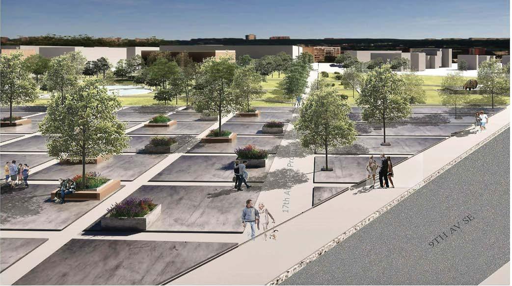
17TH AV & 9TH AV INTERSECTION- PLAZA
SCULPTURE GARDEN PROMENADE
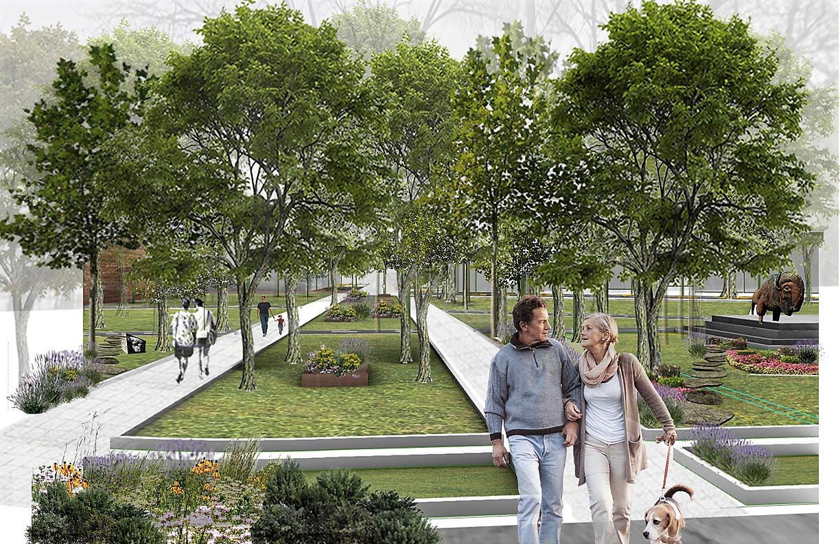
BREWERY HERITAGE GARDEN
BOW RIVERFRONT TRAIL
FINDING LOST SPACES
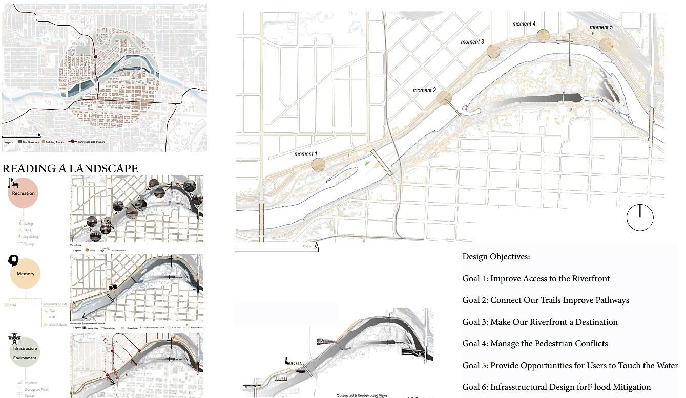
The Memorial Drive corridor along the Bow River is a unique urban landscape that requires immediate attention. The goal is to assess the quality of space along the Bow River and recommend the top five locations to access the river’s edge. Landing and reading the landscape begins with analysing the structure of a spatial layout, employing appropriate urban design elements (district-edge-pathnode-landmarks), and the observer’s characteristics. A journey through memory, infrastructure, environment, and recreation that understands, analyses, or evaluates both the space and the observer’s characteristics. The aim is to create a transformative vision of all the underutilised spaces into a thriving riverfront that can offer the adjacent community a new set of potential activities to engage in.
Landscape of Movement

Instructor: Professor Tawab Helmi
LAND 604 Landscape Architecture Studio I, Winter 2022
School of Architecture, Planning + Landscape University of Calgary
SYNTHESIS & MASTER PLANNING
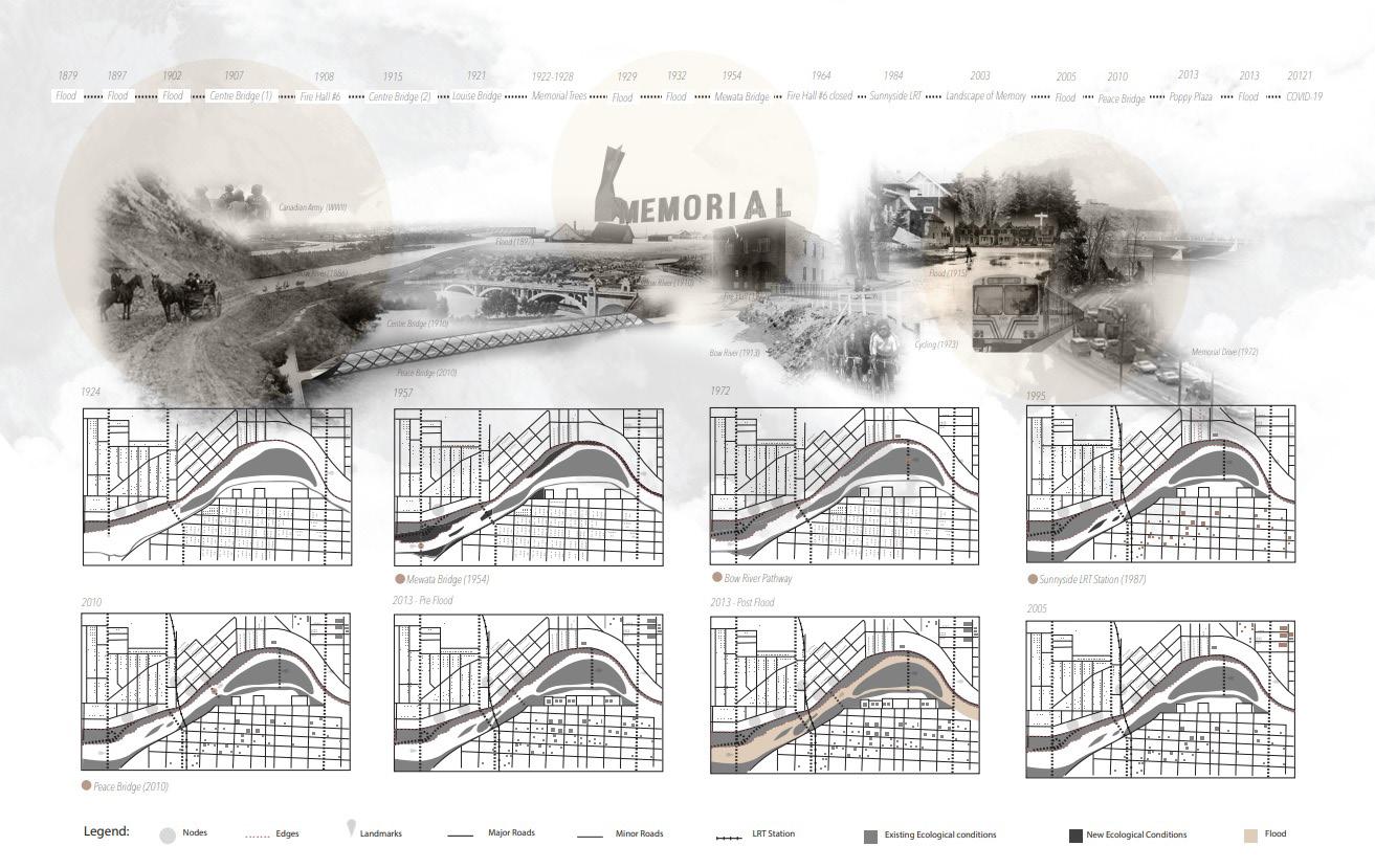
HISTORY
SYNTHESIS & MASTER PLANNING
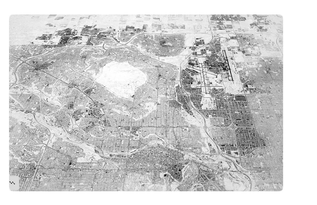
CONTEXT MAP
OBJECTIVE & GOALS
DESIGN APPROACH A COMMUNITY-ORIENTED APPROACH


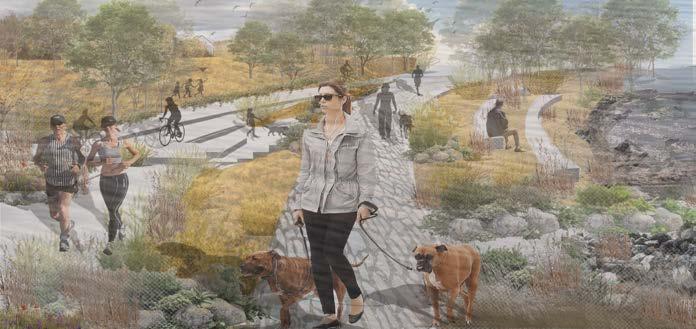
CONNECTIVITY+ LEGIBILITY+ LEGACY
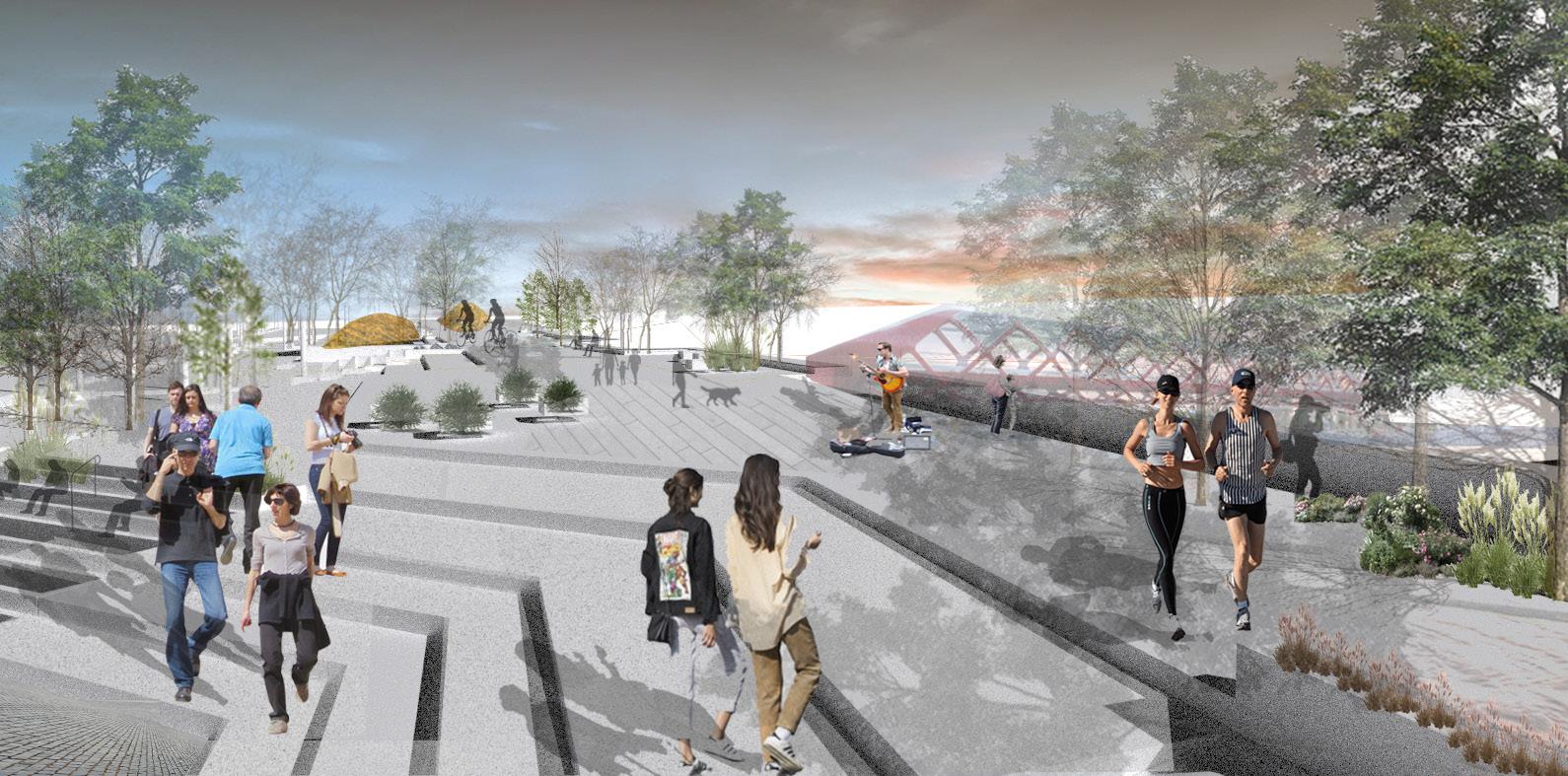
The district’s integration with the riverside through the proposed new gateways aims to expand the natural urban realm on river margins, allowing the neighborhood community to interact with nature and touch the water.
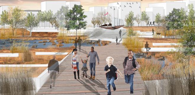
moment 1 moment 2 moment 3& 4 moment 5
Moment 1: Iconic Soldier Memorial
Moment 3: Sunny Beach Intersection
Moment 5:Sunnyside Hillside
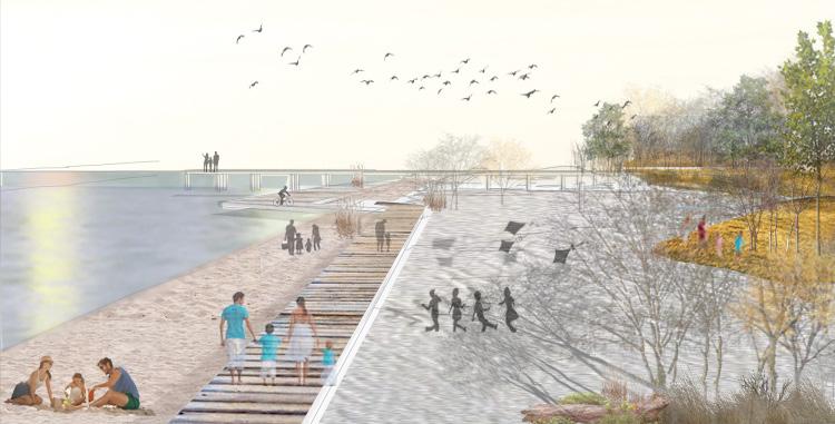
Moment 4:Sunny Beach
SUNNYSIDE HILLSIDE
DESIGN SCENARIO
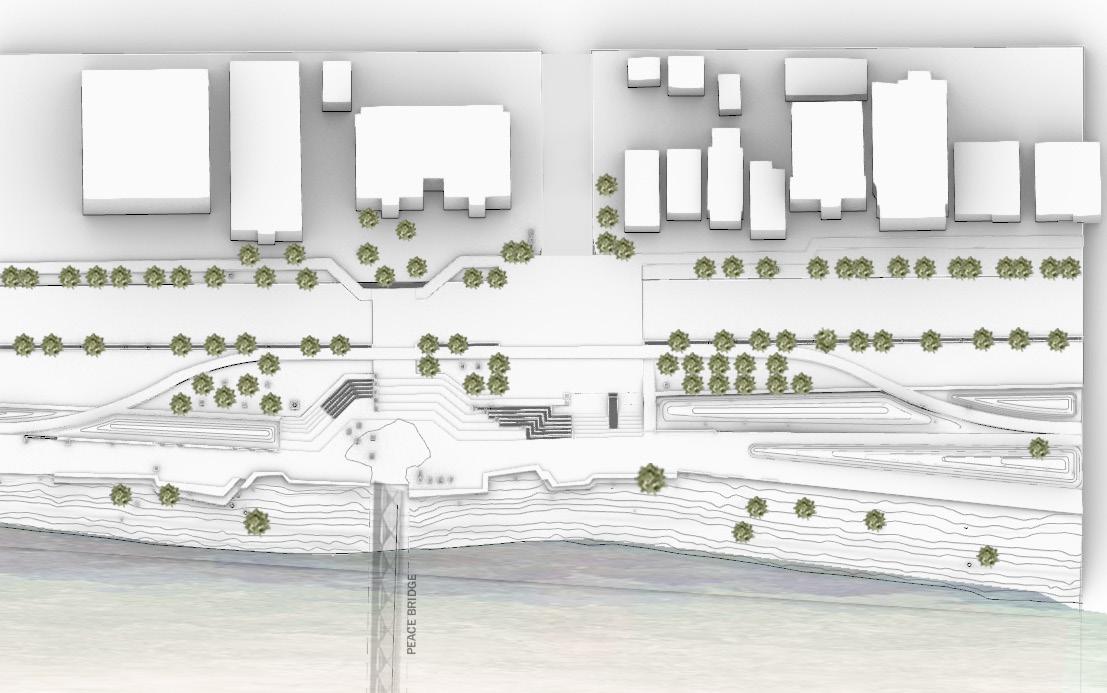


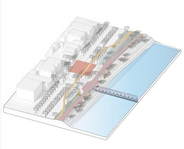
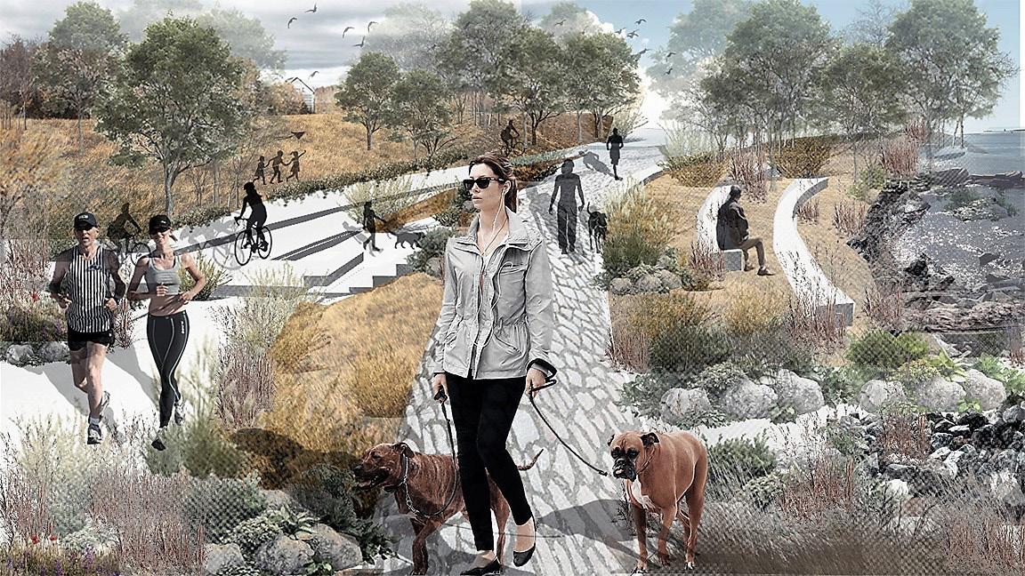
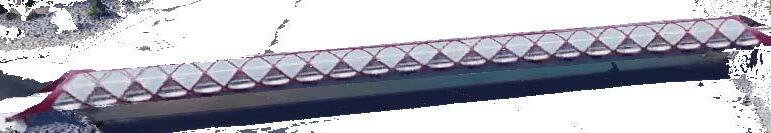
PEACE BRIDGE PLAZA
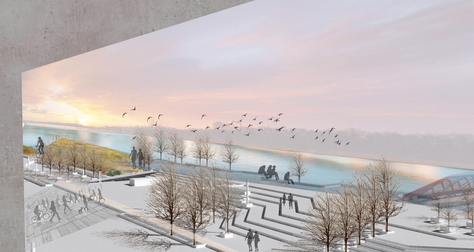
moment 2 SC:1/300 Street Noise Environmental Sound Peace Bridge Residential multi-use Pathway multi-use Pathway Cycling Route Plaza Sitting Platform Beach Berm
PEACE BRIDGE PLAZA
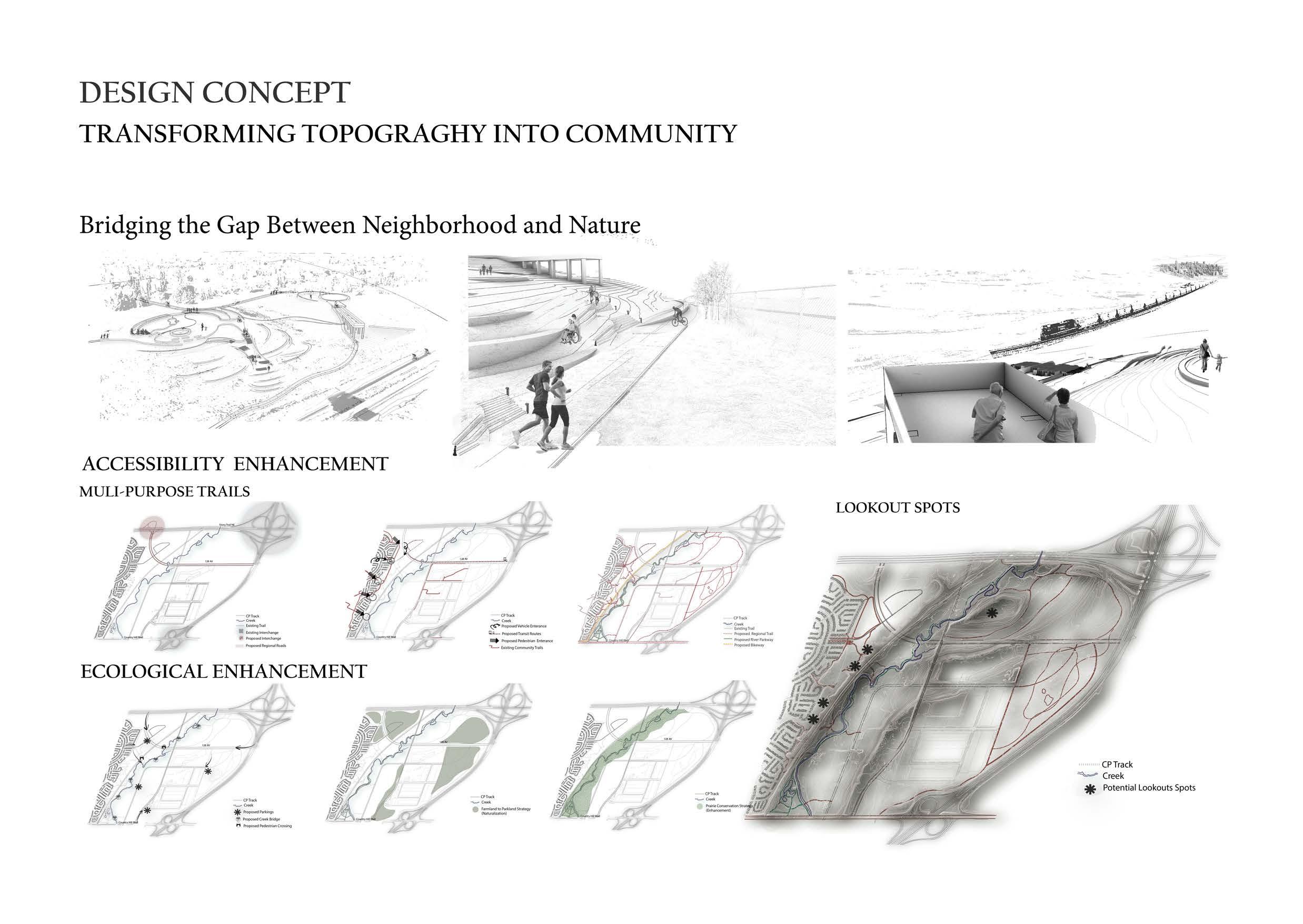
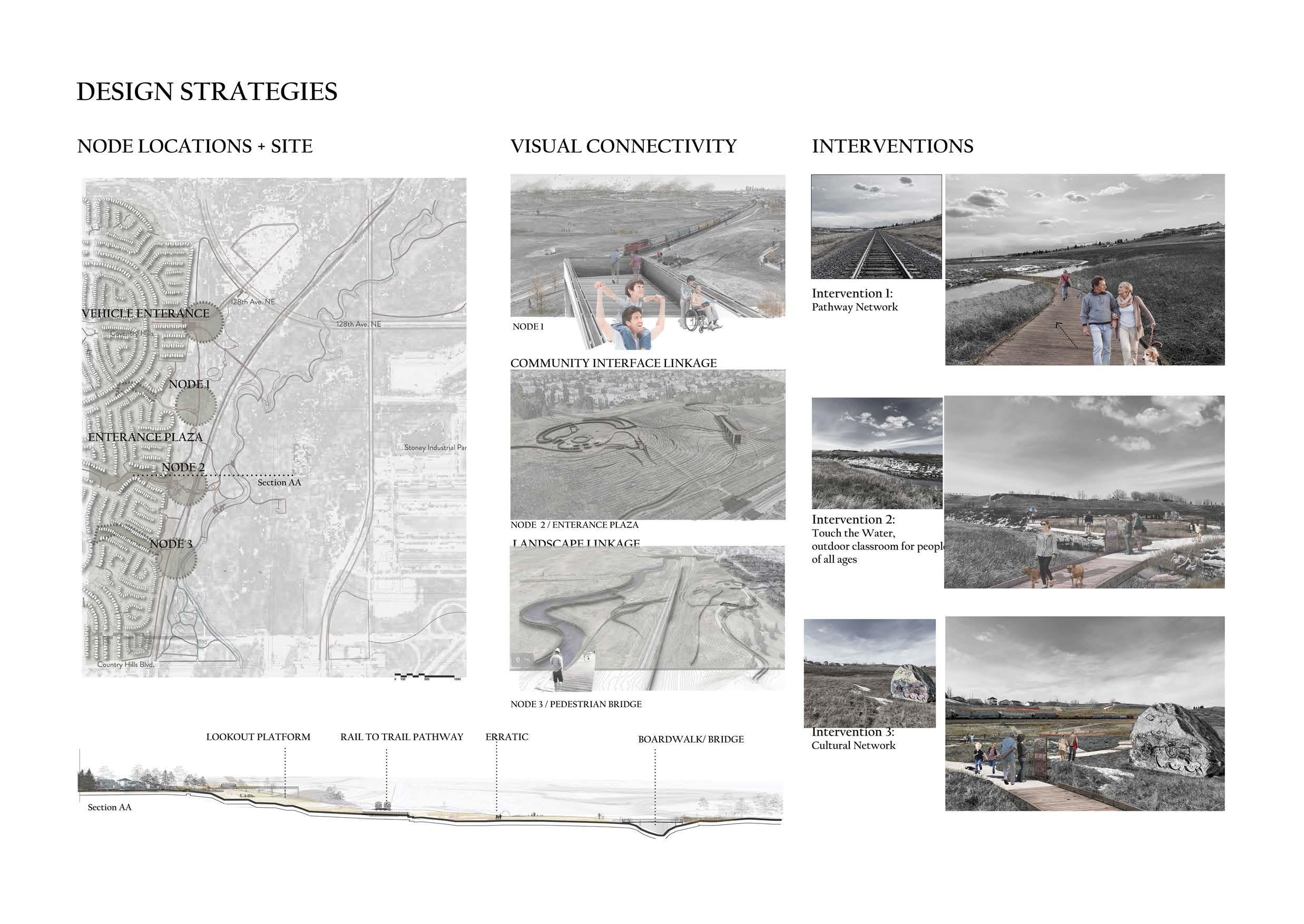
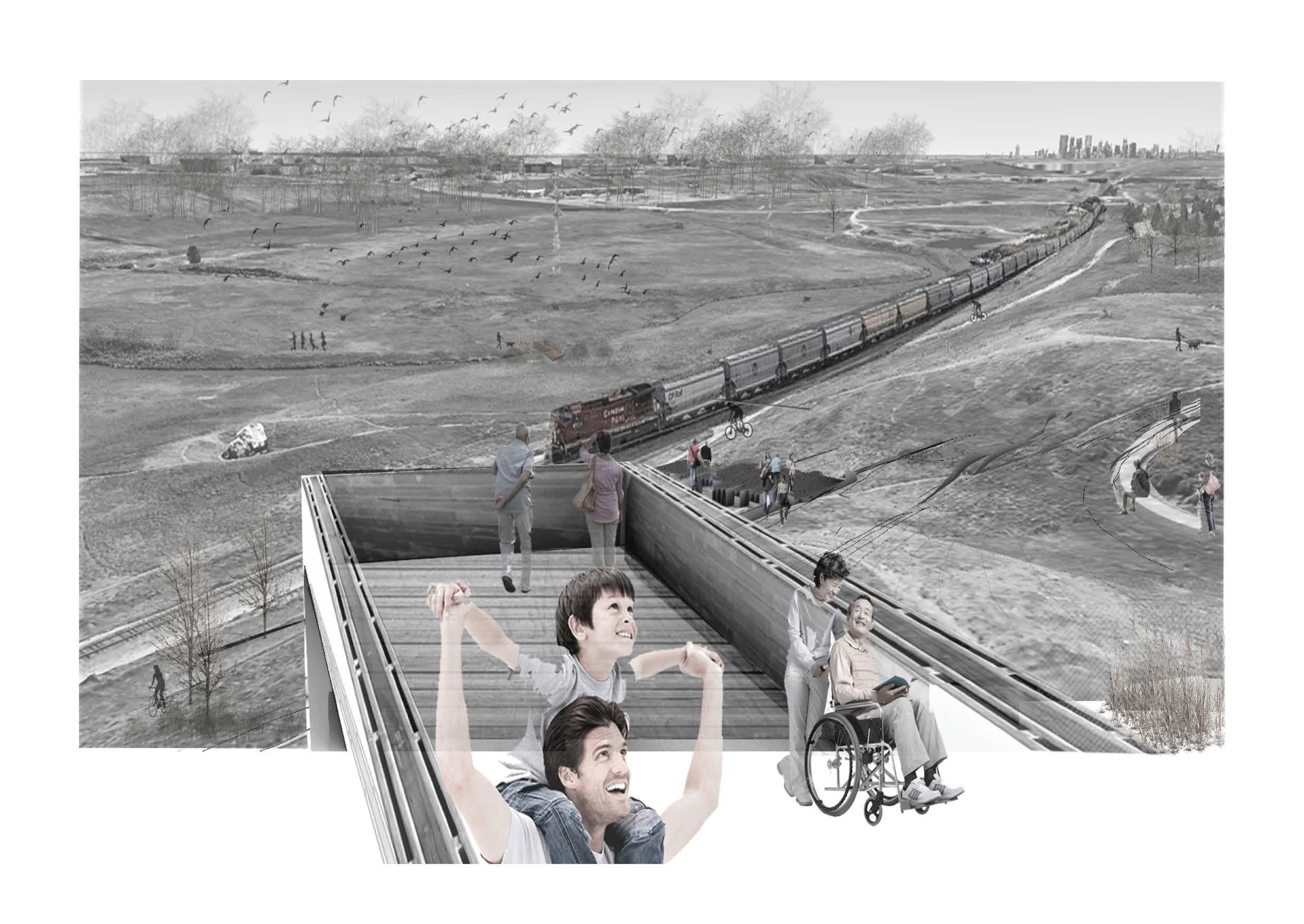
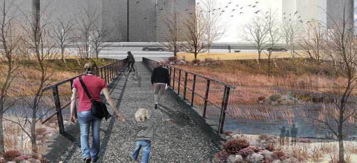
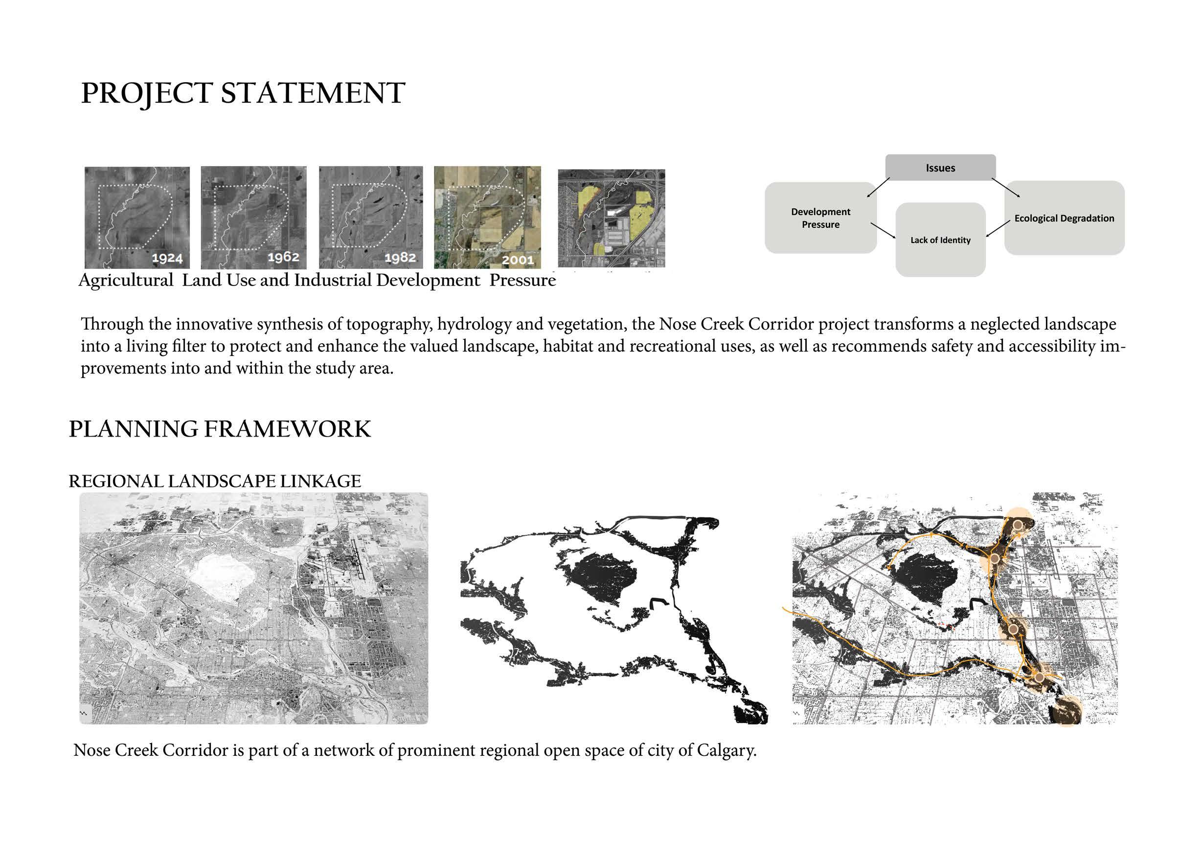
THE NOSE CREEK CORRIDOR
READING A NEGLECTED LANDSCAPE
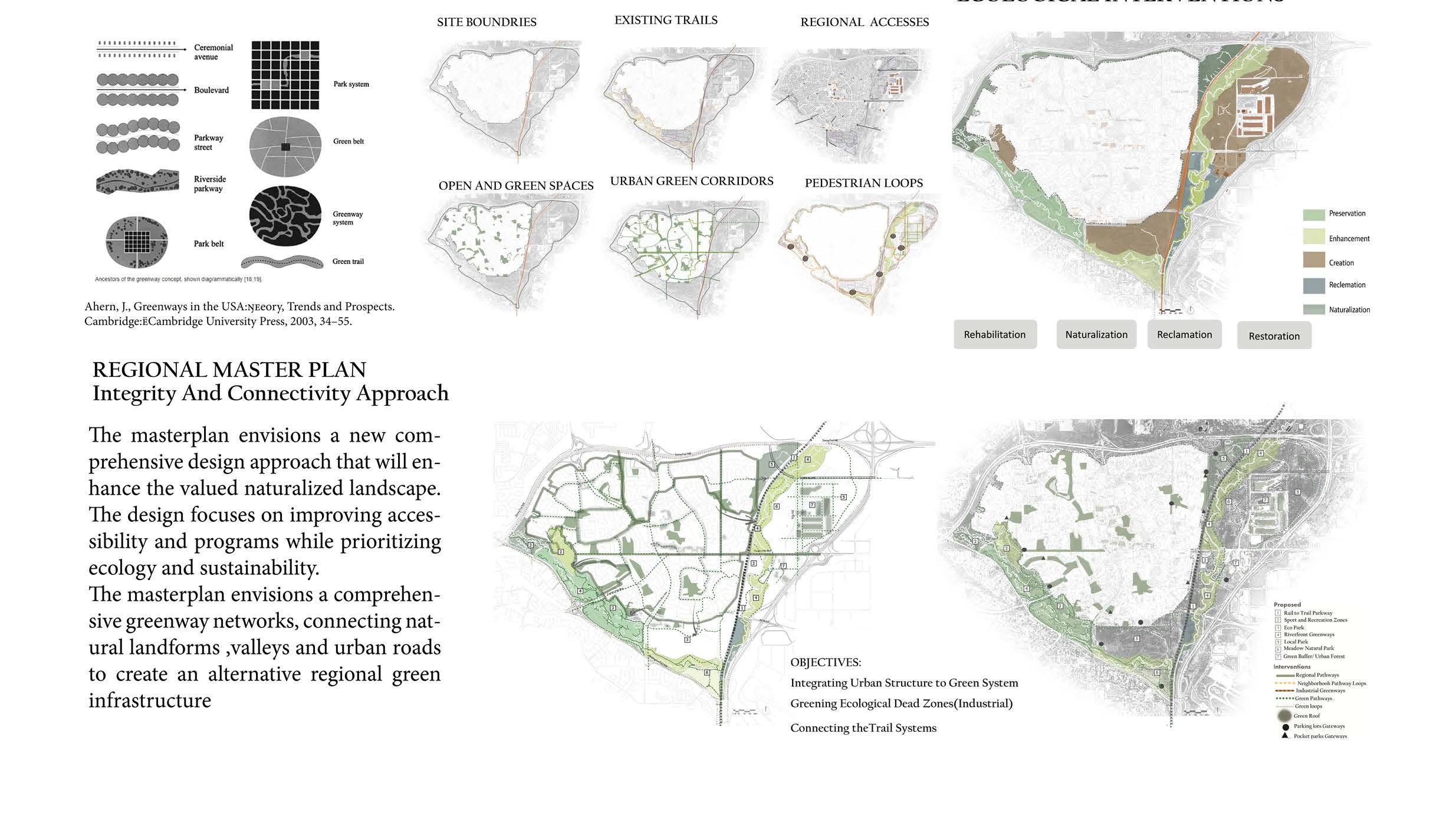
Th Nose Creek lands were aggressively occupied as the results of northeast urban development, heavily impacted by urban and agricultural uses, and industrial areas dominated open spaces. Natural lands in the Nose Creek corridor are also frequently fragmented by major infrastructure.
While Nose Creek is included in Calgary’s ambitious park master plan (1991), proposed connecting the riverfront and riparian areas as a park system/network to ensure the connectivity and integrity of the city’s landscape/green open spaces has been neglected despite having immense potential and stunning natural surroundings.The critical solution is to take a holistic landscape architectural design approch both at the regional (city-wide) and neighbourhood scales to improve the spatial quality of our creek systems. As a first step, developing a strategic comprehensive greenway networks can integrate Nose Creek into Calgary’s ecological network and park systems. These systems are healthy, connected, and resilient and provide citizens with equitable and appropriate access to nature.
A Research-oriented Project Studio
Instructors: Professor Bev Sandalack / Jack Vanston
LAND 702 -Landscape Architecture Studio 3 Advanced-Winter 2023 School of Architecture, Planning + Landscape University of Calgary
DESIGN STRATEGY
AN INTERCONNECTED ECOLOGICAL NETWORK
DESIGN PRINCIPLES
SYNTHESIS/ LANDSCAPE
VOCABULARY
ECOLOGICAL INTERVENTIONS