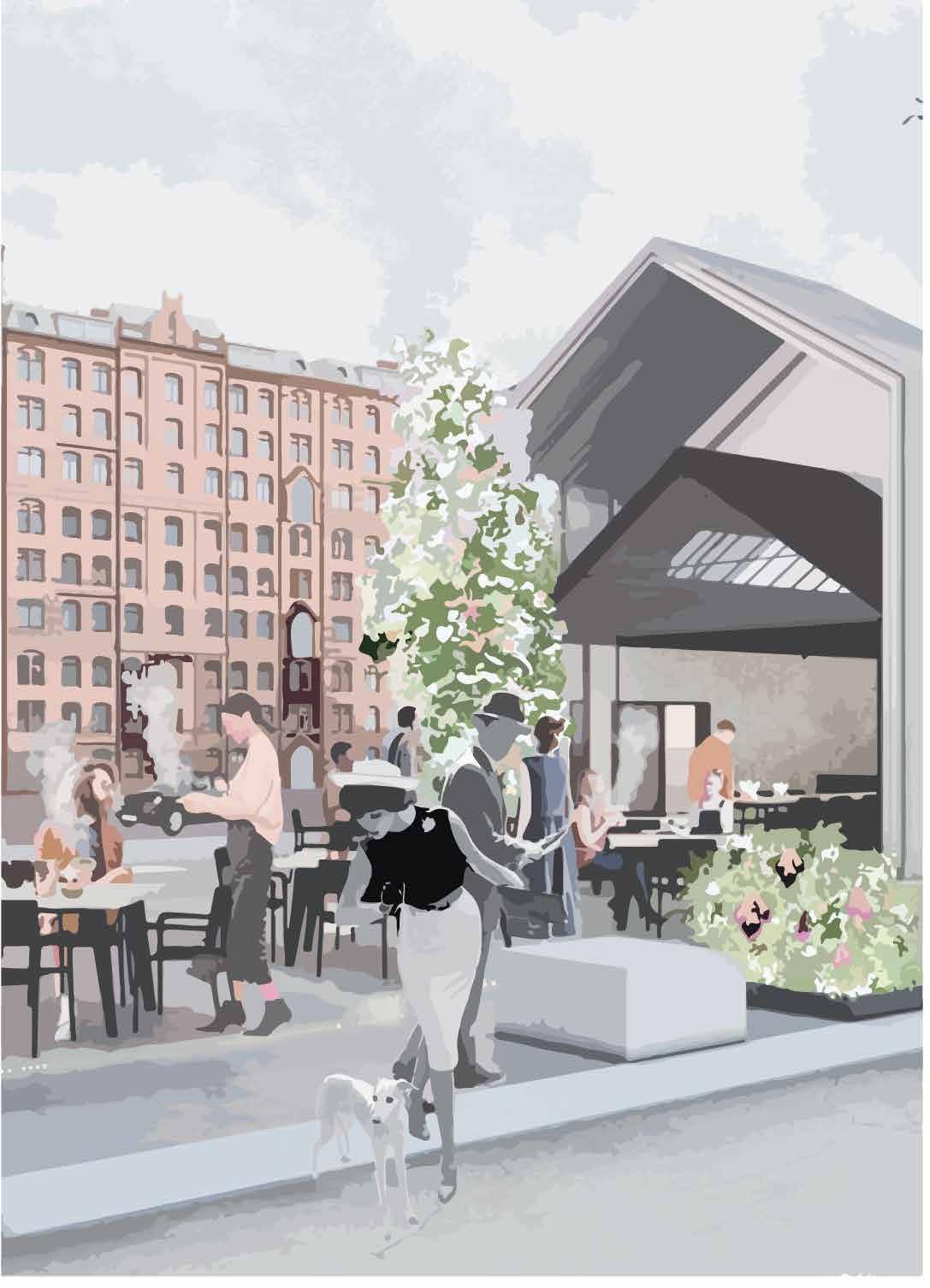
PORTFOLIO
SUMIT RAHANGDALE


Narayana Vidyalayam (Nagpur)
Higher Secondary education | 2015-2017
92.6%
School of Planning and Architecture (Bhopal)
An Institute of National Importance (MHRD)
B.PLAN | Class of 2022 | 8.14 CGPA
NSSCDCL Smart City | Nagpur
May-August 2021 | Intern
• ABD Town Planning Scheme | Integrating different Spatial Mapping platforms
• Nurturing Neighbourhood Challenge | Graphics and Mapping
• Project Public Realm and Public Art installation | Structural Design
• Streets4people Challenge | Report and Graphical work
Unit Treasurer | SPA Bhopal
2020-21 | National Organisation for Students of Planning
Rank 2nd in the NosPlan XXII, Delhi Convention
NOSPLAN Editorial Team | Delhi Convention
2020-21 | Magazine Design and Publication cell
Published ‘PUNNARUTTHAN’ Magazine NOSPLAN XXII
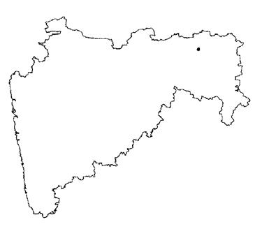
Natasha Kapaii | Mumbai, Nagpur
07/22-09/22 | Urban restructuring through the development of underutilized lands
Planning and Design Consultancy | Indore Present | Urbanism, Architecture, Design
Skills
Graphics - Photoshop, illustrator, Indesign
Mapping - ESRI ArcGIS, QGIS, 3D Modelling - Blender, SketchUp, ArcScene, Aerialod
Animation - AfterEffects, Premiere Pro
Microsoft Suite- Powerpoint, Excel, Word
Transforming Periurban Futures | 2022 | Bhopal, India
India Land and development Conference | 2021 | Virtual
NNC Technical workshop series | 2021 | Nagpur
Adobe Video Hackathon
2021 | Graduation theme
Animation and illustrations
Green Revolution | ICCE
2018 | Activity score A
Action against climate change
The Dharavi Project Competition
2021 | TOP 50
International Architecture Competition
Designing 24-hour-running transitional mixed-use space
ILDC | Centre for Land Governance, NRMC
2021 | Paper presentation
Trending Land Use Conversions in Indian SEZs
Showcase Presentation | NOSPLAN XXIII
2021 | Second Rank
Presenting studio work
2400 Minutes | NOSPLAN XXI
2019 | Fourth Rank
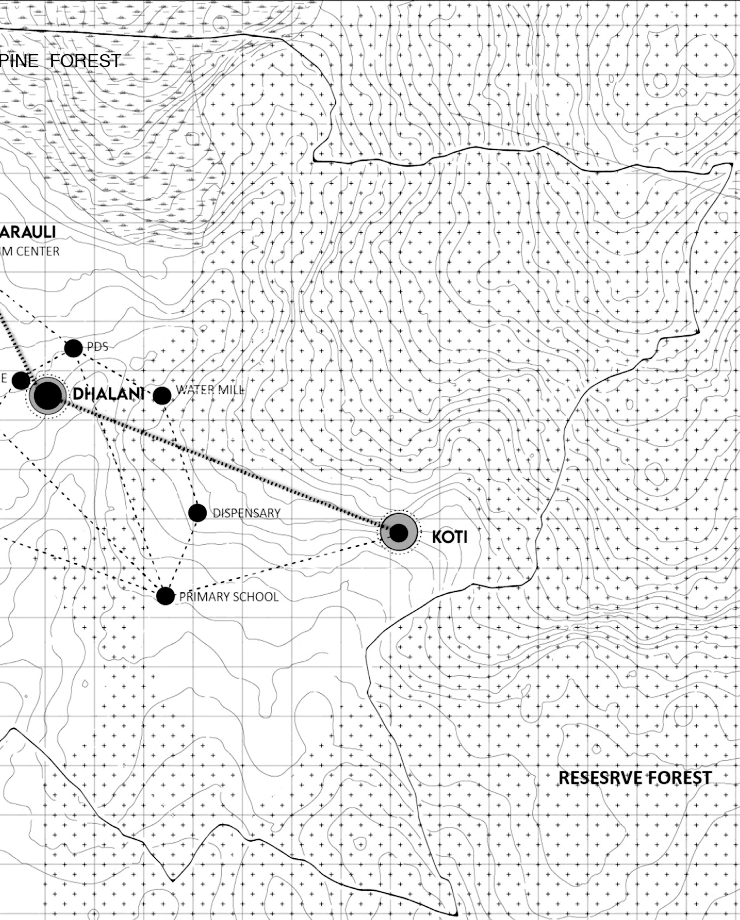
Koti Village Development Plan, Uttarakhand
Current Practces | NOSPLAN XXI
2019 | Fourth Rank
Riverfront development Adi-Ganga, West Bengal
Image of the city | NOSPLAN XXI
2019 | Third Rank
Write & Snap, Mawsynram
Academic Work
Thesis | 2022
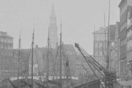
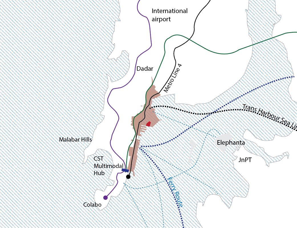
VIII Semester | Planning for Underutilized Port Spaces : A Case study of Mumbai Port Trust
DPR, Water Supply Project, Prayagraj, UP
2021 | VII semester
Master Plan, Prayagraj, UP
2021 | VI semester
Siting locations for QSR through Land Suitability
2021 | VI semester
Local Area Plan, Ratibad, MP
2020 | V semester
Impact of Covid on Public Transport System
2020 | IV semester
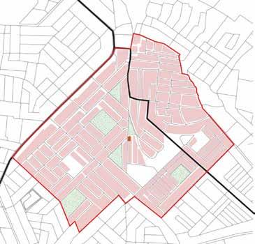
Neighbourhood Studio, Nehru Nagar Bhopal, MP
2019 | III Semesters
Land Suitability Analysis for Residential development
2019 | III semester
Area Appreciation, MP Police Academy, MP
2019 | II semester
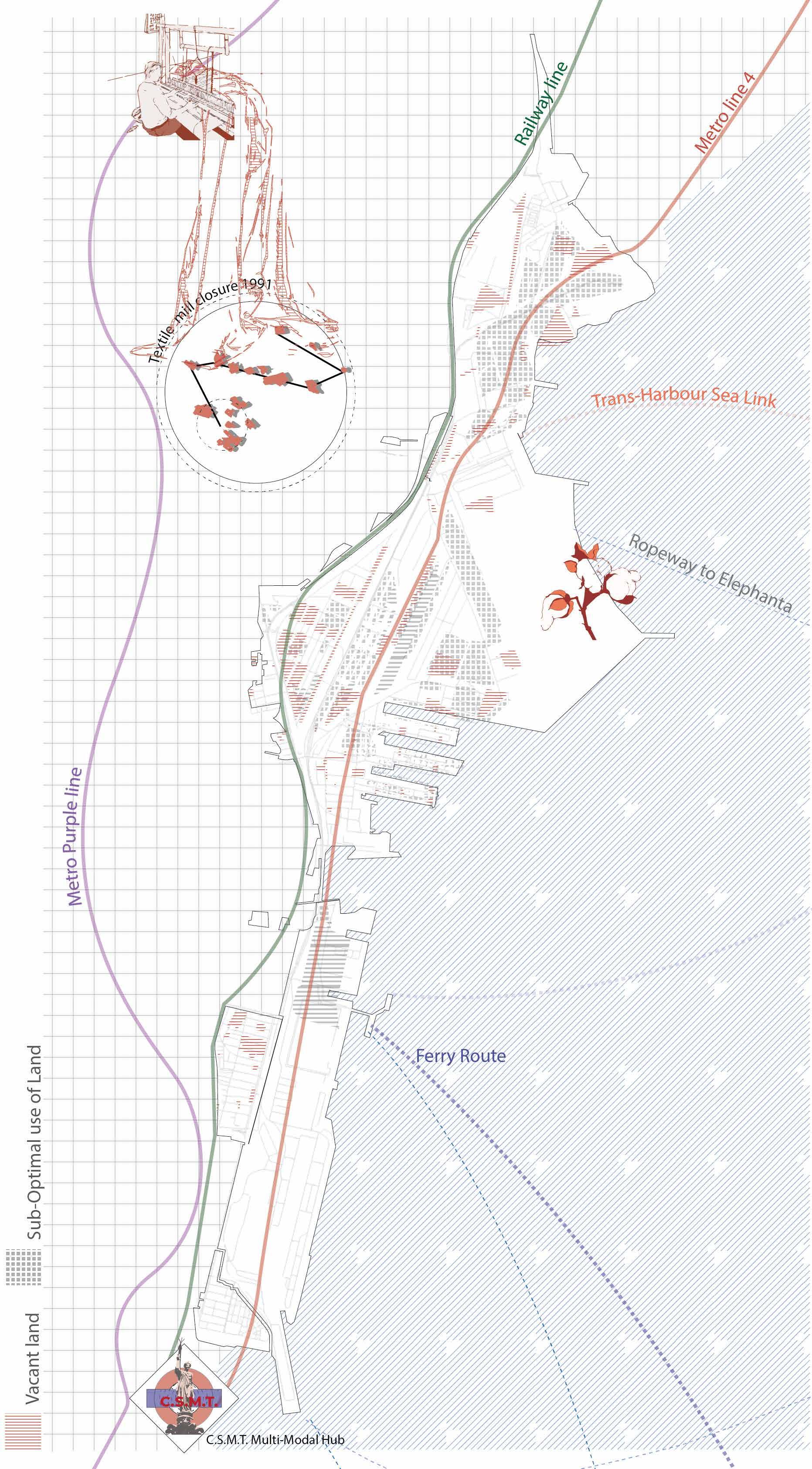
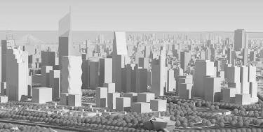
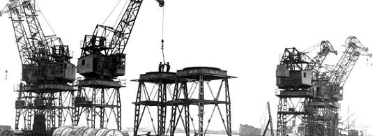
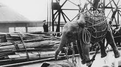
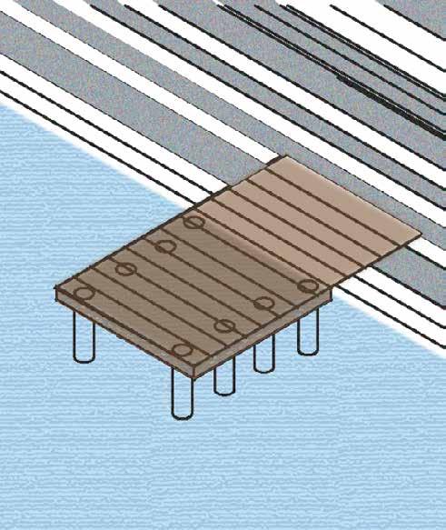
A Huge parcel of land is allocated to port authorities to facilitate better performance and future expansions. It is, however, essential to examine the current need, perception of the land under port management which are viewed as administrative function and neglected as assets (land banks). The case is especially justified when the port under performance and these lands remain vacant or underutilised. the current development of such land under port authorities is more inclined toward revenue generating non-port uses. It is the goal of this research project to find out how to make waterfront redevelopment more feasible, people-cantered, and a model for other underutilised ports in India through perview or of real estate through micro and macro level inteventions.
The Government of India, under the failing financials of MbPT prepared a port redevelopment plan which was deviating from its proposed vision (to give the land back to people). It was a mega real estate project with an attempt to turn real estate into power. The plan under public sctunity faced objections in thousands beacause for lack of space for public use and ecological imbalance to the environment.
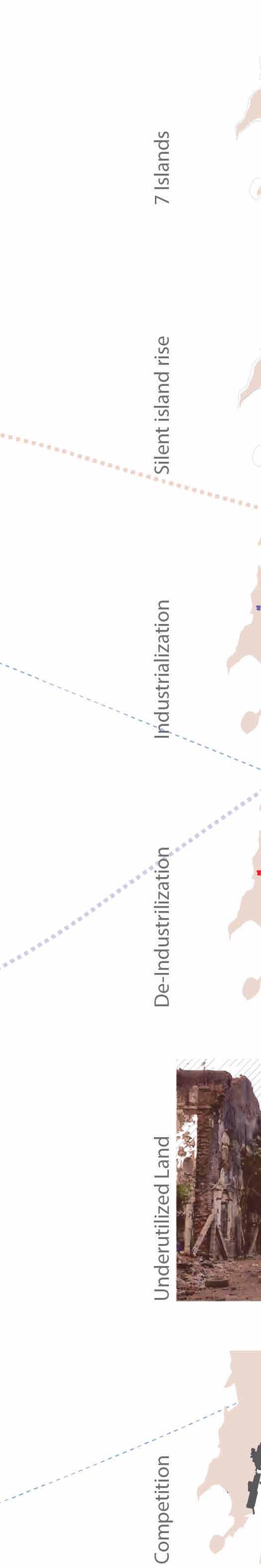
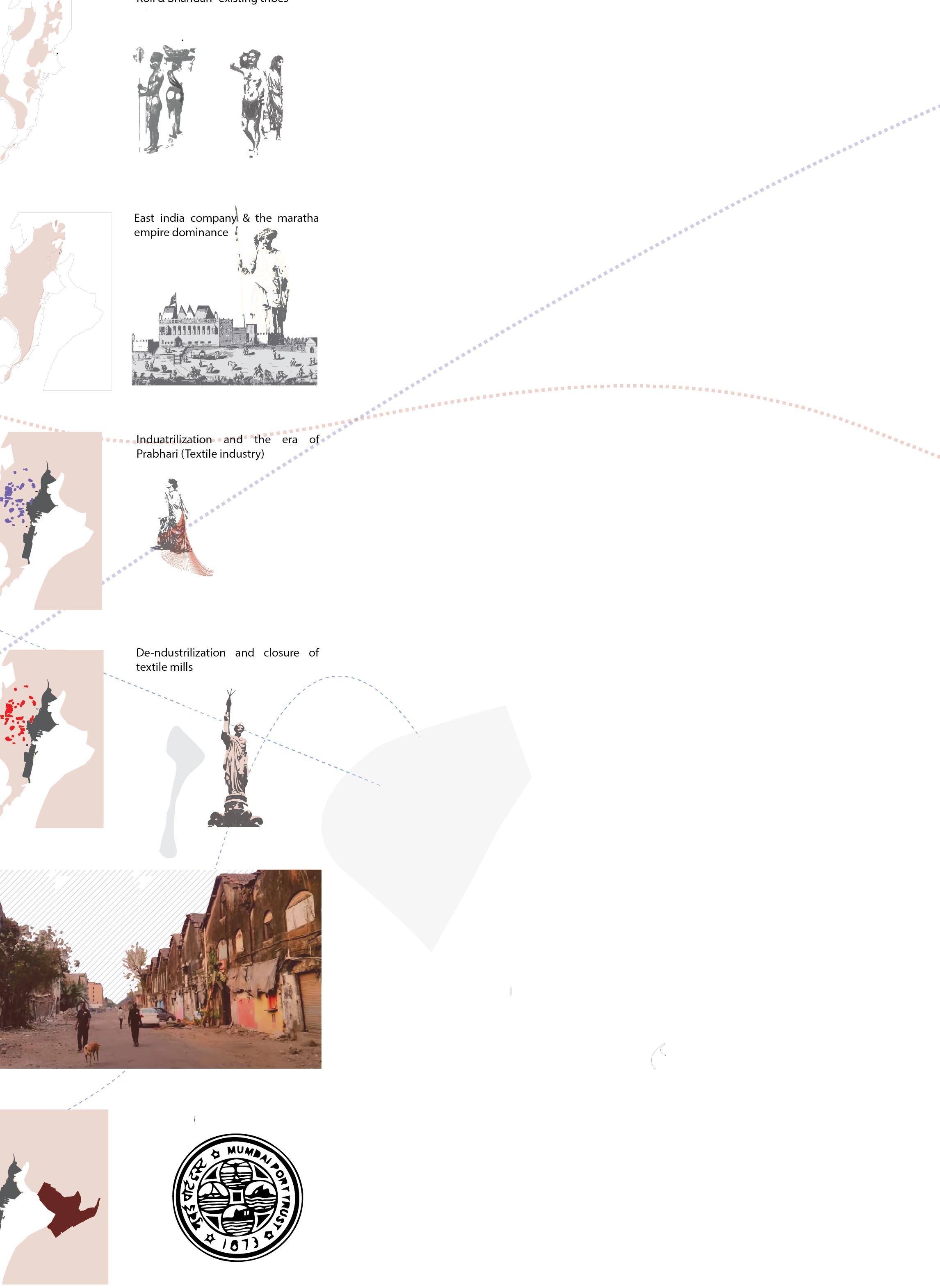
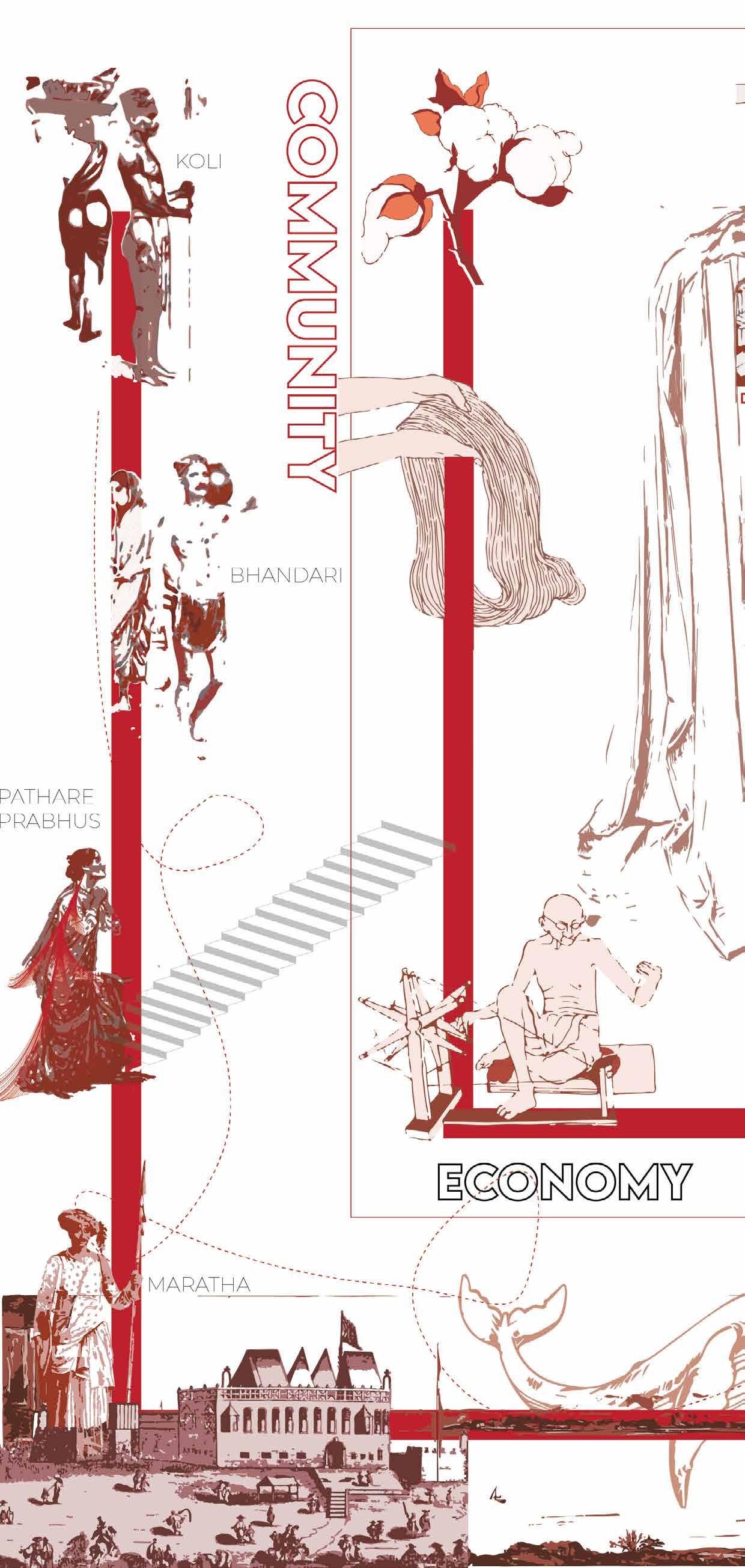
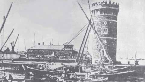
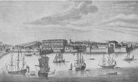
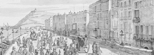
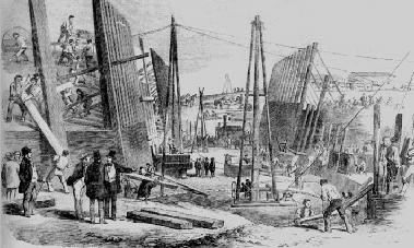
The island city developed from the seven closely placed islands where lies the ancestry of tribes such as Koli, Bhandari, Pathare prabhus, and Marathas
In 1661, Bombay was given to the English Crown through Article 11 of the treaty (Treaty of Peace and Alliance between Portugal and Great Britain and of marriage of Charles II. with the Infanta of Portugal, concluded at London, June 23, 1661 )
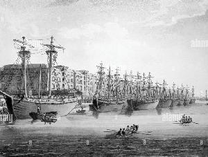
Port and city expanded from a collection of seven tiny, marshy islands into a giant magnet. trade of gold, stones, sandalwoods ivory and spices
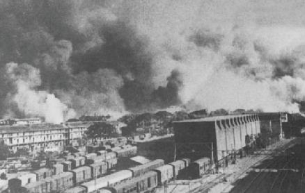
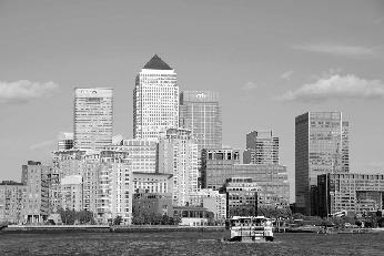
Businesses, most notably textile mills established shut down. Phased closure of MbPT increased de-industrialization process. The cotton mill strike nailed the final blow.
The redevelopment project which focuses on commercialization of land with limited focus on people and equitability
Port 1984 Indira Gandhi called for MbPT land to be made available to public due to techhnological defficiency
1988 Developemt of JnPT as a competitor and the decreased efficiency of MbPT cargo handling
2014 Jadhav Rani commission proposes for redevelopment with 30% land for green spaces.
2018 HCP prepares the redevelopment plan which faces 1000+ objection on public scrutiny

12 th 5th
Land Valuation


most expensive Real estate value (13000$/ sq.m) in the world
Methodology
12 th 5th
Highest Buying price/ Rent (x43)
Valuation of land based on circle rates by revenue division and city real estate reports by JLL & cushman and weikfeild


Re-Distribution

FSI by maintaining built-up while land use area.

Conflict between port and urban function
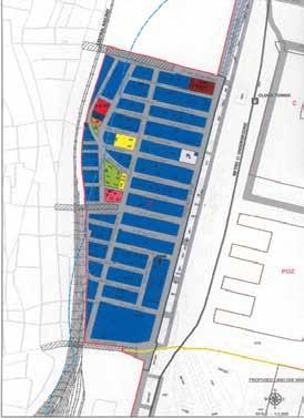
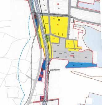
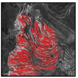
Land Use

Competition from nearby JnPT and inability to into urban port evolve
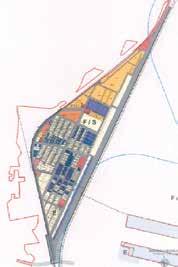
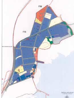
Identification of conlicting land use within the site provides us with 121 Hactares of land of other uses. Using land suitability analysis more supporting land use are proposed. Mangroove trails to protect ecology, then redistribution of residential and industrial use are proposed.
City expansion creating a pressure on the underutilized land in the heart of the city
Decreasing RCI index, signifing a change in Land Use
Potential of MbPT land

Land monetization returns upto x5 the existing land value based on market rates based on speculations the value can generate x10 times the current land value
Decreased Cargo handling from 6lakh TEU’s to only 0.5 lakh TEU’s
De-industrilized port industries developing in new industrial nodes


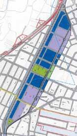
The re-valuation of land and redistribution of land-use provides us with a alternate approach which is both people centric and financially viable.
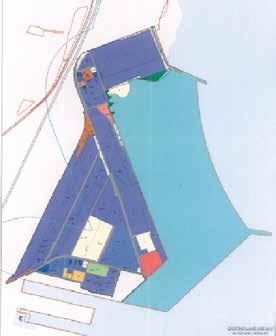
By controlling the development type within the site, the land can be creatively used to its optimization. The aim of the proposal was to involve more people in the redevelopment zone by introducing uses that make people more responsive towards the assets. The Exhibition hall, museum, innovative centers, cultural streets have been proposed for creative environment, that creates a separate identity of its own

The outcome of the thesis was a revised land use distribution map and a conceptual proposal detailing. The new uses introduced were based on literature study of waterfront redevelopment projects and principles for waterfront redevelopment. The land use redistribution successfully increased the Port eco-tourism space by 7% and reduced the commercial land use space by 4%
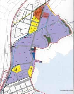
“re-Configuration
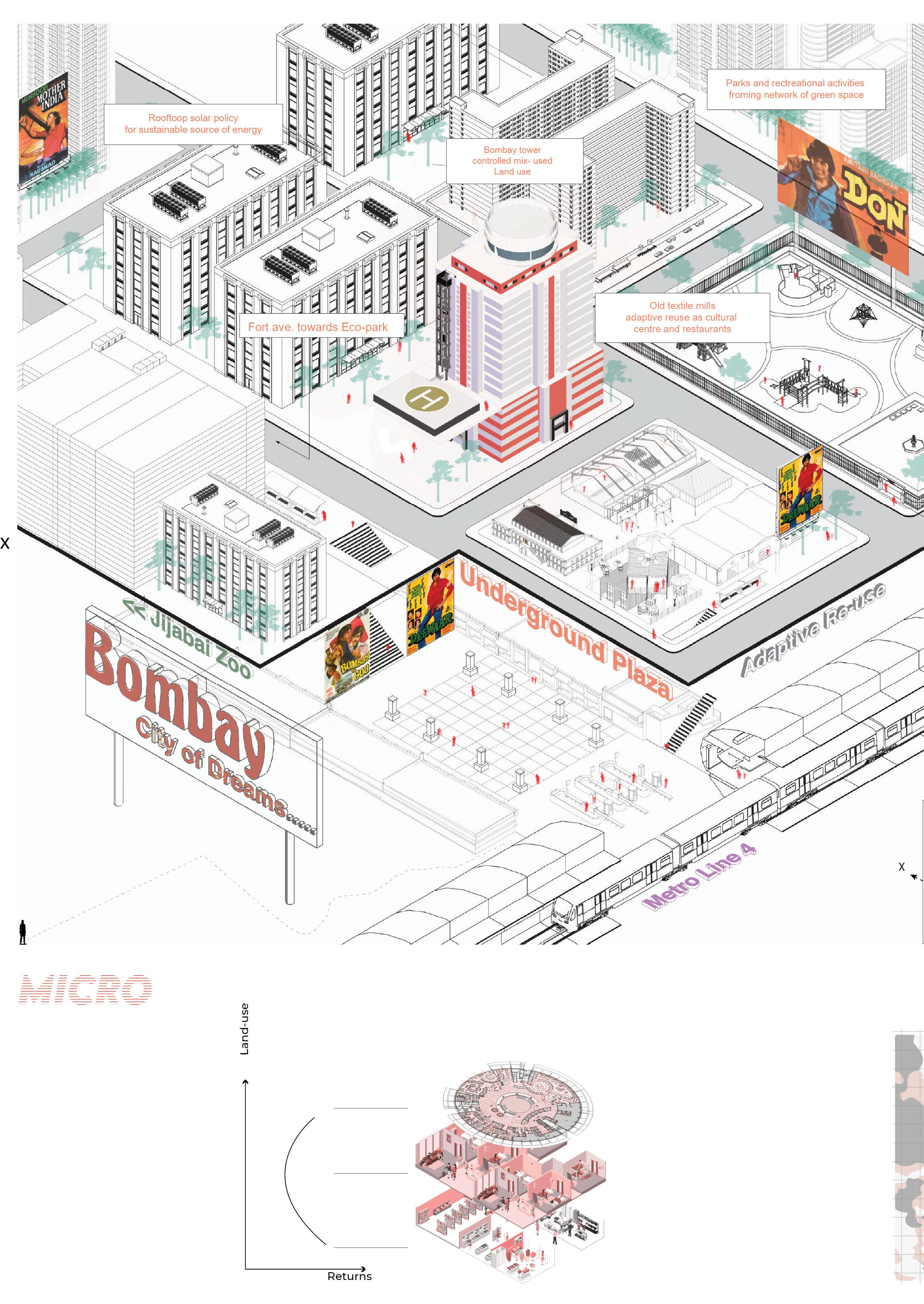
The controlled development of land use at building scale through vertical zoning provides “functional -optimisation”. This also provides lucarative return on city scale. The case is specially justified in Mumbai in view of its unrealistic real estate value.
Revolving Restaurants
Hotels
Residential
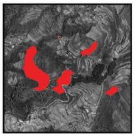
Weighted overlay Analysis to identify land suitability for land use consideration including factors like :
High tide line
Vacant land
acceptable
FAR/FSI
Special micro projects
Ecological sensitive areas
Prosimity to landmarks and transportation
Adaptive Re-use of old vacant structures into restaurants, hotels, cultural centres and maritime museus, protecting the structures. Investment to unlock the potential of tourism and cultural activities along the nodes connecting sea, and other land connections

The upcoming underground metro provides an excellent opportunity for creating a inter-city underground network.
The aim was to increase the land for public use by keeping the existing built up through FAR/FSI simulations The land suitability analysis, along with land use recofiguration let to increase in potential publically accesible from 23% to 29%.
4TH RANK
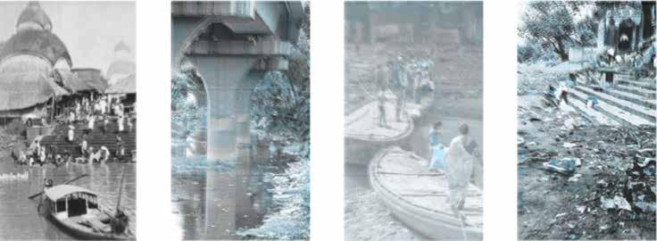
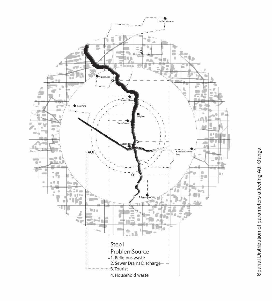
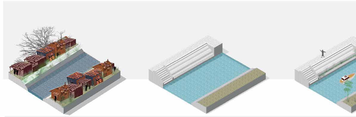
Biodiversity habitats that were once embedded within the heart of Kolkata have now shrunk or slowly disappearing. From neighbourhood ponds to the mighty Hooghly, water has been the circulatory system of life in this city. Adi Ganga is one of the most significant veins of this system. It has existed as a river-stream of Ganga in the lower-delta plains of the Bhagirathi-Hooghly system. It shares a rich heritage andtrade history with the city and gradually it became a source to religion and livelihood of locals as well. Recent anthropogenic alterations to Kolkata’s urban fabric ranging from waste discharge, encroachments and waterfrontage to real estate have significantly diminished the physical as well as intangible significance of Adi-Ganga, reducing it to a narrow channel path; choked by tons of industrial waste, making its way along metro bridges, seeping down to the wetlands along Bay of Bengal. What once used to be a symbol of co-existence and partnership of economy and heritage, is now a pit of toxins in the middle ofthe city. The project intends to revitalize this source, reforming and enhancing its image as a reflection of Kolkata’s sustenance. This will be achieved through a detailed mapping and analysis of possible opportunities and applications of sustainable urbanism strategies
The adi-ganga is connected to khidirpur port and other major land marks with high footfall concentrated along the stream wth immense potential as tourism and as well as transportaion connectivity. With the potential of land along with sustainable design and people centric approach, it can be developed to further facilitate the upcoming redevelopment and Namami gange initiatives. The aim of the study is to rejuvenate The Adi Ganga and complement its strategic location of cultural and historic importance. To preserve the ecology of the canal and restore the importance of the Ghats. To restore its historical and cultural value and bring back the ‘community’ aspect. To integrate the economy and livelihood of the people with the canal.

What does the city wants Adi-ganga to be?

Need Waterfront Holy river Areas of Interrest
The aim of the study is to rejuvenate the Adi Ganga and complement its strategic location of cultural and historic importance.
Pollution/religious activitites af-
Kalighat temple being the religious and cultural node Anthropogenic metro pillar on the river disrupting flow Encroachment along the bank and landslides fecting the river flow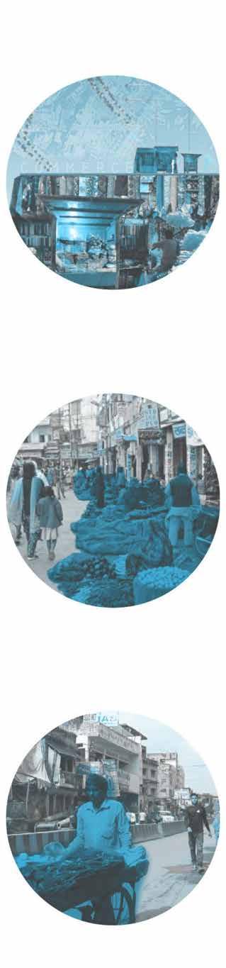
Parameters
Study area
Phase-I,II

Proposals
Environmental
Biotopes
Social
Conserve
Dredging
Recycling
Reconnaissance:
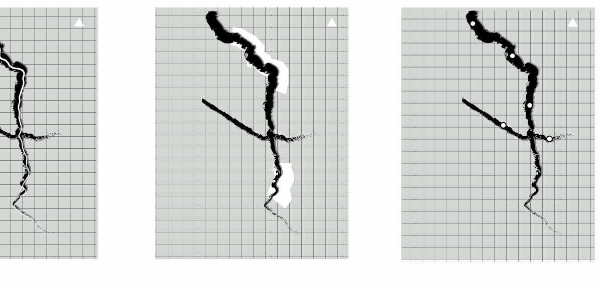
The Adi Ganga was considered as a sacred stream which attracts many pilgrims across the globe. Religious temple and Ghats located on the banks have its aesthetic value. The presence of heritage and tourism places on both sides of the canal. Urbanization and encroachment on the bank of canal have affected the underwater life and local community. There’s a need to change the existing activity and revitilise the are through urban Planning Inovation
The construction of metro pillars over river changed the velocity of the flow of river while natural siltation adding to the problems, Sewer drains discharge untreated effluent from household and industries directly to the Tolly Canal. The water channel is neither restored nor maintained. the major landmarks along the rivers has the potential to rejuvenate the river through econimical, environmental and social interventions to tackle the problems
The information depicts the or inverse with oscillating its impact on factors identified. of population, public opinion indicator shows the encroachment, metro pillars, involvement to higher density management is observed due to public outrage on authorities in public affairs
Demographic variations and their
the direct proportionality oscillating population density and identified. The combination opinion and the performance direct dependency of pillars, sewage and religoius density of population. The observed to inversely proportional on the less involvement of affairs
Analysing locations of historic and cultural importance with connectivity nodes
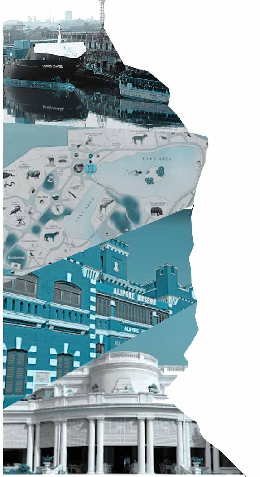
The area along the bank of the Tolly Nallah is rich in heritage and tourism prospects. The off take of the nallah starts from the hasting areas and also has famous tourism ghats along theriver Hooghly. Victoria Memorial, National Library, Alipore zoo are major locations for tourists which enhance the tourism of that area. The Kalighat Temple along the Ghats of sacred river (as known before) is a remarkable place for Hindus. The canal origins from the hasting area and continues along the posh area of south Bengal (Tollygunge). The Tollygunge club is the only Country Club of its kind in India and is ranked amongst top 20 clubs of the world. The landmarks and activities along the canal enhance its value and is needed to be rejuvenate and restored its value.
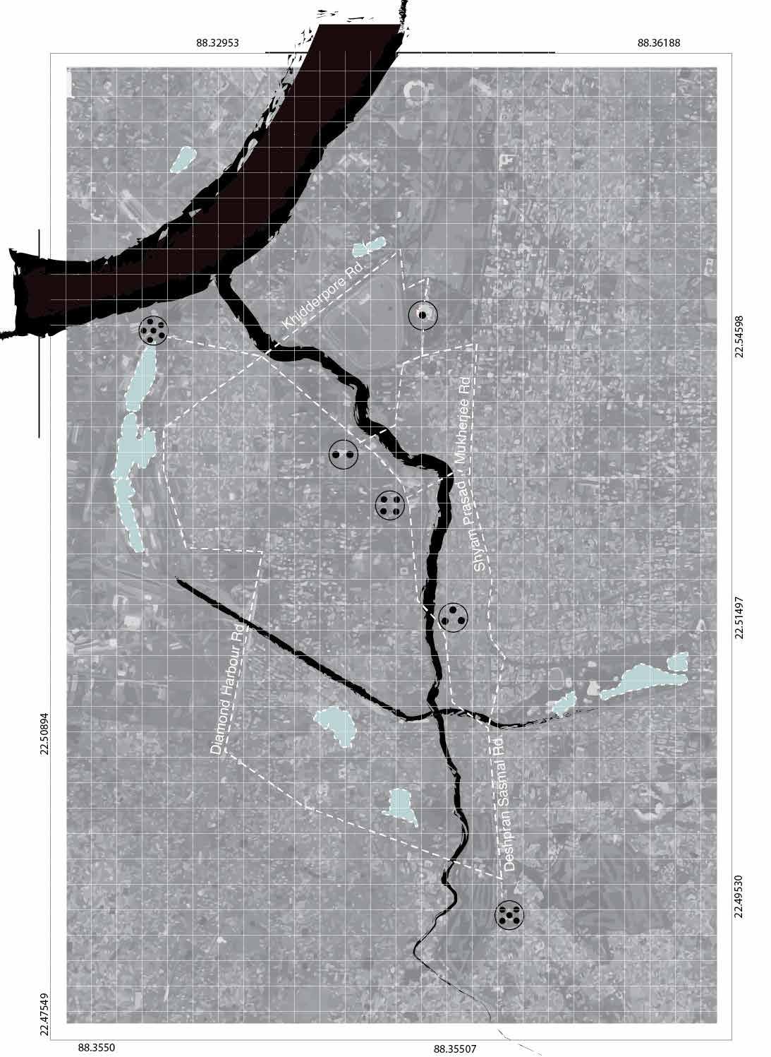 Victoria memorial
Khidirpur Dock
Alipoor Zoo National Library
Kalighat Temple
Tollygunj Club
Victoria memorial
Khidirpur Dock
Alipoor Zoo National Library
Kalighat Temple
Tollygunj Club
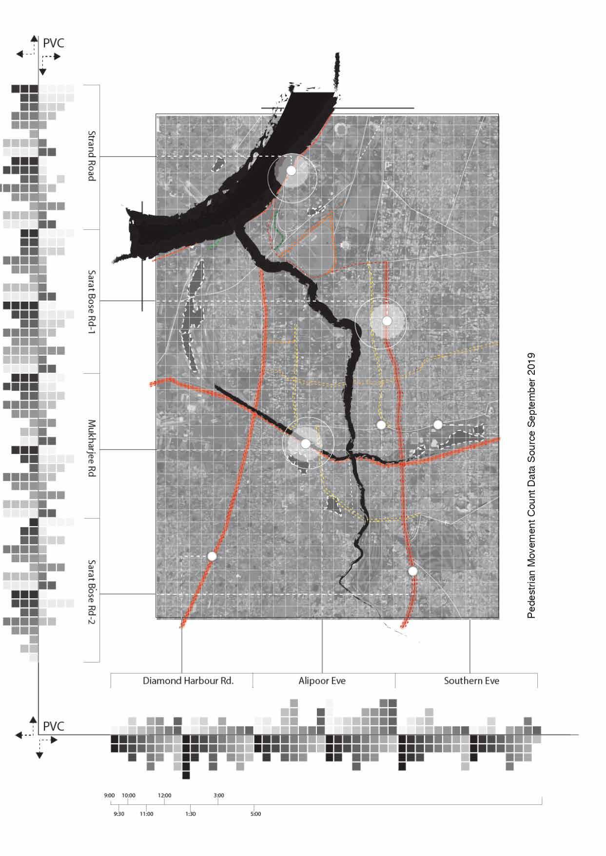
Slums are located along the dense wards of the city, also due to area being refugee sensitive the area needs step wise clearance.
Metro Line has decreased the flow of the river after the tollygunge Junction. Development is desirable but not at the cost of turning a flowing water to a moribund state
The legacy of the canal improper maintenance of people. To revitalize along the canal is proposed.
 Sewer drains discharge untreated Rehabilitation of informal settlements along the canal
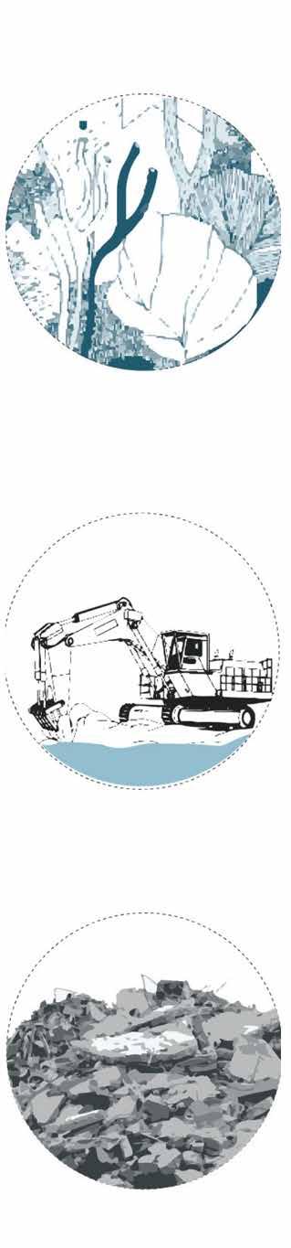
Dredging and Lining is necessary for maintenance of the edges and flow of the river.
Promoting multi-activity tourism through the hasting to tollygunge
Sewer drains discharge untreated Rehabilitation of informal settlements along the canal
Dredging and Lining is necessary for maintenance of the edges and flow of the river.
Promoting multi-activity tourism through the hasting to tollygunge
multi-activity zones and the canal from tollygunge
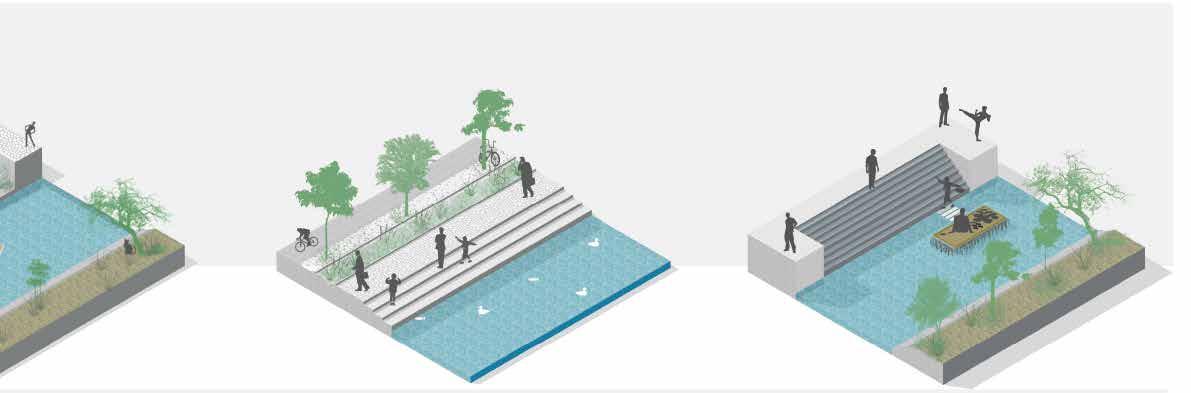
Sidewalk and NMT track along the canal to increasing the appeal of recreational activity and promote landscape
Floating market/ floating wetland to increase economic activity and biotopes to purify the water at major landmarks,
canal faded away due to maintenance and negligence revitalize it the eco tourism proposed.
Based on tha available space for development sidewalk or buffers are provided. The canal needs to be rejuvenated which will revitalize the area, community and restore its importance
The main focus of the project is to fully utilize the use of multiactivity zones and to increase the healthy interaction between nature and humans.
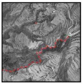
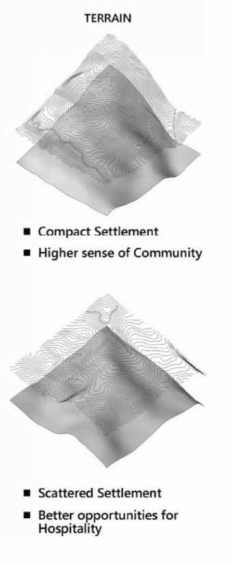
Re-modelling the Twin Villages
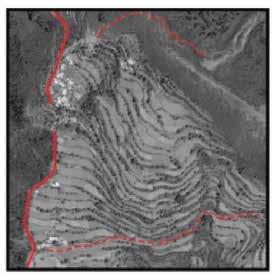

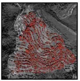
Compact Settlement
Higher sense of community
High work force
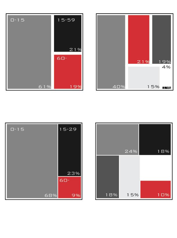
Total Population 304
Cultivation major occupation
Scope for logistics development
Scattered Settlement
Better opportunity for Hospitality
High work force
Total Population 442
Cultivation major occupation
Scope for better animal husbandary practices
Strength
LocalResources TourismPotential AnimalHusbandry AgriculturalProduce
Lowworkforce
Weakness
Literacy
Connectivity
Casual wage and animal husbandary
Casual wage
Cultivation
Casual wage and Cutivation
Salaried employment
Cultivation and animal husbandary
“Aim is to prepare a Model Smart Village Development Plan that enables social and economic development while maintaining its innate characteristics”
The basic concept of smart village is to collect community efforts and strength of people from various streams and integrate it with information technology to provide benefits to the rural community. An inclusive village development strategy that integrates the various paradigms of rural area development:
▪ Infrastructure
▪ Social Development
▪ Economic Development
▪ Human Development
▪ Governance
Shift in occupational character of the locals poses a requirement of skill development opportunities to establish economic resilience for the village.
Skill deveolopment centre will ensure the inclusion of marginal workers, and will help on development of local economy and enhance of micro connectivity
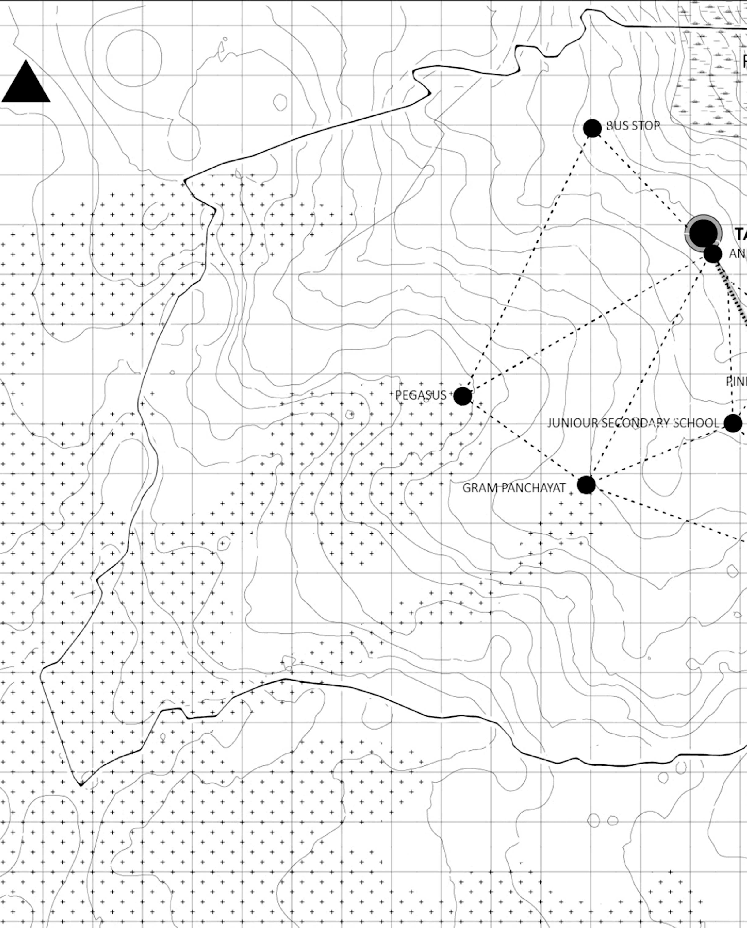
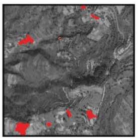
Potential for Tourism: The hamlets be linked together and revived to involvement of hospitality sector This primarily includes home-stays located along eco-tourism hotspots leading to Bhadraj mela
Increasing frequency of para transit to the villages from katoda, and further beyond the city by linking proposed warehouse to para transit and tempo logistics
Integration of two Villages: The twin villages have shown a character of dichotomy over time. Hence, for prospective development, they need to mutually benefit each other
Integrated landmarks, increasing the interaction between the villages. major focus on hospital revival and NGO’s promoting rural tourism
Agriculture: Utilizing local agricultural resources through improved irrigation techniques to strengthen livelihood

Strengthening local economy by promoting local markets and handicraft
Co-operative warehouses for agriculture produce, the farmers use storage through the inclusion of warehouse
Connectivity: To improve Para-Transit for villagers in-turn increasing reachability commerce and healthcare

Pop-up market space: location based on existing cricket ground. Marginal workers functions as part of formal economy
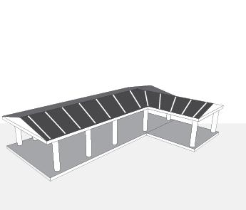
Three camphouse were proposed along The structures would be prepared from bhotia style rugs can be obtained from the goat village or could be promoted in skill objective of the these nighthouse is to make make the tourists more aware of the local be maintained and operated by the locals organising authority. The pine tree would support.
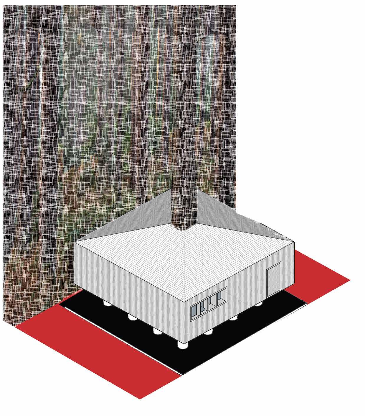 Camp House Proposed at Low Relief area aand closer to water source
Trek-Link
along the thirteen Km trek path. the localy available timber and the neighbouring villages like the development centre. The main make the trek duration longer and local village tradition. These would locals appointed through the trek would be at the centre would act as
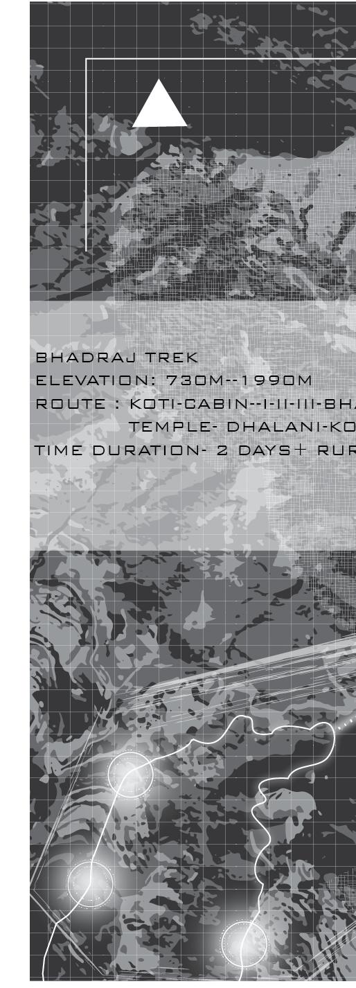
The new trek proposed is a subsidiary of existing ‘Bhadraj’ Trek. The two villages due to promising topography has the chance to increase th tourist footfall increasing the economic activity in the village. also this trek link wil appease the theme of ‘PUNNARUTHHAN’. the trek would start from Koti as the base with three camps along the route to experience the locals hospitality and finally the return would be through Dhalani. the trek organising authority will play a major role as they will pull in the tourists, there co-operation with the villagers will dicide the future course
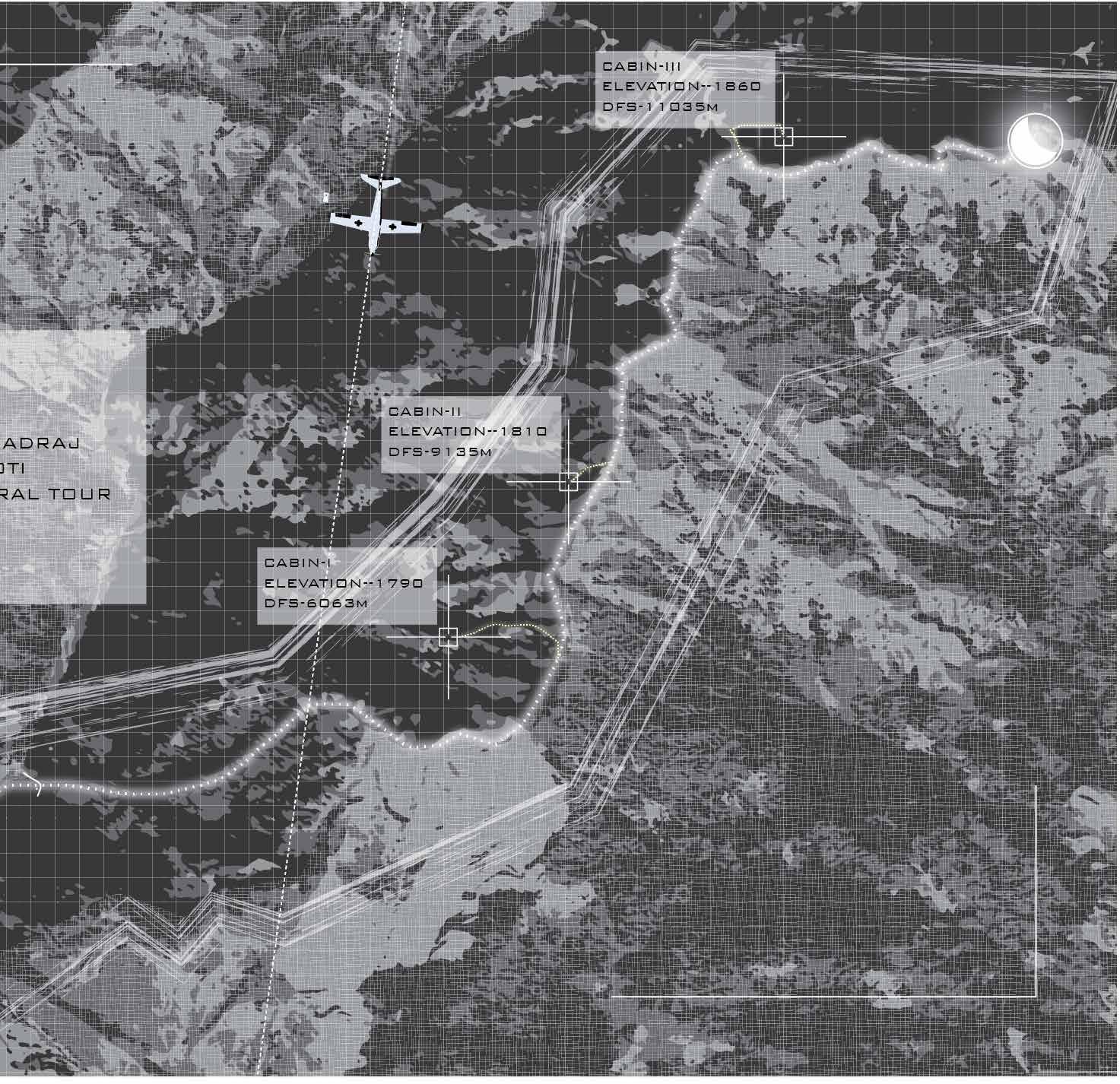 BHADRAJ
Bhadraj-Nag-Tibbat Trek MAP
BHADRAJ
Bhadraj-Nag-Tibbat Trek MAP
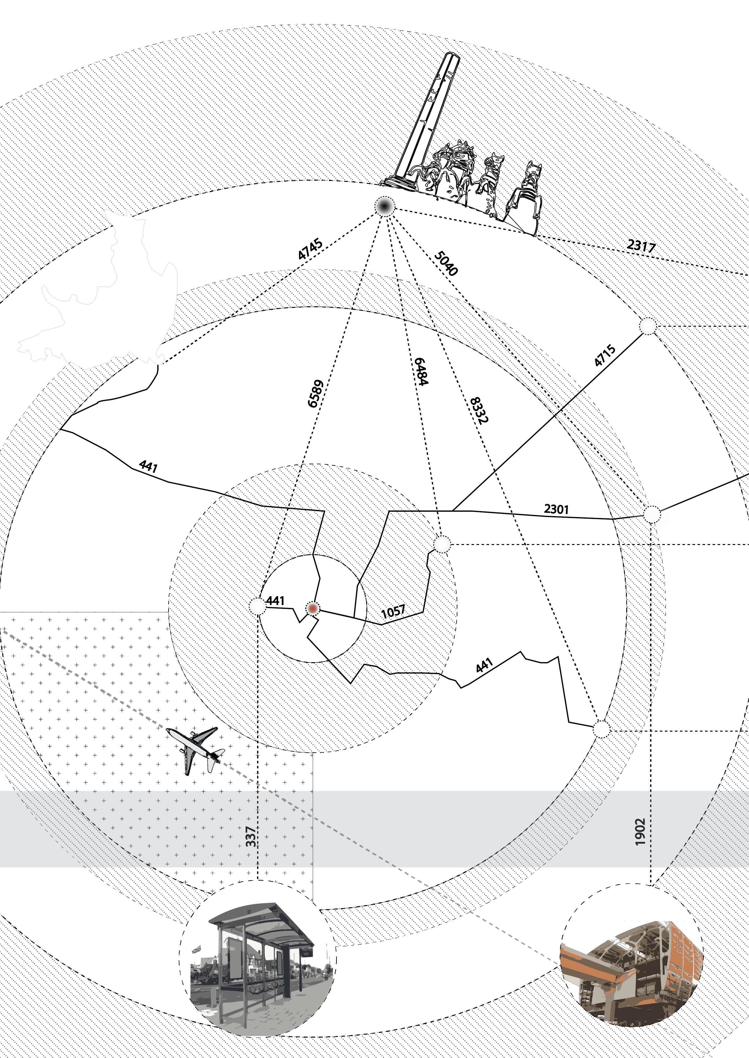


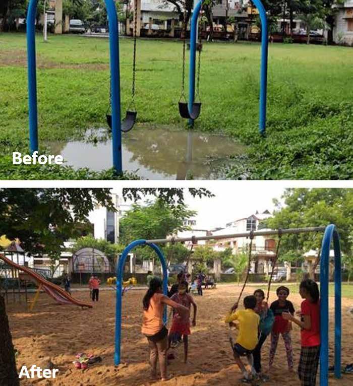
1. Open Dumping: Waste from temples and festivals accumulate on the edge remains uncleaned.Locals Dump the waste along the edges
2. Traffic Congestion: The route connects the two major junctions, chatrapati sq. and jaitala, further more there is load on these roads due to biweekly market and religious activity.
Survey- to identify along the lake, watching, jwalk, and religious involvement people
identify major activities lake, which included bird jwalk, fishing, cycling religious activities and their in attracting the
Mapping - Pixalated map was prepared based on the survey ouput to identify the space use and its importance based on activities. It helps in identifing the interaction of diferent activities
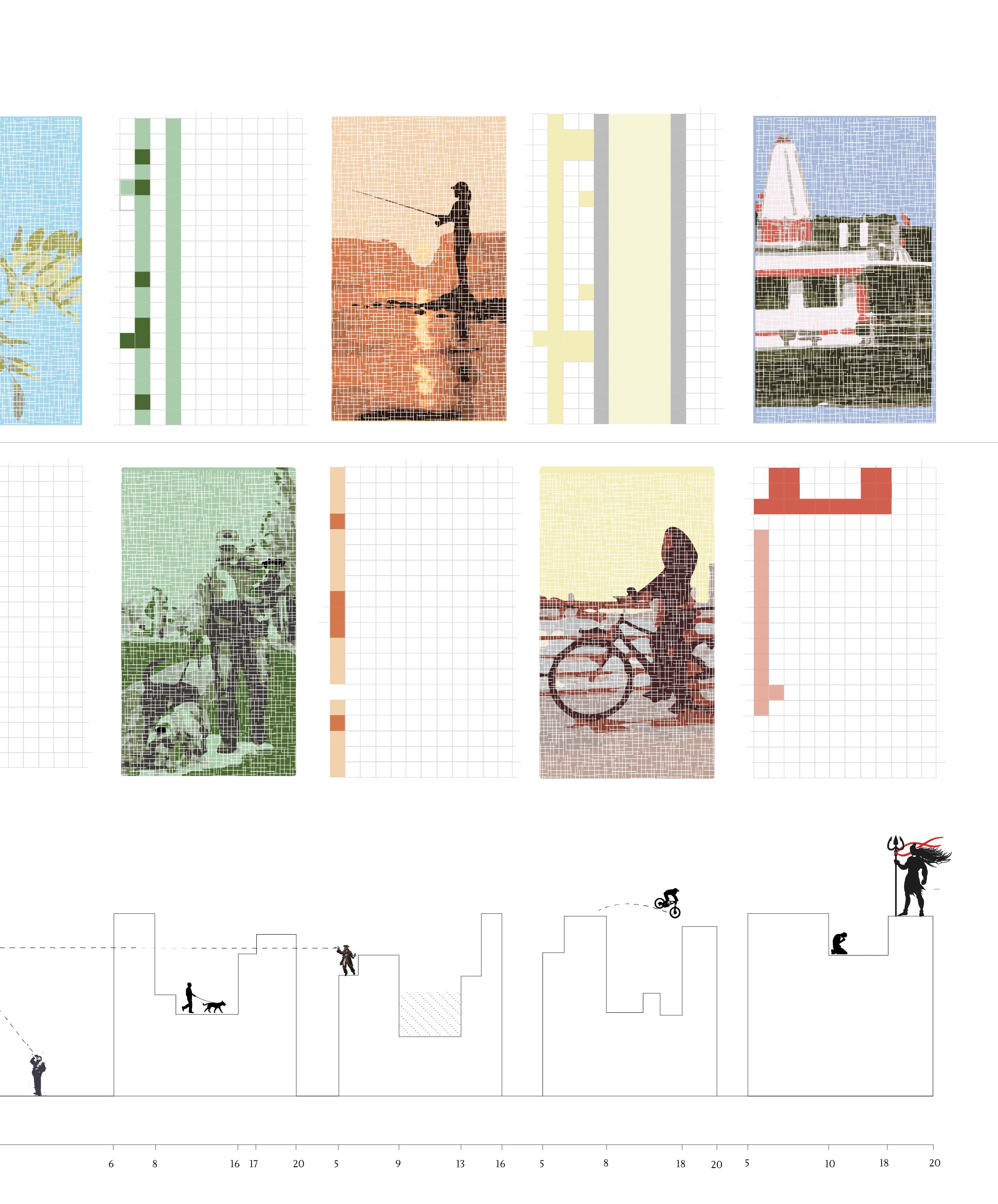
Space Utilization- Analysing the maps and the existing conditioon proposals were prepared for the poblrms identified that included congestion and open dumping. Dedicated space for activities and parking solutions to decrease congestion
Data Source 29 December 2019 Survey
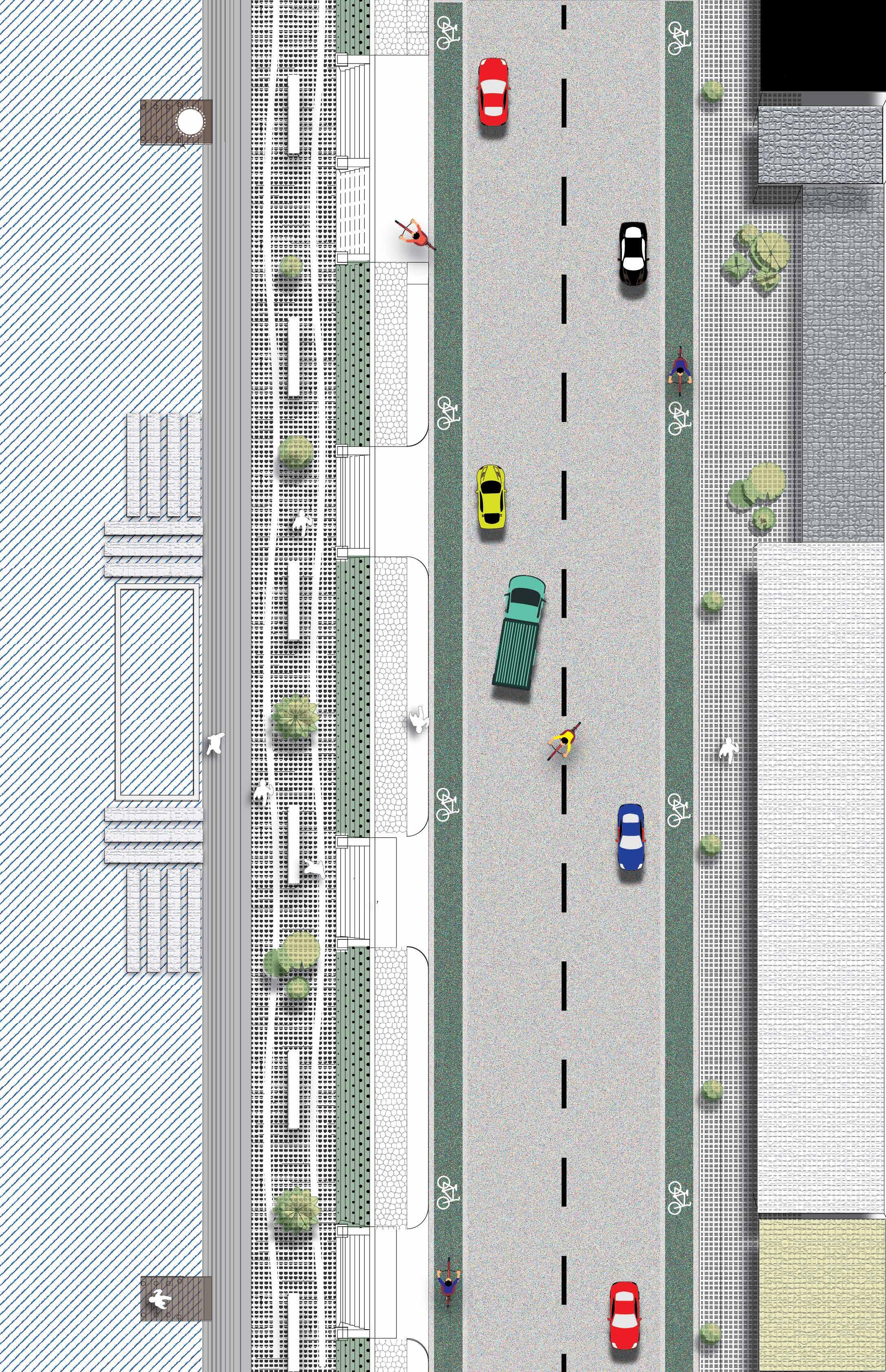
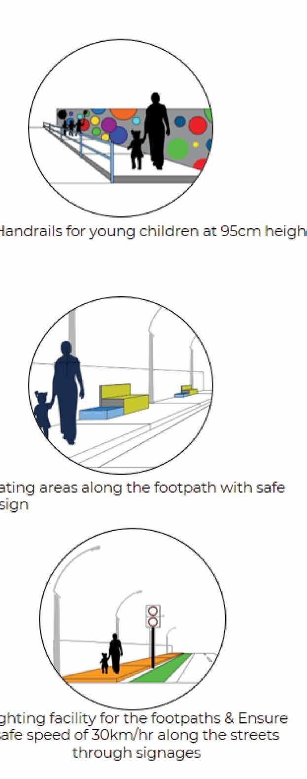
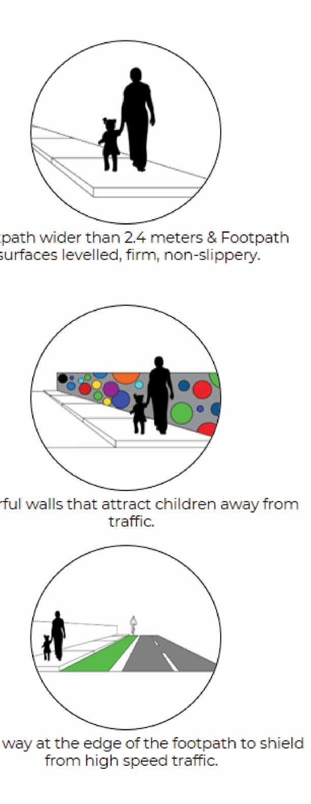
Redeveloping the edge of sonegaon lake based on the theme of safe and multi activity zone
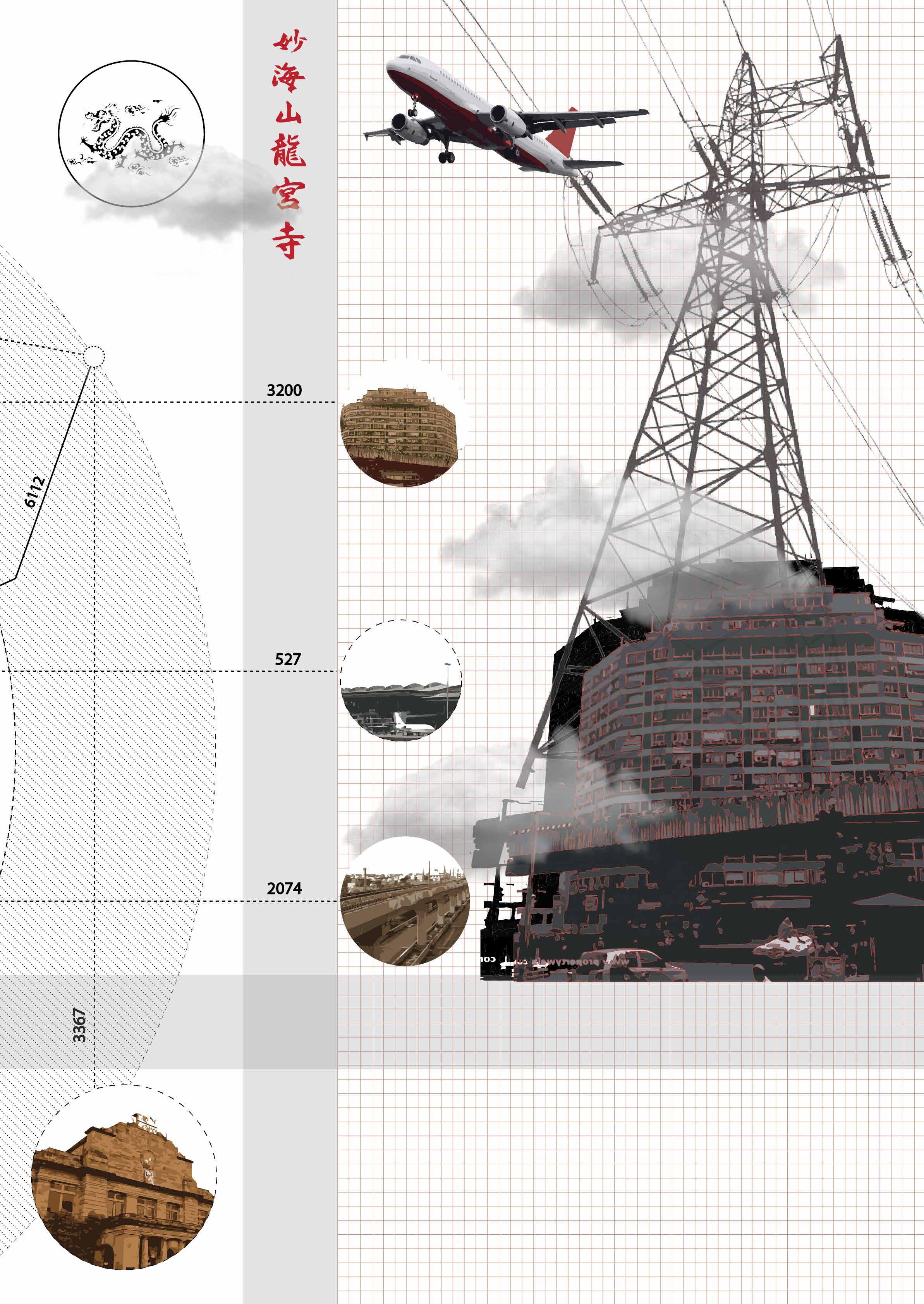
Artificial Ponds with depth of 8-10 feet can be used for idol emersion during festivals and as safe pool otherwise. The docks will fascilitate boating and help in increasing fishery. Their purpoes is to increase the contact between people and the environment.
Accessibility is encouraged through ramps with slope of 1:15 and promoting safe and frequent crosswalks and tabletop crossings. The proposal was introduced due to noticable no. of wheelchair users in the neighbourhood though not disabled, mostly elderly people.
Form based codes (FBC) is a planning and zoning tool that for regulating development using physical form rather than land use as organizing principle for the code. It can be used to regularise the existing Builtup as the encroachment remains within scale.
 SAHAY
SAHAY
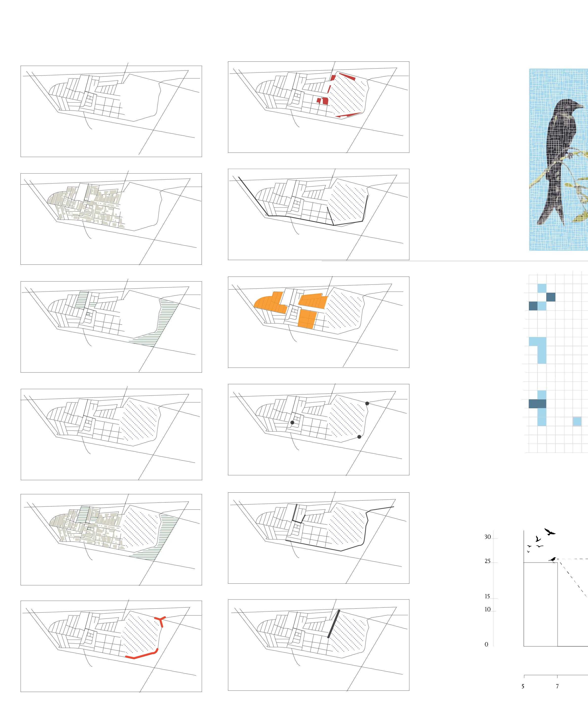
The Objective is to develop a place making project that will act as a Centre for change and community empowerment, in the heart of Dharavi, that will be wholly and truly owned by the people there. This will be a project that has the potential to become an umbrella institution for initiating change in Dharavi from within.
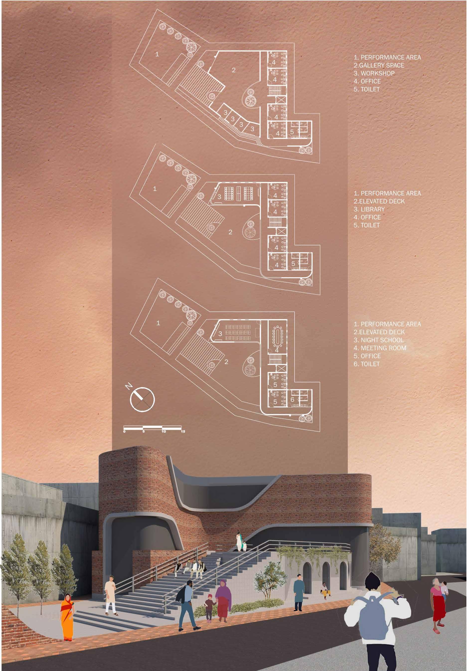
Site - The Site for the project is chosen in a matter that it allows for the design to act as an interface between the city and the people of Mumbai. This site selection makes the project accessible to the whole city. Land is a huge commodity in Mumbai and it is important to design the spaces in the most effective and efficient manner as possible.
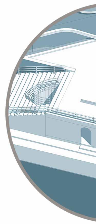
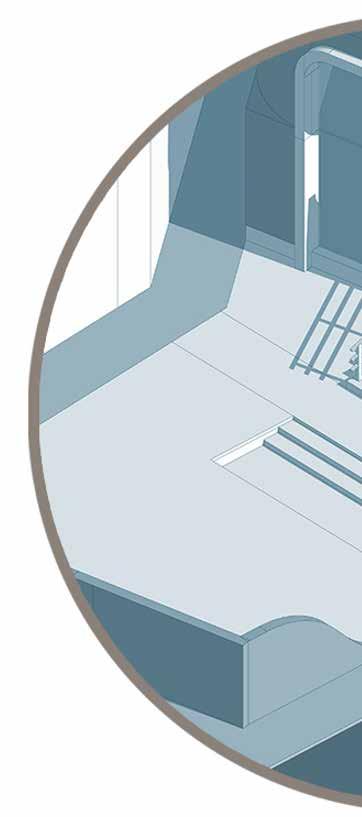
Open Perfromance designed in such a way urban catalyst in which area, lanscaping and stairs
Open Elevated Deck elevated deck which will and will provide a areal area. This type of development catalytic effect.

 Addition of Gallery space
Access and seating
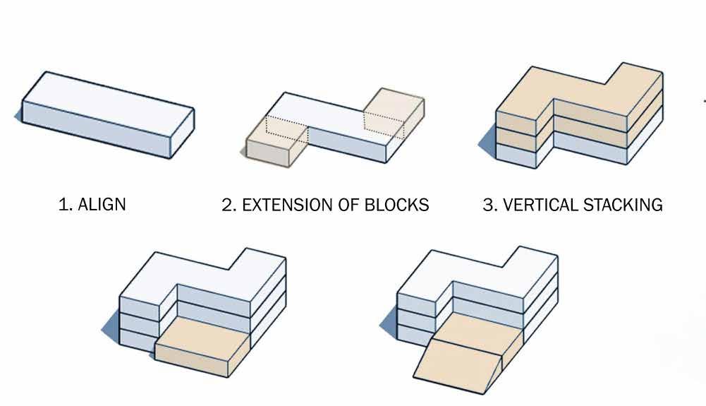
Align Extension of Blocks
Addition of Gallery space
Access and seating
Align Extension of Blocks
Perfromance Area : The frontal part is way that it will satisfy theory of which we inculcate the performing stairs acts as seating space.
Deck Area : The space will act as a will function as multipurpose area view of the site and surrounding development will help to benefit the
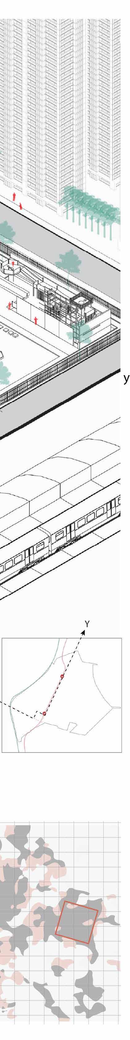
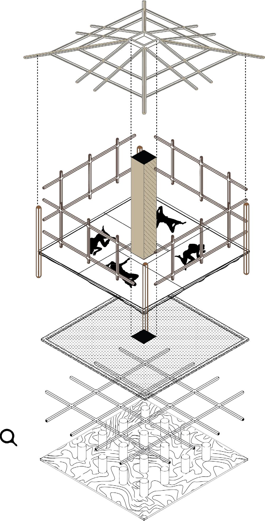
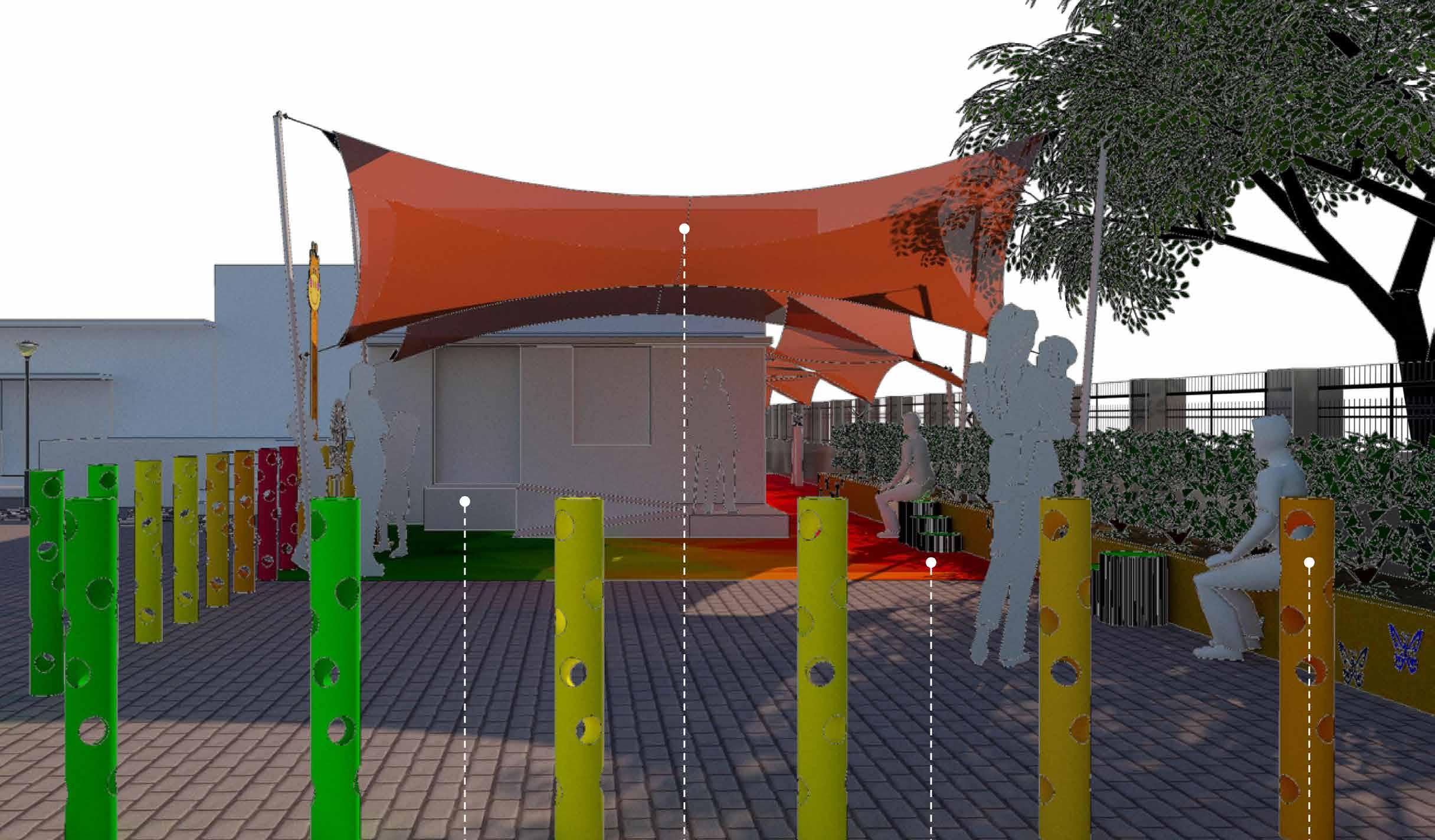
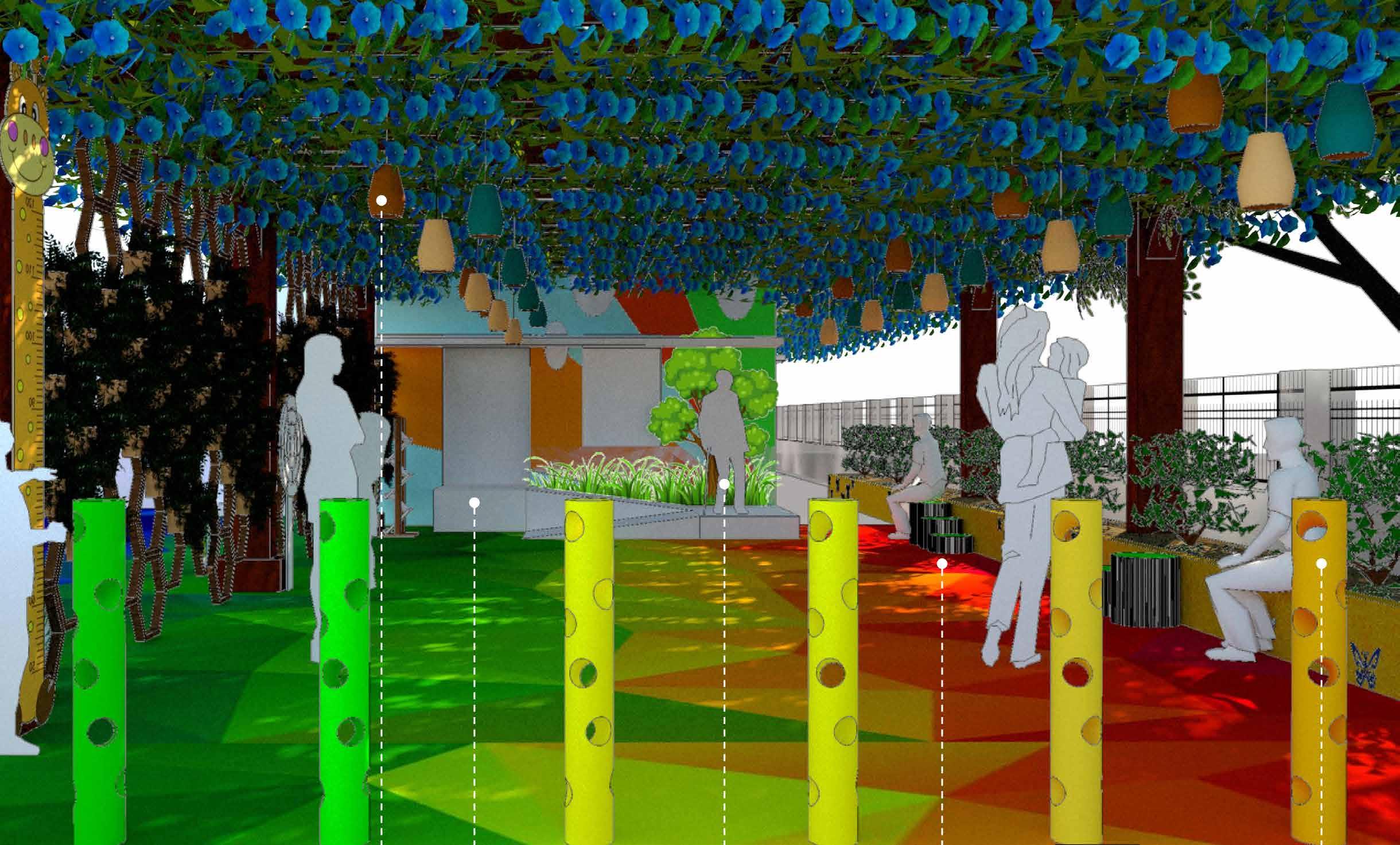
The Nurturing Neighbourhoods Challenge (NNC) is a three-year effort that intends to pilot and scale strategies to improve public space, mobility, neighborhood design, access to early children services and amenities, and data management across city agencies with Indian cities and their partners. It will also create a platform for city-to-city learning and sharing of best practices.
Primary healthcare centre is the heart of the NNC project, and will be the nucleus around which the other prposals will be centred
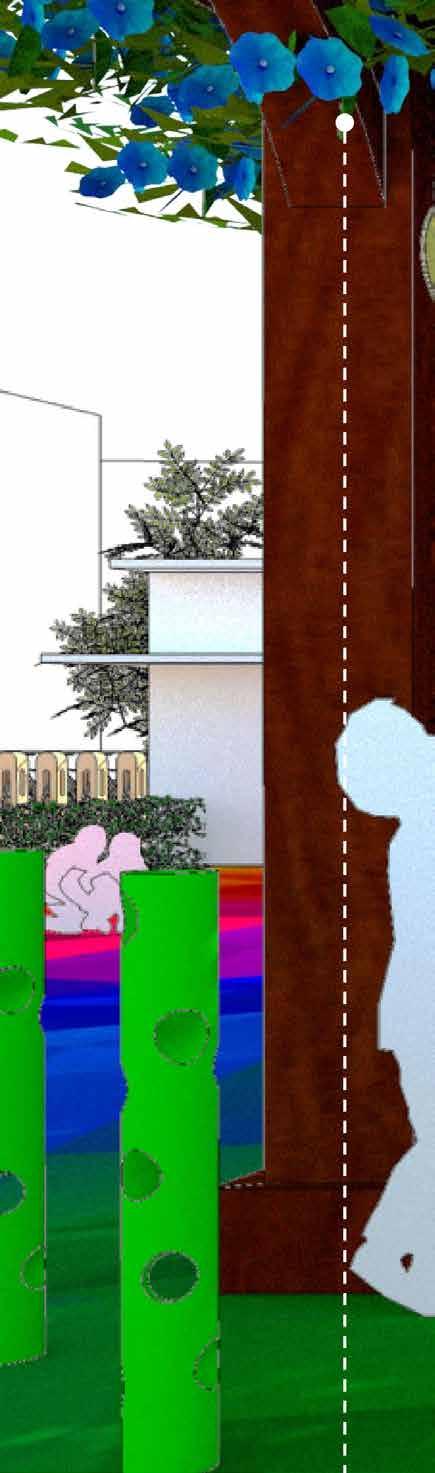
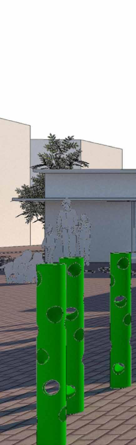
1. The firsts proposal is more vibrant and expensive, also most of the proposals are children oriented. the interventions make the place more intresting visually and physically. Special emphasis is given for flooring that is not permeable and the material is soft, where the childrens wont have the risk of getting hurt. the open space in Front of PHC is used for vehicle parking, to avoid that bollards have been prepared to reclaim the area as common place.
2. The proposal is cheap as compared to above proposal, and is more practical as teh coloured flooring may make increase the project estimate. the bollards and seating arrangements are same, with tensile roofing instead of a pergola. the bollards are used as seegregation instead of honeyvomb structured walls
as of Jan 2022
Mawsynram in the eastern part of Meghalaya in the eastern region of west khasi hill can be defined as having clouds that bridge to heavens, fog that makes you realise of the 90’s movies, rain that comes and clears makes you love the weather. Located at height of 1500-2000m above sea level Mawsynram got the name from historic megaliths found in the region. Mawsynram is famous for highest 11872 mm rainfall during peak rainfall season and making it the highest rainfall region of India it also the wettest place of the earth. The temperature here varies from 15-22-degree Celsius.
The maw of Mawsynram refers to stone, there is a famous cave by the name of Mawjymbuin located nearby, known for its fascinating stalagmites. These take the shape of a ‘Shivlinga’. The people greatly believe in god as the water from stalagmites is used as medicine by villagers. The natural beauty is another plus point of the village surrounded by cloud touching mountains giving you the feelings of isolation from the world.
Majority population in this area are Christian though the people are called ‘khasi” irrespective of their religion. Women hold a special position in the society involved in all type sector. Most shopkeepers are women. There is sluggishness in the village due to low activity. The villages are located at 1400m above sea level and are slightly lower topography as well as from one another. It is a 3hr ride from Guwahati and only bus and taxis work along this route. When arriving the fog could be the major challenge for tourist but is also the scene of awe as this heavy fog makes large boundaries of village restricted to small visible areas, one can only explore in Mawsynram
The houses are compact and gives the feeling of grandness, the 1000 house clusters found have varying heights and are self-sufficient. Due to heavy rainfall people grass as sound proofing material. For tourists there are dormitories and general employment and economy depends on the tourism industries that are regular throughout the year. Root bridge are the major tourist attraction, even double decker bridges could be found. These bridges were formed as a solution to drainage system turning into large rivers within the village, the need to cross the bridge made the khasi and jaintia peoples by aerial roots of rubber fig.
Mawsynram is one of the prime example of effective, cheap response to climate. As the houses have thatch roofs easily available in forest. The rain last from January to September and the construction work is done in this time period of September to December. the thatch itself isn’t able to fight the rain for year, the smoke from within the house acts as the coating for thatch. The government has started supplying thin tin film for people below poverty line.
Having the highest rainfall, drainage of Mawsynram is also has highest natural water drainage capacity. The drainage are all natural and they are formed according to raining condition. Mawsynram is having southern slope and the frequent landslide makes the drainage adaptable for the current rain. The amazing part of these drainage would be its location they are slimmer in top parts and wider as we go down the mountains. These could be due to presence of rocks on higher part of village and soil erosion happening from generation The adaptability of these drainage systems to the rain makes it ready to face challenges.


Refrences:
Prof. Sheuli Mitra, Ph.D. Associate Professor, Department of Urban & Regional Planning School of Planning and Architecture, Bhopal e-mail- sheulimitra@spabhopal.ac.in
Prof. Kshama Puntambekar, Ph.D. Assistant Professor, Department of Urban & Regional Planning School of Planning and Architecture, Bhopal e-mail- kshama@spabhopal.ac.in
Prof. Kakoli Saha, Ph.D. Assistant Professor, Department of Urban & Regional Planning School of Planning and Architecture, Bhopal e-mail- kakolisaha@spabhopal.ac.in