1 minute read
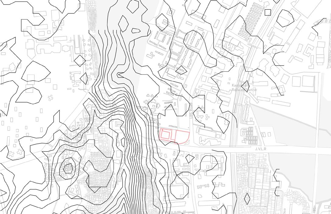
Contour Analysis

from Thesis

Figure 53
Contour Analysis The terrain analysis suggest a steep rise in terrain around the east part of site. The site lies on cascading edge of the mounts which lies in between the Powai lake and the Navy housing Colony. The terrain of the site in west is higher while the eastern part being lowered due to nearby sea on the east side. The terrain of site flat with a slight slope towards the east. The Main road is elevated because of undulated terrain from west to east. The contour elevation increases from the Navy Colony. The contour elevation is more as land is not developed remains in the natural state where in less human intervention has taken place. The adjoining area comprises of flat land mainly due to construction activity and human intervention. There exists a steep elevation right across west side of the site. The valley exits on the east heading towards the lake and some part also towards the site.
Advertisement


