
LANDSCAPE ARCHITECTURE SHALIN THANKAM
PORTFOLIO
TECHNICAL SKILLS
CURRICULAM VITAE
ROCKDALE WETLAND
CORRIDOR



] ]
CONTENTS
07 08 10
PERSONAL STATEMENT 06
TWEED MALL PRECINCT DESIGN

COFFS HARBOUR STREET DESIGN
HEALING MATERNITY GARDEN
VIVAS V PLACIDA LANDSCAPE GARDEN
24 32 40 46
AKNOWLEDGEMENT OF THE COUNTRY

I would like to acknowledge the Bedegal people that are the Traditional Custodians of this land on which I am fortunate to persue my education. I pay my respects to the Elders both past and present and extend that respect to other Aboriginal and Torres Strait Islanders who are present here today. I would also like to celebrate the diversity of Aboriginal peoples and their ongoing cultures and connections to the lands and waters of NSW.
PERSONAL STATEMENT

SHALIN THANKAM

As an architect with two years of experience, I have developed a deep interest in landscape architecture through my exposure to diverse natural environments and contrasting constructed urban spaces while living in different countries. This exposure has inspired me to pursue landscape architecture as a means to study and create a harmonious balance between the community and the environment.
Sydney, with its favorable equilibrium between urban development and natural landscapes, has been a compelling choice for furthering my studies in landscape architecture. I am particularly interested in exploring how the design of our built environment can enhance the well-being of both the community and the surrounding ecosystem, fostering a sense of harmony and sustainability.
I excel in effective verbal communication and critical thinking, enabling me to articulate design concepts clearly and develop innovative solutions for complex landscape architecture projects. With a team-oriented mindset, I collaborate effectively with professionals from diverse disciplines. I am a quick learner, constantly seeking opportunities to expand my knowledge and stay up-todate with industry advancements.
I am eager to contribute to the Australian landscape architecture community, creating sustainable landscapes and hope to gain practical experience and deepen my understanding of local contexts and design practices. Being passionate about making a positive impact, I am excited to grow as a landscape architect in Australia to learn as well as put my skill to practice to create innovative and sustainable designs.
]
]
TECHNICAL SKILLS ]

AUTOCAD
Advanced level

Advanced level

Advanced level

Good skill level

Developing level

Advanced level




Developing level
SOFT SKILL
COMMUNICATION SKILL
Basic level
Developing level
Developing level
Advanced level
Advanced level
Excelent quality to verbally communicate an idea or concept
LEADERSHIP
Great leadership qualities and excellent ability to work in a team.
- Represented media commetee in cultural club in UNSW.
TIME MANAGEMENT
Ability to manage time and work under pressure.
QUICK LEARNER
Enthusiasm to learn new concepts quickly.
ADAPTABILITY
Excellent ability to adapt in different environment.
RESPONSIBILITY
Great at handling jobs responsibly with a strong sense of duty and accountability.
RHINO SKETCHUP GRASSHOPLUMION V-RAY REVIT QGIS
3DS MAX ADOBE SUITE MICROSOFT OFFICE TEAMS
] |
CURRICULAM VITAE ]
EDUCATION
MATERS IN LANDSCAPE ARCHITECTURE
2023 l University of New South Wales
BACHELOR OF ARCHITECTURE
2020 l College of architecture Trivandrum
SCHOOLING
2015 L Good Shepeard Public school, India
2013 l Indian School, Al ain, U.A.E.
QUALIFICATIONS
SKETCHUP
2018 l Intercad System Pvt. Ltd, Trivandrum
PARAMETRIC MODELING
2019 l Rhinoceros 3D & Grasshopper, Para Kraft
CIVIL DESIGNING
2020 l Vastu Shasthra, Rajadhani Finishing School
REVIT AARCHITECTURE
2021 l Zero to hero by Munir Hamad, Udemy
2021
MAY - AUG
EXPERIENCE
HARDCO BUILDING CONTRACTING , U.A.E. ARCHITECTURAL INTERN
Worked for the world’s largest Safari zoo (apart from Africa) which is being constructed in Al Dhaid.
Prepared construction drawings with frequent site monitoring and worked with different departments like landscape, theming, MEP etc.
2020 JAN - SEPT
VISTAAR ARCHITECTS AND PLANNERS, INDIA ARCHITECTURAL INTERN
Carried out various kinds of projects like govt. buildings, school, hospital etc.Worked on a competion project to design an Administrative complex in Goa, which got short-listed.
Mainly focussed on skills like time management, software skills, team cordination, brainstorming and perfection in work.
2018
JUNE - DEC
ARCHSTUDIO V , BANGALORE, INDIA ARCHITECTURAL INTERN
Worked on various project types like Residential (Single Villa, Gated compount, Appartment as per Vastu), Commercial (Mall), Landscape projects.
Often met with clients to discuss project plans and update them with the design progress.Regular site monitoring to ensure accurate design execution.
]
| |
|
CURRICULAM VITAE ]
TRANSFERABLE SKILL
MANAGEMENT SKILL SUPERVISOR IN HOSPITALITY
Strong quality developed to effectively lead and supervise diverse teams to ensure smooth operations and customer satisfaction.
VISUAL COMMUNICATION
FREELANCE GRAPHIC DESIGN PROJECTS
I have honed my visual communication skills to effectively convey messages and capture attention.
TIME MANAGEMENT
Ability to manage time and work under pressure.
PROFESSIONAL ENGAGEMENT
Member of COUNCIL OF ARCHITECTURE, INDIA
Member of AUSTRALIAN INSTITUTE OF LANDSCAPE ARCHITECTS
LANGUAGES


]
| |
|
ENGLISH MALAYALAM
HINDI ARABIC TAMIL
FRAMEWORK ] ]

THEORIES
1. Ecological Restoration
2. Resilient Design
3. Community Engagement and Stakeholder Participation
PRECEDENT
1. Weiliu Wetland Park Landezine. (2017). Weiliu Wetland Park by Yifang Ecoscape. [online] Available at: https://landezine.com/weiliu-wetland-park-by-yifang-ecoscape/.
2. Minghu Wetland Park ArchDaily. (2015). Minghu Wetland Park / Turenscape. [online] Available at: https://www.archdaily.com/590066/minghu-wetland-park-turenscape?ad_source=search&ad_medium=projects_tab.
3. Suzhou Taihu Lakeside National Wetland Park
“The 10th International Wetlands Conference.” n.d. Temp.intecol-10iwc. com. Accessed March 6, 2023. http://temp.intecol-10iwc.com/EN/HelpCenter/HelpInfo.aspx?nid=87.
POLICY
1. NSW Wetland Policy
2. The NSW Wetlands Management Policy
3. The NSW Sea Level Policy
4. Multicultural Education Policy
| | |

ROCKDALE WETLAND CORRIDOR
SECOND YEAR CAPSTONE PROJECT
- TRANSFORMING “SQUISHY LAND” -
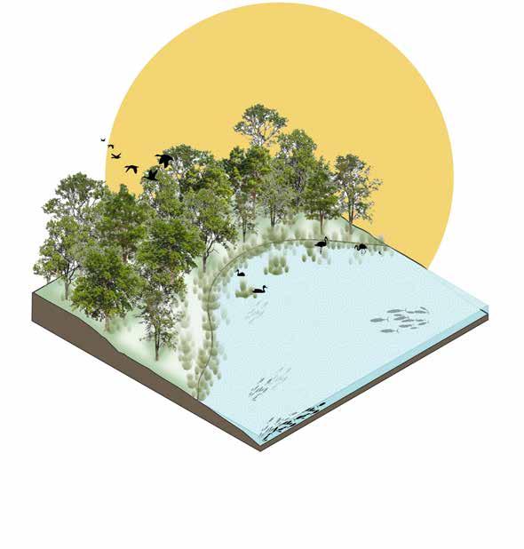
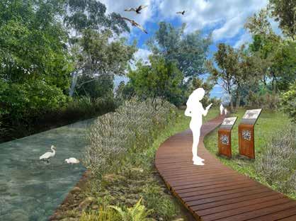
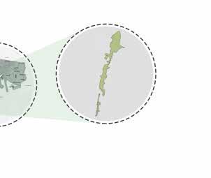
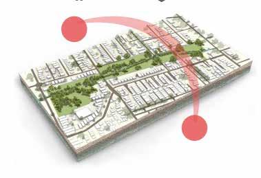
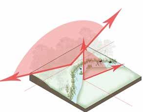
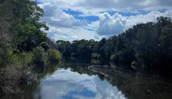
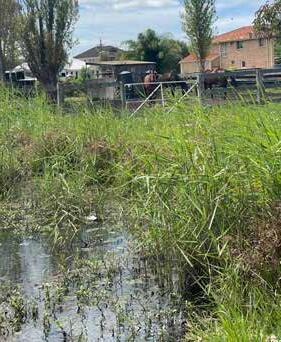
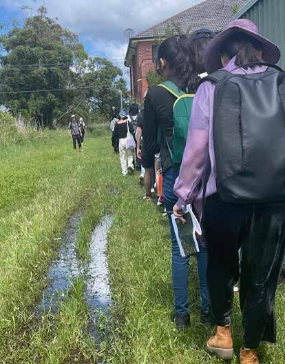
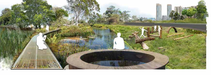
The Rockdale Wetland Corridor project is a restoration initiative, located in Sydney as part of a 5km wetland stretch. The chosen site belongs to the San Souci catchment and lies along Bado-Berong Creek, encompassing Bona Park.The site’s unique characteristics, such as tall trees, open sky, and a rich biodiversity hotspot, offer immense potential for innovative design. However, the project faces significant challenges such as sea level rise causing salination of fresh water, resulting in biodiversity loss, and water overflow from the creek affecting nearby low-lying residential areas. Addressing poor water quality and soil contamination are also key objectives.
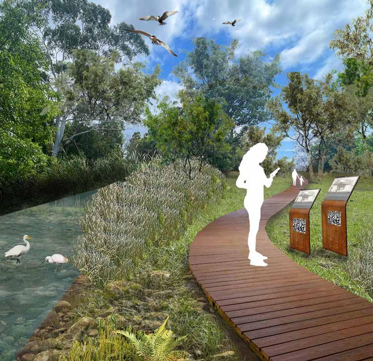
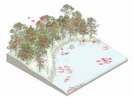
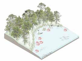
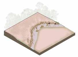
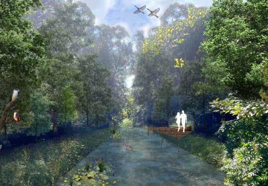
To overcome these challenges, the project aims to build a resilient system that can adapt to sea level rise and water overflow, while simultaneously restoring and enhancing the wetland’s ecological functions. Phytotechnologies will play a crucial role in this effort, utilizing plants and vegetation to address water and soil quality issues and promote overall ecosystem health. Community engagement and participation will be fostered to create a sense of ownership and stewardship among local residents.The Rockdale Wetland Corridor project envisions longterm results within a timeframe of 20 to 30 years, recognizing the time required for the wetland to fully recover and showcase the desired ecological improvements.
] ]


]
TREES ORIENTATION BIODIVERSITY HOTSPOT BURRA MIGRATION OPEN SKY E W LOCATION FUNDAMENTAL ASSETS
TALL
] 12
FLAT TERRAIN
INTRODUCTION
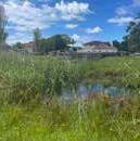
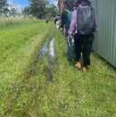

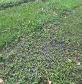
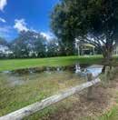
LAND OWNERSHIP
Land is owned by the bayside council. Rest of the site is owned by the Road and traffic authority

RESIDENCE TO BE CLAIMED
Few residence must claimed on either sides of the Bado- berong creek for the expansion of these open spaces
SOIL TYPE : Ettalong swamp
LACK OF CONNECTIVITY TO WETLAND
Trees and the compound wall of the residence cut the physical access of residents to wetland.
HEAT VULNERABILITY INDEX
Compared to other part of the site HVI is higher in this area and bona park.
- Special care to be give while design in case of recreational space.
LAND OWNERSHIP
Land is owned by the bayside council. site is owned by the Road and traffic authority
BADO-BERONG CREEK
VULNERABILITY INDEX
of the site HVI is higher in this area and bona park. while design in case of recreational space.
It is a 2.5 km creek that drains into George river. It had poor water quality and can be treated before draining.
- Bring openess and function
RESIDENCE TO BE CLAIMED
Few residence must claimed on either sides of the Bado- berong creek for the expansion of these open spaces
LAND OWNERSHIP
Land is owned by the bayside council. Rest of the site is owned by the Road and traffic authority
HEAT VULNERABILITY INDEX
Compared to other part of the site HVI is higher in this area and bona park.
- Special care to be give while design in case of recreational space.
Compared to other part of the site HVI is higher in - Special care to be give while design in case of
NOEL SEIFRET RESERVE
It is 3 acre park adjacent to bona park.


It is a 2.5 km creek that drains into George river. It had poor water quality and can be treated be fore draining.
SOIL
Acid sulphate soil Class 3 and Class 5
It
- Vegetation to be chose wisely
BADO-BERONG CREEK
It is a 2.5 km creek that drains into George river. It had poor water quality and can be treated before draining.
NOEL SEIFRET RESERVE
It is 3 acre park adjacent to bona park.

authority
were planted over the years.
BIODIVERSITY: Fauna - Golden wistler, grey headed flying fox
Density : Housing density was slightly increased.
INSIGHTS

RESERVE bona SOIL sulphate soil and Class 5 chose wisely
Black
Grey


SOIL
Acid sulphate soil Class 3 and Class 5 - Vegetation to be chose wisely
Vegetation It was observed that most plants were planted over the years.
Porosity : The porosity to wetland decresed over the years.
SOIL TYPE : Ettalong swamp
ENCLOSURE
Density Housing density was slightly increased.
Function : Most of the site is vaccant from 1950 while
Porosity The porosity to wetland decresed over the years.
Function : Most of the site is vaccant from 1950 while
Level of enclosure is quite low but differs when we move along the site. The openess and porosity changes with the types of vegetation length of site abd nearby built
- Space acquisition for expansion of open space
HIGH CONTOUR
LACK OF CONNECTIVITY TO WETLAND
Trees and the compound wall of the residence cut the physical access of residents to wetland.
- Bring openess and function
RESIDENCE TO BE CLAIMED
Few residence must claimed on either sides of the Bado- berong creek for the expansion of these open spaces
HIGH CONTOUR
There is a chance of flash flooding as the site lies in between higher contours.
- Water detention in site
There is a chance of flash flooding as the site lies in between higher contours.
- Water detention in site
ENCLOSURE
PLANTS
PLANTS
Plants like reeds and shrubs block the visual access to creek and obstruct users to use the space - Plants that help visual access.
PLANTS
Plants like reeds and shrubs block the visual access to creek and obstruct users to use the space
- Plants that help visual access.
Higher terrain
Site North Sans Sauci near Ramsgate
ENCLOSURE
Level of enclosure is quite low but differs when we move along the site. The openess and porosity changes with the types of vegetation length of site abd nearby built
Level of enclosure is quite low but differs when we move along the site. The openess and porosity changes with the types of vegetation length of site abd nearby built
- Space acquisition for expansion of open space
- Space acquisition for expansion of open space
SECTION B -
WATER TABLE
Water table is considerably high due to the low terrain which makes it a hazardous area during flood.
- Proper drainage systems and plants species to be choose wisely.
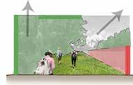
SECTION B - B’
WATER TABLE
RECREATIONAL AMENITIES
1. Bona Park
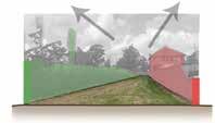
SECTION B - B’
Site between park rd and Alice rd
SECTION B - B’
Site between park rd and Alice rd
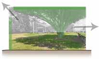
SECTION B - B’
Site between park rd and Alice rd
Water table is considerably high due to the low terrain which makes it a hazardous area during flood.
2. Vegetative garden for residence
3. Dog Leash Park
- Not frequently used. Better aminities and site specific function to be provided
WATER TABLE
Plants like reeds and shrubs block the visual access to creek and obstruct users to use the space
- Plants that help visual access.
1. Bona Park
- Proper drainage systems and plants species to be choose wisely.
SECTION B - B’

RECREATIONAL AMENITIES

SECTION B - B’
Site between park rd and Alice rd

1. Bona Park
Water table is considerably high due to the low terrain which makes it a hazardous area during flood.
2. Vegetative garden for residence
- Proper drainage systems and plants species to be choose wisely.
RECREATIONAL AMENITIES
2. Vegetative garden for residence
3. Dog Leash Park
- Not frequently used. Better aminities and site specific function to be provided


3. Dog Leash Park - Not frequently used. Better aminities and site specific function to be provided

SECTION B - B’


LANDSCAPE PERFORMANCE TABLE
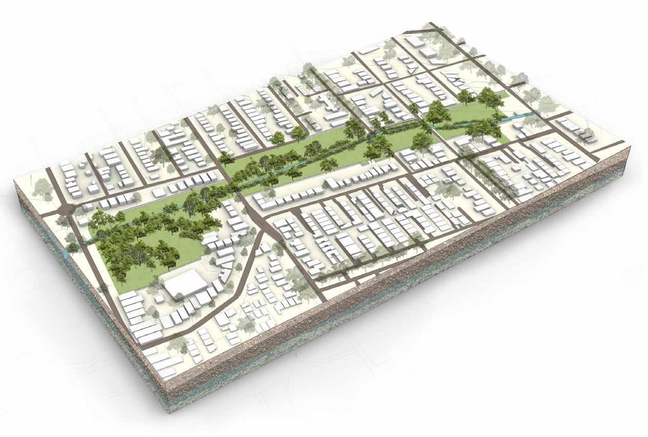
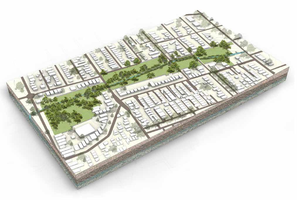
During the site study and analysis process, various aspects were carefully examined. One crucial step involved creating an axonometric 3D diagram of the site to better understand the spatial relationships and interdependencies among different features. To develop this diagram, software programs such as SketchUp, Rhino, Adobe Photoshop, and InDesign were utilized.
Bayside Council, Road and traffic OPEN SPACE ACQUISITION DIAGRAM
PLANTS Plants like reeds and shrubs block the visual access to creek and obstruct users to use the space - Plants that help visual access. BONA PARK LAND BETWEEN RICHIE ST AND ALICE ST LAND BETWEEN PARK RD AND ALICE ST BADO - BERONG CREEK NOEL SEIFERT RESERVE BADO-BERONG
SEIFRET RESERVE
NOEL
adjacent to bona park. SOIL Acid sulphate soil Class 3 and Class 5 - Vegetation to be chose wisely RECREATIONAL AMENITIES 1. Bona Park 2. Vegetative garden for residence 3. Dog Leash Park - Not frequently used. Better aminities and site specific function to be provided SECTION A - A’ Site between park rd and Alice rd Spongy dark Organic peat Black organic greasy sticky mud Grey molted sandy clay loam Compound wall
is 3 acre park
] 13
OPEN SPACE ACQUISITION DIAGRAM
BONA PARK
LAND BETWEEN RICHIE ST AND ALICE ST
LAND BETWEEN PARK RD AND ALICE ST
BADO - BERONG CREEK
TERRAIN Site lies in the low lying area of wetland corridor. - High water table DWELLING PRICE
NOEL SEIFERT RESERVE
1 2 3 Site near Ramsgate Low hanging fruit target Aspirational target Environmental Benefit Treatment of Squishy lands. Mitigation of flood in the area and
SECTION A - A’
SECTION B - B’
SECTION B - B’
SECTION B - B’
Site between park rd and Alice rd
Site between park rd and Alice rd
Site between park rd and Alice rd
R wistler, grey headed flying fox
Site between park rd and Alice rd
Spongy dark Organic peat Black organic greasy sticky mud Grey molted sandy clay loam House:
: It was observed that most plants
Vegetation
1 2 3 Site
B’
Site between park rd and Alice rd
between park rd and Alice rd
between park rd and Alice rd
between park rd and Alice rd
dark Organic peat
Site
Site
Site
Spongy
organic greasy sticky mud
molted sandy clay loam R A’
LANDSCAPE PERFORMANCE TABLE OPEN SPACE ACQUISITION DIAGRAM
BONA PARK
LAND BETWEEN RICHIE ST AND ALICE ST
LAND BETWEEN PARK RD AND ALICE ST
BADO BERONG CREEK
PRICE
NOEL SEIFERT RESERVE TERRAIN DWELLING
1 2 3 1950
1985 2023
SECTION A - A’
loam Compound wall
R A’
Spongy dark Organic peat Black organic greasy sticky mud Grey molted sandy clay
Trees and shrubs

PARAMERTRIC ALALYSIS
Grasshopper
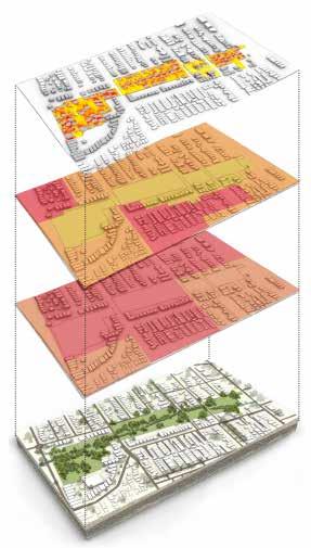

SUN ANALYSIS
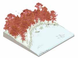
From the direct sun and UHI analysis it was observed that the site receives ample sunlight over a longer period but is poorly shaded making the site extremely hot and water in the creek dries up really quickly but floods during the slight event of rain. The strategies include to make the site more thermally comfortable. Planting more trees making it a riparian corridor can help shade the wetland and give thermal comfort.
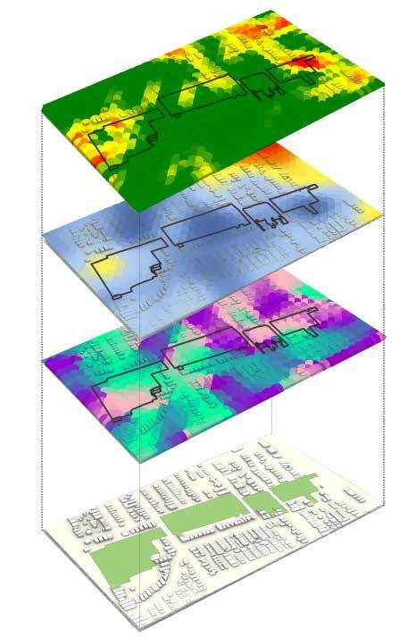
TOPOGRAPHY ANALYSIS


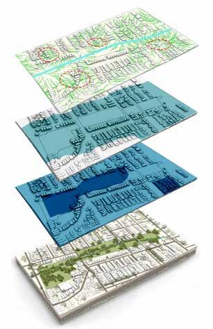

The site is relatively flat but has low terrain which poses a threat to other activities in site. Water table is being hight land is inunded during tides or slight rain. North west of the site being on high terrain might also result in flash flooding during an event of rain.
FLOOD ANALYSIS
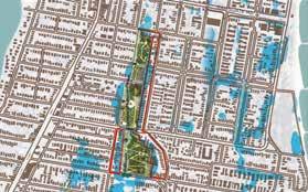
The site has been identified as having problems such as flash flooding, sea level rise and storm water surge. These problems stem from the low ground on which the site is located. Stratergies that are adopted are space acquisition by nearby residents to reclaim their land, alteration of the terrain moderately, and expansion of the creek to act as a spill-out space.
] ] 01
SEA LEVEL RISE
1%AEP FLOOD

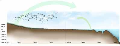
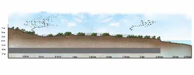
PATTERNS AND RELATIONSHIP THROUGH SITE SECTIONS

REED BED
Phytoremediation of poor quality water
BONA PARK
- Mass manufactured play equipments.
- Not very used by children
- No connection to creek
- 30 families gather in site
- Users adapt with flood by small measures
- Create sense of space
SMALL BRIDGE
- Narrow
- Only connection
Proposal : Can be expanded to view phytoremediation
LOW DENSITY HOUSES
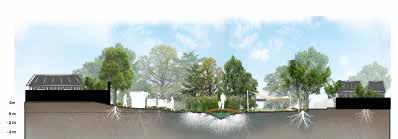
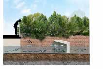
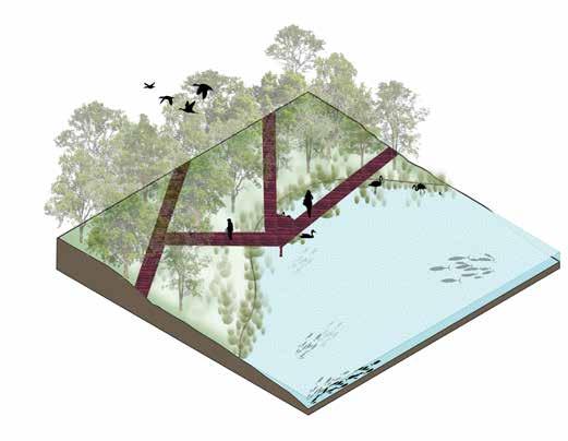
In order to gain a deeper understanding of the site and its context, different scale sections were drawn to analyze various layers and their relationships. These sections provided insights into larger patterns, including birds and burra migration, and helped identify connections with neighboring areas such as the Blue Mountains, Kamay (Botany Bay), and the San Souci residential area. Additionally, sections were used to study the biodiversity, community dynamics, soil composition, the creek, and the site itself. By examining these sections, valuable information was obtained regarding the spatial and ecological relationships between these elements.
] ] 04
SITE Rockdale Wetland Corridor BIRD MIGRATION ON LAND EELS MIGRATION Mature eels migrate to see to mate and baby eels back to land BLUE MOUNTAINS WEST PACIFIC OCEAN EAST KAMAY SITE Bona Park and the adjacent area along Bado-berong creek M6 Tunnel BADO-BERONG CREEK GEORGES RIVER BONA PARK Lowest point in site PROPOSED M6 TUNNEL 10m below ground EQUISTERIAN PARK SCOTT PARK RIPARIAN CORRIDOR Phytoremediation Maintain the flow of water, clean water, slow down flood water, habitat for birds HIGH DENSITY HOUSES COMMUNITY SPACE FOR RESIDENCE CREEK EXPANTION Giving more room for flood during rain / sea level rise COMMUNITY GARDENS Expansion of existing gardens (Community needs) GREEN COVER Reduction in UHI Increased Habitat for birds
COMMUNITY GARDEN
FENCED RESIDENCE
VIEWING POINT CONTAMINATED WATER AND FOUL OUDOR FISH AND EEL COMMUNITIES WASTE TRAP
No relation to the wetland or green corridor
L M S XS Proposal
XL

DESIGN PRINCIPLES
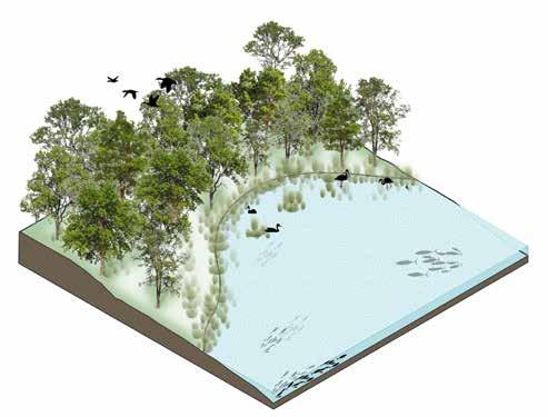
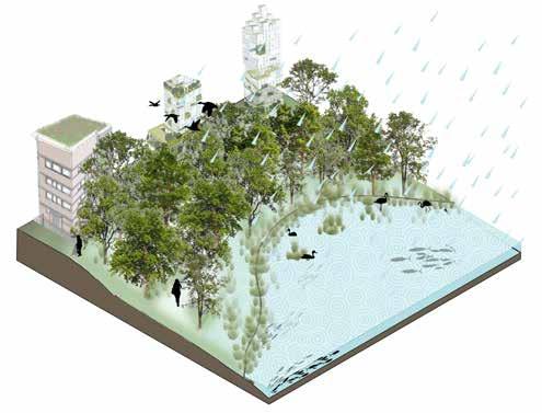
BUILDING RESILIENT SYSTEM
RESTORING ECOLOGICAL FUNCTIONS
INVOLVING COMMUITY IN PHYTOTECHNOLOGY ACTIVITIES
] ] 01
Biodiversity
Soil
Water
Soft Edge
Water
Riparian Corridor
Urban Area
Walkways

Designing for community
The Community Garden Local residents


Elevated
Access
Observatory
Elevated
Eel
Noel
Outwards
] ] 17
11 12 13 Pedestrian connectivity- Direct from Rotary Park to Scott Park Bike Path
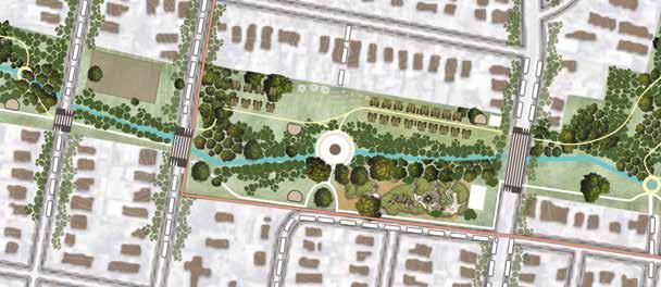
PROGRAM AND DESIGN PLAN
pedestrian crossings - Slow traffic, safe road crossing 16 17 18 19 20 14 15
viewing point + water
change - Access from all pathways
quality
Siefert walking trail
Riparian corridor viewing trail
Pole Lighting
the park
gathering observational deck -
meander into the ecology - Study phytoremediation and creek
gathering, monitor over kids in park Pedestrian
crossings - Study phytoremediation and creek
stop points - Water and Seating N Scale 1 : 2000 2 1 3 4 5 Horse stable - Viewing path
play area for kids - Elements - wood, stone, pathway
Composting
Siefert Park with stones Acess to trail
Pit
Nature
Weed
Noel
points from streets Toilet Phytoremediation garden - community maintained garden
of Native vegetation and phytoremediation - low mainatainance planting
with stone seating - workshops, market
transferable garden bed for community garden 6 7 8 9 10 1 2 3 4 5 6 7 8 9 10 10 10 10 10 10 10 10 10 10 10 10 10 10 11 12 13 13 13 13 13 14 15 15 16 17 18 19
Planting
Muntifunction
Raised

simultaneously restoring and enhancing the wetland’s ecological functions within a timeframe of 20 to 30 years. The research utilizes Susan Herrington’s theories to frame the adoption of phytotechnology in landscape planning for the Rockdale Wetland Corridor, exploring its ecological impact through principles of materiality, interventions, and language.
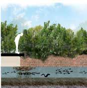
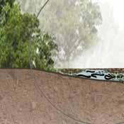


SUCCESSIVE PLANTING STRATEGIES
FOR DRY AND WET
ALTERATION IN THE DESIGN
C limate Pos itive
D es ig n Scor ecar d
Pr oject Na me S ymbi ot i c we t l a nds
Ty pe of pr oject G a rde n
N e t Im p a ct o ve r 5 0 y e a rs -
AQUISITION STRATEGIES CONTINVGENT OVER SEA LEVEL RISE
- Since the project has a significant area of lawn making it no - mow might bring in a significant change.
Tot al M at er i a Em i s s i ons ( Em bodi ed Car bon)
Tot al Pl ant S eques t r at i on
Tot al O per at onal Em s s i ons

per m 2
- Change in play ground material from sand to recycled material.
- Plants to be selected that aids carbon sequenstration to achieve carbon positive faster.
To t a l Ar
Pl ant ed a Em s s ons S eques t r a
Net ect E mis


To t a l Are Pl ant ed ar Em s s ons S eques t r a
Net Pro ject Imp act ect E miss
Law
s hings : 27 6 %
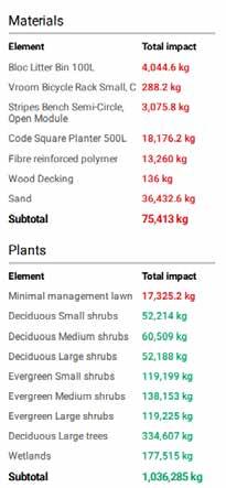
5 yea rs to pos tive C limate Positive D esig n Scor ecar d Pr o ect Na me S ymb oti c we tl a nds Ty pe of pr o ect G a rde n N e t Im p a ct o ve r 5 0 ye a rs -9 4 3 Me t ri c To n s Tot a M at er a Em s s ons ( Em bodi ed Car bon) 75 413 k g CO 2-eq Tot a Pl ant S eques t r at on 1 036 271 k g CO 2-eq Tot a O per at ona Em s s i ons 17 377 k g CO 2-eq To t a l Are a 1 5 0 5 3 5 sq m e t re s 1 5 h e c Pl ant ed a ea 14 500 s q m et r es 10% of o Em s s ons pe ar ea 0 6 k g per m 2 S eques a on per ar ea 6 9 k g per m 2 Net Project Imp act Project E missions 3 0 0 4 0 0 5 0 0 6 0 0 7 0 0 8 0 0 9 0 0 1 0 0 0 1 1 0 0 n D i o x i d e ( t o n n e s C O 2 ) CL M AT E PO S IT IVE - 9 4 3 .5 MT C O NET M PAC T PROJECTSEQUESTRATION Pav ing 53.7 % Lawn Lawn: 18 7 % : 5 yea rs to pos tive imate Positive esig n Scor ecar d Pr oject Na me S ymbi oti c we tl a nds Ty pe of pr oject G a rde n t Im p a ct o ve r 5 0 ye a rs -9 4 3 Me t ri c To n s al M at er i a Em s s i ons ( Em bod ed Car bon) 75 413 k g CO 2-eq al P ant S eques t r at i on 1 036 271 k g CO 2-eq al O per at i ona Em s s i ons 17 377 k g CO 2-eq To t a l Are a 1 5 0 ,5 3 5 sq m e t re s 1 5 h e ct a re s P ant ed ar ea 14 500 s q m et r es 10% of t ot a ar ea Em i s s ons per ar ea 0 6 k g per m 2 S eques t r at on per ar ea 6 9 k g per m 2 et Project Imp act Project E missions 3 0 0 4 0 0 5 0 0 6 0 0 7 0 0 8 0 0 9 0 0 1 0 0 0 1 1 0 0 ( ) CL M AT E PO S IT IVE - 9 4 3 .5 MT C O NET M PAC T PROJECTSEQUESTRATION Pav ng: 53.7 % : Lawn 18 7 % 5 yea rs to pos tive ate Positive g n Scor ecar d Pr oject Na me S ymbi oti c we tl a nds Ty pe of pr oject G a rde n p a ct ve r 5 0 ye a rs -9 4 3 Me t ri c To n s t er i a Em s s i ons Em bod ed Car bon) 75 413 k g CO 2-eq nt S eques t r a on 1 036 271 k g CO 2-eq er at i ona Em s s ons 17 377 k g CO 2-eq To t a l Are a 1 5 0 ,5 3 5 sq m e t re s 1 5 h e ct a re s P ant ed ar ea 14 500 s q m et r es 10% of t ot a ar ea Em i s s ons per ar ea 0 6 k g per m 2 S eques t r at on per ar ea 6 9 k g per m 2 roject Imp act
0 0 0 0 0 0 0 0 0 0 0 0 0 0 0 0 0 0 CL M AT E PO S IT IVE - 9 4 3 .5 MT C O NET M PAC T PROJECTSEQUESTRATION Pav ng: 53.7 % : Lawn 18 7 % 5 yea rs to pos tive ve car d Pr oject Na me S ymbi oti c we tl a nds Ty pe of pr oject G a rde n e a rs -9 4 3 Me t ri c To n s Em bod ed Car bon) 75 413 k g CO 2-eq 1 036 271 k g CO 2-eq ns 17 377 k g CO 2-eq To t a l Are a 1 5 0 ,5 3 5 sq m e t re s 1 5 e ct a re s P ant ed ar ea 14 500 s q m et r es 10% of t ot a ar ea Em i s s ons per ar ea 0 6 k g per m 2 S eques t r at on per ar ea 6 9 k g m 2 ct Project E missions - 9 4 3 .5 MT C O NET M PAC T PROJECTSEQUESTRATION Pav ng: 53.7 % : Lawn 18 7 % 5 yea rs to pos tive C limate Positive D esig n Scor ecar d Pr o ect Na me S ymb oti c we tl a nds Ty pe of pr o ect G a rde n N e t Im p a ct o ve r 5 0 ye a rs -9 4 3 Me t ri n s Tot a M at er a Em s s ons ( Em bodi ed Car bon) 75 413 k g CO 2-eq Tot a Pl ant S eques t r at i on 1 036 271 k g CO 2-eq Tot a O per at Em s s i ons 17 377 k g CO 2-eq To t a l Are a 1 5 0 5 3 5 sq m e t re s 1 5 h e ct a re s Pl ant ed a ea 14 500 s q m et r es 10% of o a ar ea Em s s ons pe ar ea 0 6 k g per m 2 S eques a on pe ar ea 6 9 k g per m 2 Net Project Imp act Project E missions 3 0 0 4 0 0 5 0 0 6 0 0 7 0 0 8 0 0 9 0 0 1 0 0 0 1 1 0 0 n D i o x i d e ( t o n n e s C O 2 ) CL M AT E PO S IT IVE - 9 4 3 .5 MT C O NET M PAC T PROJECTSEQUESTRATION Pav ing 53.7 % Lawn Lawn: 18 7 % : 5 y ea rs to positive e S ymbi ot i c we t l a nds t G a rde n Me t ri c To n s 413 k g CO 2-eq 271 k g CO 2-eq 377 k g CO 2-eq To t a l Are a 1 5 0 ,5 3 5 sq m e t re s 1 5 h e ct a re s Pl ant ed ar ea 14 500 s q m et r es 10% of t ot al ar ea Em i s s i ons per ar ea 0.6 k g per m 2 S eques t r at i on per ar ea 6 9 k g
Pro ject E missio ns
Project E missions
2 0 4 5 2 0 5 0 2 0 5 5 2 0 6 0 2 0 6 5 2 0 7 0
8 0 0 C o n s 5 0 Year L fesp an
C O 2 )
9 4 3 .5 M T C O NET I M PA C T
2 0 0
C a r b o n D i o x i d e ( t o n n e s
-
T C O 2 PROJ E C T E M ISSIONS
PROJECTSEQUESTRATION M
N
o ve r 5 0 y e a rs
e t Im p a ct
-9 Tot al M Car bon) Tot al P 1 Tot al O
2 0 2 5 2 0 3 0 2 0 3 5 2 0 4 0 2 0 4 5 2 0 5 0 2 0 5 5 2 0 6 0 2 0 6 5 2 0 7 0 0 5 0 0 1 1 0 0 C o n stru ct o n C o m p et o n 5 0 Year L fesp an C a r b o n D i o x i d e ( t o n n e s C O 2 ) - 9 4 3 5 M T C O NET I M PA C T PROJECTSEQUESTRATION ONS hings : 27.6 % Law
can transform and adapt to sea level rise while
NATURE PLAY
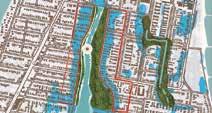
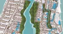
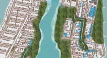
WATCHING POINT SHALLOW GROUND Scale 1 : 1500 9 10 10 13 18 16 17 18 19 20 Eel viewing point + water quality change - Access from all pathways Noel Siefert walking trail Riparian corridor viewing trail Pole Lighting Outwards the park Elevated gathering observational deck - gathering, monitor over kids in park Pit stop points - Water and Seating 15 - Study phytoremediation and creek Observatory crossings - Study phytoremediation and creek (Baeckea N Scale 5500 1 2 40 cm 1 2 3 5 90 cm 1 2 3 140 cm 180 cm GREEN BUFFER RETREAT ROOM FOR THE CREEK REALIGNING LAND 1 2 3 4 5 6 7 Aquatic Bed (Open Water) Shallow Marsh (Emergent) Deep Marsh (Emergent) Wet Meadow (Squishy land) Community Garden Wetland trees Phytoremediation garden 3 2 4 1 5 6 7 Open Water Deep Marsh Shallow Marsh Wet Meadow Tree swamp Shrub swamp Scale 5000 Scale 1 5000 Scale 1 5000 Scale 1 5000 Kamay Warradial Creek Rocky Point road Bado-berong creek N Scale 1 : 3000 ] ] 01
EEL
DESIGN PROGRM IN SECTION AND POSITIVE CLIMATE CHANGE CALCULATIONS
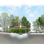










Contigent over 40 - 180cm rise ovewr 200 years


Acquisition Plan
Rescilient to Sea level rise and flooding


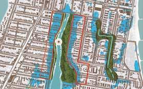


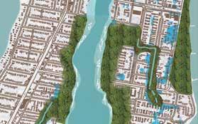


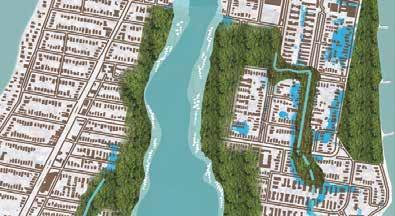
As the creek expands, open space acquisition is done to a widen the riparia corridor. The low density houses are relocated to the area with low risk of being flooded, predominantly the higher grounds.
The low risk precinct is transformed into a hig density area with the inclution of vertical circulation giving space to the blue and green.
1 2 2 3 6 5 3
40 cm 90 cm 140 cm 180 cm Scale 1 : 5000 Scale 1 : 5000 Scale 1 : 5000 Scale 1 : 5000 Kamay Warradial Creek Rocky Point road Bado-berong creek
AQUISITION STRATEGIES CONTINVGENT OVER SEA LEVEL RISE EEL WATCHING POINT Heath myrtle (Baeckea imbricata) 40 cm 2 90 cm 140 cm 180 cm RETREAT ROOM FOR THE CREEK REALIGNING LAND Scale 1 5000 Scale 1 5000 Scale 1 5000 Scale 1 5000 Bado-berong creek AQUISITION STRATEGIES CONTINVGENT OVER SEA LEVEL RISE EEL WATCHING POINT 9 10 13 17 18 19 20 Eel viewing point + water quality change - Access from all pathways Noel Siefert walking trail Riparian corridor viewing trail Pole Lighting Outwards the park Elevated gathering observational deck - gathering, monitor over kids in park Heath myrtle (Baeckea imbricata) 1 40 cm 2 90 cm 140 cm 180 cm GREEN BUFFER RETREAT ROOM FOR THE CREEK REALIGNING LAND Scale 1 5000 Scale 1 5000 Scale 1 5000 Scale 1 5000 Kamay Warradial Creek Rocky Point road Bado-berong creek N Scale 1 3000 AQUISITION STRATEGIES CONTINVGENT OVER SEA LEVEL RISE EEL WATCHING POINT Scale 1 : 1500 9 10 10 13 18 16 17 18 19 20 Eel viewing point + water quality change - Access from all pathways Noel Siefert walking trail Riparian corridor viewing trail Pole Lighting Outwards the park Elevated gathering observational deck - gathering, monitor over kids in park Pit stop points - Water and Seating 12 13 Bike Path Elevated pedestrian crossings - Slow traffic, safe road crossing 14 15 Pedestrian meander into the ecology - Study phytoremediation and creek Observatory crossings - Study phytoremediation and creek Heath myrtle (Baeckea imbricata) 1 40 cm 2 90 cm 140 cm 180 cm GREEN BUFFER RETREAT ROOM FOR THE CREEK REALIGNING LAND Scale 1 5000 Scale 1 5000 Scale 1 5000 Scale 1 5000 Kamay Warradial Creek Rocky Point road Bado-berong creek N Scale 1 3000 SecNATURE PLAY AQUISITION STRATEGIES CONTINVGENT OVER SEA LEVEL RISE EEL WATCHING POINT SHALLOW GROUND Scale 1 1500 Plan 3 4 6 7 8 9 10 10 10 13 13 19 Nature play area for kids - Elements - wood, stone, pathway Weed Composting Noel Siefert Park with stones Acess to trail Access points from streets Toilet 6 7 8 9 10 16 17 18 19 20 Eel viewing point + water quality change - Access from all pathways Noel Siefert walking trail Riparian corridor viewing trail Pole Lighting Outwards the park Elevated gathering observational deck - gathering, monitor over kids in park Pit stop points - Water and Seating 11 12 13 Pedestrian connectivity - Direct from Rotary Park to Scott Park Bike Path Elevated pedestrian crossings - Slow traffic, safe road crossing 14 15 Pedestrian meander into the ecology - Study phytoremediation and creek Observatory crossings - Study phytoremediation and creekHeath myrtle (Baeckea imbricata) 40 cm 3 4 90 cm 140 cm 180 cm
BUFFER RETREAT ROOM FOR THE CREEK
LAND Scale 5000 Scale 5000 Scale 5000 Scale 5000 Kamay Warradial Creek Rocky Point road Bado-berong creek N Scale 1 : 3000 ] ] 19 CONTIGENT ACQUISITION PLAN Over 40 - 180cm water level over 200 years
GREEN
REALIGNING
SUCCESSIVE PLANTING STRATEGIES AQUISITION STRATEGIES CONTINVGENT OVER SEA LEVEL RISE
FOR DRY AND WET

3 4 Shallow Marsh (Emergent) Wet Meadow (Squishy land)

Swamp lily (Crinum pedunculatum)

Curly dock (Rumex crispus)

Swamp Banksia (Banksia robur)


Functional traits
- Wetland Stabilization
- Aquatic Habitat
- Polinator
- Phytoremediation
Origin : Endemic Life span : Perennial

Common reed (Phragmites australis)
Functional traits
- Can tolerate both freshwater and saline conditions
- Spreads through underground rhizomes, forming dense stands
- Erosion control
- Phytoremediation
Origin Endemic Life span : 10 years
Functional traits
- Wetland Stabilization
- Polinator - Soil Stabilization
- Cultural Uses: Historically used for food and medicine by indigenous people.
Origin : Endemic Life span : 50 years
Functional traits
- Specialized roots for nutrient uptake in nutrient-poor soils
- Polinator
- Soil Stabilization
- Adaptive to different conditions
- Shrub
Origin : Endemic Life span : 10 -20 years

Bulrush (Typha spp.)
Functional traits
- Both above-water and underwater parts provide habitat.
- Phytoremediation - Soil Stabilization
- Erosion Prevention

- Cultural Uses: Historically used for various purposes by indigenous people.
Origin Endemic Life span : 3 - 4 years

Tall sedge (Carex appressa)
Functional traits
- Habitat creation

estuary margins Endemic more than 100 years

Functional traits
- Habitat creation for migratory and native birds
- Carbon Sink: Stores carbon in its biomass, contributing to carbon sequestration.
- Soil Stabilization
- Grows in seasonally inundated plains and swamps, along estuary margins
- Hydrological Regulation
- Erosion Prevention Endemic more than 100 years
Functional traits

- Flexible stems - bend without breaking, making them resistant to flooding and water currents

1 2 3 4 5 6 7 1
Yellow Water Lily (Nymphaea)
Duckweed (Lemnaceae)
- Phytoremediation for water quality - Soil Stabilization - Adaptive to different conditions like wet and dry Origin Endemic Life span : 10 -20 years Functional traits - Habitat creation for migratory and native birds - Assist in water purification and nutrient cycling for water quality. - Soil Stabilization - Adaptive to different conditions like water logged and saline areas. Endemic more than 100 years Functional traits - Habitat creation for migratory and native birds - Water purification and nutrient cycling for water - Soil Stabilization - Grows in seasonally inundated plains and swamps, along
N 1 5500 1 2 40 cm 1 2 3 6 5 4 90 cm 1 2 3 140 cm 180 cm
REALIGNING
1 2 3 4 5 6 7
Bed (Open Water)
Marsh (Emergent)
Marsh (Emergent) Wet Meadow (Squishy land) Community Garden Wetland trees Phytoremediation garden 3 2 4 1 5 6 7 Open Water Deep Marsh Shallow Marsh Wet Meadow Tree swamp Shrub swamp Rocky ] ] 20
GREEN BUFFER RETREAT ROOM FOR THE CREEK
LAND
Aquatic
Shallow
Deep
PLANTING STRATEGIES


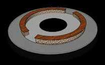
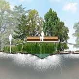

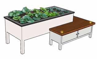

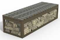


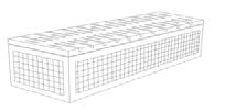

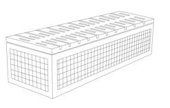
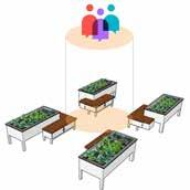
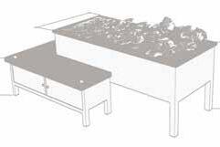

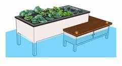
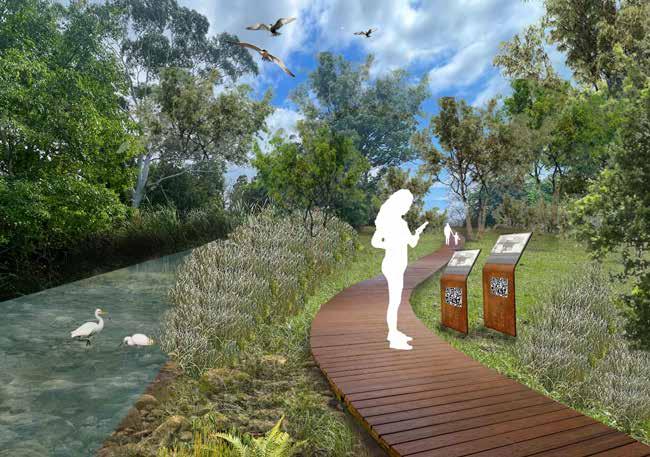
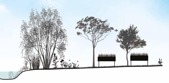
Dry Wet Planter box, seating, Light Observatory crossings Recycled plastic gabion seating Raised Planter box Seating Tool storage Minimal lighting When water level rises the product or the plants are not disturbed and the seating can be used as stepping base in case of emergency or until the planter is permanently moved to a safer location. Design was intented to include wheelchair access to the planter as well as in case of seating where wheelchair can be parked by the side. Inclusive design Inundant scenario Gathering area Crossing bridges When water level rises the obsevatory deck are not disturbed and this element in site stay for longer periods of time. Inundant scenario Recycled plastic Gabion seating River rock Ground Level ] ] 21 CUSTOM FURNITURE INVENTORY
Shallow Marsh (Emergent)
Wet Meadow (Squishy land)


Deep Marsh (Emergent)
Community Garden Phytoremediation garden 6 7
] ] 01
Water Deep Marsh Shallow Marsh Wet Meadow Tree swamp Shrub swamp
SECTIONAL VIEW


1 2 180 cm
REALIGNING LAND
FRAMEWORK ]

THEORIES
1. Meeting Place / Gathering space
2. Water sustainability
3. Walkable streets
PRECEDENT
1. Israel Plads
“Cobe - Israels Plads.” n.d. Www.cobe.dk. https://www.cobe.dk/place/ israels-plads.
2. Karen Blixen Plads
“Cobe - Karen Blixens Plads.” n.d. Www.cobe.dk. Accessed July 11, 2023. https://www.cobe.dk/place/karen-blixens-plads.
3. Cumhuriyet Street Urban Design
https://www.facebook.com/archellocom. n.d. “Cumhuriyet Street Urban Design Project | PDG Mimarlar.” Archello. Accessed July 11, 2023.
https://archello.com/project/cumhuriyet-street-urban-design-project.
POLICY
1. Road Reserve Vegetation in Urban Areas Policy
2. Landscape Protection Policy
3. Council policies
4. Tweed Community Strategic Plan 2017–2027
]
| | |

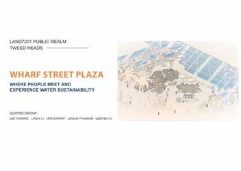
TWEED HEADS MALL

FIRST YEAR PUBLIC REALM PROJECT
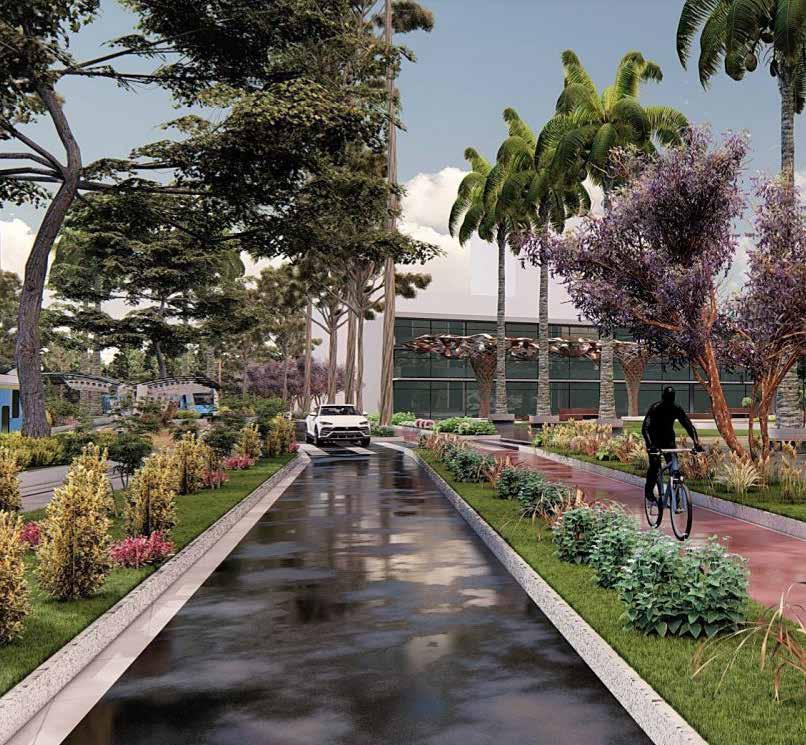
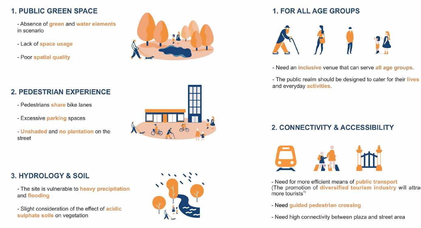
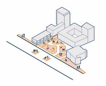
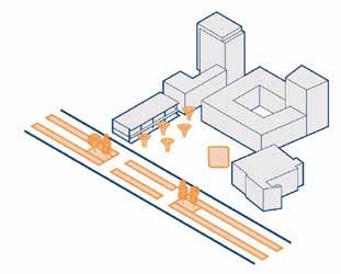
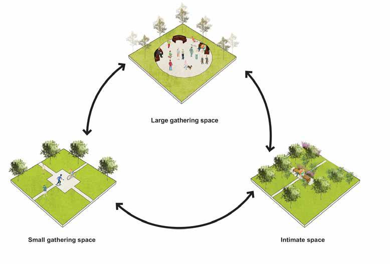
The project’s objective was to redesign the Tweed Mall precinct in Tweed Heads, which held a significant position as a focal point benefiting from its proximity to the Gold Coast Airport, hospitals, residential areas, and the southern part of Tweed Heads connected via Wharf Street. The design concept took into consideration the proposed Tweed light rail, with a primary focus on creating a plaza that would serve as a meeting place for local mall users.The plaza was positioned in front of the mall, and the street in front underwent a redesign to promote walkability and incorporate cycle paths and light rail infrastructure. Additionally, water sustainability was integrated into the design, with provisions to capture, recycle, and reuse water resources.
Project involved various stages like precedent study, site visit, site study and analysis, concept design, master plan development and presentation to the council. Within the group project, my specific contributions included conducting a site analysis, designing the street and plaza, and producing visual renders to showcase the envisioned changes.
] ]
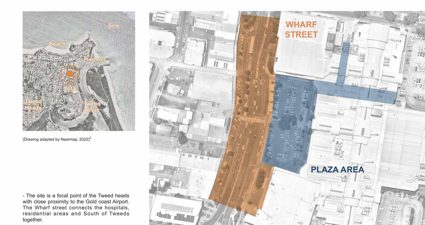
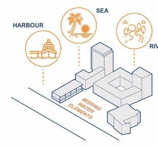
The site in Tweed Heads holds a significant position as a focal point, benefiting from its close proximity to the Gold Coast Airport. It is conveniently connected to hospitals, residential areas, and the southern part of Tweed Heads through Wharf Street. Surrounded by the Tweed River, Jack Evans Harbour, and the Gold Coast beach, the Tweed Mall site enjoys a picturesque location with abundant water sources. The Tweed River, in particular, plays a prominent role as a natural asset in the region. With its central location, accessibility via Wharf Street, and the presence of surrounding water sources, the site in Tweed Heads serves as a notable hub for residents, visitors, and businesses alike.

] 26
INTRODUCTION


ISSUES
PLANING STRATEGIES
REQUIREMENTS
] 27


DESIGN CONCEPTS


] 28


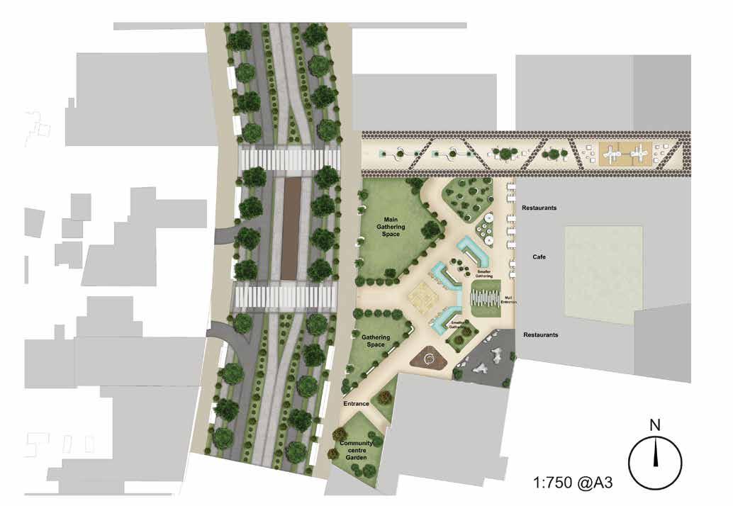

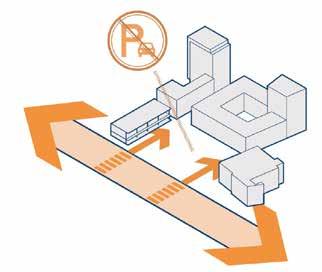
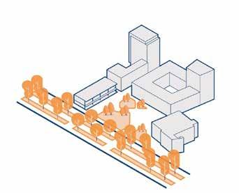
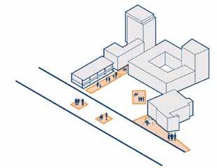
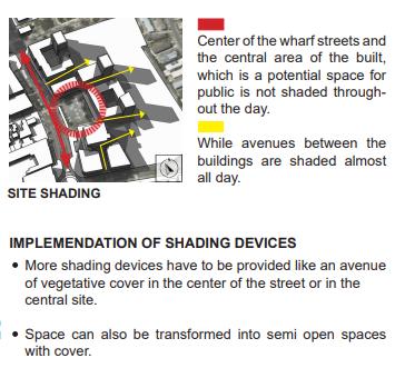
Master plan was developed to have a common meeting point. From the frequent circulation path mapped, commonly used spaces are given function with the needs of the user. Ground floor of the mall opened up to the plaza with restaurent seating provided in the plaza. Design also included water features from the water collected from the design elements during rain. Safe play area is provided for kids using the space with shaded seating for the parents to supervise.
] 29 TWEED PRICINCT PLAN AND SECTION


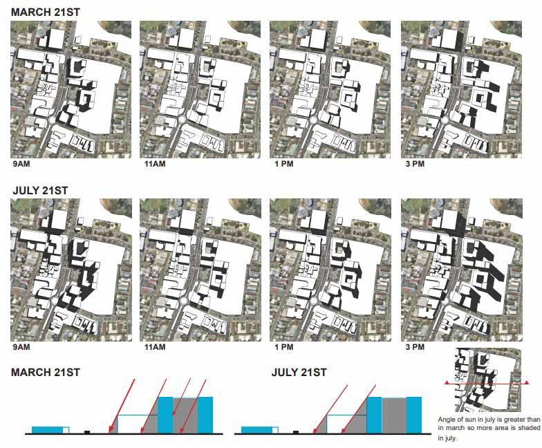
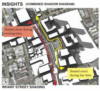
SHADOW ANALYSIS
] 30


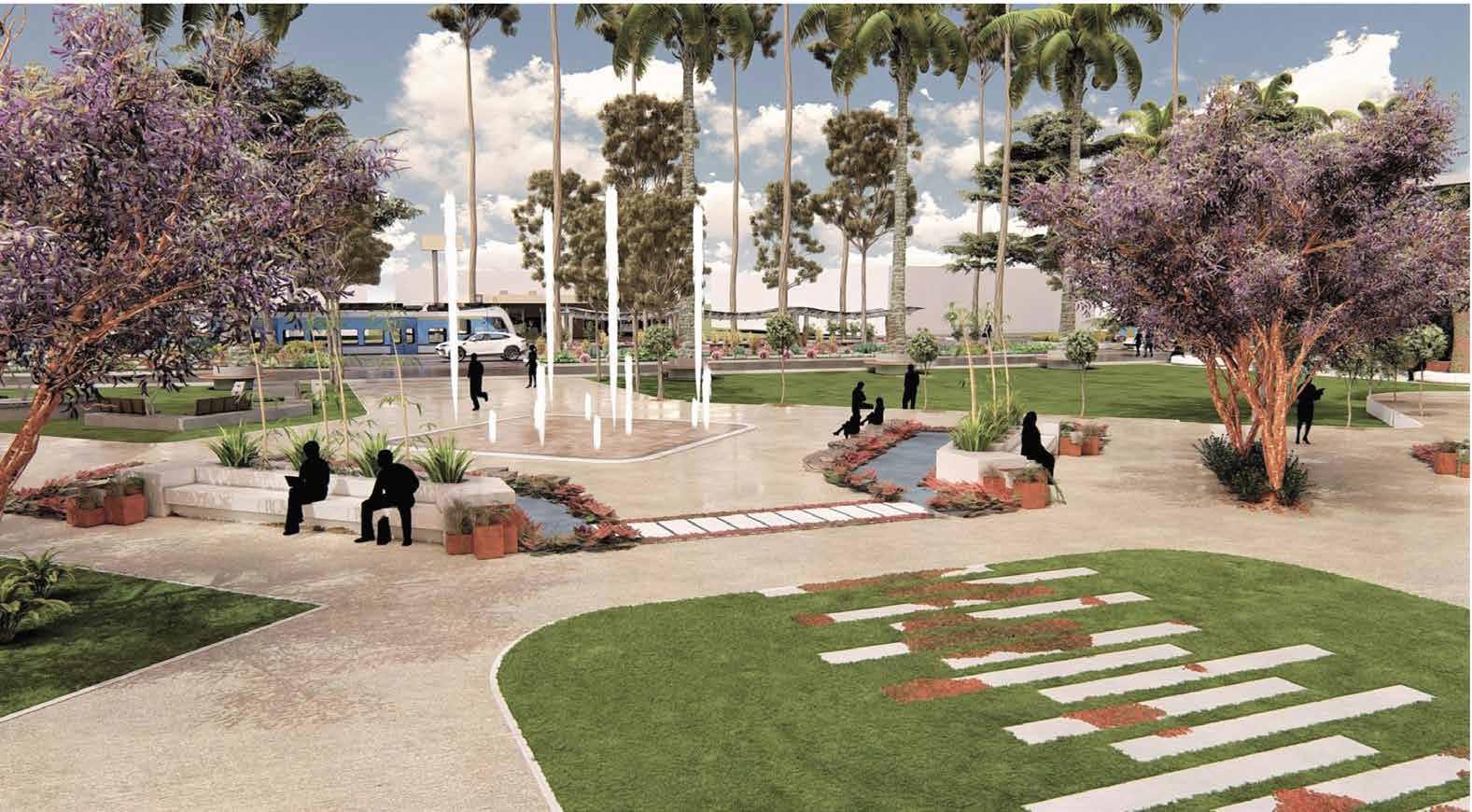
] 31 PLAZA VIEW
Plaza entry space with water feature
FRAMEWORK ]

THEORIES PRECEDENT POLICY
1. Walkable streets
2. Inclusive design
3. Accessible to community
1. Strøget, Copenhagen, Denmark
“Pedestrian Only Streets: Case Study | Stroget, Copenhagen.” n.d. Global Designing Cities Initiative. https://globaldesigningcities.org/publication/global-streetdesign-guide/streets/pedestrian-priority-spaces/pedestrian-only-streets/pedestrian-streets-case-study-stroget-copenhagen/.
2. Birch Street tactical plaza
“Birch Street Tactical Plaza.” n.d. CSC. Accessed January 31, 2024. https://www. civicspacecollaborative.com/birch-street-tactical-plaza.
3. Israel Plads
“Israels Plads Square / Cobe + Sweco Architects.” 2017. ArchDaily. September 27, 2017. https://www.archdaily.com/880388/israels-plads-square-cobe.
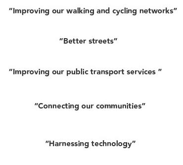
1. Movemenrt and place strategy by the Coffs council
2. City of Sydney
3. Coffs Harbour Local Environmental Plan (LEP)
4. Coffs Harbour Sustainable Transport Strategy
]
| | |

COFFS HARBOUR STREET DESIGN

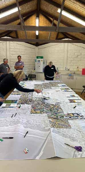
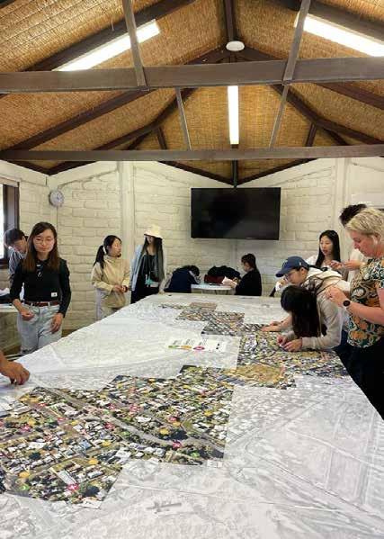
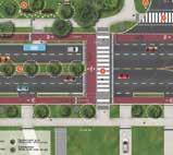
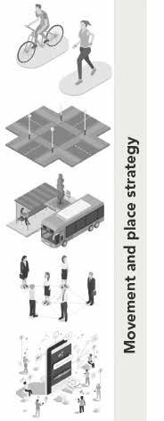
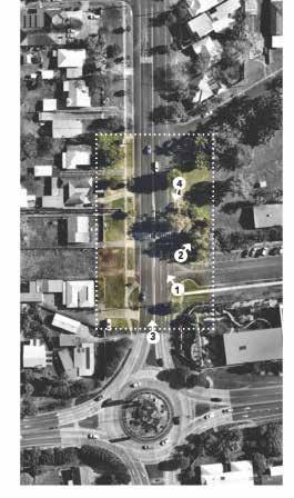
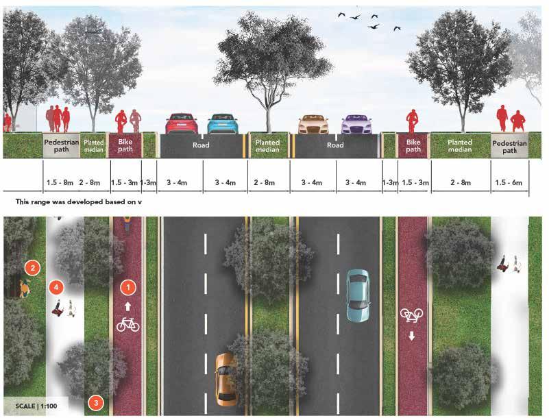
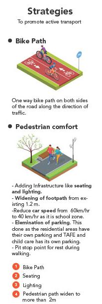
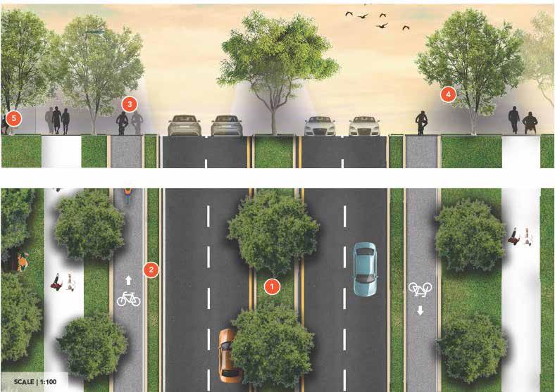
The project in Coffs Harbour aimed to transform the streets into pedestrian-friendly spaces, encouraging active transport instead of relying heavily on cars. This transformation involved a comprehensive process that included gathering and analyzing data using multiple online tools. Additionally, a crucial aspect was the five-day on-site visit, which encompassed engaging with local residents and stakeholders through a community workshop. This collaborative effort was pivotal in understanding the community’s needs and concerns. Subsequently, the project focused on meticulous street redesign, incorporating active transport strategies, planting initiatives, and implementing safe crossings. These measures were carefully crafted to initiate immediate changes while also considering the anticipated developments over the next 15 years.
]


INTRODUCTION ] 34


ACTIVE TRANSPORT STRATEGIES AND TYPICAL PLAN
ACTIVE TRANSPORT
] 35


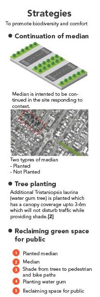
PLANTING
] 36
PLANTING STRATEGIES AND TYPICAL PLAN


SAFE CROSSING STRATEGIES AND TYPICAL PLAN
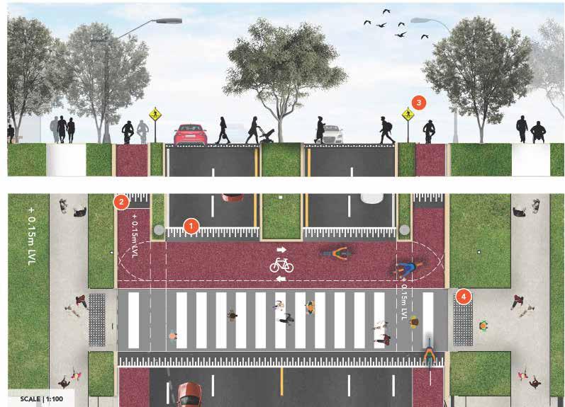
SAFE CROSSING
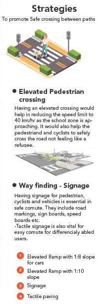
] 37


PROPOSED HARBOUR DRIVE DESIGN PLAN
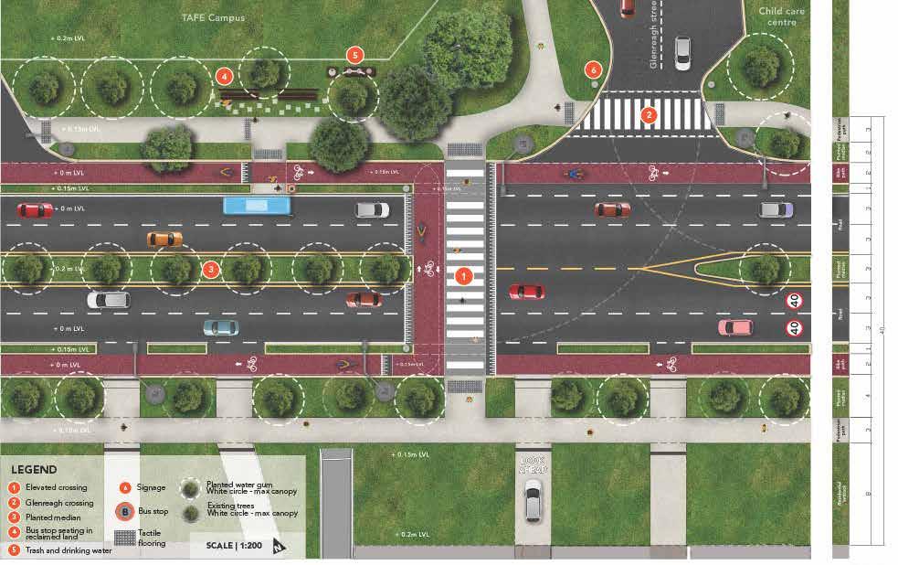
] 38


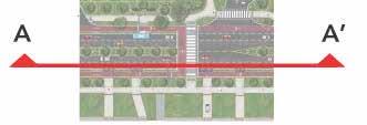
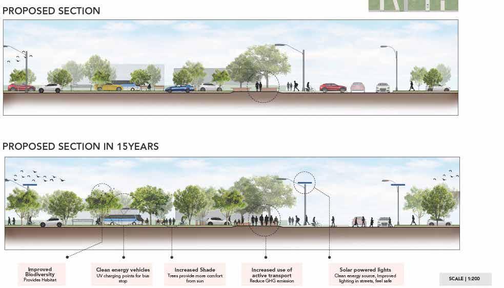
PROPOSED HARBOUR DRIVE DESIGN SECTIONS
] 39
FRAMEWORK ]

THEORIES
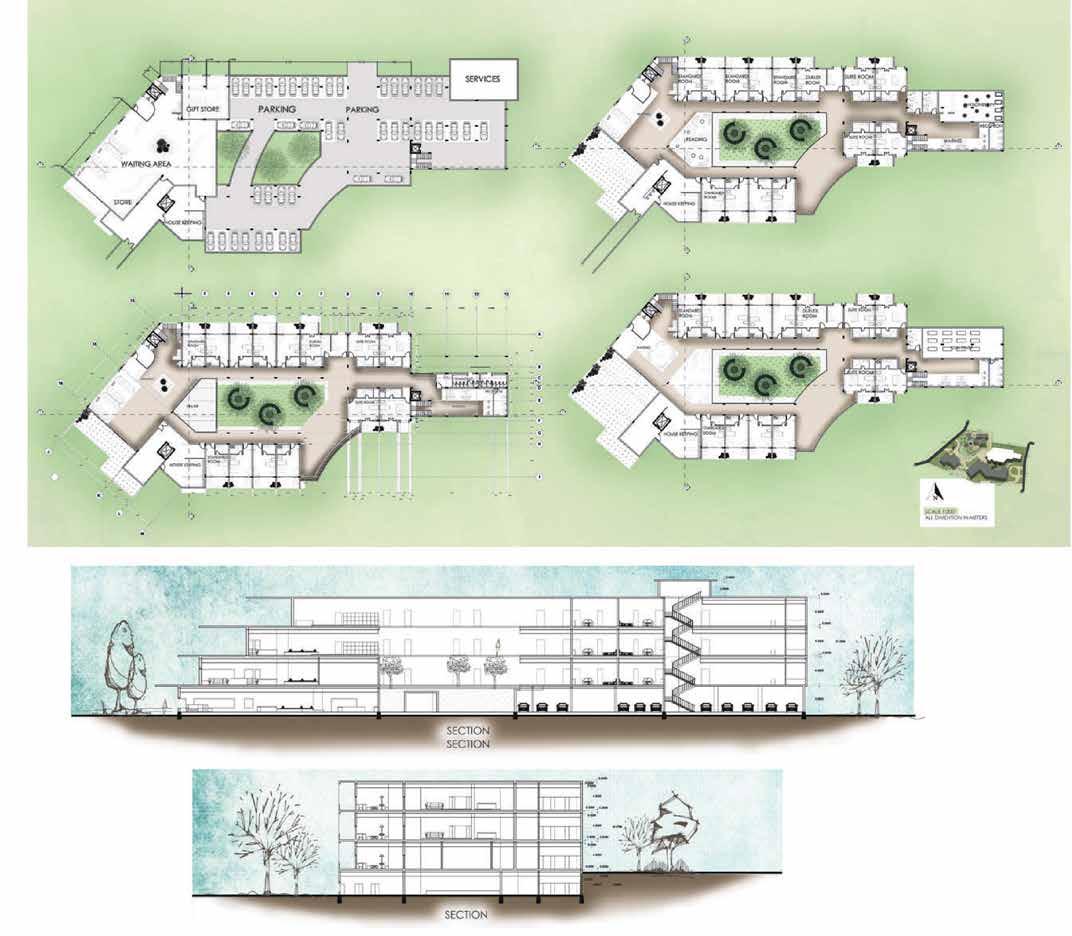
1. Functional spaces
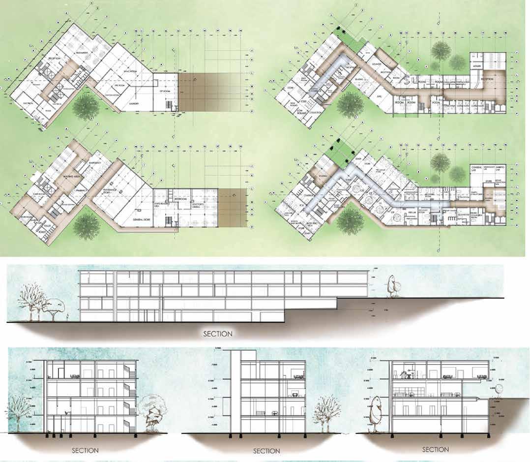
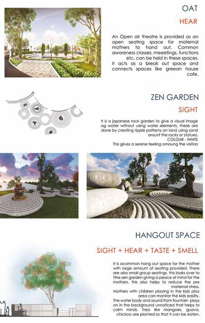
2. Sensory garden
3. Services
PRECEDENT POLICY
1. Woldya Maternity Center / Vilalta Architects
“Woldya Maternity Center / Vilalta Architects.” 2013. ArchDaily. April 7, 2013. https://www.archdaily.com/353892/woldya-maternity-center-xavier-vilalta-architects?ad_source=search&ad_medium=projects_tab.
2. Magneten Sensory Garden
“Magneten Sensory Garden by MASU Planning.” 2019. Landscape Architecture Platform | Landezine. July 3, 2019. https://landezine.com/magneten-sensory-garden-by-masu-planning/.
3. Sensational Garden / Nábito Architects
“Sensational Garden / Nabito Architects and Partners.” 2011. ArchDaily. August 4, 2011. https://www.archdaily.com/156186/sensational-garden-nabito-architects-and-partners.
1. Kerala muncipal building rules (KMBR)
2. Hospital building rules and workflow
3. National Building Code (NBC)
4. Handbook of Landscapes (CPWD)
]
| | |

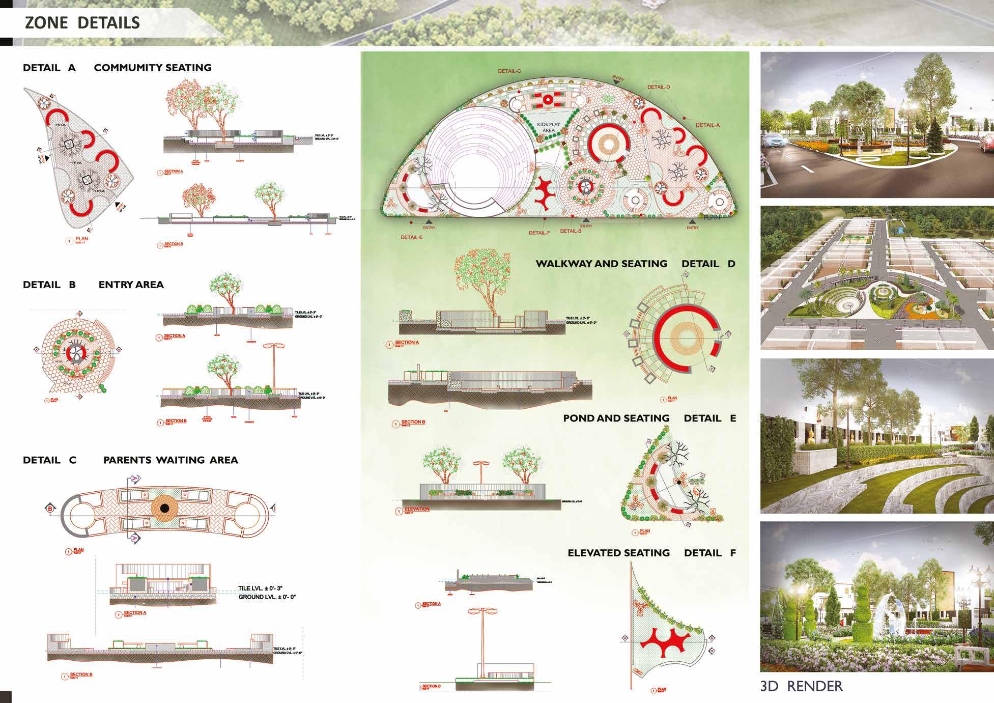
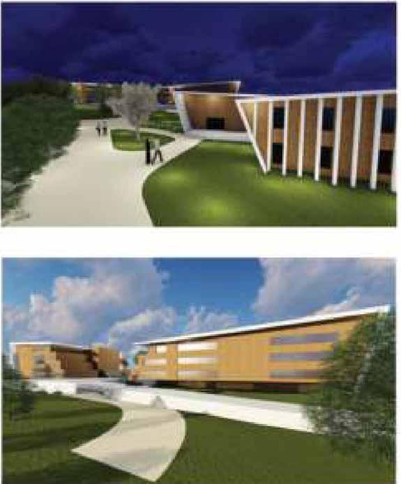
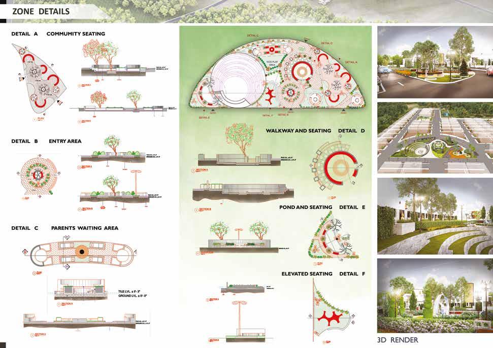
The Vivasv Placida apartment complex in Bangalore features a beautiful garden at its center. This garden is like a peaceful escape for residents, offering a calm space away from the busyness of daily life. Connected to all parts of the complex, it brings people together and encourages interaction among neighbors. The garden has different seating areas where residents can relax privately, along with a special outdoor theater and informal spots for community gatherings. Vivasv Placida isn’t just a garden – it’s a place designed for everyone to enjoy, fostering a strong sense of community in the heart of Bangalore.

]
DESIGN CONCEPT AND PLAN

DESIGN DETAILS AND VIEWS


DESIGN DETAILS AND VIEWS

HEALING SENSORY GARDEN DESIGN

FRAMEWORK ]

THEORIES
1. Meeting Place
2. Meditation garden
3. Open air theatre
1. Hyperlane Linear Sky Park
“Hyperlane Linear Sky Park / ASPECT Studios.” 2020. ArchDaily. July 22, 2020. https://www.archdaily.com/944000/hyperlane-aspect-studios.
2. White Arbor and Open Air Theater / APL design workshop
“White Arbor and Open Air Theater / APL Design Workshop.” 2020. ArchDaily. March 18, 2020. https://www.archdaily.com/935774/white-arbor-and-open-airtheater-apl-design-workshop.
3. Sensational Garden / Nábito Architects
“Sensational Garden / Nabito Architects and Partners.” 2011. ArchDaily. August 4, 2011. https://www.archdaily.com/156186/sensational-garden-nabito-architects-and-partners.
1. Bangalore Development Authority (BDA) Regulations
2. Local Municipal Corporation Bylaws
3. National Building Code (NBC)
4. Tree Preservation and Urban Forestry Policiesv
]
| | |
PRECEDENT POLICY
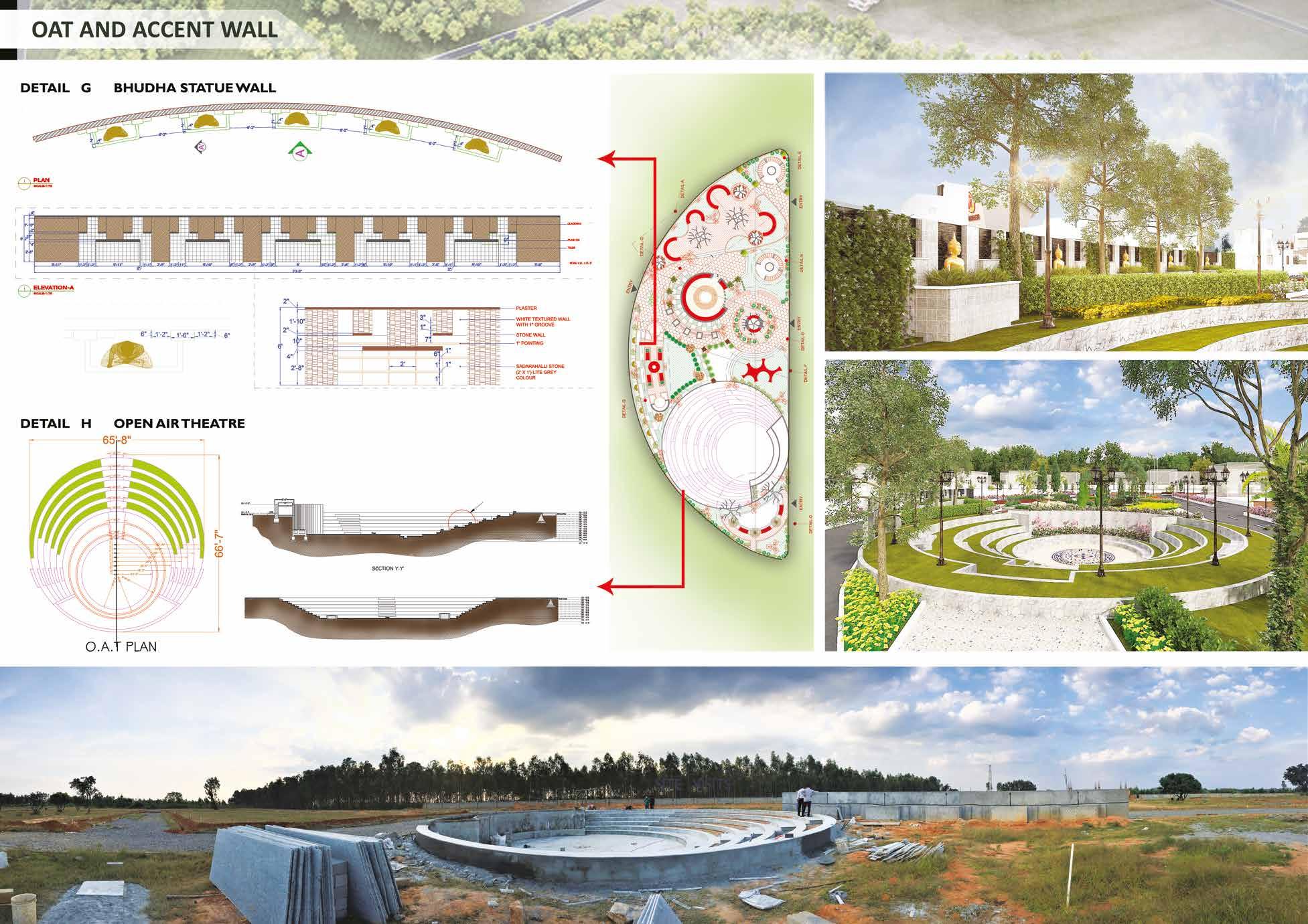

DESIGN CONCEPT AND PLAN


DESIGN DETAILS AND VIEWS


DESIGN DETAILS AND VIEWS


