7 minute read
Cudwell Meadow - an unusual plant community for South Shropshire
Mike Carter
World’s End Wetlands, Church Stretton
Advertisement
Church Stretton lies at the headwaters of Town Brook and Cound Brook. While only 500m apart, Cound Brook flows north through Coppice Leasowes Nature Reserve to join the River Severn at Cound, while Town Brook flows south to join the Onny and Teme, eventually joining the Severn at Worcester. Look at the OS map, or a satellite photo, of the Church Stretton valley and you will see an unbuilton patch just south of the town. These are known locally as the Stretton or World’s End Wetlands. This is 11 hectares of ancient wetlands fed by two catchments; to the west the immediate valley sides of the Long Mynd, to the east, the slopes of Ragleth Hill. In the middle of the valley lies the flat-topped Brockhurst Hill rising about 50m above the present valley floor. It looks like a glacial drumlin, but rather it is Longmyndian shale left isolated as meltwaters carved southwards through weaker strata. About 13,000 years ago a small glacial lake formed behind Brockhurst Hill and moraine debris. The lake in time silted and became a raised peat bog which through vegetation succession and human activity developed into the mixed habitats indicated on the 1840 tithe map: eel pools,
Figure 1: World’s End Wetlands; Cudwell Meadow circled. wet meadows and alder wet woodland. British Geological Society records of boreholes sunk in 1961 indicate, in places, peat deposits of up to 4m in depth. The advent of the Shrewsbury to Hereford railway in 1845 to the east of the wetlands required several drainage ditches across the valley to speed the flow of water down to the Onny. Old photos from the late 19th, early 20th century suggest the wetlands had dried and become reasonable pasture. However in recent decades the ditches have silted up and blocked, with the area reverting to wetlands that regularly flood, to marshy grassland, rush meadow, swamp, and willow and alder scrub. These habitats are home to Water Vole, visiting Otter, many interesting species of invertebrate and amphibian and occasional water birds, including Snipe, Kingfisher, Little Egret, Grey Wagtail and a range of resident and migratory songbirds and raptors. The 11ha of wetlands are divided into a number of small fields belonging to 5 different landowners (see Figure 1). The Strettons Area Community Wildlife Group carried out flora and fauna surveys in 2016 coordinated by the Shropshire Wildlife Trust. This resulted in half the wetlands area (Fields 6 and 9) being designated a Local Wildlife Site. In 2017 the Strettons Wetlands Interest Group (SWIG) together with Shropshire Council built a boardwalk across the valley.
Cudwell Meadow (Grid Ref: SO449932)
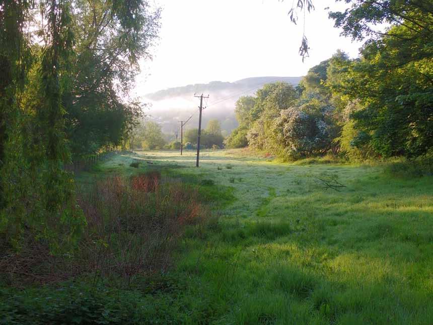
One field (Field 5) of about 1ha came up for sale early in 2020. SWIG joined with the Middle Marches Community Land Trust to launch an appeal to purchase the field. The appeal was successful in spite of covid lockdown, and purchase was completed late 2020. The field, known only as The Meadow on the tithe map, was renamed Cudwell Meadow after a spring higher on the Long Mynd which drains into the field. The field is a meadow by name only. For many years it has been seasonally grazed by sheep. Town (aka Quinny) Brook runs along the north edge of the field. In recent years to reduce flood risk to local properties,
the Environment Agency (EA) has annually excavated the brook, desilting, deepening and significantly widening its profile. This work has been done from the field side with the result that a vegetated bund has developed from the spoil. The brook water level, particularly when in spate, can be at or above the level of the field. At one point near the west end of the field overhanging branches of willow trees have restricted access for the EA excavator with the result that no bund has formed and the brook regularly overflows at this point into Cudwell Meadow. In addition during periods of high rainfall the wetlands to the east drain into the meadow. As a result much of the field is regularly inundated, parts for more than 6 months a year, other parts for 3 months. Land level contours vary across the field by only about 3 metres; nevertheless these contours are highly significant when it comes to inundation and plant community types. For the past decade at least, the field has been let for sheep grazing most months of the year. Prior to that, we are told by local residents, the field was sometimes used for grazing and stabling ponies.
Vegetation survey findings
The former landowner gave permission for bio surveys to be carried out during summer 2020. Preliminary visits were made in early summer to look for spring ephemerals and to roughly map the vegetation. Most of the surveying was carried out on 7th July. Species were recorded and data from forty nine 1m2 quadrats were collected. Quadrat data were analysed using the software programme MAVIS (Modular Analysis of Vegetation Information System), to determine community types within the National Vegetation Classification (NVC) system.
a) Diversity
145 vascular plant species were recorded in Cudwell Meadow. Species recorded included six Shropshire axiophytes: i) Prickly Sedge Carex muricata ssp. pairae; rare in the meadow ii) Bluebell Hyacinthoides non-scripta; occasional iii) Yellow Archangel Lamiastrum galeobdolon; occasional iv) Changing Forget-me-not Myosotis discolor; rare v) Creeping Forget-me-not Myosotis secunda; frequent vi) Marsh Speedwell Veronica scutellata; occasional. 145 species is an encouraging number for a field of less than a hectare. This probably reflects two main factors: i) Management in recent decades. The field has not, so far as is known, been cultivated, resown or received artificial fertiliser for several decades. ii) Inundation. Different parts of the field spend between 0–12 months under water and diversity is enhanced by this spectrum of conditions.

b) Plant Communities
Plant community stands clearly relate strongly to contour and inundation; the depth and duration of flooding, especially in the spring.
MG5 Cynosurus cristatus-Centaurea nigra grassland MG6 Lolium perenne-Cynosurus cristatus grassland MG10 Holcus lanatus-Juncus effusus rush-pasture OV28 Agrostis stolonifera-Ranunculus repens community OV28a Agrostis stolonifera-Ranunculus repens community, Persicaria hydropiper-Rorippa sylvestris sub-community OV29 Alopecurus geniculatus-Rorippa palustris community S22 Glyceria fluitans water-margin vegetation
Some communities, in particular OV28 and OV29 are not common in South Shropshire. These open vegetation communities can be important as grazing marshes for wintering wildfowl and waders in the spring. The biodiversity value of the field is such that Local Wildlife Site status has been applied for. Two adjacent fields in the Worlds End Wetlands were awarded LWS designation in 2017. At the time, Cudwell Meadow was not surveyed in detail.
Management Issues
This survey will help inform the Management Plan for Cudwell Meadow. Some issues for the Management Team to consider include:
1) Control inundation?
Currently water ingress is uncontrolled; when the brook overflows it floods the meadow. There is a case for increasing the amount and duration of inundation from Town Brook. This would offer offline floodwater storage and help reduce peak flow, so would reduce flood risk to nearby houses. Some form of sluice could be installed. Since the brook is classified as a ‘main river’, the Management Team is in discussion with the Environment Agency regarding this and other flood risk mitigation options.
2) Excavate scrapes or ponds?
There are substantial sewage and storm drain pipes under Cudwell Meadow so it is unlikely that excavation of scrapes or ponds is possible. However this may be feasible in other areas of the World’s End Wetlands.
3) Meadow or pasture?
Is it best managed as meadow (i.e. excluding livestock in spring and early summer to make hay) or as pasture? In recent decades the field has been managed as pasture grazed by sheep. It is this management that has led to the current diversity, so there is a case for continuing with the same. On the other hand some areas are relatively species-poor, in particular MG10 and the woodland margin mostly covered in bracken. The Management Team has decided to make hay in some areas to improve, vegetation diversity and communities.
4) Grazing which livestock, at what stocking density and when?
For the next few years at least, the intention is for sheep to graze the aftermath following haymaking. The Management Team will assess other options

(Mike Carter)

Cudwell Meadow (Mike Carter)
e.g. of young conservation breed store cattle. It is important that stock are removed as soon as the ground becomes inundated and becomes poached. Flooding can happen suddenly even in the summer and getting a stock owner to remove animals quickly may be an issue.
5) Aliens and ‘weeds’?
What, if anything, to do about ‘weeds’? E.g. nettles, bracken, docks and ragwort. This is an on-going debate in conservation. Most important is the alien New Zealand Pigmyweed Crassula helmsii. This is present in an area of about 300 sqm in total. Eradication is probably impossible. It needs monitoring and experimenting, for example, by altering the grazing regime.
References
Toghill, P. (2006) The Geology of Shropshire, Crowood Press (2nd Ed) p248 British Geological Society borehole records http://mapapps2.bgs.ac.uk/geoindex/home.html Accessed January 2021 Centre for Ecology and Hydrology, (2015). Modular Analysis of Vegetation Information System (MAVIS). Online at: http://www.ceh.ac.uk/ services/modular-analysis-vegetation-informationsystem-mavis Accessed July 2020 Lockton, A.J. and Whild, S.J. (2015) The Flora and Vegetation of Shropshire. Shropshire Botanical Society


