SIRADA LEEVANIJKUL LANDSCAPE ARCHITECTURE ACADEMIC + PROFESSIONAL PORTFOLIO

Academic Projects
01-20 01 31-40 03 The garden by P landscape Nanjing Hexi Andaz Hotel
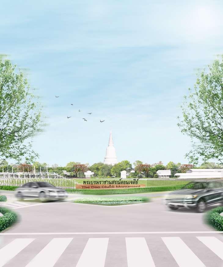
Study and Proposed Landscape Developement of Don Chedi Monument King Naresuan The Great
3rd year Studio Project, 2018 P Landscape Co., Ltd., 2021 P Landscape Co., Ltd., 2022
B.L.A Thesis Project, 2019 NAVANAKORN INDUSTRIAL ZONE: Water Link Life 21-30 02 41-50 04 51-56 05
Other works
Landscape area: 376 rai (148.6 acre)
Position: Landscape Architecture Student 4th Year Academic Thesis (Individual Project)
Adivisor: Assoc. Prof. Vipakorn Thumwimol (Vipakorn.T@chula.ac.th)
In 2019, the fine arts department had a development plan to renovate the Don Chedi monument to become the national monument of Thailand. The site was formerly a battlefield in the Yuttahattee war, the most memorable battle in the history of Thailand. This war was a royal duel on the elephant’s back, King Naresuan the Greats of Siam, whose victory over Mingyi Swa of Burma and enshrined relics of Yuttahattee pagoda to be an honor and representative of the victory and freedom of the Siamese people. Even then, the pagoda and the site were abandoned for more than 600 years until King Rama IX renovated the pagoda to become the Don Chedi monument. The site is now located in the center of the Don Chedi district of Suphan Buri.
This thesis studies and examines the cultural heritage conservation and development that is consistent with the current situation and preserves the intrinsic value of history. The project’s challenges are to seek strategies concurrently with the public and government in an urban context to prepare for future development and to renovate the master plan of the Don chedi monument, designated to be the new national archaeolog ical site for historical learning places. In addition, educators will encourage the acquisition of independence and appreciate Thai ancestors’ sacrifices.
“A large tree can stand against the storm only with deep and strong roots. Unless, we take good care of our roots, how will we survive?”
Scope area: Learning center


Scope area: Future plan developement of Donchedi district

Scope area: 376 rai conservative area by The fine arts department
Suphanburi used to be city barrier and route for attack Burmese army. (Myanmar)


18 Jan 1592,The battle of Yutthahatthi(Elephant duel) was fought. Ayotthaya army (King Naresuan the Great), the conqueror of Burmese army (King of Ava)

25 Jan 1592, King Naresuan the Great order army build pagoda of Yutthahatthi to represent triumph


In this period, the area became abandone and pagoda deteriorate.

Located of Pagoda

In King Rama VI, Damrong Rajanubhab found Yutthahat thi Pagoda and reconstruction. Nevertheless, this project didn’t finish

Yutthahatthi pagoda enrolled by The fine arts department
In King Rama V, appointed team construction Don Chedi monument to continued renovation process, connected route and set boundary to become Don Chedi Memorial
King Rama V went to grand opening Don Chedi memorial
Designed and sculptural by Silpa bhirasri (National Artist).
Original Pagoda from sketching
Abandoned Pagoda
Fine art departments designed pagoda differnce from original, because their lack of evidence to cover original.
Thai goverment selected, 18 Jan is the day to commemorate King Naresuan the Great and the victory of Yutthahatthi battle


Since 1952, Don chedi has finished renovation. This memorial becomes the city-centric of Suphanburi. Many people began to immigrate to live in the me morial site or surrounding, making this memorial a living monument and a cultural center for the community. Unfortunately, the role of the area changed from time to time to serve people’s activities, and usability, including the proj ect renovation since 1952, was not concerned about city expansion in the future that make valuable a site and monumental in terms of physical, activity, and meaning of national treasure at present be destroyed during the time

Street No.3264
Street No.3038
Street No.322

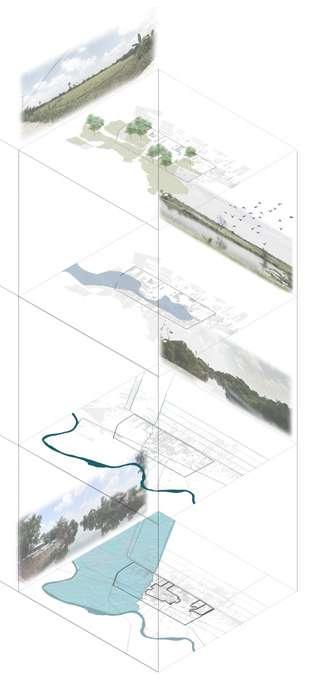
The overall concept of ‘Past meets the future city‘ is initiated for the conservation identity and value of the battlefield of Yuttahattee site along with the development of Amphor Don chedi to be a city-centric in a sustainable way. The vision is the estimated possibility of a potential route for building the sequence of approaches together with considering the beauty of the Yuttahattee pagoda, which is mainly a landmark of the city. This vision can be divided into three projects; Route connected Nong Sarai Historical Park project, Area and building heigh controlling projects, and the Traffic and Visual improvement project. This has led to the site and monument archaeological study on the urban scale of this compound.

 Route Connected High controlling area Traffic and visual improvement
Buend Nong Sarai historical site King Naresuan army area
Tha Khoi canel
Route Connected High controlling area Traffic and visual improvement
Buend Nong Sarai historical site King Naresuan army area
Tha Khoi canel


+
Stadium


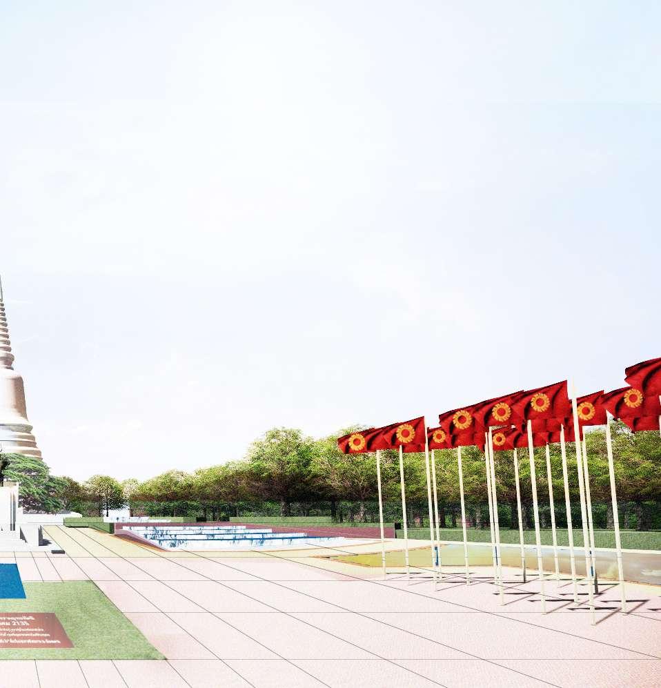
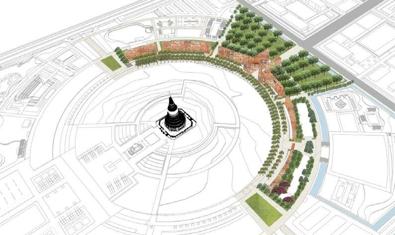
The Donchedi monument is designed to be dedicated to the celebration and to honor King Naresuan, the great who is a Thai national hero in the period of the Ayutthaya Kingdom. The foundation of the layout follows the structure plan of the Fine Arts Department in 1950 but still responds to the conservation area principles. The masterplan design concerns the pres ent function of the site and maintains the value of a national historic site. In the process of design, the metaphor of meaning is integrated and symbolically in the philosophy and situ ation ways in each landscape element. Visitors can learn in the museum pagoda and walk through the terrace of the pagoda to see the panorama view. The surrounding is designed for the learner to learn by themselves in outdoor museum areas. Furthermore, all around the site have facilities and recreation areas for serving people’s activities.

The layout follows the principle of the conservation area and plans in 1950 by Fine Arts Department.


King Naresuan the great stuck in the circle of enermy
Water is represented happiness and peace of independence
Celebration of independence
Design and layout planning by Fine Arts Department 1950Main Road Emergency Route

1 2 3 4 5 6 7 8
This site has a national archaeological monument that situated in the urban context that has valuable of tangible and intangible way
This site has a national archaeological monument of tangible and intangible way
This site has a national archaeological monument that situated in the urban context that has valuable of tangible and intangible way
Goverment Agency Hospital Temple Floating market
Coserrvation area Recreation area
The arrangement of circulation helps decrease traffic jams.
The arrangement of circulation helps decrease traffic jams.
The arrangement of circulation helps decrease traffic jams.
The learning route helps guide tourists and leaner to encourage them to learn by themselves
The learning route helps guide tourists and leaner to encourage them to learn by themselves
The learning route helps guide tourists and leaner to encourage them to learn by themselves
Building and zoning are placed by potential accessibility, behavior analysis and solve a tuft community problem to achieve the most effective function and space.
Building and zoning are placed by potential accessibili ty, behavior analysis and solve a tuft community prob lem to achieve the most effective function and space.

Building and zoning are placed by potential accessibility, behavior analysis and solve a tuft community problem to achieve the most effective function and space.


Retention Landscape
Green Learning Historical Conservation area Green street Main Pedestrain loop Parking lots
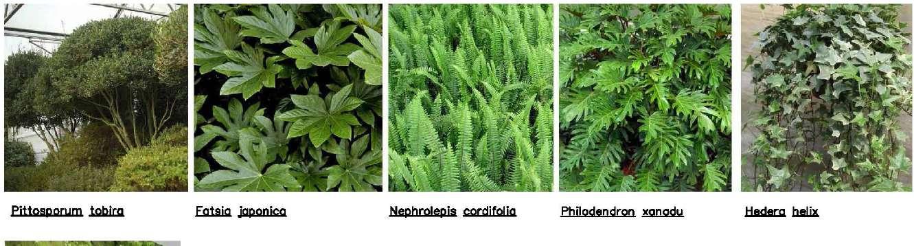
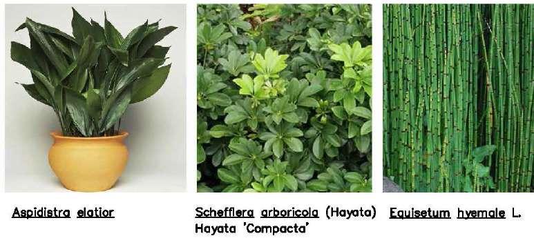
Selection plants in this site are connected to significant plant in Yutthahatti war chronicle, while respect native plants and existing tree
Selection plants in this site are connected to significant plant in Yutthahatti war chronicle, while respect native plants and existing tree to achieve the most effective function and space.
Selection plants in this site are connected to significant plant in Yutthahatti war chronicle, while respect native plants and existing tree
Natural slope Natural slope HP +17.50
The facility serves as a historical site, the center of the city, and recreation area
The facility serves as a historical site, the center of the city, and recreation area to achieve the most effective function and space.
The facility serves as a historical site, the center of the city, and recreation area
The landform of the site is vital to preserving because it is indicated to an icon and give meaning to located Yutthahatti pagoda
The landform of the site is vital to preserving because it is indicated to an icon and give meaning to located Yutthahatti pagoda
The landform of the site is vital to preserving because it is indicated to an icon and give meaning to located Yutthahatti pagoda
Design reserving water from site existing concerning and natural slope in the middle of the site to help flowing drainage and saving water for aesthetic protective fence and recreational activities
Design reserving water from site existing concerning and natural slope in the middle of the site to help flowing drainage and saving water for aesthetic protective fence and recreational activities
Design reserving water from site existing concerning and natural slope in the middle of the site to help flowing drainage and saving water for aesthetic protective fence and recreational activities to achieve the most effective function and space.
Sub pedestrian route Main pedestrian route Building usage Main road Parking lots
During the festival, events organizer have to collaborate with local people to a created policy of using the area and transportation in Don Chedi monument for easily management and preserve archaeological sites.
During the festival, events organizer have to collaborate with local people to a created policy of using the area and transportation in Don Chedi monument for easily management and preserve archaeological sites.
During the festival, events organizer have to collabo rate with local people to a created policy of using the area and transportation in Don Chedi monument for easily management and preserve archaeological sites.


 People can learn to arrange troops in the Yuttahattee war by themselves through playing the chess army board game.
Interprete surrounding, and environment of the commercial zone became a floating market in Ayothaya period to make people learn about their society and lifestyle.
This Dream park zone has rotation exibition and events throughout the entire year
People can learn to arrange troops in the Yuttahattee war by themselves through playing the chess army board game.
Interprete surrounding, and environment of the commercial zone became a floating market in Ayothaya period to make people learn about their society and lifestyle.
This Dream park zone has rotation exibition and events throughout the entire year
Transition 195m. Buffer 130m. Core 65m.


Don Chedi Monument x= 65m.
 TF
Yuttahattee story wall
Yuttahattee Learning Outdoor zone Learning construction of Don chedi pagoda
TF
Yuttahattee story wall
Yuttahattee Learning Outdoor zone Learning construction of Don chedi pagoda
Transition Areas 195m. (3x)


Buffer Zone 130m. (2x)

(1x)

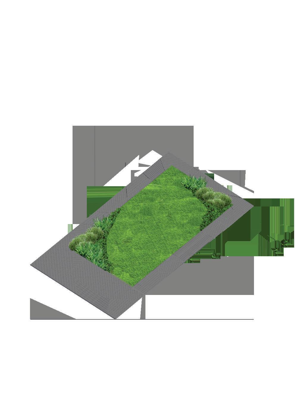
Football field

 Donchedi light and sound festival
Pathum Thani, Thailand
Landscape area: 3,600 rai (1423.3 acre)
Position: Landscape Architecture Student 3rd Year Studio Project (Individual Project)
Adivisor: Assoc. Prof. Asan Suwanarit (asan@ap.tu.ac.th)
From the history of the fertility of wetland ecology, Pathumthani that people live with nature to become the Navanakorn industrial zone and have a policy of expansion city development. It makes people gradually separate from ecology and unaware of place restrictions and how lower the land is compared with the sea level. Therefore, people in this area face the floodplain problem every rainy season and suffer enormous economic losses.
As a result, this project aims to study the procession of ecology analysis by overlay and evaluate layers of ecology factors to find the suitable and unsuitable site selection for development or preservation to retain water to avoid flooding issues. Moreover, the study also focuses on relations in the ecosystem that make people and nature can be associated by considering the existing condition, economic factors, and historic sites under the concept of ‘Water link life.’
Residential and Commercial Area
Industrial area Road Canal 1995 2005 2016 Present

Pathum Thani is Grassland have geogaphy low alluvial flats of the Chao Phraya River that make 60% of land is higher above sea level 1 meter;therefore in rainy season this province get flood
Pathum Thani is the first province to initiate irrigation canal for agriculture in Thailand


The 1950s, Industrial Revolution Agriculture area change to be commercial and industrial area


Avians
Rural and Agricultural zone can collected water in rainy season
City along the klong Community Agriculture
.Freash water pearls, Aquartic animals, Mammals
Insects, Amphibians, Reptiles
Navanakorn construction dykes to prevent flood damage


+1.95 m. The highest flood level +1.80 m. Border canal level
+1.20 m. Average water level
+0.25 m. Lowest water level
m.
Public invasion on the river bank of canal Local people constructed retaining walls to prevent flood but made them wrong. Reference image: Thairath newsEcological factor
Ranking Criteria
Incidence (Max Min)
Ecological associations value area

Ecological factor
Ranking Criteria
Urbanizaton developement area
Ecological factor
Max Best Most Min Poorest Least Climate, Geology, Hydrology, Landused Hydrology, Vegetation, Wildlife,

The City’s Transit Expansion Projects 2020, Transportation, Landused
Ranking Criteria

Develpement (Most Least) Quality (Best Poorest)
Floodplain Wetland Ecosystems Bts skytrain Transit system line extension


Floodplain with Canals


Urban with drainage
Partly natural area Canal ecosystem

City development surrounding TOD Node (Transportaion and facility) Area links to train station
City and abandon area

ๅResidential zone more compact
Catchment area


Turning abandoned areas into serving function
Government have policy to connected transportation of The Red Line metro system

City development impacts valuable wetland areas and people’s lifestyles; thus, the projects try to preserve the district’s nature and culture
Every project of Water Link Life can change urban, people, and nature living together in a sustainable way


Landscape area: 1,280 sq.m. (0.8 rai)
Client: Wannaporn Phornprapha Marketing team: Roots Marketing Stage of work: Project Inception & Initiation-Construction Project team design director: Hathai Rojanasripairot Landscape architect: Sirada Leevanijkul Napassorn Charoentra Anchisa Tirachusak Horticulture Team: Arunee Wongpanasin Praphat Bunchid
The garden by P landscape is the commercial mall located in the Asok business center of Bangkok, which has been impacted by the covid-19 pandemic imposed lockdown inside and outside our country. With this situation, many people encounter food security issues. Adaptation and getting the most out of what we have are necessary for survival; the core concept of a greenery commercial mall in the concrete city can change to a strong point for beginning to depend on ourselves by producing our food. Besides, those yields can turn into a goods product for merchandise and created the workshop of how to grow their food in small space to acknowledge city people to rely on themselves.
My contribution is to conduct a site survey, public participation, and analysis with the marketing team to meet the core need of the ‘New normal‘ situation and work on the designer team in every stage of work to renovate this project to deal with global change.


No connection to community and social media plan
1,155 sq.m2


Very small for community mall sizes

The garden will be a pilot project that inspire others to create more public gardens all over Bangkok and other cities for in creased well-being. Business will growth when economic, so ciety and environment are better. Therefore ‘Better Together‘ is the key for success.
Site located Behind Baan Kampu community mall
The garden connect want to become ple in this district by new green and learning place with a true


 Asok Safty First
Asok’s Cleanest
Asok’s Volunteer
Walking around Asok
Asok green
Asok green
Asok Safty First
Asok Safty First
Asok’s Cleanest
Asok’s Volunteer
Walking around Asok
Asok green
Asok green


The design team can collaborate with the marketing team that proposed CSR(Corporate Social Responsibility) as a marketing strategy plan to respond to the concept of ‘Better together to become a Happy district.’ Using the profit of The garden by P landscape com munity mall to do a better thing to give back to the Asok district in a non-profit creative way but not only activities but also the environment that Plandscape company always stands for. This strategy helps develop a community to be a good living and promotes community mall simultaneously. Hopefully, these projects will be pilots of greenery projects to make the city’s people rethink how important the environment is.


 Asok’s Volunteer
Asok green
Asok Safty First Asok’s Cleanest
Jolly Asok Economy
Asok’s Volunteer
Asok green
Asok Safty First Asok’s Cleanest
Jolly Asok Economy


Landscape area: Floor Level 7 : 1,220 sq.m. (0.76 rai) Floor Level 30 : 290 sq.m. (0.18 rai)
Client: Sun Hung Kai Properties Limited Stage of work: CD(Concept design)-DD(Design Developement) Project team design director: Revaree Nophaket
Hathai Rojanasripairot
Landscape architect: Sheng-Man Lin Avery Martin Myers Peeriya Treesuksiriwatana Sirada Leevanijkul
Horticulture Team: Arunee Wongpanasin Praphat Bunchid
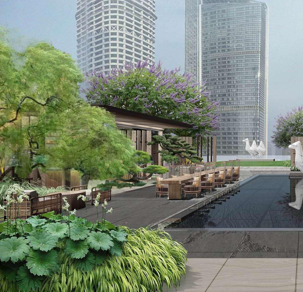
Nanjing Hexi Andaz hotel is a luxurious hotel in CBD area of Nanjing with authentic Nanjing culture and vibrant modern neighborhood character, which blend in unforgettable experiences for the visitor.
In addition, Nanjing Hexi Andaz offers a garden sanctuary where people can enclave a natural en vironment with an evergreen ‘The Noble garden’ on Floor level 7 and a bar and beverage ‘Faculty of arts‘ on Floor 30.
My main contribution to the project was participat ing in both concept design; working on interpretation design to meet the client’s desires and design devel opment; building model study, creating detailed design elements to get along with the overall design to be used within the weekly presentation to clients; involving in every package production and each stage of work as a landsape designer.
Floor Level 30
Bar and Beverage (Semi Outdoor)
Floor Level 7
Rooftop Bar Dinning outdoor with Bar and Lush green
 Photo credit: Sun Hung Kai Properties Limited


 Bar / Kiosk
 Camel Scuplture globle
Bar / Kiosk
Function Lawn
Reflecting Pond
Camel Scuplture globle
Bar / Kiosk
Function Lawn
Reflecting Pond


 Camel Sculture Scuplture Art that reflect warming Problem


Existing Structure
Shu (Chinese calligraphy)
Hua (Chinese Painting)
Qin (Musical Instrument)
Qi (Board Game ‘GO‘)