selective works 2014-2018 P O O O R T F I L
SUNG TIEN HSIN
TIEN HSIN SUNG
F. 4, No. 4, Minghua Rd. Gushan District, Kaohsiung City, Taiwan R.O.C., 80453
+886 929 337 887
skyheart0322@gmail.com
Nationality | Taiwanese
Date of Birth | 22 Mar 1996
Education
2014-2019
Bachelor of Landscape Architecture
Tunghai University, Taiwan
Academic Experience
2017-2018
Dept. of Landscape Architecture Graduation Design Exhibition
Arranged Activities, including inviting speakers and manpower assignment
Apr 2017
Fieldtrip to Sun-moon Lake Area
Investigating tourism trends of Sun-moon Lake Area by designing questionnaires
Software | AutoCAD, Sketchup, Illustrator, Photoshop, InDesign, ArcGIS
Language | Chinese-Native, Taiwanese-Conversational, English-Fluent, French-Beginner
Jun 2016
Reconstruction of the Waterfront by EADG Summer
Analyzed hydrology design methods and designed the waterfront of Shenzhen for practice
Dec 2015 Group Leader, Tunghai University Second Campus Dormitory Landscape Group leading of second-year design studio
Feb 2015 A Midsummer Night’s Dream Installation Design
As a landscape architecture student, I have been learning from practicing various scale projects. As the scale enlarged, I have encountered more complex issues in the natural and man-made land, which makes me eager to study more design approaches to gain comprehensive perspectives to face di erent environmental conditions.
I believe landscape architecture is a specialty that deals with the balance between civilization development and the natural environment. So, I chose the Stepping Stone System in the Urban Area as the topic of my graduation project, which I regard as a practice of my hypothetical graduation thesis topic. In the urban area, green lands are mostly designed without considering the living habits of the whole nature, and it is harder for the citizens to connect with nature than those living in the countryside. Therefore, I am keen to nd the balance between the built-up area and natural conserved lands.
After taking landscape architecture training, I started to consider what is suitable for people’s living environment. Under the circumstances of global warming and climate change, I believe that it is important to care for the environment while developing. Thus, I want to learn more design methods to confront the environmental situation we are facing nowadays, to build a better and more eco-friendly living environment for both people and nature. want to learn more about LID principles and tra c calming zone used in urban design during my future years as postgraduate, it leads to another hypothetical topic of my thesis project– Pedestrian and Eco-Friendly Street System.
The main reason why I would like to pursue my further education in Landscape Architecture is that my previous education at Tunghai University was mostly focusing on design. This motivates me to seek opportunities to be able to practice the design and planning on a real site. Being able to nd solutions to environmental and social issues nowadays is a life-long goal of mine.
Participated in course of Tunghai University interdisciplinary study
Nov 2014 Christmas Decorating Exhibition ‘The Christmas Sound of Home’
Practiced of bamboo construction and design
Work Experience
Jul-Sep 2017 Internship, Yuanpuu Landscape Engineering Co., Taichung, Taiwan
Project: 2018 Taichung World Flora Exposition
Duties: planting investigation, case study, logo design, presentation making
Awards
2017 3rd Place, Tunghai University and National Chiayi University combined nal critique
2016 Finalist, IFLA Taiwan and Taiwan Institute of Landscape Architects Student Awards
Extracurricular Activities
2017-2018 Director of Activity, 33th THULA Graduation Design Exhibition Organizing Committee
2016-2017 Photographer, Landscape Architecture Student Association, Tunghai University
Nov 2016 Photographer/ Team Leader, Landscape Architecture Camp, Tunghai University
Jun 2016 Photographer, Open Campus
Jul-Aug 2016 Photographer, Landscape Architecture Undergraduate Interview Student Association Sta
03 05 10 07 12 16
Landform landform exploration and land levelling practice The Park neighborhood park renewal landscape design As We school dormitory renewal landscape design New from the Past urban train station regeneration Sky Mirror recreation shing port design Wetland wetland ecosystem stepping stone design
Contents
Landform
landform exploration and land levelling practice
Academic |
Individual, 1rd year studio, Supervisor | Yi ChihChung, ycc@thu.edu.tw
Location | Hypothetical Project
Publish Date | Mar 2015
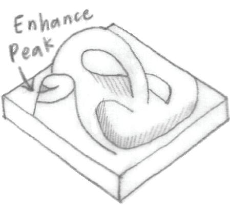
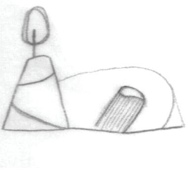
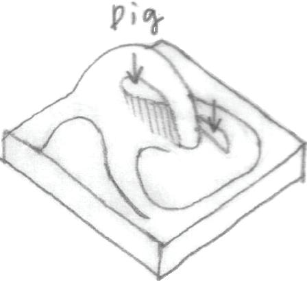
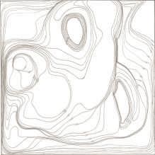
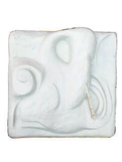
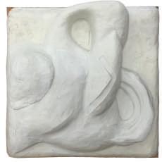
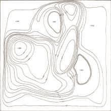
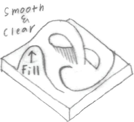
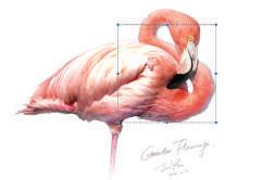
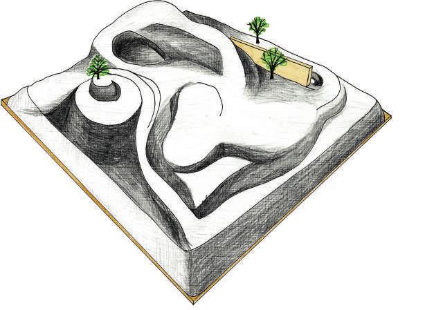
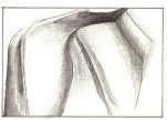
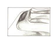
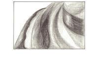
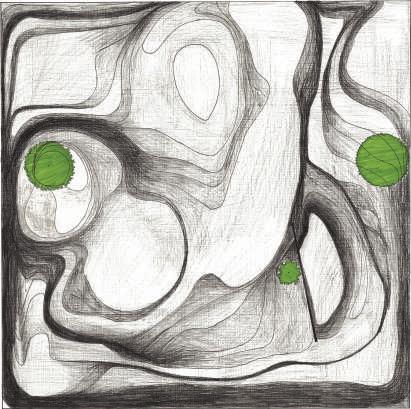
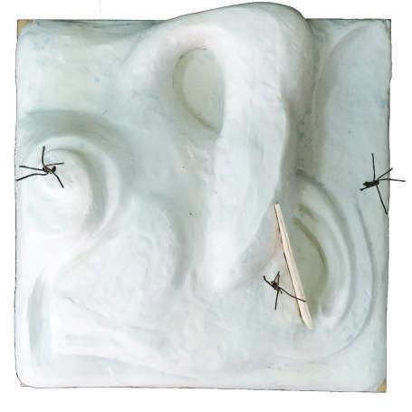
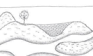
This is a hypothetical project, the main purpose of this project is to use the modeling clay to build a landform out of natural forms and do the land leveling after. I choose the natural form of a standing amingo as the concept of my modeling clay landform. I use her body as a hill and the gaps between her neck as valleys, which represent the real landform before development. After the land leveling, the site is planned as a park. There must be trees and a wall in the project as the restriction of the project. I arrange a tree on the top of the hill as it is the highest point in the park, and another as the guidance of the exit. Last but not least, the third tree is the block of a dead-end corner. There is a wall insert in the landform as the sight block of the play pool to create a rather private space.
preserve the curve feature of the original terrain
enhance the shape of the peak and the sunken area
balance digging and lling, smoothen the surface
Original Landform Contour (before)
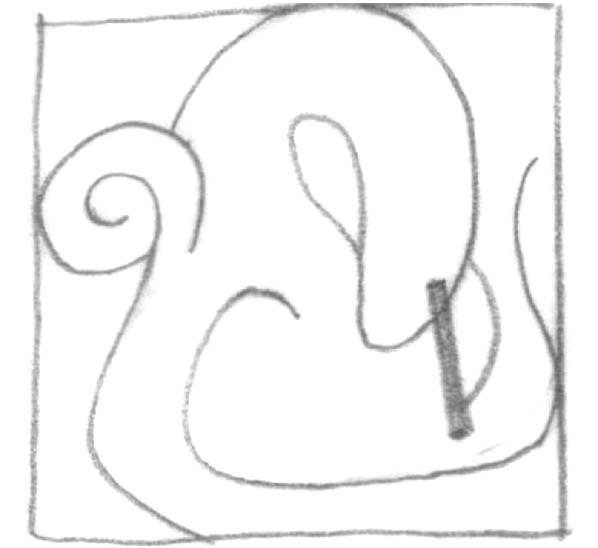
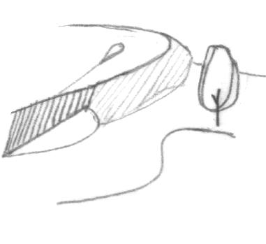
enhance the height of the peak block the end corner of the wall and the hill
vision guidance of the exit
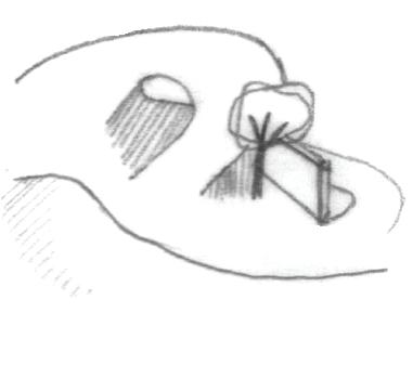
The wall provides a visually private space for the children's play pool. The pond is corresponding with the children’s play pool in the spatial feeling of open and private. The sigvht is blocked by the hill, which makes the vision focus on the pond.
Section and Tra c Route
From the amingo's curvy body, create smooth tra c routes.
Tien Hsin Sung 03
-ContourAfter Land Levelling
Contour (after)
1 2 3
-Cencept-
Entrance
Wall Pond
Exit
Visual
Children’s Play Pool Square Field Slope Sand Court Main Route Secondary Route
Inspired by the curvy body of a amingo
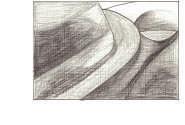
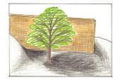
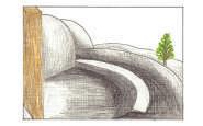
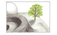
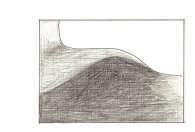
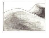
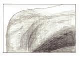
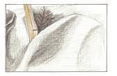
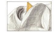
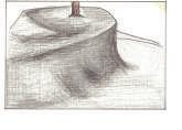
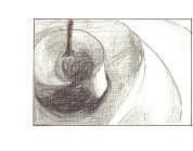
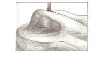
-PerspectiveTien Hsin Sung 04 A A’ section 0 1 2 4 8 16m B B’ section 0 1 2 4 8 16m C C’ section 0 1 2 4 8 16m D D’ section 0 1 2 4 8 16m E E’ section 0 1 2 4 8 16m F F’ section 0 1 2 4 8 16m 0 1 2 4 8m -Plan0 1 2 4 8m A C E B D F A’ C’ E’ D’ F’ B’
-Section-
The Park
neighborhood park renewal landscape design


Academic | Individual, 2rd year studio

Supervisor | Tsai Su Mei
Location | Dadun Park, Taichung City, Taiwan


Publish Date | Sep 2015


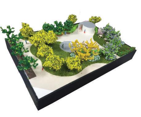
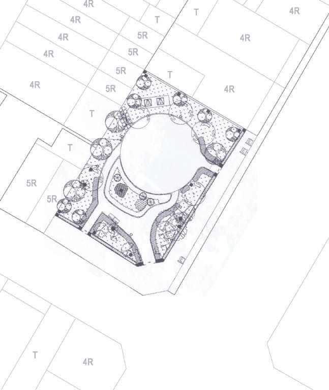
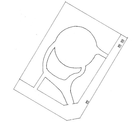
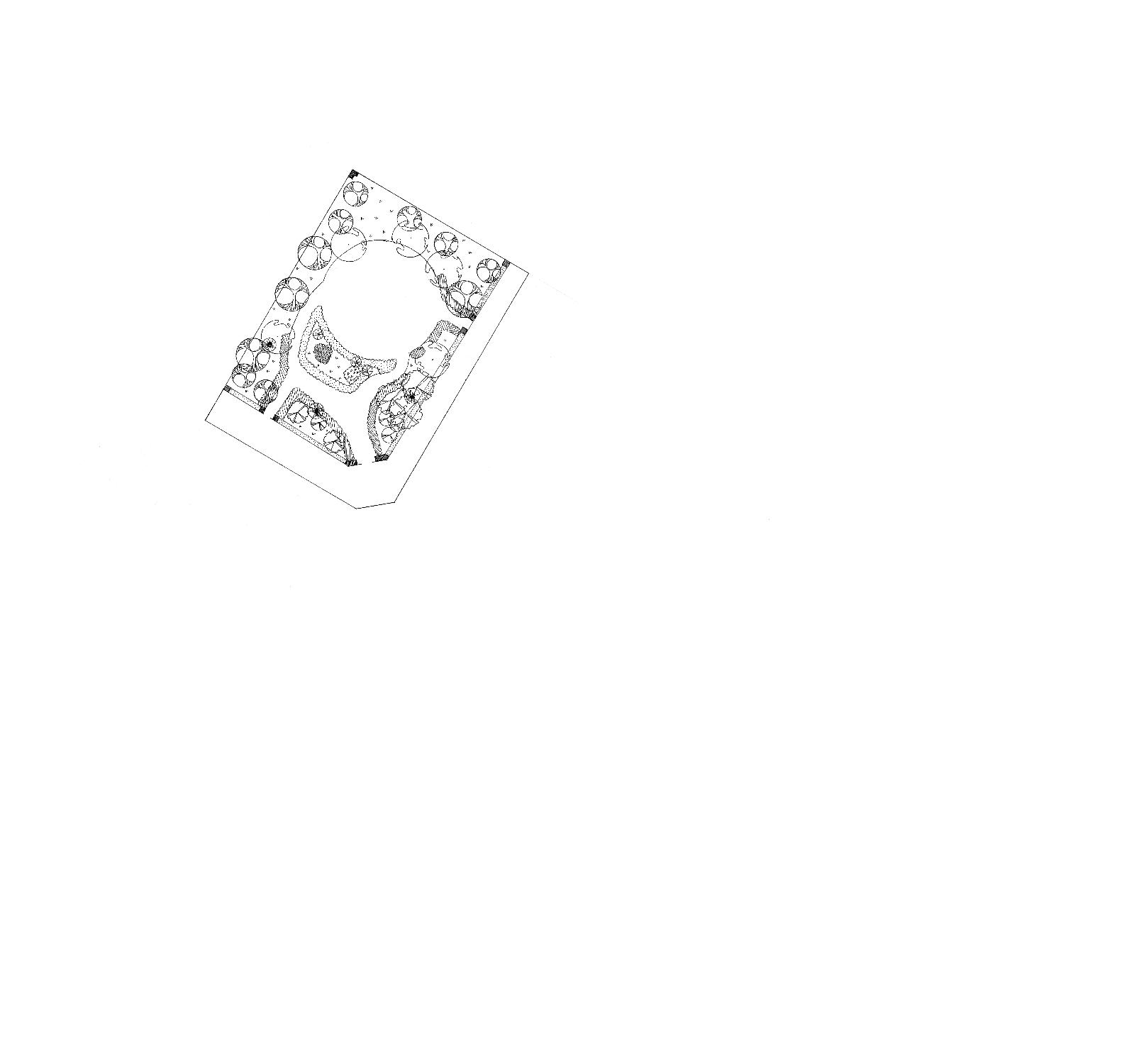
Dadun Park is located in a mixed residential area, it should have many visitors yet its messy plants and unful llable facility bring down the visiting rate. The main purpose of this case is to understand the need of the users and come up with better landscape design plan as the solution. I rearrange the green part and the tra c ow of the park to make it clearer on sight and safer for visitors who bring children with them. On the other hand, new facilities are added to ful ll visitors’ needs such as a playground, restroom, and trellis. I also designed a eld for unde ned activities for users to nd out what they can to in the park.
-Existing Problems-
Tien Hsin Sung 05 Tra c Flow Messy Plants Main Entrance Doubled Sidewalk No Shade Messy Plants Path leds to Nowhere Dadun Road Dadun19thStreet Drainage System 8m
-Site
-Cencept-ModelPlant Arrangment Clear out messy plants. Big curve arrangment bring welcoming feelings to visiters. View Point Use group trees and plants to devide spaces., block sights and create visual attraction. 8m Taiwan Eucalyptus Poonga-oil Tree Wine Bottle Coconut Buddha's Lamp Common Jasmin Orange Ceylon Myrtle Painted Copperleaf Hong Kong Orchid Tree Chinese Juniper Golden Leaves 1 2 3 5 6 7 8 9 10 4
Analysis-
Glossy Shower Senna 4 Poonga-oil Tree 6 Golden Trumpet-tree 9 Honduras Mahogany 1 Sacred Bamboo 7 Taiwan Eucalyptus 2 Ceylon Myrtle 5 Azalea 8 Common Jasmine Orange 10 Beech 3
All Gender Restroom
Shady Space for elder visitors to rest and chat
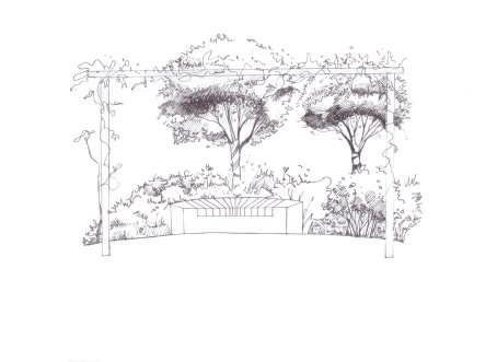
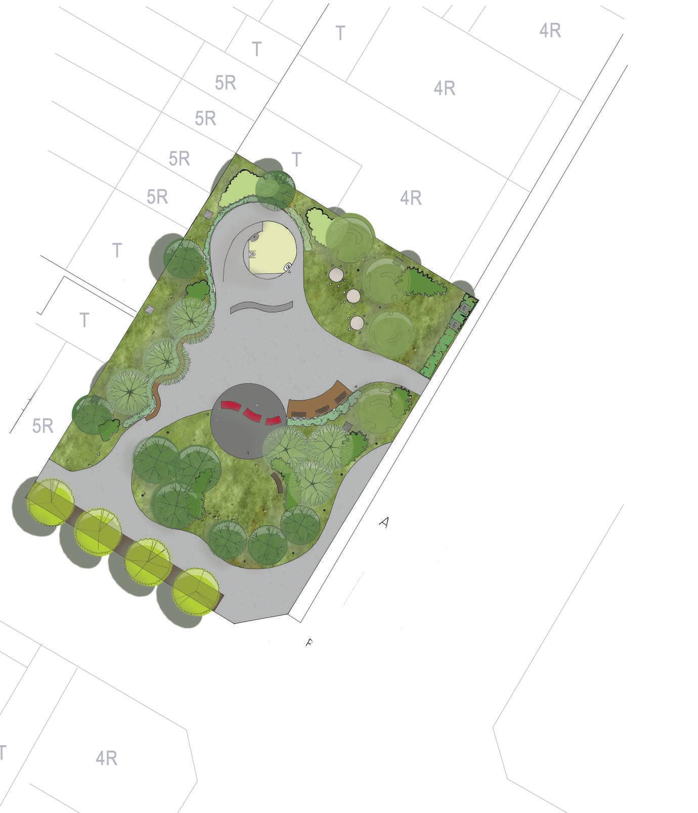
Square
high usage rate of the elders doing excerise
Curve Bench
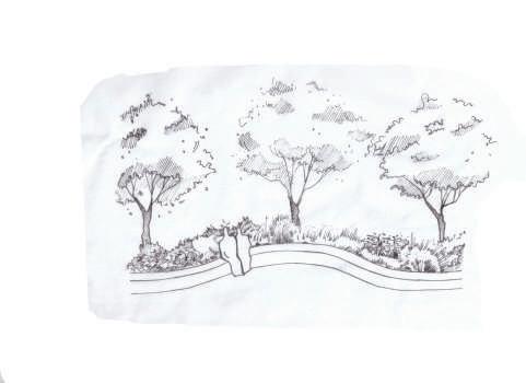
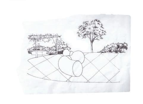


parents can watch their children from distance
Playgroung for children
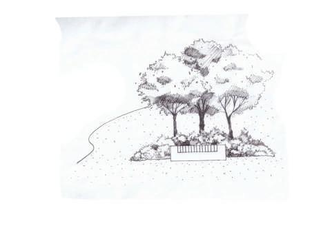
Grass Field can conduct diverse activities
Main Entrance narrowed the path and used curves instead
-Section0 1 2 4 8m A A’ B
1 3 2 4
B’
Trellis Dadun Road Dadun19thStreet Tien Hsin Sung 06 A-A’ Section 0 1 2 4 8m B-B’ Section 0 1 2 4 8m
-Site Analysis-
AS WE
school dormitory renewal landscape design
Academic | Team Leader, 2nd year studio, Dec 2015
Team Member | Huang Yu Ling, Cho Hung Che, Wu Tsung En, Liu Shi Hui, Chen Yu Ting
Chung Ying Wei, Yu Ya Chun, Heng Hui Zhen, Huang Ching Han, Chiang Kuo Yu, Luan Yung Wei
Supervisor | Su Hung
Location | Tunghai 2nd Campus, Taichung City, Taiwan
Contribution | Main Concept, Section Concept, Model
Publish Date | Sep 2017- May 2018
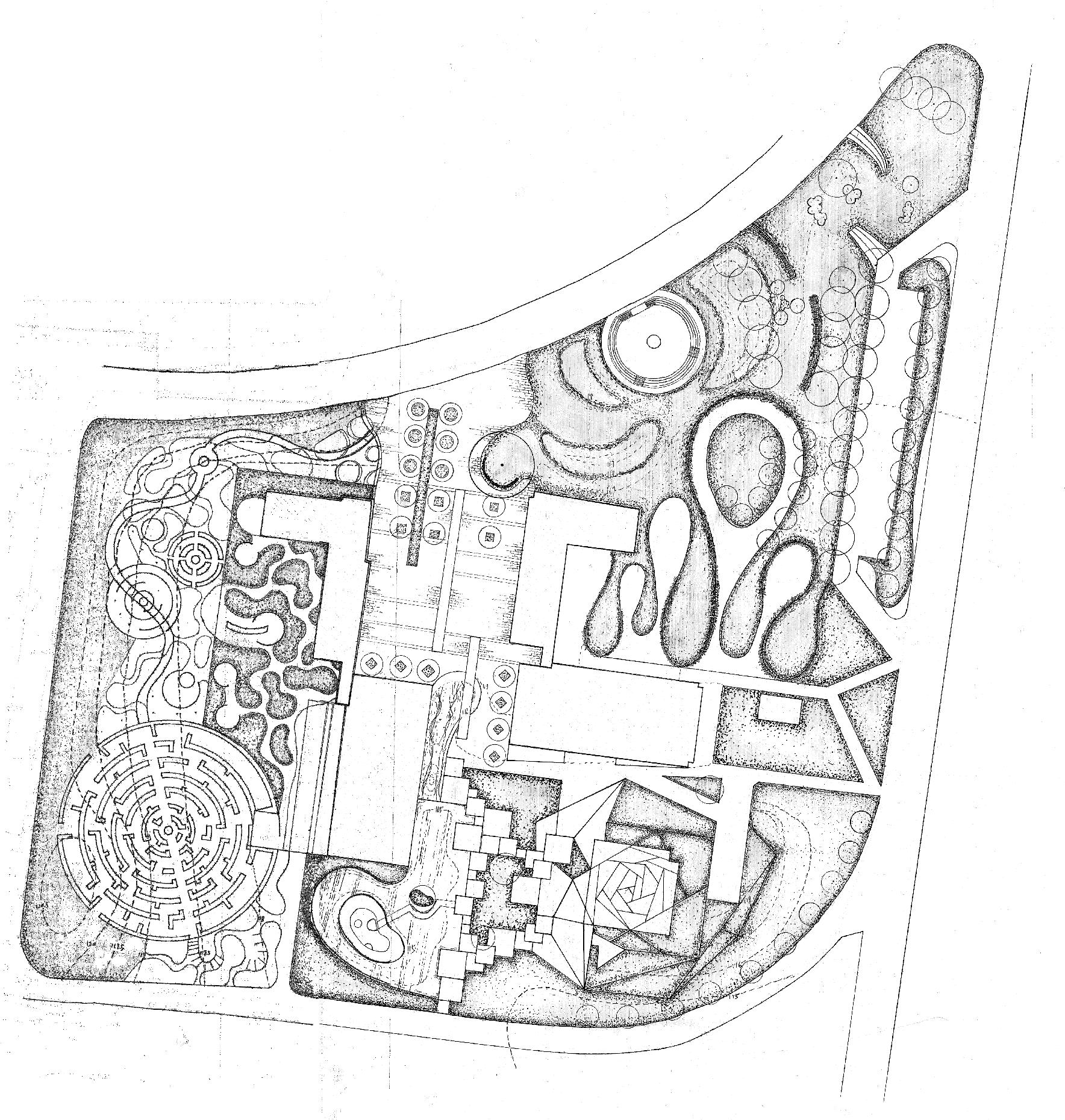
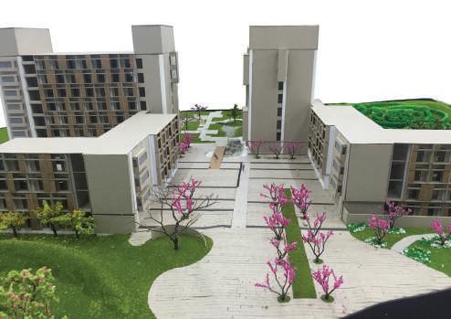
The dormitory of Tunghai University’s Second Campus is the life centre of the student on the second campus, but it is often deserted around the dormitory area. The existing facilities and design cannot provide students with a comfortable and convenient living circle. Through an in-depth investigation of students' habits of using the space around the dormitory, my team came up with improvement plans for di erent areas of the second campus dorm. I divided our team into four groups, each of them is assigned with an area using the four elements necessary for human survival, air, sunlight, earth, and water as the main design theme of the area. My group and I were responsible for the area around the female dormitory, and the element we used is Water, which represents the softness of the female’s heart.
-Concept-
We are all longing a place that is blessed and peace. So we put in Light, Earth, Air and Water the four elements of life to build our beautiful planet.
''The most beautiful things in the world cannot be seen or touched, they are felt with the heart.'' -Le Petit Prince
Sunlight
brings the brightness of day brings the energy of living brings the love and the passion of life
Water
Earth is the cradle of life when we roundabout and ripple on the water shall nd the soft trace of the wonderland
is the mother of the land is the place we stand and we curled in her arm this' where we needed to survive
Tien Hsin Sung 07
Sewage Treatment Boy’sDormitory Transition Area Entrance Plaza Girl’sDormitory Deserted Space Parking Space TrashArea StudentRestaurant Function Boy’s Dorm Garden Entrance Plaza Girl’s Dorm Parking Square Rest Area Sewage Treatment Compound Space Concept Diagram
Vegetation Cover
Water Sun Light Earth Air
Users and Circulation Car and People Main Route Car and People Secondary Route People Main Route Users
AS WE
-Master Planis the necessity of life lissome, stretching freely as we shuttle through the air
Air
Every girl has a girly heart.
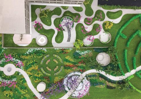
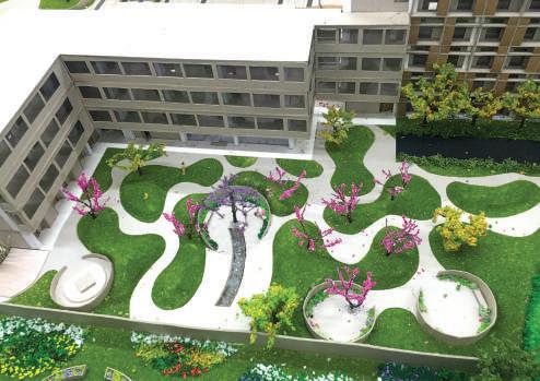
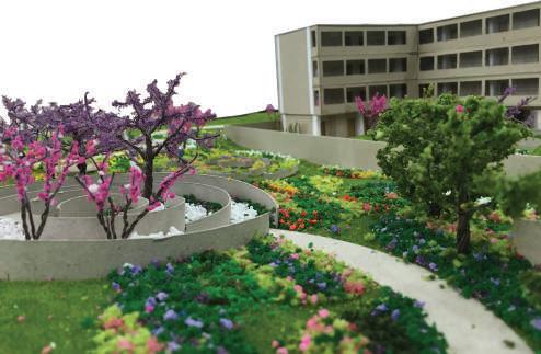
Water is the element we choose for girls dormitory. Because it represents the softness of girls. We use waves as curved lines and ripples as circles as the forms of the dormitary garden.

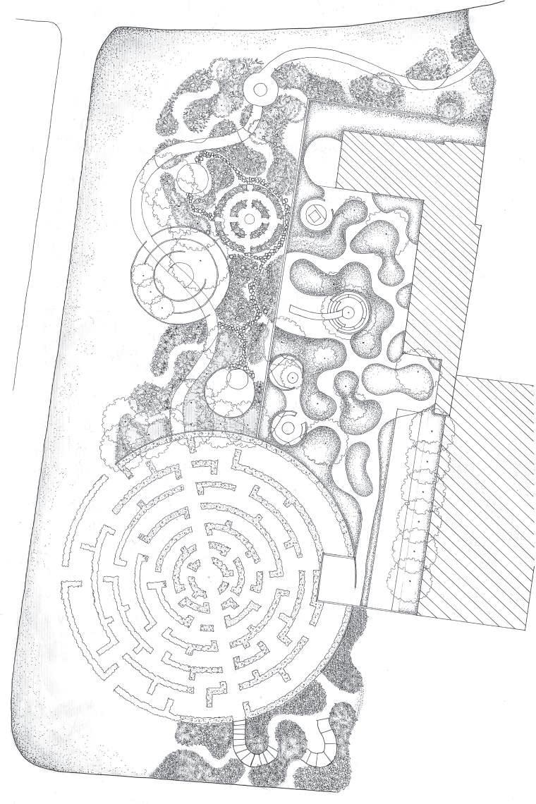
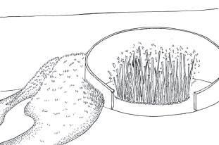
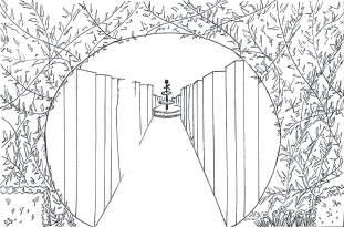
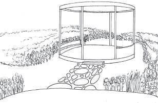
In the inner circle, we want to build a garden that provides cozy and comfy feeling just as home, so we use soft curved small hills as the obstruction of sight and the red brick wall as the connection of the rst campus girl's dormitory. The C-walls create a quiet private space in the opening garden for isolation. There is a curved path runs through the outer circle of the dorm with six ripples on it. Three of the ripples are placed on the curved path as the stationary points. And the six ripples are garden maze, pavilions and water fountains.
0 1 2 5 10m
Water
Water Quiet Soft Stretch Cycle Re ect Ripple Graden Maze Small Maze Pavilion Water Fountain Maze Entrance 120.5 120.0 119.5 118.5 119.0 118.0 Garden Path Female Dormirtory C-wall The Pavilion A C-wall C Inner Garden Hills D Maze
B A C D B A’ A
-Site PlanTien Hsin Sung 08 ‘‘AS WE’’ four Section Boy’s Dorm AIR SUN LIGHT WATER EARTH Girl’s Dorm Activity Center Female Dormitory
Entrance
-Perspective-

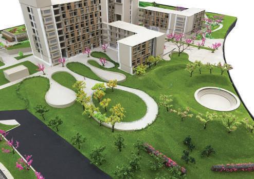
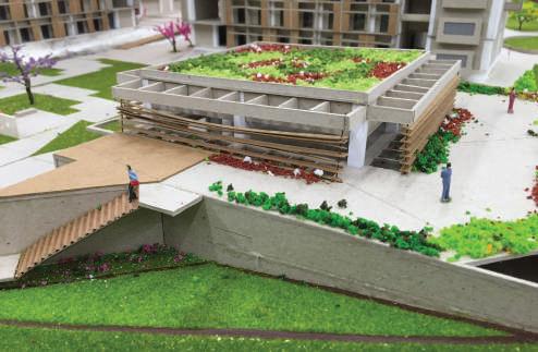
-ModelTien Hsin Sung 09 -SectionA A’ section 0 1 2 5 10m
Air Entrance Square
Water Female Dormitory Inner Garden
Water Female Dormitory
Water Garden of Peace
Sunlight Male Dormitory and Outdoor Theather
Eather Student Activity Center
New from the Past
urban train station regeneration
-Site Analysis-
Academic | 3rd year studio
Award | 2016 Student Award (Finalist)
Team Member | Huang Yu Ling
Supervisor | Wu Pei Ling, peilingwu@thu.edu.tw
Location | Taichung Station, Taichung City, Taiwan
Contribution | Concept, Plan, Perspective, Diagram Produce
Publish Date | Oct 2016
Taichung station was the centre of Taichung city, where the urban sprawl started. Railways cut through the city then divided it as the front district and the back. The economy thrived in the front district while it seemed relatively backward in the rear side of the station. In the renovation of Taichung station, the railways and the station are elevated, in order to give the space back to citizens and dredge the gap between front and back district. In this historical tra c node, we decided to use its original underground tunnel (which was used as the connection between two platforms) to create a memory corridor. For this reason, people are expected to go through various space-time experiences.
Historical Buildings
Central district was the downtown area of Taichung city. When people left, historical buildings stays, which has made the important landmarks so popular nowadays, such as the rst CHB and the Asean Square.
Migration
Central district has the most serious out-migration problem then the other districts in Taichung city. Its population has decreased more than 15% since 2004.
Uneven Development
Central District is divided into two area by the railway. The tra c ow in the city is blocked. Hence, the fornt area and the back area was developed unevenly.
Future
The concept of ‘New from the Past’, is to create a vertical history line. The ground represents the Present, the elevated railwaymeans the Future, and the underground historic hallway implies the Past. Visitors are the emissary to weave these three coexist parallel timespace together. We learn wisdom from the track of the past. And now, we are going to leave something for the next generation to discover.
The fornt of the station is the dence area of commercial use whereas the back is used for residential area.
The elevated railway brings a strong impact on the Taichung main station. Due to the overhead zation, the space underneath has been given back to people for leisure activities and tra c.
Present
Owing to the rapid urban extension, the population of the old city decrease signi cantly. Central district is facing the fact of aging society.
Past
Taichung city was born with the railway, it stretched out and built a prosperity city. There are loads of historical buildings built during the Japanese colonial period, which has laid a good foundation for the present Taichung city.
Tien Hsin Sung 10
舊
Commercial Area Residential Area
Land use
Population Increase Population Decrease Dajia Dist. Da’an Dist. Houli Dist. Dongshi Dist. Xinshe Dist. Heping Dist. Qingshui Dist. Shengang Dist. Fengyuan Dist. Shigang Dist. Longjing Dist. Dadu Dist. Wuqi Dist. Shalu Dist. Daya Dist. Tanzi Dist. North Dist. West Dist. South Dist. East Dist. Taiping Dist. Wufeng Dist. Xitun Dist. Nantun Dist. Beitun Dist. Wuri Dist. Dali Dist. Waipu Dist. Central Dist. Site Taichung Central District
-ConceptFuture Pass Present
Through the historical painting on the white ceramic tiles wall, it takes people back to the old days of Taichung main station.
Underground Tunnel Entrance
Through the old passways between platform one and two, then enter the old historical hallway.
The 'Past' part of our design is a hallway buried undersurface. The entrance of the tunnel is the old underground passway used to connect platform 1 and platform 2. The concept of this tunnel is to experience the changes through time. It's separated into three parts.

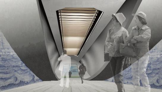
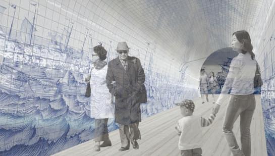
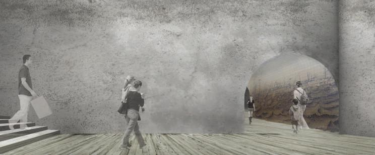
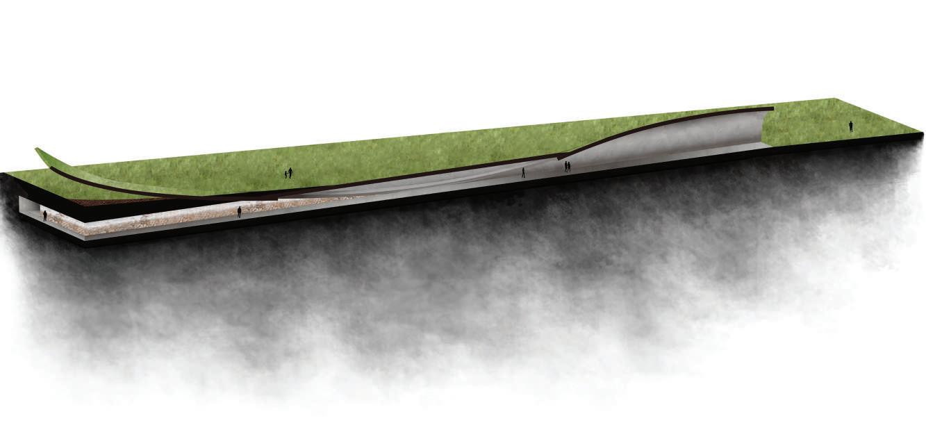
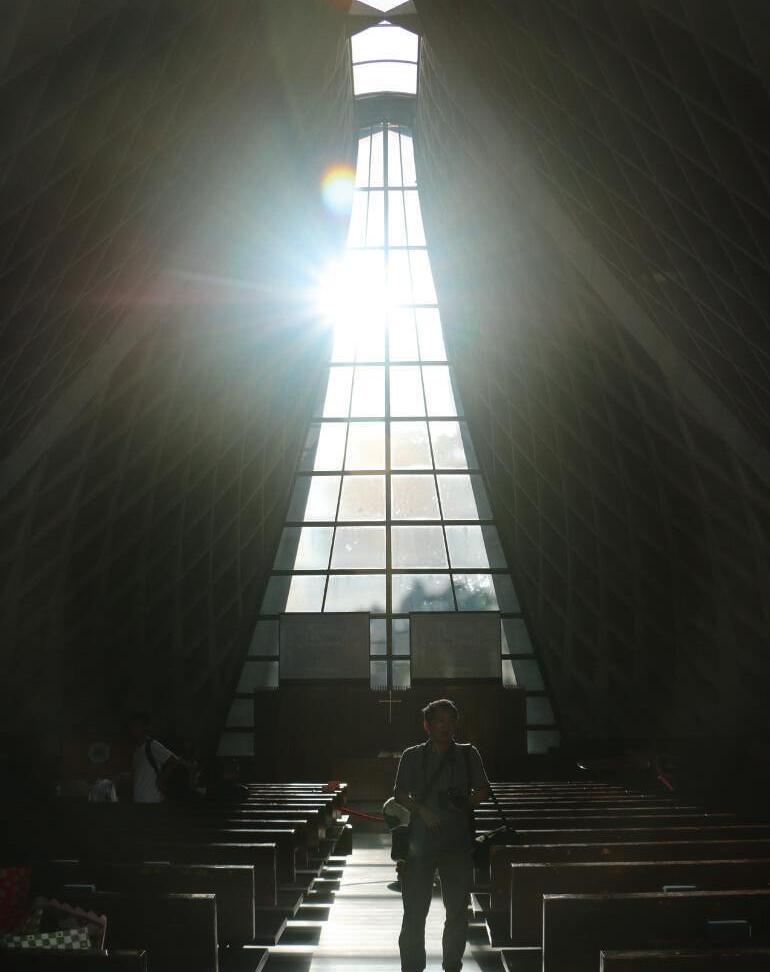
In the middle part of the tunnel, there is a glass dormer designed in a concept of the railway. As the light shine through, the shadow of the railway shows on the oor. When people are walking through the history tunnel this is a place the Present and the Past overlapped.
The tunnel's roof stretch out and framed the scenery of the elevated new Taichung station. It gives people a brand new outlook of the Future.
Stage One: Historical Feelings
Stage Two: Walking through Times
Stage Three: The Outlook
-SectionTien Hsin Sung 11
Sky Mirror
recreation shing port design
-Research Area Analysis-
Academic | Group Work, 3rd year studio
Team Member | Yeh Wei Chung
Supervisor | Li-Wen Li, liwenli@thu.edu.tw
Location | Dongshi Fishing Port, Chiayi Country, Taiwan
Contribution | Concept, Plan, Section, Diagram Produce
Publish Date | Mar 2017
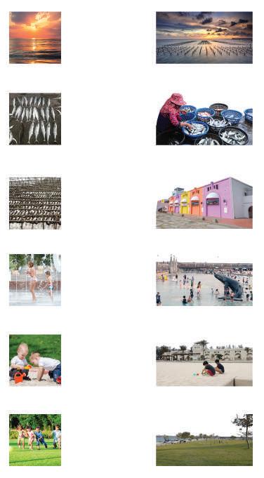
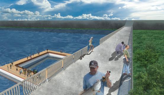
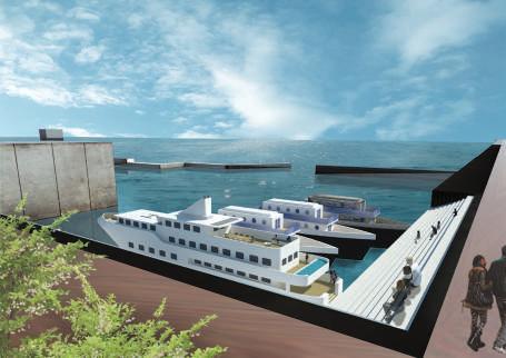
Dongshi Fishing Port is located on the southwest coast of Taiwan, where many environmental problems exist. There are many aquaculture sheries in Dongshi Township. Excessive pumping of groundwater and land reclamations causes a severe land sinking problem, and oods occur frequently, which leads to a fragile ecosystem. The declining shing port has caused an economic recession for nearby residents. We plan to transform Dongshi Fishing Port into a recreational harbour. The long-term plan is to protect the fragile coastal ecology and enable the ecological and economic cycle to continue in this area.
-Planning-
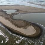
Owing to the subsidence, seawater intrusion and the coast erode going into worse. We tend to restore the habitat of the west coast to protect the seashore ecosytem environment. By opening up the sea wall, letting the water ood the shores to create wetlands, in order to build a biodiversity coastal corridor.
Chiayi Country Dongshi Township
Site
Dongshi Township is located on the western coast of Jianan Plain. The coastline is about 14 km long. It’s an alluvial plain, with an area of about 82 square kilometers. There are 23 villages in the township, with a population of about 30,000.
-Site Analysis-
Serious Subsidence Area
The southwest coast has the most serious land sinking problem in Taiwan. Due to the prosperity of aquaculture, the factories require large quantities of water so they over pumped to meet their need.
Negative Groundwater Level
Dongshi Township’s groundwater level is -23.85m, lacking groundwater can cause subsidence and seawater intrusion, which leads to groundwater pollutions.
Coastline Ecosystem
There are many wetland ecosystems on the southwest coast, attracting birds. Dongshi Fishing Port and Aogu Wetland are the relay stations for migratory birds to forage, rest and nest.
Aogu Wetland has a variety of ecological environments and habitat types. Every year, many rare birds inhabit and breed. And by turning the sh farm into wetlands can ease the impact of land subsidence and seawater
There are buses travel between Chiayi City and Dongshi Fishing Port and highways connect to the downtown.
By reproducing several common space experiences of the southwest coast, allows vistitors to learn about the local cultures while enjoying the recreations, and also to understand the environmental issues encountered in the southwest coast.
There are many aquaculture sheries in Dongshi Township. Excessive pumping of groundwater and land reclamations causes a severe land sinking problem, and oods occur frequently, which leads to a fragile ecosystem.
Ecosystem Fragile Area
Floods (Major disaster in past)
There were oyster farms since Ming Zheng Dynasty. Local people engaged in aquaculture and shery because the land is too wet and salty for growing agricultural plants.
Oyster Farms
Fish Farms
Resource
Sunset Fish Market History Water Play Area Sand Pit Meadow -17.67 -27.03 -23.85 -22.37 -10.85 -13.18
Tien Hsin Sung 12
19 19 82 17 61 166 161 157 170 168 Tra c
Environment
Aogu Wetland
Dongshi Fishing Port
Dongshi Township
-Concept- -Plant Arrangment-
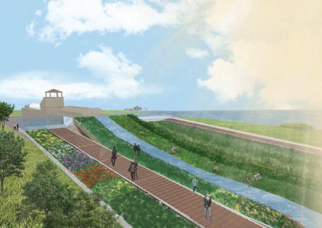
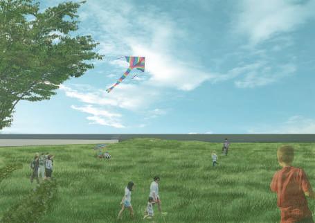
Dongshi Fishing Port once prospered with oysters farms and shing. Now it has declined and turned into a tourist attraction. The land gradually becomes vulnerable, and does damage to the ecosystem, because of the shery industry. To solve the environmental problem here, the long-term plan is to open the embankment and no longer block the tides from ooding the coast, forming an intertidal zone or wetland system. In the medium-term plan, the port will be developed as shery tourism, to enable residents to have new sources of income to balance their work in shery. At the same time, ecological education will be provided, for visitors to have a learning environment for ecological conservation.
Sand Bank Plants
White Mangrove, Mangrove, Littoral Spikegrass
Estuary Plants
Cassytha, Lumnitzerav
Grass and Forb
Hairyfruit Netseedgrass, Wiregrass
Tall Grass
Wild Sugarcane, Cogongrass, Linden Hibiscus
Windbreak
Horsetail Tree, Sea Mango, Rose Natal Grass
Trees and Shrubs
The closure embankment can't provide ecologically diverse habitat and has a great possibility of causing seawater infusion and oods.
-Space Experience-
Open up the embankment in order to let the seawater enter, then submerge the low land area to become wetlands, to increase ecological diversity.
-Design Timeline-
Madagascar Almond, India Coral Tree, Poonga-oil Tree
Large Leaf Marking Nut, Indian Barringtonia, Melaleuca
Screw Pine, Taiwan Date Palm
Sand Bar
Wetland
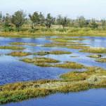
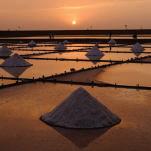
The characteristics of the southwest coast are placed in the site to form the Space Experience in Yunjianan Area(Chiayi and Tainan area). The form of unique landscapes of southwestern Taiwan—salt elds, sand bars, and wetlands are used for designing the recreation space.
Tien Hsin Sung 13
白水湖瓦盤鹽田 大田鹽場 北門鹽場 舊埕鹽田 七股鹽場 Tainan Chiayi
外傘頂洲 青山港汕沙洲 網仔寮汕沙洲 頂頭額汕沙洲 Tainan Chiayi
Salt Field
鰲鼓溼地 朴子溪河口濕地 北門濕地 七股鹽田濕地 Tainan Chiayi
Now Break down the embankment, and ll the low-lying land to balance the excavation and lling. 20 years later The seawater ood over the shore and gradually become a wetland to provide habitat. 3 years later Import seawater to the pool and store it as salt elds and sh farms for recreational use.
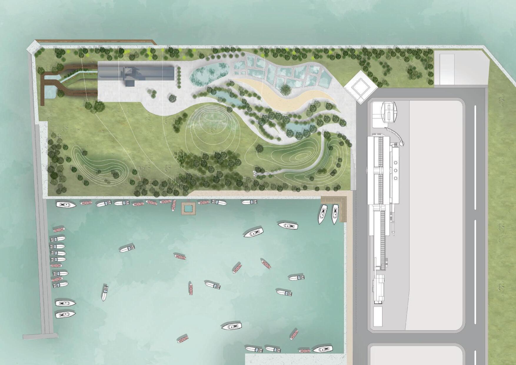
C B D E A A’ A B’ B Tien Hsin Sung 14 -Master Plan0 4 8 16 32m

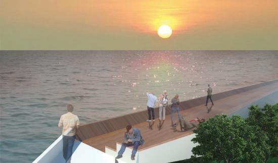


Tien Hsin Sung 15
-Section-
-Perspective-
C Sky Gardan
A Sunset Corridor E Sea Restaurant
D
Field
A A’ section 0 1 2 4 8m B B’ section 0 1 2 4 8m
B Angler Deck
Wetland
wetland ecosystem stepping stone design
Academic | Group Work, Graduation Project
Team Member | Goey Chew Chieh
Supervisor | Tang Chen Chen, archi.tang@msa.hinet.net
Location | Ertong Park, Kaohsiung City, Taiwan
Contribution | Concept, Plan, Diagram Produce, Planting Design
Publish Date | Sep 2017- May 2018
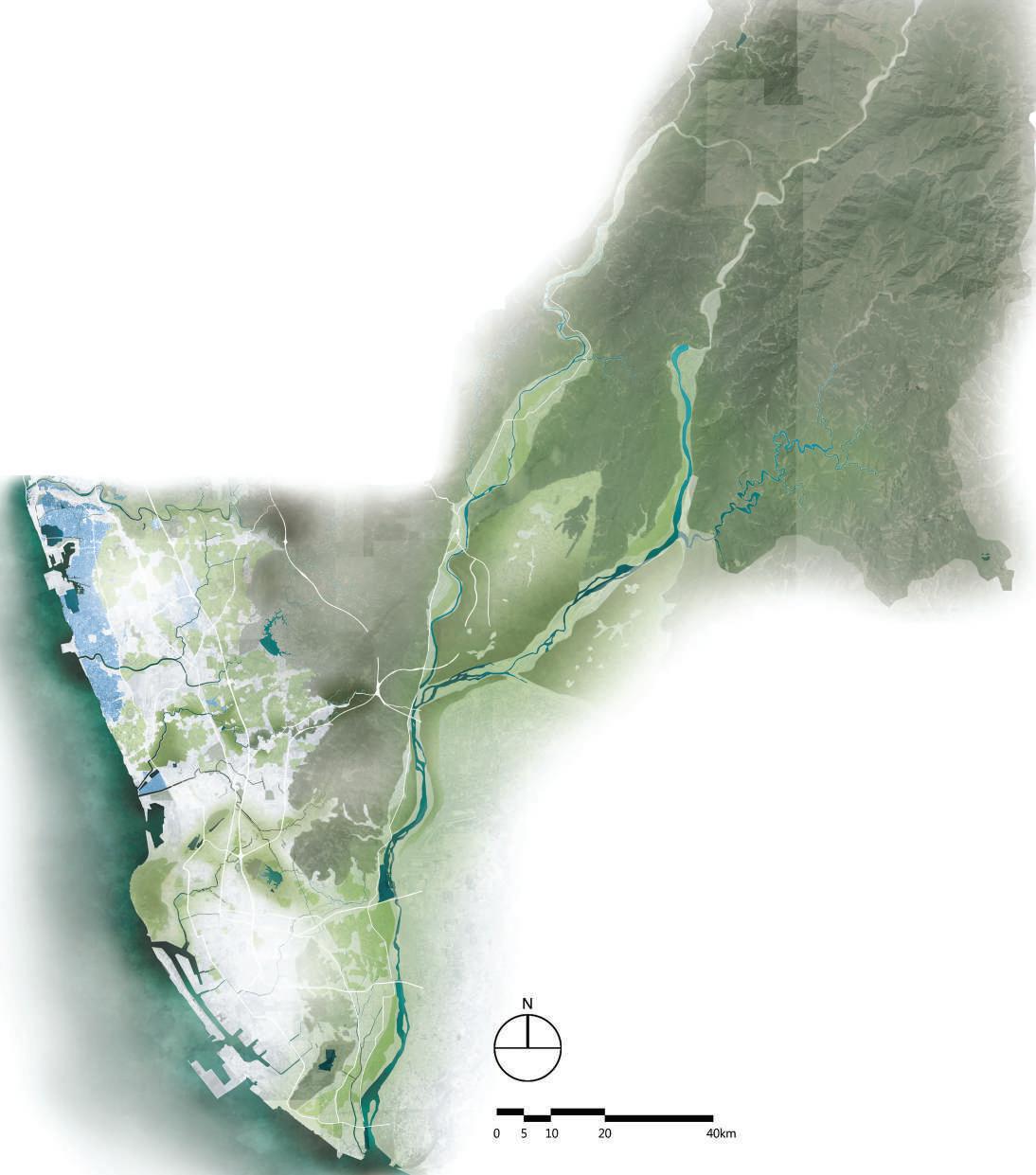
I grew up in the city. In the urban area, people usually get relatively fewer opportunities to visit nature. Hence, I have been obsessed with mankind and creatures living in a small distance but not being disturbed by each other. I think people who lived in the city shouldn’t give up the chance to enjoy Mother Nature and creatures shouldn’t lose their living right in their habitats. There are accounts of wetlands and green lands in Kaohsiung city. Using a stepping stone system to connect them can build a stronger ecological corridor. Then, creatures can migrate using the corridor between their main habitats and eco-friendly spaces in the city. With this method, more ecological communications are created, in order to strengthen the ecological chain.
-Research Area Analysis-
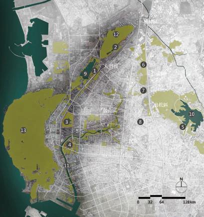
People overdevelop the environment and resources for living, the habitats are destroyed and the ecological diversity gradually disappears. The city continues to expand, cutting the habitats of animals into several pieces, causing gradual migration and extinction. From the perspective of protecting creatures, we hope to establish ecological corridors for animals in the most developed areas, to connect the broken habitats in the city. Also, to provide habitats for migration, foraging, courtship and gene ow opportunities. Furthermore, the ecological corridors also lter pollutants, prevent soil erosion, and regulate oods. They are important green infrastructures among the highly developed cities. We expected that in places where humans are densely populated, it is also possible to preserve a place where animals rest and live. Even more, it can enhance residents' knowledge of ecological conservation.
Zuoying
Jhouzai Wetland 1
Banping Lake Wetland 2
Neiweipi Wetland 3
Jongdu Wetland 4
Niaosong Wetland 5
Jiufanpi Wetland 6
Shezailinpi Wetland 7
Benhe Detention Pond 8
Lianchihtan 9
Cheng Ching Lake 10
Love River 11
Ban-Ping Mountain 12
Shoushan 13
National Wetland Local Wetland
Jhouzai Wetland 1
Nanzihsiian River Wetland 2
Daguei Lake Wetland 3
Yongan (Salt Pan) Wetland 4
Jiading Wetland 5
Wetland of the National Kaohsiung University 6
Yuanjhong Harbor Wetland 7
Banping Lake Wetland 8
Niaosong Wetland 9
Railway Bridge Marsh Park 10
Fongshan Reservoir Wetland 11
Linyuan Manmade Wetland 12
1 8 7 4 5 3 2 6 9 10 12 11
Gaoping River
A-gang-dian River Houjin River Dian-Bao River Love Rive
Gushan Niaosong
Nanzi
Tien Hsin Sung 16 Natural wetland habitat Wetland habitat in urban area Future vision of urban habitat
-Site Analysis-


Urban Area Habitats
Surroundings
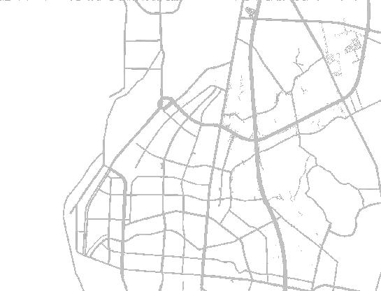
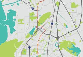
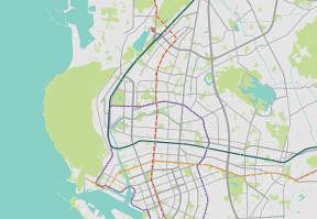
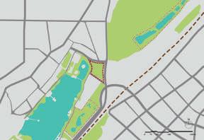
The site is located in the southern corner of Banping Mountain, the northern side of Lianchihtan (Lake). There are transfer station and department store nearby.
-Topic and Strategy-
Railway Underground Project
The open space where railways used to be is planned as green land, it would become the corridor to connect Zuoying and Gushan area's creature habitats.
Understand the Importance of Wetland Eco-system
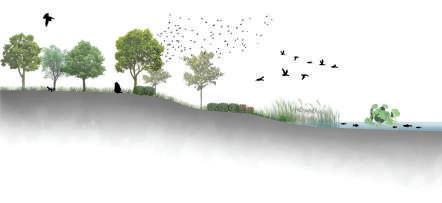


Guide Tour
Industrialization
Technological Progress
Envirnmental Education
Neighborhood Park
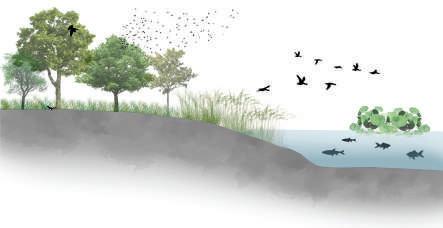
Wetland Extension & Creature Habitats


Habitat Destruction
Tra c There are expressway and HSR Zuoying Station (co-constructed with the MRT R16 Station and the Taiwan Railway), which makes it a tra c convenience spot.
Become a Eco-corridor
Wetland Rebuild
Ecology Corridor


Stepping Stone System
The surrounding area is mostly residential and few are commercial areas.
Scenic Area is a tourist attraction, and Ban-Ping Mountain belongs to Shoushan Natural Park.
Tien Hsin Sung 17
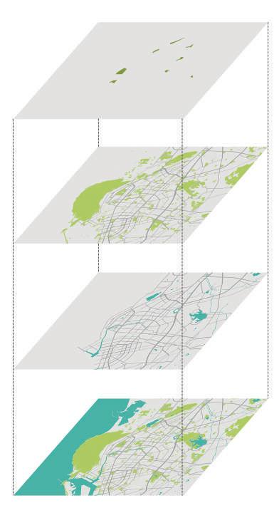
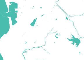
Urban Area Important Wetland Urban Area Green Land Distribution Urban Area Water Body
Ban-PingMountain
Lake
Jhouzai Wetland Eco Illustration Banping
Wetland Eco Illustration
Land Use
Lianchitan
Jhouzai Wetland SITE Kaohsiung Botanical Garden Lianchihtan Banping Lake Wetland Ban-Ping Mountain New Zuoying Station Railway Wetland Site
MRT Red Line Site MRT Orange Line LRT Railway
MRT Red Line Site Access Road Train Station Main Road Railway Site Important Wetland Creature Migrate Path Cheng Ching Lake Shoushan Lianchihtan Ban-Ping Mountain Eco Connection
Lake
There are many parks and green lands that have become stable ecological habitats around the site, with high human disturbance such as Lianchihtan, and lower human disturbance: Banping mountain, Banping
wetland and Jhouzai wetland.
Sustainability Biological Extinction Climate Change
Habitat
Inhance Ecology
Maintenance
Diversity
Build Stepping Stone System
Creatures Ecology Research Creature Tracking Ecological Tourism Natural Landscape Leisure & Recreation Ecology Investigation Green Corridor NaturalExperience Neighborhood Park UrbanGreenSpace Educational Place ResidentsLeisurePlace Tourists Researcher EcoStepping StoneSystem Wetland Corridor Habitat Foraging Mating Migration User wheel
Pedestrian Circulation
Service Circulation
Night-time Route
Research Route
Access Control Gate
General Water Stage (0.5-1.5m)
Highest Water Stage (1.5~2.5m)
Area Concept
Habitat Area
Water Puri cation Area
Education & Management Area
Grassy Marsh Swamp
Shallow Pool
Deep pool
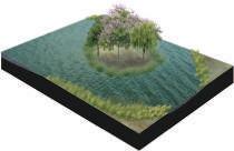
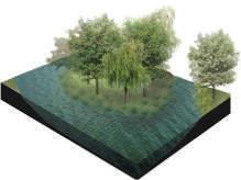
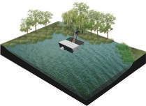
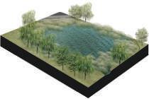
Eco Pond
Parking Lots
Lianchihtan Scenic Station
Hygrophila pogonocalyx Hayata
Hygrophila salicifolia (Vahl) Nees
Nuphar japonicum
Phragmites australis
Hydrocotyle verticillata Thunb.
Echinodorus cordifolius
Alisma canaliculatum
Tradescantia pallida
Ludwigia octovalvis
Ludwigia × taiwanensis Peng
Ipomoea aquatica Forsk.
Nymphoides indica
Polygonum glabrum
Alternanthera paronychioides St. Hil.
Murdannia keisak
Eleocharis dulcis
Zantedeschia aethiopica
Thalia dealbata
Hedychium coronarium
Pueraria montana (Lour.) Merr.
Paederia foetida L.
Passiflora foetida L.
Euryale ferox Salisb
Nelumbo nucifera
Leersia hexandra Swartz
Panicum paludosum
Paspalum conjugatum Bergius
Paspalum vaginatum Sw.
Bidens pilosa var. radiata
Lagerstroemia speciosa
Swietenia macrophylla
Samanea saman Merr.
Artocarpus heterophyllus Lam.
Bischofia javanica Bl.
Aalix warburgii
Macaranga tanarius (L.) Muell.-Arg.
Barringtonia racemosa .
Musa × paradisiaca
Canna indica Linn
Ardisia crenata Sims
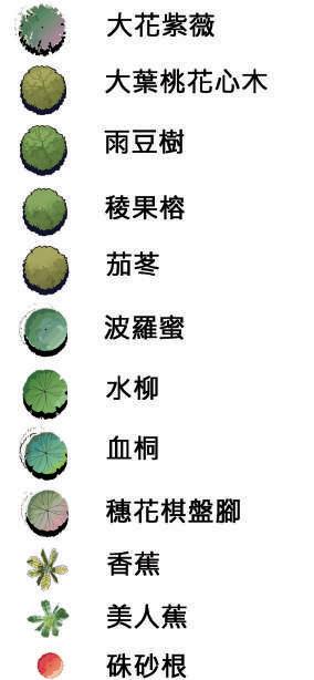
Reserve some of the original plants of the site including, Rain Tree, Honduras Mahogany, Queen Crapemyrtle, and Macaranga. To create a similar natural environment, the plant species in Jhouzai Wetland and Banping Lake Wetland are referenced.
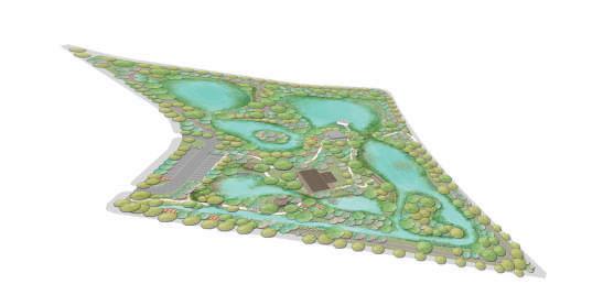
The water comes from Lianchihtan, through the grassy marsh and swamp in the Water Puri cation Area. Then discharged into the shallow pool and deep pool in the Habitat Area. At last, it goes back into Lianchihtan from the lowest southwest corner of the site.
According to the Wetland Conservation Law, the site is divided into three main areas, maintenance management area, environmental education area, and an ecological conservation area.
The research routes are arranged in the site to provide researchers to conduct monitoring and investigation of the wetland environment. To avoid disturbing the biologcal clock of the creature, people can only use the night-time route after 18:00 to separate the human activities from creatures' habitat.
Water Puri cation Area Habitat Area Education & Management Area Grassy Marsh Deep Pool Shallow Pool Eco Pond Lianchihtan Scenic Station Swamp Parking Lots Maintenance Management Area Environmental Education Area Ecological Conservation Area 6
Tien Hsin Sung 18
-Concept-
JAN FEB MAR APR MAY JUN JUL AUG OCT SEP NOV DEC
Grassy
Marsh Shallow Pool Deep Pool Swamp
-Master Plan-
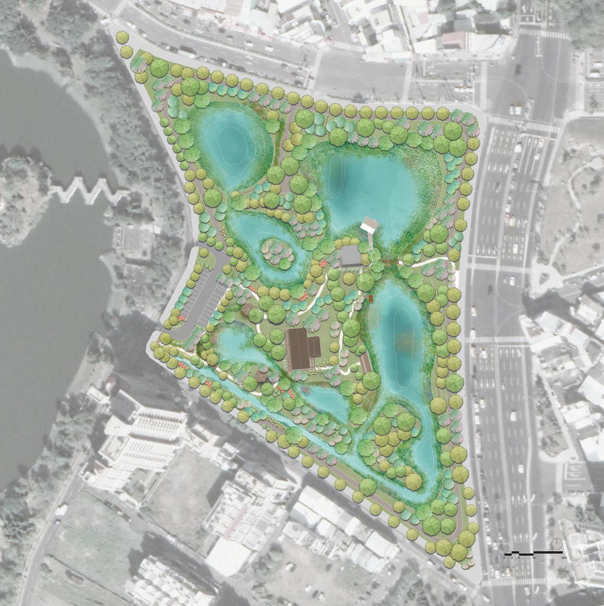
1 8 7 4 5 3 2 6 9 10 12 11 Parking lots 1 Ornamental ponds 2 Lianchihtan Scenic Station 3 Eco pond 4 Deep pool 5 Shallow pool 6 Observation deck 7 Bird watching house 8 Aerial view tower 9 Underwater observation house 10 Swamp 11 Grassy Marsh 12 Cuihua Road Mingtan Road ZhouziNorthStreet Huantan Road Lianchitan A’ A B B’ D D’ C C’
Tien Hsin Sung 19
Artocarpus heterophyllus Lam.
Macaranga tanarius (L.) Muell.-Arg.
Barringtonia racemosa
.
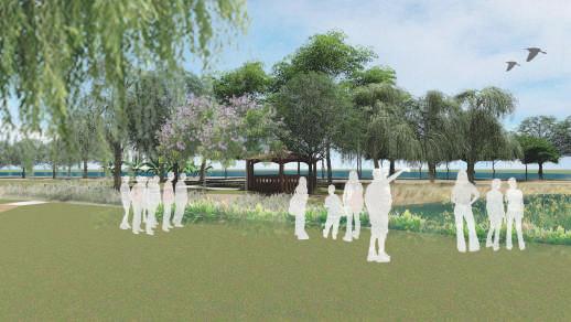
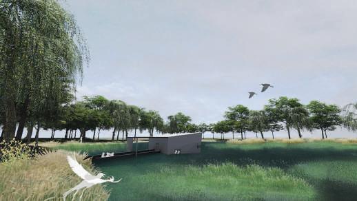
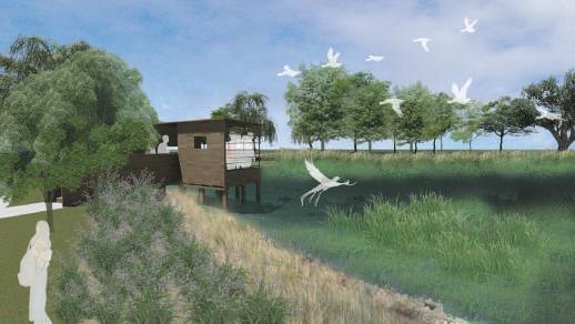
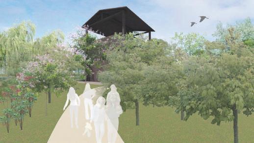
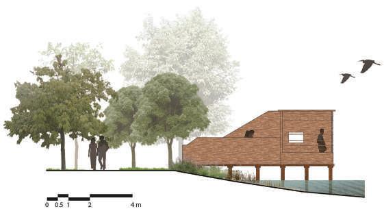
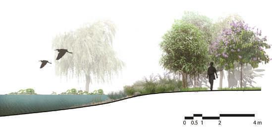
-Section-
Ornamental ponds
Underwater observation house
Bird watching house
Aerial view tower
D
B-B’ section A-A’ section -PerspectiveTien Hsin Sung 20
D’ Bird Watching House section
C C’ Eco Pond section
Tien Hsin Sung 30
SUNG TIEN HSIN selective works 2014-2018


