


Reserva de la Biósfera El Pinacate y Gran Desierto de Altar Patrimonio de la Humanidad


Reserva de la Biósfera El Pinacate y Gran Desierto de Altar Patrimonio de la Humanidad


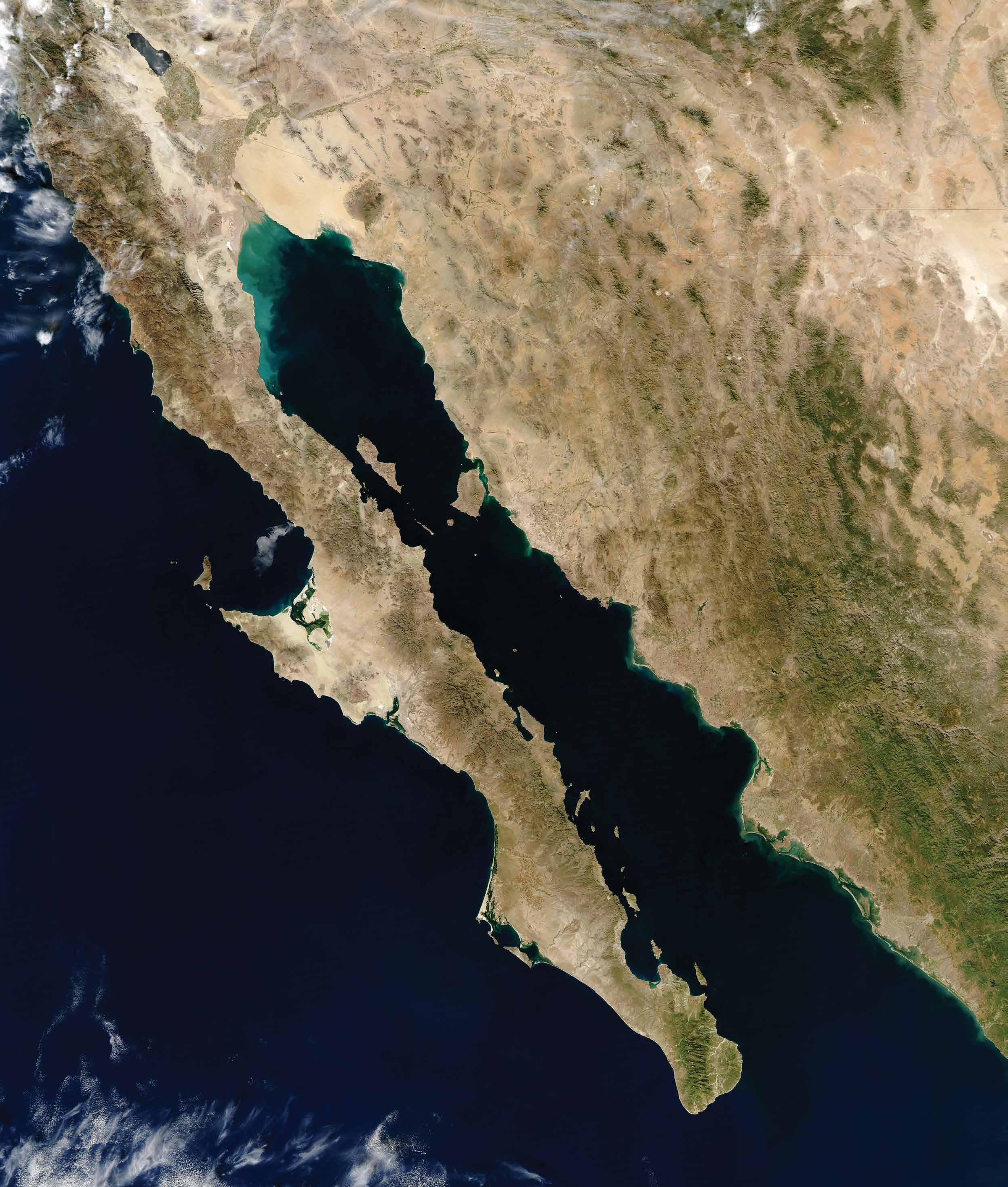
SONORA es el segundo estado más grande de México; tiene 184,000 km2 de superficie. Colinda con Estados Uni dos; su frontera tiene 600 kilómetros y cuenta con siete puertas de cruce inter nacional.
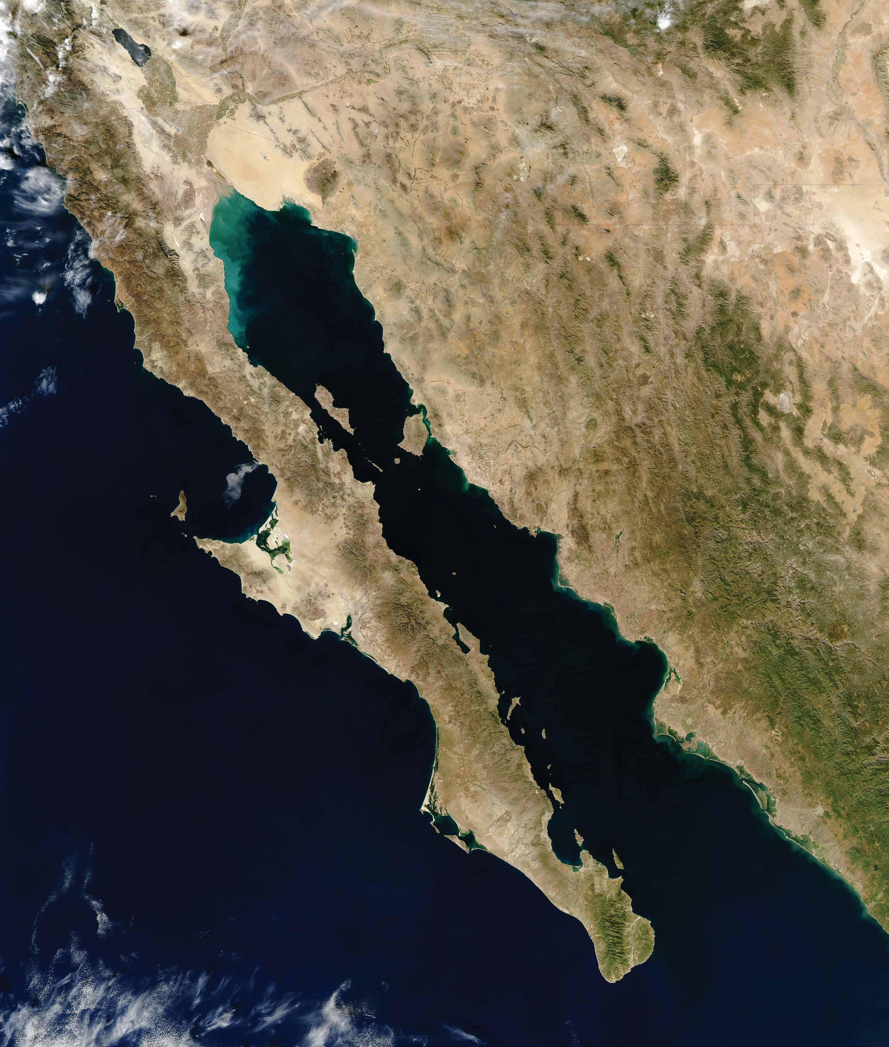
El estado cuenta con 1,200 kilómetros de litoral con el Golfo de California, riviera Mar de Cortés, en donde hay puertos pesqueros, cuatro ma rinas turísticas y una terminal de cruceros. Tiene cuatro aero puertos internacionales. En su territorio hay cuatro grandes lagos (presas), tiene impresionantes atractivos naturales: La Reserva de la Biósfera del Alto Golfo y Sierra de El Pinacate,Patrimonio de la Humanidad y cinco Áreas Naturales Protegi das en el mar, en el desierto y en la Sierra Madre Occidental.
SONORA is the second largest state in Mexico with over 71,000 square miles of territory. It borders the United States for 372 miles mostly along the American state of Arizona, sharing seven international crossing gates. The state has 745 miles of coastline along the Gulf of California or Sea of Cor tés, where fishing ports, four tourist marinas, four international airports and a cruise ship terminal can be found. Sonora has four large lakes (dams), and impressive natural attractions: the Alto Golfo and Sierra de El Pinacate Biosphere Reserve, a World Heritage Site and five natural protected areas in the Great Sonoran Desert, the Sea of Cortes and the Sierra Ma dre Occidental. (western Mexican Rockies).

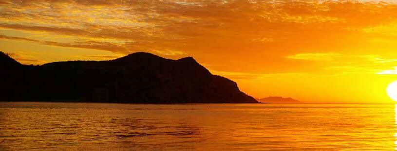
Aquí en el noroeste de México, donde las distancias son parte de la grandeza y de los atractivos, y donde el horizonte se pierde en las arenas del desierto y en el mar, o choca en los picos o cañones de la Sierra Madre, tenemos una riqueza natural, de historia, de valores culturales y de formas únicas de vida que están ahí como tesoro escondido que muy pocos conocen y dsifrutan.
Será porque el clima se convierte en cómplice y enemigo, porque el tiempo tiene otra di mensión cuando se anda el camino, porque estamos hechos a lo nuestro entre quehaceres y costumbres, o porque no hemos dado la importancia a nuestro valioso patrimonio natural y cultural que por más de cuatro siglos permaneció sin cambio.
Pero es ahora, cuando el desarrollo y las comunicaciones nos acercan, que hemos descu bierto que compartir vale y que en ese intercambio vivimos experiencias únicas en pueblos, ciudades y en el polifacético mundo rural y su diversidad natural.
Tenemos de todo en los extremos: llanuras tapizadas de flores que adornan un solo día. Miles de atardeceres incandescentes que duran un minuto, hermosos torrenciales de vera no que llena los arroyos unas horas, escénicas nevadas que duran un amanecer, y hasta huellas de dinosaurios que se alcanzan en un día para tan sólo una foto. Por otra parte, tenemos lugares, obras y espacios que están ahí como detenidos en el tiempo en memoria de grandes eventos de la historia, de la Colonia, de la Revolución y la transformación tecnológica.
Aquí una muestra del gran menú de oferta de oportunidades para propios y extraños con quienes, estamos seguros, habremos de hacer del turismo el gran escenario multiplicador de experiencias para visitantes y de bienestar para quienes tenemos todo para compartir.
Con el saludo de nuestro gobernador, Dr. Alfonso Durazo, les doy la bienvenida y les invito a disfrutar su estancia y compartir sus experiencias.
Secretaria de turiSmo


Here in northwestern Mexico, where distances are part of the greatness and attractions, and where the horizon is lost in the sands of the desert and in the sea, or collides with the peaks or canyons of the Sierra Madre, we have a natural wealth, history, cultural values and unique ways of life that are there as a hidden treasure that very few know and enjoy. It will be because the climate becomes an accomplice and enemy, because time has another dimension when walking the road, because we are made to our own between chores and customs, or because we have not given the importance to our valuable natural and cultural heritage that by more than four centuries remained unchanged. But it is now, when development and communications bring us closer, that we have discovered that sharing is worthwhile and that in this exchange we live unique experiences in towns, cities and in the multifaceted rural world and its natural diversity. We have everything at the extremes: flower-covered plains that adorn a single day, thousands of incandescent sunsets that last a minute, beautiful summer torrentials that fill the streams for a few hours, scenic snowfalls that last a sunrise, and even dinosaur footprints that are reached in a day for just one photo. On the other hand, we have places, works and spaces that are there as if frozen in time in memory of great events in history, the Colony, the Revolution and technological transformation. Here is a sample of the great menu of opportunities for locals and foreigners with whom, we are sure, we will make tourism the great scenario that multiplies experiences for visitors and well-being for those who have everything to share. With greetings from our governor, Dr. Alfonso Durazo, I welcome you and invite you to enjoy your stay and share your experiences.
Celida López Cárdenas Secretary of touriSm
”Queremos compartir con todo el mundo la riqueza natural y cultural del estado de Sonora. El Turismo como actividad económica es ahora una gran oportunidad para nuestra gente” : Alfonso Durazo Montaño
Gobernador del estado de sonora
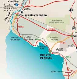


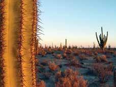
Es indescriptible la sensación que se alcanza cuando en 360 grados de visión hay solamente arena. Más intenso aún, cuando al explorar imaginas cómo era la vida de los primeros habitantes que caminaban del cerro al mar por el infinito suelo de arenas calcinantes que se mueven con el viento. Llegar en automóvil al centro explicativo para visitantes, caminar en la duna hasta la cima para alcanzar a ver el mar, luego recorrer caminos de lava y ceniza para llegar a la escarpada orilla de los cráteres surgidos de explosiones y colapsos de la tierra en medio del desierto es una experiencia mundial porque no hay algo similar. Mar, arena, zona volcánica, flora y fauna en una sensible armonía haciendo equilibrio en los extremos más radicales de clima, a veces durante un mismo día, son impactos que impresionan a todo visitante.
Pero si de sentir algo más se trata, la invitación es a per noctar en la obscuridad de la noche con el brillo de nuestra
galaxia como refenrecia de lo pequeño que somos y lo grandioso del universo. En El Pinacate practicaron los pri meros astronautas que fueron a la luna, en sus dimensiones se pierden las distancias, se pasan las horas y parece estar detenido el tiempo en los milenarios sahuaros que vigilan celosos al intruso.
Guías expertos, conocedores y con voca ción de guardaparques pueden llevarte, acompañarte, atenderte y hacer que tu visita sea una experiencia de emociones y conocimientos que te llenarán de satis facciones.

Las distancias son grandes, el clima extre moso, y la experiencia emocionante.

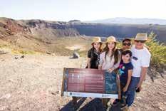
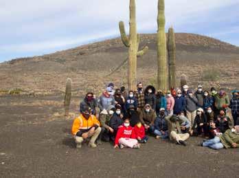
A 360 degree view with only of sand and dunes in sight is an overwhelming sensation, which gets to be even more intense when you imagine what life was like for the first inhabitants who walked from the high dunes to the ocean on hot sands moving with the wind.

You fist arrive by car at the Visitor Center, and then go on to walk on the dunes to reach the top and have a breathtaking sight of the Sea of Cortes, the Aquarium of the World, as renowned oceanographer Jacques Cousteau named it. Pathways of lava and cinder are a common sight as you walk to reach the steep edge of the craters that emerged from ancient eruptions in the middle of the desert. Sea, sand, volcanic craters and unique wildlife in the most radical extremes of climate, sometimes during the same day, are treats for those who visit. But if camping is your thing, how about spendind the night having the brightness of the galaxy as your cieling? El Pinacate, where NASA’s first astronauts trained in the 1960’s recognizing similarities in the area’s petrified lava and craters to those on the Moon, time and distance seem to stop with the ancient saguaro cacti as the only witnesses. Expert guides, knowledgeable and with park ranger vocation, can lead your way and make your visit the experience of a lifetime.


Desde las alturas hasta lo profundo. Aventura en desierto, montaña y mar
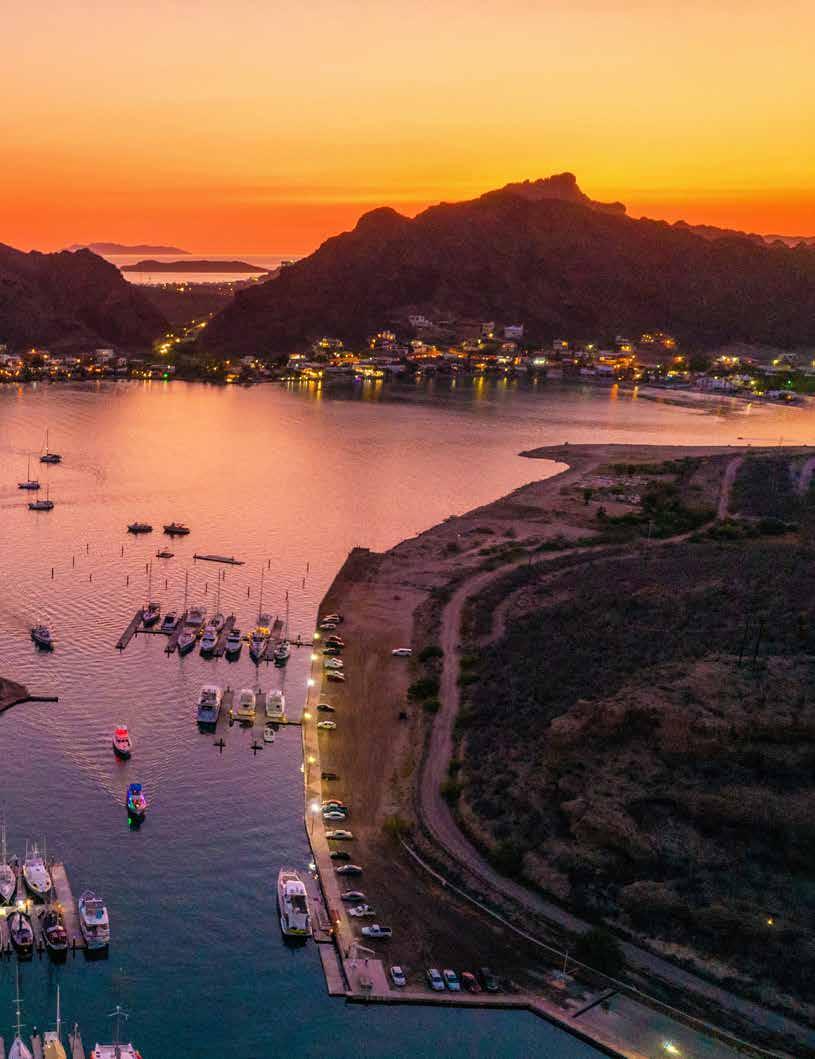
Un paquete de aventuras mar y tierra, para quedarse toda una va cación encuentras en San Carlos, Guaymas, en el litoral de Sonora, a 350 millas de la frontera con Es tados Unidos.
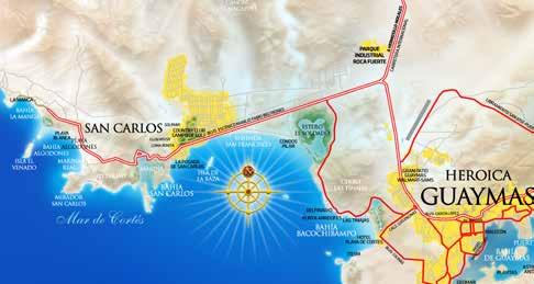
Navegar en kayak a la salida del sol o hacer ruta en bicicleta por la costera con la brisa del mar y el sol brillante pueden ser el inicio de un fin de semana. Más allá, las montañas con sus rincones tropicales que es conde la sierra del Aguaje llena de secretos y de vida. Subir a la cima del cerro Tetakawi es una experiencia indescriptible o pasar un día de pesca en el Mar de Cortés, troleando en busca del marlin o el pez dorado
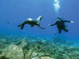
no tiene comparación, pues el escenario natural del li toral y la riqueza del mar son inigualables. Si eres buzo o gustas del snorkel, la vida submarina del acuario del mundo tiene la distinción mundial y para una aventura submarina diferente, el arrecife artificial se llena de vida y se convierte en una novedosa experiencia que atrae a visitantes de otros continentes.
En este pueblo a la orilla del mar, con todos los servi cios y excelentes opciones gastronómicas, también hay atractivos locales únicos como el Delfinario y el Estero
del Soldado, un área Natural Protegida llena de vida y parador de aves migrato rias. Para cerrar el día, la cena de corte internacional inicia a las 6 de la tarde, previa hora feliz y posterior reventón en los excelentes bares y antros a la orilla del mar.
A package of sea and land adventures for a complete vacation experience is what you will find in San Carlos, Guaymas, on the coast of Sonora, just 350 miles from the US border.
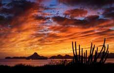

Kayaking at sunrise or cycling along the coast can be the beginning of a weekend getaway. Climbing to the top of the Tetakawi mountain is an indescribable experience, so is fishing in the Sea of Cortez, trolling for marlin or dorado.

If you are a scuba diver the underwater life of the Sea of Cortez, named by Jacques Cousteau “the aquarium of the world” has the unique distinction to offer a different underwater adventure: add to all that the new artificial reef, full of life and rapidly becoming the new experience that attracts visitors from the US and even other continents.
With all the mod cons and excellent restaurant options, there are also unique local attractions such as the dolphinarium and the Estero del Soldado, a protected natural reserve full of life and a yearly stop on the route of migratory birds. The port of Guaymas sees the arrival of cruise ships, and whether you spend your time in San Carlos or Guaymas, if you choose to close the day in relax, happy hour drinks are a must and then you can head to a top of the line gourmet dinner, followed by a visit to the many excellent bars and clubs that are always in fashion and have the best atmosphere by the sea.
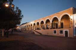
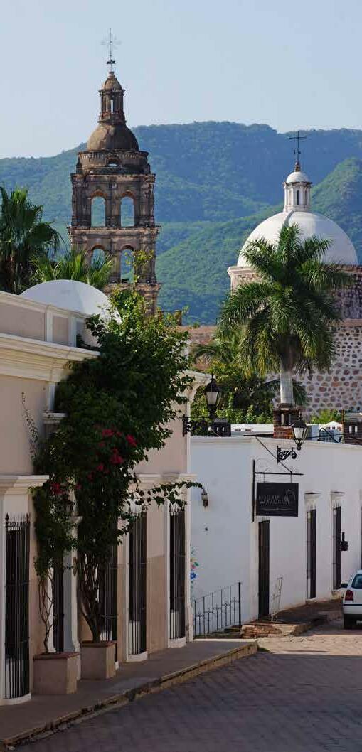
La magia de Álamos, pueblo colonial de origen minero, inicia su historia con sus emocionantes capítulos de rique za de plata, de Casa de Moneda, de capital del Estado de Occidente, del obispado regional y de su poderío económico y político. Hermoso pueblo colonial enclava do en las faldas de la sierra de Los Frailes y atravesado por dos arroyos, es desde sus orígenes, y etiquetado ofi cialmente en 2005, Pueblo Mágico de Sonora. Descri birlo sería interminable como también lo son las emocio nes de quien lo visita, lo disfruta o lo toma como punto de partida para recorrer el sur de Sonora, desde las faldas de la Sierra Madre hasta la orilla del mar. Espacios únicos en sus áreas naturales protegidas del río Cuchujaqui y Sierra de Álamos conservan su biodiversi dad y paisaje junto con el clima que se siente tropical en los veranos cuando la selva se cierra y los caminos se angostan. Museo Costumbrista, templo, casa de Ma ría Félix, Palacio Municipal, mercado, el antiguo pan
teón y decenas de edificios conservados armonizan el paisaje de este pueblo de calles angostas y empedradas en el que se disfrutan eventos y festivales culturales, con centraciones deportivas, exploraciones de la biodiversi dad, cocina autóctona y también fusión internacional de primer mundo. Sus alojamientos y hospedaje rural, urba no y hotel boutique, hacen que el visitante siempre quie ra estar más tiempo disfrutando de cada minuto y cada espacio de este pedazo bien cuidado del Sonora de
hace más de tres siglos, hoy funcional y hospitalario como uno de los destinos turísticos más significativos de Sonora.
The City of Portals, birthplace of the greatest Spanish cinema diva of all times, María Félix


The magic of Alamos, a colonial town of mining origins, begins with its history and exciting chapters of wealth, government powers of the Estado de Occidente, or western province, regional bishopric, and its economic and political power.
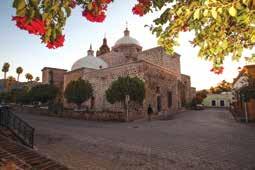
A beautiful colonial town nestled in the foothills of the Sierra de Los Frailes and crossed by two streams, it has been a Magical Town of Sonora since its origins and was so officially labeled in 2005.
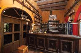
To describe a town like Alamos would take endless pages, as are the emotions of those who visit it, enjoy it or use it as a base to tour Southern Sonora, from the foothills of the Sierra Madre (western Mexican Rockies) to the seashore. Unique spaces in its protected natural areas of the Cuchujaqui River and Sierra de Alamos preserve its biodiversity and landscape along with a climate that feels tropical in the summers when the jungle deepens and the roads narrow. Museo Costumbrista, temple, Maria Felix’s house and museum, municipal palace, market, old cemetery, and dozens of preserved buildings harmonize the landscape of this town of narrow cobblestone streets where you can enjoy cultural events and festivals, sporting events, biodiversity explorations, local cuisine and international and fusion cuisine. Its rural, urban, and boutique hotel accommodations and lodging make the visitor wish to stay longer in this well-kept piece of the Sonora of over three centuries ago.

Pueblos con historias y leyendas en un mundo natural para aventura En el extremo noreste de Sonora, justo en las faldas de la Sierra Madre Occidental, el panorama se impone con los contrastes de las altas montañas y los valles a la ribera del río. Ahí, en los pocos espacios con vocación agrícola, los misioneros jesuitas fundaron en 1600 una serie de pueblos de misión y colonias que por más de cuatro siglos permanecieron intactas, ajenas a las moderni dad y autónomos en muchos aspectos. La ganadería en toda la inmensidad del terreno, la agricultura de temporal y en espacios irrigables por el río han sido, desde la llegada de los españoles, las actividades productivas, además de la minería subterránea y de gambusinos, ahora explotada con técnicas modernas.
Pueblos que, cada uno a la orilla de su río, coinciden en sus cos tumbres, su origen, religiosidad, ambiente alegre y hospitalidad amigable. El templo misional, la plaza y el edificio o casona de la autoridad municipal como centro cívico y cultural en cada pueblo muestran evidencia de la estructura del poder que les dio origen. A
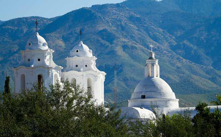
su alrededor, en todos, las calles limpias y el orden cotidiano dejan ver pueblos sanos, pulcros y de gente trabajadora. Cada pueblo es centro de una región rural extraordinaria y única, donde los paisajes y los caprichos de la na turaleza ofrecen la oportunidad para encontrar los espacios de aventura, re creación y contacto con la tierra. Ríos, cascadas, lagos, paredones, aguajes, ranchos, colinas que van desde el mez quite hasta el encino y el pino en las altas cumbres. Una biodiversidad envi diable y prístina digna de admirarse y cuidarse conforman los tesoros turísticos de los pueblos de la sierra alta.
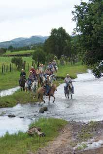
In the far northeast of Sonora, right on the slopes of the Sierra Madre Occidental (western Mexican Rockies) among high mountains and valleys along the river, Jesuit missionaries founded in the 17th century several mission towns and colonies that remained intact for almost four centuries, isolated from modernity. Cattle ranching and agriculture have been the primary activities since the arrival of the Spaniards. Panning and underground mining also took place and are still practiced.
These towns share origin, customs, religious beliefs, as well as a happy atmosphere and friendly hospitality, around their mission temple, their plaza or main square and the local government building. They all offer the opportunity to find adventure and contact with nature: rivers, waterfalls, lakes, cliffs and much more, surrounded by hills that range from mesquite trees to oaks and pines on the high peaks of the mountains.
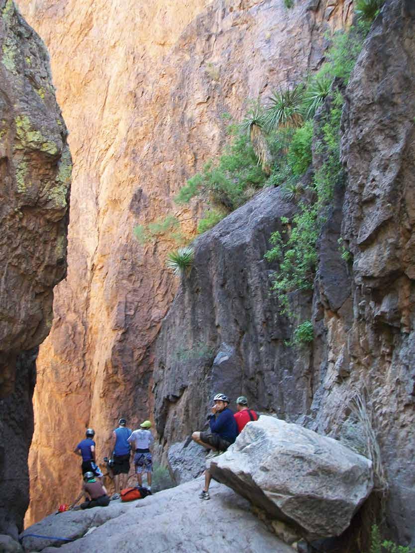
en Cruz del Diablo
Mesa de Tres Ríos
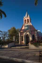
Templo de Bacadéhuachi
at the Cruz del Diablo canyon
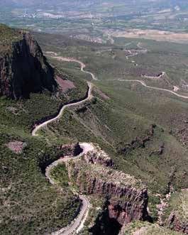
Mesa de Tres Ríos
Lady of Loreto Temple in Bacadehuachi
Escalando el cañón de La Cruz del Diablo
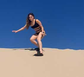
La ciudad capital de Sonora es ca becera de un gran municipio que alcanza más de 100 kilómetros de costa frente a la Isla del Tiburón, la más grande de México en el Mar de Cortés. A sólo 100 km del centro ur bano, Bahía de Kino es destino de sol y playa natural con su muy original be lleza y sus propios y únicos atractivos y opciones para entretenimiento del vi sitante. Además de los deportes acuá ticos de playa y de mar adentro como pesca y buceo, el turista puede agendar una visita a San Nicolás y sentir el vértigo al deslizarse por la duna en su sand board . Ba hía de Kino tiene su poblado de pescadores y su oferta gastronómica típica de playa, además de servicios de
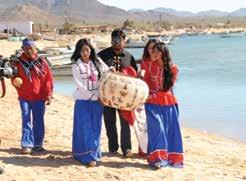
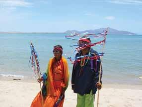
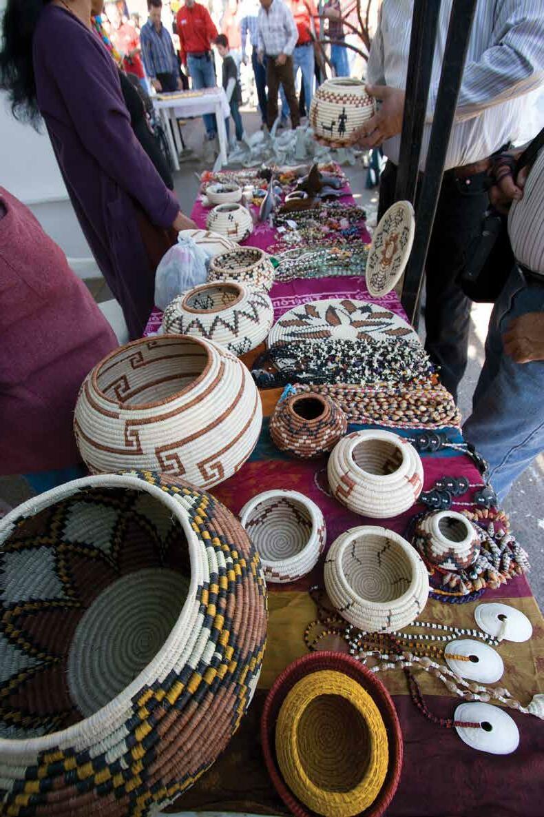
La Nación Seri o Comcáac, pueblo originario de esta región, conserva y comparte, desde Bahía de Kino hasta sus poblados costeros como Punta Chueca y Desembo que, sus artesanías y herencia cultural de danzas, cere
monias, costumbres y servicios turísticos como traslados y paseos guiados a la Isla del Tiburón, que es parte de su na ción y territorio. Una visita al Museo de los Seris de Bahía de Kino muestra la historia, origen y vida de los Comcáac, esta etnia con ancestrales memorias y desconocida procedencia.
Excelente gastronomía y opciones de hospedaje, camping, RV y glamping se ofrecen en la región costera de Hermo sillo. Consulte a su operador.
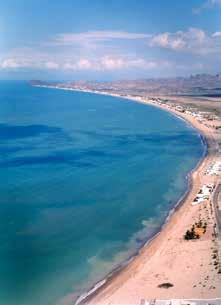
62 miles from the city of Hermosillo, capital of the state of Sonora, you will find a 60 mile stretch of sandy beaches in front Isla del Tiburon, the largest island in Mexico, in the Sea of Cortez. Kino Bay or Bahía de Kino is the natural sun and beach destination with unique options for the visitors entertainment. In addition to beach and offshore water sports such as fishing and diving, tourists can schedule a visit to San Nicolas and feel the thrill of sliding down the huge dunes on their sand board. Kino, still a fishing village since its origins, offers sea food options as well as lodging and beach services to spend the day.
The Seri or Comcaac Nation, native people of this region, preserve and share, from Kino itself to the coastal towns of Punta Chueca and Desemboque, their handicrafts and cultural heritage of dances and ceremonies, as well as some services such as guided tours to Isla del Tiburon (Shark Island), home of the big horn sheep, which is part of their territory. A visit to Museo de los Seris will show you the history and life of the Comcaac tribe.
Excellent restaurant and lodging options, camping, RV parks and glamping are offered along this coastal region of Hermosillo.

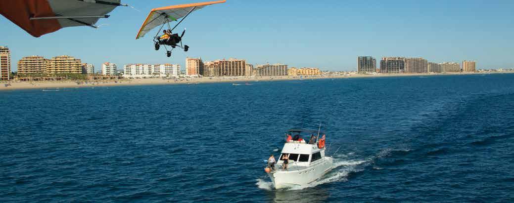
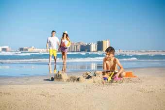

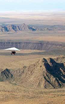
Mucho qué hacer en mar y tierra Sol, playa infinita, deportes acuáticos, pesca, buceo, golf y ambiente de fiesta en una atmósfera internacional de primer mundo hacen de Puerto Peñasco el destino turístico de playa más visitado y más internacional de Sonora. Un pueblo y puerto a la orilla del mar que ahora ofrece comodidad y atractivos, servicios y experiencias a turistas internacionales y sigue extendiendo sus espacios de recreación hacia sus playas al sureste. Grandes re sorts como el Mayan y Las Palomas, conjuntos integrados como Encántame Towers apuntan a un futuro de clase mundial; su localización cercana a las reservas naturales protegidas del Gran Desierto de Altar, Alto Golfo y Biós fera de El Pinacate, Patrimonio de la Humanidad ofrecen la gran oportunidad de vivir una de las máximas expe riencias en el espacio natural de Sonora. Salir de pesca, a un paseo a la isla San Jorge o sencilla
mente caminar y disfrutar la playa, rodar en la duna en ATV, navegar con wind surf, kayak o paddle board, to mar un crucero vespertino “Margarita sunset”, pasear en jet sky o subirse a la banana o parapente y hasta volar en un ultraligero para sentir la libertad, para rematar en el malecón y sus cantinas ambientadas sobre los pasillos
repletos de recuerdos, souvenirs y arte sanías, ¡sólo en Puerto Peñasco!
Por supuesto, puede pasar todo el día en el tranquilo balcón del apartamento de su elección frente al mar en los conjuntos de condominios que ofrecen todo para una feliz estancia familiar y plena vaca ción a la orilla del mar.
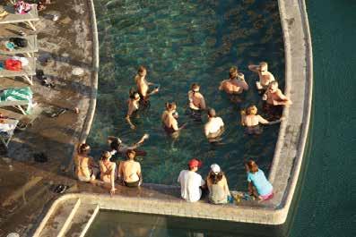
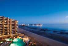

Sun, endless sandy beach, water sports, fishing, scuba diving, golf and festive atmosphere in Puerto Peñasco, or Rocky Point as foreign visitors call this place where Al Capone spent the last years of life. The most visited and most international beach destination in Sonora, Rocky Point is a town and port by the sea that now offers comfort, attractions, services and experiences to tourists from all over the world. Resorts like the Mayan Palace and Las Palomas as well as integrated complexes like Encantame Towers, point to a world-class future, enhanced by its location, close to the protected natural reserves of the El Pinacate and the Great Sonoran Desert Biosphere Reserve. Go fishing, visit San Jorge Island or simply take a walk and enjoy the beach, roll on the dunes or enjoy them on your ATV, practice wind surfing, kayak or paddle board, take an evening “margarita sunset” cruise, ride on a jet ski, get on the banana or do some paragliding or ultralight flying. Finish off on the boardwalk and its many bars, set on the corridors full of souvenirs and crafts. Or just relax spending your whole day on the quiet balcony of the apartment or hotel room of your choice glancing at the Sea of Cortes, the Aquarium of the World, as renowned oceanographer Jacques Cousteau named it.
El Pinacate
en la playa
en parapente y ultraligero

sunset boat party
El Pinacate


on the beach
and ultralight flights
sunset cruise party
Por su posición en el mapa, se ha nombra do baja pero en sí, es alta, escarpada y llena de valores naturales. La ruta es vía El Novillo, Bacanora, Sahuaripa, Arivechi y otros pintorescos pueblos como El valle de Tacupeto y Güisamopa. Por esta ruta que también nos lleva a Yécora, nos da la op ción de llegar a Ónavas, Suaqui Grande, San Javier y pasar por Tecoripa y La Colora da. Es un circuito que conviene hacerse en por lo menos dos días.

La crónica histórica de los pueblos de esta ruta es muy in teresante y los atractivos naturales muy diversos, además del infinito panorama serrano que obliga a hacer para
das en el camino para disfrutar de las presas El Novillo y el Cajón de Onapa y los pueblos lejanos casi todos a la orilla de su río.
Visitar Bacanora y su museo, enfiestarse en Sahuaripa a la orilla del río, subir a Tarachi, El Trigo, La Iglesia o llegar hasta Nátora allá en el río Mulatos junto con el Aros es toda una vacación rural emocionante. Seguir al sur por el
valle que se extiende hasta Arivechi, subir a sus aguas termales, conocer los pueblos de El Valle de Tacupeto, luego llegar a Suaqui Grande para redondear el circuito volviendo a Hermosillo por la Colorada es toda una experiencia
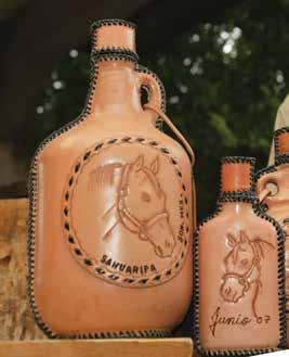
Due to its location on the map, it has been called Sierra Baja or low sierra, but it is high in altitude, steep, and full of natural resources. The route goes through El Novilllo, Bacanora (town home of the agave distilled drink of the same name), Sahuaripa, Arivechi, and other colorful towns such as El Valle de Tacupeto, and Güisamopa. Do not forget to taste one or several shots of bacanora in one of the several distilleries along the way.
This route also takes us to Yecora, giving us the option of reaching Onavas, Suaqui Grande, and San Javier passing through Tecoripa and La Colorada. It is a circuit that should be done in at least two days.
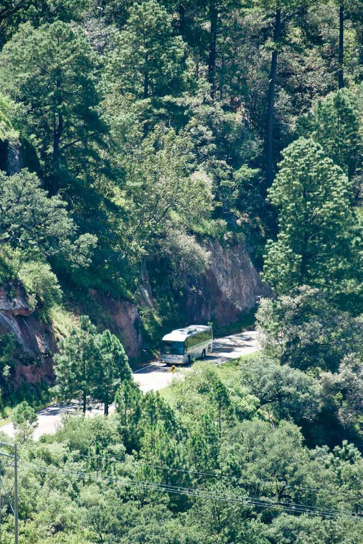
The historical chronicle of the towns on this route is very interesting and the natural attractions are very diverse, in addition to the mountain sights that make you stop along the way to enjoy the El Novillo and Cajón de Onapa dams and the distant towns, most of them on the riverside.


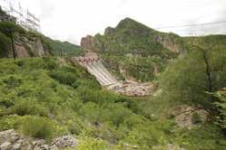
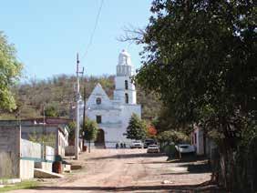
Visiting Bacanora, partying in Sahuaripa on the banks of the river, going up to Tarachi, El Trigo, La Iglesia, or reaching Natora on the Mulatos River is an exciting rural vacation. Going on south through the valley you will reach Arivechi and its hot springs, El Valle de Tacupeto and Suaqui Grande to round off the circuit by returning to Hermosillo through La Colorada, quite an experience.


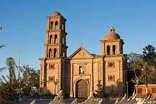
Cócorit es un pueblo con encanto que conserva viva la magia de su mezcla de culturas y momentos de su evolución histórica. Es el pueblo viejo de la mo derna Ciudad Obregón, que evoca en su ambiente colonial la atmósfera del siglo XIX con la herencia de la cultura originaria de la etnia yaqui y de la misión establecida en1617 por los misioneros jesuitas. Es uno de los ocho pueblos yaquis y una de las prime ras colonias en Sonora.
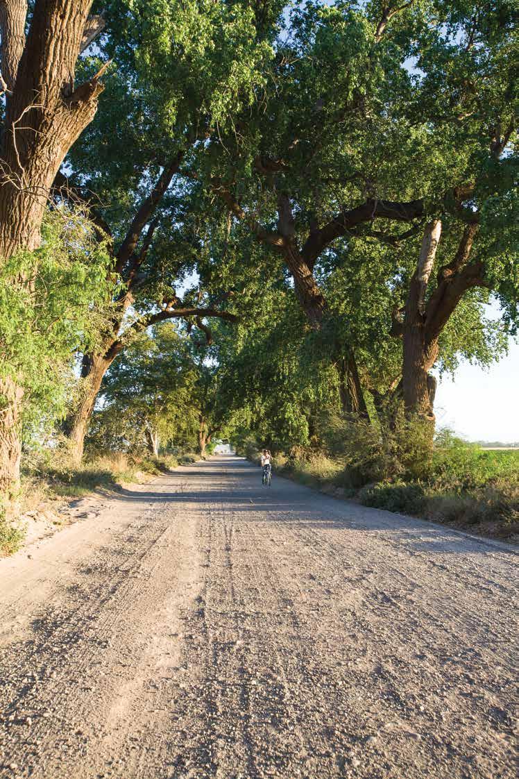
Con servicios urbanos de proveeduría y hospedaje en Cd. Obregón, el visitante puede disfrutar de Có corit y de toda la ribera del río Yaqui que se extiende desde la Presa y paseo El Oviachic hacia el ponien te, por campos de labranza a la orilla del río y los canales de riego del afamado Valle del Yaqui, lleno de comunidades rurales que comparten experiencias
de cocina autóctona, de paisajes rura les únicos, alamedas centenarias, cos tumbres, folklor y artesanía de la etnia yaqui que hasta la fecha se reserva con rigor sus rituales y ceremonias.
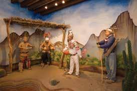
Hornos, Bácum, Potam, Vícam y otros pueblos están cercanos y accesibles en la ruta. En los recientes años, Cócorit se ha convertido en el espacio cultural de la región y las manifestaciones de artes plásticas decoran y hacen el ambiente más recreativo.
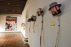

Cocorit is a charming town that keeps alive the magic of its mixture of cultures and moments of its historical evolution. It is the old town very near the modern city of Ciudad Obregon, which displays in its colonial environment the atmosphere of the 19th century with the heritage of the original culture of the Yaqui tribe and the mission established in 1617 by the Jesuits.
Cocorit is one of the eight Yaqui towns and one of the first colonies established in Sonora. With urban and lodging services provided by Ciudad Obregon, the visitor can enjoy Cocorit and the entire banks of the Yaqui River that go from the El Oviachic dam towards the west, through large agricultural fields and irrigation canals. A good number of small rural communities hare customs and cuisine, unique rural landscapes, centuries-old poplar groves, folklore and crafts of the Yaqui culture, whose members even now rigorously preserve rituals and ceremonies. Hornos, Bacum, Potam, Vicam, and other Yaqui towns are nearby. In recent years, Cocorit has experienced a cultural boom, with a movement of local artists that display their work in murals on walls and public buildings, making this town even more colorful than it already was.

de los Yaquis.
yaquis.
a El Oviáchic
tribe Museum.
the Yaqui villages
El Oviachic

Son 300 killómetros de ruta escénica que va de pueblo en pueblo por una de las regiones más significativas de Sonora. Montañas y valles se abren en el horizonte de jando ver los campos de labranza que dan profundidad al panorama, abriendo paso a las torres del templo de cada pueblo como parte de su propia identidad.
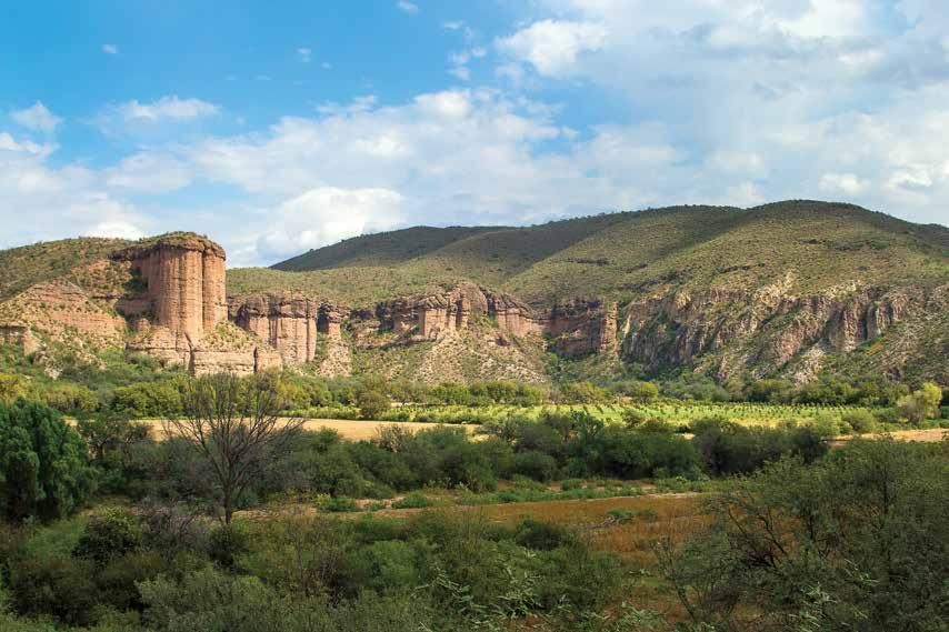
están también la agricul tura y la minería.
El río con escaso caudal en entretiempo, se deja ver como espejo relumbrante al fondo de la cañada en Ma zocahui, para luego irse extendiendo para dar lugar a valles productores y ranchos ganaderos con una cadena de montañas a cada lado, paralelas al río y al camino.
Son pueblos fundados en el siglo XVII por misioneros je suitas que acompañaban a los colonizadores que incur sionaron es estas tierras en busca de la riqueza minera.

El legado de la evangelización está presente y vigente en las costumbres y festividades de cada pueblo, así como su estructura social original. Eminentemente ganaderos, estos pueblos viven de sus recursos naturales entre los que
La experiencia de viajar por esta ruta y de visitar sus pueblos nos lleva más allá de sus límites para conocer ranchos, los parajes a la orilla del río, los ambientes deportivos y festivos como el jaripeo, las li gas de baseball locales y las frecuentes rodadas de ciclistas de ruta y de montaña. Las fiestas pa tronales, las fechas cívicas y el calendario religioso rigen el ritmo de vida, de producción, de cosecha y de celebración. Plantaciones de maguey bacanora, destiladoras rurales, bodega vinícola, minas en operación y rincones serranos son lugares para visitar, incluidos los manantiales de aguas termales de El Bacerán y el Agua Caliente. Ambiente veraniego es
seguro en los pasos del río sobre la carretera en Cañón de Evans, Bacoachi, Tahuichopa, Chinapa y también bajo los puentes cuan do hay caudal en Banámichi, San Pedro el Saucito y otros cruces de arroyos. Todos los templos son museos vivos que silenciosos muestran las profundas raíces que dieron origen a este armoniosa cadena de pueblos por los que se puede viajar desde la capital hasta la frontera Norte de Sonora.
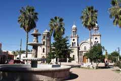
Along the river that gave Sonora its name, a stretch of 186 miles of scenic route goes from town to town through one of the most significant regions of the state. Mountains and valleys open up on the horizon revealing farm fields and temple towers of every town on this route.
The river, with little flow during dry season, becomes a shimmering mirror at the bottom of the ravine in Mazocahui, to later spread out to large valleys with cattle ranches and small cultivated fields. These towns were founded in the 17th century by Jesuit missionaries who accompanied the Spanish settlers in search of mining wealth.
The experience of traveling along this route and visiting its towns can take you beyond its limits to get to know ranches, beautiful riverbank spots, local sports such as the popular baseball league, rodeo and the frequent road and mountain biker events.
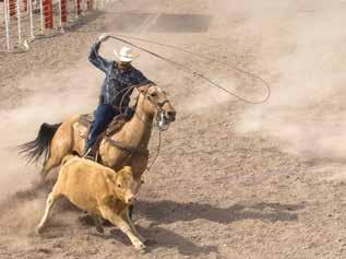

The patron saint festivities, the civic holidays and the religious calendar govern the rhythm of life, production, harvest and celebration.

Agave plantations to produce bacanora, the local drink made by rural distillers, wine cellars, operating mines and mountain corners are places to visit, including the El Bacerán and Agua Caliente hot springs.
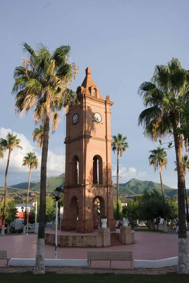
Every church is a living museum that silently depicts the deep roots of this harmonious chain of towns through which you can travel from the State capital to the US border.
-
 Plaza de armas de Arizpe

grabadas, la flora endémica del desier to de Sonora. Visitas recomendables al amanecer y a la puesta del sol.

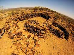
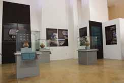
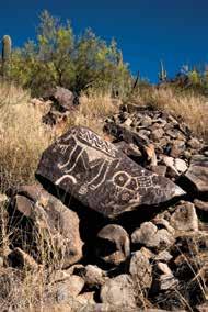
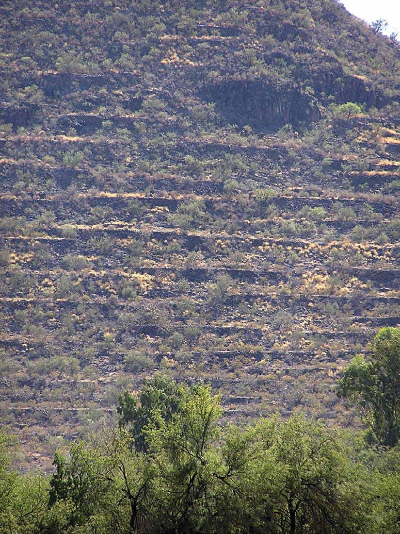
In this archaeological route in the middle of the Great Sonoran Desert, evidence shows the original inhabitants of the land were semi-nomadic collectors who left their traces in the stones of the region. The Trincheras hill shows the importance of a civilization that built stone walls on the hillside that the Spaniards confused with guarding trenches (hence the name “trincheras”), that form terraces with different uses, from ceremonial to agricultural. When in the town of Trincheras, do not miss the visitor center where you will find a detailed account of the origins and ways of life of this ancient civilization. A few miles further westbound, on the outskirts of Caborca, the hills of La Proveedora in the Puerto Blanco ranch concentrate the largest number of petroglyphs in the Americas. With a wide variety of motifs, from animals, human figures, fretwork and labyrinths, the engravings made on the millennial stones are attributed to the same ancient culture we now also call Trincheras and date back over 13,000 years. Certified guides and experts on the subject are recommended, as well as visits at sunrise and sunset. You can also admire the endemic flora of the Sonoran desert next to the engraved stones.


la época del año de sus más tradi cionales fiestas. Rodeados de colinas y llanuras tapizadas de mezquites, sa huaros, paloverdes y choyas, reciben el esplendor de los tapices de flores en cada primavera convirtiendo al desier to en el jardín más florido del planeta; en el verano, el clima es rudo y agre sivo pero llega el momento del más in tenso aguacero que llena los arroyos, enverdece el campo y cambia el color de los cerros circundantes.

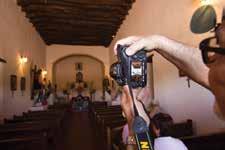
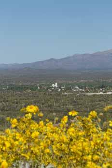

This region nestled in what Herbert Bolton called “The Confines of Christianity” was inhabited by brave natives. The lands surrounding the Altar River yielded to the Christian faith and flourished prosperously around 1670 under the guidance of Italian missionary Eusebio Francisco Kino. The temples along this route preserve the over three century old images, altarpieces and altars. There are 2 ways to do this route, either on a modern highway or through a dirt road which will allow you to visit the Cuauhtemoc dam, and southbound along the river, until you reach Altar, Pitiquito and Caborca.
Small, festive and productive towns with very well defined working patterns during the year, as well as for their traditional festivals. Surrounded by hills and plains covered by mesquites, sahuaros, paloverdes and cholla cacti, they blossom every spring, turning the desert into a carpet of flowers. In the summer, the weather is harsh and extremely hot, but even that ends up bringing the longed for monsoons that provide plenty of water for streams and creeks, which turns the countryside green, changing the color of the fields.
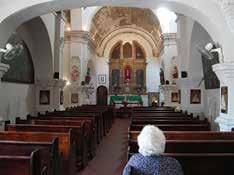 Templo histórico de la Purísima Concepción de Caborca
Templo de Tubutama
Misión de Tubutama
Templo de Caborca
Mision de Oquitoa
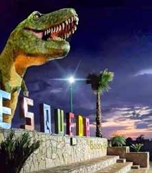
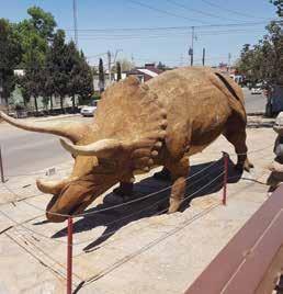
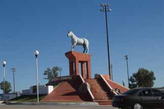
Conocer la fábrica de monturas y artículos de cuero, visi tar la estatua de El Moro de Cumpas y recorrer caminos de minas antiguas y también la más moderna de Méxi co; visitar el centro histórico de Nacozari, el monumento a Jesús García y la grandes mansiones de la Moctezuma Copper Co. y Mr Douglas. Divisar una de las chimeneas más grandes del mundo en la Fundición de Esqueda y parar en sus plazas para ir a la ruta de los dinosaurios es una interesante experiencia familiar con grandes y memorables acontecimientos históricos.
Esta región es el cinturón minero del cobre y los corredo res del indio Gerónimo, la tierra del capitán de Anza, colonizador de San Francisco, CA. EUA. Con acceso a las presas Cuquiárachi y La Angostura siguiendo los ríos Moctazuma y Fronteras se llega hasta Agua Prieta, fron

tera con Douglas, Arizona, en los límites del Viejo Oeste. Paisajes, ran chos, haciendas centenarias y luga res propios para acampar, montar, y andar en bicicleta los encuentra con sus anfitriones y guías. ¡Clima perfec to y ambiente festivo siempre!
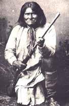
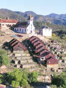


Visit the saddle and leather goods factory, the statue of El Moro de Cumpas, the most famous race horse in Sonora ever, and travel through roads that take you to old mines but also to the most modern one in Mexico nowadays; visit the historic center of Nacozari, the monument to Jesus Garcia and the mansions of Moctezuma Copper Co. owner, James Douglas.
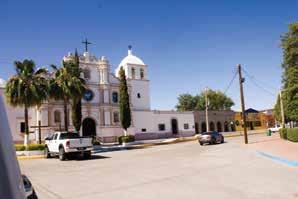
Go sightseeing and amaze yourself with one of the tallest chimneys in the world at the Esqueda foundry, stop at the town plaza or go check the dinosaur trail, a fascinating family experience with great and memorable historical events. This region is the copper mining belt and the corridors of Geronimo, the world famous Apache indian
Here you will find the birth town of San Francisco, California, founder, Captain Juan Bautista de Anza. With access to the Cuquiárachi and La Angostura dams, following the Moctezuma and Fronteras rivers, you reach Agua Prieta, bordering Douglas, Arizona, on the edge of the Old West. Hosts and guides can take you to beautiful landscapes, ranches, centennial haciendas, and camping, riding and biking locations. Perfect weather and a festive atmosphere always!
En el extremo sur de Sonora se conjugan las experien cias más diversas que van de las cumbres de la sierra al mar y del bosque de pino y encino al desierto y pitayal. En un trayecto de menos de 160 kilómetros, el visitante encuentra, dependiendo de la estación, la exhuberante selva tropical con sus arroyos y laderas arboladas de las altas montañas de la Sierra Madre y la sierra de Los Frailes, pasando por las coloridas amapas que florecen cada enero y que poco a poco se dispersan para dar paso a los cactus diversos que rodean las comunidades indígenas de la etnia mayo en Masiaca.
De ahí, continuar hacia la puesta del sol a través de el pitayal más extenso de América que por callejones pol vorientos nos lleva hasta el paraíso a la orilla del mar, playa Las Bocas, Camahuiroa o la maravillosa estación biológica Navopatia junto al manglar, la isla y el canal repleto de aves migratorias y los delfines chacoteando

nopal, tamales y birria en Masiaca en medio del mundo de los Mayos,su cul tura y su folklor o la mariscada en la palapa playera vcacional completan la experiencia con un trago de mezcal ba chomojaqui, destilado artesanal de una variedad de agave regional,
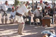
In the southernmost part of Sonora you can live the most diverse experiences, ranging from mountain peaks to the ocean and from pine and oak forests to the desert and with large wild prickly pear fields.
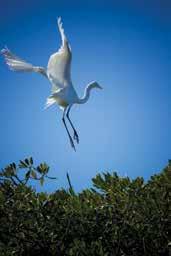

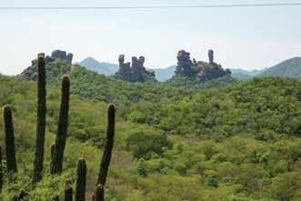

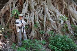

On a journey of less than 100 miles, the visitor finds -depending on the seasonthe lush tropical forest on the slopes of the high mountains, to later go through pink poui tree forests that blossom every January and that little by little dissapear to give way to the diverse cacti that surround the tribal communities of the Mayo ethnic group in Masiaca, after which the largest wild prickly pear field in the Americas can be found.
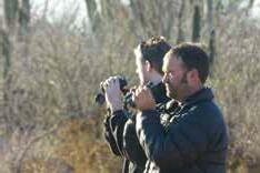
If you continue your tour, through rustic roads you will find paradise on the seashore, Las Bocas beach, Camahuiroa or the wonderful Navopatia, a biological research station next to the mangrove, the island and the creek full of migratory birds, with playful dolphins you might see in the clear waters where the ocean begins.
Finally, experience food in the ramadas with traditional stews with nopal (cactus), tamales and birria (goat beef stew) or enjoy a seafood platter on the beach, as you complete the experience with a drink of bachomojaqui mezcal, a local distilled drink out of a variety of regional agave.
Overlanding en Santa Bárbara. Álamos Sierra MadreViajar a uno de los pueblos más altos de Sonora es una aventura que te muestra lo diverso de este gran estado. Estos caminos ascien den del desierto y valle el litoral, hasta mesetas a más de 2400 me tros sobre el nivel del mar.
En el camino, tomando cual quiera de las dos rutas, viajas por pueblos pintorescos y rodeas una de las presas más grandes de Sonora. Los caminos sinuosos que serpentean dejando ver el horizonte infinito de cordilleras son el pri mer atractivo para quienes no han sentido la distancia, la altitud y el contrastante cambio de clima en un solo trayecto, particularmente en el exuberante y húmedo pero frío verano de la sierra en los meses de julio y agosto.
Sensaciones únicas en la Sierra Madreque no se atribu yen a Sonora y que contrastan con el ardiente y seco clima y panorama del desierto en el occidente del mismo estado.
Yécora, originalmente misión, como destino tiene muchos atractivos enclavados en una atmósfera de naturaleza rica en biodiversidad y propicia para toda clase de aventuras.
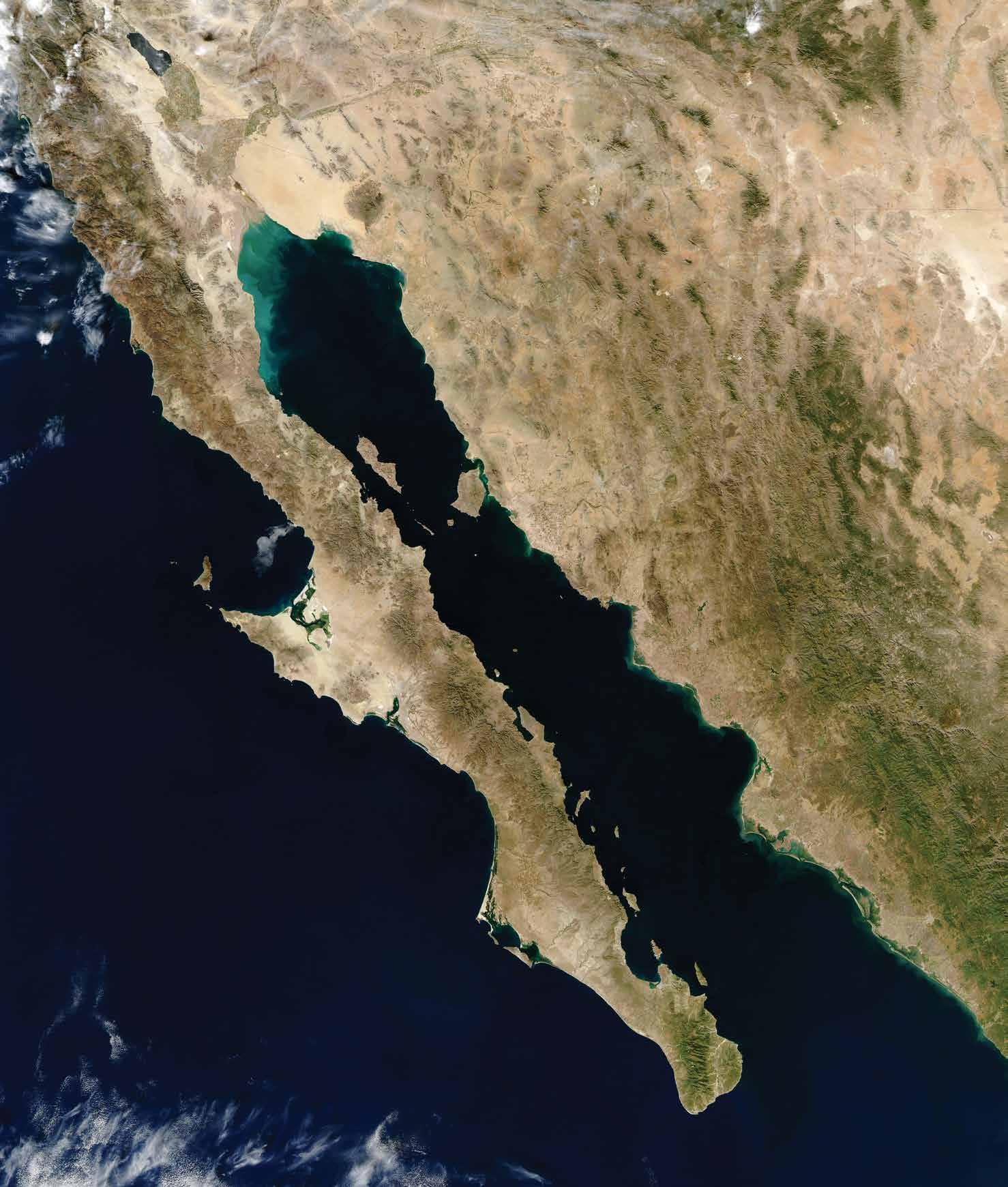
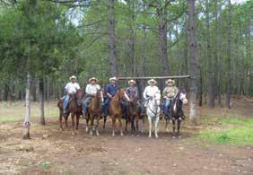
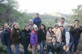
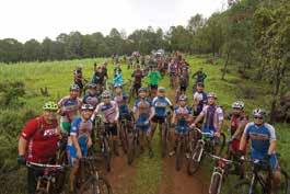
Pasear a caballo, escalar, hacer ra ppel, caminar, participar en los yeco razos de bicicleta y todoterreno, o en las aventuras del torneo de guajolote. Claro, para los safaris fotográficos, Yé cora ofrece unos de los mejores esce narios naturales.
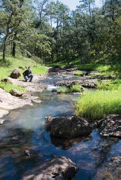
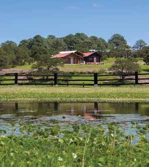
Cabañas, hoteles, guías, restaurantes, servicios básicos, gasolinería y buena comunicación hacen placentera la es tancia de todo visitante.

Traveling to one of the highest towns in Sonora is an adventure that shows you how diverse this great state is. These roads ascend from the valley at sea level, up to heights over 7,800 feet above sea level. Along the way by either route, you travel through colorful towns and around one of the largest dams in Sonora. The winding roads reveal an infinite horizon of mountain ranges and a change of weather, particularly when you reach the high mountain environment with a humid but cold summer unlike the rest of the state, unique sensations in the Sierra Madre (Mexican western Rockies) that you will not experience in the extremely hot climate of most of Sonora.
Yecora, originally a mission, is a destination with many outdoor attractions nestled in an atmosphere of rich biodiversity. Horseback riding, climbing, rappelling, hiking, and the traditional “yecorazos”, as locals call their off-road and bicycle gatherings, not to mention their wild turkey hunting tournament. For photographic safaris, Yecora offers some of the best natural settings. Cabins, small hotels, guides, restaurants, and good connections both highways and telecommunications make every visitor’s stay a pleasant one.
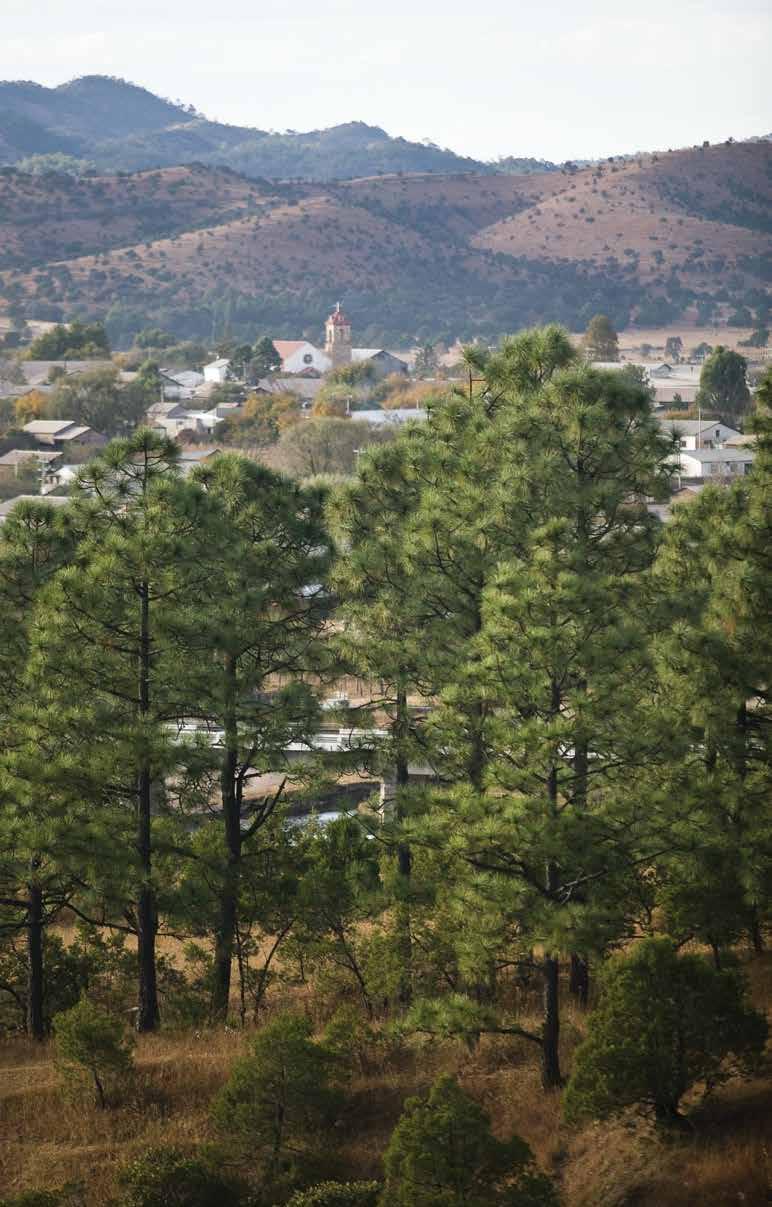 Panorámica de Yécora desde la bajada del aserradero

San Francisco Javier trae a Magdalena a miles de peregrinos cada 4 de octubre y todo el año. Su templo y plaza también están vinculados con su fun dador, el padre Eusebio Francisco Kino, cuya cripta con sus restos es parte del conjunto central de su plaza monumental. Fue declarado Pueblo Mágico en 2012 y es, la tierra y lugar donde descansan los restos de Luis Donaldo Colosio Murrieta, candidato a la presidencia de México asesinado en 1994. Situado a 120 km de la frontera con Estados Uni dos y con excelente clima todo el año, Magdalena de Kino tiene también atractivos rurales para todo visitante. Ranchos ganaderos con confortables alojamientos, huertos y espacios de aventura al exterior y muchos atractivos de esos que dan identidad a Sonora como el bosque de sa huaros, el camino real a San Ignacio e Ímuris, dos misiones establecidas junto con Magdalena en 1680, Cercanos también están la misión de Cocóspera y el rancho Aribabi,
reserva natural particular protegida en la ladera y el valle al norte de la Sierra Azul. Las fiestas de San Francisco en otoño congregan en Magdalena a peregrinos y visitantes que a pie, a caballo y por todos los medios, llegan de todos los rumbos y la convierten en una de las fiestas más significativas de Sonora. Indígenas yaquis, pápagos, ma yos, y de otras etnias internacionales ofrecen penitencias,
 A Nogales.
a Cananea-Agua Prieta
a Hermosilllo
a Cucurpe Sinoquipe
Caseta-Cuota
San Ignacio
Magdalena de Kino
Terrenate
La Mesa
La Estación Pierson
Trayecto Cabalgata
Presa Comaquito Tacicuri
Babasac
Microondas el Agulia
Presa del Yeso
a Tubutama
Carretera libre Carretera libre
Fin de la Ruta
Inicio de Ruta
bailables, tributos y espectáculos musica les en todo el pueblo en honor del santo. El festival de Kino en primavera y otras fiestas cívicas memorables mantienen el ambiente por todo el año. Este pueblo hospitalario comparte cocina tradicio nal, carne de res famosa por su calidad y cocina, ates de membrillo, guisos con chile colorado y las inigualables tortillas de harina de trigo.
Thousands of pilgrims come to this town every year to pay tribute to San Francisco Javier, whose temple at the town’s main square is the meeting point for all visitors every October 4. Right there you can visit the crypt of Magdalena’s founder, Jesuit Priest Eusebio Francisco Kino, whose re mains are displayed for people to see.


Magdalena was declared a Magical Town in 2012 and it is also the birth and rest place of Luis Donaldo Colosio, Mex ico’s main presidential candidate assassi nated in 1994 during a campaign event. Located 75 miles from the US border and with excellent weather year round, Mag dalena also has rural attractions such as cattle ranches with comfortable accom modations, orchards and outdoor adven ture spaces such as the saguaro forest, the Camino Real to San Ignacio and Imuris, two missions established along with Magdalena in 1680. Nearby you can visit the Cocóspera Mission and the Aribabi ranch, a private natural reserve in the valley.
The San Francisco festivities in the fall gather pilgrims and visitors on foot, horse back and automobile; Yaqui, Tohono O’odham, Mayo and other international ethnic groups offer dances and tributes to honor the saint. The Kino festival in the spring, on the other hand, and other civ ic holidays, keep the atmosphere festive throughout the year.
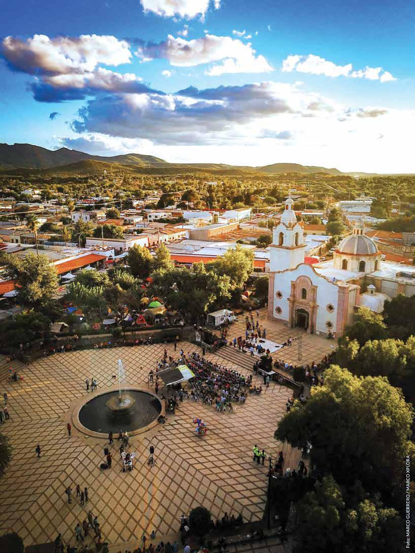
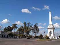
Cuadros auténticos y únicos decoran el paisaje urbano de la perla del Mayo. Carretas tiradas por caballo recogen de los campos y huertos situados a la orilla del río, las verduras frescas que se ofertan en el mercado. En la imagen también está una ciudad moderna que conjuga las tradiciones de los indígenas mayos con el desarrollo agrícola y comercial alcanzado en sus poco más de cien años de fundada.
Situada en las márgenes del río Mayo, es la ciudad que atiende el mayor número de comunidades rurales de Sonora, la dispersión de sus pobladores alcanza todo el municipio en tre campos agrícolas y ranchos situados en las márgenes del río Mayo en donde hay poblaciones autóctonas que conser van tradiciones y costumbres originales y religiosas que dan lugar a fiestas, campañas y peregrinaciones como las fiestas de San Juan, las de Semana Santa y otros eventos de místico significado a los que los visitantes siempre son bienvenidos. Las costumbres aquí son distintas al resto de Sonora y son producto del clima casi tropical y del profundo arraigo a la tierra y sus pobladores originarios. Primera ciudad en el
trayecto de sur a Norte, es punto de confluencia de los cami nos que cruzan el sur de Sonora y su diversidad natural en la ribera del río y sus espacios rurales da lugar a un sinnúmero de experiencias que van desde las exploraciones de la mon taña en la colonial Álamos, hasta tibias arenas de sus dunas y playas en la vecina municipalidad de Huatabampo. La visita a Navojoa invita a conocer la zona arqueológica y museo de sitio de Tehuelibampo con sus testimonios gra bados en piedra que muestran la vida indígena de hace más de 2,500 años. Diversidad natural, cultura mestiza y religiosidad se evidencian en el lugar y en todo el trayecto para conocer este sagrado lugar de sus habitantes, ante
cesores de los Mayos. En todas las rutas y caminos de la región del río mayo, la bicicleta como deporte y también como medio de transporte es parte del escena rio. Artesanías y manualidades de cuero, carrizo, palma y mimbre se ofrecen por los residentes,
Unique sights of old habits decorate the urban landscape of this region. Horsedrawn carts collect fresh vegetables from the fields and orchards located on the banks of the river. A harsh contrast to Navojoa, a small modern city in which you can see traditions of the Mayo tribe still in use, with the agricultural and commercial development achieved here in more than a hundred years of history.
Located on the banks of the Mayo River, the Navojoa valley has the largest number of rural communities in Sonora, scattered between agricultural fields and ranches where native populations live and keep their religious traditions and customs that give rise to festivals and pilgrimages such as the festivals of San Juan, those of Holy Week and other events of mystical meaning in which visitors are always welcome. The hot and humid weather is common throughout the zone, where you can live experiences that range from mountain explorations in colonial Alamos, to the warm sands of its dunes and beaches in the neighboring Huatabampo.


You can also visit the archaeological zone and the Tehuelibampo site museum with ancient testimonies engraved in stone that show tribal life over 25 centuries ago.
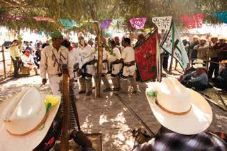
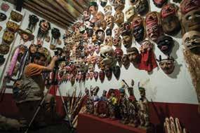
Natural diversity, mestizo culture and Mayo tribe religiousness are evident in the place and throughout the journey. Every route and path of the Mayo River region has bicycle as a sport but also as transportation for many locals’ daily activities. Arts and crafts of leather, reed, palm tree and wicker are offered by residents.
 Fariseos, Fiestas de San Juan
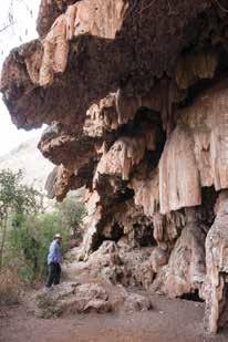
La aventura rural se combina con ex periencias diferentes en los extremos de la presa El Novillo o Plutarco Elías Calles: en el norte, un pueblo pinto resco a la orilla de la desembocadura del río en la presa, al que se llega por una carretera cómoda con atractivos en su trayecto que puede ser vía Ures o Pueblo de Álamos, Mátape, San Pedro de la Cueva o directo de Hermosillo a Mazatán sin rodear por Ures. Los touroperadores tienen ac ceso a rincones escondidos en el camino como la cascada seca, una conformación calcárea que ha permanecido por siglos evidenciando tiempos de abundante lluvia y bosques tropicales. También hay paradas en ranchitos ganaderos y productores de bacanora y de quesos regional que se pueden visitar.

San Pedro de la Cueva es el destino de este extremo de la presa y los atractivos se combinan en tierra y agua, desde la escalada del cerro de la cueva hasta las experiencias
en la pesca de lobina y tilapia, y la visita a las ruinas de los pueblos sacrificados en aras del progreso, inundados para alcanzar el almacenamiento de agua en la presa.
En el extremo sur de la presa, que dista más de 60 km nave gando directo desde San Pedro de la Cueva, los atractivos son diferentes; La cortina de la presa encajonada entre los cerros y escarpadas paredes recrean en verano un espacio tropical diferente al resto de Sonora. El acceso carretero a la cortina y a las instalaciones de generación de energía se deriva en Mazatán por la carretera a Sahuaripa. La vi sita a El Novillo por la cortina nos lleva primero al pueblo La Estrella, establecido en tiempos de la construcción de la presa. Muchas historias se cuentan de lo sucedido en los años 50’s y 60’s cuando la mole de concreto se elevó hasta detener al río. El paisaje en El Novillo es más espectacular
 Villa Pesqueira
San Pedro de la Cueva Nacori Grande
Rebeico
en los meses de verano. La experiencia ru ral se combina con la opción de navegar en kayak río abajo y llegar hasta el para dor de Soyopa, pueblo situado a 20 km en la ribera del río. Este recorrido tiene su magia y es totalmente diferente en cada estación del año. Consulta su guía local o touroperadores.
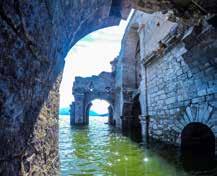
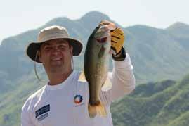
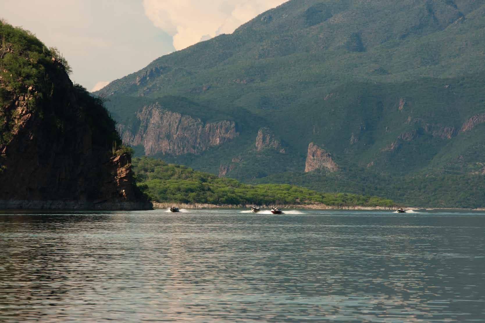

San Pedro de la Cueva in the north; the dam and Soyopa in the south, this rural adventure combines different experienc es depending on which end of the lake you are. San Pedro de la Cueva in the north is a colorful town on the shore of the mouth of the river in the lake, which is reached by a modern road with some at tractions on the way. Tour operators have access to hidden spots all along, such as the dry waterfall, a formation that has re mained for centuries when the land was a rainforest. You can also visit cattle ranch es and bacanora producers so you taste the local drink made of agave. In San Pedro de la Cueva you can either climb the hill with the cave that gives the town its name, fish for bass and tilapia, or visit the ruins of the towns sacrificed for the sake of progress when the dam was built. In the south of the lake, 37 miles from San Pedro by boat, you will find the the dam, boxed between the hills and steep cliffs which gives us a tropical space very differ ent from the rest of Sonora. A visit to lake El Novillo through the curtain leads us first to a town calles La Estrella, established at the time the dam was built. The scenery in the lake is most spectacular during the summer months. The rural experience is combined with the option of kayaking down the river and reaching Soyopa and its famous look out, little over 12 miles away from the river bank. This route has its own magic and is very different depending on the season of the year. Consult your local guide or tour operators.
 Presa El Novillo

Cabañas en la ladera de la sierra, hermosos panoramas de sus ranchos ganaderos y un centro histórico típico de un pueblo minero del siglo XIX son parte de la presentación de Cananea a sus visitantes quienes tienen mucho qué dis frutar en esta región con grandes atributos naturales, cultu rales y de servicios.
Con historia y profundas raíces, y una gran influencia internacional en sus aspectos culturales y sociales, Cananea cuenta con atrac tivos para quien pueda quedarse largo tiempo: la famosa Cárcel de Cananea convertida en Museo de la Lucha Obrera, la Casa de William Cornell Green, ahora sede del Instituto Nacional de Astrofísica Óptica y Electrónica, su centro comercial original El Ron quillo, Cananea Vieja, Mesa Sur y colonias originales que contras tan con el Parque Tamosura y su modernidad de servicios de cine, hotel, boliche, y plaza comercial.
En las afueras de la zona urbana, Cananea tiene ranchos gana deros con oferta de hospedaje y atractivos naturales, sierras con panorámicas vistas y paradores para campamento, además de cabañas. Visitar Cananea es también conocer las instalaciones de
la Unidad de Manejo Animal UMA de Grupo México que mues tra especies en programas de rescate como el guajolote Gould, el lobo gris, el jaguar y el oso pardo, además de aves y otros pequeños mamíferos.
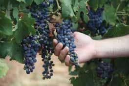
Ya estando en las afueras, hay que programar la visita al viñedo Uvas de Altura que produce excelentes vinos de la marca 4S. La experiencia de ascender a la sierra La Mariquita y conocer el Observatorio Astronómico, o la opción de subir a la cabaña de los guardabosques en la Reserva Natural Protegida de la Sierra de Los Ajos y adentrarse en sus arroyos encajonados colmados de naturaleza o hacer una visita guiada a las instalaciones de la mina Buenavista del Cobre pueden ser otras grandes experiencias, algunas de las cuales requieren trámites y solo en determinadas fechas. Cananea tiene tres sierras, tres cuencas de ríos y dista solo
50 km de la frontera con Estados Unidos en el Viejo Oeste norteamericano.


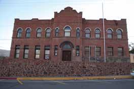
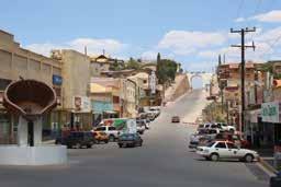

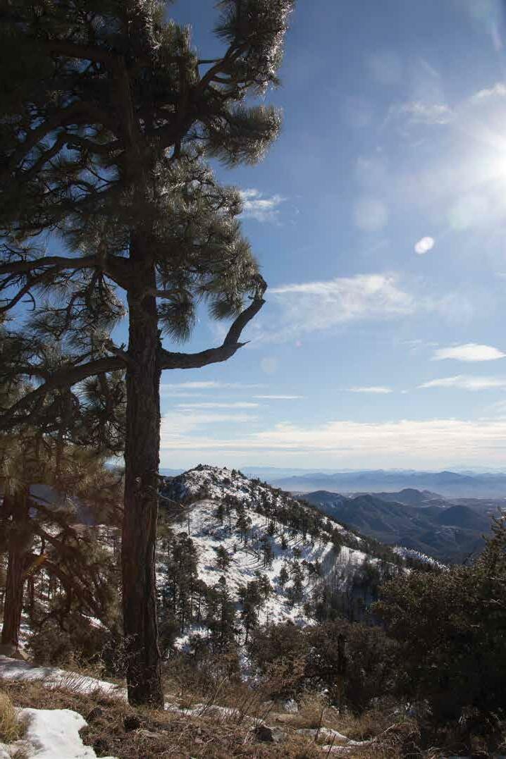
Cabins on the slopes of the mountains, beautiful views of its cattle ranches and a typical historic center of a 19th century mining town are part of Cananea’s presentation to its visitors who can enjoy great natural and cultural attributes and services. Cananea had an important role in Mexico’s history, and has had a great international influence too. This small city has attractions such as the historic Cananea Prison, nowadays Museo de la Lucha Obrera (Museum of the Workers’ Struggle); the House of Willian Cornell Green, now headquarters for the National Institute of Optical and Electronic Astrophysics; the original shopping center El Ronquillo; Cananea Vieja (old Cananea); Mesa Sur and other original colonies that contrast with the Tamosura Park and its modern cinema, hotel, bowling alley, and shopping center. On the outskirts of the urban area, Cananea has cattle ranches with lodging and natural attractions, sierras with beautiful views and camping sites, as well as cabins. Visiting Cananea is also beacoming acquainted with the Animal Management Unit of Grupo México Mining Co., where they have rescue programs for endangered species such as the Gould turkey, gray wolf, jaguar and bear, as well as birds and other small mammals.
On the outskirts, schedule a visit to the Uvas de Altura vineyard, where the 4S brand wines are produced. Experience of going up the La Mariquita mountain range and visiting the Astronomical Observatory, or the park ranger cabins in the Sierra de Los Ajos Reserve with its creeks and streams. You may also want to see the Buenavista del Cobre mine, one of the largest copper mines in the Americas; if so, you will need to request a guided tour available in certain seasons. Cananea has three mountain ranges, three river basins and is a little over 30 miles from the US border.
Enclavada en el centro de un mosaico verde de muchas tonalidades, en el que serpentean relumbrantes los canales de riego, se yergue una ciudad nueva, dinámica y produc tiva que da a México fama internacional por su producción agrícola y su desarrollo comercial derivado del campo.

En Ciudad Obregón coinciden y crecen con armonía las culturas de la etnia yaqui y el colono que aporta alta tecnología y conocimiento para hacer de esta región el emporio agrícola que ha sido llamado el granero de México. De trazo geométrico, calles amplias, arbolada y limpia, la ciudad tiene sus atractivos propios como el espacio recreativo y familiar de la Laguna del Náinari y los muchos destinos rurales en el valle que llegan hasta las playas en el litoral con el mar de Cortés.
Ciudad Obregón es el centro comercial del sur del esta do de Sonora y con aeropuerto internacional y eje carre tero y ferroviario, es el punto de conexión internacional
para viajeros de toda la región.
Estadio de baseball y equipo Los Yaquis, clubes depor tivos de pescadores en la presa El Oviachic, campo de golf y muchos puntos rurales para conocer, incluyen cam pos agrícolas al poniente y ranchos ganaderos al oriente con temporadas exitosas de turismo de aventura y tam bién organizadores cinegéticos con excelentes servicio e instalaciones para caza de paloma y otras especies. De la gastronomía hay mucho que comentar, pero re sumiendo, es la experiencia de expertos que combinan la cocina original de la tribu, la abundancia del mar y

In the middle of a green mosaic of many shades, in which the irrigation canals run across the land, stands a new, dynamic and productive city that gives Mexico international fame for its agricultural pro duction and commercial development derived from the field.

The cultures of the Yaqui tribe and the first Spanish settlers made a perfect match and the 20th century, with newcomers who contributed technology and knowledge, made this region the agricultural emporium that has been called “the granary of Mexico”. With a geometric layout designed in fact by American architects, wide, tree-lined and clean streets, the city has its own attractions such as the recreational and family space of the Nainari Lagoon and the many rural destinations in the valley that reach the beaches on the Sea of Cortez coast line.
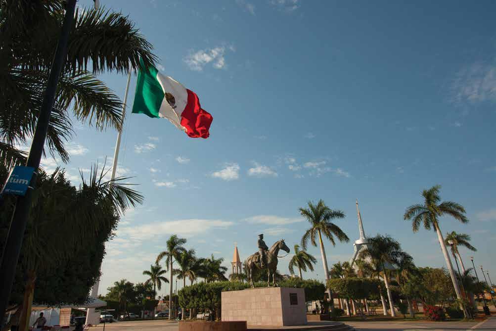
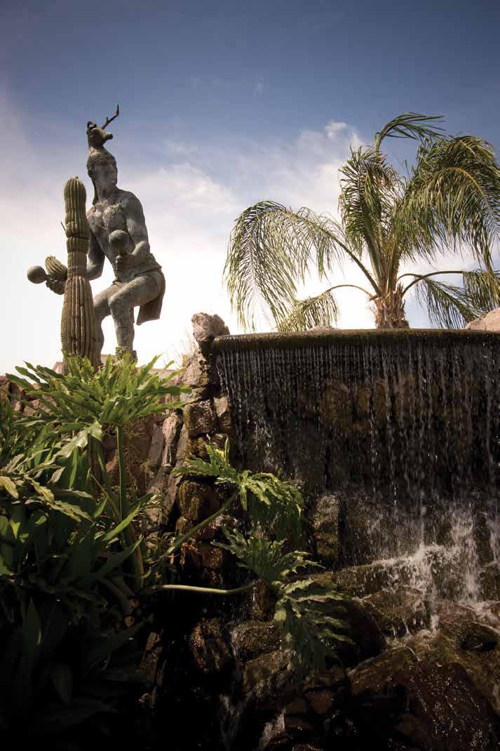
Obregon is the commercial center of the southern part of the state of Sonora and with its international airport and highway and railroad hub, it is the connecting point for travelers from all over the region.

Baseball stadium and Los Yaquis local team, fishing sport clubs at El Oviachic dam, golf course, and many rural spots to visit, including agricultural fields to the west and cattle ranches to the east, make for successful seasons for adventure tourism and hunting expeditions for dove hunting and other species.
There is much to comment about the gastronomic choices, but in summary, it is the experience of experts who combine the Yaqui tribe cuisine with the abundance of seafood, the famous local beef and pork which make this
las riquezas ganaderas de res y puerco que dan fama a Sonora.
De la Revolución
agrícola
río y playas
de Náinari
Oviachic, Yaqui
This is the place where carne asada (typical Sonora style mesquite charcoal roast beef), large fluor tortillas, coyotas and bacanora (local agave distilled drink) come together to welcome visitors who come to the capital city of Sonora.

Populated by simple and hardworking people, the city lives a productive dynamism because of the many economic activities and interests that make this state one of great importance in northwestern Mexico, the second largest in the country. A center for agricultural, industrial, live stock and mining businesses, govern ment, education and advanced medi cine, Hermosillo is the destination with the highest number of flights in the re gion and the most dynamic commercial activity and services. It is located just 223 miles south of the U.S. border at Nogales, home to major manufacturing industries such as a Ford Motor Compa ny plant and many of its supplier plants.
To visit Hermosillo means attending Expogan (cattle state fair) in early May, the baseball season from September to February, and the Fiestas del Pitic at the end of May. It is also to enjoy the beach 55 miles away in Bahia de Kino, where you can experience the world of the Seri tribe. From Hermosillo you can take routes that will lead you to every corner of Sonora, from the sea and the coast to the high mountains and its diversity of climate and landscape.
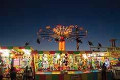

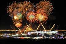
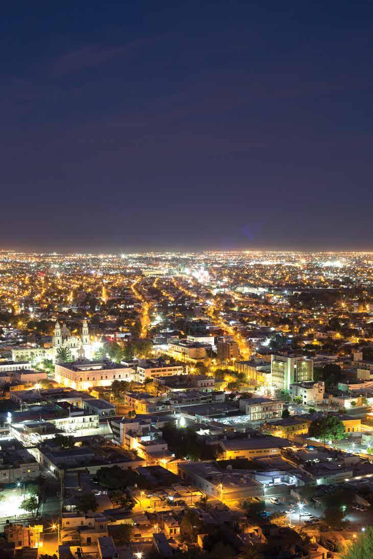
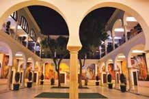
A multifaceted city that shares with visitors the nostalgia of its historic center, captured in the murals of the government palace and exhibited in local museums, Hermosillo invites you to get to know the festive, cheerful, sincere and hospitable place that makes it the capital city of the great state of Sonora.

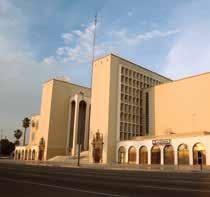

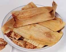

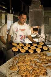
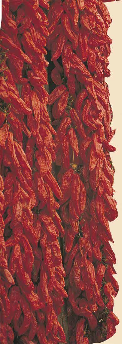



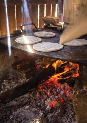
 Tortillas de harina de trigo
Gallina pinta Tamales
Tortillas de garbanzo)
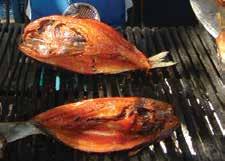
Pescado sarandeadoCoyotas Villa Seris
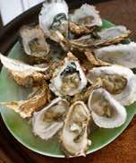
Ostiones frescos
Pozole de trigo
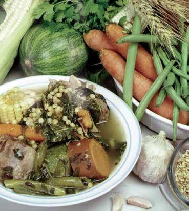
Compartir una experiencia gastronómica con el visitante es invitarle a compartir la parrilla, la hornilla o el fogón tradi cional, pero también las fusiones gourmet que se preparan con la influencia internacional y con los ingredientes más frescos del rancho y del océano. Sonora produce la mejor carne para el mundo y en su gran litoral tiene siempre listo para el plato todas las opciones de productos frescos del mar. Platillos tradicionales, únicos y recetas propias con sa bor auténtico se comparten siempre como el mayor tributo a nuestros invitados.


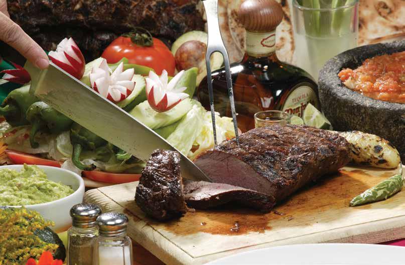
Por supuesto, un brindis con vinos de Sonora y un aperitivo con un shot de Bacanora es parte del disfrute.
Sharing a gastronomic experience with a visitor is having him or her share the grill or the stove, whether it is a modern or a traditional one, but also encouraging to experience the gourmet fusions that are cooked with international influence, using fresh ingredients from the farm or the ocean. Sonora is known worldwide for the superior quality and taste of its beef. On the other hand, Sonora’s great coastline offers every option of fresh seafood products ready to indulge everyone. Traditional, unique dishes and recipes with distinctive flavors are always shared as the greatest tribute to our guests.
Of course, a toast with Sonora wines and an appetizer with a shot of Bacanora, our very own distilled agave drink, is a must .




El contenido de esta revista tiene fines promocionales con visión general de los destinos y rutas. La responsabilidad de los servicios ofrecidos y adquiridos por los visitantes será de los proveedores de servicios con los que establezcan compromisos y tratos de negocio. Los datos definitivos, actuales y contactos los pueden encontrar accediendo a los sitios infomativos de los proveedores y destinos y en la página VisitSonora.com

Se recomienda verificar fechas de eventos, horarios, temporadas, clima y requisitos para tener una expe riencia exitosa. Consulte asesores y guías certificados que le ayudarán con gusto a su proyecto de viaje. ¡Feliz viaje por los caminos y rutas de Sonora!

This magazine is for promotional use only, and has general information about destinations and routes. The responsibility for services offered or purchased by visitors belongs to the service providers with whom they establish contracts or business deals. Final and up to date information, as well as contacts can be obtained from service providers’ web sites and at VisitSonora.com
Always verify event dates, daily schedules, season activities, weather and requirements in order to have a successful experience. Check for assistance or certified guides who will gladly help you plan your trip. Have a great journey through Sonora’s roads and routes!
Listado actualizado de touroperadores, guías y anfitriones turísticos certificados, integrantes de la Asociación de Touroperadores del Desierto, Mar y Montaña A.C. y de la Asociación de Guías y Anfitriones Turísticos de Sonora, A.C. que podrán atenderte en el destino turístico que elijas.


List of tour operators, certified guides and tourist hosts, members of the Touroperadores del Desierto, Mar y Montaña, AC, and the Asociación de Guías y Anfitriones Turísticos de Sonora, AC, who will assist you in any destination you choose to visit.


